Your search criteria found
12760
images
Target is Mars (and available satellites)
Go to PIAxxxxx:
Refine this list of images by:
Target:
Deimos
Mars
Phobos
Mission:
2001 Mars Odyssey
Antarctic Meteorite Location and Mapping Project (AMLAMP)
Dawn
ExoMars
Hubble Space Telescope
InSight
MAVEN
Mariner Mars 1964 (Mariner 4)
Mariner Mars 1969 (Mariner 7)
Mariner Mars 1971 (Mariner 9)
Mars 2020
Mars 2020 Rover
Mars Atmosphere and Volatile Evolution MissioN (MAVEN)
Mars Climate Orbiter
Mars Cube One (MarCO)
Mars Exploration Rover (MER)
Mars Express (MEX)
Mars Global Surveyor (MGS)
Mars Helicopter
Mars Pathfinder (MPF)
Mars Reconnaissance Orbiter (MRO)
Mars Sample Return
Mars Sample Return (MSR)
Mars Science Laboratory (MSL)
Phoenix
Rosetta
Viking
Spacecraft:
2001 Mars Odyssey
Curiosity
Dawn
InSight Mars Lander
Ingenuity
MAVEN
MarCO-B
Mariner 4
Mariner 7
Mariner 9
Mars Climate Orbiter
Mars Express (MEX)
Mars Express (MEX) Orbiter
Mars Global Surveyor Orbiter
Mars Pathfinder Lander
Mars Pathfinder Rover
Mars Reconnaissance Orbiter (MRO)
Mars Sample Return
Mars Science Laboratory (MSL)
NASA's Mars Pathfinder Lander
Opportunity
Perseverance
Philae Lander
Phoenix Lander
Phoenix Mars Lander
Spirit
Viking Lander 1
Viking Lander 2
Viking Orbiter 1
Viking Orbiter 2
Instrument:
Alpha Particle X-ray Spectrometer
Alpha Particle X-ray Spectrometer (MSL)
Atmospheric Structure / Meteorology Instrument
CHIMRA
Camera 1
Camera 2
Chemistry & Mineralogy (CheMin)
Chemistry and Camera (ChemCam)
Comet Infrared and Visible Analyser (CIVA
Compact Reconnaissance Imaging Spectrometer for Mars (CRISM)
Context Camera (CTX)
Deep Space Network
Descent Image Motion Estimation System (DIMES)
Dynamic Albedo of Neutrons
Dynamic Albedo of Neutrons (DAN)
Gamma Ray Spectrometer - Neutron Spectrometer
Gamma Ray Spectrometer Suite
Hazard Avoidance Camera
Hazard Avoidance Camera (M2020)
Hazard Avoidance Camera (MSL)
Heat and Physical Properties Package (HP3)
High Resolution Imaging Science Experiment (HiRISE)
High Resolution Instrument (HRI)
High Resolution Stereo Camera
Imager for Mars Pathfinder
Imaging Ultraviolet Spectrograph
Imaging Ultraviolet Spectrograph (IUVS)
Instrument Context Camera (ICC)
Instrument Deployment Camera (IDC)
Lander Vision System Camera (LCAM)
Magnetometer
Mars Advanced Radar for Subsurface and Ionosphere Sounding (MARSIS)
Mars Advanced Radar for Subsurface and Ionospheric Sounding (MARSIS)
Mars Climate Sounder (MCS)
Mars Color Imager (MARCI)
Mars Descent Imager
Mars Environmental Dynamics Analyzer (MEDA)
Mars Hand Lens Imager (MAHLI)
Mars Horizon Sensor Assembly
Mars Orbiter Camera (MOC)
Mars Orbiter Laser Altimeter
Mars Radiation Experiment
Mastcam
Mastcam-Z
Microscopic Imager
Microscopy Electrochemistry and Conductivity Analyzer (MECA)
Miniature Thermal Emission Spectrometer
Moessbauer Spectrometer
Navigation Camera
Navigation Camera (M2020)
Navigation Camera (MSL)
Neutral Gas and Ion Mass Spectrometer
Neutron Spectrometer
Optical Microscope
Optical Navigation Camera
Panoramic Camera
Planetary Instrument for X-ray Lithochemistry (PIXL)
Radar System
Radiation Assessment Detector (RAD)
Radio Science Subsystem
Robotic Arm
Robotic Arm (MSL)
Robotic Arm Camera (RAC)
Rock Abrasion Tool (RAT)
Rover Cameras
Rover Environmental Monitoring Station (REMS)
Sample Analysis at Mars (SAM)
Scanning Habitable Environments with Raman & Luminescence for Organics and Chemicals (SHERLOC)
Seismic Experiment for Interior Structure (SEIS)
Shallow Subsurface Radar (SHARAD)
Stereo Imager (SSI)
SuperCam
Surface Stereo Imager (SSI)
Thermal Emission Imaging System
Thermal Emission Spectrometer
Thermal and Electrical Conductivity Probe
Thermal and Evolved Gas Analyzer
Trace Gas Orbiter
Visual Imaging Subsystem
Visual Imaging Subsystem - Camera A
Visual Imaging Subsystem - Camera B
Wide Field Planetary Camera 2
Click on an image for detailed information
Click on a column heading to sort in ascending or descending order
My
List
Addition Date
Target
Mission
Instrument
Size
2015-12-21
Mars
2001 Mars Odyssey
THEMIS
1421x2649x1
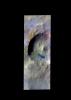
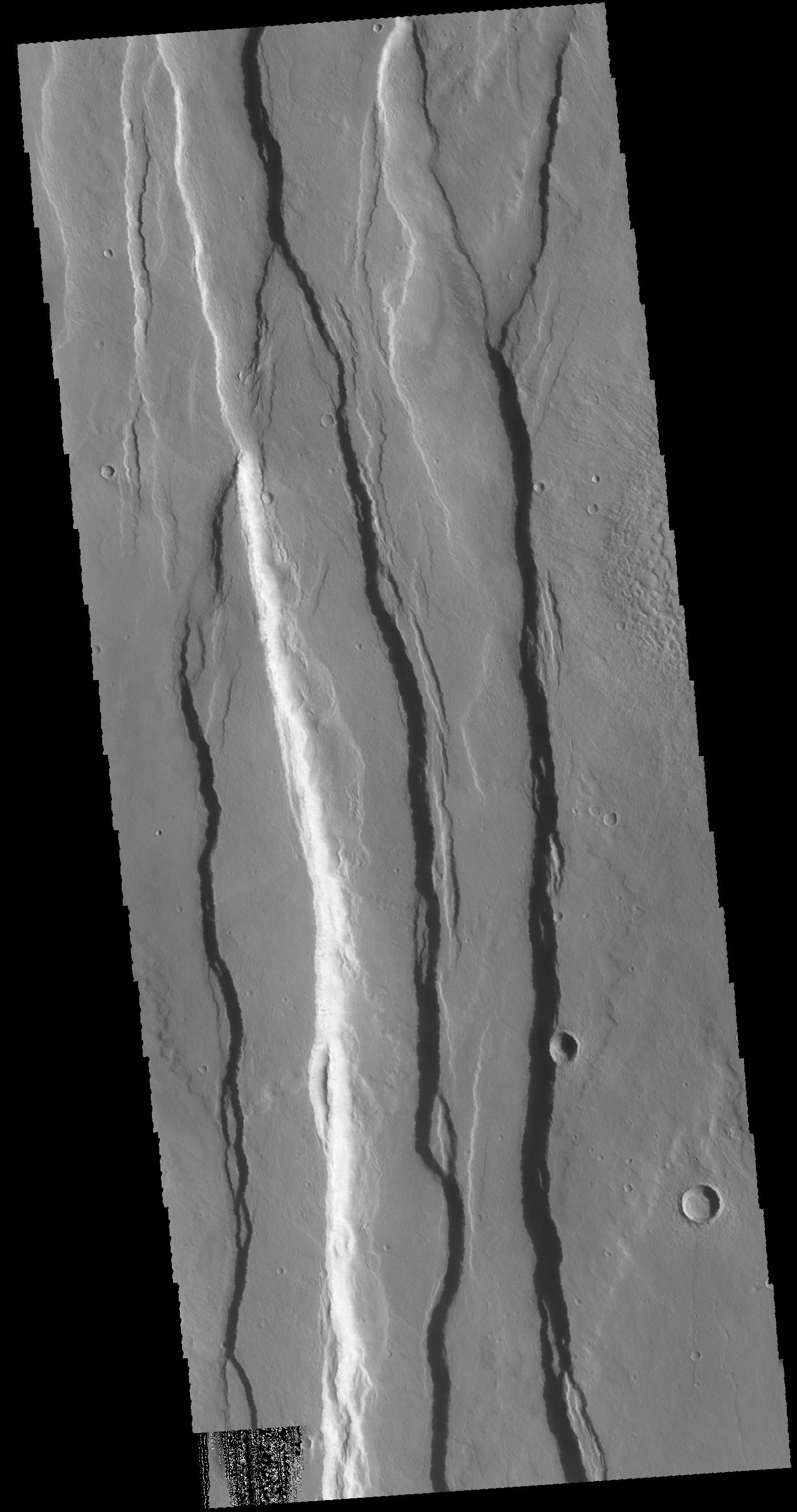
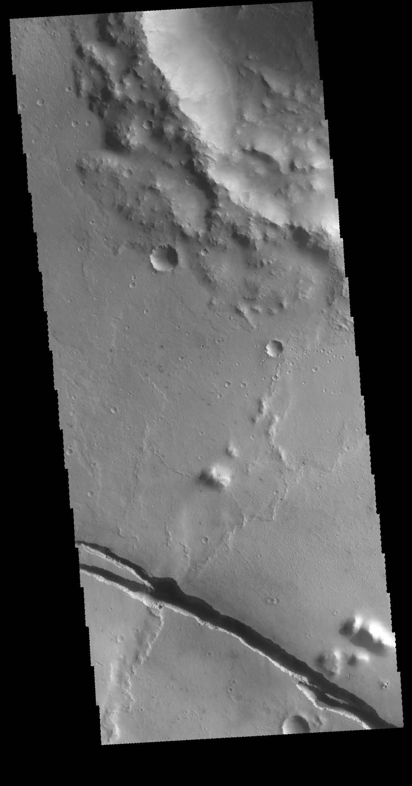
PIA20218:
Auqakuh Vallis
Full Resolution:
TIFF
(2.689 MB)
JPEG
(337.5 kB)
2015-12-22
Mars
2001 Mars Odyssey
THEMIS
1445x2653x1
PIA20219:
Phlegra Montes
Full Resolution:
TIFF
(2.726 MB)
JPEG
(309.9 kB)
2015-12-23
Mars
2001 Mars Odyssey
THEMIS
1450x2660x1
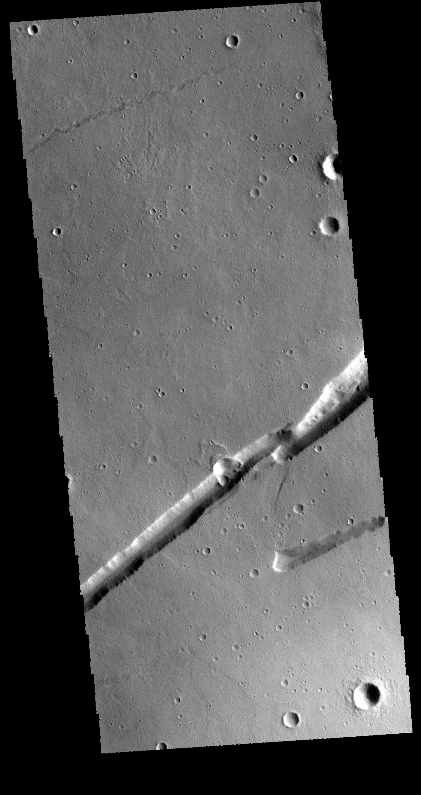
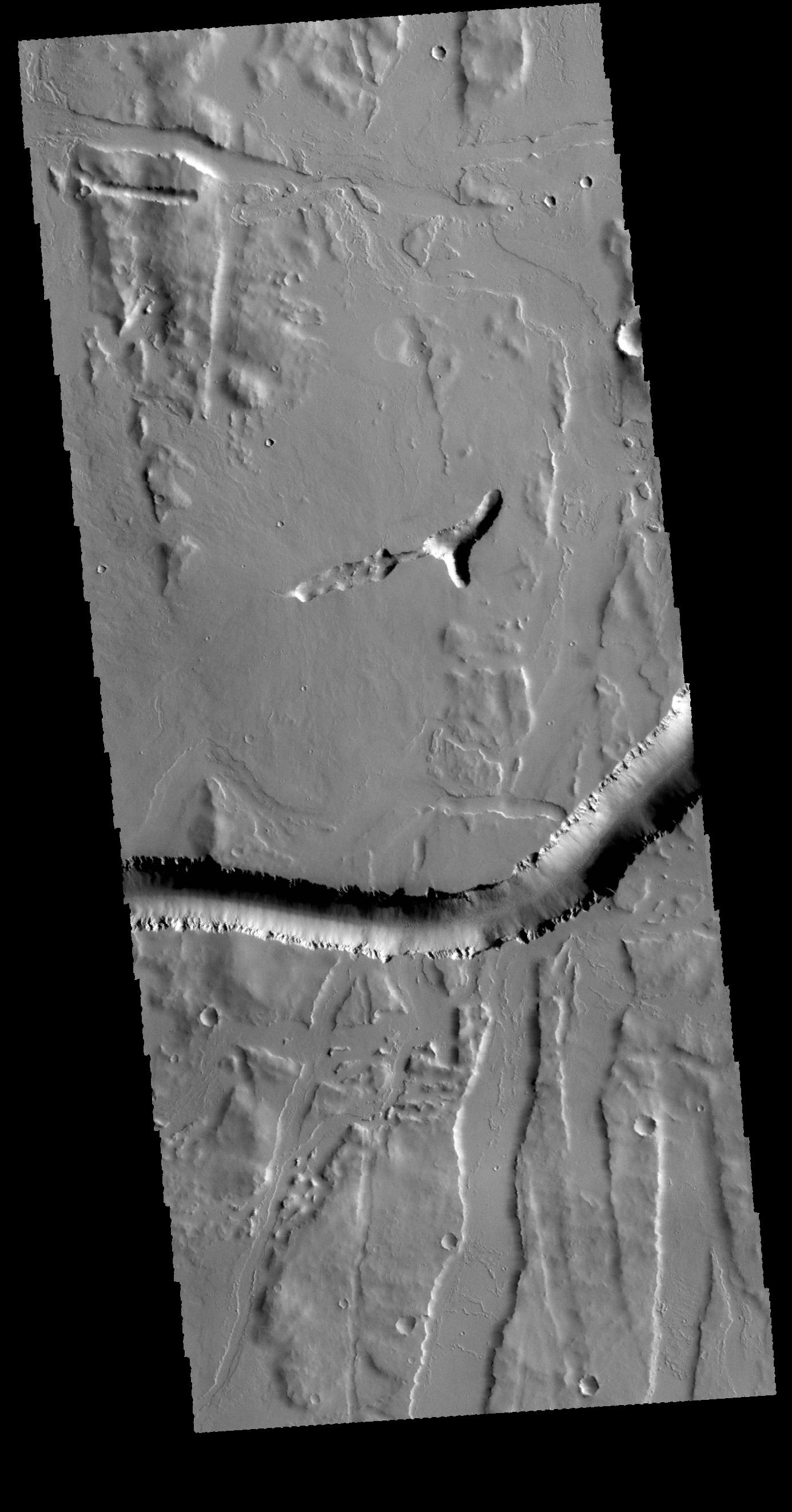
PIA20220:
Tempe Terra
Full Resolution:
TIFF
(2.746 MB)
JPEG
(379.5 kB)
2015-12-23
Mars
Mars Reconnaissance Orbiter (MRO)
HiRISE
2880x1800x3
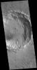
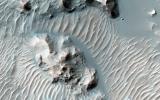
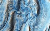
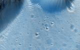
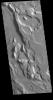
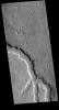
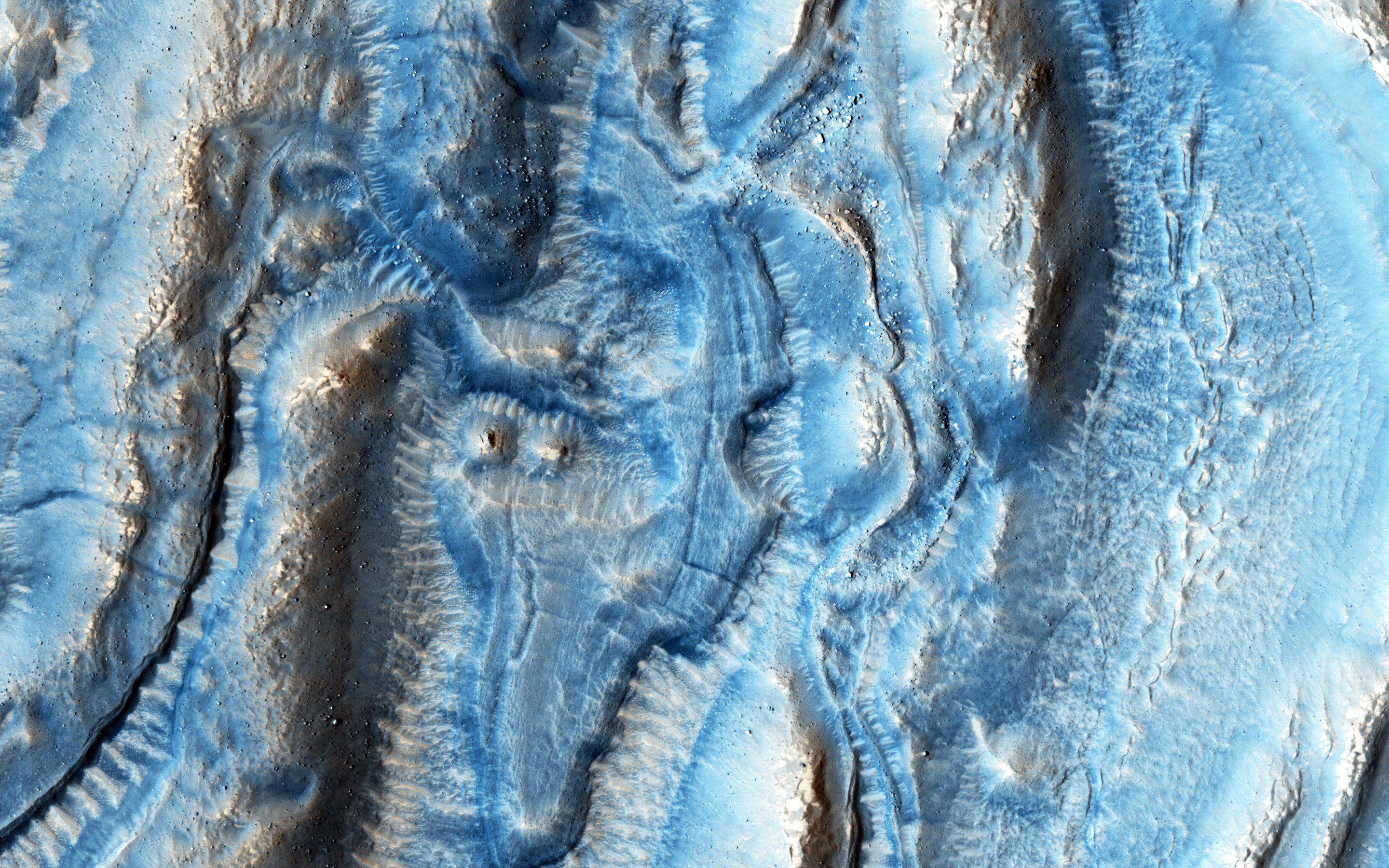
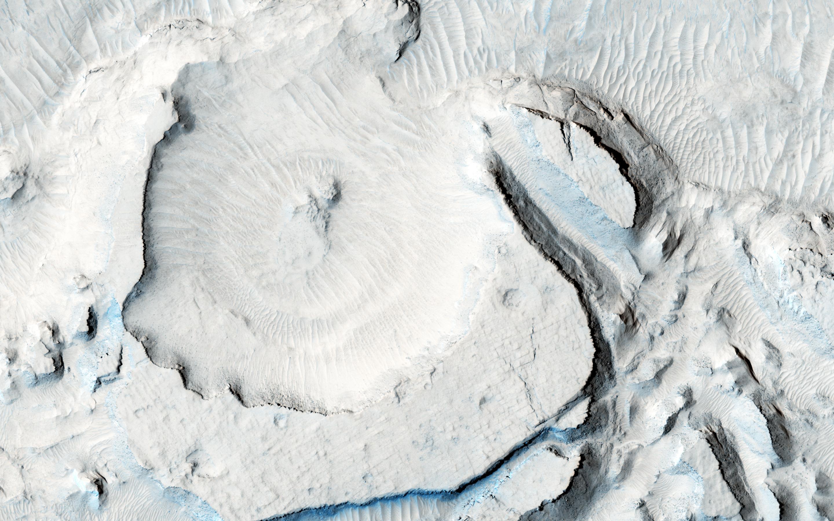
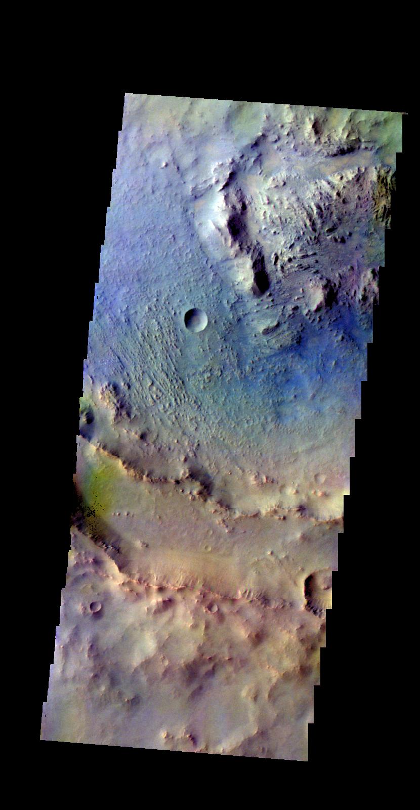
PIA20288:
Icy Erosion
Full Resolution:
TIFF
(15.14 MB)
JPEG
(754.4 kB)
2015-12-23
Mars
Mars Reconnaissance Orbiter (MRO)
HiRISE
2880x1800x3
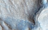
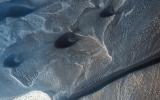
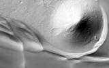
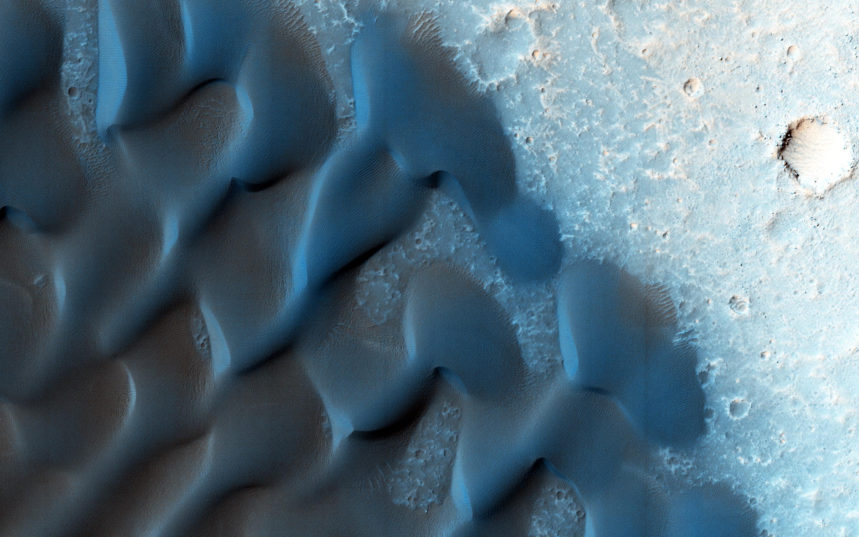
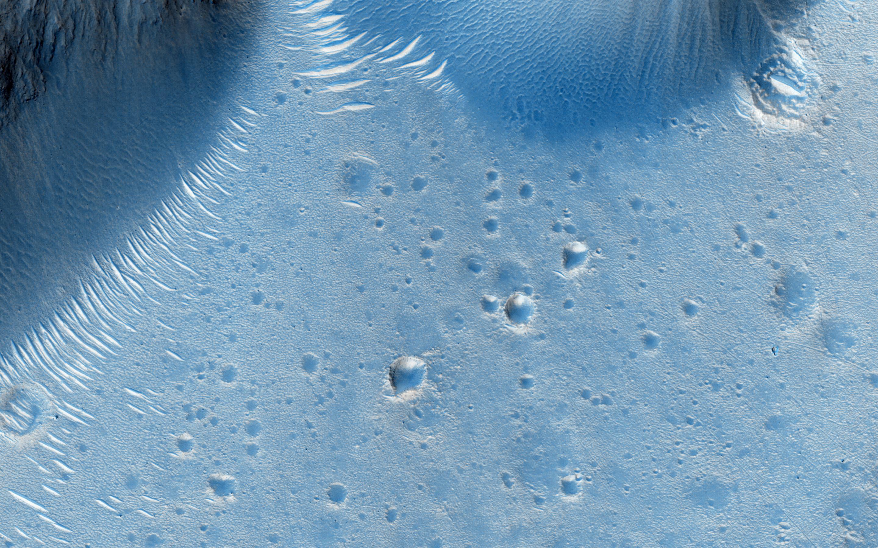
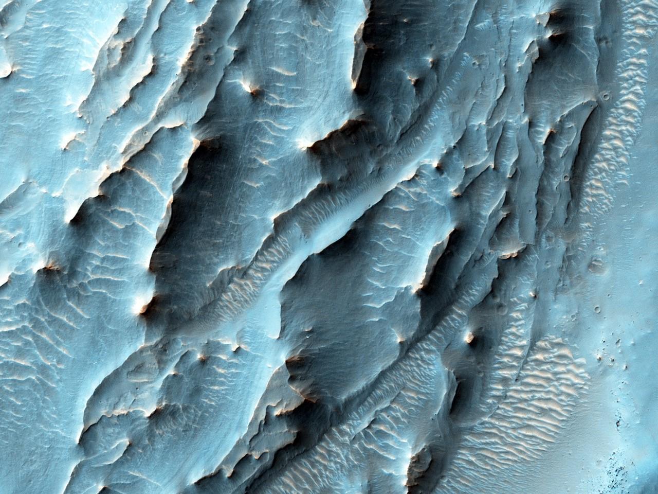
PIA20289:
A Frost Enhanced Landscape
Full Resolution:
TIFF
(15.56 MB)
JPEG
(1.378 MB)
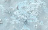
2015-12-23
Mars
Mars Reconnaissance Orbiter (MRO)
HiRISE
2880x1800x1
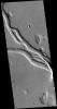
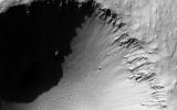
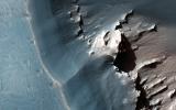
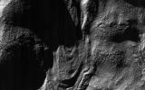
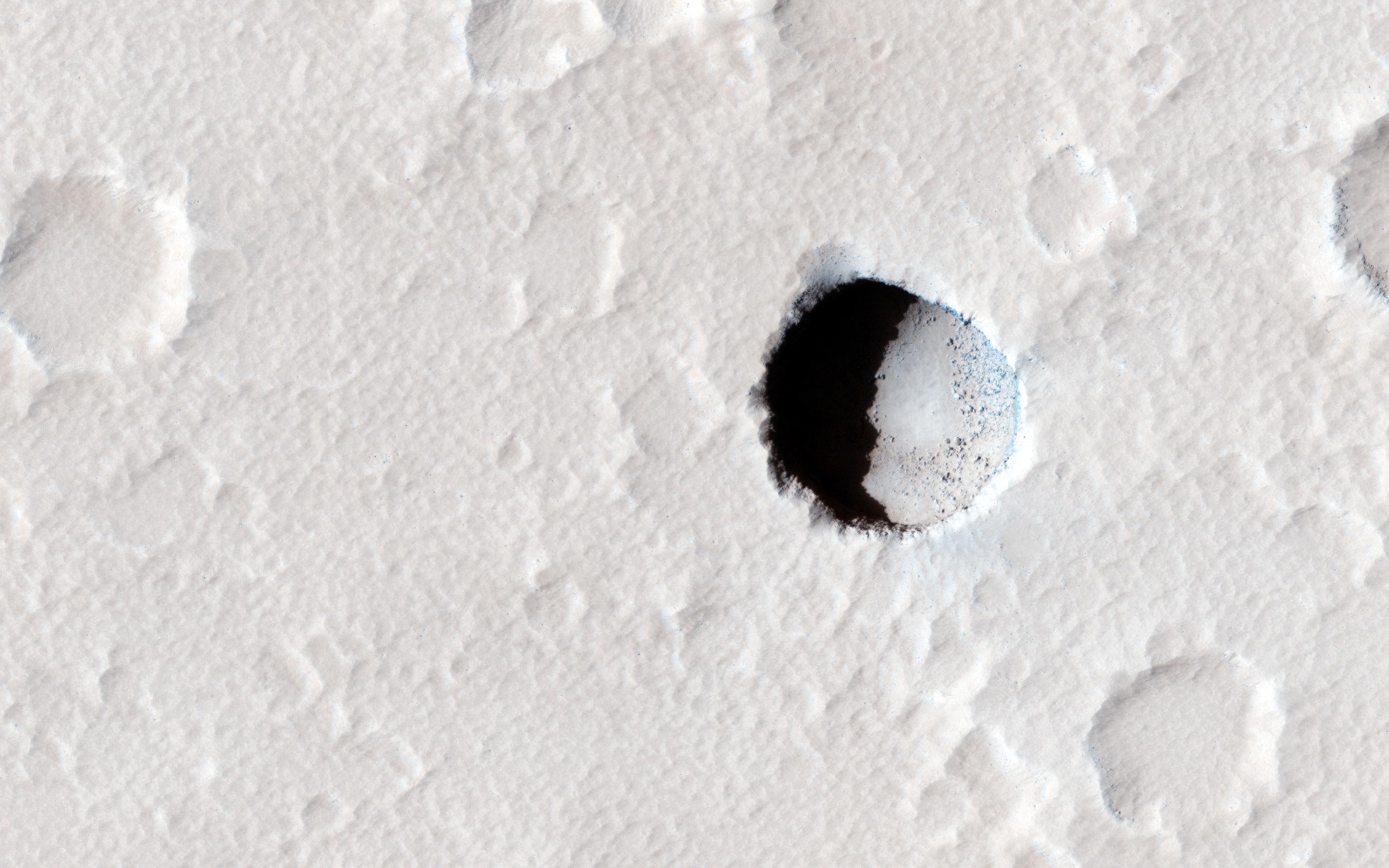
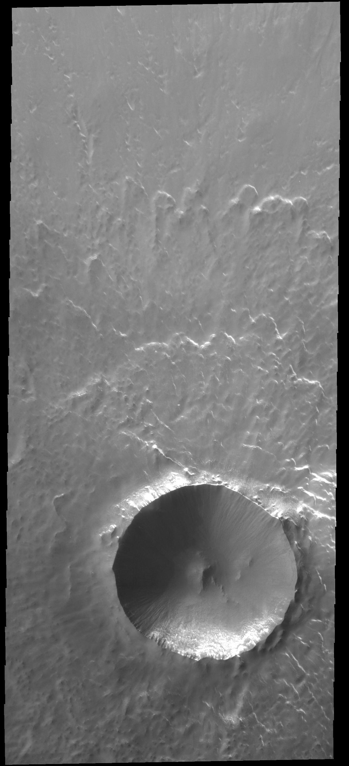
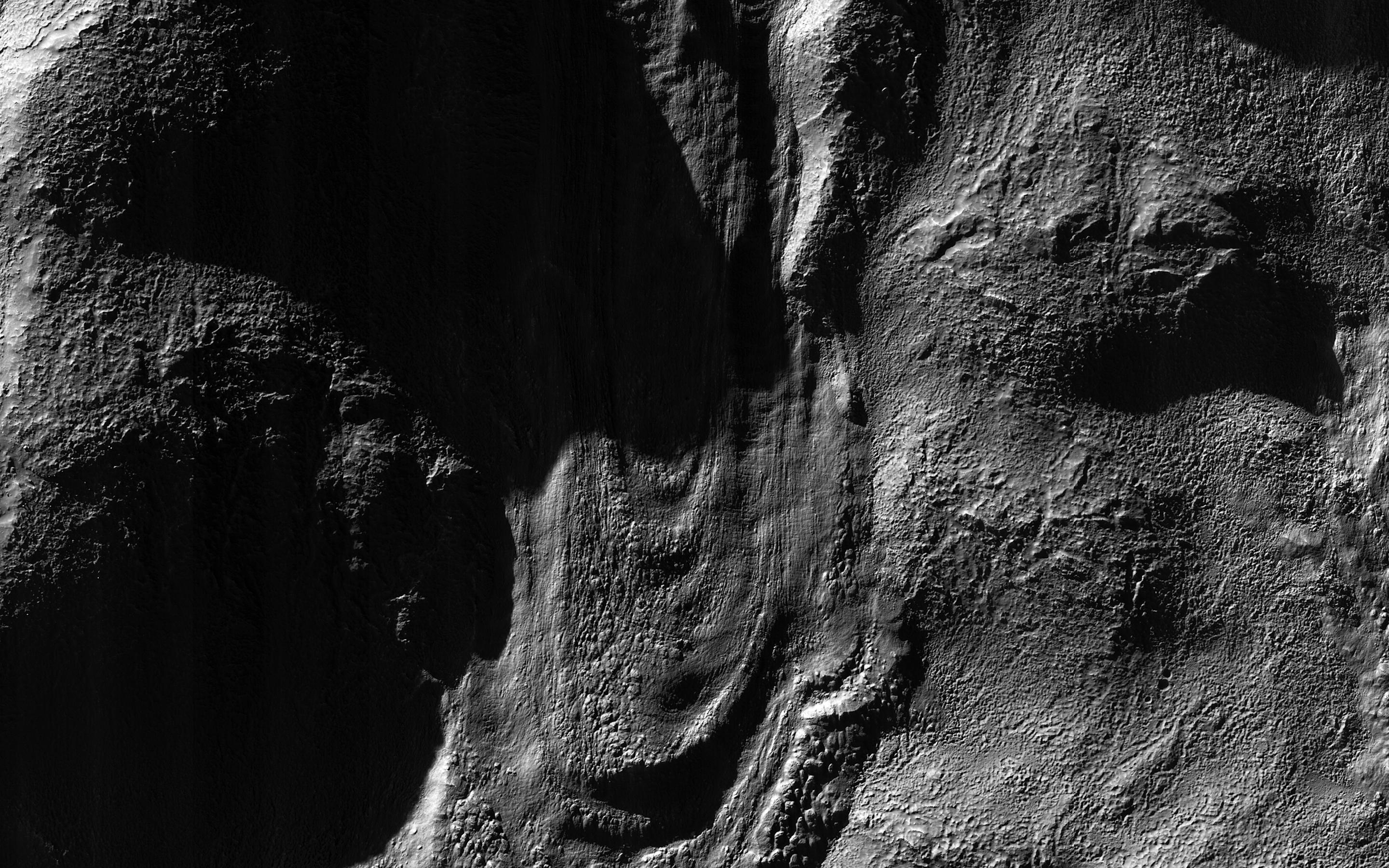
PIA20290:
Boulders on a Landslide
Full Resolution:
TIFF
(5.191 MB)
JPEG
(1.134 MB)
2015-12-24
Mars
2001 Mars Odyssey
THEMIS
1430x2650x1
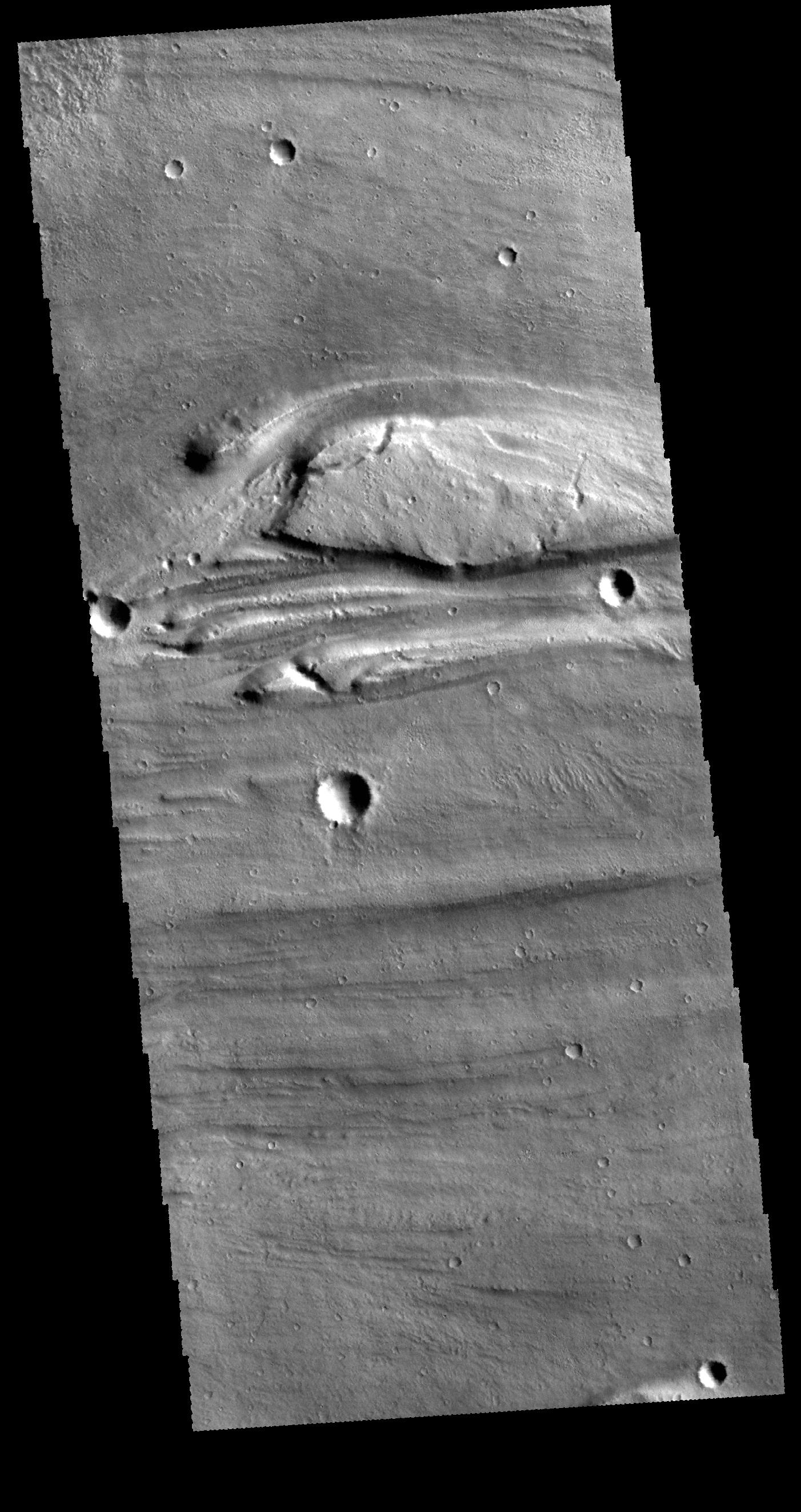
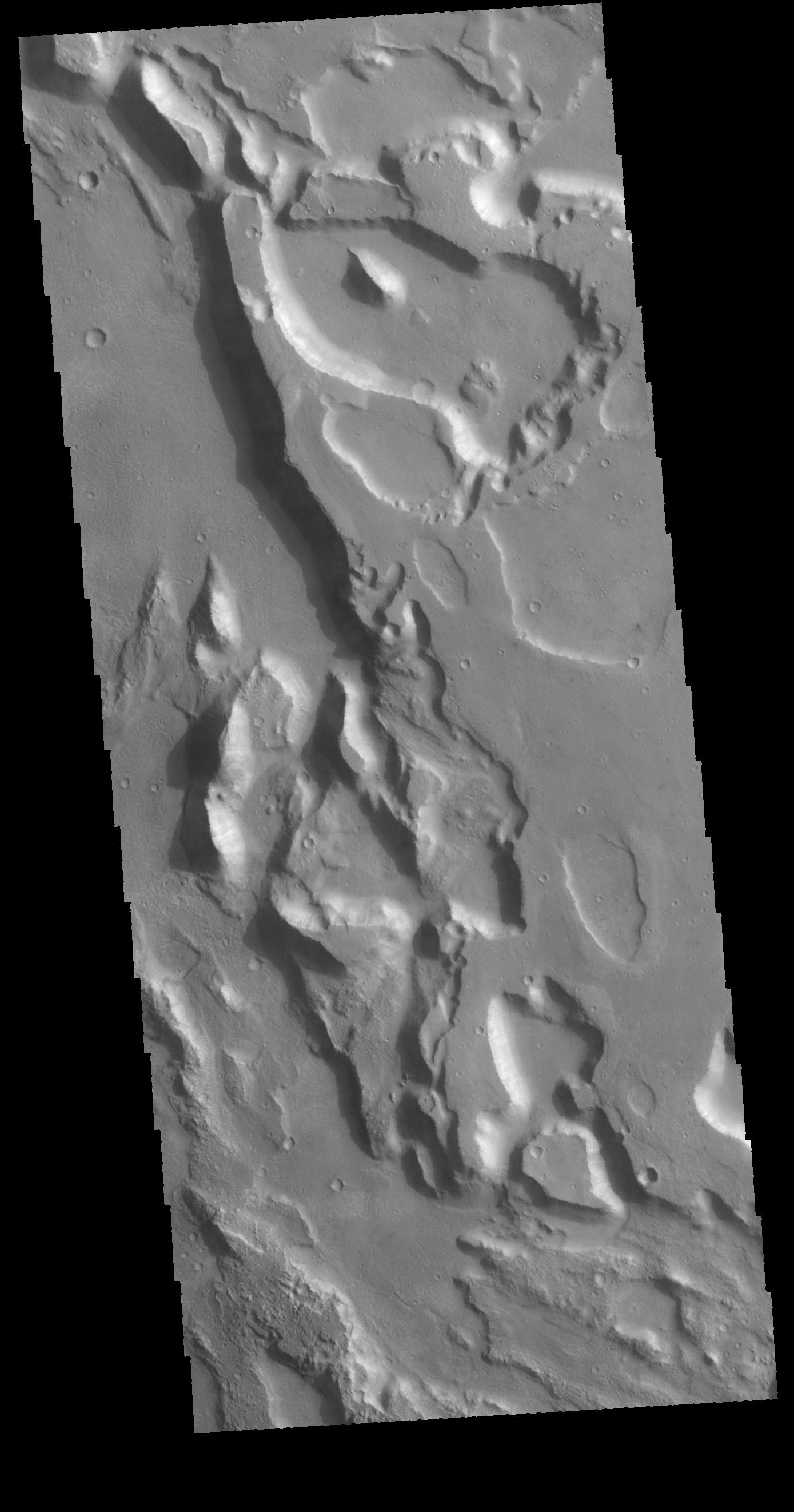
PIA20221:
Mamers Valles
Full Resolution:
TIFF
(2.541 MB)
JPEG
(286.8 kB)
2015-12-25
Mars
2001 Mars Odyssey
THEMIS
1399x2645x1
PIA20222:
Olympica Fossae
Full Resolution:
TIFF
(2.49 MB)
JPEG
(385.9 kB)
2015-12-28
Mars
2001 Mars Odyssey
THEMIS
711x1549x3
PIA20223:
Nili Fossae - False Color
Full Resolution:
TIFF
(2.296 MB)
JPEG
(105.1 kB)
2015-12-29
Mars
2001 Mars Odyssey
THEMIS
691x1538x3
PIA20224:
Hebes Mensa - False Color
Full Resolution:
TIFF
(2.102 MB)
JPEG
(93.22 kB)
2015-12-30
Mars
2001 Mars Odyssey
THEMIS
1250x1771x3
PIA20225:
Noachis Terra - False Color
Full Resolution:
TIFF
(2.219 MB)
JPEG
(105.8 kB)
2015-12-31
Mars
2001 Mars Odyssey
THEMIS
688x1538x3
PIA20226:
Ophir Planum - False Color
Full Resolution:
TIFF
(2.065 MB)
JPEG
(95.97 kB)
2016-01-01
Mars
2001 Mars Odyssey
THEMIS
681x1536x3
PIA20227:
Eos Chasma - False Color
Full Resolution:
TIFF
(2.097 MB)
JPEG
(94.28 kB)
2016-01-04
Mars
2001 Mars Odyssey
THEMIS
691x1538x3
PIA20228:
Iani Chaos - False Color
Full Resolution:
TIFF
(2.251 MB)
JPEG
(96.57 kB)
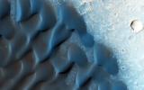
2016-01-04
Mars
Mars Science Laboratory (MSL)
Navcam (MSL)
4937x1190x1
PIA20281:
Slip Face on Downwind Side of 'Namib' Sand Dune on Mars
Full Resolution:
TIFF
(4.713 MB)
JPEG
(512.6 kB)
2016-01-04
Mars
Mars Science Laboratory (MSL)
Navcam (MSL)
4937x1190x3
PIA20282:
Downwind Side of 'Namib' Sand Dune on Mars, Stereo
Full Resolution:
TIFF
(13 MB)
JPEG
(596.7 kB)
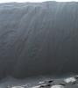
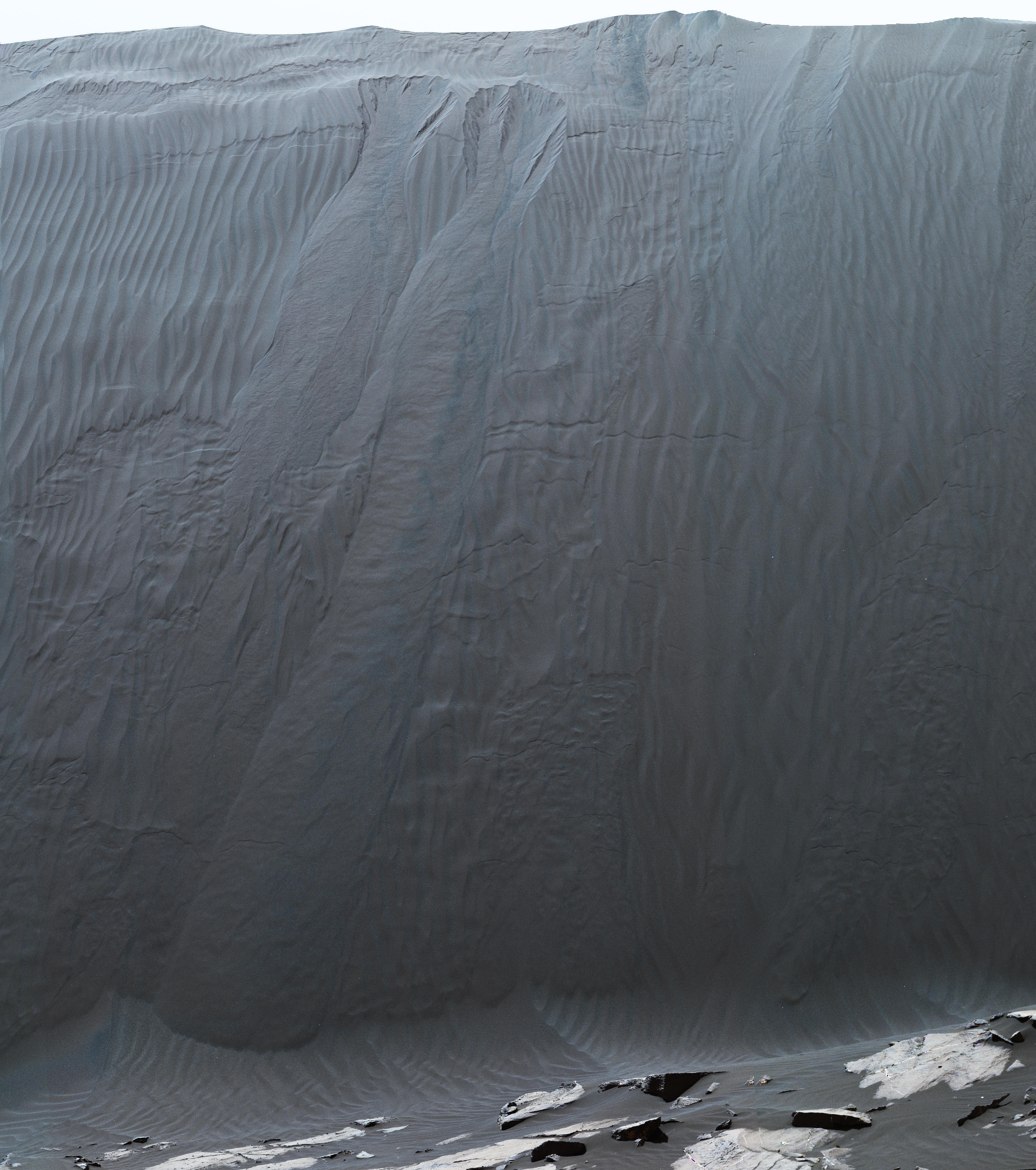
2016-01-04
Mars
Mars Science Laboratory (MSL)
Mastcam
5164x5832x3
PIA20283:
Mastcam Telephoto of a Martian Dune's Downwind Face
Full Resolution:
TIFF
(69.84 MB)
JPEG
(3.946 MB)
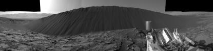
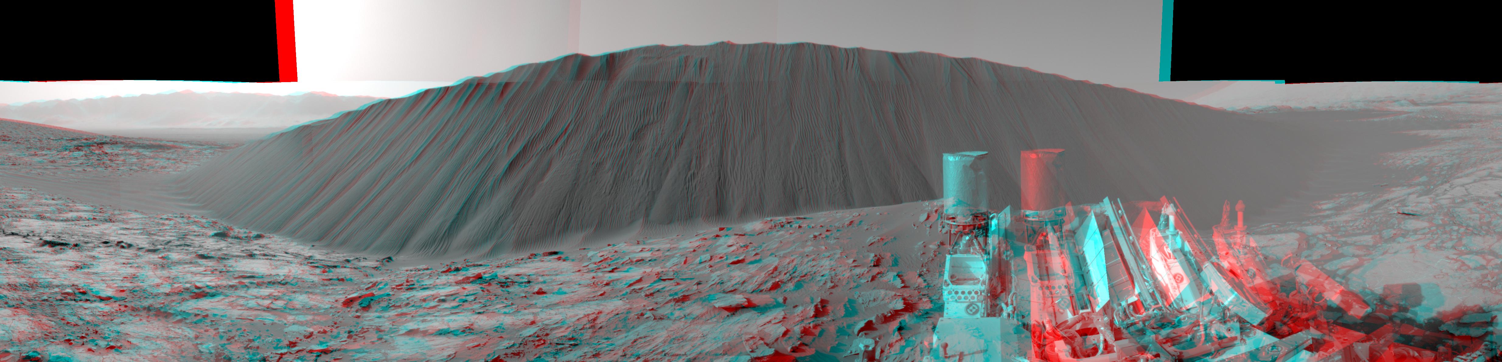
2016-01-04
Mars
Mars Science Laboratory (MSL)
Mastcam
14400x4447x3
PIA20284:
Full-Circle Panorama Beside 'Namib Dune' on Mars
Full Resolution:
TIFF
(173.5 MB)
JPEG
(8.304 MB)
2016-01-05
Mars
2001 Mars Odyssey
THEMIS
720x1552x3
PIA20229:
Nili Fossae - False Color
Full Resolution:
TIFF
(2.292 MB)
JPEG
(108.6 kB)
2016-01-06
Mars
2001 Mars Odyssey
THEMIS
694x1540x3
PIA20230:
Nili Patera - False Color
Full Resolution:
TIFF
(2.168 MB)
JPEG
(103.6 kB)
2016-01-07
Mars
2001 Mars Odyssey
THEMIS
726x1565x3
PIA20231:
Crater - False Color
Full Resolution:
TIFF
(2.225 MB)
JPEG
(115.7 kB)
2016-01-08
Mars
2001 Mars Odyssey
THEMIS
691x1539x3
PIA20232:
Arabia Terra Plains - False Color
Full Resolution:
TIFF
(2.203 MB)
JPEG
(117.6 kB)
2016-01-11
Mars
2001 Mars Odyssey
THEMIS
1438x2655x1
PIA20233:
Rim Complexities
Full Resolution:
TIFF
(2.777 MB)
JPEG
(334.8 kB)
2016-01-12
Mars
2001 Mars Odyssey
THEMIS
1399x2644x1
PIA20234:
Hebrus Valles
Full Resolution:
TIFF
(2.613 MB)
JPEG
(327.4 kB)
2016-01-13
Mars
2001 Mars Odyssey
THEMIS
1402x2645x1
PIA20235:
Labeatis Fossae
Full Resolution:
TIFF
(2.679 MB)
JPEG
(389.3 kB)
2016-01-14
Mars
Mars Reconnaissance Orbiter (MRO)
HiRISE
2880x1800x3
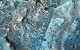
PIA20337:
Ancient Rivers
Full Resolution:
TIFF
(15.56 MB)
JPEG
(1.353 MB)
2016-01-14
Mars
Mars Reconnaissance Orbiter (MRO)
HiRISE
2880x1800x3
PIA20338:
Mars 2020 Candidate Landing Site in McLaughlin Crater
Full Resolution:
TIFF
(15.56 MB)
JPEG
(1.247 MB)
2016-01-14
Mars
Mars Reconnaissance Orbiter (MRO)
HiRISE
2880x1800x3
PIA20339:
Erosion and Deposition in Schaeberle Crater
Full Resolution:
TIFF
(15.56 MB)
JPEG
(820.8 kB)
2016-01-14
Mars
Mars Reconnaissance Orbiter (MRO)
HiRISE
2880x1800x1
PIA20340:
A Young, Fresh Crater in Hellespontus
Full Resolution:
TIFF
(4.722 MB)
JPEG
(525 kB)
2016-01-14
Mars
2001 Mars Odyssey
THEMIS
1407x2645x1
PIA20236:
Elysium Fossae
Full Resolution:
TIFF
(2.236 MB)
JPEG
(215.2 kB)
2016-01-15
Mars
2001 Mars Odyssey
THEMIS
1186x2621x1
PIA20237:
Hyperboreae Undae
Full Resolution:
TIFF
(3.088 MB)
JPEG
(437.7 kB)
2016-01-18
Mars
2001 Mars Odyssey
THEMIS
1434x2658x1
PIA20238:
Moreux Crater
Full Resolution:
TIFF
(2.448 MB)
JPEG
(247.2 kB)
2016-01-19
Mars
2001 Mars Odyssey
THEMIS
1407x2651x1
PIA20240:
Concentric Rims
Full Resolution:
TIFF
(2.683 MB)
JPEG
(375.1 kB)
2016-01-20
Mars
2001 Mars Odyssey
THEMIS
1405x2647x1
PIA20241:
Kasei Valles
Full Resolution:
TIFF
(2.667 MB)
JPEG
(298.7 kB)
2016-01-21
Mars
2001 Mars Odyssey
THEMIS
614x2711x3
PIA20242:
Coprates Chasma - False Color
Full Resolution:
TIFF
(2.05 MB)
JPEG
(86.16 kB)
2016-01-22
Mars
2001 Mars Odyssey
THEMIS
617x2739x3
PIA20243:
Galle Crater - False Color
Full Resolution:
TIFF
(2.167 MB)
JPEG
(102.6 kB)
2016-01-25
Mars
2001 Mars Odyssey
THEMIS
690x1539x3
PIA20244:
Crater - False Color
Full Resolution:
TIFF
(2.097 MB)
JPEG
(114.6 kB)
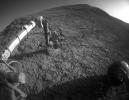
2016-01-25
Mars
Mars Exploration Rover (MER)
Hazcam
1024x792x1
PIA20285:
Mars Rover Opportunity at Rock Abrasion Target 'Potts'
Full Resolution:
TIFF
(796.2 kB)
JPEG
(114.9 kB)
2016-01-26
Mars
2001 Mars Odyssey
THEMIS
693x1539x3
PIA20245:
Gale Crater - False Color
Full Resolution:
TIFF
(2.064 MB)
JPEG
(81.34 kB)
2016-01-27
Mars
2001 Mars Odyssey
THEMIS
780x1582x3
PIA20246:
Crater - False Color
Full Resolution:
TIFF
(2.572 MB)
JPEG
(159.5 kB)
2016-01-27
Mars
Mars Reconnaissance Orbiter (MRO)
HiRISE
2880x1800x3
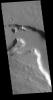
PIA20368:
Pit Crater near Elysium Mons
Full Resolution:
TIFF
(11.19 MB)
JPEG
(553.7 kB)
2016-01-27
Mars
Mars Reconnaissance Orbiter (MRO)
HiRISE
2880x1800x3
PIA20369:
The Changing Sands
Full Resolution:
TIFF
(15.56 MB)
JPEG
(771.5 kB)
2016-01-27
Mars
Mars Reconnaissance Orbiter (MRO)
HiRISE
2880x1800x3
PIA20370:
A Tale of Two Flows
Full Resolution:
TIFF
(15.56 MB)
JPEG
(982.3 kB)
2016-01-27
Mars
Mars Reconnaissance Orbiter (MRO)
HiRISE
2880x1800x3
PIA20371:
Jarosite in Noctis Labyrinthus
Full Resolution:
TIFF
(15.56 MB)
JPEG
(642.5 kB)
2016-01-28
Mars
2001 Mars Odyssey
THEMIS
766x1572x3
PIA20247:
Windstreaks - False Color
Full Resolution:
TIFF
(2.447 MB)
JPEG
(153.4 kB)
2016-01-29
Mars
2001 Mars Odyssey
THEMIS
881x1628x3
PIA20248:
Sand Dunes - False Color
Full Resolution:
TIFF
(2.672 MB)
JPEG
(104.8 kB)
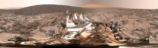
2016-01-29
Mars
Mars Science Laboratory (MSL)
MAHLI
5623x6000x3
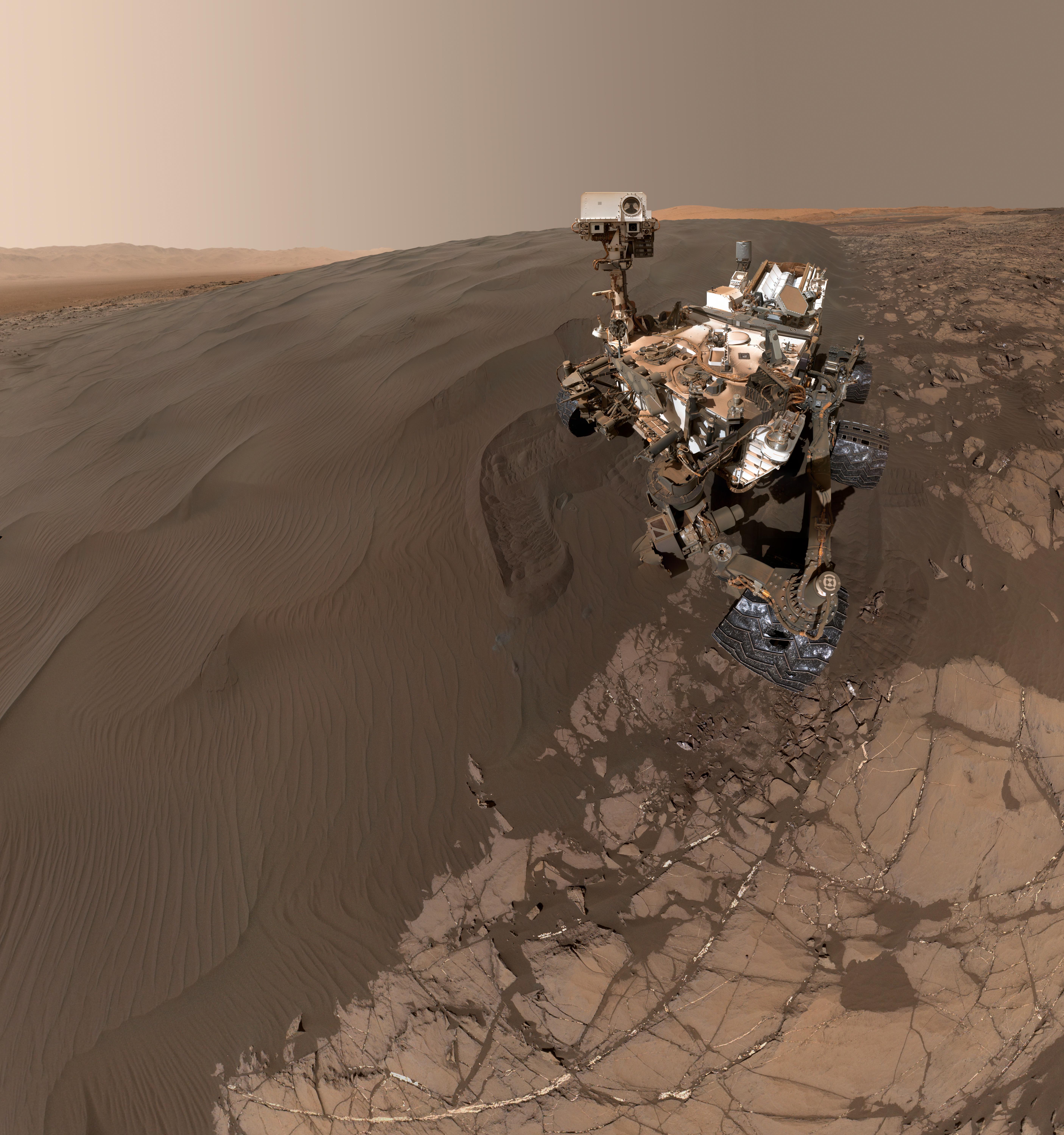
PIA20316:
Curiosity Self-Portrait at Martian Sand Dune
Full Resolution:
TIFF
(78.7 MB)
JPEG
(2.703 MB)
2016-01-29
Mars
Mars Science Laboratory (MSL)
MAHLI
1584x1184x3
PIA20317:
Night Close-up of Martian Sand Grains
Full Resolution:
TIFF
(5.628 MB)
JPEG
(368.9 kB)
2016-02-01
Mars
2001 Mars Odyssey
THEMIS
831x1602x3
PIA20249:
Terra Sabaea - False Color
Full Resolution:
TIFF
(2.567 MB)
JPEG
(141.8 kB)
2016-02-02
Mars
2001 Mars Odyssey
THEMIS
816x1593x3
PIA20250:
Ophir Chasma - False Color
Full Resolution:
TIFF
(2.416 MB)
JPEG
(88.15 kB)
2016-02-03
Mars
2001 Mars Odyssey
THEMIS
816x1592x3
PIA20251:
Ophir Chasma - False Color
Full Resolution:
TIFF
(2.514 MB)
JPEG
(100.4 kB)
2016-02-04
Mars
2001 Mars Odyssey
THEMIS
817x1593x3
PIA20252:
Craters - False Color
Full Resolution:
TIFF
(2.546 MB)
JPEG
(105.7 kB)
2016-02-05
Mars
2001 Mars Odyssey
THEMIS
834x1603x3
PIA20253:
Terra Sabaea - False Color
Full Resolution:
TIFF
(2.727 MB)
JPEG
(181.2 kB)
2016-02-08
Mars
2001 Mars Odyssey
THEMIS
702x1436x1
PIA20254:
Dark Slope Streaks
Full Resolution:
TIFF
(677.5 kB)
JPEG
(70.02 kB)
2016-02-09
Mars
2001 Mars Odyssey
THEMIS
707x1444x1
PIA20255:
Ridges
Full Resolution:
TIFF
(702.5 kB)
JPEG
(70.3 kB)
2016-02-10
Mars
2001 Mars Odyssey
THEMIS
1430x2658x1
PIA20256:
Hills and Channels
Full Resolution:
TIFF
(2.692 MB)
JPEG
(306.6 kB)
2016-02-11
Mars
Mars Reconnaissance Orbiter (MRO)
HiRISE
2880x1800x3
PIA20379:
Inverted Terrain in Eridania
Full Resolution:
TIFF
(15.56 MB)
JPEG
(768 kB)
2016-02-11
Mars
Mars Reconnaissance Orbiter (MRO)
HiRISE
2880x1800x3
PIA20461:
Wind at Work
Full Resolution:
TIFF
(15 MB)
JPEG
(554.4 kB)
2016-02-11
Mars
Mars Reconnaissance Orbiter (MRO)
HiRISE
2880x1800x3
PIA20462:
Rounded Mounds in Northern Arabia Terra
Full Resolution:
TIFF
(13.56 MB)
JPEG
(657.9 kB)
2016-02-11
Mars
Mars Reconnaissance Orbiter (MRO)
HiRISE
2880x1800x3
PIA20463:
A Possible Alluvial Fan
Full Resolution:
TIFF
(15.56 MB)
JPEG
(869 kB)
2016-02-11
Mars
2001 Mars Odyssey
THEMIS
1209x2650x1
PIA20257:
Lonar Crater
Full Resolution:
TIFF
(2.329 MB)
JPEG
(212.5 kB)
2016-02-12
Mars
2001 Mars Odyssey
THEMIS
1402x2645x1
PIA20258:
Kasei Valles
Full Resolution:
TIFF
(2.755 MB)
JPEG
(427.9 kB)
2016-02-15
Mars
2001 Mars Odyssey
THEMIS
1424x2653x1
PIA20259:
Tempe Terra
Full Resolution:
TIFF
(2.846 MB)
JPEG
(397.4 kB)
2016-02-16
Mars
2001 Mars Odyssey
THEMIS
1396x2646x1
PIA20260:
Ceraunius Fossae
Full Resolution:
TIFF
(2.545 MB)
JPEG
(285.7 kB)
2016-02-17
Mars
2001 Mars Odyssey
THEMIS
1432x2655x1
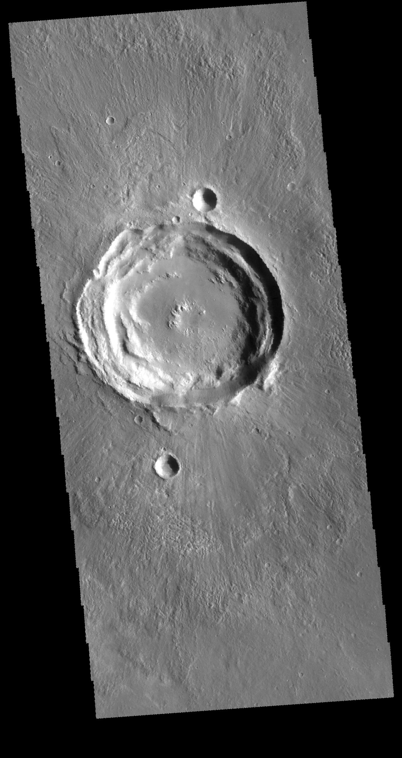
PIA20261:
Rampart Crater
Full Resolution:
TIFF
(2.85 MB)
JPEG
(415.6 kB)
2016-02-18
Mars
2001 Mars Odyssey
THEMIS
1404x2646x1
PIA20262:
Granicus Valles
Full Resolution:
TIFF
(2.556 MB)
JPEG
(280 kB)
2016-02-19
Mars
2001 Mars Odyssey
THEMIS
1385x2643x1
PIA20264:
Olympica Fossae
Full Resolution:
TIFF
(2.487 MB)
JPEG
(306.2 kB)
2016-02-22
Mars
2001 Mars Odyssey
THEMIS
1385x2643x1
PIA20265:
More Olympica Fossae
Full Resolution:
TIFF
(2.411 MB)
JPEG
(346.6 kB)
2016-02-23
Mars
2001 Mars Odyssey
THEMIS
1380x2642x1
PIA20411:
Arabia Terra
Full Resolution:
TIFF
(2.416 MB)
JPEG
(256.7 kB)
2016-02-24
Mars
2001 Mars Odyssey
THEMIS
1389x2644x1
PIA20412:
Ares Vallis
Full Resolution:
TIFF
(2.483 MB)
JPEG
(256.5 kB)
2016-02-24
Mars
Mars Reconnaissance Orbiter (MRO)
HiRISE
2880x1800x3
PIA20469:
Summer Sand Dunes
Full Resolution:
TIFF
(15.56 MB)
JPEG
(996.1 kB)
2016-02-24
Mars
Mars Reconnaissance Orbiter (MRO)
HiRISE
2880x1800x1
PIA20470:
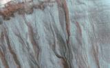
Dramatic Shadows over a Fossil Glacier
Full Resolution:
TIFF
(4.997 MB)
JPEG
(993.7 kB)
2016-02-24
Mars
Mars Reconnaissance Orbiter (MRO)
HiRISE
2880x1800x3
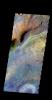
PIA20471:
Colorful Hargraves
Full Resolution:
TIFF
(15.56 MB)
JPEG
(974.5 kB)
2016-02-24
Mars
Mars Reconnaissance Orbiter (MRO)
HiRISE
2880x1800x3
PIA20472:
Frosted Gully Slopes in Shadows
Full Resolution:
TIFF
(15.56 MB)
JPEG
(966.2 kB)
2016-02-25
Mars
2001 Mars Odyssey
THEMIS
1385x2642x1
PIA20413:
Cerberus Fossae
Full Resolution:
TIFF
(2.464 MB)
JPEG
(273.3 kB)
2016-02-25
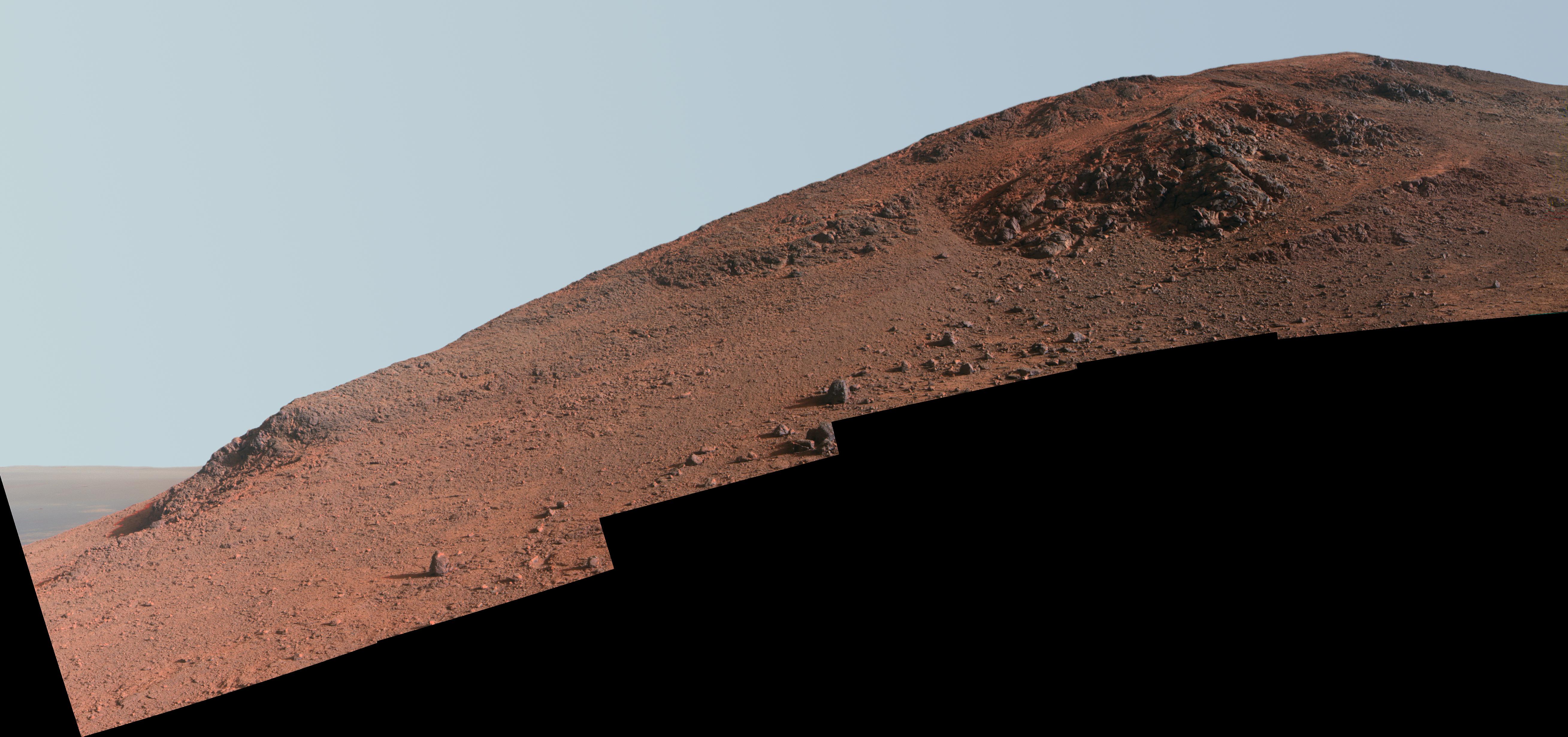
Mars
Mars Exploration Rover (MER)
Panoramic Camera
5235x2459x3
PIA20318:
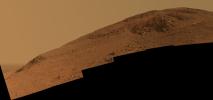
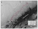
Steep 'Knudsen Ridge' Along 'Marathon Valley' on Mars
Full Resolution:
TIFF
(19.32 MB)
JPEG
(895.6 kB)
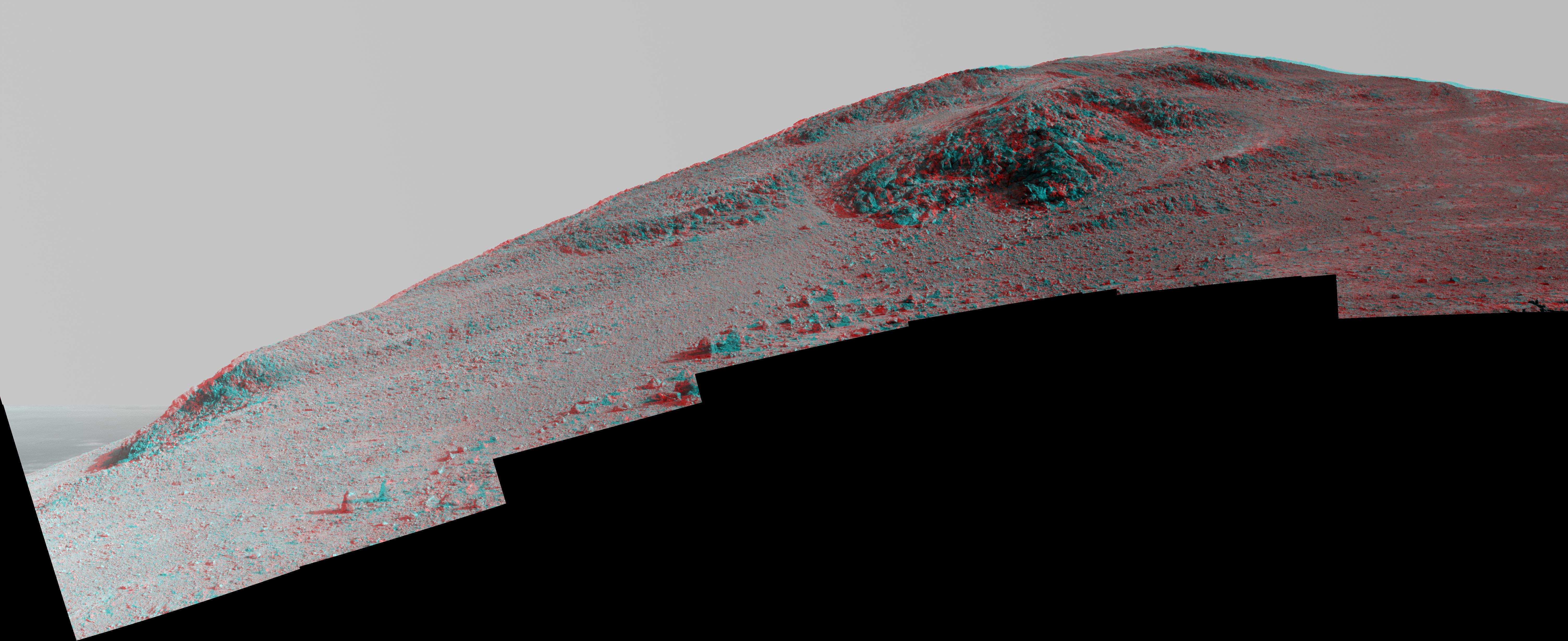
2016-02-25
Mars
Mars Exploration Rover (MER)
Panoramic Camera
5235x2459x3
PIA20319:
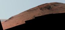
Steep 'Knudsen Ridge' Along 'Marathon Valley' on Mars (Enhanced Color)
Full Resolution:
TIFF
(22.45 MB)
JPEG
(1.096 MB)
2016-02-25
Mars
Mars Exploration Rover (MER)
Panoramic Camera
6015x2459x3
PIA20320:
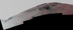
Steep 'Knudsen Ridge' Along 'Marathon Valley' on Mars (Stereo)
Full Resolution:
TIFF
(17.97 MB)
JPEG
(1.276 MB)
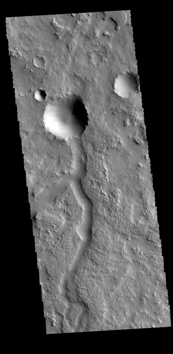
2016-02-26
Mars
2001 Mars Odyssey
THEMIS
698x1430x1
PIA20414:
Terra Sabaea
Full Resolution:
TIFF
(739.7 kB)
JPEG
(110.7 kB)
2016-02-29
Mars
2001 Mars Odyssey
THEMIS
702x1434x1
PIA20415:
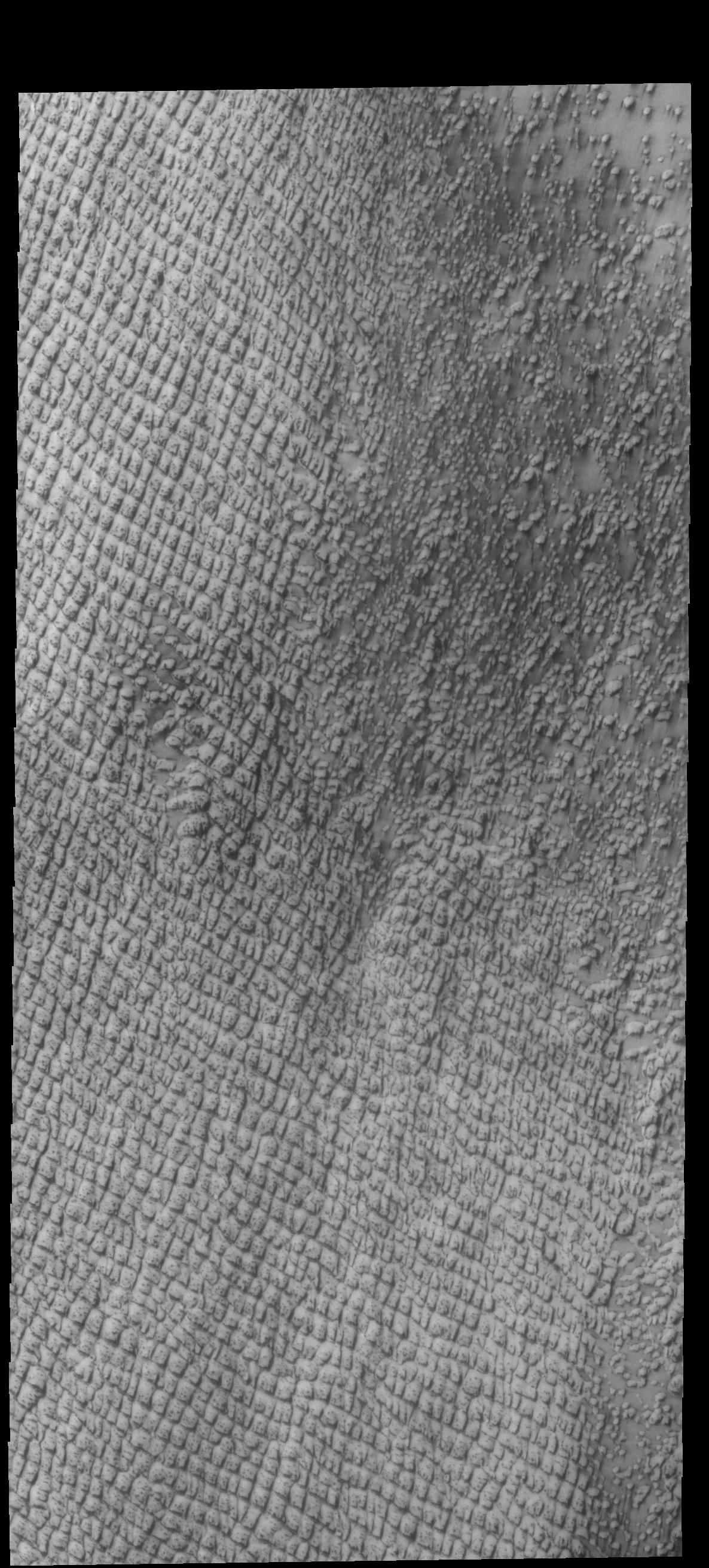
Crater Dunes
Full Resolution:
TIFF
(653.7 kB)
JPEG
(67.29 kB)
2016-03-01
Mars
2001 Mars Odyssey
THEMIS
703x1436x1
PIA20416:
Crater
Full Resolution:
TIFF
(708.7 kB)
JPEG
(83.99 kB)
2016-03-02
Mars
2001 Mars Odyssey
THEMIS
706x1440x1
PIA20417:
Nilus Chaos
Full Resolution:
TIFF
(727.4 kB)
JPEG
(90.49 kB)
2016-03-03
Mars
2001 Mars Odyssey
THEMIS
1436x2651x1
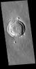
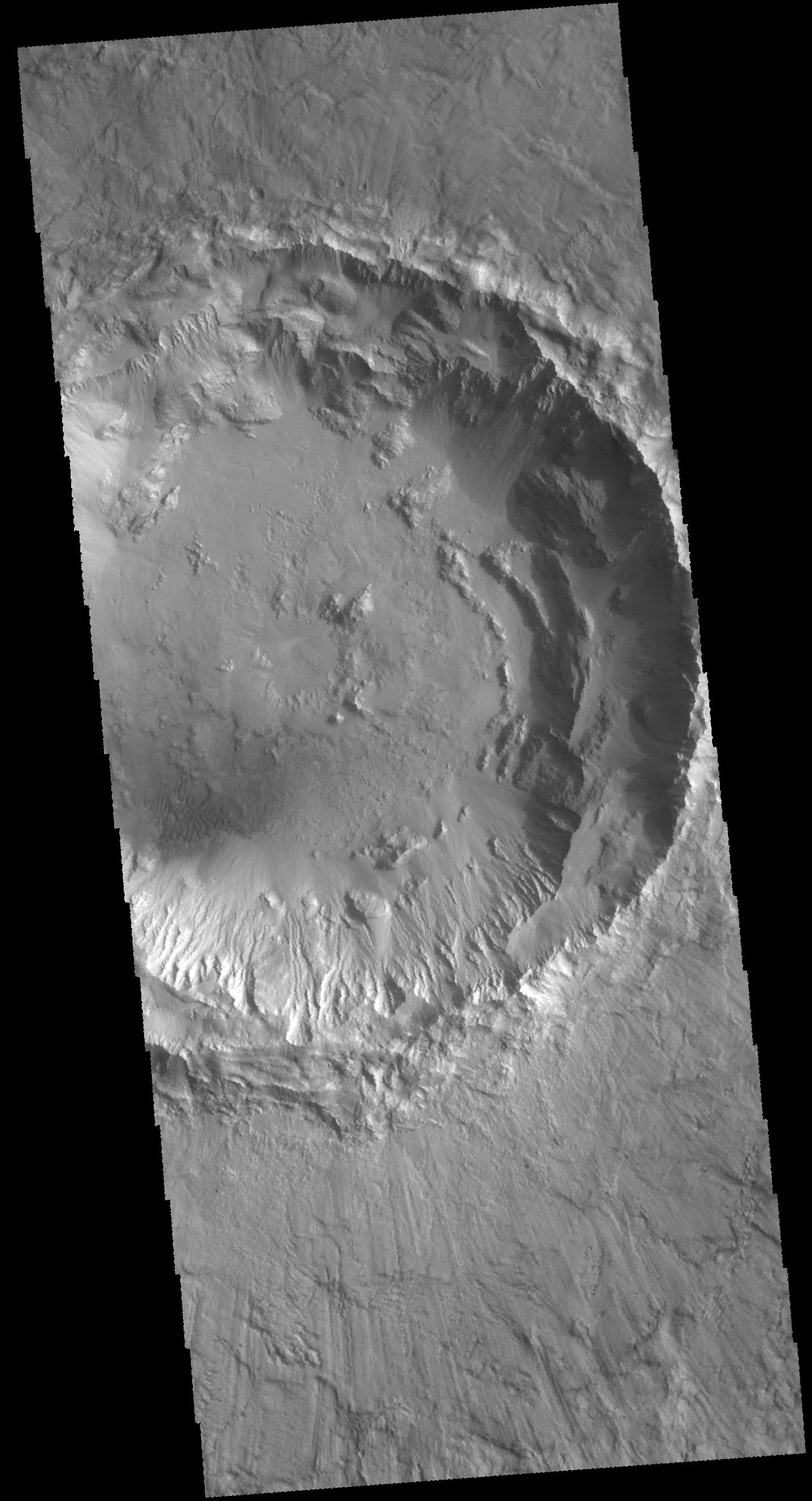
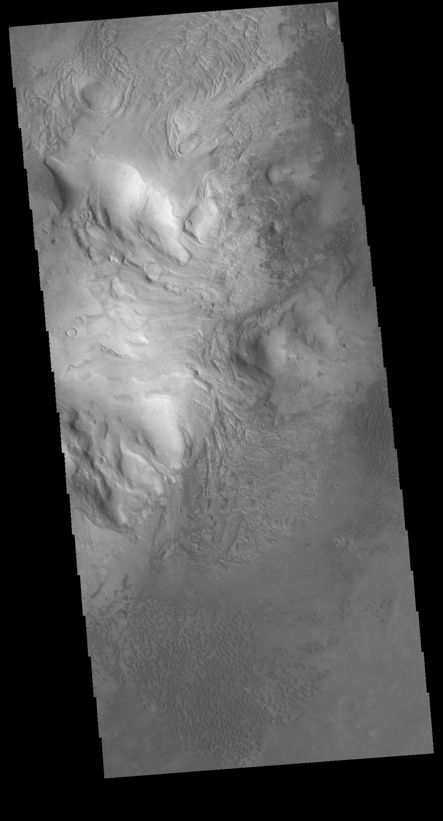
PIA20418:
Central Pit Crater
Full Resolution:
TIFF
(2.693 MB)
JPEG
(322.8 kB)
2016-03-04
Mars
2001 Mars Odyssey
THEMIS
1430x2651x1
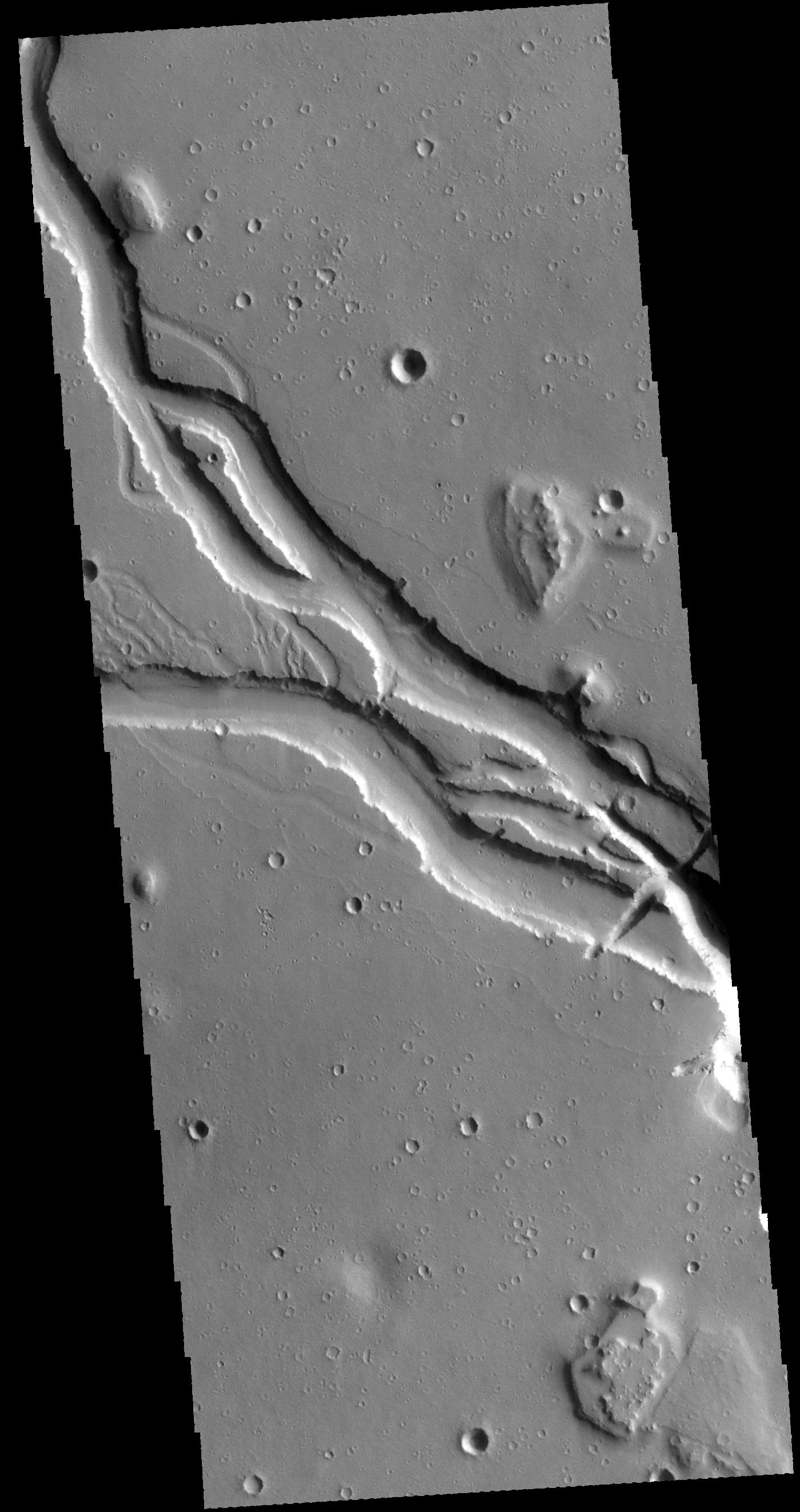
PIA20419:
Channel
Full Resolution:
TIFF
(2.888 MB)
JPEG
(456.9 kB)
2016-03-07
Mars
2001 Mars Odyssey
THEMIS
815x1593x3
PIA20420:
Crater - False Color
Full Resolution:
TIFF
(2.609 MB)
JPEG
(118.1 kB)
2016-03-08
Mars
2001 Mars Odyssey
THEMIS
826x1599x3
PIA20422:
Terra Sabaea - False Color
Full Resolution:
TIFF
(2.604 MB)
JPEG
(159 kB)
2016-03-09
Mars
2001 Mars Odyssey
THEMIS
830x1599x3
PIA20423:
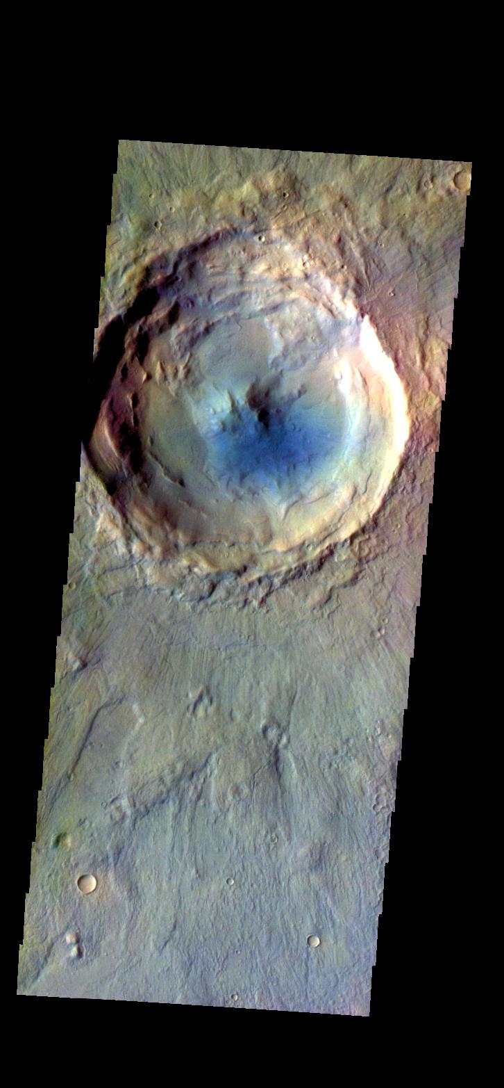
Martin Crater - False Color
Full Resolution:
TIFF
(2.575 MB)
JPEG
(135.7 kB)
2016-03-09
Mars
MAVEN
1586x888x3
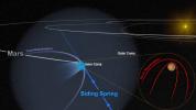
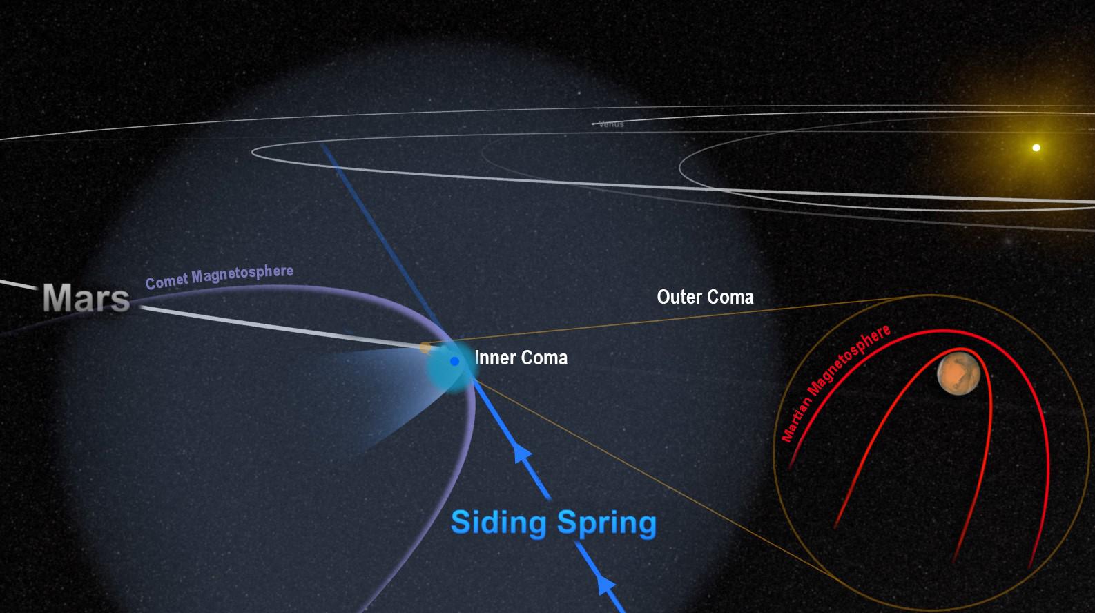
PIA20321:
Passing Comet Affects Magnetic Field at Mars
Full Resolution:
TIFF
(2.679 MB)
JPEG
(148.8 kB)
2016-03-09
Mars
Mars Reconnaissance Orbiter (MRO)
HiRISE
1280x960x3
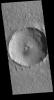
PIA20167:
For a Decade Orbiting Mars: One Recent View
Full Resolution:
TIFF
(3.688 MB)
JPEG
(200.3 kB)
2016-03-10
Mars
Mars Reconnaissance Orbiter (MRO)
HiRISE
2880x1800x1
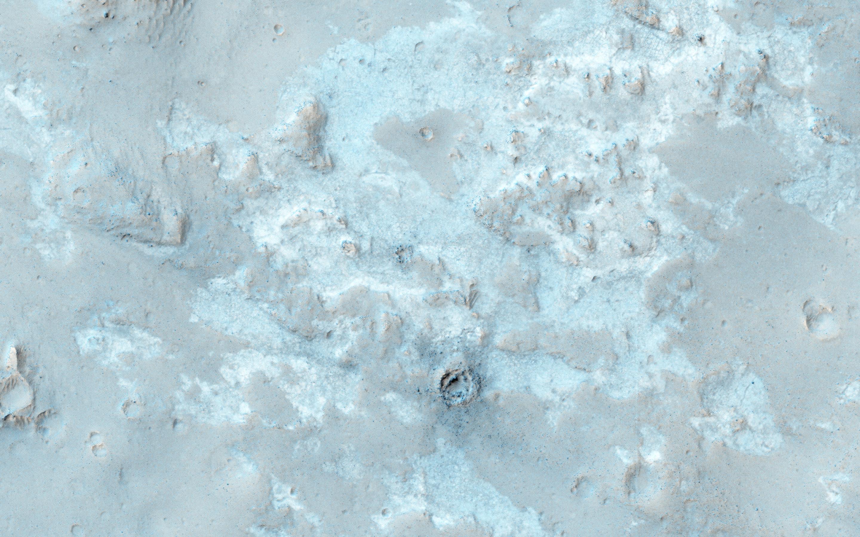
PIA20478:
The Dune Sea of Ganges Chasma
Full Resolution:
TIFF
(5.191 MB)
JPEG
(788.9 kB)
2016-03-10
Mars
Mars Reconnaissance Orbiter (MRO)
HiRISE
2880x1800x3
PIA20479:
The Northwest Floor of Gale Crater
Full Resolution:
TIFF
(15.56 MB)
JPEG
(973.1 kB)
2016-03-10
Mars
Mars Reconnaissance Orbiter (MRO)
HiRISE
2880x1800x1
PIA20480:
Night Vision
Full Resolution:
TIFF
(5.191 MB)
JPEG
(985.4 kB)
2016-03-10
Mars
2001 Mars Odyssey
THEMIS
818x1595x3
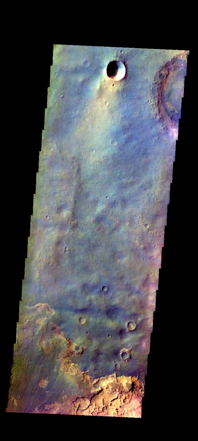
PIA20424:
Chasma Chaos - False Color
Full Resolution:
TIFF
(2.446 MB)
JPEG
(98.09 kB)
2016-03-11
Mars
2001 Mars Odyssey
THEMIS
819x1594x3
PIA20425:
Coprates Chasma - False Color
Full Resolution:
TIFF
(2.389 MB)
JPEG
(96.45 kB)
2016-03-11
Mars
Mars Science Laboratory (MSL)
HiRISE
3300x2550x3
PIA20166:
New Waypoint, Science Team Newcomers for Curiosity
Full Resolution:
TIFF
(12.44 MB)
JPEG
(1.458 MB)
2016-03-11
Mars
Mars Science Laboratory (MSL)
Mastcam
4184x2799x3
PIA20322:
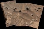
Knobbly Textured Sandstone on Mount Sharp, Mars
Full Resolution:
TIFF
(26.73 MB)
JPEG
(1.678 MB)
2016-03-11
Mars
Mars Science Laboratory (MSL)
MAHLI
1609x1198x3
PIA20323:
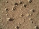
Nodules of Cemented Sand Grains Within Martian Sandstone
Full Resolution:
TIFF
(5.785 MB)
JPEG
(500.8 kB)
2016-03-11
Mars
Mars Science Laboratory (MSL)
MAHLI
1609x1198x3
PIA20324:
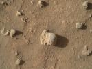
Sandstone Nodule Beside 'Naukluft Plateau' on Mount Sharp, Mars
Full Resolution:
TIFF
(5.785 MB)
JPEG
(491.8 kB)
2016-03-14
Mars
2001 Mars Odyssey
THEMIS
852x1611x3
PIA20426:
Terra Sirenum - False Color
Full Resolution:
TIFF
(2.608 MB)
JPEG
(114.2 kB)
2016-03-15
Mars
2001 Mars Odyssey
THEMIS
797x1590x3
PIA20427:
Terra Sirenum - False Color
Full Resolution:
TIFF
(2.447 MB)
JPEG
(144.7 kB)
1-100
101-200
201-300
301-400
401-500
501-600
601-700
701-800
801-900
901-1000
Currently displaying images:
9301 - 9400
of 12760


