PDS logoPlanetary Data System
PDS Information
Find a Node - Use these links to navigate to any of the 8 publicly accessible PDS Nodes.

This bar indicates that you are within the PDS enterprise which includes 6 science discipline nodes and 2 support nodes which are overseen by the Project Management Office at NASA's Goddard Space Flight Center (GSFC). Each node is led by an expert in the subject discipline, supported by an advisory group of other practitioners of that discipline, and subject to selection and approval under a regular NASA Research Announcement.
Click here to return to the Photojournal Home Page Click here to view a list of Photojournal Image Galleries Photojournal_inner_header
Latest Images  |  Spacecraft & Technology  |  Animations  |  Space Images App  |  Feedback  |  Photojournal Search  

PIA20339: Erosion and Deposition in Schaeberle Crater
 Target Name:  Mars
 Is a satellite of:  Sol (our sun)
 Mission:  Mars Reconnaissance Orbiter (MRO)
 Spacecraft:  Mars Reconnaissance Orbiter (MRO)
 Instrument:  HiRISE
 Product Size:  2880 x 1800 pixels (w x h)
 Produced By:  University of Arizona/HiRISE-LPL
 Other  
Information: 
Other products from ESP_042527_1555
 Full-Res TIFF:  PIA20339.tif (15.56 MB)
 Full-Res JPEG:  PIA20339.jpg (820.8 kB)

Click on the image above to download a moderately sized image in JPEG format (possibly reduced in size from original)

Original Caption Released with Image:

Click here for larger version of PIA20339
Map Projected Browse Image
Click on the image for larger version

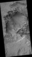
Schaeberle Crater is a large, heavily-infilled crater with many interesting features. This image shows a window into the crater fill deposit, showcasing eroding bedrock and aeolian landforms.

This pit is located near the geometric center of our image, making it a central pit crater. Central pit craters are thought to form from impact melt draining through subsurface cracks in the deepest part of the crater shortly following impact.

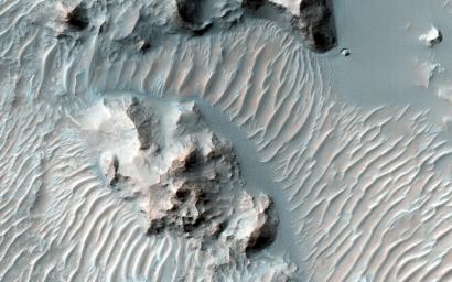
A closeup image shows light-toned bedrock and a small cliff that appears to be weathering away. Below the cliff there are several different types of aeolian features, including ripples and transverse aeolian ridges (TAR). The sand that forms the small, bluish ripples may be weathering out of the cliff face, in contrast to the larger, light-toned TAR which are thought to be currently inactive.

More of the TAR are visible in another closeup image. In this case, they are clearly covered by a dark, ripple-covered sand sheet. We have only imaged this location once, so it is impossible to determine whether or not the sand sheet is blowing in the wind. But due to repeated HiRISE imaging in other areas, active dunes are now known to be common across Mars and we can reasonably speculate that these dunes are moving, too.

The University of Arizona, Tucson, operates HiRISE, which was built by Ball Aerospace & Technologies Corp., Boulder, Colo. NASA's Jet Propulsion Laboratory, a division of the California Institute of Technology in Pasadena, manages the Mars Reconnaissance Orbiter Project for NASA's Science Mission Directorate, Washington.

Image Credit:
NASA/JPL-Caltech/Univ. of Arizona

Image Addition Date:
2016-01-14