Your search criteria found
12760
images
Target is Mars (and available satellites)
Go to PIAxxxxx:
Refine this list of images by:
Target:
Deimos
Mars
Phobos
Mission:
2001 Mars Odyssey
Antarctic Meteorite Location and Mapping Project (AMLAMP)
Dawn
ExoMars
Hubble Space Telescope
InSight
MAVEN
Mariner Mars 1964 (Mariner 4)
Mariner Mars 1969 (Mariner 7)
Mariner Mars 1971 (Mariner 9)
Mars 2020
Mars 2020 Rover
Mars Atmosphere and Volatile Evolution MissioN (MAVEN)
Mars Climate Orbiter
Mars Cube One (MarCO)
Mars Exploration Rover (MER)
Mars Express (MEX)
Mars Global Surveyor (MGS)
Mars Helicopter
Mars Pathfinder (MPF)
Mars Reconnaissance Orbiter (MRO)
Mars Sample Return
Mars Sample Return (MSR)
Mars Science Laboratory (MSL)
Phoenix
Rosetta
Viking
Spacecraft:
2001 Mars Odyssey
Curiosity
Dawn
InSight Mars Lander
Ingenuity
MAVEN
MarCO-B
Mariner 4
Mariner 7
Mariner 9
Mars Climate Orbiter
Mars Express (MEX)
Mars Express (MEX) Orbiter
Mars Global Surveyor Orbiter
Mars Pathfinder Lander
Mars Pathfinder Rover
Mars Reconnaissance Orbiter (MRO)
Mars Sample Return
Mars Science Laboratory (MSL)
NASA's Mars Pathfinder Lander
Opportunity
Perseverance
Philae Lander
Phoenix Lander
Phoenix Mars Lander
Spirit
Viking Lander 1
Viking Lander 2
Viking Orbiter 1
Viking Orbiter 2
Instrument:
Alpha Particle X-ray Spectrometer
Alpha Particle X-ray Spectrometer (MSL)
Atmospheric Structure / Meteorology Instrument
CHIMRA
Camera 1
Camera 2
Chemistry & Mineralogy (CheMin)
Chemistry and Camera (ChemCam)
Comet Infrared and Visible Analyser (CIVA
Compact Reconnaissance Imaging Spectrometer for Mars (CRISM)
Context Camera (CTX)
Deep Space Network
Descent Image Motion Estimation System (DIMES)
Dynamic Albedo of Neutrons
Dynamic Albedo of Neutrons (DAN)
Gamma Ray Spectrometer - Neutron Spectrometer
Gamma Ray Spectrometer Suite
Hazard Avoidance Camera
Hazard Avoidance Camera (M2020)
Hazard Avoidance Camera (MSL)
Heat and Physical Properties Package (HP3)
High Resolution Imaging Science Experiment (HiRISE)
High Resolution Instrument (HRI)
High Resolution Stereo Camera
Imager for Mars Pathfinder
Imaging Ultraviolet Spectrograph
Imaging Ultraviolet Spectrograph (IUVS)
Instrument Context Camera (ICC)
Instrument Deployment Camera (IDC)
Lander Vision System Camera (LCAM)
Magnetometer
Mars Advanced Radar for Subsurface and Ionosphere Sounding (MARSIS)
Mars Advanced Radar for Subsurface and Ionospheric Sounding (MARSIS)
Mars Climate Sounder (MCS)
Mars Color Imager (MARCI)
Mars Descent Imager
Mars Environmental Dynamics Analyzer (MEDA)
Mars Hand Lens Imager (MAHLI)
Mars Horizon Sensor Assembly
Mars Orbiter Camera (MOC)
Mars Orbiter Laser Altimeter
Mars Radiation Experiment
Mastcam
Mastcam-Z
Microscopic Imager
Microscopy Electrochemistry and Conductivity Analyzer (MECA)
Miniature Thermal Emission Spectrometer
Moessbauer Spectrometer
Navigation Camera
Navigation Camera (M2020)
Navigation Camera (MSL)
Neutral Gas and Ion Mass Spectrometer
Neutron Spectrometer
Optical Microscope
Optical Navigation Camera
Panoramic Camera
Planetary Instrument for X-ray Lithochemistry (PIXL)
Radar System
Radiation Assessment Detector (RAD)
Radio Science Subsystem
Robotic Arm
Robotic Arm (MSL)
Robotic Arm Camera (RAC)
Rock Abrasion Tool (RAT)
Rover Cameras
Rover Environmental Monitoring Station (REMS)
Sample Analysis at Mars (SAM)
Scanning Habitable Environments with Raman & Luminescence for Organics and Chemicals (SHERLOC)
Seismic Experiment for Interior Structure (SEIS)
Shallow Subsurface Radar (SHARAD)
Stereo Imager (SSI)
SuperCam
Surface Stereo Imager (SSI)
Thermal Emission Imaging System
Thermal Emission Spectrometer
Thermal and Electrical Conductivity Probe
Thermal and Evolved Gas Analyzer
Trace Gas Orbiter
Visual Imaging Subsystem
Visual Imaging Subsystem - Camera A
Visual Imaging Subsystem - Camera B
Wide Field Planetary Camera 2
Click on an image for detailed information
Click on a column heading to sort in ascending or descending order
My
List
Addition Date
Target
Mission
Instrument
Size
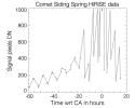
2014-10-23
Mars
MAVEN
Imaging Ultraviolet Spectrograph
6256x4479x3
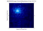
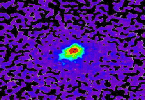
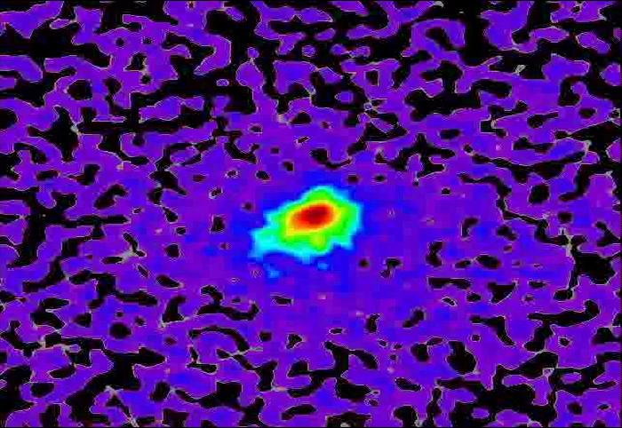
PIA18619:
MAVEN Ultraviolet Image of Comet Siding Spring's Hydrogen Coma
Full Resolution:
TIFF
(84.1 MB)
JPEG
(705.2 kB)
2014-10-23
Mars
2001 Mars Odyssey
THEMIS
1394x2951x1
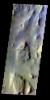
PIA18756:
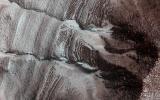
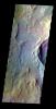
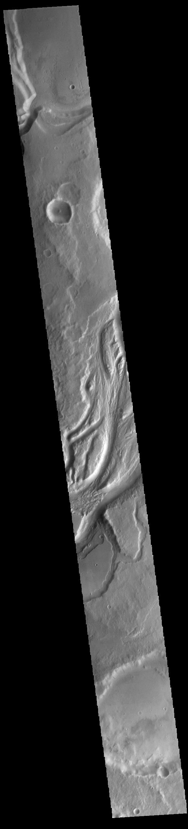
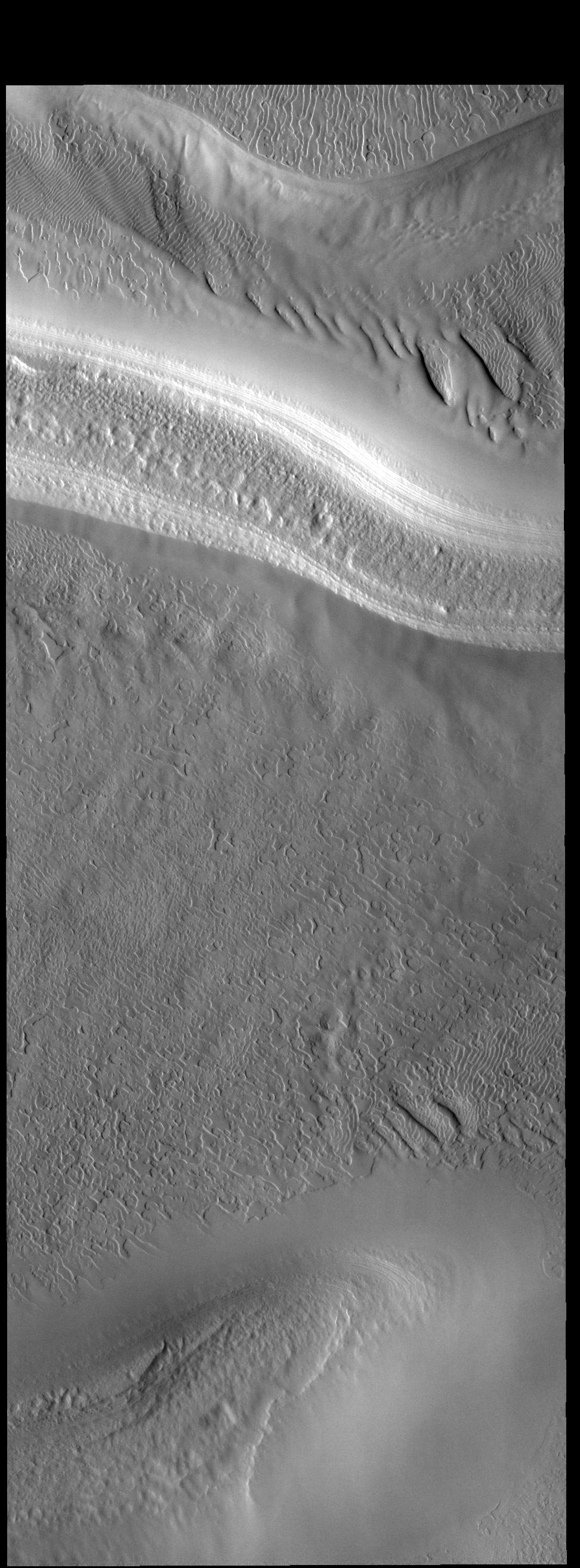
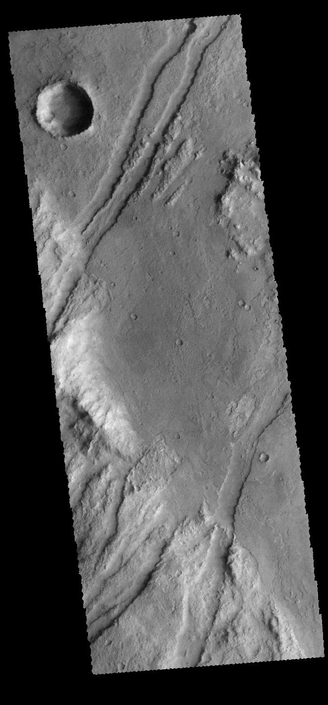
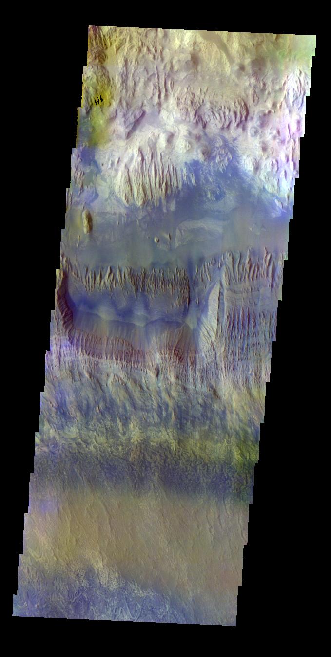
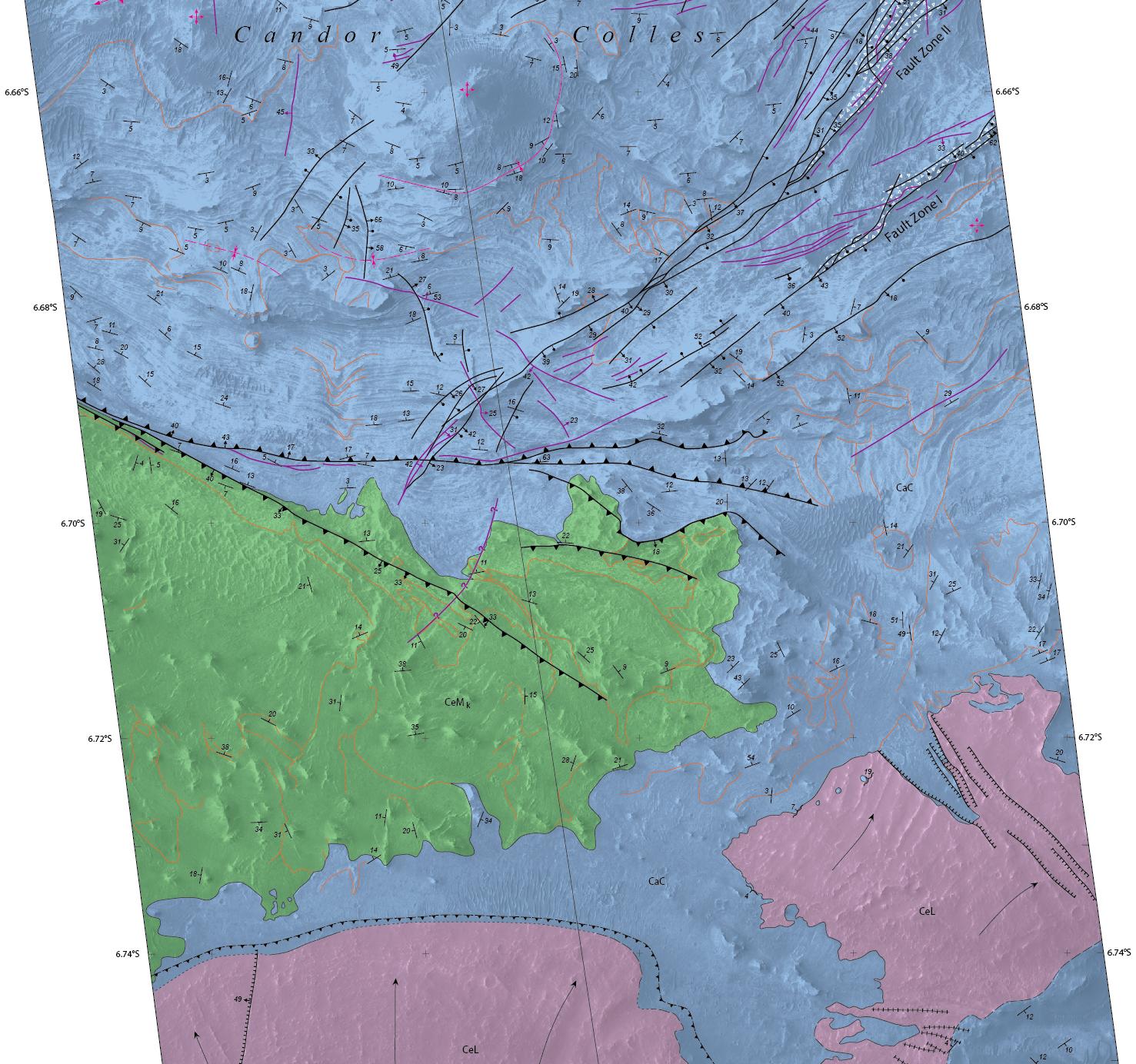
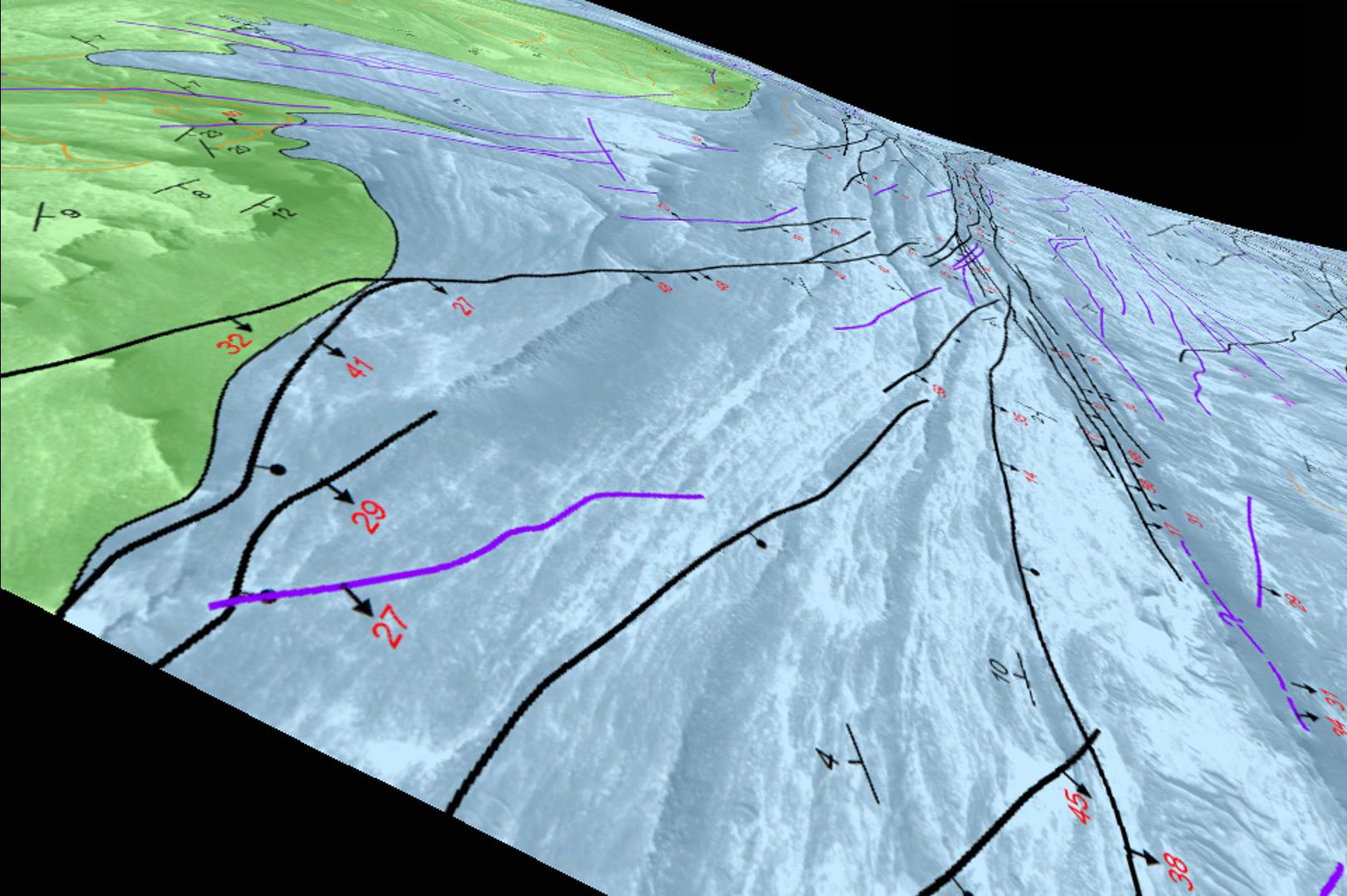
Candor Chasma
Full Resolution:
TIFF
(4.119 MB)
JPEG
(322.5 kB)
2014-10-23
Mars
Hubble Space Telescope
WFPC2
1167x876x3
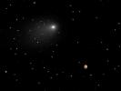
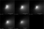
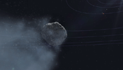
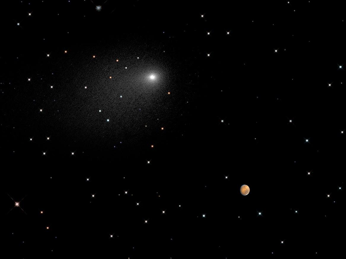
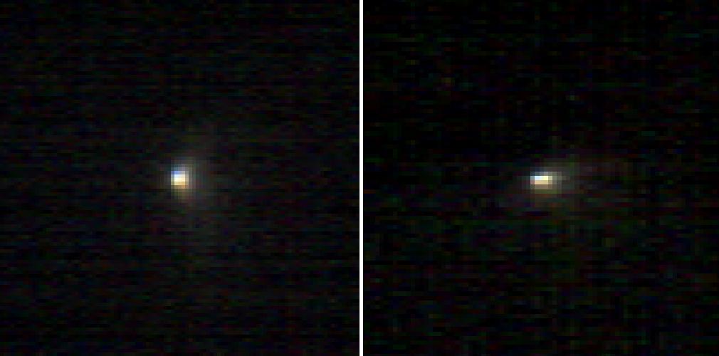
PIA17802:
Close Encounters: Comet Siding Spring Seen Next to Mars (Synthesized Image)
Full Resolution:
TIFF
(3.068 MB)
JPEG
(43.77 kB)
2014-10-24
Mars
2001 Mars Odyssey
THEMIS
1389x2959x1
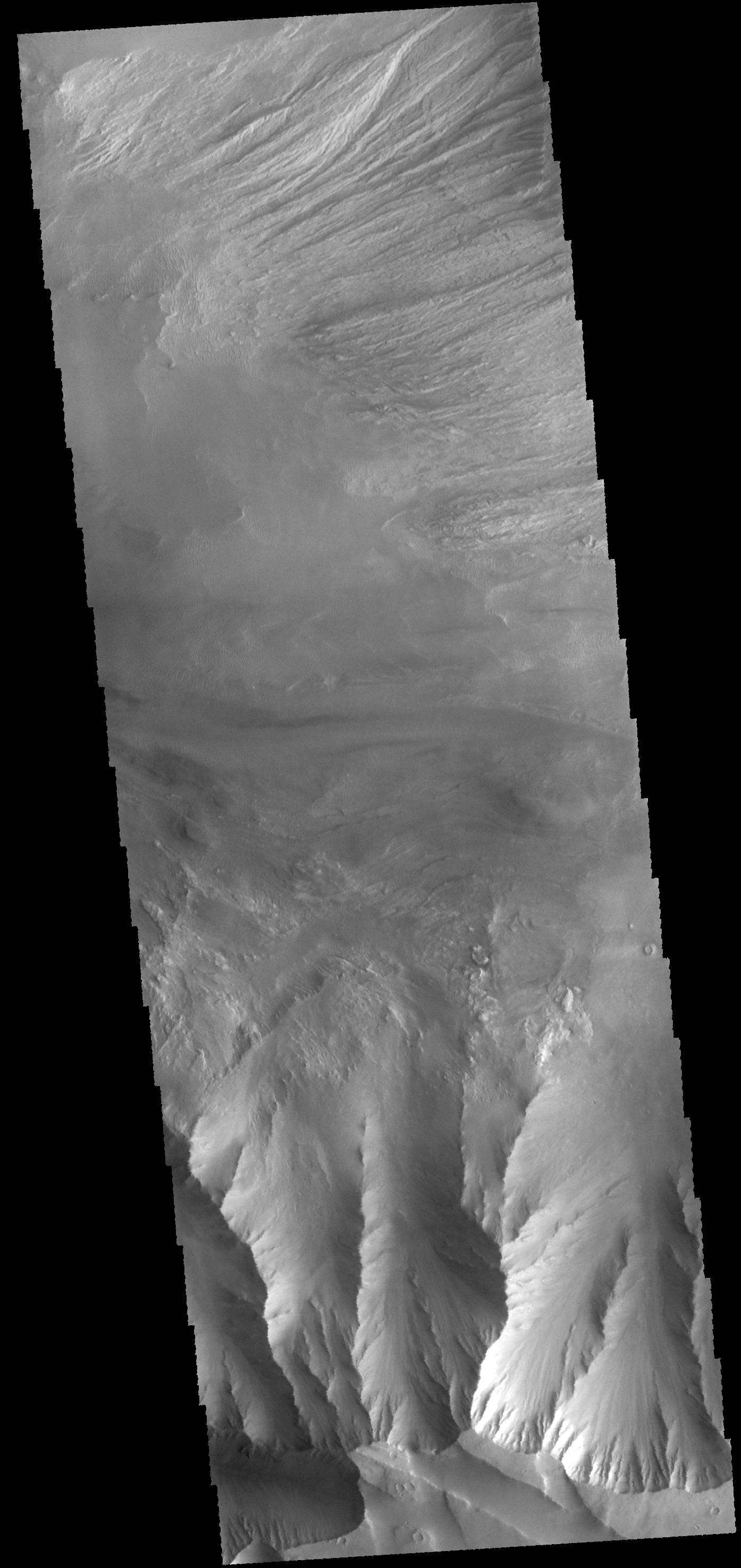
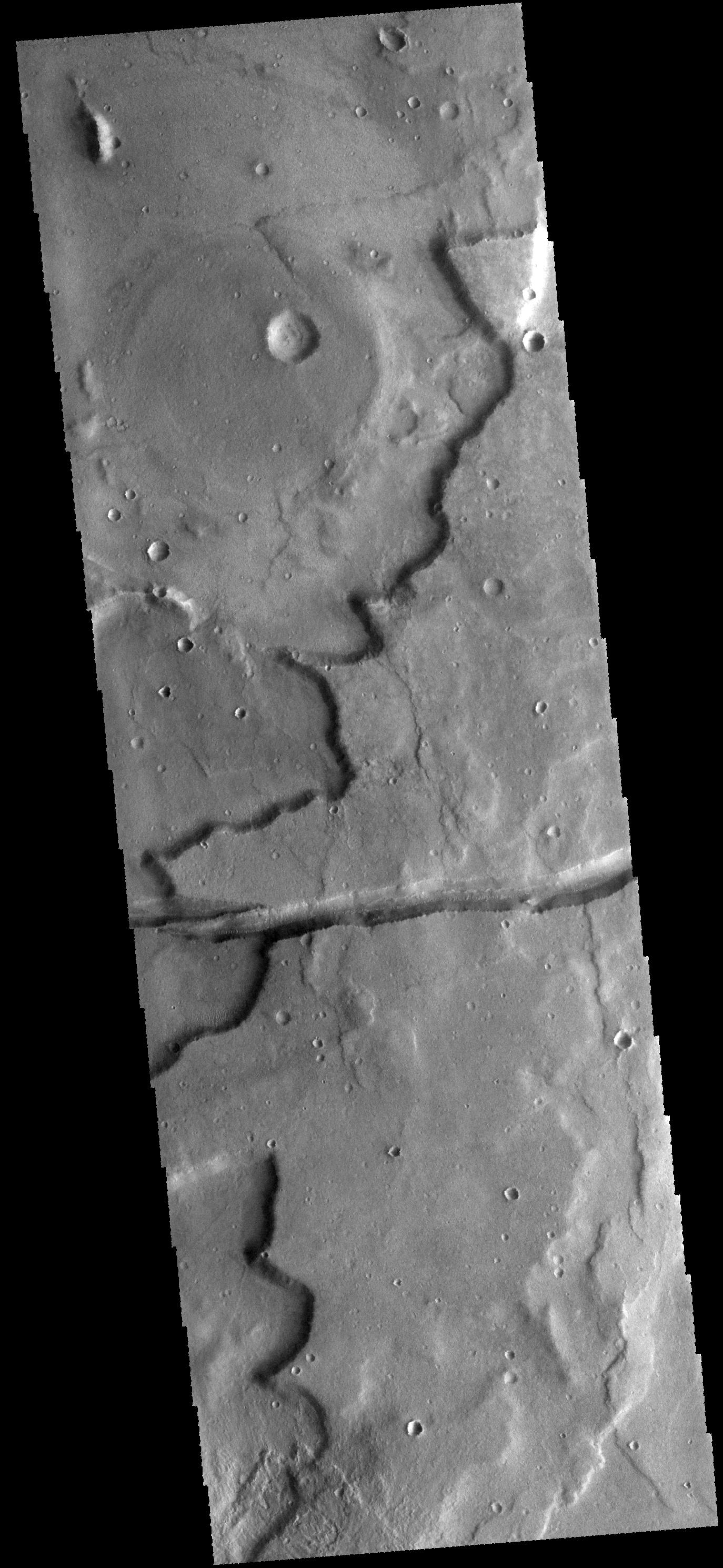
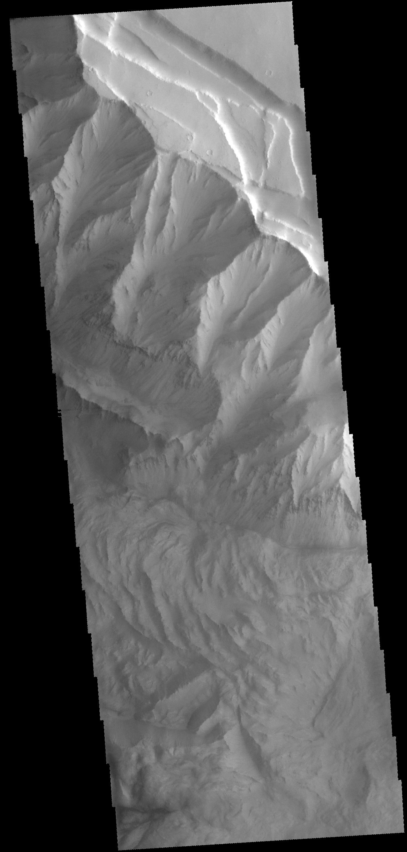
PIA18757:
Mangala Fossa
Full Resolution:
TIFF
(4.115 MB)
JPEG
(342.3 kB)
2014-10-24
Mars
Mars Reconnaissance Orbiter (MRO)
CRISM
1010x500x3
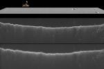
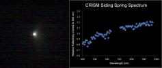
PIA15291:
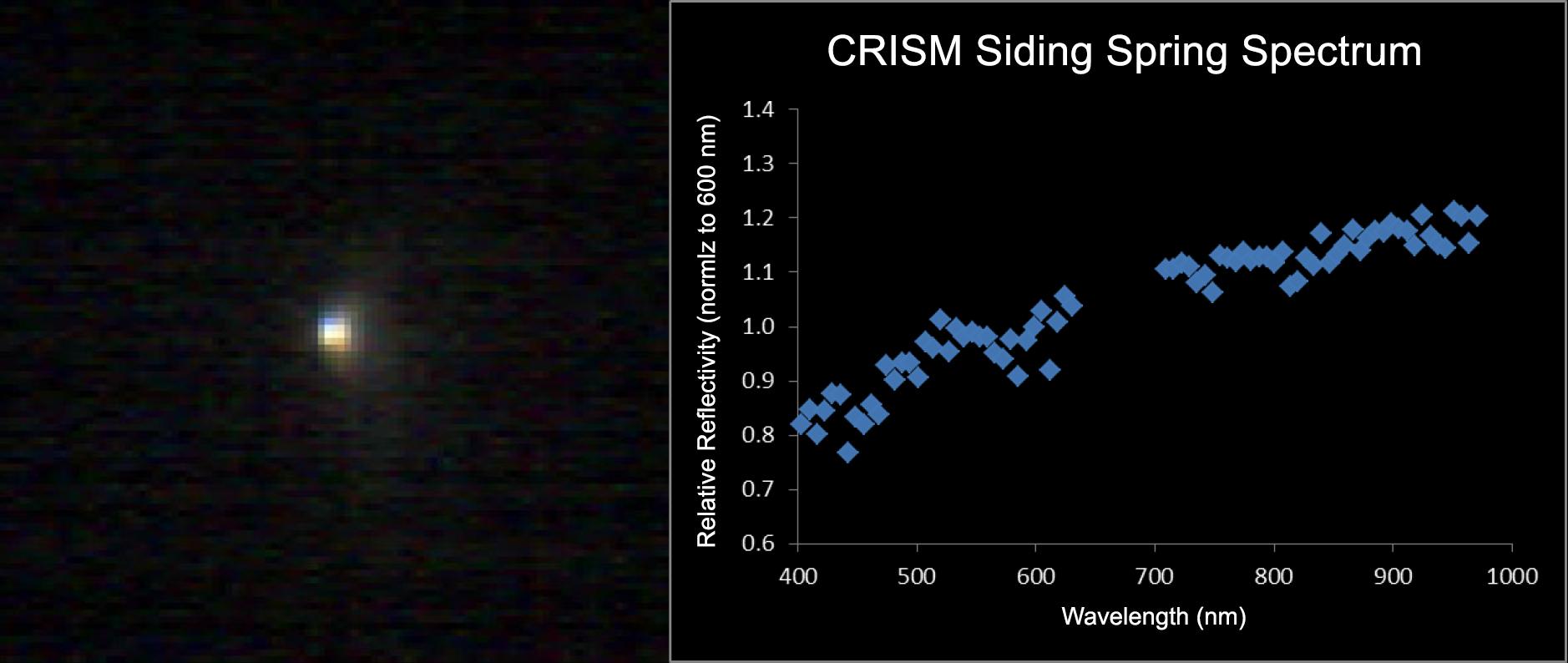
Images From Mars-Orbiting Spectrometer Show Comet's Coma
Full Resolution:
TIFF
(1.516 MB)
JPEG
(38.03 kB)
2014-10-27
Mars
2001 Mars Odyssey
THEMIS
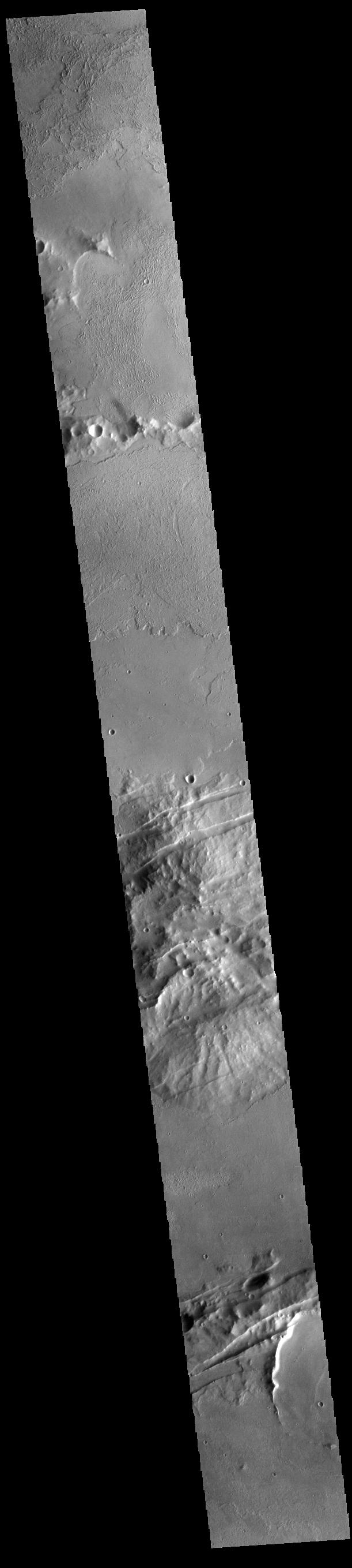
1374x2980x1
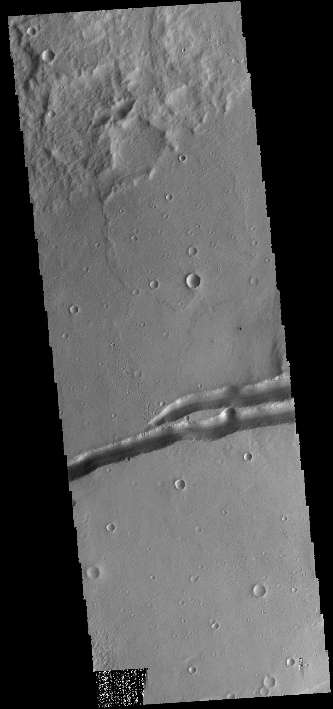
PIA18760:
Sirenum Fossae
Full Resolution:
TIFF
(4.1 MB)
JPEG
(463 kB)
2014-10-28
Mars
2001 Mars Odyssey
THEMIS
986x2626x1
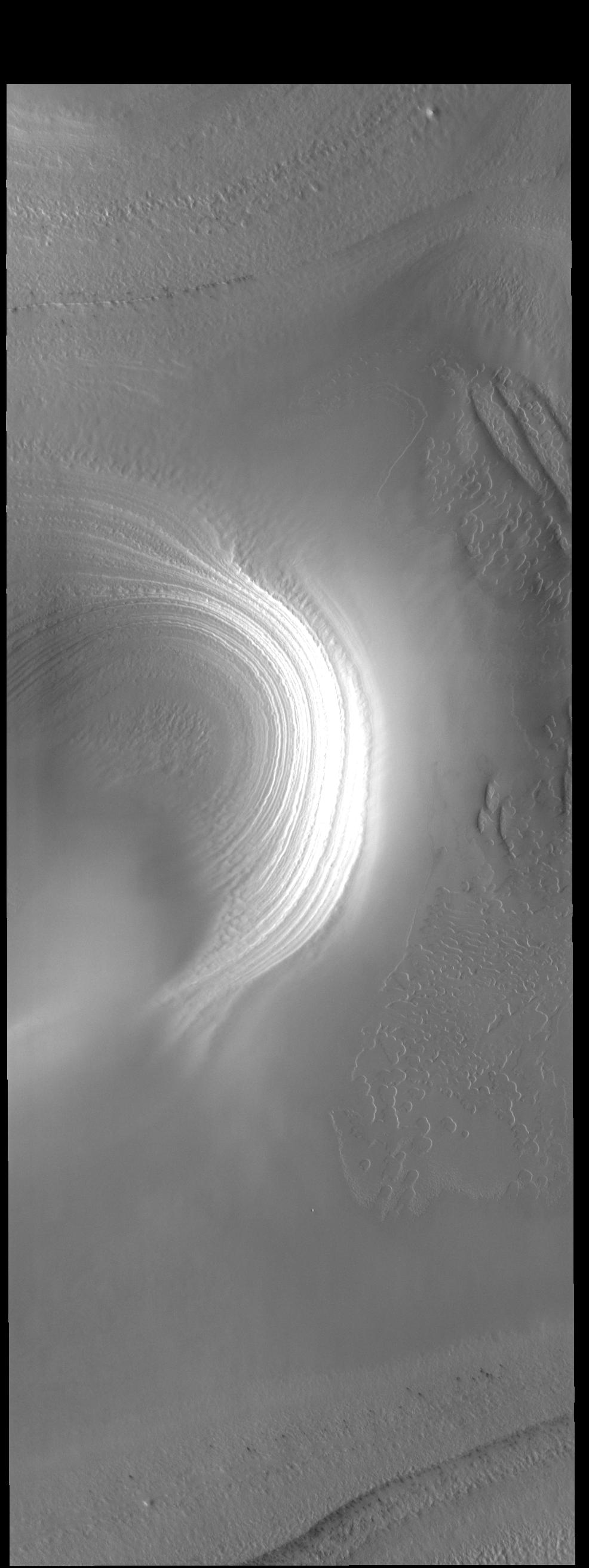
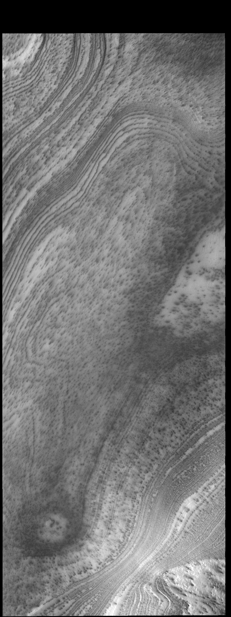
PIA18763:
South Pole Layers
Full Resolution:
TIFF
(2.592 MB)
JPEG
(179 kB)
2014-10-29
Mars
2001 Mars Odyssey
THEMIS
1400x2949x1
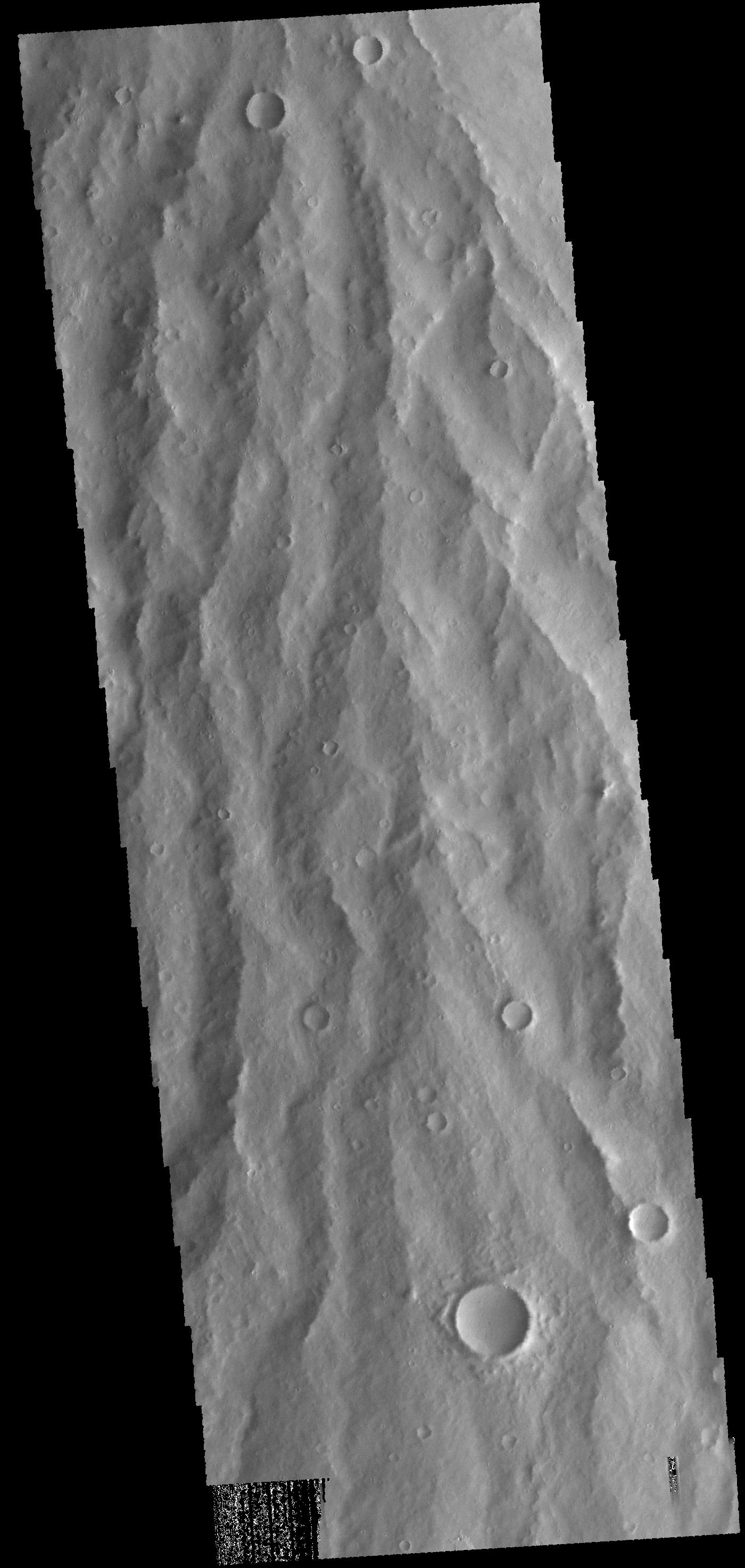
PIA18765:
Apollinaris Mons
Full Resolution:
TIFF
(4.134 MB)
JPEG
(326.8 kB)
2014-10-29
Mars
Mars Reconnaissance Orbiter (MRO)
HiRISE
2880x1800x1
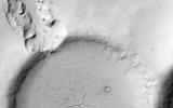
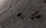
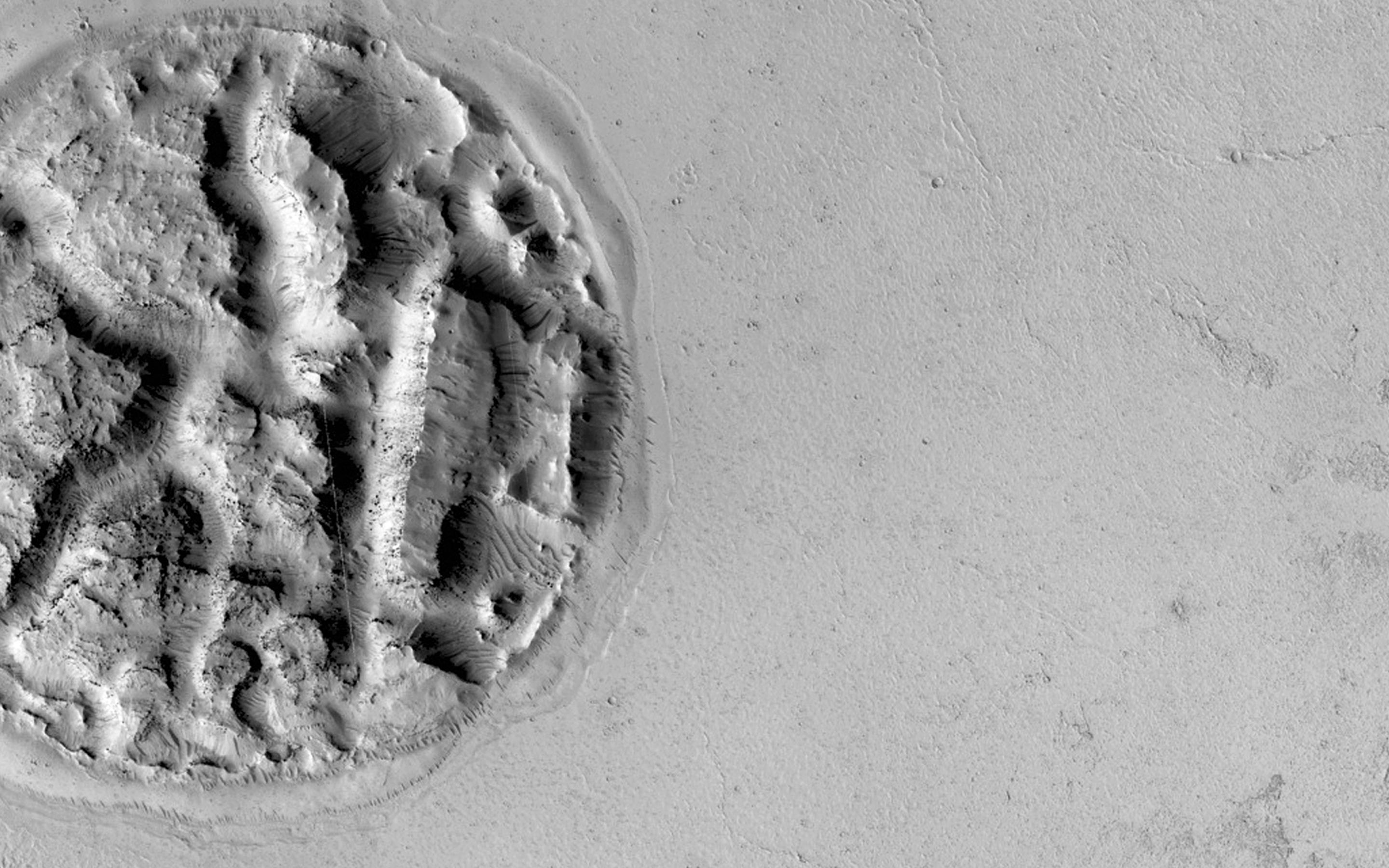
PIA18887:
Which Way is Up?
Full Resolution:
TIFF
(5.191 MB)
JPEG
(506.4 kB)
2014-10-29
Mars
Mars Reconnaissance Orbiter (MRO)
HiRISE
2880x1800x3
PIA18888:
Search for the Mars 2 Debris Field
Full Resolution:
TIFF
(15.56 MB)
JPEG
(1.2 MB)
2014-10-29
Mars
Mars Reconnaissance Orbiter (MRO)
HiRISE
2880x1800x3
PIA18889:
Sand Sources Near Athabasca Valles
Full Resolution:
TIFF
(15.56 MB)
JPEG
(844.8 kB)
2014-10-29
Mars
Mars Reconnaissance Orbiter (MRO)
HiRISE
2880x1800x3
PIA18890:
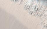
Hardened Dunes in Arcadia Planitia
Full Resolution:
TIFF
(15.56 MB)
JPEG
(968.1 kB)
2014-10-30
Mars
2001 Mars Odyssey
THEMIS
1374x2980x1
PIA18767:
Sirenum Fossae
Full Resolution:
TIFF
(4.1 MB)
JPEG
(463 kB)
2014-10-31
Mars
2001 Mars Odyssey
THEMIS
1389x2959x1
PIA18768:
Memnonia Fossae
Full Resolution:
TIFF
(4.115 MB)
JPEG
(342.3 kB)
2014-11-03
Mars
2001 Mars Odyssey
THEMIS
1408x2946x1
PIA18769:
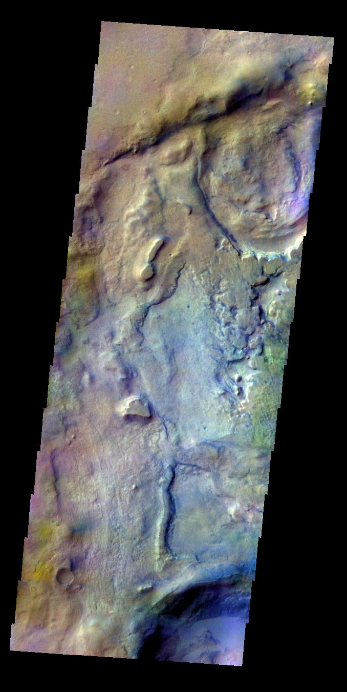
Ophir Chasma
Full Resolution:
TIFF
(4.153 MB)
JPEG
(253 kB)
2014-11-04
Mars
2001 Mars Odyssey
THEMIS
985x2623x1
PIA18770:
South Polar Layers
Full Resolution:
TIFF
(2.586 MB)
JPEG
(317 kB)
2014-11-04
Mars
Mars Science Laboratory (MSL)
Mastcam
1344x1200x3
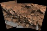
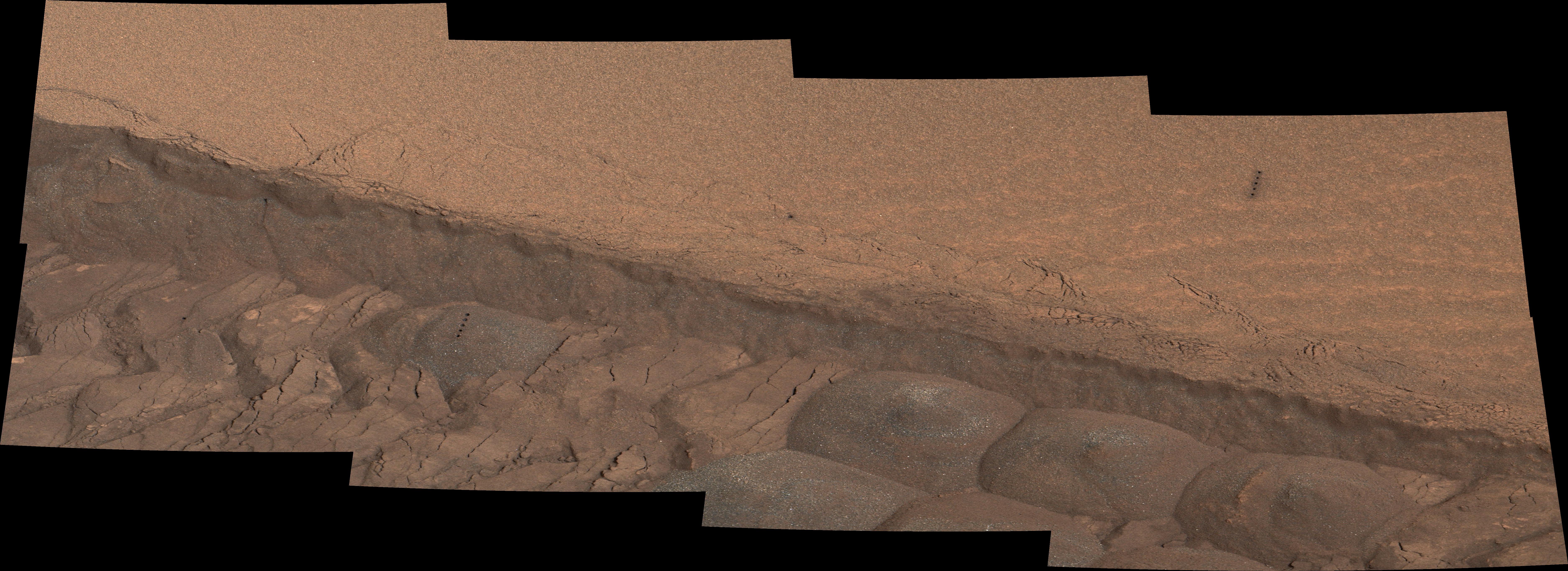
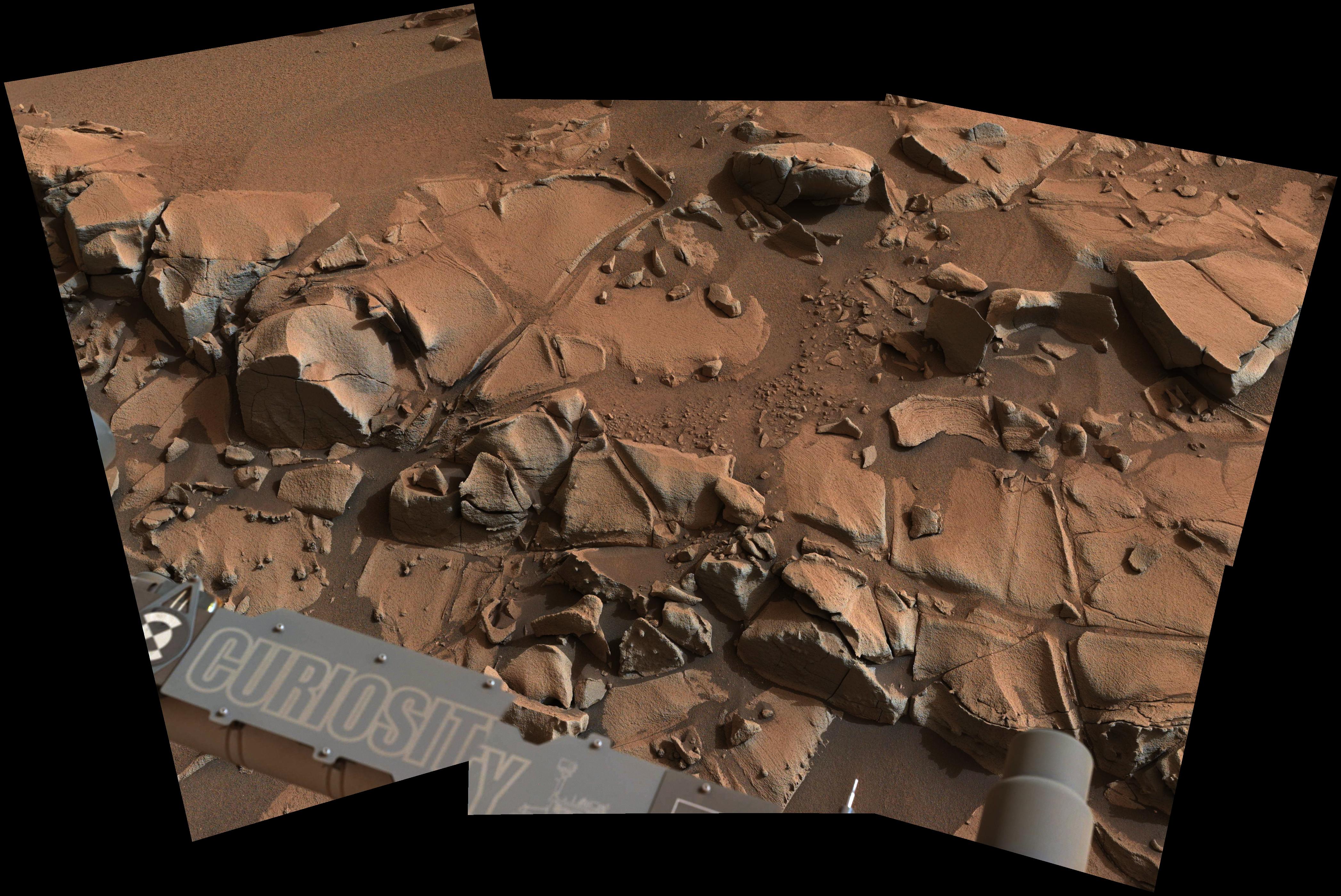
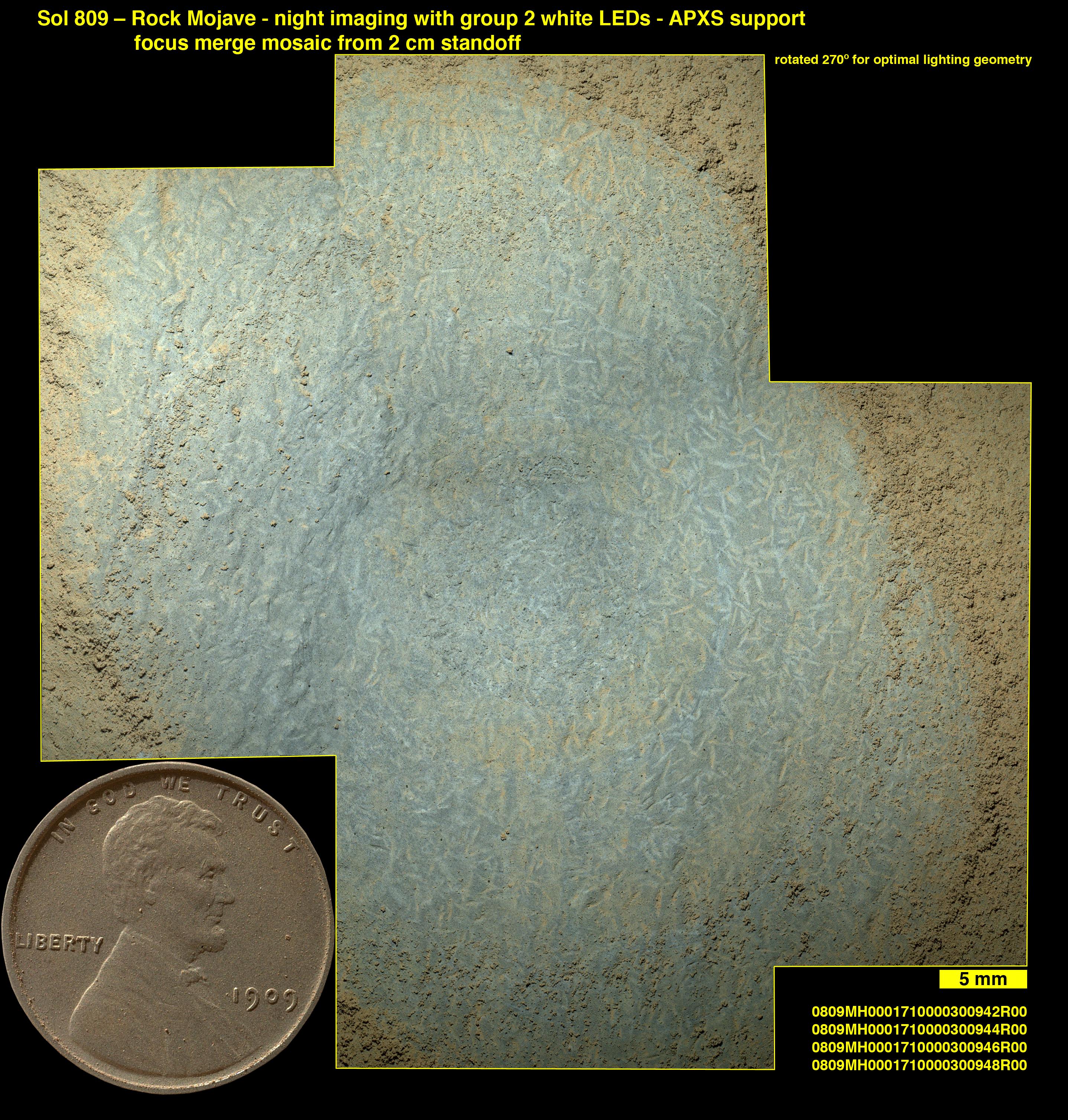
PIA19036:
'Confidence Hills' -- The First Mount Sharp Drilling Site
Full Resolution:
TIFF
(4.84 MB)
JPEG
(233.4 kB)
2014-11-04
Mars
Mars Science Laboratory (MSL)
Mastcam
768x768x3
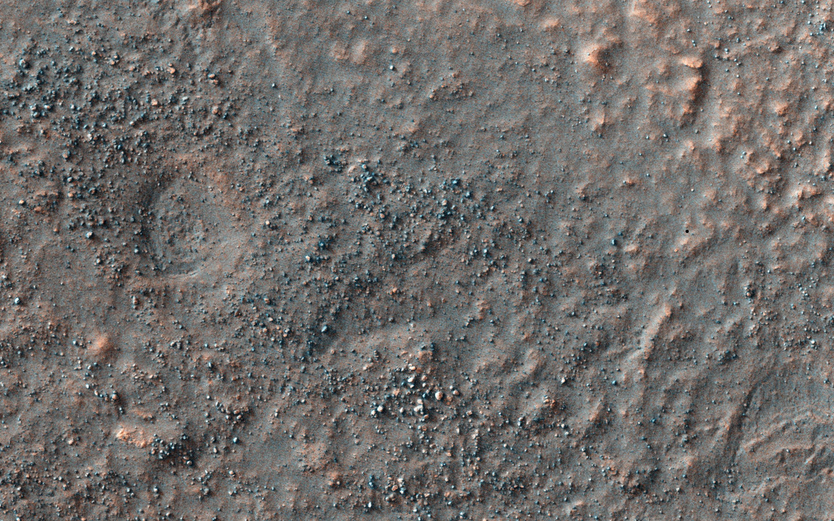
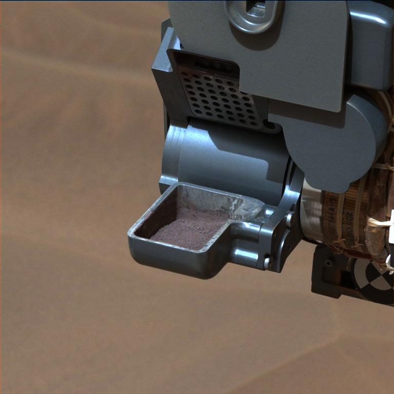
PIA19037:
'Confidence Hills' Drill Powder in Scoop
Full Resolution:
TIFF
(1.77 MB)
JPEG
(48.85 kB)
2014-11-04
Mars
Mars Science Laboratory (MSL)
CheMin
912x498x3
PIA19038:
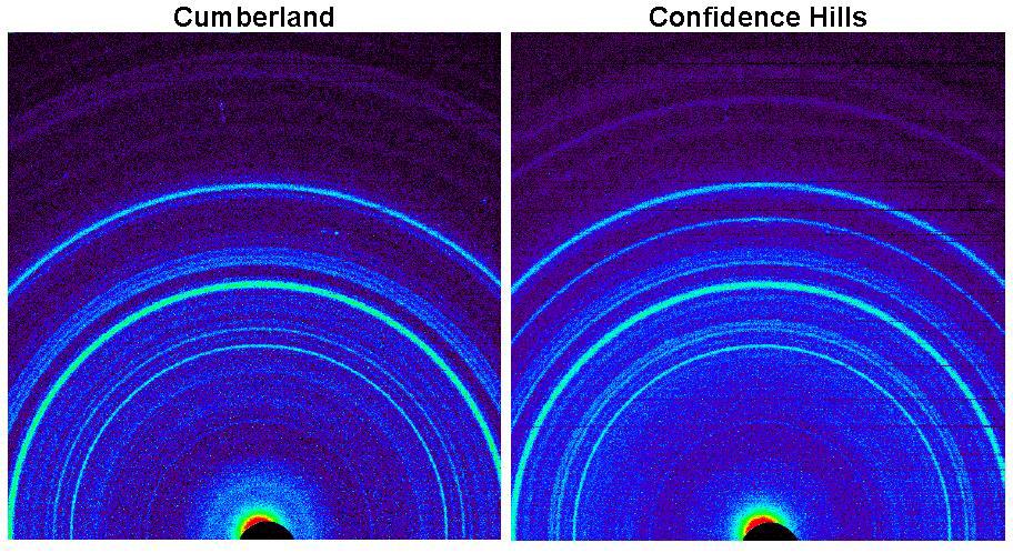
Signature of Hematite in 'Confidence Hills' Martian Rock
Full Resolution:
TIFF
(1.363 MB)
JPEG
(142.3 kB)
2014-11-04
Mars
Mars Science Laboratory (MSL)
Mastcam
4067x2184x3
PIA19039:
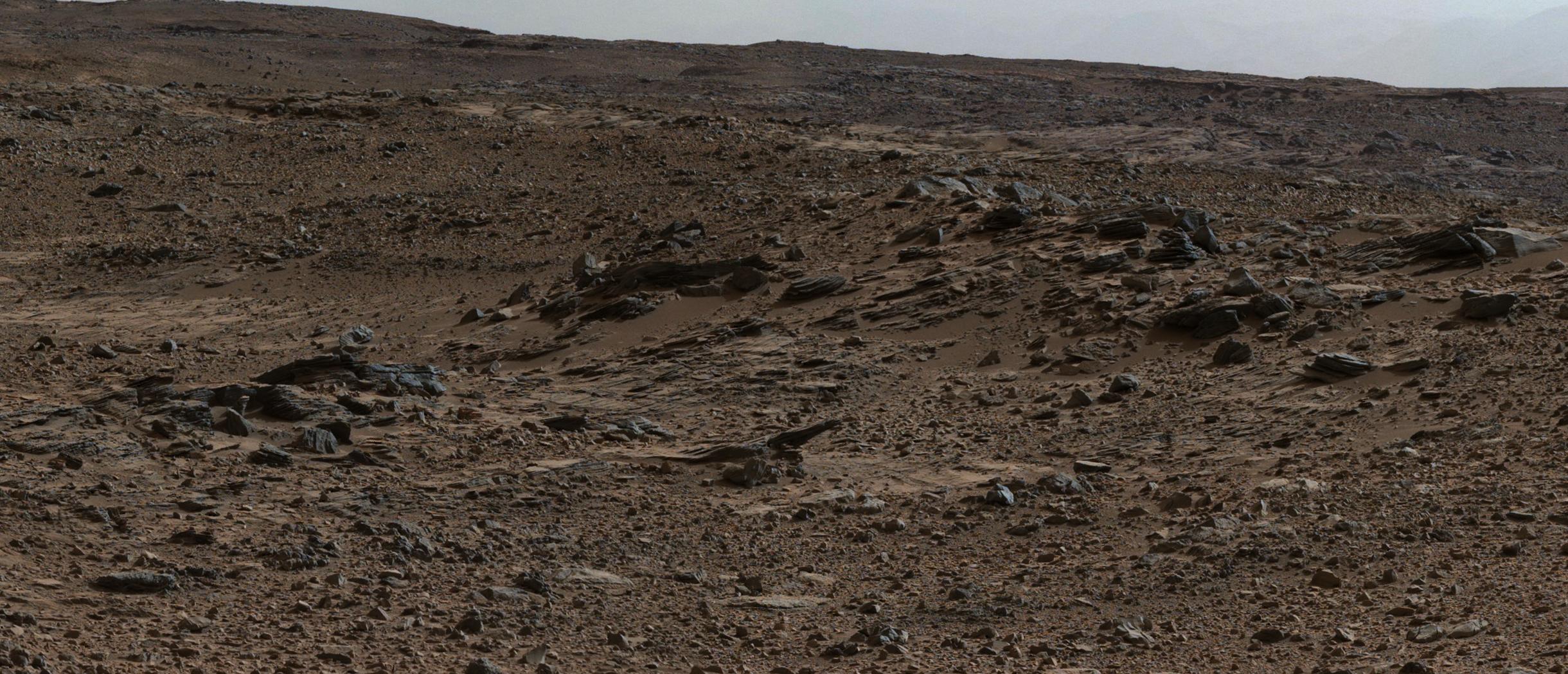
Mars Rover Curiosity's Walkabout at 'Pahrump Hills'
Full Resolution:
TIFF
(26.66 MB)
JPEG
(1.645 MB)
2014-11-05
Mars
2001 Mars Odyssey
THEMIS
615x2711x1
PIA18936:
Tithonium and Ius Chasmata
Full Resolution:
TIFF
(1.669 MB)
JPEG
(73.71 kB)
2014-11-06
Mars
Mars Science Laboratory (MSL)
Mastcam
2040x1200x1
PIA19043:
Mars Curiosity Rover Views Comet Siding Spring
Full Resolution:
TIFF
(2.451 MB)
JPEG
(339.8 kB)
2014-11-06
Mars
2001 Mars Odyssey
THEMIS
611x2717x1
PIA18937:
Volcanics and Tectonics
Full Resolution:
TIFF
(1.662 MB)
JPEG
(124.7 kB)
2014-11-07
Mars
2001 Mars Odyssey
THEMIS
670x1417x1
PIA18940:
Solis Planum
Full Resolution:
TIFF
(950.6 kB)
JPEG
(138.9 kB)
2014-11-07
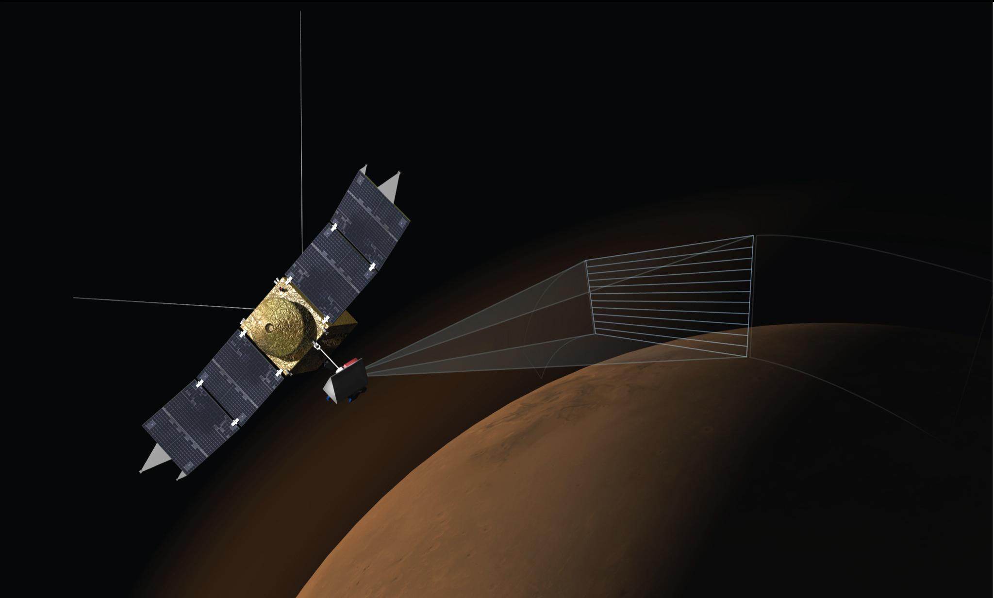
Mars
MAVEN
2048x1232x3
PIA18856:
Artist's Concept of MAVEN's Imaging Ultraviolet Spectrograph at Work
Full Resolution:
TIFF
(7.572 MB)
JPEG
(94.7 kB)
2014-11-07
Mars
MAVEN
2048x1536x3
PIA18857:
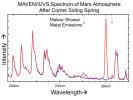
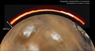
Comet Meteor Shower Put Magnesium and Iron into Martian Atmosphere
Full Resolution:
TIFF
(9.44 MB)
JPEG
(208.1 kB)
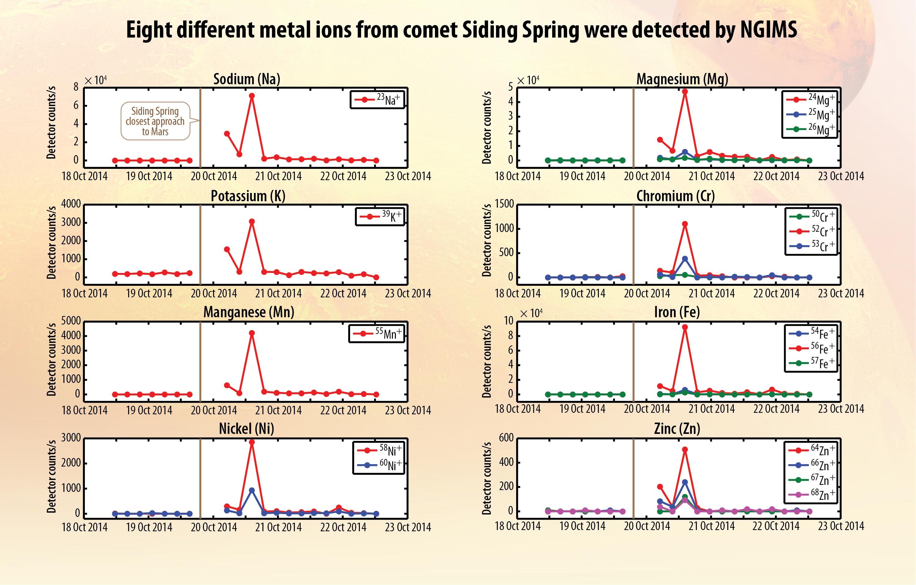
2014-11-07
Mars
MAVEN
Neutral Gas and Ion Mass Spectrometer
3001x1916x3
PIA18858:
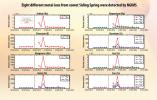
Ions of Eight Metals from Comet Dust Detected in Mars Atmosphere
Full Resolution:
TIFF
(17.26 MB)
JPEG
(533.5 kB)
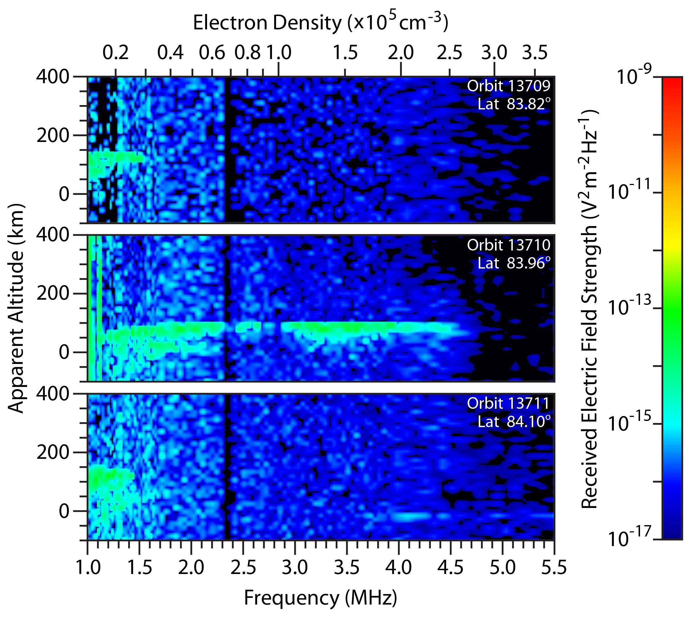
2014-11-07
Mars
Mars Express (MEX)
Mars Advanced Radar for Subsurface and Ionosphere Sounding (MARSIS)
2373x2138x3
PIA18859:
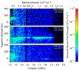
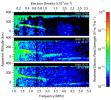
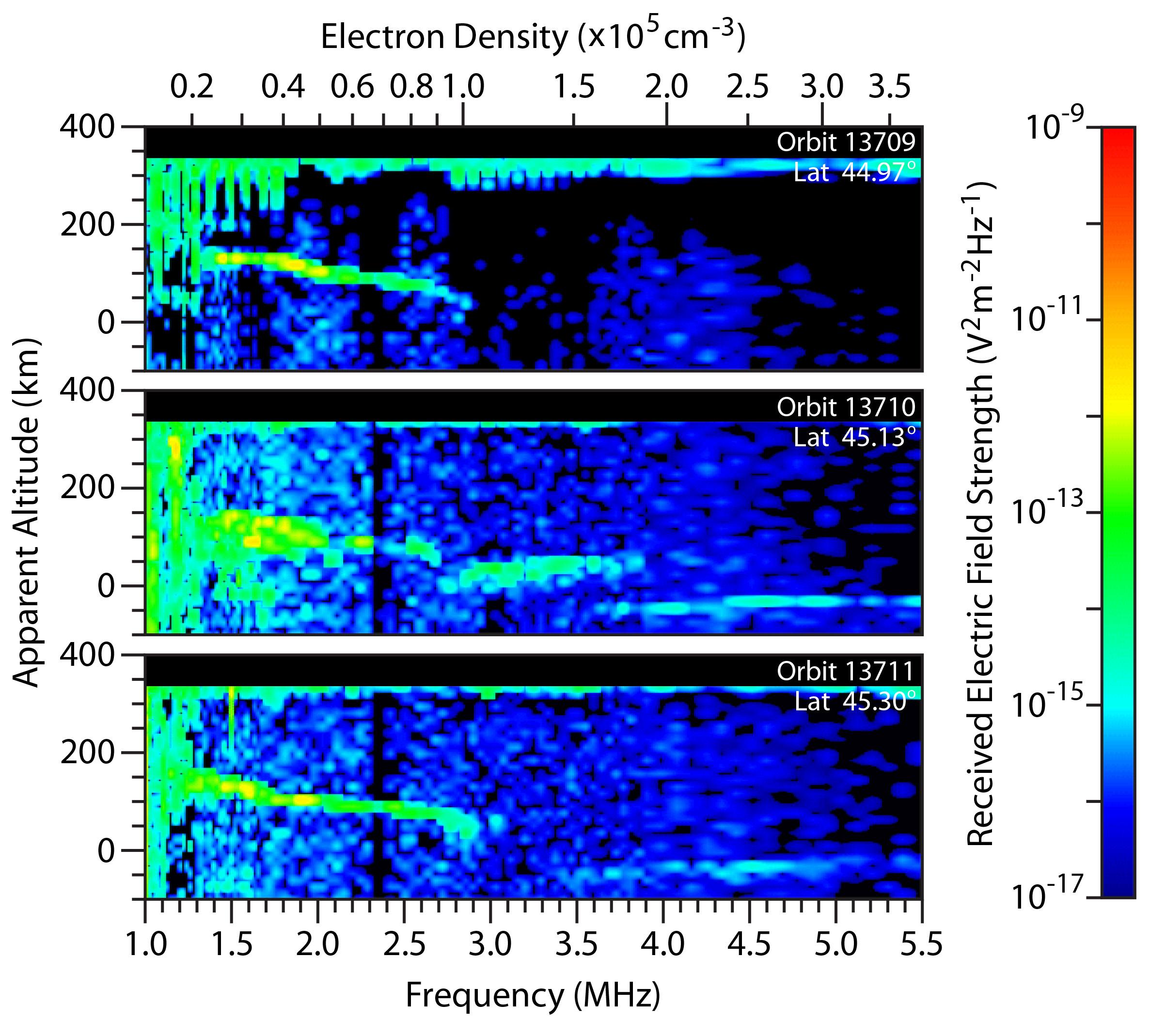
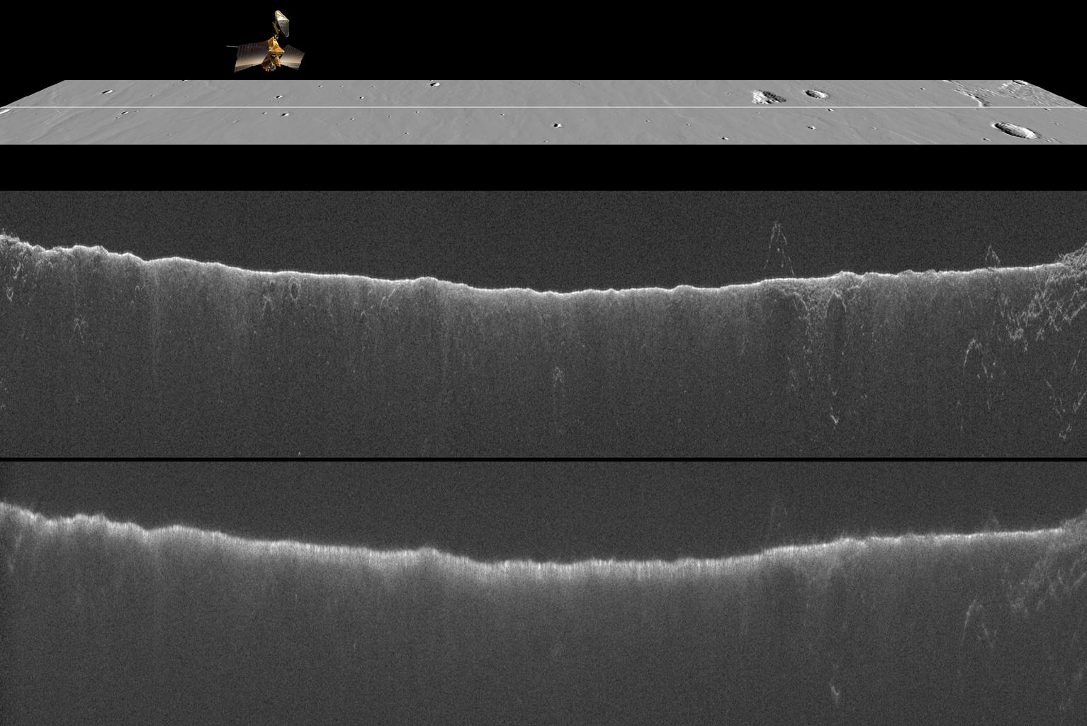
Radar-Detected Change in Martian Near-Polar Ionosphere After Comet's Flyby
Full Resolution:
TIFF
(15.23 MB)
JPEG
(513 kB)
2014-11-07
Mars
Mars Express (MEX)
Mars Advanced Radar for Subsurface and Ionosphere Sounding (MARSIS)
2373x2138x3
PIA18860:
Change in Mars' Mid-Latitude Ionosphere After Comet Flyby
Full Resolution:
TIFF
(15.23 MB)
JPEG
(494.5 kB)
2014-11-07
Mars
Mars Reconnaissance Orbiter (MRO)
Shallow Subsurface Radar (SHARAD)
1534x1024x3
PIA18861:
Radar Indication of Effect of Comet Flyby on Martian Ionosphere
Full Resolution:
TIFF
(4.714 MB)
JPEG
(192.9 kB)
2014-11-07
Mars
Mars Reconnaissance Orbiter (MRO)
HiRISE
973x779x3
PIA18862:
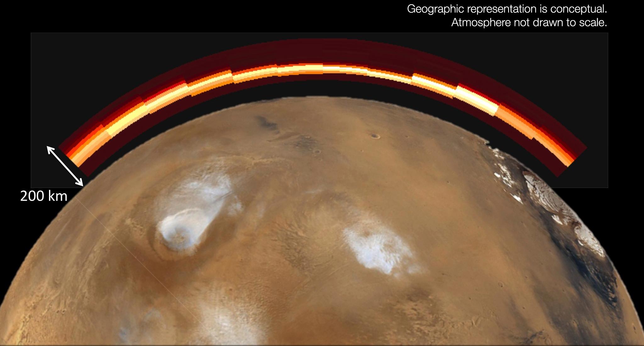
Brightness Rhythm of Mars Flyby Comet Is Clue to Rotation Rate
Full Resolution:
TIFF
(759 kB)
JPEG
(58.15 kB)
2014-11-07
Mars
Mars Reconnaissance Orbiter (MRO)
HiRISE
1692x1128x1
PIA18863:
Mars Orbiter Sizes Up Passing Comet
Full Resolution:
TIFF
(1.911 MB)
JPEG
(66.52 kB)
2014-11-07
Mars
MAVEN
Imaging Ultraviolet Spectrograph (IUVS)
2048x1101x3
PIA18864:
Emission from Ionized Magnesium in Mars' Atmosphere After Comet Flyby
Full Resolution:
TIFF
(6.767 MB)
JPEG
(150.6 kB)
2014-11-07
Mars
Mars Reconnaissance Orbiter (MRO)
CRISM
1878x794x3
PIA18865:
Mars-Orbiting Spectrometer Shows Dusty Comet's Spectrum
Full Resolution:
TIFF
(4.475 MB)
JPEG
(94.77 kB)
2014-11-07
Mars
Mars Reconnaissance Orbiter (MRO)
HiRISE
700x482x3
PIA19044:
Mars-Flyby Comet in False Color
Full Resolution:
TIFF
(1.013 MB)
JPEG
(77.35 kB)
2014-11-07
Mars
Mars Reconnaissance Orbiter (MRO)
HiRISE
1267x719x3
PIA19045:
Mars Orbiter Observes Comet Siding Spring (Animation)
Full Resolution:
TIFF
(2.734 MB)
JPEG
(36.37 kB)
2014-11-10
Mars
2001 Mars Odyssey
THEMIS
530x5434x1
PIA18941:
Cavi Angusti
Full Resolution:
TIFF
(2.883 MB)
JPEG
(199 kB)
2014-11-10
Mars
Mars Exploration Rover (MER)
MAVEN
Navigation Camera
1024x1024x1
PIA18866:
Image Relayed by MAVEN Mars Orbiter from Curiosity Mars Rover
Full Resolution:
TIFF
(1.05 MB)
JPEG
(255.2 kB)
2014-11-11
Mars
2001 Mars Odyssey
THEMIS
998x2643x1
PIA18942:
Angustus Laybrinthus
Full Resolution:
TIFF
(2.641 MB)
JPEG
(163.6 kB)
2014-11-12
Mars
2001 Mars Odyssey
THEMIS
498x1405x1
PIA18947:
Angustus Labyrinthus 2
Full Resolution:
TIFF
(700.6 kB)
JPEG
(60.94 kB)
2014-11-13
Mars
2001 Mars Odyssey
THEMIS
617x2714x1
PIA18948:
Mangala Valles
Full Resolution:
TIFF
(1.676 MB)
JPEG
(99.34 kB)
2014-11-13
Mars
Mars Reconnaissance Orbiter (MRO)
HiRISE
2880x1800x3
PIA18892:
Spring in Inca City I
Full Resolution:
TIFF
(15.56 MB)
JPEG
(748.4 kB)
2014-11-13
Mars
Mars Reconnaissance Orbiter (MRO)
HiRISE
2880x1800x3
PIA18893:
Spring in Inca City II
Full Resolution:
TIFF
(15.56 MB)
JPEG
(680.1 kB)
2014-11-13
Mars
Mars Reconnaissance Orbiter (MRO)
HiRISE
2880x1800x3
PIA18894:
Spring in Inca City III
Full Resolution:
TIFF
(15.56 MB)
JPEG
(730.6 kB)
2014-11-13
Mars
Mars Reconnaissance Orbiter (MRO)
HiRISE
2880x1800x3
PIA18895:
Spring in Inca City IV
Full Resolution:
TIFF
(15.56 MB)
JPEG
(667.2 kB)
2014-11-13
Mars
Mars Reconnaissance Orbiter (MRO)
HiRISE
2880x1800x3
PIA18896:
Spring in Inca City V
Full Resolution:
TIFF
(15.56 MB)
JPEG
(452.8 kB)
2014-11-14
Mars
2001 Mars Odyssey
THEMIS
486x1396x1
PIA18949:
South Polar Textures
Full Resolution:
TIFF
(679.4 kB)
JPEG
(179.1 kB)
2014-11-17
Mars
2001 Mars Odyssey
THEMIS
1330x2688x1
PIA18952:
Lohse Crater
Full Resolution:
TIFF
(3.579 MB)
JPEG
(276.6 kB)
2014-11-18
Mars
2001 Mars Odyssey
THEMIS
1317x2676x1
PIA18953:
Claritas Fossae
Full Resolution:
TIFF
(3.528 MB)
JPEG
(331.9 kB)
2014-11-18
Mars
Mars Exploration Rover (MER)
Microscopic Imager
1760x1069x1
PIA18885:
Clues to Wet History in Texture of a Martian Rock
Full Resolution:
TIFF
(1.884 MB)
JPEG
(198.2 kB)
2014-11-18
Mars
Mars Science Laboratory (MSL)
Mastcam
3528x1304x3
PIA18880:
Erosion Resistance at 'Pink Cliffs' at Base of Martian Mount Sharp
Full Resolution:
TIFF
(13.81 MB)
JPEG
(1.094 MB)
2014-11-18
Mars
Mars Science Laboratory (MSL)
Mastcam
4185x2801x3
PIA18881:
Fine-Grained, Finely Layered Rock at Base of Martian Mount Sharp
Full Resolution:
TIFF
(35.19 MB)
JPEG
(1.45 MB)
2014-11-18
Mars
Mars Science Laboratory (MSL)
Mastcam
7501x2733x3
PIA18882:
Ripple's Interior Exposed by Rover Wheel Track
Full Resolution:
TIFF
(61.52 MB)
JPEG
(2.514 MB)
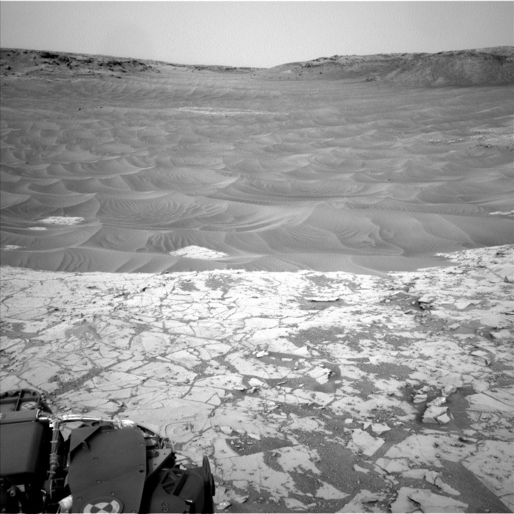
2014-11-18
Mars
Mars Science Laboratory (MSL)
Navcam (MSL)
1024x1024x1
PIA18883:
Ripples Beside 'Pahrump Hills' Outcrop at Base of Mount Sharp
Full Resolution:
TIFF
(1.05 MB)
JPEG
(179.2 kB)
2014-11-19
Mars
2001 Mars Odyssey
THEMIS
1326x2680x1
PIA18954:
Reull Vallis
Full Resolution:
TIFF
(3.557 MB)
JPEG
(358 kB)
2014-11-20
Mars
2001 Mars Odyssey
THEMIS
986x2633x1
PIA18955:
South Polar Textures
Full Resolution:
TIFF
(2.599 MB)
JPEG
(298.4 kB)
2014-11-21
Mars
2001 Mars Odyssey
THEMIS
1328x2670x1
PIA18956:
Sirenum Fossae
Full Resolution:
TIFF
(3.55 MB)
JPEG
(447.7 kB)
2014-11-24
Mars
2001 Mars Odyssey
THEMIS
972x2627x1
PIA18957:
South Polar Cap
Full Resolution:
TIFF
(2.556 MB)
JPEG
(340.6 kB)
2014-11-25
Mars
2001 Mars Odyssey
THEMIS
663x1423x1
PIA18959:
Claritas Fossae
Full Resolution:
TIFF
(944.6 kB)
JPEG
(109.6 kB)
2014-11-25
Mars
Mars Science Laboratory (MSL)
Mastcam
4188x2799x3
PIA19066:
Within Rover's Reach at Mars Target Area 'Alexander Hills'
Full Resolution:
TIFF
(35.19 MB)
JPEG
(1.442 MB)
2014-11-26
Mars
2001 Mars Odyssey
THEMIS
1361x2716x1
PIA18960:
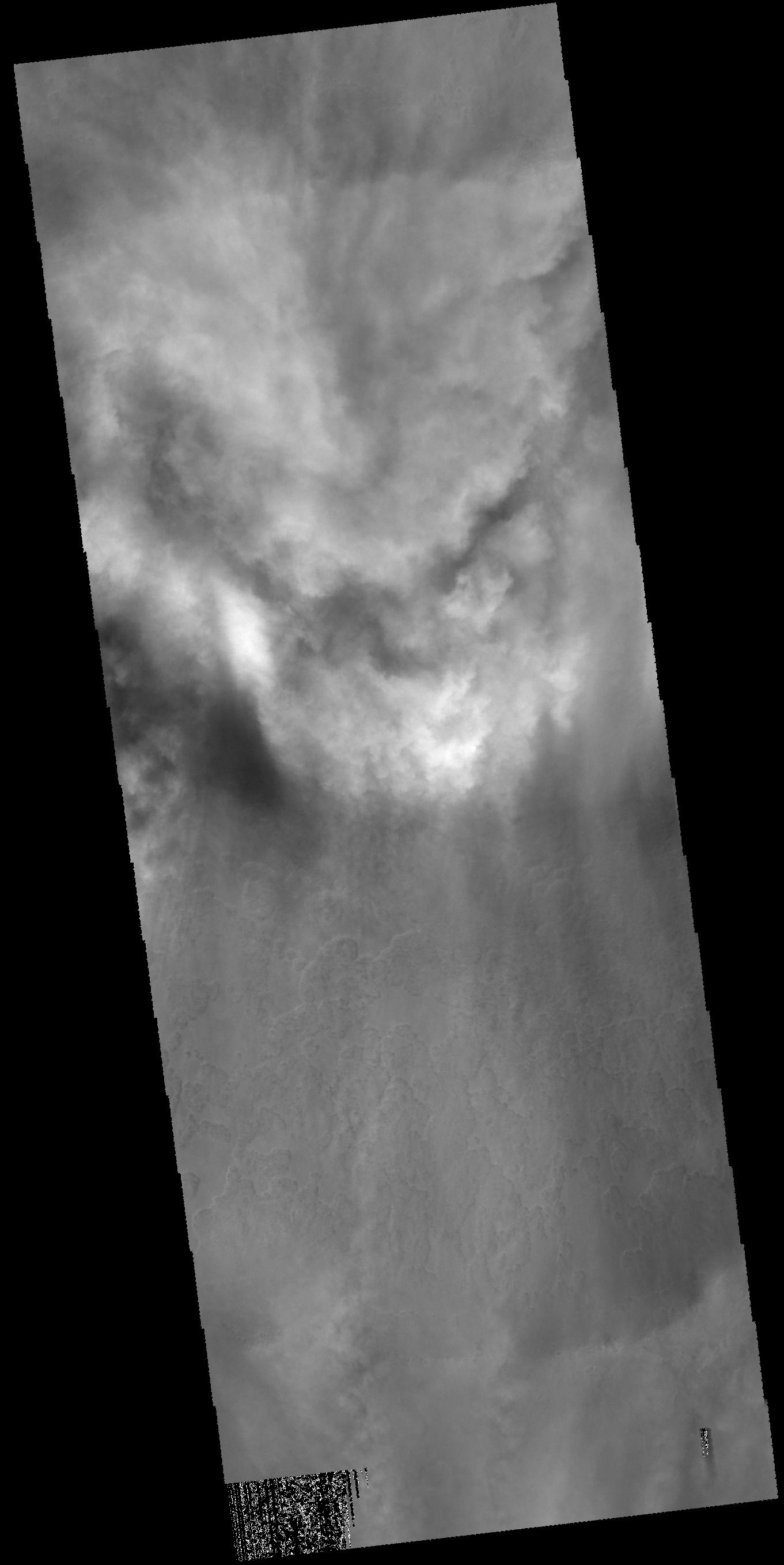
Clouds
Full Resolution:
TIFF
(3.7 MB)
JPEG
(180.9 kB)
2014-11-27
Mars
2001 Mars Odyssey
THEMIS
624x2698x3
PIA18961:
False Color Ascraeus Mons
Full Resolution:
TIFF
(5.053 MB)
JPEG
(120.9 kB)
2014-11-28
Mars
2001 Mars Odyssey
THEMIS
616x2710x3
PIA18962:
Tithonium and Ius Chasmata False Color
Full Resolution:
TIFF
(5.01 MB)
JPEG
(97.03 kB)
2014-12-01
Mars
2001 Mars Odyssey
THEMIS
627x2725x3
PIA18963:
Claritas Fossae False Color
Full Resolution:
TIFF
(5.128 MB)
JPEG
(118.2 kB)
2014-12-02
Mars
2001 Mars Odyssey
THEMIS
613x2709x3
PIA18969:
Noctis Labyrinthus False Color
Full Resolution:
TIFF
(4.984 MB)
JPEG
(85.72 kB)
2014-12-03
Mars
Mars Reconnaissance Orbiter (MRO)
HiRISE
2880x1800x3
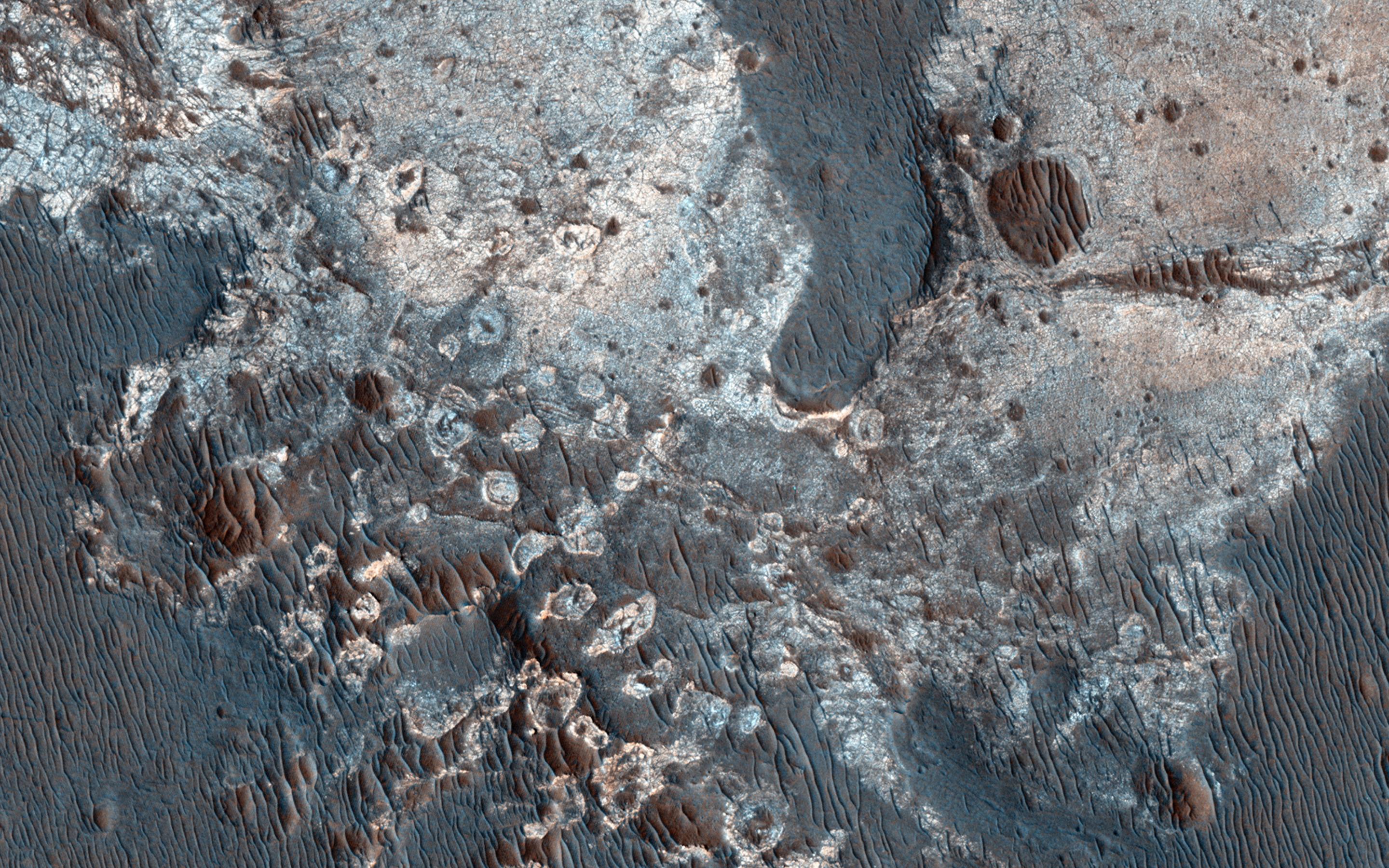
PIA18930:
Braided TARs in Syrtis Major
Full Resolution:
TIFF
(15.56 MB)
JPEG
(831.4 kB)
2014-12-03
Mars
Mars Reconnaissance Orbiter (MRO)
HiRISE
2880x1800x3
PIA18931:
Dunes and Wind Streaks in Arabia Terra
Full Resolution:
TIFF
(15.56 MB)
JPEG
(683.5 kB)
2014-12-03
Mars
Mars Reconnaissance Orbiter (MRO)
HiRISE
2880x1800x1
PIA18932:
An Enigmatic Feature in Athabasca Lava Flows
Full Resolution:
TIFF
(5.191 MB)
JPEG
(552.5 kB)
2014-12-03
Mars
Mars Reconnaissance Orbiter (MRO)
HiRISE
2880x1800x3
PIA18933:
Clays along the Coprates Chasma Plateau
Full Resolution:
TIFF
(15.56 MB)
JPEG
(1.023 MB)
2014-12-03
Mars
2001 Mars Odyssey
THEMIS
605x2706x3
PIA18970:
Arsia Mons False Color
Full Resolution:
TIFF
(4.913 MB)
JPEG
(85.22 kB)
2014-12-04
Mars
2001 Mars Odyssey
THEMIS
996x2639x1
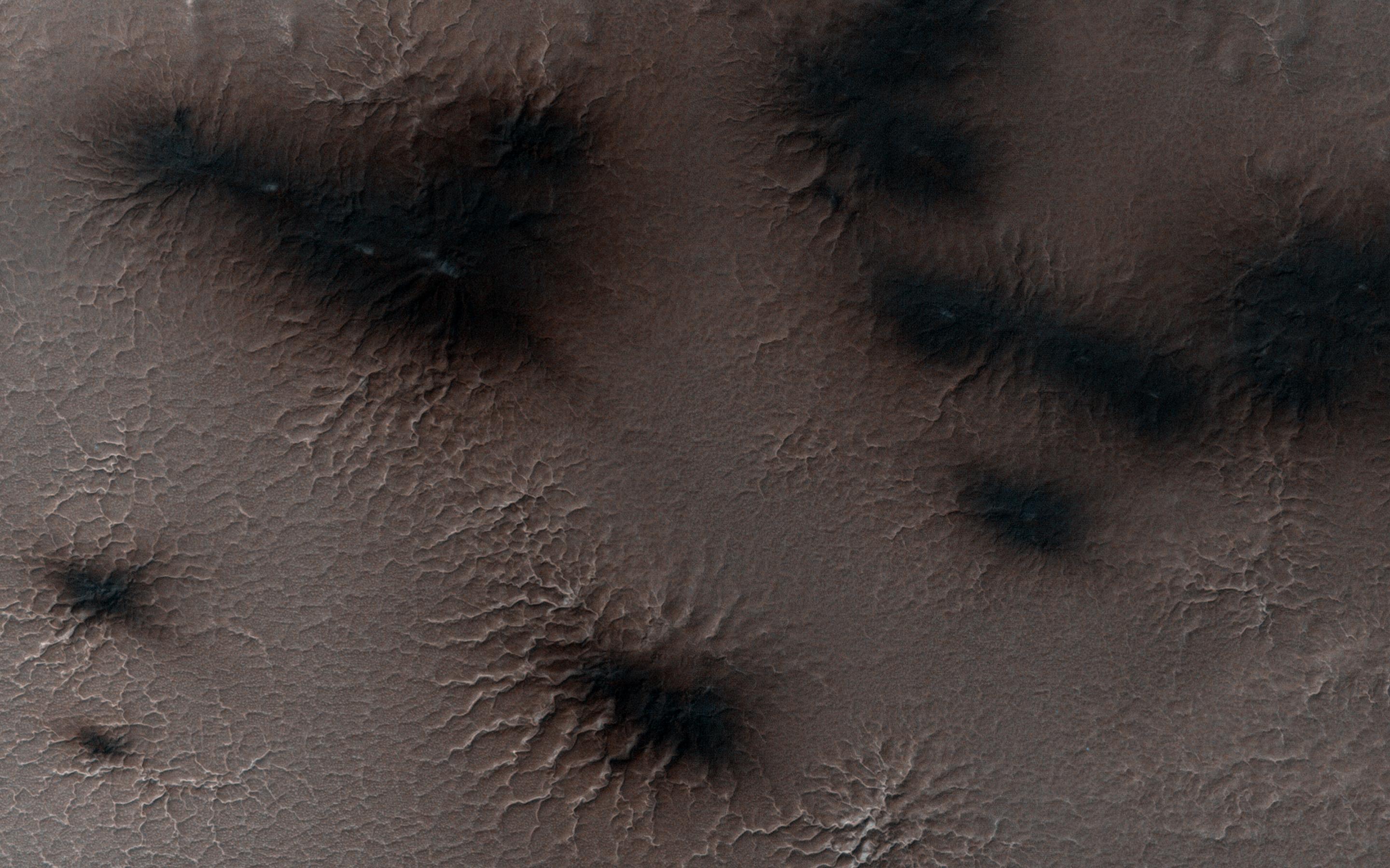
PIA18972:
South Polar Layers
Full Resolution:
TIFF
(2.631 MB)
JPEG
(314.7 kB)
2014-12-05
Mars
2001 Mars Odyssey
THEMIS
978x2627x1
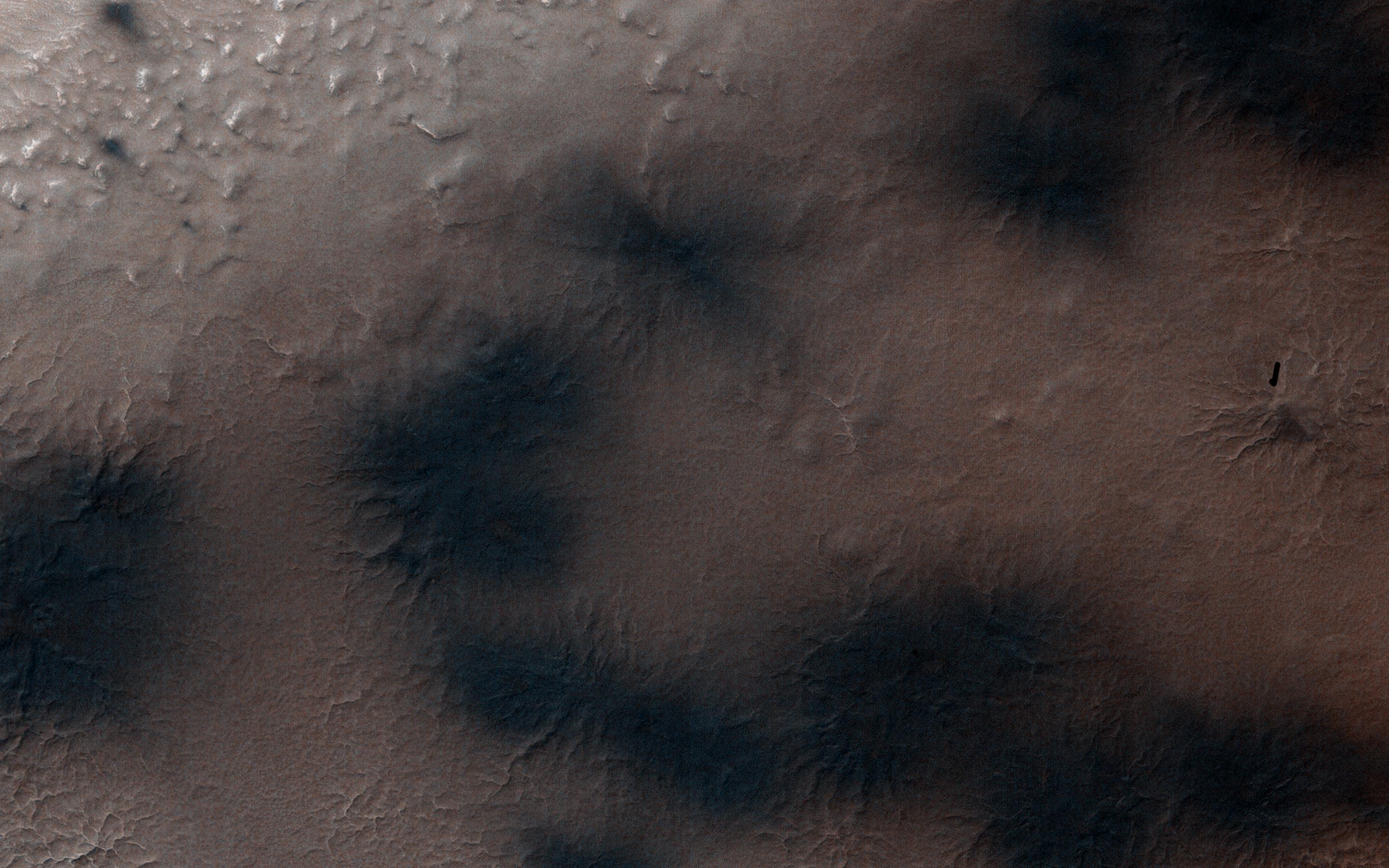
PIA18973:
Polar Trough
Full Resolution:
TIFF
(2.572 MB)
JPEG
(354.9 kB)
2014-12-08
Mars
2001 Mars Odyssey
THEMIS
679x1344x3
PIA18975:
Hebes Chasma - False Color
Full Resolution:
TIFF
(2.739 MB)
JPEG
(102.5 kB)
2014-12-08
Mars
Mars Reconnaissance Orbiter (MRO)
Mars Science Laboratory (MSL)
HiRISE
3300x2550x3
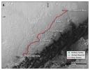
PIA19067:
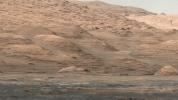
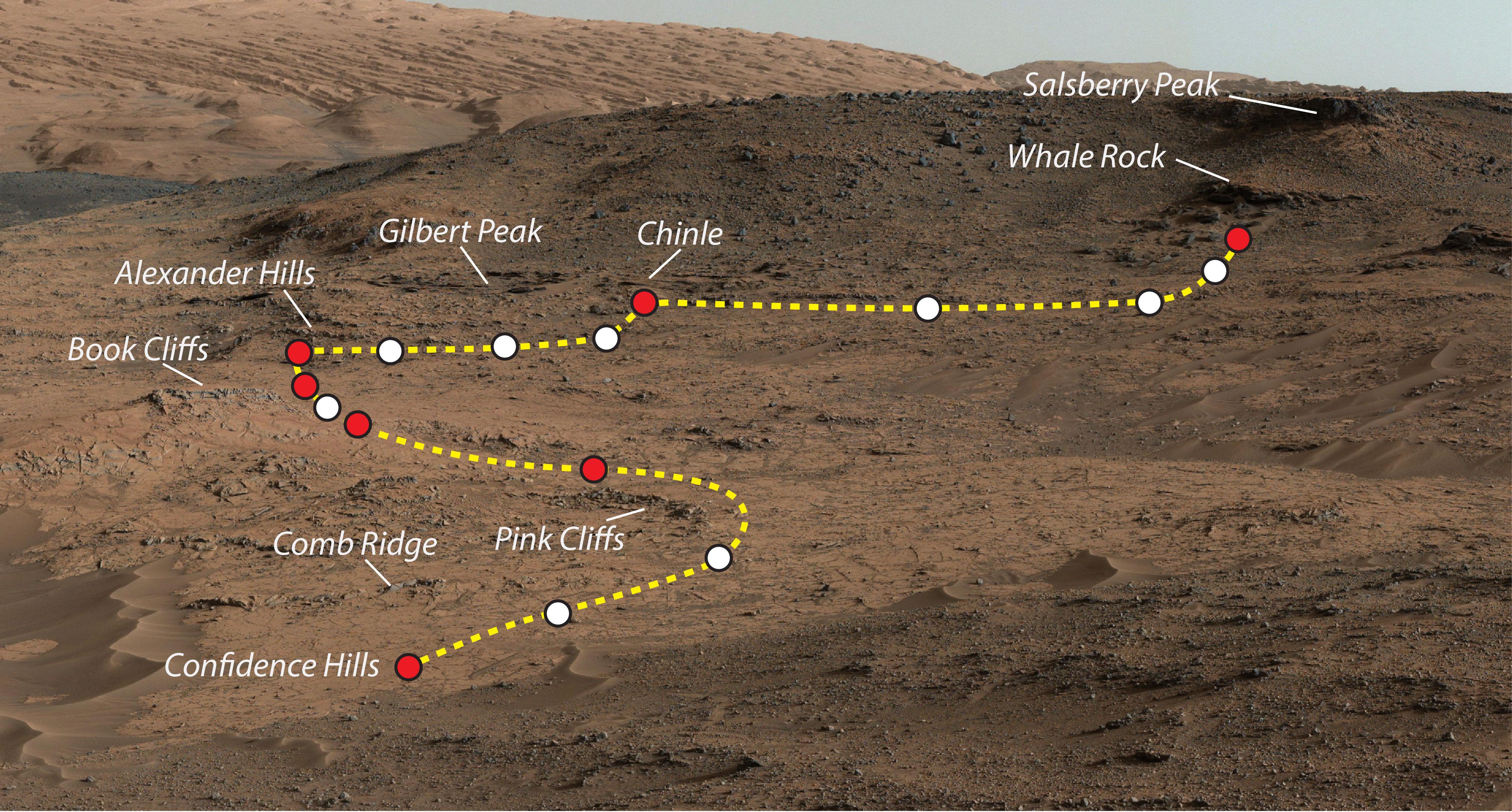
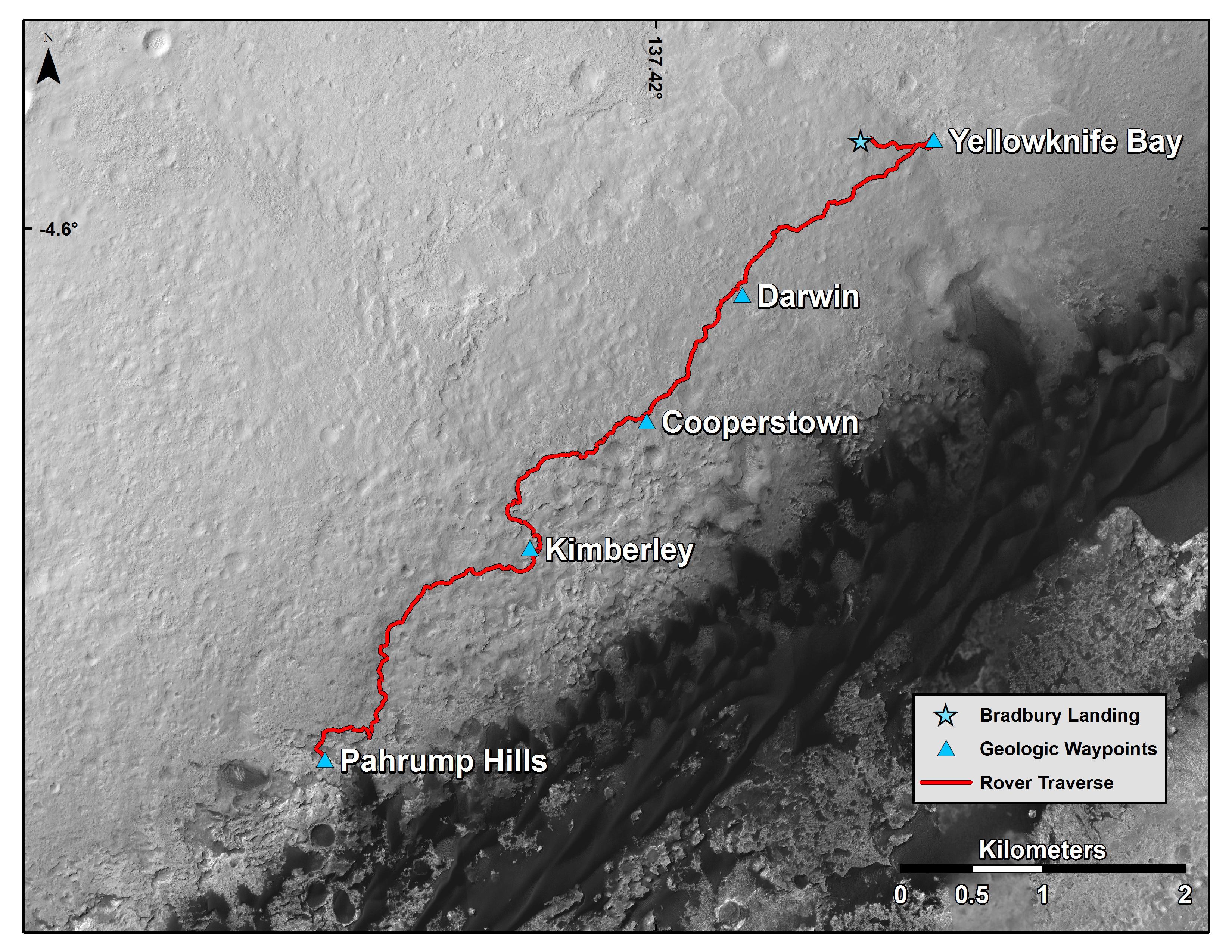
Curiosity Mars Rover's Route from Landing to Base of Mount Sharp
Full Resolution:
TIFF
(25.26 MB)
JPEG
(1.381 MB)
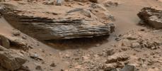
2014-12-08
Mars
Mars Science Laboratory (MSL)
Mastcam
3619x2196x3
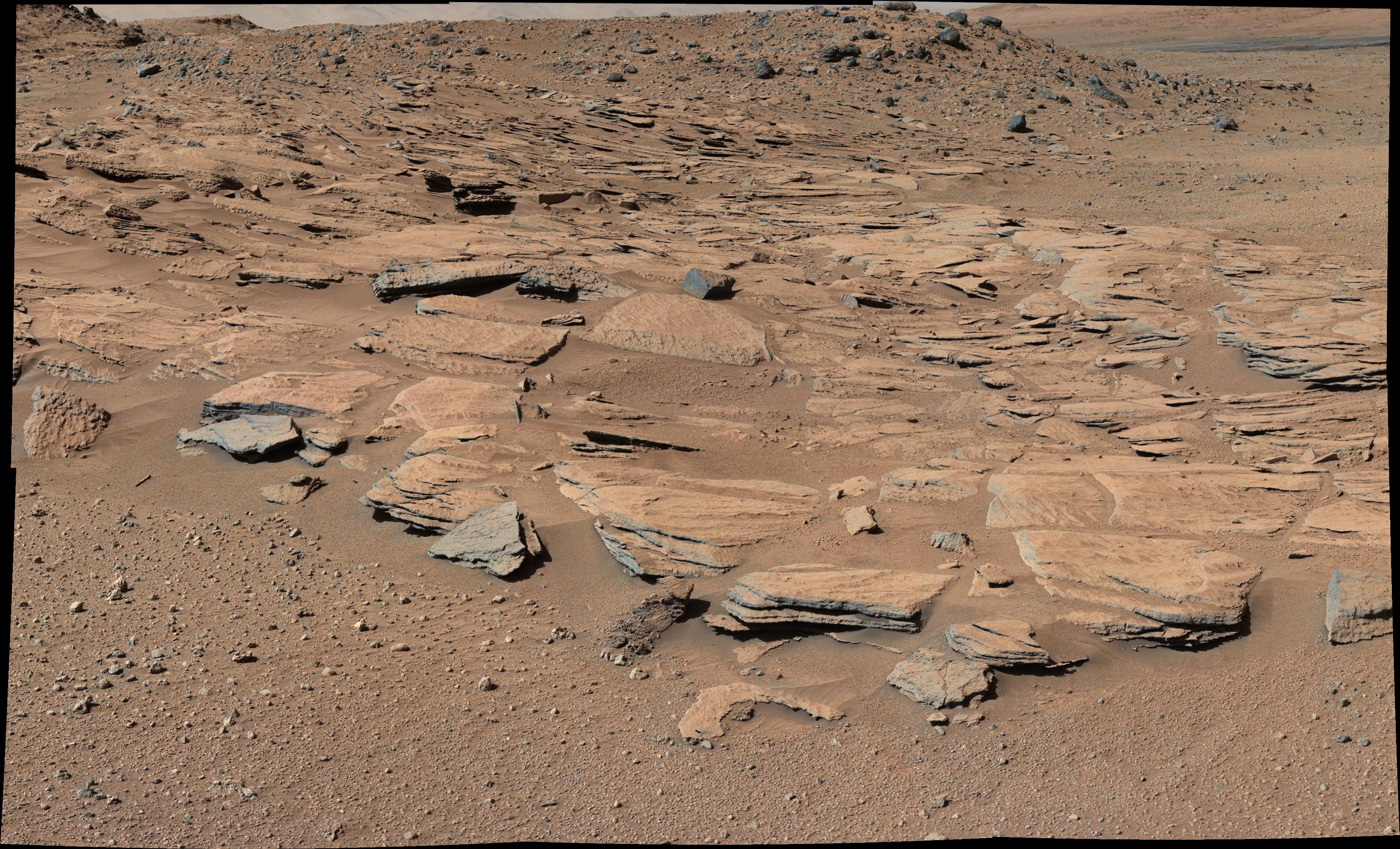
PIA19068:
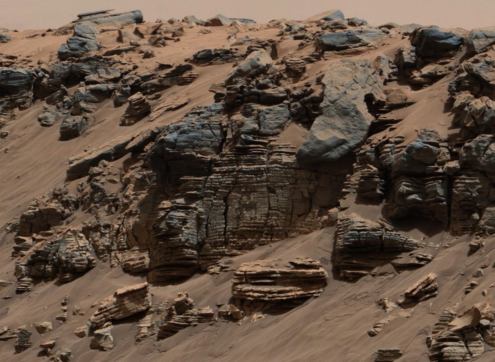
Inclined Martian Sandstone Beds Near 'Kimberley'
Full Resolution:
TIFF
(23.85 MB)
JPEG
(1.665 MB)
2014-12-08
Mars
Mars Science Laboratory (MSL)
Mastcam
4657x1024x3
PIA19069:
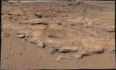
Bedding Pattern Interpreted as Martian Delta Deposition
Full Resolution:
TIFF
(14.31 MB)
JPEG
(1.16 MB)
2014-12-08
Mars
Mars Science Laboratory (MSL)
Mastcam
6246x2048x3
PIA19070:
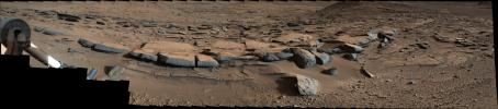
Sets of Beds Inclined Toward Mount Sharp
Full Resolution:
TIFF
(38.39 MB)
JPEG
(2.709 MB)
2014-12-08
Mars
Mars Science Laboratory (MSL)
1931x1078x3
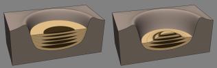
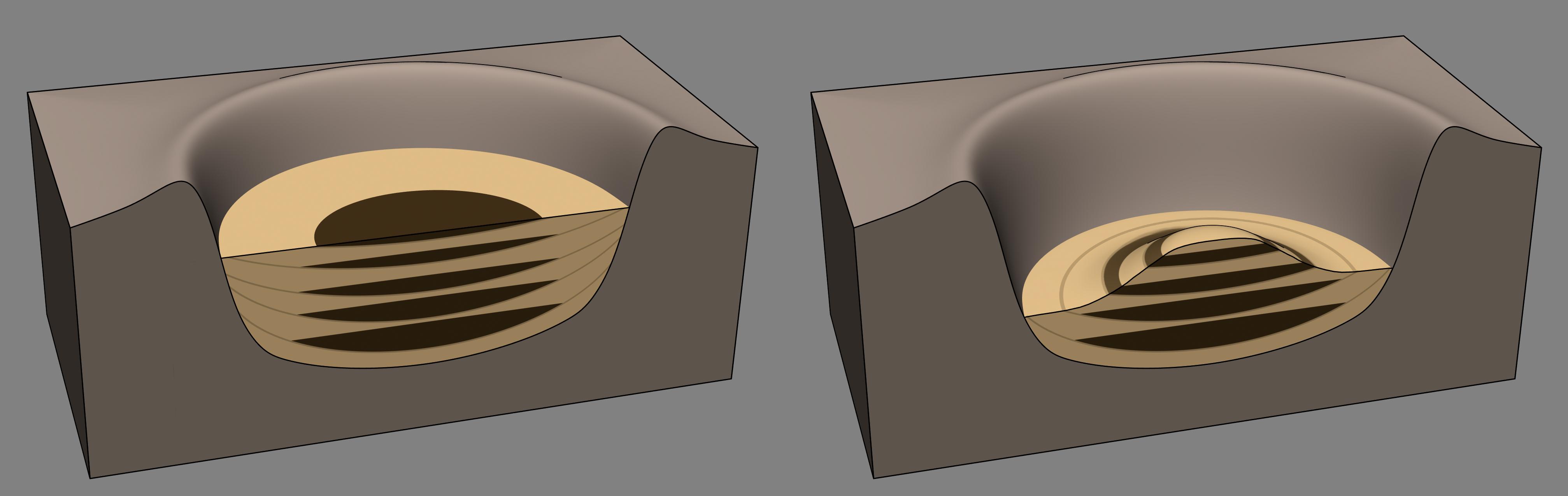
PIA19071:
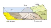
How a Delta Forms Where River Meets Lake
Full Resolution:
TIFF
(6.247 MB)
JPEG
(112.7 kB)
2014-12-08
Mars
Mars Science Laboratory (MSL)
Mastcam
2440x1049x3
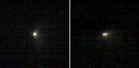
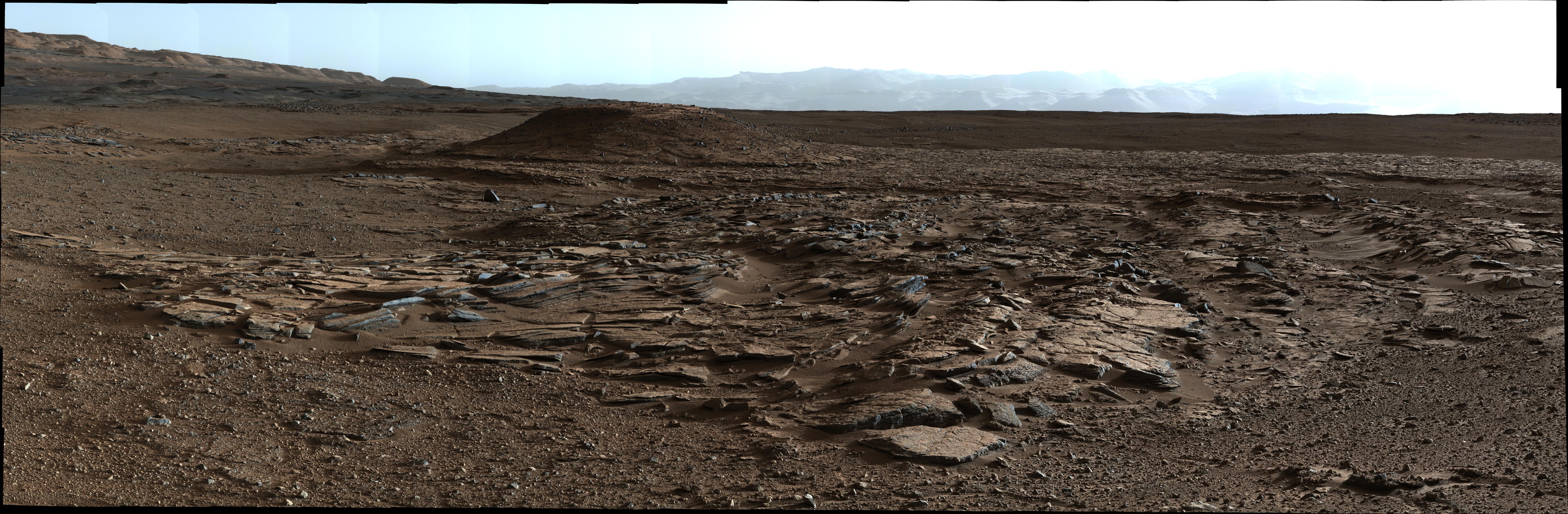
PIA19072:
Sol 696 (July 22, 2014), Left
Full Resolution:
TIFF
(7.682 MB)
JPEG
(515.2 kB)
2014-12-08
Mars
Mars Science Laboratory (MSL)
Mastcam
1588x1160x3
PIA19074:
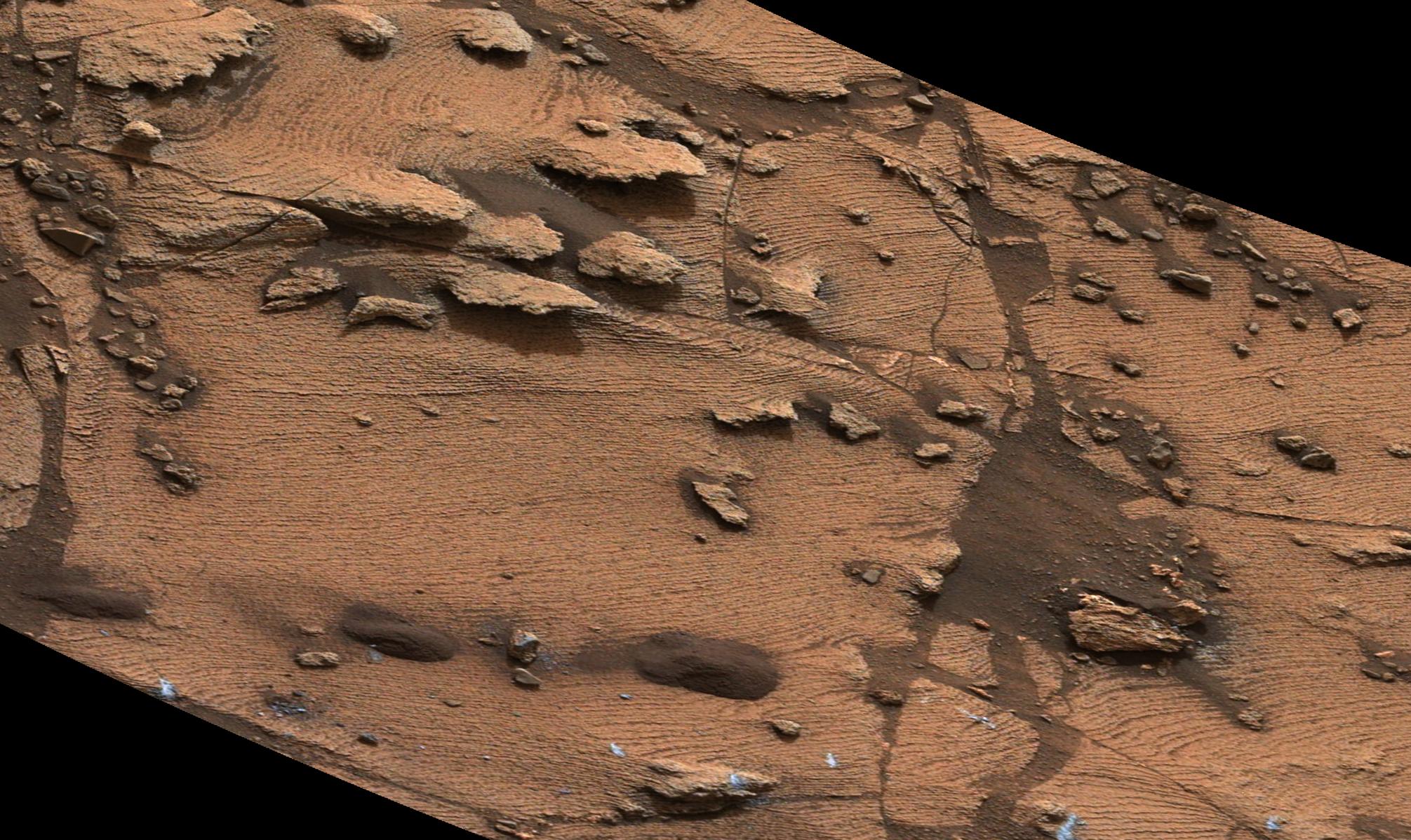
Sedimentary Signs of a Martian Lakebed
Full Resolution:
TIFF
(5.528 MB)
JPEG
(276.3 kB)
2014-12-08
Mars
Mars Science Laboratory (MSL)
Mastcam
2011x1198x3
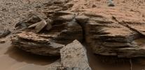
PIA19075:
Thin-Laminated Rock in 'Pahrump Hills' Outcrop
Full Resolution:
TIFF
(7.23 MB)
JPEG
(448.2 kB)
2014-12-08
Mars
Mars Science Laboratory (MSL)
Mastcam
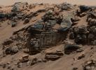
4006x1929x3
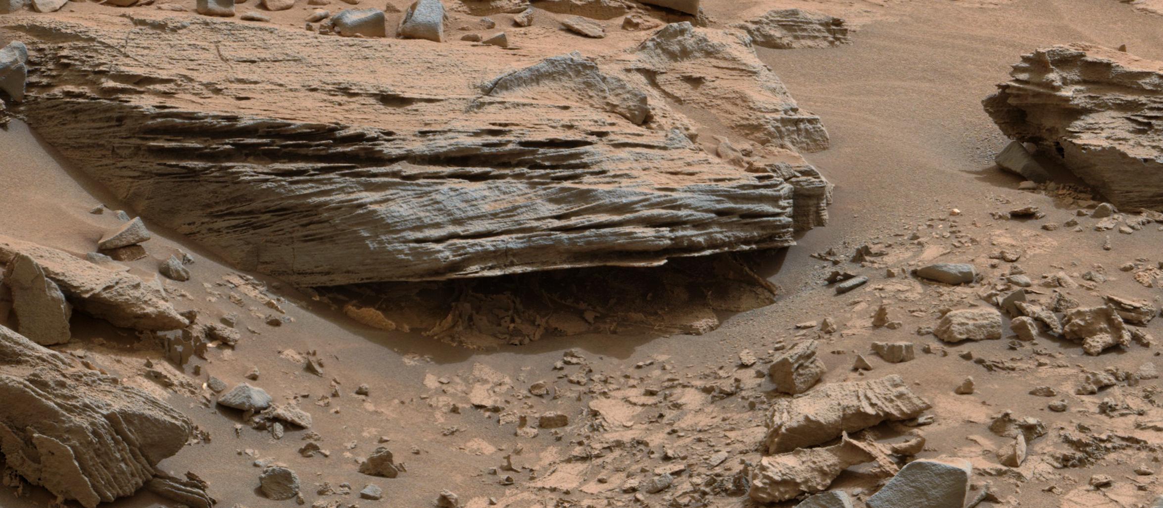
PIA19076:
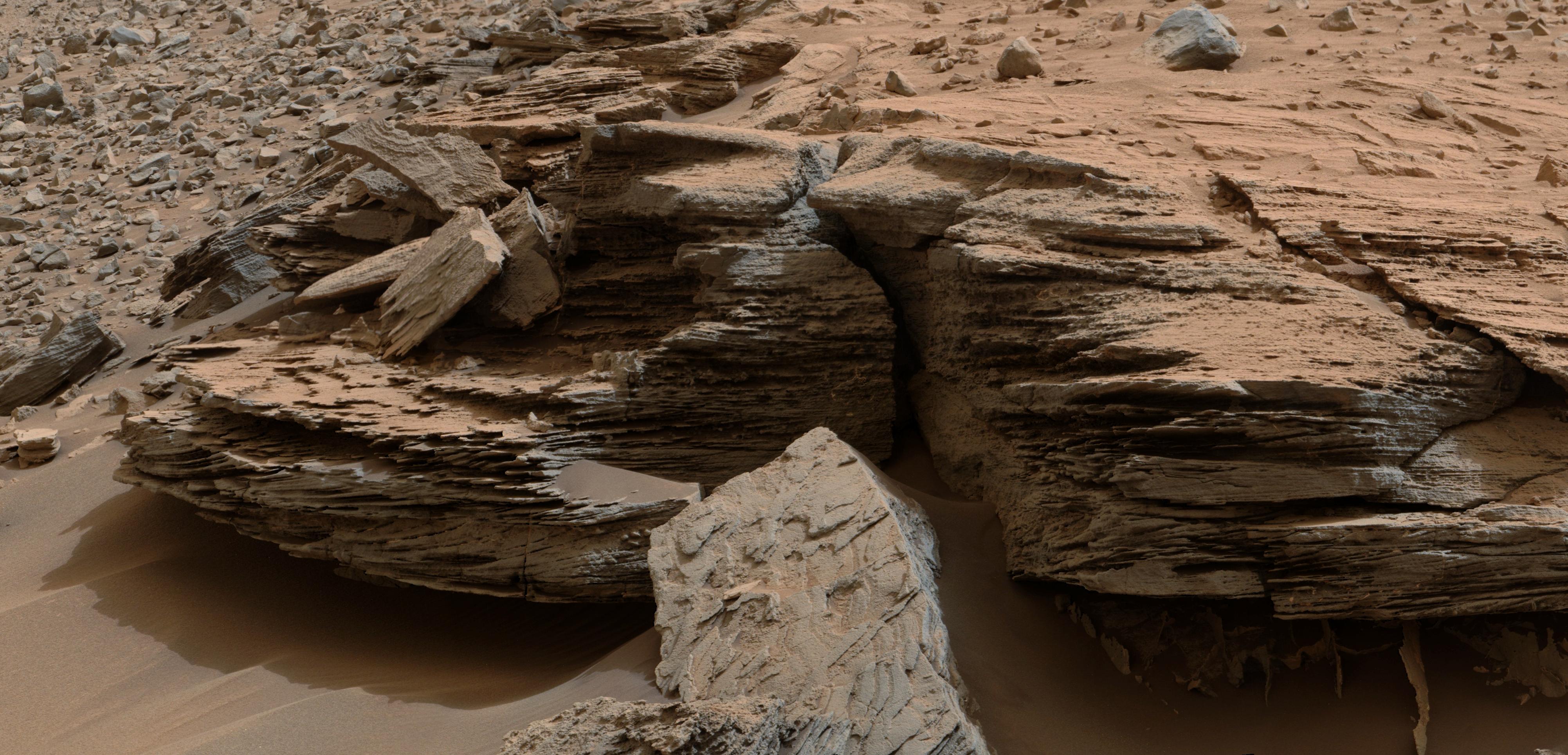
Cross-Bedding at 'Whale Rock'
Full Resolution:
TIFF
(23.19 MB)
JPEG
(1.06 MB)
2014-12-08
Mars
Mars Science Laboratory (MSL)
MAHLI
2876x3014x3
PIA19077:
Crystals May Have Formed in Drying Martian Lake
Full Resolution:
TIFF
(26.02 MB)
JPEG
(1.59 MB)
2014-12-08
Mars
Mars Science Laboratory (MSL)
4030x1275x3
PIA19079:
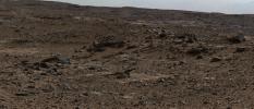
Sedimentation and Erosion in Gale Crater, Mars
Full Resolution:
TIFF
(15.42 MB)
JPEG
(190.5 kB)
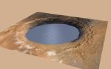
2014-12-08
Mars
Mars Science Laboratory (MSL)
2560x1600x3
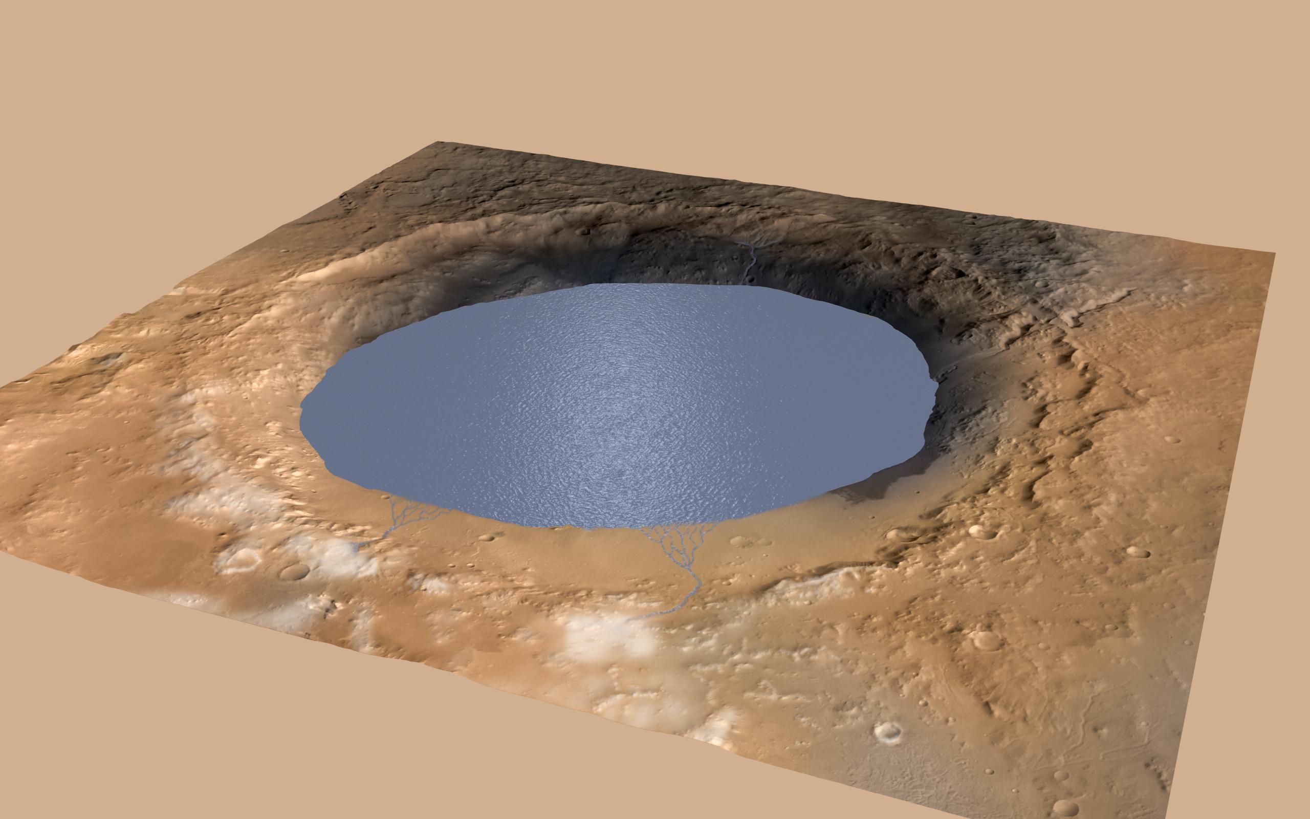
PIA19080:
Simulated View of Gale Crater Lake on Mars
Full Resolution:
TIFF
(12.29 MB)
JPEG
(271.9 kB)
2014-12-08
Mars
Mars Science Laboratory (MSL)
Mastcam
2350x1026x3
PIA19081:
Martian Rock's Evidence of Lake Currents
Full Resolution:
TIFF
(7.236 MB)
JPEG
(399.7 kB)
2014-12-09
Mars
2001 Mars Odyssey
THEMIS
673x1339x3
PIA18977:
Melas Chasma - False Color
Full Resolution:
TIFF
(2.705 MB)
JPEG
(93.03 kB)
2014-12-10
Mars
2001 Mars Odyssey
THEMIS
674x1338x3
PIA18978:
Coprates Chasma - False Color
Full Resolution:
TIFF
(2.707 MB)
JPEG
(74.26 kB)
2014-12-10
Mars
Mars Reconnaissance Orbiter (MRO)
HiRISE
2880x1800x3
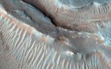
PIA19116:
Seeing Beneath the Surface in Morava Valles
Full Resolution:
TIFF
(15.56 MB)
JPEG
(986.2 kB)
2014-12-10
Mars
Mars Reconnaissance Orbiter (MRO)
HiRISE
2880x1800x3
PIA19117:
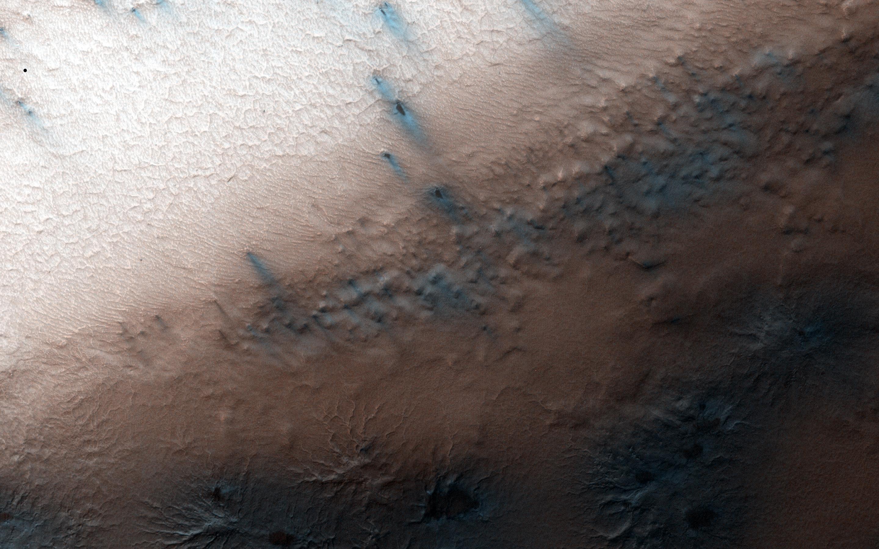
Frosted Gullies in a Central Pit
Full Resolution:
TIFF
(15.56 MB)
JPEG
(922.7 kB)
2014-12-10
Mars
Mars Reconnaissance Orbiter (MRO)
HiRISE
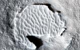
2880x1800x3
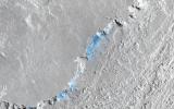
PIA19118:
Recurring Slope Lineae in Juventae Chasma
Full Resolution:
TIFF
(15.56 MB)
JPEG
(1.026 MB)
2014-12-10
Mars
Mars Reconnaissance Orbiter (MRO)
HiRISE
2880x1800x3
PIA19119:
Inverted Ridges in the Eridania Basin
Full Resolution:
TIFF
(15.56 MB)
JPEG
(923.3 kB)
2014-12-11
Mars
2001 Mars Odyssey
THEMIS
674x1341x3
PIA18979:
Coprates Chasma - False Color
Full Resolution:
TIFF
(2.713 MB)
JPEG
(59.75 kB)
2014-12-11
Mars
Mars Science Laboratory (MSL)
Mastcam
1920x1080x3
PIA19083:
Mount Sharp Buttes and Layers From Near 'Darwin'
Full Resolution:
TIFF
(6.223 MB)
JPEG
(419.5 kB)
2014-12-11
Mars
Mars Exploration Rover (MER)
Hazcam
1024x1024x1
PIA19082:
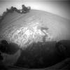
Opportunity Pausing at a Bright Outcrop on Endeavour Rim, Sol 3854
Full Resolution:
TIFF
(1.05 MB)
JPEG
(113 kB)
2014-12-12
Mars
2001 Mars Odyssey
THEMIS
680x1344x3
PIA18980:
Tyrrhena Terra - False Color
Full Resolution:
TIFF
(2.743 MB)
JPEG
(88.66 kB)
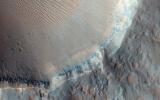
2014-12-12
Mars
Mars Reconnaissance Orbiter (MRO)
HiRISE
1477x1384x3
PIA19084:
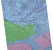
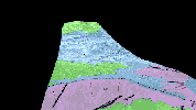
Geological Mapping of Hills in Martian Canyon
Full Resolution:
TIFF
(6.135 MB)
JPEG
(332.6 kB)
2014-12-12
Mars
Mars Reconnaissance Orbiter (MRO)
HiRISE
1619x1077x3
PIA19085:
Simulated Flyover of Mars Canyon Map (Animation)
Full Resolution:
TIFF
(5.233 MB)
JPEG
(208.9 kB)
2014-12-15
Mars
2001 Mars Odyssey
THEMIS
678x1351x3
PIA18981:
Proctor Crater - False Color
Full Resolution:
TIFF
(2.749 MB)
JPEG
(107.3 kB)
2014-12-16
Mars
2001 Mars Odyssey
THEMIS
674x1341x3
PIA18985:
Eos Chasma - False Color
Full Resolution:
TIFF
(2.713 MB)
JPEG
(88.64 kB)
1-100
101-200
201-300
301-400
401-500
501-600
601-700
701-800
801-900
901-1000
Currently displaying images:
8701 - 8800
of 12760


