Your search criteria found
12755
images
Target is Mars (and available satellites)
Go to PIAxxxxx:
Refine this list of images by:
Target:
Deimos
Mars
Phobos
Mission:
2001 Mars Odyssey
Antarctic Meteorite Location and Mapping Project (AMLAMP)
Dawn
ExoMars
Hubble Space Telescope
InSight
MAVEN
Mariner Mars 1964 (Mariner 4)
Mariner Mars 1969 (Mariner 7)
Mariner Mars 1971 (Mariner 9)
Mars 2020
Mars 2020 Rover
Mars Atmosphere and Volatile Evolution MissioN (MAVEN)
Mars Climate Orbiter
Mars Cube One (MarCO)
Mars Exploration Rover (MER)
Mars Express (MEX)
Mars Global Surveyor (MGS)
Mars Helicopter
Mars Pathfinder (MPF)
Mars Reconnaissance Orbiter (MRO)
Mars Sample Return
Mars Sample Return (MSR)
Mars Science Laboratory (MSL)
Phoenix
Rosetta
Viking
Spacecraft:
2001 Mars Odyssey
Curiosity
Dawn
InSight Mars Lander
Ingenuity
MAVEN
MarCO-B
Mariner 4
Mariner 7
Mariner 9
Mars Climate Orbiter
Mars Express (MEX)
Mars Express (MEX) Orbiter
Mars Global Surveyor Orbiter
Mars Pathfinder Lander
Mars Pathfinder Rover
Mars Reconnaissance Orbiter (MRO)
Mars Sample Return
Mars Science Laboratory (MSL)
NASA's Mars Pathfinder Lander
Opportunity
Perseverance
Philae Lander
Phoenix Lander
Phoenix Mars Lander
Spirit
Viking Lander 1
Viking Lander 2
Viking Orbiter 1
Viking Orbiter 2
Instrument:
Alpha Particle X-ray Spectrometer
Alpha Particle X-ray Spectrometer (MSL)
Atmospheric Structure / Meteorology Instrument
CHIMRA
Camera 1
Camera 2
Chemistry & Mineralogy (CheMin)
Chemistry and Camera (ChemCam)
Comet Infrared and Visible Analyser (CIVA
Compact Reconnaissance Imaging Spectrometer for Mars (CRISM)
Context Camera (CTX)
Deep Space Network
Descent Image Motion Estimation System (DIMES)
Dynamic Albedo of Neutrons
Dynamic Albedo of Neutrons (DAN)
Gamma Ray Spectrometer - Neutron Spectrometer
Gamma Ray Spectrometer Suite
Hazard Avoidance Camera
Hazard Avoidance Camera (M2020)
Hazard Avoidance Camera (MSL)
Heat and Physical Properties Package (HP3)
High Resolution Imaging Science Experiment (HiRISE)
High Resolution Instrument (HRI)
High Resolution Stereo Camera
Imager for Mars Pathfinder
Imaging Ultraviolet Spectrograph
Imaging Ultraviolet Spectrograph (IUVS)
Instrument Context Camera (ICC)
Instrument Deployment Camera (IDC)
Lander Vision System Camera (LCAM)
Magnetometer
Mars Advanced Radar for Subsurface and Ionosphere Sounding (MARSIS)
Mars Advanced Radar for Subsurface and Ionospheric Sounding (MARSIS)
Mars Climate Sounder (MCS)
Mars Color Imager (MARCI)
Mars Descent Imager
Mars Environmental Dynamics Analyzer (MEDA)
Mars Hand Lens Imager (MAHLI)
Mars Horizon Sensor Assembly
Mars Orbiter Camera (MOC)
Mars Orbiter Laser Altimeter
Mars Radiation Experiment
Mastcam
Mastcam-Z
Microscopic Imager
Microscopy Electrochemistry and Conductivity Analyzer (MECA)
Miniature Thermal Emission Spectrometer
Moessbauer Spectrometer
Navigation Camera
Navigation Camera (M2020)
Navigation Camera (MSL)
Neutral Gas and Ion Mass Spectrometer
Neutron Spectrometer
Optical Microscope
Optical Navigation Camera
Panoramic Camera
Planetary Instrument for X-ray Lithochemistry (PIXL)
Radar System
Radiation Assessment Detector (RAD)
Radio Science Subsystem
Robotic Arm
Robotic Arm (MSL)
Robotic Arm Camera (RAC)
Rock Abrasion Tool (RAT)
Rover Cameras
Rover Environmental Monitoring Station (REMS)
Sample Analysis at Mars (SAM)
Scanning Habitable Environments with Raman & Luminescence for Organics and Chemicals (SHERLOC)
Seismic Experiment for Interior Structure (SEIS)
Shallow Subsurface Radar (SHARAD)
Stereo Imager (SSI)
SuperCam
Surface Stereo Imager (SSI)
Thermal Emission Imaging System
Thermal Emission Spectrometer
Thermal and Electrical Conductivity Probe
Thermal and Evolved Gas Analyzer
Trace Gas Orbiter
Visual Imaging Subsystem
Visual Imaging Subsystem - Camera A
Visual Imaging Subsystem - Camera B
Wide Field Planetary Camera 2
Click on an image for detailed information
Click on a column heading to sort in ascending or descending order
My
List
Addition Date
Target
Mission
Instrument
Size
2013-02-21
Mars
2001 Mars Odyssey
THEMIS
686x1537x1
PIA16259:
Melas Chasma
Full Resolution:
TIFF
(1.056 MB)
JPEG
(87.23 kB)
2013-02-22
Mars
2001 Mars Odyssey
THEMIS
1336x2824x1
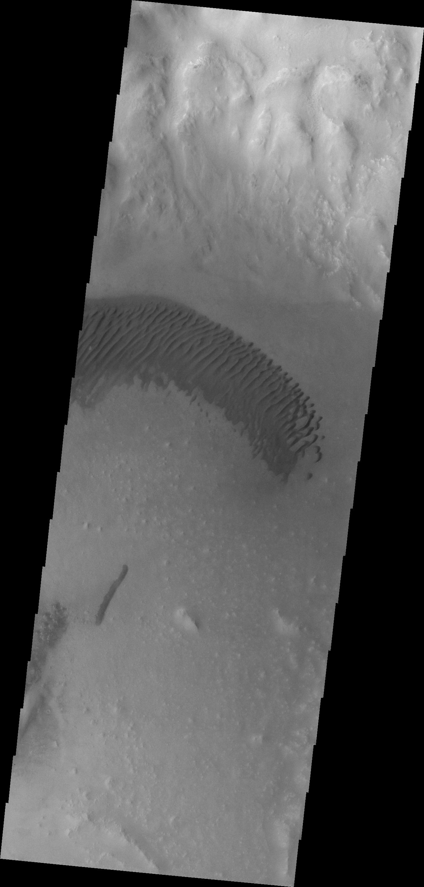
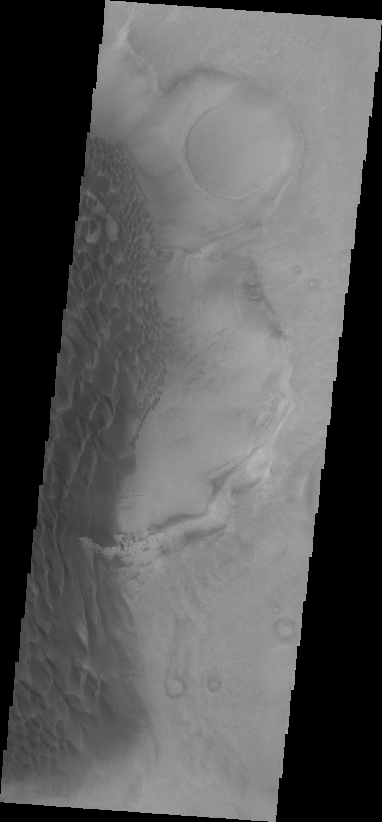
PIA16260:
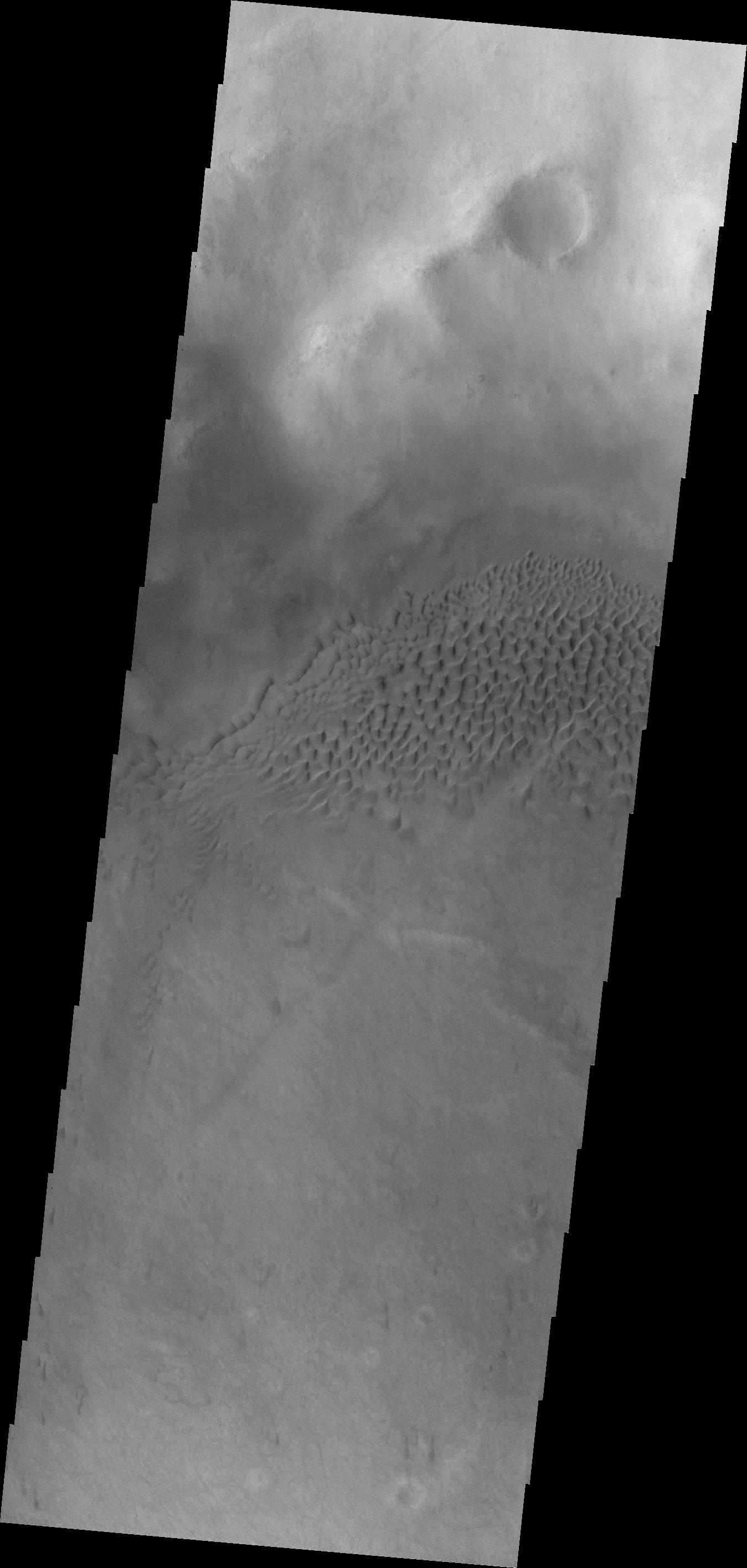
Dunes
Full Resolution:
TIFF
(3.777 MB)
JPEG
(239.1 kB)
2013-02-25
Mars
2001 Mars Odyssey
THEMIS
1283x2772x1
PIA16261:
Arsia Mons
Full Resolution:
TIFF
(3.56 MB)
JPEG
(404.9 kB)
2013-02-25
Mars
Mars Science Laboratory (MSL)
CHIMRA
Mastcam
SAM
1600x1200x3
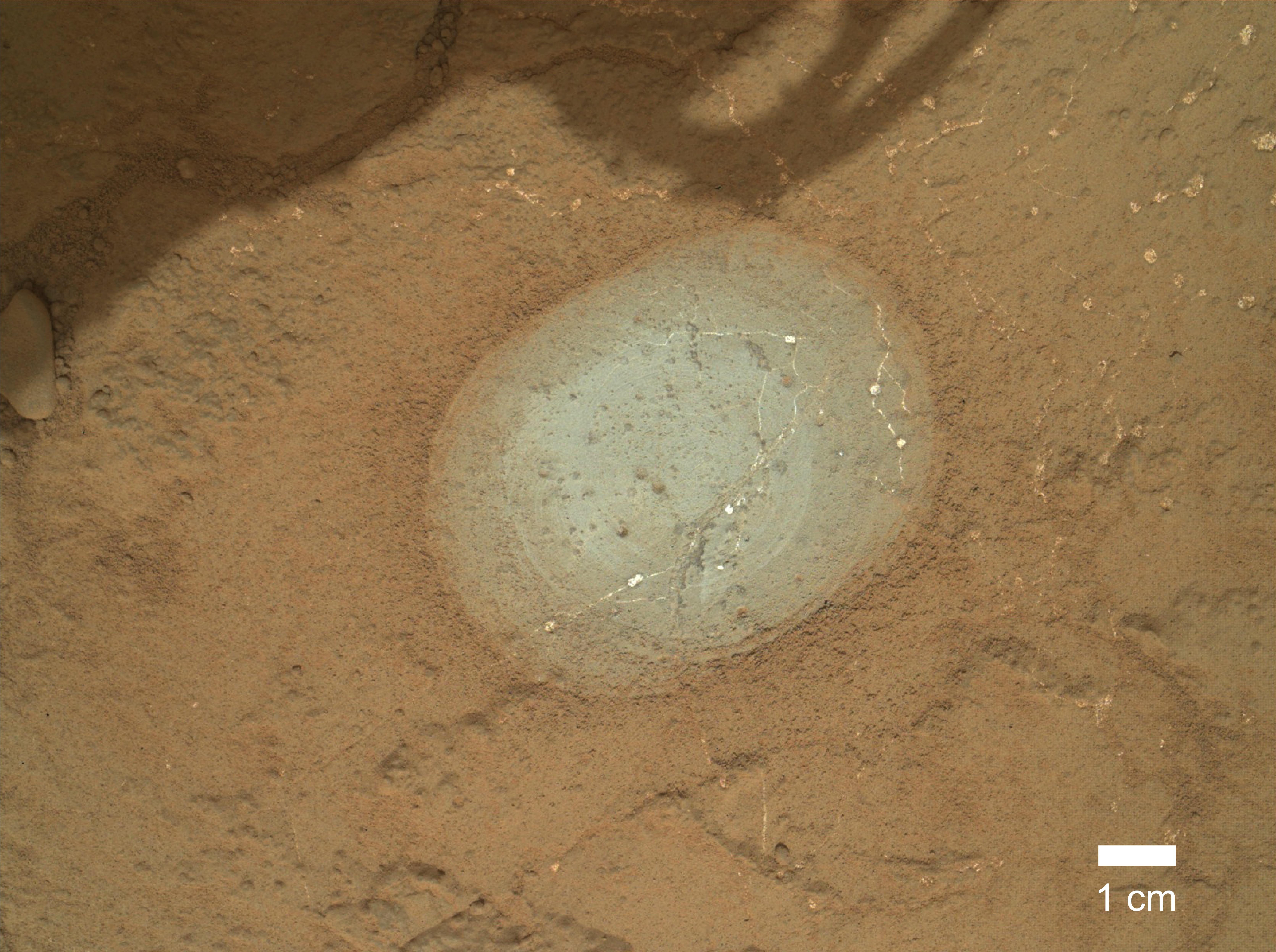
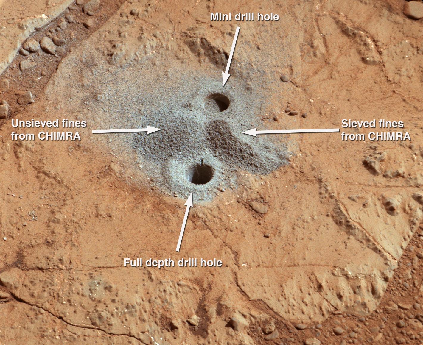
PIA16766:
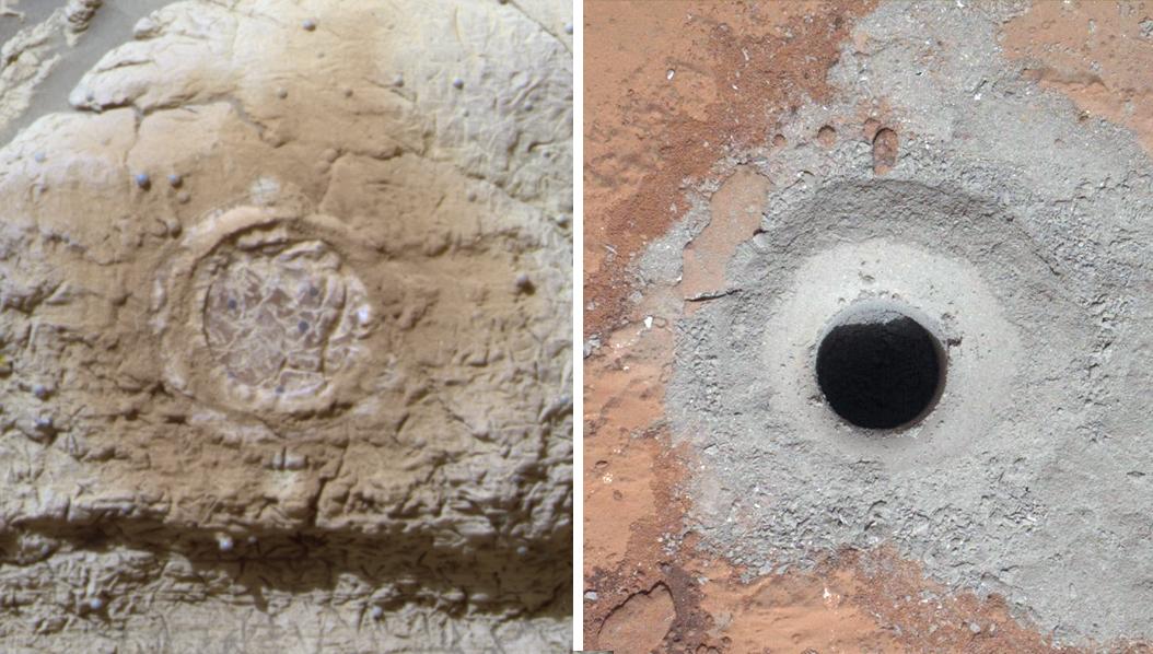
Check-up Image After Delivering Martian Rock Powder
Full Resolution:
TIFF
(5.762 MB)
JPEG
(184.4 kB)
2013-02-26
Mars
2001 Mars Odyssey
THEMIS
1349x2832x1
PIA16262:
Hussey Crater Dunes
Full Resolution:
TIFF
(3.824 MB)
JPEG
(271.5 kB)
2013-02-27
Mars
2001 Mars Odyssey
THEMIS
1312x2781x1
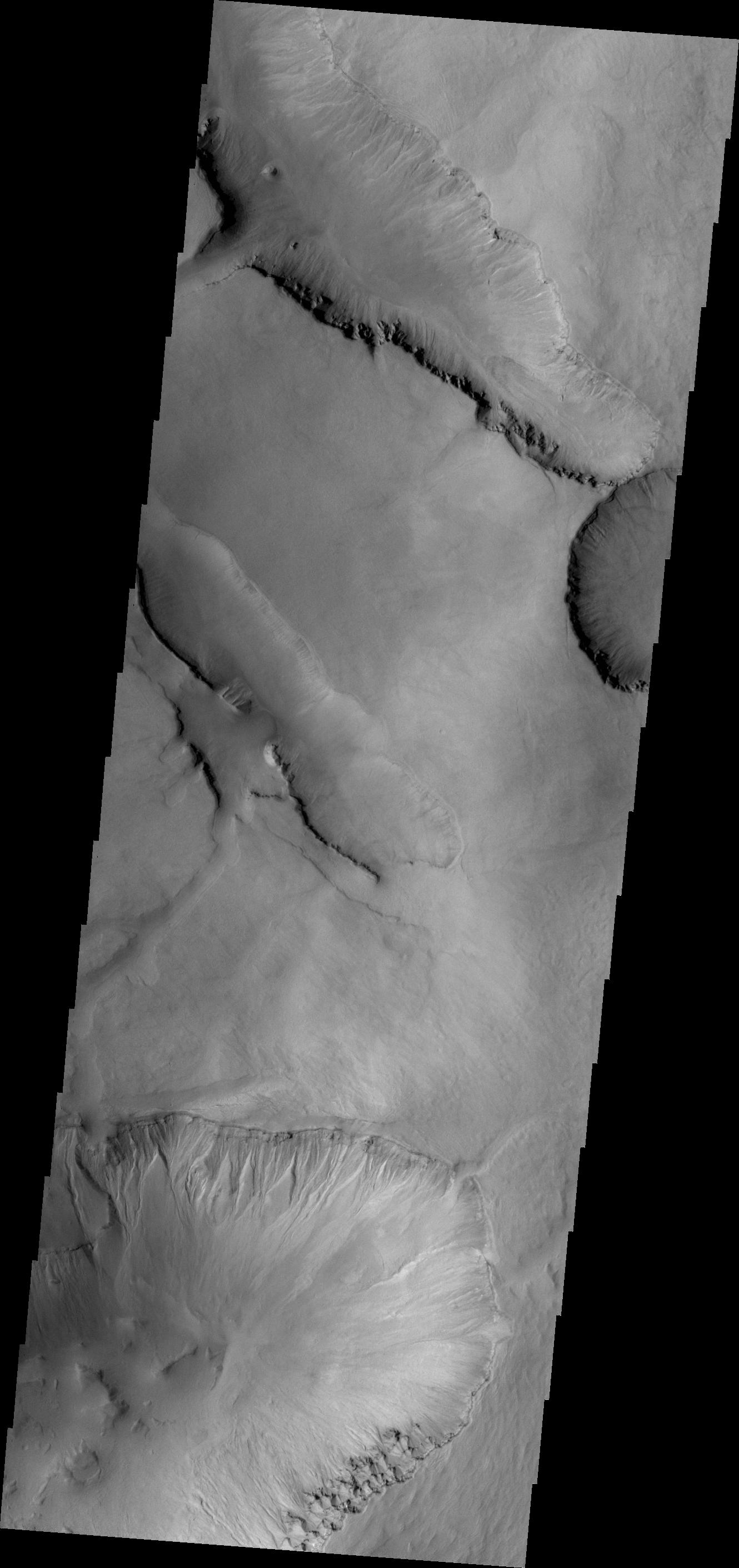
PIA16263:
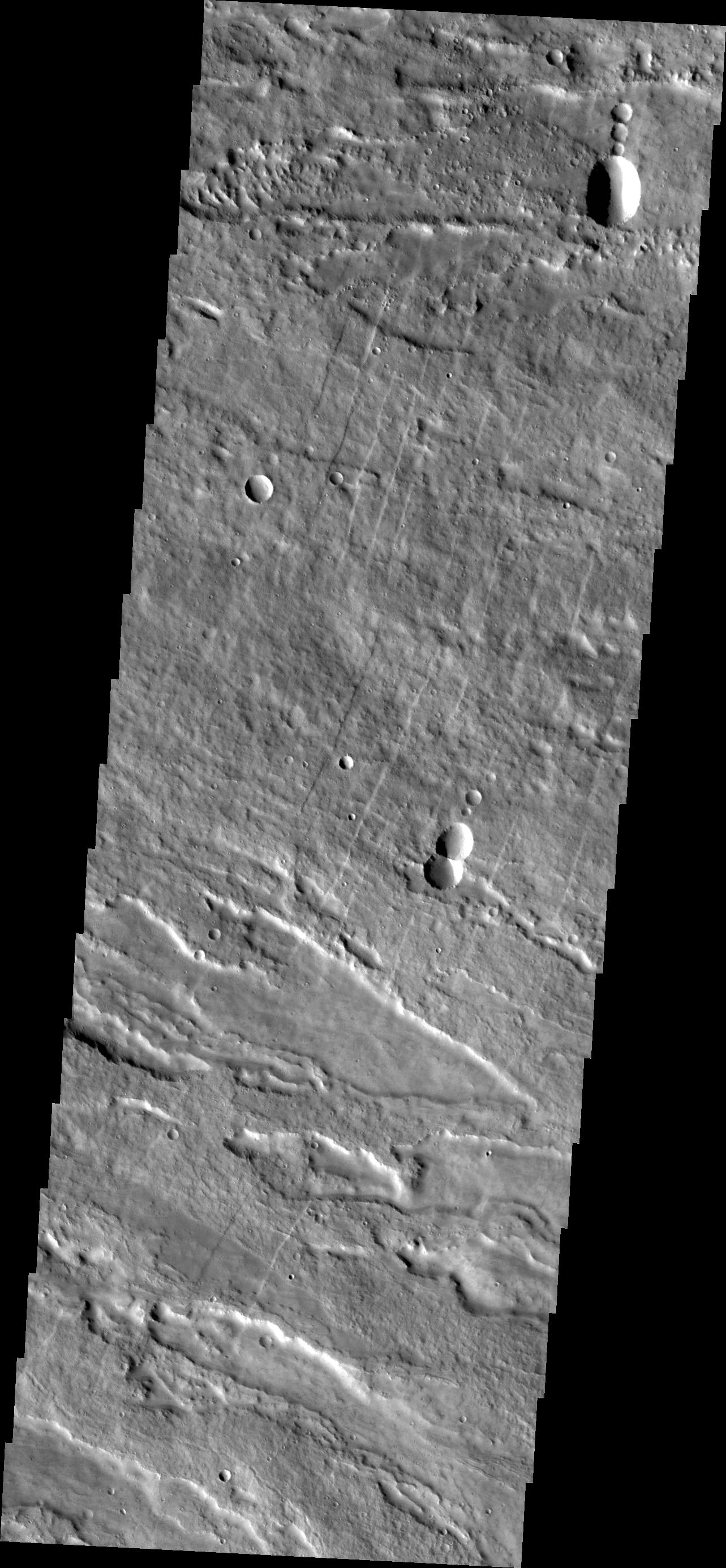
Faults
Full Resolution:
TIFF
(3.653 MB)
JPEG
(307.3 kB)
2013-02-28
Mars
2001 Mars Odyssey
THEMIS
1318x2779x1
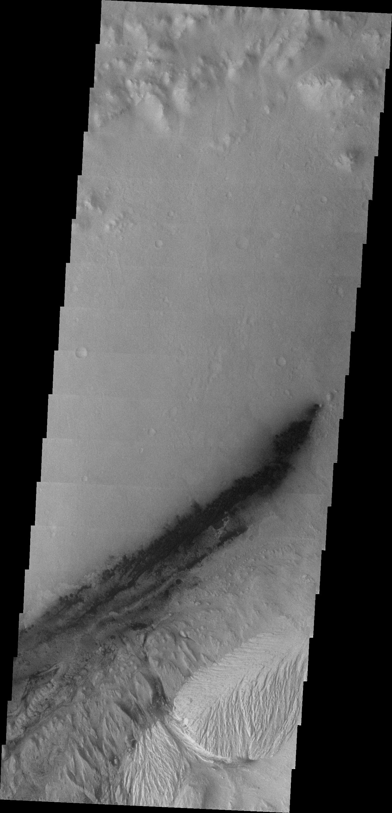
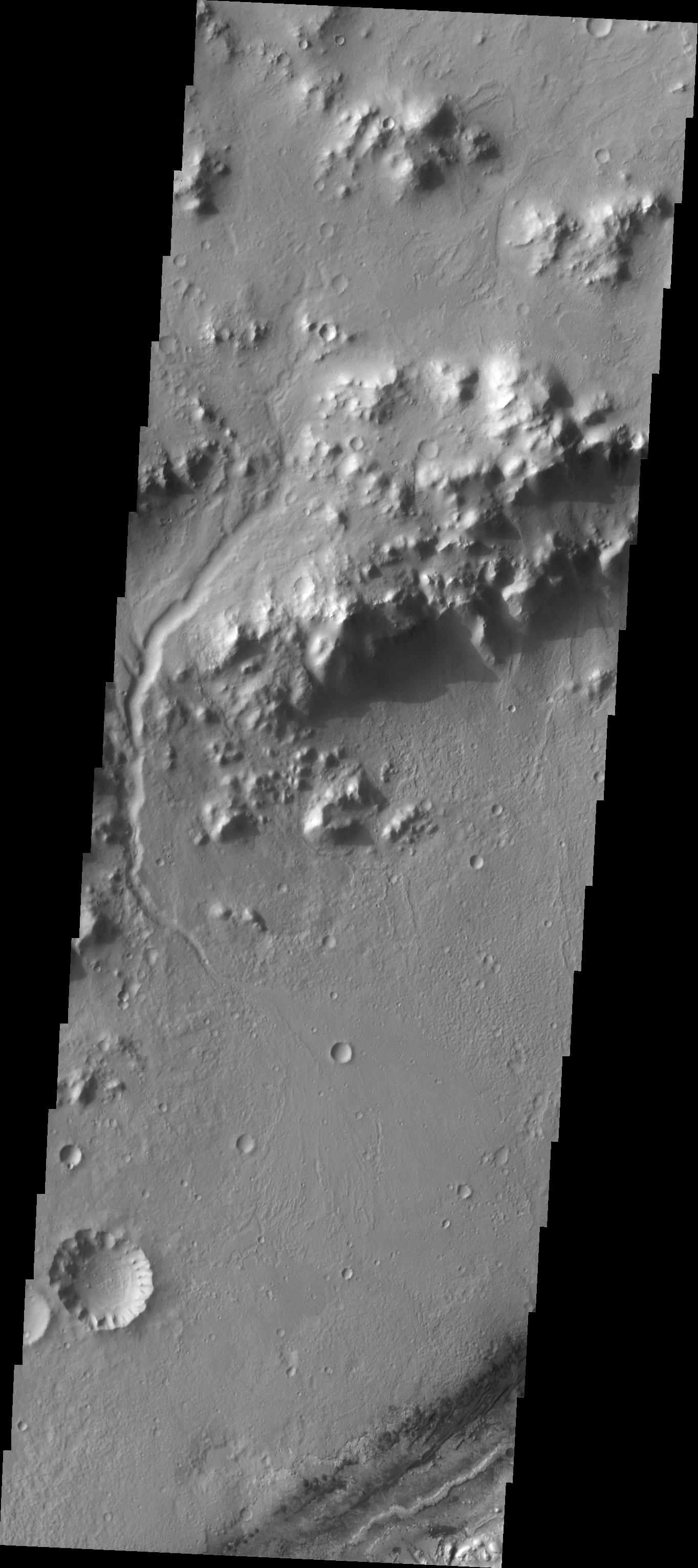
PIA16264:
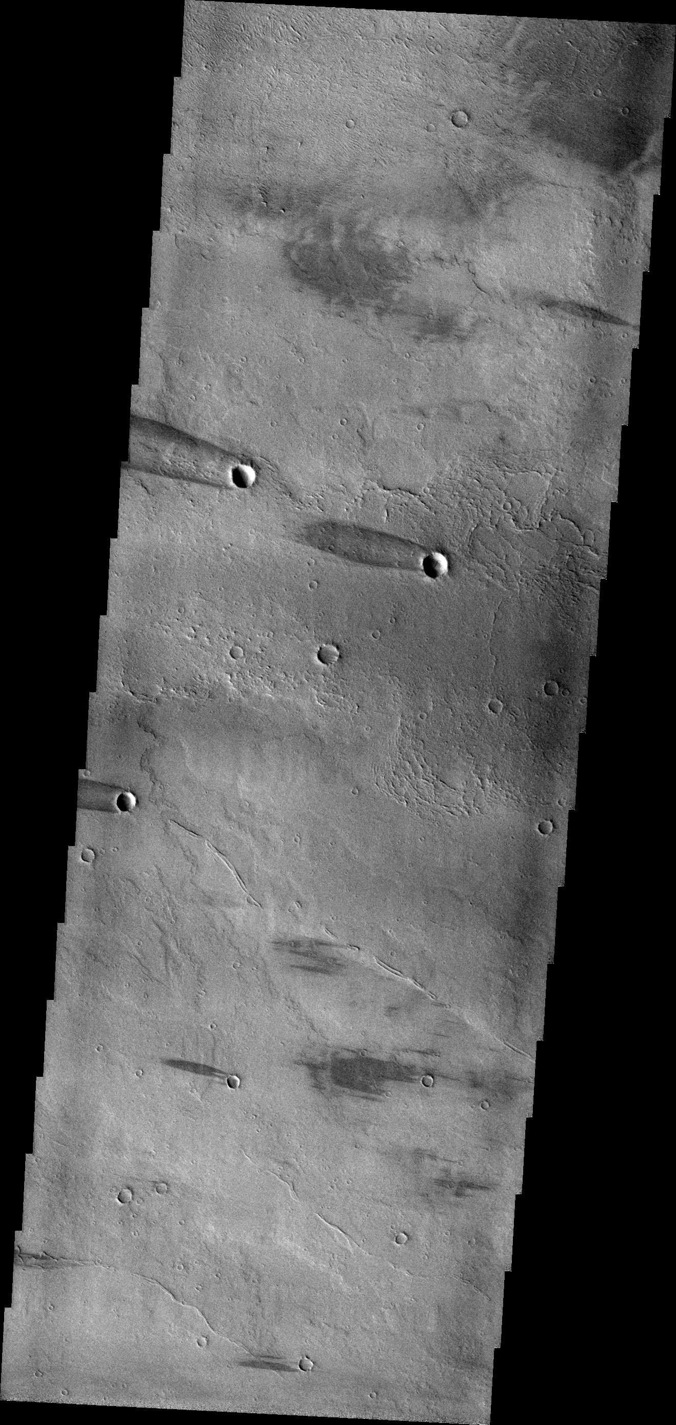
Windstreaks
Full Resolution:
TIFF
(3.667 MB)
JPEG
(625.8 kB)
2013-03-01
Mars
2001 Mars Odyssey
THEMIS
1305x2802x1
PIA16265:
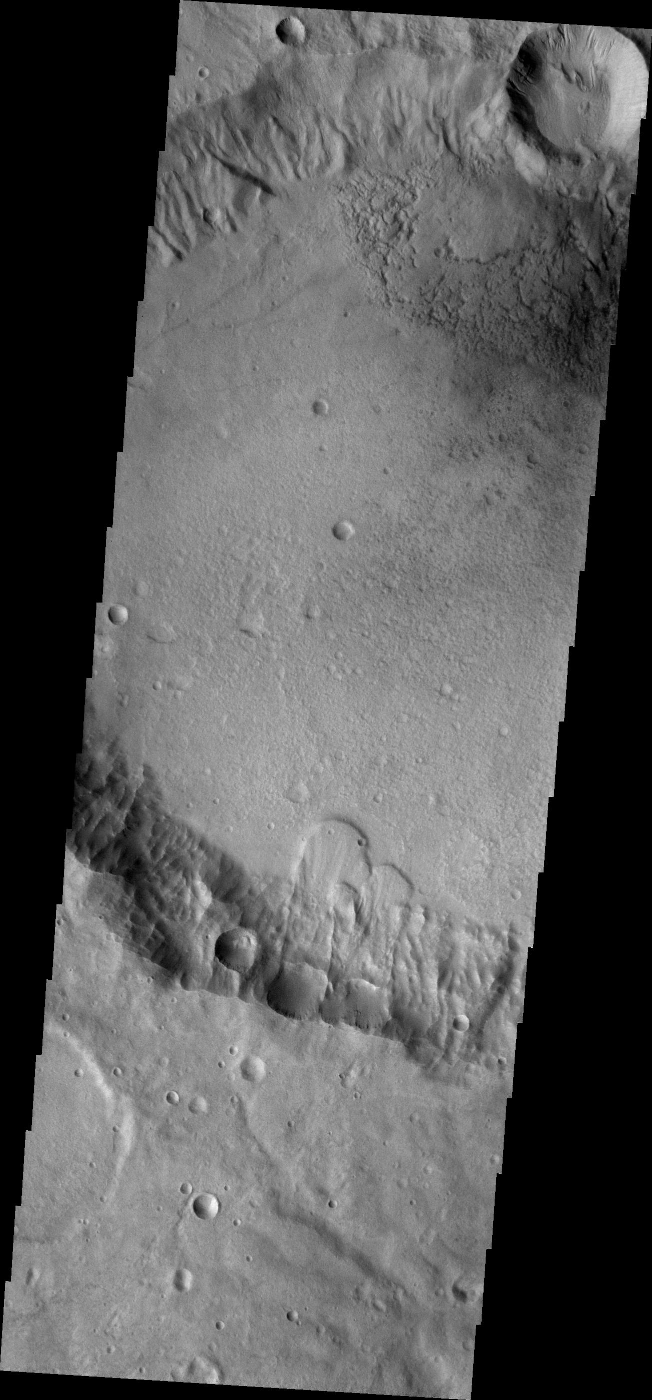
Landslides
Full Resolution:
TIFF
(3.661 MB)
JPEG
(379.9 kB)
2013-03-04
Mars
2001 Mars Odyssey
THEMIS
1324x2819x1
PIA16266:
Gullies
Full Resolution:
TIFF
(3.736 MB)
JPEG
(292.9 kB)
2013-03-05
Mars
2001 Mars Odyssey
THEMIS
1308x2796x1
PIA16267:
Channels
Full Resolution:
TIFF
(3.661 MB)
JPEG
(340.1 kB)
2013-03-06
Mars
2001 Mars Odyssey
THEMIS
1306x2795x1
PIA16268:
Graben
Full Resolution:
TIFF
(3.654 MB)
JPEG
(523.1 kB)
2013-03-07
Mars
2001 Mars Odyssey
THEMIS
1314x2813x1
PIA16270:
Channel
Full Resolution:
TIFF
(3.7 MB)
JPEG
(355.1 kB)
2013-03-07
Mars
Mars Reconnaissance Orbiter (MRO)
Shallow Subsurface Radar (SHARAD)
1000x692x3
PIA16767:
Visualization of Buried Marte Vallis Channels
Full Resolution:
TIFF
(2.077 MB)
JPEG
(74.88 kB)
2013-03-08
Mars
2001 Mars Odyssey
THEMIS
1334x2784x1
PIA16271:
Coprates Labes
Full Resolution:
TIFF
(3.718 MB)
JPEG
(359.3 kB)
2013-03-11
Mars
2001 Mars Odyssey
THEMIS
1328x2781x1
PIA16272:
Wind Erosion
Full Resolution:
TIFF
(3.697 MB)
JPEG
(517.6 kB)
2013-03-12
Mars
2001 Mars Odyssey
THEMIS
1316x2800x1
PIA16273:
Martz Crater
Full Resolution:
TIFF
(3.689 MB)
JPEG
(392.5 kB)
2013-03-12
Mars
Mars Science Laboratory (MSL)
CheMin
650x321x3
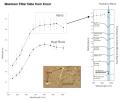
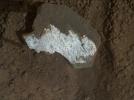
PIA16830:
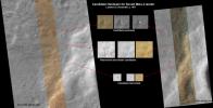
Minerals at 'Rocknest' and 'John Klein'
Full Resolution:
TIFF
(626.4 kB)
JPEG
(66.74 kB)
2013-03-12
Mars
Mars Science Laboratory (MSL)
THEMIS
938x720x3
PIA16832:
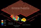
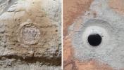
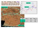
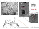
Location of John Klein Drill Site
Full Resolution:
TIFF
(2.027 MB)
JPEG
(150.6 kB)
2013-03-12
Mars
Mars Exploration Rover (MER)
Mars Science Laboratory (MSL)
Mastcam
Panoramic Camera
2660x1179x3
PIA16833:
Two Different Aqueous Environments
Full Resolution:
TIFF
(9.412 MB)
JPEG
(605.8 kB)
2013-03-12
Mars
Mars Exploration Rover (MER)
Mars Science Laboratory (MSL)
MAHLI
Panoramic Camera
1054x598x3
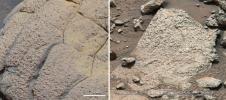
PIA16834:
Studying Habitability in Ancient Martian Environments
Full Resolution:
TIFF
(1.892 MB)
JPEG
(117.8 kB)
2013-03-12
Mars
Mars Science Laboratory (MSL)
SAM
929x720x3
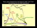
PIA16835:
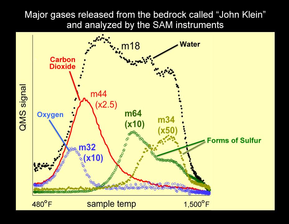
Major Gases Released from Drilled Samples of the "John Klein" Rock
Full Resolution:
TIFF
(2.008 MB)
JPEG
(79.48 kB)
2013-03-12
Mars
Mars Science Laboratory (MSL)
SAM
844x720x3
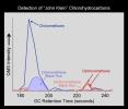
PIA16836:
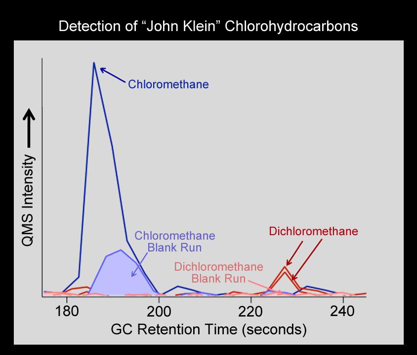
Chlorinated Forms of Methane at "John Klein" Site
Full Resolution:
TIFF
(1.824 MB)
JPEG
(50.18 kB)
2013-03-13
Mars
2001 Mars Odyssey
THEMIS
1316x2800x1
PIA16274:
Channels
Full Resolution:
TIFF
(3.689 MB)
JPEG
(418.8 kB)
2013-03-14
Mars
2001 Mars Odyssey
THEMIS
688x1539x1
PIA16275:
Solis Planum
Full Resolution:
TIFF
(1.06 MB)
JPEG
(145.5 kB)
2013-03-15
Mars
2001 Mars Odyssey
THEMIS
690x1538x1
PIA16276:
Crater Delta
Full Resolution:
TIFF
(1.063 MB)
JPEG
(83.11 kB)
2013-03-15
Mars
Mars Science Laboratory (MSL)
Mastcam
14576x2018x3
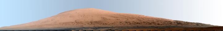
PIA16768:
Mount Sharp Panorama in White-Balanced Colors
Full Resolution:
TIFF
(88.26 MB)
JPEG
(2.085 MB)
2013-03-15
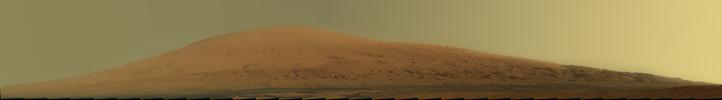
Mars
Mars Science Laboratory (MSL)
Mastcam
14585x2018x3
PIA16769:
Mount Sharp Panorama in Raw Colors
Full Resolution:
TIFF
(88.31 MB)
JPEG
(1.377 MB)
2013-03-18
Mars
2001 Mars Odyssey
THEMIS
1340x2926x1
PIA16277:
Winslow Crater
Full Resolution:
TIFF
(3.925 MB)
JPEG
(387.7 kB)
2013-03-18
Mars
Mars Science Laboratory (MSL)
MAHLI
6683x4987x3
PIA16790:
Target 'Wernecke' After Brushing by Curiosity
Full Resolution:
TIFF
(100 MB)
JPEG
(3.064 MB)
2013-03-18
Mars
Mars Science Laboratory (MSL)
Alpha Particle X-ray Spectrometer (MSL)
1883x1179x3
PIA16791:
Elemental Compositions of 'Yellowknife Bay' Rocks
Full Resolution:
TIFF
(6.663 MB)
JPEG
(161.1 kB)
2013-03-18
Mars
Mars Science Laboratory (MSL)
Mastcam
1024x914x3
PIA16792:
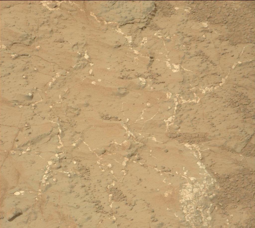
Veins and Nodules at 'Knorr' Target in 'Yellowknife Bay' of Gale Crater
Full Resolution:
TIFF
(2.809 MB)
JPEG
(118.6 kB)
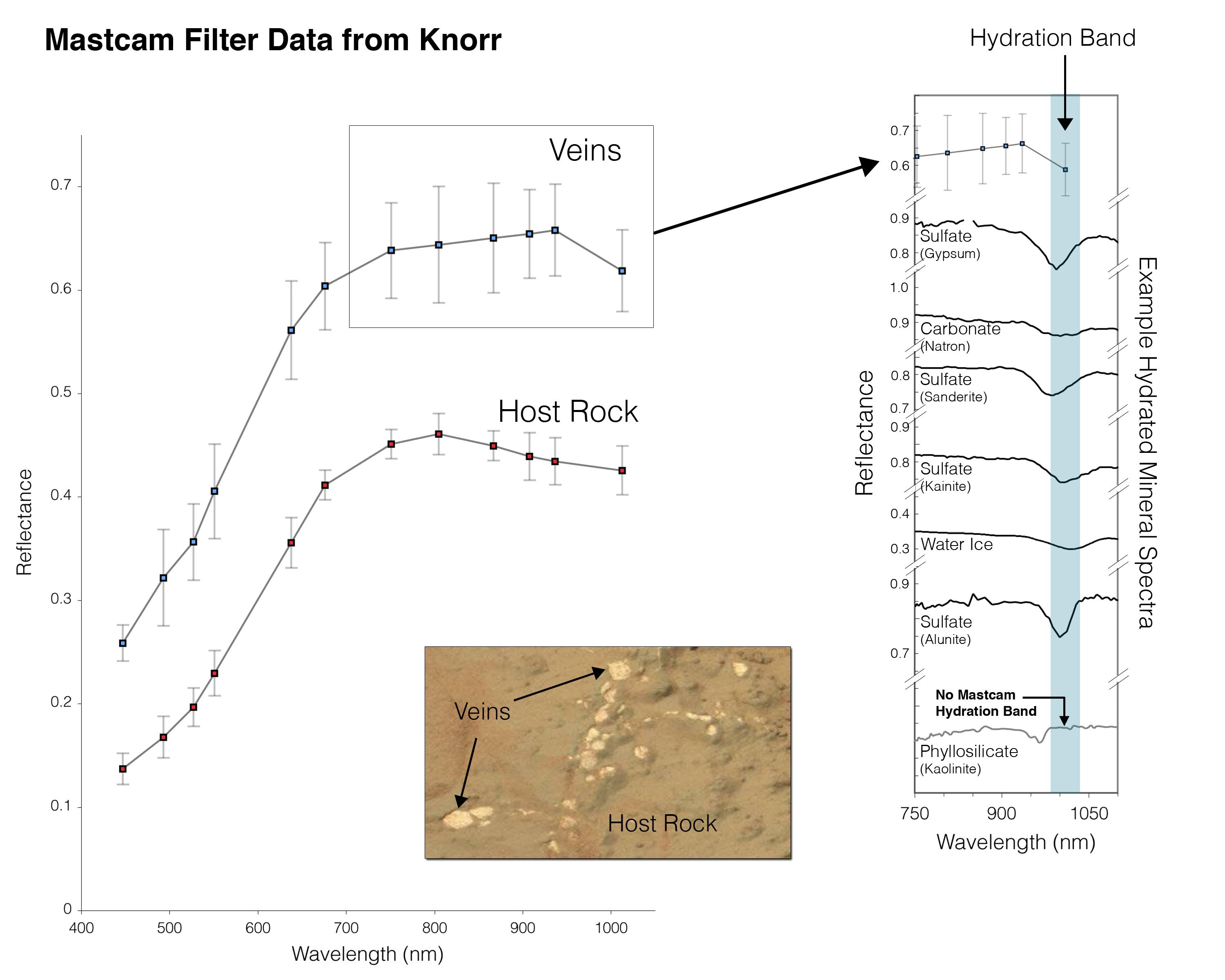
2013-03-18
Mars
Mars Science Laboratory (MSL)
Mastcam
3000x2400x3
PIA16793:
Indication of Hydration in Veins and Nodules of 'Knorr' in 'Yellowknife Bay'
Full Resolution:
TIFF
(21.61 MB)
JPEG
(357.3 kB)
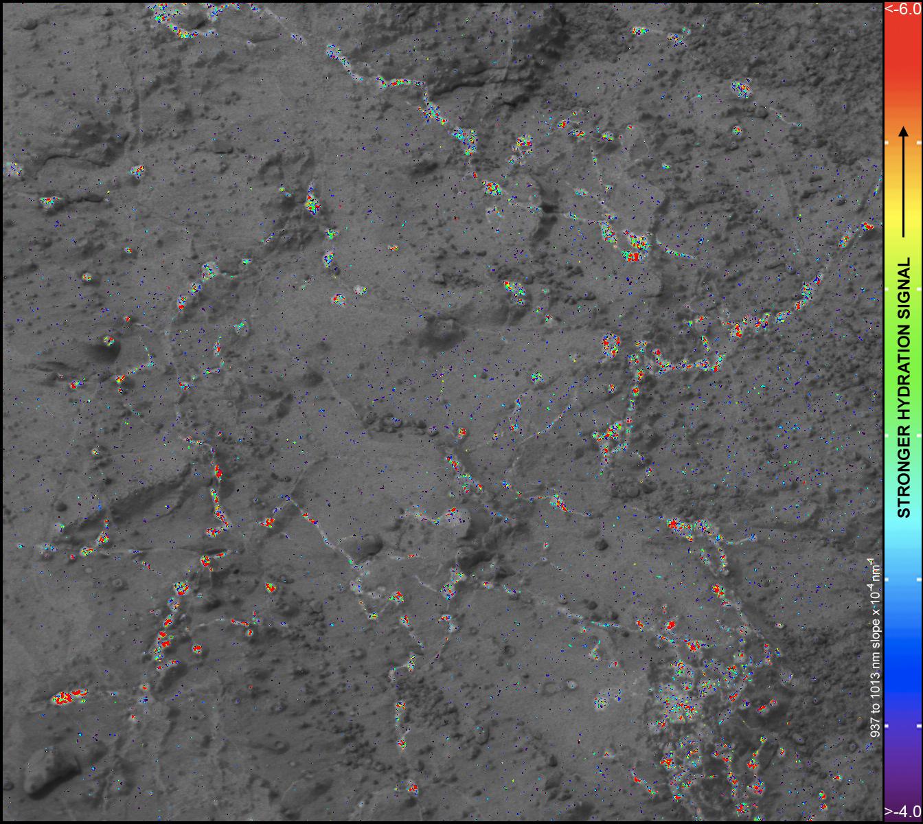
2013-03-18
Mars
Mars Science Laboratory (MSL)
Mastcam
1344x1200x3
PIA16794:
Hydration Map, Based on Mastcam Spectra, for 'Knorr' Rock Target
Full Resolution:
TIFF
(4.84 MB)
JPEG
(288 kB)
2013-03-18
Mars
Mars Science Laboratory (MSL)
Mastcam
1024x914x3
PIA16795:
Rock "Tintina" Exposes "Yellowknife Bay" Vein Material
Full Resolution:
TIFF
(2.809 MB)
JPEG
(125.5 kB)
2013-03-18
Mars
Mars Science Laboratory (MSL)
Mastcam
1344x1200x3
PIA16796:
Hydration Map, Based on Mastcam Spectra, for broken rock 'Tintina'
Full Resolution:
TIFF
(4.84 MB)
JPEG
(204.3 kB)
2013-03-18
Mars
Mars Science Laboratory (MSL)
MAHLI
1584x1184x3
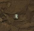
PIA16797:
Close-up View of Broken Mars Rock 'Tintina'
Full Resolution:
TIFF
(5.628 MB)
JPEG
(300.5 kB)
2013-03-18
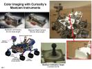
Mars
Mars Science Laboratory (MSL)
Mastcam
1150x863x3
PIA16798:
Mast Camera and Its Calibration Target on Curiosity Rover
Full Resolution:
TIFF
(2.979 MB)
JPEG
(158 kB)
2013-03-18
Mars
Mars Science Laboratory (MSL)
Mastcam
1150x863x3
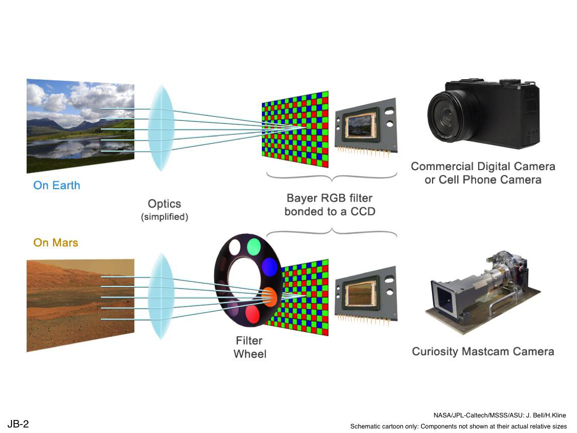
PIA16799:
Filters for Color Imaging and for Science
Full Resolution:
TIFF
(2.979 MB)
JPEG
(90.23 kB)
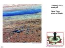
2013-03-18
Mars
Mars Science Laboratory (MSL)
Mastcam
1150x863x3
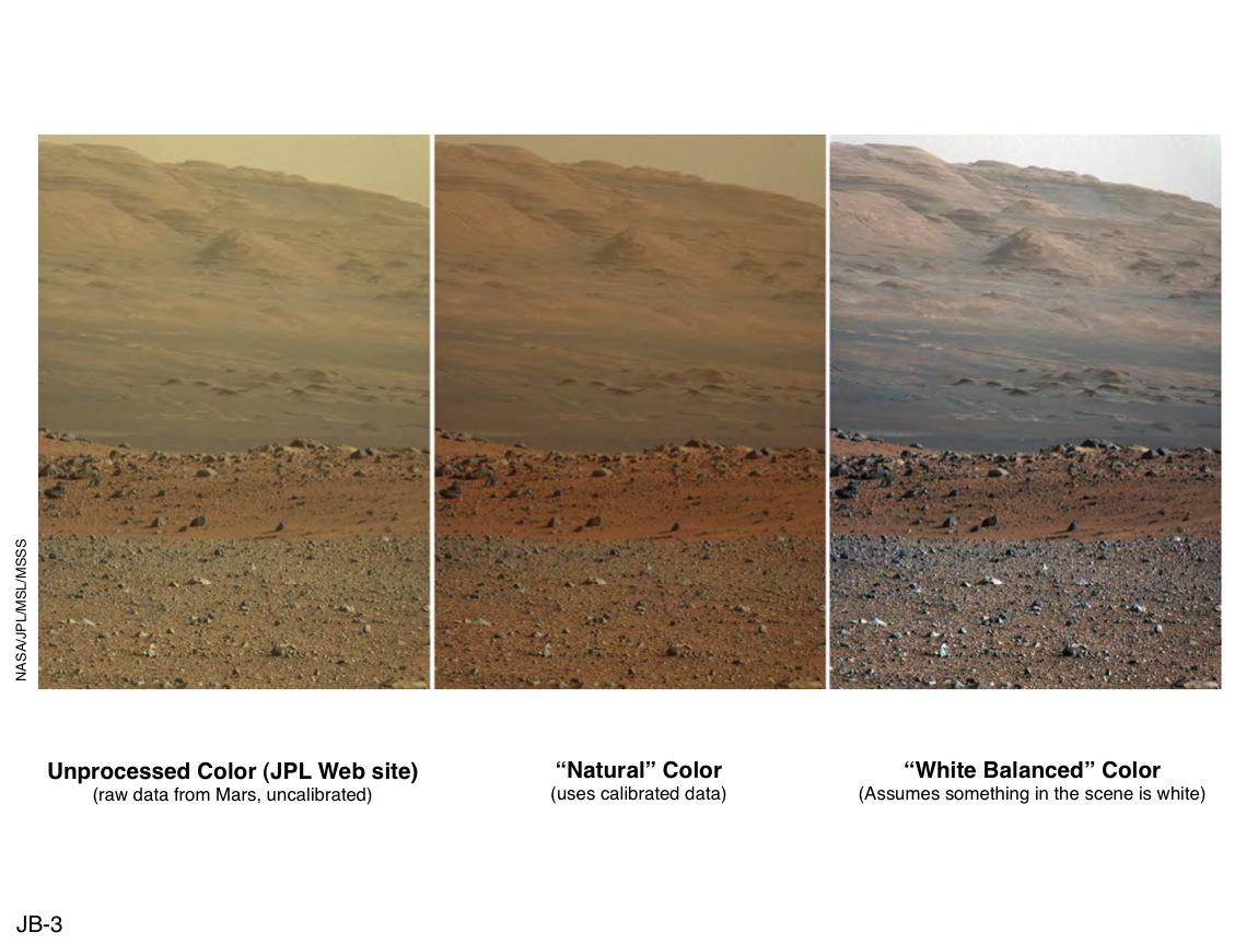
PIA16800:
'Raw,' 'Natural' and 'White-Balanced' Views of Martian Terrain
Full Resolution:
TIFF
(2.979 MB)
JPEG
(108 kB)
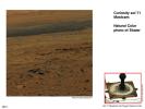
2013-03-18
Mars
Mars Science Laboratory (MSL)
Mastcam
1150x863x3
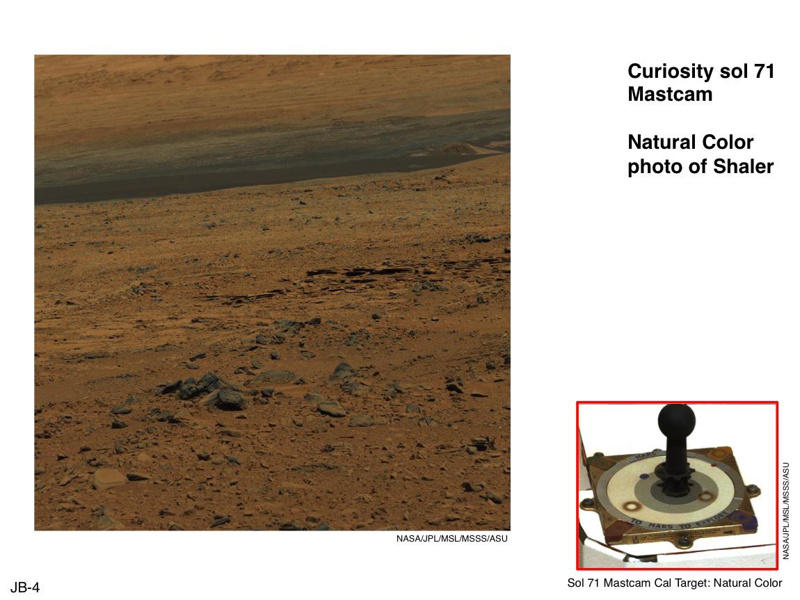
PIA16801:
Using Curiosity's Mast Camera to View Scene in 'Natural' Color
Full Resolution:
TIFF
(2.979 MB)
JPEG
(118.6 kB)
2013-03-18
Mars
Mars Science Laboratory (MSL)
Mastcam
1150x863x3
PIA16802:
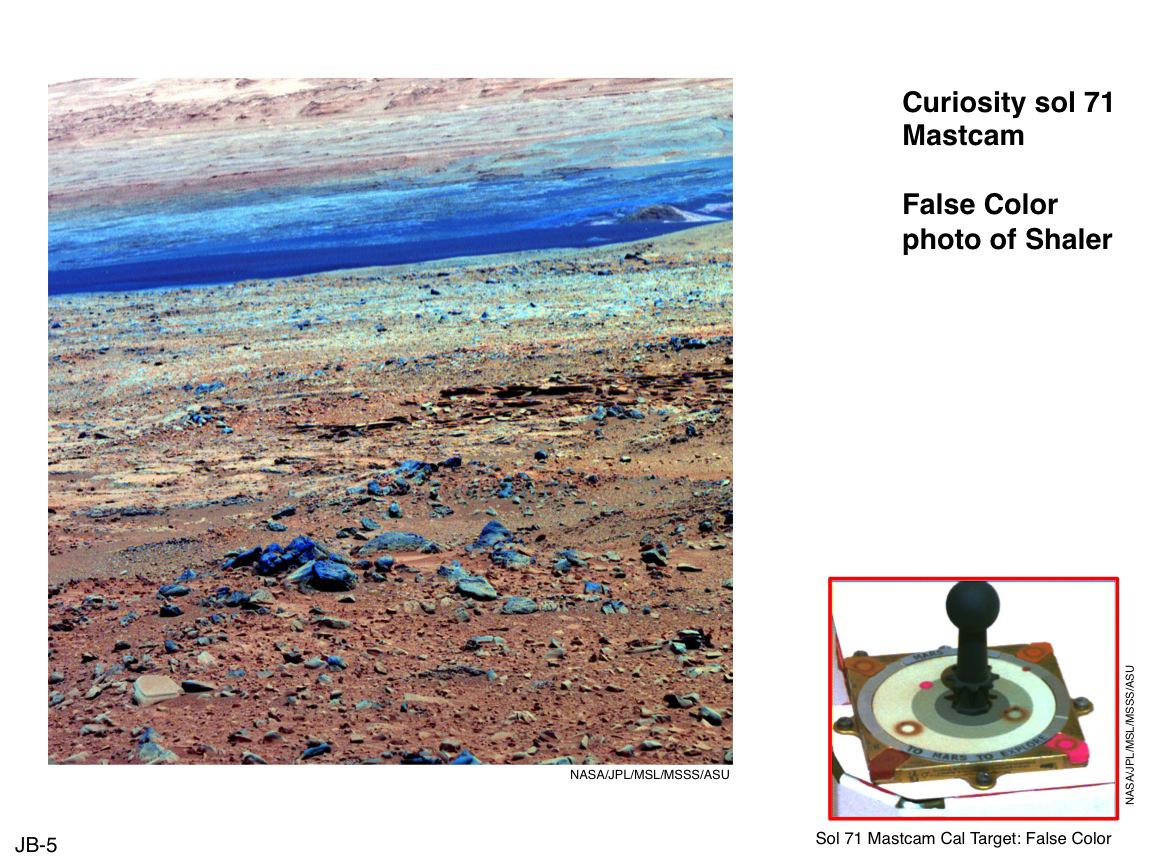
Using False Color from Curiosity's Mast Camera
Full Resolution:
TIFF
(2.979 MB)
JPEG
(174.6 kB)
2013-03-18
Mars
Mars Science Laboratory (MSL)
Mastcam
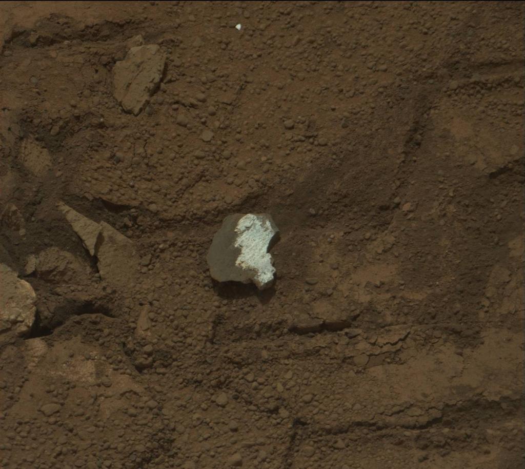
477x384x3
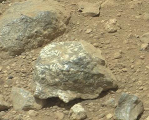
PIA16803:
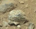
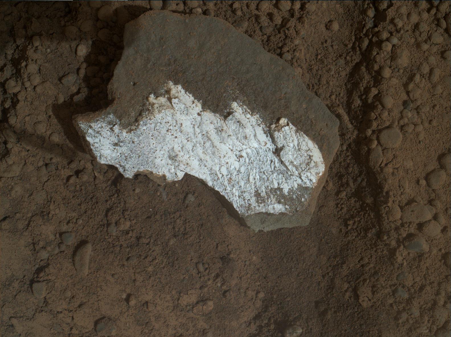
Bluish-Black Rock with White 'Crystals' on Mars
Full Resolution:
TIFF
(549.9 kB)
JPEG
(34.45 kB)
2013-03-18
Mars
Mars Science Laboratory (MSL)
Mastcam
1150x1107x3
PIA16804:
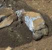
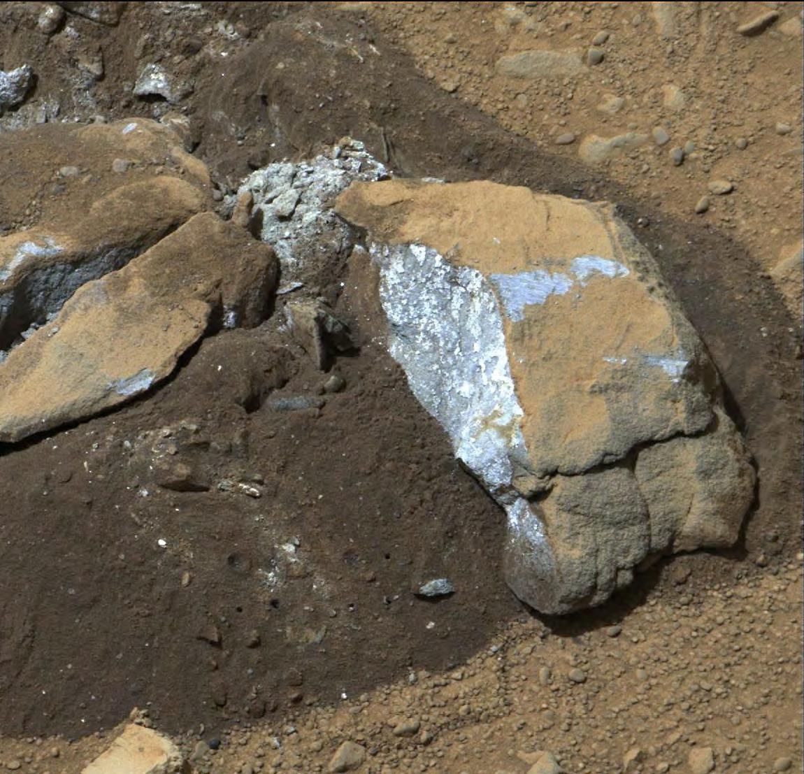
Bluish Color in Broken Rock in 'Yellowknife Bay'
Full Resolution:
TIFF
(3.821 MB)
JPEG
(219.4 kB)
2013-03-18
Mars
Mars Science Laboratory (MSL)
Mastcam
1150x863x3
PIA16805:
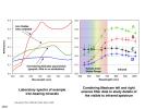
Drill Hole Image and Spectra Acquired by Mastcam
Full Resolution:
TIFF
(2.979 MB)
JPEG
(112.7 kB)
2013-03-18
Mars
Mars Science Laboratory (MSL)
Mastcam
1150x863x3
PIA16806:
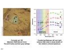
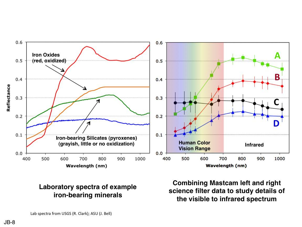
Comparing Mastcam and Laboratory Spectra
Full Resolution:
TIFF
(2.979 MB)
JPEG
(105.7 kB)
2013-03-18
Mars
Mars Science Laboratory (MSL)
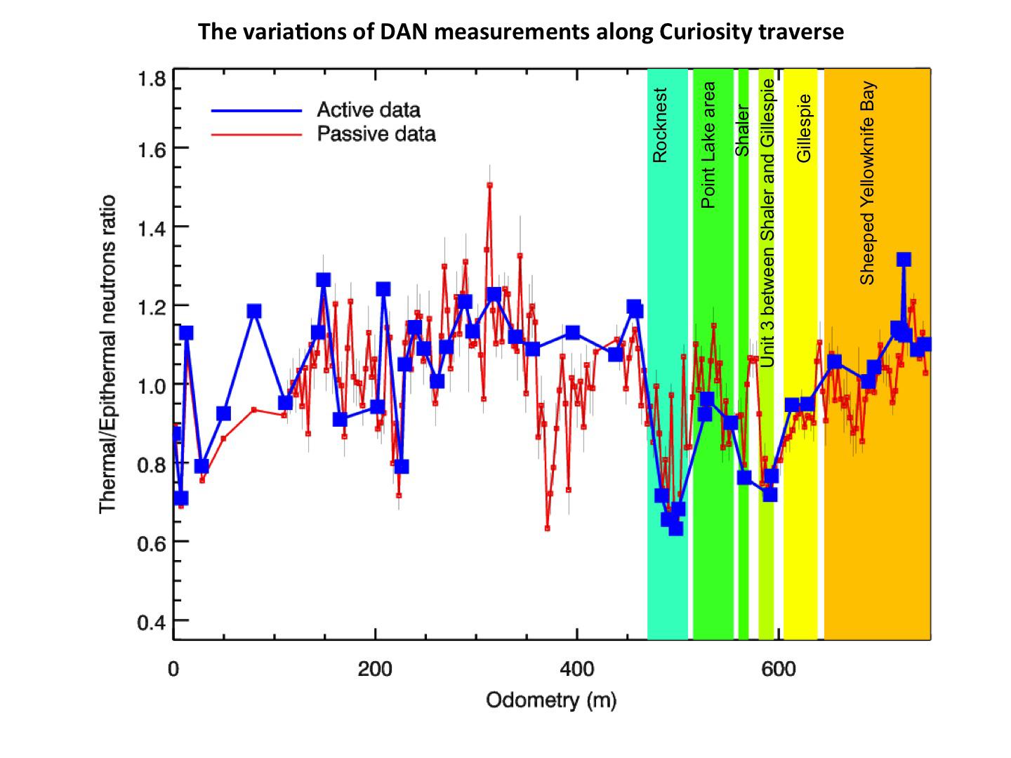
Dynamic Albedo of Neutrons
1440x1080x3
PIA16807:
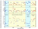
Variations of DAN Measurements Along Curiosity Traverse
Full Resolution:
TIFF
(4.668 MB)
JPEG
(146.1 kB)
2013-03-18
Mars
Mars Science Laboratory (MSL)
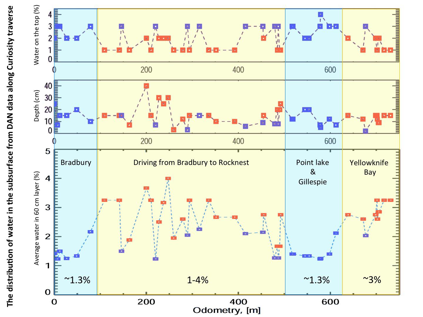
Dynamic Albedo of Neutrons
1440x1080x3
PIA16808:
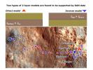
Two Types of Modeling of Subsurface Water
Full Resolution:
TIFF
(4.668 MB)
JPEG
(297.3 kB)
2013-03-18
Mars
Mars Science Laboratory (MSL)
Dynamic Albedo of Neutrons
1440x1080x3
PIA16809:
Variation in Water Content in Martian Subsurface Along Curiosity's Traverse
Full Resolution:
TIFF
(4.668 MB)
JPEG
(148 kB)
2013-03-18
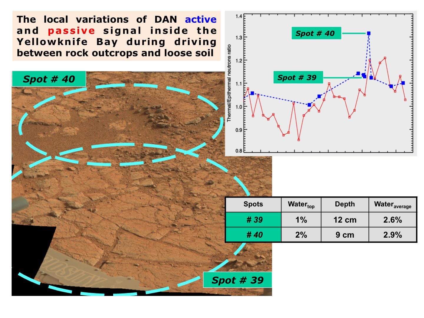
Mars
Mars Science Laboratory (MSL)
Dynamic Albedo of Neutrons
1440x1080x3
PIA16810:
Variation in Subsurface Water In 'Yellowknife Bay'
Full Resolution:
TIFF
(4.668 MB)
JPEG
(206.8 kB)
2013-03-19
Mars
2001 Mars Odyssey
THEMIS
683x1539x1
PIA16278:
Ladon Valles
Full Resolution:
TIFF
(1.052 MB)
JPEG
(116.9 kB)
2013-03-20
Mars
2001 Mars Odyssey
THEMIS
1358x2836x1
PIA16279:
Dunes
Full Resolution:
TIFF
(3.855 MB)
JPEG
(234.4 kB)
2013-03-20
Mars
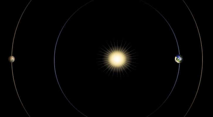
726x400x3
PIA16811:
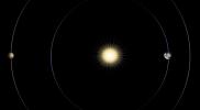
Geometry of Mars Solar Conjunction
Full Resolution:
TIFF
(871.7 kB)
JPEG
(12.1 kB)
2013-03-21
Mars
2001 Mars Odyssey
THEMIS
1339x2931x1
PIA16280:
Coprates Catena
Full Resolution:
TIFF
(3.929 MB)
JPEG
(245.4 kB)
2013-03-22
Mars
2001 Mars Odyssey
THEMIS
691x1538x1
PIA16281:
Ganges Chasma
Full Resolution:
TIFF
(1.064 MB)
JPEG
(56.36 kB)
2013-03-25
Mars
2001 Mars Odyssey
THEMIS
696x1540x1
PIA16282:
Channel
Full Resolution:
TIFF
(1.073 MB)
JPEG
(106.9 kB)
2013-03-25
Mars
Mars Science Laboratory (MSL)
Navcam (MSL)
1024x1024x1
PIA16812:
View From Camera Not Used During Curiosity's First Six Months on Mars
Full Resolution:
TIFF
(1.05 MB)
JPEG
(241.9 kB)
2013-03-26
Mars
2001 Mars Odyssey
THEMIS
1332x2787x1
PIA16283:
Arda Valles
Full Resolution:
TIFF
(3.716 MB)
JPEG
(413.2 kB)
2013-03-27
Mars
2001 Mars Odyssey
THEMIS
685x1539x1
PIA16284:
Daedalia Planum
Full Resolution:
TIFF
(1.056 MB)
JPEG
(181.8 kB)
2013-03-28
Mars
2001 Mars Odyssey
THEMIS
693x1539x1
PIA16285:
Windstreaks
Full Resolution:
TIFF
(1.068 MB)
JPEG
(122.1 kB)
2013-03-29
Mars
2001 Mars Odyssey
THEMIS
1315x2786x1
PIA16286:
Arda Valles
Full Resolution:
TIFF
(3.668 MB)
JPEG
(350.1 kB)
2013-04-01
Mars
2001 Mars Odyssey
THEMIS
1310x2814x1
PIA16287:
Rabe Crater Dunes
Full Resolution:
TIFF
(3.69 MB)
JPEG
(168.1 kB)
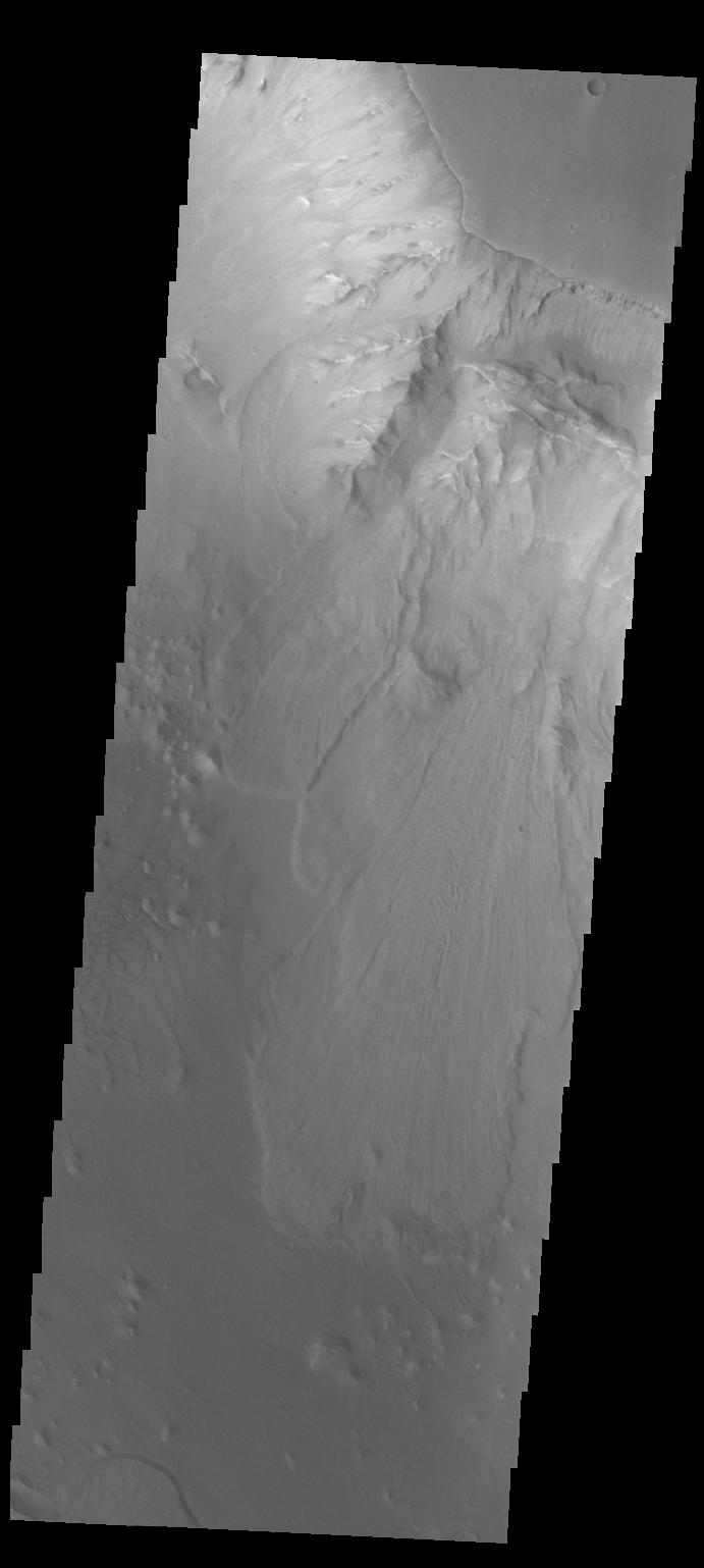
2013-04-02
Mars
2001 Mars Odyssey
THEMIS
1330x2818x1
PIA16288:
Gullies
Full Resolution:
TIFF
(3.752 MB)
JPEG
(267 kB)
2013-04-03
Mars
2001 Mars Odyssey
THEMIS
1337x2774x1
PIA16289:
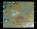
Curiosity Landing Site
Full Resolution:
TIFF
(3.713 MB)
JPEG
(364.8 kB)
2013-04-03
Mars
Mars Reconnaissance Orbiter (MRO)
Mars Science Laboratory (MSL)
HiRISE
369x390x1
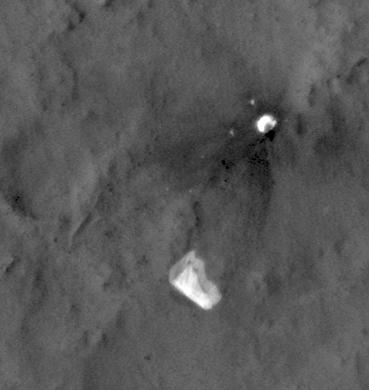
PIA16813:
MSL's Parachute Flapping in the Wind
Full Resolution:
TIFF
(144.3 kB)
JPEG
(15.5 kB)
2013-04-04
Mars
2001 Mars Odyssey
THEMIS
1364x3064x1
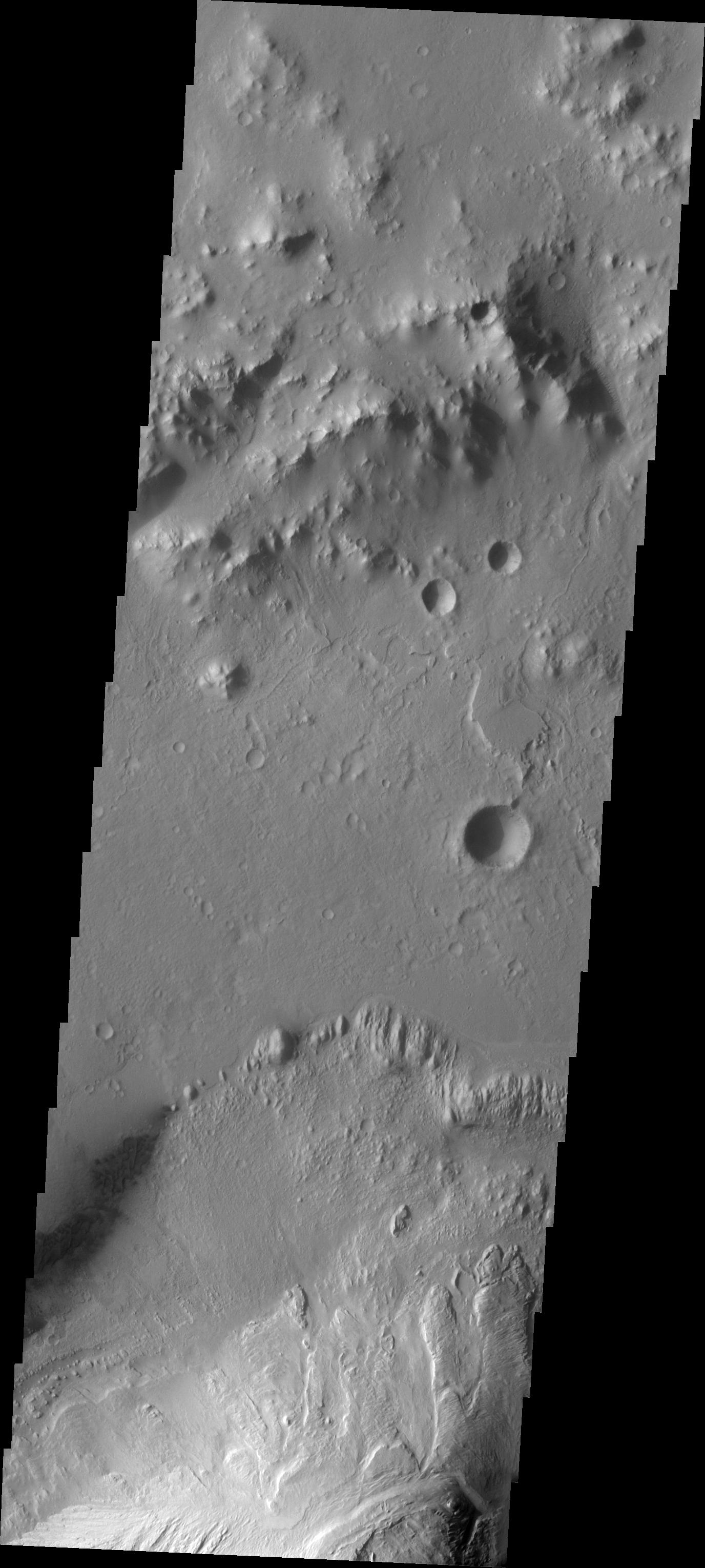
PIA16240:
Images of Gale #2
Full Resolution:
TIFF
(4.184 MB)
JPEG
(351 kB)
2013-04-05
Mars
2001 Mars Odyssey
THEMIS
1376x3059x1
PIA16241:
Images of Gale #3
Full Resolution:
TIFF
(4.214 MB)
JPEG
(336.9 kB)
2013-04-08
Mars
Mars Science Laboratory (MSL)
Mastcam
1420x1159x3
PIA16815:
Dust from Mars Drilling: Tailings and Discard Piles
Full Resolution:
TIFF
(4.939 MB)
JPEG
(335.9 kB)
2013-04-08
Mars
Mars Science Laboratory (MSL)
SAM
720x540x3
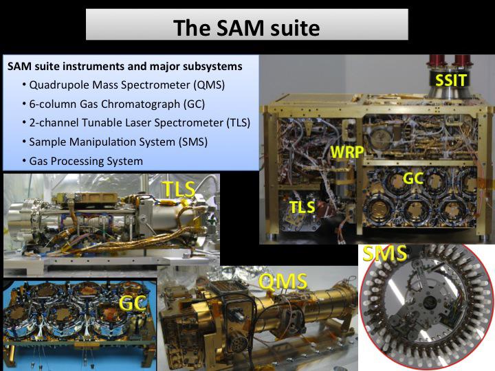
PIA16816:
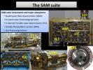
The SAM Suite
Full Resolution:
TIFF
(1.167 MB)
JPEG
(87.23 kB)
2013-04-08
Mars
Mars Science Laboratory (MSL)
SAM
1242x782x3
PIA16817:
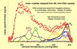
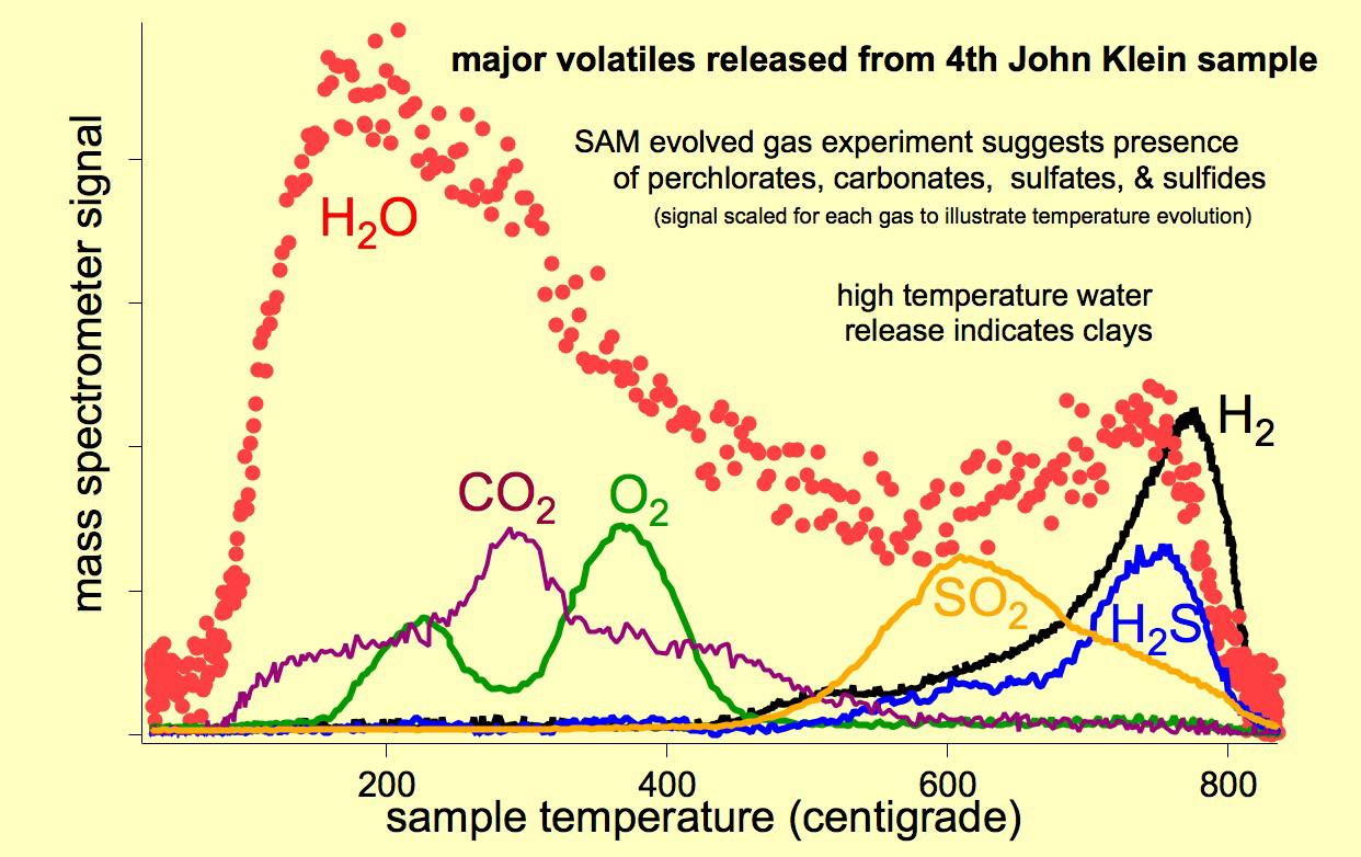
Major Volatiles Released from the Fourth 'John Klein' Portion
Full Resolution:
TIFF
(2.915 MB)
JPEG
(134.4 kB)
2013-04-08
Mars
Mars Science Laboratory (MSL)
SAM
960x720x3
PIA16818:
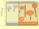
Argon Isotopes Provide Robust Signature of Atmospheric Loss
Full Resolution:
TIFF
(2.075 MB)
JPEG
(65.18 kB)
2013-04-08
Mars
Mars Science Laboratory (MSL)
ChemCam
960x720x3
PIA16819:
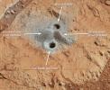
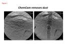
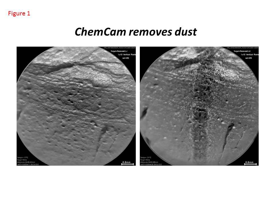
Curiosity's ChemCam Removes Dust
Full Resolution:
TIFF
(2.075 MB)
JPEG
(71.03 kB)
2013-04-08
Mars
Mars Science Laboratory (MSL)
ChemCam
960x720x3
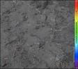
PIA16910:
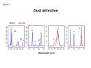
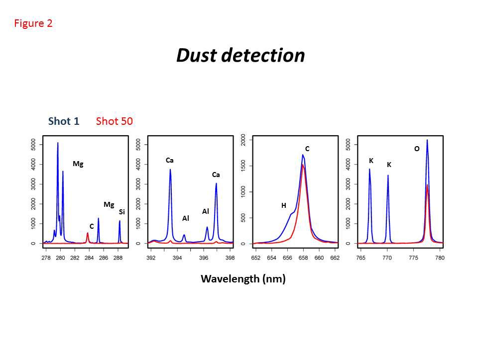
Dust Detection by Curiosity's ChemCam
Full Resolution:
TIFF
(2.075 MB)
JPEG
(48.57 kB)
2013-04-08
Mars
Mars Science Laboratory (MSL)
ChemCam
960x720x3
PIA16911:
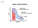
Curiosity's ChemCam Analyzes Rocks, Soils and Dust
Full Resolution:
TIFF
(2.075 MB)
JPEG
(39.68 kB)
2013-04-08
Mars
Mars Science Laboratory (MSL)
REMS
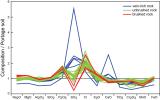
664x531x3
PIA16912:
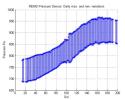
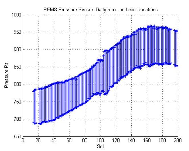
Seasonal Pressure Curve Peaks at Gale Crater
Full Resolution:
TIFF
(1.058 MB)
JPEG
(58.18 kB)
2013-04-08
Mars
Mars Science Laboratory (MSL)
REMS
700x534x3
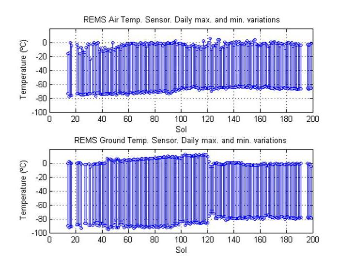
PIA16913:
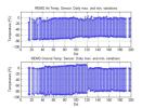
Steady Temperatures at Mars' Gale Crater
Full Resolution:
TIFF
(1.122 MB)
JPEG
(75.76 kB)
2013-04-08
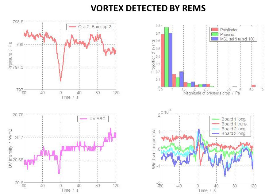
Mars
Mars Science Laboratory (MSL)
REMS
890x639x3
PIA16914:
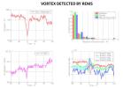
Whirlwind Detection by Curiosity in Gale Crater
Full Resolution:
TIFF
(1.707 MB)
JPEG
(69.34 kB)
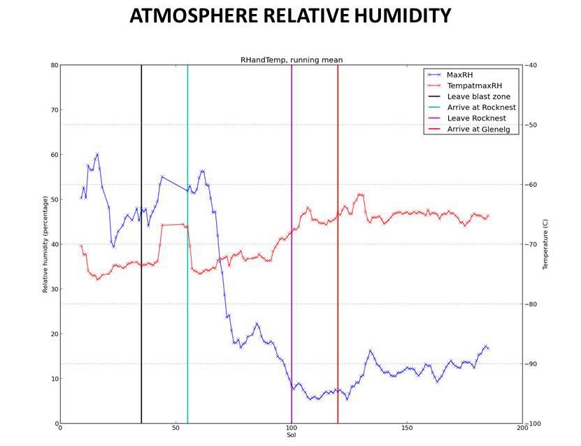
2013-04-08
Mars
Mars Science Laboratory (MSL)
REMS
831x637x3
PIA16915:
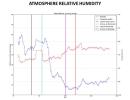
Humidity in Gale Crater: Scant and Variable
Full Resolution:
TIFF
(1.589 MB)
JPEG
(46.41 kB)
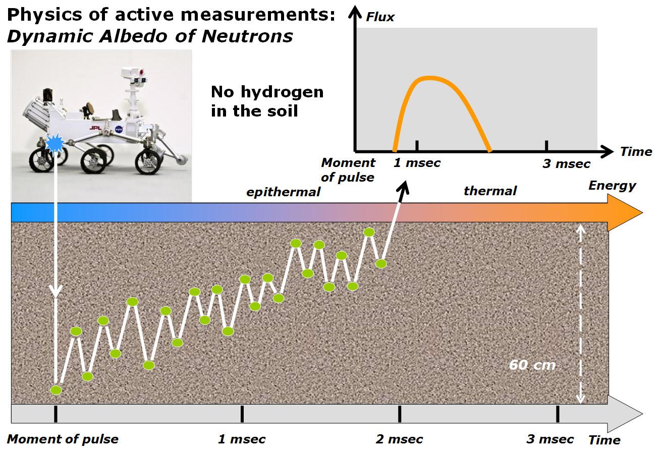
2013-04-08
Mars
Mars Science Laboratory (MSL)
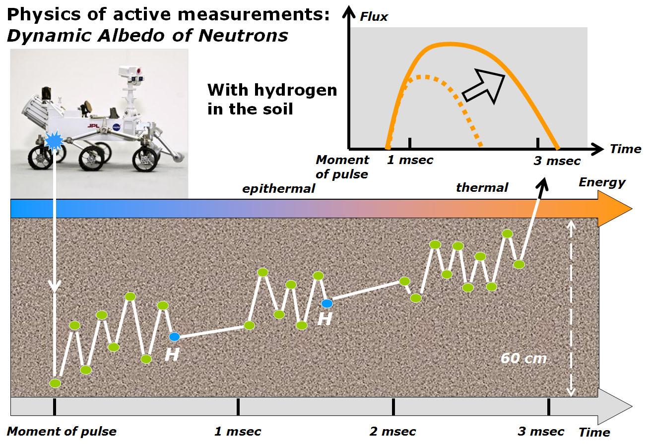
DAN
1312x902x3
PIA16916:
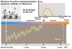
Physics of How DAN on Curiosity Checks for Water, Part 1
Full Resolution:
TIFF
(3.552 MB)
JPEG
(195.2 kB)
2013-04-08
Mars
Mars Science Laboratory (MSL)
DAN
1312x902x3
PIA16917:
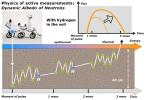
Physics of How DAN on Curiosity Checks for Water, Part 2
Full Resolution:
TIFF
(3.552 MB)
JPEG
(200.8 kB)
2013-04-08
Mars
2001 Mars Odyssey
THEMIS
1373x3064x1
PIA16242:
Images of Gale #4
Full Resolution:
TIFF
(4.212 MB)
JPEG
(317.6 kB)
2013-04-09
Mars
2001 Mars Odyssey
THEMIS
1330x2773x1
PIA16243:
Images of Gale #5
Full Resolution:
TIFF
(3.692 MB)
JPEG
(342.9 kB)
2013-04-10
Mars
2001 Mars Odyssey
THEMIS
1352x2922x1
PIA16244:
Images of Gale #6
Full Resolution:
TIFF
(3.955 MB)
JPEG
(199.5 kB)
2013-04-10
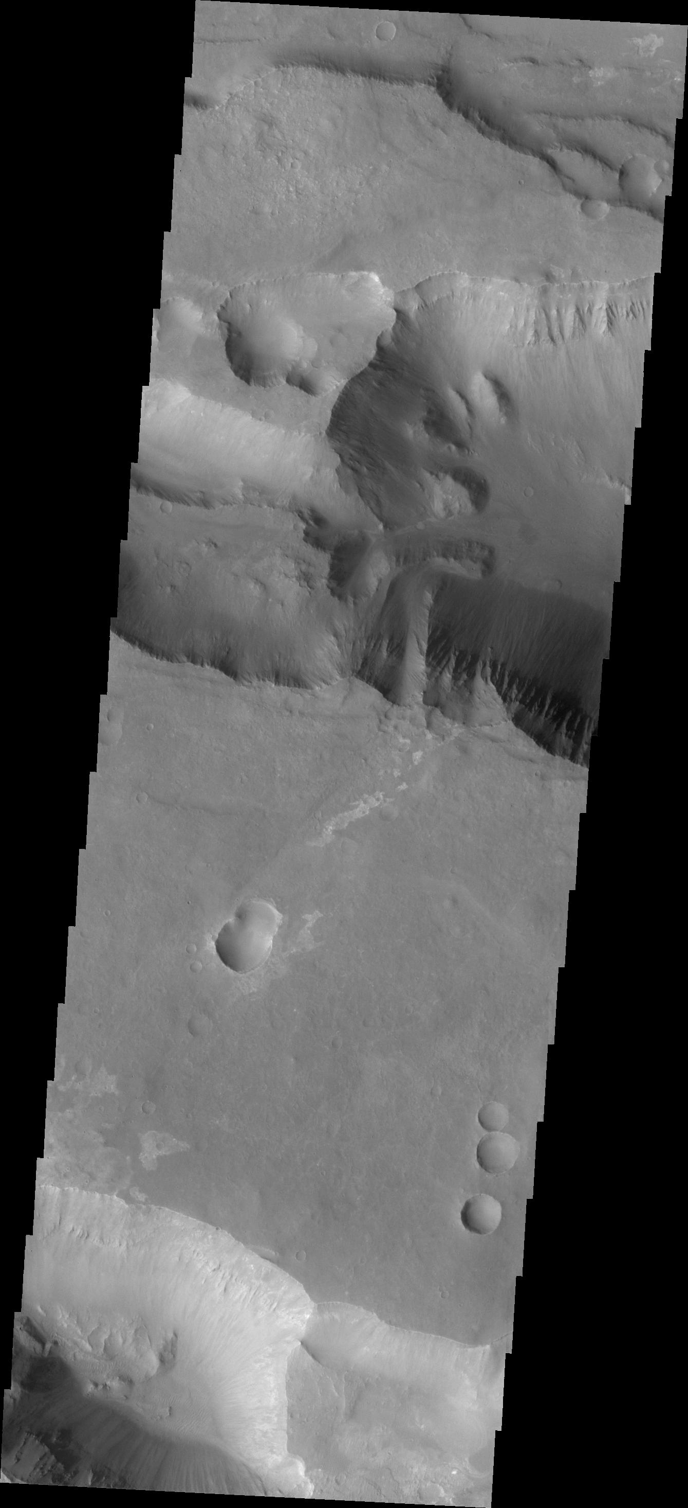
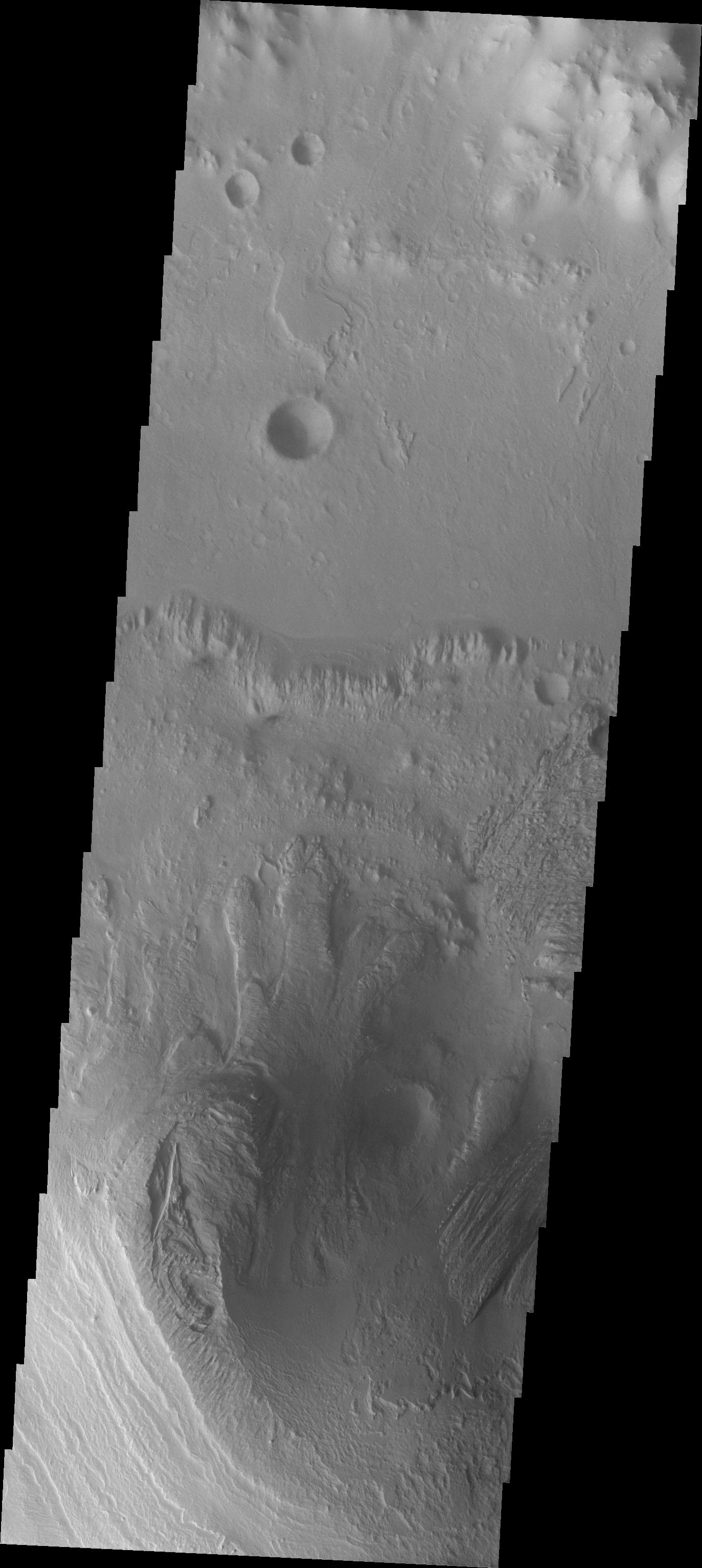
Mars
Mars Reconnaissance Orbiter (MRO)
HiRISE
2560x1920x3
PIA17877:
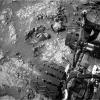
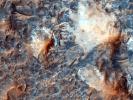
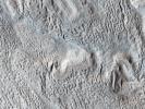
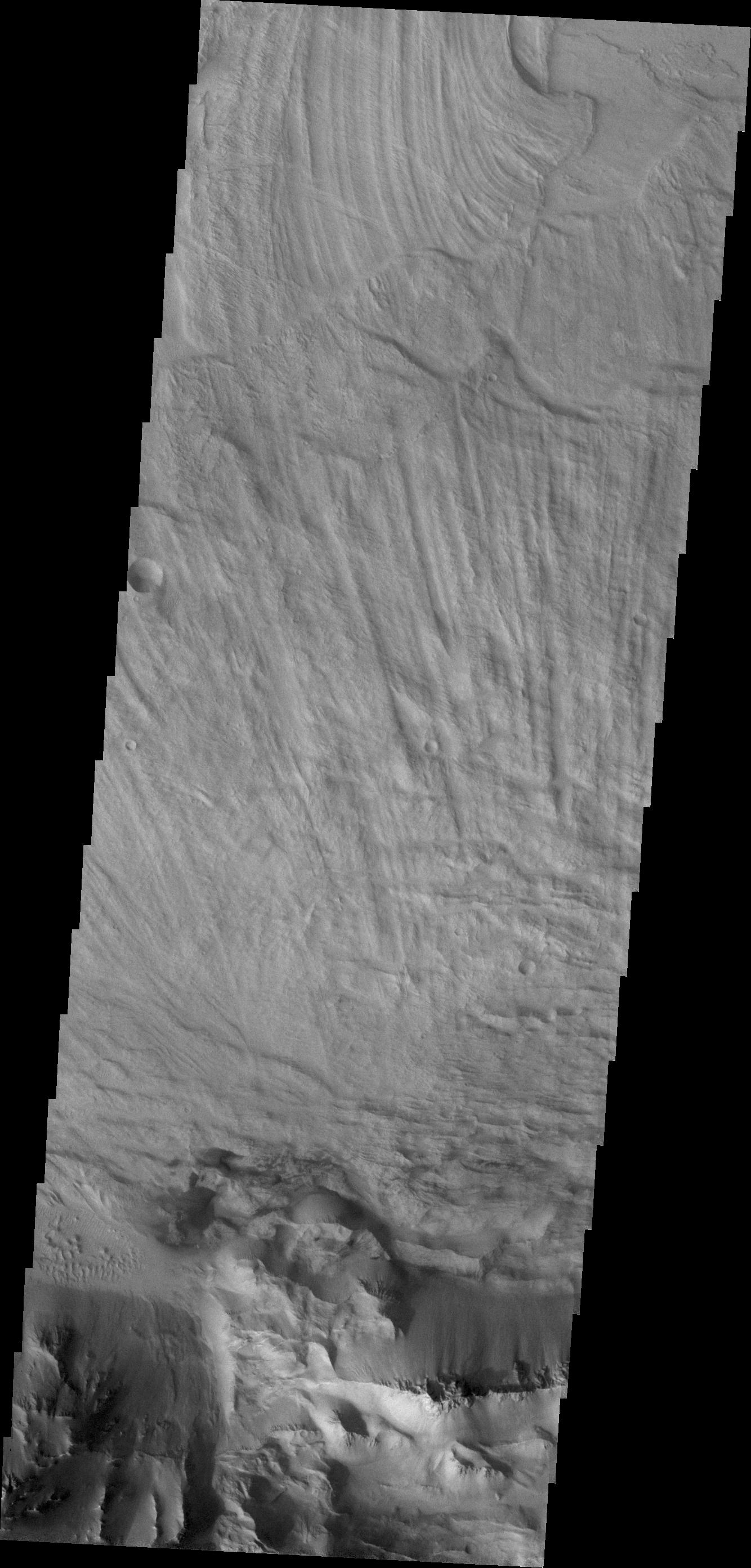
Megabreccia on the Floor of an Impact Crater
Full Resolution:
TIFF
(14.75 MB)
JPEG
(747.9 kB)
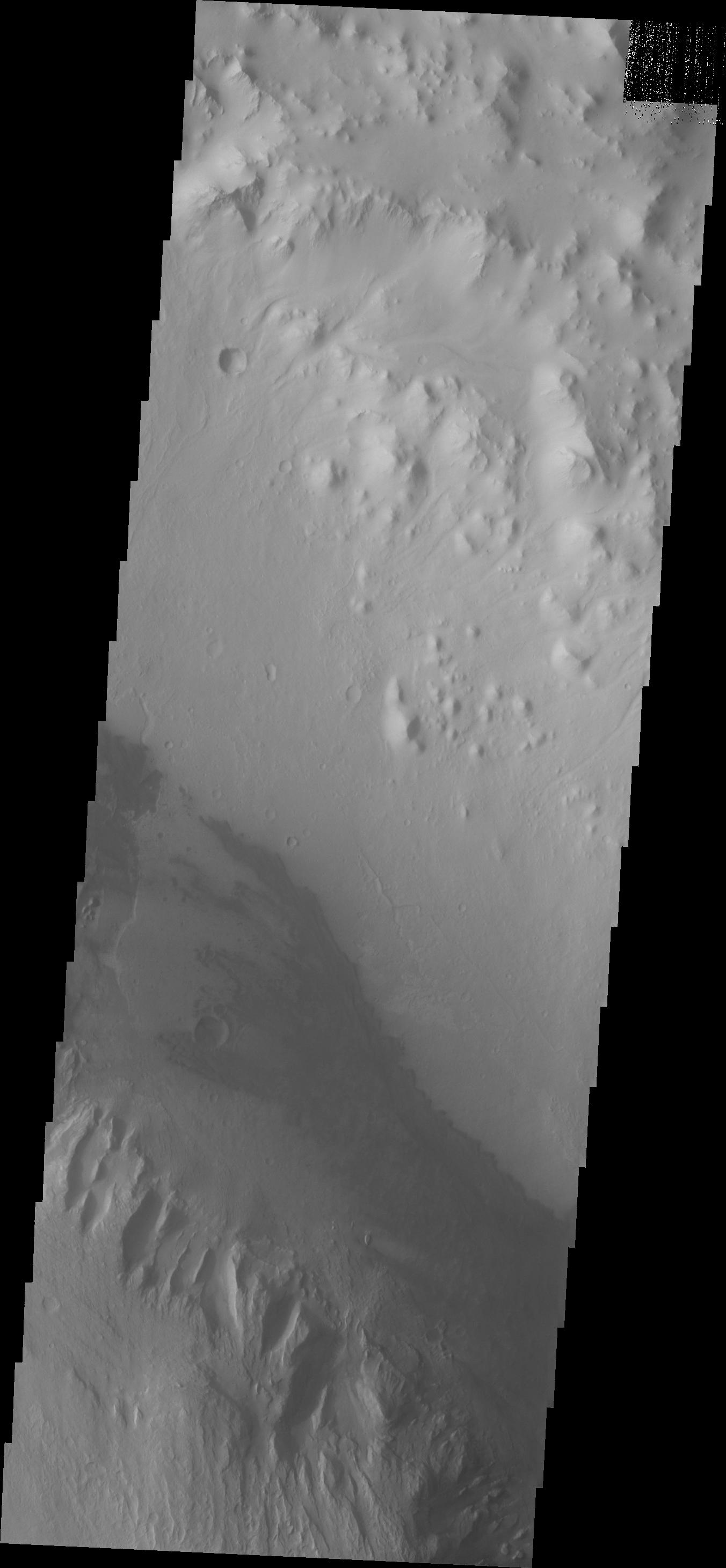
2013-04-10
Mars
Mars Reconnaissance Orbiter (MRO)
HiRISE
2560x1920x3
PIA17878:
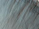
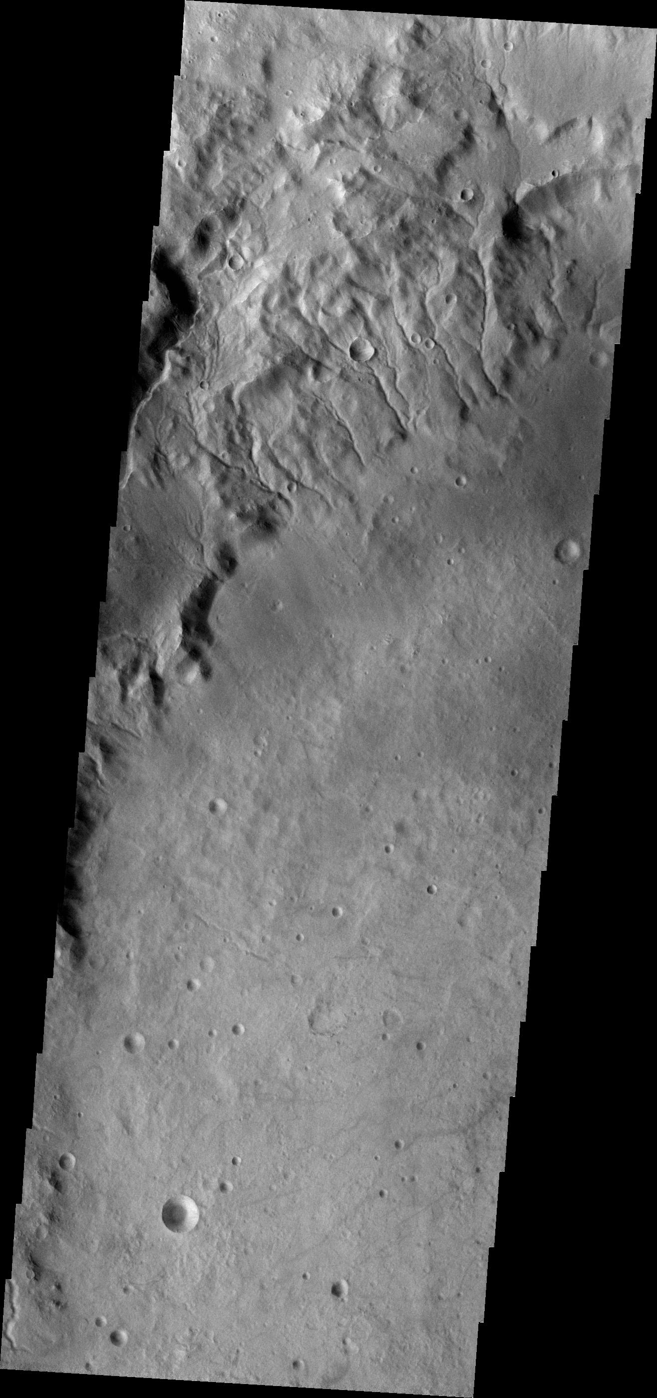
Bright Tracks from Bouncing and Rolling Boulders
Full Resolution:
TIFF
(14.75 MB)
JPEG
(905 kB)
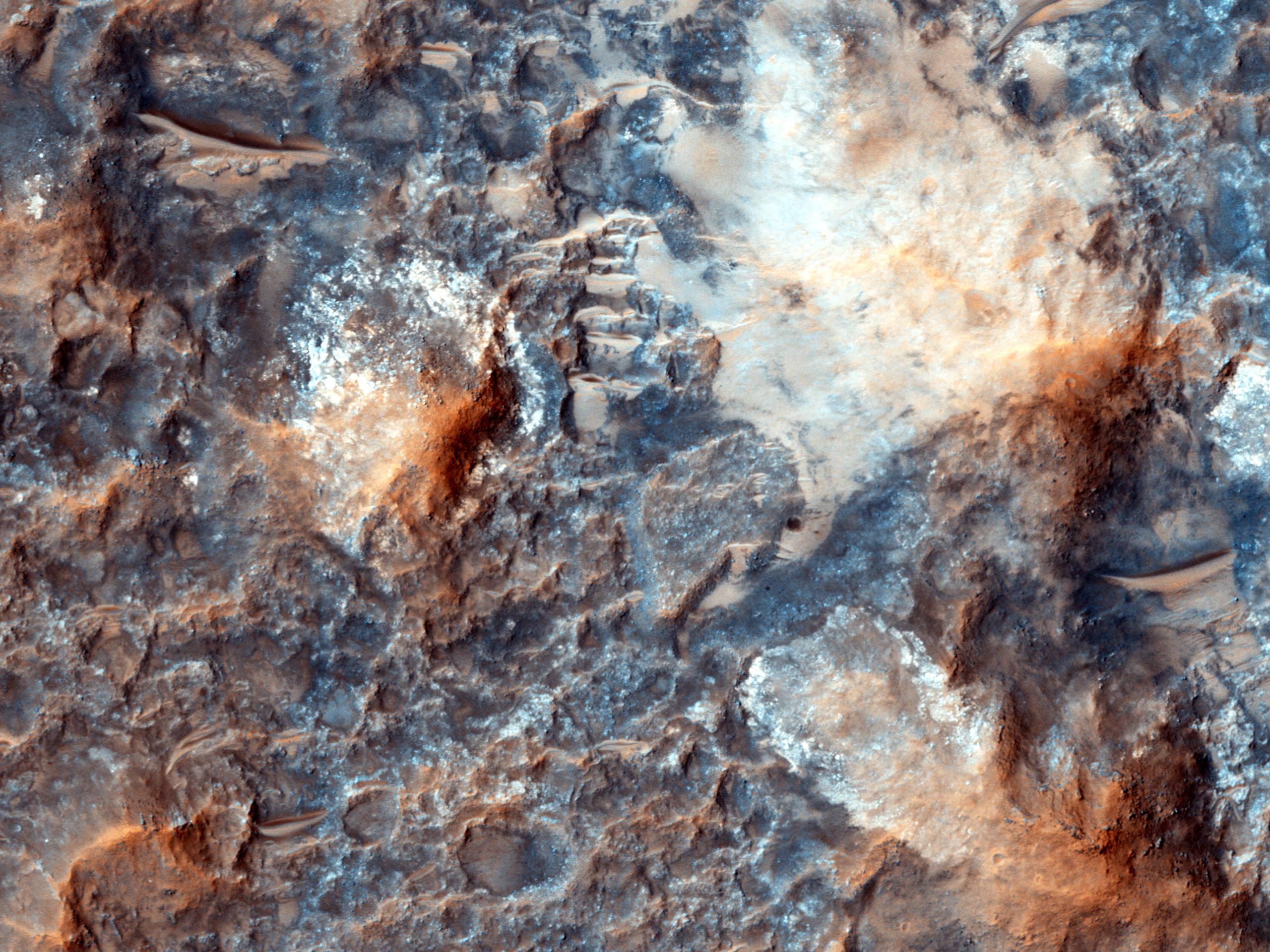
2013-04-10
Mars
Mars Reconnaissance Orbiter (MRO)
HiRISE
2560x1920x3
PIA17879:
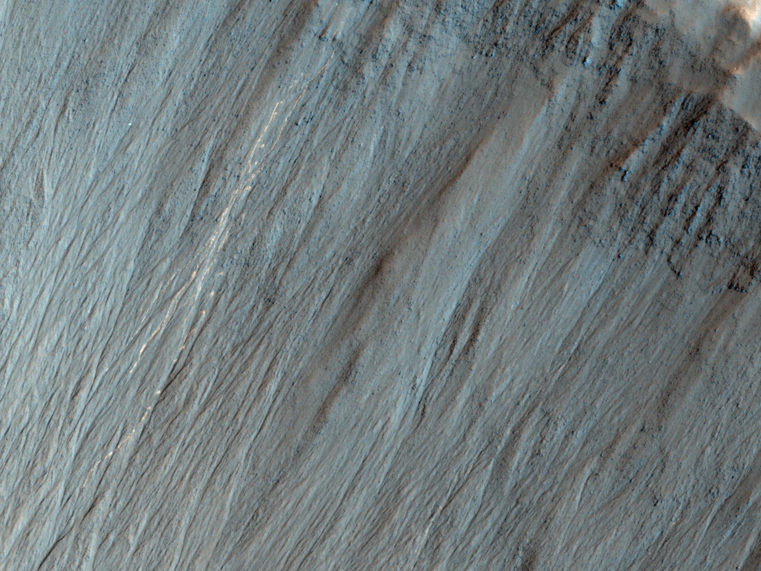
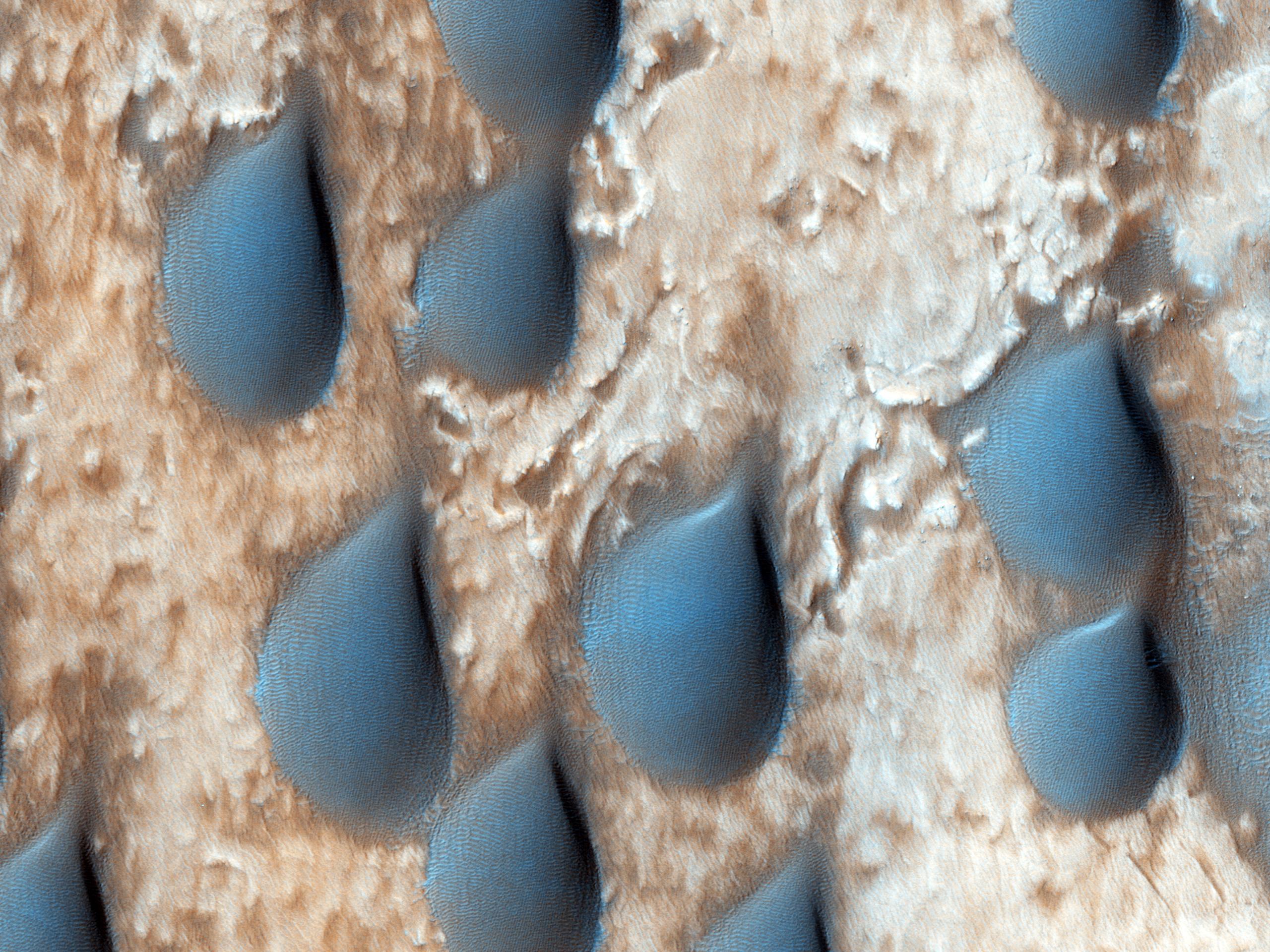
Raindrops of Sand in Copernicus Crater
Full Resolution:
TIFF
(14.75 MB)
JPEG
(787.4 kB)
2013-04-10
Mars
Mars Reconnaissance Orbiter (MRO)
HiRISE
2560x1920x3
PIA17880:
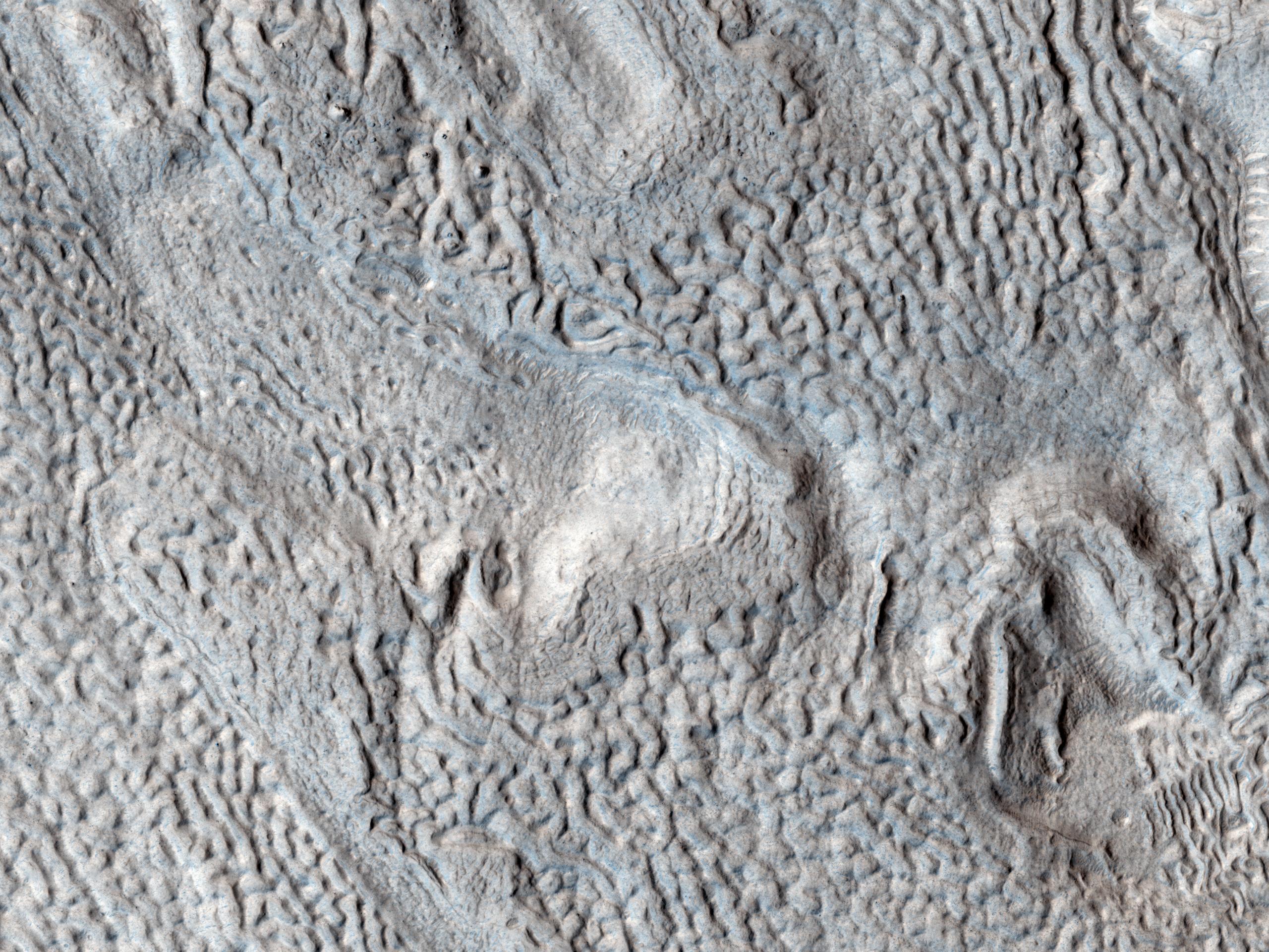
Ridges and Grooves That Wave and Buckle on a Valley Floor
Full Resolution:
TIFF
(14.75 MB)
JPEG
(905.8 kB)
2013-04-11
Mars
2001 Mars Odyssey
THEMIS
1345x2777x1
PIA16245:
Images of Gale #7
Full Resolution:
TIFF
(3.739 MB)
JPEG
(169.9 kB)
2013-04-11
Mars
Mars Reconnaissance Orbiter (MRO)
HiRISE
3505x1786x3
PIA16920:
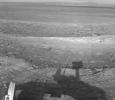
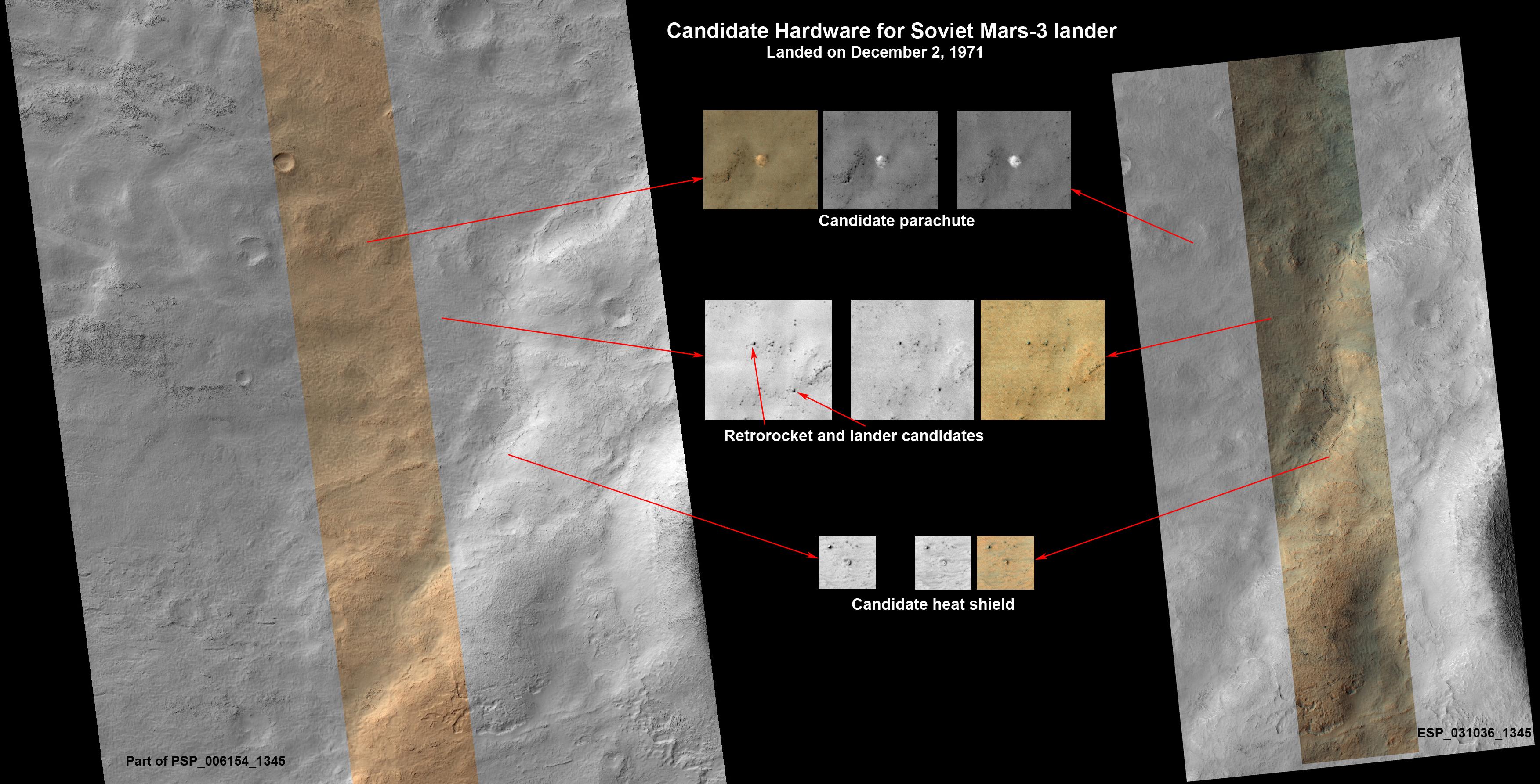
Could This Be the Mars Soviet 3 Lander?
Full Resolution:
TIFF
(18.79 MB)
JPEG
(727.8 kB)
2013-04-12
Mars
2001 Mars Odyssey
THEMIS
1335x2926x1
PIA16960:
Images of Gale #8
Full Resolution:
TIFF
(3.91 MB)
JPEG
(172.4 kB)
2013-04-12
Mars
Mars Science Laboratory (MSL)
ChemCam
Navcam (MSL)
910x675x3
PIA16922:
Accurate Pointing by Curiosity
Full Resolution:
TIFF
(1.844 MB)
JPEG
(105 kB)
2013-04-12
Mars
Mars Exploration Rover (MER)
Navigation Camera
1059x922x1
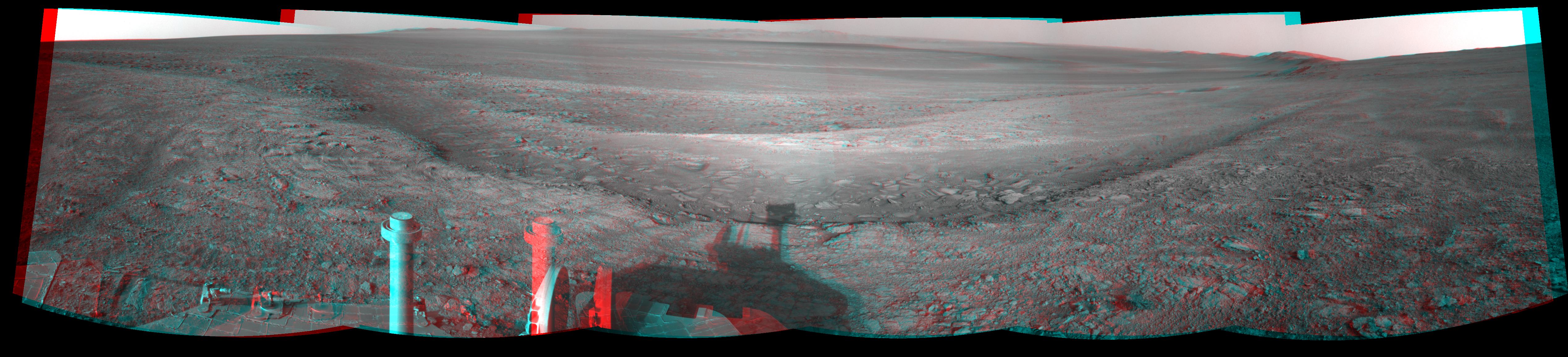
PIA16923:
Opportunity's Shadow and Endeavour Crater Vista
Full Resolution:
TIFF
(977.7 kB)
JPEG
(120.5 kB)
2013-04-15
Mars
2001 Mars Odyssey
THEMIS
1396x2793x1
PIA16961:
Images of Gale #9
Full Resolution:
TIFF
(3.904 MB)
JPEG
(277.4 kB)
2013-04-16
Mars
2001 Mars Odyssey
THEMIS
1322x2780x1
PIA16962:
Images of Gale #10
Full Resolution:
TIFF
(3.679 MB)
JPEG
(237.3 kB)
2013-04-16
Mars
Mars Exploration Rover (MER)
Navigation Camera
5076x1157x3
PIA16924:
Opportunity Overlooking Endeavour Crater, Stereo View
Full Resolution:
TIFF
(17.63 MB)
JPEG
(764.1 kB)
2013-04-17
Mars
2001 Mars Odyssey
THEMIS
1403x3230x1
PIA16963:
Images of Gale #11
Full Resolution:
TIFF
(4.537 MB)
JPEG
(310.5 kB)
2013-04-18
Mars
2001 Mars Odyssey
THEMIS
1473x2804x1
PIA16964:
Images of Gale #12
Full Resolution:
TIFF
(4.135 MB)
JPEG
(380.1 kB)
2013-04-19
Mars
2001 Mars Odyssey
THEMIS
1380x3059x1
PIA16965:
Images of Gale #13
Full Resolution:
TIFF
(4.227 MB)
JPEG
(290.3 kB)
2013-04-22
Mars
2001 Mars Odyssey
THEMIS
1381x3057x1
PIA16966:
Images of Gale #14
Full Resolution:
TIFF
(4.227 MB)
JPEG
(185.3 kB)
2013-04-23
Mars
2001 Mars Odyssey
THEMIS
1460x2794x1
PIA16967:
Images of Gale #15
Full Resolution:
TIFF
(4.084 MB)
JPEG
(287 kB)
2013-04-23
Mars
Mars Science Laboratory (MSL)
Navcam (MSL)
7824x3328x3
PIA16847:
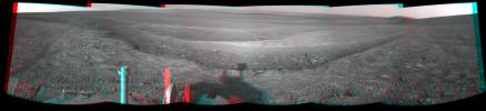
Mars Stereo View from "John Klein" to Mount Sharp (Raw)
Full Resolution:
TIFF
(78.14 MB)
JPEG
(2.325 MB)
1-100
101-200
201-300
301-400
401-500
501-600
601-700
701-800
801-900
901-1000
Currently displaying images:
7801 - 7900
of 12755


