PDS logoPlanetary Data System
PDS Information
Find a Node - Use these links to navigate to any of the 8 publicly accessible PDS Nodes.

This bar indicates that you are within the PDS enterprise which includes 6 science discipline nodes and 2 support nodes which are overseen by the Project Management Office at NASA's Goddard Space Flight Center (GSFC). Each node is led by an expert in the subject discipline, supported by an advisory group of other practitioners of that discipline, and subject to selection and approval under a regular NASA Research Announcement.
Click here to return to the Photojournal Home Page Click here to view a list of Photojournal Image Galleries Photojournal_inner_header
Latest Images  |  Spacecraft & Technology  |  Animations  |  Space Images App  |  Feedback  |  Photojournal Search  
My Favorite Images from the Planetary Photojoural
I have 8 images in my list


The first time you select an image to My List, a separate browser window will open. This page will list the set of images you have selected as favorites from the Photojournal. This list is kept for a short period of time, approximately 60 days. The way we associate you with your list is through a persistent cookie left on your computer. This cookie is nothing more than a unique key that allows the Photojournal to make this association. Once created, this list is only modifiable from the same computer. Information stored in the cookie on your computer is used by the Photojournal server only during your session. If you configure your Web browser not to use cookies, you will not be able to create and refer back to a personal list of favorite images. To view your current list, click on a marked entry for your list from the catalog page, or add another favorite. For more information, see JPL's Privacy Policy.
My
List
Catalog # Target Mission Instrument Addition Date Size
Remove Image from Favorite List PIA09539 Mars Mars Reconnaissance Orbiter (MRO)
HiRISE
2007-01-03 2048x1938x1
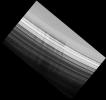
North Polar Layered Deposits Exposed Wall
Title:
North Polar Layered Deposits Exposed Wall
Remove Image from Favorite List PIA11150 Mars Phoenix
Surface Stereo Imager (SSI)
2008-09-14 1024x1024x1
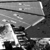
Winds were strong enough to cause about a half a centimeter (.19 inch) of motion of a solar panel on NASA's Phoenix Mars lander when the lander's Surface Stereo Imager took this picture on Aug. 31, 2008. The lander's telltale wind gauge can be seen.
Title:
Solar Panel Buffeted by Wind at Phoenix Site
Remove Image from Favorite List PIA14933 Tethys Cassini-Huygens
Imaging Science Subsystem
2012-11-14 7333x7333x1
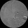
The southern hemisphere of Tethys is seen in this polar stereographic map, mosaicked from the best-available images from NASA's Cassini spacecraft.
Title:
Tethys South Polar Map - June 2012
Remove Image from Favorite List PIA03372 Earth Landsat
Shuttle Radar Topography Mission (SRTM)
C-Band Interferometric Radar
Thematic Mapper
2002-11-08 7350x10850x3
Los Angeles, California and vicinity seen from space, as viewed by NASA's Landsat 7 satellite from an altitude of 437 miles on May 4, 2001.
Title:
Landsat with SRTM Shaded Relief, Los Angeles and Vicinity from Space
Remove Image from Favorite List PIA04047 Mars 2001 Mars Odyssey
THEMIS
2002-12-18 1172x3079x1
This image from NASA's Mars Odyssey shows a region called Terra Sirenum in Mars' southern hemisphere named for the Sea of the Sirens from Greek Mythology. This is not a sea, however, but a relatively dusty, high albedo region of Mars.
Title:
Terra Sirenum
Remove Image from Favorite List PIA11080 Earth Terra
ASTER
2008-05-23 1735x1511x3
Nuuk (or Gadthab) is the capital and largest city of Greenland. It is located at the mouth of the Nuup Kangerlua inlet on the west coast of Greenland. This image was acquired August 2, 2004 by NASA's Terra spacecraft.
Title:
Nuuk, Greenland
Remove Image from Favorite List PIA20104 Earth Terra
ASTER
2015-11-16 2997x1845x3
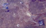
This image from NASA's Terra spacecraft shows the Orapa diamond mine, the world's largest diamond mine by area. The mine is located in Botswana.
Title:
Orapa Diamond Mine, Botswana
Remove Image from Favorite List PIA16911 Mars Mars Science Laboratory (MSL)
ChemCam
2013-04-08 960x720x3
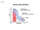
This diagram shows how materials analyzed by the ChemCam instrument on NASA's Curiosity Mars rover during the first 100 Martian days of the mission differed with regard to hydrogen content (horizontal axis) and alkali (vertical axis).
Title:
Curiosity's ChemCam Analyzes Rocks, Soils and Dust