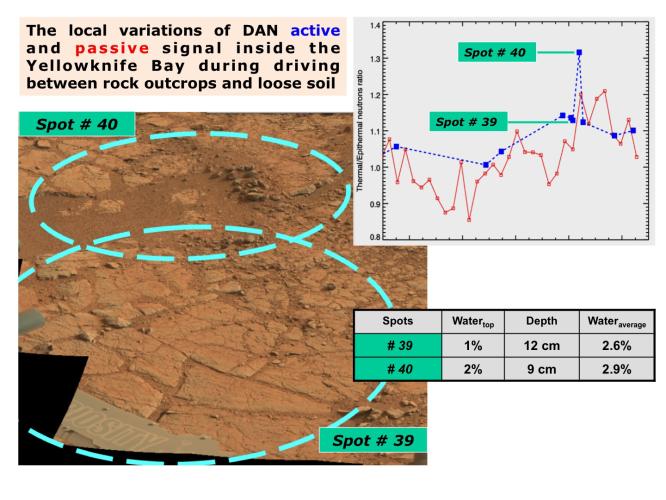
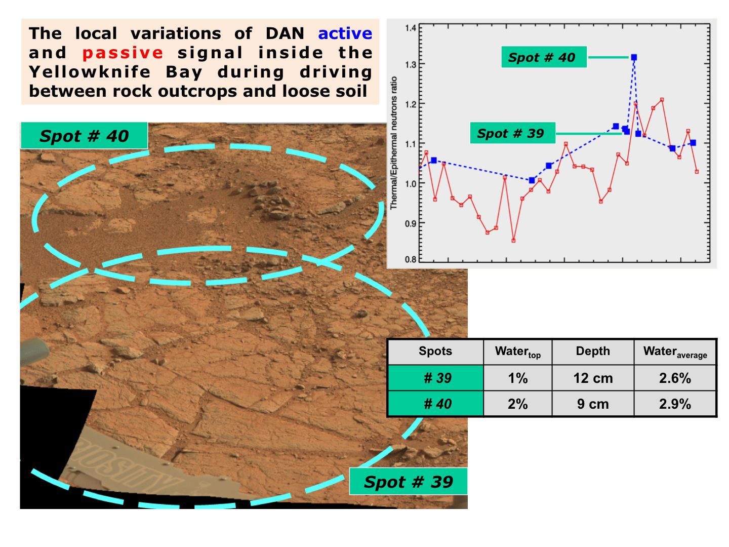
The image, at lower left, is annotated to show where the Dynamic Albedo of Neutrons (DAN) instrument on NASA's Mars rover Curiosity took measurement on a rock outcrop (Spot 39) and on loose soil (Spot 40) within the "Yellowknife Bay' area of Mars' Gale Crater.
The graph, at upper right, and the table, at lower right, show that the DAN measurements indicated more water in the subsurface at the loose-soil spot than at the rock outcrop. DAN detects even very small amounts of water in the ground beneath the rover, primarily water bound into the crystal structure of hydrated minerals.
The image at lower left was taken by the rover's Mast Camera (Mastcam).
JPL manages the Mars Science Laboratory/Curiosity for NASA's Science Mission Directorate in Washington. The rover was designed, developed and assembled at JPL, a division of the California Institute of Technology in Pasadena.
For more about NASA's Curiosity mission, visit: http://www.jpl.nasa.gov/msl, http://www.nasa.gov/mars, and http://marsprogram.jpl.nasa.gov/msl.