Your search criteria found 12755 images
Target is Mars (and available satellites)
Go to PIAxxxxx:
Refine this list of images by:
Target:
Mission:
Spacecraft:
Instrument:
Click on an image for detailed information
Click on a column heading to sort in ascending or descending order
My
List
Addition DateSort Ascending Target Mission Instrument Size
Add Image to Favorite List 2012-10-18 Mars Mars Science Laboratory (MSL)
MAHLI
1083x678x3
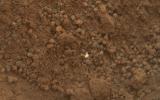
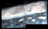
The mission's science team assessed the bright particles in this scooped pit to be native Martian material rather than spacecraft debris as seen in this image from NASA's Mars rover Curiosity as it collected its second scoop of Martian soil.
PIA16233:
Bright Particle in Hole Dug by Scooping of Martian Soil
Full Resolution:     TIFF (2.204 MB)     JPEG (122.5 kB)
Add Image to Favorite List 2012-10-19 Mars 2001 Mars Odyssey
THEMIS
1347x2921x1
What appears to be a channel in this image captured by NASA's 2001 Mars Odyssey spacecraft is actually one of the fractures that make up Nili Fossae.
PIA16328:
Nili Fossae
Full Resolution:     TIFF (3.939 MB)     JPEG (373.8 kB)
Add Image to Favorite List 2012-10-22 Mars 2001 Mars Odyssey
THEMIS
1349x2923x1
This image from NASA's 2001 Mars Odyssey spacecraft of Daedalia Planum shows the termination or end of a single flow. In this case it is the end of the brighter/rougher flow on the right side of the image.
PIA16329:
Arcuate Fratures
Full Resolution:     TIFF (3.947 MB)     JPEG (653.8 kB)
Add Image to Favorite List 2012-10-22 Mars Mars Science Laboratory (MSL)
ChemCam
720x720x1
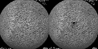
The Chemistry and Camera (ChemCam) instrument on NASA's Mars rover Curiosity used its laser and spectrometers to examine what chemical elements are in a drift of Martian sand during the mission's 74th Martian day, or sol (Oct. 20, 2012).
PIA16234:
Laser Hit on Martian Sand Target, Before and After Animation Icon
Full Resolution:     TIFF (519.1 kB)     JPEG (102.3 kB)
Add Image to Favorite List 2012-10-23 Mars 2001 Mars Odyssey
THEMIS
1291x2774x1
A volcanic vent has created a small construct (a volcano) in this region of Tharsis east of Arsia Mons. This image is from NASA's 2001 Mars Odyssey spacecraft.
PIA16330:
Tharsis Volcanics
Full Resolution:     TIFF (3.585 MB)     JPEG (542.1 kB)
Add Image to Favorite List 2012-10-24 Mars 2001 Mars Odyssey
THEMIS
1160x1576x1
Dark slope streaks mark the rim of this unnamed crater near Schiaparelli Crater as seen by NASA's 2001 Mars Odyssey spacecraft.
PIA16331:
Dark Slope Streaks
Full Resolution:     TIFF (1.83 MB)     JPEG (109.1 kB)
Add Image to Favorite List 2012-10-25 Mars 2001 Mars Odyssey
THEMIS
1348x2924x1
The channels in this image captured by NASA's 2001 Mars Odyssey spacecraft are part of Enipeus Vallis.
PIA16332:
Enipeus Vallis
Full Resolution:     TIFF (3.946 MB)     JPEG (549.8 kB)
Add Image to Favorite List 2012-10-25 Mars Mars Science Laboratory (MSL)
Navcam (MSL)
438x200x1
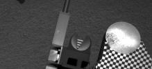
Sample material from the fourth scoop of Martian soil collected by NASA's Mars rover Curiosity is on the rover's observation tray in this image taken during the mission's 78th Martian sol, (Oct. 24, 2012) by Curiosity's left Navigation Camera.
PIA16235:
Scooped Material on Rover's Observation Tray
Full Resolution:     TIFF (87.91 kB)     JPEG (14.34 kB)
Add Image to Favorite List 2012-10-26 Mars 2001 Mars Odyssey
THEMIS
1315x2782x1
The windstreaks in this image from NASA's 2001 Mars Odyssey spacecraft are located on the volcanic plains of Daedalia Planum.
PIA16333:
Windstreaks
Full Resolution:     TIFF (3.662 MB)     JPEG (327.2 kB)
Add Image to Favorite List 2012-10-29 Mars 2001 Mars Odyssey
THEMIS
943x2940x1
The sun has now risen over the south pole of Mars. The polar surface is defrosting. This captured by NASA's 2001 Mars Odyssey spacecraft image shows layering near the margin of the south polar cap.
PIA16334:
South Pole
Full Resolution:     TIFF (2.776 MB)     JPEG (240.8 kB)
Add Image to Favorite List 2012-10-29 Mars Mars Science Laboratory (MSL)
MAHLI
1196x1605x3
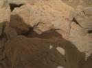
'Et-Then' is located near the rover's front left wheel, where the rover has been stationed while scooping soil at the site called 'Rocknest' in this image from NASA's Curiosity spacecraft.
PIA16236:
Rock 'Et-Then' Near Curiosity, Sol 82
Full Resolution:     TIFF (5.761 MB)     JPEG (666.8 kB)
Add Image to Favorite List 2012-10-29 Mars Mars Science Laboratory (MSL)
MAHLI
1584x1184x3
This focus-merge image from the Mars Hand Lens Imager (MAHLI) on the arm of NASA's Mars rover Curiosity shows a rock called 'Burwash.' The rock has a coating of dust on it. The coarser, visible grains are windblown sand.
PIA16237:
Rock 'Burwash' Near Curiosity, Sol 82
Full Resolution:     TIFF (5.628 MB)     JPEG (445.3 kB)
Add Image to Favorite List 2012-10-30 Mars 2001 Mars Odyssey
THEMIS
1341x2774x1
This image from NASA's 2001 Mars Odyssey spacecraft shows some of the extensive volcanic flows east of the large Tharsis volcanoes.
PIA16335:
Tharsis Volcanics
Full Resolution:     TIFF (3.724 MB)     JPEG (708 kB)
Add Image to Favorite List 2012-10-30 Mars Mars Science Laboratory (MSL)
CheMin
Mastcam
3027x1200x3
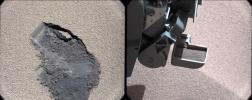
This pair of images shows a 'bite mark' where NASA's Curiosity rover scooped up some Martian soil (left), and the scoop carrying soil.
PIA16173:
Curiosity Digs In
Full Resolution:     TIFF (10.9 MB)     JPEG (660.7 kB)
Add Image to Favorite List 2012-10-30 Mars Mars Science Laboratory (MSL)
CheMin
Mastcam
2316x1152x3
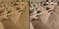
This pair of images from the Mast Camera on NASA's Curiosity rover shows the upper portion of a wind-blown deposit dubbed 'Rocknest.' At left, colors are unmodified, showing the scene as it would appear on Mars, which has a dusty red-colored atmosphere.
PIA16174:
Wind-Blown Martian Sand
Full Resolution:     TIFF (8.007 MB)     JPEG (530.1 kB)
Add Image to Favorite List 2012-10-30 Mars Mars Science Laboratory (MSL)
CheMin
582x600x3
This graphic shows results of the first analysis of Martian soil by the CheMin experiment on NASA's Curiosity rover. The image reveals the presence of crystalline feldspar, pyroxenes and olivine mixed with some amorphous (non-crystalline) material.
PIA16217:
First X-ray View of Martian Soil
Full Resolution:     TIFF (351.3 kB)     JPEG (157.3 kB)
Add Image to Favorite List 2012-10-31 Mars 2001 Mars Odyssey
THEMIS
1349x2773x1
This image from NASA's 2001 Mars Odyssey spacecraft of a ridge in the Tharsis region (called Uranius Dorsum) reminds one of a skeletal spine.
PIA16336:
Uranius Dorsum
Full Resolution:     TIFF (3.745 MB)     JPEG (511.3 kB)
Add Image to Favorite List 2012-10-31 Mars 2001 Mars Odyssey
THEMIS
1349x2773x1
The ridge in this image captured by NASA's 2001 Mars Odyssey spacecraft shows Mars' Tharsis region (called Uranius Dorsum) reminds one of a skeletal spine.
PIA16269:
Uranius Dorsum
Full Resolution:     TIFF (3.745 MB)     JPEG (511.3 kB)
Add Image to Favorite List 2012-11-01 Mars Mars Science Laboratory (MSL)
MAHLI
504x699x3
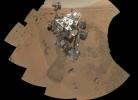
NASA's Curiosity rover used the Mars Hand Lens Imager (MAHLI) to capture the set of thumbnail images stitched together to create this full-color self-portrait.
PIA16238:
Preliminary Self-Portrait of Curiosity by Rover's Arm Camera
Full Resolution:     TIFF (1.057 MB)     JPEG (45.02 kB)
Add Image to Favorite List 2012-11-01 Mars 2001 Mars Odyssey
THEMIS
1350x2985x1
This image NASA's 2001 Mars Odyssey spacecraft shows part of the dune field on the floor of Brashear Crater.
PIA16337:
Brashear Dunes
Full Resolution:     TIFF (4.034 MB)     JPEG (356 kB)
Add Image to Favorite List 2012-11-01 Mars Mars Science Laboratory (MSL)
MAHLI
5463x7595x3
NASA's Curiosity rover used its Mars Hand Lens Imager (MAHLI) to capture a set of 55 high-resolution images, which were stitched together to create a full-color self-portrait.
PIA16239:
High-Resolution Self-Portrait by Curiosity Rover Arm Camera
Full Resolution:     TIFF (124.5 MB)     JPEG (3.831 MB)
Add Image to Favorite List 2012-11-02 Mars 2001 Mars Odyssey
THEMIS
937x2920x1
As spring progresses at the south pole, the surface reacts to the change of season. This image from NASA's 2001 Mars Odyssey spacecraft shows a region of the south pole that is monitored throughout spring, summer, and fall at the south pole.
PIA16338:
South Pole
Full Resolution:     TIFF (2.739 MB)     JPEG (313.1 kB)
Add Image to Favorite List 2012-11-05 Mars 2001 Mars Odyssey
THEMIS
1342x2770x1
This image captured by NASA's 2001 Mars Odyssey spacecraft shows a portion of Maja Valles.
PIA16339:
Maja Valles
Full Resolution:     TIFF (3.721 MB)     JPEG (313.9 kB)
Add Image to Favorite List 2012-11-06 Mars 2001 Mars Odyssey
THEMIS
1331x2772x1
This image from NASA's 2001 Mars Odyssey spacecraft shows a portion of northeastern Syrtis Major. In this image are several windstreaks and a lava flow that has entered the crater on the top of the image.
PIA16437:
Syrtis Major
Full Resolution:     TIFF (3.693 MB)     JPEG (283.7 kB)
Add Image to Favorite List 2012-11-07 Mars 2001 Mars Odyssey
THEMIS
1303x2941x1
This image from NASA's 2001 Mars Odyssey spacecraft shows a portion of Her Desher Vallis.
PIA16439:
Her Desher Vallis
Full Resolution:     TIFF (3.836 MB)     JPEG (344 kB)
Add Image to Favorite List 2012-11-08 Mars 2001 Mars Odyssey
THEMIS
1304x2772x1
The linear depression in this image from NASA's 2001 Mars Odyssey spacecraft is a volcanic vent in the lava plains east of Pavonis Mons.
PIA16470:
Volcanic Vent
Full Resolution:     TIFF (3.619 MB)     JPEG (370.4 kB)
Add Image to Favorite List 2012-11-09 Mars 2001 Mars Odyssey
THEMIS
1335x2773x1
Lava channels east of Olympus Mons as seen by NASA's 2001 Mars Odyssey spacecraft.
PIA16471:
Lava Channels
Full Resolution:     TIFF (3.706 MB)     JPEG (484 kB)
Add Image to Favorite List 2012-11-09 Mars Mars Exploration Rover (MER)
Panoramic Camera
11174x3162x3
This 360-degree view, called the 'McMurdo' panorama, from NASA's Mars Exploration Rover Spirit, where the rover stayed on a small hill known as 'Low Ridge' from April through October 2006.
PIA16440:
Spirit Mars Rover in 'McMurdo' Panorama
Full Resolution:     TIFF (106 MB)     JPEG (3.946 MB)
Add Image to Favorite List 2012-11-09 Mars Mars Exploration Rover (MER)
Panoramic Camera
11174x3162x3
This false color view, called the 'McMurdo' panorama, from NASA's Mars Exploration Rover Spirit, where the rover stayed on a small hill known as 'Low Ridge' from April through October 2006.
PIA16441:
Spirit Mars Rover in 'McMurdo' Panorama (False Color)
Full Resolution:     TIFF (106 MB)     JPEG (4.81 MB)
Add Image to Favorite List 2012-11-09 Mars Mars Exploration Rover (MER)
Panoramic Camera
12953x12953x3
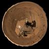
This self-portrait of NASA's Mars Exploration Rover Spirit is a polar projection of the 360-degree 'McMurdo' panorama made from images taken by Spirit from April through October 2006.
PIA16442:
Spirit Mars Rover in 'McMurdo' Panorama, Polar Projection
Full Resolution:     TIFF (503.4 MB)     JPEG (12.15 MB)
Add Image to Favorite List 2012-11-09 Mars Mars Exploration Rover (MER)
Panoramic Camera
12953x12953x3
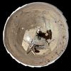
This self-portrait of NASA's Mars Exploration Rover Spirit is a false color polar projection of the 360-degree 'McMurdo' panorama made from images taken by Spirit from April through October 2006.
PIA16443:
Spirit Mars Rover in 'McMurdo' Panorama, Polar Projection (False Color)
Full Resolution:     TIFF (503.4 MB)     JPEG (15.03 MB)
Add Image to Favorite List 2012-11-12 Mars 2001 Mars Odyssey
THEMIS
1341x2771x1
This image from NASA's 2001 Mars Odyssey spacecraft shows a young crater. Dark radial spokes are created by the explosive blast of an impact event. With time, only thick ejecta near the rim of the crater will be visible, and dark spokes will disappear.
PIA16472:
Young Crater
Full Resolution:     TIFF (3.72 MB)     JPEG (535.1 kB)
Add Image to Favorite List 2012-11-12 Mars Mars Exploration Rover (MER)
Panoramic Camera
2233x1330x3
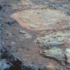
NASA's Mars Exploration Rover Opportunity inspected this mineral vein, called 'Homestake,' in November 2011 at the northern end of the 'Cape York' section of Endeavour Crater's western rim.
PIA16444:
'Homestake' Vein on 'Cape York,' Color Enhanced
Full Resolution:     TIFF (8.913 MB)     JPEG (204.2 kB)
Add Image to Favorite List 2012-11-12 Mars Mars Exploration Rover (MER)
Panoramic Camera
1024x1024x3
A rind that appears bluish in this false-color view covers portions of the surface of a rock called 'Whitewater Lake' in the top half of the view from NASA's Mars Exploration Rover Opportunity.
PIA16445:
'Whitewater Lake' Rock Viewed by Opportunity
Full Resolution:     TIFF (3.147 MB)     JPEG (214.2 kB)
Add Image to Favorite List 2012-11-13 Mars 2001 Mars Odyssey
THEMIS
1213x3061x1
This image from NASA's 2001 Mars Odyssey spacecraft of Daedalia Planum shows the termination or end of a single flow. In this case it is the end of the brighter/rougher flow on the right side of the image.
PIA16473:
Dust Devil Tracks
Full Resolution:     TIFF (3.717 MB)     JPEG (491.9 kB)
Add Image to Favorite List 2012-11-13 Mars Mars Science Laboratory (MSL)
SAM
1425x1038x3
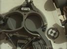
This subframe image from the left Mastcam on NASA's Mars rover Curiosity shows the covers in place over two sample inlet funnels of the rover's Sample Analysis at Mars (SAM) instrument suite.
PIA16446:
Inlet Covers for Sample Analysis at Mars
Full Resolution:     TIFF (4.439 MB)     JPEG (128.1 kB)
Add Image to Favorite List 2012-11-14 Mars 2001 Mars Odyssey
THEMIS
1342x2626x1
The small dark windstreaks as seen by NASA's 2001 Mars Odyssey spacecraft are located near Lycus Sulci.
PIA16495:
Windstreaks
Full Resolution:     TIFF (3.528 MB)     JPEG (514.3 kB)
Add Image to Favorite List 2012-11-15 Mars 2001 Mars Odyssey
THEMIS
1354x2919x1
The channels in this image from NASA's 2001 Mars Odyssey spacecraft are located on the southern margin of the Elysium Volcanic region.
PIA16496:
Channels
Full Resolution:     TIFF (3.956 MB)     JPEG (591 kB)
Add Image to Favorite List 2012-11-15 Mars Mars Science Laboratory (MSL)
REMS
2004x1250x3
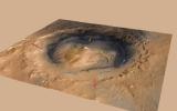
This graphic shows the pattern of winds predicted to be swirling around and inside Gale Crater, where NASA's Curiosity rover landed on Mars. Modeling the winds gives scientists a context for the data from Curiosity's Rover Environmental Monitoring Station
PIA16475:
Mountain Winds at Gale Crater
Full Resolution:     TIFF (7.518 MB)     JPEG (187.4 kB)
Add Image to Favorite List 2012-11-15 Mars Mars Science Laboratory (MSL)
REMS
2154x1986x3
Twenty-one times during the first 12 weeks that NASA's Mars rover Curiosity worked on Mars, the rover's Rover Environmental Monitoring Station (REMS) detected brief dips in air pressure that could be caused by a passing whirlwind.
PIA16476:
Signs of a Whirlwind in Gale Crater
Full Resolution:     TIFF (12.84 MB)     JPEG (224 kB)
Add Image to Favorite List 2012-11-15 Mars Mars Science Laboratory (MSL)
REMS
2999x2249x3
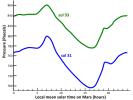
This graph shows the atmospheric pressure at the surface of Mars, as measured by the Rover Environmental Monitoring Station on NASA's Curiosity rover. Pressure is a measure of the amount of air in the whole column of atmosphere sitting above the rover.
PIA16477:
Pressure Cycles on Mars
Full Resolution:     TIFF (20.24 MB)     JPEG (262.7 kB)
Add Image to Favorite List 2012-11-15 Mars Mars Science Laboratory (MSL)
1286x994x3
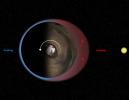
This diagram illustrates Mars' 'thermal tides,' a weather phenomenon responsible for large, daily variations in pressure at the Martian surface.
PIA16478:
Thermal Tides at Mars
Full Resolution:     TIFF (3.836 MB)     JPEG (97.88 kB)
Add Image to Favorite List 2012-11-15 Mars Mars Science Laboratory (MSL)
RAD
REMS
1889x1412x3
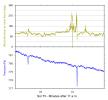
This graphic shows the daily variations in Martian radiation and atmospheric pressure as measured by NASA's Curiosity rover. As pressure increases, the total radiation dose decreases.
PIA16479:
Daily Cycles of Radiation and Pressure at Gale Crater
Full Resolution:     TIFF (8.005 MB)     JPEG (215.1 kB)
Add Image to Favorite List 2012-11-15 Mars Mars Science Laboratory (MSL)
RAD
1889x1412x3
This graphic shows the variation of radiation dose measured by the Radiation Assessment Detector on NASA's Curiosity rover over about 50 sols, or Martian days, on Mars.
PIA16480:
Longer-Term Radiation Variations at Gale Crater
Full Resolution:     TIFF (8.005 MB)     JPEG (256.9 kB)
Add Image to Favorite List 2012-11-15 Mars Mars Science Laboratory (MSL)
Navcam (MSL)
1024x1024x1
NASA's Mars rover Curiosity used a mechanism on its robotic arm to dig up five scoopfuls of material from a patch of dusty sand called 'Rocknest,' producing the five bite-mark pits visible in this image from the rover's left Navigation Camera (Navcam).
PIA16199:
Five Bites Into Mars
Full Resolution:     TIFF (1.05 MB)     JPEG (120.5 kB)
Add Image to Favorite List 2012-11-16 Mars 2001 Mars Odyssey
THEMIS
1339x2922x1
This image captured by NASA's 2001 Mars Odyssey spacecraft shows a portion of an unnamed channel near Auqakuh Vallis.
PIA16497:
Channel
Full Resolution:     TIFF (3.917 MB)     JPEG (366.8 kB)
Add Image to Favorite List 2012-11-19 Mars 2001 Mars Odyssey
THEMIS
679x1537x1
The lava flows in this image from NASA's 2001 Mars Odyssey spacecraft are part of the extensive lava plains of Daedalia Planum.
PIA16498:
Daedalia Planum
Full Resolution:     TIFF (1.045 MB)     JPEG (168.8 kB)
Add Image to Favorite List 2012-11-20 Mars 2001 Mars Odyssey
THEMIS
1376x2930x1
The fractures in this image are part of the large fracture system that surrounds Alba Mons as seen by NASA's 2001 Mars Odyssey spacecraft.
PIA16499:
Alba Mons Fractures
Full Resolution:     TIFF (4.037 MB)     JPEG (525.3 kB)
Add Image to Favorite List 2012-11-20 Mars Mars Science Laboratory (MSL)
Navcam (MSL)
1024x1024x1
NASA's Mars rover Curiosity drove 83 feet eastward during the 102nd Martian day, or sol, of the mission (Nov. 18, 2012). At the end of the drive, Curiosity's view was toward 'Yellowknife Bay' in the 'Glenelg' area of Gale Crater.
PIA16447:
Post-Drive View on Curiosity's Sol 102
Full Resolution:     TIFF (1.05 MB)     JPEG (179.7 kB)
Add Image to Favorite List 2012-11-20 Mars Mars Science Laboratory (MSL)
Navcam (MSL)
3707x996x1
NASA's Mars rover Curiosity drove 6.2 feet (1.9 meters) during the 100th Martian day, or sol, of the mission (Nov. 16, 2012). The view spans from north at the left to south-southeast at the right. It is presented in a cylindrical projection.
PIA16448:
Curiosity's Eastward View After Sol 100 Drive
Full Resolution:     TIFF (3.696 MB)     JPEG (460.2 kB)
Add Image to Favorite List 2012-11-20 Mars Mars Science Laboratory (MSL)
Navcam (MSL)
3893x1162x3
NASA's Mars rover Curiosity drove 6.2 feet (1.9 meters) during the 100th Martian day, or sol, of the mission (Nov. 16, 2012). The rover used its Navigation Camera after the drive to record the images combined into this 3-D panoramic view.
PIA16449:
Curiosity's Eastward View After Sol 100 Drive, Stereo
Full Resolution:     TIFF (13.58 MB)     JPEG (640.8 kB)
Add Image to Favorite List 2012-11-21 Mars 2001 Mars Odyssey
THEMIS
1341x2770x1
This image from NASA's 2001 Mars Odyssey spacecraft shows the Tharsis plains contains numerous channels, which were likely created by the flow of lava.
PIA16500:
Lava Channels
Full Resolution:     TIFF (3.718 MB)     JPEG (603.7 kB)
Add Image to Favorite List 2012-11-21 Mars Mars Reconnaissance Orbiter (MRO)
MARCI
2881x1441x3
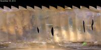
This nearly global mosaic of observations from NASA's Mars Reconnaissance Orbiter on Nov. 18, 2012, shows a dust storm in Mars' southern hemisphere. Small white arrows outline the area where dust from the storm is apparent in the atmosphere.
PIA16450:
Martian Dust Storm, Nov. 18, 2012
Full Resolution:     TIFF (12.46 MB)     JPEG (314.4 kB)
Add Image to Favorite List 2012-11-22 Mars 2001 Mars Odyssey
THEMIS
1342x2773x1
Dark slope streaks are common on the ridges of Lycus Sulci. These markings are thought to be formed by the removal of the brighter dust when material is shed from the top of the ridge. This image is from NASA's 2001 Mars Odyssey spacecraft.
PIA16501:
Lycus Sulci
Full Resolution:     TIFF (3.725 MB)     JPEG (287.8 kB)
Add Image to Favorite List 2012-11-23 Mars 2001 Mars Odyssey
THEMIS
1336x2772x1
The hills and mesas in this image seen by NASA's 2001 Mars Odyssey spacecraft are part of Echus Chaos.
PIA16502:
Echus Chaos
Full Resolution:     TIFF (3.707 MB)     JPEG (308.7 kB)
Add Image to Favorite List 2012-11-26 Mars 2001 Mars Odyssey
THEMIS
1314x2768x1
The lava channels in this image from NASA's 2001 Mars Odyssey spacecraft are located on the northern flank of Ascraeus Mons.
PIA16503:
Lava Channels
Full Resolution:     TIFF (3.641 MB)     JPEG (470.1 kB)
Add Image to Favorite List 2012-11-26 Mars Mars Science Laboratory (MSL)
ChemCam
1295x1317x3
This view of a rock called 'Rocknest 3' combines two images taken by the Chemistry and Camera (ChemCam) instrument on the NASA Mars rover Curiosity and indicates five spots where ChemCam had hit the rock with laser pulses to check its composition.
PIA16451:
Mars Rock 'Rocknest 3' Imaged by Curiosity's ChemCam
Full Resolution:     TIFF (5.119 MB)     JPEG (177.2 kB)
Add Image to Favorite List 2012-11-26 Mars Mars Science Laboratory (MSL)
Mastcam
1851x1440x3
This view of a Martian rock called 'Rocknest 3' combines four images taken by the right-eye camera of the Mast Camera (Mastcam) instrument. The image has been white-balanced to show what the rock would look like if it were on Earth.
PIA16452:
A Martian Rock Called 'Rocknest 3'
Full Resolution:     TIFF (7.999 MB)     JPEG (538.1 kB)
Add Image to Favorite List 2012-11-26 Mars Mars Science Laboratory (MSL)
Mastcam
13726x3008x3
The image, which has been white-balanced to show what the rocks and soils in it would look like if they were on Earth, is a mosaic of images taken at a site called 'Rocknest' while NASA's Mars rover Curiosity was working.
PIA16453:
Panoramic View From 'Rocknest' Position of Curiosity Mars Rover
Full Resolution:     TIFF (123.9 MB)     JPEG (7.811 MB)
Add Image to Favorite List 2012-11-27 Mars 2001 Mars Odyssey
THEMIS
1405x2931x1
The channels in this image captured by NASA's 2001 Mars Odyssey spacecraft are draining the northeastern margin of Tempe Terra.
PIA16504:
Tempe Terra
Full Resolution:     TIFF (4.123 MB)     JPEG (405.5 kB)
Add Image to Favorite List 2012-11-27 Mars Mars Reconnaissance Orbiter (MRO)
MARCI
2881x1441x3
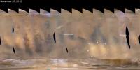
A regional dust storm visible in the southern hemisphere of Mars in this nearly global mosaic of observations made by the Mars Color Imager on NASA's Mars Reconnaissance Orbiter on Nov. 25, 2012, has contracted from its size a week earlier.
PIA16454:
Regional Dust Storm Weakening, Nov. 25, 2012
Full Resolution:     TIFF (12.46 MB)     JPEG (266 kB)
Add Image to Favorite List 2012-11-27 Mars Mars Science Laboratory (MSL)
REMS
2999x2249x3
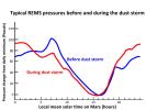
This graph compares a typical daily pattern of changing atmospheric pressure (blue) with the pattern during a regional dust storm hundreds of miles away (red). The data are by the Rover Environmental Monitoring Station (REMS) on NASA's Curiosity rover.
PIA16455:
Atmospheric Pressure Patterns Before and During Dust Storm
Full Resolution:     TIFF (20.24 MB)     JPEG (324.8 kB)
Add Image to Favorite List 2012-11-28 Mars 2001 Mars Odyssey
THEMIS
1312x2770x1
The lava channels in this image from NASA's 2001 Mars Odyssey spacecraft are located on the southern flank of Ascraeus Mons.
PIA16505:
Lava Channels
Full Resolution:     TIFF (3.638 MB)     JPEG (415.4 kB)
Add Image to Favorite List 2012-11-29 Mars 2001 Mars Odyssey
THEMIS
1323x2934x1
The windstreaks in this image are located in Daedalia Planum as seen by NASA's 2001 Mars Odyssey spacecraft.
PIA16506:
Windstreaks
Full Resolution:     TIFF (3.886 MB)     JPEG (542.1 kB)
Add Image to Favorite List 2012-11-30 Mars 2001 Mars Odyssey
THEMIS
1351x2774x1
The streamlined island in this image captured by NASA's 2001 Mars Odyssey spacecraft is located in the channel of Marte Vallis.
PIA16507:
Streamlined Island
Full Resolution:     TIFF (3.752 MB)     JPEG (389.4 kB)
Add Image to Favorite List 2012-12-03 Mars 2001 Mars Odyssey
THEMIS
1347x2772x1
The unnamed channels in this image from NASA's 2001 Mars Odyssey spacecraft are located southeast of Albor Tholus.
PIA16508:
Channels
Full Resolution:     TIFF (3.738 MB)     JPEG (398.1 kB)
Add Image to Favorite List 2012-12-03 Mars Mars Science Laboratory (MSL)
MAHLI
11119x8056x3
This mosaic from NASA's Mars rover, Curiosity, shows the first four of five places from which the rover's scoop obtained sand to clean the sample handling and processing system.
PIA16468:
Curiosity's 'Rocknest' Workplace
Full Resolution:     TIFF (268.8 MB)     JPEG (7.885 MB)
Add Image to Favorite List 2012-12-03 Mars Mars Science Laboratory (MSL)
MAHLI
1234x860x3
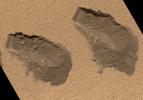
This is a view of the third (left) and fourth (right) trenches made by the 1.6-inch-wide (4-centimeter-wide) scoop on NASA's Mars rover Curiosity in October 2012 and shows some of the details regarding the properties of the 'Rocknest' wind drift sand.
PIA16469:
Scoop Marks in the Sand at 'Rocknest'
Full Resolution:     TIFF (3.185 MB)     JPEG (319.1 kB)
Add Image to Favorite List 2012-12-03 Mars Mars Science Laboratory (MSL)
MAHLI
1248x706x3
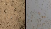
NASA's Mars rover Curiosity acquired close-up views of sands in the 'Rocknest' wind drift to document the nature of the material that the rover scooped, sieved and delivered to the CheMin and SAM instruments in October and November 2012.
PIA16570:
Windblown Sand from the 'Rocknest' Drift
Full Resolution:     TIFF (2.644 MB)     JPEG (255.2 kB)
Add Image to Favorite List 2012-12-03 Mars Mars Science Laboratory (MSL)
1809x1332x3
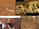
This collage shows the variety of soils found at landing sites on Mars. The elemental composition of the typical, reddish soils were investigated by NASA's Viking, Pathfinder and Mars Exploration Rover missions, and now with the Curiosity rover.
PIA16571:
A Sampling of Martian Soils
Full Resolution:     TIFF (7.232 MB)     JPEG (328.1 kB)
Add Image to Favorite List 2012-12-03 Mars Mars Science Laboratory (MSL)
Alpha Particle X-ray Spectrometer (MSL)
1600x1200x3
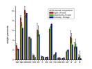
This graph compares the elemental composition of typical soils at three landing regions on Mars: Gusev Crater, from Spirit; Meridiani Planum, from Opportunity; and now Gale Crater, where NASA's newest Curiosity rover is currently investigating.
PIA16572:
Inspecting Soils Across Mars
Full Resolution:     TIFF (5.762 MB)     JPEG (141.9 kB)
Add Image to Favorite List 2012-12-03 Mars Mars Science Laboratory (MSL)
SAM
1721x1322x3
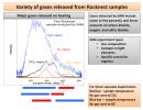
This plot of data from NASA's Mars rover Curiosity shows the variety of gases that were released from sand grains upon heating in the Sample Analysis at Mars instrument, or SAM.
PIA16573:
Heating Martian Sand Grains
Full Resolution:     TIFF (6.828 MB)     JPEG (240 kB)
Add Image to Favorite List 2012-12-03 Mars Mars Science Laboratory (MSL)
SAM
1600x1200x3
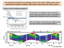
This plot shows the first-ever look at the deuterium to hydrogen ratio measured from the surface of Mars, as detected by the Sample Analysis at Mars instrument, or SAM, on NASA's Curiosity rover.
PIA16574:
Atmospheric Loss on Mars
Full Resolution:     TIFF (5.762 MB)     JPEG (216.4 kB)
Add Image to Favorite List 2012-12-03 Mars Mars Science Laboratory (MSL)
SAM
1600x1200x3
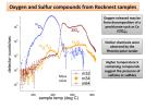
NASA's Mars rover Curiosity has detected sulfur, chlorine, and oxygen compounds in fine grains scooped by the rover at a wind drift site called 'Rocknest.' The grains were heated and analyzed using the rover's Sample Analysis at Mars instrument suite.
PIA16575:
Signs of Perchlorates and Sulfur Containing Compounds
Full Resolution:     TIFF (5.762 MB)     JPEG (189.8 kB)
Add Image to Favorite List 2012-12-03 Mars Mars Science Laboratory (MSL)
SAM
1600x1200x3
The first examinations of Martian soil by the Sample Analysis at Mars, or SAM, instrument on NASA's Mars Curiosity rover show no definitive detection of Martian organic molecules at this point.
PIA16576:
Chlorinated Compounds at 'Rocknest'
Full Resolution:     TIFF (5.762 MB)     JPEG (253.8 kB)
Add Image to Favorite List 2012-12-03 Mars Mars Reconnaissance Orbiter (MRO)
Mars Science Laboratory (MSL)
HiRISE
3300x2550x3
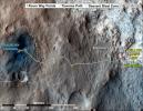
This map shows where NASA's Mars rover Curiosity has driven since landing at a site subsequently named 'Bradbury Landing,' and traveling to an overlook position near beside 'Point Lake,' in drives totaling 1,703 feet (519 meters).
PIA16577:
Curiosity Rover's Traverse, August through November 2012
Full Resolution:     TIFF (25.26 MB)     JPEG (1.893 MB)
Add Image to Favorite List 2012-12-04 Mars 2001 Mars Odyssey
THEMIS
1332x2934x1
This small field of sand dunes is located on the floor of an unnamed crater on Mars in Terra Cimmeria as seen by NASA's 2001 Mars Odyssey spacecraft.
PIA16509:
Crater Dunes
Full Resolution:     TIFF (3.912 MB)     JPEG (426.4 kB)
Add Image to Favorite List 2012-12-05 Mars 2001 Mars Odyssey
THEMIS
1356x2923x1
This image captured by NASA's 2001 Mars Odyssey spacecraft shows part of Aram Chaos. There are several layers of material in this region.
PIA16510:
Aram Chaos
Full Resolution:     TIFF (3.968 MB)     JPEG (420.1 kB)
Add Image to Favorite List 2012-12-05 Mars Mars Reconnaissance Orbiter (MRO)
Mars Science Laboratory (MSL)
CTX
HiRISE
4985x2619x3
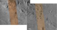
These images from the NASA Mars Reconnaissance Orbiter show several impact scars on Mars made by pieces of the NASA Mars Science Laboratory spacecraft that the spacecraft shed just before entering the Martian atmosphere.
PIA16456:
Impact Scars from MSL Cruise Stage and Two Balance Weights
Full Resolution:     TIFF (39.19 MB)     JPEG (1.692 MB)
Add Image to Favorite List 2012-12-06 Mars 2001 Mars Odyssey
THEMIS
1374x2776x1
Dark slope steaks mark the ridges of this region in Lycus Sulci in this image from NASA's 2001 Mars Odyssey spacecraft.
PIA16511:
Lycus Sulci
Full Resolution:     TIFF (3.819 MB)     JPEG (236.1 kB)
Add Image to Favorite List 2012-12-07 Mars 2001 Mars Odyssey
THEMIS
1410x2796x1
The sand dunes in this image captured by NASA's 2001 Mars Odyssey spacecraft are located on the floor of Lyot Crater.
PIA16512:
Lyot Crater Dunes
Full Resolution:     TIFF (3.947 MB)     JPEG (254.3 kB)
Add Image to Favorite List 2012-12-10 Mars 2001 Mars Odyssey
THEMIS
1370x2925x1
The windstreaks in this image from NASA's 2001 Mars Odyssey spacecraft are located on the southwestern flank of Alba Mons.
PIA16513:
Windstreaks
Full Resolution:     TIFF (4.012 MB)     JPEG (517.3 kB)
Add Image to Favorite List 2012-12-11 Mars 2001 Mars Odyssey
THEMIS
1349x2926x1
The surface in this image captured by NASA's 2001 Mars Odyssey spacecraft has been scoured by the wind, producing the linear ridges/valleys.
PIA16592:
Wind Erosion
Full Resolution:     TIFF (3.951 MB)     JPEG (453.2 kB)
Add Image to Favorite List 2012-12-11 Mars Mars Science Laboratory (MSL)
MAHLI
6710x4500x3
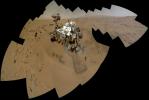
The mosaic shows NASA's Curiosity rover at 'Rocknest,' the spot in Gale Crater where the mission's first scoop sampling took place. Four scoop scars can be seen in the regolith in front of the rover.
PIA16457:
Curiosity Self-Portrait, Wide View
Full Resolution:     TIFF (90.62 MB)     JPEG (2.278 MB)
Add Image to Favorite List 2012-12-11 Mars Mars Reconnaissance Orbiter (MRO)
Mars Science Laboratory (MSL)
HiRISE
3300x2550x3
This map traces where NASA's Mars rover Curiosity drove between landing at a site subsequently named 'Bradbury Landing,' and the position reached during the mission's 123rd Martian day, or sol, (Aug. 10, 2012).
PIA16459:
Curiosity Traverse Map, Sol 123
Full Resolution:     TIFF (25.26 MB)     JPEG (1.748 MB)
Add Image to Favorite List 2012-12-11 Mars Mars Science Laboratory (MSL)
Mastcam
2438x1141x3
The NASA Mars rover Curiosity used its Mast Camera (Mastcam) during the mission's 120th Martian day, or sol (Dec. 7, 2012), to record this view of a rock outcrop informally named 'Shaler.'
PIA16550:
Layered Martian Outcrop 'Shaler' in 'Glenelg' Area
Full Resolution:     TIFF (8.349 MB)     JPEG (481.8 kB)
Add Image to Favorite List 2012-12-11 Mars Mars Science Laboratory (MSL)
Navcam (MSL)
5012x988x1
The NASA Mars rover Curiosity used its Navigation Camera (Navcam) during the mission's 120th Martian day, or sol (Dec. 7, 2012), to record the seven images combined into this panoramic view.
PIA16551:
Sol 120 Panorama from Curiosity, near 'Shaler'
Full Resolution:     TIFF (4.96 MB)     JPEG (606.5 kB)
Add Image to Favorite List 2012-12-11 Mars Mars Science Laboratory (MSL)
Navcam (MSL)
5168x1157x3
This stereo panoramic view combines 14 images taken by NASA's Mars rover Curiosity during the mission's 120th Martian day, or sol (Dec. 7, 2012). You need 3D glasses.
PIA16552:
Sol 120 Panorama from Curiosity, near 'Shaler' (Stereo)
Full Resolution:     TIFF (17.95 MB)     JPEG (728.3 kB)
Add Image to Favorite List 2012-12-12 Mars 2001 Mars Odyssey
THEMIS
1344x2775x1
This region of arcuate (or curved) fractures is located north of Apollinaris Mons as seen by NASA's 2001 Mars Odyssey spacecraft.
PIA16593:
Arcuate Fractures
Full Resolution:     TIFF (3.734 MB)     JPEG (685.9 kB)
Add Image to Favorite List 2012-12-13 Mars 2001 Mars Odyssey
THEMIS
1368x2920x1
The sand dunes in this image from NASA's 2001 Mars Odyssey spacecraft are located on the floor of Hargraves Crater.
PIA16594:
Hargraves Crater Dunes
Full Resolution:     TIFF (3.999 MB)     JPEG (230.2 kB)
Add Image to Favorite List 2012-12-14 Mars 2001 Mars Odyssey
THEMIS
1330x2767x1
Today's image shows the eastern side of the summit caldera of Ceraunius Tholus as seen by NASA's 2001 Mars Odyssey spacecraft.
PIA16595:
Ceraunius Tholus
Full Resolution:     TIFF (3.684 MB)     JPEG (203.1 kB)
Add Image to Favorite List 2012-12-17 Mars 2001 Mars Odyssey
THEMIS
686x1538x1
Layer upon layer of volcanic flows make up Daedalia Planum as shown in this image from NASA's 2001 Mars Odyssey spacecraft.
PIA16597:
Daedalia Planum
Full Resolution:     TIFF (1.056 MB)     JPEG (170.7 kB)
Add Image to Favorite List 2012-12-18 Mars 2001 Mars Odyssey
THEMIS
1362x2770x1
This image from NASA's 2001 Mars Odyssey spacecraft shows sand dunes of the floor of Trouvelot Crater.
PIA16641:
Trouvelot Crater Dunes
Full Resolution:     TIFF (3.777 MB)     JPEG (290 kB)
Add Image to Favorite List 2012-12-18 Mars Mars Science Laboratory (MSL)
Navcam (MSL)
1024x1024x1
The NASA Mars rover Curiosity used its left Navigation Camera to record this view of the step down into a shallow depression called 'Yellowknife Bay.' The descent into the basin crossed a step about 2 feet high, visible in the upper half of this image.
PIA16553:
Looking Back at Entry Into 'Yellowknife Bay'
Full Resolution:     TIFF (1.05 MB)     JPEG (138.6 kB)
Add Image to Favorite List 2012-12-18 Mars Mars Reconnaissance Orbiter (MRO)
Mars Science Laboratory (MSL)
HiRISE
3300x2550x3
This map traces where NASA's Mars rover Curiosity drove between landing at a site subsequently named 'Bradbury Landing,' where the rover entered a shallow depression called 'Yellowknife Bay' on Sol 125 (Dec.12).
PIA16554:
Curiosity Traverse Map, Sol 130
Full Resolution:     TIFF (25.26 MB)     JPEG (1.761 MB)
Add Image to Favorite List 2012-12-19 Mars 2001 Mars Odyssey
THEMIS
1341x2777x1
This image from NASA's 2001 Mars Odyssey spacecraft shows part of the floor of Ganges Chasma on Mars, including part of a sand sheet.
PIA16642:
Ganges Chasma
Full Resolution:     TIFF (3.728 MB)     JPEG (273 kB)
Add Image to Favorite List 2012-12-19 Mars Mars Exploration Rover (MER)
Hazcam
1024x1024x1
This image from NASA Mars Exploration Rover Opportunity shows the rover's arm extended for examination of a target called 'Onaping' at the base of an outcrop called 'Copper Cliff' in the Matijevic Hill area of the west rim of Endeavour Crater.
PIA16555:
Opportunity Investigation Target "Onaping"
Full Resolution:     TIFF (1.05 MB)     JPEG (117.5 kB)
Add Image to Favorite List 2012-12-19 Mars Mars Exploration Rover (MER)
Navigation Camera
7688x1073x1
This full-circle panorama shows the terrain around the NASA Mars Exploration Rover Opportunity on part of a relatively flat, light-toned outcrop called 'Whitewater Lake' on Sept. 13, 2012.
PIA16556:
Opportunity's Surroundings on Sol 3071, on 'Whitewater Lake' Outcrop
Full Resolution:     TIFF (8.258 MB)     JPEG (1.138 MB)
Add Image to Favorite List 2012-12-19 Mars Mars Exploration Rover (MER)
Navigation Camera
7753x1255x3
This full-circle, 3-D panorama shows the terrain around the NASA Mars Exploration Rover Opportunity on part of a relatively flat, light-toned outcrop called 'Whitewater Lake.' The basin of Endeavour Crater is in the left half of the image.
PIA16557:
Opportunity's Surroundings on Sol 3071, Stereo View
Full Resolution:     TIFF (29.2 MB)     JPEG (1.296 MB)
Add Image to Favorite List 2012-12-19 Mars Mars Exploration Rover (MER)
Navigation Camera
7688x1610x1
This full-circle, panorama shows the terrain around the NASA Mars Exploration Rover Opportunity on part of a relatively flat, light-toned outcrop called 'Whitewater Lake.' The basin of Endeavour Crater is in the left half of the image.
PIA16558:
Opportunity's Surroundings on Sol 3105, on 'Matijevic Hill'
Full Resolution:     TIFF (12.39 MB)     JPEG (1.516 MB)
Retrieve Previous Set  Jump to a Previous Set   Jump to a Previous Set   Jump to a Previous Set   Jump to a Previous Set   Jump to a Previous Set   Jump to a Previous Set   Jump to a Previous Set   Jump to a Previous Set   Jump to a Previous Set   Jump to a Previous Set   Retrieve Next Set 
 1-100   101-200   201-300   301-400   401-500   501-600   601-700   701-800   801-900   901-1000 
Currently displaying images: 7601 - 7700 of 12755