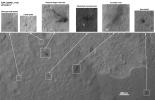
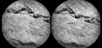
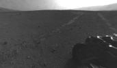
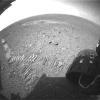
Your search criteria found 826 images
Target is Mars (and available satellites)
Go to PIAxxxxx:
Refine this list of images by:
Target:
Spacecraft:
Instrument:
Click on an image for detailed information
Click on a column heading to sort in ascending or descending order
My
List
Addition DateSort Ascending Target Mission Instrument Size
Add Image to Favorite List 2012-10-30 Mars Mars Science Laboratory (MSL)
CheMin
Mastcam
3027x1200x3
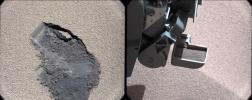
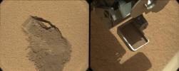
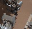
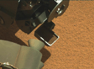
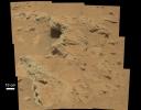
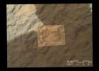
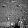
This pair of images shows a 'bite mark' where NASA's Curiosity rover scooped up some Martian soil (left), and the scoop carrying soil.
PIA16173:
Curiosity Digs In
Full Resolution:     TIFF (10.9 MB)     JPEG (660.7 kB)
Add Image to Favorite List 2012-10-29 Mars Mars Science Laboratory (MSL)
MAHLI
1584x1184x3
This focus-merge image from the Mars Hand Lens Imager (MAHLI) on the arm of NASA's Mars rover Curiosity shows a rock called 'Burwash.' The rock has a coating of dust on it. The coarser, visible grains are windblown sand.
PIA16237:
Rock 'Burwash' Near Curiosity, Sol 82
Full Resolution:     TIFF (5.628 MB)     JPEG (445.3 kB)
Add Image to Favorite List 2012-10-29 Mars Mars Science Laboratory (MSL)
MAHLI
1196x1605x3
'Et-Then' is located near the rover's front left wheel, where the rover has been stationed while scooping soil at the site called 'Rocknest' in this image from NASA's Curiosity spacecraft.
PIA16236:
Rock 'Et-Then' Near Curiosity, Sol 82
Full Resolution:     TIFF (5.761 MB)     JPEG (666.8 kB)
Add Image to Favorite List 2012-10-25 Mars Mars Science Laboratory (MSL)
Navcam (MSL)
438x200x1
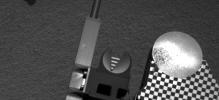
Sample material from the fourth scoop of Martian soil collected by NASA's Mars rover Curiosity is on the rover's observation tray in this image taken during the mission's 78th Martian sol, (Oct. 24, 2012) by Curiosity's left Navigation Camera.
PIA16235:
Scooped Material on Rover's Observation Tray
Full Resolution:     TIFF (87.91 kB)     JPEG (14.34 kB)
Add Image to Favorite List 2012-10-22 Mars Mars Science Laboratory (MSL)
ChemCam
720x720x1
The Chemistry and Camera (ChemCam) instrument on NASA's Mars rover Curiosity used its laser and spectrometers to examine what chemical elements are in a drift of Martian sand during the mission's 74th Martian day, or sol (Oct. 20, 2012).
PIA16234:
Laser Hit on Martian Sand Target, Before and After Animation Icon
Full Resolution:     TIFF (519.1 kB)     JPEG (102.3 kB)
Add Image to Favorite List 2012-10-18 Mars Mars Science Laboratory (MSL)
MAHLI
1083x678x3
The mission's science team assessed the bright particles in this scooped pit to be native Martian material rather than spacecraft debris as seen in this image from NASA's Mars rover Curiosity as it collected its second scoop of Martian soil.
PIA16233:
Bright Particle in Hole Dug by Scooping of Martian Soil
Full Resolution:     TIFF (2.204 MB)     JPEG (122.5 kB)
Add Image to Favorite List 2012-10-18 Mars Mars Science Laboratory (MSL)
Mastcam
1347x975x3
The robotic arm on NASA's Mars rover Curiosity delivered a sample of Martian soil to the rover's observation tray for the first time during the mission's 70th Martian day, or sol (Oct. 16, 2012).
PIA16232:
First Sample Placed on Curiosity's Observation Tray
Full Resolution:     TIFF (3.942 MB)     JPEG (114.9 kB)
Add Image to Favorite List 2012-10-18 Mars Mars Science Laboratory (MSL)
Navcam (MSL)
1024x1024x1
Three bite marks left in the Martian ground by the scoop on the robotic arm of NASA's Mars rover Curiosity are visible in this image. Each of the three bites is about 2 inches (5 centimeters) wide.
PIA16231:
Curiosity's First Three Bites Into Martian Ground
Full Resolution:     TIFF (1.05 MB)     JPEG (161.7 kB)
Add Image to Favorite List 2012-10-15 Mars Mars Science Laboratory (MSL)
MAHLI
1584x1184x3
This image from NASA's Mars rover Curiosity shows a small bright object on the ground beside the rover at the 'Rocknest' site. The rover team has assessed this object as debris from the spacecraft, possibly from the events of landing on Mars.
PIA16230:
Small Debris on the Ground Beside Curiosity
Full Resolution:     TIFF (5.628 MB)     JPEG (485.9 kB)
Add Image to Favorite List 2012-10-15 Mars Mars Science Laboratory (MSL)
MAHLI
1608x1199x3
This image contributed to an interpretation by NASA's Mars rover Curiosity science team that some of the bright particles on the ground near the rover are native Martian material.
PIA16229:
Bright Particle of Martian Origin in Scoop Hole
Full Resolution:     TIFF (5.786 MB)     JPEG (288 kB)
Add Image to Favorite List 2012-10-12 Mars Mars Science Laboratory (MSL)
Navcam (MSL)
7703x2198x1
Smooth surfaces of windblown sand and dust of the 'Rocknest' area signal an appropriate place for NASA's Curiosity to collect and use the mission's first few scoopfuls of soil.
PIA16227:
Curiosity's Location During First Scooping
Full Resolution:     TIFF (16.95 MB)     JPEG (1.911 MB)
Add Image to Favorite List 2012-10-11 Mars Mars Science Laboratory (MSL)
CHIMRA
Mastcam
1547x1200x3
This image from NASA's Curiosity rover just after discarding a soil sample as part of its first 'decontamination' exercise. A small amount of remnant material is visible inside the delivery tube, which is magnified in the blow-up at lower right.
PIA16196:
Thanks for the Scrub
Full Resolution:     TIFF (5.571 MB)     JPEG (161.2 kB)
Add Image to Favorite List 2012-10-11 Mars Mars Science Laboratory (MSL)
CHIMRA
Mastcam
1506x1200x3
This image shows fine sand from Mars that was filtered by NASA's Curiosity rover as part of its first 'decontamination' exercise.
PIA16195:
Sand Filtered through Curiosity's Sieve
Full Resolution:     TIFF (5.424 MB)     JPEG (113.8 kB)
Add Image to Favorite List 2012-10-11 Mars Mars Science Laboratory (MSL)
CHIMRA
Mastcam
1498x1199x3
In this image, the scoop on NASA's Curiosity rover shows the larger soil particles that were too big to filter through a sample-processing sieve that is porous only to particles less than 0.006 inches (150 microns) across.
PIA16194:
Too Big for the Sieve
Full Resolution:     TIFF (5.39 MB)     JPEG (229.6 kB)
Add Image to Favorite List 2012-10-11 Mars Mars Science Laboratory (MSL)
MAHLI
1579x1180x3
This image shows the wall of a scuffmark NASA's Curiosity made in a windblown ripple of Martian sand with its wheel. The upper half of the image shows a small portion of the side wall of the scuff and a little bit of the floor of the scuff.
PIA16193:
High-Resolution View of Cross-Section Through a Mars Ripple
Full Resolution:     TIFF (5.592 MB)     JPEG (611.4 kB)
Add Image to Favorite List 2012-10-11 Mars Mars Science Laboratory (MSL)
ChemCam
Mastcam
2668x2668x3
This image shows where NASA's Curiosity rover aimed two different instruments to study a rock known as 'Jake Matijevic.' The red dots are where ChemCam zapped the rock with its laser.
PIA16192:
Target: Jake Matijevic Rock
Full Resolution:     TIFF (21.36 MB)     JPEG (1.126 MB)
Add Image to Favorite List 2012-10-10 Mars Mars Science Laboratory (MSL)
Mastcam
3020x1200x3
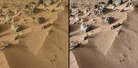
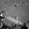
This pairing illustrates the first time that NASA's Mars rover Curiosity collected a scoop of soil on Mars. At right, the ground location 'Rocknest,' at left, after the scoop of sand and dust had been removed.
PIA16226:
First Scoop by Curiosity, Sol 61 Views
Full Resolution:     TIFF (10.88 MB)     JPEG (479.7 kB)
Add Image to Favorite List 2012-10-10 Mars Mars Reconnaissance Orbiter (MRO)
Mars Science Laboratory (MSL)
HiRISE
2414x1387x3
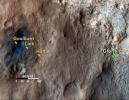
This 3-D image shows the upcoming science destination for NASA's Mars rover Curiosity, a region dubbed 'Glenelg,' where three different types of material seen from orbit come together.
PIA16210:
'Glenelg' in 3-D
Full Resolution:     TIFF (10.05 MB)     JPEG (554.1 kB)
Add Image to Favorite List 2012-10-10 Mars Mars Reconnaissance Orbiter (MRO)
Mars Science Laboratory (MSL)
HiRISE
950x795x3
This stereo anaglyph shows the parachute and back shell that helped guide NASA's Curiosity to the surface of Mars. You need 3-D glasses to view this image.
PIA16209:
Parachute and Back Shell in 3-D
Full Resolution:     TIFF (2.267 MB)     JPEG (87.85 kB)
Add Image to Favorite List 2012-10-10 Mars Mars Reconnaissance Orbiter (MRO)
Mars Science Laboratory (MSL)
HiRISE
398x408x3
This stereo anaglyph shows NASA's Mars rover Curiosity where it landed on Mars within Gale Crater, at a site now called Bradbury Landing. You need 3-D glasses to view this image.
PIA16208:
Curiosity at Bradbury Landing Site in 3-D
Full Resolution:     TIFF (487.5 kB)     JPEG (17.84 kB)
Add Image to Favorite List 2012-10-08 Mars Mars Science Laboratory (MSL)
Mastcam
1345x1200x3
This image from NASA's Curiosity shows a scoop full of sand and dust lifted by the rover's first use of the scoop on its robotic arm. In the foreground, near bottom of this image, the bright object visible on the ground might be a piece of rover hardware.
PIA16225:
View of Curiosity's First Scoop Also Shows Bright Object
Full Resolution:     TIFF (4.844 MB)     JPEG (242.9 kB)
Add Image to Favorite List 2012-10-08 Mars Mars Science Laboratory (MSL)
Mastcam
1400x1024x3
This image from a video shows the first Martian material collected by the scoop on the robotic arm of NASA's Mars rover Curiosity. The material vibrated inside the scoop after it was lifted from the ground.
PIA16224:
Curiosity's First Scoop of Mars, in Vibration Movie Animation Icon
Full Resolution:     TIFF (4.303 MB)     JPEG (148.8 kB)
Add Image to Favorite List 2012-10-04 Mars Mars Science Laboratory (MSL)
Navcam (MSL)
1024x1024x1
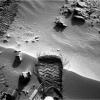
NASA's Mars rover Curiosity cut a wheel scuff mark into a wind-formed ripple at the 'Rocknest' site to give researchers a better opportunity to examine the particle-size distribution of the material forming the ripple.
PIA16205:
Wheel Scuff Mark at 'Rocknest'
Full Resolution:     TIFF (1.05 MB)     JPEG (281.5 kB)
Add Image to Favorite List 2012-10-04 Mars Mars Science Laboratory (MSL)
Mastcam
3926x2218x3
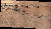
This patch of windblown sand and dust downhill from a cluster of dark rocks is the 'Rocknest' site, which has been selected as the likely location for first use of the scoop on the arm of NASA's Mars rover Curiosity.
PIA16204:
'Rocknest' From Sol 52 Location
Full Resolution:     TIFF (26.13 MB)     JPEG (1.876 MB)
Add Image to Favorite List 2012-10-04 Mars Mars Science Laboratory (MSL)
Navcam (MSL)
7824x1488x1
This 360-degree panorama from NASA's Mars rover Curiosity shows the rocky terrain of 'Rocknest' surrounding it as of its 55th Martian day, or sol, of the mission (Oct. 1, 2012).
PIA16202:
View on the Way to 'Glenelg'
Full Resolution:     TIFF (11.65 MB)     JPEG (1.1 MB)
Add Image to Favorite List 2012-10-04 Mars Mars Science Laboratory (MSL)
HiRISE
3600x2700x3
This map shows the route driven by NASA's Mars rover Curiosity through the 56th Martian day, or sol, of the rover's mission on Mars (Oct. 2, 2012).
PIA16200:
Curiosity's Travels Through Sol 56
Full Resolution:     TIFF (29.17 MB)     JPEG (1.87 MB)
Add Image to Favorite List 2012-10-03 Mars Mars Science Laboratory (MSL)
Mastcam
2901x3036x3
This stereo image from the Mast Camera (Mastcam) on NASA's Mars rover Curiosity shows a rock outcrop called 'Hottah,' cited as evidence for vigorous flow of water in a long-ago Martian stream. You need 3D glasses to view this image.
PIA16223:
Martian Streambed Evidence Rock in 3-D
Full Resolution:     TIFF (26.43 MB)     JPEG (977.2 kB)
Add Image to Favorite List 2012-10-01 Mars Mars Science Laboratory (MSL)
MAHLI
1812x1959x3
This is the highest-resolution view that the MAHLI camera on NASA's Mars rover Curiosity acquired of the top of a rock called 'Bathurst Inlet'; the rock is dark gray and is so fine-grained that MAHLI cannot resolve grains or crystals in it.
PIA14763:
'Bathurst Inlet' Rock on Curiosity's Sol 54, Close-Up View
Full Resolution:     TIFF (10.65 MB)     JPEG (618.9 kB)
Add Image to Favorite List 2012-10-01 Mars Mars Science Laboratory (MSL)
MAHLI
1812x1958x3
NASA's Mars rover Curiosity held its MAHLI camera about 10.5 inches (27 centimeters) away from the top of a rock called 'Bathurst Inlet' for a set of eight images combined into this merged-focus view of the rock.
PIA14762:
'Bathurst Inlet' Rock on Curiosity's Sol 54, Context View
Full Resolution:     TIFF (10.65 MB)     JPEG (311.4 kB)
Add Image to Favorite List 2012-09-27 Mars Mars Science Laboratory (MSL)
Mastcam
1800x1350x3
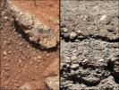
This set of images compares the 'Link' outcrop of rocks on Mars (left) with similar rocks seen on Earth (right). The 'Link' outcrop shows rounded gravel fragments, or clasts, up to a couple inches (few centimeters), within the rock outcrop.
PIA16189:
Rock Outcrops on Mars and Earth
Full Resolution:     TIFF (7.293 MB)     JPEG (399.8 kB)
Add Image to Favorite List 2012-09-27 Mars Mars Science Laboratory (MSL)
Mastcam
960x719x3
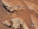
In this image from NASA's Curiosity rover, a rock outcrop called 'Link' pops out from a Martian surface that is elsewhere blanketed by reddish-brown dust.
PIA16188:
Link to a Watery Past
Full Resolution:     TIFF (2.072 MB)     JPEG (143.4 kB)
Add Image to Favorite List 2012-09-27 Mars Mars Science Laboratory (MSL)
Mastcam
1280x646x3
This image from NASA's Curiosity Rover shows a high-resolution view of an area that is known as Goulburn Scour, a set of rocks blasted by the engines of Curiosity's descent stage on Mars.
PIA16187:
Best View of Goulburn Scour
Full Resolution:     TIFF (2.482 MB)     JPEG (227.5 kB)
Add Image to Favorite List 2012-09-27 Mars 2001 Mars Odyssey
Mars Science Laboratory (MSL)
THEMIS
3338x2580x3
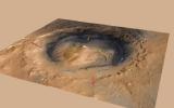
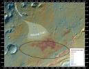
This false-color map shows the area within Gale Crater on Mars, where NASA's Curiosity rover landed on Aug. 5, 2012 PDT (Aug. 6, 2012 EDT). The rover is heading toward Glenelg, just to the lower right of Bradbury.
PIA16159:
Downslope of the Fan
Full Resolution:     TIFF (25.85 MB)     JPEG (1.89 MB)
Add Image to Favorite List 2012-09-27 Mars Mars Reconnaissance Orbiter (MRO)
Mars Science Laboratory (MSL)
HiRISE
3339x2580x3
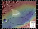
This image shows the topography, with shading added, around the area where NASA's Curiosity rover landed. An alluvial fan, or fan-shaped deposit where debris spreads out downslope, has been highlighted in lighter colors for better viewing.
PIA16158:
Where Water Flowed Downslope
Full Resolution:     TIFF (25.85 MB)     JPEG (1.87 MB)
Add Image to Favorite List 2012-09-27 Mars Mars Reconnaissance Orbiter (MRO)
Mars Science Laboratory (MSL)
HiRISE
932x720x3
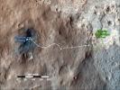
This map shows the path on Mars of NASA's Curiosity rover toward Glenelg, an area where three terrains of scientific interest converge. Arrows mark what appears to be an ancient Martian streambed.
PIA16157:
Curiosity's Roadside Discoveries
Full Resolution:     TIFF (2.014 MB)     JPEG (132.4 kB)
Add Image to Favorite List 2012-09-27 Mars Mars Science Laboratory (MSL)
Mastcam
936x728x3
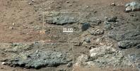
NASA's Curiosity rover found evidence for an ancient, flowing stream on Mars at a few sites, including the rock outcrop pictured here, which the science team has named 'Hottah' after Hottah Lake in Canada's Northwest Territories.
PIA16156:
Remnants of Ancient Streambed on Mars
Full Resolution:     TIFF (2.045 MB)     JPEG (96.69 kB)
Add Image to Favorite List 2012-09-24 Mars Mars Science Laboratory (MSL)
MAHLI
2700x1950x3
This image combines photographs taken by the Mars Hand Lens Imager (MAHLI) at three different distances from the first Martian rock that NASA's Curiosity rover touched with its arm.
PIA16221:
Mars Hand Lens Imager Nested Close-Ups of Rock 'Jake Matijevic'
Full Resolution:     TIFF (15.8 MB)     JPEG (525.3 kB)
Add Image to Favorite List 2012-09-24 Mars Mars Science Laboratory (MSL)
Navcam (MSL)
Robotic Arm (MSL)
1024x1024x1
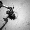
This image shows the robotic arm of NASA's Mars rover Curiosity with the first rock touched by an instrument on the arm. The rover placed the APXS instrument onto the rock to assess what chemical elements were present in the rock.
PIA16220:
Curiosity's Rock-Contact Science Begins
Full Resolution:     TIFF (1.05 MB)     JPEG (226.7 kB)
Add Image to Favorite List 2012-09-21 Mars Mars Science Laboratory (MSL)
MAHLI
2199x2000x3
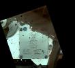
This view of Curiosity's deck shows a plaque bearing several signatures of US officials, including that of President Obama and Vice President Biden. The image was taken by the rover's Mars Hand Lens Imager (MAHLI).
PIA15883:
President's Signature Onboard Curiosity
Full Resolution:     TIFF (13.2 MB)     JPEG (434.6 kB)
Add Image to Favorite List 2012-09-21 Mars Mars Science Laboratory (MSL)
MAHLI
1584x1184x3
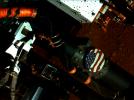
This view of the American flag medallion on NASA's Mars rover Curiosity was taken by the rover's MAHLI camera during the 44th Martian sol on Sept. 19, 2012. The flag is one of four 'mobility logos' placed on the rover's mobility rocker arms.
PIA15882:
Curiosity's Stars and Stripes
Full Resolution:     TIFF (5.628 MB)     JPEG (223.5 kB)
Add Image to Favorite List 2012-09-19 Mars Mars Science Laboratory (MSL)
Navcam (MSL)
1024x1024x1
The drive by NASA's Mars rover Curiosity during the mission's 43rd Martian day ended with this rock front of the rover. The rover team has assessed it as a suitable target for the first use of Curiosity's contact instruments on a rock.
PIA16155:
'Jake Matijevic' Contact Target for Curiosity
Full Resolution:     TIFF (1.05 MB)     JPEG (254.6 kB)
Add Image to Favorite List 2012-09-19 Mars Mars Science Laboratory (MSL)
Mastcam
11909x3375x3
This mosaic from the Mast Camera on NASA's Curiosity rover shows the view looking toward the 'Glenelg' area, where three different terrain types come together.
PIA16154:
On the Road to Glenelg
Full Resolution:     TIFF (120.6 MB)     JPEG (5.589 MB)
Add Image to Favorite List 2012-09-19 Mars Mars Reconnaissance Orbiter (MRO)
Mars Science Laboratory (MSL)
HiRISE
3300x2550x3
This map shows the route driven by NASA's Mars rover Curiosity through the 43rd Martian day, or sol, of the rover's mission on Mars (Sept. 19, 2012). The route starts where the rover touched down, a site subsequently named Bradbury Landing.
PIA16153:
Curiosity Traverse Map Through Sol 43
Full Resolution:     TIFF (25.26 MB)     JPEG (1.57 MB)
Add Image to Favorite List 2012-09-19 Mars Mars Science Laboratory (MSL)
Mastcam
1090x545x1
As part of a multi-mission campaign, NASA's Curiosity rover is observing Martian moon transits, the first of which involved the moon Phobos grazing the sun's disk.
PIA16152:
Comparing Phobos Views
Full Resolution:     TIFF (594.9 kB)     JPEG (16.81 kB)
Add Image to Favorite List 2012-09-19 Mars Mars Science Laboratory (MSL)
Mastcam
570x570x1
Mars has two small, asteroid-sized moons named Phobos and Deimos. This frame from an animation shows the point of view of the rover, located near the equator of Mars, as these moons occasionally pass in front of, or 'transit,' the disk of the sun.
PIA16151:
Phobos in Transit Animation Icon
Full Resolution:     TIFF (325.4 kB)     JPEG (6.434 kB)
Add Image to Favorite List 2012-09-19 Mars Mars Science Laboratory (MSL)
Mastcam
3823x2333x3
This mosaic from the Mast Camera on NASA's Curiosity rover shows a close-up view looking toward the 'Glenelg' area. One terrain type is light-toned with well-developed layering, which likely records the deposition of sedimentary materials.
PIA16150:
Dark Bands Run Through Light Layers
Full Resolution:     TIFF (26.77 MB)     JPEG (613.9 kB)
Add Image to Favorite List 2012-09-13 Mars Mars Science Laboratory (MSL)
MAHLI
1096x1200x3
This 3-D view of the calibration target for the MAHLI camera aboard NASA's Mars rover Curiosity was assembled from two images taken by that camera during the 34th Martian day. The camera is on the turret of tools at the end of Curiosity's robotic arm.
PIA15879:
3-D View of MAHLI Calibration Target
Full Resolution:     TIFF (3.947 MB)     JPEG (191.8 kB)
Add Image to Favorite List 2012-09-12 Mars Mars Science Laboratory (MSL)
Navcam (MSL)
1024x1024x1
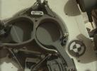
This image from NASA's Curiosity rover shows the inlet covers for the Sample Analysis at Mars instrument as the rover continues to check out its instruments in the first phase after landing.
PIA16164:
Opening and Closing SAM Animation Icon
Full Resolution:     TIFF (1.05 MB)     JPEG (101.4 kB)
Add Image to Favorite List 2012-09-12 Mars Mars Science Laboratory (MSL)
CheMin
MAHLI
1581x1181x3
This image from NASA's Curiosity rover shows the open inlet where powdered rock and soil samples will be funneled down for analysis.
PIA16163:
Say 'Ahh' on Mars
Full Resolution:     TIFF (5.604 MB)     JPEG (242.9 kB)
Add Image to Favorite List 2012-09-12 Mars Mars Science Laboratory (MSL)
CheMin
MAHLI
1581x1181x3
This image from NASA's Curiosity rover shows the cover on an inlet that will receive powdered rock and soil samples for analysis. The image also shows sand and angular and rounded pebbles that were deposited on the rover deck when it landed.
PIA16162:
Getting Ready for Sampling on Mars
Full Resolution:     TIFF (5.604 MB)     JPEG (228.8 kB)
Add Image to Favorite List 2012-09-12 Mars Mars Science Laboratory (MSL)
MAHLI
Mastcam
917x688x3
This image shows the Mars Hand Lens Imager (MAHLI) on NASA's Curiosity rover, with the Martian landscape in the background. The image was taken by Curiosity's Mast Camera on the 32nd Martian day, or sol, of operations on the surface.
PIA16161:
Hello, MAHLI
Full Resolution:     TIFF (1.894 MB)     JPEG (70.73 kB)
Add Image to Favorite List 2012-09-12 Mars Mars Science Laboratory (MSL)
Alpha Particle X-ray Spectrometer (MSL)
Mastcam
983x738x3
This image shows the Alpha Particle X-Ray Spectrometer (APXS) on NASA's Curiosity rover, with the Martian landscape in the background. This image let researchers know that the APXS instrument had not become caked with dust during Curiosity's landing.
PIA16160:
Portrait of APXS on Mars
Full Resolution:     TIFF (2.177 MB)     JPEG (82.27 kB)
Add Image to Favorite List 2012-09-10 Mars Mars Science Laboratory (MSL)
MAHLI
5768x2624x3
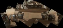
This view of the lower front and underbelly areas of NASA's Mars rover Curiosity combines nine images taken by the rover's MAHLI camera during the 34th Martian day, or sol, of Curiosity's work on Mars.
PIA16137:
Panorama of Curiosity's Belly Check
Full Resolution:     TIFF (45.43 MB)     JPEG (934.1 kB)
Add Image to Favorite List 2012-09-10 Mars Mars Science Laboratory (MSL)
MAHLI
2023x1876x3
This image taken by the MAHLI camera shows a sample of basaltic rock from a lava flow in New Mexico serves as a calibration target carried on the front of NASA's Mars rover Curiosity for the rover's Canadian-made APXS instrument.
PIA16136:
A Piece of New Mexico on Mars
Full Resolution:     TIFF (11.39 MB)     JPEG (408.7 kB)
Add Image to Favorite List 2012-09-10 Mars Mars Science Laboratory (MSL)
MAHLI
1988x1839x3
NASA's Mars rover Curiosity carries five cylindrical blocks of organic check material for use in a control experiment if the rover's Sample Analysis at Mars (SAM) laboratory detects any organic compounds in samples of Martian soil or powdered rock.
PIA16135:
Sealed Organic Check Material on Curiosity
Full Resolution:     TIFF (10.97 MB)     JPEG (235.8 kB)
Add Image to Favorite List 2012-09-10 Mars Mars Science Laboratory (MSL)
MAHLI
2949x1981x3
This view of the three left wheels of NASA's Mars rover Curiosity combines two images that were taken by the rover's Mars Hand Lens Imager (MAHLI) during the 34th Martian day, or sol, on Mars (Sept. 9, 2012).
PIA16134:
Wheels and a Destination
Full Resolution:     TIFF (17.53 MB)     JPEG (453.3 kB)
Add Image to Favorite List 2012-09-10 Mars Mars Science Laboratory (MSL)
Hazcam (MSL)
MAHLI
-1x-1x3
This view of the lower front and underbelly areas of NASA's Mars rover Curiosity was taken by the rover's MAHLI camera during Sept. 9, 2012. Also visible are the hazard avoidance cameras on the front of the rover.
PIA16133:
Belly Check for Curiosity
Full Resolution:     TIFF (10.76 MB)     JPEG (237.4 kB)
Add Image to Favorite List 2012-09-10 Mars Mars Science Laboratory (MSL)
MAHLI
1991x1852x3
This view of the calibration target for the MAHLI camera aboard NASA's Mars rover Curiosity combines two images taken by that camera during Sept. 9, 2012. Part of Curiosity's left-front and center wheels and a patch of Martian ground are also visible.
PIA16132:
Calibration Target for Curiosity's Arm Camera
Full Resolution:     TIFF (11.07 MB)     JPEG (266.1 kB)
Add Image to Favorite List 2012-09-10 Mars Mars Science Laboratory (MSL)
MAHLI
1987x1839x3
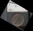
The penny in this image is part of a camera calibration target on NASA's Mars rover Curiosity. The MAHLI camera on the rover took this image of the MAHLI calibration target during the 34th Martian day of Curiosity's work on Mars, Sept. 9, 2012.
PIA16131:
Lincoln Penny on Mars in Camera's Calibration Target
Full Resolution:     TIFF (10.97 MB)     JPEG (430.3 kB)
Add Image to Favorite List 2012-09-09 Mars Mars Science Laboratory (MSL)
MAHLI
1605x1193x3
The level of detail apparent in this image from Curiosity's Mars Hand Lens Imager (MAHLI) shows that haziness in earlier MAHLI images since landing was due to dust that had settled on the dust cover during the landing.
PIA16130:
First Image From Curiosity's Arm Camera With Dust Cover Open
Full Resolution:     TIFF (5.746 MB)     JPEG (624.3 kB)
Add Image to Favorite List 2012-09-09 Mars Mars Science Laboratory (MSL)
MAHLI
573x144x3
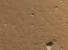
As the last step in a series of inspections of the Mars Hand Lens Imager (MAHLI) aboard NASA's Mars rover Curiosity, this camera's reclosable dust cover was opened for the first time on Sept. 8, 2012.
PIA16129:
Martian Ground Seen by Arm Camera With and Without Dust Cover (Thumbnails)
Full Resolution:     TIFF (247.8 kB)     JPEG (13.73 kB)
Add Image to Favorite List 2012-09-08 Mars Mars Science Laboratory (MSL)
MAHLI
2025x1877x3
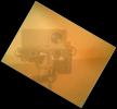
On Sol 32 (Sept. 7, 2012) the Curiosity rover used a camera located on its arm to obtain this self portrait. The MAHLI cover was in the closed position in order to inspect the dust cover.
PIA16149:
Rover Takes Self Portrait
Full Resolution:     TIFF (11.41 MB)     JPEG (268.4 kB)
Add Image to Favorite List 2012-09-06 Mars Mars Science Laboratory (MSL)
HiRISE
3300x2550x3
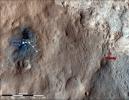
This map shows the route driven by NASA's Mars rover Curiosity through the 29th Martian day, or sol, of the rover's mission on Mars (Sept. 4, 2012).
PIA16148:
Curiosity Traverse Map Through Sol 29
Full Resolution:     TIFF (25.26 MB)     JPEG (1.558 MB)
Add Image to Favorite List 2012-09-06 Mars Mars Science Laboratory (MSL)
1427x578x3
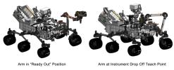
This engineering drawing shows the arm on NASA's Curiosity's rover in its 'ready-for-action' position, or 'ready out' as engineers say, in addition to the position it assumes to drop off samples.
PIA16147:
Flexing Curiosity's Arm
Full Resolution:     TIFF (2.476 MB)     JPEG (116.9 kB)
Add Image to Favorite List 2012-09-06 Mars Mars Science Laboratory (MSL)
1438x933x3
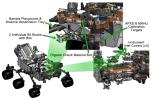
This engineering drawing shows various components needed to support tools at the end of the arm on NASA's Curiosity rover, including: calibration targets for helping instruments set their baseline levels.
PIA16146:
Curiosity's Work Bench
Full Resolution:     TIFF (4.027 MB)     JPEG (223.4 kB)
Add Image to Favorite List 2012-09-06 Mars Mars Science Laboratory (MSL)
1438x933x3
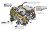
This engineering drawing shows the five devices that make up the turret at the end of the arm on NASA's Curiosity rover. These include: the drill for acquiring powdered samples from interiors of rocks.
PIA16145:
Tools at Curiosity's 'Fingertips'
Full Resolution:     TIFF (4.027 MB)     JPEG (192.1 kB)
Add Image to Favorite List 2012-09-06 Mars Mars Science Laboratory (MSL)
1438x933x3
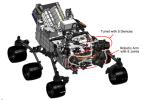
This engineering drawing shows the location of the arm on NASA's Curiosity rover, in addition to the arm's turret, which holds two instruments and three tools. The arm places and holds turret-mounted tools on rock and soil targets.
PIA16144:
Curiosity's Robotic Arm
Full Resolution:     TIFF (4.027 MB)     JPEG (169 kB)
Add Image to Favorite List 2012-09-06 Mars Mars Science Laboratory (MSL)
HiRISE
2055x1437x3
After a rocket-powered descent stage, also known as the sky crane, delivered NASA's Curiosity rover to Mars on Aug. 5 PDT (Aug. 6 EDT), 2012, it flew away and fell to the surface.
PIA16143:
Dissecting the Scene of Sky Crane Crash
Full Resolution:     TIFF (8.863 MB)     JPEG (454.9 kB)
Add Image to Favorite List 2012-09-06 Mars Mars Science Laboratory (MSL)
HiRISE
579x538x3
This color view of the parachute and back shell that helped deliver NASA's Curiosity rover to the surface of the Red Planet was taken by the High-HiRISE camera on NASA's Mars Reconnaissance Orbiter.
PIA16142:
Relics of Rover's Landing
Full Resolution:     TIFF (935 kB)     JPEG (34.81 kB)
Add Image to Favorite List 2012-09-06 Mars Mars Science Laboratory (MSL)
HiRISE
574x643x3
Tracks from the first drives of NASA's Curiosity rover are visible in this image captured by the High-Resolution Imaging Science Experiment (HiRISE) camera on NASA's Mars Reconnaissance Orbiter. The rover is seen where the tracks end.
PIA16141:
A Rover's Journey Begins
Full Resolution:     TIFF (1.108 MB)     JPEG (51.17 kB)
Add Image to Favorite List 2012-09-06 Mars Mars Science Laboratory (MSL)
MAHLI
Mastcam
1347x1200x3
The left eye of the Mast Camera (Mastcam) on NASA's Mars rover Curiosity took this image of the camera on the rover's arm, the Mars Hand Lens Imager (MAHLI), during the 30th Martian day, or sol, of the rover's mission on Mars (Sept. 5, 2012).
PIA15699:
Camera on Curiosity's Arm as Seen by Camera on Mast
Full Resolution:     TIFF (4.851 MB)     JPEG (136.8 kB)
Add Image to Favorite List 2012-09-06 Mars Mars Science Laboratory (MSL)
Navcam (MSL)
7703x1749x1
This scene shows the surroundings of the location where NASA's Mars rover Curiosity arrived on the 29th Martian day, or sol, of the rover's mission on Mars (Sept. 4, 2012).
PIA15698:
Curiosity's Location During Arm Checkouts
Full Resolution:     TIFF (13.49 MB)     JPEG (1.578 MB)
Add Image to Favorite List 2012-09-04 Mars Mars Science Laboratory (MSL)
7824x3337x3
This 3D image from NASA's Curiosity was taken from the rover's Bradbury Landing site inside Gale Crater, Mars. Between the rover on the right, and its shadow on the left, looms the rover's eventual target: Mount Sharp.
PIA16140:
3-D View from Bradbury Landing Site
Full Resolution:     TIFF (78.35 MB)     JPEG (1.916 MB)
Add Image to Favorite List 2012-08-31 Mars Mars Science Laboratory (MSL)
Hazcam (MSL)
7703x977x1
NASA's Mars rover Curiosity drove about 70 feet (about 21 meters) on the mission's 21st Martian day, or sol (Aug. 30, 2012) and then took images with its Navigation Camera that are combined into this scene, which inclues the fresh tracks.
PIA15697:
Looking Back at Tracks from Sol 24 Drive
Full Resolution:     TIFF (7.534 MB)     JPEG (1.005 MB)
Add Image to Favorite List 2012-08-31 Mars Mars Reconnaissance Orbiter (MRO)
Mars Science Laboratory (MSL)
HiRISE
2800x1800x1
Details such as the shadow of the mast on NASA's Mars rover Curiosity appear in an image taken Aug. 17, 2012, by the HiRISE camera on NASA's Mars Reconnaissance Orbiter, from more directly overhead than previous HiRISE images of Curiosity.
PIA15696:
Orbiter View of Curiosity From Nearly Straight Overhead
Full Resolution:     TIFF (5.047 MB)     JPEG (578.1 kB)
Add Image to Favorite List 2012-08-30 Mars Mars Science Laboratory (MSL)
ChemCam
1512x720x1
The Chemistry and Camera (ChemCam) instrument on NASA's Mars rover Curiosity used its laser to examine side-by-side points in a target patch of soil, leaving the marks apparent in this before-and-after comparison.
PIA15695:
Marks of Laser Exam on Martian Soil
Full Resolution:     TIFF (1.09 MB)     JPEG (156 kB)
Add Image to Favorite List 2012-08-29 Mars Mars Science Laboratory (MSL)
Hazcam (MSL)
1001x587x1
On Aug. 28, 2012, during the 22nd Martian day, or sol, after landing on Mars, NASA's Curiosity rover drove about 52 feet (16 meters) eastward, the longest drive of the mission so far. The drive imprinted the wheel tracks visible in this image.
PIA15694:
Tracks from Eastbound Drive on Curiosity's Sol 22
Full Resolution:     TIFF (588.4 kB)     JPEG (49.86 kB)
Add Image to Favorite List 2012-08-29 Mars Mars Science Laboratory (MSL)
Navcam (MSL)
1024x1024x1
Soil clinging to the right middle and rear wheels of NASA's Mars rover Curiosity can be seen in this image taken by the Curiosity's Navigation Camera after the rover's third drive on Mars.
PIA15693:
Martian Soil on Curiosity's Wheels After Sol 22 Drive
Full Resolution:     TIFF (1.05 MB)     JPEG (247.4 kB)
Add Image to Favorite List 2012-08-29 Mars Mars Science Laboratory (MSL)
1024x1024x1
This image shows a close-up of track marks left by NASA's Curiosity rover. Holes in the rover's wheels, seen here in this view, leave imprints in the tracks that can be used to help the rover drive more accurately. The imprint is Morse code for JPL.
PIA16112:
Curiosity Tracks Its Tracks
Full Resolution:     TIFF (1.05 MB)     JPEG (174.8 kB)
Add Image to Favorite List 2012-08-29 Mars Mars Science Laboratory (MSL)
1024x1024x1
The straight lines in Curiosity's zigzag track marks are Morse code for JPL. The 'footprint' is an important reference mark that the rover can use to drive more precisely via a system called visual odometry.
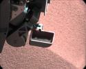
PIA16111:
Reading the Rover's Tracks
Full Resolution:     TIFF (1.05 MB)     JPEG (274.3 kB)
Add Image to Favorite List 2012-08-29 Mars Mars Science Laboratory (MSL)
1024x1024x1
This image shows a close-up of track marks from the first test drive of NASA's Curiosity rover. The rover's arm is visible in the foreground. A close inspection of the tracks reveals a unique, repeating pattern: Morse code for JPL.
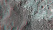
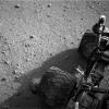
PIA16093:
Curiosity Leaves Its Mark
Full Resolution:     TIFF (1.05 MB)     JPEG (245.6 kB)
Add Image to Favorite List 2012-08-27 Mars Mars Science Laboratory (MSL)
4024x1282x1
Two donut-shaped tracks make an infinity symbol, and mark the first two drives of NASA's Curiosity rover. The landing site is at the far right.
PIA16110:
From Infinity and Beyond
Full Resolution:     TIFF (5.164 MB)     JPEG (628.4 kB)
Add Image to Favorite List 2012-08-27 Mars Mars Science Laboratory (MSL)
1024x1024x1
This image taken by a front Hazard-Avoidance camera on NASA's Curiosity shows track marks from the rover's first Martian drives.
PIA16109:
Big Wheels Keep on Rollin'
Full Resolution:     TIFF (1.05 MB)     JPEG (133.4 kB)
Add Image to Favorite List 2012-08-27 Mars Mars Science Laboratory (MSL)
1024x1024x1
This image taken by NASA's Curiosity rover shows track marks from a successful drive to the scour mark known as Goulburn, an area of bedrock exposed by thrusters on the rover's descent stage.
PIA16108:
Evidence of Curiosity's Second Drive
Full Resolution:     TIFF (1.05 MB)     JPEG (89.13 kB)
Add Image to Favorite List 2012-08-27 Mars Mars Science Laboratory (MSL)
Mastcam
1463x978x3
A chapter of the layered geological history of Mars is laid bare in this postcard from NASA's Curiosity rover. The image shows the base of Mount Sharp, the rover's eventual science destination.
PIA16105:
Layers at the Base of Mount Sharp
Full Resolution:     TIFF (4.294 MB)     JPEG (222.6 kB)
Add Image to Favorite List 2012-08-27 Mars Mars Science Laboratory (MSL)
Mastcam
1463x1928x3
This image is from a test series used to chacterize the 100-millimeter Mast Camera on NASA's Curiosity rover. It was taken on Aug. 23, 2012, and looks south-southwest from the rover's landing site.
PIA16104:
Focusing the 100-millimeter Mastcam
Full Resolution:     TIFF (8.465 MB)     JPEG (523.5 kB)
Add Image to Favorite List 2012-08-27 Mars Mars Science Laboratory (MSL)
Mastcam
1375x1148x3
This image is from a series of test images to calibrate the 34-millimeter Mast Camera on NASA's Curiosity rover. It was taken on Aug. 23, 2012 and looks south-southwest from the rover's landing site.
PIA16103:
Focusing the 34-millimeter Mastcam
Full Resolution:     TIFF (4.738 MB)     JPEG (276.7 kB)
Add Image to Favorite List 2012-08-27 Mars Mars Science Laboratory (MSL)
Mastcam
14494x3560x3
This color panorama shows a 360-degree view of the landing site of NASA's Curiosity rover, including the highest part of Mount Sharp visible to the rover.
PIA16101:
Landing Site Panorama, with the Heights of Mount Sharp
Full Resolution:     TIFF (154.8 MB)     JPEG (6.485 MB)
Add Image to Favorite List 2012-08-27 Mars Mars Science Laboratory (MSL)
Mastcam
3313x1660x3
This image taken by the Mast Camera (MastCam) on NASA's Curiosity rover highlights the interesting geology of Mount Sharp, a mountain inside Gale Crater, where the rover landed.
PIA16099:
Getting to Know Mount Sharp
Full Resolution:     TIFF (16.51 MB)     JPEG (1.314 MB)
Add Image to Favorite List 2012-08-22 Mars Mars Science Laboratory (MSL)
Navcam (MSL)
Robotic Arm (MSL)
2089x2074x1
The extended robotic arm of NASA's Mars rover Curiosity can be seen in this mosaic of full-resolution images from Curiosity's Navigation camera (Navcam). Curiosity extended its arm on Aug. 20, 2012.
PIA16096:
Curiosity's First Arm Extension, Full Resolution
Full Resolution:     TIFF (4.338 MB)     JPEG (262 kB)
Add Image to Favorite List 2012-08-22 Mars Mars Science Laboratory (MSL)
1024x1024x1
This image shows the tracks left by NASA's Curiosity rover on Aug. 22, 2012, as it completed its first test drive on Mars. This image was taken by a front Hazard-Avoidance camera, which has a fisheye lens.
PIA16095:
Making Tracks on Mars
Full Resolution:     TIFF (1.05 MB)     JPEG (131.4 kB)
Add Image to Favorite List 2012-08-22 Mars Mars Science Laboratory (MSL)
1600x1600x1
This imagery is being released in association with NASA's Mars Science Laboratory mission. This is a temporary caption to be replaced as soon as more information is available.
PIA16094:
Rover Takes Its First 'Steps'
Full Resolution:     TIFF (2.563 MB)     JPEG (378.2 kB)
Add Image to Favorite List 2012-08-22 Mars Mars Science Laboratory (MSL)
7703x1997x1
This 360-degree panorama shows evidence of a successful first test drive for NASA's Curiosity rover; the rover made its first move, going forward about 15 feet (4.5 meters), rotating 120 degrees and then reversing about 8 feet (2.5 meters).
PIA16092:
Curiosity's First Track Marks on Mars
Full Resolution:     TIFF (15.4 MB)     JPEG (1.667 MB)
Add Image to Favorite List 2012-08-22 Mars Mars Science Laboratory (MSL)
1024x1024x1
NASA's Curiosity rover shot its laser 50 times at rocks exposed by thrusters on the rover's sky crane at the scour mark called 'Goulburn.'
PIA16091:
After the Laser Shots Animation Icon
Full Resolution:     TIFF (1.05 MB)     JPEG (107.4 kB)
Add Image to Favorite List 2012-08-22 Mars Mars Science Laboratory (MSL)
1732x1486x3
This photo mosaic shows the scour mark, dubbed 'Goulburn,' left by the thrusters on the sky crane that helped lower NASA's Curiosity rover to the Red Planet.
PIA16090:
Zapping Rocks Exposed by the Sky Crane's Thrusters
Full Resolution:     TIFF (7.724 MB)     JPEG (280.9 kB)
Add Image to Favorite List 2012-08-21 Mars Mars Science Laboratory (MSL)
1024x1024x1
This image from an animated gif shows the movement of the rear right wheel of NASA's Curiosity as rover drivers turned the wheels in place at the landing site on Mars.
PIA16087:
Wiggle in the Gravel Animation Icon
Full Resolution:     TIFF (1.05 MB)     JPEG (156.9 kB)
Add Image to Favorite List 2012-08-21 Mars Mars Science Laboratory (MSL)
Mastcam
1024x1024x1
This full-resolution image from NASA's Curiosity shows the elbow joint of the rover's extended robotic arm on Aug. 20, 2012. The Navigation Camera captured this view.
PIA16086:
Part of Curiosity's Outstretched Arm, Full-Resolution
Full Resolution:     TIFF (1.05 MB)     JPEG (103.8 kB)
Add Image to Favorite List 2012-08-21 Mars Mars Science Laboratory (MSL)
Robotic Arm (MSL)
1024x1024x1
This full-resolution image from NASA's Curiosity shows the turret of tools at the end of the rover's extended robotic arm on Aug. 20, 2012. The Navigation Camera captured this view.
PIA16085:
End of Curiosity's Extended Arm, Full-Resolution
Full Resolution:     TIFF (1.05 MB)     JPEG (66.03 kB)
Add Image to Favorite List 2012-08-21 Mars Mars Science Laboratory (MSL)
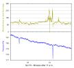
1367x798x3
This graph shows the rise and fall of air and ground temperatures on Mars obtained by NASA's Curiosity rover.
PIA16081:
Taking Mars' Temperature
Full Resolution:     TIFF (3.274 MB)     JPEG (89.58 kB)
Add Image to Favorite List 2012-08-21 Mars Mars Science Laboratory (MSL)
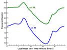
1367x798x3
This graph shows readings for atmospheric pressure at the landing site of NASA's Curiosity rover. The data were obtained by Curiosity's Rover Environmental Monitoring Station from Aug. 15 to Aug. 18, 2012.
PIA16080:
First Pressure Readings on Mars
Full Resolution:     TIFF (3.274 MB)     JPEG (98.91 kB)
Retrieve Previous Set  Jump to a Previous Set   Jump to a Previous Set   Jump to a Previous Set   Jump to a Previous Set   Jump to a Previous Set   Jump to a Previous Set   Current Set   Jump to a Following Set   Jump to a Following Set   Retrieve Next Set 
 1-100   101-200   201-300   301-400   401-500   501-600   601-700   701-800   801-900 
Currently displaying images: 601 - 700 of 826