Your search criteria found
12755
images
Target is Mars (and available satellites)
Go to PIAxxxxx:
Refine this list of images by:
Target:
Deimos
Mars
Phobos
Mission:
2001 Mars Odyssey
Antarctic Meteorite Location and Mapping Project (AMLAMP)
Dawn
ExoMars
Hubble Space Telescope
InSight
MAVEN
Mariner Mars 1964 (Mariner 4)
Mariner Mars 1969 (Mariner 7)
Mariner Mars 1971 (Mariner 9)
Mars 2020
Mars 2020 Rover
Mars Atmosphere and Volatile Evolution MissioN (MAVEN)
Mars Climate Orbiter
Mars Cube One (MarCO)
Mars Exploration Rover (MER)
Mars Express (MEX)
Mars Global Surveyor (MGS)
Mars Helicopter
Mars Pathfinder (MPF)
Mars Reconnaissance Orbiter (MRO)
Mars Sample Return
Mars Sample Return (MSR)
Mars Science Laboratory (MSL)
Phoenix
Rosetta
Viking
Spacecraft:
2001 Mars Odyssey
Curiosity
Dawn
InSight Mars Lander
Ingenuity
MAVEN
MarCO-B
Mariner 4
Mariner 7
Mariner 9
Mars Climate Orbiter
Mars Express (MEX)
Mars Express (MEX) Orbiter
Mars Global Surveyor Orbiter
Mars Pathfinder Lander
Mars Pathfinder Rover
Mars Reconnaissance Orbiter (MRO)
Mars Sample Return
Mars Science Laboratory (MSL)
NASA's Mars Pathfinder Lander
Opportunity
Perseverance
Philae Lander
Phoenix Lander
Phoenix Mars Lander
Spirit
Viking Lander 1
Viking Lander 2
Viking Orbiter 1
Viking Orbiter 2
Instrument:
Alpha Particle X-ray Spectrometer
Alpha Particle X-ray Spectrometer (MSL)
Atmospheric Structure / Meteorology Instrument
CHIMRA
Camera 1
Camera 2
Chemistry & Mineralogy (CheMin)
Chemistry and Camera (ChemCam)
Comet Infrared and Visible Analyser (CIVA
Compact Reconnaissance Imaging Spectrometer for Mars (CRISM)
Context Camera (CTX)
Deep Space Network
Descent Image Motion Estimation System (DIMES)
Dynamic Albedo of Neutrons
Dynamic Albedo of Neutrons (DAN)
Gamma Ray Spectrometer - Neutron Spectrometer
Gamma Ray Spectrometer Suite
Hazard Avoidance Camera
Hazard Avoidance Camera (M2020)
Hazard Avoidance Camera (MSL)
Heat and Physical Properties Package (HP3)
High Resolution Imaging Science Experiment (HiRISE)
High Resolution Instrument (HRI)
High Resolution Stereo Camera
Imager for Mars Pathfinder
Imaging Ultraviolet Spectrograph
Imaging Ultraviolet Spectrograph (IUVS)
Instrument Context Camera (ICC)
Instrument Deployment Camera (IDC)
Lander Vision System Camera (LCAM)
Magnetometer
Mars Advanced Radar for Subsurface and Ionosphere Sounding (MARSIS)
Mars Advanced Radar for Subsurface and Ionospheric Sounding (MARSIS)
Mars Climate Sounder (MCS)
Mars Color Imager (MARCI)
Mars Descent Imager
Mars Environmental Dynamics Analyzer (MEDA)
Mars Hand Lens Imager (MAHLI)
Mars Horizon Sensor Assembly
Mars Orbiter Camera (MOC)
Mars Orbiter Laser Altimeter
Mars Radiation Experiment
Mastcam
Mastcam-Z
Microscopic Imager
Microscopy Electrochemistry and Conductivity Analyzer (MECA)
Miniature Thermal Emission Spectrometer
Moessbauer Spectrometer
Navigation Camera
Navigation Camera (M2020)
Navigation Camera (MSL)
Neutral Gas and Ion Mass Spectrometer
Neutron Spectrometer
Optical Microscope
Optical Navigation Camera
Panoramic Camera
Planetary Instrument for X-ray Lithochemistry (PIXL)
Radar System
Radiation Assessment Detector (RAD)
Radio Science Subsystem
Robotic Arm
Robotic Arm (MSL)
Robotic Arm Camera (RAC)
Rock Abrasion Tool (RAT)
Rover Cameras
Rover Environmental Monitoring Station (REMS)
Sample Analysis at Mars (SAM)
Scanning Habitable Environments with Raman & Luminescence for Organics and Chemicals (SHERLOC)
Seismic Experiment for Interior Structure (SEIS)
Shallow Subsurface Radar (SHARAD)
Stereo Imager (SSI)
SuperCam
Surface Stereo Imager (SSI)
Thermal Emission Imaging System
Thermal Emission Spectrometer
Thermal and Electrical Conductivity Probe
Thermal and Evolved Gas Analyzer
Trace Gas Orbiter
Visual Imaging Subsystem
Visual Imaging Subsystem - Camera A
Visual Imaging Subsystem - Camera B
Wide Field Planetary Camera 2
Click on an image for detailed information
Click on a column heading to sort in ascending or descending order
My
List
Addition Date
Target
Mission
Instrument
Size
2008-04-16
Mars
2001 Mars Odyssey
THEMIS
1326x2956x1
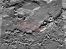
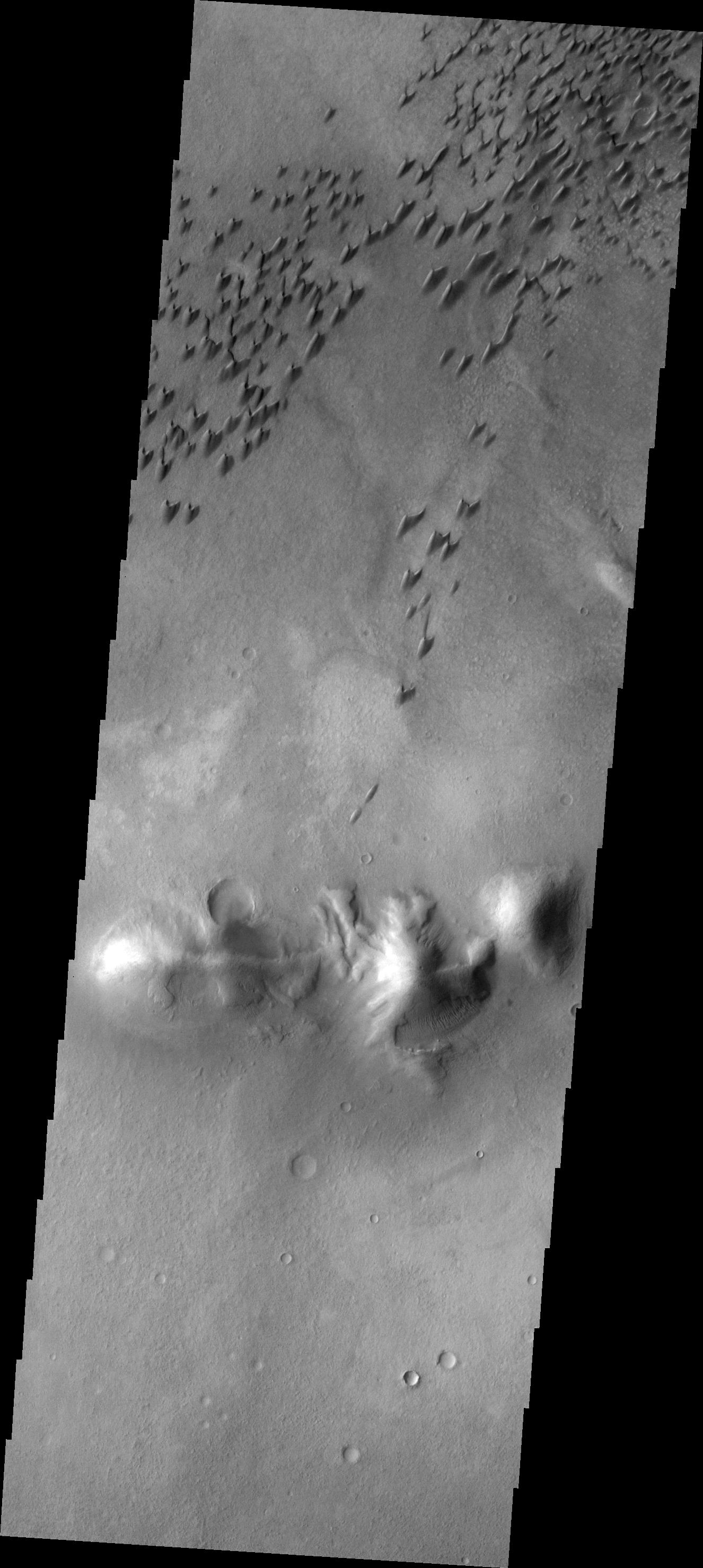
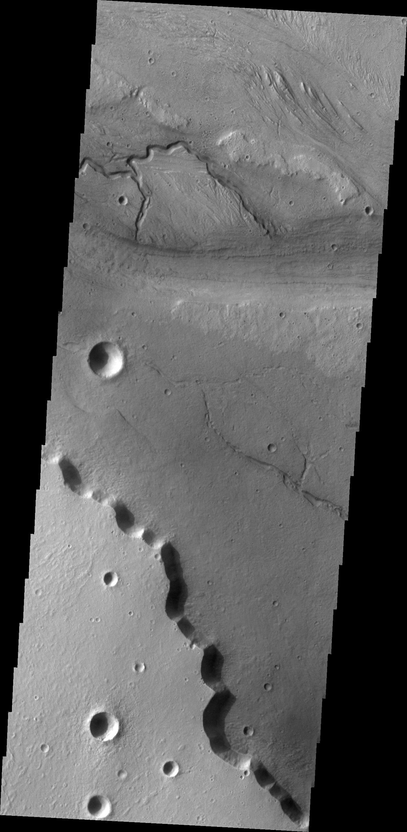
PIA10321:
Arkhangelsky Dunes
Full Resolution:
TIFF
(3.924 MB)
JPEG
(351 kB)
2008-04-17
Mars
2001 Mars Odyssey
THEMIS
1351x2926x1
PIA10322:
Melas Chasma
Full Resolution:
TIFF
(3.957 MB)
JPEG
(273.2 kB)
2008-04-17
Mars
Mars Express (MEX)
Mars Reconnaissance Orbiter (MRO)
MARSIS
Shallow Subsurface Radar (SHARAD)
1265x723x3
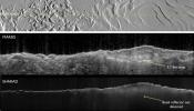
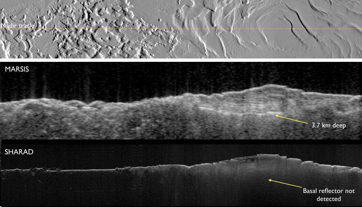
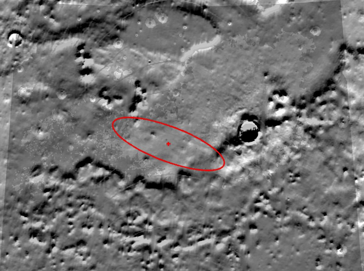
PIA10375:
Two Radar Sounders Examine South Polar Layered Deposits on Mars
Full Resolution:
TIFF
(2.747 MB)
JPEG
(134.7 kB)
2008-04-17
Mars
Mars Express (MEX)
Mars Reconnaissance Orbiter (MRO)
MARSIS
Shallow Subsurface Radar (SHARAD)
516x387x1
PIA10376:
Mars Radar Opens a Planet's Third Dimension
Full Resolution:
TIFF
(307.4 kB)
JPEG
(20.51 kB)
2008-04-18
Mars
2001 Mars Odyssey
THEMIS
1316x2955x1
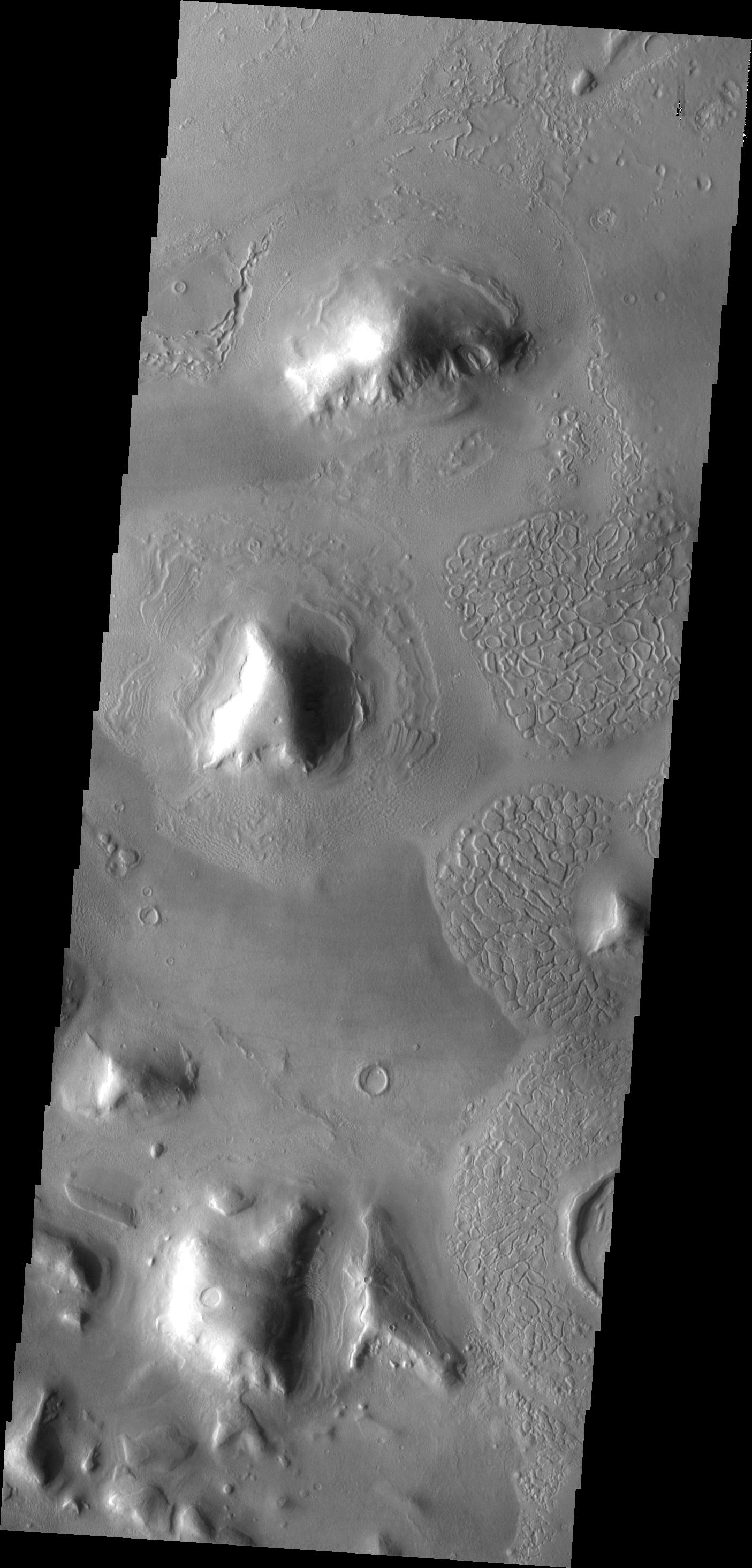
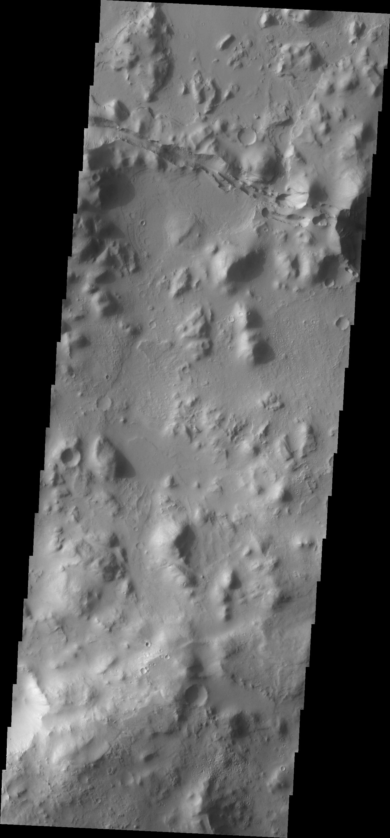
PIA10323:
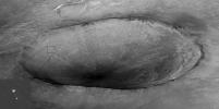
Newton Crater
Full Resolution:
TIFF
(3.893 MB)
JPEG
(474.9 kB)
2008-04-21
Mars
2001 Mars Odyssey
THEMIS
1353x2931x1
PIA10324:
Coprates Chasma
Full Resolution:
TIFF
(3.97 MB)
JPEG
(289 kB)
2008-04-22
Mars
2001 Mars Odyssey
THEMIS
1382x2916x1
PIA10325:
Elysium Fossae
Full Resolution:
TIFF
(4.035 MB)
JPEG
(300.3 kB)
2008-04-23
Mars
2001 Mars Odyssey
THEMIS
1349x2922x1
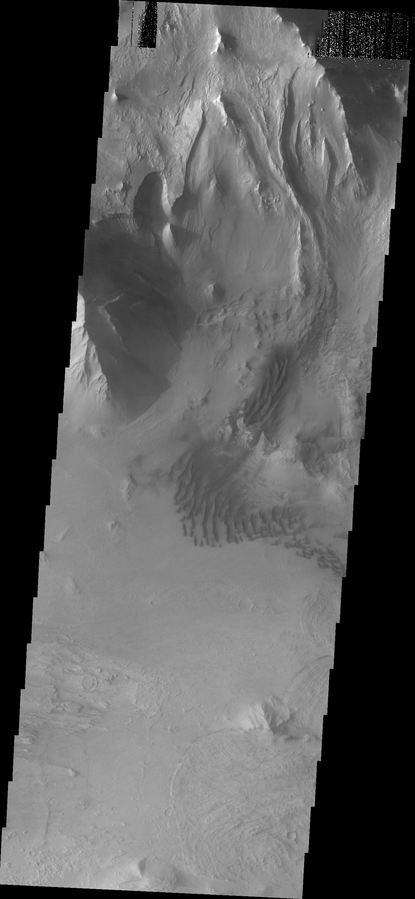
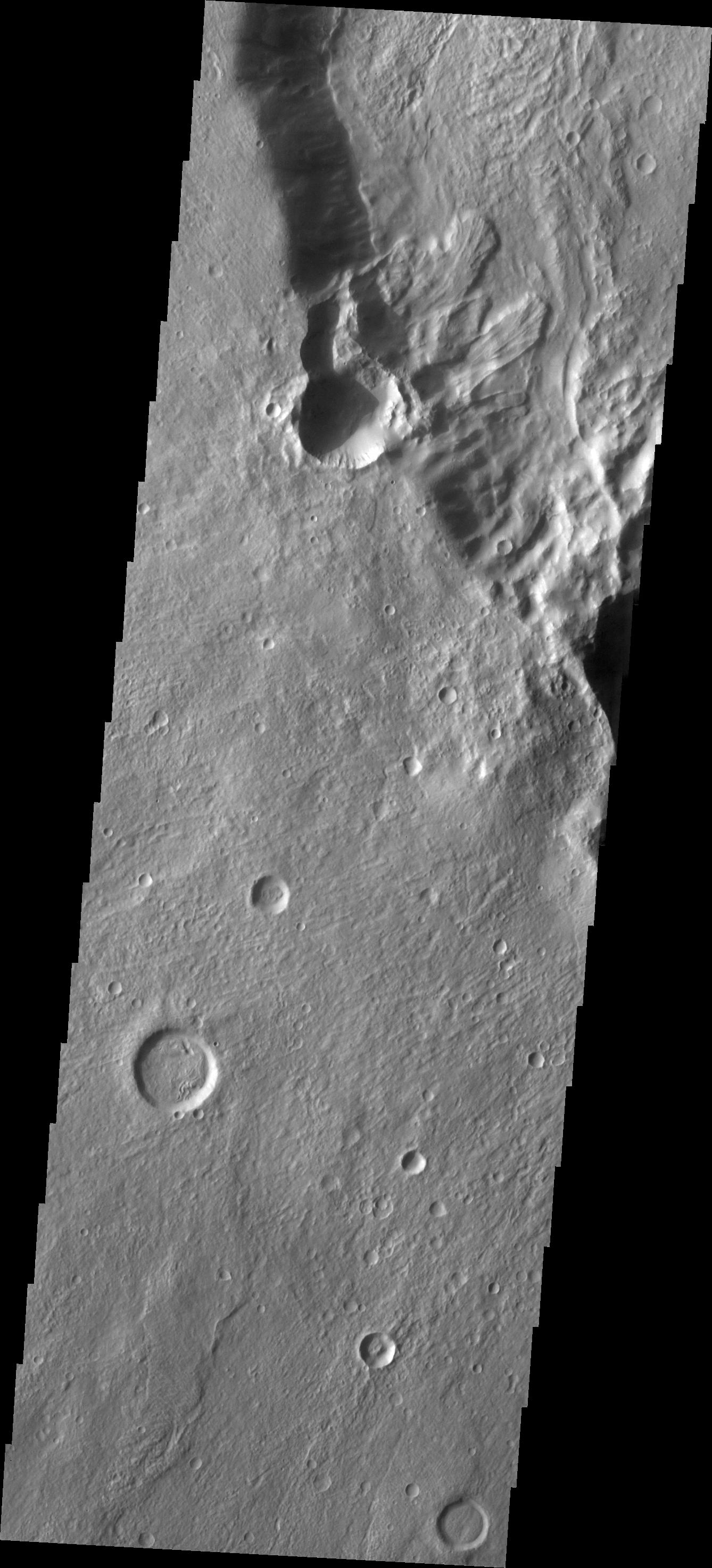
PIA10326:
Aeolis Landslides
Full Resolution:
TIFF
(3.946 MB)
JPEG
(375.2 kB)
2008-04-24
Mars
2001 Mars Odyssey
THEMIS
1344x2955x1
PIA10327:
Rim Channels
Full Resolution:
TIFF
(3.976 MB)
JPEG
(354.5 kB)
2008-04-25
Mars
2001 Mars Odyssey
THEMIS
1367x2916x1
PIA10328:
Montevallo Crater
Full Resolution:
TIFF
(3.991 MB)
JPEG
(338.6 kB)
2008-04-28
Mars
2001 Mars Odyssey
THEMIS
1335x2925x1
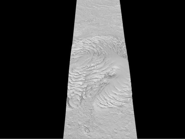
PIA10329:
Triplet Crater
Full Resolution:
TIFF
(3.909 MB)
JPEG
(355.5 kB)
2008-04-29
Mars
2001 Mars Odyssey
THEMIS
1341x2940x1
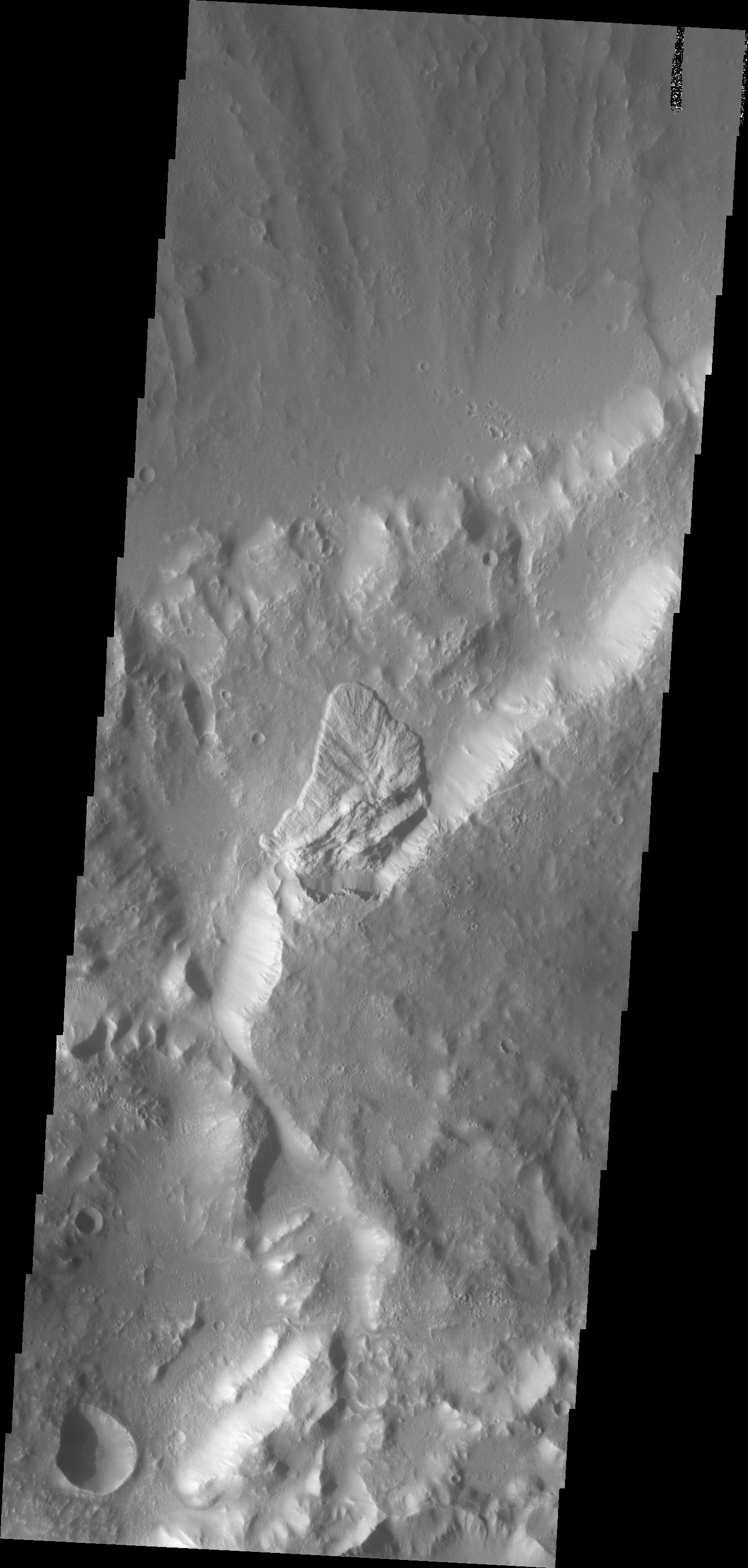
PIA10330:
Landslide
Full Resolution:
TIFF
(3.947 MB)
JPEG
(314 kB)
2008-04-29
Mars
Mars Reconnaissance Orbiter (MRO)
CRISM
1166x1784x3
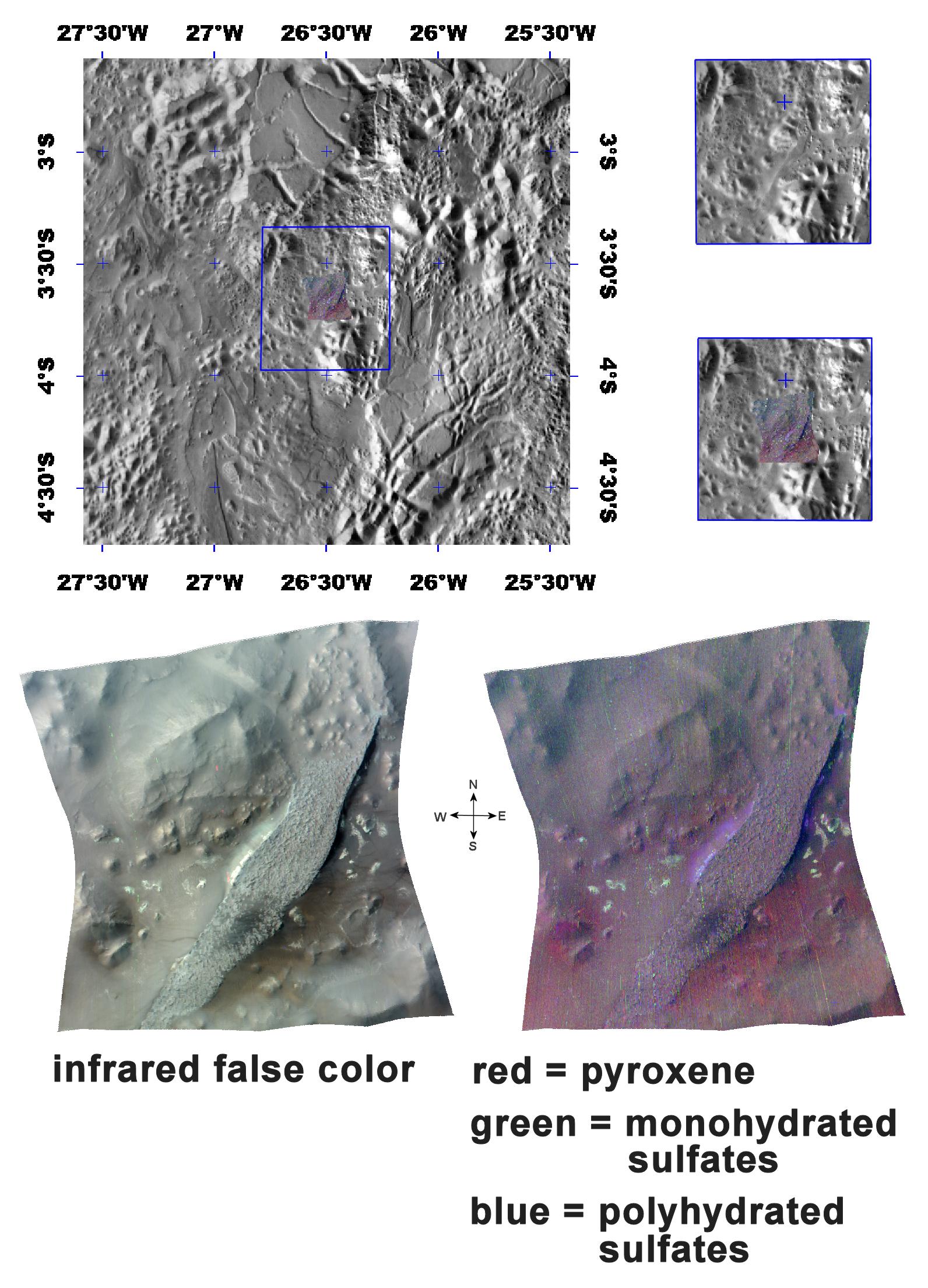
PIA10644:
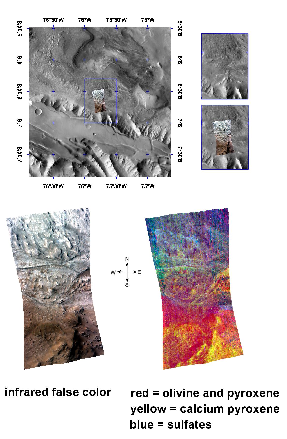
The Minerals of Candor Chasma
Full Resolution:
TIFF
(6.248 MB)
JPEG
(266.8 kB)
2008-04-30
Mars
2001 Mars Odyssey
THEMIS
1379x2917x1
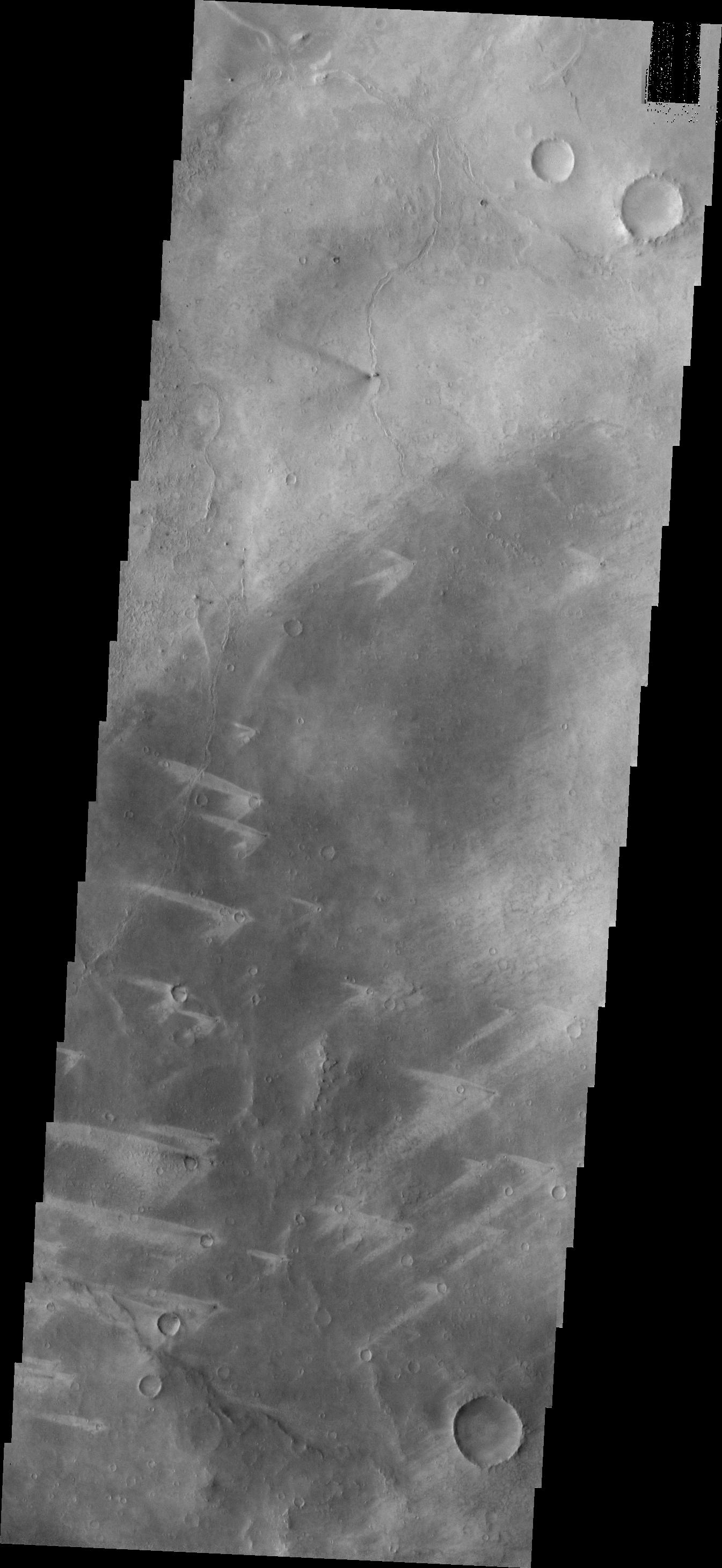
PIA10331:
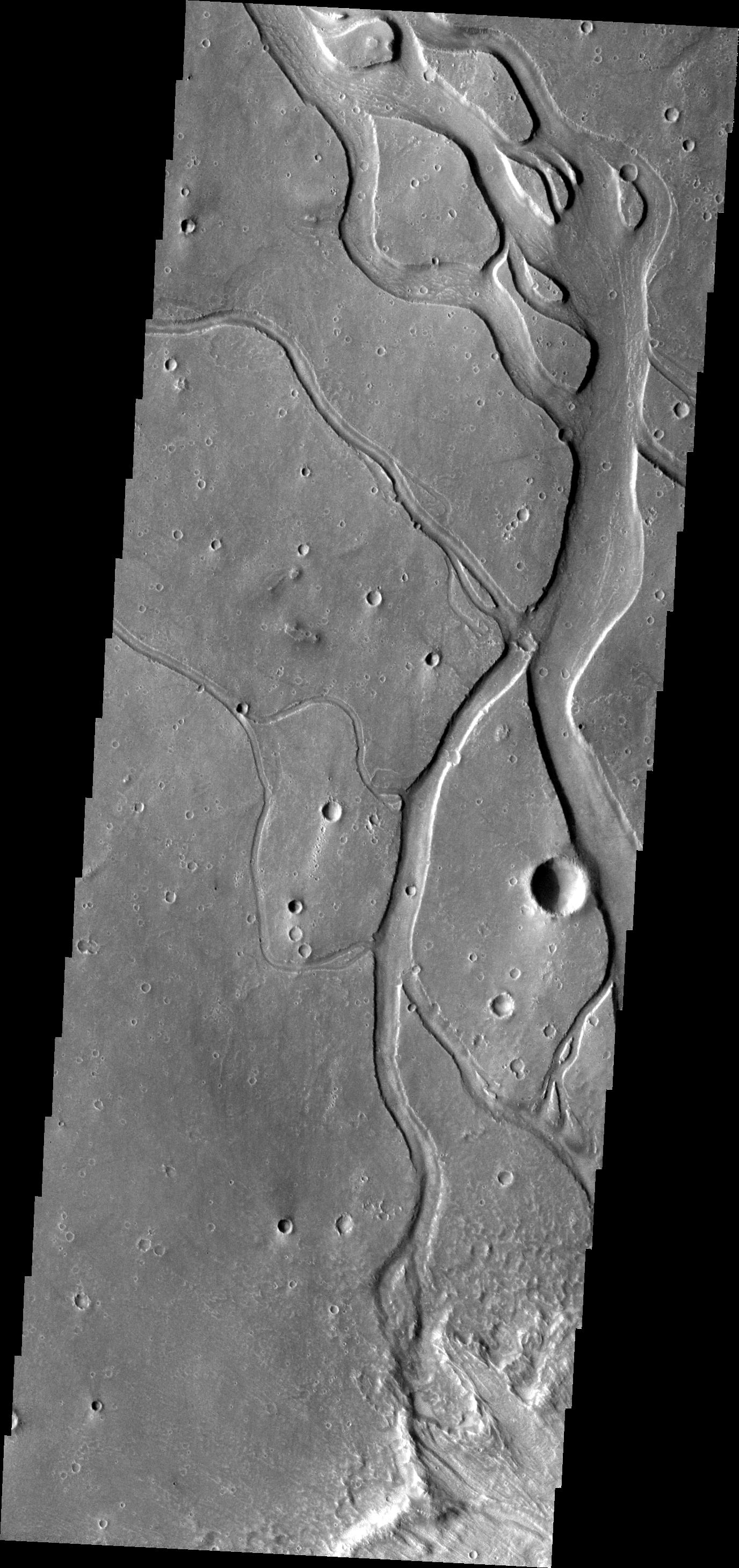
Granicus Valles
Full Resolution:
TIFF
(4.027 MB)
JPEG
(494 kB)
2008-05-01
Mars
2001 Mars Odyssey
THEMIS
1366x2918x1
PIA10332:
Elysium Planitia
Full Resolution:
TIFF
(3.991 MB)
JPEG
(543.4 kB)
2008-05-02
Mars
2001 Mars Odyssey
THEMIS
1307x2786x1
PIA10333:
Ridges
Full Resolution:
TIFF
(3.645 MB)
JPEG
(497.6 kB)
2008-05-05
Mars
2001 Mars Odyssey
THEMIS
1340x2928x1
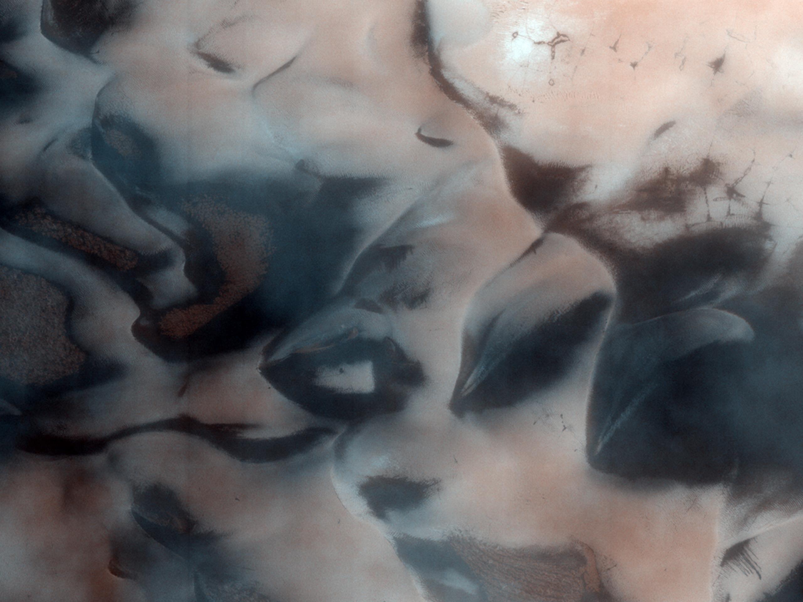
PIA10334:
Herschel Dunes
Full Resolution:
TIFF
(3.928 MB)
JPEG
(388.8 kB)
2008-05-06
Mars
2001 Mars Odyssey
THEMIS
1319x2945x1
PIA10335:
Dunes
Full Resolution:
TIFF
(3.889 MB)
JPEG
(276.2 kB)
2008-05-06
Mars
Mars Reconnaissance Orbiter (MRO)
CTX
499x5222x1
PIA10632:
Context Camera View in Phoenix Landing Region in Martian Arctic
Full Resolution:
TIFF
(2.609 MB)
JPEG
(328.2 kB)
2008-05-06
Mars
Mars Reconnaissance Orbiter (MRO)
CTX
4096x4096x1
PIA10633:
Context Camera Spots Dust Devils at Phoenix Landing Site
Full Resolution:
TIFF
(16.79 MB)
JPEG
(2.521 MB)
2008-05-06
Mars
Mars Reconnaissance Orbiter (MRO)
MARCI
1083x844x3
PIA10634:
Phoenix Landing Area Viewed by Mars Color Imager
Full Resolution:
TIFF
(2.746 MB)
JPEG
(40.7 kB)
2008-05-07
Mars
2001 Mars Odyssey
THEMIS
1338x2927x1
PIA10336:
Dunes
Full Resolution:
TIFF
(3.92 MB)
JPEG
(235.8 kB)
2008-05-08
Mars
2001 Mars Odyssey
THEMIS
1338x2946x1
PIA10337:
Landslides
Full Resolution:
TIFF
(3.946 MB)
JPEG
(368.9 kB)
2008-05-09
Mars
2001 Mars Odyssey
THEMIS
1390x2916x1
PIA10338:
Landslide
Full Resolution:
TIFF
(4.058 MB)
JPEG
(275.3 kB)
2008-05-09
Mars
Mars Reconnaissance Orbiter (MRO)
CRISM
1592x2208x3
PIA10943:
The Minerals of Aureum Chaos
Full Resolution:
TIFF
(10.56 MB)
JPEG
(449.5 kB)
2008-05-12
Mars
2001 Mars Odyssey
THEMIS
1270x6018x1
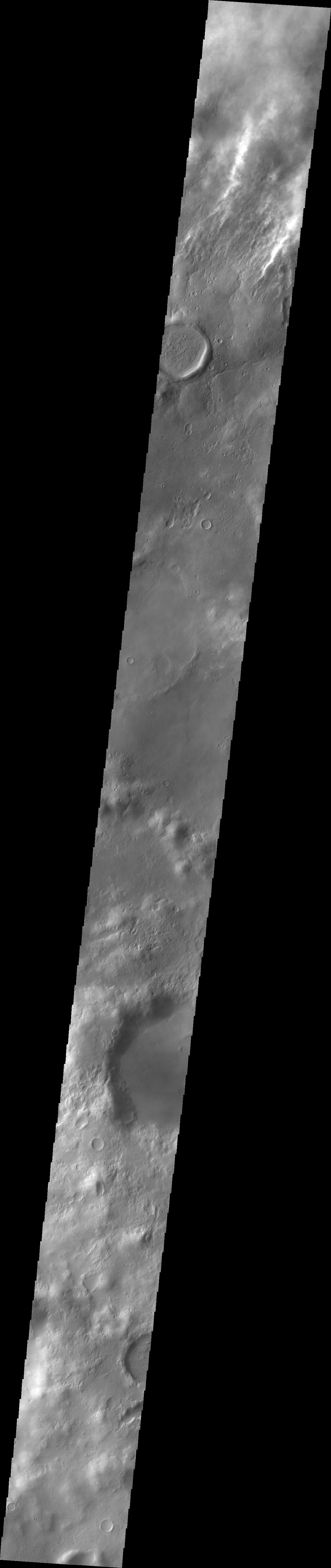
PIA10339:
Storm Clouds
Full Resolution:
TIFF
(7.651 MB)
JPEG
(335.7 kB)
2008-05-13
Mars
2001 Mars Odyssey
THEMIS
1358x2920x1
PIA10340:
Landslide
Full Resolution:
TIFF
(3.969 MB)
JPEG
(285.1 kB)
2008-05-14
Mars
2001 Mars Odyssey
THEMIS
1405x2929x1
PIA10341:
Texture
Full Resolution:
TIFF
(4.12 MB)
JPEG
(366.1 kB)
2008-05-14
Mars
Mars Reconnaissance Orbiter (MRO)
HiRISE
2560x1920x3
PIA12112:
Polygons, Crater Layers, and Defrosting Dunes
Full Resolution:
TIFF
(14.76 MB)
JPEG
(350.6 kB)
2008-05-15
Mars
2001 Mars Odyssey
THEMIS
1345x2919x1
PIA10342:
Windstreaks
Full Resolution:
TIFF
(3.93 MB)
JPEG
(312.1 kB)
2008-05-15
Mars
Mars Reconnaissance Orbiter (MRO)
Shallow Subsurface Radar (SHARAD)
1152x1056x3
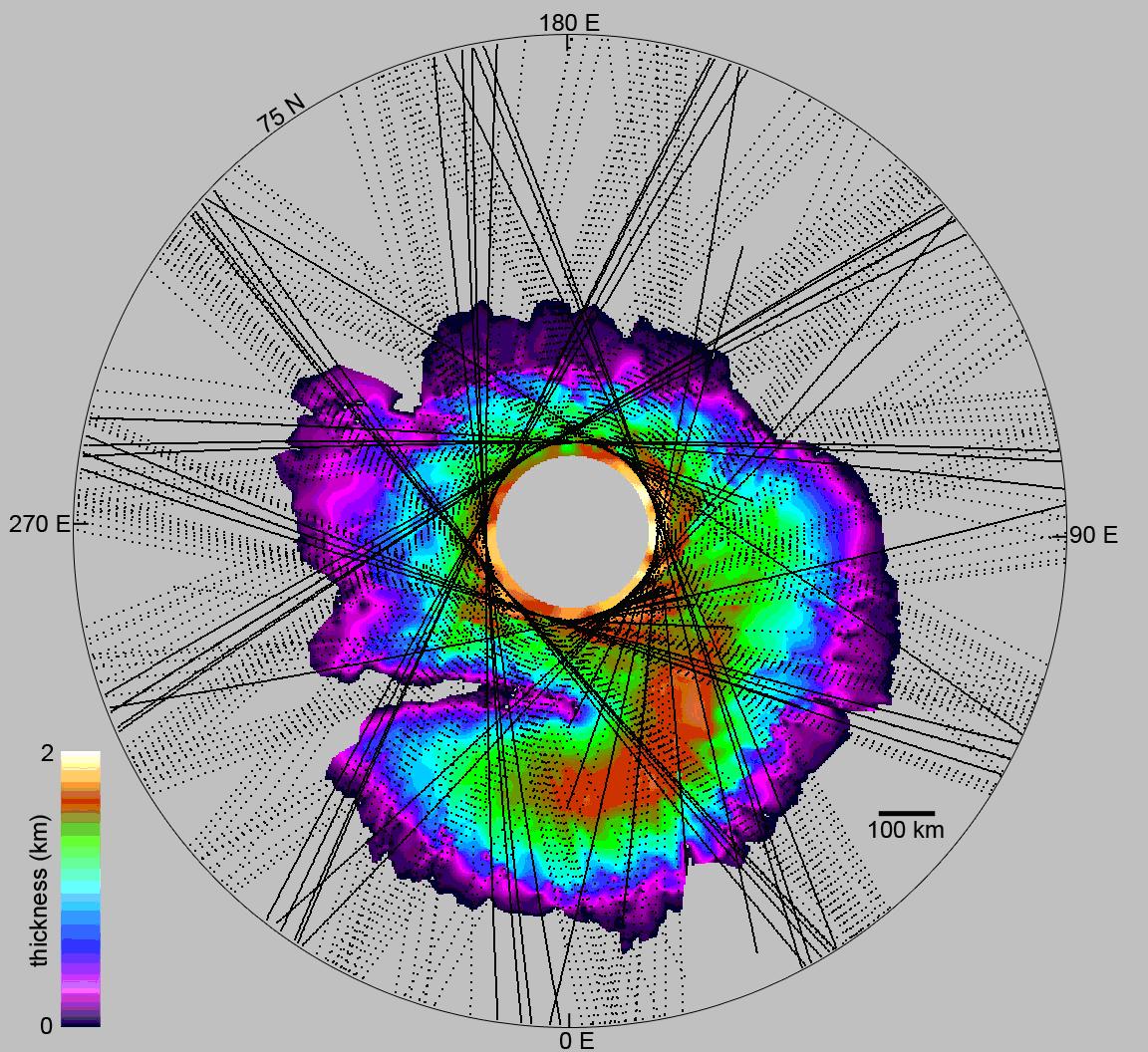
PIA10651:
How Thick is the North Polar Ice Cap on Mars?
Full Resolution:
TIFF
(3.654 MB)
JPEG
(319.4 kB)
2008-05-15
Mars
Mars Reconnaissance Orbiter (MRO)
Shallow Subsurface Radar (SHARAD)
2101x715x3
PIA10652:
What Lies Below a Martian Ice Cap
Full Resolution:
TIFF
(4.513 MB)
JPEG
(351.7 kB)
2008-05-15
Mars
Mars Reconnaissance Orbiter (MRO)
CRISM
1684x1552x3
PIA10944:
Mawrth Vallis Phyllosilicates
Full Resolution:
TIFF
(7.853 MB)
JPEG
(381.5 kB)
2008-05-16
Mars
2001 Mars Odyssey
THEMIS
1338x2928x1
PIA10343:
Wind Action
Full Resolution:
TIFF
(3.922 MB)
JPEG
(503.5 kB)
2008-05-19
Mars
2001 Mars Odyssey
THEMIS
1361x2916x1
PIA10344:
Jovis Tholus
Full Resolution:
TIFF
(3.973 MB)
JPEG
(365.9 kB)
2008-05-20
Mars
2001 Mars Odyssey
THEMIS
1371x2917x1
PIA10345:
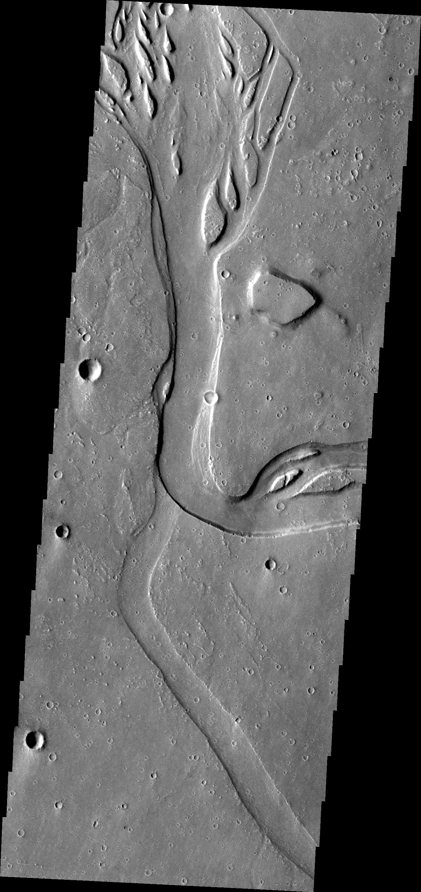
Marte Valles
Full Resolution:
TIFF
(4.004 MB)
JPEG
(479.8 kB)
2008-05-20
Mars
Mars Reconnaissance Orbiter (MRO)
CRISM
1576x1688x3
PIA10945:
An Olivine-Rich Crater in Tyrrhena Terra
Full Resolution:
TIFF
(7.995 MB)
JPEG
(282.7 kB)
2008-05-21
Mars
2001 Mars Odyssey
THEMIS
1381x2921x1
PIA10346:
Channels
Full Resolution:
TIFF
(4.039 MB)
JPEG
(575.2 kB)
2008-05-22
Mars
2001 Mars Odyssey
THEMIS
1376x2918x1
PIA10347:
Hebrus Valles
Full Resolution:
TIFF
(4.02 MB)
JPEG
(481.9 kB)
2008-05-22
Mars
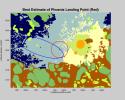
Mars Global Surveyor (MGS)
Phoenix
MOLA
720x486x3
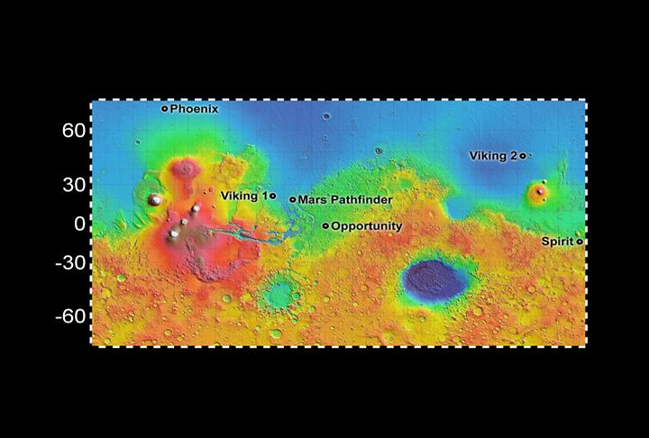
PIA10656:
Six Landing Sites on Mars
Full Resolution:
TIFF
(1.051 MB)
JPEG
(44.63 kB)
2008-05-22
Mars
Mars Reconnaissance Orbiter (MRO)
Phoenix
HiRISE
720x486x3
PIA10658:
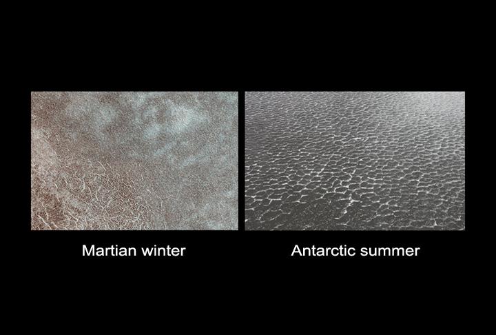
Polygon Patterned Ground on Mars and on Earth
Full Resolution:
TIFF
(1.051 MB)
JPEG
(44.26 kB)
2008-05-23
Mars
2001 Mars Odyssey
THEMIS
1376x2917x1
PIA10348:
Hebrus Valles
Full Resolution:
TIFF
(4.019 MB)
JPEG
(536.1 kB)
2008-05-24
Mars
Mars Reconnaissance Orbiter (MRO)
Phoenix
HiRISE
516x268x3
PIA10669:
Zooming in on Landing Site
Full Resolution:
TIFF
(415.5 kB)
JPEG
(11.47 kB)
2008-05-24
Mars
Mars Reconnaissance Orbiter (MRO)
Phoenix
MARCI
516x516x3
PIA10672:
Clear Skies Ahead
Full Resolution:
TIFF
(268.3 kB)
JPEG
(22.66 kB)
2008-05-24
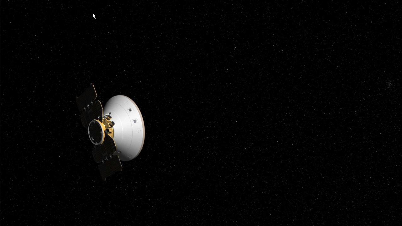
Mars
Phoenix
1198x893x3
PIA10677:
Phoenix on Target
Full Resolution:
TIFF
(3.213 MB)
JPEG
(128.7 kB)
2008-05-24
Mars
Phoenix
1279x719x3
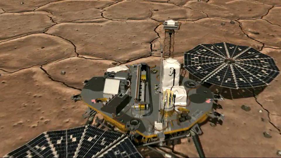
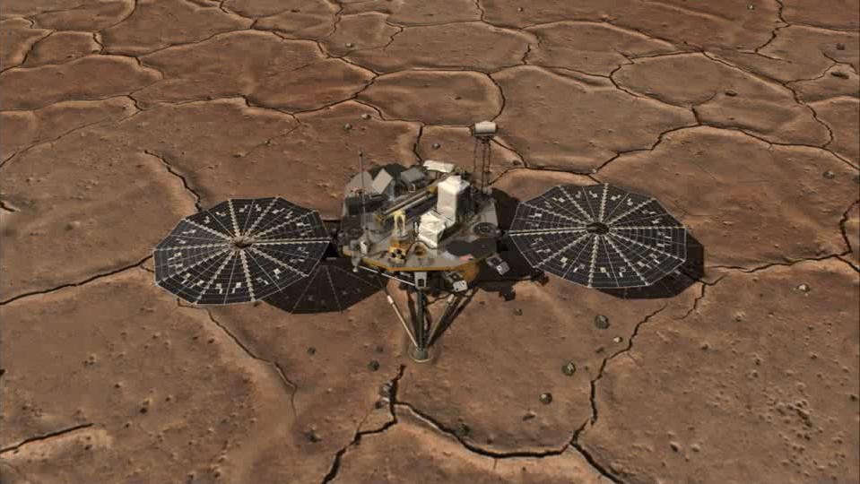
PIA10678:
How to Correct a Trajectory (Artist's Concept)
Full Resolution:
TIFF
(2.762 MB)
JPEG
(76.79 kB)
2008-05-26
Mars
Phoenix
Surface Stereo Imager (SSI)
512x512x1
PIA10679:
Robotic Arm Unwrapped
Full Resolution:
TIFF
(262.6 kB)
JPEG
(32.79 kB)
2008-05-26
Mars
Phoenix
Surface Stereo Imager (SSI)
2091x2938x1
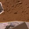
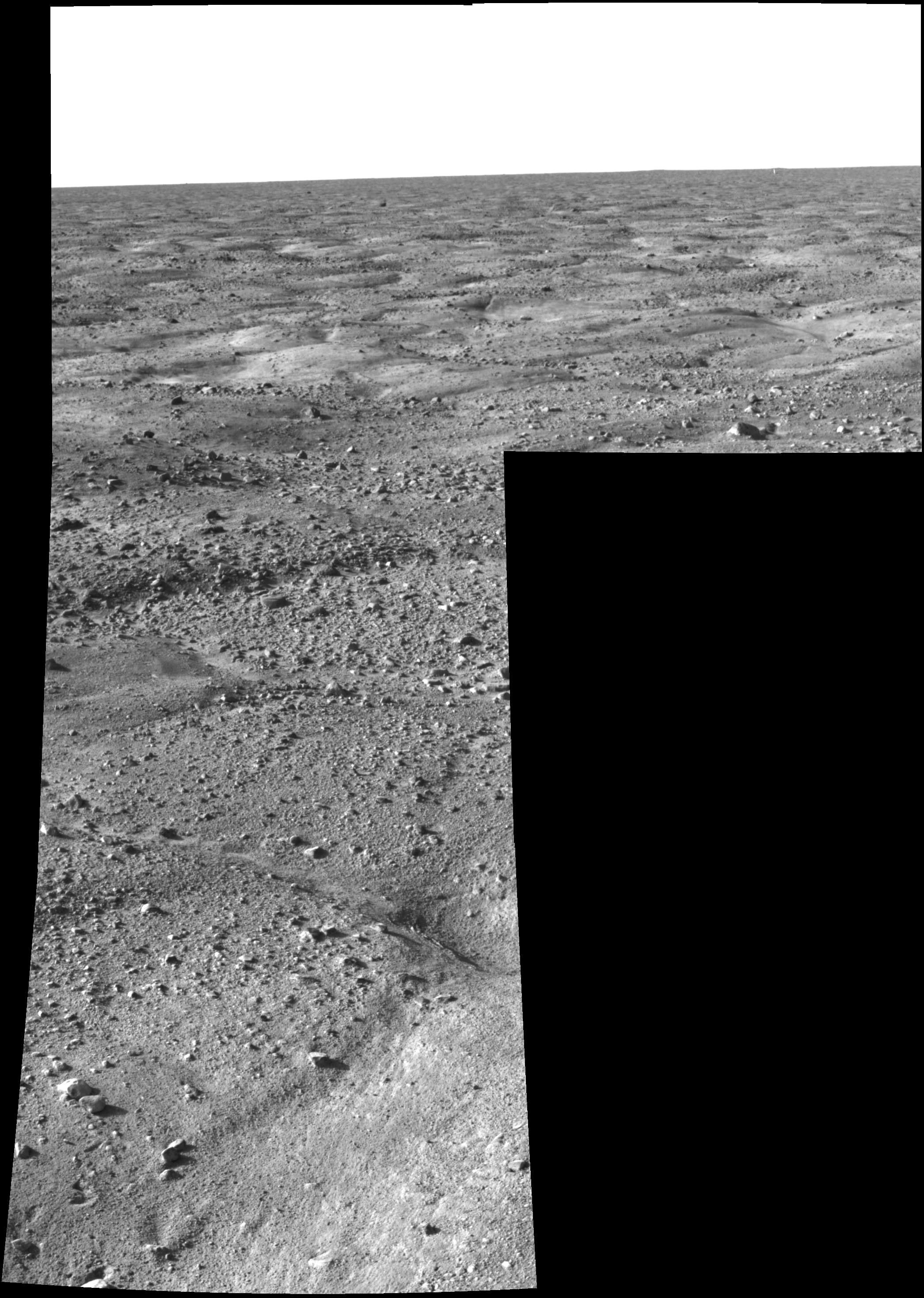
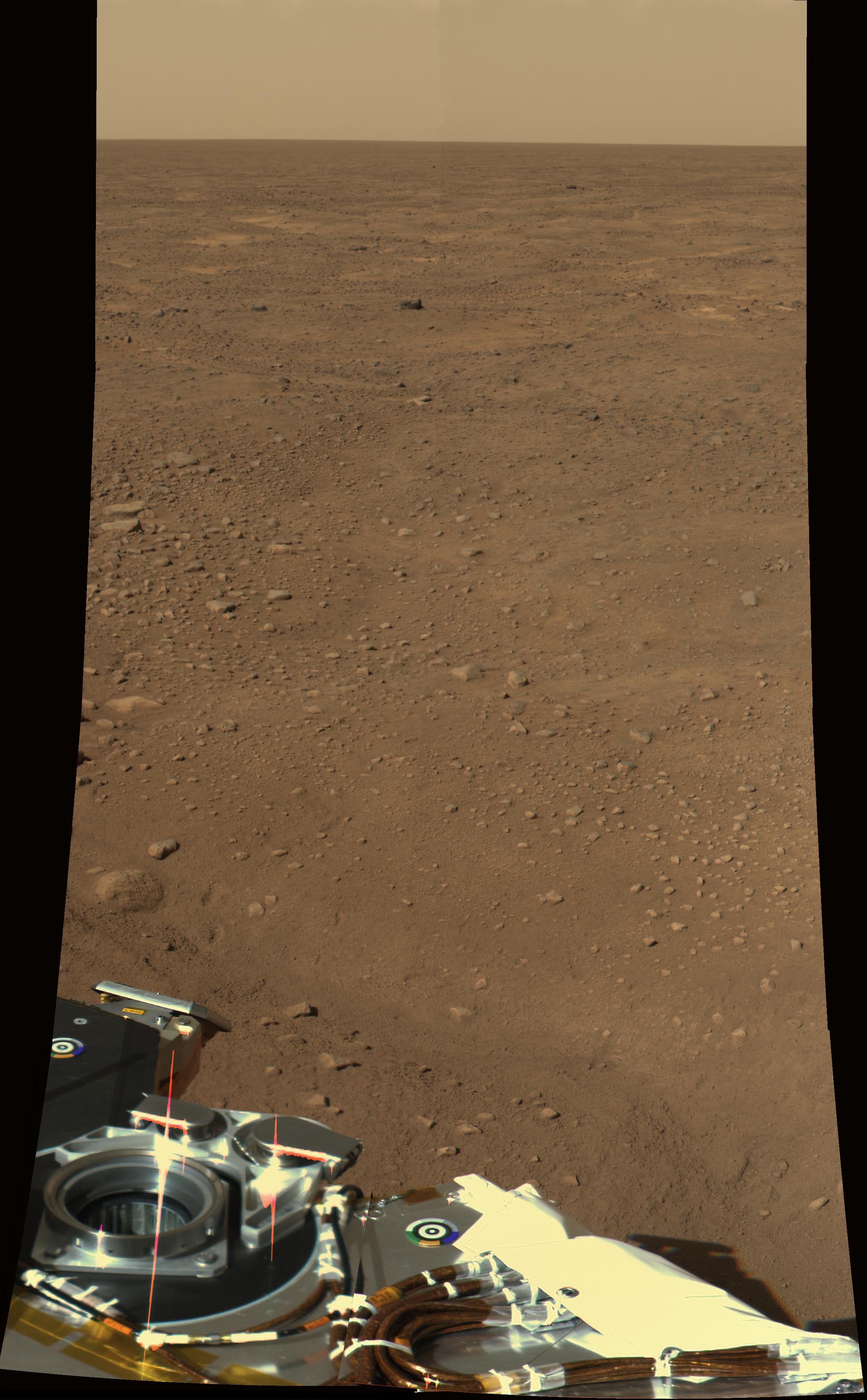
PIA10680:
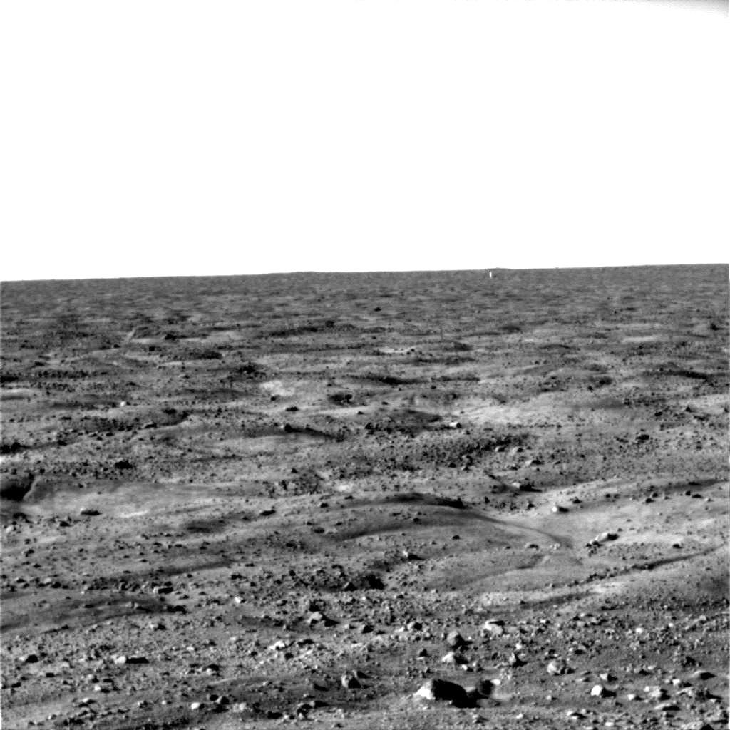
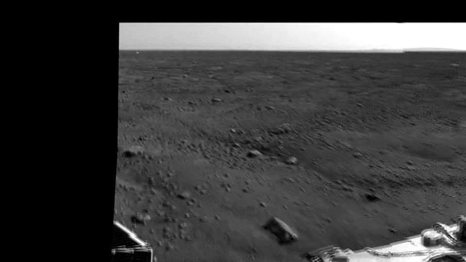
First Look at Martian Arctic Plains
Full Resolution:
TIFF
(6.151 MB)
JPEG
(629.9 kB)
2008-05-26
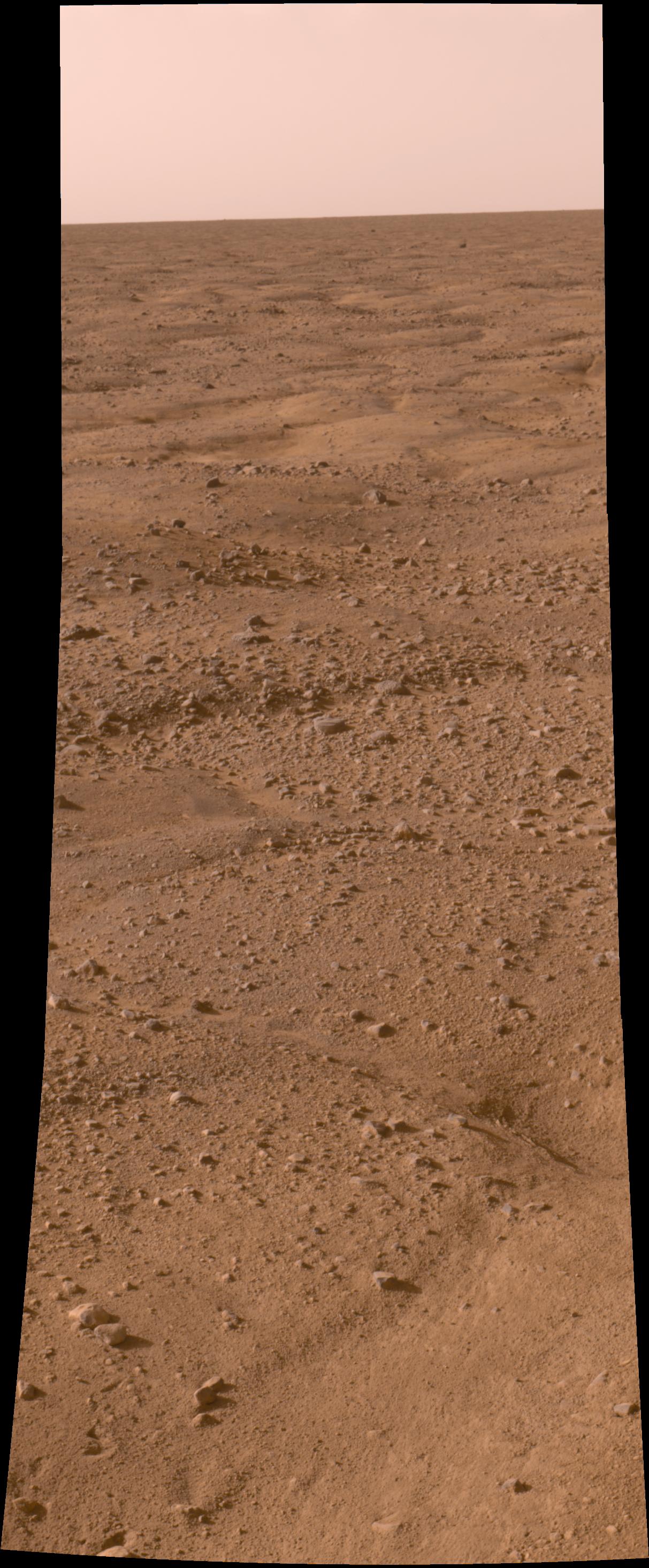
Mars
Phoenix
Surface Stereo Imager (SSI)
1024x1024x1
PIA10681:
First Look at Martian Arctic Plains
Full Resolution:
TIFF
(1.05 MB)
JPEG
(124.9 kB)
2008-05-26
Mars
Phoenix
Surface Stereo Imager (SSI)
1024x1024x3
PIA10682:
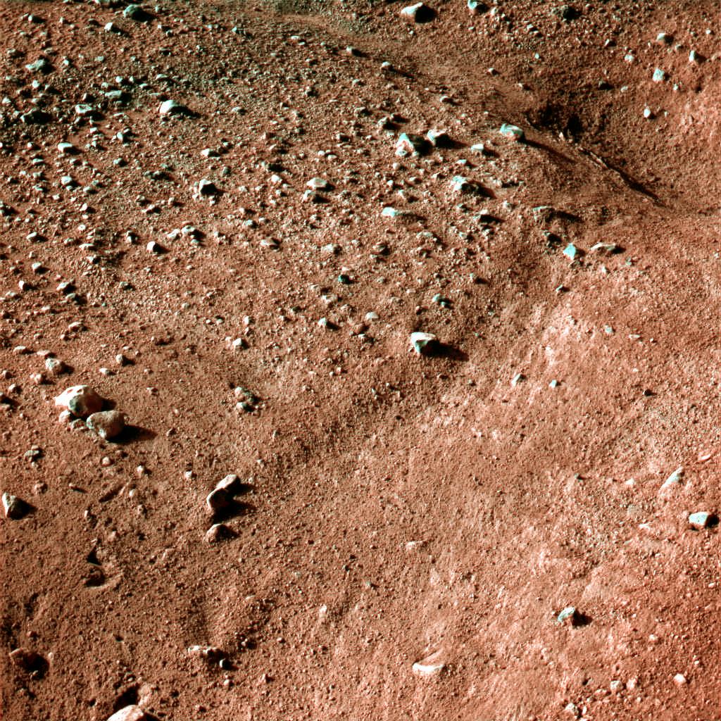
Icy, Patterned Ground on Mars
Full Resolution:
TIFF
(3.15 MB)
JPEG
(305.9 kB)
2008-05-26
Mars
Phoenix
Surface Stereo Imager (SSI)
1024x1024x1
PIA10683:
Polygon on Mars
Full Resolution:
TIFF
(1.05 MB)
JPEG
(318.4 kB)
2008-05-26
Mars
Phoenix
Surface Stereo Imager (SSI)
1024x1024x1
PIA10684:
Arctic Landscape Within Reach
Full Resolution:
TIFF
(1.05 MB)
JPEG
(269.1 kB)
2008-05-26
Mars
Phoenix
Surface Stereo Imager (SSI)
1024x1024x1
PIA10685:
On Solid Ground
Full Resolution:
TIFF
(1.05 MB)
JPEG
(144.6 kB)
2008-05-26
Mars
Phoenix
Surface Stereo Imager (SSI)
1024x1024x1
PIA10686:
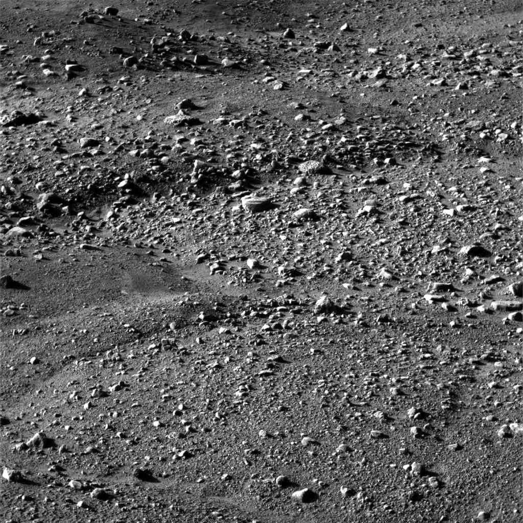
The Ground Beneath Phoenix's Feet
Full Resolution:
TIFF
(1.05 MB)
JPEG
(131.5 kB)
2008-05-26
Mars
Phoenix
1464x1170x3
PIA10687:
Phoenix's New Neighborhood
Full Resolution:
TIFF
(5.148 MB)
JPEG
(200.9 kB)
2008-05-26
Mars
Phoenix
Surface Stereo Imager (SSI)
1143x1008x1
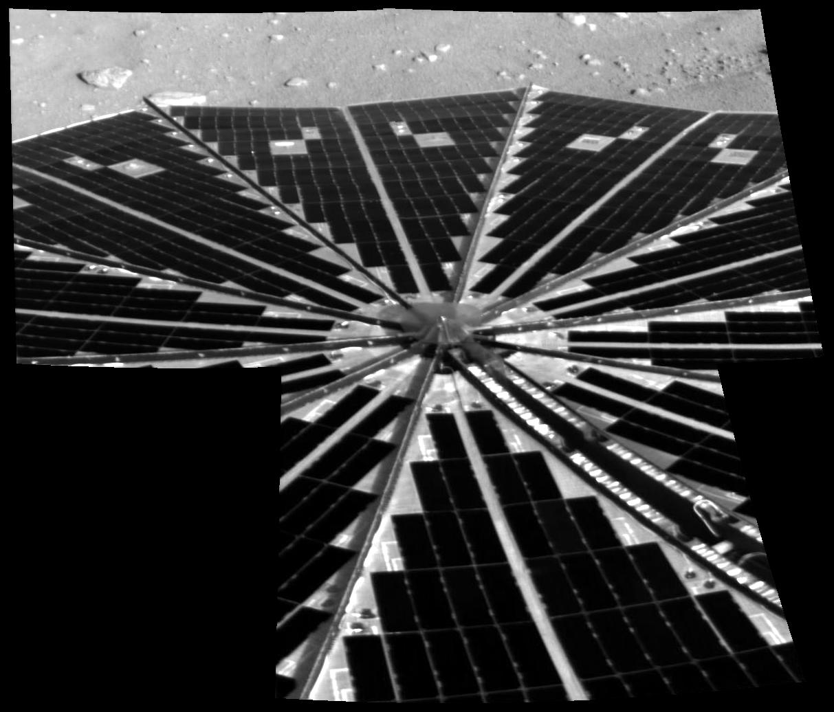
PIA10688:
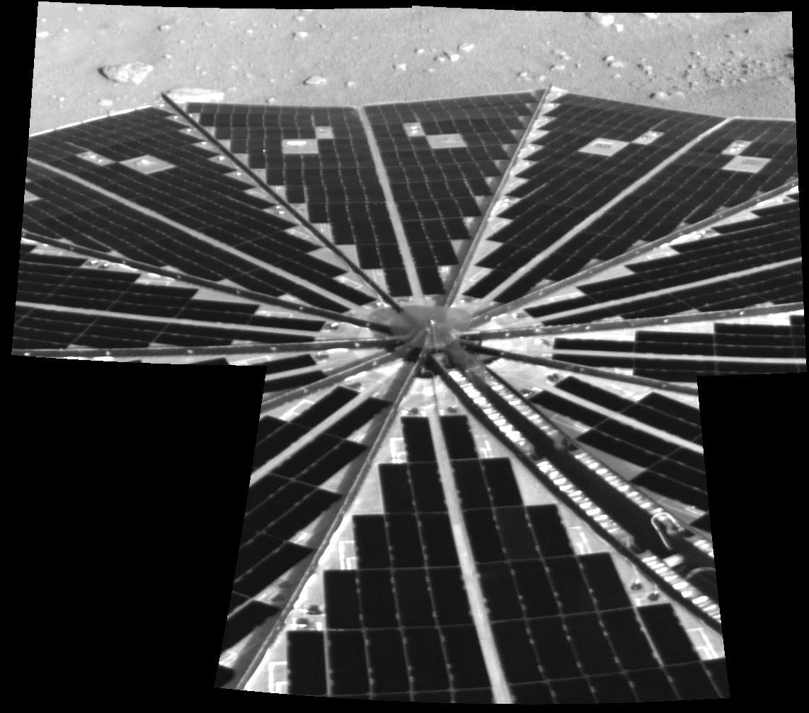
Solar Power Grid Unfurled
Full Resolution:
TIFF
(1.154 MB)
JPEG
(113.7 kB)
2008-05-26
Mars
Phoenix
Surface Stereo Imager (SSI)
1213x1036x1
PIA10689:
Solar Power Grid
Full Resolution:
TIFF
(1.258 MB)
JPEG
(121 kB)
2008-05-26
Mars
Phoenix
Surface Stereo Imager (SSI)
1213x2933x3
PIA10690:
Phoenix Opens its Eyes
Full Resolution:
TIFF
(10.69 MB)
JPEG
(425.4 kB)
2008-05-26
Mars
2001 Mars Odyssey
THEMIS
1346x2919x1
PIA10349:
Labeatis Catenae
Full Resolution:
TIFF
(3.933 MB)
JPEG
(424.7 kB)
2008-05-26
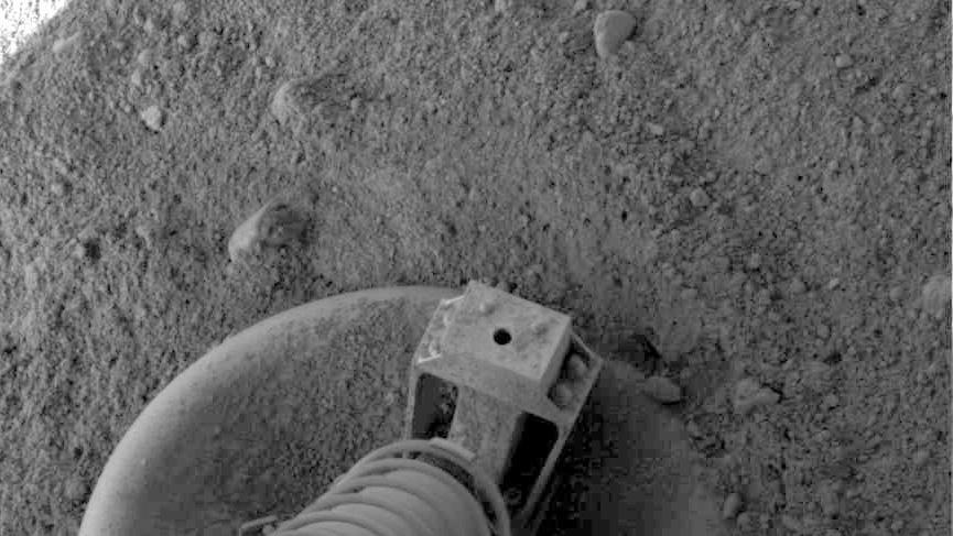
Mars
Phoenix
Surface Stereo Imager (SSI)
865x487x1
PIA10691:
Phoenix Footpad Up Close
Full Resolution:
TIFF
(421.9 kB)
JPEG
(67.74 kB)
2008-05-26
Mars
Phoenix
Surface Stereo Imager (SSI)
640x360x3
PIA10693:
Looking out Across the Martian Polar Plains
Full Resolution:
TIFF
(692.2 kB)
JPEG
(21.54 kB)
2008-05-26
Mars
Phoenix
MOLA
Surface Stereo Imager (SSI)
640x360x3
PIA10694:
Phoenix's Position on Mars
Full Resolution:
TIFF
(692.2 kB)
JPEG
(12.07 kB)
2008-05-26
Mars
Phoenix
HiRISE
420x446x1
PIA10697:
Phoenix Makes a Grand Entrance
Full Resolution:
TIFF
(187.7 kB)
JPEG
(68.86 kB)
2008-05-26
Mars
Phoenix
HiRISE
420x446x1
PIA10698:
Phoenix Makes a Grand Entrance
Full Resolution:
TIFF
(187.7 kB)
JPEG
(26.18 kB)
2008-05-27
Mars
2001 Mars Odyssey
THEMIS
1360x2919x1
PIA10800:
Tartarus Montes
Full Resolution:
TIFF
(3.974 MB)
JPEG
(265.6 kB)
2008-05-27
Mars
Phoenix
Surface Stereo Imager (SSI)
1024x1024x3
PIA10699:
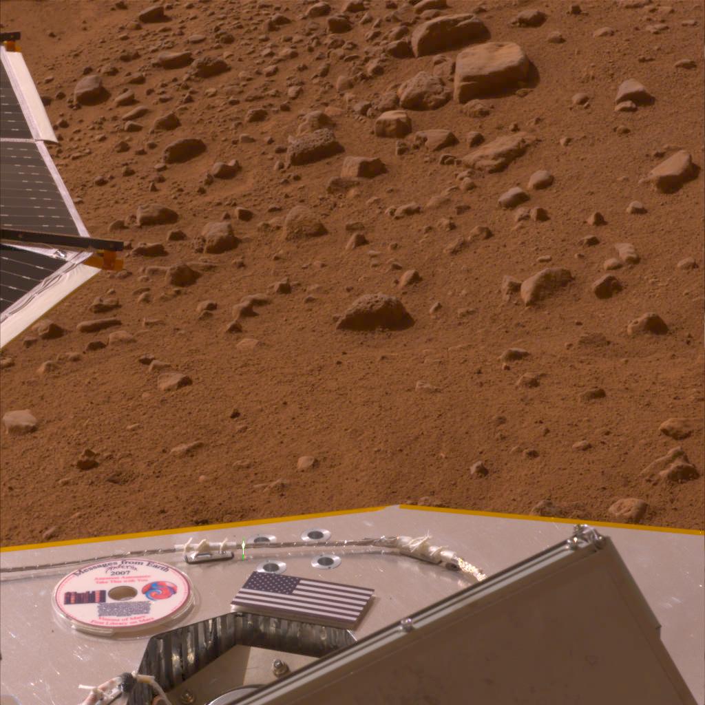
American Flag and Mini-DVD Attached to Deck of Phoenix
Full Resolution:
TIFF
(3.15 MB)
JPEG
(136.8 kB)
2008-05-27
Mars
Phoenix
Surface Stereo Imager (SSI)
960x540x1
PIA10700:
Animation Showing Backshell and Parachute
Full Resolution:
TIFF
(519.2 kB)
JPEG
(49.01 kB)
2008-05-27
Mars
Phoenix
HiRISE
508x600x3
PIA10701:
Color Image of Phoenix Lander on Mars Surface
Full Resolution:
TIFF
(915.6 kB)
JPEG
(19.36 kB)
2008-05-27
Mars
Phoenix
HiRISE
404x449x3
PIA10702:
Color Image of Phoenix Heat Shield and Bounce Mark
Full Resolution:
TIFF
(545 kB)
JPEG
(28.66 kB)
2008-05-27
Mars
Phoenix
HiRISE
443x670x3
PIA10703:
Color of Parachute on Ground
Full Resolution:
TIFF
(891.6 kB)
JPEG
(19.43 kB)
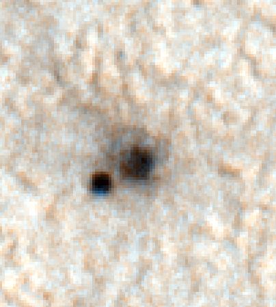
2008-05-27
Mars
Phoenix
HiRISE
1500x746x1
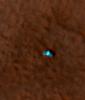
PIA10705:
Phoenix Descending with Crater in the Background
Full Resolution:
TIFF
(1.12 MB)
JPEG
(184.9 kB)
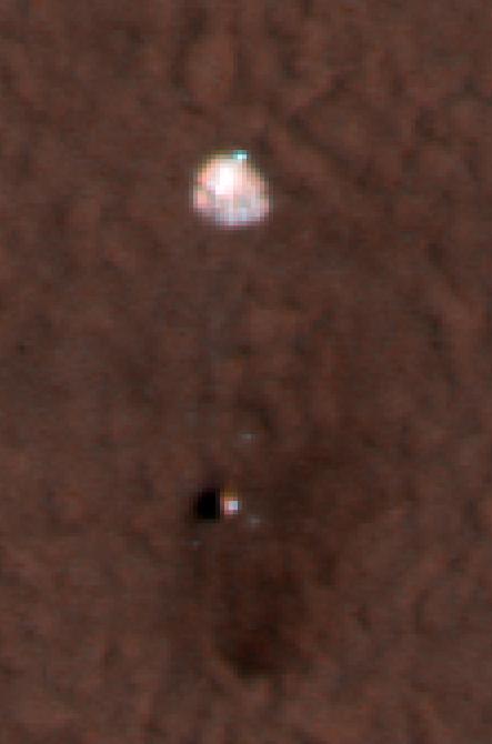
2008-05-27
Mars
Phoenix
HiRISE
2455x1830x3
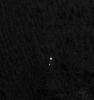
PIA10706:
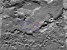
Zeroing In on Phoenix's Final Destination
Full Resolution:
TIFF
(13.49 MB)
JPEG
(371.7 kB)
2008-05-27
Mars
Phoenix
Surface Stereo Imager (SSI)
1024x512x3
PIA10707:
Protective Film Moves Aside
Full Resolution:
TIFF
(1.575 MB)
JPEG
(80.6 kB)
2008-05-27
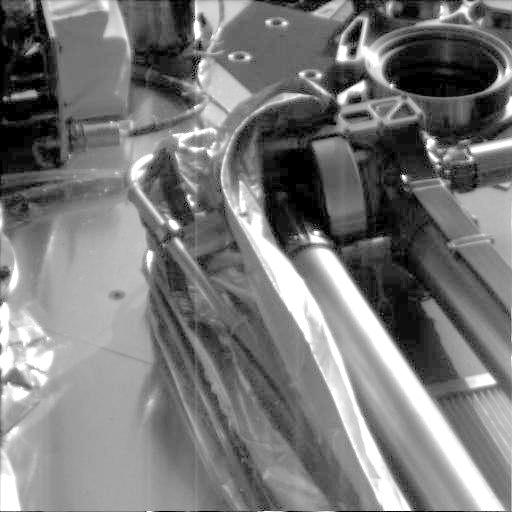
Mars
Phoenix
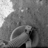
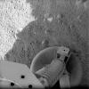
Robotic Arm
Surface Stereo Imager (SSI)
960x540x1
PIA10708:
Ready to Unfurl
Full Resolution:
TIFF
(519.2 kB)
JPEG
(36.48 kB)
2008-05-27
Mars
Phoenix
Robotic Arm
Surface Stereo Imager (SSI)
960x540x3
PIA10709:
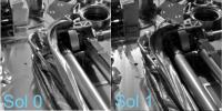
How to Take a Picture of A Robotic Arm
Full Resolution:
TIFF
(1.558 MB)
JPEG
(98.07 kB)
2008-05-27
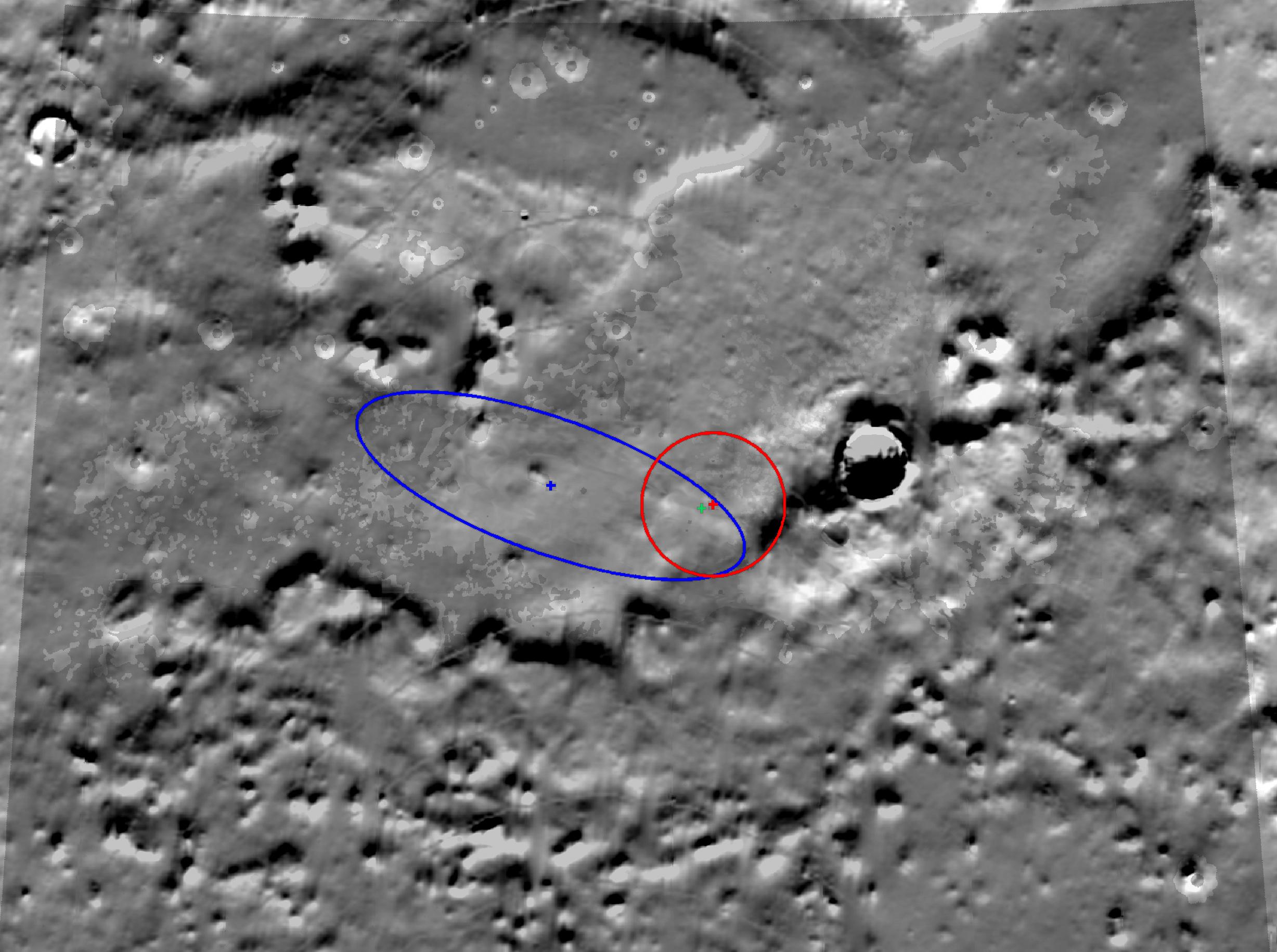
Mars
Mars Reconnaissance Orbiter (MRO)
Phoenix
HiRISE
1437x1388x3
PIA10710:
Connecting the Dots: Lander, Heat Shield, Parachute
Full Resolution:
TIFF
(5.995 MB)
JPEG
(282.8 kB)
2008-05-28
Mars
2001 Mars Odyssey
THEMIS
1360x2774x1
PIA10801:
Kasei Channels
Full Resolution:
TIFF
(3.777 MB)
JPEG
(346 kB)
2008-05-28
Mars
Phoenix
Surface Stereo Imager (SSI)
3330x813x1
PIA10712:
View of Phoenix's Surroundings as of Sol 2
Full Resolution:
TIFF
(2.711 MB)
JPEG
(304.4 kB)
2008-05-28
Mars
Phoenix
Surface Stereo Imager (SSI)
2395x3868x3
PIA10713:
Color view to Northwest of Phoenix
Full Resolution:
TIFF
(27.82 MB)
JPEG
(804.1 kB)
2008-05-28
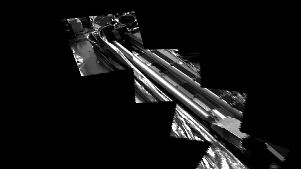
Mars
Phoenix
Robotic Arm Camera (RAC)
Surface Stereo Imager (SSI)
960x540x3
PIA10715:
View from Above of Phoenix's Stowed Robotic Arm Camera
Full Resolution:
TIFF
(1.558 MB)
JPEG
(89.41 kB)
2008-05-28
Mars
Phoenix
Surface Stereo Imager (SSI)
959x540x3
PIA10718:
Phoenix Work Area Animation
Full Resolution:
TIFF
(1.556 MB)
JPEG
(75.82 kB)
2008-05-28
Mars
Phoenix
Surface Stereo Imager (SSI)
640x360x3
PIA10719:
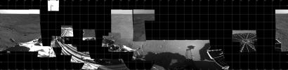
Phoenix Sol 2 Northwestern Panorama
Full Resolution:
TIFF
(692.2 kB)
JPEG
(42.73 kB)
2008-05-28
Mars
Phoenix
Surface Stereo Imager (SSI)
523x520x3
PIA10720:
Phoenix Color Targets
Full Resolution:
TIFF
(816.9 kB)
JPEG
(25.06 kB)
2008-05-28
Mars
Phoenix
Surface Stereo Imager (SSI)
1991x1991x1
PIA10721:
Phoenix's view of Mars as of the end of Sol 2
Full Resolution:
TIFF
(3.968 MB)
JPEG
(483.1 kB)
2008-05-28
Mars
Phoenix
Robotic Arm Camera (RAC)
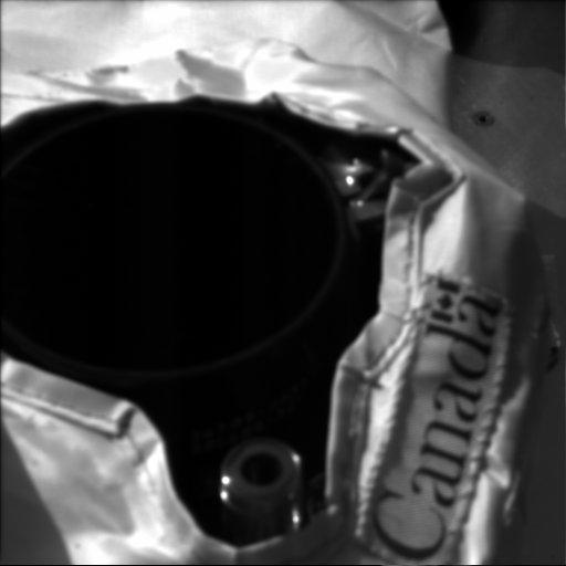
512x256x1
PIA10722:
Phoenix 'Gets the Scoop' on the Scoop
Full Resolution:
TIFF
(131.4 kB)
JPEG
(10.3 kB)
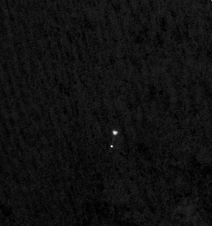
2008-05-29
Mars
2001 Mars Odyssey
THEMIS
1372x2921x1
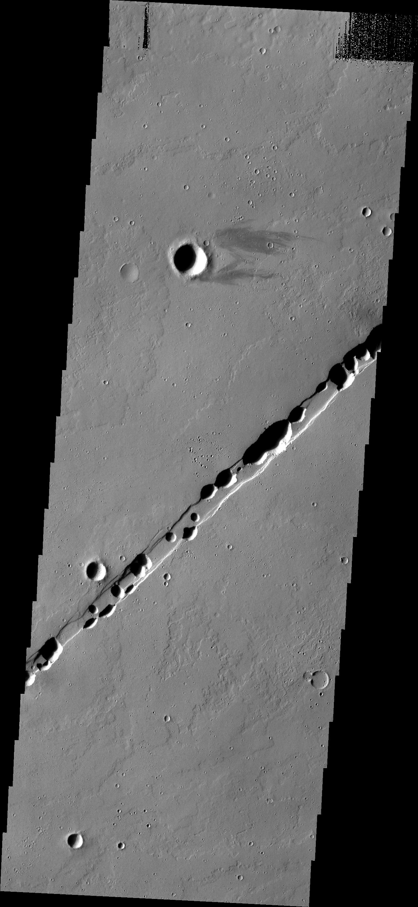
PIA10802:
Kasei Valles
Full Resolution:
TIFF
(4.013 MB)
JPEG
(414.2 kB)
2008-05-29
Mars
Phoenix
Surface Stereo Imager (SSI)
6659x1187x1
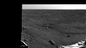
PIA10726:
Sweeping Martian Plains
Full Resolution:
TIFF
(7.914 MB)
JPEG
(731.5 kB)
2008-05-29
Mars
Phoenix
Surface Stereo Imager (SSI)
960x540x3
PIA10727:
Phoenix Lidar Operation Animation
Full Resolution:
TIFF
(1.558 MB)
JPEG
(91.62 kB)
2008-05-29
Mars
Phoenix
Surface Stereo Imager (SSI)
500x500x1
PIA10728:
Phoenix Deploying its Robotic Arm Elbow
Full Resolution:
TIFF
(250.5 kB)
JPEG
(47.28 kB)
2008-05-29
Mars
Phoenix
Robotic Arm
Surface Stereo Imager (SSI)
256x256x1
PIA10730:
Phoenix Deploying its Wrist
Full Resolution:
TIFF
(65.83 kB)
JPEG
(10.39 kB)
2008-05-29
Mars
Phoenix
Surface Stereo Imager (SSI)
1579x597x3
PIA10731:
A Fairy-Tale Landscape
Full Resolution:
TIFF
(2.833 MB)
JPEG
(126.2 kB)
2008-05-29
Mars
Phoenix
Surface Stereo Imager (SSI)
640x360x3
PIA10732:
Phoenix Checks out its Work Area
Full Resolution:
TIFF
(692.2 kB)
JPEG
(24.32 kB)
2008-05-29
Mars
Phoenix
Stereo Imager (SSI)
960x540x1
PIA10733:
Martian Arctic Landscape Panorama Video
Full Resolution:
TIFF
(519.2 kB)
JPEG
(36.91 kB)
2008-05-29
Mars
Phoenix
Surface Stereo Imager (SSI)
3961x3961x1
PIA10734:
Fish Eye View of Horizon and Lander
Full Resolution:
TIFF
(15.71 MB)
JPEG
(1.191 MB)
2008-05-30
Mars
2001 Mars Odyssey
THEMIS
1336x2769x1
PIA10803:
Volcanic Vent
Full Resolution:
TIFF
(3.703 MB)
JPEG
(511.8 kB)
2008-05-30
Mars
Mars Reconnaissance Orbiter (MRO)
CRISM
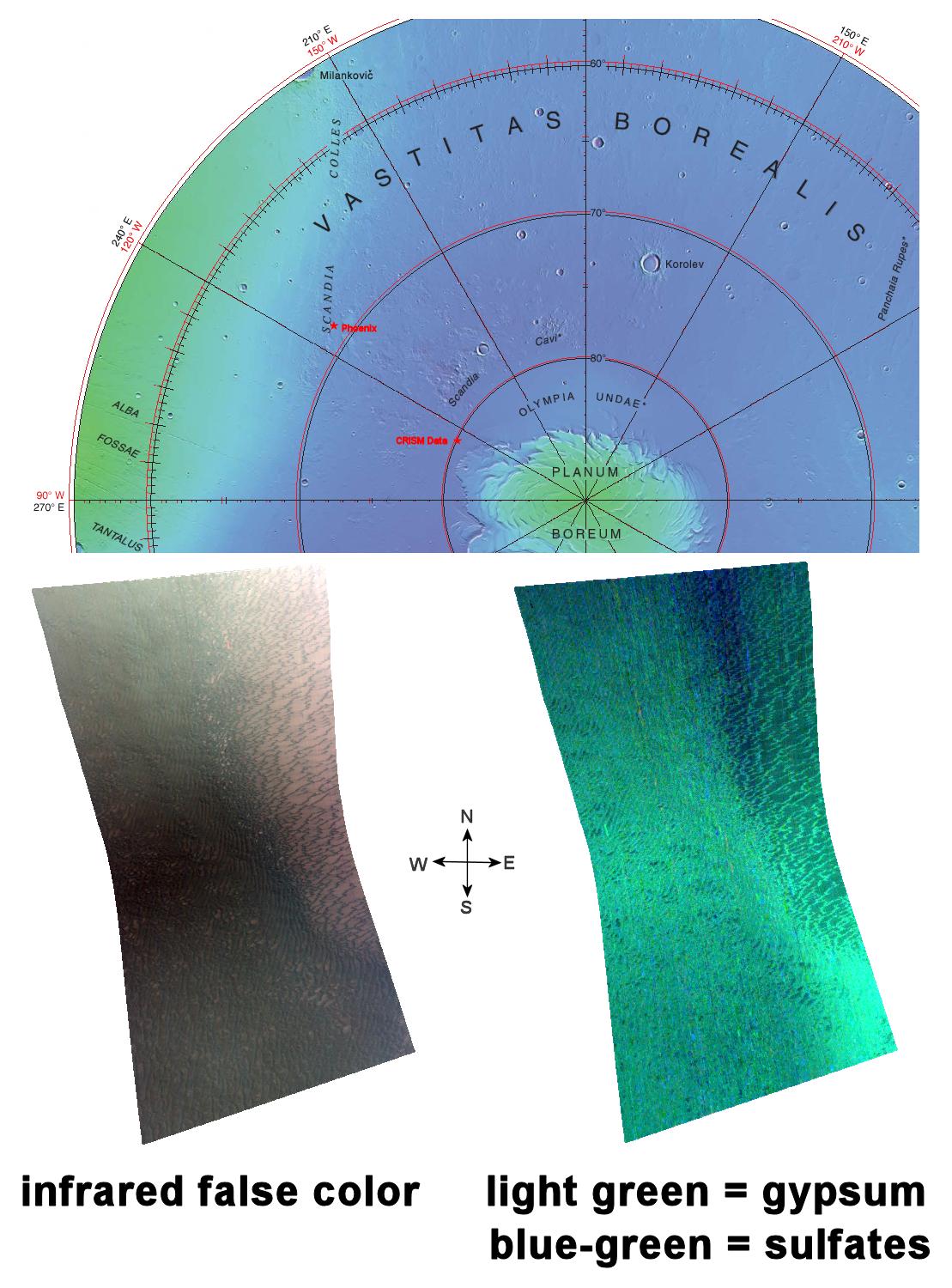
1109x1500x3
PIA10946:
Gypsum Dunes North of Phoenix Landing Site
Full Resolution:
TIFF
(4.997 MB)
JPEG
(202.4 kB)
2008-05-30
Mars
Phoenix
Surface Stereo Imager (SSI)
6659x1818x1
PIA10735:
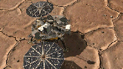
Phoenix Site Panorama
Full Resolution:
TIFF
(12.12 MB)
JPEG
(887 kB)
2008-05-30
Mars
Phoenix
Surface Stereo Imager (SSI)
512x512x1
PIA10736:
Weather Station's Lidar in Action
Full Resolution:
TIFF
(262.6 kB)
JPEG
(20.94 kB)
2008-05-30
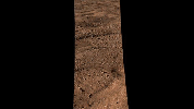
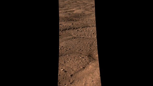
Mars
Viking
Camera 2
1744x512x1
PIA10738:
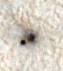
Mars Surface near Viking Lander 1 Footpad
Full Resolution:
TIFF
(894.2 kB)
JPEG
(142.4 kB)
2008-05-30
Mars
Phoenix
Robotic Arm Camera (RAC)
512x256x1
PIA10739:
Mars Surface Beneath Phoenix
Full Resolution:
TIFF
(131.4 kB)
JPEG
(18.89 kB)
1-100
101-200
201-300
301-400
401-500
501-600
601-700
701-800
801-900
901-1000
Currently displaying images:
5501 - 5600
of 12755


