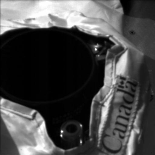
This image of the Canadian-built Phoenix lidar in operation (with the cover open) was acquired at the Phoenix landing site on Sol 3. The Surface Stereo Imager (right) acquired this image at 11:40:12 local solar time. The camera pointing was elevation minus 47.2987 degrees and azimuth 225.325 degrees.
The Phoenix Mission is led by the University of Arizona, Tucson, on behalf of NASA. Project management of the mission is by NASA's Jet Propulsion Laboratory, Pasadena, Calif. Spacecraft development is by Lockheed Martin Space Systems, Denver.
Photojournal Note: As planned, the Phoenix lander, which landed May 25, 2008 23:53 UTC, ended communications in November 2008, about six months after landing, when its solar panels ceased operating in the dark Martian winter.
