Click on an image for detailed information
Click on a column heading to sort in ascending or descending order

My
List |
Addition Date
|
Target
|
Mission
|
Instrument
|
Size
|

|
2012-09-27 |
Mars
|
Mars Reconnaissance Orbiter (MRO)
Mars Science Laboratory (MSL)
|
HiRISE
|
932x720x3 |
|
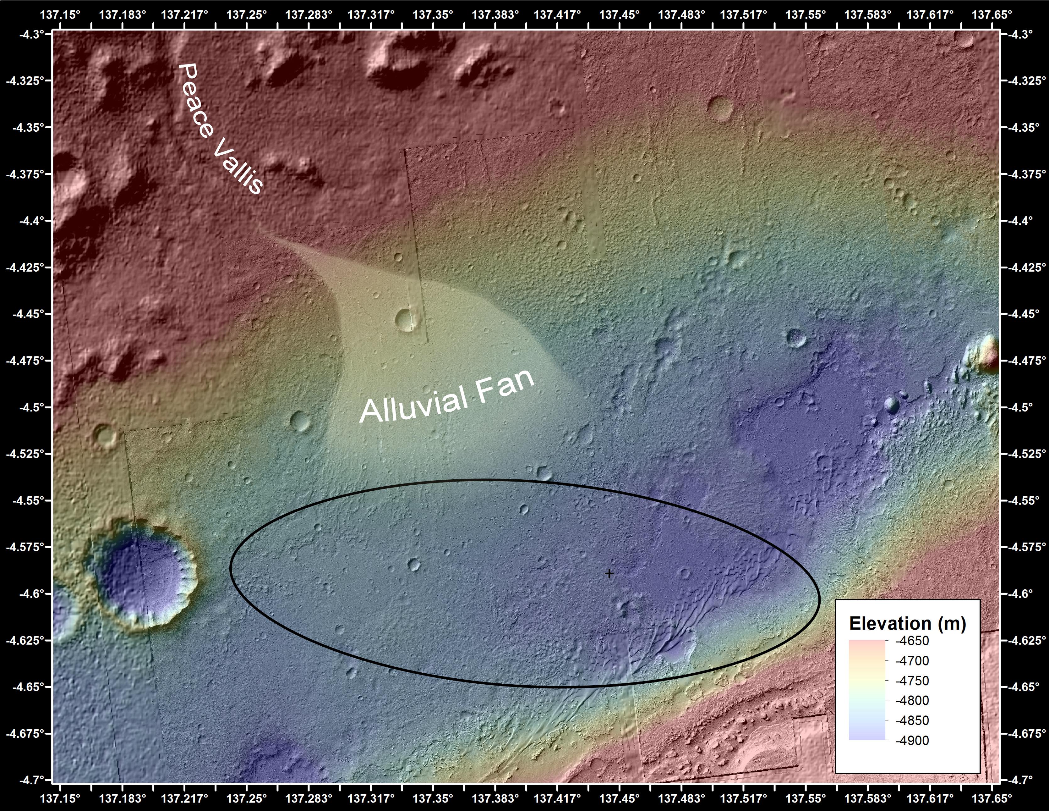
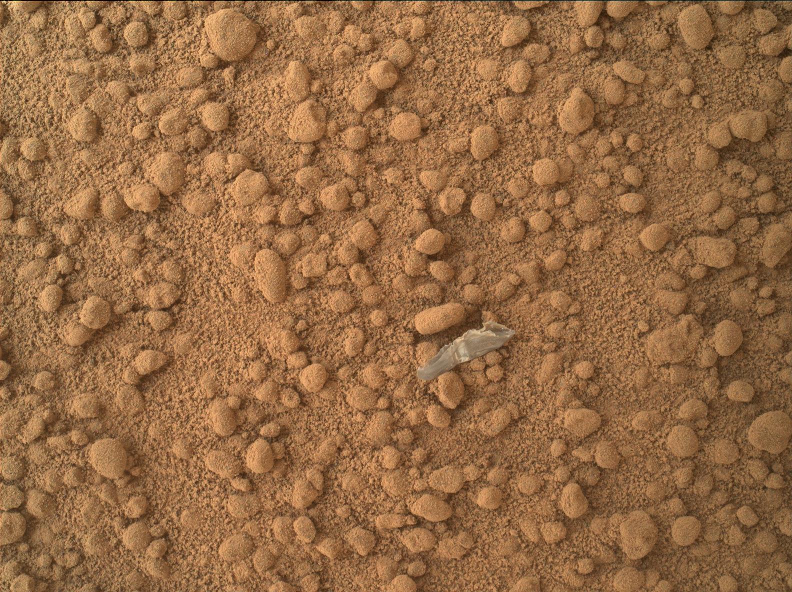
-
PIA16157:
-
Curiosity's Roadside Discoveries
Full Resolution:
TIFF
(2.014 MB)
JPEG
(132.4 kB)
|
|
|
2012-09-27 |
Mars
|
Mars Reconnaissance Orbiter (MRO)
Mars Science Laboratory (MSL)
|
HiRISE
|
3339x2580x3 |

|
-
PIA16158:
-
Where Water Flowed Downslope
Full Resolution:
TIFF
(25.85 MB)
JPEG
(1.87 MB)
|
|
|
2012-10-04 |
Mars
|
Mars Science Laboratory (MSL)
|
HiRISE
|
3600x2700x3 |
|
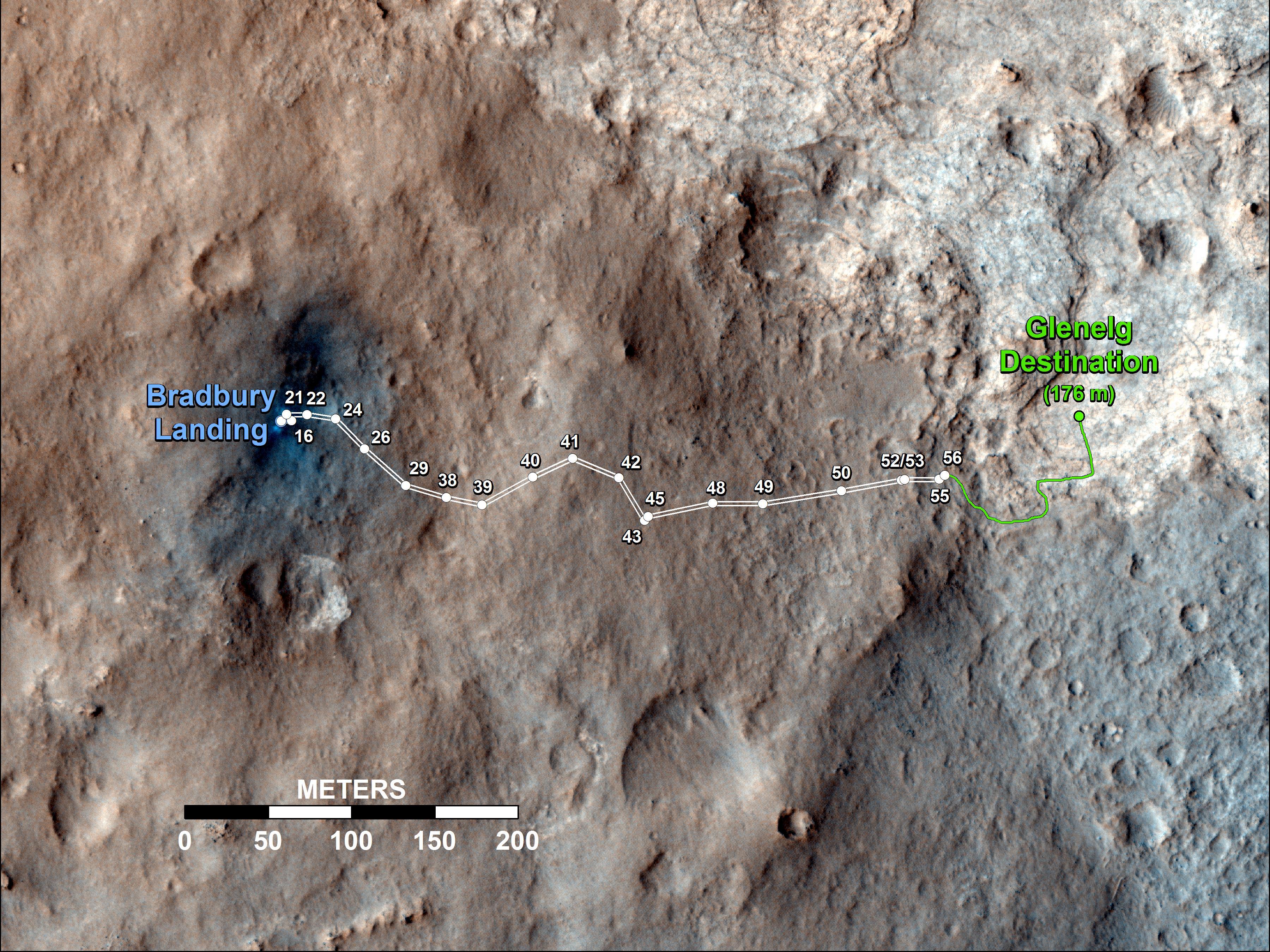
-
PIA16200:
-
Curiosity's Travels Through Sol 56
Full Resolution:
TIFF
(29.17 MB)
JPEG
(1.87 MB)
|
|
|
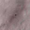
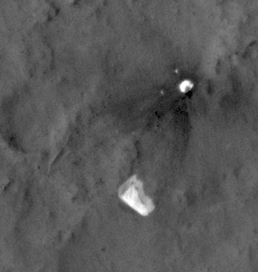
2012-10-10 |
Mars
|
Mars Reconnaissance Orbiter (MRO)
Mars Science Laboratory (MSL)
|
HiRISE
|
398x408x3 |
|
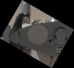
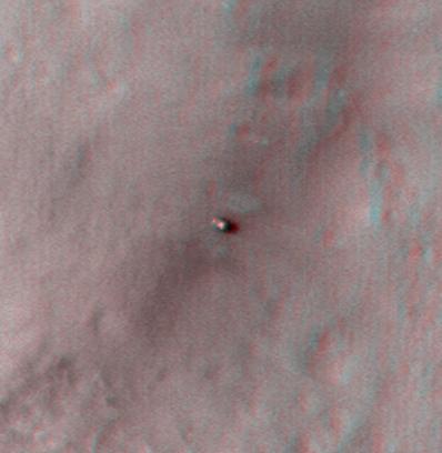
-
PIA16208:
-
Curiosity at Bradbury Landing Site in 3-D
Full Resolution:
TIFF
(487.5 kB)
JPEG
(17.84 kB)
|
|
|
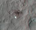
2012-10-10 |
Mars
|
Mars Reconnaissance Orbiter (MRO)
Mars Science Laboratory (MSL)
|
HiRISE
|
950x795x3 |
|
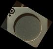
-
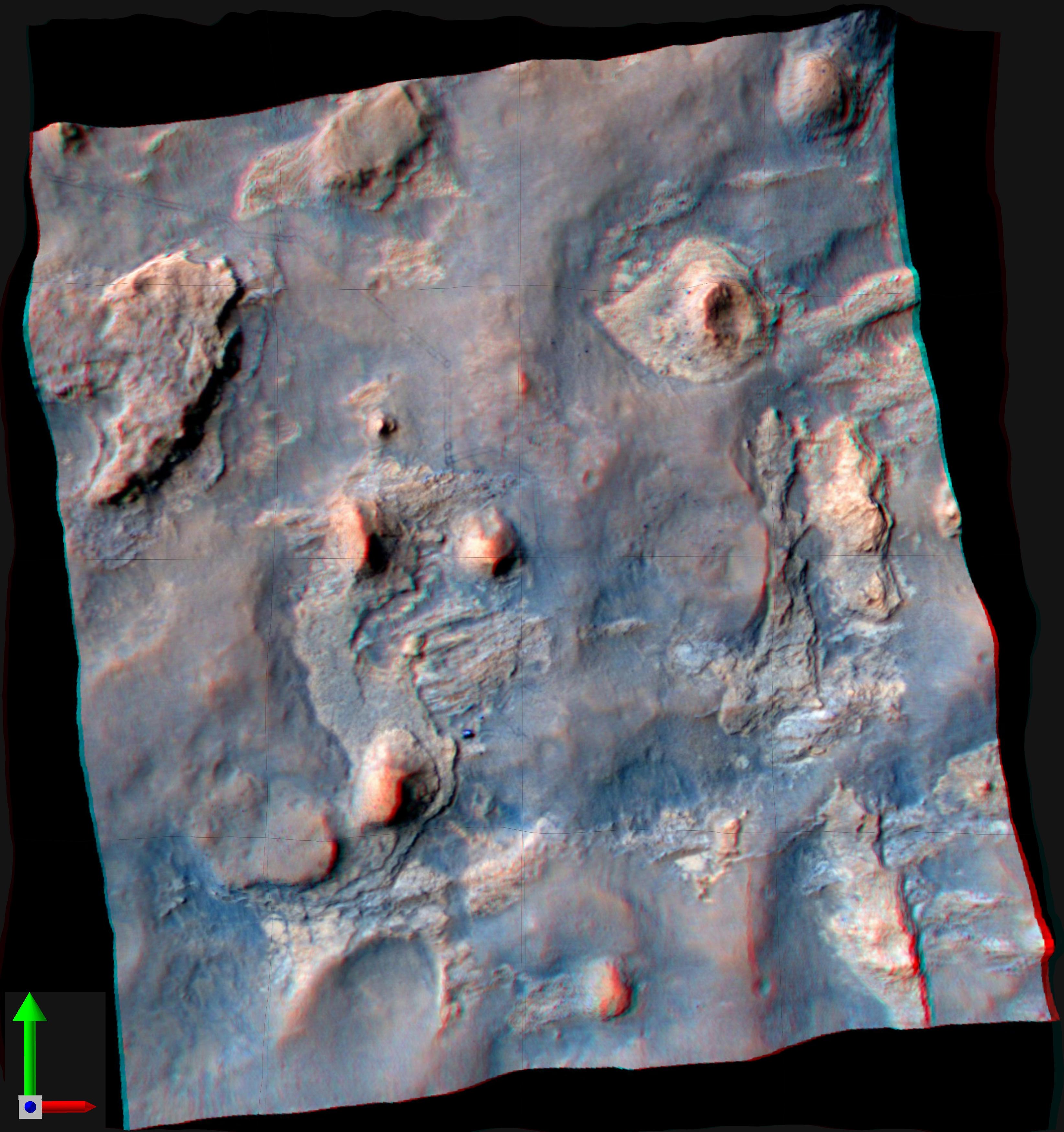
PIA16209:
-
Parachute and Back Shell in 3-D
Full Resolution:
TIFF
(2.267 MB)
JPEG
(87.85 kB)
|
|
|
2012-10-10 |
Mars
|
Mars Reconnaissance Orbiter (MRO)
Mars Science Laboratory (MSL)
|
HiRISE
|
2414x1387x3 |
|
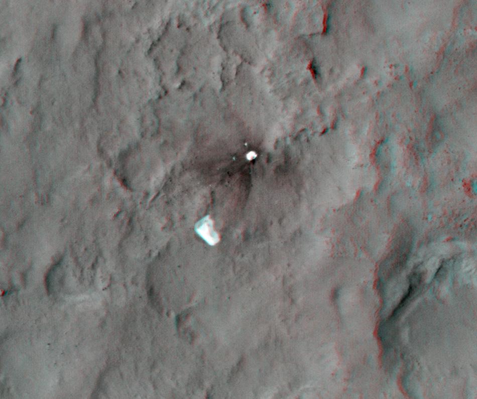
-
PIA16210:
-
'Glenelg' in 3-D
Full Resolution:
TIFF
(10.05 MB)
JPEG
(554.1 kB)
|
|
|
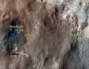
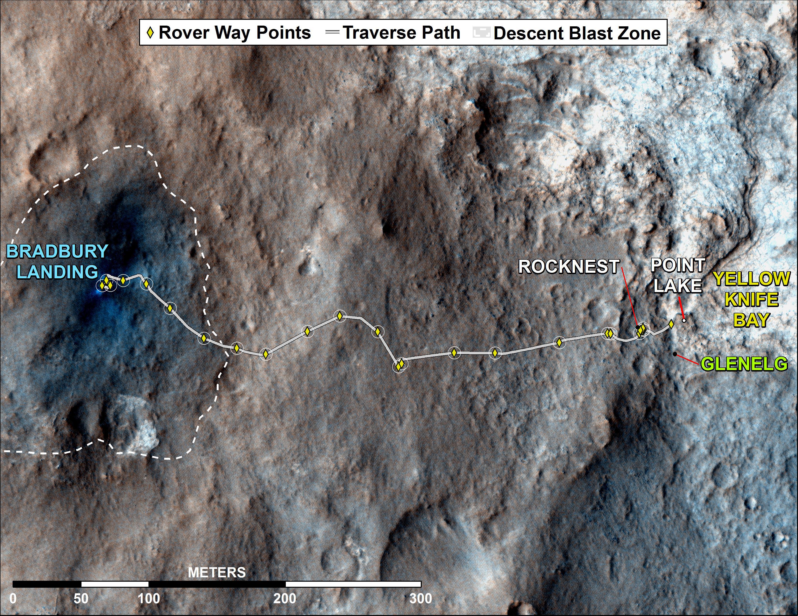
2012-12-03 |
Mars
|
Mars Reconnaissance Orbiter (MRO)
Mars Science Laboratory (MSL)
|
HiRISE
|
3300x2550x3 |
|
-
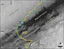
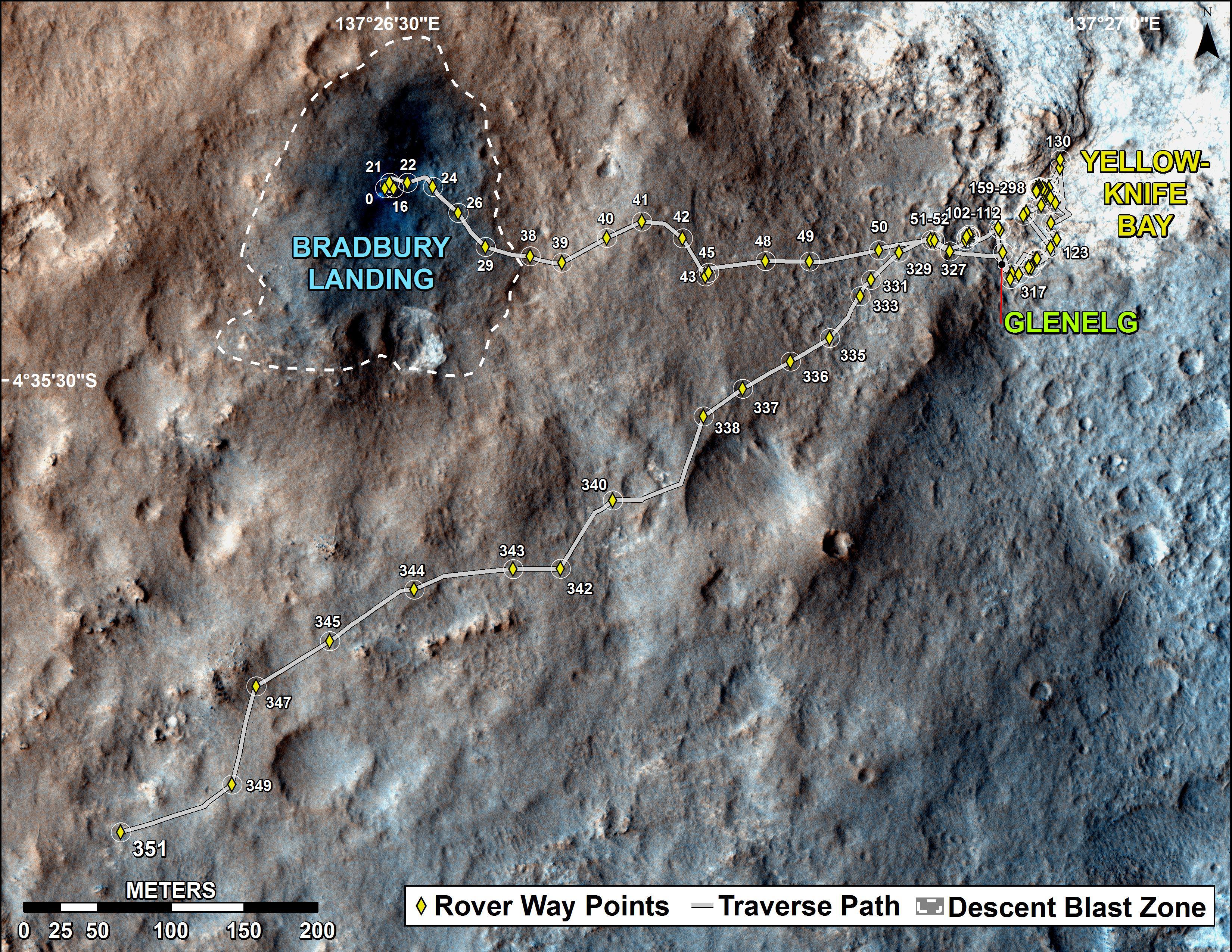
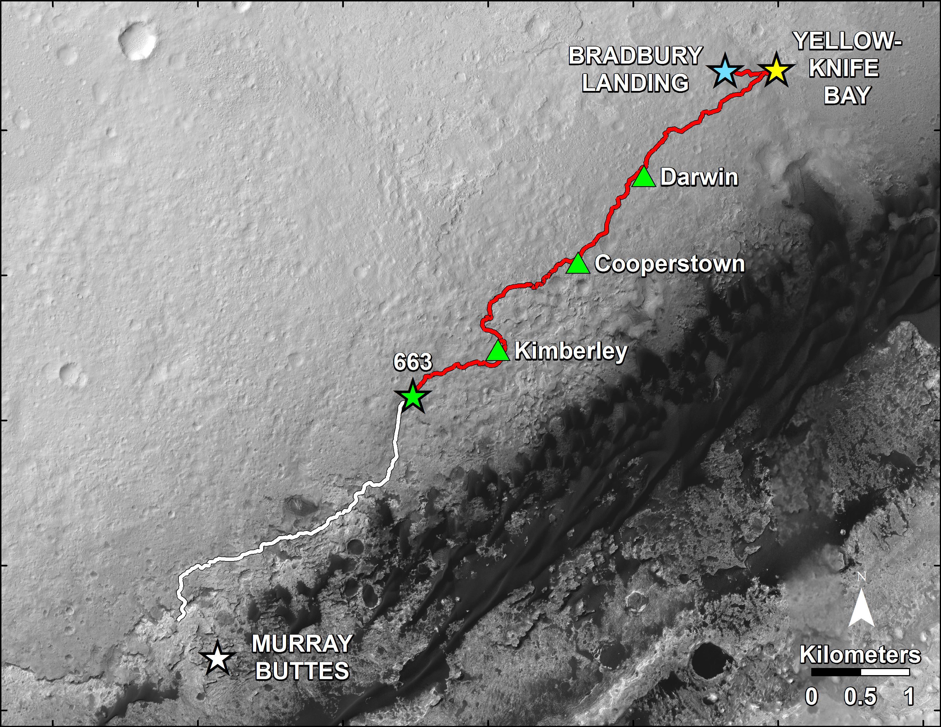
PIA16577:
-
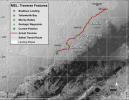
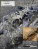
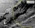
Curiosity Rover's Traverse, August through November 2012
Full Resolution:
TIFF
(25.26 MB)
JPEG
(1.893 MB)
|
|
|
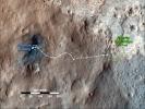
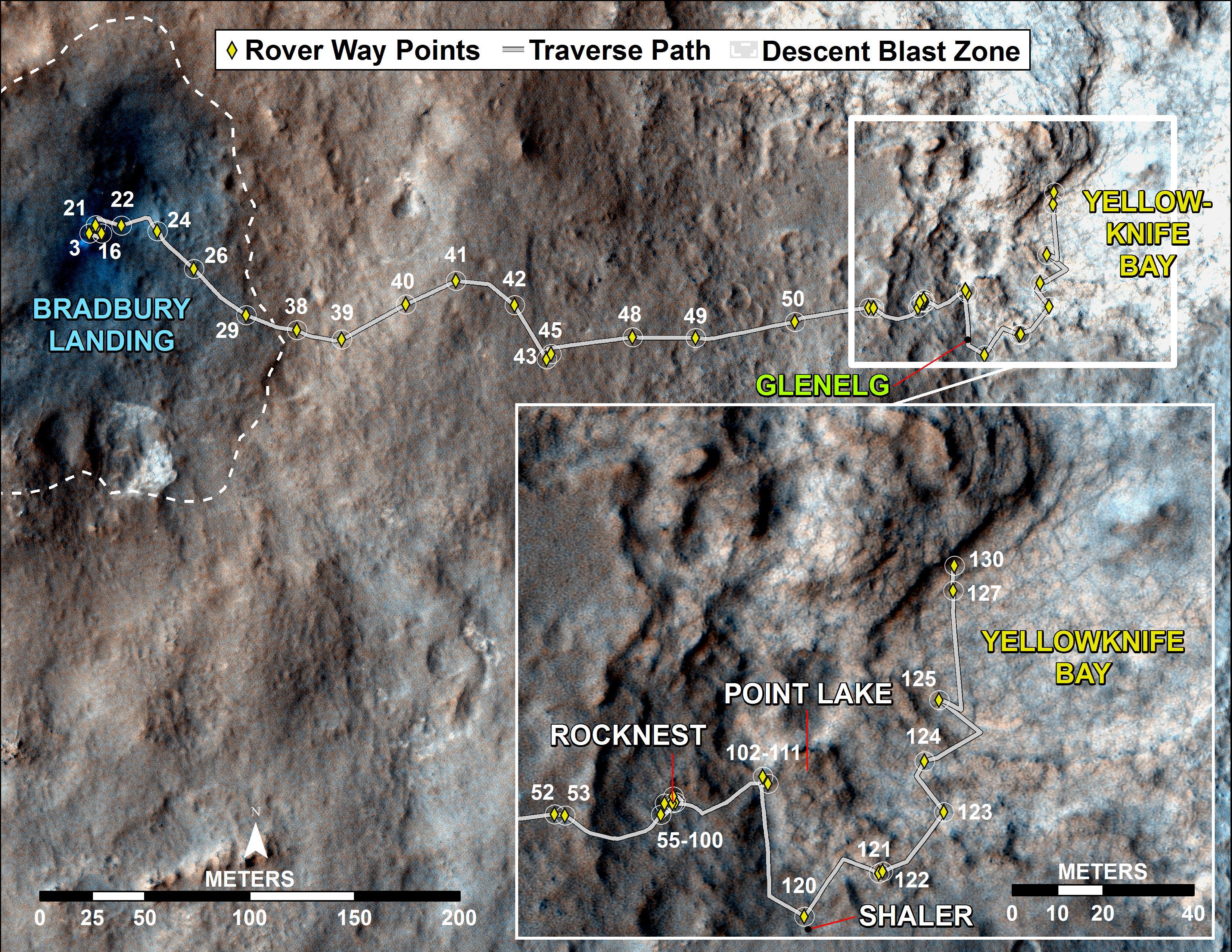
2012-12-18 |
Mars
|
Mars Reconnaissance Orbiter (MRO)
Mars Science Laboratory (MSL)
|
HiRISE
|
3300x2550x3 |

|
-
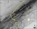
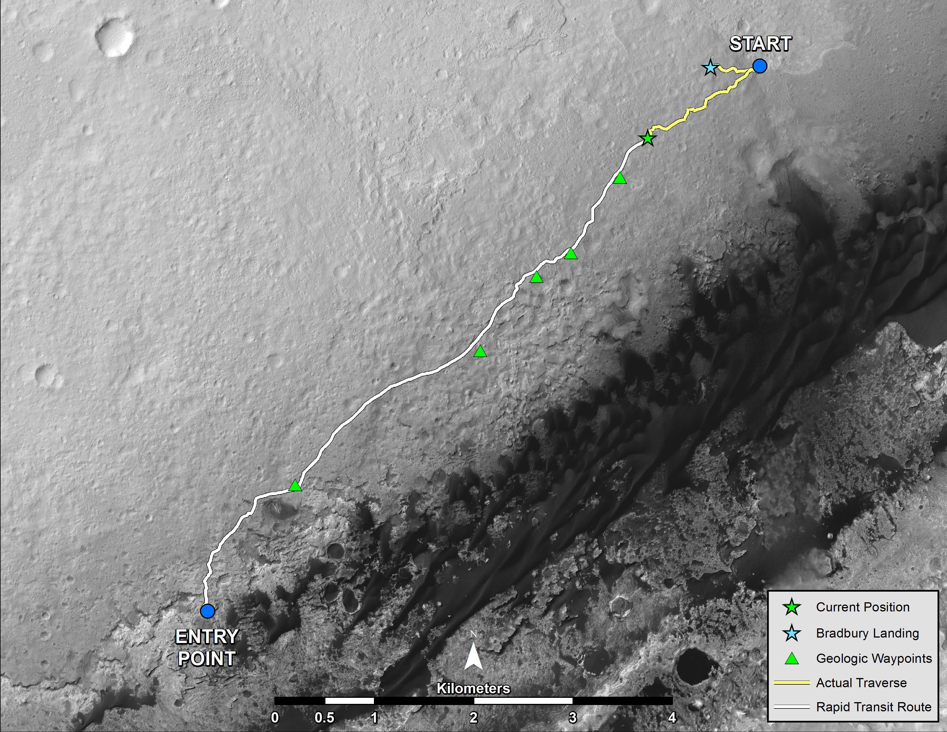
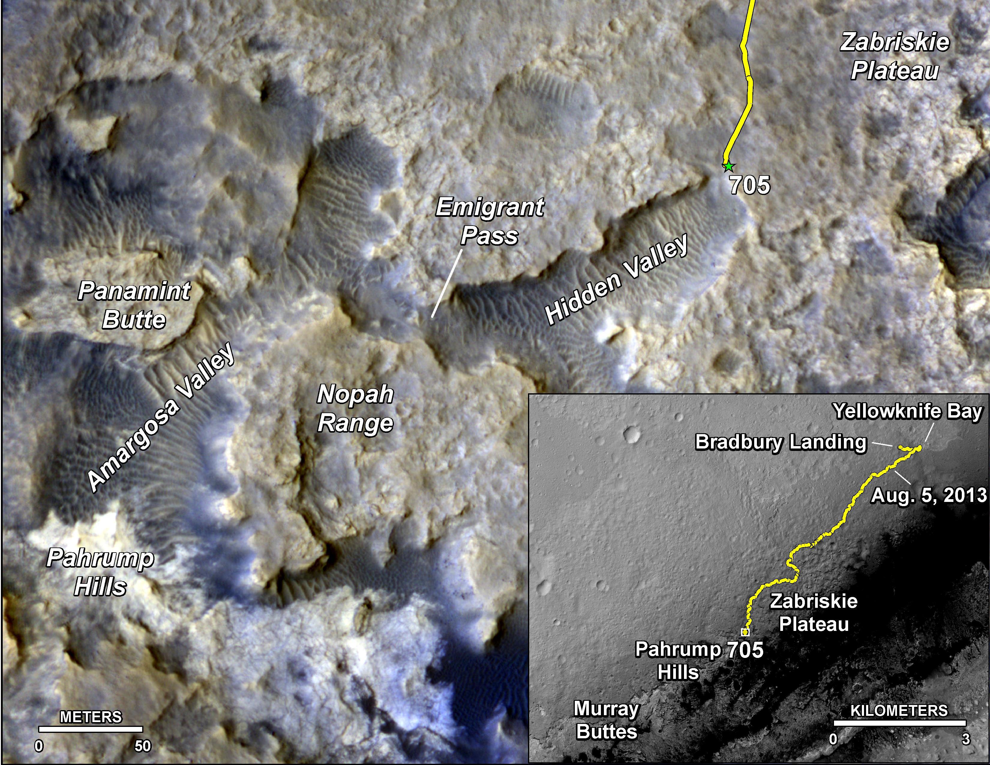
PIA16554:
-
Curiosity Traverse Map, Sol 130
Full Resolution:
TIFF
(25.26 MB)
JPEG
(1.761 MB)
|
|
|
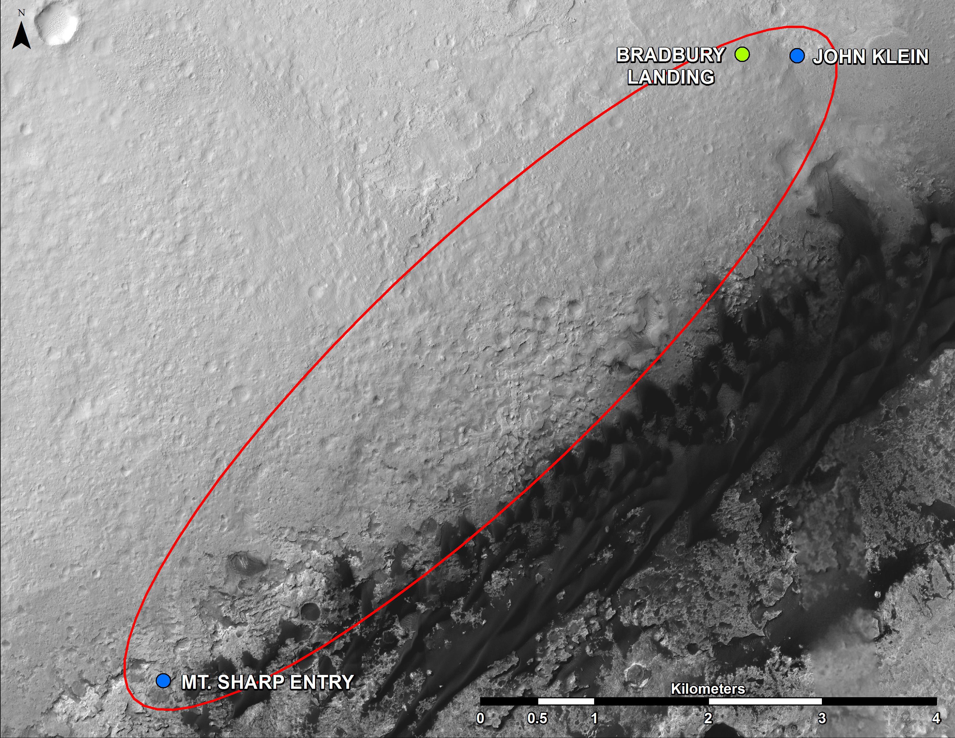
2013-04-03 |
Mars
|
Mars Reconnaissance Orbiter (MRO)
Mars Science Laboratory (MSL)
|
HiRISE
|
369x390x1 |
|
-
PIA16813:
-
MSL's Parachute Flapping in the Wind

Full Resolution:
TIFF
(144.3 kB)
JPEG
(15.5 kB)
|
|
|
2013-06-05 |
Mars
|
Mars Science Laboratory (MSL)
|
HiRISE
|
3300x2550x3 |
|
-
PIA17064:
-
From 'Glenelg' to Mount Sharp
Full Resolution:
TIFF
(25.26 MB)
JPEG
(1.462 MB)
|
|
|
2013-07-24 |
Mars
|
Mars Reconnaissance Orbiter (MRO)
Mars Science Laboratory (MSL)
|
HiRISE
|
2389x1598x3 |
|
-
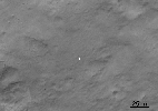
PIA17080:
-
View From Mars Orbiter Showing Curiosity Rover at 'Shaler'
Full Resolution:
TIFF
(11.46 MB)
JPEG
(879.4 kB)
|
|
|
2013-08-02 |
Mars
|
Mars Reconnaissance Orbiter (MRO)
Mars Science Laboratory (MSL)
|
HiRISE
|
3300x2550x3 |

|
-
PIA17085:
-
Full Curiosity Traverse Passes One-Mile Mark
Full Resolution:
TIFF
(25.26 MB)
JPEG
(2.249 MB)
|
|
|
2013-08-27 |
Mars
|
Mars Reconnaissance Orbiter (MRO)
Mars Science Laboratory (MSL)
|
HiRISE
|
3300x2550x3 |
|
-
PIA17355:
-
Curiosity's Progress on Route from 'Glenelg' to Mount Sharp
Full Resolution:
TIFF
(25.26 MB)
JPEG
(1.493 MB)
|
|
|
2013-11-13 |
Mars
|
Mars Reconnaissance Orbiter (MRO)
|
HiRISE
|
1152x1072x1 |

|
-
PIA17587:
-
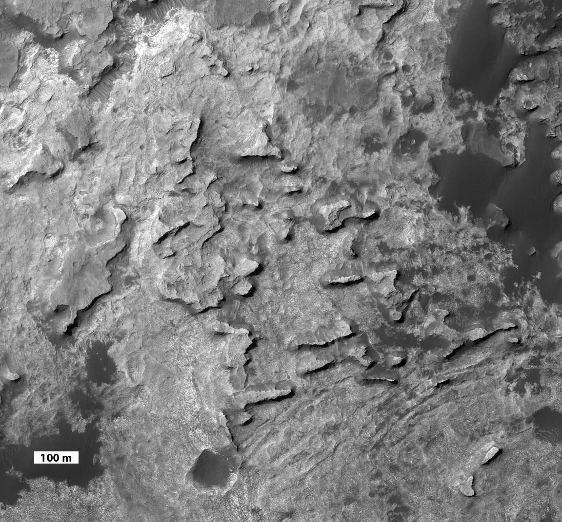
'Murray Buttes' at Foot of Mount Sharp on Mars
Full Resolution:
TIFF
(1.236 MB)
JPEG
(248 kB)
|
|
|
2013-11-13 |
Mars
|
Mars Exploration Rover (MER)
Mars Reconnaissance Orbiter (MRO)
|
HiRISE
|
8192x4298x3 |
|
-
PIA17586:
-
A New Perspective on Murray Ridge
Full Resolution:
TIFF
(105.7 MB)
JPEG
(2.803 MB)
|
|
|
2014-01-29 |
Mars
|
Mars Reconnaissance Orbiter (MRO)
Mars Science Laboratory (MSL)
|
HiRISE
|
3300x2550x3 |
|
-
PIA17765:
-
Traverse Map for Mars Rover Curiosity as of Jan. 26, 2014
Full Resolution:
TIFF
(25.26 MB)
JPEG
(1.211 MB)
|
|
|
2014-04-03 |
Mars
|
Mars Science Laboratory (MSL)
|
HiRISE
|
3300x2550x3 |
|
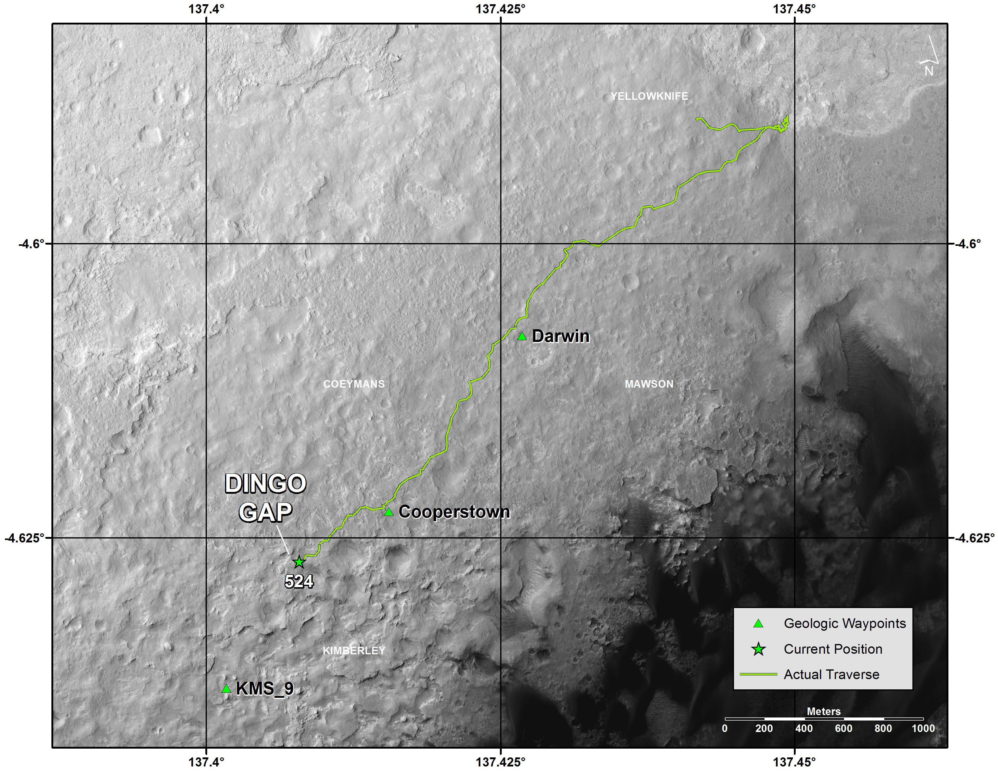
-
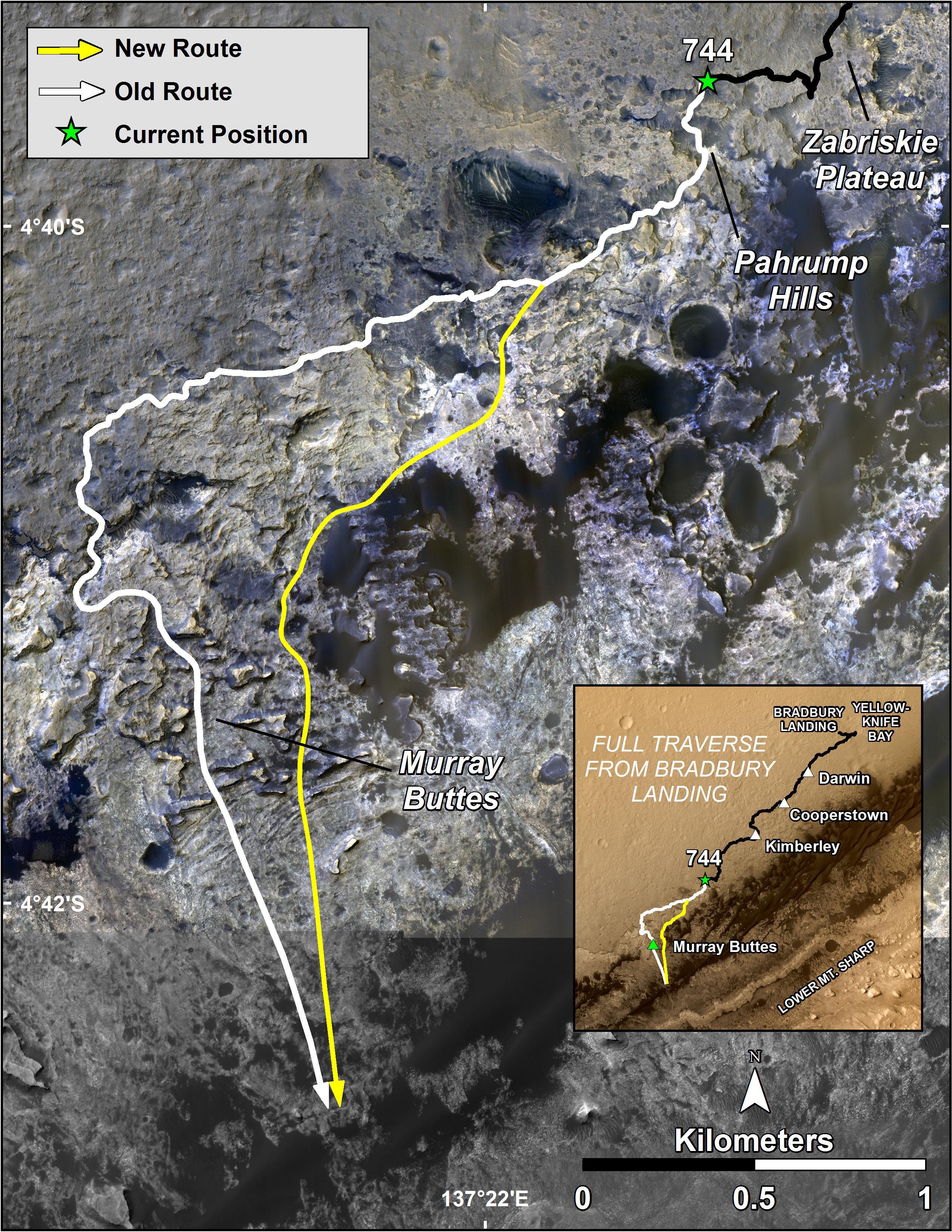
PIA18075:
-
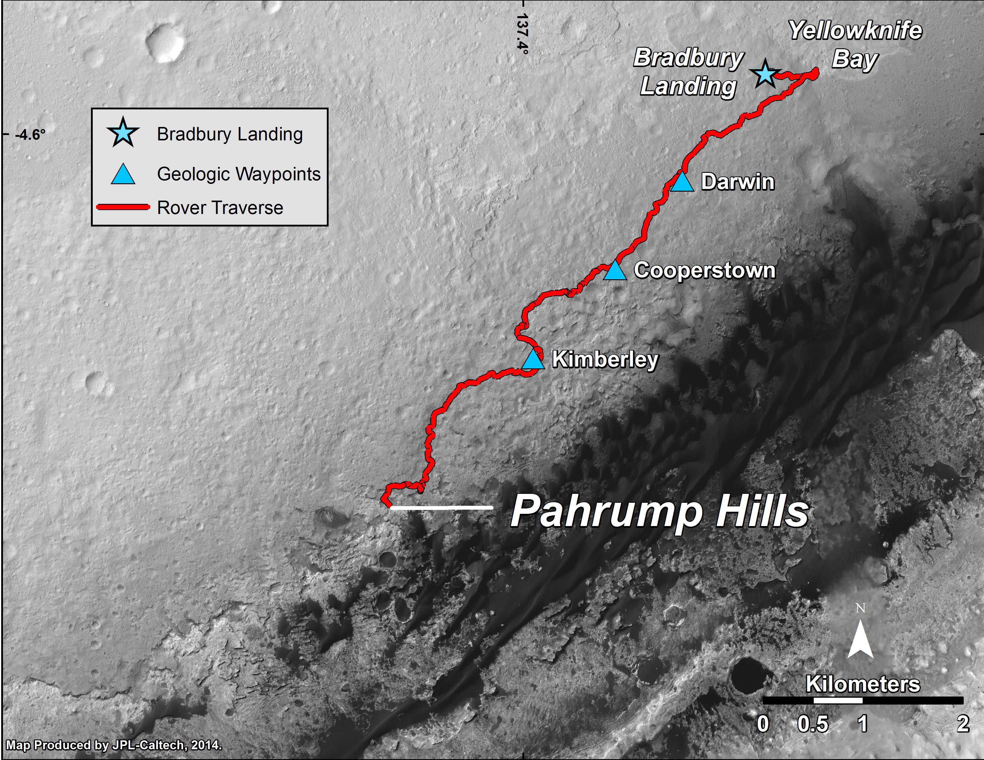
Map of Curiosity Mars Rover's Drives to 'the Kimberley' Waypoint
Full Resolution:
TIFF
(25.26 MB)
JPEG
(1.265 MB)
|
|
|
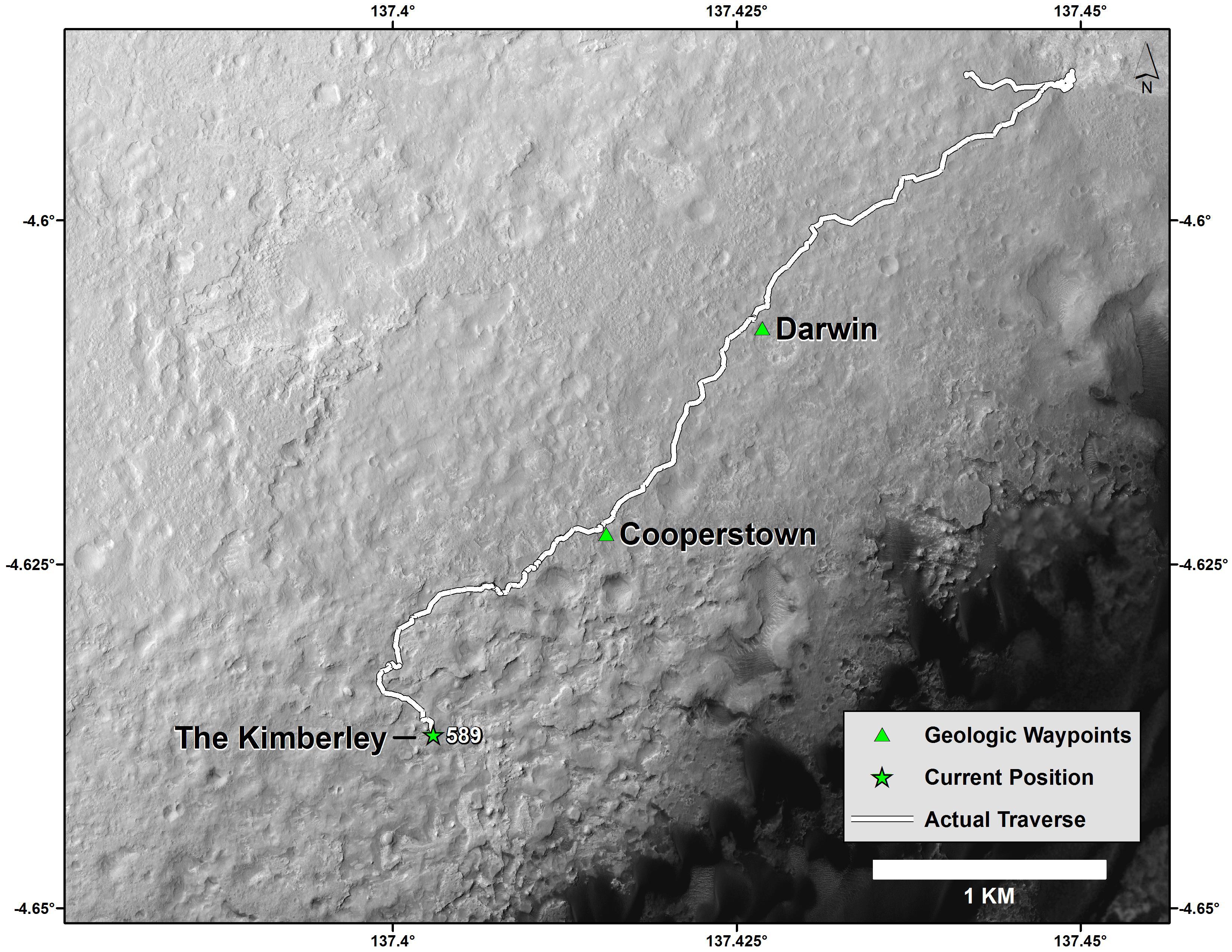
2014-04-03 |
Mars
|
Mars Science Laboratory (MSL)
|
HiRISE
|
3300x2550x3 |
|
-
PIA18076:
-
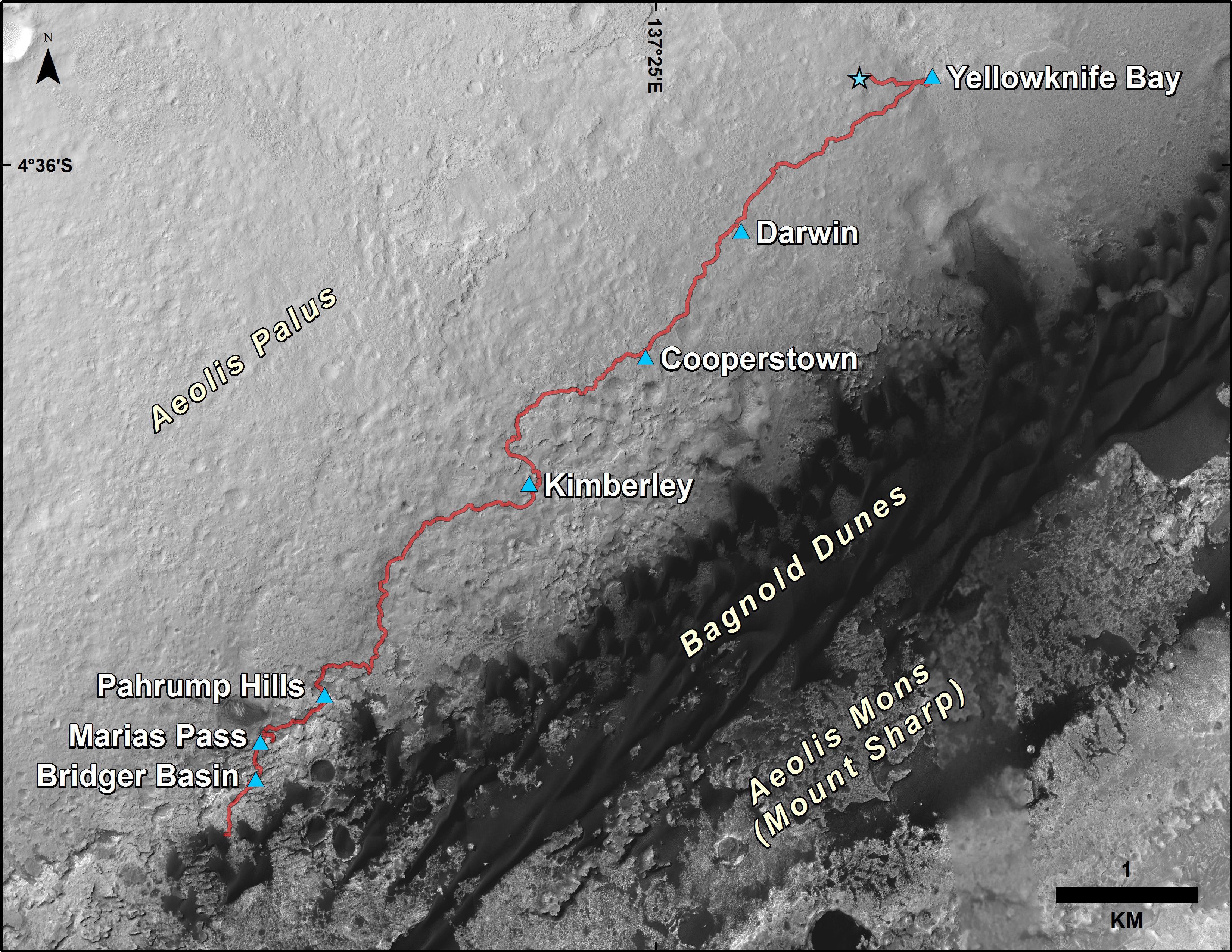
Curiosity Mars Rover's Route from Landing to 'The Kimberley' Waypoint
Full Resolution:
TIFF
(25.26 MB)
JPEG
(1.23 MB)
|
|
|
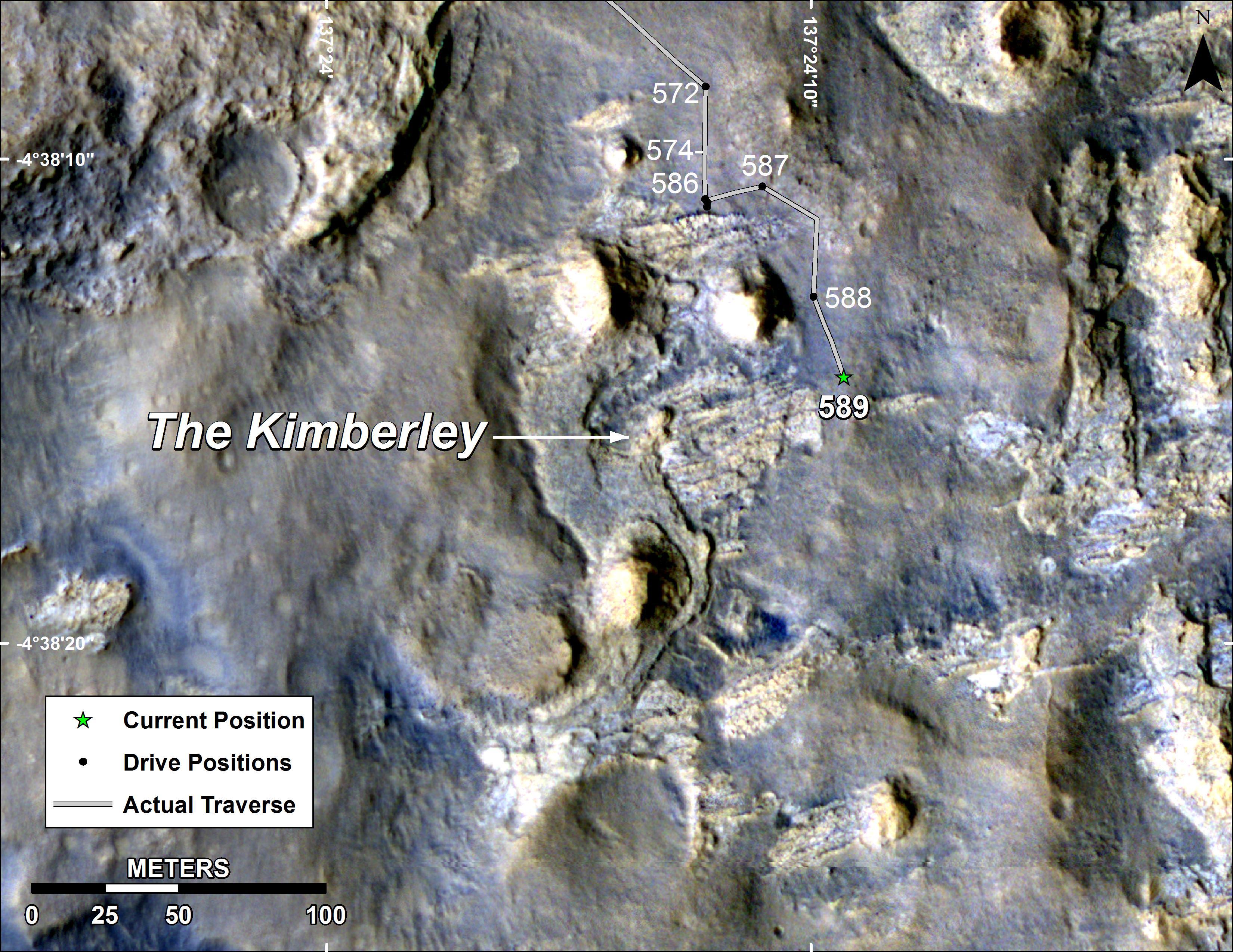
2014-04-16 |
Mars
|
Mars Reconnaissance Orbiter (MRO)
Mars Science Laboratory (MSL)
|
HiRISE
|
1322x1482x3 |
|
-
PIA18081:
-
Curiosity and Rover Tracks at 'the Kimberley,' April 2014
Full Resolution:
TIFF
(5.88 MB)
JPEG
(347.6 kB)
|
|
|
2014-04-16 |
Mars
|
Mars Reconnaissance Orbiter (MRO)
Mars Science Laboratory (MSL)
|
HiRISE
|
3287x3497x3 |
|
-
PIA18082:
-
Stereo View of Curiosity and Rover Tracks at 'the Kimberley,' April 2014
Full Resolution:
TIFF
(34.5 MB)
JPEG
(791.9 kB)
|
|
|
2014-06-23 |
Mars
|
Mars Science Laboratory (MSL)
|
HiRISE
|
3300x2550x3 |

|
-
PIA18391:
-
Curiosity's Progress on Route to Mount Sharp
Full Resolution:
TIFF
(25.26 MB)
JPEG
(1.565 MB)
|
|
|
2014-06-23 |
Mars
|
Mars Science Laboratory (MSL)
|
HiRISE
|
3300x2550x3 |
|
-
PIA18392:
-
Curiosity Rover's Traverse, First 663 Sols on Mars
Full Resolution:
TIFF
(25.26 MB)
JPEG
(1.455 MB)
|
|
|
2014-08-01 |
Mars
|
Mars Reconnaissance Orbiter (MRO)
Mars Science Laboratory (MSL)
|
HiRISE
|
3300x2550x3 |
|
-
PIA18408:
-
Sandy Martian Valleys in Curiosity's Near Future
Full Resolution:
TIFF
(25.26 MB)
JPEG
(1.213 MB)
|
|
|
2014-09-11 |
Mars
|
Mars Reconnaissance Orbiter (MRO)
Mars Science Laboratory (MSL)
|
HiRISE
|
2550x3300x3 |
|
-
PIA18475:
-
Curiosity's Next Steps
Full Resolution:
TIFF
(25.25 MB)
JPEG
(1.735 MB)
|
|
|
2014-09-11 |
Mars
|
Mars Reconnaissance Orbiter (MRO)
Mars Science Laboratory (MSL)
|
HiRISE
|
3300x2550x3 |

|
-
PIA18474:
-
Slopes of Mount Sharp
Full Resolution:
TIFF
(25.26 MB)
JPEG
(1.023 MB)
|
|
|
2014-09-11 |
Mars
|
Mars Reconnaissance Orbiter (MRO)
Mars Science Laboratory (MSL)
|
HiRISE
|
4890x3912x3 |
|
-
PIA18780:
-
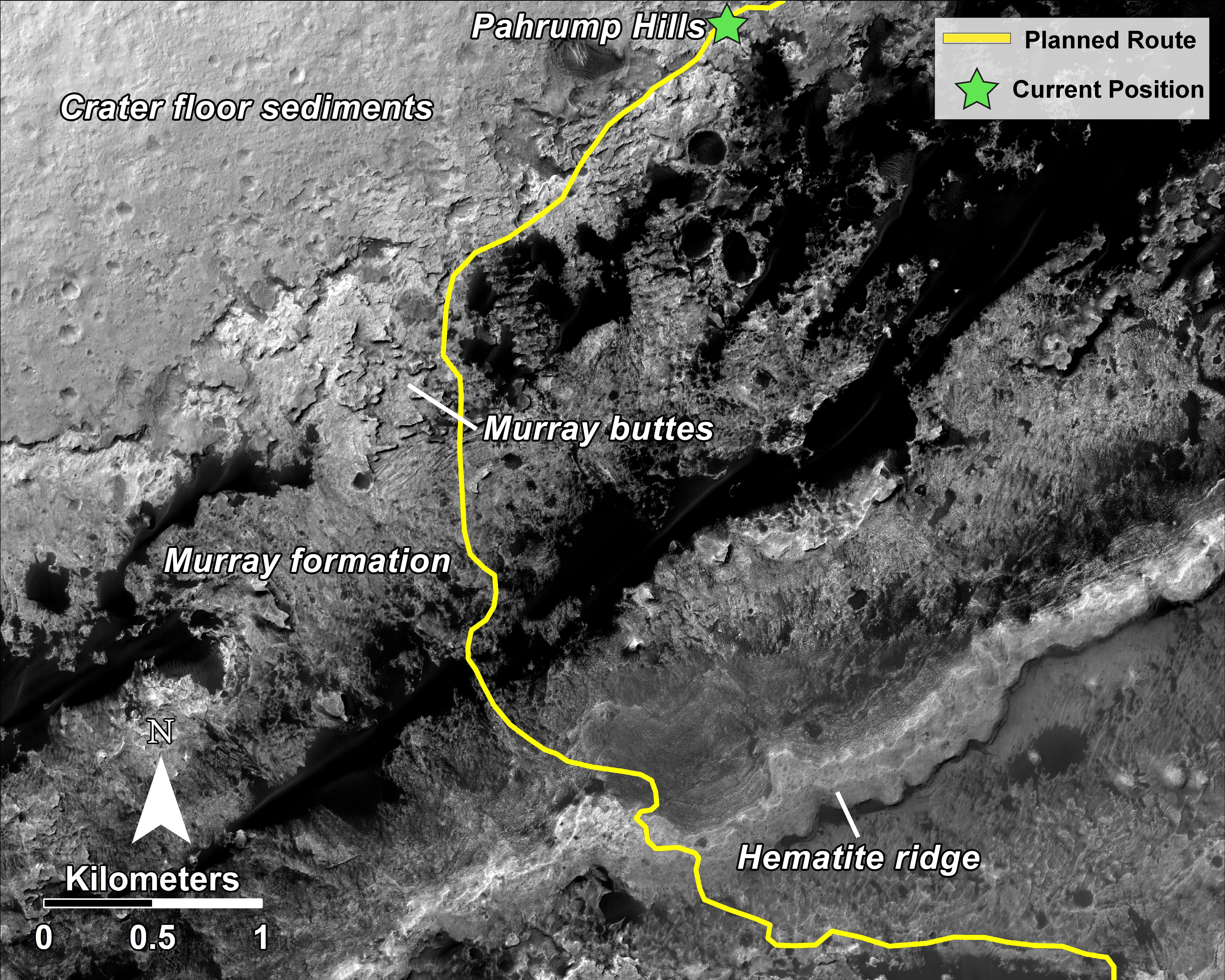
Curiosity Rover Planned Route
Full Resolution:
TIFF
(57.42 MB)
JPEG
(3.739 MB)
|
|
|
2014-09-11 |
Mars
|
Mars Reconnaissance Orbiter (MRO)
Mars Science Laboratory (MSL)
|
HiRISE
|
4173x3008x3 |
|
-
PIA18781:
-
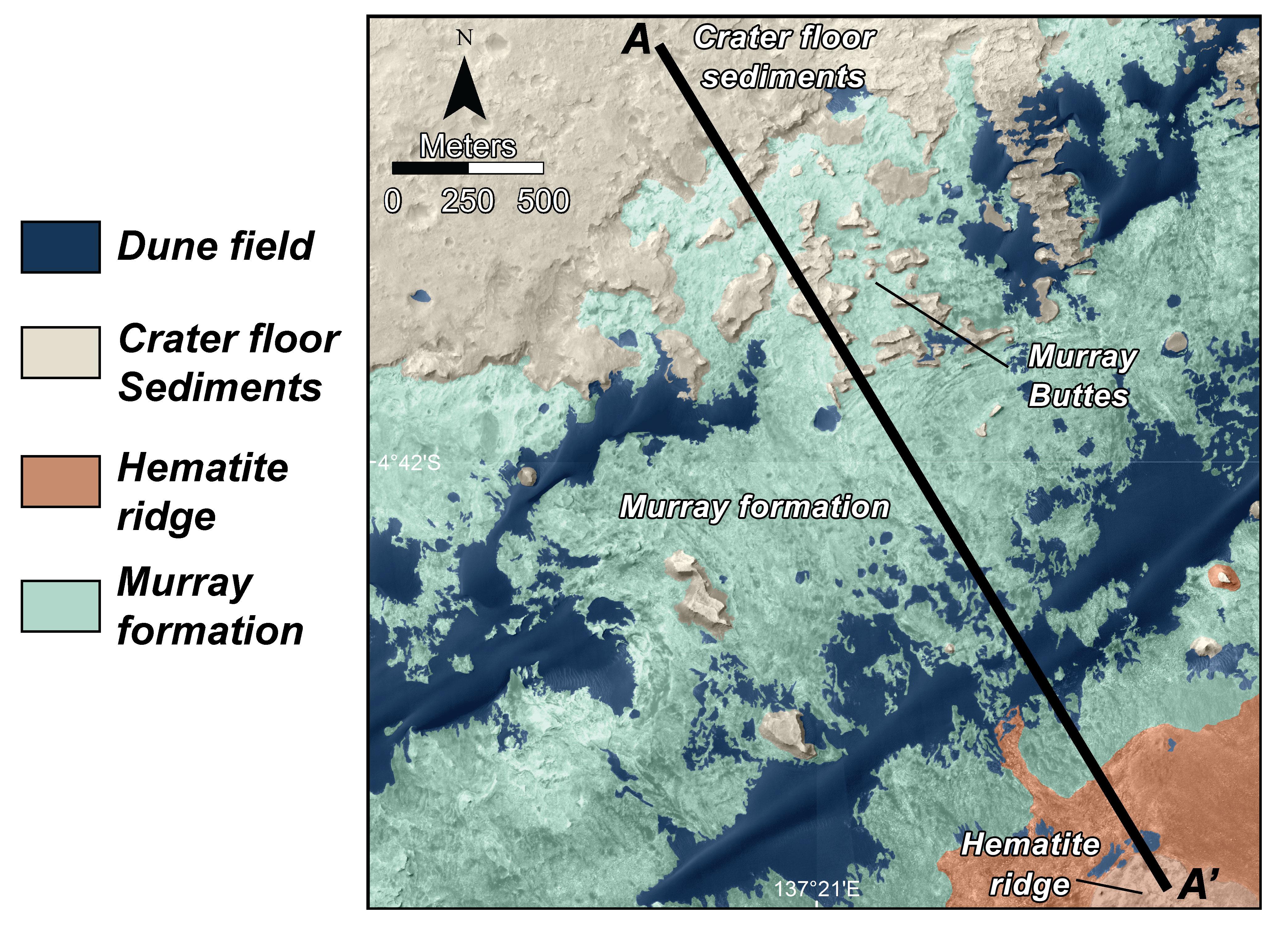
Map of Lower Mount Sharp
Full Resolution:
TIFF
(37.68 MB)
JPEG
(1.64 MB)
|
|
|
2014-09-11 |
Mars
|
Mars Reconnaissance Orbiter (MRO)
Mars Science Laboratory (MSL)
|
HiRISE
|
1927x1542x3 |
|
-
PIA18783:
-
'Murray Buttes' Mesa
Full Resolution:
TIFF
(8.918 MB)
JPEG
(471.3 kB)
|
|
|
2014-09-11 |
Mars
|
Mars Reconnaissance Orbiter (MRO)
Mars Science Laboratory (MSL)
|
HiRISE
|
1927x1542x3 |

|
-
PIA18784:
-
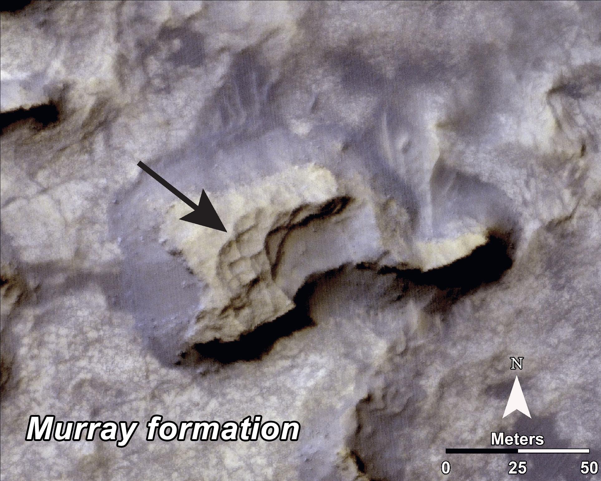
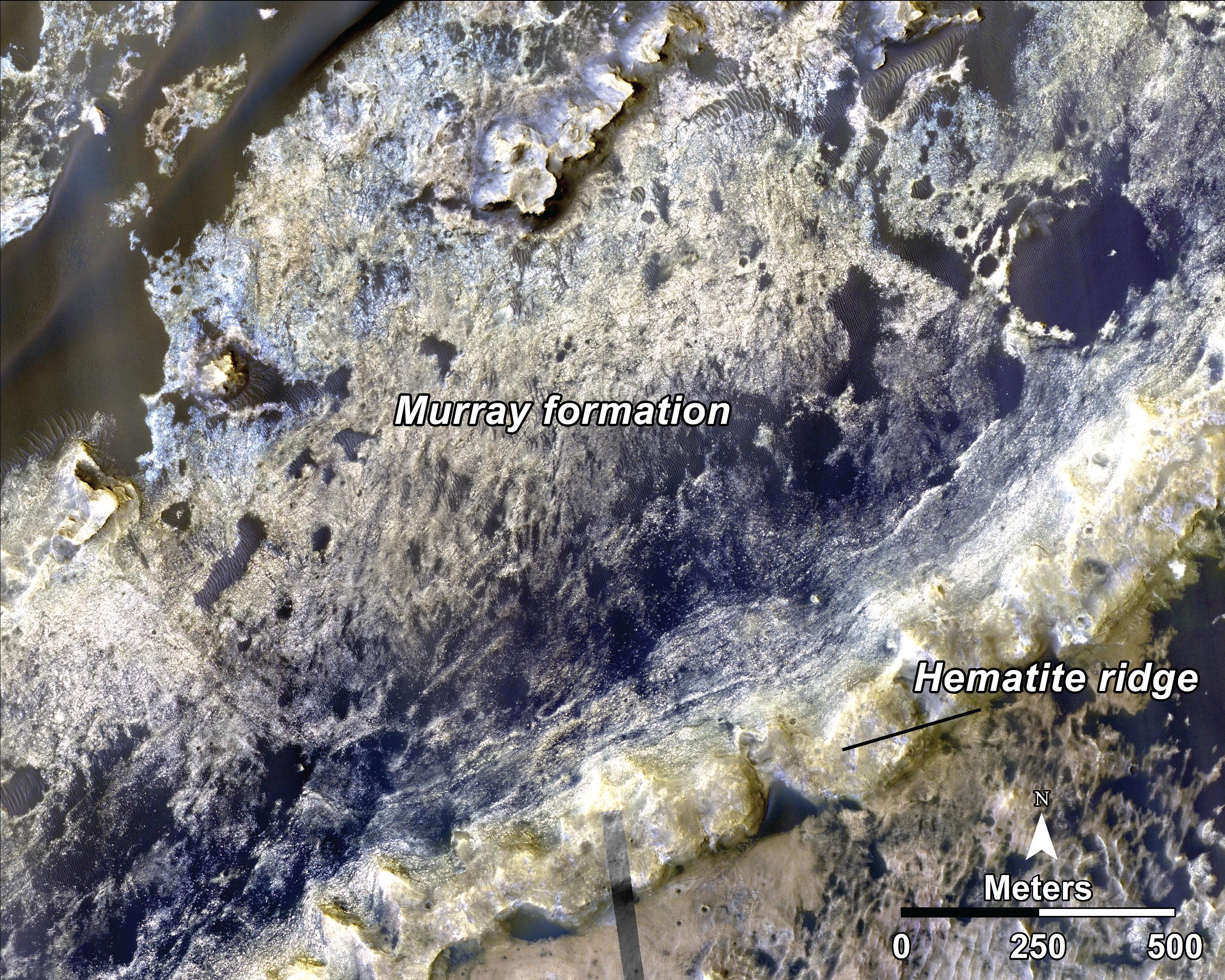
Bands on the 'Murray Formation'
Full Resolution:
TIFF
(8.918 MB)
JPEG
(563 kB)
|
|
|
2014-09-11 |
Mars
|
Mars Reconnaissance Orbiter (MRO)
Mars Science Laboratory (MSL)
|
HiRISE
|
3000x2400x3 |
|
-
PIA18785:
-
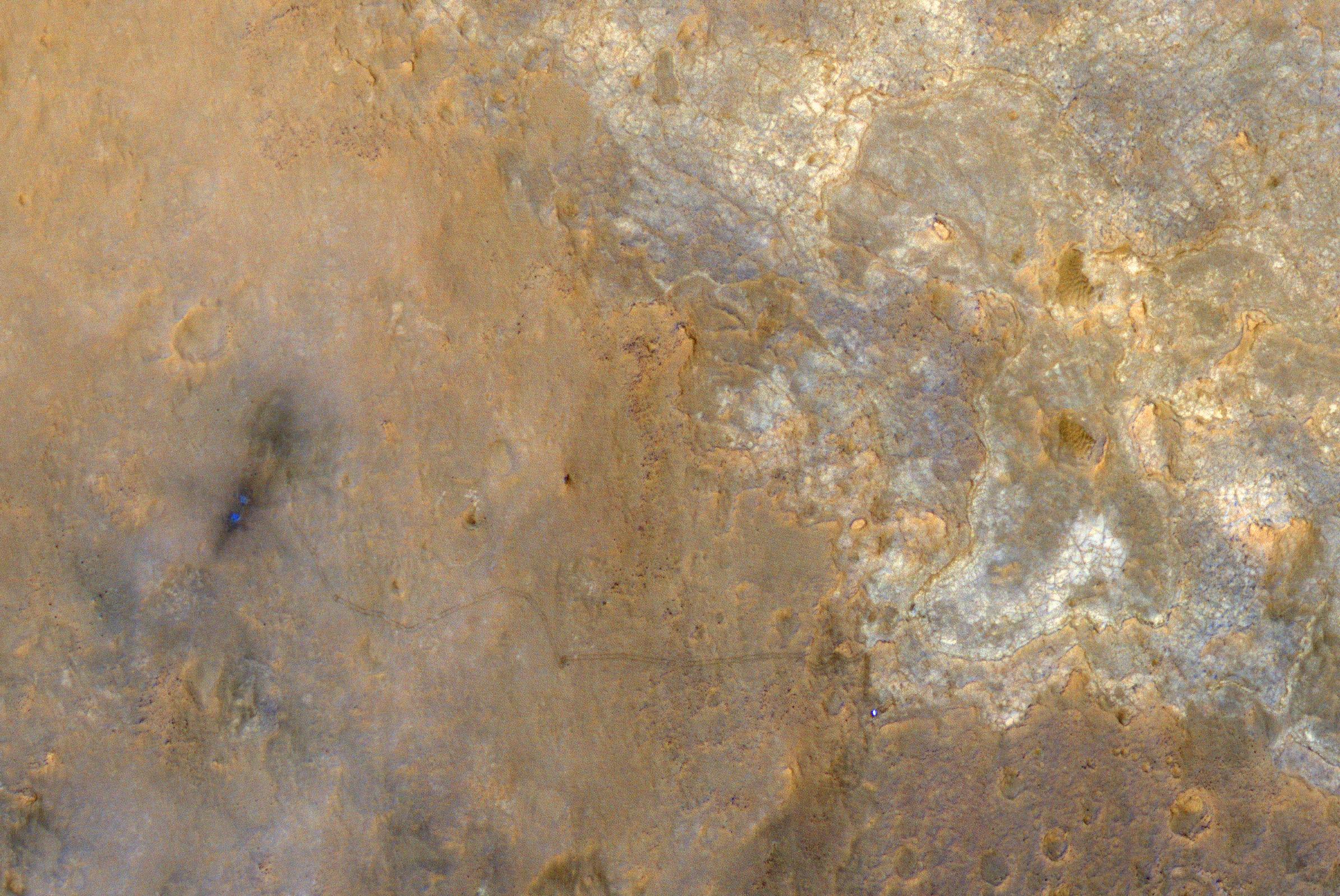
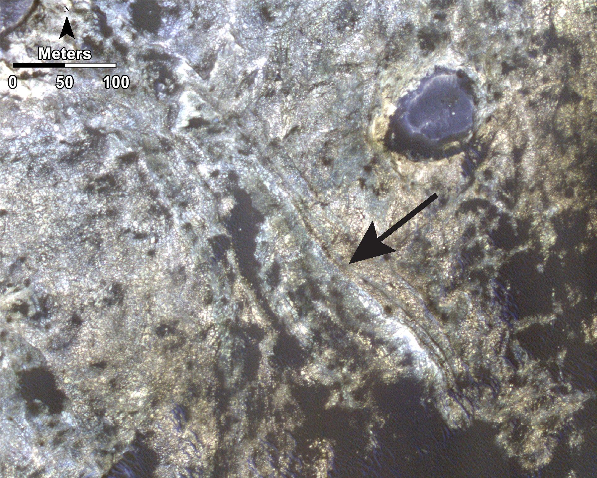
Geological Transition
Full Resolution:
TIFF
(21.61 MB)
JPEG
(2.032 MB)
|
|
|
2014-09-25 |
Mars
|
Mars Reconnaissance Orbiter (MRO)
Mars Science Laboratory (MSL)
|
HiRISE
|
3300x2550x3 |
|
-
PIA18607:
-
Curiosity Mars Rover's Route from Landing to 'Pahrump Hills'
Full Resolution:
TIFF
(25.26 MB)
JPEG
(1.571 MB)
|
|
|
2015-04-16 |
Mars
|
Mars Science Laboratory (MSL)
|
HiRISE
|
3300x2550x3 |
|
-
PIA19390:
-
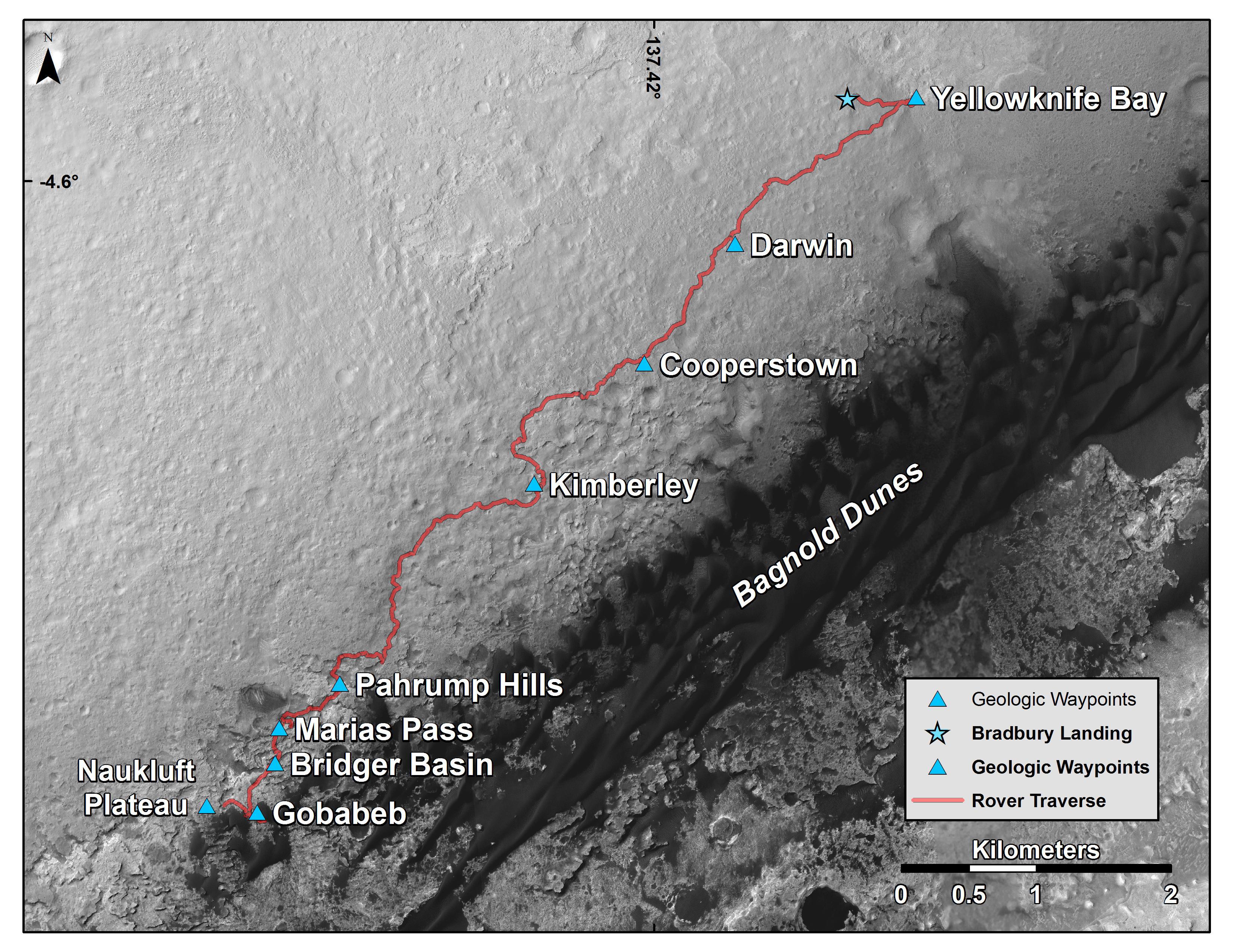
Curiosity's Position After 10 Kilometers
Full Resolution:
TIFF
(25.26 MB)
JPEG
(1.777 MB)
|
|
|
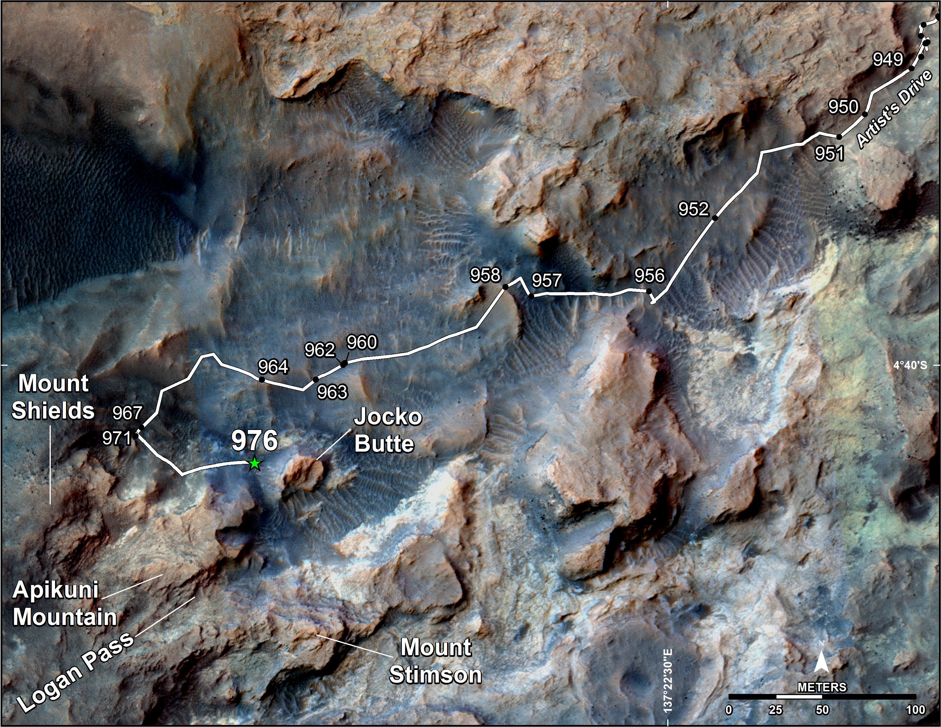
2015-04-22 |
Mars
|
Mars Reconnaissance Orbiter (MRO)
Mars Science Laboratory (MSL)
|
HiRISE
|
2286x1510x3 |
|
-
PIA19392:
-
Mars Orbiter Sees Curiosity Rover in 'Artist's Drive'
Full Resolution:
TIFF
(10.36 MB)
JPEG
(527.1 kB)
|
|
|
2015-05-08 |
Mars
|
Mars Science Laboratory (MSL)
|
HiRISE
|
3300x2550x3 |

|
-
PIA19399:
-
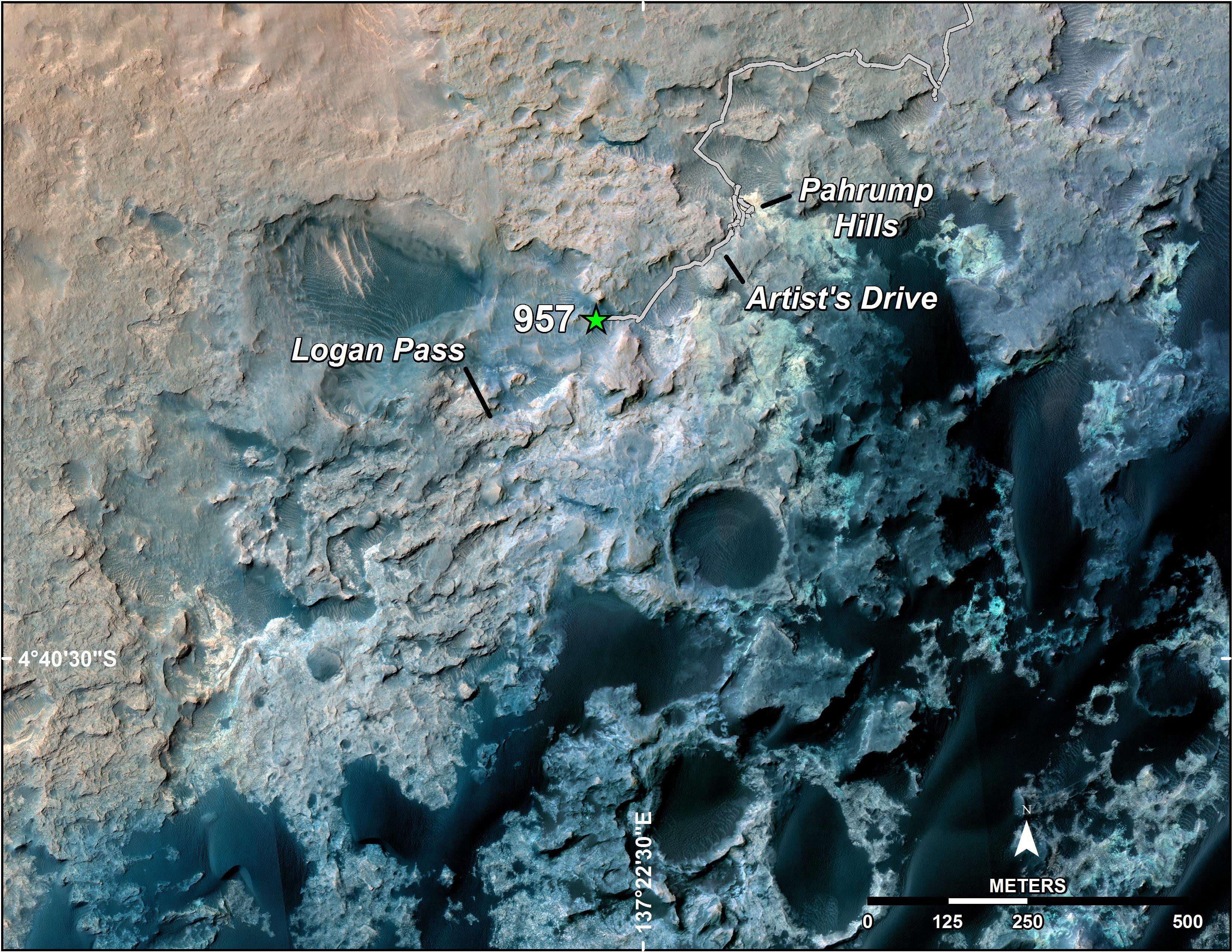
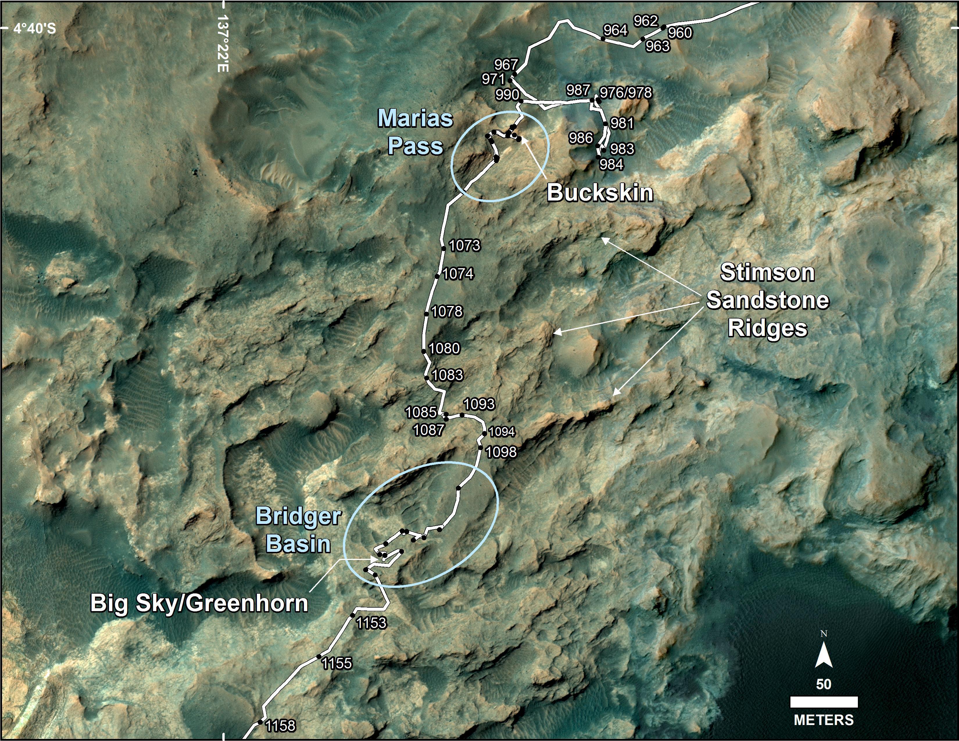
Curiosity's Path to Some Spring 2015 Study Sites
Full Resolution:
TIFF
(25.26 MB)
JPEG
(1.318 MB)
|
|
|
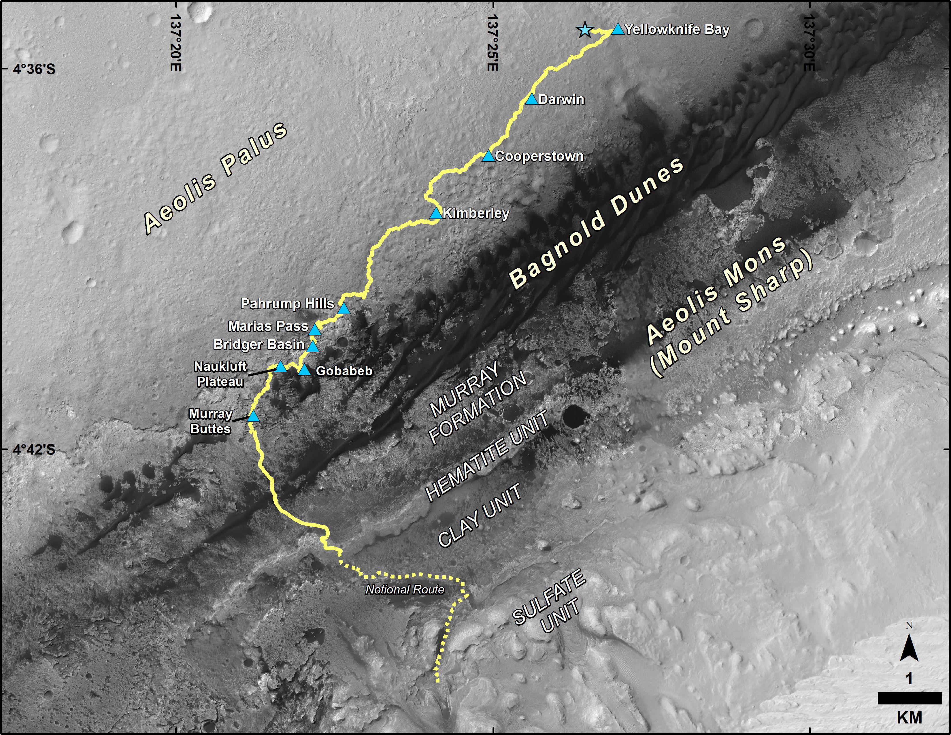
2016-10-03 |
Mars
|
Mars Science Laboratory (MSL)
|
HiRISE
|
3300x2550x3 |
|
-
PIA20846:
-
Curiosity Destinations for Second Extended Mission
Full Resolution:
TIFF
(13.9 MB)
JPEG
(1.797 MB)
|
|
|
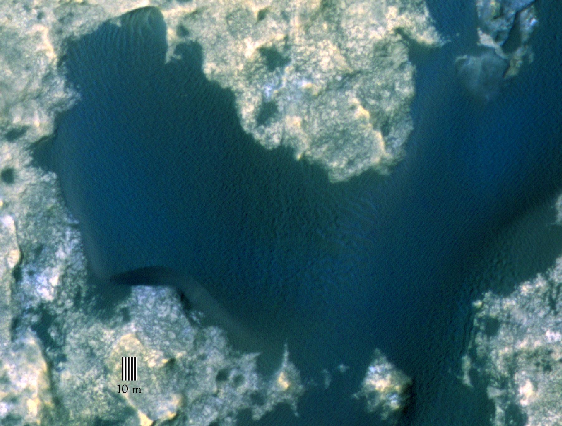
2015-11-16 |
Mars
|
Mars Science Laboratory (MSL)
|
HiRISE
|
1804x1368x3 |

|
-
PIA19930:
-
Orbital View of Dune That Curiosity Will Visit
Full Resolution:
TIFF
(7.407 MB)
JPEG
(306 kB)
|
|
|
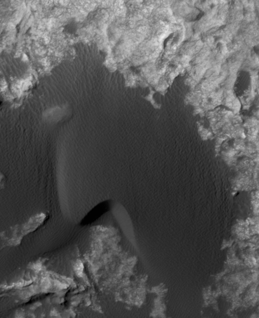
2015-11-16 |
Mars
|
Mars Science Laboratory (MSL)
|
HiRISE
|
891x1095x1 |

|
-
PIA20161:
-
Change Observed in Martian Sand Dune
Full Resolution:
TIFF
(875.3 kB)
JPEG
(87.75 kB)
|
|
|
2015-11-16 |
Mars
|
Mars Science Laboratory (MSL)
|
HiRISE
|
3300x2550x3 |
|
-
PIA20162:
-
Curiosity Rover's Traverse, First 1,163 Sols on Mars
Full Resolution:
TIFF
(12.23 MB)
JPEG
(1.431 MB)
|
|
|
2015-12-17 |
Mars
|
Mars Reconnaissance Orbiter (MRO)
Mars Science Laboratory (MSL)
|
HiRISE
|
3300x2550x3 |
|
-
PIA20172:
-
Curiosity Rover's Traverse, First 1,185 Sols on Mars
Full Resolution:
TIFF
(13.35 MB)
JPEG
(1.533 MB)
|
|
|
2015-12-17 |
Mars
|
Mars Reconnaissance Orbiter (MRO)
Mars Science Laboratory (MSL)
|
HiRISE
|
3300x2550x3 |
|
-
PIA20173:
-
Curiosity's Path During 2015 Studies of Silica-Rich Rocks
Full Resolution:
TIFF
(25.26 MB)
JPEG
(1.372 MB)
|
|
|
2016-03-11 |
Mars
|
Mars Science Laboratory (MSL)
|
HiRISE
|
3300x2550x3 |
|
-
PIA20166:
-
New Waypoint, Science Team Newcomers for Curiosity
Full Resolution:
TIFF
(12.44 MB)
JPEG
(1.458 MB)
|
|
|
2016-06-29 |
Mars
|
Mars Reconnaissance Orbiter (MRO)
|
HiRISE
|
2880x1800x3 |
|
-
PIA20735:
-
Martian Morse Code
Full Resolution:
TIFF
(15.56 MB)
JPEG
(1.195 MB)
|
|
|
2016-06-29 |
Mars
|
Mars Reconnaissance Orbiter (MRO)
|
HiRISE
|
2880x1800x3 |
|
-
PIA20737:
-
Bedrock North of Terby Crater
Full Resolution:
TIFF
(15.56 MB)
JPEG
(775.2 kB)
|
|
|
2016-06-29 |
Mars
|
Mars Reconnaissance Orbiter (MRO)
|
HiRISE
|
2880x1800x3 |
|
-
PIA20740:
-
Dreaming of Graben in the Labyrinth of the Night
Full Resolution:
TIFF
(15.56 MB)
JPEG
(765.6 kB)
|
|
|
2016-06-29 |
Mars
|
Mars Reconnaissance Orbiter (MRO)
|
HiRISE
|
2880x1800x3 |
|
-
PIA20736:
-
Glowing Gullies in Kaiser Crater Dunes
Full Resolution:
TIFF
(15.11 MB)
JPEG
(766.1 kB)
|
|
|
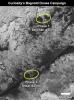
2017-02-27 |
Mars
|
Mars Reconnaissance Orbiter (MRO)
Mars Science Laboratory (MSL)
|
HiRISE
|
825x1118x3 |
|
-
PIA21269:
-
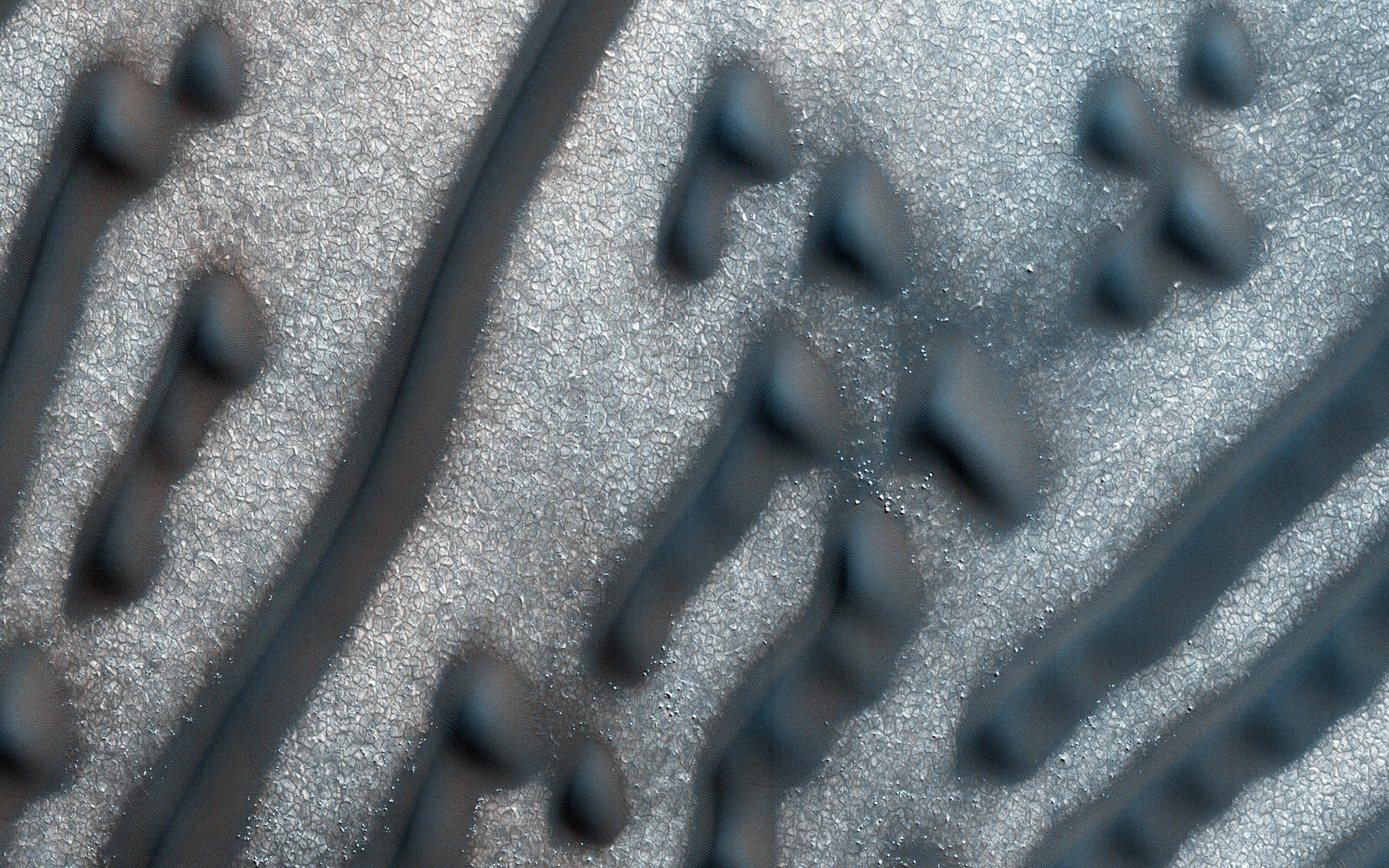
Curiosity's Bagnold Dunes Campaign: Two Types of Dunes
Full Resolution:
TIFF
(1.475 MB)
JPEG
(200.6 kB)
|
|
|
2017-06-20 |
Mars
|
Mars Reconnaissance Orbiter (MRO)
Mars Science Laboratory (MSL)
|
HiRISE
|
1403x789x3 |

|
-
PIA21710:
-
Curiosity Rover on Mount Sharp, Seen from Mars Orbit
Full Resolution:
TIFF
(3.322 MB)
JPEG
(215.9 kB)
|
|
|
2017-07-11 |
Mars
|
Mars Science Laboratory (MSL)
|
HiRISE
|
3300x2550x3 |
|
-
PIA21720:
-
Mid-2017 Map of NASA's Curiosity Mars Rover Mission
Full Resolution:
TIFF
(14.25 MB)
JPEG
(1.627 MB)
|
|
|
2019-08-22 |
Mars
|
Mars Science Laboratory (MSL)
|
HiRISE
|
3300x2550x3 |
|
-
PIA23412:
-
Mid-2019 Map of NASA's Curiosity Rover Mission
Full Resolution:
TIFF
(13.3 MB)
JPEG
(1.669 MB)
|
|
|
2012-08-07 |
Mars
|
Mars Science Laboratory (MSL)
|
HiRISE
Mars Descent Imager
|
9000x6750x3 |

|
-
PIA15996:
-
Nailing Down Curiosity's Landing Site
Full Resolution:
TIFF
(182.3 MB)
JPEG
(6.01 MB)
|
|
|
2012-08-08 |
Mars
|
Mars Reconnaissance Orbiter (MRO)
Mars Science Laboratory (MSL)
|
HiRISE
MARDI
|
1665x1174x3 |
|
-
PIA16019:
-
A Better Look of the Martian Surface
Full Resolution:
TIFF
(5.867 MB)
JPEG
(153.7 kB)
|
|
|
2016-10-03 |
Mars
|
Mars Science Laboratory (MSL)
|
HiRISE
MAHLI
|
3300x2550x3 |
|
-
PIA20845:
-
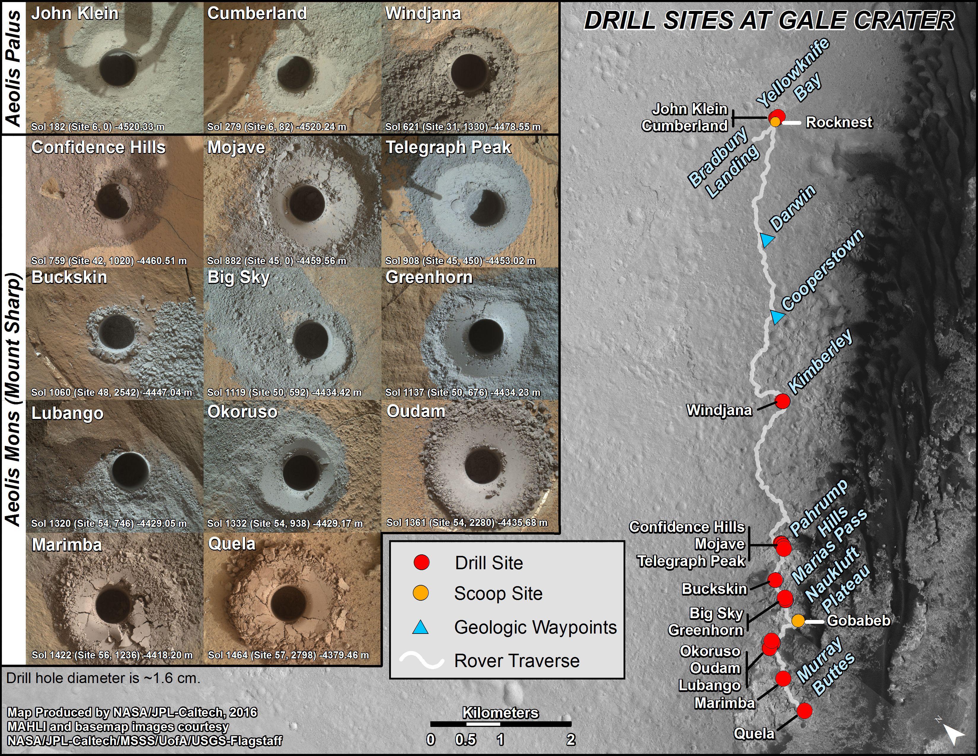
Curiosity's First 16 Rock or Soil Sampling Sites on Mars
Full Resolution:
TIFF
(20.59 MB)
JPEG
(2.195 MB)
|
|
|
2016-12-13 |
Mars
|
Mars Reconnaissance Orbiter (MRO)
Mars Science Laboratory (MSL)
|
HiRISE
MAHLI
|
3300x2550x3 |
|
-
PIA21254:
-
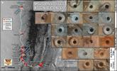
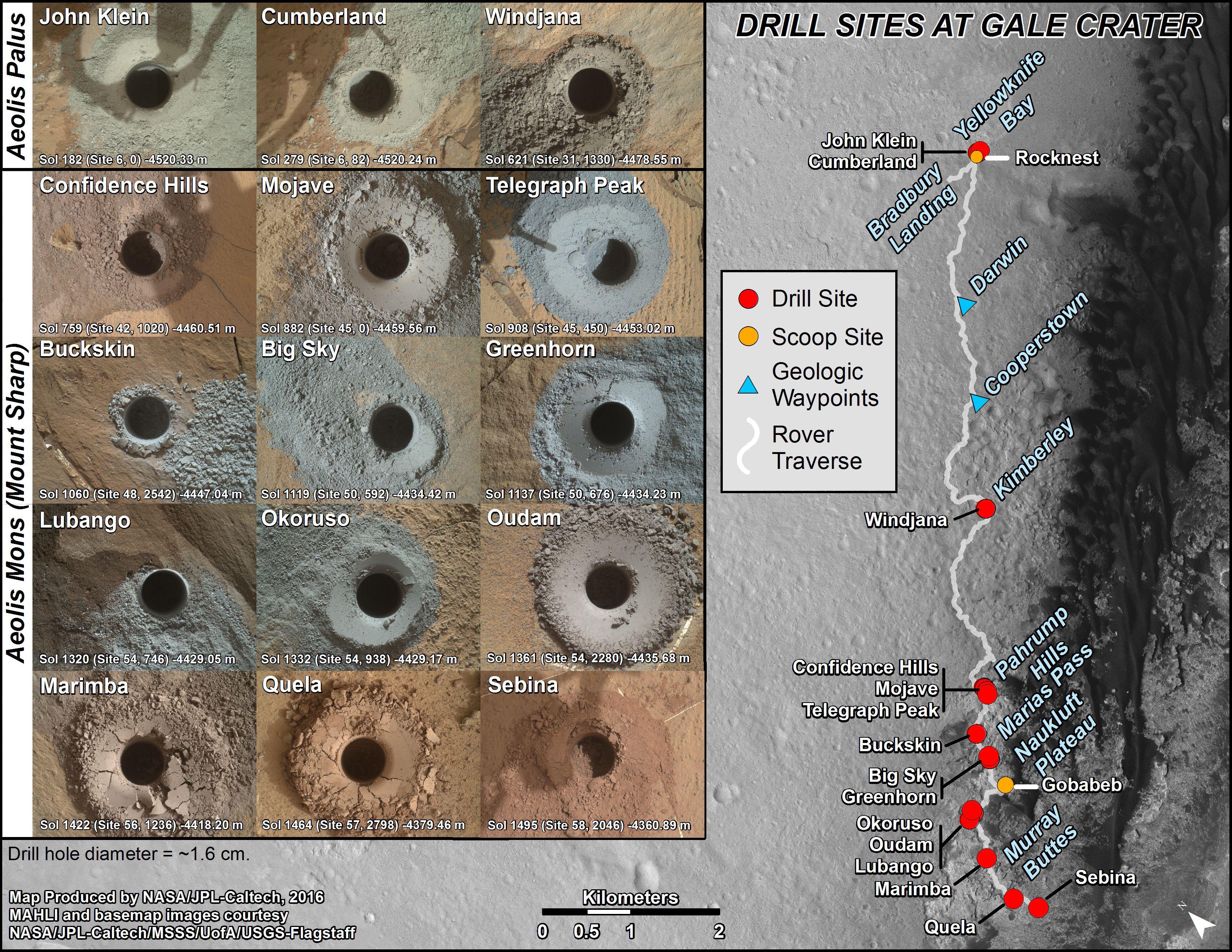
Curiosity's Rock or Soil Sampling Sites on Mars, Through November 2016
Full Resolution:
TIFF
(21.14 MB)
JPEG
(2.213 MB)
|
|
|
2019-08-22 |
Mars
|
Mars Science Laboratory (MSL)
|
HiRISE
MAHLI
|
4200x2550x3 |
|
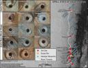
-
PIA23413:
-
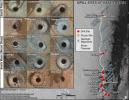
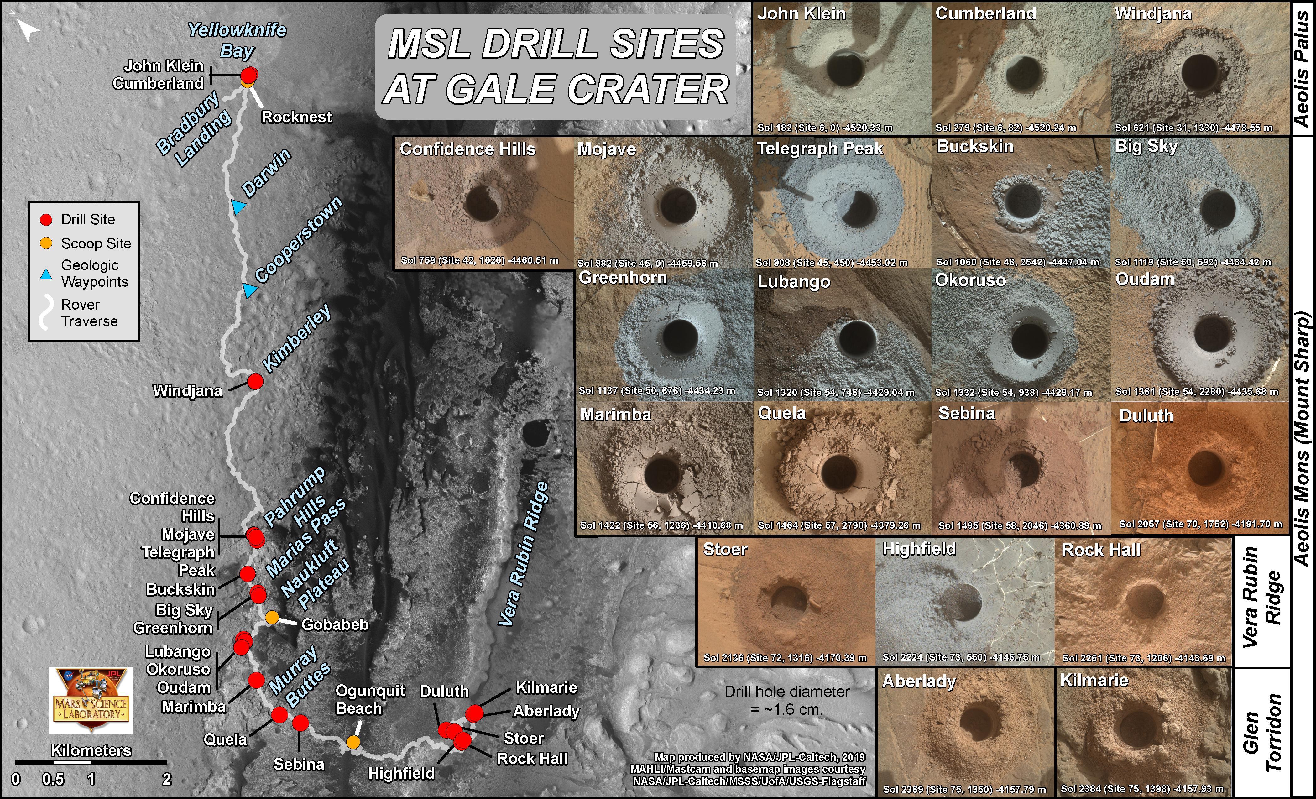
Curiosity's 21 Drill Holes on Mars
Full Resolution:
TIFF
(25.48 MB)
JPEG
(2.573 MB)
|
|
|
2012-08-10 |
Mars
|
Mars Reconnaissance Orbiter (MRO)
Mars Science Laboratory (MSL)
|
MARCI
|
1449x1087x3 |
|
-
PIA16037:
-
Mars Weather Map, Aug. 5
Full Resolution:
TIFF
(4.727 MB)
JPEG
(123.9 kB)
|
|
|
2012-08-07 |
Mars
|
Mars Science Laboratory (MSL)
|
MARDI
|
9000x6750x3 |
|
-
PIA15995:
-
Narrowing in on Curiosity's Landing Site
Full Resolution:
TIFF
(182.3 MB)
JPEG
(2.007 MB)
|
|
|
2012-08-08 |
Mars
|
Mars Science Laboratory (MSL)
|
MARDI
|
2108x1533x3 |

|
-
PIA16021:
-
Curiosity's Heat Shield in Detail
Full Resolution:
TIFF
(9.699 MB)
JPEG
(144.8 kB)
|
|
|
2012-08-08 |
Mars
|
Mars Science Laboratory (MSL)
|
MARDI
|
2108x1533x3 |
|
-
PIA16018:
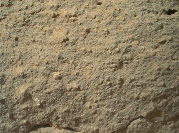
-
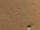
Gravel-Covered Martian Surface
Full Resolution:
TIFF
(3.237 MB)
JPEG
(198.7 kB)
|
|
|
2013-01-15 |
Mars
|
Mars Science Laboratory (MSL)
|
MARDI
|
615x458x3 |
|
-
PIA16618:
-
Texture of 'Gillespie Lake' Rock
Full Resolution:
TIFF
(845.5 kB)
JPEG
(62.47 kB)
|
|
|
2017-02-27 |
Mars
|
Mars Science Laboratory (MSL)
|
MARDI
|
2108x1533x3 |
|
-
PIA21143:
-
Sand Moving Under Curiosity, One Day to Next
Full Resolution:
TIFF
(7.113 MB)
JPEG
(214.8 kB)
|
|
|
2012-08-03 |
Mars
|
Mars Science Laboratory (MSL)
|
MAHLI
|
676x677x1 |
|
-
PIA15961:
-
Popping the Lid off Curiosity's Hazard Cameras
Full Resolution:
TIFF
(458.3 kB)
JPEG
(49.74 kB)
|
|
|
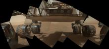
2012-08-07 |
Mars
|
Mars Science Laboratory (MSL)
|
MAHLI
|
2025x1877x3 |
|
-
PIA15691:
-
First Color Landscape Image of Mars from Curiosity
Full Resolution:
TIFF
(11.41 MB)
JPEG
(219.3 kB)
|
|
|
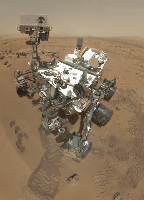
2012-08-07 |
Mars
|
Mars Science Laboratory (MSL)
|
MAHLI
|
6570x4770x3 |
|
-
PIA16007:
-
Curiosity's Landscape Portrait in Context
Full Resolution:
TIFF
(94.06 MB)
JPEG
(2.029 MB)
|
|
|
2012-09-08 |
Mars
|
Mars Science Laboratory (MSL)
|
MAHLI
|
2025x1877x3 |
|
-
PIA16149:
-
Rover Takes Self Portrait
Full Resolution:
TIFF
(11.41 MB)
JPEG
(268.4 kB)
|
|
|
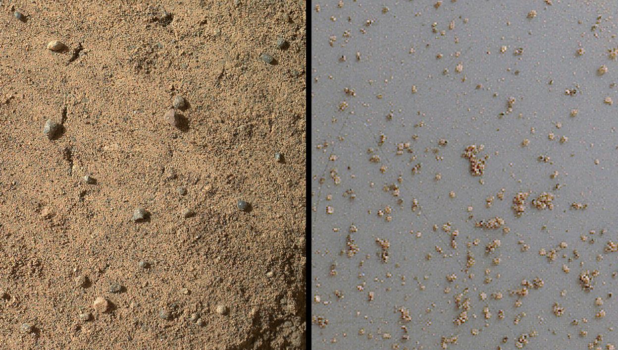
2012-09-09 |
Mars
|
Mars Science Laboratory (MSL)
|
MAHLI
|
573x144x3 |
|
-
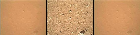
PIA16129:
Martian Ground Seen by Arm Camera With and Without Dust Cover (Thumbnails)
Full Resolution:
TIFF
(247.8 kB)
JPEG
(13.73 kB)
|
|
|
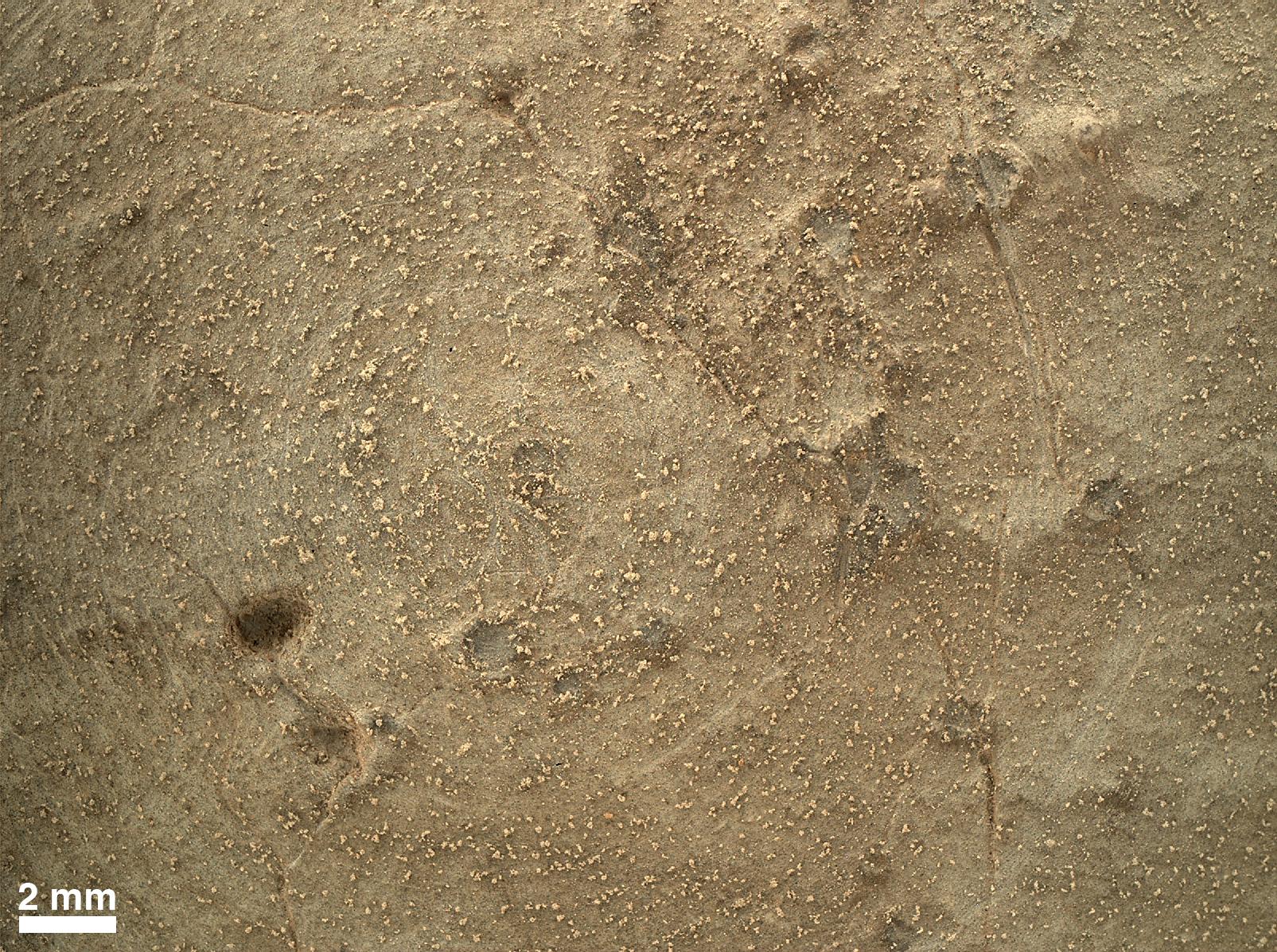
2012-09-09 |
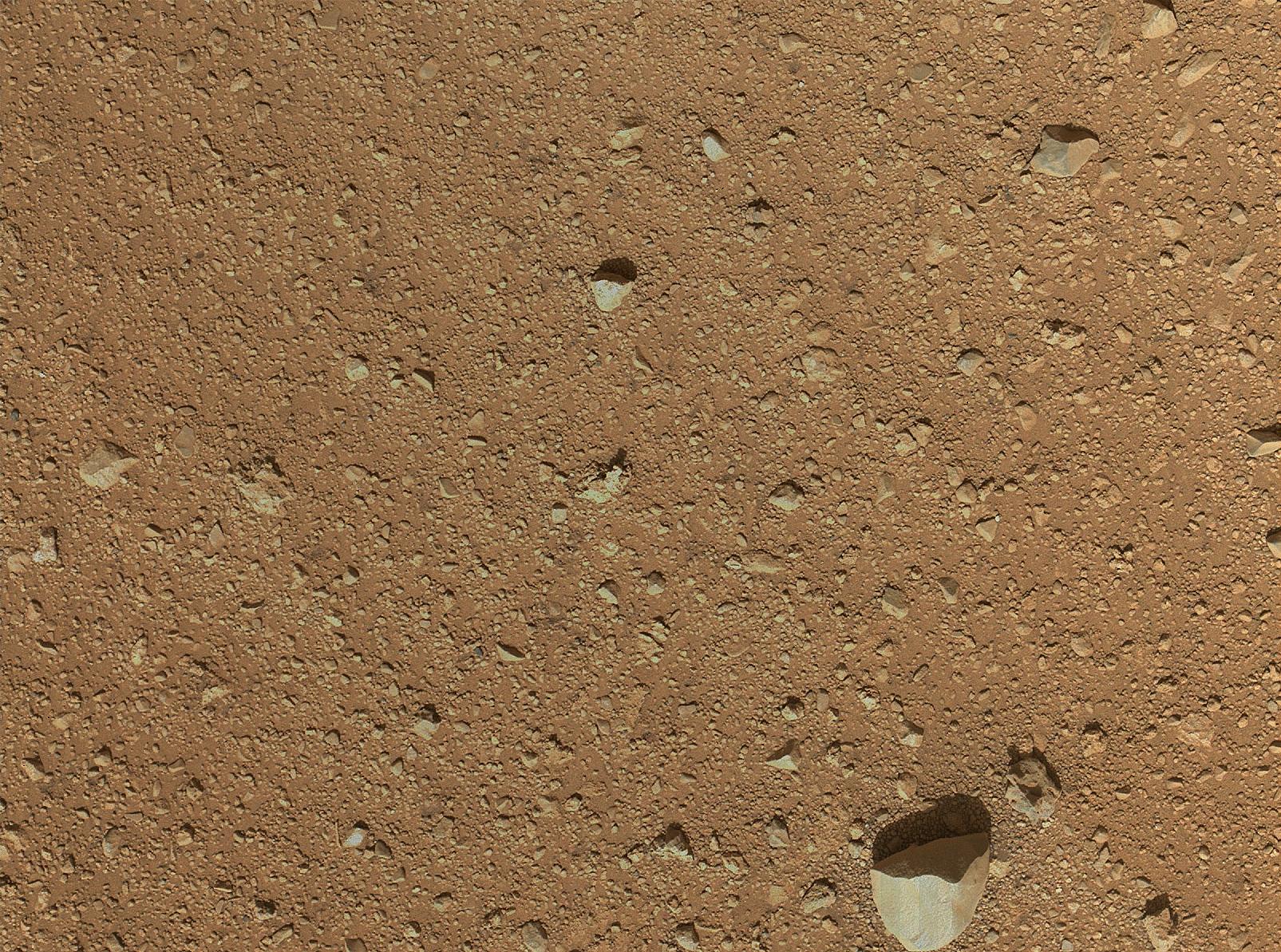
Mars
|
Mars Science Laboratory (MSL)
|
MAHLI
|
1605x1193x3 |
|
-
PIA16130:
-
First Image From Curiosity's Arm Camera With Dust Cover Open
Full Resolution:
TIFF
(5.746 MB)
JPEG
(624.3 kB)
|
|
|
2012-09-10 |
Mars
|
Mars Science Laboratory (MSL)
|
MAHLI
|
1987x1839x3 |
|
-
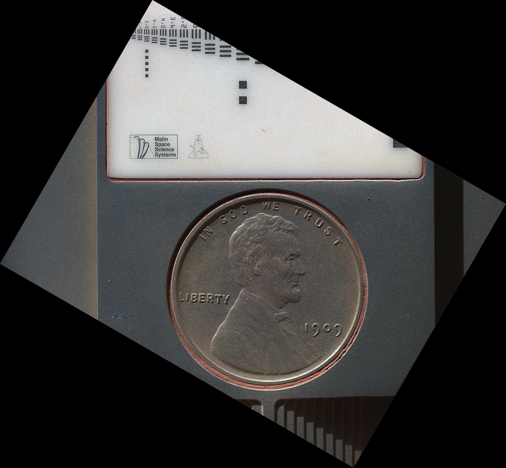
PIA16131:
-
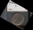
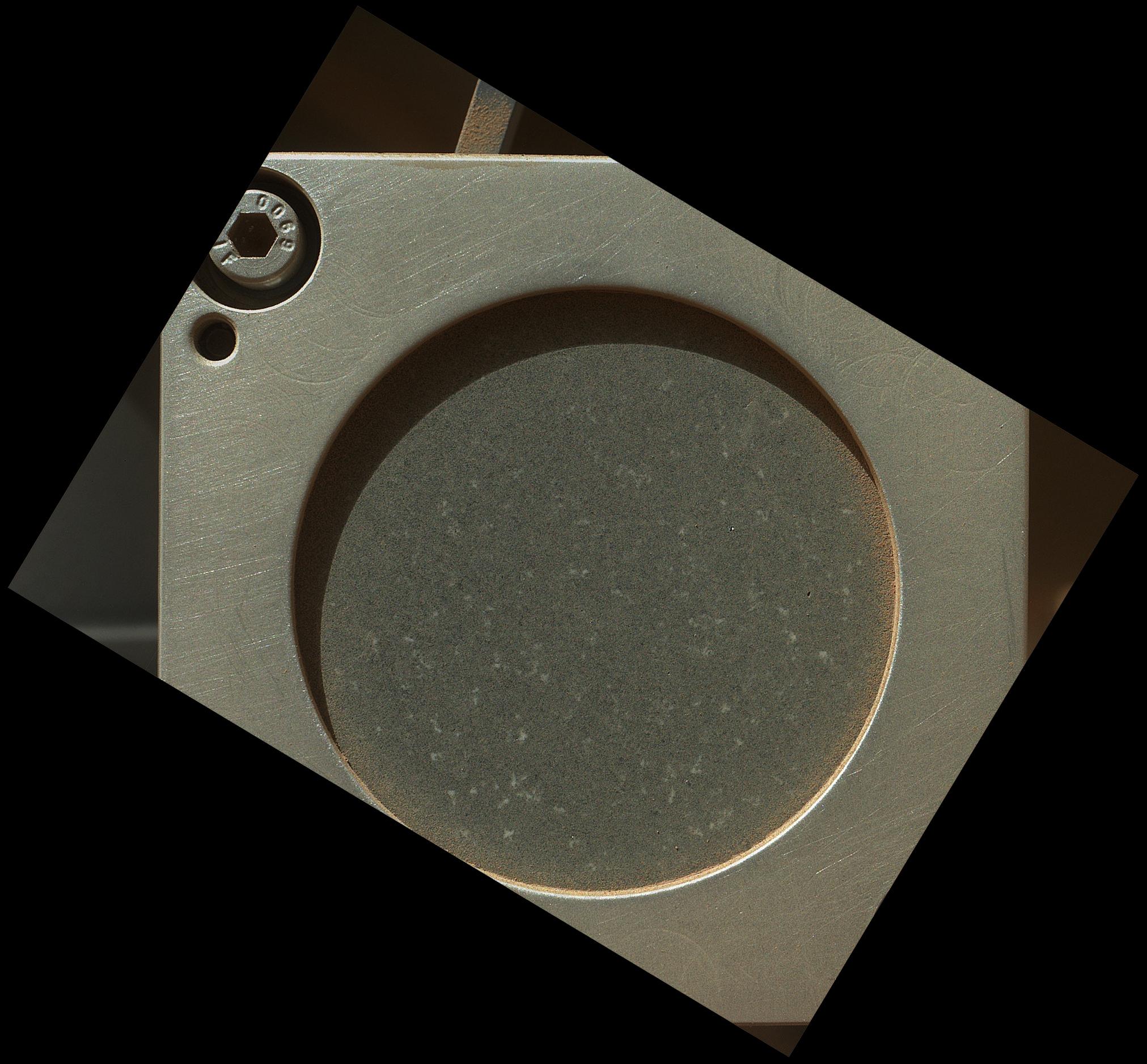
Lincoln Penny on Mars in Camera's Calibration Target
Full Resolution:
TIFF
(10.97 MB)
JPEG
(430.3 kB)
|
|
|
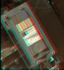
2012-09-10 |
Mars
|
Mars Science Laboratory (MSL)
|
MAHLI
|
1991x1852x3 |
|
-
PIA16132:
-
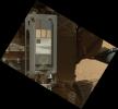
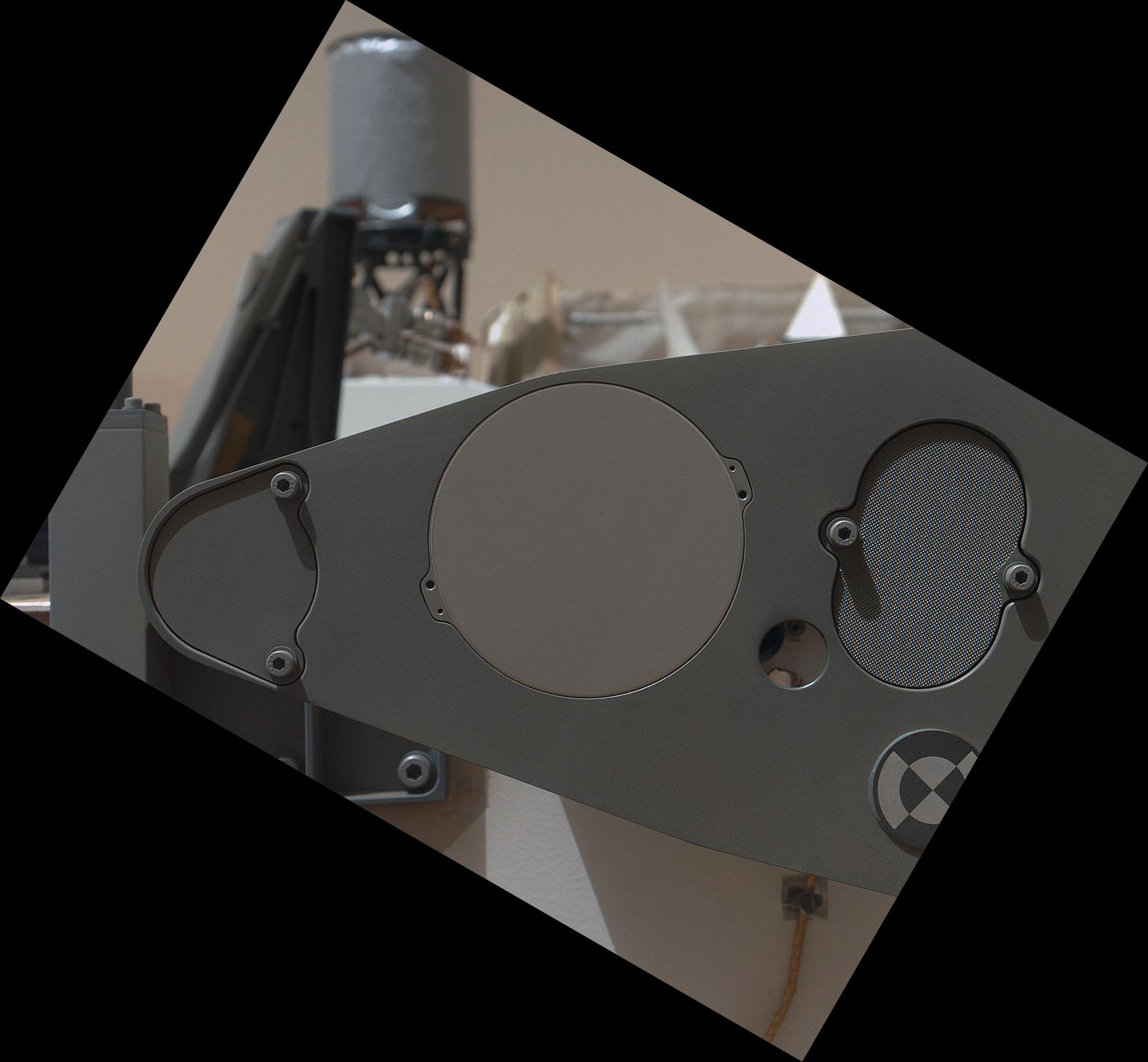
Calibration Target for Curiosity's Arm Camera
Full Resolution:
TIFF
(11.07 MB)
JPEG
(266.1 kB)
|
|
|
2012-09-10 |
Mars
|
Mars Science Laboratory (MSL)
|
MAHLI
|
2949x1981x3 |
|
-
PIA16134:
-
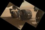
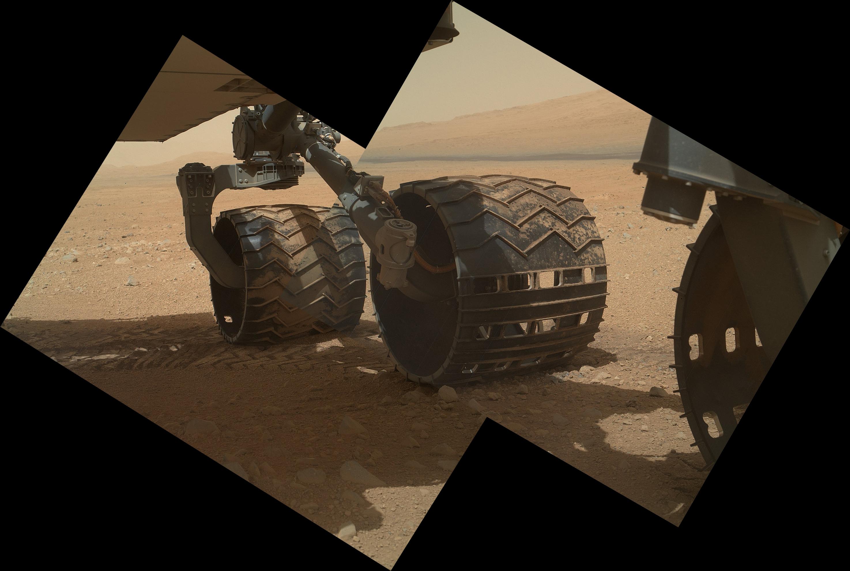
Wheels and a Destination
Full Resolution:
TIFF
(17.53 MB)
JPEG
(453.3 kB)
|
|
|
2012-09-10 |
Mars
|
Mars Science Laboratory (MSL)
|
MAHLI
|
1988x1839x3 |
|
-
PIA16135:
-
Sealed Organic Check Material on Curiosity
Full Resolution:
TIFF
(10.97 MB)
JPEG
(235.8 kB)
|
|
|
2012-09-10 |
Mars
|
Mars Science Laboratory (MSL)
|
MAHLI
|
2023x1876x3 |
|
-
PIA16136:
-
A Piece of New Mexico on Mars
Full Resolution:
TIFF
(11.39 MB)
JPEG
(408.7 kB)
|
|
|
2012-09-10 |
Mars
|
Mars Science Laboratory (MSL)
|
MAHLI
|
5768x2624x3 |
|
-
PIA16137:
-
Panorama of Curiosity's Belly Check
Full Resolution:
TIFF
(45.43 MB)
JPEG
(934.1 kB)
|
|
|
2012-09-13 |
Mars
|
Mars Science Laboratory (MSL)
|
MAHLI
|
1096x1200x3 |
|
-
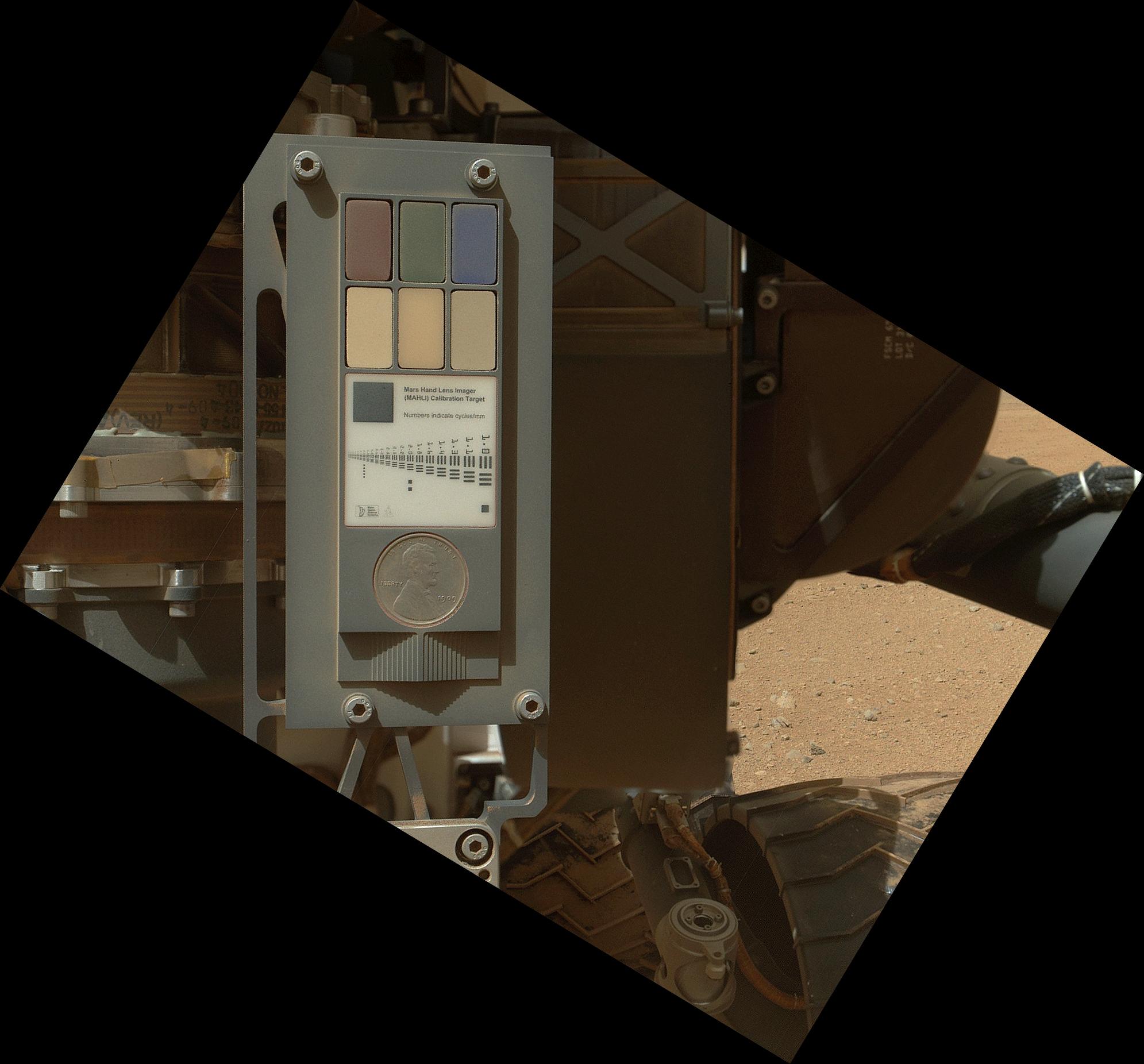
PIA15879:
-
3-D View of MAHLI Calibration Target
Full Resolution:
TIFF
(3.947 MB)
JPEG
(191.8 kB)
|
|
|
2012-09-21 |
Mars
|
Mars Science Laboratory (MSL)
|
MAHLI
|
1584x1184x3 |
|
-
PIA15882:
-
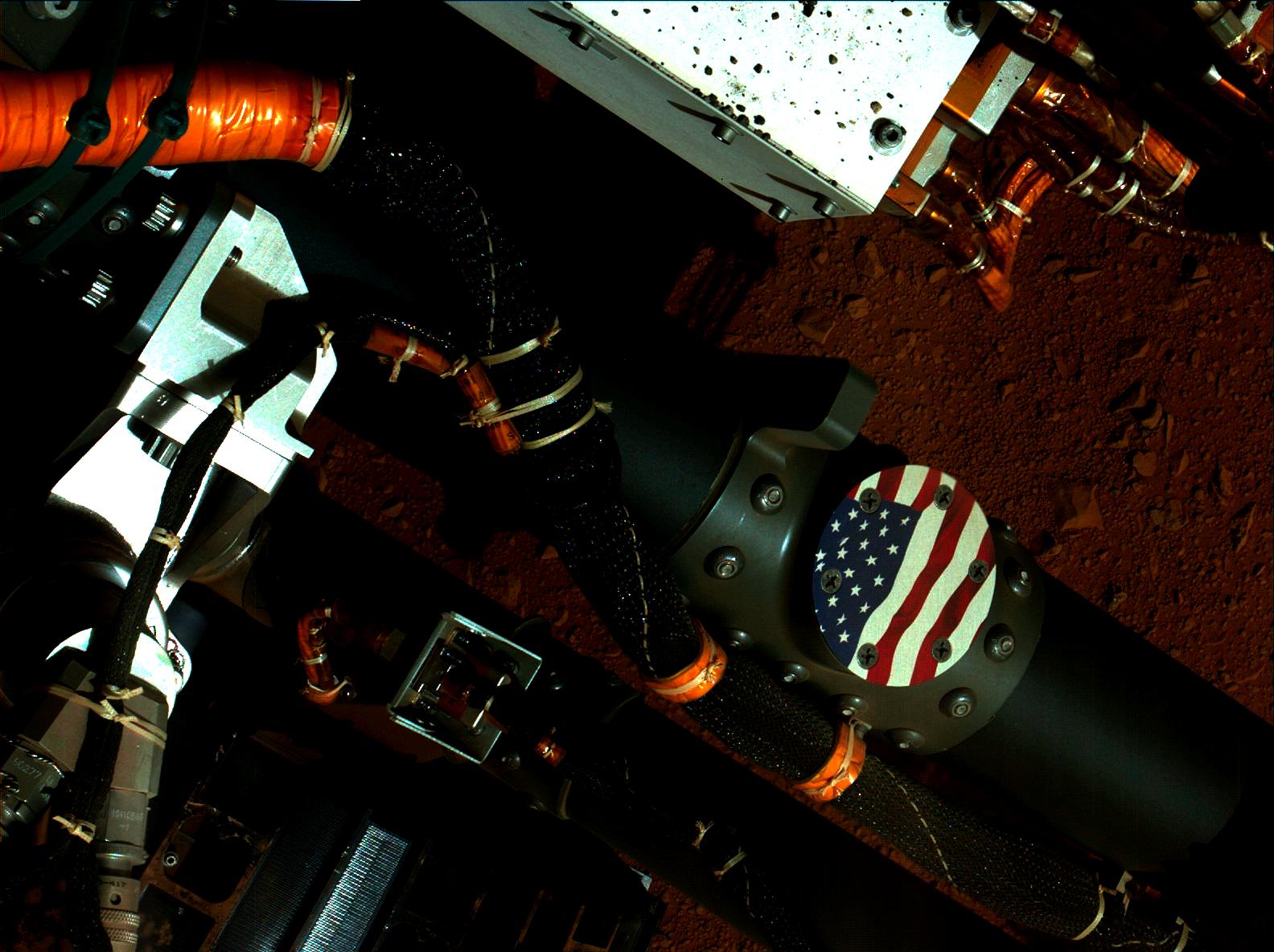
Curiosity's Stars and Stripes
Full Resolution:
TIFF
(5.628 MB)
JPEG
(223.5 kB)
|
|
|
2012-09-21 |
Mars
|
Mars Science Laboratory (MSL)
|
MAHLI
|
2199x2000x3 |
|
-
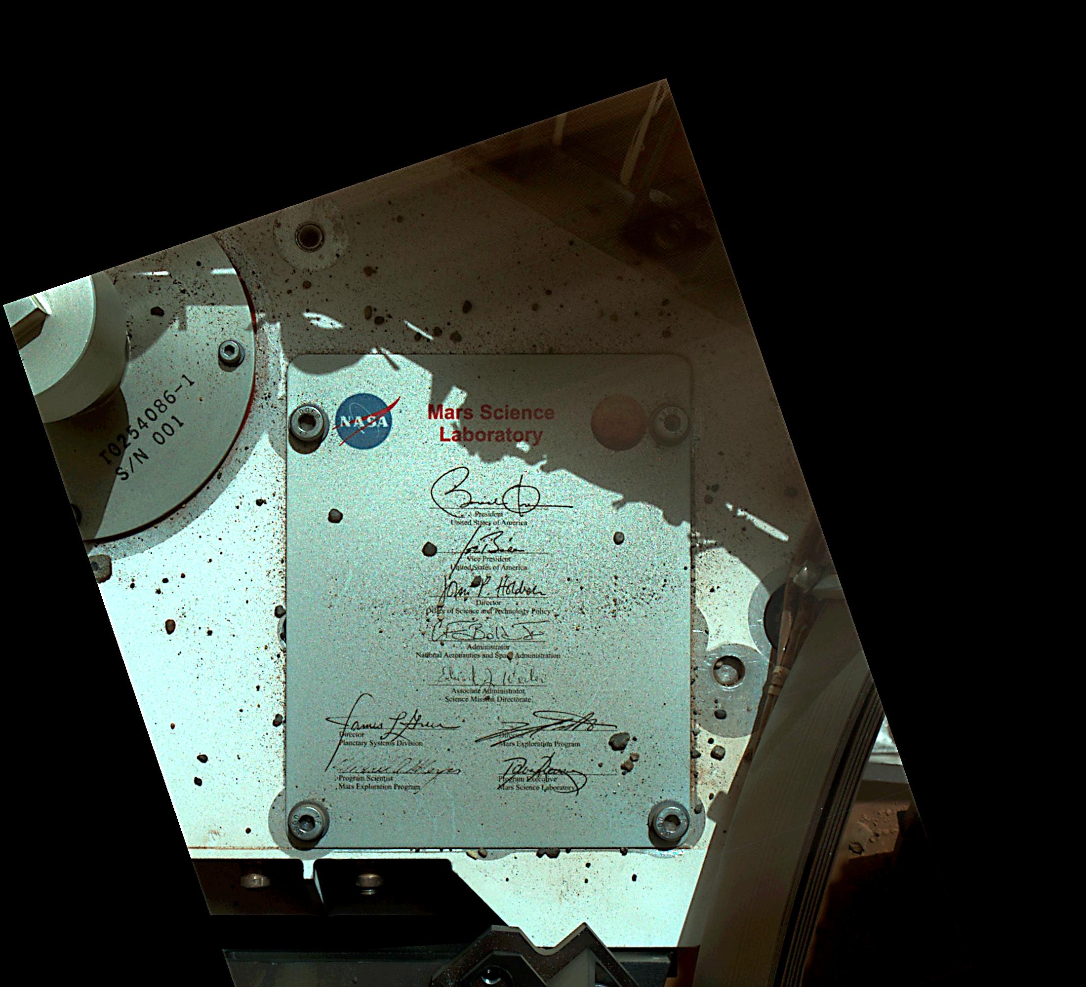
PIA15883:
-
President's Signature Onboard Curiosity
Full Resolution:
TIFF
(13.2 MB)
JPEG
(434.6 kB)
|
|
|
2012-10-01 |
Mars
|
Mars Science Laboratory (MSL)
|
MAHLI
|
1812x1958x3 |
|
-
PIA14762:
-
'Bathurst Inlet' Rock on Curiosity's Sol 54, Context View
Full Resolution:
TIFF
(10.65 MB)
JPEG
(311.4 kB)
|
|
|
2012-10-01 |
Mars
|
Mars Science Laboratory (MSL)
|
MAHLI
|
1812x1959x3 |
|
-
PIA14763:
-
'Bathurst Inlet' Rock on Curiosity's Sol 54, Close-Up View
Full Resolution:
TIFF
(10.65 MB)
JPEG
(618.9 kB)
|
|
|
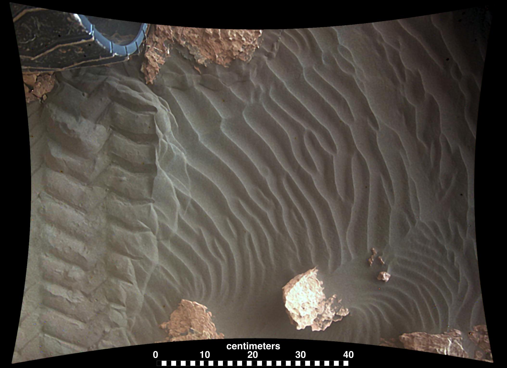
2012-10-11 |
Mars
|
Mars Science Laboratory (MSL)
|
MAHLI
|
1579x1180x3 |
|
-
PIA16193:
-
High-Resolution View of Cross-Section Through a Mars Ripple
Full Resolution:
TIFF
(5.592 MB)
JPEG
(611.4 kB)
|
|
|
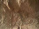
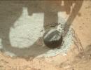
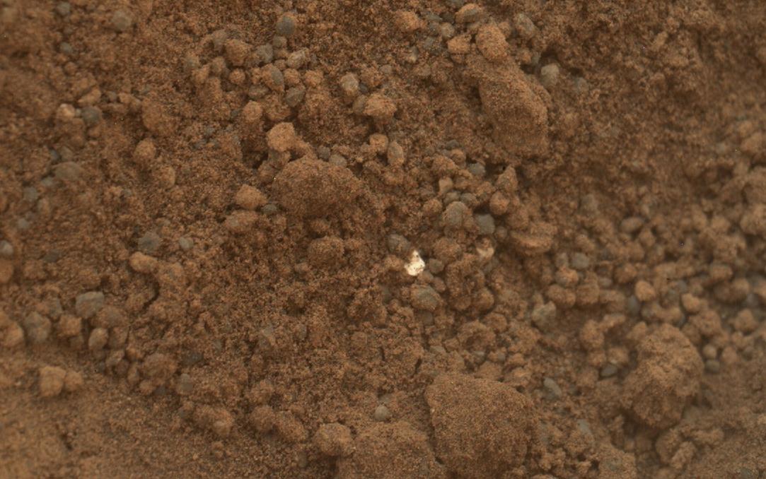
2012-10-15 |
Mars
|
Mars Science Laboratory (MSL)
|
MAHLI
|
1608x1199x3 |
|
-
PIA16229:
-
Bright Particle of Martian Origin in Scoop Hole
Full Resolution:
TIFF
(5.786 MB)
JPEG
(288 kB)
|
|
|
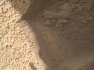
2012-10-15 |
Mars
|
Mars Science Laboratory (MSL)
|
MAHLI
|
1584x1184x3 |
|
-
PIA16230:
-
Small Debris on the Ground Beside Curiosity
Full Resolution:
TIFF
(5.628 MB)
JPEG
(485.9 kB)
|
|
|
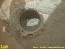
2012-10-18 |
Mars
|
Mars Science Laboratory (MSL)
|
MAHLI
|
1083x678x3 |
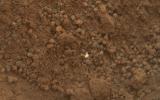
|
-
PIA16233:
-
Bright Particle in Hole Dug by Scooping of Martian Soil
Full Resolution:
TIFF
(2.204 MB)
JPEG
(122.5 kB)
|
|
|
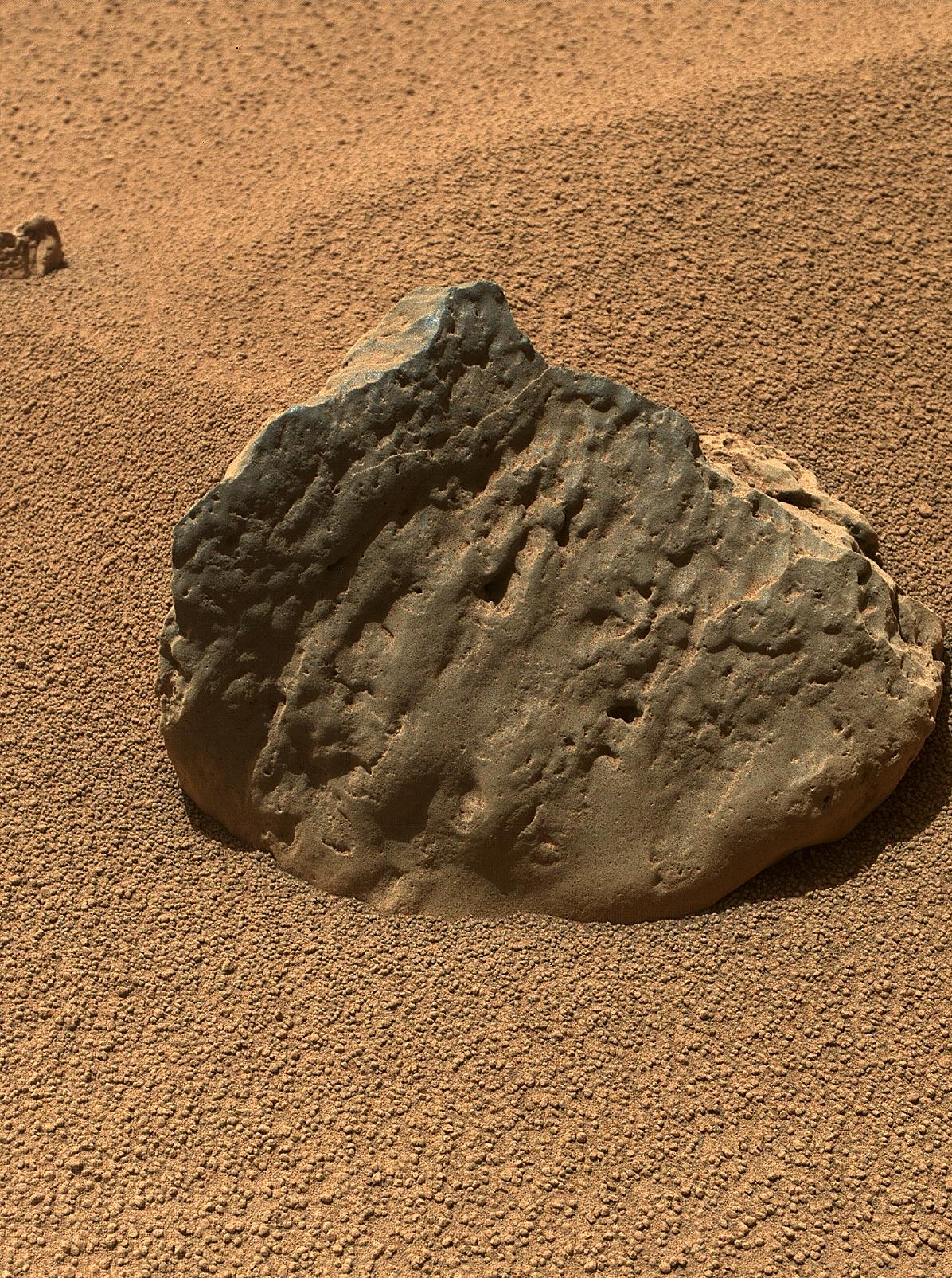
2012-10-29 |
Mars
|
Mars Science Laboratory (MSL)
|
MAHLI
|
1196x1605x3 |

|
-
PIA16236:
-
Rock 'Et-Then' Near Curiosity, Sol 82
Full Resolution:
TIFF
(5.761 MB)
JPEG
(666.8 kB)
|
|
|
2012-10-29 |
Mars
|
Mars Science Laboratory (MSL)
|
MAHLI
|
1584x1184x3 |
|
-
PIA16237:
-
Rock 'Burwash' Near Curiosity, Sol 82
Full Resolution:
TIFF
(5.628 MB)
JPEG
(445.3 kB)
|
|
|
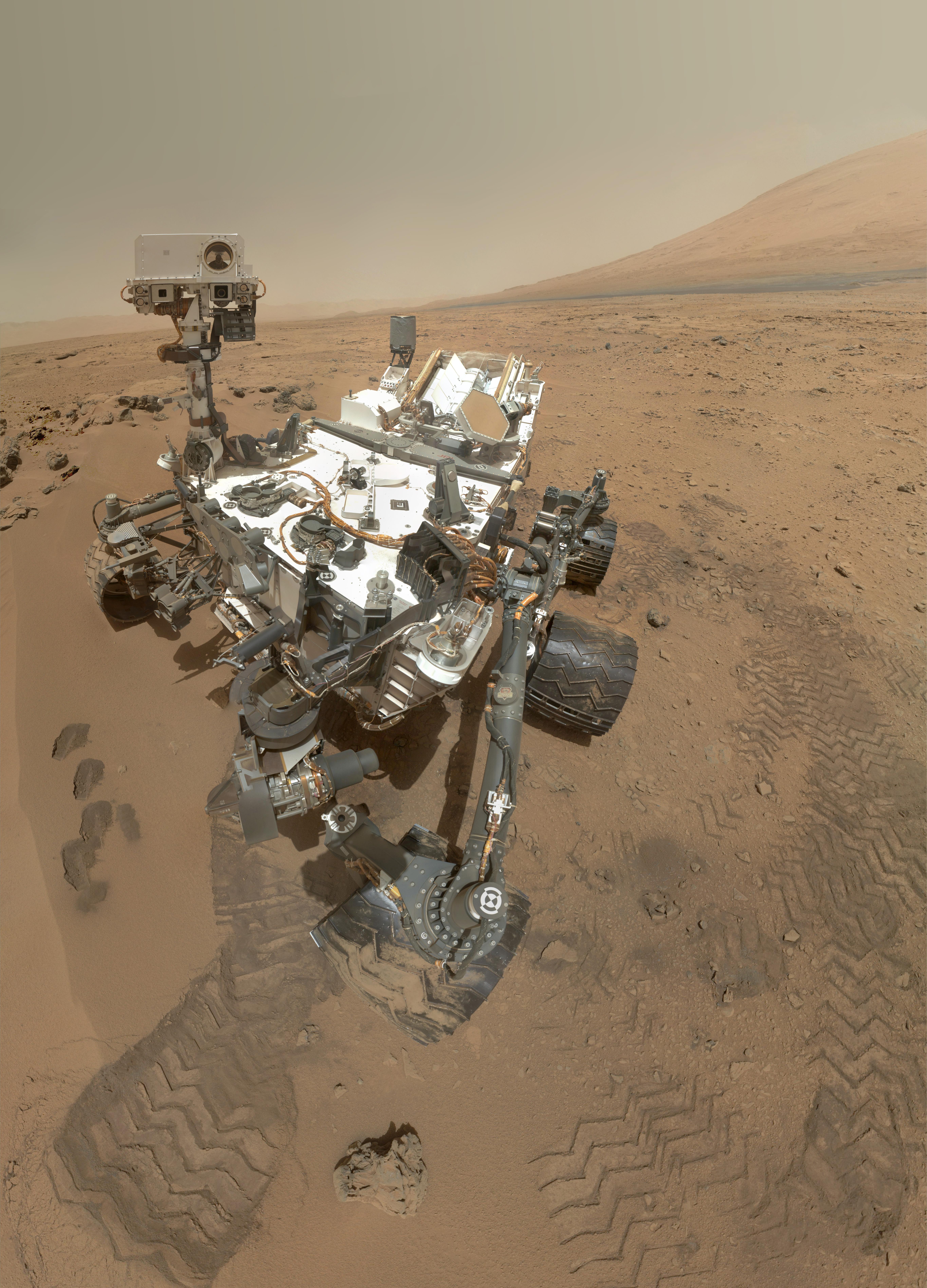
2012-11-01 |
Mars
|
Mars Science Laboratory (MSL)
|
MAHLI
|
5463x7595x3 |
|
-
PIA16239:
-
High-Resolution Self-Portrait by Curiosity Rover Arm Camera
Full Resolution:
TIFF
(124.5 MB)
JPEG
(3.831 MB)
|
|
|
2012-11-01 |
Mars
|
Mars Science Laboratory (MSL)
|
MAHLI
|
504x699x3 |
|
-
PIA16238:
-
Preliminary Self-Portrait of Curiosity by Rover's Arm Camera
Full Resolution:
TIFF
(1.057 MB)
JPEG
(45.02 kB)
|
|
|
2012-12-03 |
Mars
|
Mars Science Laboratory (MSL)
|
MAHLI
|
11119x8056x3 |
|
-
PIA16468:
-
Curiosity's 'Rocknest' Workplace
Full Resolution:
TIFF
(268.8 MB)
JPEG
(7.885 MB)
|
|
|
2012-12-03 |
Mars
|
Mars Science Laboratory (MSL)
|
MAHLI
|
1234x860x3 |
|
-
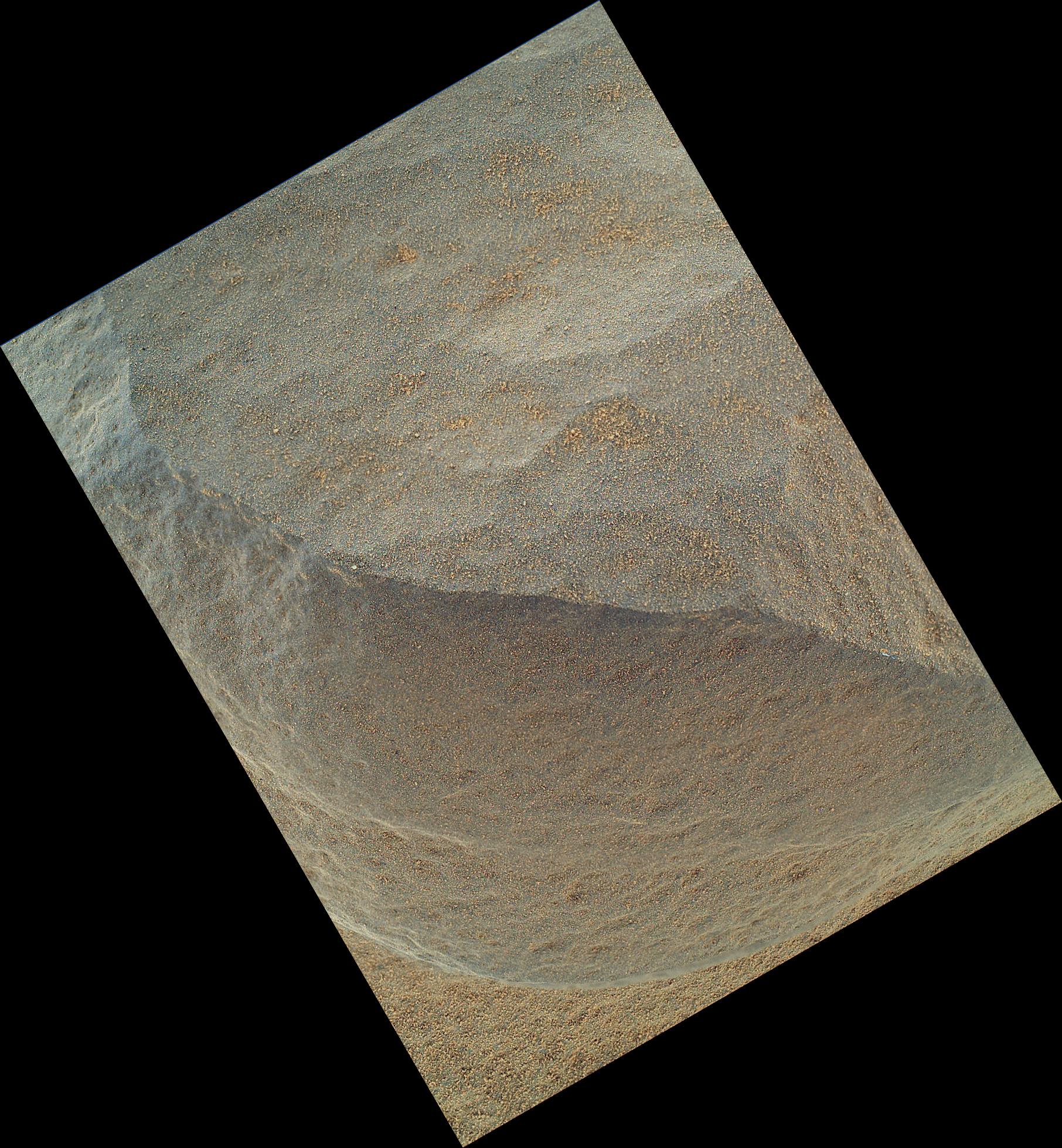
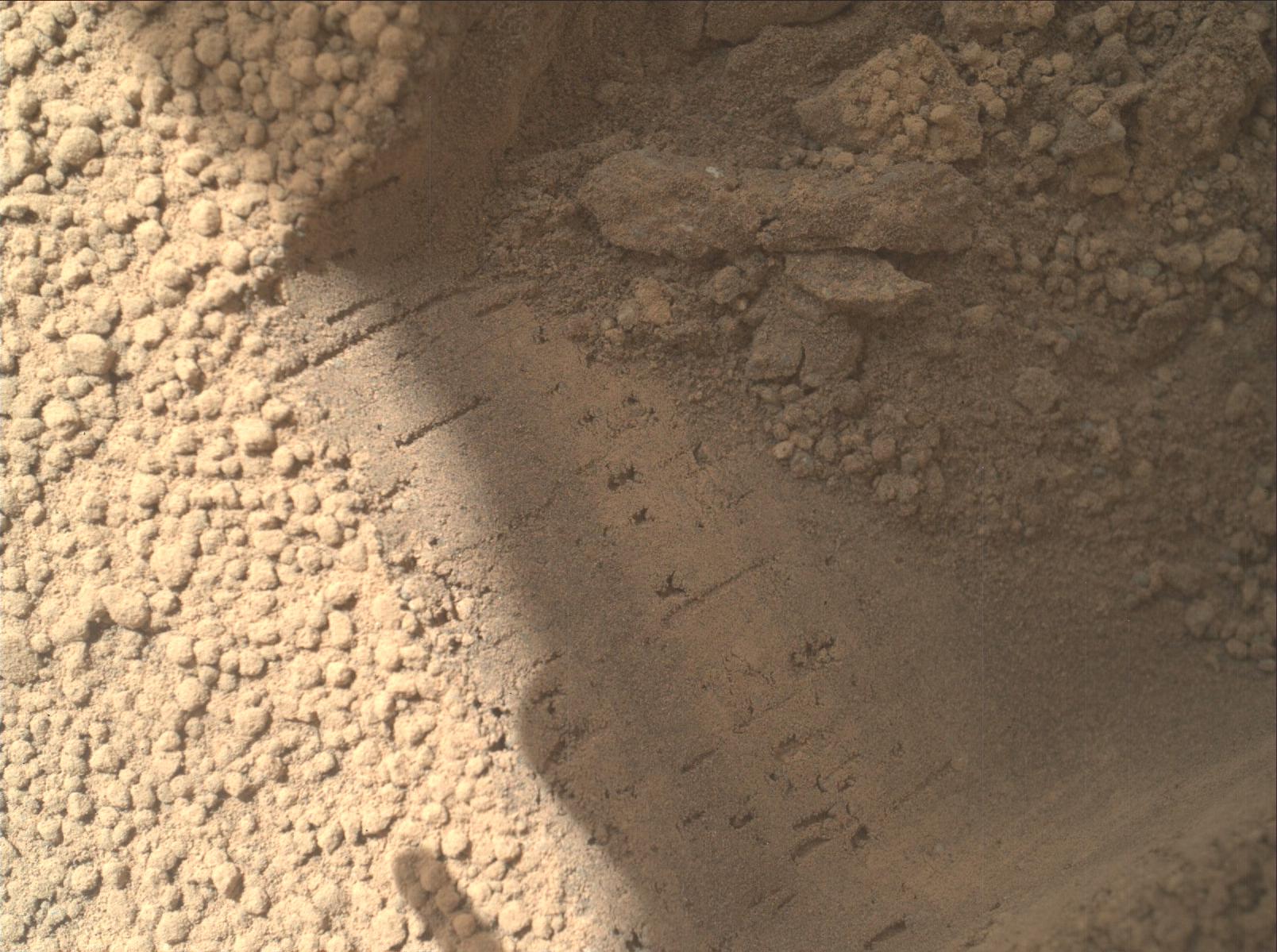
PIA16469:
-
Scoop Marks in the Sand at 'Rocknest'
Full Resolution:
TIFF
(3.185 MB)
JPEG
(319.1 kB)
|
|
|
2012-12-03 |
Mars
|
Mars Science Laboratory (MSL)
|
MAHLI
|
1248x706x3 |
|
-
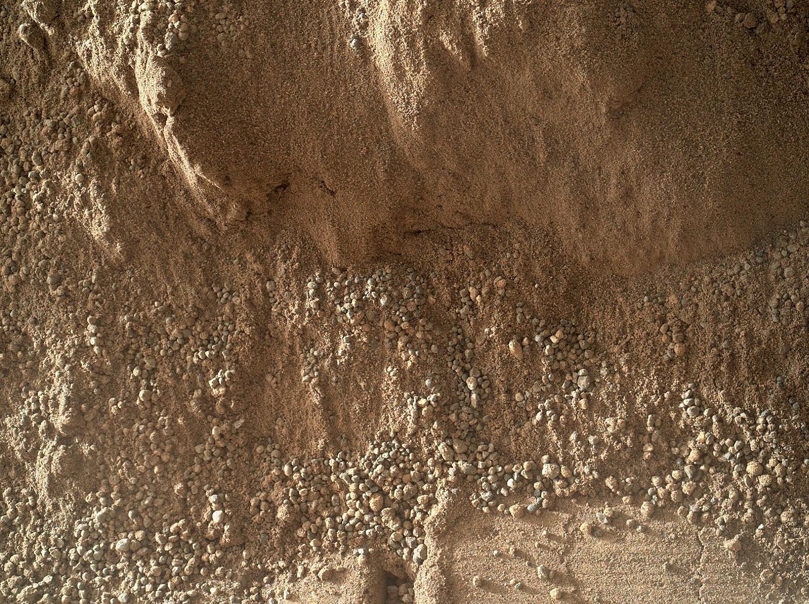
PIA16570:
-
Windblown Sand from the 'Rocknest' Drift
Full Resolution:
TIFF
(2.644 MB)
JPEG
(255.2 kB)
|
|
|
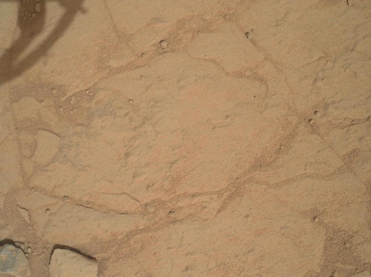
2013-01-07 |
Mars
|
Mars Science Laboratory (MSL)
|
MAHLI
|
1602x1195x3 |
|
-
PIA16565:
-
First Use of Mars Rover Curiosity's Dust Removal Tool
Full Resolution:
TIFF
(5.745 MB)
JPEG
(493.3 kB)
|
|
|
2013-01-07 |
Mars
|
Mars Science Laboratory (MSL)
|
MAHLI
|
1605x1196x3 |
|
-
PIA16566:
-
Close-up of Brushed Area on Martian Rock Target 'Ekwir_1'
Full Resolution:
TIFF
(5.761 MB)
JPEG
(619.5 kB)
|
|
|
2013-01-15 |
Mars
|
Mars Science Laboratory (MSL)
|
MAHLI
|
1182x882x3 |
|
-
PIA16619:
-
Before and After a Little Dusting
Full Resolution:
TIFF
(1.045 MB)
JPEG
(145.7 kB)
|
|
|
2013-01-24 |
Mars
|
Mars Science Laboratory (MSL)
|
MAHLI
|
1605x1195x3 |
|
-
PIA16711:
-
MAHLI's First Night Imaging of Martian Rock, White Lighting
Full Resolution:
TIFF
(5.756 MB)
JPEG
(338.6 kB)
|
|
|
2013-01-24 |
Mars
|
Mars Science Laboratory (MSL)
|
MAHLI
|
1605x1195x3 |
|
-
PIA16712:
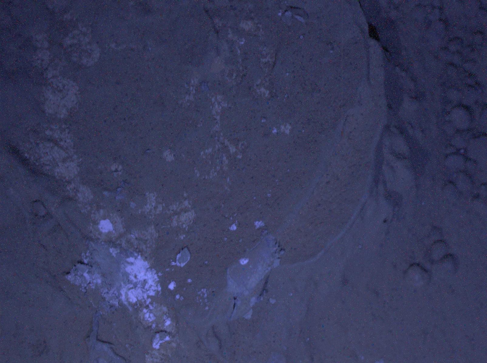
-
MAHLI's First Night Imaging of Martian Rock Under Ultraviolet Lighting
Full Resolution:
TIFF
(5.756 MB)
JPEG
(248.6 kB)
|
|
|
2013-01-24 |
Mars
|
Mars Science Laboratory (MSL)
|
MAHLI
|
1604x1195x3 |

|
-
PIA16713:
-
First Night Image of MAHLI Calibration Target in White Lighting
Full Resolution:
TIFF
(5.752 MB)
JPEG
(219.8 kB)
|
|
|
2013-01-24 |
Mars
|
Mars Science Laboratory (MSL)
|
MAHLI
|
1604x1195x3 |
|
-
PIA16714:
-
First Night Image of MAHLI Calibration Target Under Ultraviolet Lights
Full Resolution:
TIFF
(5.752 MB)
JPEG
(104.3 kB)
|
|
|
2013-02-04 |
Mars
|
Mars Science Laboratory (MSL)
|
MAHLI
|
1605x1196x3 |

|
-
PIA16717:
-
Preparatory Test for First Rock Drilling by Mars Rover Curiosity
Full Resolution:
TIFF
(5.761 MB)
JPEG
(532.8 kB)
|
|
|
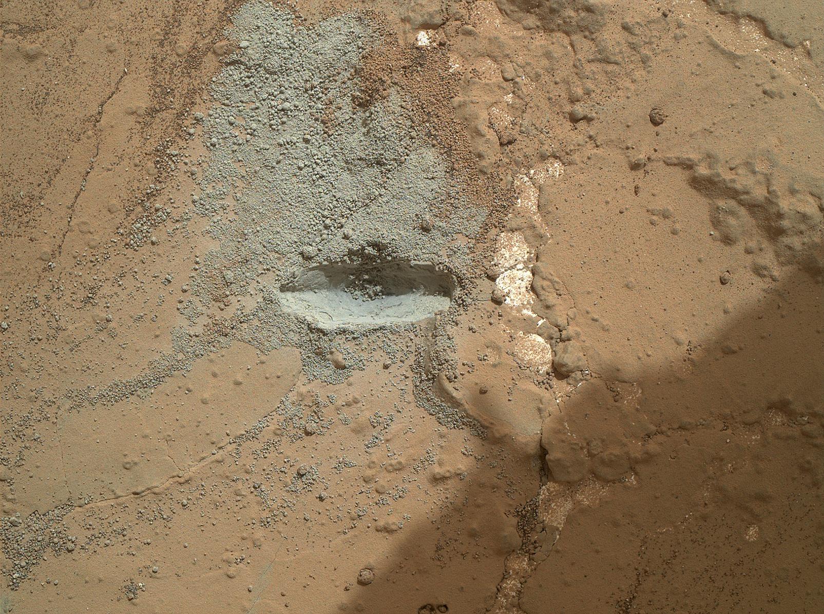
2013-02-07 |
Mars
|
Mars Science Laboratory (MSL)
|
MAHLI
|
1563x1200x3 |
|
-
PIA16760:
-
Preparatory Test of Drilling on Mars Generates Rock Powder
Full Resolution:
TIFF
(5.629 MB)
JPEG
(300 kB)
|
|
|
2013-02-07 |
Mars
|
Mars Science Laboratory (MSL)
|
MAHLI
|
1584x1184x3 |
|
-
PIA16761:
-
Close-Up After Preparatory Test of Drilling on Mars
Full Resolution:
TIFF
(5.628 MB)
JPEG
(519.8 kB)
|
|
|
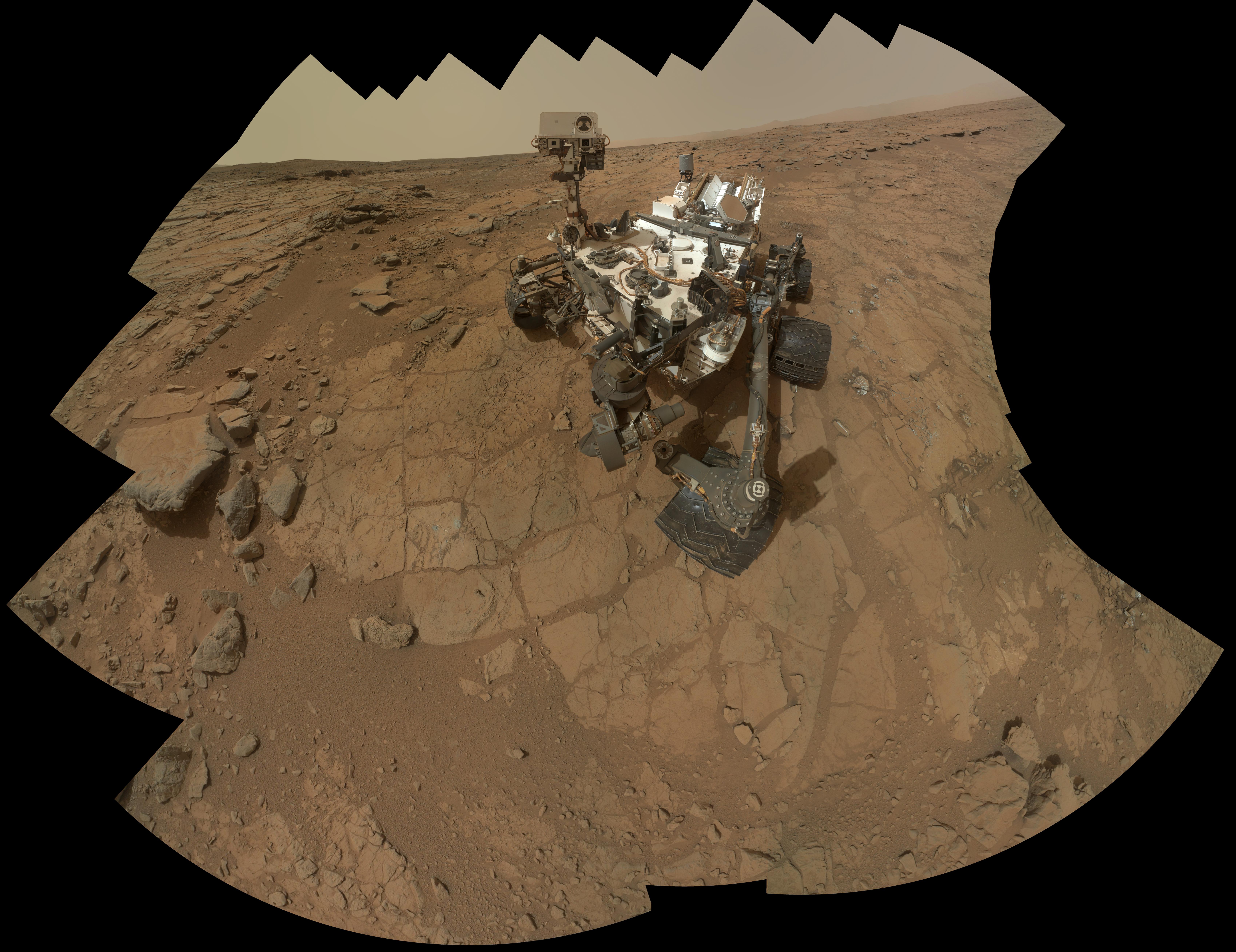
2013-02-07 |
Mars
|
Mars Science Laboratory (MSL)
|
MAHLI
|
6795x5234x3 |
|
-
PIA16763:
-
Curiosity Rover's Self Portrait at 'John Klein' Drilling Site
Full Resolution:
TIFF
(106.7 MB)
JPEG
(2.865 MB)
|
|
|
2013-02-07 |
Mars
|
Mars Science Laboratory (MSL)
|
MAHLI
|
8510x12204x3 |
|
-
PIA16764:
-
Curiosity Rover's Self Portrait at 'John Klein' Drilling Site, Cropped
Full Resolution:
TIFF
(311.7 MB)
JPEG
(6.678 MB)
|


