Your search criteria found
12723
images
Target is Mars
Go to PIAxxxxx:
Refine this list of images by:
Target:
Mars
Sun
Titan
Vesta
Mission:
2001 Mars Odyssey
Antarctic Meteorite Location and Mapping Project (AMLAMP)
Cassini-Huygens
Dawn
ExoMars
Hubble Space Telescope
InSight
MAVEN
Mariner Mars 1964 (Mariner 4)
Mariner Mars 1969 (Mariner 7)
Mariner Mars 1971 (Mariner 9)
Mars 2020
Mars 2020 Rover
Mars Atmosphere and Volatile Evolution MissioN (MAVEN)
Mars Climate Orbiter
Mars Cube One (MarCO)
Mars Exploration Rover (MER)
Mars Express (MEX)
Mars Global Surveyor (MGS)
Mars Helicopter
Mars Pathfinder (MPF)
Mars Reconnaissance Orbiter (MRO)
Mars Sample Return
Mars Sample Return (MSR)
Mars Science Laboratory (MSL)
Phoenix
Rosetta
Viking
Spacecraft:
2001 Mars Odyssey
Curiosity
Dawn
InSight Mars Lander
Ingenuity
MAVEN
MarCO-B
Mariner 4
Mariner 7
Mariner 9
Mars Climate Orbiter
Mars Express (MEX)
Mars Express (MEX) Orbiter
Mars Global Surveyor Orbiter
Mars Pathfinder Lander
Mars Pathfinder Rover
Mars Reconnaissance Orbiter (MRO)
Mars Sample Return
Mars Science Laboratory (MSL)
NASA's Mars Pathfinder Lander
Opportunity
Perseverance
Philae Lander
Phoenix Lander
Phoenix Mars Lander
Spirit
Viking Lander 1
Viking Lander 2
Viking Orbiter 1
Viking Orbiter 2
Instrument:
Alpha Particle X-ray Spectrometer
Alpha Particle X-ray Spectrometer (MSL)
Atmospheric Structure / Meteorology Instrument
CHIMRA
Camera 1
Camera 2
Chemistry & Mineralogy (CheMin)
Chemistry and Camera (ChemCam)
Comet Infrared and Visible Analyser (CIVA
Compact Reconnaissance Imaging Spectrometer for Mars (CRISM)
Context Camera (CTX)
Deep Space Network
Descent Image Motion Estimation System (DIMES)
Dynamic Albedo of Neutrons
Dynamic Albedo of Neutrons (DAN)
Gamma Ray Spectrometer - Neutron Spectrometer
Gamma Ray Spectrometer Suite
Hazard Avoidance Camera
Hazard Avoidance Camera (M2020)
Hazard Avoidance Camera (MSL)
Heat and Physical Properties Package (HP3)
High Resolution Imaging Science Experiment (HiRISE)
High Resolution Instrument (HRI)
High Resolution Stereo Camera
Imager for Mars Pathfinder
Imaging Science Subsystem
Imaging Ultraviolet Spectrograph
Imaging Ultraviolet Spectrograph (IUVS)
Instrument Context Camera (ICC)
Instrument Deployment Camera (IDC)
Lander Vision System Camera (LCAM)
Magnetometer
Mars Advanced Radar for Subsurface and Ionosphere Sounding (MARSIS)
Mars Advanced Radar for Subsurface and Ionospheric Sounding (MARSIS)
Mars Climate Sounder (MCS)
Mars Color Imager (MARCI)
Mars Descent Imager
Mars Environmental Dynamics Analyzer (MEDA)
Mars Hand Lens Imager (MAHLI)
Mars Horizon Sensor Assembly
Mars Orbiter Camera (MOC)
Mars Orbiter Laser Altimeter
Mars Radiation Experiment
Mastcam
Mastcam-Z
Microscopic Imager
Microscopy Electrochemistry and Conductivity Analyzer (MECA)
Miniature Thermal Emission Spectrometer
Moessbauer Spectrometer
Navigation Camera
Navigation Camera (M2020)
Navigation Camera (MSL)
Neutral Gas and Ion Mass Spectrometer
Neutron Spectrometer
Optical Microscope
Panoramic Camera
Planetary Instrument for X-ray Lithochemistry (PIXL)
Radar System
Radiation Assessment Detector (RAD)
Radio Science Subsystem
Robotic Arm
Robotic Arm (MSL)
Robotic Arm Camera (RAC)
Rock Abrasion Tool (RAT)
Rover Cameras
Rover Environmental Monitoring Station (REMS)
Sample Analysis at Mars (SAM)
Scanning Habitable Environments with Raman & Luminescence for Organics and Chemicals (SHERLOC)
Seismic Experiment for Interior Structure (SEIS)
Shallow Subsurface Radar (SHARAD)
Stereo Imager (SSI)
SuperCam
Surface Stereo Imager (SSI)
Thermal Emission Imaging System
Thermal Emission Spectrometer
Thermal and Electrical Conductivity Probe
Thermal and Evolved Gas Analyzer
Trace Gas Orbiter
Visual Imaging Subsystem
Visual Imaging Subsystem - Camera A
Visual Imaging Subsystem - Camera B
Wide Field Planetary Camera 2
Click on an image for detailed information
Click on a column heading to sort in ascending or descending order
My
List
Addition Date
Target
Mission
Instrument
Size
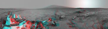
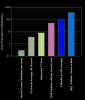
2013-04-08
Mars
Mars Science Laboratory (MSL)
REMS
831x637x3
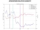
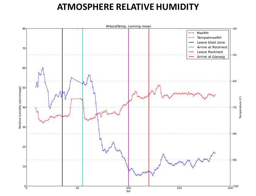
PIA16915:
Humidity in Gale Crater: Scant and Variable
Full Resolution:
TIFF
(1.589 MB)
JPEG
(46.41 kB)
2013-04-08
Mars
Mars Science Laboratory (MSL)
DAN
1312x902x3
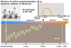
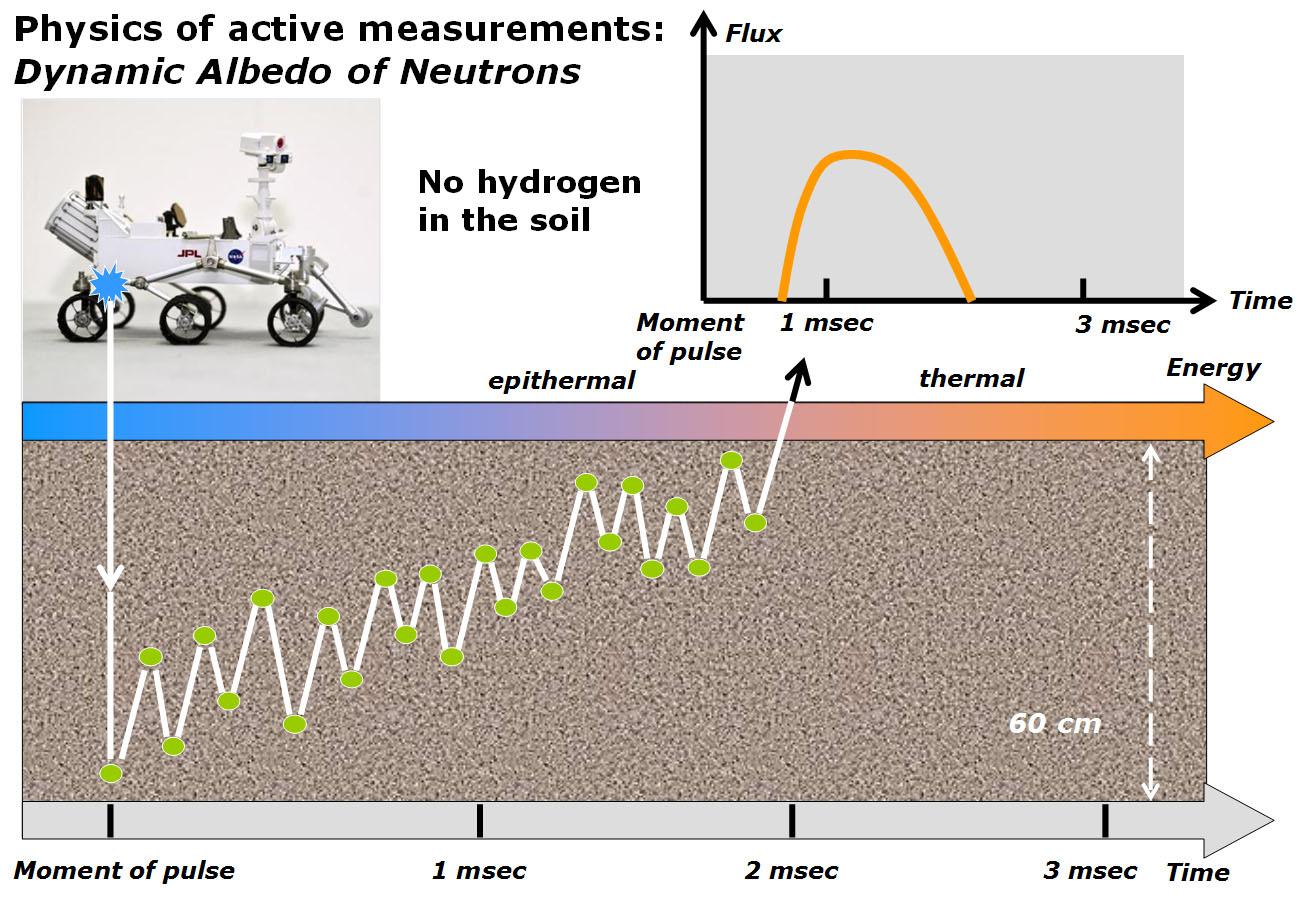
PIA16916:
Physics of How DAN on Curiosity Checks for Water, Part 1
Full Resolution:
TIFF
(3.552 MB)
JPEG
(195.2 kB)
2013-04-08
Mars
Mars Science Laboratory (MSL)
DAN
1312x902x3
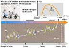
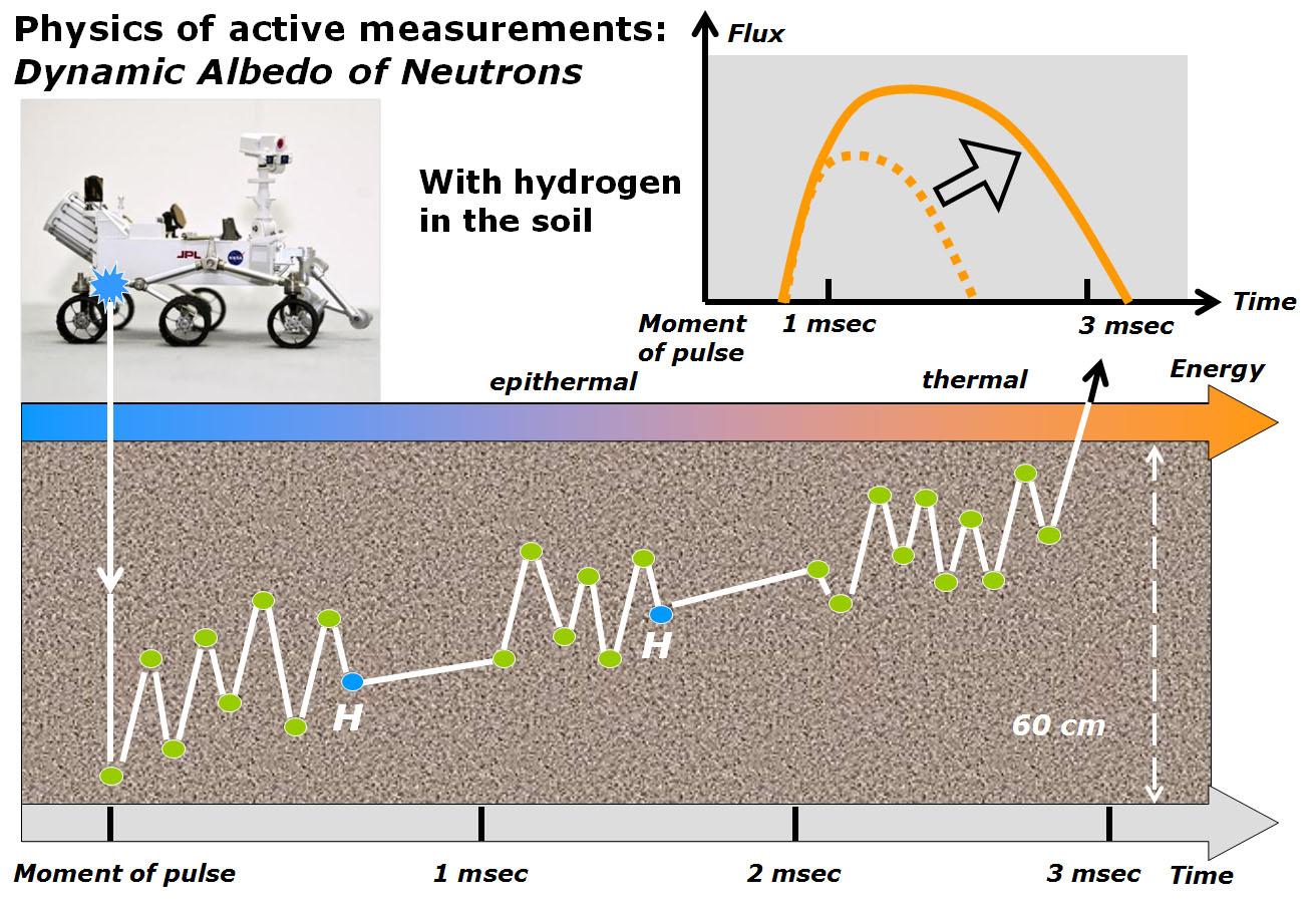
PIA16917:
Physics of How DAN on Curiosity Checks for Water, Part 2
Full Resolution:
TIFF
(3.552 MB)
JPEG
(200.8 kB)
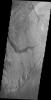
2013-04-08
Mars
2001 Mars Odyssey
THEMIS
1373x3064x1
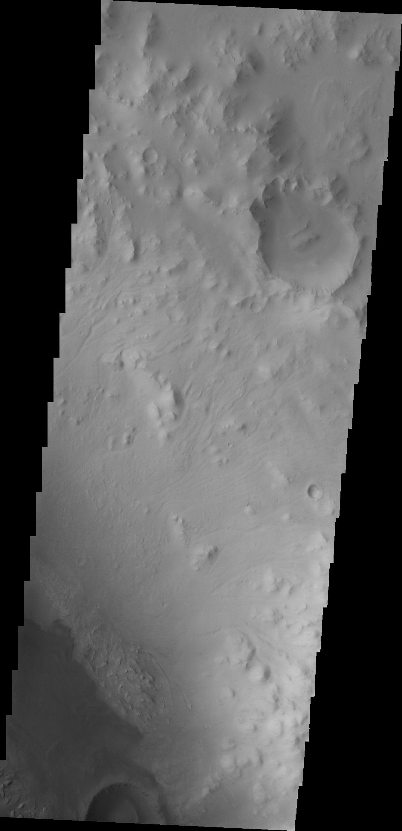
PIA16242:
Images of Gale #4
Full Resolution:
TIFF
(4.212 MB)
JPEG
(317.6 kB)
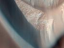
2013-04-09
Mars
2001 Mars Odyssey
THEMIS
1330x2773x1
PIA16243:
Images of Gale #5
Full Resolution:
TIFF
(3.692 MB)
JPEG
(342.9 kB)
2013-04-10
Mars
2001 Mars Odyssey
THEMIS
1352x2922x1
PIA16244:
Images of Gale #6
Full Resolution:
TIFF
(3.955 MB)
JPEG
(199.5 kB)
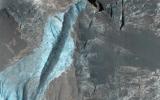
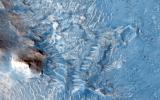
2013-04-10
Mars
Mars Reconnaissance Orbiter (MRO)
HiRISE
2560x1920x3
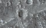
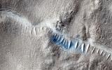
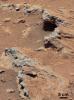
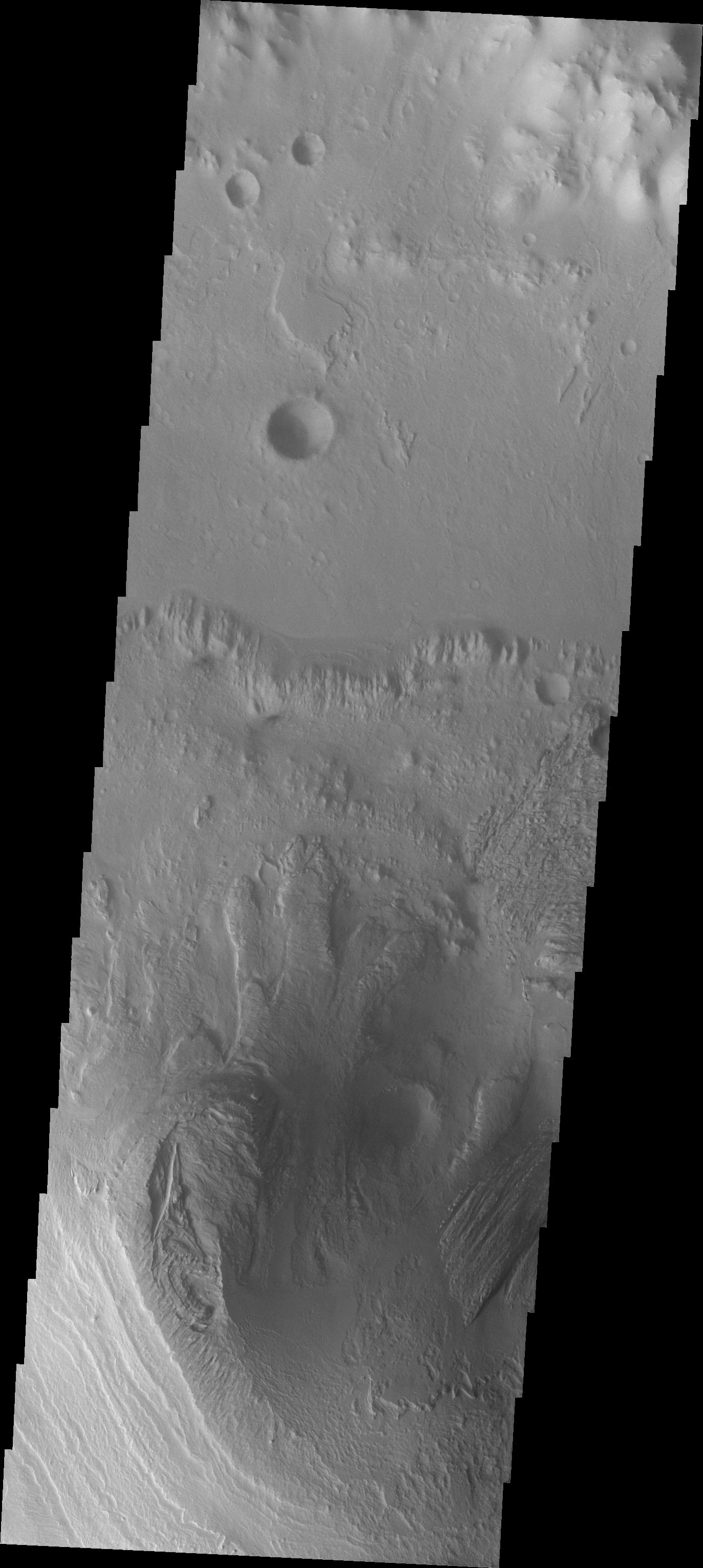
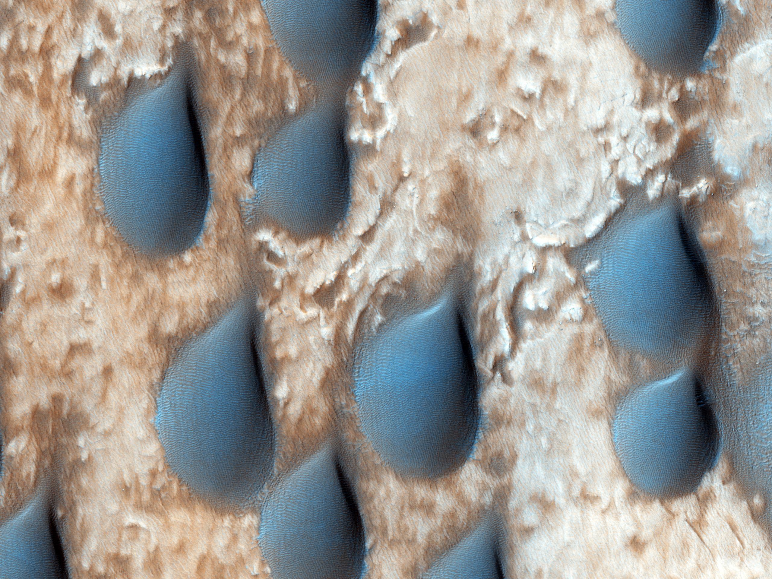
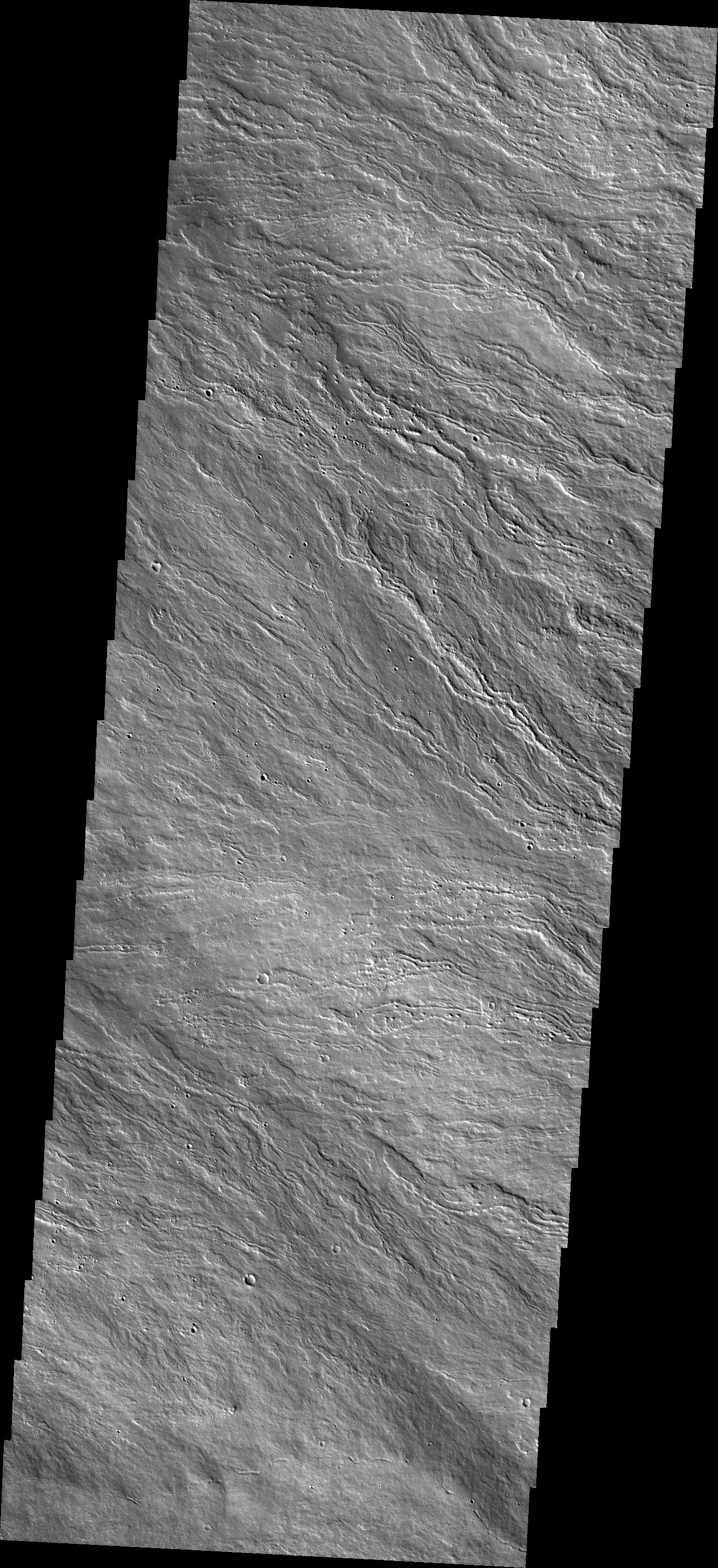
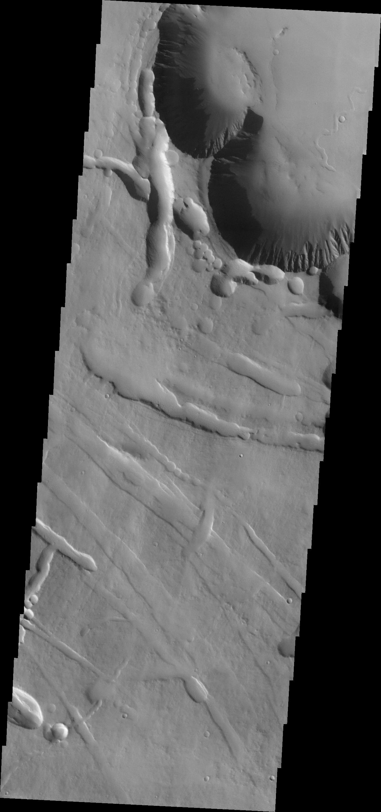
PIA17877:
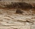
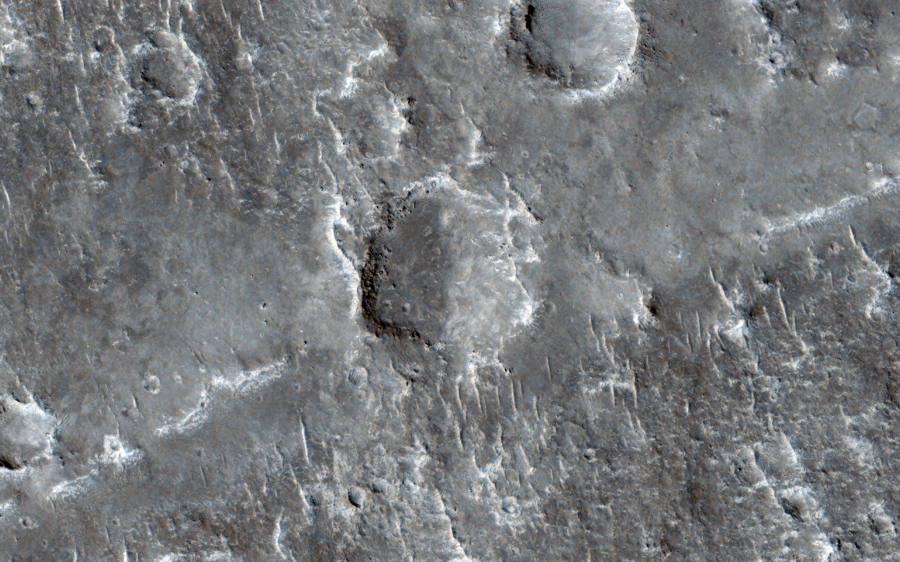
Megabreccia on the Floor of an Impact Crater
Full Resolution:
TIFF
(14.75 MB)
JPEG
(747.9 kB)
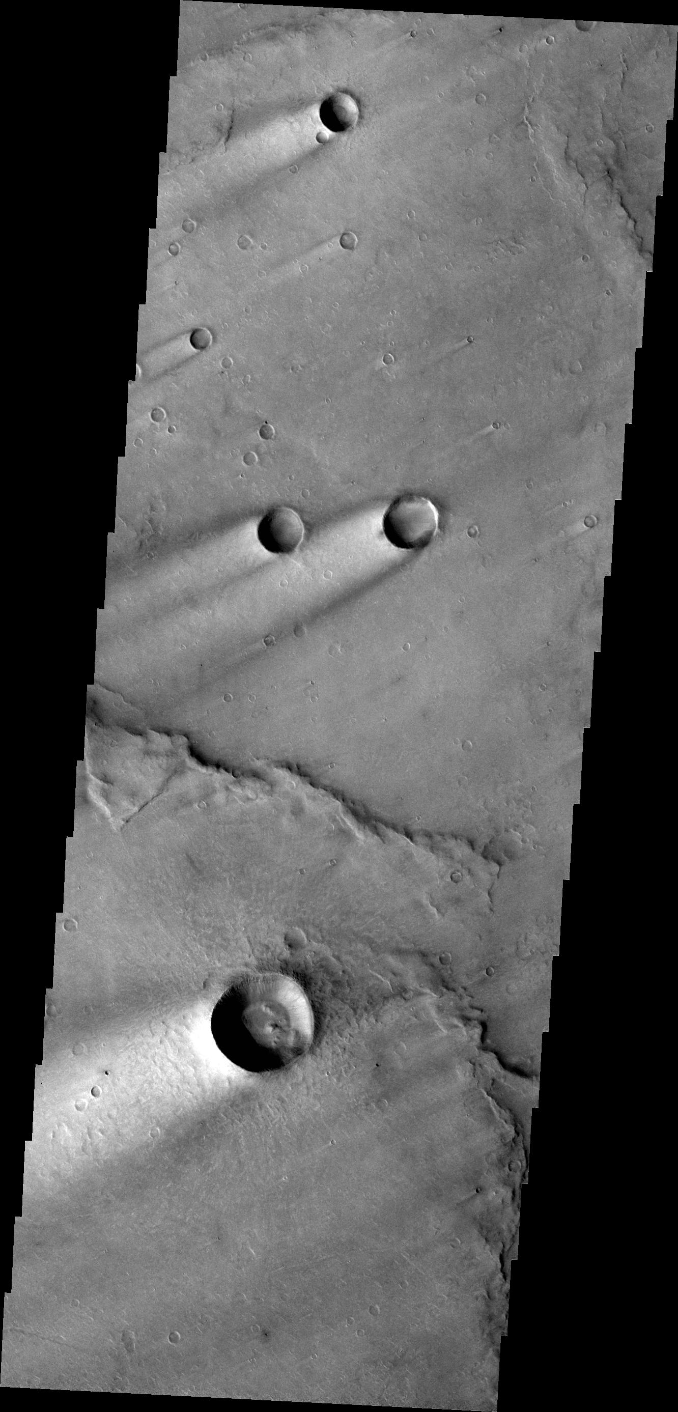
2013-04-10
Mars
Mars Reconnaissance Orbiter (MRO)
HiRISE
2560x1920x3
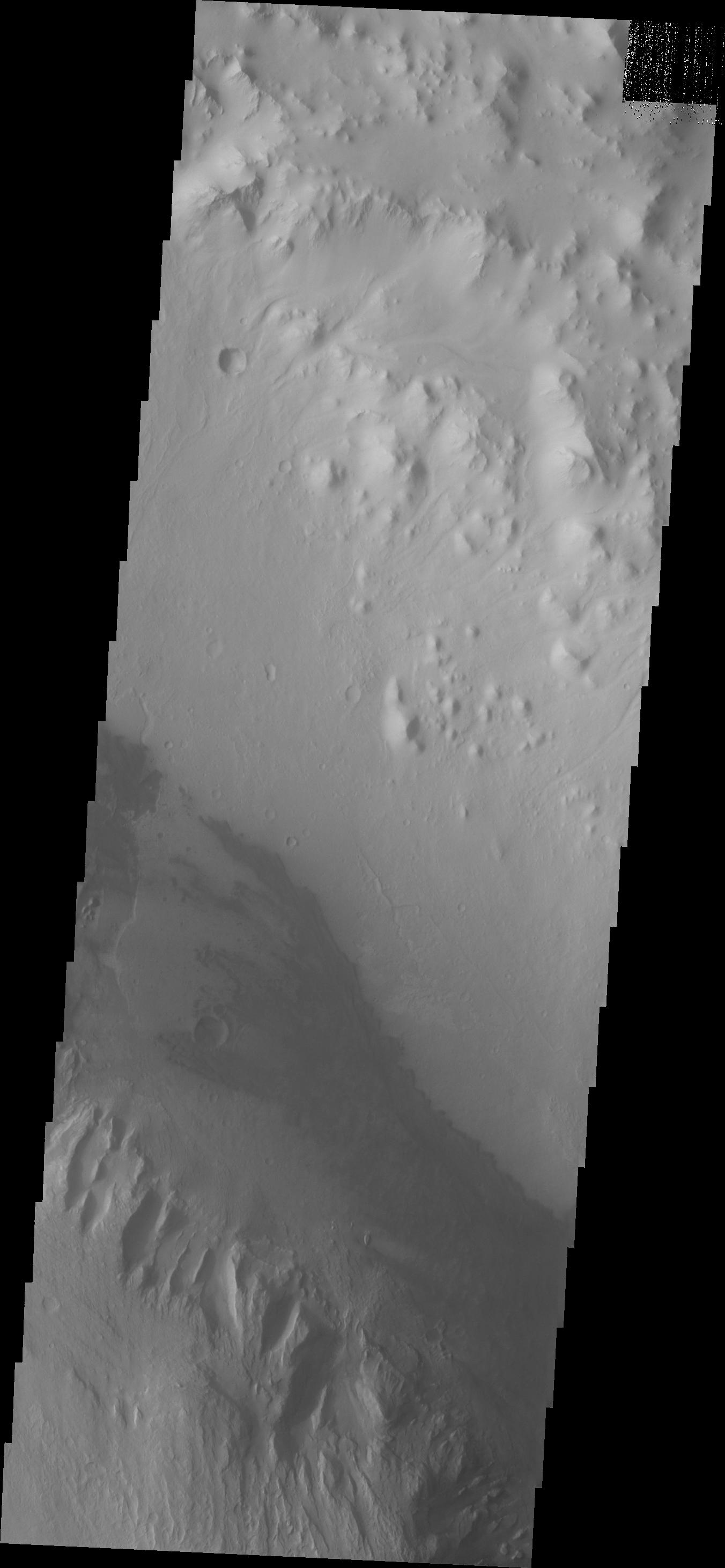
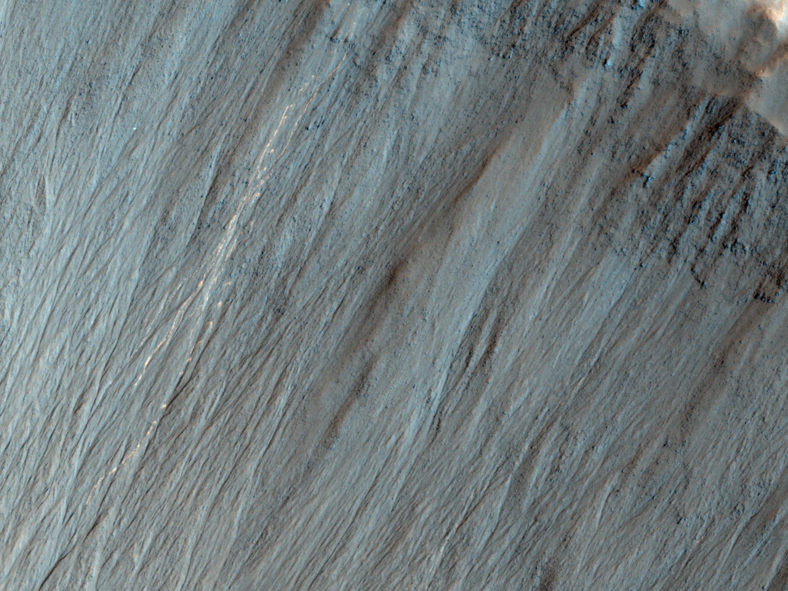
PIA17878:
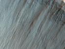
Bright Tracks from Bouncing and Rolling Boulders
Full Resolution:
TIFF
(14.75 MB)
JPEG
(905 kB)
2013-04-10
Mars
Mars Reconnaissance Orbiter (MRO)
HiRISE
2560x1920x3
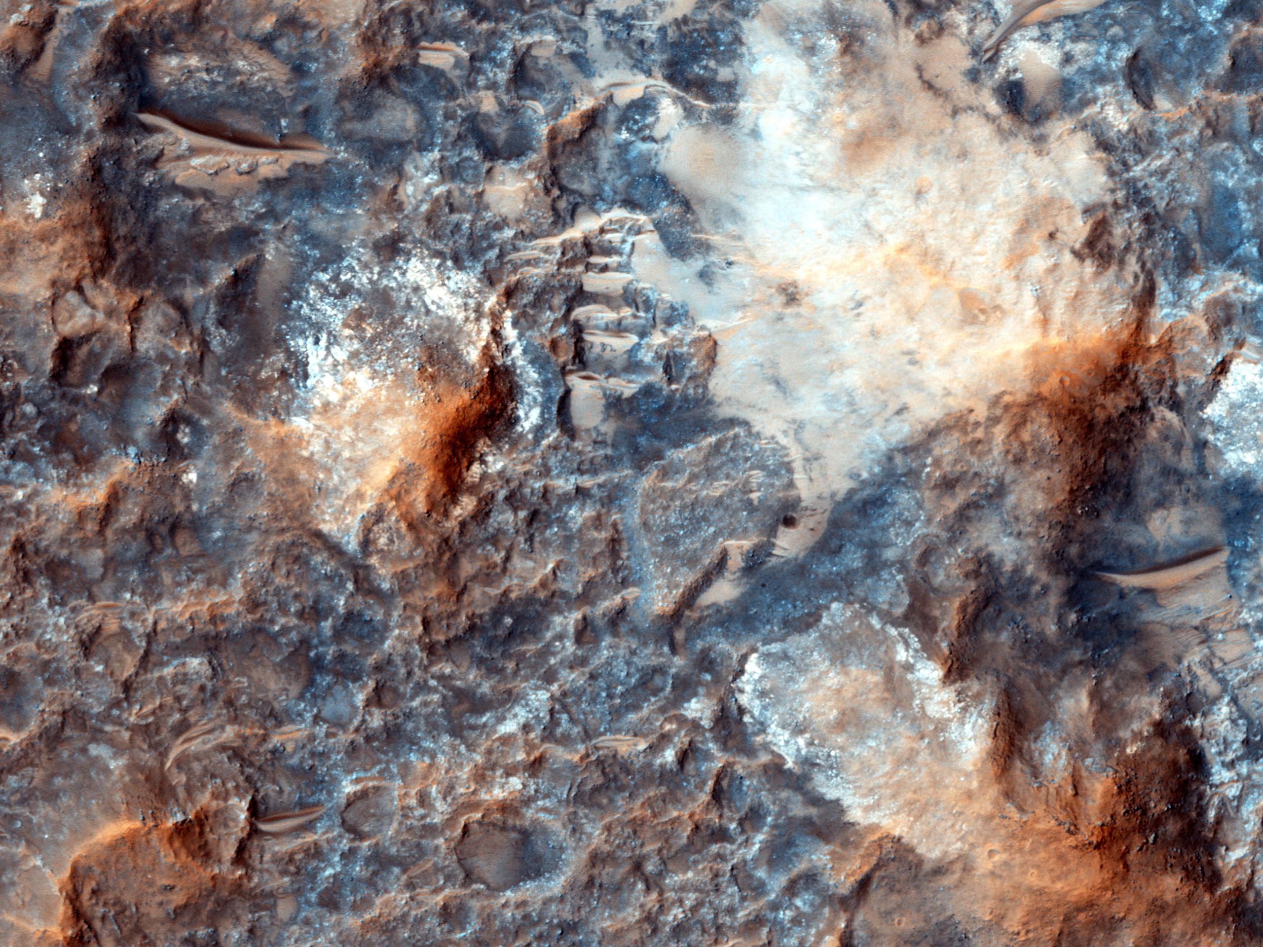
PIA17879:
Raindrops of Sand in Copernicus Crater
Full Resolution:
TIFF
(14.75 MB)
JPEG
(787.4 kB)
2013-04-10
Mars
Mars Reconnaissance Orbiter (MRO)
HiRISE
2560x1920x3
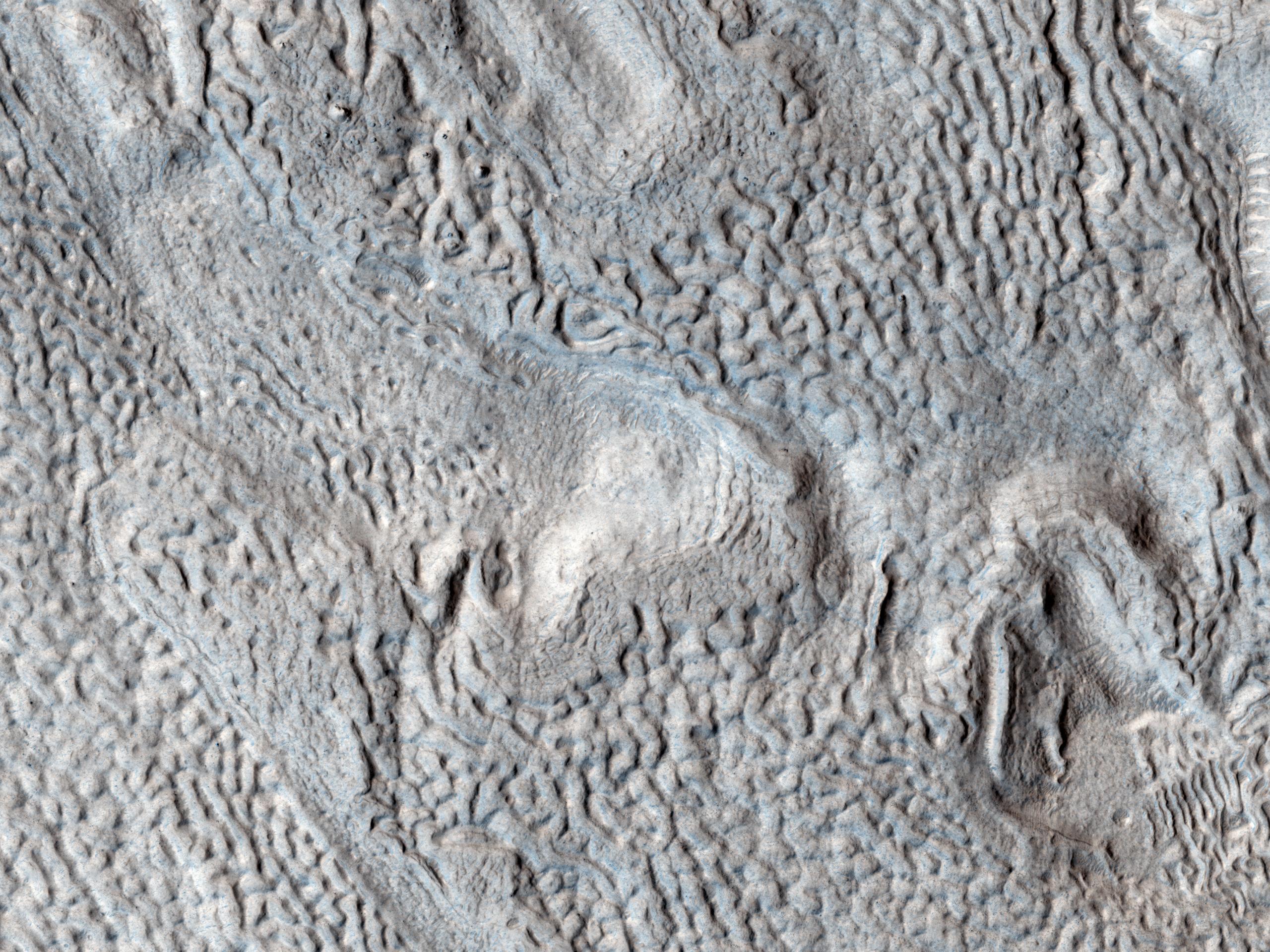
PIA17880:
Ridges and Grooves That Wave and Buckle on a Valley Floor
Full Resolution:
TIFF
(14.75 MB)
JPEG
(905.8 kB)
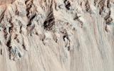
2013-04-11
Mars
2001 Mars Odyssey
THEMIS
1345x2777x1
PIA16245:
Images of Gale #7
Full Resolution:
TIFF
(3.739 MB)
JPEG
(169.9 kB)
2013-04-11
Mars
Mars Reconnaissance Orbiter (MRO)
HiRISE
3505x1786x3
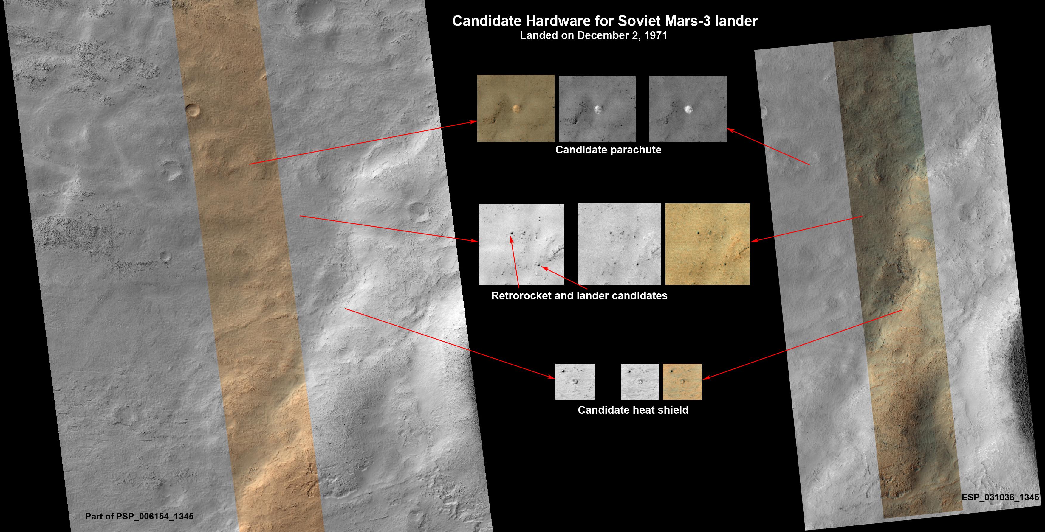
PIA16920:
Could This Be the Mars Soviet 3 Lander?
Full Resolution:
TIFF
(18.79 MB)
JPEG
(727.8 kB)
2013-04-12
Mars
2001 Mars Odyssey
THEMIS
1335x2926x1
PIA16960:
Images of Gale #8
Full Resolution:
TIFF
(3.91 MB)
JPEG
(172.4 kB)
2013-04-12
Mars
Mars Science Laboratory (MSL)
ChemCam
Navcam (MSL)
910x675x3
PIA16922:
Accurate Pointing by Curiosity
Full Resolution:
TIFF
(1.844 MB)
JPEG
(105 kB)
2013-04-12
Mars
Mars Exploration Rover (MER)
Navigation Camera
1059x922x1
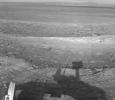
PIA16923:
Opportunity's Shadow and Endeavour Crater Vista
Full Resolution:
TIFF
(977.7 kB)
JPEG
(120.5 kB)
2013-04-15
Mars
2001 Mars Odyssey
THEMIS
1396x2793x1
PIA16961:
Images of Gale #9
Full Resolution:
TIFF
(3.904 MB)
JPEG
(277.4 kB)
2013-04-16
Mars
2001 Mars Odyssey
THEMIS
1322x2780x1
PIA16962:
Images of Gale #10
Full Resolution:
TIFF
(3.679 MB)
JPEG
(237.3 kB)
2013-04-16
Mars
Mars Exploration Rover (MER)
Navigation Camera
5076x1157x3
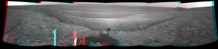
PIA16924:
Opportunity Overlooking Endeavour Crater, Stereo View
Full Resolution:
TIFF
(17.63 MB)
JPEG
(764.1 kB)
2013-04-17
Mars
2001 Mars Odyssey
THEMIS
1403x3230x1
PIA16963:
Images of Gale #11
Full Resolution:
TIFF
(4.537 MB)
JPEG
(310.5 kB)
2013-04-18
Mars
2001 Mars Odyssey
THEMIS
1473x2804x1
PIA16964:
Images of Gale #12
Full Resolution:
TIFF
(4.135 MB)
JPEG
(380.1 kB)
2013-04-19
Mars
2001 Mars Odyssey
THEMIS
1380x3059x1
PIA16965:
Images of Gale #13
Full Resolution:
TIFF
(4.227 MB)
JPEG
(290.3 kB)
2013-04-22
Mars
2001 Mars Odyssey
THEMIS
1381x3057x1
PIA16966:
Images of Gale #14
Full Resolution:
TIFF
(4.227 MB)
JPEG
(185.3 kB)
2013-04-23
Mars
2001 Mars Odyssey
THEMIS
1460x2794x1
PIA16967:
Images of Gale #15
Full Resolution:
TIFF
(4.084 MB)
JPEG
(287 kB)
2013-04-23
Mars
Mars Science Laboratory (MSL)
Navcam (MSL)
7824x3328x3
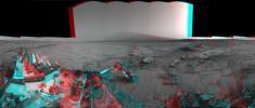
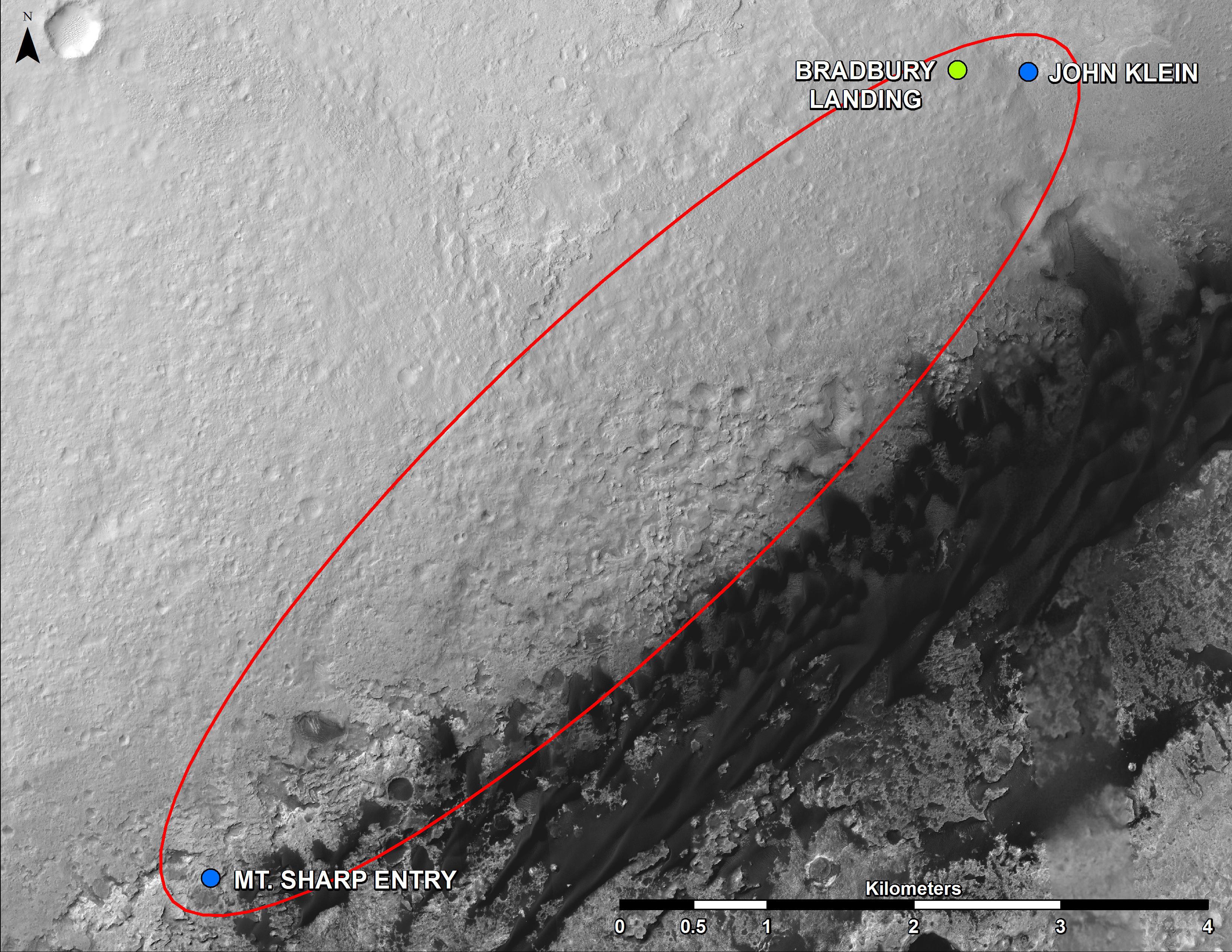
PIA16847:
Mars Stereo View from "John Klein" to Mount Sharp (Raw)
Full Resolution:
TIFF
(78.14 MB)
JPEG
(2.325 MB)
2013-04-23
Mars
Mars Science Laboratory (MSL)
Navcam (MSL)
7824x2131x3
PIA16925:
Mars Stereo View from "John Klein" to Mount Sharp
Full Resolution:
TIFF
(50.04 MB)
JPEG
(1.804 MB)
2013-04-24
Mars
2001 Mars Odyssey
THEMIS
1429x2794x1
PIA16968:
Images of Gale #16
Full Resolution:
TIFF
(3.997 MB)
JPEG
(335.2 kB)
2013-04-25
Mars
2001 Mars Odyssey
THEMIS
1375x3059x1
PIA16969:
Images of Gale #17
Full Resolution:
TIFF
(4.211 MB)
JPEG
(341.1 kB)
2013-04-26
Mars
2001 Mars Odyssey
THEMIS
1347x2778x1
PIA16970:
Images of Gale #18
Full Resolution:
TIFF
(3.746 MB)
JPEG
(303.8 kB)
2013-04-29
Mars
2001 Mars Odyssey
THEMIS
1334x2774x1
PIA16971:
Images of Gale #19
Full Resolution:
TIFF
(3.704 MB)
JPEG
(202.7 kB)
2013-04-30
Mars
2001 Mars Odyssey
THEMIS
1395x3234x1
PIA16972:
Images of Gale #20
Full Resolution:
TIFF
(4.517 MB)
JPEG
(237.1 kB)
2013-05-01
Mars
2001 Mars Odyssey
THEMIS
1337x2775x1
PIA16973:
V38546002
Full Resolution:
TIFF
(3.714 MB)
JPEG
(194.9 kB)
2013-05-01
Mars
Mars Reconnaissance Orbiter (MRO)
HiRISE
2560x1920x3
PIA17869:
Olivine-Bearing Dune Fields and Wall Rock in Coprates Chasma
Full Resolution:
TIFF
(14.75 MB)
JPEG
(884.9 kB)
2013-05-01
Mars
Mars Reconnaissance Orbiter (MRO)
HiRISE
2880x1800x1
PIA17870:
Watch for Falling Rocks!
Full Resolution:
TIFF
(5.191 MB)
JPEG
(428.7 kB)
2013-05-01
Mars
Mars Reconnaissance Orbiter (MRO)
HiRISE
2880x1800x3
PIA17871:
Mystery Martian Morphology of the Month
Full Resolution:
TIFF
(15.56 MB)
JPEG
(744.8 kB)
2013-05-01
Mars
Mars Reconnaissance Orbiter (MRO)
HiRISE
2880x1800x3
PIA17872:
Sedimentary Bedrock Diversity in Terby Crater
Full Resolution:
TIFF
(15.56 MB)
JPEG
(662.3 kB)
2013-05-02
Mars
2001 Mars Odyssey
THEMIS
1337x2775x1
PIA16974:
Images of Gale #21
Full Resolution:
TIFF
(3.714 MB)
JPEG
(194.9 kB)
2013-05-03
Mars
2001 Mars Odyssey
THEMIS
1335x2773x1
PIA16975:
Images of Gale #22
Full Resolution:
TIFF
(3.706 MB)
JPEG
(215.3 kB)
2013-05-06
Mars
2001 Mars Odyssey
THEMIS
1491x2806x1
PIA16976:
Images of Gale #23
Full Resolution:
TIFF
(4.188 MB)
JPEG
(238.9 kB)
2013-05-07
Mars
2001 Mars Odyssey
THEMIS
1414x2793x1
PIA16977:
Images of Gale #24
Full Resolution:
TIFF
(3.954 MB)
JPEG
(259.6 kB)
2013-05-08
Mars
2001 Mars Odyssey
THEMIS
1318x2917x1
PIA16978:
Images of Gale #25
Full Resolution:
TIFF
(3.849 MB)
JPEG
(257.5 kB)
2013-05-09
Mars
2001 Mars Odyssey
THEMIS
1333x2774x1
PIA16979:
Images of Gale #26
Full Resolution:
TIFF
(3.702 MB)
JPEG
(242.7 kB)
2013-05-09
Mars
Mars Science Laboratory (MSL)
HiRISE
3300x2550x3
PIA16926:
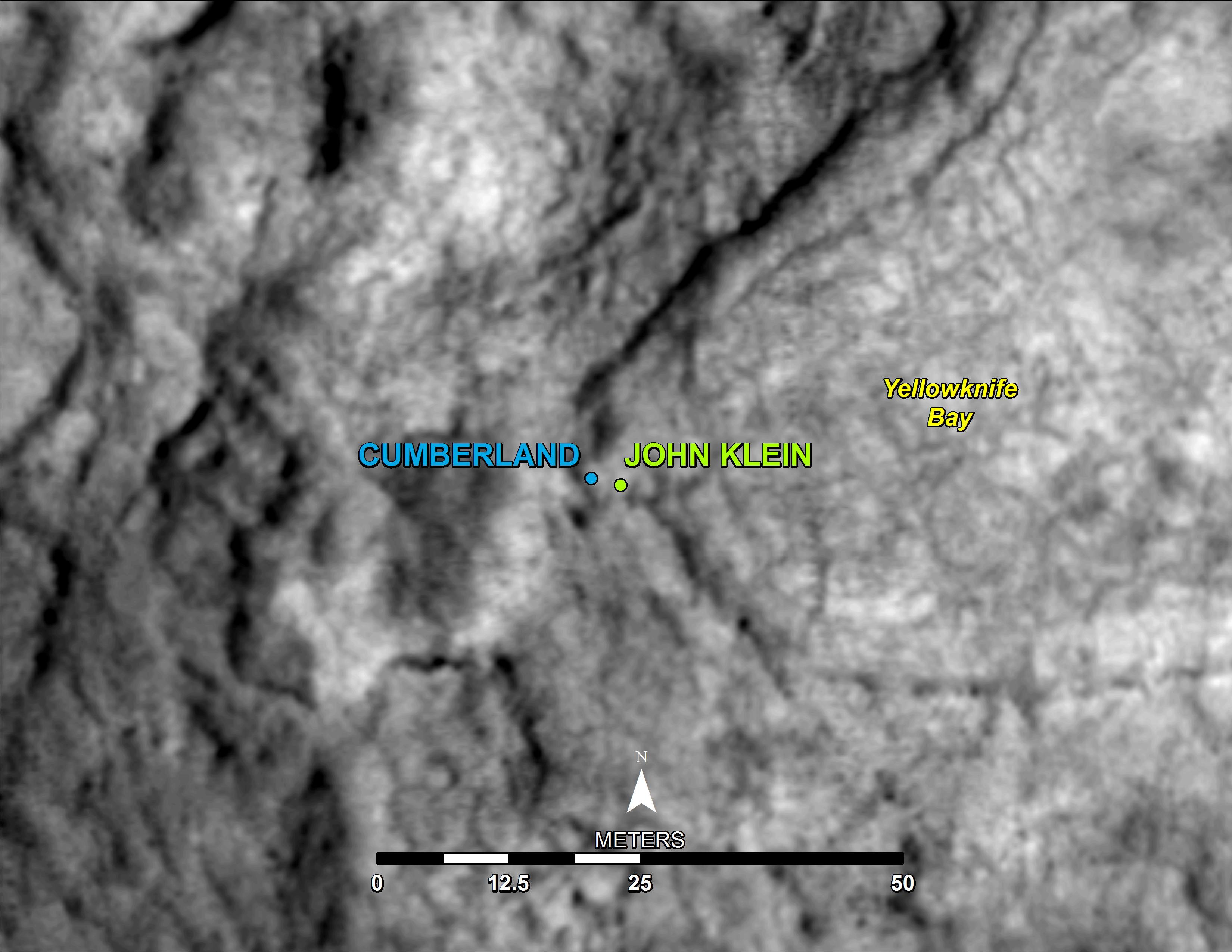
'Cumberland' Selected as Curiosity's Second Drilling Target
Full Resolution:
TIFF
(25.26 MB)
JPEG
(495.3 kB)
2013-05-09
Mars
Mars Science Laboratory (MSL)
Mastcam
3894x3322x3
PIA16927:
'Cumberland' Target for Drilling by Curiosity Mars Rover
Full Resolution:
TIFF
(38.82 MB)
JPEG
(1.899 MB)
2013-05-10
Mars
2001 Mars Odyssey
THEMIS
1343x2925x1
PIA16981:
Images of Gale #27
Full Resolution:
TIFF
(3.932 MB)
JPEG
(239.3 kB)
2013-05-10
Mars
Mars Exploration Rover (MER)
Hazcam
2048x1024x1
PIA16814:
Sky Gets Dustier Between Opportunity's Sols 3296 and 3301
Full Resolution:
TIFF
(2.099 MB)
JPEG
(128.4 kB)
2013-05-13
Mars
2001 Mars Odyssey
THEMIS
1328x2776x1
PIA16982:
Images of Gale #28
Full Resolution:
TIFF
(3.69 MB)
JPEG
(230.4 kB)
2013-05-14
Mars
2001 Mars Odyssey
THEMIS
1362x2787x1
PIA16983:
Images of Gale #29
Full Resolution:
TIFF
(3.8 MB)
JPEG
(314.2 kB)
2013-05-15
Mars
2001 Mars Odyssey
THEMIS
1390x3227x1
PIA16984:
Images of Gale #30
Full Resolution:
TIFF
(4.491 MB)
JPEG
(302.5 kB)
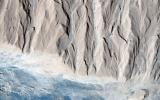
2013-05-15
Mars
Mars Reconnaissance Orbiter (MRO)
HiRISE
2880x1800x3
PIA17726:
Polygonal Dunes
Full Resolution:
TIFF
(15.56 MB)
JPEG
(686.3 kB)
2013-05-15
Mars
Mars Reconnaissance Orbiter (MRO)
HiRISE
2880x1800x3
PIA17727:
Seasonal Flows in Palikir Crater
Full Resolution:
TIFF
(15.56 MB)
JPEG
(926.5 kB)
2013-05-15
Mars
Mars Reconnaissance Orbiter (MRO)
HiRISE
2880x1800x3
PIA17728:
Dust Devil Tracks and Slope Streaks on Martian Sand Dunes
Full Resolution:
TIFF
(15.56 MB)
JPEG
(599.8 kB)
2013-05-15
Mars
Mars Reconnaissance Orbiter (MRO)
HiRISE
2880x1800x3
PIA17729:
A Possible Landing Site for NASA's InSight Mission
Full Resolution:
TIFF
(15.56 MB)
JPEG
(1.028 MB)
2013-05-15
Mars
Mars Reconnaissance Orbiter (MRO)
CTX
HiRISE
1253x1822x3
PIA16928:
Fresh Cluster of Impact Craters on Mars
Full Resolution:
TIFF
(6.852 MB)
JPEG
(311.5 kB)
2013-05-16
Mars
2001 Mars Odyssey
THEMIS
1335x2774x1
PIA16985:
Images of Gale #31
Full Resolution:
TIFF
(3.707 MB)
JPEG
(310.5 kB)
2013-05-16
Mars
Mars Science Laboratory (MSL)
Hazcam (MSL)
1024x1024x1
PIA16932:
Curiosity at 'Cumberland'
Full Resolution:
TIFF
(1.05 MB)
JPEG
(140.1 kB)
2013-05-16
Mars
Mars Exploration Rover (MER)
Hazcam
1024x1024x1
PIA16933:
View Back at Record-Setting Drive by Opportunity
Full Resolution:
TIFF
(1.05 MB)
JPEG
(67.02 kB)
2013-05-17
Mars
2001 Mars Odyssey
THEMIS
1329x2776x1
PIA16986:
Images of Gale #32
Full Resolution:
TIFF
(3.693 MB)
JPEG
(298.3 kB)
2013-05-17
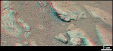
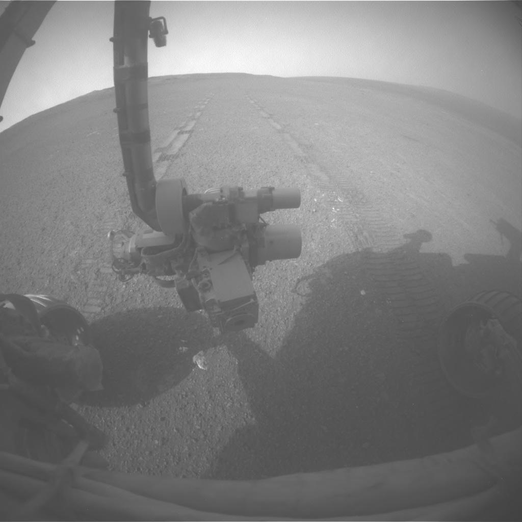
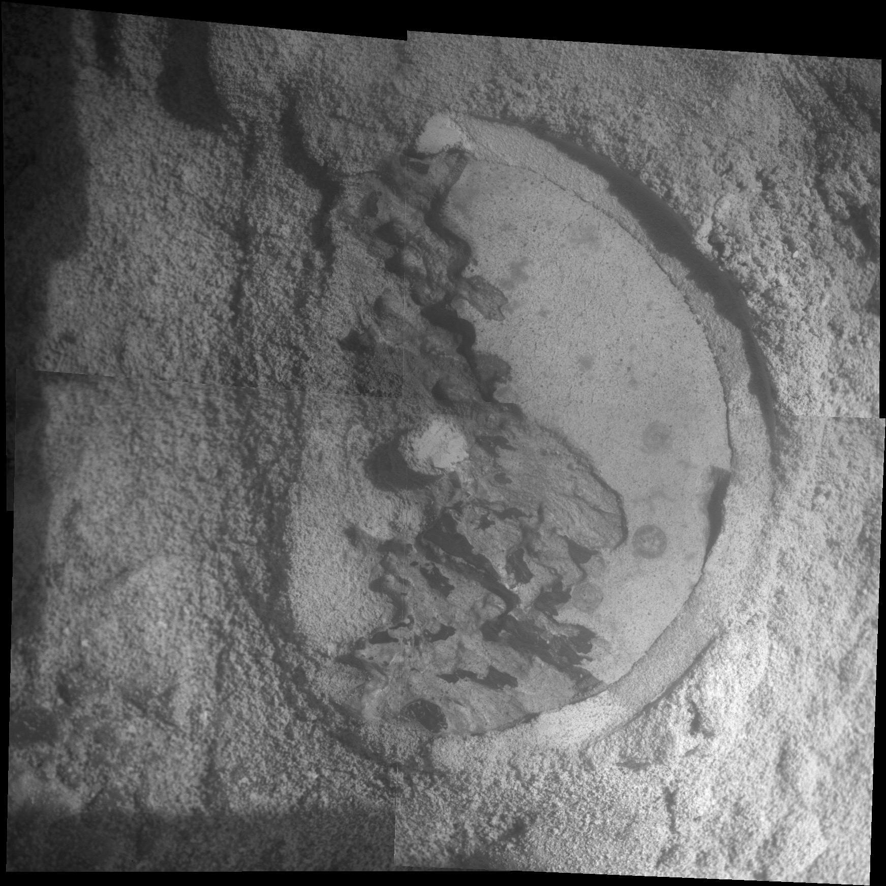
Mars
Mars Exploration Rover (MER)
Microscopic Imager
1743x1743x1
PIA16929:
Close-Up of 'Esperance' After Abrasion by Opportunity
Full Resolution:
TIFF
(3.042 MB)
JPEG
(401.9 kB)
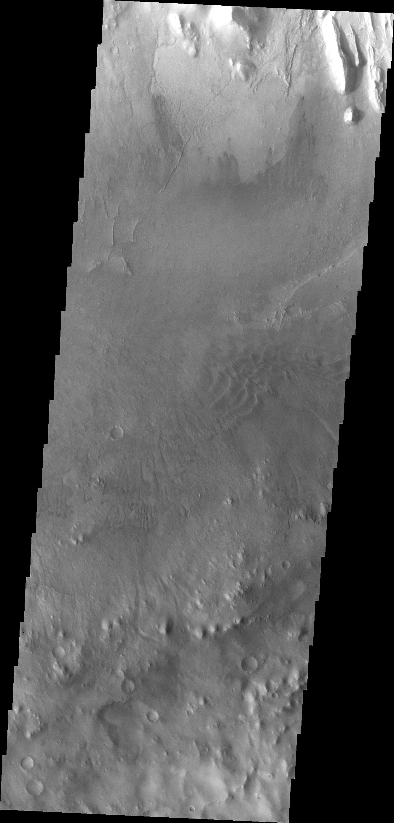
2013-05-17
Mars
Mars Exploration Rover (MER)
Panoramic Camera
1019x1024x3
PIA16930:
Rock Target 'Esperance' Altered by Wet History (False Color)
Full Resolution:
TIFF
(3.132 MB)
JPEG
(135.4 kB)
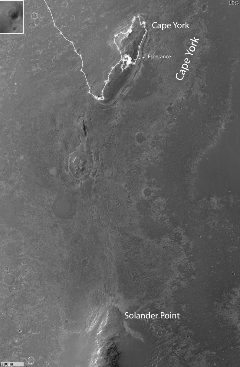
2013-05-17
Mars
Mars Exploration Rover (MER)
HiRISE
793x1209x1
PIA16931:
Opportunity Heads Toward Next Destination, 'Solander Point'
Full Resolution:
TIFF
(959.9 kB)
JPEG
(122.1 kB)
2013-05-20
Mars
2001 Mars Odyssey
THEMIS
1338x2921x1
PIA16987:
Images of Gale #33
Full Resolution:
TIFF
(3.912 MB)
JPEG
(213.3 kB)
2013-05-20
Mars
Mars Science Laboratory (MSL)
MAHLI
664x989x3
PIA16935:
Before-and-After Blink of 'Cumberland' Drilling
Full Resolution:
TIFF
(659.1 kB)
JPEG
(72.1 kB)
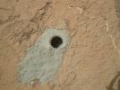
2013-05-20
Mars
Mars Science Laboratory (MSL)
MAHLI
1604x1196x3
PIA16936:
'Cumberland' Target Drilled by Curiosity
Full Resolution:
TIFF
(5.757 MB)
JPEG
(448.7 kB)
2013-05-21
Mars
2001 Mars Odyssey
THEMIS
686x1539x1
PIA16989:
Arsia Mons Flows
Full Resolution:
TIFF
(1.057 MB)
JPEG
(180.1 kB)
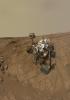
2013-05-21
Mars
Mars Science Laboratory (MSL)
MAHLI
8510x12204x3
PIA16937:
Updated Curiosity Self-Portrait at 'John Klein'
Full Resolution:
TIFF
(311.7 MB)
JPEG
(6.77 MB)
2013-05-22
Mars
2001 Mars Odyssey
THEMIS
687x1539x1
PIA17090:
More Arsia Mons Flows
Full Resolution:
TIFF
(1.059 MB)
JPEG
(187.6 kB)
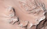
2013-05-22
Mars
Mars Reconnaissance Orbiter (MRO)
HiRISE
2880x1800x3
PIA17730:
Eastern Valles Marineris Bedrock Stratigraphy and Falling Dunes
Full Resolution:
TIFF
(5.191 MB)
JPEG
(484.3 kB)
2013-05-22
Mars
Mars Reconnaissance Orbiter (MRO)
HiRISE
2880x1800x3
PIA17731:
How Did the Mound in Gale Crater Form?
Full Resolution:
TIFF
(15.56 MB)
JPEG
(724.9 kB)
2013-05-22
Mars
Mars Reconnaissance Orbiter (MRO)
HiRISE
2880x1800x3
PIA17732:
Ridges and a Valley with Flow Fronts
Full Resolution:
TIFF
(15.56 MB)
JPEG
(764.9 kB)
2013-05-22
Mars
Mars Reconnaissance Orbiter (MRO)
HiRISE
2880x1800x3
PIA17733:
Ice in a Chlorite-Bearing Escarpment in Northwest Hellas
Full Resolution:
TIFF
(15.56 MB)
JPEG
(767.7 kB)
2013-05-23
Mars
2001 Mars Odyssey
THEMIS
696x1540x1
PIA17223:
Aram Chaos
Full Resolution:
TIFF
(1.073 MB)
JPEG
(103.7 kB)
2013-05-24
Mars
2001 Mars Odyssey
THEMIS
685x1537x1
PIA17224:
Coprates Chasma
Full Resolution:
TIFF
(1.054 MB)
JPEG
(80.82 kB)
2013-05-27
Mars
2001 Mars Odyssey
THEMIS
1315x2790x1
PIA17225:
Bakhuysen Crater
Full Resolution:
TIFF
(3.673 MB)
JPEG
(235 kB)
2013-05-28
Mars
2001 Mars Odyssey
THEMIS
1354x2927x1
PIA17091:
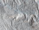
Yardangs
Full Resolution:
TIFF
(3.967 MB)
JPEG
(475.8 kB)
2013-05-29
Mars
2001 Mars Odyssey
THEMIS
1325x2798x1
PIA17092:
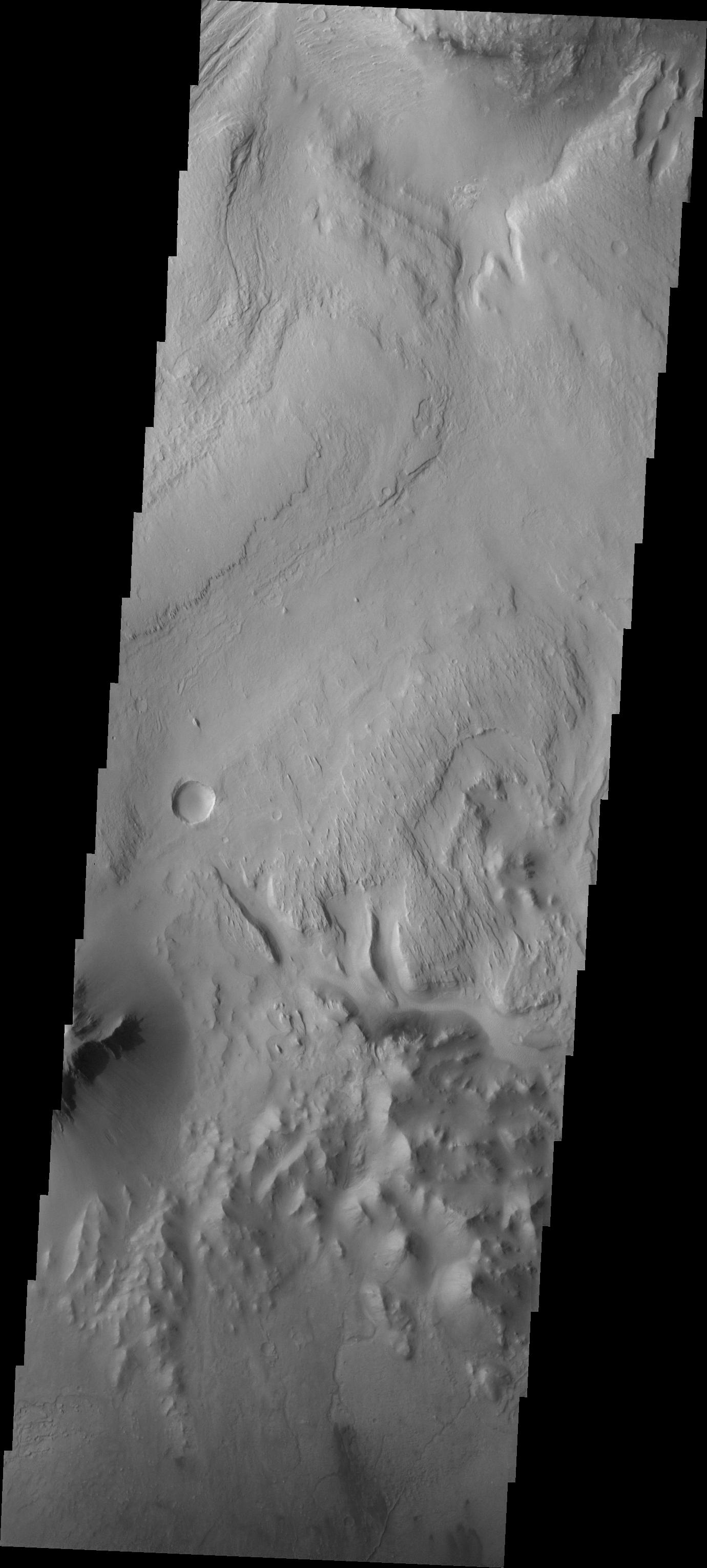
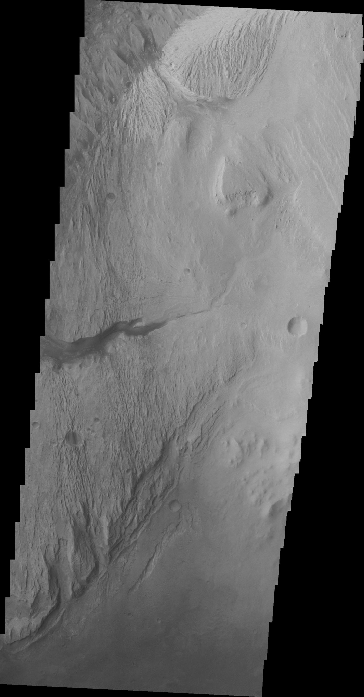
Channel
Full Resolution:
TIFF
(3.711 MB)
JPEG
(387 kB)
2013-05-29
Mars
Mars Reconnaissance Orbiter (MRO)
HiRISE
2880x1800x3
PIA17734:
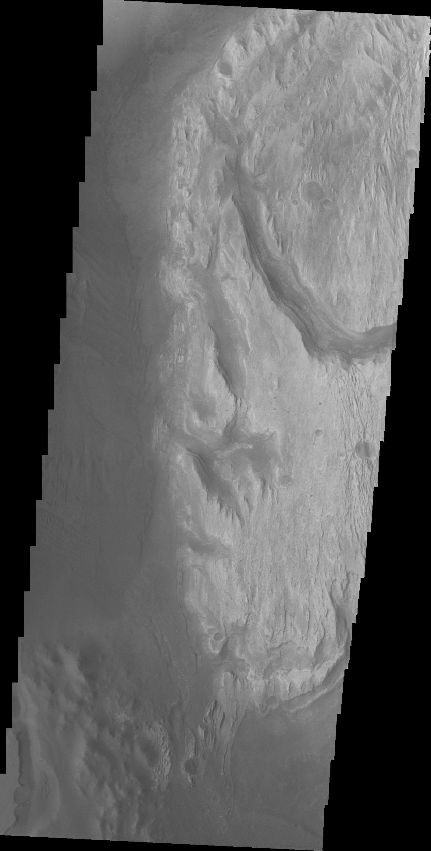
Active Slope Flows on the Central Hills of Hale Crater
Full Resolution:
TIFF
(15.56 MB)
JPEG
(579.8 kB)
2013-05-29
Mars
Mars Reconnaissance Orbiter (MRO)
HiRISE
2880x1800x3
PIA17735:
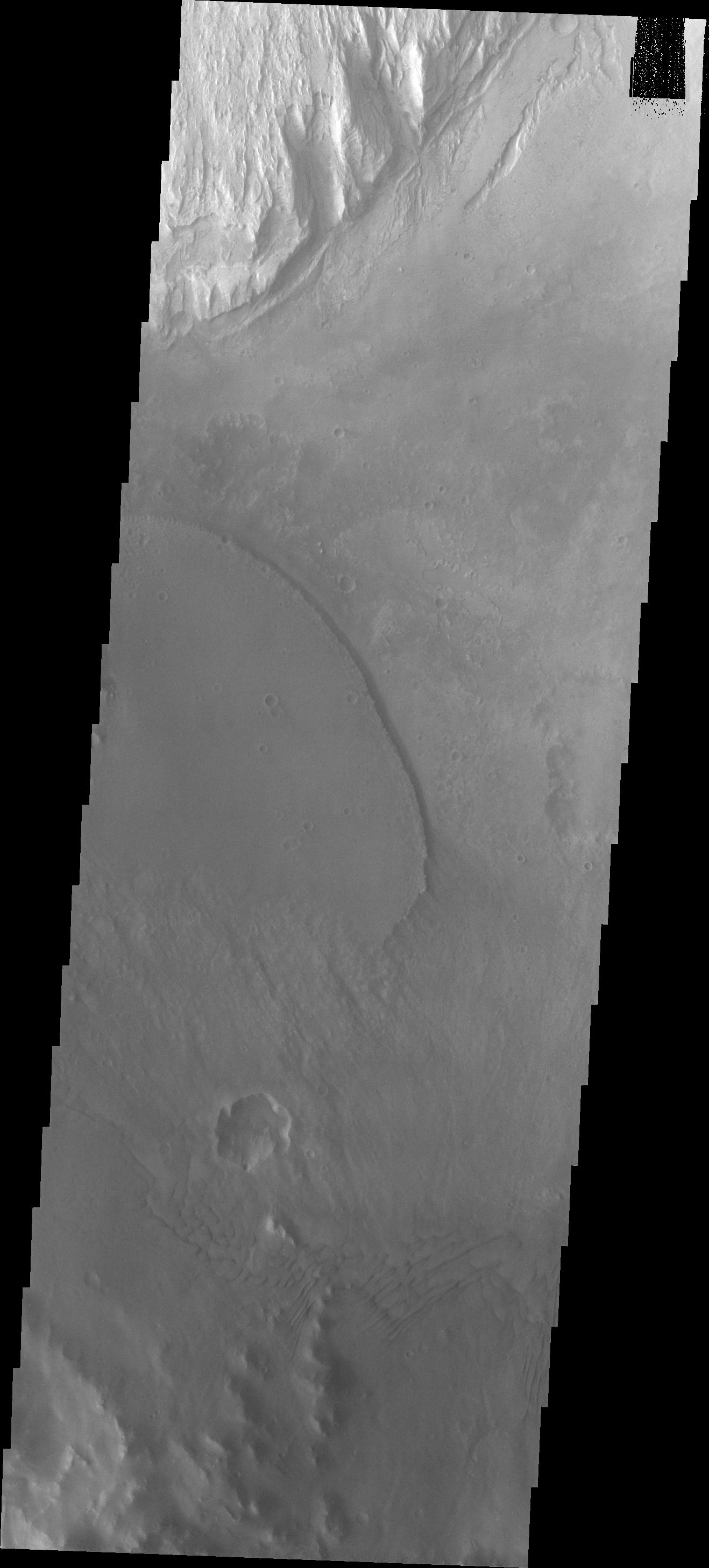
Crater with Debris Aprons in Tyrrhena Terra
Full Resolution:
TIFF
(15.56 MB)
JPEG
(821.8 kB)
2013-05-29
Mars
Mars Reconnaissance Orbiter (MRO)
HiRISE
2880x1800x3
PIA17736:
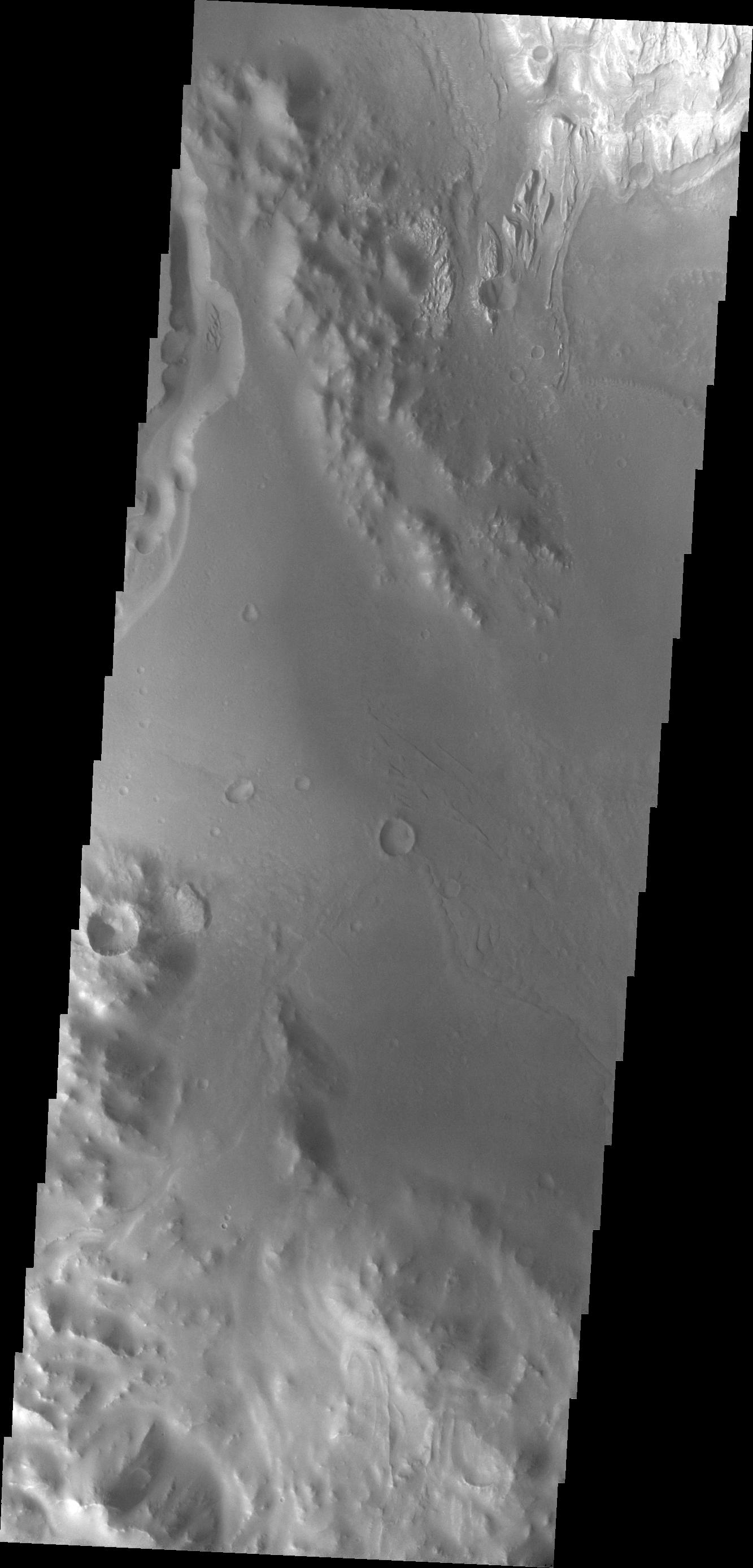
Valleys in Tyrrhena Terra
Full Resolution:
TIFF
(15.56 MB)
JPEG
(949.2 kB)
2013-05-30
Mars
2001 Mars Odyssey
THEMIS
1336x2975x1
PIA17093:
Dunes and Dust Devils
Full Resolution:
TIFF
(3.979 MB)
JPEG
(283.9 kB)
2013-05-30
Mars
Mars Science Laboratory (MSL)
RAD
824x546x3
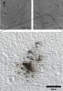
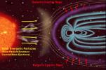
PIA16938:
Sources of Ionizing Radiation in Interplanetary Space
Full Resolution:
TIFF
(1.35 MB)
JPEG
(59.08 kB)
2013-05-30
Mars
Mars Science Laboratory (MSL)
RAD
3921x2769x1
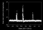
PIA16939:
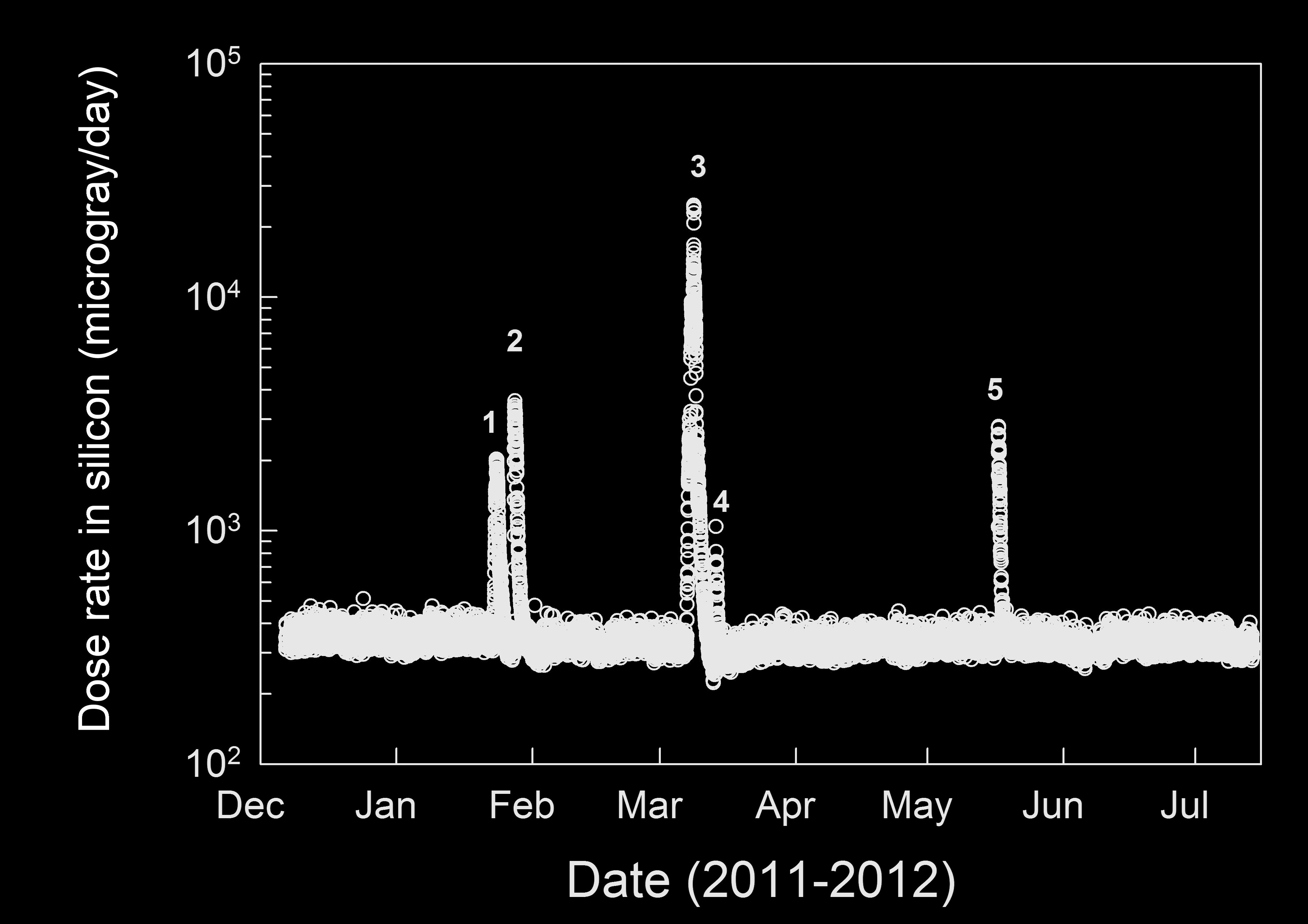
Radiation Measurements During Trip From Earth to Mars
Full Resolution:
TIFF
(10.87 MB)
JPEG
(368.4 kB)
2013-05-30
Mars
Mars Science Laboratory (MSL)
RAD
3920x3032x3
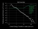
PIA17060:
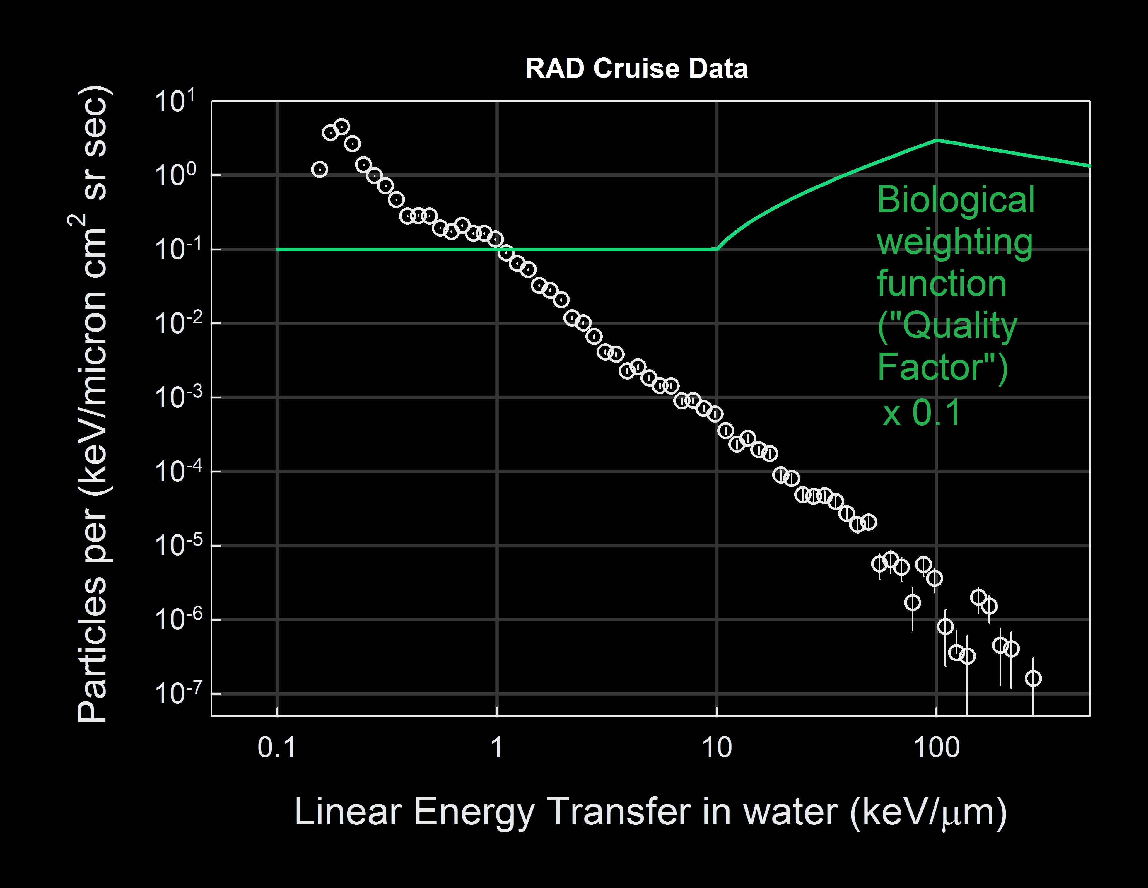
Calculating Radiation Dose for Biological Tissue
Full Resolution:
TIFF
(11.9 MB)
JPEG
(547.9 kB)
2013-05-30
Mars
Mars Science Laboratory (MSL)
RAD
3651x4301x3
PIA17061:
Comparison of Some Radiation Exposures to Mars-Trip Level
Full Resolution:
TIFF
(15.72 MB)
JPEG
(635.4 kB)
2013-05-30
Mars
Mars Science Laboratory (MSL)
Mastcam
4372x5883x3
PIA17062:
Remnants of Ancient Streambed on Mars (White-Balanced View)
Full Resolution:
TIFF
(77.21 MB)
JPEG
(2.608 MB)
2013-05-30
Mars
Mars Science Laboratory (MSL)
Mastcam
2498x1126x3
PIA17063:
Evidence About a Martian Streambed (Stereo)
Full Resolution:
TIFF
(8.441 MB)
JPEG
(394.8 kB)
2013-05-31
Mars
2001 Mars Odyssey
THEMIS
1314x2799x1
PIA17094:
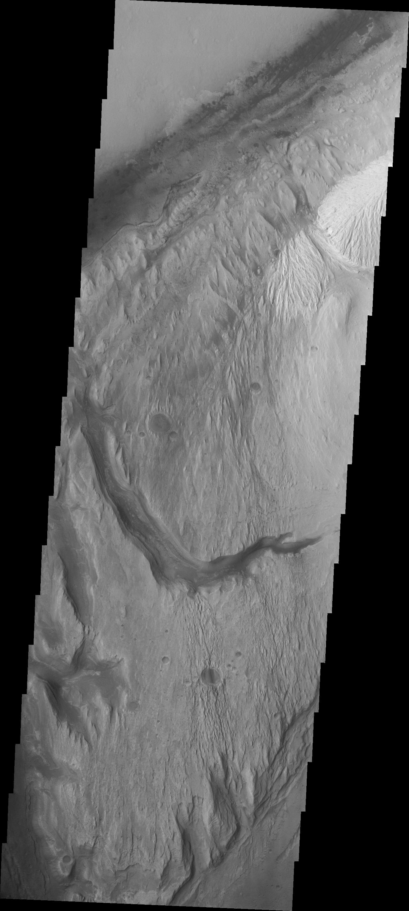
Channels
Full Resolution:
TIFF
(3.682 MB)
JPEG
(454 kB)
2013-06-03
Mars
2001 Mars Odyssey
THEMIS
1320x2783x1
PIA17095:
Coprates Chasma
Full Resolution:
TIFF
(3.677 MB)
JPEG
(192.3 kB)
2013-06-04
Mars
2001 Mars Odyssey
THEMIS
1315x2957x1
PIA17096:
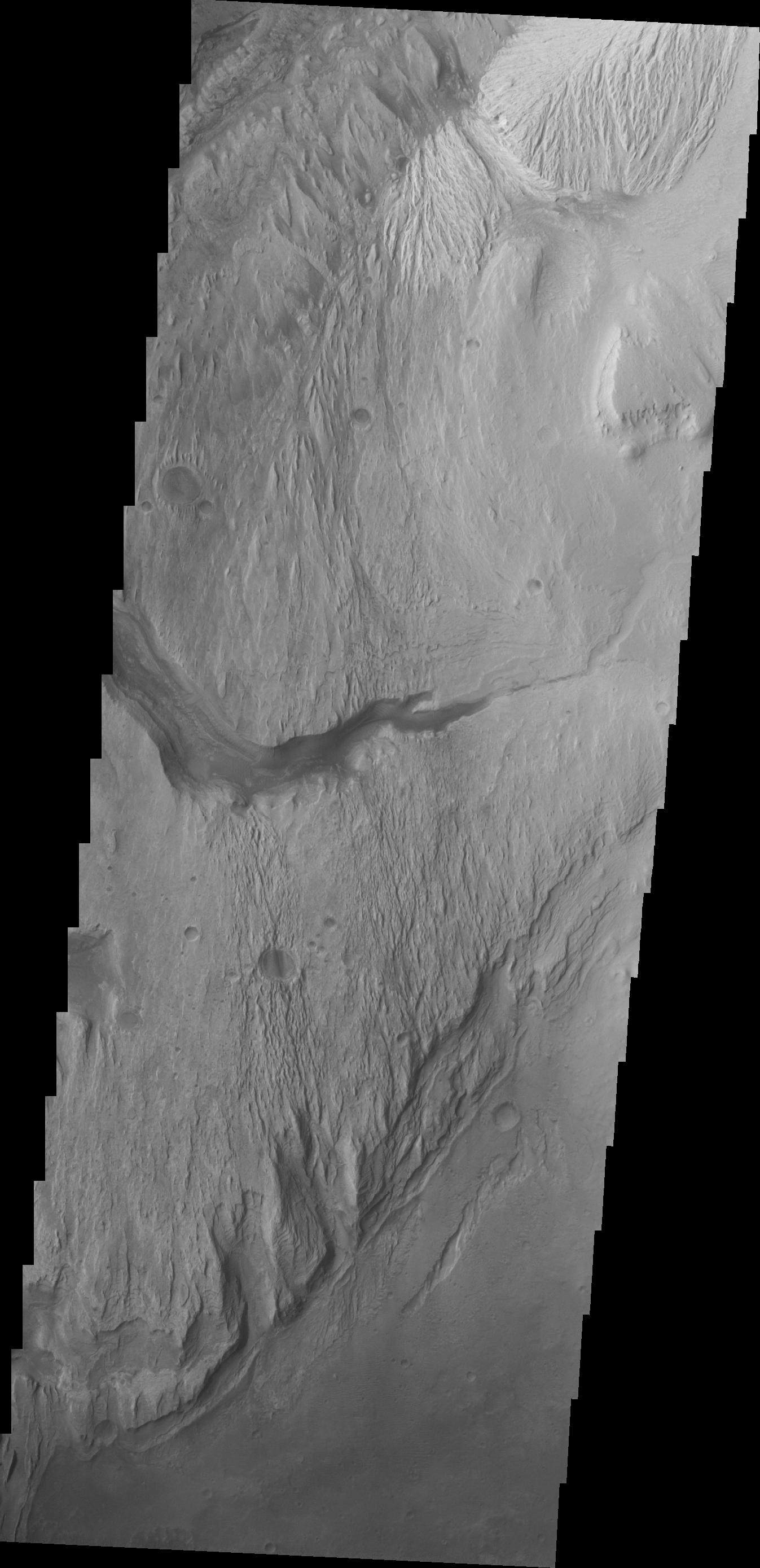
Channels
Full Resolution:
TIFF
(3.893 MB)
JPEG
(412.4 kB)
2013-06-05
Mars
2001 Mars Odyssey
THEMIS
1335x2915x1
PIA17097:
Olympus Mons Flows
Full Resolution:
TIFF
(3.896 MB)
JPEG
(664.8 kB)
2013-06-05
Mars
Mars Science Laboratory (MSL)
HiRISE
3300x2550x3
PIA17064:
From 'Glenelg' to Mount Sharp
Full Resolution:
TIFF
(25.26 MB)
JPEG
(1.462 MB)
2013-06-05
Mars
Mars Science Laboratory (MSL)
Navcam (MSL)
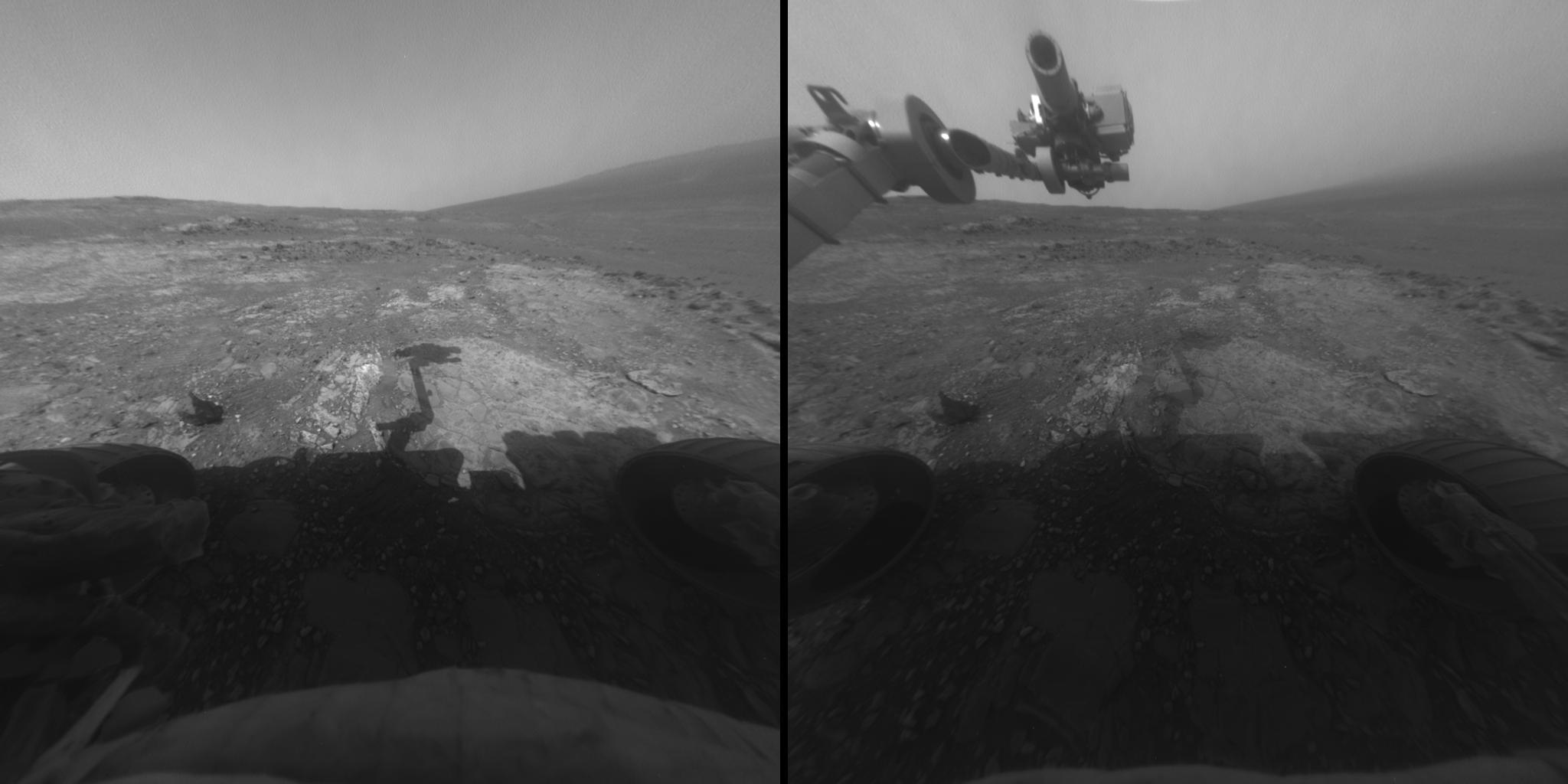
1372x1104x3
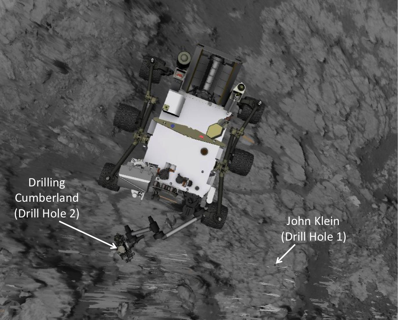
PIA17065:
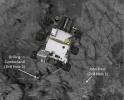
Position of Curiosity for Drilling at 'Cumberland'
Full Resolution:
TIFF
(4.546 MB)
JPEG
(185.5 kB)
2013-06-05
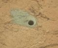
Mars
Mars Science Laboratory (MSL)
MAHLI
1608x1200x3
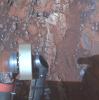
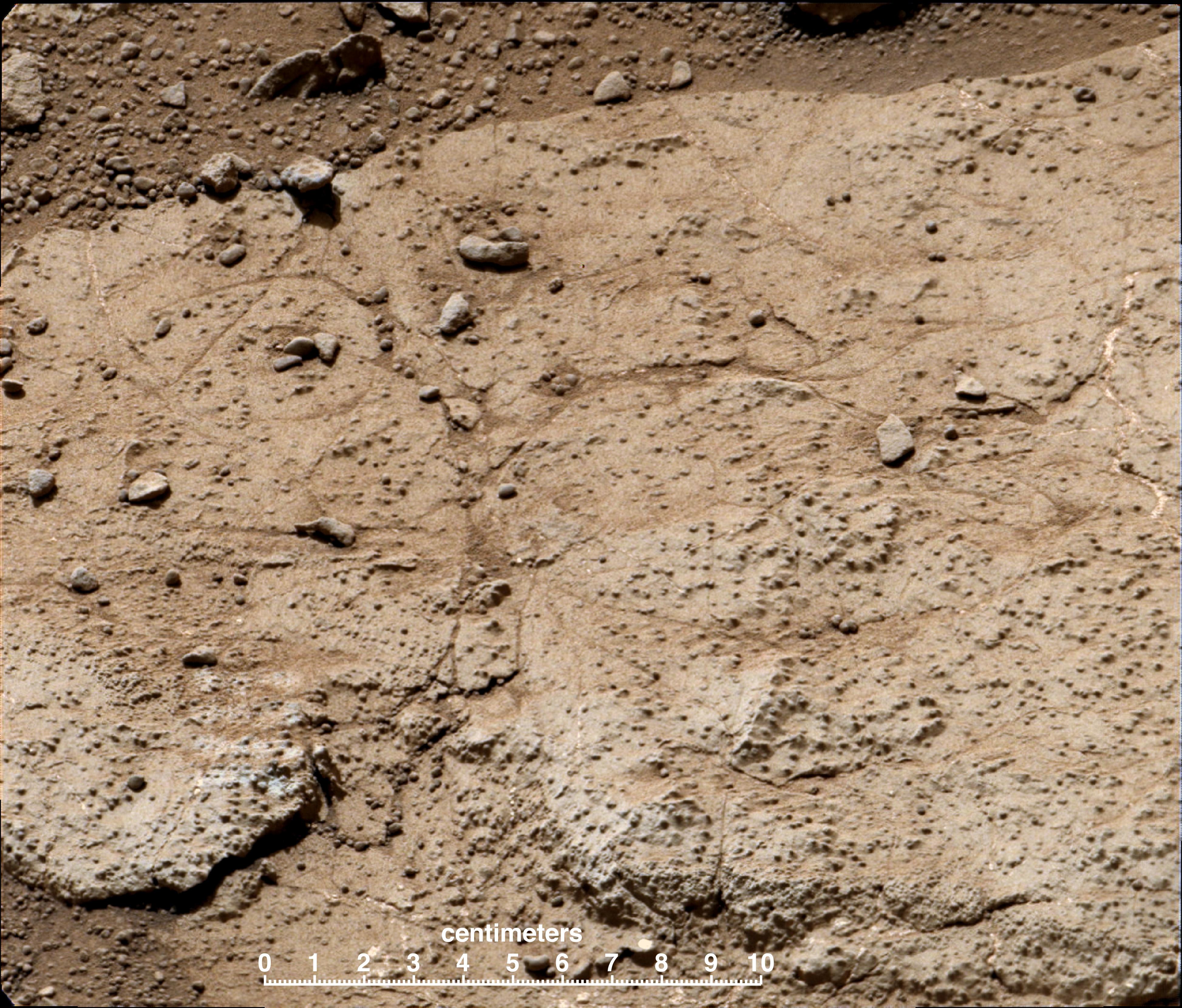
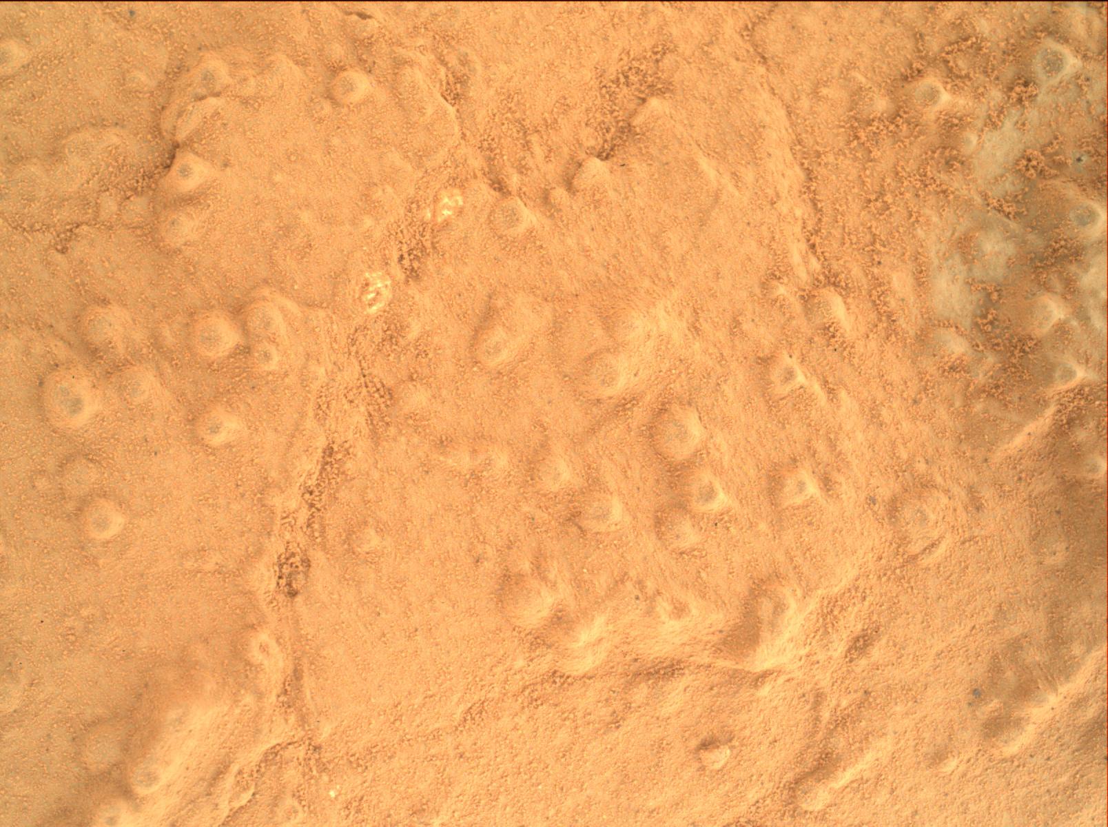
PIA17066:
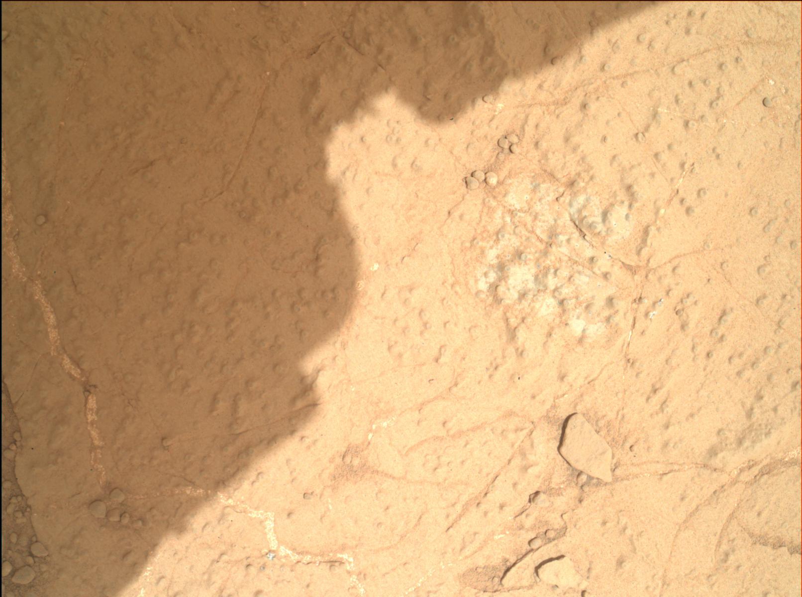
Concretions at 'Cumberland'
Full Resolution:
TIFF
(5.791 MB)
JPEG
(309.1 kB)
2013-06-05
Mars
Mars Science Laboratory (MSL)
MAHLI
1612x1200x3
PIA17067:
Checking Contact Points for Curiosity's Drill
Full Resolution:
TIFF
(5.805 MB)
JPEG
(204.7 kB)
2013-06-05
Mars
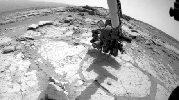
Mars Science Laboratory (MSL)
Hazcam (MSL)
1279x715x1
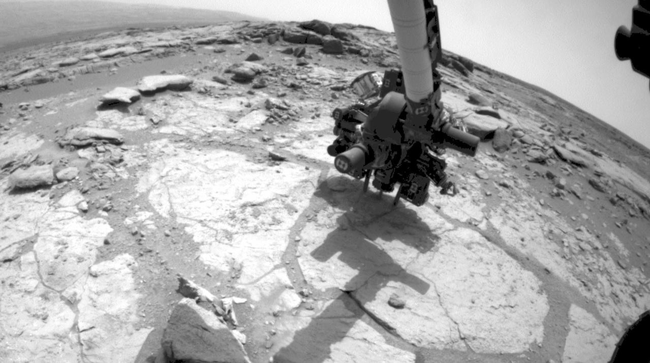
PIA17068:
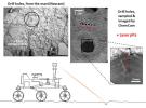
Curiosity Mars Rover Drilling Into Its Second Rock
Full Resolution:
TIFF
(915.7 kB)
JPEG
(127.9 kB)
2013-06-05
Mars
Mars Science Laboratory (MSL)
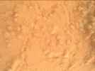
ChemCam
Mastcam
936x786x3
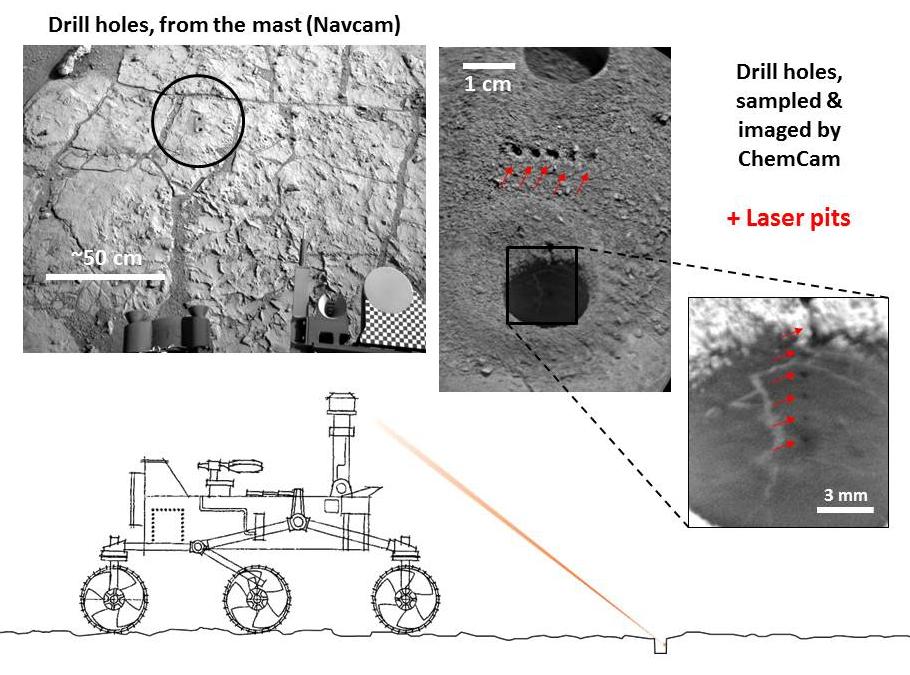
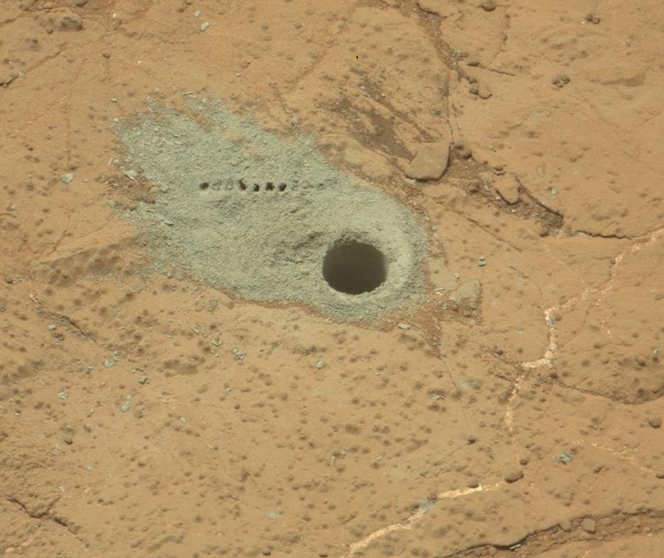
PIA17069:
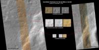
Drilled Hole and ChemCam Marks at 'Cumberland'
Full Resolution:
TIFF
(2.208 MB)
JPEG
(98.53 kB)
2013-06-05
Mars
Mars Science Laboratory (MSL)
Mastcam
1408x1200x3
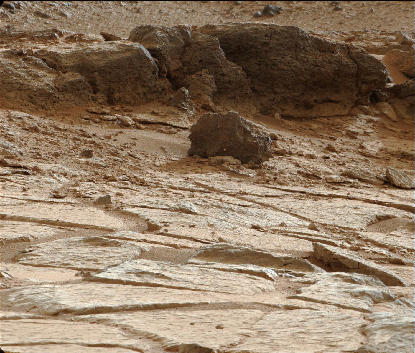
PIA17071:
'Point Lake' Outcrop in Gale Crater
Full Resolution:
TIFF
(5.071 MB)
JPEG
(340.8 kB)
2013-06-06
Mars
2001 Mars Odyssey
THEMIS
1302x2770x1
PIA17098:
Pavonis Chasma
Full Resolution:
TIFF
(3.61 MB)
JPEG
(234 kB)
2013-06-07
Mars
2001 Mars Odyssey
THEMIS
1332x2774x1
PIA17100:
Windstreaks
Full Resolution:
TIFF
(3.699 MB)
JPEG
(382.4 kB)
2013-06-07
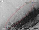
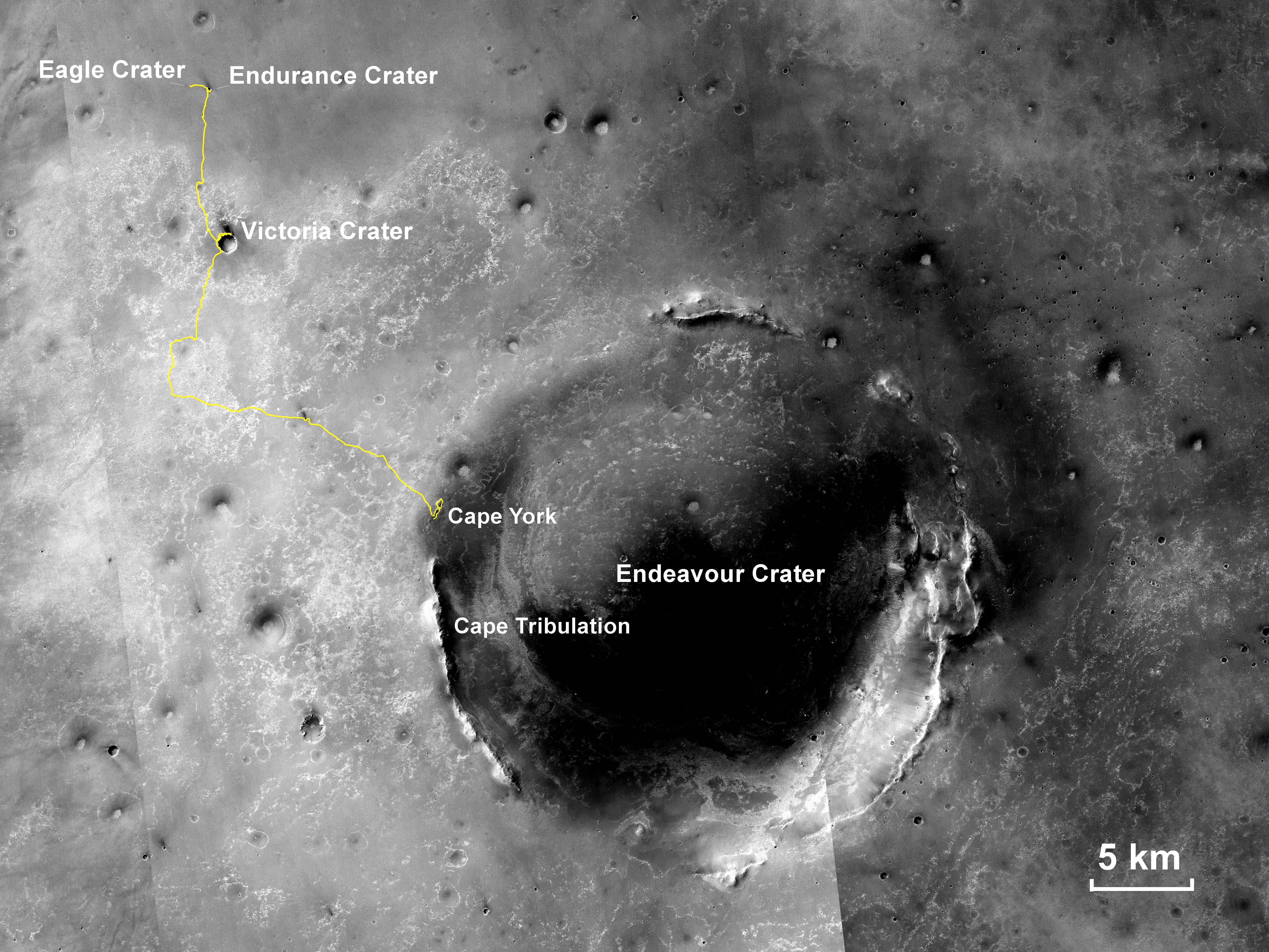
Mars
Mars Exploration Rover (MER)
Mars Reconnaissance Orbiter (MRO)
CTX
5198x3900x3
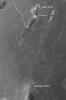
PIA17070:
Opportunity's Traverse Through 112 Months
Full Resolution:
TIFF
(60.85 MB)
JPEG
(3.973 MB)
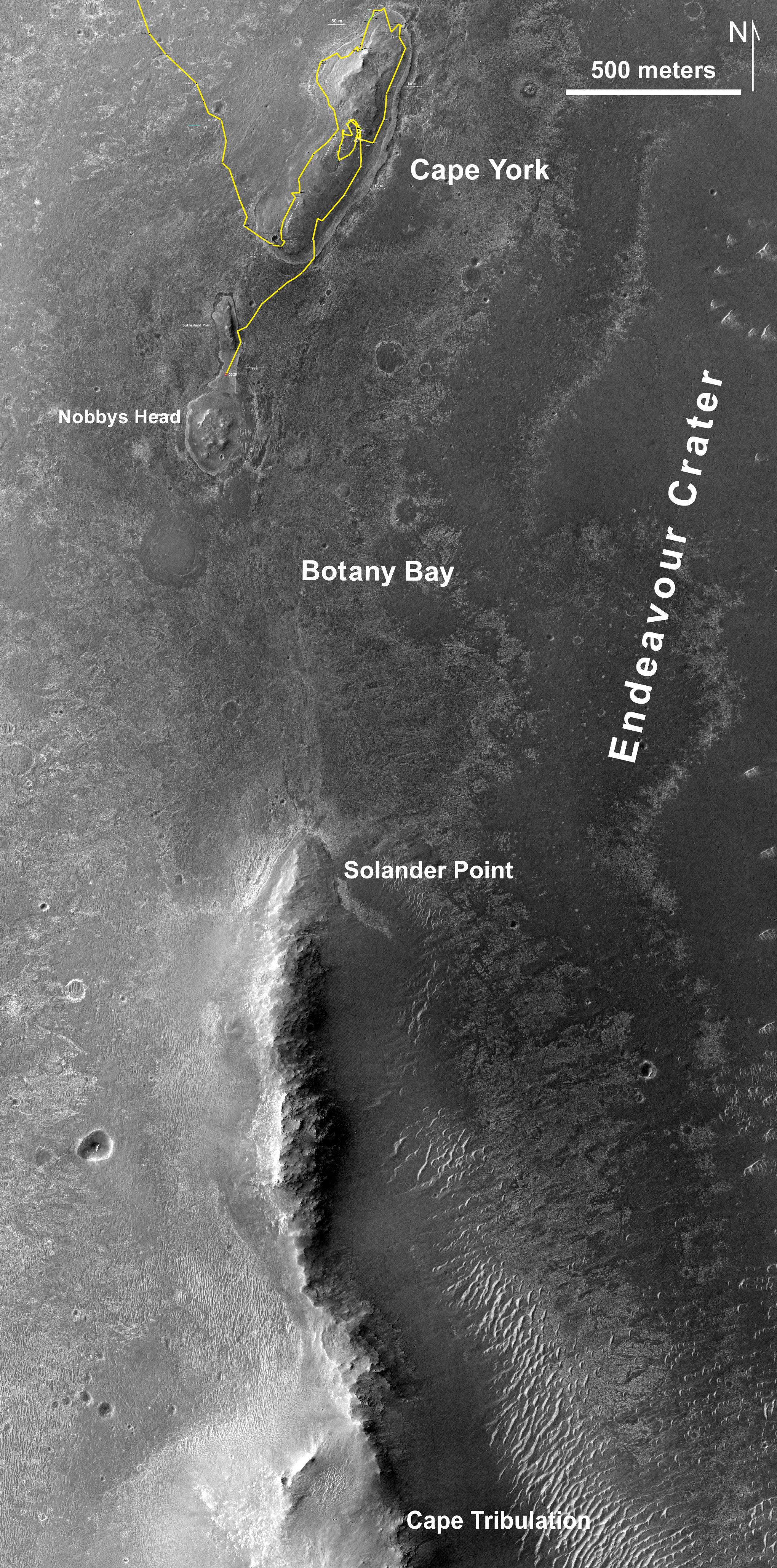
2013-06-07
Mars
Mars Reconnaissance Orbiter (MRO)
HiRISE
2040x4116x3
PIA17072:
Southbound Opportunity, June 2013
Full Resolution:
TIFF
(25.2 MB)
JPEG
(2.025 MB)
1-100
101-200
201-300
301-400
401-500
501-600
601-700
701-800
801-900
901-1000
Currently displaying images:
7861 - 7960
of 12723


