My
List |
Addition Date
|
Target
|
Mission
|
Instrument
|
Size
|

|
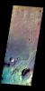
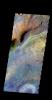
2016-04-29 |
Mars
|
2001 Mars Odyssey
|
THEMIS
|
708x1547x3 |
|
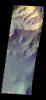
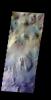
-
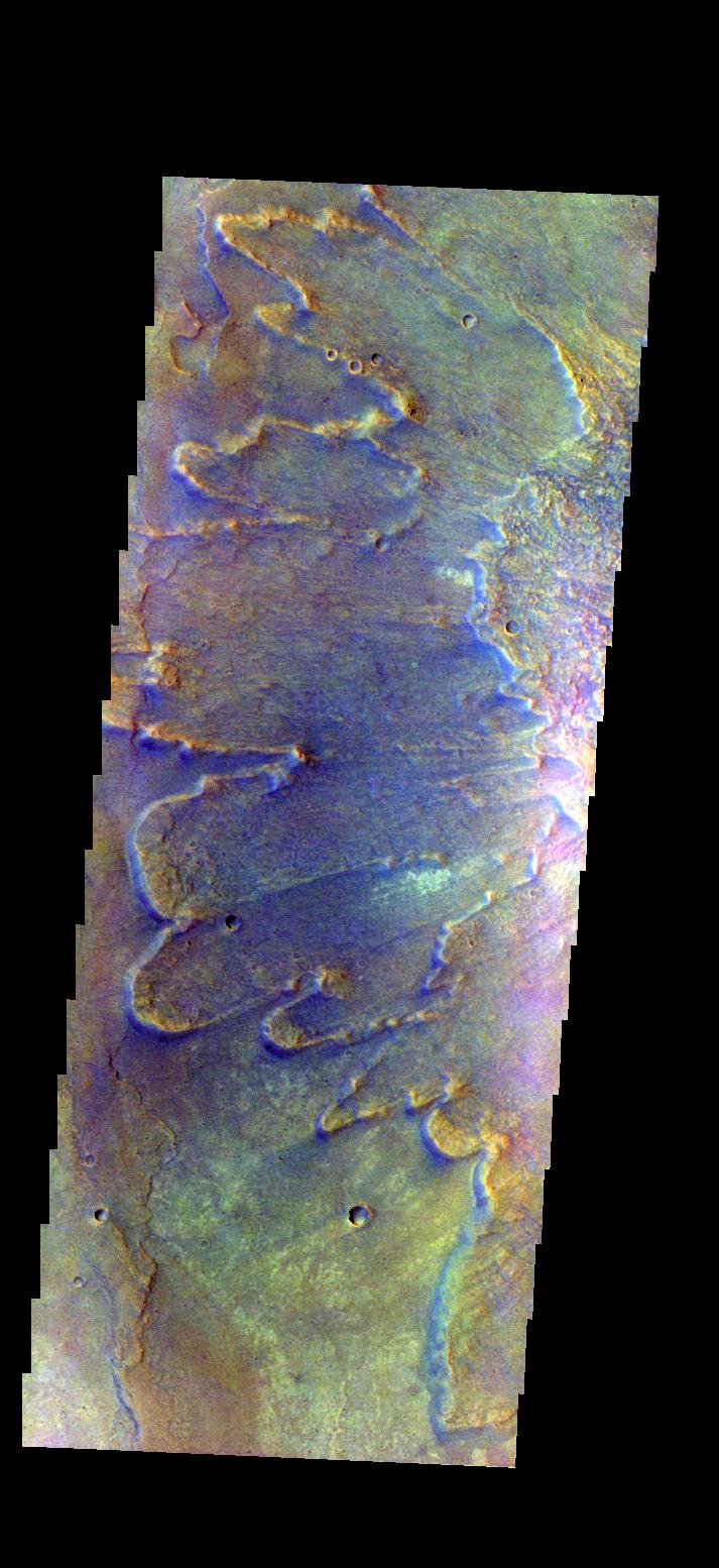
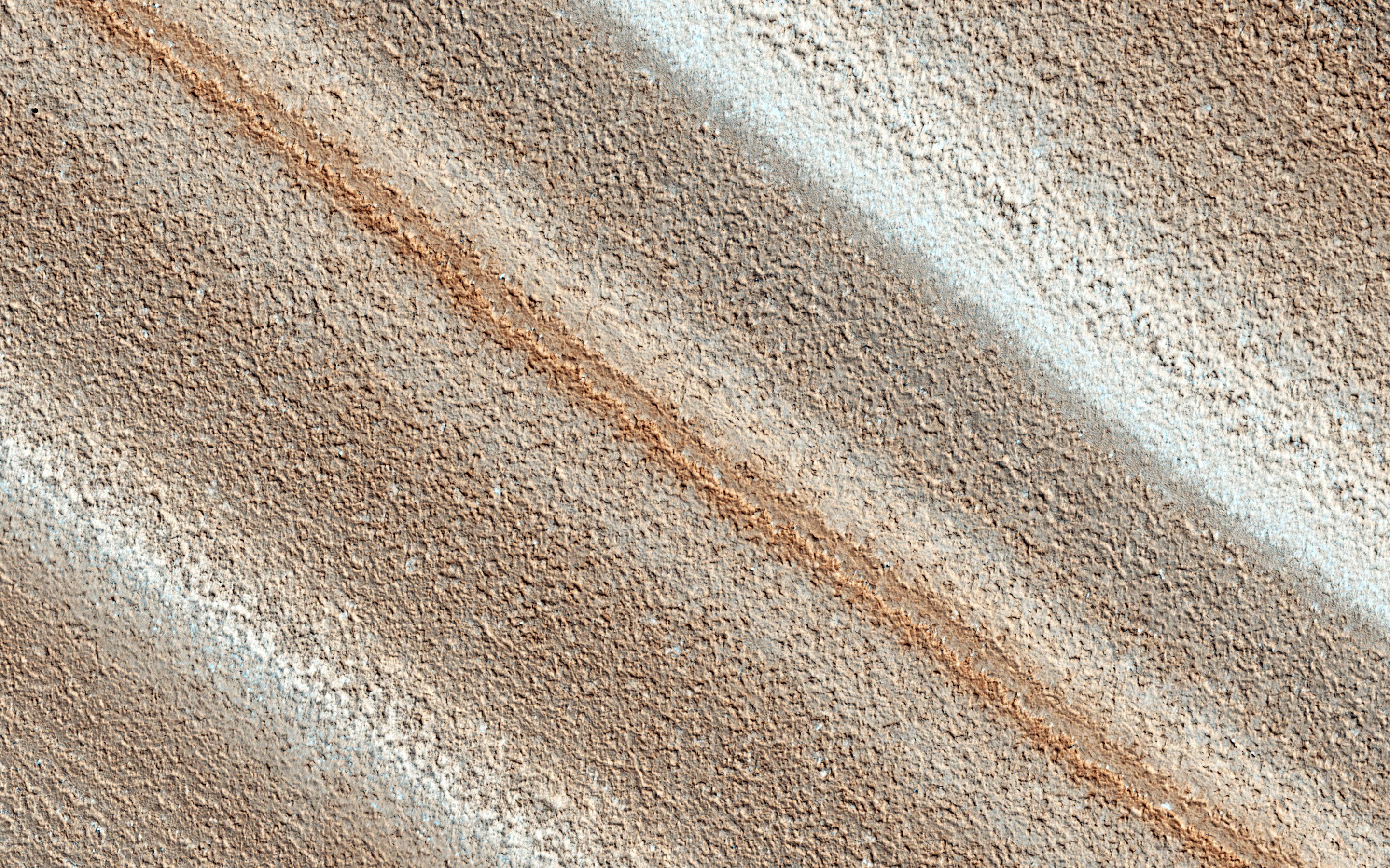
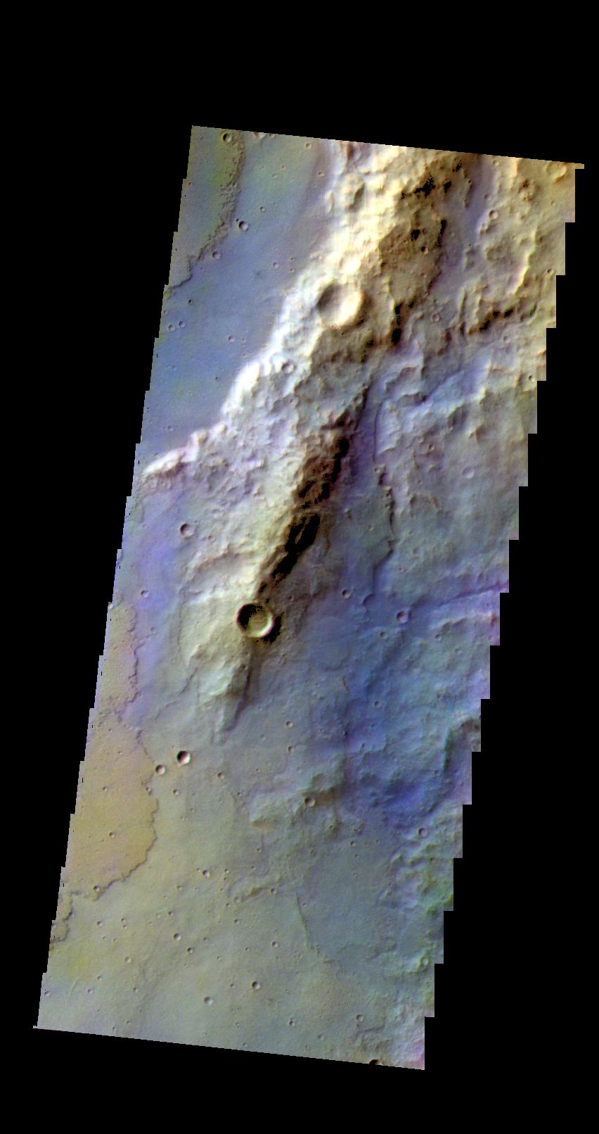
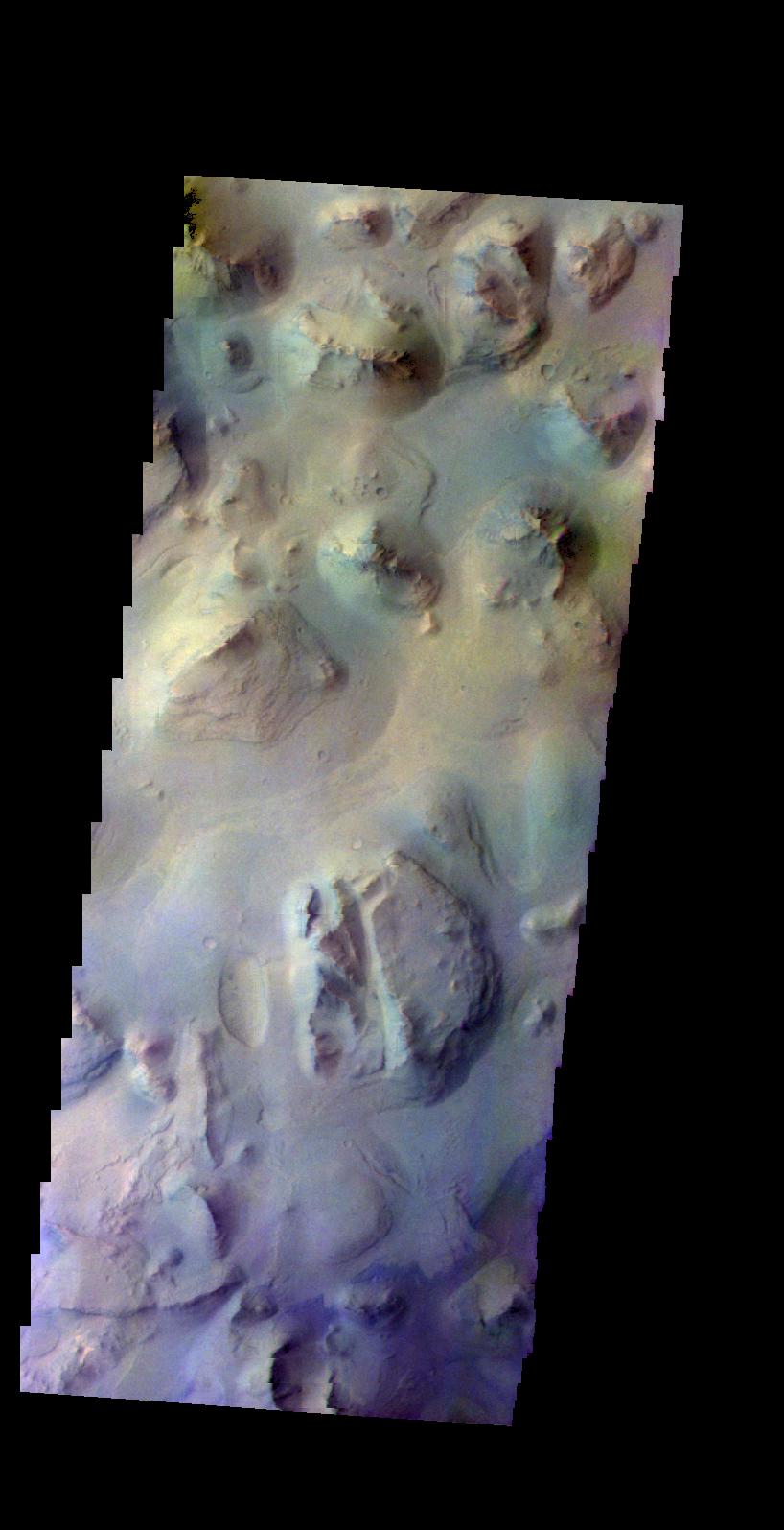
PIA20593:
-
Coprates Chasma - False Color
Full Resolution:
TIFF
(2.097 MB)
JPEG
(78.98 kB)
|
|
|
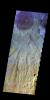
2016-04-28 |
Mars
|
2001 Mars Odyssey
|
THEMIS
|
705x1546x3 |
|
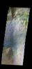
-
PIA20592:
-
Ophir Chasma - False Color
Full Resolution:
TIFF
(2.172 MB)
JPEG
(85.04 kB)
|
|
|
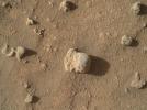
2016-04-27 |
Mars
|
Mars Science Laboratory (MSL)
|
MAHLI
|
1603x1122x3 |
|
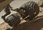
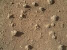
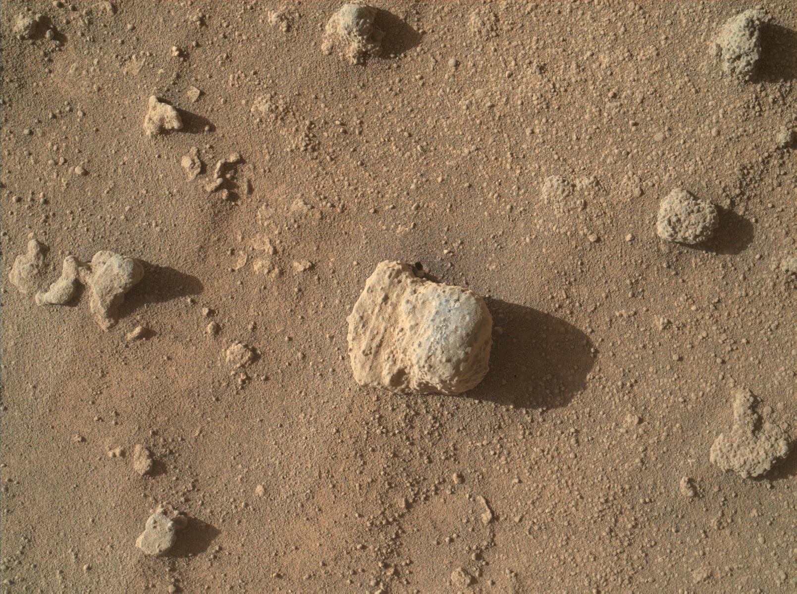
-
PIA20334:
-
Routine Inspection of Rover Wheel Wear and Tear
Full Resolution:
TIFF
(4.6 MB)
JPEG
(196.9 kB)
|
|
|
2016-04-27 |
Mars
|
Mars Science Laboratory (MSL)
|
Mastcam
|
15177x1024x3 |
|
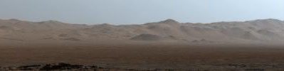
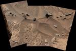
-
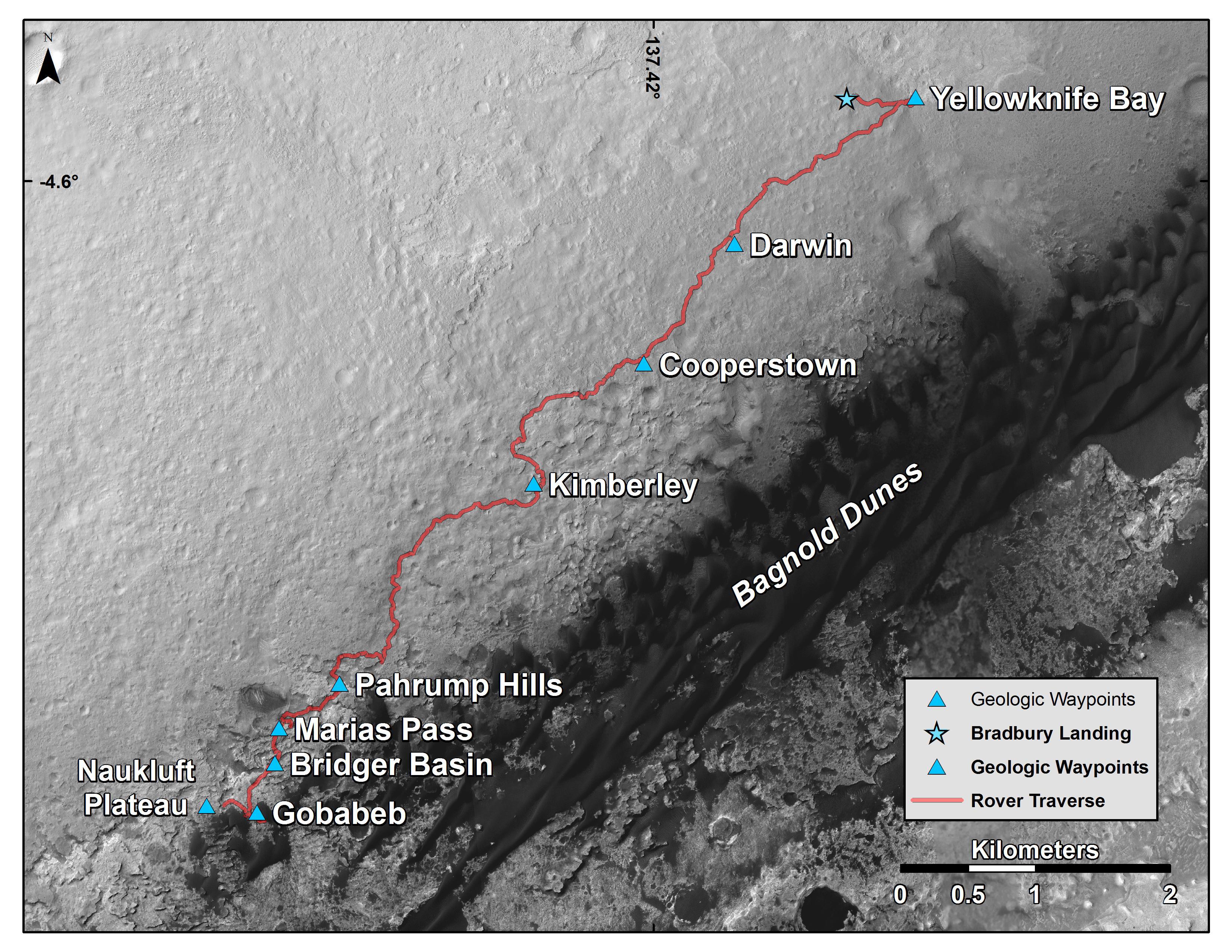
PIA20333:
Northern Portion of Gale Crater Rim Viewed from 'Naukluft Plateau'
Full Resolution:
TIFF
(29.32 MB)
JPEG
(1.072 MB)
|
|
|
2016-04-27 |
Mars
|
Mars Science Laboratory (MSL)
|
Mastcam
|
13054x3000x3 |
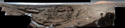
|
-
PIA20332:
Full-Circle Vista from 'Naukluft Plateau' on Mars
Full Resolution:
TIFF
(586.4 MB)
JPEG
(110.6 MB)
|
|
|
2016-04-27 |
Mars
|
2001 Mars Odyssey
|
THEMIS
|
711x1553x3 |
|
-
PIA20459:
-
Nili Fossae - False Color
Full Resolution:
TIFF
(2.327 MB)
JPEG
(111.6 kB)
|
|
|
2016-04-26 |
Mars
|
2001 Mars Odyssey
|
THEMIS
|
713x1554x3 |
|
-
PIA20458:
-
Yuty Crater Ejecta - False Color
Full Resolution:
TIFF
(2.348 MB)
JPEG
(144.8 kB)
|
|
|
2016-04-25 |
Mars
|
2001 Mars Odyssey
|
THEMIS
|
763x1367x3 |
|
-
PIA20457:
-
Terra Sirenum - False Color
Full Resolution:
TIFF
(2.029 MB)
JPEG
(123.2 kB)
|
|
|
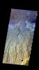
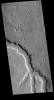
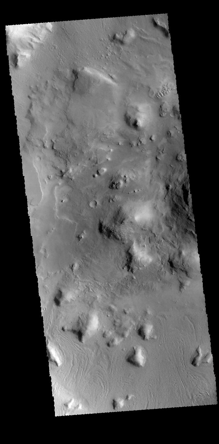
2016-04-22 |
Mars
|
2001 Mars Odyssey
|
THEMIS
|
1340x2647x1 |
|
-
PIA20456:
-
Lava Flows
Full Resolution:
TIFF
(2.857 MB)
JPEG
(525.7 kB)
|
|
|
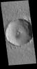
2016-04-21 |
Mars
|
2001 Mars Odyssey
|
THEMIS
|
1166x2596x1 |
|
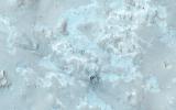
-
PIA20455:
-
Polar Cap Layers
Full Resolution:
TIFF
(2.124 MB)
JPEG
(134.5 kB)
|
|
|
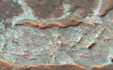
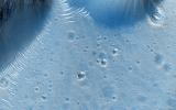
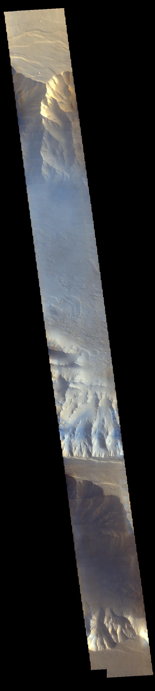
2016-04-21 |
Mars
|
Mars Reconnaissance Orbiter (MRO)
|
HiRISE
|
2880x1800x3 |
|
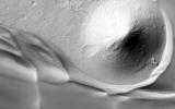
-
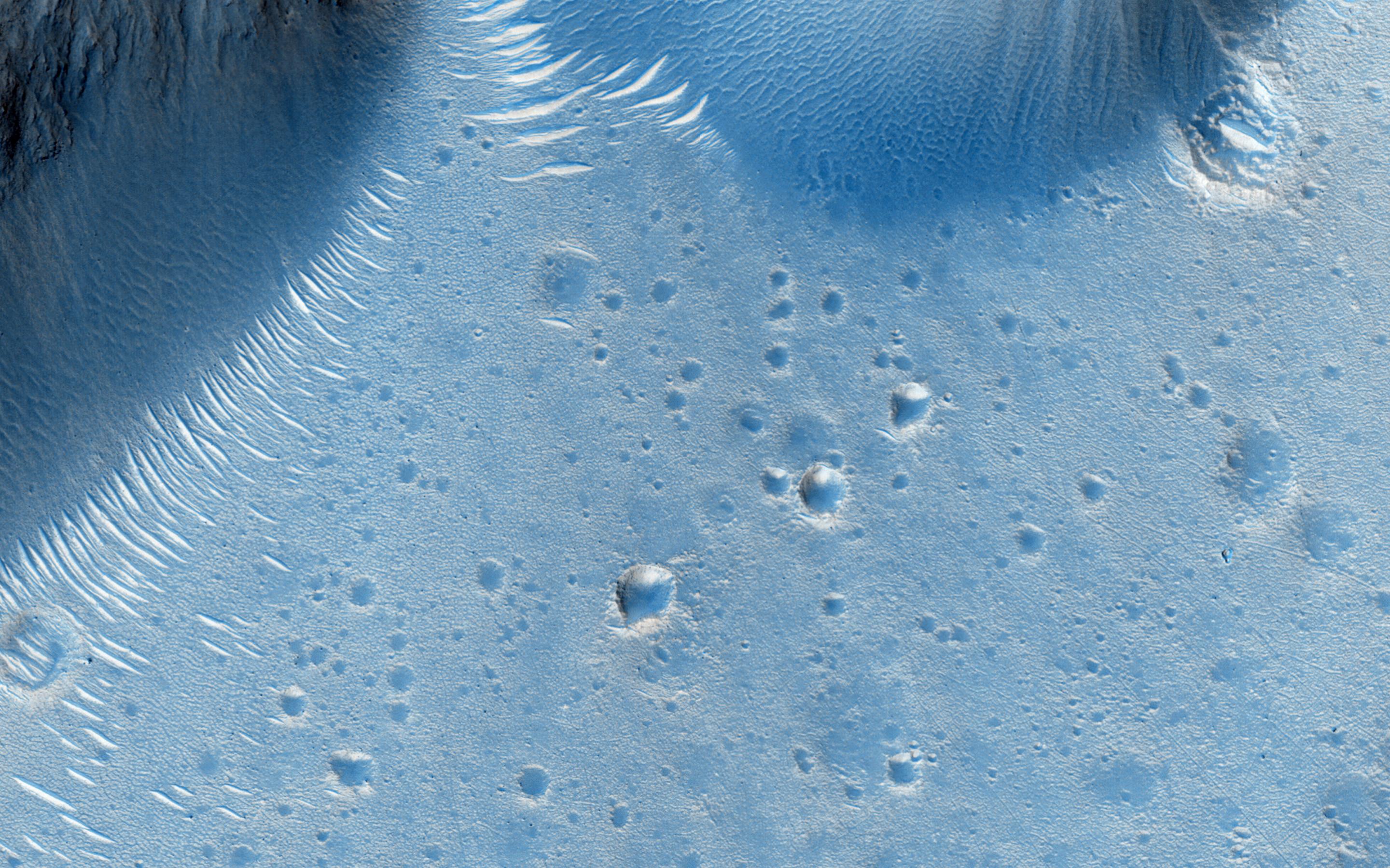
PIA20655:
-
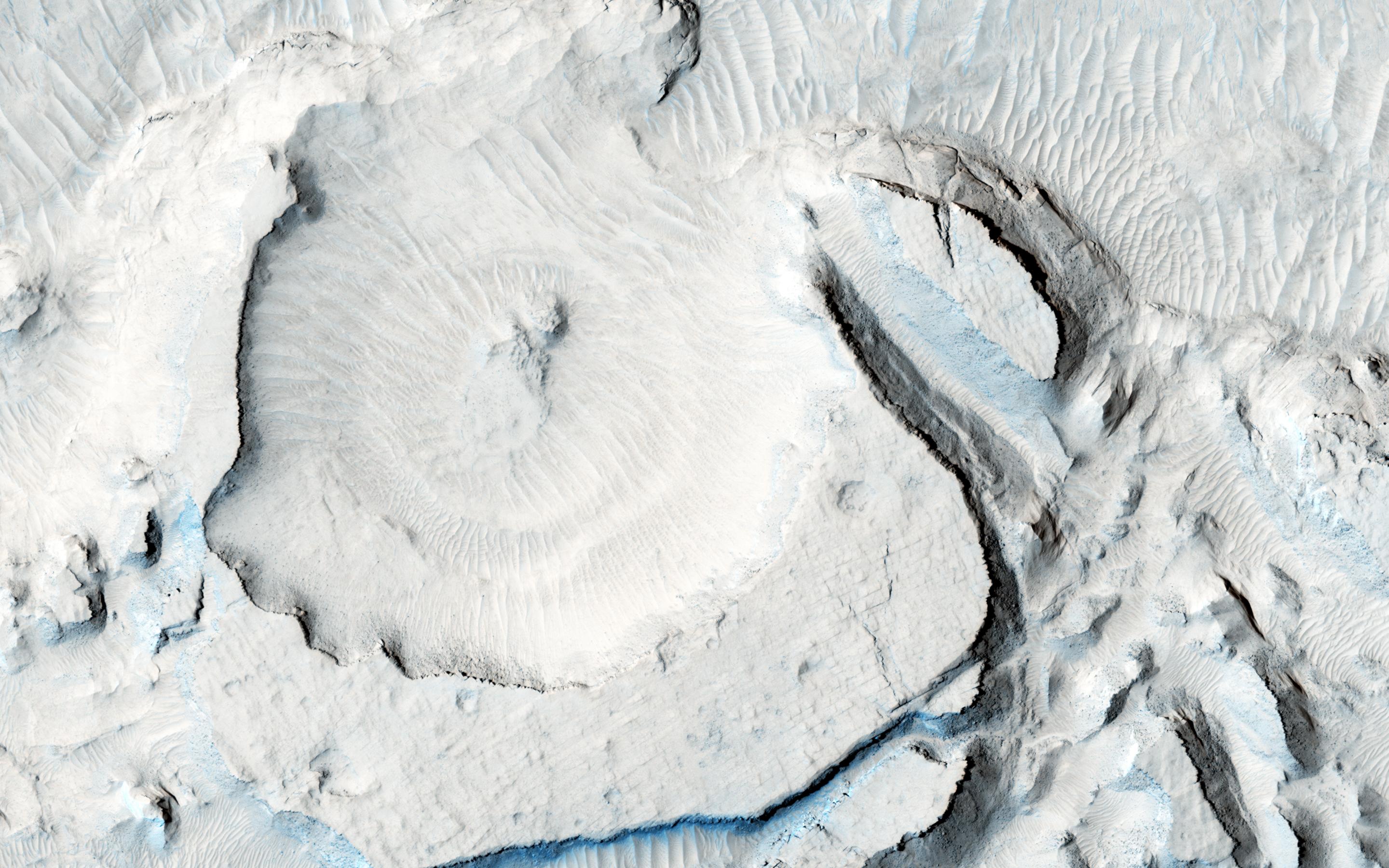
Cratered Cones in Acidalia Planitia
Full Resolution:
TIFF
(15.56 MB)
JPEG
(876.1 kB)
|
|
|
2016-04-21 |
Mars
|
Mars Reconnaissance Orbiter (MRO)
|
HiRISE
|
2880x1800x3 |
|
-
PIA20644:
-
Many Fantastic Colors
Full Resolution:
TIFF
(15.56 MB)
JPEG
(978.6 kB)
|
|
|
2016-04-21 |
Mars
|
Mars Reconnaissance Orbiter (MRO)
|
HiRISE
|
2880x1800x3 |
|
-
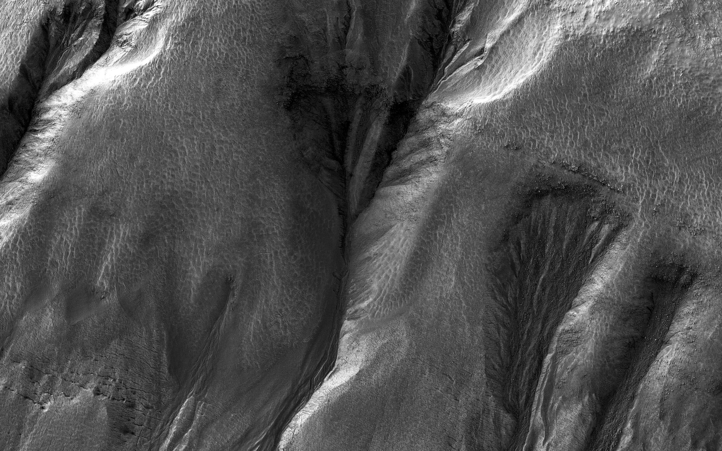
PIA20643:
-
Gullies with Dramatic Lighting
Full Resolution:
TIFF
(13.67 MB)
JPEG
(685 kB)
|
|
|
2016-04-21 |
Mars
|
Mars Reconnaissance Orbiter (MRO)
|
HiRISE
|
2880x1800x3 |
|
-
PIA20642:
-
Flood Lavas and Mass Extinctions
Full Resolution:
TIFF
(15.56 MB)
JPEG
(1.093 MB)
|
|
|
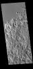
2016-04-20 |
Mars
|
2001 Mars Odyssey
|
THEMIS
|
1192x2625x1 |
|
-
PIA20454:
-
Siton Undae
Full Resolution:
TIFF
(3.133 MB)
JPEG
(512.2 kB)
|
|
|
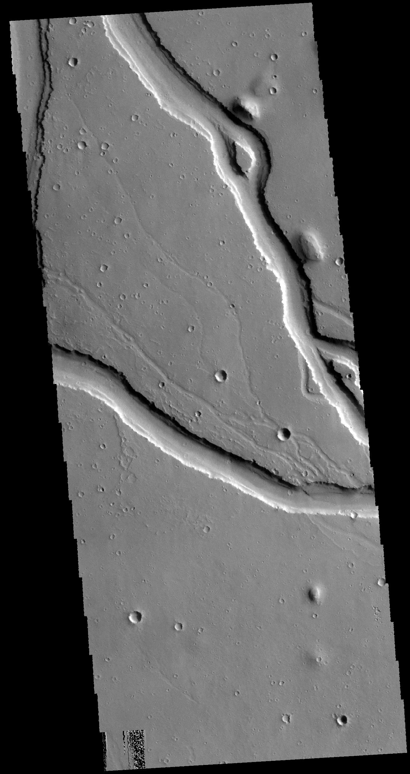
2016-04-19 |
Mars
|
2001 Mars Odyssey
|
THEMIS
|
1410x2647x1 |
|
-
PIA20453:
-
Granicus Valles
Full Resolution:
TIFF
(2.855 MB)
JPEG
(440.5 kB)
|
|
|
2016-04-18 |
Mars
|
2001 Mars Odyssey
|
THEMIS
|
616x1479x1 |
|
-
PIA20452:
-
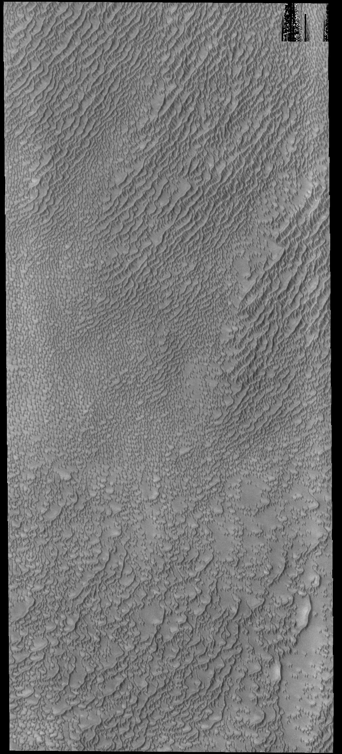
Crater Dunes
Full Resolution:
TIFF
(635.3 kB)
JPEG
(49.38 kB)
|
|
|
2016-04-15 |
Mars
|
2001 Mars Odyssey
|
THEMIS
|
709x1445x1 |
|
-
PIA20451:
-
Terra Sabaea Channels
Full Resolution:
TIFF
(710 kB)
JPEG
(71.8 kB)
|
|
|
2016-04-14 |
Mars
|
2001 Mars Odyssey
|
THEMIS
|
1388x2645x1 |

|
-
PIA20450:
-
Crater Dunes
Full Resolution:
TIFF
(2.569 MB)
JPEG
(301.1 kB)
|
|
|
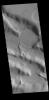
2016-04-13 |
Mars
|
2001 Mars Odyssey
|
THEMIS
|
700x1434x1 |
|
-
PIA20449:
-
Nepenthes Mensae
Full Resolution:
TIFF
(718.6 kB)
JPEG
(80.22 kB)
|
|
|
2016-04-12 |
Mars
|
2001 Mars Odyssey
|
THEMIS
|
1404x2643x1 |

|
-
PIA20448:
-
Elysium Fossae
Full Resolution:
TIFF
(2.381 MB)
JPEG
(220.6 kB)
|
|
|
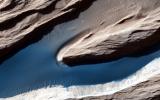
2016-04-11 |
Mars
|
2001 Mars Odyssey
|
THEMIS
|
705x1437x1 |
|
-
PIA20447:
-
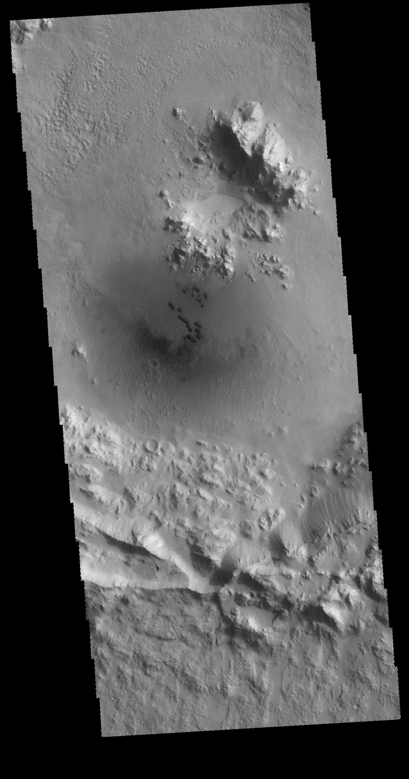
Crater Ejecta
Full Resolution:
TIFF
(736.5 kB)
JPEG
(120.5 kB)
|
|
|
2016-04-08 |
Mars
|
2001 Mars Odyssey
|
THEMIS
|
1401x2642x1 |
|
-
PIA20446:
-
Kasei Valles
Full Resolution:
TIFF
(2.163 MB)
JPEG
(184.1 kB)
|
|
|
2016-04-07 |
Mars
|
2001 Mars Odyssey
|
THEMIS
|
717x1455x1 |

|
-
PIA20445:
-
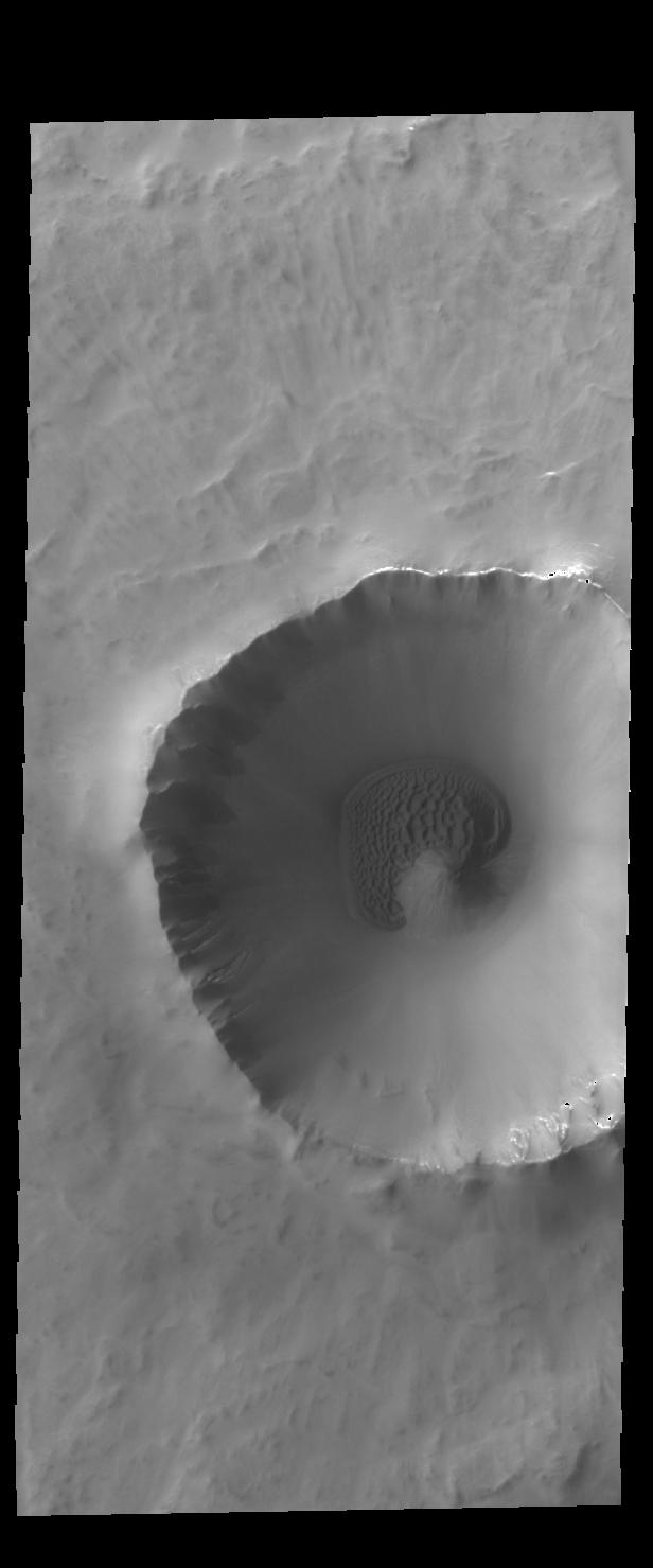
Crater
Full Resolution:
TIFF
(758.2 kB)
JPEG
(92.48 kB)
|
|
|
2016-04-06 |
Mars
|
2001 Mars Odyssey
|
THEMIS
|
1402x2643x1 |

|
-
PIA20444:
-
Hebrus Valles
Full Resolution:
TIFF
(2.58 MB)
JPEG
(339.7 kB)
|
|
|
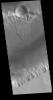
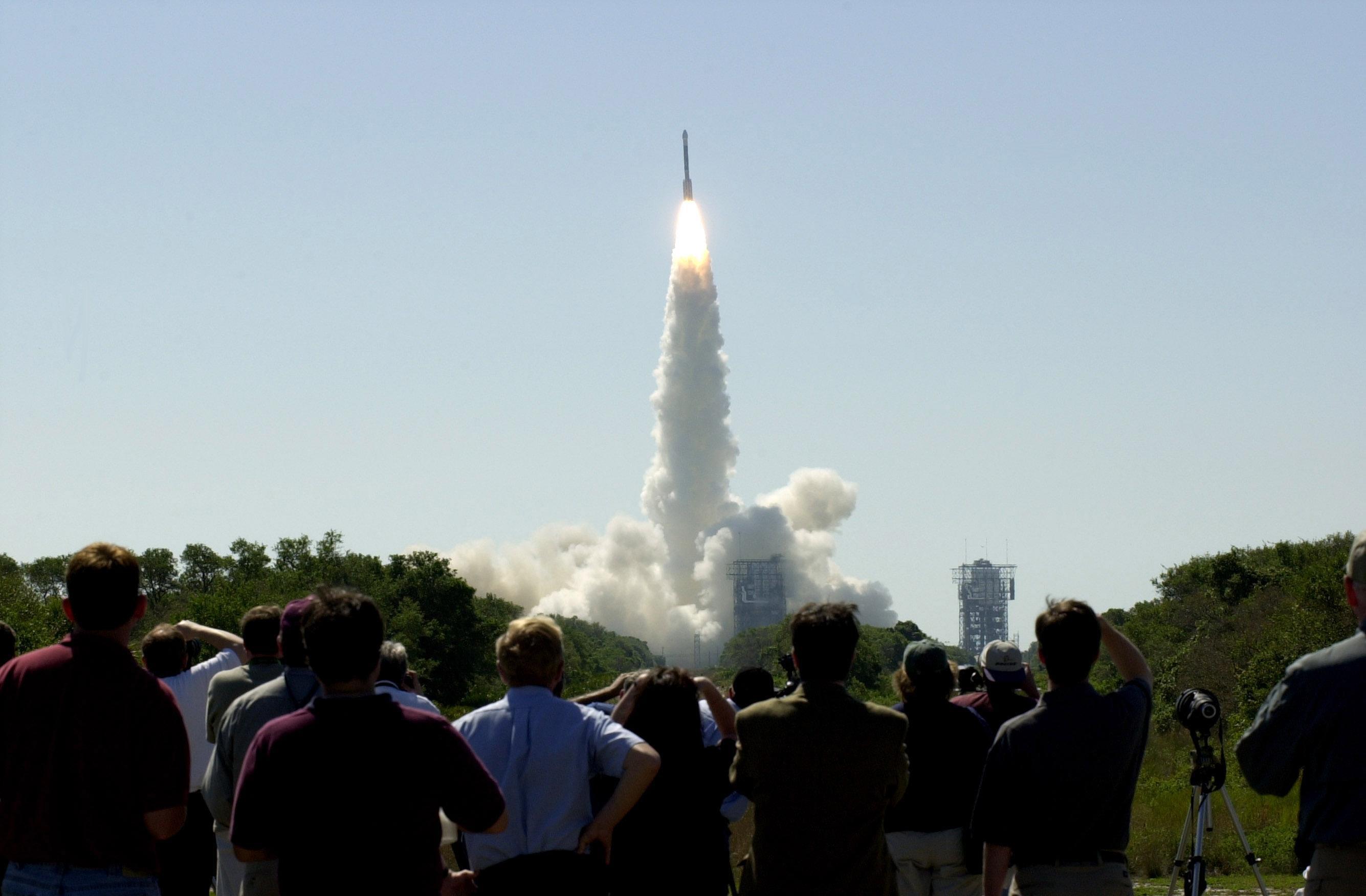
2016-04-05 |
Mars
|
2001 Mars Odyssey
|
|
2670x1752x3 |
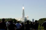
|
-
PIA20331:
-
Odyssey's Launch to Mars on April 7, 2001
Full Resolution:
TIFF
(7.027 MB)
JPEG
(291.8 kB)
|
|
|
2016-04-05 |
Mars
|
2001 Mars Odyssey
|
THEMIS
|
608x2712x3 |
|
-
PIA20330:
-
Mars Odyssey View of Morning Clouds in Canyon
Full Resolution:
TIFF
(2.012 MB)
JPEG
(86.96 kB)
|
|
|
2016-04-05 |
Mars
|
2001 Mars Odyssey
|
THEMIS
|
1389x2641x1 |
|
-
PIA20443:
-
Cerberus Fossae
Full Resolution:
TIFF
(2.327 MB)
JPEG
(315 kB)
|
|
|
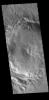
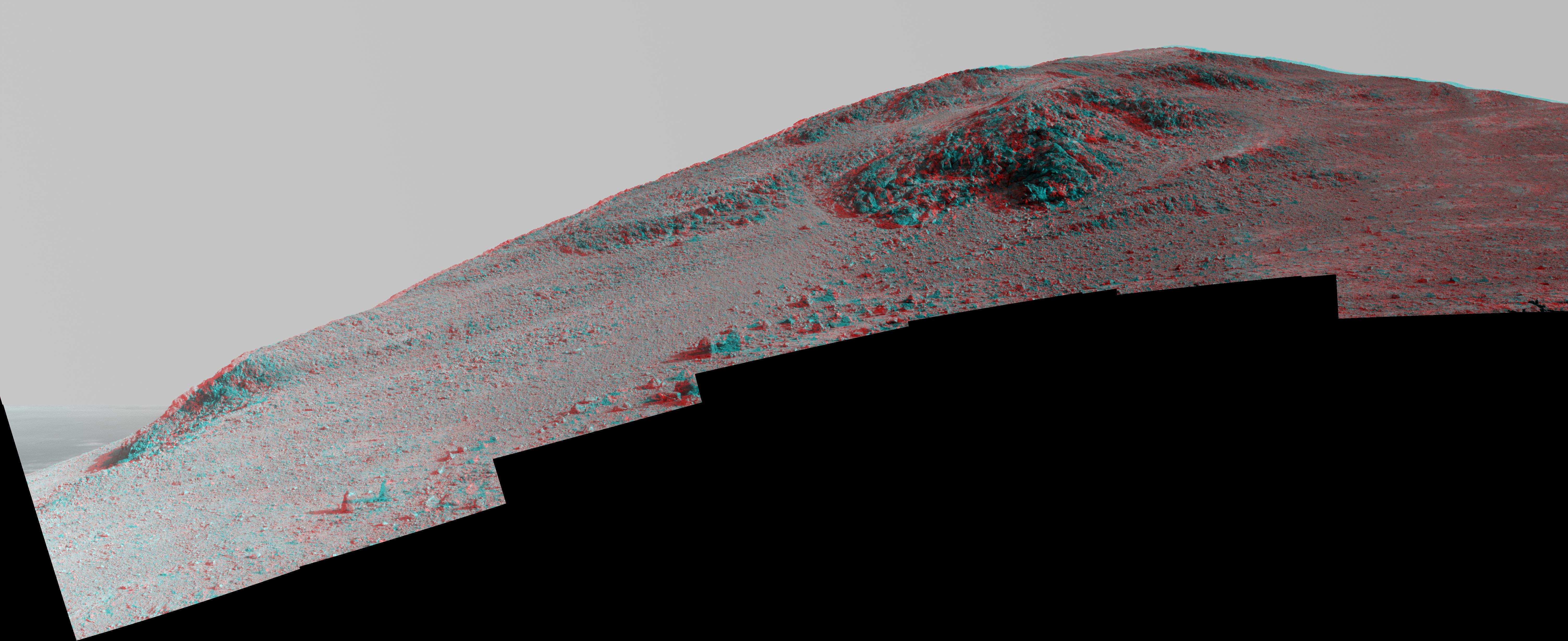
2016-04-04 |
Mars
|
Mars Exploration Rover (MER)
|
Navigation Camera
|
1020x1024x1 |

|
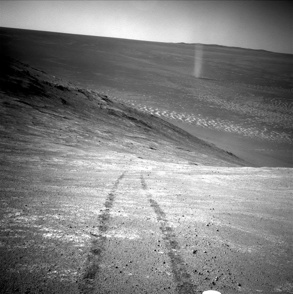
-
PIA20012:
-
Opportunity's Devilish View from on High
Full Resolution:
TIFF
(1.046 MB)
JPEG
(226.3 kB)
|
|
|
2016-04-04 |
Mars
|
2001 Mars Odyssey
|
THEMIS
|
720x1456x1 |
|
-
PIA20442:
-
Hrad Valles
Full Resolution:
TIFF
(814.8 kB)
JPEG
(148.6 kB)
|
|
|
2016-04-01 |
Mars
|
2001 Mars Odyssey
|
THEMIS
|
1407x2646x1 |
|
-
PIA20441:
-
Phlegethon Catena
Full Resolution:
TIFF
(2.507 MB)
JPEG
(271.4 kB)
|
|
|
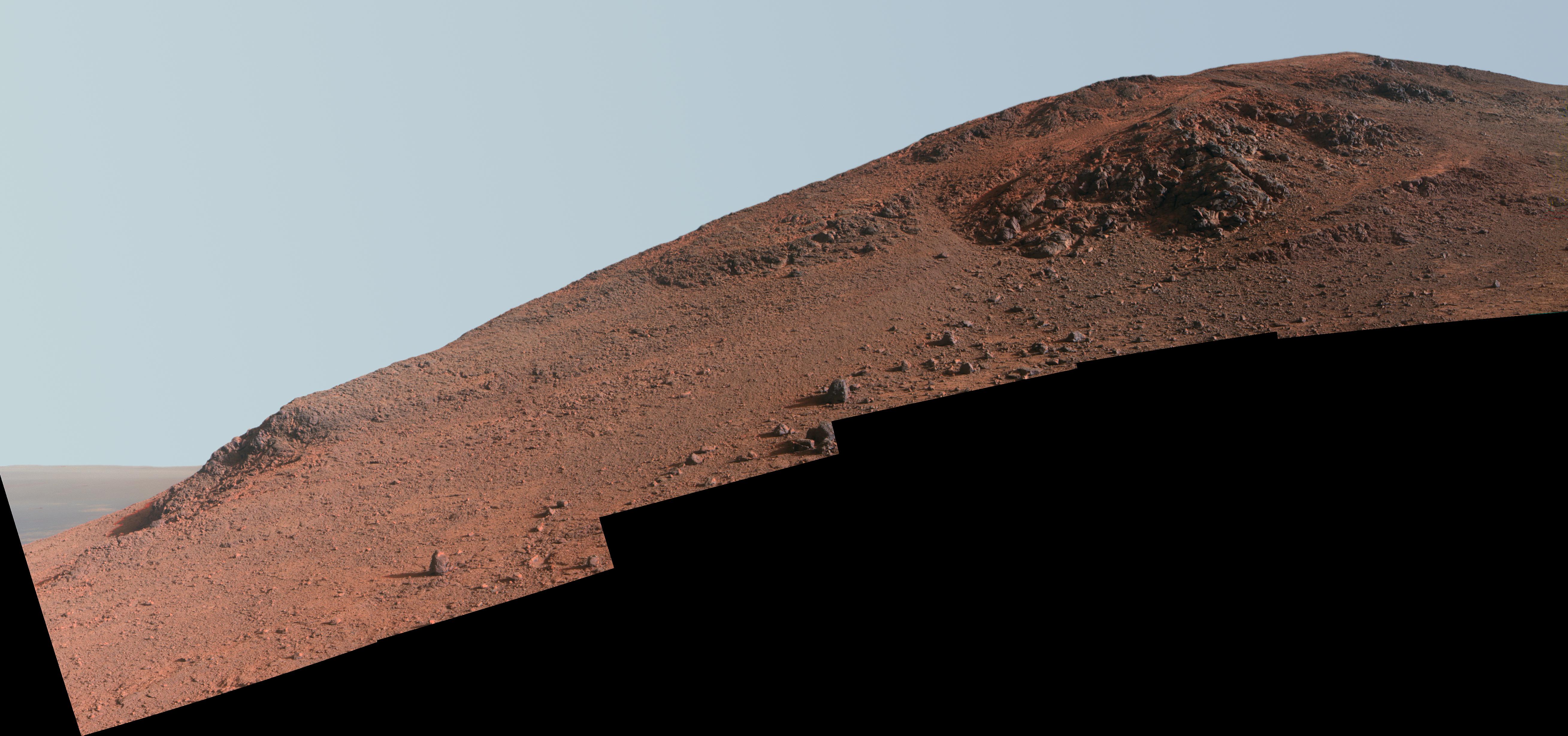
2016-03-31 |
Mars
|
Mars Exploration Rover (MER)
|
Navigation Camera
|
1024x1024x1 |
|
-
PIA20329:
-
Streaks on Opportunity Solar Panel After Uphill Drive
Full Resolution:
TIFF
(1 MB)
JPEG
(139.9 kB)
|
|
|
2016-03-31 |
Mars
|
Mars Exploration Rover (MER)
|
Hazcam
|
1290x1285x1 |
|
-
PIA20328:
-
Opportunity's Shadow and Tracks on Martian Slope
Full Resolution:
TIFF
(836 kB)
JPEG
(81.32 kB)
|
|
|
2016-03-31 |
Mars
|
2001 Mars Odyssey
|
THEMIS
|
1422x2646x1 |
|
-
PIA20440:
-
Granicus Valles
Full Resolution:
TIFF
(2.878 MB)
JPEG
(477.5 kB)
|
|
|
2016-03-30 |
Mars
|
2001 Mars Odyssey
|
THEMIS
|
1389x2641x1 |

|
-
PIA20439:
-
Cerberus Fossae
Full Resolution:
TIFF
(2.542 MB)
JPEG
(324.6 kB)
|
|
|
2016-03-29 |
Mars
|
2001 Mars Odyssey
|
THEMIS
|
703x1439x1 |
|
-
PIA20438:
-
Olympica Fossae
Full Resolution:
TIFF
(741.5 kB)
JPEG
(120.3 kB)
|
|
|
2016-03-28 |
Mars
|
2001 Mars Odyssey
|
THEMIS
|
1185x2608x1 |
|
-
PIA20436:
-
More Olympia Undae
Full Resolution:
TIFF
(2.706 MB)
JPEG
(325.4 kB)
|
|
|
2016-03-25 |
Mars
|
2001 Mars Odyssey
|
THEMIS
|
1179x2587x1 |
|
-
PIA20435:
-
Olympia Undae
Full Resolution:
TIFF
(2.953 MB)
JPEG
(415.4 kB)
|
|
|
2016-03-24 |
Mars
|
2001 Mars Odyssey
|
THEMIS
|
1170x2595x1 |

|
-
PIA20434:
-
Polar Cap Layers
Full Resolution:
TIFF
(2.617 MB)
JPEG
(298.5 kB)
|
|
|
2016-03-23 |
Mars
|
Mars Reconnaissance Orbiter (MRO)
|
HiRISE
|
2880x1800x3 |

|
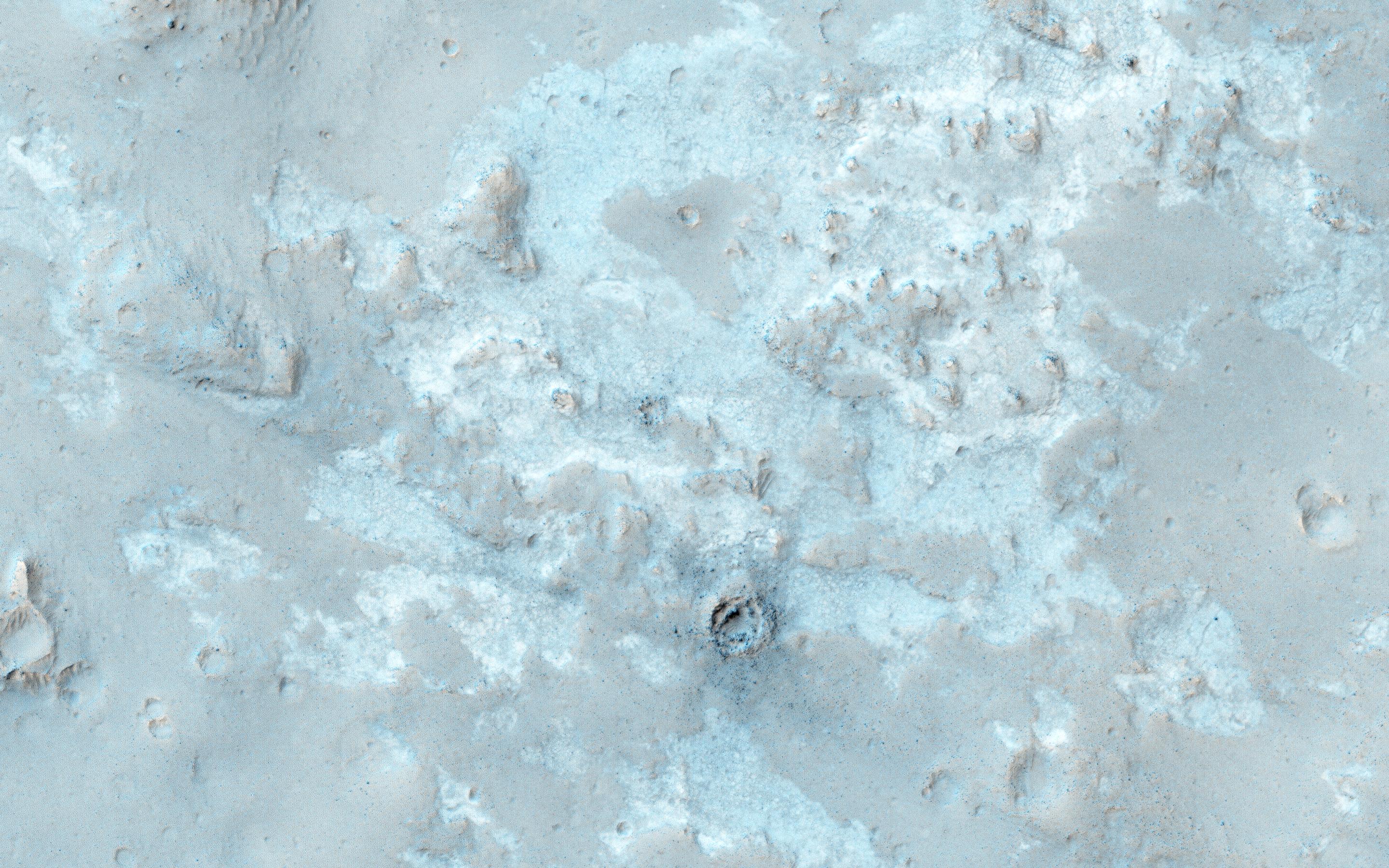
-
PIA20541:
-
Colorful Polar Layered Deposits
Full Resolution:
TIFF
(15.56 MB)
JPEG
(1.428 MB)
|
|
|
2016-03-23 |
Mars
|
Mars Reconnaissance Orbiter (MRO)
|
HiRISE
|
2880x1800x3 |
|
-
PIA20540:
-
Looking for Ice
Full Resolution:
TIFF
(15.56 MB)
JPEG
(1.829 MB)
|
|
|
2016-03-23 |
Mars
|
Mars Reconnaissance Orbiter (MRO)
|
HiRISE
|
2880x1800x3 |
|
-
PIA20539:
-
Old Salt
Full Resolution:
TIFF
(15.56 MB)
JPEG
(803.7 kB)
|
|
|
2016-03-23 |
Mars
|
Mars Reconnaissance Orbiter (MRO)
|
HiRISE
|
2880x1800x3 |
|
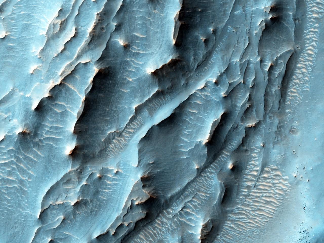
-
PIA20538:
-
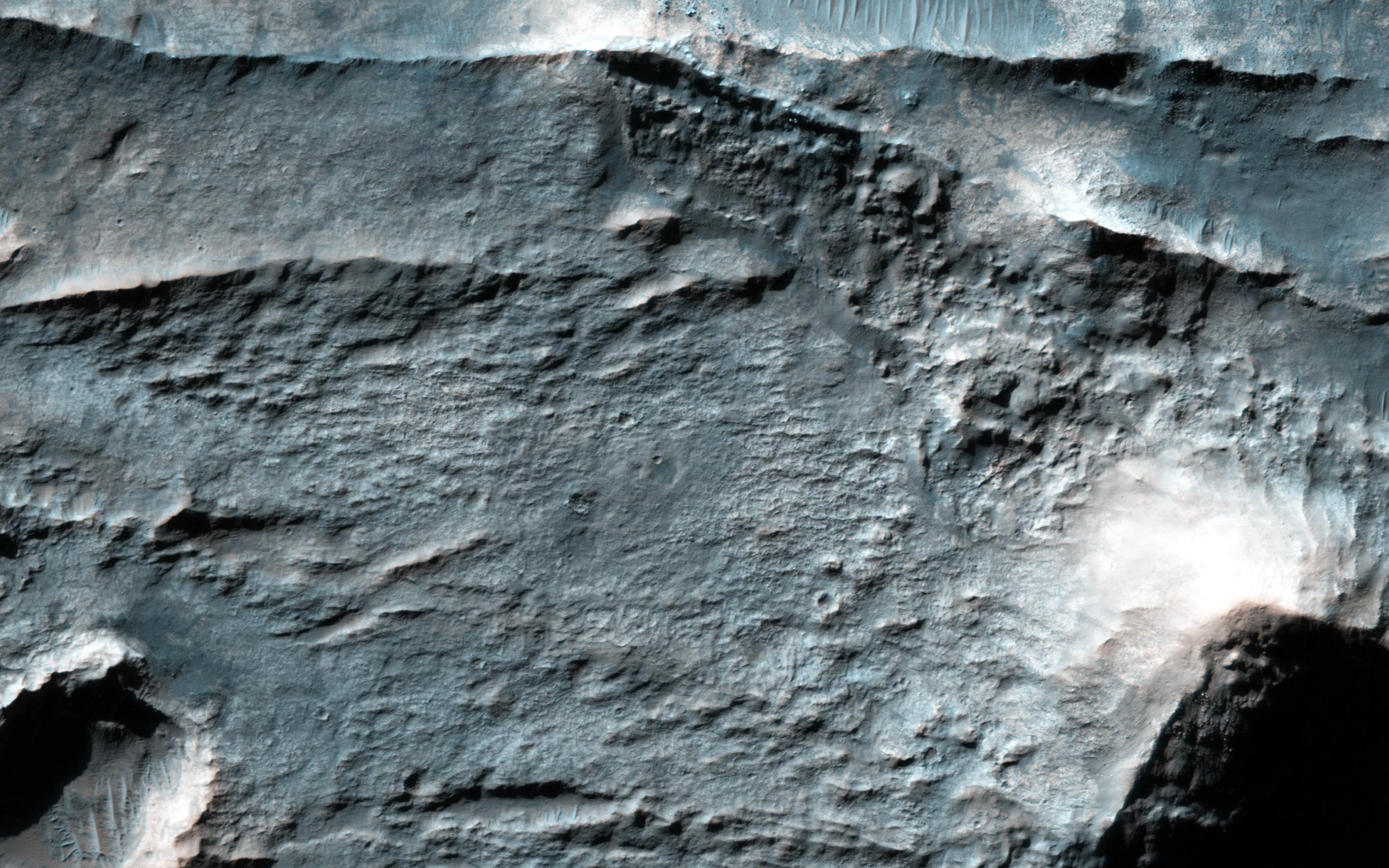
Stratigraphy of Alluvial Fans in Saheki Crater
Full Resolution:
TIFF
(13.24 MB)
JPEG
(436.8 kB)
|
|
|
2016-03-23 |
Mars
|
2001 Mars Odyssey
|
THEMIS
|
1183x2591x1 |
|
-
PIA20433:
-
Olympia Undae
Full Resolution:
TIFF
(3.032 MB)
JPEG
(433.2 kB)
|
|
|
2016-03-22 |
Mars
|
2001 Mars Odyssey
|
THEMIS
|
703x1435x1 |
|
-
PIA20432:
-
Cerberus Fossae
Full Resolution:
TIFF
(604.1 kB)
JPEG
(58.54 kB)
|
|
|
2016-03-21 |
Mars
|
2001 Mars Odyssey
Mars Global Surveyor (MGS)
Mars Reconnaissance Orbiter (MRO)
|
MOLA
|
2400x2400x3 |
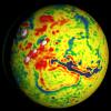
|
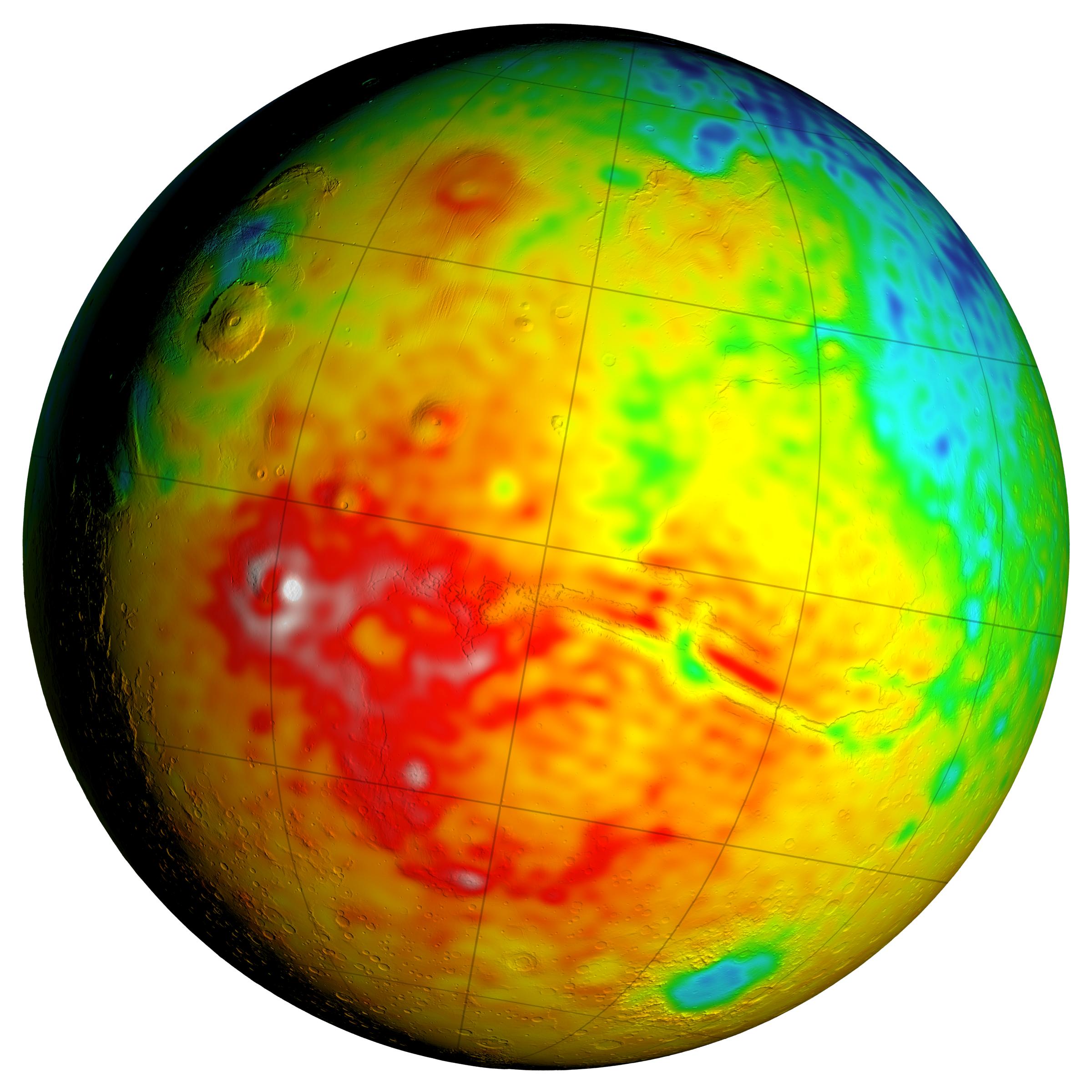
-
PIA20327:
-
Local Variations in the Gravitational Pull of Mars
Full Resolution:
TIFF
(11.91 MB)
JPEG
(443.7 kB)
|
|
|
2016-03-21 |
Mars
|
2001 Mars Odyssey
Mars Global Surveyor (MGS)
Mars Reconnaissance Orbiter (MRO)
|
MOLA
|
2400x2400x3 |

|
-
PIA20326:
-
Newly Detailed Map of Mars' Crustal Thickness
Full Resolution:
TIFF
(10.76 MB)
JPEG
(398.9 kB)
|
|
|
2016-03-21 |
Mars
|
2001 Mars Odyssey
Mars Global Surveyor (MGS)
Mars Reconnaissance Orbiter (MRO)
|
MOLA
|
3200x1500x3 |
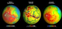
|
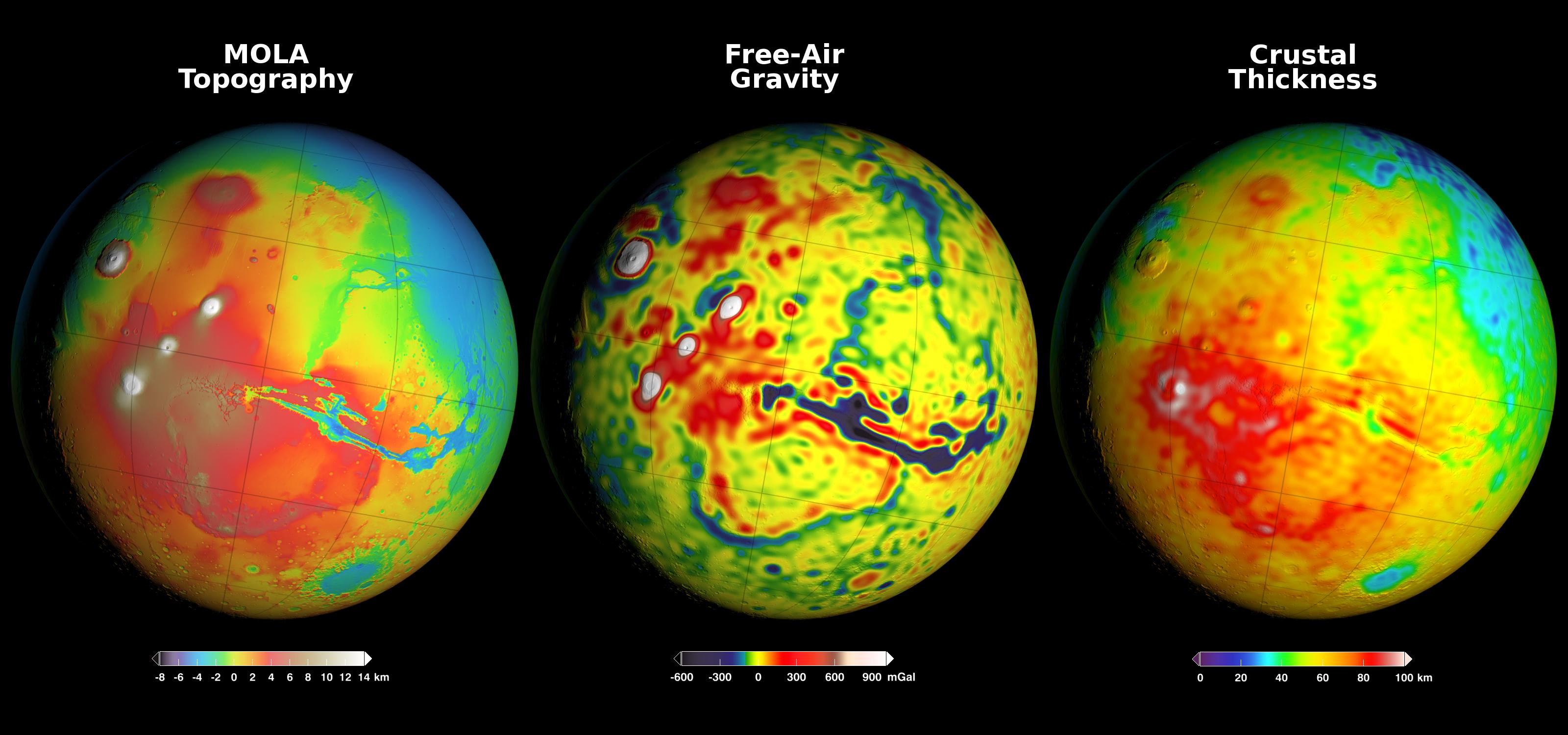
-
PIA20277:
-
Using Gravity and Topography to Map Mars' Crustal Thickness
Full Resolution:
TIFF
(7.902 MB)
JPEG
(358.2 kB)
|
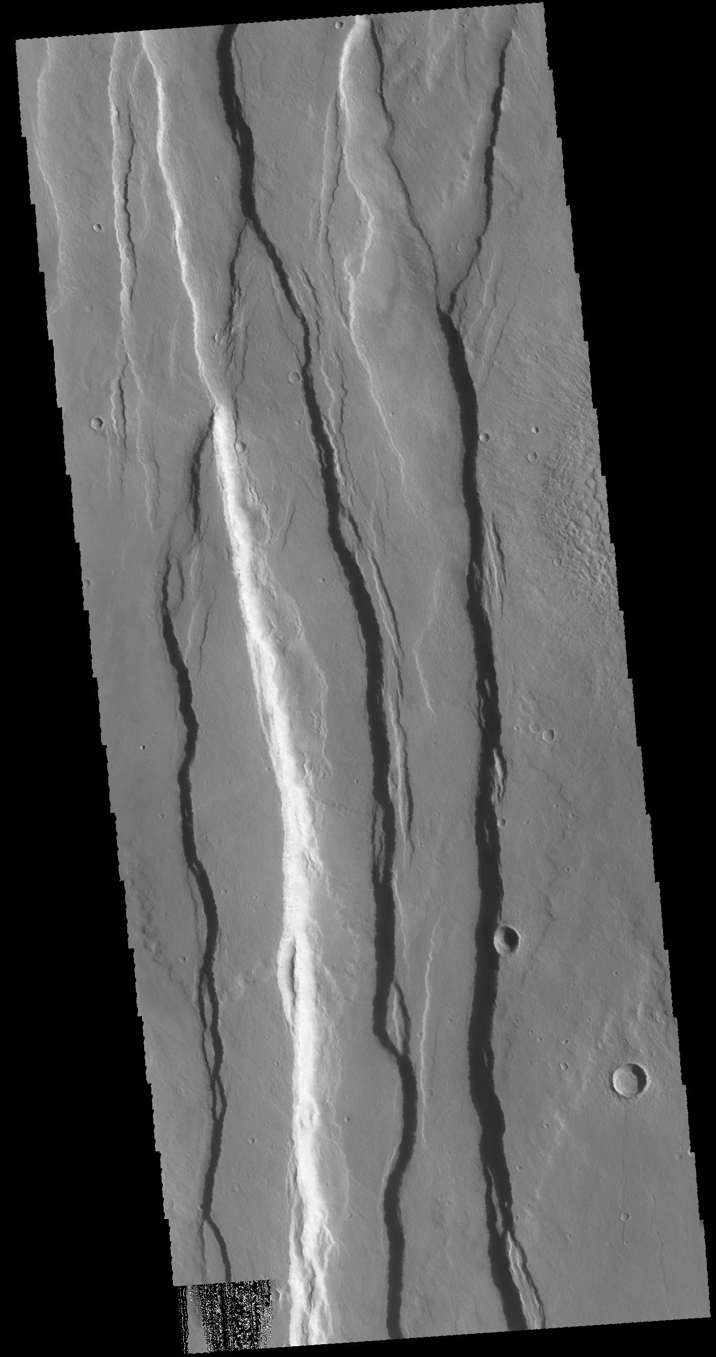
|
|
2016-03-21 |
Mars
|
2001 Mars Odyssey
|
THEMIS
|
706x1440x1 |

|
-
PIA20431:
-
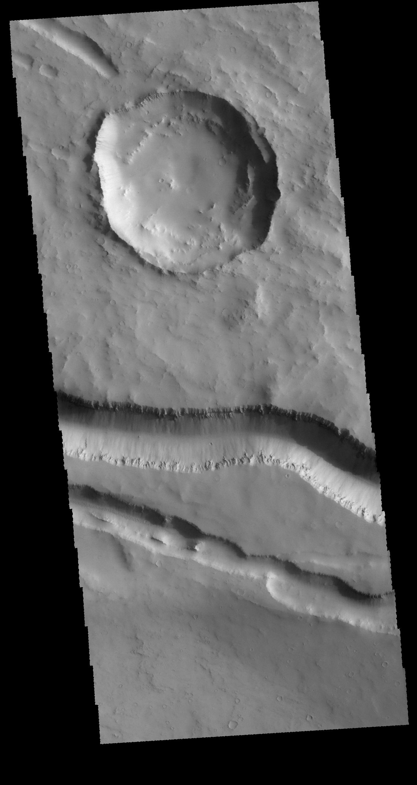
Crater Interior
Full Resolution:
TIFF
(655 kB)
JPEG
(66.3 kB)
|
|
|
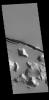
2016-03-18 |
Mars
|
2001 Mars Odyssey
|
THEMIS
|
775x1575x3 |
|
-
PIA20430:
-
Capri Mensa - False Color
Full Resolution:
TIFF
(2.372 MB)
JPEG
(118.4 kB)
|
|
|
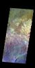
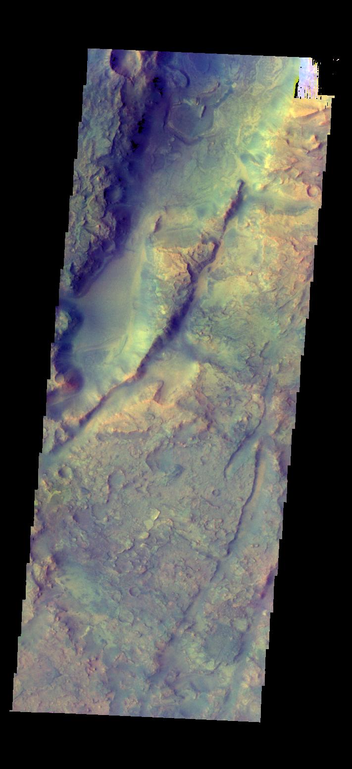
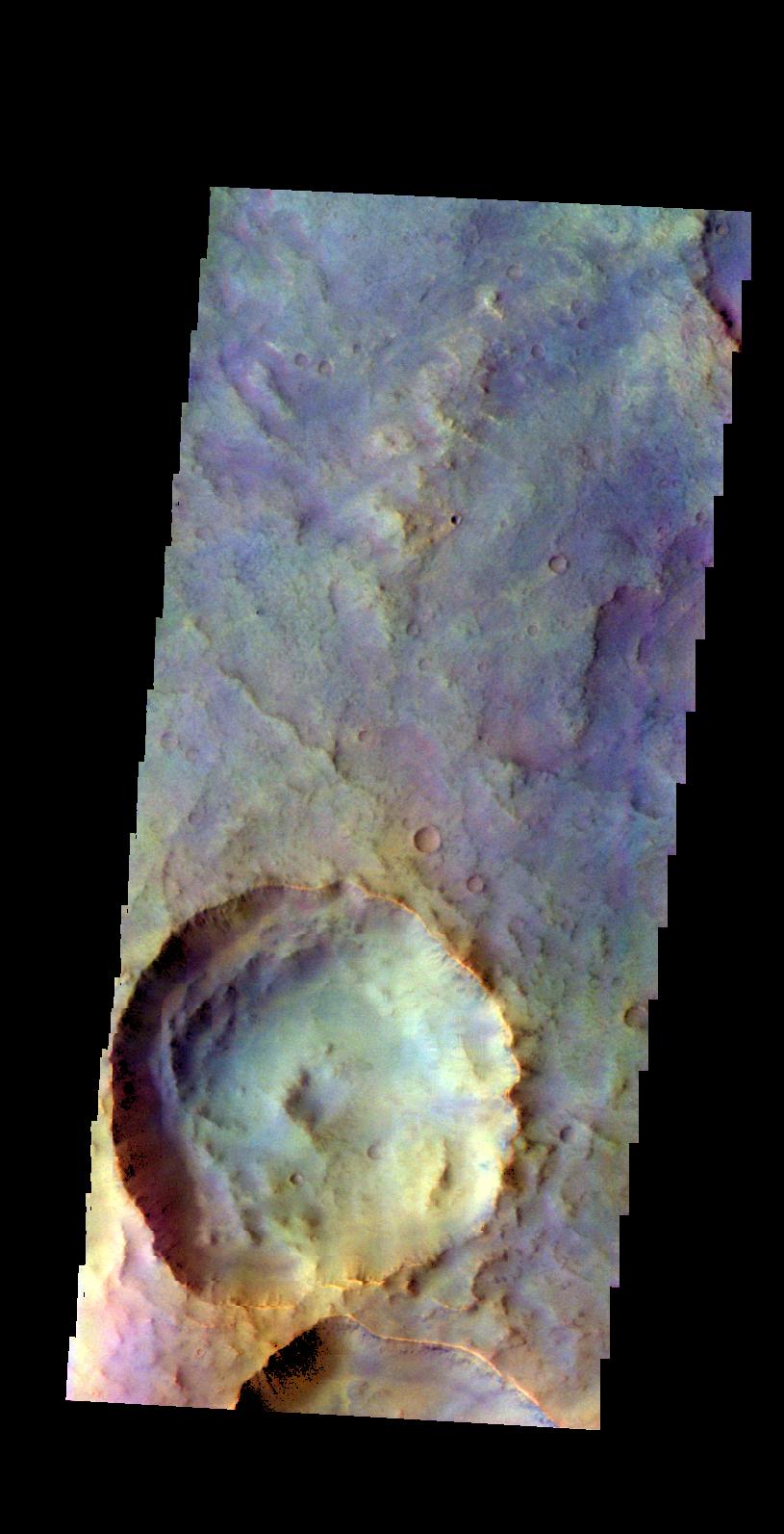
2016-03-17 |
Mars
|
2001 Mars Odyssey
|
THEMIS
|
791x1584x3 |
|
-
PIA20429:
-
Tyrrhena Terra - False Color
Full Resolution:
TIFF
(2.564 MB)
JPEG
(133.4 kB)
|
|
|
2016-03-16 |
Mars
|
2001 Mars Odyssey
|
THEMIS
|
783x1579x3 |
|
-
PIA20428:
-
Tyrrhena Terra - False Color
Full Resolution:
TIFF
(2.392 MB)
JPEG
(114.5 kB)
|
|
|
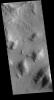
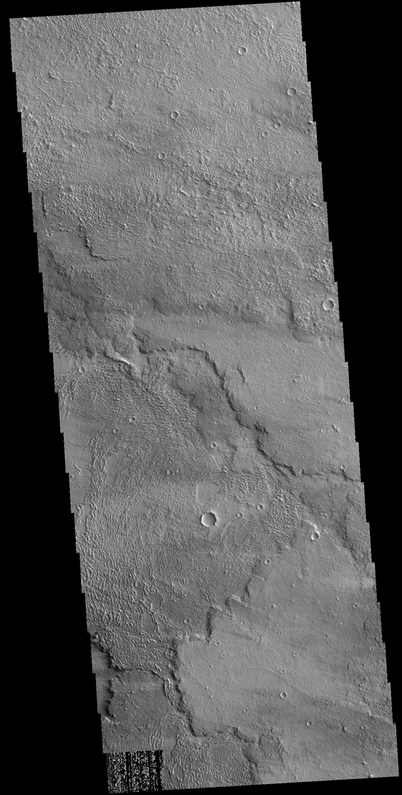
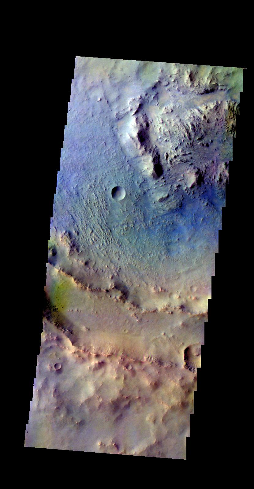
2016-03-15 |
Mars
|
2001 Mars Odyssey
|
THEMIS
|
797x1590x3 |
|
-
PIA20427:
-
Terra Sirenum - False Color
Full Resolution:
TIFF
(2.447 MB)
JPEG
(144.7 kB)
|
|
|
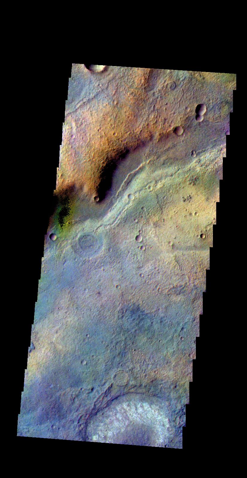
2016-03-14 |
Mars
|
2001 Mars Odyssey
|
THEMIS
|
852x1611x3 |

|
-
PIA20426:
-
Terra Sirenum - False Color
Full Resolution:
TIFF
(2.608 MB)
JPEG
(114.2 kB)
|
|
|
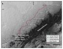
2016-03-11 |
Mars
|
Mars Science Laboratory (MSL)
|
MAHLI
|
1609x1198x3 |
|
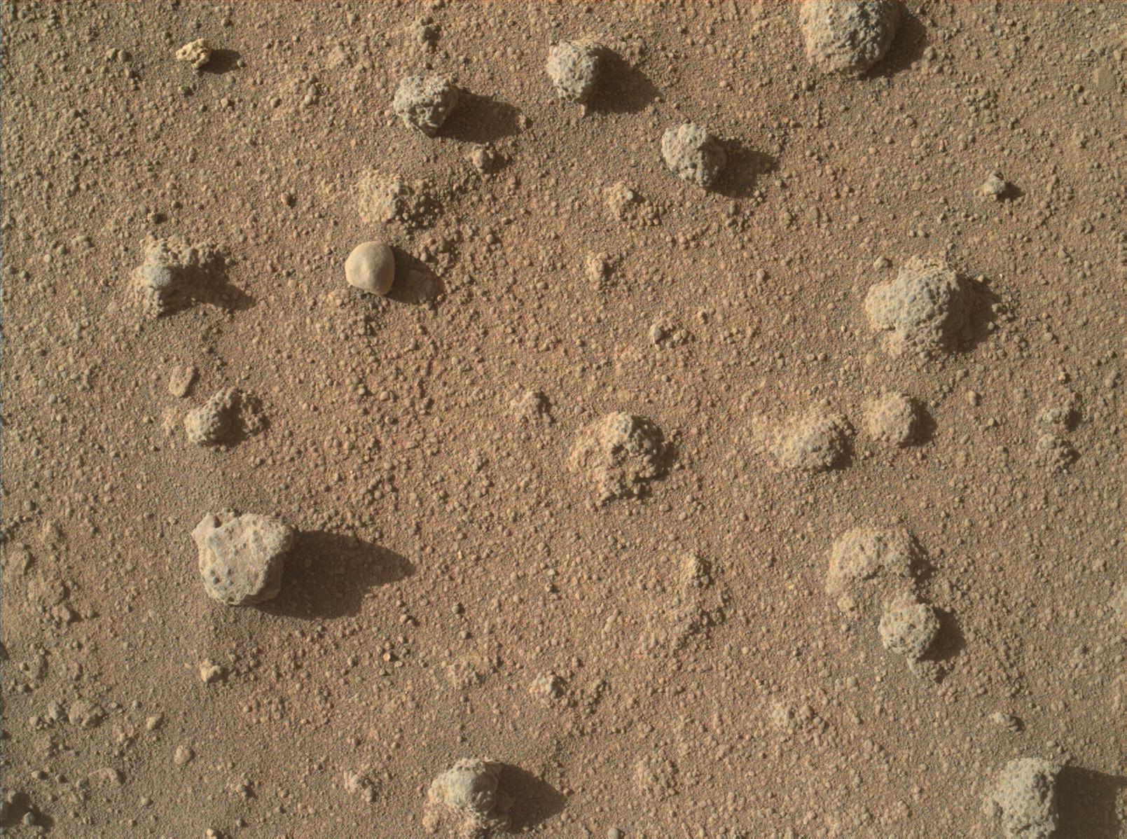
-
PIA20324:
-
Sandstone Nodule Beside 'Naukluft Plateau' on Mount Sharp, Mars
Full Resolution:
TIFF
(5.785 MB)
JPEG
(491.8 kB)
|
|
|
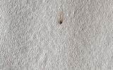
2016-03-11 |
Mars
|
Mars Science Laboratory (MSL)
|
MAHLI
|
1609x1198x3 |
|
-
PIA20323:
-
Nodules of Cemented Sand Grains Within Martian Sandstone
Full Resolution:
TIFF
(5.785 MB)
JPEG
(500.8 kB)
|
|
|
2016-03-11 |
Mars
|
Mars Science Laboratory (MSL)
|
Mastcam
|
4184x2799x3 |
|
-
PIA20322:
-
Knobbly Textured Sandstone on Mount Sharp, Mars
Full Resolution:
TIFF
(26.73 MB)
JPEG
(1.678 MB)
|
|
|
2016-03-11 |
Mars
|
Mars Science Laboratory (MSL)
|
HiRISE
|
3300x2550x3 |
|
-
PIA20166:
-
New Waypoint, Science Team Newcomers for Curiosity
Full Resolution:
TIFF
(12.44 MB)
JPEG
(1.458 MB)
|
|
|
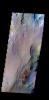
2016-03-11 |
Mars
|
2001 Mars Odyssey
|
THEMIS
|
819x1594x3 |
|
-
PIA20425:
-
Coprates Chasma - False Color
Full Resolution:
TIFF
(2.389 MB)
JPEG
(96.45 kB)
|
|
|
2016-03-10 |
Mars
|
2001 Mars Odyssey
|
THEMIS
|
818x1595x3 |
|
-
PIA20424:
-
Chasma Chaos - False Color
Full Resolution:
TIFF
(2.446 MB)
JPEG
(98.09 kB)
|
|
|
2016-03-10 |
Mars
|
Mars Reconnaissance Orbiter (MRO)
|
HiRISE
|
2880x1800x1 |

|
-
PIA20480:
-
Night Vision
Full Resolution:
TIFF
(5.191 MB)
JPEG
(985.4 kB)
|
|
|
2016-03-10 |
Mars
|
Mars Reconnaissance Orbiter (MRO)
|
HiRISE
|
2880x1800x3 |
|
-
PIA20479:
-
The Northwest Floor of Gale Crater
Full Resolution:
TIFF
(15.56 MB)
JPEG
(973.1 kB)
|
|
|
2016-03-10 |
Mars
|
Mars Reconnaissance Orbiter (MRO)
|
HiRISE
|
2880x1800x1 |
|
-
PIA20478:
-
The Dune Sea of Ganges Chasma
Full Resolution:
TIFF
(5.191 MB)
JPEG
(788.9 kB)
|
|
|
2016-03-09 |
Mars
|
Mars Reconnaissance Orbiter (MRO)
|
HiRISE
|
1280x960x3 |

|
-
PIA20167:
-
For a Decade Orbiting Mars: One Recent View
Full Resolution:
TIFF
(3.688 MB)
JPEG
(200.3 kB)
|
|
|
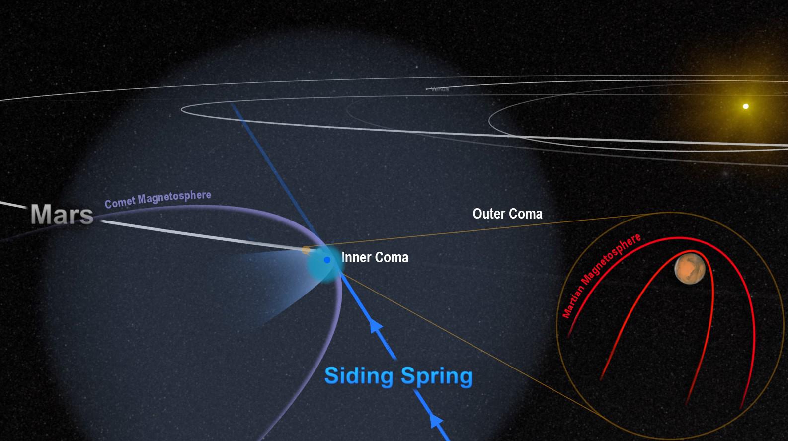
2016-03-09 |
Mars
|
MAVEN
|
|
1586x888x3 |
|
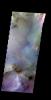
-
PIA20321:
-
Passing Comet Affects Magnetic Field at Mars
Full Resolution:
TIFF
(2.679 MB)
JPEG
(148.8 kB)
|
|
|
2016-03-09 |
Mars
|
2001 Mars Odyssey
|
THEMIS
|
830x1599x3 |

|
-
PIA20423:
-
Martin Crater - False Color
Full Resolution:
TIFF
(2.575 MB)
JPEG
(135.7 kB)
|
|
|
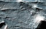
2016-03-08 |
Mars
|
2001 Mars Odyssey
|
THEMIS
|
826x1599x3 |
|
-
PIA20422:
-
Terra Sabaea - False Color
Full Resolution:
TIFF
(2.604 MB)
JPEG
(159 kB)
|
|
|
2016-03-07 |
Mars
|
2001 Mars Odyssey
|
THEMIS
|
815x1593x3 |

|
-
PIA20420:
-
Crater - False Color
Full Resolution:
TIFF
(2.609 MB)
JPEG
(118.1 kB)
|
|
|
2016-03-04 |
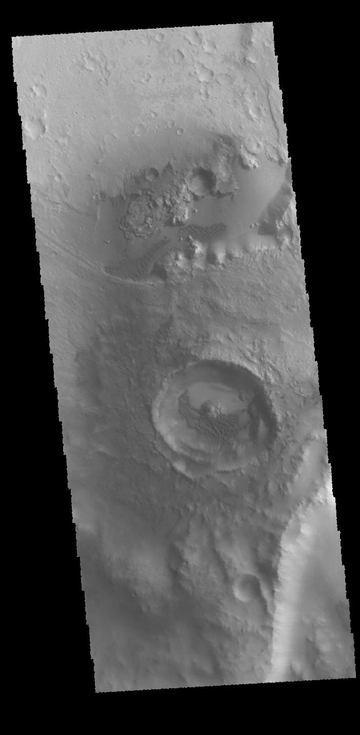
Mars
|
2001 Mars Odyssey
|
THEMIS
|
1430x2651x1 |
|
-
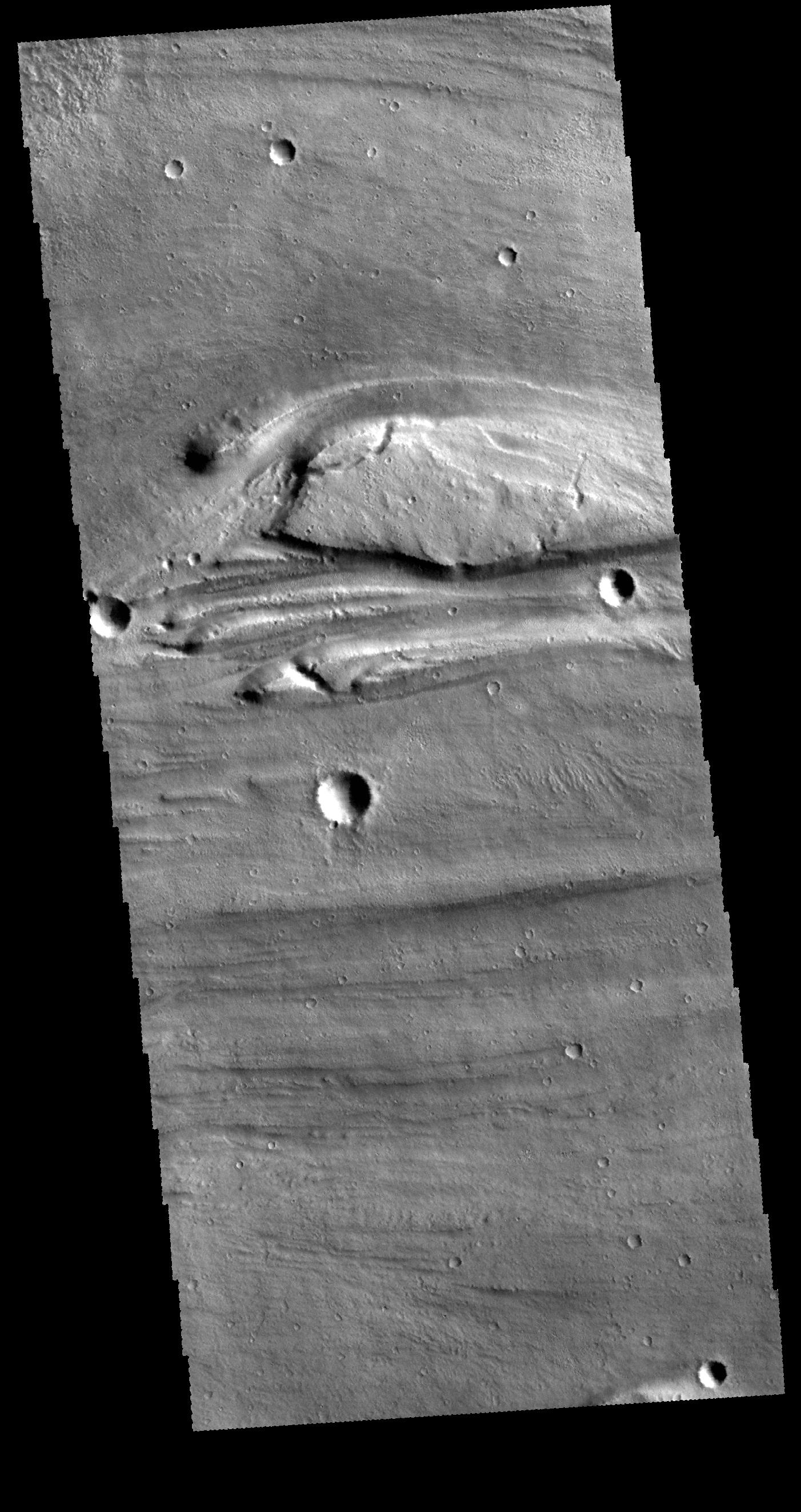
PIA20419:
-
Channel
Full Resolution:
TIFF
(2.888 MB)
JPEG
(456.9 kB)
|
|
|
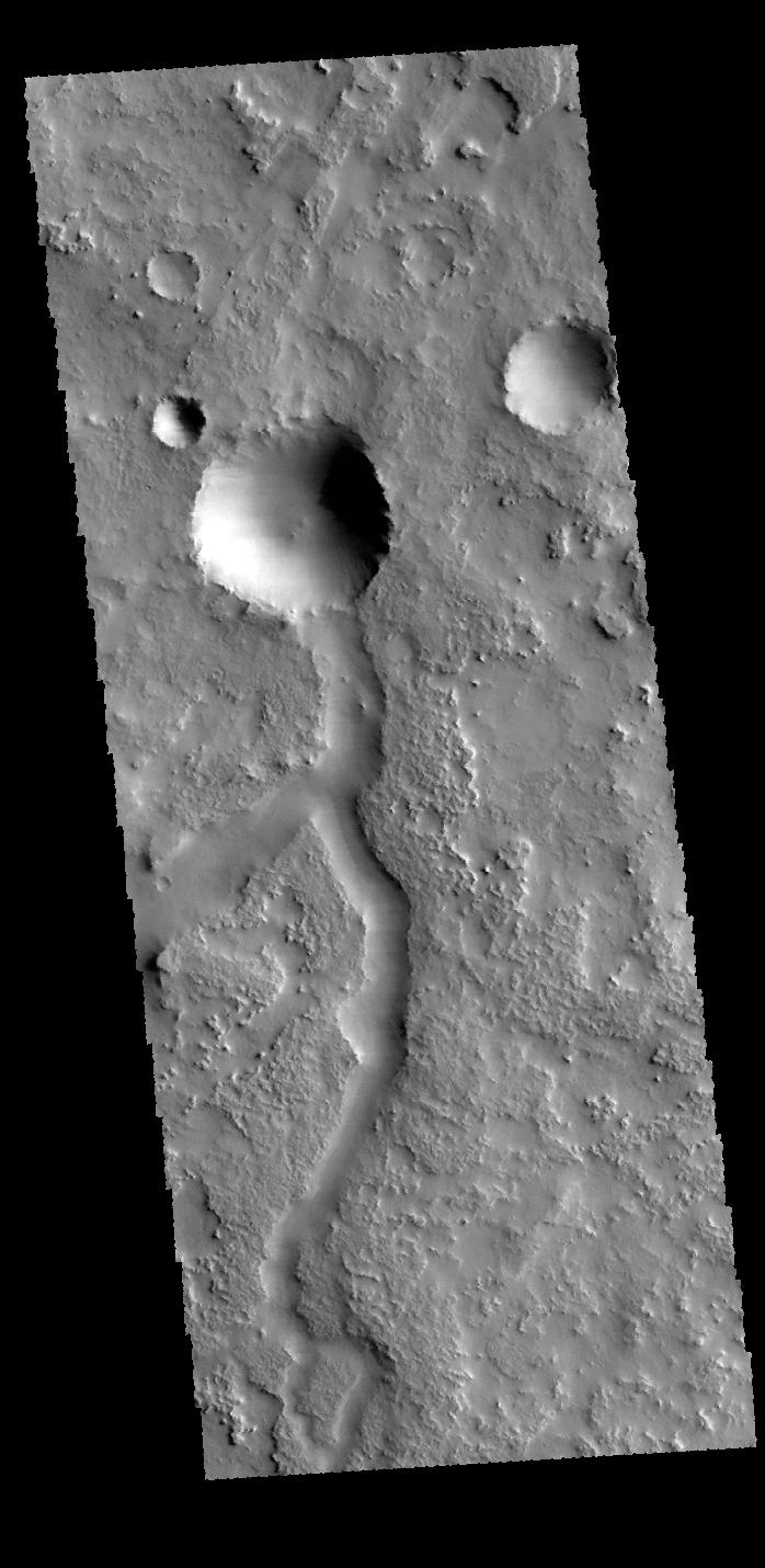
2016-03-03 |
Mars
|
2001 Mars Odyssey
|
THEMIS
|
1436x2651x1 |
|
-
PIA20418:
-
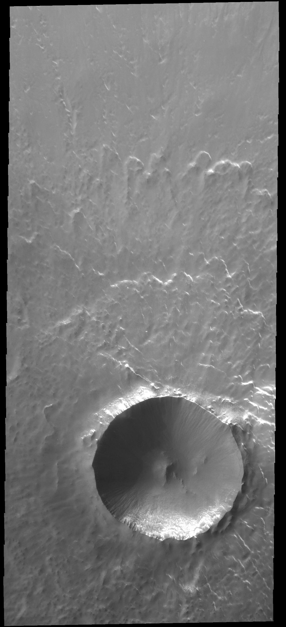
Central Pit Crater
Full Resolution:
TIFF
(2.693 MB)
JPEG
(322.8 kB)
|
|
|
2016-03-02 |
Mars
|
2001 Mars Odyssey
|
THEMIS
|
706x1440x1 |
|
-
PIA20417:
-
Nilus Chaos
Full Resolution:
TIFF
(727.4 kB)
JPEG
(90.49 kB)
|
|
|
2016-03-01 |
Mars
|
2001 Mars Odyssey
|
THEMIS
|
703x1436x1 |
|
-
PIA20416:
-
Crater
Full Resolution:
TIFF
(708.7 kB)
JPEG
(83.99 kB)
|
|
|
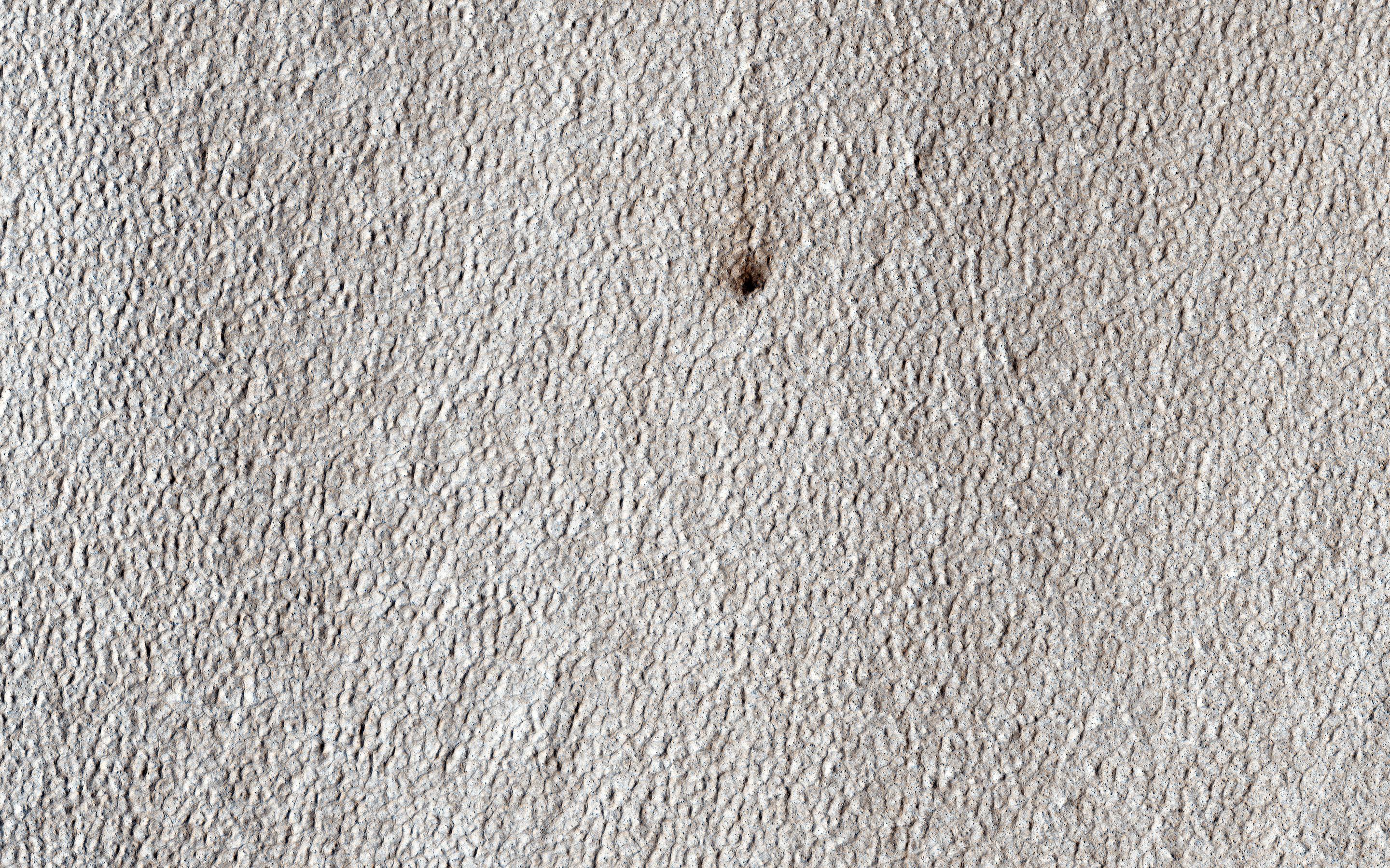
2016-02-29 |
Mars
|
2001 Mars Odyssey
|
THEMIS
|
702x1434x1 |

|
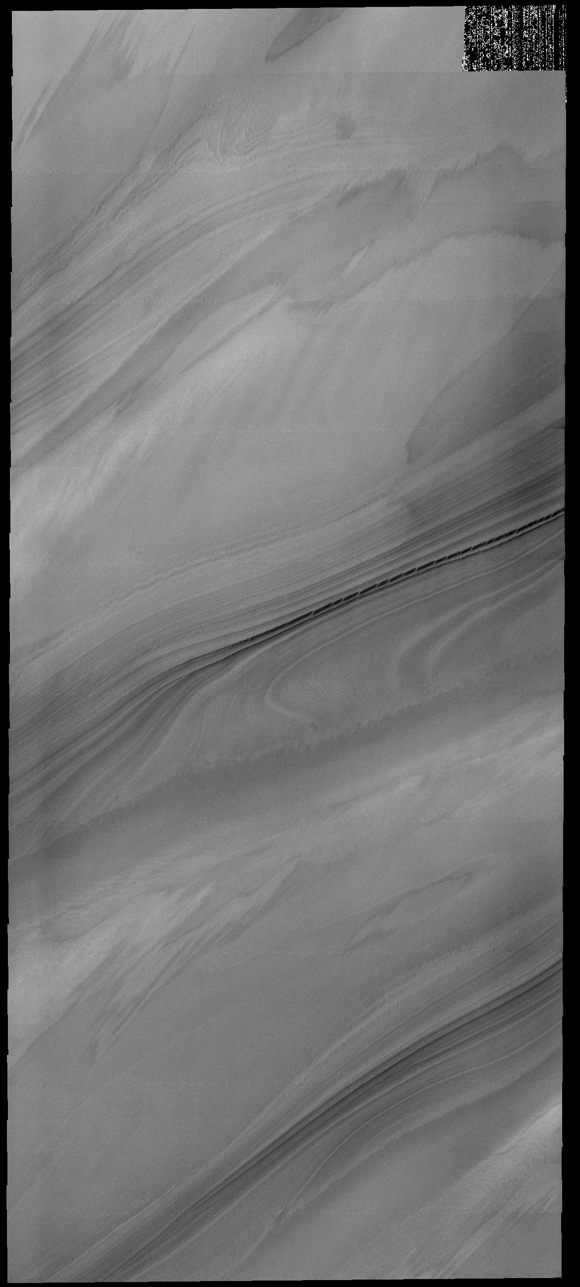
-
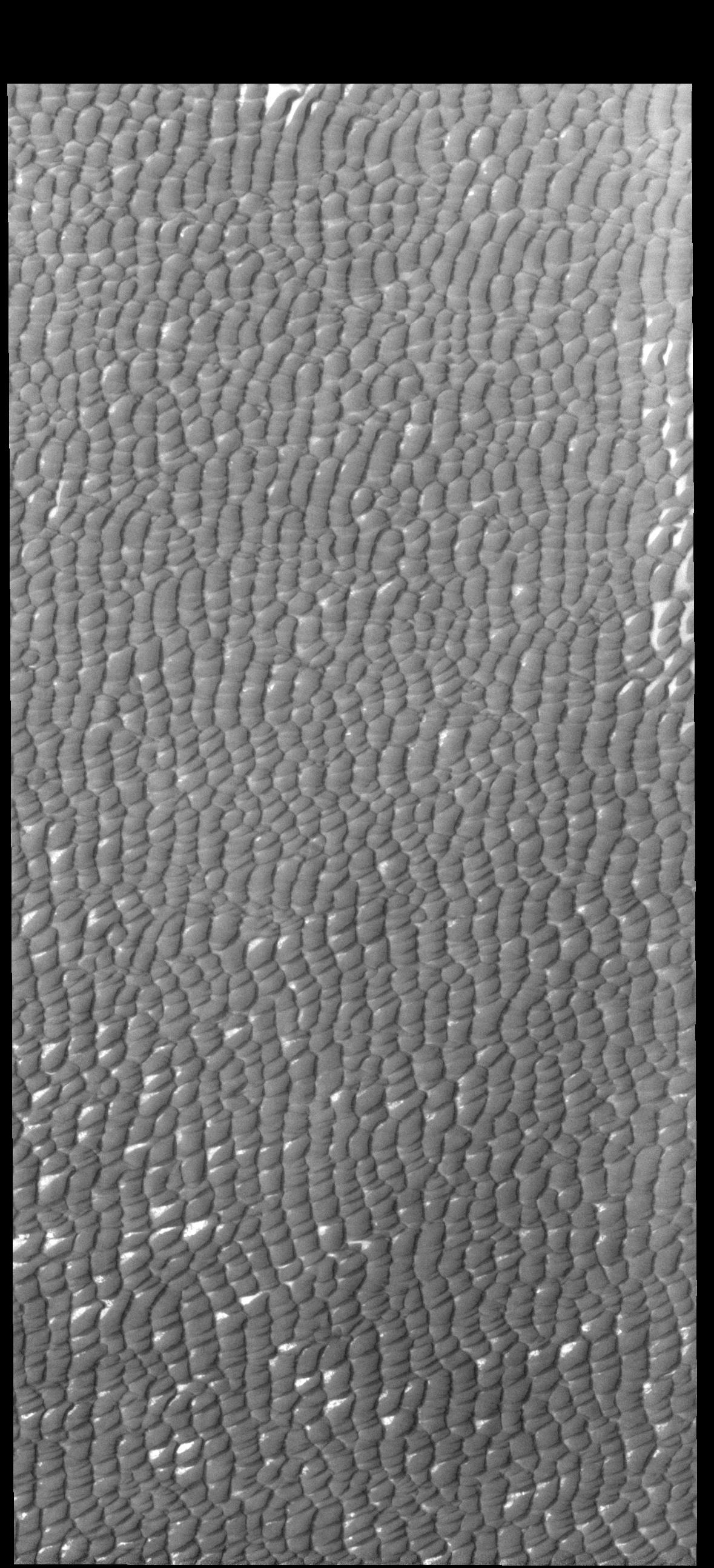
PIA20415:
-
Crater Dunes
Full Resolution:
TIFF
(653.7 kB)
JPEG
(67.29 kB)
|
|
|
2016-02-26 |
Mars
|
2001 Mars Odyssey
|
THEMIS
|
698x1430x1 |

|
-
PIA20414:
-
Terra Sabaea
Full Resolution:
TIFF
(739.7 kB)
JPEG
(110.7 kB)
|
|
|
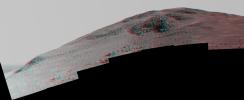
2016-02-25 |
Mars
|
Mars Exploration Rover (MER)
|
Panoramic Camera
|
6015x2459x3 |
|
-
PIA20320:
-
Steep 'Knudsen Ridge' Along 'Marathon Valley' on Mars (Stereo)
Full Resolution:
TIFF
(17.97 MB)
JPEG
(1.276 MB)
|
|
|
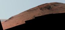
2016-02-25 |
Mars
|
Mars Exploration Rover (MER)
|
Panoramic Camera
|
5235x2459x3 |
|
-
PIA20319:
-
Steep 'Knudsen Ridge' Along 'Marathon Valley' on Mars (Enhanced Color)
Full Resolution:
TIFF
(22.45 MB)
JPEG
(1.096 MB)
|
|
|
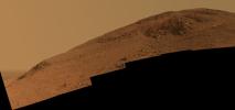
2016-02-25 |
Mars
|
Mars Exploration Rover (MER)
|
Panoramic Camera
|
5235x2459x3 |
|
-
PIA20318:
-
Steep 'Knudsen Ridge' Along 'Marathon Valley' on Mars
Full Resolution:
TIFF
(19.32 MB)
JPEG
(895.6 kB)
|
|
|
2016-02-25 |
Mars
|
2001 Mars Odyssey
|
THEMIS
|
1385x2642x1 |

|
-
PIA20413:
-
Cerberus Fossae
Full Resolution:
TIFF
(2.464 MB)
JPEG
(273.3 kB)
|
|
|
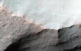
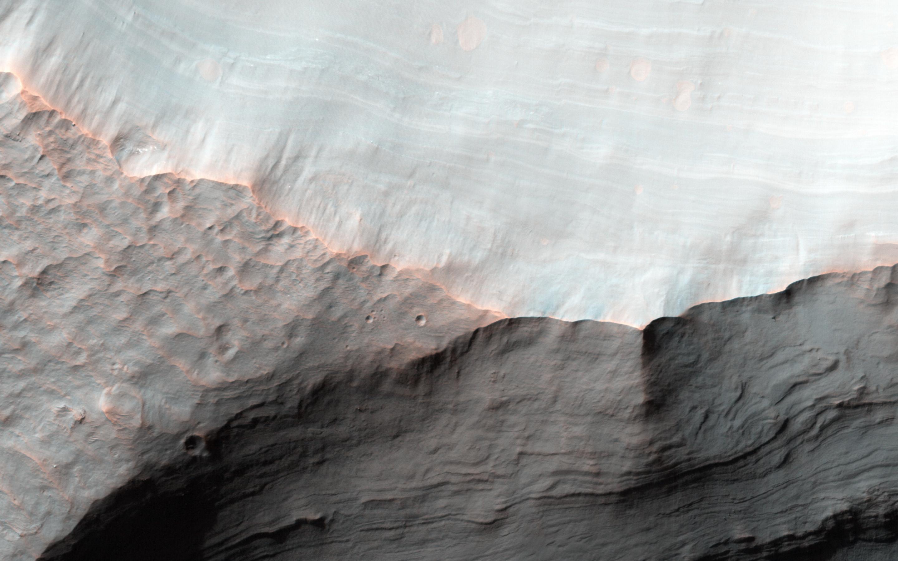
2016-02-24 |
Mars
|
Mars Reconnaissance Orbiter (MRO)
|
HiRISE
|
2880x1800x3 |
|
-
PIA20472:
-
Frosted Gully Slopes in Shadows
Full Resolution:
TIFF
(15.56 MB)
JPEG
(966.2 kB)
|
|
|
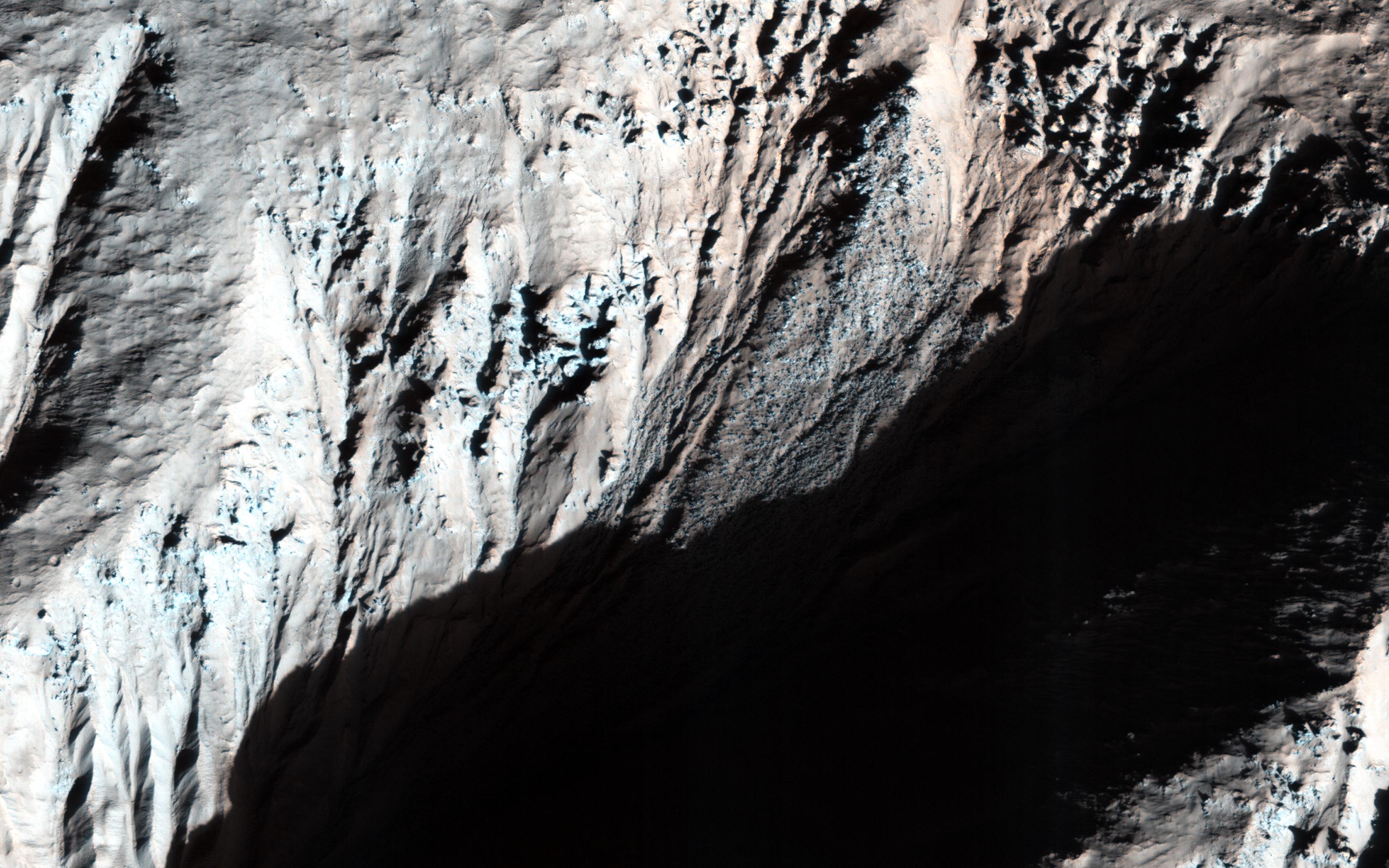
2016-02-24 |
Mars
|
Mars Reconnaissance Orbiter (MRO)
|
HiRISE
|
2880x1800x3 |
|
-
PIA20471:
-
Colorful Hargraves
Full Resolution:
TIFF
(15.56 MB)
JPEG
(974.5 kB)
|
|
|
2016-02-24 |
Mars
|
Mars Reconnaissance Orbiter (MRO)
|
HiRISE
|
2880x1800x1 |
|
-
PIA20470:
-
Dramatic Shadows over a Fossil Glacier
Full Resolution:
TIFF
(4.997 MB)
JPEG
(993.7 kB)
|
|
|
2016-02-24 |
Mars
|
Mars Reconnaissance Orbiter (MRO)
|
HiRISE
|
2880x1800x3 |
|
-
PIA20469:
-
Summer Sand Dunes
Full Resolution:
TIFF
(15.56 MB)
JPEG
(996.1 kB)
|
|
|
2016-02-24 |
Mars
|
2001 Mars Odyssey
|
THEMIS
|
1389x2644x1 |
|
-
PIA20412:
-
Ares Vallis
Full Resolution:
TIFF
(2.483 MB)
JPEG
(256.5 kB)
|
|
|
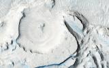
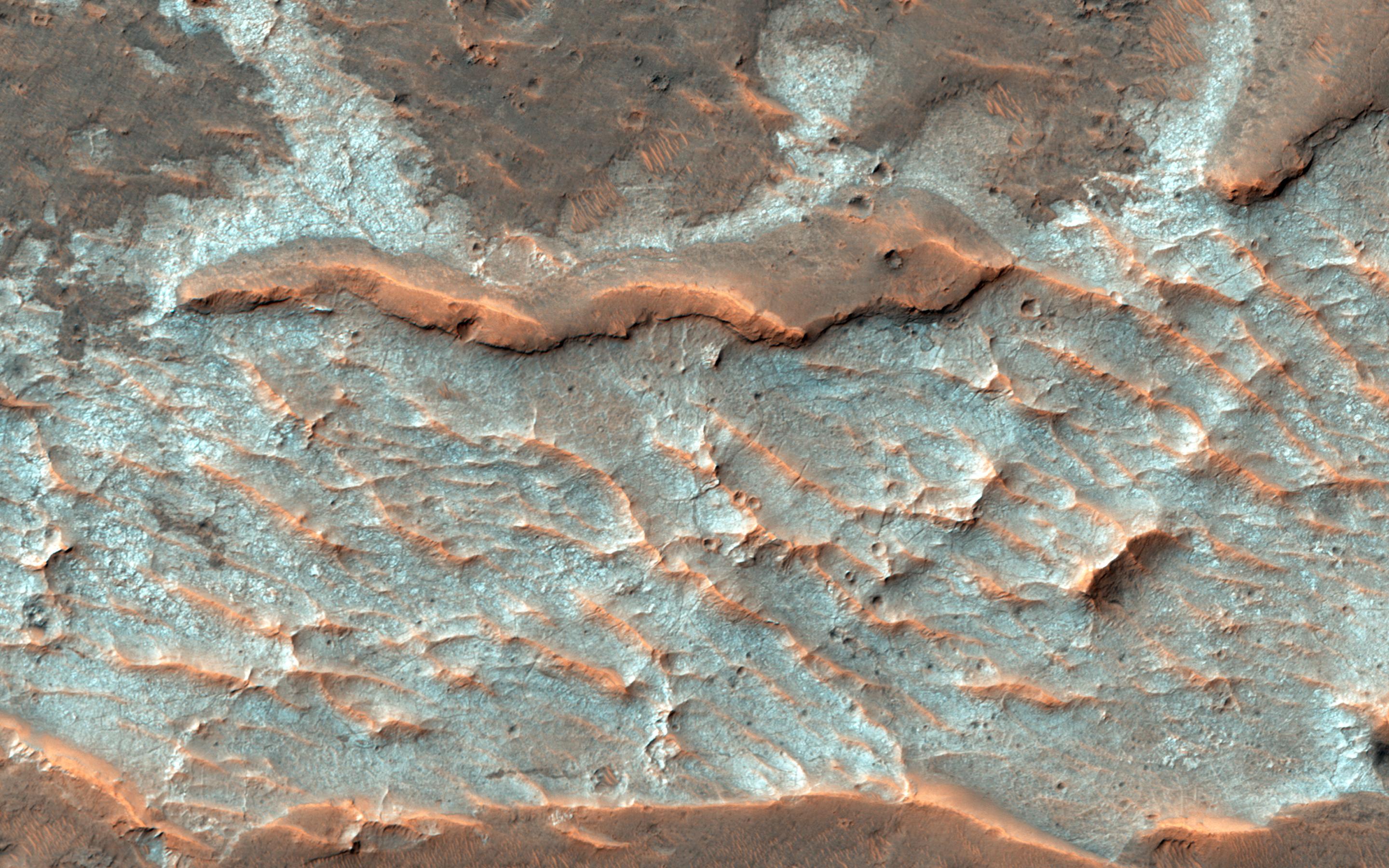
2016-02-23 |
Mars
|
2001 Mars Odyssey
|
THEMIS
|
1380x2642x1 |
|
-
PIA20411:
-
Arabia Terra
Full Resolution:
TIFF
(2.416 MB)
JPEG
(256.7 kB)
|
|
|
2016-02-22 |
Mars
|
2001 Mars Odyssey
|
THEMIS
|
1385x2643x1 |
|
-
PIA20265:
-
More Olympica Fossae
Full Resolution:
TIFF
(2.411 MB)
JPEG
(346.6 kB)
|
|
|
2016-02-19 |
Mars
|
2001 Mars Odyssey
|
THEMIS
|
1385x2643x1 |
|
-
PIA20264:
-
Olympica Fossae
Full Resolution:
TIFF
(2.487 MB)
JPEG
(306.2 kB)
|
|
|
2016-02-18 |
Mars
|
2001 Mars Odyssey
|
THEMIS
|
1404x2646x1 |
|
-
PIA20262:
-
Granicus Valles
Full Resolution:
TIFF
(2.556 MB)
JPEG
(280 kB)
|
|
|
2016-02-17 |
Mars
|
2001 Mars Odyssey
|
THEMIS
|
1432x2655x1 |
|
-
PIA20261:
-
Rampart Crater
Full Resolution:
TIFF
(2.85 MB)
JPEG
(415.6 kB)
|
|
|
2016-02-16 |
Mars
|
2001 Mars Odyssey
|
THEMIS
|
1396x2646x1 |

|
-
PIA20260:
-
Ceraunius Fossae
Full Resolution:
TIFF
(2.545 MB)
JPEG
(285.7 kB)
|
|
|
2016-02-15 |
Mars
|
2001 Mars Odyssey
|
THEMIS
|
1424x2653x1 |
|
-
PIA20259:
-
Tempe Terra
Full Resolution:
TIFF
(2.846 MB)
JPEG
(397.4 kB)
|
|
|
2016-02-12 |
Mars
|
2001 Mars Odyssey
|
THEMIS
|
1402x2645x1 |
|
-
PIA20258:
-
Kasei Valles
Full Resolution:
TIFF
(2.755 MB)
JPEG
(427.9 kB)
|
|
|
2016-02-11 |
Mars
|
2001 Mars Odyssey
|
THEMIS
|
1209x2650x1 |

|
-
PIA20257:
-
Lonar Crater
Full Resolution:
TIFF
(2.329 MB)
JPEG
(212.5 kB)
|
|
|
2016-02-11 |
Mars
|
Mars Reconnaissance Orbiter (MRO)
|
HiRISE
|
2880x1800x3 |
|
-
PIA20463:
-
A Possible Alluvial Fan
Full Resolution:
TIFF
(15.56 MB)
JPEG
(869 kB)
|
|
|
2016-02-11 |
Mars
|
Mars Reconnaissance Orbiter (MRO)
|
HiRISE
|
2880x1800x3 |
|
-
PIA20462:
-
Rounded Mounds in Northern Arabia Terra
Full Resolution:
TIFF
(13.56 MB)
JPEG
(657.9 kB)
|
|
|
2016-02-11 |
Mars
|
Mars Reconnaissance Orbiter (MRO)
|
HiRISE
|
2880x1800x3 |
|
-
PIA20461:
-
Wind at Work
Full Resolution:
TIFF
(15 MB)
JPEG
(554.4 kB)
|
|
|
2016-02-11 |
Mars
|
Mars Reconnaissance Orbiter (MRO)
|
HiRISE
|
2880x1800x3 |
|
-
PIA20379:
-
Inverted Terrain in Eridania
Full Resolution:
TIFF
(15.56 MB)
JPEG
(768 kB)
|
|
|
2016-02-10 |
Mars
|
2001 Mars Odyssey
|
THEMIS
|
1430x2658x1 |
|
-
PIA20256:
-
Hills and Channels
Full Resolution:
TIFF
(2.692 MB)
JPEG
(306.6 kB)
|
|
|
2016-02-09 |
Mars
|
2001 Mars Odyssey
|
THEMIS
|
707x1444x1 |
|
-
PIA20255:
-
Ridges
Full Resolution:
TIFF
(702.5 kB)
JPEG
(70.3 kB)
|
|
|
2016-02-08 |
Mars
|
2001 Mars Odyssey
|
THEMIS
|
702x1436x1 |

|
-
PIA20254:
-
Dark Slope Streaks
Full Resolution:
TIFF
(677.5 kB)
JPEG
(70.02 kB)
|
|
|
2016-02-05 |
Mars
|
2001 Mars Odyssey
|
THEMIS
|
834x1603x3 |
|
-
PIA20253:
-
Terra Sabaea - False Color
Full Resolution:
TIFF
(2.727 MB)
JPEG
(181.2 kB)
|
 Planetary Data System


