Click on an image for detailed information
Click on a column heading to sort in ascending or descending order

My
List |
Addition Date
|
Target
|
Mission
|
Instrument
|
Size
|

|
2012-10-03 |
Mars
|
Mars Science Laboratory (MSL)
|
Mastcam
|
2901x3036x3 |
|
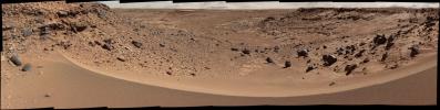
-
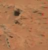
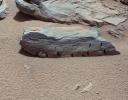
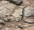
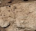
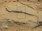
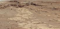
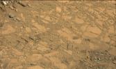
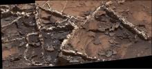
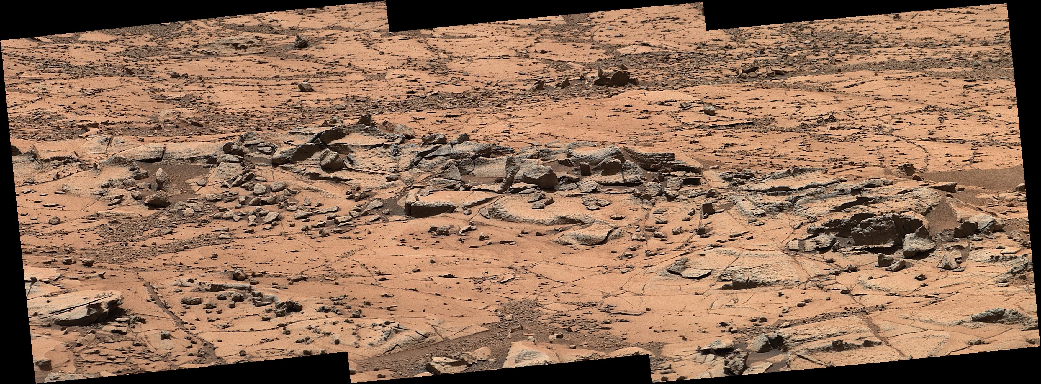
PIA16223:
-
Martian Streambed Evidence Rock in 3-D
Full Resolution:
TIFF
(26.43 MB)
JPEG
(977.2 kB)
|
|
|
2012-10-04 |
Mars
|
Mars Science Laboratory (MSL)
|
Mastcam
|
3926x2218x3 |
|
-
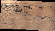
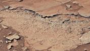
PIA16204:
-
'Rocknest' From Sol 52 Location
Full Resolution:
TIFF
(26.13 MB)
JPEG
(1.876 MB)
|
|
|
2012-10-08 |
Mars
|
Mars Science Laboratory (MSL)
|
Mastcam
|
1400x1024x3 |

|
-
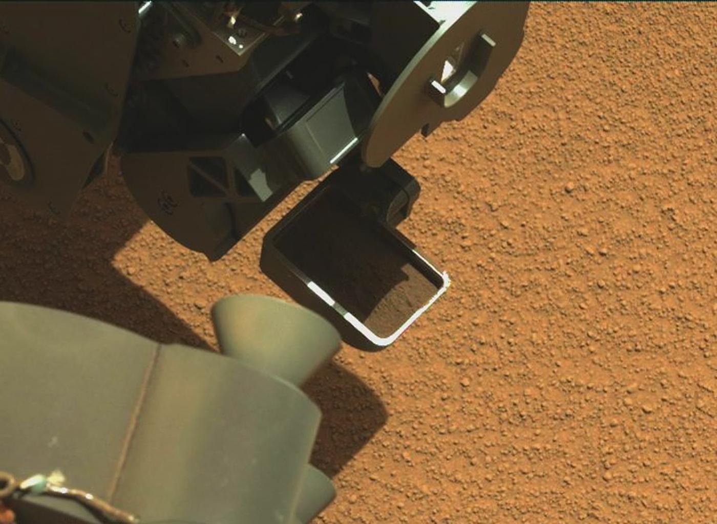
PIA16224:
-
Curiosity's First Scoop of Mars, in Vibration Movie

Full Resolution:
TIFF
(4.303 MB)
JPEG
(148.8 kB)
|
|
|
2012-10-08 |
Mars
|
Mars Science Laboratory (MSL)
|
Mastcam
|
1345x1200x3 |
|
-
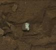
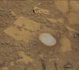
PIA16225:
-
View of Curiosity's First Scoop Also Shows Bright Object
Full Resolution:
TIFF
(4.844 MB)
JPEG
(242.9 kB)
|
|
|
2012-10-10 |
Mars
|
Mars Science Laboratory (MSL)
|
Mastcam
|
3020x1200x3 |
|
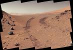
-
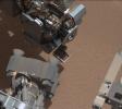
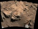
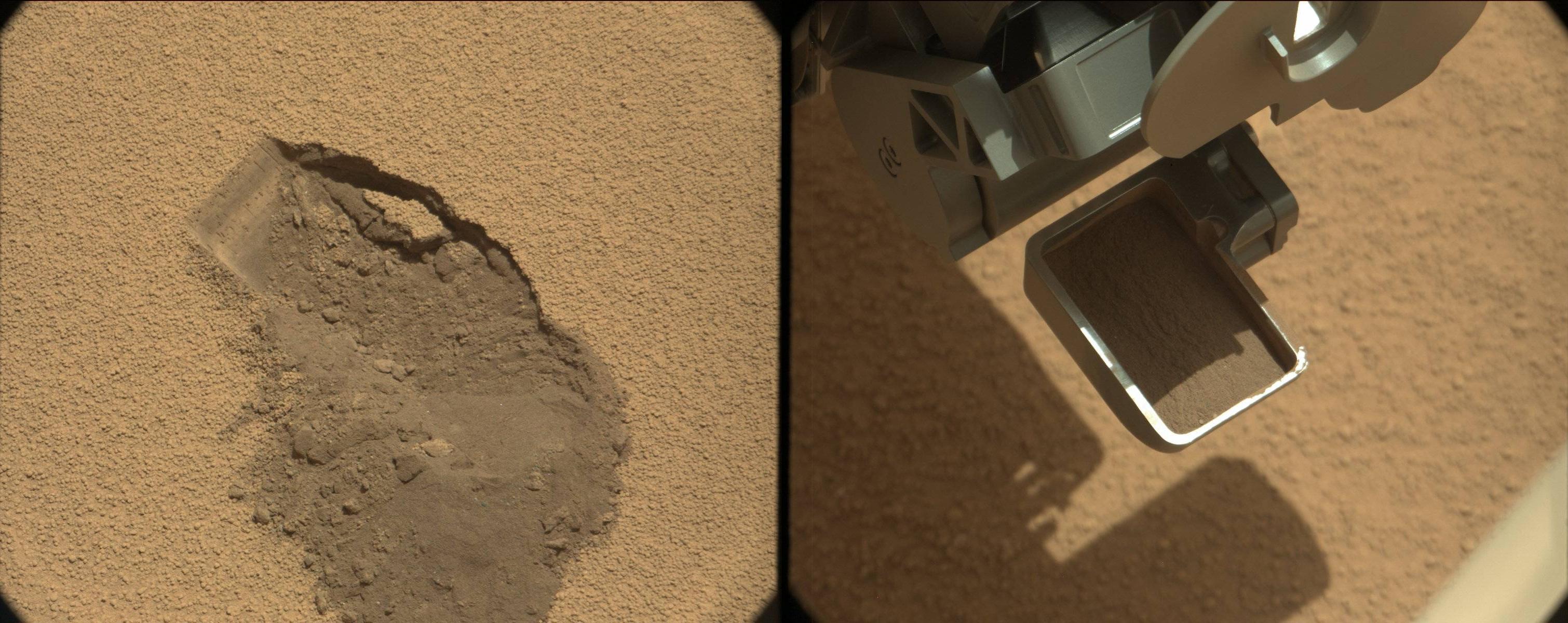
PIA16226:
-
First Scoop by Curiosity, Sol 61 Views
Full Resolution:
TIFF
(10.88 MB)
JPEG
(479.7 kB)
|
|
|
2012-10-18 |
Mars
|
Mars Science Laboratory (MSL)
|
Mastcam
|
1347x975x3 |

|
-
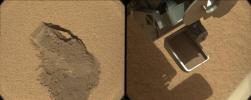
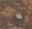
PIA16232:
-
First Sample Placed on Curiosity's Observation Tray
Full Resolution:
TIFF
(3.942 MB)
JPEG
(114.9 kB)
|
|
|
2012-11-26 |
Mars
|
Mars Science Laboratory (MSL)
|
Mastcam
|
1851x1440x3 |
|
-
PIA16452:
-
A Martian Rock Called 'Rocknest 3'
Full Resolution:
TIFF
(7.999 MB)
JPEG
(538.1 kB)
|
|
|
2012-11-26 |
Mars
|
Mars Science Laboratory (MSL)
|
Mastcam
|
13726x3008x3 |
|
-
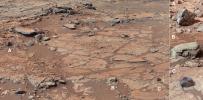
PIA16453:
Panoramic View From 'Rocknest' Position of Curiosity Mars Rover
Full Resolution:
TIFF
(123.9 MB)
JPEG
(7.811 MB)
|
|
|
2013-01-02 |
Mars
|
Mars Science Laboratory (MSL)
|
Mastcam
|
15338x3300x3 |
|
-
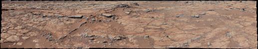
PIA16563:
Panoramic View From Near "Point Lake" in Gale Crater, Sol 106
Full Resolution:
TIFF
(151.9 MB)
JPEG
(7.168 MB)
|
|
|
2013-01-15 |
Mars
|
Mars Science Laboratory (MSL)
|
Mastcam
|
3483x2651x3 |
|
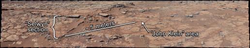
-
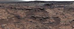
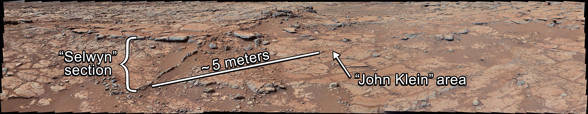
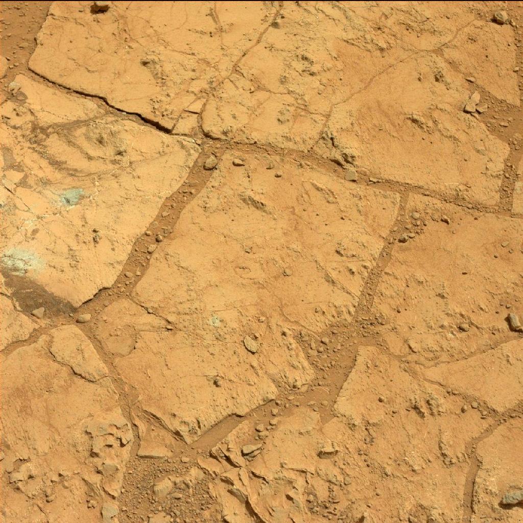
PIA16567:
-
'John Klein' Site Selected for Curiosity's Drill Debut
Full Resolution:
TIFF
(27.71 MB)
JPEG
(1.787 MB)
|
|
|
2013-01-15 |
Mars
|
Mars Science Laboratory (MSL)
|
Mastcam
|
12858x6312x3 |
|
-
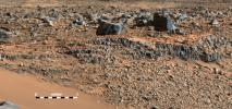
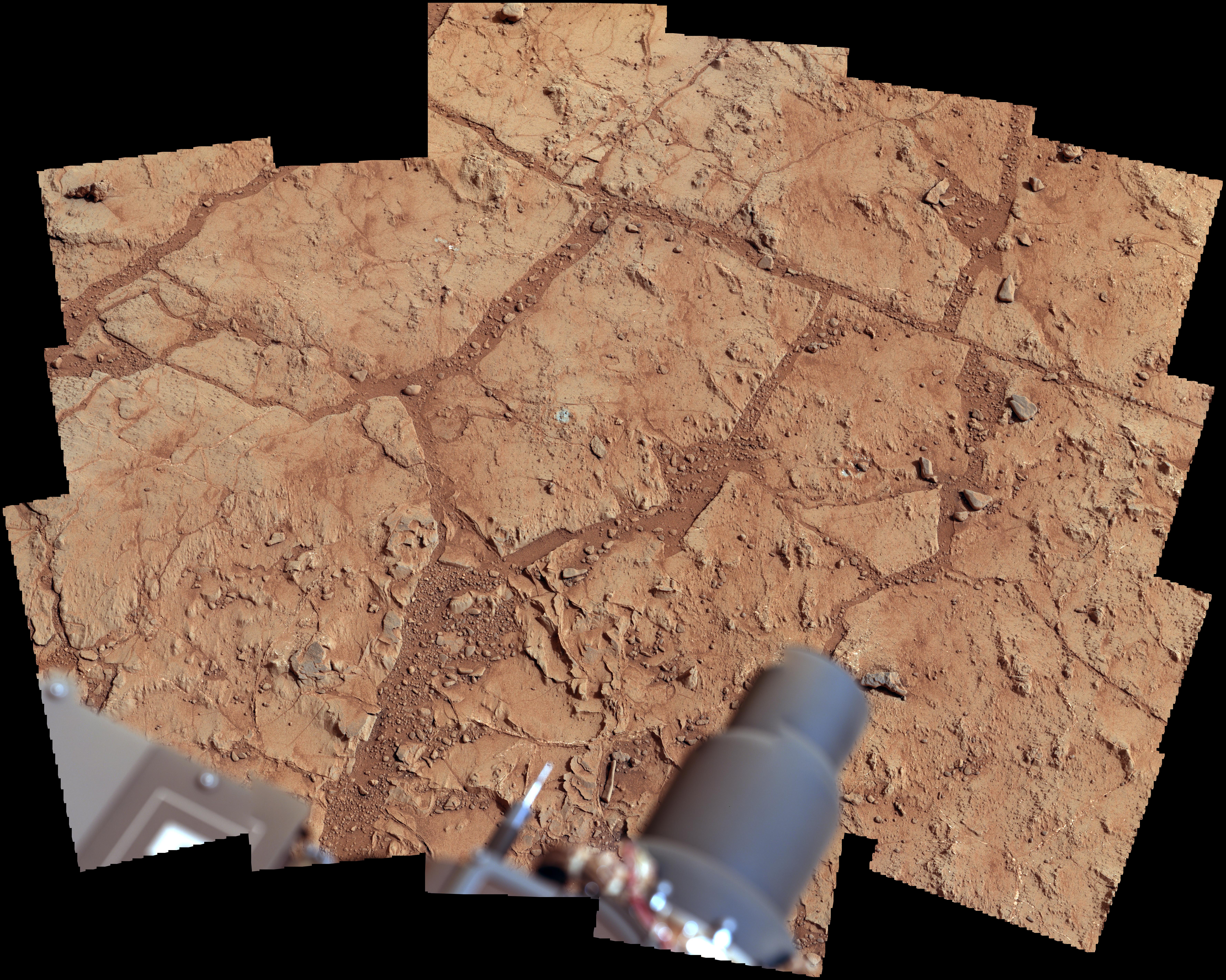
PIA16568:
-
Diversity in Vicinity of Curiosity's First Drilling Target
Full Resolution:
TIFF
(243.5 MB)
JPEG
(12.8 MB)
|
|
|
2013-01-15 |
Mars
|
Mars Science Laboratory (MSL)
|
Mastcam
|
4977x3714x3 |
|
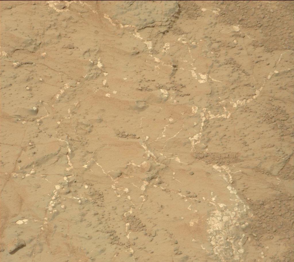
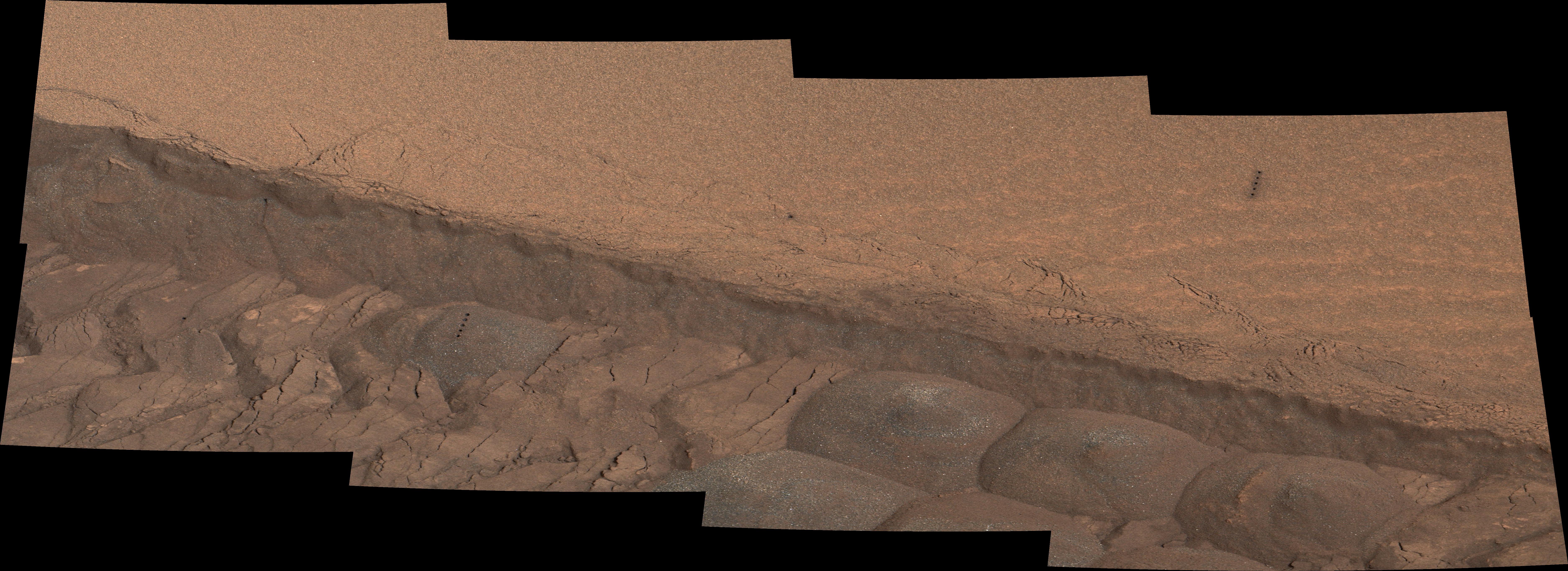
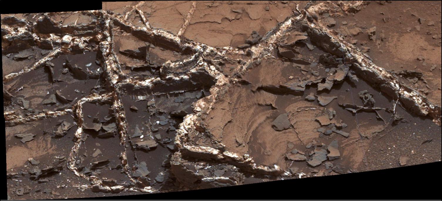
-
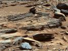
PIA16569:
-
'Yellowknife Bay' Veins and Concretions
Full Resolution:
TIFF
(55.48 MB)
JPEG
(2.37 MB)
|
|
|
2013-01-15 |
Mars
|
Mars Science Laboratory (MSL)
|
Mastcam
|
19590x2421x3 |

|
-
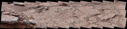
PIA16700:
Wide View of 'Shaler' Outcrop, Sol 120
Full Resolution:
TIFF
(142.3 MB)
JPEG
(8.299 MB)
|
|
|
2013-01-15 |
Mars
|
Mars Science Laboratory (MSL)
|
Mastcam
|
14049x2720x3 |
|
-
PIA16701:
View from Inside 'Yellowknife Bay'
Full Resolution:
TIFF
(114.7 MB)
JPEG
(7.851 MB)
|
|
|
2013-01-15 |
Mars
|
Mars Science Laboratory (MSL)
|
Mastcam
|
14016x3249x3 |
|
-
PIA16702:
Neighborhood for Curiosity's First Drilling Campaign
Full Resolution:
TIFF
(136.6 MB)
JPEG
(7.141 MB)
|
|
|
2013-01-15 |
Mars
|
Mars Science Laboratory (MSL)
|
Mastcam
|
1344x1200x3 |
|
-
PIA16705:
-
Veins in 'Sheepbed' Outcrop
Full Resolution:
TIFF
(4.84 MB)
JPEG
(456.9 kB)
|
|
|
2013-01-15 |
Mars
|
Mars Science Laboratory (MSL)
|
Mastcam
|
1501x844x3 |
|
-
PIA16706:
-
Spherules in 'Yellowknife Bay'
Full Resolution:
TIFF
(3.802 MB)
JPEG
(203.7 kB)
|
|
|
2013-01-15 |
Mars
|
Mars Science Laboratory (MSL)
|
Mastcam
|
1227x919x3 |
|
-
PIA16707:
-
'Shaler' Unit's Evidence of Stream Flow
Full Resolution:
TIFF
(3.384 MB)
JPEG
(232.4 kB)
|
|
|
2013-02-20 |
Mars
|
Mars Science Laboratory (MSL)
|
Mastcam
|
2400x465x3 |
|
-
PIA16685:
Setting the Scene for Curiosity's First Drilling
Full Resolution:
TIFF
(3.349 MB)
JPEG
(334.6 kB)
|
|
|
2013-02-07 |
Mars
|
Mars Science Laboratory (MSL)
|
Mastcam
|
1024x1024x3 |
|
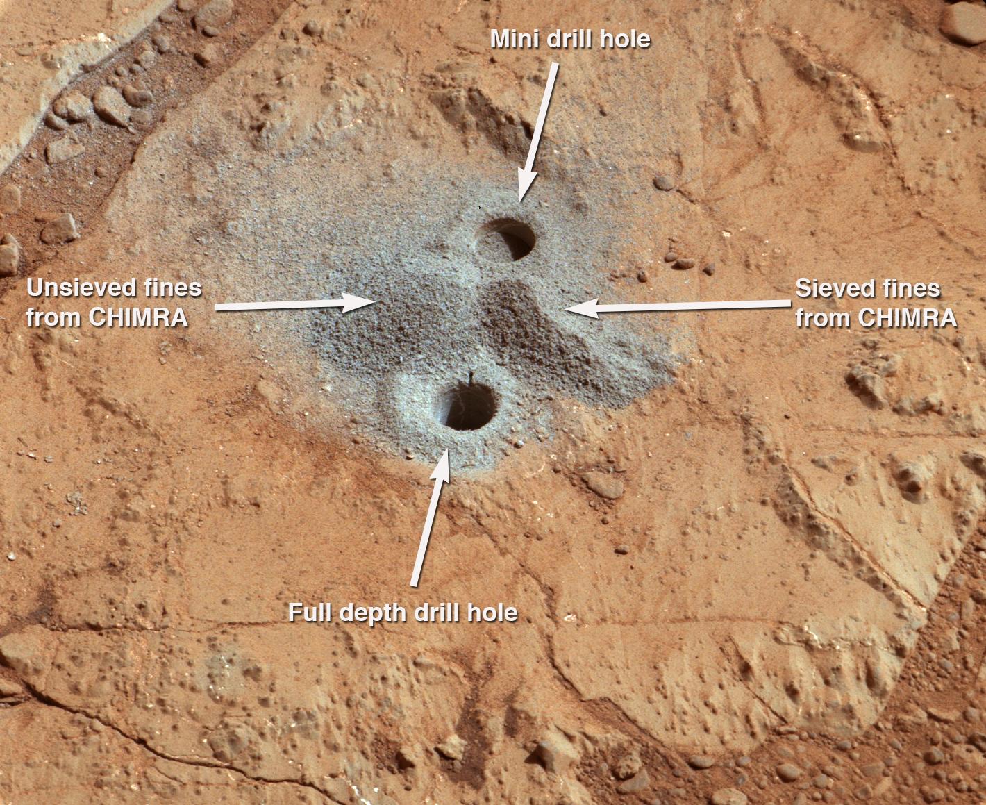
-
PIA16762:
-
Before-and-After Blink of Curiosity 'Mini Drill' into Mars Rock
Full Resolution:
TIFF
(1.051 MB)
JPEG
(216.1 kB)
|
|
|
2013-02-09 |
Mars
|
Mars Science Laboratory (MSL)
|
Mastcam
|
7107x5681x3 |

|
-
PIA16686:
-
Investigating Curiosity's Drill Area
Full Resolution:
TIFF
(121.2 MB)
JPEG
(5.308 MB)
|
|
|
2013-03-15 |
Mars
|
Mars Science Laboratory (MSL)
|
Mastcam
|
14576x2018x3 |
|
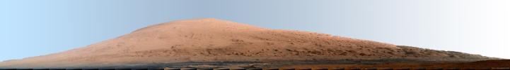
-
PIA16768:
Mount Sharp Panorama in White-Balanced Colors
Full Resolution:
TIFF
(88.26 MB)
JPEG
(2.085 MB)
|
|
|
2013-03-15 |
Mars
|
Mars Science Laboratory (MSL)
|
Mastcam
|
14585x2018x3 |
|
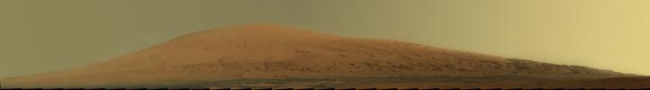
-
PIA16769:
Mount Sharp Panorama in Raw Colors
Full Resolution:
TIFF
(88.31 MB)
JPEG
(1.377 MB)
|
|
|
2013-03-18 |
Mars
|
Mars Science Laboratory (MSL)
|
Mastcam
|
1024x914x3 |
|
-
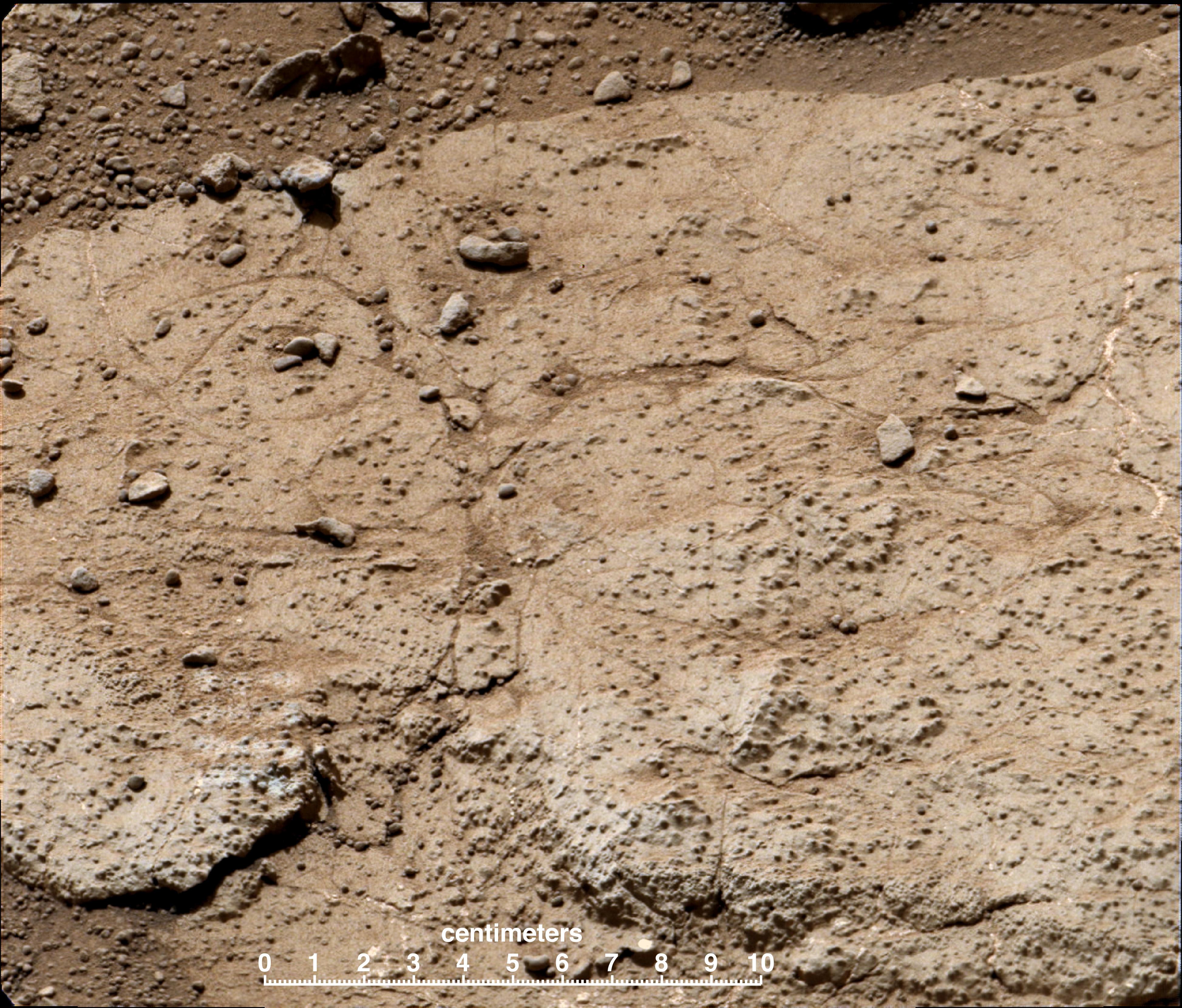
PIA16792:
-
Veins and Nodules at 'Knorr' Target in 'Yellowknife Bay' of Gale Crater
Full Resolution:
TIFF
(2.809 MB)
JPEG
(118.6 kB)
|
|
|
2013-03-18 |
Mars
|
Mars Science Laboratory (MSL)
|
Mastcam
|
3000x2400x3 |
|
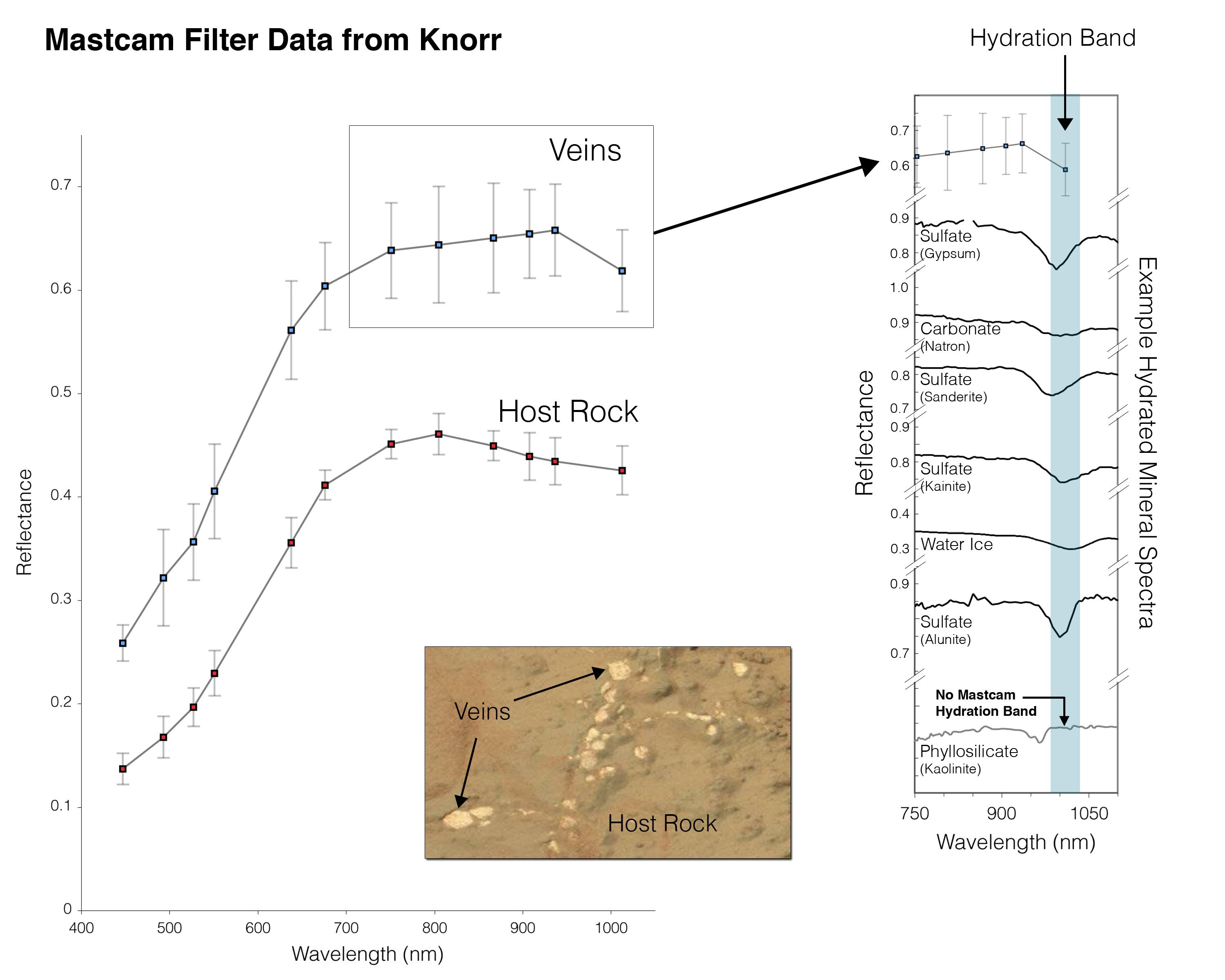
-
PIA16793:
-
Indication of Hydration in Veins and Nodules of 'Knorr' in 'Yellowknife Bay'
Full Resolution:
TIFF
(21.61 MB)
JPEG
(357.3 kB)
|
|
|
2013-03-18 |
Mars
|
Mars Science Laboratory (MSL)
|
Mastcam
|
1344x1200x3 |
|
-
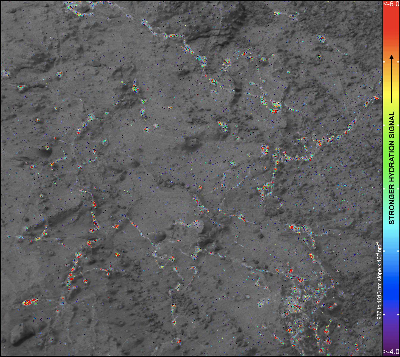
PIA16794:
-
Hydration Map, Based on Mastcam Spectra, for 'Knorr' Rock Target
Full Resolution:
TIFF
(4.84 MB)
JPEG
(288 kB)
|
|
|
2013-03-18 |
Mars
|
Mars Science Laboratory (MSL)
|
Mastcam
|
1024x914x3 |
|
-
PIA16795:
-
Rock "Tintina" Exposes "Yellowknife Bay" Vein Material
Full Resolution:
TIFF
(2.809 MB)
JPEG
(125.5 kB)
|
|
|
2013-03-18 |
Mars
|
Mars Science Laboratory (MSL)
|
Mastcam
|
1344x1200x3 |
|
-
PIA16796:
-
Hydration Map, Based on Mastcam Spectra, for broken rock 'Tintina'
Full Resolution:
TIFF
(4.84 MB)
JPEG
(204.3 kB)
|
|
|
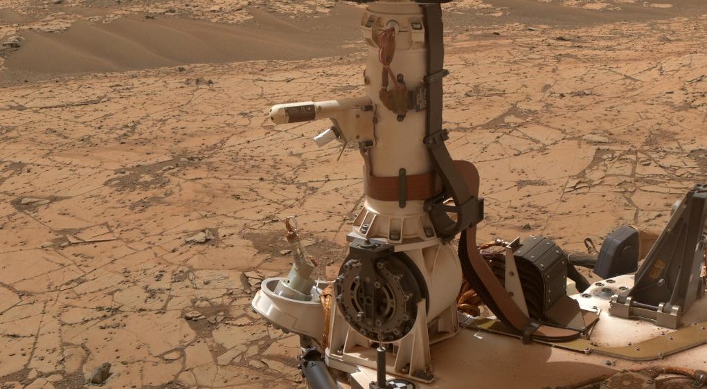
2013-03-18 |
Mars
|
Mars Science Laboratory (MSL)
|
Mastcam
|
1150x863x3 |
|
-
PIA16798:
-
Mast Camera and Its Calibration Target on Curiosity Rover
Full Resolution:
TIFF
(2.979 MB)
JPEG
(158 kB)
|
|
|
2013-03-18 |
Mars
|
Mars Science Laboratory (MSL)
|
Mastcam
|
1150x863x3 |

|
-
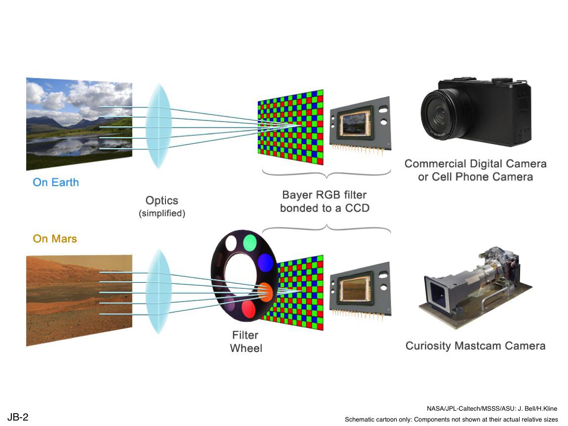
PIA16799:
-
Filters for Color Imaging and for Science
Full Resolution:
TIFF
(2.979 MB)
JPEG
(90.23 kB)
|
|
|
2013-03-18 |
Mars
|
Mars Science Laboratory (MSL)
|
Mastcam
|
1150x863x3 |

|
-
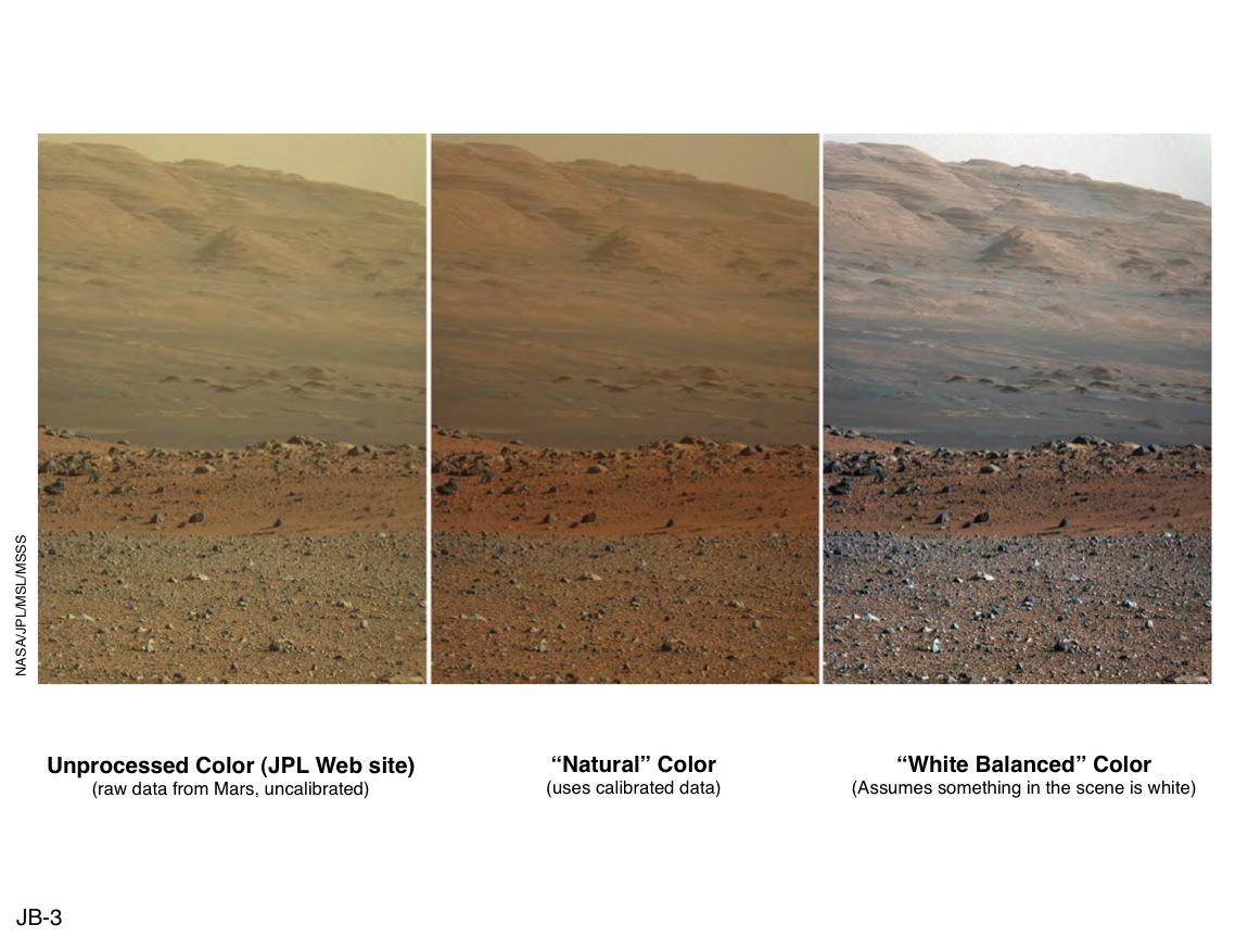
PIA16800:
-
'Raw,' 'Natural' and 'White-Balanced' Views of Martian Terrain
Full Resolution:
TIFF
(2.979 MB)
JPEG
(108 kB)
|
|
|
2013-03-18 |
Mars
|
Mars Science Laboratory (MSL)
|
Mastcam
|
1150x863x3 |
|
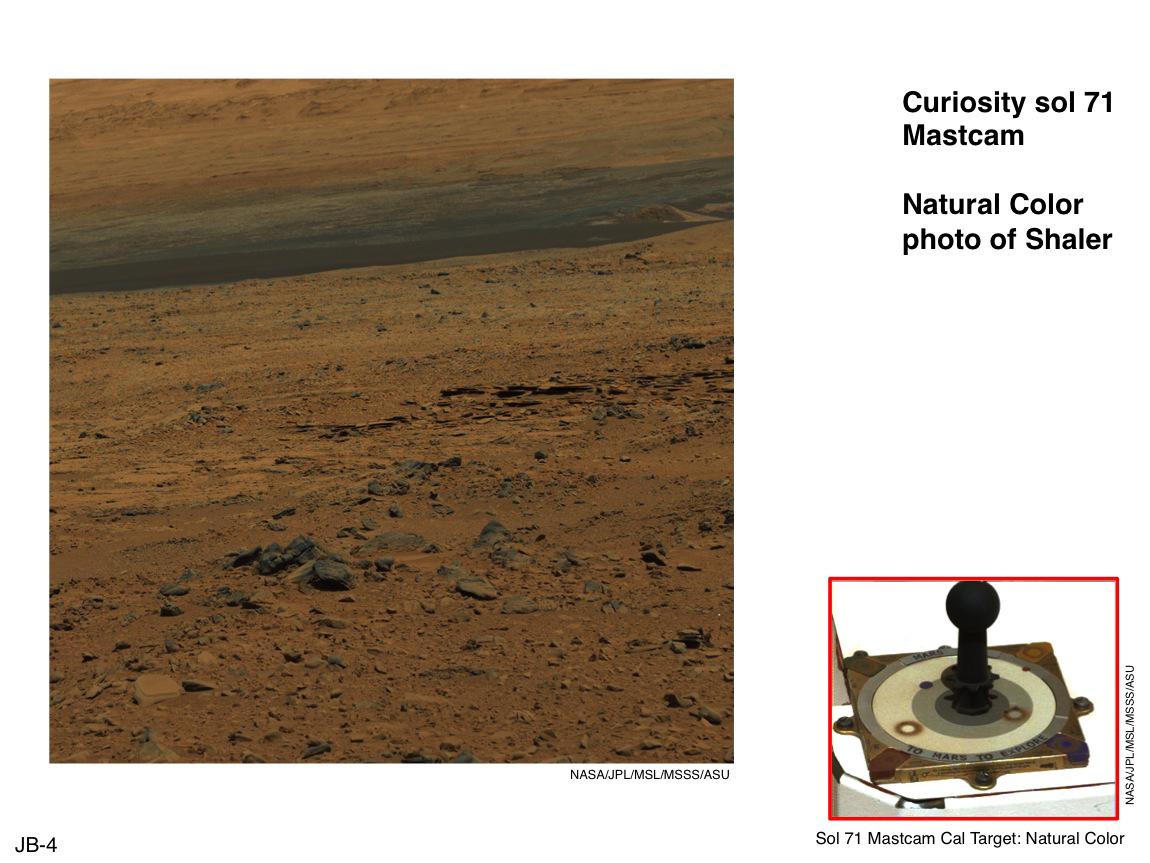
-
PIA16801:
-
Using Curiosity's Mast Camera to View Scene in 'Natural' Color
Full Resolution:
TIFF
(2.979 MB)
JPEG
(118.6 kB)
|
|
|
2013-03-18 |
Mars
|
Mars Science Laboratory (MSL)
|
Mastcam
|
1150x863x3 |
|
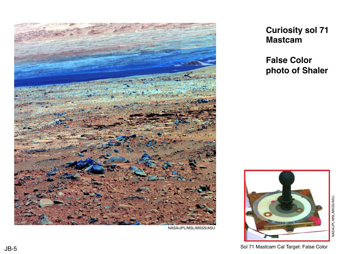
-
PIA16802:
-
Using False Color from Curiosity's Mast Camera
Full Resolution:
TIFF
(2.979 MB)
JPEG
(174.6 kB)
|
|
|
2013-03-18 |
Mars
|
Mars Science Laboratory (MSL)
|
Mastcam
|
477x384x3 |
|
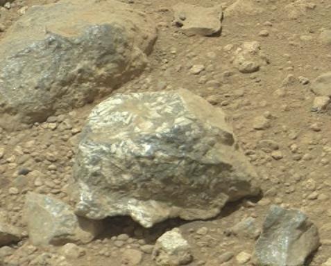
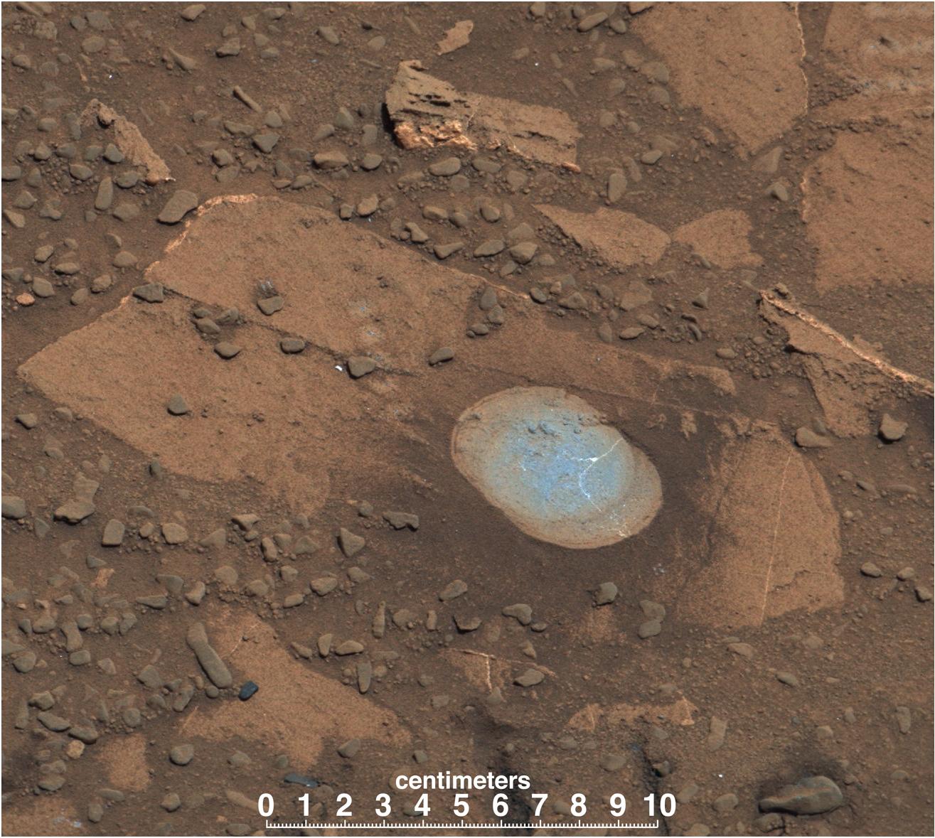
-
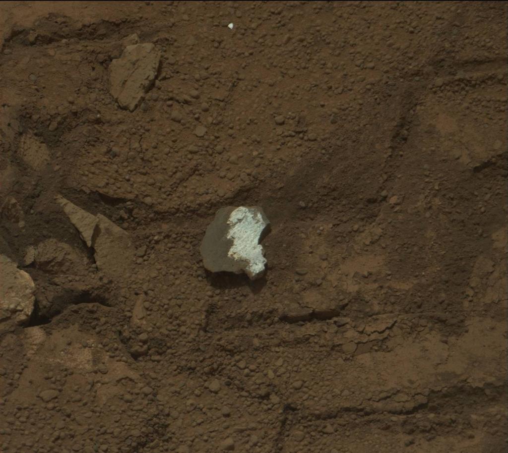
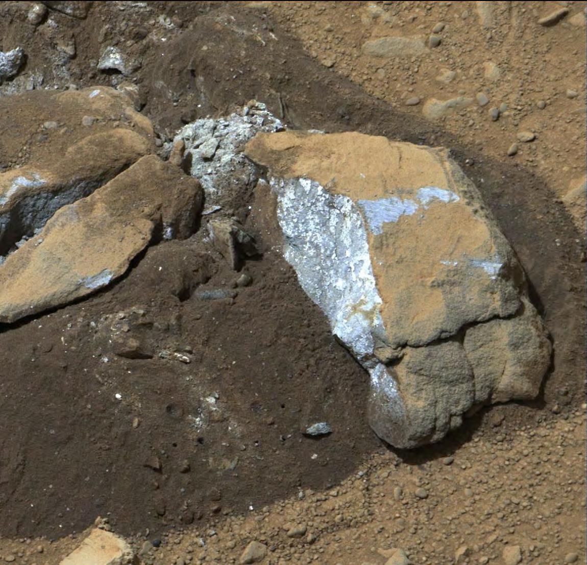
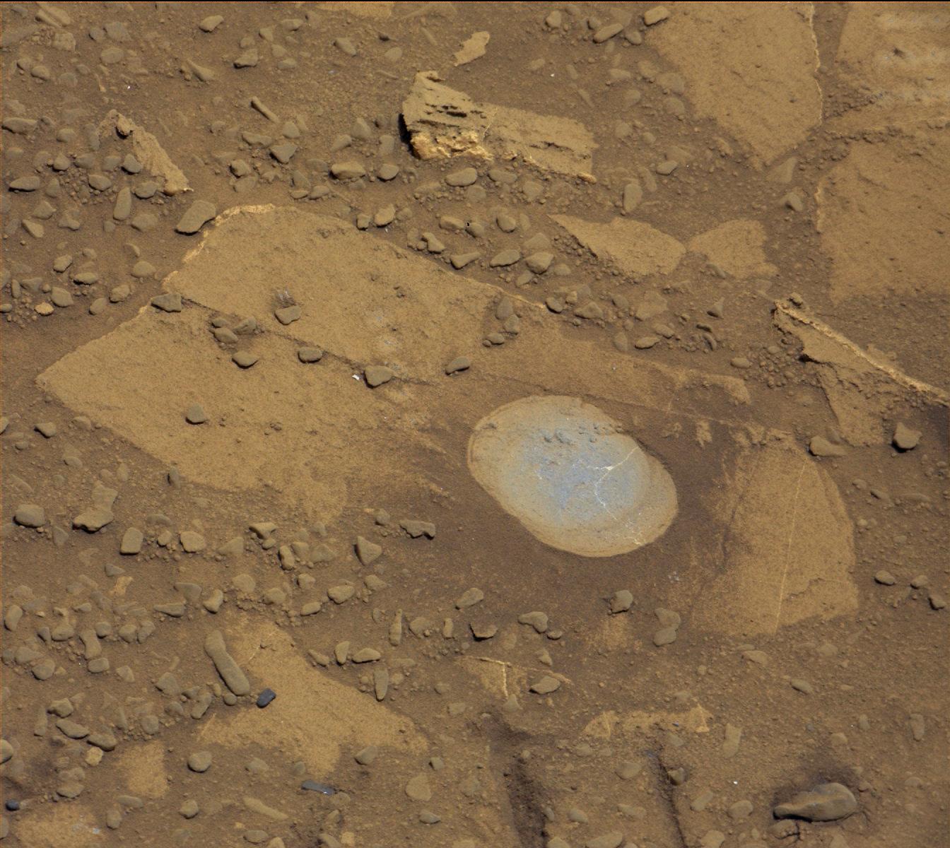
PIA16803:
-
Bluish-Black Rock with White 'Crystals' on Mars
Full Resolution:
TIFF
(549.9 kB)
JPEG
(34.45 kB)
|
|
|
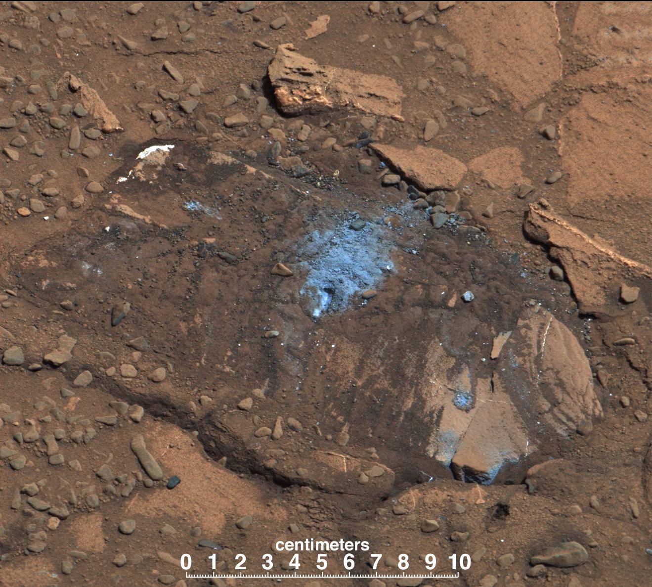
2013-03-18 |
Mars
|
Mars Science Laboratory (MSL)
|
Mastcam
|
1150x1107x3 |
|
-
PIA16804:
-
Bluish Color in Broken Rock in 'Yellowknife Bay'
Full Resolution:
TIFF
(3.821 MB)
JPEG
(219.4 kB)
|
|
|
2013-03-18 |
Mars
|
Mars Science Laboratory (MSL)
|
Mastcam
|
1150x863x3 |
|
-
PIA16805:
-
Drill Hole Image and Spectra Acquired by Mastcam
Full Resolution:
TIFF
(2.979 MB)
JPEG
(112.7 kB)
|
|
|
2013-03-18 |
Mars
|
Mars Science Laboratory (MSL)
|
Mastcam
|
1150x863x3 |
|
-
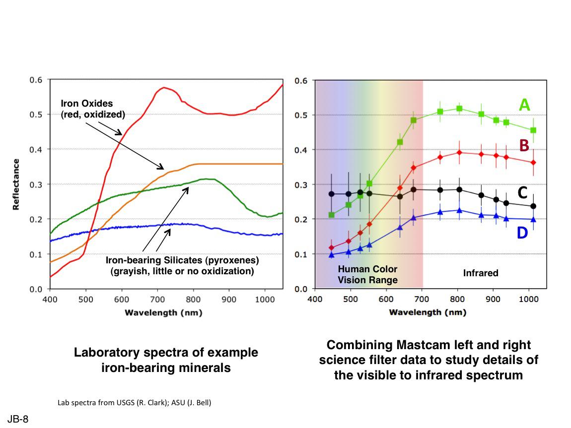
PIA16806:
-
Comparing Mastcam and Laboratory Spectra
Full Resolution:
TIFF
(2.979 MB)
JPEG
(105.7 kB)
|
|
|
2013-04-08 |
Mars
|
Mars Science Laboratory (MSL)
|
Mastcam
|
1420x1159x3 |
|
-
PIA16815:
-
Dust from Mars Drilling: Tailings and Discard Piles
Full Resolution:
TIFF
(4.939 MB)
JPEG
(335.9 kB)
|
|
|
2013-05-09 |
Mars
|
Mars Science Laboratory (MSL)
|
Mastcam
|
3894x3322x3 |
|
-
PIA16927:
-
'Cumberland' Target for Drilling by Curiosity Mars Rover
Full Resolution:
TIFF
(38.82 MB)
JPEG
(1.899 MB)
|
|
|
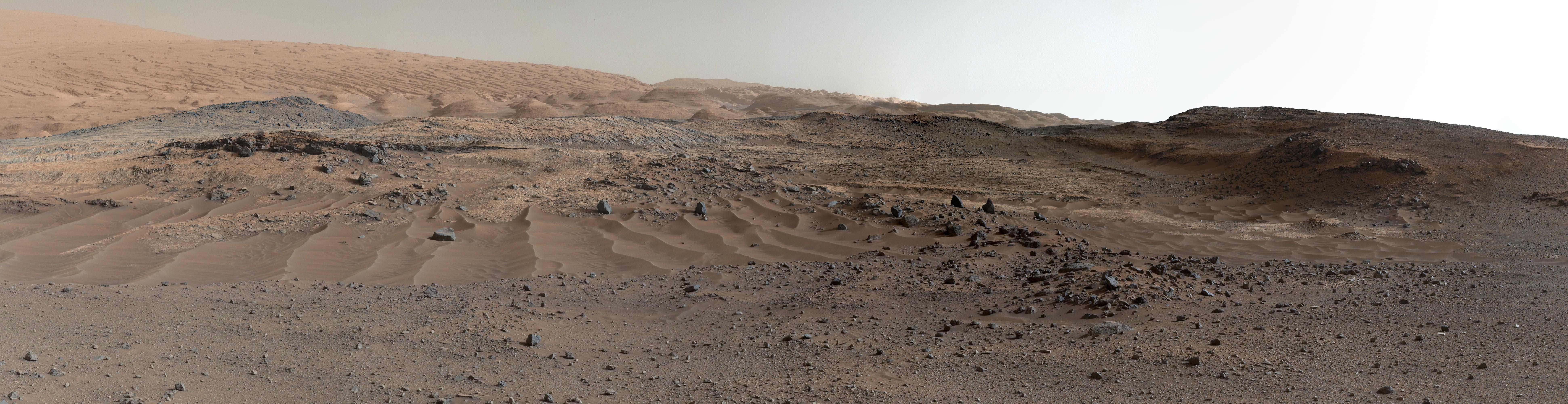
2013-05-30 |
Mars
|
Mars Science Laboratory (MSL)
|
Mastcam
|
4372x5883x3 |
|
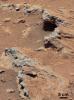
-
PIA17062:
-
Remnants of Ancient Streambed on Mars (White-Balanced View)
Full Resolution:
TIFF
(77.21 MB)
JPEG
(2.608 MB)
|
|
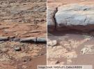
|
2013-05-30 |
Mars
|
Mars Science Laboratory (MSL)
|
Mastcam
|
2498x1126x3 |
|
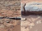
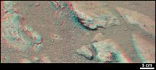
-
PIA17063:
-
Evidence About a Martian Streambed (Stereo)
Full Resolution:
TIFF
(8.441 MB)
JPEG
(394.8 kB)
|
|
|
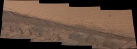
2013-06-05 |
Mars
|
Mars Science Laboratory (MSL)
|
Mastcam
|
1408x1200x3 |
|
-
PIA17071:
-
'Point Lake' Outcrop in Gale Crater
Full Resolution:
TIFF
(5.071 MB)
JPEG
(340.8 kB)
|
|
|
2013-06-25 |
Mars
|
Mars Science Laboratory (MSL)
|
Mastcam
|
11037x3592x3 |
|
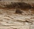
-
PIA17268:
-
Puzzling 'Point Lake' Outcrop Revisited
Full Resolution:
TIFF
(119 MB)
JPEG
(4.198 MB)
|
|
|
2013-07-09 |
Mars
|
Mars 2020 Rover
Mars Science Laboratory (MSL)
|
Mastcam
|
2460x1824x3 |
|
-
PIA17275:
-
The Importance of Nested Scales of Observations, Large Scales
Full Resolution:
TIFF
(13.47 MB)
JPEG
(624.1 kB)
|
|
|
2013-08-02 |
Mars
|
Mars Science Laboratory (MSL)
|
Mastcam
|
7651x1488x3 |
|
-
PIA17083:
Curiosity Sol 343 Vista With 'Twin Cairns' on Route to Mount Sharp
Full Resolution:
TIFF
(34.17 MB)
JPEG
(1.305 MB)
|
|
|
2013-08-15 |
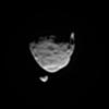
Phobos
|
Mars Science Laboratory (MSL)
|
Mastcam
|
156x161x1 |
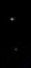
|
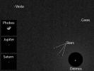
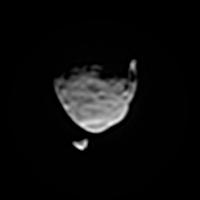
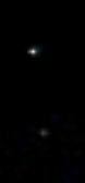
-
PIA17089:
-
Two Moons Passing in the Martian Night
Full Resolution:
TIFF
(25.37 kB)
JPEG
(1.243 kB)
|
|
|
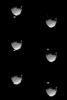
2013-08-15 |
Phobos
|
Mars Science Laboratory (MSL)
|
Mastcam
|
200x200x1 |
|
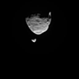
-
PIA17350:
-
Two Moons of Mars in One Enhanced View
Full Resolution:
TIFF
(40.26 kB)
JPEG
(1.818 kB)
|
|
|
2013-08-15 |
Phobos
|
Mars Science Laboratory (MSL)
|
Mastcam
|
300x300x1 |

|
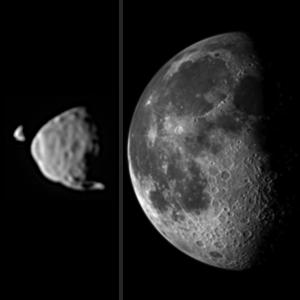
-
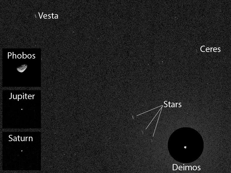
PIA17351:
-
Illustration Comparing Apparent Sizes of Moons
Full Resolution:
TIFF
(90.31 kB)
JPEG
(8.076 kB)
|
|
|
2013-08-15 |
Phobos
|
Mars Science Laboratory (MSL)
|
Mastcam
|
512x768x1 |
|
-
PIA17353:
-
Before and After Occultation of Deimos by Phobos
Full Resolution:
TIFF
(393.8 kB)
JPEG
(10.41 kB)
|
|
|
2013-08-15 |
Phobos
|
Mars Science Laboratory (MSL)
|
Mastcam
|
256x256x1 |

|
-
PIA17352:
-
Smoothed Movie of Phobos Passing Deimos in Martian Sky
Full Resolution:
TIFF
(65.82 kB)
JPEG
(2.121 kB)
|
|
|
2013-08-28 |
Phobos
|
Mars Science Laboratory (MSL)
|
Mastcam
|
450x150x1 |

|
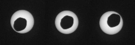
-
PIA17356:
-
Annular Eclipse of the Sun by Phobos, as Seen by Curiosity
Full Resolution:
TIFF
(67.79 kB)
JPEG
(5.465 kB)
|
|
|
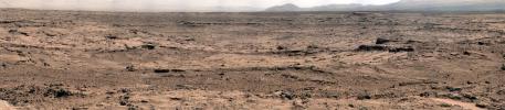
2013-09-10 |
Mars
|
Mars Science Laboratory (MSL)
|
Mastcam
|
4605x2258x3 |
|
-
PIA17360:
-
'Darwin' Outcrop at 'Waypoint 1' of Curiosity's trek to Mount Sharp
Full Resolution:
TIFF
(31.21 MB)
JPEG
(1.826 MB)
|
|
|
2013-09-13 |
Mars
|
Mars Science Laboratory (MSL)
|
Mastcam
|
1344x1200x3 |
|
-
PIA17481:
-
Evolving Excitement Over 'Darwin' Rock Outcrop at 'Waypoint 1'
Full Resolution:
TIFF
(4.84 MB)
JPEG
(253.3 kB)
|
|
|
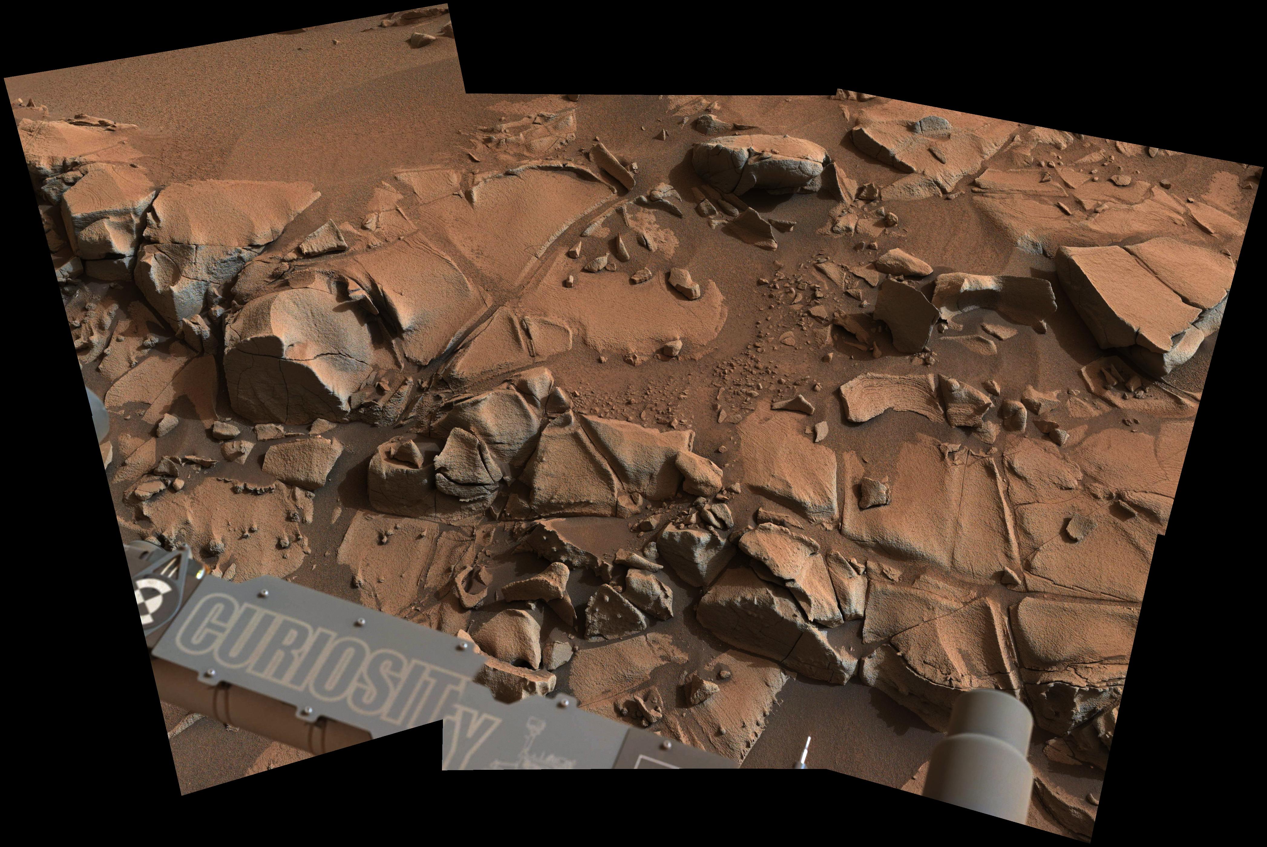
2013-12-05 |
Mars
|
Mars Science Laboratory (MSL)
|
Mastcam
|
1306x954x3 |
|
-
PIA17592:
-
Target Rock 'Ithaca' in Gale Crater, Mars
Full Resolution:
TIFF
(3.739 MB)
JPEG
(172.8 kB)
|
|
|
2013-12-09 |
Mars
|
Mars Science Laboratory (MSL)
|
Mastcam
|
9170x3590x3 |
|
-
PIA17595:
-
View of Yellowknife Bay Formation, with Drilling Sites
Full Resolution:
TIFF
(98.79 MB)
JPEG
(6.708 MB)
|
|
|
2013-12-09 |
Mars
|
Mars Science Laboratory (MSL)
|
Mastcam
|
2853x1800x3 |
|
-
PIA17603:
-
Erosion by Scarp Retreat in Gale Crater
Full Resolution:
TIFF
(15.41 MB)
JPEG
(699.4 kB)
|
|
|
2014-01-29 |
Mars
|
Mars Science Laboratory (MSL)
|
Mastcam
|
5544x1047x3 |
|
-
PIA17766:
Curiosity Mars Rover Approaches 'Dingo Gap,' Mastcam View
Full Resolution:
TIFF
(17.42 MB)
JPEG
(1.284 MB)
|
|
|
2014-02-03 |
Mars
|
Mars Science Laboratory (MSL)
|
Mastcam
|
9074x2287x3 |
|
-
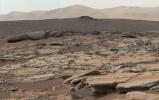
PIA17931:
Martian Valley May Be Curiosity's Route
Full Resolution:
TIFF
(62.28 MB)
JPEG
(4.277 MB)
|
|
|
2014-02-06 |
Earth
|
Mars Science Laboratory (MSL)
|
Mastcam
|
78x168x3 |
|
-
PIA17935:
-
Curiosity Mars Rover's First Image of Earth and Earth's Moon
Full Resolution:
TIFF
(39.55 kB)
JPEG
(1.009 kB)
|
|
|
2014-02-06 |
Earth
|
Mars Science Laboratory (MSL)
|
Mastcam
|
3200x2000x3 |
|
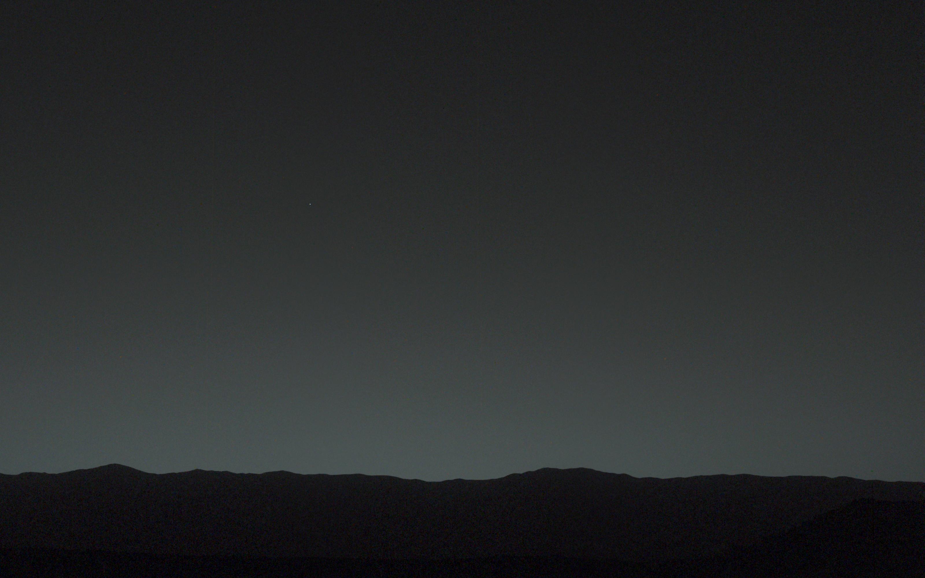
-
PIA17936:
-
Bright 'Evening Star' Seen from Mars is Earth
Full Resolution:
TIFF
(19.21 MB)
JPEG
(389.6 kB)
|
|
|
2014-02-19 |
Mars
|
Mars Science Laboratory (MSL)
|
Mastcam
|
4890x3361x3 |
|
-
PIA17944:
-
Curiosity's Color View of Martian Dune After Crossing It
Full Resolution:
TIFF
(49.33 MB)
JPEG
(2.485 MB)
|
|
|
2014-03-24 |
Mars
|
Mars Science Laboratory (MSL)
|
Mastcam
|
2340x1143x3 |
|
-
PIA17959:
-
Differential Erosion at Work on Martian Sandstones
Full Resolution:
TIFF
(8.027 MB)
JPEG
(556.2 kB)
|
|
|
2014-04-24 |
Ceres
|
Mars Science Laboratory (MSL)
|
Mastcam
|
768x576x1 |
|
-
PIA17937:
-
First Asteroid Image from the Surface of Mars
Full Resolution:
TIFF
(443 kB)
JPEG
(121.2 kB)
|
|
|
2014-04-25 |
Mars
|
Mars Science Laboratory (MSL)
|
Mastcam
|
2724x2031x3 |
|
-
PIA18087:
-
Sandstone Target 'Windjana' May Be Next Martian Drilling Site
Full Resolution:
TIFF
(16.6 MB)
JPEG
(899.8 kB)
|
|
|
2014-06-10 |
Mercury
|
Mars Science Laboratory (MSL)
|
Mastcam
|
1280x256x1 |
|
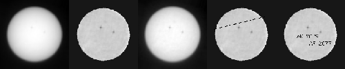
-
PIA18389:
Mercury Transit of the Sun, Seen From Mars
Full Resolution:
TIFF
(328.2 kB)
JPEG
(21.61 kB)
|
|
|
2014-08-15 |
Mars
|
Mars Science Laboratory (MSL)
|
Mastcam
|
1344x804x3 |
|
-
PIA18601:
-
Drilling Candidate Site 'Bonanza King' on Mars
Full Resolution:
TIFF
(3.243 MB)
JPEG
(167.7 kB)
|
|
|
2014-08-18 |
Mars
|
Mars Science Laboratory (MSL)
|
Mastcam
|
1344x1200x3 |
|
-
PIA18602:
-
Curiosity's Brushwork on Martian 'Bonanza King' Target
Full Resolution:
TIFF
(4.84 MB)
JPEG
(259.3 kB)
|
|
|
2014-09-11 |
Mars
|
Mars Science Laboratory (MSL)
|
Mastcam
|
1315x1179x3 |
|
-
PIA18477:
-
A Bonanza of Clues About Mars
Full Resolution:
TIFF
(4.653 MB)
JPEG
(253.2 kB)
|
|
|
2014-09-11 |
Mars
|
Mars Science Laboratory (MSL)
|
Mastcam
|
2102x984x3 |
|
-
PIA18476:
-
Martian Layers Thicker on Top
Full Resolution:
TIFF
(6.208 MB)
JPEG
(479.9 kB)
|
|
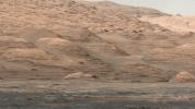
|
2014-09-11 |
Mars
|
Mars Science Laboratory (MSL)
|
Mastcam
|
6612x1241x3 |

|
-
PIA18473:
Curiosity Marches Onward and Upward
Full Resolution:
TIFF
(24.63 MB)
JPEG
(1.424 MB)
|
|
|
2014-09-11 |
Mars
|
Mars Science Laboratory (MSL)
|
Mastcam
|
1319x1187x3 |

|
-
PIA18478:
-
Loose Rock Leads to Incomplete Drilling
Full Resolution:
TIFF
(4.699 MB)
JPEG
(278.6 kB)
|
|
|
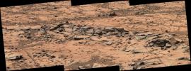
2014-09-25 |
Mars
|
Mars Science Laboratory (MSL)
|
Mastcam
|
6886x2279x3 |
|
-
PIA18608:
-
Curiosity Mars Rover's Approach to 'Pahrump Hills'
Full Resolution:
TIFF
(47.1 MB)
JPEG
(2.455 MB)
|
|
|
2014-11-04 |
Mars
|
Mars Science Laboratory (MSL)
|
Mastcam
|
1344x1200x3 |
|
-
PIA19036:
-
'Confidence Hills' -- The First Mount Sharp Drilling Site
Full Resolution:
TIFF
(4.84 MB)
JPEG
(233.4 kB)
|
|
|
2014-11-04 |
Mars
|
Mars Science Laboratory (MSL)
|
Mastcam
|
768x768x3 |
|
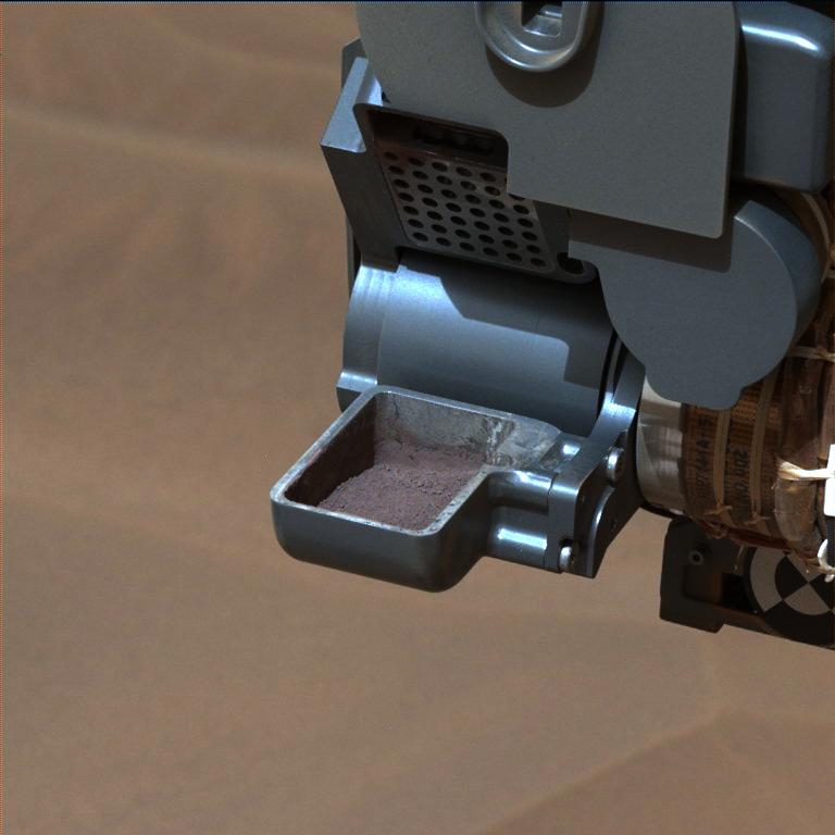
-
PIA19037:
-
'Confidence Hills' Drill Powder in Scoop
Full Resolution:
TIFF
(1.77 MB)
JPEG
(48.85 kB)
|
|
|
2014-11-04 |
Mars
|
Mars Science Laboratory (MSL)
|
Mastcam
|
4067x2184x3 |
|
-
PIA19039:
-
Mars Rover Curiosity's Walkabout at 'Pahrump Hills'
Full Resolution:
TIFF
(26.66 MB)
JPEG
(1.645 MB)
|
|
|
2014-11-06 |
Mars
|
Mars Science Laboratory (MSL)
|
Mastcam
|
2040x1200x1 |

|
-
PIA19043:
-
Mars Curiosity Rover Views Comet Siding Spring
Full Resolution:
TIFF
(2.451 MB)
JPEG
(339.8 kB)
|
|
|
2014-12-11 |
Mars
|
Mars Science Laboratory (MSL)
|
Mastcam
|
1920x1080x3 |
|
-
PIA19083:
-
Mount Sharp Buttes and Layers From Near 'Darwin'
Full Resolution:
TIFF
(6.223 MB)
JPEG
(419.5 kB)
|
|
|
2014-11-18 |
Mars
|
Mars Science Laboratory (MSL)
|
Mastcam
|
3528x1304x3 |
|
-
PIA18880:
-
Erosion Resistance at 'Pink Cliffs' at Base of Martian Mount Sharp
Full Resolution:
TIFF
(13.81 MB)
JPEG
(1.094 MB)
|
|
|
2014-11-18 |
Mars
|
Mars Science Laboratory (MSL)
|
Mastcam
|
4185x2801x3 |
|
-
PIA18881:
-
Fine-Grained, Finely Layered Rock at Base of Martian Mount Sharp
Full Resolution:
TIFF
(35.19 MB)
JPEG
(1.45 MB)
|
|
|
2014-11-18 |
Mars
|
Mars Science Laboratory (MSL)
|
Mastcam
|
7501x2733x3 |
|
-
PIA18882:
-
Ripple's Interior Exposed by Rover Wheel Track
Full Resolution:
TIFF
(61.52 MB)
JPEG
(2.514 MB)
|
|
|
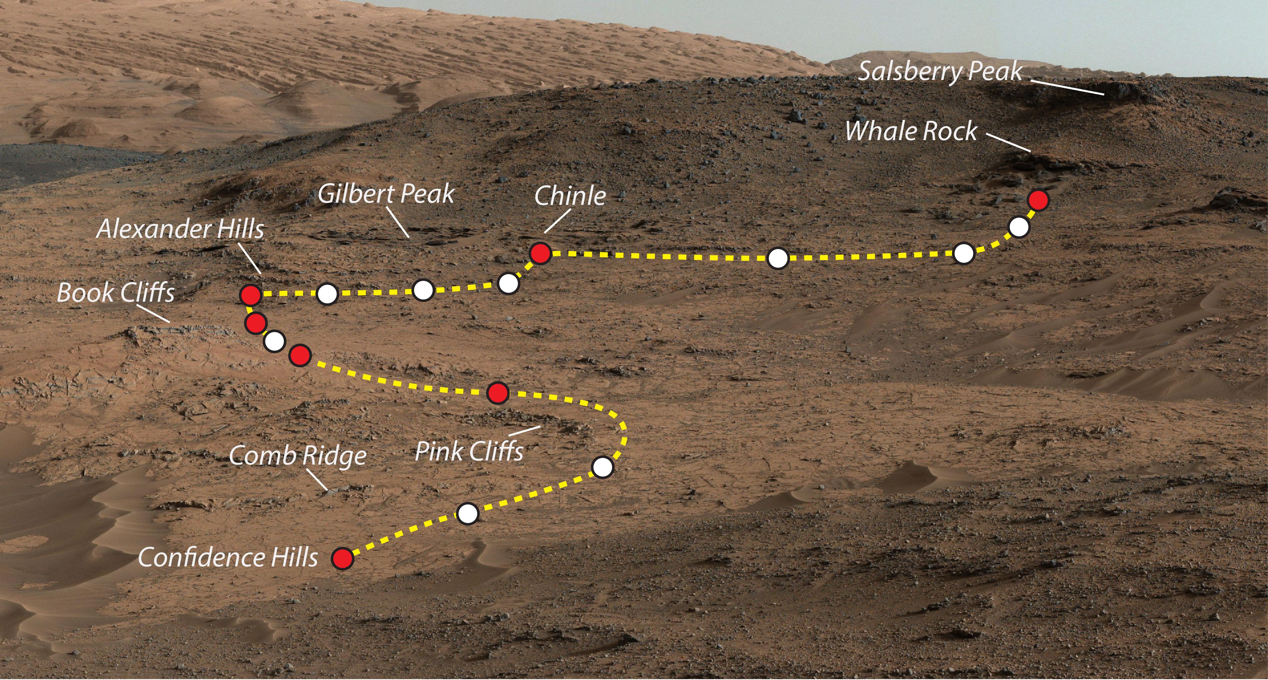
2014-11-25 |
Mars
|
Mars Science Laboratory (MSL)
|
Mastcam
|
4188x2799x3 |
|
-
PIA19066:
-
Within Rover's Reach at Mars Target Area 'Alexander Hills'
Full Resolution:
TIFF
(35.19 MB)
JPEG
(1.442 MB)
|
|
|
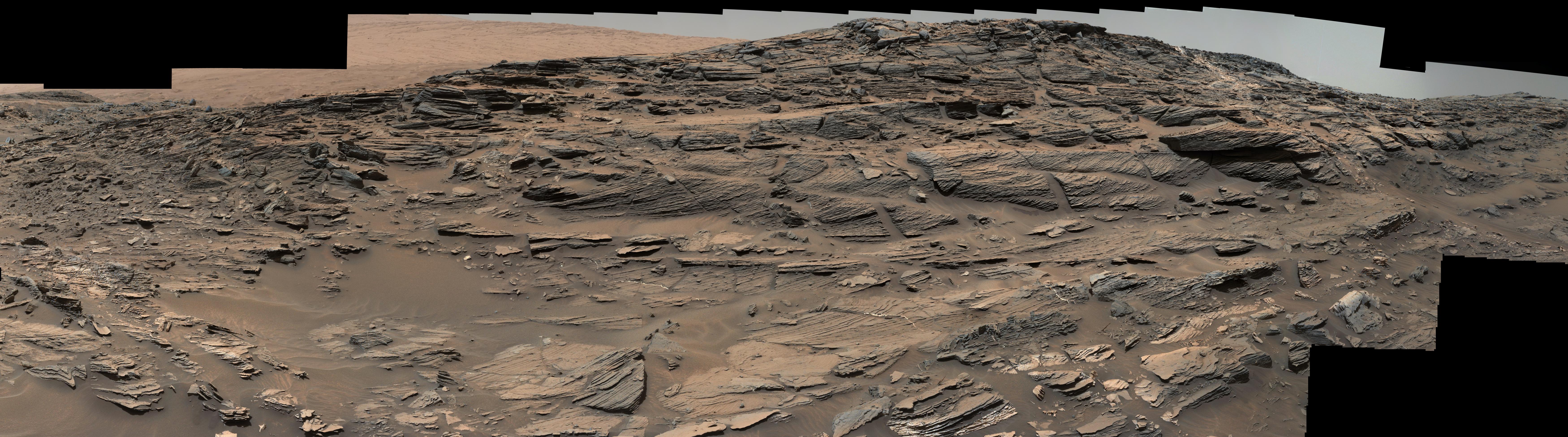
2015-03-06 |
Mars
|
Mars Science Laboratory (MSL)
|
Mastcam
|
1278x1092x3 |
|
-
PIA19145:
-
Curiosity's Drill After Drilling at 'Telegraph Peak'
Full Resolution:
TIFF
(4.188 MB)
JPEG
(128.3 kB)
|
|
|
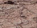
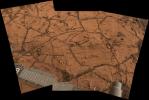
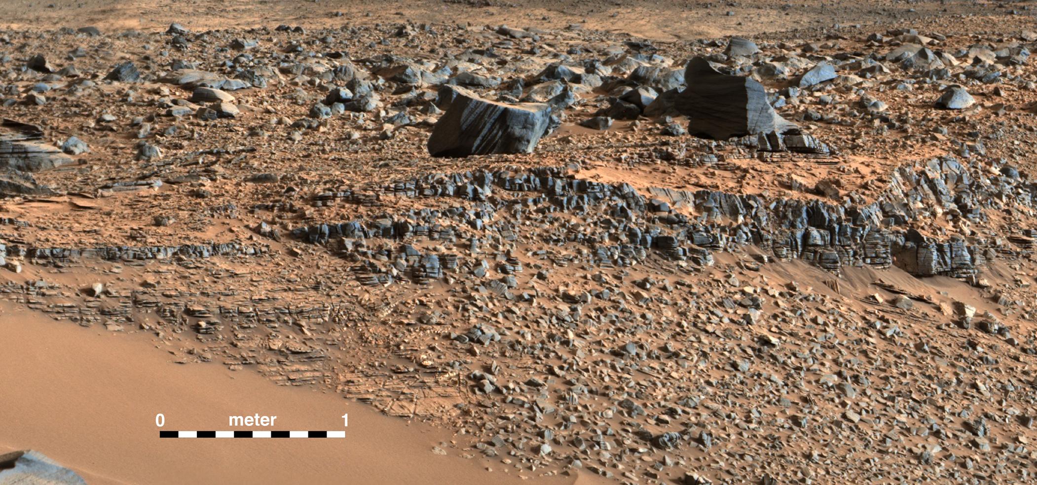
2015-04-01 |
Mars
|
Mars Science Laboratory (MSL)
|
Mastcam
|
4680x2088x3 |
|
-
PIA19161:
-
Prominent Veins at 'Garden City' on Mount Sharp, Mars
Full Resolution:
TIFF
(29.33 MB)
JPEG
(1.949 MB)
|
|
|
2015-04-13 |
Mars
|
Mars Science Laboratory (MSL)
|
Mastcam
|
1021x562x3 |
|
-
PIA19164:
-
Mars Weather-Station Tools on Rover's Mast
Full Resolution:
TIFF
(1.722 MB)
JPEG
(104.9 kB)
|
|
|
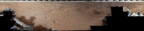
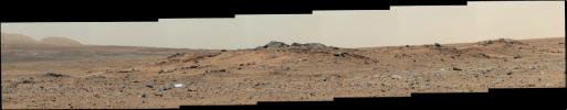
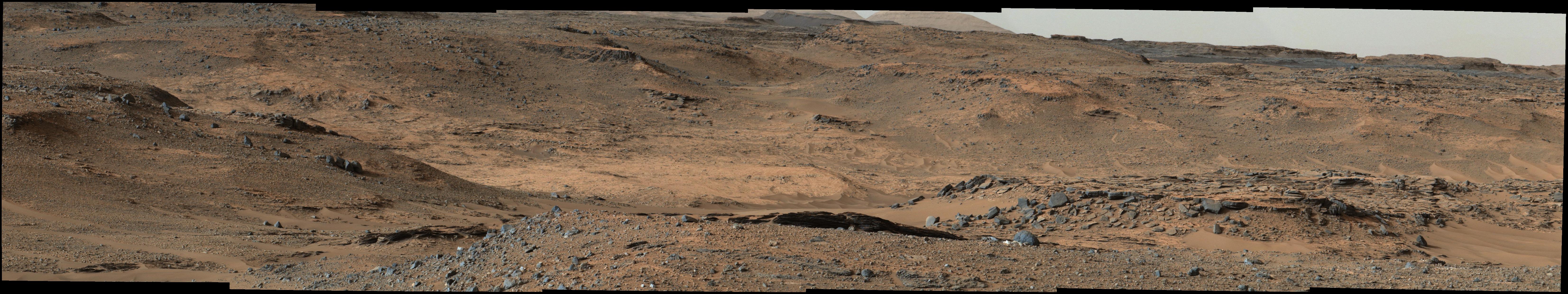
2015-05-08 |
Mars
|
Mars Science Laboratory (MSL)
|
Mastcam
|
19578x3893x3 |
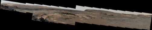
|
-
PIA19397:
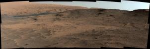
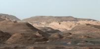
Diverse Terrain Types on Mount Sharp, Mars
Full Resolution:
TIFF
(228.7 MB)
JPEG
(6.143 MB)
|
|
|
2015-05-08 |
Mars
|
Mars Science Laboratory (MSL)
|
Mastcam
|
13066x3144x3 |
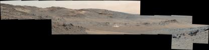
|
-
PIA19398:
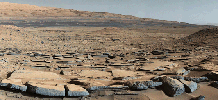
Looking Toward Curiosity Study Areas, Spring 2015
Full Resolution:
TIFF
(123.3 MB)
JPEG
(3.421 MB)
|
|
|
2015-05-08 |
Mars
|
Mars Science Laboratory (MSL)
|
Mastcam
|
1344x1080x3 |
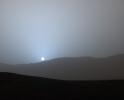
|
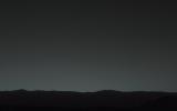
-
PIA19400:
-
Sunset in Mars' Gale Crater
Full Resolution:
TIFF
(4.356 MB)
JPEG
(47.63 kB)
|
|
|
2015-05-08 |
Mars
|
Mars Science Laboratory (MSL)
|
Mastcam
|
1619x1154x3 |
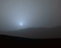
|
-
PIA19401:
-
Sunset Sequence in Mars' Gale Crater (Animation)
Full Resolution:
TIFF
(5.607 MB)
JPEG
(64.18 kB)
|
|
|
2015-05-22 |
Mars
|
Mars Science Laboratory (MSL)
|
Mastcam
|
7984x2383x3 |
|
-
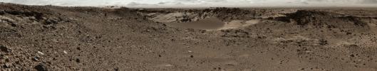
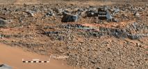
PIA19662:
-
Unfavorable Terrain for Crossing Near 'Logan Pass'
Full Resolution:
TIFF
(57.1 MB)
JPEG
(2.547 MB)
|
|
|
2015-07-10 |
Sol (our sun)
|
Mars Science Laboratory (MSL)
|
Mastcam
|
801x400x1 |
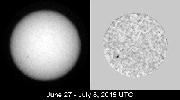
|
-
PIA19801:
-
Tracking Sunspots from Mars, Summer 2015 (Animation)
Full Resolution:
TIFF
(320.9 kB)
JPEG
(22.27 kB)
|
|
|
2015-07-10 |
Sol (our sun)
|
Mars Science Laboratory (MSL)
|
Mastcam
|
801x400x1 |
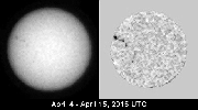
|
-
PIA19802:
-
Tracking Sunspots from Mars, April 2015 (Animation)
Full Resolution:
TIFF
(320.9 kB)
JPEG
(25.3 kB)
|
|
|
2015-08-05 |
Mars
|
Mars Science Laboratory (MSL)
|
Mastcam
|
7765x2000x3 |
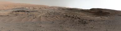
|
-
PIA19803:
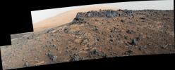
Curiosity Rover's View of Alluring Martian Geology Ahead
Full Resolution:
TIFF
(41.12 MB)
JPEG
(2.37 MB)
|
|
|
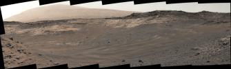
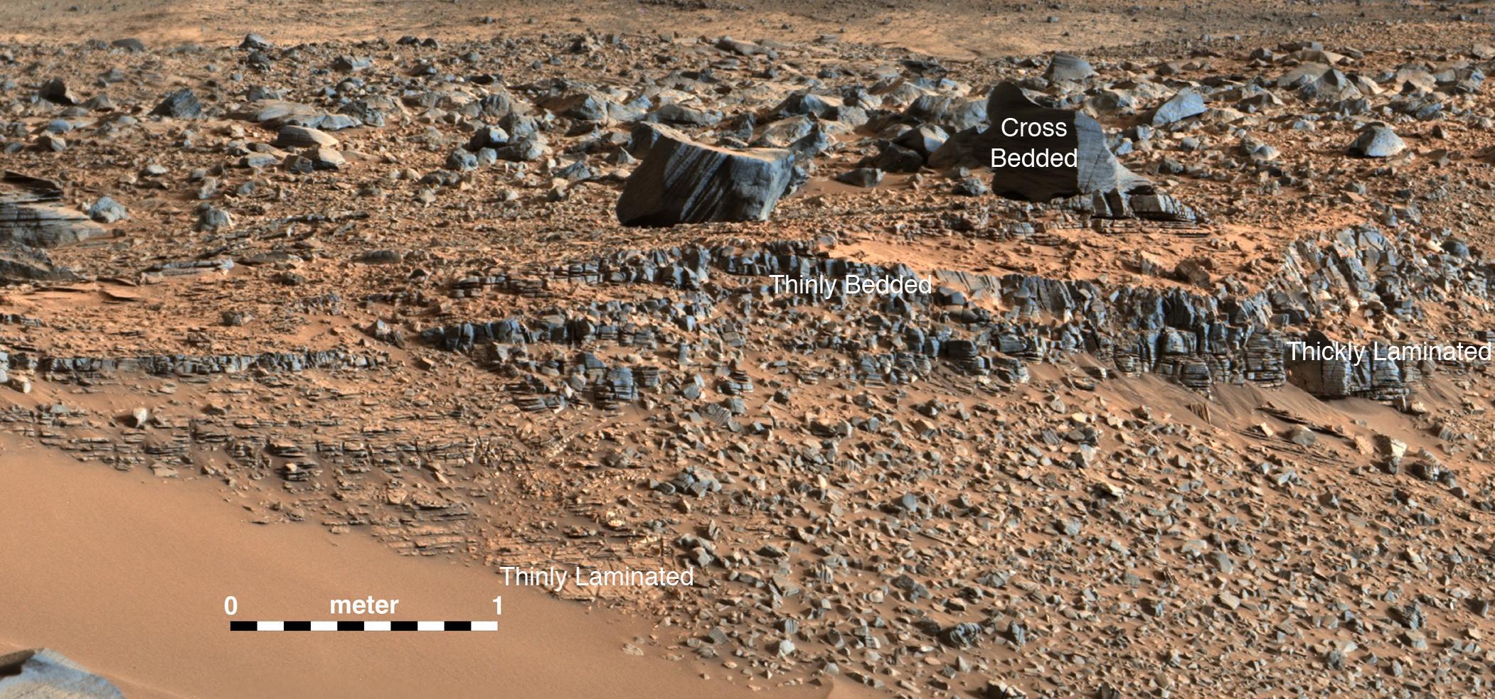
2015-09-11 |
Mars
|
Mars Science Laboratory (MSL)
|
Mastcam
|
7000x1951x3 |

|
-
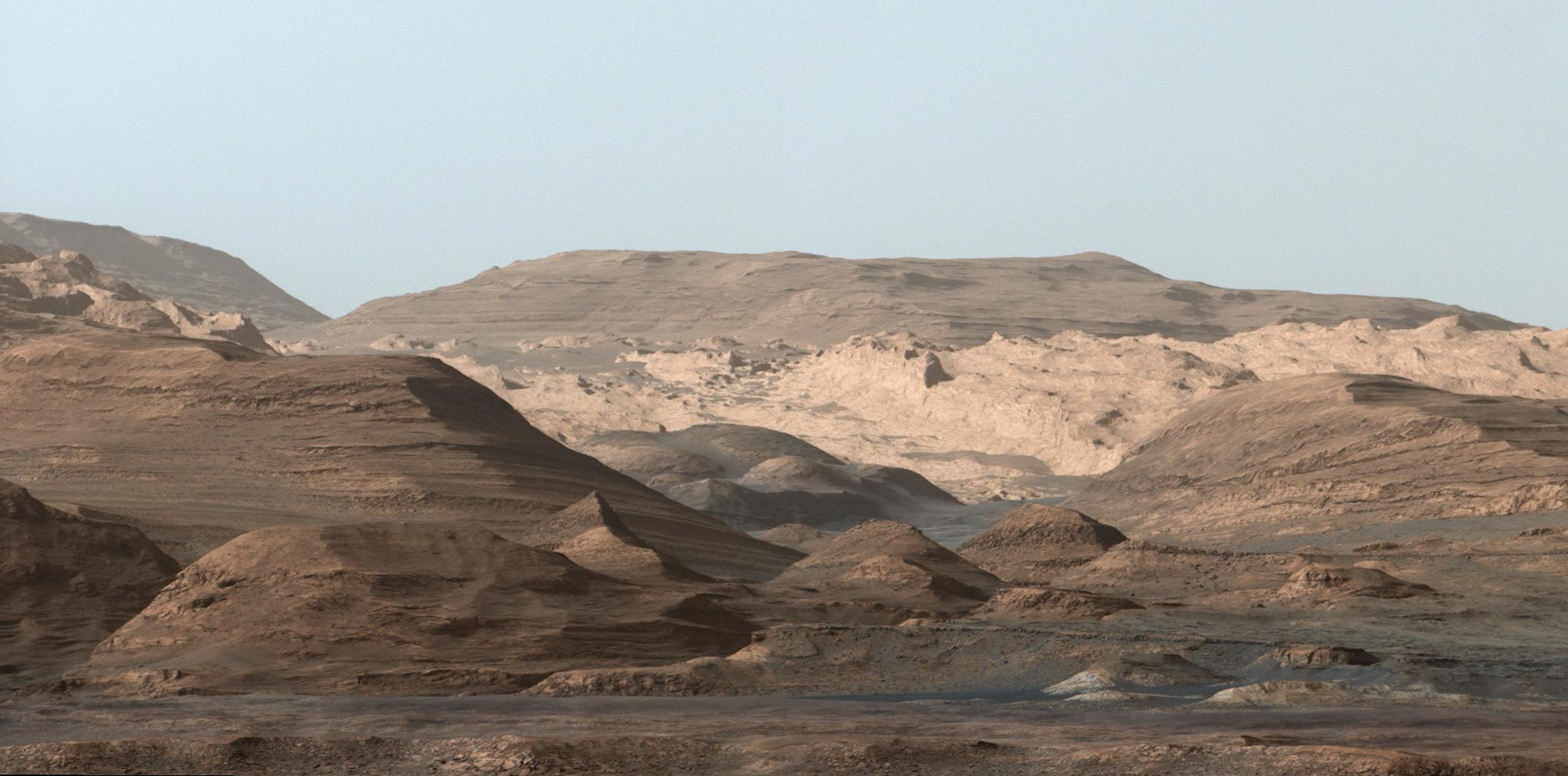
PIA19818:
Vista from Curiosity Shows Crossbedded Martian Sandstone
Full Resolution:
TIFF
(35.94 MB)
JPEG
(2.319 MB)
|
|
|
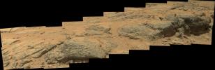
2015-10-02 |
Mars
|
Mars Science Laboratory (MSL)
|
Mastcam
|
2279x1127x3 |
|
-
PIA19912:
-
Mount Sharp Comes In Sharply
Full Resolution:
TIFF
(6.884 MB)
JPEG
(278.2 kB)
|
|
|
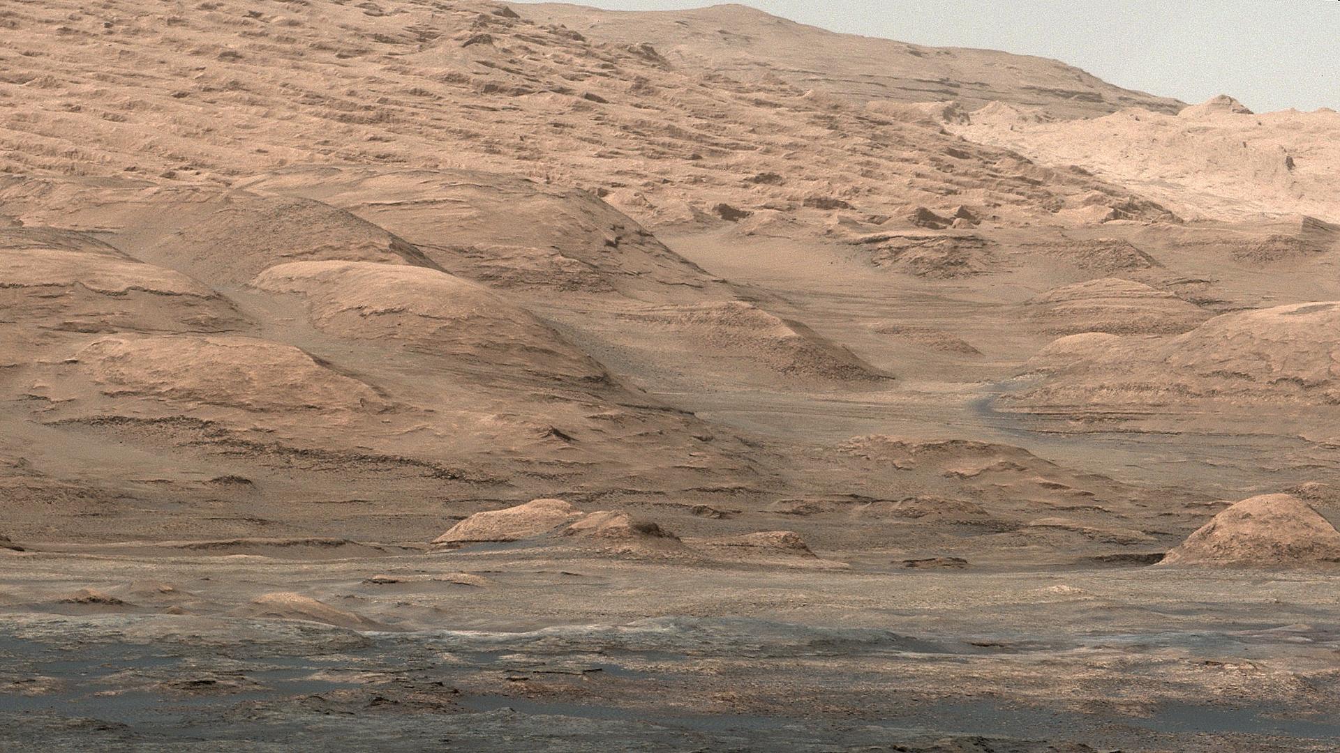
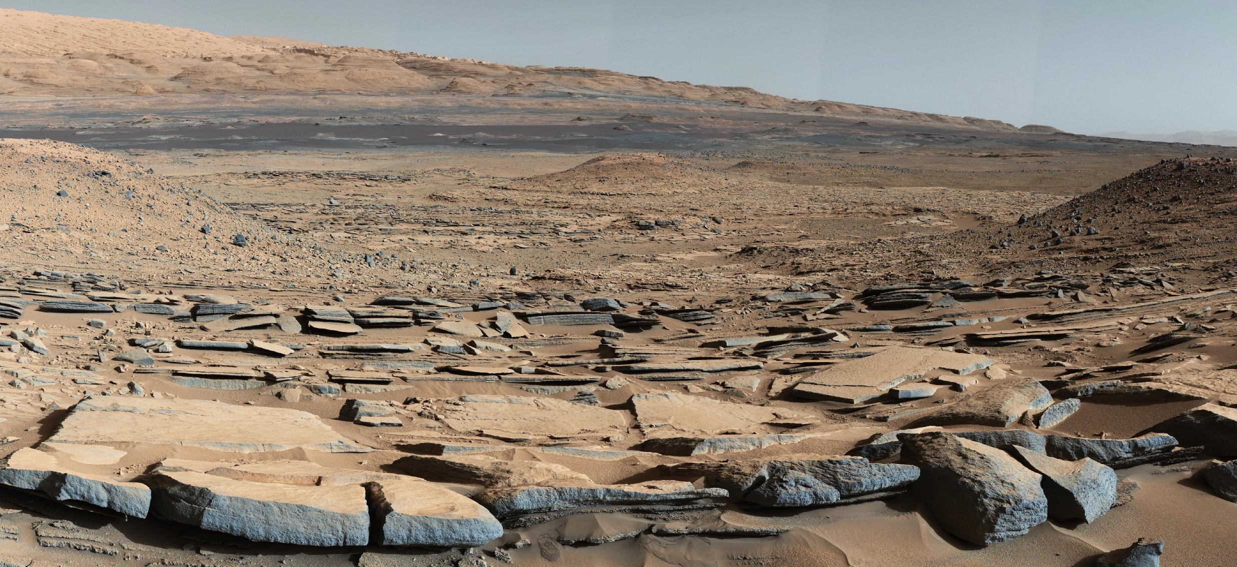
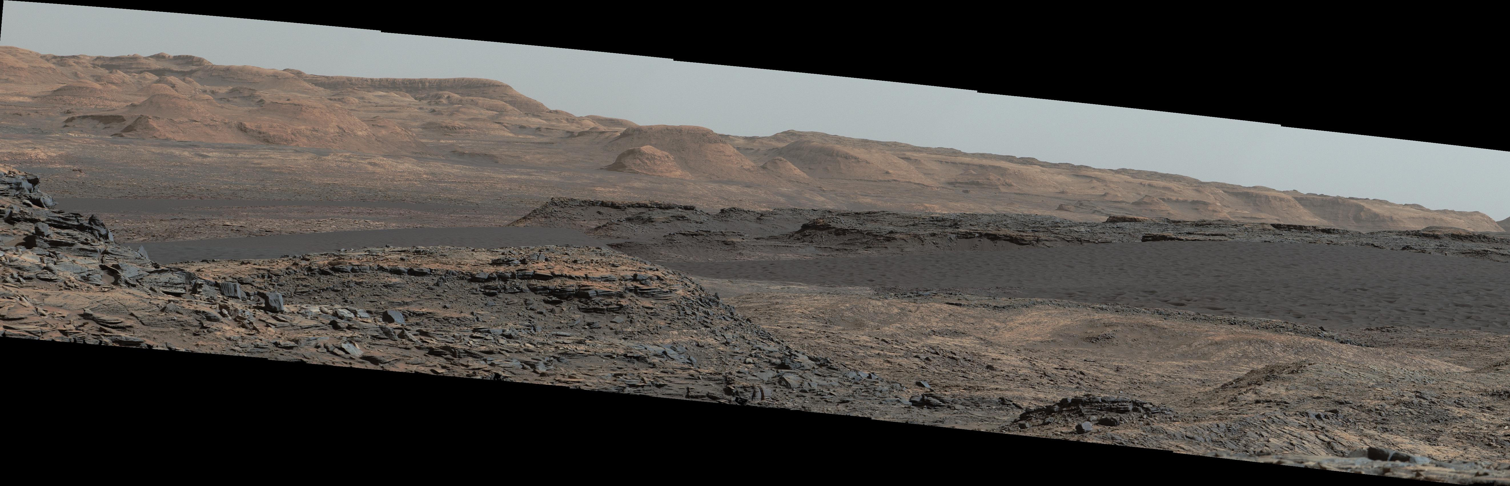
2015-10-08 |
Mars
|
Mars Science Laboratory (MSL)
|
Mastcam
|
2472x1134x3 |
|
-
PIA19839:
-
Strata at Base of Mount Sharp
Full Resolution:
TIFF
(8.382 MB)
JPEG
(679.5 kB)
|
|
|
2015-10-08 |
Mars
|
Mars Science Laboratory (MSL)
|
Mastcam
|
2102x984x3 |
|
-
PIA19840:
-
Secrets of 'Hidden Valley' on Mars
Full Resolution:
TIFF
(6.208 MB)
JPEG
(485.1 kB)
|
|
|
2015-11-11 |
Mars
|
Mars Science Laboratory (MSL)
|
Mastcam
|
5572x2246x3 |
|
-
PIA19921:
-
Veiny 'Garden City' Site and Surroundings on Mount Sharp, Mars
Full Resolution:
TIFF
(30.62 MB)
JPEG
(2.718 MB)
|
|
|
2015-11-11 |
Mars
|
Mars Science Laboratory (MSL)
|
Mastcam
|
1505x685x3 |
|
-
PIA19922:
-
'Garden City' Vein Complex on Lower Mount Sharp, Mars
Full Resolution:
TIFF
(3.093 MB)
JPEG
(179.7 kB)
|
|
|
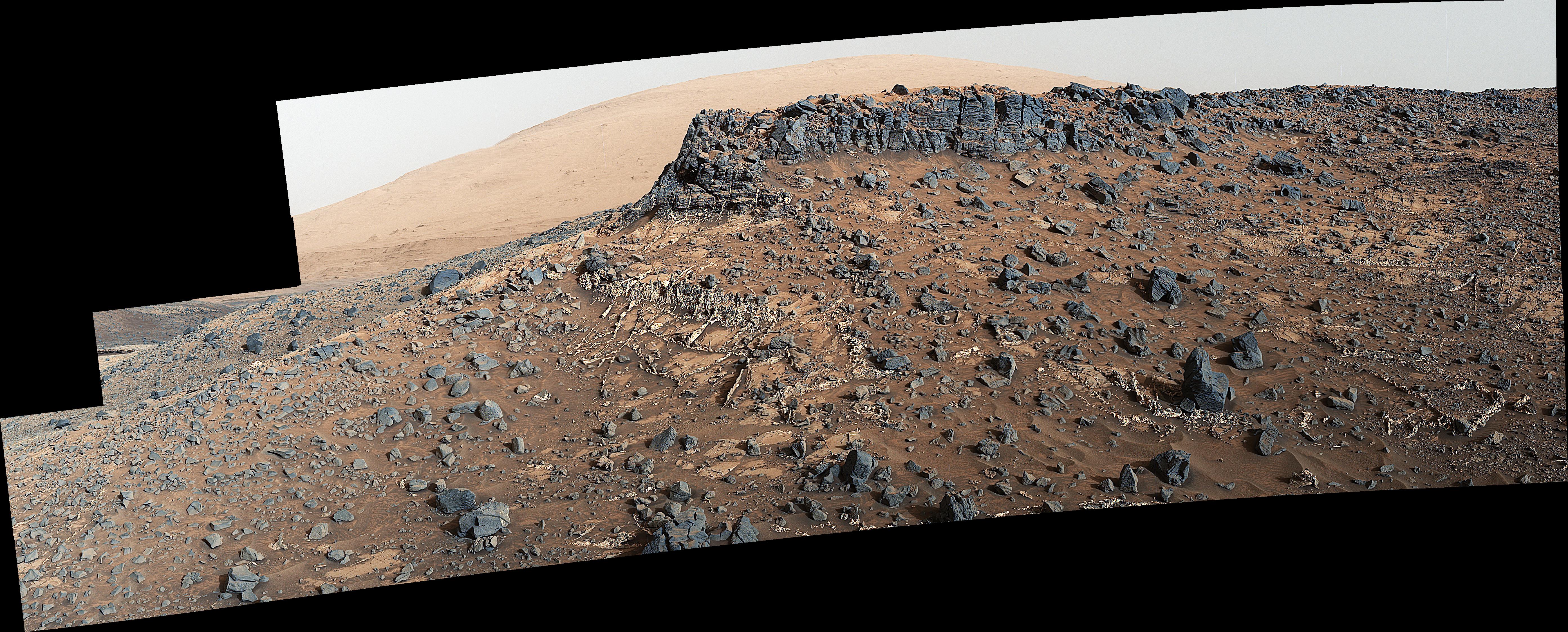
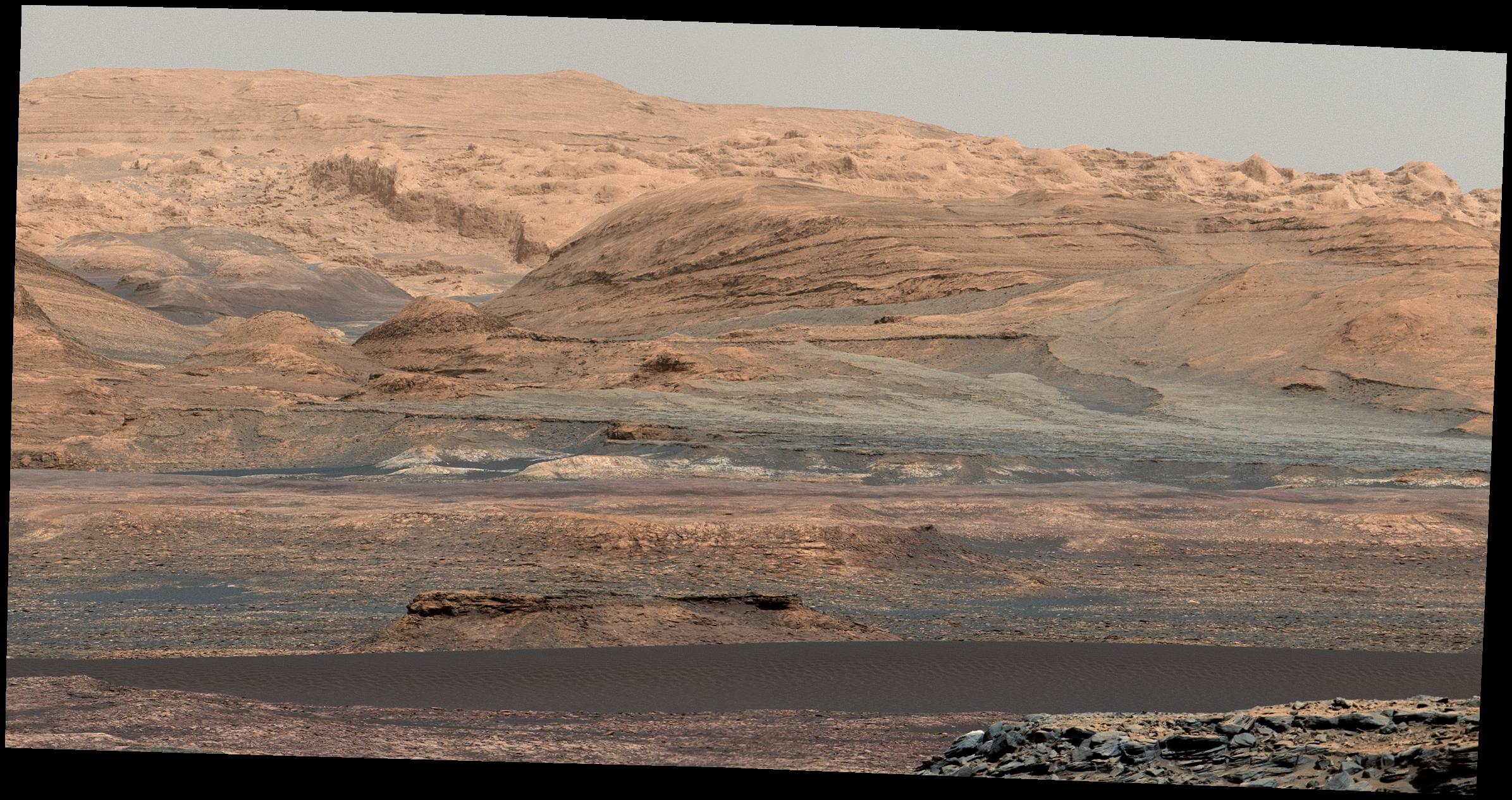
2015-11-16 |
Mars
|
Mars Science Laboratory (MSL)
|
Mastcam
|
5288x1703x3 |

|
-
PIA19928:
-
Curiosity Rover Will Study Dunes on Route up Mountain
Full Resolution:
TIFF
(16.7 MB)
JPEG
(1.074 MB)
|
|
|
2015-11-16 |
Mars
|
Mars Science Laboratory (MSL)
|
Mastcam
|
2391x1265x3 |

|
-
PIA19929:
-
Glimpse of 'Bagnold Dunes' Edging Mount Sharp
Full Resolution:
TIFF
(8.223 MB)
JPEG
(521.4 kB)
|


