PDS logoPlanetary Data System
PDS Information
Find a Node - Use these links to navigate to any of the 8 publicly accessible PDS Nodes.

This bar indicates that you are within the PDS enterprise which includes 6 science discipline nodes and 2 support nodes which are overseen by the Project Management Office at NASA's Goddard Space Flight Center (GSFC). Each node is led by an expert in the subject discipline, supported by an advisory group of other practitioners of that discipline, and subject to selection and approval under a regular NASA Research Announcement.
Click here to return to the Photojournal Home Page Click here to view a list of Photojournal Image Galleries Photojournal_inner_header
Latest Images  |  Spacecraft & Technology  |  Animations  |  Space Images App  |  Feedback  |  Photojournal Search  
Your search criteria found 5 images
Spacecraft
Go to PIAxxxxx:
Refine this list of images by:
Instrument:
Click on an image for detailed information
Click on a column heading to sort in ascending or descending order
My
List
Addition DateSort Ascending Target Mission Instrument Size
Add Image to Favorite List 2015-05-01 Earth ARIA
X-band Interferometric Synthetic Aperture Radar
1362x1320x3
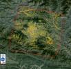
NASA data and expertise are providing valuable information for the ongoing response to the April 25, 2015, magnitude 7.8 Gorkha earthquake in Nepal.
PIA13911:
NASA-Generated Damage Map to Assist with 2015 Gorkha, Nepal Earthquake Disaster Response
Full Resolution:     TIFF (5.396 MB)     JPEG (349.8 kB)
Add Image to Favorite List 2014-09-04 Earth ARIA
X-band Interferometric Synthetic Aperture Radar
2019x2004x3
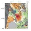
A magnitude 6.0 earthquake struck southern Napa county northeast of San Francisco, California, on Aug. 24, 2014. NASA satellite data reveal ground defomation.
PIA18798:
NASA Analyses of Global Positioning System Data and Italian Radar Satellite Data Reveal Napa Quake Ground Deformation
Full Resolution:     TIFF (12.14 MB)     JPEG (554.3 kB)
Add Image to Favorite List 2013-11-26 Earth ARIA
X-band Interferometric Synthetic Aperture Radar
1916x780x3
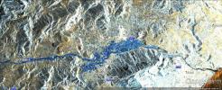
In mid-November 2013, extratropical cyclone Cleopatra brought devastating flooding to the Italian island of Sardinia as shown by the COSMO-SkyMed satellite.
PIA17738:
NASA Produces Map to Aid in Italian Flood Response
Full Resolution:     TIFF (4.485 MB)     JPEG (344.8 kB)
Add Image to Favorite List 2013-11-13 Earth ARIA
X-band interferometric synthetic aperture radar
1623x956x3
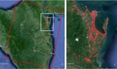
This image, is of Super Typhoon Haiyan, one of the most powerful storms ever recorded on Earth, which struck the Philippines Nov. 8, 2013.
PIA17687:
NASA-Generated Damage Map To Assist With Typhoon Haiyan Disaster Response
Full Resolution:     TIFF (4.657 MB)     JPEG (212.5 kB)
Add Image to Favorite List 2011-03-10 Earth ARIA
X-band interferometric synthetic aperture radar
2692x863x3
This image using COSMO-SkyMed radar data, depicts the relative deformation of Earth's surface at Kilauea when a large fissure eruption began on the east rift zone of Hawaii's Kilauea volcano on March 5, 2011.
PIA13910:
INSAR Images Hawaii's Kilauea Volcano
Full Resolution:     TIFF (6.977 MB)     JPEG (732.1 kB)
Currently displaying images: 1 - 5 of 5