PDS logoPlanetary Data System
PDS Information
Find a Node - Use these links to navigate to any of the 8 publicly accessible PDS Nodes.

This bar indicates that you are within the PDS enterprise which includes 6 science discipline nodes and 2 support nodes which are overseen by the Project Management Office at NASA's Goddard Space Flight Center (GSFC). Each node is led by an expert in the subject discipline, supported by an advisory group of other practitioners of that discipline, and subject to selection and approval under a regular NASA Research Announcement.
Click here to return to the Photojournal Home Page Click here to view a list of Photojournal Image Galleries Photojournal_inner_header
Latest Images  |  Spacecraft & Technology  |  Animations  |  Space Images App  |  Feedback  |  Photojournal Search  
Your search criteria found 41 images
Mission
Go to PIAxxxxx:
Click on an image for detailed information
Click on a column heading to sort in ascending or descending order
My
List
Addition DateSort Ascending Target Mission Instrument Size
Add Image to Favorite List 1998-07-03 Earth TOPEX/Poseidon
Altimeter
695x900x3
This series of six images shows the evolution of atmospheric water vapor over the Pacific Ocean during the 1998 El Niño condition.
PIA01450:
TOPEX/El Niño Watch - Moisture in the Atmosphere, Jan & Feb, 1998
Full Resolution:     TIFF (540.4 kB)     JPEG (90.56 kB)
Add Image to Favorite List 1998-04-02 Earth TOPEX/Poseidon
Altimeter
2550x2545x3
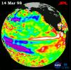
This image of the Pacific Ocean was produced using sea surface height measurements taken by NASA's U.S.-French TOPEX/Poseidon satellite.
PIA00837:
TOPEX/El Niño Watch - El Niño Warm Water Pool Returns to Near Normal State, Mar, 14, 1998
Full Resolution:     TIFF (5.839 MB)     JPEG (585.3 kB)
Add Image to Favorite List 1997-12-19 Earth TOPEX/Poseidon
Altimeter
2550x2550x3
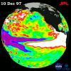
This image of the Pacific Ocean was produced using sea surface height measurements taken by NASA's U.S.-French TOPEX/Poseidon satellite.
PIA01140:
TOPEX/El Niño Watch - El Niño Rhythm, Dec, 10, 1997
Full Resolution:     TIFF (3.255 MB)     JPEG (614.2 kB)
Add Image to Favorite List 1997-12-08 Earth TOPEX/Poseidon
Altimeter
2550x2548x3
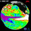
This image of the Pacific Ocean was produced using sea surface height measurements taken by NASA's U.S./French TOPEX/Poseidon satellite. The image shows sea surface height relative to normal ocean conditions on Dec. 1, 1997.
PIA01099:
TOPEX/El Niño Watch - "Double Peak" Pattern Complete, Dec, 1, 1997
Full Resolution:     TIFF (5.241 MB)     JPEG (569.5 kB)
Add Image to Favorite List 1997-11-20 Earth TOPEX/Poseidon
Altimeter
2550x2544x3
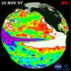
This image of the Pacific Ocean was produced using sea surface height measurements taken by the U.S./French TOPEX/Poseidon satellite. The image shows sea surface height relative to normal ocean conditions on Nov. 10, 1997.
PIA01085:
TOPEX/El Niño Watch - Warm Water Pool is Increasing, Nov. 10, 1997
Full Resolution:     TIFF (5.509 MB)     JPEG (577.8 kB)
Add Image to Favorite List 1997-10-30 Earth TOPEX/Poseidon
Altimeter
2550x2545x3
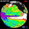
This image of the Pacific Ocean was produced using sea surface height measurements taken by NASA's U.S./French TOPEX/POSEIDON satellite.
PIA01053:
TOPEX/El Niño Watch - October 23, 1997
Full Resolution:     TIFF (4.569 MB)     JPEG (562.8 kB)
Add Image to Favorite List 1997-10-14 Earth TOPEX/Poseidon
Altimeter
2154x1036x3
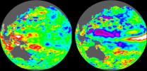
These images of the Pacific Ocean near Indonesia were produced using sea surface height measurements taken by NASA's U.S.-French TOPEX/Poseidon satellite.
PIA00742:
TOPEX/El Niño Watch - Indonesia Area, December, 1996 and August, 1997
Full Resolution:     TIFF (3.323 MB)     JPEG (282.5 kB)
Add Image to Favorite List 1997-10-14 Earth TOPEX/Poseidon
Altimeter
2000x2000x3
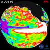
This image of the Pacific Ocean was produced using sea surface height measurements taken by NASA's U.S./French TOPEX/Poseidon satellite.
PIA00741:
TOPEX/El Niño Watch - October 3, 1997
Full Resolution:     TIFF (2.293 MB)     JPEG (424.1 kB)
Add Image to Favorite List 1997-10-14 Earth TOPEX/Poseidon
Altimeter
900x900x3
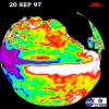
This image of the Pacific Ocean was produced using sea surface height measurements taken by NASA's U.S./French TOPEX/POSEIDON satellite.
PIA00736:
TOPEX/El Niño Watch- September 20, 1997
Full Resolution:     TIFF (187.3 kB)     JPEG (120.7 kB)
Add Image to Favorite List 1997-10-14 Earth TOPEX/Poseidon
Altimeter
900x900x3
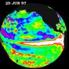
This image of the Pacific Ocean was produced using sea surface height measurements taken by NASA's U.S./French TOPEX/POSEIDON satellite.
PIA00735:
TOPEX/El Niño Watch - June 25, 1997
Full Resolution:     TIFF (889.7 kB)     JPEG (106.5 kB)
Add Image to Favorite List 1997-10-14 Earth TOPEX/Poseidon
Altimeter
900x900x3
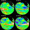
These four views of the Pacific Ocean were produced using sea surface height measurements taken by NASA's U.S./French TOPEX/POSEIDON satellite.
PIA00734:
TOPEX/El Niño Watch - March thru June, 1997
Full Resolution:     TIFF (1.041 MB)     JPEG (149.8 kB)
Retrieve Previous Set
Currently displaying images: 31 - 41 of 41