MOC image P005_03 was acquired at 6:25 AM PDT on September 19, 1997, about 11 minutes after Mars Global Surveyor passed close to the planet for the fifth time. During the imaging period, the spacecraft was canted towards the sun-lit hemisphere by 25°, and the MOC was obliquely viewing features about 1600 km (1000 miles) away. The resolution at that distance was about 6 meters (20 feet) per picture element (pixels), but in order to improve the number of gray levels, the pixels were summed in both the cross-track and along-track directions, yielding final resolution of about 12 meters (40 feet) per pixel. The MOC image covers an area about 12 km X 12 km (7.5 X 7.5 miles).
Shown above are three pictures:
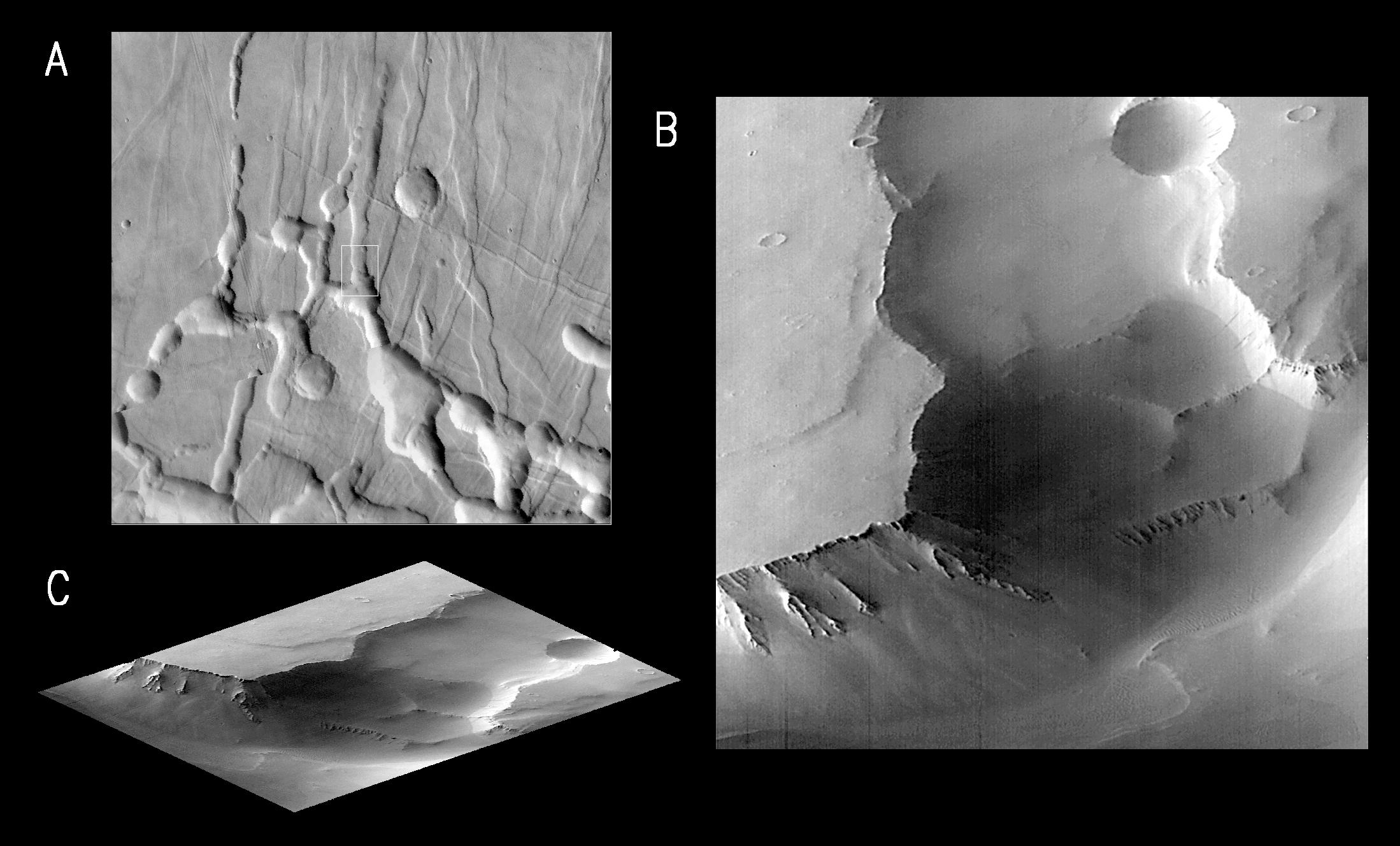
(A) is excepted from the U.S. Geological Survey's Mars Digital Image Mosaic, showing the Labyrinthus Noctis area west of the Valles Marineris. This image is about 175 km (109 miles) square. The outline of the MOC high resolution (Narrow Angle) camera image is centered at 4.6°S, 102.6°W.(B) is the MOC frame P005_03. Because the MOC acquires its images one line at a time, the cant angle towards the sun-lit portion of the planet, the spacecraft orbital velocity, and the spacecraft rotational velocity combined to distort the image slightly.
(C) shows P005_03 skewed and rotated to the perspective that MOC was viewing at the time the image was taken.
Labyrinthus Noctis is near the crest of a large (many thousands of kilometers) upcoming of the Martian crust, and the 2000 meter (6500 foot) deep canyons visible in these pictures are bounded by faults. Debris shed from the steep slopes has moved down into after the canyons opened. Small dunes are seen in the lowest area, beneath the high cliffs.Launched on November 7, 1996, Mars Global Surveyor entered Mars orbit on Thursday, September 11, 1997. The spacecraft has been using atmospheric drag to reduce the size of its orbit for the past three weeks, and will achieve a circular orbit only 400 km (248 mi) above the surface early next year. Mapping operations begin in March 1998. At that time, MOC narrow angle images will be 5-10 times higher resolution than these pictures.
Malin Space Science Systems and the California Institute of Technology built the MOC using spare hardware from the Mars Observer mission. MSSS operates the camera from its facilities in San Diego, CA. The Jet Propulsion Laboratory's Mars Surveyor Operations Project operates the Mars Global Surveyor spacecraft with its industrial partner, Lockheed Martin Astronautics, from facilities in Pasadena, CA and Denver, CO.
 Planetary Data System


