PDS logoPlanetary Data System
PDS Information
Find a Node - Use these links to navigate to any of the 8 publicly accessible PDS Nodes.

This bar indicates that you are within the PDS enterprise which includes 6 science discipline nodes and 2 support nodes which are overseen by the Project Management Office at NASA's Goddard Space Flight Center (GSFC). Each node is led by an expert in the subject discipline, supported by an advisory group of other practitioners of that discipline, and subject to selection and approval under a regular NASA Research Announcement.
Click here to return to the Photojournal Home Page Click here to view a list of Photojournal Image Galleries Photojournal_inner_header
Latest Images  |  Spacecraft & Technology  |  Animations  |  Space Images App  |  Feedback  |  Photojournal Search  
Your search criteria found 13 images
Mission
Go to PIAxxxxx:
Refine this list of images by:
Spacecraft:
Click on an image for detailed information
Click on a column heading to sort in ascending or descending order
My
List
Addition DateSort Ascending Target Mission Instrument Size
Add Image to Favorite List 2020-01-03 CubeSat
5760x3240x3
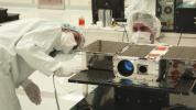
This image shows Electrical Test Engineer Esha Murty and Integration and Test Lead Cody Colley preparing the ASTERIA spacecraft for mass-properties measurements in April 2017.
PIA23406:
ASTERIA CubeSat Before Launch
Full Resolution:     TIFF (42.61 MB)     JPEG (1.192 MB)
Add Image to Favorite List 2019-09-04 Earth CubeSat
1400x788x3
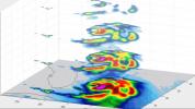
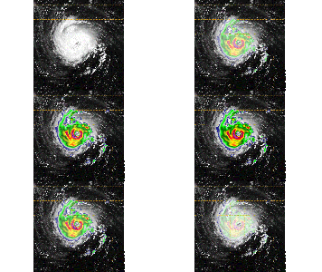
Hurricane Dorian off the coast of Florida, as seen by the small satellite TEMPEST-D at 2 a.m. EDT on Sep. 3, 2019 (11 p.m PDT on Sept. 2, 2019). The layers in the animation reveal slices of the hurricane from four depths.
PIA23431:
TEMPEST-D CubeSat Sees Hurricane Dorian in 3D
Full Resolution:     TIFF (1.581 MB)     JPEG (105.9 kB)
Add Image to Favorite List 2019-08-29 Earth CubeSat
1400x778x3
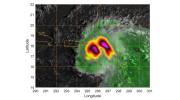
Hurricane Dorian off the coast of Puerto Rico, as seen by the small satellite TEMPEST-D on Aug. 28, 2019 (local time). The colors in the image reveal the heavy rain and moisture inside the storm.
PIA23414:
Small Satellite TEMPEST-D Sees Hurricane Dorian off Coast
Full Resolution:     TIFF (1.738 MB)     JPEG (121.2 kB)
Add Image to Favorite List 2019-05-16 Earth CubeSat
2592x2192x1
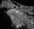
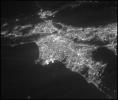
This image of the greater Los Angeles area was taken on March 29, 2019, by ASTERIA, the Arcsecond Space Telescope Enabling Research in Astrophysics satellite. It shows a region of about 43.5 square miles with a resolution of about 100 feet per pixel.
PIA23125:
ASTERIA Image of Los Angeles 2
Full Resolution:     TIFF (4.963 MB)     JPEG (831.4 kB)
Add Image to Favorite List 2019-05-16 Earth CubeSat
2592x2192x1
This image of the greater Los Angeles area was taken on March 29, 2019 by ASTERIA, the Arcsecond Space Telescope Enabling Research in Astrophysics satellite. The Port of Long Beach is visible near the center of the image.
PIA23124:
ASTERIA Image of Los Angeles 1
Full Resolution:     TIFF (4.729 MB)     JPEG (440.4 kB)
Add Image to Favorite List 2019-04-09 CubeSat
1200x670x3
A brief laser flash, seen here at the center of the image, was part of an experiment conducted by two NASA CubeSats.
PIA23117:
CubeSats Communicate with Lasers
Full Resolution:     TIFF (1.161 MB)     JPEG (67.95 kB)
Add Image to Favorite List 2019-03-27 CubeSat
9600x7223x3
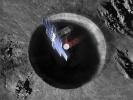
This artist's concept shows a view from above the Lunar Flashlight spacecraft, a six-unit CubeSat designed to search for ice on the Moon's surface using special lasers.
PIA23132:
Lunar Flashlight from Above (Artist's Concept)
Full Resolution:     TIFF (79.31 MB)     JPEG (5.846 MB)
Add Image to Favorite List 2019-03-27 CubeSat
9600x7223x3
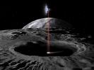
This artist's concept shows the Lunar Flashlight spacecraft, a six-unit CubeSat designed to search for ice on the Moon's surface using special lasers.
PIA23131:
Lunar Flashlight (Artist's Concept)
Full Resolution:     TIFF (54.2 MB)     JPEG (3.871 MB)
Add Image to Favorite List 2018-09-25 Earth CubeSat
1280x434x3
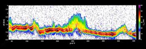
This graph shows the first data from NASA's RainCube satellite. The data shows a vertical snapshot of a storm over the mountains in Mexico in late August 2018, as measured by RainCube's radar.
PIA22654:
RainCube Collects First Storm Data
Full Resolution:     TIFF (759.9 kB)     JPEG (106.9 kB)
Add Image to Favorite List 2018-09-25 Earth CubeSat
478x318x3
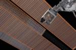
This image shows the size of NASA's tiny weather satellite, Raincube, in comparison to the International Space Station. RainCube was deployed into low-Earth orbit from the ISS in July, 2018.
PIA22653:
Mini Mission RainCube is Sent into Earth Orbit
Full Resolution:     TIFF (330.8 kB)     JPEG (210.5 kB)
Add Image to Favorite List 2018-09-20 Earth CubeSat
790x787x3
This image combines NASA's TEMPEST-D data with a visible image of the storm from NASA's GOES weather satellite revealing the eye of the storm surrounded by towering, intense rain bands.
PIA22652:
Hurricane Florence as Seen from a CubeSat Animation Icon
Full Resolution:     TIFF (1.357 MB)     JPEG (144.5 kB)
Add Image to Favorite List 2018-05-17 CubeSat
4032x3024x3
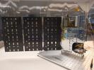
The complete TEMPEST-D spacecraft shown with the solar panels deployed.
PIA22458:
TEMPEST-D Spacecraft
Full Resolution:     TIFF (24.92 MB)     JPEG (1.13 MB)
Add Image to Favorite List 2018-05-17 CubeSat
2757x3142x3
The RainCube 6U CubeSat with fully-deployed antenna.
PIA22457:
RainCube 6U CubeSat
Full Resolution:     TIFF (8.191 MB)     JPEG (419 kB)
Currently displaying images: 1 - 13 of 13