My
List |
Addition Date
|
Target
|
Mission
|
Instrument
|
Size
|

|
2006-02-14 |
Mars
|
Mars Global Surveyor (MGS)
|
Mars Orbiter Camera (MOC)
|
281x413x1 |

|
-
PIA02179:
-
Valentine 2006
Full Resolution:
TIFF
(116.4 kB)
JPEG
(27.6 kB)
|

|
2006-02-13 |
Mars
|
Mars Global Surveyor (MGS)
|
Mars Orbiter Camera (MOC)
|
672x1366x1 |

|
-
PIA02178:
-
Chryse Plains
Full Resolution:
TIFF
(919.1 kB)
JPEG
(261.4 kB)
|

|
2006-02-12 |
Mars
|
Mars Global Surveyor (MGS)
|
Mars Orbiter Camera (MOC)
|
1024x2098x1 |

|
-
PIA02177:
-
Tithonium Landslide
Full Resolution:
TIFF
(2.151 MB)
JPEG
(670.7 kB)
|

|
2006-02-11 |
Mars
|
Mars Global Surveyor (MGS)
|
Mars Orbiter Camera (MOC)
|
672x1464x1 |

|
-
PIA02176:
-
South Polar Terrain
Full Resolution:
TIFF
(985 kB)
JPEG
(193.4 kB)
|

|
2006-02-10 |
Mars
|
Mars Global Surveyor (MGS)
|
Mars Orbiter Camera (MOC)
|
1024x1919x1 |

|
-
PIA02169:
-
Syrtis Crater
Full Resolution:
TIFF
(1.967 MB)
JPEG
(190.2 kB)
|

|
2006-02-09 |
Mars
|
Mars Global Surveyor (MGS)
|
Mars Orbiter Camera (MOC)
|
672x1728x1 |

|
-
PIA02168:
-
South Polar Terraces
Full Resolution:
TIFF
(1.163 MB)
JPEG
(154.2 kB)
|

|
2006-02-08 |
Mars
|
Mars Global Surveyor (MGS)
|
Mars Orbiter Camera (MOC)
|
672x1160x1 |

|
-
PIA02167:
-
South Polar Landforms
Full Resolution:
TIFF
(780.5 kB)
JPEG
(251.2 kB)
|

|
2006-02-07 |
Mars
|
Mars Global Surveyor (MGS)
|
Mars Orbiter Camera (MOC)
|
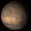
640x640x3 |
|
-
PIA02165:
-
Mars at Ls 12°: Tharsis
Full Resolution:
TIFF
(411.8 kB)
JPEG
(34.2 kB)
|

|
2006-02-06 |
Mars
|
Mars Global Surveyor (MGS)
|
Mars Orbiter Camera (MOC)
|
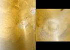
1230x869x3 |
|
-
PIA02164:
-
Arsia and Phobos
Full Resolution:
TIFF
(3.21 MB)
JPEG
(93.8 kB)
|

|
2006-02-05 |
Mars
|
Mars Global Surveyor (MGS)
|
Mars Orbiter Camera (MOC)
|
672x1552x1 |

|
-
PIA02163:
-
Elysium Summit
Full Resolution:
TIFF
(1.044 MB)
JPEG
(130.4 kB)
|

|
2006-02-04 |
Mars
|
Mars Global Surveyor (MGS)
|
Mars Orbiter Camera (MOC)
|
672x1104x1 |

|
-
PIA02162:
-
Streaked Plain
Full Resolution:
TIFF
(742.9 kB)
JPEG
(234.4 kB)
|

|
2006-02-03 |
Mars
|
Mars Global Surveyor (MGS)
|
Mars Orbiter Camera (MOC)
|
512x1660x1 |

|
-
PIA02161:
-
D and D (Dunes and Devils)
Full Resolution:
TIFF
(851 kB)
JPEG
(67.5 kB)
|

|
2006-02-02 |
Mars
|
Mars Global Surveyor (MGS)
|
Mars Orbiter Camera (MOC)
|
672x1176x1 |

|
-
PIA02152:
-
Broken Plain
Full Resolution:
TIFF
(791.3 kB)
JPEG
(172.2 kB)
|

|
2006-02-01 |
Mars
|
Mars Global Surveyor (MGS)
|
Mars Orbiter Camera (MOC)
|
2048x3024x1 |

|
-
PIA02151:
-
South High-latitude Gullies
Full Resolution:
TIFF
(6.199 MB)
JPEG
(1.313 MB)
|

|
2006-01-31 |
Mars
|
Mars Global Surveyor (MGS)
|
Mars Orbiter Camera (MOC)
|
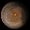
640x640x3 |
|
-
PIA02150:
-
Mars at Ls 357°: South Polar Region
Full Resolution:
TIFF
(411.8 kB)
JPEG
(37.87 kB)
|

|
2006-01-30 |
Mars
|
Mars Global Surveyor (MGS)
|
Mars Orbiter Camera (MOC)
|
601x1372x1 |

|
-
PIA06108:
-
Northern Plains Scene
Full Resolution:
TIFF
(825.6 kB)
JPEG
(294.6 kB)
|

|
2006-01-29 |
Mars
|
Mars Global Surveyor (MGS)
|
Mars Orbiter Camera (MOC)
|
672x968x1 |

|
-
PIA06104:
-
Number 8
Full Resolution:
TIFF
(651.4 kB)
JPEG
(130.7 kB)
|

|
2006-01-28 |
Mars
|
Mars Global Surveyor (MGS)
|
Mars Orbiter Camera (MOC)
|
2048x2865x1 |

|
-
PIA06103:
-
South Polar Hills
Full Resolution:
TIFF
(5.873 MB)
JPEG
(718.7 kB)
|

|
2006-01-27 |
Mars
|
Mars Global Surveyor (MGS)
|
Mars Orbiter Camera (MOC)
|
2048x4115x1 |

|
-
PIA03698:
-
Terby's Rocks
Full Resolution:
TIFF
(8.436 MB)
JPEG
(882.1 kB)
|

|
2006-01-26 |
Mars
|
Mars Global Surveyor (MGS)
|
Mars Orbiter Camera (MOC)
|
1024x2220x1 |

|
-
PIA03697:
-
Secondary Field
Full Resolution:
TIFF
(2.276 MB)
JPEG
(623.9 kB)
|

|
2006-01-25 |
Mars
|
Mars Global Surveyor (MGS)
|
Mars Orbiter Camera (MOC)
|
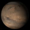
640x640x3 |
|
-
PIA03696:
-
Mars at Ls 357°: Elysium/Mare Cimmerium
Full Resolution:
TIFF
(411.8 kB)
JPEG
(31.68 kB)
|

|
2006-01-24 |
Mars
|
Mars Global Surveyor (MGS)
Mars Exploration Rover (MER)
|
Mars Orbiter Camera (MOC)
|
1442x4116x3 |

|
-
PIA03691:
-
2 Years on Mars! Meridiani Planum Features Investigated by the Rover,
Opportunity
Full Resolution:
TIFF
(17.84 MB)
JPEG
(981 kB)
|

|
2006-01-23 |
Mars
|
Mars Global Surveyor (MGS)
|
Mars Orbiter Camera (MOC)
|
601x1476x1 |

|
-
PIA03690:
-
North Polar Dunes
Full Resolution:
TIFF
(888.2 kB)
JPEG
(120 kB)
|

|
2006-01-22 |
Mars
|
Mars Global Surveyor (MGS)
|
Mars Orbiter Camera (MOC)
|
2048x3648x1 |

|
-
PIA03689:
-
Southern Terrain
Full Resolution:
TIFF
(7.479 MB)
JPEG
(2.002 MB)
|

|
2006-01-21 |
Mars
|
Mars Global Surveyor (MGS)
|
Mars Orbiter Camera (MOC)
|
916x1312x1 |

|
-
PIA03688:
-
Cratered Surface
Full Resolution:
TIFF
(1.203 MB)
JPEG
(145.9 kB)
|

|
2006-01-20 |
Mars
|
Mars Global Surveyor (MGS)
|
Mars Orbiter Camera (MOC)
|
672x1268x1 |

|
-
PIA03687:
-
Devil in Mendel
Full Resolution:
TIFF
(853.2 kB)
JPEG
(216.1 kB)
|

|
2006-01-19 |
Mars
|
Mars Global Surveyor (MGS)
|
Mars Orbiter Camera (MOC)
|
672x1296x1 |

|
-
PIA03680:
-
South Polar Scene
Full Resolution:
TIFF
(872 kB)
JPEG
(119.8 kB)
|

|
2006-01-18 |
Mars
|
Mars Global Surveyor (MGS)
|
Mars Orbiter Camera (MOC)
|
512x1124x1 |

|
-
PIA03679:
-
Work of the Wind
Full Resolution:
TIFF
(576.3 kB)
JPEG
(60.85 kB)
|

|
2006-01-17 |
Mars
|
Mars Global Surveyor (MGS)
|
Mars Orbiter Camera (MOC)
|
640x640x3 |
|
-
PIA03675:
-
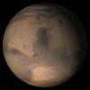
Mars at Ls 357°: Syrtis Major
Full Resolution:
TIFF
(411.8 kB)
JPEG
(35.15 kB)
|

|
2006-01-16 |
Mars
|
Mars Global Surveyor (MGS)
|
Mars Orbiter Camera (MOC)
|
2048x3432x1 |

|
-
PIA03674:
-
Impact Crater
Full Resolution:
TIFF
(7.036 MB)
JPEG
(1.063 MB)
|

|
2006-01-15 |
Mars
|
Mars Global Surveyor (MGS)
|
Mars Orbiter Camera (MOC)
|
672x1096x1 |

|
-
PIA03673:
-
South Polar Terrain
Full Resolution:
TIFF
(737.5 kB)
JPEG
(191.3 kB)
|

|
2006-01-14 |
Mars
|
Mars Global Surveyor (MGS)
|
Mars Orbiter Camera (MOC)
|
1024x2576x1 |

|
-
PIA03672:
-
Becquerel's Layers
Full Resolution:
TIFF
(2.641 MB)
JPEG
(870.7 kB)
|

|
2006-01-13 |
Mars
|
Mars Global Surveyor (MGS)
|
Mars Orbiter Camera (MOC)
|
836x2527x1 |

|
-
PIA03666:
-
North Polar Layers
Full Resolution:
TIFF
(2.115 MB)
JPEG
(271.9 kB)
|

|
2006-01-12 |
Mars
|
Mars Global Surveyor (MGS)
|
Mars Orbiter Camera (MOC)
|
640x1536x1 |

|
-
PIA03661:
-
Aeolis Yardangs
Full Resolution:
TIFF
(984.3 kB)
JPEG
(267.4 kB)
|

|
2006-01-11 |
Mars
|
Mars Global Surveyor (MGS)
|
Mars Orbiter Camera (MOC)
|
2048x3672x1 |

|
-
PIA03660:
-
Eos Chaos Rocks
Full Resolution:
TIFF
(7.528 MB)
JPEG
(671.1 kB)
|

|
2006-01-10 |
Mars
|
Mars Global Surveyor (MGS)
|
Mars Orbiter Camera (MOC)
|
640x640x3 |
|
-
PIA03659:
-
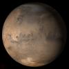
Mars at Ls 357°: Acidalia/Mare Erythraeum
Full Resolution:
TIFF
(411.8 kB)
JPEG
(39.75 kB)
|

|
2006-01-09 |
Mars
|
Mars Global Surveyor (MGS)
|
Mars Orbiter Camera (MOC)
|
836x1464x1 |

|
-
PIA03657:
-
Nirgal Vallis
Full Resolution:
TIFF
(1.225 MB)
JPEG
(163.1 kB)
|

|
2006-01-08 |
Mars
|
Mars Global Surveyor (MGS)
|
Mars Orbiter Camera (MOC)
|
1024x1940x1 |

|
-
PIA03656:
-
Dunes in Brashear
Full Resolution:
TIFF
(1.989 MB)
JPEG
(621.8 kB)
|

|
2006-01-07 |
Mars
|
Mars Global Surveyor (MGS)
|
Mars Orbiter Camera (MOC)
|
1024x1664x1 |

|
-
PIA03655:
-
Secondaries near Cerberus
Full Resolution:
TIFF
(1.706 MB)
JPEG
(499.3 kB)
|

|
2006-01-06 |
Mars
|
Mars Global Surveyor (MGS)
|
Mars Orbiter Camera (MOC)
|
672x1056x1 |

|
-
PIA03278:
-
Polar Layers
Full Resolution:
TIFF
(710.6 kB)
JPEG
(207.4 kB)
|

|
2006-01-05 |
Mars
|
Mars Global Surveyor (MGS)
|
Mars Orbiter Camera (MOC)
|
672x1318x1 |

|
-
PIA03277:
-
Martian Artwork
Full Resolution:
TIFF
(886.8 kB)
JPEG
(206.5 kB)
|

|
2006-01-04 |
Mars
|
Mars Global Surveyor (MGS)
|
Mars Orbiter Camera (MOC)
|
640x640x3 |
|
-
PIA03276:
-
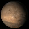
Mars at Ls 357°: Tharsis
Full Resolution:
TIFF
(411.8 kB)
JPEG
(33.94 kB)
|

|
2006-01-03 |
Mars
|
Mars Global Surveyor (MGS)
Mars Exploration Rover (MER)
|
Mars Orbiter Camera (MOC)
|
892x444x1 |
|
-
PIA03255:
-
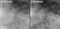
Spirit on "Husband Hill," with 2004 Comparison
Full Resolution:
TIFF
(396.7 kB)
JPEG
(45.25 kB)
|

|
2006-01-03 |
Mars
|
Mars Global Surveyor (MGS)
Mars Exploration Rover (MER)
|
Mars Orbiter Camera (MOC)
|
6700x6065x3 |
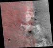
|
-
PIA03254:
-
Spirit's Neighborhood in 'Columbia Hills,' in Stereo
Full Resolution:
TIFF
(121.9 MB)
JPEG
(2.885 MB)
|

|
2006-01-03 |
Mars
|
Mars Global Surveyor (MGS)
Mars Exploration Rover (MER)
|
Mars Orbiter Camera (MOC)
|
6492x6065x1 |
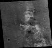
|
-
PIA03253:
-
Spirit Rover on 'Husband Hill'
Full Resolution:
TIFF
(39.42 MB)
JPEG
(4.319 MB)
|

|
2006-01-02 |
Mars
|
Mars Global Surveyor (MGS)
|
Mars Orbiter Camera (MOC)
|
836x4218x1 |

|
-
PIA03269:
-
Dunes in Noachis
Full Resolution:
TIFF
(3.53 MB)
JPEG
(369.1 kB)
|

|
2006-01-01 |
Mars
|
Mars Global Surveyor (MGS)
|
Mars Orbiter Camera (MOC)
|
1024x1895x1 |

|
-
PIA03268:
-
Light-toned Rock
Full Resolution:
TIFF
(1.943 MB)
JPEG
(488.4 kB)
|

|
2005-12-31 |
Mars
|
Mars Global Surveyor (MGS)
|
Mars Orbiter Camera (MOC)
|
1024x2100x1 |

|
-
PIA03267:
-
Zephyria Channel
Full Resolution:
TIFF
(2.153 MB)
JPEG
(572.9 kB)
|

|
2005-12-30 |
Mars
|
Mars Global Surveyor (MGS)
|
Mars Orbiter Camera (MOC)
|
2048x3120x1 |

|
-
PIA03266:
-
Polar Summer
Full Resolution:
TIFF
(6.396 MB)
JPEG
(1.14 MB)
|

|
2005-12-29 |
Mars
|
Mars Global Surveyor (MGS)
|
Mars Orbiter Camera (MOC)
|
2048x3968x1 |

|
-
PIA03265:
-
Ascraeus Depression
Full Resolution:
TIFF
(8.135 MB)
JPEG
(1.745 MB)
|

|
2005-12-28 |
Mars
|
Mars Global Surveyor (MGS)
|
Mars Orbiter Camera (MOC)
|
836x1585x1 |

|
-
PIA03264:
-
Herschel's Dunes
Full Resolution:
TIFF
(1.327 MB)
JPEG
(134.3 kB)
|

|
2005-12-27 |
Mars
|
Mars Global Surveyor (MGS)
|
Mars Orbiter Camera (MOC)
|
640x640x3 |
|
-
PIA03263:
-
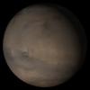
Mars at Ls 341°: Elysium/Mare Cimmerium
Full Resolution:
TIFF
(411.8 kB)
JPEG
(20.63 kB)
|

|
2005-12-26 |
Mars
|
Mars Global Surveyor (MGS)
|
Mars Orbiter Camera (MOC)
|
512x1048x1 |

|
-
PIA03262:
-
Buried Craters
Full Resolution:
TIFF
(537.3 kB)
JPEG
(204.3 kB)
|

|
2005-12-25 |
Mars
|
Mars Global Surveyor (MGS)
|
Mars Orbiter Camera (MOC)
|
672x1550x1 |

|
-
PIA03261:
-
Richardson Dunes
Full Resolution:
TIFF
(1.043 MB)
JPEG
(130 kB)
|

|
2005-12-24 |
Mars
|
Mars Global Surveyor (MGS)
|
Mars Orbiter Camera (MOC)
|
1024x1784x1 |

|
-
PIA03260:
-
Lonely Crater
Full Resolution:
TIFF
(1.829 MB)
JPEG
(201.6 kB)
|

|
2005-12-23 |
Mars
|
Mars Global Surveyor (MGS)
|
Mars Orbiter Camera (MOC)
|
2048x4608x1 |

|
-
PIA03259:
-
Outcrops in Aram
Full Resolution:
TIFF
(9.447 MB)
JPEG
(1.937 MB)
|

|
2005-12-22 |
Mars
|
Mars Global Surveyor (MGS)
|
Mars Orbiter Camera (MOC)
|
512x851x1 |

|
-
PIA03258:
-
Copernicus Dunes
Full Resolution:
TIFF
(436.4 kB)
JPEG
(106 kB)
|

|
2005-12-21 |
Mars
|
Mars Global Surveyor (MGS)
|
Mars Orbiter Camera (MOC)
|
365x491x1 |

|
-
PIA03257:
-
Eyes of Ganges
Full Resolution:
TIFF
(179.6 kB)
JPEG
(43.26 kB)
|

|
2005-12-20 |
Mars
|
Mars Global Surveyor (MGS)
|
Mars Orbiter Camera (MOC)
|
640x640x3 |
|
-
PIA03256:
-
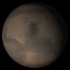
Mars at Ls 341°: Syrtis Major
Full Resolution:
TIFF
(411.8 kB)
JPEG
(22.78 kB)
|

|
2005-12-19 |
Mars
|
Mars Global Surveyor (MGS)
|
Mars Orbiter Camera (MOC)
|
1024x1896x1 |

|
-
PIA03651:
-
Double Impact
Full Resolution:
TIFF
(1.944 MB)
JPEG
(677.2 kB)
|

|
2005-12-18 |
Mars
|
Mars Global Surveyor (MGS)
|
Mars Orbiter Camera (MOC)
|
512x869x1 |

|
-
PIA03650:
-
Meridiani Scene
Full Resolution:
TIFF
(445.6 kB)
JPEG
(98.6 kB)
|

|
2005-12-17 |
Mars
|
Mars Global Surveyor (MGS)
|
Mars Orbiter Camera (MOC)
|
2048x2928x1 |

|
-
PIA03649:
-
Polar Features
Full Resolution:
TIFF
(6.003 MB)
JPEG
(1.596 MB)
|

|
2005-12-16 |
Mars
|
Mars Global Surveyor (MGS)
|
Mars Orbiter Camera (MOC)
|
836x1838x1 |

|
-
PIA03644:
-
Marte Vallis
Full Resolution:
TIFF
(1.538 MB)
JPEG
(274.2 kB)
|

|
2005-12-15 |
Mars
|
Mars Global Surveyor (MGS)
|
Mars Orbiter Camera (MOC)
|
1024x3248x1 |

|
-
PIA03643:
-
Inverted Valley
Full Resolution:
TIFF
(3.329 MB)
JPEG
(535 kB)
|

|
2005-12-14 |
Mars
|
Mars Global Surveyor (MGS)
|
Mars Orbiter Camera (MOC)
|
1024x2128x1 |

|
-
PIA03642:
-
Dust Devil Art
Full Resolution:
TIFF
(2.181 MB)
JPEG
(592.7 kB)
|

|
2005-12-13 |
Mars
|
Mars Global Surveyor (MGS)
|
Mars Orbiter Camera (MOC)
|
640x640x3 |
|
-
PIA03639:
-
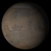
Mars at Ls 341°: Acidalia/Mare Erythraeum
Full Resolution:
TIFF
(411.8 kB)
JPEG
(22.49 kB)
|

|
2005-12-12 |
Mars
|
Mars Global Surveyor (MGS)
|
Mars Orbiter Camera (MOC)
|
672x1934x1 |

|
-
PIA03631:
-
Banded Argyre
Full Resolution:
TIFF
(1.301 MB)
JPEG
(213.6 kB)
|

|
2005-12-11 |
Mars
|
Mars Global Surveyor (MGS)
|
Mars Orbiter Camera (MOC)
|
672x1608x1 |

|
-
PIA03630:
-
West Candor Rocks
Full Resolution:
TIFF
(1.082 MB)
JPEG
(347.6 kB)
|

|
2005-12-10 |
Mars
|
Mars Global Surveyor (MGS)
|
Mars Orbiter Camera (MOC)
|
836x4566x1 |

|
-
PIA03629:
-
Polar Layers
Full Resolution:
TIFF
(3.821 MB)
JPEG
(657.3 kB)
|

|
2005-12-09 |
Mars
|
Mars Global Surveyor (MGS)
|
Mars Orbiter Camera (MOC)
|
672x1192x1 |

|
-
PIA03628:
-
Polar Pit
Full Resolution:
TIFF
(802.1 kB)
JPEG
(96.87 kB)
|

|
2005-12-08 |
Mars
|
Mars Global Surveyor (MGS)
|
Mars Orbiter Camera (MOC)
|
2048x3154x1 |

|
-
PIA03627:
-
South Polar Cap
Full Resolution:
TIFF
(6.466 MB)
JPEG
(1.559 MB)
|

|
2005-12-07 |
Mars
|
Mars Global Surveyor (MGS)
|
Mars Orbiter Camera (MOC)
|
836x2155x1 |

|
-
PIA03626:
-
Northeast Isidis
Full Resolution:
TIFF
(1.804 MB)
JPEG
(467.7 kB)
|

|
2005-12-06 |
Mars
|
Mars Global Surveyor (MGS)
|
Mars Orbiter Camera (MOC)
|
640x640x3 |
|
-
PIA03620:
-
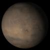
Mars at Ls 341°: Tharsis
Full Resolution:
TIFF
(411.8 kB)
JPEG
(21.4 kB)
|

|
2005-12-05 |
Mars
|
2001 Mars Odyssey
Mars Global Surveyor (MGS)
Mars Exploration Rover (MER)
|
Descent Image Motion Estimation System (DIMES)
Mars Orbiter Camera
Thermal Emission Imaging System
|
1411x2043x3 |

|
-
PIA03616:
-
Partway to 'Victoria'
Full Resolution:
TIFF
(8.665 MB)
JPEG
(265.7 kB)
|

|
2005-12-05 |
Mars
|
Mars Global Surveyor (MGS)
Mars Exploration Rover (MER)
2001 Mars Odyssey
|
Descent Image Motion Estimation System (DIMES)
Mars Orbiter Camera
Thermal Emission Imaging System
|
1415x2044x3 |

|
-
PIA03609:
-
Opportunity Traverse Map, Sol 656
Full Resolution:
TIFF
(8.693 MB)
JPEG
(249.9 kB)
|

|
2005-12-05 |
Mars
|
Mars Global Surveyor (MGS)
Mars Exploration Rover (MER)
|
Mars Orbiter Camera (MOC)
|
1039x691x3 |
|
-
PIA03624:
-
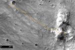
Spirit Traverse Map, Sol 680
Full Resolution:
TIFF
(2.157 MB)
JPEG
(131 kB)
|

|
2005-12-05 |
Mars
|
Mars Global Surveyor (MGS)
|
Mars Orbiter Camera (MOC)
|
672x1764x1 |

|
-
PIA03619:
-
Gullied Crater
Full Resolution:
TIFF
(1.187 MB)
JPEG
(278.7 kB)
|

|
2005-12-04 |
Mars
|
Mars Global Surveyor (MGS)
|
Mars Orbiter Camera (MOC)
|
1024x1712x1 |

|
-
PIA03618:
-
Crater and Streaks
Full Resolution:
TIFF
(1.755 MB)
JPEG
(281.2 kB)
|

|
2005-12-03 |
Mars
|
Mars Global Surveyor (MGS)
|
Mars Orbiter Camera (MOC)
|
836x2204x1 |

|
-
PIA03575:
-
Tractus Catena Pits
Full Resolution:
TIFF
(1.845 MB)
JPEG
(248.6 kB)
|

|
2005-12-02 |
Mars
|
Mars Global Surveyor (MGS)
|
Mars Orbiter Camera (MOC)
|
1024x1874x1 |

|
-
PIA03574:
-
Lycus Sulci
Full Resolution:
TIFF
(1.921 MB)
JPEG
(261.8 kB)
|

|
2005-12-01 |
Mars
|
Mars Global Surveyor (MGS)
|
Mars Orbiter Camera (MOC)
|
1024x1408x1 |

|
-
PIA03573:
-
Daedalia Streak
Full Resolution:
TIFF
(1.443 MB)
JPEG
(571 kB)
|

|
2005-11-30 |
Mars
|
Mars Global Surveyor (MGS)
|
Mars Orbiter Camera (MOC)
|
672x2076x1 |

|
-
PIA03572:
-
Crater Interior
Full Resolution:
TIFF
(1.397 MB)
JPEG
(345.6 kB)
|

|
2005-11-30 |
Mars
|
Mars Express (MEX)
Mars Global Surveyor (MGS)
|
Mars Advanced Radar for Subsurface and Ionospheric Sounding
(MARSIS)
Mars Orbiter Laser Altimeter
|
788x683x3 |
|
-
PIA03237:
-
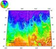
Topographic Map of Chryse Planitia with Location of Possible Buried Basin
Full Resolution:
TIFF
(1.617 MB)
JPEG
(106.2 kB)
|

|
2005-11-30 |
Mars
|
Mars Express (MEX)
Mars Global Surveyor (MGS)
|
MARSIS
Mars Orbiter Laser Altimeter
|
979x666x3 |
|
-
PIA03235:
-
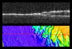
Radargram of Mars' North Polar Layered Deposits with Topographic Map
Full Resolution:
TIFF
(1.959 MB)
JPEG
(95.14 kB)
|

|
2005-11-29 |
Mars
|
Mars Global Surveyor (MGS)
|
Mars Orbiter Camera (MOC)
|
640x640x3 |
|
-
PIA03595:
-
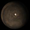
Mars at Ls 324°: South Polar Region
Full Resolution:
TIFF
(411.8 kB)
JPEG
(25.63 kB)
|

|
2005-11-28 |
Mars
|
Mars Global Surveyor (MGS)
|
Mars Orbiter Camera (MOC)
|
1024x2304x1 |

|
-
PIA03594:
-
Meridiani Outcrops
Full Resolution:
TIFF
(2.362 MB)
JPEG
(623.3 kB)
|

|
2005-11-27 |
Mars
|
Mars Global Surveyor (MGS)
|
Mars Orbiter Camera (MOC)
|
672x1141x1 |

|
-
PIA03593:
-
Dust Devil Streaks
Full Resolution:
TIFF
(767.8 kB)
JPEG
(180 kB)
|

|
2005-11-26 |
Mars
|
Mars Global Surveyor (MGS)
|
Mars Orbiter Camera (MOC)
|
836x2866x1 |

|
-
PIA03592:
-
Argyre Streaks
Full Resolution:
TIFF
(2.399 MB)
JPEG
(464.9 kB)
|

|
2005-11-25 |
Mars
|
Mars Global Surveyor (MGS)
|
Mars Orbiter Camera (MOC)
|
2048x2315x1 |

|
-
PIA03591:
-
Mid-latitude Gullies
Full Resolution:
TIFF
(4.746 MB)
JPEG
(939.2 kB)
|

|
2005-11-24 |
Mars
|
Mars Global Surveyor (MGS)
|
Mars Orbiter Camera (MOC)
|
836x1499x1 |

|
-
PIA03590:
-
Gullied Slope
Full Resolution:
TIFF
(1.255 MB)
JPEG
(280.4 kB)
|

|
2005-11-23 |
Mars
|
Mars Global Surveyor (MGS)
|
Mars Orbiter Camera (MOC)
|
1024x2096x1 |

|
-
PIA03589:
-
Light-toned Rocks
Full Resolution:
TIFF
(2.149 MB)
JPEG
(373.6 kB)
|

|
2005-11-22 |
Mars
|
Mars Global Surveyor (MGS)
|
Mars Orbiter Camera (MOC)
|
640x640x3 |
|
-
PIA03588:
-
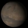
Mars at Ls 324°: Elysium/Mare Cimmerium
Full Resolution:
TIFF
(411.8 kB)
JPEG
(20.47 kB)
|

|
2005-11-21 |
Mars
|
Mars Global Surveyor (MGS)
|
Mars Orbiter Camera (MOC)
|
672x1224x1 |

|
-
PIA03587:
-
Crater in Arabia
Full Resolution:
TIFF
(823.6 kB)
JPEG
(93.38 kB)
|

|
2005-11-20 |
Mars
|
Mars Global Surveyor (MGS)
|
Mars Orbiter Camera (MOC)
|
1024x1140x1 |

|
-
PIA03586:
-
8°N 7°W Crater
Full Resolution:
TIFF
(1.169 MB)
JPEG
(280.5 kB)
|

|
2005-11-19 |
Mars
|
Mars Global Surveyor (MGS)
|
Mars Orbiter Camera (MOC)
|
1536x2003x1 |

|
-
PIA03585:
-
South Mid-latitude Gullies
Full Resolution:
TIFF
(3.08 MB)
JPEG
(542.5 kB)
|

|
2005-11-18 |
Mars
|
Mars Global Surveyor (MGS)
|
Mars Orbiter Camera (MOC)
|
836x3390x1 |

|
-
PIA03584:
-
Landslide in Mutch
Full Resolution:
TIFF
(2.837 MB)
JPEG
(330.9 kB)
|

|
2005-11-17 |
Mars
|
Mars Global Surveyor (MGS)
|
Mars Orbiter Camera (MOC)
|
827x1955x1 |

|
-
PIA03547:
-
Dust-covered Flow
Full Resolution:
TIFF
(1.619 MB)
JPEG
(239.4 kB)
|

|
2005-11-16 |
Mars
|
Mars Global Surveyor (MGS)
|
Mars Orbiter Camera (MOC)
|
672x1244x1 |

|
-
PIA03546:
-
Small Yardangs
Full Resolution:
TIFF
(837 kB)
JPEG
(173.5 kB)
|

|
2005-11-15 |
Mars
|
Mars Global Surveyor (MGS)
|
Mars Orbiter Camera (MOC)
|
640x640x3 |
|
-
PIA03198:
-
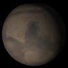
Mars at Ls 324°: Syrtis Major
Full Resolution:
TIFF
(411.8 kB)
JPEG
(21.8 kB)
|

|
2005-11-14 |
Mars
|
Mars Global Surveyor (MGS)
|
Mars Orbiter Camera (MOC)
|
836x2057x1 |

|
-
PIA03197:
-
White Rock
Full Resolution:
TIFF
(1.722 MB)
JPEG
(359.1 kB)
|

 Planetary Data System


