My
List |
Addition Date
|
Target
|
Mission
|
Instrument
|
Size
|

|
2025-07-03 |
Earth
|
ECOSTRESS
|
|
3507x2480x3 |

|
-
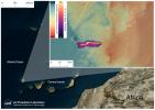
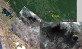
PIA26190:
-
ECOSTRESS Captures Paris During Europe Heat Wave
Full Resolution:
TIFF
(24.59 MB)
JPEG
(3.007 MB)
|
|
|
2024-09-13 |
Earth
|
ECOSTRESS
|
|
3507x2480x3 |
|
-
PIA26187:
-
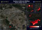
Southern California Wildfires Captured by NASA's ECOSTRESS
Full Resolution:
TIFF
(19.8 MB)
JPEG
(1.341 MB)
|
|
|
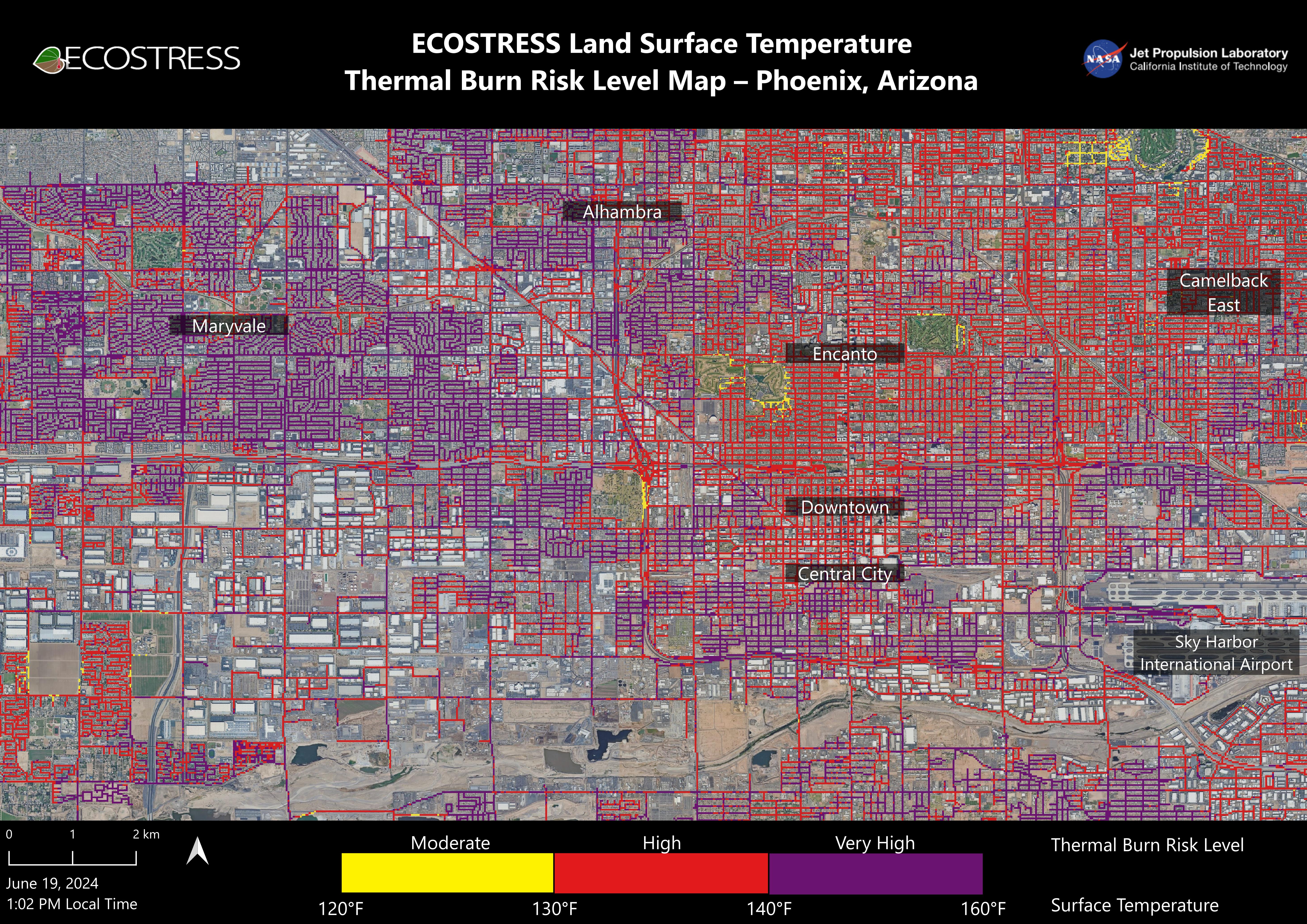
2024-07-02 |
Earth
|
ECOSTRESS
|
ECOSTRESS
|
5846x4133x3 |
|
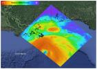
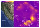
-
PIA25529:
-
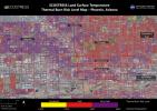
NASA's ECOSTRESS Maps Burn Risk Across Phoenix Streets
Full Resolution:
TIFF
(56.15 MB)
JPEG
(5.17 MB)
|
|
|
2022-08-04 |
Earth
|
ECOSTRESS
|
|
3507x2480x3 |
|
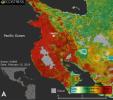
-
PIA25488:
-
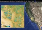
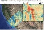
Evapotranspiration over Central Valley
Full Resolution:
TIFF
(24.59 MB)
JPEG
(1.422 MB)
|
|
|
2022-08-04 |
Earth
|
ECOSTRESS
|
|
3507x2480x3 |
|
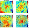
-
PIA25487:
-
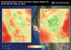
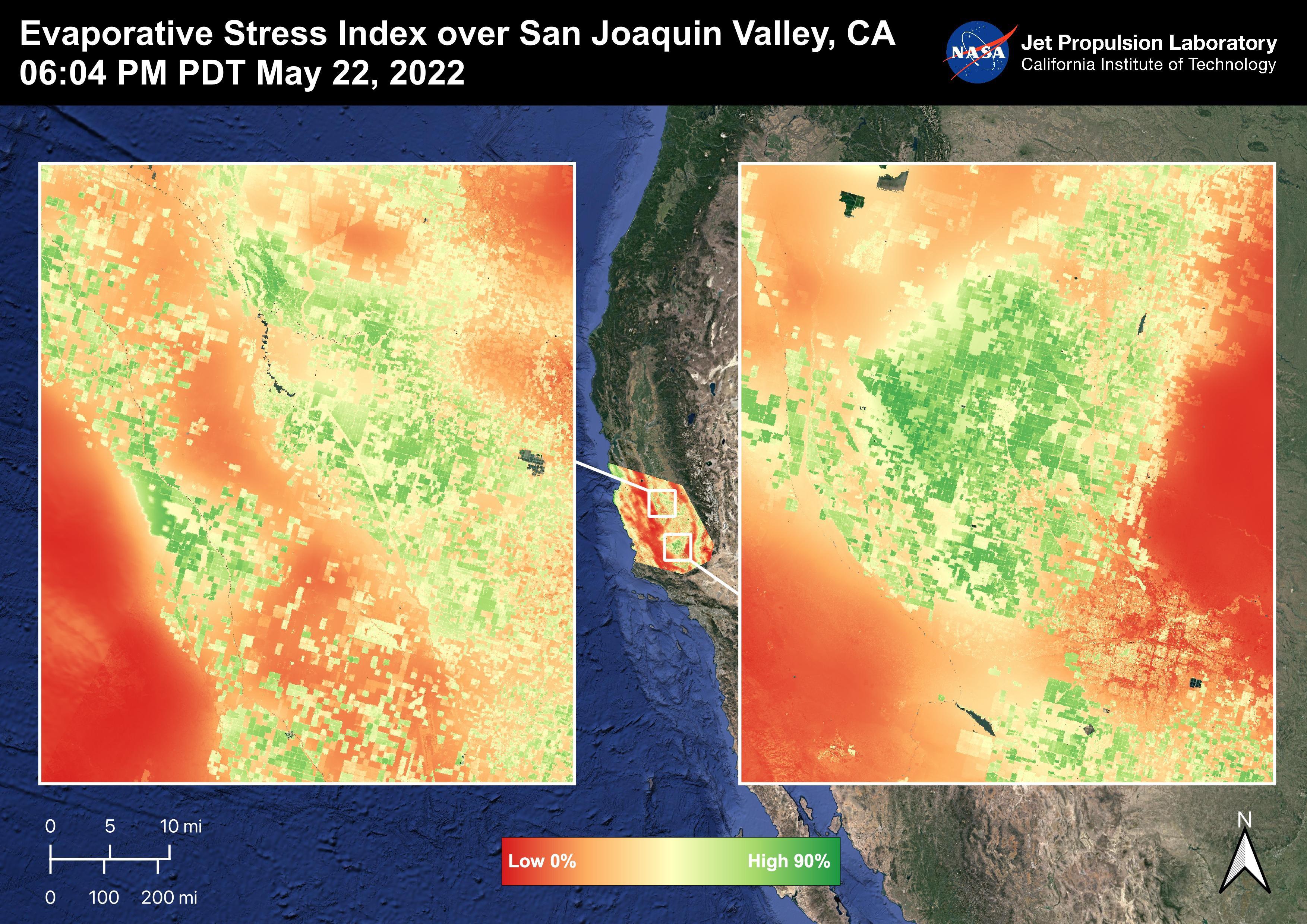
Evaporative Stress Index over San Joaquin Valley
Full Resolution:
TIFF
(24.55 MB)
JPEG
(1.344 MB)
|
|
|
2022-08-04 |
Earth
|
ECOSTRESS
|
|
3507x2480x3 |

|
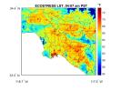
-
PIA25486:
-
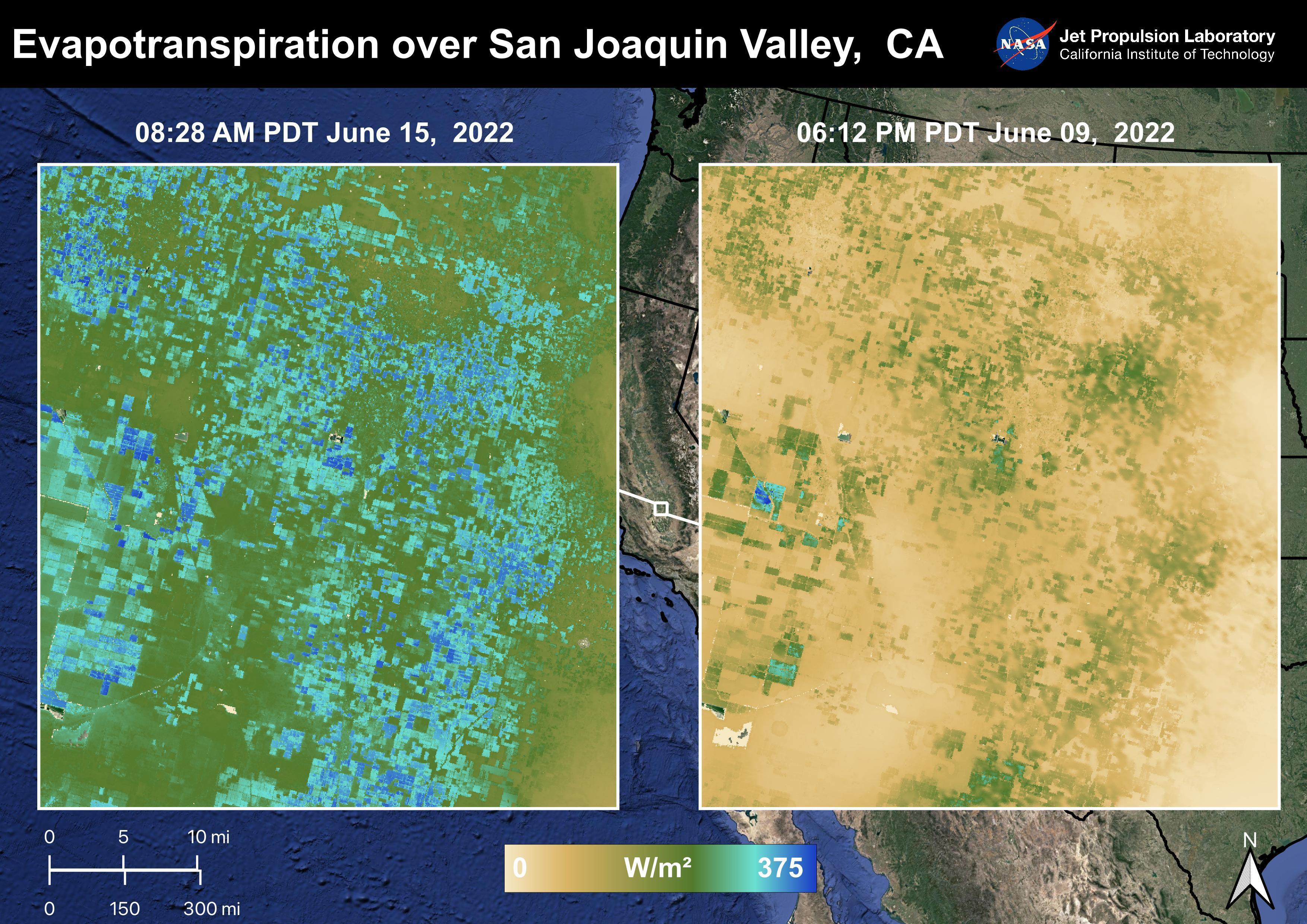
Evapotranspiration over San Joaquin Valley
Full Resolution:
TIFF
(24.07 MB)
JPEG
(1.347 MB)
|
|
|
2022-08-04 |
Earth
|
ECOSTRESS
|
|
3507x2480x3 |
|
-
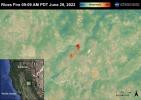
PIA25485:
-
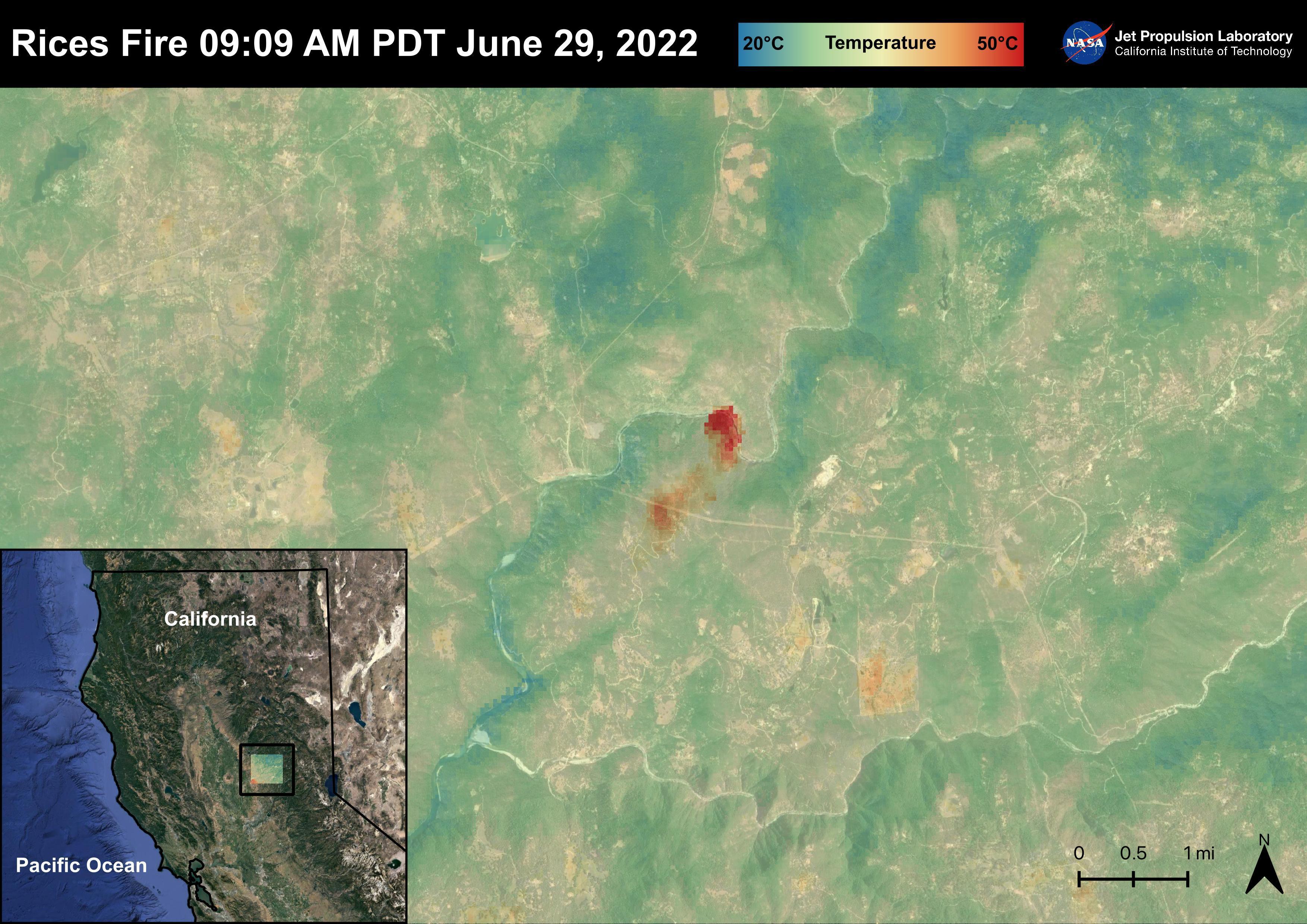
The Rices Fire
Full Resolution:
TIFF
(23.34 MB)
JPEG
(1.067 MB)
|
|
|
2022-08-04 |
Earth
|
ECOSTRESS
|
|
3507x2480x3 |
|
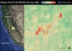
-
PIA25484:
-
The Electra Fire
Full Resolution:
TIFF
(23.43 MB)
JPEG
(1.034 MB)
|
|
|
2022-08-04 |
Earth
|
ECOSTRESS
|
|
3507x2480x3 |
|
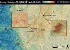
-
PIA25483:
-
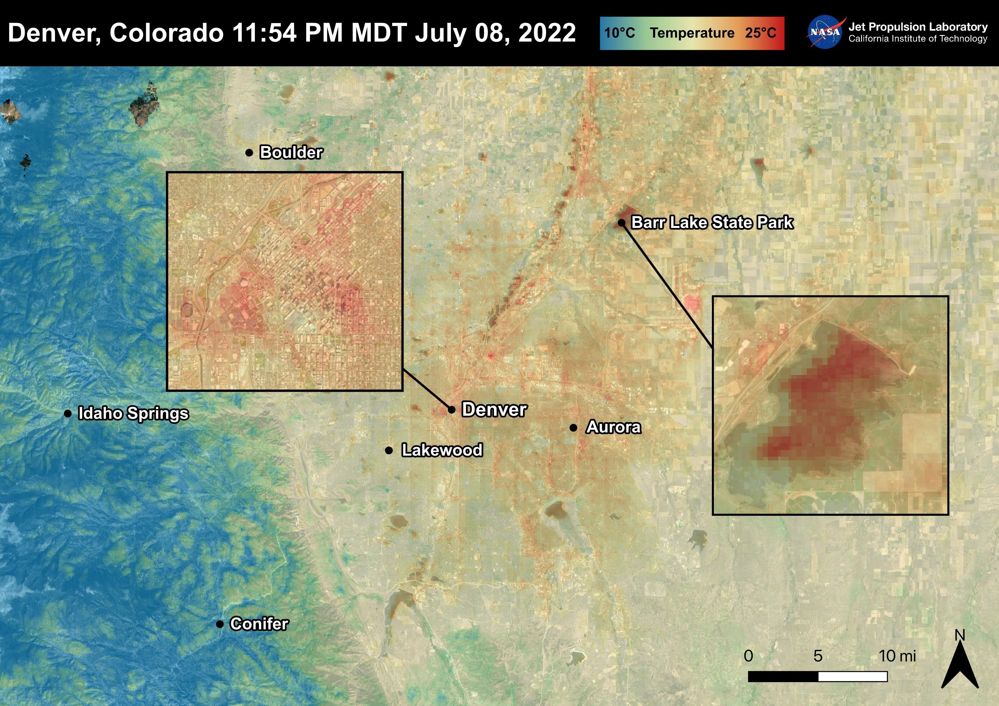
Denver, CO
Full Resolution:
TIFF
(25.33 MB)
JPEG
(1.18 MB)
|
|
|
2022-08-04 |
Earth
|
ECOSTRESS
|
|
3507x2480x3 |
|
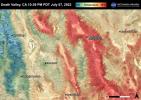
-
PIA25482:
-
Death Valley, CA
Full Resolution:
TIFF
(26.1 MB)
JPEG
(1.367 MB)
|
|
|
2022-08-04 |
Earth
|
ECOSTRESS
|
|
3507x2480x3 |
|
-
PIA25481:
-
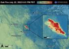
The Oak Fire
Full Resolution:
TIFF
(21.67 MB)
JPEG
(865 kB)
|
|
|
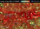
2022-07-22 |
Earth
|
ECOSTRESS
|
|
3507x2480x3 |
|
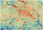
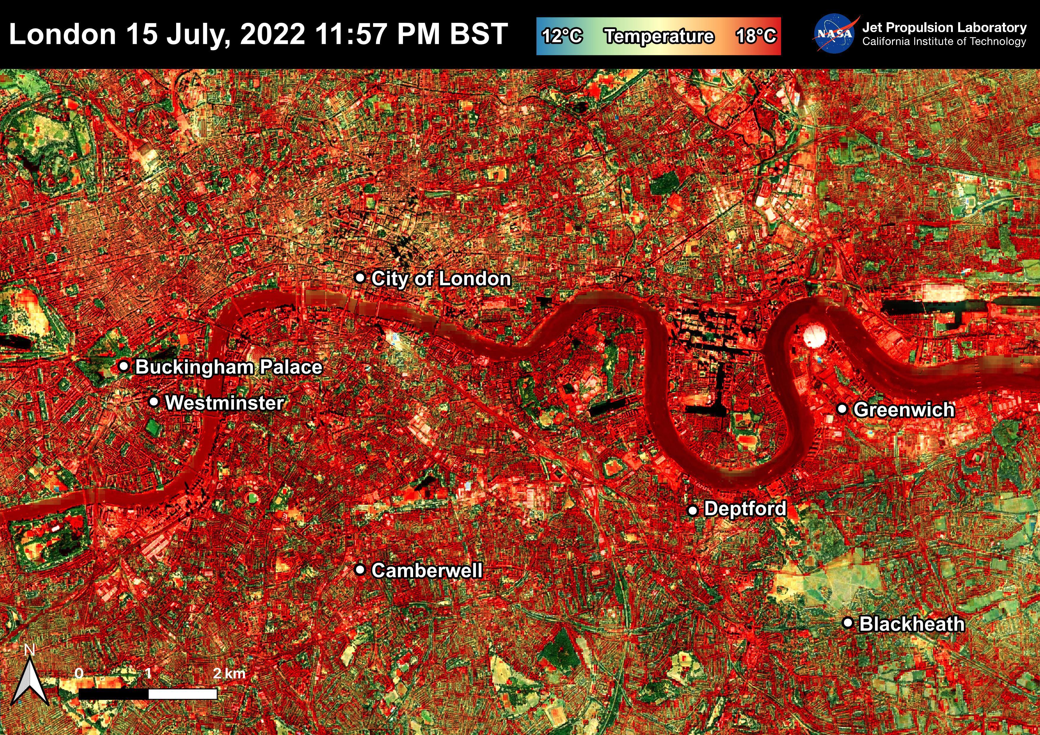
-
PIA25423:
-
NASA's ECOSTRESS Shows Overnight Heat in London
Full Resolution:
TIFF
(26.1 MB)
JPEG
(2.721 MB)
|
|
|
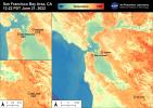
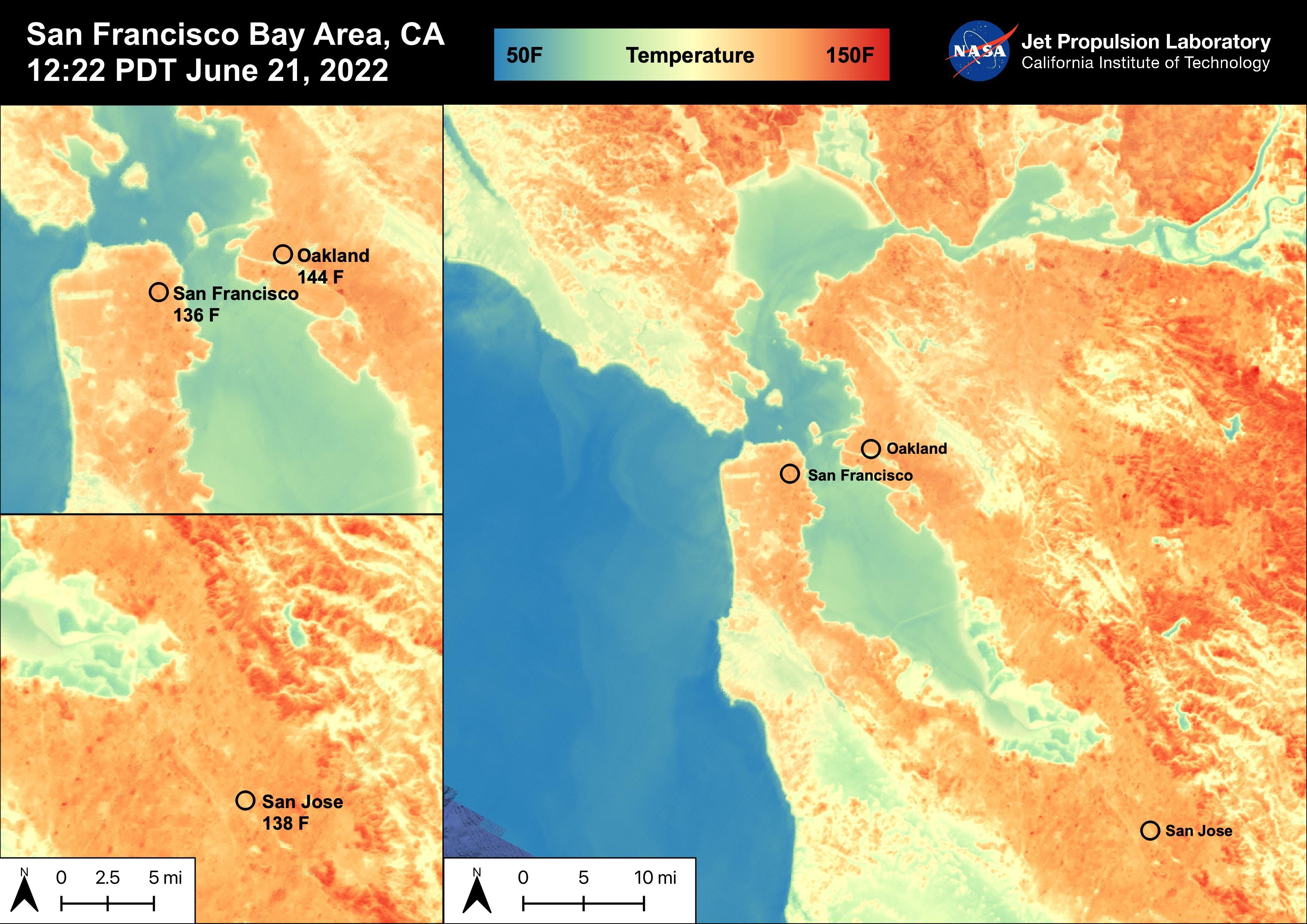
2022-06-30 |
Earth
|
ECOSTRESS
|
|
3507x2480x3 |
|
-
PIA25441:
-
High Temperatures in the San Francisco Bay Area
Full Resolution:
TIFF
(21.01 MB)
JPEG
(919.1 kB)
|
|
|
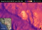
2022-06-30 |
Earth
|
ECOSTRESS
|
|
3507x2480x3 |
|
-
PIA25356:
-
Sheep Fire
Full Resolution:
TIFF
(16.45 MB)
JPEG
(598.1 kB)
|
|
|
2022-06-30 |
Earth
|
ECOSTRESS
|
|
3507x2480x3 |
|
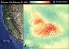
-
PIA25280:
-
Colorado Fire
Full Resolution:
TIFF
(17.17 MB)
JPEG
(810.7 kB)
|
|
|
2022-06-22 |
Earth
|
ECOSTRESS
|
|
3099x2201x3 |
|
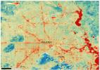
-
PIA25422:
-
NASA's ECOSTRESS Shows Heat in Dallas and Fort Worth
Full Resolution:
TIFF
(20.47 MB)
JPEG
(2.22 MB)
|
|
|
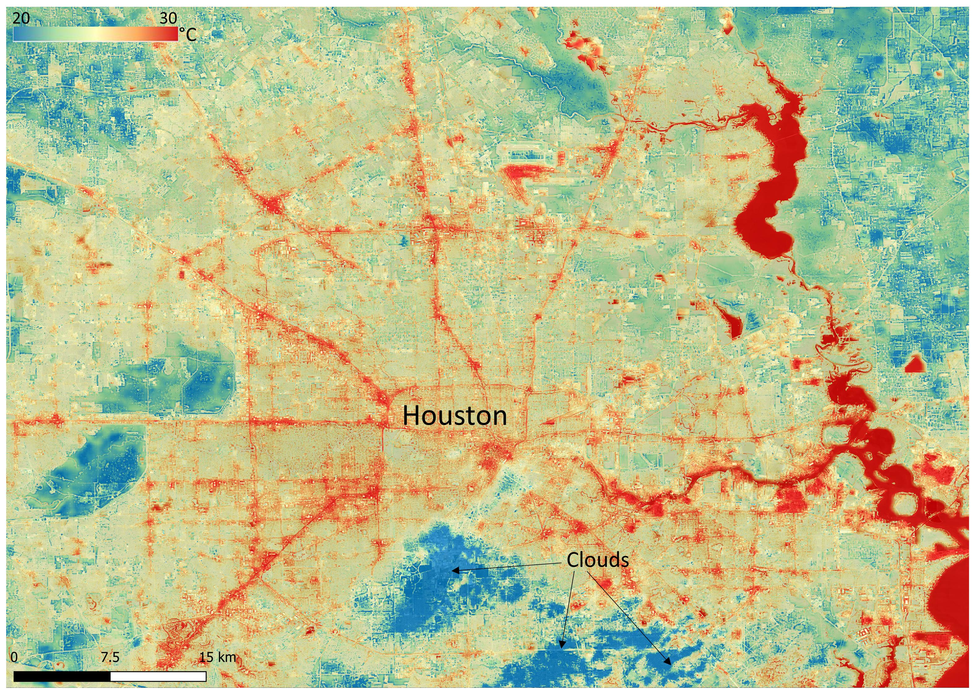
2022-06-22 |
Earth
|
ECOSTRESS
|
|
3161x2230x3 |
|
-
PIA25421:
-
NASA's ECOSTRESS Shows Surface Heat in Houston
Full Resolution:
TIFF
(21.16 MB)
JPEG
(1.711 MB)
|
|
|
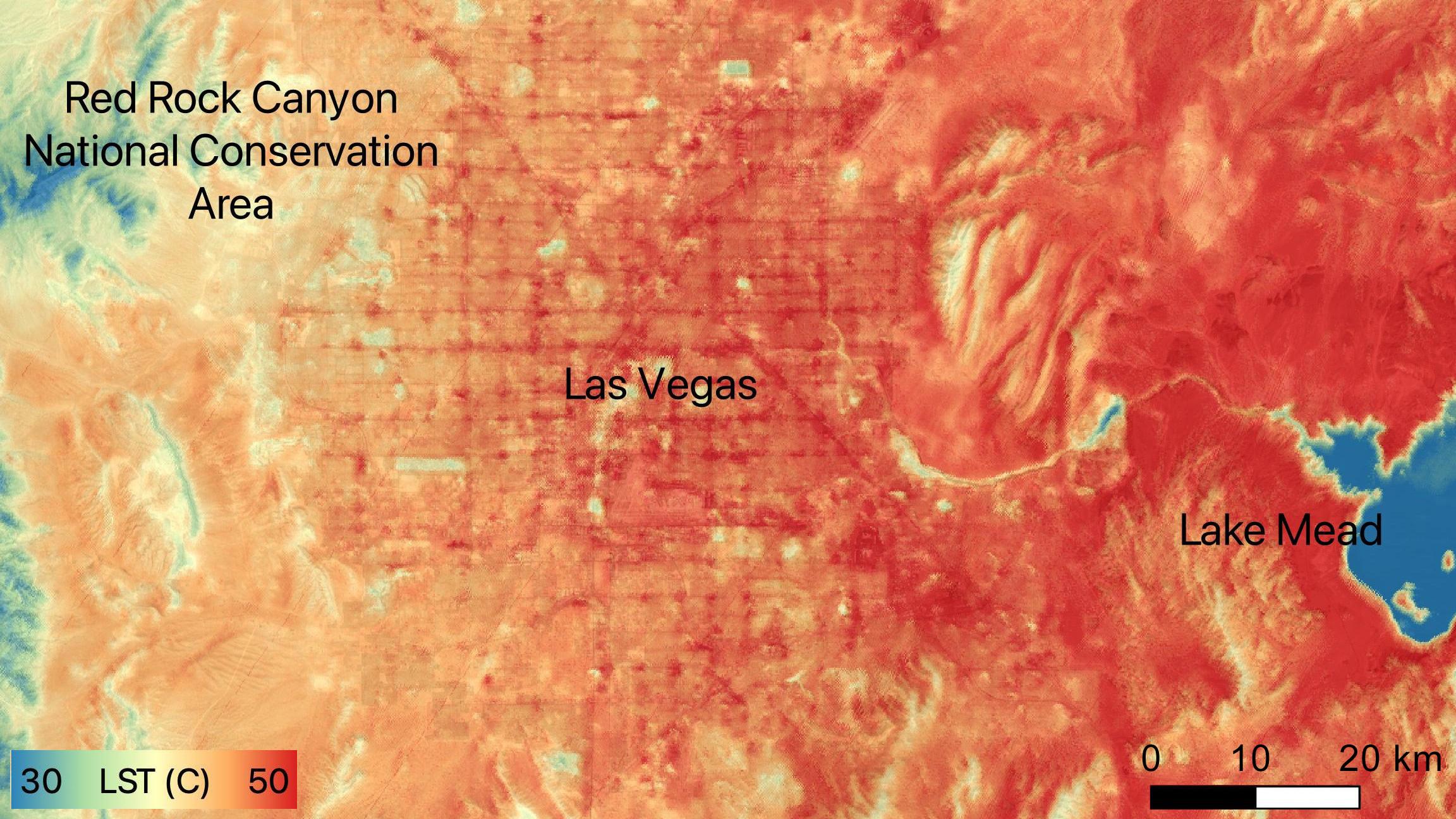
2022-06-15 |
Earth
|
ECOSTRESS
|
|
2304x1296x3 |

|
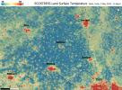
-
PIA24988:
-
NASA's ECOSTRESS Sees Las Vegas Streets Turn Up the Heat
Full Resolution:
TIFF
(8.962 MB)
JPEG
(479.4 kB)
|
|
|
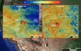
2022-05-12 |
Earth
|
ECOSTRESS
|
|
3376x2477x3 |
|
-
PIA24987:
-
ECOSTRESS Detects Heat Islands in Indian Heat Wave
Full Resolution:
TIFF
(25.1 MB)
JPEG
(2.193 MB)
|
|
|
2021-10-27 |
Earth
|
ECOSTRESS
|
|
3507x2480x3 |
|
-
PIA24916:
-
La Palma Volcano
Full Resolution:
TIFF
(16.12 MB)
JPEG
(719.5 kB)
|
|
|
2021-10-07 |
Earth
|
ECOSTRESS
|
|
3507x2480x3 |
|
-
PIA24210:
-
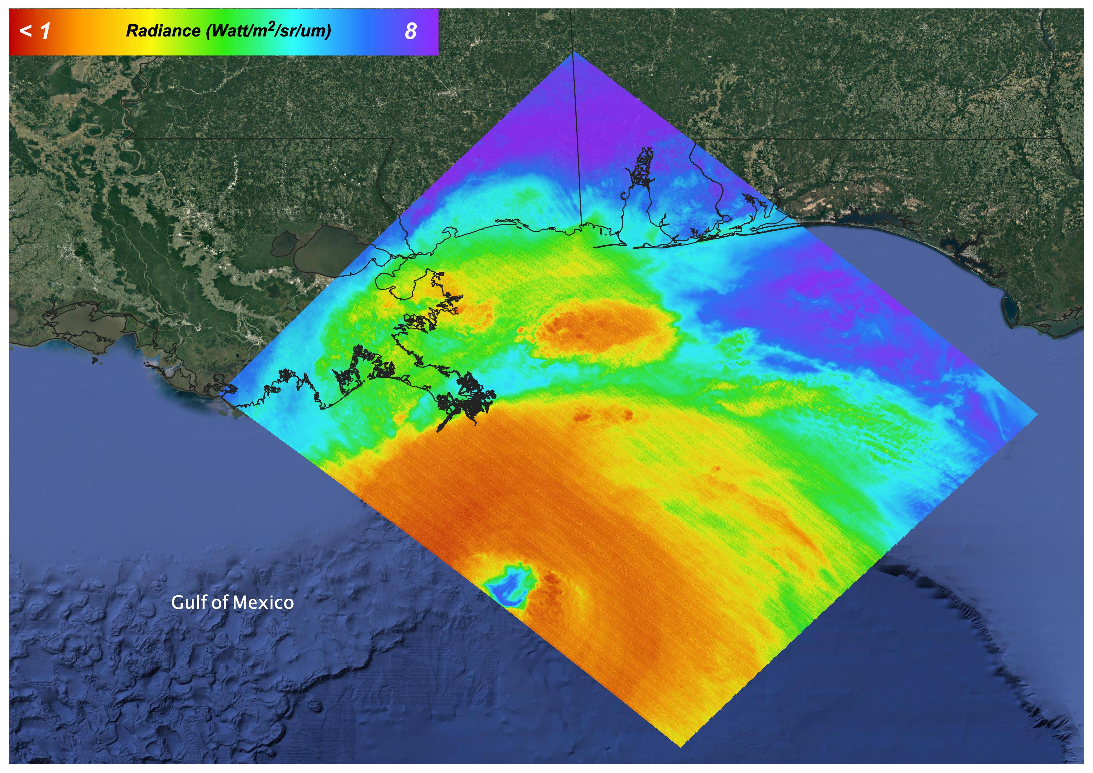
Hurricane Ida, August 27, 2021
Full Resolution:
TIFF
(21.59 MB)
JPEG
(1.144 MB)
|
|
|
2021-10-07 |
Earth
|
ECOSTRESS
|
|
3507x2480x3 |
|
-
PIA24209:
-
Glass Fire, September 27, 2020
Full Resolution:
TIFF
(14.05 MB)
JPEG
(854.1 kB)
|
|
|
2021-07-29 |
Earth
|
ECOSTRESS
|
|
731x573x3 |
|
-
PIA23696:
-
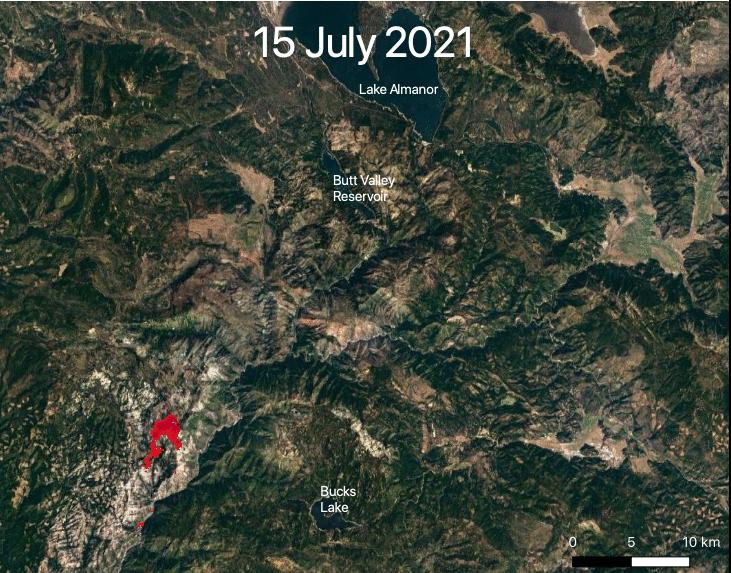
ECOSTRESS Views 2021 Northern California Dixie Fire
Full Resolution:
TIFF
(1.257 MB)
JPEG
(113.3 kB)
|
|
|
2021-07-29 |
Earth
|
ECOSTRESS
|
|
827x679x3 |
|
-
PIA23695:
-
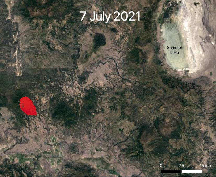
ECOSTRESS Views 2021 Southern Oregon Bootleg Fire
Full Resolution:
TIFF
(1.685 MB)
JPEG
(109.8 kB)
|
|
|
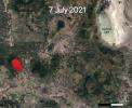
2021-07-15 |
Earth
|
ECOSTRESS
|
|
1984x2041x3 |
|
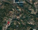
-
PIA23694:
-
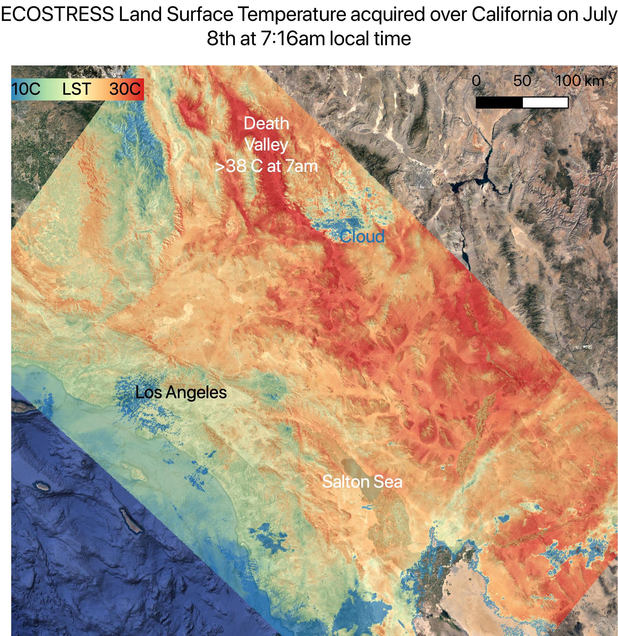
July 2021 Heat Wave Ground Temperature
Full Resolution:
TIFF
(12.15 MB)
JPEG
(746.2 kB)
|
|
|
2020-10-28 |
Earth
|
ECOSTRESS
|
|
1695x1883x3 |

|
-
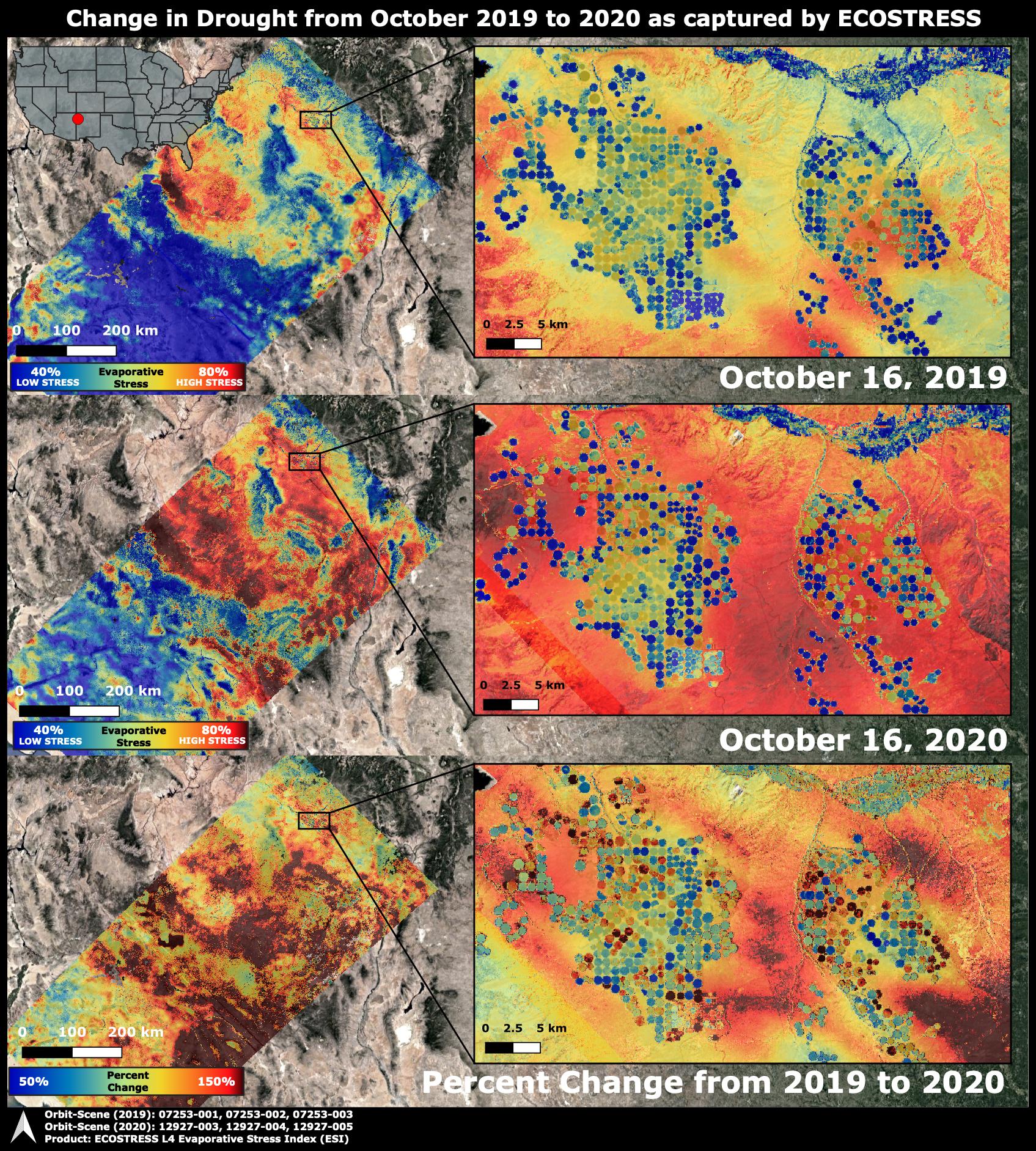
PIA24132:
-
ECOSTRESS Drought Stress Comparison
Full Resolution:
TIFF
(9.579 MB)
JPEG
(930 kB)
|
|
|
2020-10-02 |
Earth
|
ECOSTRESS
|
|
1825x1894x3 |

|
-
PIA23721:
-
NASA's ECOSTRESS Images California Wildfires From Space
Full Resolution:
TIFF
(10.37 MB)
JPEG
(633.2 kB)
|
|
|
2020-09-08 |
Earth
|
ECOSTRESS
|
|
1600x1007x3 |
|
-
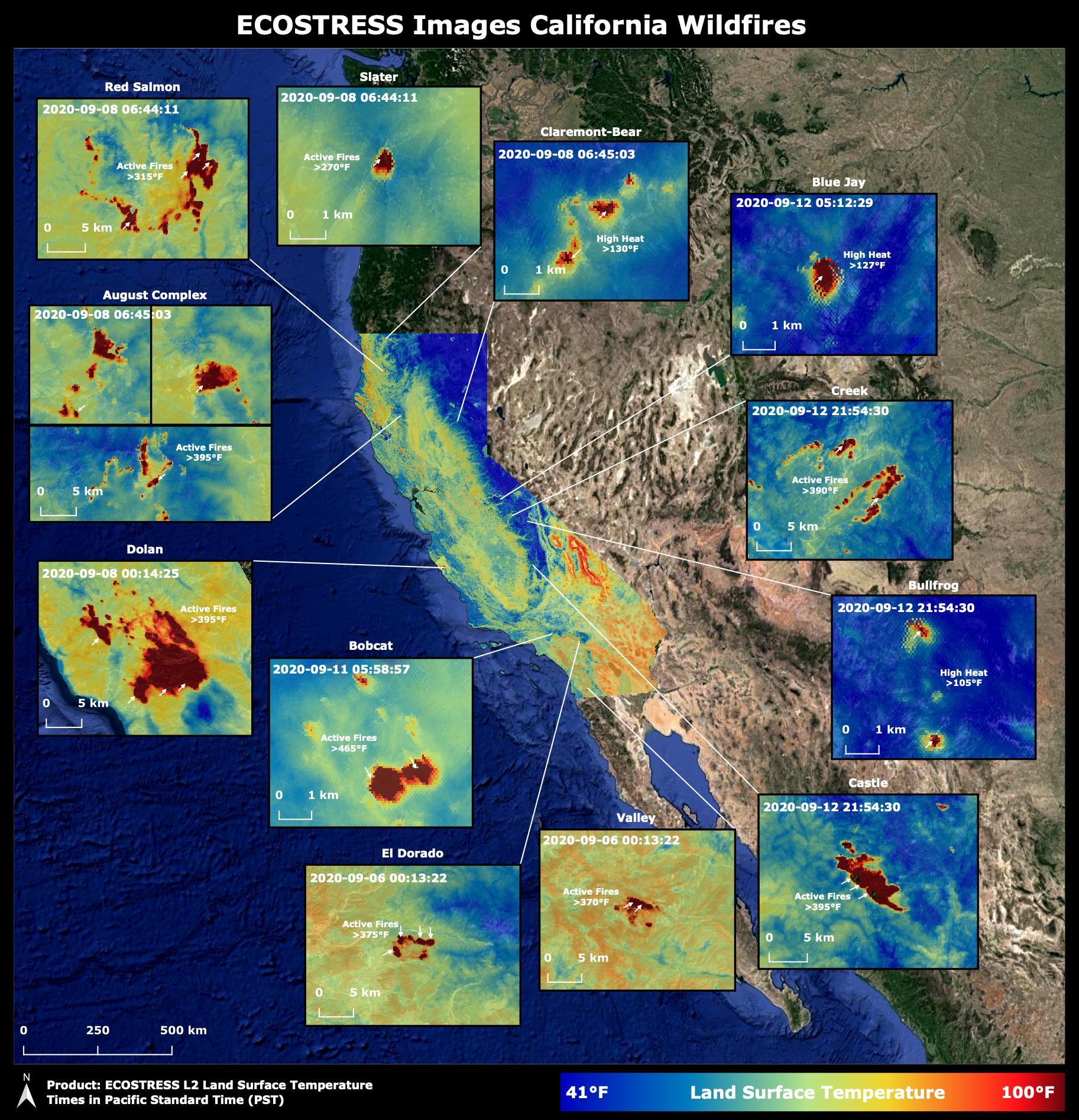
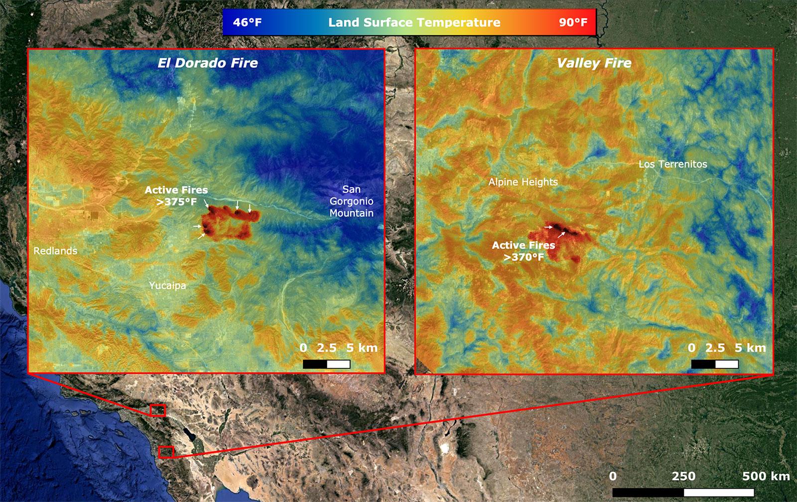
PIA23788:
-
NASA's ECOSTRESS Takes Surface Temperature Around California Fires
Full Resolution:
TIFF
(4.835 MB)
JPEG
(361.7 kB)
|
|
|
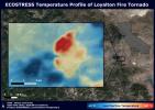
2020-08-27 |
Earth
|
ECOSTRESS
|
|
3507x2480x3 |
|
-
PIA23215:
-
NASA's ECOSTRESS Sees Fire-Induced Tornado From Space
Full Resolution:
TIFF
(21.72 MB)
JPEG
(1.14 MB)
|
|
|
2020-08-19 |
Earth
|
ECOSTRESS
|
|
3447x2404x3 |
|
-
PIA23787:
-
Death Valley Heats Up
Full Resolution:
TIFF
(23.97 MB)
JPEG
(1.434 MB)
|
|
|
2020-08-19 |
Earth
|
ECOSTRESS
|
|
3507x2480x3 |
|
-
PIA23786:
-
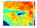
Los Angeles Heat Wave
Full Resolution:
TIFF
(19.81 MB)
JPEG
(1.073 MB)
|
|
|
2020-08-03 |
Earth
|
ECOSTRESS
|
|
1650x1023x3 |

|
-
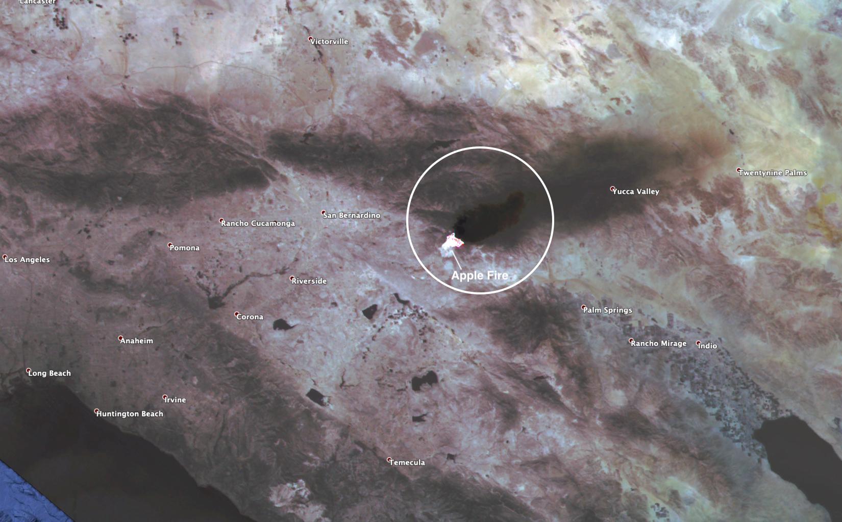
PIA23799:
-
ECOSTRESS Spies Apple Fire's Smoke Plume
Full Resolution:
TIFF
(4.924 MB)
JPEG
(188.5 kB)
|
|
|
2020-08-03 |
Earth
|
ECOSTRESS
|
|
2908x2224x3 |
|
-
PIA23798:
-
ECOSTRESS Gauges the Apple Fire's Temperature From Space
Full Resolution:
TIFF
(14.41 MB)
JPEG
(620.1 kB)
|
|
|
2020-02-04 |
Earth
|
ECOSTRESS
|
|
772x440x3 |

|
-
PIA23430:
-
The ECOSTRESS Mission Spots Plants as They Wake Up
Full Resolution:
TIFF
(1.02 MB)
JPEG
(72.92 kB)
|
|
|
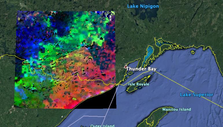
2019-11-05 |
Earth
|
ECOSTRESS
|
|
720x715x3 |
|
-
PIA23432:
-
Drought-Stressed Forest Fueled Amazon Fires
Full Resolution:
TIFF
(1.545 MB)
JPEG
(112.1 kB)
|
|
|
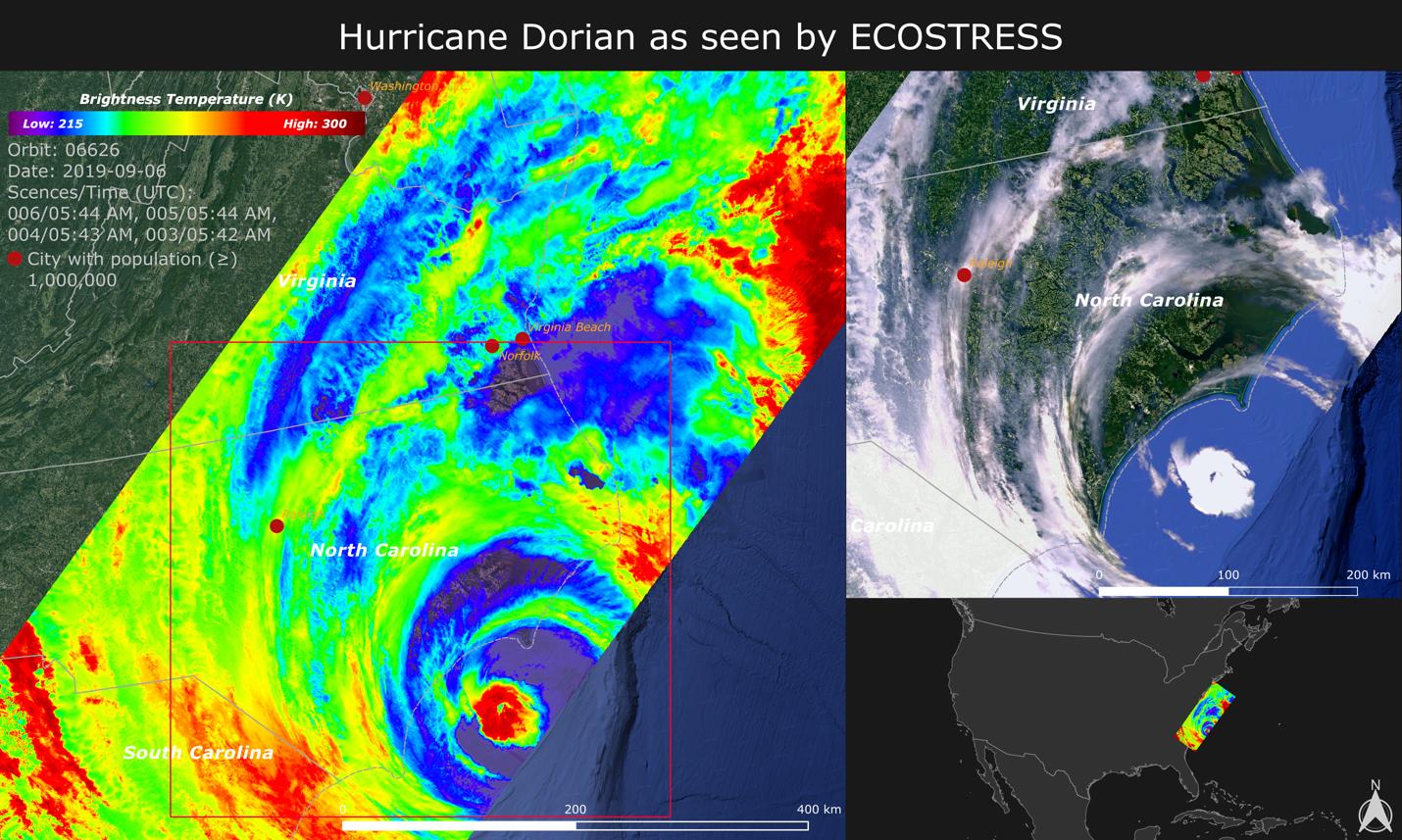
2019-09-18 |
Earth
|
ECOSTRESS
|
|
1430x857x3 |

|
-
PIA23422:
-
NASA Images Hurricane Dorian's Temperature from Space
Full Resolution:
TIFF
(3.196 MB)
JPEG
(252.8 kB)
|
|
|
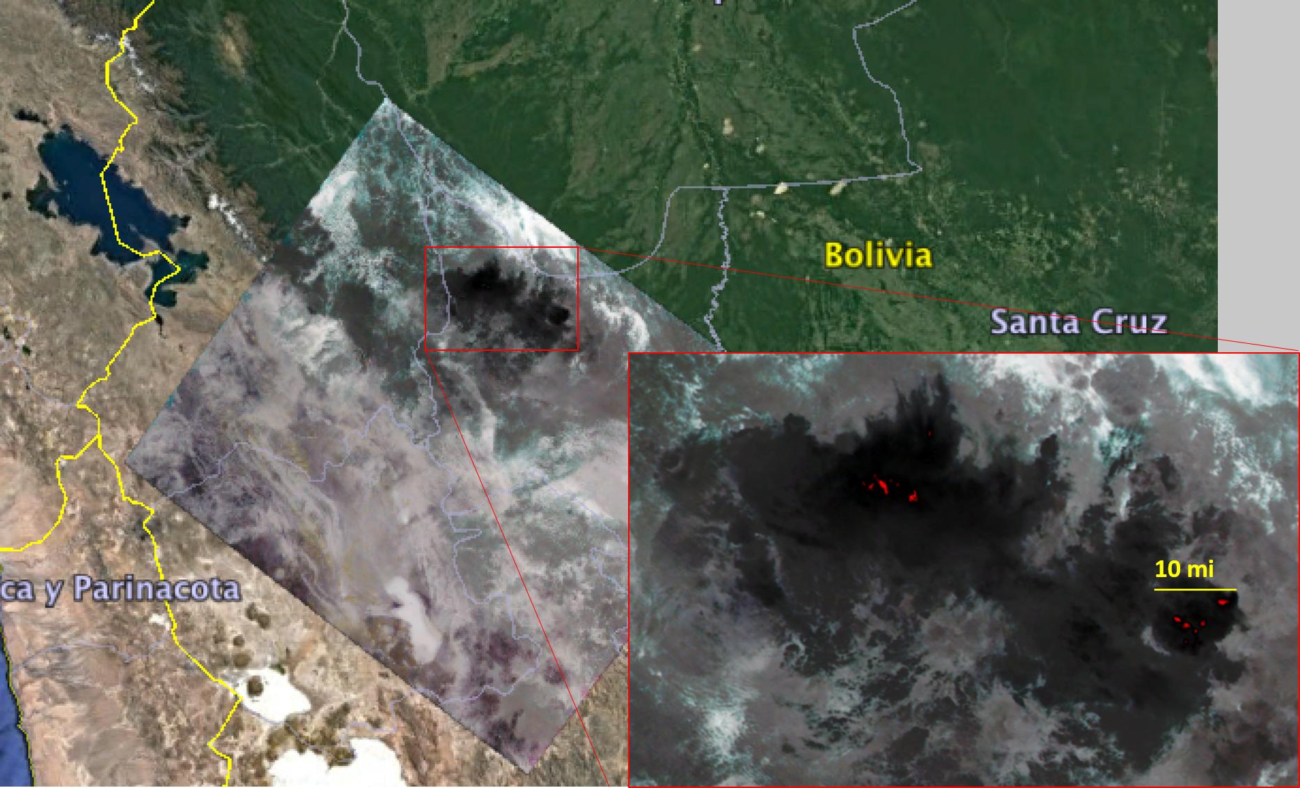
2019-08-28 |
Earth
|
ECOSTRESS
|
|
1867x1132x3 |
|
-
PIA23357:
-
Amazon Fires Seen by NASA's ECOSTRESS
Full Resolution:
TIFF
(6.142 MB)
JPEG
(260.2 kB)
|
|
|
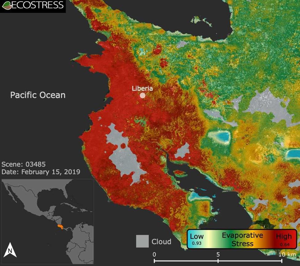
2019-08-08 |
Earth
|
ECOSTRESS
|
|
974x864x3 |
|
-
PIA22839:
-
ECOSTRESS Focuses on Costa Rican Drought
Full Resolution:
TIFF
(1.922 MB)
JPEG
(129.8 kB)
|
|
|
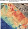
2019-07-02 |
Earth
|
ECOSTRESS
|
|
2258x2190x3 |
|
-
PIA23148:
-
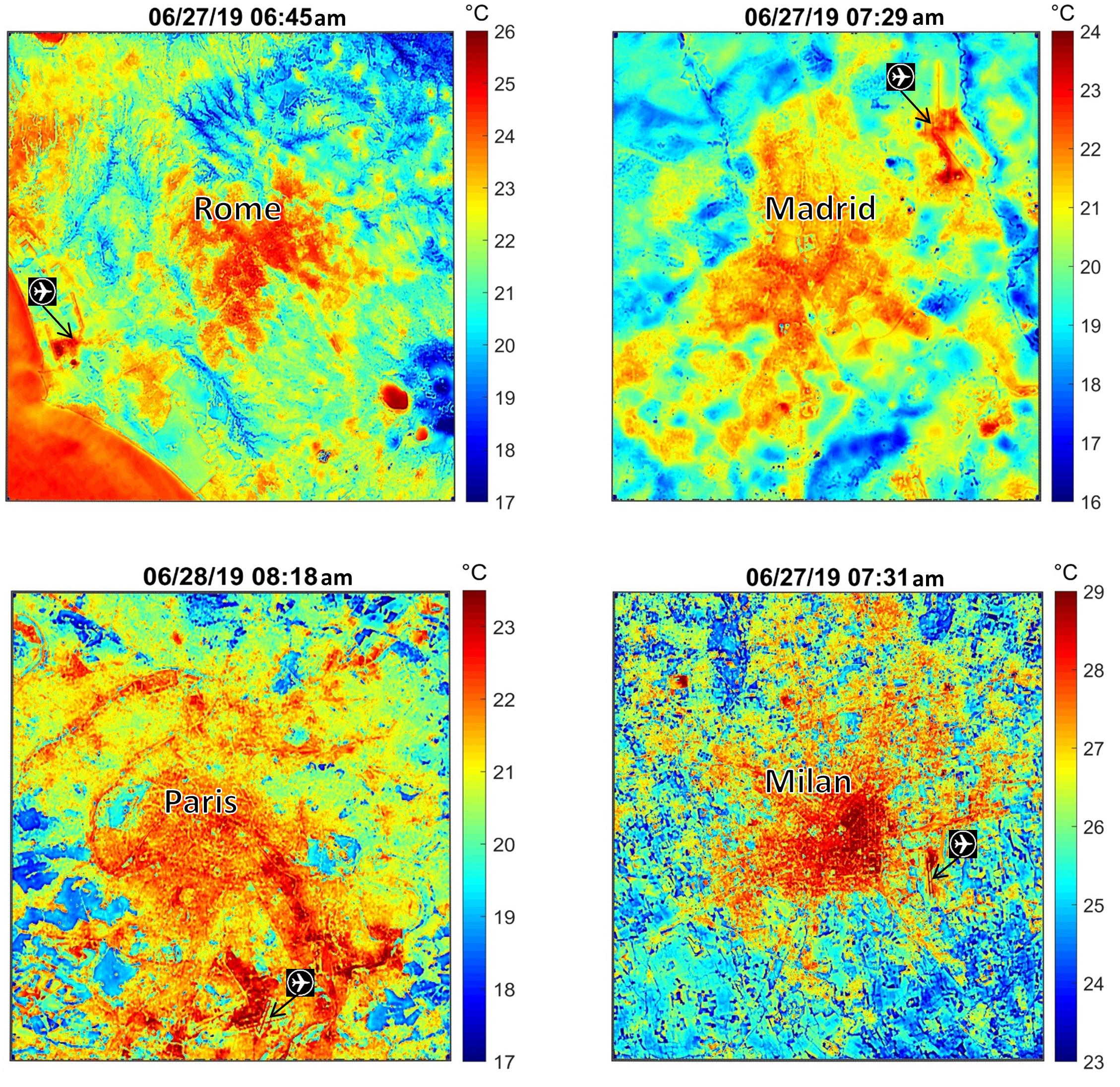
NASA's ECOSTRESS Maps Europe Heat Wave
Full Resolution:
TIFF
(13.41 MB)
JPEG
(928.6 kB)
|
|
|
2018-09-18 |
Earth
|
ECOSTRESS
|
|
1473x1105x3 |
|
-
PIA22703:
-
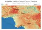
NASA's ECOSTRESS Detects Surface Temperature Variations in Los Angeles
Full Resolution:
TIFF
(2.25 MB)
JPEG
(180.7 kB)
|
|
|
2018-08-02 |
Earth
|
ECOSTRESS
|
|
740x697x3 |
|
-
PIA22490:
-
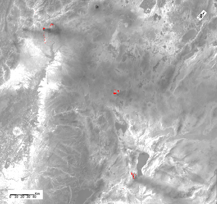
ECOSTRESS Detects Wildfires in Western U.S.
Full Resolution:
TIFF
(668.4 kB)
JPEG
(367.8 kB)
|
|
|
2018-07-23 |
Earth
|
ECOSTRESS
|
|
741x708x3 |
|
-
PIA22590:
-
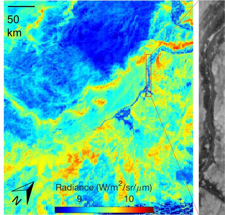
NASA's ECOSTRESS First Light Image
Full Resolution:
TIFF
(1.575 MB)
JPEG
(116.3 kB)
|
|
|
2018-06-11 |
|
ECOSTRESS
|
|
768x512x3 |

|
-
PIA22509:
-
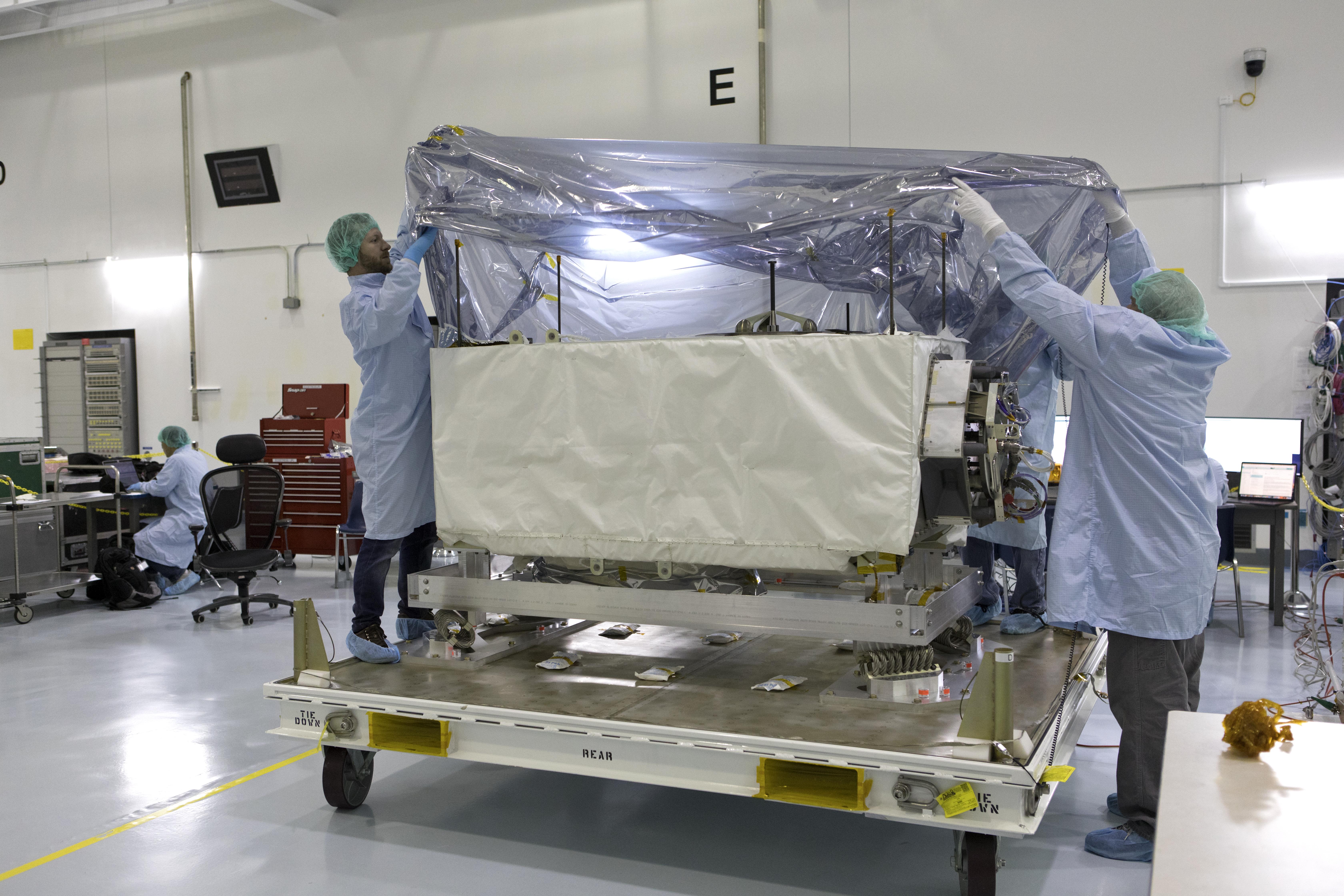
NASA's New 'Plant Thermometer' Undergoes Inspection
Full Resolution:
TIFF
(1.121 MB)
JPEG
(55.93 kB)
|
|
|
2018-04-17 |
|
ECOSTRESS
|
|
6720x4480x3 |
|
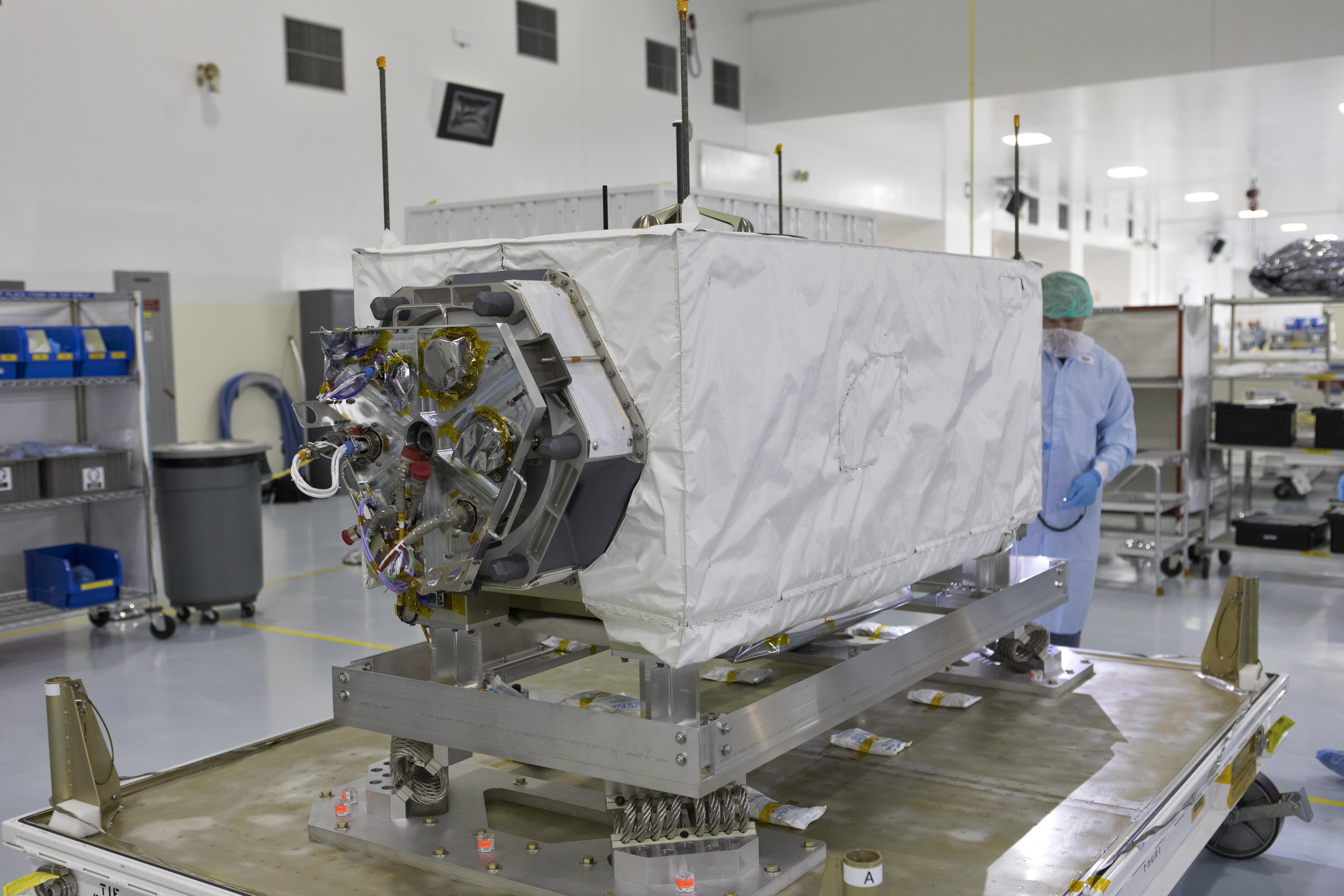
-
PIA22417:
-
NASA's ECOSTRESS Investigation Arrives at Launch Site
Full Resolution:
TIFF
(70.06 MB)
JPEG
(4.026 MB)
|
|
|
2018-04-17 |
|
ECOSTRESS
|
|
6720x4480x3 |

|
-
PIA22416:
-
NASA's ECOSTRESS Investigation Arrives at Launch Site
Full Resolution:
TIFF
(66.98 MB)
JPEG
(3.628 MB)
|
|
|
2018-04-17 |
|
ECOSTRESS
|
|
2859x1698x3 |

|
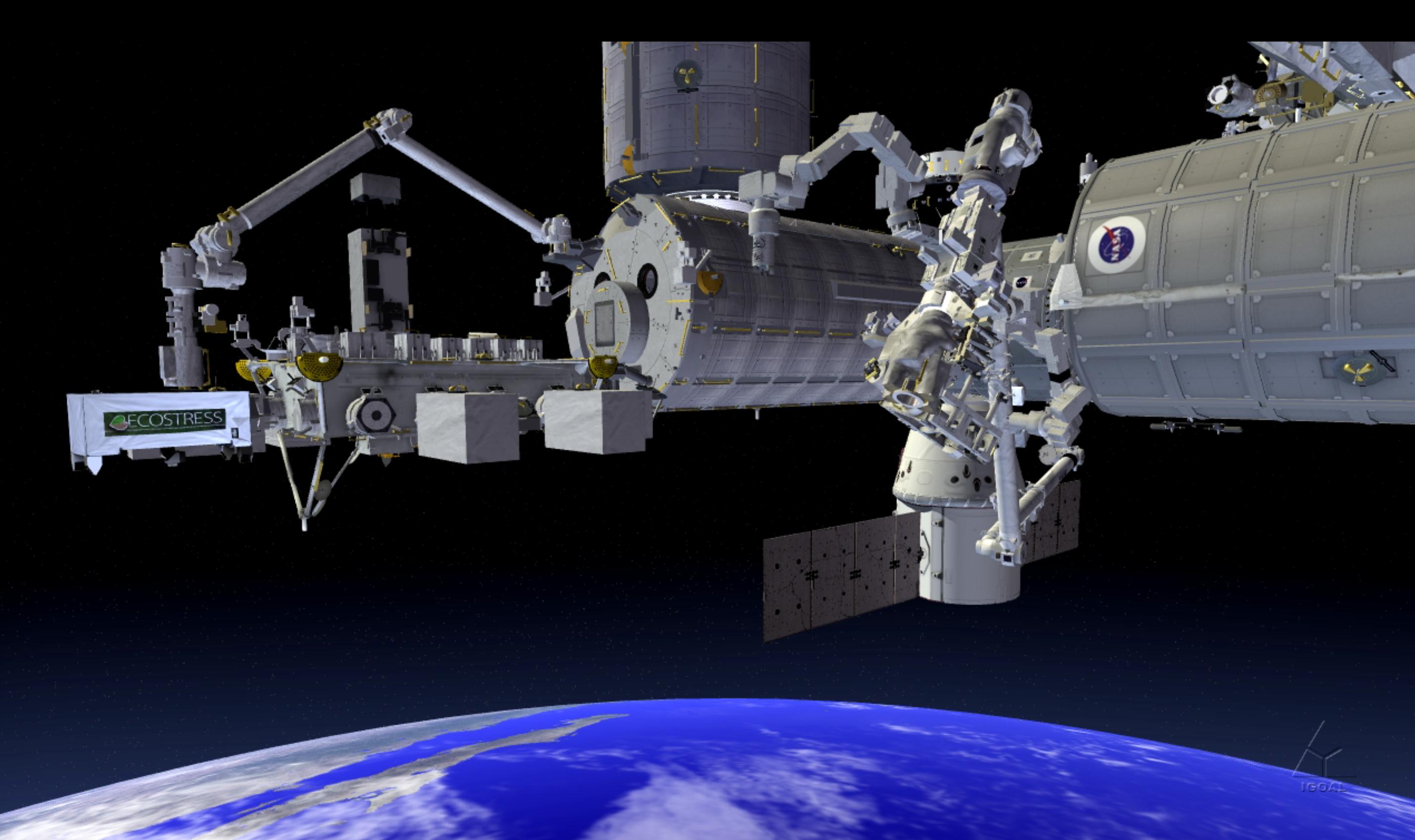
-
PIA22415:
-
NASA's ECOSTRESS Investigation Being Installed on the International Space Station (Artist's Concept)
Full Resolution:
TIFF
(6.649 MB)
JPEG
(310.7 kB)
|
 Planetary Data System


