My
List |
Addition Date
|
Target
|
Mission
|
Instrument
|
Size
|

|
2014-09-02 |
Earth
|
Aqua
|
MODIS
|
6843x3890x3 |
|
-
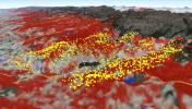
PIA18795:
-
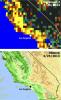
2013 Yosemite Fire Assessed by NASA Satellite Data
Full Resolution:
TIFF
(79.89 MB)
JPEG
(2.397 MB)
|
|
|
2014-05-29 |
Earth
|
Aqua
|
MODIS
|
7091x5556x1 |
|
-
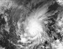
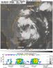
PIA18097:
-
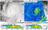
Hurricane Amanda
Full Resolution:
TIFF
(39.44 MB)
JPEG
(4.125 MB)
|
|
|
2013-08-22 |
Earth
|
CloudSat
|
Cloud Profiling Radar (CPR)
MODIS
|
1199x206x3 |

|
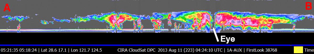
-
PIA17413:
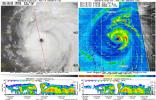
NASA's CloudSat Eyes Powerful Typhoon Utor
Full Resolution:
TIFF
(741.5 kB)
JPEG
(52.9 kB)
|
|
|
2013-06-13 |
Earth
|
Aqua
Terra
|
MODIS
MODIS
|
1659x1452x3 |
|
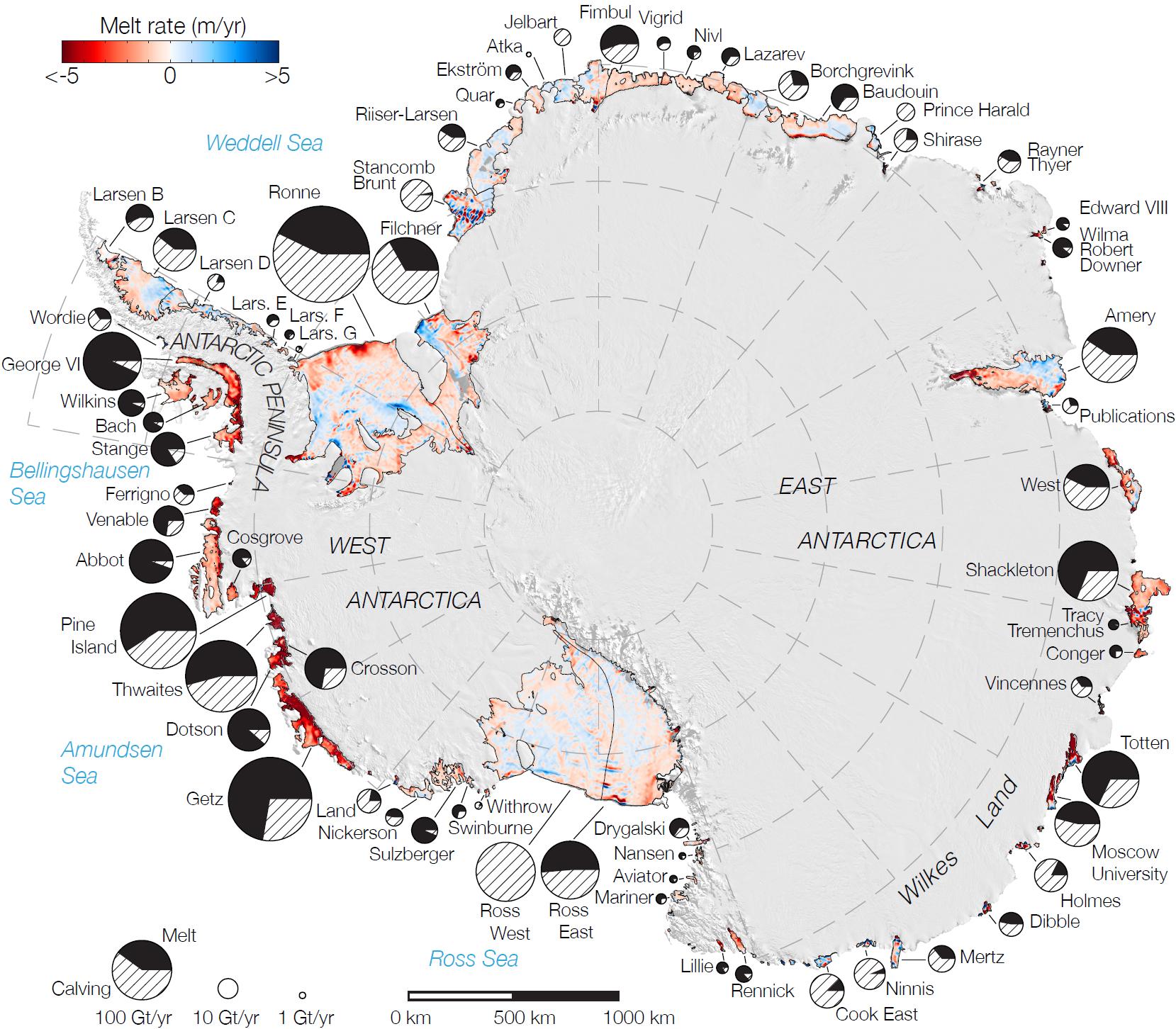
-
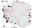
PIA17284:
-
Rates of Basal Melt of Antarctic Ice Shelves
Full Resolution:
TIFF
(7.23 MB)
JPEG
(358.1 kB)
|
|
|
2013-05-13 |
Earth
|
Aqua
|
MODIS
|
1500x1686x3 |
|
-
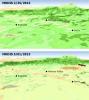
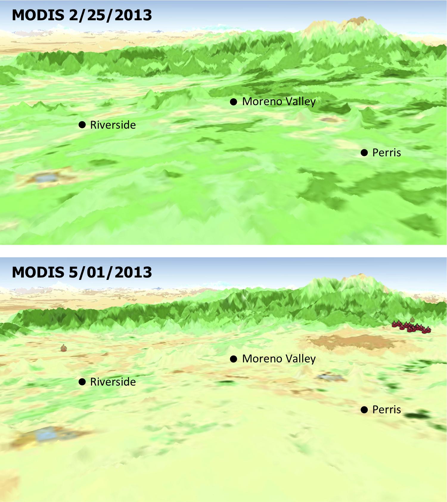
PIA17053:
-
MODIS Satellite See Double Jeopardy for Socal Fire Season
Full Resolution:
TIFF
(7.59 MB)
JPEG
(220.7 kB)
|
|
|
2013-05-13 |
Earth
|
Aqua
OSCAT
|
MODIS
OSCAT Scatterometer
|
1034x1692x3 |
|
-
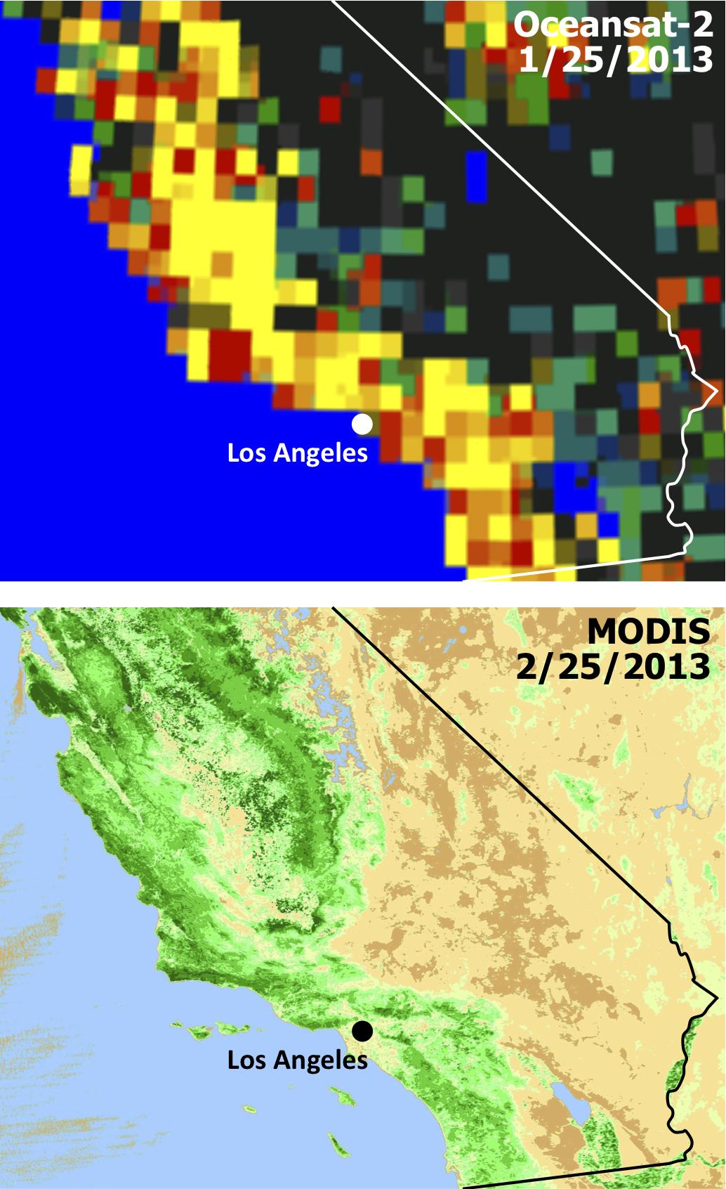
PIA17052:
-
Satellites See Double Jeopardy for Socal Fire Season
Full Resolution:
TIFF
(5.251 MB)
JPEG
(212.1 kB)
|
|
|
2012-06-29 |
Earth
|
Aqua
|
AIRS
MODIS
|
1920x1070x3 |

|
-
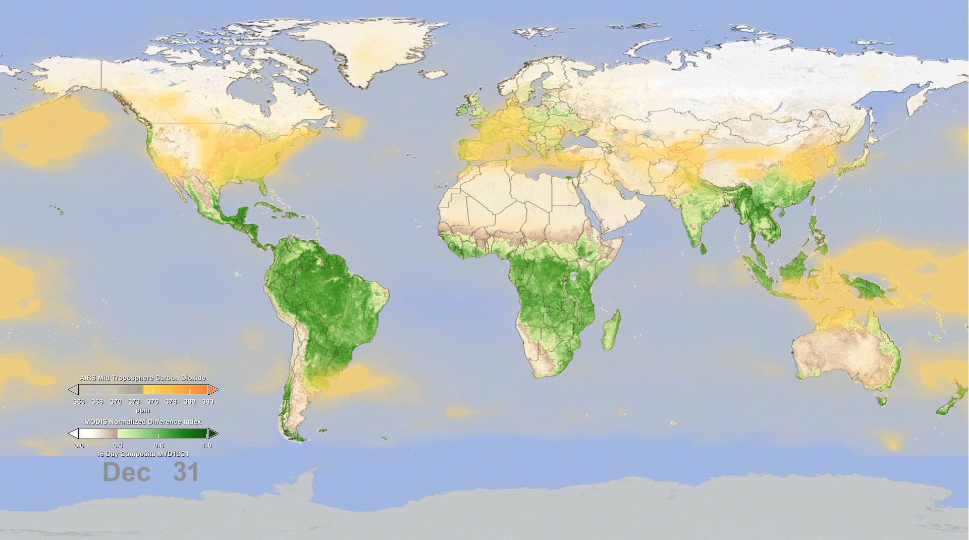
PIA15838:
-
Effect of Seasonal Vegetation Cycle on Global Atmospheric Carbon Dioxide

Full Resolution:
TIFF
(6.166 MB)
JPEG
(200.6 kB)
|
|
|
2010-08-19 |
Earth
|
CloudSat
|
Cloud Profiling Radar (CPR)
MODIS
|
1055x1419x3 |

|
-
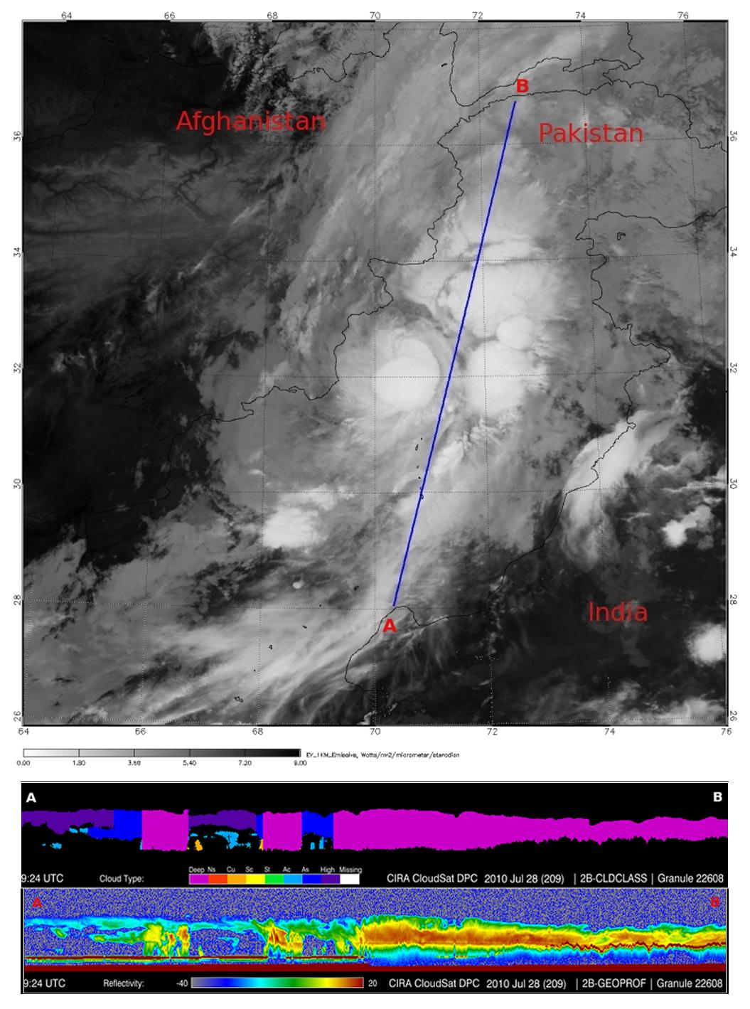
PIA13340:
-
NASA's CloudSat Spots Beginning of Pakistan Floods
Full Resolution:
TIFF
(4.497 MB)
JPEG
(200.3 kB)
|
|
|
2009-09-15 |
Earth
|
CloudSat
|
AMSR-E
Cloud Profiling Radar (CPR)
MODIS
|
960x616x3 |
|
-
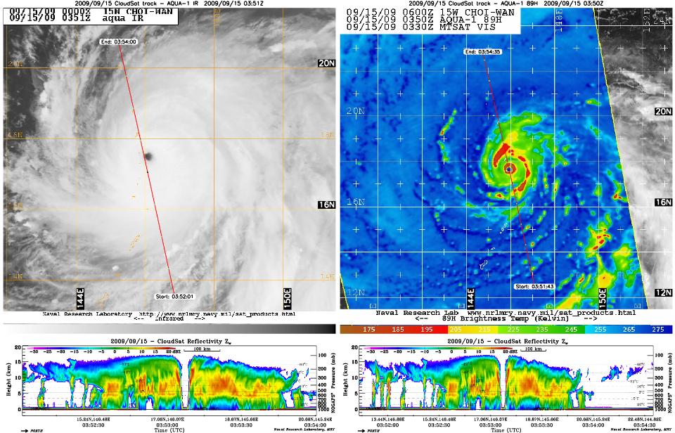
PIA12198:
-
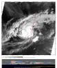
CloudSat Peers Into the Heart of a Super Typhoon
Full Resolution:
TIFF
(1.777 MB)
JPEG
(143.8 kB)
|
|
|
2009-08-21 |
Earth
|
CloudSat
|
AMSR-E
Cloud Profiling Radar (CPR)
MODIS
|
1728x1108x3 |
|
-
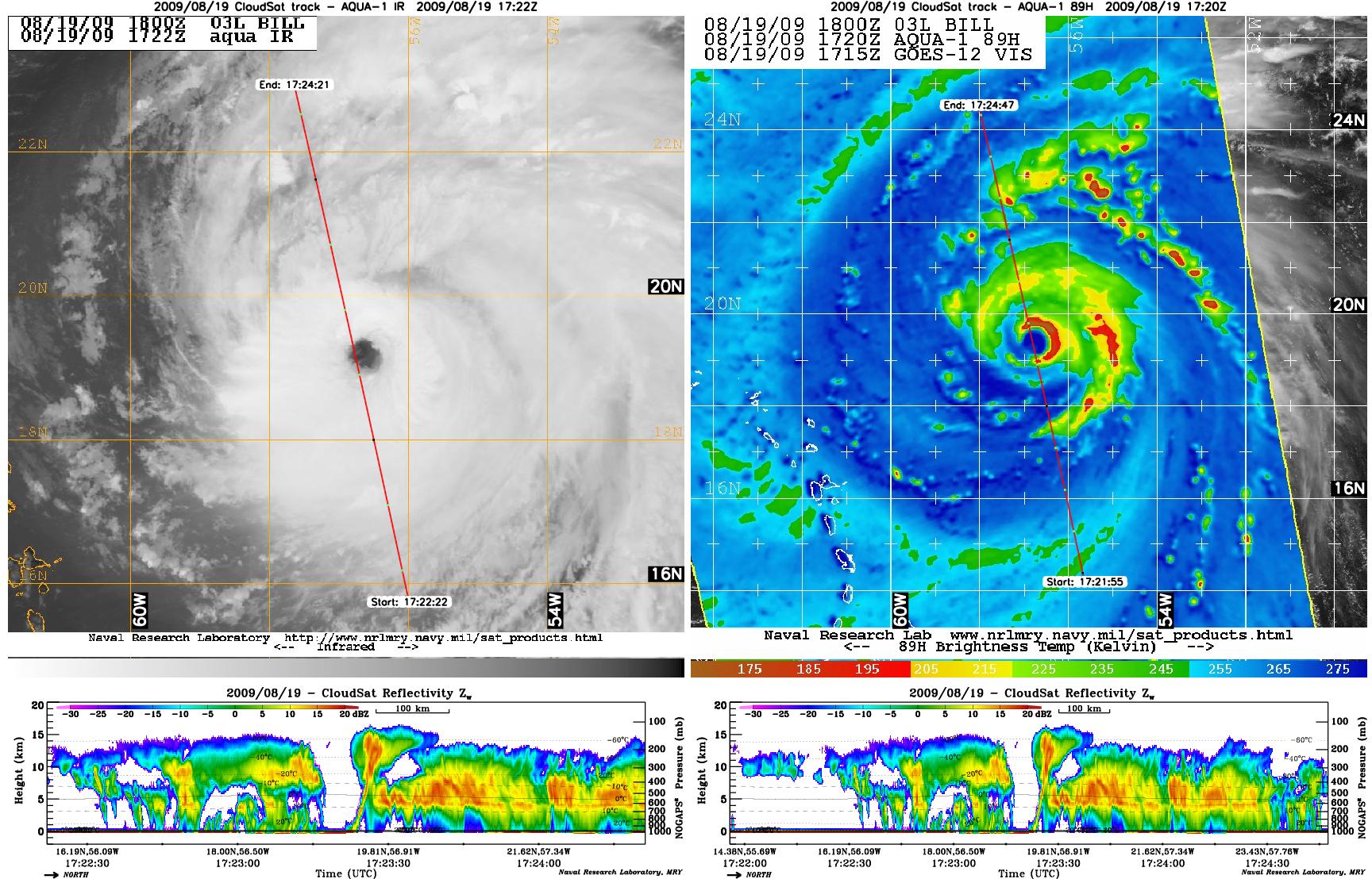
PIA12179:
-
Hurricane Bill Eye Overpass
Full Resolution:
TIFF
(5.753 MB)
JPEG
(381.1 kB)
|
|
|
2007-06-07 |
Earth
|
CloudSat
|
Cloud Profiling Radar (CPR)
Moderate Resolution Imaging Spectroradiometer (MODIS)
|
1277x1539x3 |
|
-
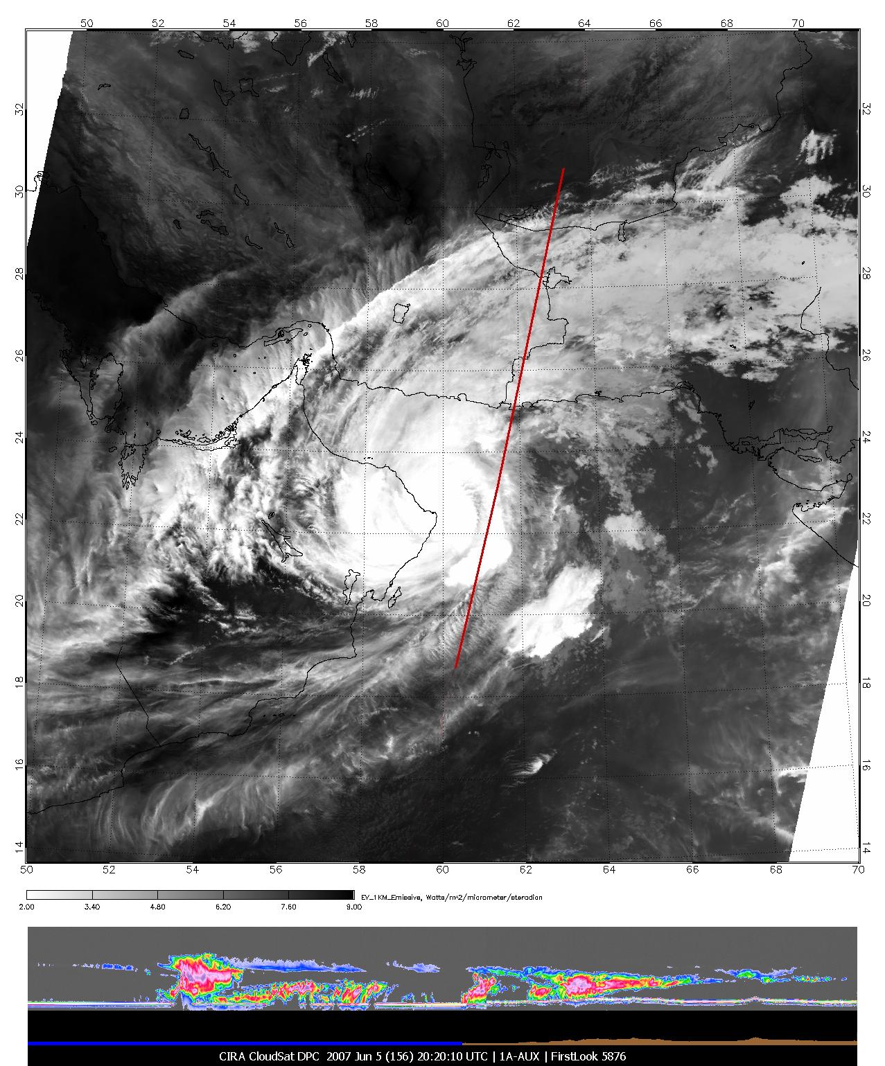
PIA09601:
-
Tropical Cyclone Gonu Viewed by CloudSat
Full Resolution:
TIFF
(5.902 MB)
JPEG
(317.8 kB)
|
|
|
2007-05-10 |
Earth
|
CloudSat
|
Cloud Profiling Radar (CPR)
Moderate Resolution Imaging Spectroradiometer (MODIS)
|
864x1108x3 |
|
-
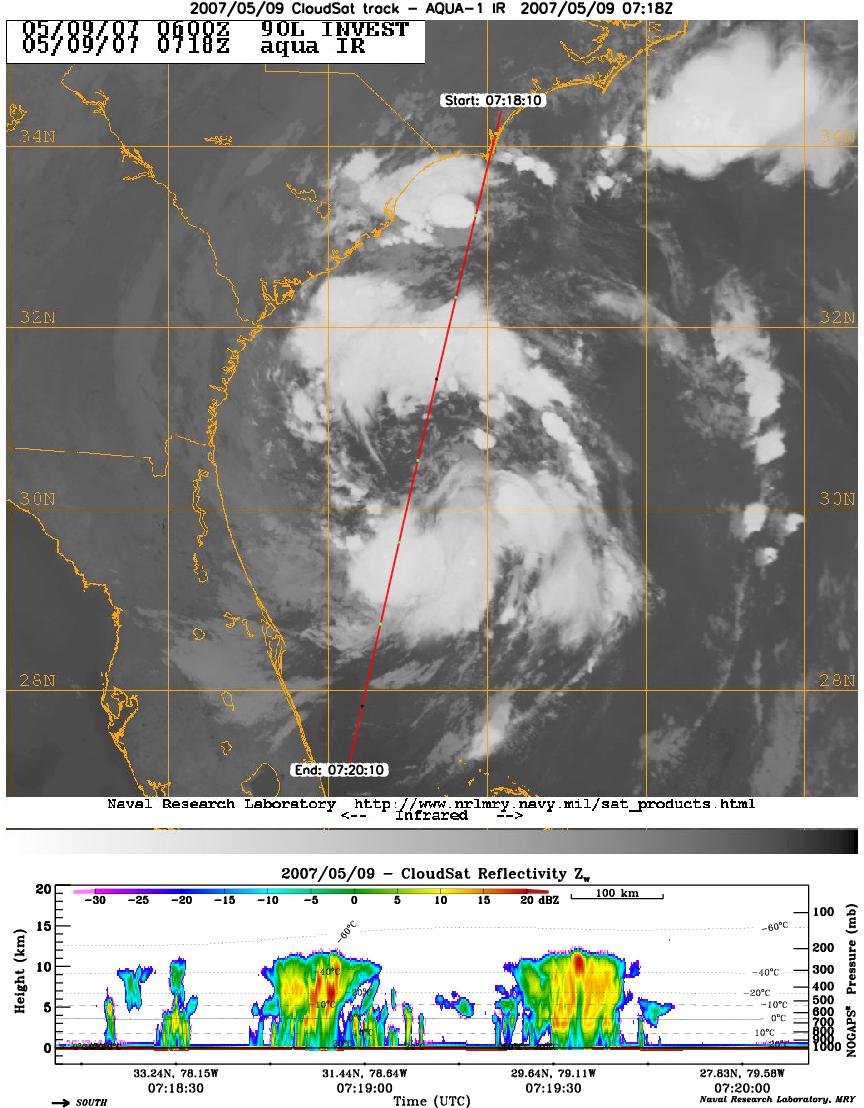
PIA09379:
-
CloudSat Profiles Tropical Storm Andrea
Full Resolution:
TIFF
(2.875 MB)
JPEG
(159.7 kB)
|
 Planetary Data System


