My
List |
Addition Date
|
Target
|
Mission
|
Instrument
|
Size
|

|
2005-12-05 |
Mars
|
2001 Mars Odyssey
Mars Global Surveyor (MGS)
Mars Exploration Rover (MER)
|
Descent Image Motion Estimation System (DIMES)
Mars Orbiter Camera
Thermal Emission Imaging System
|
1411x2043x3 |
|
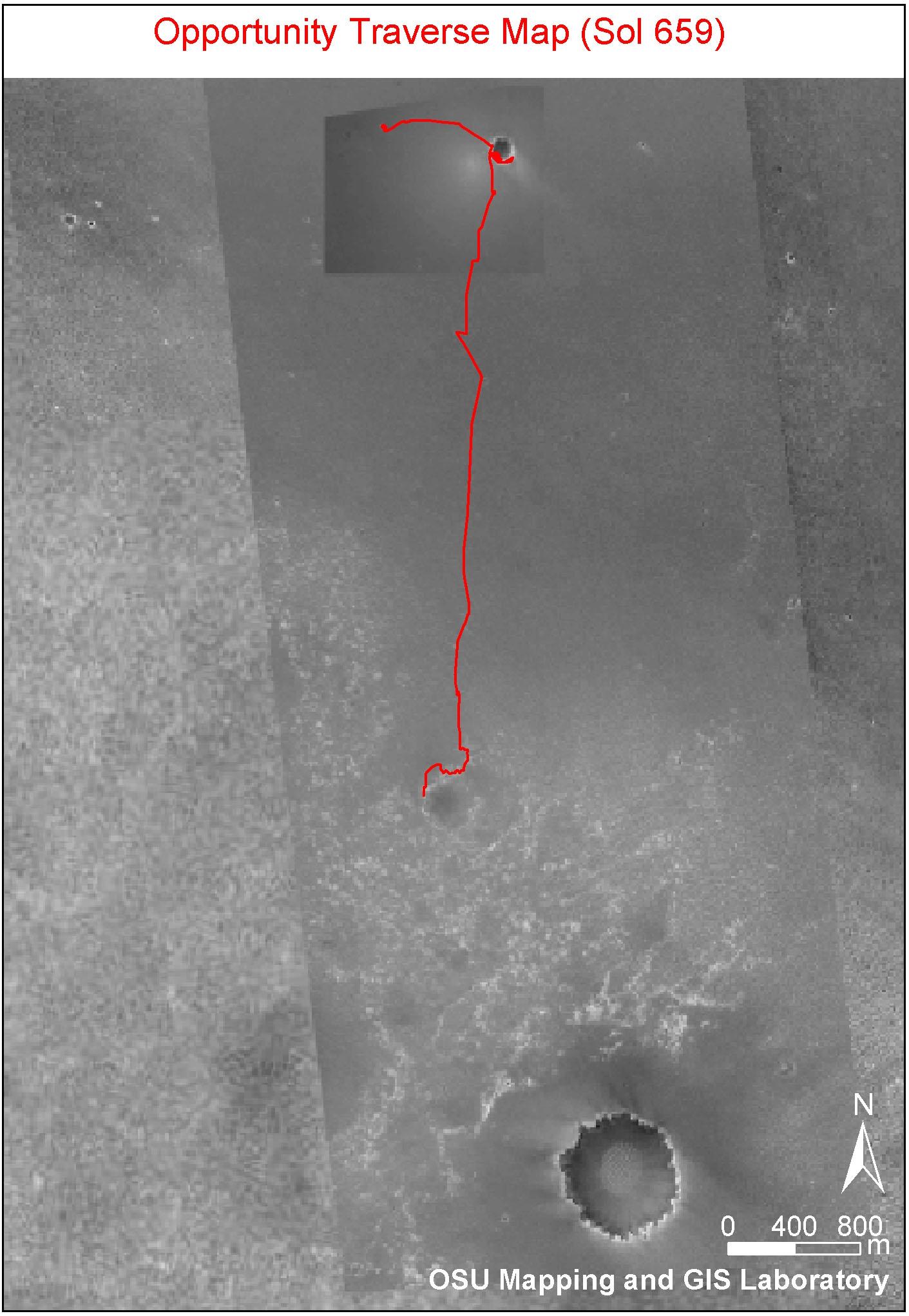
-
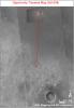
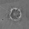
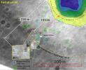
PIA03616:
-
Partway to 'Victoria'
Full Resolution:
TIFF
(8.665 MB)
JPEG
(265.7 kB)
|
|
|
2005-12-05 |
Mars
|
Mars Global Surveyor (MGS)
Mars Exploration Rover (MER)
2001 Mars Odyssey
|
Descent Image Motion Estimation System (DIMES)
Mars Orbiter Camera
Thermal Emission Imaging System
|
1415x2044x3 |
|
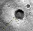
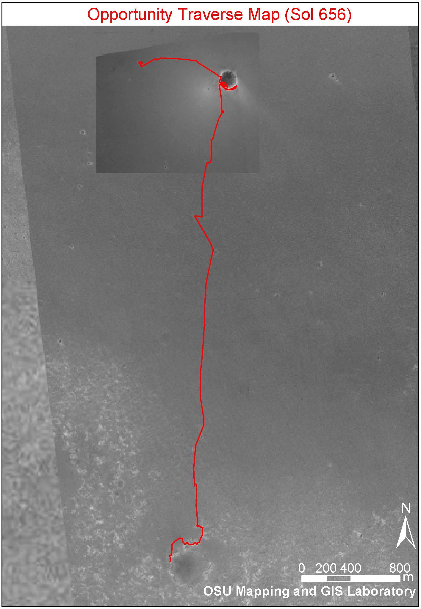
-
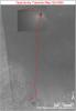
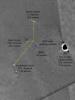
PIA03609:
-
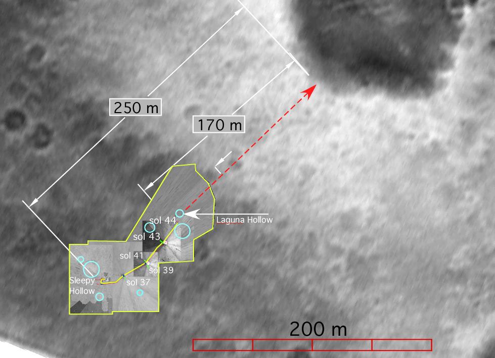
Opportunity Traverse Map, Sol 656
Full Resolution:
TIFF
(8.693 MB)
JPEG
(249.9 kB)
|
|
|
2005-03-30 |
Mars
|
Mars Exploration Rover (MER)
Mars Global Surveyor (MGS)
2001 Mars Odyssey
|
Descent Image Motion Estimation System (DIMES)
Mars Orbiter Camera
Thermal Emission Imaging System
|
2392x1823x3 |
|
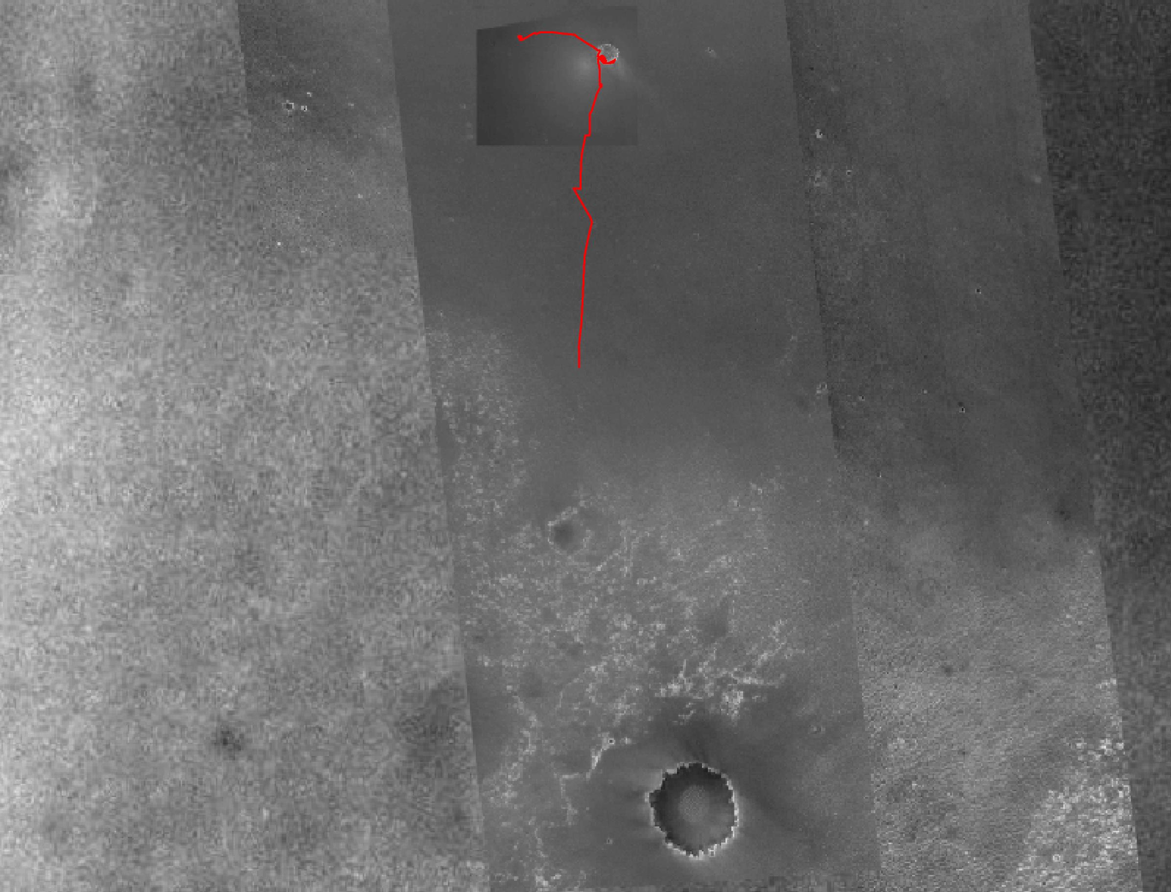
-
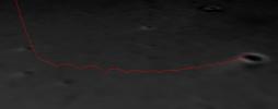
PIA07506:
-
Opportunity's Fast Progress Southward
Full Resolution:
TIFF
(5.086 MB)
JPEG
(406.4 kB)
|
|
|
2004-09-21 |
Mars
|
Mars Exploration Rover (MER)
|
Descent Image Motion Estimation System (DIMES)
Navigation Camera
|
1054x701x3 |
|
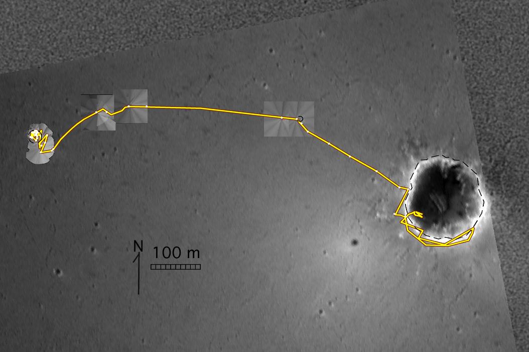
-
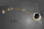
PIA06871:
-
Opportunity's Travels During its First 205 Martian Days
Full Resolution:
TIFF
(1.006 MB)
JPEG
(74.08 kB)
|
|
|
2004-06-15 |
Mars
|
Mars Global Surveyor (MGS)
Mars Exploration Rover (MER)
|
Descent Image Motion Estimation System (DIMES)
Mars Orbiter Camera (MOC)
|
3240x1875x3 |

|
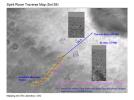
-
PIA06269:
-
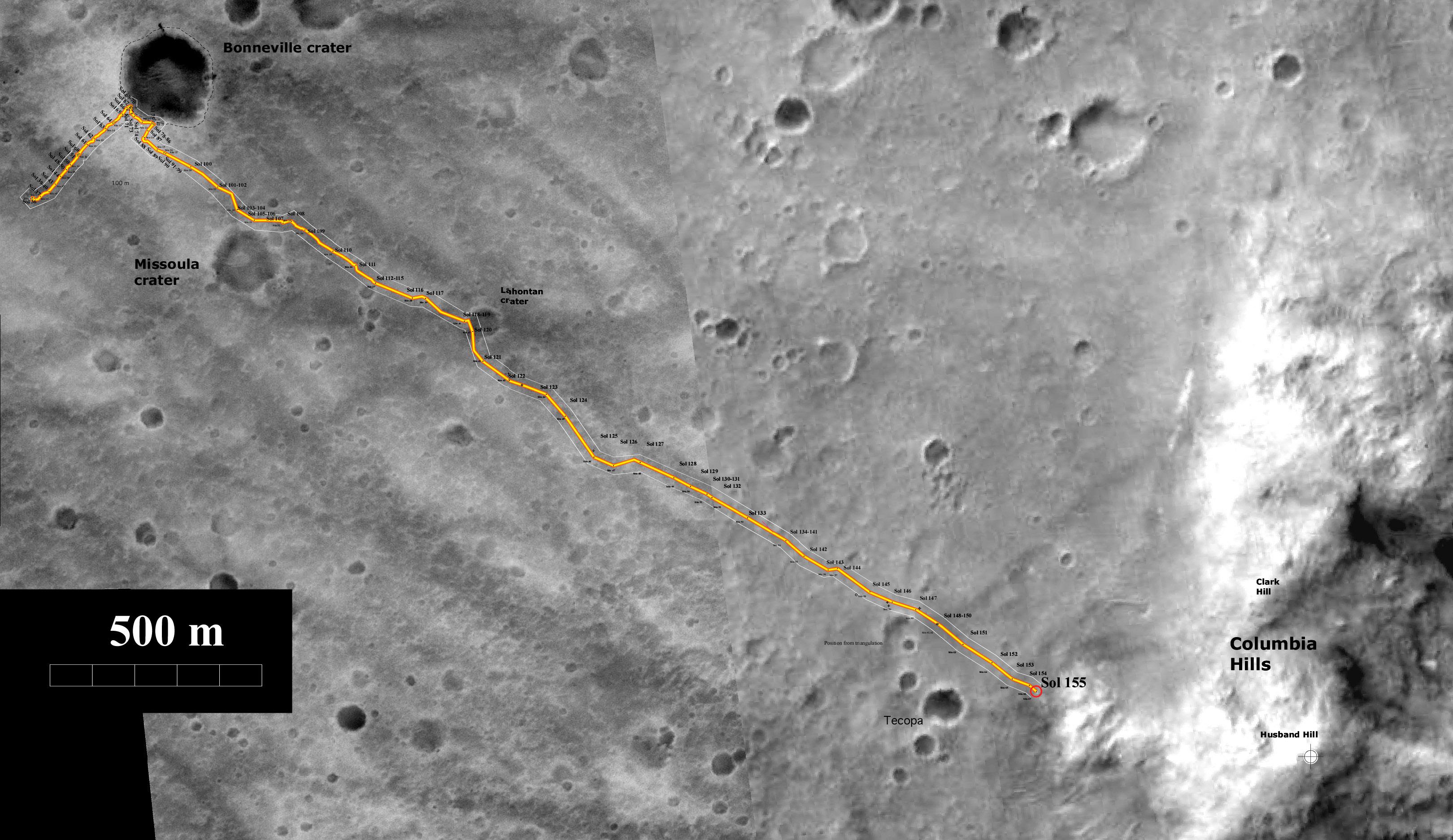
Spirit's Trip to the Hills
Full Resolution:
TIFF
(8.321 MB)
JPEG
(755.2 kB)
|
|
|
2004-06-03 |
Mars
|
Mars Global Surveyor (MGS)
Mars Exploration Rover (MER)
|
Descent Image Motion Estimation System (DIMES)
Mars Orbiter Camera (MOC)
Navigation Camera
Panoramic Camera
|
4004x4000x1 |
|
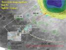
-
PIA06020:
-
Endurance Road Map
Full Resolution:
TIFF
(7.341 MB)
JPEG
(811.3 kB)
|
|
|
2004-04-08 |
Mars
|
Mars Exploration Rover (MER)
|
Descent Image Motion Estimation System (DIMES)
|
1226x1140x3 |
|
-
PIA05719:
-
Spirit's Prime-Mission Traverse
Full Resolution:
TIFF
(1.999 MB)
JPEG
(131.2 kB)
|
|
|
2004-03-06 |
Mars
|
Mars Exploration Rover (MER)
|
Descent Image Motion Estimation System (DIMES)
Panoramic Camera
|
1197x896x3 |
|
-
PIA05506:
-
What Lies Ahead
Full Resolution:
TIFF
(1.757 MB)
JPEG
(103.6 kB)
|
|
|
2004-02-26 |
Mars
|
Mars Global Surveyor (MGS)
Mars Exploration Rover (MER)
|
Descent Image Motion Estimation System (DIMES)
Mars Orbiter Camera (MOC)
|
5760x4328x3 |
|
-
PIA05448:
-
Getting Closer
Full Resolution:
TIFF
(32 MB)
JPEG
(1.508 MB)
|
|
|
2004-02-19 |
Mars
|
Mars Global Surveyor (MGS)
Mars Exploration Rover (MER)
|
Descent Image Motion Estimation System (DIMES)
Mars Orbiter Camera (MOC)
|
889x723x3 |
|
-
PIA05329:
-
Halfway There
Full Resolution:
TIFF
(1.261 MB)
JPEG
(85.96 kB)
|
|
|
2004-02-18 |
Mars
|
Mars Exploration Rover (MER)
|
Descent Image Motion Estimation System (DIMES)
Navigation Camera
Panoramic Camera
|
979x709x3 |

|
-
PIA05317:
-
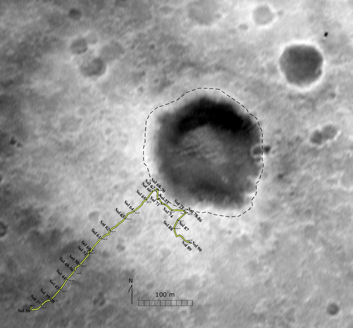
Spirit's Path to Bonneville
Full Resolution:
TIFF
(861.8 kB)
JPEG
(75.48 kB)
|
|
|
2004-02-09 |
Mars
|
2001 Mars Odyssey
Mars Global Surveyor (MGS)
Mars Exploration Rover (MER)
|
Descent Image Motion Estimation System (DIMES)
Mars Orbiter Camera (MOC)
Thermal Emission Imaging System
|
4000x5308x3 |
|
-
PIA05228:
-
"X" Marks the Spot
Full Resolution:
TIFF
(11.63 MB)
JPEG
(2.084 MB)
|
|
|
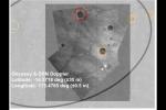
2004-02-09 |
Mars
|
Mars Exploration Rover (MER)
|
Descent Image Motion Estimation System (DIMES)
|
875x345x3 |
|
-
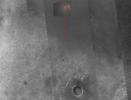
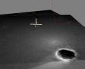
PIA05227:
-
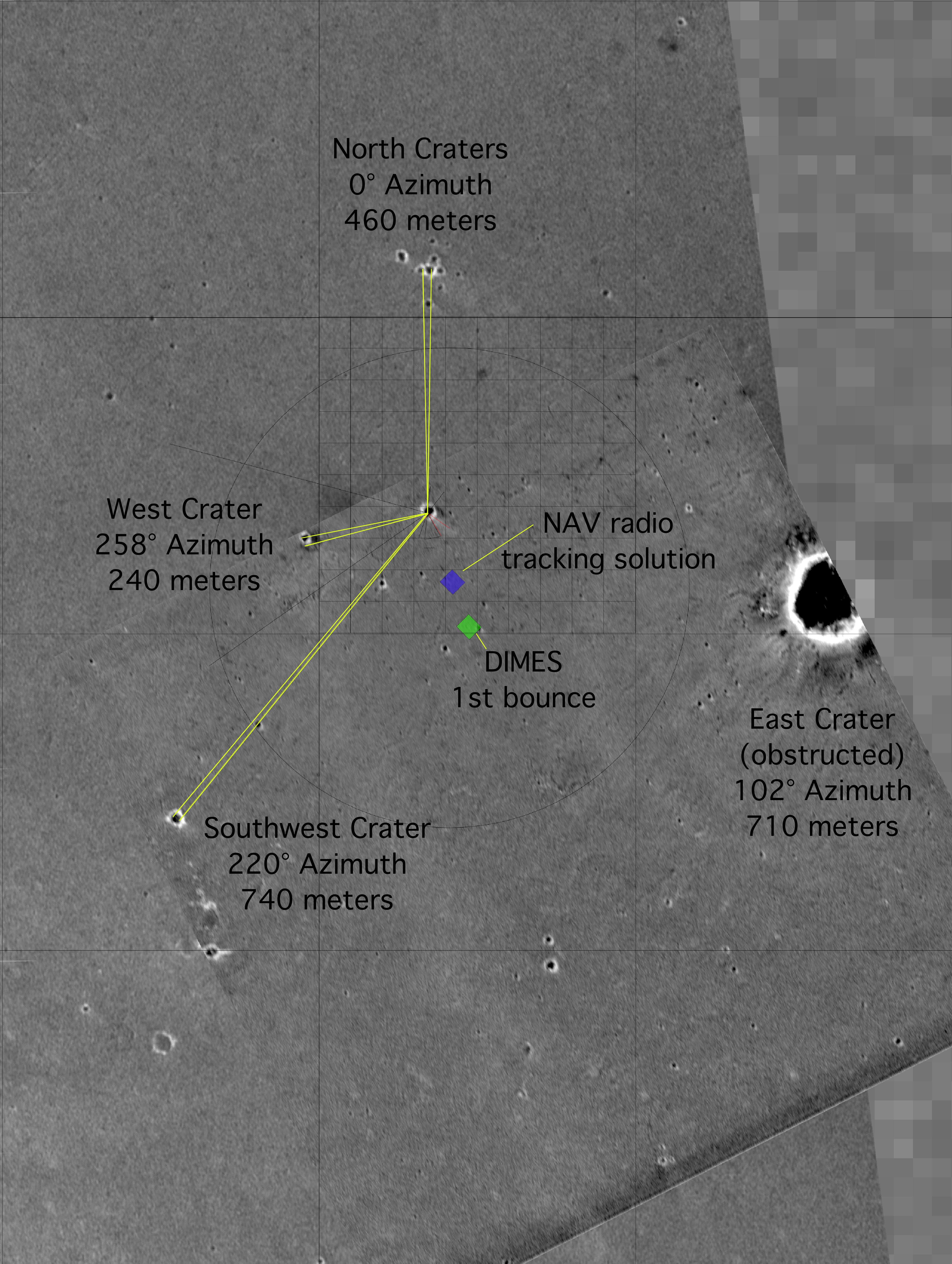
Opportunity Bounces to a Stop
Full Resolution:
TIFF
(907.7 kB)
JPEG
(18.23 kB)
|
|
|
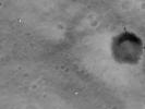
2004-02-09 |
Mars
|
Mars Exploration Rover (MER)
|
Descent Image Motion Estimation System (DIMES)
|
764x614x3 |
|
-
PIA05226:
-
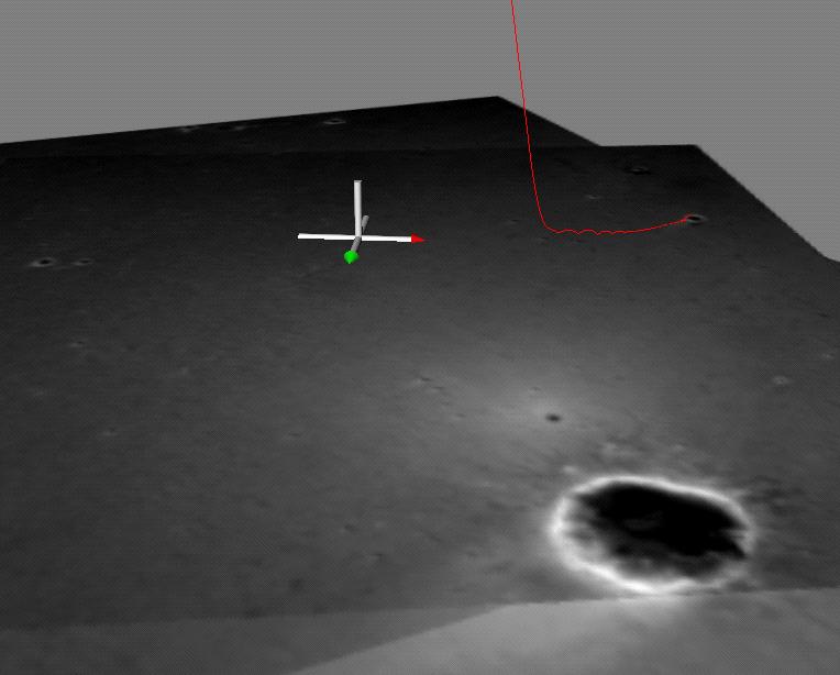
Opportunity's Hole in One (Side View)
Full Resolution:
TIFF
(1.41 MB)
JPEG
(40.31 kB)
|
|
|
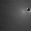
2004-02-09 |
Mars
|
Mars Exploration Rover (MER)
|
Descent Image Motion Estimation System (DIMES)
|
878x774x3 |
|
-
PIA05225:
-
Opportunity's Hole in One
Full Resolution:
TIFF
(2.042 MB)
JPEG
(67.66 kB)
|
|
|
2004-01-28 |
Mars
|
Mars Global Surveyor (MGS)
Mars Exploration Rover (MER)
|
Descent Image Motion Estimation System (DIMES)
Mars Orbiter Camera (MOC)
|
1700x1700x1 |
|
-
PIA05165:
-
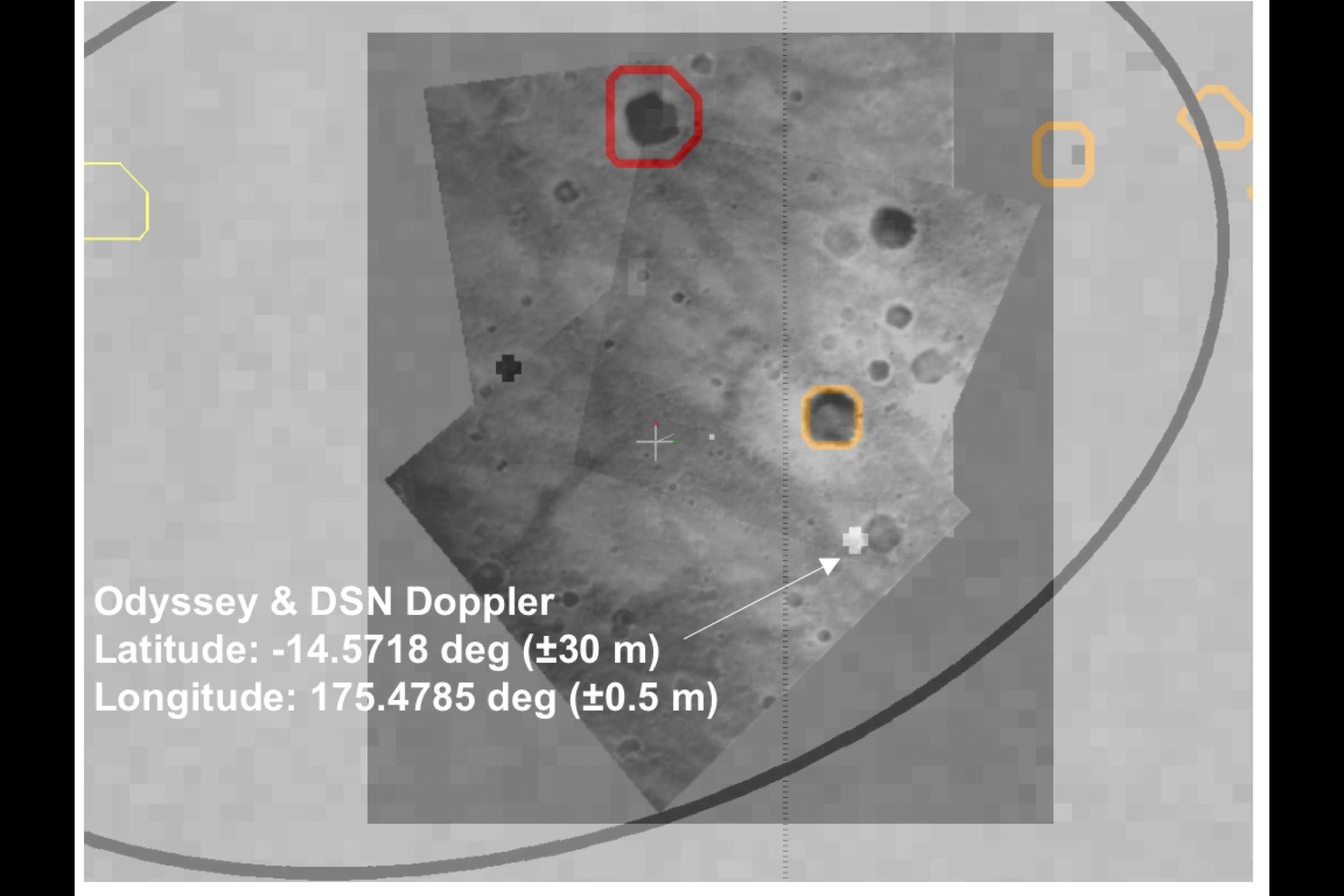
Challenger Memorial Station, Meridiani Planum, Mars
Full Resolution:
TIFF
(2.513 MB)
JPEG
(403.8 kB)
|
|
|
2004-01-25 |
Mars
|
Mars Exploration Rover (MER)
|
Descent Image Motion Estimation System (DIMES)
|
1024x1021x1 |
|
-
PIA05148:
-
Crater Down Below
Full Resolution:
TIFF
(630.2 kB)
JPEG
(38.64 kB)
|
|
|
2004-01-25 |
Mars
|
Mars Exploration Rover (MER)
|
Descent Image Motion Estimation System (DIMES)
|
1024x1021x1 |
|
-
PIA05147:
-
Crater Down Below-2
Full Resolution:
TIFF
(750.7 kB)
JPEG
(52.71 kB)
|
|
|
2004-01-25 |
Mars
|
Mars Exploration Rover (MER)
|
Descent Image Motion Estimation System (DIMES)
|
1024x1021x1 |
|
-
PIA05146:
-
Crater Down Below-3
Full Resolution:
TIFF
(768.2 kB)
JPEG
(56.83 kB)
|
|
|
2004-01-23 |
Mars
|
Mars Exploration Rover (MER)
|
Descent Image Motion Estimation System (DIMES)
|
1190x528x3 |
|
-
PIA05132:
-
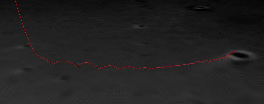
Bouncing Down to Mars
Full Resolution:
TIFF
(1.885 MB)
JPEG
(36.98 kB)
|
|
|
2004-01-23 |
Mars
|
Mars Global Surveyor (MGS)
Mars Exploration Rover (MER)
|
Descent Image Motion Estimation System (DIMES)
Mars Orbiter Camera (MOC)
Panoramic Camera
|
640x480x1 |
|
-
PIA05131:
-
Spirit Lightens the Load
Full Resolution:
TIFF
(302.4 kB)
JPEG
(32.79 kB)
|
|
|
2004-01-13 |
Mars
|
Mars Exploration Rover (MER)
|
Descent Image Motion Estimation System (DIMES)
|
4800x3200x3 |
|
-
PIA05057:
-
Right on Target-3
Full Resolution:
TIFF
(9.042 MB)
JPEG
(502 kB)
|
|
|
2004-01-13 |
Mars
|
Mars Global Surveyor (MGS)
Mars Exploration Rover (MER)
|
Descent Image Motion Estimation System (DIMES)
Mars Orbiter Camera (MOC)
|
2996x4584x3 |
|
-
PIA05059:
-
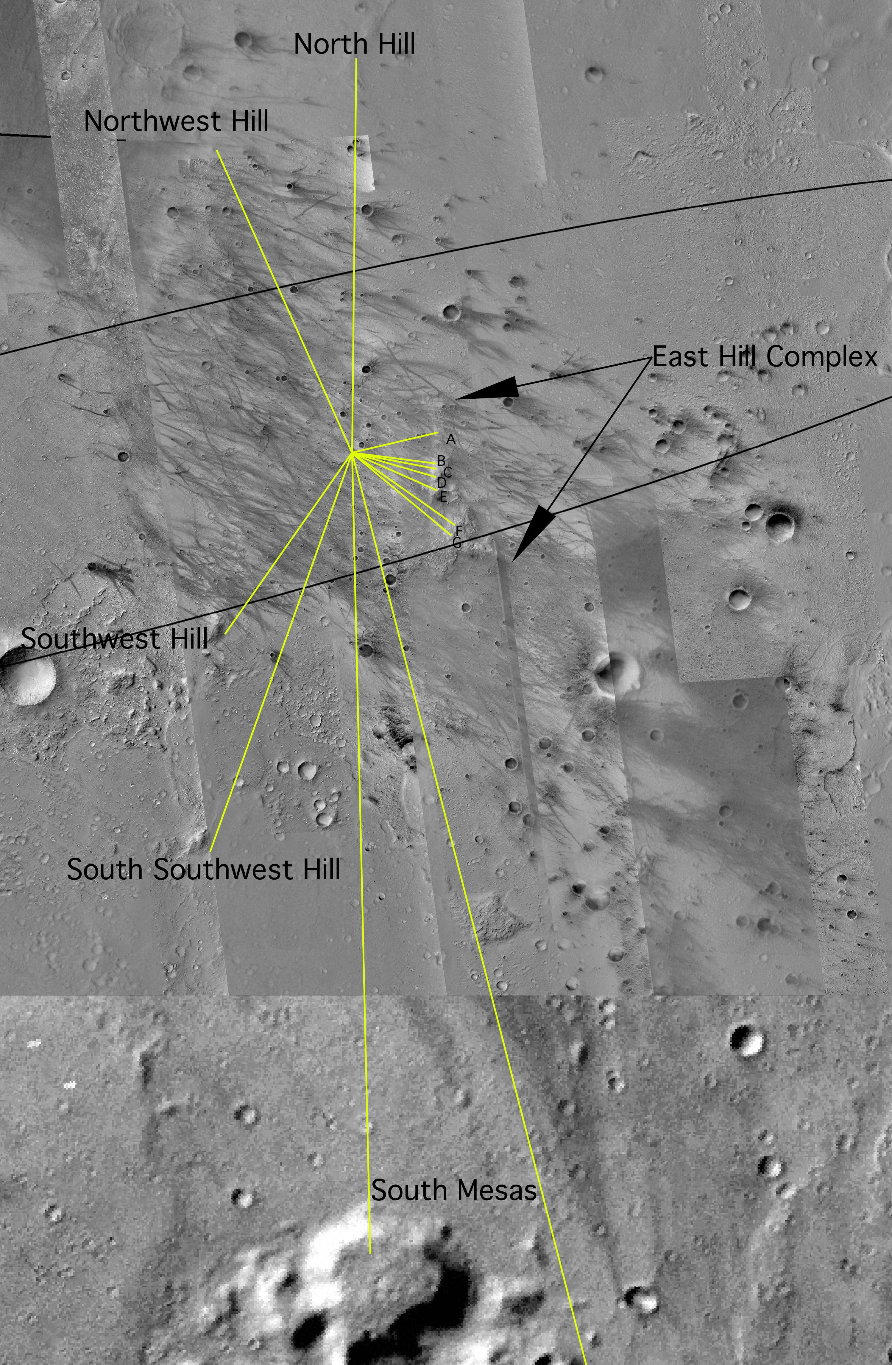
Map of Hills on the Horizon
Full Resolution:
TIFF
(19.24 MB)
JPEG
(2.046 MB)
|
|
|
2004-01-04 |
Mars
|
Mars Exploration Rover (MER)
|
Descent Image Motion Estimation System (DIMES)
|
1024x1021x1 |
|
-
PIA04986:
-
Spirit's Descent to Mars-1433m
Full Resolution:
TIFF
(960.7 kB)
JPEG
(80.9 kB)
|
|
|
2004-01-04 |
Mars
|
Mars Exploration Rover (MER)
|
Descent Image Motion Estimation System (DIMES)
|
1024x1021x1 |
|
-
PIA04985:
-
Spirit's Descent to Mars-1983m
Full Resolution:
TIFF
(887.8 kB)
JPEG
(79.38 kB)
|
|
|
2004-01-04 |
Mars
|
Mars Exploration Rover (MER)
|
Descent Image Motion Estimation System (DIMES)
|
1024x1021x1 |
|
-
PIA04984:
-
Spirit's Descent to Mars-1706m
Full Resolution:
TIFF
(983.4 kB)
JPEG
(87.24 kB)
|
 Planetary Data System


