My
List |
Addition Date
|
Target
|
Mission
|
Instrument
|
Size
|

|
2024-10-31 |
Earth
|
Terra
|
ASTER
|
1807x2042x3 |
|
-
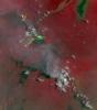
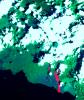
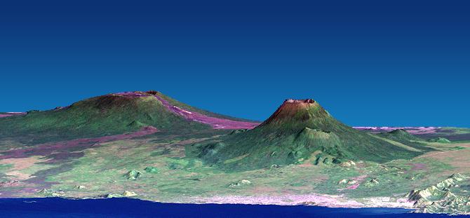
PIA26449:
-
Nyamulagira Volcano, Democratic Republic Congo
Full Resolution:
TIFF
(9.954 MB)
JPEG
(282.2 kB)
|
|
|
2002-07-11 |
Earth
|
Shuttle Radar Topography Mission (SRTM)
|
C-Band Interferometric Radar
|
7200x3601x3 |
|
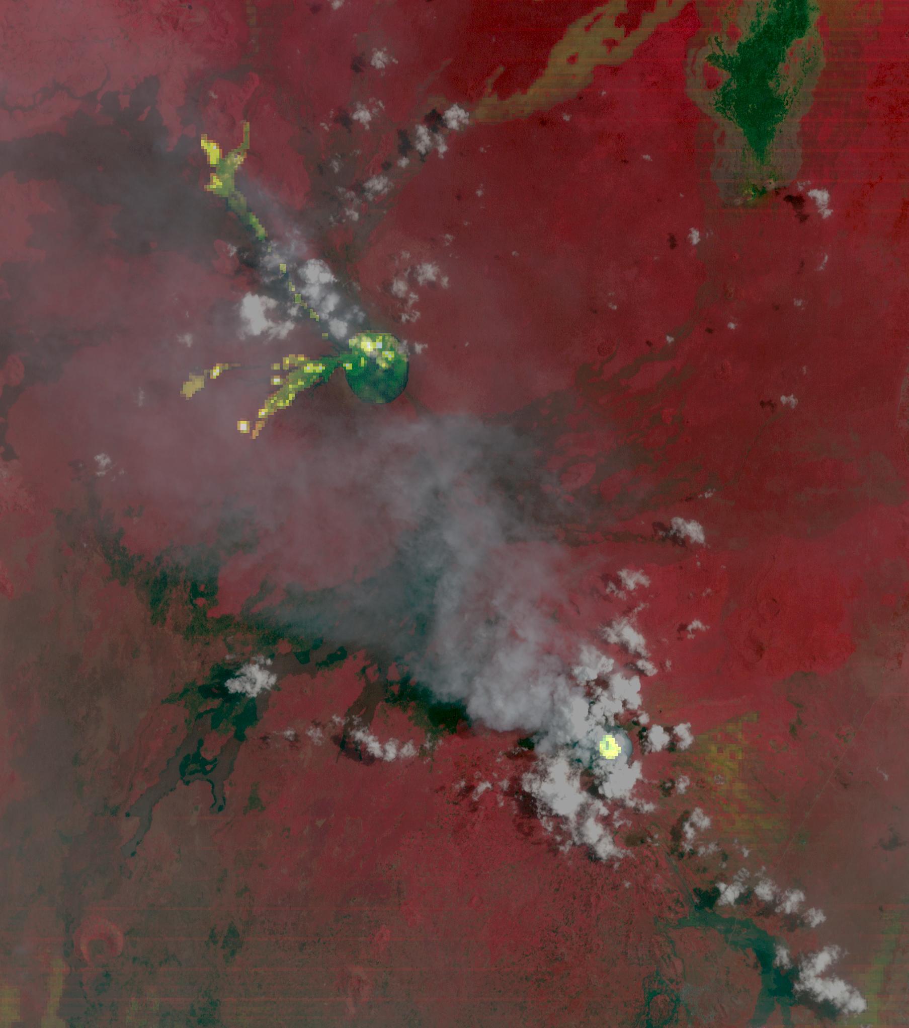
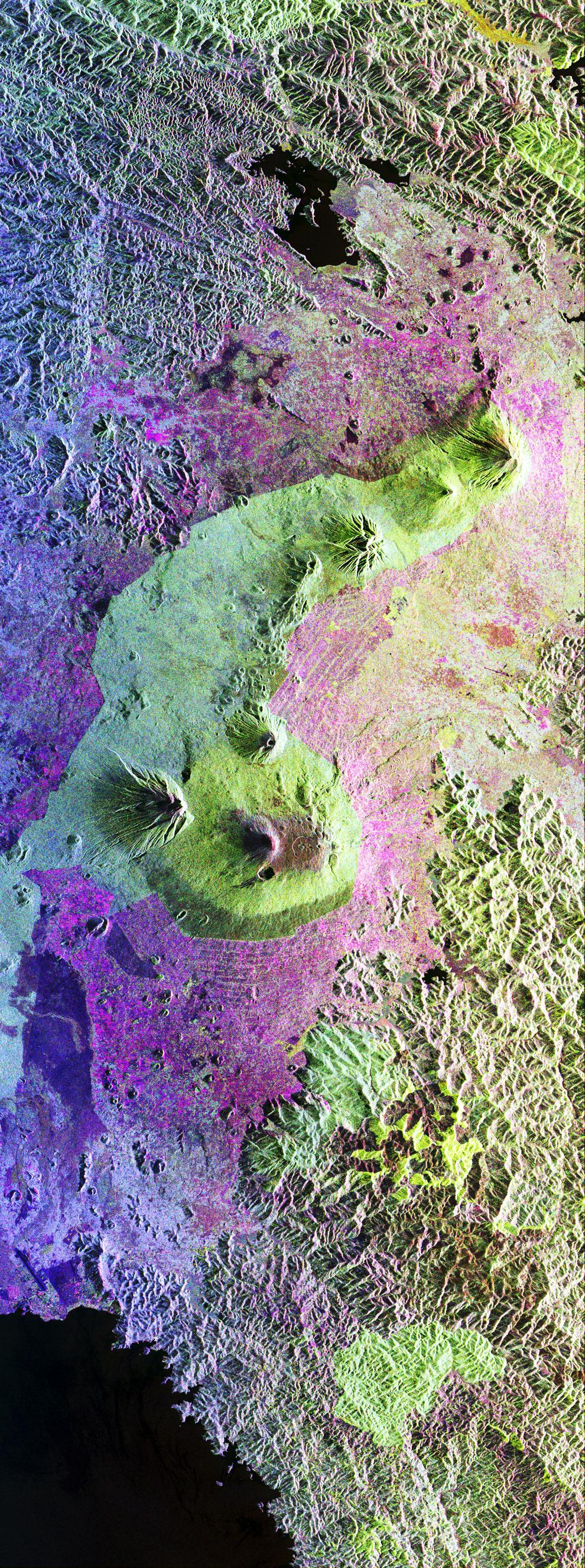
-
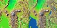
PIA03351:
-
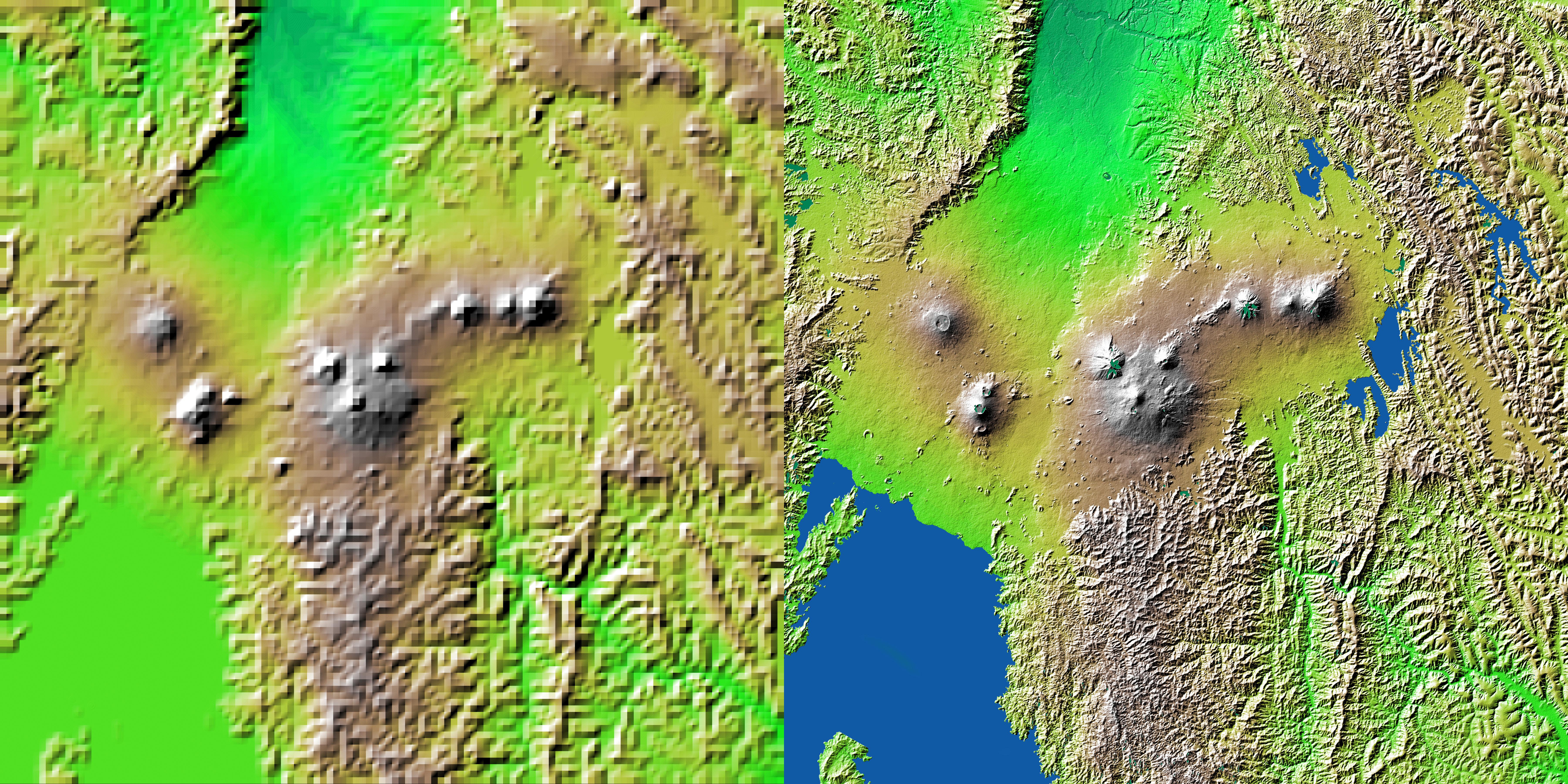
Shaded Relief with Height as Color, Virunga and Nyiragongo Volcanoes and the East African Rift Valley
Full Resolution:
TIFF
(78.98 MB)
JPEG
(5.492 MB)
|
|
|
2002-02-01 |
Earth
|
Landsat
Shuttle Radar Topography Mission (SRTM)
|
C-Band Interferometric Radar
Thematic Mapper
|
1384x2022x3 |
|
-
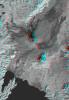
PIA03340:
-
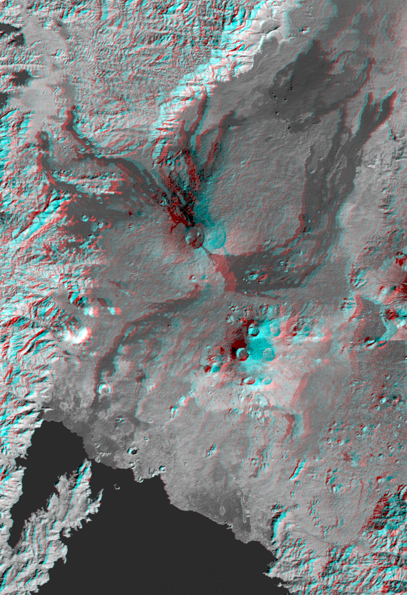
Nyiragongo volcano, Congo, Anaglyph, SRTM / Landsat
Full Resolution:
TIFF
(7.001 MB)
JPEG
(499 kB)
|
|
|
2002-02-01 |
Earth
|
Landsat
Shuttle Radar Topography Mission (SRTM)
|
C-Band Interferometric Radar
Thematic Mapper
|
670x1350x3 |
|
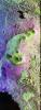
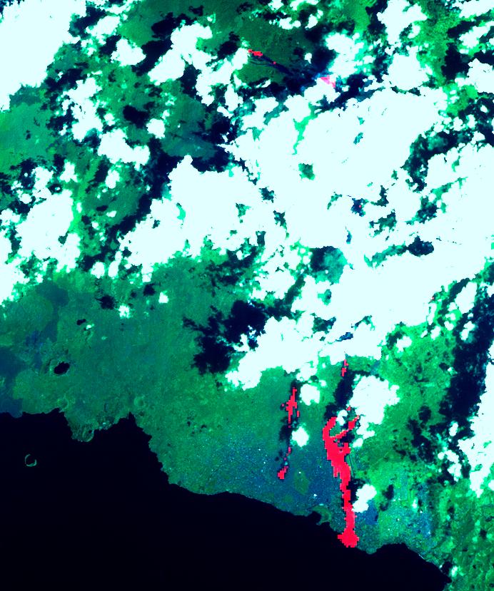
-
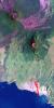
PIA03339:
-
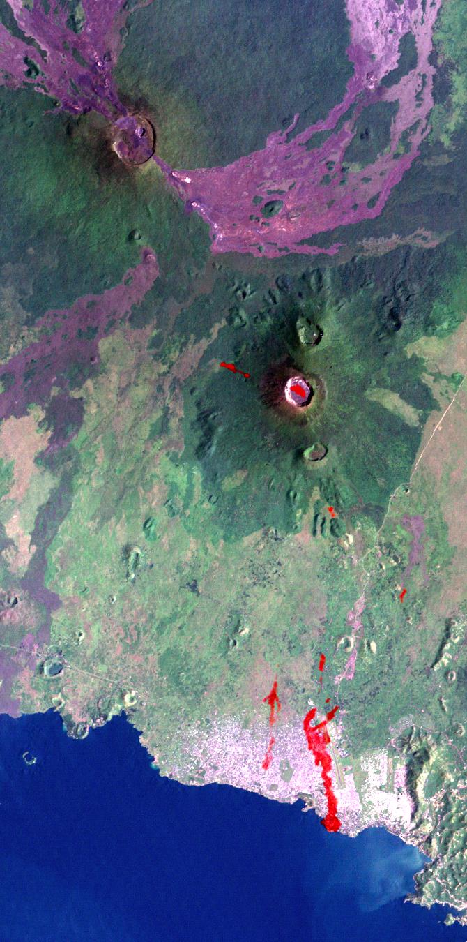
Nyiragongo Volcano, Congo, Map View with Lava, Landsat / ASTER / SRTM
Full Resolution:
TIFF
(2.983 MB)
JPEG
(168.3 kB)
|
|
|
2002-02-01 |
Earth
|
Landsat
Shuttle Radar Topography Mission (SRTM)
|
C-Band Interferometric Radar
Thematic Mapper
|
670x311x3 |

|
-
PIA03338:
-
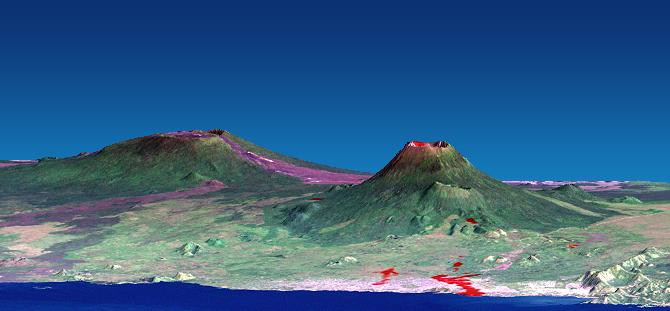
Nyiragongo volcano, Congo, Perspective View with Lava SRTM / ASTER / Landsat
Full Resolution:
TIFF
(368.7 kB)
JPEG
(29.26 kB)
|
|
|
2002-02-01 |
Earth
|
Landsat
Shuttle Radar Topography Mission (SRTM)
|
C-Band Interferometric Radar
Thematic Mapper
|
670x311x3 |

|
-
PIA03337:
-
Nyiragongo volcano, Congo, Pre-eruption Perspective View, SRTM / Landsat
Full Resolution:
TIFF
(368 kB)
JPEG
(28.97 kB)
|
|
|
2002-02-01 |
Earth
|
Terra
|
ASTER
|
692x829x3 |
|
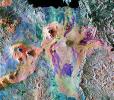
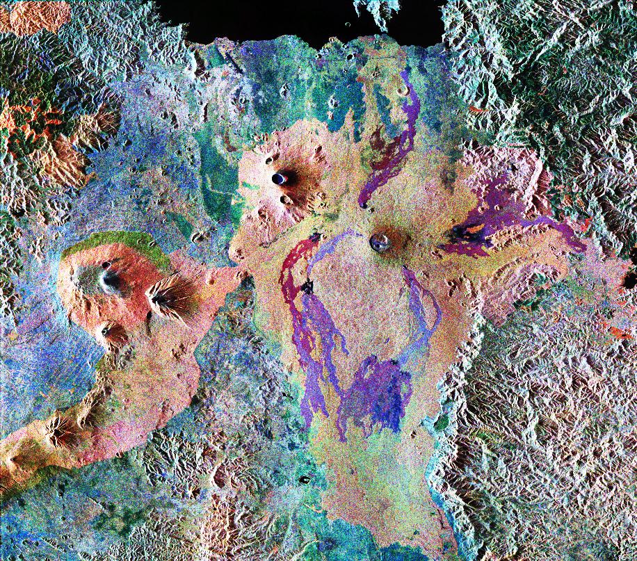
-
PIA03462:
-
Nyiragonga Volcano
Full Resolution:
TIFF
(997.9 kB)
JPEG
(119.6 kB)
|
|
|
1999-05-01 |
Earth
|
Spaceborne Imaging Radar-C/X-Band Synthetic Aperture Radar
|
|
916x807x3 |
|
-
PIA01736:
-
Space Radar Image of Karisoke & Virunga Volcanoes
Full Resolution:
TIFF
(2.857 MB)
JPEG
(375 kB)
|
|
|
1999-01-27 |
Earth
|
Spaceborne Imaging Radar-C/X-Band Synthetic Aperture Radar
|
|
990x2655x3 |
|
-
PIA01724:
-
Space Radar Image of Central African Gorilla Habitat
Full Resolution:
TIFF
(10.21 MB)
JPEG
(1.071 MB)
|
 Planetary Data System


