My
List |
Addition Date
|
Target
|
Mission
|
Instrument
|
Size
|

|
2005-06-02 |
Earth
|
Aura
|
MLS
|
720x540x3 |
|
-
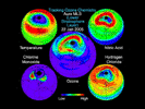
PIA07255:
-
Aura Microwave Limb Sounder Animation Illustrating the Interaction Between
Temperatures and Chemicals Involved in Ozone Destruction, 2004-2005 Arctic Winter

Full Resolution:
TIFF
(1.168 MB)
JPEG
(60.91 kB)
|
|
|
2005-01-12 |
Earth
|
Terra
|
MISR
|
1245x1090x3 |
|
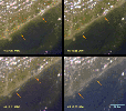
-
PIA04372:
-
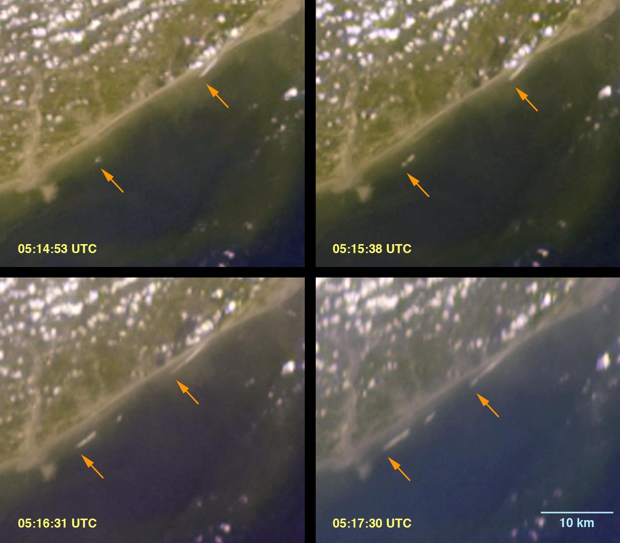
Breaking Tsunami Waves along India's Eastern Coast
Full Resolution:
TIFF
(3.174 MB)
JPEG
(100.1 kB)
|
|
|
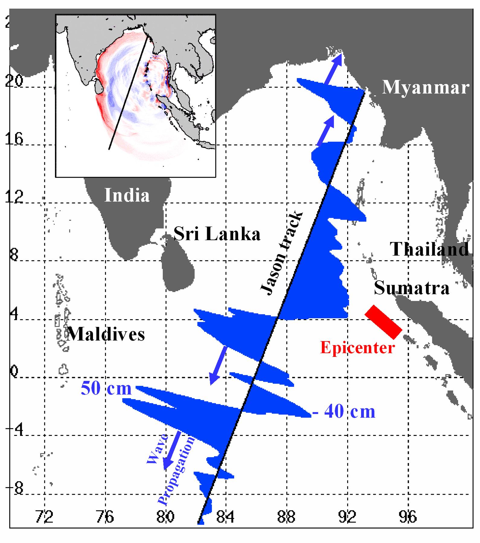
2005-01-12 |
Earth
|
Jason-1
|
Altimeter
|
1590x1800x3 |
|
-
PIA07219:
-
NASA/French Satellite Data Reveal New Details of Tsunami
Full Resolution:
TIFF
(1.269 MB)
JPEG
(280 kB)
|
|
|
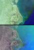
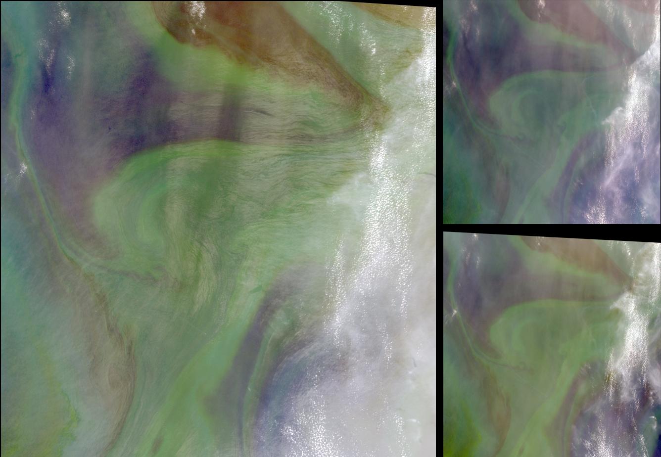
2004-10-02 |
Earth
|
Terra
|
MISR
|
1336x924x3 |

|
-
PIA04369:
-
Red Plankton in the Arabian Sea
Full Resolution:
TIFF
(3.416 MB)
JPEG
(118.9 kB)
|
|
|
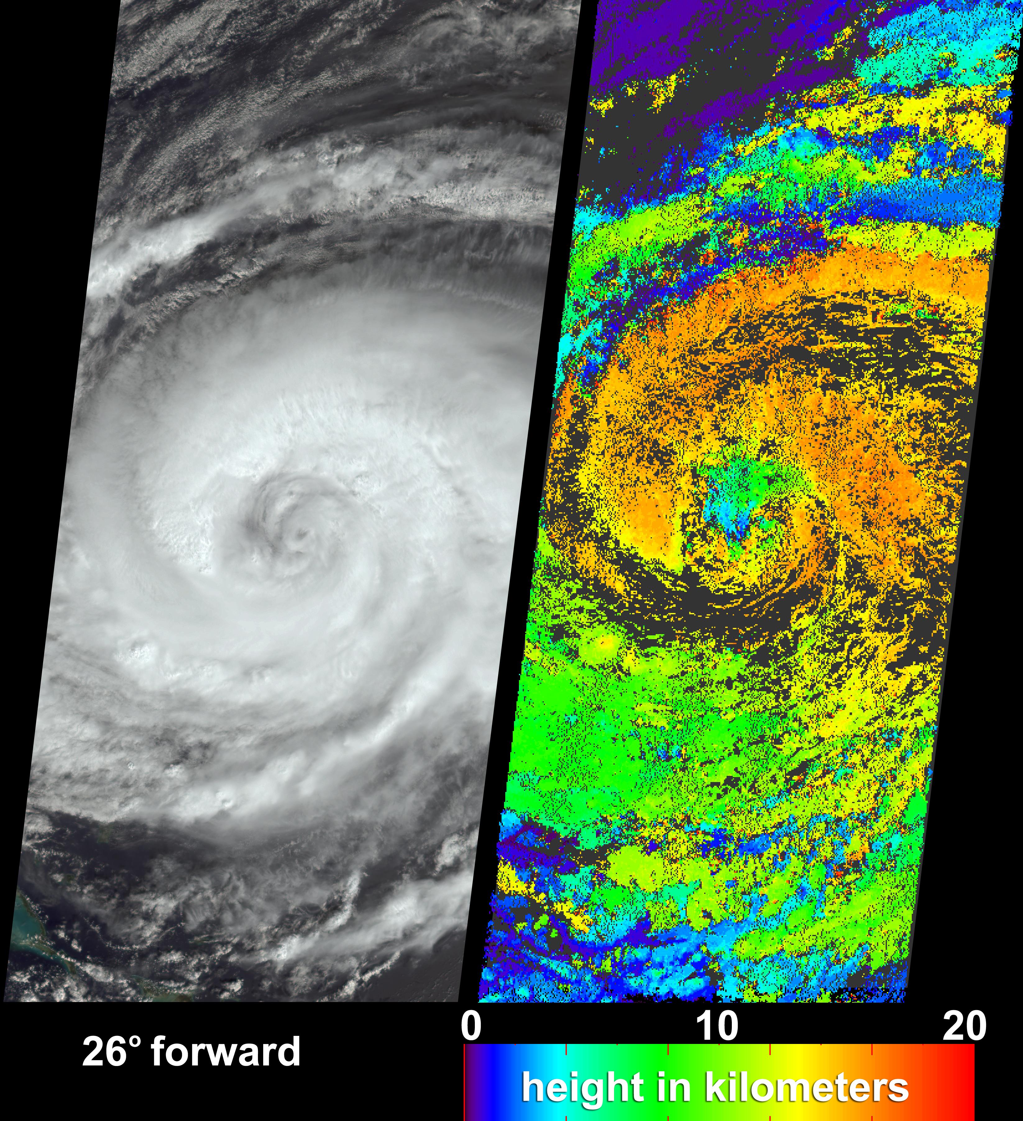
2004-09-29 |
Earth
|
Terra
|
MISR
|
3292x3608x3 |
|
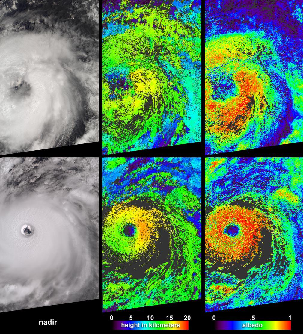
-
PIA04368:
-
Hurricane Jeanne Cloud Height and Motion
Full Resolution:
TIFF
(16.71 MB)
JPEG
(2.156 MB)
|
|
|
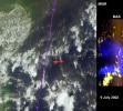
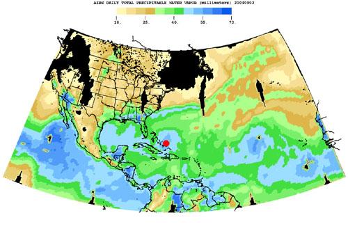
2004-08-30 |
Earth
|
Aqua
|
AIRS
|
500x342x3 |
|
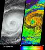
-
PIA00433:
-
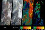
Hurricane Frances as Observed by NASA's Spaceborne Atmospheric Infrared
Sounder (AIRS) - Total Water Vapor Time Series
Full Resolution:
TIFF
(344.8 kB)
JPEG
(36.3 kB)
|
|
|
2004-07-07 |
Earth
|
Terra
|
MISR
|
3141x2477x3 |
|
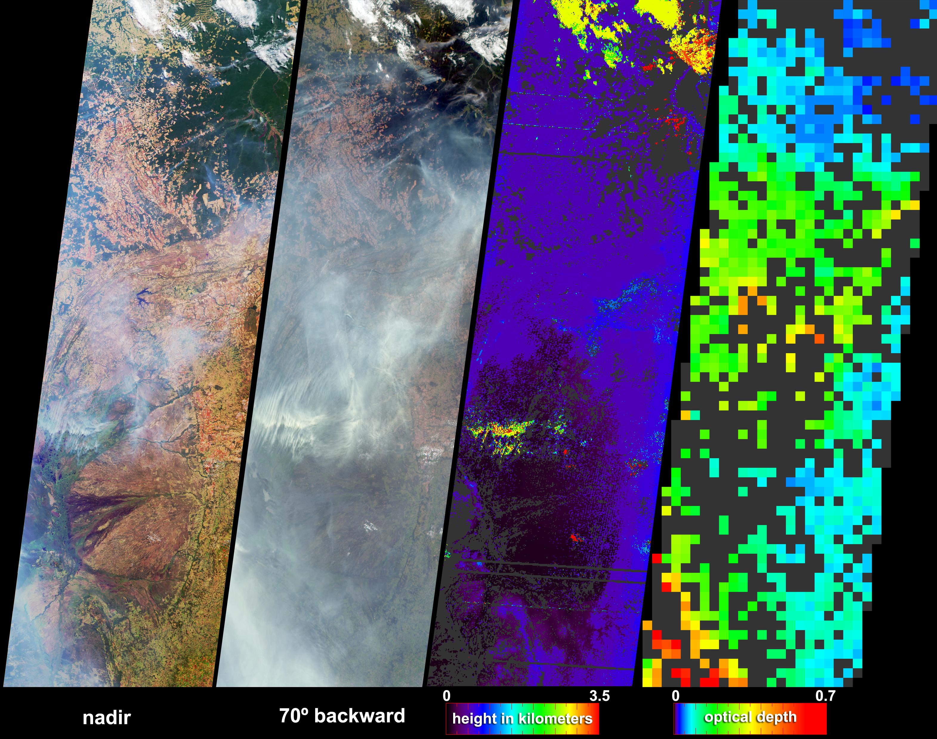
-
PIA04362:
-
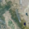
Fire and Deforestation near the Xingu River
Full Resolution:
TIFF
(13.92 MB)
JPEG
(1.079 MB)
|
|
|
2004-05-26 |
Earth
|
Terra
|
MISR
|
680x792x3 |
|
-
PIA04359:
-
Sun Glint from Solar Electric Generating Stations
Full Resolution:
TIFF
(1.528 MB)
JPEG
(99.83 kB)
|
|
|
2003-11-18 |
Earth
|
Jason-1
|
Altimeter
|
900x900x3 |
|
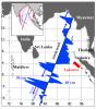
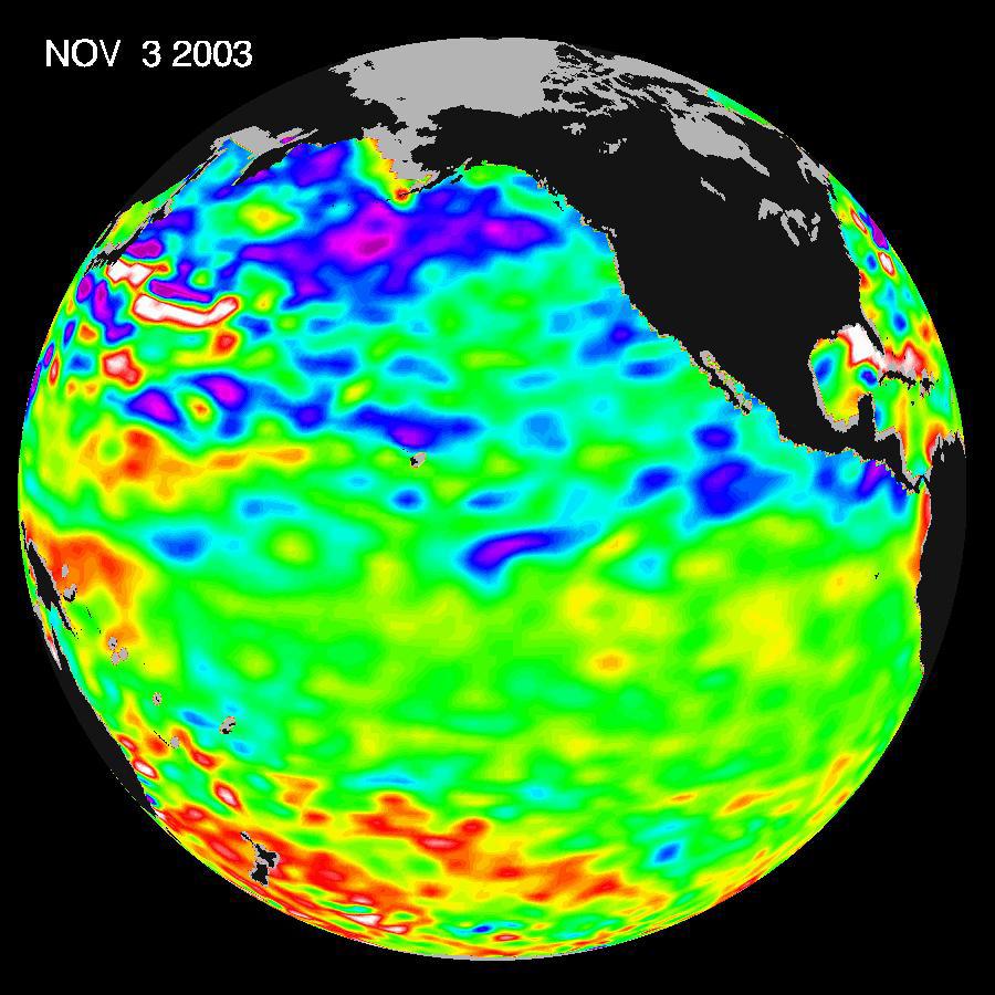
-
PIA04878:
-
A Mostly Quiet Pacific
Full Resolution:
TIFF
(1.523 MB)
JPEG
(113.4 kB)
|
|
|
2003-09-18 |
Earth
|
Terra
|
MISR
|
1011x1115x3 |
|
-
PIA04339:
-
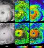
Aspects of Hurricane Isabel
Full Resolution:
TIFF
(3.386 MB)
JPEG
(348.3 kB)
|
|
|
2003-09-10 |
Earth
|
Terra
|
MISR
|
1280x866x3 |
|
-
PIA04338:
-
Smoke Plumes from the B&B Complex Fires, Oregon
Full Resolution:
TIFF
(2.02 MB)
JPEG
(215.1 kB)
|
|
|
2003-04-30 |
Earth
|
Terra
|
MISR
|
2156x3424x3 |
|
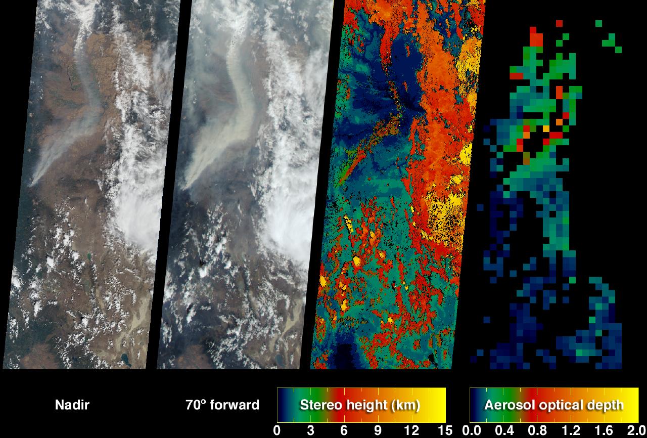
-
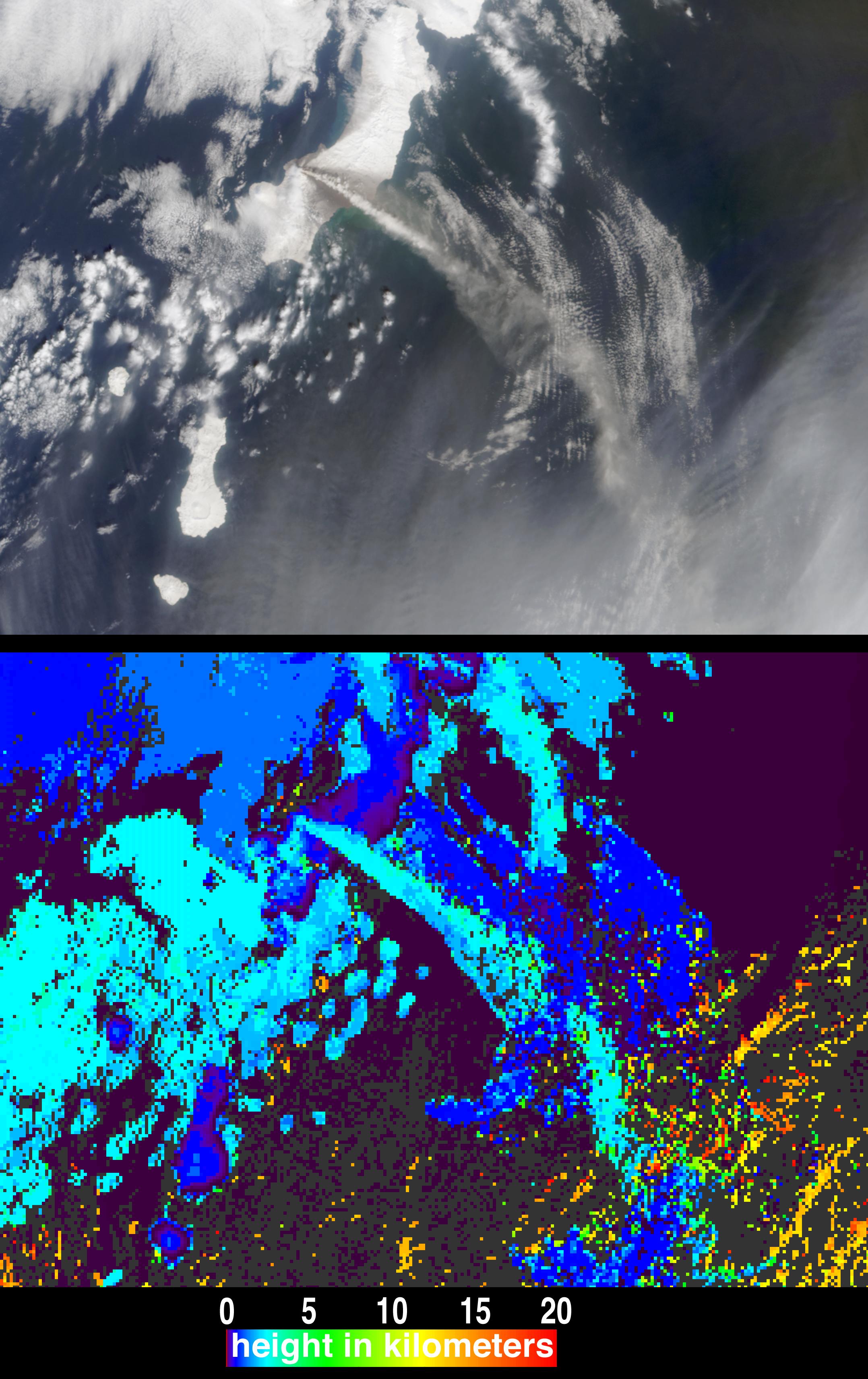
PIA04328:
-
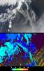
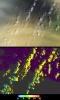
Height and Motion of the Chikurachki Eruption Plume
Full Resolution:
TIFF
(9.229 MB)
JPEG
(473.8 kB)
|
|
|
2003-03-12 |
Earth
|
Terra
|
MISR
|
1134x1885x3 |
|
-
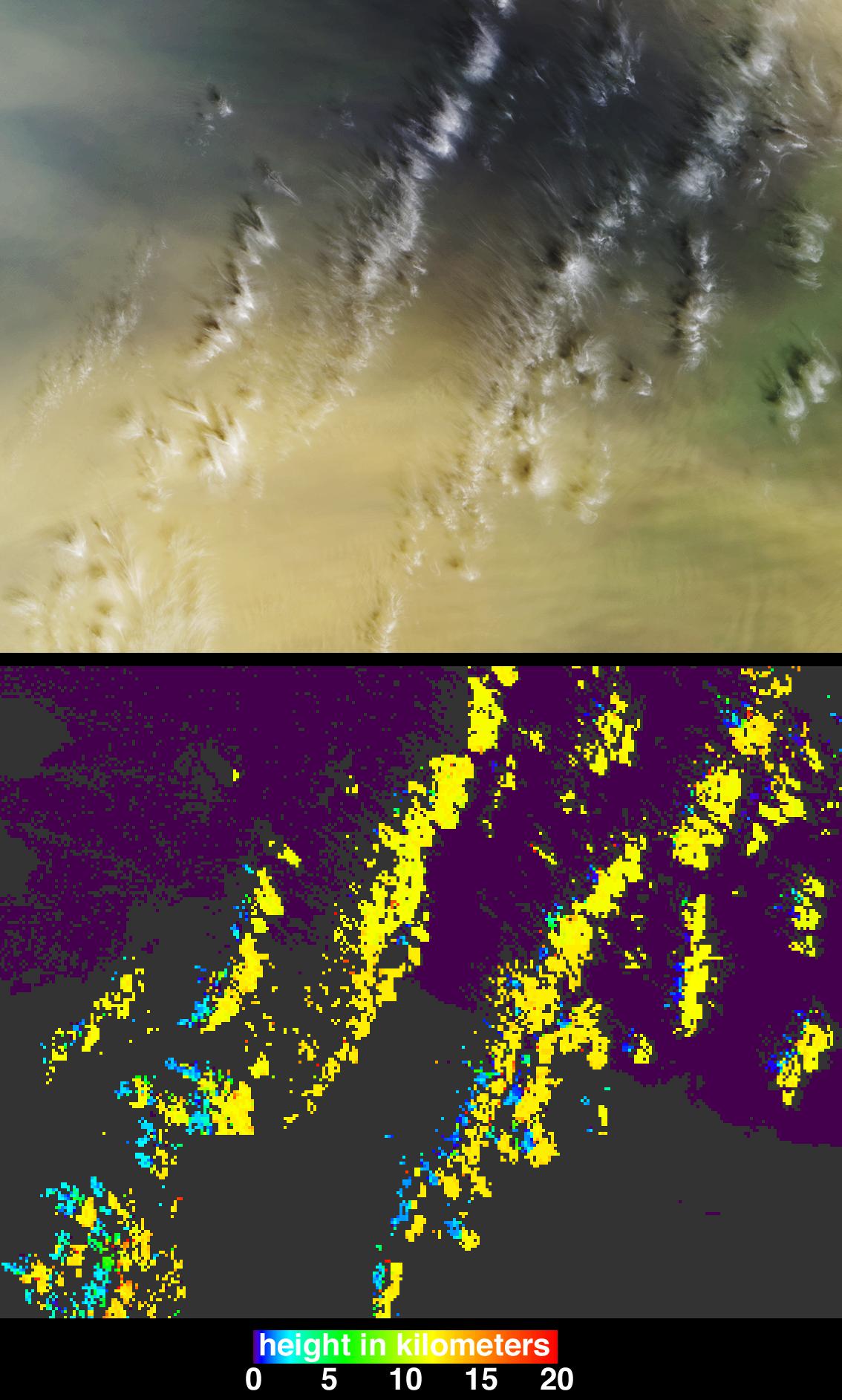
PIA04322:
-
Casting Light and Shadows on a Saharan Dust Storm
Full Resolution:
TIFF
(3.043 MB)
JPEG
(250.3 kB)
|
|
|
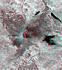
2002-11-13 |
Earth
|
Terra
|
MISR
|
1079x984x3 |

|
-
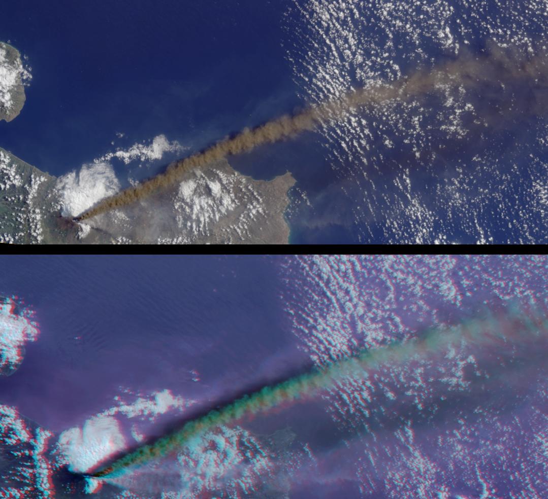
PIA03733:
-
Multi-angle Portrayals of Mt. Etna's Plume
Full Resolution:
TIFF
(2.551 MB)
JPEG
(138.7 kB)
|
|
|
2002-08-07 |
Earth
|
Terra
|
MISR
|
1069x970x3 |
|
-
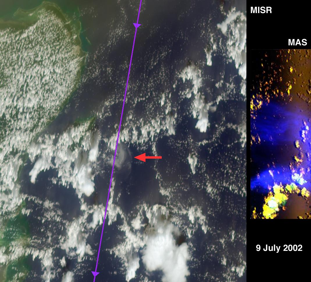
PIA03719:
-
A Hard Look at Thin Clouds
Full Resolution:
TIFF
(2.909 MB)
JPEG
(154.1 kB)
|
|
|
2002-06-19 |
Earth
|
Terra
|
MISR
|
1632x582x3 |

|
-
PIA03712:
-
Darkened Skies over the Pacific
Full Resolution:
TIFF
(800.2 kB)
JPEG
(79.16 kB)
|
|
|
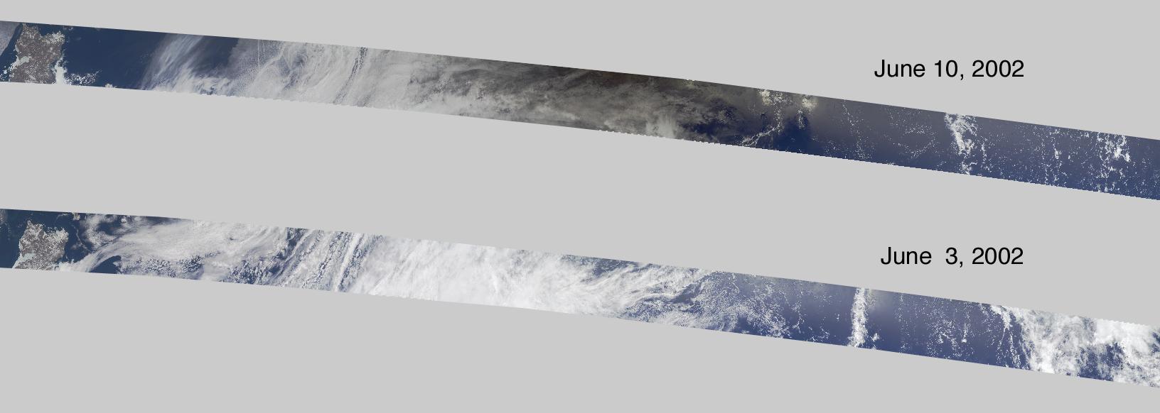
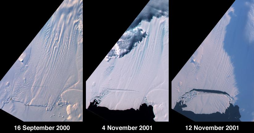
2001-11-14 |
Earth
|
Terra
|
MISR
|
822x432x3 |
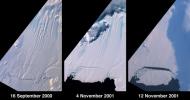
|
-
PIA03431:
-
Birth of a Large Iceberg in Pine Island Bay, Antarctica
Full Resolution:
TIFF
(674.3 kB)
JPEG
(43.08 kB)
|
|
|
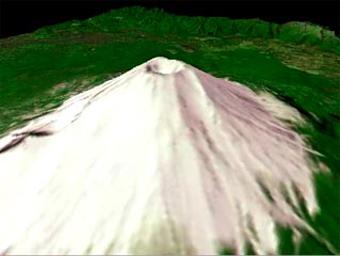
2001-10-22 |
Earth
|
Terra
|
ASTER
|
340x256x3 |

|
-
PIA11166:
-
Mt. Fuji, Japan
Full Resolution:
TIFF
(261.6 kB)
JPEG
(12.14 kB)
|
|
|
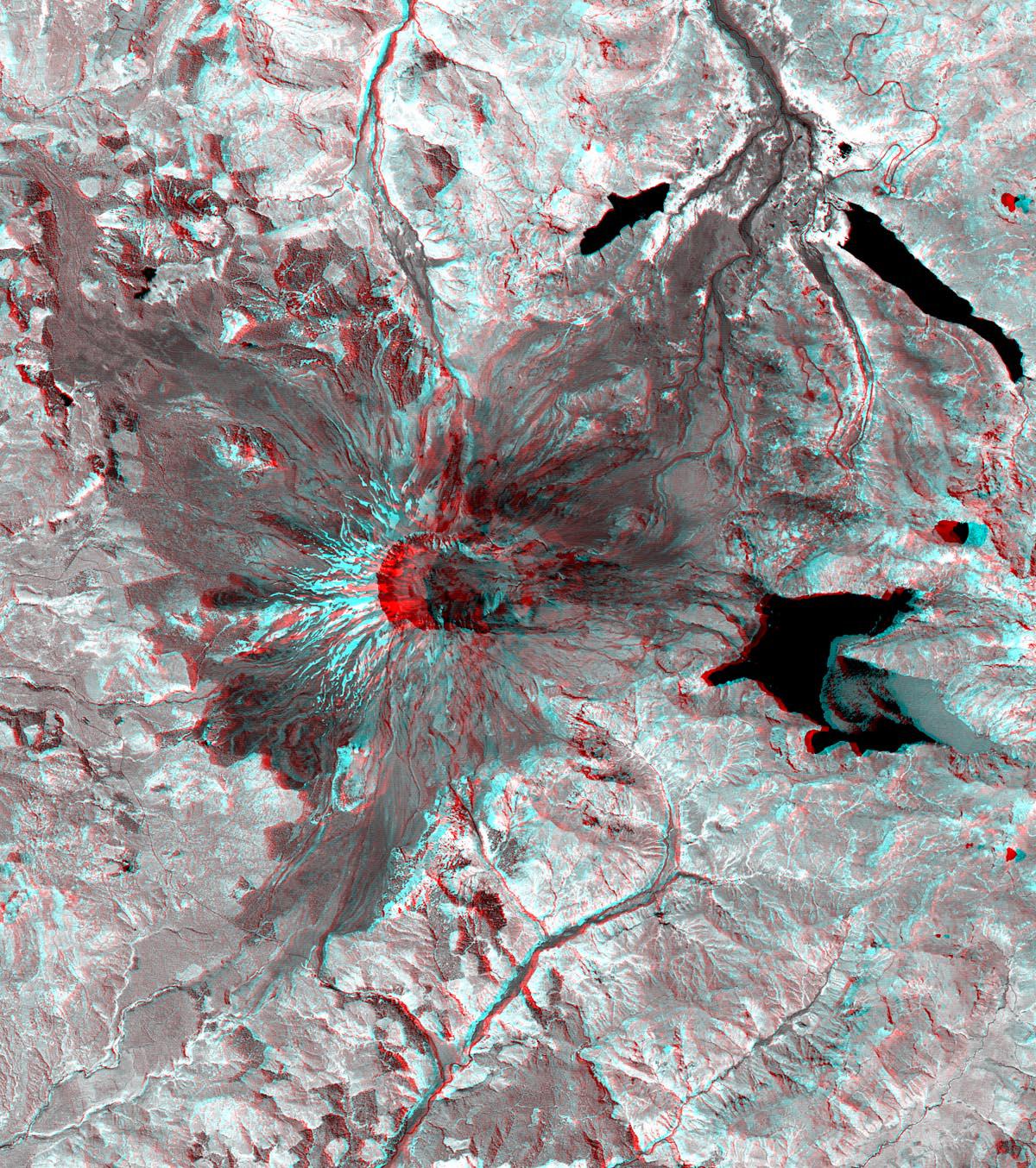
2001-10-22 |
Earth
|
Terra
|
ASTER
|
1200x1354x3 |
|
-
PIA11160:
-
Mt. St. Helens
Full Resolution:
TIFF
(4.88 MB)
JPEG
(460.2 kB)
|
|
|
2001-09-13 |
Earth
|
Terra
|
MISR
|
1268x1908x3 |
|
-
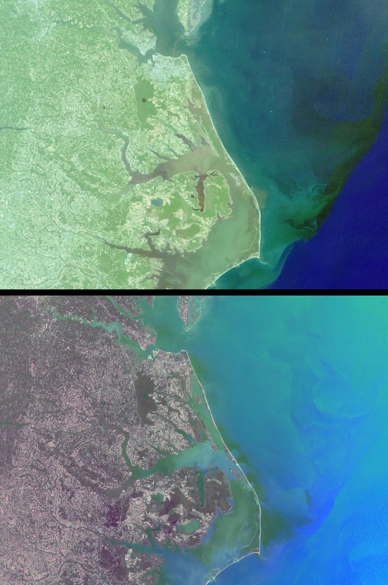
PIA03422:
-
Mixing Waters and Moving Ships off the North Carolina Coast
Full Resolution:
TIFF
(7.865 MB)
JPEG
(341.6 kB)
|
|
|
2001-09-05 |
Earth
|
Terra
|
MISR
|
1223x1208x3 |
|
-
PIA03421:
-
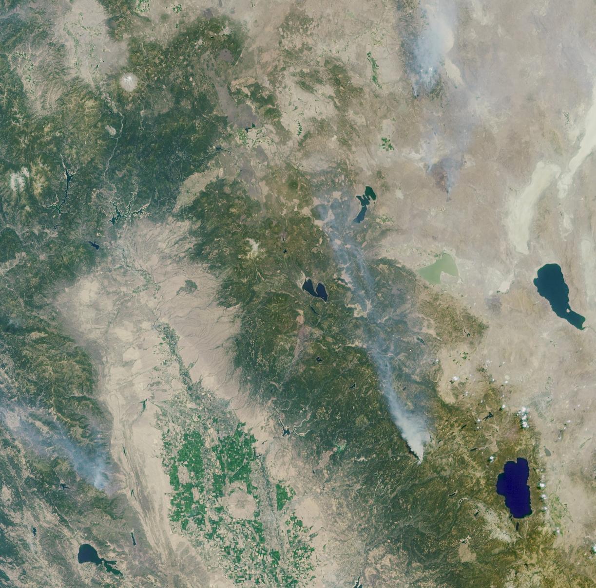
A Panoramic View of the Emigrant Gap Fire, California
Full Resolution:
TIFF
(5.087 MB)
JPEG
(270.8 kB)
|
|
|
1999-09-16 |
Earth
|
QuikScat
|
SeaWinds Scatterometer
|
564x400x3 |
|
-
PIA02334:
-
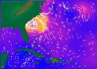
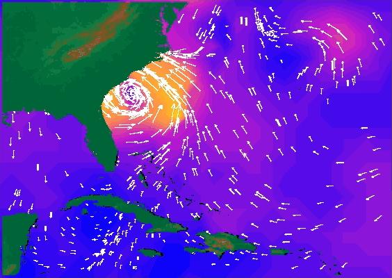
SeaWinds Radar Stares Into The Eye Of Angry Hurricane Floyd
Full Resolution:
TIFF
(192.6 kB)
JPEG
(44.92 kB)
|
|
|
1996-01-29 |
Earth
|
Galileo
|
Solid-State Imaging
|
800x800x3 |
|
-
PIA00114:
-
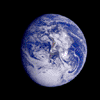
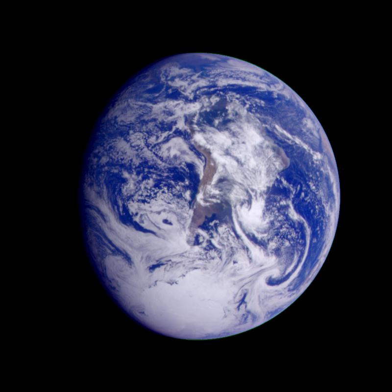
Earth - South America (First Frame of Earth Spin Movie)
Full Resolution:
TIFF
(760.1 kB)
JPEG
(50.21 kB)
|
 Planetary Data System


