My
List |
Addition Date
|
Target
|
Mission
|
Instrument
|
Size
|

|
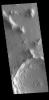
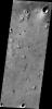
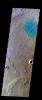
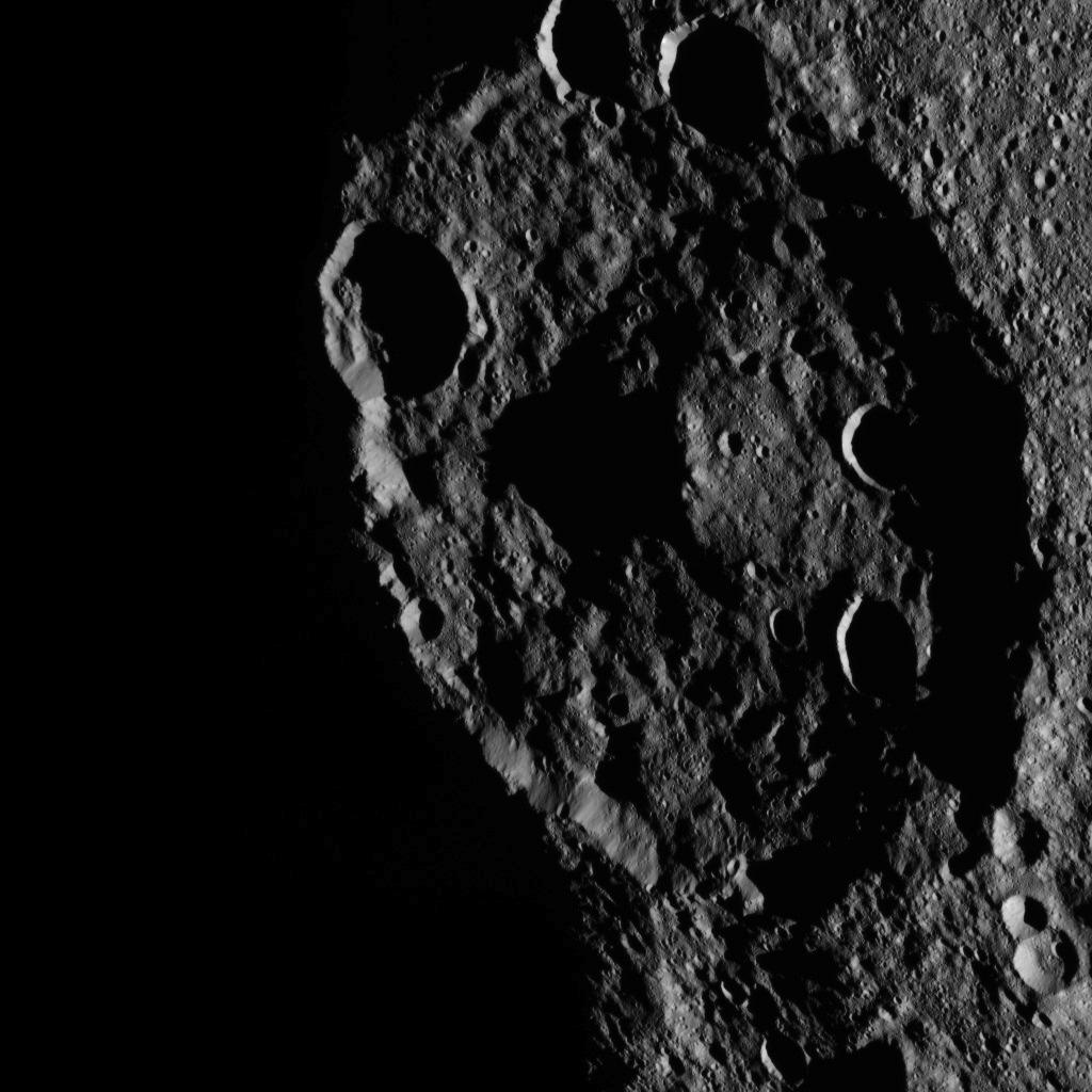
2015-11-05 |
Mars
|
Mars Reconnaissance Orbiter (MRO)
|
HiRISE
|
2880x1800x3 |
|
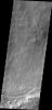
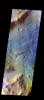
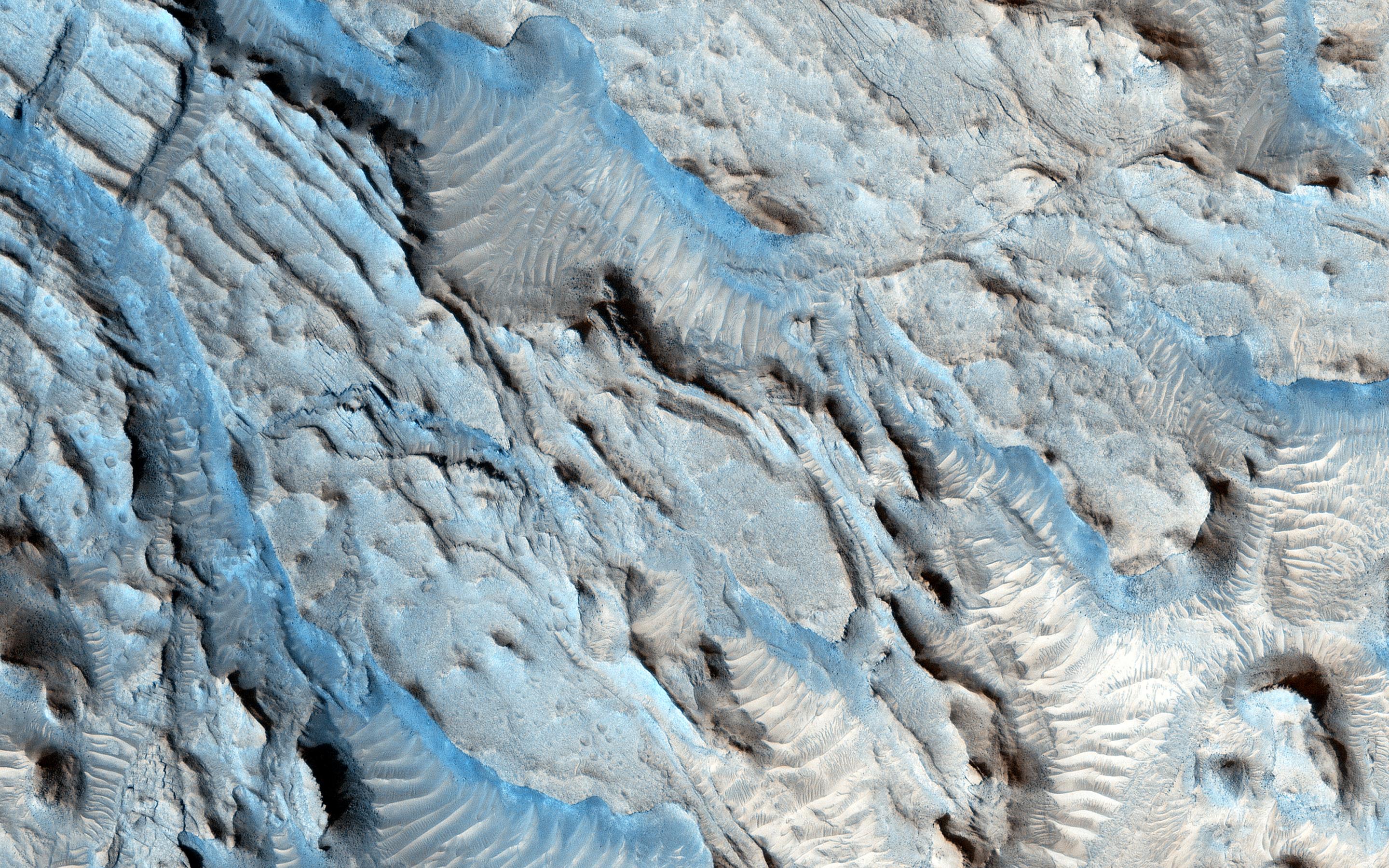
-
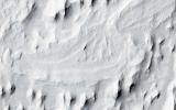
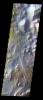
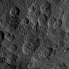
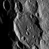
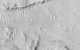
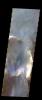
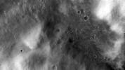
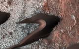
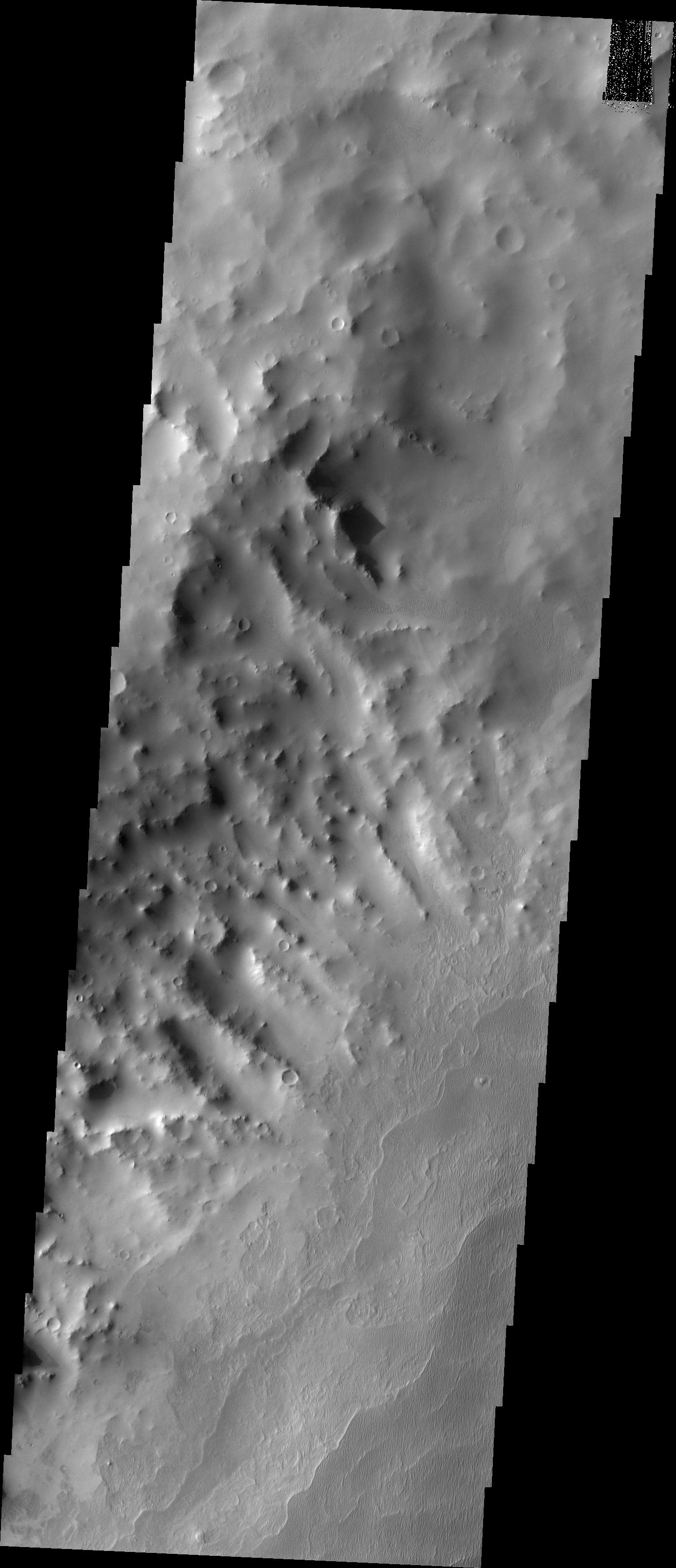
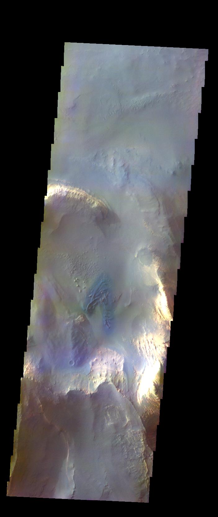
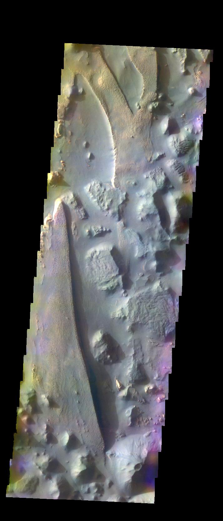
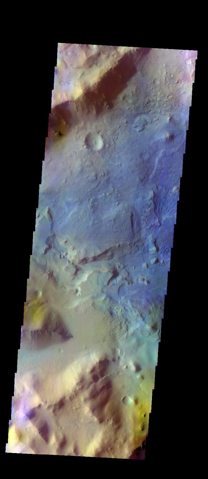
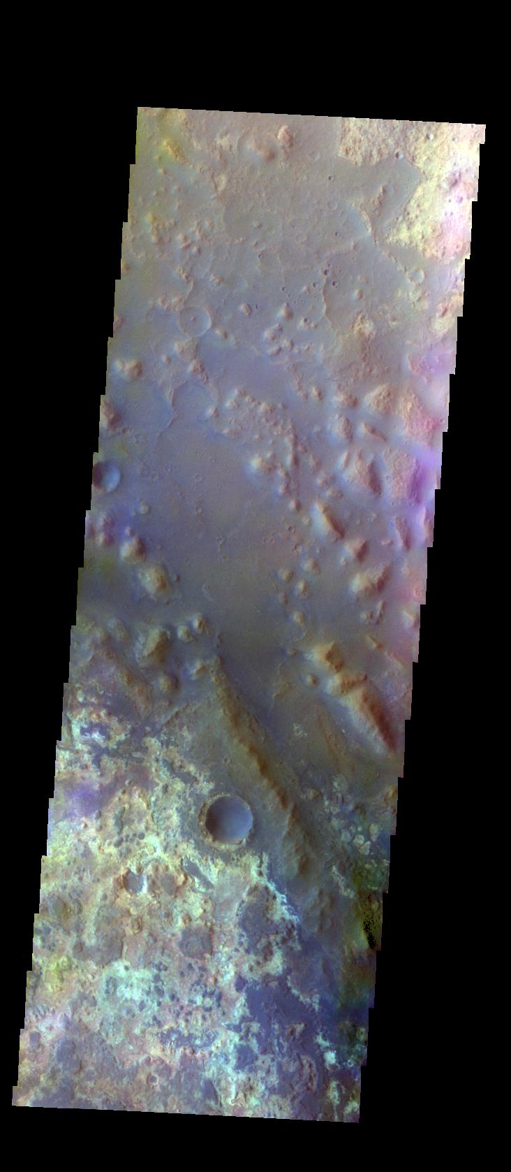
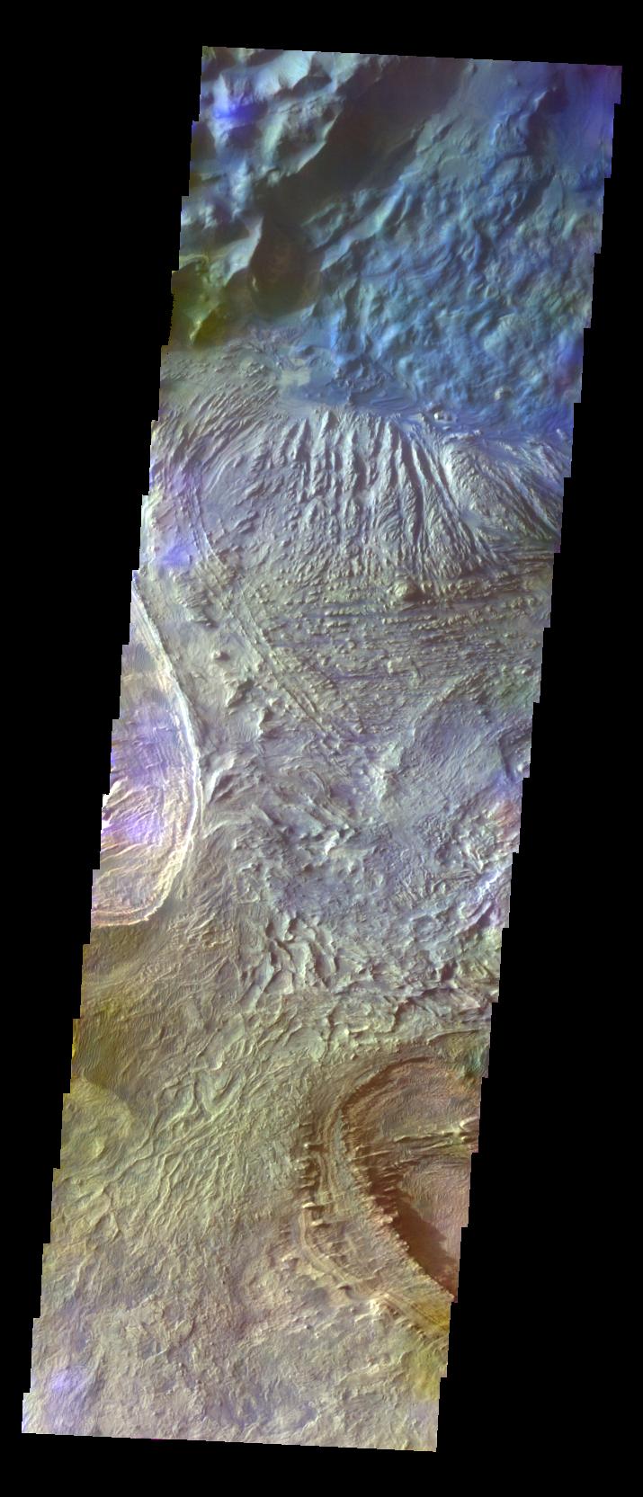
PIA20047:
-
Meanders in Ridge Form in the Zephyria Region
Full Resolution:
TIFF
(13.52 MB)
JPEG
(673.1 kB)
|
|
|
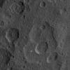
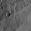
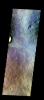
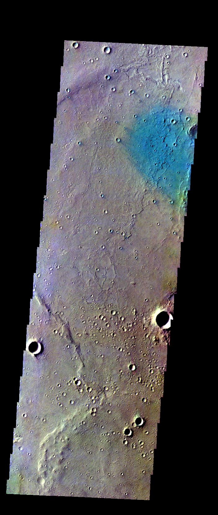
2015-11-05 |
Mars
|
Mars Reconnaissance Orbiter (MRO)
|
HiRISE
|
2880x1800x3 |

|
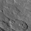
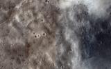
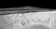
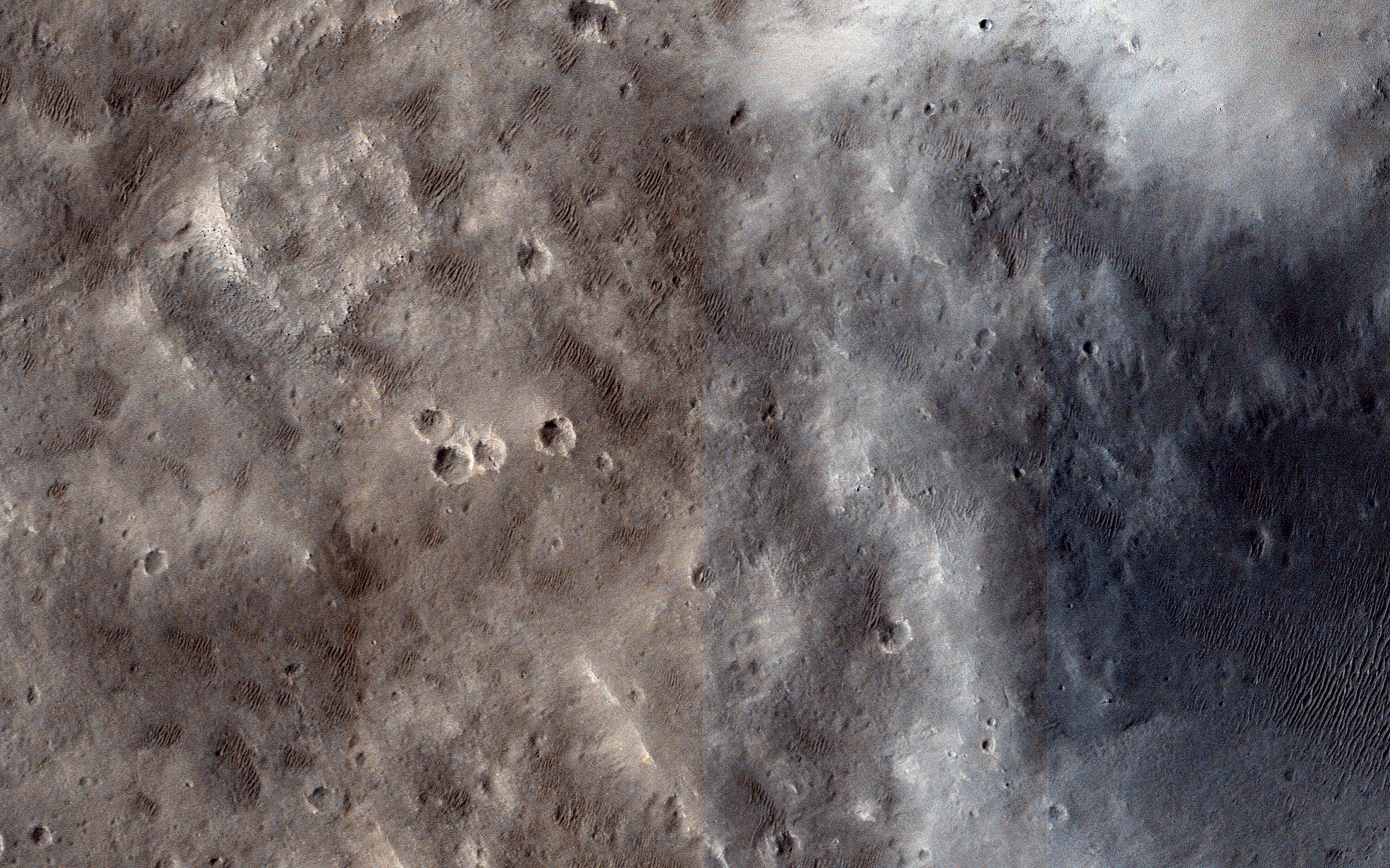
-
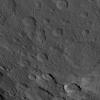
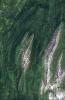
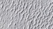
PIA20046:
-
Small Channels and a Rocky Patch in the Cydonia Region
Full Resolution:
TIFF
(15.56 MB)
JPEG
(1.167 MB)
|
|
|
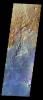
2015-11-05 |
Mars
|
Mars Reconnaissance Orbiter (MRO)
|
HiRISE
|
2880x1800x1 |

|
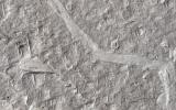
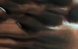
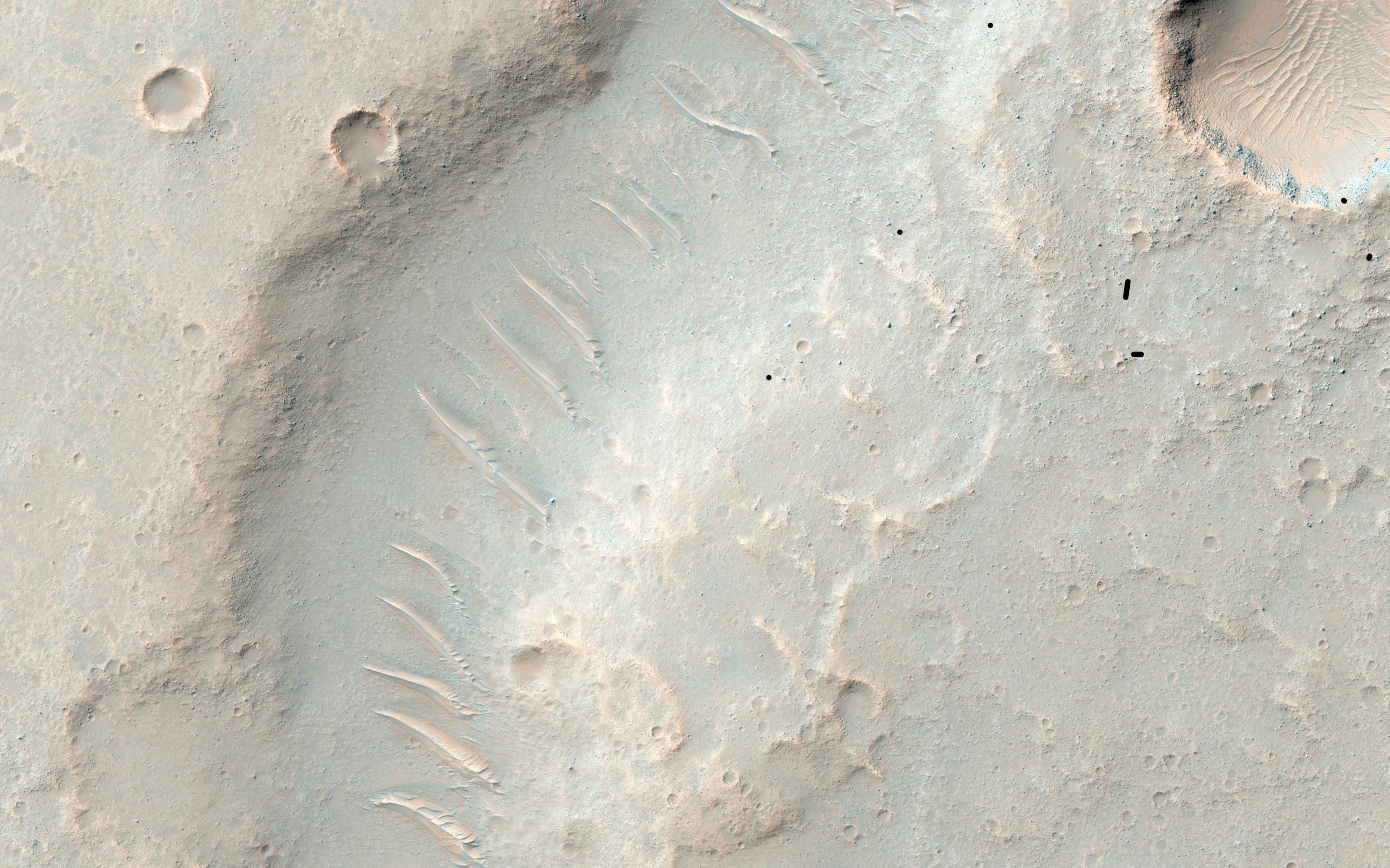
-
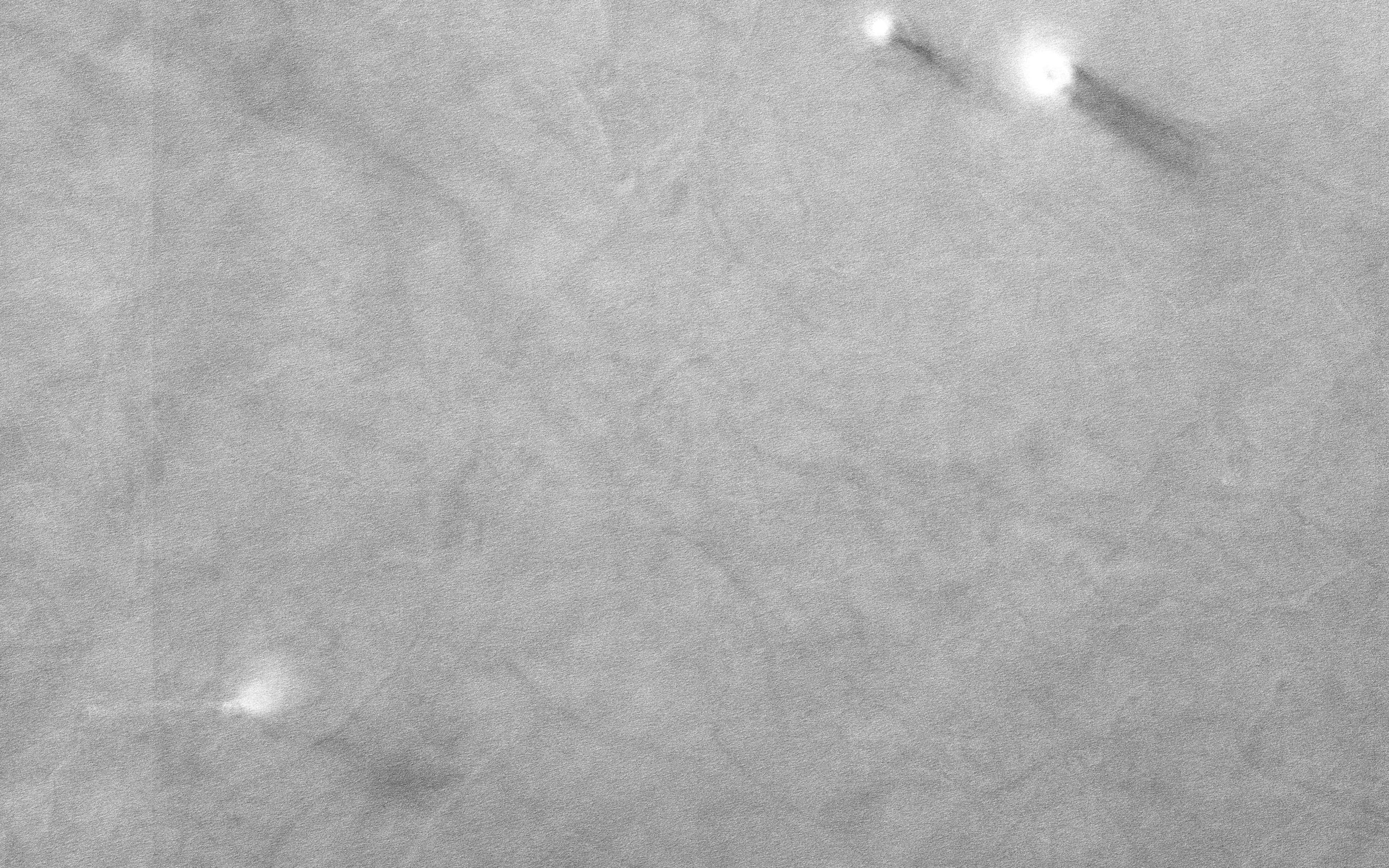
PIA20045:
-
Marching Dust Devils
Full Resolution:
TIFF
(5.191 MB)
JPEG
(1.254 MB)
|
|
|
2015-11-05 |
Mars
|
Mars Reconnaissance Orbiter (MRO)
|
HiRISE
|
2880x1800x3 |
|
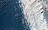
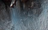
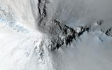
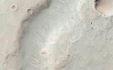
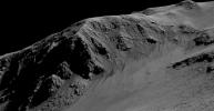
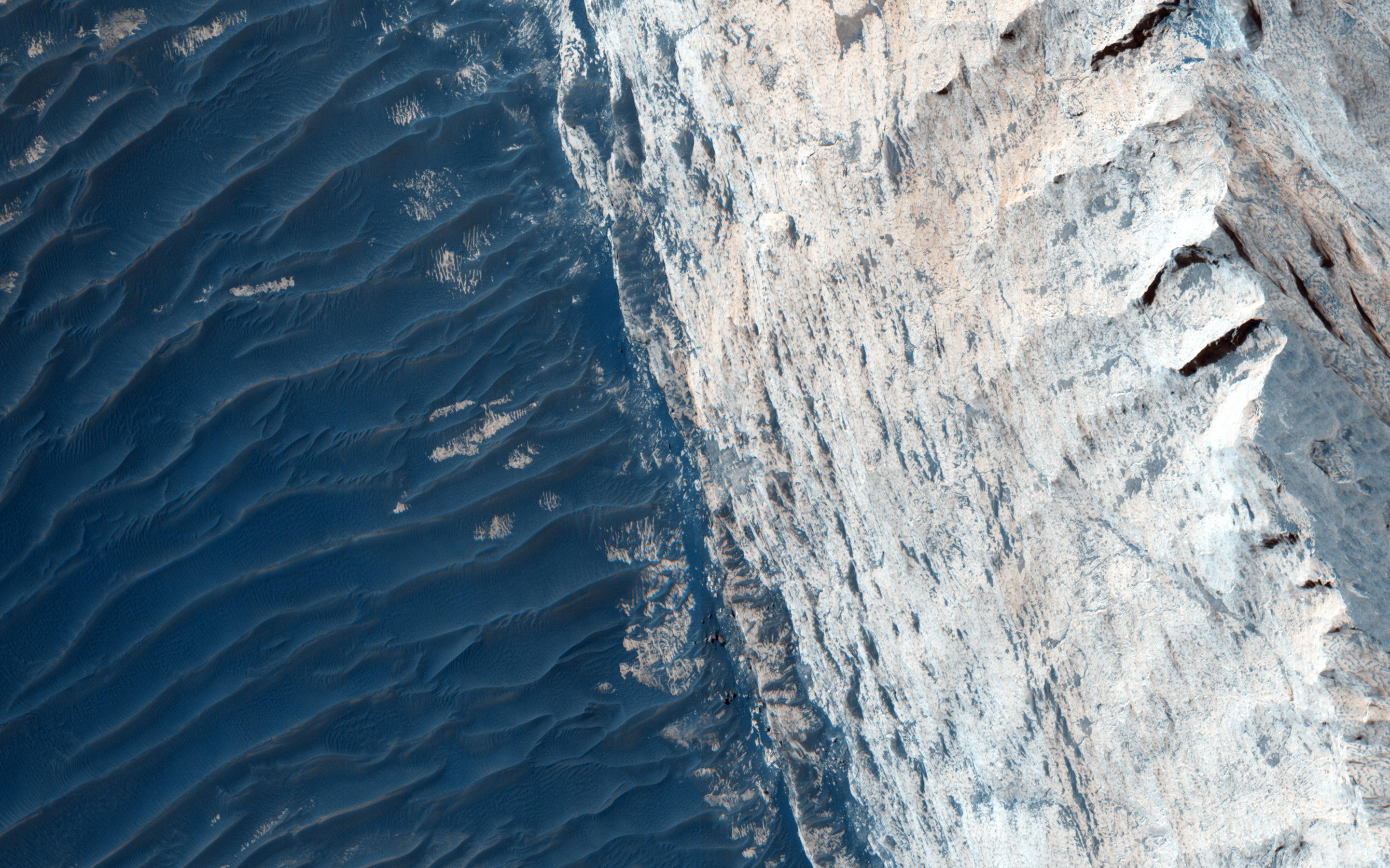
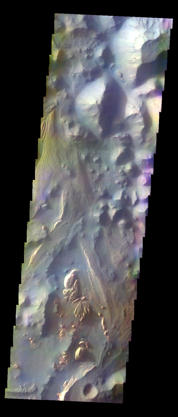
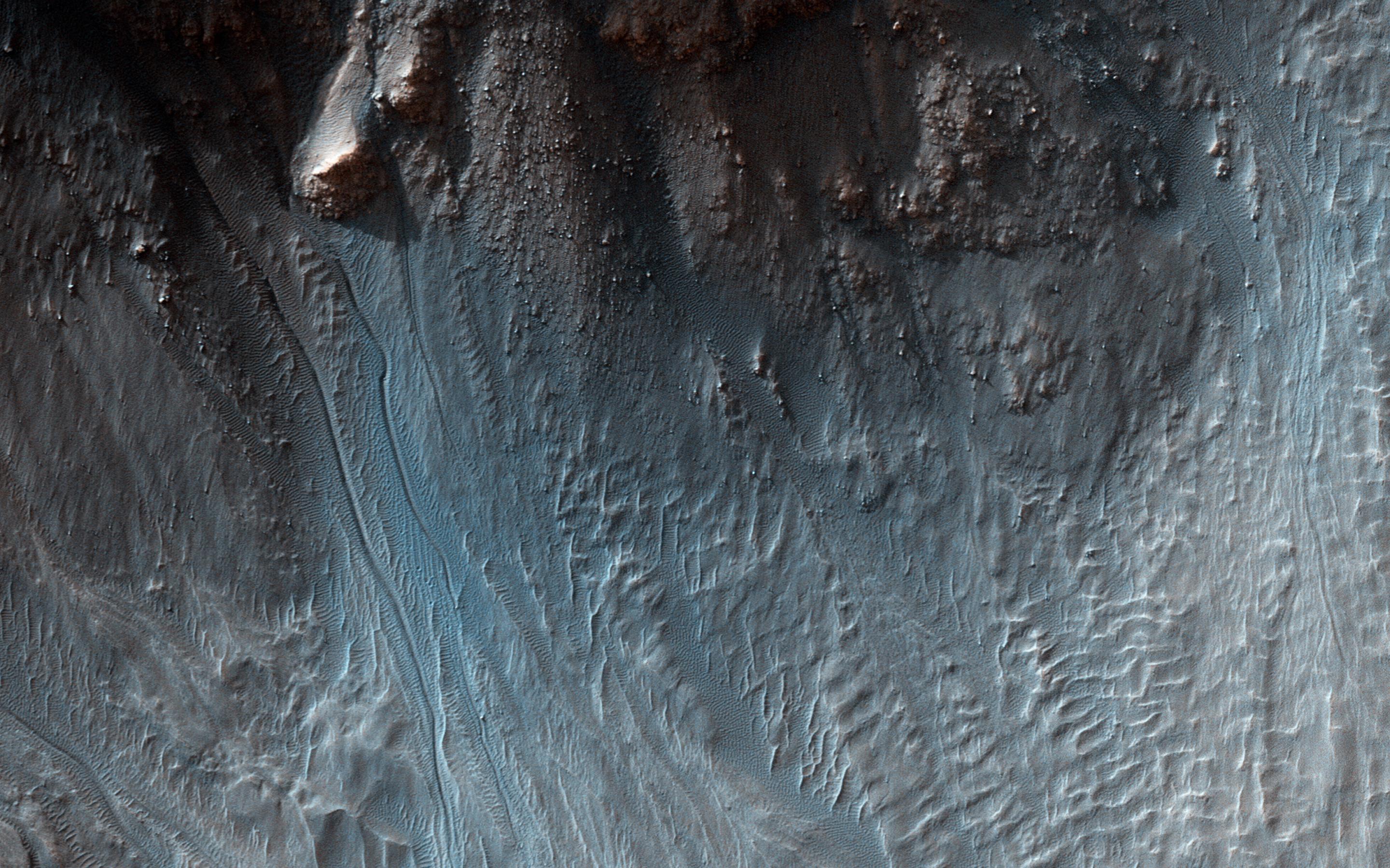
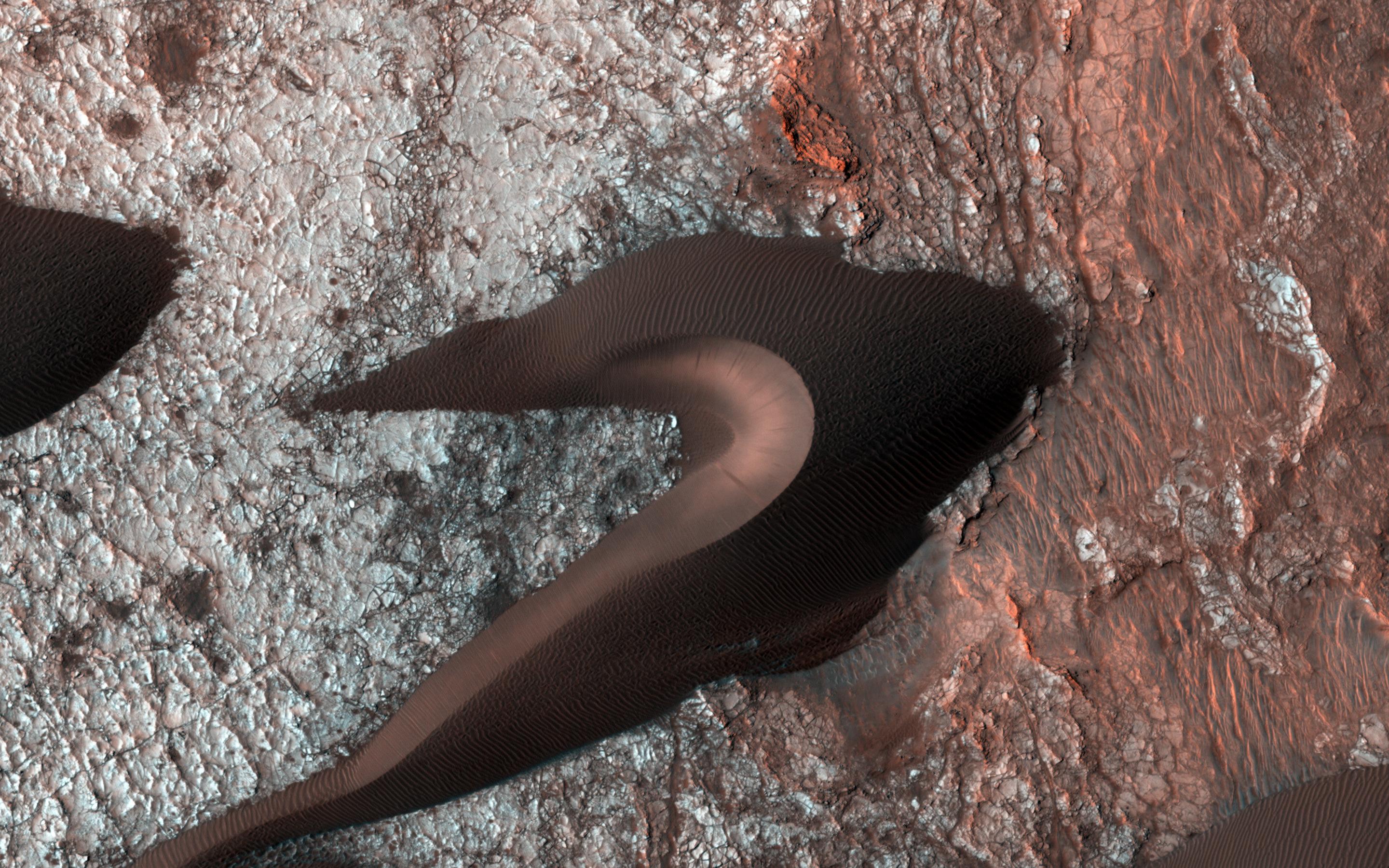
-
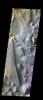
PIA20044:
-
Layers and Fractures in Ophir Chasma
Full Resolution:
TIFF
(15.56 MB)
JPEG
(815.3 kB)
|
|
|
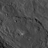
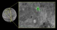
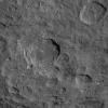
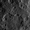
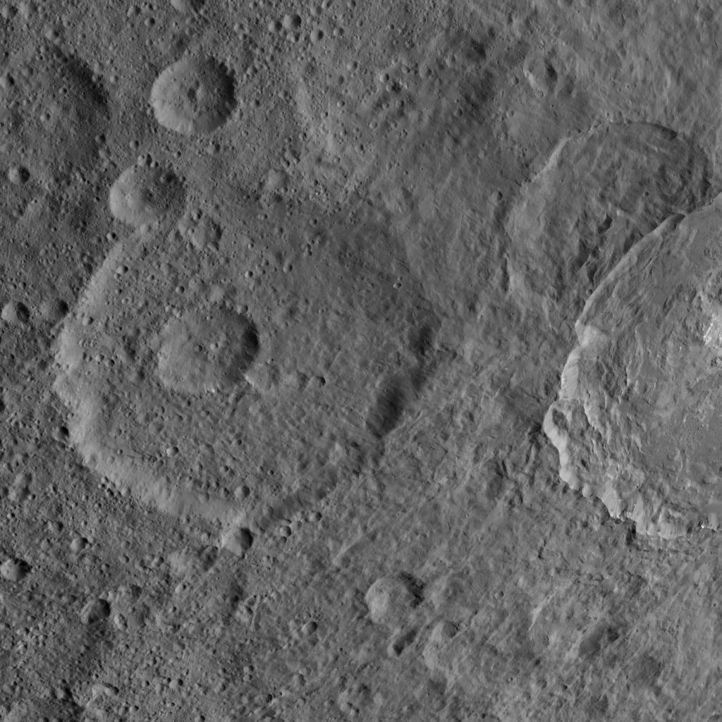
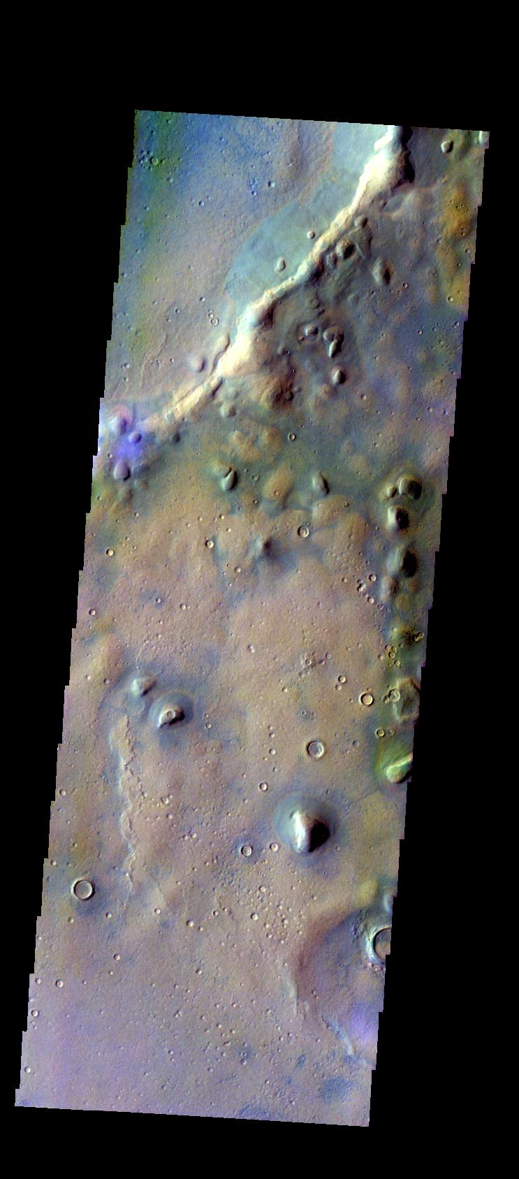
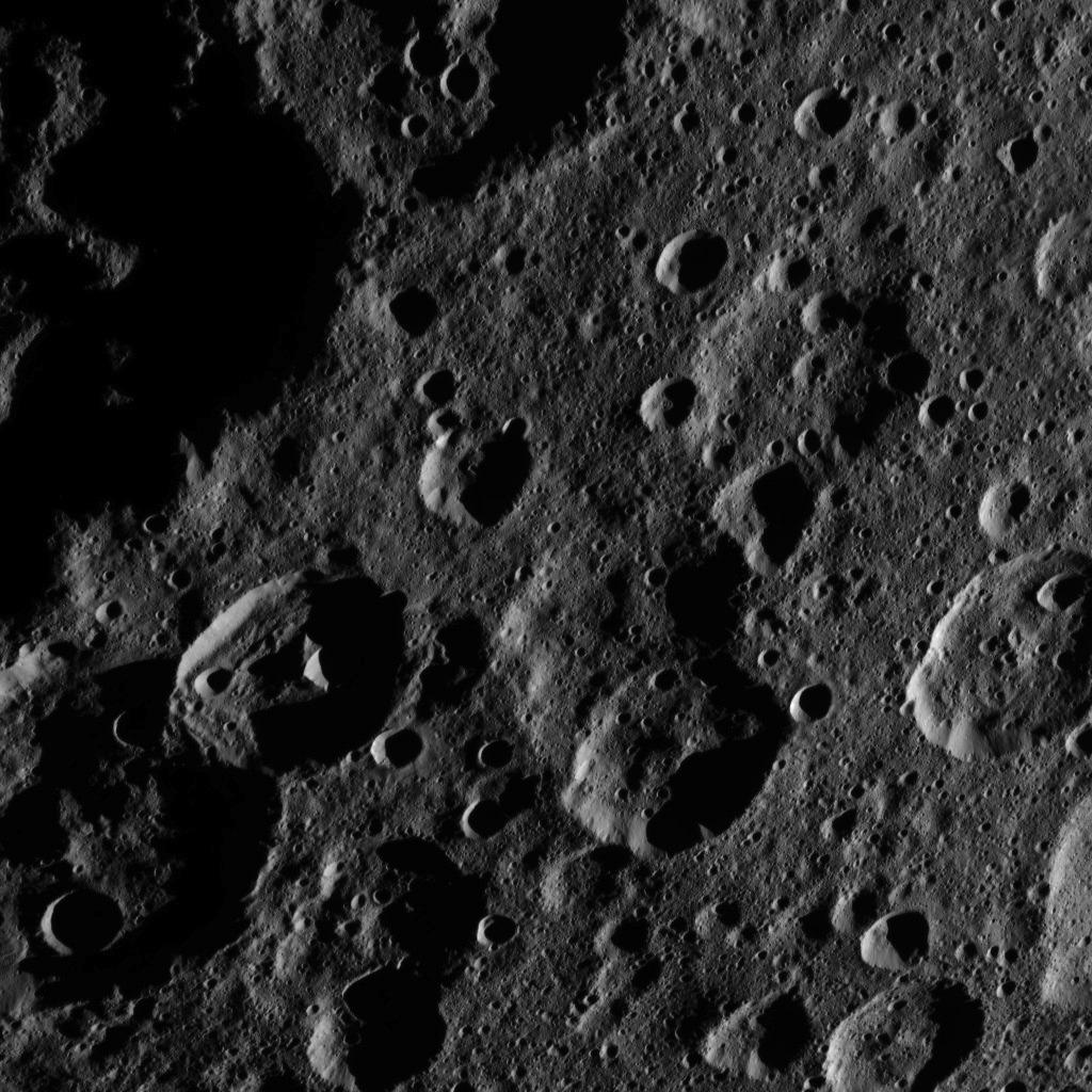
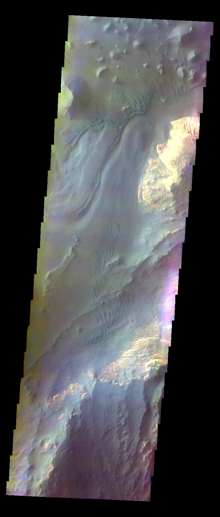
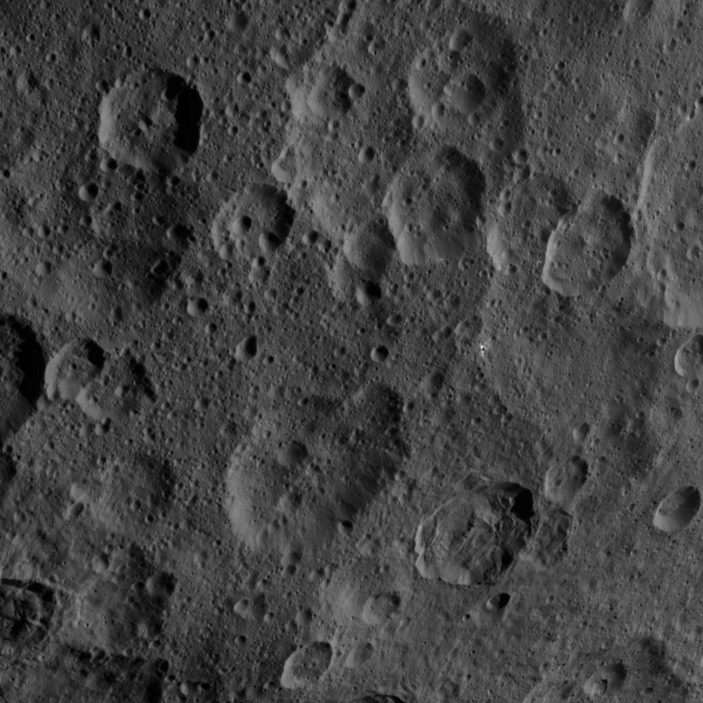
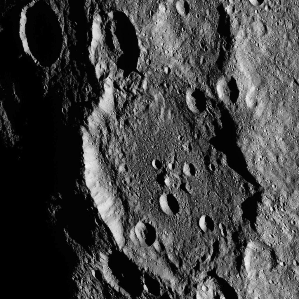
2015-11-04 |
Ceres
|
Dawn
|
Framing Camera
|
1024x1024x1 |
|
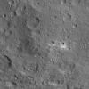
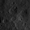
-
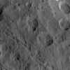
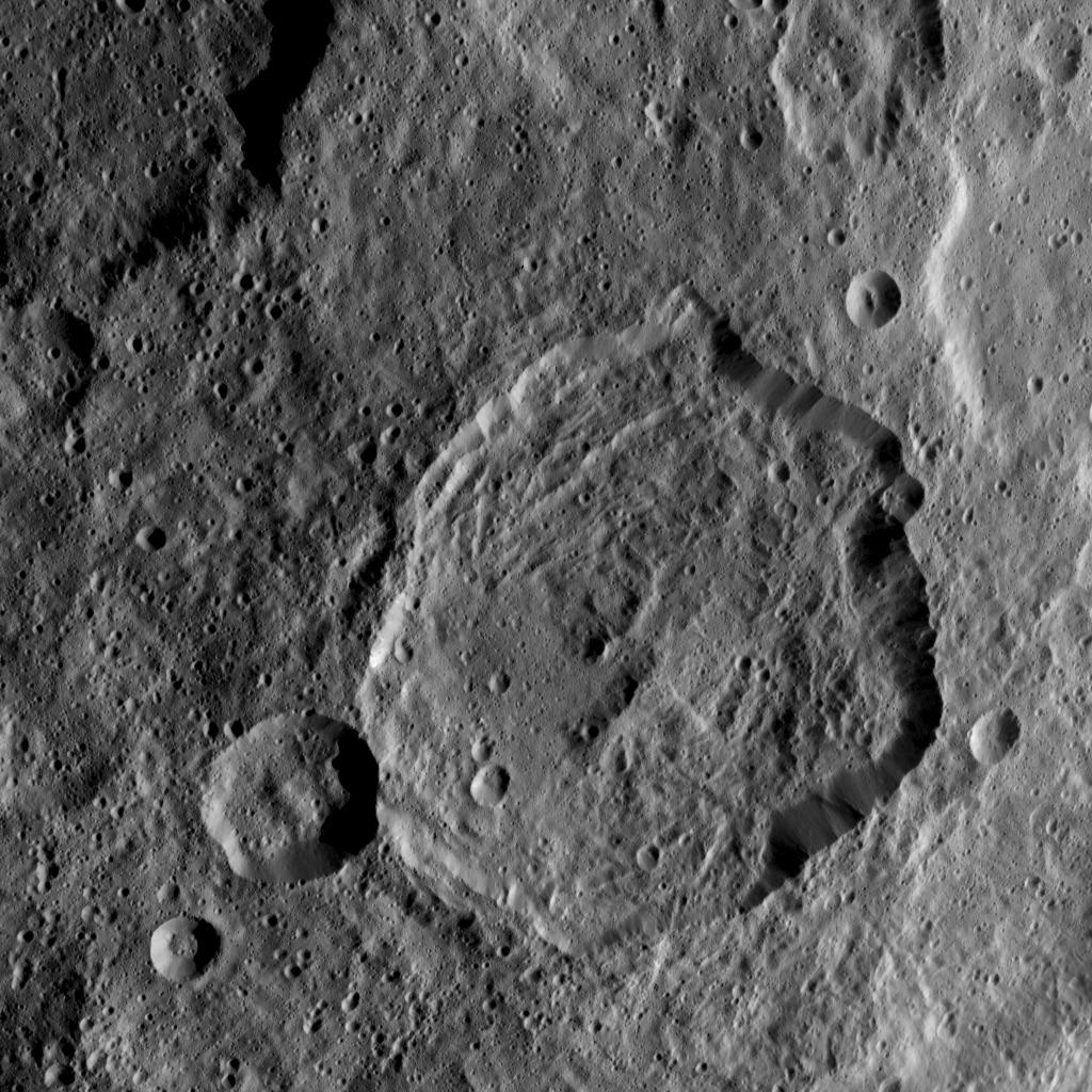
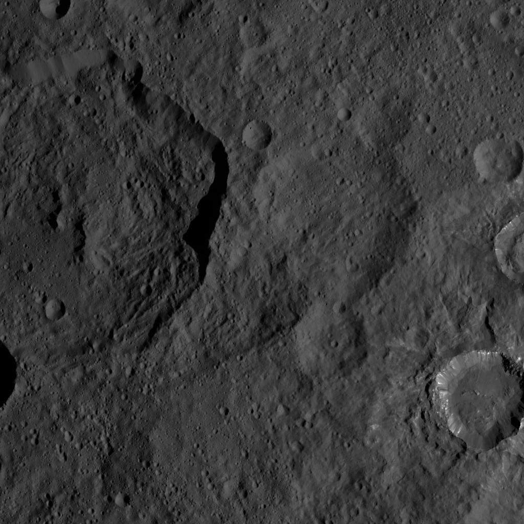
PIA19994:
-
Dawn HAMO Image 52
Full Resolution:
TIFF
(1.05 MB)
JPEG
(165.9 kB)
|
|
|
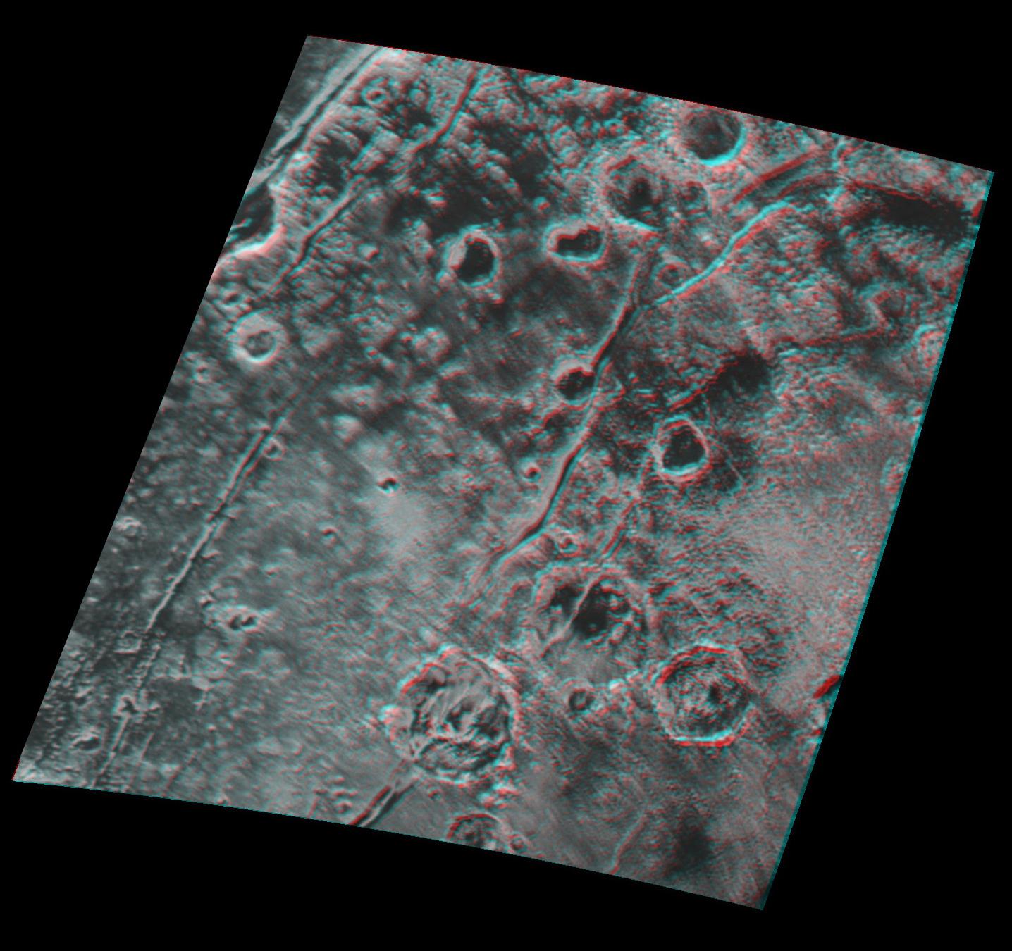
2015-11-04 |
Mars
|
2001 Mars Odyssey
|
THEMIS
|
711x1665x3 |
|
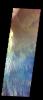
-
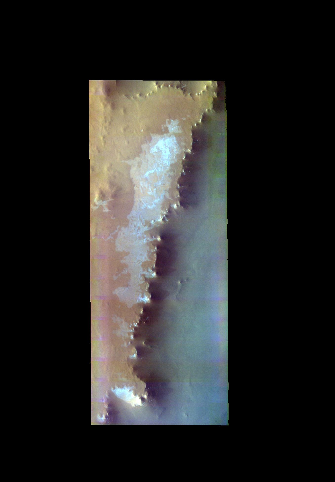
PIA20084:
-
Hebes Chasma - False Color
Full Resolution:
TIFF
(2.418 MB)
JPEG
(99.01 kB)
|
|
|
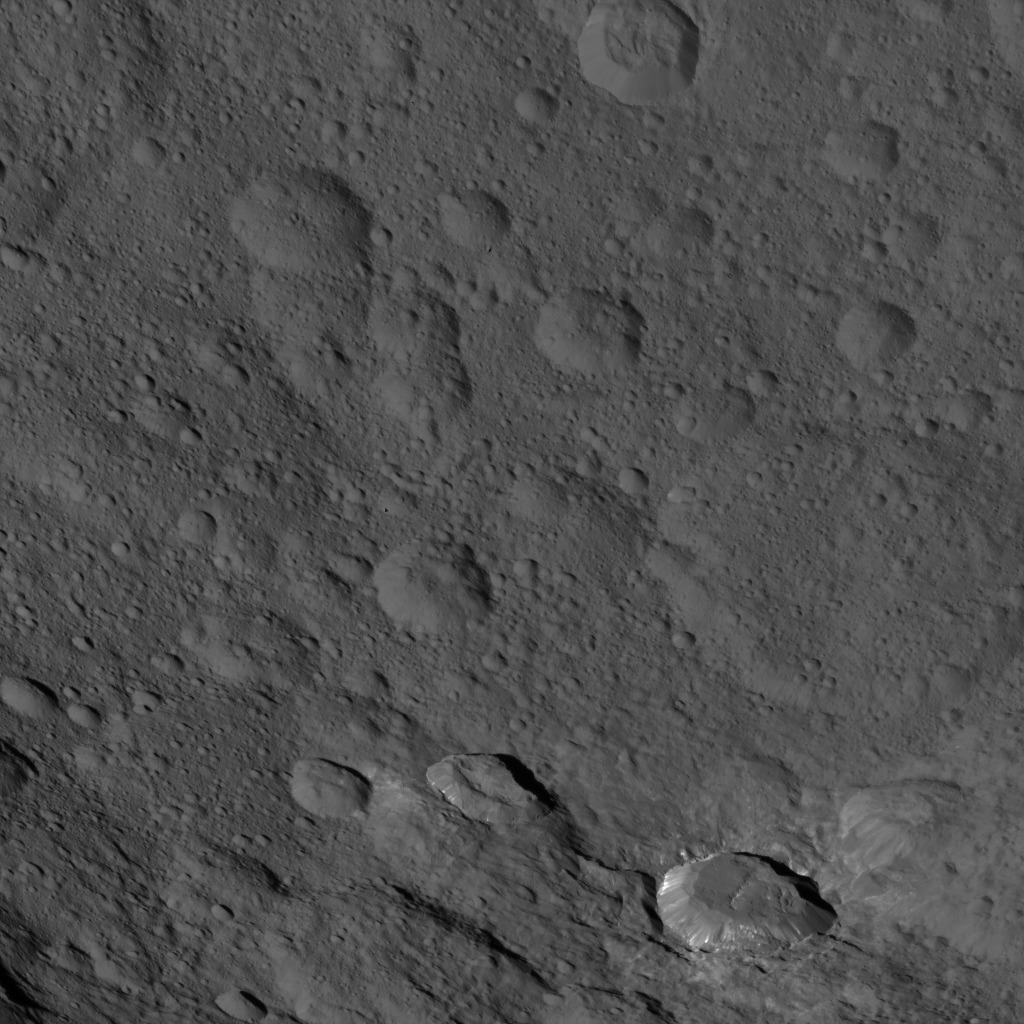
2015-11-03 |
Ceres
|
Dawn
|
Framing Camera
|
1024x1024x1 |

|
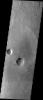
-
PIA19993:
-
Dawn HAMO Image 51
Full Resolution:
TIFF
(982.2 kB)
JPEG
(126.2 kB)
|
|
|
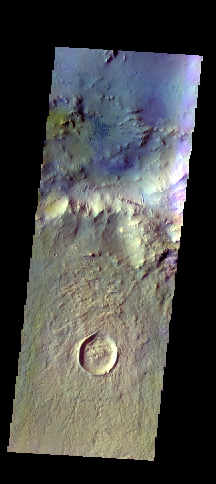
2015-11-03 |
Mars
|
2001 Mars Odyssey
|
THEMIS
|
1357x1951x3 |

|
-
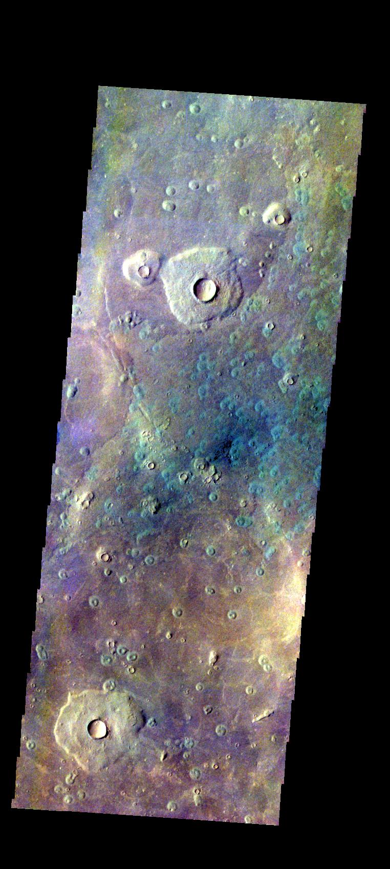
PIA20083:
-
Escorial Crater- False Color
Full Resolution:
TIFF
(2.952 MB)
JPEG
(121 kB)
|
|
|
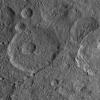
2015-11-02 |
Ceres
|
Dawn
|
Framing Camera
|
1024x1024x1 |
|
-
PIA19992:
-
Dawn HAMO Image 50
Full Resolution:
TIFF
(1.05 MB)
JPEG
(154.5 kB)
|
|
|
2015-11-02 |
Mars
|
2001 Mars Odyssey
|
THEMIS
|
720x1668x3 |
|
-
PIA20082:
-
Danielson Crater Dunes - False Color
Full Resolution:
TIFF
(2.461 MB)
JPEG
(138.9 kB)
|
|
|
2015-10-30 |
Ceres
|
Dawn
|
Framing Camera
|
1024x1024x1 |
|
-
PIA19991:
-
Dawn HAMO Image 49
Full Resolution:
TIFF
(1.05 MB)
JPEG
(168.3 kB)
|
|
|
2015-10-30 |
Mars
|
2001 Mars Odyssey
|
THEMIS
|
743x1687x3 |
|
-
PIA20081:
-
Tyndall Crater - False Color
Full Resolution:
TIFF
(2.606 MB)
JPEG
(138.4 kB)
|
|
|
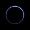
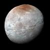
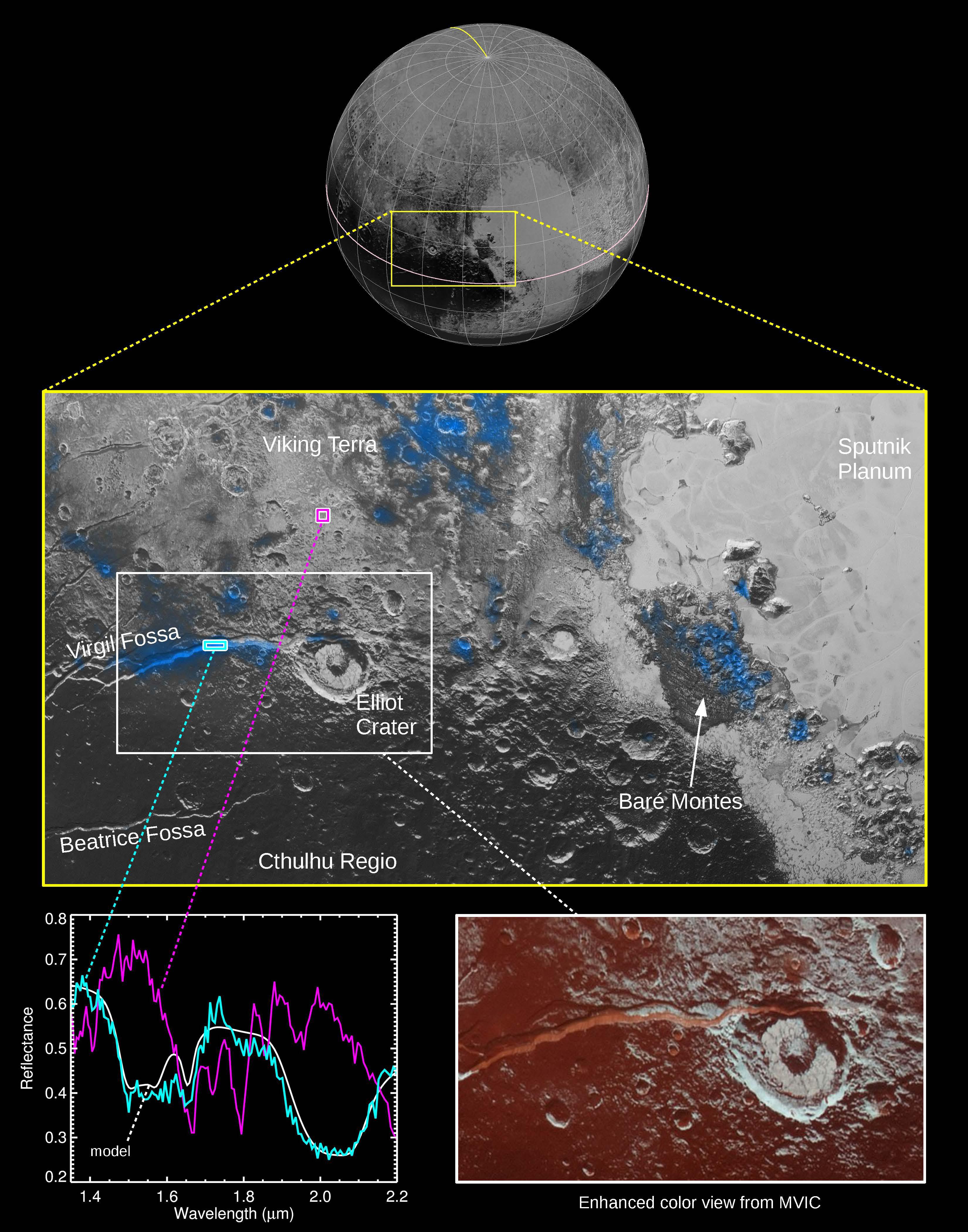
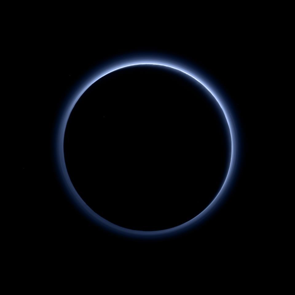
2015-10-29 |
Pluto
|
New Horizons
|
MVIC
|
2000x1125x1 |
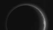
|
-
PIA20038:
-
A Full View of Pluto's Stunning Crescent
Full Resolution:
TIFF
(642.6 kB)
JPEG
(51.98 kB)
|
|
|
2015-10-29 |
Pluto
|
New Horizons
|
LORRI
|
1041x717x1 |
|
-
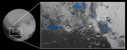
PIA20037:
-
Mapping Pluto's 'Broken Heart'
Full Resolution:
TIFF
(348.4 kB)
JPEG
(37.54 kB)
|
|
|
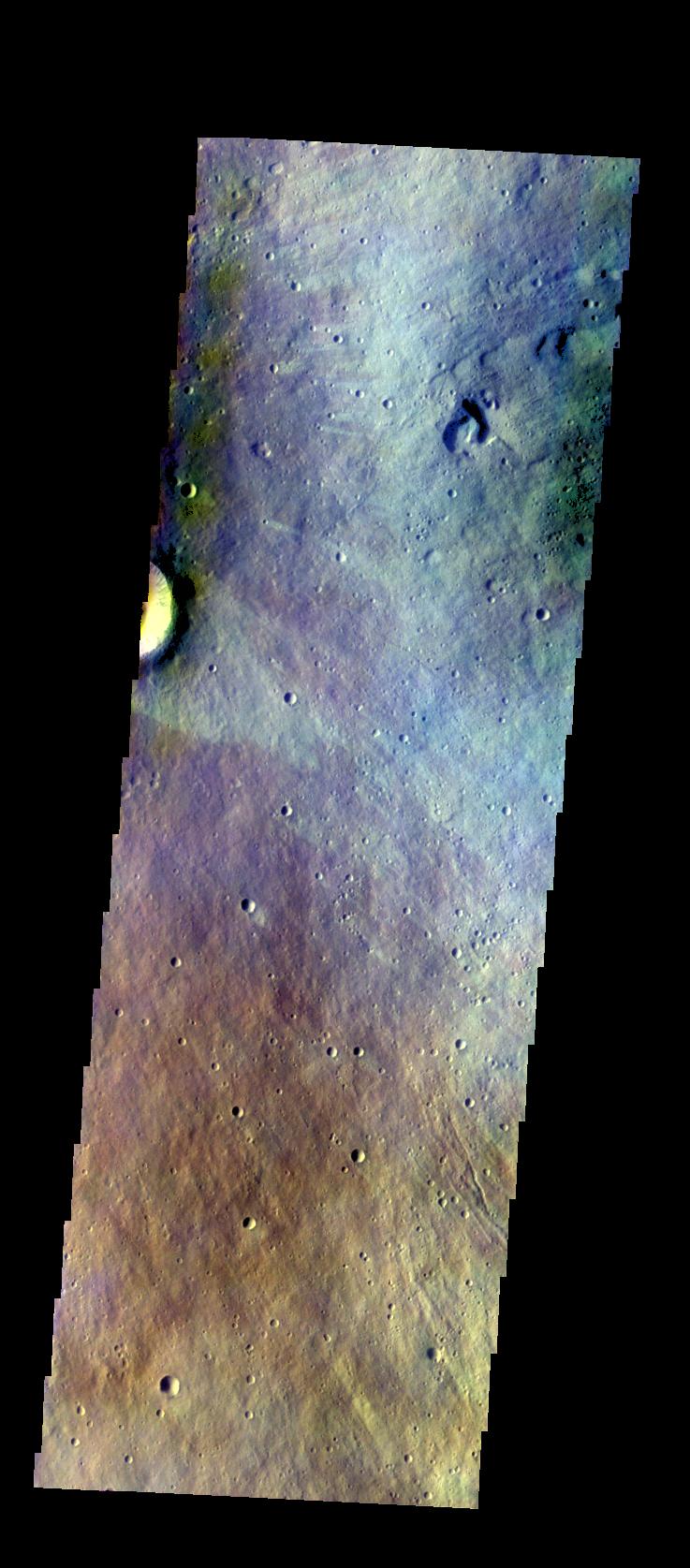
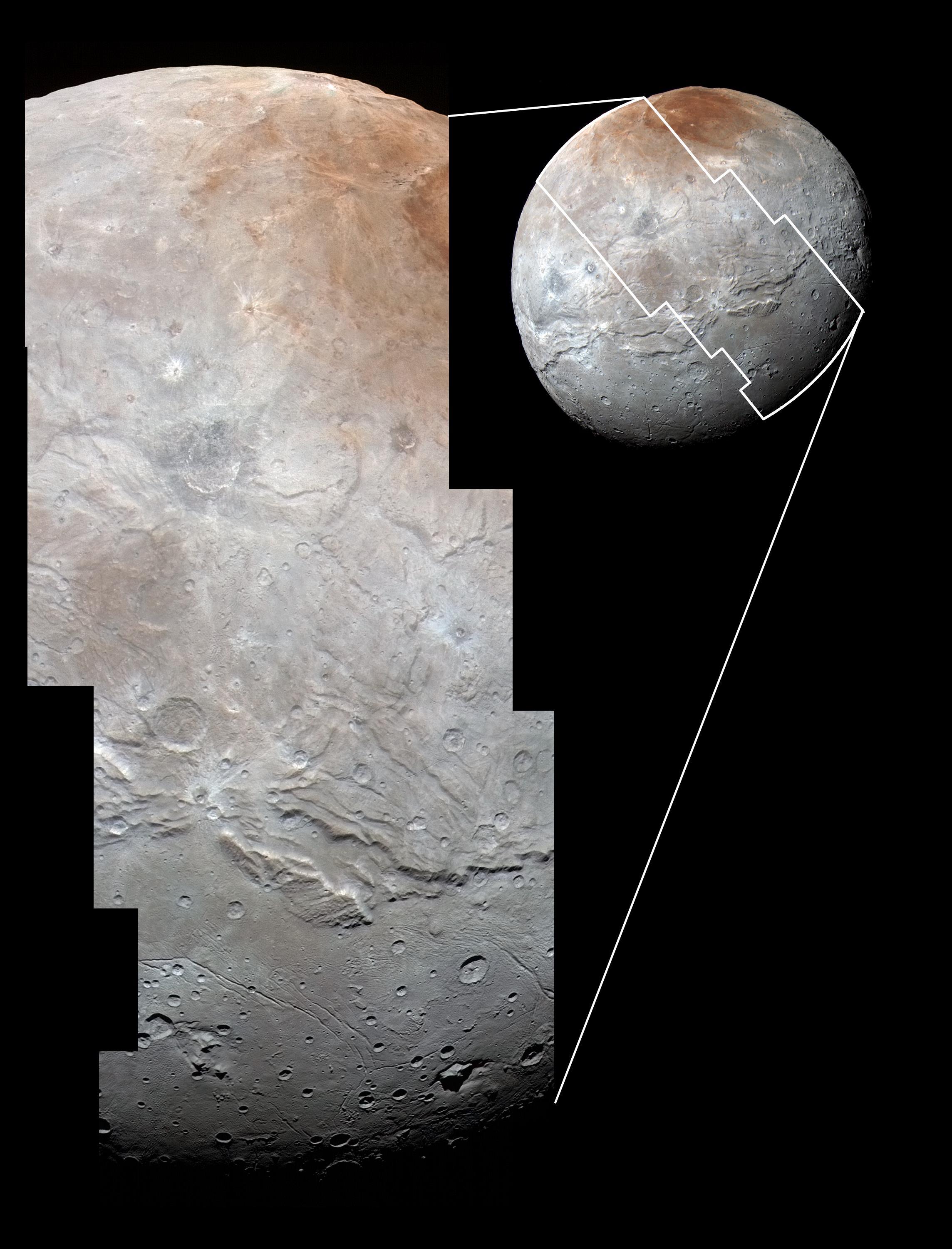
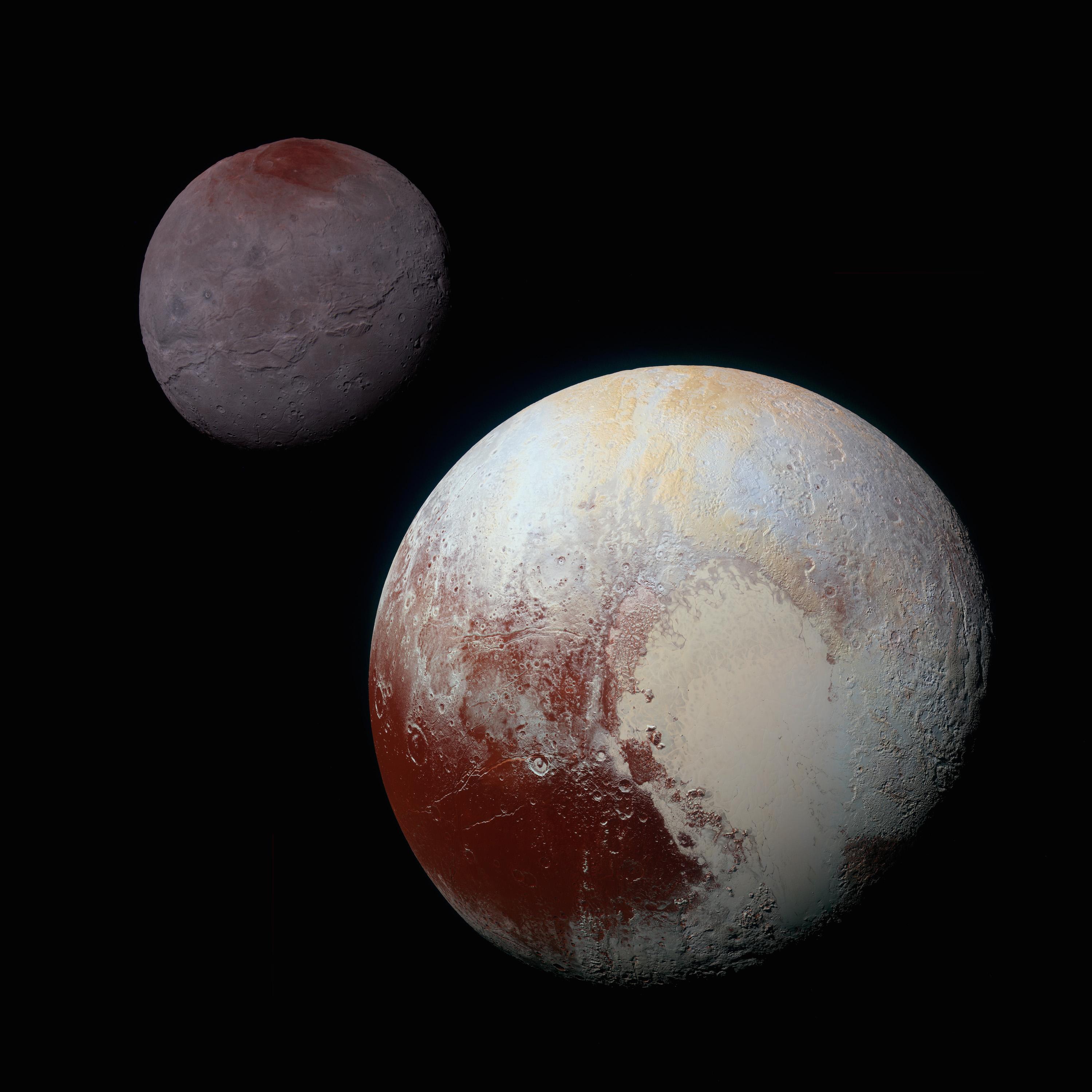
2015-10-29 |
Charon
|
New Horizons
|
LEISA
LORRI
|
2416x1266x3 |
|
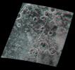
-
PIA20036:
-
The Youngest Crater on Charon?
Full Resolution:
TIFF
(3.342 MB)
JPEG
(337.5 kB)
|
|
|
2015-10-29 |
Ceres
|
Dawn
|
Framing Camera
|
1024x1024x1 |
|
-
PIA19990:
-
Dawn HAMO Image 48
Full Resolution:
TIFF
(1.05 MB)
JPEG
(159.8 kB)
|
|
|
2015-10-29 |
Mars
|
2001 Mars Odyssey
|
THEMIS
|
712x1665x3 |

|
-
PIA20080:
-
Iani Chaos - False Color
Full Resolution:
TIFF
(2.564 MB)
JPEG
(98.89 kB)
|
|
|
2015-10-28 |
Ceres
|
Dawn
|
Framing Camera
|
1024x1024x1 |

|
-
PIA19989:
-
Dawn HAMO Image 47
Full Resolution:
TIFF
(992.5 kB)
JPEG
(190.5 kB)
|
|
|
2015-10-28 |
Mars
|
2001 Mars Odyssey
|
THEMIS
|
709x1665x3 |
|
-
PIA20079:
-
Capri Mensa - False Color
Full Resolution:
TIFF
(2.451 MB)
JPEG
(90.88 kB)
|
|
|
2015-10-27 |
Ceres
|
Dawn
|
Framing Camera
|
1024x1024x1 |

|
-
PIA19988:
-
Dawn HAMO Image 46
Full Resolution:
TIFF
(611 kB)
JPEG
(122 kB)
|
|
|
2015-10-27 |
Mars
|
2001 Mars Odyssey
|
THEMIS
|
756x1690x3 |
|
-
PIA20078:
-
Bamberg Crater Dunes - False Color
Full Resolution:
TIFF
(2.601 MB)
JPEG
(127.3 kB)
|
|
|
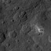
2015-10-26 |
Ceres
|
Dawn
|
Framing Camera
|
3558x3072x1 |
|
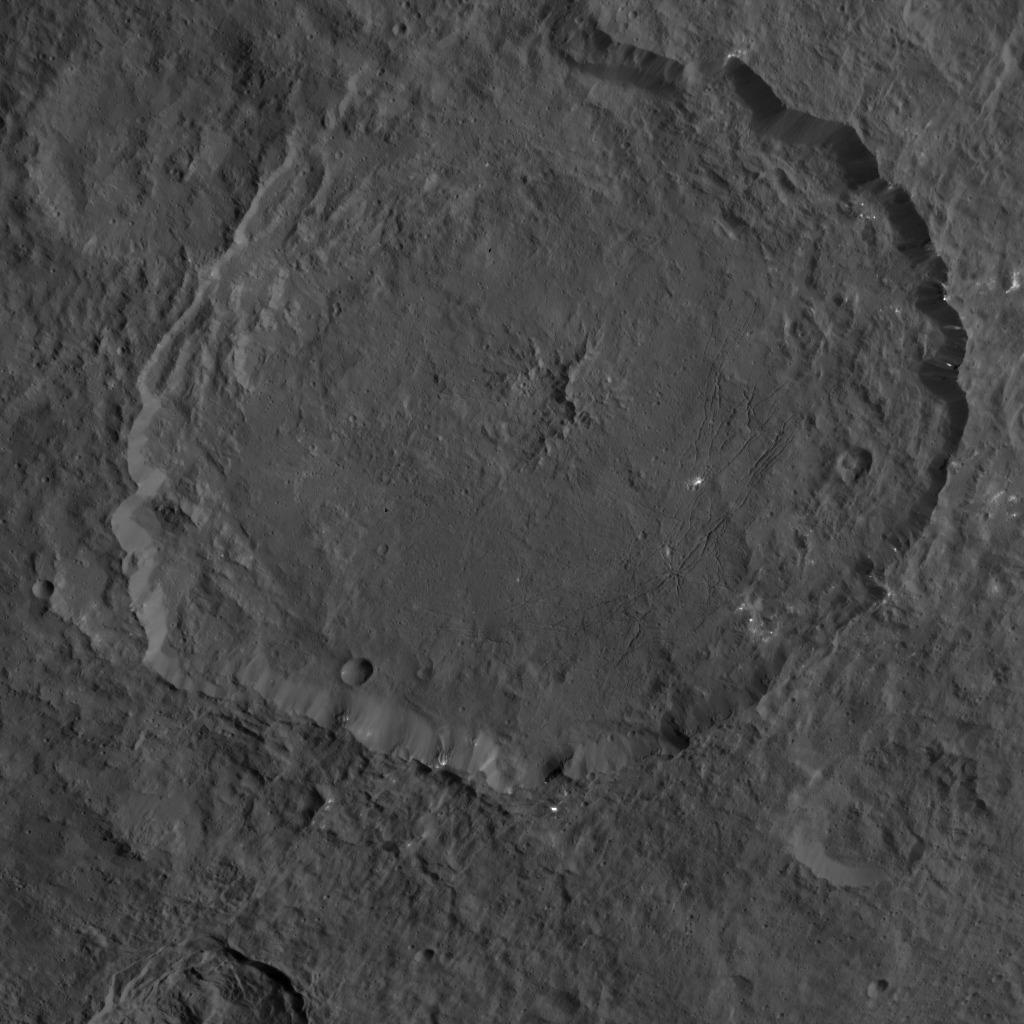
-
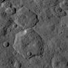
PIA19996:
-
Occator and Surrounding Terrain
Full Resolution:
TIFF
(5.459 MB)
JPEG
(797.7 kB)
|
|
|
2015-10-26 |
Ceres
|
Dawn
|
Framing Camera
|
1024x1024x1 |
|
-
PIA19987:
-
Dawn HAMO Image 45
Full Resolution:
TIFF
(1.05 MB)
JPEG
(225.9 kB)
|
|
|
2015-10-26 |
Mars
|
2001 Mars Odyssey
|
THEMIS
|
712x1665x3 |
|
-
PIA20076:
-
Aureum Chaos - False Color
Full Resolution:
TIFF
(2.557 MB)
JPEG
(99.74 kB)
|
|
|
2015-10-23 |
Pluto
|
New Horizons
|
LORRI
|
1320x1277x1 |
|
-
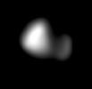
PIA20034:
-
Kerberos Revealed
Full Resolution:
TIFF
(272.7 kB)
JPEG
(29.04 kB)
|
|
|
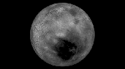
2015-10-23 |
Pluto
|
New Horizons
|
LORRI
|
1920x1080x1 |
|
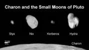
-
PIA20033:
-
Family Portrait of Pluto's Moons
Full Resolution:
TIFF
(834.9 kB)
JPEG
(107.3 kB)
|
|
|
2015-10-23 |
Pluto
|
New Horizons
|
LORRI
|
1436x1350x3 |
|
-
PIA20032:
-
Pluto in 3-D
Full Resolution:
TIFF
(4.107 MB)
JPEG
(198.6 kB)
|
|
|
2015-10-23 |
Ceres
|
Dawn
|
Framing Camera
|
1024x1024x1 |
|
-
PIA19986:
-
Dawn HAMO Image 44
Full Resolution:
TIFF
(1.05 MB)
JPEG
(180.1 kB)
|
|
|
2015-10-23 |
Mars
|
2001 Mars Odyssey
|
THEMIS
|
606x2724x3 |
|
-
PIA20075:
-
Cloudy Day - False Color
Full Resolution:
TIFF
(2.215 MB)
JPEG
(94.62 kB)
|
|
|
2015-10-22 |
Ceres
|
Dawn
|
Framing Camera
|
1024x1024x1 |
|
-
PIA19985:
-
Dawn HAMO Image 43
Full Resolution:
TIFF
(997.1 kB)
JPEG
(139.7 kB)
|
|
|
2015-10-22 |
Mars
|
2001 Mars Odyssey
|
THEMIS
|
668x1435x3 |
|
-
PIA20074:
-
Proctor Crater Dunes - False Color
Full Resolution:
TIFF
(1.98 MB)
JPEG
(108 kB)
|
|
|
2015-10-21 |
Ceres
|
Dawn
|
Framing Camera
|
1024x1024x1 |
|
-
PIA19984:
-
Dawn HAMO Image 42
Full Resolution:
TIFF
(1.05 MB)
JPEG
(220 kB)
|
|
|
2015-10-21 |
Mars
|
2001 Mars Odyssey
|
THEMIS
|
1444x2657x1 |
|
-
PIA20073:
-
Channels
Full Resolution:
TIFF
(2.701 MB)
JPEG
(280.7 kB)
|
|
|
2015-10-20 |
Ceres
|
Dawn
|
Framing Camera
|
1024x1024x1 |
|
-
PIA19983:
-
Dawn HAMO Image 41
Full Resolution:
TIFF
(1.047 MB)
JPEG
(140.9 kB)
|
|
|
2015-10-20 |
Mars
|
2001 Mars Odyssey
|
THEMIS
|
711x1439x1 |
|
-
PIA20072:
-
Dark Slope Streaks
Full Resolution:
TIFF
(670.8 kB)
JPEG
(59.39 kB)
|
|
|
2015-10-19 |
Ceres
|
Dawn
|
Framing Camera
|
1024x1024x1 |
|
-
PIA19982:
-
Dawn HAMO Image 40
Full Resolution:
TIFF
(958.1 kB)
JPEG
(204.1 kB)
|
|
|
2015-10-19 |
Mars
|
2001 Mars Odyssey
|
THEMIS
|
1400x2645x1 |
|
-
PIA20071:
-
Olympica Fossae
Full Resolution:
TIFF
(2.803 MB)
JPEG
(380.4 kB)
|
|
|
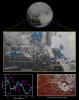
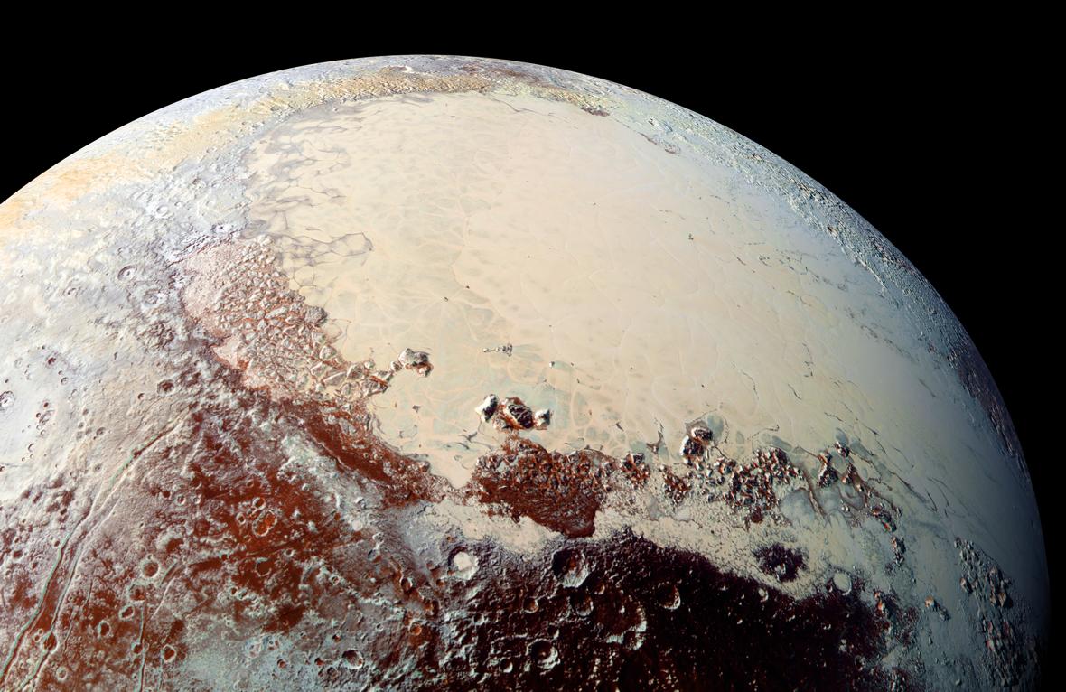
2015-10-16 |
Pluto
|
New Horizons
|
LEISA
MVIC
|
3300x4200x3 |
|
-
PIA20030:
-
Water Ice on Pluto
Full Resolution:
TIFF
(15.82 MB)
JPEG
(1.239 MB)
|
|
|
2015-10-16 |
Ceres
|
Dawn
|
Framing Camera
|
1024x1024x1 |
|
-
PIA19981:
-
Dawn HAMO Image 39
Full Resolution:
TIFF
(1.05 MB)
JPEG
(164.4 kB)
|
|
|
2015-10-16 |
Mars
|
2001 Mars Odyssey
|
THEMIS
|
1325x2774x1 |
|
-
PIA19800:
-
The Martian, Part 5: Schiaparelli Crater Floor
Full Resolution:
TIFF
(3.138 MB)
JPEG
(595.6 kB)
|
|
|
2015-10-15 |
Pluto
|
New Horizons
|
LORRI
MVIC
|
1180x766x3 |

|
-
PIA20007:
-
Sputnik Planum, in Color
Full Resolution:
TIFF
(2.433 MB)
JPEG
(152.9 kB)
|
|
|
2015-10-15 |
Ceres
|
Dawn
|
Framing Camera
|
1024x1024x1 |
|
-
PIA19980:
-
Dawn HAMO Image 38
Full Resolution:
TIFF
(1.05 MB)
JPEG
(170.7 kB)
|
|
|
2015-10-15 |
Mars
|
2001 Mars Odyssey
|
THEMIS
|
1388x3222x1 |

|
-
PIA19799:
-
The Martian, Part 4: Schiaparelli Crater Rim
Full Resolution:
TIFF
(3.232 MB)
JPEG
(328.6 kB)
|
|
|
2015-10-14 |
Mars
|
Mars Reconnaissance Orbiter (MRO)
|
HiRISE
|
2880x1800x3 |
|
-
PIA20006:
-
Fine-Branched Ridges
Full Resolution:
TIFF
(15.56 MB)
JPEG
(1.099 MB)
|
|
|
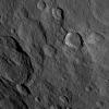
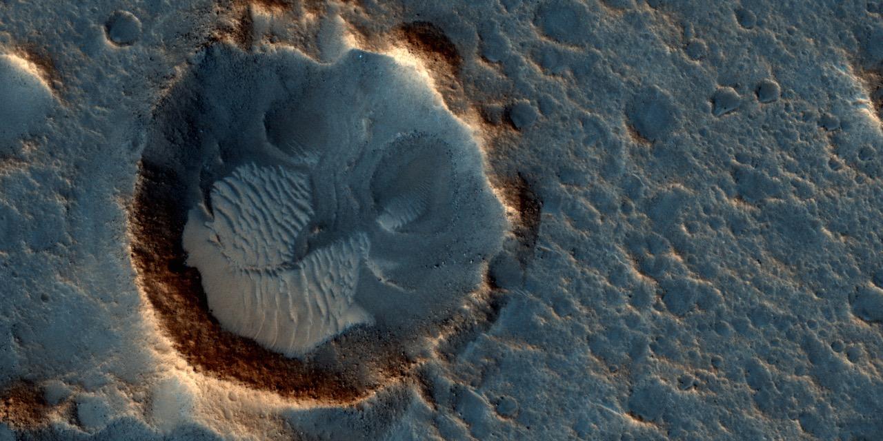
2015-10-14 |
Mars
|
Mars Reconnaissance Orbiter (MRO)
|
HiRISE
|
2880x1800x3 |
|
-
PIA20005:
-
Gullies in a Central Pit Crater
Full Resolution:
TIFF
(15.56 MB)
JPEG
(885.4 kB)
|
|
|
2015-10-14 |
Mars
|
Mars Reconnaissance Orbiter (MRO)
|
HiRISE
|
2880x1800x3 |
|
-
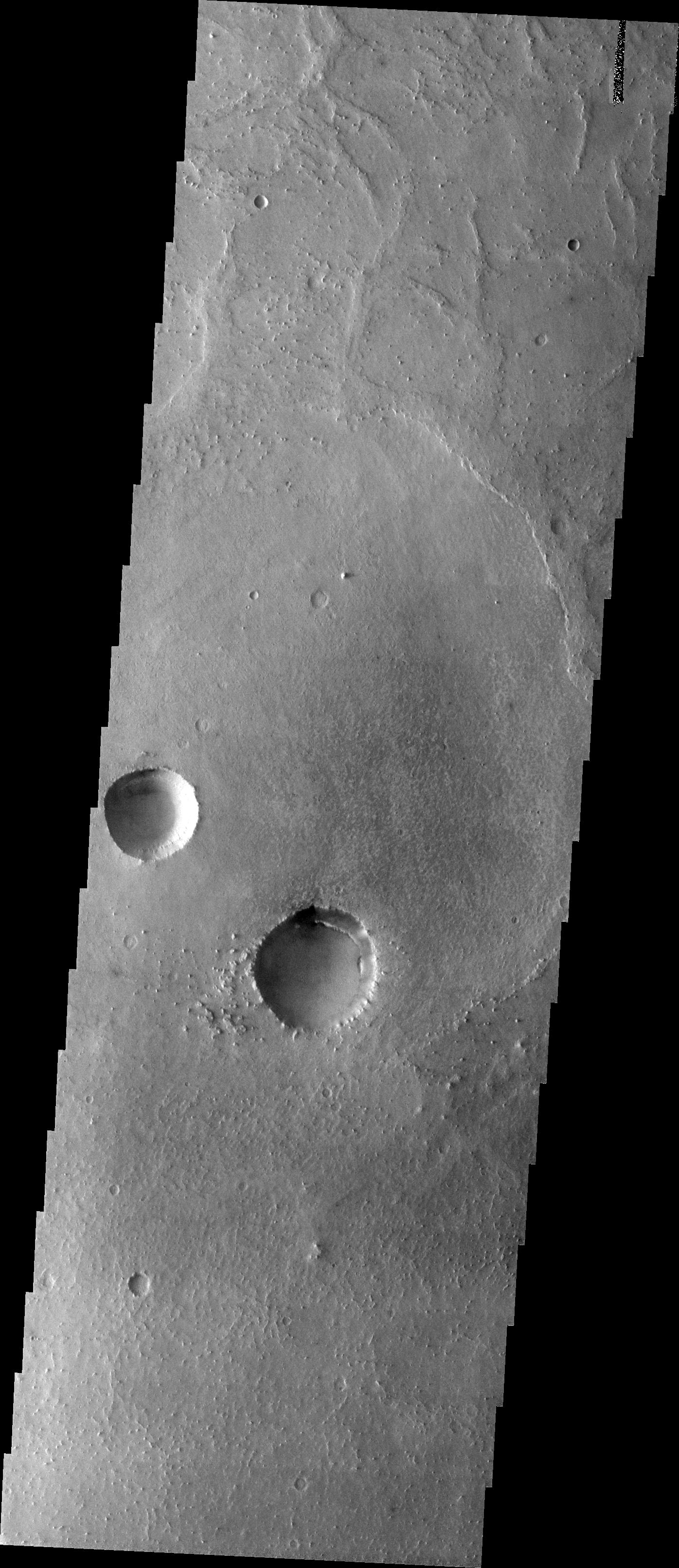
PIA20004:
-
Kasei Valles
Full Resolution:
TIFF
(5.191 MB)
JPEG
(987.8 kB)
|
|
|
2015-10-14 |
Mars
|
Mars Reconnaissance Orbiter (MRO)
|
HiRISE
|
2880x1800x3 |
|
-
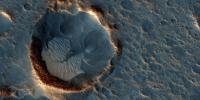
PIA20003:
-
A Cone Shaped Hill
Full Resolution:
TIFF
(14.25 MB)
JPEG
(766.5 kB)
|
|
|
2015-10-14 |
Ceres
|
Dawn
|
Framing Camera
|
1024x1024x1 |
|
-
PIA19979:
-
Dawn HAMO Image 37
Full Resolution:
TIFF
(1.05 MB)
JPEG
(147.2 kB)
|
|
|
2015-10-14 |
Mars
|
2001 Mars Odyssey
|
THEMIS
|
1396x3225x1 |
|
-
PIA19798:
-
The Martian, Part 3: Meridiani Planum
Full Resolution:
TIFF
(3.553 MB)
JPEG
(525.7 kB)
|
|
|
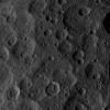
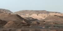
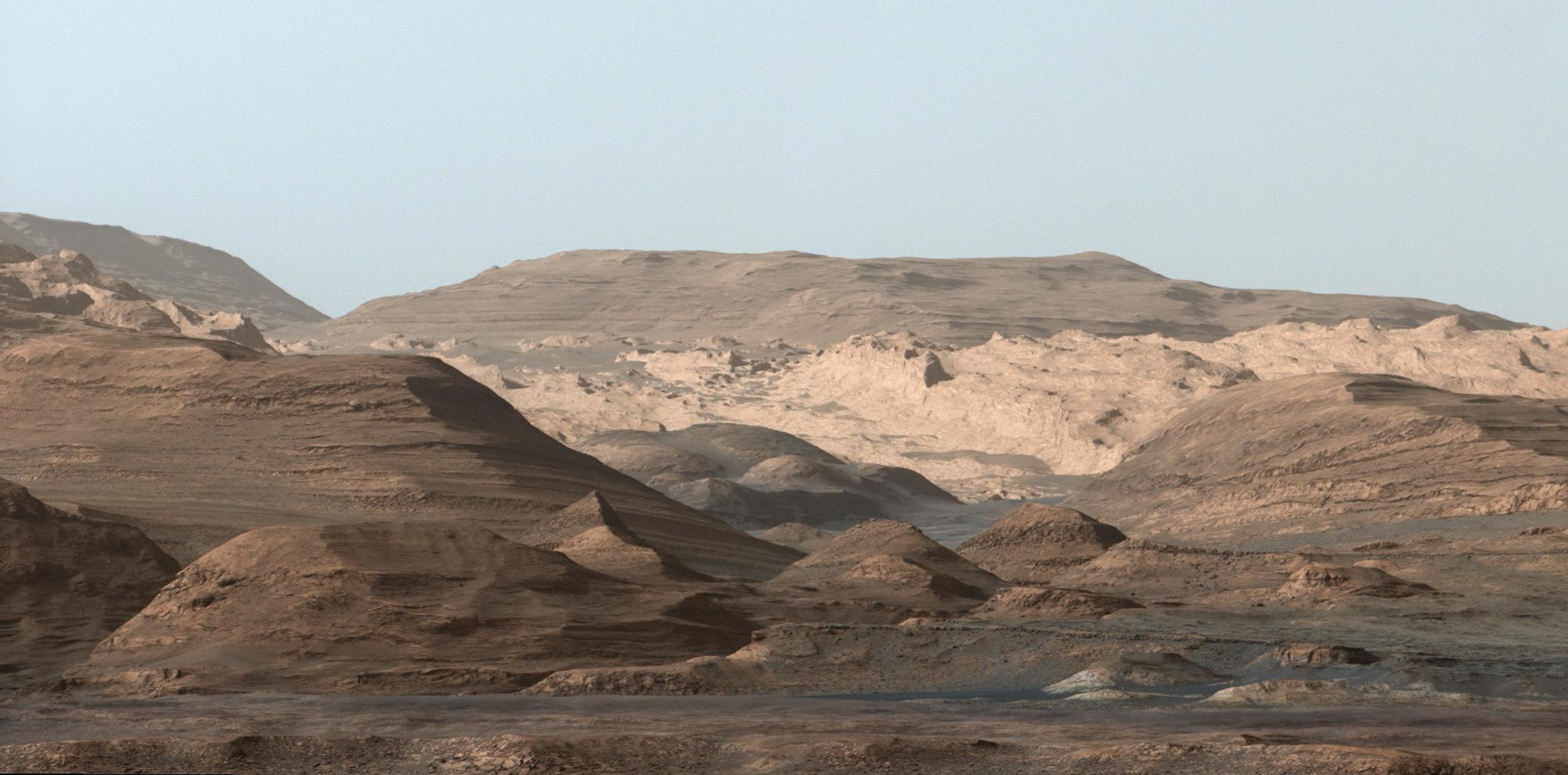
2015-10-13 |
Mars
|
Mars Science Laboratory (MSL)
|
MAHLI
|
7149x10036x3 |
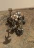
|
-
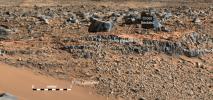
PIA19920:
-
Curiosity Self-Portrait at 'Big Sky' Drilling Site
Full Resolution:
TIFF
(165.6 MB)
JPEG
(5.999 MB)
|
|
|
2015-10-13 |
Ceres
|
Dawn
|
Framing Camera
|
1024x1024x1 |
|
-
PIA19978:
-
Dawn HAMO Image 36
Full Resolution:
TIFF
(1.05 MB)
JPEG
(215.6 kB)
|
|
|
2015-10-13 |
Mars
|
2001 Mars Odyssey
|
THEMIS
|
1356x2769x1 |
|
-
PIA19797:
-
The Martian, Part 2: Mawrth Valles
Full Resolution:
TIFF
(2.974 MB)
JPEG
(366.9 kB)
|
|
|
2015-10-12 |
Ceres
|
Dawn
|
Framing Camera
|
1024x1024x1 |
|
-
PIA19973:
-
Dawn HAMO Image 35
Full Resolution:
TIFF
(1.05 MB)
JPEG
(234.9 kB)
|
|
|
2015-10-12 |
Mars
|
2001 Mars Odyssey
|
THEMIS
|
1406x2918x1 |
|
-
PIA19796:
-
The Martian, Part 1: Acidalia Planitia
Full Resolution:
TIFF
(3.302 MB)
JPEG
(560.8 kB)
|
|
|
2015-10-09 |
Ceres
|
Dawn
|
Framing Camera
|
1024x1024x1 |
|
-
PIA19972:
-
Dawn HAMO Image 34
Full Resolution:
TIFF
(1.05 MB)
JPEG
(195.1 kB)
|
|
|
2015-10-09 |
Mars
|
2001 Mars Odyssey
|
THEMIS
|
714x1666x3 |
|
-
PIA19794:
-
Arabia Terra - False Color
Full Resolution:
TIFF
(2.683 MB)
JPEG
(175 kB)
|
|
|
2015-10-08 |
Pluto
|
New Horizons
|
MVIC
|
960x960x3 |
|
-
PIA19964:
-
Pluto's Blue Sky
Full Resolution:
TIFF
(407.5 kB)
JPEG
(23.72 kB)
|
|
|
2015-10-08 |
Pluto
|
New Horizons
|
LEISA
MVIC
|
2707x1072x3 |
|
-
PIA19963:
-
Water Ice on Pluto
Full Resolution:
TIFF
(3.858 MB)
JPEG
(427.7 kB)
|
|
|
2015-10-08 |
Mars
|
Mars Science Laboratory (MSL)
|
Mastcam
|
2102x984x3 |
|
-
PIA19840:
-
Secrets of 'Hidden Valley' on Mars
Full Resolution:
TIFF
(6.208 MB)
JPEG
(485.1 kB)
|
|
|
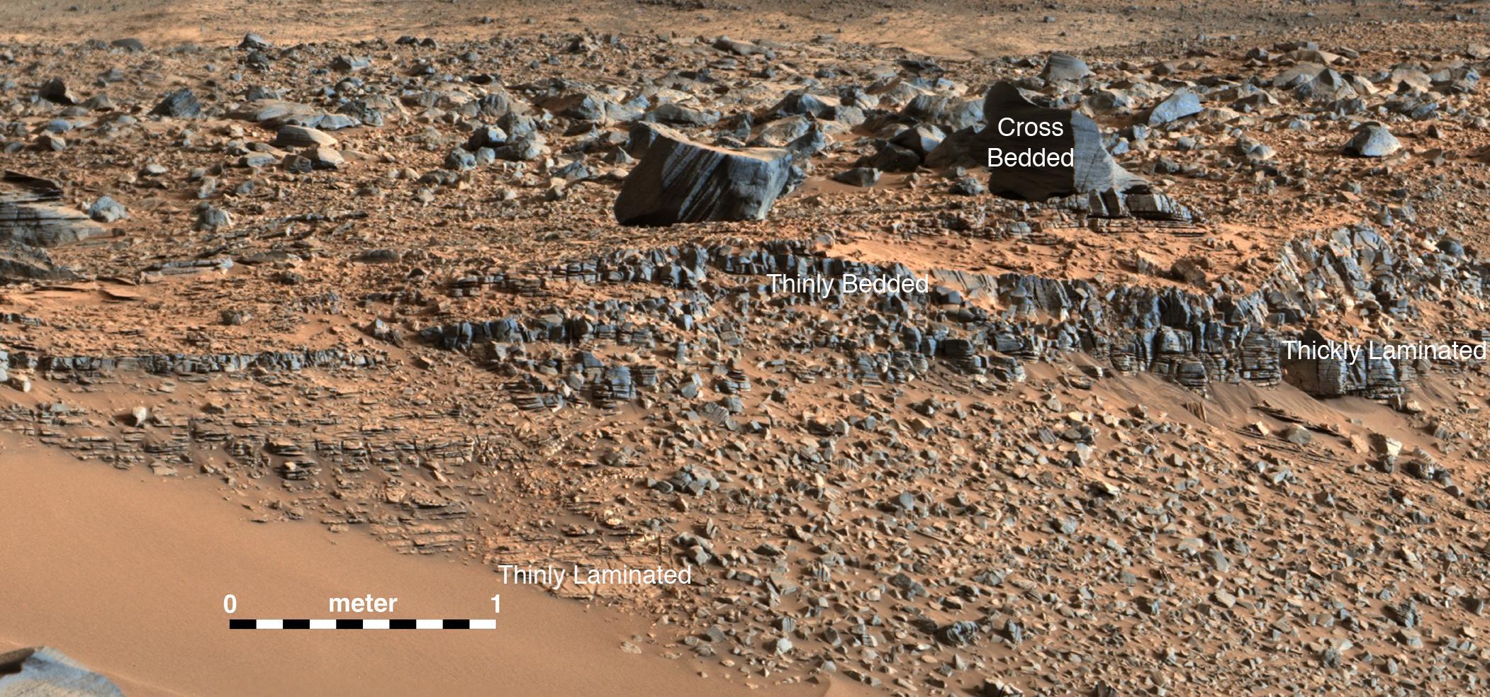
2015-10-08 |
Mars
|
Mars Science Laboratory (MSL)
|
Mastcam
|
2472x1134x3 |
|
-
PIA19839:
-
Strata at Base of Mount Sharp

Full Resolution:
TIFF
(8.382 MB)
JPEG
(679.5 kB)
|
|
|
2015-10-08 |
Ceres
|
Dawn
|
Framing Camera
|
1024x1024x1 |
|
-
PIA19971:
-
Dawn HAMO Image 33
Full Resolution:
TIFF
(1.05 MB)
JPEG
(216.6 kB)
|
|
|
2015-10-08 |
Mars
|
2001 Mars Odyssey
|
THEMIS
|
703x1664x3 |
|
-
PIA19793:
-
Melas Chasma - False Color
Full Resolution:
TIFF
(2.191 MB)
JPEG
(73.92 kB)
|
|
|
2015-10-07 |
Ceres
|
Dawn
|
Framing Camera
|
1024x1024x1 |

|
-
PIA19910:
-
Dawn HAMO Image 32
Full Resolution:
TIFF
(1.05 MB)
JPEG
(218.1 kB)
|
|
|
2015-10-07 |
Mars
|
2001 Mars Odyssey
|
THEMIS
|
762x1697x3 |

|
-
PIA19792:
-
Acidalia Planitia - False Color
Full Resolution:
TIFF
(2.793 MB)
JPEG
(186.2 kB)
|
|
|
2015-10-06 |
Earth
|
Terra
|
ASTER
|
535x829x3 |
|
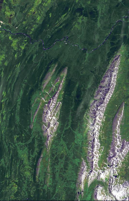
-
PIA19795:
-
Ural Mountains, Russia
Full Resolution:
TIFF
(1.331 MB)
JPEG
(92.24 kB)
|
|
|
2015-10-06 |
Ceres
|
Dawn
|
Framing Camera
|
1024x1024x1 |
|
-
PIA19909:
-
Dawn HAMO Image 31
Full Resolution:
TIFF
(1.05 MB)
JPEG
(198.9 kB)
|
|
|
2015-10-06 |
Mars
|
2001 Mars Odyssey
|
THEMIS
|
713x1666x3 |
|
-
PIA19791:
-
Aureum Chaos - False Color
Full Resolution:
TIFF
(2.469 MB)
JPEG
(105.1 kB)
|
|
|
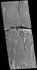
2015-10-05 |
Mars
|
Mars Reconnaissance Orbiter (MRO)
|
HiRISE
|
1280x720x1 |
|
-
PIA19915:
-
Western Edge of Mars' Marth Crater, a Movie Location
Full Resolution:
TIFF
(922.8 kB)
JPEG
(106.5 kB)
|
|
|
2015-10-05 |
Mars
|
Mars Reconnaissance Orbiter (MRO)
|
HiRISE
|
1280x720x3 |
|
-
PIA19914:
-
'The Martian' Story's Ares 4 Landing Site
Full Resolution:
TIFF
(2.766 MB)
JPEG
(280.8 kB)
|
|
|
2015-10-05 |
Mars
|
Mars Reconnaissance Orbiter (MRO)
|
HiRISE
|
1280x640x3 |
|
-
PIA19913:
-
The Ares 3 Landing Site: Where Science Fact Meets Fiction
Full Resolution:
TIFF
(2.459 MB)
JPEG
(139.8 kB)
|
|
|
2015-10-05 |
Ceres
|
Dawn
|
Framing Camera
|
1024x1024x1 |
|
-
PIA19908:
-
Dawn HAMO Image 30
Full Resolution:
TIFF
(1.05 MB)
JPEG
(166.7 kB)
|
|
|
2015-10-05 |
Mars
|
2001 Mars Odyssey
|
THEMIS
|
704x1664x3 |
|
-
PIA19790:
-
Gusev Crater - False Color
Full Resolution:
TIFF
(2.474 MB)
JPEG
(182 kB)
|
|
|
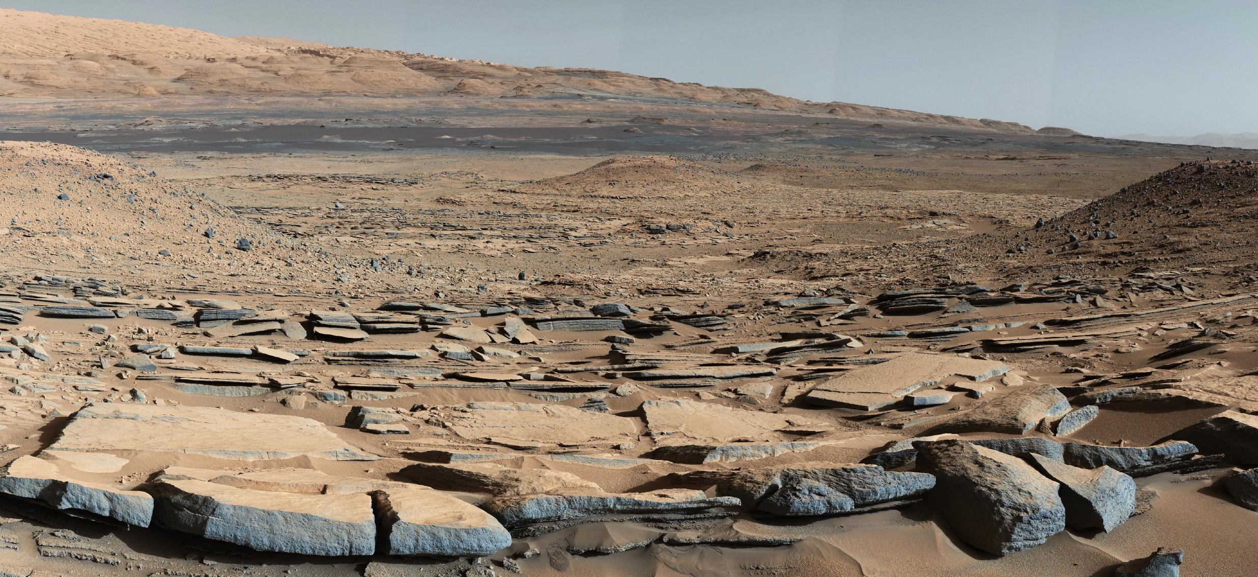
2015-10-02 |
Mars
|
Mars Science Laboratory (MSL)
|
Mastcam
|
2279x1127x3 |
|
-
PIA19912:
-
Mount Sharp Comes In Sharply
Full Resolution:
TIFF
(6.884 MB)
JPEG
(278.2 kB)
|
|
|
2015-10-02 |
Ceres
|
Dawn
|
Framing Camera
|
1024x1024x1 |
|
-
PIA19907:
-
Dawn HAMO Image 29
Full Resolution:
TIFF
(1.049 MB)
JPEG
(145.9 kB)
|
|
|
2015-10-02 |
Mars
|
2001 Mars Odyssey
|
THEMIS
|
737x1675x3 |
|
-
PIA19789:
-
Elysium Mons - False Color
Full Resolution:
TIFF
(2.539 MB)
JPEG
(146.5 kB)
|
|
|
2015-10-01 |
Charon
|
New Horizons
|
LORRI
MVIC
|
2000x2000x3 |
|
-
PIA19968:
-
Charon in Enhanced Color
Full Resolution:
TIFF
(5.723 MB)
JPEG
(318.4 kB)
|
|
|
2015-10-01 |
Charon
|
New Horizons
|
LORRI
MVIC
|
2288x3000x3 |
|
-
PIA19967:
-
Charon in Detail
Full Resolution:
TIFF
(9.294 MB)
JPEG
(618.8 kB)
|
|
|
2015-10-01 |
Charon
|
New Horizons
|
MVIC
|
3000x3000x3 |

|
-
PIA19966:
-
Charon and Pluto: Strikingly Different Worlds
Full Resolution:
TIFF
(9.594 MB)
JPEG
(617.5 kB)
|
|
|
2015-10-01 |
Charon
|
New Horizons
|
LORRI
MVIC
|
1621x907x1 |
|
-
PIA19965:
-
Flying over Charon
Full Resolution:
TIFF
(587.9 kB)
JPEG
(74.33 kB)
|
|
|
2015-10-01 |
Ceres
|
Dawn
|
Framing Camera
|
1024x1024x1 |
|
-
PIA19906:
-
Dawn HAMO Image 28
Full Resolution:
TIFF
(1.05 MB)
JPEG
(176.6 kB)
|
|
|
2015-10-01 |
Mars
|
2001 Mars Odyssey
|
THEMIS
|
731x1679x3 |
|
-
PIA19788:
-
Terra Sabaea - False Color
Full Resolution:
TIFF
(2.56 MB)
JPEG
(97.11 kB)
|
|
|
2015-09-30 |
Mars
|
Mars Reconnaissance Orbiter (MRO)
|
HiRISE
|
2880x1800x3 |
|
-
PIA19962:
-
Aeolian Features of Scandia Cavi
Full Resolution:
TIFF
(13.56 MB)
JPEG
(693.2 kB)
|
|
|
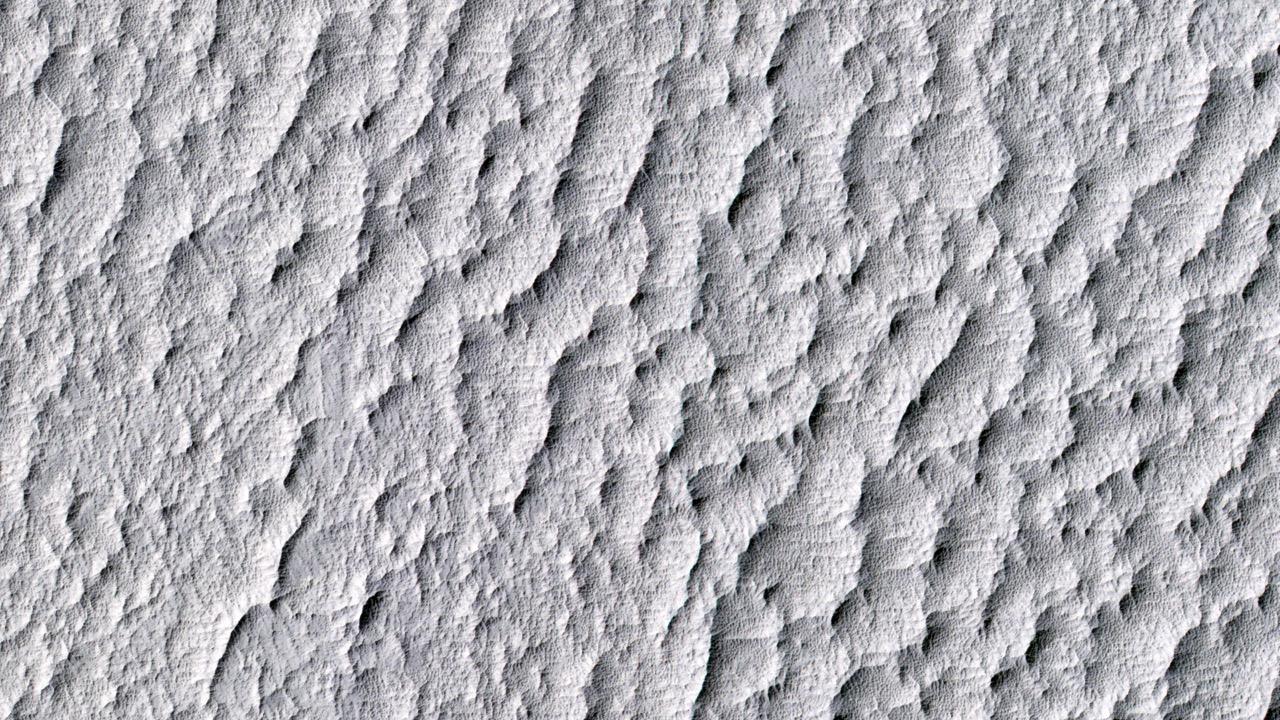
2015-09-30 |
Mars
|
Mars Reconnaissance Orbiter (MRO)
|
HiRISE
|
2880x1800x3 |

|
-
PIA19961:
-
Dynamic Mars
Full Resolution:
TIFF
(14.28 MB)
JPEG
(457.8 kB)
|
|
|
2015-09-30 |
Mars
|
Mars Reconnaissance Orbiter (MRO)
|
HiRISE
|
2880x1800x3 |
|
-
PIA19960:
-
Nested Channels near Hellas
Full Resolution:
TIFF
(14.91 MB)
JPEG
(850.1 kB)
|
|
|
2015-09-30 |
Mars
|
Mars Reconnaissance Orbiter (MRO)
|
HiRISE
|
2880x1800x3 |
|
-
PIA19959:
-
Western Edge of Marth Crater
Full Resolution:
TIFF
(15.56 MB)
JPEG
(1.029 MB)
|
|
|
2015-09-30 |
Mars
|
Mars Reconnaissance Orbiter (MRO)
|
HiRISE
|
2880x1800x3 |
|
-
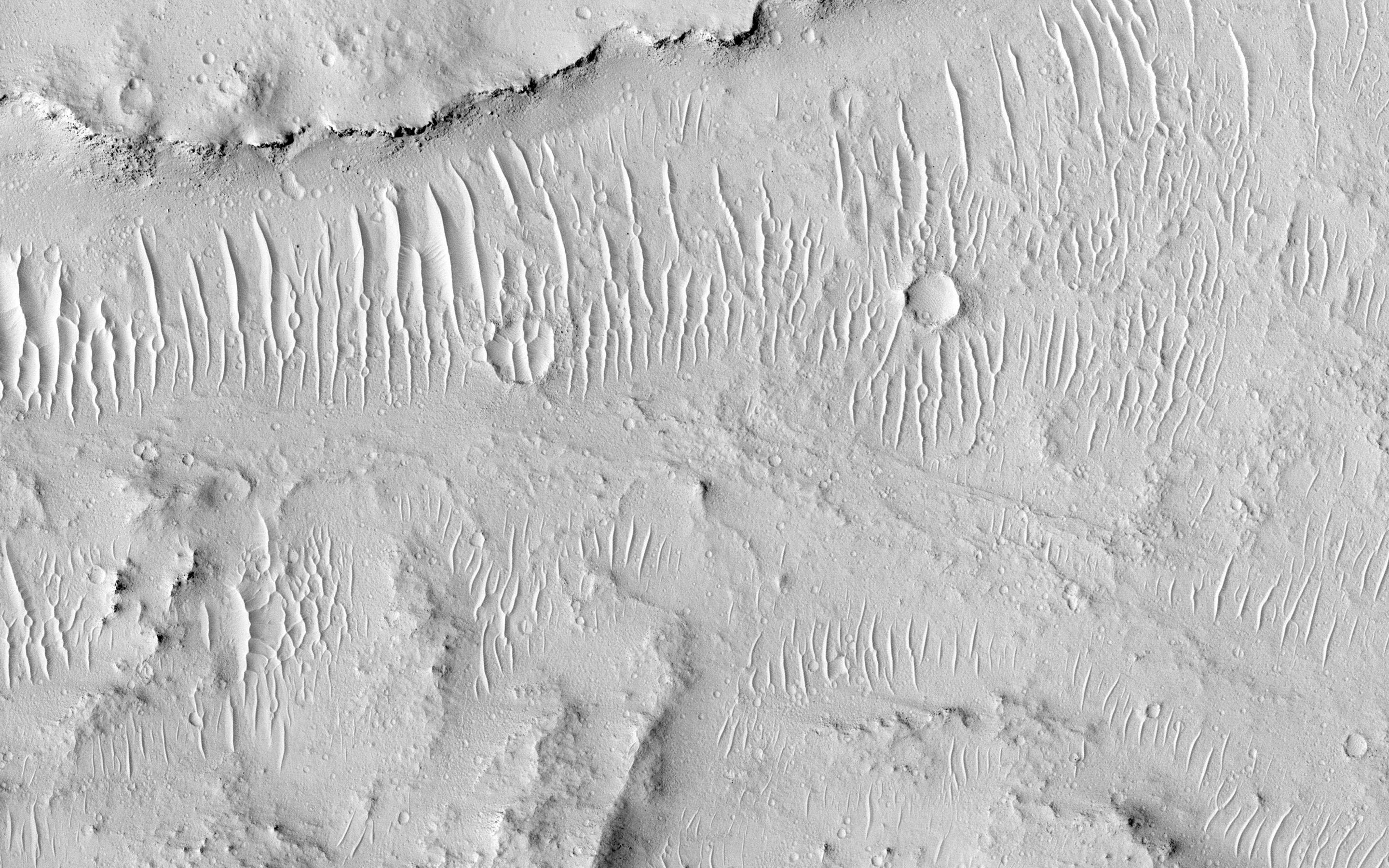
PIA19958:
-
All Along the Fractures
Full Resolution:
TIFF
(15.56 MB)
JPEG
(907.6 kB)
|
|
|
2015-09-30 |
Ceres
|
Dawn
|
Framing Camera
|
1024x1024x1 |
|
-
PIA19905:
-
Dawn HAMO Image 27
Full Resolution:
TIFF
(935.6 kB)
JPEG
(120.5 kB)
|
|
|
2015-09-30 |
Mars
|
2001 Mars Odyssey
|
THEMIS
|
732x1678x3 |
|
-
PIA19787:
-
Mawrth Vallis - False Color
Full Resolution:
TIFF
(2.711 MB)
JPEG
(138.1 kB)
|
|
|
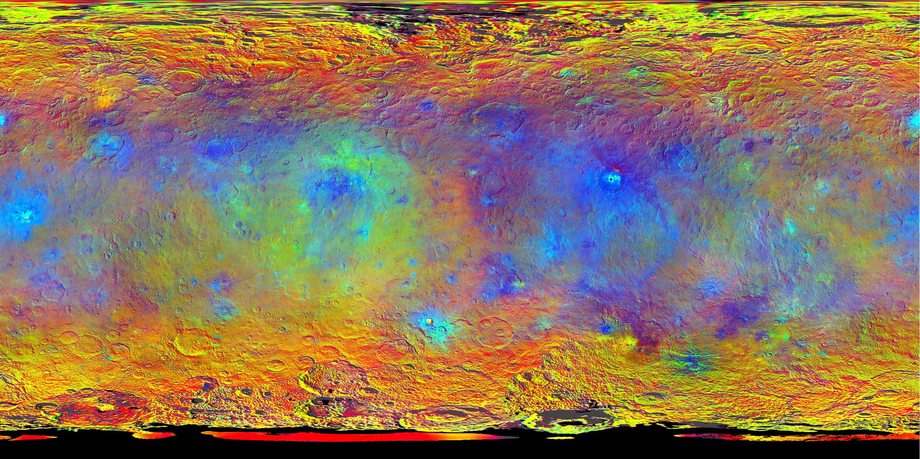
2015-09-30 |
Ceres
|
Dawn
|
Framing Camera
|
3078x1538x3 |
|
-
PIA19977:
-
Hints at Ceres' Composition from Color
Full Resolution:
TIFF
(14.21 MB)
JPEG
(1.331 MB)
|
|
|
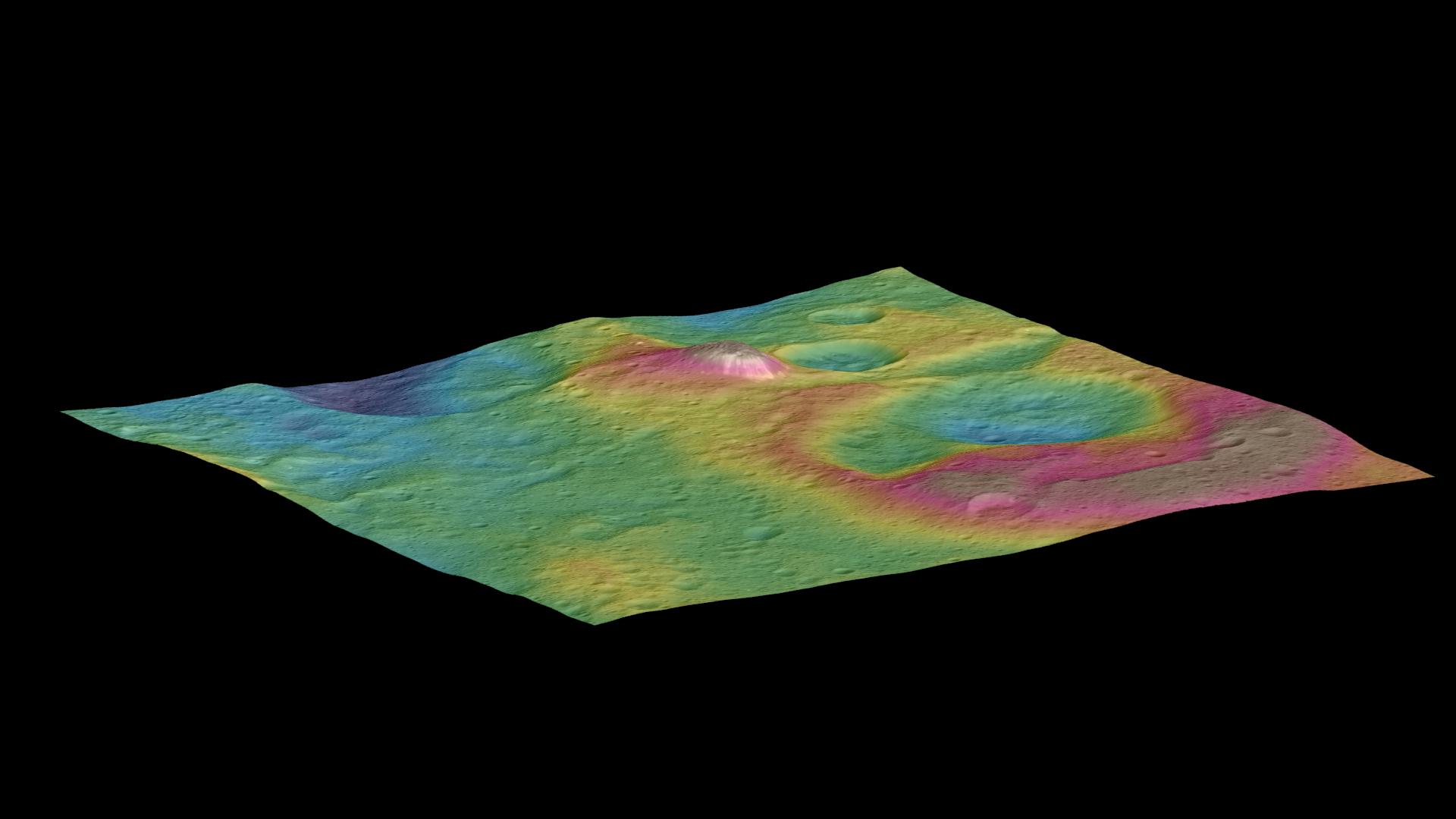
2015-09-30 |
Ceres
|
Dawn
|
Framing Camera
|
1920x1080x3 |

|
-
PIA19976:
-
Topographic View of Ceres Mountain
Full Resolution:
TIFF
(1.589 MB)
JPEG
(101.7 kB)
|
|
|
2015-09-30 |
Ceres
|
Dawn
|
Framing Camera
|
2186x1446x3 |
|
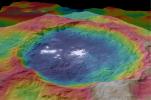
-
PIA19975:
-
Occator Topography
Full Resolution:
TIFF
(7.155 MB)
JPEG
(273.6 kB)
|
|
|
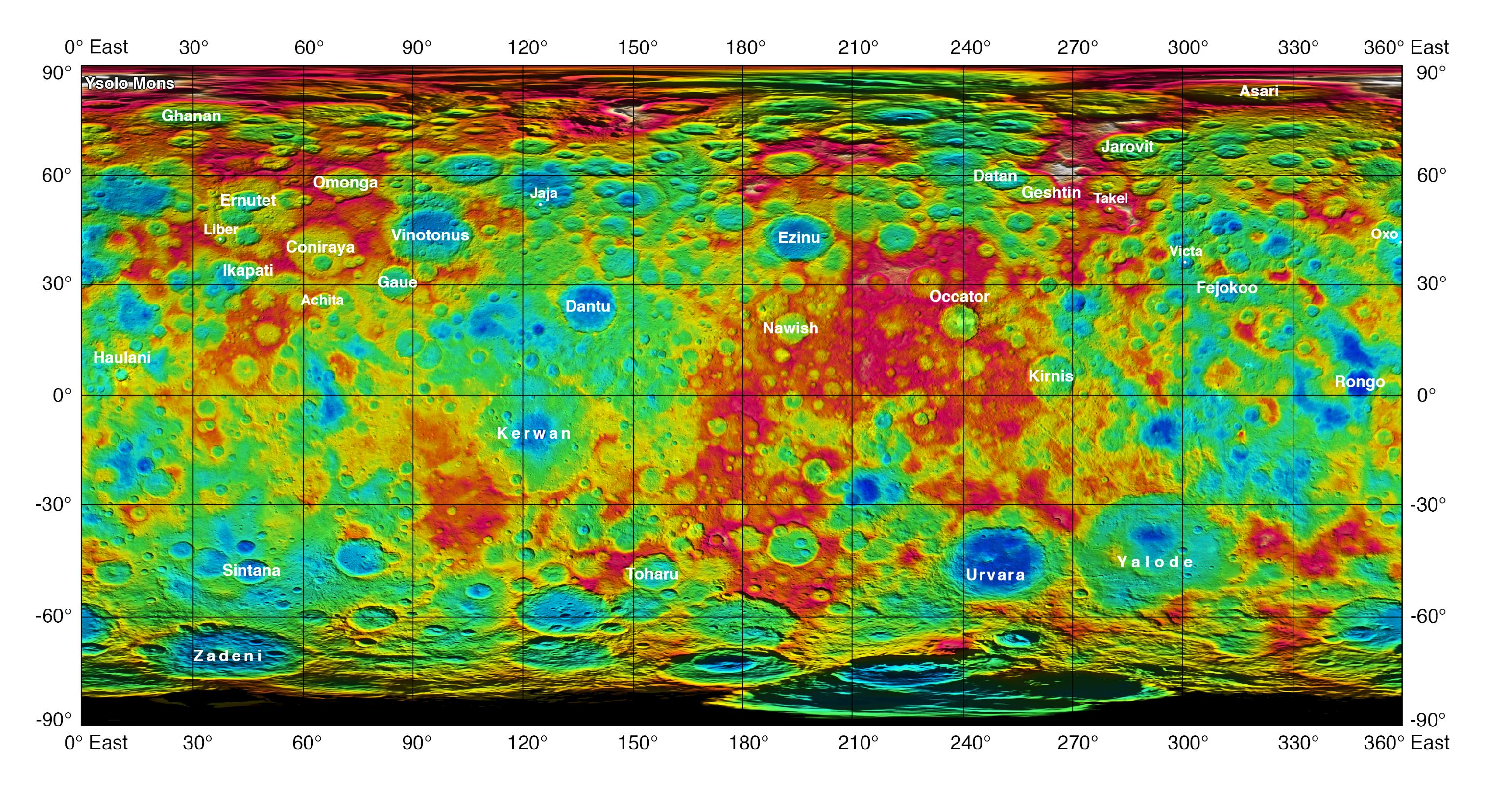
2015-09-30 |
Ceres
|
Dawn
|
Framing Camera
|
3032x1626x3 |
|
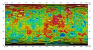
-
PIA19974:
-
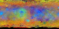
Topographic Ceres Map with Feature Names II
Full Resolution:
TIFF
(12.85 MB)
JPEG
(948.9 kB)
|
|
|
2015-09-29 |
Ceres
|
Dawn
|
Framing Camera
|
1024x1024x1 |
|
-
PIA19904:
-
Dawn HAMO Image 26
Full Resolution:
TIFF
(1.05 MB)
JPEG
(178.5 kB)
|
|
|
2015-09-29 |
Mars
|
2001 Mars Odyssey
|
THEMIS
|
732x1677x3 |
|
-
PIA19785:
-
Mawrth Valles - False Color
Full Resolution:
TIFF
(2.5 MB)
JPEG
(111.2 kB)
|
|
|
2015-09-28 |
Ceres
|
Dawn
|
Framing Camera
|
1024x1024x1 |

|
-
PIA19903:
-
Dawn HAMO Image 25
Full Resolution:
TIFF
(1.05 MB)
JPEG
(141.5 kB)
|
|
|
2015-09-28 |
Mars
|
Mars Reconnaissance Orbiter (MRO)
|
HiRISE
|
1241x845x3 |

|
-
PIA19919:
-
Animation of Site of Seasonal Flows in Hale Crater, Mars
Full Resolution:
TIFF
(3.094 MB)
JPEG
(85.26 kB)
|
|
|
2015-09-28 |
Mars
|
Mars Reconnaissance Orbiter (MRO)
|
HiRISE
|
1920x997x1 |
|
-
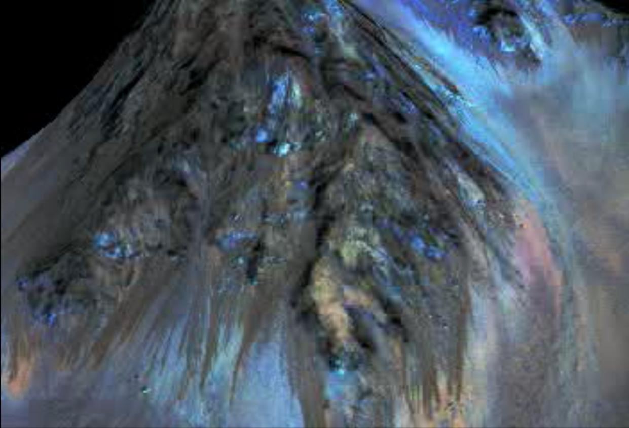
PIA19918:
-
Recurring "Lineae" on Slopes at Horowitz Crater
Full Resolution:
TIFF
(1.334 MB)
JPEG
(238.8 kB)
|
|
|
2015-09-28 |
Mars
|
Mars Reconnaissance Orbiter (MRO)
|
HiRISE
|
1920x997x1 |
|
-
PIA19917:
-
Dark, Recurring Streaks on Walls of Garni Crater
Full Resolution:
TIFF
(1.532 MB)
JPEG
(296.4 kB)
|
|
|
2015-09-28 |
Mars
|
Mars Reconnaissance Orbiter (MRO)
|
HiRISE
|
1920x997x3 |

|
-
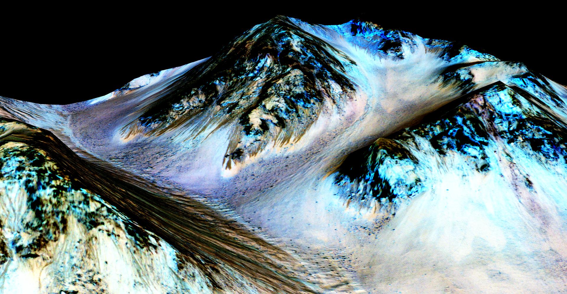
PIA19916:
-
Recurring 'Lineae' on Slopes at Hale Crater, Mars
Full Resolution:
TIFF
(3.078 MB)
JPEG
(403.4 kB)
|
|
|
2015-09-28 |
Mars
|
2001 Mars Odyssey
|
THEMIS
|
715x1665x3 |
|
-
PIA19784:
-
Candor Chasma - False Color
Full Resolution:
TIFF
(2.583 MB)
JPEG
(155 kB)
|
 Planetary Data System


