My
List |
Addition Date
|
Target
|
Mission
|
Instrument
|
Size
|

|
2014-11-04 |
Mars
|
Mars Science Laboratory (MSL)
|
Mastcam
|
4067x2184x3 |
|
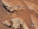
-
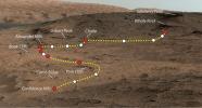
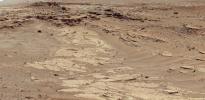
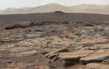
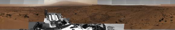
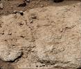
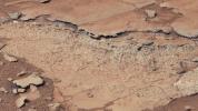
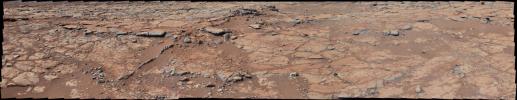
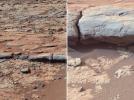
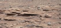
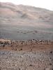
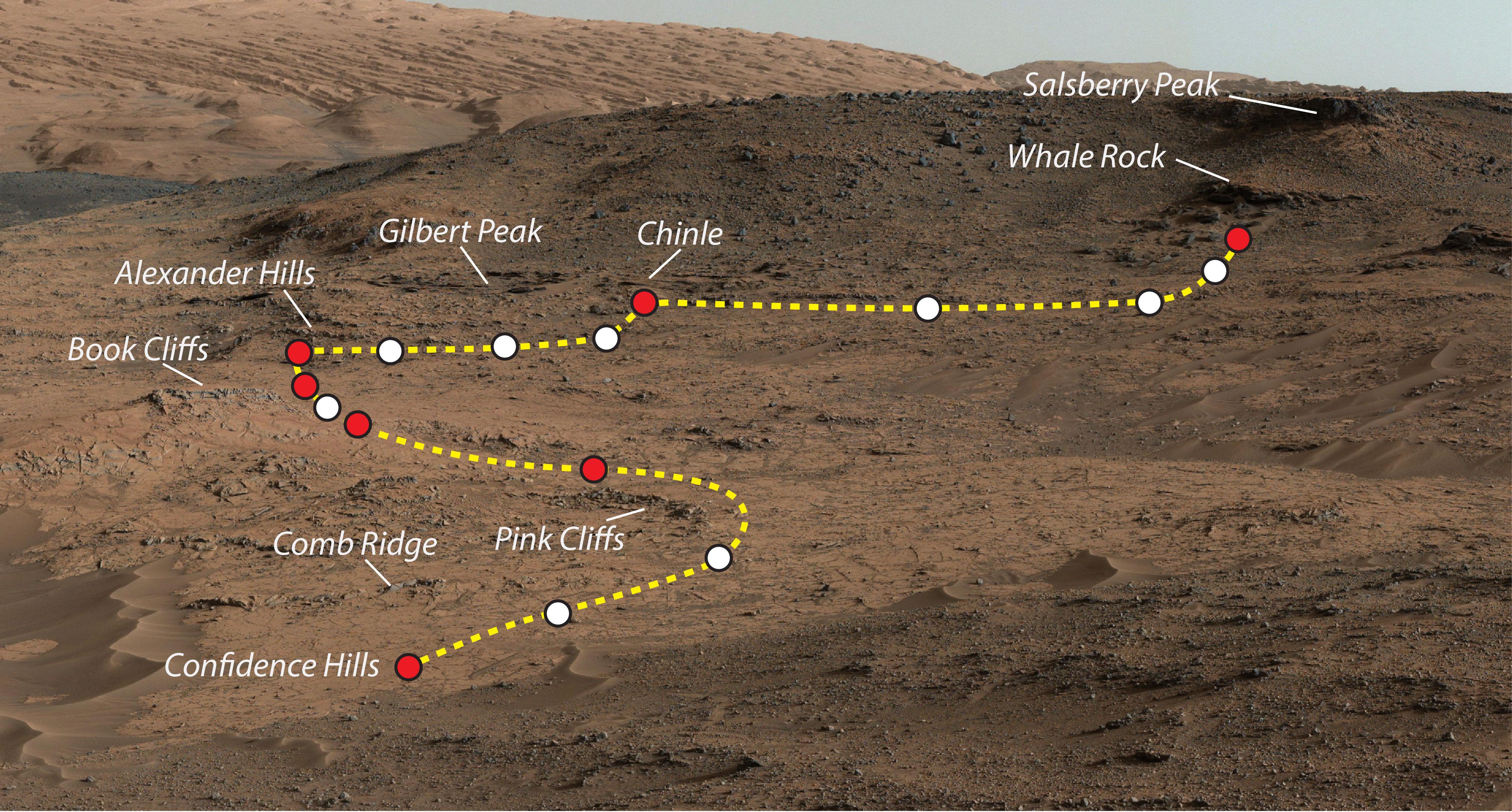
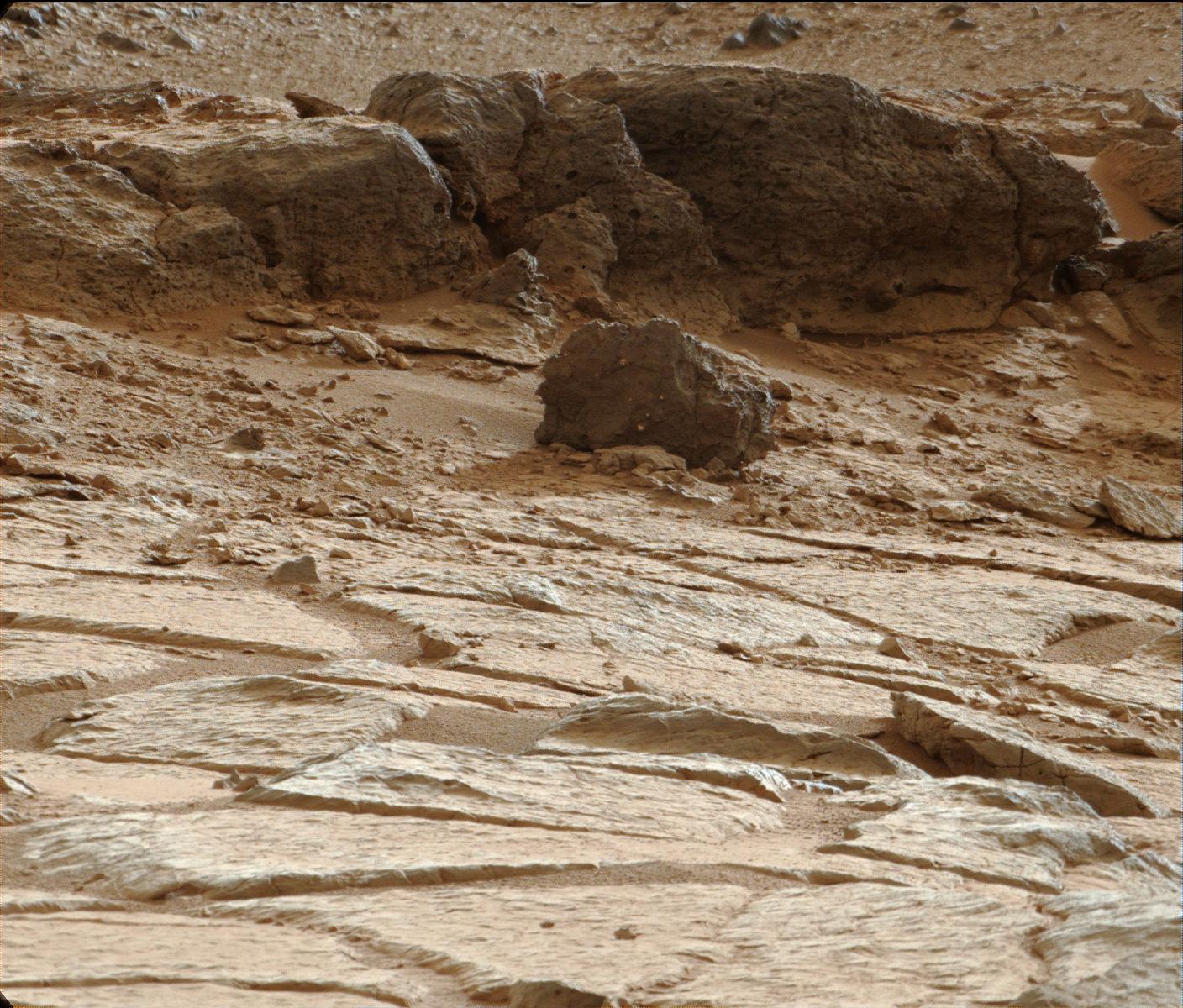
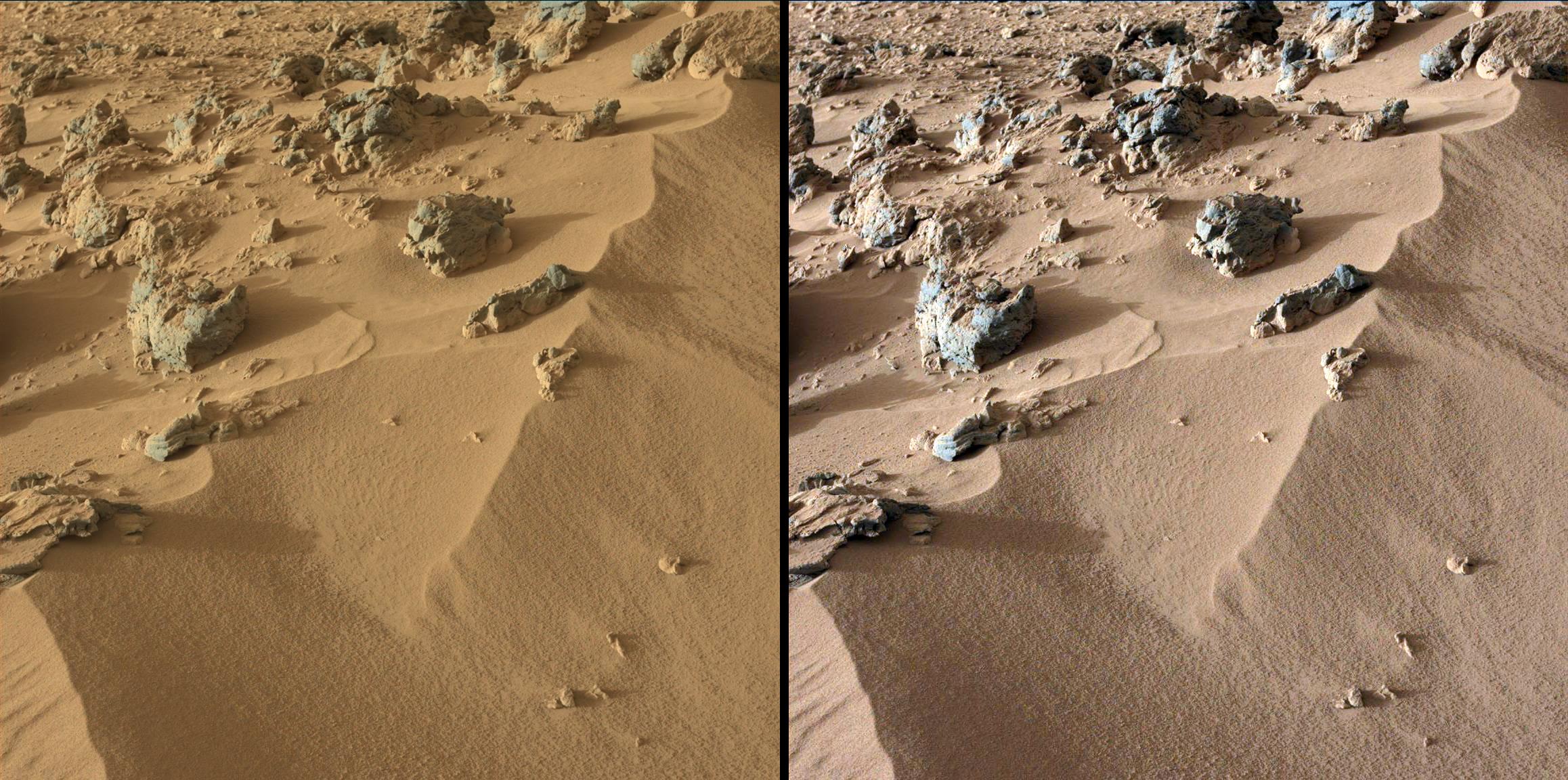
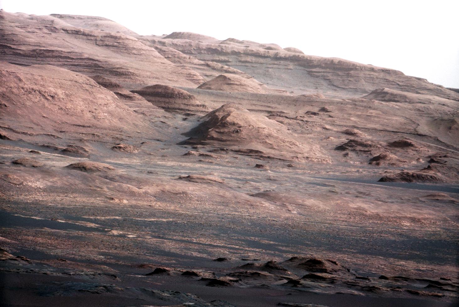
PIA19039:
-
Mars Rover Curiosity's Walkabout at 'Pahrump Hills'
Full Resolution:
TIFF
(26.66 MB)
JPEG
(1.645 MB)
|
|
|
2014-11-04 |
Mars
|
Mars Science Laboratory (MSL)
|
Mastcam
|
768x768x3 |
|
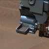
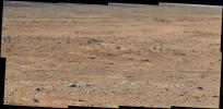
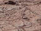
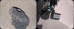
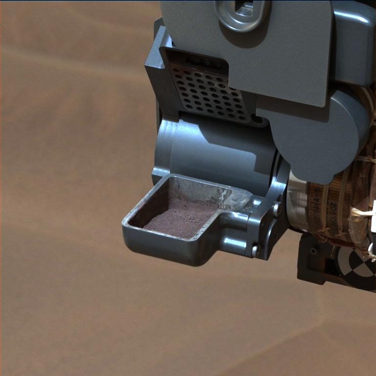
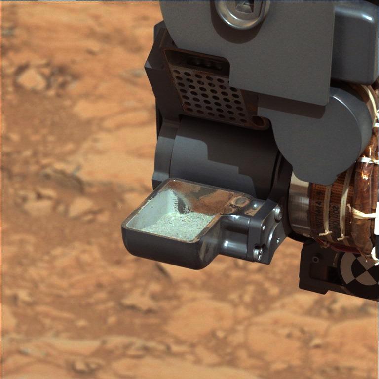
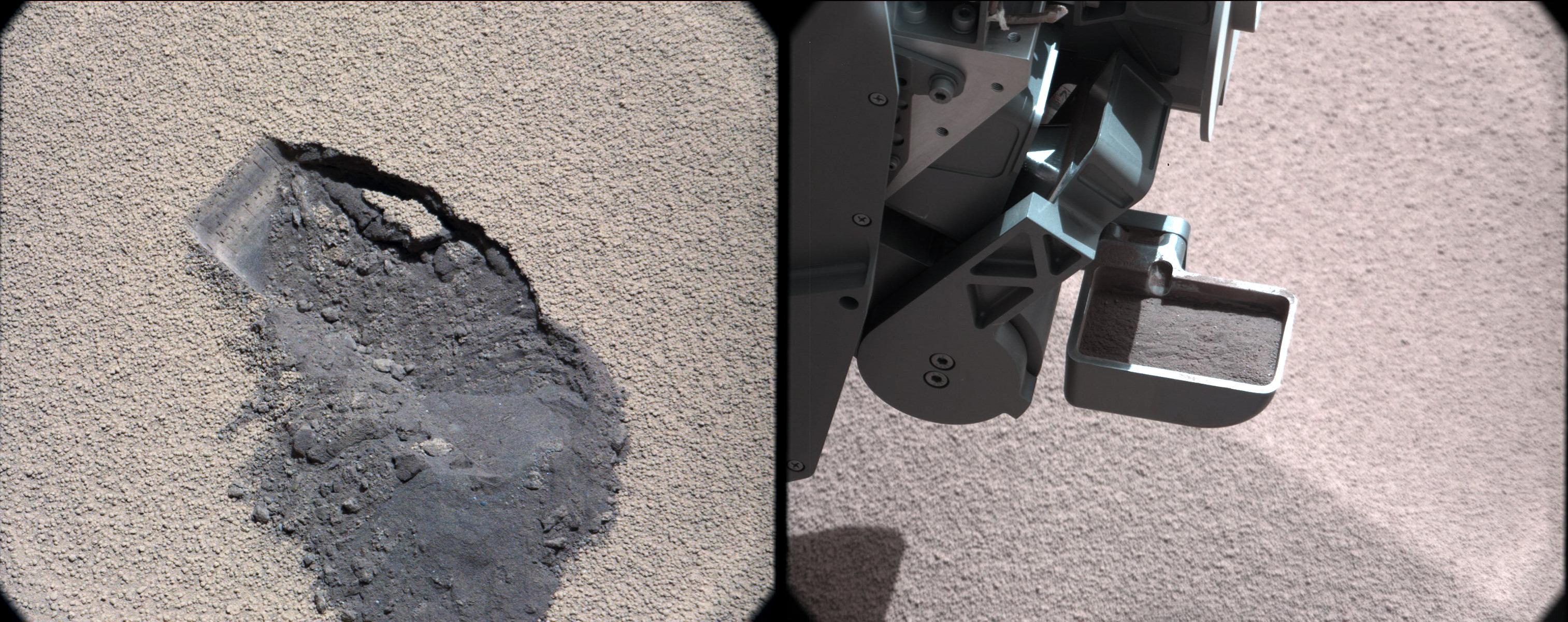
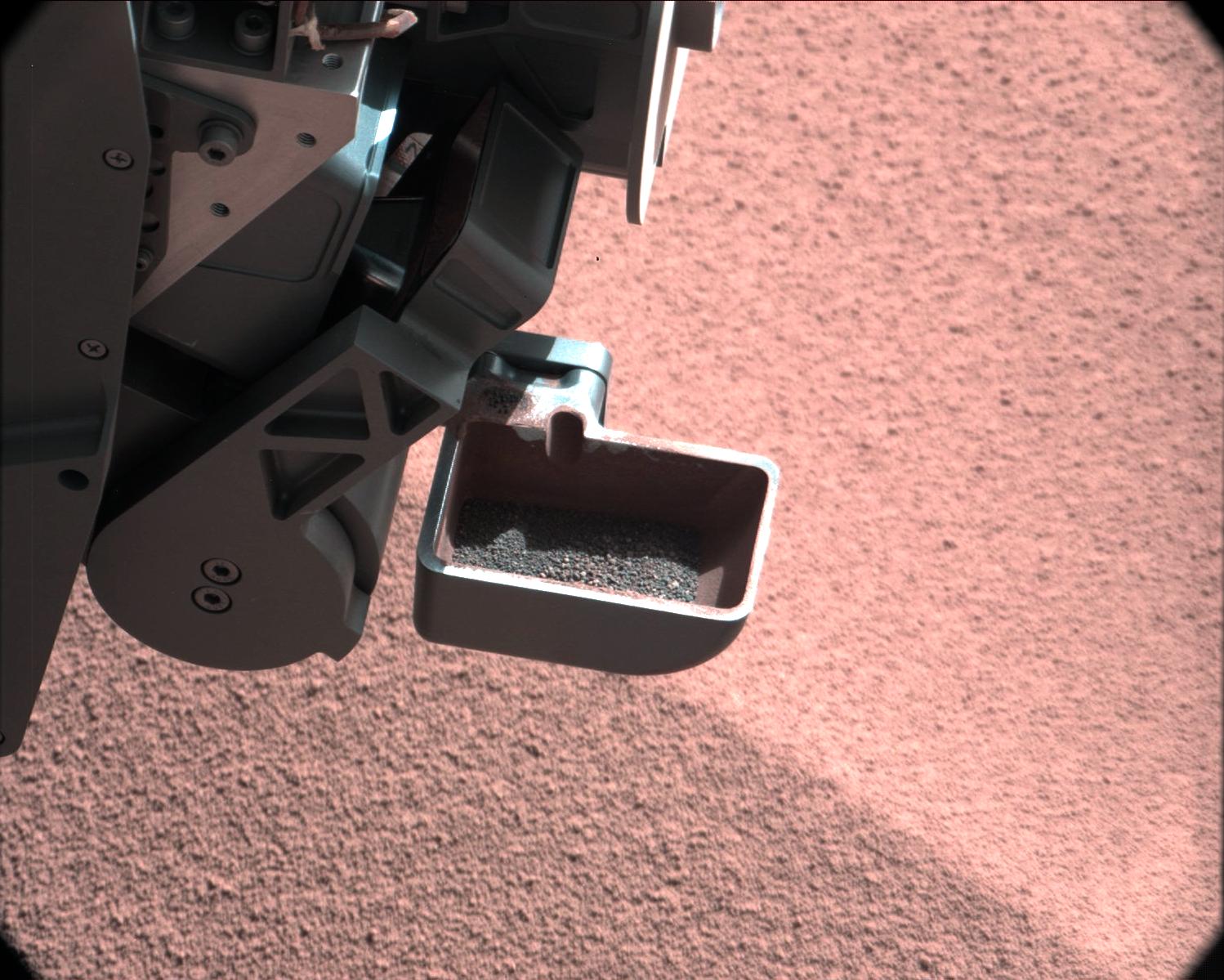
-
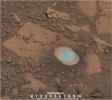
PIA19037:
-
'Confidence Hills' Drill Powder in Scoop
Full Resolution:
TIFF
(1.77 MB)
JPEG
(48.85 kB)
|
|
|
2014-11-04 |
Mars
|
Mars Science Laboratory (MSL)
|
Mastcam
|
1344x1200x3 |
|
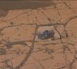
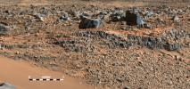
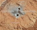
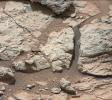
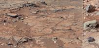
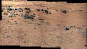
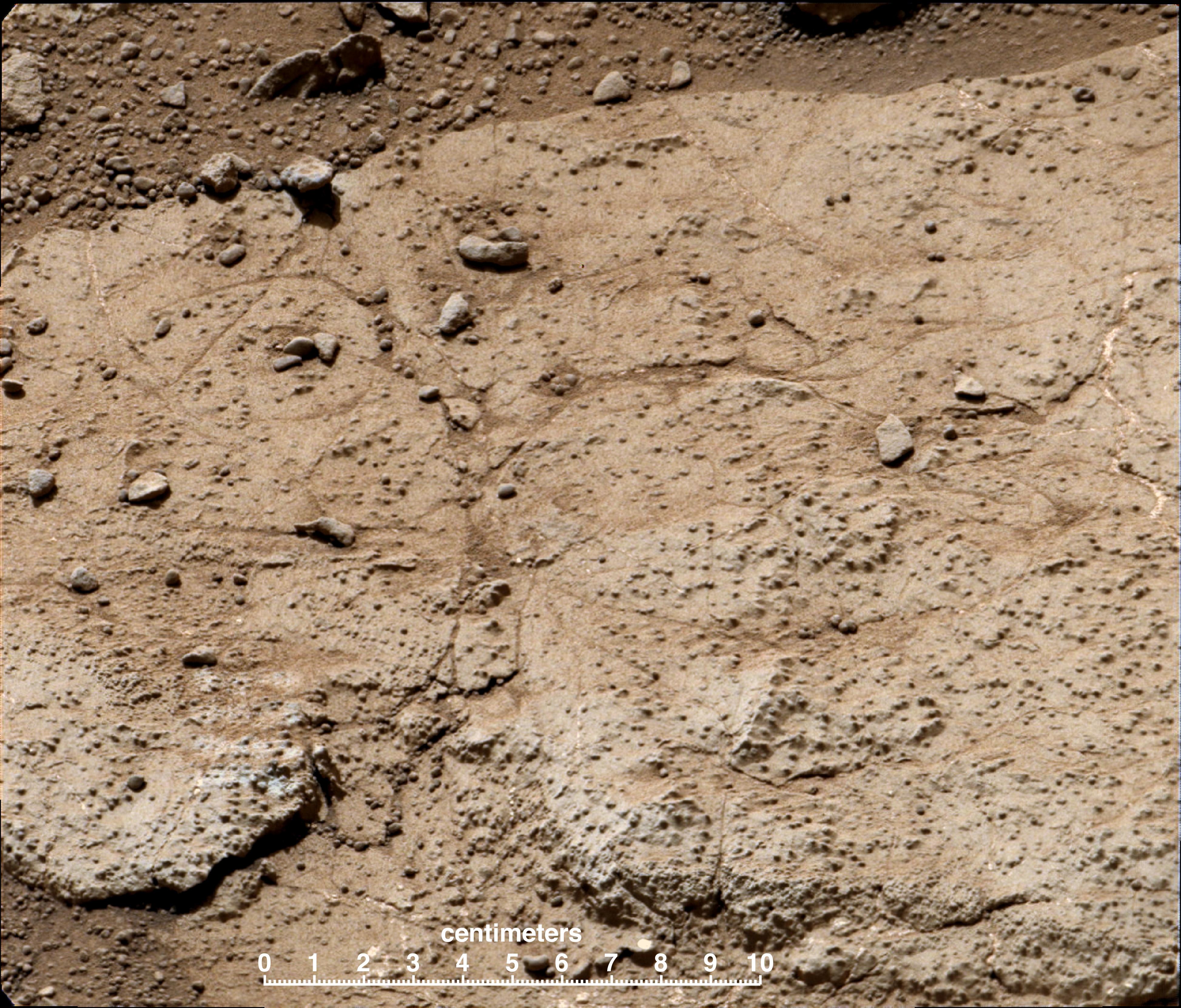
-
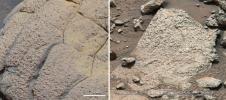
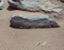
PIA19036:
-
'Confidence Hills' -- The First Mount Sharp Drilling Site
Full Resolution:
TIFF
(4.84 MB)
JPEG
(233.4 kB)
|
|
|
2014-09-25 |
Mars
|
Mars Science Laboratory (MSL)
|
Mastcam
|
6886x2279x3 |
|
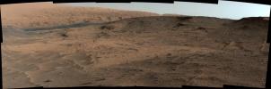
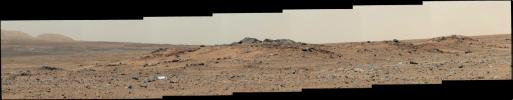
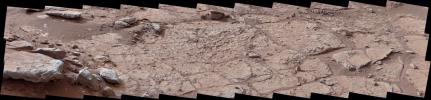
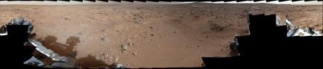
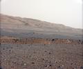
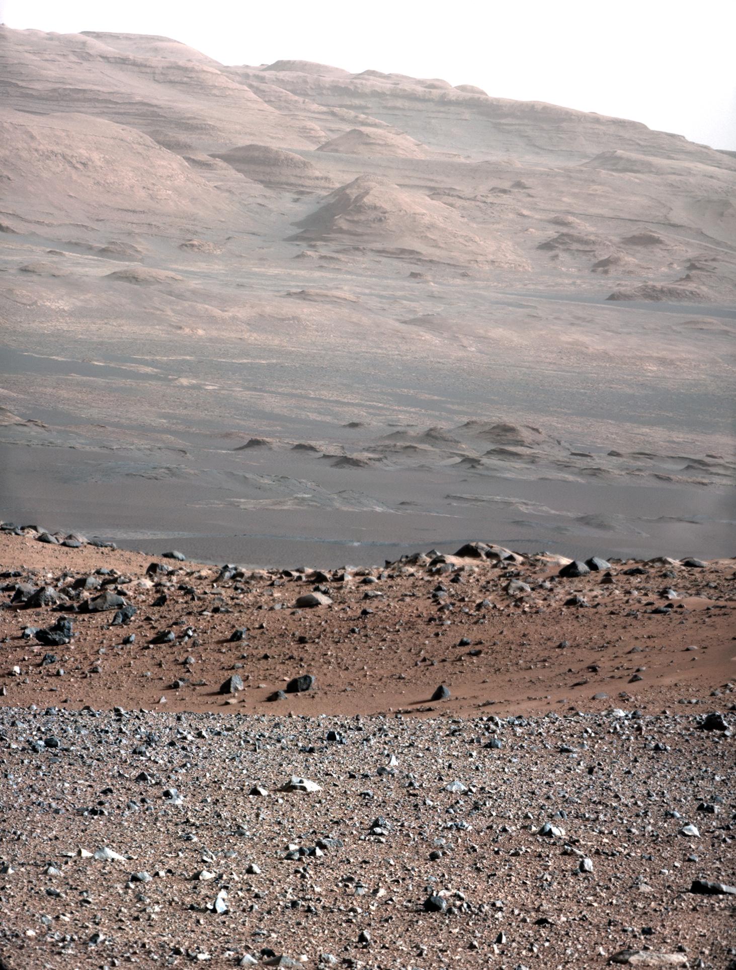
-
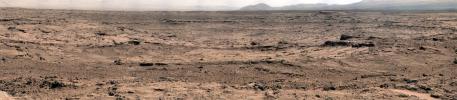
PIA18608:
-
Curiosity Mars Rover's Approach to 'Pahrump Hills'
Full Resolution:
TIFF
(47.1 MB)
JPEG
(2.455 MB)
|
|
|
2014-09-11 |
Mars
|
Mars Science Laboratory (MSL)
|
Mastcam
|
1319x1187x3 |

|
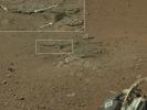
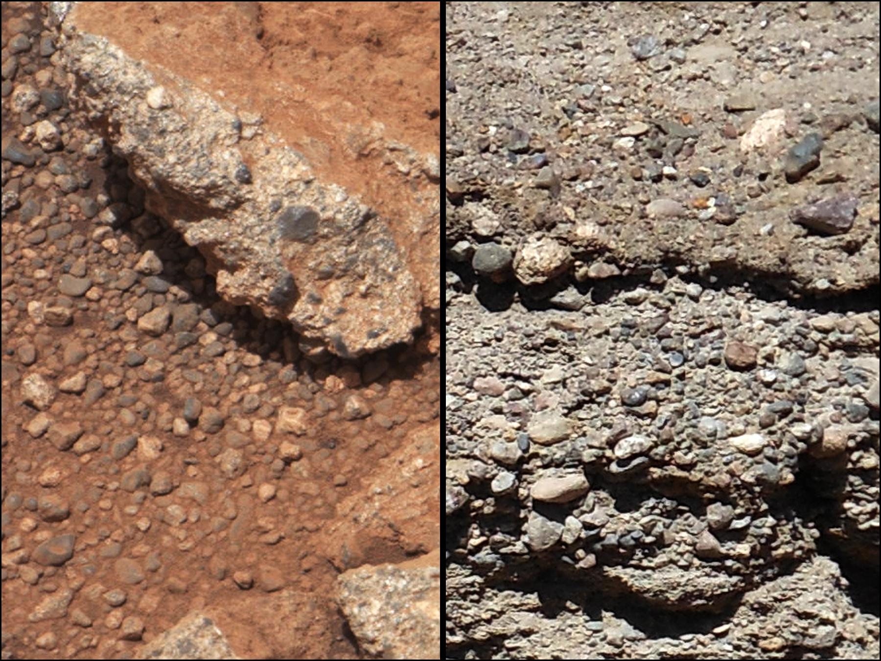
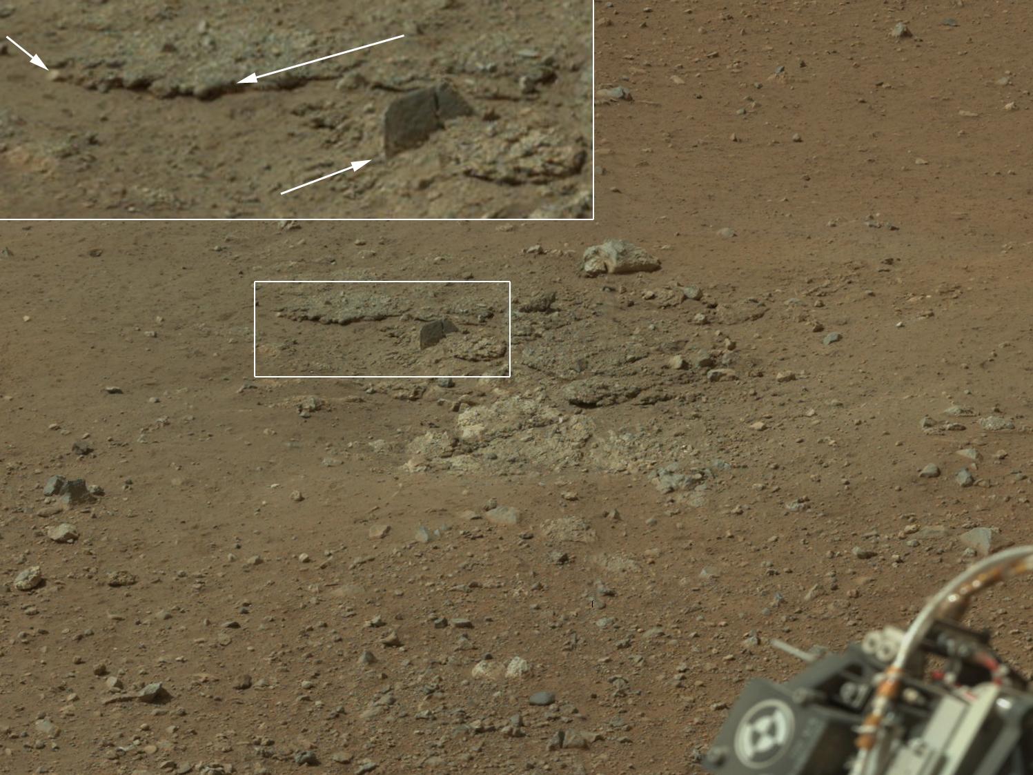
-
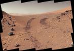
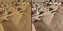
PIA18478:
-
Loose Rock Leads to Incomplete Drilling
Full Resolution:
TIFF
(4.699 MB)
JPEG
(278.6 kB)
|
|
|
2014-09-11 |
Mars
|
Mars Science Laboratory (MSL)
|
Mastcam
|
1315x1179x3 |
|
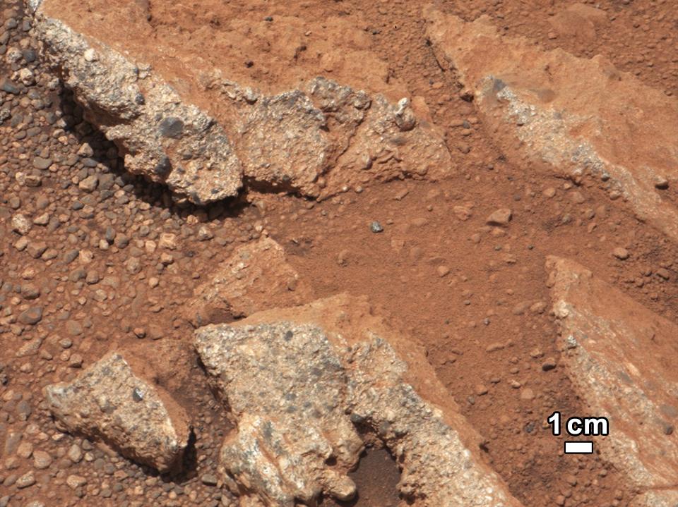
-
PIA18477:
-
A Bonanza of Clues About Mars
Full Resolution:
TIFF
(4.653 MB)
JPEG
(253.2 kB)
|
|
|
2014-09-11 |
Mars
|
Mars Science Laboratory (MSL)
|
Mastcam
|
2102x984x3 |
|
-
PIA18476:
-
Martian Layers Thicker on Top
Full Resolution:
TIFF
(6.208 MB)
JPEG
(479.9 kB)
|
|
|
2014-09-11 |
Mars
|
Mars Science Laboratory (MSL)
|
Mastcam
|
6612x1241x3 |

|
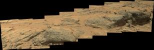
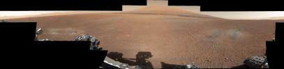
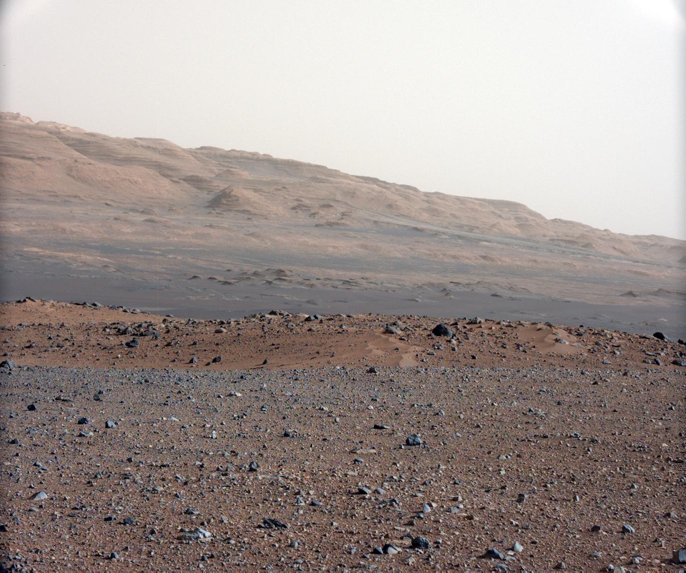
-
PIA18473:
Curiosity Marches Onward and Upward
Full Resolution:
TIFF
(24.63 MB)
JPEG
(1.424 MB)
|
|
|
2014-07-15 |
Mars
|
Mars Science Laboratory (MSL)
|
ChemCam
Mastcam
|
8830x4230x3 |
|
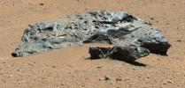
-
PIA18387:
-
Curiosity Finds Iron Meteorite on Mars
Full Resolution:
TIFF
(112.1 MB)
JPEG
(3.279 MB)
|
|
|
2014-04-25 |
Mars
|
Mars Science Laboratory (MSL)
|
Mastcam
|
2724x2031x3 |
|
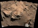
-
PIA18087:
-
Sandstone Target 'Windjana' May Be Next Martian Drilling Site
Full Resolution:
TIFF
(16.6 MB)
JPEG
(899.8 kB)
|
|
|
2014-03-24 |
Mars
|
Mars Science Laboratory (MSL)
|
Mastcam
|
2340x1143x3 |
|
-
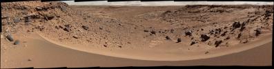
PIA17959:
-
Differential Erosion at Work on Martian Sandstones
Full Resolution:
TIFF
(8.027 MB)
JPEG
(556.2 kB)
|
|
|
2014-02-19 |
Mars
|
Mars Science Laboratory (MSL)
|
Mastcam
|
4890x3361x3 |
|
-
PIA17944:
-
Curiosity's Color View of Martian Dune After Crossing It
Full Resolution:
TIFF
(49.33 MB)
JPEG
(2.485 MB)
|
|
|
2014-02-03 |
Mars
|
Mars Science Laboratory (MSL)
|
Mastcam
|
9074x2287x3 |
|
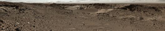
-
PIA17931:
Martian Valley May Be Curiosity's Route
Full Resolution:
TIFF
(62.28 MB)
JPEG
(4.277 MB)
|
|
|
2014-01-29 |
Mars
|
Mars Science Laboratory (MSL)
|
Mastcam
|
5544x1047x3 |
|
-
PIA17766:
Curiosity Mars Rover Approaches 'Dingo Gap,' Mastcam View
Full Resolution:
TIFF
(17.42 MB)
JPEG
(1.284 MB)
|
|
|
2013-12-09 |
Mars
|
Mars Science Laboratory (MSL)
|
Mastcam
|
2853x1800x3 |
|
-
PIA17603:
-
Erosion by Scarp Retreat in Gale Crater
Full Resolution:
TIFF
(15.41 MB)
JPEG
(699.4 kB)
|
|
|
2013-09-10 |
Mars
|
Mars Science Laboratory (MSL)
|
Mastcam
|
4605x2258x3 |
|
-
PIA17360:
-
'Darwin' Outcrop at 'Waypoint 1' of Curiosity's trek to Mount Sharp
Full Resolution:
TIFF
(31.21 MB)
JPEG
(1.826 MB)
|
|
|
2013-08-02 |
Mars
|
Mars Science Laboratory (MSL)
|
Mastcam
|
7651x1488x3 |
|
-
PIA17083:
Curiosity Sol 343 Vista With 'Twin Cairns' on Route to Mount Sharp
Full Resolution:
TIFF
(34.17 MB)
JPEG
(1.305 MB)
|
|
|
2013-06-25 |
Mars
|
Mars Science Laboratory (MSL)
|
Mastcam
|
11037x3592x3 |
|
-
PIA17268:
-
Puzzling 'Point Lake' Outcrop Revisited
Full Resolution:
TIFF
(119 MB)
JPEG
(4.198 MB)
|
|
|
2013-06-19 |
Mars
|
Mars Science Laboratory (MSL)
|
Mastcam
Navcam (MSL)
|
17548x3022x3 |
|
-
PIA16918:
Billion-Pixel View From Curiosity at Rock Nest, White-Balanced
Full Resolution:
TIFF
(159.1 MB)
JPEG
(7.72 MB)
|
|
|
2013-06-05 |
Mars
|
Mars Science Laboratory (MSL)
|
Mastcam
|
1408x1200x3 |
|
-
PIA17071:
-
'Point Lake' Outcrop in Gale Crater
Full Resolution:
TIFF
(5.071 MB)
JPEG
(340.8 kB)
|
|
|
2013-05-30 |
Mars
|
Mars Science Laboratory (MSL)
|
Mastcam
|
2498x1126x3 |
|
-
PIA17063:
-
Evidence About a Martian Streambed (Stereo)
Full Resolution:
TIFF
(8.441 MB)
JPEG
(394.8 kB)
|
|
|
2013-05-30 |
Mars
|
Mars Science Laboratory (MSL)
|
Mastcam
|
4372x5883x3 |
|
-
PIA17062:
-
Remnants of Ancient Streambed on Mars (White-Balanced View)
Full Resolution:
TIFF
(77.21 MB)
JPEG
(2.608 MB)
|
|
|
2013-05-09 |
Mars
|
Mars Science Laboratory (MSL)
|
Mastcam
|
3894x3322x3 |
|
-
PIA16927:
-
'Cumberland' Target for Drilling by Curiosity Mars Rover
Full Resolution:
TIFF
(38.82 MB)
JPEG
(1.899 MB)
|
|
|
2013-04-08 |
Mars
|
Mars Science Laboratory (MSL)
|
Mastcam
|
1420x1159x3 |
|
-
PIA16815:
-
Dust from Mars Drilling: Tailings and Discard Piles
Full Resolution:
TIFF
(4.939 MB)
JPEG
(335.9 kB)
|
|
|
2013-03-18 |
Mars
|
Mars Science Laboratory (MSL)
|
Mastcam
|
1150x863x3 |

|
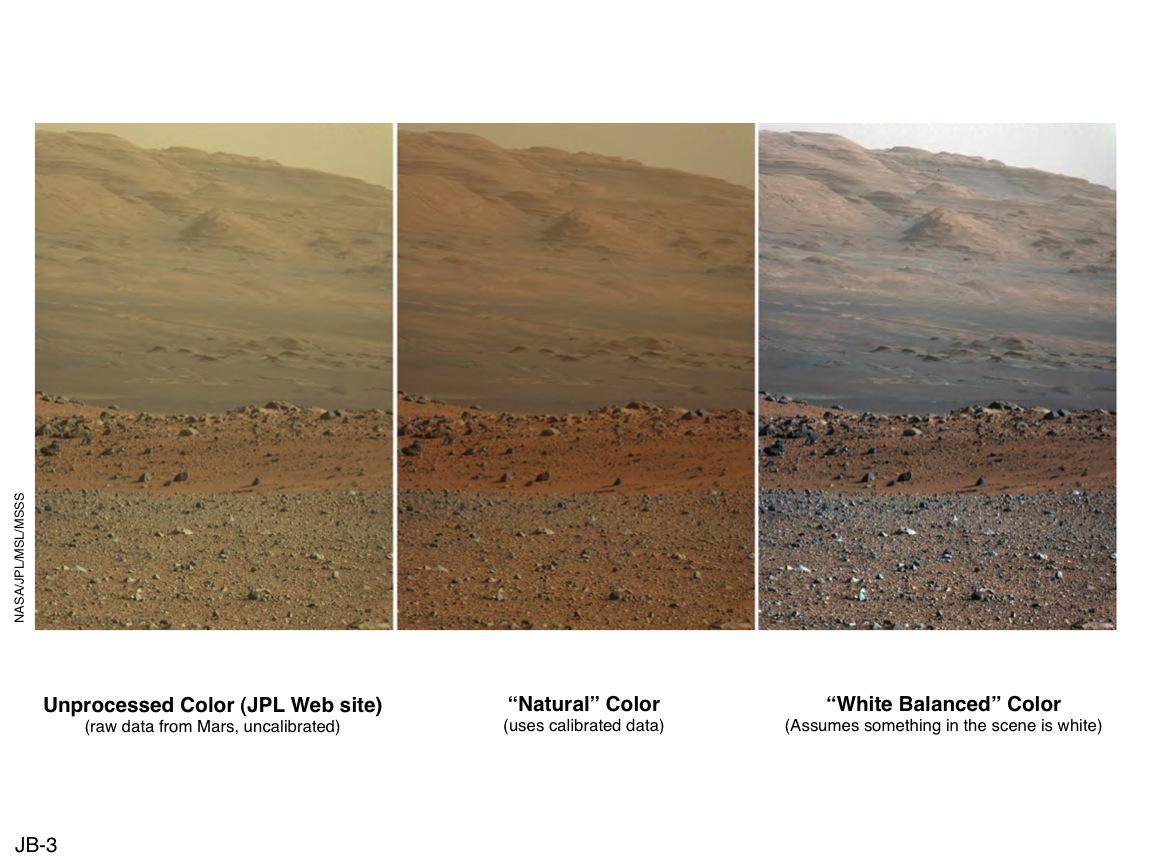
-
PIA16800:
-
'Raw,' 'Natural' and 'White-Balanced' Views of Martian Terrain
Full Resolution:
TIFF
(2.979 MB)
JPEG
(108 kB)
|
|
|
2013-03-15 |
Mars
|
Mars Science Laboratory (MSL)
|
Mastcam
|
14585x2018x3 |
|
-
PIA16769:
Mount Sharp Panorama in Raw Colors
Full Resolution:
TIFF
(88.31 MB)
JPEG
(1.377 MB)
|
|
|
2013-03-15 |
Mars
|
Mars Science Laboratory (MSL)
|
Mastcam
|
14576x2018x3 |
|
-
PIA16768:
Mount Sharp Panorama in White-Balanced Colors
Full Resolution:
TIFF
(88.26 MB)
JPEG
(2.085 MB)
|
|
|
2013-03-12 |
Mars
|
Mars Exploration Rover (MER)
Mars Science Laboratory (MSL)
|
Mastcam
Panoramic Camera
|
2660x1179x3 |
|
-
PIA16833:
-
Two Different Aqueous Environments
Full Resolution:
TIFF
(9.412 MB)
JPEG
(605.8 kB)
|
|
|
2013-02-25 |
Mars
|
Mars Science Laboratory (MSL)
|
CHIMRA
Mastcam
SAM
|
1600x1200x3 |
|
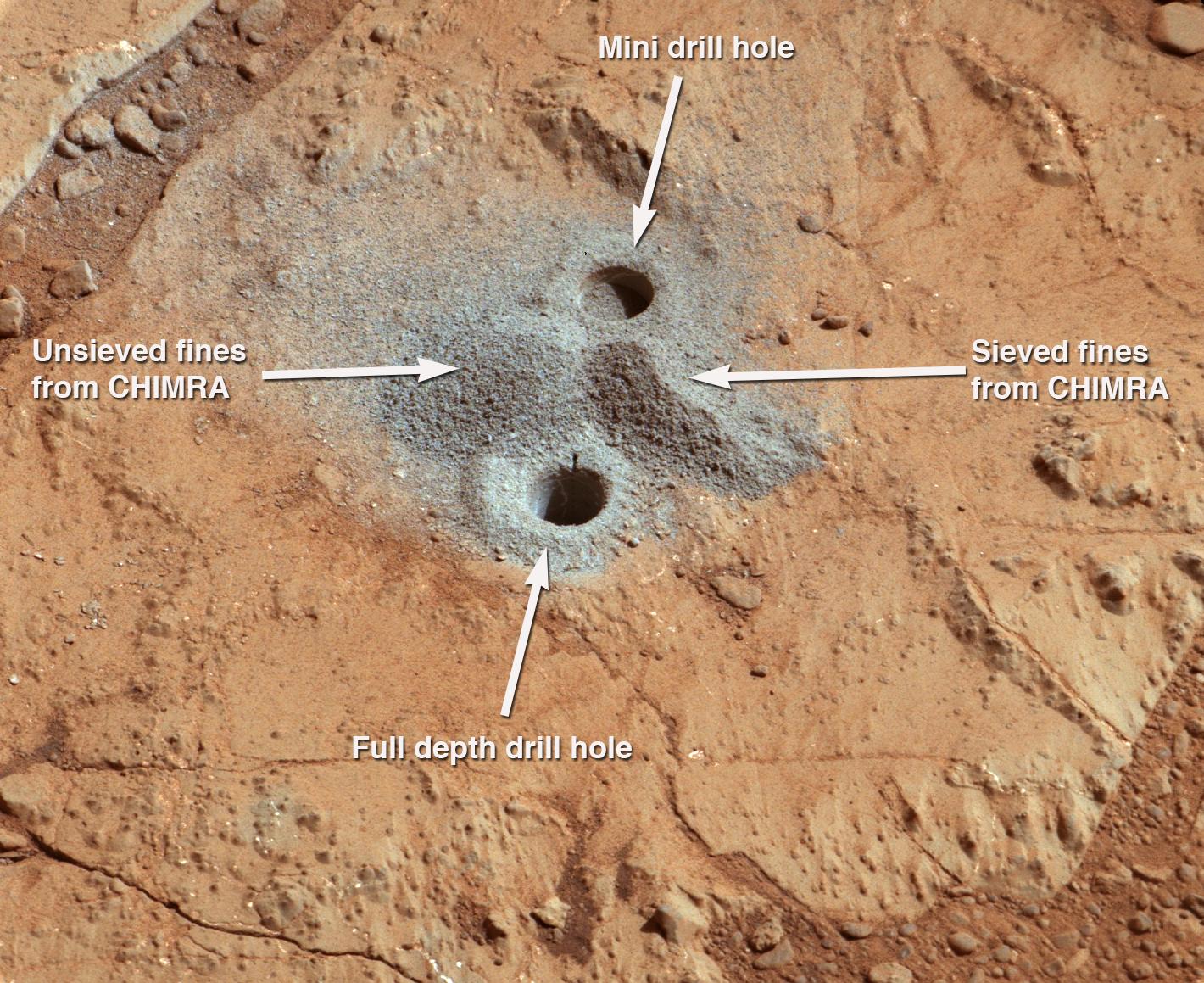
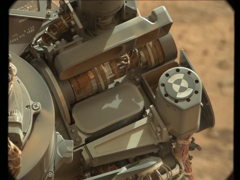
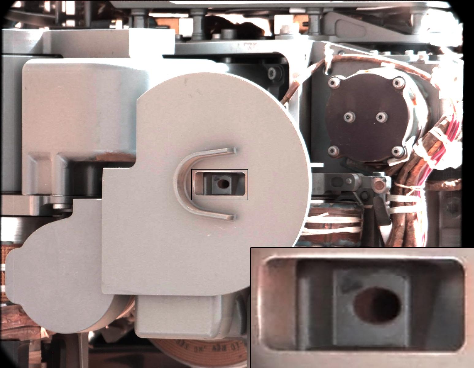
-
PIA16766:
-
Check-up Image After Delivering Martian Rock Powder
Full Resolution:
TIFF
(5.762 MB)
JPEG
(184.4 kB)
|
|
|
2013-02-20 |
Mars
|
Mars Science Laboratory (MSL)
|
CHIMRA
Mastcam
|
768x768x3 |

|
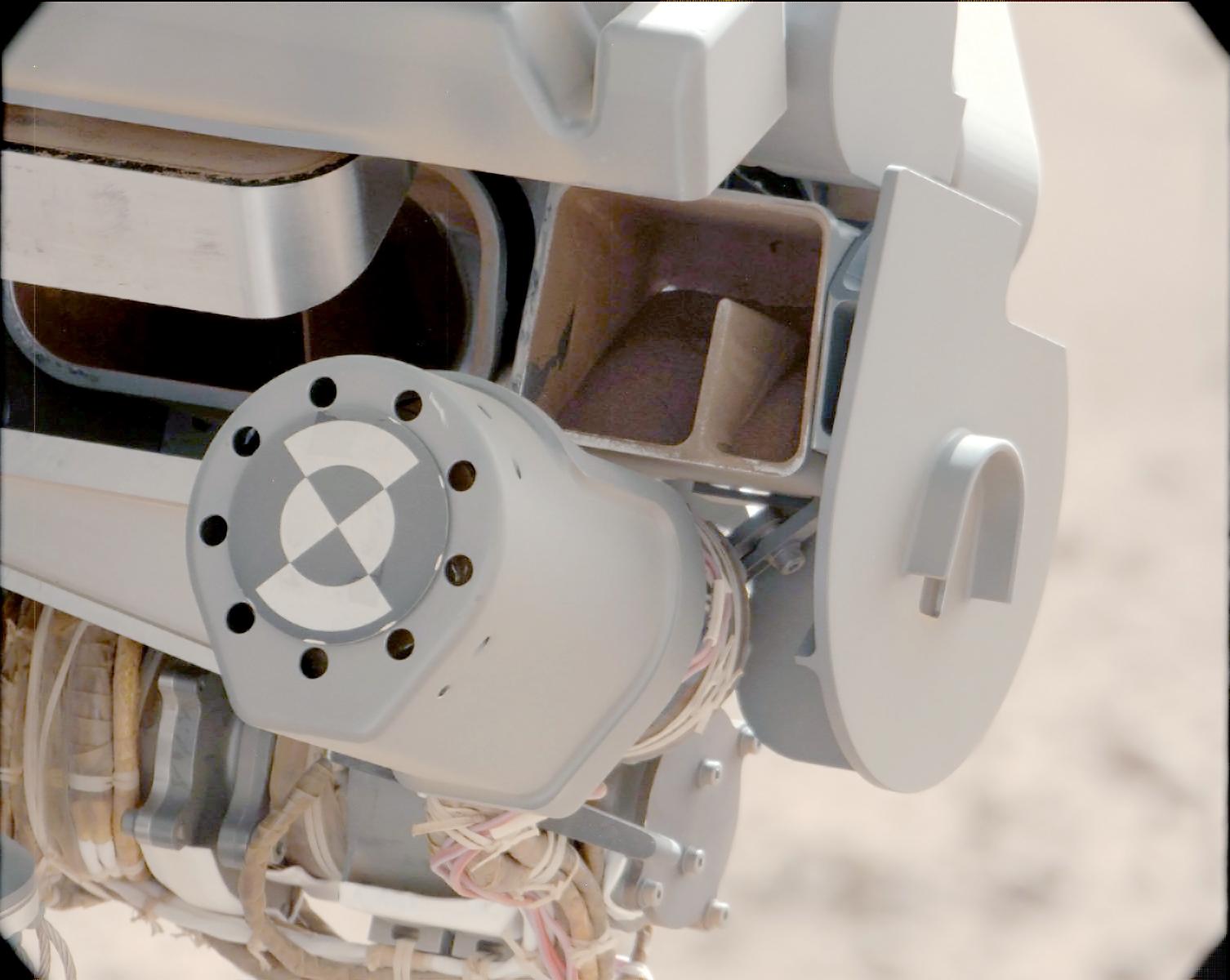
-
PIA16729:
-
First Curiosity Drilling Sample in the Scoop
Full Resolution:
TIFF
(1.77 MB)
JPEG
(59.15 kB)
|
|
|
2013-02-20 |
Mars
|
Mars Science Laboratory (MSL)
|
CHIMRA
Mastcam
|
800x600x3 |

|
-
PIA16688:
-
Sifting Martian Samples
Full Resolution:
TIFF
(1.441 MB)
JPEG
(54.52 kB)
|
|
|
2013-02-20 |
Mars
|
Mars Science Laboratory (MSL)
|
Mastcam
|
2400x465x3 |
|
-
PIA16685:
Setting the Scene for Curiosity's First Drilling
Full Resolution:
TIFF
(3.349 MB)
JPEG
(334.6 kB)
|
|
|
2013-02-09 |
Mars
|
Mars Science Laboratory (MSL)
|
Mastcam
|
7107x5681x3 |

|
-
PIA16686:
-
Investigating Curiosity's Drill Area
Full Resolution:
TIFF
(121.2 MB)
JPEG
(5.308 MB)
|
|
|
2013-01-15 |
Mars
|
Mars Science Laboratory (MSL)
|
Mastcam
|
1227x919x3 |
|
-
PIA16707:
-
'Shaler' Unit's Evidence of Stream Flow
Full Resolution:
TIFF
(3.384 MB)
JPEG
(232.4 kB)
|
|
|
2013-01-15 |
Mars
|
Mars Science Laboratory (MSL)
|
Mastcam
|
1501x844x3 |
|
-
PIA16706:
-
Spherules in 'Yellowknife Bay'
Full Resolution:
TIFF
(3.802 MB)
JPEG
(203.7 kB)
|
|
|
2013-01-15 |
Mars
|
Mars Science Laboratory (MSL)
|
Mastcam
|
1344x1200x3 |
|
-
PIA16705:
-
Veins in 'Sheepbed' Outcrop
Full Resolution:
TIFF
(4.84 MB)
JPEG
(456.9 kB)
|
|
|
2013-01-15 |
Mars
|
Mars Science Laboratory (MSL)
|
Mastcam
|
14016x3249x3 |
|
-
PIA16702:
Neighborhood for Curiosity's First Drilling Campaign
Full Resolution:
TIFF
(136.6 MB)
JPEG
(7.141 MB)
|
|
|
2013-01-15 |
Mars
|
Mars Science Laboratory (MSL)
|
Mastcam
|
14049x2720x3 |
|
-
PIA16701:
View from Inside 'Yellowknife Bay'
Full Resolution:
TIFF
(114.7 MB)
JPEG
(7.851 MB)
|
|
|
2013-01-15 |
Mars
|
Mars Science Laboratory (MSL)
|
Mastcam
|
4977x3714x3 |
|
-
PIA16569:
-
'Yellowknife Bay' Veins and Concretions
Full Resolution:
TIFF
(55.48 MB)
JPEG
(2.37 MB)
|
|
|
2013-01-15 |
Mars
|
Mars Science Laboratory (MSL)
|
Mastcam
|
19590x2421x3 |

|
-
PIA16700:
Wide View of 'Shaler' Outcrop, Sol 120
Full Resolution:
TIFF
(142.3 MB)
JPEG
(8.299 MB)
|
|
|
2013-01-15 |
Mars
|
Mars Science Laboratory (MSL)
|
Mastcam
|
12858x6312x3 |
|
-
PIA16568:
-
Diversity in Vicinity of Curiosity's First Drilling Target
Full Resolution:
TIFF
(243.5 MB)
JPEG
(12.8 MB)
|
|
|
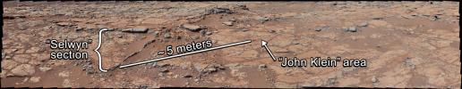
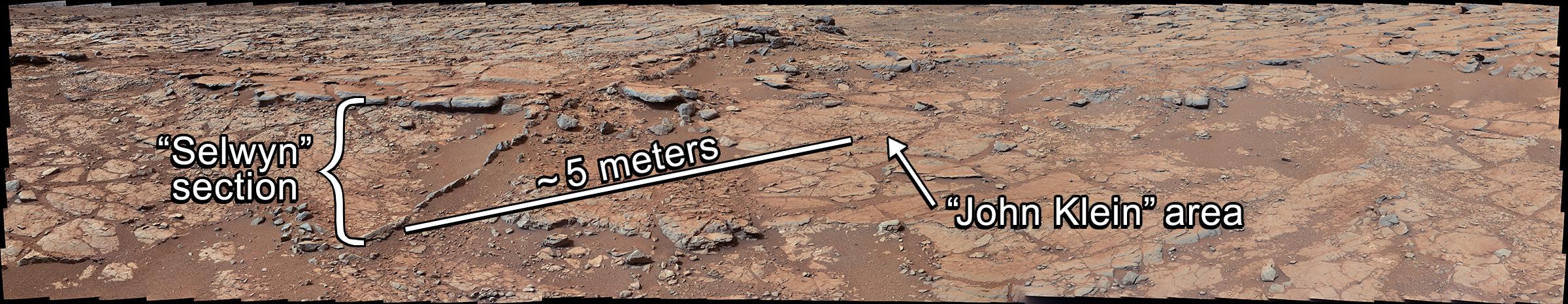
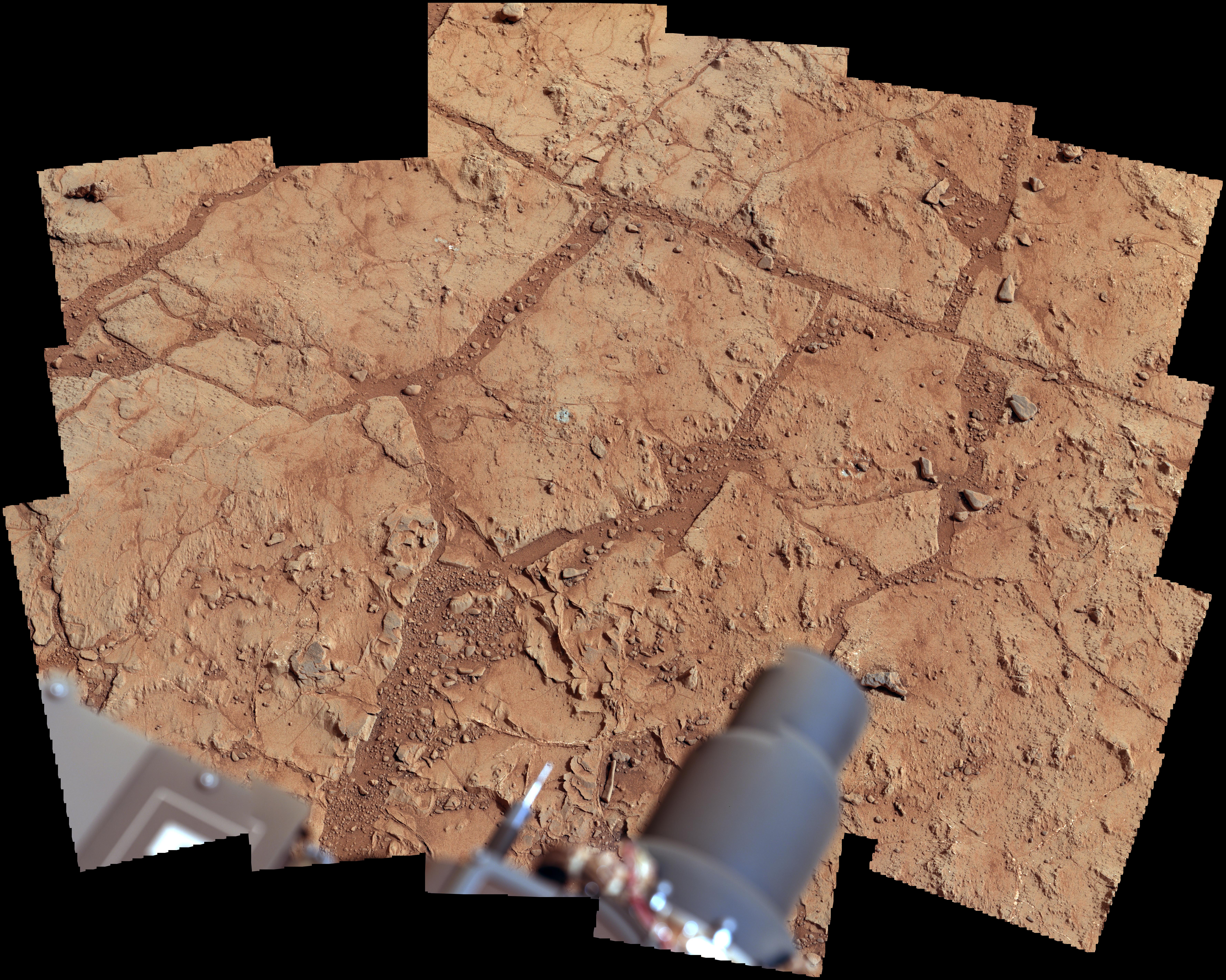
2013-01-15 |
Mars
|
Mars Science Laboratory (MSL)
|
Mastcam
|
3483x2651x3 |
|
-
PIA16567:
-
'John Klein' Site Selected for Curiosity's Drill Debut
Full Resolution:
TIFF
(27.71 MB)
JPEG
(1.787 MB)
|
|
|
2013-01-02 |
Mars
|
Mars Science Laboratory (MSL)
|
Mastcam
|
15338x3300x3 |
|
-
PIA16563:
Panoramic View From Near "Point Lake" in Gale Crater, Sol 106
Full Resolution:
TIFF
(151.9 MB)
JPEG
(7.168 MB)
|
|
|
2012-12-11 |
Mars
|
Mars Science Laboratory (MSL)
|
Mastcam
|
2438x1141x3 |
|
-
PIA16550:
-
Layered Martian Outcrop 'Shaler' in 'Glenelg' Area
Full Resolution:
TIFF
(8.349 MB)
JPEG
(481.8 kB)
|
|
|
2012-11-26 |
Mars
|
Mars Science Laboratory (MSL)
|
Mastcam
|
13726x3008x3 |
|
-
PIA16453:
Panoramic View From 'Rocknest' Position of Curiosity Mars Rover
Full Resolution:
TIFF
(123.9 MB)
JPEG
(7.811 MB)
|
|
|
2012-11-26 |
Mars
|
Mars Science Laboratory (MSL)
|
Mastcam
|
1851x1440x3 |
|
-
PIA16452:
-
A Martian Rock Called 'Rocknest 3'
Full Resolution:
TIFF
(7.999 MB)
JPEG
(538.1 kB)
|
|
|
2012-10-30 |
Mars
|
Mars Science Laboratory (MSL)
|
CheMin
Mastcam
|
2316x1152x3 |
|
-
PIA16174:
-
Wind-Blown Martian Sand
Full Resolution:
TIFF
(8.007 MB)
JPEG
(530.1 kB)
|
|
|
2012-10-30 |
Mars
|
Mars Science Laboratory (MSL)
|
CheMin
Mastcam
|
3027x1200x3 |
|
-
PIA16173:
-
Curiosity Digs In
Full Resolution:
TIFF
(10.9 MB)
JPEG
(660.7 kB)
|
|
|
2012-10-11 |
Mars
|
Mars Science Laboratory (MSL)
|
CHIMRA
Mastcam
|
1547x1200x3 |
|
-
PIA16196:
-
Thanks for the Scrub
Full Resolution:
TIFF
(5.571 MB)
JPEG
(161.2 kB)
|
|
|
2012-10-11 |
Mars
|
Mars Science Laboratory (MSL)
|
CHIMRA
Mastcam
|
1506x1200x3 |
|
-
PIA16195:
-
Sand Filtered through Curiosity's Sieve
Full Resolution:
TIFF
(5.424 MB)
JPEG
(113.8 kB)
|
|
|
2012-10-11 |
Mars
|
Mars Science Laboratory (MSL)
|
CHIMRA
Mastcam
|
1498x1199x3 |

|
-
PIA16194:
-
Too Big for the Sieve
Full Resolution:
TIFF
(5.39 MB)
JPEG
(229.6 kB)
|
|
|
2012-10-04 |
Mars
|
Mars Science Laboratory (MSL)
|
Mastcam
|
3926x2218x3 |
|
-
PIA16204:
-
'Rocknest' From Sol 52 Location
Full Resolution:
TIFF
(26.13 MB)
JPEG
(1.876 MB)
|
|
|
2012-09-27 |
Mars
|
Mars Science Laboratory (MSL)
|
Mastcam
|
1800x1350x3 |

|
-
PIA16189:
-
Rock Outcrops on Mars and Earth
Full Resolution:
TIFF
(7.293 MB)
JPEG
(399.8 kB)
|
|
|
2012-09-27 |
Mars
|
Mars Science Laboratory (MSL)
|
Mastcam
|
960x719x3 |
|
-
PIA16188:
-
Link to a Watery Past
Full Resolution:
TIFF
(2.072 MB)
JPEG
(143.4 kB)
|
|
|
2012-09-19 |
Mars
|
Mars Science Laboratory (MSL)
|
Mastcam
|
570x570x1 |
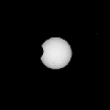
|
-
PIA16151:
-
Phobos in Transit

Full Resolution:
TIFF
(325.4 kB)
JPEG
(6.434 kB)
|
|
|
2012-09-12 |
Mars
|
Mars Science Laboratory (MSL)
|
MAHLI
Mastcam
|
917x688x3 |
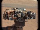
|
-
PIA16161:
-
Hello, MAHLI
Full Resolution:
TIFF
(1.894 MB)
JPEG
(70.73 kB)
|
|
|
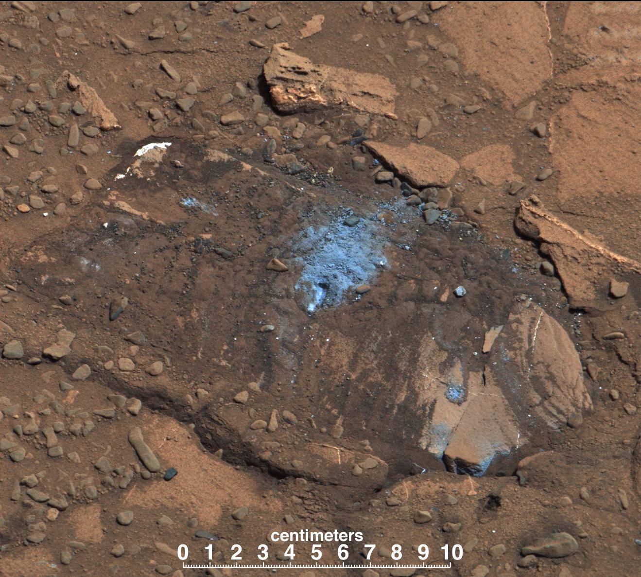
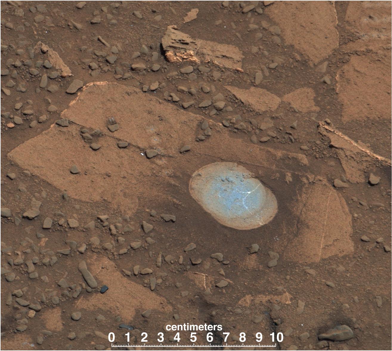
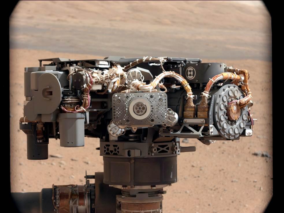
2012-09-12 |
Mars
|
Mars Science Laboratory (MSL)
|
Alpha Particle X-ray Spectrometer (MSL)
Mastcam
|
983x738x3 |

|
-
PIA16160:
-
Portrait of APXS on Mars
Full Resolution:
TIFF
(2.177 MB)
JPEG
(82.27 kB)
|
|
|
2012-08-27 |
Mars
|
Mars Science Laboratory (MSL)
|
Mastcam
|
1463x978x3 |
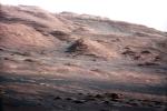
|
-
PIA16105:
-
Layers at the Base of Mount Sharp
Full Resolution:
TIFF
(4.294 MB)
JPEG
(222.6 kB)
|
|
|
2012-08-27 |
Mars
|
Mars Science Laboratory (MSL)
|
Mastcam
|
1463x1928x3 |
|
-
PIA16104:
-
Focusing the 100-millimeter Mastcam
Full Resolution:
TIFF
(8.465 MB)
JPEG
(523.5 kB)
|
|
|
2012-08-27 |
Mars
|
Mars Science Laboratory (MSL)
|
Mastcam
|
1375x1148x3 |
|
-
PIA16103:
-
Focusing the 34-millimeter Mastcam
Full Resolution:
TIFF
(4.738 MB)
JPEG
(276.7 kB)
|
|
|
2012-08-27 |
Mars
|
Mars Science Laboratory (MSL)
|
Mastcam
|
14494x3560x3 |
|
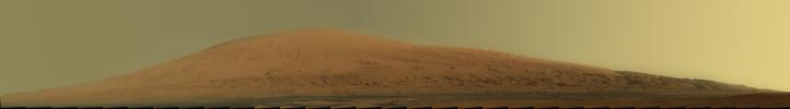
-
PIA16101:
Landing Site Panorama, with the Heights of Mount Sharp
Full Resolution:
TIFF
(154.8 MB)
JPEG
(6.485 MB)
|
|
|
2012-08-12 |
Mars
|
Mars Science Laboratory (MSL)
|
Mastcam
|
1497x1123x3 |
|
-
PIA16054:
-
Exposed by Rocket Engine Blasts
Full Resolution:
TIFF
(5.045 MB)
JPEG
(231.9 kB)
|
|
|
2012-08-12 |
Mars
|
Mars Science Laboratory (MSL)
|
Mastcam
|
1785x1267x3 |
|
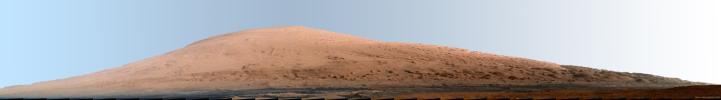
-
PIA16053:
-
Destination Mount Sharp
Full Resolution:
TIFF
(6.788 MB)
JPEG
(208.9 kB)
|
|
|
2012-08-12 |
Mars
|
Mars Science Laboratory (MSL)
|
Mastcam
|
1449x1089x3 |
|
-
PIA16052:
-
Wall of Gale Crater
Full Resolution:
TIFF
(4.736 MB)
JPEG
(89.12 kB)
|
|
|
2012-08-11 |
Mars
|
Mars Science Laboratory (MSL)
|
Mastcam
|
29184x4144x3 |
|
-
PIA16051:
First High-Resolution Color Mosaic of Curiosity's Mastcam Images
Full Resolution:
TIFF
(362.8 MB)
JPEG
(9.043 MB)
|
|
|
2012-08-09 |
Mars
|
Mars Science Laboratory (MSL)
|
Mastcam
|
3653x755x3 |
|
-
PIA16029:
Gale Crater Vista, in Glorious Color
Full Resolution:
TIFF
(8.277 MB)
JPEG
(271.7 kB)
|
 Planetary Data System


