My
List |
Addition Date
|
Target
|
Mission
|
Instrument
|
Size
|

|
2000-07-08 |
Earth
|
Terra
|
MISR
|
584x900x3 |
|
-
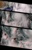
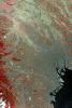
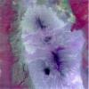
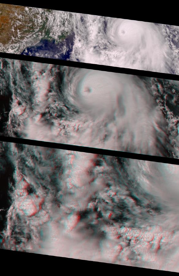
PIA02611:
-
MISR Views Hurricane Carlotta
Full Resolution:
TIFF
(1.25 MB)
JPEG
(76.02 kB)
|
|
|
2000-06-20 |
Earth
|
Terra
|
MISR
|
2548x3800x3 |
|
-
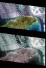
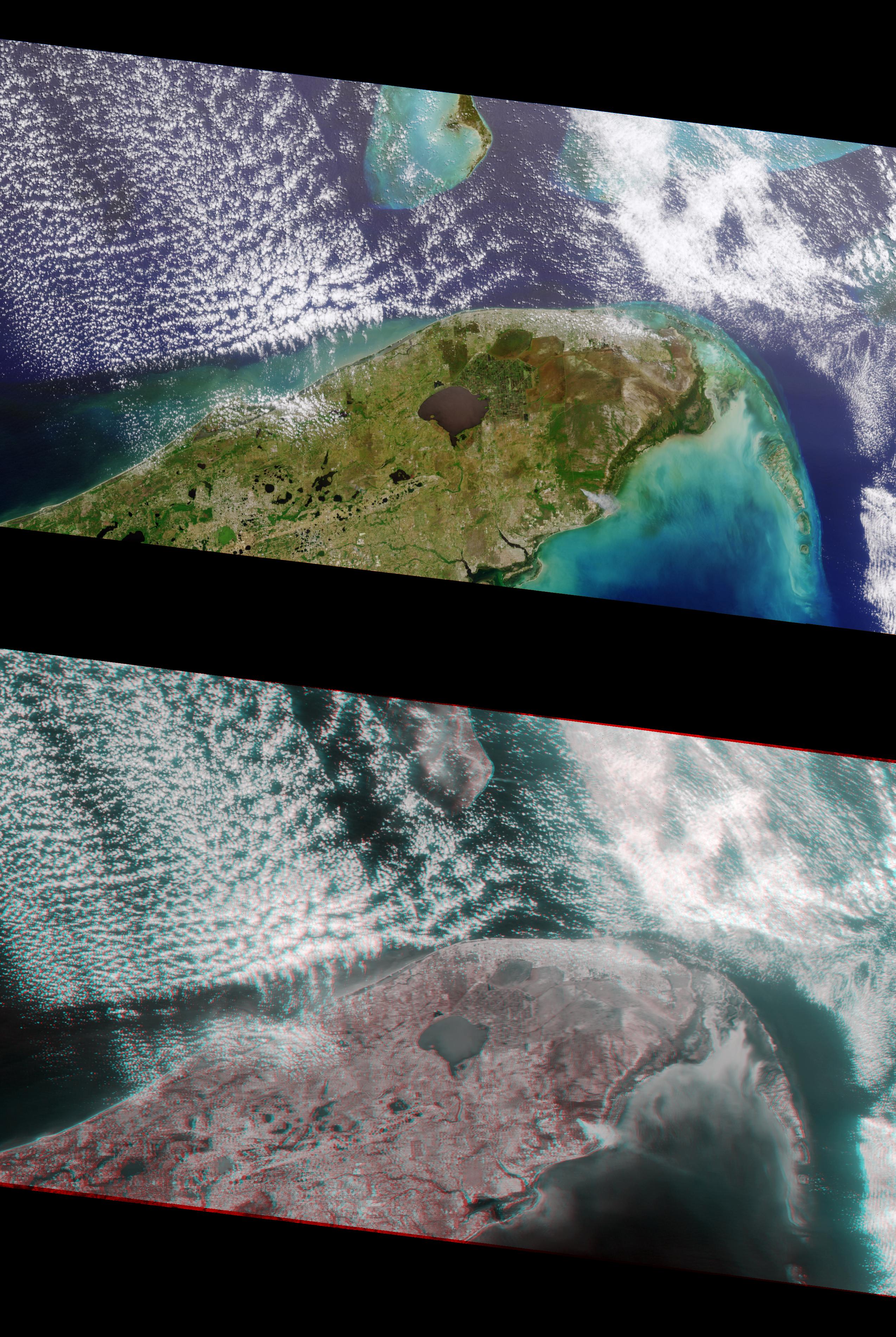
PIA02610:
-
MISR Views Florida
Full Resolution:
TIFF
(19.67 MB)
JPEG
(1.364 MB)
|
|
|
2000-06-20 |
Earth
|
Terra
|
MISR
|
2220x2048x3 |
|
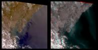
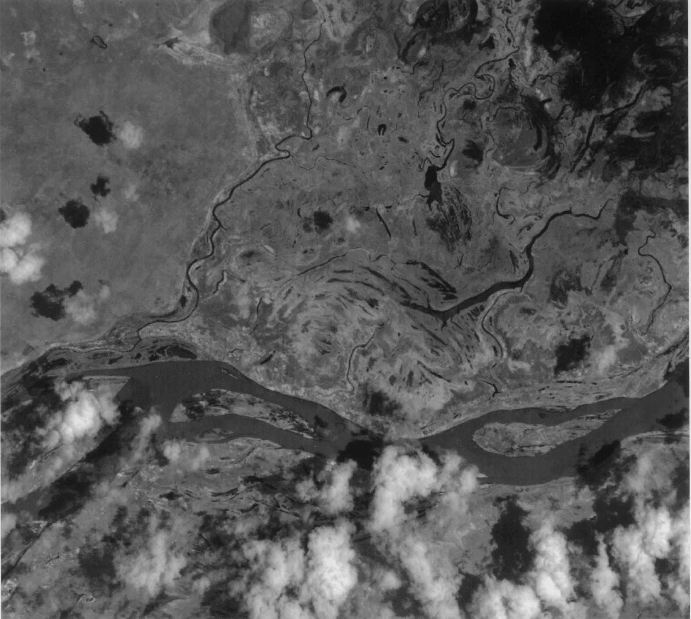
-
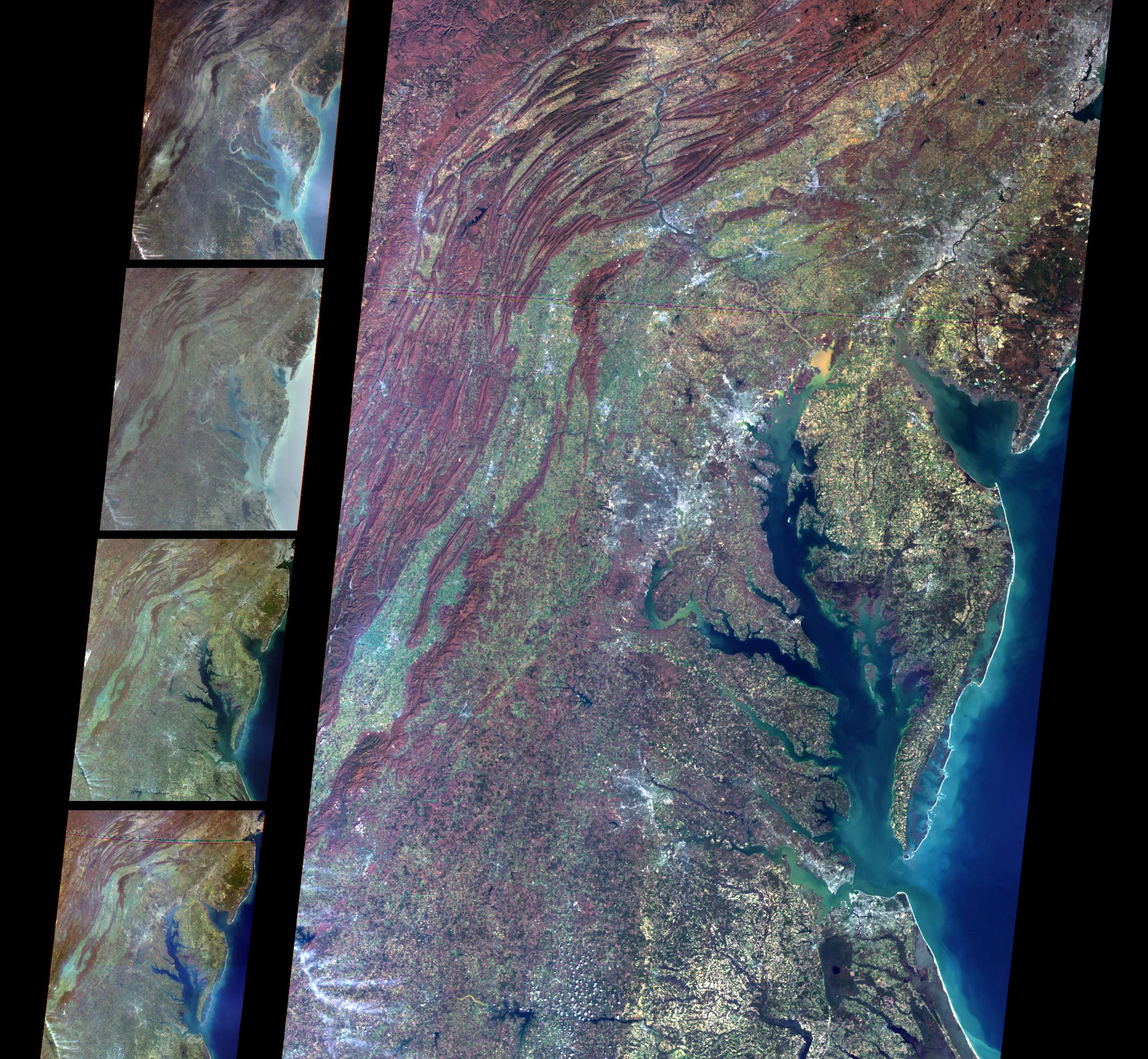
PIA02609:
-
MISR Views Delaware Bay, Chesapeake Bay, and the Appalachian Mountains
Full Resolution:
TIFF
(12.73 MB)
JPEG
(862.5 kB)
|
|
|
2000-04-26 |
Earth
|
Terra
|
ASTER
|
1174x1447x3 |
|
-
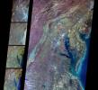
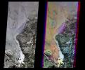
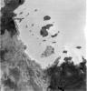
PIA02608:
-
ASTER Images Mt. Usu Volcano
Full Resolution:
TIFF
(3.631 MB)
JPEG
(681 kB)
|
|
|
2000-04-26 |
Earth
|
Terra
|
ASTER
|
4100x6177x3 |
|
-
PIA02607:
-
ASTER Images Tokyo
Full Resolution:
TIFF
(75.98 MB)
JPEG
(12.25 MB)
|
|
|
2000-04-26 |
Earth
|
Terra
|
ASTER
|
4100x5400x3 |
|
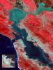
-
PIA02606:
-
ASTER Images San Francisco Bay Area
Full Resolution:
TIFF
(54.36 MB)
JPEG
(4.828 MB)
|
|
|
2000-04-26 |
Earth
|
Terra
|
ASTER
|
4100x4980x3 |
|
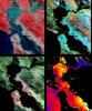
-
PIA02605:
-
ASTER Images San Francisco Bay Area
Full Resolution:
TIFF
(36.23 MB)
JPEG
(3.773 MB)
|
|
|
2000-04-26 |
Earth
|
Terra
|
ASTER
|
2100x1445x3 |
|
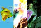
-
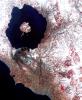
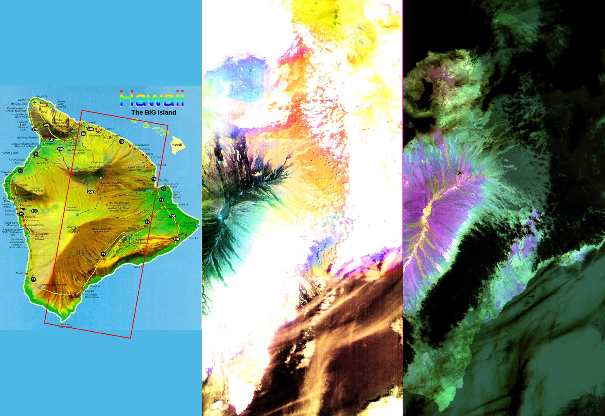
PIA02604:
-
ASTER Images the Island of Hawaii
Full Resolution:
TIFF
(7.393 MB)
JPEG
(430.3 kB)
|
|
|
2000-04-19 |
Earth
|
Terra
|
MISR
|
1520x1264x3 |
|
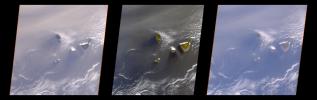
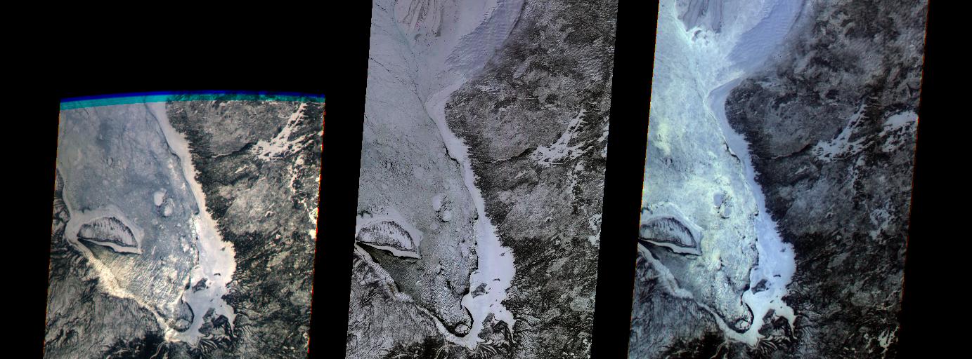
-
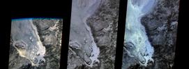
PIA02603:
-
Multi-angle Images of Hudson Bay and James Bay, Canada, 24 February 2000
Full Resolution:
TIFF
(4.927 MB)
JPEG
(370.2 kB)
|
|
|
2000-04-19 |
Earth
|
Terra
|
MISR
|
2536x800x3 |
|
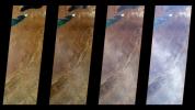
-
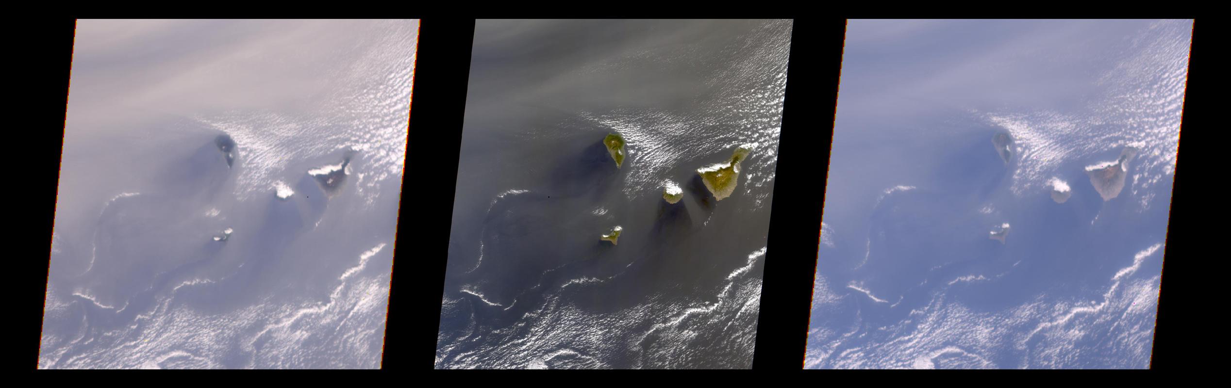
PIA02602:
-
Multi-Angle View of the Canary Islands
Full Resolution:
TIFF
(3.681 MB)
JPEG
(169 kB)
|
|
|
2000-04-19 |
Earth
|
Terra
|
MISR
|
1920x1079x3 |
|
-
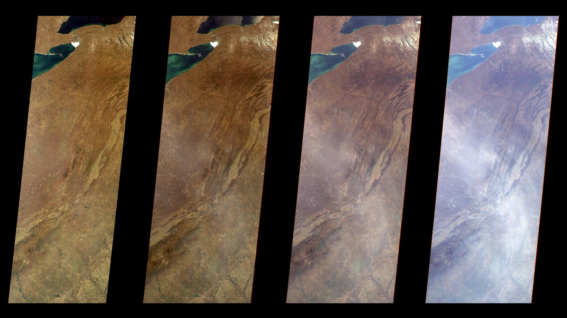
PIA02601:
-
Multi-Angle Views of the Appalachian Mountains, 6 March 2000
Full Resolution:
TIFF
(5.067 MB)
JPEG
(244.4 kB)
|
|
|
2000-04-19 |
Earth
|
Terra
|
MISR
|
1906x981x3 |
|
-
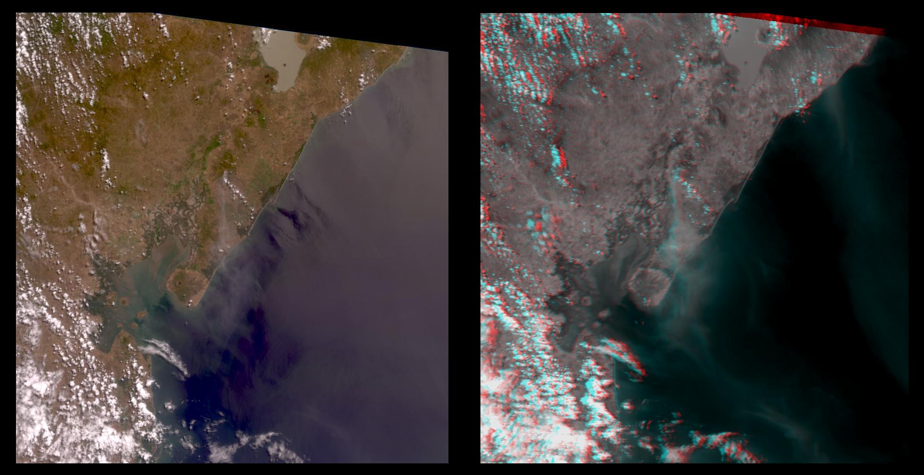
PIA02600:
-
Nicaraguan Volcanoes, 26 February 2000
Full Resolution:
TIFF
(4.239 MB)
JPEG
(194.3 kB)
|
|
|
2000-03-11 |
Earth
|
Terra
|
ASTER
|
2288x2288x3 |
|
-
PIA02453:
-
ASTER's First Views of Rift Valley, Ethiopia - Thermal-Infrared (TIR) Image (color)
Full Resolution:
TIFF
(13.48 MB)
JPEG
(231.5 kB)
|
|
|
2000-03-11 |
Earth
|
Terra
|
ASTER
|
2160x2251x1 |
|
-
PIA02452:
-
ASTER's First Views of Red Sea, Ethiopia - Thermal-Infrared (TIR) Image (monochrome)
Full Resolution:
TIFF
(2.76 MB)
JPEG
(185.8 kB)
|
|
|
2000-03-11 |
Earth
|
Terra
|
ASTER
|
2263x2027x1 |
|
-
PIA02451:
-
ASTER's First Views of San Francisco River, Brazil - Visible/near Infrared (VNIR) Image (monochrome)
Full Resolution:
TIFF
(3.321 MB)
JPEG
(256.2 kB)
|
|
|
2000-03-11 |
Earth
|
Terra
|
MISR
|
1383x512x3 |
|
-
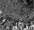
PIA02450:
-
MISR's First Views of James Bay, Canada
Full Resolution:
TIFF
(1.916 MB)
JPEG
(146.1 kB)
|
|
|
1998-03-26 |
Earth
|
Terra
|
MLS
|
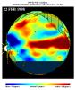
2550x3300x3 |
|
-
PIA00824:
-
TOPEX/El Niño Watch - El Niño Moisture in the Atmosphere, January and February, 1998
Full Resolution:
TIFF
(3.821 MB)
JPEG
(655.2 kB)
|
|
|
1998-03-16 |
Earth
|
Terra
|
MLS
|
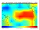
2550x3009x3 |
|
-
PIA00823:
-
TOPEX/El Niño Watch - El Niño Moisture in the Atmosphere, February 22, 1998
Full Resolution:
TIFF
(3.85 MB)
JPEG
(515.6 kB)
|
|
|
1998-03-14 |
Earth
|
Terra
|
MLS
|
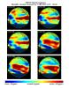
695x900x3 |
|
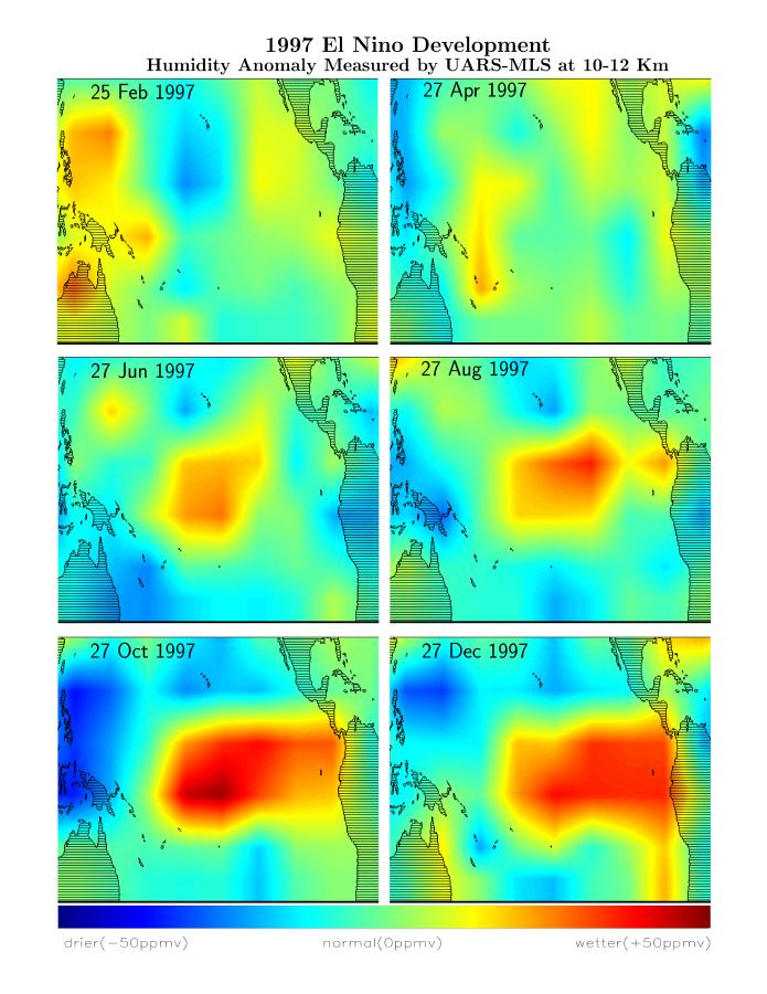
-
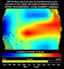
PIA01166:
-
Microwave Limb Sounder/El Niño Watch - February thru December, 1997
Full Resolution:
TIFF
(933.4 kB)
JPEG
(94.24 kB)
|
|
|
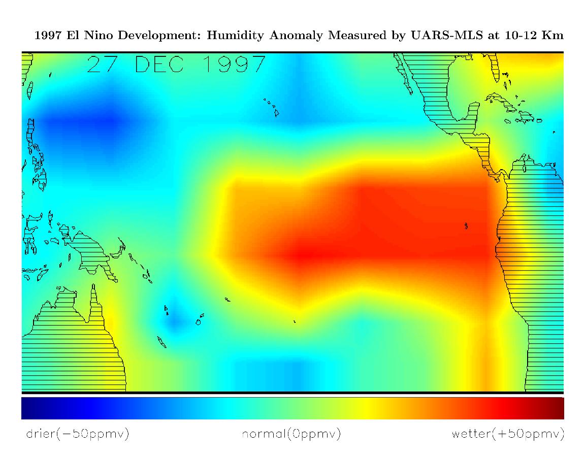
1998-03-14 |
Earth
|
Terra
|
MLS
|
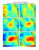
1152x900x3 |
|
-
PIA01165:
-
Microwave Limb Sounder/El Niño Watch - December, 1997
Full Resolution:
TIFF
(891.4 kB)
JPEG
(120.4 kB)
|
|
|
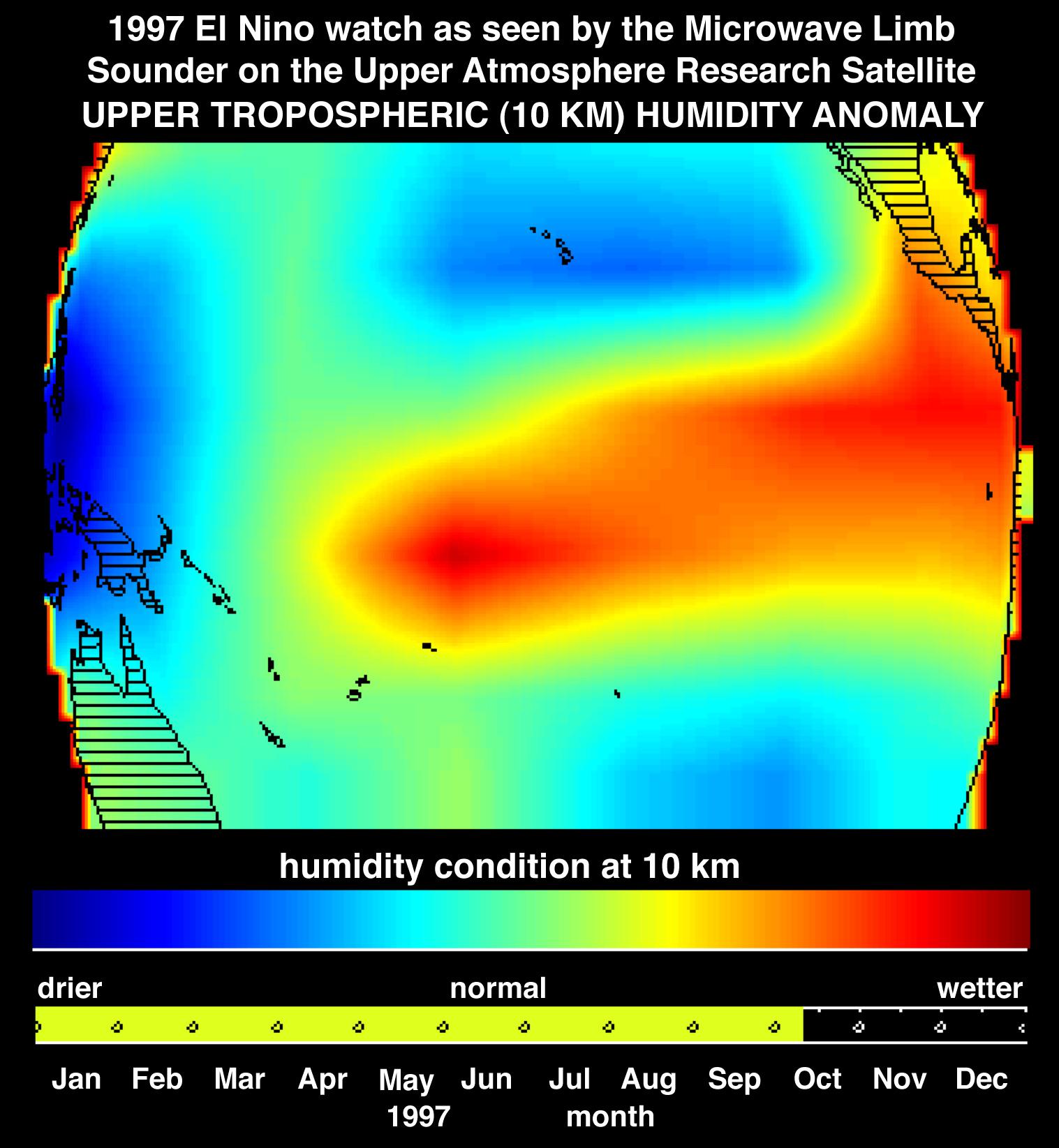
1997-10-30 |
Earth
|
Terra
|
MLS
|
1517x1645x3 |
|
-
PIA01052:
-
Microwave Limb Sounder/El Niño Watch - Water Vapor Measurement, October, 1997
Full Resolution:
TIFF
(2.984 MB)
JPEG
(225.4 kB)
|
 Planetary Data System


