|
Your search criteria found 3396 images Feature Name |
| My List |
Addition Date | Target | Mission |
Instrument
|
Size |

|
2015-02-12 | Titan |
Cassini-Huygens |
Radar Mapper |
1407x843x1 |
|
|||||
|
|
2016-07-29 | Titan |
Cassini-Huygens |
Radar Mapper |
460x618x1 |

|
|||||
|
|
2016-07-29 | Titan |
Cassini-Huygens |
Radar Mapper |
811x716x1 |
|
|||||
|
|
2016-03-02 | Titan |
Cassini-Huygens |
Radar Mapper |
2000x1496x3 |
|
|||||
|
|
2016-03-24 | Titan |
Cassini-Huygens |
Radar Mapper |
1600x1313x1 |

|
|||||
|
|
2016-09-07 | Titan |
Cassini-Huygens |
Radar Mapper |
1896x1701x1 |

|
|||||
|
|
2016-09-07 | Titan |
Cassini-Huygens |
Radar Mapper |
1920x2048x1 |

|
|||||
|
|
2016-09-07 | Titan |
Cassini-Huygens |
Radar Mapper |
2625x1580x1 |

|
|||||
|
|
2016-09-07 | Titan |
Cassini-Huygens |
Radar Mapper |
931x592x1 |

|
|||||
|
|
2007-04-26 | Titan |
Cassini-Huygens |
Radar Mapper |
6209x634x1 |
|
|||||
|
|
2007-10-02 | Titan |
Cassini-Huygens |
Radar Mapper |
18944x2048x1 |
|
|||||
|
|
2008-02-22 | Titan |
Cassini-Huygens |
Radar Mapper |
4000x1923x1 |

|
|||||
|
|
2008-12-21 | Titan |
Cassini-Huygens |
Radar Mapper |
6912x3030x1 |
|
|||||
|
|
2009-02-07 | Titan |
Cassini-Huygens |
Radar Mapper |
13440x1408x1 |
|
|||||
|
|
2009-05-21 | Titan |
Cassini-Huygens |
Radar Mapper |
19584x1920x1 |
|
|||||
|
|
2009-06-06 | Titan |
Cassini-Huygens |
Radar Mapper |
19456x1920x1 |
|
|||||
|
|
2009-06-22 | Titan |
Cassini-Huygens |
Radar Mapper |
18816x1536x1 |
|
|||||
|
|
2009-07-08 | Titan |
Cassini-Huygens |
Radar Mapper |
768x349x1 |

|
|||||
|
|
2009-07-24 | Titan |
Cassini-Huygens |
Radar Mapper |
12288x1408x1 |
|
|||||
|
|
2009-08-25 | Titan |
Cassini-Huygens |
Radar Mapper |
19200x2048x1 |
|
|||||
|
|
2009-12-28 | Titan |
Cassini-Huygens |
Radar Mapper |
15360x1792x1 |
|
|||||
|
|
2005-02-15 | Titan |
Cassini-Huygens |
Radar Mapper |
16768x2688x1 |

|
|||||
|
|
2005-09-07 | Titan |
Cassini-Huygens |
Radar Mapper |
6162x1222x1 |
|
|||||
|
|
2005-10-28 | Titan |
Cassini-Huygens |
Radar Mapper |
17610x3153x1 |

|
|||||
|
|
2006-10-09 | Titan |
Cassini-Huygens |
Radar Mapper |
19620x1774x1 |
|
|||||
|
|
2006-12-12 | Titan |
Cassini-Huygens |
Radar Mapper |
15971x1676x1 |
|
|||||
|
|
2007-01-13 | Titan |
Cassini-Huygens |
Radar Mapper |
19200x1920x1 |
|
|||||
|
|
2007-12-20 | Titan |
Cassini-Huygens |
Radar Mapper |
16640x1920x1 |
|
|||||
|
|
2010-07-07 | Titan |
Cassini-Huygens |
Radar Mapper |
14165x894x1 |
|
|||||
|
|
2008-12-05 | Titan |
Cassini-Huygens |
Radar Mapper |
16363x1543x1 |

|
|||||
|
|
2010-01-12 | Titan |
Cassini-Huygens |
Radar Mapper |
9179x3260x1 |
|
|||||
|
|
2017-08-11 | Titan |
Cassini-Huygens |
Radar Mapper |
14594x2578x1 |

|
|||||
|
|
2008-02-28 | Io |
New Horizons |
MVIC |
600x300x3 |
|
|||||
|
|
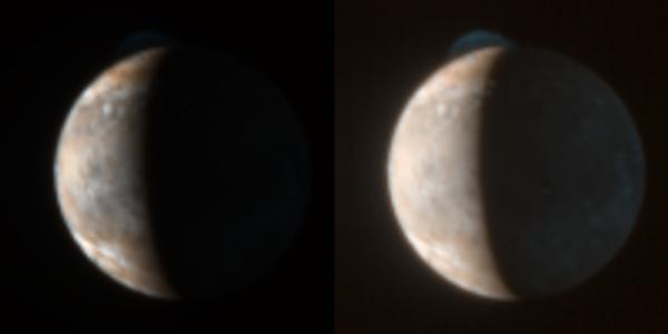
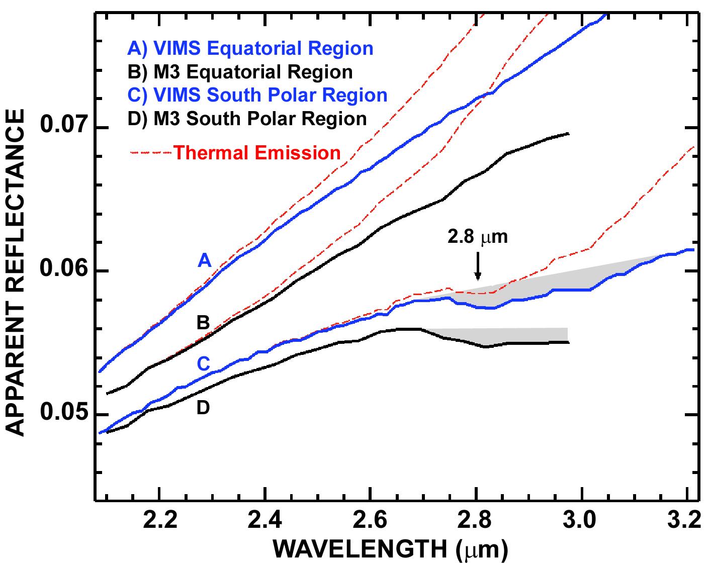
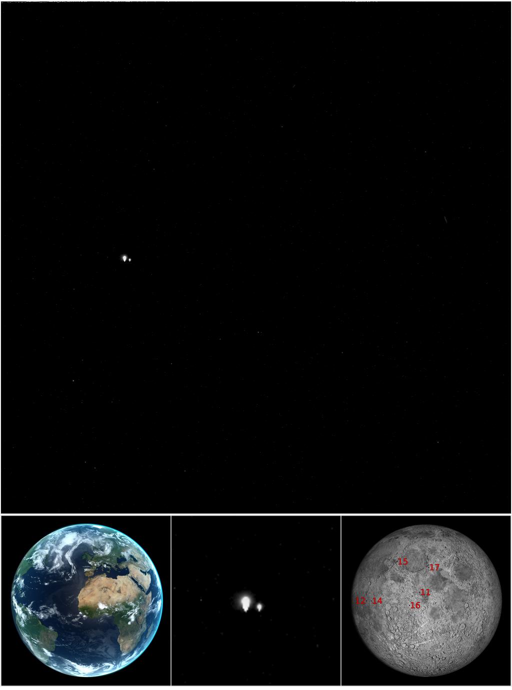
2009-09-24 | Moon |
Cassini-Huygens Chandrayaan-1 |
Moon Mineralogy Mapper VIMS |
1410x1120x3 |
|
|||||
|
|
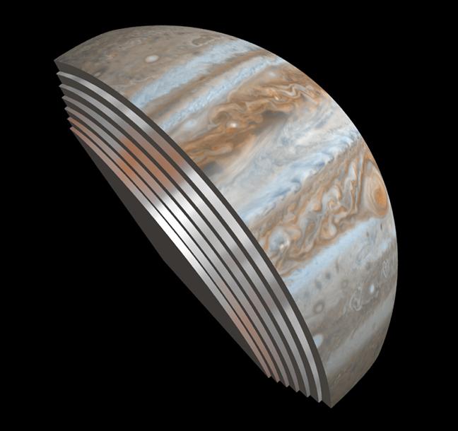
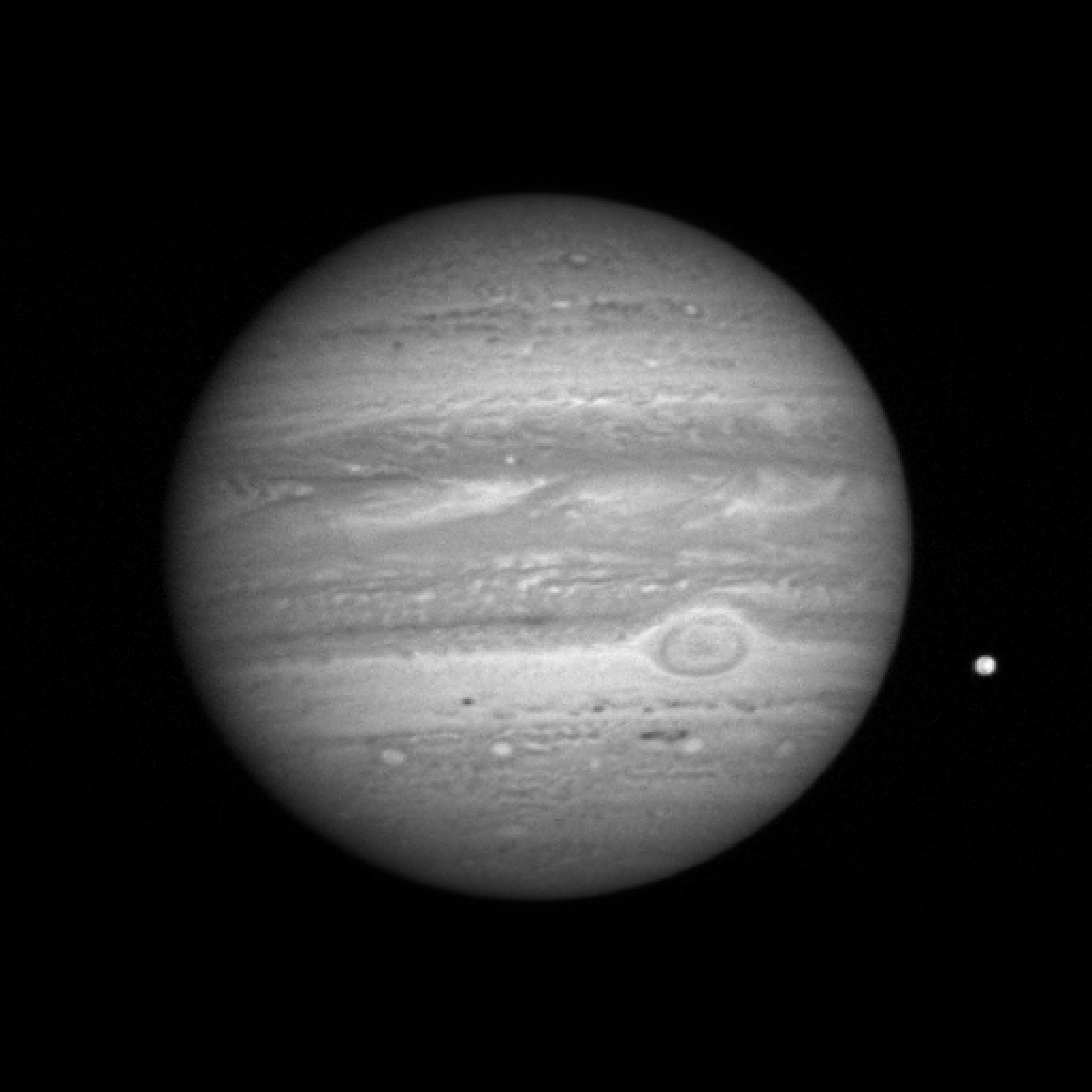
2016-10-19 | Jupiter |
Juno |
Microwave Radiometer (MWR) |
648x610x3 |

|
|||||
|
|
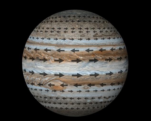
2021-10-28 | Jupiter |
Juno |
Microwave Radiometer (MWR) |
634x505x3 |
|
|||||
|
|
2013-07-22 | Earth |
MESSENGER |
MDIS - Wide Angle |
1024x1380x3 |
|
|||||
|
|
2003-05-22 | Earth |
Mars Global Surveyor (MGS) |
Mars Orbiter Camera (MOC) |
1068x3151x3 |
|
|
|||||
|
|
2003-05-22 | Jupiter |
Mars Global Surveyor (MGS) |
Mars Orbiter Camera (MOC) |
4655x961x3 |

|
|||||
|
|
2003-05-28 | Mars |
Mars Global Surveyor (MGS) |
Mars Orbiter Camera (MOC) |
388x583x3 |
|
|||||
|
|
2003-02-27 | Jupiter |
Cassini-Huygens |
MIMI |
959x981x3 |
|
|||||
|
|
2003-02-27 | Jupiter |
Cassini-Huygens |
MIMI |
1500x1125x3 |
|
|||||
|
|
2004-07-01 | Saturn |
Cassini-Huygens |
MIMI |
720x486x3 |
|
|||||
|
|
2004-08-05 | Titan |
Cassini-Huygens |
MIMI |
720x540x3 |
|
|||||
|
|
2004-08-05 | Titan |
Cassini-Huygens |
MIMI |
720x540x3 |
|
|||||
|
|
2009-10-15 | Sol (our sun) |
Cassini-Huygens |
MIMI |
1280x720x3 |
|
|||||
|
|
2007-12-12 | S Rings |
Cassini-Huygens |
MIMI |
2598x1449x3 |
|
|||||
|
|
2007-12-12 | S Rings |
Cassini-Huygens |
MIMI |
1051x788x3 |
|
|||||
|
|
2007-12-12 | S Rings |
Cassini-Huygens |
MIMI |
640x479x3 |

|
|||||
|
|
2009-11-20 | Sol (our sun) |
Cassini-Huygens |
MIMI |
1163x781x3 |
|
|||||
|
|
2010-12-14 | Titan |
Cassini-Huygens |
MIMI |
641x359x3 |
|
|||||
|
|
2010-12-14 | Titan |
Cassini-Huygens |
MIMI |
641x360x3 |
|
|||||
|
|
2011-04-28 |
Cassini-Huygens Voyager |
MIMI |
2124x1260x3 | |
|
|||||
|
|
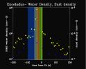
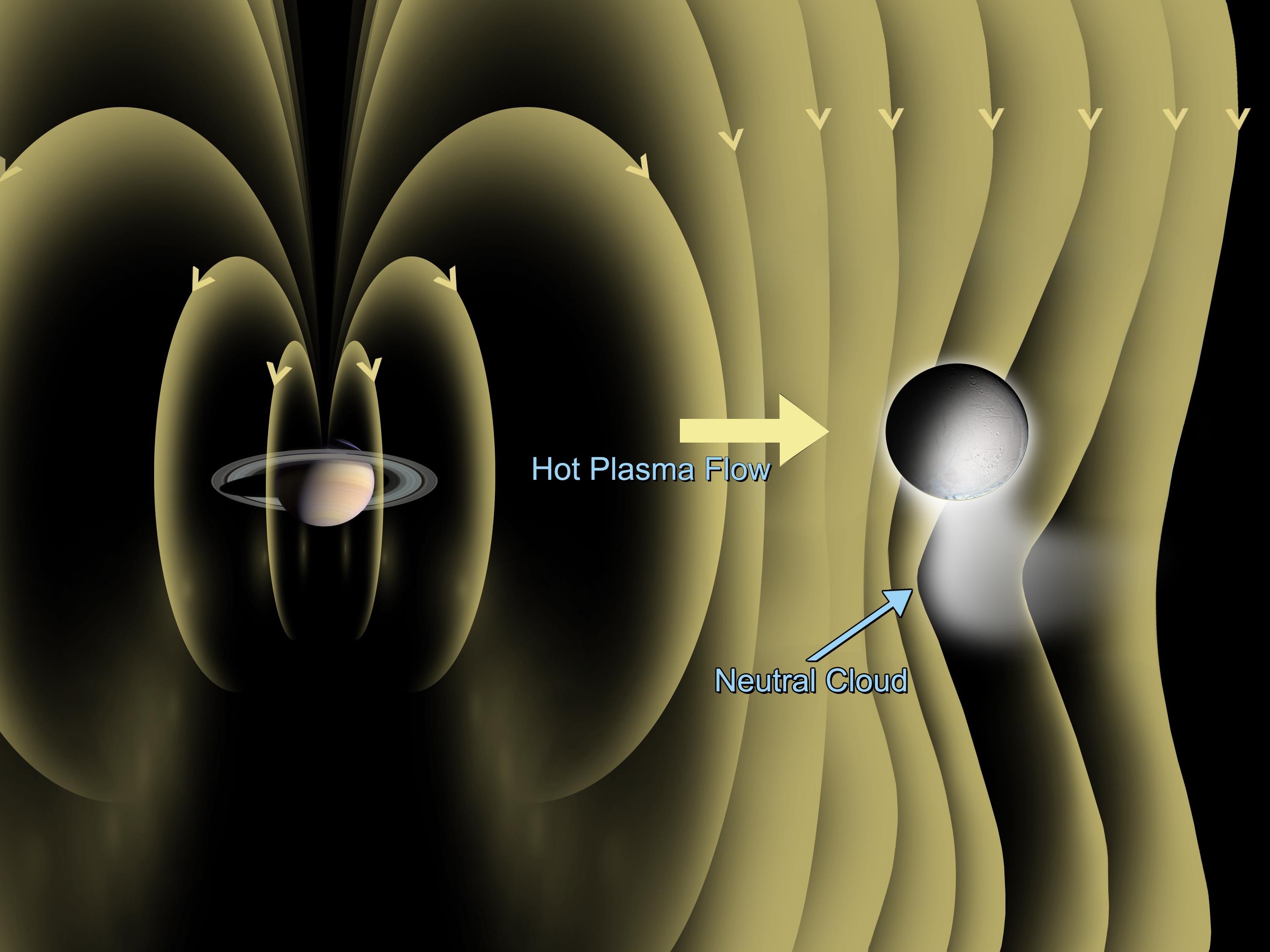
2005-03-16 | Enceladus |
Cassini-Huygens |
Magnetometer |
720x540x3 |
|
|||||
|
|
2005-04-27 | Enceladus |
Cassini-Huygens |
Magnetometer |
934x600x3 |
|
|||||
|
|
2005-07-29 | Enceladus |
Cassini-Huygens |
Magnetometer |
3000x2250x3 |

|
|||||
|
|
2007-04-02 | Jupiter |
New Horizons |
LORRI |
3600x3600x1 |
|
|||||
|
|
2007-04-02 | Io |
New Horizons |
LORRI |
500x256x1 |
|
|||||
|
|
2007-04-02 | J Rings |
New Horizons |
LORRI |
835x626x1 |
|
|||||
|
|
2016-09-02 | Jupiter |
Juno |
JunoCam |
1816x2380x3 |
|
|||||
|
|
2004-07-03 | Titan |
Cassini-Huygens |
Ion and Neutral Mass Spectrometer Magnetospheric Imaging Instrument (MIMI) |
720x540x3 |
|
|||||
|
|
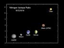
2005-08-30 | Enceladus |
Cassini-Huygens |
Ion and Neutral Mass Spectrometer Cosmic Dust Analyzer |
1016x819x3 |
|
|||||
|
|
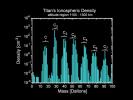
2004-10-27 | Titan |
Cassini-Huygens |
Ion and Neutral Mass Spectrometer |
1280x960x3 |
|
|||||
|
|
2004-10-27 | Titan |
Cassini-Huygens |
Ion and Neutral Mass Spectrometer |
720x540x3 |
|
|||||
|
|
2005-04-22 | Titan |
Cassini-Huygens |
Ion and Neutral Mass Spectrometer |
720x540x3 |
|
|||||
|
|
2008-03-26 | Enceladus |
Cassini-Huygens |
Ion and Neutral Mass Spectrometer |
1440x1080x3 |
|
|||||
|
|
2008-03-26 | Enceladus |
Cassini-Huygens |
Ion and Neutral Mass Spectrometer |
1440x1080x3 |
|
|||||
|
|
2008-03-26 | Enceladus |
Cassini-Huygens |
Ion and Neutral Mass Spectrometer |
2444x2020x3 |

|
|||||
|
|
2017-04-13 | Enceladus |
Cassini-Huygens |
Ion and Neutral Mass Spectrometer |
2550x3300x3 |
|
|||||
|
|
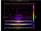
2004-09-02 | Saturn |
Cassini-Huygens |
Infrared Spectrometer (IRS) |
746x792x3 |
|
|||||
|
|
2010-12-29 | Jupiter |
Cassini-Huygens |
Infrared Spectrometer |
882x427x3 |
|
|||||
|
|
2014-07-28 | Enceladus |
Cassini-Huygens |
Imaging Science Subsystem Visual and Infrared Mapping Spectrometer |
1033x799x3 |
|
|||||
|
|
2019-06-13 | Saturn |
Cassini-Huygens |
Imaging Science Subsystem Visual and Infrared Mapping Spectrometer |
3950x2946x3 |
|
|||||
|
|
2009-01-29 | Titan |
Cassini-Huygens |
Imaging Science Subsystem Radar Mapper Visual and Infrared Mapping Spectrometer |
1884x2000x3 |
|
|||||
|
|
2019-11-18 | Titan |
Cassini-Huygens |
Imaging Science Subsystem Radar Mapper |
6604x3746x3 |
|
|||||
|
|
2005-04-13 | Titan |
Cassini-Huygens |
Imaging Science Subsystem Visual and Infrared Mapping Spectrometer |
1707x1148x3 |
|
|||||
|
|
2006-11-09 | Saturn |
Cassini-Huygens |
Imaging Science Subsystem Visual and Infrared Mapping Spectrometer |
1527x1018x3 |
|
|||||
|
|
2005-11-30 | Titan |
Cassini-Huygens |
Imaging Science Subsystem Radar Mapper Visual and Infrared Mapping Spectrometer |
668x415x3 |

|
|||||
|
|
2006-05-03 | Titan |
Cassini-Huygens |
Imaging Science Subsystem Radar Mapper |
800x422x1 |

|
|||||
|
|
2005-07-29 | Enceladus |
Cassini-Huygens |
Imaging Science Subsystem Composite Infrared Spectrometer |
973x965x3 |
|
|||||
|
|
2006-03-09 | Enceladus |
Cassini-Huygens |
Imaging Science Subsystem Composite Infrared Spectrometer |
1171x384x3 |

|
|||||
|
|
2006-03-09 | Enceladus |
Cassini-Huygens |
Imaging Science Subsystem Composite Infrared Spectrometer |
1171x384x3 |
|
|||||
|
|
2014-10-01 | Titan |
Cassini-Huygens |
ISS - Wide Angle Visual and Infrared Mapping Spectrometer |
1203x774x3 |
|
|||||
|
|
2013-07-22 | S Rings |
MESSENGER Cassini-Huygens |
ISS - Wide Angle MDIS - Wide Angle |
1799x958x3 |
|
|||||
|
|
2006-12-18 | Saturn |
Cassini-Huygens |
ISS - Wide Angle |
1008x1008x1 |
|
|||||
|
|
1999-09-01 | Moon |
Cassini-Huygens |
ISS - Wide Angle |
413x300x1 |
|
|
||||
|
|
2004-07-27 | Titan |
Cassini-Huygens |
ISS - Wide Angle |
1201x691x3 |
|
|||||
|
|
2004-07-28 | Titan |
Cassini-Huygens |
ISS - Wide Angle |
1105x610x3 |
|
|||||
|
|
2004-08-02 | Saturn |
Cassini-Huygens |
ISS - Wide Angle |
1166x649x1 |

|
|||||
|
|
2004-08-06 | Saturn |
Cassini-Huygens |
ISS - Wide Angle |
1016x634x3 |
|
|||||
|
|
2004-08-18 | Saturn |
Cassini-Huygens |
ISS - Wide Angle |
932x600x1 |
|
|||||
|
|
2004-09-06 | Saturn |
Cassini-Huygens |
ISS - Wide Angle |
989x642x1 |
|
|||||
|
|
2004-09-09 | Atlas |
Cassini-Huygens |
ISS - Wide Angle |
1432x756x3 |
|
|||||
|
|
2004-09-13 | Saturn |
Cassini-Huygens |
ISS - Wide Angle |
1021x870x1 |
|
|||||
|
|
2004-09-30 | Prometheus |
Cassini-Huygens |
ISS - Wide Angle |
301x386x1 |
|
|||||
|
|
2009-08-19 | Pandora |
Cassini-Huygens |
ISS - Wide Angle |
708x993x1 |
|
|||||
|
|
2004-10-28 | Titan |
Cassini-Huygens |
ISS - Wide Angle |
1024x1024x1 |

|
|||||
|
|
2004-11-30 | Saturn |
Cassini-Huygens |
ISS - Wide Angle |
1024x1024x1 |
|
|||||
|
|
2004-12-01 | Saturn |
Cassini-Huygens |
ISS - Wide Angle |
1024x1024x1 |

|
|||||
|
|
2004-12-06 | Saturn |
Cassini-Huygens |
ISS - Wide Angle |
994x1000x1 |
|
|||||

|
 |
|
|
 |
 |
|
|
|
|
|

|
| 1-100 | 101-200 | 201-300 | 301-400 | 401-500 | 501-600 | 601-700 | 701-800 | 801-900 | 901-1000 |
| Currently displaying images: 301 - 400 of 3396 |