PDS logoPlanetary Data System
PDS Information
Find a Node - Use these links to navigate to any of the 8 publicly accessible PDS Nodes.

This bar indicates that you are within the PDS enterprise which includes 6 science discipline nodes and 2 support nodes which are overseen by the Project Management Office at NASA's Goddard Space Flight Center (GSFC). Each node is led by an expert in the subject discipline, supported by an advisory group of other practitioners of that discipline, and subject to selection and approval under a regular NASA Research Announcement.
Click here to return to the Photojournal Home Page Click here to view a list of Photojournal Image Galleries Photojournal_inner_header
Latest Images  |  Spacecraft & Technology  |  Animations  |  Space Images App  |  Feedback  |  Photojournal Search  
My Favorite Images from the Planetary Photojoural
I have 13 images in my list


The first time you select an image to My List, a separate browser window will open. This page will list the set of images you have selected as favorites from the Photojournal. This list is kept for a short period of time, approximately 60 days. The way we associate you with your list is through a persistent cookie left on your computer. This cookie is nothing more than a unique key that allows the Photojournal to make this association. Once created, this list is only modifiable from the same computer. Information stored in the cookie on your computer is used by the Photojournal server only during your session. If you configure your Web browser not to use cookies, you will not be able to create and refer back to a personal list of favorite images. To view your current list, click on a marked entry for your list from the catalog page, or add another favorite. For more information, see JPL's Privacy Policy.
My
List
Catalog # Target Mission Instrument Addition Date Size
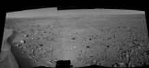
Remove Image from Favorite List PIA06024 Mars Mars Exploration Rover (MER)
Navigation Camera
2004-06-03 2613x1200x1
Lahontan Crater Looms (right eye)
Title:
Lahontan Crater Looms (right eye)
Remove Image from Favorite List PIA26150 Asteroid Deep Space Network (DSN)
Deep Space Network
2024-07-03 4000x3000x3
This sunset photo shows NASA's Deep Space Station 14 (DSS-14), the 230-foot-wide (70-meter) antenna at the Goldstone Deep Space Communications Complex near Barstow, California.
Title:
The Goldstone Solar System Radar at Sunset
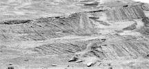
Remove Image from Favorite List PIA07107 Mars Mars Exploration Rover (MER)
Panoramic Camera
2004-12-13 3072x1422x1
NASA's Mars Exploration Rover Opportunity tried to get as detailed a look as possible at a target region near eastern foot of 'Burns Cliff.' The intervening layered terrain was too difficult for driving the rover closer.
Title:
Angled Layers in Super Resolution
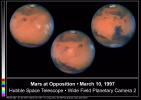
Remove Image from Favorite List PIA01250 Mars Hubble Space Telescope
WFPC2
1998-05-02 2850x2025x3
Pictures of the planet Mars taken with the recently refurbished NASA Hubble Space Telescope will provide the most detailed global view of the red planet ever obtained from Earth. The images were taken by HST's Wide Field Planetary Camera-2.
Title:
Hubble Captures A Full Rotation Of Mars
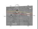
Remove Image from Favorite List PIA00959 Mars Mars Global Surveyor (MGS)
MOLA
1997-10-13 3300x2550x3
Among the myriad of interesting landforms sampled by NASA's Mars Global Surveyor on its first traverse across the red planet on 15 September 1997.
Title:
MGS Mars Orbiter Laser Altimeter Topographic Profile of Impact Crater
Remove Image from Favorite List PIA03770 Mars 2001 Mars Odyssey
THEMIS
2002-05-21 1235x3079x1
Remarkable variations in the erosion of the Medusae Fossae Formation are shown in this scene from NASA's Mars Odyssey spacecraft. In this region, the surface has been eroded by the wind into a series of linear ridges called yardangs.
Title:
Medusae Fossae Formation
Remove Image from Favorite List PIA24229 Mars 2001 Mars Odyssey
THEMIS
2021-10-28 694x1430x1
This image from NASA's Mars Odyssey shows a region of arcuate (or curved) fractures, located north of Apollinaris Mons, on the margin with Elysium Planitia.
Title:
Arcuate Fractures
Remove Image from Favorite List PIA22764 Ceres Dawn
Framing Camera
2018-09-26 676x676x1
This image of Occator Crater on Ceres' limb -- long exposure -- was obtained by NASA's Dawn spacecraft on August 14, 2018 from an altitude of about 1149 miles (1849 kilometers).
Title:
Occator Crater on Ceres' Limb -- Long Exposure
Remove Image from Favorite List PIA12251 Herschel Space Observatory
PACS
SPIRE
2009-10-02 3403x3327x3
Some of the coldest and darkest dust in space shines brightly in this infrared image from the Herschel Observatory, a European Space Agency mission with important participation from NASA.
Title:
Awash with Infrared Light
Remove Image from Favorite List PIA17170 Earth Cassini-Huygens
ISS - Wide Angle
2013-07-22 941x826x3
The cameras on NASA's Cassini spacecraft captured this rare look at Earth and its moon from Saturn orbit on July 19, 2013. The image has been magnified five times.
Title:
One Special Day in the Life of Planet Earth -- Close-Up
Remove Image from Favorite List PIA12962 Earth OSTM/Jason-2
Altimeter
2010-03-16 900x900x3
Recent sea-level height data from NASA's Jason-2 oceanography satellite show a weakening of trade winds in western and central equatorial Pacific during late-January through February has triggered yet another strong, eastward-moving Kelvin wave.
Title:
El NiƱo's Last Stand?
Remove Image from Favorite List PIA00250 Venus Magellan
Imaging Radar
1996-03-14 1694x2817x1
This full-resolution image from NASA's Magellan spacecraft shows the northern part of the Akna Montes (mountains) of Venus.
Title:
Venus - Wanda Crater in Akna Montes
Remove Image from Favorite List PIA04391 Titan Cassini-Huygens
Radar Mapper
2007-04-26 6209x634x1
This image was obtained by NASA's Cassini radar instrument during a flyby on April 26, 2007. The radar antenna was pointing toward Titan at an altitude of 980 kilometers 609 miles) during the closest approach.
Title:
Titan Radar Swath (T-29 Flyby - April 26, 2007)