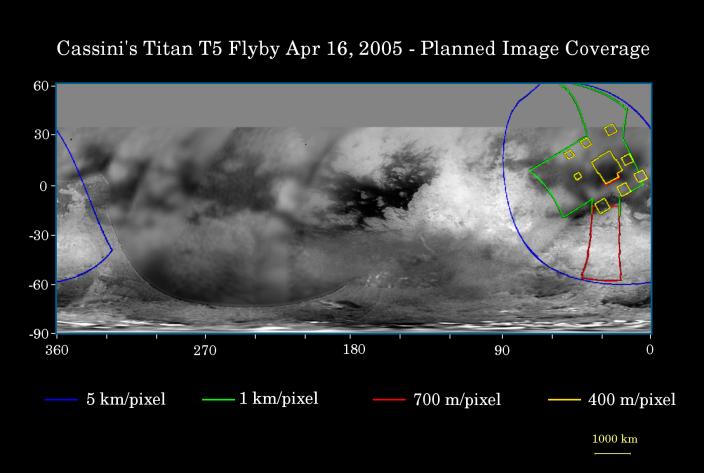
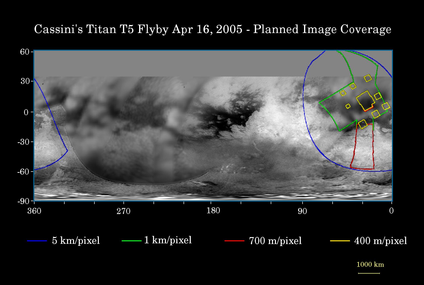
This map of Titan's surface illustrates the regions that will be imaged by Cassini during the spacecraft's close flyby of the smog-enshrouded moon on April 16, 2005. At closest approach, the spacecraft is expected to pass approximately 1,025 kilometers (640 miles) above the moon's surface.
The colored lines delineate the regions that will be imaged at differing resolutions.
Images from this encounter will add to those taken during the March 31, 2005, flyby and improve the moderate resolution coverage of this region. The imaging coverage will include the eastern portion of territory observed by Cassini's radar instrument in October 2004 and February 2005, and will provide a way to compare the surface as viewed by the different instruments. Such comparisons (see PIA06222) will provide insight into the nature of Titan's surface.
The higher-resolution (yellow boxes) have been spread out around a central mosaic in order to maximize coverage of this region by the visual and infrared mapping spectrometer which will be observing simultaneously with the cameras of the imaging science subsystem.
The map shows only brightness variations on Titan's surface (the illumination is such that there are no shadows and no shading due to topographic variations). Previous observations indicate that, due to Titan's thick, hazy atmosphere, the sizes of surface features that can be resolved are a few times larger than the actual pixel scale labeled on the map.
The images for this global map were obtained using a narrow band filter centered at 938 nanometers-- a near-infrared wavelength (invisible to the human eye). At this wavelength, light can penetrate Titan's atmosphere to reach the surface and return through the atmosphere to be detected by the camera. The images have been processed to enhance surface details.
It is currently northern winter on Titan, so the moon's high northern latitudes are not illuminated, resulting in the lack of coverage north of 35 degrees north latitude.
At 5,150 kilometers (3,200 miles) across, Titan is one of the solar system's largest moons.
The Cassini-Huygens mission is a cooperative project of NASA, the European Space Agency and the Italian Space Agency. The Jet Propulsion Laboratory, a division of the California Institute of Technology in Pasadena, manages the mission for NASA's Science Mission Directorate, Washington, D.C. The Cassini orbiter and its two onboard cameras were designed, developed and assembled at JPL. The imaging team is based at the Space Science Institute, Boulder, Colo.
For more information about the Cassini-Huygens mission visit http://saturn.jpl.nasa.gov. For additional images visit the Cassini imaging team homepage http://ciclops.org.
 Planetary Data System


