Your search criteria found
12760
images
Target is Mars (and available satellites)
Go to PIAxxxxx:
Refine this list of images by:
Target:
Deimos
Mars
Phobos
Mission:
2001 Mars Odyssey
Antarctic Meteorite Location and Mapping Project (AMLAMP)
Dawn
ExoMars
Hubble Space Telescope
InSight
MAVEN
Mariner Mars 1964 (Mariner 4)
Mariner Mars 1969 (Mariner 7)
Mariner Mars 1971 (Mariner 9)
Mars 2020
Mars 2020 Rover
Mars Atmosphere and Volatile Evolution MissioN (MAVEN)
Mars Climate Orbiter
Mars Cube One (MarCO)
Mars Exploration Rover (MER)
Mars Express (MEX)
Mars Global Surveyor (MGS)
Mars Helicopter
Mars Pathfinder (MPF)
Mars Reconnaissance Orbiter (MRO)
Mars Sample Return
Mars Sample Return (MSR)
Mars Science Laboratory (MSL)
Phoenix
Rosetta
Viking
Spacecraft:
2001 Mars Odyssey
Curiosity
Dawn
InSight Mars Lander
Ingenuity
MAVEN
MarCO-B
Mariner 4
Mariner 7
Mariner 9
Mars Climate Orbiter
Mars Express (MEX)
Mars Express (MEX) Orbiter
Mars Global Surveyor Orbiter
Mars Pathfinder Lander
Mars Pathfinder Rover
Mars Reconnaissance Orbiter (MRO)
Mars Sample Return
Mars Science Laboratory (MSL)
NASA's Mars Pathfinder Lander
Opportunity
Perseverance
Philae Lander
Phoenix Lander
Phoenix Mars Lander
Spirit
Viking Lander 1
Viking Lander 2
Viking Orbiter 1
Viking Orbiter 2
Instrument:
Alpha Particle X-ray Spectrometer
Alpha Particle X-ray Spectrometer (MSL)
Atmospheric Structure / Meteorology Instrument
CHIMRA
Camera 1
Camera 2
Chemistry & Mineralogy (CheMin)
Chemistry and Camera (ChemCam)
Comet Infrared and Visible Analyser (CIVA
Compact Reconnaissance Imaging Spectrometer for Mars (CRISM)
Context Camera (CTX)
Deep Space Network
Descent Image Motion Estimation System (DIMES)
Dynamic Albedo of Neutrons
Dynamic Albedo of Neutrons (DAN)
Gamma Ray Spectrometer - Neutron Spectrometer
Gamma Ray Spectrometer Suite
Hazard Avoidance Camera
Hazard Avoidance Camera (M2020)
Hazard Avoidance Camera (MSL)
Heat and Physical Properties Package (HP3)
High Resolution Imaging Science Experiment (HiRISE)
High Resolution Instrument (HRI)
High Resolution Stereo Camera
Imager for Mars Pathfinder
Imaging Ultraviolet Spectrograph
Imaging Ultraviolet Spectrograph (IUVS)
Instrument Context Camera (ICC)
Instrument Deployment Camera (IDC)
Lander Vision System Camera (LCAM)
Magnetometer
Mars Advanced Radar for Subsurface and Ionosphere Sounding (MARSIS)
Mars Advanced Radar for Subsurface and Ionospheric Sounding (MARSIS)
Mars Climate Sounder (MCS)
Mars Color Imager (MARCI)
Mars Descent Imager
Mars Environmental Dynamics Analyzer (MEDA)
Mars Hand Lens Imager (MAHLI)
Mars Horizon Sensor Assembly
Mars Orbiter Camera (MOC)
Mars Orbiter Laser Altimeter
Mars Radiation Experiment
Mastcam
Mastcam-Z
Microscopic Imager
Microscopy Electrochemistry and Conductivity Analyzer (MECA)
Miniature Thermal Emission Spectrometer
Moessbauer Spectrometer
Navigation Camera
Navigation Camera (M2020)
Navigation Camera (MSL)
Neutral Gas and Ion Mass Spectrometer
Neutron Spectrometer
Optical Microscope
Optical Navigation Camera
Panoramic Camera
Planetary Instrument for X-ray Lithochemistry (PIXL)
Radar System
Radiation Assessment Detector (RAD)
Radio Science Subsystem
Robotic Arm
Robotic Arm (MSL)
Robotic Arm Camera (RAC)
Rock Abrasion Tool (RAT)
Rover Cameras
Rover Environmental Monitoring Station (REMS)
Sample Analysis at Mars (SAM)
Scanning Habitable Environments with Raman & Luminescence for Organics and Chemicals (SHERLOC)
Seismic Experiment for Interior Structure (SEIS)
Shallow Subsurface Radar (SHARAD)
Stereo Imager (SSI)
SuperCam
Surface Stereo Imager (SSI)
Thermal Emission Imaging System
Thermal Emission Spectrometer
Thermal and Electrical Conductivity Probe
Thermal and Evolved Gas Analyzer
Trace Gas Orbiter
Visual Imaging Subsystem
Visual Imaging Subsystem - Camera A
Visual Imaging Subsystem - Camera B
Wide Field Planetary Camera 2
Click on an image for detailed information
Click on a column heading to sort in ascending or descending order
My
List
Addition Date
Target
Mission
Instrument
Size
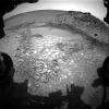
2014-08-15
Mars
Mars Science Laboratory (MSL)
Navcam (MSL)
1024x1024x1
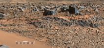
PIA18600:
View Down 'Hidden Valley' Ramp at 'Bonanza King' on Mars
Full Resolution:
TIFF
(1.05 MB)
JPEG
(151.1 kB)
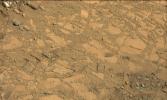
2014-08-15
Mars
Mars Science Laboratory (MSL)
Mastcam
1344x804x3
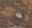
PIA18601:
Drilling Candidate Site 'Bonanza King' on Mars
Full Resolution:
TIFF
(3.243 MB)
JPEG
(167.7 kB)
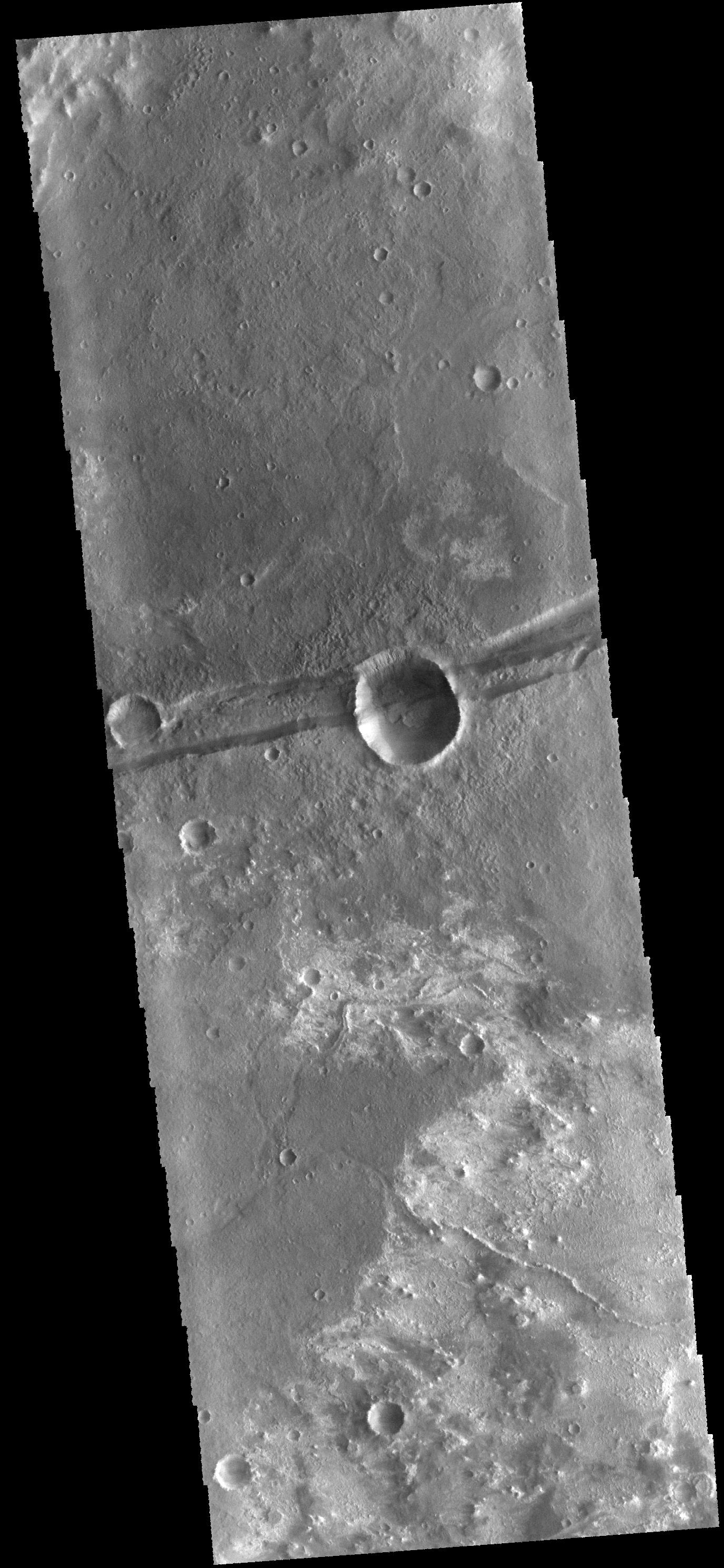
2014-08-18
Mars
2001 Mars Odyssey
THEMIS
320x7184x1
PIA18679:
Channel at Night
Full Resolution:
TIFF
(2.301 MB)
JPEG
(632.4 kB)
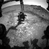
2014-08-18
Mars
Mars Science Laboratory (MSL)
Mastcam
1344x1200x3
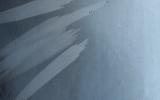
PIA18602:
Curiosity's Brushwork on Martian 'Bonanza King' Target
Full Resolution:
TIFF
(4.84 MB)
JPEG
(259.3 kB)
2014-08-19
Mars
2001 Mars Odyssey
THEMIS
1339x5916x1
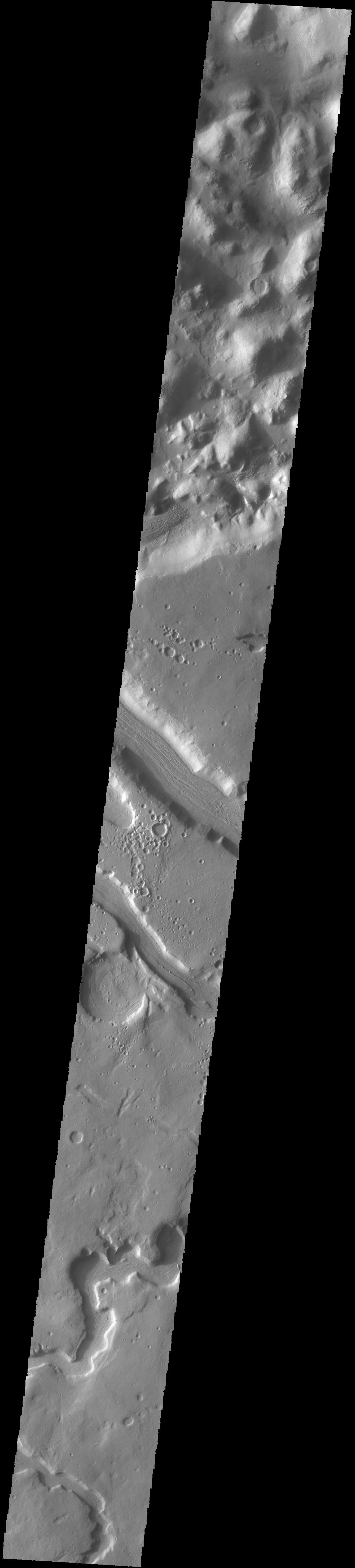
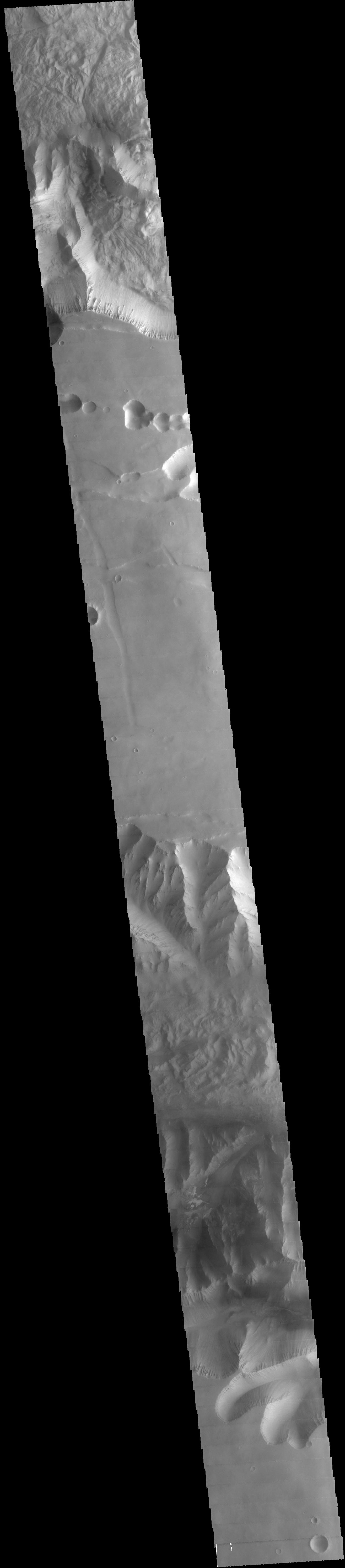
PIA18680:
Anio Valles
Full Resolution:
TIFF
(7.93 MB)
JPEG
(389.2 kB)
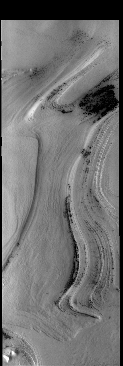
2014-08-20
Mars
2001 Mars Odyssey
THEMIS
993x5851x1
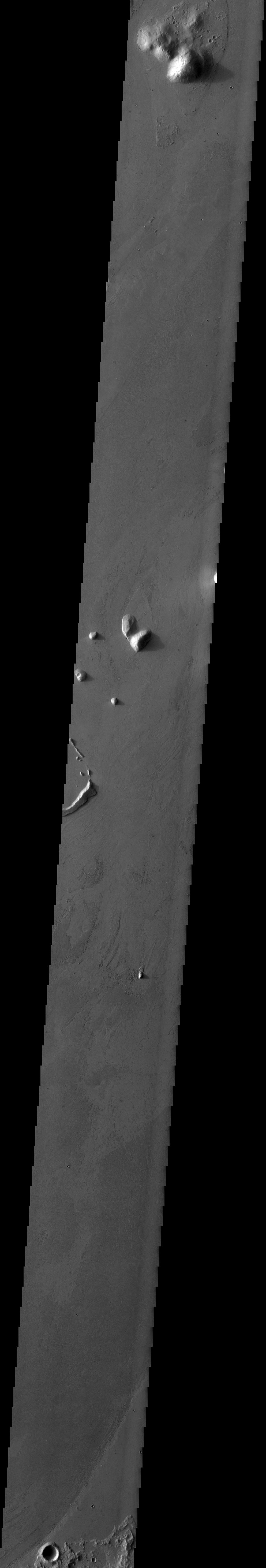
PIA18682:
Marte Vallis
Full Resolution:
TIFF
(5.816 MB)
JPEG
(327.6 kB)
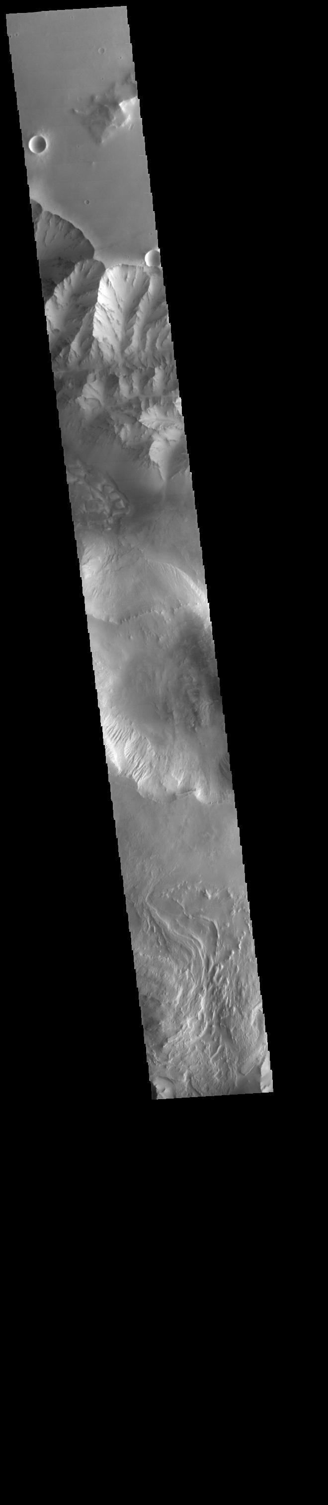
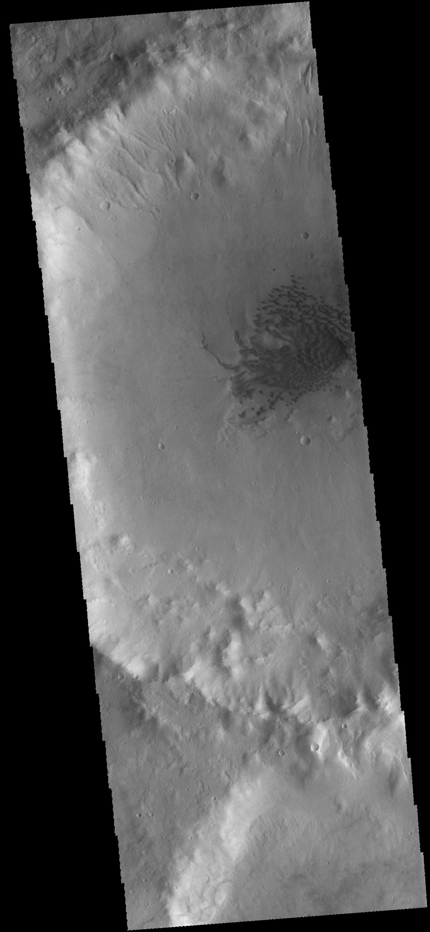
2014-08-21
Mars
2001 Mars Odyssey
THEMIS
907x5851x1
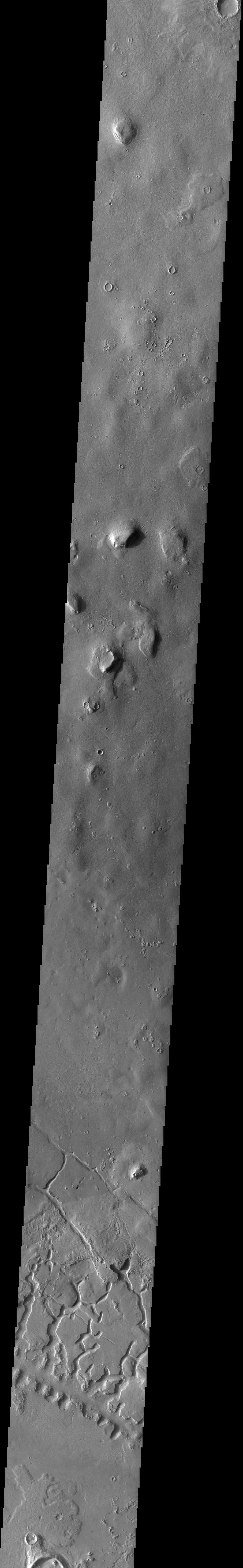
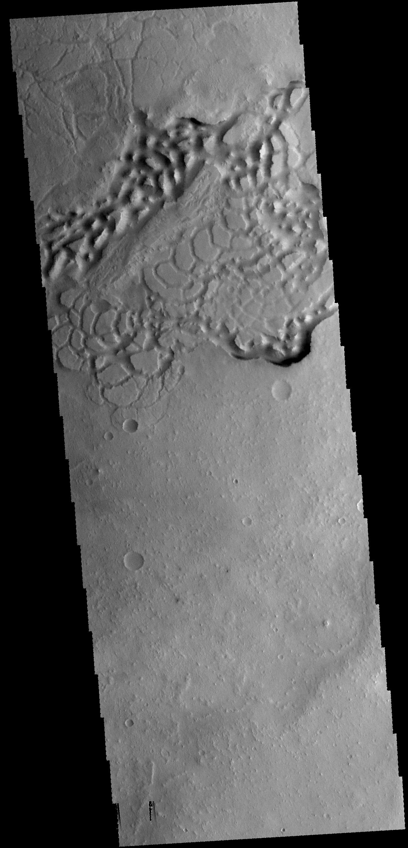
PIA18684:
Galaxias Fossae
Full Resolution:
TIFF
(5.312 MB)
JPEG
(480.5 kB)
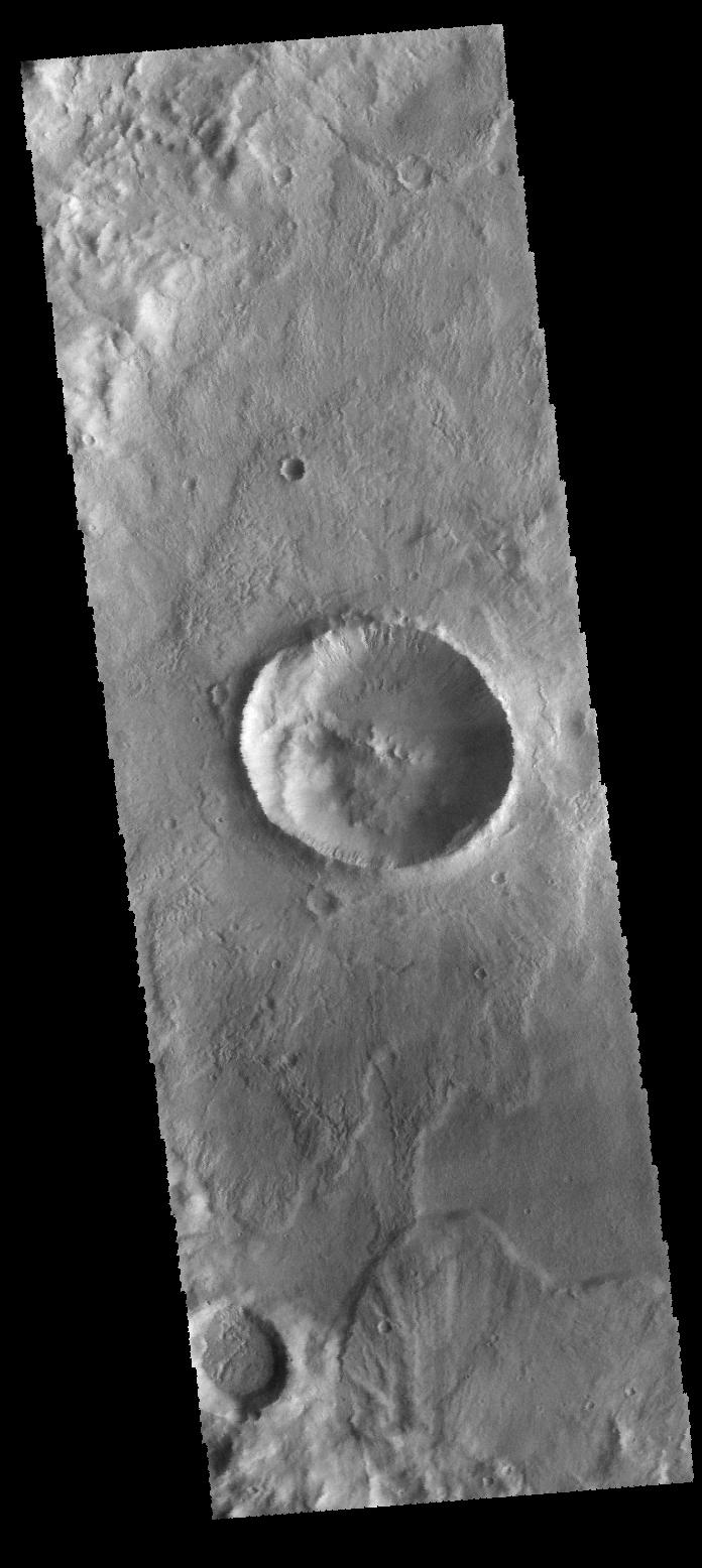
2014-08-22
Mars
2001 Mars Odyssey
THEMIS
709x6204x1
PIA18685:
Crater Dunes and Gullies
Full Resolution:
TIFF
(4.403 MB)
JPEG
(304.2 kB)
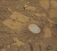
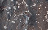
2014-08-22
Mars
Mars Science Laboratory (MSL)
Hazcam (MSL)
1024x1024x1
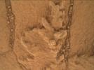
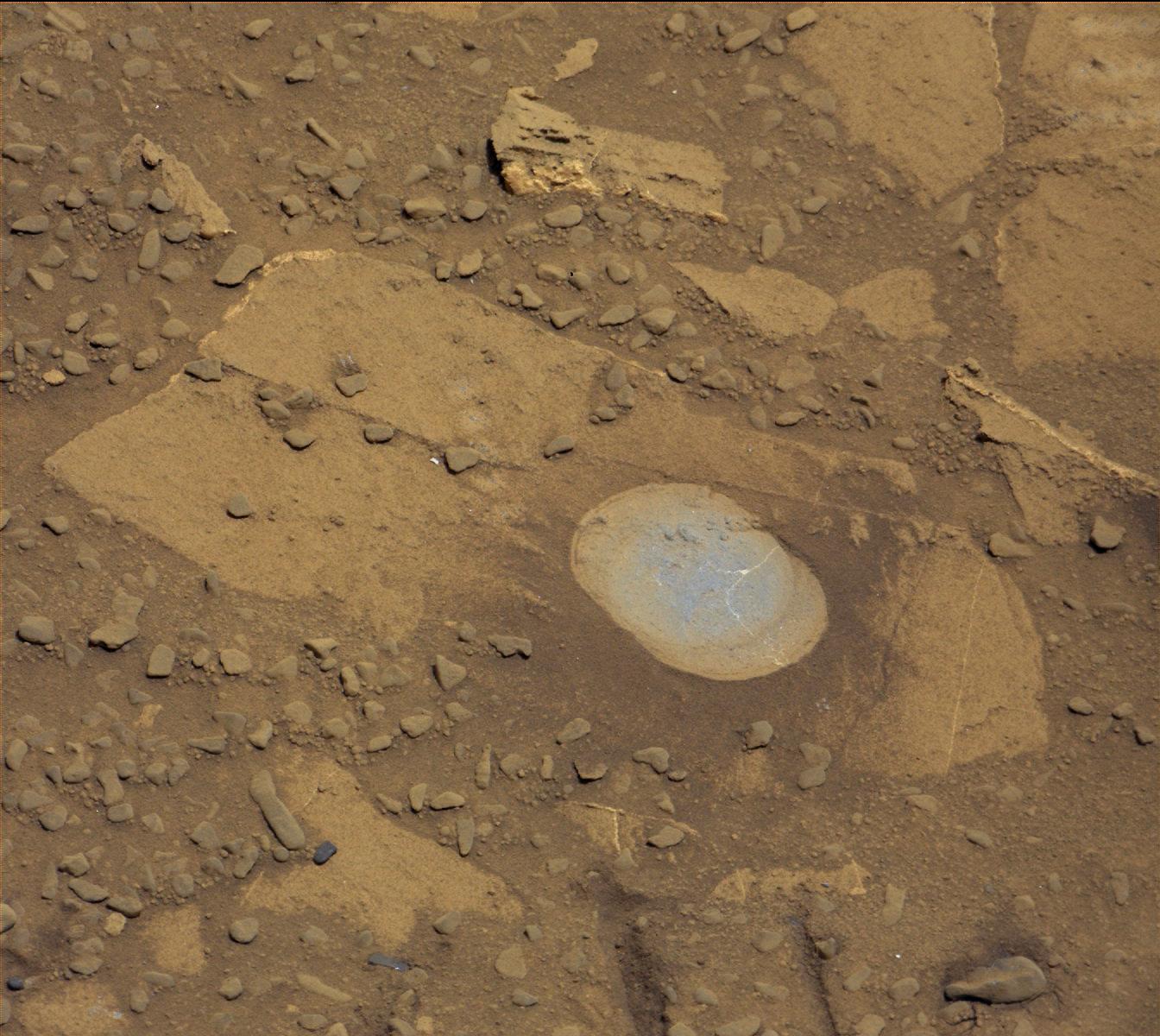
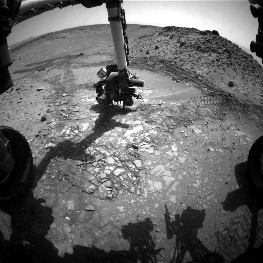
PIA18603:
Candidate Drilling Target on Mars Doesn't Pass Exam
Full Resolution:
TIFF
(1.05 MB)
JPEG
(156.7 kB)
2014-08-25
Mars
2001 Mars Odyssey
THEMIS
1186x2907x1
PIA18688:
Olympia Undae
Full Resolution:
TIFF
(3.452 MB)
JPEG
(175.6 kB)
2014-08-26
Mars
2001 Mars Odyssey
THEMIS
1376x2959x1
PIA18690:
Landslide
Full Resolution:
TIFF
(4.077 MB)
JPEG
(321 kB)
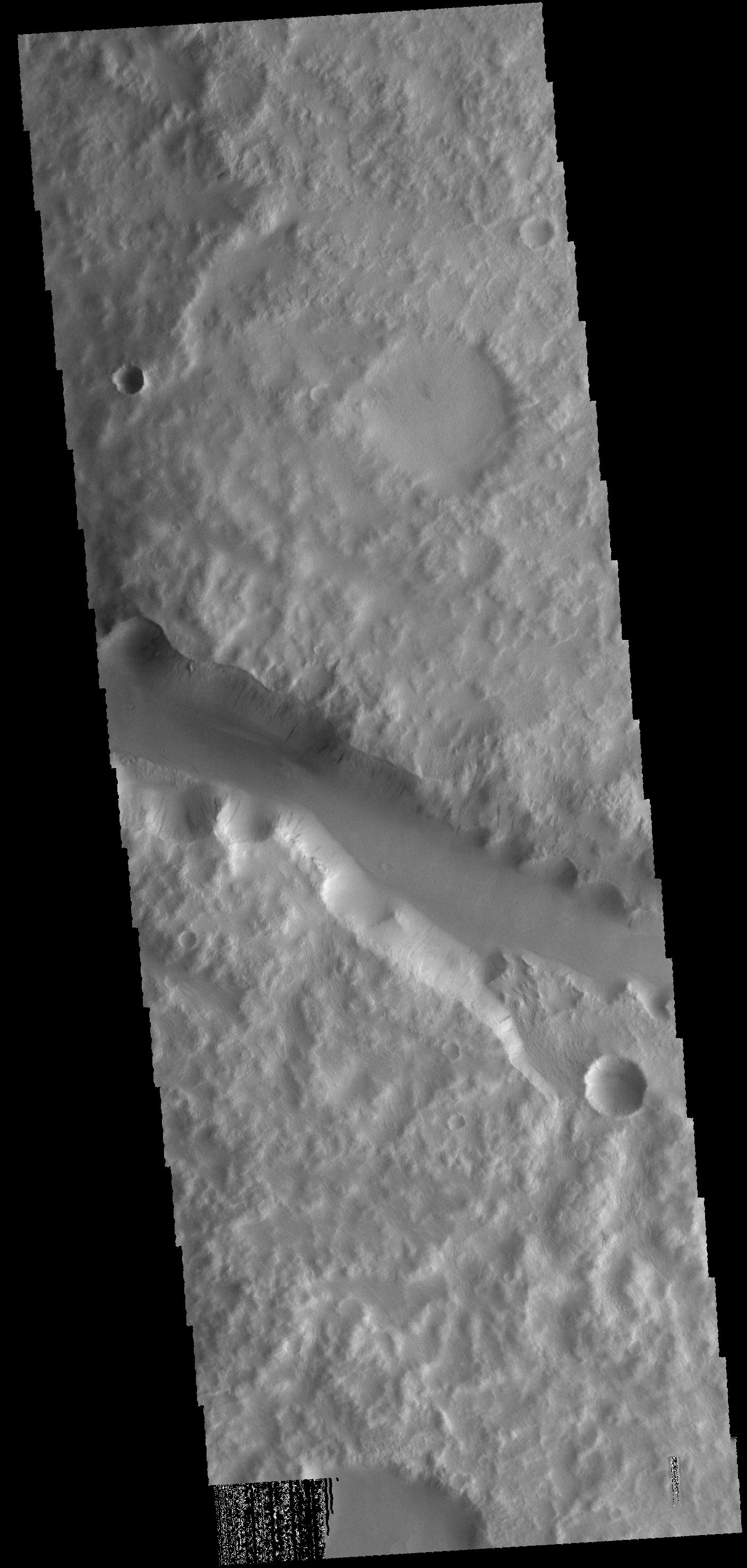
2014-08-27
Mars
2001 Mars Odyssey
THEMIS
1412x2948x1
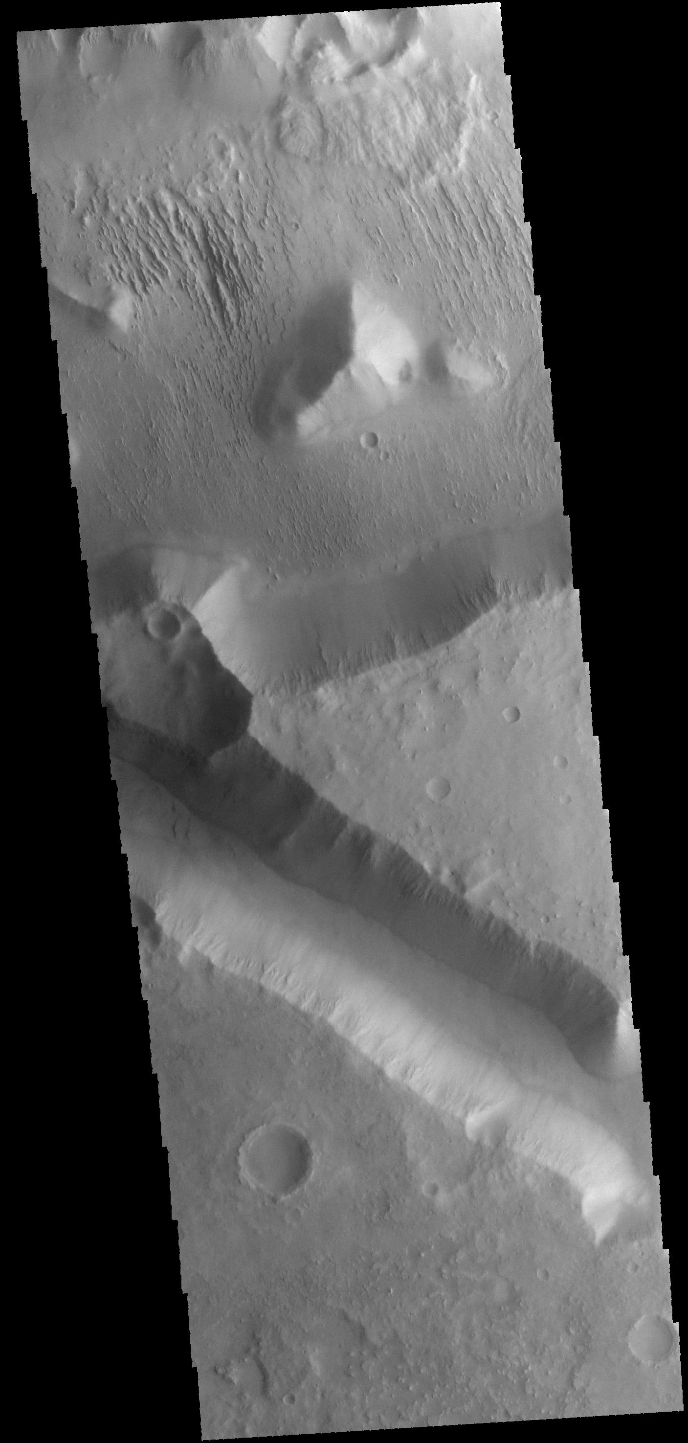
PIA18691:
Ravi Vallis
Full Resolution:
TIFF
(4.168 MB)
JPEG
(348.9 kB)
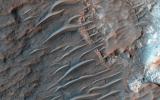
2014-08-27
Mars
Mars Reconnaissance Orbiter (MRO)
HiRISE
2880x1800x3
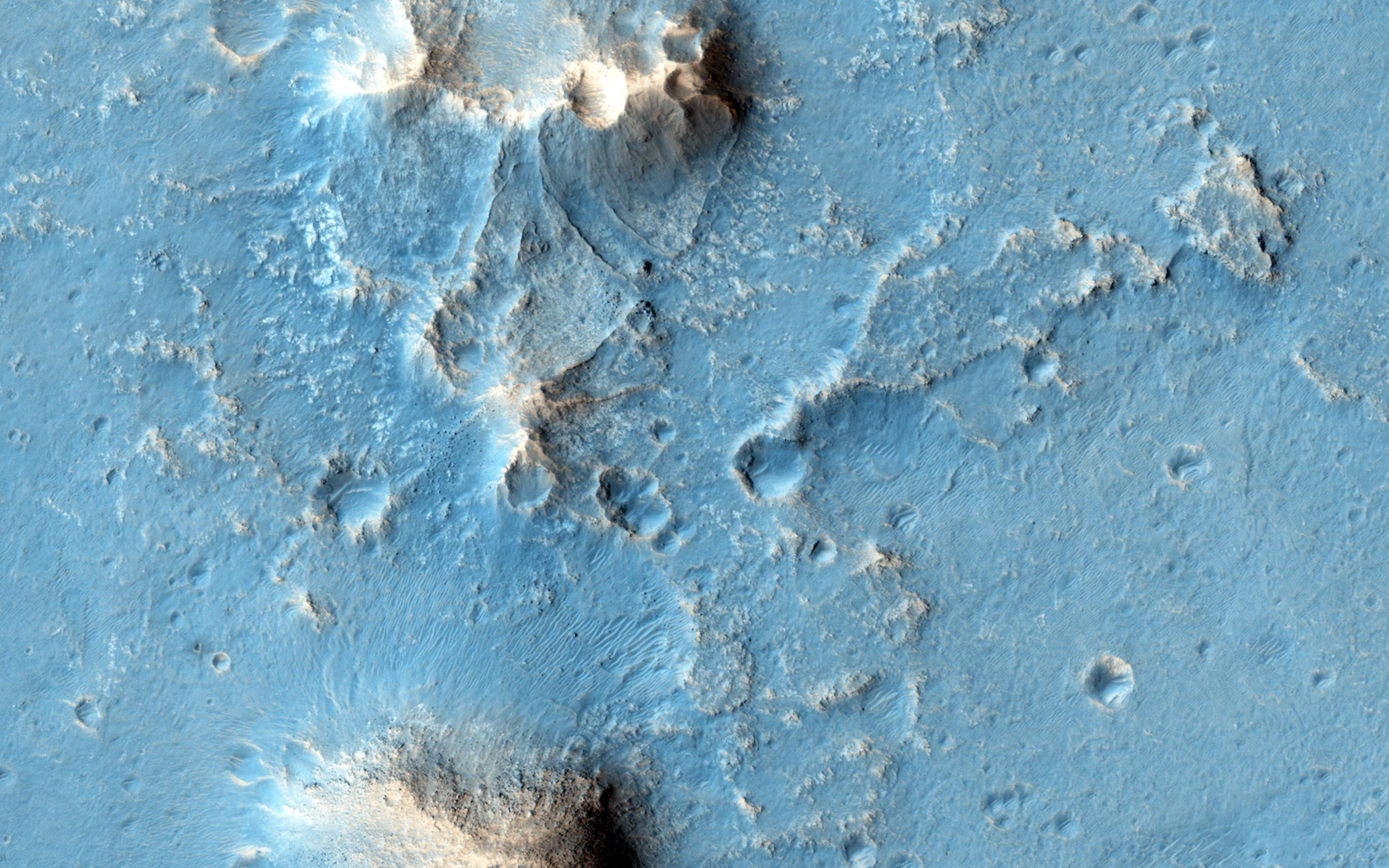
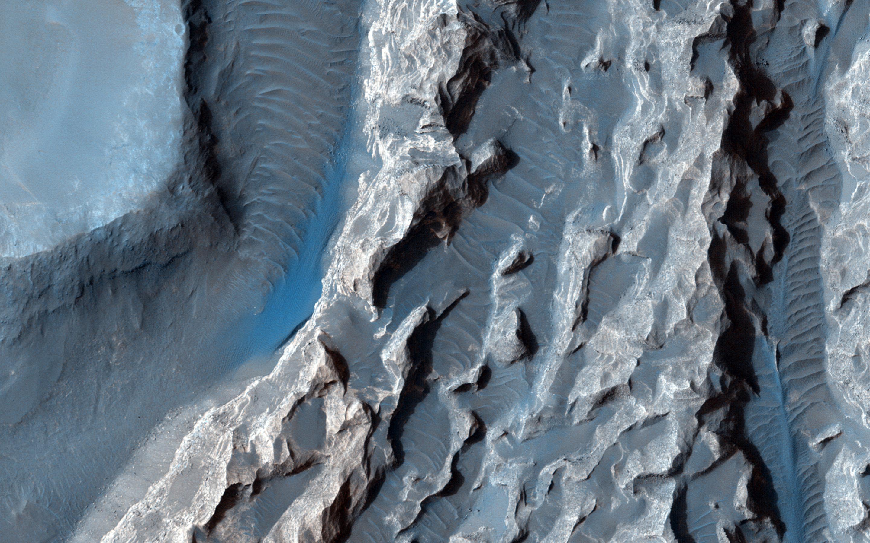
PIA18773:
A Possible Landing Site in Aram Dorsum for the ExoMars Rover
Full Resolution:
TIFF
(15.56 MB)
JPEG
(608.6 kB)
2014-08-27
Mars
Mars Reconnaissance Orbiter (MRO)
HiRISE
2880x1800x3
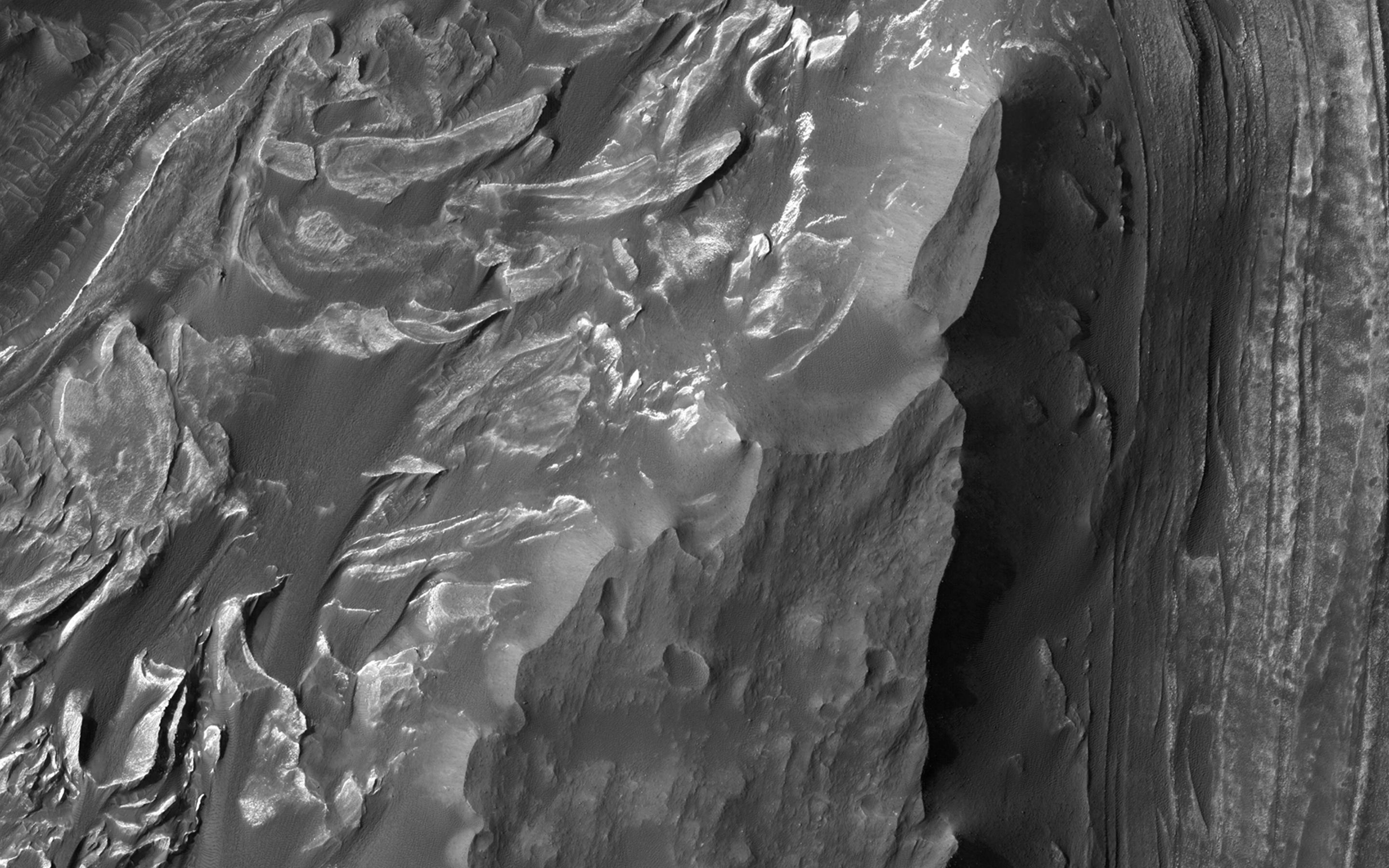
PIA18774:
Weird Crater
Full Resolution:
TIFF
(15.56 MB)
JPEG
(933 kB)
2014-08-27
Mars
Mars Reconnaissance Orbiter (MRO)
HiRISE
2880x1800x3
PIA18775:
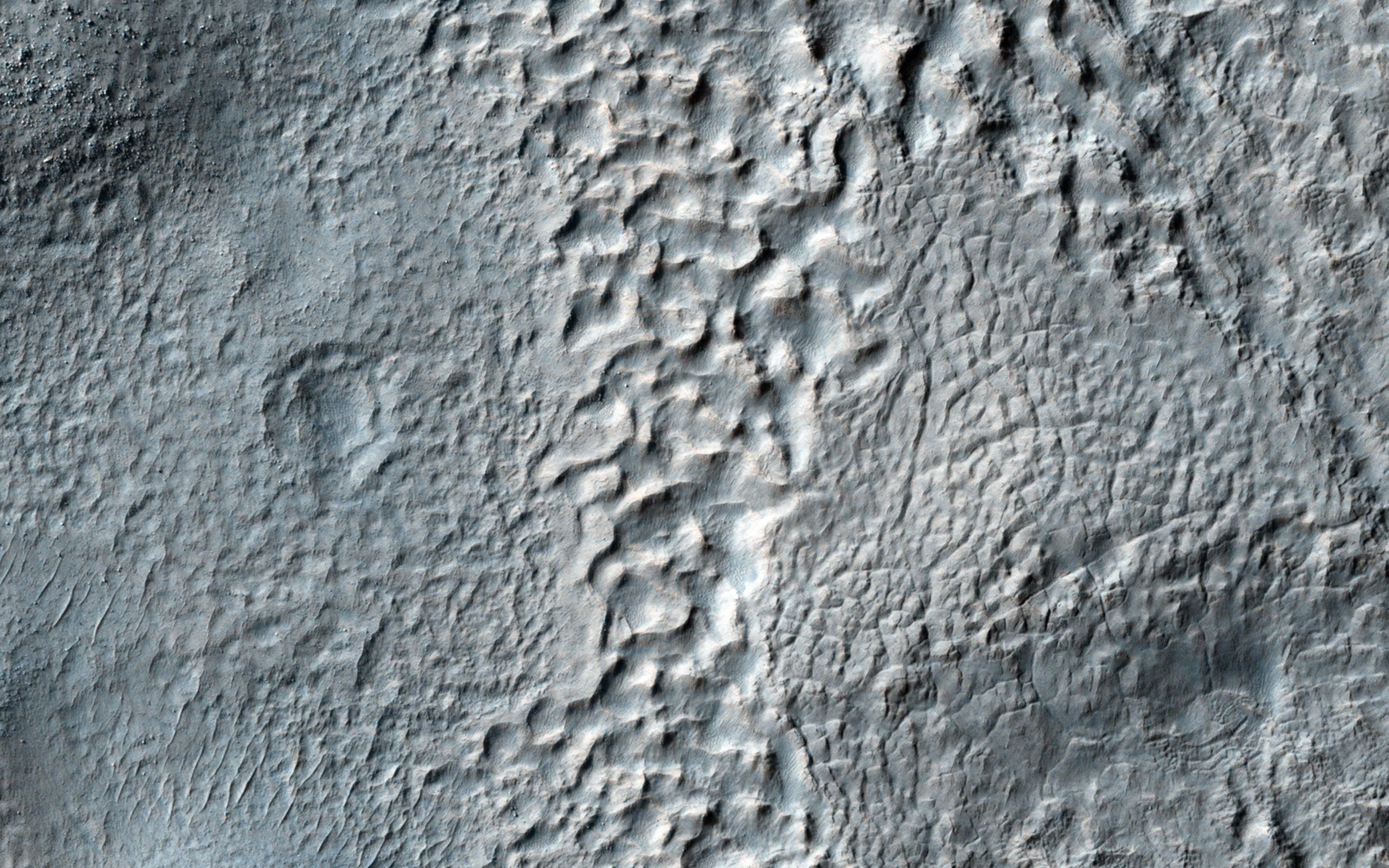
Mantled Terrain in the Southern Mid-Latitudes
Full Resolution:
TIFF
(15.56 MB)
JPEG
(874.7 kB)
2014-08-27
Mars
Mars Reconnaissance Orbiter (MRO)
HiRISE
2880x1800x3
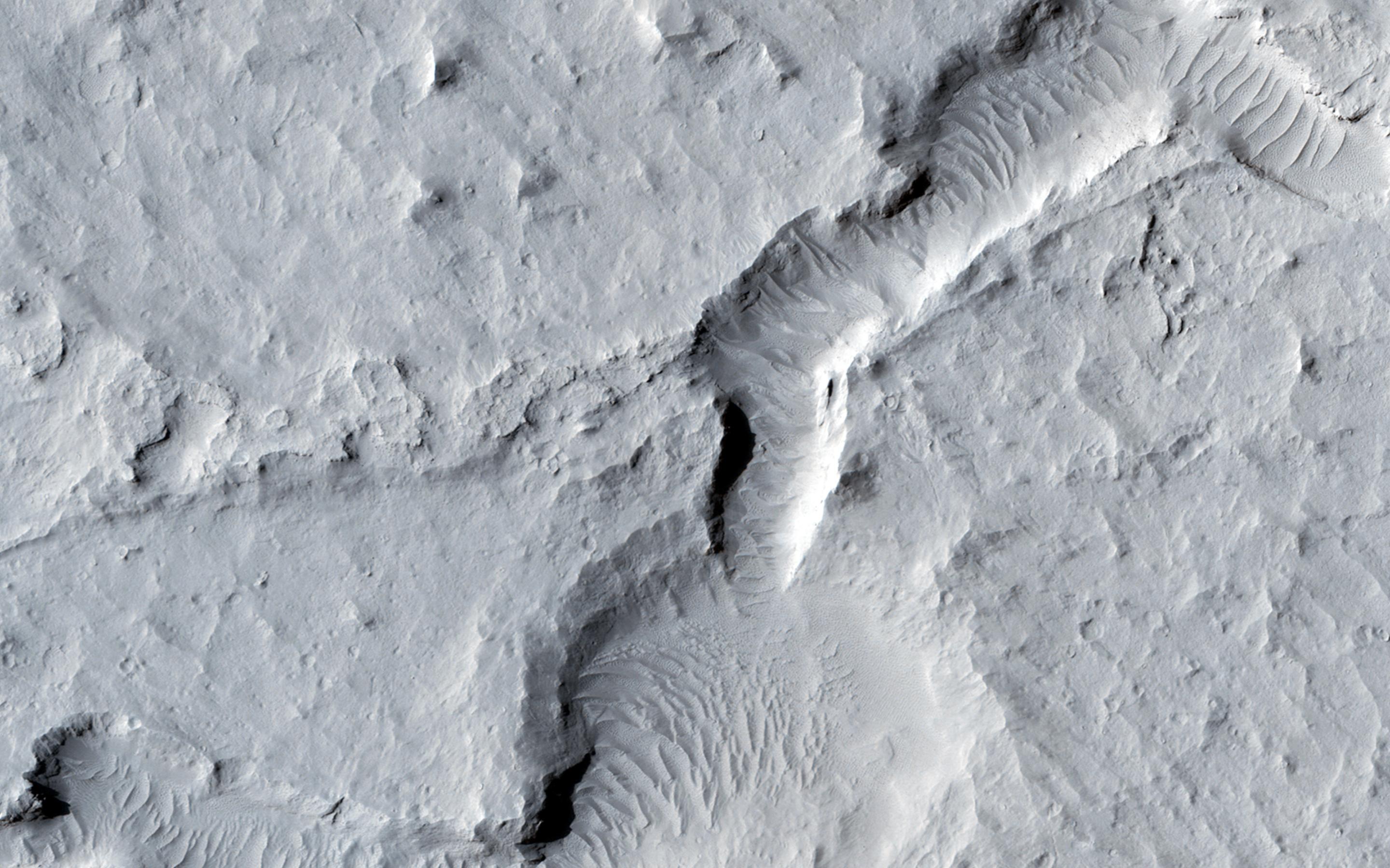
PIA18776:
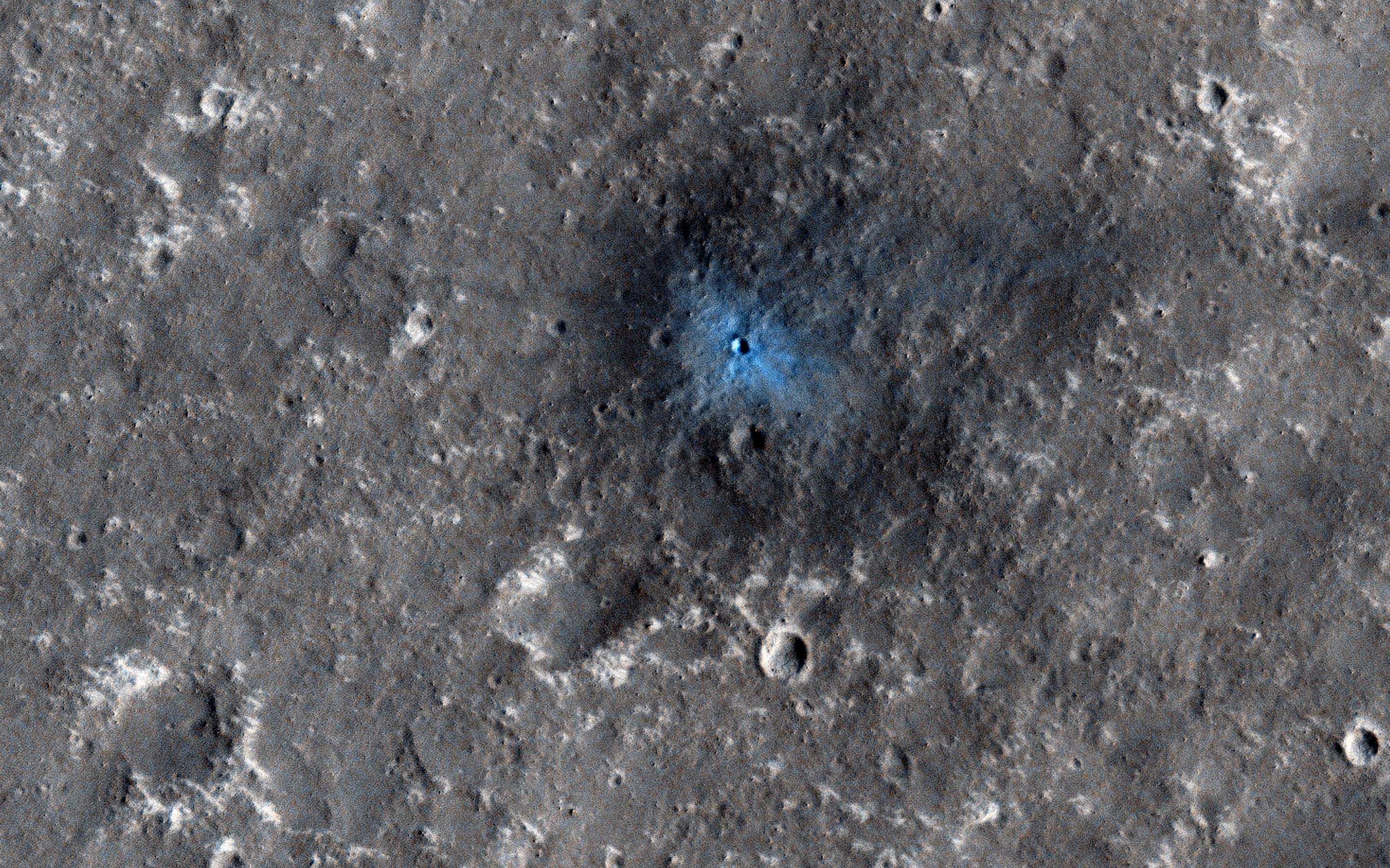
A New Impact Crater Near NASA's InSight Landing Region
Full Resolution:
TIFF
(15.56 MB)
JPEG
(1.268 MB)
2014-08-28
Mars
2001 Mars Odyssey
THEMIS
1321x5953x1
PIA18693:
Ares Vallis
Full Resolution:
TIFF
(7.872 MB)
JPEG
(433.7 kB)
2014-08-29
Mars
2001 Mars Odyssey
THEMIS
-1x-1x3
PIA18694:
Dark Slope Streaks
Full Resolution:
TIFF
(4.196 MB)
JPEG
(271.5 kB)
2014-08-29
Mars
Mars Exploration Rover (MER)
Navigation Camera
2246x884x1
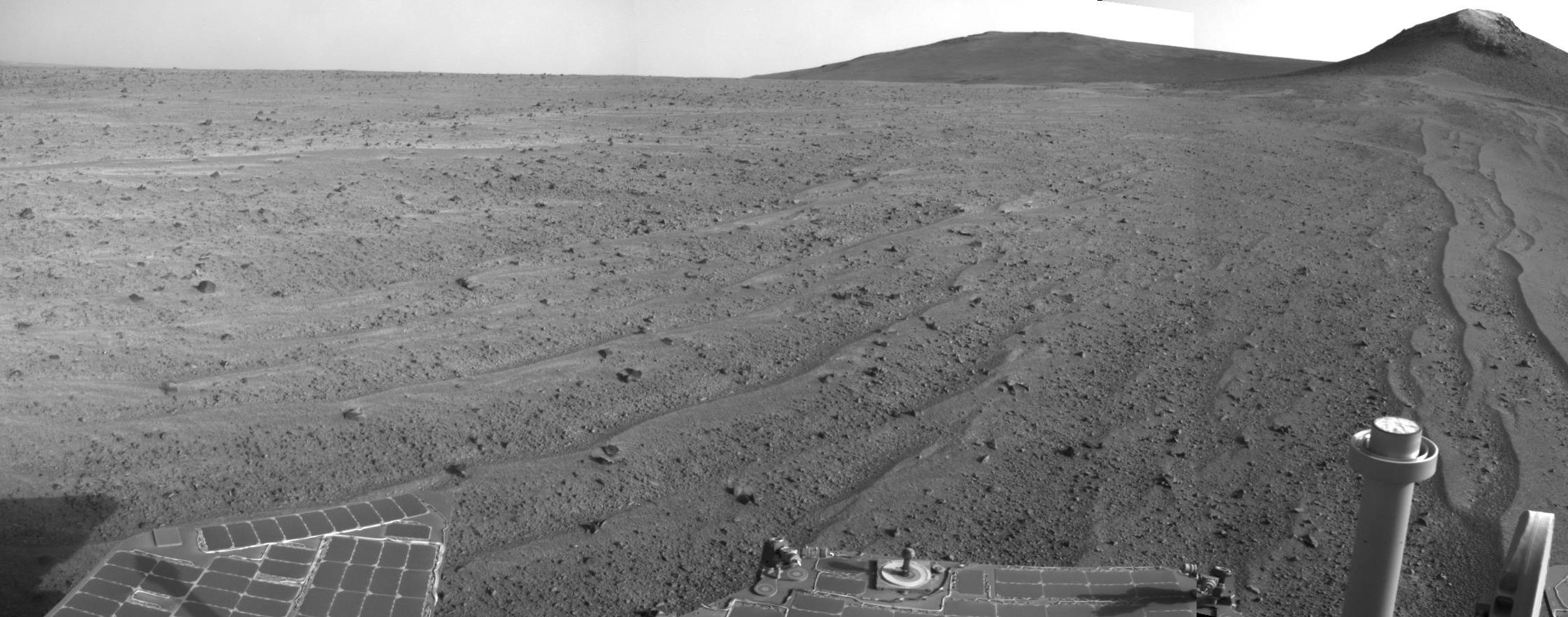
PIA18598:
Opportunity's Rear-Facing View Ahead After a Drive
Full Resolution:
TIFF
(1.988 MB)
JPEG
(282.4 kB)
2014-09-01
Mars
2001 Mars Odyssey
THEMIS
1432x2943x1
PIA18696:
Lava Channel
Full Resolution:
TIFF
(4.219 MB)
JPEG
(410.3 kB)
2014-09-02
Mars
2001 Mars Odyssey
THEMIS
1373x2938x1
PIA18697:
Pavonis Mons
Full Resolution:
TIFF
(4.039 MB)
JPEG
(204.9 kB)
2014-09-03
Mars
2001 Mars Odyssey
THEMIS
1437x2943x1
PIA18698:
Dunes
Full Resolution:
TIFF
(4.234 MB)
JPEG
(300.4 kB)
2014-09-04
Mars
2001 Mars Odyssey
THEMIS
1446x2943x1
PIA18700:
Nilus Mensae
Full Resolution:
TIFF
(4.261 MB)
JPEG
(350.5 kB)
2014-09-05
Mars
2001 Mars Odyssey
THEMIS
1413x2937x1
PIA18702:
Olympus Mons
Full Resolution:
TIFF
(4.155 MB)
JPEG
(461.9 kB)
2014-09-08
Mars
2001 Mars Odyssey
THEMIS
1384x2959x1
PIA18703:
Ma'adim Vallis
Full Resolution:
TIFF
(4.1 MB)
JPEG
(313.8 kB)
2014-09-09
Mars
2001 Mars Odyssey
THEMIS
1418x2947x1
PIA18704:
Avernus Colles
Full Resolution:
TIFF
(4.184 MB)
JPEG
(403 kB)
2014-09-09
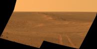
Mars
Mars Exploration Rover (MER)
Panoramic Camera
2285x1168x3
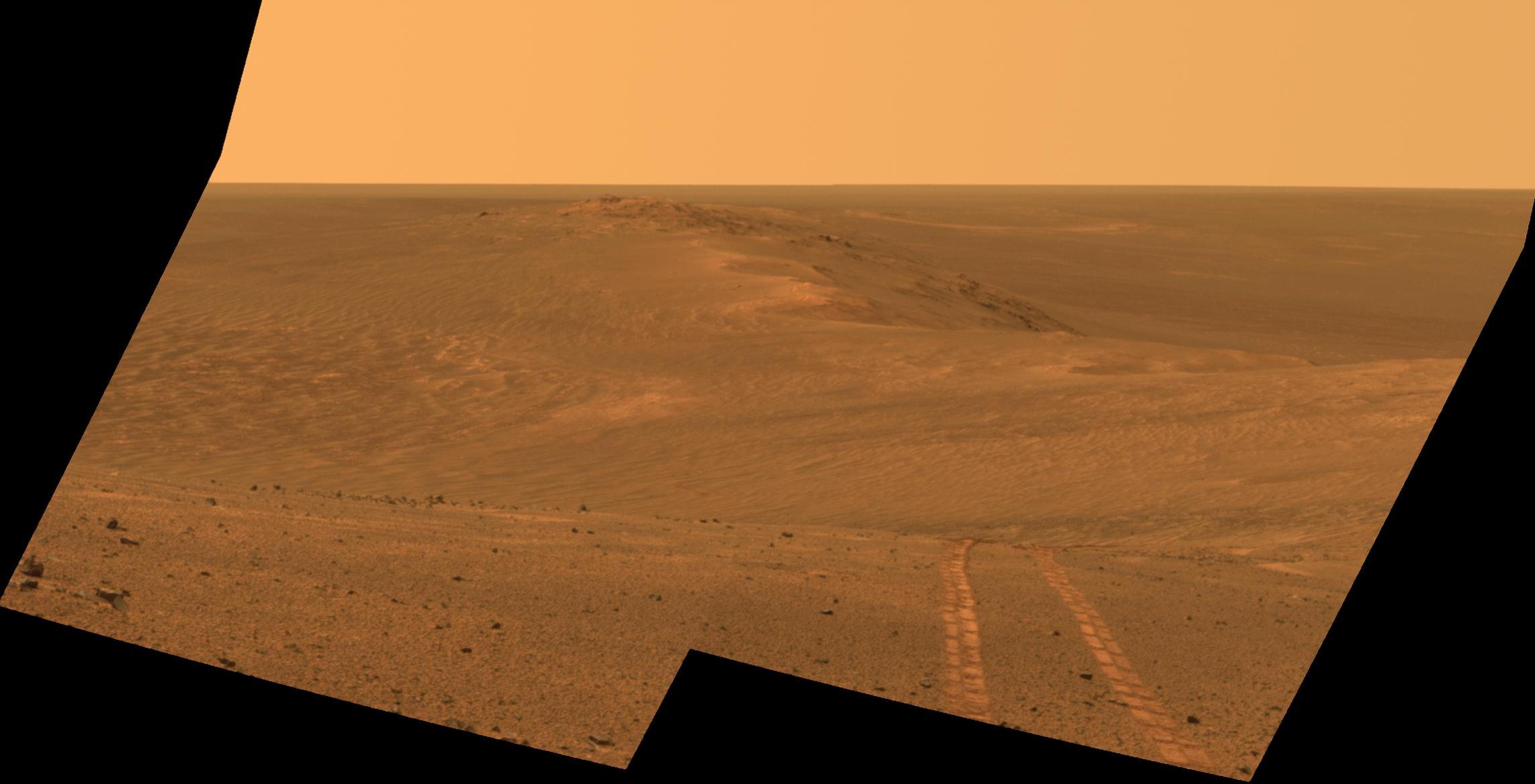
PIA18604:
Rover Tracks in Northward View Along West Rim of Endeavour
Full Resolution:
TIFF
(8.01 MB)
JPEG
(164.9 kB)
2014-09-09
Mars
Mars Exploration Rover (MER)
Panoramic Camera
2285x1168x3
PIA18605:
Rover Tracks in Northward View Along West Rim of Endeavour, False Color
Full Resolution:
TIFF
(8.01 MB)
JPEG
(284.7 kB)
2014-09-09
Mars
Mars Exploration Rover (MER)
Panoramic Camera
2134x1148x3
PIA18606:
Rover's Tracks in Stereo View Along Rim of Endeavour Crater
Full Resolution:
TIFF
(7.353 MB)
JPEG
(323 kB)
2014-09-10
Mars
2001 Mars Odyssey
THEMIS
1407x2950x1
PIA18705:
Aeolis Mensae
Full Resolution:
TIFF
(4.156 MB)
JPEG
(292.8 kB)
2014-09-10
Mars
Mars Reconnaissance Orbiter (MRO)
HiRISE
2880x1800x3
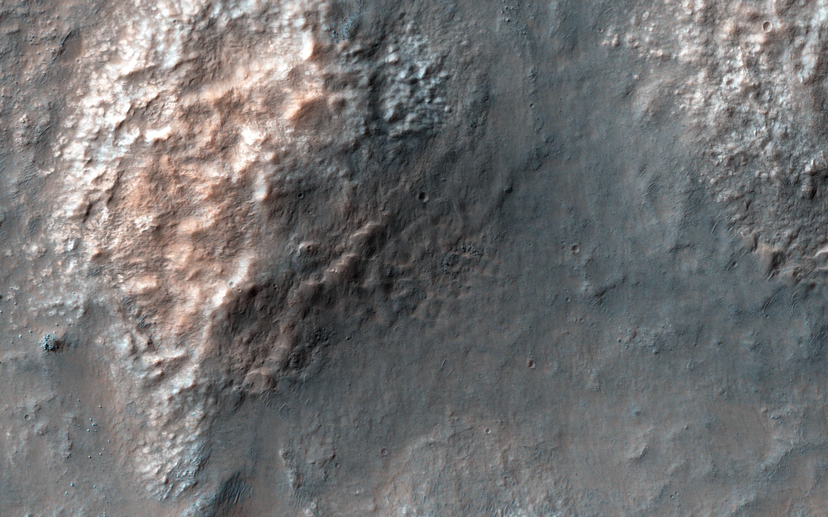
PIA18804:
Chaos in Eridania Basin
Full Resolution:
TIFF
(15.56 MB)
JPEG
(684.1 kB)
2014-09-10
Mars
Mars Reconnaissance Orbiter (MRO)
HiRISE
2880x1800x3
PIA18805:
Mysterious Light-Toned Deposit in Vinogradov Crater
Full Resolution:
TIFF
(15.56 MB)
JPEG
(1.01 MB)
2014-09-10
Mars
Mars Reconnaissance Orbiter (MRO)
HiRISE
2880x1800x3
PIA18806:
Banded TARs in Iapygia
Full Resolution:
TIFF
(15.56 MB)
JPEG
(738.2 kB)
2014-09-10
Mars
Mars Reconnaissance Orbiter (MRO)
HiRISE
2880x1800x1
PIA18807:
Overlapping Lobate Lava Flows in Daedalia Planum
Full Resolution:
TIFF
(5.191 MB)
JPEG
(515.1 kB)
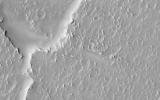
2014-09-11
Mars
2001 Mars Odyssey
THEMIS
1376x2937x1
PIA18706:
Pavonis Mons
Full Resolution:
TIFF
(4.046 MB)
JPEG
(311.8 kB)
2014-09-11
Mars
Mars Science Laboratory (MSL)
Mastcam
6612x1241x3
PIA18473:
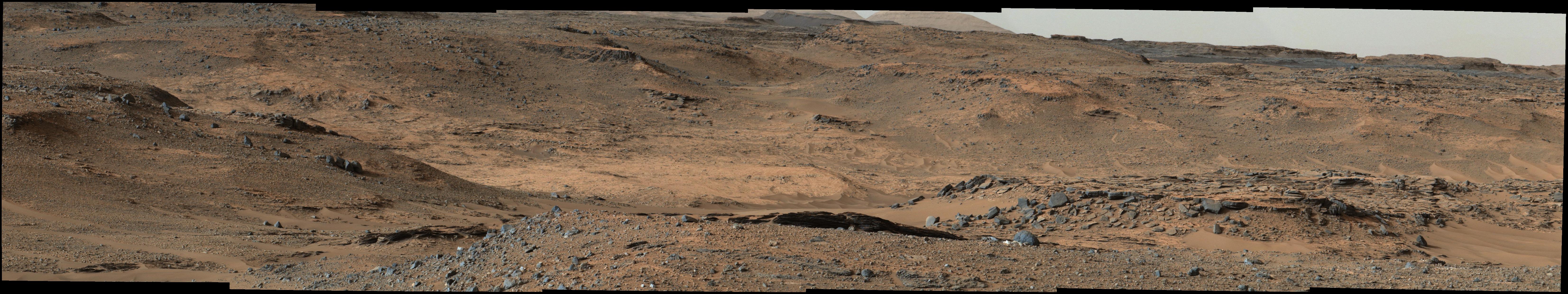
Curiosity Marches Onward and Upward
Full Resolution:
TIFF
(24.63 MB)
JPEG
(1.424 MB)
2014-09-11
Mars
Mars Reconnaissance Orbiter (MRO)
Mars Science Laboratory (MSL)
HiRISE
3300x2550x3
PIA18474:
Slopes of Mount Sharp
Full Resolution:
TIFF
(25.26 MB)
JPEG
(1.023 MB)
2014-09-11
Mars
Mars Reconnaissance Orbiter (MRO)
Mars Science Laboratory (MSL)
HiRISE
2550x3300x3
PIA18475:
Curiosity's Next Steps
Full Resolution:
TIFF
(25.25 MB)
JPEG
(1.735 MB)
2014-09-11
Mars
Mars Science Laboratory (MSL)
Mastcam
2102x984x3
PIA18476:
Martian Layers Thicker on Top
Full Resolution:
TIFF
(6.208 MB)
JPEG
(479.9 kB)
2014-09-11
Mars
Mars Science Laboratory (MSL)
Mastcam
1315x1179x3
PIA18477:
A Bonanza of Clues About Mars
Full Resolution:
TIFF
(4.653 MB)
JPEG
(253.2 kB)
2014-09-11
Mars
Mars Science Laboratory (MSL)
Mastcam
1319x1187x3
PIA18478:
Loose Rock Leads to Incomplete Drilling
Full Resolution:
TIFF
(4.699 MB)
JPEG
(278.6 kB)
2014-09-11
Mars
Mars Science Laboratory (MSL)
Alpha Particle X-ray Spectrometer
1530x1032x3
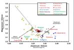
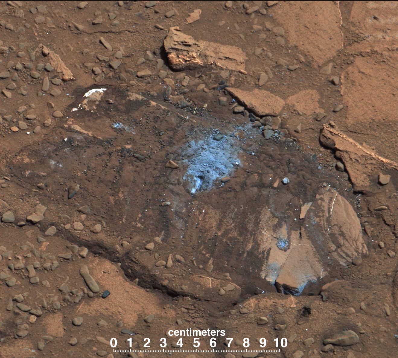
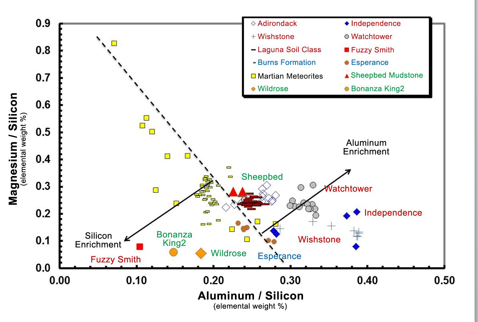
PIA18479:
Martian Rocks Rich in Silicon
Full Resolution:
TIFF
(4.739 MB)
JPEG
(134.6 kB)
2014-09-11
Mars
Mars Reconnaissance Orbiter (MRO)
Mars Science Laboratory (MSL)
HiRISE
4890x3912x3
PIA18780:
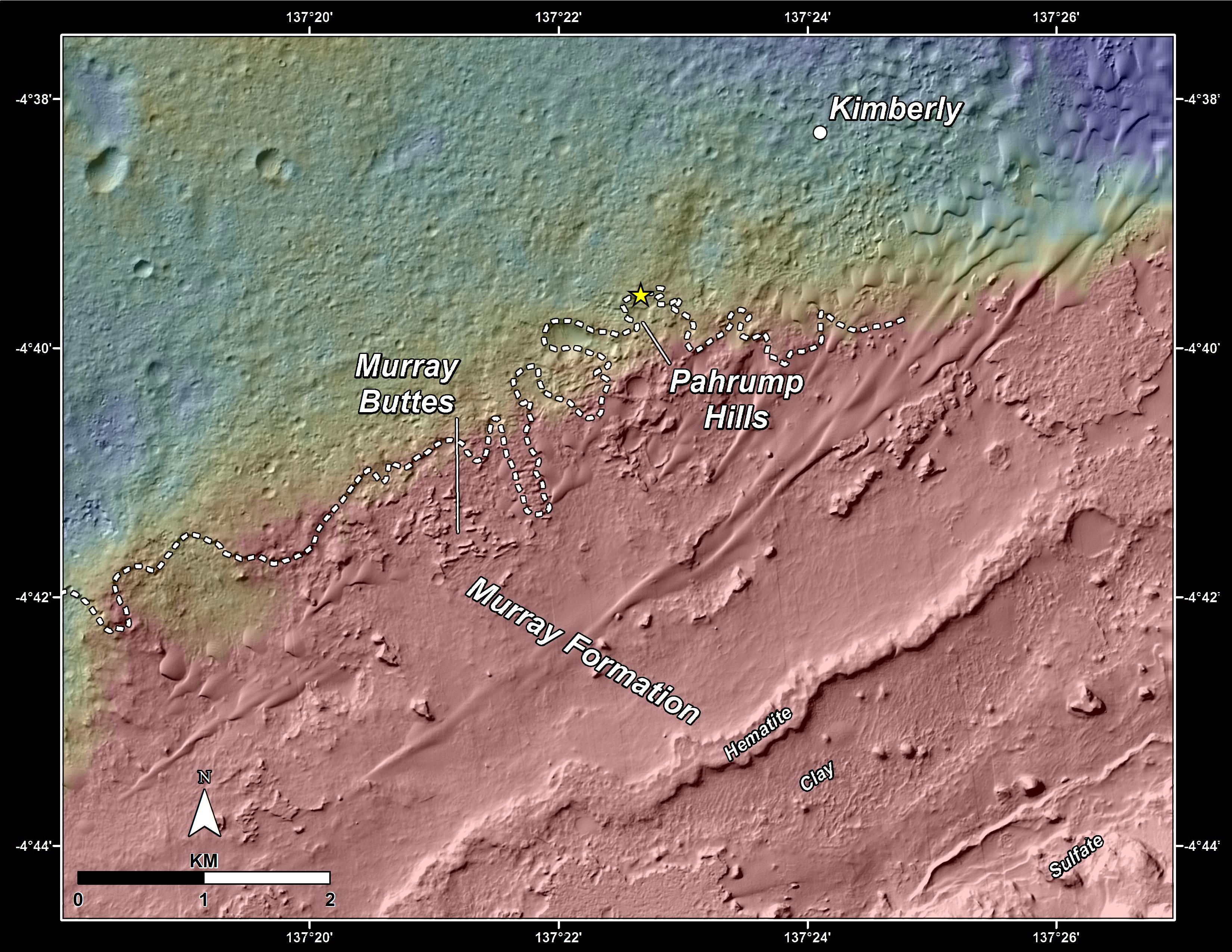
Curiosity Rover Planned Route
Full Resolution:
TIFF
(57.42 MB)
JPEG
(3.739 MB)
2014-09-11
Mars
Mars Reconnaissance Orbiter (MRO)
Mars Science Laboratory (MSL)
HiRISE
4173x3008x3
PIA18781:
Map of Lower Mount Sharp
Full Resolution:
TIFF
(37.68 MB)
JPEG
(1.64 MB)
2014-09-11
Mars
Mars Science Laboratory (MSL)
4200x1759x3
PIA18782:
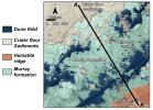
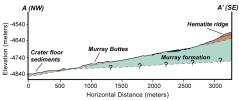
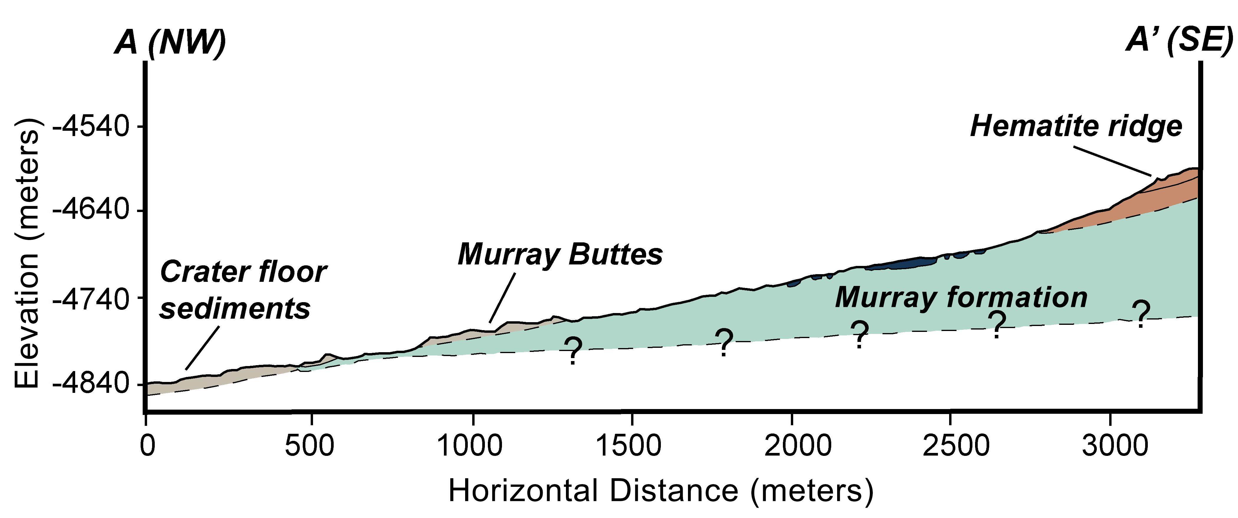
Geologic Cross-Section
Full Resolution:
TIFF
(22.18 MB)
JPEG
(366.6 kB)
2014-09-11
Mars
Mars Reconnaissance Orbiter (MRO)
Mars Science Laboratory (MSL)
HiRISE
1927x1542x3
PIA18783:
'Murray Buttes' Mesa
Full Resolution:
TIFF
(8.918 MB)
JPEG
(471.3 kB)
2014-09-11
Mars
Mars Reconnaissance Orbiter (MRO)
Mars Science Laboratory (MSL)
HiRISE
1927x1542x3
PIA18784:
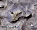
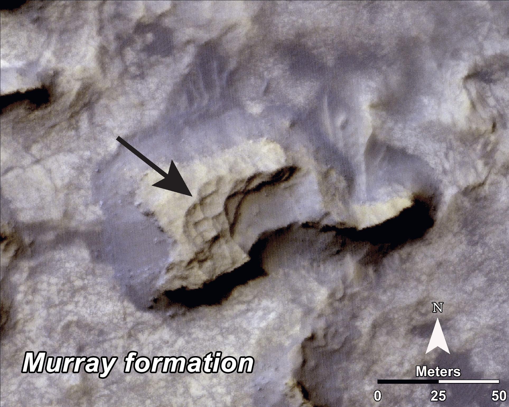
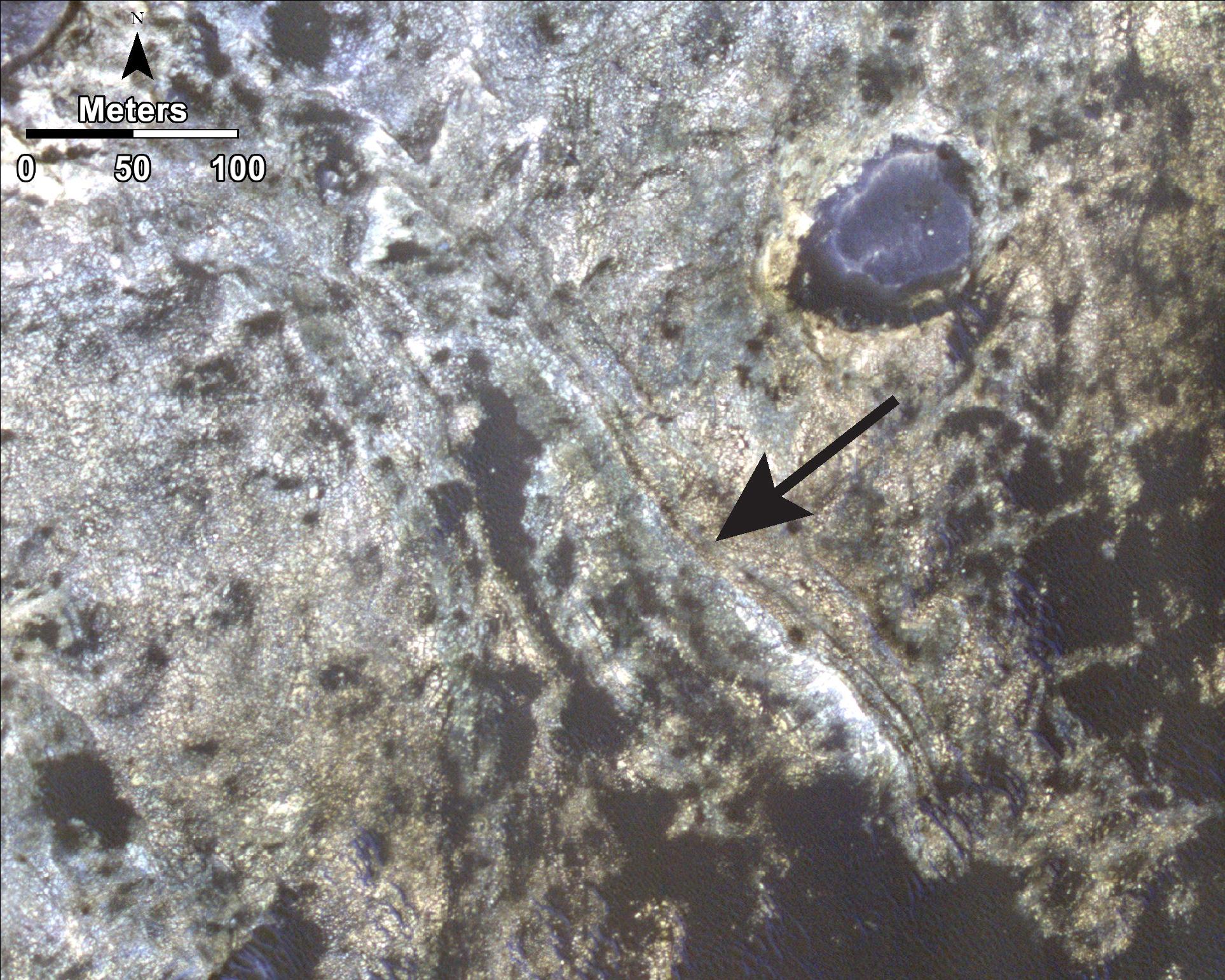
Bands on the 'Murray Formation'
Full Resolution:
TIFF
(8.918 MB)
JPEG
(563 kB)
2014-09-11
Mars
Mars Reconnaissance Orbiter (MRO)
Mars Science Laboratory (MSL)
HiRISE
3000x2400x3
PIA18785:
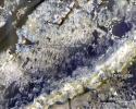
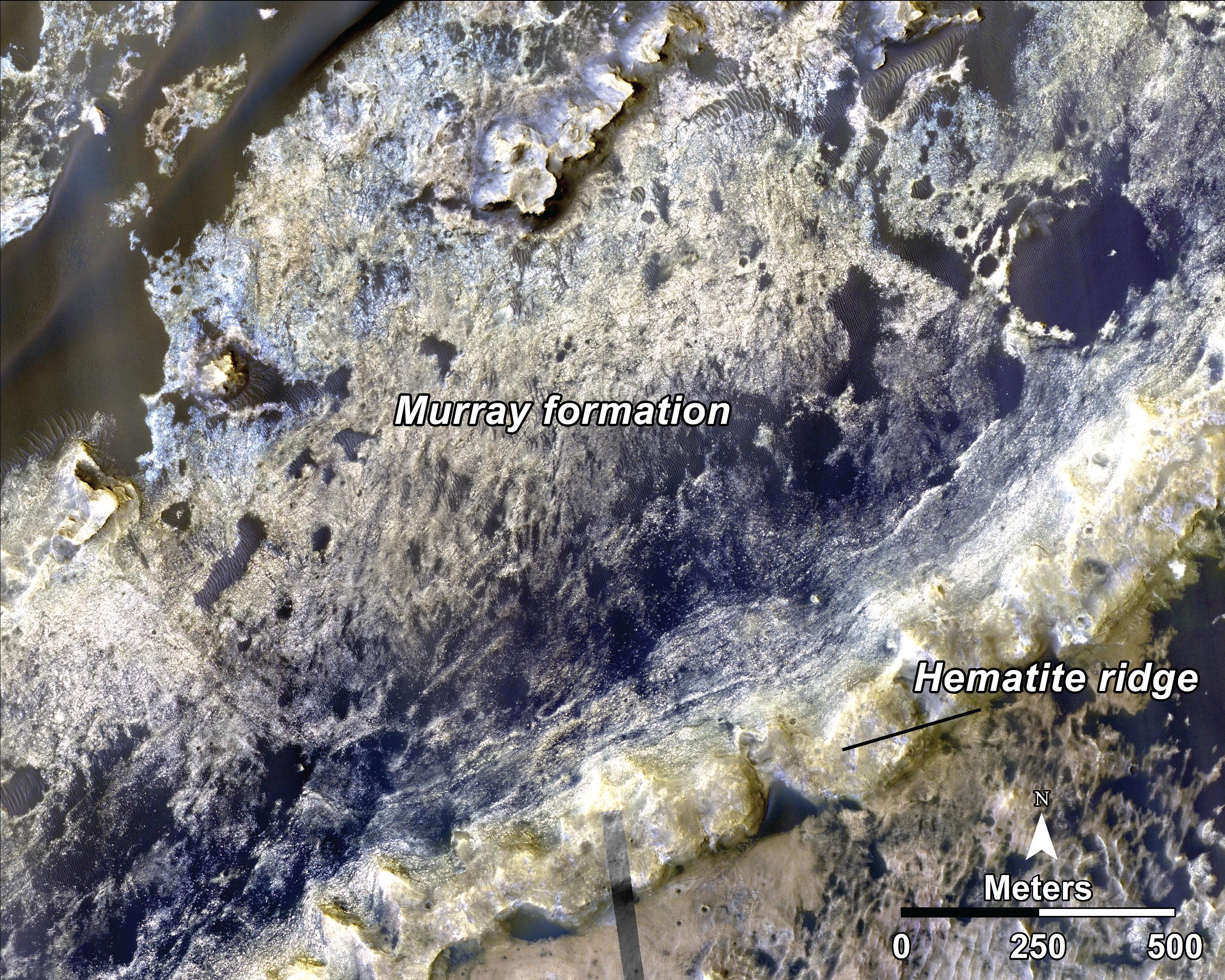
Geological Transition
Full Resolution:
TIFF
(21.61 MB)
JPEG
(2.032 MB)
2014-09-12
Mars
2001 Mars Odyssey
THEMIS
1382x2959x1
PIA18707:
Volcanic Flow Surfaces
Full Resolution:
TIFF
(4.094 MB)
JPEG
(416.2 kB)
2014-09-15
Mars
2001 Mars Odyssey
THEMIS
1405x2954x1
PIA18709:
Melas Chasma
Full Resolution:
TIFF
(4.155 MB)
JPEG
(266.6 kB)
2014-09-16
Mars
2001 Mars Odyssey
THEMIS
1423x2942x1
PIA18711:
Gigas Sulci
Full Resolution:
TIFF
(4.191 MB)
JPEG
(409.1 kB)
2014-09-17
Mars
2001 Mars Odyssey
THEMIS
988x2932x1
PIA18712:
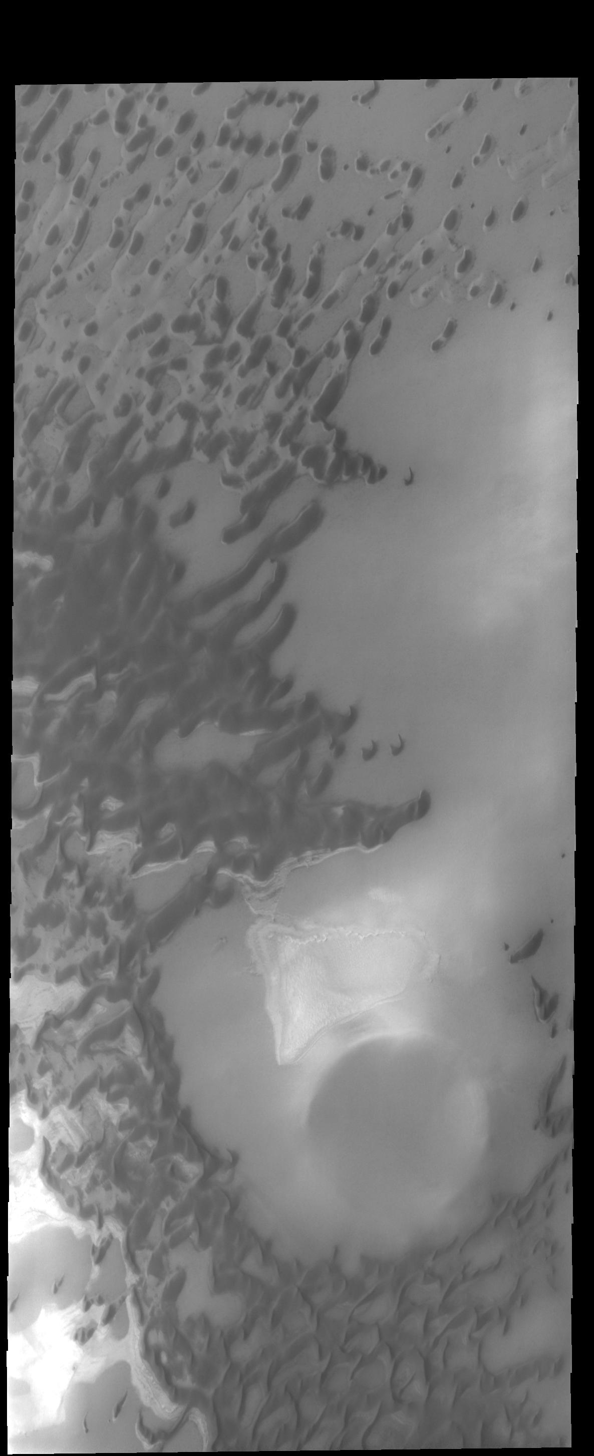
South Polar Cap
Full Resolution:
TIFF
(2.9 MB)
JPEG
(301 kB)
2014-09-18
Mars
2001 Mars Odyssey
THEMIS
491x1528x1
PIA18714:
South Polar Cap
Full Resolution:
TIFF
(751.2 kB)
JPEG
(93.79 kB)
2014-09-19
Mars
2001 Mars Odyssey
THEMIS
974x2930x1
PIA18715:
Polar Textures
Full Resolution:
TIFF
(2.857 MB)
JPEG
(645.4 kB)
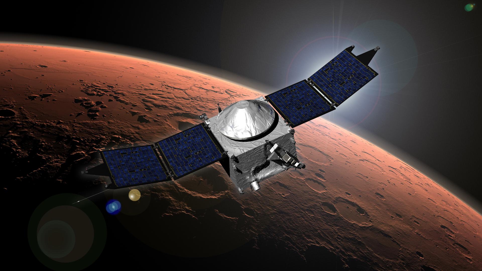
2014-09-21
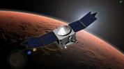
Mars
MAVEN
1920x1080x3
PIA18811:
MAVEN (Artist's Concept)
Full Resolution:
TIFF
(6.223 MB)
JPEG
(220.8 kB)
2014-09-22
Mars
2001 Mars Odyssey
THEMIS
1407x2950x1
PIA18718:
Labou Vallis
Full Resolution:
TIFF
(4.156 MB)
JPEG
(353.2 kB)
2014-09-23
Mars
2001 Mars Odyssey
THEMIS
1371x2981x1
PIA18719:
Terra Cimmeria
Full Resolution:
TIFF
(4.092 MB)
JPEG
(399.1 kB)
2014-09-24
Mars
2001 Mars Odyssey
THEMIS
696x1556x1
PIA18720:
Terra Sirenum
Full Resolution:
TIFF
(1.084 MB)
JPEG
(114.7 kB)
2014-09-25
Mars
2001 Mars Odyssey
THEMIS
1010x2952x1
PIA18722:
South Polar Crater
Full Resolution:
TIFF
(2.985 MB)
JPEG
(190.1 kB)
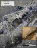
2014-09-25
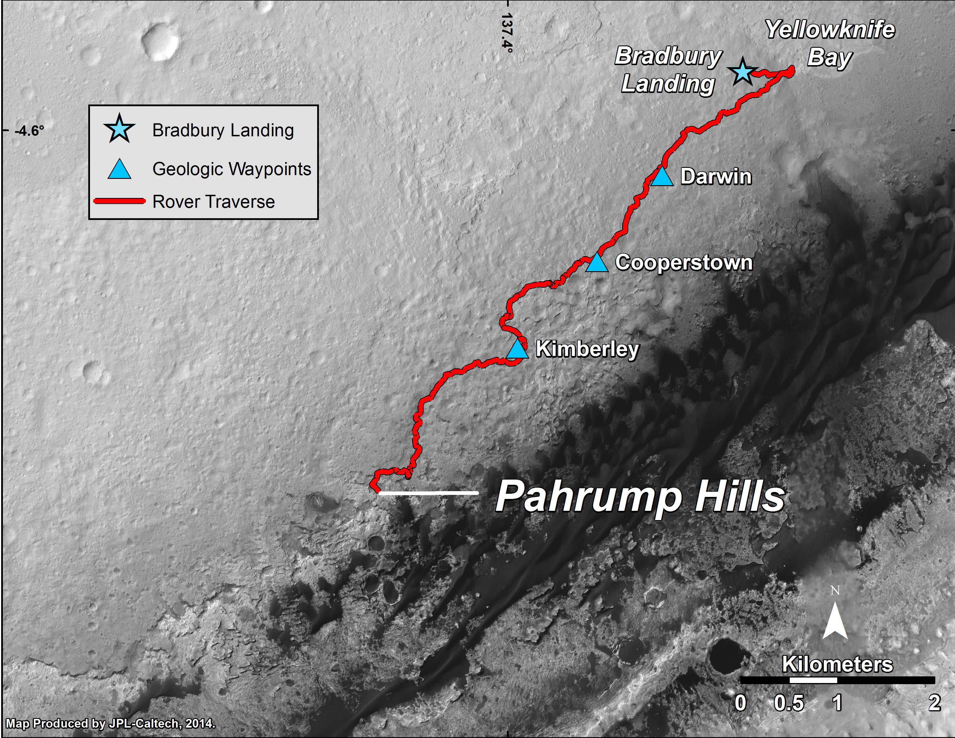
Mars
Mars Reconnaissance Orbiter (MRO)
Mars Science Laboratory (MSL)
HiRISE
3300x2550x3
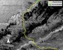
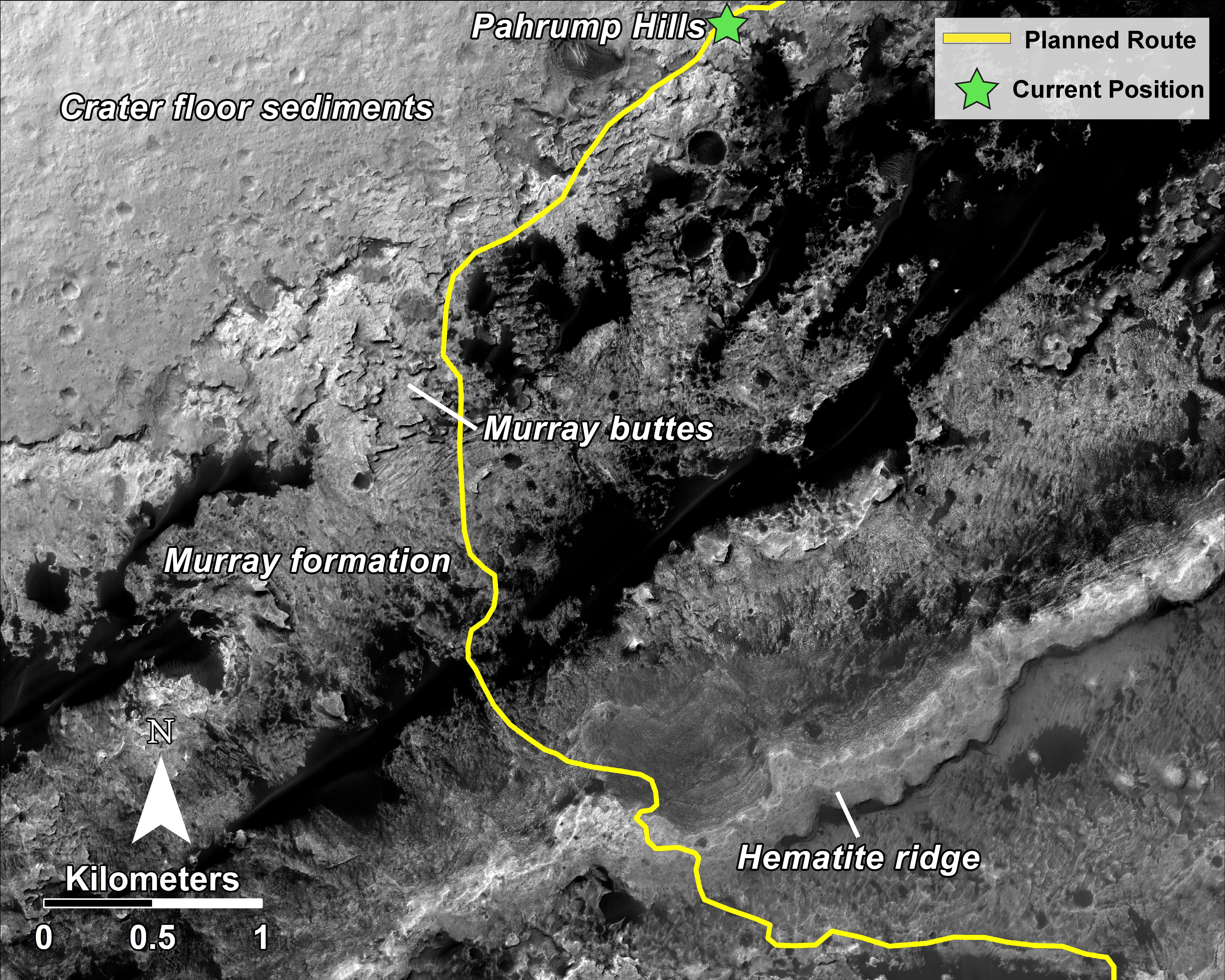
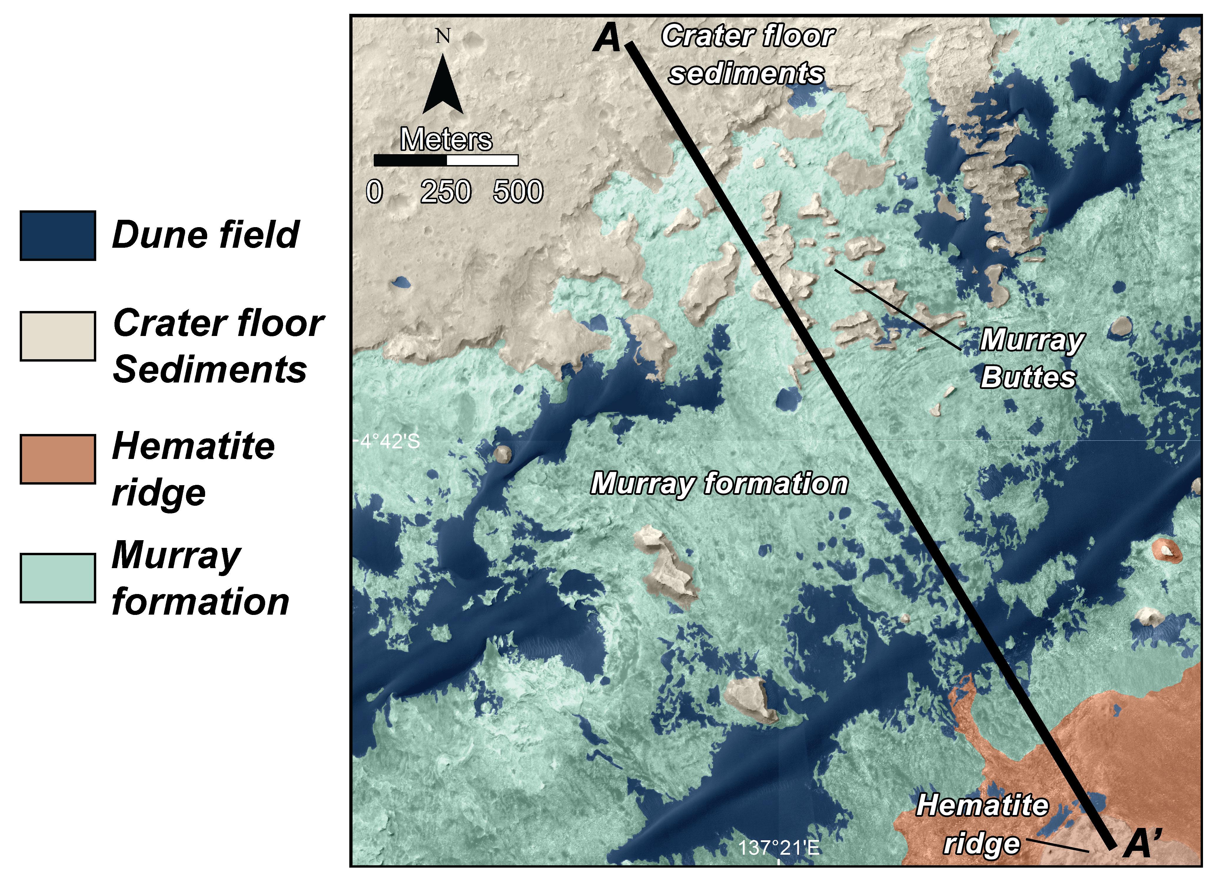
PIA18607:
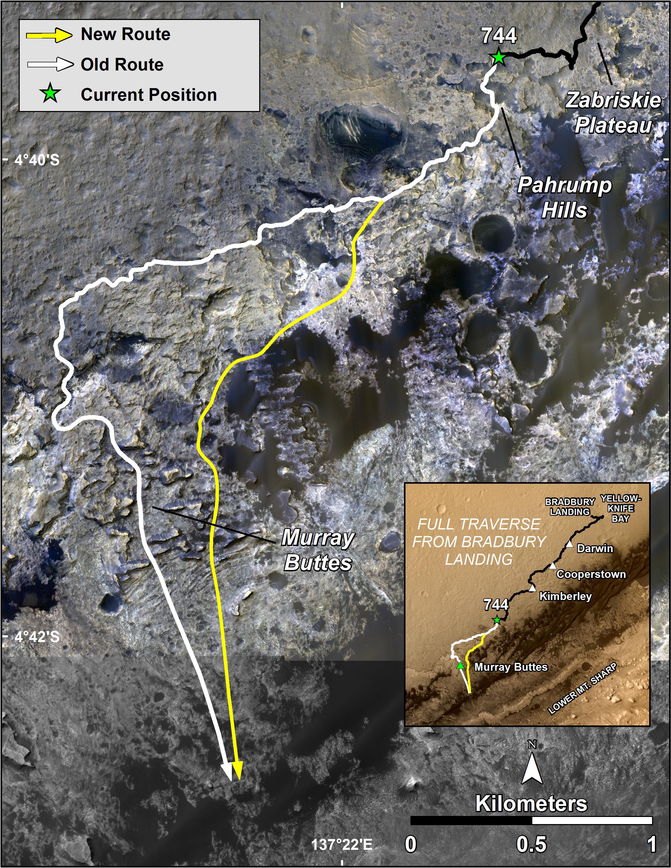
Curiosity Mars Rover's Route from Landing to 'Pahrump Hills'
Full Resolution:
TIFF
(25.26 MB)
JPEG
(1.571 MB)
2014-09-25
Mars
Mars Science Laboratory (MSL)
Mastcam
6886x2279x3
PIA18608:
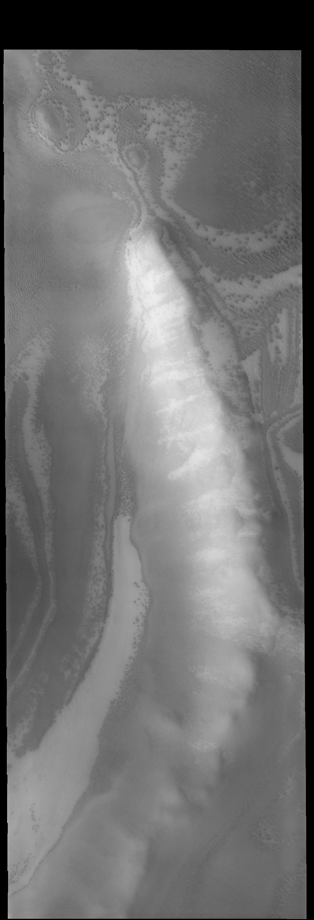
Curiosity Mars Rover's Approach to 'Pahrump Hills'
Full Resolution:
TIFF
(47.1 MB)
JPEG
(2.455 MB)
2014-09-25
Mars
Mars Science Laboratory (MSL)
MAHLI
1569x1170x3
PIA18609:
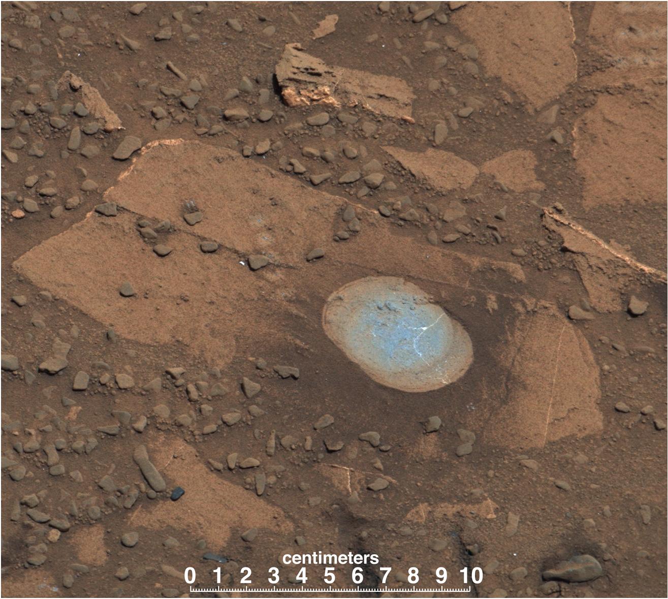
First Sampling Hole in Mount Sharp
Full Resolution:
TIFF
(5.509 MB)
JPEG
(530.7 kB)
2014-09-25
Mars
Mars Science Laboratory (MSL)
MAHLI
1584x1184x3
PIA18610:
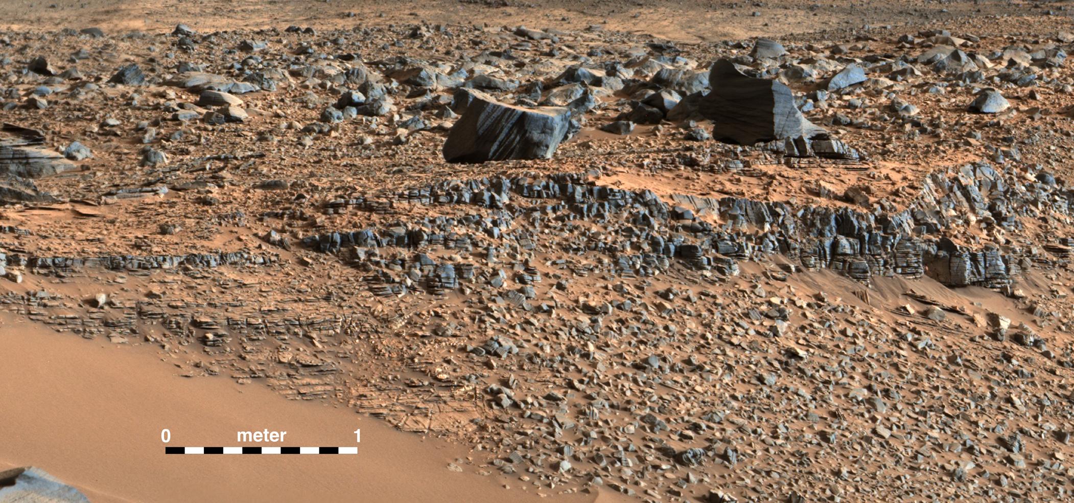
Resistant Features in 'Pahrump Hills' Outcrop
Full Resolution:
TIFF
(5.628 MB)
JPEG
(345.3 kB)
2014-09-26
Mars
2001 Mars Odyssey
THEMIS
660x3022x1
PIA18724:
Candor Chasma
Full Resolution:
TIFF
(1.997 MB)
JPEG
(80.28 kB)
2014-09-29
Mars
2001 Mars Odyssey
THEMIS
495x1468x1
PIA18727:
South Pole Layers
Full Resolution:
TIFF
(727.6 kB)
JPEG
(84.63 kB)
2014-09-30
Mars
2001 Mars Odyssey
THEMIS
1443x2943x1
PIA18728:
Dark Slope Streaks
Full Resolution:
TIFF
(4.252 MB)
JPEG
(289.5 kB)
2014-10-01
Mars
2001 Mars Odyssey
THEMIS
1316x5973x1
PIA18729:
Valles Marineris
Full Resolution:
TIFF
(7.869 MB)
JPEG
(293.2 kB)
2014-10-01
Mars
Mars Reconnaissance Orbiter (MRO)
HiRISE
2880x1800x3
PIA18817:
Possible Future Mars Landing Site in Oxia Planum
Full Resolution:
TIFF
(15.56 MB)
JPEG
(705.9 kB)
2014-10-01
Mars
Mars Reconnaissance Orbiter (MRO)
HiRISE
2880x1800x3
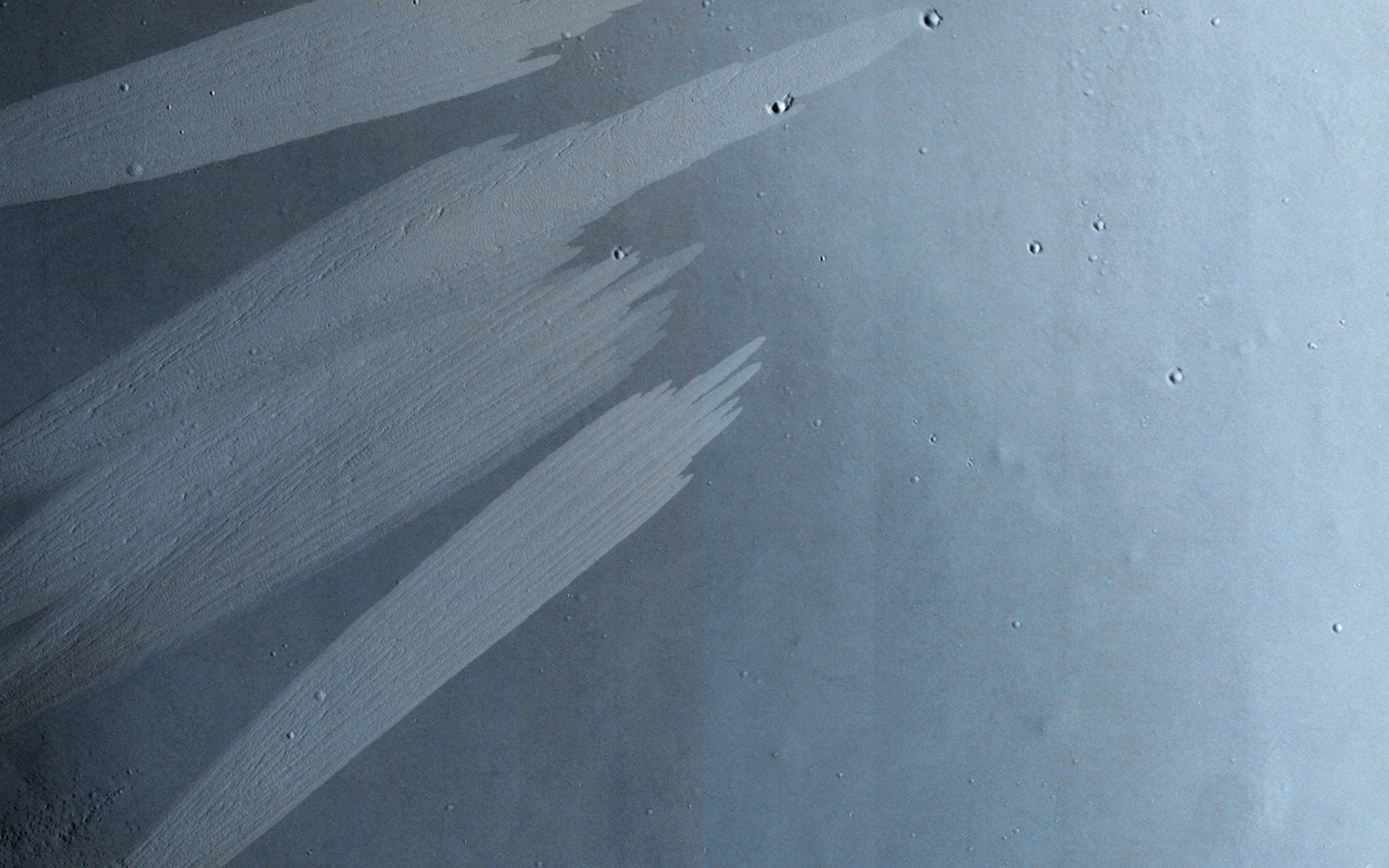
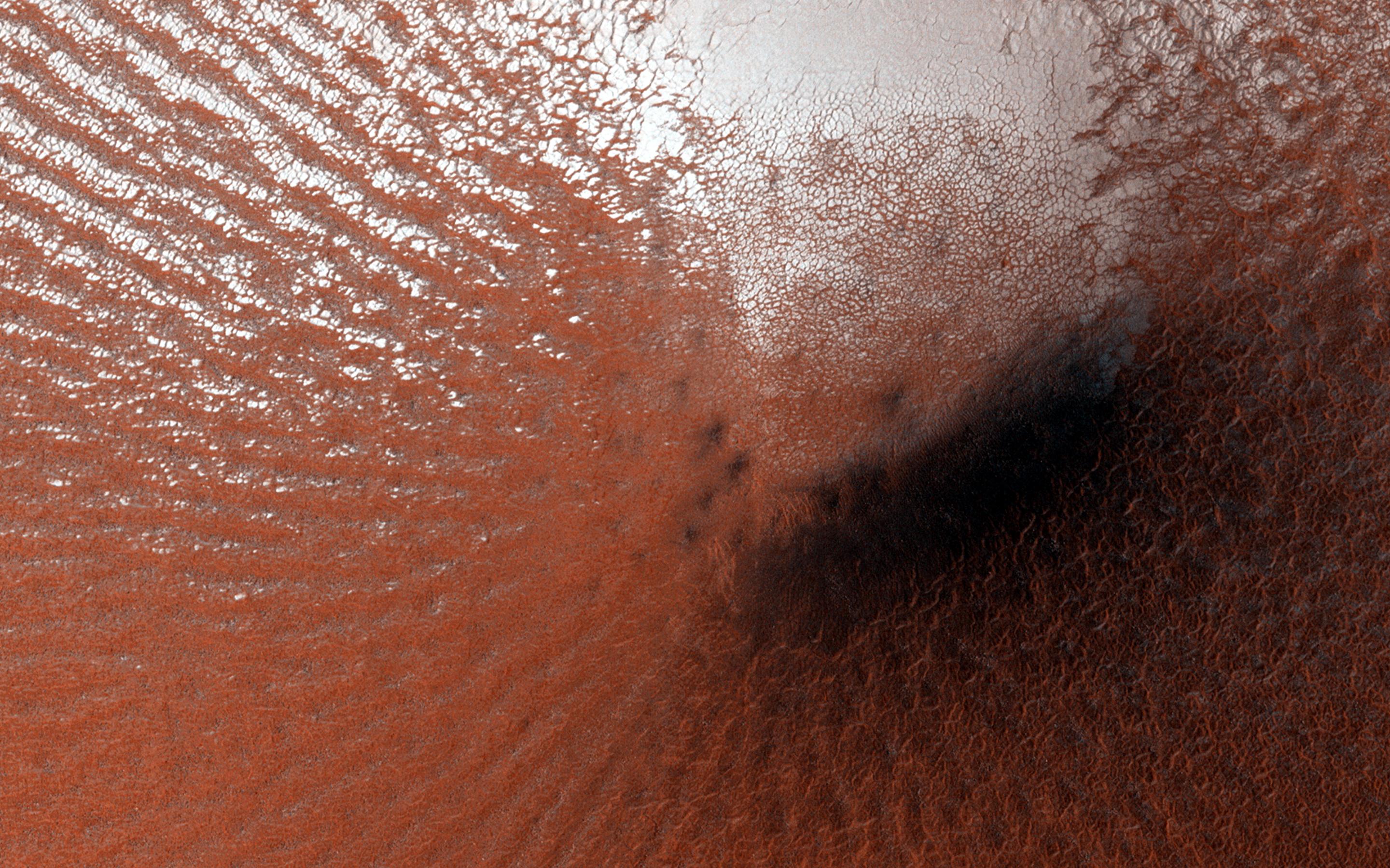
PIA18818:
Continual Dune and Ripple Migration in Nili Patera
Full Resolution:
TIFF
(15.56 MB)
JPEG
(807.2 kB)
2014-10-01
Mars
Mars Reconnaissance Orbiter (MRO)
HiRISE
2880x1800x3
PIA18819:
Bright Slope Streaks in Arabia Terra
Full Resolution:
TIFF
(15.56 MB)
JPEG
(556.2 kB)
2014-10-01
Mars
Mars Reconnaissance Orbiter (MRO)
HiRISE
2880x1800x3
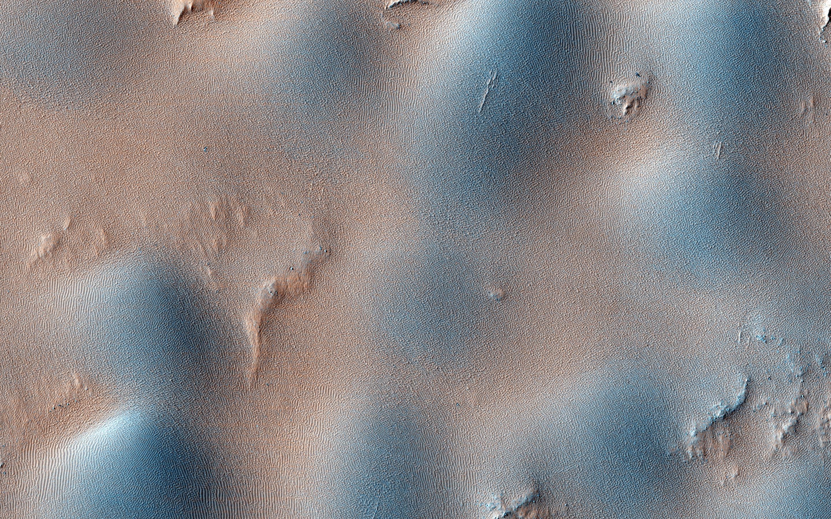
PIA18820:
Dome and Barchan Dunes in Newton Crater
Full Resolution:
TIFF
(15.56 MB)
JPEG
(1.351 MB)
2014-10-02
Mars
2001 Mars Odyssey
THEMIS
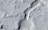
716x1548x1
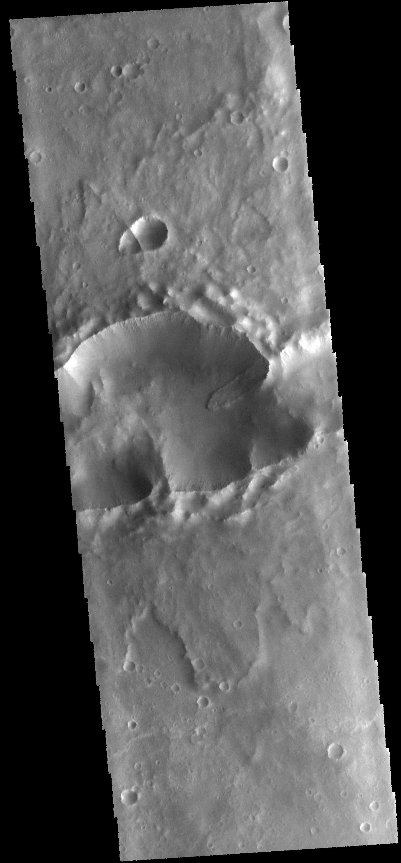
PIA18731:
Hebes Chasma
Full Resolution:
TIFF
(1.11 MB)
JPEG
(105.2 kB)
2014-10-03
Mars
2001 Mars Odyssey
THEMIS
1400x2949x1
PIA18732:
Apollinaris Mons
Full Resolution:
TIFF
(4.134 MB)
JPEG
(326.8 kB)
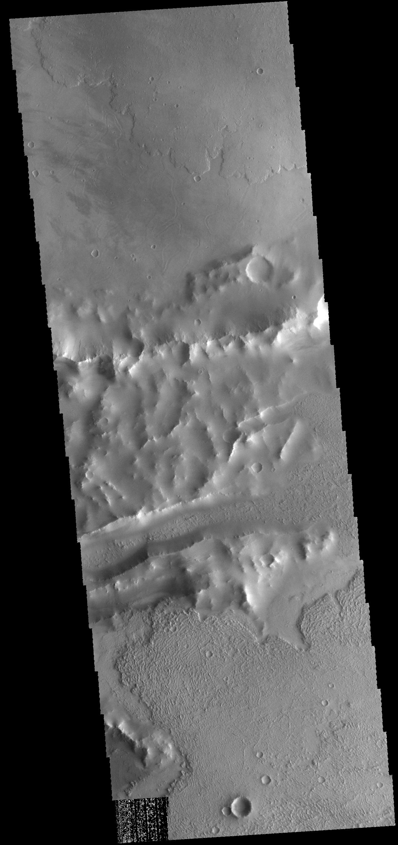
2014-10-06
Mars
2001 Mars Odyssey
THEMIS
970x2933x1
PIA18733:
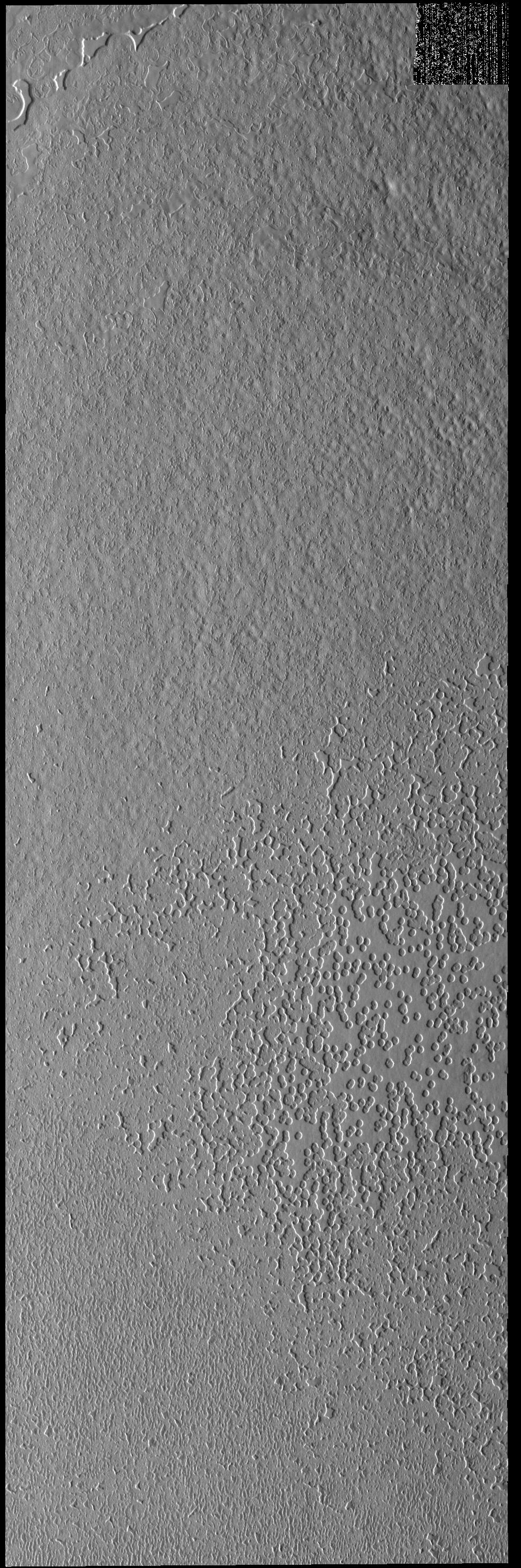
South Polar Textures
Full Resolution:
TIFF
(2.848 MB)
JPEG
(599.1 kB)
2014-10-07
Mars
2001 Mars Odyssey
THEMIS
1012x2958x1
PIA18736:
South Polar Textures
Full Resolution:
TIFF
(2.997 MB)
JPEG
(355 kB)
2014-10-08
Mars
2001 Mars Odyssey
THEMIS
1387x2955x1
PIA18740:
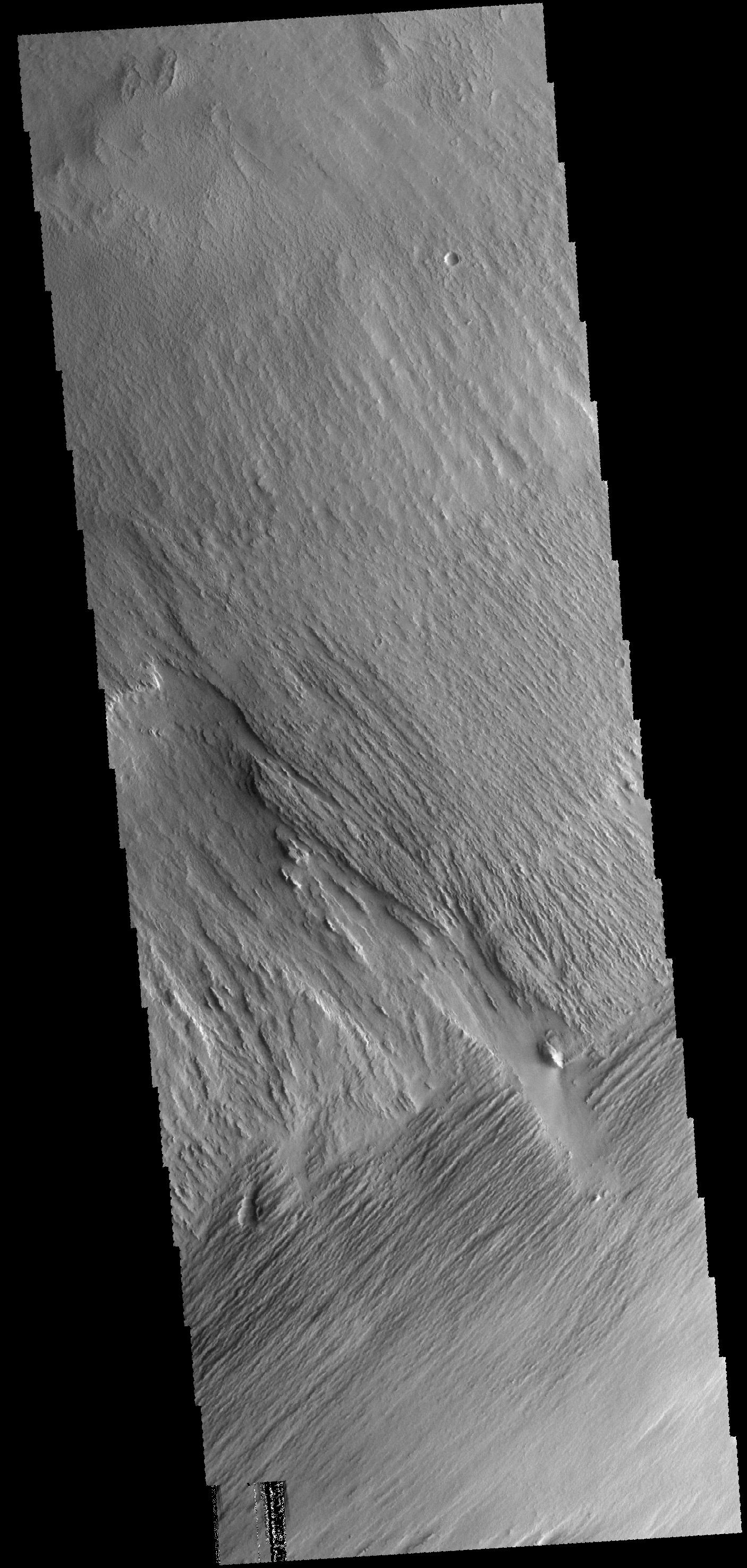
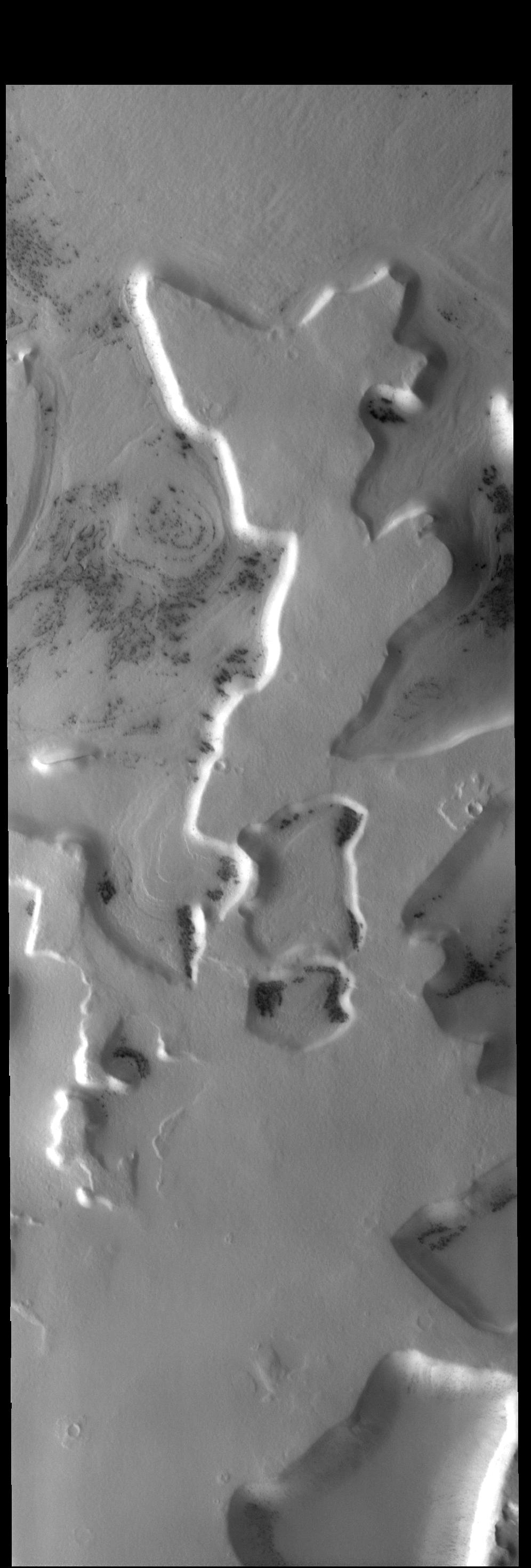
Daedalia Planum
Full Resolution:
TIFF
(4.104 MB)
JPEG
(570.9 kB)
2014-10-09
Mars
2001 Mars Odyssey
THEMIS
498x1533x1
PIA18741:
Angustus Labyrinthus
Full Resolution:
TIFF
(764.4 kB)
JPEG
(58.46 kB)
2014-10-09
Mars
2560x1600x3
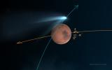
PIA18611:
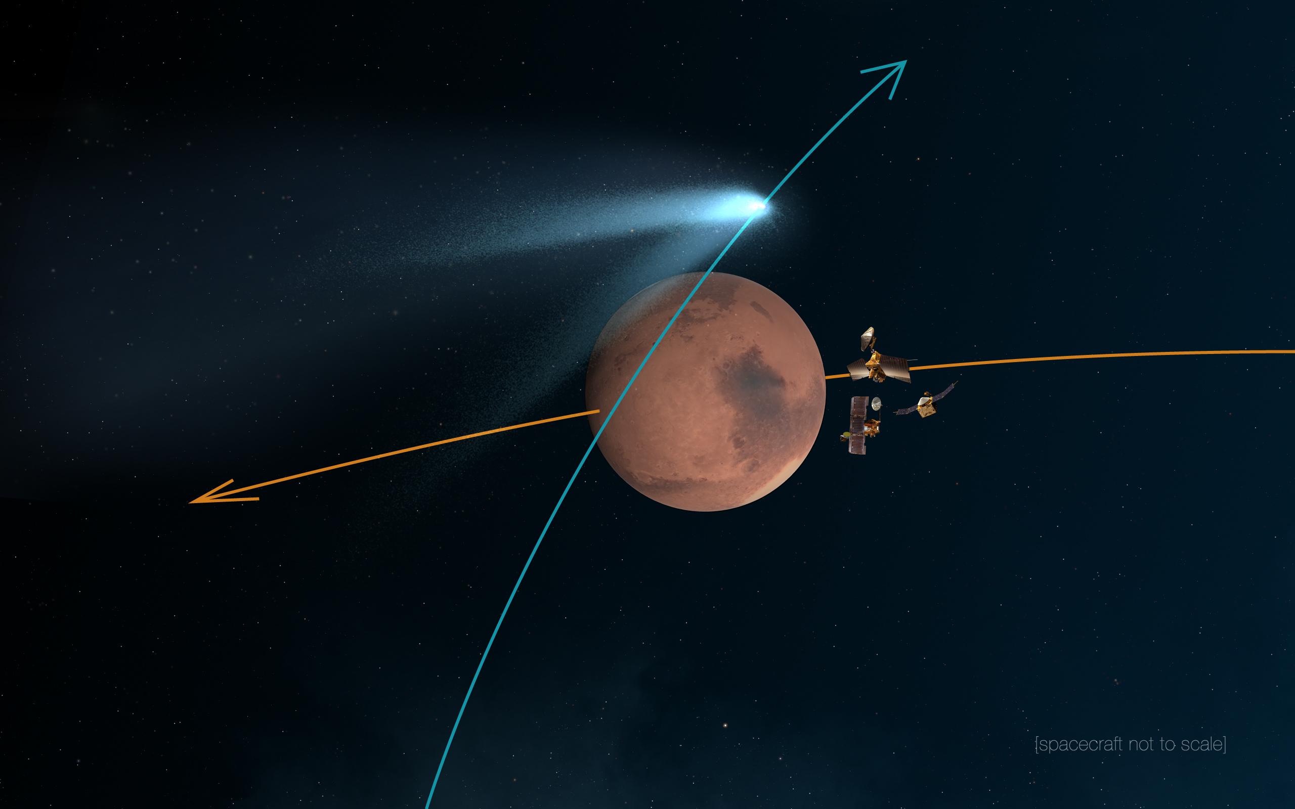
Mars Orbiters 'Duck and Cover' for Comet Siding Spring Flyby (Artist's Concept)
Full Resolution:
TIFF
(12.29 MB)
JPEG
(163.2 kB)
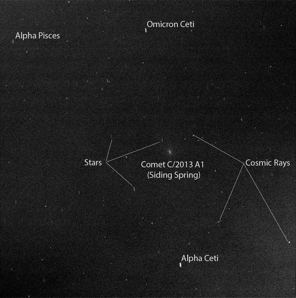
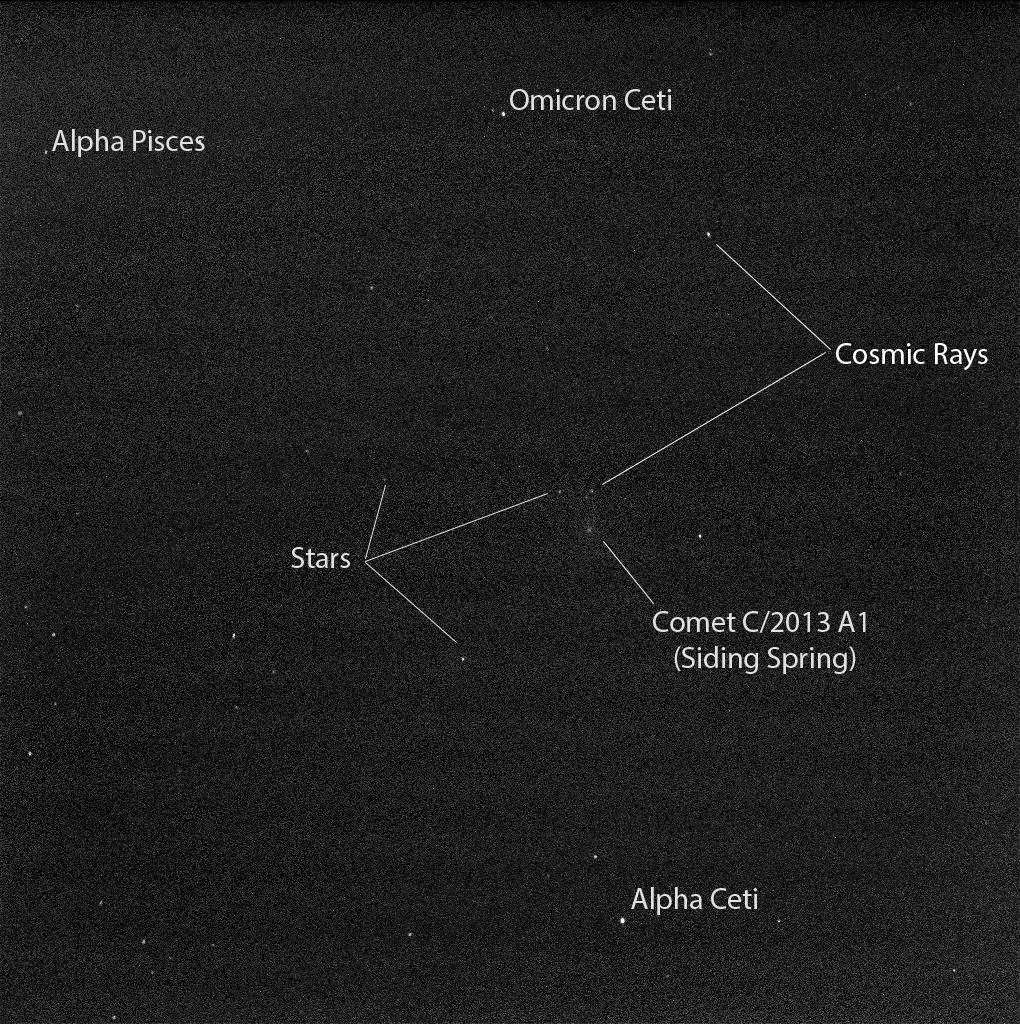
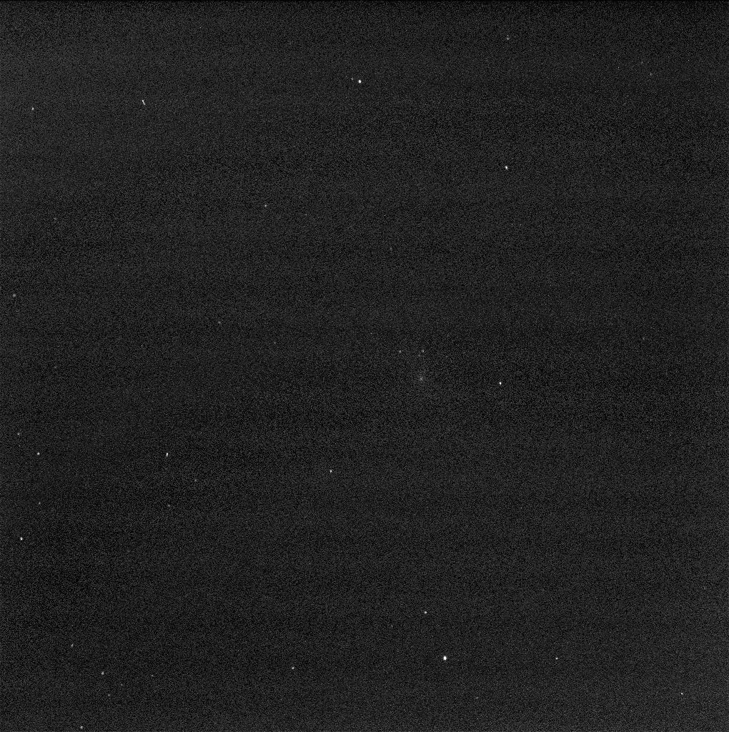
2014-10-09
Mars
1000x1000x3
PIA18612:
View of Comet Siding Spring from Southern Hemisphere (Artist's Concept)
Full Resolution:
TIFF
(3.001 MB)
JPEG
(39.78 kB)
2014-10-10
Mars
2001 Mars Odyssey
THEMIS
894x3029x1
PIA18742:
Arsia Mons
Full Resolution:
TIFF
(2.711 MB)
JPEG
(174.7 kB)
2014-10-13
Mars
2001 Mars Odyssey
THEMIS
1406x2951x1
PIA18743:
Yardangs
Full Resolution:
TIFF
(4.154 MB)
JPEG
(488.1 kB)
2014-10-14
Mars
2001 Mars Odyssey
THEMIS
996x2940x1
PIA18744:
South Polar Features
Full Resolution:
TIFF
(2.931 MB)
JPEG
(232 kB)
2014-10-14
Mars
MAVEN
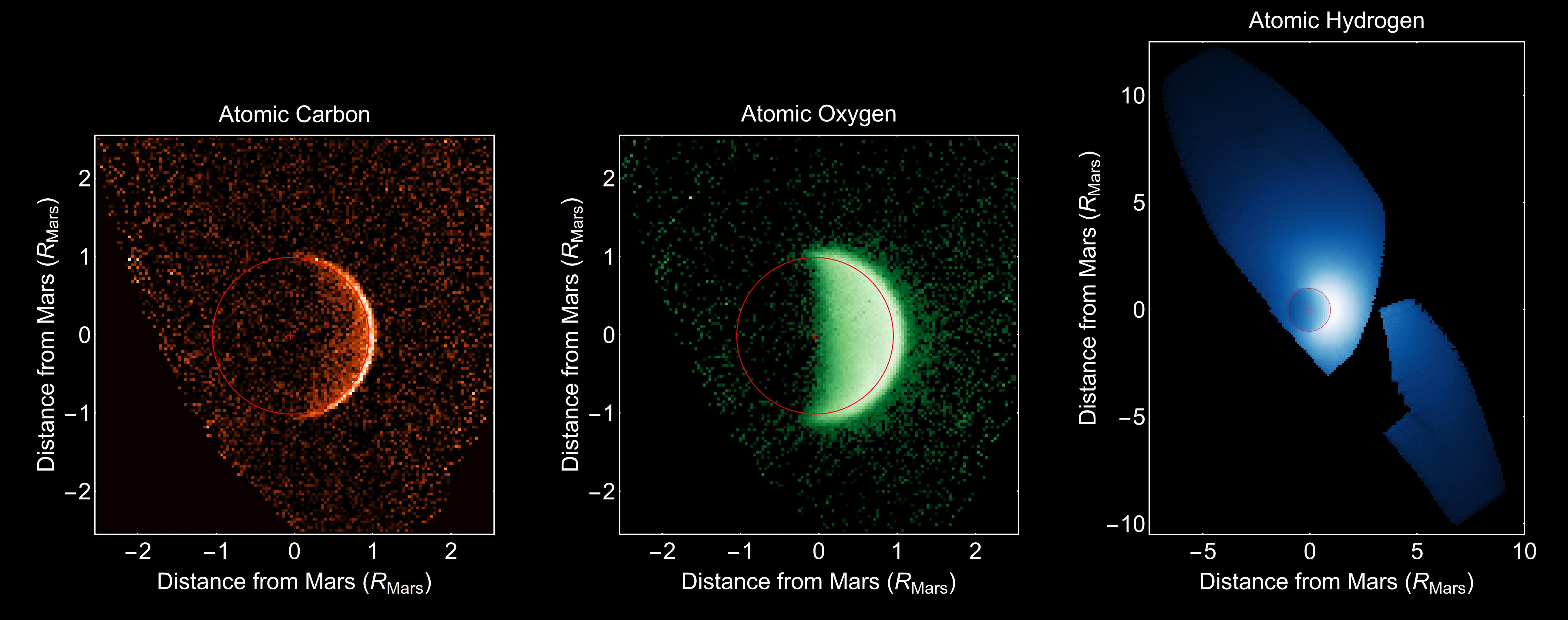
Imaging Ultraviolet Spectrograph
5170x2045x3
PIA18613:
Ultraviolet Views of Martian Atmosphere
Full Resolution:
TIFF
(31.73 MB)
JPEG
(695.6 kB)
2014-10-15
Mars
2001 Mars Odyssey
THEMIS
1397x2948x1
PIA18745:
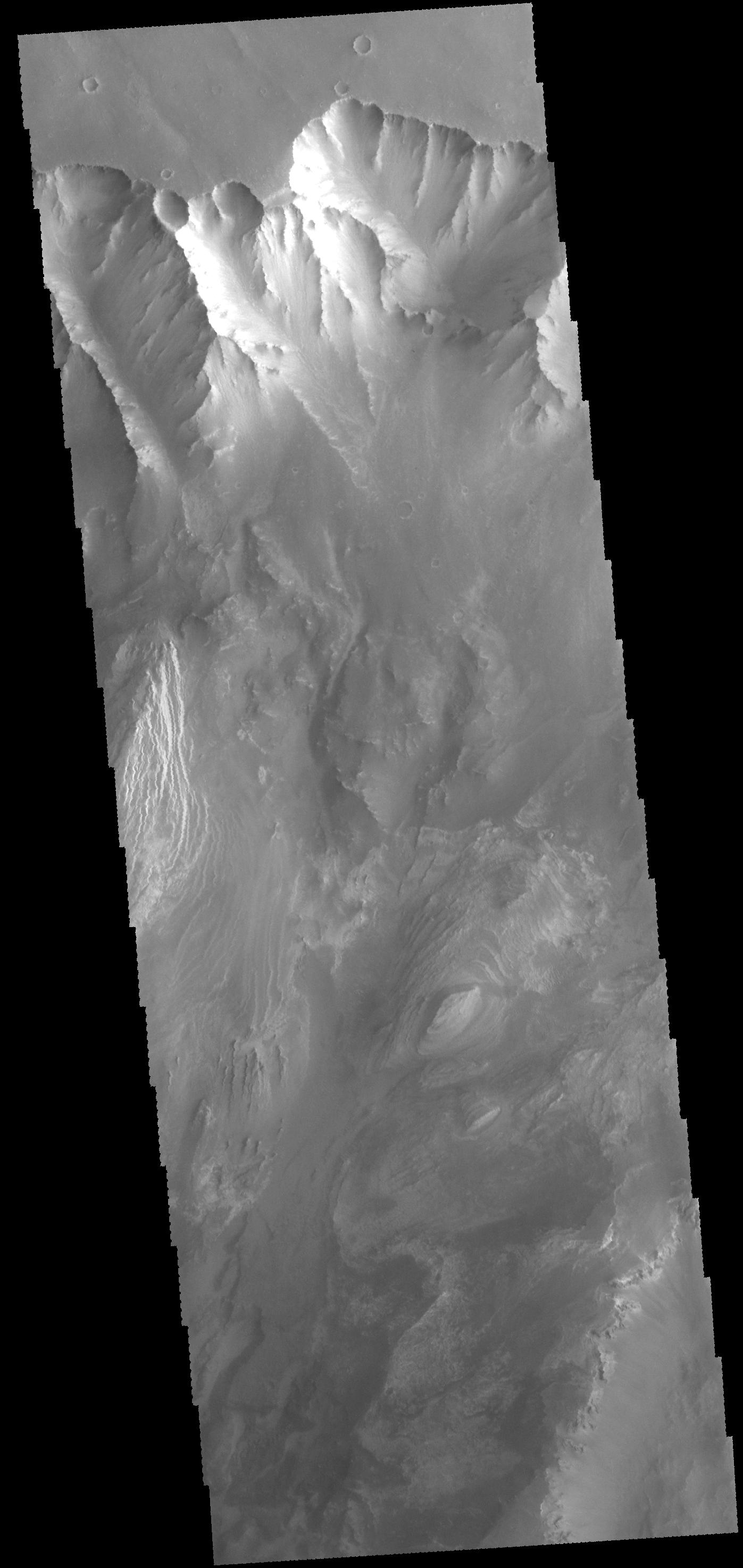
Valles Marineris
Full Resolution:
TIFF
(4.123 MB)
JPEG
(254.6 kB)
2014-10-15
Mars
Mars Reconnaissance Orbiter (MRO)
HiRISE
2880x1800x3
PIA18829:
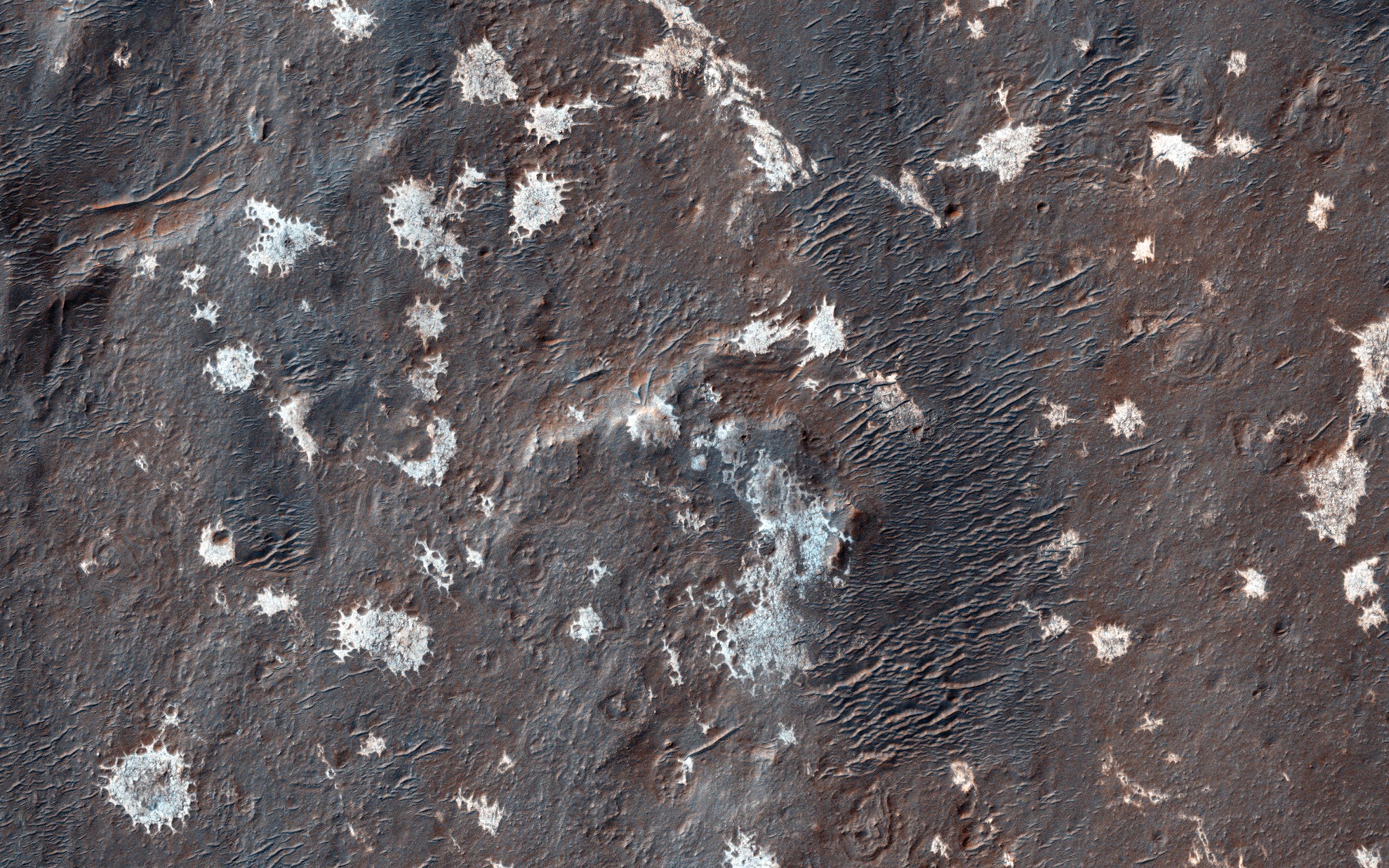
A Light Toned Deposit in Arsinoes Chaos
Full Resolution:
TIFF
(15.56 MB)
JPEG
(693 kB)
2014-10-15
Mars
Mars Reconnaissance Orbiter (MRO)
HiRISE
2880x1800x1
PIA18830:
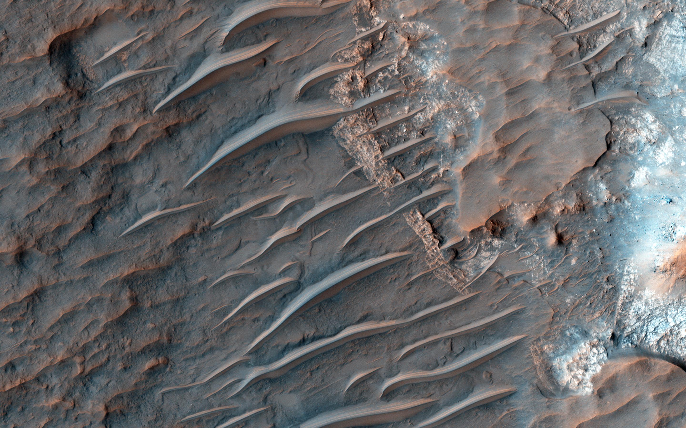
Mounds of Layered Material on the West Edge of Melas Chasma
Full Resolution:
TIFF
(5.191 MB)
JPEG
(662.3 kB)
2014-10-15
Mars
Mars Reconnaissance Orbiter (MRO)
HiRISE
2880x1800x3
PIA18831:
A Collection of Landforms in Eastern Elysium Planitia
Full Resolution:
TIFF
(15.56 MB)
JPEG
(595.3 kB)
2014-10-15
Mars
Mars Reconnaissance Orbiter (MRO)
HiRISE
2880x1800x3
PIA18832:
Perennial Frost in a Crater on the Northern Plains
Full Resolution:
TIFF
(15.56 MB)
JPEG
(895.2 kB)
2014-10-16
Mars
2001 Mars Odyssey
THEMIS
1410x2946x1
PIA18750:
Candor Chasma
Full Resolution:
TIFF
(4.159 MB)
JPEG
(257.1 kB)
2014-10-16
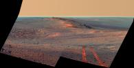
Mars
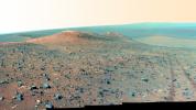
Mars Exploration Rover (MER)
Panoramic Camera
4457x2488x3
PIA18614:
Opportunity's Northward View of 'Wdowiak Ridge'
Full Resolution:
TIFF
(33.29 MB)
JPEG
(1.15 MB)
2014-10-16
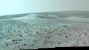
Mars
Mars Exploration Rover (MER)
Panoramic Camera
4461x2498x3
PIA18615:
Opportunity's Northward View of 'Wdowiak Ridge' (False Color)
Full Resolution:
TIFF
(33.45 MB)
JPEG
(1.787 MB)
2014-10-16
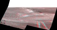
Mars
Mars Exploration Rover (MER)
Panoramic Camera
4430x2488x3
PIA18616:
Opportunity's Northward View of 'Wdowiak Ridge' (Stereo)
Full Resolution:
TIFF
(33.09 MB)
JPEG
(1.566 MB)
2014-10-17
Mars
2001 Mars Odyssey
THEMIS
1378x2951x1
PIA18751:
Lava Flows
Full Resolution:
TIFF
(4.071 MB)
JPEG
(484.8 kB)
2014-10-20
Mars
2001 Mars Odyssey
THEMIS
1391x2954x1
PIA18753:
Faults and Flows
Full Resolution:
TIFF
(4.114 MB)
JPEG
(367.7 kB)
2014-10-20
Mars
Mars Exploration Rover (MER)
Panoramic Camera
1020x1024x1
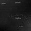
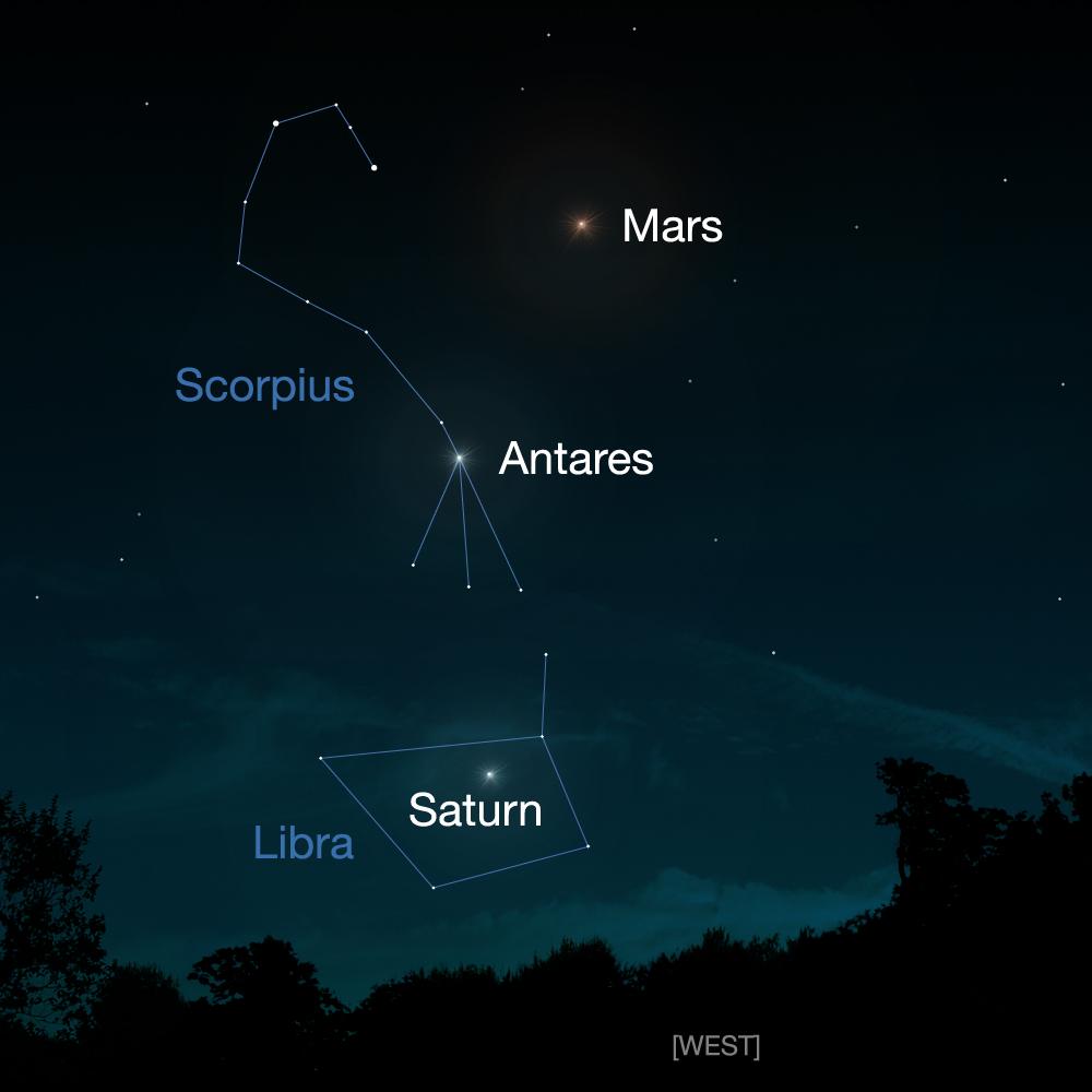
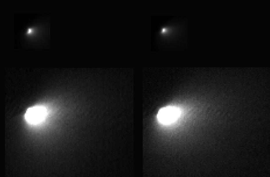
PIA18591:
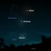
Mars Rover Opportunity's View of Passing Comet
Full Resolution:
TIFF
(1.046 MB)
JPEG
(311.3 kB)
2014-10-20
Mars
Mars Exploration Rover (MER)
Panoramic Camera
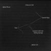
1020x1024x1
PIA18592:
Mars Rover Opportunity's View of Passing Comet (Short Exposure)
Full Resolution:
TIFF
(1.046 MB)
JPEG
(312.7 kB)
2014-10-20
Mars
Mars Exploration Rover (MER)
Panoramic Camera
1020x1024x1
PIA18617:
Mars Rover Opportunity's View of Comet (Blink of Two Exposures)
Full Resolution:
TIFF
(1.046 MB)
JPEG
(310.7 kB)
2014-10-20
Mars
Mars Reconnaissance Orbiter (MRO)
HiRISE
929x610x1
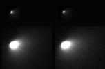
PIA18618:
First Resolved Image of a Long-Period Comet's Nucleus
Full Resolution:
TIFF
(567.5 kB)
JPEG
(26.9 kB)
2014-10-21
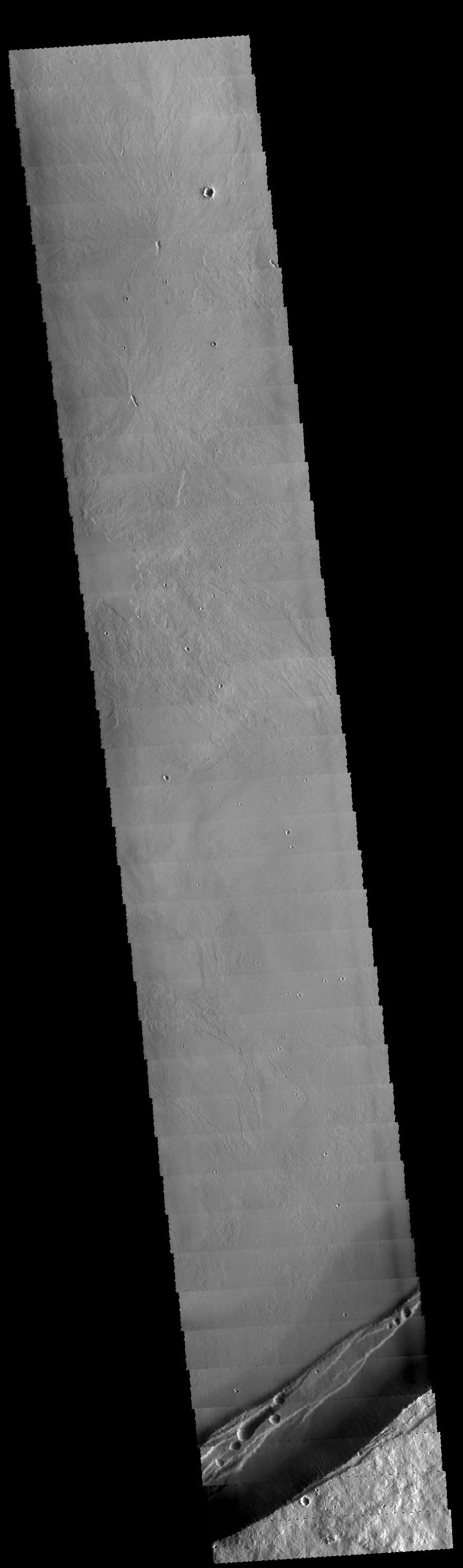
Mars
2001 Mars Odyssey
THEMIS
1374x2975x1
PIA18754:
Sirenum Fossae
Full Resolution:
TIFF
(4.093 MB)
JPEG
(470.3 kB)
2014-10-22
Mars
2001 Mars Odyssey
THEMIS
1373x2977x1
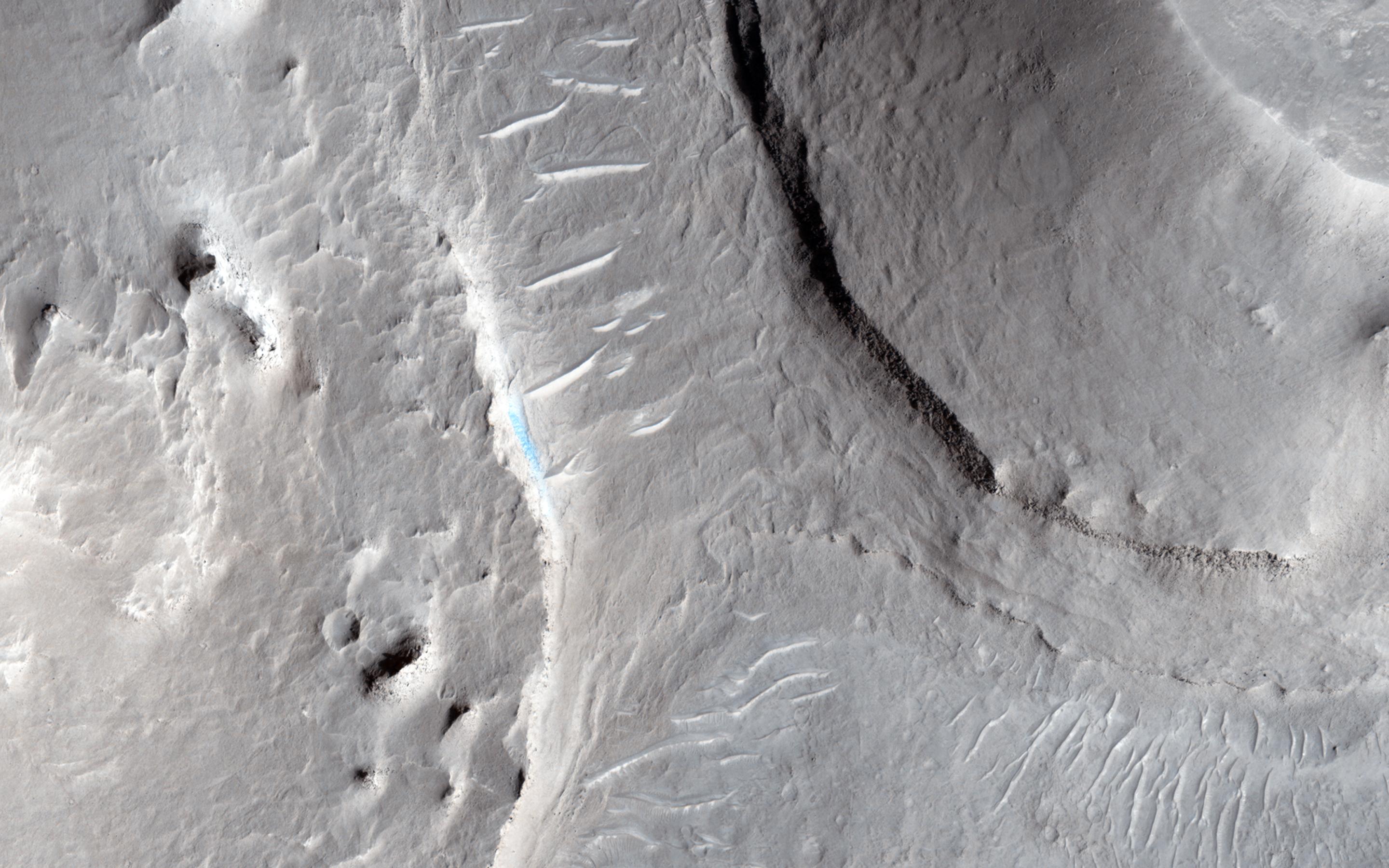
PIA18755:
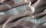
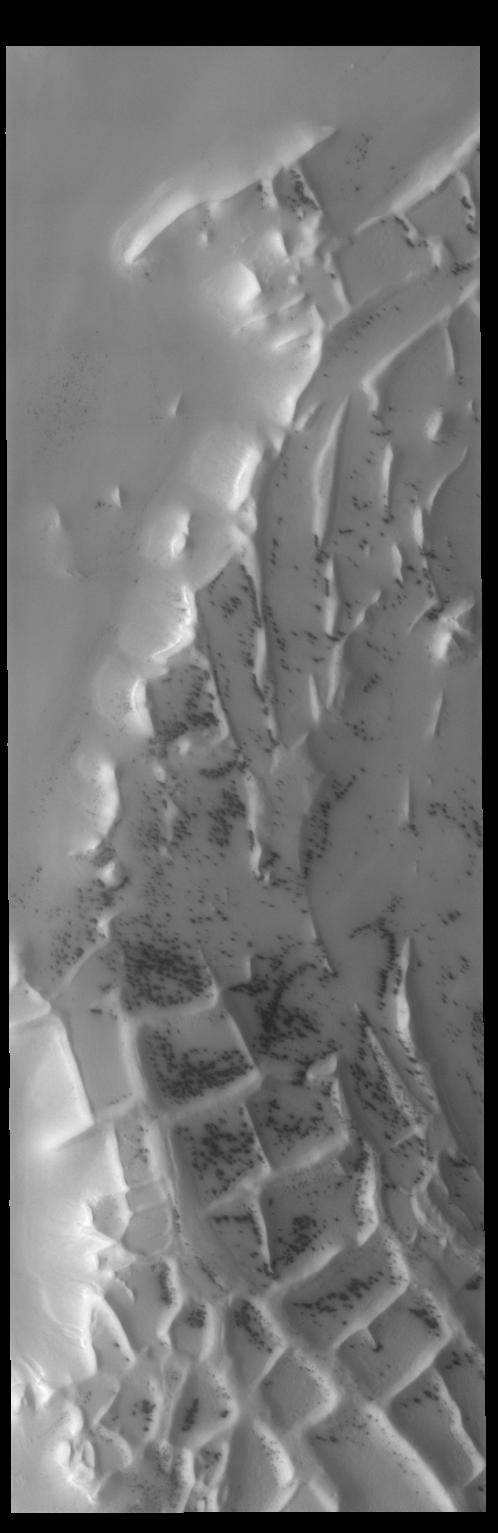
Crater Dunes
Full Resolution:
TIFF
(4.092 MB)
JPEG
(299.1 kB)
1-100
101-200
201-300
301-400
401-500
501-600
601-700
701-800
801-900
901-1000
Currently displaying images:
8601 - 8700
of 12760


