Your search criteria found
12760
images
Target is Mars (and available satellites)
Go to PIAxxxxx:
Refine this list of images by:
Target:
Deimos
Mars
Phobos
Mission:
2001 Mars Odyssey
Antarctic Meteorite Location and Mapping Project (AMLAMP)
Dawn
ExoMars
Hubble Space Telescope
InSight
MAVEN
Mariner Mars 1964 (Mariner 4)
Mariner Mars 1969 (Mariner 7)
Mariner Mars 1971 (Mariner 9)
Mars 2020
Mars 2020 Rover
Mars Atmosphere and Volatile Evolution MissioN (MAVEN)
Mars Climate Orbiter
Mars Cube One (MarCO)
Mars Exploration Rover (MER)
Mars Express (MEX)
Mars Global Surveyor (MGS)
Mars Helicopter
Mars Pathfinder (MPF)
Mars Reconnaissance Orbiter (MRO)
Mars Sample Return
Mars Sample Return (MSR)
Mars Science Laboratory (MSL)
Phoenix
Rosetta
Viking
Spacecraft:
2001 Mars Odyssey
Curiosity
Dawn
InSight Mars Lander
Ingenuity
MAVEN
MarCO-B
Mariner 4
Mariner 7
Mariner 9
Mars Climate Orbiter
Mars Express (MEX)
Mars Express (MEX) Orbiter
Mars Global Surveyor Orbiter
Mars Pathfinder Lander
Mars Pathfinder Rover
Mars Reconnaissance Orbiter (MRO)
Mars Sample Return
Mars Science Laboratory (MSL)
NASA's Mars Pathfinder Lander
Opportunity
Perseverance
Philae Lander
Phoenix Lander
Phoenix Mars Lander
Spirit
Viking Lander 1
Viking Lander 2
Viking Orbiter 1
Viking Orbiter 2
Instrument:
Alpha Particle X-ray Spectrometer
Alpha Particle X-ray Spectrometer (MSL)
Atmospheric Structure / Meteorology Instrument
CHIMRA
Camera 1
Camera 2
Chemistry & Mineralogy (CheMin)
Chemistry and Camera (ChemCam)
Comet Infrared and Visible Analyser (CIVA
Compact Reconnaissance Imaging Spectrometer for Mars (CRISM)
Context Camera (CTX)
Deep Space Network
Descent Image Motion Estimation System (DIMES)
Dynamic Albedo of Neutrons
Dynamic Albedo of Neutrons (DAN)
Gamma Ray Spectrometer - Neutron Spectrometer
Gamma Ray Spectrometer Suite
Hazard Avoidance Camera
Hazard Avoidance Camera (M2020)
Hazard Avoidance Camera (MSL)
Heat and Physical Properties Package (HP3)
High Resolution Imaging Science Experiment (HiRISE)
High Resolution Instrument (HRI)
High Resolution Stereo Camera
Imager for Mars Pathfinder
Imaging Ultraviolet Spectrograph
Imaging Ultraviolet Spectrograph (IUVS)
Instrument Context Camera (ICC)
Instrument Deployment Camera (IDC)
Lander Vision System Camera (LCAM)
Magnetometer
Mars Advanced Radar for Subsurface and Ionosphere Sounding (MARSIS)
Mars Advanced Radar for Subsurface and Ionospheric Sounding (MARSIS)
Mars Climate Sounder (MCS)
Mars Color Imager (MARCI)
Mars Descent Imager
Mars Environmental Dynamics Analyzer (MEDA)
Mars Hand Lens Imager (MAHLI)
Mars Horizon Sensor Assembly
Mars Orbiter Camera (MOC)
Mars Orbiter Laser Altimeter
Mars Radiation Experiment
Mastcam
Mastcam-Z
Microscopic Imager
Microscopy Electrochemistry and Conductivity Analyzer (MECA)
Miniature Thermal Emission Spectrometer
Moessbauer Spectrometer
Navigation Camera
Navigation Camera (M2020)
Navigation Camera (MSL)
Neutral Gas and Ion Mass Spectrometer
Neutron Spectrometer
Optical Microscope
Optical Navigation Camera
Panoramic Camera
Planetary Instrument for X-ray Lithochemistry (PIXL)
Radar System
Radiation Assessment Detector (RAD)
Radio Science Subsystem
Robotic Arm
Robotic Arm (MSL)
Robotic Arm Camera (RAC)
Rock Abrasion Tool (RAT)
Rover Cameras
Rover Environmental Monitoring Station (REMS)
Sample Analysis at Mars (SAM)
Scanning Habitable Environments with Raman & Luminescence for Organics and Chemicals (SHERLOC)
Seismic Experiment for Interior Structure (SEIS)
Shallow Subsurface Radar (SHARAD)
Stereo Imager (SSI)
SuperCam
Surface Stereo Imager (SSI)
Thermal Emission Imaging System
Thermal Emission Spectrometer
Thermal and Electrical Conductivity Probe
Thermal and Evolved Gas Analyzer
Trace Gas Orbiter
Visual Imaging Subsystem
Visual Imaging Subsystem - Camera A
Visual Imaging Subsystem - Camera B
Wide Field Planetary Camera 2
Click on an image for detailed information
Click on a column heading to sort in ascending or descending order
My
List
Addition Date
Target
Mission
Instrument
Size
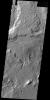
2014-03-28
Mars
2001 Mars Odyssey
THEMIS
1393x2921x1
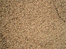
PIA18133:
Windstreaks
Full Resolution:
TIFF
(4.074 MB)
JPEG
(468.8 kB)
2014-03-31
Mars
2001 Mars Odyssey
THEMIS
1515x2956x1
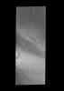
PIA18134:
Dust Devil Tracks
Full Resolution:
TIFF
(4.483 MB)
JPEG
(437 kB)
2014-04-01
Mars
2001 Mars Odyssey
THEMIS
1439x2926x1
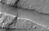
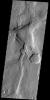
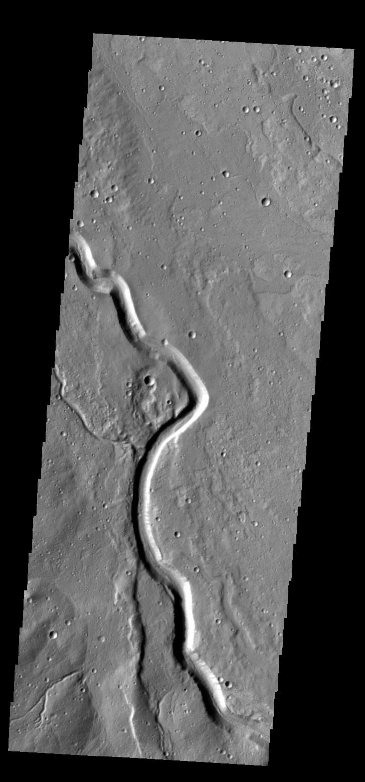
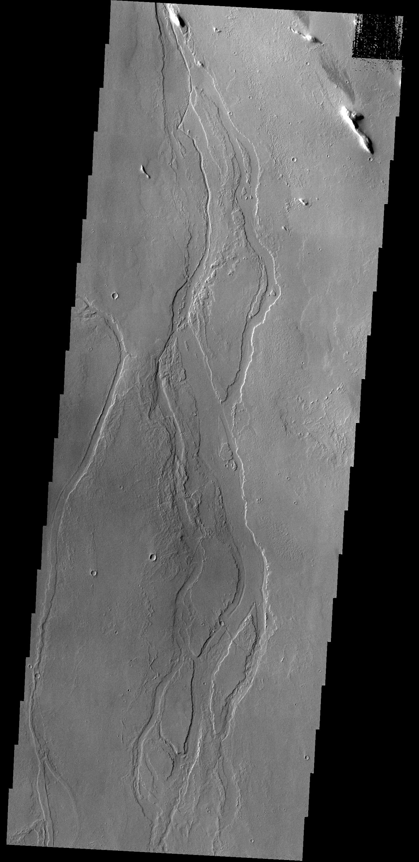
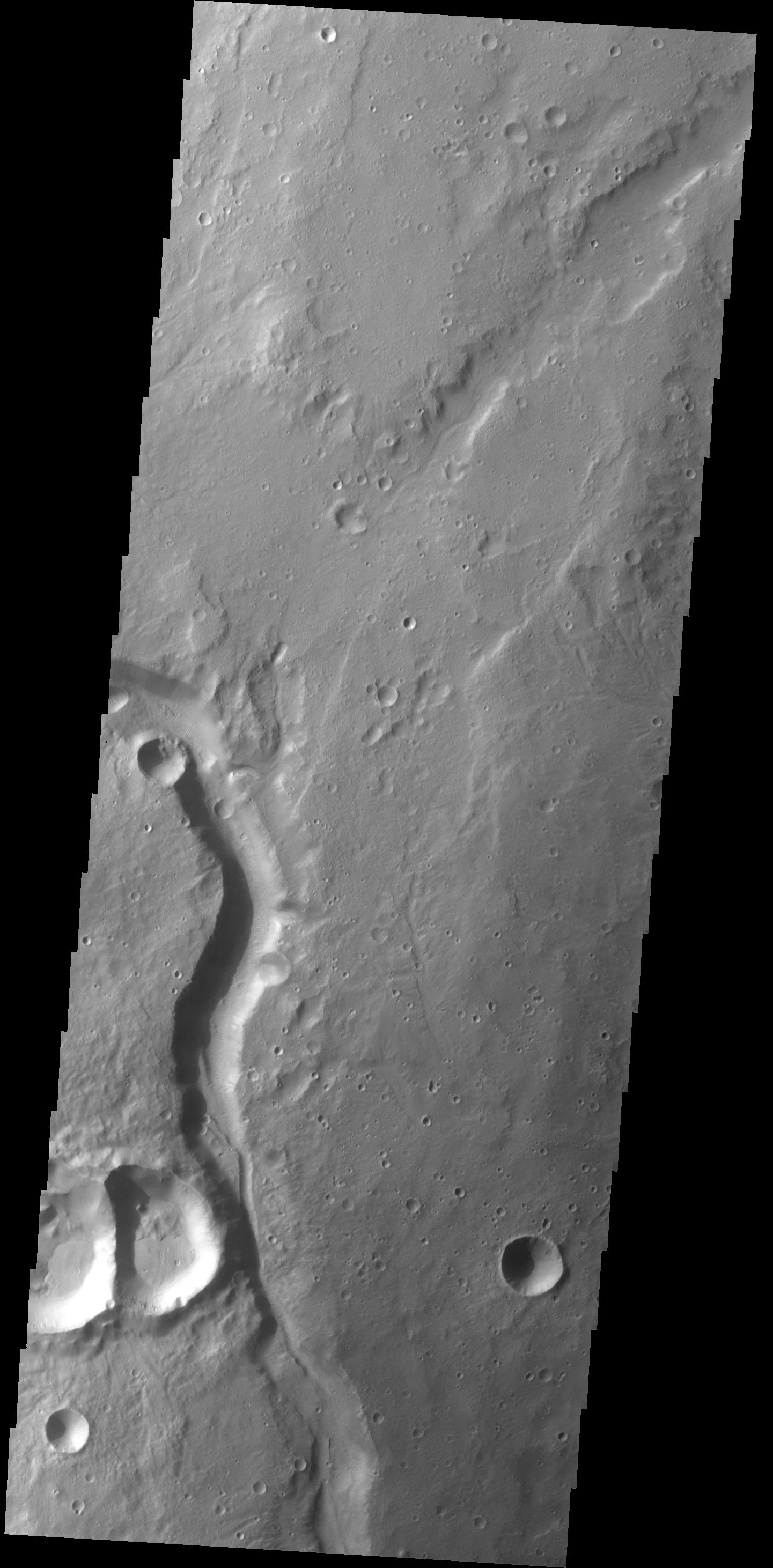
PIA18135:
Channel
Full Resolution:
TIFF
(4.215 MB)
JPEG
(360.8 kB)
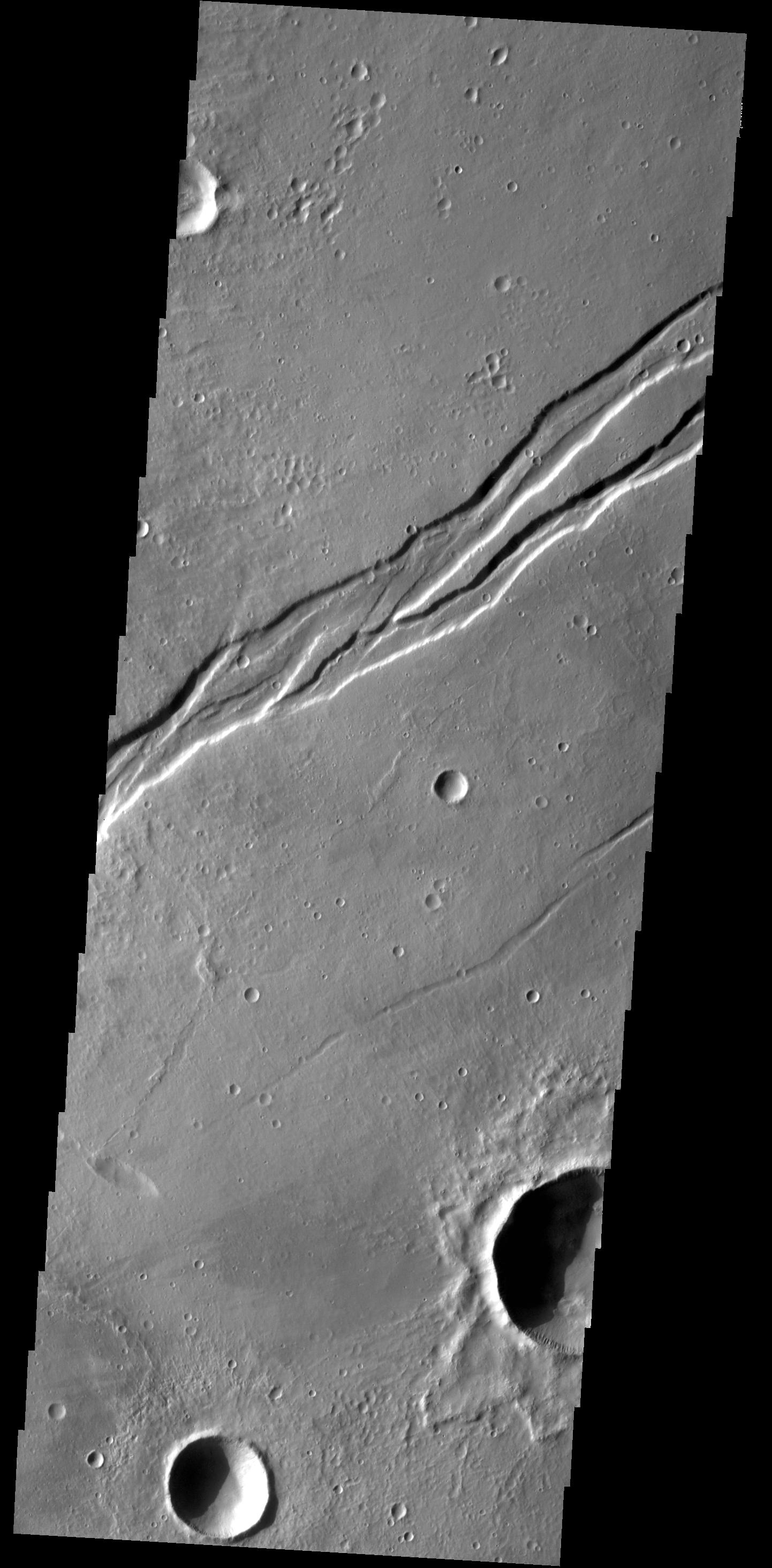
2014-04-02
Mars
2001 Mars Odyssey
THEMIS
1268x2863x1
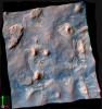
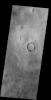
PIA18190:
Spring at the North Pole
Full Resolution:
TIFF
(3.634 MB)
JPEG
(176.5 kB)
2014-04-03
Mars
2001 Mars Odyssey
THEMIS
1408x2924x1
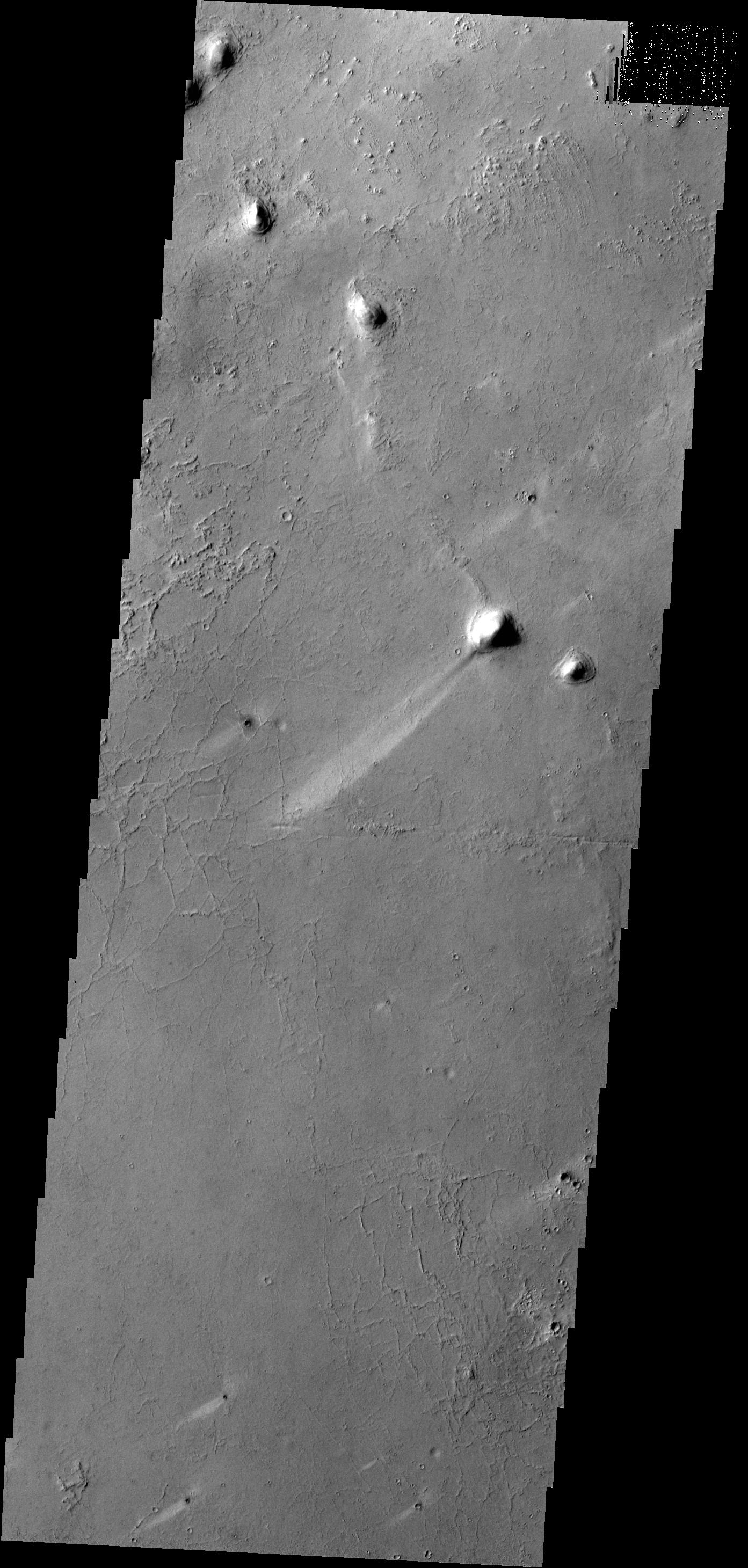
PIA18191:
Streamlined Island
Full Resolution:
TIFF
(4.122 MB)
JPEG
(372.5 kB)
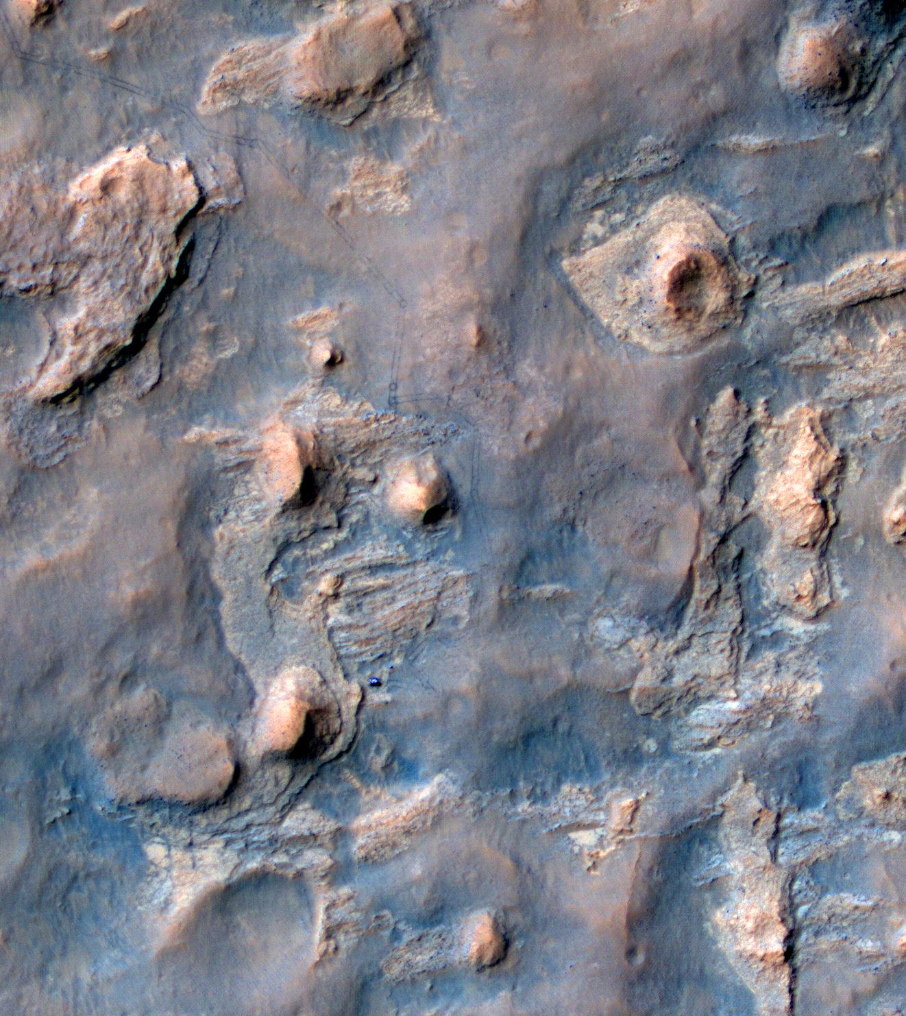
2014-04-03
Mars
Mars Science Laboratory (MSL)
Navcam (MSL)
2043x759x1
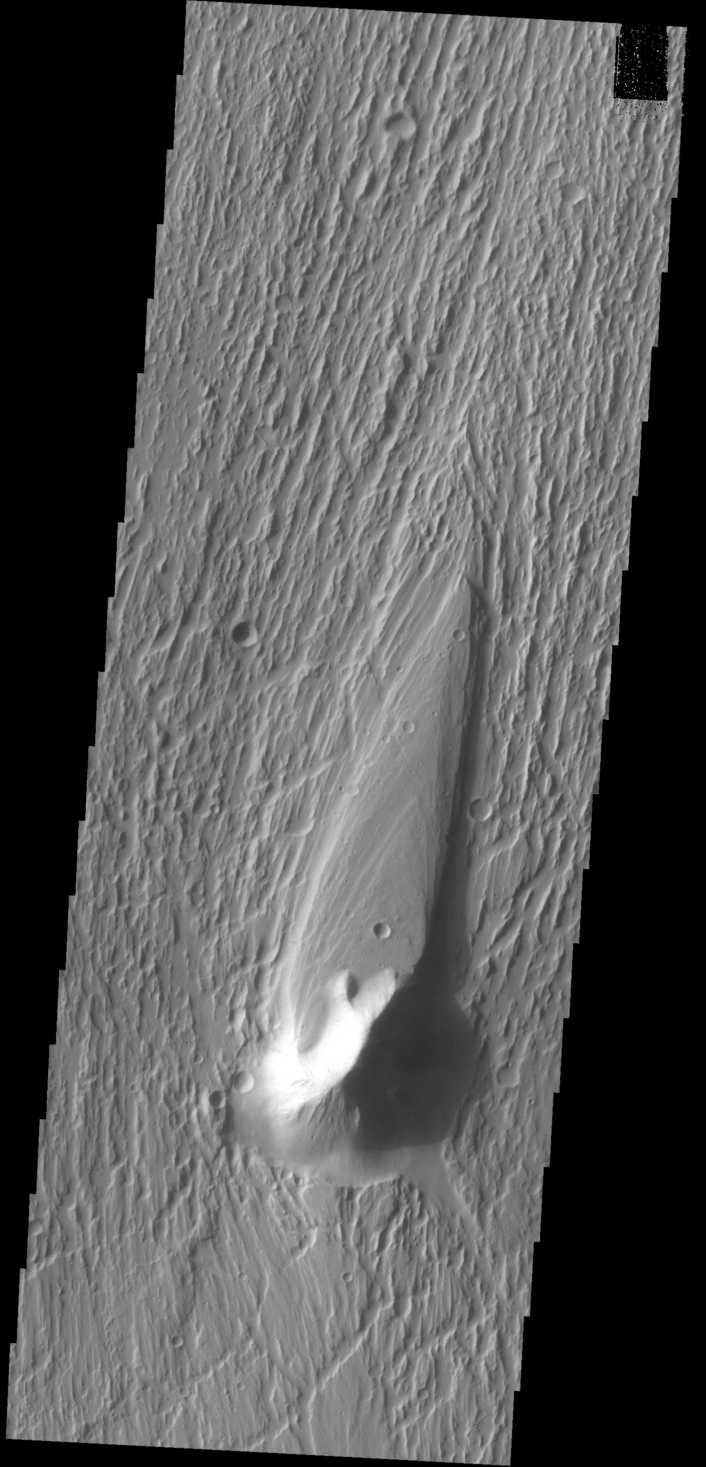
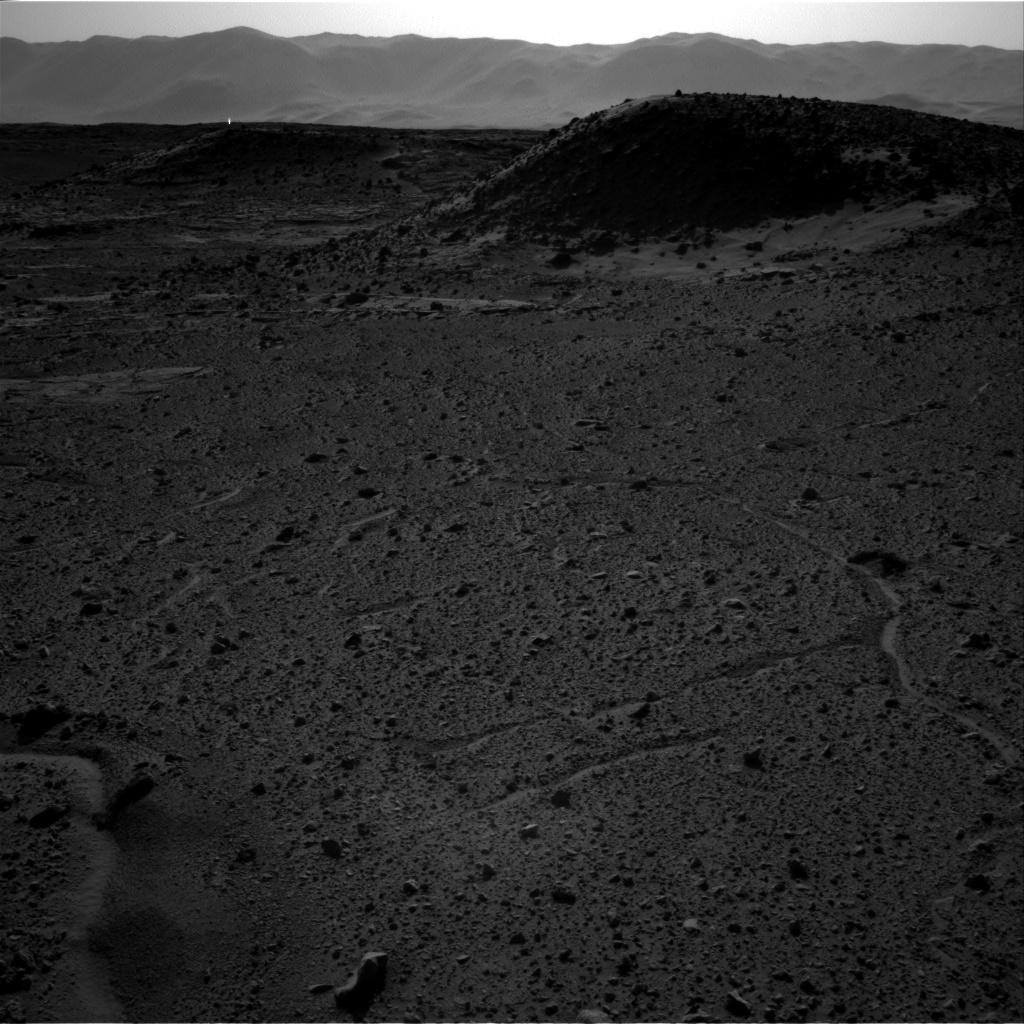
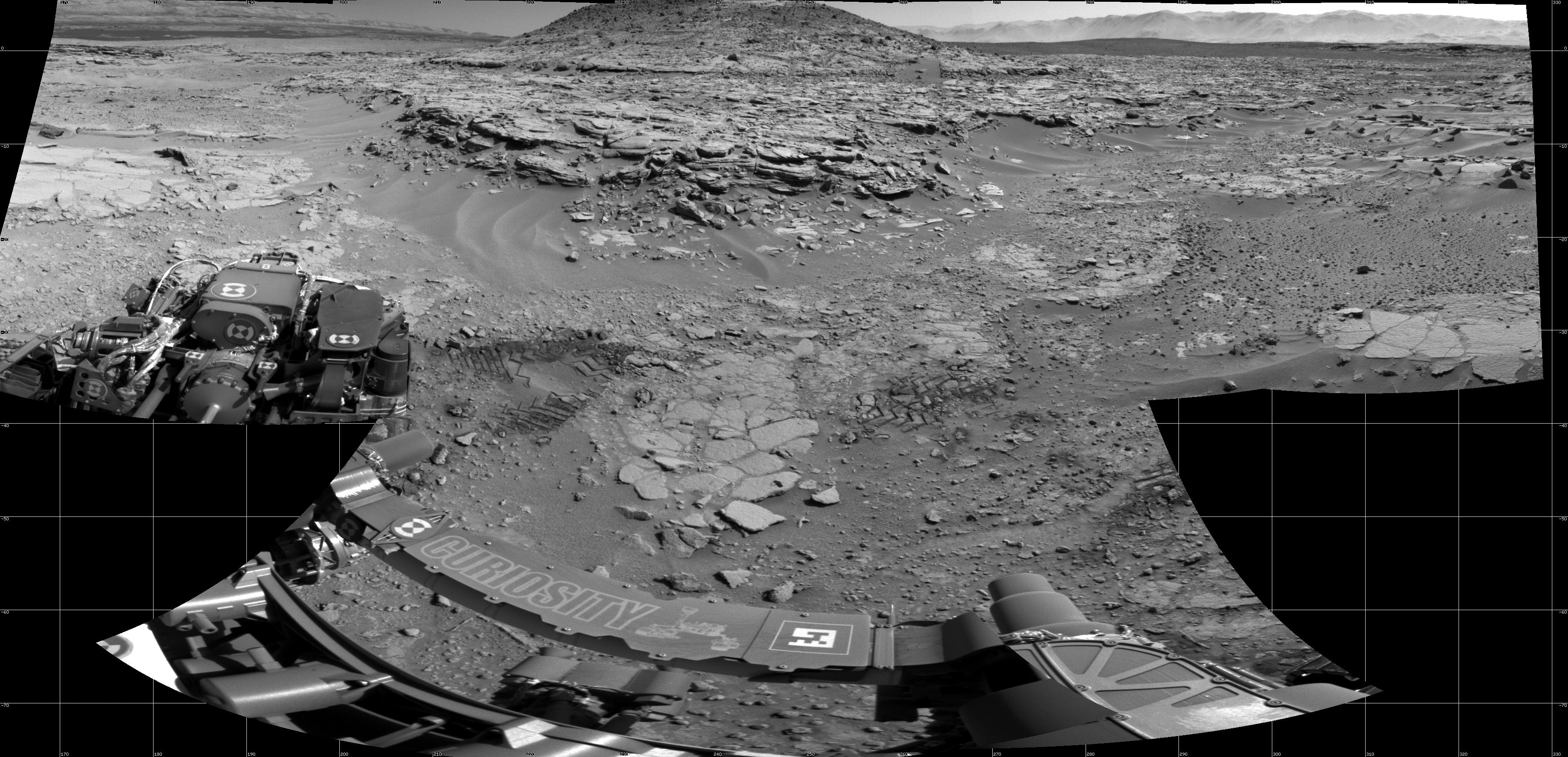
PIA18072:
Curiosity's View From Before Final Approach to 'The Kimberley' Waypoint
Full Resolution:
TIFF
(1.552 MB)
JPEG
(258.1 kB)
2014-04-03
Mars
Mars Science Laboratory (MSL)
Navcam (MSL)
2307x956x1
PIA18073:
Curiosity's View From Arrival Point at 'The Kimberley' Waypoint
Full Resolution:
TIFF
(2.208 MB)
JPEG
(393.1 kB)
2014-04-03
Mars
Mars Science Laboratory (MSL)
Navcam (MSL)
2338x1111x3
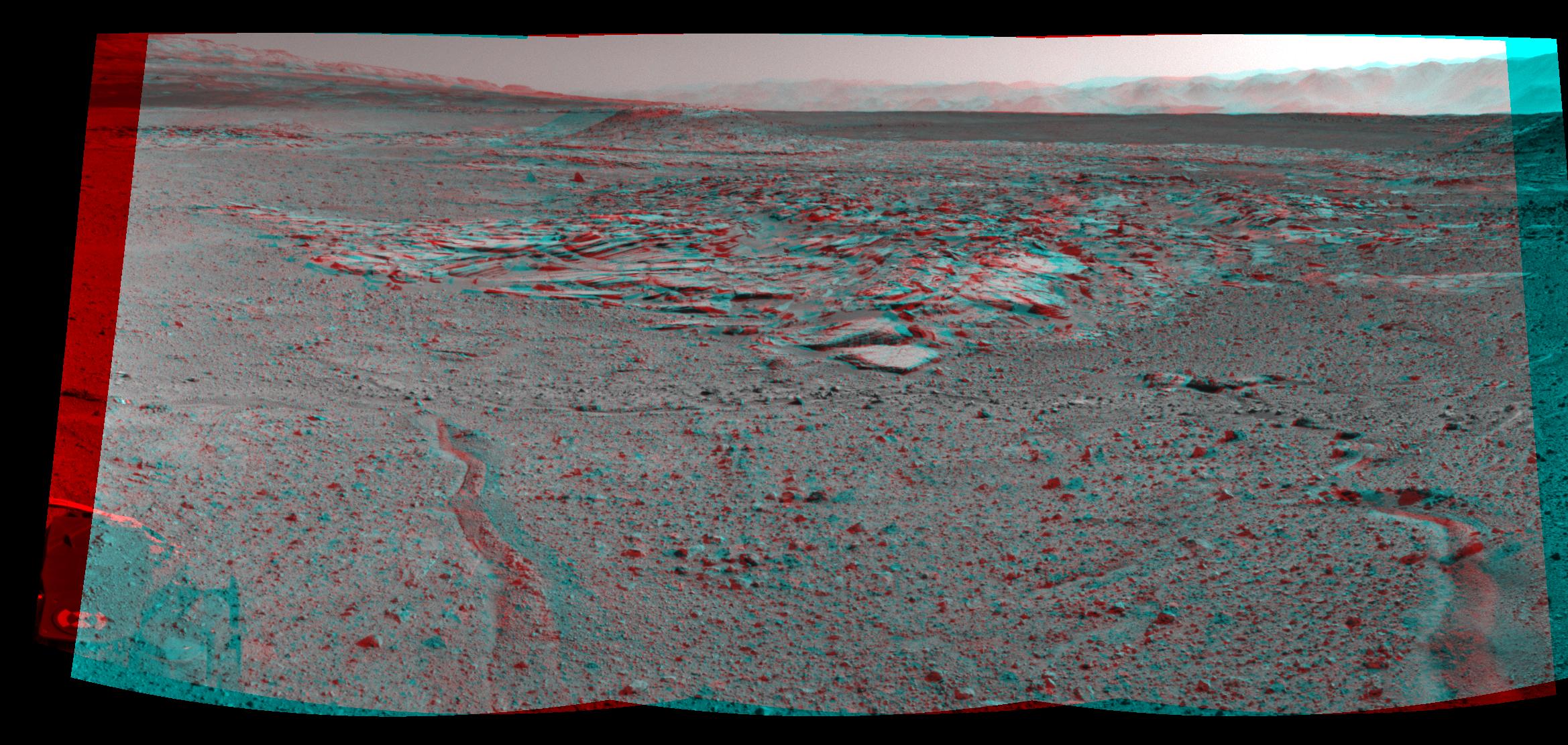
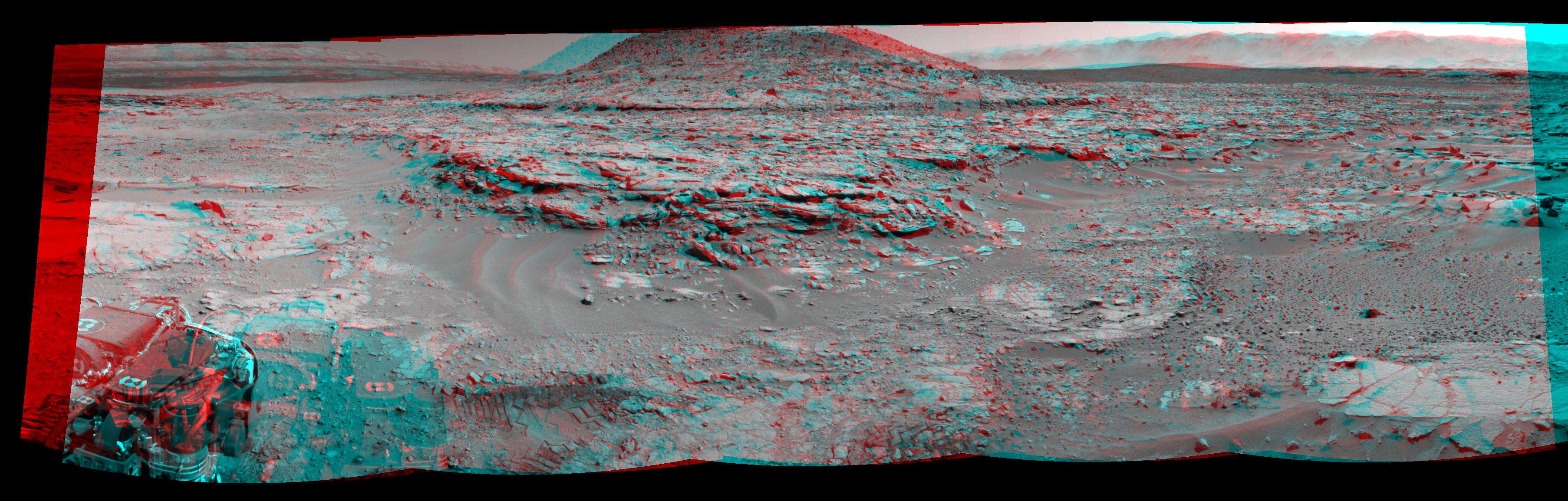
PIA18074:
Curiosity's View From Arrival Point at 'The Kimberley' Waypoint (Stereo)
Full Resolution:
TIFF
(7.796 MB)
JPEG
(446.6 kB)
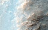
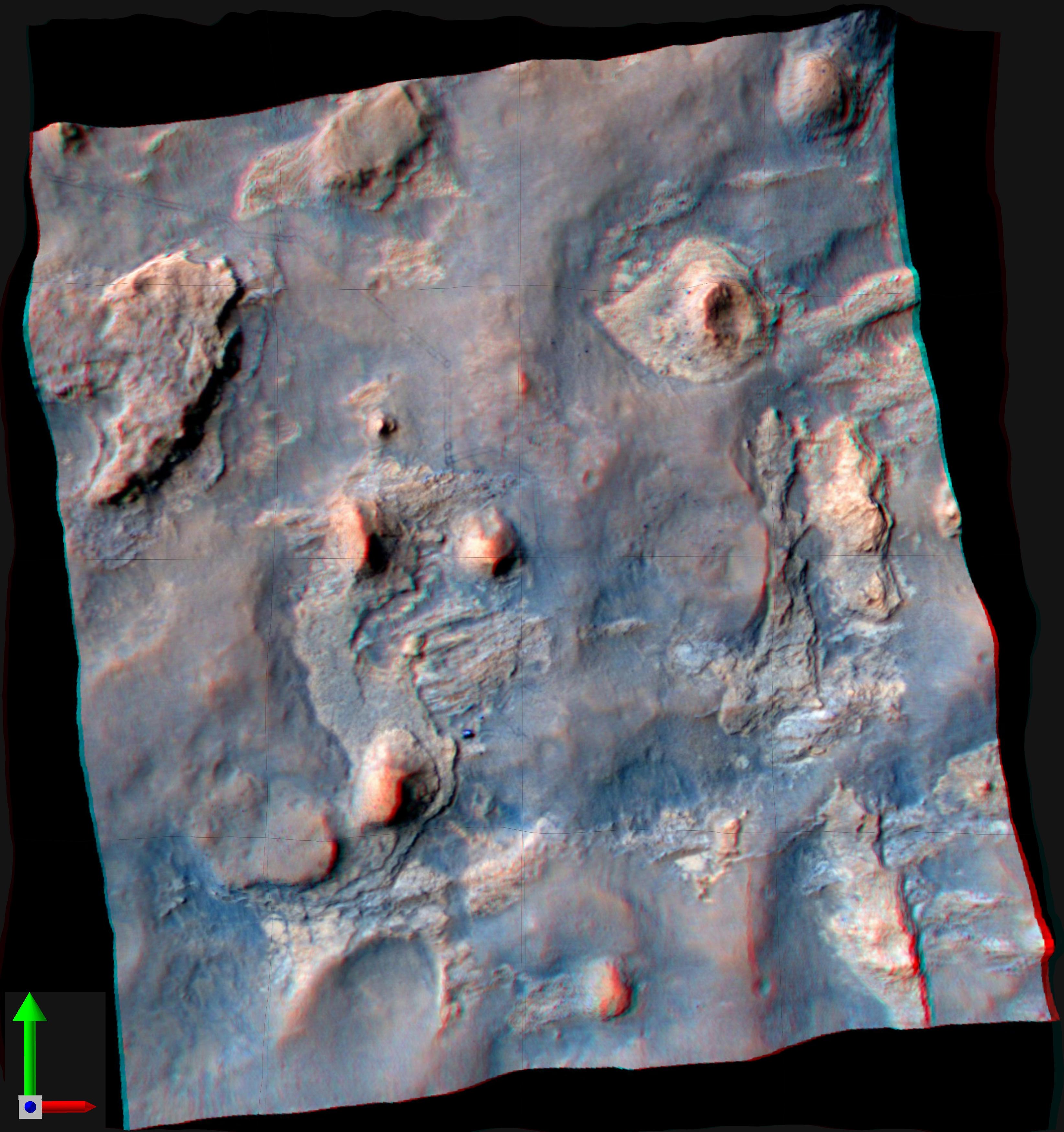
2014-04-03
Mars
Mars Science Laboratory (MSL)
HiRISE
3300x2550x3
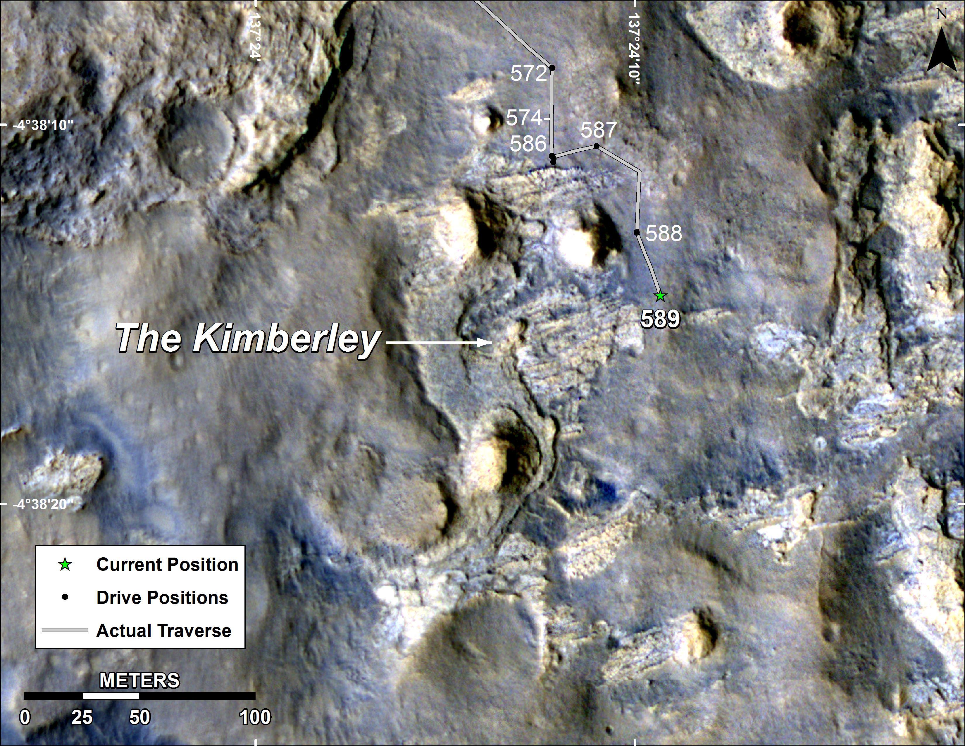
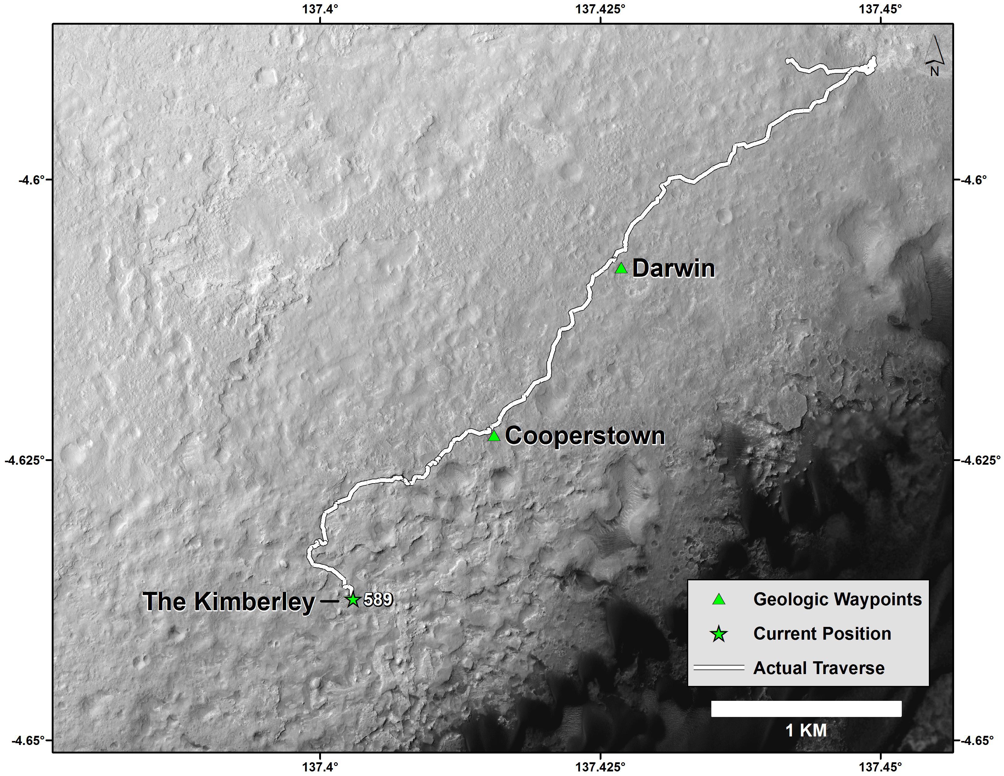
PIA18075:
Map of Curiosity Mars Rover's Drives to 'the Kimberley' Waypoint
Full Resolution:
TIFF
(25.26 MB)
JPEG
(1.265 MB)
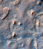
2014-04-03
Mars
Mars Science Laboratory (MSL)
HiRISE
3300x2550x3
PIA18076:
Curiosity Mars Rover's Route from Landing to 'The Kimberley' Waypoint
Full Resolution:
TIFF
(25.26 MB)
JPEG
(1.23 MB)
2014-04-04
Mars
2001 Mars Odyssey
THEMIS
1407x2926x1
PIA18192:
Lava Flows
Full Resolution:
TIFF
(4.122 MB)
JPEG
(454.2 kB)
2014-04-07
Mars
2001 Mars Odyssey
THEMIS
1429x2926x1
PIA18193:
Labeatis Fossae
Full Resolution:
TIFF
(4.186 MB)
JPEG
(548.1 kB)
2014-04-08
Mars
2001 Mars Odyssey
THEMIS
1427x2925x1
PIA18194:
Patapsco Vallis
Full Resolution:
TIFF
(4.179 MB)
JPEG
(433.7 kB)
2014-04-08
Mars
Mars Science Laboratory (MSL)
Navcam (MSL)
1024x1024x1
PIA18077:
Bright Spot Toward Sun in Image from NASA's Curiosity Mars Rover
Full Resolution:
TIFF
(1.05 MB)
JPEG
(152.5 kB)
2014-04-09
Mars
2001 Mars Odyssey
THEMIS
1411x2927x1
PIA18195:
Windstreak
Full Resolution:
TIFF
(4.135 MB)
JPEG
(632.6 kB)
2014-04-09
Mars
Mars Reconnaissance Orbiter (MRO)
HiRISE
2880x1800x3
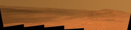
PIA17916:
Opportunity Rover's Winter Work at Murray Ridge
Full Resolution:
TIFF
(15.56 MB)
JPEG
(576.8 kB)
2014-04-09
Mars
Mars Reconnaissance Orbiter (MRO)
HiRISE
2880x1800x1
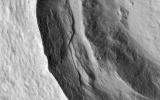
PIA17917:
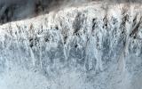
Slumping Terraces on a Crater Wall
Full Resolution:
TIFF
(5.191 MB)
JPEG
(678 kB)
2014-04-09
Mars
Mars Reconnaissance Orbiter (MRO)
HiRISE
2880x1800x1
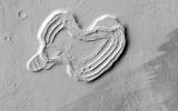
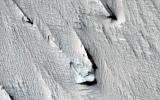
PIA17918:
A Heart in Ascraeus Mons
Full Resolution:
TIFF
(5.191 MB)
JPEG
(751.7 kB)
2014-04-09
Mars
Mars Reconnaissance Orbiter (MRO)
HiRISE
2880x1800x3
PIA17919:
Two-Color Dunes in Meridiani Terra
Full Resolution:
TIFF
(15.56 MB)
JPEG
(858.4 kB)
2014-04-09
Mars
Mars Reconnaissance Orbiter (MRO)
HiRISE
2880x1800x3
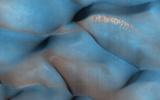
PIA18119:
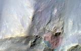
Recurring Slope Lineae in Coprates Chasma
Full Resolution:
TIFF
(15.56 MB)
JPEG
(572.3 kB)
2014-04-09
Mars
Mars Reconnaissance Orbiter (MRO)
HiRISE
2880x1800x1
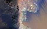
PIA18120:
Finding Faults in Melas Chasma
Full Resolution:
TIFF
(5.191 MB)
JPEG
(747.3 kB)
2014-04-09
Mars
Mars Reconnaissance Orbiter (MRO)
HiRISE
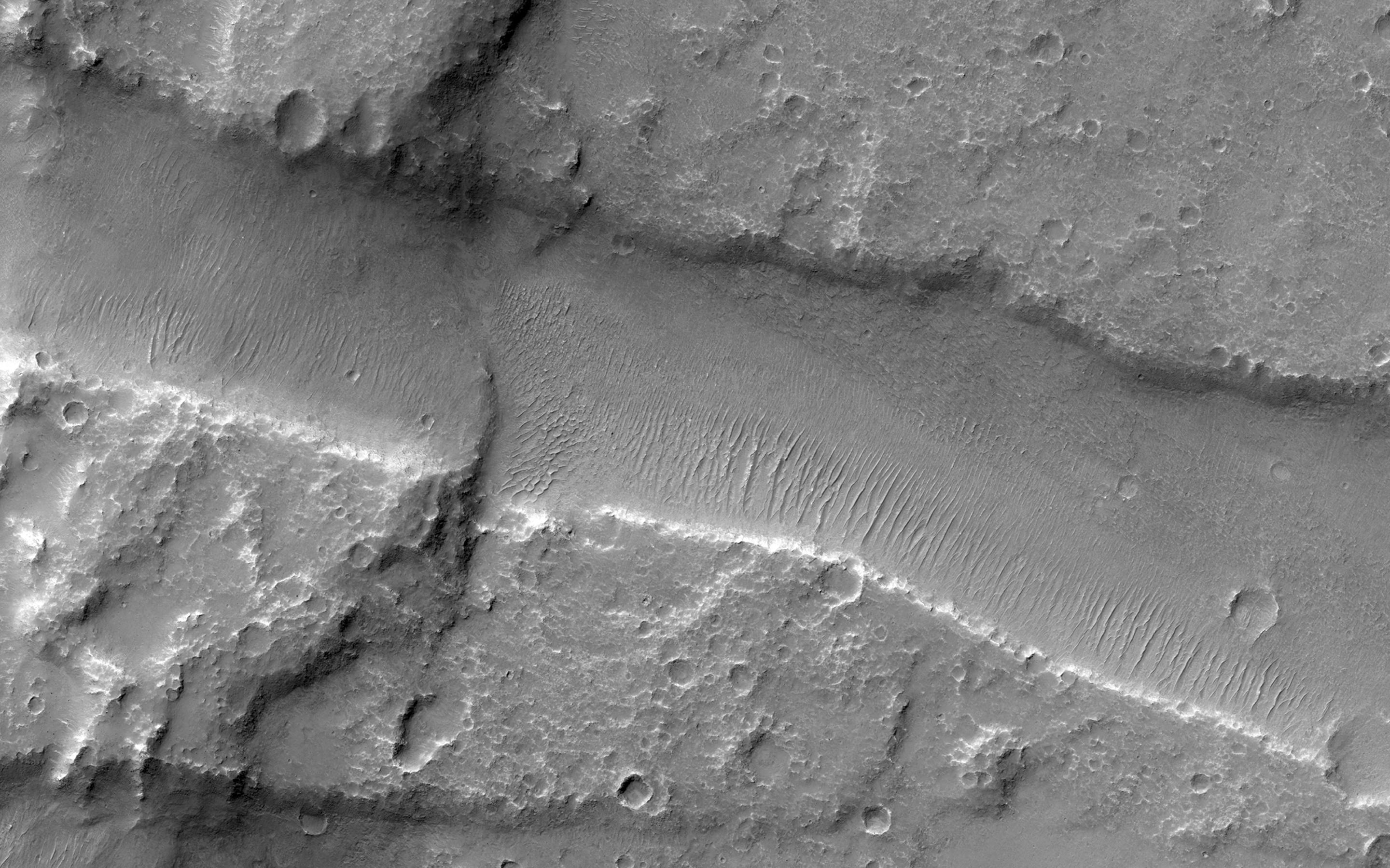
2880x1800x3
PIA18121:
Chevrons on a Flow Surface in Marte Vallis
Full Resolution:
TIFF
(15.56 MB)
JPEG
(834.3 kB)
2014-04-09
Mars
Mars Reconnaissance Orbiter (MRO)
HiRISE
2880x1800x3
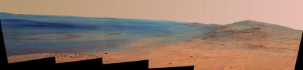
PIA18122:
Opportunity Rover on Valentine's Day 2014
Full Resolution:
TIFF
(15.56 MB)
JPEG
(565 kB)
2014-04-10
Mars
2001 Mars Odyssey
THEMIS
1232x2836x1
PIA18196:
Olympia Undae
Full Resolution:
TIFF
(3.498 MB)
JPEG
(188.2 kB)
2014-04-11
Mars
2001 Mars Odyssey
THEMIS
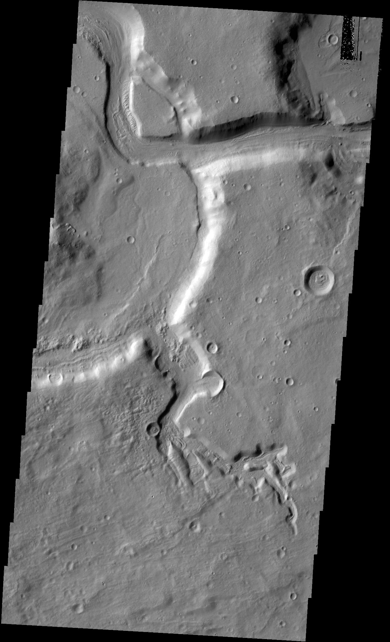
1423x2926x1
PIA18197:
Channel
Full Resolution:
TIFF
(4.169 MB)
JPEG
(314.6 kB)
2014-04-14
Mars
2001 Mars Odyssey
THEMIS
728x1559x1
PIA18198:
Buvinda Vallis
Full Resolution:
TIFF
(1.136 MB)
JPEG
(118.2 kB)
2014-04-15
Mars
2001 Mars Odyssey
THEMIS
1447x2927x1
PIA18199:
Streamlined Island
Full Resolution:
TIFF
(4.24 MB)
JPEG
(490.2 kB)
2014-04-16
Mars
2001 Mars Odyssey
THEMIS
1442x2927x1
PIA18200:
Labeatis Fossae
Full Resolution:
TIFF
(4.226 MB)
JPEG
(346.5 kB)
2014-04-16
Mars
Mars Reconnaissance Orbiter (MRO)
Mars Science Laboratory (MSL)
HiRISE
1322x1482x3
PIA18081:
Curiosity and Rover Tracks at 'the Kimberley,' April 2014
Full Resolution:
TIFF
(5.88 MB)
JPEG
(347.6 kB)
2014-04-16
Mars
Mars Reconnaissance Orbiter (MRO)
Mars Science Laboratory (MSL)
HiRISE
3287x3497x3
PIA18082:
Stereo View of Curiosity and Rover Tracks at 'the Kimberley,' April 2014
Full Resolution:
TIFF
(34.5 MB)
JPEG
(791.9 kB)
2014-04-16
Mars
Mars Science Laboratory (MSL)
Navcam (MSL)
3595x1737x1
PIA18083:
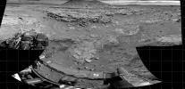
'Mount Remarkable' and Surrounding Outcrops at Mars Rover's Waypoint
Full Resolution:
TIFF
(6.252 MB)
JPEG
(882.7 kB)
2014-04-16
Mars
Mars Science Laboratory (MSL)
Navcam (MSL)
3612x1155x3
PIA18084:
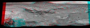
Stereo View of 'Mount Remarkable' and Surrounding Outcrops at Mars Rover's Waypoint
Full Resolution:
TIFF
(12.52 MB)
JPEG
(697.9 kB)
2014-04-16
Mars
Mars Reconnaissance Orbiter (MRO)
HiRISE
2880x1800x3
PIA18224:
A Surprise Landslump in Melas Chasma
Full Resolution:
TIFF
(15.56 MB)
JPEG
(662.5 kB)
2014-04-16
Mars
Mars Reconnaissance Orbiter (MRO)
HiRISE
2880x1800x3
PIA18225:
Equatorial Gullies on Mars
Full Resolution:
TIFF
(15.56 MB)
JPEG
(886.3 kB)
2014-04-16
Mars
Mars Reconnaissance Orbiter (MRO)
HiRISE
2880x1800x3
PIA18226:
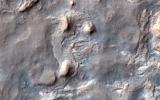
A Big Block of Red Bedrock
Full Resolution:
TIFF
(15.56 MB)
JPEG
(570.4 kB)
2014-04-16
Mars
Mars Reconnaissance Orbiter (MRO)
HiRISE
2880x1800x3
PIA18227:
Curiosity Ready to Drill for Gold at the Kimberley
Full Resolution:
TIFF
(15.56 MB)
JPEG
(735.3 kB)
2014-04-17
Mars
2001 Mars Odyssey
THEMIS
1454x2932x1
PIA18201:
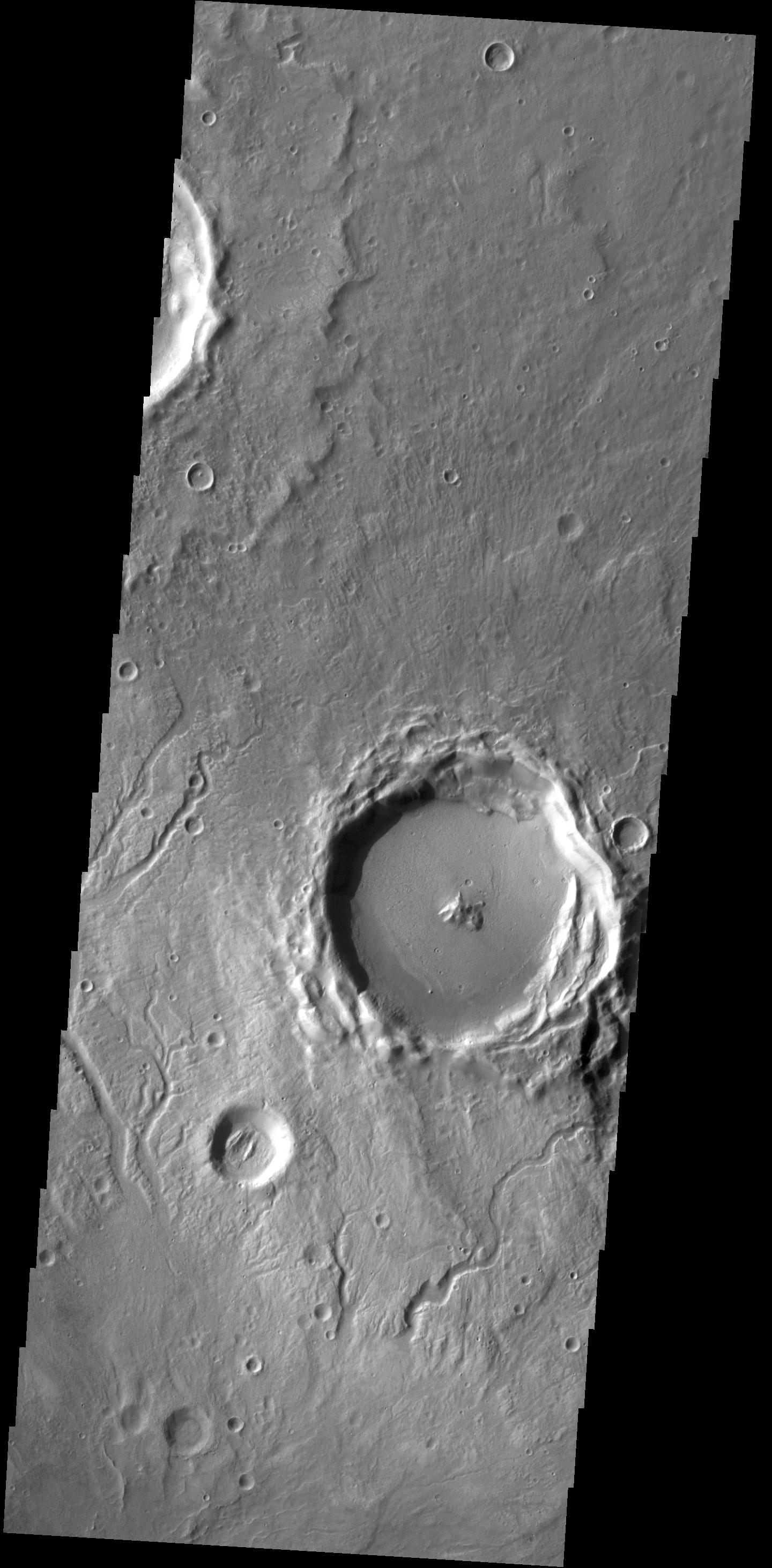
Semeykin Crater
Full Resolution:
TIFF
(4.268 MB)
JPEG
(462.3 kB)
2014-04-17
Mars
Mars Exploration Rover (MER)
Panoramic Camera
7694x6016x3
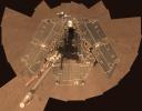
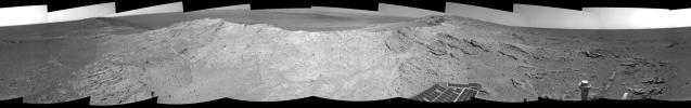
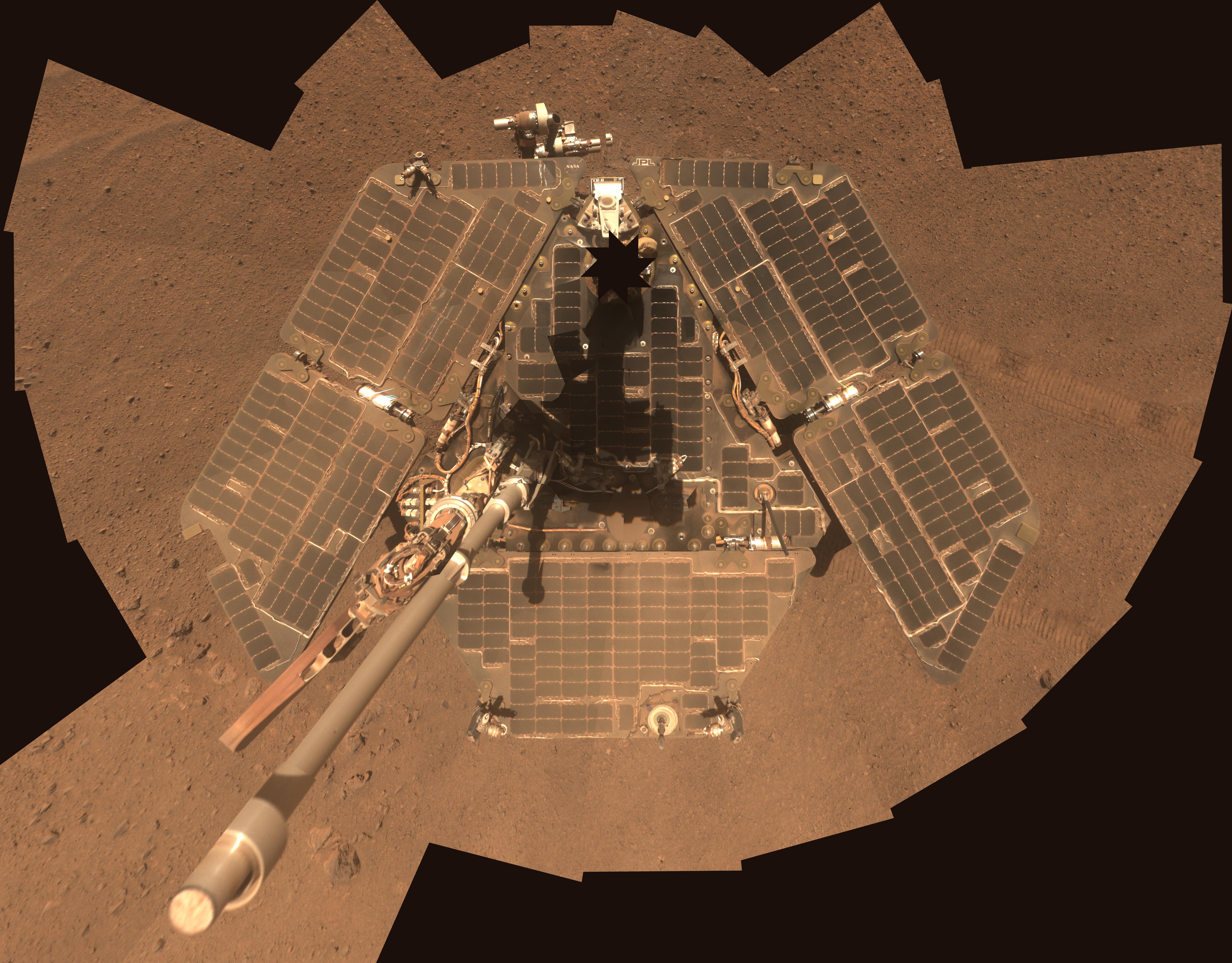
PIA18079:
Self-Portrait by Freshly Cleaned Opportunity Mars Rover in March 2014
Full Resolution:
TIFF
(138.9 MB)
JPEG
(3.583 MB)
2014-04-17
Mars
Mars Exploration Rover (MER)
Panoramic Camera
7694x6016x3
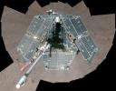
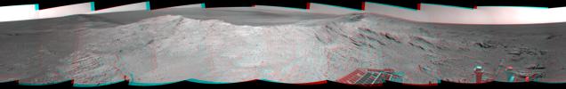
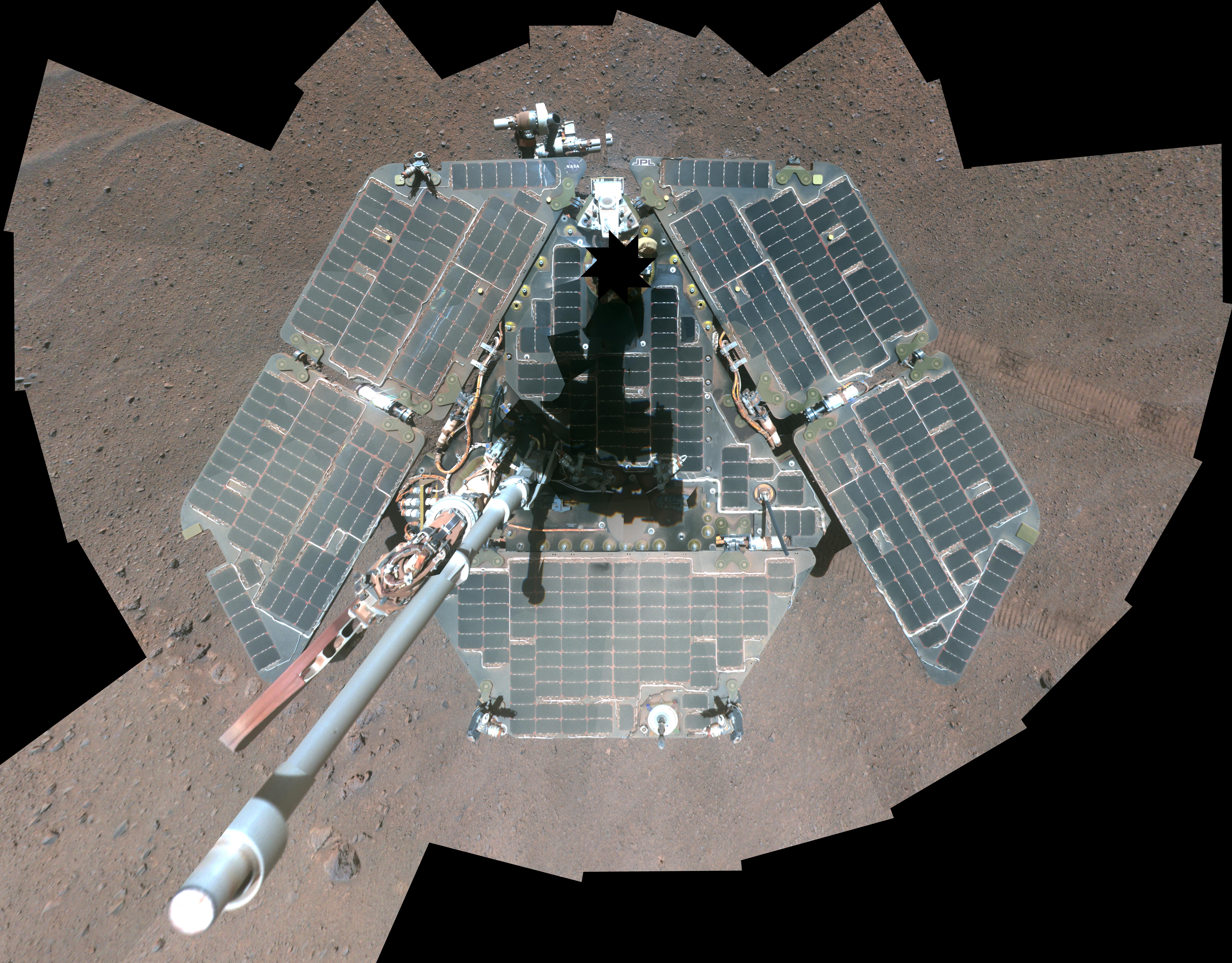
PIA18080:
Self-Portrait by Freshly Cleaned Opportunity Mars Rover, False Color
Full Resolution:
TIFF
(138.9 MB)
JPEG
(4.265 MB)
2014-04-18
Mars
2001 Mars Odyssey
THEMIS
1440x2926x1
PIA18202:
Channels
Full Resolution:
TIFF
(4.218 MB)
JPEG
(375.5 kB)
2014-04-21
Mars
2001 Mars Odyssey
THEMIS
1432x2928x1
PIA18203:
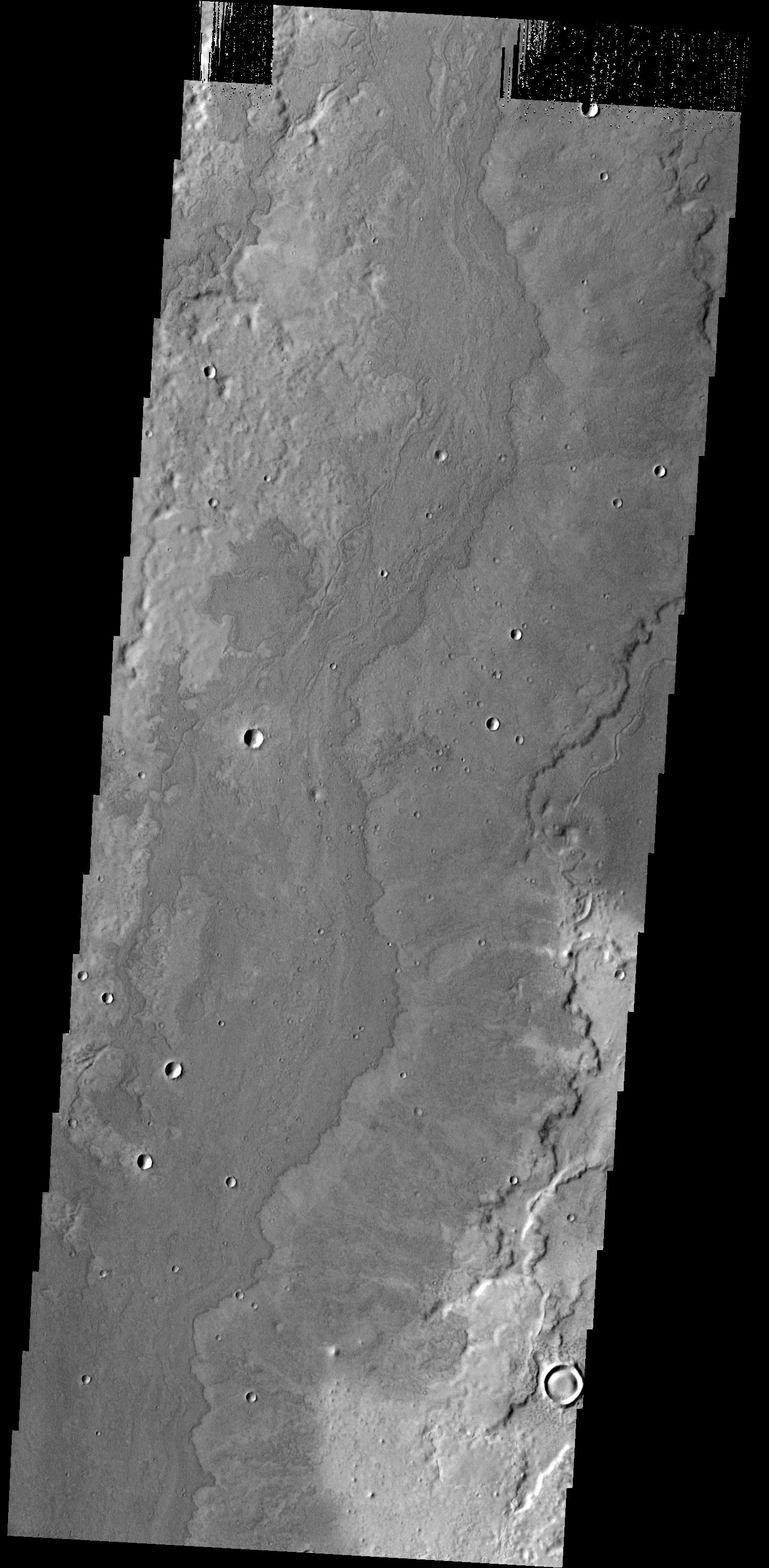
Ceraunius Fossae
Full Resolution:
TIFF
(4.198 MB)
JPEG
(261.6 kB)
2014-04-22
Mars
2001 Mars Odyssey
THEMIS
1435x2924x1
PIA18217:
Lava Flows
Full Resolution:
TIFF
(4.201 MB)
JPEG
(440.9 kB)
2014-04-23
Mars
2001 Mars Odyssey
THEMIS
1421x2925x1
PIA18218:
Cyane Fossae
Full Resolution:
TIFF
(4.161 MB)
JPEG
(634.3 kB)
2014-04-24
Mars
2001 Mars Odyssey
THEMIS
1422x2925x1
PIA18219:
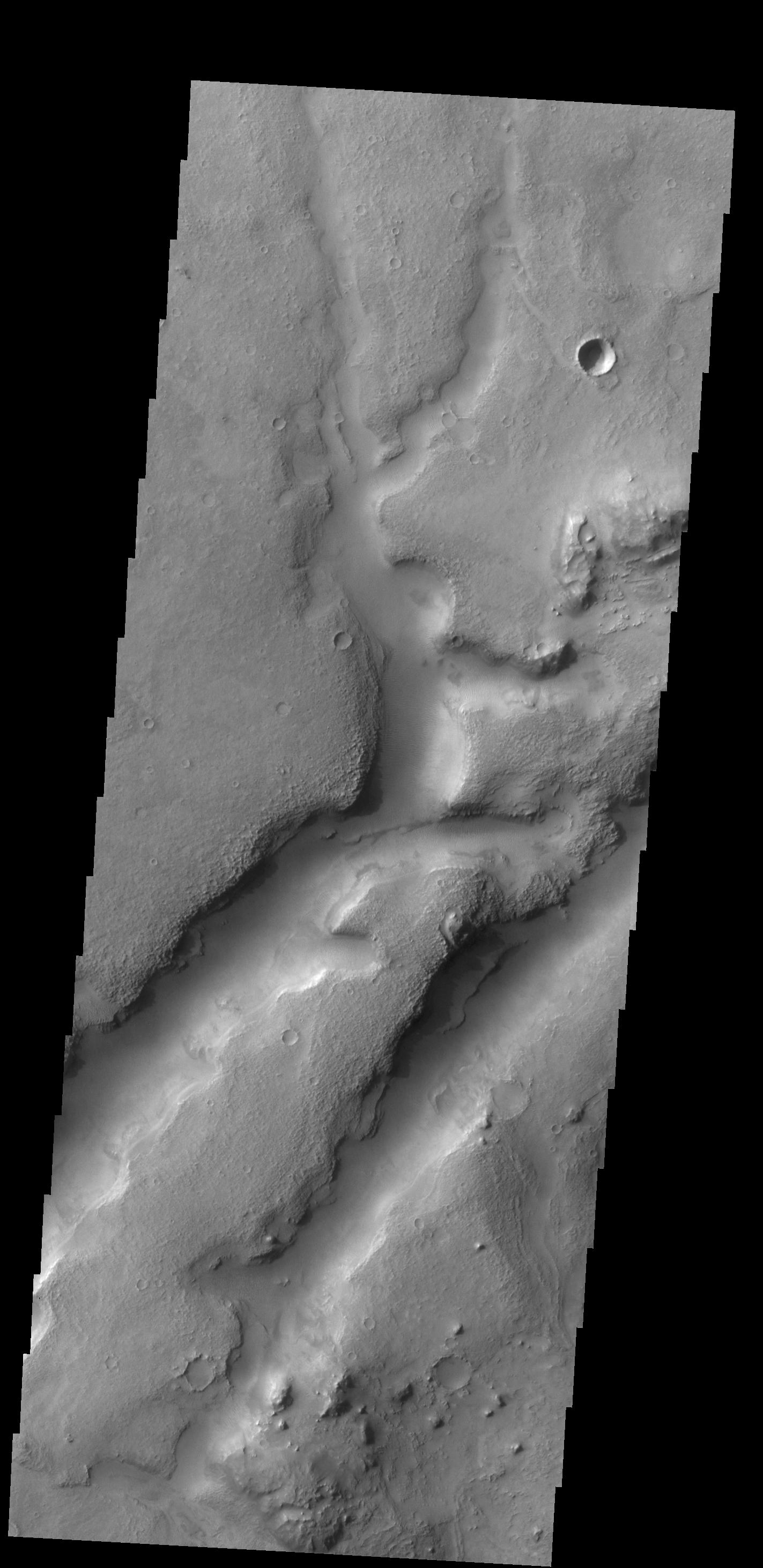
Channels
Full Resolution:
TIFF
(4.164 MB)
JPEG
(490.8 kB)
2014-04-25
Mars
2001 Mars Odyssey
THEMIS
1419x2923x1
PIA18220:
Kasei Valles
Full Resolution:
TIFF
(4.153 MB)
JPEG
(432.3 kB)
2014-04-25
Mars
Mars Reconnaissance Orbiter (MRO)
HiRISE
556x437x3
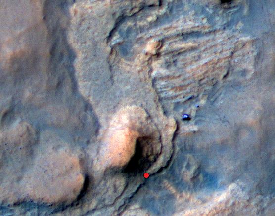
PIA18085:
Location of Mars Sandstone Target 'Windjana'
Full Resolution:
TIFF
(729.4 kB)
JPEG
(45.28 kB)
2014-04-25
Mars
Mars Science Laboratory (MSL)
Navcam (MSL)
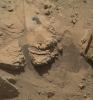
1024x892x1
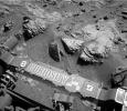
PIA18086:
Curiosity Mars Rover Beside Sandstone Target 'Windjana'
Full Resolution:
TIFF
(914.5 kB)
JPEG
(171.2 kB)
2014-04-25
Mars
Mars Science Laboratory (MSL)
Mastcam
2724x2031x3
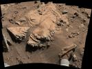
PIA18087:
Sandstone Target 'Windjana' May Be Next Martian Drilling Site
Full Resolution:
TIFF
(16.6 MB)
JPEG
(899.8 kB)
2014-04-28
Mars
2001 Mars Odyssey
THEMIS
1438x2924x1
PIA18221:
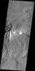
Granicus Valles
Full Resolution:
TIFF
(4.21 MB)
JPEG
(456.2 kB)
2014-04-29
Mars
2001 Mars Odyssey
THEMIS
1326x2184x1
PIA18222:
Channels
Full Resolution:
TIFF
(2.899 MB)
JPEG
(277.8 kB)
2014-04-29
Mars
Mars Science Laboratory (MSL)
MAHLI
1588x1184x3
PIA18088:
Martian Sandstone Target "Windjana" Before and After Brushing
Full Resolution:
TIFF
(1.884 MB)
JPEG
(741.4 kB)
2014-04-30
Mars
2001 Mars Odyssey
THEMIS
1419x2926x1
PIA18223:
Alluvial Fans
Full Resolution:
TIFF
(4.157 MB)
JPEG
(322.9 kB)
2014-04-30
Mars
Mars Reconnaissance Orbiter (MRO)
HiRISE
2880x1800x3
PIA18241:
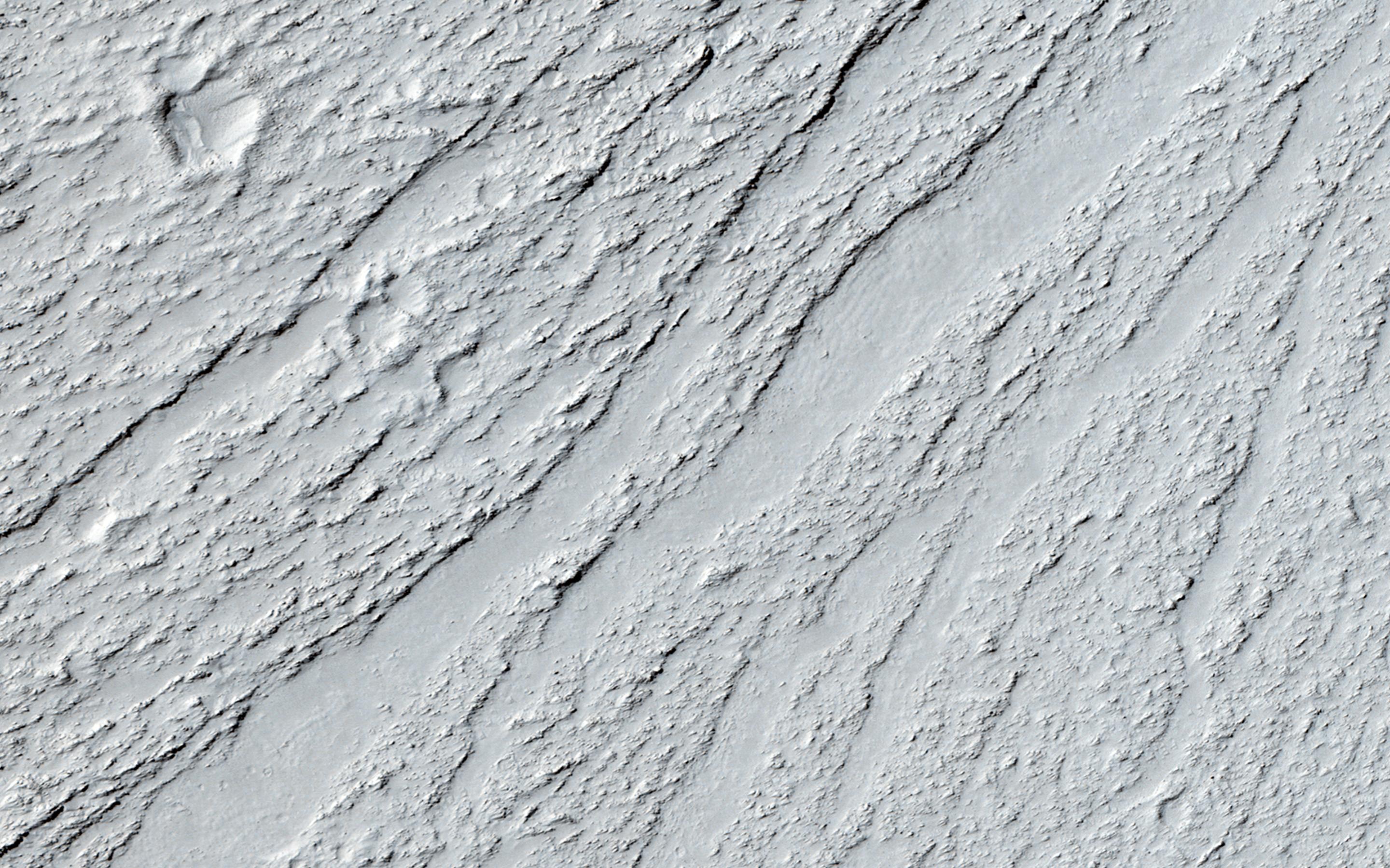
Yardangs Forming Near Gordii Dorsum
Full Resolution:
TIFF
(15.56 MB)
JPEG
(734.8 kB)
2014-04-30
Mars
Mars Reconnaissance Orbiter (MRO)
HiRISE
2880x1800x3
PIA18242:
Sunken and Pitted Ejecta
Full Resolution:
TIFF
(15.56 MB)
JPEG
(1.028 MB)
2014-04-30
Mars
Mars Reconnaissance Orbiter (MRO)
HiRISE
2880x1800x3
PIA18243:
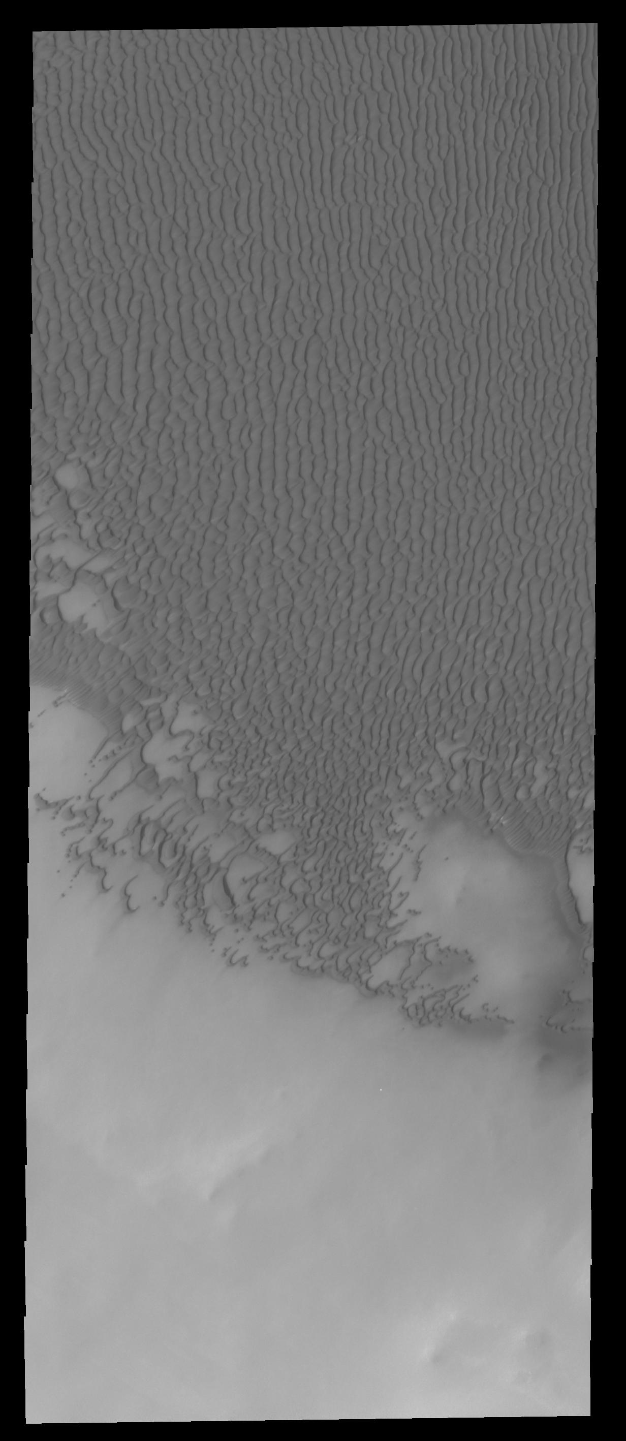
Changing Dunes and Ripples in Olympia Undae
Full Resolution:
TIFF
(15.56 MB)
JPEG
(700.2 kB)
2014-04-30
Mars
Mars Reconnaissance Orbiter (MRO)
HiRISE
2880x1800x3
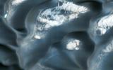
PIA18244:
The Active Dunes of Nili Patera
Full Resolution:
TIFF
(15.56 MB)
JPEG
(786.7 kB)
2014-04-30
Mars
Mars Science Laboratory (MSL)
MAHLI
1593x1200x3
PIA18089:
Preparatory Drilling Test on Martian Target 'Windjana'
Full Resolution:
TIFF
(5.737 MB)
JPEG
(401.4 kB)
2014-05-01
Mars
2001 Mars Odyssey
THEMIS
1416x2925x1
PIA18232:
Lava Flows
Full Resolution:
TIFF
(4.147 MB)
JPEG
(652.1 kB)
2014-05-02
Mars
2001 Mars Odyssey
THEMIS
2898x3568x1
PIA18233:
Polar Dunes
Full Resolution:
TIFF
(10.35 MB)
JPEG
(620.9 kB)
2014-05-05
Mars
2001 Mars Odyssey
THEMIS
1415x2924x1
PIA18234:
Lava Flows
Full Resolution:
TIFF
(4.142 MB)
JPEG
(609.3 kB)
2014-05-06
Mars
2001 Mars Odyssey
THEMIS
1455x2931x1
PIA18235:
Ceraunius Fossae
Full Resolution:
TIFF
(4.27 MB)
JPEG
(287.1 kB)
2014-05-06
Mars
Mars Science Laboratory (MSL)
Navigation Camera
598x293x1
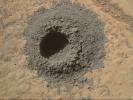
PIA18090:
Sample-Collection Drill Hole on Martian Sandstone Target 'Windjana'
Full Resolution:
TIFF
(175.6 kB)
JPEG
(42.97 kB)
2014-05-07
Mars
2001 Mars Odyssey
THEMIS
1434x2928x1
PIA18236:
Lycus Sulci
Full Resolution:
TIFF
(4.204 MB)
JPEG
(365.6 kB)
2014-05-08
Mars
2001 Mars Odyssey
THEMIS
2295x3360x1
PIA18237:
Polar Dunes
Full Resolution:
TIFF
(7.72 MB)
JPEG
(618.4 kB)
2014-05-09
Mars
2001 Mars Odyssey
THEMIS
2907x3561x1
PIA18238:
Polar Layers
Full Resolution:
TIFF
(10.37 MB)
JPEG
(385.2 kB)
2014-05-12
Mars
2001 Mars Odyssey
THEMIS
1402x2922x1
PIA18239:
Tartarus Colles
Full Resolution:
TIFF
(4.102 MB)
JPEG
(289 kB)
2014-05-13
Mars
2001 Mars Odyssey
THEMIS
2378x3385x1
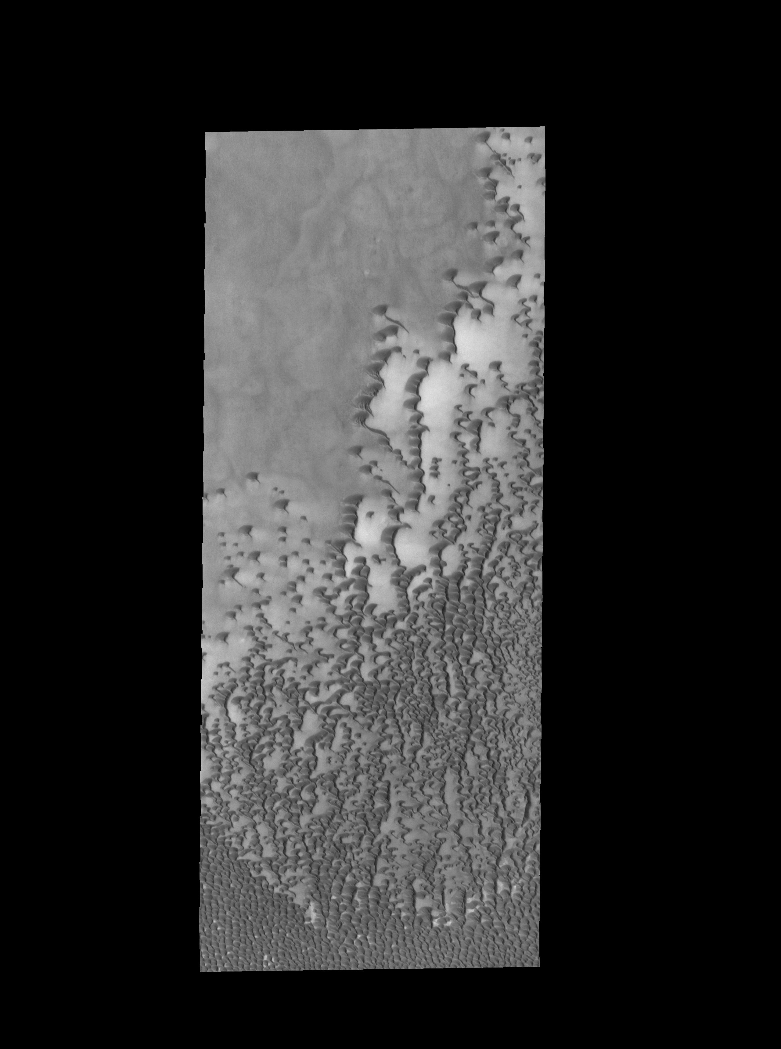
PIA18240:
Crater Dunes
Full Resolution:
TIFF
(8.059 MB)
JPEG
(270.6 kB)
2014-05-14
Mars
2001 Mars Odyssey
THEMIS
2277x3343x1
PIA18250:
Crater Dunes
Full Resolution:
TIFF
(7.621 MB)
JPEG
(223.3 kB)
2014-05-15
Mars
2001 Mars Odyssey
THEMIS
1464x2928x1
PIA18251:
Tempe Terra
Full Resolution:
TIFF
(4.291 MB)
JPEG
(420.5 kB)
2014-05-15
Mars
Mars Science Laboratory (MSL)
MAHLI
1181x1580x3
PIA18091:
Nighttime Image of Laser Sharpshooting on Mars
Full Resolution:
TIFF
(5.6 MB)
JPEG
(418.9 kB)
2014-05-15
Mars
Mars Science Laboratory (MSL)
MAHLI
1184x1272x3
PIA18092:
Mars Rock 'Windjana' After Examination
Full Resolution:
TIFF
(4.52 MB)
JPEG
(331 kB)
2014-05-16
Mars
2001 Mars Odyssey
THEMIS
2346x3374x1
PIA18252:
Crater Dunes
Full Resolution:
TIFF
(7.925 MB)
JPEG
(237.9 kB)
2014-05-19
Mars
2001 Mars Odyssey
THEMIS
1441x2924x1
PIA18254:
Channel
Full Resolution:
TIFF
(4.218 MB)
JPEG
(318.1 kB)
2014-05-19
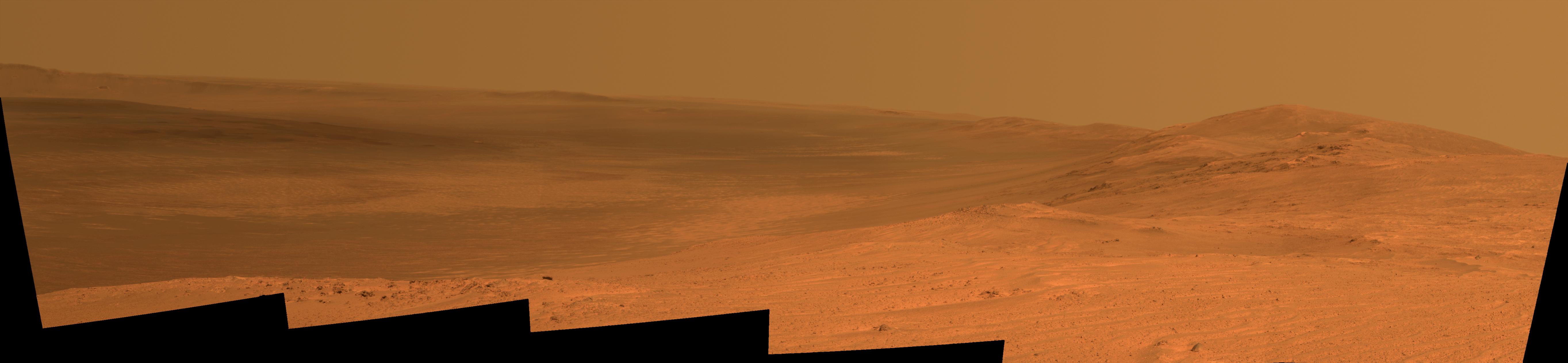
Mars
Mars Exploration Rover (MER)
Panoramic Camera
5454x1264x3
PIA18093:
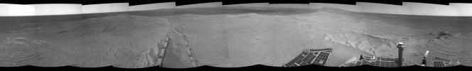
Endeavour Crater Rim From 'Murray Ridge' on Mars
Full Resolution:
TIFF
(20.69 MB)
JPEG
(398 kB)
2014-05-19
Mars
Mars Exploration Rover (MER)
Panoramic Camera
5454x1264x3
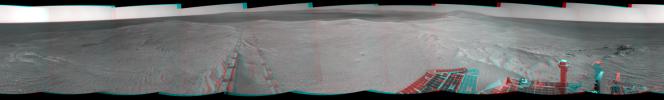
PIA18094:
Endeavour Crater Rim From 'Murray Ridge' on Mars, False Color
Full Resolution:
TIFF
(20.69 MB)
JPEG
(598 kB)
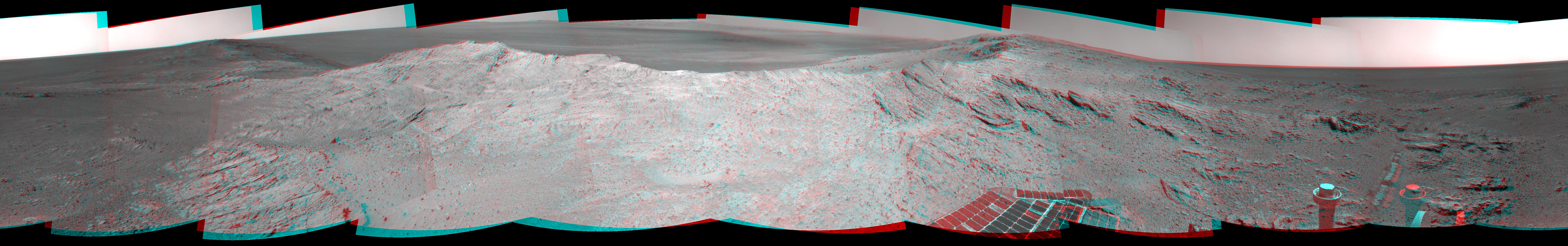
2014-05-19
Mars
Mars Exploration Rover (MER)
Navigation Camera
7753x1217x1
PIA18095:
Approaching a Target Deposit on Mars Crater Rim
Full Resolution:
TIFF
(9.445 MB)
JPEG
(1.222 MB)
2014-05-19
Mars
Mars Exploration Rover (MER)
Navigation Camera
7753x1217x3
PIA18096:
Approaching a Target Deposit on Mars Crater Rim (Stereo)
Full Resolution:
TIFF
(28.32 MB)
JPEG
(1.311 MB)
2014-05-19
Mars
Mars Exploration Rover (MER)
Navigation Camera
7753x1168x1
PIA18098:
Opportunity's Tracks Near Crater Rim Ridgeline
Full Resolution:
TIFF
(9.065 MB)
JPEG
(993.8 kB)
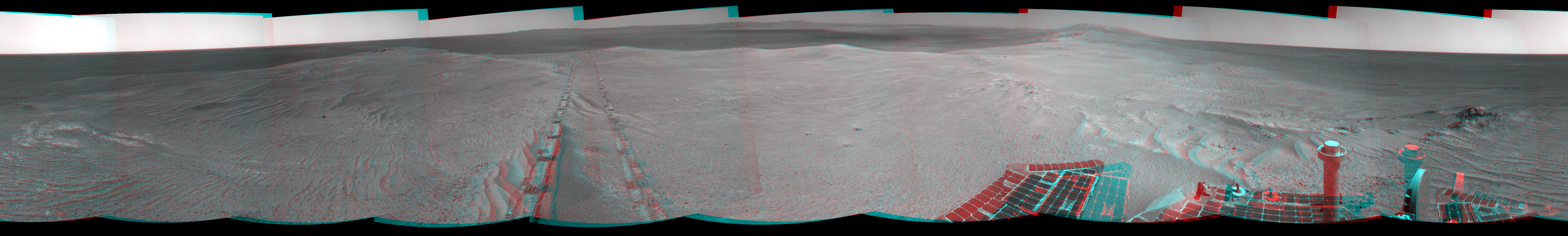
2014-05-19
Mars
Mars Exploration Rover (MER)
Navigation Camera
7753x1168x3
PIA18099:
Opportunity's Tracks Near Crater Rim Ridgeline (Stereo)
Full Resolution:
TIFF
(27.18 MB)
JPEG
(1.024 MB)
2014-05-20
Mars
2001 Mars Odyssey
THEMIS
1432x2924x1
PIA18255:
Olympica Fossae
Full Resolution:
TIFF
(4.192 MB)
JPEG
(293.3 kB)
2014-05-21
Mars
2001 Mars Odyssey
THEMIS
1473x2934x1
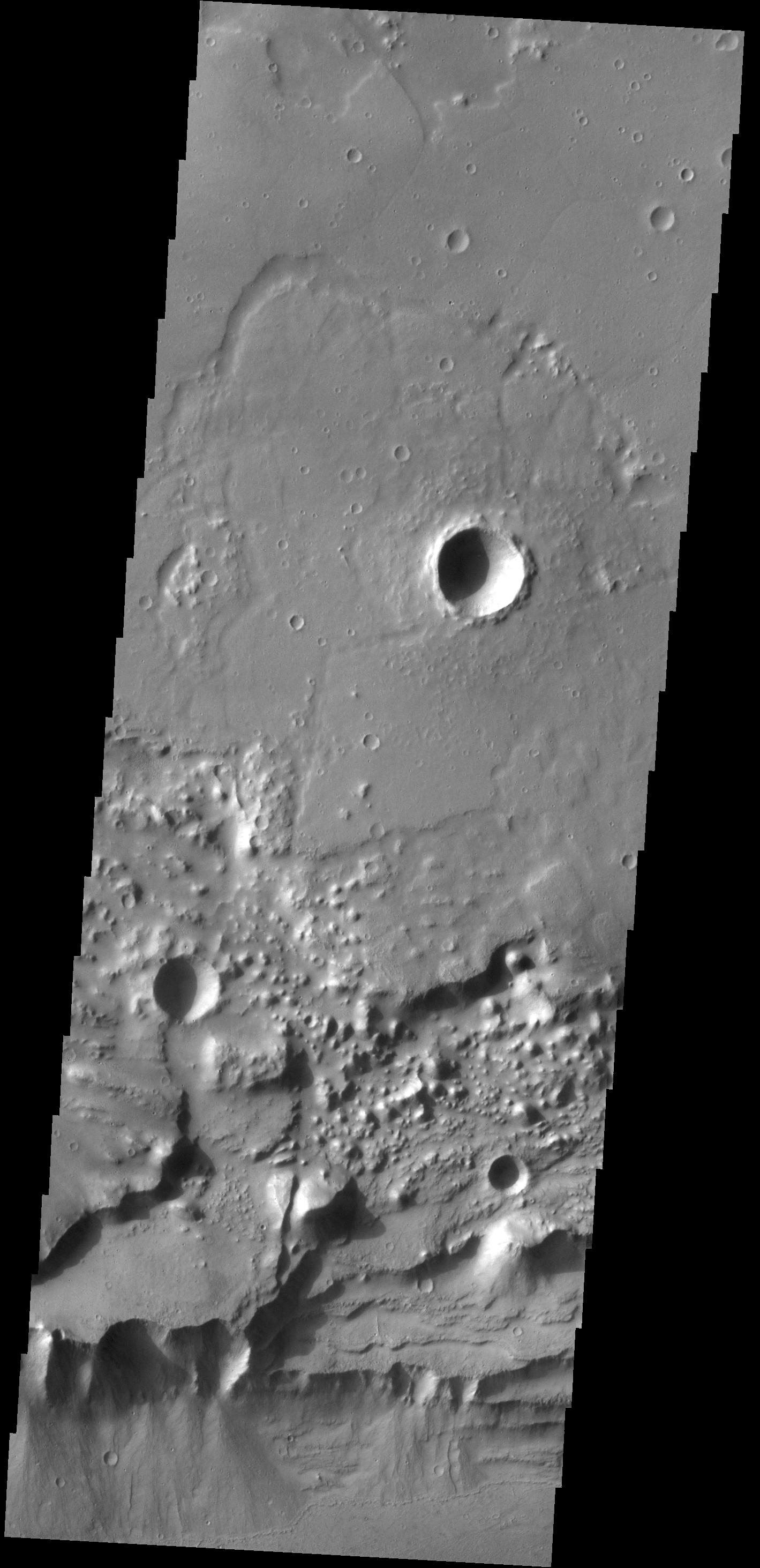
PIA18256:
Chaos
Full Resolution:
TIFF
(4.327 MB)
JPEG
(442.7 kB)
2014-05-21
Mars
Mars Reconnaissance Orbiter (MRO)
HiRISE
840x333x1
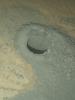
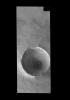
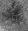
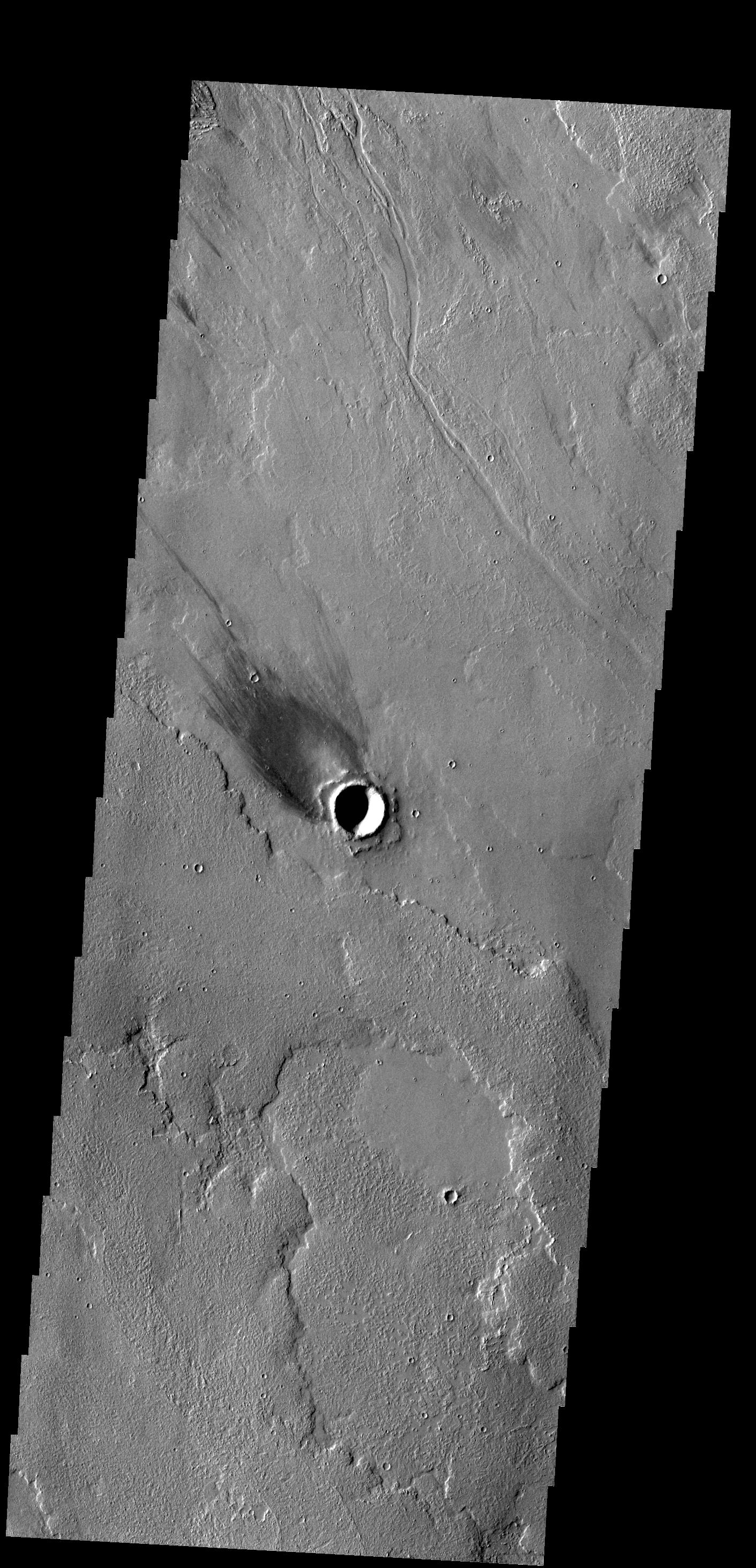
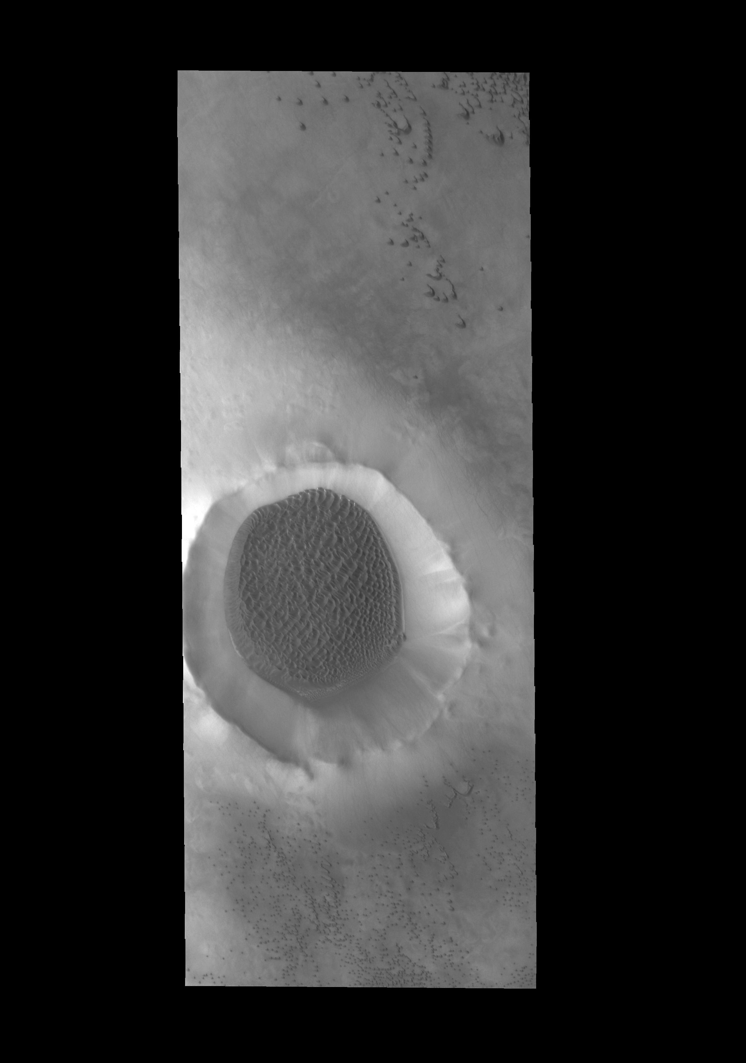
PIA17482:
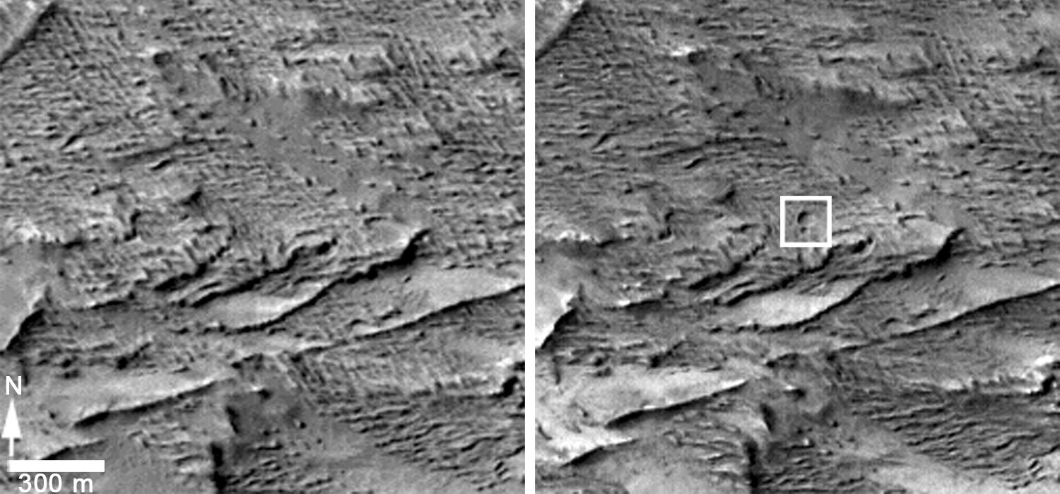
New Impact Site
Full Resolution:
TIFF
(280.2 kB)
JPEG
(95.43 kB)
2014-05-22
Mars
2001 Mars Odyssey
THEMIS
1504x2949x1
PIA18257:
Utopia Planitia
Full Resolution:
TIFF
(4.44 MB)
JPEG
(538.5 kB)
2014-05-22
Mars
Mars Reconnaissance Orbiter (MRO)
MARCI
1700x1700x3
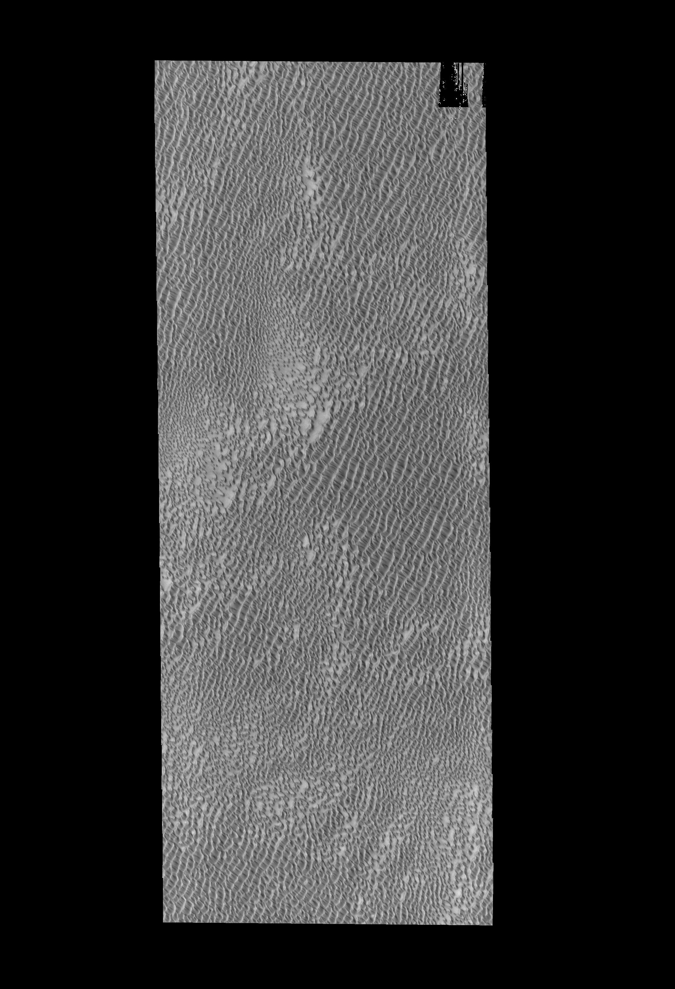
PIA18380:
Impact Scar Detected in Mars Weathercam Image
Full Resolution:
TIFF
(8.674 MB)
JPEG
(222.2 kB)
2014-05-22
Mars
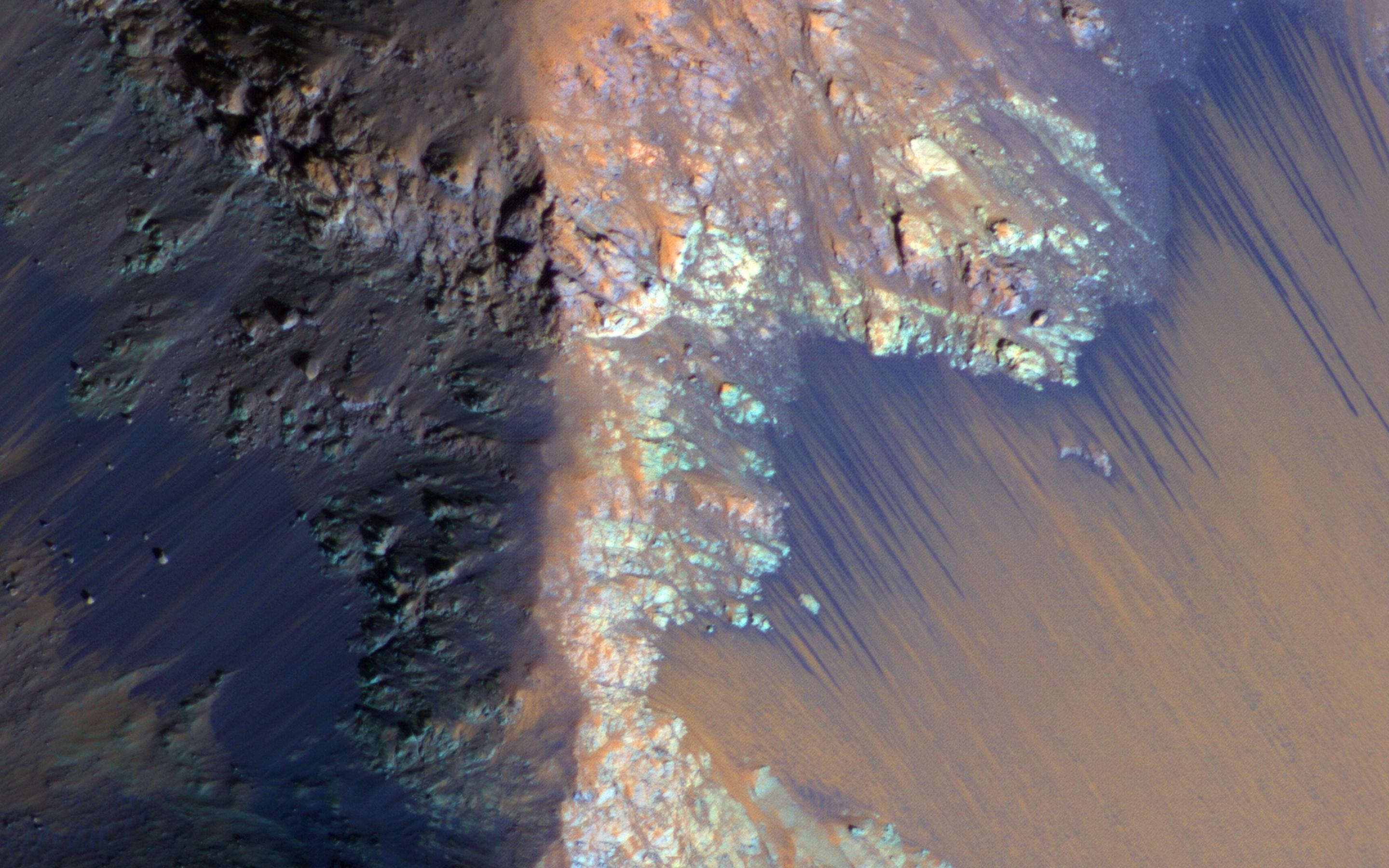
Mars Reconnaissance Orbiter (MRO)
HiRISE
2880x1800x3
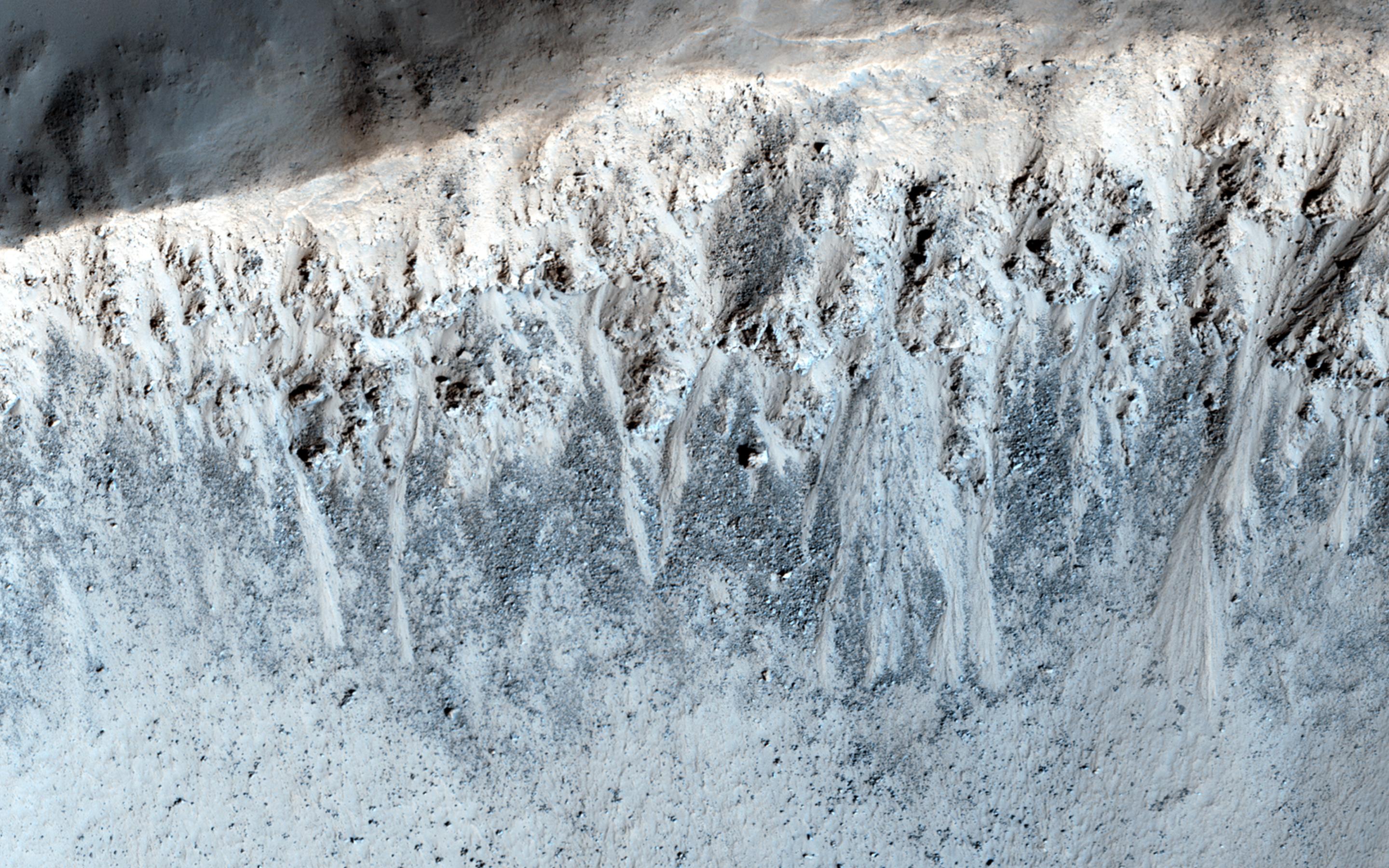
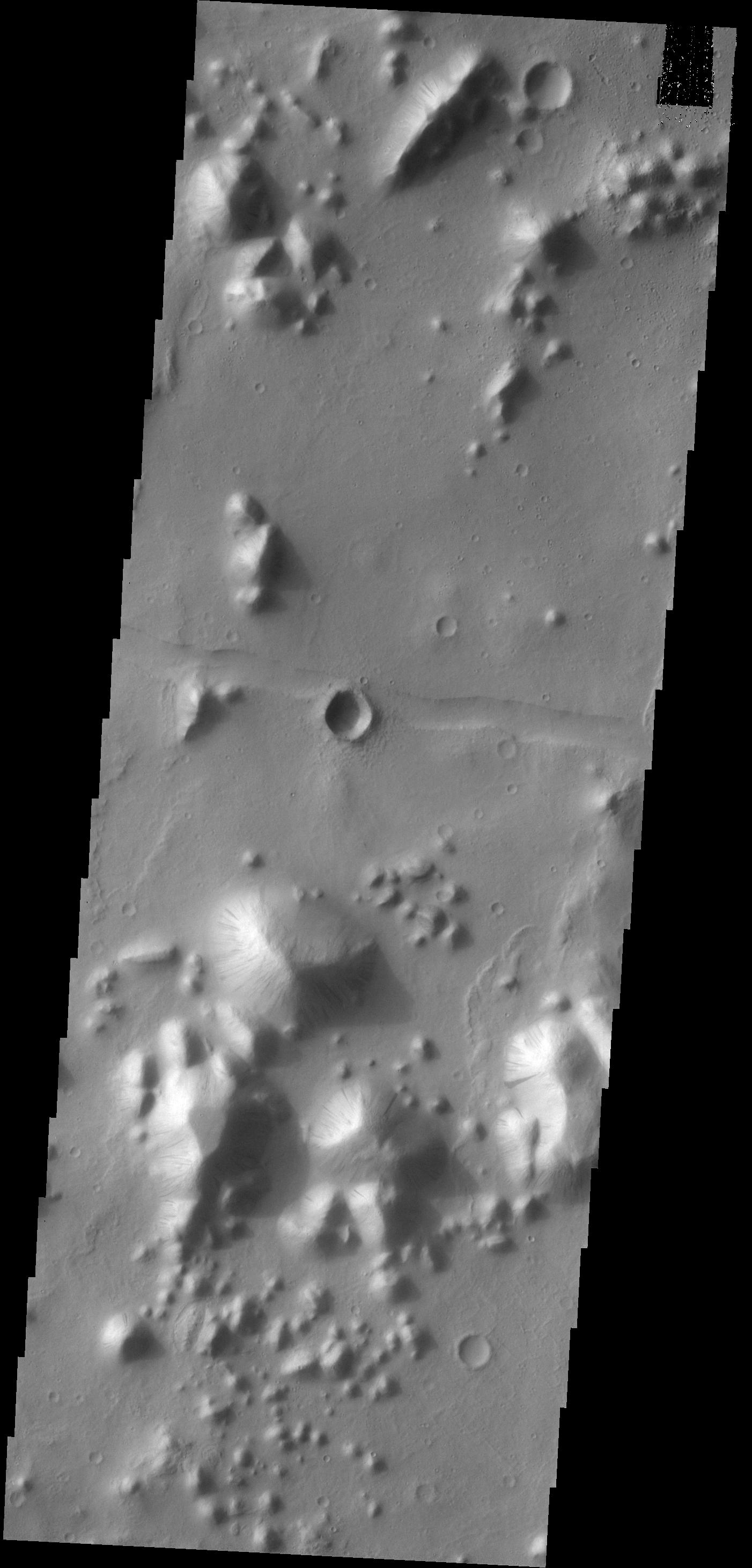
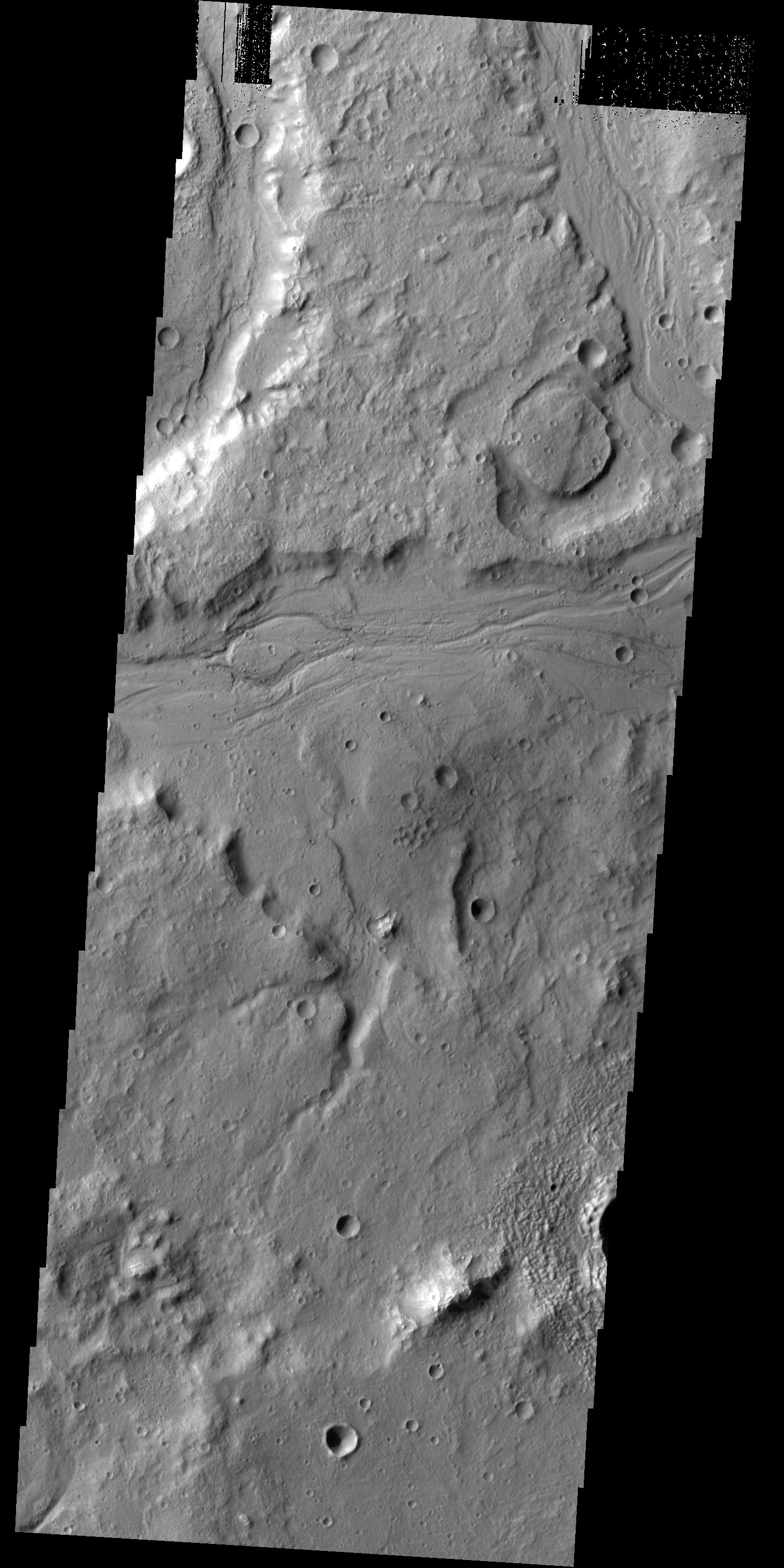
PIA18648:
What Gullies Can Say
Full Resolution:
TIFF
(15.56 MB)
JPEG
(696.7 kB)
2014-05-22
Mars
Mars Reconnaissance Orbiter (MRO)
HiRISE
2880x1800x1
PIA18649:
The Busy Flank of Arsia Mons
Full Resolution:
TIFF
(5.191 MB)
JPEG
(682.4 kB)
2014-05-22
Mars
Mars Reconnaissance Orbiter (MRO)
MARCI
928x242x3
PIA18381:
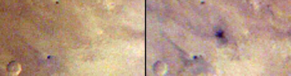
Best-Ever Pinning Down When a Space Rock Hit Mars
Full Resolution:
TIFF
(674.2 kB)
JPEG
(28.52 kB)
2014-05-22
Mars
Mars Reconnaissance Orbiter (MRO)
CTX
1980x2176x1
PIA18382:
Fresh Mars Crater Confirmed Within Impact Scar
Full Resolution:
TIFF
(4.313 MB)
JPEG
(1.148 MB)
2014-05-22
Mars
Mars Reconnaissance Orbiter (MRO)
HiRISE
2880x1800x3
PIA18771:
At the Edge of a Polar Cap
Full Resolution:
TIFF
(15.56 MB)
JPEG
(796.4 kB)
2014-05-22
Mars
Mars Reconnaissance Orbiter (MRO)
CTX
1500x699x1
PIA18383:
Before-and-After Views Confirm Fresh Craters
Full Resolution:
TIFF
(1.05 MB)
JPEG
(153.2 kB)
2014-05-22
Mars
Mars Reconnaissance Orbiter (MRO)
HiRISE
2880x1800x1
PIA18772:
Global Eyes on an Impact Prize
Full Resolution:
TIFF
(5.191 MB)
JPEG
(700.7 kB)
2014-05-22
Mars
Mars Reconnaissance Orbiter (MRO)
HiRISE
1413x951x3
PIA18384:
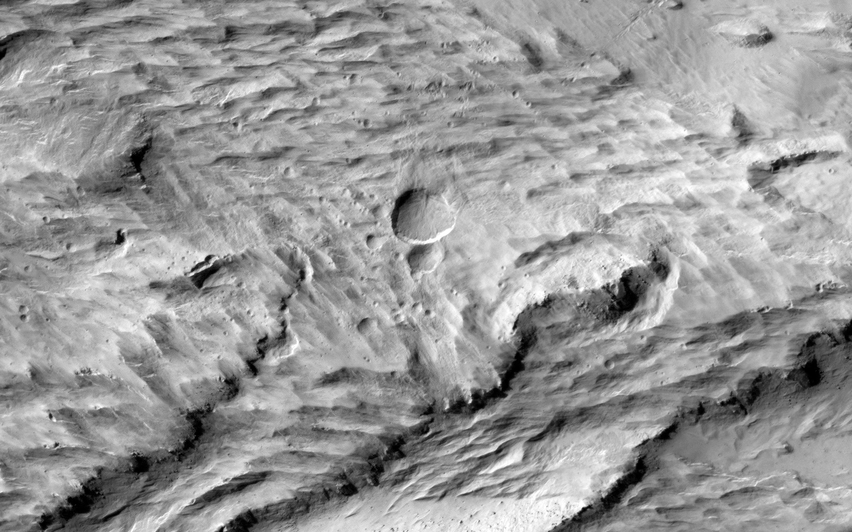
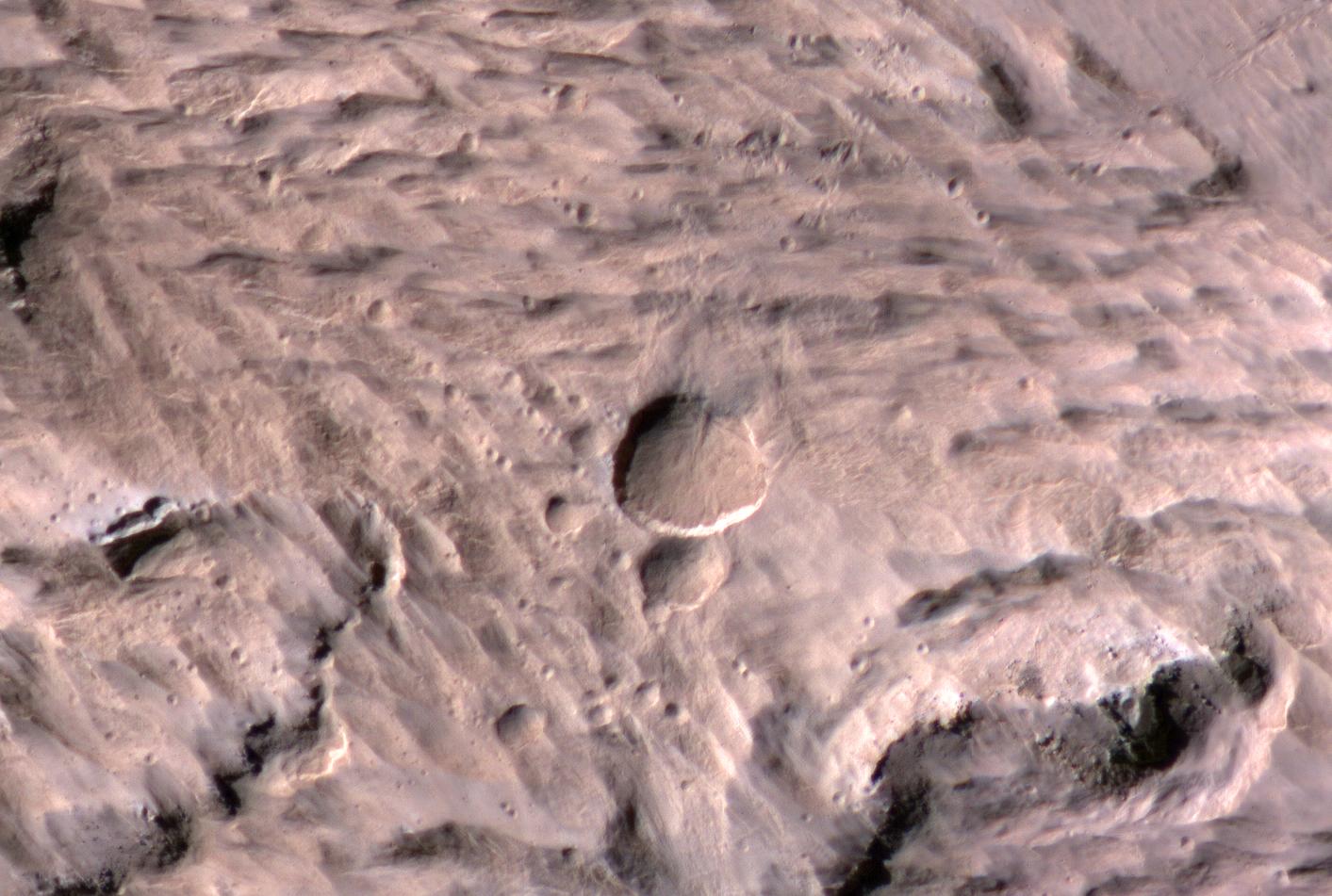
Large, Fresh Crater Surrounded by Smaller Craters
Full Resolution:
TIFF
(4.033 MB)
JPEG
(174.3 kB)
2014-05-22
Mars
Mars Reconnaissance Orbiter (MRO)
HiRISE
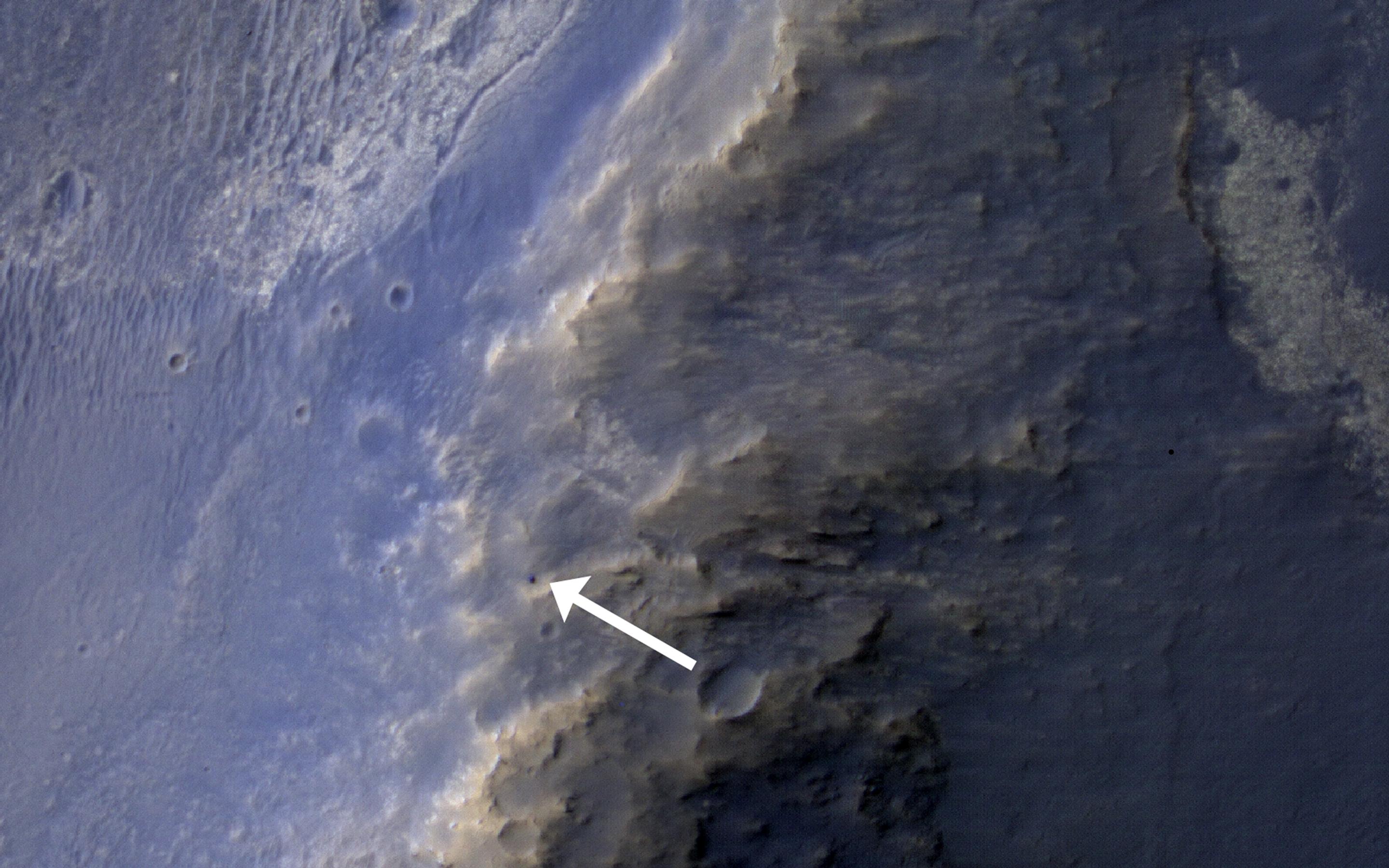
741x493x3
PIA18385:
Landslides Near Fresh Crater on Mars
Full Resolution:
TIFF
(1.097 MB)
JPEG
(56.47 kB)
2014-05-23
Mars
2001 Mars Odyssey
THEMIS
1466x2931x1
PIA18259:
Channels
Full Resolution:
TIFF
(4.302 MB)
JPEG
(405.6 kB)
2014-05-26
Mars
2001 Mars Odyssey
THEMIS
2476x3416x1
PIA18260:
Siton Undae
Full Resolution:
TIFF
(8.467 MB)
JPEG
(561.3 kB)
2014-05-27
Mars
2001 Mars Odyssey
THEMIS
2411x3387x1
PIA18261:
More Siton Undae
Full Resolution:
TIFF
(8.175 MB)
JPEG
(403.1 kB)
2014-05-28
Mars
2001 Mars Odyssey
THEMIS
1416x2926x1
PIA18262:
Olympus Rupes
Full Resolution:
TIFF
(4.148 MB)
JPEG
(493.8 kB)
2014-05-29
Mars
2001 Mars Odyssey
THEMIS
1514x2954x1
PIA18263:
Dust Devil Tracks
Full Resolution:
TIFF
(4.477 MB)
JPEG
(376.5 kB)
2014-05-30
Mars
2001 Mars Odyssey
THEMIS
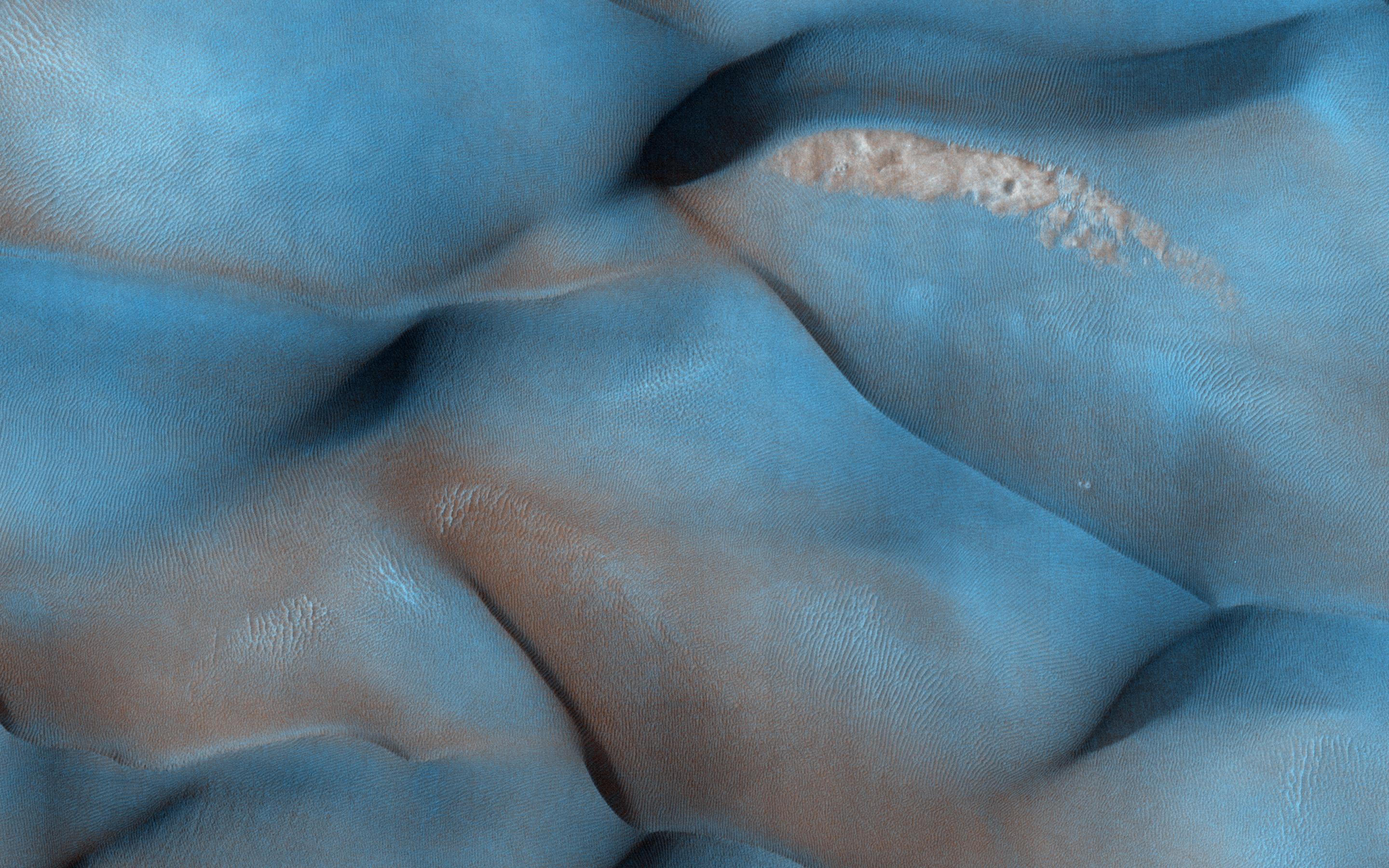
2560x3437x1
PIA18264:
Siton Undae
Full Resolution:
TIFF
(8.808 MB)
JPEG
(416.5 kB)
2014-06-02
Mars
2001 Mars Odyssey
THEMIS
1430x2924x1
PIA18265:
Crater Delta
Full Resolution:
TIFF
(4.186 MB)
JPEG
(434.3 kB)
1-100
101-200
201-300
301-400
401-500
501-600
601-700
701-800
801-900
901-1000
Currently displaying images:
8401 - 8500
of 12760


