Your search criteria found
12755
images
Target is Mars (and available satellites)
Go to PIAxxxxx:
Refine this list of images by:
Target:
Deimos
Mars
Phobos
Mission:
2001 Mars Odyssey
Antarctic Meteorite Location and Mapping Project (AMLAMP)
Dawn
ExoMars
Hubble Space Telescope
InSight
MAVEN
Mariner Mars 1964 (Mariner 4)
Mariner Mars 1969 (Mariner 7)
Mariner Mars 1971 (Mariner 9)
Mars 2020
Mars 2020 Rover
Mars Atmosphere and Volatile Evolution MissioN (MAVEN)
Mars Climate Orbiter
Mars Cube One (MarCO)
Mars Exploration Rover (MER)
Mars Express (MEX)
Mars Global Surveyor (MGS)
Mars Helicopter
Mars Pathfinder (MPF)
Mars Reconnaissance Orbiter (MRO)
Mars Sample Return
Mars Sample Return (MSR)
Mars Science Laboratory (MSL)
Phoenix
Rosetta
Viking
Spacecraft:
2001 Mars Odyssey
Curiosity
Dawn
InSight Mars Lander
Ingenuity
MAVEN
MarCO-B
Mariner 4
Mariner 7
Mariner 9
Mars Climate Orbiter
Mars Express (MEX)
Mars Express (MEX) Orbiter
Mars Global Surveyor Orbiter
Mars Pathfinder Lander
Mars Pathfinder Rover
Mars Reconnaissance Orbiter (MRO)
Mars Sample Return
Mars Science Laboratory (MSL)
NASA's Mars Pathfinder Lander
Opportunity
Perseverance
Philae Lander
Phoenix Lander
Phoenix Mars Lander
Spirit
Viking Lander 1
Viking Lander 2
Viking Orbiter 1
Viking Orbiter 2
Instrument:
Alpha Particle X-ray Spectrometer
Alpha Particle X-ray Spectrometer (MSL)
Atmospheric Structure / Meteorology Instrument
CHIMRA
Camera 1
Camera 2
Chemistry & Mineralogy (CheMin)
Chemistry and Camera (ChemCam)
Comet Infrared and Visible Analyser (CIVA
Compact Reconnaissance Imaging Spectrometer for Mars (CRISM)
Context Camera (CTX)
Deep Space Network
Descent Image Motion Estimation System (DIMES)
Dynamic Albedo of Neutrons
Dynamic Albedo of Neutrons (DAN)
Gamma Ray Spectrometer - Neutron Spectrometer
Gamma Ray Spectrometer Suite
Hazard Avoidance Camera
Hazard Avoidance Camera (M2020)
Hazard Avoidance Camera (MSL)
Heat and Physical Properties Package (HP3)
High Resolution Imaging Science Experiment (HiRISE)
High Resolution Instrument (HRI)
High Resolution Stereo Camera
Imager for Mars Pathfinder
Imaging Ultraviolet Spectrograph
Imaging Ultraviolet Spectrograph (IUVS)
Instrument Context Camera (ICC)
Instrument Deployment Camera (IDC)
Lander Vision System Camera (LCAM)
Magnetometer
Mars Advanced Radar for Subsurface and Ionosphere Sounding (MARSIS)
Mars Advanced Radar for Subsurface and Ionospheric Sounding (MARSIS)
Mars Climate Sounder (MCS)
Mars Color Imager (MARCI)
Mars Descent Imager
Mars Environmental Dynamics Analyzer (MEDA)
Mars Hand Lens Imager (MAHLI)
Mars Horizon Sensor Assembly
Mars Orbiter Camera (MOC)
Mars Orbiter Laser Altimeter
Mars Radiation Experiment
Mastcam
Mastcam-Z
Microscopic Imager
Microscopy Electrochemistry and Conductivity Analyzer (MECA)
Miniature Thermal Emission Spectrometer
Moessbauer Spectrometer
Navigation Camera
Navigation Camera (M2020)
Navigation Camera (MSL)
Neutral Gas and Ion Mass Spectrometer
Neutron Spectrometer
Optical Microscope
Optical Navigation Camera
Panoramic Camera
Planetary Instrument for X-ray Lithochemistry (PIXL)
Radar System
Radiation Assessment Detector (RAD)
Radio Science Subsystem
Robotic Arm
Robotic Arm (MSL)
Robotic Arm Camera (RAC)
Rock Abrasion Tool (RAT)
Rover Cameras
Rover Environmental Monitoring Station (REMS)
Sample Analysis at Mars (SAM)
Scanning Habitable Environments with Raman & Luminescence for Organics and Chemicals (SHERLOC)
Seismic Experiment for Interior Structure (SEIS)
Shallow Subsurface Radar (SHARAD)
Stereo Imager (SSI)
SuperCam
Surface Stereo Imager (SSI)
Thermal Emission Imaging System
Thermal Emission Spectrometer
Thermal and Electrical Conductivity Probe
Thermal and Evolved Gas Analyzer
Trace Gas Orbiter
Visual Imaging Subsystem
Visual Imaging Subsystem - Camera A
Visual Imaging Subsystem - Camera B
Wide Field Planetary Camera 2
Click on an image for detailed information
Click on a column heading to sort in ascending or descending order
My
List
Addition Date
Target
Mission
Instrument
Size
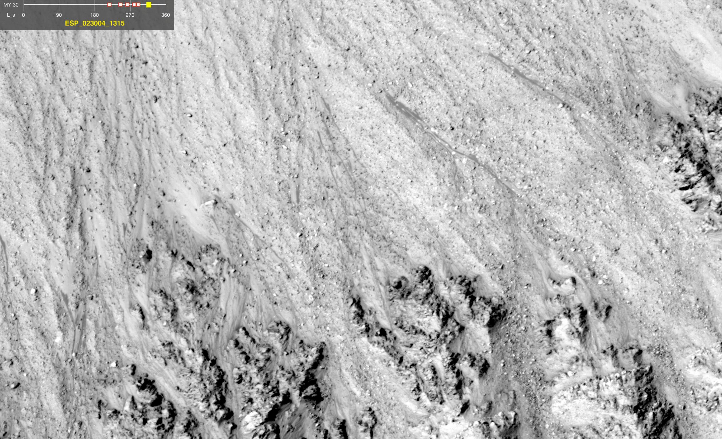
2011-08-04
Mars
Mars Reconnaissance Orbiter (MRO)
HiRISE
1642x1534x3
PIA14474:
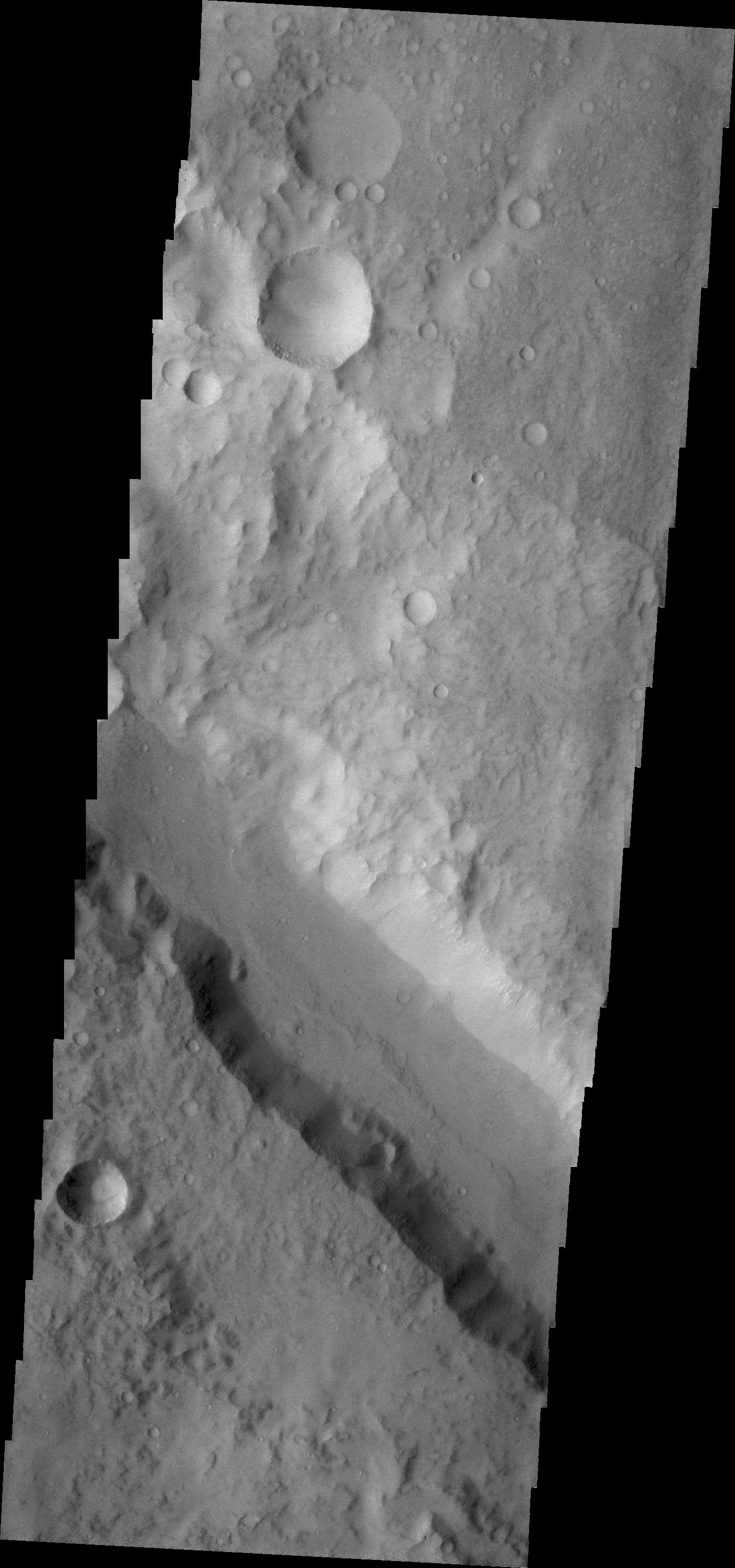
Dark Flows in Newton Crater Extending During Summer (Six-Image Sequence)
Full Resolution:
TIFF
(2.524 MB)
JPEG
(394.1 kB)
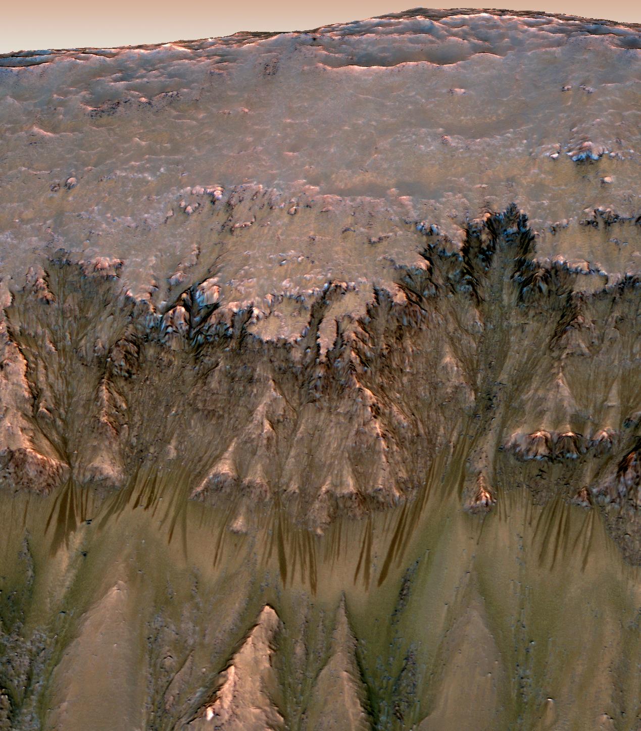
2011-08-04
Mars
Mars Reconnaissance Orbiter (MRO)
HiRISE
2453x2033x3
PIA14476:
Warm-Season Flows on Slope in Horowitz Crater (Nine-Image Sequence)
Full Resolution:
TIFF
(4.994 MB)
JPEG
(594.9 kB)
2011-08-04
Mars
Mars Reconnaissance Orbiter (MRO)
HiRISE
2147x1319x3
PIA14477:
Warm-Season Flows on Steep Slope in Slope in Terra Cimmeria (Eight-Image Sequence)
Full Resolution:
TIFF
(2.837 MB)
JPEG
(404.1 kB)
2011-08-04
Mars
Mars Reconnaissance Orbiter (MRO)
HiRISE
2515x1530x3
PIA14478:
Warm-Season Flows in Well-Preserved Crater in Terra Sirenum (Six-Image Sequence)
Full Resolution:
TIFF
(3.854 MB)
JPEG
(597.1 kB)
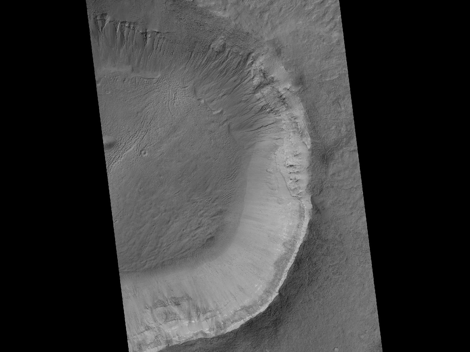
2011-08-04
Mars
Mars Reconnaissance Orbiter (MRO)
HiRISE
1269x1448x3
PIA14479:
Oblique View of Warm Season Flows in Newton Crater
Full Resolution:
TIFF
(5.519 MB)
JPEG
(285.1 kB)
2011-08-04
Mars
Mars Reconnaissance Orbiter (MRO)
HiRISE
1600x1200x1
PIA14501:
Gullies and Newly Identified Flow Features in Same Mars Crater
Full Resolution:
TIFF
(1.922 MB)
JPEG
(196.2 kB)
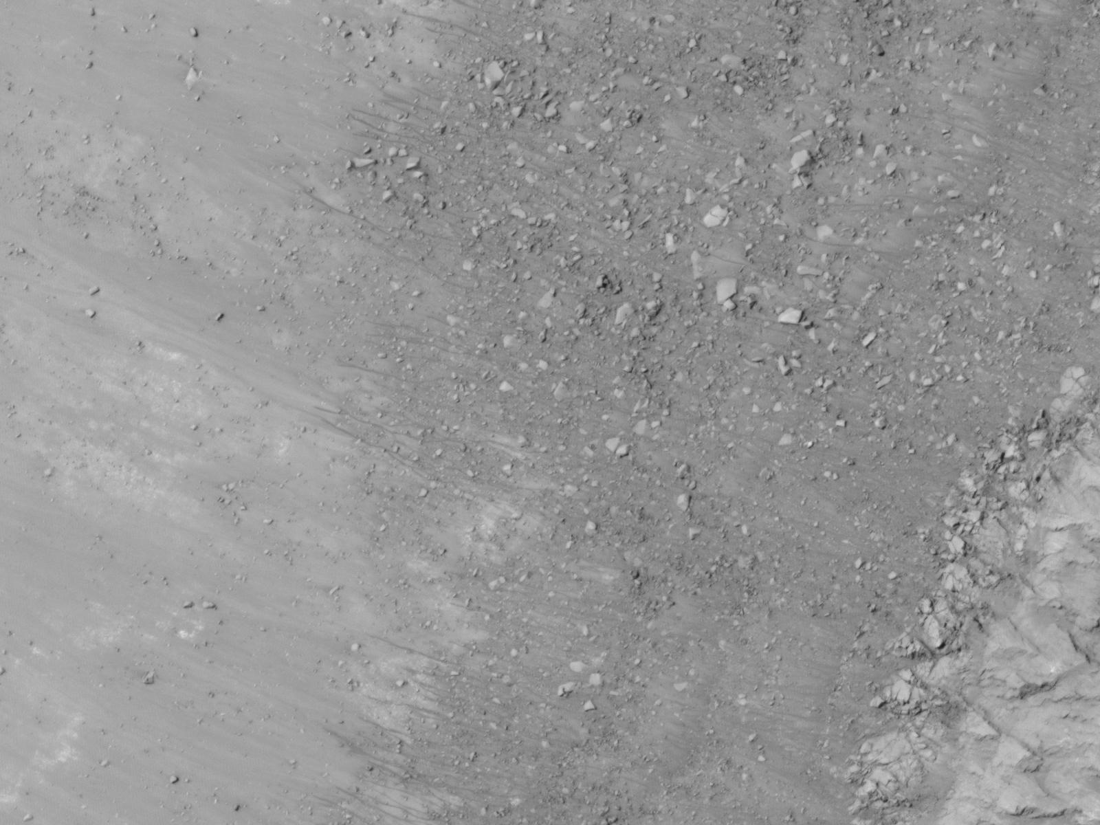
2011-08-04
Mars
Mars Reconnaissance Orbiter (MRO)
HiRISE
1600x1200x1
PIA14502:
Site of Warm Season Flows in Mars Crater
Full Resolution:
TIFF
(1.922 MB)
JPEG
(209.1 kB)
2011-08-04
Mars
Mars Reconnaissance Orbiter (MRO)
HiRISE
1600x1200x1
PIA14503:
Changes in a Gully in a Mars Crater (Two-Image Comparison)
Full Resolution:
TIFF
(1.922 MB)
JPEG
(136.2 kB)
2011-08-05
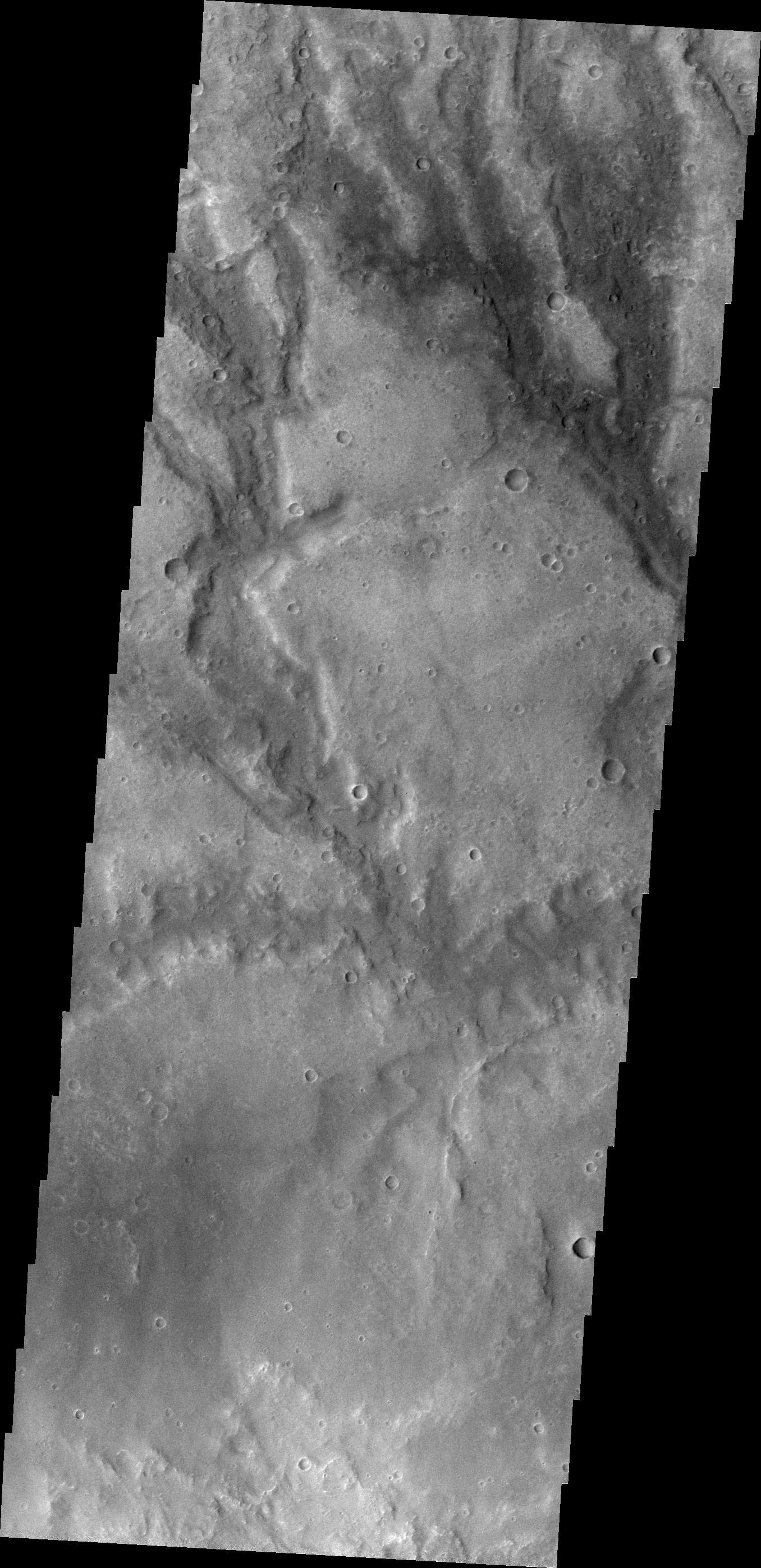
Mars
2001 Mars Odyssey
THEMIS
1356x2937x1
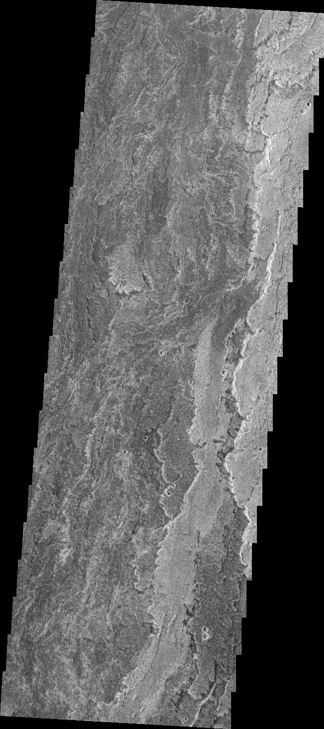
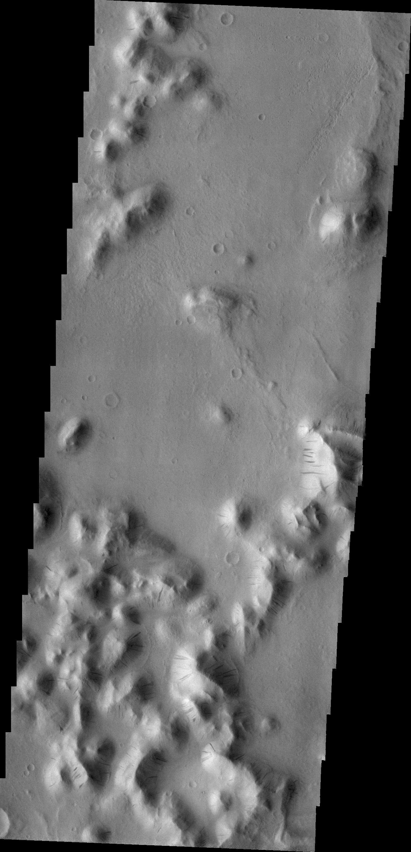
PIA14518:
Coprates Catena
Full Resolution:
TIFF
(3.987 MB)
JPEG
(342.3 kB)
2011-08-05
Mars
Mars Exploration Rover (MER)
CTX
943x1989x3
PIA14504:
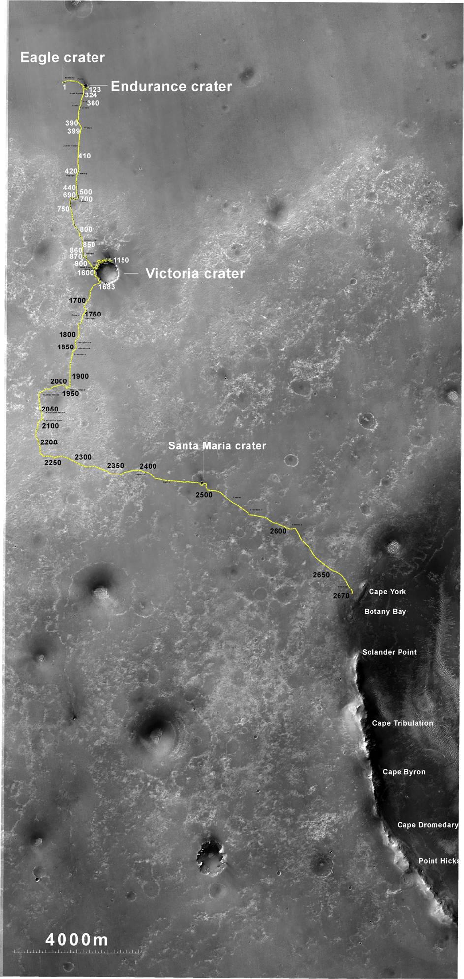
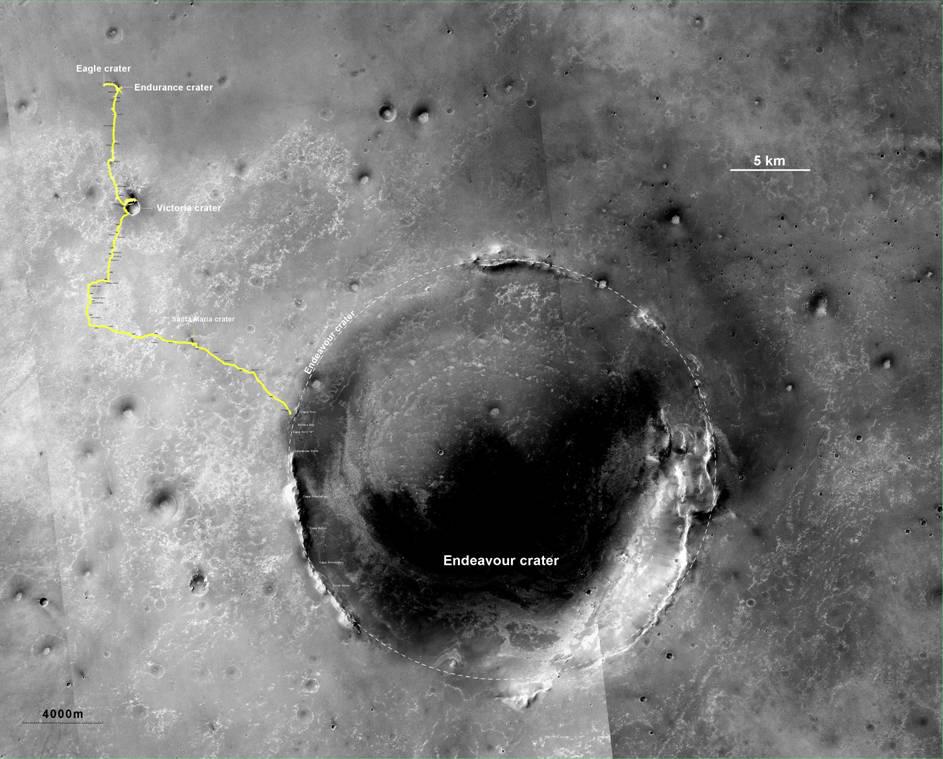
Opportunity's Route to Endeavour Crater
Full Resolution:
TIFF
(5.635 MB)
JPEG
(260 kB)
2011-08-05
Mars
Mars Exploration Rover (MER)
CTX
943x759x3
PIA14505:
Opportunity's Route to Endeavour Crater (Wide View)
Full Resolution:
TIFF
(2.15 MB)
JPEG
(101 kB)
2011-08-08
Mars
2001 Mars Odyssey
THEMIS
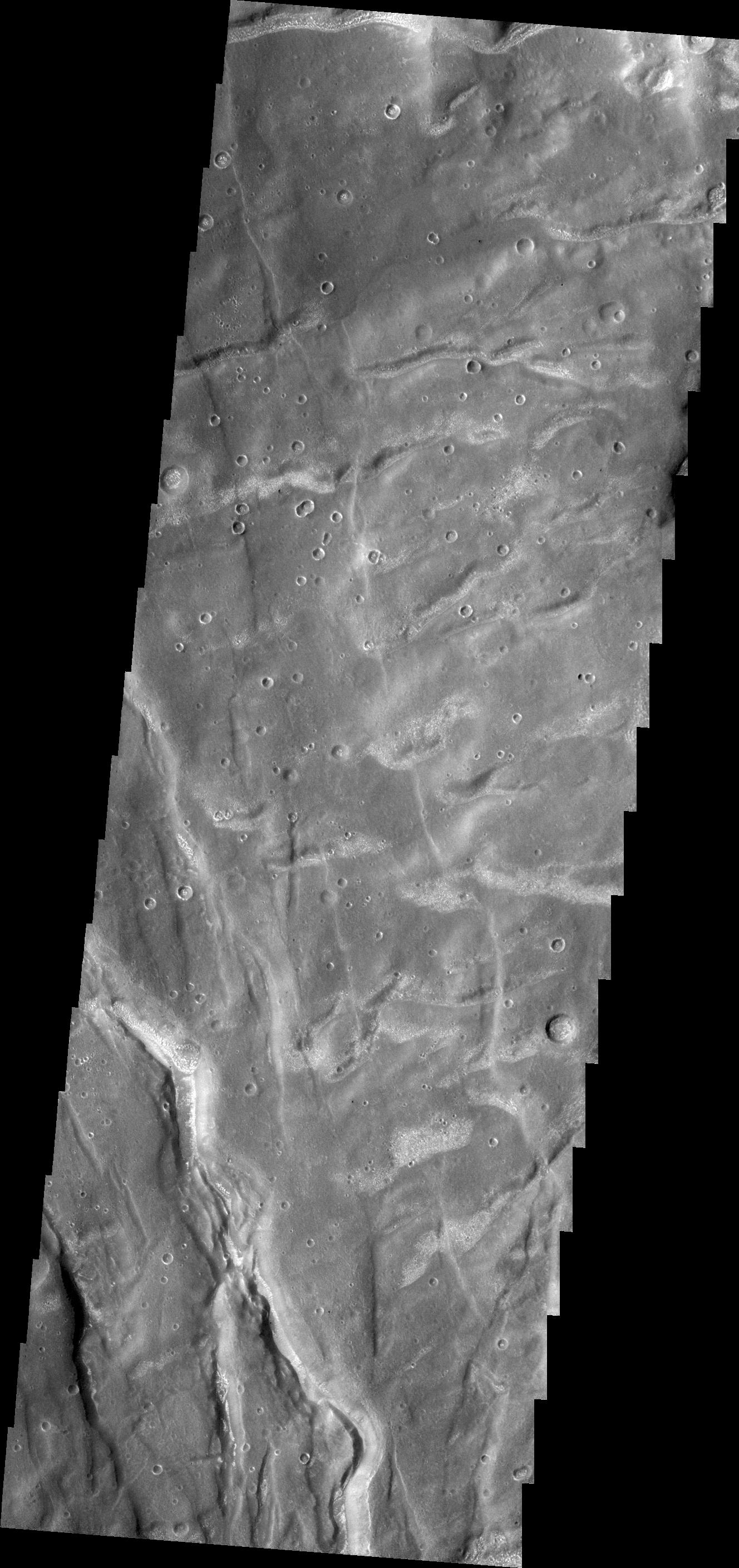
1412x2842x1
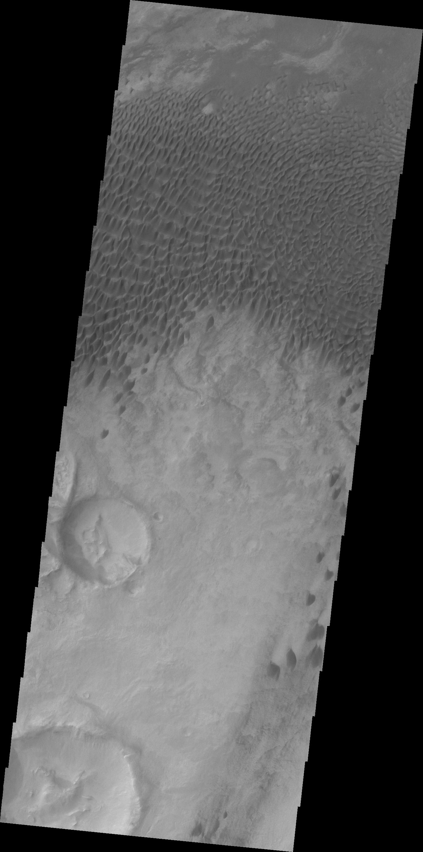
PIA14519:
Dunes in Aonia Planum
Full Resolution:
TIFF
(4.018 MB)
JPEG
(250 kB)
2011-08-08
Mars
Mars Exploration Rover (MER)
Panoramic Camera
2908x1246x1
PIA14506:
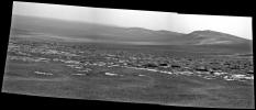
Opportunity's View Approaching Rim of Endeavour
Full Resolution:
TIFF
(3.629 MB)
JPEG
(510.5 kB)
2011-08-09
Mars
2001 Mars Odyssey
THEMIS
1363x2945x1
PIA14520:
Samara Valles
Full Resolution:
TIFF
(4.018 MB)
JPEG
(408.6 kB)
2011-08-10
Mars
2001 Mars Odyssey
THEMIS
1273x2762x1
PIA14521:
Ascraeus Mons
Full Resolution:
TIFF
(3.52 MB)
JPEG
(510.1 kB)
2011-08-10
Mars
Mars Exploration Rover (MER)
Panoramic Camera
1848x1009x3
PIA14507:
West Rim of Endeavour Crater on Mars (False Color)
Full Resolution:
TIFF
(5.602 MB)
JPEG
(242.4 kB)
2011-08-10
Mars
Mars Exploration Rover (MER)
Panoramic Camera
1848x1009x3
PIA14508:
West Rim of Endeavour Crater on Mars
Full Resolution:
TIFF
(5.602 MB)
JPEG
(167.1 kB)
2011-08-10
Mars
Mars Exploration Rover (MER)
Panoramic Camera
4383x1200x1
PIA14509:
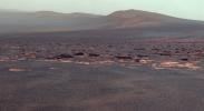
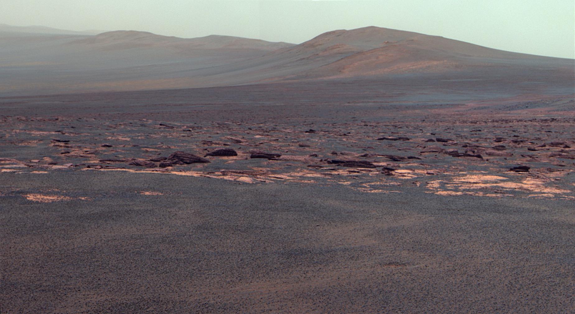
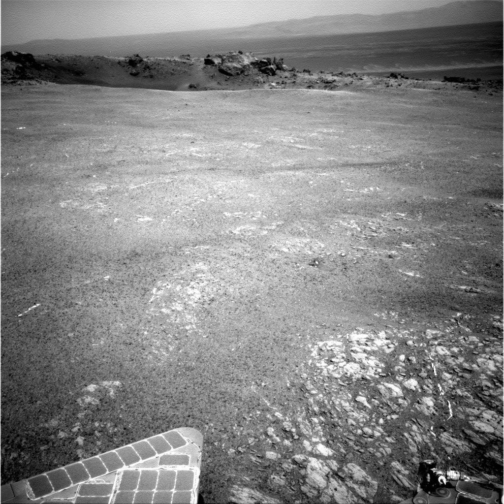
Arrival at 'Spirit Point' by Mars Rover Opportunity
Full Resolution:
TIFF
(5.269 MB)
JPEG
(448.8 kB)
2011-08-10
Mars
Mars Exploration Rover (MER)
Panoramic Camera
1024x1024x1
PIA14510:
Small 'Odyssey' Crater on Rim of Huge 'Endeavour' Crater
Full Resolution:
TIFF
(1.05 MB)
JPEG
(286.7 kB)
2011-08-11
Mars
2001 Mars Odyssey
THEMIS
1356x2793x1
PIA14522:
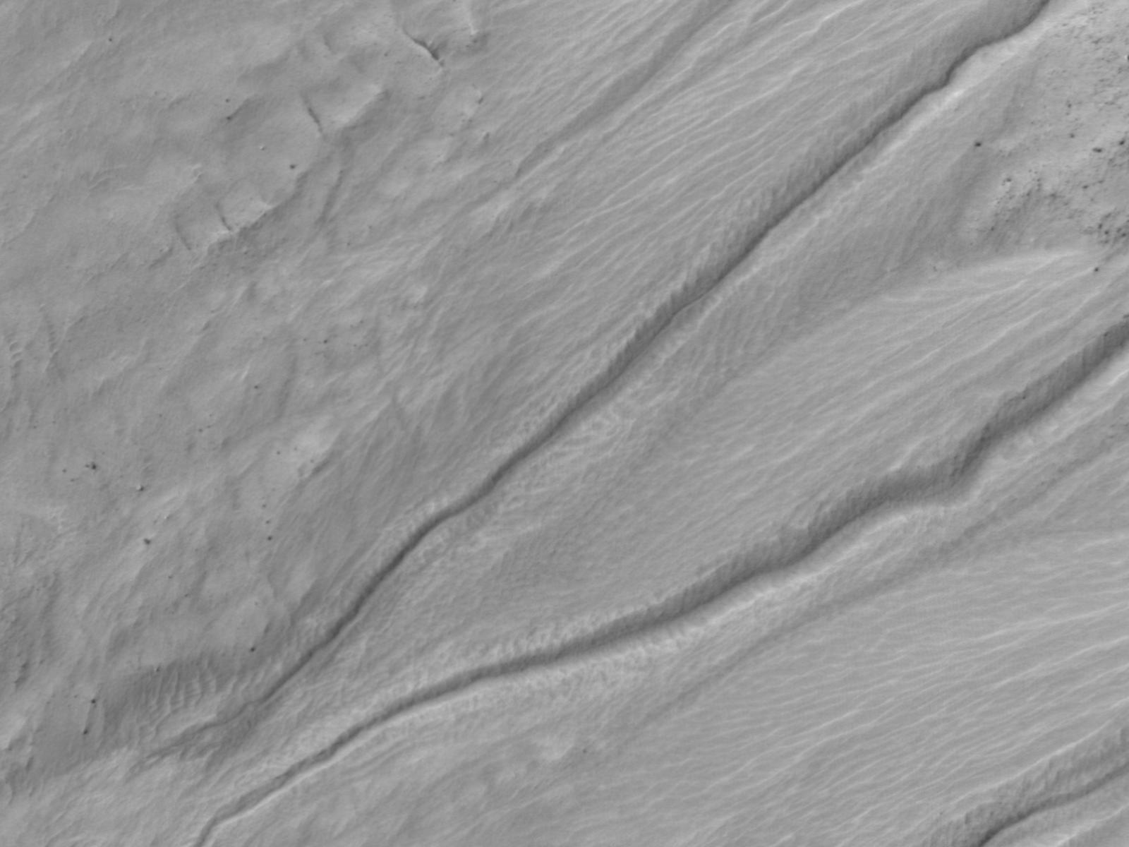
Channels
Full Resolution:
TIFF
(3.791 MB)
JPEG
(451.3 kB)
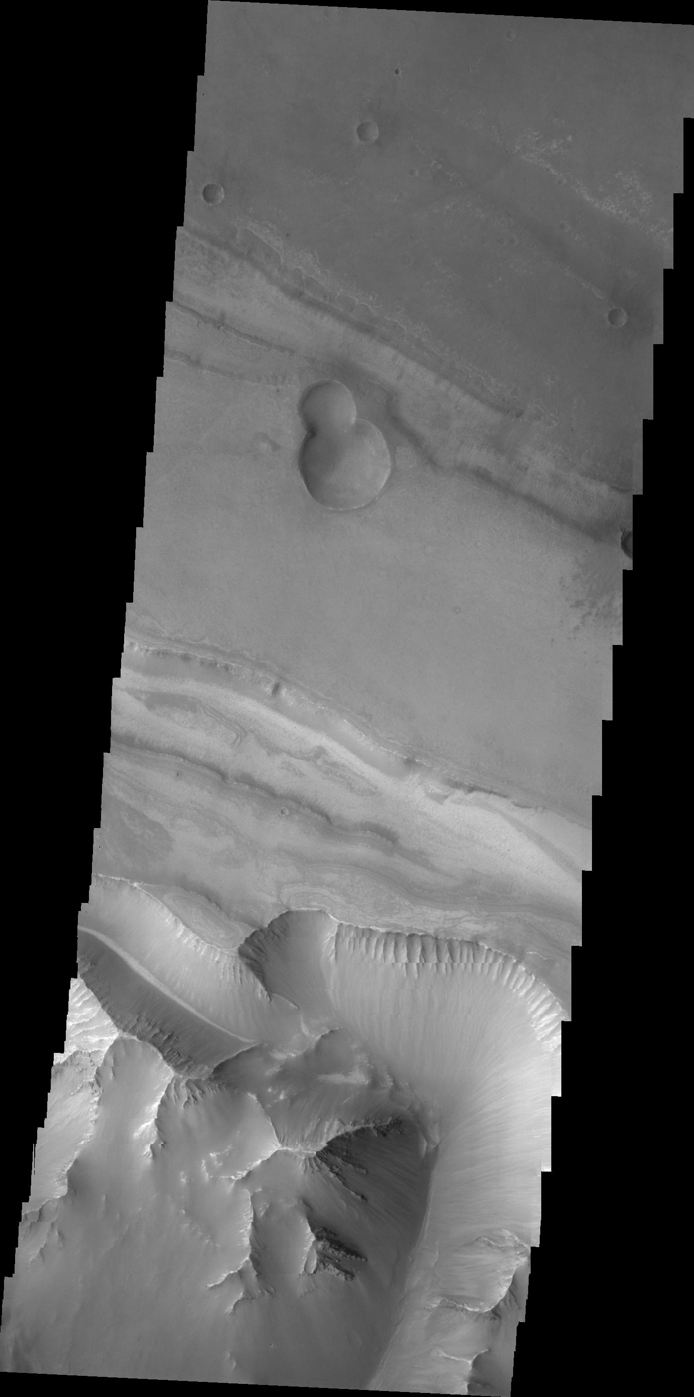
2011-08-12
Mars
2001 Mars Odyssey
THEMIS
1381x2777x1
PIA14523:
Valles Marineris
Full Resolution:
TIFF
(3.84 MB)
JPEG
(209 kB)
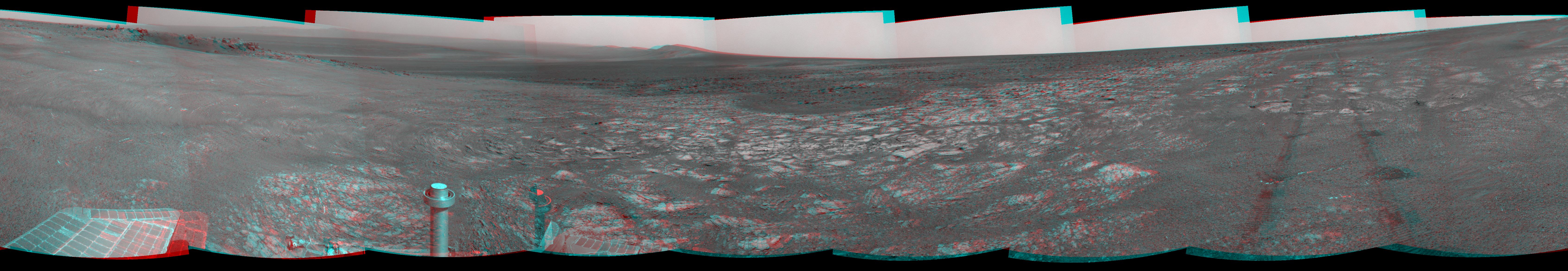
2011-08-15
Mars
Mars Exploration Rover (MER)
Navigation Camera
6767x1169x3
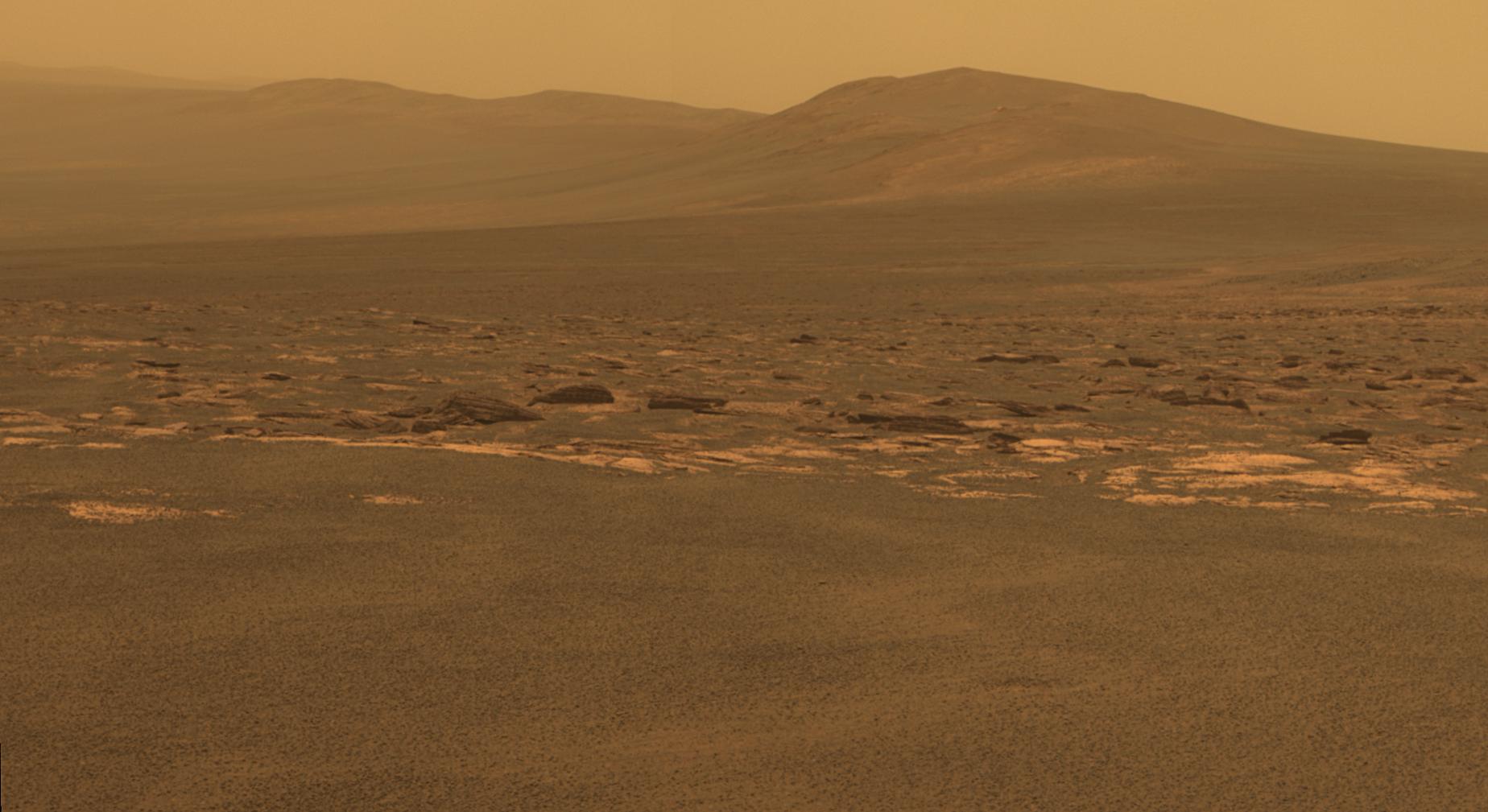
PIA14531:
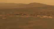
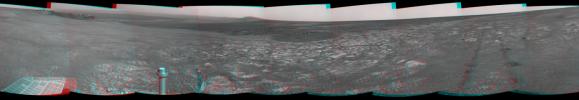
'Spirit Point' Vista from Opportunity, in Stereo
Full Resolution:
TIFF
(23.73 MB)
JPEG
(1.008 MB)
2011-08-15
Mars
2001 Mars Odyssey
THEMIS
1333x2817x1
PIA14524:
Coracis Fossae
Full Resolution:
TIFF
(3.759 MB)
JPEG
(458.8 kB)
2011-08-16
Mars
2001 Mars Odyssey
THEMIS
1315x2923x1
PIA14525:
Windstreaks
Full Resolution:
TIFF
(3.848 MB)
JPEG
(498.5 kB)
2011-08-17
Mars
2001 Mars Odyssey
THEMIS
1346x2787x1
PIA14526:
Windstreak
Full Resolution:
TIFF
(3.755 MB)
JPEG
(555.9 kB)
2011-08-18
Mars
2001 Mars Odyssey
THEMIS
666x1471x1
PIA14527:
Daedalia Planum
Full Resolution:
TIFF
(980.9 kB)
JPEG
(182.1 kB)
2011-08-19
Mars
Mars Exploration Rover (MER)
Panoramic Camera
650x410x1
PIA14532:
'Ridout' Rock on Rim of Odyssey Crater
Full Resolution:
TIFF
(267 kB)
JPEG
(43.24 kB)
2011-08-19
Mars
Mars Exploration Rover (MER)
Panoramic Camera
1024x1024x1
PIA14533:
On Different Ground: Soil on Endeavour Rim
Full Resolution:
TIFF
(1.05 MB)
JPEG
(299.6 kB)
2011-08-19
Mars
Mars Exploration Rover (MER)
Panoramic Camera
1024x1024x1
PIA14534:
View Across Endeavour Crater
Full Resolution:
TIFF
(1.05 MB)
JPEG
(167.3 kB)
2011-08-19
Mars
Mars Exploration Rover (MER)
Panoramic Camera
1024x1024x1
PIA14535:
'Tisdale 2' Rock, Next Stop for Opportunity
Full Resolution:
TIFF
(1.05 MB)
JPEG
(300.5 kB)
2011-08-22
Mars
2001 Mars Odyssey
THEMIS
678x1470x1
PIA14559:
Margaritifer Terra
Full Resolution:
TIFF
(997.9 kB)
JPEG
(131.3 kB)
2011-08-23
Mars
2001 Mars Odyssey
THEMIS
976x2776x1
PIA14560:
South Polar Surface
Full Resolution:
TIFF
(2.712 MB)
JPEG
(286 kB)
2011-08-24
Mars
2001 Mars Odyssey
THEMIS
1372x2959x1
PIA14561:
Landslides in Terra Sirenum
Full Resolution:
TIFF
(4.065 MB)
JPEG
(324.9 kB)
2011-08-25
Mars
2001 Mars Odyssey
THEMIS
1354x2778x1
PIA14562:
Channel
Full Resolution:
TIFF
(3.765 MB)
JPEG
(584.3 kB)
2011-08-26
Mars
2001 Mars Odyssey
THEMIS
1086x2939x1
PIA14563:
Dust Devil Tracks
Full Resolution:
TIFF
(3.195 MB)
JPEG
(412.4 kB)
2011-08-29
Mars
2001 Mars Odyssey
THEMIS
1382x2935x1
PIA14564:
Valles Marineris Canyon
Full Resolution:
TIFF
(4.061 MB)
JPEG
(247.3 kB)
2011-08-30
Mars
2001 Mars Odyssey
THEMIS
1385x2842x1
PIA14565:
Small Dunes
Full Resolution:
TIFF
(3.941 MB)
JPEG
(279.4 kB)
2011-09-01
Mars
Mars Exploration Rover (MER)
Mars Reconnaissance Orbiter (MRO)
CTX
5664x7979x3
PIA14536:
Opportunity Traverses Through 2,700 Martian Days
Full Resolution:
TIFF
(45.26 MB)
JPEG
(6.766 MB)
2011-09-01
Mars
Mars Exploration Rover (MER)
Mars Reconnaissance Orbiter (MRO)
HiRISE
8192x5786x3
PIA14537:
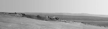
Opportunity's First Neighborhood on Rim of Endeavour
Full Resolution:
TIFF
(142.2 MB)
JPEG
(5.631 MB)
2011-09-01
Mars
Mars Exploration Rover (MER)
Navigation Camera
8192x4843x1
PIA14538:
Opportunity's View Across 'Botany Bay' and Endeavour on Sol 2678
Full Resolution:
TIFF
(39.71 MB)
JPEG
(3.319 MB)
2011-09-01
Mars
Mars Exploration Rover (MER)
Navigation Camera
8192x4809x1
PIA14539:
Bright Veins in 'Botany Bay' on rim of Endeavour Crater on Mars
Full Resolution:
TIFF
(39.43 MB)
JPEG
(3.268 MB)
2011-09-01
Mars
Mars Exploration Rover (MER)
Panoramic Camera
1024x1024x3
PIA14540:
Rock 'Tisdale 2' on Endeavour Crater Rim (False Color)
Full Resolution:
TIFF
(3.15 MB)
JPEG
(324.2 kB)
2011-09-01
Mars
Mars Exploration Rover (MER)
Microscopic Imager
Panoramic Camera
7680x7671x3
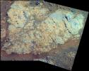
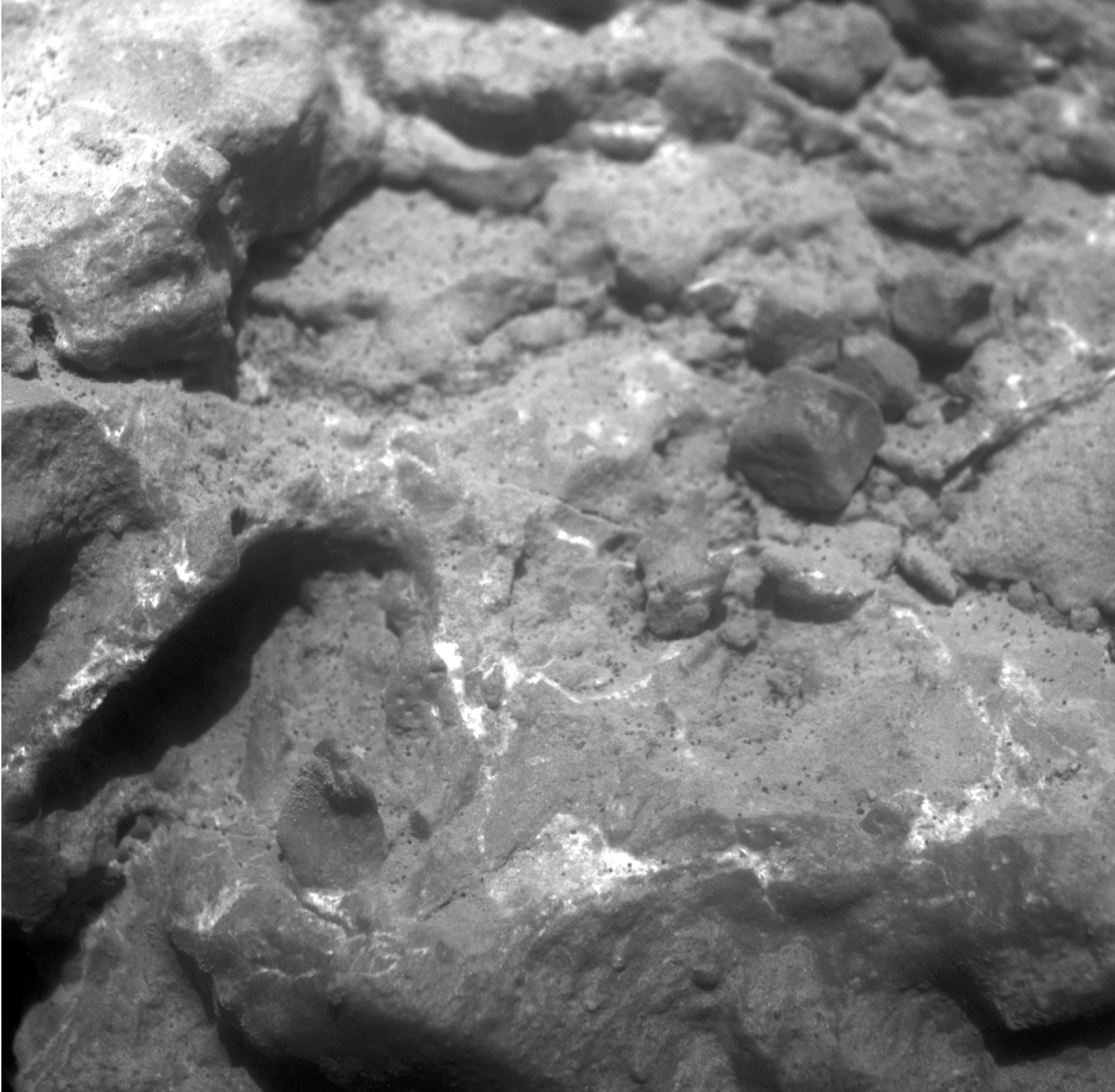
PIA14745:
Locations of Microscopic Imager Observations on 'Tisdale 2'
Full Resolution:
TIFF
(176.7 MB)
JPEG
(4.45 MB)
2011-09-01
Mars
Mars Exploration Rover (MER)
Microscopic Imager
6621x6488x1
PIA14746:
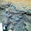
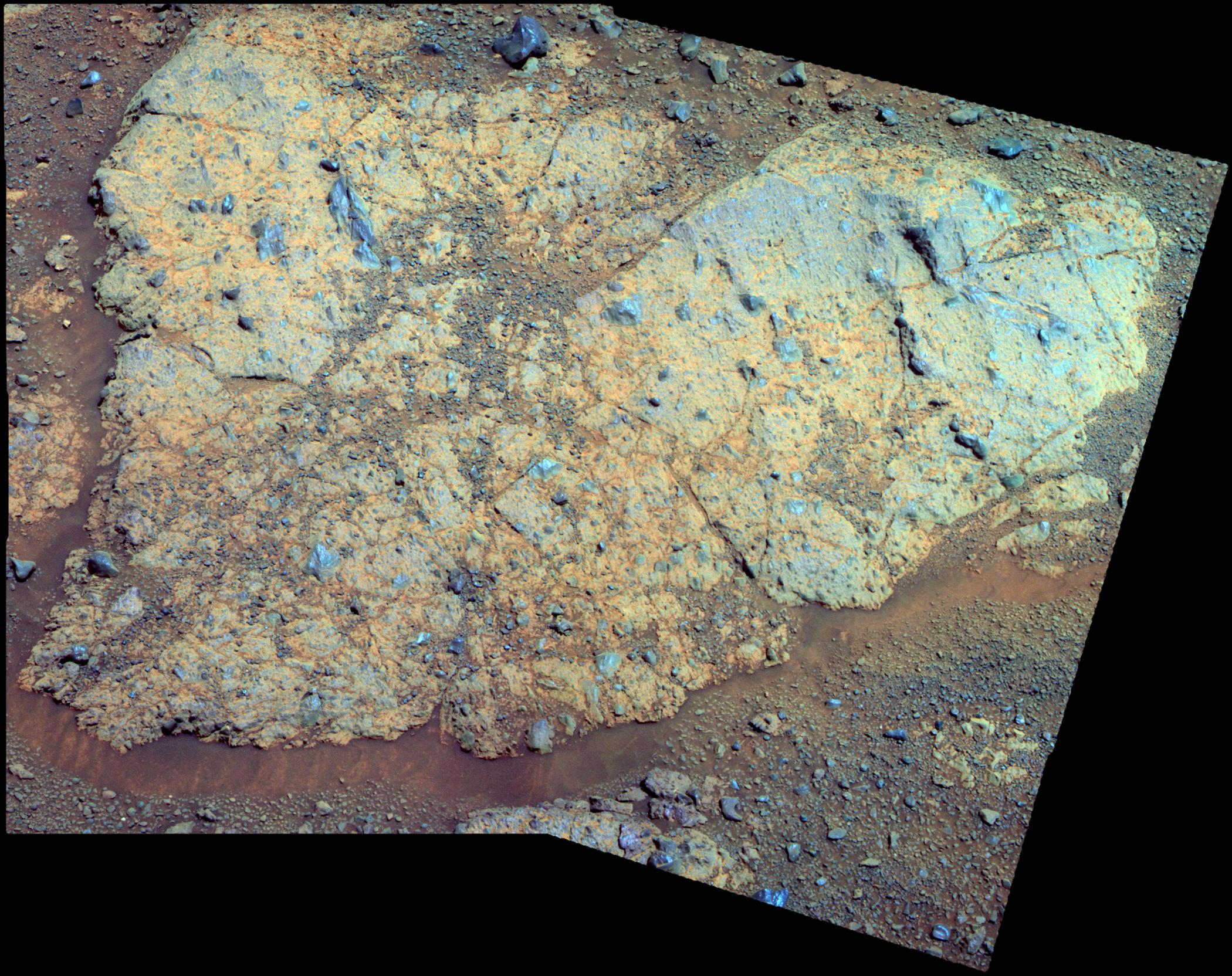
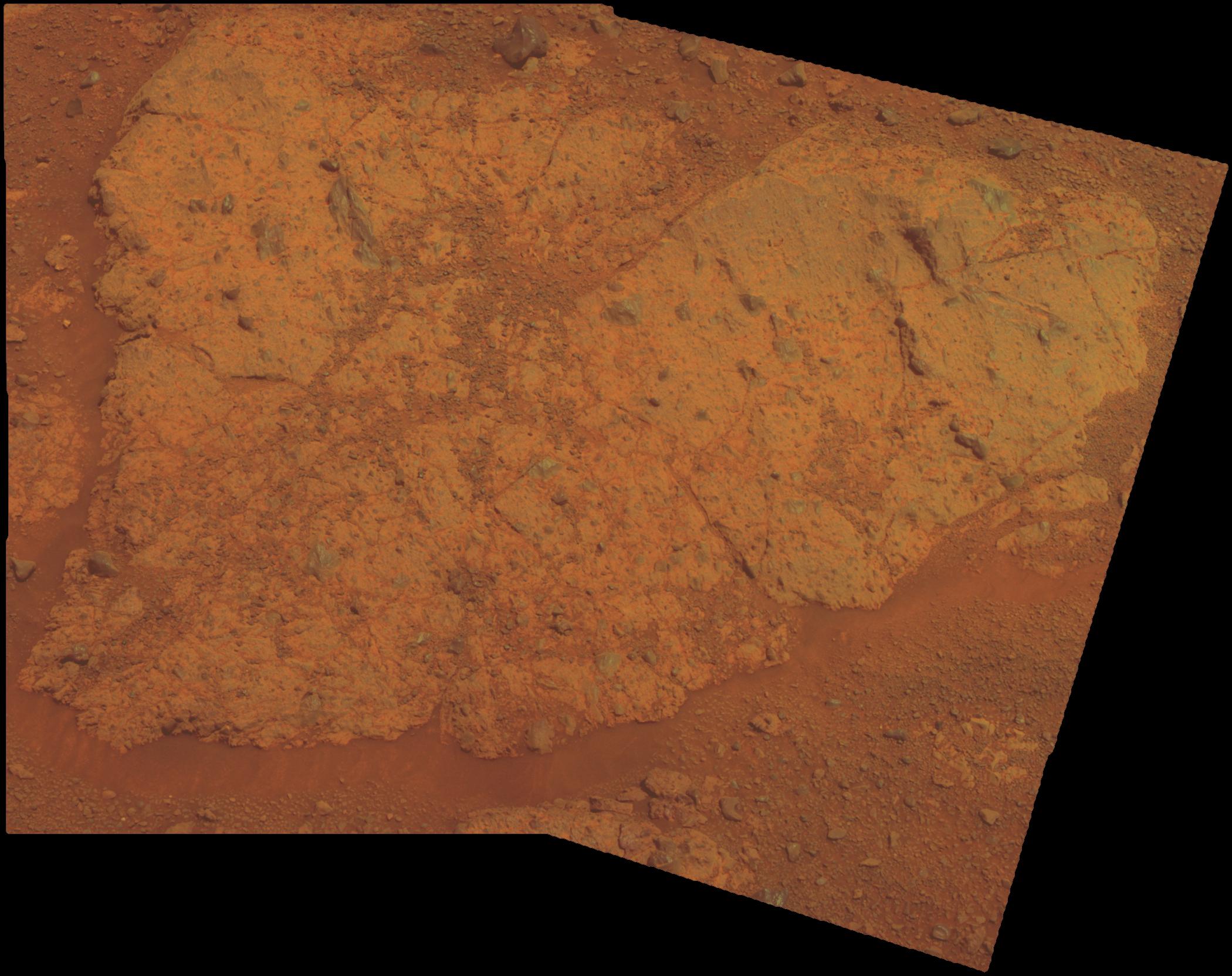
Magnified View of Texture on Part of "Tisdale 2" Rock
Full Resolution:
TIFF
(43.01 MB)
JPEG
(2.786 MB)
2011-09-01
Mars
Mars Exploration Rover (MER)
Alpha Particle X-ray Spectrometer
934x673x3
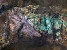
PIA14747:
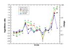
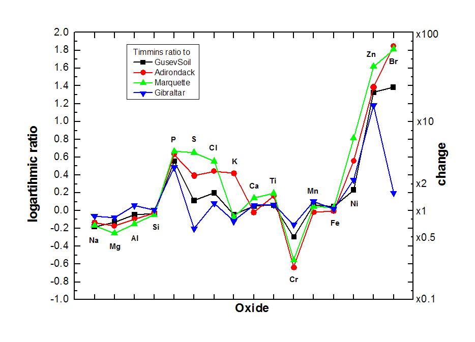
Elevated Zinc and Bromine in Rock on Endeavour Rim
Full Resolution:
TIFF
(631 kB)
JPEG
(64.27 kB)
2011-09-01
Mars
Mars Exploration Rover (MER)
Navigation Camera
1024x1024x1
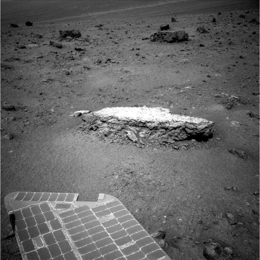
PIA14748:
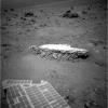
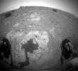
Approaching 'Tisdale 2' Rock on Rim of Endeavour Crater, Sol 2690
Full Resolution:
TIFF
(1.05 MB)
JPEG
(192.7 kB)
2011-09-01
Mars
Mars Exploration Rover (MER)
Hazcam
1024x1024x1
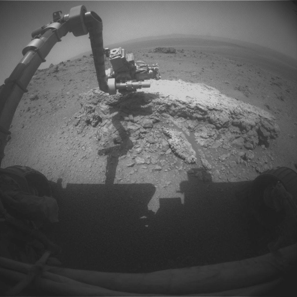
PIA14749:
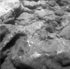
Opportunity at Work Examining 'Tisdale 2,' Sol 2695
Full Resolution:
TIFF
(1.05 MB)
JPEG
(100.3 kB)
2011-09-05
Mars
2001 Mars Odyssey
THEMIS
652x1467x1
PIA14566:
Arsia Mons Flows
Full Resolution:
TIFF
(957.7 kB)
JPEG
(167.7 kB)
2011-09-06
Mars
2001 Mars Odyssey
THEMIS
1344x2782x1
PIA14567:
Small Dunes
Full Resolution:
TIFF
(3.743 MB)
JPEG
(450.3 kB)
2011-09-07
Mars
2001 Mars Odyssey
THEMIS
1328x2815x1
PIA14568:
Claritas Fossae
Full Resolution:
TIFF
(3.742 MB)
JPEG
(417.5 kB)
2011-09-08
Mars
2001 Mars Odyssey
THEMIS
678x1476x1
PIA14569:
Terby Crater
Full Resolution:
TIFF
(1.002 MB)
JPEG
(80.28 kB)
2011-09-09
Mars
2001 Mars Odyssey
THEMIS
1451x2862x1
PIA14768:
Darwin Crater Dunes
Full Resolution:
TIFF
(4.158 MB)
JPEG
(260.6 kB)
2011-09-12
Mars
Mars Exploration Rover (MER)
Navigation Camera
Panoramic Camera
3072x3072x3
PIA14750:
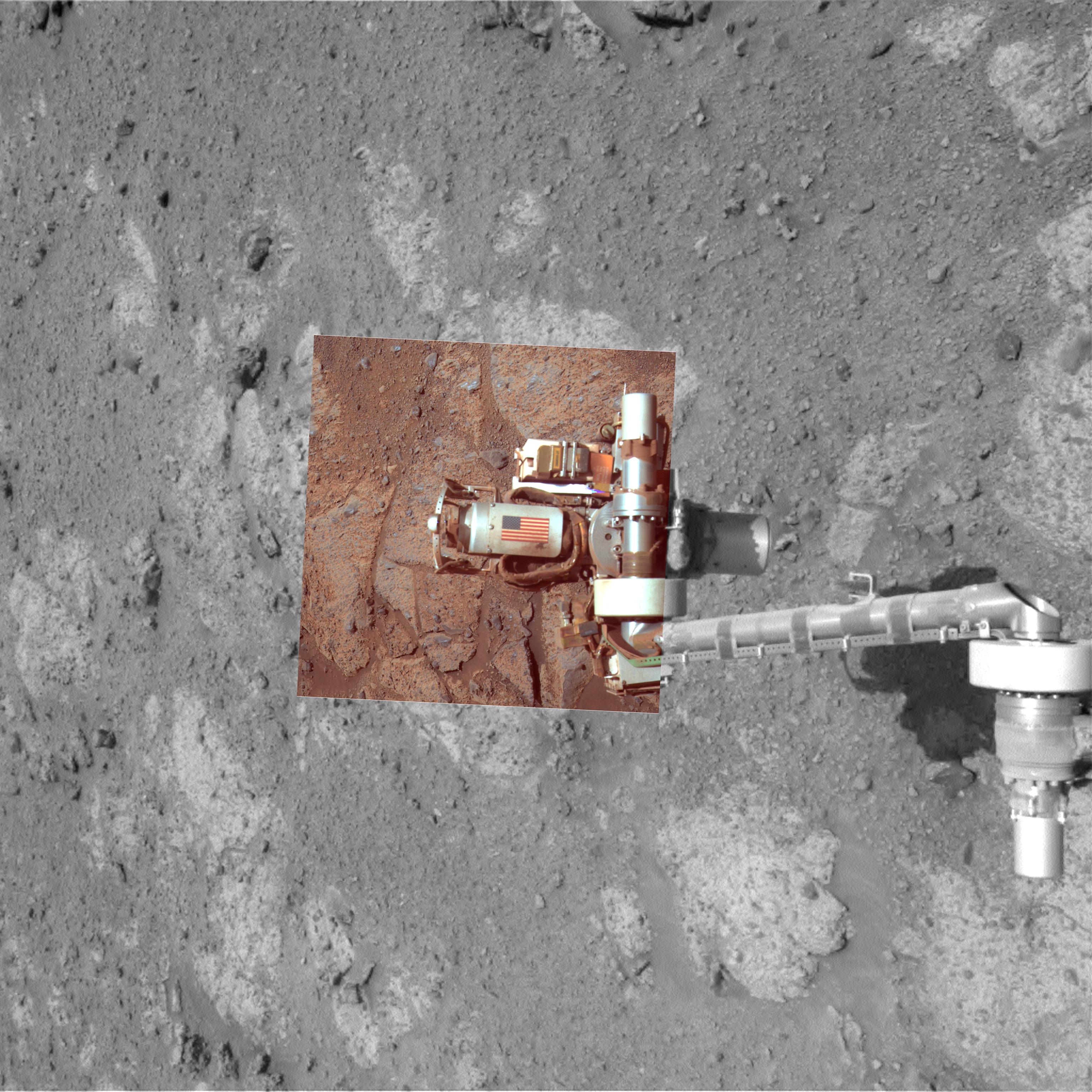
Memorial Image Taken on Mars on Sept. 11, 2011
Full Resolution:
TIFF
(28.31 MB)
JPEG
(1.098 MB)
2011-09-14
Mars
2001 Mars Odyssey
THEMIS
1383x2818x1
PIA14773:
Gullies on Argyre Planitia
Full Resolution:
TIFF
(3.902 MB)
JPEG
(327.3 kB)
2011-09-14
Mars
2001 Mars Odyssey
THEMIS
1378x2940x1
PIA14774:
Ma'adim Valles
Full Resolution:
TIFF
(4.056 MB)
JPEG
(381.9 kB)
2011-09-14
Mars
Mars Exploration Rover (MER)
Hazcam
1024x933x1
PIA14751:
Shadow Across 'Chester Lake' on Endeavour Rim, Sol 2710
Full Resolution:
TIFF
(956.6 kB)
JPEG
(131.7 kB)
2011-09-14
Mars
Mars Exploration Rover (MER)
Panoramic Camera
2100x1664x3
PIA14752:
'Chester Lake' Bedrock on Rim of Endeavour Crater (False Color)
Full Resolution:
TIFF
(10.5 MB)
JPEG
(657.4 kB)
2011-09-14
Mars
Mars Exploration Rover (MER)
Panoramic Camera
2100x1664x3
PIA14753:
'Chester Lake' Bedrock on Rim of Endeavour Crater
Full Resolution:
TIFF
(10.5 MB)
JPEG
(361.7 kB)
2011-09-15
Mars
2001 Mars Odyssey
THEMIS
1350x2788x1
PIA14775:
Dunes in Briault Crater
Full Resolution:
TIFF
(3.768 MB)
JPEG
(380.1 kB)
2011-09-19
Mars
2001 Mars Odyssey
THEMIS
1356x2816x1
PIA14781:
Channel near Pulawy Crater
Full Resolution:
TIFF
(3.822 MB)
JPEG
(415.6 kB)
2011-09-20
Mars
2001 Mars Odyssey
THEMIS
1435x2957x1
PIA14782:
Rabe Crater Dunes
Full Resolution:
TIFF
(4.248 MB)
JPEG
(178.2 kB)
2011-09-21
Mars
2001 Mars Odyssey
THEMIS
1349x2771x1
PIA14783:
Windstreaks in Syrtis Major Planum
Full Resolution:
TIFF
(3.742 MB)
JPEG
(454.5 kB)
2011-09-22
Mars
2001 Mars Odyssey
THEMIS
661x1468x1
PIA14784:
Daedalia Planum
Full Resolution:
TIFF
(971.6 kB)
JPEG
(189.9 kB)
2011-09-23
Mars
2001 Mars Odyssey
THEMIS
672x1464x1
PIA14785:
Juventae Chasma
Full Resolution:
TIFF
(985 kB)
JPEG
(66.49 kB)
2011-10-05
Mars
Mars Reconnaissance Orbiter (MRO)
HiRISE
2560x1920x3
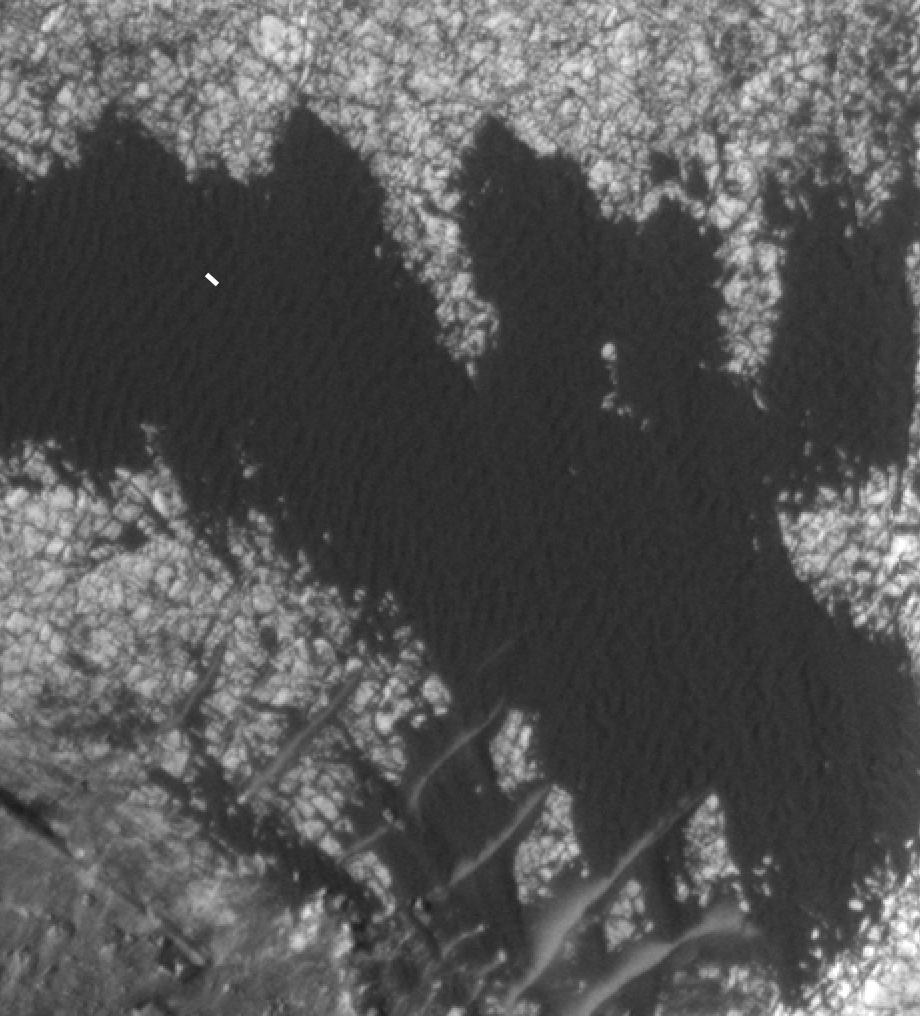
PIA14890:
Colorful Central Peak in an Unnamed Crater
Full Resolution:
TIFF
(14.76 MB)
JPEG
(581.1 kB)
2011-10-10
Mars
Mars Exploration Rover (MER)
Navigation Camera
1024x1024x1
PIA14759:
Approaching Endeavour Crater, Sol 2,680
Full Resolution:
TIFF
(1.05 MB)
JPEG
(204.5 kB)
2011-10-11
Mars
2001 Mars Odyssey
THEMIS
1378x2780x1
PIA14899:
Erosion
Full Resolution:
TIFF
(3.836 MB)
JPEG
(683.3 kB)
2011-10-12
Mars
2001 Mars Odyssey
THEMIS
1413x2958x1
PIA14950:
Channel in Tyrrhena Terra
Full Resolution:
TIFF
(4.185 MB)
JPEG
(533.2 kB)
2011-10-13
Mars
2001 Mars Odyssey
THEMIS
735x1562x1
PIA14951:
Lava Layers
Full Resolution:
TIFF
(1.149 MB)
JPEG
(128.8 kB)
2011-10-14
Mars
2001 Mars Odyssey
THEMIS
1340x2792x1
PIA14952:
Mesas of Capri Chasma
Full Resolution:
TIFF
(3.745 MB)
JPEG
(301.2 kB)
2011-10-17
Mars
2001 Mars Odyssey
THEMIS
1117x2888x1
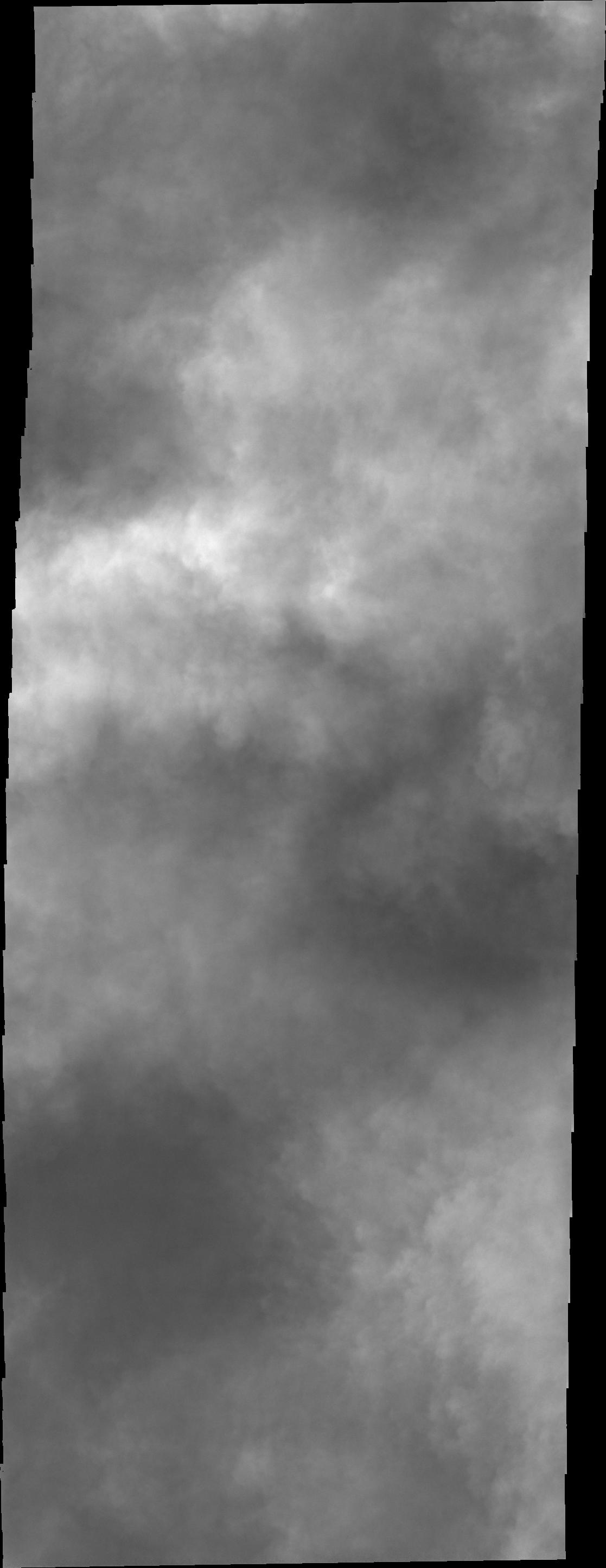
PIA14965:
Clouds over Charlier Crater
Full Resolution:
TIFF
(3.229 MB)
JPEG
(131.2 kB)
2011-10-18
Mars
2001 Mars Odyssey
THEMIS
728x1557x1
PIA14966:
Naktong Vallis
Full Resolution:
TIFF
(1.135 MB)
JPEG
(104.8 kB)
2011-10-19
Mars
2001 Mars Odyssey
THEMIS
1387x2788x1
PIA14967:
Margaritifer Chaos
Full Resolution:
TIFF
(3.872 MB)
JPEG
(369.9 kB)
2011-10-20
Mars
2001 Mars Odyssey
THEMIS
1572x3030x1
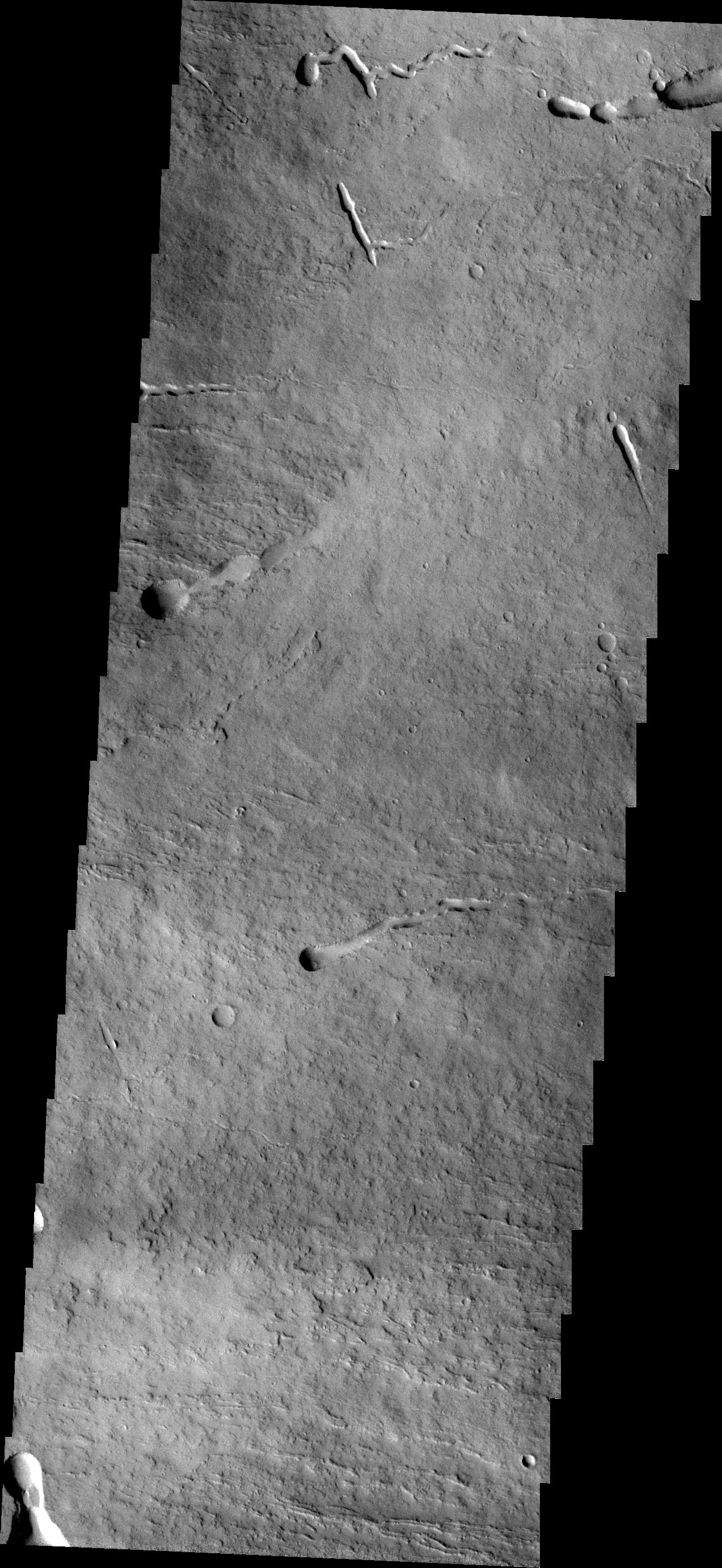
PIA14968:
Darwin Crater Dunes
Full Resolution:
TIFF
(4.768 MB)
JPEG
(341 kB)
2011-10-21
Mars
2001 Mars Odyssey
THEMIS
1349x2916x1
PIA14969:
Tiu Valles
Full Resolution:
TIFF
(3.938 MB)
JPEG
(420.3 kB)
2011-10-24
Mars
2001 Mars Odyssey
THEMIS
1384x2801x1
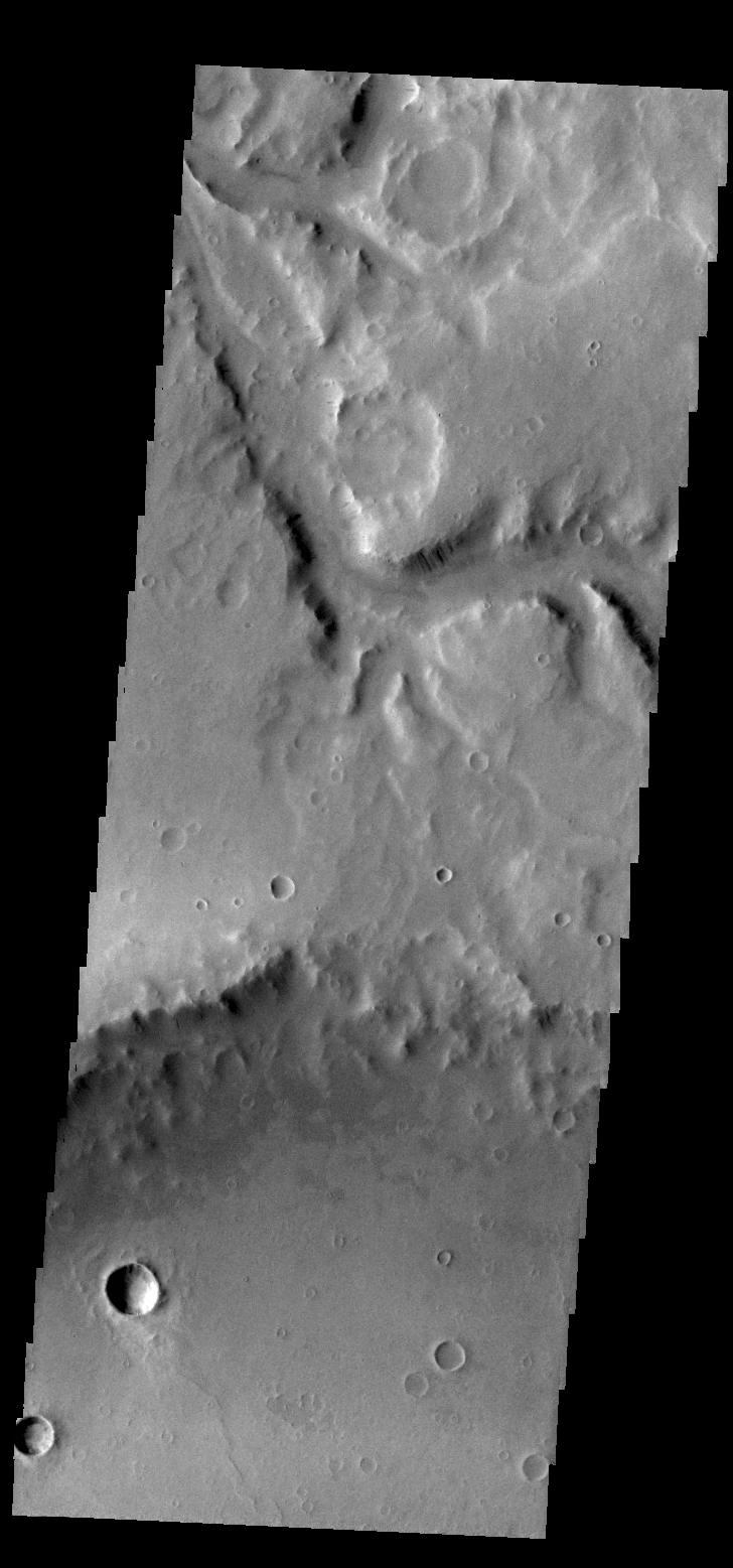
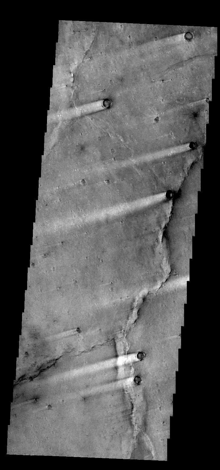
PIA14970:
Tectonism
Full Resolution:
TIFF
(3.881 MB)
JPEG
(390.7 kB)
2011-10-25
Mars
2001 Mars Odyssey
THEMIS
1388x2812x1
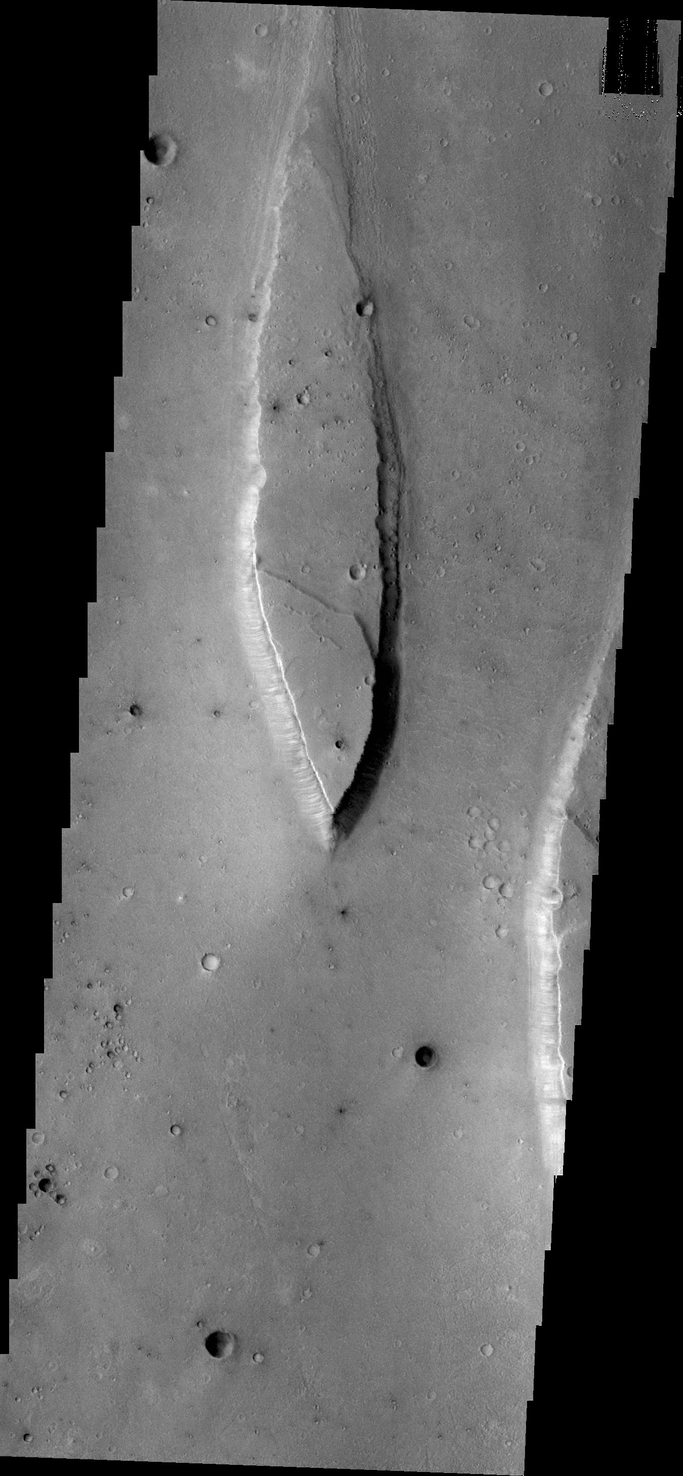
PIA14971:
Crater Rim Channels
Full Resolution:
TIFF
(3.908 MB)
JPEG
(320 kB)
2011-10-26
Mars
2001 Mars Odyssey
THEMIS
1372x2796x1
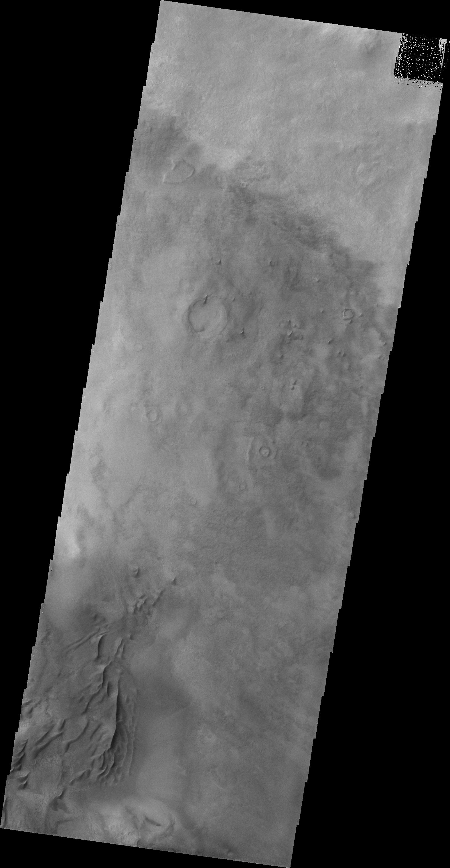
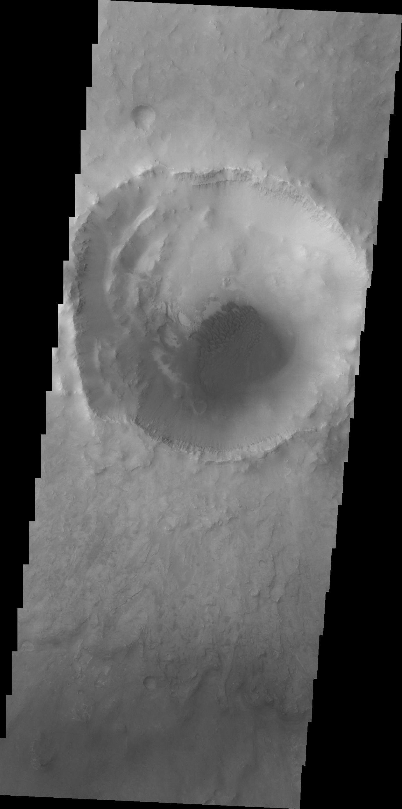
PIA14980:
Out of Round
Full Resolution:
TIFF
(3.841 MB)
JPEG
(311.3 kB)
2011-10-27
Mars
2001 Mars Odyssey
THEMIS
705x1545x1
PIA14981:
Channel
Full Resolution:
TIFF
(1.091 MB)
JPEG
(88.88 kB)
2011-10-28
Mars
2001 Mars Odyssey
THEMIS
1279x2784x1
PIA14982:
V43109001
Full Resolution:
TIFF
(3.565 MB)
JPEG
(159.1 kB)
2011-10-31
Mars
2001 Mars Odyssey
THEMIS
1331x2777x1
PIA14983:
Wind Erosion
Full Resolution:
TIFF
(3.7 MB)
JPEG
(662.7 kB)
2011-11-01
Mars
2001 Mars Odyssey
THEMIS
1379x2832x1
PIA14984:
Lohse Crater Dunes
Full Resolution:
TIFF
(3.91 MB)
JPEG
(264.1 kB)
2011-11-02
Mars
2001 Mars Odyssey
THEMIS
1349x2815x1
PIA14985:
Sirenum Fossae
Full Resolution:
TIFF
(3.801 MB)
JPEG
(313.4 kB)
2011-11-02
Mars
Mars Reconnaissance Orbiter (MRO)
CRISM
2000x2000x3
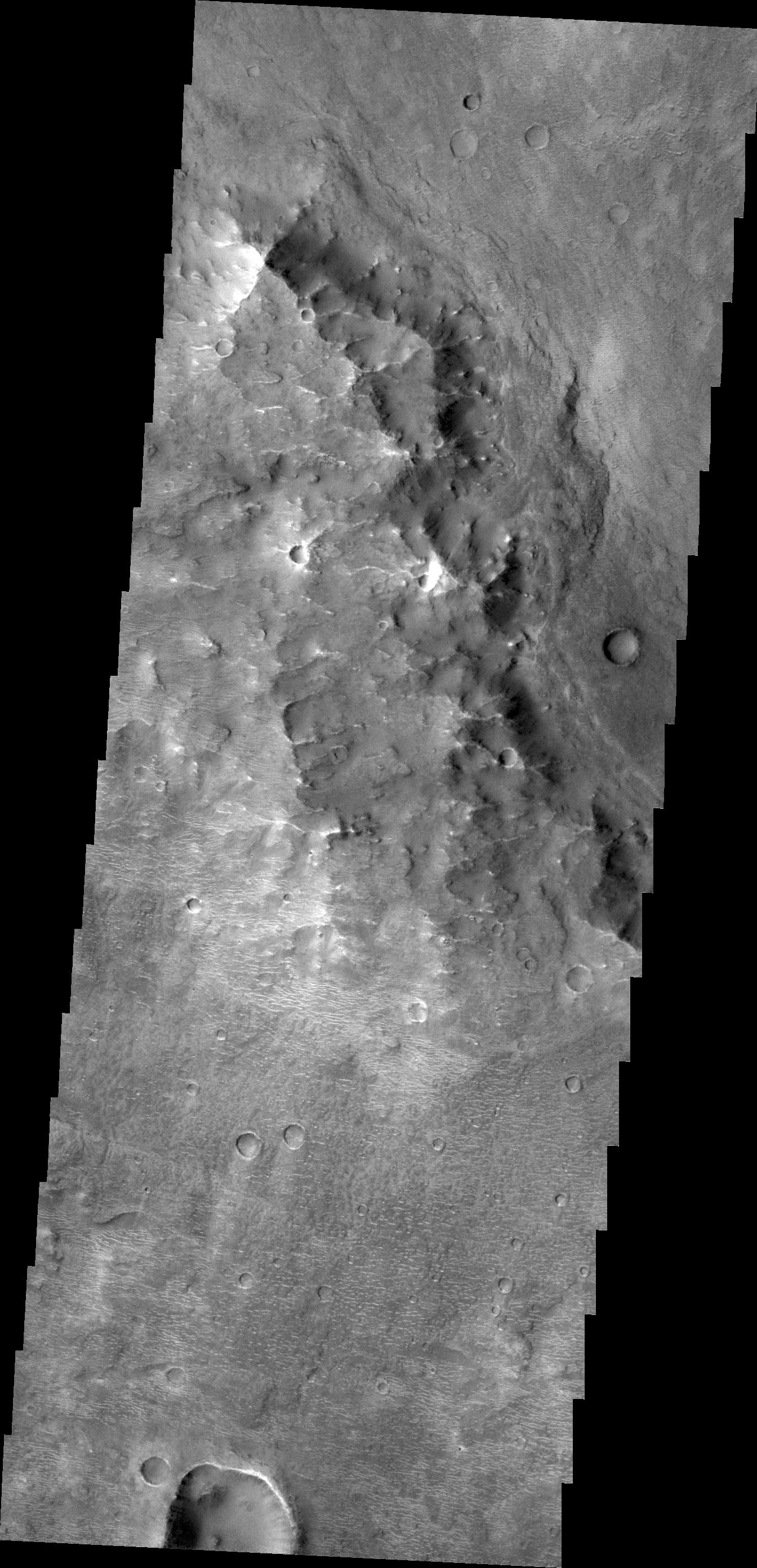
PIA14764:
Clay Minerals in Craters and Escarpments on Mars
Full Resolution:
TIFF
(12.02 MB)
JPEG
(262.6 kB)
2011-11-03
Mars
2001 Mars Odyssey
THEMIS
1470x2869x1
PIA14986:
V43168007
Full Resolution:
TIFF
(4.222 MB)
JPEG
(198.6 kB)
2011-11-04
Mars
2001 Mars Odyssey
THEMIS
704x1545x1
PIA14987:
Aureum Chaos
Full Resolution:
TIFF
(1.089 MB)
JPEG
(90.74 kB)
2011-11-07
Mars
2001 Mars Odyssey
THEMIS
1357x2791x1
PIA14988:
V43188001
Full Resolution:
TIFF
(3.791 MB)
JPEG
(217.8 kB)
2011-11-08
Mars
2001 Mars Odyssey
THEMIS
1426x2861x1
PIA14989:
V43209003
Full Resolution:
TIFF
(4.085 MB)
JPEG
(246.4 kB)
2011-11-09
Mars
2001 Mars Odyssey
THEMIS
1366x2794x1
PIA14990:
Coprates Catena
Full Resolution:
TIFF
(3.821 MB)
JPEG
(392.3 kB)
2011-11-10
Mars
2001 Mars Odyssey
THEMIS
728x1556x1
PIA14991:
Windstreaks
Full Resolution:
TIFF
(1.134 MB)
JPEG
(105.6 kB)
2011-11-11
Mars
2001 Mars Odyssey
THEMIS
1165x3126x1
PIA14992:
Dunes in Terra Sirenum
Full Resolution:
TIFF
(3.646 MB)
JPEG
(223.6 kB)
2011-11-14
Mars
2001 Mars Odyssey
THEMIS
1339x2773x1
PIA14993:
Dark Slope Streaks
Full Resolution:
TIFF
(3.717 MB)
JPEG
(356.9 kB)
2011-11-15
Mars
2001 Mars Odyssey
THEMIS
729x1557x1
PIA14994:
Syrtis Major Windstreaks
Full Resolution:
TIFF
(1.136 MB)
JPEG
(137.1 kB)
2011-11-16
Mars
2001 Mars Odyssey
THEMIS
1382x2782x1
PIA14995:
Bopolu Dunes
Full Resolution:
TIFF
(3.849 MB)
JPEG
(190.6 kB)
2011-11-17
Mars
2001 Mars Odyssey
THEMIS
1496x2868x1
PIA14996:
Brashear Crater Dunes
Full Resolution:
TIFF
(4.295 MB)
JPEG
(237 kB)
2011-11-17
Mars
Mars Reconnaissance Orbiter (MRO)
HiRISE
920x1016x1
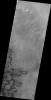
PIA14876:
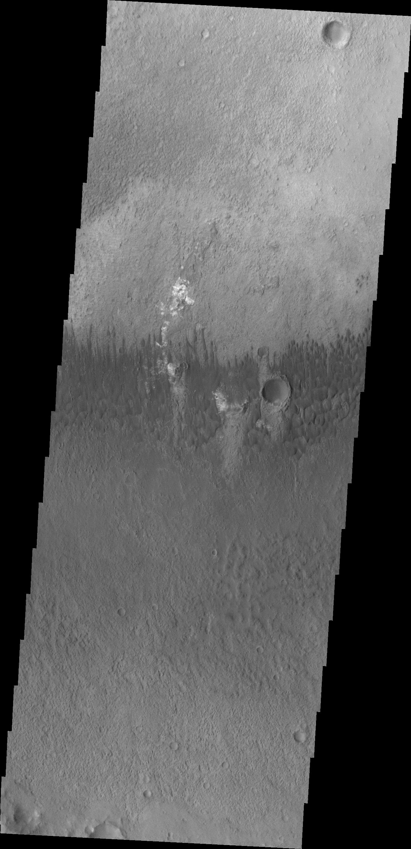
Blowing in the Martian Wind
Full Resolution:
TIFF
(936 kB)
JPEG
(106.7 kB)
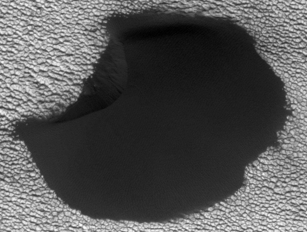
2011-11-17
Mars
Mars Reconnaissance Orbiter (MRO)
HiRISE
781x1019x1
PIA14877:
Shifting Sand in Herschel Crater
Full Resolution:
TIFF
(796.9 kB)
JPEG
(171.2 kB)
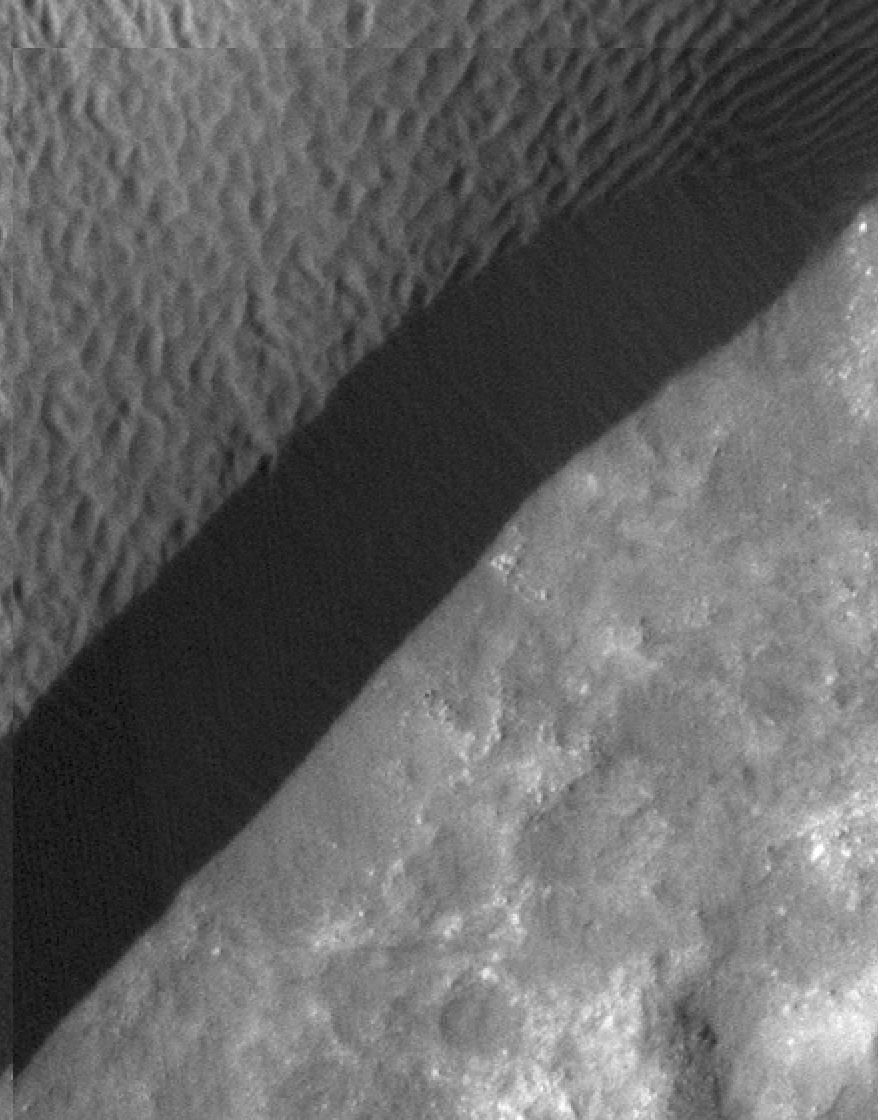
2011-11-17
Mars
Mars Reconnaissance Orbiter (MRO)
HiRISE
738x604x1
PIA14878:
Rippling Dune Front in Herschel Crater on Mars
Full Resolution:
TIFF
(446.4 kB)
JPEG
(72.31 kB)
2011-11-17
Mars
Mars Reconnaissance Orbiter (MRO)
HiRISE
878x1120x1
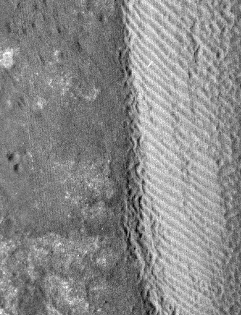
PIA14879:
Rippling Dune Front in Herschel Crater on Mars
Full Resolution:
TIFF
(984.6 kB)
JPEG
(119.5 kB)
2011-11-17
Mars
Mars Reconnaissance Orbiter (MRO)
HiRISE
1225x925x1
PIA14880:
Movement in Martian Dune Field
Full Resolution:
TIFF
(1.135 MB)
JPEG
(144.5 kB)
1-100
101-200
201-300
301-400
401-500
501-600
601-700
701-800
801-900
901-1000
Currently displaying images:
7001 - 7100
of 12755


