Click on an image for detailed information
Click on a column heading to sort in ascending or descending order

My
List |
Addition Date
|
Target
|
Mission
|
Instrument
|
Size
|

|
2008-10-15 |
Mars
|
Mars Reconnaissance Orbiter (MRO)
|
HiRISE
|
2048x1778x1 |
|
-
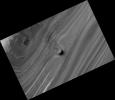
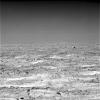
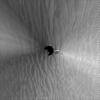
PIA11231:
-
Unusual Mound in North Polar Layered Deposits
Full Resolution:
TIFF
(3.645 MB)
JPEG
(386.1 kB)
|
|
|
2008-10-16 |
Mars
|
2001 Mars Odyssey
|
THEMIS
|
1377x2922x1 |

|
-
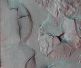
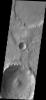
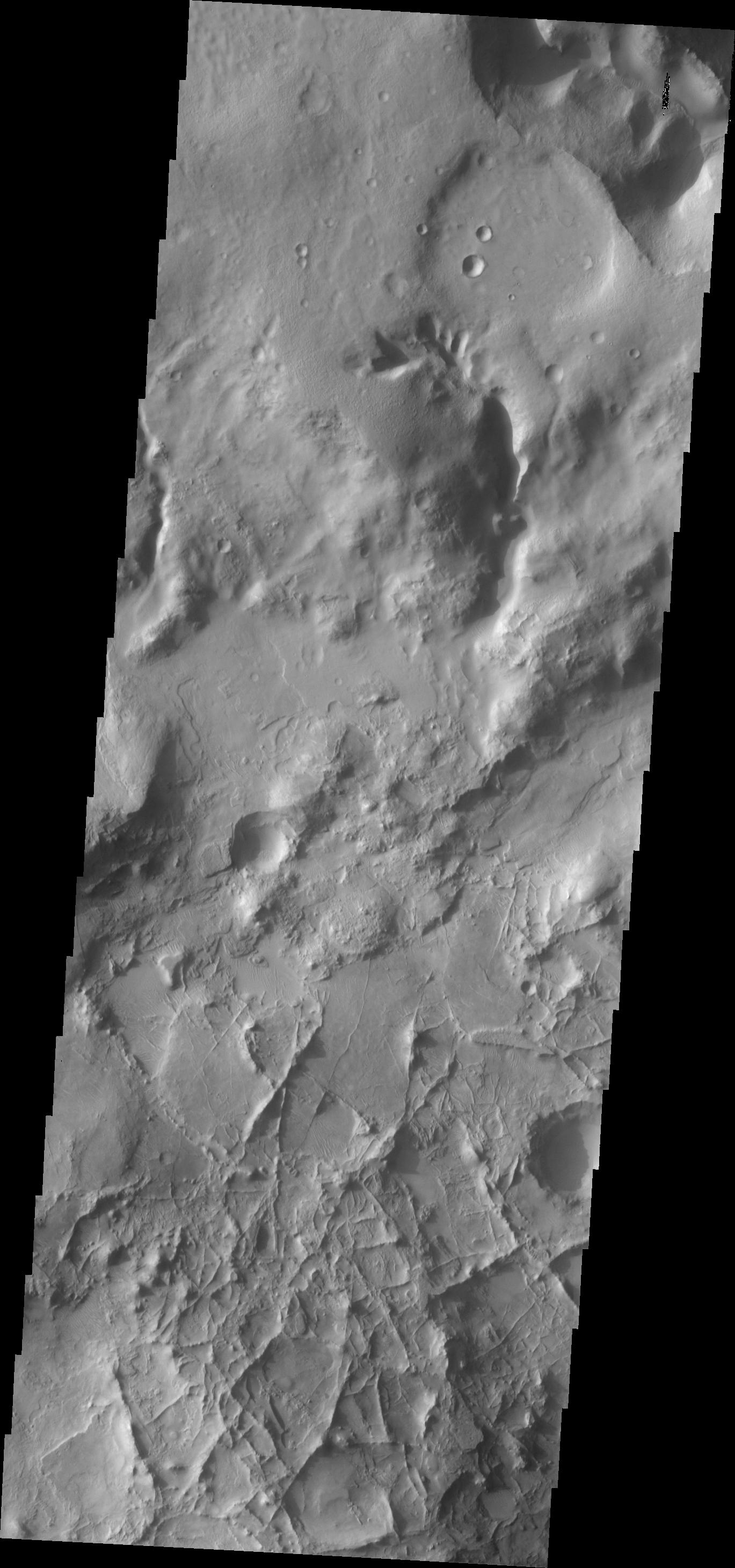
PIA11251:
-
Fractures and Collapse
Full Resolution:
TIFF
(4.029 MB)
JPEG
(343.1 kB)
|
|
|
2008-10-16 |
Mars
|
Phoenix
|
Surface Stereo Imager (SSI)
|
1024x256x1 |
|
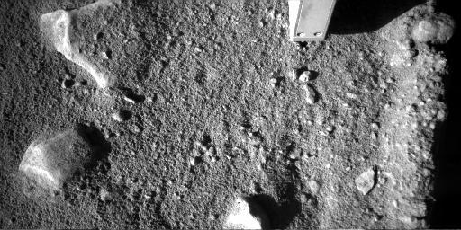
-
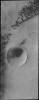
PIA11234:
Dust Storm Moving Near Phoenix Lander

Full Resolution:
TIFF
(262.6 kB)
JPEG
(22.3 kB)
|
|
|
2008-10-16 |
Mars
|
Phoenix
|
Surface Stereo Imager (SSI)
|
118x256x1 |
|
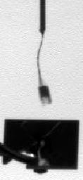
-
PIA11235:
-
Telltale Instrument Waving in the Martian Wind
Full Resolution:
TIFF
(30.47 kB)
JPEG
(4.377 kB)
|
|
|
2008-10-17 |
Mars
|
2001 Mars Odyssey
|
THEMIS
|
1385x2923x1 |

|
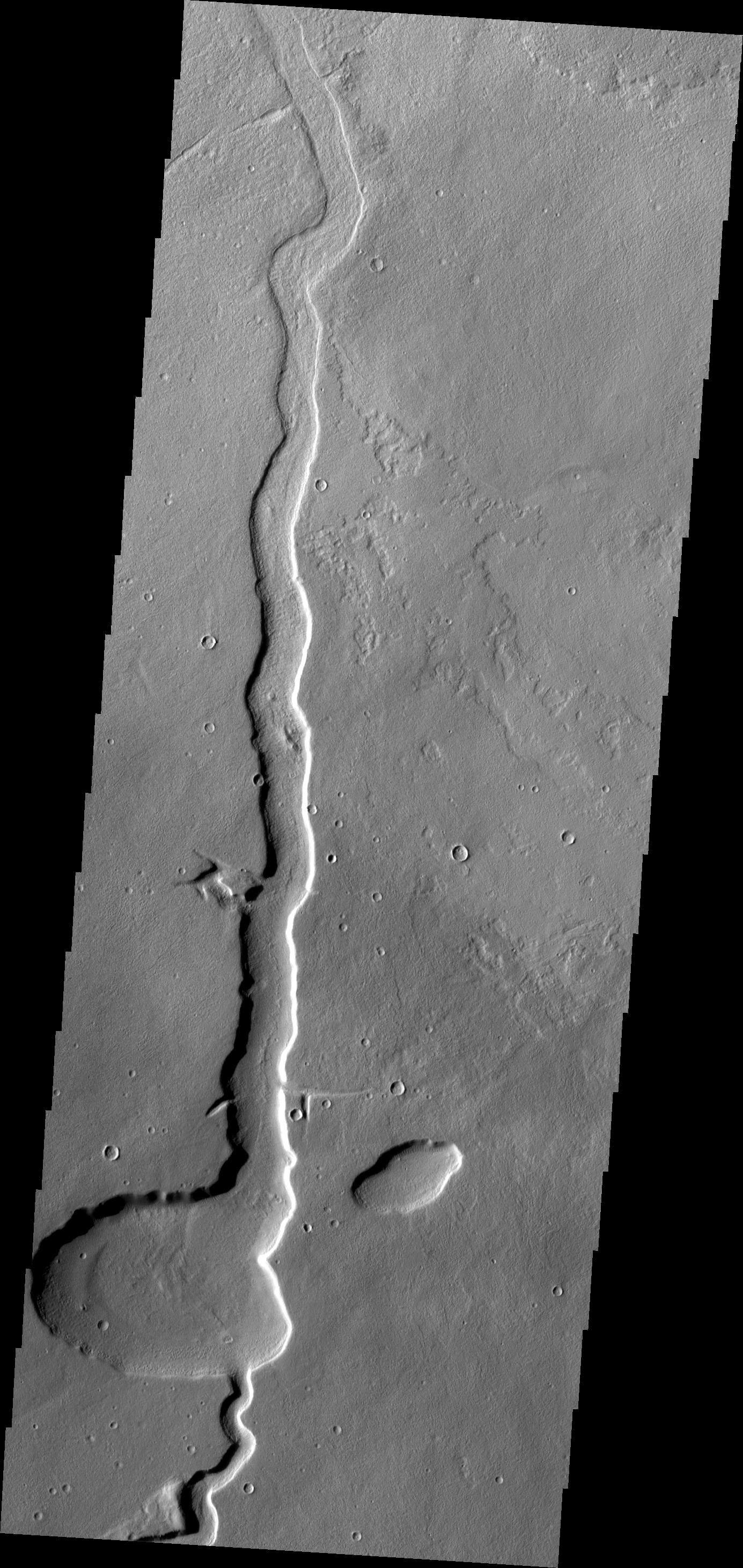
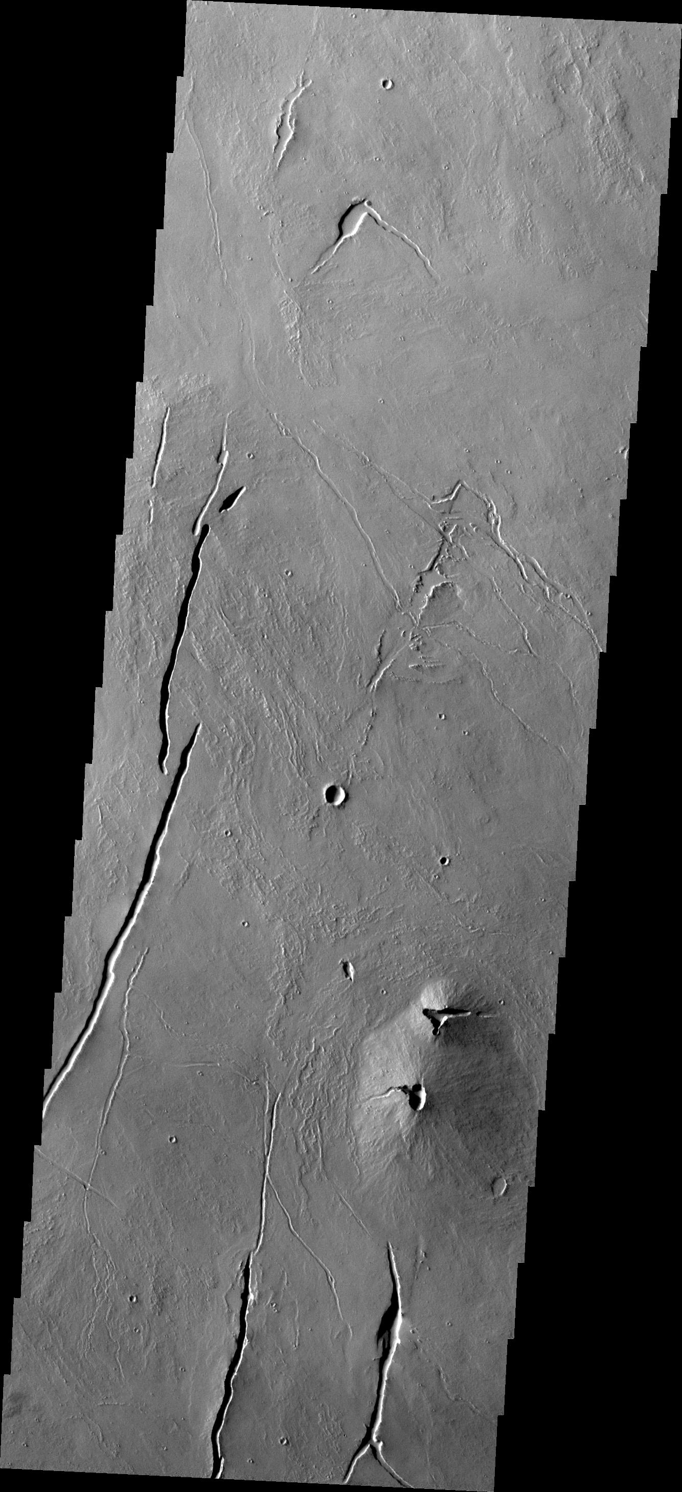
-
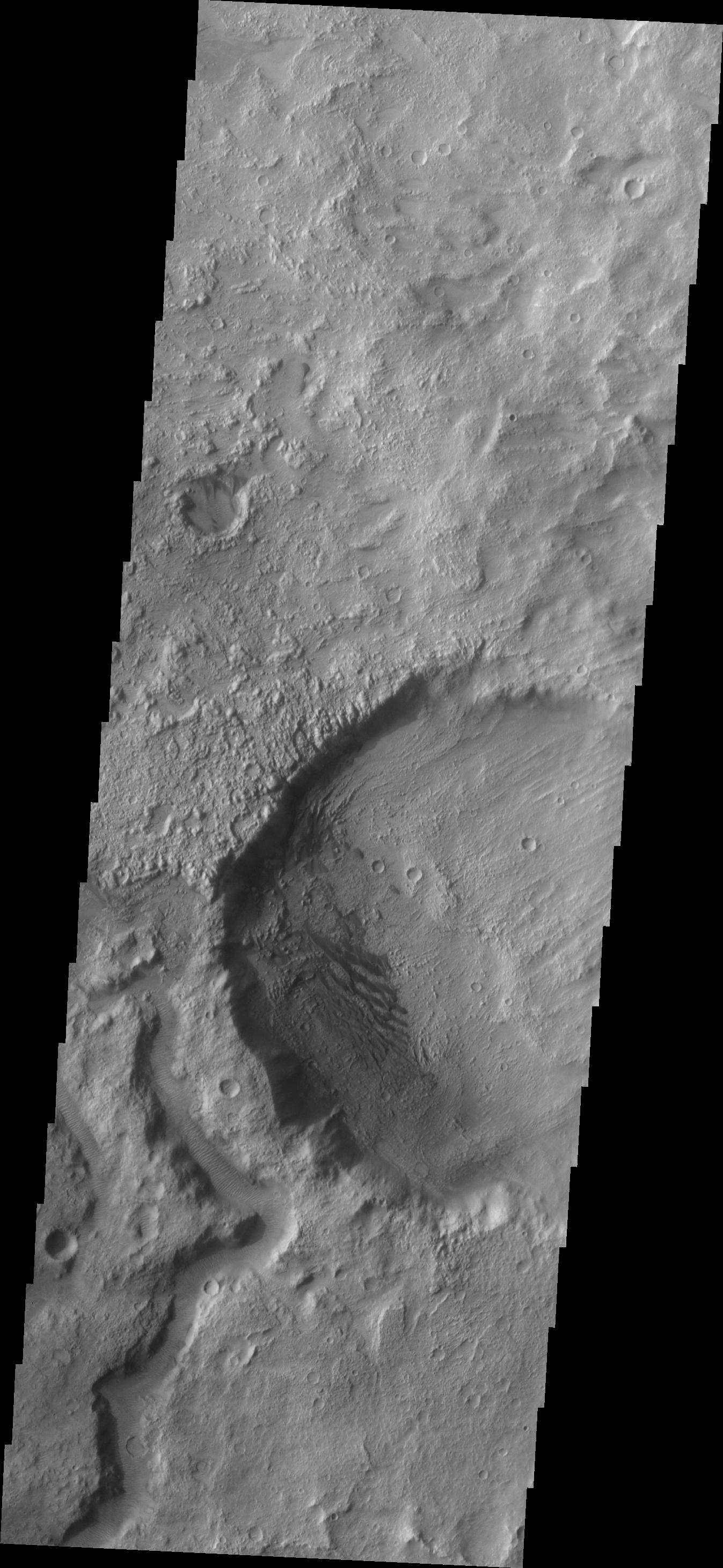
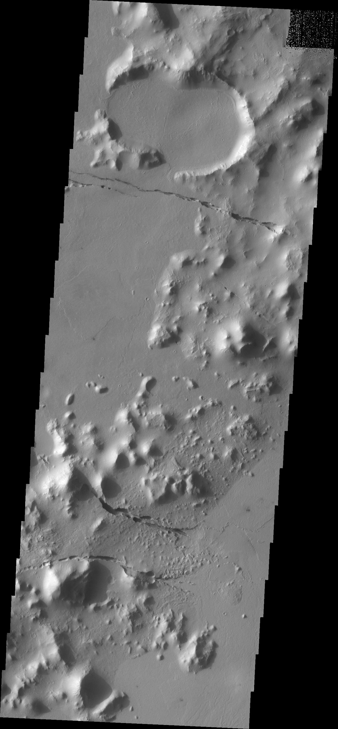
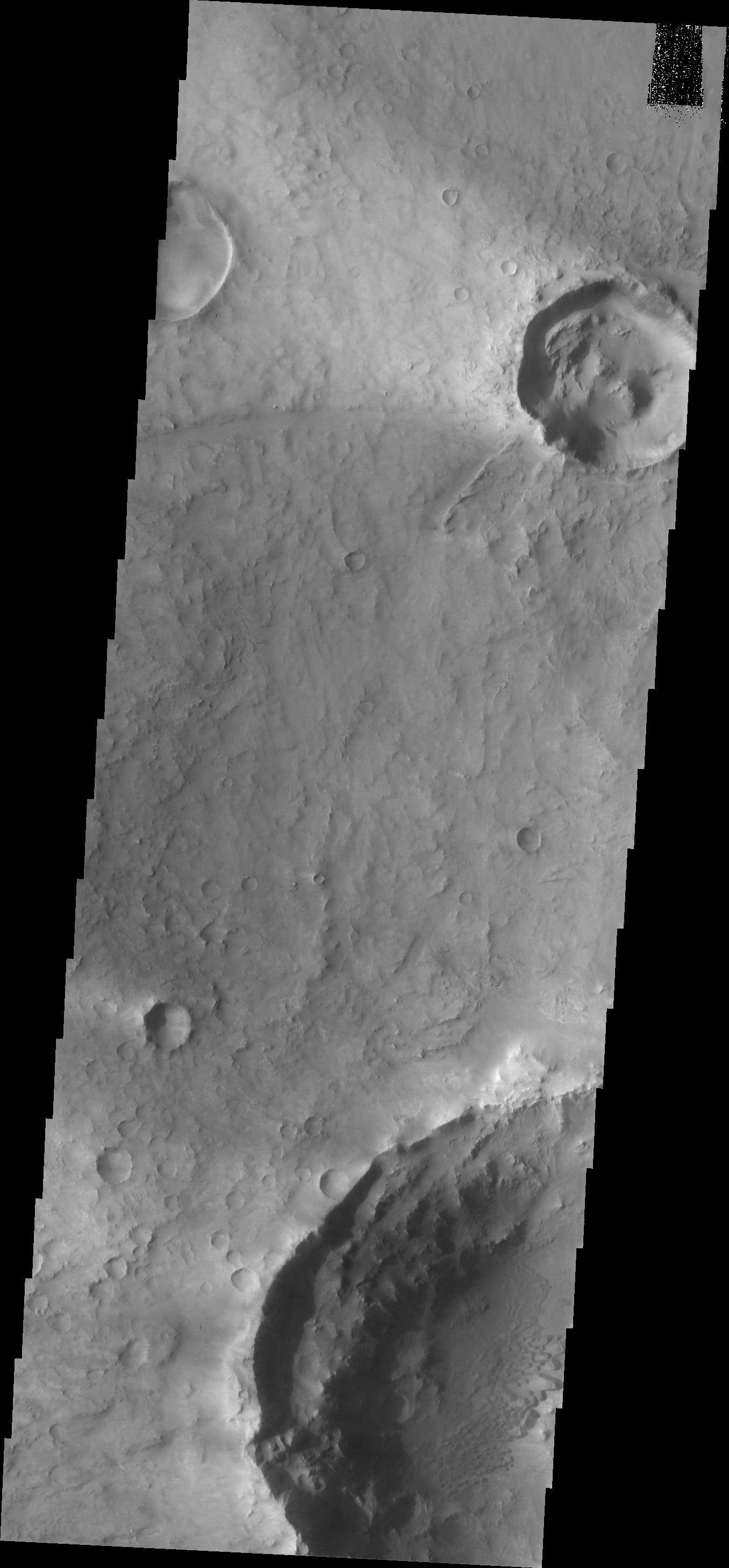
PIA11252:
-
Lava Channel
Full Resolution:
TIFF
(4.053 MB)
JPEG
(533.9 kB)
|
|
|
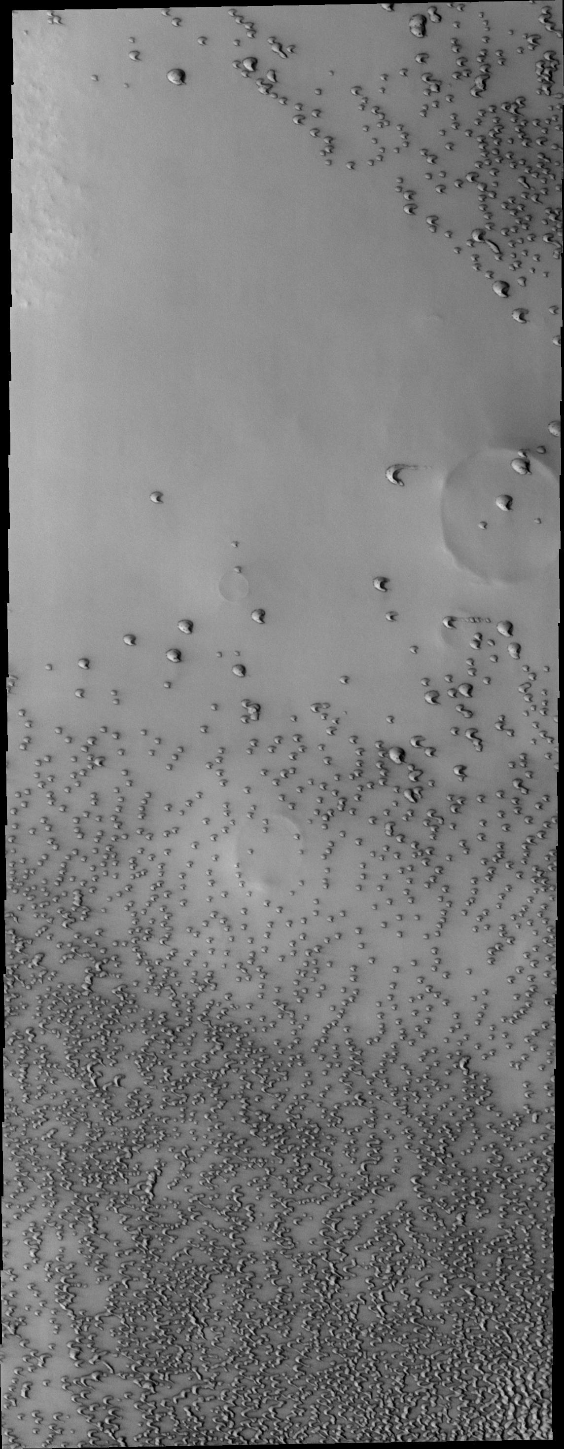
2008-10-20 |
Mars
|
2001 Mars Odyssey
|
THEMIS
|
320x3600x1 |

|
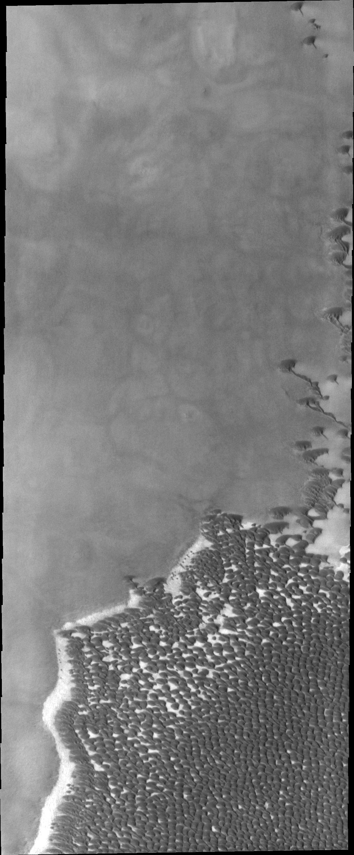
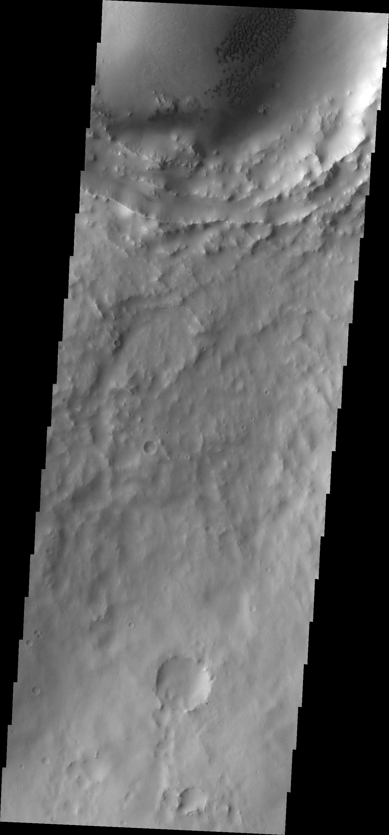
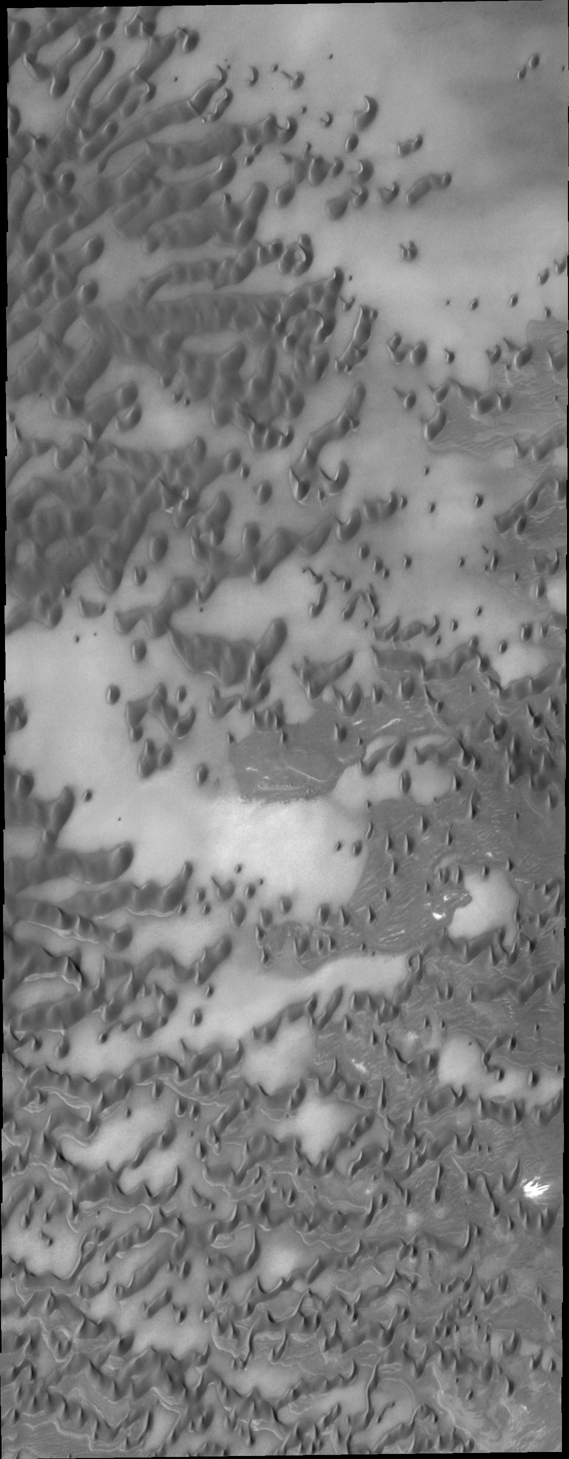
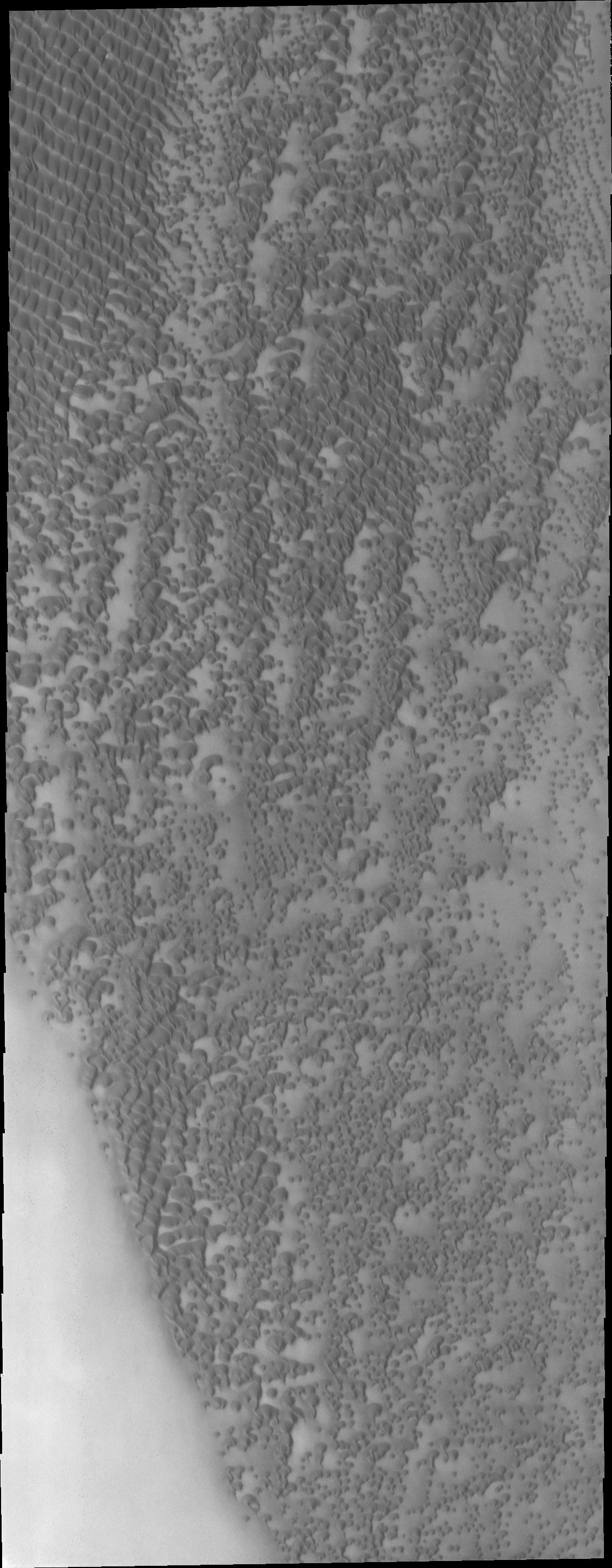
-
PIA11253:
-
Polar Dunes
Full Resolution:
TIFF
(1.153 MB)
JPEG
(173.9 kB)
|
|
|
2008-10-20 |
Mars
|
Phoenix
|
Robotic Arm Camera (RAC)
Thermal and Evolved Gas Analyzer
|
512x256x1 |
|
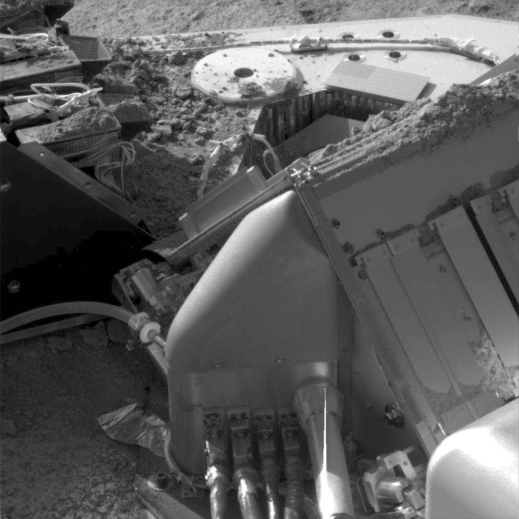
-
PIA11236:
-
Soil Fills Phoenix Laboratory Cell
Full Resolution:
TIFF
(131.4 kB)
JPEG
(20.03 kB)
|
|
|
2008-10-21 |
Mars
|
2001 Mars Odyssey
|
THEMIS
|
1145x2767x1 |
|
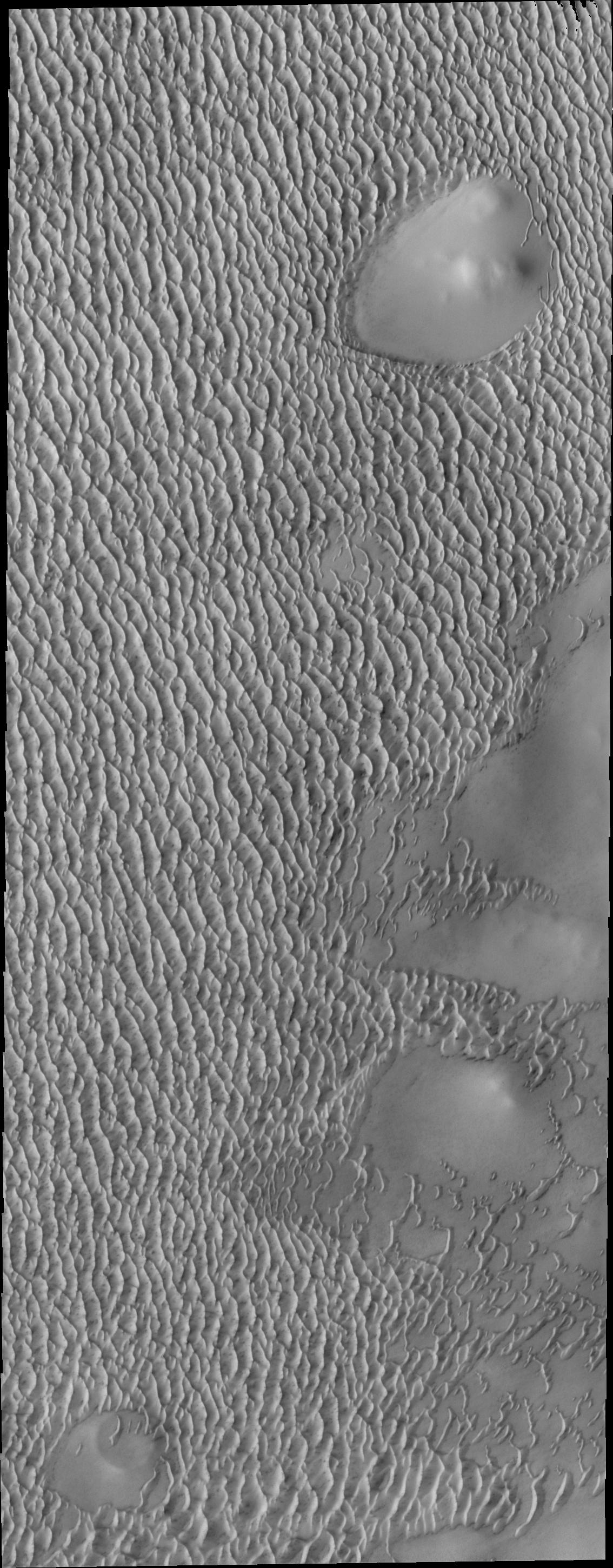
-
PIA11254:
-
Polar Dunes
Full Resolution:
TIFF
(3.172 MB)
JPEG
(358.1 kB)
|
|
|
2008-10-22 |
Mars
|
Phoenix
|
MECA
Surface Stereo Imager (SSI)
Thermal and Evolved Gas Analyzer
|
1024x1024x1 |
|
-
PIA11373:
-
Soil on Phoenix Deck
Full Resolution:
TIFF
(1.05 MB)
JPEG
(110 kB)
|
|
|
2008-10-22 |
Mars
|
2001 Mars Odyssey
|
THEMIS
|
1384x2923x1 |
|
-
PIA11255:
-
Cerulli Channels
Full Resolution:
TIFF
(4.05 MB)
JPEG
(367.9 kB)
|
|
|
2008-10-23 |
Mars
|
2001 Mars Odyssey
|
THEMIS
|
1144x2937x1 |
|
-
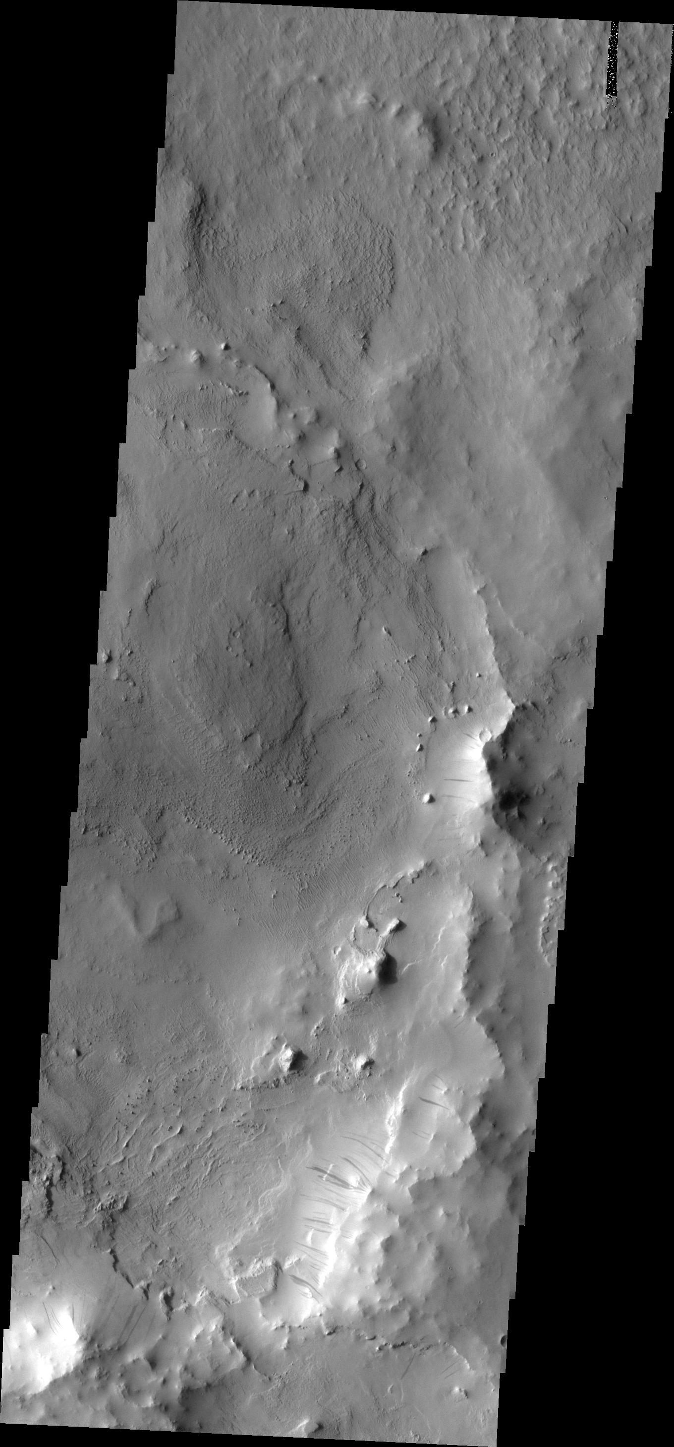
PIA11256:
-
Polar Dunes
Full Resolution:
TIFF
(3.364 MB)
JPEG
(387.1 kB)
|
|
|
2008-10-24 |
Mars
|
2001 Mars Odyssey
|
THEMIS
|
1366x2920x1 |

|
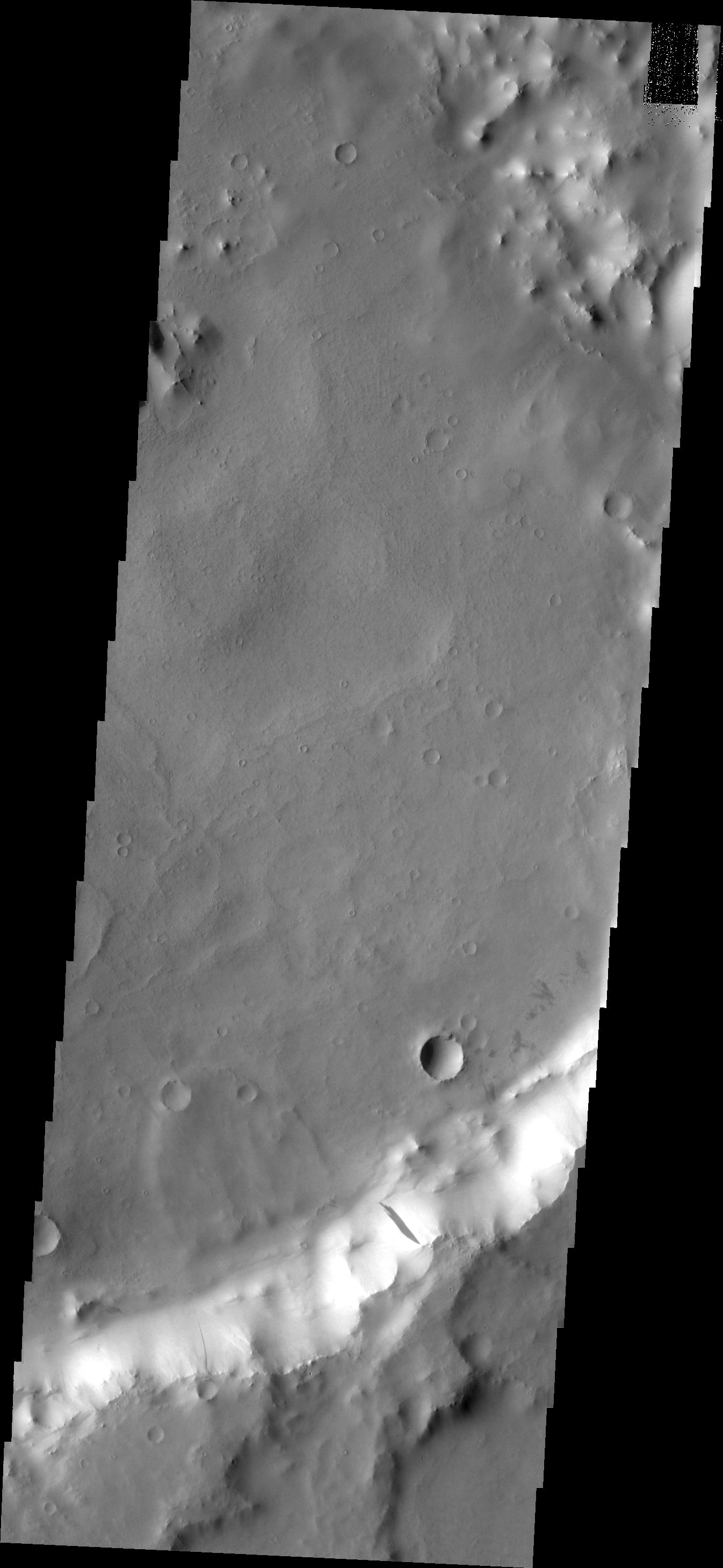
-
PIA11257:
-
Dark Slope Streaks
Full Resolution:
TIFF
(3.994 MB)
JPEG
(256 kB)
|
|
|
2008-10-27 |
Mars
|
2001 Mars Odyssey
|
THEMIS
|
1369x2924x1 |

|
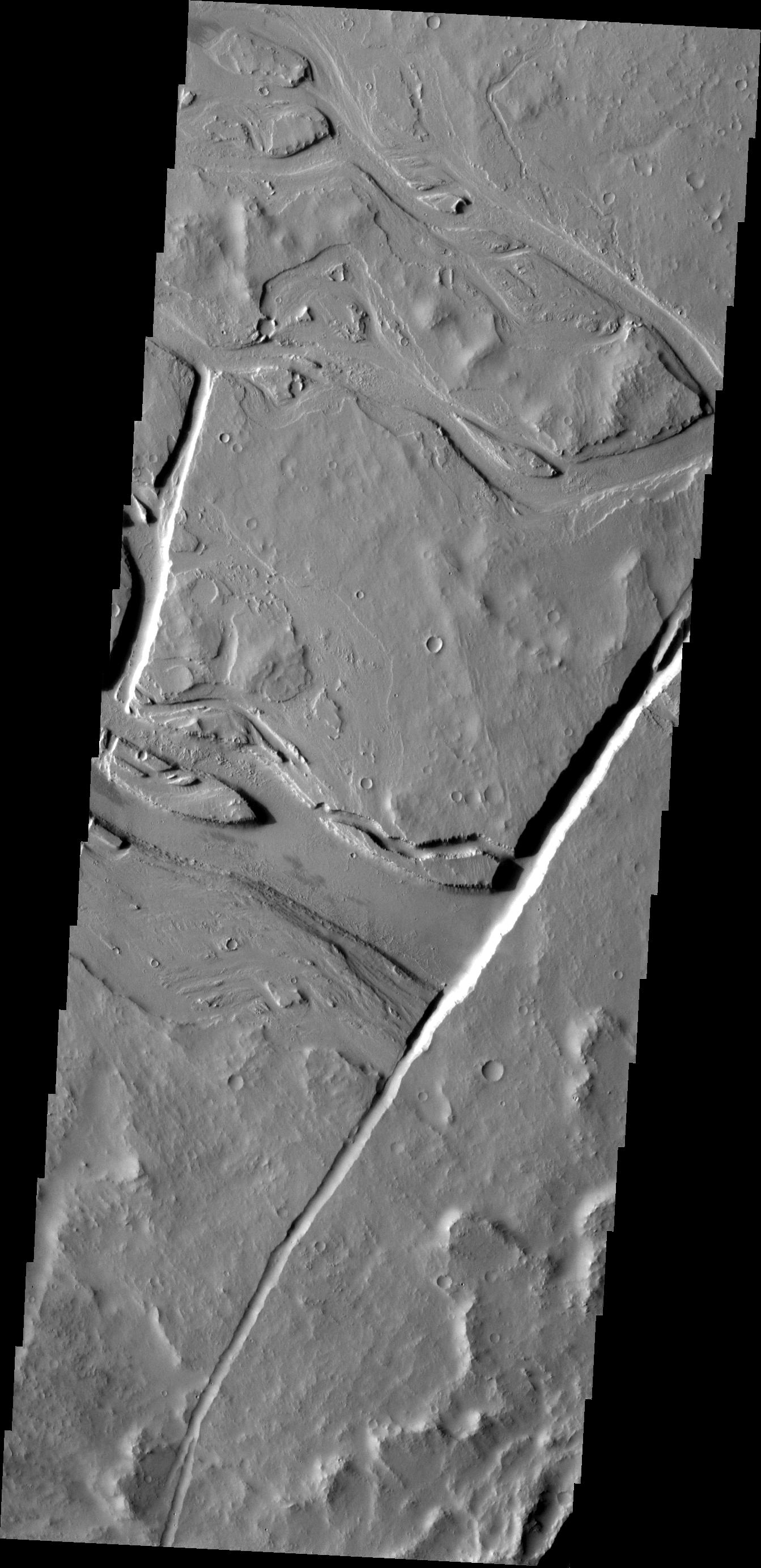
-
PIA11258:
-
Channel
Full Resolution:
TIFF
(4.008 MB)
JPEG
(464.8 kB)
|
|
|
2008-10-28 |
Mars
|
2001 Mars Odyssey
|
THEMIS
|
1396x2926x1 |
|
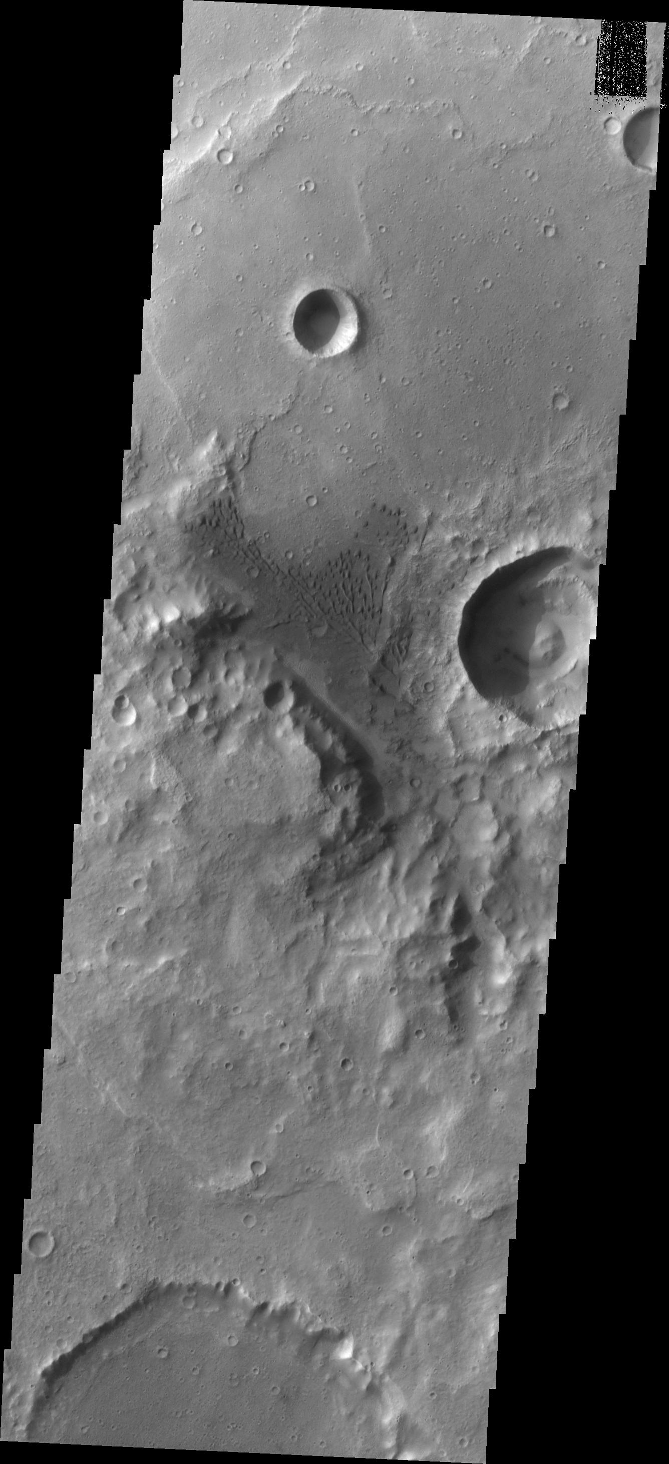
-
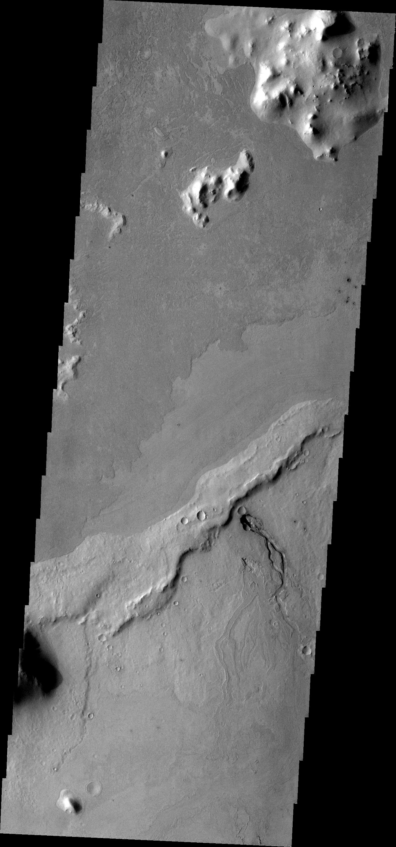
PIA11259:
-
Semeykin Drainage
Full Resolution:
TIFF
(4.09 MB)
JPEG
(442.3 kB)
|
|
|
2008-10-28 |
Mars
|
Mars Reconnaissance Orbiter (MRO)
|
HiRISE
|
3300x2359x3 |

|
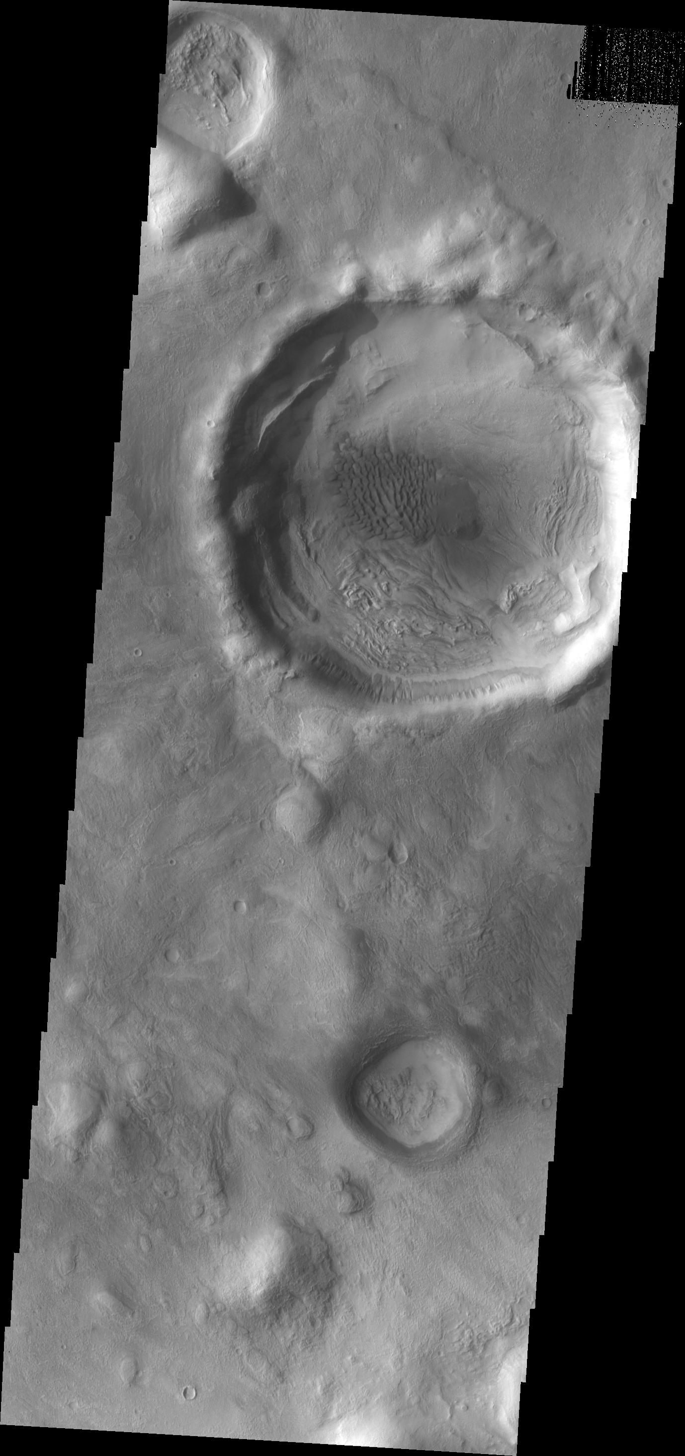
-
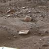
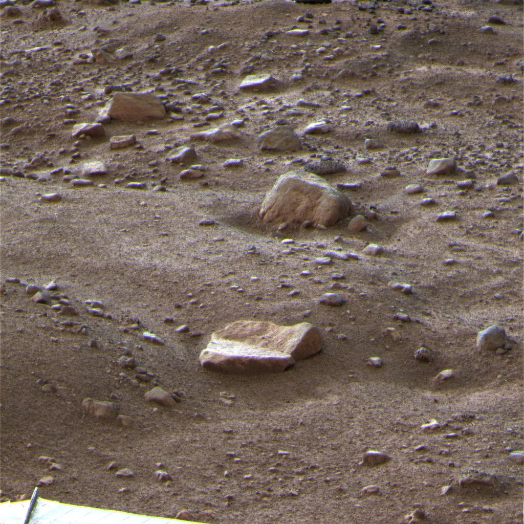
PIA11377:
-
A Gem of a Find
Full Resolution:
TIFF
(23.35 MB)
JPEG
(1.523 MB)
|
|
|
2008-10-29 |
Mars
|
2001 Mars Odyssey
|
THEMIS
|
1369x2921x1 |

|
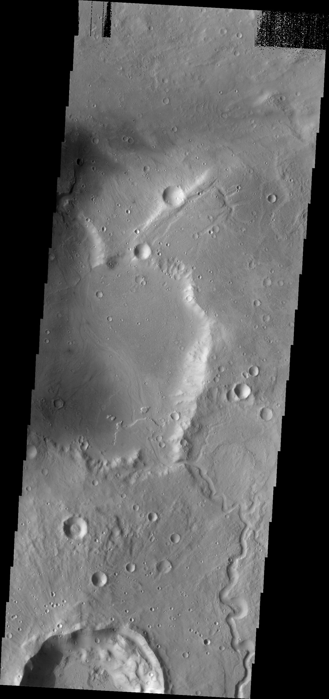
-
PIA11260:
-
Linear Ridges
Full Resolution:
TIFF
(4.004 MB)
JPEG
(321.6 kB)
|
|
|
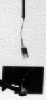
2008-10-29 |
Mars
|
Phoenix
|
Robotic Arm Camera (RAC)
Thermal and Electrical Conductivity Probe
|
512x256x1 |
|
-
PIA11378:
-
Phoenix's Probe Inserted in Martian Soil
Full Resolution:
TIFF
(131.4 kB)
JPEG
(45 kB)
|
|
|
2008-10-29 |
Mars
|
Phoenix
|
Robotic Arm Camera (RAC)
|
512x256x1 |
|
-
PIA11379:
-
Underneath the Phoenix Lander
Full Resolution:
TIFF
(131.4 kB)
JPEG
(24 kB)
|
|
|
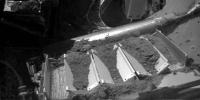
2008-10-29 |
Mars
|
Phoenix
|
Surface Stereo Imager (SSI)
|
1024x1024x3 |
|
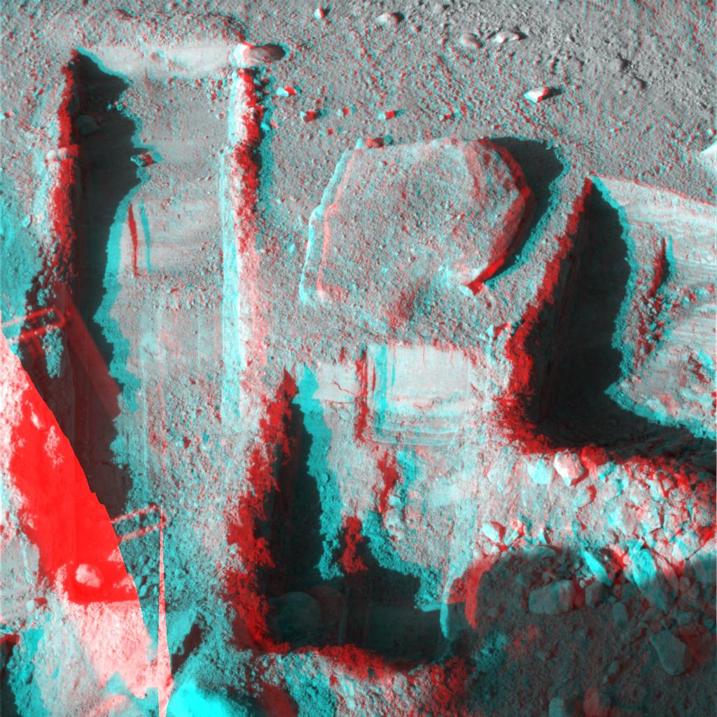
-
PIA11380:
-
Phoenix Deepens Trenches on Mars (3-D)
Full Resolution:
TIFF
(3.15 MB)
JPEG
(215 kB)
|
|
|
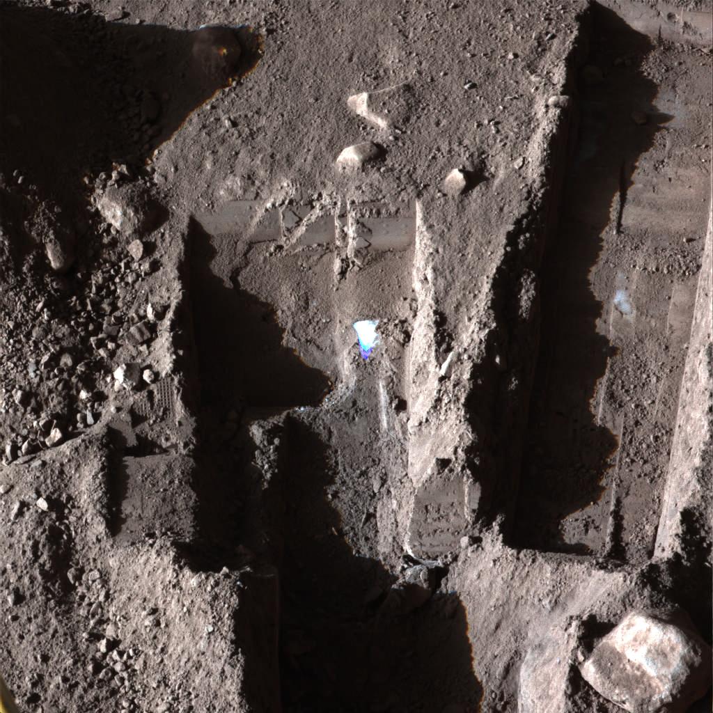
2008-10-29 |
Mars
|
Phoenix
|
Surface Stereo Imager (SSI)
|
1024x1024x3 |
|
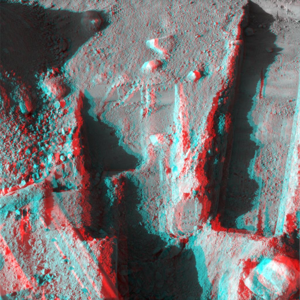
-
PIA11381:
-
Phoenix Deepens Trenches on Mars (3-D)
Full Resolution:
TIFF
(3.15 MB)
JPEG
(203.9 kB)
|
|
|
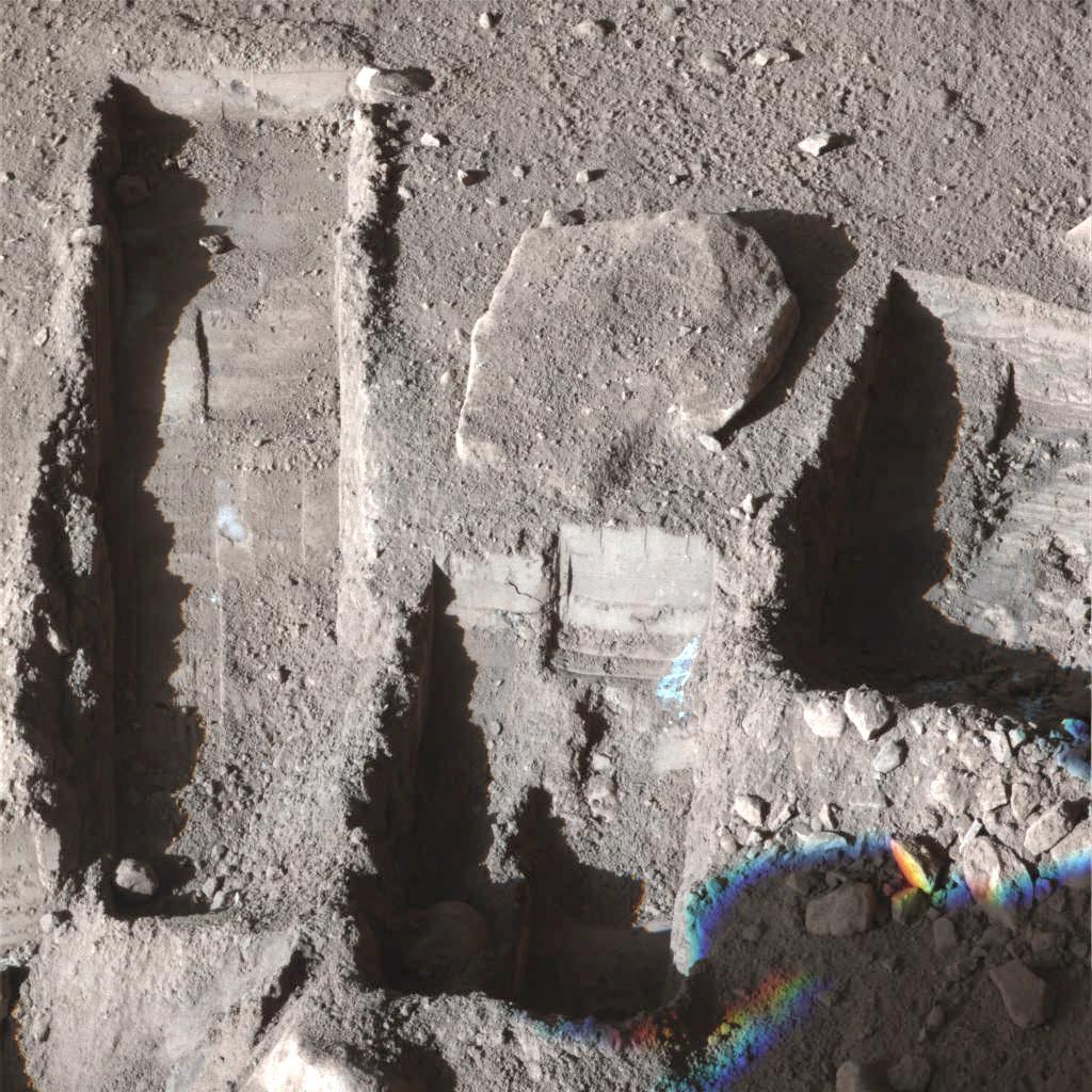
2008-10-29 |
Mars
|
Phoenix
|
Surface Stereo Imager (SSI)
|
1024x1024x3 |
|
-
PIA11382:
-
Phoenix Deepens Trenches on Mars
Full Resolution:
TIFF
(3.15 MB)
JPEG
(203.8 kB)
|
|
|
2008-10-29 |
Mars
|
Phoenix
|
Surface Stereo Imager (SSI)
|
1024x1024x3 |
|
-
PIA11383:
-
Phoenix Deepens Trenches on Mars
Full Resolution:
TIFF
(3.15 MB)
JPEG
(191.6 kB)
|
|
|
2008-10-30 |
Mars
|
2001 Mars Odyssey
|
THEMIS
|
1432x2945x1 |
|
-
PIA11261:
-
Dust Devil Tracks
Full Resolution:
TIFF
(4.222 MB)
JPEG
(521.2 kB)
|
|
|
2008-10-31 |
Mars
|
2001 Mars Odyssey
|
THEMIS
|
1349x2923x1 |
|
-
PIA11262:
-
Arcuate Fractures
Full Resolution:
TIFF
(3.947 MB)
JPEG
(545.7 kB)
|
|
|
2008-11-03 |
Mars
|
2001 Mars Odyssey
|
THEMIS
|
1347x2923x1 |

|
-
PIA11263:
-
Dunes and Channel
Full Resolution:
TIFF
(3.941 MB)
JPEG
(386.1 kB)
|
|
|
2008-11-04 |
Mars
|
2001 Mars Odyssey
|
THEMIS
|
1361x2919x1 |
|
-
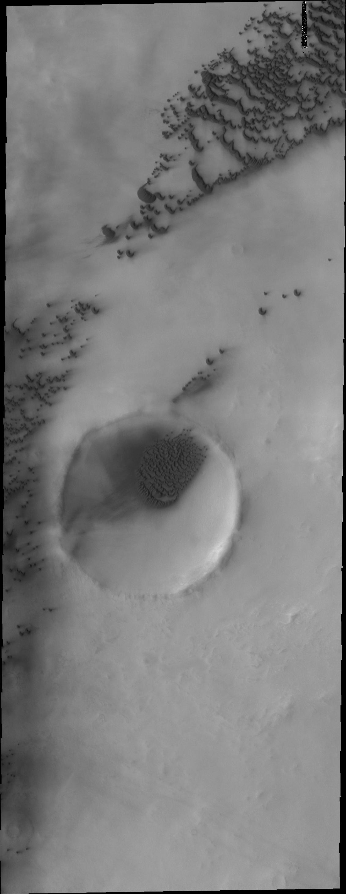
PIA11264:
-
Crater Dunes
Full Resolution:
TIFF
(3.977 MB)
JPEG
(208.1 kB)
|
|
|
2008-11-05 |
Mars
|
2001 Mars Odyssey
|
THEMIS
|
1336x2924x1 |
|
-
PIA11265:
-
Crater Dunes
Full Resolution:
TIFF
(3.911 MB)
JPEG
(325.7 kB)
|
|
|
2008-11-06 |
Mars
|
2001 Mars Odyssey
|
THEMIS
|
1375x2922x1 |

|
-
PIA11266:
-
Delta
Full Resolution:
TIFF
(4.023 MB)
JPEG
(329.1 kB)
|
|
|
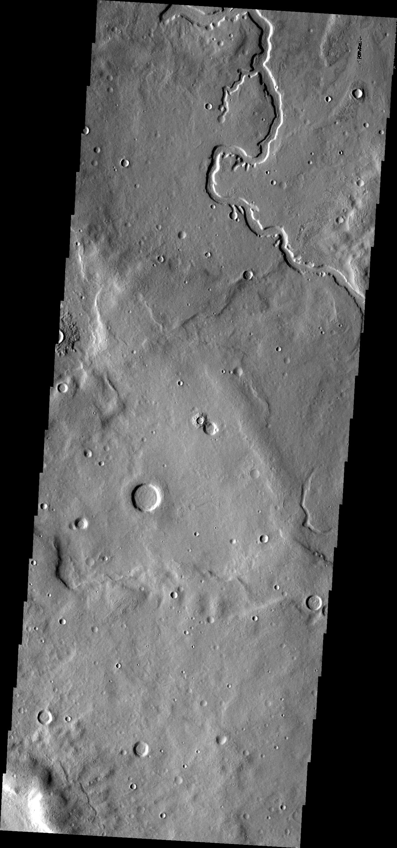
2008-11-07 |
Mars
|
2001 Mars Odyssey
|
THEMIS
|
1322x2922x1 |
|
-
PIA11267:
-
Dust Devil Tracks
Full Resolution:
TIFF
(3.867 MB)
JPEG
(311.6 kB)
|
|
|
2008-11-10 |
Mars
|
2001 Mars Odyssey
|
THEMIS
|
1355x2921x1 |

|
-
PIA11268:
-
Wind Erosion
Full Resolution:
TIFF
(3.962 MB)
JPEG
(650.4 kB)
|
|
|
2008-11-12 |
Mars
|
Mars Reconnaissance Orbiter (MRO)
|
MARCI
|
512x512x3 |

|
-
PIA11418:
-
MRO MARCI Weather Report for the week of 3 November 2008 � 9 November 2008
Full Resolution:
TIFF
(787.5 kB)
JPEG
(13.55 kB)
|
|
|
2008-11-18 |
Mars
|
2001 Mars Odyssey
|
Gamma Ray Spectrometer
Laser Altimeter
|
850x650x3 |
|
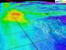
-
PIA11421:
-
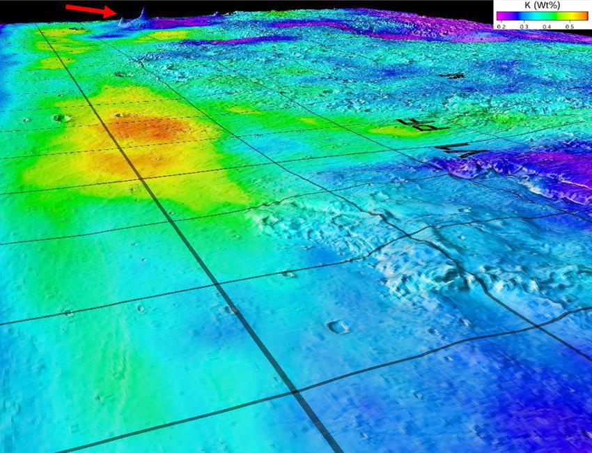
Potassium Concentrations on Mars
Full Resolution:
TIFF
(1.659 MB)
JPEG
(122.3 kB)
|
|
|
2008-12-01 |
Mars
|
2001 Mars Odyssey
|
THEMIS
|
1131x2897x1 |

|
-
PIA11269:
-
Polar Dunes
Full Resolution:
TIFF
(3.28 MB)
JPEG
(298.7 kB)
|
|
|
2008-12-02 |
Mars
|
2001 Mars Odyssey
|
THEMIS
|
1134x2900x1 |
|
-
PIA11270:
-
More Polar Dunes
Full Resolution:
TIFF
(3.292 MB)
JPEG
(448.6 kB)
|
|
|
2008-12-03 |
Mars
|
2001 Mars Odyssey
|
THEMIS
|
1378x2926x1 |

|
-
PIA11271:
-
Dunes
Full Resolution:
TIFF
(4.037 MB)
JPEG
(343.6 kB)
|
|
|
2008-12-04 |
Mars
|
2001 Mars Odyssey
|
THEMIS
|
1371x2919x1 |

|
-
PIA11272:
-
Terra Sabaea
Full Resolution:
TIFF
(4.007 MB)
JPEG
(409.3 kB)
|
|
|
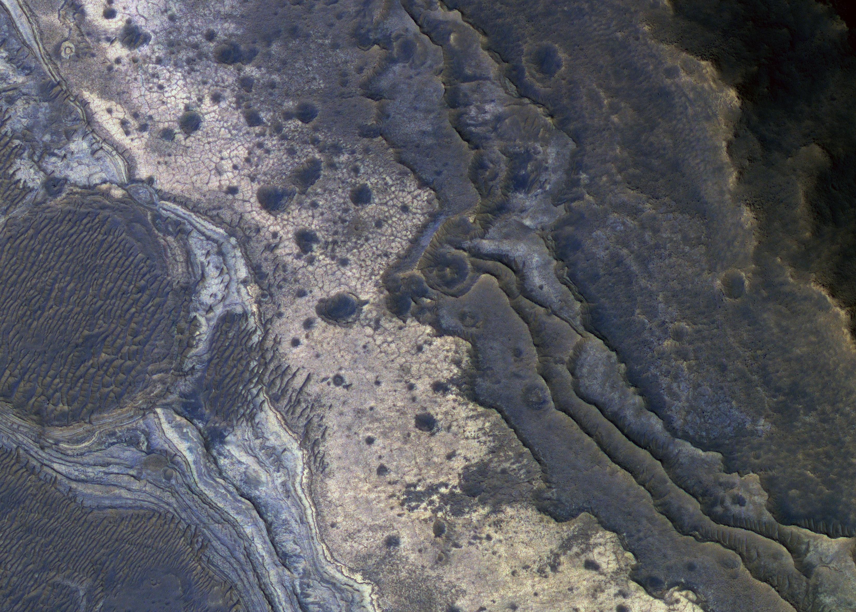
2008-12-04 |
Mars
|
Mars Reconnaissance Orbiter (MRO)
|
HiRISE
|
962x747x1 |

|
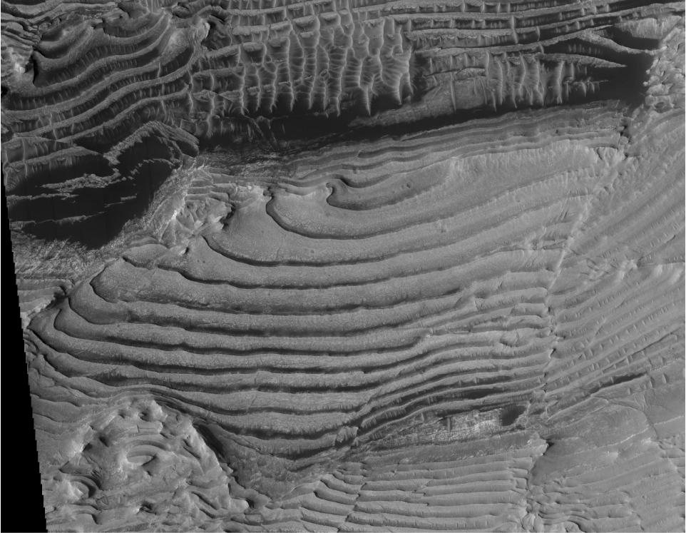
-
PIA11441:
-
Periodic Layering in Martian Sedimentary Rocks
Full Resolution:
TIFF
(719.6 kB)
JPEG
(115.1 kB)
|
|
|
2008-12-04 |
Mars
|
Mars Reconnaissance Orbiter (MRO)
|
HiRISE
|
1416x998x1 |
|
-
PIA11442:
-
Periodic Layering in Martian Sedimentary Rocks, Oblique View
Full Resolution:
TIFF
(1.415 MB)
JPEG
(246.9 kB)
|
|
|
2008-12-04 |
Mars
|
Mars Reconnaissance Orbiter (MRO)
|
HiRISE
|
2024x2572x3 |

|
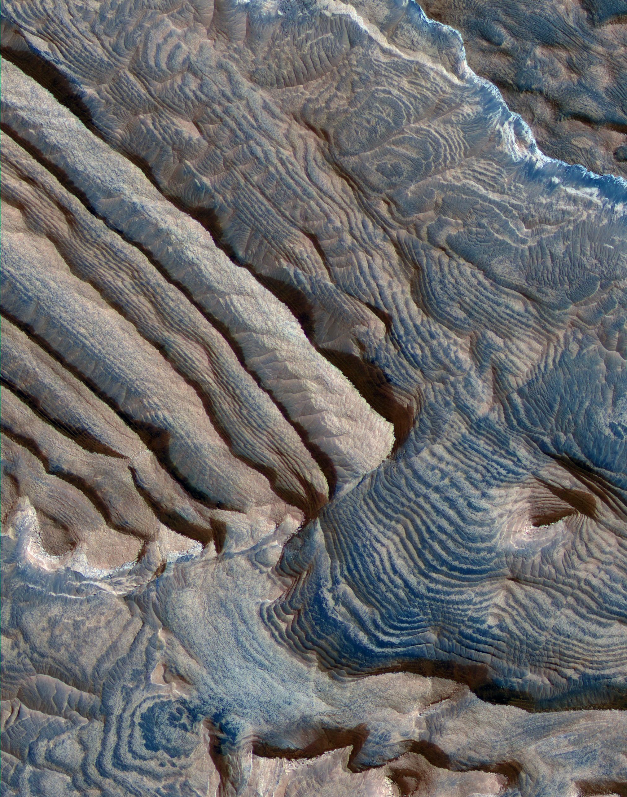
-
PIA11443:
-
Periodic Layering in Becquerel Crater, Mars
Full Resolution:
TIFF
(15.64 MB)
JPEG
(1.002 MB)
|
|
|
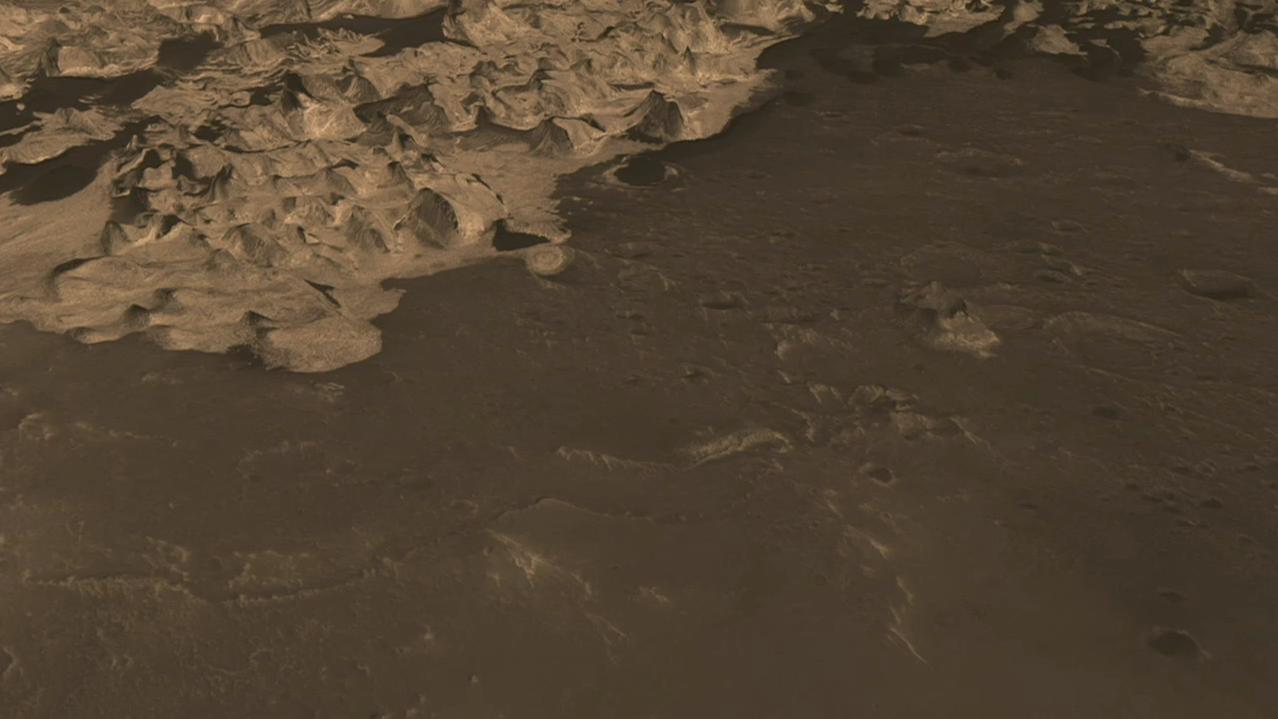
2008-12-04 |
Mars
|
Mars Reconnaissance Orbiter (MRO)
|
HiRISE
|
1278x719x3 |
|
-
PIA11444:
-
Flyover Animation of Becquerel Crater on Mars
Full Resolution:
TIFF
(2.76 MB)
JPEG
(73.52 kB)
|
|
|
2008-12-05 |
Mars
|
2001 Mars Odyssey
|
THEMIS
|
1378x2923x1 |

|
-
PIA11273:
-
More Terra Sabaea
Full Resolution:
TIFF
(4.033 MB)
JPEG
(389.3 kB)
|
|
|
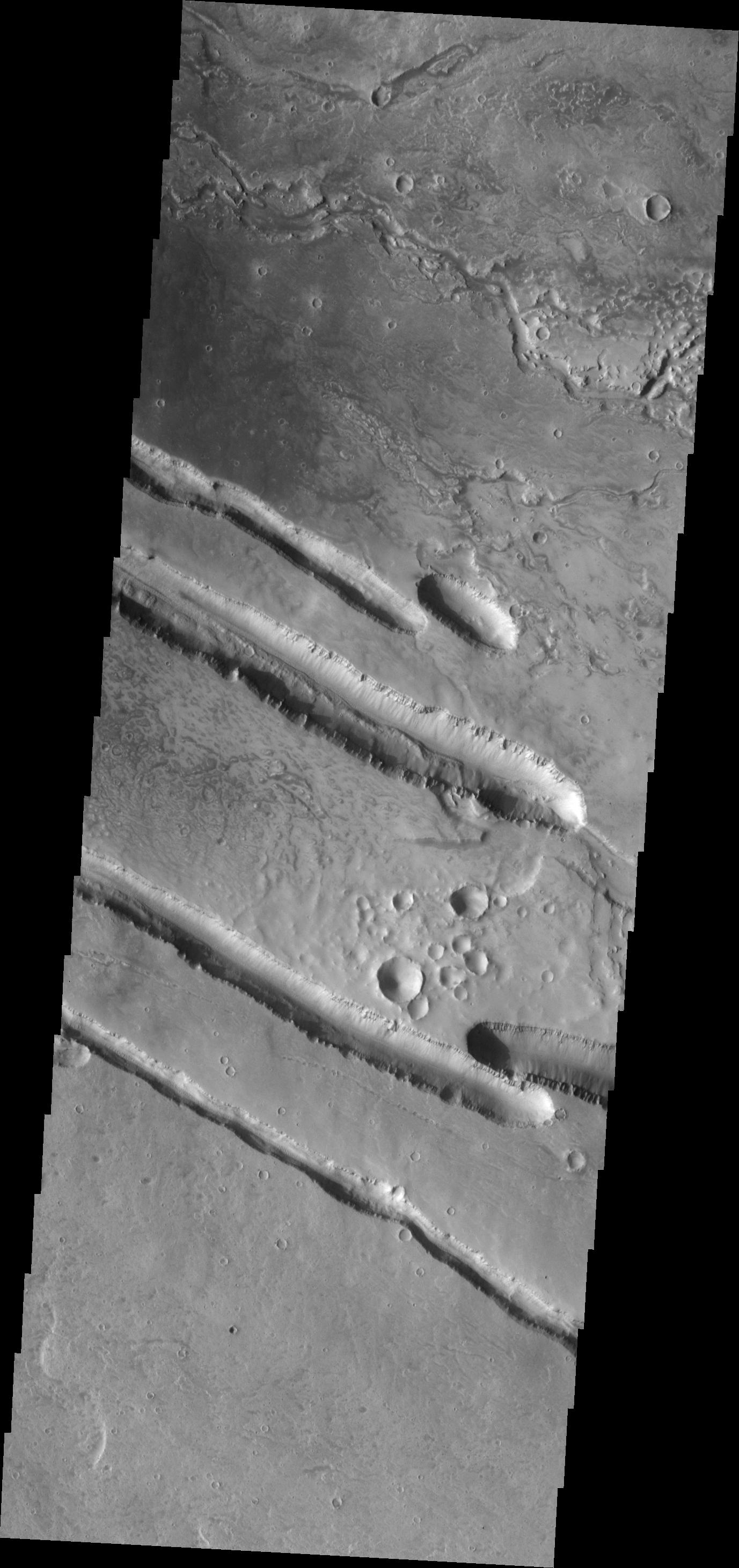
2008-12-08 |
Mars
|
2001 Mars Odyssey
|
THEMIS
|
1373x2920x1 |

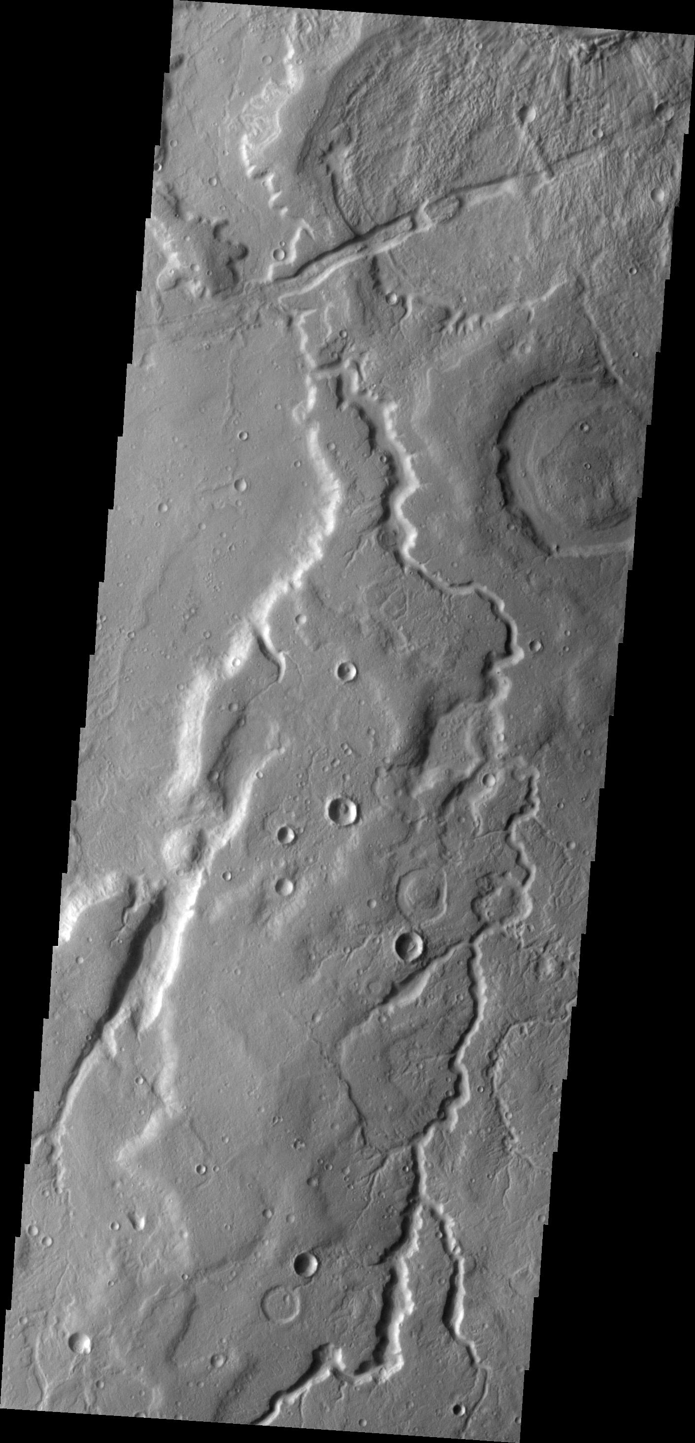
|
-
PIA11274:
-
Granicus Valles
Full Resolution:
TIFF
(4.014 MB)
JPEG
(365.5 kB)
|
|
|
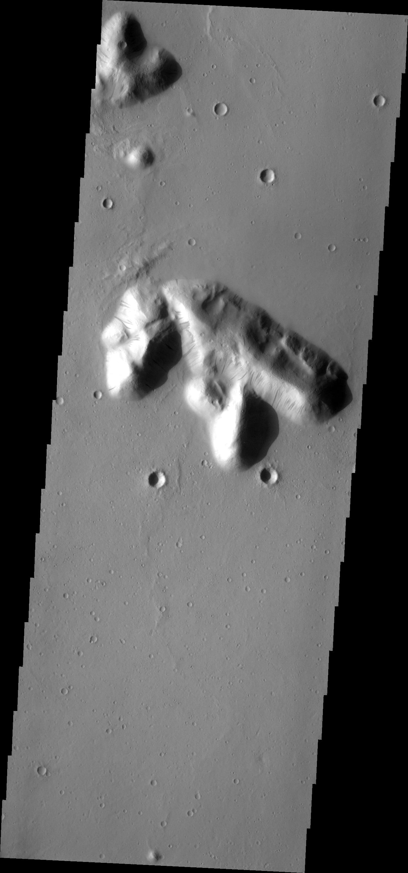
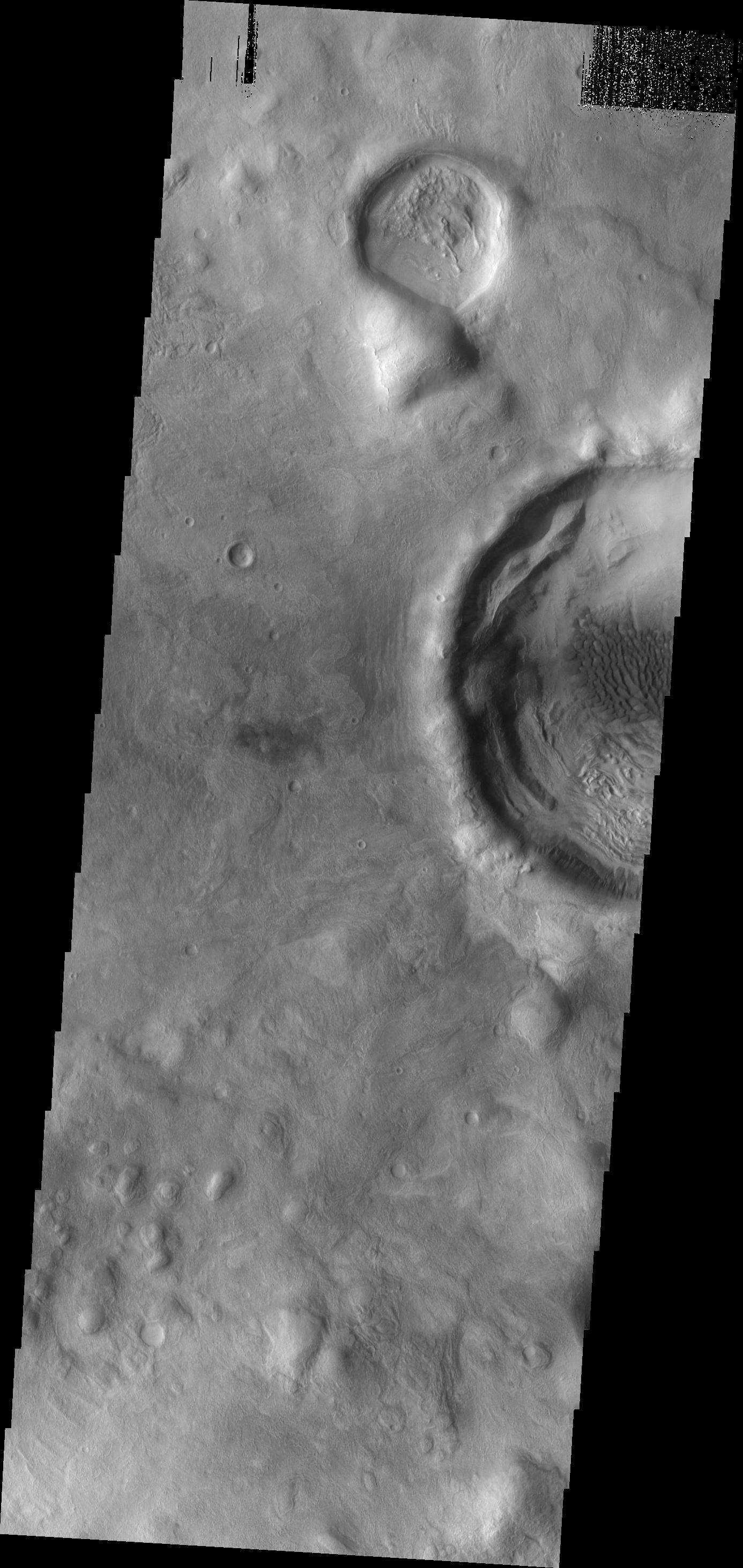
2008-12-08 |
Mars
|
Mars Reconnaissance Orbiter (MRO)
|
HiRISE
|
1129x949x3 |
|
-
PIA11446:
-
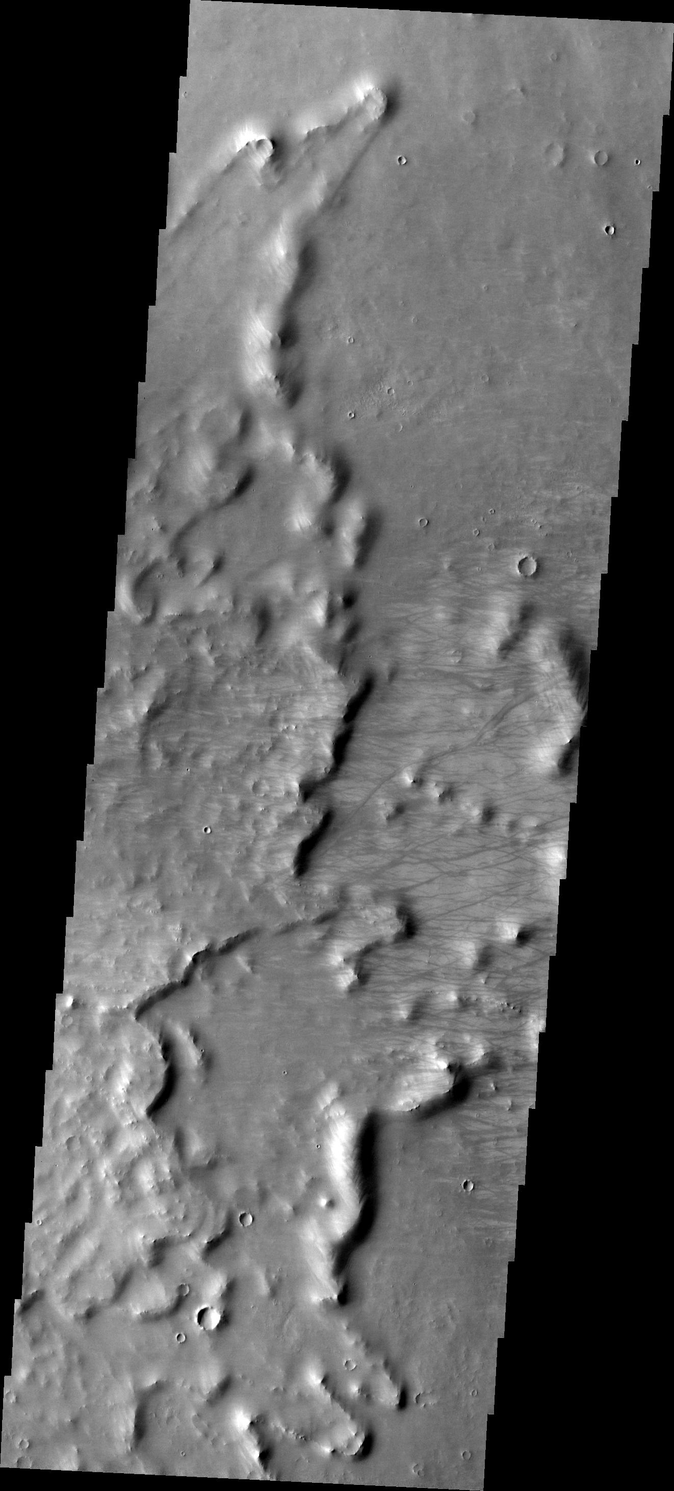
Elysium Planitia, Mars - Fractured Mounds in Stereo
Full Resolution:
TIFF
(3.218 MB)
JPEG
(227.3 kB)
|
|
|
2008-12-09 |
Mars
|
2001 Mars Odyssey
|
THEMIS
|
1354x2921x1 |

|
-
PIA11275:
-
Cerberus Fossae
Full Resolution:
TIFF
(3.959 MB)
JPEG
(329.6 kB)
|
|
|
2008-12-10 |
Mars
|
2001 Mars Odyssey
|
THEMIS
|
1360x2918x1 |

|
-
PIA11276:
-
Dark Slope Streaks
Full Resolution:
TIFF
(3.973 MB)
JPEG
(349.6 kB)
|
|
|
2008-12-11 |
Mars
|
2001 Mars Odyssey
|
THEMIS
|
1371x2925x1 |

|
-
PIA11277:
-
Terra Sabaea Channel
Full Resolution:
TIFF
(4.015 MB)
JPEG
(486.4 kB)
|
|
|
2008-12-12 |
Mars
|
2001 Mars Odyssey
|
THEMIS
|
1132x2923x1 |
|
-
PIA11278:
-
Polar Dunes
Full Resolution:
TIFF
(3.312 MB)
JPEG
(166.9 kB)
|
|
|
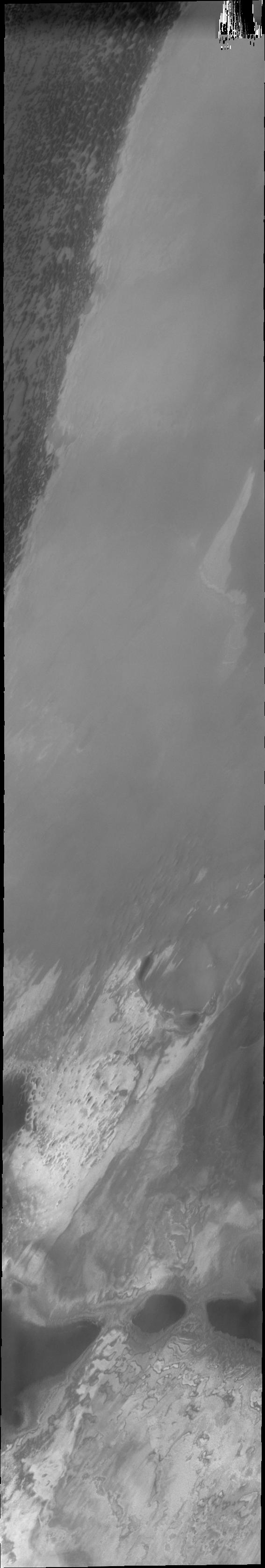
2008-12-15 |
Mars
|
Phoenix
|
Thermal and Electrical Conductivity Probe
|
1152x1152x3 |
|
-
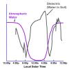
PIA11711:
-
Overnight Changes Recorded by Phoenix Conductivity Probe
Full Resolution:
TIFF
(3.986 MB)
JPEG
(89.88 kB)
|
|
|
2008-12-15 |
Mars
|
Phoenix
|
|
960x720x3 |
|
-
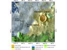
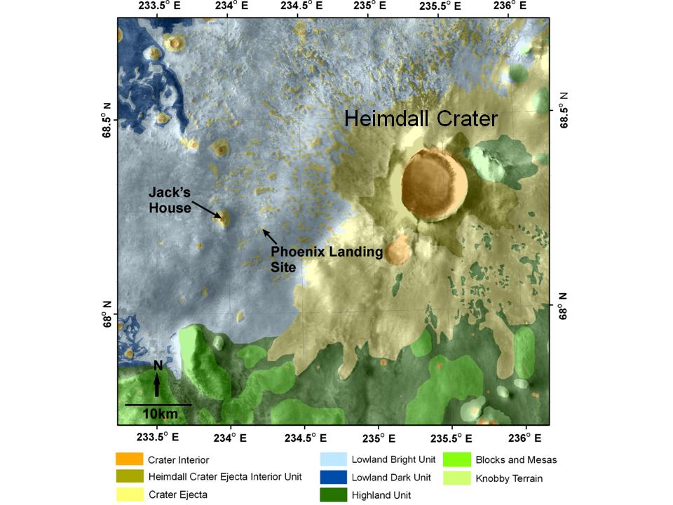
PIA11712:
-
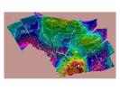
Geomorphic Map of Region Around Phoenix Mars Lander
Full Resolution:
TIFF
(2.077 MB)
JPEG
(92.3 kB)
|
|
|
2008-12-15 |
Mars
|
Phoenix
|
Thermal and Electrical Conductivity Probe
|
1200x971x3 |
|
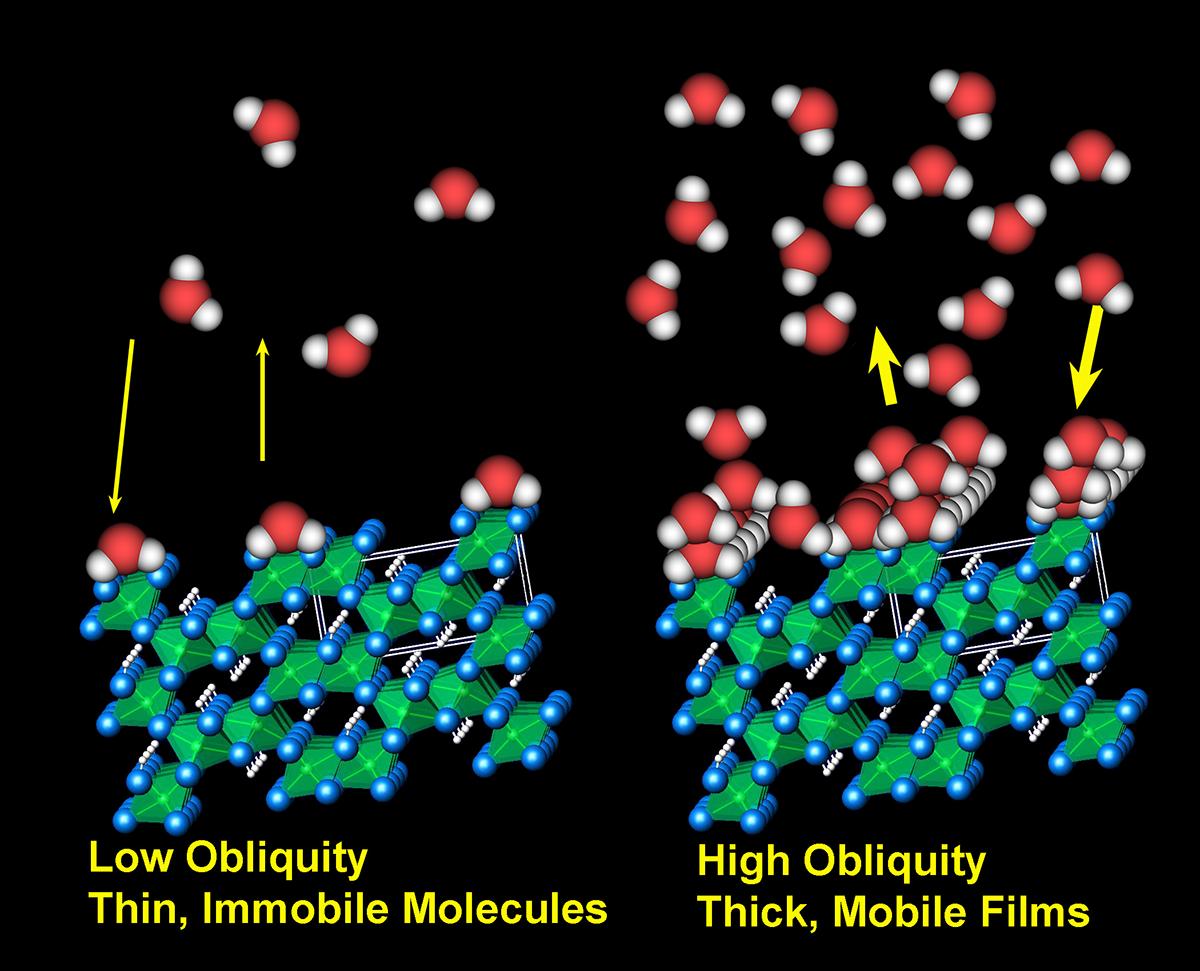
-
PIA11713:
-
Adsorbed Water Illustration
Full Resolution:
TIFF
(3.5 MB)
JPEG
(127.6 kB)
|
|
|
2008-12-15 |
Mars
|
Phoenix
|
|
3456x3000x3 |
|
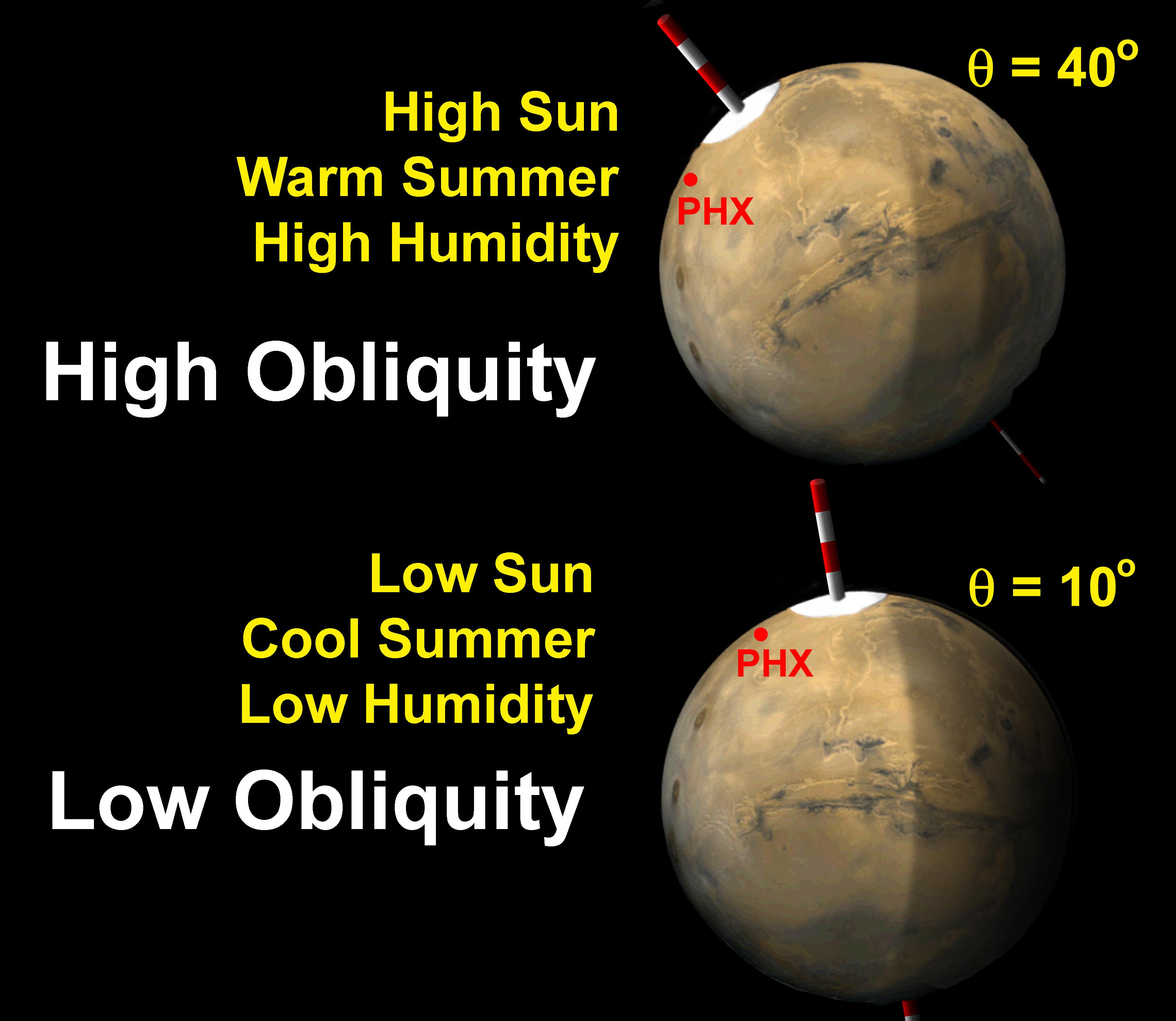
-
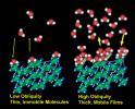
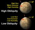
PIA11714:
-
Mars Obliquity Cycle Illustration
Full Resolution:
TIFF
(31.1 MB)
JPEG
(451.3 kB)
|
|
|
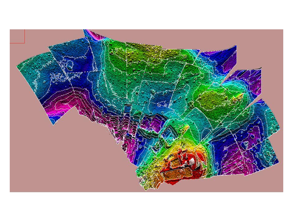
2008-12-15 |
Mars
|
Phoenix
|
|
960x720x3 |
|
-
PIA11715:
-
Contour Map of Mars' Surface Beside Phoenix
Full Resolution:
TIFF
(2.077 MB)
JPEG
(152.7 kB)
|
|
|
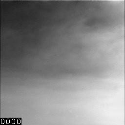
2008-12-15 |
Mars
|
Phoenix
|
Surface Stereo Imager (SSI)
|
256x256x3 |
|
-
PIA11716:
-
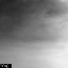
Dark Skies and Clouds Move in at Phoenix site
Full Resolution:
TIFF
(67.38 kB)
JPEG
(4.825 kB)
|
|
|
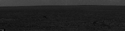
2008-12-15 |
Mars
|
Phoenix
|
Surface Stereo Imager (SSI)
|
1024x1024x1 |
|
-
PIA11717:
-
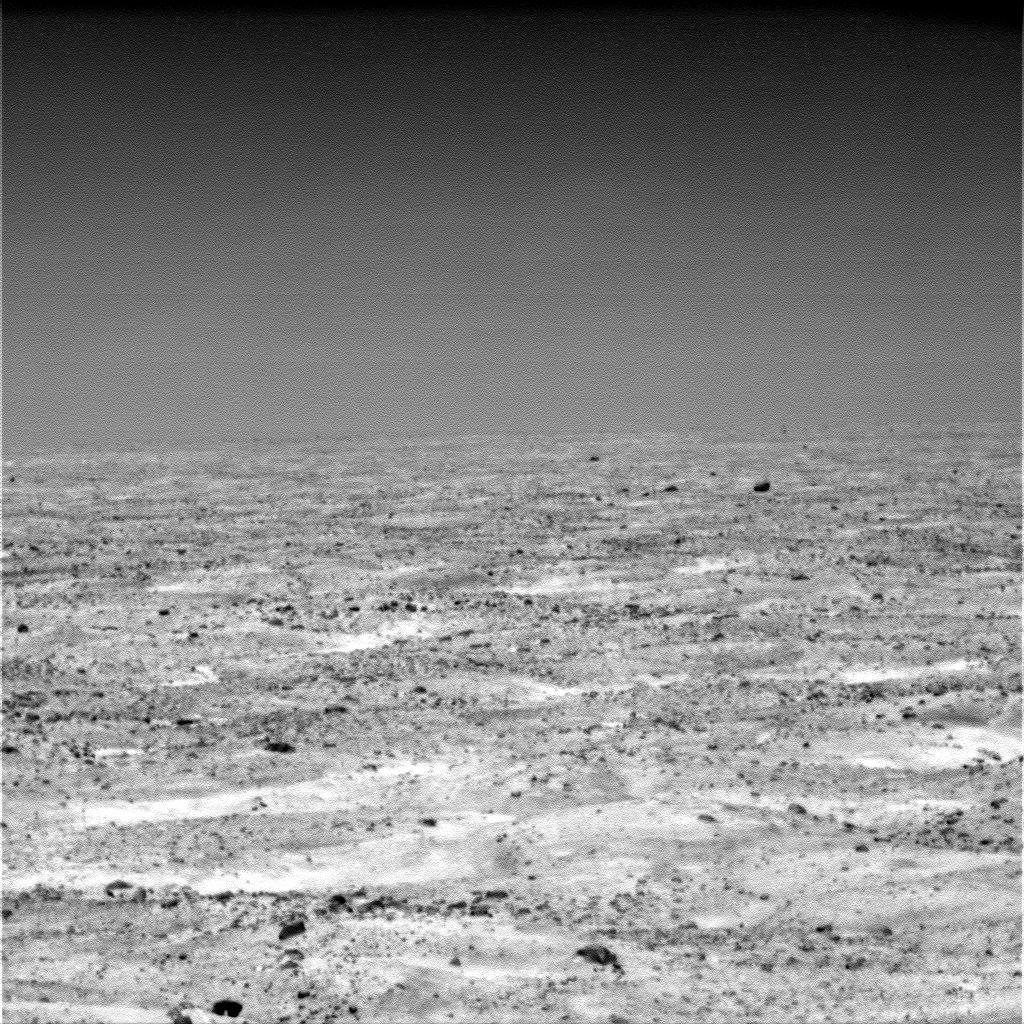
Martian Plain in Late Summer
Full Resolution:
TIFF
(1.05 MB)
JPEG
(310 kB)
|
|
|
2008-12-15 |
Mars
|
Phoenix
|
Surface Stereo Imager (SSI)
|
3000x3000x3 |
|
-
PIA11718:
-
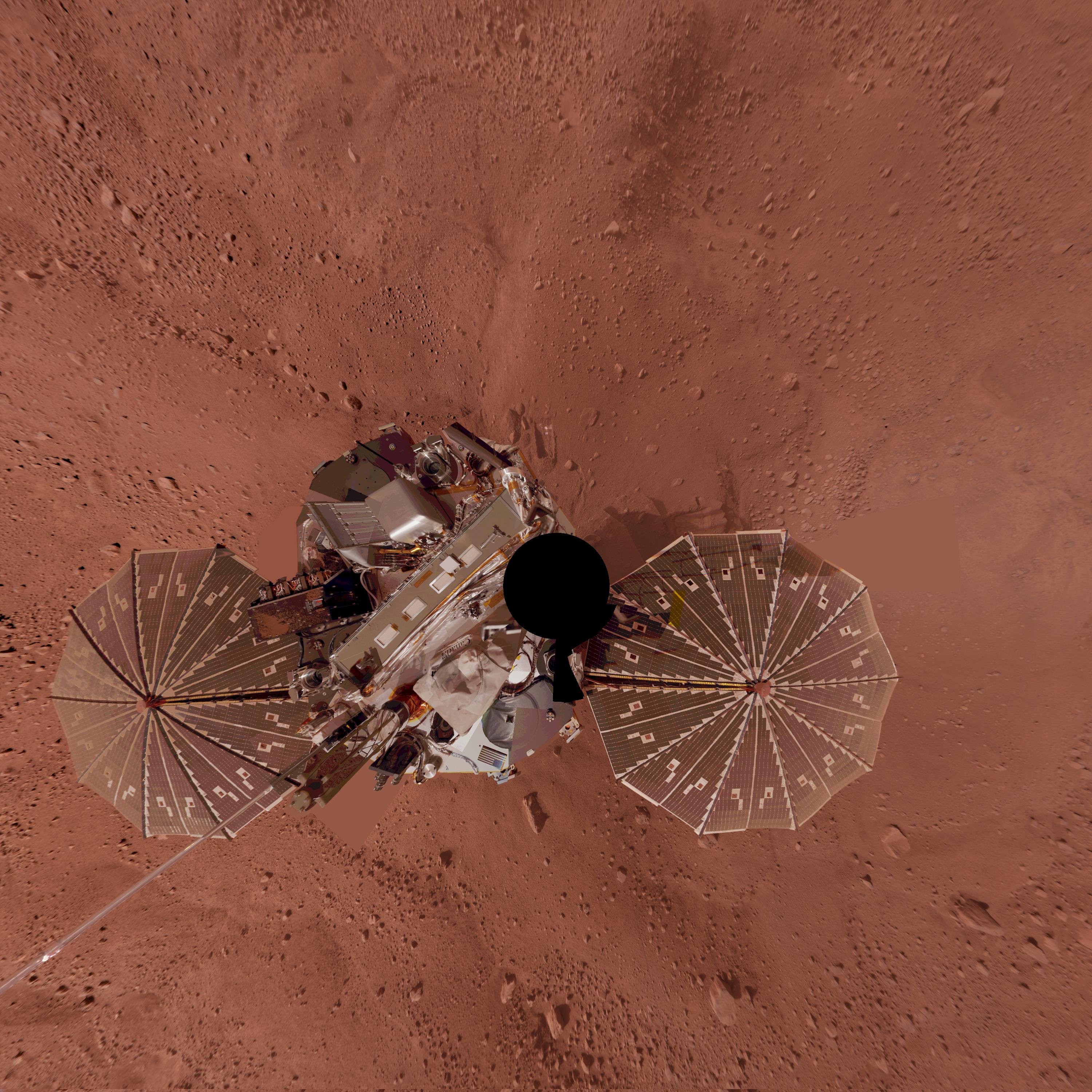
Phoenix Lander on Mars with Surrounding Terrain, Vertical Projection
Full Resolution:
TIFF
(27 MB)
JPEG
(1.045 MB)
|
|
|
2008-12-15 |
Mars
|
Phoenix
|
Surface Stereo Imager (SSI)
|
3000x3000x3 |
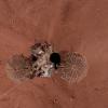
|
-
PIA11719:
-
Phoenix Lander Self Portrait on Mars, Vertical Projection
Full Resolution:
TIFF
(27 MB)
JPEG
(1.184 MB)
|
|
|
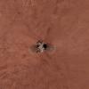
2008-12-15 |
Mars
|
Phoenix
|
Surface Stereo Imager (SSI)
|
720x720x3 |
|
-
PIA11720:
-
'La Mancha' Trench Dug by Phoenix Mars Lander
Full Resolution:
TIFF
(1.557 MB)
JPEG
(128.1 kB)
|
|
|
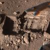
2008-12-15 |
Mars
|
Phoenix
|
Surface Stereo Imager (SSI)
Thermal and Electrical Conductivity Probe
|
1152x1063x3 |
|
-
PIA11721:
-
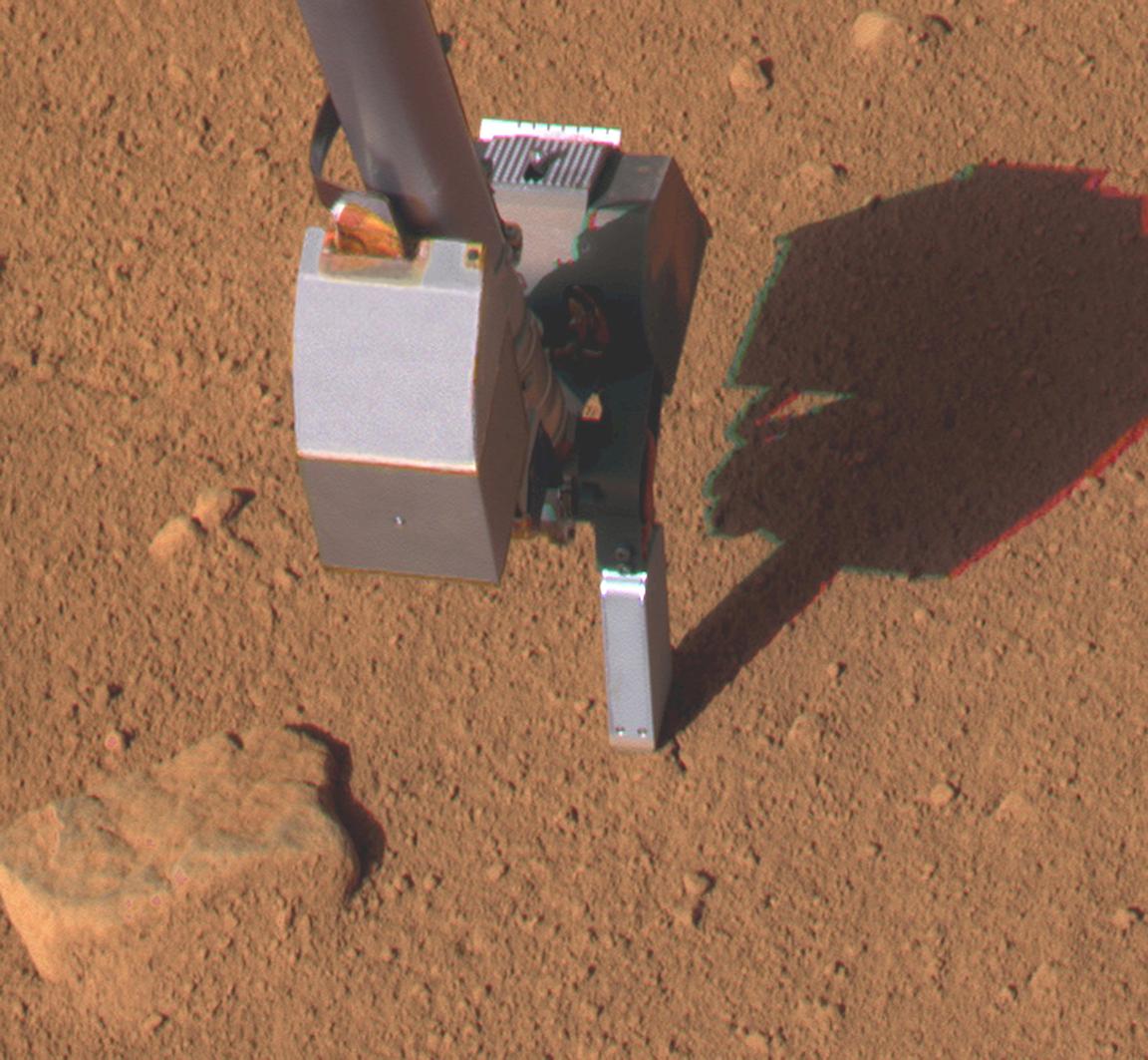
Conductivity Probe Inserted in Martian Soil, Sol 46
Full Resolution:
TIFF
(3.678 MB)
JPEG
(161.7 kB)
|
|
|
2008-12-15 |
Mars
|
Phoenix
|
Thermal and Electrical Conductivity Probe
|
714x2000x3 |
|
-
PIA11722:
-
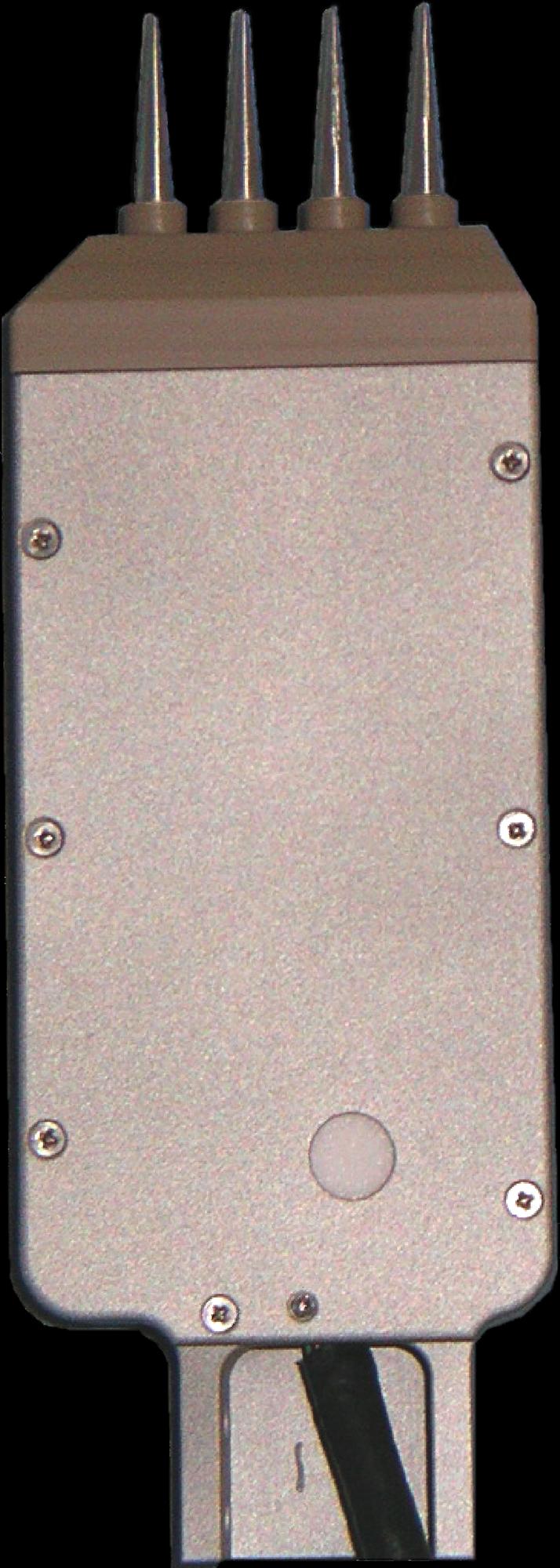
Conductivity Probe
Full Resolution:
TIFF
(4.29 MB)
JPEG
(167.6 kB)
|
|
|
2008-12-15 |
Mars
|
Phoenix
|
Surface Stereo Imager (SSI)
|
6000x6000x3 |
|
-
PIA11723:
-
Phoenix Lander on Mars with Surrounding Terrain, Polar Projection
Full Resolution:
TIFF
(108 MB)
JPEG
(3.027 MB)
|
|
|
2008-12-15 |
Mars
|
Phoenix
|
Surface Stereo Imager (SSI)
|
512x512x3 |
|
-
PIA11724:
-
Frost seen on Snow White Trench
Full Resolution:
TIFF
(787.5 kB)
JPEG
(57.71 kB)
|
|
|
2008-12-15 |
Mars
|
Phoenix
|
Surface Stereo Imager (SSI)
|
1024x1024x3 |
|
-
PIA11725:
-
One Last Look at the Martian Arctic
Full Resolution:
TIFF
(3.15 MB)
JPEG
(239.7 kB)
|
|
|
2008-12-15 |
Mars
|
2001 Mars Odyssey
|
THEMIS
|
1352x2920x1 |
|
-
PIA11279:
-
Landslides
Full Resolution:
TIFF
(3.952 MB)
JPEG
(261.8 kB)
|
|
|
2008-12-16 |
Mars
|
2001 Mars Odyssey
|
THEMIS
|
1334x2916x1 |

|
-
PIA11280:
-
Volcano
Full Resolution:
TIFF
(3.894 MB)
JPEG
(438.5 kB)
|
|
|
2008-12-17 |
Mars
|
2001 Mars Odyssey
|
THEMIS
|
1343x2768x1 |

|
-
PIA11281:
-
Lava Channels
Full Resolution:
TIFF
(3.721 MB)
JPEG
(364.7 kB)
|
|
|
2008-12-18 |
Mars
|
2001 Mars Odyssey
|
THEMIS
|
1411x2929x1 |

|
-
PIA11282:
-
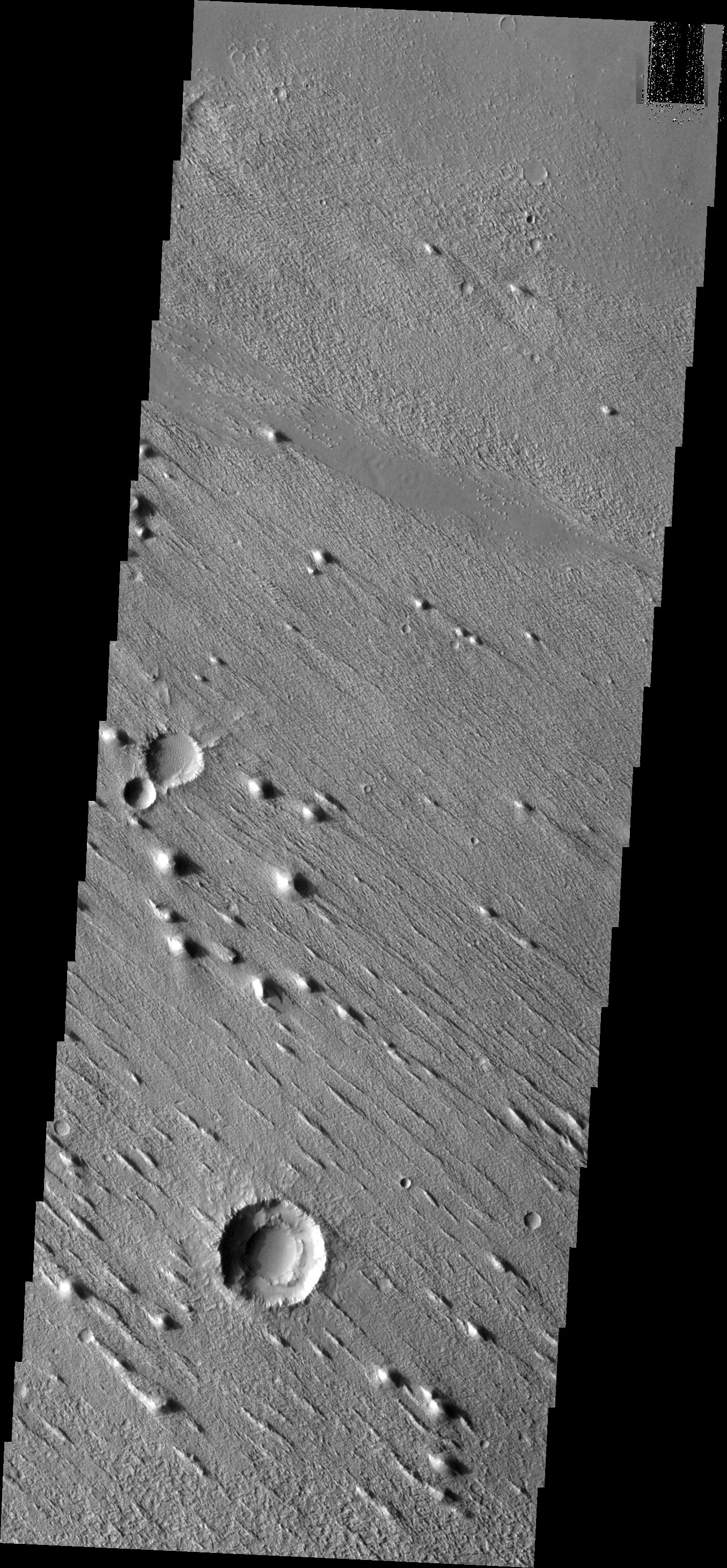
Tempe Terra
Full Resolution:
TIFF
(4.138 MB)
JPEG
(392.9 kB)
|
|
|
2008-12-18 |
Mars
|
Mars Reconnaissance Orbiter (MRO)
|
CRISM
|
677x640x3 |
|
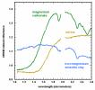
-
PIA11728:
-
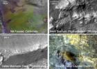
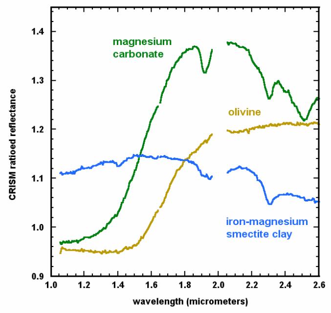
Mineral Spectra from Nili Fossae, Mars
Full Resolution:
TIFF
(435.5 kB)
JPEG
(43.35 kB)
|
|
|
2008-12-18 |
Mars
|
Mars Reconnaissance Orbiter (MRO)
|
CRISM
|
2159x1055x3 |
|
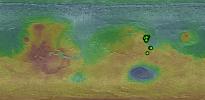
-
PIA11729:
-
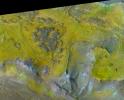
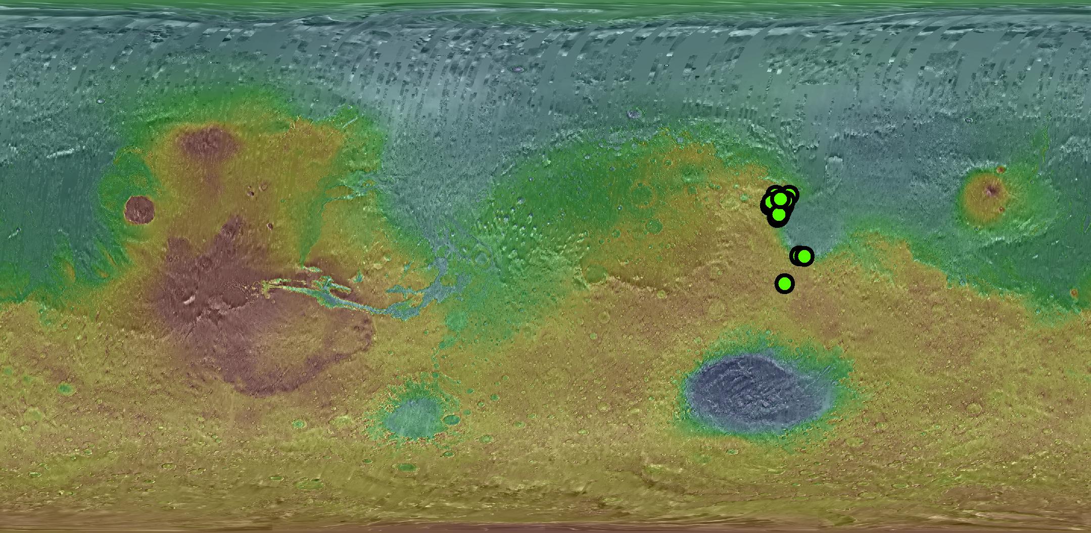
Known Locations of Carbonate Rocks on Mars
Full Resolution:
TIFF
(6.842 MB)
JPEG
(459.5 kB)
|
|
|
2008-12-18 |
Mars
|
Mars Reconnaissance Orbiter (MRO)
|
CRISM
|
4222x3413x3 |
|
-
PIA11730:
-
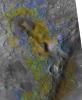
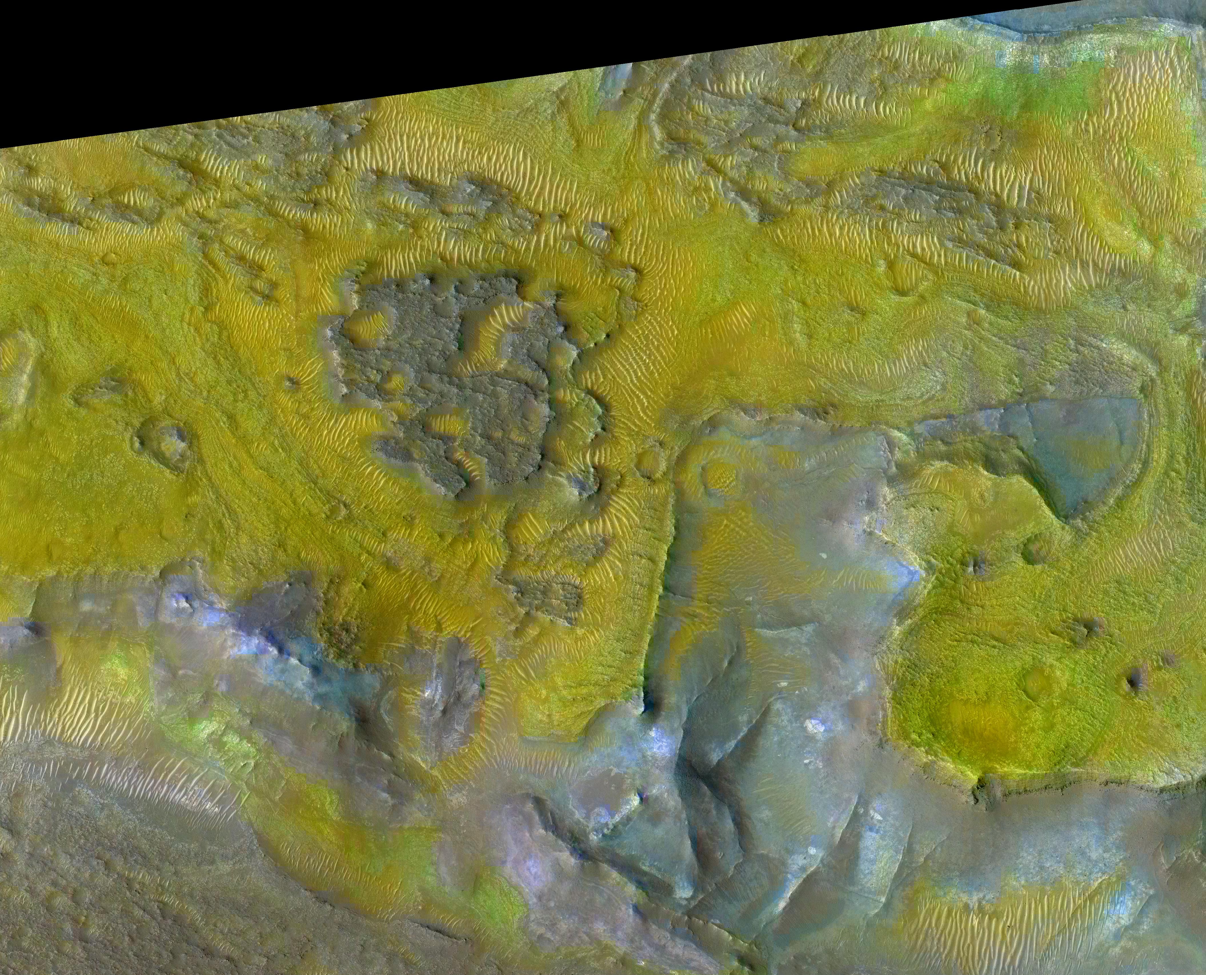
Carbonate-Olivine Relationship in Nile Fossae, Mars
Full Resolution:
TIFF
(43.23 MB)
JPEG
(2.86 MB)
|
|
|
2008-12-18 |
Mars
|
Mars Reconnaissance Orbiter (MRO)
|
CRISM
|
5086x6227x3 |
|
-
PIA11731:
-
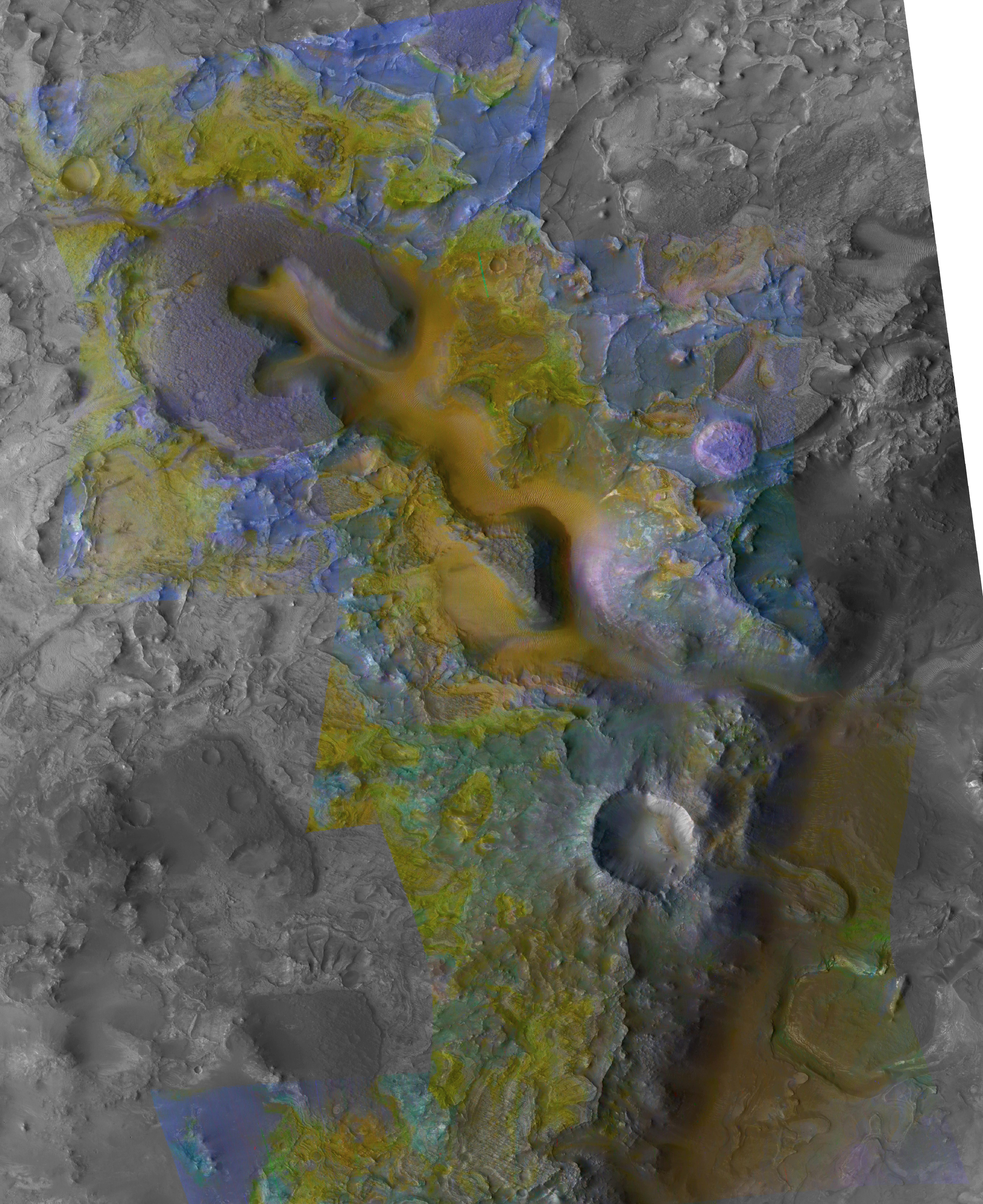
Context of Carbonate Rocks in Heavily Eroded Martian Terrain
Full Resolution:
TIFF
(95.01 MB)
JPEG
(3.072 MB)
|
|
|
2008-12-18 |
Mars
|
Mars Reconnaissance Orbiter (MRO)
|
CRISM
|
2718x1936x3 |
|
-
PIA11732:
-
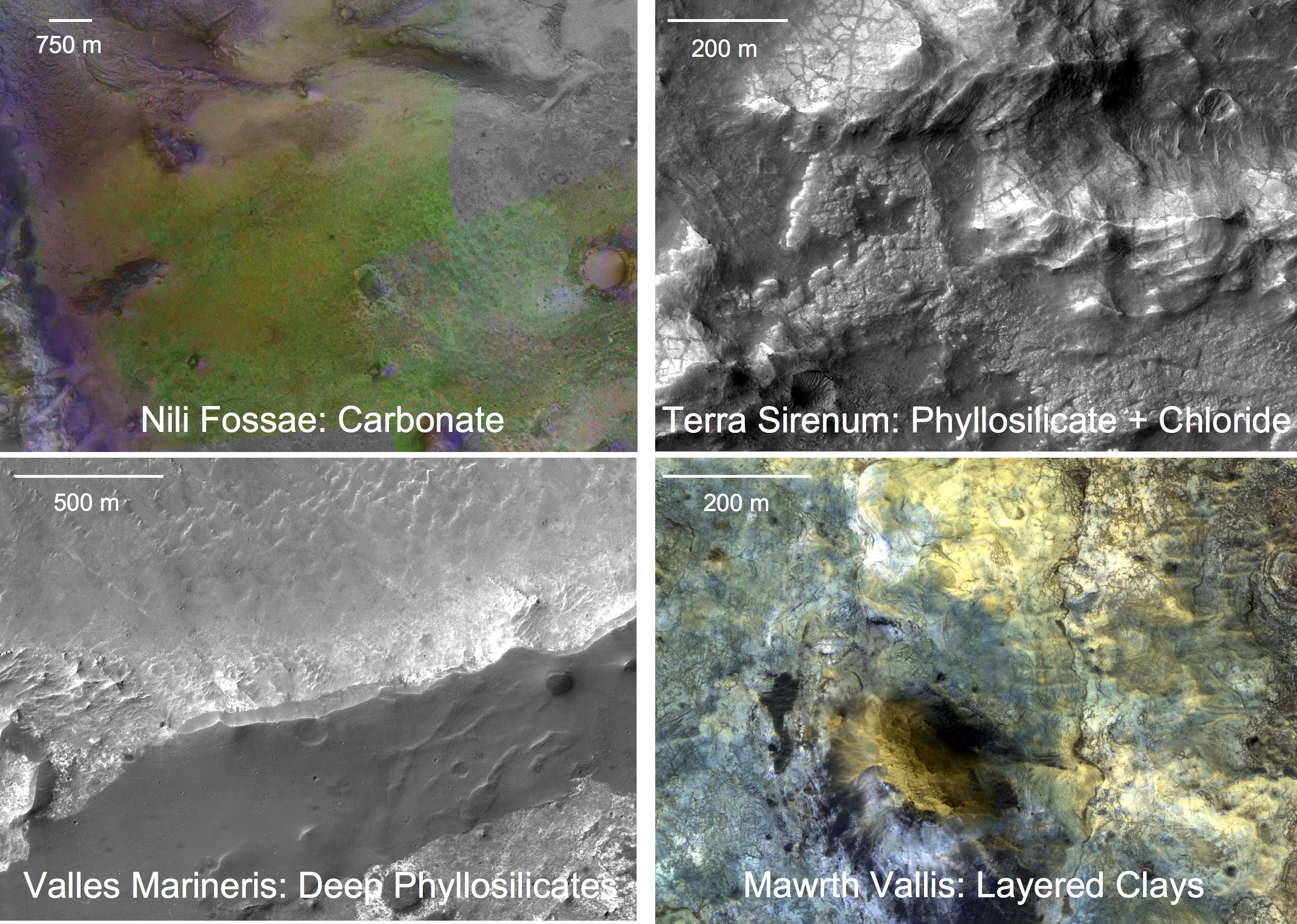
Four Types of Deposits From Wet Conditions on Early Mars
Full Resolution:
TIFF
(15.8 MB)
JPEG
(886.6 kB)
|
|
|
2008-12-19 |
Mars
|
2001 Mars Odyssey
|
THEMIS
|
1323x2933x1 |

|
-
PIA11283:
-
Daedalia Planum
Full Resolution:
TIFF
(3.885 MB)
JPEG
(608.1 kB)
|
|
|
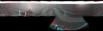
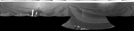
2008-12-21 |
Mars
|
Phoenix
|
Surface Stereo Imager (SSI)
|
26642x6250x3 |
|
-
PIA11734:
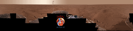
Full-Circle Color Panorama of Phoenix Landing Site on Northern Mars
Full Resolution:
TIFF
(499.5 MB)
JPEG
(8.879 MB)
|
|
|
2008-12-22 |
Mars
|
2001 Mars Odyssey
|
THEMIS
|
1381x2919x1 |
|
-
PIA11284:
-
Platy Lava Flow
Full Resolution:
TIFF
(4.036 MB)
JPEG
(457.8 kB)
|
|
|
2008-12-23 |
Mars
|
2001 Mars Odyssey
|
THEMIS
|
1345x2926x1 |

|
-
PIA11285:
-
Dunes
Full Resolution:
TIFF
(3.94 MB)
JPEG
(398.1 kB)
|
|
|
2008-12-24 |
Mars
|
2001 Mars Odyssey
|
THEMIS
|
1356x2918x1 |

|
-
PIA11286:
-
Dunes
Full Resolution:
TIFF
(3.961 MB)
JPEG
(257.2 kB)
|
|
|
2008-12-25 |
Mars
|
2001 Mars Odyssey
|
THEMIS
|
1346x2918x1 |
|
-
PIA11287:
-
Dark Slope Streak
Full Resolution:
TIFF
(3.932 MB)
JPEG
(255.3 kB)
|
|
|
2008-12-26 |
Mars
|
2001 Mars Odyssey
|
THEMIS
|
1355x2926x1 |
|
-
PIA11288:
-
Ganges Chasma
Full Resolution:
TIFF
(3.969 MB)
JPEG
(330.6 kB)
|
|
|
2008-12-29 |
Mars
|
2001 Mars Odyssey
|
THEMIS
|
1407x2929x1 |
|
-
PIA11289:
-
Channel
Full Resolution:
TIFF
(4.126 MB)
JPEG
(410.9 kB)
|
|
|
2008-12-30 |
Mars
|
2001 Mars Odyssey
|
THEMIS
|
1364x2918x1 |

|
-
PIA11290:
-
Volcanic Vent
Full Resolution:
TIFF
(3.984 MB)
JPEG
(434.5 kB)
|
|
|
2008-12-31 |
Mars
|
2001 Mars Odyssey
|
THEMIS
|
1332x2922x1 |
|
-
PIA11291:
-
Candor Chasma
Full Resolution:
TIFF
(3.896 MB)
JPEG
(327.5 kB)
|
|
|
2009-01-01 |
Mars
|
2001 Mars Odyssey
|
THEMIS
|
1137x2914x1 |

|
-
PIA11292:
-
Polar Dunes
Full Resolution:
TIFF
(3.317 MB)
JPEG
(320.4 kB)
|
|
|
2009-01-02 |
Mars
|
2001 Mars Odyssey
|
THEMIS
|
567x3358x1 |

|
-
PIA11293:
-
Polar Textures
Full Resolution:
TIFF
(1.906 MB)
JPEG
(139.7 kB)
|
|
|
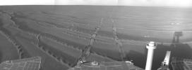
2009-01-05 |
Mars
|
2001 Mars Odyssey
|
THEMIS
|
1386x2925x1 |

|
-
PIA11294:
-
Crater Dunes
Full Resolution:
TIFF
(4.059 MB)
JPEG
(386.4 kB)
|
|
|
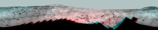
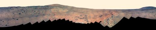
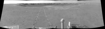
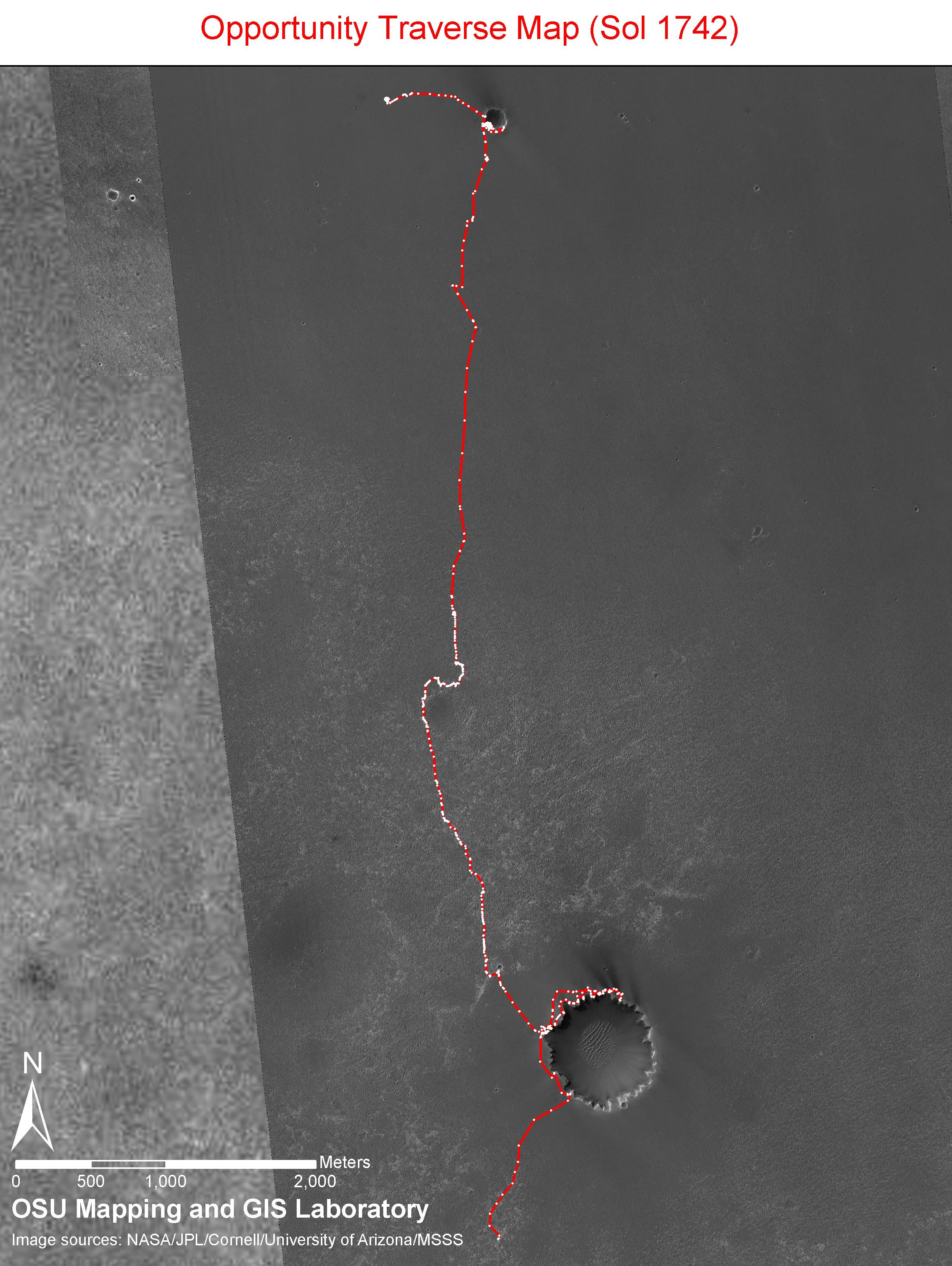
2009-01-05 |
Mars
|
Mars Exploration Rover (MER)
|
|
2442x3246x3 |
|
-
PIA11737:
-
Opportunity Sol 1742 Traverse Map
Full Resolution:
TIFF
(23.81 MB)
JPEG
(697.8 kB)
|
|
|
2009-01-05 |
Mars
|
Mars Exploration Rover (MER)
|
|
2442x3246x3 |
|
-
PIA11738:
-
Opportunity Sol 1742 Traverse Map with Endeavour Crater
Full Resolution:
TIFF
(23.81 MB)
JPEG
(1.207 MB)
|
|
|
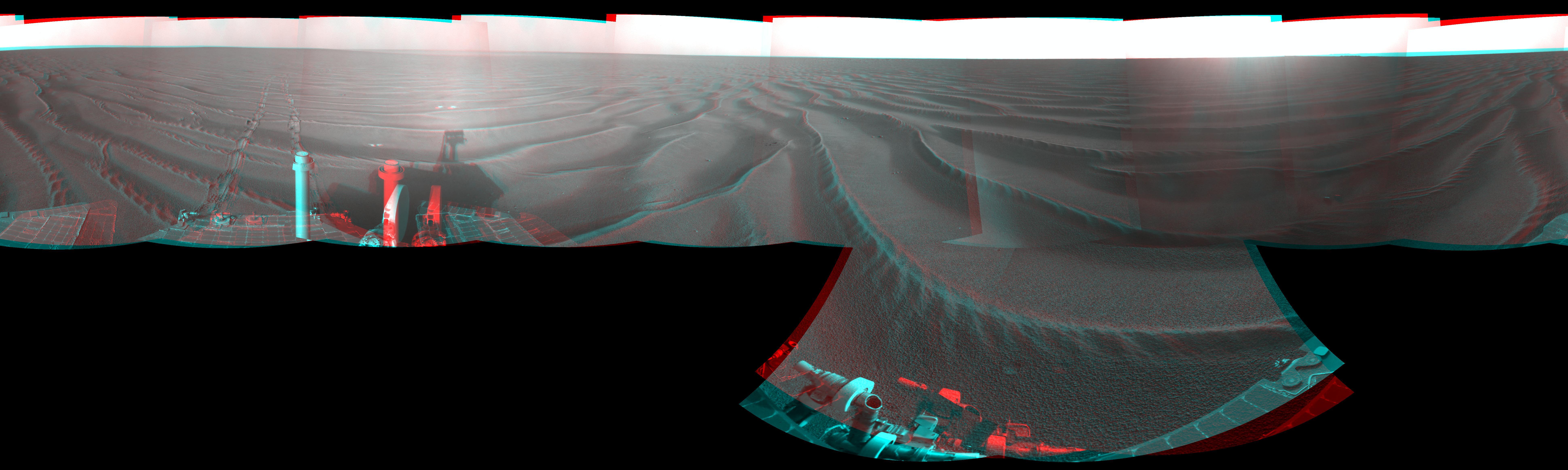
2009-01-05 |
Mars
|
Mars Exploration Rover (MER)
|
Navigation Camera
|
7753x2324x3 |
|
-
PIA11739:
-
Opportunity's Surroundings on Sol 1687 (Stereo)
Full Resolution:
TIFF
(54.05 MB)
JPEG
(1.201 MB)
|
|
|
2009-01-05 |
Mars
|
Mars Exploration Rover (MER)
|
Navigation Camera
|
4099x4099x1 |

|
-
PIA11740:
-
Opportunity's Surroundings on Sol 1687 (Polar)
Full Resolution:
TIFF
(16.83 MB)
JPEG
(1.114 MB)
|
|
|
2009-01-05 |
Mars
|
Mars Exploration Rover (MER)
|
Navigation Camera
|
4000x4000x1 |
|
-
PIA11741:
-
Opportunity's Surroundings on Sol 1687 (Vertical)
Full Resolution:
TIFF
(16.02 MB)
JPEG
(1.013 MB)
|
|
|
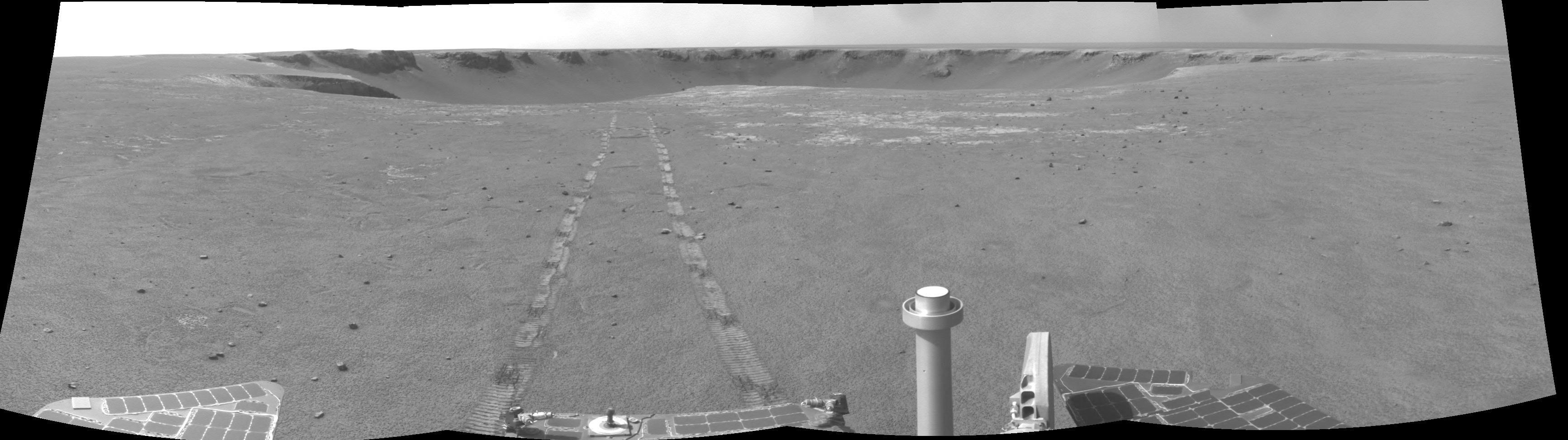
2009-01-05 |
Mars
|
Mars Exploration Rover (MER)
|
Navigation Camera
|
7688x1797x1 |
|
-
PIA11742:
Opportunity's Surroundings on Sol 1687
Full Resolution:
TIFF
(13.83 MB)
JPEG
(1.02 MB)
|
|
|
2009-01-05 |
Mars
|
Mars Exploration Rover (MER)
|
Navigation Camera
|
2368x870x1 |
|
-
PIA11743:
-
View from Southwest of Victoria Crater
Full Resolution:
TIFF
(2.063 MB)
JPEG
(205.1 kB)
|
|
|
2009-01-05 |
Mars
|
Mars Exploration Rover (MER)
|
Panoramic Camera
|
23123x4477x3 |
|
-
PIA11744:
Full-Circle 'Bonestell' Panorama from Spirit (Stereo)
Full Resolution:
TIFF
(310.6 MB)
JPEG
(11.21 MB)
|
|
|
2009-01-05 |
Mars
|
Mars Exploration Rover (MER)
|
Panoramic Camera
|
23123x4477x3 |
|
-
PIA11745:
Full-Circle 'Bonestell' Panorama from Spirit (False Color)
Full Resolution:
TIFF
(310.6 MB)
JPEG
(9.044 MB)
|
|
|
2009-01-05 |
Mars
|
Mars Exploration Rover (MER)
|
Panoramic Camera
|
23123x4477x3 |

|
-
PIA11746:
Full-Circle 'Bonestell' Panorama from Spirit
Full Resolution:
TIFF
(310.6 MB)
JPEG
(6.833 MB)
|
|
|
2009-01-06 |
Mars
|
2001 Mars Odyssey
|
THEMIS
|
1415x2928x1 |
|
-
PIA11295:
-
Channel
Full Resolution:
TIFF
(4.148 MB)
JPEG
(497.7 kB)
|
|
|
2009-01-07 |
Mars
|
2001 Mars Odyssey
|
THEMIS
|
1379x2918x1 |
|
-
PIA11296:
-
Lycus Sulci
Full Resolution:
TIFF
(4.029 MB)
JPEG
(251.1 kB)
|
|
|
2009-01-08 |
Mars
|
2001 Mars Odyssey
|
THEMIS
|
1387x2916x1 |
|
-
PIA11297:
-
Marte Vallis
Full Resolution:
TIFF
(4.049 MB)
JPEG
(432.8 kB)
|
|
|
2009-01-08 |
Mars
|
Mars Exploration Rover (MER)
|
Navigation Camera
|
3465x972x1 |
|
-
PIA11750:
Places to Go, Things to See
Full Resolution:
TIFF
(3.372 MB)
JPEG
(355.9 kB)
|
|
|
2009-01-08 |
Mars
|
Mars Reconnaissance Orbiter (MRO)
|
HiRISE
|
873x1103x3 |
|
-
PIA11751:
-
A Change of Seasons at Phoenix Site
Full Resolution:
TIFF
(2.892 MB)
JPEG
(325.9 kB)
|
|
|
2009-01-09 |
Mars
|
2001 Mars Odyssey
|
THEMIS
|
1280x5978x1 |
|
-
PIA11298:
-
Landslide
Full Resolution:
TIFF
(7.66 MB)
JPEG
(368.7 kB)
|


