My
List |
Addition Date
|
Target
|
Mission
|
Instrument
|
Size
|

|
2014-11-07 |
Mars
|
Mars Reconnaissance Orbiter (MRO)
|
HiRISE
|
1267x719x3 |
|
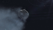
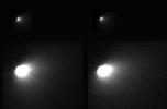
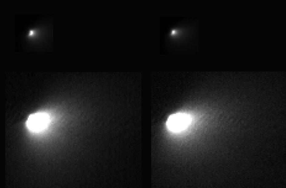
-
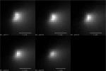
PIA19045:
-
Mars Orbiter Observes Comet Siding Spring (Animation)

Full Resolution:
TIFF
(2.734 MB)
JPEG
(36.37 kB)
|
|
|
2014-11-07 |
Mars
|
Mars Reconnaissance Orbiter (MRO)
|
HiRISE
|
700x482x3 |
|
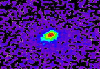
-
PIA19044:
-
Mars-Flyby Comet in False Color
Full Resolution:
TIFF
(1.013 MB)
JPEG
(77.35 kB)
|
|
|
2014-11-07 |
Mars
|
Mars Reconnaissance Orbiter (MRO)
|
CRISM
|
1878x794x3 |
|
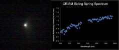
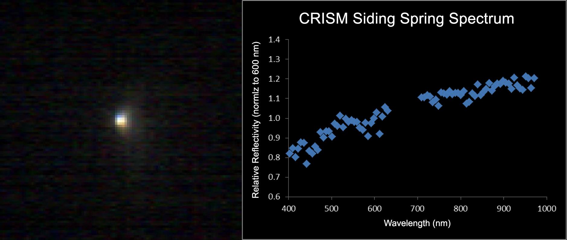
-
PIA18865:
-
Mars-Orbiting Spectrometer Shows Dusty Comet's Spectrum
Full Resolution:
TIFF
(4.475 MB)
JPEG
(94.77 kB)
|
|
|
2014-11-07 |
Mars
|
MAVEN
|
Imaging Ultraviolet Spectrograph (IUVS)
|
2048x1101x3 |
|
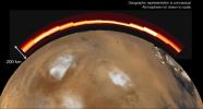
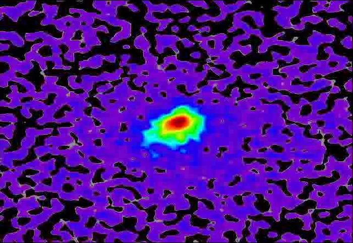
-
PIA18864:
-
Emission from Ionized Magnesium in Mars' Atmosphere After Comet Flyby
Full Resolution:
TIFF
(6.767 MB)
JPEG
(150.6 kB)
|
|
|
2014-11-07 |
Mars
|
Mars Reconnaissance Orbiter (MRO)
|
HiRISE
|
1692x1128x1 |
|
-
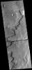
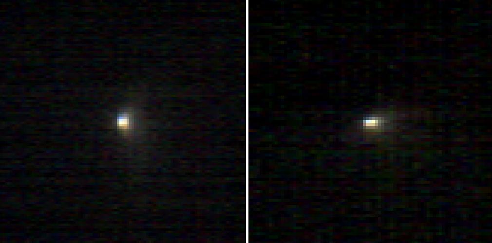
PIA18863:
-
Mars Orbiter Sizes Up Passing Comet
Full Resolution:
TIFF
(1.911 MB)
JPEG
(66.52 kB)
|
|
|
2014-11-07 |
Mars
|
Mars Reconnaissance Orbiter (MRO)
|
HiRISE
|
973x779x3 |
|
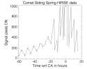
-
PIA18862:
-
Brightness Rhythm of Mars Flyby Comet Is Clue to Rotation Rate
Full Resolution:
TIFF
(759 kB)
JPEG
(58.15 kB)
|
|
|
2014-11-07 |
Mars
|
Mars Reconnaissance Orbiter (MRO)
|
Shallow Subsurface Radar (SHARAD)
|
1534x1024x3 |
|
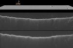
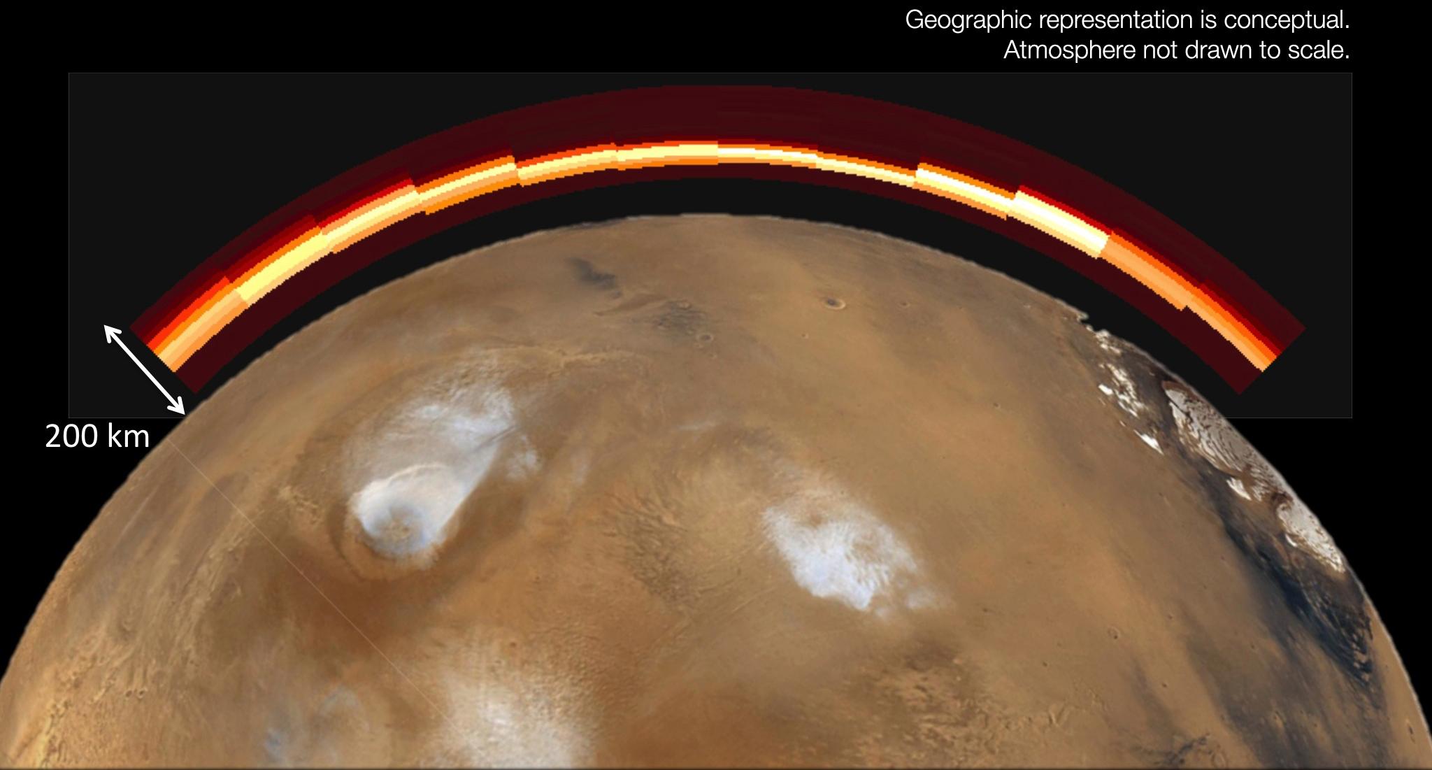
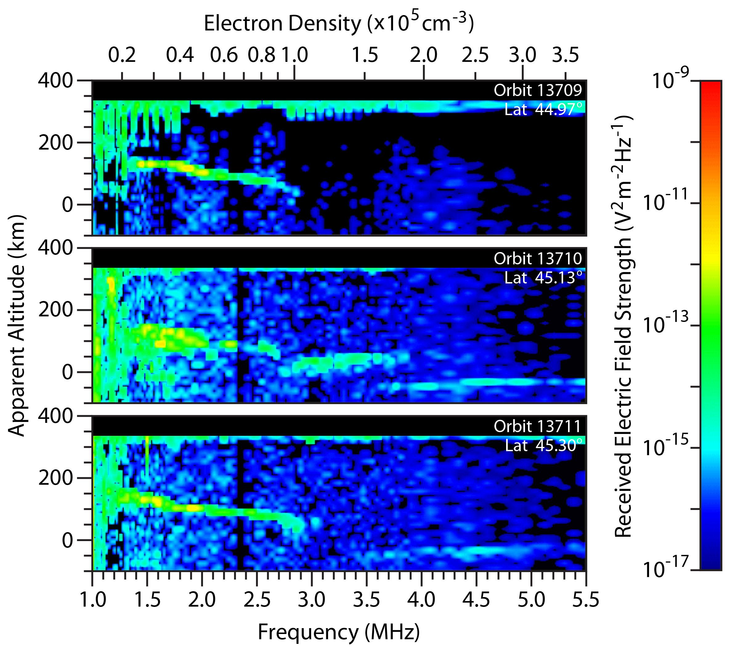
-
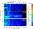
PIA18861:
-
Radar Indication of Effect of Comet Flyby on Martian Ionosphere
Full Resolution:
TIFF
(4.714 MB)
JPEG
(192.9 kB)
|
|
|
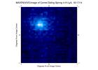
2014-11-07 |
Mars
|
Mars Express (MEX)
|
Mars Advanced Radar for Subsurface and Ionosphere Sounding (MARSIS)
|
2373x2138x3 |
|
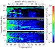
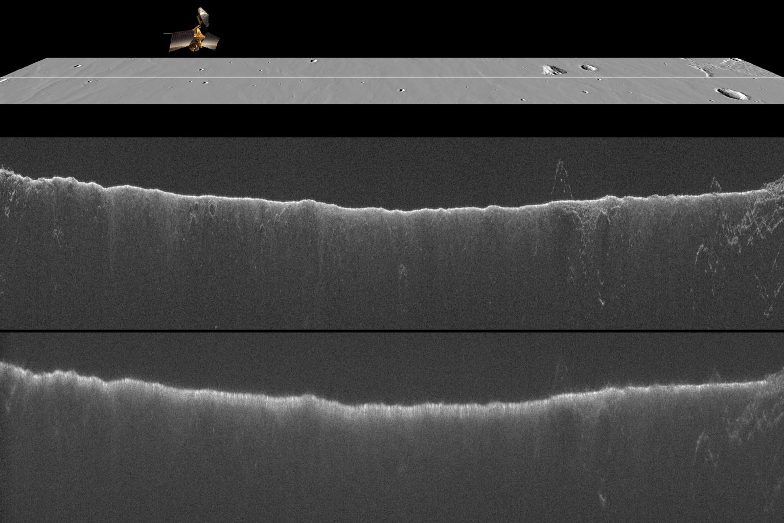
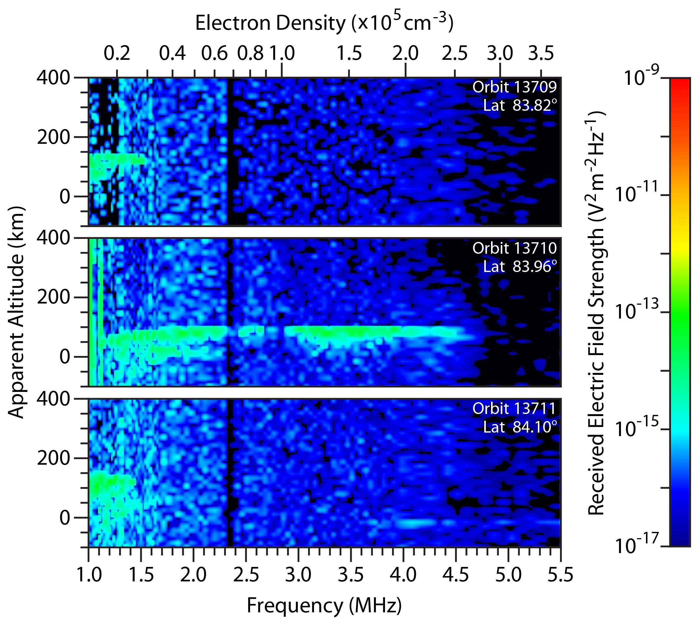
-
PIA18860:
-
Change in Mars' Mid-Latitude Ionosphere After Comet Flyby
Full Resolution:
TIFF
(15.23 MB)
JPEG
(494.5 kB)
|
|
|
2014-11-07 |
Mars
|
Mars Express (MEX)
|
Mars Advanced Radar for Subsurface and Ionosphere Sounding (MARSIS)
|
2373x2138x3 |
|
-
PIA18859:
-
Radar-Detected Change in Martian Near-Polar Ionosphere After Comet's Flyby
Full Resolution:
TIFF
(15.23 MB)
JPEG
(513 kB)
|
|
|
2014-11-07 |
Mars
|
MAVEN
|
Neutral Gas and Ion Mass Spectrometer
|
3001x1916x3 |
|
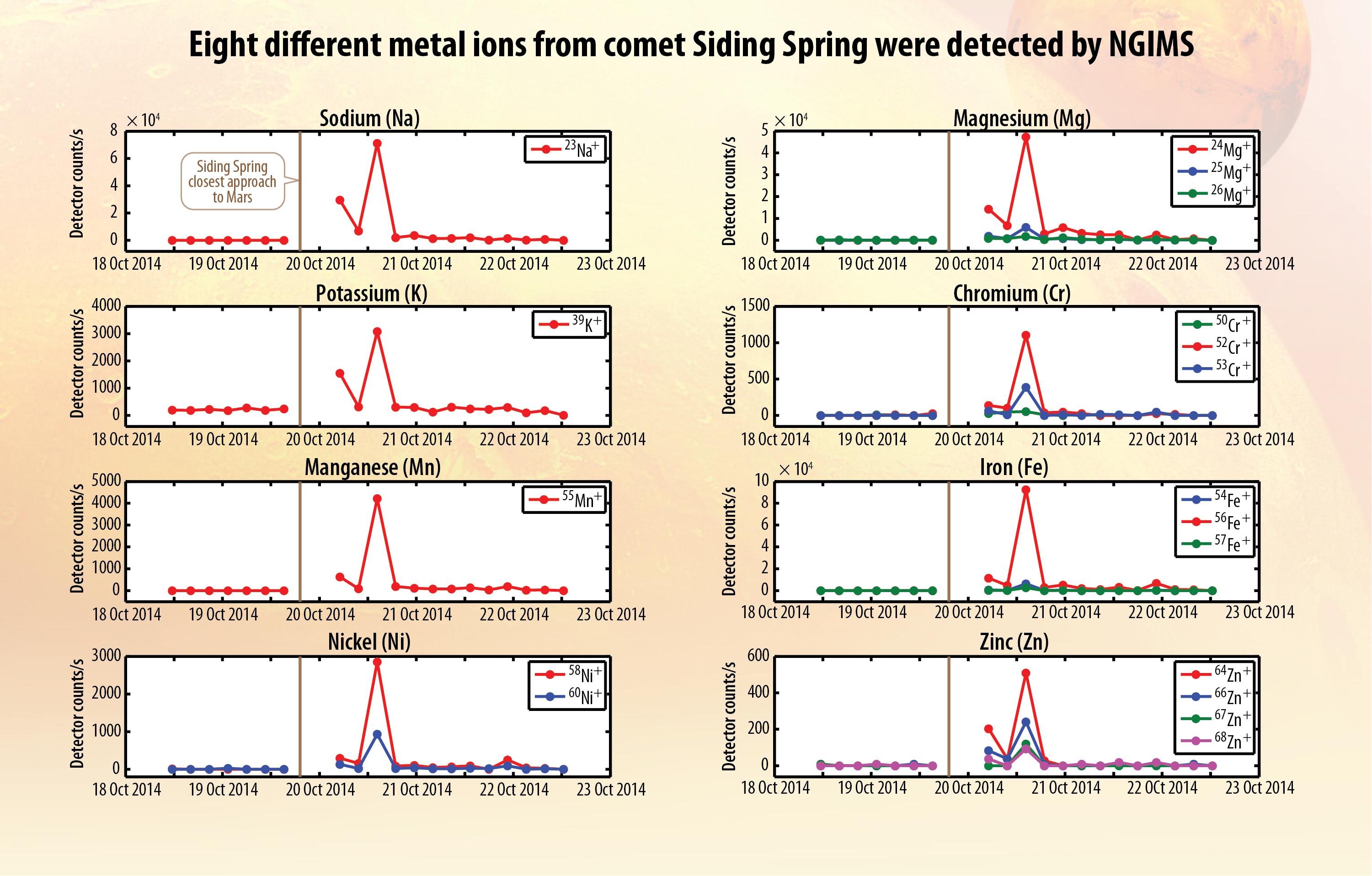
-
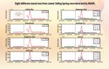
PIA18858:
-
Ions of Eight Metals from Comet Dust Detected in Mars Atmosphere
Full Resolution:
TIFF
(17.26 MB)
JPEG
(533.5 kB)
|
|
|
2014-11-07 |
Mars
|
MAVEN
|
|
2048x1536x3 |
|
-
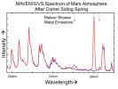
PIA18857:
-
Comet Meteor Shower Put Magnesium and Iron into Martian Atmosphere
Full Resolution:
TIFF
(9.44 MB)
JPEG
(208.1 kB)
|
|
|
2014-11-07 |
Mars
|
MAVEN
|
|
2048x1232x3 |
|
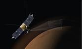
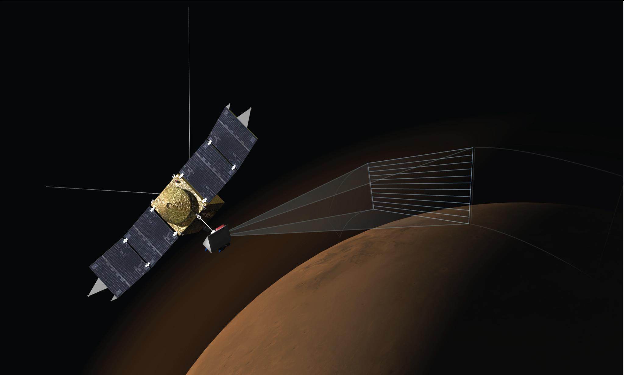
-
PIA18856:
-
Artist's Concept of MAVEN's Imaging Ultraviolet Spectrograph at Work
Full Resolution:
TIFF
(7.572 MB)
JPEG
(94.7 kB)
|
|
|
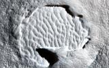
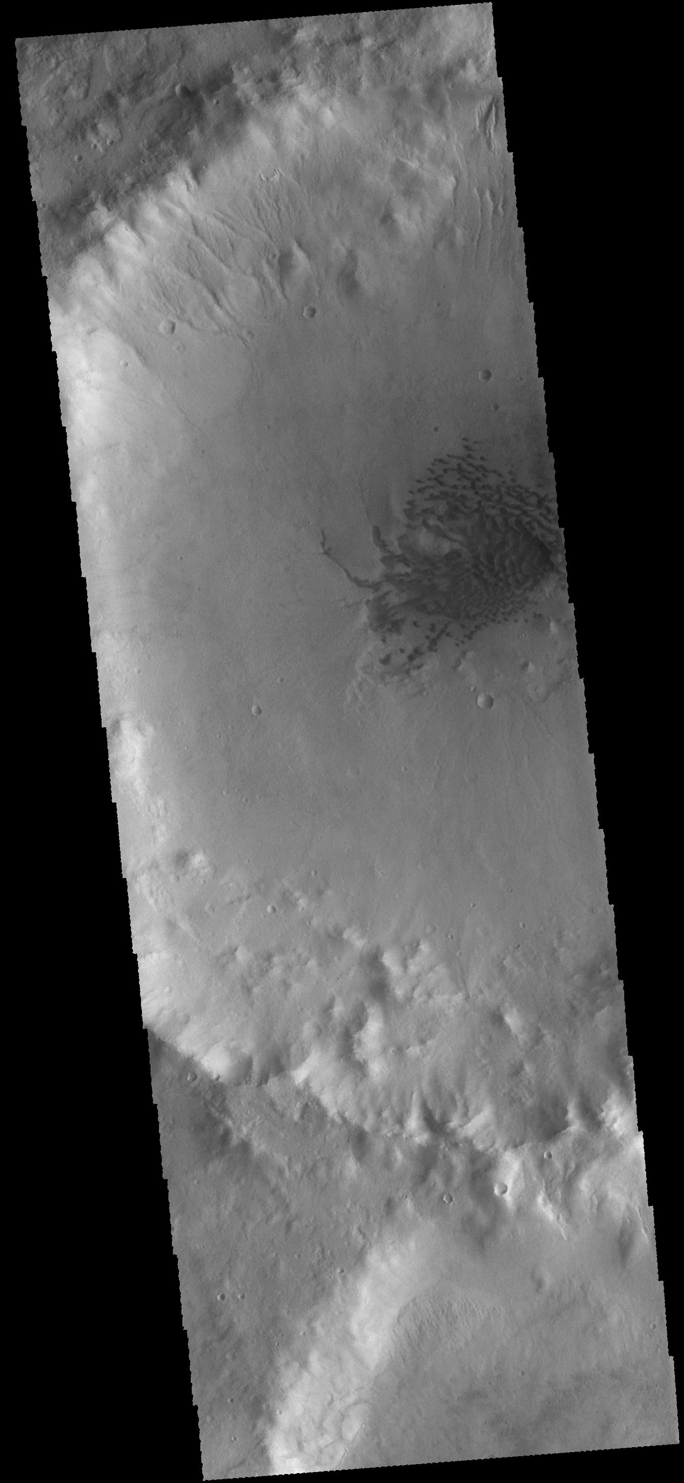
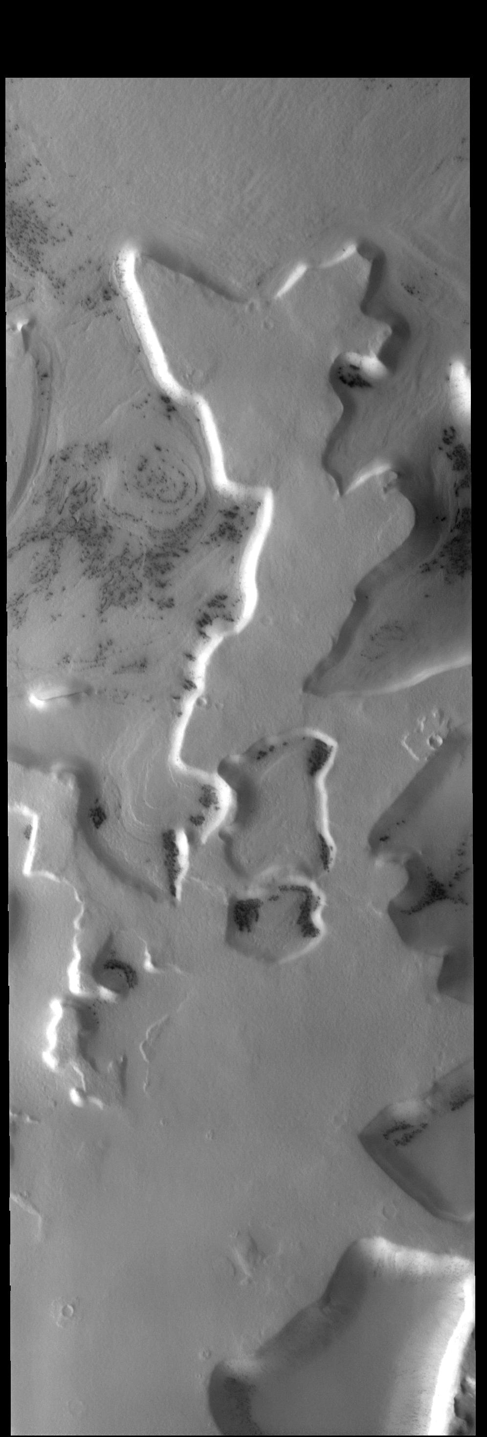
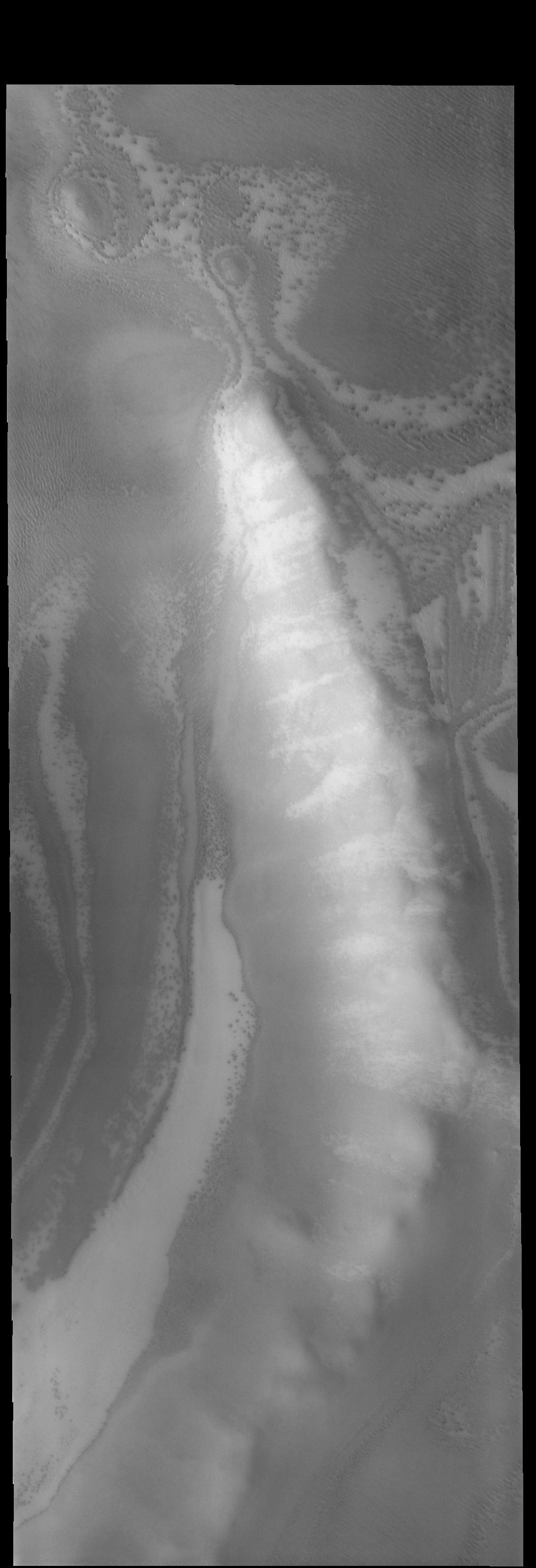
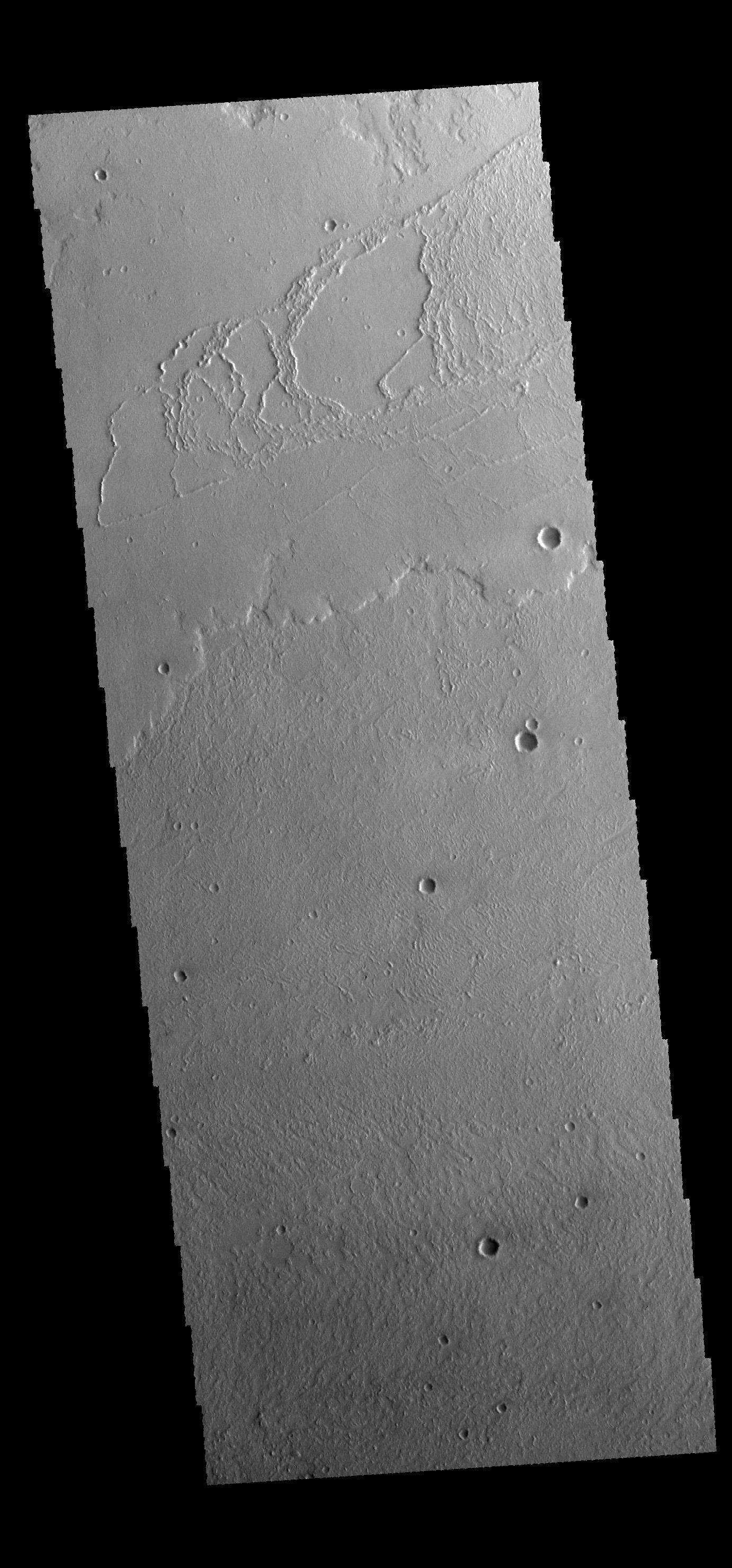
2014-11-07 |
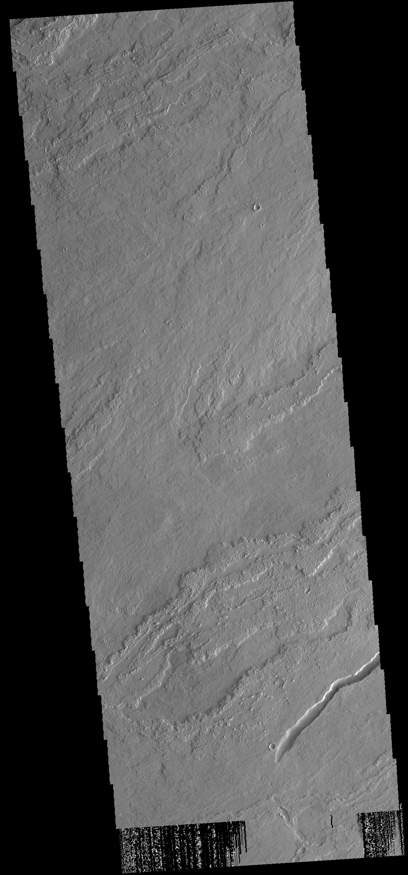
Mars
|
2001 Mars Odyssey
|
THEMIS
|
670x1417x1 |

|
-
PIA18940:
-
Solis Planum
Full Resolution:
TIFF
(950.6 kB)
JPEG
(138.9 kB)
|
|
|
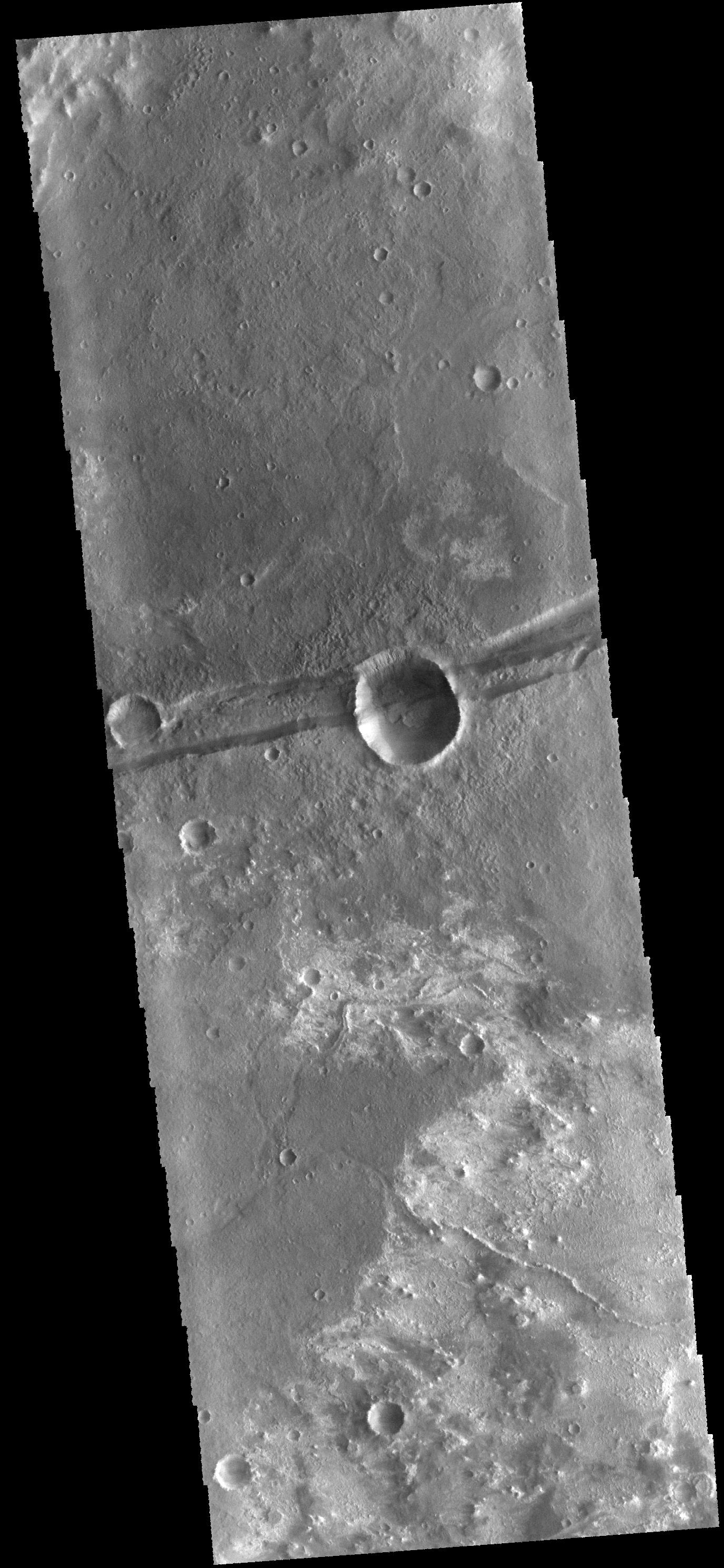
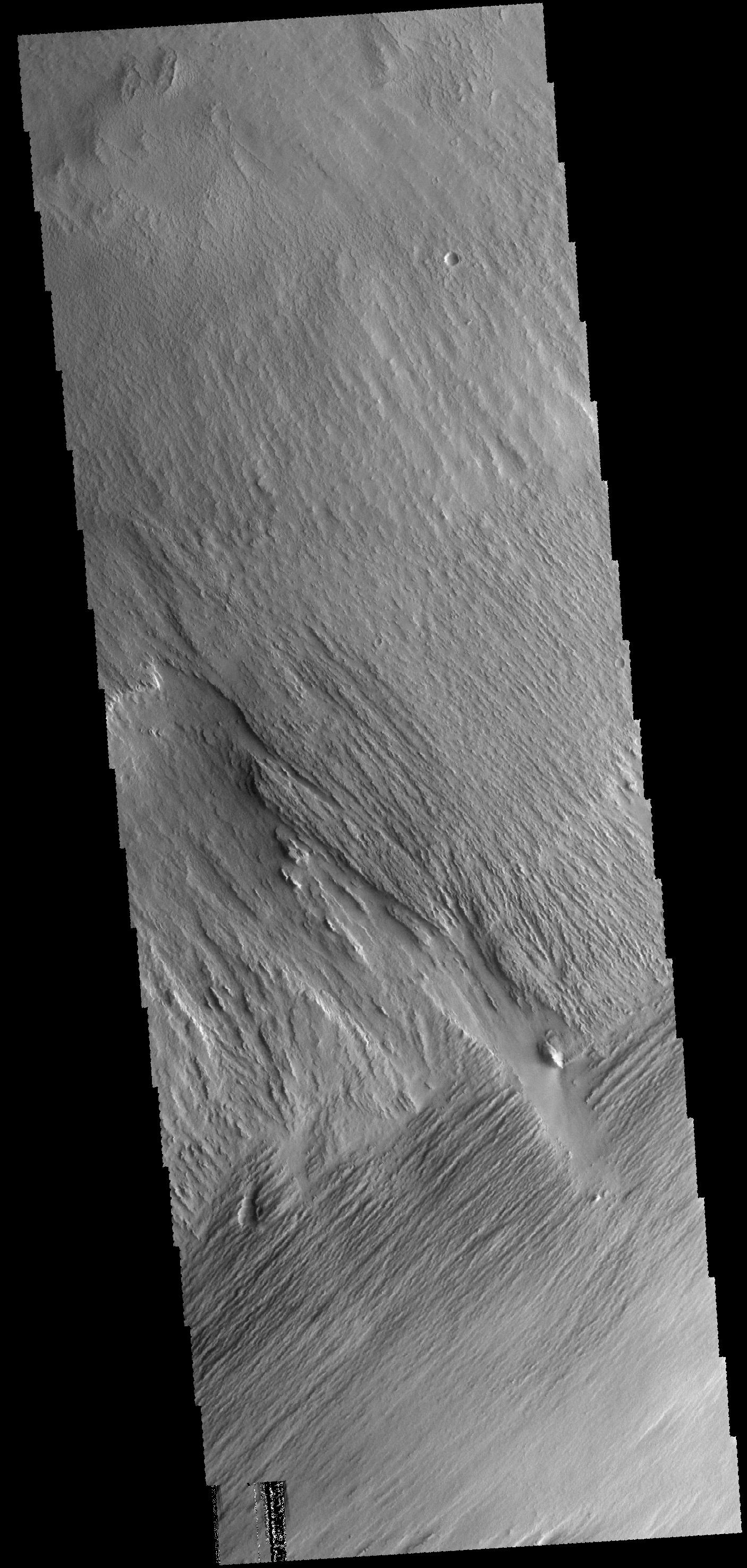
2014-11-06 |
Mars
|
2001 Mars Odyssey
|
THEMIS
|
611x2717x1 |

|
-
PIA18937:
-
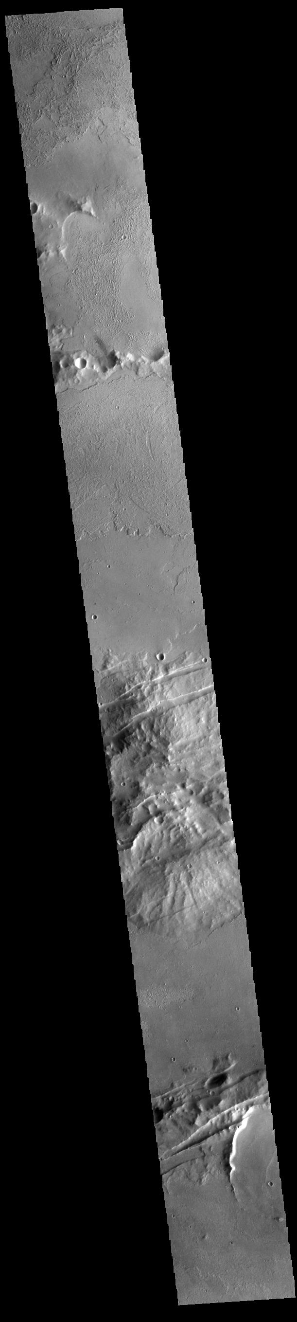
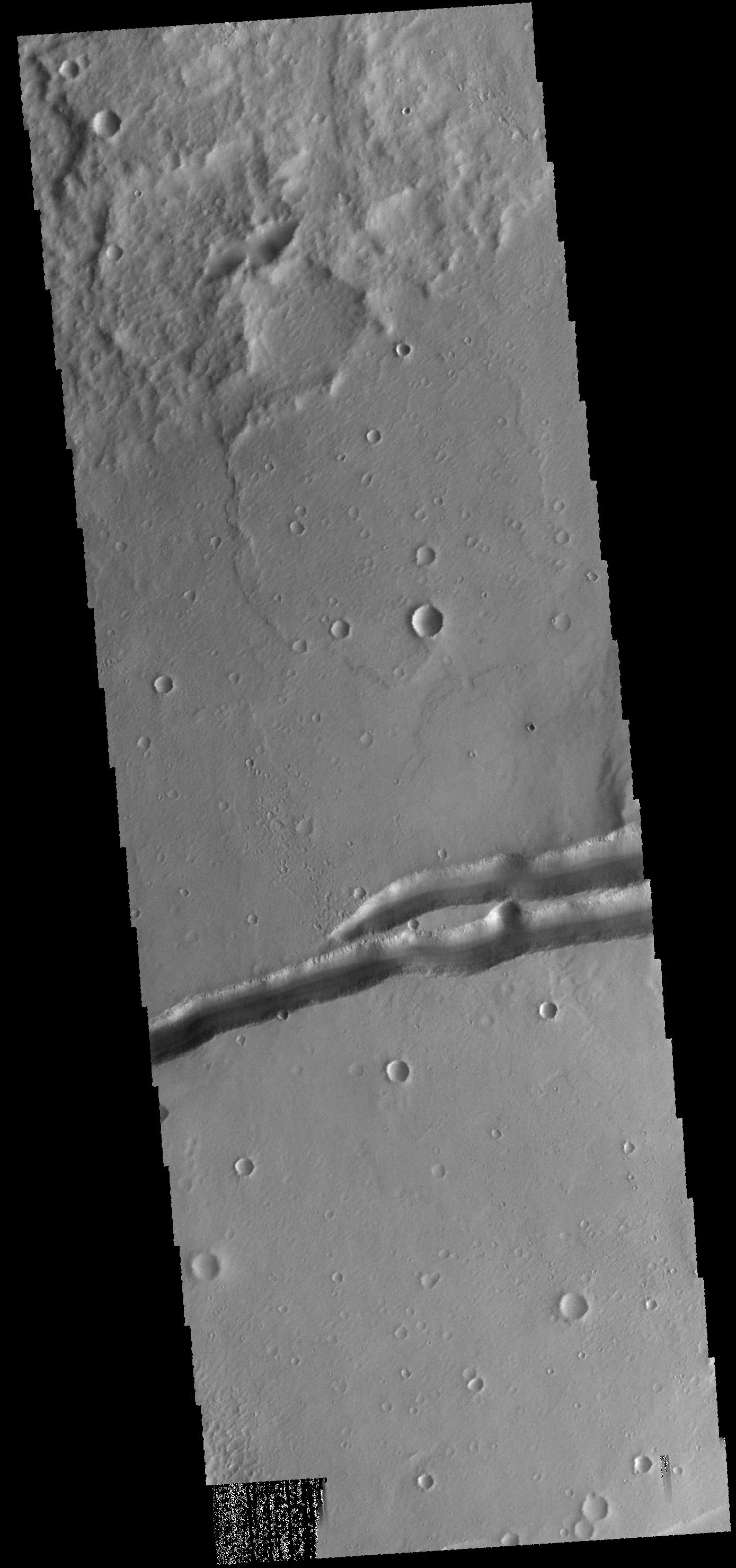
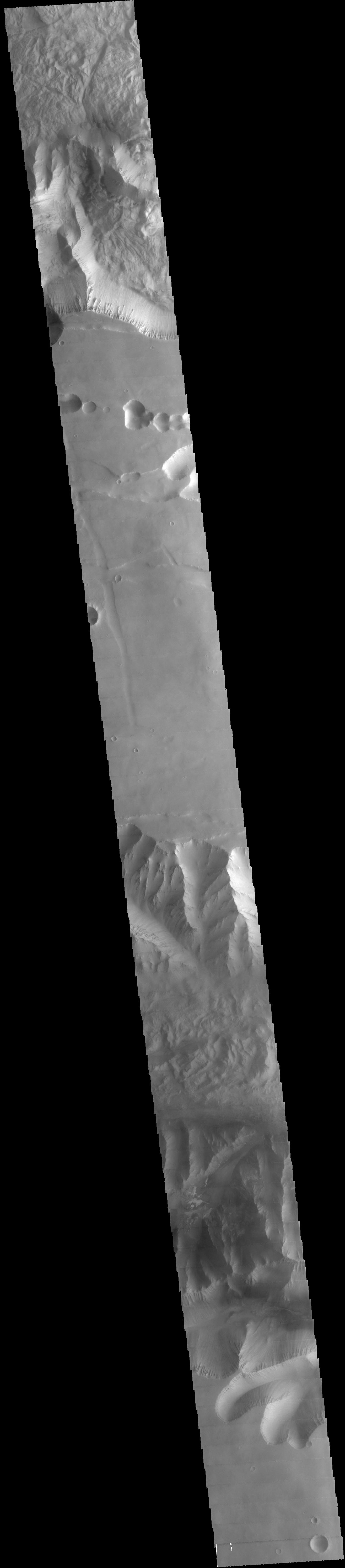
Volcanics and Tectonics
Full Resolution:
TIFF
(1.662 MB)
JPEG
(124.7 kB)
|
|
|
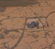
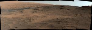
2014-11-06 |
Mars
|
Mars Science Laboratory (MSL)
|
Mastcam
|
2040x1200x1 |
|
-
PIA19043:
-
Mars Curiosity Rover Views Comet Siding Spring
Full Resolution:
TIFF
(2.451 MB)
JPEG
(339.8 kB)
|
|
|
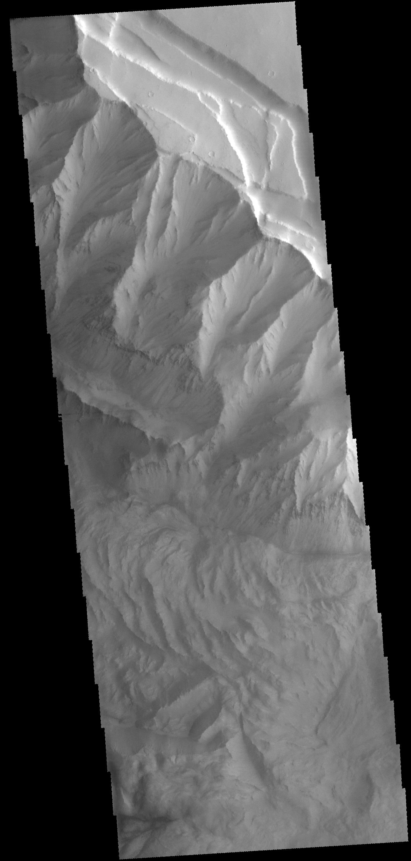
2014-11-05 |
Mars
|
2001 Mars Odyssey
|
THEMIS
|
615x2711x1 |

|
-
PIA18936:
-
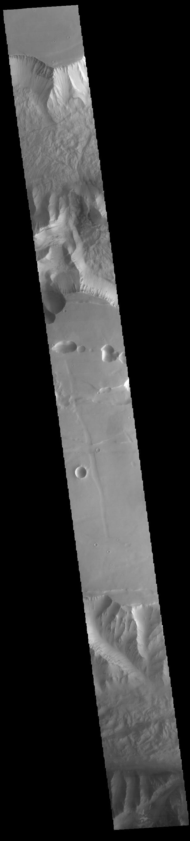
Tithonium and Ius Chasmata
Full Resolution:
TIFF
(1.669 MB)
JPEG
(73.71 kB)
|
|
|
2014-11-04 |
Mars
|
Mars Science Laboratory (MSL)
|
Mastcam
|
4067x2184x3 |
|
-
PIA19039:
-
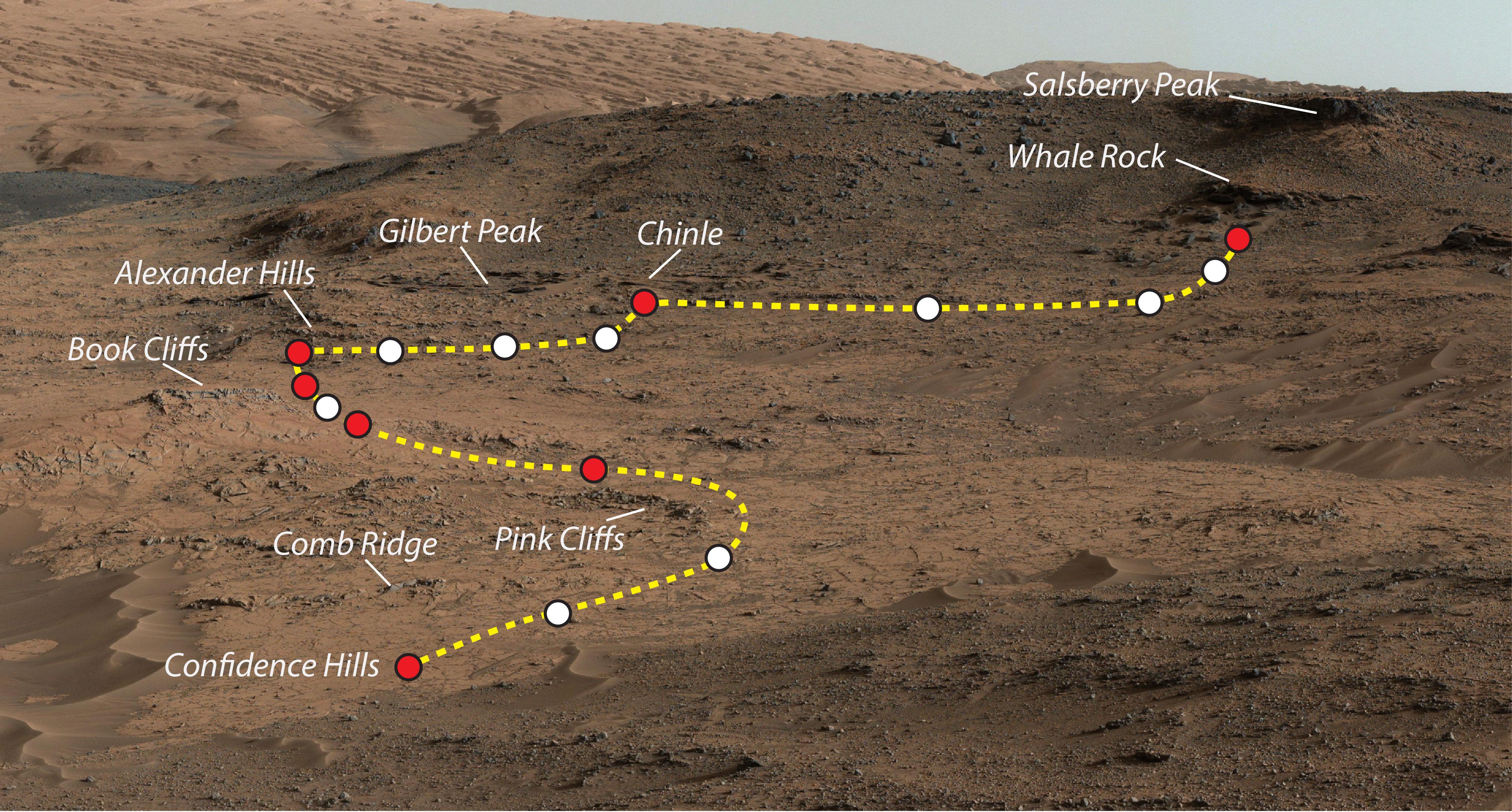
Mars Rover Curiosity's Walkabout at 'Pahrump Hills'
Full Resolution:
TIFF
(26.66 MB)
JPEG
(1.645 MB)
|
|
|
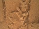
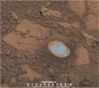
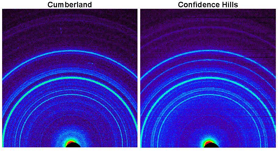
2014-11-04 |
Mars
|
Mars Science Laboratory (MSL)
|
CheMin
|
912x498x3 |
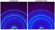
|
-
PIA19038:
-
Signature of Hematite in 'Confidence Hills' Martian Rock
Full Resolution:
TIFF
(1.363 MB)
JPEG
(142.3 kB)
|
|
|
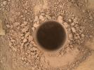
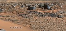
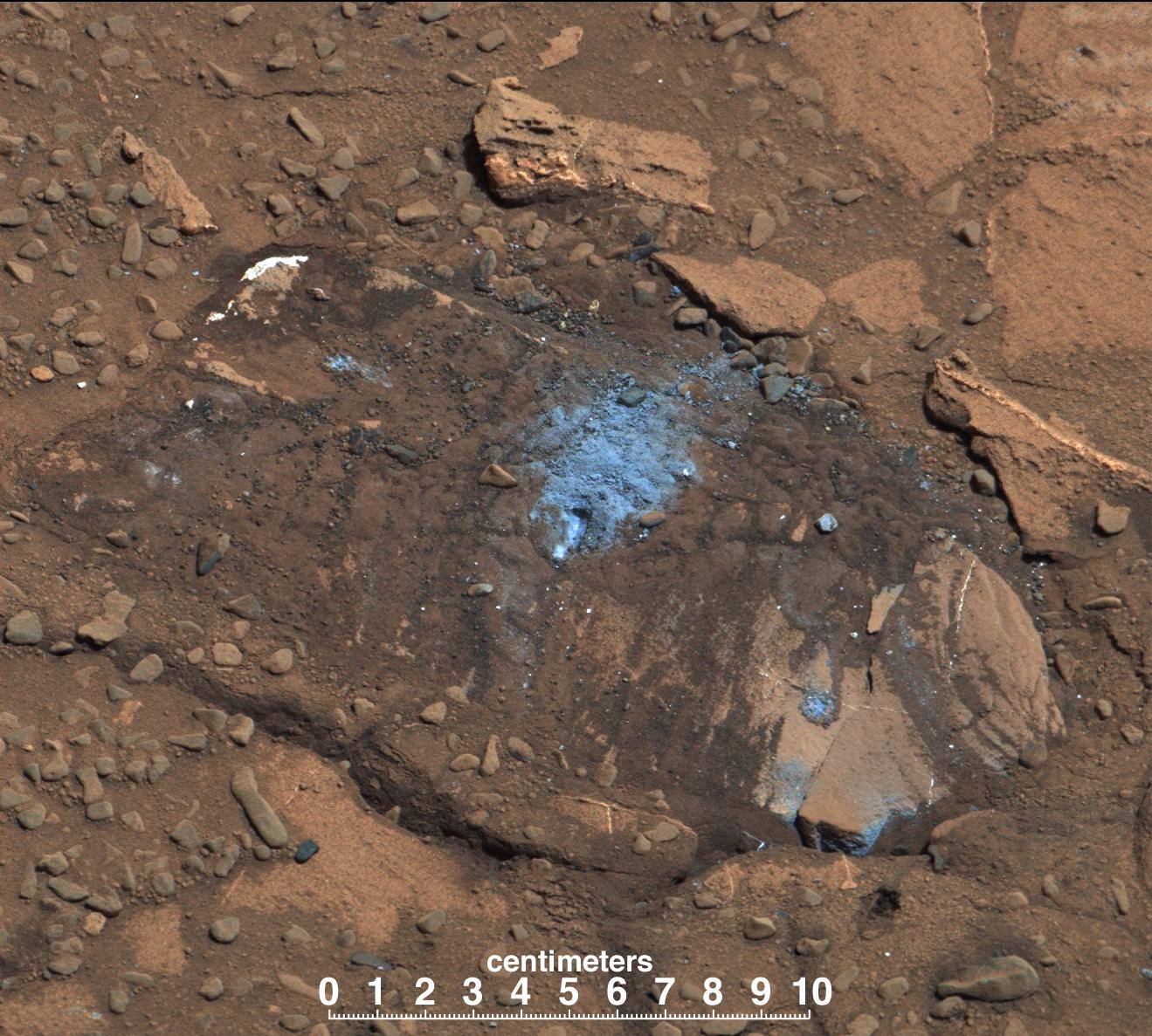
2014-11-04 |
Mars
|
Mars Science Laboratory (MSL)
|
Mastcam
|
768x768x3 |
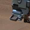
|
-
PIA19037:
-
'Confidence Hills' Drill Powder in Scoop
Full Resolution:
TIFF
(1.77 MB)
JPEG
(48.85 kB)
|
|
|
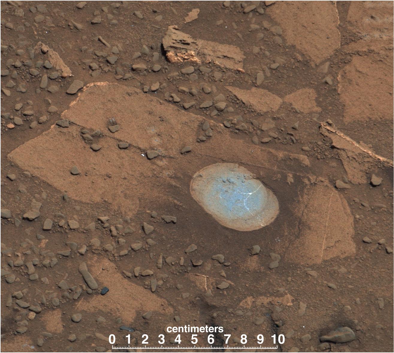
2014-11-04 |
Mars
|
Mars Science Laboratory (MSL)
|
Mastcam
|
1344x1200x3 |
|
-
PIA19036:
-
'Confidence Hills' -- The First Mount Sharp Drilling Site
Full Resolution:
TIFF
(4.84 MB)
JPEG
(233.4 kB)
|
|
|
2014-11-04 |
Mars
|
2001 Mars Odyssey
|
THEMIS
|
985x2623x1 |

|
-
PIA18770:
-
South Polar Layers
Full Resolution:
TIFF
(2.586 MB)
JPEG
(317 kB)
|
|
|
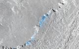
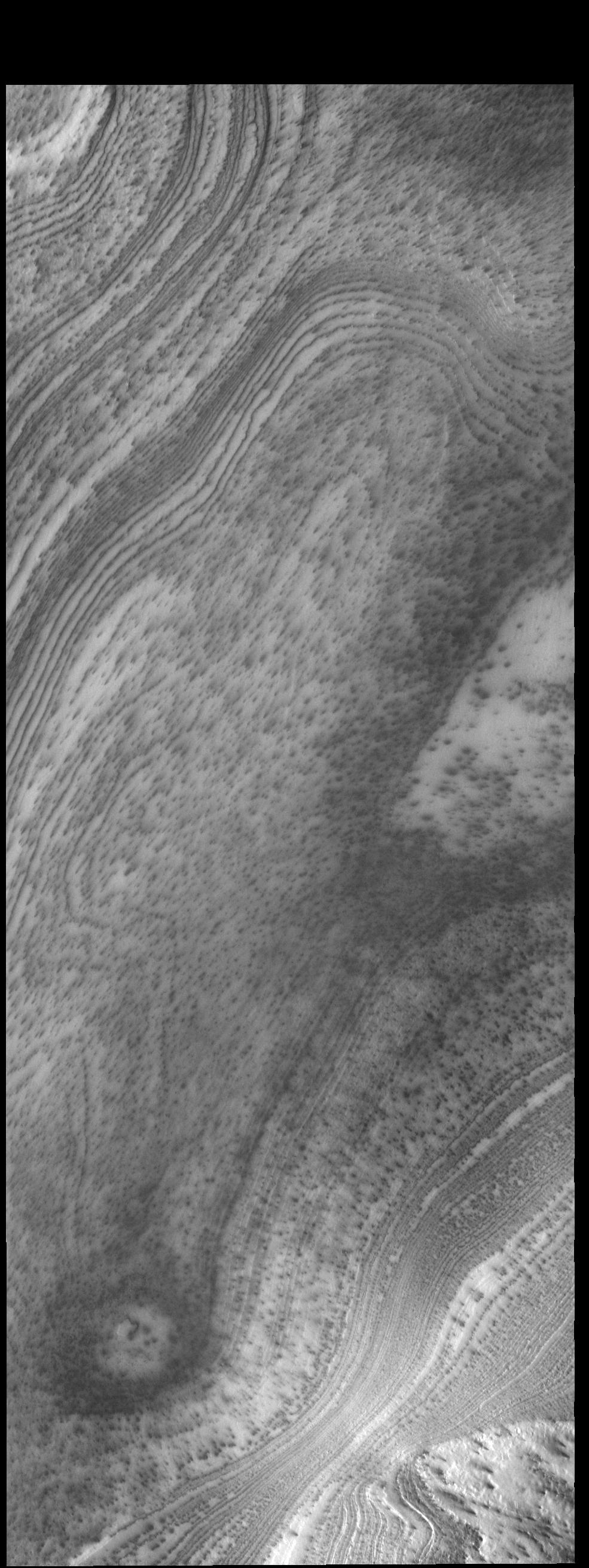
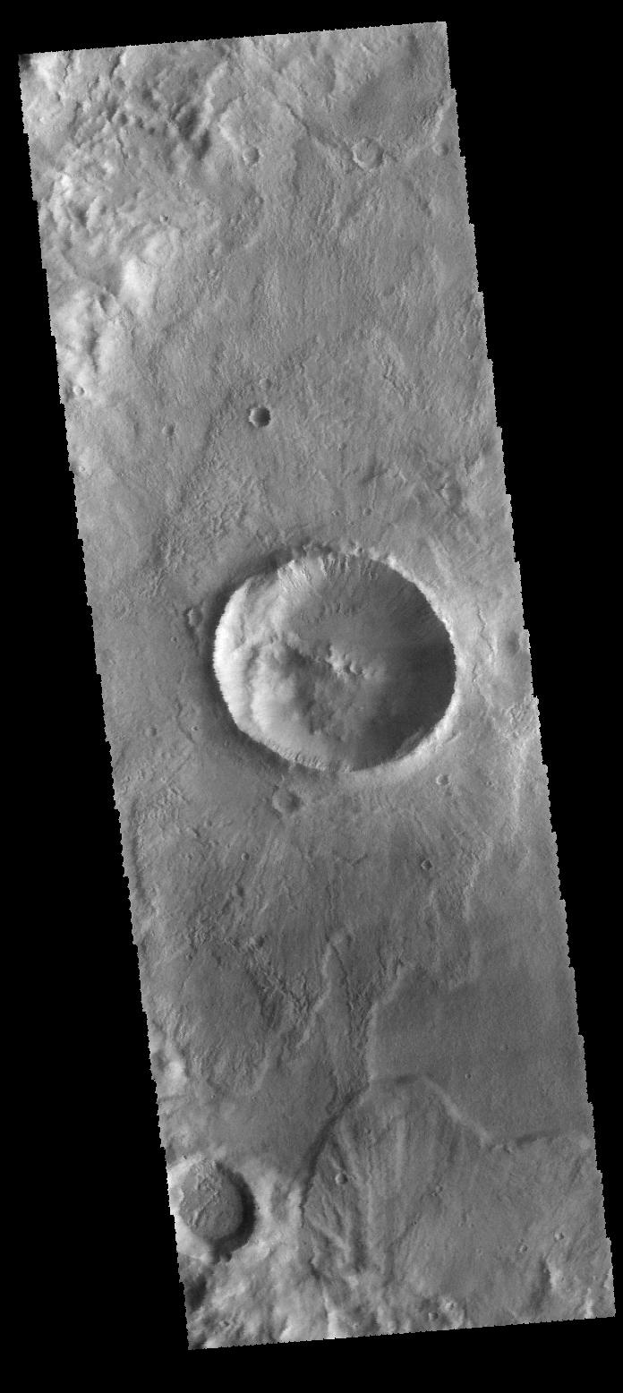
2014-11-03 |
Mars
|
2001 Mars Odyssey
|
THEMIS
|
1408x2946x1 |

|
-
PIA18769:
-
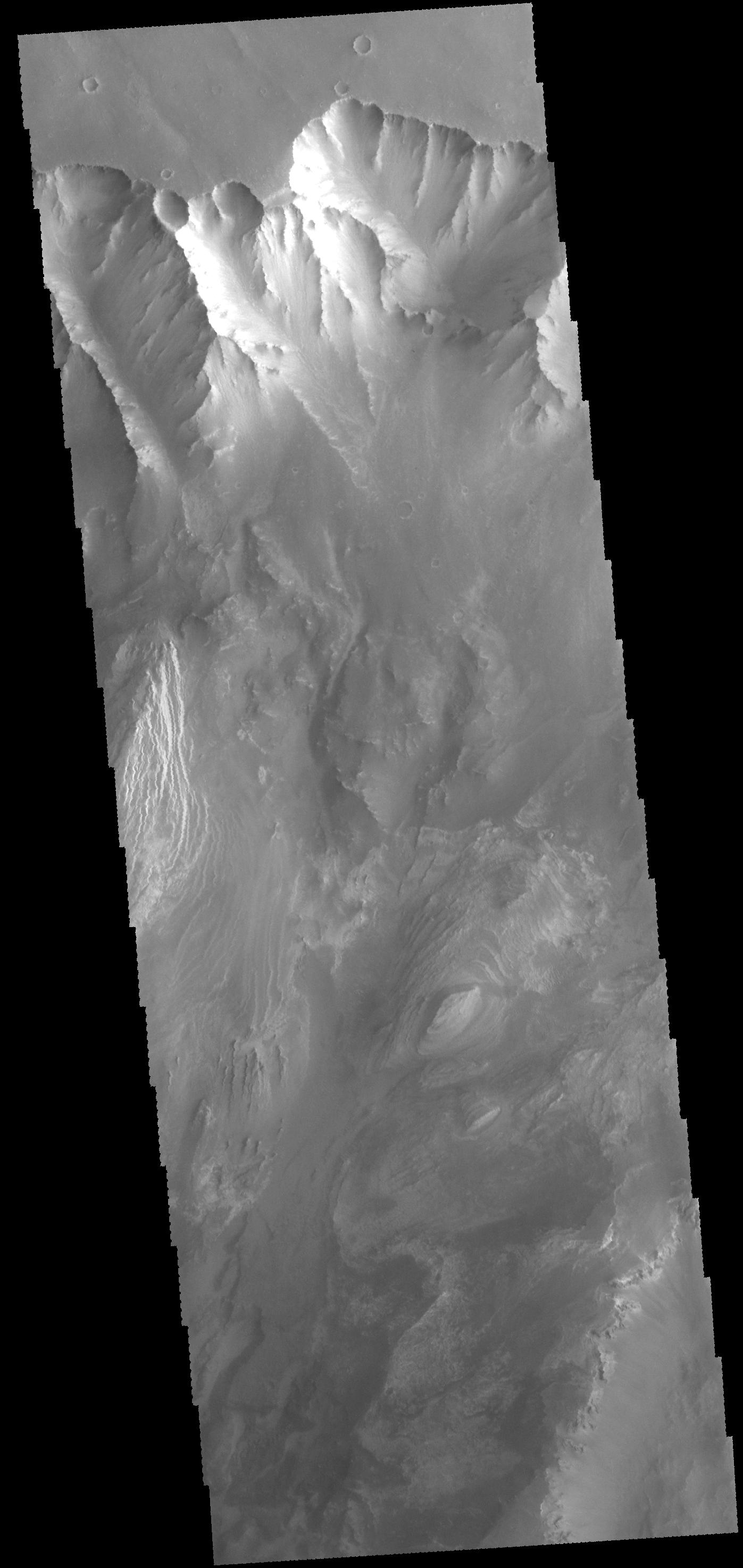
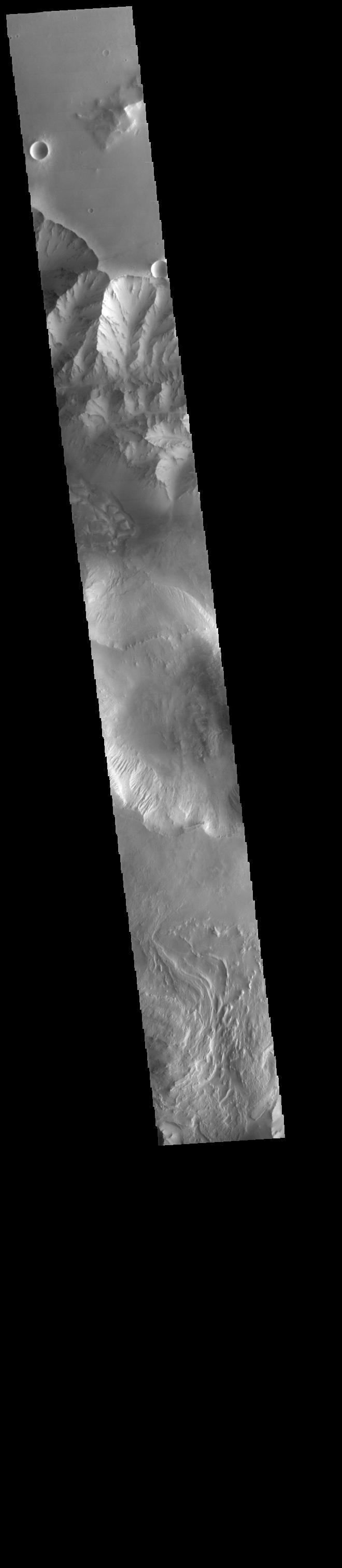
Ophir Chasma
Full Resolution:
TIFF
(4.153 MB)
JPEG
(253 kB)
|
|
|
2014-10-31 |
Mars
|
2001 Mars Odyssey
|
THEMIS
|
1389x2959x1 |

|
-
PIA18768:
-
Memnonia Fossae
Full Resolution:
TIFF
(4.115 MB)
JPEG
(342.3 kB)
|
|
|
2014-10-30 |
Mars
|
2001 Mars Odyssey
|
THEMIS
|
1374x2980x1 |

|
-
PIA18767:
-
Sirenum Fossae
Full Resolution:
TIFF
(4.1 MB)
JPEG
(463 kB)
|
|
|
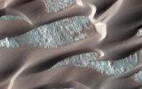
2014-10-29 |
Mars
|
Mars Reconnaissance Orbiter (MRO)
|
HiRISE
|
2880x1800x3 |
|
-
PIA18890:
-
Hardened Dunes in Arcadia Planitia
Full Resolution:
TIFF
(15.56 MB)
JPEG
(968.1 kB)
|
|
|
2014-10-29 |
Mars
|
Mars Reconnaissance Orbiter (MRO)
|
HiRISE
|
2880x1800x3 |
|
-
PIA18889:
-
Sand Sources Near Athabasca Valles
Full Resolution:
TIFF
(15.56 MB)
JPEG
(844.8 kB)
|
|
|
2014-10-29 |
Mars
|
Mars Reconnaissance Orbiter (MRO)
|
HiRISE
|
2880x1800x3 |

|
-
PIA18888:
-
Search for the Mars 2 Debris Field
Full Resolution:
TIFF
(15.56 MB)
JPEG
(1.2 MB)
|
|
|
2014-10-29 |
Mars
|
Mars Reconnaissance Orbiter (MRO)
|
HiRISE
|
2880x1800x1 |
|
-
PIA18887:
-
Which Way is Up?
Full Resolution:
TIFF
(5.191 MB)
JPEG
(506.4 kB)
|
|
|
2014-10-29 |
Mars
|
2001 Mars Odyssey
|
THEMIS
|
1400x2949x1 |

|
-
PIA18765:
-
Apollinaris Mons
Full Resolution:
TIFF
(4.134 MB)
JPEG
(326.8 kB)
|
|
|
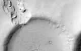
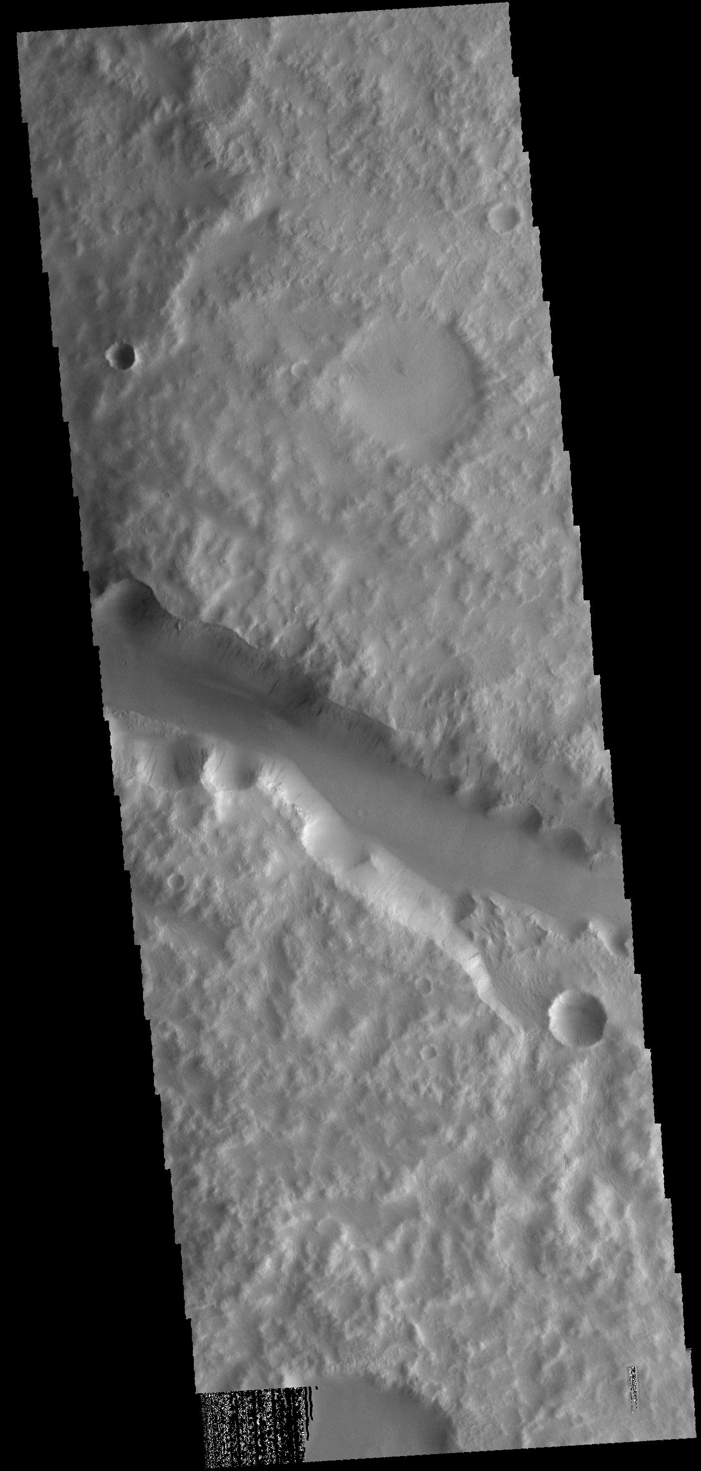
2014-10-28 |
Mars
|
2001 Mars Odyssey
|
THEMIS
|
986x2626x1 |

|
-
PIA18763:
-
South Pole Layers
Full Resolution:
TIFF
(2.592 MB)
JPEG
(179 kB)
|
|
|
2014-10-27 |
Mars
|
2001 Mars Odyssey
|
THEMIS
|
1374x2980x1 |
|
-
PIA18760:
-
Sirenum Fossae
Full Resolution:
TIFF
(4.1 MB)
JPEG
(463 kB)
|
|
|
2014-10-24 |
Mars
|
Mars Reconnaissance Orbiter (MRO)
|
CRISM
|
1010x500x3 |
|
-
PIA15291:
-
Images From Mars-Orbiting Spectrometer Show Comet's Coma
Full Resolution:
TIFF
(1.516 MB)
JPEG
(38.03 kB)
|
|
|
2014-10-24 |
Mars
|
2001 Mars Odyssey
|
THEMIS
|
1389x2959x1 |

|
-
PIA18757:
-
Mangala Fossa
Full Resolution:
TIFF
(4.115 MB)
JPEG
(342.3 kB)
|
|
|
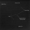
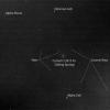
2014-10-23 |
Mars
|
Hubble Space Telescope
|
WFPC2
|
1167x876x3 |
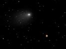
|
-
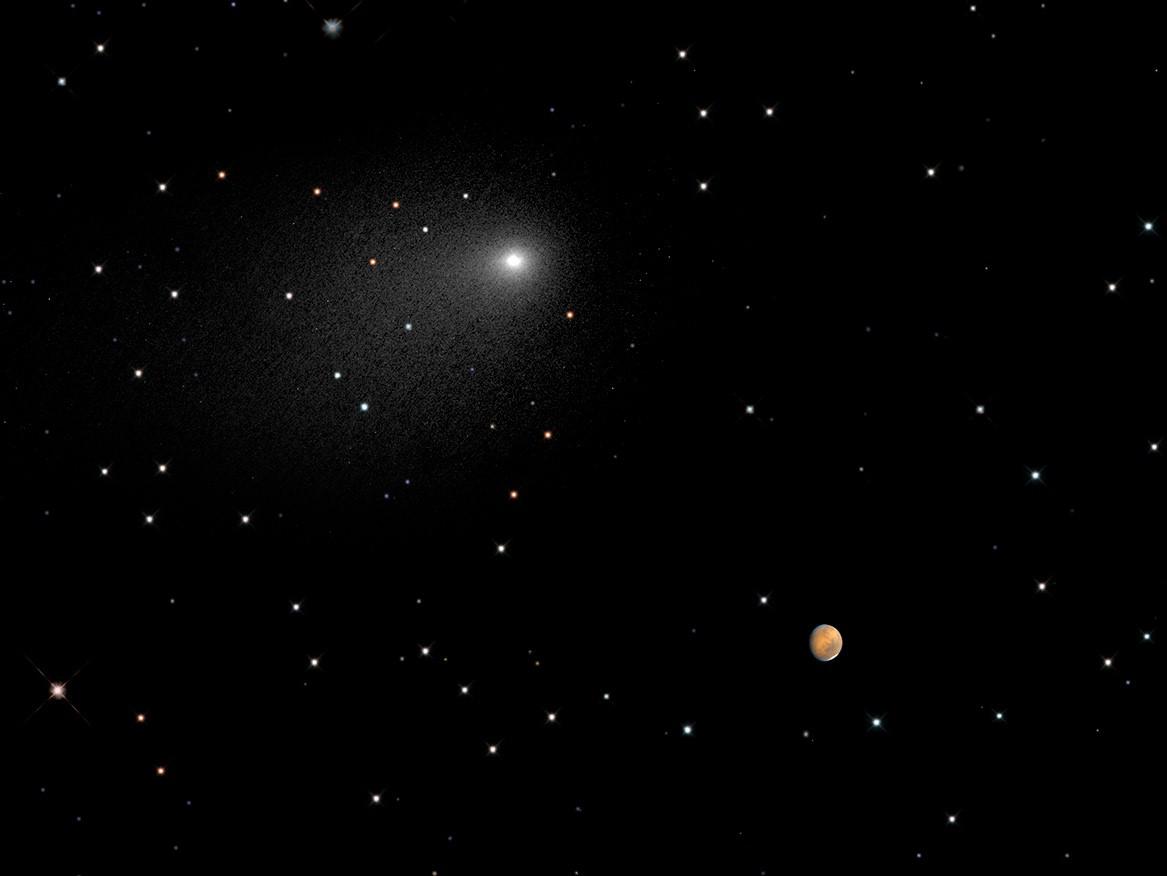
PIA17802:
-
Close Encounters: Comet Siding Spring Seen Next to Mars (Synthesized Image)
Full Resolution:
TIFF
(3.068 MB)
JPEG
(43.77 kB)
|
|
|
2014-10-23 |
Mars
|
2001 Mars Odyssey
|
THEMIS
|
1394x2951x1 |

|
-
PIA18756:
-
Candor Chasma
Full Resolution:
TIFF
(4.119 MB)
JPEG
(322.5 kB)
|
|
|
2014-10-23 |
Mars
|
MAVEN
|
Imaging Ultraviolet Spectrograph
|
6256x4479x3 |
|
-
PIA18619:
-
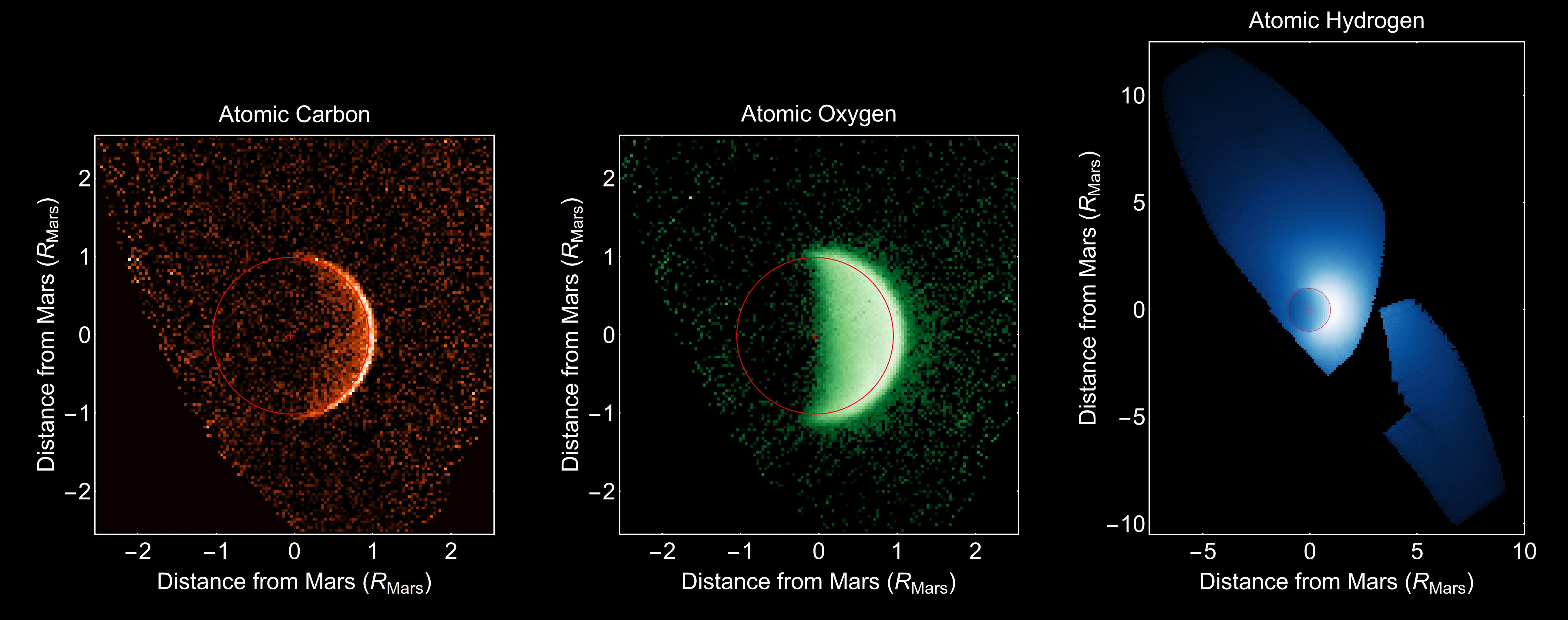
MAVEN Ultraviolet Image of Comet Siding Spring's Hydrogen Coma
Full Resolution:
TIFF
(84.1 MB)
JPEG
(705.2 kB)
|
|
|
2014-10-22 |
Mars
|
2001 Mars Odyssey
|
THEMIS
|
1373x2977x1 |

|
-
PIA18755:
-
Crater Dunes
Full Resolution:
TIFF
(4.092 MB)
JPEG
(299.1 kB)
|
|
|
2014-10-21 |
Mars
|
2001 Mars Odyssey
|
THEMIS
|
1374x2975x1 |

|
-
PIA18754:
-
Sirenum Fossae
Full Resolution:
TIFF
(4.093 MB)
JPEG
(470.3 kB)
|
|
|
2014-10-20 |
Mars
|
Mars Reconnaissance Orbiter (MRO)
|
HiRISE
|
929x610x1 |
|
-
PIA18618:
-
First Resolved Image of a Long-Period Comet's Nucleus
Full Resolution:
TIFF
(567.5 kB)
JPEG
(26.9 kB)
|
|
|
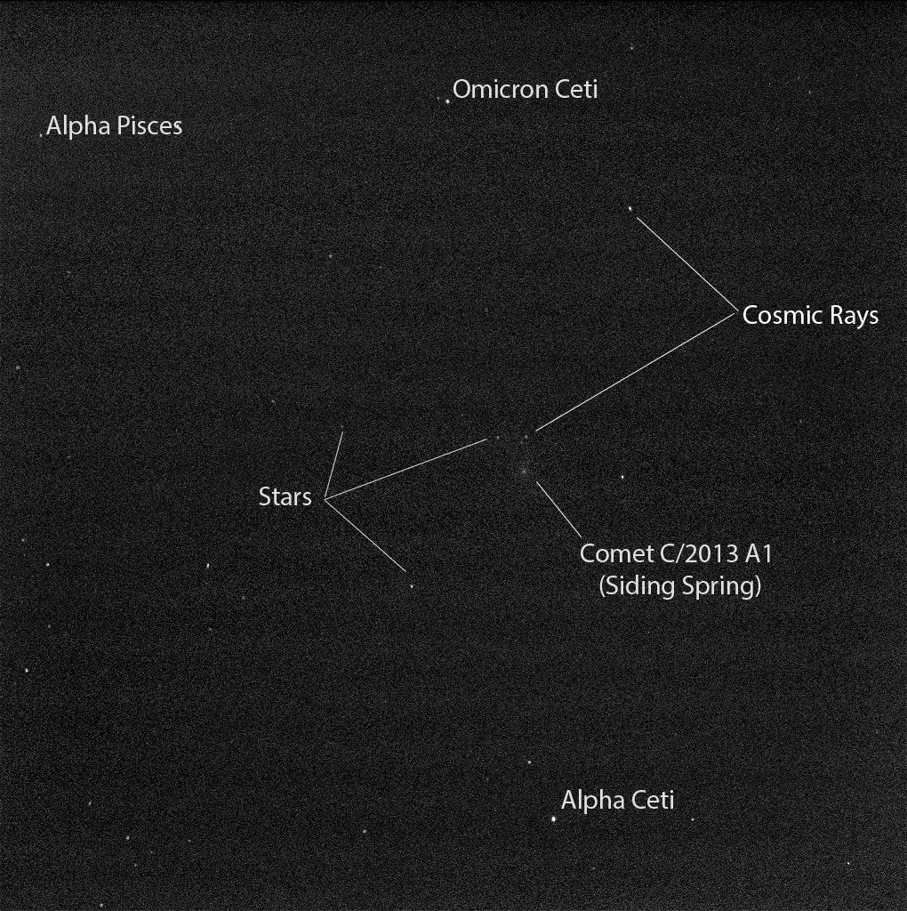
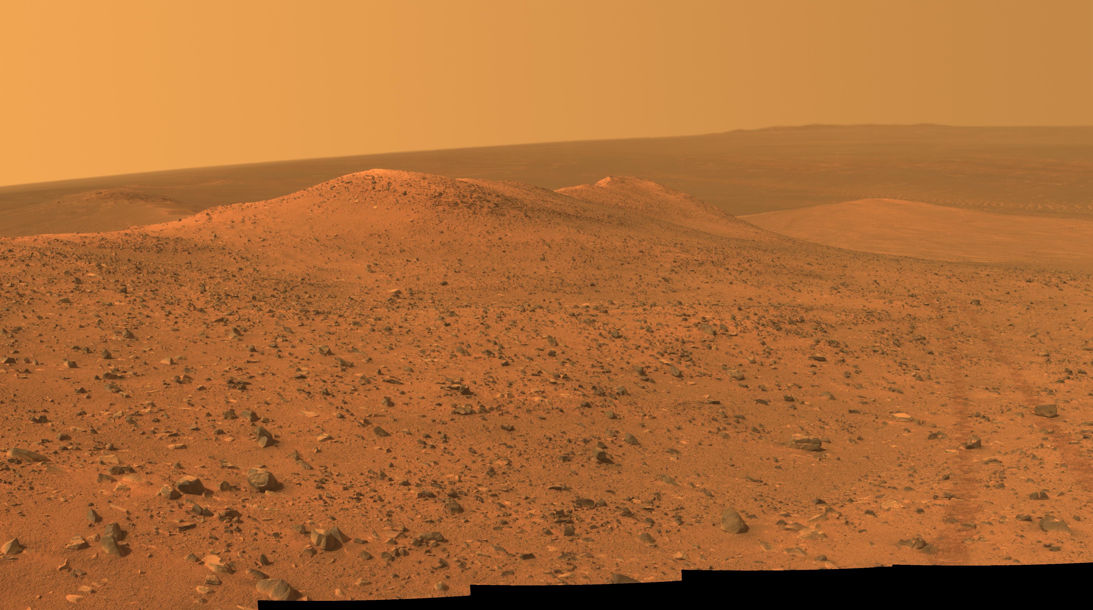
2014-10-20 |
Mars
|
Mars Exploration Rover (MER)
|
Panoramic Camera
|
1020x1024x1 |
|
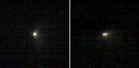
-
PIA18617:
-
Mars Rover Opportunity's View of Comet (Blink of Two Exposures)
Full Resolution:
TIFF
(1.046 MB)
JPEG
(310.7 kB)
|
|
|
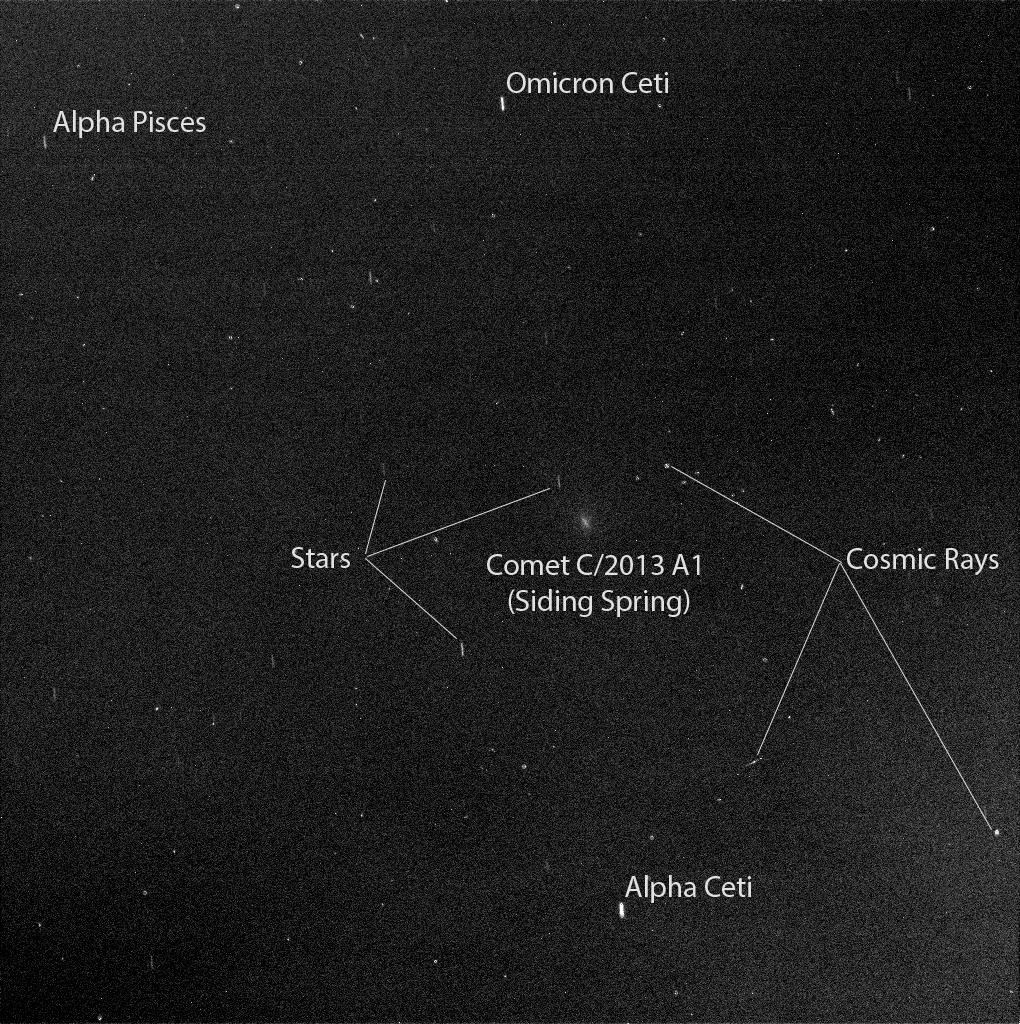
2014-10-20 |
Mars
|
Mars Exploration Rover (MER)
|
Panoramic Camera
|
1020x1024x1 |
|
-
PIA18592:
-
Mars Rover Opportunity's View of Passing Comet (Short Exposure)
Full Resolution:
TIFF
(1.046 MB)
JPEG
(312.7 kB)
|
|
|
2014-10-20 |
Mars
|
Mars Exploration Rover (MER)
|
Panoramic Camera
|
1020x1024x1 |
|
-
PIA18591:
-
Mars Rover Opportunity's View of Passing Comet
Full Resolution:
TIFF
(1.046 MB)
JPEG
(311.3 kB)
|
|
|
2014-10-20 |
Mars
|
2001 Mars Odyssey
|
THEMIS
|
1391x2954x1 |
|
-
PIA18753:
-
Faults and Flows
Full Resolution:
TIFF
(4.114 MB)
JPEG
(367.7 kB)
|
|
|
2014-10-17 |
Mars
|
2001 Mars Odyssey
|
THEMIS
|
1378x2951x1 |

|
-
PIA18751:
-
Lava Flows
Full Resolution:
TIFF
(4.071 MB)
JPEG
(484.8 kB)
|
|
|
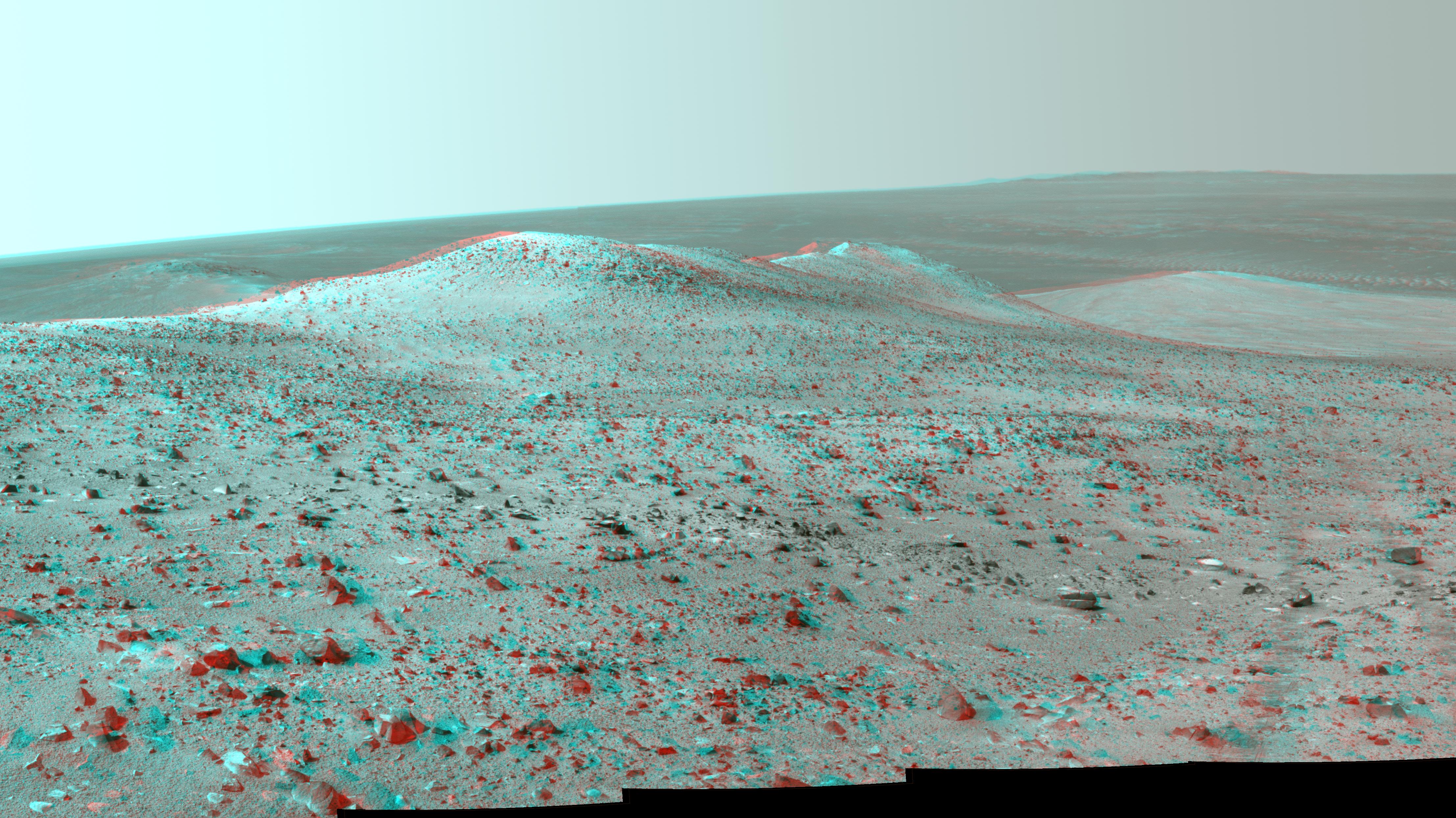
2014-10-16 |
Mars
|
Mars Exploration Rover (MER)
|
Panoramic Camera
|
4430x2488x3 |
|
-
PIA18616:
-
Opportunity's Northward View of 'Wdowiak Ridge' (Stereo)
Full Resolution:
TIFF
(33.09 MB)
JPEG
(1.566 MB)
|
|
|
2014-10-16 |
Mars
|
Mars Exploration Rover (MER)
|
Panoramic Camera
|
4461x2498x3 |
|
-
PIA18615:
-
Opportunity's Northward View of 'Wdowiak Ridge' (False Color)
Full Resolution:
TIFF
(33.45 MB)
JPEG
(1.787 MB)
|
|
|
2014-10-16 |
Mars
|
Mars Exploration Rover (MER)
|
Panoramic Camera
|
4457x2488x3 |

|
-
PIA18614:
-
Opportunity's Northward View of 'Wdowiak Ridge'
Full Resolution:
TIFF
(33.29 MB)
JPEG
(1.15 MB)
|
|
|
2014-10-16 |
Mars
|
2001 Mars Odyssey
|
THEMIS
|
1410x2946x1 |

|
-
PIA18750:
-
Candor Chasma
Full Resolution:
TIFF
(4.159 MB)
JPEG
(257.1 kB)
|
|
|
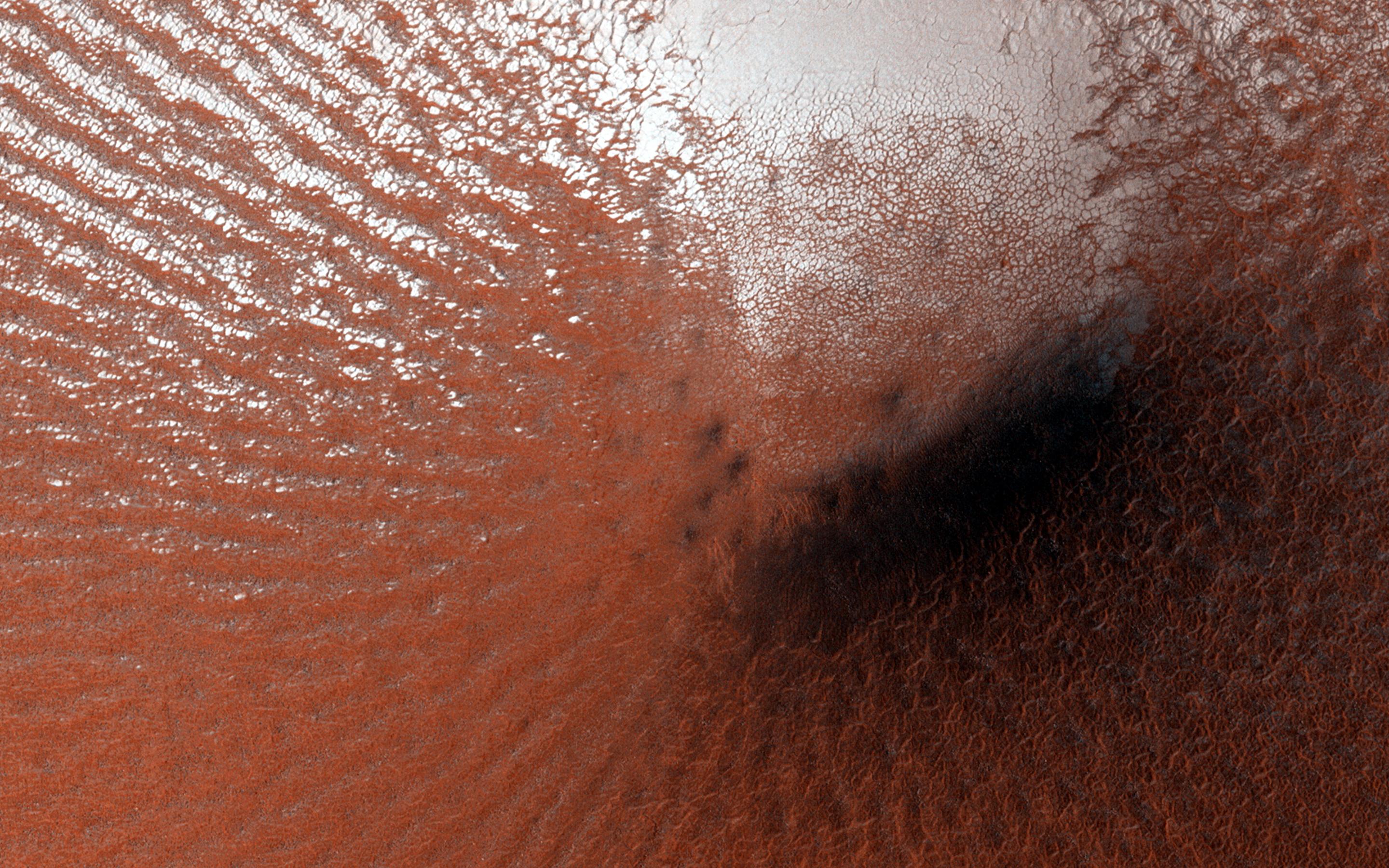
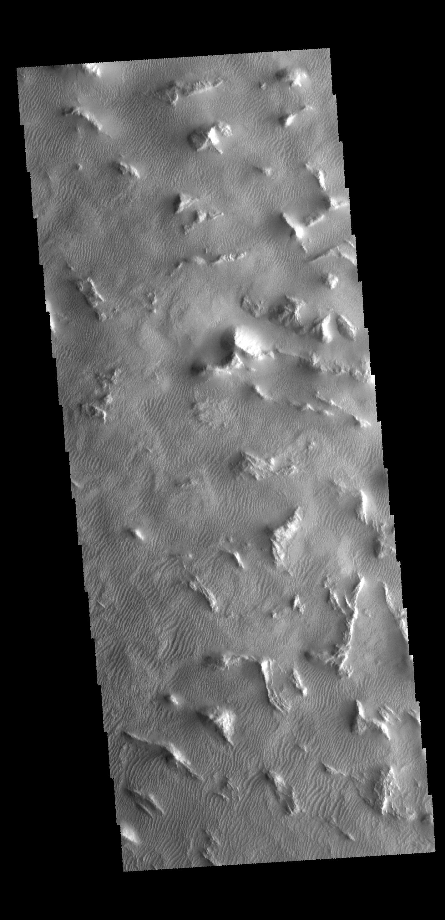
2014-10-15 |
Mars
|
Mars Reconnaissance Orbiter (MRO)
|
HiRISE
|
2880x1800x3 |

|
-
PIA18832:
-
Perennial Frost in a Crater on the Northern Plains
Full Resolution:
TIFF
(15.56 MB)
JPEG
(895.2 kB)
|
|
|
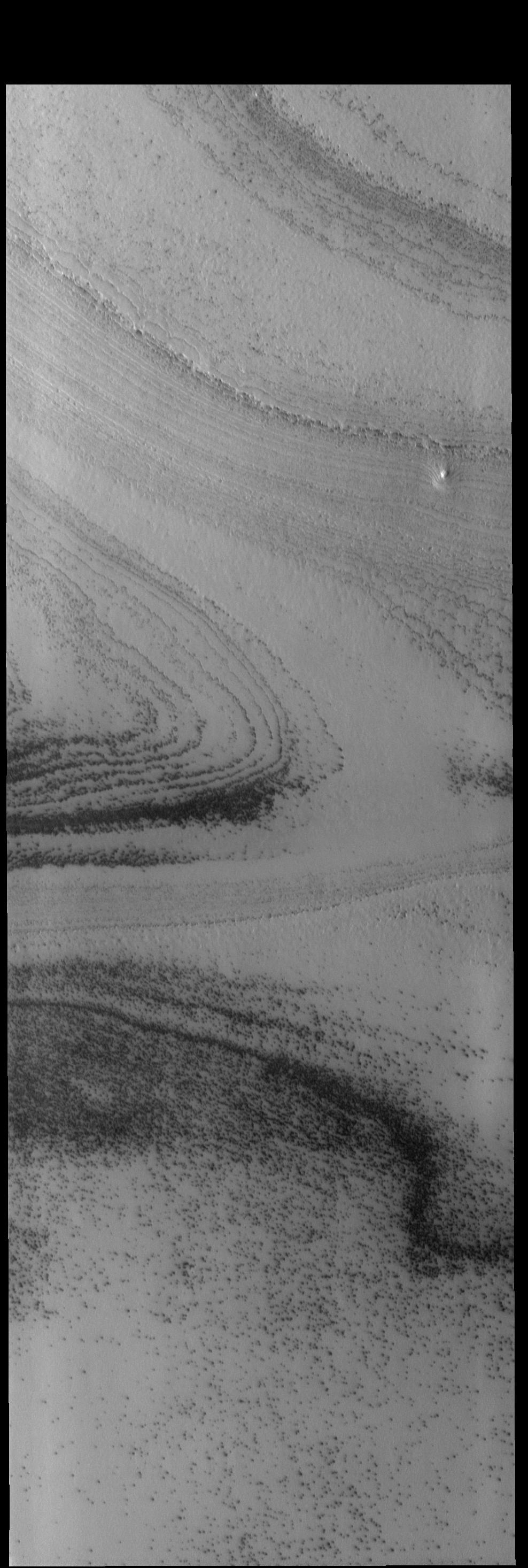
2014-10-15 |
Mars
|
Mars Reconnaissance Orbiter (MRO)
|
HiRISE
|
2880x1800x3 |
|
-
PIA18831:
-
A Collection of Landforms in Eastern Elysium Planitia
Full Resolution:
TIFF
(15.56 MB)
JPEG
(595.3 kB)
|
|
|
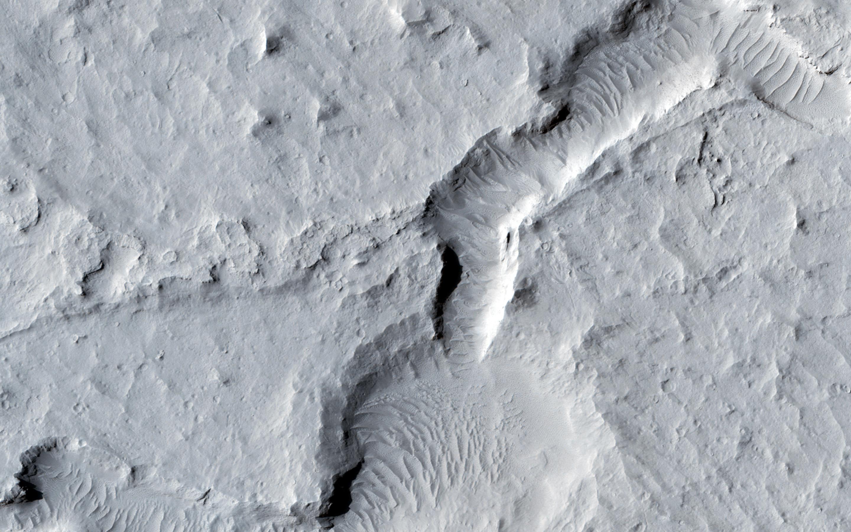
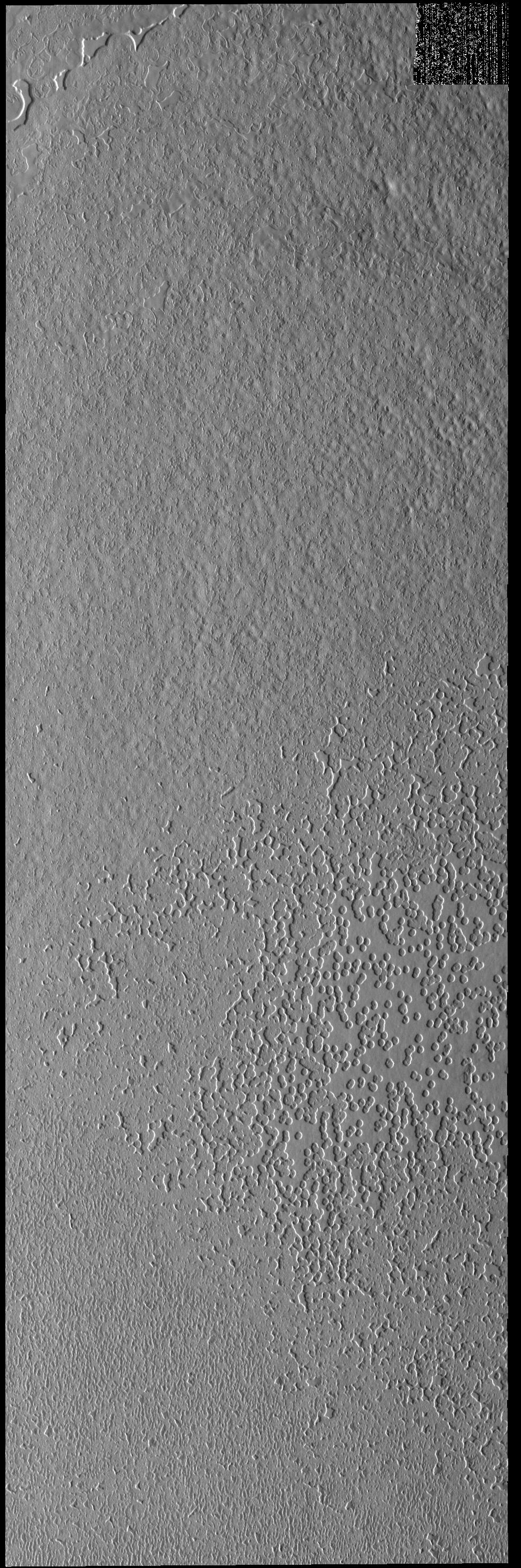
2014-10-15 |
Mars
|
Mars Reconnaissance Orbiter (MRO)
|
HiRISE
|
2880x1800x1 |

|
-
PIA18830:
-
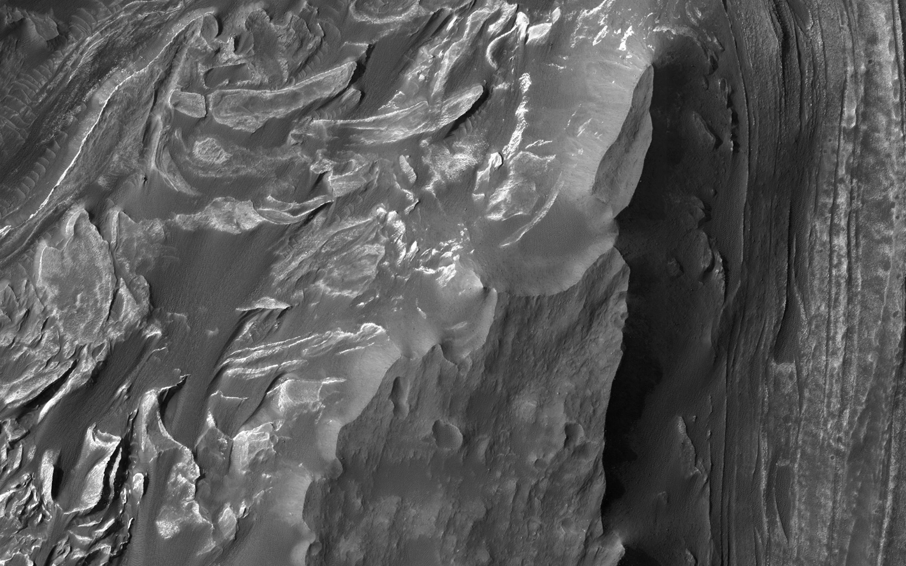
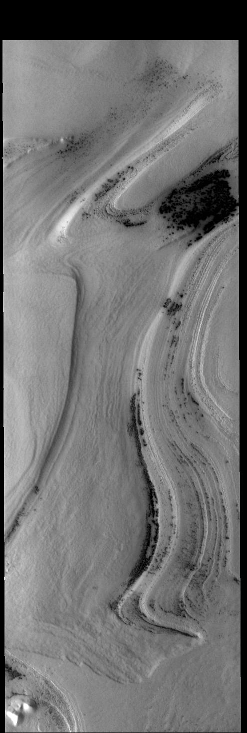
Mounds of Layered Material on the West Edge of Melas Chasma
Full Resolution:
TIFF
(5.191 MB)
JPEG
(662.3 kB)
|
|
|
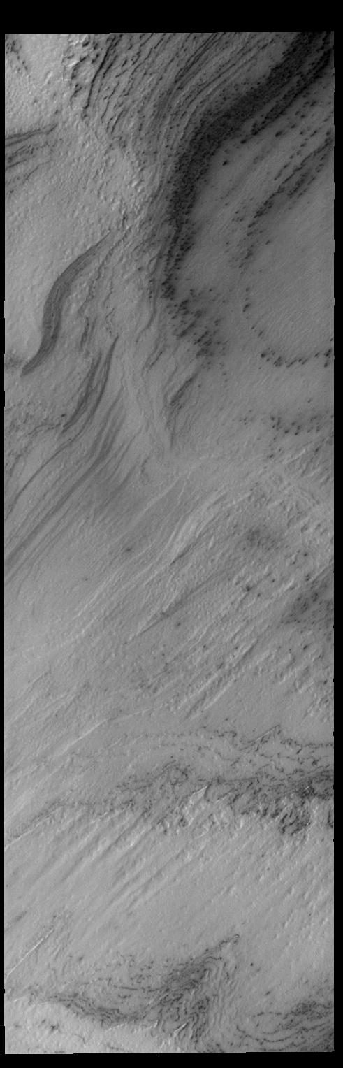
2014-10-15 |
Mars
|
Mars Reconnaissance Orbiter (MRO)
|
HiRISE
|
2880x1800x3 |

|
-
PIA18829:
-
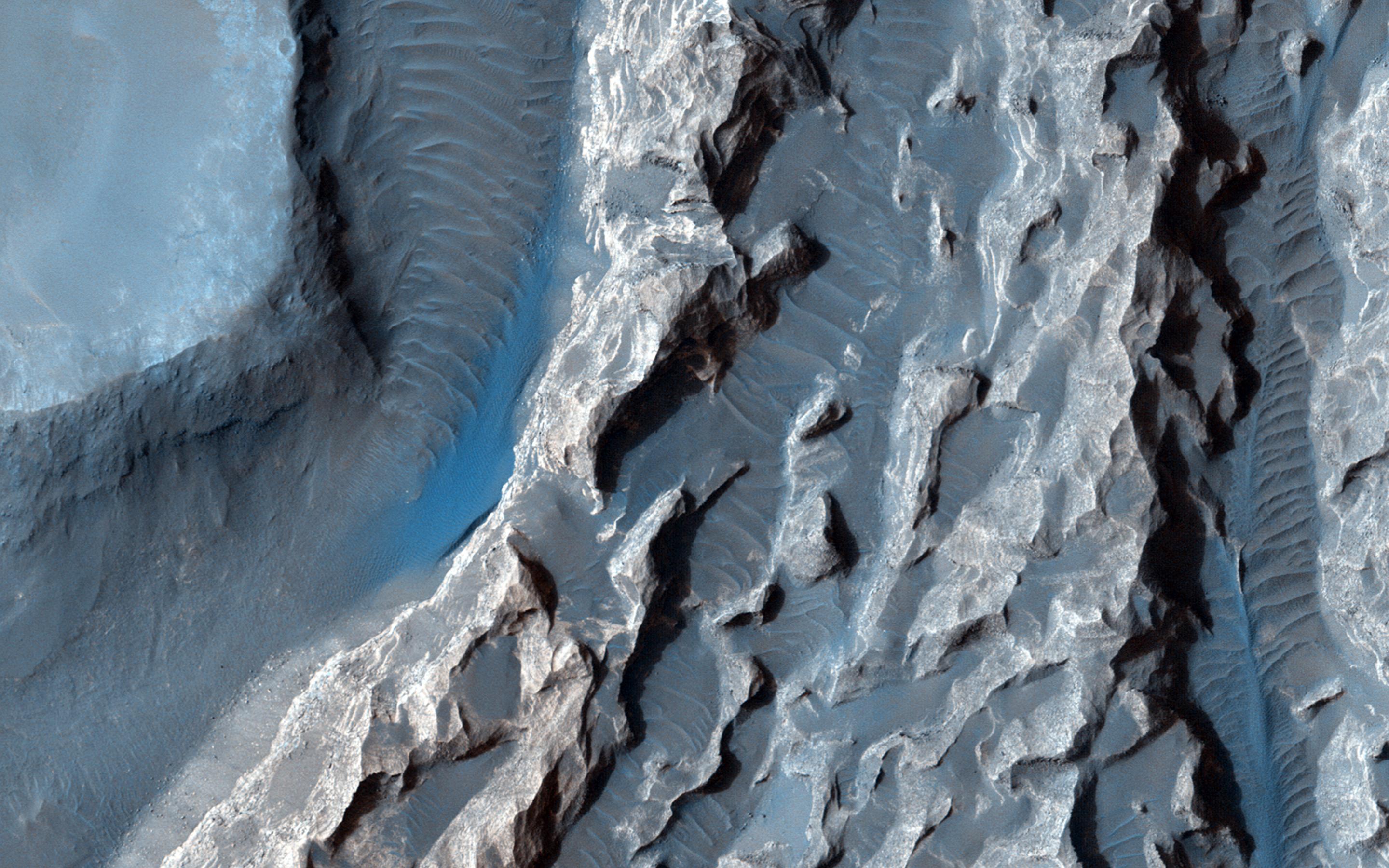
A Light Toned Deposit in Arsinoes Chaos
Full Resolution:
TIFF
(15.56 MB)
JPEG
(693 kB)
|
|
|
2014-10-15 |
Mars
|
2001 Mars Odyssey
|
THEMIS
|
1397x2948x1 |

|
-
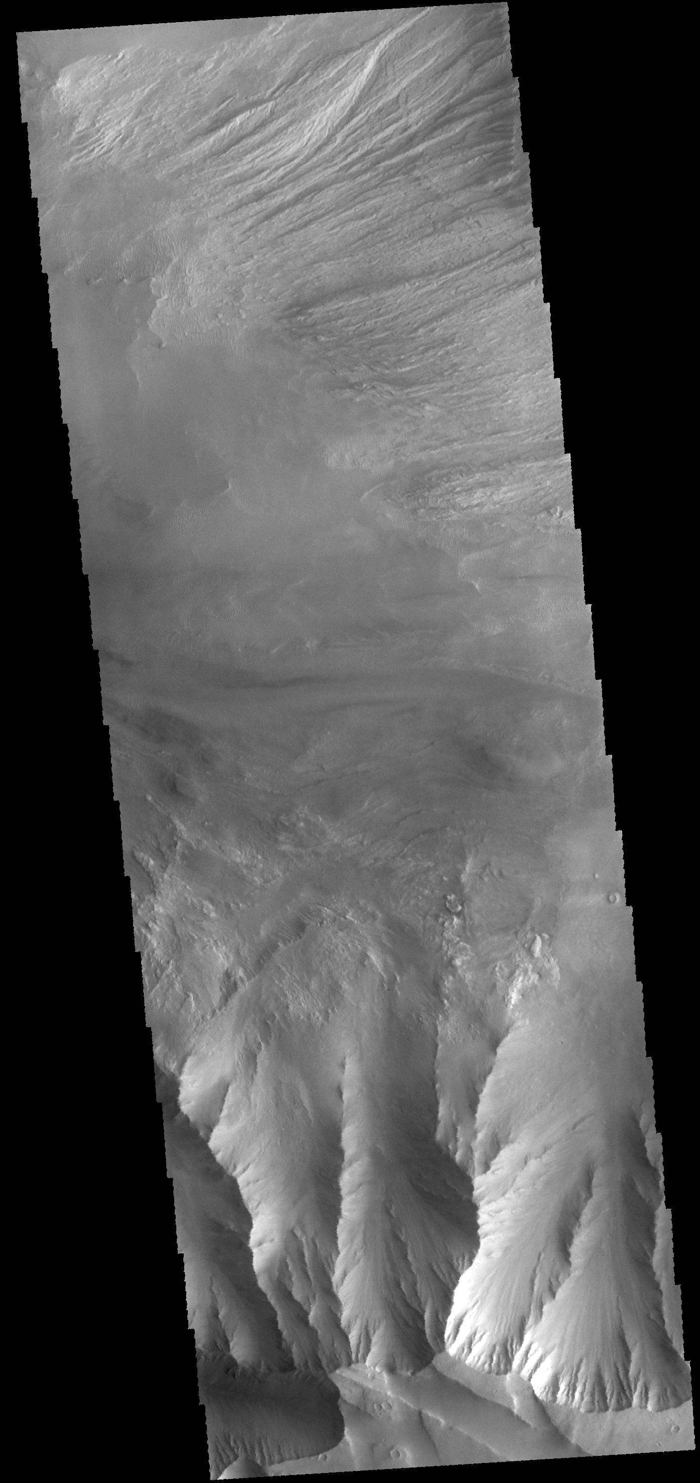
PIA18745:
-
Valles Marineris
Full Resolution:
TIFF
(4.123 MB)
JPEG
(254.6 kB)
|
|
|
2014-10-14 |
Mars
|
MAVEN
|
Imaging Ultraviolet Spectrograph
|
5170x2045x3 |

|
-
PIA18613:
-
Ultraviolet Views of Martian Atmosphere
Full Resolution:
TIFF
(31.73 MB)
JPEG
(695.6 kB)
|
|
|
2014-10-14 |
Mars
|
2001 Mars Odyssey
|
THEMIS
|
996x2940x1 |

|
-
PIA18744:
-
South Polar Features
Full Resolution:
TIFF
(2.931 MB)
JPEG
(232 kB)
|
|
|
2014-10-13 |
Mars
|
2001 Mars Odyssey
|
THEMIS
|
1406x2951x1 |

|
-
PIA18743:
-
Yardangs
Full Resolution:
TIFF
(4.154 MB)
JPEG
(488.1 kB)
|
|
|
2014-10-10 |
Mars
|
2001 Mars Odyssey
|
THEMIS
|
894x3029x1 |

|
-
PIA18742:
-
Arsia Mons
Full Resolution:
TIFF
(2.711 MB)
JPEG
(174.7 kB)
|
|
|
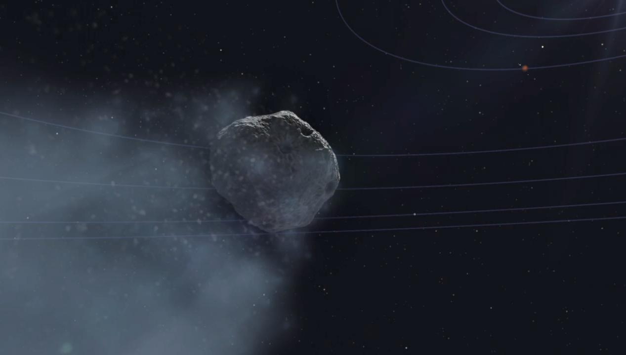
2014-10-09 |
Mars
|
|
|
1000x1000x3 |
|
-
PIA18612:
-
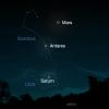
View of Comet Siding Spring from Southern Hemisphere (Artist's Concept)
Full Resolution:
TIFF
(3.001 MB)
JPEG
(39.78 kB)
|
|
|
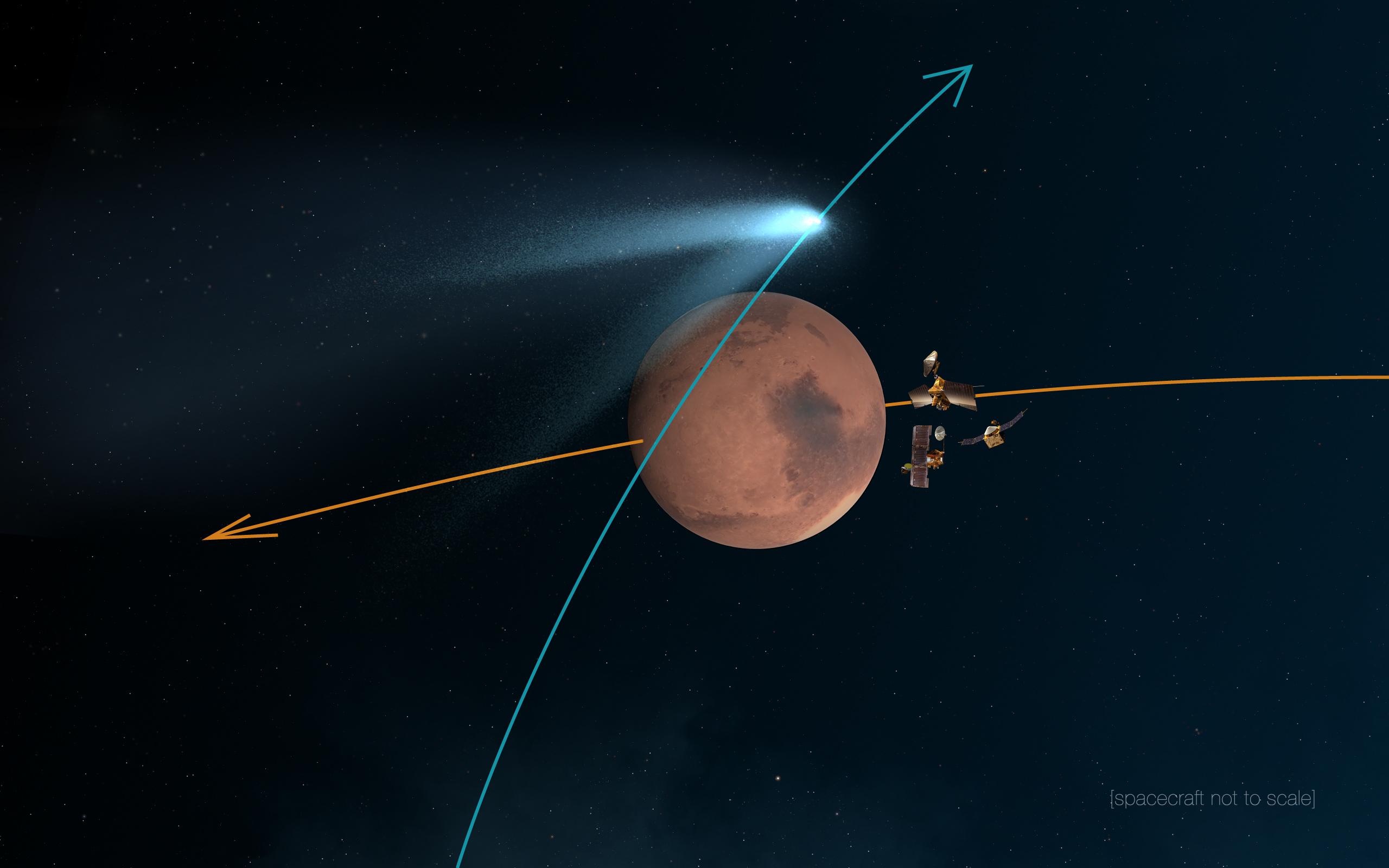
2014-10-09 |
Mars
|
|
|
2560x1600x3 |
|
-
PIA18611:
-
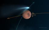
Mars Orbiters 'Duck and Cover' for Comet Siding Spring Flyby (Artist's Concept)
Full Resolution:
TIFF
(12.29 MB)
JPEG
(163.2 kB)
|
|
|
2014-10-09 |
Mars
|
2001 Mars Odyssey
|
THEMIS
|
498x1533x1 |

|
-
PIA18741:
-
Angustus Labyrinthus
Full Resolution:
TIFF
(764.4 kB)
JPEG
(58.46 kB)
|
|
|
2014-10-08 |
Mars
|
2001 Mars Odyssey
|
THEMIS
|
1387x2955x1 |

|
-
PIA18740:
-
Daedalia Planum
Full Resolution:
TIFF
(4.104 MB)
JPEG
(570.9 kB)
|
|
|
2014-10-07 |
Mars
|
2001 Mars Odyssey
|
THEMIS
|
1012x2958x1 |

|
-
PIA18736:
-
South Polar Textures
Full Resolution:
TIFF
(2.997 MB)
JPEG
(355 kB)
|
|
|
2014-10-06 |
Mars
|
2001 Mars Odyssey
|
THEMIS
|
970x2933x1 |
|
-
PIA18733:
-
South Polar Textures
Full Resolution:
TIFF
(2.848 MB)
JPEG
(599.1 kB)
|
|
|
2014-10-03 |
Mars
|
2001 Mars Odyssey
|
THEMIS
|
1400x2949x1 |

|
-
PIA18732:
-
Apollinaris Mons
Full Resolution:
TIFF
(4.134 MB)
JPEG
(326.8 kB)
|
|
|
2014-10-02 |
Mars
|
2001 Mars Odyssey
|
THEMIS
|
716x1548x1 |

|
-
PIA18731:
-
Hebes Chasma
Full Resolution:
TIFF
(1.11 MB)
JPEG
(105.2 kB)
|
|
|
2014-10-01 |
Mars
|
Mars Reconnaissance Orbiter (MRO)
|
HiRISE
|
2880x1800x3 |

|
-
PIA18820:
-
Dome and Barchan Dunes in Newton Crater
Full Resolution:
TIFF
(15.56 MB)
JPEG
(1.351 MB)
|
|
|
2014-10-01 |
Mars
|
Mars Reconnaissance Orbiter (MRO)
|
HiRISE
|
2880x1800x3 |
|
-
PIA18819:
-
Bright Slope Streaks in Arabia Terra
Full Resolution:
TIFF
(15.56 MB)
JPEG
(556.2 kB)
|
|
|
2014-10-01 |
Mars
|
Mars Reconnaissance Orbiter (MRO)
|
HiRISE
|
2880x1800x3 |
|
-
PIA18818:
-
Continual Dune and Ripple Migration in Nili Patera
Full Resolution:
TIFF
(15.56 MB)
JPEG
(807.2 kB)
|
|
|
2014-10-01 |
Mars
|
Mars Reconnaissance Orbiter (MRO)
|
HiRISE
|
2880x1800x3 |

|
-
PIA18817:
-
Possible Future Mars Landing Site in Oxia Planum
Full Resolution:
TIFF
(15.56 MB)
JPEG
(705.9 kB)
|
|
|
2014-10-01 |
Mars
|
2001 Mars Odyssey
|
THEMIS
|
1316x5973x1 |

|
-
PIA18729:
-
Valles Marineris
Full Resolution:
TIFF
(7.869 MB)
JPEG
(293.2 kB)
|
|
|
2014-09-30 |
Mars
|
2001 Mars Odyssey
|
THEMIS
|
1443x2943x1 |

|
-
PIA18728:
-
Dark Slope Streaks
Full Resolution:
TIFF
(4.252 MB)
JPEG
(289.5 kB)
|
|
|
2014-09-29 |
Mars
|
2001 Mars Odyssey
|
THEMIS
|
495x1468x1 |

|
-
PIA18727:
-
South Pole Layers
Full Resolution:
TIFF
(727.6 kB)
JPEG
(84.63 kB)
|
|
|
2014-09-26 |
Mars
|
2001 Mars Odyssey
|
THEMIS
|
660x3022x1 |

|
-
PIA18724:
-
Candor Chasma
Full Resolution:
TIFF
(1.997 MB)
JPEG
(80.28 kB)
|
|
|
2014-09-25 |
Mars
|
Mars Science Laboratory (MSL)
|
MAHLI
|
1584x1184x3 |
|
-
PIA18610:
-
Resistant Features in 'Pahrump Hills' Outcrop
Full Resolution:
TIFF
(5.628 MB)
JPEG
(345.3 kB)
|
|
|
2014-09-25 |
Mars
|
Mars Science Laboratory (MSL)
|
MAHLI
|
1569x1170x3 |
|
-
PIA18609:
-
First Sampling Hole in Mount Sharp
Full Resolution:
TIFF
(5.509 MB)
JPEG
(530.7 kB)
|
|
|
2014-09-25 |
Mars
|
Mars Science Laboratory (MSL)
|
Mastcam
|
6886x2279x3 |
|
-
PIA18608:
-
Curiosity Mars Rover's Approach to 'Pahrump Hills'
Full Resolution:
TIFF
(47.1 MB)
JPEG
(2.455 MB)
|
|
|
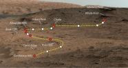
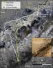
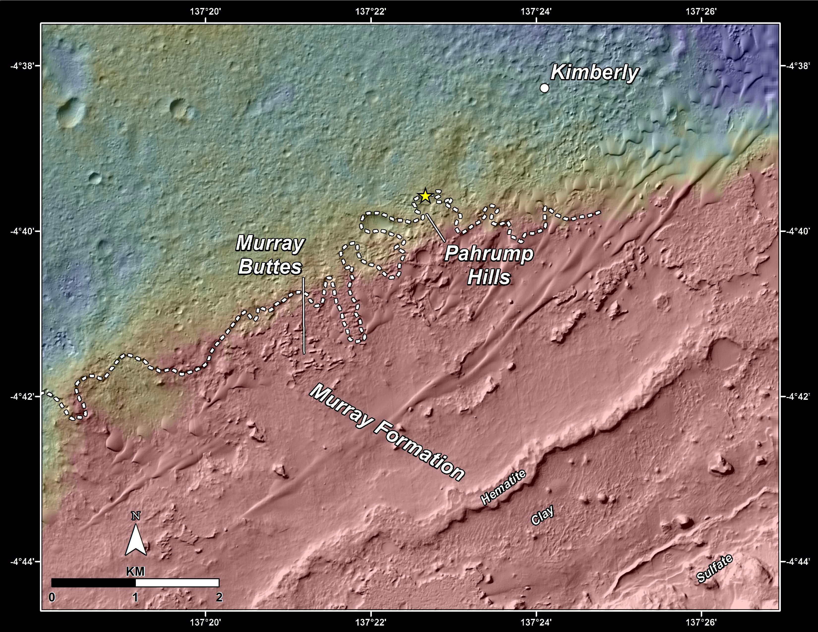
2014-09-25 |
Mars
|
Mars Reconnaissance Orbiter (MRO)
Mars Science Laboratory (MSL)
|
HiRISE
|
3300x2550x3 |
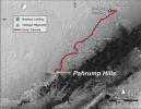
|
-
PIA18607:
-
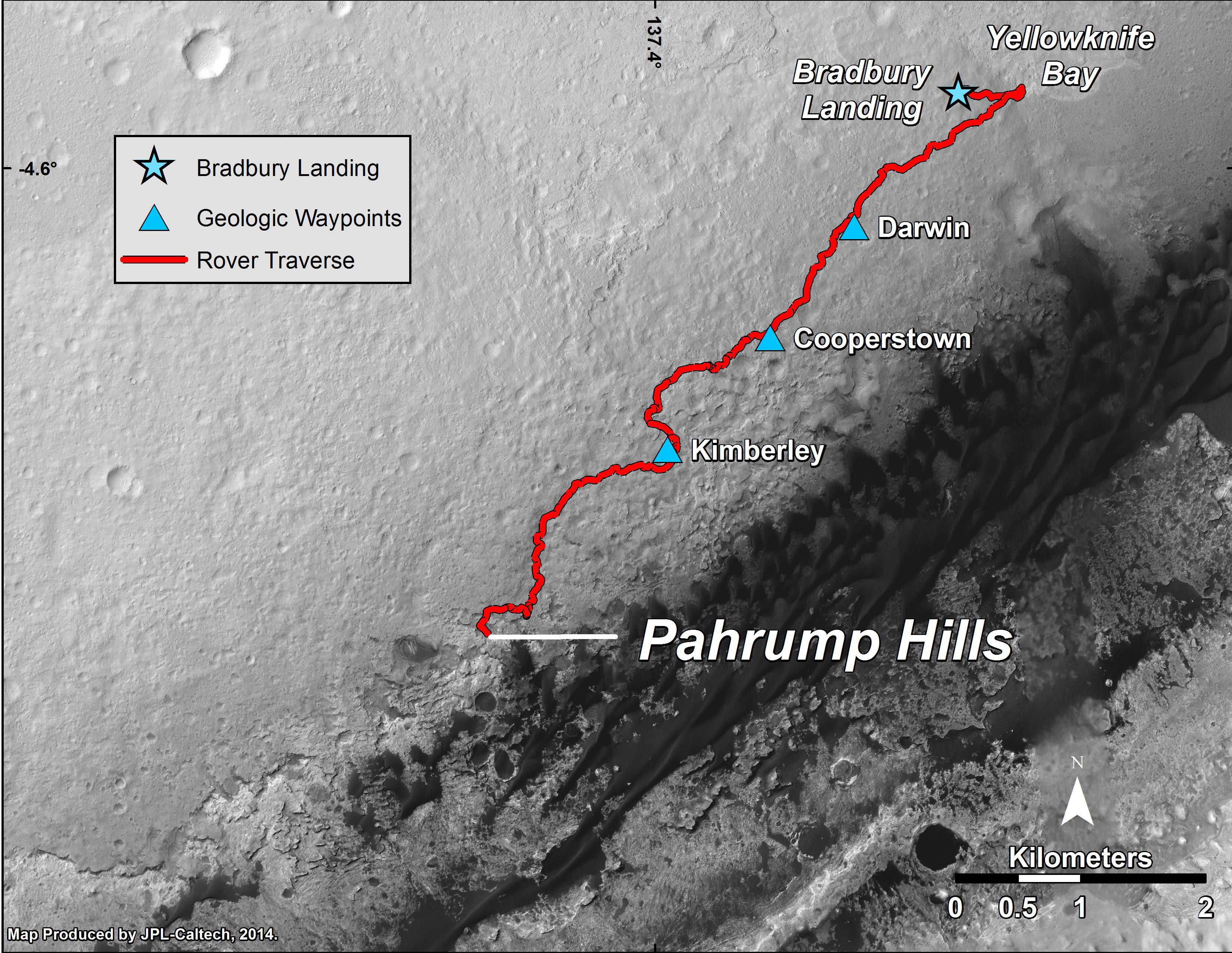
Curiosity Mars Rover's Route from Landing to 'Pahrump Hills'
Full Resolution:
TIFF
(25.26 MB)
JPEG
(1.571 MB)
|
|
|
2014-09-25 |
Mars
|
2001 Mars Odyssey
|
THEMIS
|
1010x2952x1 |

|
-
PIA18722:
-
South Polar Crater
Full Resolution:
TIFF
(2.985 MB)
JPEG
(190.1 kB)
|
|
|
2014-09-24 |
Mars
|
2001 Mars Odyssey
|
THEMIS
|
696x1556x1 |

|
-
PIA18720:
-
Terra Sirenum
Full Resolution:
TIFF
(1.084 MB)
JPEG
(114.7 kB)
|
|
|
2014-09-23 |
Mars
|
2001 Mars Odyssey
|
THEMIS
|
1371x2981x1 |

|
-
PIA18719:
-
Terra Cimmeria
Full Resolution:
TIFF
(4.092 MB)
JPEG
(399.1 kB)
|
|
|
2014-09-22 |
Mars
|
2001 Mars Odyssey
|
THEMIS
|
1407x2950x1 |

|
-
PIA18718:
-
Labou Vallis
Full Resolution:
TIFF
(4.156 MB)
JPEG
(353.2 kB)
|
|
|
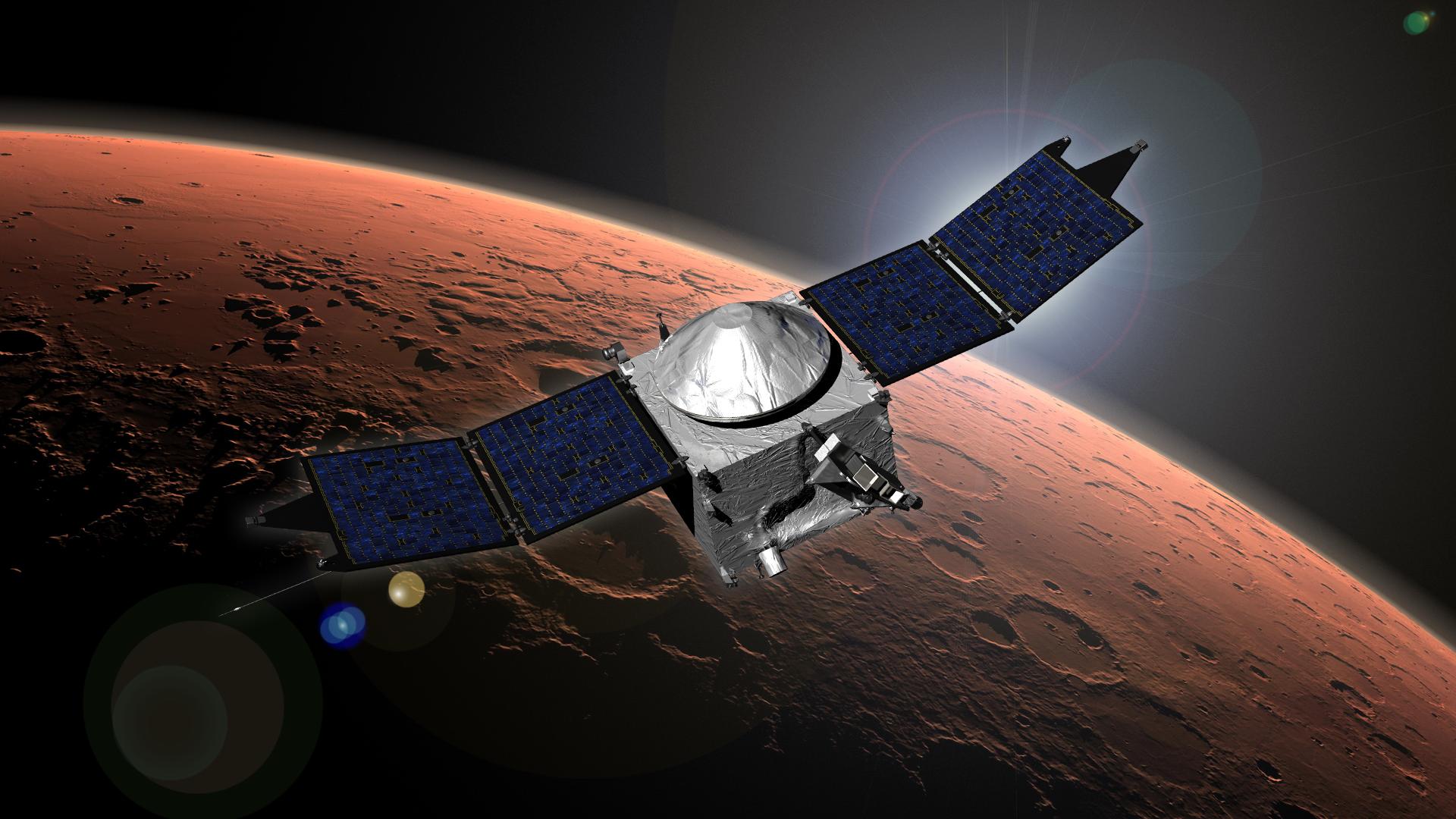
2014-09-21 |
Mars
|
MAVEN
|
|
1920x1080x3 |
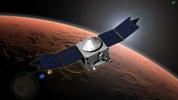
|
-
PIA18811:
-
MAVEN (Artist's Concept)
Full Resolution:
TIFF
(6.223 MB)
JPEG
(220.8 kB)
|
|
|
2014-09-19 |
Mars
|
2001 Mars Odyssey
|
THEMIS
|
974x2930x1 |

|
-
PIA18715:
-
Polar Textures
Full Resolution:
TIFF
(2.857 MB)
JPEG
(645.4 kB)
|
|
|
2014-09-18 |
Mars
|
2001 Mars Odyssey
|
THEMIS
|
491x1528x1 |

|
-
PIA18714:
-
South Polar Cap
Full Resolution:
TIFF
(751.2 kB)
JPEG
(93.79 kB)
|
|
|
2014-09-17 |
Mars
|
2001 Mars Odyssey
|
THEMIS
|
988x2932x1 |

|
-
PIA18712:
-
South Polar Cap
Full Resolution:
TIFF
(2.9 MB)
JPEG
(301 kB)
|
|
|
2014-09-16 |
Mars
|
2001 Mars Odyssey
|
THEMIS
|
1423x2942x1 |

|
-
PIA18711:
-
Gigas Sulci
Full Resolution:
TIFF
(4.191 MB)
JPEG
(409.1 kB)
|
|
|
2014-09-15 |
Mars
|
2001 Mars Odyssey
|
THEMIS
|
1405x2954x1 |

|
-
PIA18709:
-
Melas Chasma
Full Resolution:
TIFF
(4.155 MB)
JPEG
(266.6 kB)
|
|
|
2014-09-12 |
Mars
|
2001 Mars Odyssey
|
THEMIS
|
1382x2959x1 |

|
-
PIA18707:
-
Volcanic Flow Surfaces
Full Resolution:
TIFF
(4.094 MB)
JPEG
(416.2 kB)
|
|
|
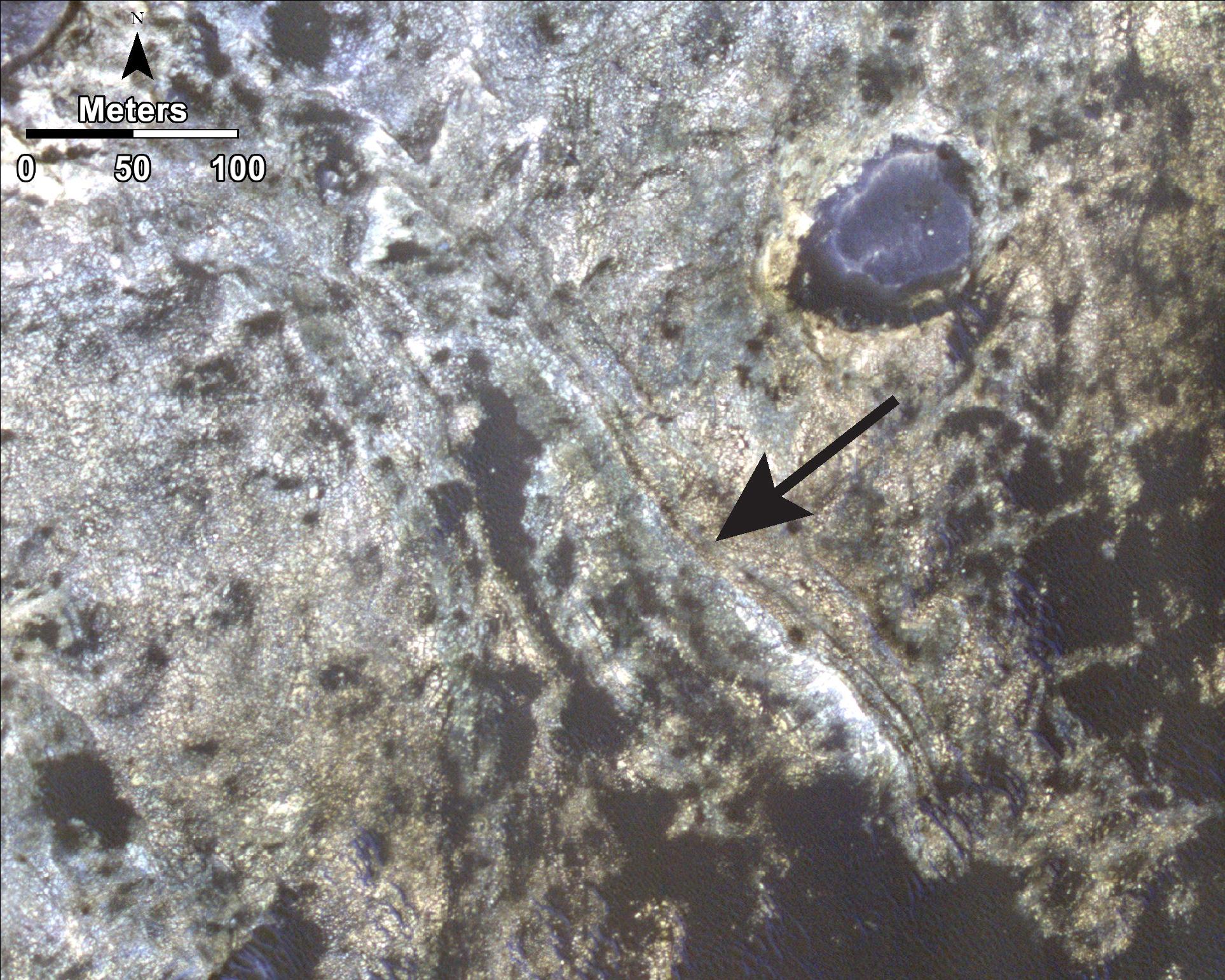
2014-09-11 |
Mars
|
Mars Reconnaissance Orbiter (MRO)
Mars Science Laboratory (MSL)
|
HiRISE
|
3000x2400x3 |
|
-
PIA18785:
-
Geological Transition
Full Resolution:
TIFF
(21.61 MB)
JPEG
(2.032 MB)
|
|
|
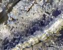
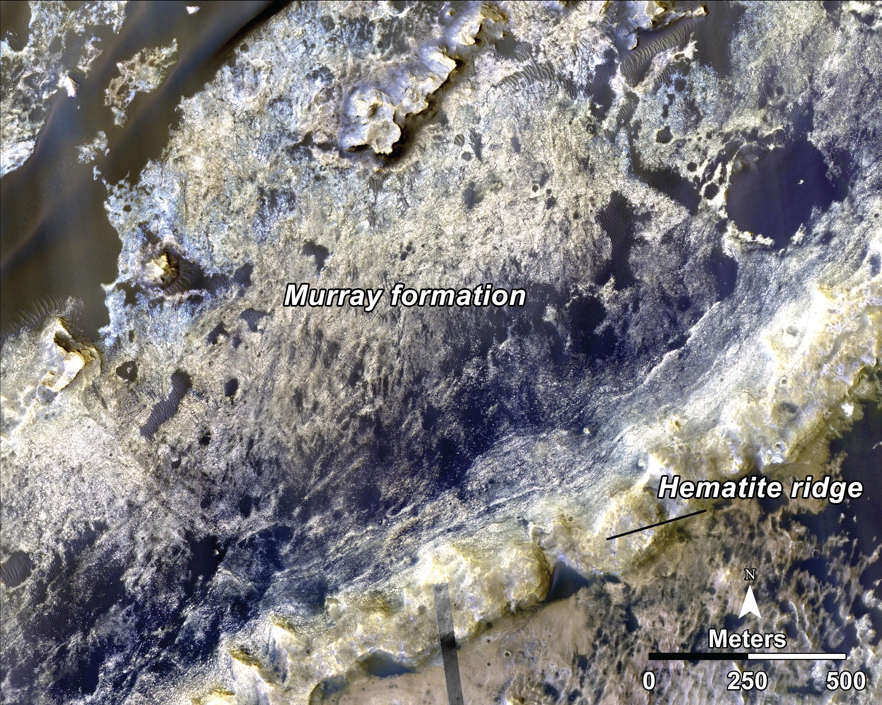
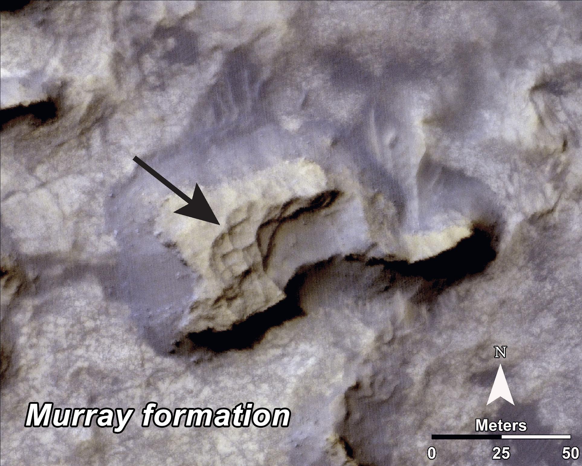
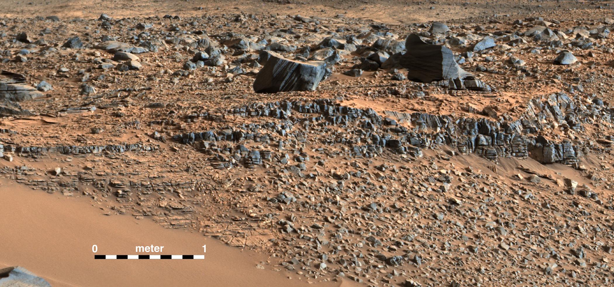
2014-09-11 |
Mars
|
Mars Reconnaissance Orbiter (MRO)
Mars Science Laboratory (MSL)
|
HiRISE
|
1927x1542x3 |

|
-
PIA18784:
-
Bands on the 'Murray Formation'
Full Resolution:
TIFF
(8.918 MB)
JPEG
(563 kB)
|
|
|
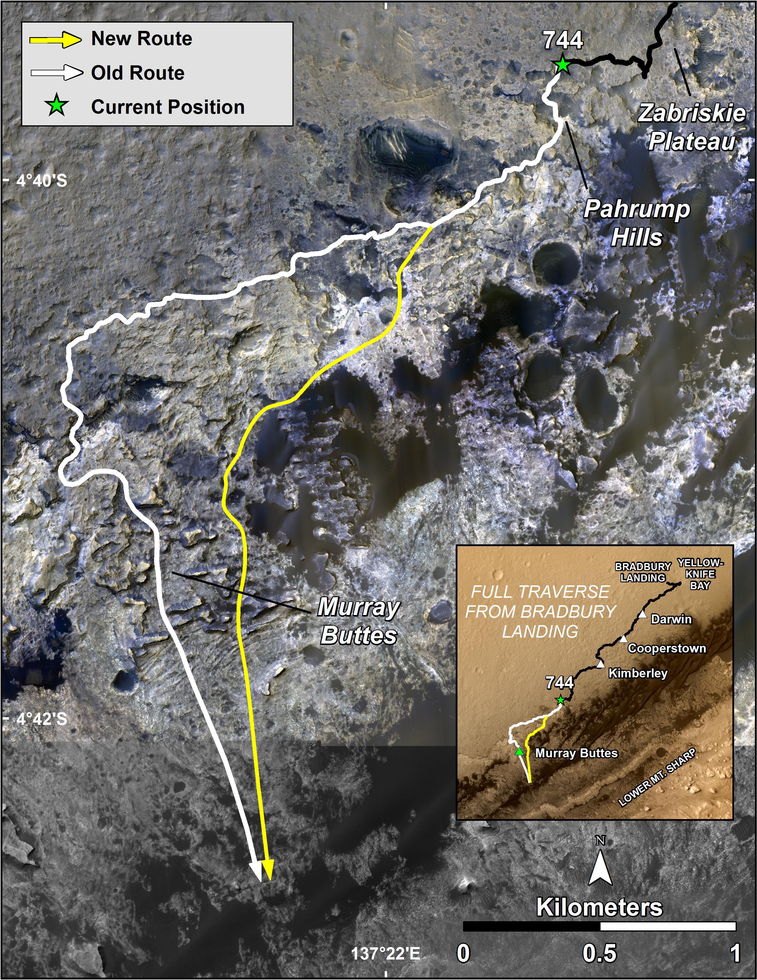
2014-09-11 |
Mars
|
Mars Reconnaissance Orbiter (MRO)
Mars Science Laboratory (MSL)
|
HiRISE
|
1927x1542x3 |
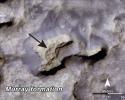
|
-
PIA18783:
-
'Murray Buttes' Mesa
Full Resolution:
TIFF
(8.918 MB)
JPEG
(471.3 kB)
|
|
|
2014-09-11 |
Mars
|
Mars Science Laboratory (MSL)
|
|
4200x1759x3 |
|
-
PIA18782:
-
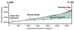
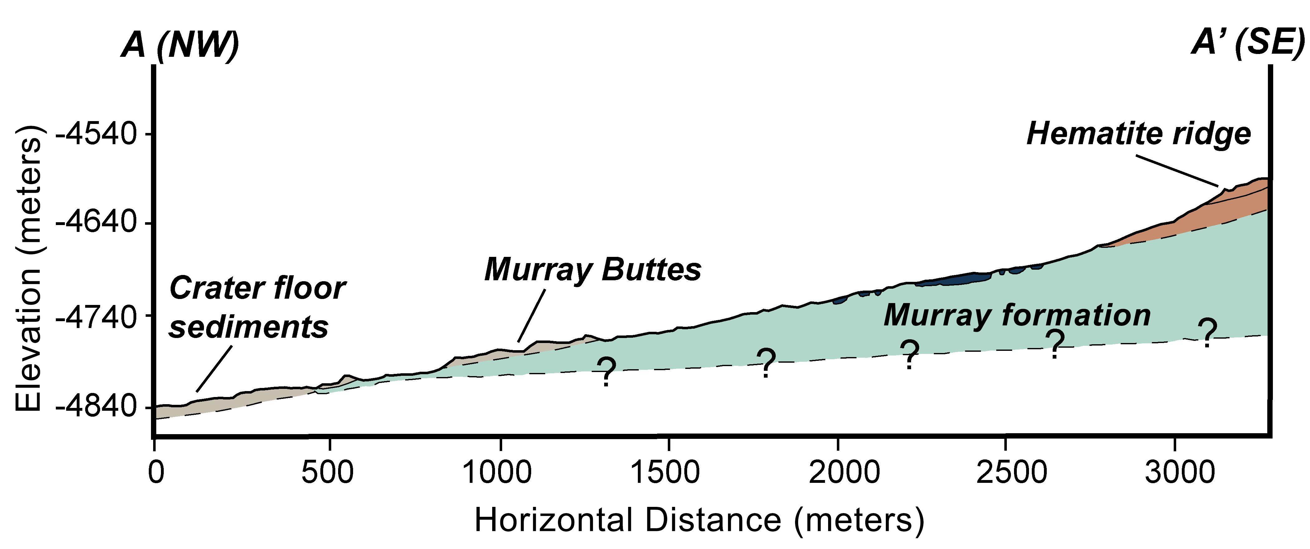
Geologic Cross-Section
Full Resolution:
TIFF
(22.18 MB)
JPEG
(366.6 kB)
|
|
|
2014-09-11 |
Mars
|
Mars Reconnaissance Orbiter (MRO)
Mars Science Laboratory (MSL)
|
HiRISE
|
4173x3008x3 |
|
-
PIA18781:
-
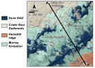
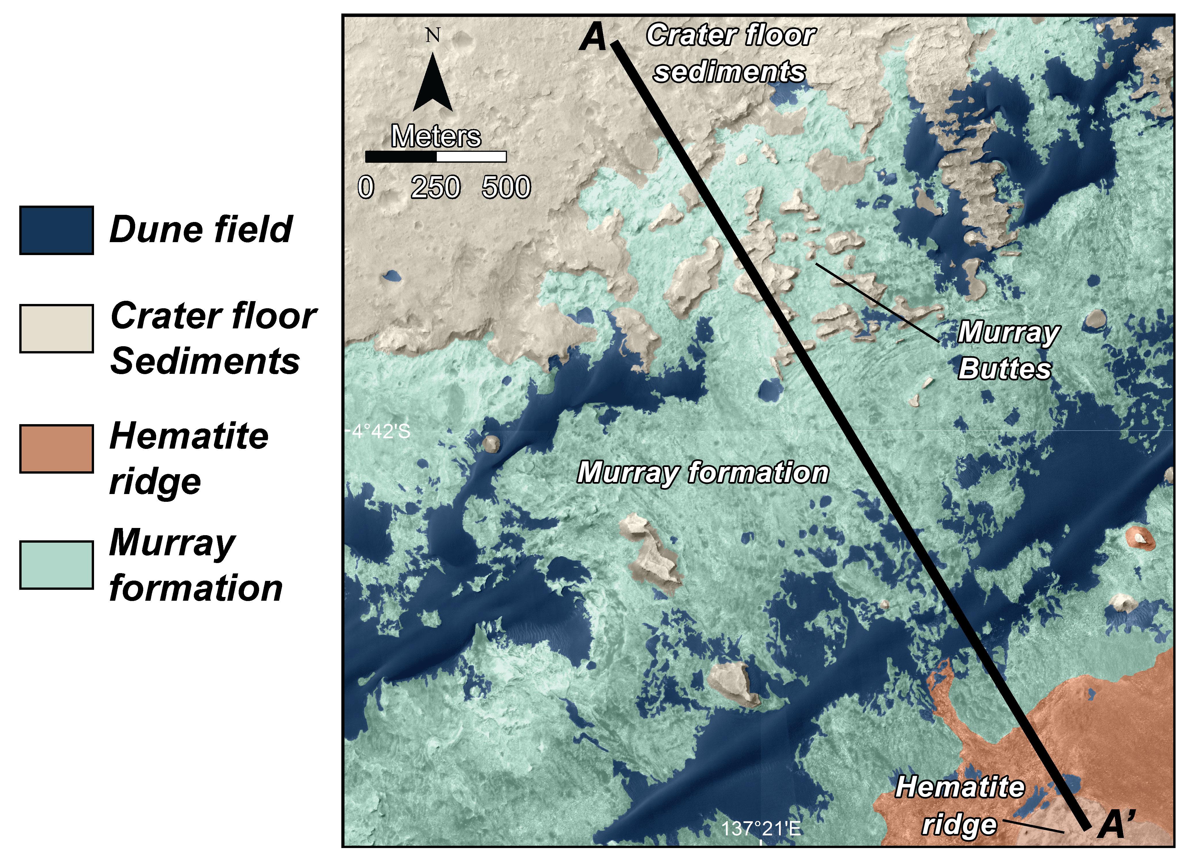
Map of Lower Mount Sharp
Full Resolution:
TIFF
(37.68 MB)
JPEG
(1.64 MB)
|
|
|
2014-09-11 |
Mars
|
Mars Reconnaissance Orbiter (MRO)
Mars Science Laboratory (MSL)
|
HiRISE
|
4890x3912x3 |
|
-
PIA18780:
-
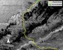
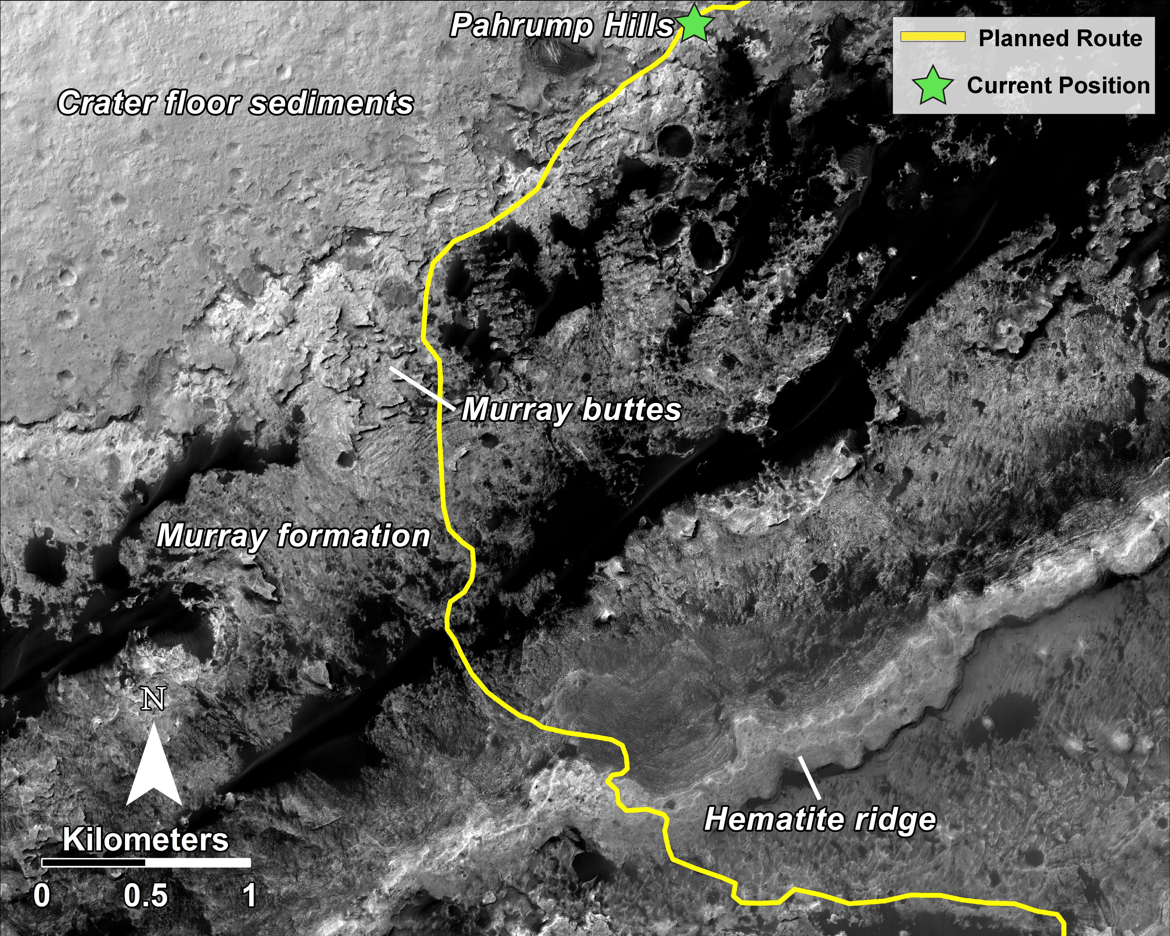
Curiosity Rover Planned Route
Full Resolution:
TIFF
(57.42 MB)
JPEG
(3.739 MB)
|
|
|
2014-09-11 |
Mars
|
Mars Science Laboratory (MSL)
|
Alpha Particle X-ray Spectrometer
|
1530x1032x3 |
|
-
PIA18479:
-
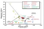
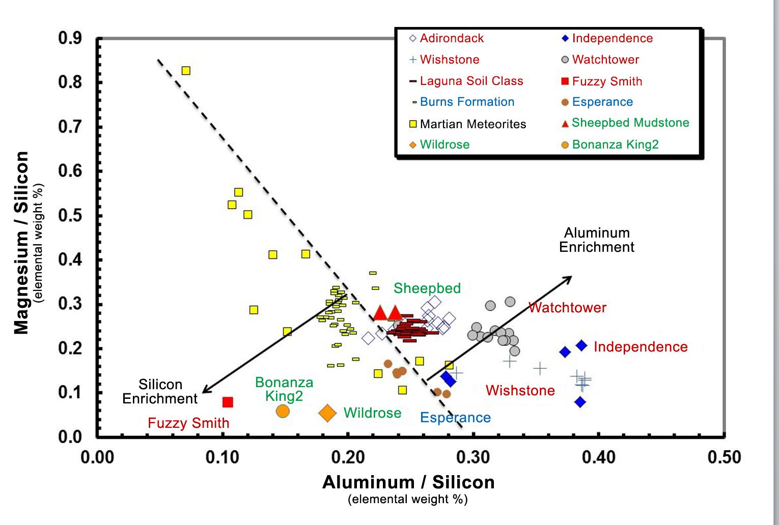
Martian Rocks Rich in Silicon
Full Resolution:
TIFF
(4.739 MB)
JPEG
(134.6 kB)
|
|
|
2014-09-11 |
Mars
|
Mars Science Laboratory (MSL)
|
Mastcam
|
1319x1187x3 |

|
-
PIA18478:
-
Loose Rock Leads to Incomplete Drilling
Full Resolution:
TIFF
(4.699 MB)
JPEG
(278.6 kB)
|
|
|
2014-09-11 |
Mars
|
Mars Science Laboratory (MSL)
|
Mastcam
|
1315x1179x3 |
|
-
PIA18477:
-
A Bonanza of Clues About Mars
Full Resolution:
TIFF
(4.653 MB)
JPEG
(253.2 kB)
|
|
|
2014-09-11 |
Mars
|
Mars Science Laboratory (MSL)
|
Mastcam
|
2102x984x3 |
|
-
PIA18476:
-
Martian Layers Thicker on Top
Full Resolution:
TIFF
(6.208 MB)
JPEG
(479.9 kB)
|
|
|
2014-09-11 |
Mars
|
Mars Reconnaissance Orbiter (MRO)
Mars Science Laboratory (MSL)
|
HiRISE
|
2550x3300x3 |
|
-
PIA18475:
-
Curiosity's Next Steps
Full Resolution:
TIFF
(25.25 MB)
JPEG
(1.735 MB)
|
|
|
2014-09-11 |
Mars
|
Mars Reconnaissance Orbiter (MRO)
Mars Science Laboratory (MSL)
|
HiRISE
|
3300x2550x3 |

|
-
PIA18474:
-
Slopes of Mount Sharp
Full Resolution:
TIFF
(25.26 MB)
JPEG
(1.023 MB)
|
 Planetary Data System


