Your search criteria found 825 images
Target is Mars (and available satellites)
Go to PIAxxxxx:
Refine this list of images by:
Target:
Spacecraft:
Instrument:
Click on an image for detailed information
Click on a column heading to sort in ascending or descending order
My
List
Addition Date TargetSort Descending Mission Instrument Size
Add Image to Favorite List 2014-12-11 Mars Mars Science Laboratory (MSL)
Mastcam
1920x1080x3
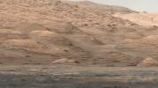
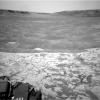
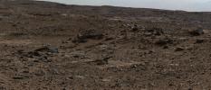
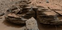
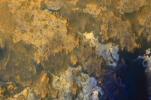
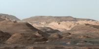
This view from the Mastcam on NASA's Curiosity Mars rover shows dramatic buttes and layers on the lower flank of Mount Sharp. It was taken on Sept. 7, 2013, from near the waypoint called 'Darwin' on the route toward an entry point to the mountain.
PIA19083:
Mount Sharp Buttes and Layers From Near 'Darwin'
Full Resolution:     TIFF (6.223 MB)     JPEG (419.5 kB)
Add Image to Favorite List 2014-11-18 Mars Mars Science Laboratory (MSL)
Mastcam
3528x1304x3
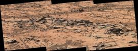
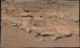
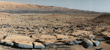
This small ridge, about 3 feet long, appears to resist wind erosion more than the flatter plates around it. Such differences are among the traits NASA's Curiosity Mars rover is examining at selected rock targets at the base of Mount Sharp.
PIA18880:
Erosion Resistance at 'Pink Cliffs' at Base of Martian Mount Sharp
Full Resolution:     TIFF (13.81 MB)     JPEG (1.094 MB)
Add Image to Favorite List 2014-11-18 Mars Mars Science Laboratory (MSL)
Mastcam
4185x2801x3
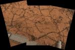
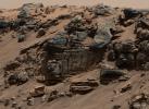
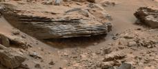
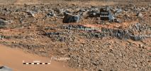
This patch of Martian bedrock, about 2 feet (70 centimeters) across, is finely layered rock with some pea-size inclusions. It lies near the lowest point of the 'Pahrump Hills' outcrop, which forms part of the basal layer of Mount Sharp.
PIA18881:
Fine-Grained, Finely Layered Rock at Base of Martian Mount Sharp
Full Resolution:     TIFF (35.19 MB)     JPEG (1.45 MB)
Add Image to Favorite List 2014-11-18 Mars Mars Science Laboratory (MSL)
Mastcam
7501x2733x3
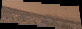
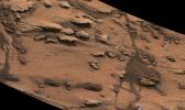
A wheel track cuts through a windblown ripple of dusty sand in this Nov. 7, 2014, image from the Mastcam on NASA's Curiosity rover. The view spans about four feet across.
PIA18882:
Ripple's Interior Exposed by Rover Wheel Track
Full Resolution:     TIFF (61.52 MB)     JPEG (2.514 MB)
Add Image to Favorite List 2014-11-18 Mars Mars Science Laboratory (MSL)
Navcam (MSL)
1024x1024x1
This northeast-facing view from the lower edge of the pale 'Pahrump Hills' outcrop at the base of Mount Sharp includes wind-sculpted ripples of sand and dust in the middle ground. It was taken by Curiosity's Navcam on Nov. 13, 2014.
PIA18883:
Ripples Beside 'Pahrump Hills' Outcrop at Base of Mount Sharp
Full Resolution:     TIFF (1.05 MB)     JPEG (179.2 kB)
Add Image to Favorite List 2014-11-25 Mars Mars Science Laboratory (MSL)
Mastcam
4188x2799x3
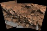
This view from NASA's Curiosity Mars rover shows a swath of bedrock called 'Alexander Hills,' which the rover approached for close-up inspection of selected targets. It is a mosaic of six frames taken on Nov. 23, 2014.
PIA19066:
Within Rover's Reach at Mars Target Area 'Alexander Hills'
Full Resolution:     TIFF (35.19 MB)     JPEG (1.442 MB)
Add Image to Favorite List 2014-12-08 Mars Mars Reconnaissance Orbiter (MRO)
Mars Science Laboratory (MSL)
HiRISE
3300x2550x3
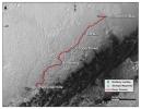
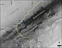
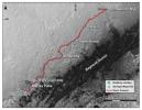
This map shows the route driven by NASA's Curiosity Mars rover from the location where it landed in August 2012 to the 'Pahrump Hills' outcrop at the base of Mount Sharp.
PIA19067:
Curiosity Mars Rover's Route from Landing to Base of Mount Sharp
Full Resolution:     TIFF (25.26 MB)     JPEG (1.381 MB)
Add Image to Favorite List 2014-12-08 Mars Mars Science Laboratory (MSL)
Mastcam
3619x2196x3
This image from Curiosity's Mastcam shows inclined beds of sandstone interpreted as the deposits of small deltas fed by rivers flowing down from the Gale Crater rim and building out into a lake where Mount Sharp is now.
PIA19068:
Inclined Martian Sandstone Beds Near 'Kimberley'
Full Resolution:     TIFF (23.85 MB)     JPEG (1.665 MB)
Add Image to Favorite List 2014-12-08 Mars Mars Science Laboratory (MSL)
Mastcam
4657x1024x3
On March 25, 2014, view from the Mastcam on NASA's Curiosity Mars rover looks southward at the Kimberley waypoint. Multiple sandstone beds show systematic inclination to the south suggesting progressive build-out of delta sediments.
PIA19069:
Bedding Pattern Interpreted as Martian Delta Deposition
Full Resolution:     TIFF (14.31 MB)     JPEG (1.16 MB)
Add Image to Favorite List 2014-12-08 Mars Mars Science Laboratory (MSL)
Mastcam
6246x2048x3
This image from Curiosity's Mastcam looks to the west of a waypoint on the rover's route to Mount Sharp. The mountain lies to the left of the scene.
PIA19070:
Sets of Beds Inclined Toward Mount Sharp
Full Resolution:     TIFF (38.39 MB)     JPEG (2.709 MB)
Add Image to Favorite List 2014-12-08 Mars Mars Science Laboratory (MSL)
1931x1078x3
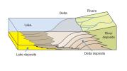
This diagram depicts rivers entering a lake. Where the water's flow decelerates, sediments drop out, and a delta forms, depositing a prism of sediment that tapers out toward the lake's interior.
PIA19071:
How a Delta Forms Where River Meets Lake
Full Resolution:     TIFF (6.247 MB)     JPEG (112.7 kB)
Add Image to Favorite List 2014-12-08 Mars Mars Science Laboratory (MSL)
Mastcam
2440x1049x3
This image shows inclined beds characteristic of delta deposits where a stream entered a lake, but at a higher elevation and farther south than other delta deposits north of Mount Sharp.
PIA19072:
Sol 696 (July 22, 2014), Left
Full Resolution:     TIFF (7.682 MB)     JPEG (515.2 kB)
Add Image to Favorite List 2014-12-08 Mars Mars Science Laboratory (MSL)
Mastcam
1588x1160x3
This evenly layered rock photographed by the Mast Camera (Mastcam) on NASA's Curiosity Mars Rover on Aug. 7, 2014, shows a pattern typical of a lake-floor sedimentary deposit not far from where flowing water entered a lake.
PIA19074:
Sedimentary Signs of a Martian Lakebed
Full Resolution:     TIFF (5.528 MB)     JPEG (276.3 kB)
Add Image to Favorite List 2014-12-08 Mars Mars Science Laboratory (MSL)
Mastcam
2011x1198x3
This image from NASA's Curiosity Mars rover shows an example of a thin-laminated, evenly stratified rock type that occurs in the 'Pahrump Hills' outcrop at the base of Mount Sharp on Mars. This type of rock can form under a lake.
PIA19075:
Thin-Laminated Rock in 'Pahrump Hills' Outcrop
Full Resolution:     TIFF (7.23 MB)     JPEG (448.2 kB)
Add Image to Favorite List 2014-12-08 Mars Mars Science Laboratory (MSL)
Mastcam
4006x1929x3
This view from the NASA's Curiosity Mars rover shows an example of cross-bedding that results from water passing over a loose bed of sediment. It was taken at a target called 'Whale Rock' within the 'Pahrump Hills' outcrop at the base of Mount Sharp.
PIA19076:
Cross-Bedding at 'Whale Rock'
Full Resolution:     TIFF (23.19 MB)     JPEG (1.06 MB)
Add Image to Favorite List 2014-12-08 Mars Mars Science Laboratory (MSL)
MAHLI
2876x3014x3
Lozenge-shaped crystals are evident in this magnified view of a Martian rock target called 'Mojave,' taken on Nov. 15, 2014, by NASA's Curiosity Mars rover. These features record concentration of dissolved salts, possibly in a drying lake.
PIA19077:
Crystals May Have Formed in Drying Martian Lake
Full Resolution:     TIFF (26.02 MB)     JPEG (1.59 MB)
Add Image to Favorite List 2014-12-08 Mars Mars Science Laboratory (MSL)
4030x1275x3
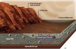
This image depicts how a mountain inside a Mars' Gale Crater might have formed. At left, the crater fills with layers of sediment. Yellow is for deposits in alluvial fans, deltas, and drifts during both wet and dry periods.
PIA19079:
Sedimentation and Erosion in Gale Crater, Mars
Full Resolution:     TIFF (15.42 MB)     JPEG (190.5 kB)
Add Image to Favorite List 2014-12-08 Mars Mars Science Laboratory (MSL)
2560x1600x3
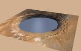
This simulation depicts a lake partially filling Mars' Gale Crater, receiving runoff from snow melting on the crater's rim, showing evidence that NASA's Curiosity rover has found ancient streams, deltas and lakes.
PIA19080:
Simulated View of Gale Crater Lake on Mars
Full Resolution:     TIFF (12.29 MB)     JPEG (271.9 kB)
Add Image to Favorite List 2014-12-08 Mars Mars Science Laboratory (MSL)
Mastcam
2350x1026x3
Cross-bedding seen in the layers of this Martian rock is evidence of movement of water recorded by the waves or ripples of loose sediment the water passed over, such as a current in a lake. This image is from NASA's Curiosity Mars rover.
PIA19081:
Martian Rock's Evidence of Lake Currents
Full Resolution:     TIFF (7.236 MB)     JPEG (399.7 kB)
Add Image to Favorite List 2014-12-16 Mars Mars Science Laboratory (MSL)
SAM
845x616x3
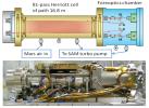
By measuring absorption of light at specific wavelengths, Tunable Laser Spectrometer (TLS) onboard NASA's Curiosity measures concentrations of methane, carbon dioxide and water vapor in Mars' atmosphere.
PIA19086:
Tunable Laser Spectrometer on NASA's Curiosity Mars Rover
Full Resolution:     TIFF (1.562 MB)     JPEG (95.98 kB)
Add Image to Favorite List 2014-12-16 Mars Mars Science Laboratory (MSL)
SAM
960x621x3
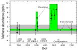
This graphic shows tenfold spiking in the abundance of methane in the Martian atmosphere surrounding NASA's Curiosity Mars rover, as detected by a series of measurements made with the Tunable Laser Spectrometer instrument in the rover's laboratory suite.
PIA19087:
Methane Measurements by NASA's Curiosity in Mars' Gale Crater
Full Resolution:     TIFF (1.789 MB)     JPEG (61.48 kB)
Add Image to Favorite List 2014-12-16 Mars Mars Science Laboratory (MSL)
SAM
1440x1080x3
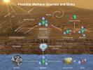
This illustration portrays possible ways methane might be added to Mars' atmosphere (sources) and removed from the atmosphere (sinks). NASA's Curiosity Mars rover has detected fluctuations in methane concentration in the atmosphere.
PIA19088:
Possible Methane Sources and Sinks
Full Resolution:     TIFF (4.668 MB)     JPEG (233 kB)
Add Image to Favorite List 2014-12-16 Mars Mars Science Laboratory (MSL)
SAM
960x720x3
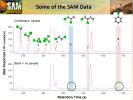
Data graphed here are examples from the Sample Analysis at Mars (SAM) laboratory's detection of Martian organics in a sample of powder that the drill on NASA's Curiosity Mars rover collected from a rock target called 'Cumberland.'
PIA19089:
Some Data from Detection of Organics in a Rock on Mars
Full Resolution:     TIFF (2.075 MB)     JPEG (79.68 kB)
Add Image to Favorite List 2014-12-16 Mars Mars Science Laboratory (MSL)
SAM
960x720x3
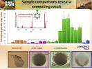
This graphic offers comparisons between the amount of an organic chemical named chlorobenzene detected in the 'Cumberland' rock sample and amounts of it in samples from three other Martian surface targets analyzed by NASA's Curiosity Mars rover.
PIA19090:
Comparing 'Cumberland' With Other Samples Analyzed by Curiosity
Full Resolution:     TIFF (2.075 MB)     JPEG (106.1 kB)
Add Image to Favorite List 2014-12-16 Mars Mars Science Laboratory (MSL)
SAM
960x618x3
This illustration portrays some of the reasons why finding organic chemicals on Mars is challenging. Whatever organic chemicals may be produced on Mars or delivered to Mars face several possible modes of being transformed or destroyed.
PIA19091:
Mars Has Ways to Make Organics Hard to Find
Full Resolution:     TIFF (1.781 MB)     JPEG (72.92 kB)
Add Image to Favorite List 2015-01-14 Mars Mars Science Laboratory (MSL)
Hazcam (MSL)
1024x1024x1
This view NASA's Curiosity Mars Rover shows the rover's drill in position for a mini-drill test to assess whether a rock target called 'Mojave' is appropriate for full-depth drilling to collect a sample. It was taken on Jan. 13, 2015.
PIA19104:
Curiosity Conducting Mini-Drill Test at 'Mojave'
Full Resolution:     TIFF (1.05 MB)     JPEG (145.5 kB)
Add Image to Favorite List 2015-01-14 Mars Mars Science Laboratory (MSL)
MAHLI
1196x1607x3
This Jan. 13, 2015, view from NASA's Curiosity Mars rover shows outcomes of a mini-drill test to assess whether the 'Mojave' rock is appropriate for full-depth drilling to collect a sample.
PIA19105:
Results from Curiosity's Mini-Drill Test at 'Mojave'
Full Resolution:     TIFF (5.768 MB)     JPEG (403 kB)
Add Image to Favorite List 2015-02-05 Mars Mars Science Laboratory (MSL)
MAHLI
1184x1584x3
Gray cuttings from Curiosity's drilling into a target called 'Mojave 2' are visible surrounding the sample-collection hole in this image from NASA's Curiosity rover.
PIA19115:
Site of Curiosity's Second Bite of Mount Sharp
Full Resolution:     TIFF (5.629 MB)     JPEG (251.9 kB)
Add Image to Favorite List 2015-02-24 Mars Mars Science Laboratory (MSL)
MAHLI
9015x4617x3
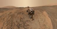
This self-portrait of NASA's Curiosity Mars rover shows the vehicle at the 'Mojave' site, where its drill collected the mission's second taste of Mount Sharp.
PIA19142:
Curiosity Self-Portrait at 'Mojave' Site on Mount Sharp
Full Resolution:     TIFF (124.9 MB)     JPEG (3.55 MB)
Add Image to Favorite List 2015-02-25 Mars Mars Science Laboratory (MSL)
MAHLI
1584x1184x3
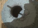
This hole, with a diameter slightly smaller than a U.S. dime, was drilled by NASA's Curiosity Mars rover into a rock target called 'Telegraph Peak.' The rock is located within the basal layer of Mount Sharp. The hole was drilled on Feb. 24, 2015.
PIA19140:
Hole at 'Telegraph Peak' Drilled by Mars Rover Curiosity
Full Resolution:     TIFF (5.628 MB)     JPEG (477.6 kB)
Add Image to Favorite List 2015-03-06 Mars Mars Science Laboratory (MSL)
Mastcam
1278x1092x3
This raw-color view from Curiosity's Mastcam shows the rover's drill just after finishing a drilling operation at 'Telegraph Peak' on Feb. 24, 2015.
PIA19145:
Curiosity's Drill After Drilling at 'Telegraph Peak'
Full Resolution:     TIFF (4.188 MB)     JPEG (128.3 kB)
Add Image to Favorite List 2015-03-06 Mars Mars Science Laboratory (MSL)
Navcam (MSL)
1024x830x1
This image from the Navigation Camera (Navcam) on NASA's Curiosity Mars rover shows the position in which the rover held its arm for several days.
PIA19147:
Curiosity's Arm Holding Steady, Sol 915
Full Resolution:     TIFF (851 kB)     JPEG (152.4 kB)
Add Image to Favorite List 2015-03-12 Mars Mars Science Laboratory (MSL)
HiRISE
1138x711x3
This area at the base of Mount Sharp on Mars includes a pale outcrop, called 'Pahrump Hills,' that NASA's Curiosity Mars rover investigated from September 2014 to March 2015.
PIA19148:
Curiosity Heading Away from 'Pahrump Hills'
Full Resolution:     TIFF (2.428 MB)     JPEG (125.3 kB)
Add Image to Favorite List 2015-03-27 Mars Mars Reconnaissance Orbiter (MRO)
Mars Science Laboratory (MSL)
HiRISE
2072x1225x1
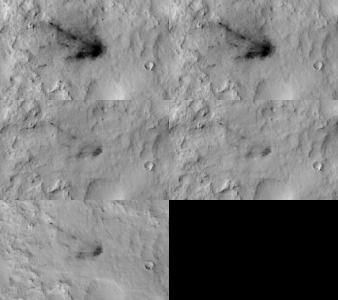
This frame from a sequence of images shows a blast zone where the sky crane from NASA's Curiosity rover mission hit the ground after setting the rover down in August 2012. The images are from HiRISE on NASA's Mars Reconnaissance Orbiter.
PIA19159:
Changes in Scars From 2012 Mars Landing Animation Icon
Full Resolution:     TIFF (2.542 MB)     JPEG (291.2 kB)
Add Image to Favorite List 2015-04-01 Mars Mars Science Laboratory (MSL)
Mastcam
4680x2088x3
This March 18, 2015, view from the Mast Camera on NASA's Curiosity Mars rover shows a network of two-tone mineral veins at an area called 'Garden City' on lower Mount Sharp.
PIA19161:
Prominent Veins at 'Garden City' on Mount Sharp, Mars
Full Resolution:     TIFF (29.33 MB)     JPEG (1.949 MB)
Add Image to Favorite List 2015-04-01 Mars Mars Science Laboratory (MSL)
MAHLI
777x702x3
This view from the Mars Hand Lens Imager on the arm of NASA's Curiosity Mars rover is a close-up of a two-tone mineral vein at a site called 'Garden City' on lower Mount Sharp. It was taken during night, illuminated by LEDs, on March 25, 2015.
PIA19162:
Night Close-up of Mineral Veins at 'Garden City,' Mars
Full Resolution:     TIFF (1.637 MB)     JPEG (78.88 kB)
Add Image to Favorite List 2015-04-13 Mars Mars Science Laboratory (MSL)
Navcam (MSL)
6225x1460x1
This view through a valley called 'Artist's Drive' from the Navigation Camera (Navcam) on NASA's Curiosity Mars rover shows the terrain ahead of the rover as it makes its way westward.
PIA19163:
Curiosity View Ahead Through 'Artist's Drive'
Full Resolution:     TIFF (9.1 MB)     JPEG (796.2 kB)
Add Image to Favorite List 2015-04-13 Mars Mars Science Laboratory (MSL)
Navcam (MSL)
6246x1497x3
This stereo view from the Navigation Camera (Navcam) on NASA's Curiosity Mars rover shows the terrain ahead of the rover as it makes its way westward through a valley called 'Artist's Drive.' 3-D glasses are need to view this image.
PIA19165:
Curiosity View Ahead Through 'Artist's Drive' (Stereo)
Full Resolution:     TIFF (28.06 MB)     JPEG (1.019 MB)
Add Image to Favorite List 2015-04-13 Mars Mars Science Laboratory (MSL)
Mastcam
1021x562x3
The Rover Environmental Monitoring Station (REMS) on NASA's Curiosity Mars rover includes temperature and humidity sensors mounted on the rover's mast. One of the REMS booms extends to the left from the mast in this view.
PIA19164:
Mars Weather-Station Tools on Rover's Mast
Full Resolution:     TIFF (1.722 MB)     JPEG (104.9 kB)
Add Image to Favorite List 2015-04-13 Mars Mars Science Laboratory (MSL)
Navcam (MSL)
3356x685x1
NASA's Curiosity Mars rover used its Navigation Camera (Navcam) to capture this view on April 11, 2015, during the 952nd Martian day, or sol of the rover's work on Mars.
PIA19386:
Scene From 'Artist's Drive' on Mars
Full Resolution:     TIFF (2.302 MB)     JPEG (234.8 kB)
Add Image to Favorite List 2015-04-13 Mars Mars Science Laboratory (MSL)
Navcam (MSL)
3368x832x3
NASA's Curiosity Mars rover used its Navigation Camera (Navcam) to capture this view on April 11, 2015, during the 952nd Martian day, or sol of the rover's work on Mars.
PIA19387:
Scene From 'Artist's Drive' on Mars (Stereo)
Full Resolution:     TIFF (8.41 MB)     JPEG (231.6 kB)
Add Image to Favorite List 2016-08-04 Mars Mars Science Laboratory (MSL)
Navcam (MSL)
982x726x1
NASA's Curiosity Mars rover began close-up investigation of a target called 'Marimba,' on lower Mount Sharp, during the week preceding the fourth anniversary of the mission's dramatic sky-crane landing.
PIA20764:
Curiosity's Arm Over 'Marimba' Target on Mount Sharp
Full Resolution:     TIFF (713.9 kB)     JPEG (138.6 kB)
Add Image to Favorite List 2015-04-16 Mars Mars Science Laboratory (MSL)
HiRISE
3300x2550x3
A green star marks the location of NASA's Curiosity Mars rover after a drive on the mission's 957th Martian day, or sol, (April 16, 2015). The map covers an area about 1.25 miles (2 kilometers) wide.
PIA19390:
Curiosity's Position After 10 Kilometers
Full Resolution:     TIFF (25.26 MB)     JPEG (1.777 MB)
Add Image to Favorite List 2015-04-16 Mars Mars Science Laboratory (MSL)
Navigation Camera
3345x777x1
NASA's Curiosity Mars rover used its Navigation Camera (Navcam) to capture this scene toward the west just after completing a drive that took the mission's total driving distance past 10 kilometers (6.214 miles).
PIA19391:
Ten Kilometers and Counting, on Mars
Full Resolution:     TIFF (2.602 MB)     JPEG (261.5 kB)
Add Image to Favorite List 2015-04-22 Mars Mars Reconnaissance Orbiter (MRO)
Mars Science Laboratory (MSL)
HiRISE
2286x1510x3
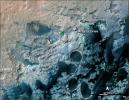
A view from NASA's Mars Reconnaissance Orbiter on April 8, 2015, catches sight of NASA's Curiosity Mars rover passing through a valley called 'Artist's Drive' on the lower slope of Mount Sharp.
PIA19392:
Mars Orbiter Sees Curiosity Rover in 'Artist's Drive'
Full Resolution:     TIFF (10.36 MB)     JPEG (527.1 kB)
Add Image to Favorite List 2015-05-08 Mars Mars Science Laboratory (MSL)
Mastcam
19578x3893x3
A sweeping panorama combining 33 telephoto images into one Martian vista presents details of several types of terrain visible on Mount Sharp from a location along the route of NASA's Curiosity Mars rover.
PIA19397:
Diverse Terrain Types on Mount Sharp, Mars
Full Resolution:     TIFF (228.7 MB)     JPEG (6.143 MB)
Add Image to Favorite List 2015-05-08 Mars Mars Science Laboratory (MSL)
Mastcam
13066x3144x3
This April 16, 2015, panorama from the Mast Camera on NASA's Curiosity Mars rover shows a detailed view toward two areas, 'Mount Shields' and 'Logan Pass,' on lower Mount Sharp, chosen for close-up inspection in subsequent weeks.
PIA19398:
Looking Toward Curiosity Study Areas, Spring 2015
Full Resolution:     TIFF (123.3 MB)     JPEG (3.421 MB)
Add Image to Favorite List 2015-05-08 Mars Mars Science Laboratory (MSL)
HiRISE
3300x2550x3
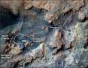
This map shows the route on lower Mount Sharp that NASA's Curiosity followed in April and early May 2015, in the context of the surrounding terrain. Numbers along the route identify the sol, or Martian day, on which it completed the drive.
PIA19399:
Curiosity's Path to Some Spring 2015 Study Sites
Full Resolution:     TIFF (25.26 MB)     JPEG (1.318 MB)
Add Image to Favorite List 2015-05-08 Mars Mars Science Laboratory (MSL)
Mastcam
1344x1080x3
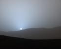
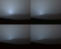
NASA's Curiosity Mars rover recorded this view of the sun setting at the close of the mission's 956th Martian day, or sol (April 15, 2015), from the rover's location in Gale Crater.
PIA19400:
Sunset in Mars' Gale Crater
Full Resolution:     TIFF (4.356 MB)     JPEG (47.63 kB)
Add Image to Favorite List 2015-05-08 Mars Mars Science Laboratory (MSL)
Mastcam
1619x1154x3
This frame is from sequence of views NASA's Curiosity Mars rover recorded of the sun setting at the close of the mission's 956th Martian day, or sol (April 15, 2015), from the rover's location in Gale Crater.
PIA19401:
Sunset Sequence in Mars' Gale Crater (Animation) Animation Icon
Full Resolution:     TIFF (5.607 MB)     JPEG (64.18 kB)
Add Image to Favorite List 2015-05-22 Mars Mars Science Laboratory (MSL)
ChemCam
721x722x1
This image from the Chemistry and Camera (ChemCam) instrument on NASA's Curiosity Mars rover shows detailed texture of a rock target called 'Yellowjacket' on Mars' Mount Sharp.
PIA19661:
Auto-Focused on Details in "Yellowjacket" on Mars
Full Resolution:     TIFF (521.3 kB)     JPEG (65.33 kB)
Add Image to Favorite List 2015-05-22 Mars Mars Science Laboratory (MSL)
Mastcam
7984x2383x3
This view southeastward from NASA's Curiosity's Mastcam shows terrain judged difficult for traversing between the rover and an outcrop in the middle distance where a pale rock unit meets a darker rock unit above it.
PIA19662:
Unfavorable Terrain for Crossing Near 'Logan Pass'
Full Resolution:     TIFF (57.1 MB)     JPEG (2.547 MB)
Add Image to Favorite List 2015-05-22 Mars Mars Science Laboratory (MSL)
Navcam (MSL)
954x588x1
The Martian outcrop where pale rock meets darker overlying rock near the middle of this view from NASA's Curiosity Mars rover is an example of a geological contact. It was taken with the rover's Navcam on May 21, 2015.
PIA19663:
Rover's Reward for Climbing: Exposed Geological Contact
Full Resolution:     TIFF (561.8 kB)     JPEG (132.5 kB)
Add Image to Favorite List 2015-07-01 Mars Mars Science Laboratory (MSL)
Mastcam
3946x2455x3
This view from the Mast Camera (Mastcam) on NASA's Curiosity Mars rover shows a site where two different types of bedrock meet on lower Mount Sharp.
PIA19676:
Geological Contact Zone Near 'Marias Pass' on Mars
Full Resolution:     TIFF (29.07 MB)     JPEG (1.592 MB)
Add Image to Favorite List 2015-07-01 Mars Mars Science Laboratory (MSL)
MAHLI
1584x1184x3
This view of a sandstone target called 'Big Arm' covers an area about 1.3 inches (33 millimeters) wide in detail that shows differing shapes and colors of sand grains in the stone.
PIA19677:
Diverse Grains in Mars Sandstone Target 'Big Arm'
Full Resolution:     TIFF (5.628 MB)     JPEG (332.3 kB)
Add Image to Favorite List 2015-07-01 Mars Mars Science Laboratory (MSL)
Navcam (MSL)
7729x2563x3
This 3-D stereo view from NASA's Curiosity Mars rover shows a 360-degree panorama around the location where the rover spent its 1,000th Martian day, or sol, on Mars. The site is a valley just below 'Marias Pass' on lower Mount Sharp.
PIA19678:
Panorama from Curiosity's Sol 1000 Location (Stereo)
Full Resolution:     TIFF (59.45 MB)     JPEG (2.315 MB)
Add Image to Favorite List 2015-07-01 Mars Mars Science Laboratory (MSL)
Navcam (MSL)
7729x2563x1
This 360-degree panorama from the Navigation Camera (Navcam) on NASA's Curiosity Mars rover shows the surroundings of a site on lower Mount Sharp where the rover spent its 1,000th Martian day, or sol, on Mars.
PIA19679:
Panorama from Curiosity's Sol 1000 Location
Full Resolution:     TIFF (19.83 MB)     JPEG (2.221 MB)
Add Image to Favorite List 2015-07-23 Mars Mars Science Laboratory (MSL)
MAHLI
1600x1191x3
A rock fragment dubbed 'Lamoose' is shown in this picture taken by NASA's Curiosity rover. Like other nearby rocks in a portion of the 'Marias Pass' area of Mt. Sharp, Mars, it has unusually high concentrations of silica.
PIA19828:
High-Silica 'Lamoose' Rock
Full Resolution:     TIFF (5.719 MB)     JPEG (461 kB)
Add Image to Favorite List 2015-07-23 Mars Mars Science Laboratory (MSL)
MAHLI
4424x2085x3
A rock outcrop dubbed 'Missoula,' near Marias Pass on Mars, is seen in this image mosaic taken by NASA's Curiosity rover. Pale mudstone (bottom of outcrop) meets coarser sandstone (top) in this geological contact zone.
PIA19829:
Contact Zone: 'Missoula'
Full Resolution:     TIFF (27.69 MB)     JPEG (1.027 MB)
Add Image to Favorite List 2015-08-05 Mars Mars Science Laboratory (MSL)
Mastcam
7765x2000x3
A southward-looking panorama combining images from both cameras of the Mast Camera (Mastcam) instrument on NASA's Curiosity Mars Rover shows diverse geological textures on Mount Sharp.
PIA19803:
Curiosity Rover's View of Alluring Martian Geology Ahead
Full Resolution:     TIFF (41.12 MB)     JPEG (2.37 MB)
Add Image to Favorite List 2015-08-05 Mars Mars Science Laboratory (MSL)
MAHLI
1610x1200x3
NASA's Curiosity Mars Rover drilled this hole to collect sample material from a rock target called 'Buckskin' on July 30, 2015, during the 1060th Martian day, or sol, of the rover's work on Mars. The diameter is slightly smaller than a U.S. dime.
PIA19804:
Hole at 'Buckskin' Drilled Days Before Landing Anniversary
Full Resolution:     TIFF (5.798 MB)     JPEG (394.1 kB)
Add Image to Favorite List 2015-08-19 Mars Mars Science Laboratory (MSL)
MAHLI
6000x6000x3
This version of a self-portrait of NASA's Curiosity Mars rover at a drilling site called 'Buckskin' on lower Mount Sharp is presented as a stereographic projection, which shows the horizon as a circle.
PIA19806:
Round-Horizon Version of Curiosity's Low-Angle Selfie at 'Buckskin'
Full Resolution:     TIFF (76.24 MB)     JPEG (2.506 MB)
Add Image to Favorite List 2015-08-19 Mars Mars Science Laboratory (MSL)
MAHLI
6000x3588x3
This low-angle self-portrait of NASA's Curiosity Mars rover shows the vehicle above the 'Buckskin' rock target, where the mission collected its seventh drilled sample. The site is in the 'Marias Pass' area of lower Mount Sharp.
PIA19807:
Curiosity Low-Angle Self-Portrait at 'Buckskin' Drilling Site on Mount Sharp
Full Resolution:     TIFF (58.24 MB)     JPEG (2.233 MB)
Add Image to Favorite List 2015-08-19 Mars Mars Science Laboratory (MSL)
MAHLI
4841x2949x3
This low-angle self-portrait of NASA's Curiosity Mars rover shows the vehicle at the site from which it reached down to drill into a rock target called 'Buckskin' on lower Mount Sharp.
PIA19808:
Looking Up at Mars Rover Curiosity in 'Buckskin' Selfie
Full Resolution:     TIFF (36.88 MB)     JPEG (1.605 MB)
Add Image to Favorite List 2015-08-19 Mars Mars Science Laboratory (MSL)
DAN
1631x1430x3
Curiosity's Russian-made instrument for checking hydration levels in the ground beneath the rover detected an unusually high amount at a site near 'Marias Pass,' prompting repeated passes over the area to map the hydrogen amounts.
PIA19809:
Curiosity Finds Hydrogen-Rich Area of Mars Subsurface
Full Resolution:     TIFF (4.994 MB)     JPEG (365.4 kB)
Add Image to Favorite List 2015-08-19 Mars Mars Science Laboratory (MSL)
MAHLI
4320x1845x3
This view of a test rover at NASA's Jet Propulsion Laboratory, Pasadena, California, results from advance testing of arm positions and camera pointings for taking a low-angle self-portrait of NASA's Curiosity Mars rover.
PIA19810:
Test Rover at JPL During Preparation for Mars Rover's Low-Angle Selfie
Full Resolution:     TIFF (10.79 MB)     JPEG (545 kB)
Add Image to Favorite List 2015-09-11 Mars Mars Science Laboratory (MSL)
Mastcam
7000x1951x3
Large-scale crossbedding in the sandstone of this ridge on a lower slope of Mars' Mount Sharp is typical of windblown sand dunes that have petrified. NASA's Curiosity Mars rover used its Mastcam to capture this vista on Aug. 27, 2015.
PIA19818:
Vista from Curiosity Shows Crossbedded Martian Sandstone
Full Resolution:     TIFF (35.94 MB)     JPEG (2.319 MB)
Add Image to Favorite List 2016-10-03 Mars Mars Science Laboratory (MSL)
HiRISE
3300x2550x3
This map shows the route driven by NASA's Curiosity Mars rover from the location where it landed in August 2012 to its location in September 2016 at 'Murray Buttes', and the path planned for reaching destination at lower Mount Sharp.
PIA20846:
Curiosity Destinations for Second Extended Mission
Full Resolution:     TIFF (13.9 MB)     JPEG (1.797 MB)
Add Image to Favorite List 2015-10-02 Mars Mars Science Laboratory (MSL)
Mastcam
2279x1127x3
This composite image looking toward the higher regions of Mount Sharp was taken in mid-September, 2015, by NASA's Curiosity rover.
PIA19912:
Mount Sharp Comes In Sharply
Full Resolution:     TIFF (6.884 MB)     JPEG (278.2 kB)
Add Image to Favorite List 2015-10-08 Mars Mars Science Laboratory (MSL)
Mastcam
2472x1134x3
A view from the 'Kimberly' formation on Mars taken by NASA's Curiosity rover. The strata in the foreground dip towards the base of Mount Sharp, indicating the ancient depression that existed before the larger bulk of the mountain formed.
PIA19839:
Strata at Base of Mount Sharp Animation Icon
Full Resolution:     TIFF (8.382 MB)     JPEG (679.5 kB)
Add Image to Favorite List 2015-10-08 Mars Mars Science Laboratory (MSL)
Mastcam
2102x984x3
An image taken at the 'Hidden Valley' site, en-route to Mount Sharp, by NASA's Curiosity rover. A variety of mudstone strata in the area indicate a lakebed deposit, with river- and stream-related deposits nearby.
PIA19840:
Secrets of 'Hidden Valley' on Mars
Full Resolution:     TIFF (6.208 MB)     JPEG (485.1 kB)
Add Image to Favorite List 2015-10-13 Mars Mars Science Laboratory (MSL)
MAHLI
7149x10036x3
This self-portrait of NASA's Curiosity Mars rover shows the vehicle at the 'Big Sky' site, where its drill collected the mission's fifth taste of Mount Sharp.
PIA19920:
Curiosity Self-Portrait at 'Big Sky' Drilling Site
Full Resolution:     TIFF (165.6 MB)     JPEG (5.999 MB)
Add Image to Favorite List 2015-11-11 Mars Mars Science Laboratory (MSL)
Mastcam
5572x2246x3
This view from the Mast Camera (Mastcam) on NASA's Curiosity Mars rover shows a site with a network of prominent mineral veins below a cap rock ridge on lower Mount Sharp.
PIA19921:
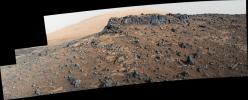
Veiny 'Garden City' Site and Surroundings on Mount Sharp, Mars
Full Resolution:     TIFF (30.62 MB)     JPEG (2.718 MB)
Add Image to Favorite List 2015-11-11 Mars Mars Science Laboratory (MSL)
Mastcam
1505x685x3
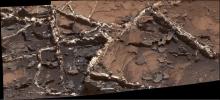
Prominent mineral veins at the 'Garden City' site examined by NASA's Curiosity Mars rover vary in thickness and brightness, as seen in this image from Curiosity's Mast Camera (Mastcam).
PIA19922:
'Garden City' Vein Complex on Lower Mount Sharp, Mars
Full Resolution:     TIFF (3.093 MB)     JPEG (179.7 kB)
Add Image to Favorite List 2015-11-11 Mars Mars Science Laboratory (MSL)
ChemCam
949x396x3
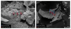
These images and overlay bar charts at 'Garden City' from the Chemistry and Camera (ChemCam) instrument on NASA's Curiosity Mars rover indicate where some high-potassium material is localized within mineral veins.
PIA19923:
Dark, Thin Fracture-Filling Material
Full Resolution:     TIFF (554.9 kB)     JPEG (50.57 kB)
Add Image to Favorite List 2015-11-11 Mars Mars Science Laboratory (MSL)
ChemCam
847x388x1
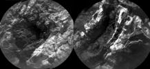
These images at 'Garden City' from the Chemistry and Camera (ChemCam) instrument on NASA's Curiosity Mars rover indicate similarly dark material, but with very different chemistries, in mineral veins.
PIA19924:
Thick, Dark Veins at 'Garden City,' Mars
Full Resolution:     TIFF (311.2 kB)     JPEG (49.1 kB)
Add Image to Favorite List 2015-11-11 Mars Mars Science Laboratory (MSL)
MAHLI
628x446x3
This view from the Mars Hand Lens Imager (MAHLI) on the arm of NASA's Curiosity Mars rover shows texture within a light-toned vein at a site called 'Garden City' on lower Mount Sharp.
PIA19925:
Crystal Growth Texture in Light Vein at 'Garden City'
Full Resolution:     TIFF (840.8 kB)     JPEG (60.26 kB)
Add Image to Favorite List 2015-11-11 Mars Mars Science Laboratory (MSL)
MAHLI
573x438x3
Light material emplaced within darker vein material is seen in this view of a mineral vein at the 'Garden City' site on lower Mount Sharp, Mars. The Mars Hand Lens Imager (MAHLI) on the arm of NASA's Curiosity Mars Rover took the image on April 4, 2015.
PIA19926:
Injection of Light Material into an Older Dark Vein
Full Resolution:     TIFF (753.4 kB)     JPEG (40.18 kB)
Add Image to Favorite List 2015-11-11 Mars Mars Science Laboratory (MSL)
MAHLI
570x451x3
This view from the Mars Hand Lens Imager (MAHLI) on the arm of NASA's Curiosity Mars rover shows a combination of dark and light material within a mineral vein at a site called 'Garden City' on lower Mount Sharp.
PIA19927:
Light Material Ripped Up Older Dark Vein Material
Full Resolution:     TIFF (771.7 kB)     JPEG (55.89 kB)
Add Image to Favorite List 2015-11-16 Mars Mars Science Laboratory (MSL)
Mastcam
5288x1703x3
This view from the Mast Camera (Mastcam) on NASA's Curiosity Mars rover shows a dark sand dune in the middle distance. Mount Sharp will be the first in-place study of an active sand dune anywhere other than Earth.
PIA19928:
Curiosity Rover Will Study Dunes on Route up Mountain
Full Resolution:     TIFF (16.7 MB)     JPEG (1.074 MB)
Add Image to Favorite List 2015-11-16 Mars Mars Science Laboratory (MSL)
Mastcam
2391x1265x3
The dark band in the lower portion of this Martian scene is part of the 'Bagnold Dunes' dune field lining the northwestern edge of Mount Sharp, inside Gale Crater.
PIA19929:
Glimpse of 'Bagnold Dunes' Edging Mount Sharp
Full Resolution:     TIFF (8.223 MB)     JPEG (521.4 kB)
Add Image to Favorite List 2015-11-16 Mars Mars Science Laboratory (MSL)
HiRISE
1804x1368x3
This view taken from orbit around Mars shows the sand dune that will be the first to be visited by NASA's Curiosity Mars Rover along its route to higher layers of Mount Sharp.
PIA19930:
Orbital View of Dune That Curiosity Will Visit
Full Resolution:     TIFF (7.407 MB)     JPEG (306 kB)
Add Image to Favorite List 2015-11-16 Mars Mars Science Laboratory (MSL)
HiRISE
891x1095x1
This is a frame from an animation that flips back and forth between views taken in 2010 and 2014 of a Martian sand dune at the edge of Mount Sharp, documenting dune activity.
PIA20161:
Change Observed in Martian Sand Dune
Full Resolution:     TIFF (875.3 kB)     JPEG (87.75 kB)
Add Image to Favorite List 2015-11-16 Mars Mars Science Laboratory (MSL)
HiRISE
3300x2550x3
This map shows the route driven by NASA's Curiosity Mars rover from the location where it landed in August 2012 to its location in mid-November 2015, approaching examples of dunes in the 'Bagnold Dunes' dune field.
PIA20162:
Curiosity Rover's Traverse, First 1,163 Sols on Mars
Full Resolution:     TIFF (12.23 MB)     JPEG (1.431 MB)
Add Image to Favorite List 2015-11-24 Mars Mars Science Laboratory (MSL)
1000x1650x3
This graphic depicts paths by which carbon has been exchanged among Martian interior, surface rocks, polar caps, waters and atmosphere, and also depicts a mechanism by which it is lost from the atmosphere with a strong effect on isotope ratio.
PIA20163:
Carbon Exchange and Loss Processes on Mars
Full Resolution:     TIFF (387.2 kB)     JPEG (116.4 kB)
Add Image to Favorite List 2015-12-10 Mars Mars Science Laboratory (MSL)
Mastcam
1492x4046x3
The rippled surface of the first Martian sand dune ever studied up close fills this view of 'High Dune' from the Mastcam on NASA's Curiosity rover. This site is part of the 'Bagnold Dunes' field along the northwestern flank of Mount Sharp.
PIA20168:
'High Dune' is First Martian Dune Studied up Close
Full Resolution:     TIFF (14.24 MB)     JPEG (1.086 MB)
Add Image to Favorite List 2015-12-10 Mars Mars Science Laboratory (MSL)
Mastcam
4192x2813x3
A wheel track left by NASA's Curiosity Mars rover exposes underlying material in a shallow sand sheet in this view from Curiosity's Mast Camera (Mastcam). The site is close to a large sand dune of similarly dark sand grains.
PIA20169:
Rover Track in Sand Sheet Near Martian Sand Dune
Full Resolution:     TIFF (24.15 MB)     JPEG (1.761 MB)
Add Image to Favorite List 2015-12-10 Mars Mars Science Laboratory (MSL)
MAHLI
1584x1184x3
This view shows grains of sand where NASA's Curiosity Mars rover was driven into a shallow sand sheet near a large dune. The disturbance by the wheel exposed interior material of the sand body, including finer sand grains than on the undisturbed surface.
PIA20170:
Martian Sand Disturbed by Rover Wheel
Full Resolution:     TIFF (5.628 MB)     JPEG (553.3 kB)
Add Image to Favorite List 2015-12-10 Mars Mars Science Laboratory (MSL)
MAHLI
1609x1198x3
This view of the undisturbed surface of a Martian sand dune called 'High Dune' visited by NASA's Curiosity rover shows coarse grains remaining on the surface after wind removal of smaller particles.
PIA20171:
Surface Close-up of a Martian Sand Dune
Full Resolution:     TIFF (5.785 MB)     JPEG (515 kB)
Add Image to Favorite List 2015-12-17 Mars Mars Reconnaissance Orbiter (MRO)
Mars Science Laboratory (MSL)
HiRISE
3300x2550x3
This map shows the route driven by NASA's Curiosity Mars rover from the location where it landed in August 2012 to its location in December 2015.
PIA20172:
Curiosity Rover's Traverse, First 1,185 Sols on Mars
Full Resolution:     TIFF (13.35 MB)     JPEG (1.533 MB)
Add Image to Favorite List 2015-12-17 Mars Mars Reconnaissance Orbiter (MRO)
Mars Science Laboratory (MSL)
HiRISE
3300x2550x3
This map shows the route on lower Mount Sharp that NASA's Curiosity followed between April 19, 2015, and Nov. 5, 2015.
PIA20173:
Curiosity's Path During 2015 Studies of Silica-Rich Rocks
Full Resolution:     TIFF (25.26 MB)     JPEG (1.372 MB)
Add Image to Favorite List 2015-12-17 Mars Mars Science Laboratory (MSL)
Mastcam
7949x2273x3
This view from the Mast Camera (Mastcam) in NASA's Curiosity Mars rover shows the 'Marias Pass' area where a lower and older geological unit of mudstone.
PIA20174:
'Marias Pass,' Contact Zone of Two Martian Rock Units
Full Resolution:     TIFF (50.21 MB)     JPEG (4.009 MB)
Add Image to Favorite List 2015-12-17 Mars Mars Science Laboratory (MSL)
Navcam (MSL)
1024x998x1
NASA's Curiosity Mars rover used its Navigation Camera (Navcam) to capture this view partway back down a slope it climbed toward 'Marias Pass' on lower Mount Sharp. The image was taken May 22, 2015.
PIA20175:
Area with Silica-Rich Target Near 'Marias Pass' on Mars
Full Resolution:     TIFF (1.023 MB)     JPEG (219.6 kB)
Add Image to Favorite List 2015-12-17 Mars Mars Science Laboratory (MSL)
Navcam (MSL)
7696x2268x1
This 360-degree panorama shows the 'Marias Pass' area, at center, and part of the slope that NASA's Curiosity Mars rover climbed to get there, at right.
PIA20266:
Full-Circle View Near 'Marias Pass' on Mars
Full Resolution:     TIFF (10.75 MB)     JPEG (1.919 MB)
Add Image to Favorite List 2015-12-17 Mars Mars Science Laboratory (MSL)
ChemCam
1218x1110x3
This image from the Chemistry and Camera (ChemCam) instrument on NASA's Curiosity Mars rover shows detailed texture of a rock target called 'Elk' on Mars' Mount Sharp.
PIA20267:
Details on Silica-Rich 'Elk' Target near 'Marias Pass'
Full Resolution:     TIFF (3.033 MB)     JPEG (142.2 kB)
Add Image to Favorite List 2015-12-17 Mars Mars Science Laboratory (MSL)
Navcam (MSL)
874x508x1
This view from NASA's Curiosity Mars rover shows an example of discoloration closely linked to fractures in the Stimson formation sandstone on lower Mount Sharp. The pattern is evident along two perpendicular fractures.
PIA20268:
Discolored Fracture Zones in Martian Sandstone
Full Resolution:     TIFF (444.7 kB)     JPEG (117.2 kB)
Add Image to Favorite List 2015-12-17 Mars Mars Science Laboratory (MSL)
Mastcam
1344x1200x3
This image from NASA's Curiosity Mars rover reveals details of a bedrock discoloration pattern at a site between 'Marias Pass' and 'Bridger Basin.' The discoloration is not associated with individual layers.
PIA20269:
Detail of Discoloration Pattern Seen by Curiosity
Full Resolution:     TIFF (4.1 MB)     JPEG (223.5 kB)
Add Image to Favorite List 2015-12-17 Mars Mars Science Laboratory (MSL)
Mastcam
4532x4171x3
This view from the Mast Camera (Mastcam) on NASA's Curiosity Mars rover covers an area in 'Bridger Basin' that includes the locations where the rover drilled a target called 'Big Sky' on the mission's Sol 1119 (Sept. 29, 2015).
PIA20270:
'Big Sky' and 'Greenhorn' Drilling Area on Mount Sharp
Full Resolution:     TIFF (46.14 MB)     JPEG (2.171 MB)
Add Image to Favorite List 2015-12-17 Mars Mars Science Laboratory (MSL)
CheMin
MAHLI
1260x671x3
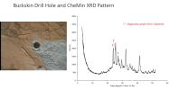
The graph at right presents information from the NASA Curiosity Mars rover's onboard analysis of rock powder drilled from the 'Buckskin' target location, shown at left.
PIA20271:
'Buckskin' Drill Hole and CheMin X-ray Diffraction
Full Resolution:     TIFF (706.4 kB)     JPEG (82.16 kB)
Add Image to Favorite List 2015-12-17 Mars Mars Science Laboratory (MSL)
CheMin
MAHLI
1236x672x3
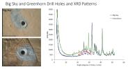
The graph at right presents information from the NASA Curiosity Mars rover's onboard analysis of rock powder drilled from the 'Big Sky' and 'Greenhorn' target locations, shown at left.
PIA20272:
'Big Sky' and 'Greenhorn' Drill Holes and CheMin X-ray Diffraction
Full Resolution:     TIFF (819.4 kB)     JPEG (99.92 kB)
Retrieve Previous Set  Jump to a Previous Set   Jump to a Previous Set   Jump to a Previous Set   Jump to a Previous Set   Jump to a Previous Set   Current Set   Jump to a Following Set   Jump to a Following Set   Jump to a Following Set   Retrieve Next Set 
 1-100   101-200   201-300   301-400   401-500   501-600   601-700   701-800   801-900 
Currently displaying images: 501 - 600 of 825