My
List |
Addition Date
|
Target
|
Mission
|
Instrument
|
Size
|

|
1997-08-19 |
Mars
|
Mars Pathfinder (MPF)
|
Rover Cameras
|
540x343x1 |

|
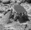
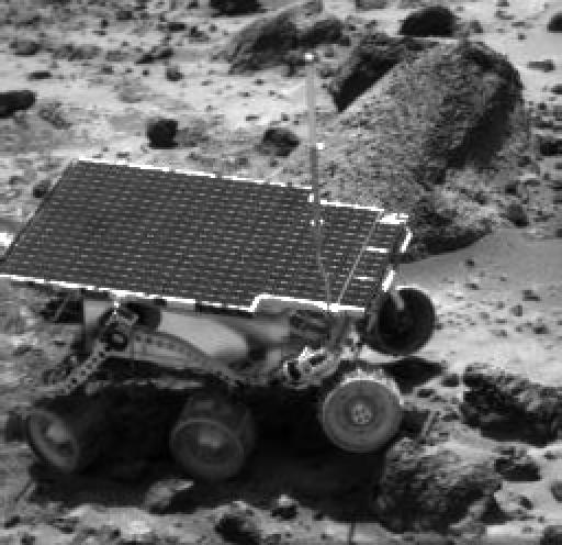
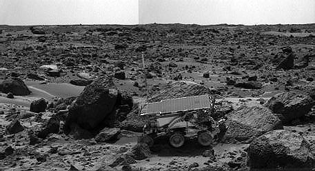
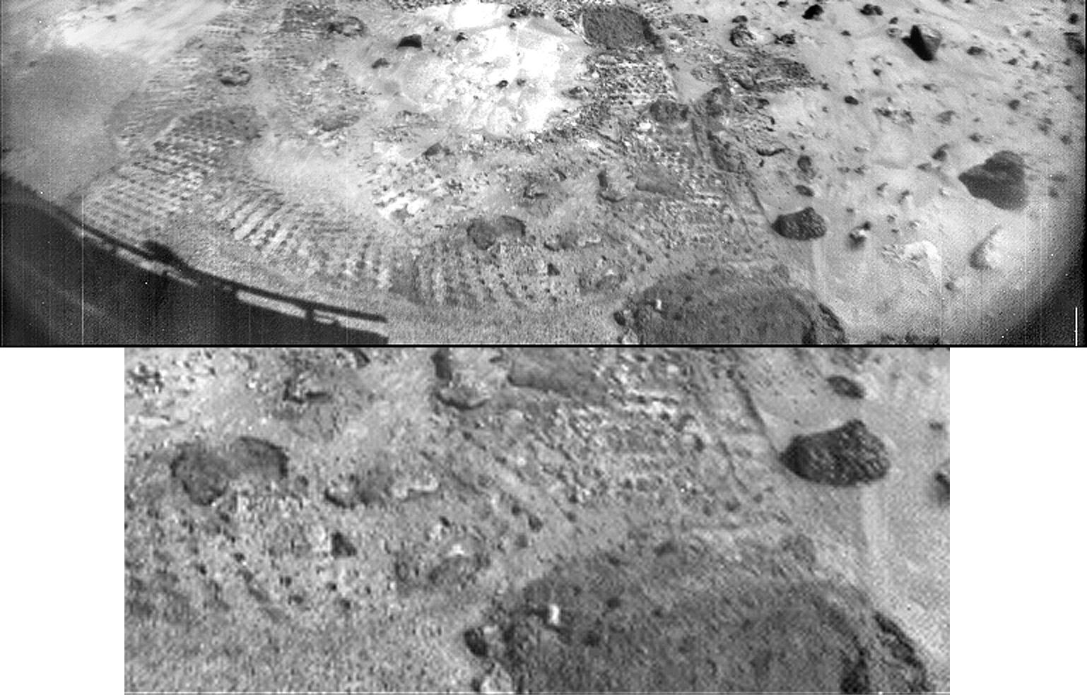
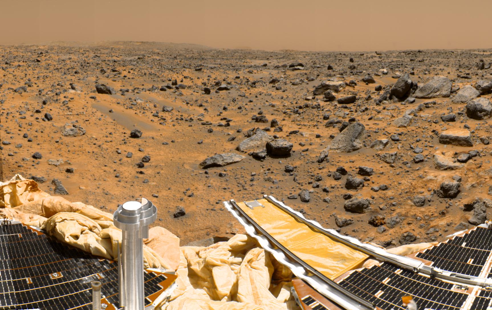
-
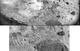
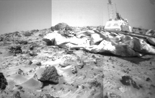
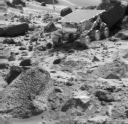
PIA00903:
-
Rover Camera Mosaic of Lander & Wedge
Full Resolution:
TIFF
(151 kB)
JPEG
(32.16 kB)
|
|
|
1997-08-19 |
Mars
|
Mars Pathfinder (MPF)
|
Imager for Mars Pathfinder
|
256x248x1 |
|
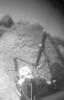
-
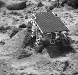
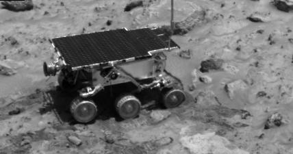
PIA00904:
-
Sojourner at "Wedge"
Full Resolution:
TIFF
(65.81 kB)
JPEG
(11.86 kB)
|
|
|
1997-08-27 |
Mars
|
Mars Pathfinder (MPF)
|
Imager for Mars Pathfinder
|
256x248x1 |

|
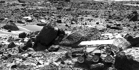
-
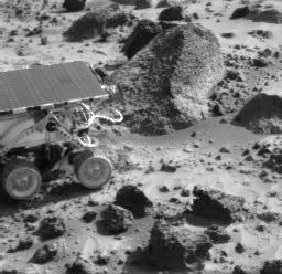
PIA00905:
-
Sojourner at "Wedge"
Full Resolution:
TIFF
(68.28 kB)
JPEG
(16.13 kB)
|
|
|
1997-08-27 |
Mars
|
Mars Pathfinder (MPF)
|
Imager for Mars Pathfinder
|
242x383x1 |
|
-
PIA00906:
-
Sojourner's APXS & "Wedge"
Full Resolution:
TIFF
(46.71 kB)
JPEG
(9.82 kB)
|
|
|
1997-08-27 |
Mars
|
Mars Pathfinder (MPF)
|
Imager for Mars Pathfinder
|
512x496x1 |
|
-
PIA00907:
-
Sojourner Nearing "Wedge"
Full Resolution:
TIFF
(162.9 kB)
JPEG
(44.42 kB)
|
|
|
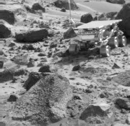
1997-08-27 |
Mars
|
Mars Pathfinder (MPF)
|
Imager for Mars Pathfinder
|
481x280x1 |
|
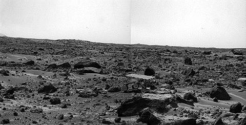
-
PIA00908:
-
Sojourner near the "Rock Garden"
Full Resolution:
TIFF
(148.7 kB)
JPEG
(32.74 kB)
|
|
|
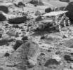
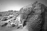
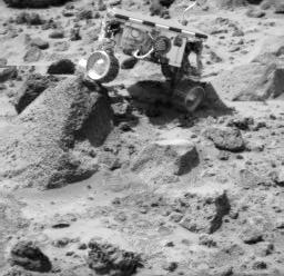
1997-08-27 |
Mars
|
Mars Pathfinder (MPF)
|
Rover Cameras
|
540x343x1 |

|
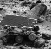
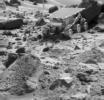
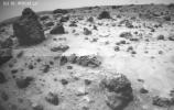
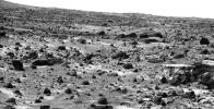
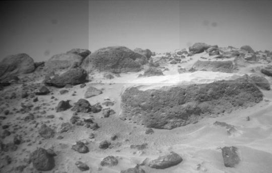
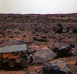
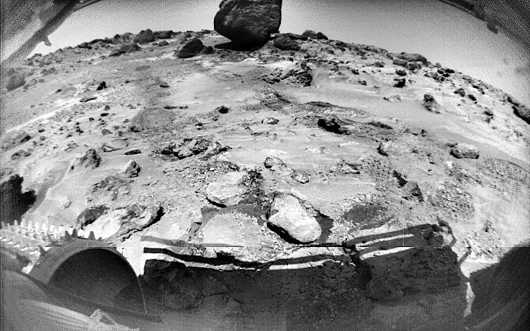
-
PIA00909:
-
"Flat Top's" Pitted Surface
Full Resolution:
TIFF
(152.3 kB)
JPEG
(23.49 kB)
|
|
|
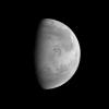
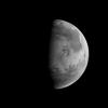
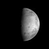
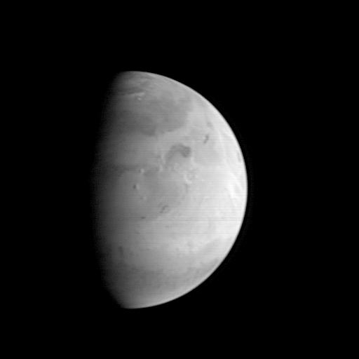
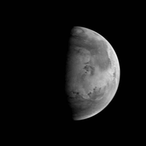
1997-08-22 |
Mars
|
Mars Global Surveyor (MGS)
|
Mars Orbiter Camera (MOC)
|
512x512x1 |

|
-
PIA00910:
-
MGS Approach Image - Syrtis Major Region
Full Resolution:
TIFF
(54.19 kB)
JPEG
(9.769 kB)
|
|
|
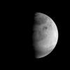
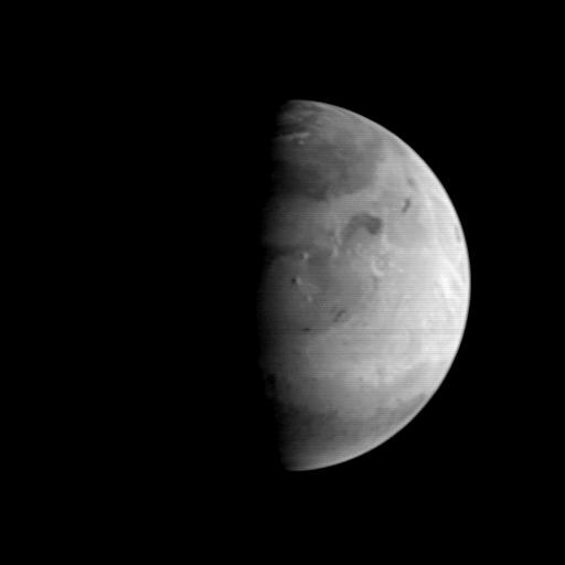
1997-08-22 |
Mars
|
Mars Global Surveyor (MGS)
|
Mars Orbiter Camera (MOC)
|
512x512x1 |
|
-
PIA00911:
-
MGS Approach Image - Chryse Planitia
Full Resolution:
TIFF
(52.54 kB)
JPEG
(9.599 kB)
|
|
|
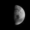
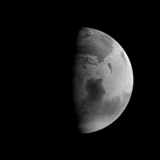
1997-08-22 |
Mars
|
Mars Global Surveyor (MGS)
|
Mars Orbiter Camera (MOC)
|
512x512x1 |

|
-
PIA00912:
-
MGS Approach Image - Elysium Region
Full Resolution:
TIFF
(54.8 kB)
JPEG
(9.524 kB)
|
|
|
1997-08-27 |
Mars
|
Mars Pathfinder (MPF)
|
Imager for Mars Pathfinder
|
256x248x1 |

|
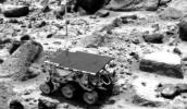
-
PIA00913:
-
Sojourner Doing a Wheelie on "Wedge"
Full Resolution:
TIFF
(67.45 kB)
JPEG
(16.53 kB)
|
|
|
1997-08-27 |
Mars
|
Mars Pathfinder (MPF)
|
Imager for Mars Pathfinder
|
256x248x1 |
|
-
PIA00914:
-
Sojourner, "Wedge," & "Shark"
Full Resolution:
TIFF
(66.42 kB)
JPEG
(16.11 kB)
|
|
|
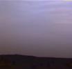
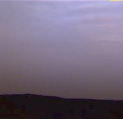
1997-08-28 |
Mars
|
Mars Pathfinder (MPF)
|
Imager for Mars Pathfinder
|
248x240x3 |
|
-
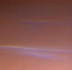
PIA00915:
-
A Violet Martian Sky
Full Resolution:
TIFF
(93.61 kB)
JPEG
(3.361 kB)
|
|
|
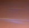
1997-08-28 |
Mars
|
Mars Pathfinder (MPF)
|
Imager for Mars Pathfinder
|
238x230x3 |
|
-
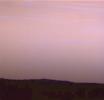
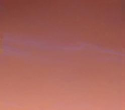
PIA00916:
-
Wispy Blue Clouds Over Mars
Full Resolution:
TIFF
(79.82 kB)
JPEG
(3.028 kB)
|
|
|
1997-08-28 |
Mars
|
Mars Pathfinder (MPF)
|
Imager for Mars Pathfinder
|
1024x300x3 |
|
-
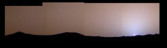
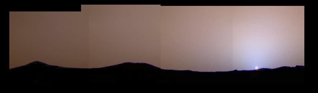
PIA00917:
-
Color Variations in the Sky at Sunset
Full Resolution:
TIFF
(359.7 kB)
JPEG
(13.19 kB)
|
|
|
1997-08-28 |
Mars
|
Mars Pathfinder (MPF)
|
Imager for Mars Pathfinder
|
248x240x3 |
|
-
PIA00918:
-
Pre-Dawn Martian Sky
Full Resolution:
TIFF
(102.5 kB)
JPEG
(3.596 kB)
|
|
|
1997-08-28 |
Mars
|
Mars Pathfinder (MPF)
|
Imager for Mars Pathfinder
|
248x220x3 |
|
-
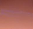
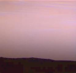
PIA00919:
-
Pre-Dawn Clouds Over Mars
Full Resolution:
TIFF
(28.38 kB)
JPEG
(2.625 kB)
|
|
|
1997-08-28 |
Mars
|
Mars Pathfinder (MPF)
|
Imager for Mars Pathfinder
|
248x240x3 |
|
-
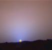
PIA00920:
-
Close-Up of Sol 24 Sunset
Full Resolution:
TIFF
(112 kB)
JPEG
(3.496 kB)
|
|
|
1997-08-28 |
Mars
|
Mars Pathfinder (MPF)
|
Imager for Mars Pathfinder
|
256x248x1 |
|
-
PIA00921:
-
Sojourner's APXS at "Shark"
Full Resolution:
TIFF
(69.04 kB)
JPEG
(16.3 kB)
|
|
|
1997-08-28 |
Mars
|
Mars Pathfinder (MPF)
|
Imager for Mars Pathfinder
|
687x345x1 |
|
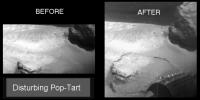
-
PIA00922:
-
Disturbing "Pop-Tart"
Full Resolution:
TIFF
(73.26 kB)
JPEG
(28.67 kB)
|
|
|
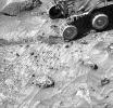
1997-08-29 |
Mars
|
Mars Pathfinder (MPF)
|
Imager for Mars Pathfinder
|
428x225x1 |
|
-
PIA00923:
-
Rover Soil Experiments Near "Casper" & "Shaggy"
Full Resolution:
TIFF
(93.7 kB)
JPEG
(16.76 kB)
|
|
|
1997-08-29 |
Mars
|
Mars Pathfinder (MPF)
|
Imager for Mars Pathfinder
|
385x191x1 |
|
-
PIA00924:
-
Rover Soil Experiments Near "Yogi"
Full Resolution:
TIFF
(72.69 kB)
JPEG
(13.21 kB)
|
|
|
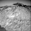
1997-08-29 |
Mars
|
Mars Pathfinder (MPF)
|
Rover Cameras
|
540x343x1 |
|
-
PIA00925:
-
"Poohbear Rock"
Full Resolution:
TIFF
(172.3 kB)
JPEG
(32.5 kB)
|
|
|
1997-09-28 |
Mars
|
Mars Pathfinder (MPF)
|
Atmospheric Structure / Meteorology Instrument
|
733x733x3 |
|
-
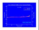
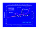
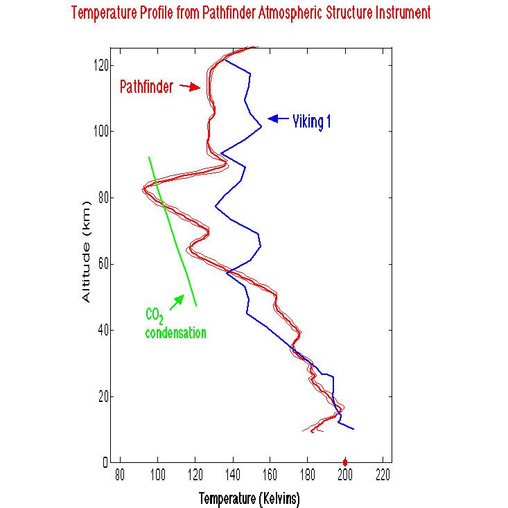
PIA00926:
-
Temperature Profile from Pathfinder Atmospheric Structure Instrument
Full Resolution:
TIFF
(133.3 kB)
JPEG
(48.19 kB)
|
|
|
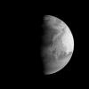
1997-09-10 |
Mars
|
Mars Global Surveyor (MGS)
|
Mars Orbiter Camera (MOC)
|
512x512x1 |
|
-
PIA00929:
-
MGS Approach Image - 172.4° W Longitude
Full Resolution:
TIFF
(42.96 kB)
JPEG
(8.111 kB)
|
|
|
1997-09-10 |
Mars
|
Mars Global Surveyor (MGS)
|
Mars Orbiter Camera (MOC)
|
512x512x1 |
|
-
PIA00930:
-
MGS Approach Image - 262.3° W Longitude
Full Resolution:
TIFF
(42.21 kB)
JPEG
(8.863 kB)
|
|
|
1997-09-10 |
Mars
|
Mars Global Surveyor (MGS)
|
Mars Orbiter Camera (MOC)
|
512x512x1 |

|
-
PIA00931:
-
MGS Approach Image - 352.2° W Longitude
Full Resolution:
TIFF
(44.39 kB)
JPEG
(9.87 kB)
|
|
|
1997-09-10 |
Mars
|
Mars Global Surveyor (MGS)
|
Mars Orbiter Camera (MOC)
|
512x512x1 |
|
-
PIA00932:
-
MGS Approach Image - 82.1° W Longitude
Full Resolution:
TIFF
(44.85 kB)
JPEG
(9.484 kB)
|
|
|
1997-09-10 |
Mars
|
Mars Global Surveyor (MGS)
|
Mars Orbiter Camera (MOC)
|
512x512x1 |
|
-
PIA00933:
-
MGS Approach Image - 217.4° W Longitude
Full Resolution:
TIFF
(45.74 kB)
JPEG
(9.268 kB)
|
|
|
1997-09-10 |
Mars
|
Mars Global Surveyor (MGS)
|
Mars Orbiter Camera (MOC)
|
512x512x1 |
|
-
PIA00934:
-
MGS Approach Image - 307.3° W Longitude
Full Resolution:
TIFF
(46.05 kB)
JPEG
(9.347 kB)
|
|
|
1997-09-10 |
Mars
|
Mars Global Surveyor (MGS)
|
Mars Orbiter Camera (MOC)
|
512x512x1 |
|
-
PIA00935:
-
MGS Approach Image - 37.2° W Longitude
Full Resolution:
TIFF
(47.3 kB)
JPEG
(9.643 kB)
|
|
|
1997-09-10 |
Mars
|
Mars Global Surveyor (MGS)
|
Mars Orbiter Camera (MOC)
|
512x512x1 |
|
-
PIA00936:
-
MGS Approach Image - 127.2° W Longitude
Full Resolution:
TIFF
(48.34 kB)
JPEG
(9.972 kB)
|
|
|
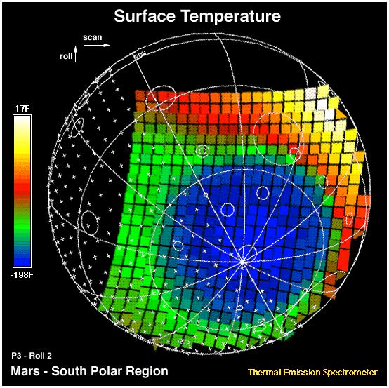
1997-09-24 |
Mars
|
Mars Global Surveyor (MGS)
|
Thermal Emission Spectrometer
|
554x553x3 |
|
-
PIA00937:
-
MGS Thermal Emission Spectrometer Image
Full Resolution:
TIFF
(90.26 kB)
JPEG
(80.87 kB)
|
|
|
1997-09-28 |
Mars
|
Mars Pathfinder (MPF)
|
Rover Cameras
|
1030x686x1 |
|
-
PIA00938:
-
Close-up view of "Chimp"
Full Resolution:
TIFF
(777.8 kB)
JPEG
(133.7 kB)
|
|
|
1997-10-14 |
Mars
|
Mars Pathfinder (MPF)
|
Rover Cameras
|
383x380x1 |
|
-
PIA00939:
-
Close-up of "Moe"
Full Resolution:
TIFF
(129.3 kB)
JPEG
(28.27 kB)
|
|
|
1997-09-28 |
Mars
|
Mars Pathfinder (MPF)
|
Rover Cameras
|
1080x686x1 |

|
-
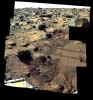
PIA00940:
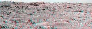
-
"Rock Garden" Mosaic
Full Resolution:
TIFF
(811.3 kB)
JPEG
(146 kB)
|
|
|
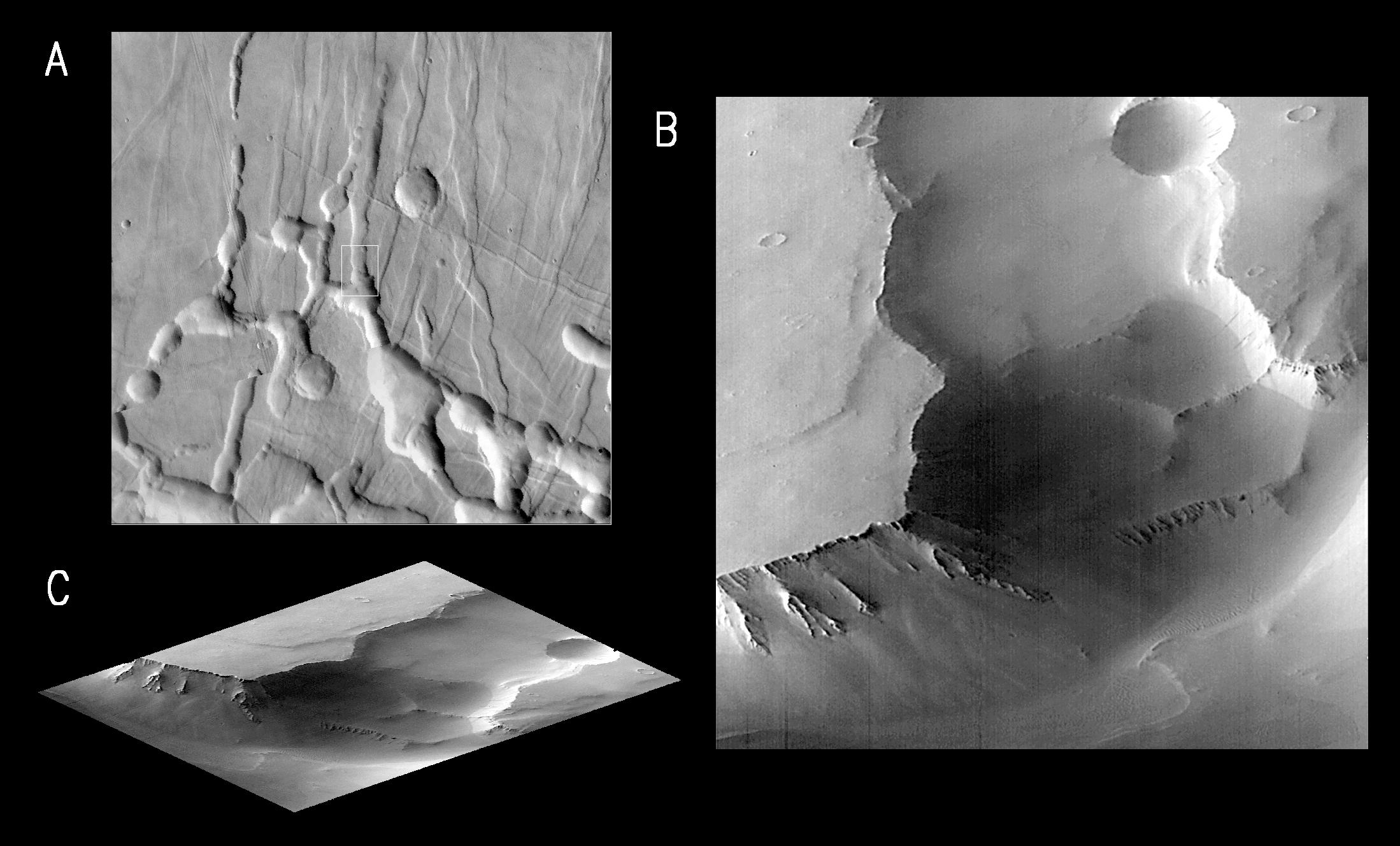
1997-10-02 |
Mars
|
Mars Global Surveyor (MGS)
|
Mars Orbiter Camera (MOC)
|
2198x1328x1 |

|
-
PIA00941:
-
MGS Views of Labyrinthus Noctis
Full Resolution:
TIFF
(1.163 MB)
JPEG
(260.3 kB)
|
|
|
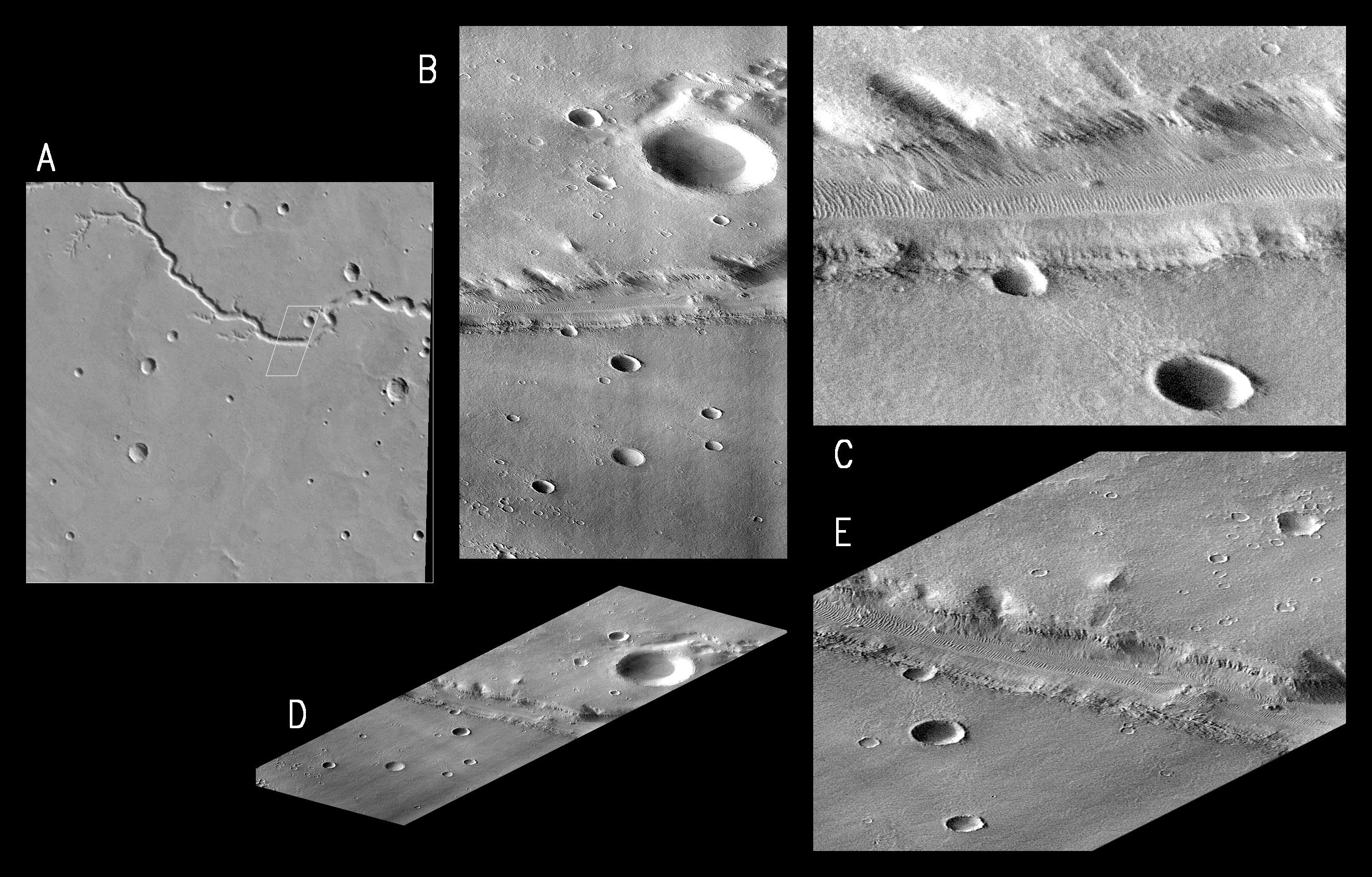
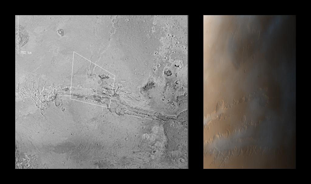
1997-10-02 |
Mars
|
Mars Global Surveyor (MGS)
|
Mars Orbiter Camera (MOC)
|
2637x1686x1 |
|
-
PIA00942:
-
MGS Views of Nirgal Vallis
Full Resolution:
TIFF
(2.573 MB)
JPEG
(722.7 kB)
|
|
|
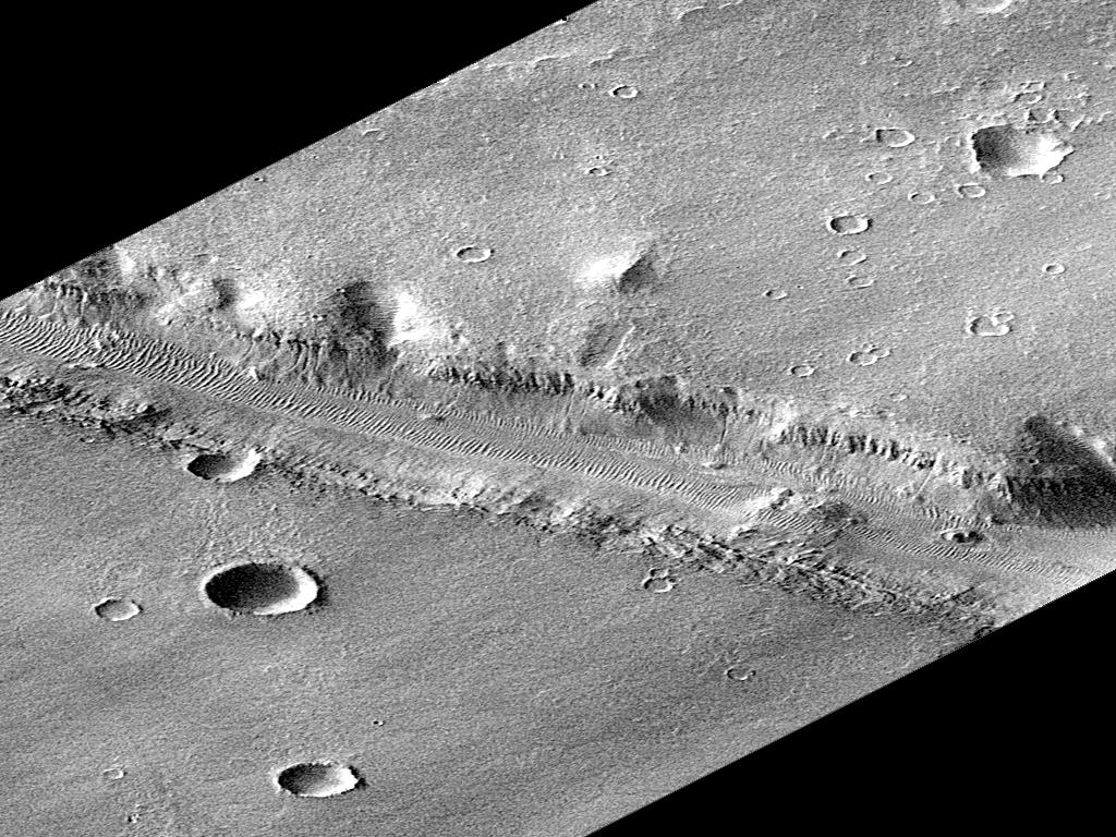
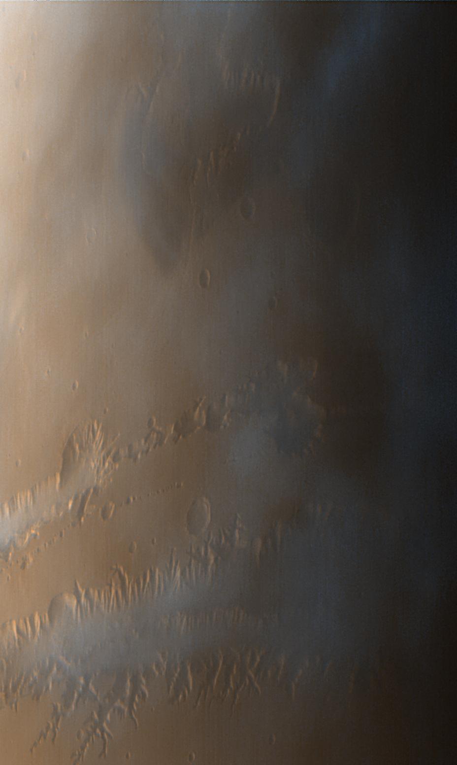
1997-10-02 |
Mars
|
Mars Global Surveyor (MGS)
|
Mars Orbiter Camera (MOC)
|
630x504x1 |
|
-
PIA00943:
-
Subsection of Nirgal Vallis Image
Full Resolution:
TIFF
(325.3 kB)
JPEG
(101.6 kB)
|
|
|
1997-10-02 |
Mars
|
Mars Global Surveyor (MGS)
|
Mars Orbiter Camera (MOC)
|
1024x768x1 |
|
-
PIA00944:
-
Rotated Perspective View of Nirgal Vallis
Full Resolution:
TIFF
(625.1 kB)
JPEG
(193.6 kB)
|
|
|
1997-10-02 |
Mars
|
Mars Global Surveyor (MGS)
|
Mars Orbiter Camera (MOC)
|
1024x1024x1 |
|
-
PIA00945:
-
MGS Views of Labyrinthus Noctis
Full Resolution:
TIFF
(588.8 kB)
JPEG
(124.5 kB)
|
|
|
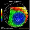
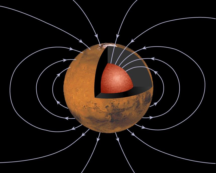
1997-10-13 |
Mars
|
Mars Global Surveyor (MGS)
|
Magnetometer
|
762x609x3 |
|
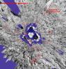
-
PIA00946:
-
Orientation and Magnitude of Mars' Magnetic Field
Full Resolution:
TIFF
(178.7 kB)
JPEG
(31.52 kB)
|
|
|
1997-10-13 |
Mars
|
Mars Global Surveyor (MGS)
|
Magnetometer
|
861x689x3 |

|
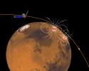
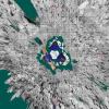
-
PIA00947:
-
Mars' Inner Core
Full Resolution:
TIFF
(232.6 kB)
JPEG
(51.04 kB)
|
|
|
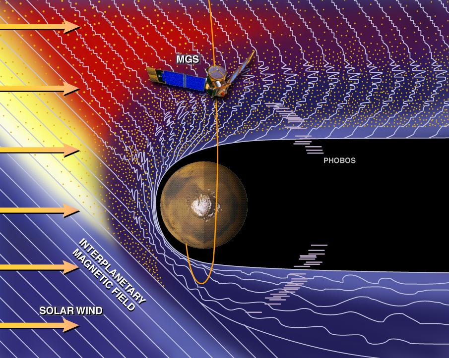
1997-10-13 |
Mars
|
Mars Global Surveyor (MGS)
|
Magnetometer
|
905x723x3 |
|
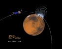
-
PIA00948:
-
Mars and the Solar Wind
Full Resolution:
TIFF
(1.197 MB)
JPEG
(146.1 kB)
|
|
|
1997-10-13 |
Mars
|
Mars Global Surveyor (MGS)
|
Magnetometer
|
715x572x3 |
|
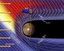
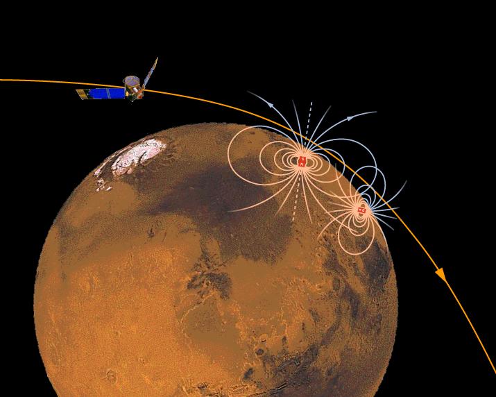
-
PIA00949:
-
Magnetic Sources in the Crust of Mars
Full Resolution:
TIFF
(360.8 kB)
JPEG
(50.93 kB)
|
|
|
1997-10-13 |
Mars
|
Mars Global Surveyor (MGS)
|
MOLA
|
2550x3300x3 |
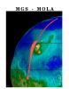
|
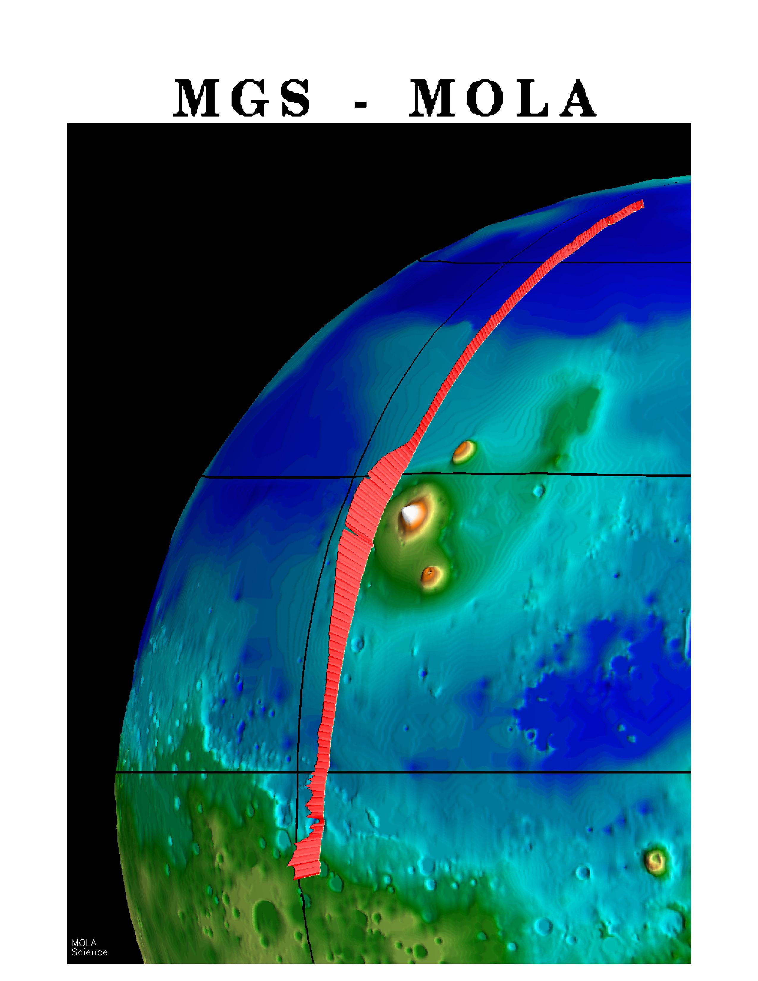
-
PIA00957:
-
MGS Mars Orbiter Laser (MOLA) Surface Topography of Northern Hemisphere
Full Resolution:
TIFF
(8.502 MB)
JPEG
(439.4 kB)
|
|
|
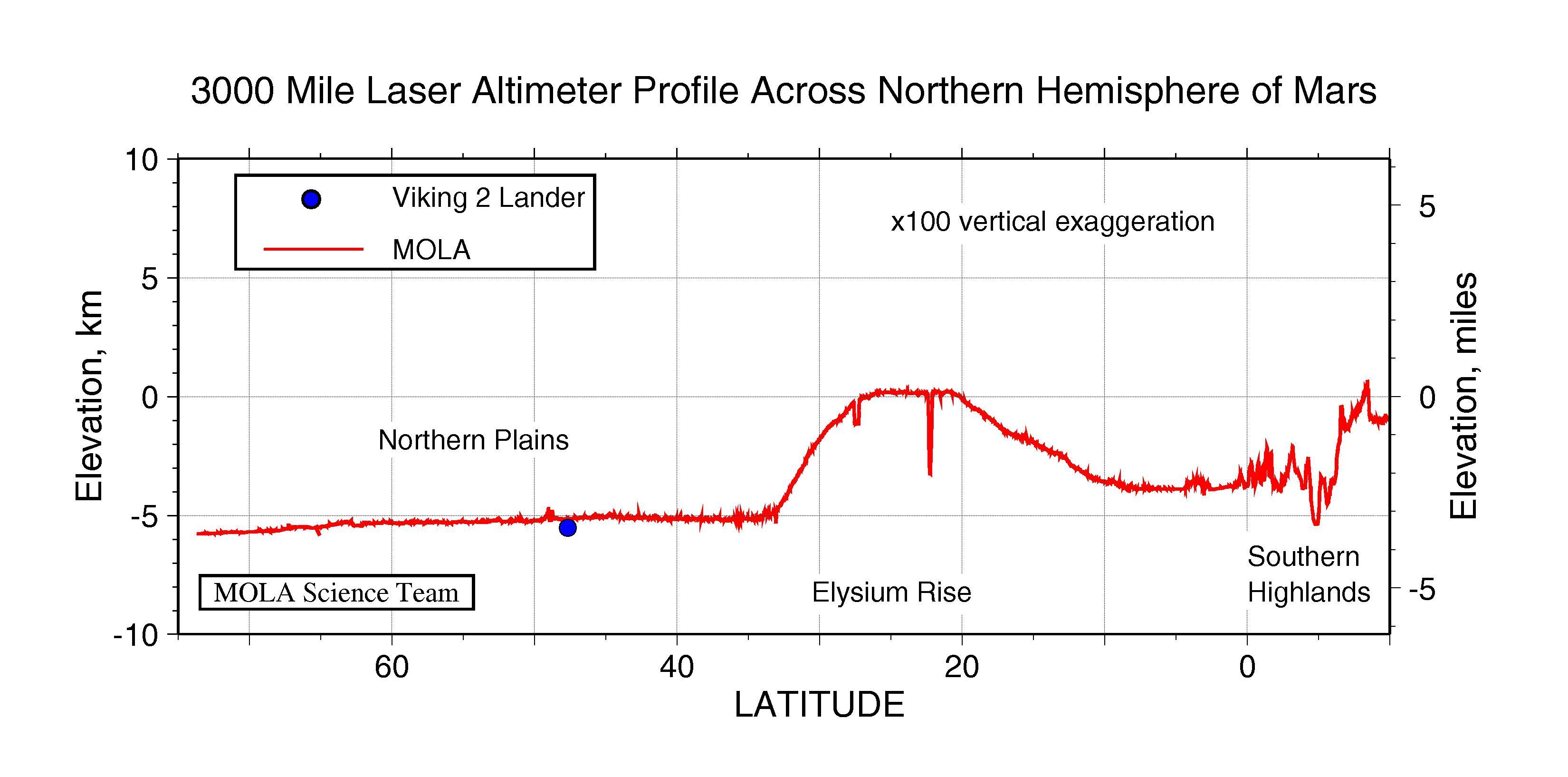
1997-10-13 |
Mars
|
Mars Global Surveyor (MGS)
|
MOLA
|
3300x1634x3 |

|
-
PIA00958:
-
3000 Mile Laser Altimeter Profile Across Northern Hemisphere of Mars
Full Resolution:
TIFF
(730.3 kB)
JPEG
(341 kB)
|
|
|
1997-10-13 |
Mars
|
Mars Global Surveyor (MGS)
|
MOLA
|
3300x2550x3 |
|
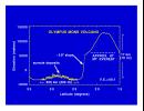
-
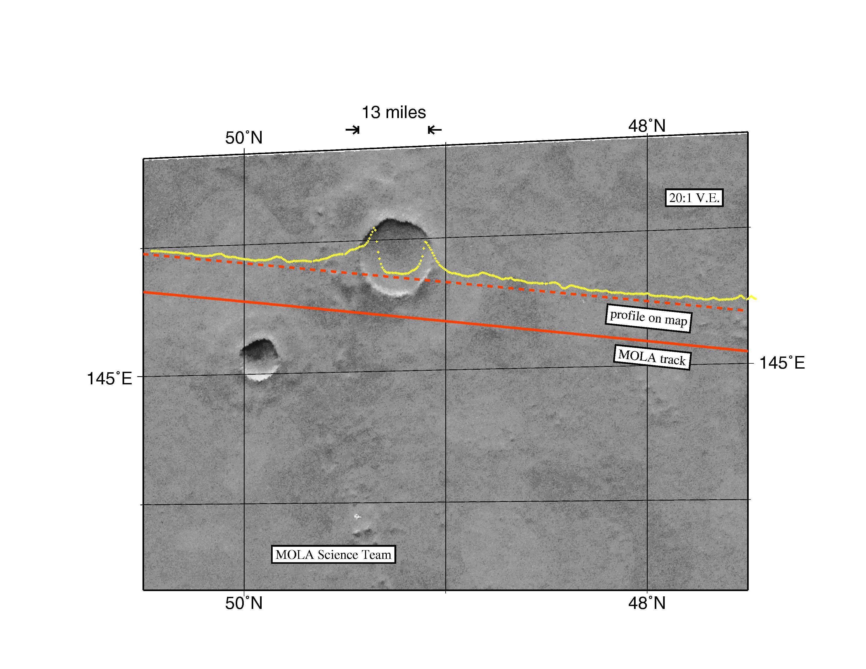
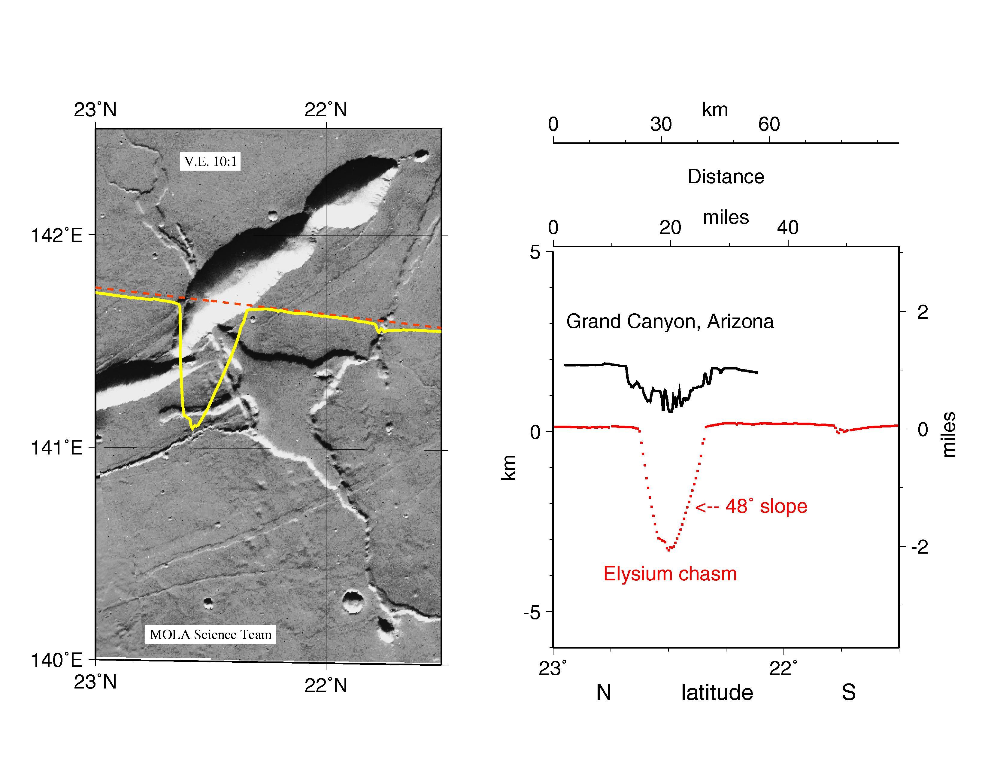
PIA00959:
-
MGS Mars Orbiter Laser Altimeter Topographic Profile of Impact Crater
Full Resolution:
TIFF
(5.47 MB)
JPEG
(741 kB)
|
|
|
1997-10-13 |
Mars
|
Mars Global Surveyor (MGS)
|
MOLA
|
3300x2550x3 |
|
-
PIA00960:
-
MGS Mars Orbiter Laser Altimeter (MOLA) - Mars/Earth Relief Comparison
Full Resolution:
TIFF
(3.639 MB)
JPEG
(615.3 kB)
|
|
|
1997-10-13 |
Mars
|
Mars Pathfinder (MPF)
|
Rover Cameras
|
383x280x1 |

|
-
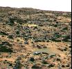
PIA00961:
-
"Half-Dome" Rock
Full Resolution:
TIFF
(96.12 kB)
JPEG
(20.99 kB)
|
|
|
1997-10-13 |
Mars
|
Mars Pathfinder (MPF)
|
Rover Cameras
|
856x340x1 |

|
-
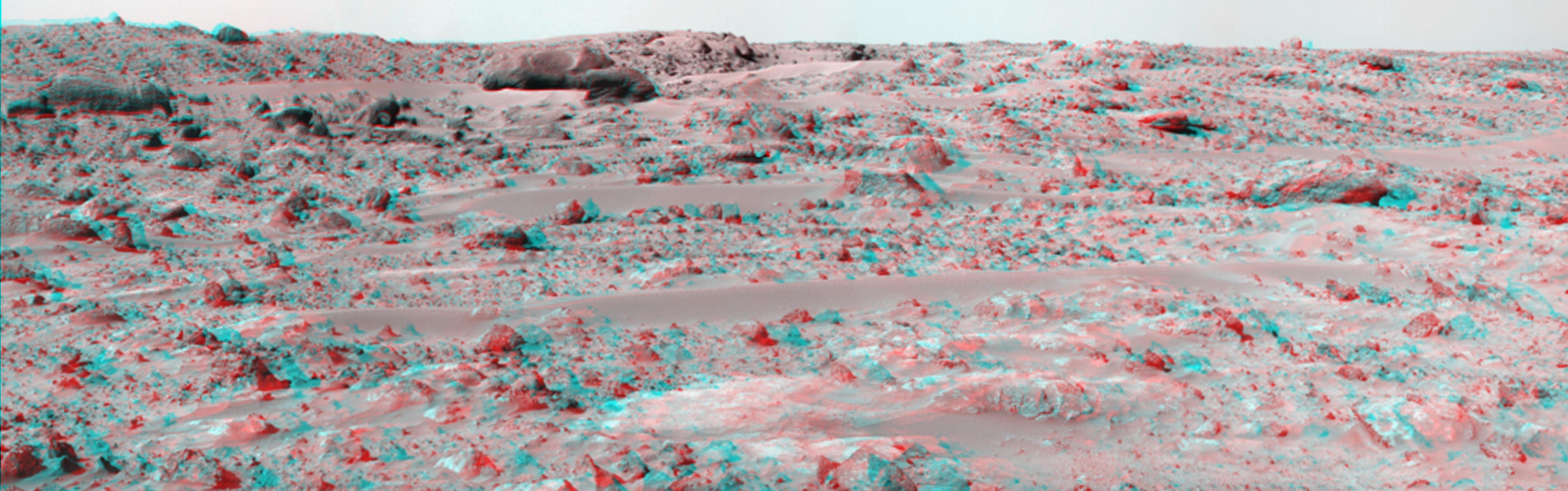
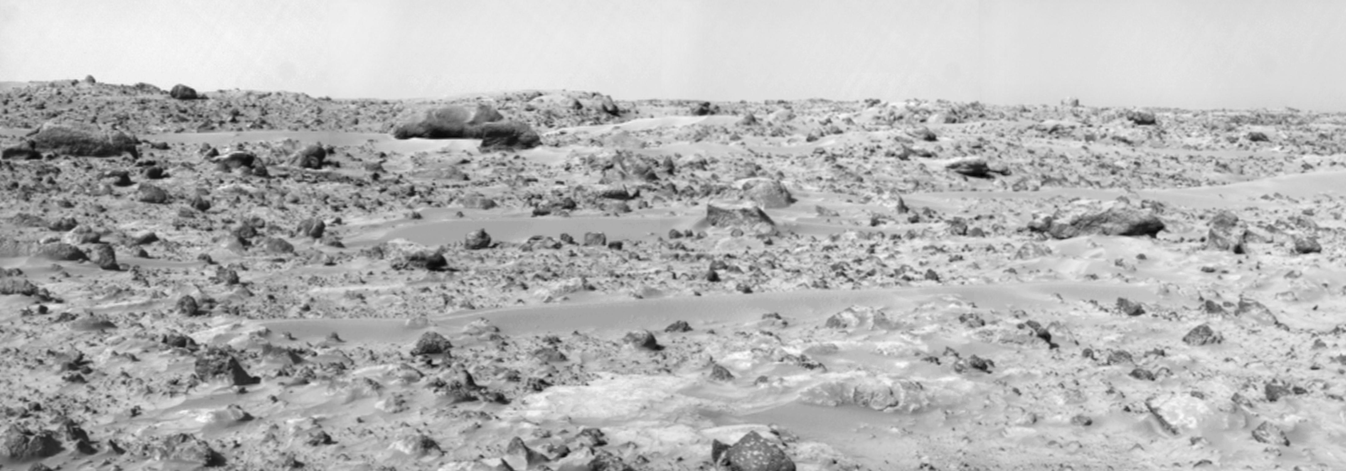
PIA00962:
-
Stereo Images of Wind Tails Near "Chimp"
Full Resolution:
TIFF
(195.6 kB)
JPEG
(44.51 kB)
|
|
|
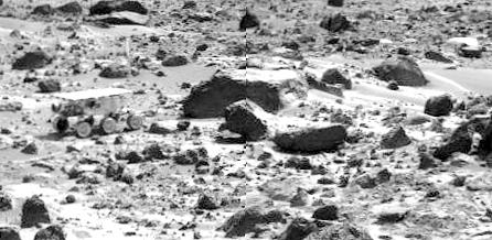
1997-10-13 |
Mars
|
Mars Pathfinder (MPF)
|
Rover Cameras
|
383x480x1 |
|
-
PIA00963:
-
Wind Tails Near "Chimp"
Full Resolution:
TIFF
(147.8 kB)
JPEG
(29.98 kB)
|
|
|
1997-10-13 |
Mars
|
Mars Pathfinder (MPF)
|
Rover Cameras
|
768x279x1 |
|
-
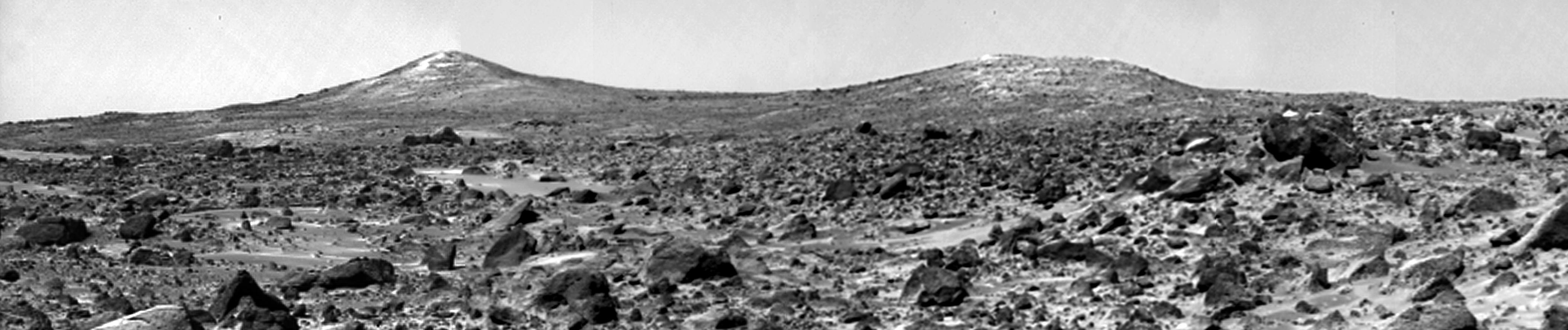
PIA00964:
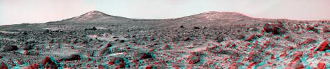
-
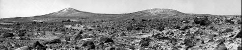
New View of Twin Peaks Region
Full Resolution:
TIFF
(185.3 kB)
JPEG
(26.82 kB)
|
|
|
1997-10-13 |
Mars
|
Mars Pathfinder (MPF)
|
Rover Cameras
|
768x263x1 |
|
-
PIA00965:
-
Dunes, Big Crater, & Twin Peaks - Right Eye
Full Resolution:
TIFF
(241.2 kB)
JPEG
(44.88 kB)
|
|
|
1997-10-13 |
Mars
|
Mars Pathfinder (MPF)
|
Imager for Mars Pathfinder
|
457x248x1 |
|
-
PIA00966:
-
Sojourner's APXS at "Moe" - Right Eye
Full Resolution:
TIFF
(129.8 kB)
JPEG
(33.36 kB)
|
|
|
1997-10-14 |
Mars
|
Mars Pathfinder (MPF)
|
Imager for Mars Pathfinder
|
256x248x3 |
|
-
PIA00967:
-
Sojourner at "Moe" - Color
Full Resolution:
TIFF
(54.28 kB)
JPEG
(21.57 kB)
|
|
|
1997-10-13 |
Mars
|
Mars Pathfinder (MPF)
|
Imager for Mars Pathfinder
|
450x227x1 |
|
-
PIA00968:
-
Sojourner's APXS at "Stimpy" - Right Eye
Full Resolution:
TIFF
(125.5 kB)
JPEG
(38.14 kB)
|
|
|
1997-10-13 |
Mars
|
Mars Pathfinder (MPF)
|
Imager for Mars Pathfinder
|
480x244x1 |

|
-
PIA00969:
-
Sojourner's Farthest Journey
Full Resolution:
TIFF
(124.2 kB)
JPEG
(31.93 kB)
|
|
|
1997-10-13 |
Mars
|
Mars Pathfinder (MPF)
|
Imager for Mars Pathfinder
|
486x248x1 |
|
-
PIA00970:
-
Sojourner's APXS at "Chimp" - Left Eye
Full Resolution:
TIFF
(137.4 kB)
JPEG
(39.1 kB)
|
|
|
1997-10-14 |
Mars
|
Mars Pathfinder (MPF)
|
Imager for Mars Pathfinder
|
446x218x1 |

|
-
PIA00971:
-
Sojourner near "Chimp"
Full Resolution:
TIFF
(111.1 kB)
JPEG
(31.13 kB)
|
|
|
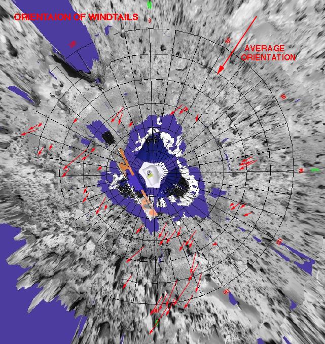
1997-10-14 |
Mars
|
Mars Pathfinder (MPF)
|
Imager for Mars Pathfinder
|
641x678x3 |
|
-
PIA00972:
-
Orientation of Windtails at Pathfinder Landing Site
Full Resolution:
TIFF
(859.1 kB)
JPEG
(137.5 kB)
|
|
|
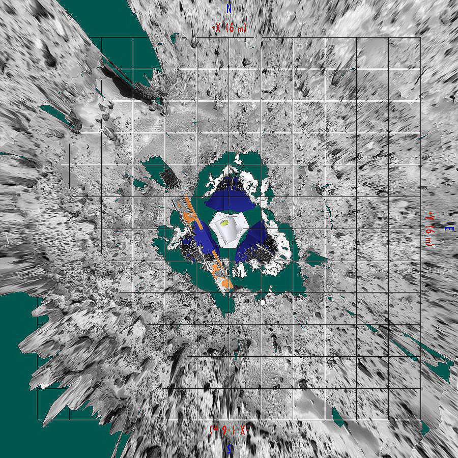
1997-10-14 |
Mars
|
Mars Pathfinder (MPF)
|
Imager for Mars Pathfinder
|
900x900x3 |
|
-
PIA00973:
-
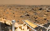
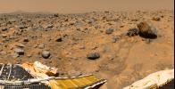
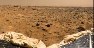
Overhead view of Pathfinder Landing Site
Full Resolution:
TIFF
(1.686 MB)
JPEG
(288.5 kB)
|
|
|
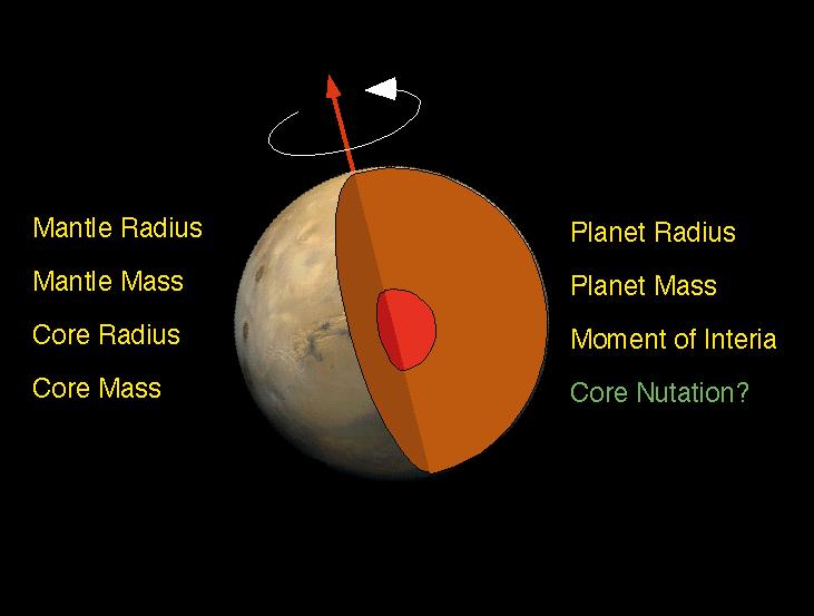
1997-10-14 |
Mars
|
Mars Pathfinder (MPF)
|
Deep Space Network
|
731x553x3 |
|
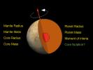
-
PIA00974:
-
Schematic of Mars Interior
Full Resolution:
TIFF
(35.11 kB)
JPEG
(33.04 kB)
|
|
|
1997-10-14 |
Mars
|
Mars Pathfinder (MPF)
|
Deep Space Network
|
731x553x3 |

|
-
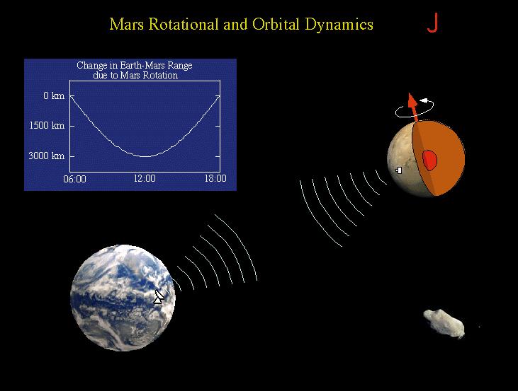
PIA00975:
-
Mars Rotational and Orbital Dynamics
Full Resolution:
TIFF
(40.52 kB)
JPEG
(39.07 kB)
|
|
|
1997-10-14 |
Mars
|
Mars Pathfinder (MPF)
|
Atmospheric Structure / Meteorology Instrument
|
613x467x3 |
|
-
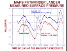
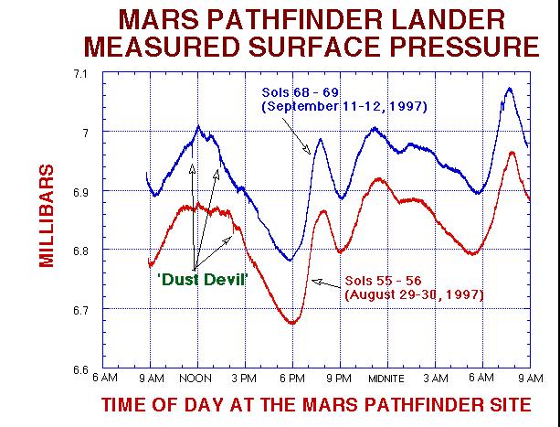
PIA00976:
-
MPF Lander Measured Surface Pressure
Full Resolution:
TIFF
(19.31 kB)
JPEG
(68.86 kB)
|
|
|
1997-10-14 |
Mars
|
Mars Pathfinder (MPF)
|
Atmospheric Structure / Meteorology Instrument
|
606x463x3 |
|
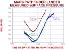
-
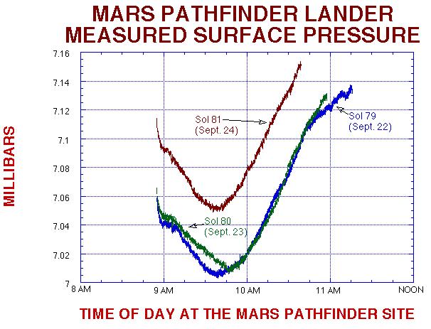
PIA00977:
-
MPF Lander Measured Surface Pressure
Full Resolution:
TIFF
(16.72 kB)
JPEG
(60.7 kB)
|
|
|
1997-10-14 |
Mars
|
Mars Pathfinder (MPF)
|
Atmospheric Structure / Meteorology Instrument
|
605x458x3 |
|
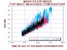
-
PIA00978:
-
MPF Top-Mast Measured Temperature
Full Resolution:
TIFF
(21.08 kB)
JPEG
(60.55 kB)
|
|
|
1997-10-14 |
Mars
|
Mars Pathfinder (MPF)
|
Imager for Mars Pathfinder
|
510x385x3 |
|
-
PIA00979:
-
"Roadrunner Flats"
Full Resolution:
TIFF
(97.43 kB)
JPEG
(49.77 kB)
|
|
|
1997-10-14 |
Mars
|
Mars Pathfinder (MPF)
|
Rover Cameras
|
1538x984x1 |
|
-
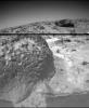
PIA00980:
-
Closeup of "Mermaid Dune"
Full Resolution:
TIFF
(1.428 MB)
JPEG
(213.8 kB)
|
|
|
1997-10-14 |
Mars
|
Mars Pathfinder (MPF)
|
Imager for Mars Pathfinder
|
1277x1239x3 |
|
-
PIA00981:
-
"Jenkins Dune"
Full Resolution:
TIFF
(5.209 MB)
JPEG
(264.9 kB)
|
|
|
1997-10-14 |
Mars
|
Mars Pathfinder (MPF)
|
Imager for Mars Pathfinder
|
1050x1140x3 |
|
-
PIA00982:
-
"Barnacle Bill" and Surrounding from Super-Pan
Full Resolution:
TIFF
(2.964 MB)
JPEG
(246 kB)
|
|
|
1997-10-14 |
Mars
|
Mars Pathfinder (MPF)
|
Rover Cameras
|
383x472x1 |
|
-
PIA00983:
-
Pits and Flutes on "Stimpy"
Full Resolution:
TIFF
(171.6 kB)
JPEG
(28.27 kB)
|
|
|
1997-10-14 |
Mars
|
Mars Pathfinder (MPF)
|
Rover Cameras
|
413x399x1 |
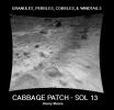
|
-
PIA00984:
-
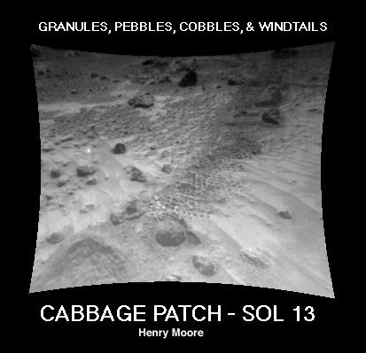
"Cabbage Patch"
Full Resolution:
TIFF
(90.68 kB)
JPEG
(24 kB)
|
|
|
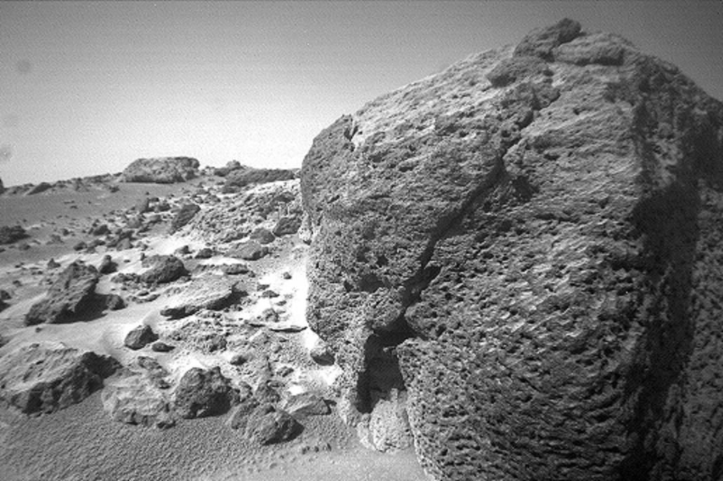
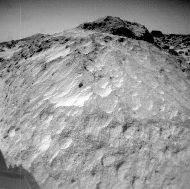
1997-10-14 |
Mars
|
Mars Pathfinder (MPF)
|
Imager for Mars Pathfinder
|
256x248x1 |
|
-
PIA00985:
-
Pebbles and Cobbles at MPF Site
Full Resolution:
TIFF
(78.29 kB)
JPEG
(19.51 kB)
|
|
|
1997-10-14 |
Mars
|
Mars Pathfinder (MPF)
|
Imager for Mars Pathfinder
|
256x248x3 |

|
-
PIA00986:
-
"Shark"
Full Resolution:
TIFF
(73.15 kB)
JPEG
(32.26 kB)
|
|
|
1997-10-14 |
Mars
|
Mars Pathfinder (MPF)
|
Imager for Mars Pathfinder
|
256x248x3 |
|
-
PIA00987:
-
"Rock Garden"
Full Resolution:
TIFF
(72.21 kB)
JPEG
(31.42 kB)
|
|
|
1997-10-14 |
Mars
|
Mars Pathfinder (MPF)
|
Rover Cameras
|
593x446x1 |
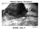
|
-
PIA00988:
-
Pebbles, Cobbles, and Sockets
Full Resolution:
TIFF
(205.9 kB)
JPEG
(42.9 kB)
|
|
|
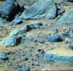
1997-10-14 |
Mars
|
Mars Pathfinder (MPF)
|
Rover Cameras
|
523x475x1 |
|
-
PIA00989:
-
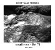
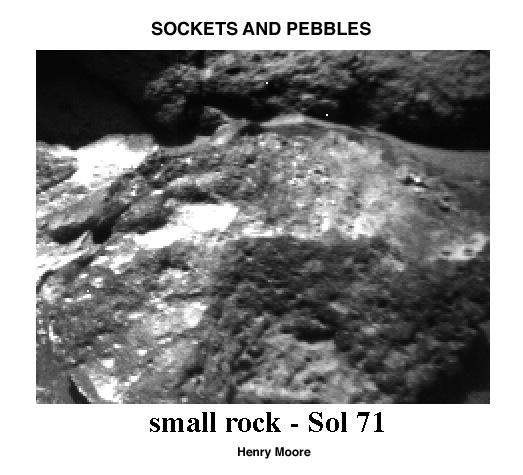
Sockets and Pebbles
Full Resolution:
TIFF
(161.2 kB)
JPEG
(39.43 kB)
|
|
|
1997-10-14 |
Mars
|
Mars Pathfinder (MPF)
Viking
|
|
216x224x1 |
|
-
PIA00990:
-
Wind Drifts at Viking 1 Landing Site
Full Resolution:
TIFF
(48.92 kB)
JPEG
(10.82 kB)
|
|
|
1997-10-15 |
Mars
|
Mars Global Surveyor (MGS)
|
Mars Orbiter Camera (MOC)
|
928x1552x3 |
|
-
PIA00991:
-
Valles Marineris
Full Resolution:
TIFF
(3.993 MB)
JPEG
(82.71 kB)
|
|
|
1997-10-15 |
Mars
|
Mars Global Surveyor (MGS)
|
Mars Orbiter Camera (MOC)
|
1023x608x3 |
|
-
PIA00992:
-
Valles Marineris
Full Resolution:
TIFF
(956.1 kB)
JPEG
(68.46 kB)
|
|
|
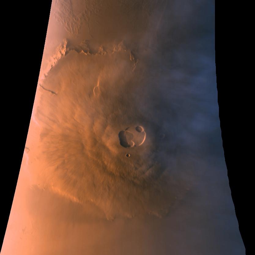
1998-04-23 |
Mars
|
Mars Global Surveyor (MGS)
|
Mars Orbiter Camera (MOC)
|
834x834x3 |

|
-
PIA00993:
-
Olympus Mons in Color
Full Resolution:
TIFF
(1.23 MB)
JPEG
(35.04 kB)
|
|
|
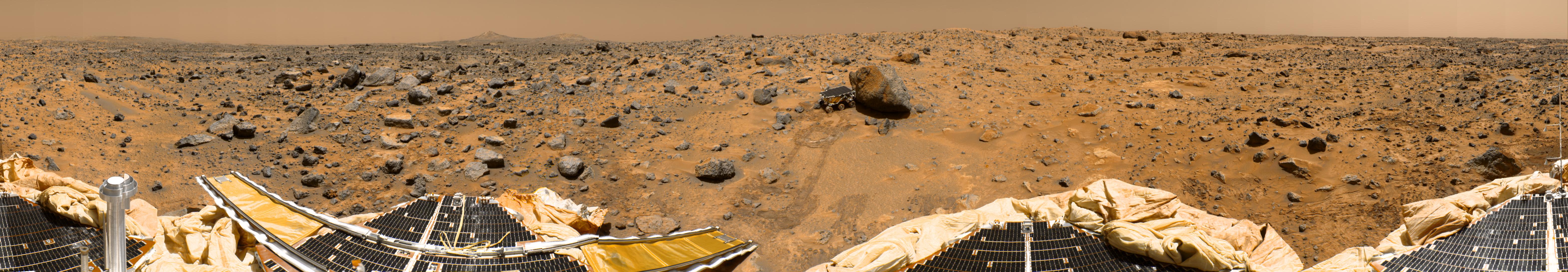
1997-11-04 |
Mars
|
Mars Pathfinder (MPF)
|
Imager for Mars Pathfinder
|
6283x1090x3 |
|
-
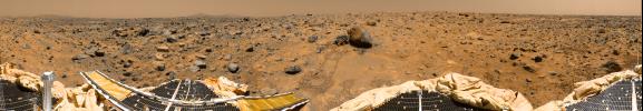
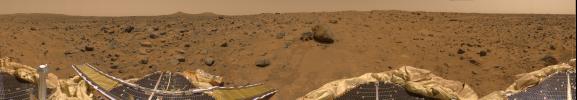
PIA00994:
Color Enhanced Version of 360-degree Panorama
Full Resolution:
TIFF
(21.37 MB)
JPEG
(1.191 MB)
|
|
|
1997-11-04 |
Mars
|
Mars Pathfinder (MPF)
|
Imager for Mars Pathfinder
|
4214x888x3 |
|
-
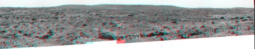
PIA00995:
The Twin Peaks in 3-D, as Viewed by the Mars Pathfinder IMP Camera
Full Resolution:
TIFF
(8.885 MB)
JPEG
(443.4 kB)
|
|
|
1997-11-04 |
Mars
|
Mars Pathfinder (MPF)
|
Rover Cameras
|
768x481x1 |

|
-
PIA00998:
-
Sojourner's View of "Yogi"
Full Resolution:
TIFF
(402.4 kB)
JPEG
(103.1 kB)
|
|
|
1997-11-04 |
Mars
|
Mars Pathfinder (MPF)
|
Imager for Mars Pathfinder
|
4204x1317x3 |
|
-
PIA00999:
-
Northeast View from Pathfinder Lander - Anaglyph
Full Resolution:
TIFF
(16.27 MB)
JPEG
(615.8 kB)
|
|
|
1997-11-04 |
Mars
|
Mars Pathfinder (MPF)
|
Imager for Mars Pathfinder
|
4375x1533x1 |
|
-
PIA01000:
-
Northeast View from Pathfinder Lander
Full Resolution:
TIFF
(5.217 MB)
JPEG
(531 kB)
|
|
|
1997-11-04 |
Mars
|
Mars Pathfinder (MPF)
|
Imager for Mars Pathfinder
|
4214x887x1 |
|
-
PIA01001:
Twin Peaks (B/W)
Full Resolution:
TIFF
(3.169 MB)
JPEG
(373 kB)
|
|
|
1997-11-04 |
Mars
|
Mars Pathfinder (MPF)
|
Imager for Mars Pathfinder
|
1726x1090x3 |
|
-
PIA01002:
-
Portion of Enhanced 360-degree Gallery Pan
Full Resolution:
TIFF
(5.793 MB)
JPEG
(339.2 kB)
|
|
|
1997-11-04 |
Mars
|
Mars Pathfinder (MPF)
|
Imager for Mars Pathfinder
|
2128x1090x3 |
|
-
PIA01003:
-
Sojourner Within Color-Enhanced Panorama
Full Resolution:
TIFF
(7.214 MB)
JPEG
(380.8 kB)
|
|
|
1997-11-04 |
Mars
|
Mars Pathfinder (MPF)
|
Imager for Mars Pathfinder
|
2094x1090x3 |
|
-
PIA01004:
-
ASI/MET Within Color-Enhanced Panorama
Full Resolution:
TIFF
(7.116 MB)
JPEG
(413.1 kB)
|
|
|
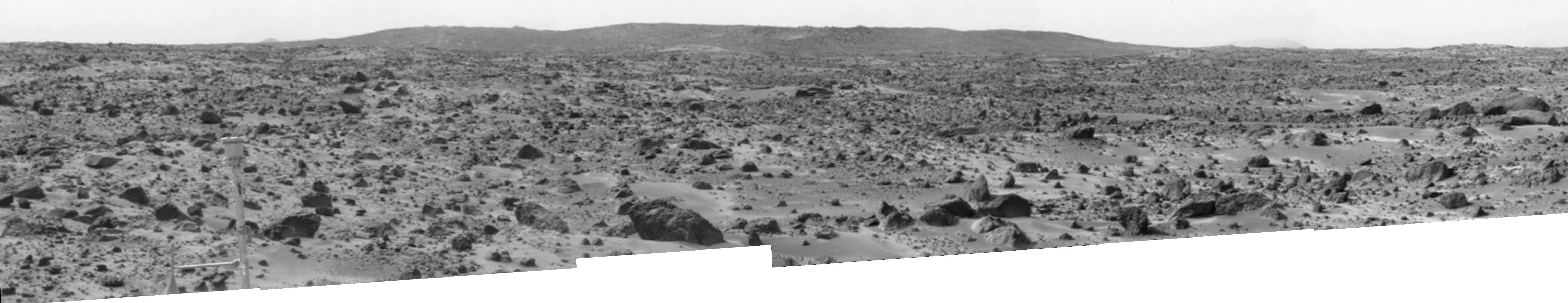
1997-11-04 |
Mars
|
Mars Pathfinder (MPF)
|
Imager for Mars Pathfinder
|
6283x1090x3 |
|
-
PIA01005:
360-degree Color Panorama
Full Resolution:
TIFF
(18.62 MB)
JPEG
(840.3 kB)
|
|
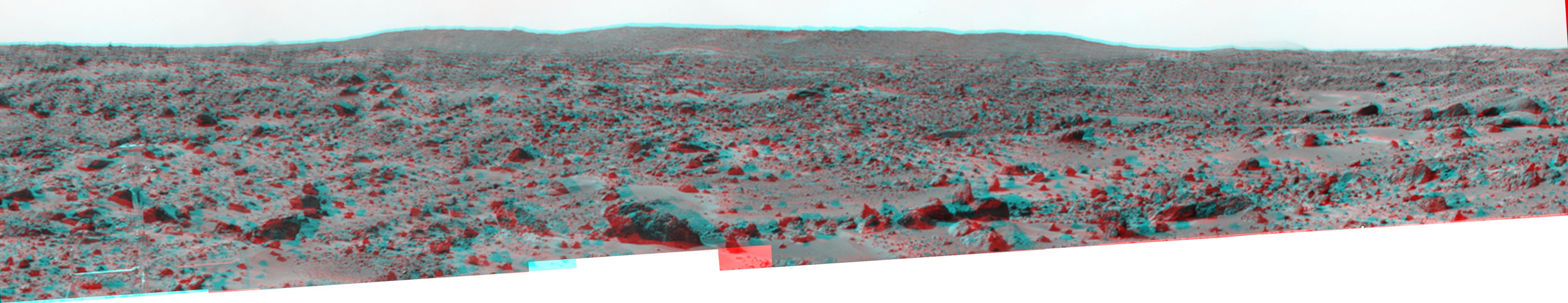
|
1997-11-04 |
Mars
|
Mars Pathfinder (MPF)
|
Imager for Mars Pathfinder
|
528x901x3 |
|
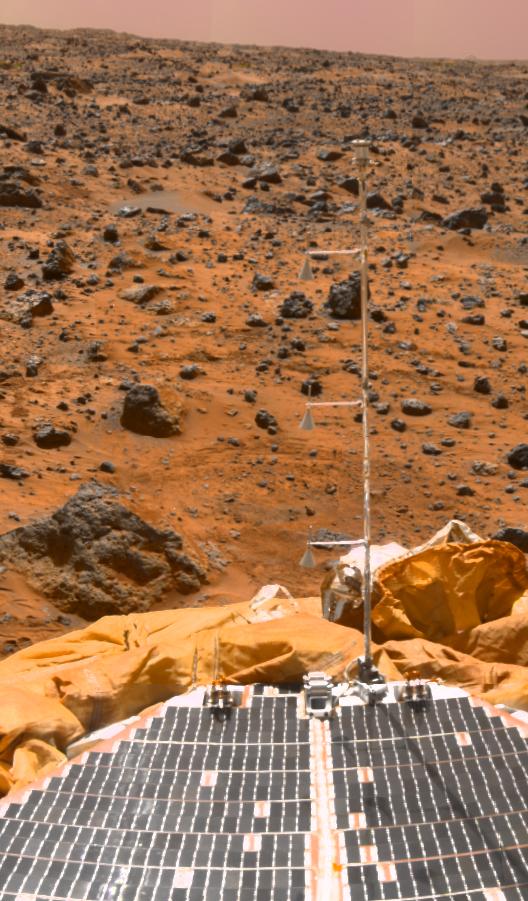
-
PIA01006:
-
ASI/MET Mast
Full Resolution:
TIFF
(1.261 MB)
JPEG
(103 kB)
|
|
|
1997-11-04 |
Mars
|
Mars Pathfinder (MPF)
|
Imager for Mars Pathfinder
|
6141x1189x3 |
|
-
PIA01007:
Big Crater as Viewed by Pathfinder Lander - Anaglyph
Full Resolution:
TIFF
(15.57 MB)
JPEG
(701.7 kB)
|
|
|
1997-11-04 |
Mars
|
Mars Pathfinder (MPF)
|
Imager for Mars Pathfinder
|
6141x1189x1 |

|
-
PIA01008:
Big Crater as Viewed by Pathfinder Lander
Full Resolution:
TIFF
(4.878 MB)
JPEG
(547.3 kB)
|
|
|
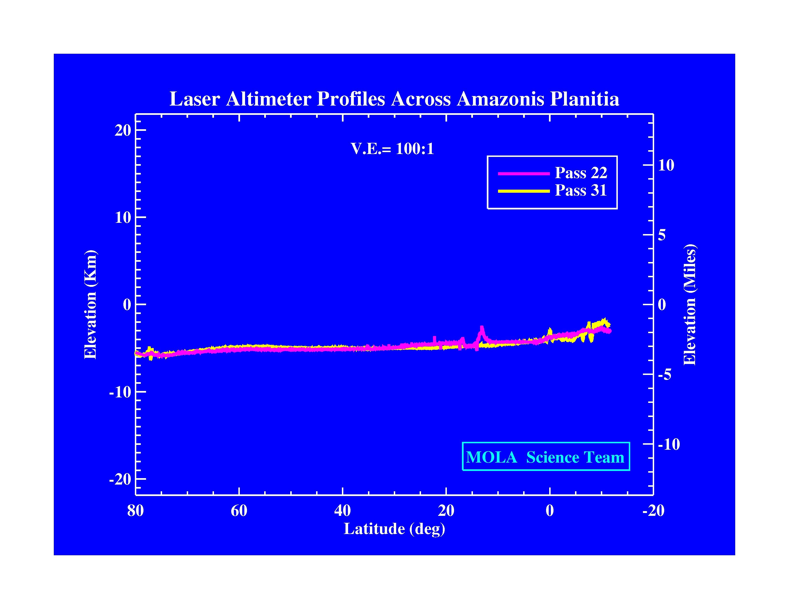
1997-11-10 |
Mars
|
Mars Global Surveyor (MGS)
|
MOLA
|
3300x2550x3 |
|
-
PIA01009:
-
Laser Altimeter Profiles Across Amazonis Planitia
Full Resolution:
TIFF
(530.8 kB)
JPEG
(371.9 kB)
|
|
|
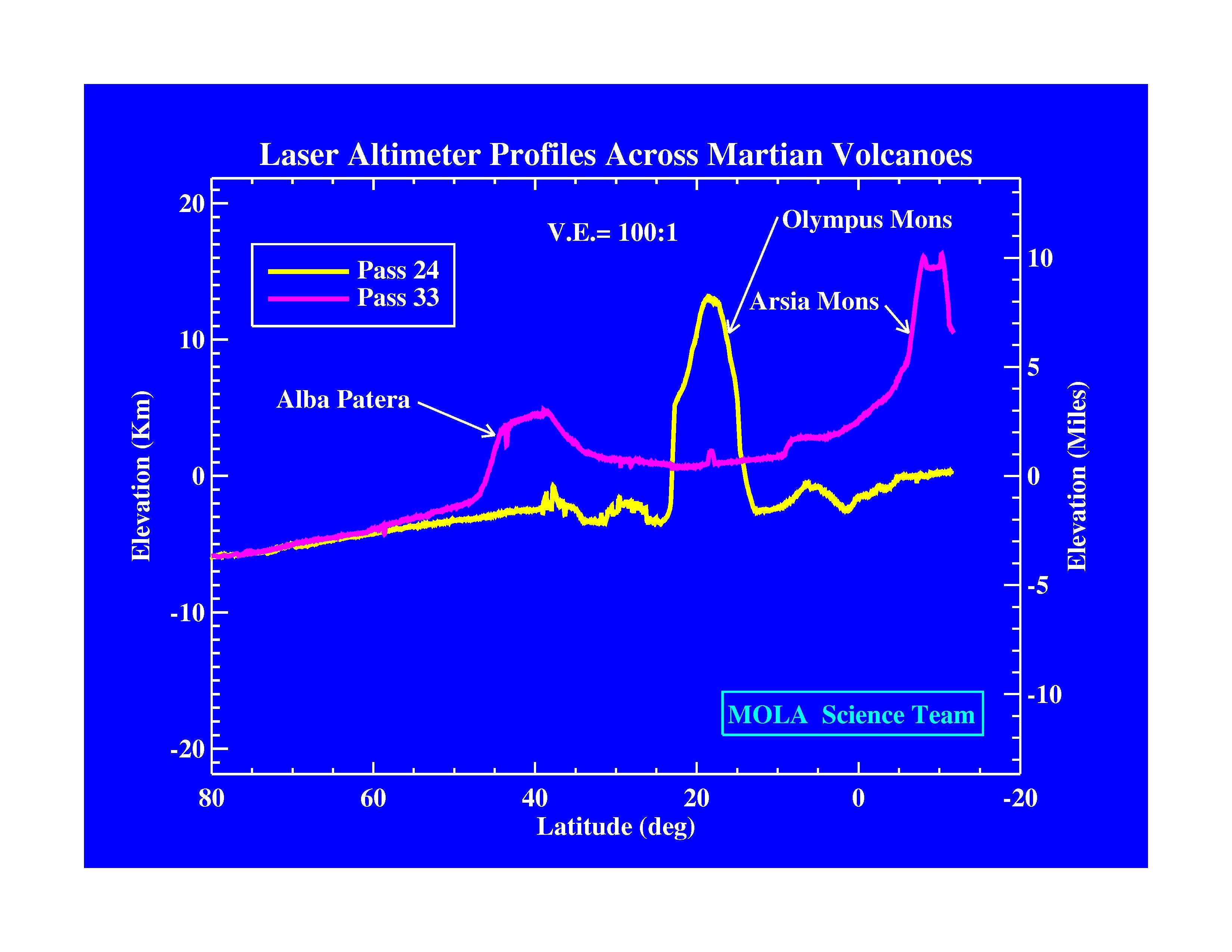
1997-11-10 |
Mars
|
Mars Global Surveyor (MGS)
|
MOLA
|
3300x2550x3 |
|
-
PIA01010:
-
Laser Altimeter Profiles Across Martian Volcanoes
Full Resolution:
TIFF
(677.9 kB)
JPEG
(424.4 kB)
|
|
|
1997-11-10 |
Mars
|
Mars Global Surveyor (MGS)
|
MOLA
|
3300x2550x3 |
|
-
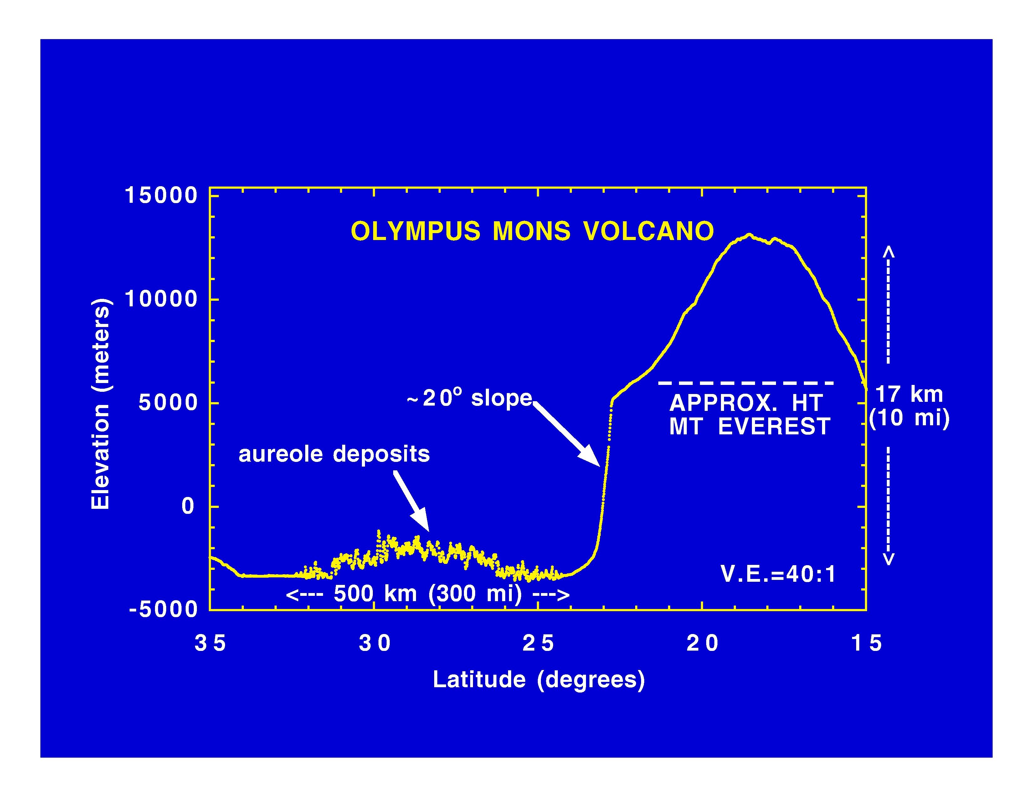
PIA01011:
-
Olympus Mons Volcano
Full Resolution:
TIFF
(625.4 kB)
JPEG
(414.7 kB)
|
|
|
1997-11-10 |
Mars
|
Mars Global Surveyor (MGS)
|
MOLA
|
3300x2550x3 |
|
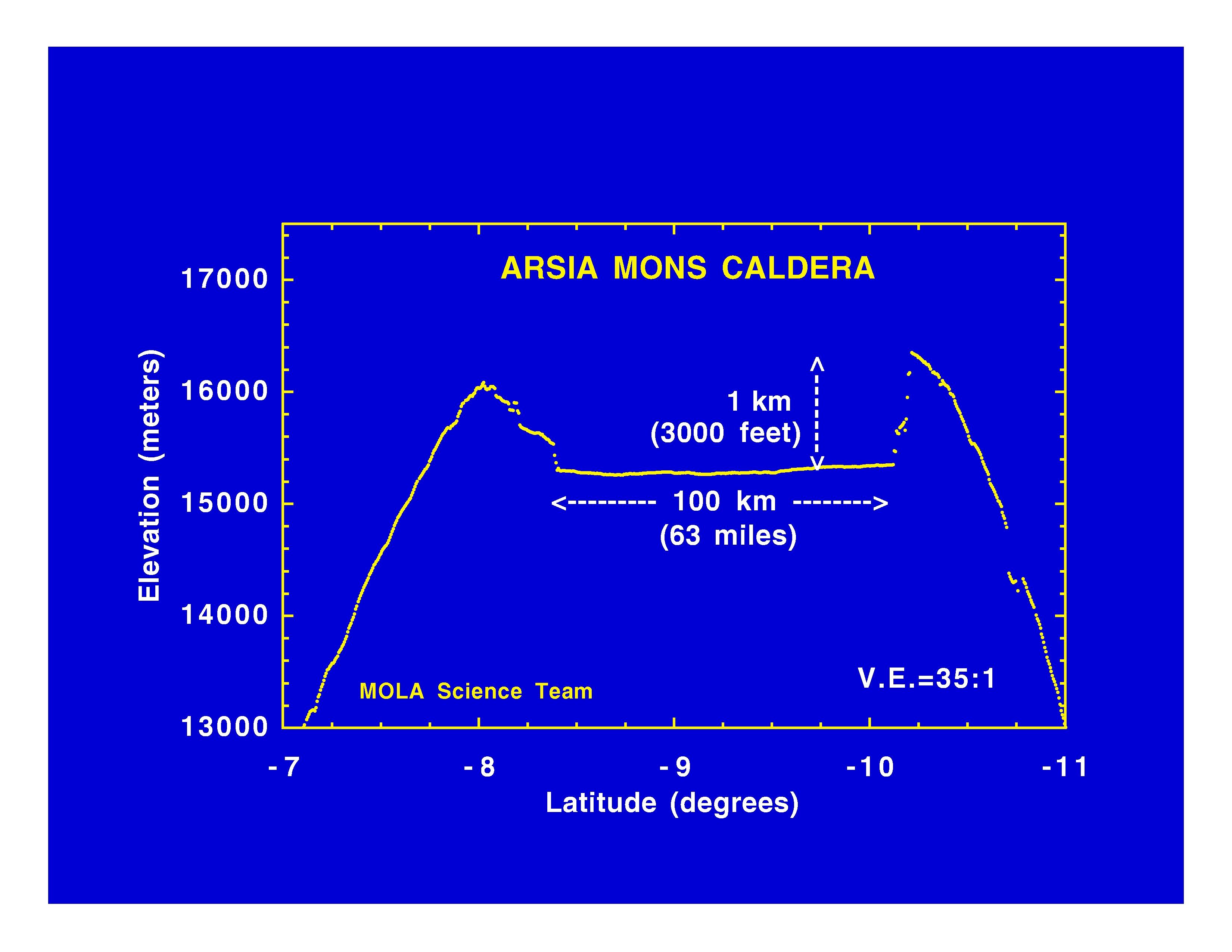
-
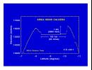
PIA01012:
-
Arsia Mons Caldera
Full Resolution:
TIFF
(534.1 kB)
JPEG
(365.8 kB)
|
|
|
1997-11-10 |
Mars
|
Mars Global Surveyor (MGS)
|
MOLA
|
3300x2550x3 |
|
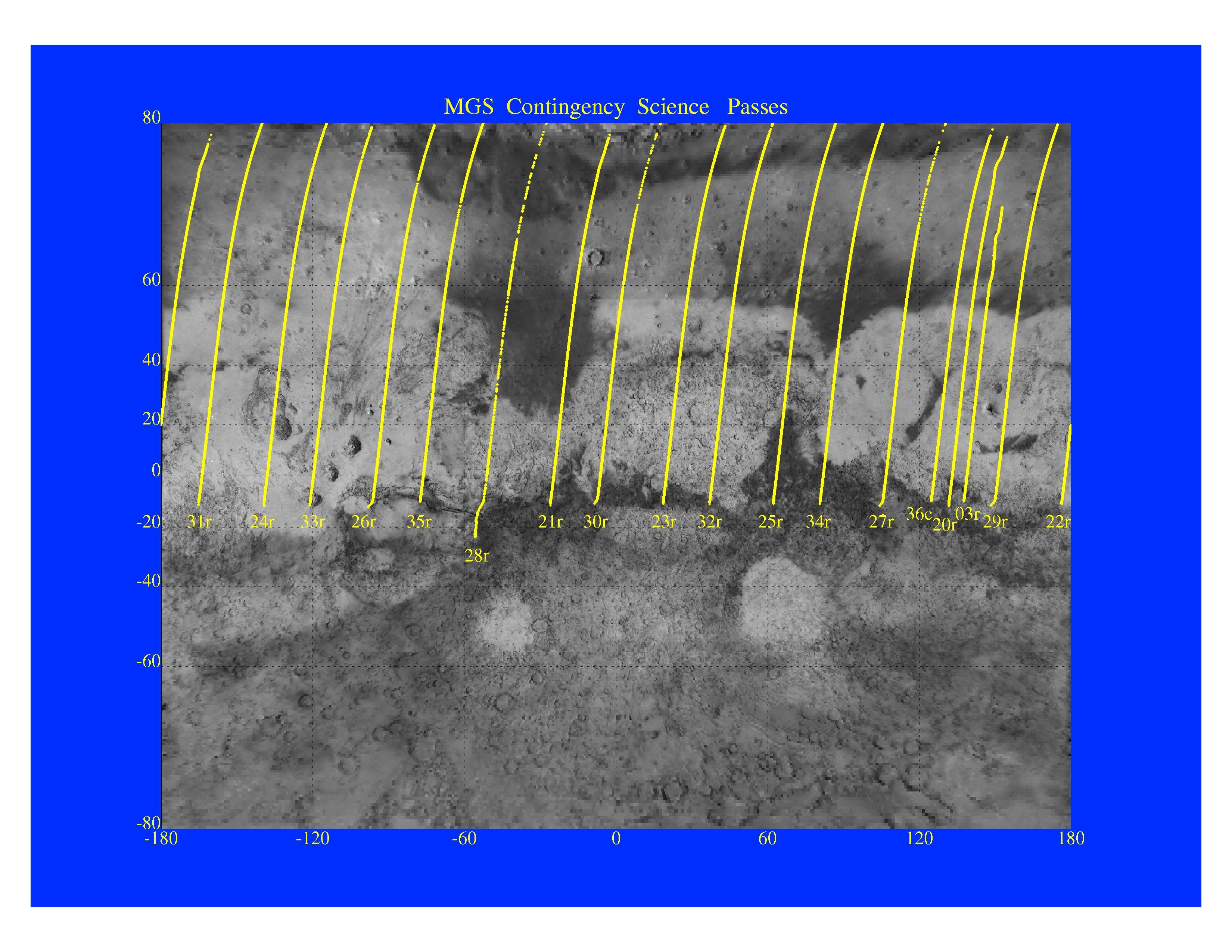
-
PIA01013:
-
MGS Contingency Science Passes
Full Resolution:
TIFF
(4.409 MB)
JPEG
(879.4 kB)
|
 Planetary Data System


