My
List |
Addition Date
|
Target
|
Mission
|
Instrument
|
Size
|

|
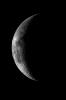
1996-01-29 |
Moon
|
Galileo
|
Solid-State Imaging
|
1988x1069x1 |
|
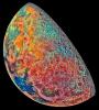
-
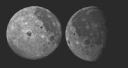
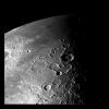
PIA00077:
-
Moon - 2 Views of Orientale Basin
Full Resolution:
TIFF
(882.2 kB)
JPEG
(133.4 kB)
|
|
|
1996-02-02 |
Moon
|
Galileo
|
Solid-State Imaging
|
1069x1069x3 |
|
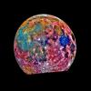
-
PIA00113:
-
Moon Color Composite
Full Resolution:
TIFF
(1.786 MB)
JPEG
(76.81 kB)
|
|
|
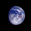
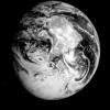
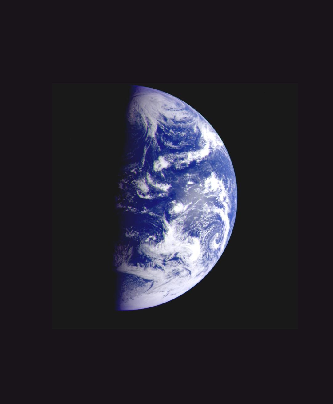
1996-01-29 |
Earth
|
Galileo
|
Solid-State Imaging
|
800x800x3 |
|
-
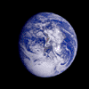
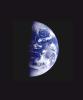
PIA00114:
-
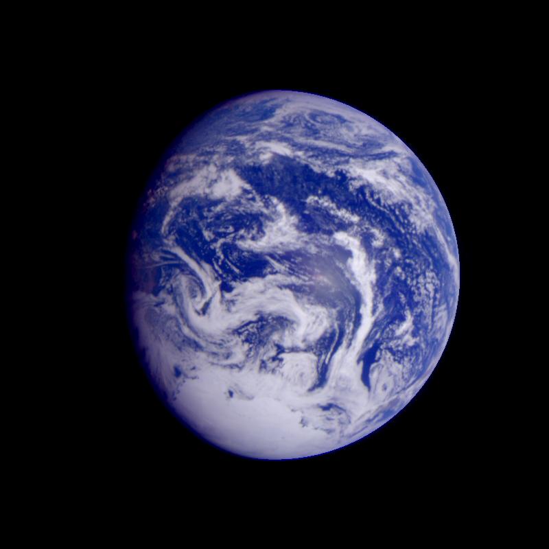
Earth - South America (First Frame of Earth Spin Movie)

Full Resolution:
TIFF
(760.1 kB)
JPEG
(50.21 kB)
|
|
|
2001-02-28 |
Earth
|
Galileo
|
Solid-State Imaging
|
538x758x3 |

|
-
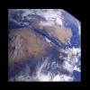
PIA00115:
-
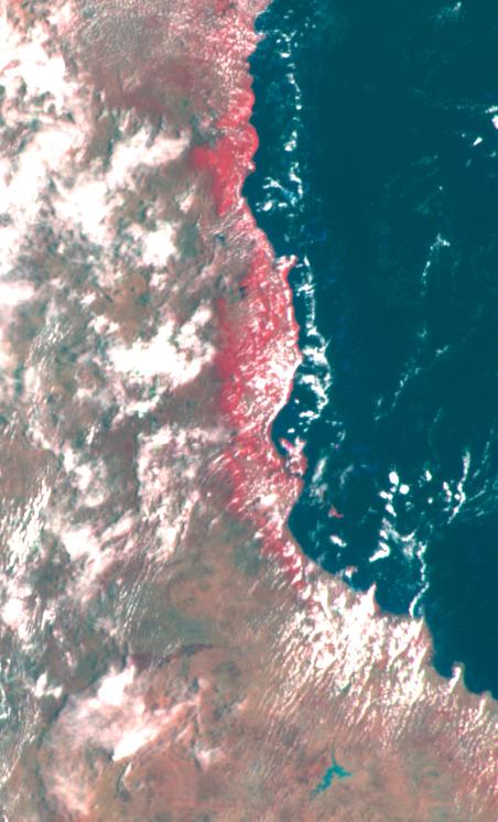
Earth - Simpson Desert, Central Australia
Full Resolution:
TIFF
(920 kB)
JPEG
(59.48 kB)
|
|
|
1996-02-01 |
Earth
|
Galileo
|
Solid-State Imaging
|
1378x458x3 |
|
-
PIA00116:
-
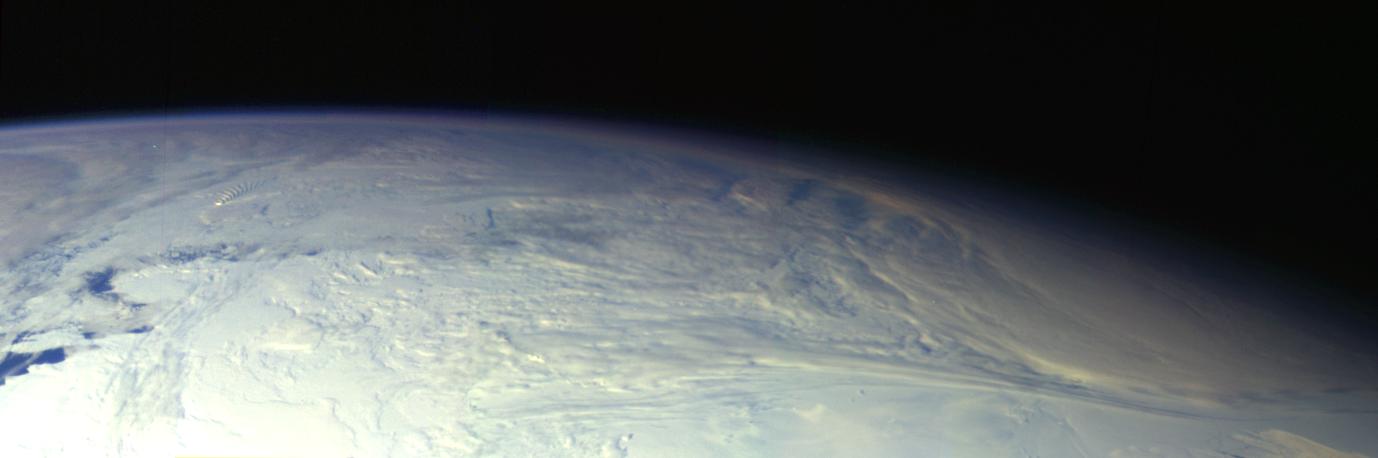
Earth - Antarctica Mosaic
Full Resolution:
TIFF
(1.091 MB)
JPEG
(41.89 kB)
|
|
|
1996-02-09 |
Earth
|
Galileo
|
Solid-State Imaging
|
2450x2200x3 |
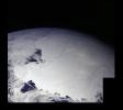
|
-
PIA00117:
-
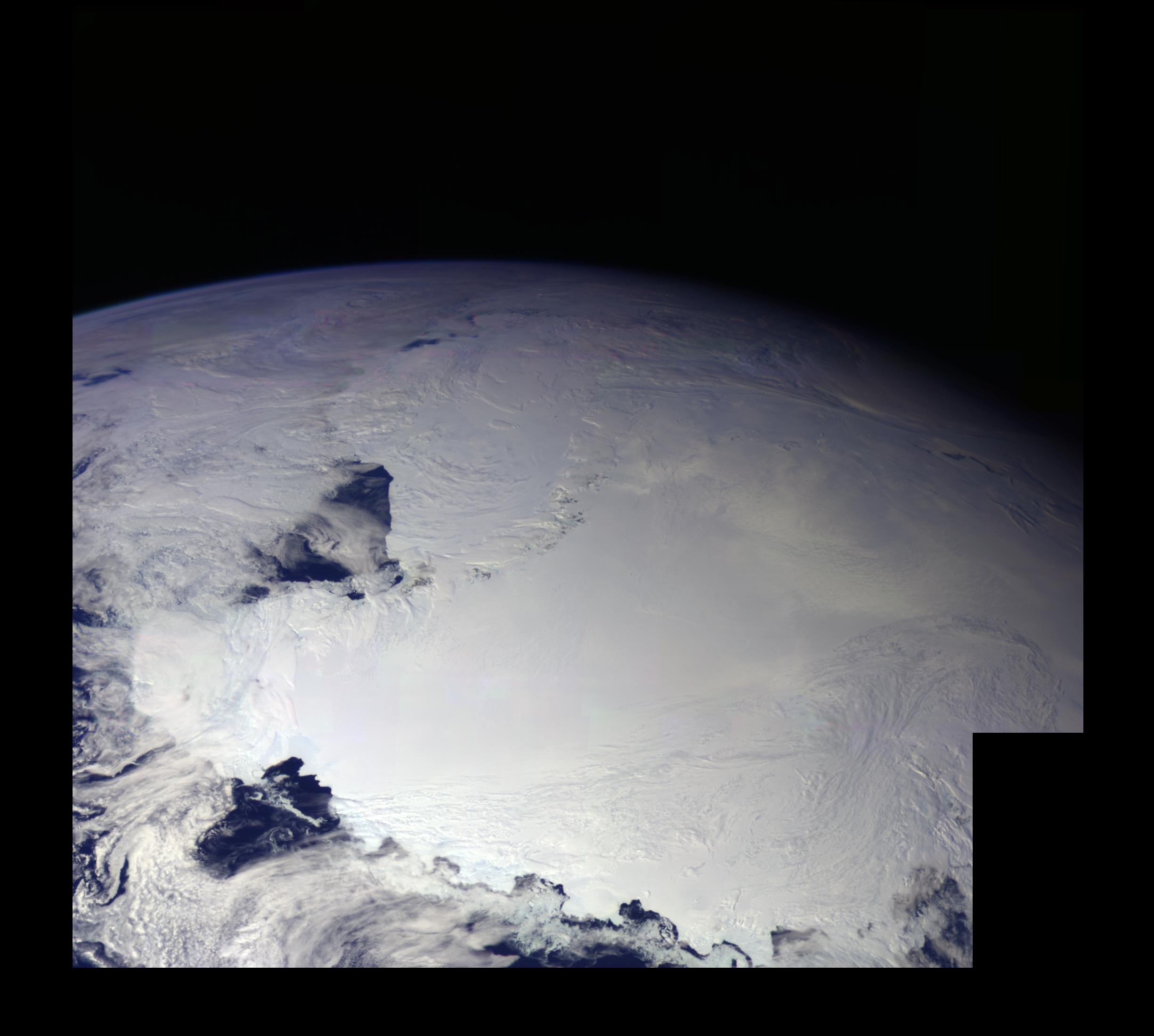
Earth - Ross Ice Shelf, Antarctica
Full Resolution:
TIFF
(7.234 MB)
JPEG
(268.4 kB)
|
|
|
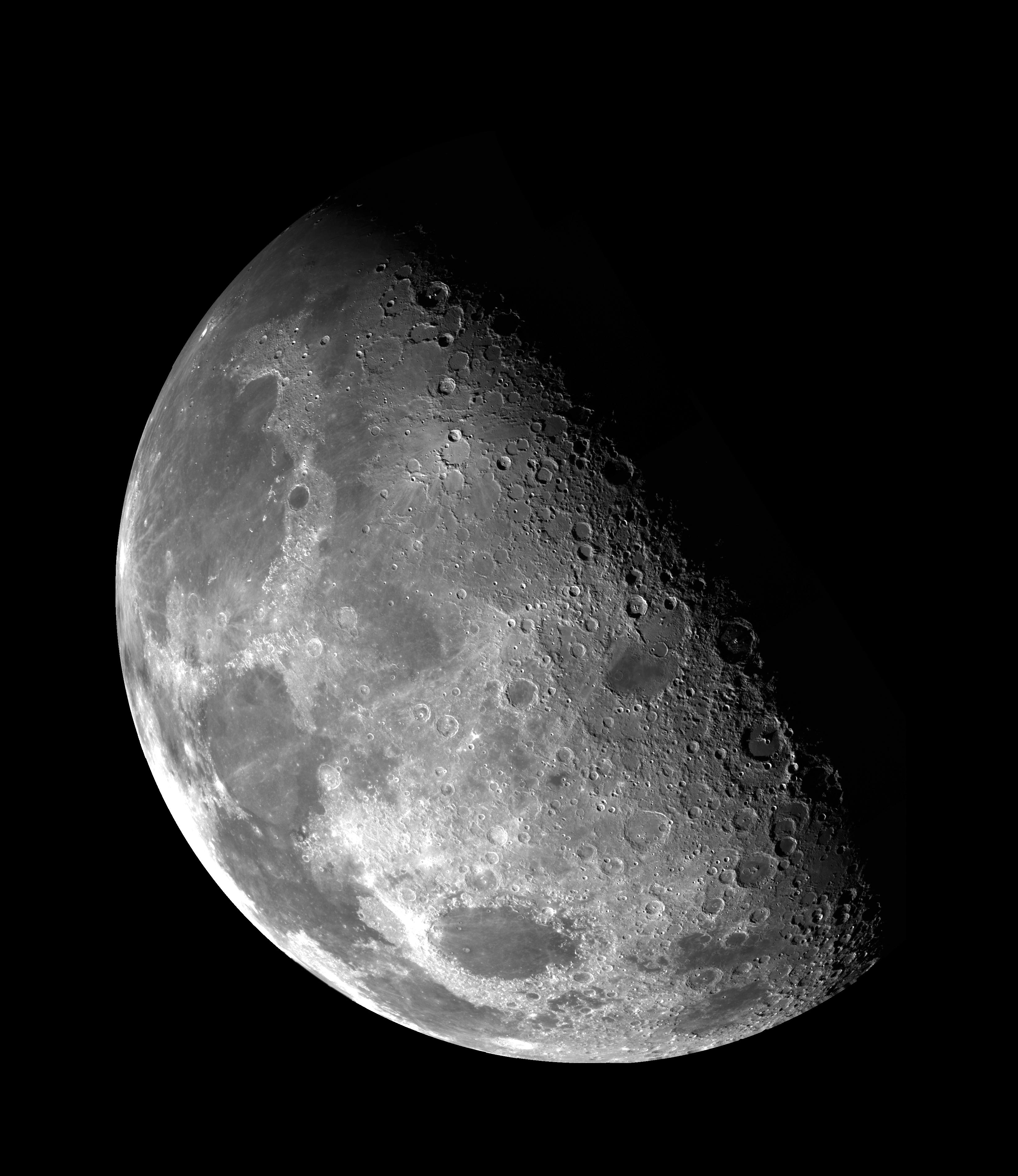
1996-01-29 |
Moon
|
Galileo
|
Solid-State Imaging
|
800x800x1 |
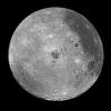
|
-
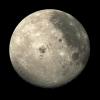
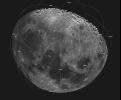
PIA00120:
-
Moon - Western Hemisphere
Full Resolution:
TIFF
(301.2 kB)
JPEG
(134.9 kB)
|
|
|
2001-02-28 |
Earth
|
Galileo
|
Solid-State Imaging
|
452x746x3 |
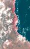
|
-
PIA00121:
-
Earth - Eastern Australia Coast
Full Resolution:
TIFF
(693.7 kB)
JPEG
(57.29 kB)
|
|
|
1996-02-08 |
Earth
|
Galileo
|
Solid-State Imaging
|
800x800x3 |
|
-
PIA00122:
-
Earth - India and Australia
Full Resolution:
TIFF
(534.7 kB)
JPEG
(38.04 kB)
|
|
|
1996-01-29 |
Earth
|
Galileo
|
Solid-State Imaging
|
800x800x3 |

|
-
PIA00123:
-
Earth - Pacific Ocean
Full Resolution:
TIFF
(653.7 kB)
JPEG
(44.28 kB)
|
|
|
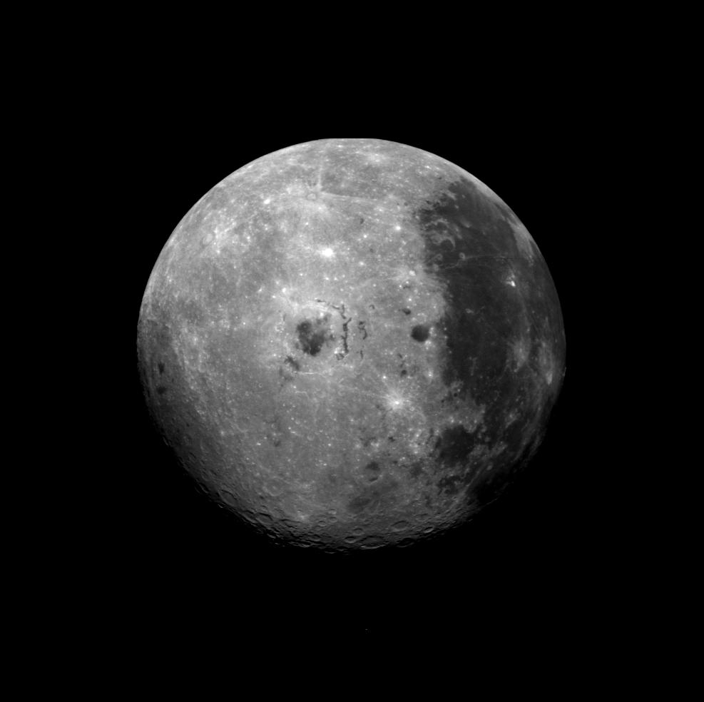
1996-01-29 |
Moon
|
Galileo
|
Solid-State Imaging
|
876x879x1 |
|
-
PIA00126:
-
Moon - North Pole
Full Resolution:
TIFF
(303.1 kB)
JPEG
(96.51 kB)
|
|
|
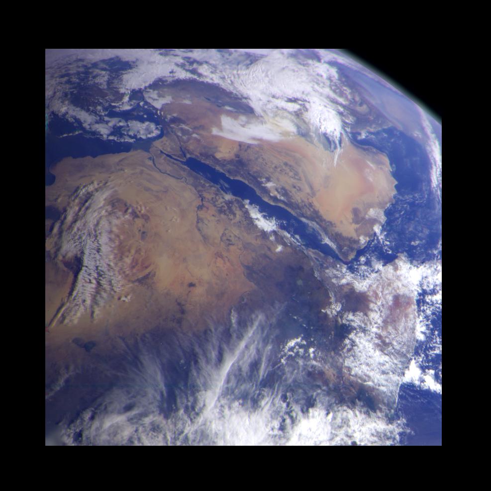
1996-01-29 |
Earth
|
Galileo
|
Solid-State Imaging
|
987x987x3 |
|
-
PIA00127:
-
Earth - Northeast Africa and the Arabian Peninsula
Full Resolution:
TIFF
(1.878 MB)
JPEG
(94.22 kB)
|
|
|
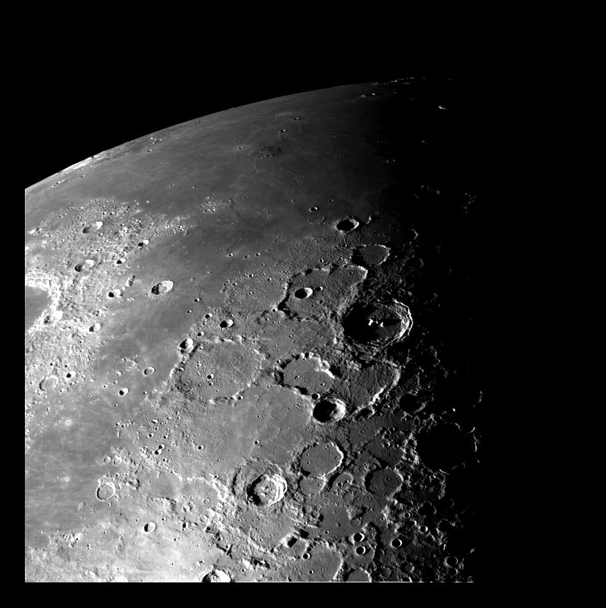
1996-02-05 |
Moon
|
Galileo
|
Solid-State Imaging
|
3211x2672x1 |
|
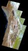
-
PIA00128:
-
Moon - 18 Image Mosaic
Full Resolution:
TIFF
(4.805 MB)
JPEG
(1.171 MB)
|
|
|
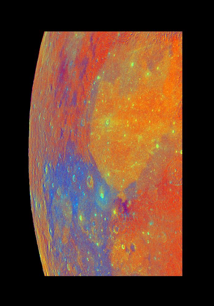
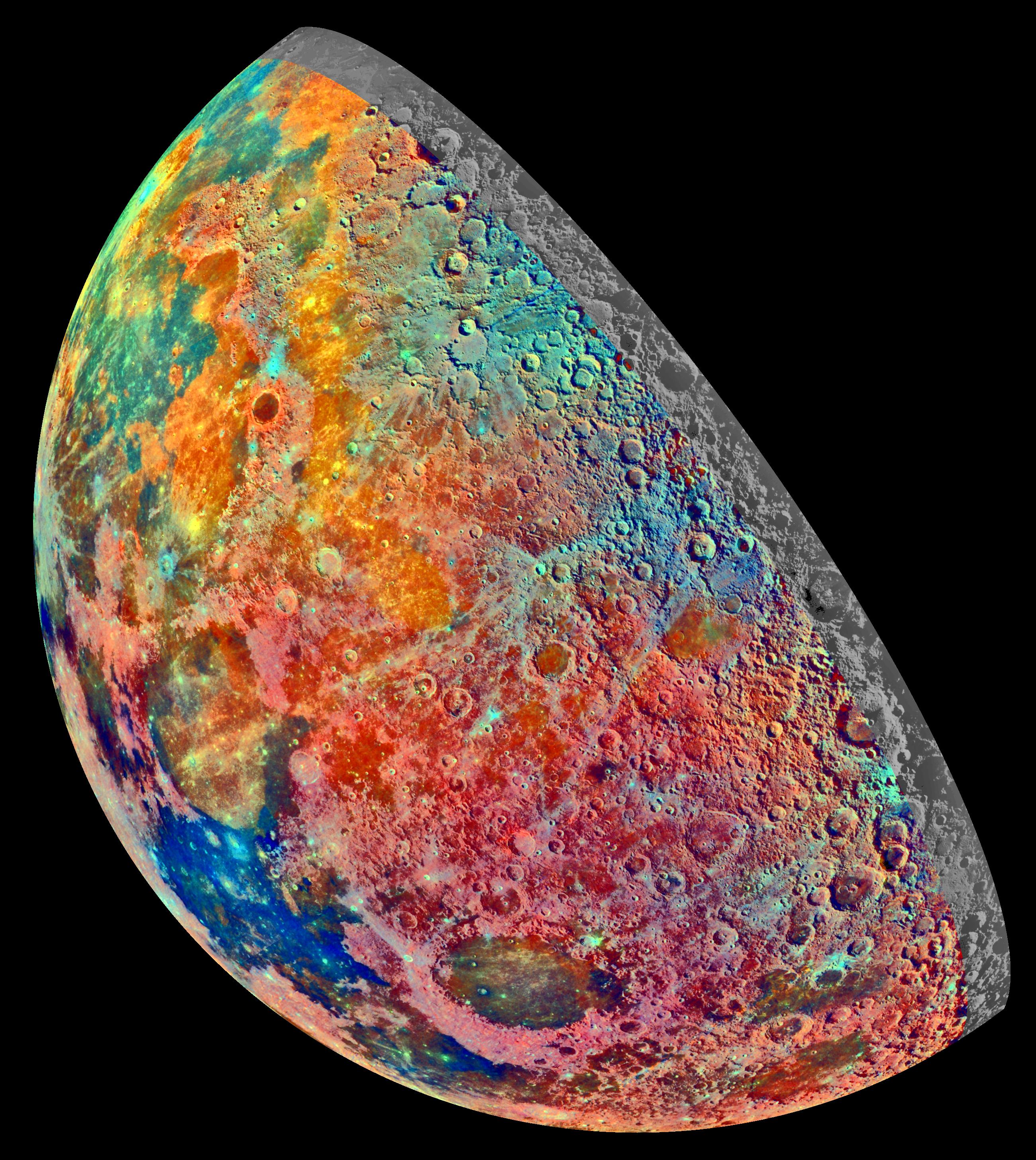
1996-01-29 |
Moon
|
Galileo
|
Solid-State Imaging
|
696x993x3 |
|
-
PIA00129:
-
Moon - False Color Mosaic
Full Resolution:
TIFF
(1.498 MB)
JPEG
(100.6 kB)
|
|
|
1996-02-05 |
Moon
|
Galileo
|
Solid-State Imaging
|
3296x3809x1 |

|
-
PIA00130:
-
Moon - North Pole Mosaic
Full Resolution:
TIFF
(4.431 MB)
JPEG
(795.9 kB)
|
|
|
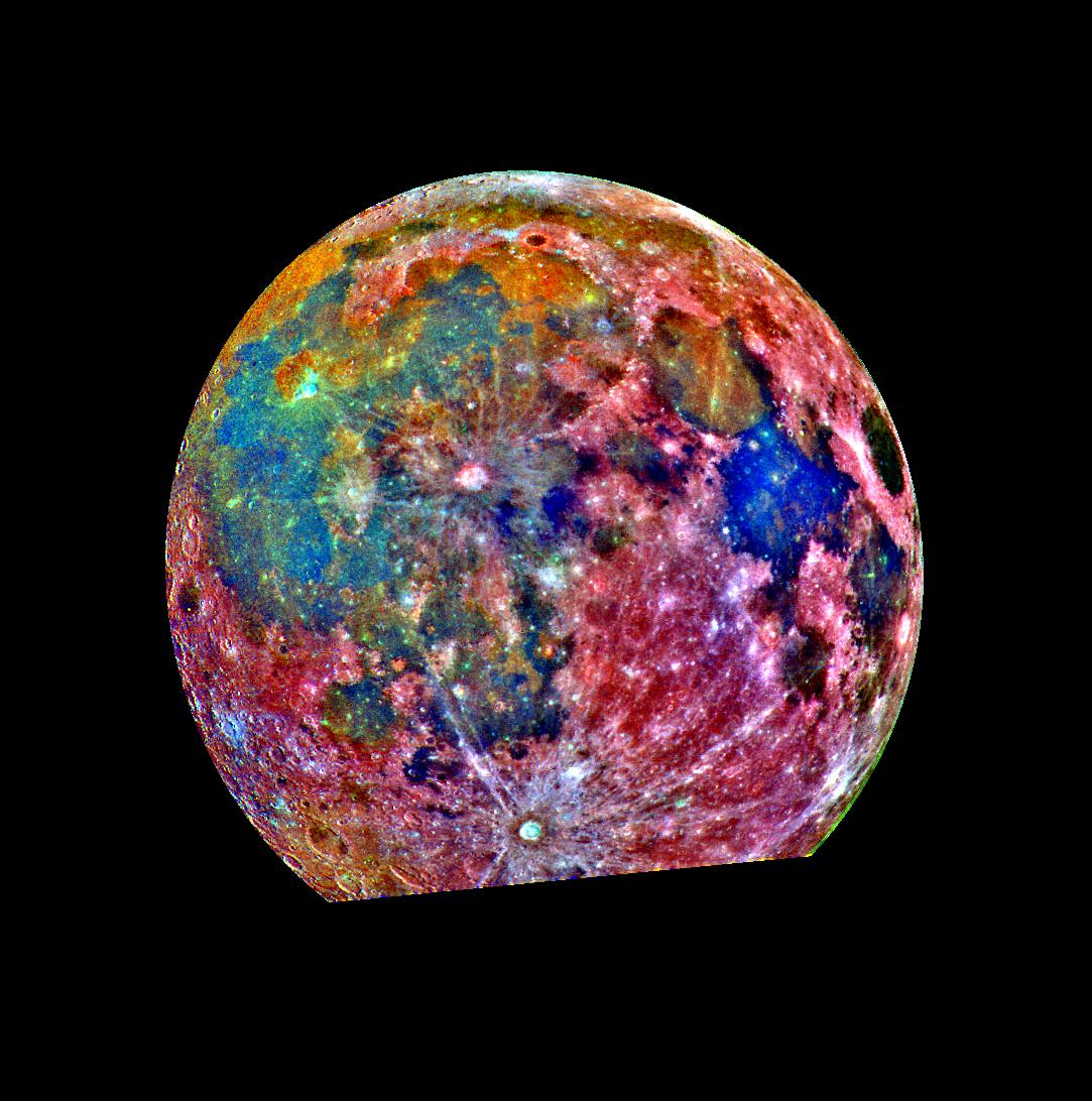
1996-02-05 |
Moon
|
Galileo
|
Solid-State Imaging
|
2600x2910x3 |
|
-
PIA00131:
-
Moon - False Color Mosaic
Full Resolution:
TIFF
(16.68 MB)
JPEG
(1.131 MB)
|
|
|
1996-01-29 |
Moon
|
Galileo
|
Solid-State Imaging
|
1083x1092x3 |
|
-
PIA00132:
-
Moon - False Color Mosaic
Full Resolution:
TIFF
(1.575 MB)
JPEG
(168.1 kB)
|
|
|
1996-08-05 |
Earth
|
Galileo
|
Solid-State Imaging
|
3670x6735x3 |
|
-
PIA00133:
-
Earth - False Color Mosaic of the Andes
Full Resolution:
TIFF
(49.61 MB)
JPEG
(2.406 MB)
|
|
|
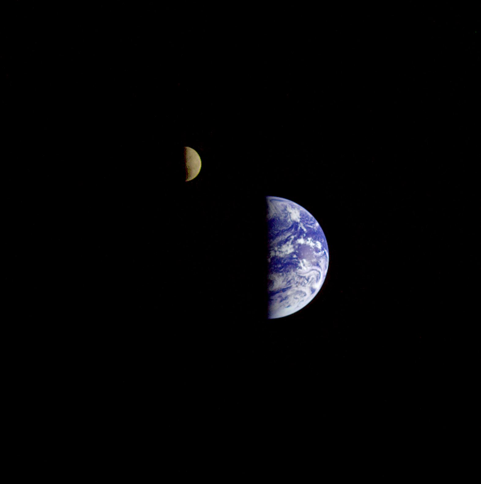
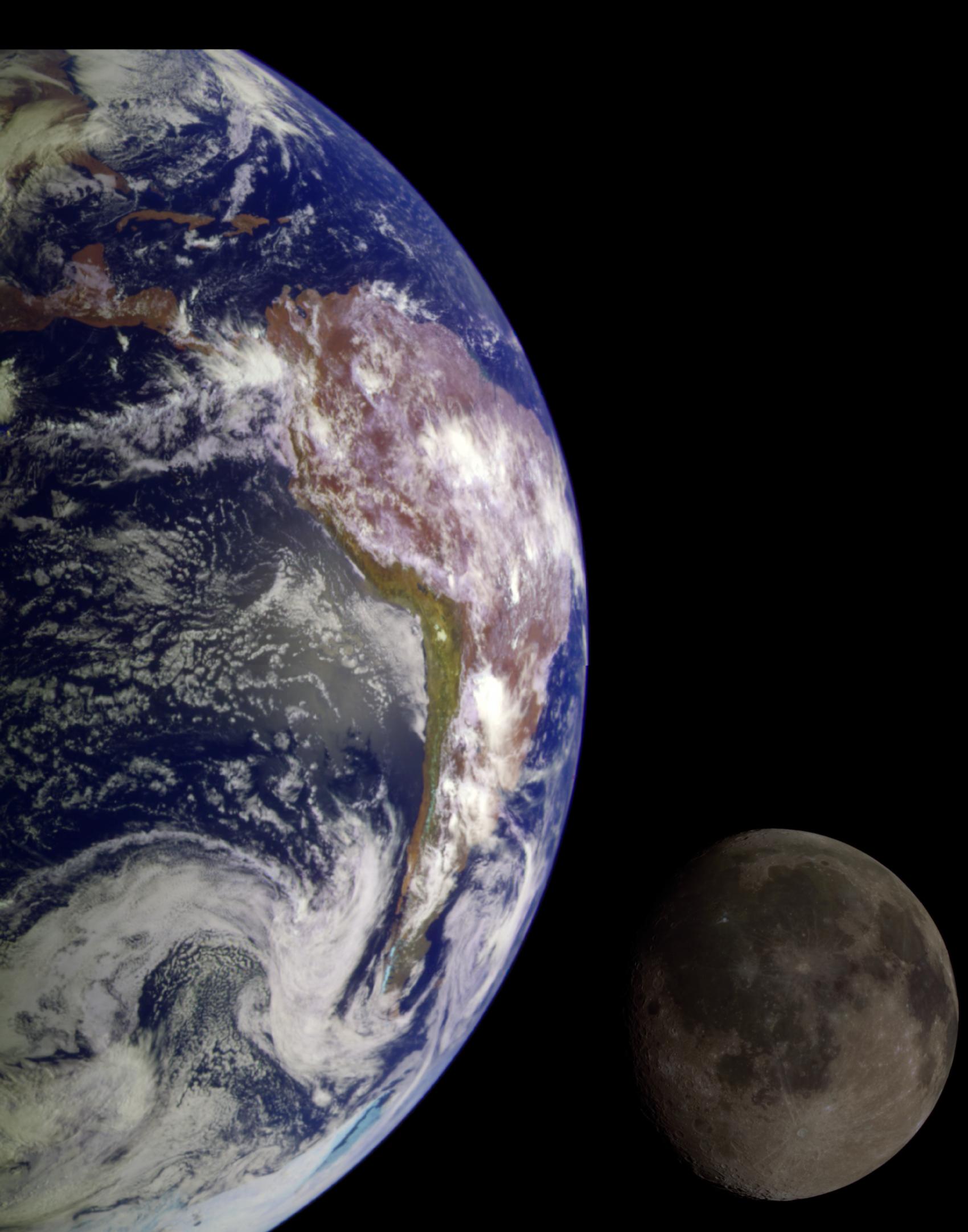
1996-01-29 |
Earth
|
Galileo
|
Solid-State Imaging
|
1572x1580x3 |
|
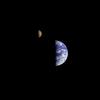
-
PIA00134:
-
Earth - Moon Conjunction
Full Resolution:
TIFF
(640.6 kB)
JPEG
(53.53 kB)
|
|
|
1996-02-08 |
Moon
|
Galileo
|
Solid-State Imaging
|
800x1220x1 |
|
-
PIA00224:
-
Moon - Western Near Side
Full Resolution:
TIFF
(118.2 kB)
JPEG
(31.73 kB)
|
|
|
1996-02-08 |
Moon
|
Galileo
|
Solid-State Imaging
|
987x984x1 |

|
-
PIA00225:
-
Far Side of the Moon
Full Resolution:
TIFF
(255.4 kB)
JPEG
(47.45 kB)
|
|
|
1996-02-08 |
Earth
|
Galileo
|
Solid-State Imaging
|
650x650x1 |
|
-
PIA00226:
-
Global View of Earth in the Near-Infrared
Full Resolution:
TIFF
(223.3 kB)
JPEG
(44.25 kB)
|
|
|
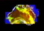
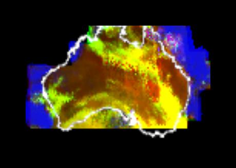
1996-02-08 |
Earth
|
Galileo
|
Near Infrared Mapping Spectrometer
|
460x328x3 |
|
-
PIA00227:
-
Australia Viewed by NIMS
Full Resolution:
TIFF
(196.9 kB)
JPEG
(15.16 kB)
|
|
|
1996-02-08 |
Earth
|
Galileo
|
Solid-State Imaging
|
888x894x1 |
|
-
PIA00230:
-
Galileo Optical Experiment (GOPEX)
Full Resolution:
TIFF
(152.7 kB)
JPEG
(41.31 kB)
|
|
|
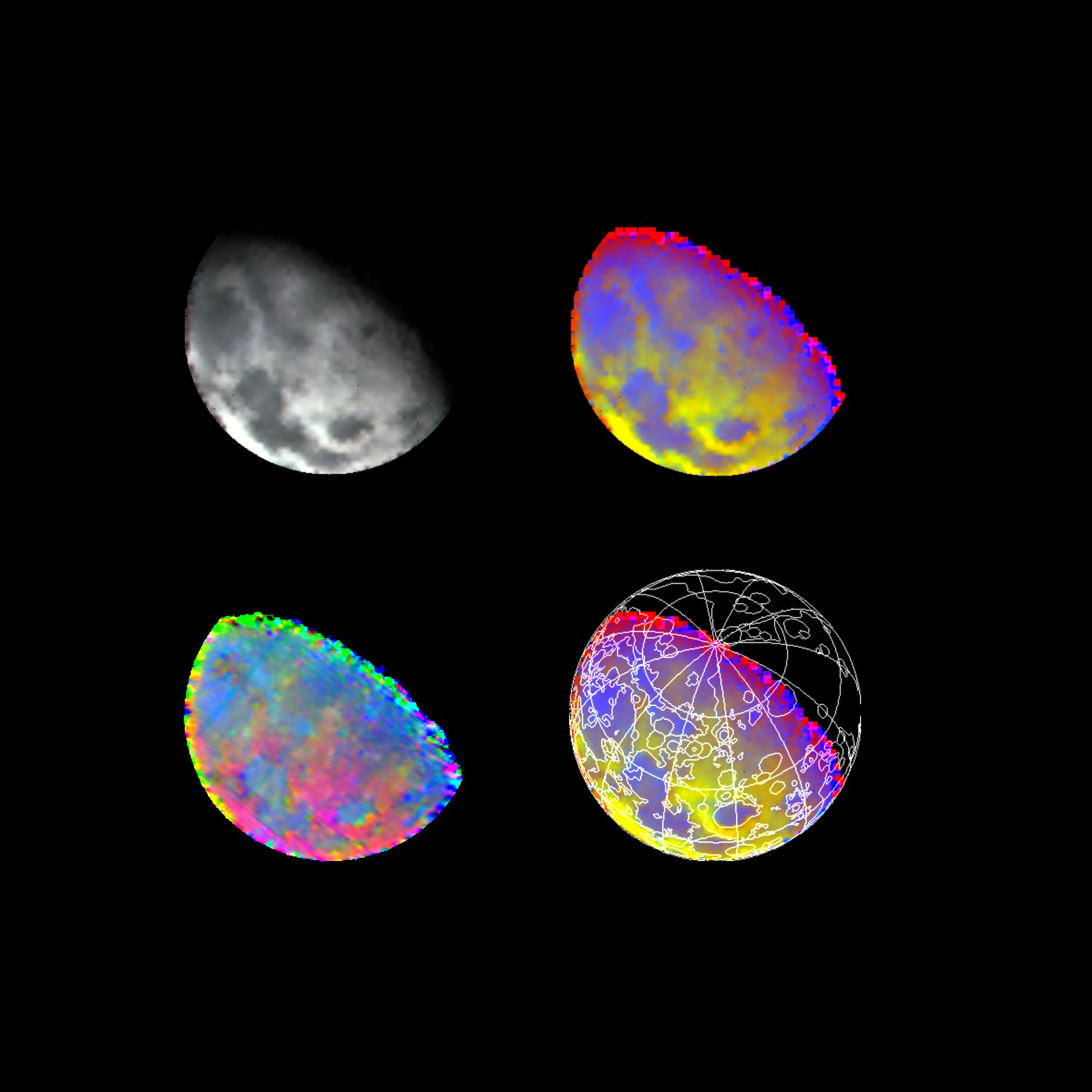
1996-02-08 |
Moon
|
Galileo
|
Near Infrared Mapping Spectrometer
|
2364x2364x3 |

|
-
PIA00231:
-
Moon As Seen By NIMS
Full Resolution:
TIFF
(3.323 MB)
JPEG
(222.8 kB)
|
|
|
1996-02-08 |
Earth
|
Galileo
|
Solid-State Imaging
|
1083x1314x3 |
|
-
PIA00232:
-
Earth - Departing Image by Galileo
Full Resolution:
TIFF
(823.3 kB)
JPEG
(64.79 kB)
|
|
|
1998-06-04 |
Earth
|
Galileo
|
Solid-State Imaging
|
1700x2164x3 |
|
-
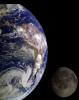
PIA00342:
-
The Earth & Moon
Full Resolution:
TIFF
(7.005 MB)
JPEG
(262.2 kB)
|
|
|
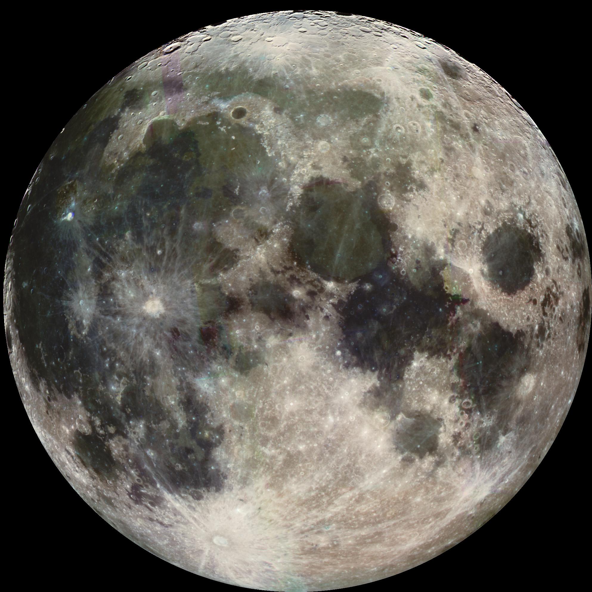
1998-06-08 |
Moon
|
Galileo
|
|
3053x3053x3 |
|
-
PIA00404:
-
Moon - North Polar Mosaic, Color
Full Resolution:
TIFF
(13.03 MB)
JPEG
(713.7 kB)
|
|
|
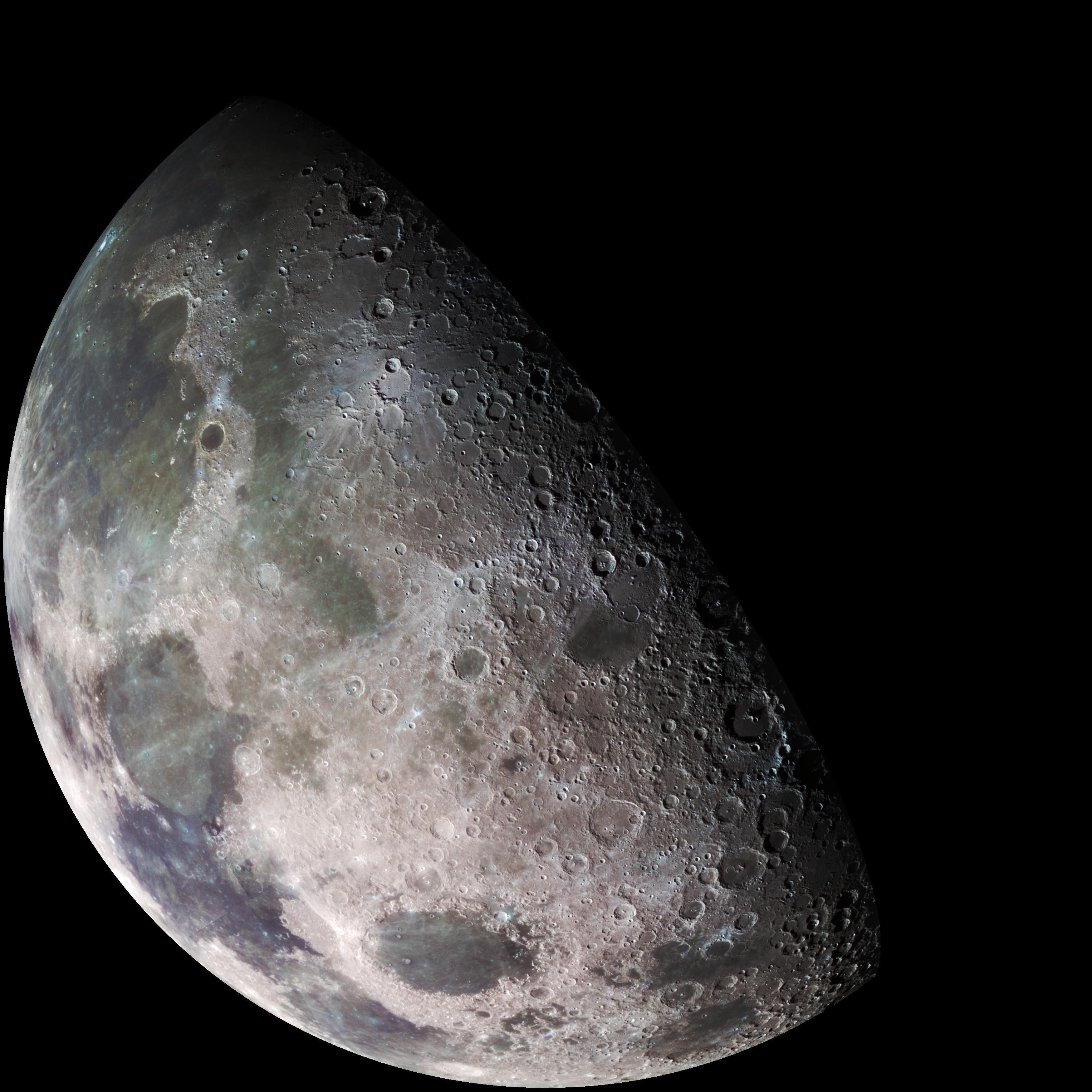
1998-06-08 |
Moon
|
Galileo
|
|
1986x1986x3 |

|
-
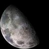
PIA00405:
-
Earth's Moon
Full Resolution:
TIFF
(8.683 MB)
JPEG
(403.3 kB)
|
|
|
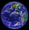
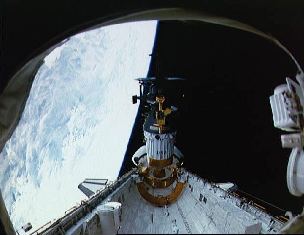
1997-09-10 |
Earth
|
Galileo
|
|
420x480x3 |
|
-
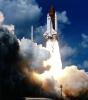
PIA00726:
-
Launch of Galileo on STS-34 Atlantis
Full Resolution:
TIFF
(518.9 kB)
JPEG
(24.27 kB)
|
|
|
1997-09-10 |
Earth
|
Galileo
|
|
620x480x3 |

|
-
PIA00727:
-
Deployment of Galileo and the IUS
Full Resolution:
TIFF
(628.2 kB)
JPEG
(37.42 kB)
|
|
|
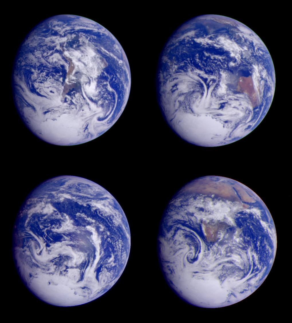
1997-09-10 |
Earth
|
Galileo
|
Solid-State Imaging
|
1020x1128x3 |
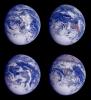
|
-
PIA00728:
-
Global Images of Earth
Full Resolution:
TIFF
(2.169 MB)
JPEG
(117.6 kB)
|
|
|
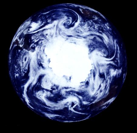
1997-09-10 |
Earth
|
Galileo
|
Solid-State Imaging
|
452x439x3 |
|
-
PIA00729:
-
South Polar Projection of Earth
Full Resolution:
TIFF
(169.4 kB)
JPEG
(29.01 kB)
|
|
|
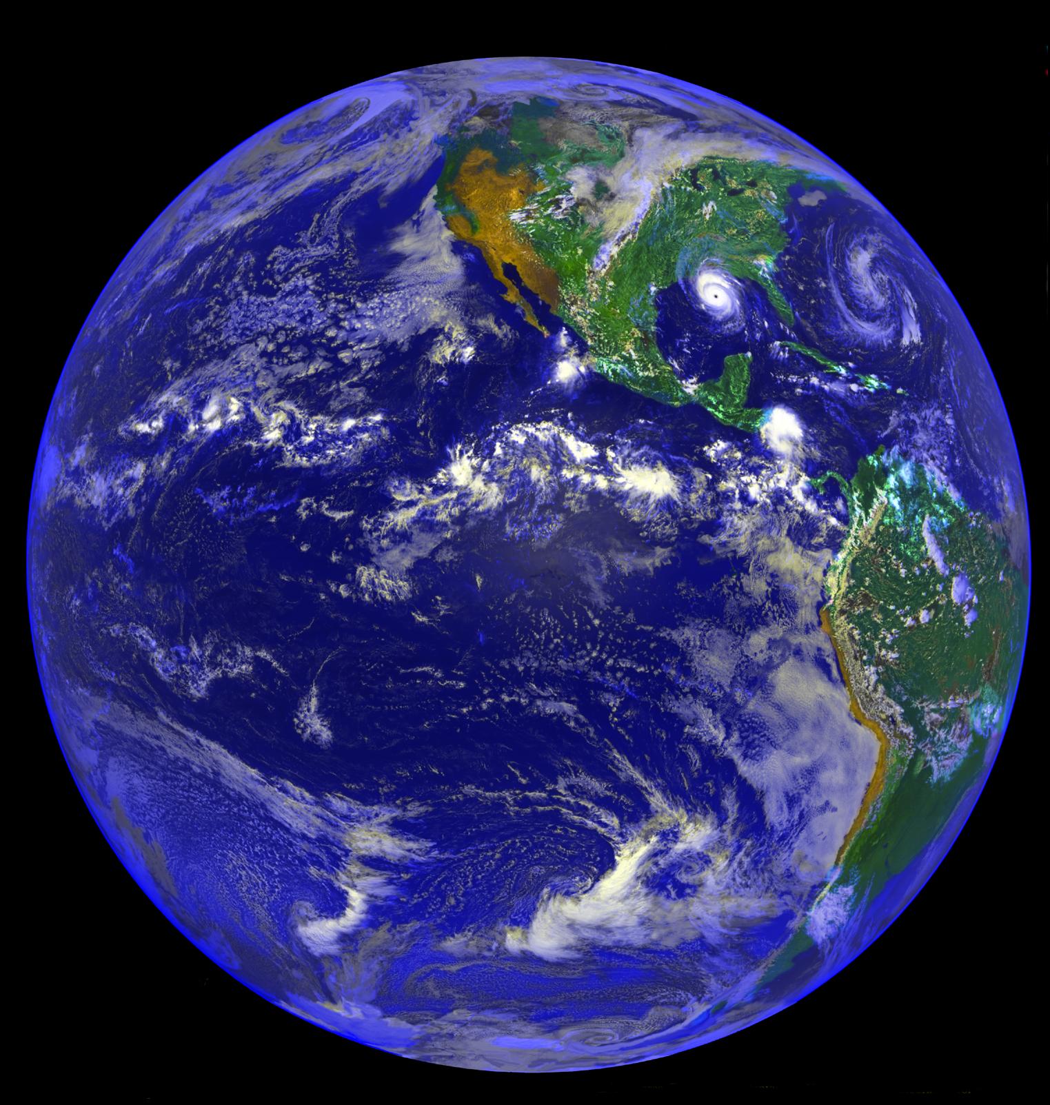
1998-07-23 |
Earth
|
Geostationary Operational Environmental Satellite 7 (GOES-7)
|
|
1523x1603x3 |
|
-
PIA01462:
-
The Americas and Hurricane Andrew
Full Resolution:
TIFF
(4.864 MB)
JPEG
(345.4 kB)
|
|
|
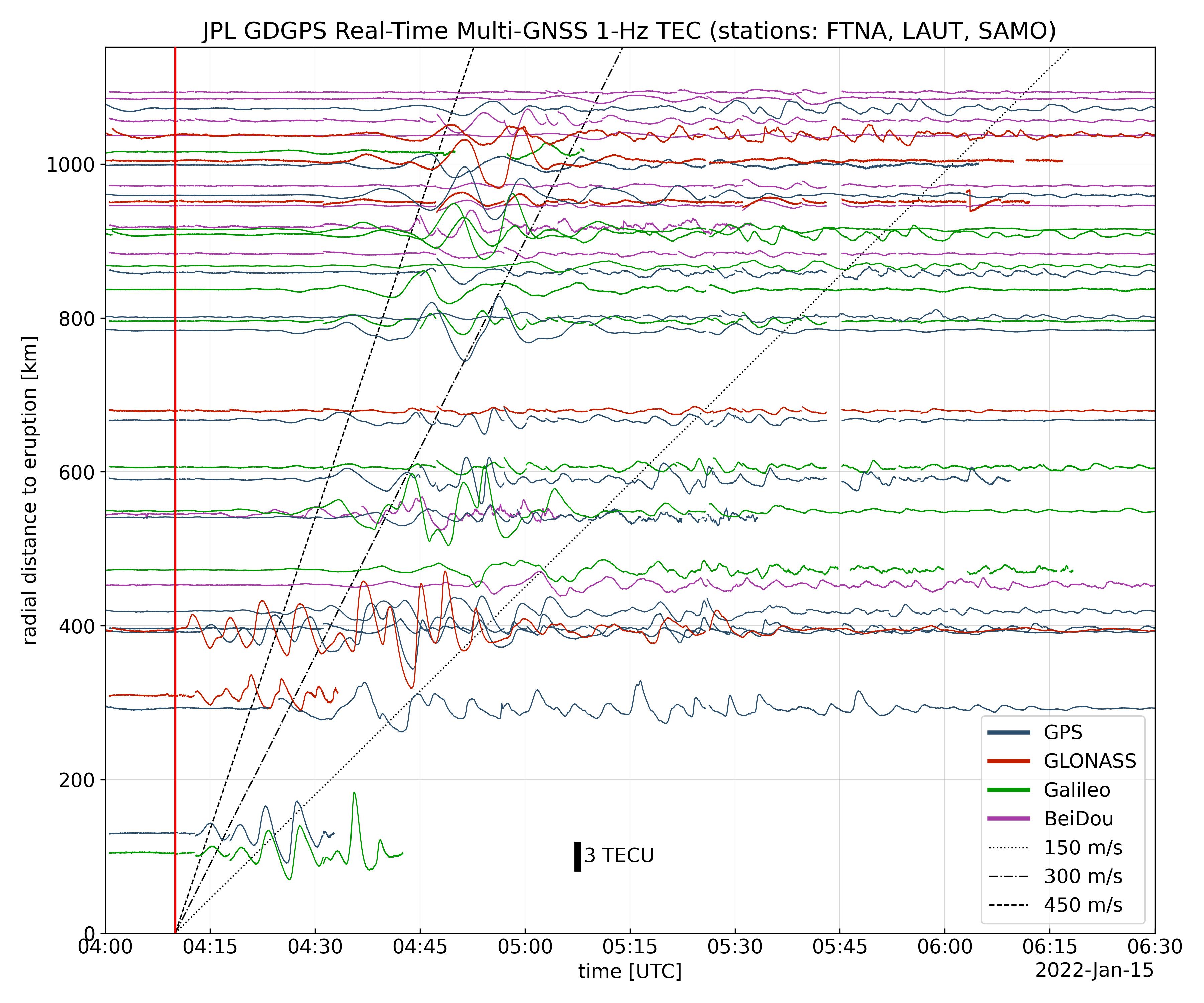
2022-01-27 |
Earth
|
Global Differential Global Positioning System (GDGPS)
|
|
3600x3000x3 |
|
-
PIA24905:
-
Tonga Eruption Atmospheric Wave
Full Resolution:
TIFF
(3.165 MB)
JPEG
(1.025 MB)
|
|
|
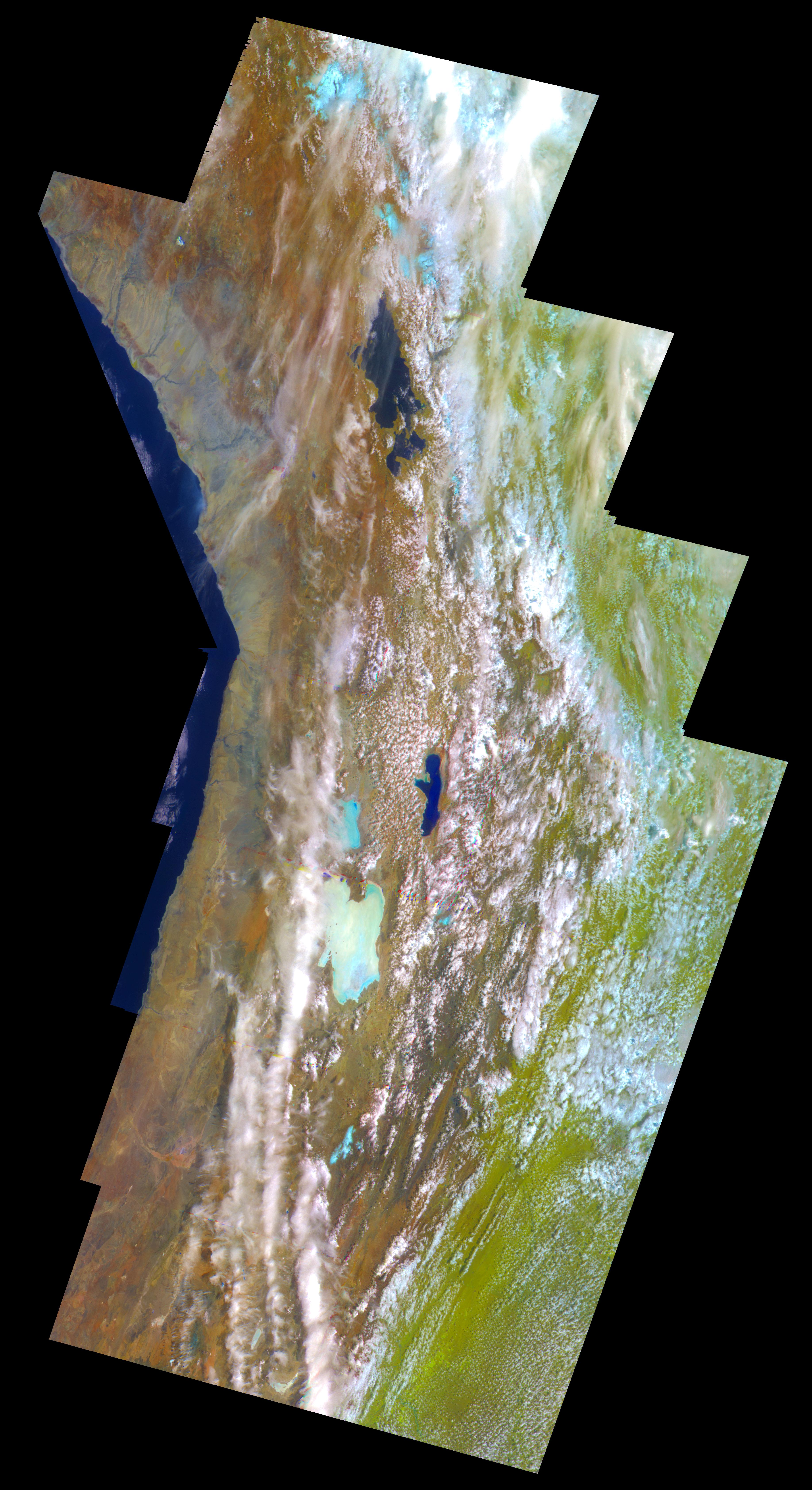
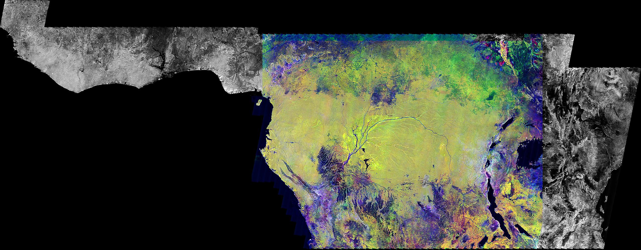
1999-09-23 |
Earth
|
Global Rain Forest Mapping Project (GRFM)
|
JERS-1 SAR
|
2552x997x3 |
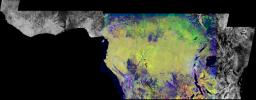
|
-
PIA01348:
-
Radar Mosaic of Africa
Full Resolution:
TIFF
(4.785 MB)
JPEG
(616.3 kB)
|
|
|
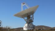
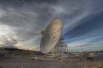
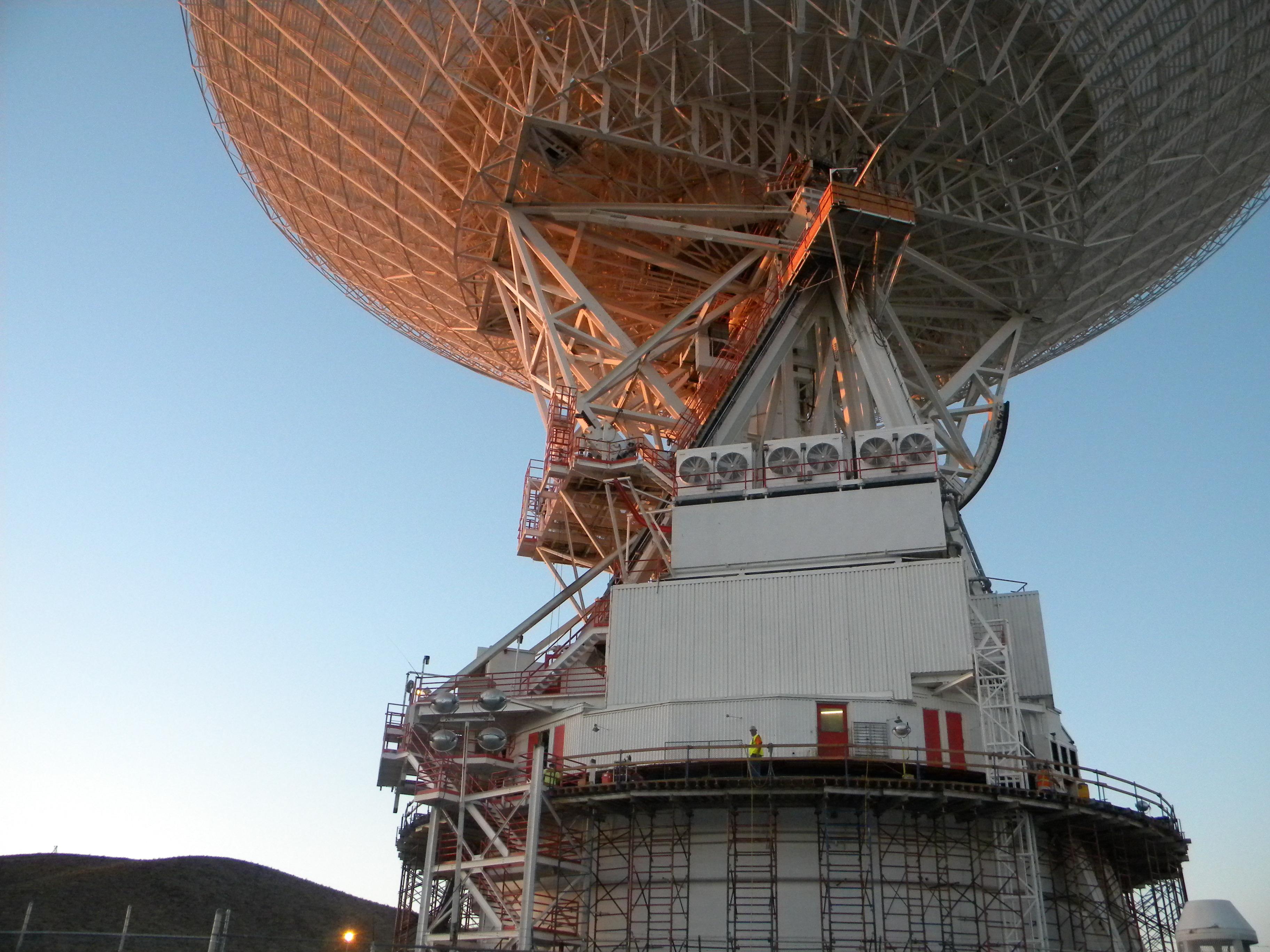
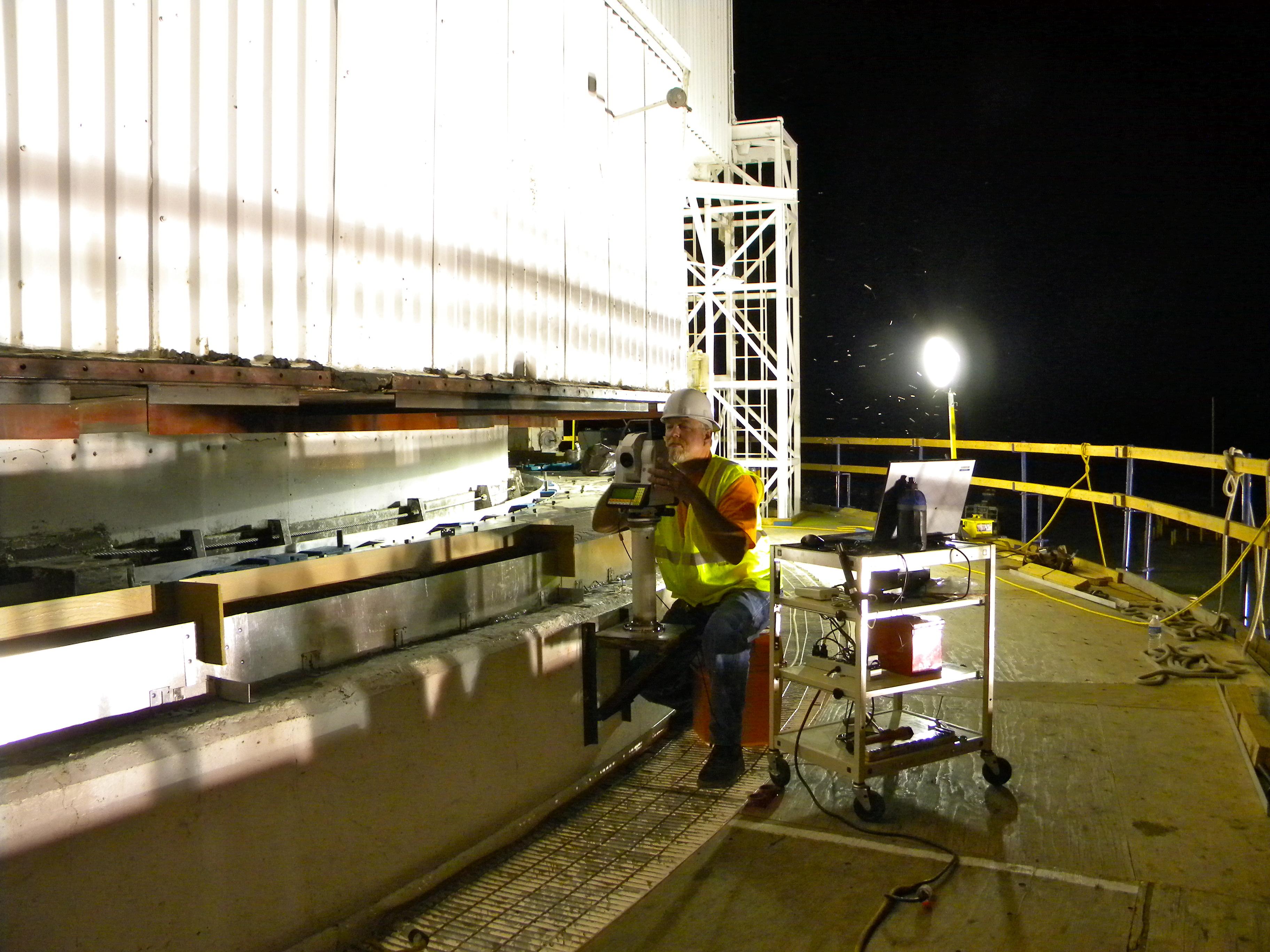
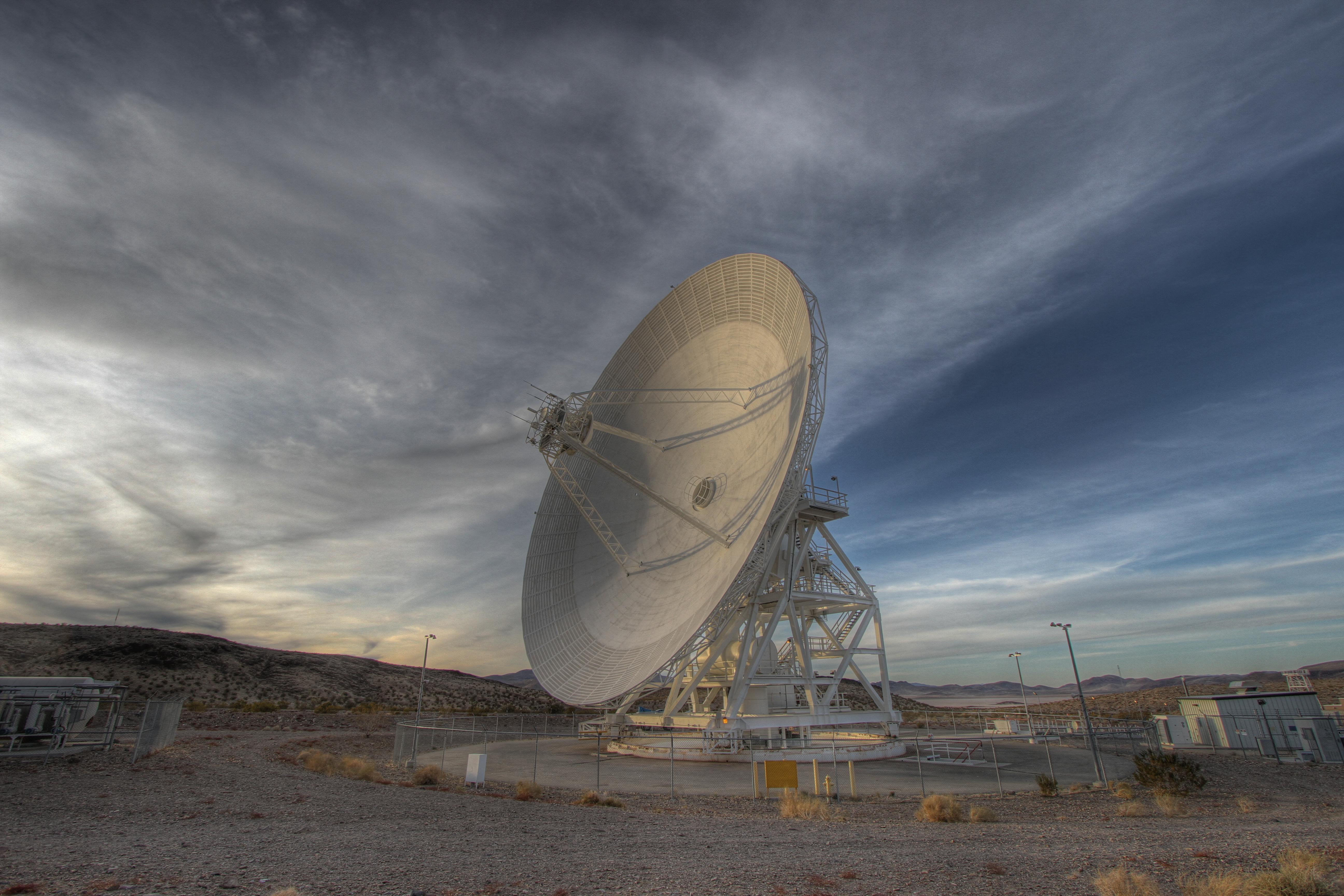
2008-07-06 |
Earth
|
Goldstone Deep Space Network (DSN)
|
Deep Space Network Antenna
|
1148x1119x3 |
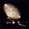
|
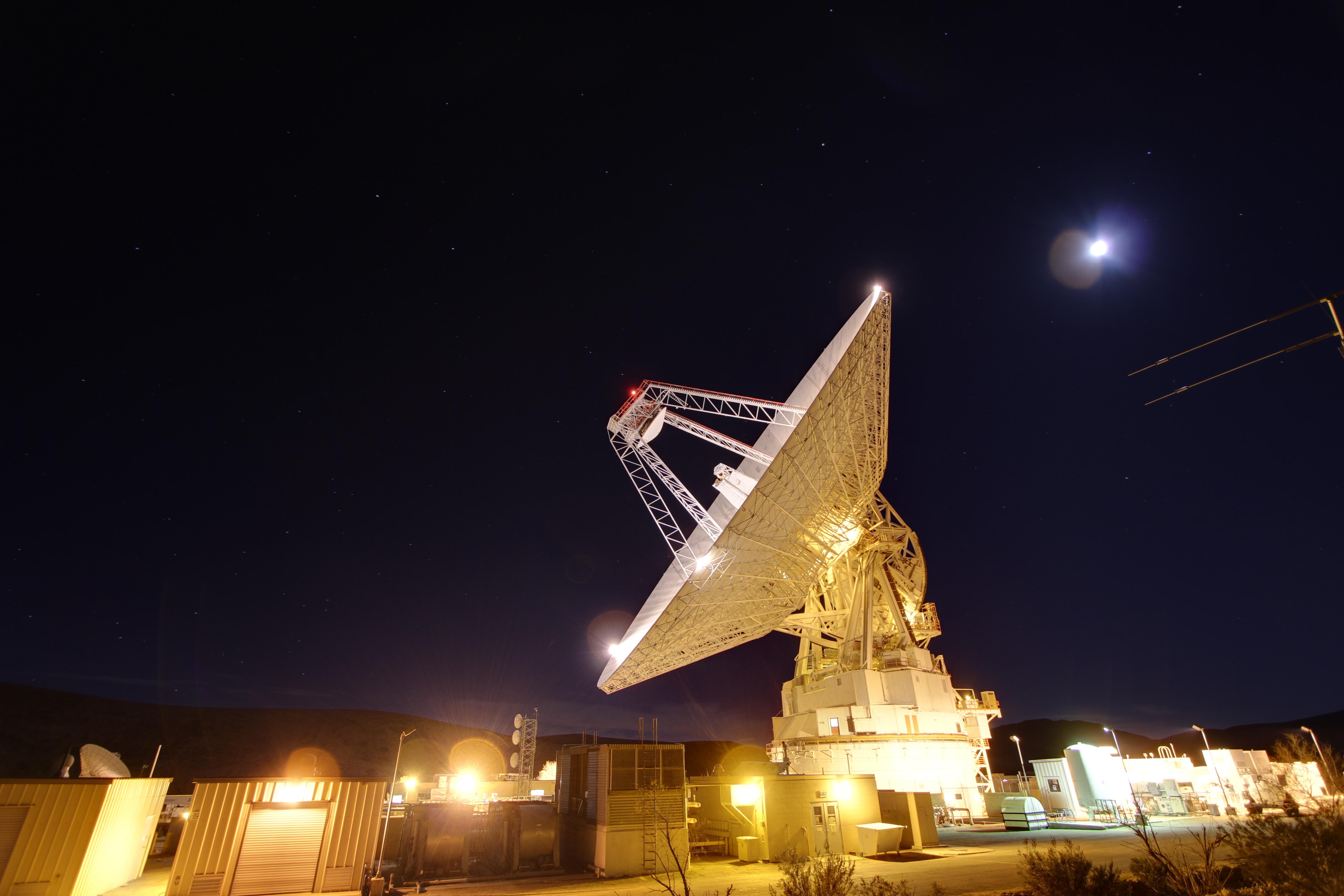
-
PIA10953:
-
70m Antenna at Goldstone, California
Full Resolution:
TIFF
(3.859 MB)
JPEG
(120 kB)
|
|
|
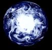
2009-06-18 |
Moon
|
Goldstone Deep Space Network (DSN)
|
Goldstone Solar System Radar
|
4000x3796x3 |
|
-
PIA12077:
-
Moon's Rugged South Polar Region Composite
Full Resolution:
TIFF
(45.55 MB)
JPEG
(1.896 MB)
|
|
|
2010-07-15 |
Earth
|
Goldstone Deep Space Network (DSN)
|
Deep Space Network Antenna
|
3648x2736x3 |

|
-
PIA13270:
-
Mars Antenna Ready for Surgery
Full Resolution:
TIFF
(29.94 MB)
JPEG
(965.1 kB)
|
|
|
2010-07-15 |
Earth
|
Goldstone Deep Space Network (DSN)
|
Deep Space Network Antenna
|
3648x2736x3 |
|
-
PIA13271:
-
Checking for Even Surfaces
Full Resolution:
TIFF
(29.94 MB)
JPEG
(946.6 kB)
|
|
|
2010-07-15 |
Earth
|
Goldstone Deep Space Network (DSN)
|
Deep Space Network Antenna
|
3648x2736x3 |

|
-
PIA13272:
-
Pouring the New Grout
Full Resolution:
TIFF
(29.94 MB)
JPEG
(886.6 kB)
|
|
|
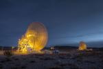
2010-08-25 |
Earth
|
Goldstone Deep Space Network (DSN)
|
Deep Space Network Antenna
|
1920x1080x3 |
|
-
PIA13277:
-
Tracks of a Giant
Full Resolution:
TIFF
(6.23 MB)
JPEG
(171.5 kB)
|
|
|
2010-08-25 |
Earth
|
Goldstone Deep Space Network (DSN)
|
Deep Space Network Antenna
|
4000x3000x3 |
|
-
PIA13320:
-
New Joints for a Workhorse Antenna
Full Resolution:
TIFF
(36 MB)
JPEG
(1.129 MB)
|
|
|
2010-08-25 |
Earth
|
Goldstone Deep Space Network (DSN)
|
Deep Space Network Antenna
|
4000x3000x3 |
|
-
PIA13321:
-
Lifting the Runners
Full Resolution:
TIFF
(36 MB)
JPEG
(1.32 MB)
|
|
|
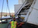
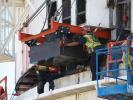
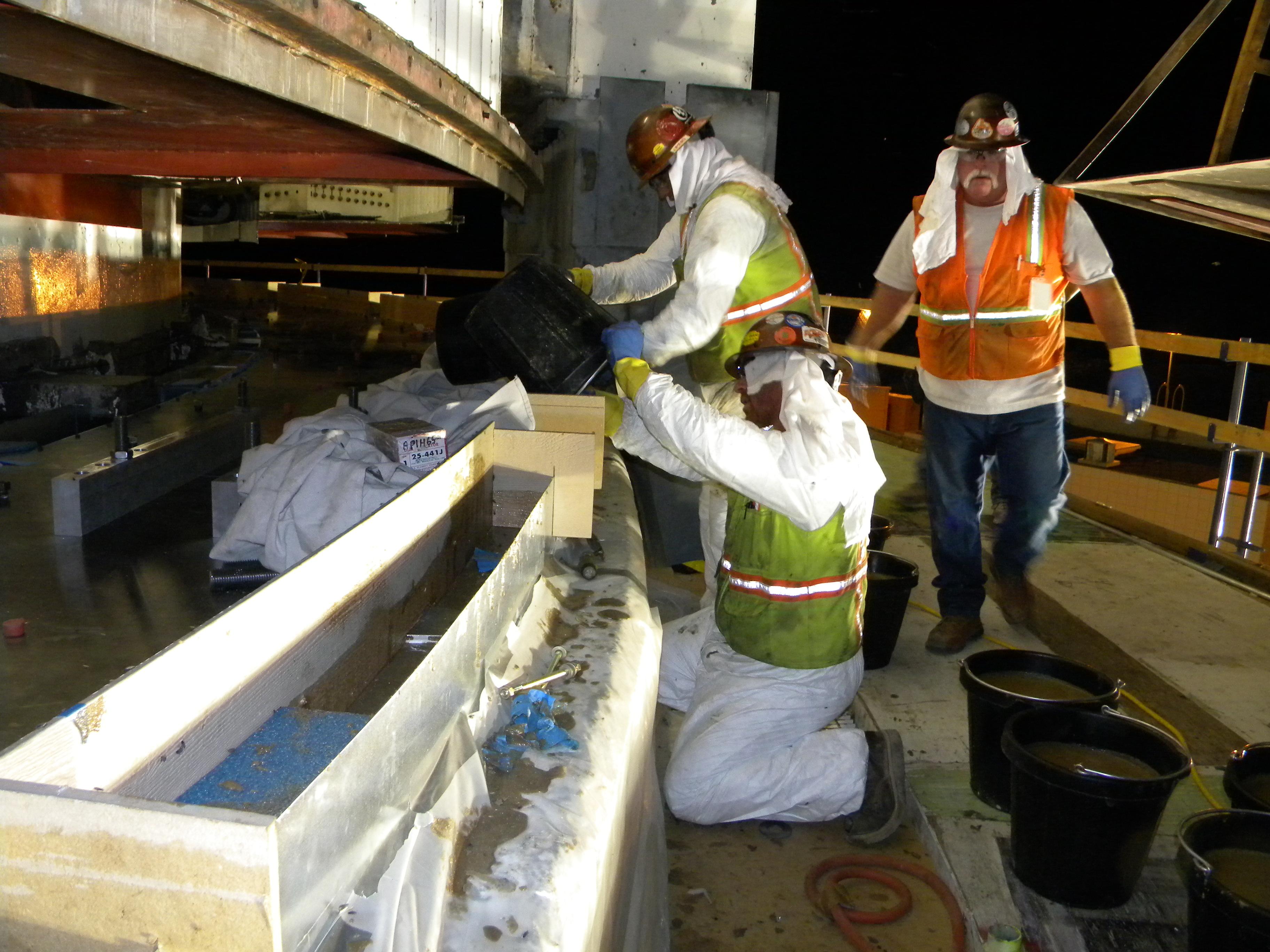
2010-11-03 |
Earth
|
Goldstone Deep Space Network (DSN)
|
Deep Space Station 14
|
2560x1920x3 |
|
-
PIA13561:
-
Replacing the Elevation Bearings
Full Resolution:
TIFF
(14.76 MB)
JPEG
(550.5 kB)
|
|
|
2010-11-03 |
Earth
|
Goldstone Deep Space Network (DSN)
|
Deep Space Station 14
|
2560x1920x3 |
|
-
PIA13562:
-
Old Elevation Bearings
Full Resolution:
TIFF
(14.76 MB)
JPEG
(434.6 kB)
|
|
|
2010-11-03 |
Earth
|
Goldstone Deep Space Network (DSN)
|
Deep Space Station 14
|
2560x1920x3 |
|
-
PIA13563:
-
A Heavy-Duty Jack for a Giant Task
Full Resolution:
TIFF
(14.76 MB)
JPEG
(553 kB)
|
|
|
2010-11-03 |
Earth
|
Goldstone Deep Space Network (DSN)
|
Deep Space Station 14
|
2560x1920x3 |
|
-
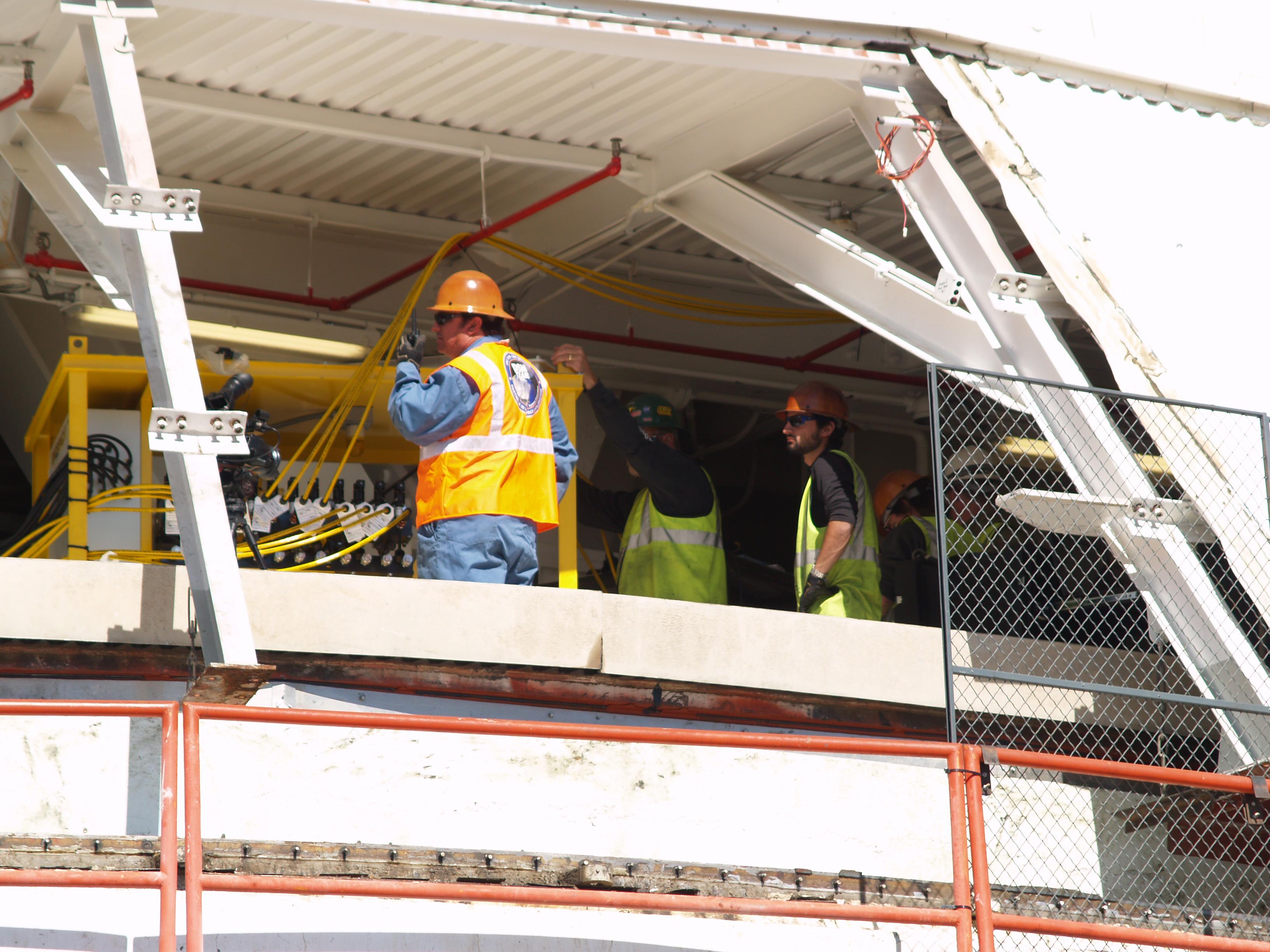
PIA13564:
-
Out with the Old Grout
Full Resolution:
TIFF
(14.76 MB)
JPEG
(609.2 kB)
|
|
|
2010-11-03 |
Earth
|
Goldstone Deep Space Network (DSN)
|
Deep Space Station 14
|
3264x2448x3 |
|
-
PIA13429:
-
Removing Pads from Antenna
Full Resolution:
TIFF
(23.97 MB)
JPEG
(653.3 kB)
|
|
|
2010-11-03 |
Earth
|
Goldstone Deep Space Network (DSN)
|
Deep Space Station 14
|
2448x3264x3 |

|
-
PIA13430:
-
Checking on the Jacks
Full Resolution:
TIFF
(24 MB)
JPEG
(621.7 kB)
|
|
|
2010-11-03 |
Earth
|
Goldstone Deep Space Network (DSN)
|
Deep Space Station 14
|
3264x2448x3 |
|
-
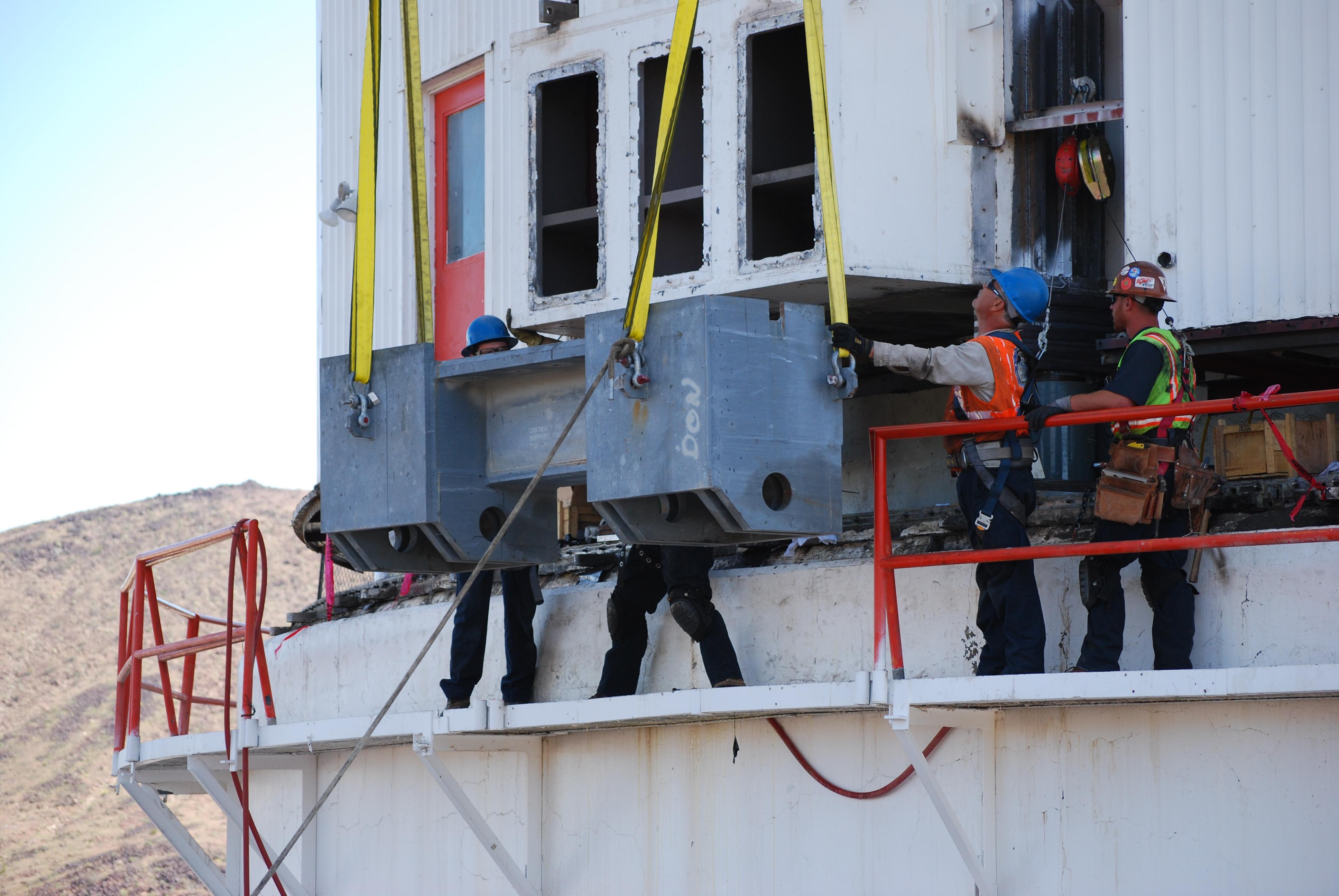
PIA13557:
-
Jacking up the Antenna
Full Resolution:
TIFF
(23.97 MB)
JPEG
(701.1 kB)
|
|
|
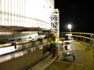
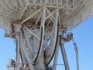
2010-11-03 |
Earth
|
Goldstone Deep Space Network (DSN)
|
Deep Space Station 14
|
3872x2592x3 |
|
-
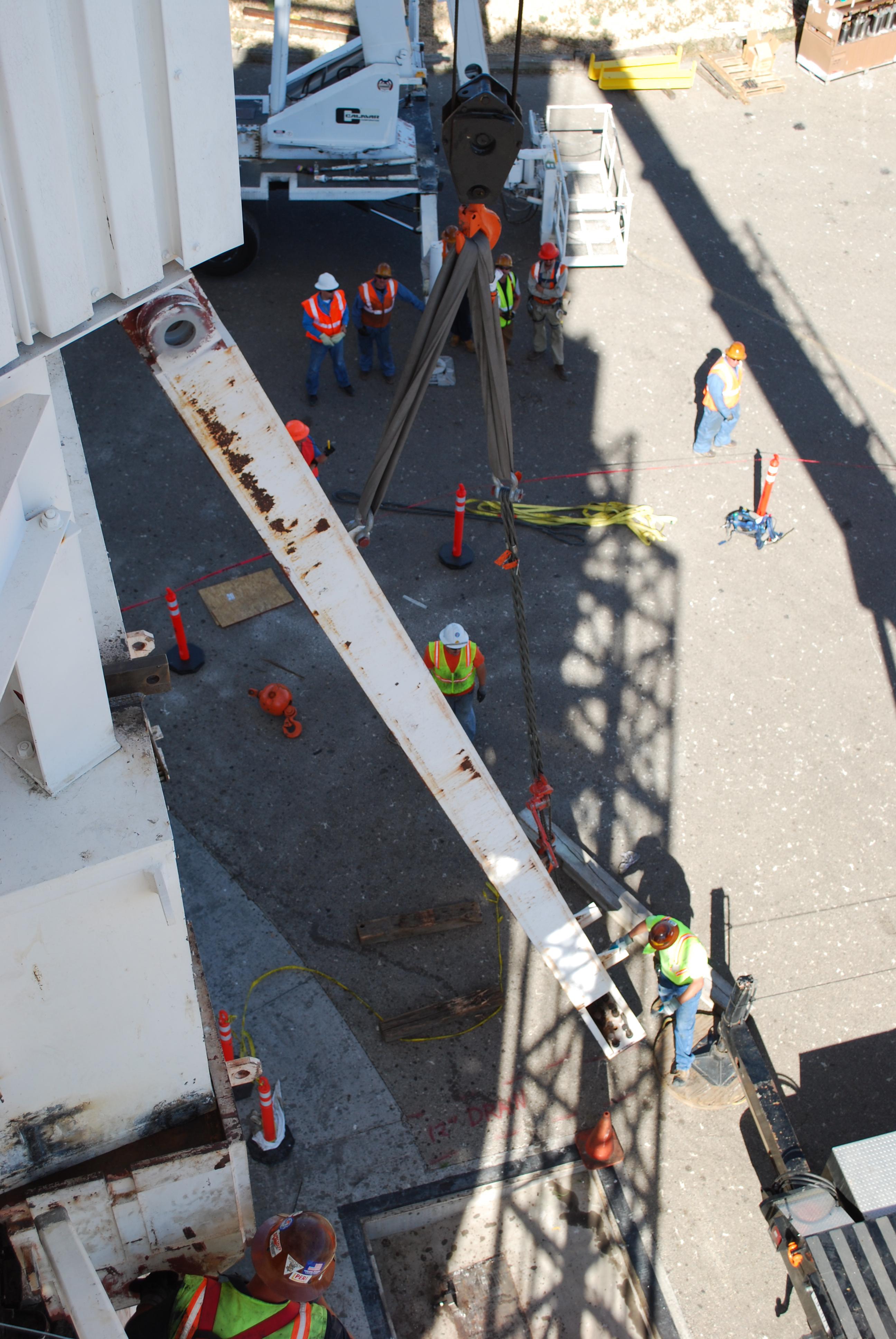
PIA13558:
-
Stringer Box Going In
Full Resolution:
TIFF
(30.11 MB)
JPEG
(713 kB)
|
|
|
2010-11-03 |
Earth
|
Goldstone Deep Space Network (DSN)
|
Deep Space Station 14
|
3872x2592x3 |
|
-
PIA13559:
-
Prepping a Support Leg
Full Resolution:
TIFF
(30.11 MB)
JPEG
(1.107 MB)
|
|
|
2010-11-03 |
Earth
|
Goldstone Deep Space Network (DSN)
|
Deep Space Station 14
|
2592x3872x3 |
|
-
PIA13560:
-
Mars Antenna Gets Legs
Full Resolution:
TIFF
(30.14 MB)
JPEG
(834.8 kB)
|
|
|
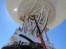
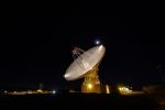
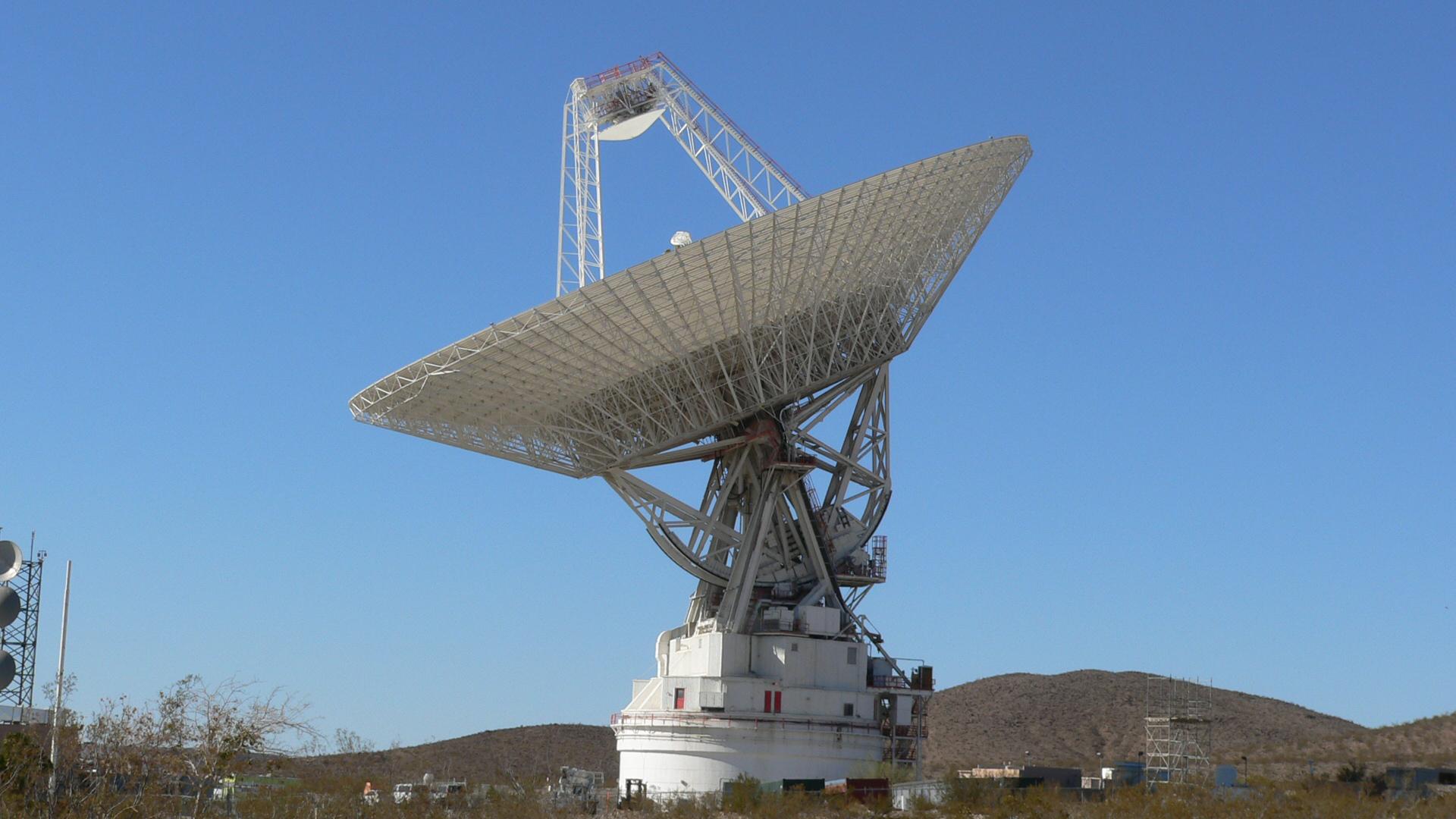
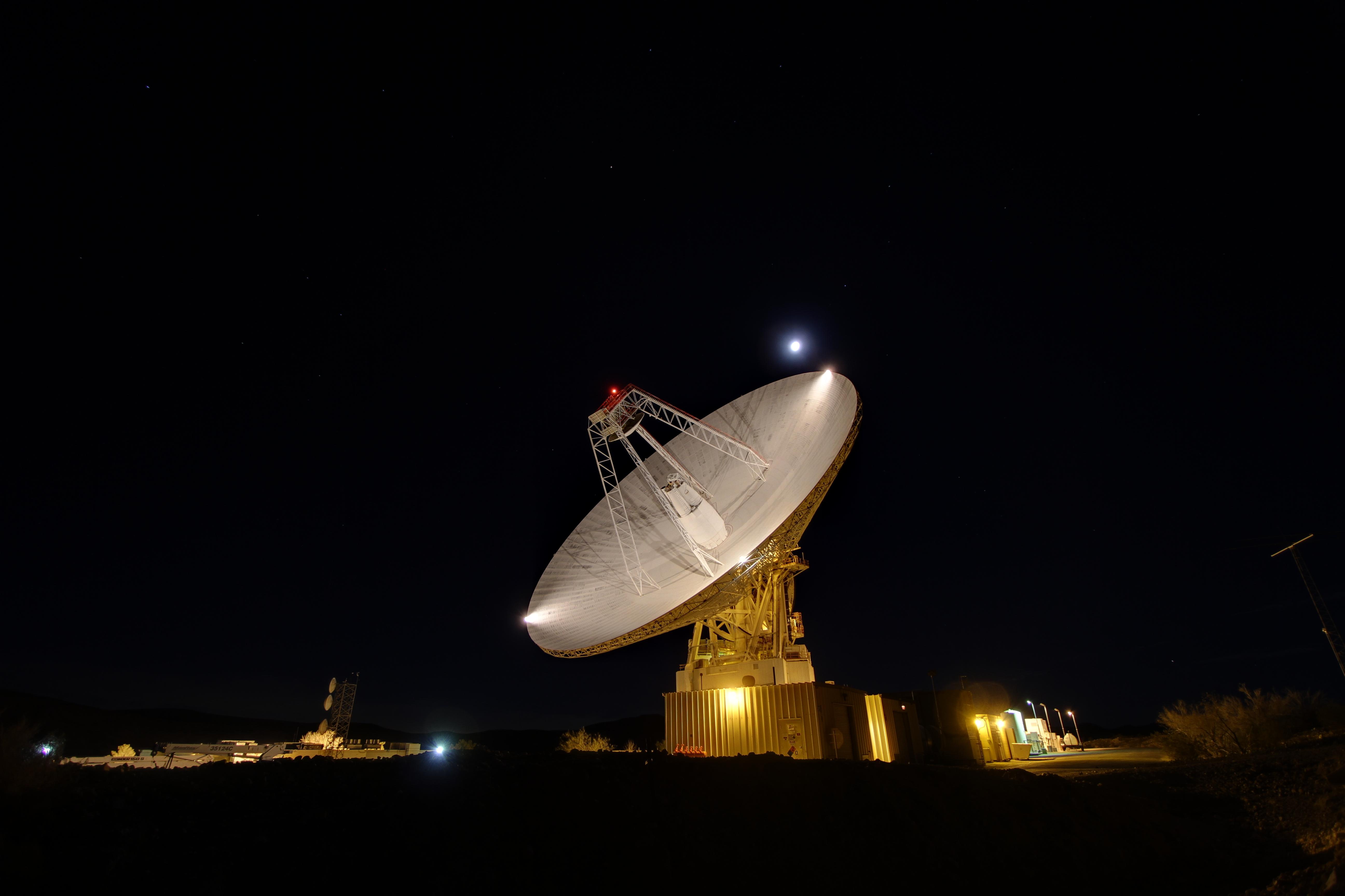
2013-12-18 |
Earth
|
Goldstone Deep Space Network (DSN)
|
Goldstone Solar System Radar
|
5184x3456x3 |

|
-
PIA17790:
-
Goldstone 70-Meter
Full Resolution:
TIFF
(53.78 MB)
JPEG
(888.4 kB)
|
|
|
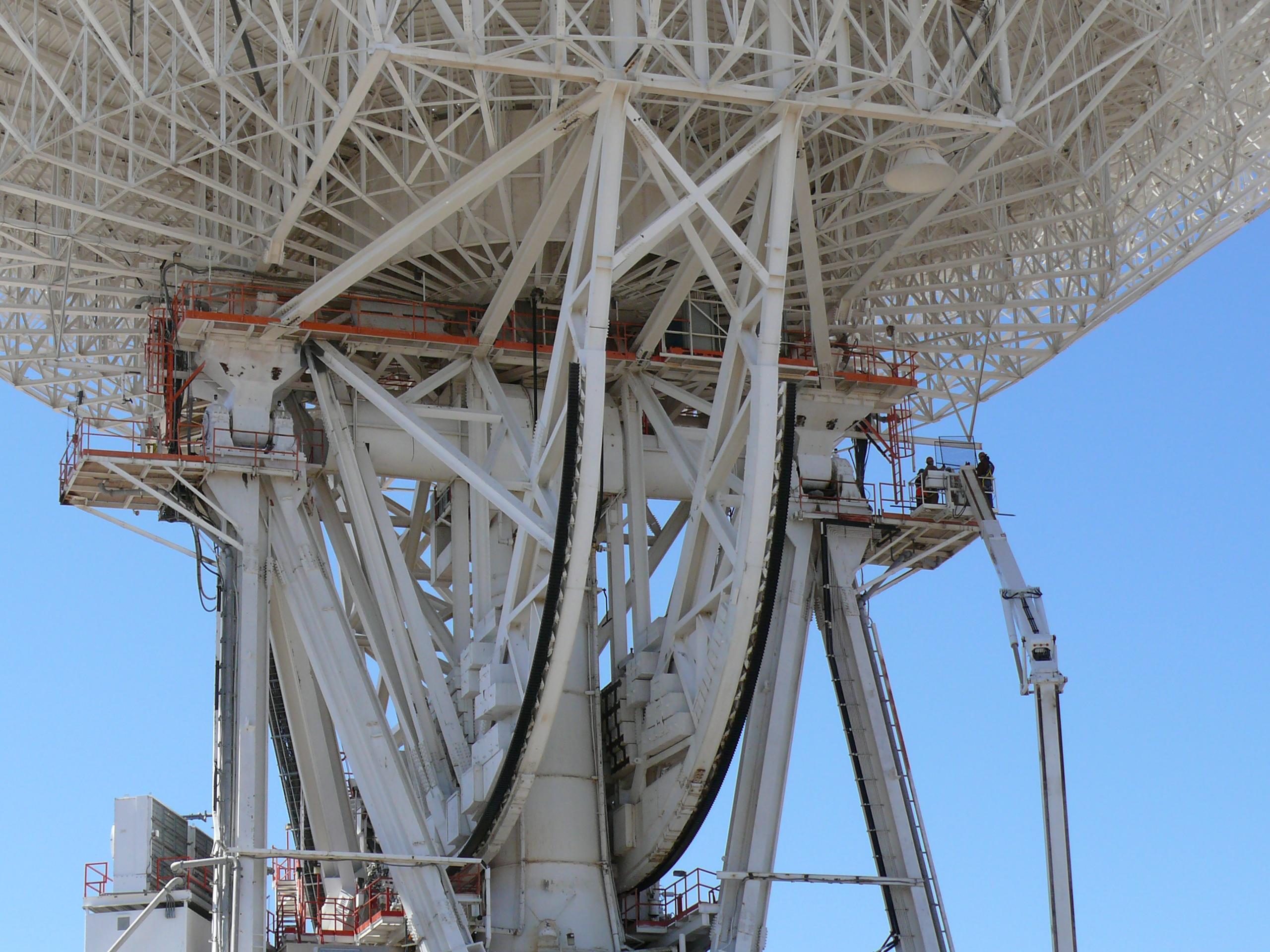
2013-12-18 |
Earth
|
Goldstone Deep Space Network (DSN)
|
Goldstone Solar System Radar
|
5184x3456x3 |
|
-
PIA17791:
-
Goldstone 34-meter Beam Waveguide
Full Resolution:
TIFF
(53.78 MB)
JPEG
(1.726 MB)
|
|
|
2013-12-18 |
Earth
|
Goldstone Deep Space Network (DSN)
|
Goldstone Solar System Radar
|
5184x3456x3 |
|
-
PIA17792:
-
Goldstone 70-m Antenna
Full Resolution:
TIFF
(53.78 MB)
JPEG
(536.5 kB)
|
|
|
2013-12-18 |
Earth
|
Goldstone Deep Space Network (DSN)
|
Goldstone Solar System Radar
|
5184x3456x3 |
|
-
PIA17793:
-
Dawn in the Apollo Valley
Full Resolution:
TIFF
(53.78 MB)
JPEG
(1.362 MB)
|
|
|
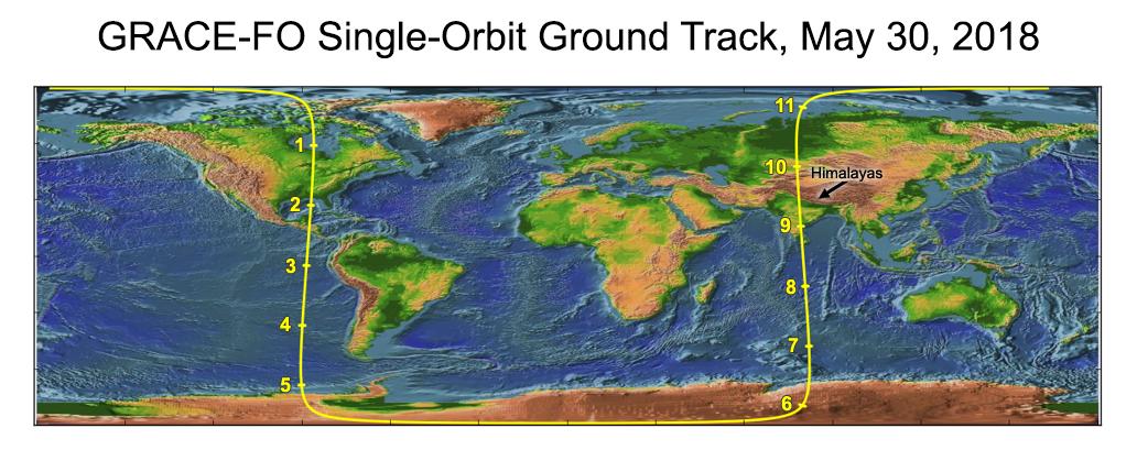
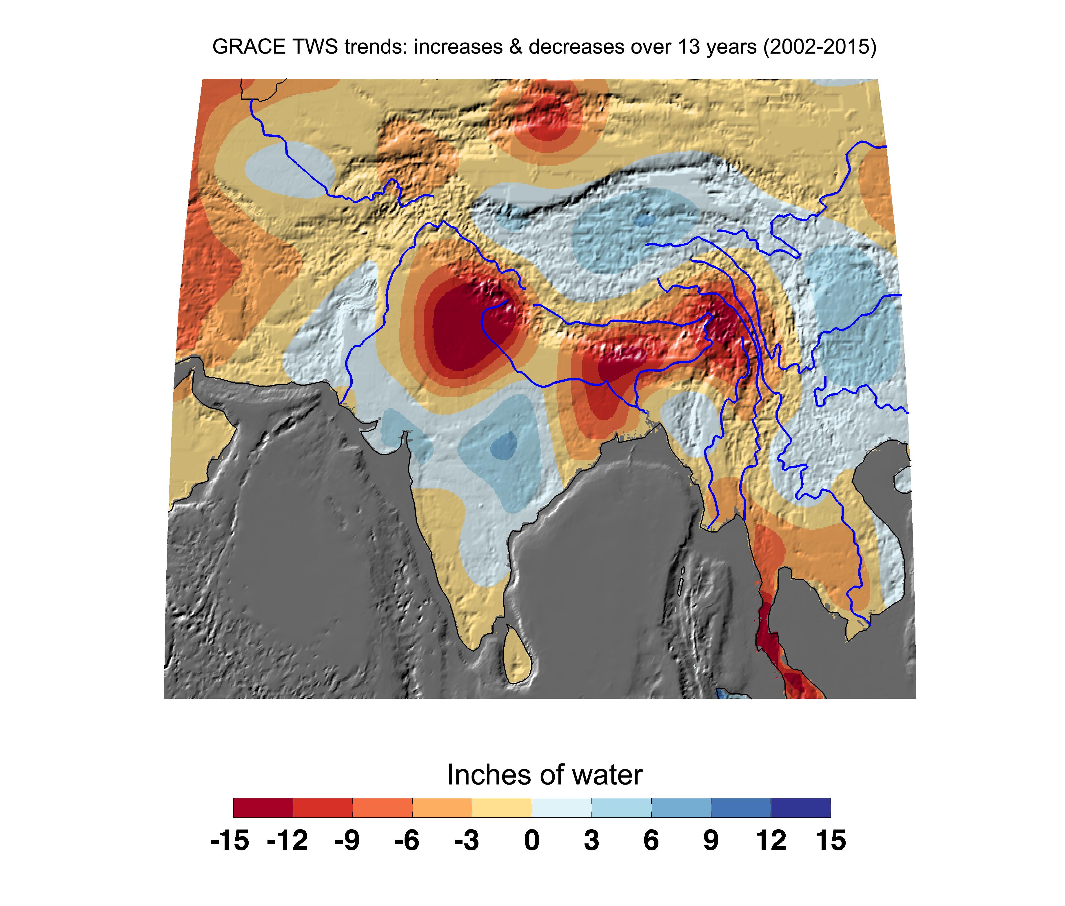
2018-06-11 |
Earth
|
GRACE-FO
|
Microwave Ranging Instrument
|
1032x409x3 |

|
-
PIA22507:
-
Recently Launched Twin Satellites Create 'The Himalaya Plot'
Full Resolution:
TIFF
(1.074 MB)
JPEG
(92.2 kB)
|
|
|
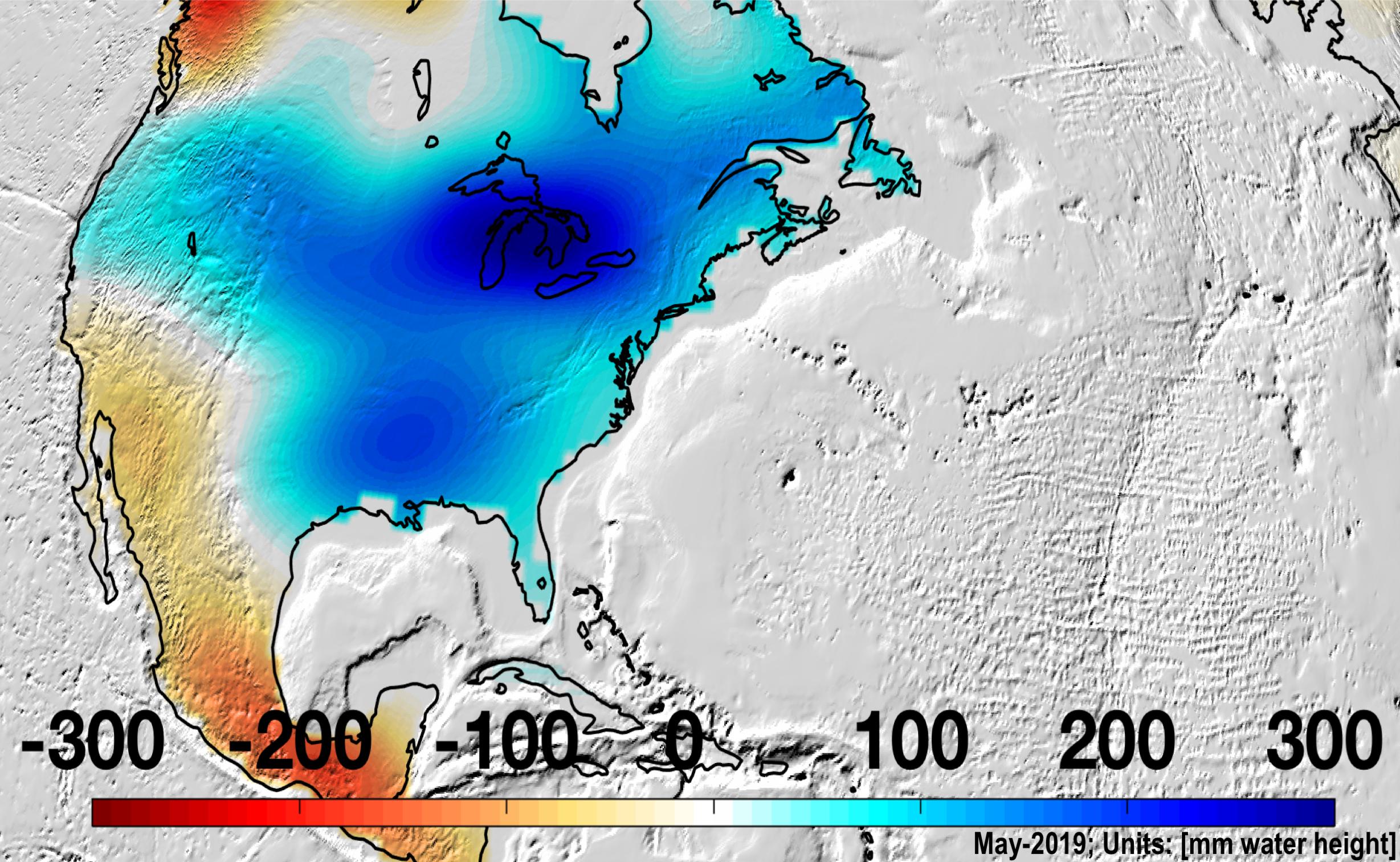
2019-08-20 |
Earth
|
GRACE-FO
|
Microwave Ranging Instrument
|
2457x1513x3 |

|
-
PIA22840:
-
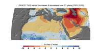
Changes in Mass, North America
Full Resolution:
TIFF
(6.842 MB)
JPEG
(582.4 kB)
|
|
|
2019-08-20 |
Earth
|
GRACE-FO
|
Microwave Ranging Instrument
|
2454x1516x3 |
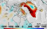
|
-
PIA23340:
-
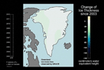
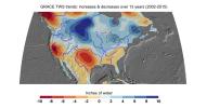
Changes in Mass, Greenland
Full Resolution:
TIFF
(6.486 MB)
JPEG
(458.8 kB)
|
|
|
2003-07-21 |
Earth
|
GRACE
|
K-Band Ranging System
|
2037x1645x3 |
|
-
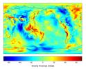
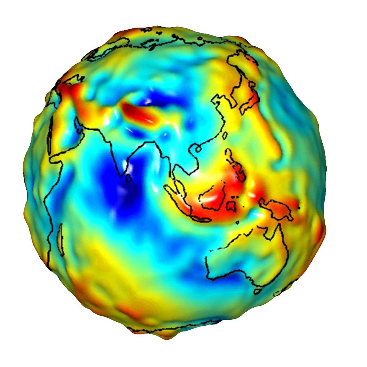
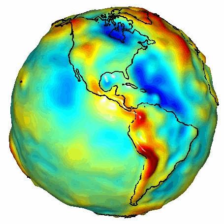
PIA04652:
-
New Views of Earth's Gravity Field from GRACE
Full Resolution:
TIFF
(6.062 MB)
JPEG
(295.6 kB)
|
|
|
2010-02-19 |
Earth
|
GRACE
|
K-Band Ranging System
|
1279x720x3 |
|
-
PIA12845:
-
Greenland Gains Some, Loses More
Full Resolution:
TIFF
(2.766 MB)
JPEG
(101.2 kB)
|
|
|
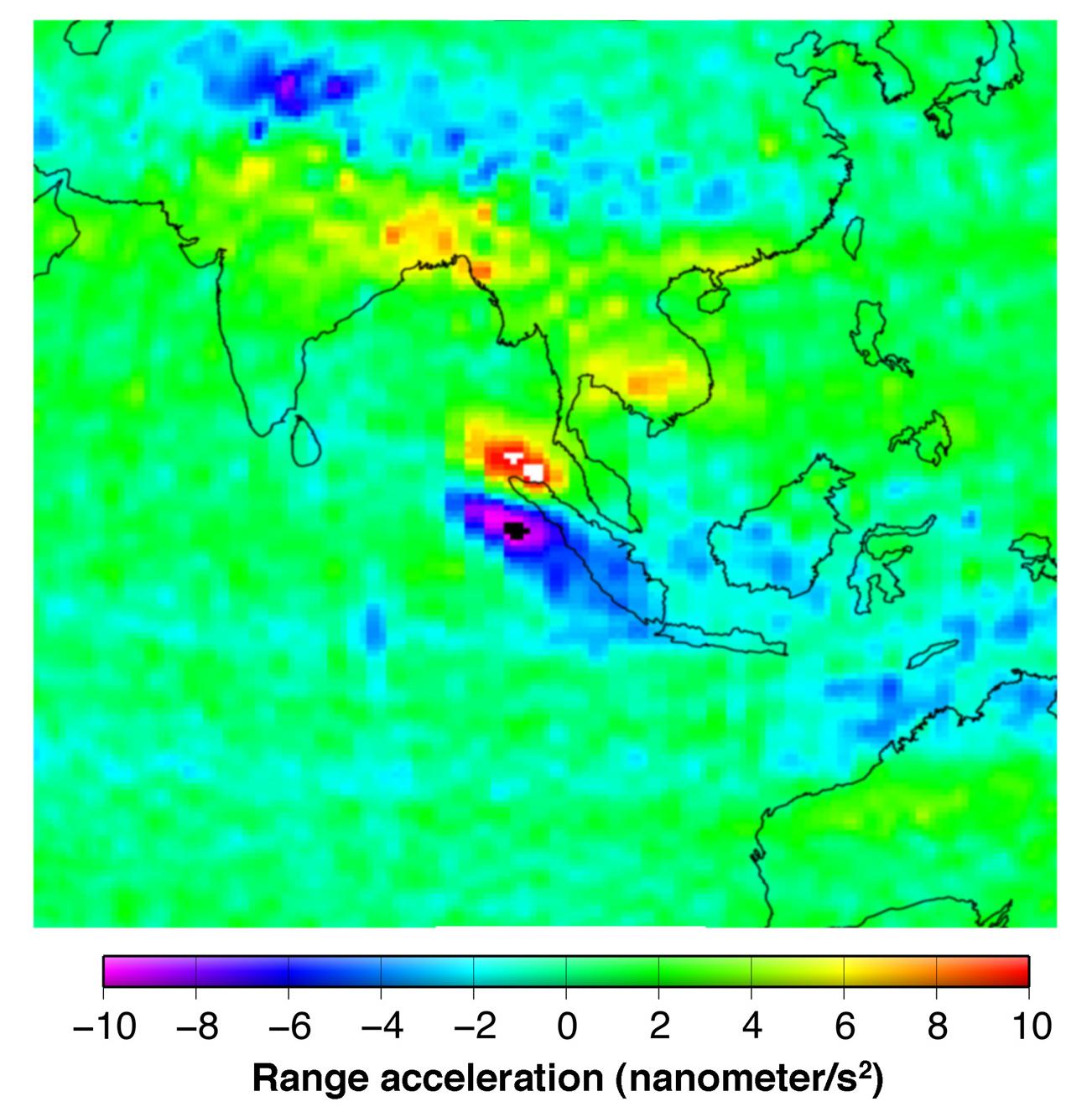
2005-12-06 |
Earth
|
GRACE
|
K-Band Ranging System
|
1302x1326x3 |
|
-
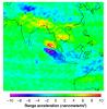
PIA03625:
-
Earthquake Signal Visible in GRACE Data
Full Resolution:
TIFF
(5.185 MB)
JPEG
(150.8 kB)
|
|
|
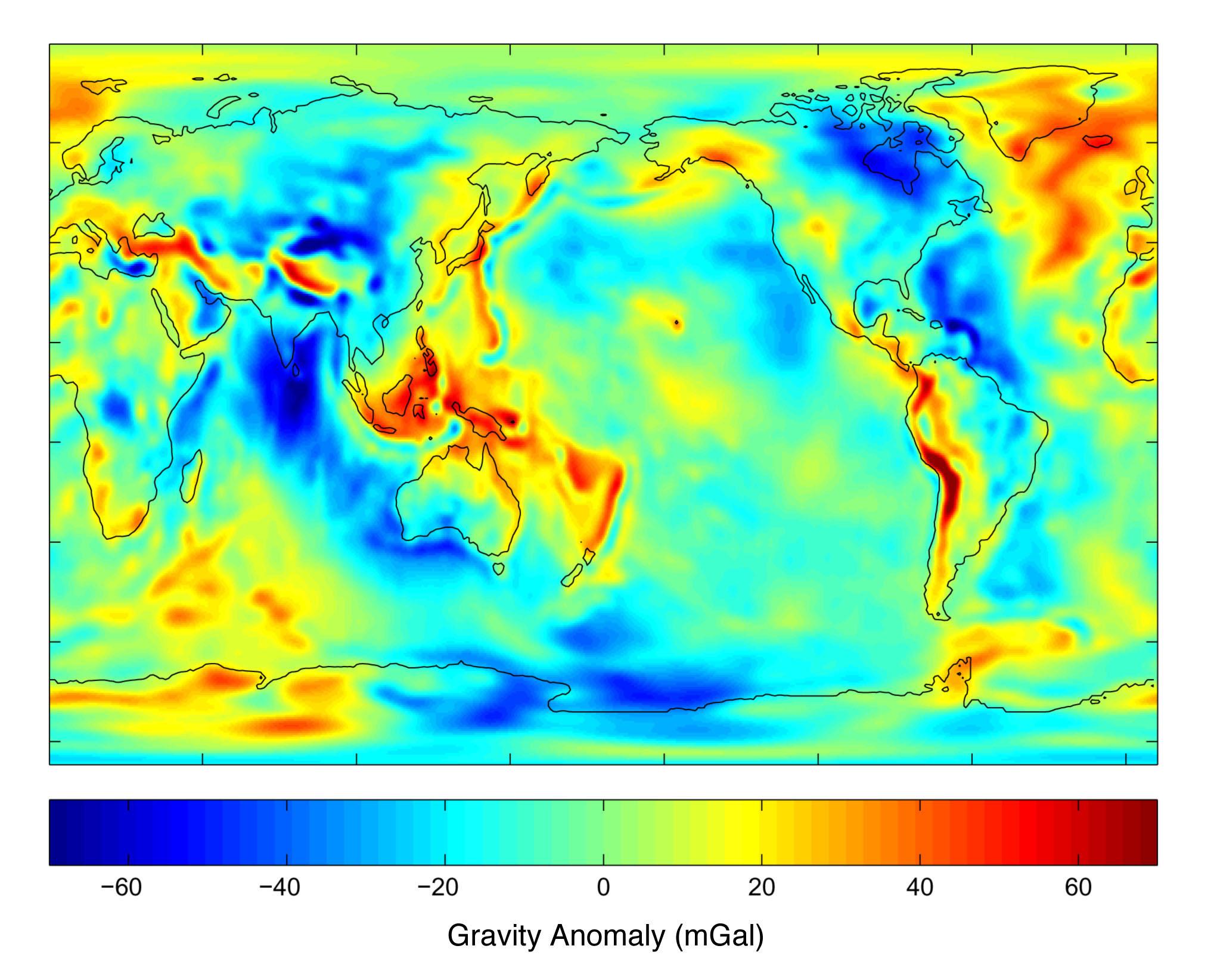
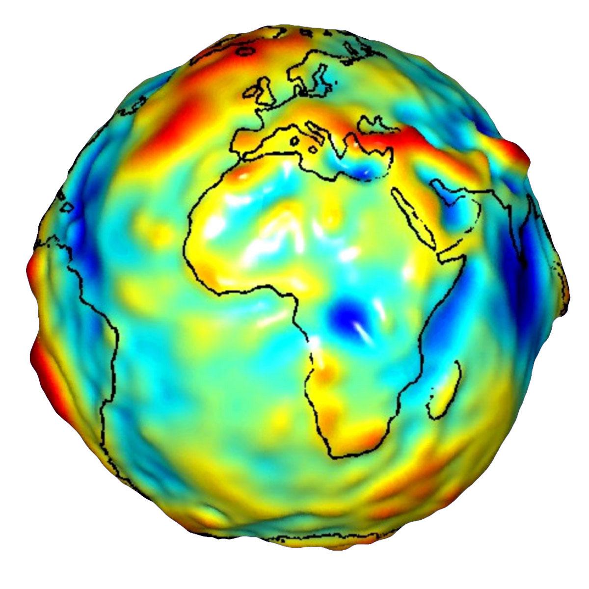
2007-12-11 |
Earth
|
GRACE
|
K-Band Ranging System
|
1200x1200x3 |
|
-
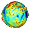
PIA12104:
-
Global Gravity: Africa and Europe
Full Resolution:
TIFF
(4.325 MB)
JPEG
(127.7 kB)
|
|
|
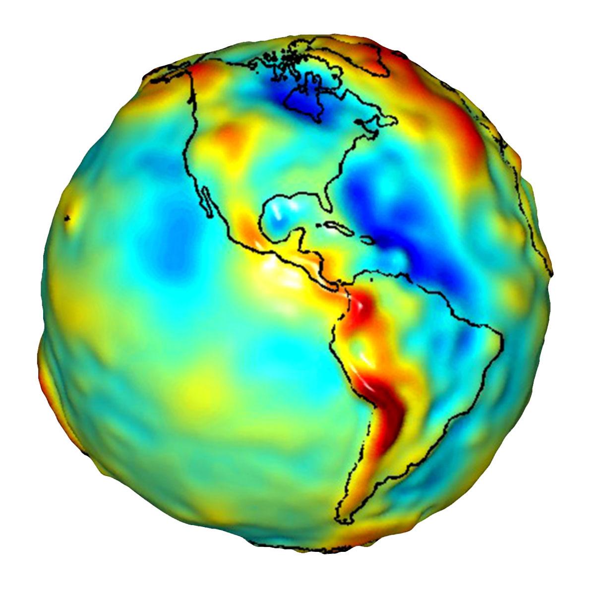
2009-07-15 |
Earth
|
GRACE
|
K-Band Ranging System
|
1200x1200x3 |
|
-
PIA12132:
-
Global Gravity: North and South America
Full Resolution:
TIFF
(4.325 MB)
JPEG
(105.9 kB)
|
|
|
2009-07-15 |
Earth
|
GRACE
|
K-Band Ranging System
|
1200x1200x3 |
|
-
PIA12133:
-
Global Gravity: Asia and Australia
Full Resolution:
TIFF
(4.325 MB)
JPEG
(118.3 kB)
|
|
|
2009-07-17 |
Earth
|
GRACE
|
K-Band Ranging System
|
455x455x3 |
|
-
PIA12146:
-
GRACE Global Gravity Animation
Full Resolution:
TIFF
(209 kB)
JPEG
(35.98 kB)
|
|
|
2009-08-27 |
Earth
|
GRACE
|
K-Band Ranging System
|
778x778x3 |

|
-
PIA12188:
-
New Look at Gravity Data Sheds Light on Ocean and Climate
Full Resolution:
TIFF
(1.818 MB)
JPEG
(96.21 kB)
|
|
|
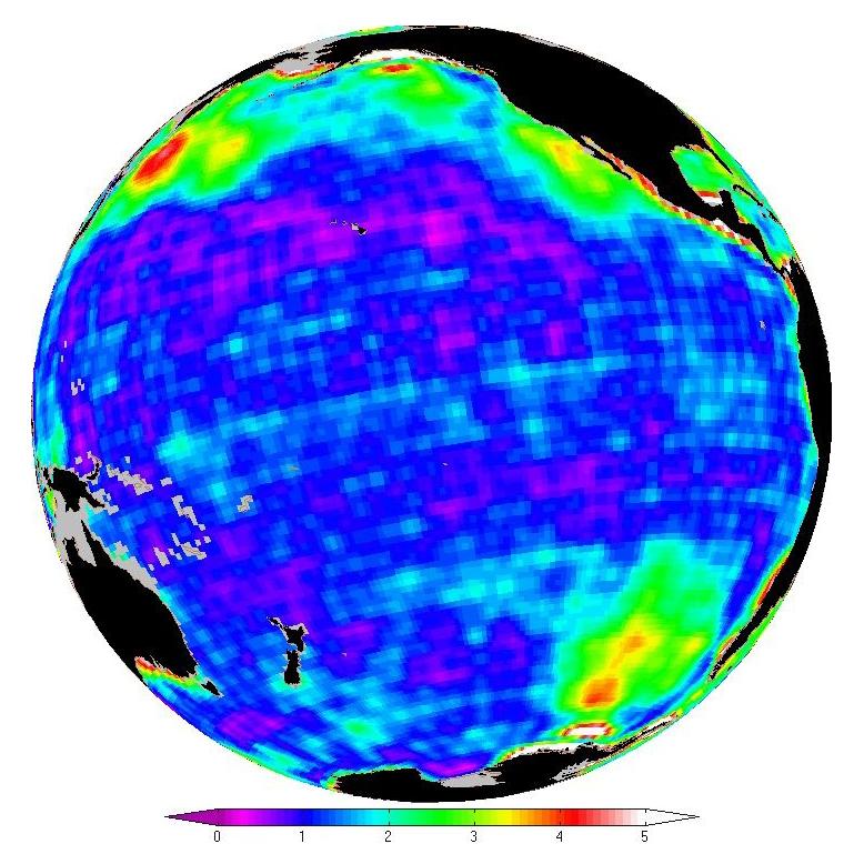
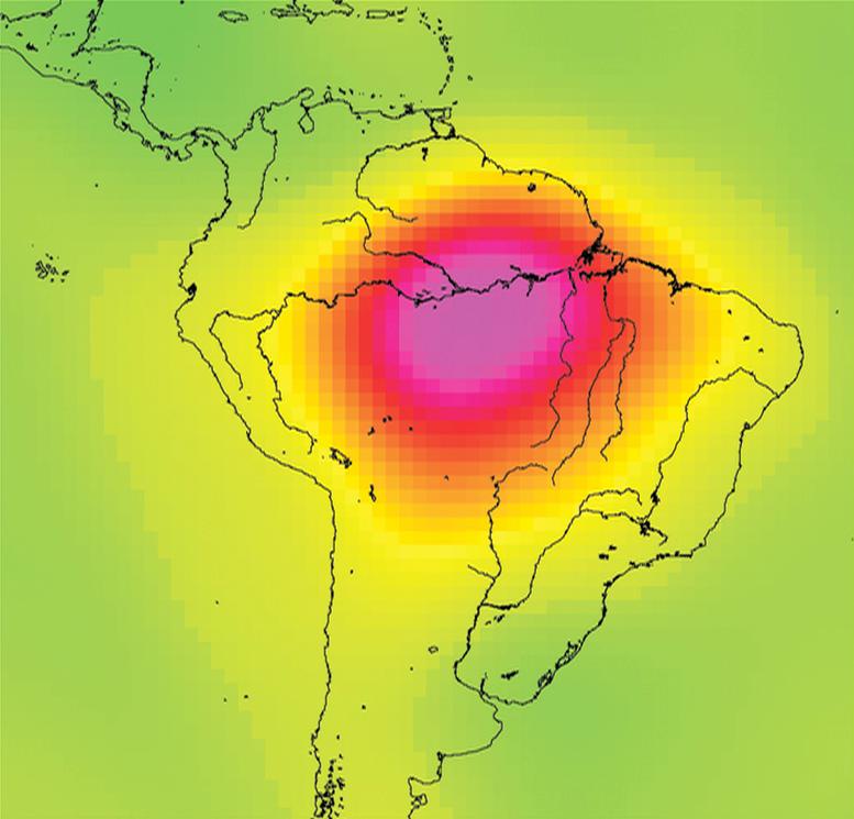
2010-07-07 |
Earth
|
GRACE
|
K-Band Ranging System
|
777x745x3 |

|
-
PIA13243:
-
Measuring Water Storage in the Amazon
Full Resolution:
TIFF
(1.739 MB)
JPEG
(51.9 kB)
|
|
|
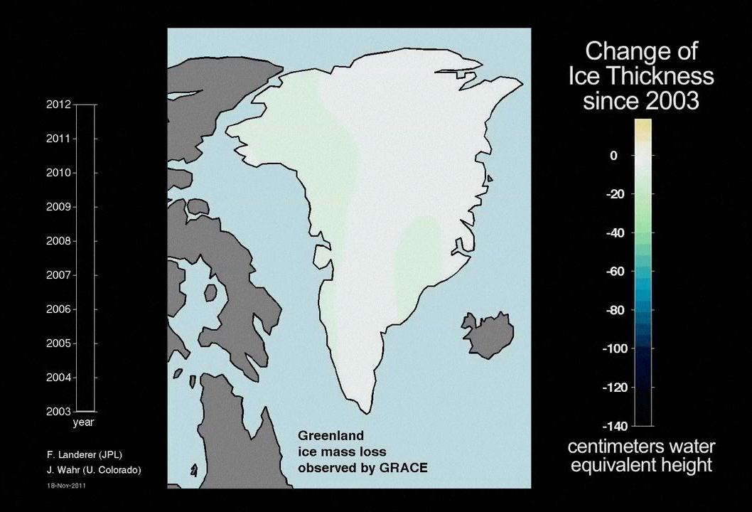
2012-02-02 |
Earth
|
GRACE
|
K-Band Ranging System
|
1058x720x3 |
|
-
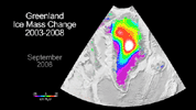
PIA13955:
-
Ice Mass Loss on Greenland, 2003-2011
Full Resolution:
TIFF
(2.288 MB)
JPEG
(78.67 kB)
|
|
|
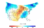
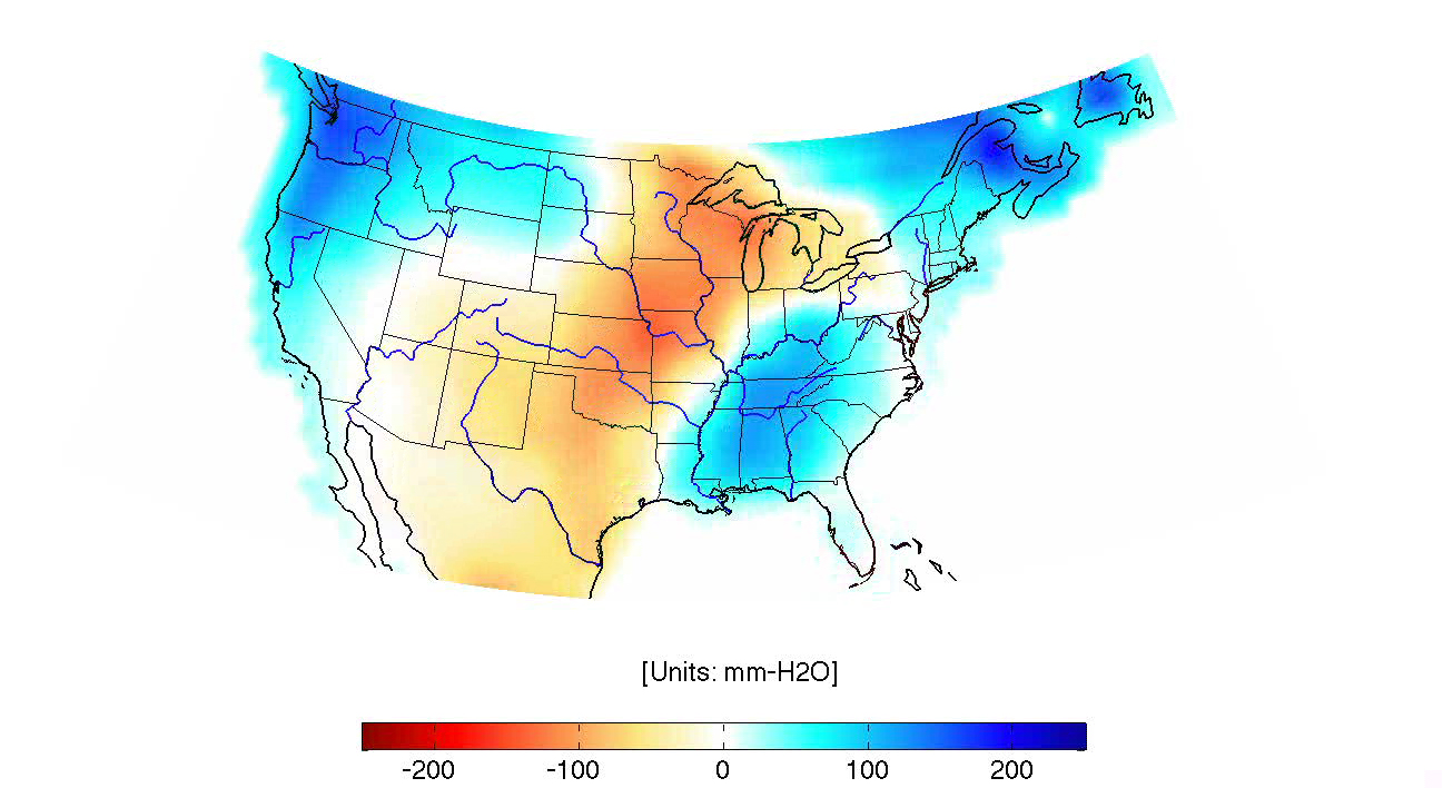
2013-06-13 |
Earth
|
GRACE
|
K-Band Ranging System
|
2168x2430x3 |
|
-
PIA16840:
-
GRACE Measures Groundwater Changes Across the U.S.
Full Resolution:
TIFF
(15.81 MB)
JPEG
(518.9 kB)
|
|
|
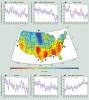
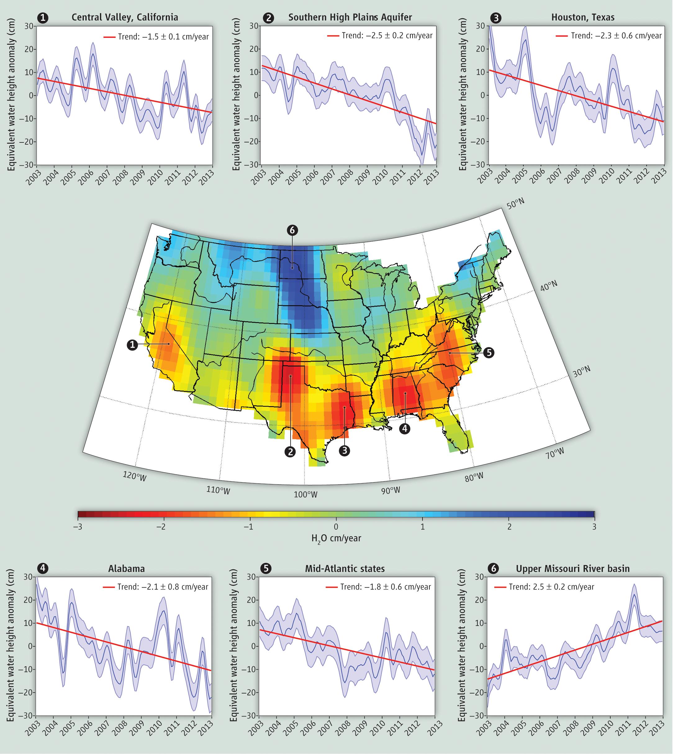
2013-10-26 |
Earth
|
GRACE
|
K-Band Ranging System
|
1297x708x3 |
|
-
PIA14268:
-
GRACE Land Water Storage Monthly Changes over the United States, 2003 – Early 2013
Full Resolution:
TIFF
(690.1 kB)
JPEG
(464 kB)
|
|
|
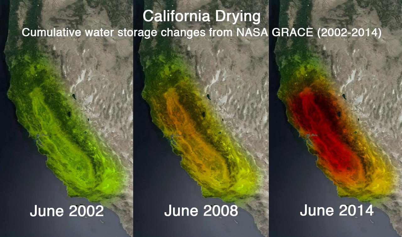
2014-10-01 |
Earth
|
GRACE
|
K-Band Ranging System
|
1280x755x3 |

|
-
PIA18816:
-
NASA's GRACE Sees a Drying California
Full Resolution:
TIFF
(2.9 MB)
JPEG
(141.3 kB)
|
|
|
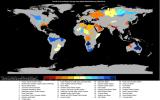
2015-06-16 |
Earth
|
GRACE
|
|
3315x2066x3 |
|
-
PIA19685:
-
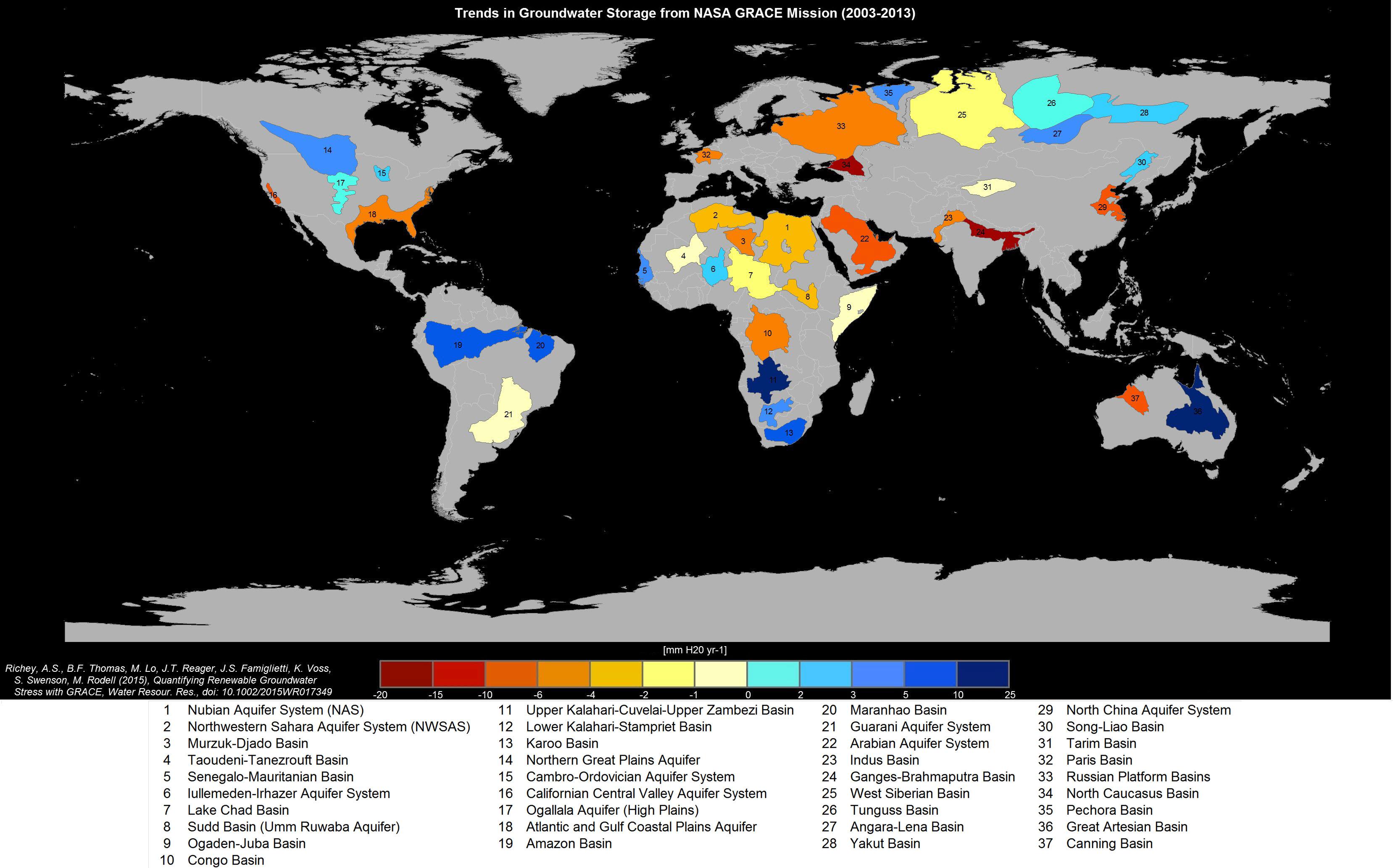
Study: Third of Big Groundwater Basins in Distress
Full Resolution:
TIFF
(20.55 MB)
JPEG
(559.3 kB)
|
|
|
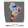
2015-12-08 |
Earth
|
GRACE
|
K-Band Ranging System
|
3335x3332x3 |
|
-
PIA20205:
-
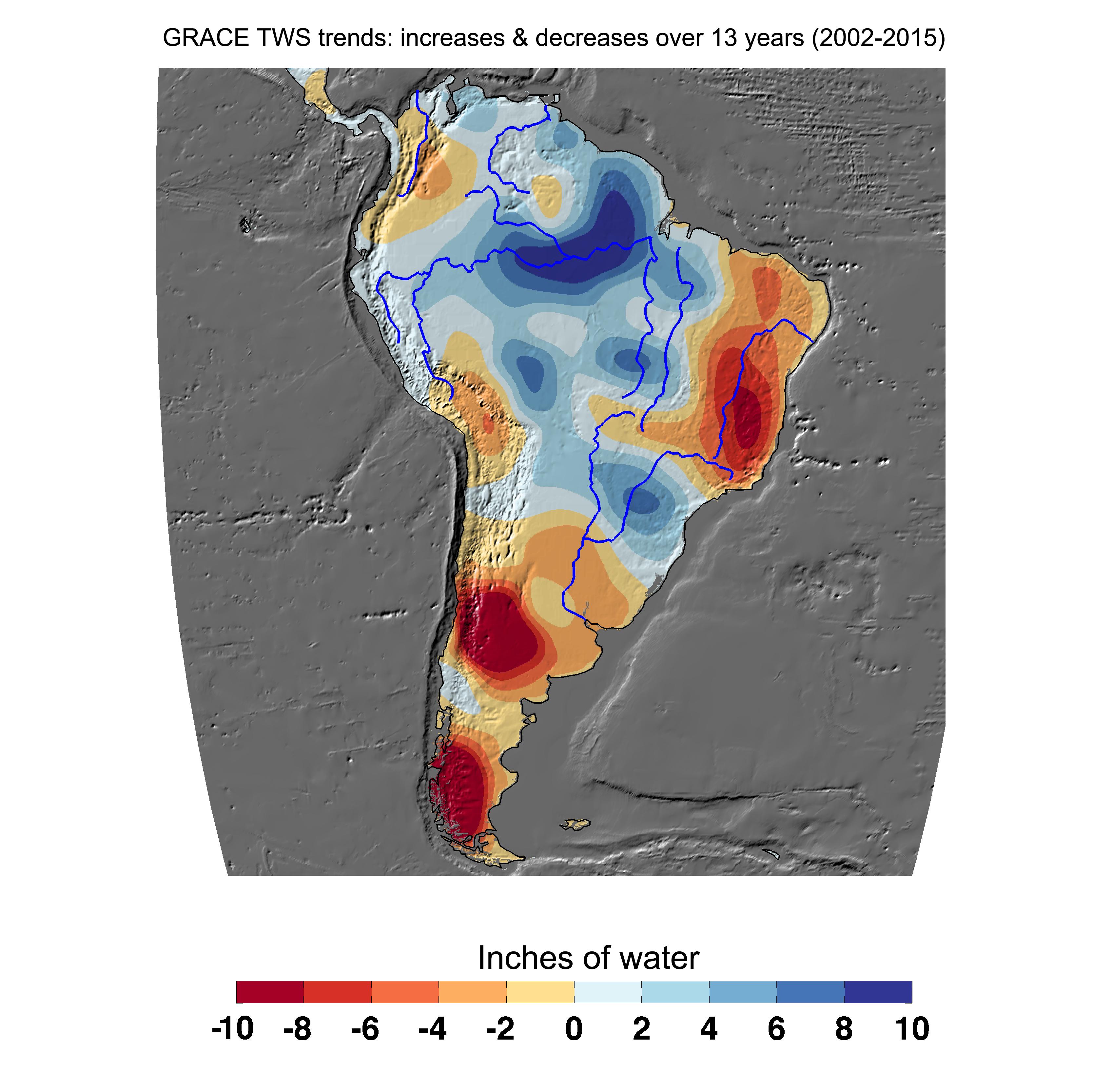
Cumulative Total South America Freshwater Losses as Seen by NASA's GRACE, 2002-15
Full Resolution:
TIFF
(6.343 MB)
JPEG
(772.7 kB)
|
|
|
2015-12-08 |
Earth
|
GRACE
|
K-Band Ranging System
|
4900x2500x3 |
|
-
PIA20207:
-
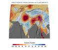
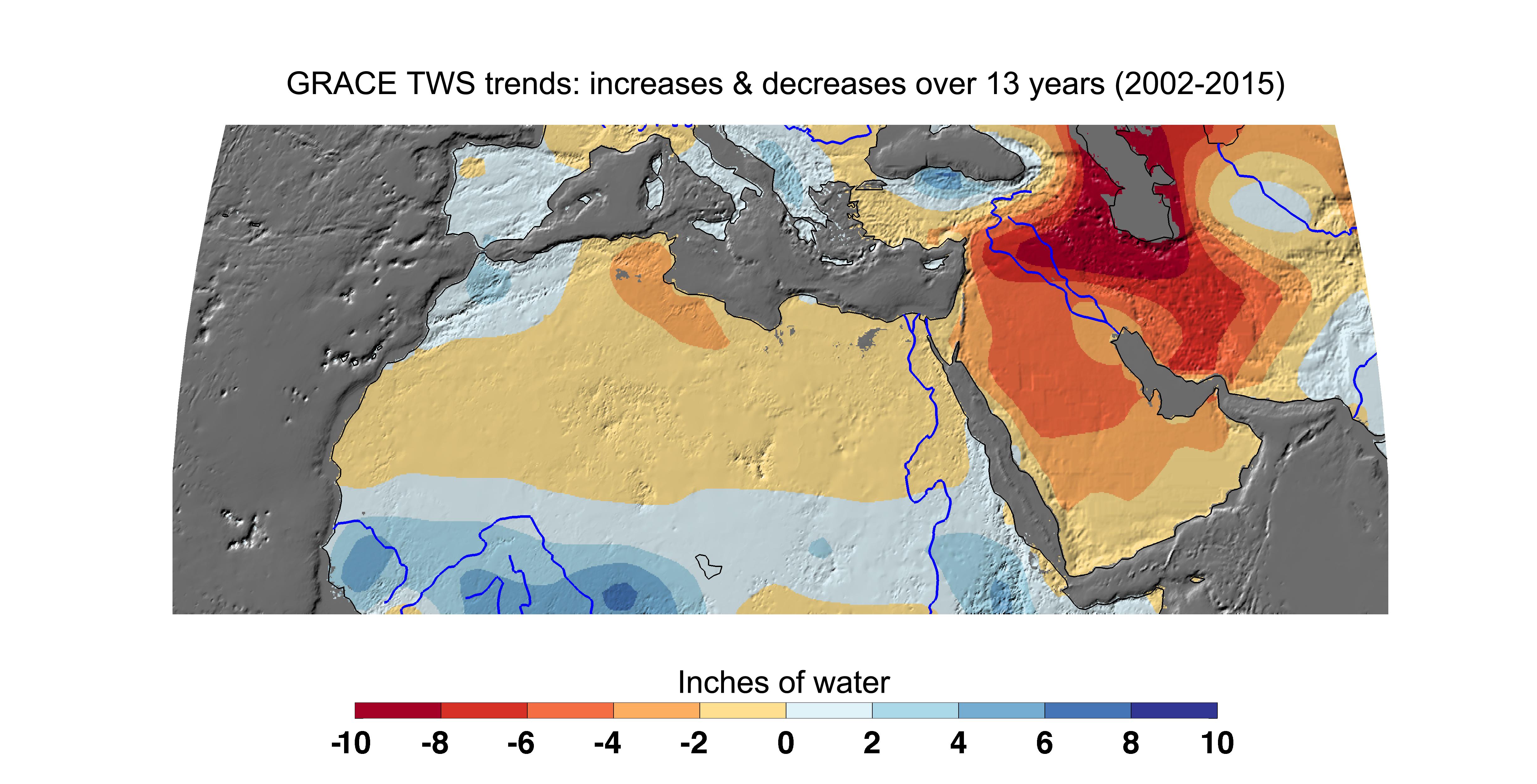
Cumulative Total Middle East/North Africa Freshwater Losses as Seen by NASA's GRACE, 2002-15
Full Resolution:
TIFF
(7.868 MB)
JPEG
(961.7 kB)
|
|
|
2015-12-08 |
Earth
|
GRACE
|
K-Band Ranging System
|
5198x2724x3 |
|
-
PIA20204:
-
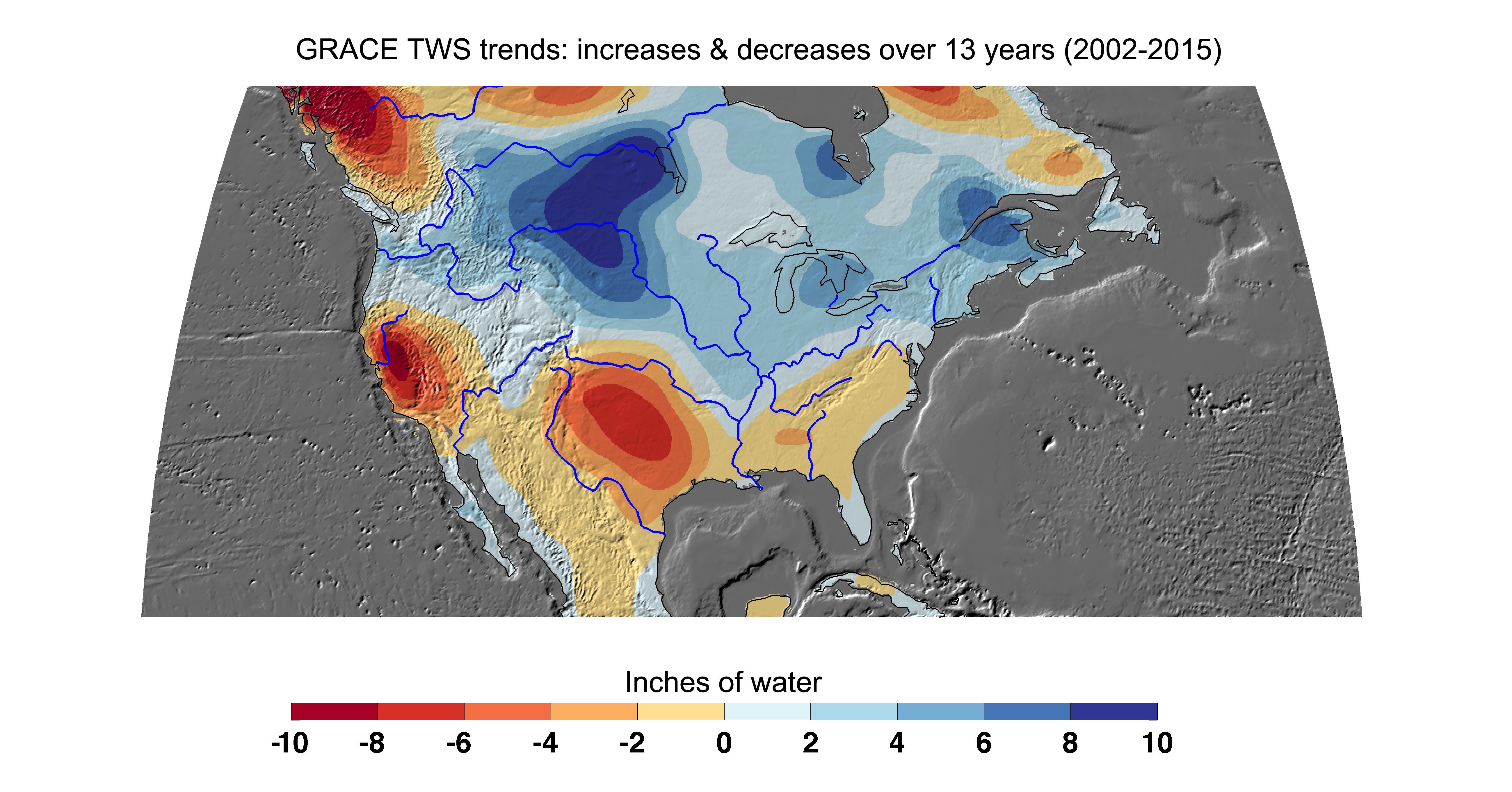
Cumulative Total U.S. Freshwater Losses as Seen by NASA's GRACE, 2002-15
Full Resolution:
TIFF
(8.747 MB)
JPEG
(1.212 MB)
|
|
|
2015-12-08 |
Earth
|
GRACE
|
K-Band Ranging System
|
3675x3127x3 |
|
-
PIA20206:
-
Cumulative Total India Freshwater Losses as Seen by NASA's GRACE, 2002-15
Full Resolution:
TIFF
(7.855 MB)
JPEG
(947.3 kB)
|
|
|
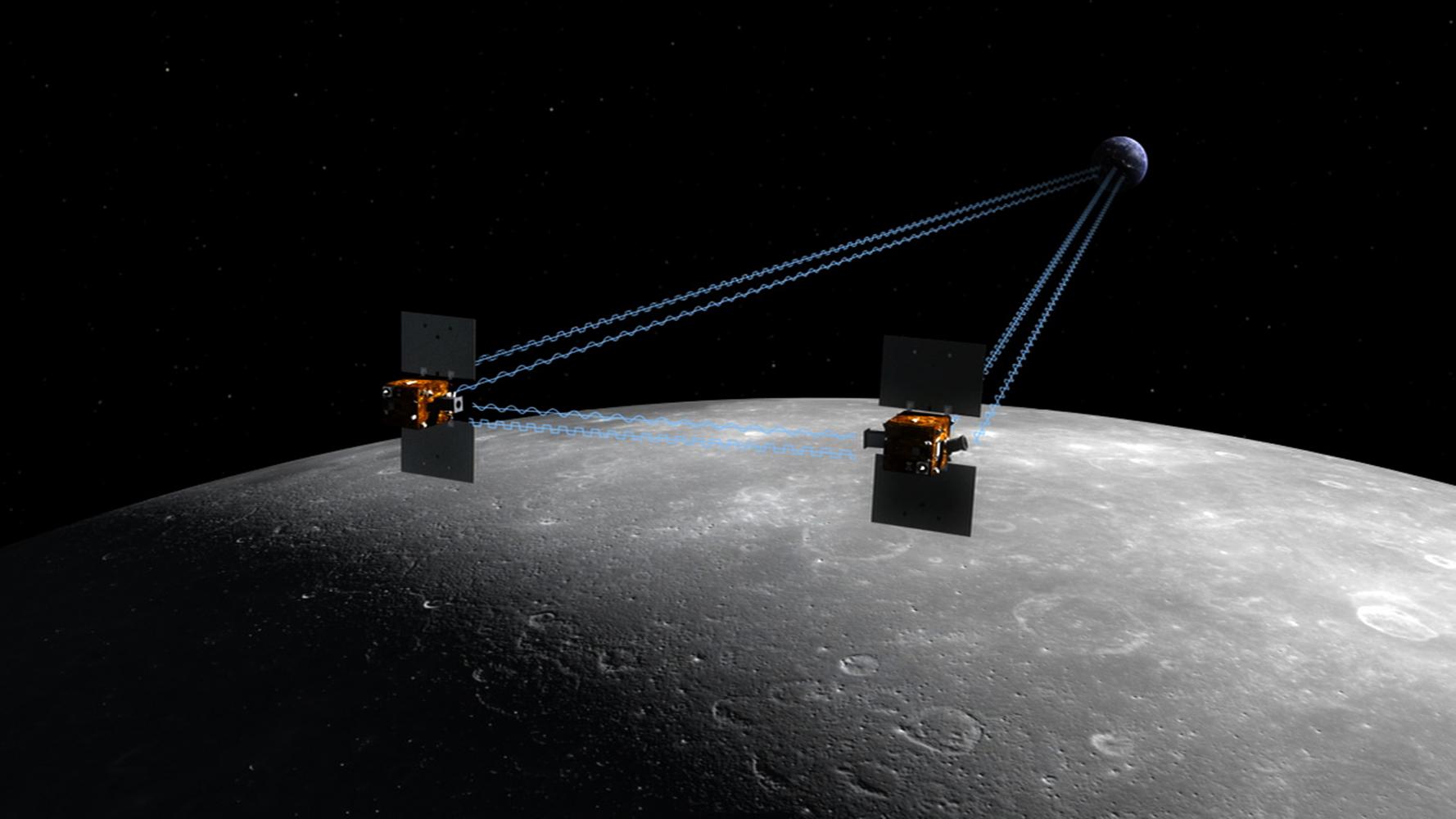
2007-12-11 |
Moon
|
GRAIL
|
|
1778x1000x3 |
|
-
PIA10130:
-
New NASA Mission to Reveal Moon's Internal Structure and Evolution (Artist's Concept)
Full Resolution:
TIFF
(5.342 MB)
JPEG
(117.2 kB)
|
|
|
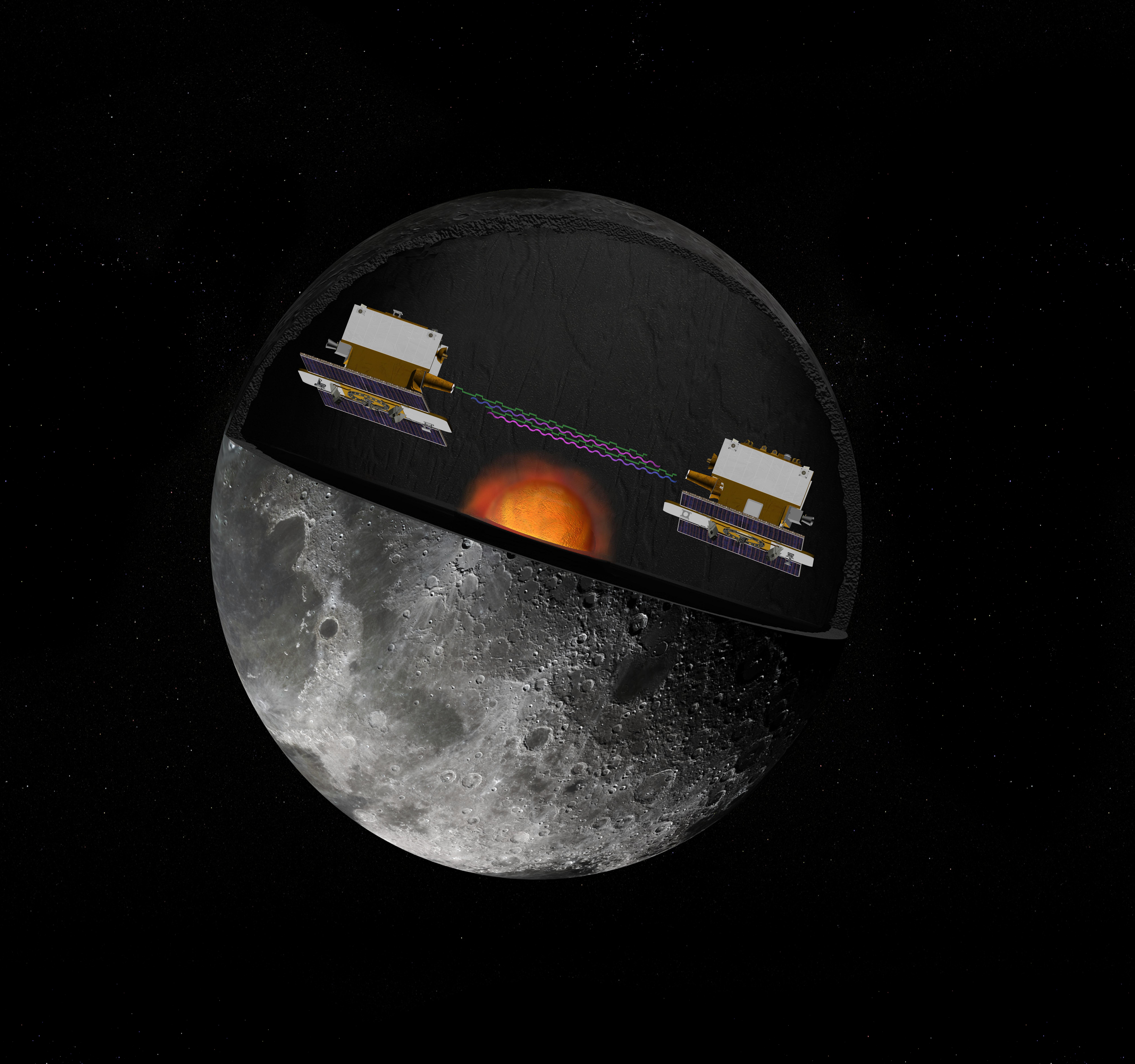
2009-05-18 |
Moon
|
GRAIL
|
|
6000x4000x3 |
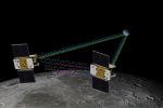
|
-
PIA12009:
-
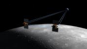
GRAIL's Twin Spacecraft fly in Tandem Around the Moon (Artist's Concept)
Full Resolution:
TIFF
(72 MB)
JPEG
(1.186 MB)
|
|
|
2009-05-18 |
Moon
|
GRAIL
|
|
8000x7500x3 |
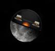
|
-
PIA12010:
-
GRAIL's Twin Spacecraft -- Crust to Core (Artist's Concept)
Full Resolution:
TIFF
(180 MB)
JPEG
(2.615 MB)
|
|
|
2012-03-22 |
Moon
|
GRAIL
|
MoonKAM
|
486x720x3 |
|
-
PIA15514:
-
MoonKAM Looks Homeward
Full Resolution:
TIFF
(1.051 MB)
JPEG
(59.59 kB)
|
|
|
2012-03-22 |
Moon
|
GRAIL
|
MoonKAM
|
485x714x3 |
|
-
PIA15515:
-
Far Side of Moon Imaged by MoonKAM
Full Resolution:
TIFF
(1.04 MB)
JPEG
(59.81 kB)
|
|
|
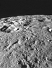
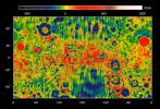
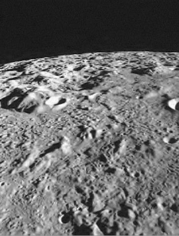
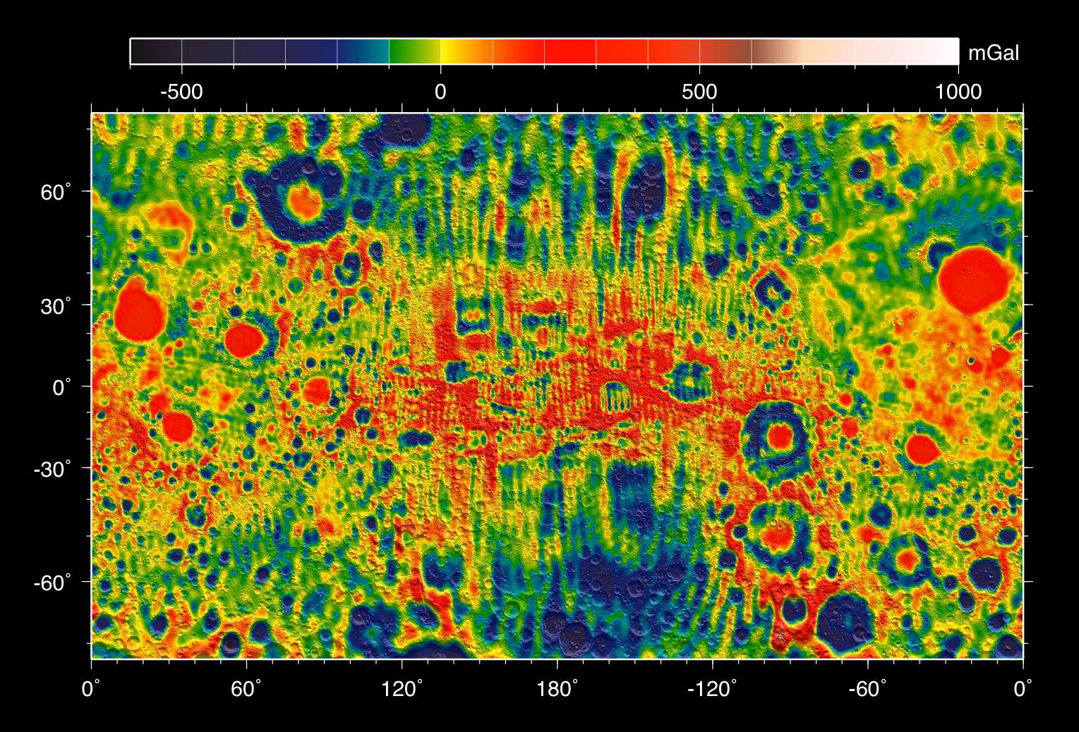
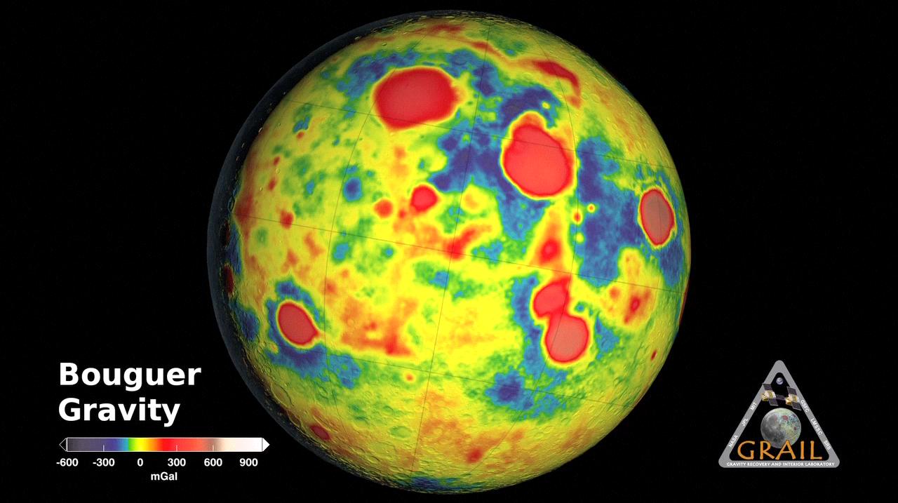
2012-12-05 |
Moon
|
GRAIL
|
|
4532x1967x3 |
|
-
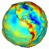
PIA16578:
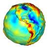
-
Gravity of the Moon's Crust
Full Resolution:
TIFF
(26.76 MB)
JPEG
(504.8 kB)
|
|
|
2012-12-05 |
Moon
|
GRAIL
|
MoonKAM
|
364x480x1 |
|
-
PIA16620:
-
Mare Orientale Flyover
Full Resolution:
TIFF
(175.1 kB)
JPEG
(35.44 kB)
|
|
|
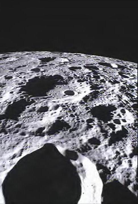
2012-12-05 |
Moon
|
GRAIL
|
|
1169x492x3 |
|
-
PIA16579:
-
GRAIL's Gravity Gradients
Full Resolution:
TIFF
(1.726 MB)
JPEG
(173.3 kB)
|
|
|
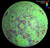
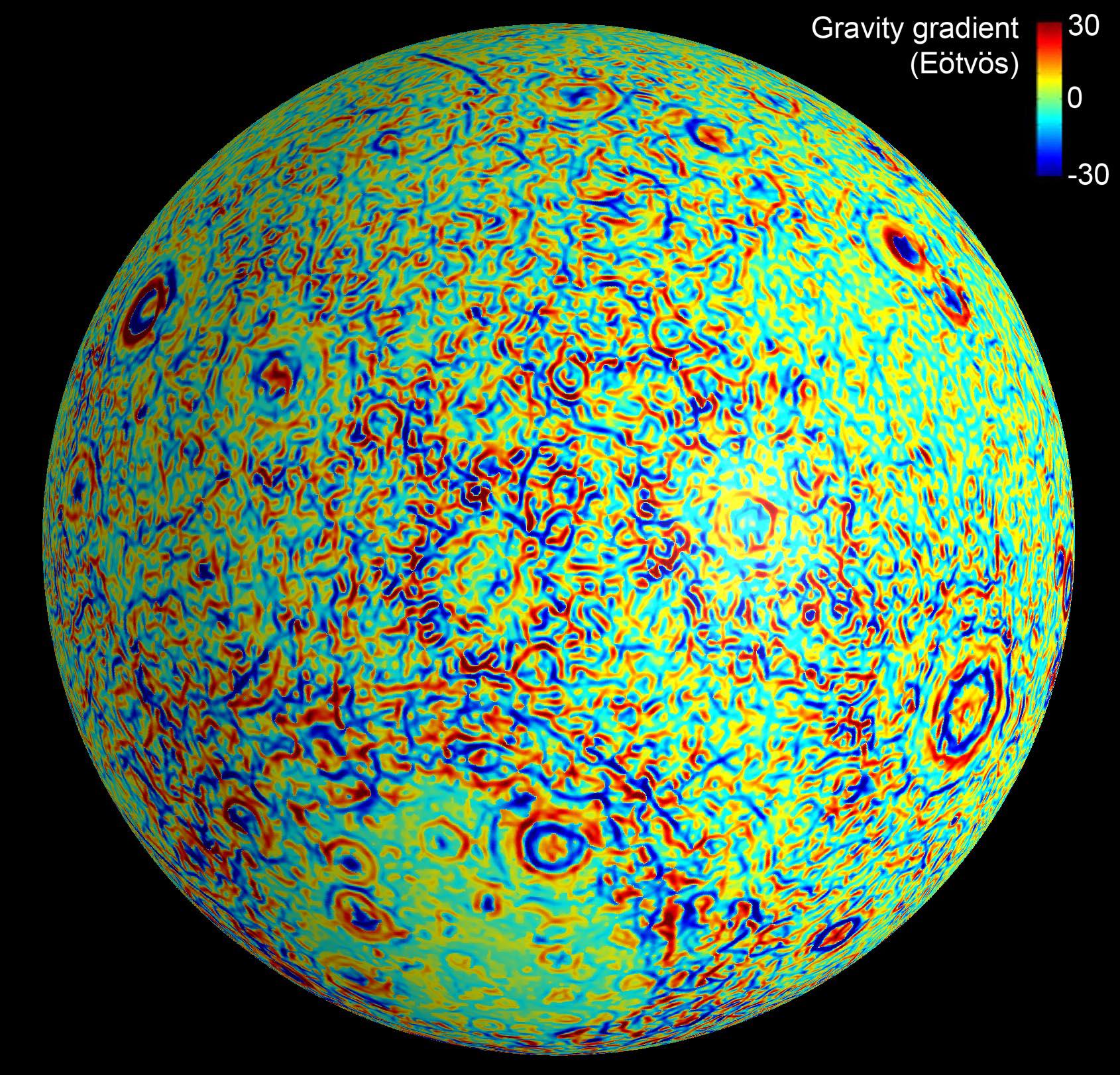
2012-12-05 |
Moon
|
GRAIL
|
|
4532x1967x3 |
|
-
PIA16580:
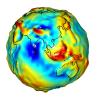
-
Linear Gravity Anomalies
Full Resolution:
TIFF
(26.76 MB)
JPEG
(1.128 MB)
|
|
|
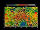
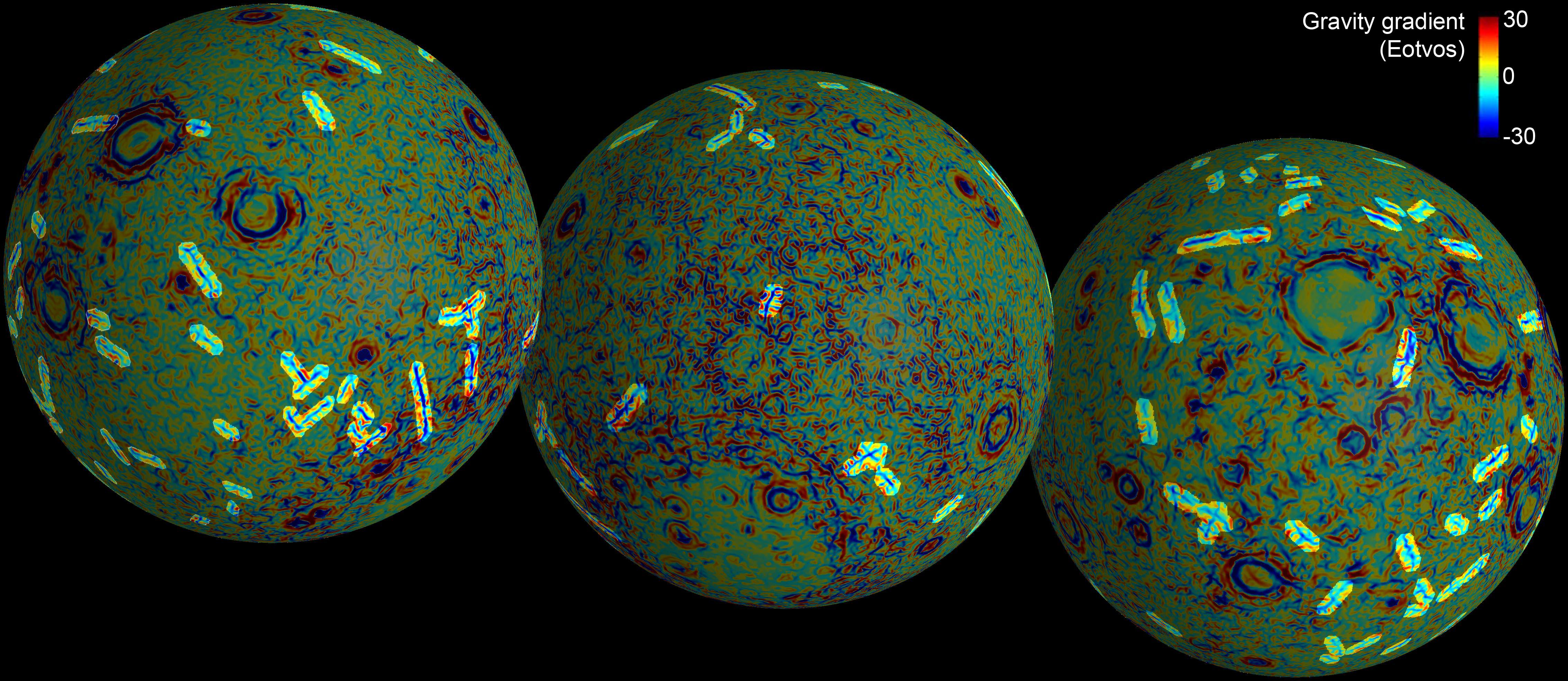
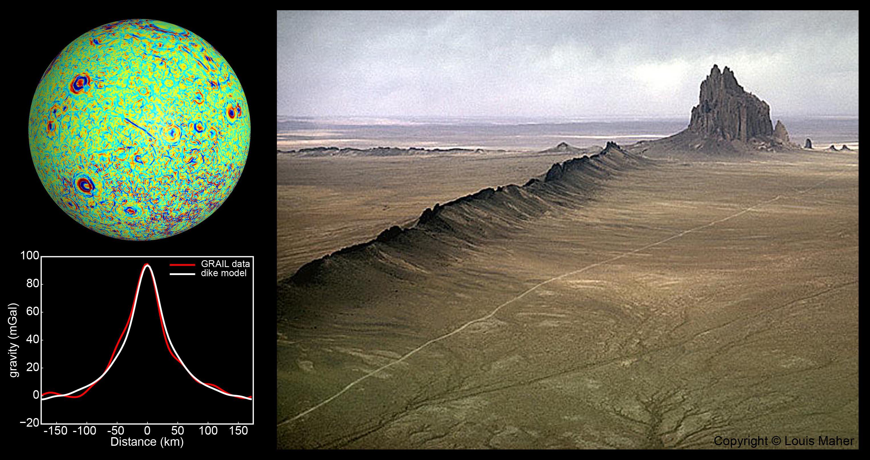
2012-12-05 |
Moon
|
GRAIL
|
|
3051x1614x3 |

|
-
PIA16583:
-
GRAIL Identifies Moon Dikes
Full Resolution:
TIFF
(14.78 MB)
JPEG
(525.4 kB)
|
|
|
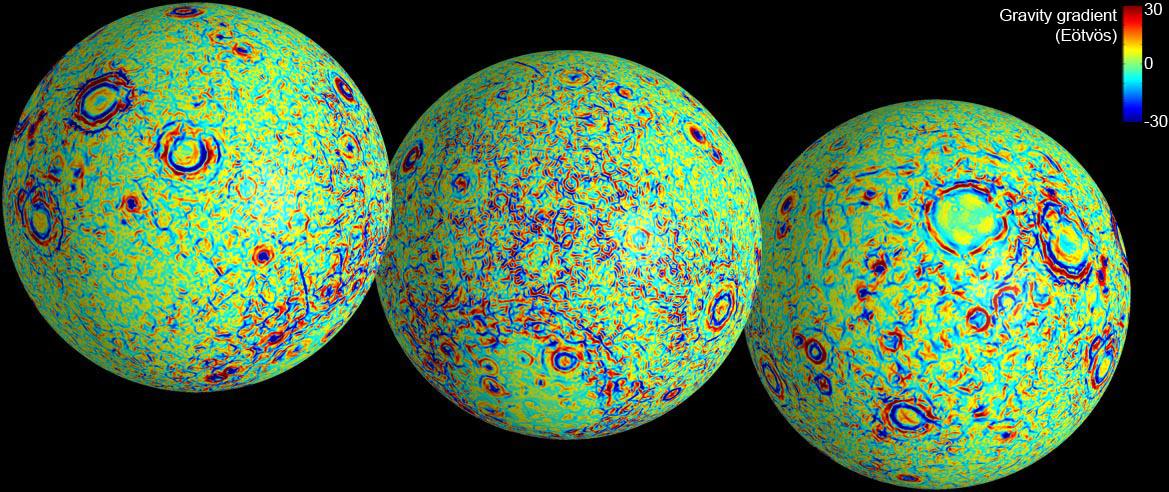
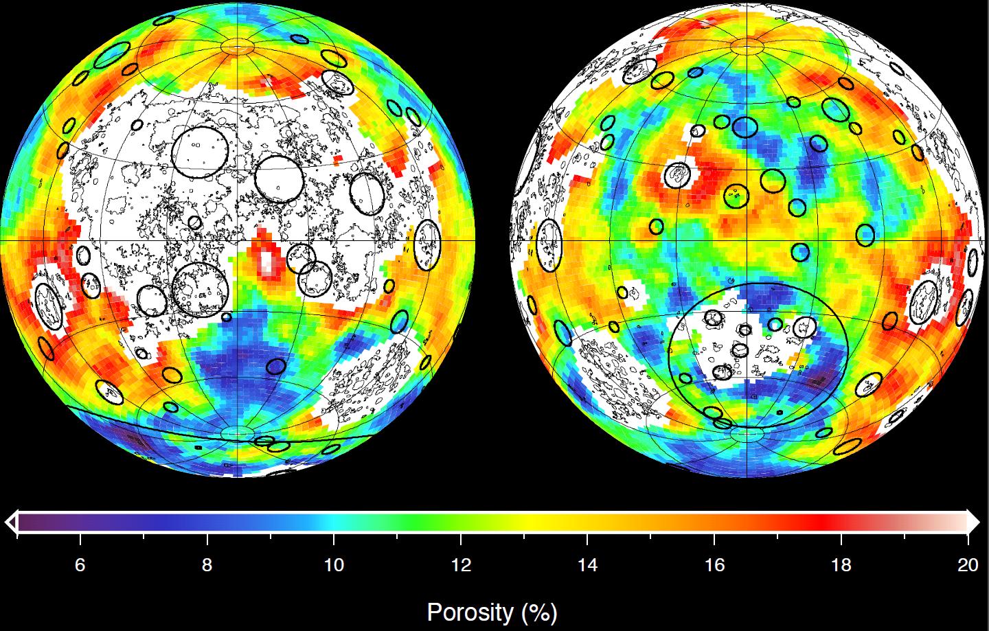
2012-12-05 |
Moon
|
GRAIL
|
|
1690x1623x3 |
|
-
PIA16585:
-
Lunar Gravity Gradients
Full Resolution:
TIFF
(8.232 MB)
JPEG
(613.4 kB)
|
|
|
2012-12-05 |
Moon
|
GRAIL
|
|
1529x1038x3 |
|
-
PIA16586:
-
Moon Gravity Field Using Prospector Data
Full Resolution:
TIFF
(4.763 MB)
JPEG
(406.2 kB)
|
|
|
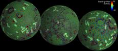
2012-12-05 |
Moon
|
GRAIL
|
|
1600x1200x3 |
|
-
PIA16587:
-
GRAIL's Gravity Field of the Moon
Full Resolution:
TIFF
(5.762 MB)
JPEG
(476 kB)
|
|
|
2012-12-05 |
Moon
|
GRAIL
|
|
1440x919x3 |
|
-
PIA16588:
-
Closer Look at Lunar Highland Crust
Full Resolution:
TIFF
(3.972 MB)
JPEG
(312.4 kB)
|
|
|
2012-12-05 |
Moon
|
GRAIL
|
|
1278x718x3 |
|
-
PIA16622:
-
GRAIL's Gravity Tour of the Moon
Full Resolution:
TIFF
(2.754 MB)
JPEG
(114.8 kB)
|
|
|
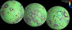
2012-12-05 |
Moon
|
GRAIL
|
|
1914x1077x3 |
|
-
PIA16621:
-
Map of Moon's Crust
Full Resolution:
TIFF
(6.187 MB)
JPEG
(173.7 kB)
|
|
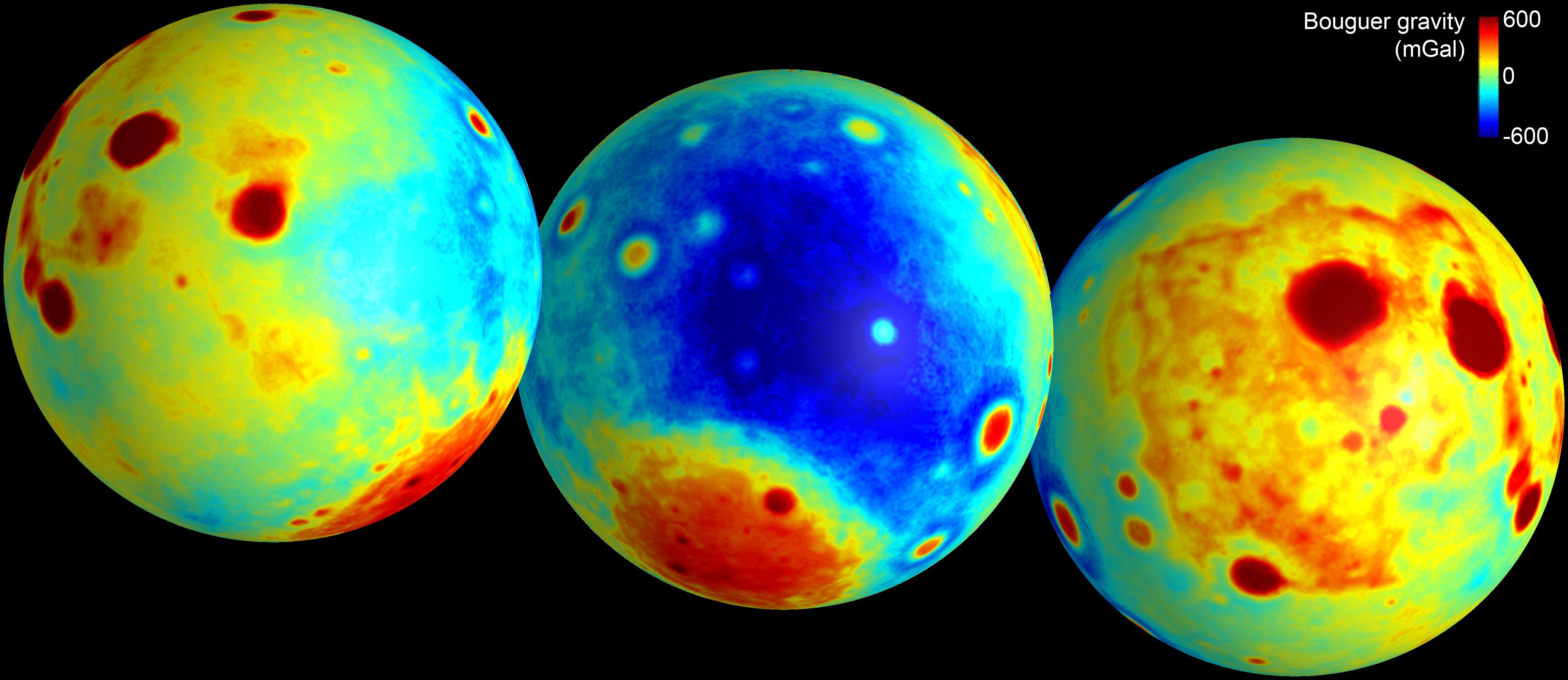
|
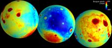
2012-12-05 |
Moon
|
GRAIL
|
|
1280x717x3 |

|
-
PIA16623:
-
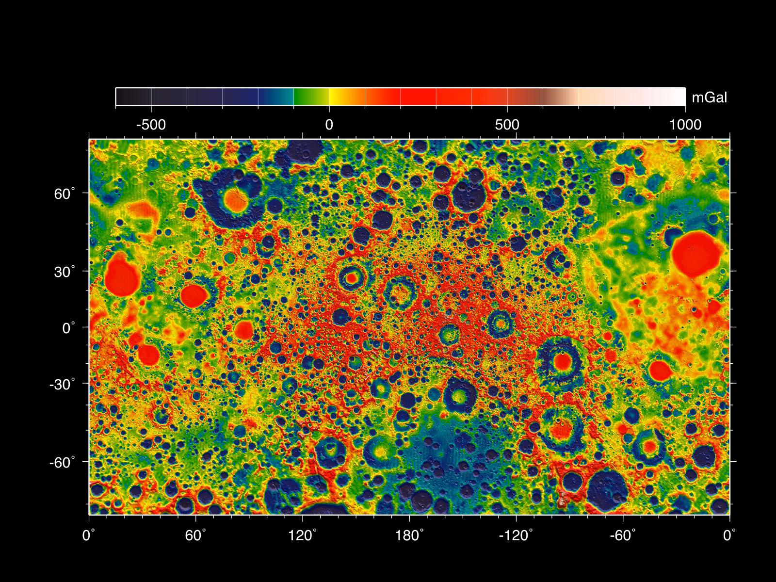
GRAIL's 'Bouguer' Gravity Moon Map
Full Resolution:
TIFF
(2.754 MB)
JPEG
(95.48 kB)
|
|
|
2012-12-13 |
Moon
|
GRAIL
|
|
1230x1242x3 |
|
-
PIA16494:
-
Lunar Heritage Sites and GRAIL's Final Mile
Full Resolution:
TIFF
(4.585 MB)
JPEG
(279 kB)
|
|
|
2013-03-19 |
Moon
|
GRAIL
|
|
2022x2040x3 |
|
-
PIA16896:
-
Gravity at the Moon's North Pole
Full Resolution:
TIFF
(12.38 MB)
JPEG
(1.121 MB)
|
|
|
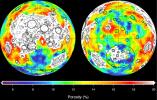
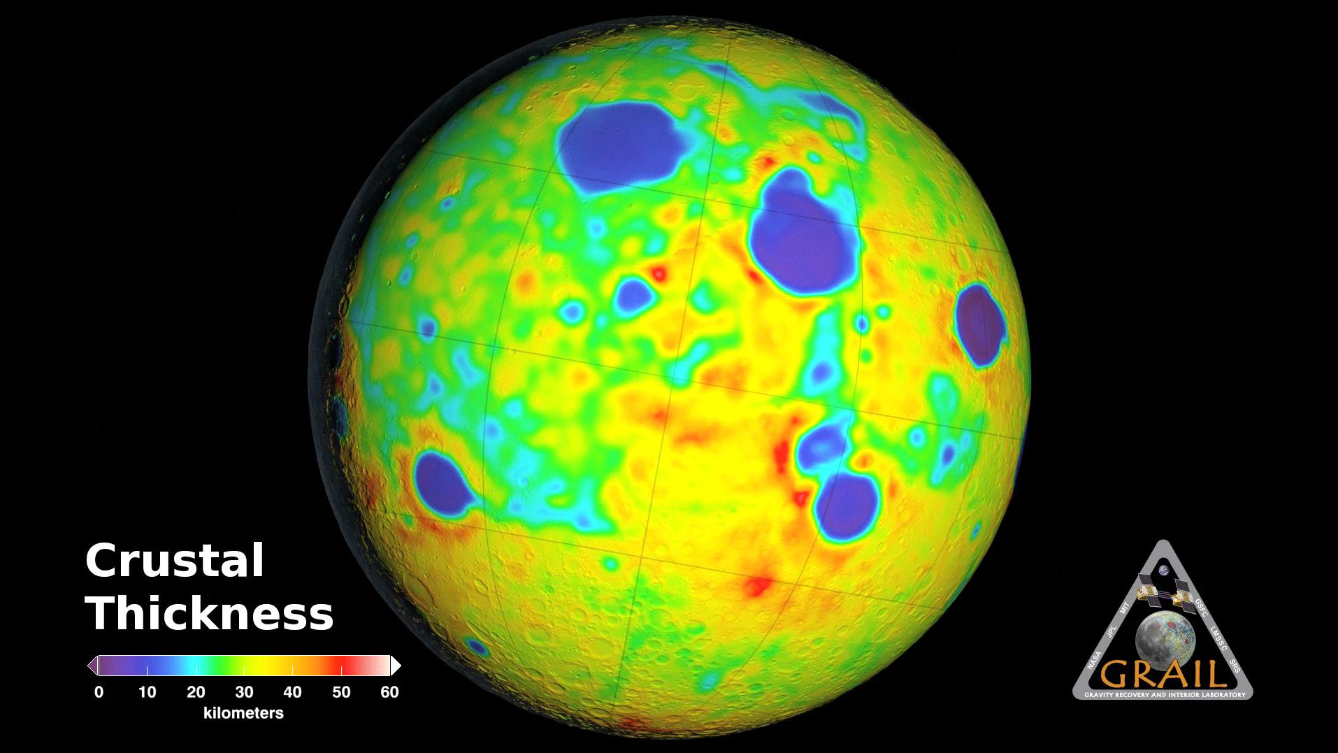
2013-11-08 |
Moon
|
GRAIL
|
|
1557x1001x3 |
|
-
PIA17674:
-
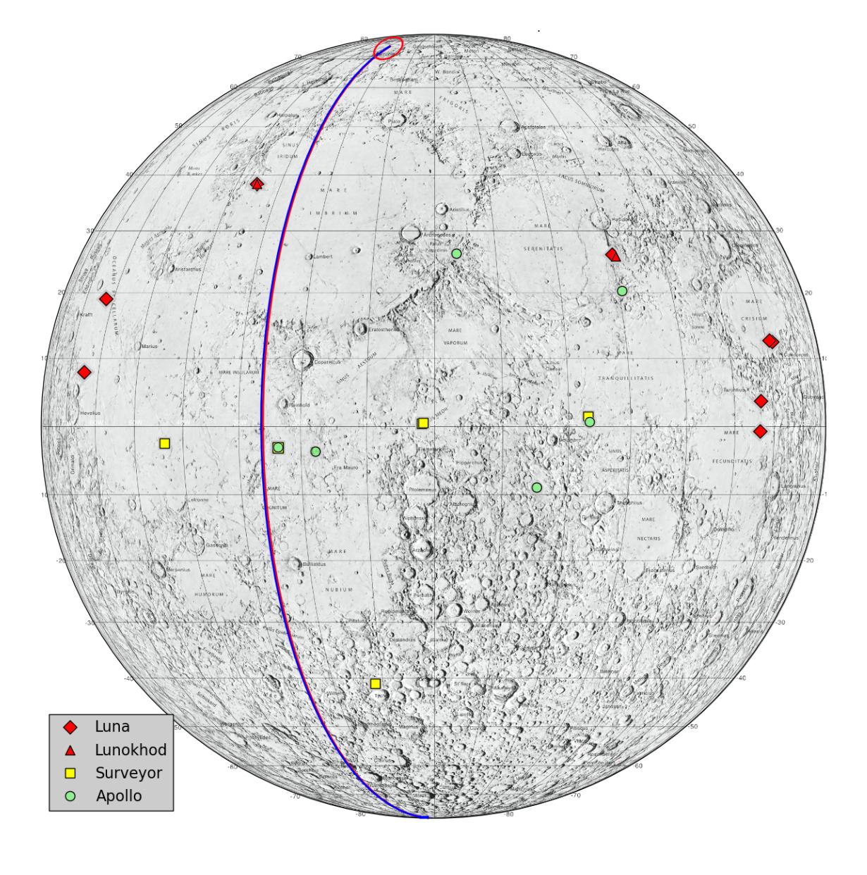
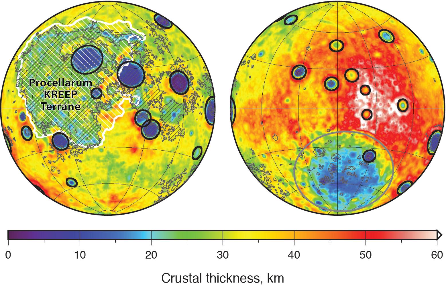
Moon Crustal Thickness
Full Resolution:
TIFF
(4.678 MB)
JPEG
(288 kB)
|
|
|
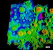
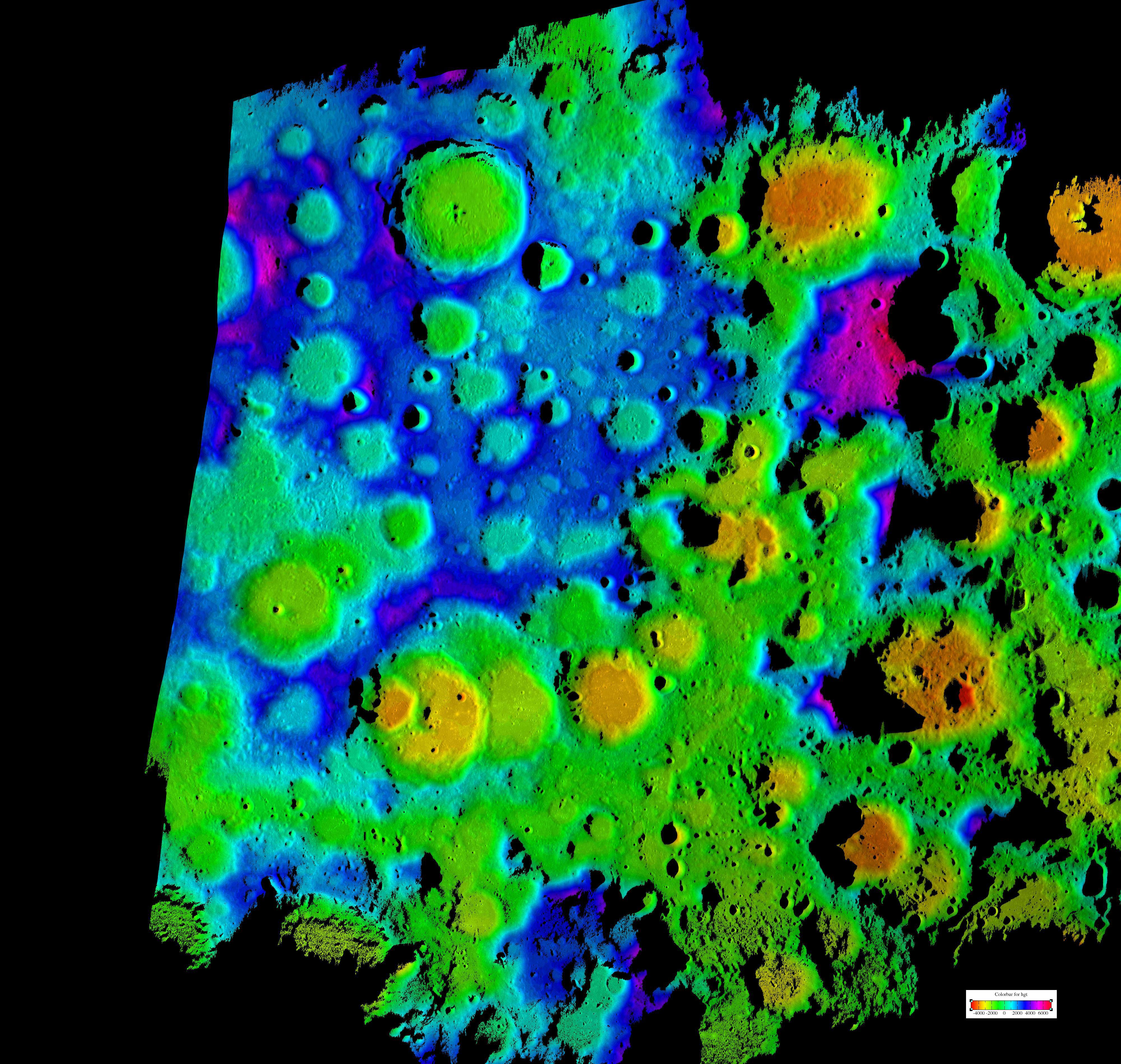
2016-10-27 |
Moon
|
GRAIL
|
|
2707x2832x3 |

|
-
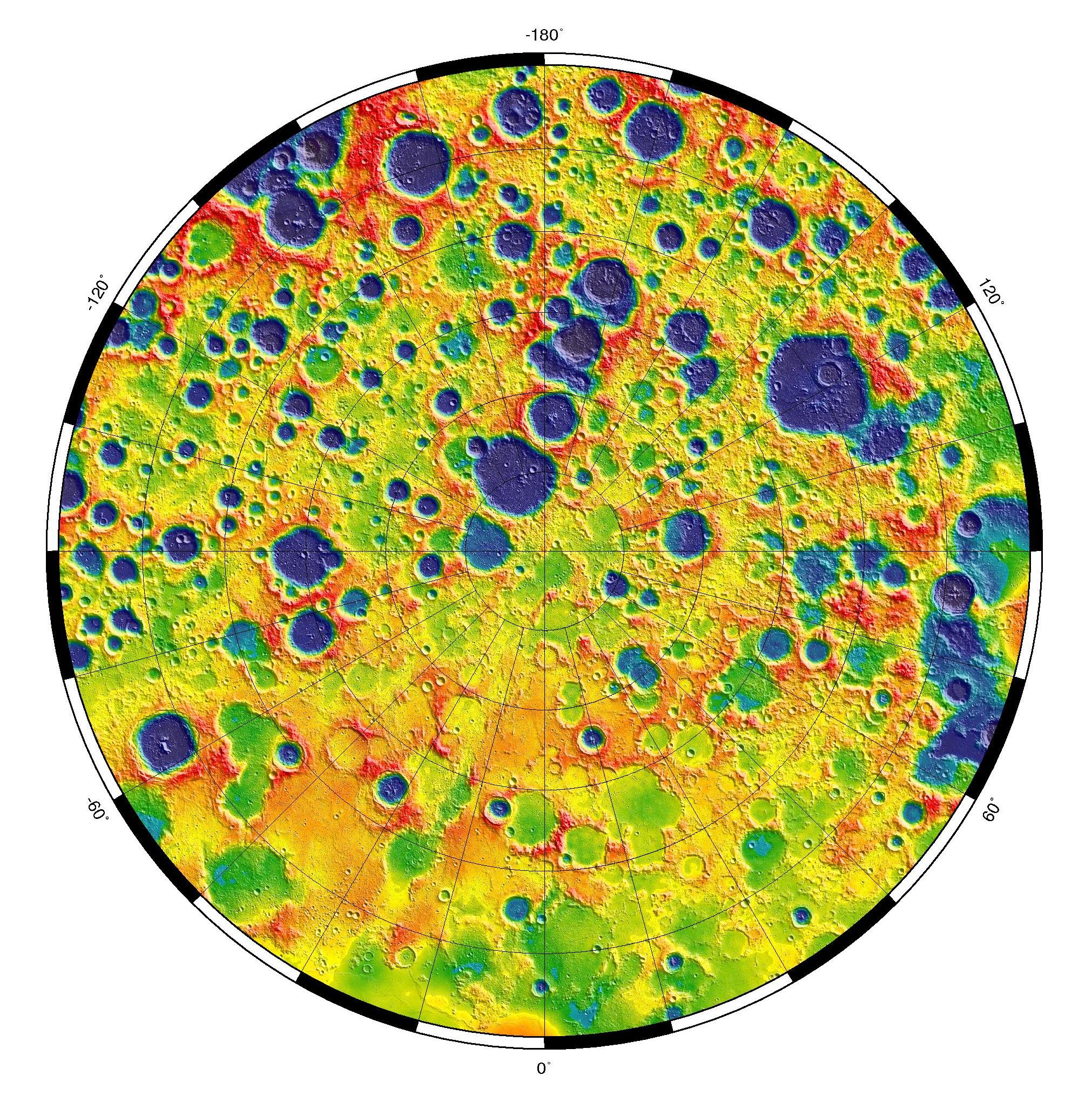
PIA21050:
-
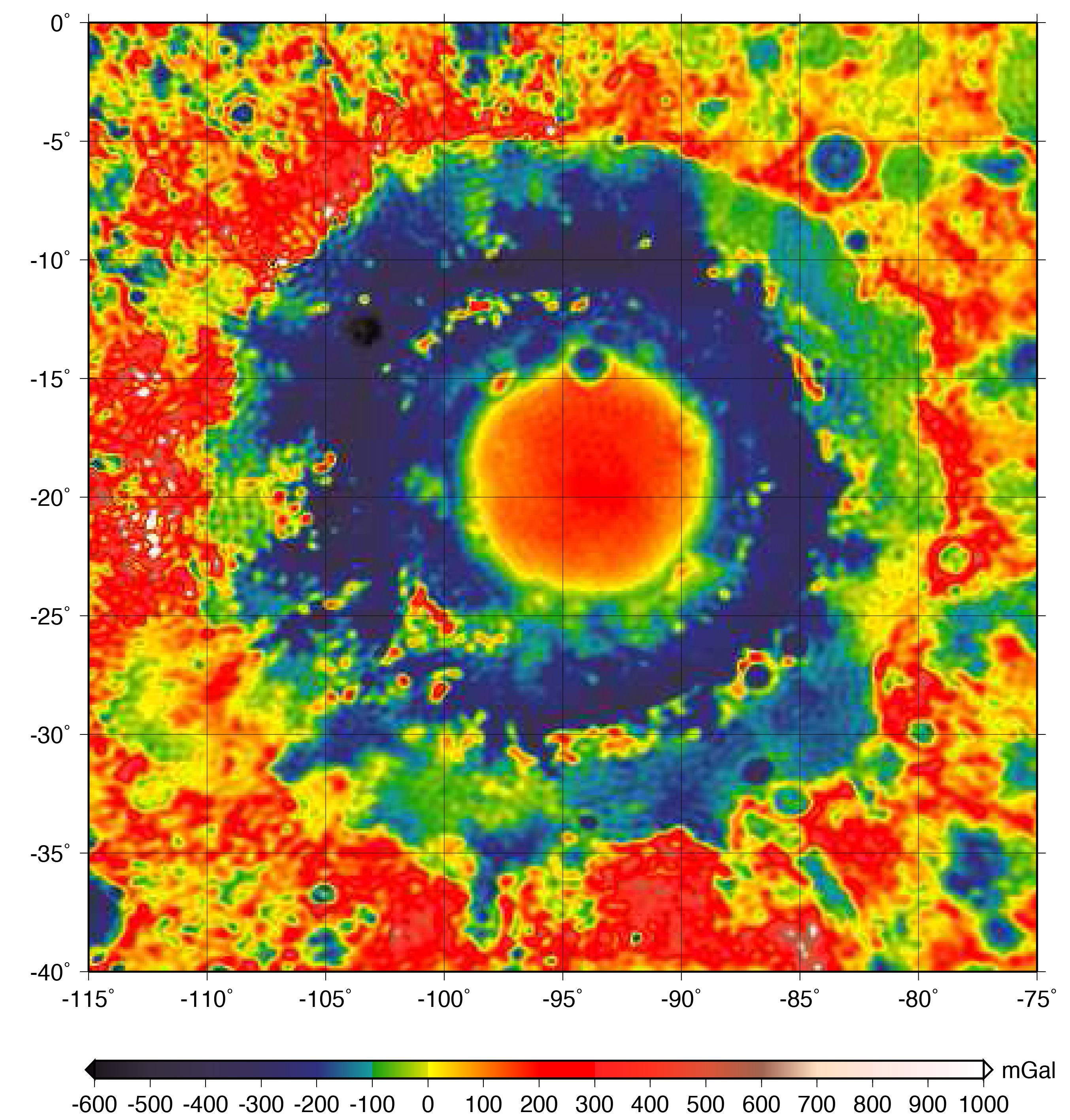
GRAIL Gravity Map of Orientale Basin
Full Resolution:
TIFF
(17.62 MB)
JPEG
(990.3 kB)
|
 Planetary Data System


