My
List |
Addition Date
|
Target
|
Mission
|
Instrument
|
Size
|

|
2018-02-15 |
Mars
|
Mars Exploration Rover (MER)
|
HiRISE
|
3741x2519x3 |
|
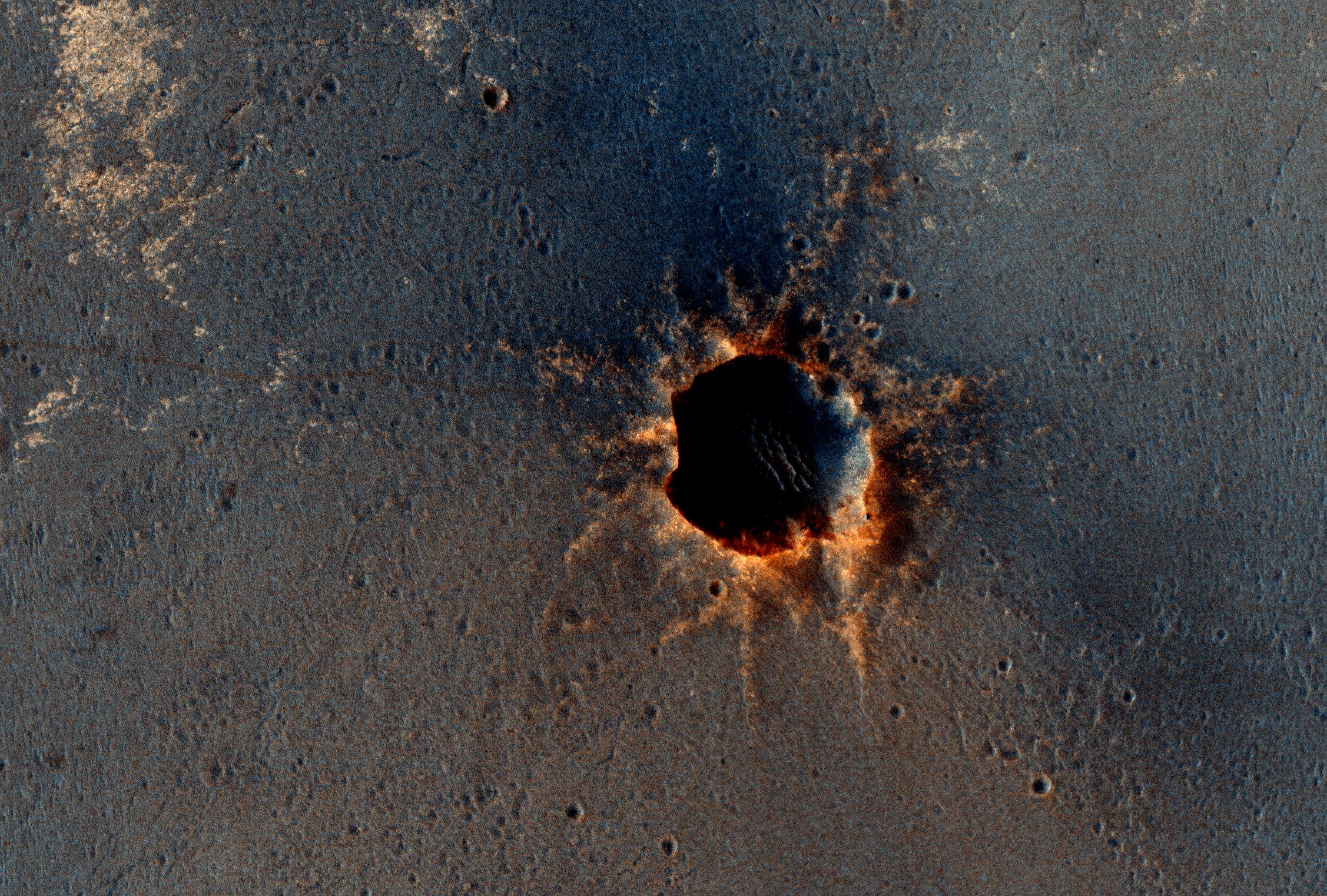
-
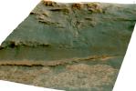
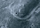
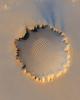
PIA22216:
-
Martian 'Perseverance Valley' in Perspective (Vertical Exaggeration)
Full Resolution:
TIFF
(17.11 MB)
JPEG
(995.8 kB)
|
|
|
2017-04-21 |
Mars
|
Mars Exploration Rover (MER)
Mars Reconnaissance Orbiter (MRO)
|
HiRISE
|
2558x2014x3 |
|
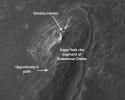
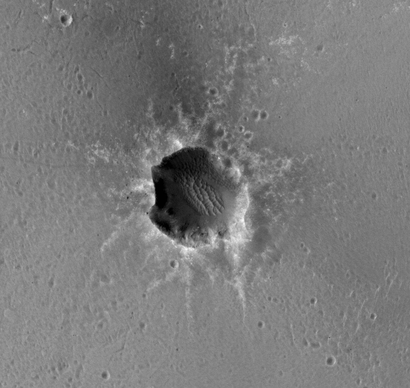
-
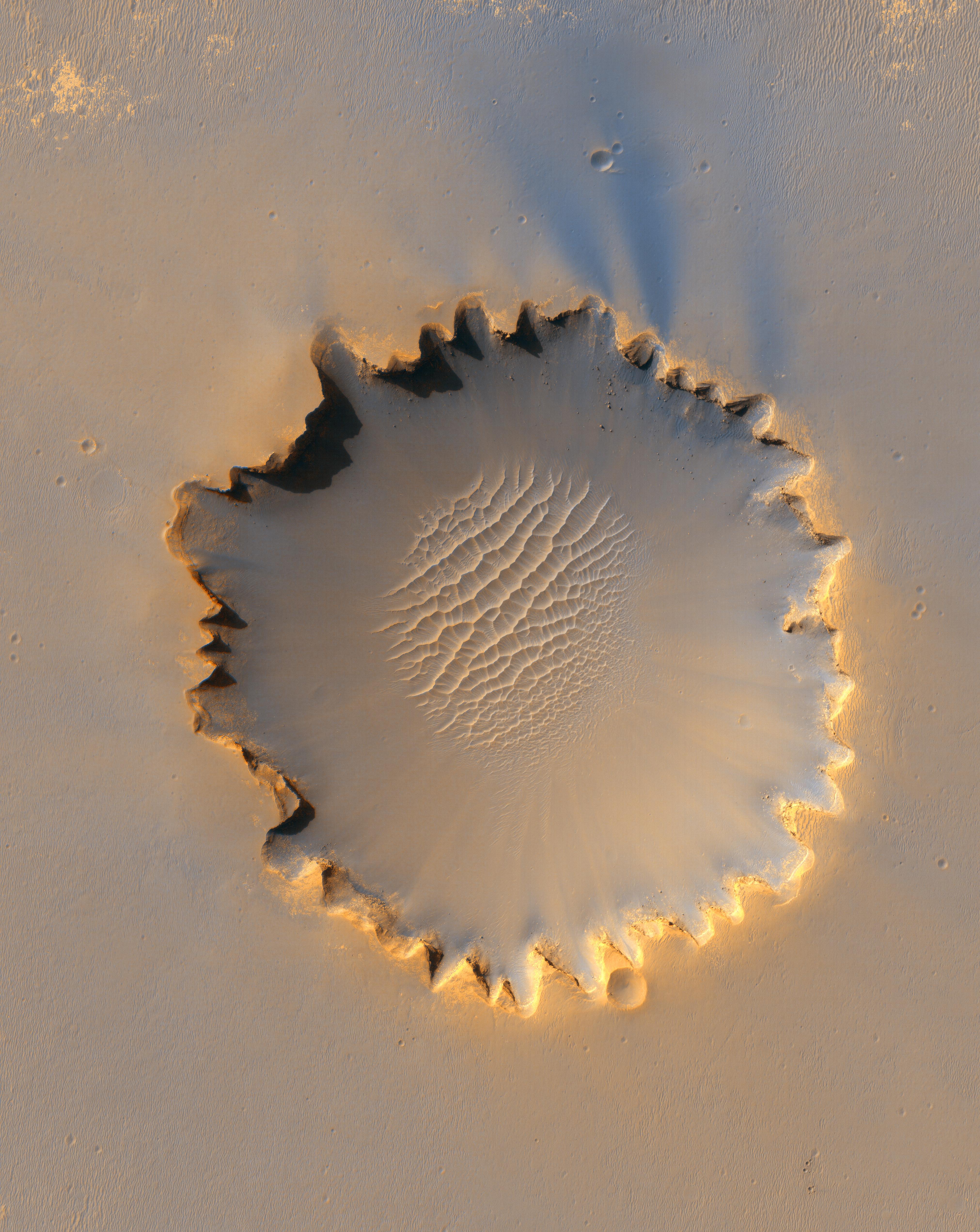
PIA21494:
-
Rover's Landing Hardware at Eagle Crater, Mars
Full Resolution:
TIFF
(11.9 MB)
JPEG
(733.9 kB)
|
|
|
2016-10-07 |
Mars
|
Mars Exploration Rover (MER)
Mars Reconnaissance Orbiter (MRO)
|
HiRISE
|
3200x4880x3 |

|
-
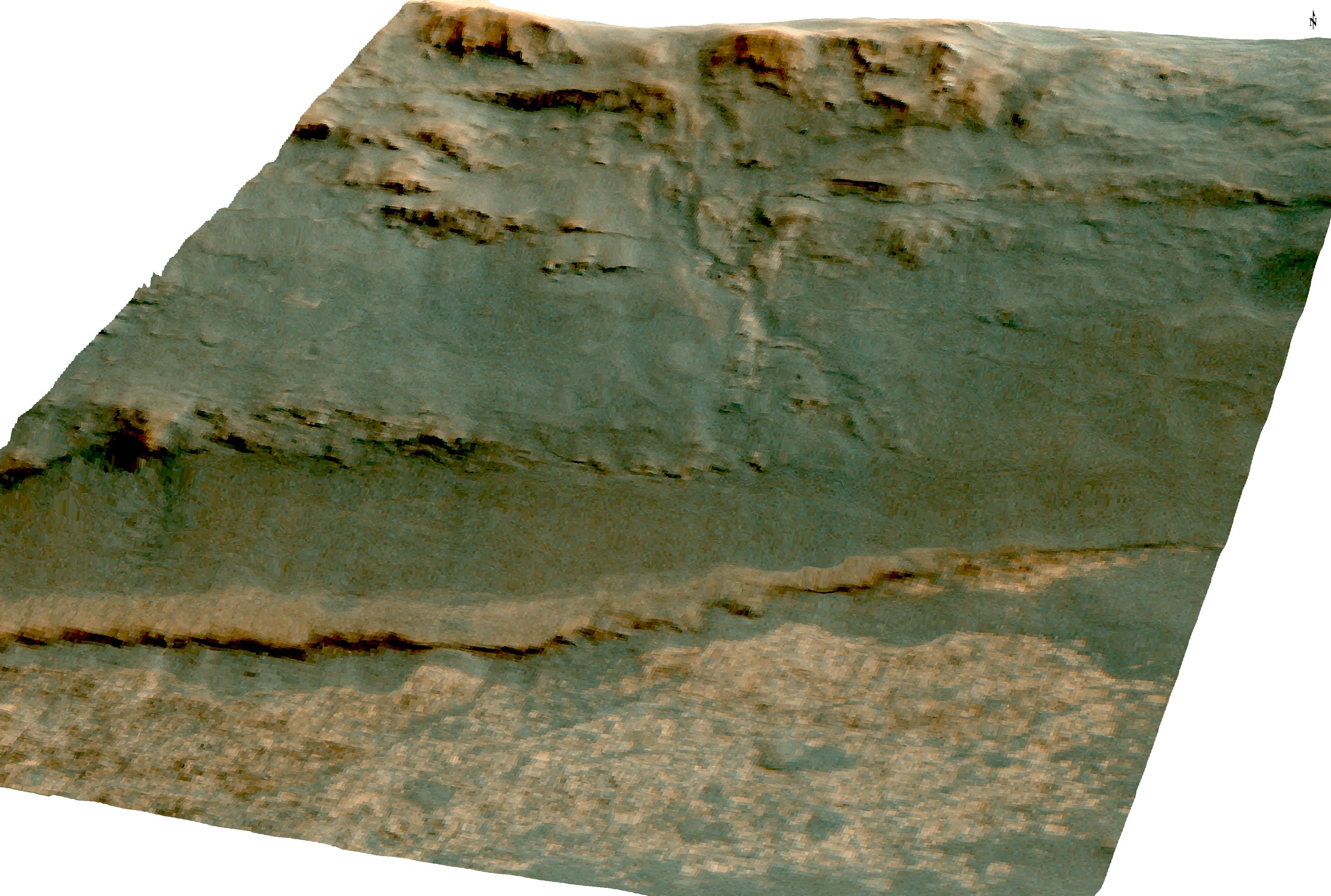
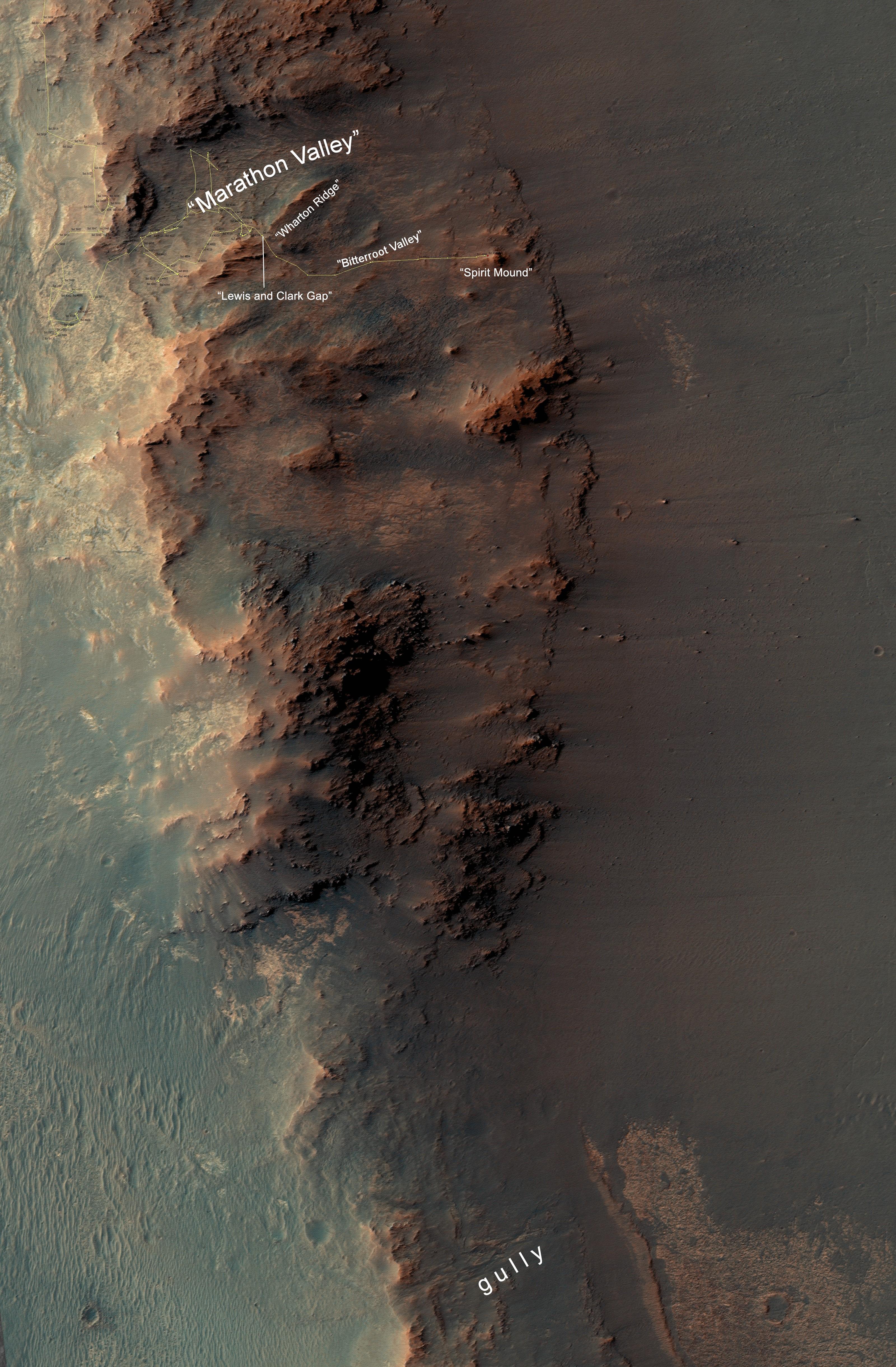
PIA20854:
-
From 'Marathon Valley' to Gully on Endeavour Rim
Full Resolution:
TIFF
(41.84 MB)
JPEG
(2.035 MB)
|
|
|
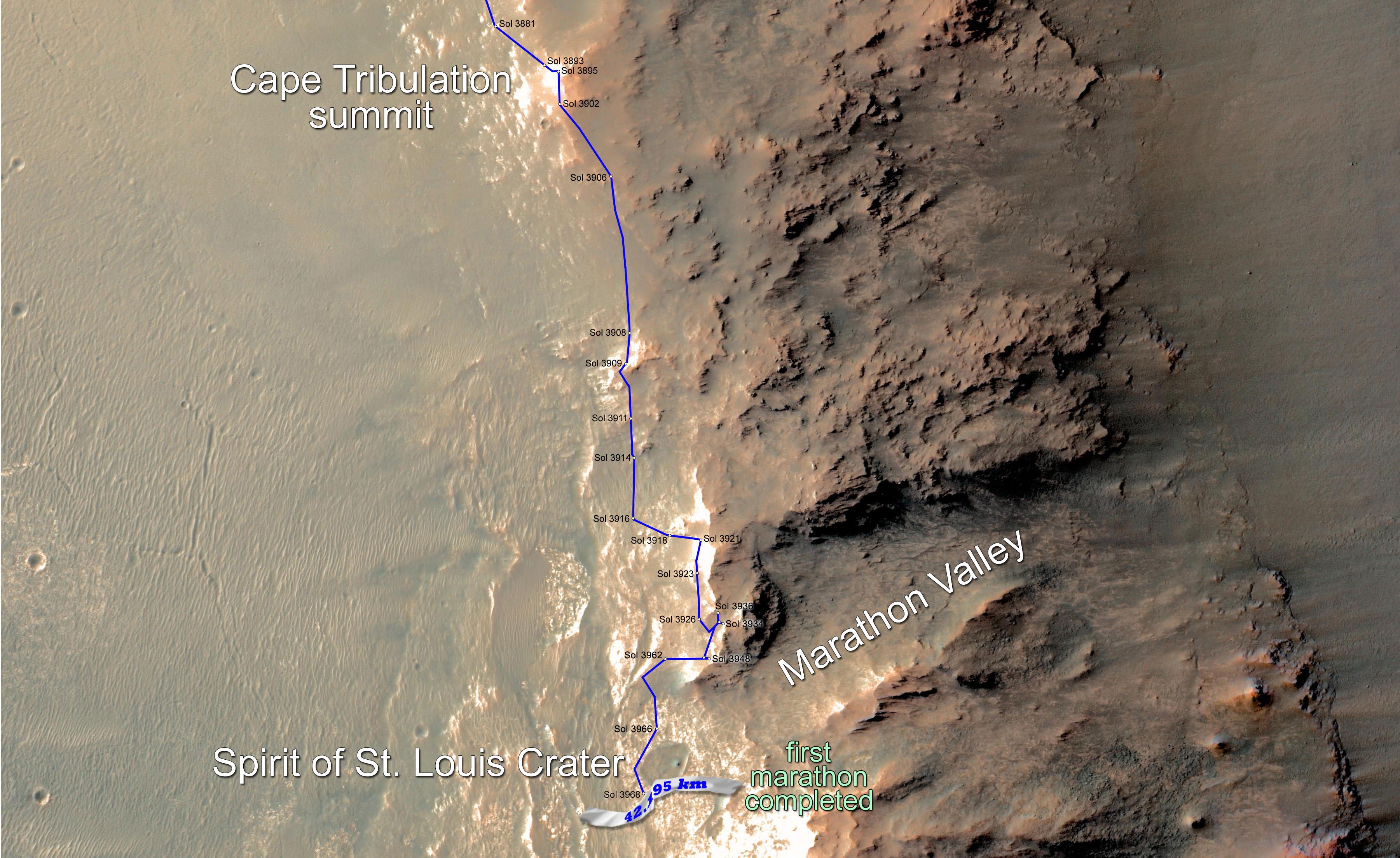
2015-03-24 |
Mars
|
Mars Exploration Rover (MER)
Mars Reconnaissance Orbiter (MRO)
|
HiRISE
|
3602x2208x3 |
|
-
PIA19157:
-
Opportunity Rover Surpasses Marathon Distance
Full Resolution:
TIFF
(23.87 MB)
JPEG
(1.029 MB)
|
|
|
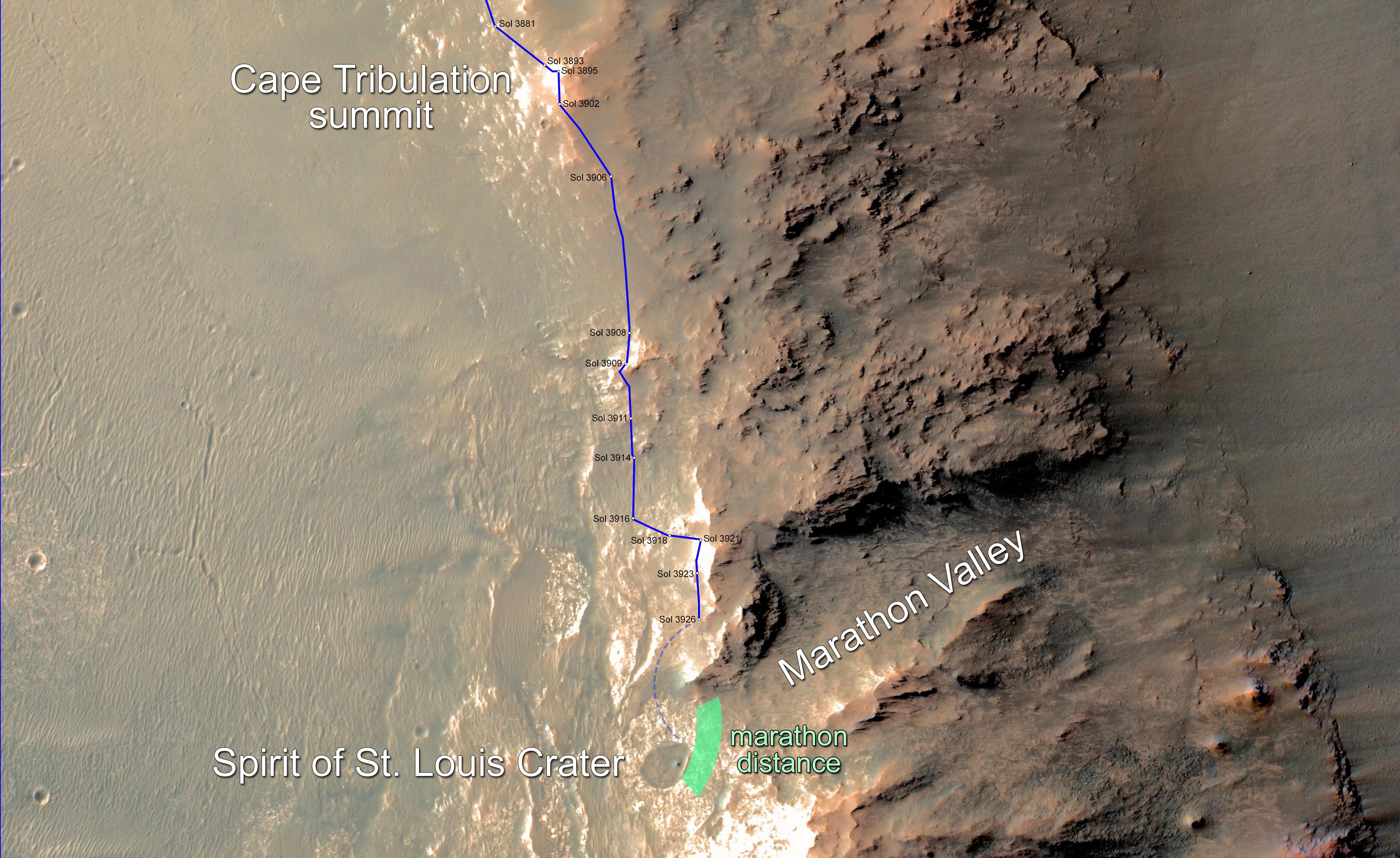
2015-02-10 |
Mars
|
Mars Exploration Rover (MER)
|
HiRISE
|
3602x2208x3 |
|
-
PIA19141:
-
Opportunity Rover Nears Mars Marathon Feat
Full Resolution:
TIFF
(23.87 MB)
JPEG
(1.028 MB)
|
|
|
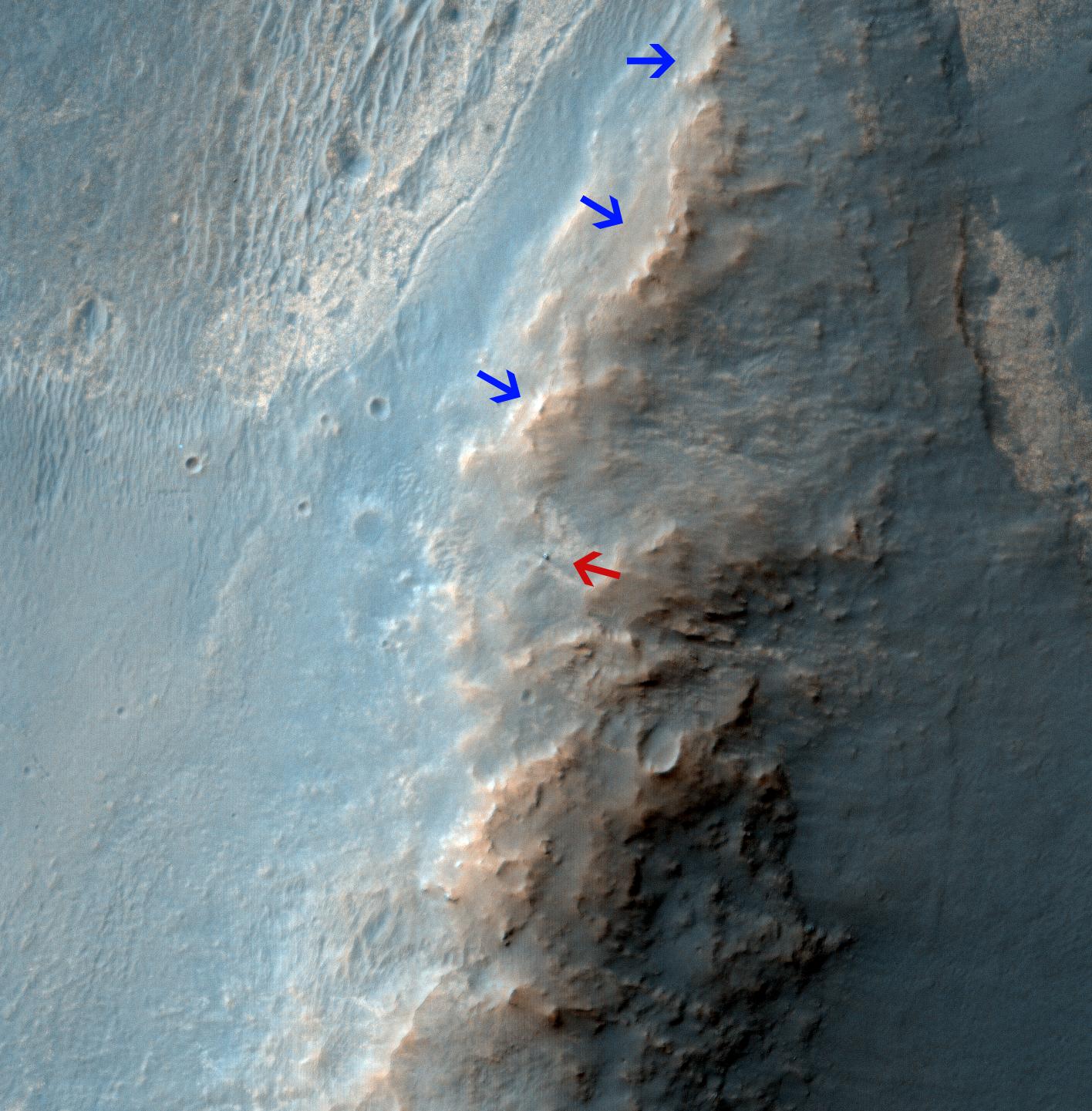
2014-02-19 |
Mars
|
Mars Exploration Rover (MER)
Mars Reconnaissance Orbiter (MRO)
|
HiRISE
|
1416x1441x3 |
|
-
PIA17941:
-
Opportunity Rover on 'Murray Ridge' Seen From Orbit
Full Resolution:
TIFF
(6.124 MB)
JPEG
(282.8 kB)
|
|
|
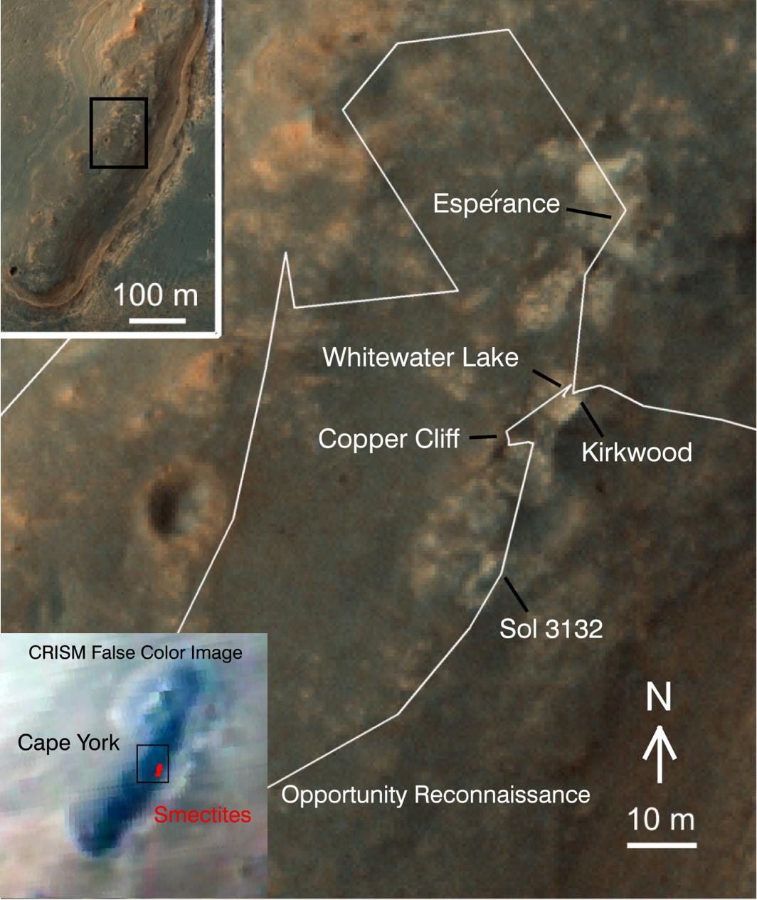
2014-01-23 |
Mars
|
Mars Exploration Rover (MER)
Mars Reconnaissance Orbiter (MRO)
|
HiRISE
|
1064x1265x3 |
|
-
PIA17264:
-
'Cape York' Explored
Full Resolution:
TIFF
(4.04 MB)
JPEG
(138.1 kB)
|
|
|
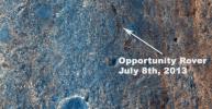
2013-11-13 |
Mars
|
Mars Exploration Rover (MER)
Mars Reconnaissance Orbiter (MRO)
|
HiRISE
|
8192x4298x3 |
|
-
PIA17586:
-
A New Perspective on Murray Ridge
Full Resolution:
TIFF
(105.7 MB)
JPEG
(2.803 MB)
|
|
|
2013-07-17 |
Mars
|
Mars Exploration Rover (MER)
Mars Reconnaissance Orbiter (MRO)
|
HiRISE
|
1616x839x3 |
|
-
PIA17278:
-
Color View From Orbit Showing Opportunity in 'Botany Bay'
Full Resolution:
TIFF
(4.069 MB)
JPEG
(524.7 kB)
|
|
|
2013-06-07 |
Mars
|
Mars Exploration Rover (MER)
|
HiRISE
|
8192x4206x1 |
|
-
PIA17076:
-
Perspective View of 'Botany Bay' and Surroundings, With Vertical Exaggeration
Full Resolution:
TIFF
(34.49 MB)
JPEG
(3.985 MB)
|
|
|
2013-06-07 |
Mars
|
Mars Exploration Rover (MER)
Mars Reconnaissance Orbiter (MRO)
|
HiRISE
|
3153x3788x3 |
|
-
PIA17073:
-
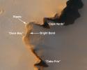
Opportunity's Exploration of "Cape York"
Full Resolution:
TIFF
(35.85 MB)
JPEG
(573.3 kB)
|
|
|
2013-05-17 |
Mars
|
Mars Exploration Rover (MER)
|
HiRISE
|
793x1209x1 |
|
-
PIA16931:
-
Opportunity Heads Toward Next Destination, 'Solander Point'
Full Resolution:
TIFF
(959.9 kB)
JPEG
(122.1 kB)
|
|
|
2012-02-08 |
Mars
|
Mars Exploration Rover (MER)
Mars Reconnaissance Orbiter (MRO)
|
HiRISE
|
2080x1393x3 |
|
-
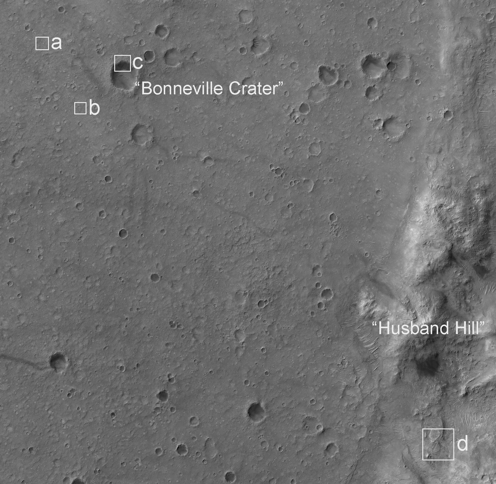
PIA15038:
-
Spirit Lander and Bonneville Crater in Color
Full Resolution:
TIFF
(8.704 MB)
JPEG
(354.7 kB)
|
|
|
2012-01-05 |
Mars
|
Mars Exploration Rover (MER)
Mars Reconnaissance Orbiter (MRO)
|
HiRISE
|
700x560x1 |
|
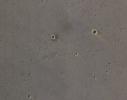
-
PIA15276:
-
Locator Map for 'Greeley Haven' on Endeavour Rim
Full Resolution:
TIFF
(392.6 kB)
JPEG
(56.54 kB)
|
|
|
2011-09-01 |
Mars
|
Mars Exploration Rover (MER)
Mars Reconnaissance Orbiter (MRO)
|
HiRISE
|
8192x5786x3 |
|
-
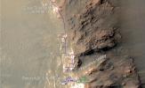
PIA14537:
-
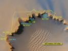
Opportunity's First Neighborhood on Rim of Endeavour
Full Resolution:
TIFF
(142.2 MB)
JPEG
(5.631 MB)
|
|
|
2011-06-08 |
Mars
|
Mars Exploration Rover (MER)
Mars Reconnaissance Orbiter (MRO)
|
HiRISE
|
8192x5789x3 |
|
-
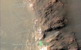
PIA14134:
-
Opportunity's First Goal at Endeavour Crater: 'Spirit Point'
Full Resolution:
TIFF
(47.47 MB)
JPEG
(3.48 MB)
|
|
|
2011-03-09 |
Mars
|
Mars Exploration Rover (MER)
Mars Reconnaissance Orbiter (MRO)
|
HiRISE
|
2254x1522x3 |
|
-
PIA13803:
-
Opportunity is Still Smiling
Full Resolution:
TIFF
(10.3 MB)
JPEG
(1.155 MB)
|
|
|
2011-01-04 |
Mars
|
Mars Exploration Rover (MER)
Mars Reconnaissance Orbiter (MRO)
|
HiRISE
|
1347x1277x1 |

|
-
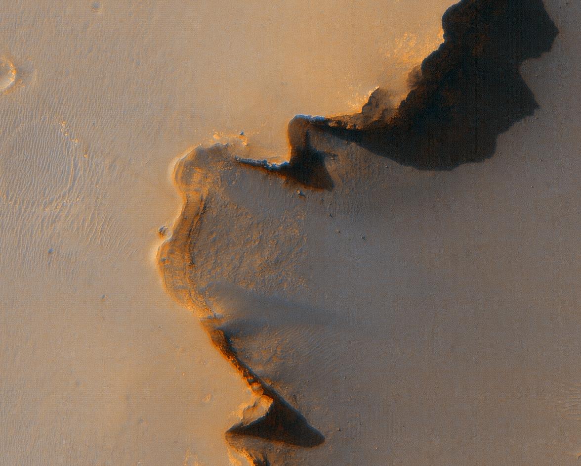
PIA13754:
-
Mars Orbiter Sees Rover Opportunity at Crater Edge
Full Resolution:
TIFF
(1.722 MB)
JPEG
(195 kB)
|
|
|
2010-12-10 |
Mars
|
Mars Exploration Rover (MER)
|
CTX
HiRISE
|
3038x6485x1 |
|
-
PIA13598:
-
Opportunity's Martian Traverse Through Sol 2442
Full Resolution:
TIFF
(19.73 MB)
JPEG
(1.488 MB)
|
|
|
2007-12-10 |
Mars
|
Mars Exploration Rover (MER)
Mars Reconnaissance Orbiter (MRO)
|
HiRISE
|
1052x717x3 |
|
-
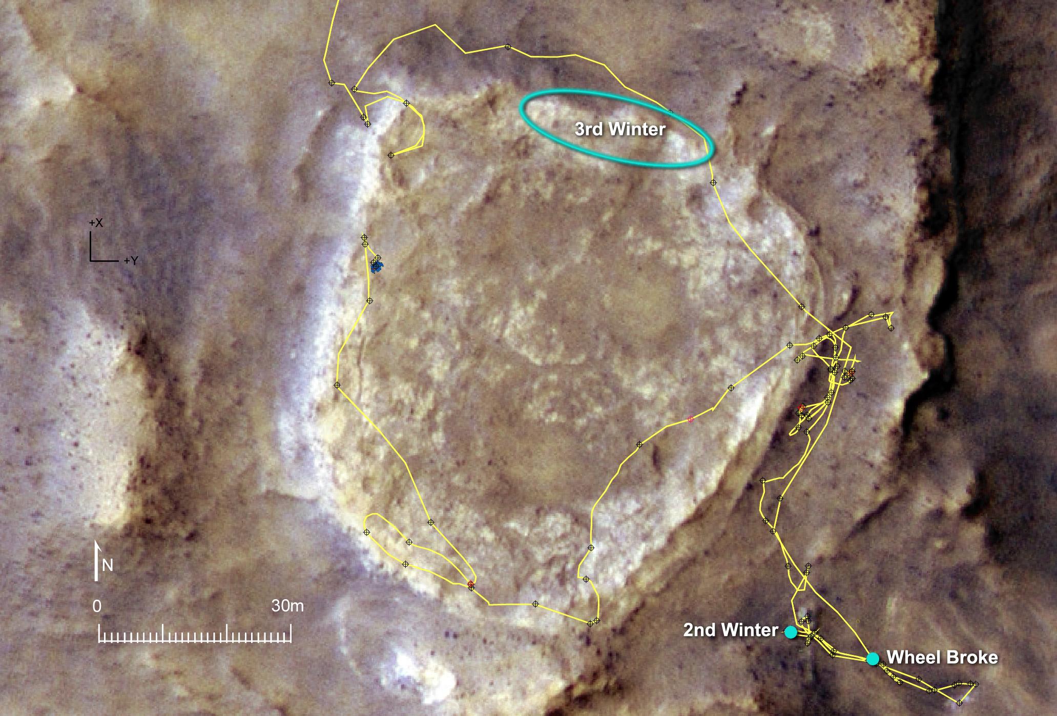
PIA10129:
-
Spirit Nears North-Tilting Site for Winter Haven
Full Resolution:
TIFF
(2.266 MB)
JPEG
(143.3 kB)
|
|
|
2007-12-10 |
Mars
|
Mars Exploration Rover (MER)
Mars Reconnaissance Orbiter (MRO)
|
HiRISE
|
2063x1397x3 |
|
-
PIA10127:
-
Heading for Next Winter Haven
Full Resolution:
TIFF
(8.657 MB)
JPEG
(398.4 kB)
|
|
|
2007-12-10 |
Mars
|
Mars Exploration Rover (MER)
Mars Reconnaissance Orbiter (MRO)
|
HiRISE
|
3688x2720x3 |
|
-
PIA10126:
-
Spirit's Traverse, Sols 1 to 1,386
Full Resolution:
TIFF
(30.09 MB)
JPEG
(2.09 MB)
|
|
|
2007-06-28 |
Mars
|
Mars Exploration Rover (MER)
Mars Reconnaissance Orbiter (MRO)
|
HiRISE
|
720x540x3 |
|
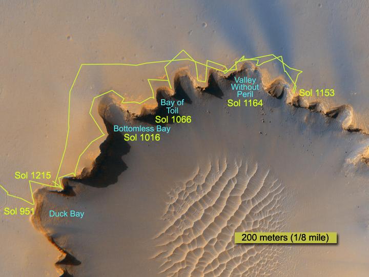
-
PIA09696:
-
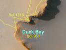
Crater Rim Path, Sol 1,215
Full Resolution:
TIFF
(1.168 MB)
JPEG
(46.69 kB)
|
|
|
2007-06-28 |
Mars
|
Mars Exploration Rover (MER)
Mars Reconnaissance Orbiter (MRO)
|
HiRISE
|
1792x877x1 |

|
-
PIA09692:
-
Rover Tracks at Crater's Edge
Full Resolution:
TIFF
(1.574 MB)
JPEG
(263.1 kB)
|
|
|
2007-06-28 |
Mars
|
Mars Exploration Rover (MER)
Mars Reconnaissance Orbiter (MRO)
|
HiRISE
|
1176x942x3 |
|
-
PIA09690:
-
Opportunity Gets Ready to Roll
Full Resolution:
TIFF
(3.327 MB)
JPEG
(165.4 kB)
|
|
|
2007-06-28 |
Mars
|
Mars Global Surveyor (MGS)
Mars Exploration Rover (MER)
Mars Reconnaissance Orbiter (MRO)
|
HiRISE
Mars Orbiter Camera (MOC)
|
636x479x3 |
|
-
PIA09689:
-
Opportunity's Long Road to Victoria (Animation)

Full Resolution:
TIFF
(915.1 kB)
JPEG
(31.22 kB)
|
|
|
2007-06-28 |
Mars
|
Mars Exploration Rover (MER)
Mars Reconnaissance Orbiter (MRO)
|
Panoramic Camera
High Resolution Imaging Science Experiment (HiRISE)
|
639x361x3 |
|
-
PIA09687:
-
Surveying the Scene Above Opportunity (Simulation)
Full Resolution:
TIFF
(693 kB)
JPEG
(21.41 kB)
|
|
|
2007-01-23 |
Mars
|
Mars Exploration Rover (MER)
Mars Reconnaissance Orbiter (MRO)
|
HiRISE
|
1729x1729x3 |
|
-
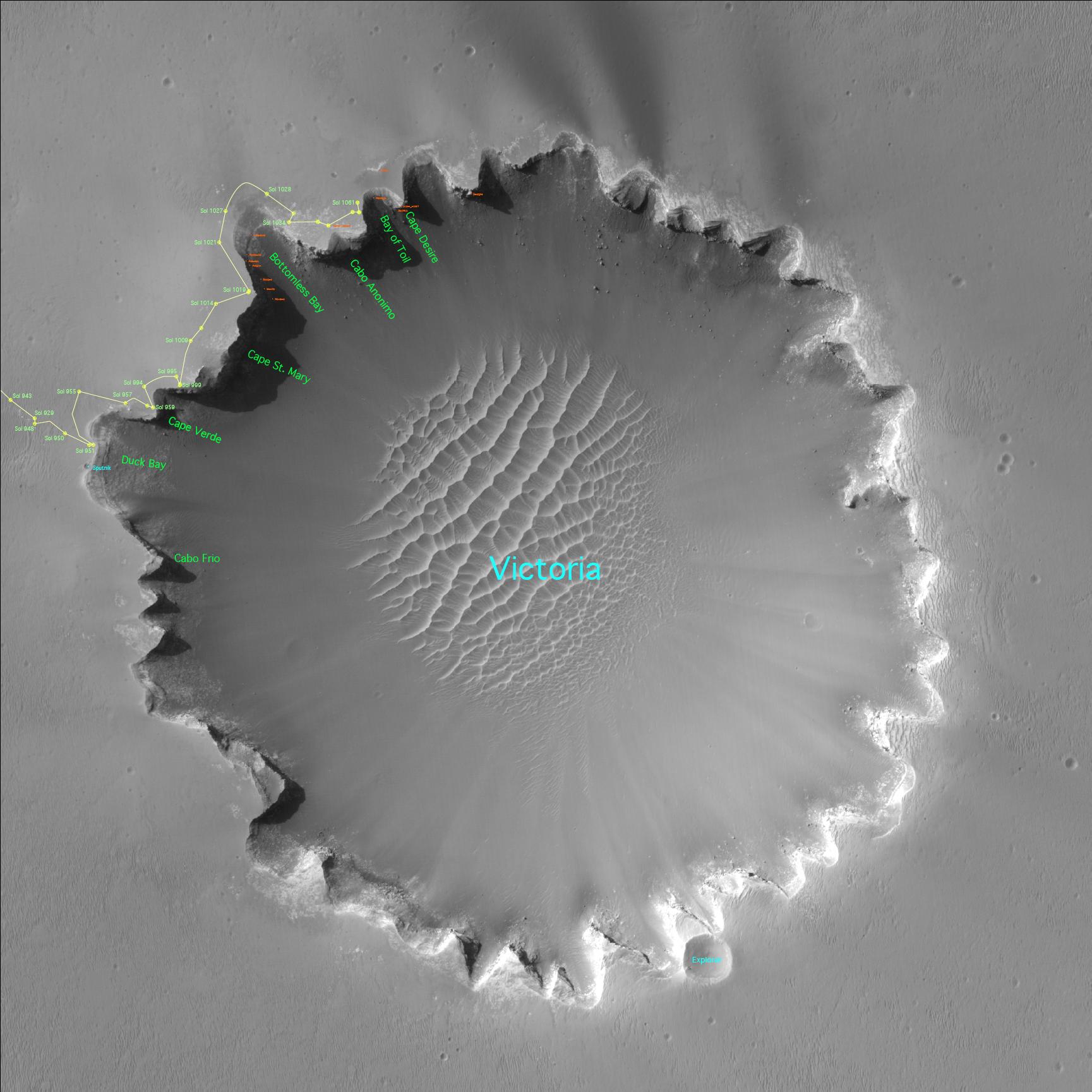
PIA09116:
-
Satellite View of Opportunity's Journey around "Victoria Crater"
Full Resolution:
TIFF
(8.982 MB)
JPEG
(261.1 kB)
|
|
|
2007-01-19 |
Mars
|
Mars Exploration Rover (MER)
Mars Reconnaissance Orbiter (MRO)
|
HiRISE
|
1000x1000x11 |
|
-
PIA09114:
-
Rovers Get New Driving Capability
Full Resolution:
TIFF
(22.64 MB)
JPEG
(714.6 kB)
|
|
|
2006-12-13 |
Mars
|
Mars Exploration Rover (MER)
Mars Reconnaissance Orbiter (MRO)
|
HiRISE
|
790x685x1 |
|
-
PIA09089:
-
Spirit's Tracks around 'Home Plate'
Full Resolution:
TIFF
(541.9 kB)
JPEG
(124 kB)
|
|
|
2006-12-13 |
Mars
|
Mars Exploration Rover (MER)
Mars Reconnaissance Orbiter (MRO)
|
HiRISE
|
1151x1046x1 |
|
-
PIA09088:
-
Spirit's Winter Work Site
Full Resolution:
TIFF
(1.205 MB)
JPEG
(256.4 kB)
|
|
|
2006-12-05 |
Mars
|
Mars Exploration Rover (MER)
Mars Reconnaissance Orbiter (MRO)
|
HiRISE
|
773x1423x1 |
|
-
PIA01880:
-
Three-Frame 'Movie' of Opportunity Rover at 'Victoria Crater'
Full Resolution:
TIFF
(1.101 MB)
JPEG
(115.2 kB)
|
|
|
2006-12-05 |
Mars
|
Mars Exploration Rover (MER)
Mars Reconnaissance Orbiter (MRO)
|
HiRISE
|
1663x1621x1 |
|
-
PIA01879:
-
Mars Exploration Rover Landing Site at Gusev Crater
Full Resolution:
TIFF
(2.699 MB)
JPEG
(417.8 kB)
|
|
|
2006-10-06 |
Mars
|
Mars Exploration Rover (MER)
Mars Reconnaissance Orbiter (MRO)
|
HiRISE
|
1373x1049x1 |
|
-
PIA08817:
-
Opportunity at Crater's 'Cape Verde' (Red Filter)
Full Resolution:
TIFF
(1.442 MB)
JPEG
(130.9 kB)
|
|
|
2006-10-06 |
Mars
|
Mars Exploration Rover (MER)
Mars Reconnaissance Orbiter (MRO)
|
HiRISE
|
1941x1230x3 |
|
-
PIA08816:
-
Opportunity at Crater's 'Cape Verde'
Full Resolution:
TIFF
(7.172 MB)
JPEG
(264.8 kB)
|
|
|
2006-10-06 |
Mars
|
Mars Exploration Rover (MER)
Mars Reconnaissance Orbiter (MRO)
|
HiRISE
|
4045x5085x3 |
|
-
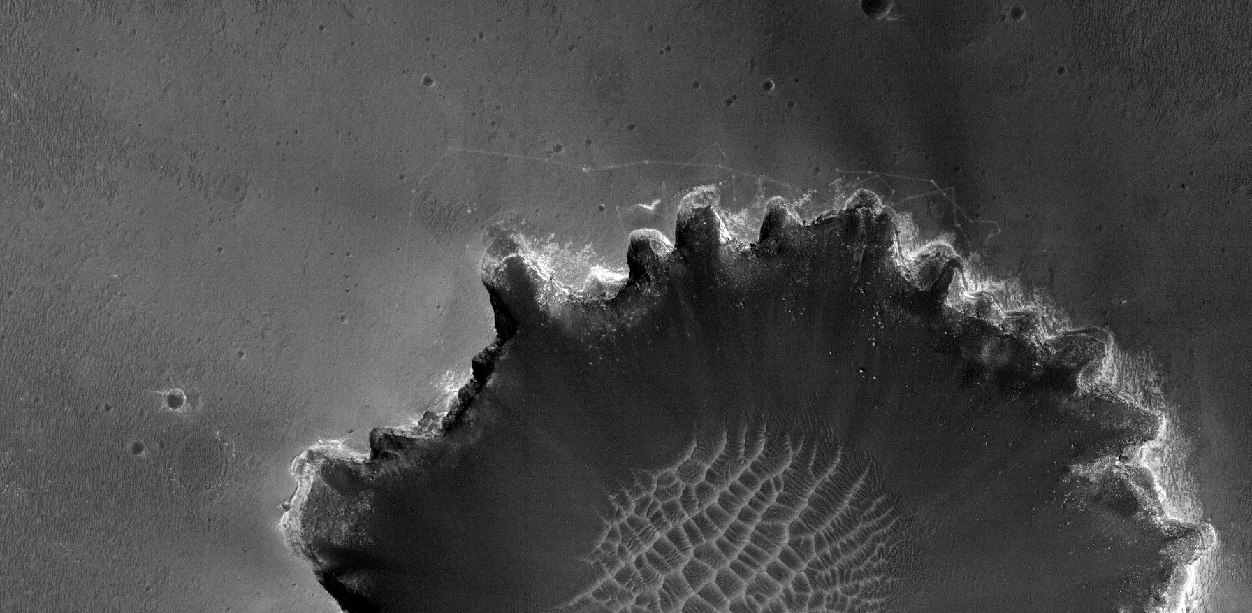
PIA08813:
-
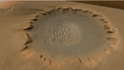
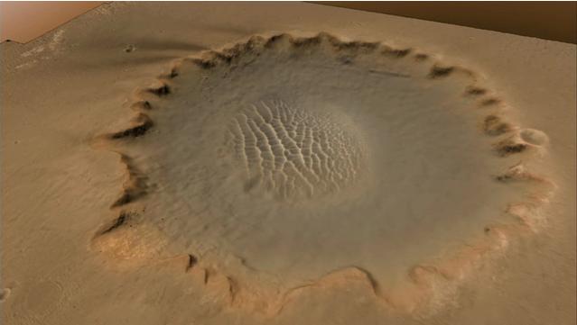
'Victoria Crater' at Meridiani Planum
Full Resolution:
TIFF
(61.71 MB)
JPEG
(3.174 MB)
|
|
|
2006-10-06 |
Mars
|
Mars Exploration Rover (MER)
Mars Reconnaissance Orbiter (MRO)
|
HiRISE
|
1176x942x3 |

|
-
PIA08812:
-
The Opportunity Rover at 'Victoria Crater'
Full Resolution:
TIFF
(3.327 MB)
JPEG
(159.1 kB)
|
 Planetary Data System


