My
List |
Addition Date
|
Target
|
Mission
|
Instrument
|
Size
|

|
2017-04-19 |
Mars
|
Mars Exploration Rover (MER)
|
CTX
|
509x905x1 |
|
-
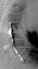
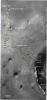
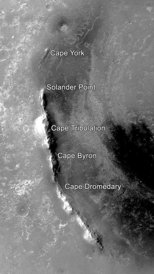
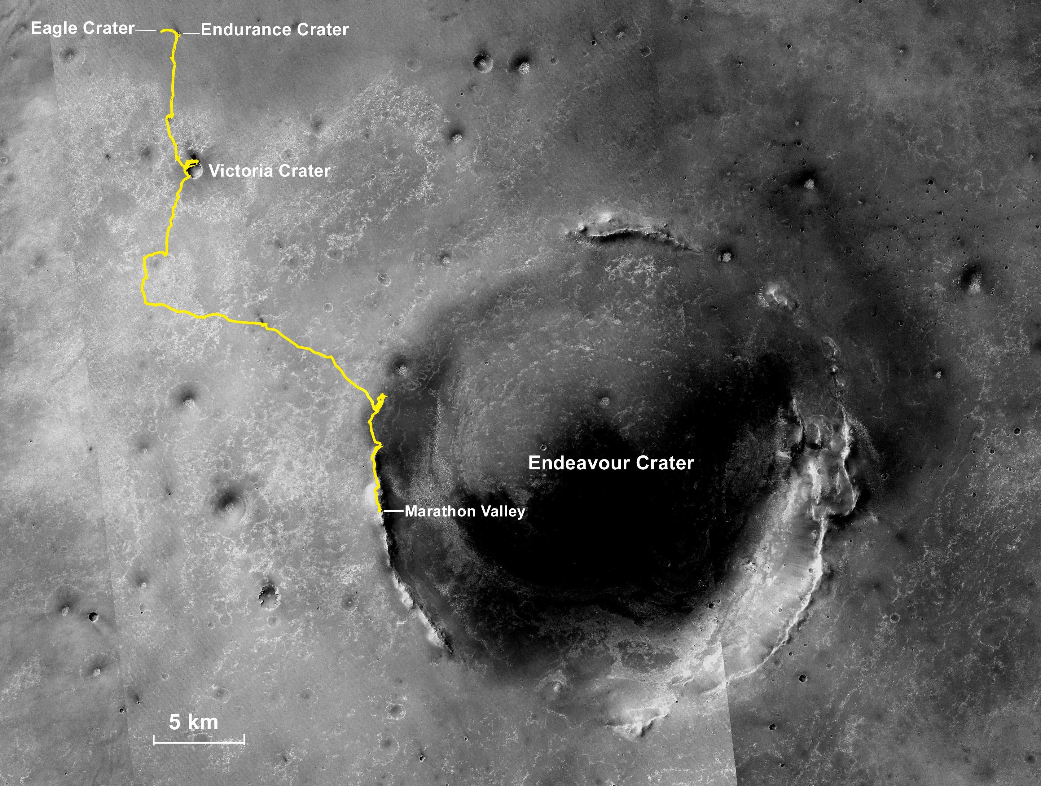
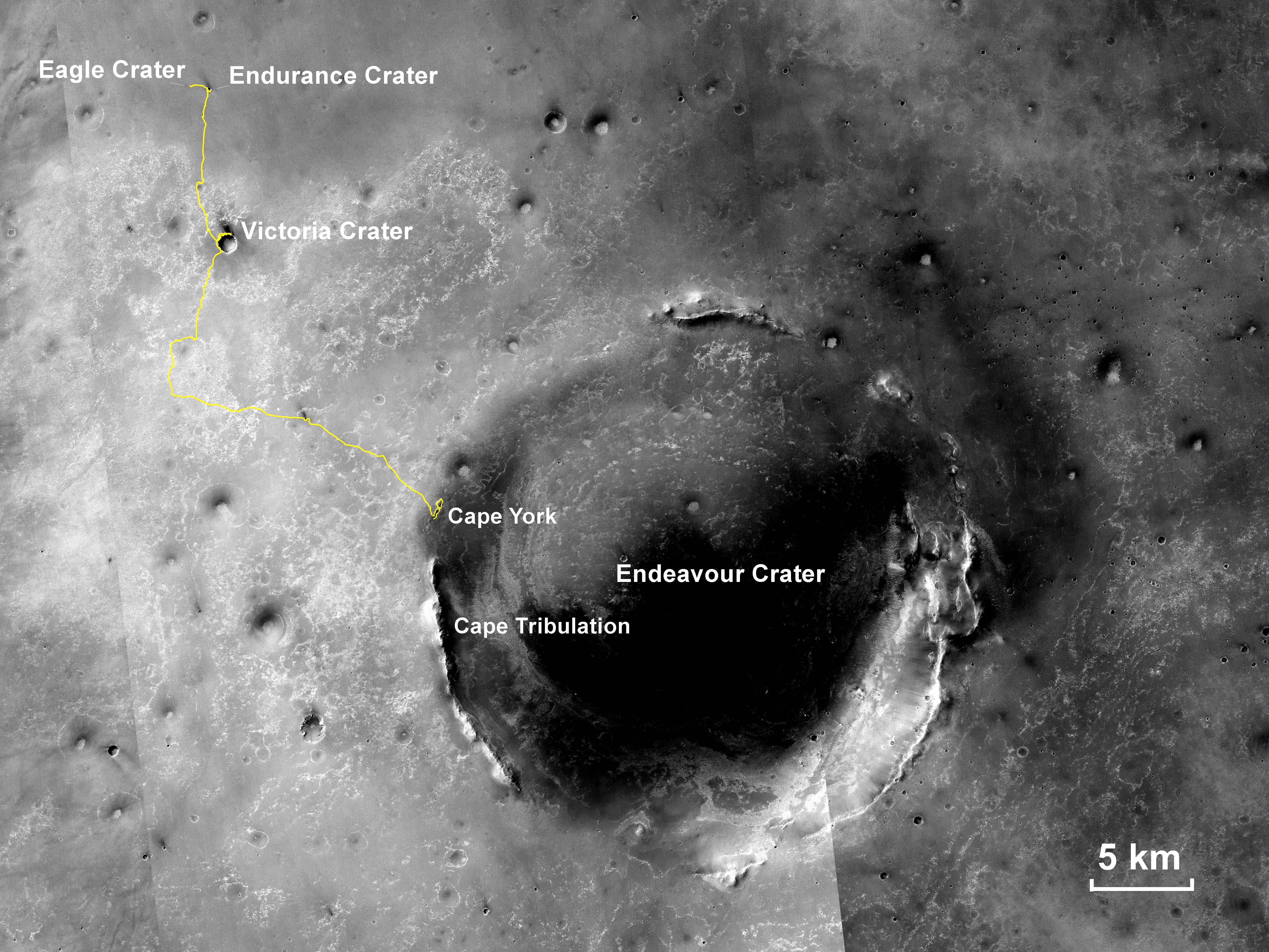
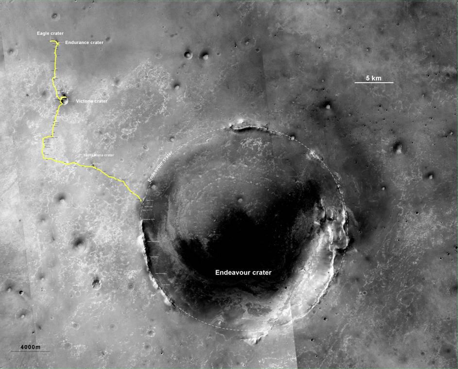
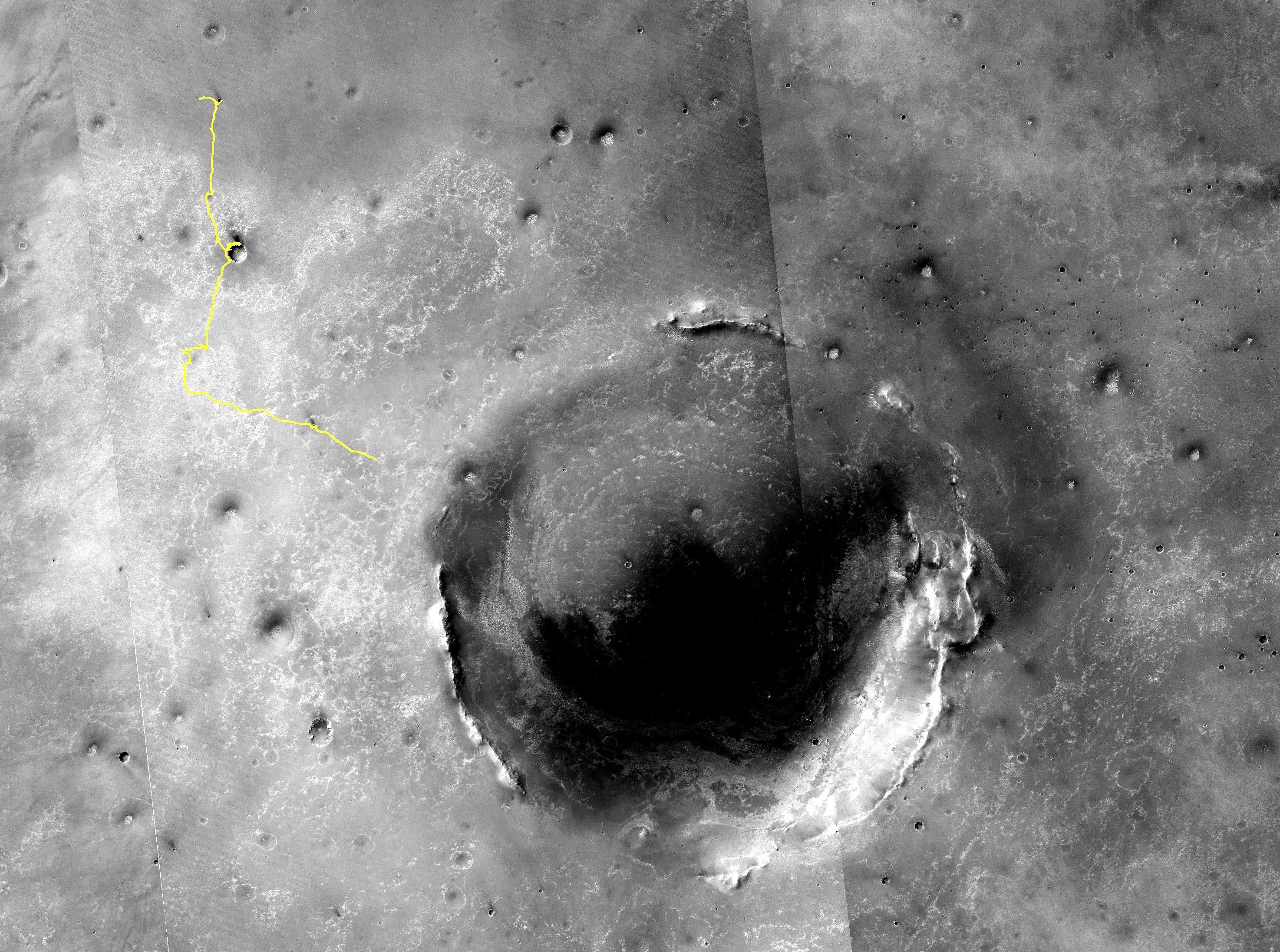
PIA21490:
-
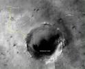
Segments on Western Rim of Endeavour Crater, Mars
Full Resolution:
TIFF
(461.3 kB)
JPEG
(88.6 kB)
|
|
|
2015-03-24 |
Mars
|
Mars Exploration Rover (MER)
|
CTX
|
3360x2537x3 |
|
-
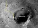
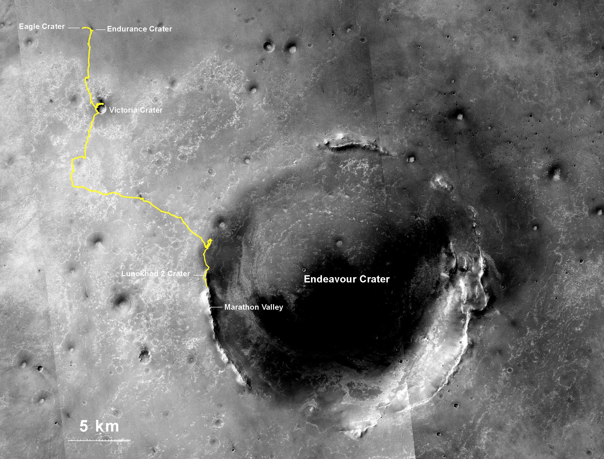
PIA19154:
-
Opportunity Rover's Full Marathon-Length Traverse
Full Resolution:
TIFF
(25.58 MB)
JPEG
(1.516 MB)
|
|
|
2014-07-28 |
Mars
|
Mars Exploration Rover (MER)
Mars Reconnaissance Orbiter (MRO)
|
CTX
|
2420x1838x3 |
|
-
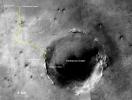
PIA18404:
-
Opportunity's Journey Exceeds 25 Miles
Full Resolution:
TIFF
(13.35 MB)
JPEG
(943.2 kB)
|
|
|
2014-01-23 |
Mars
|
Mars Exploration Rover (MER)
Mars Reconnaissance Orbiter (MRO)
|
CTX
|
4853x3687x3 |
|
-
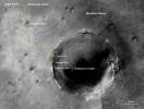
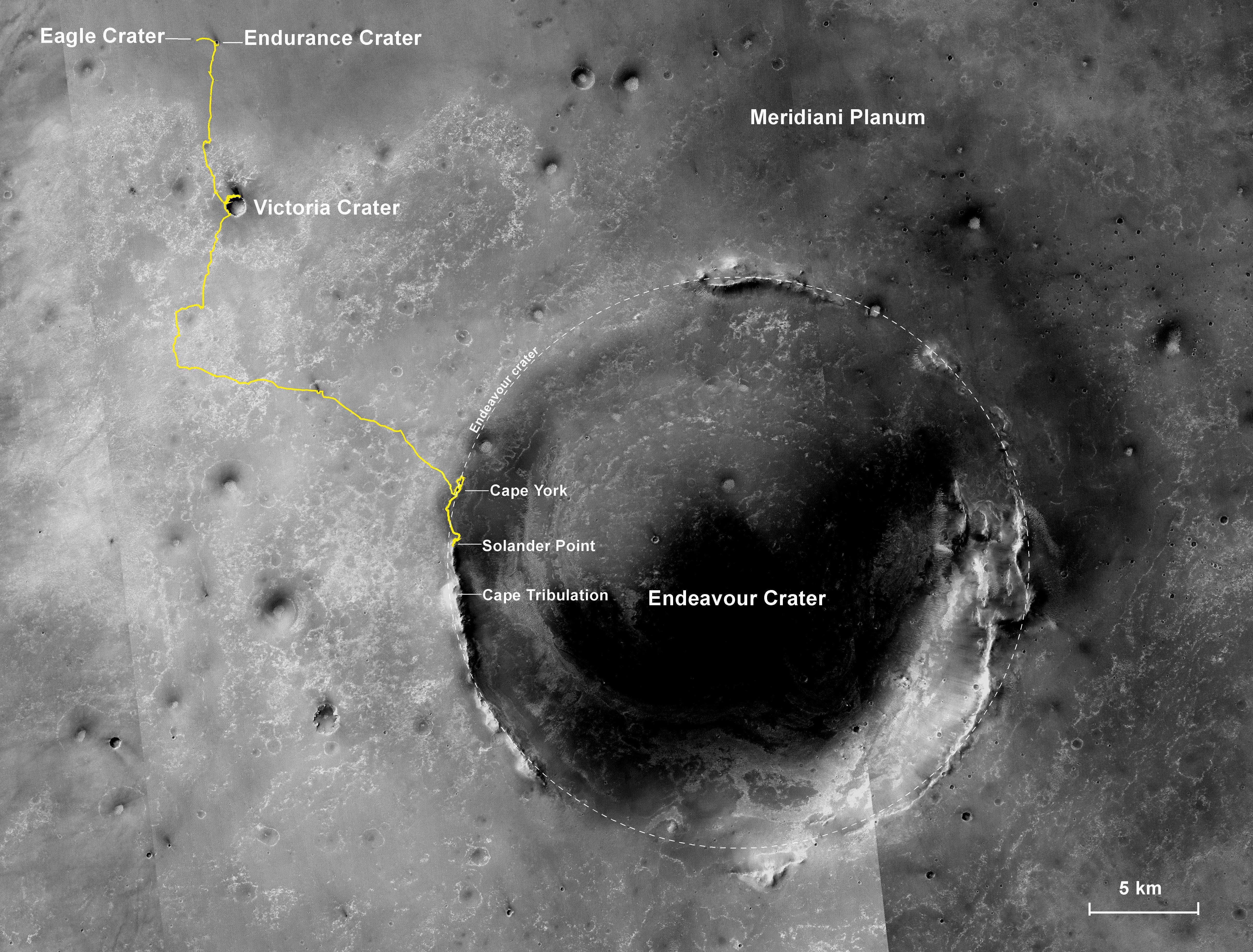
PIA17758:
-
Opportunity's First Decade of Driving on Mars
Full Resolution:
TIFF
(53.71 MB)
JPEG
(3.168 MB)
|
|
|
2013-12-03 |
Mars
|
Mars Exploration Rover (MER)
Mars Reconnaissance Orbiter (MRO)
|
CTX
|
4731x3605x3 |
|
-
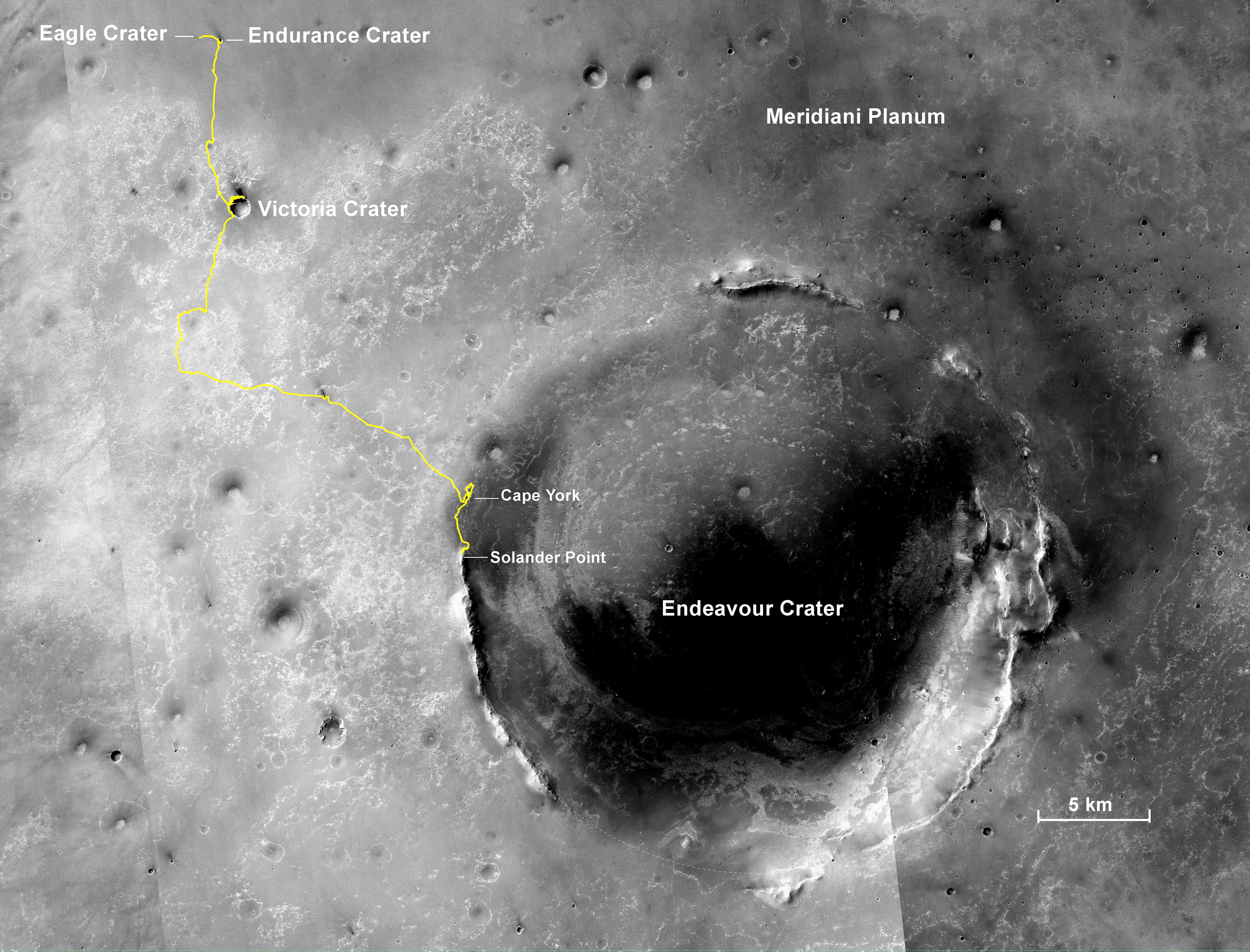
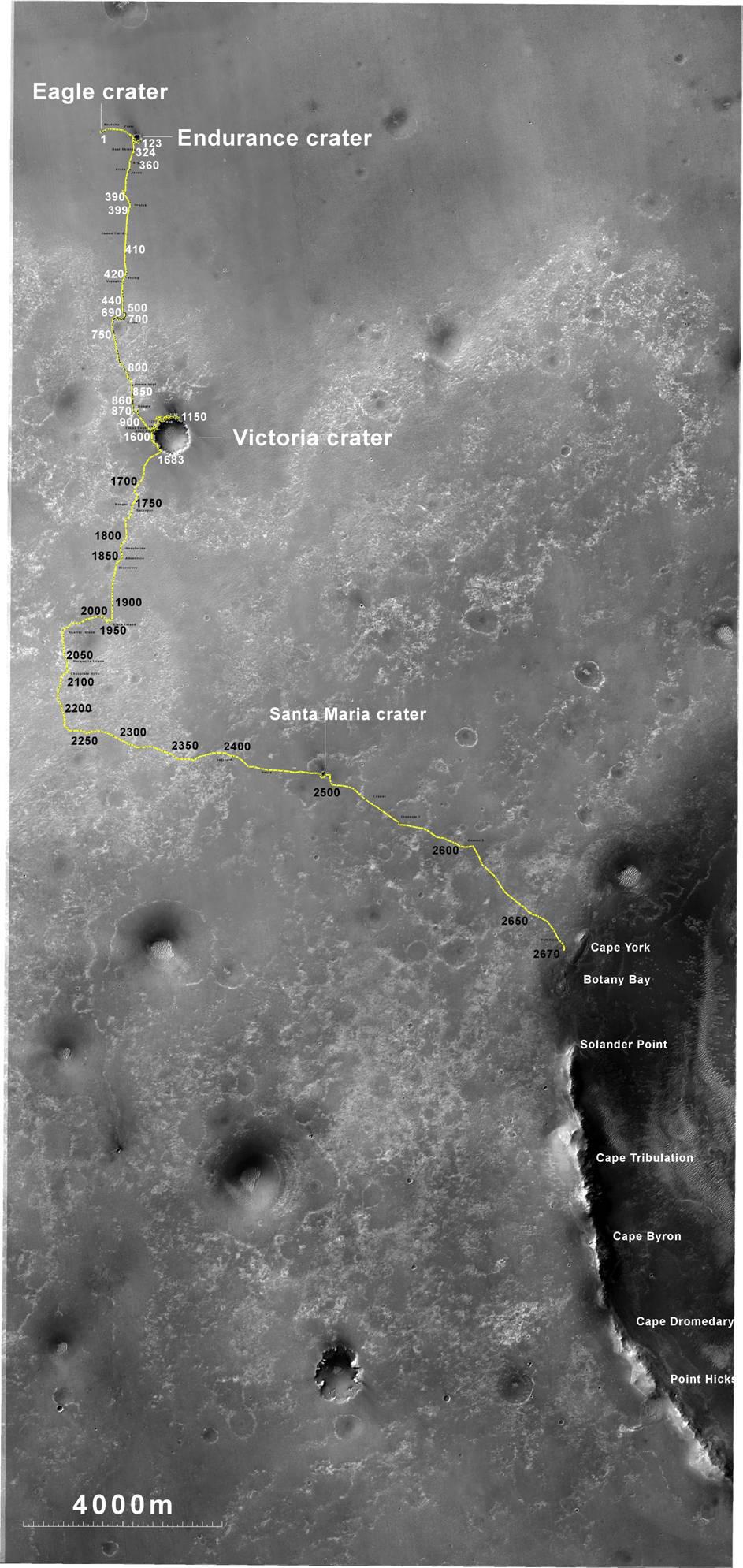
PIA17589:
-
Opportunity's Journey, Approaching 10th Anniversary
Full Resolution:
TIFF
(51.19 MB)
JPEG
(3.199 MB)
|
|
|
2013-06-07 |
Mars
|
Mars Exploration Rover (MER)
Mars Reconnaissance Orbiter (MRO)
|
CTX
|
5198x3900x3 |
|
-
PIA17070:
-
Opportunity's Traverse Through 112 Months
Full Resolution:
TIFF
(60.85 MB)
JPEG
(3.973 MB)
|
|
|
2011-09-01 |
Mars
|
Mars Exploration Rover (MER)
Mars Reconnaissance Orbiter (MRO)
|
CTX
|
5664x7979x3 |
|
-
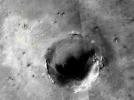
PIA14536:
-
Opportunity Traverses Through 2,700 Martian Days
Full Resolution:
TIFF
(45.26 MB)
JPEG
(6.766 MB)
|
|
|
2011-08-05 |
Mars
|
Mars Exploration Rover (MER)
|
CTX
|
943x759x3 |
|
-
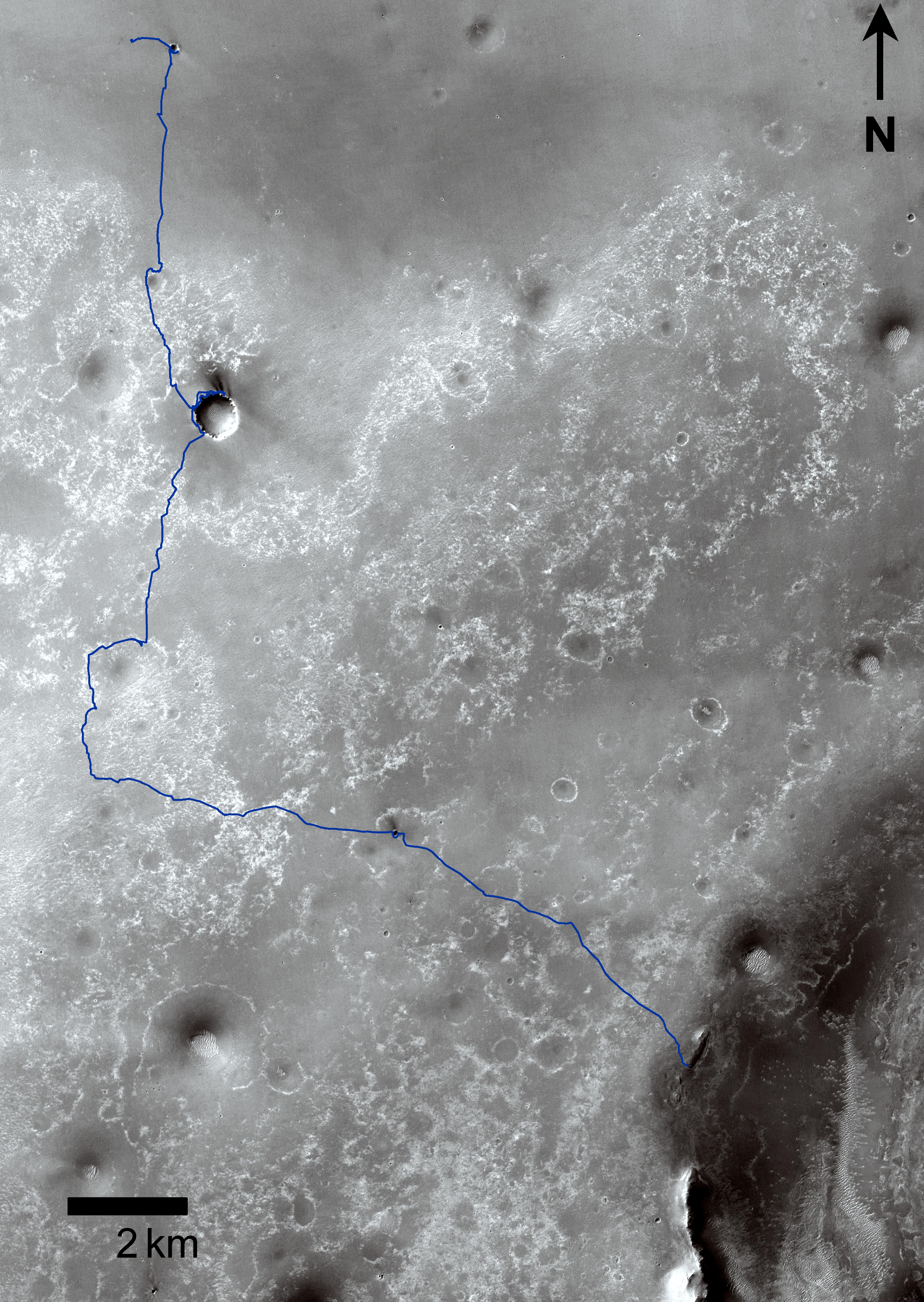
PIA14505:
-
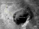
Opportunity's Route to Endeavour Crater (Wide View)
Full Resolution:
TIFF
(2.15 MB)
JPEG
(101 kB)
|
|
|
2011-08-05 |
Mars
|
Mars Exploration Rover (MER)
|
CTX
|
943x1989x3 |
|
-
PIA14504:
-
Opportunity's Route to Endeavour Crater
Full Resolution:
TIFF
(5.635 MB)
JPEG
(260 kB)
|
|
|
2011-06-08 |
Mars
|
Mars Exploration Rover (MER)
Mars Reconnaissance Orbiter (MRO)
|
CTX
|
2948x2193x3 |
|
-
PIA14135:
-
Eagle to Endeavour: Opportunity's Path, Sol 2609
Full Resolution:
TIFF
(19.4 MB)
JPEG
(1.319 MB)
|
|
|
2010-12-10 |
Mars
|
Mars Exploration Rover (MER)
|
CTX
HiRISE
|
3038x6485x1 |
|
-
PIA13598:
-
Opportunity's Martian Traverse Through Sol 2442
Full Resolution:
TIFF
(19.73 MB)
JPEG
(1.488 MB)
|
|
|
2010-06-29 |
Mars
|
Mars Exploration Rover (MER)
|
CTX
|
4056x4096x1 |

|
-
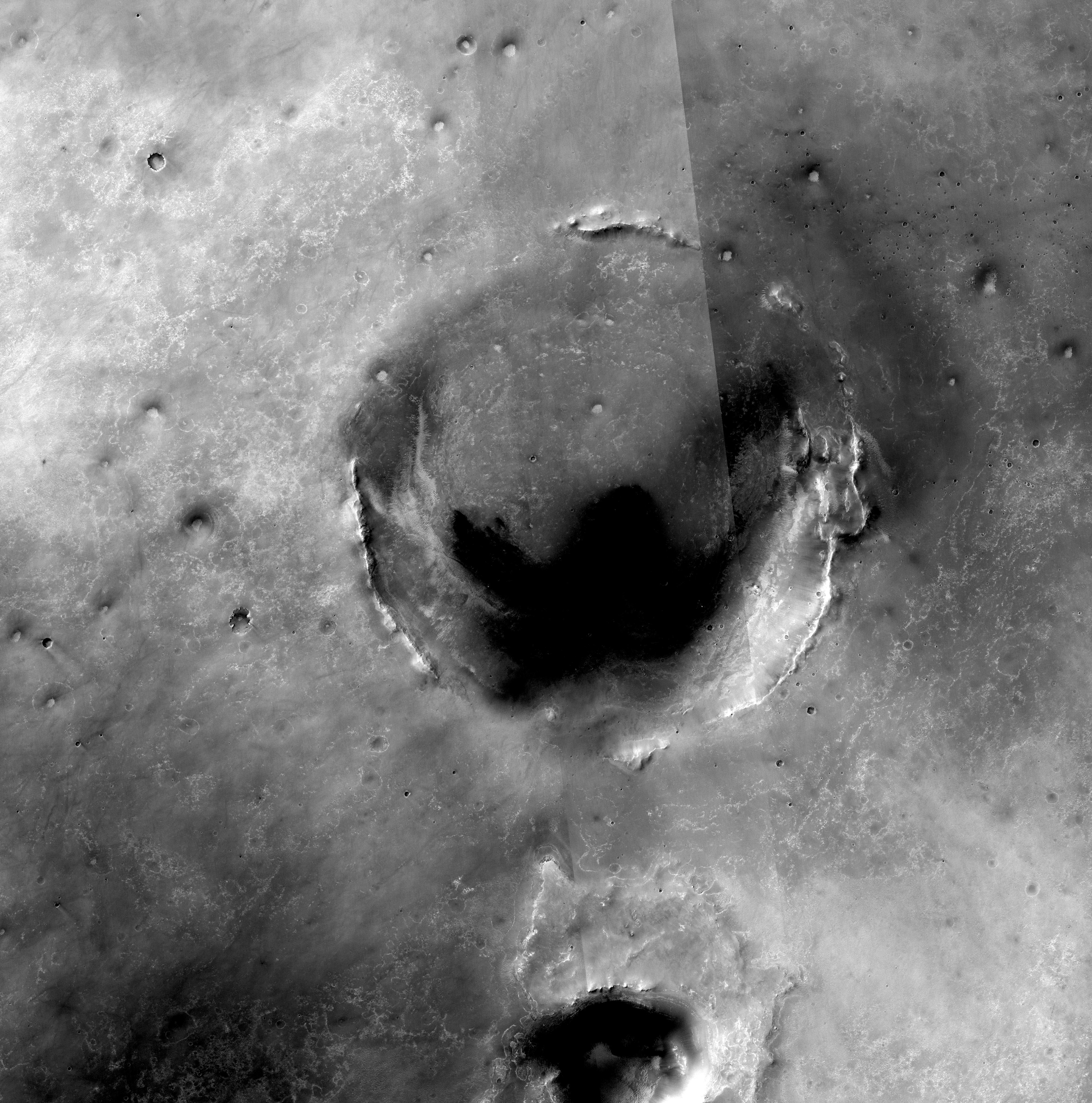
PIA13196:
-
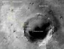
Opportunity Amid Mars Craters
Full Resolution:
TIFF
(16.63 MB)
JPEG
(2.577 MB)
|
 Planetary Data System


