My
List |
Addition Date
|
Target
|
Mission
|
Instrument
|
Size
|

|
2009-10-03 |
Mars
|
Mars Exploration Rover (MER)
|
Navigation Camera
|
1024x1024x1 |
|
-
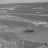
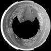
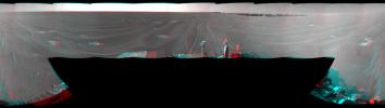
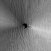
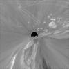
PIA12254:
-
Opportunity Finds Another Meteorite
Full Resolution:
TIFF
(1.05 MB)
JPEG
(96.74 kB)
|
|
|
2009-07-23 |
Mars
|
Mars Exploration Rover (MER)
|
Navigation Camera
|
7688x1715x1 |
|
-
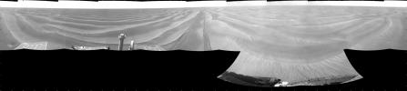
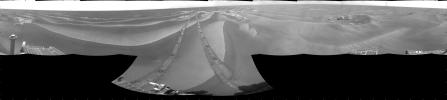
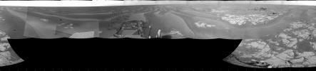
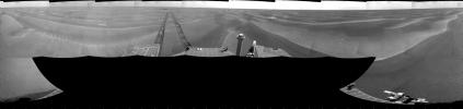
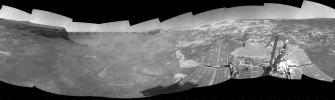
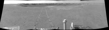
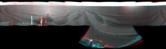
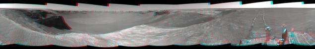
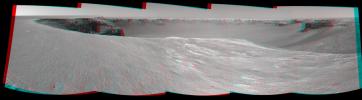
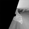
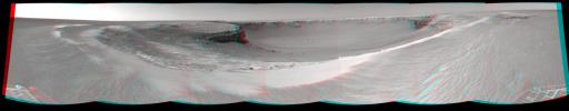
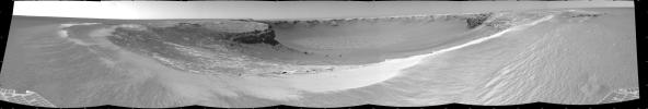
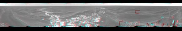
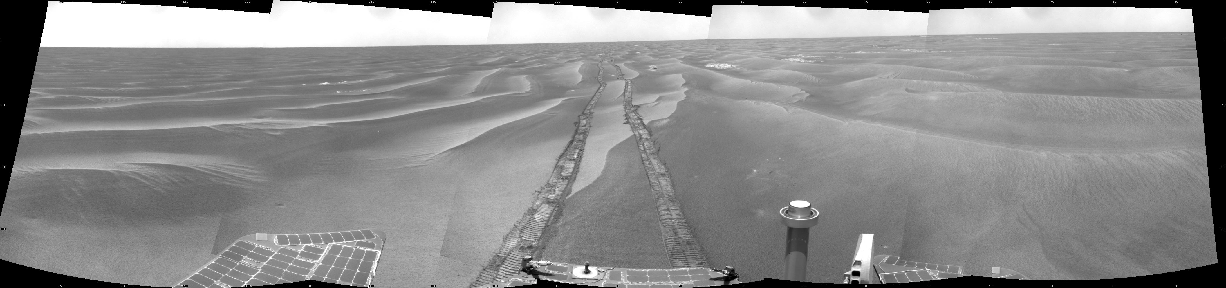
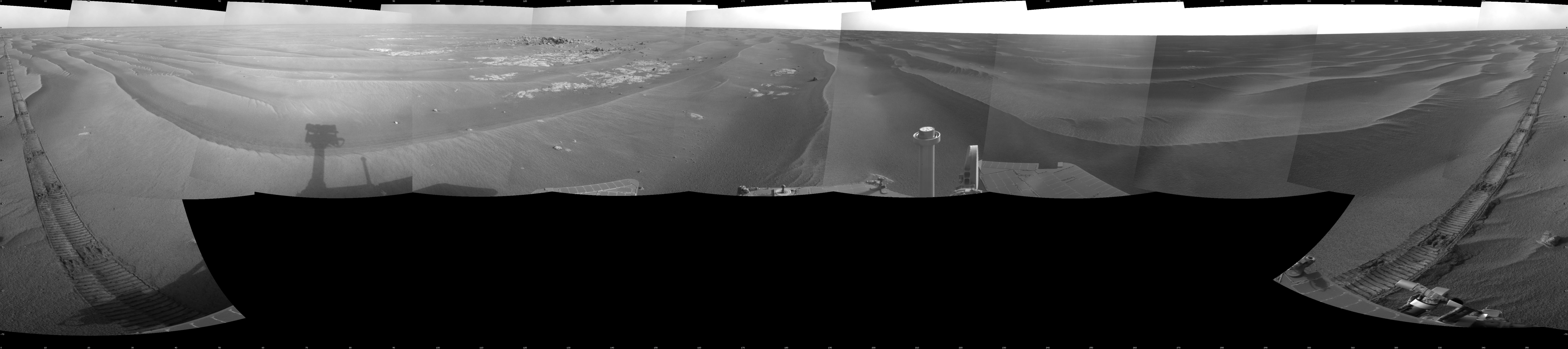
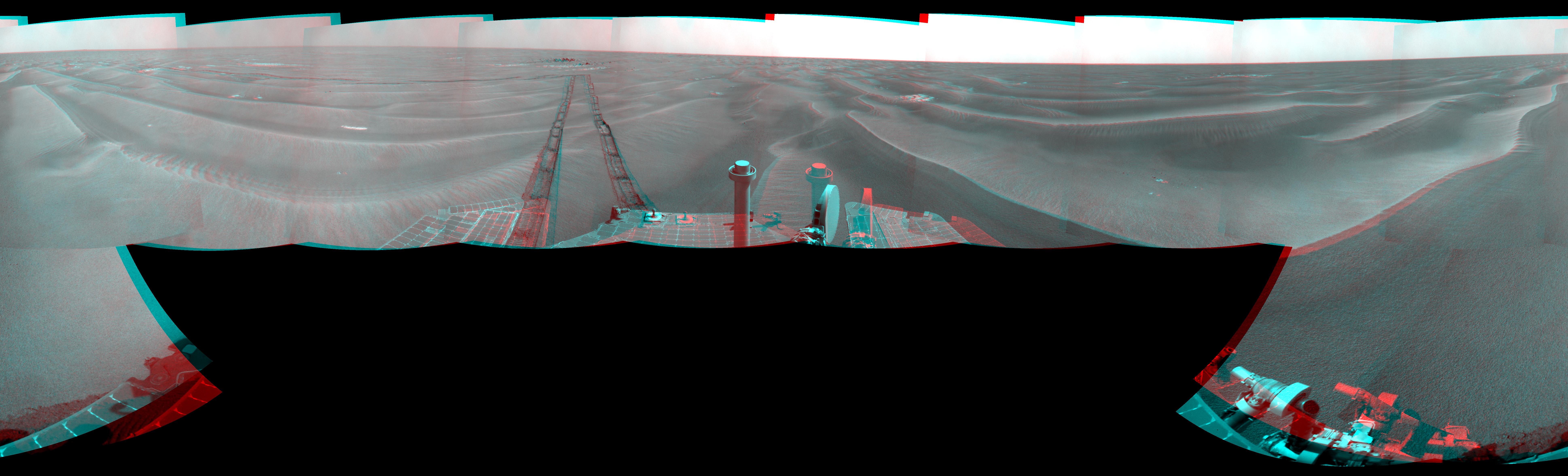
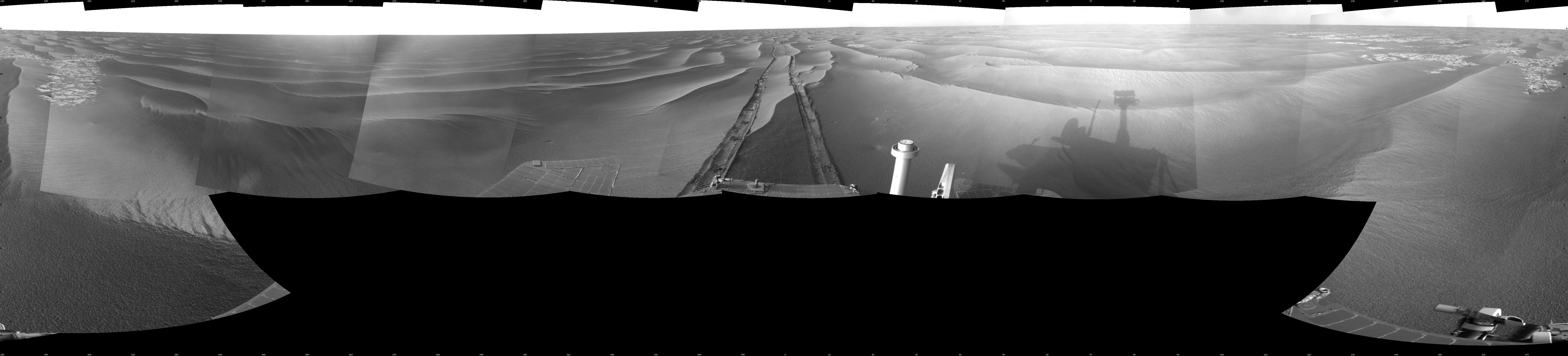
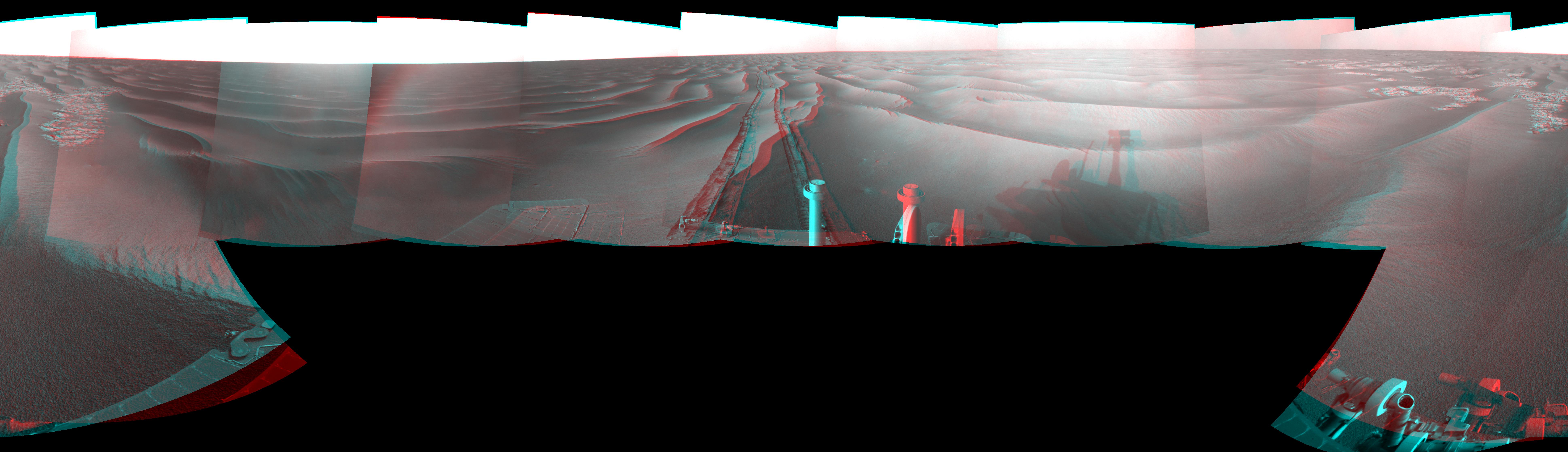
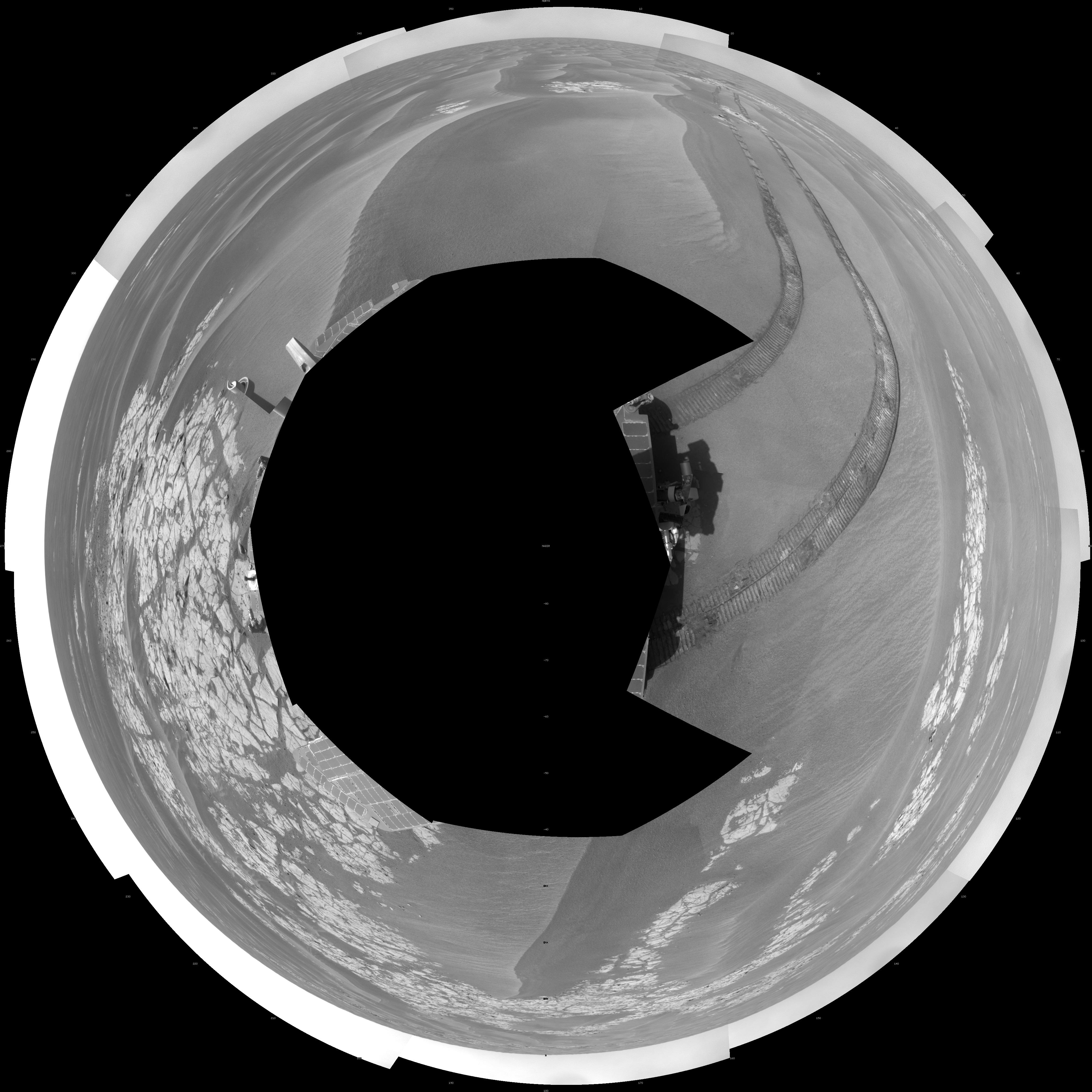
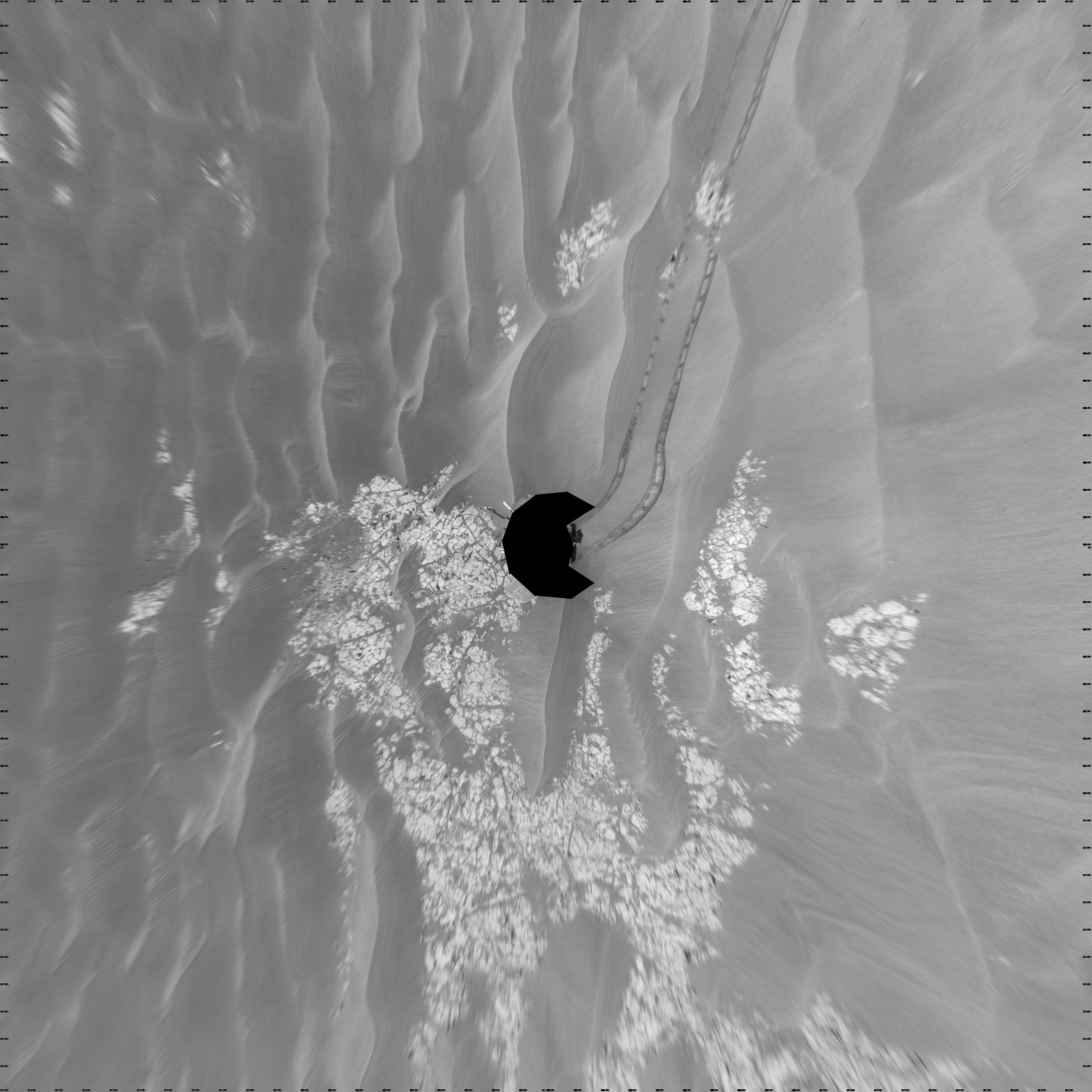
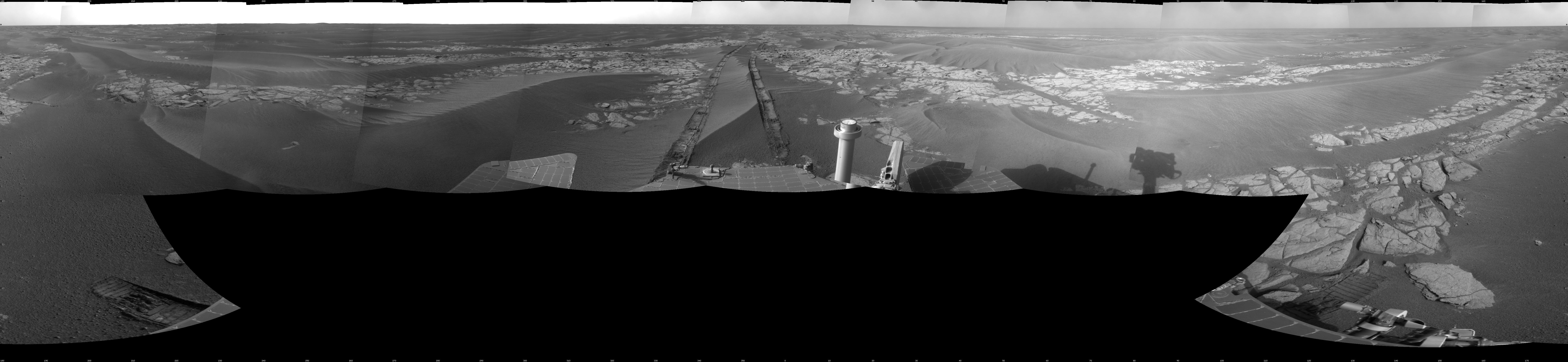
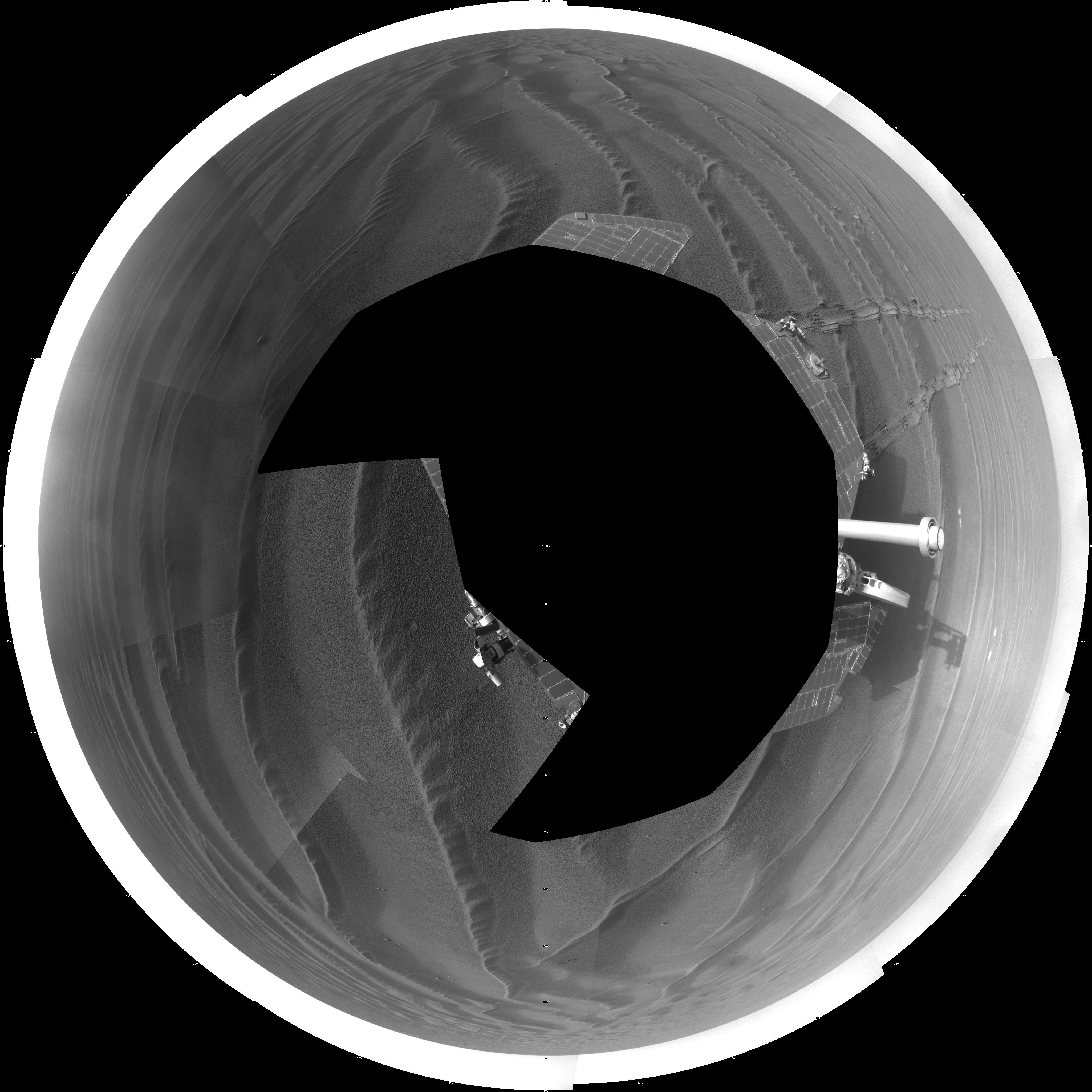
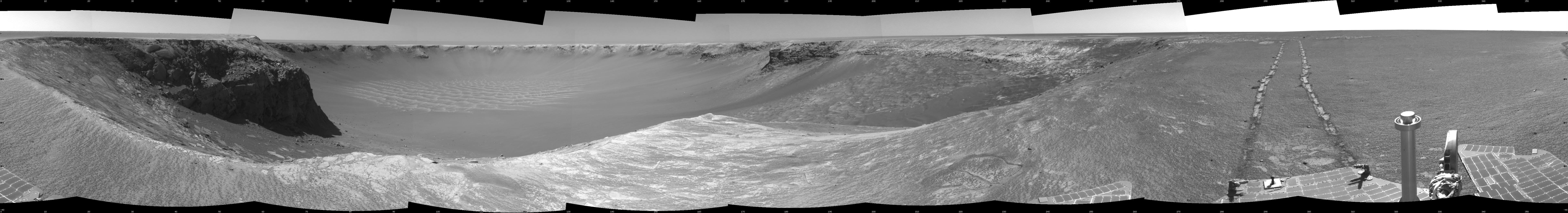
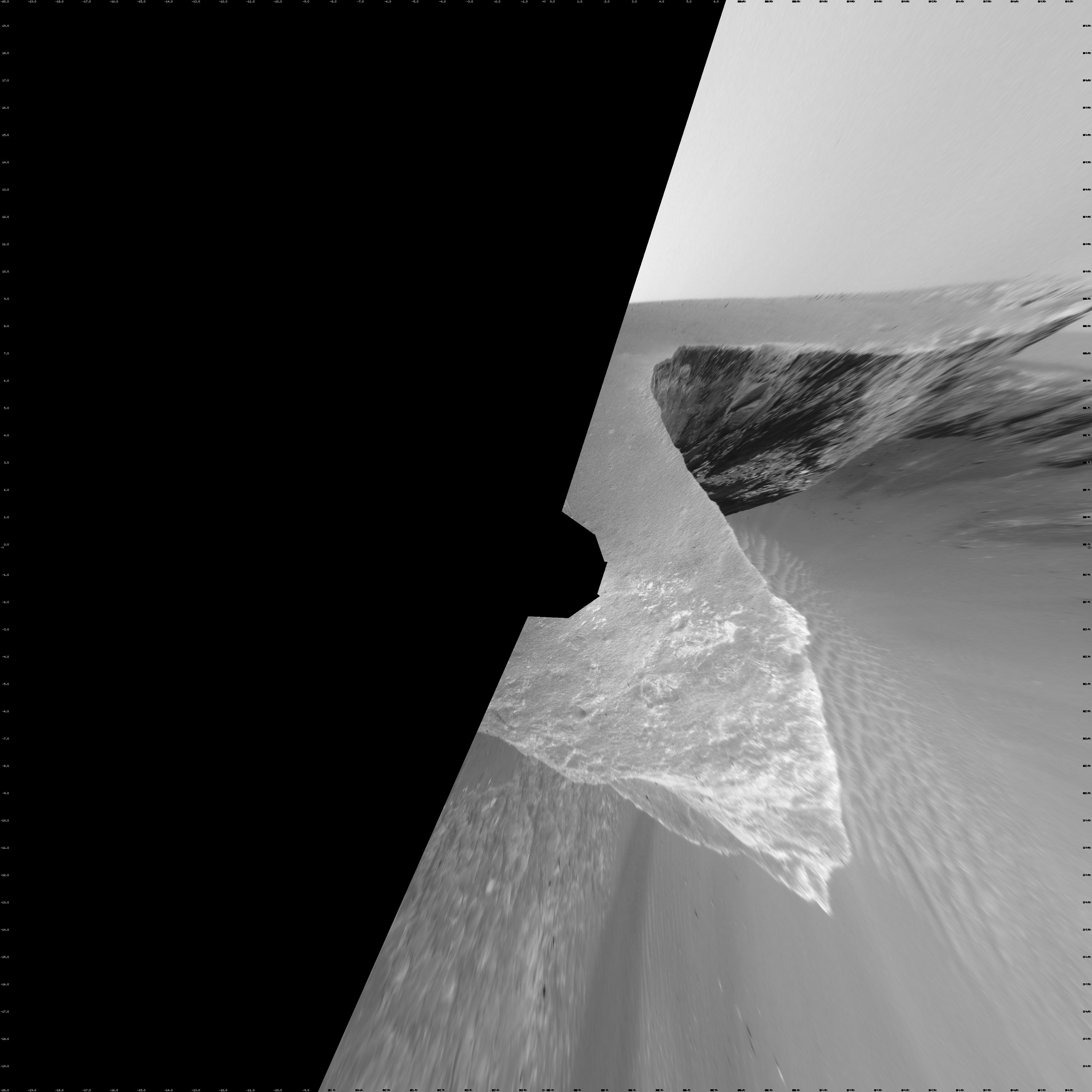
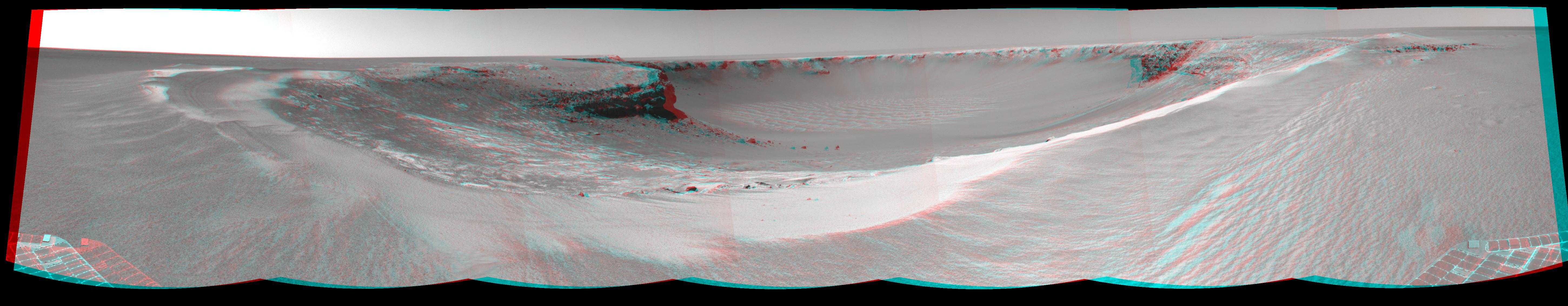
PIA12155:
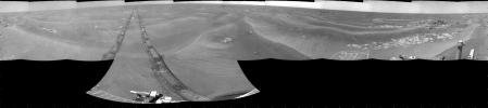
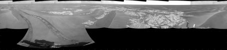
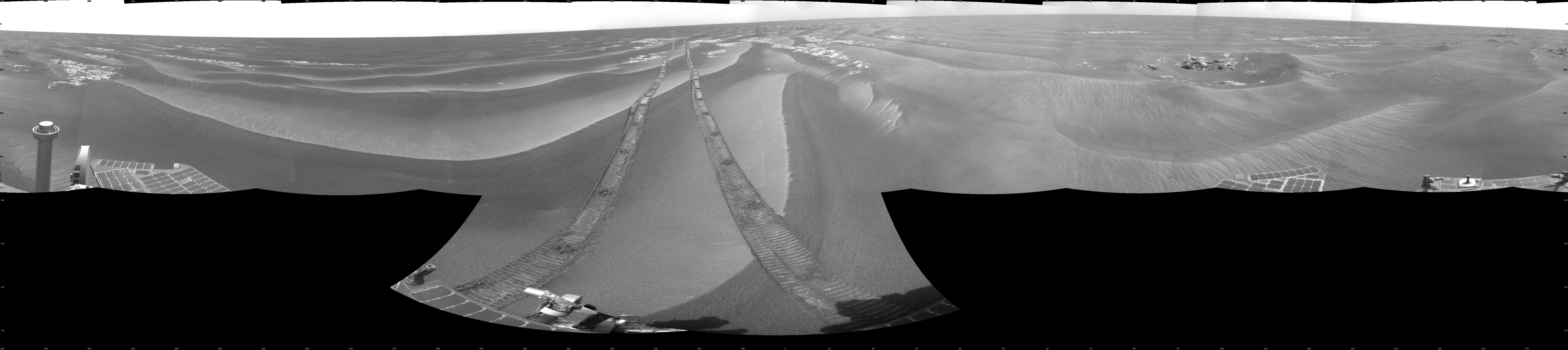
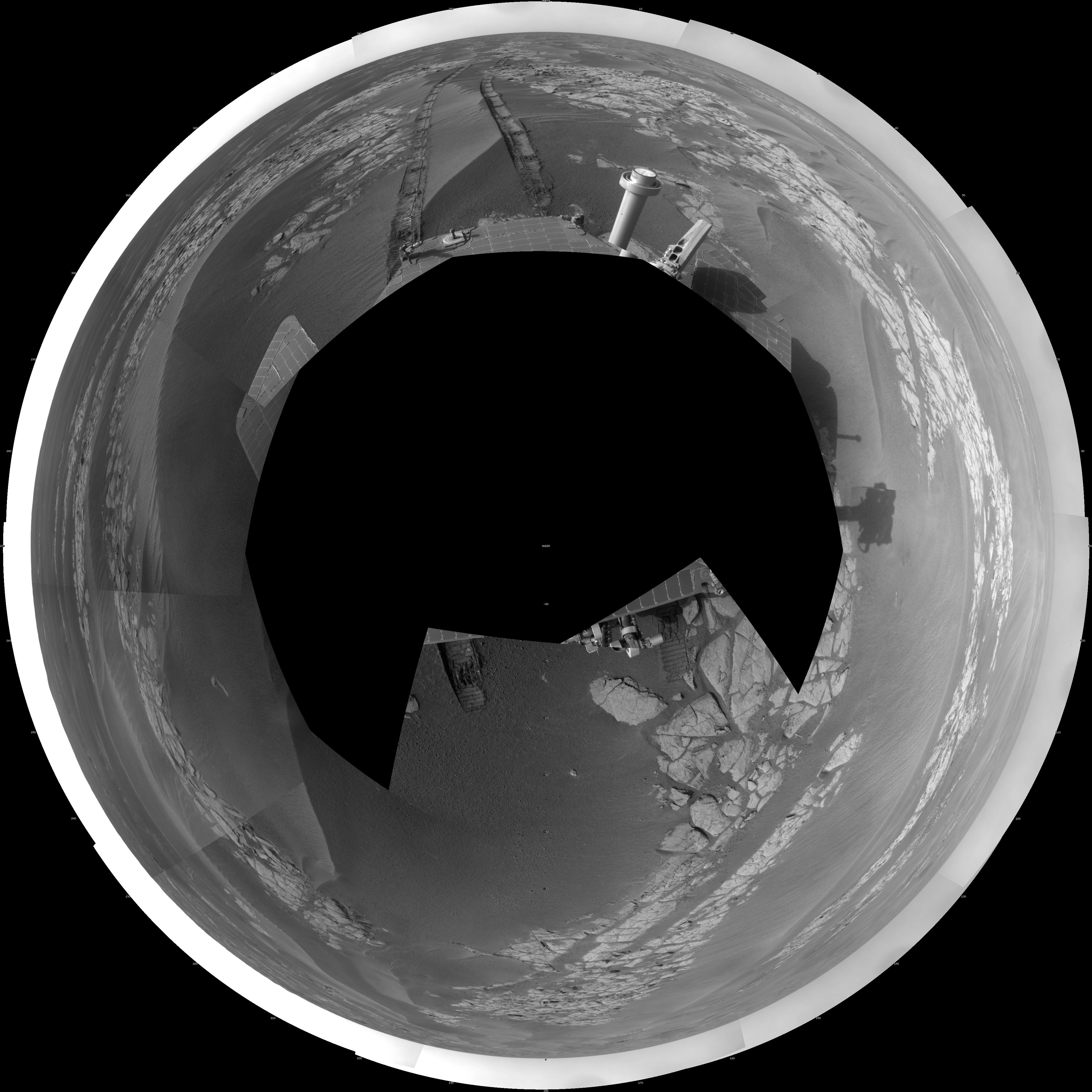
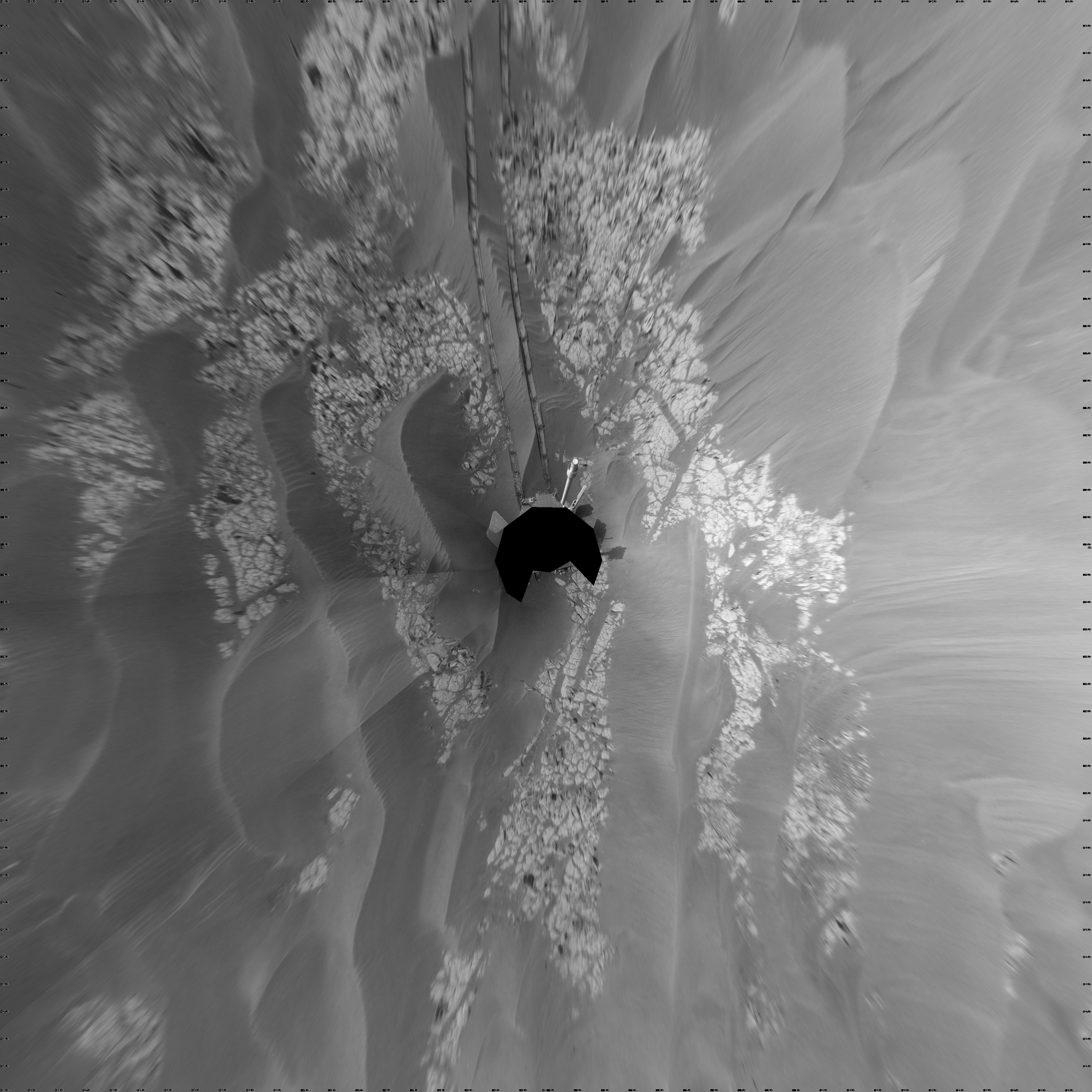
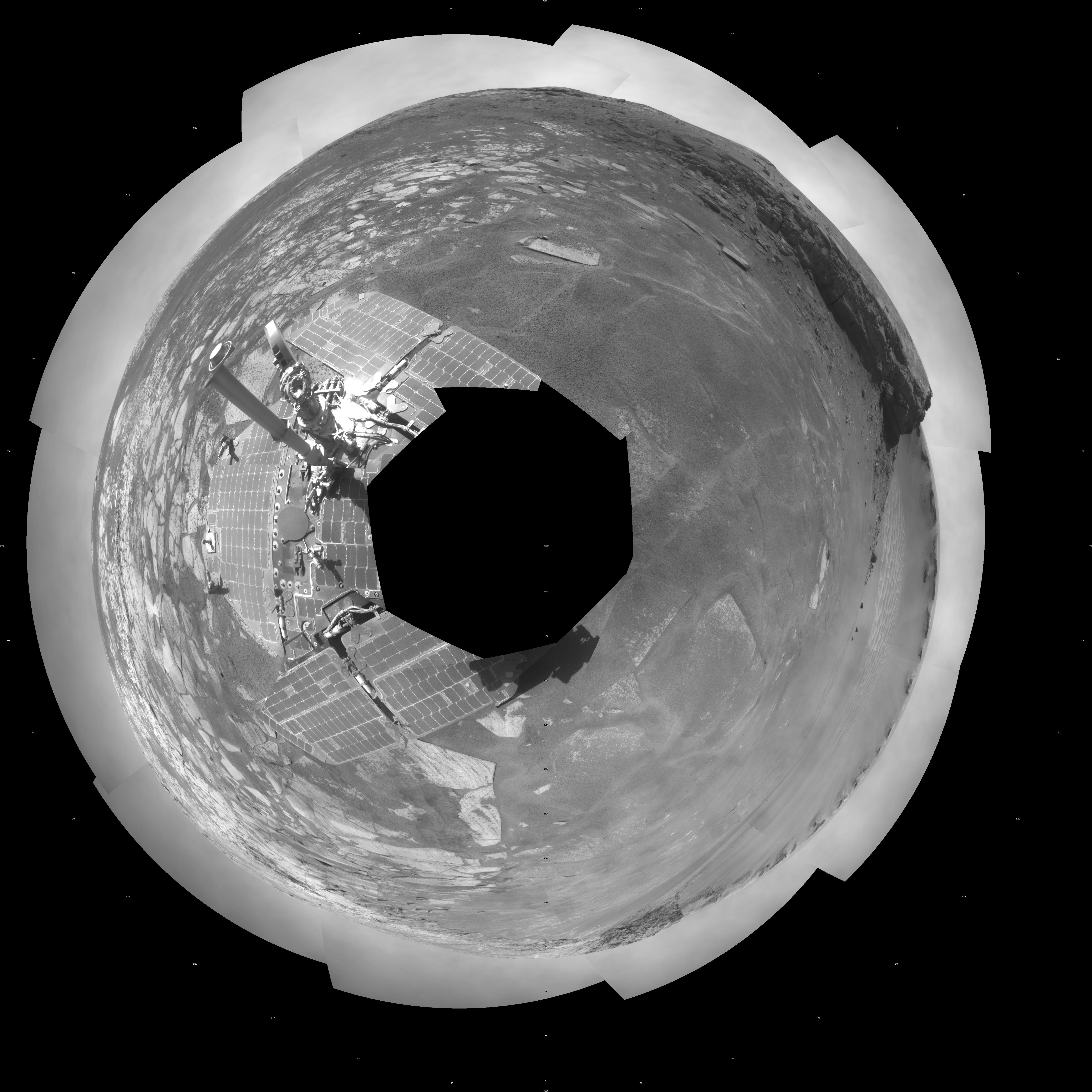
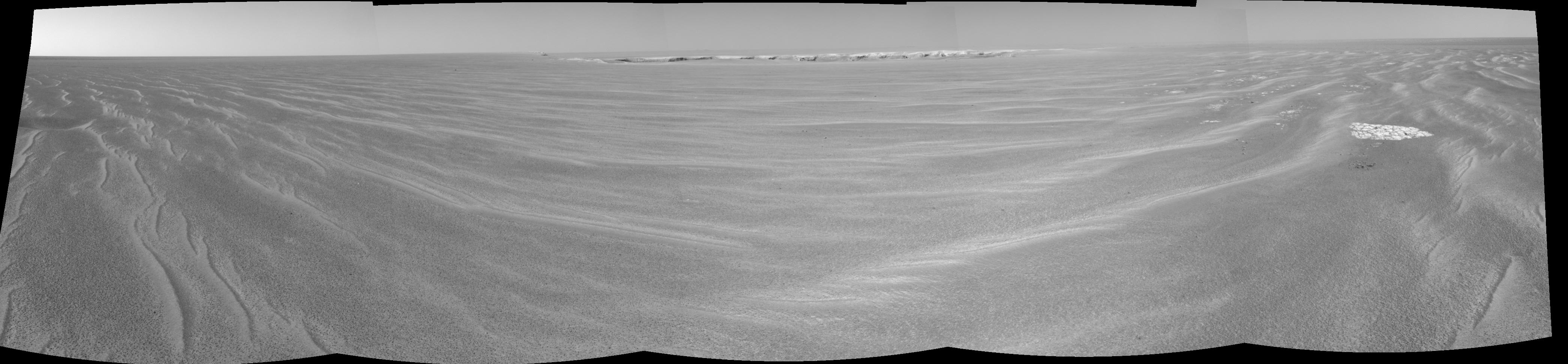
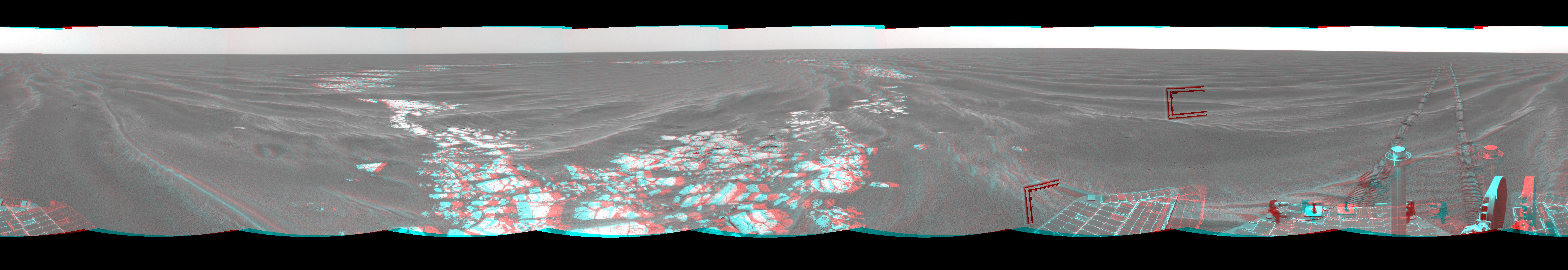
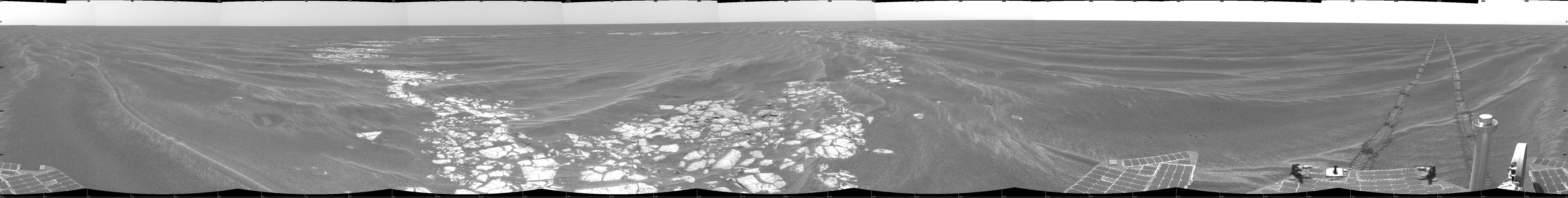
Opportunity's Surroundings on Sol 1950
Full Resolution:
TIFF
(13.2 MB)
JPEG
(1.089 MB)
|
|
|
2009-07-23 |
Mars
|
Mars Exploration Rover (MER)
|
Navigation Camera
|
7753x2178x3 |
|
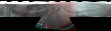
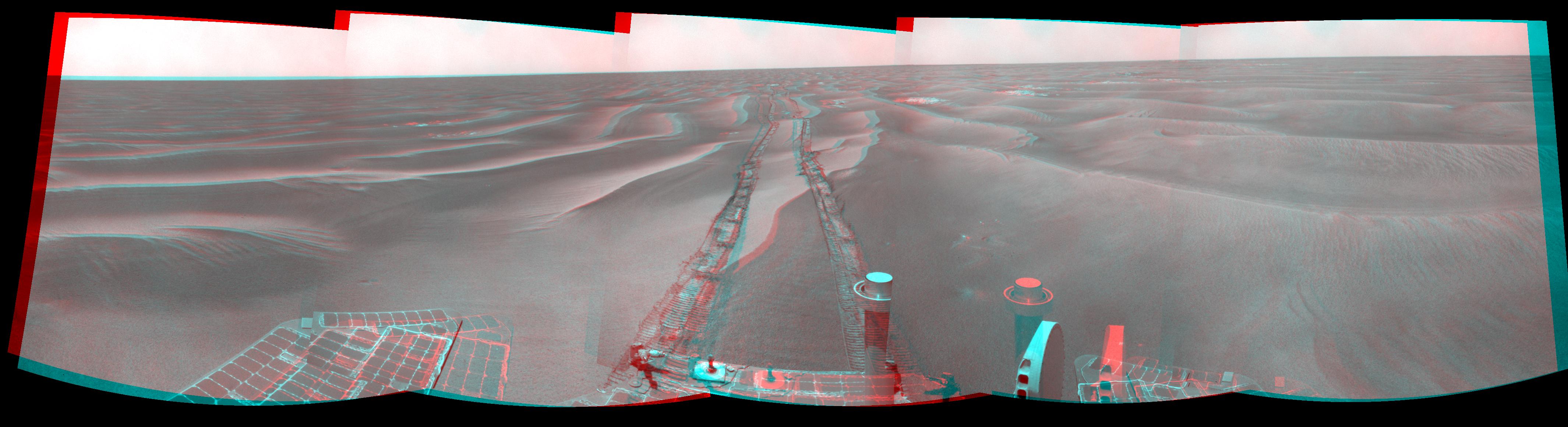
-
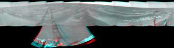
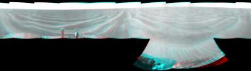
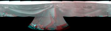
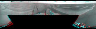
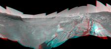
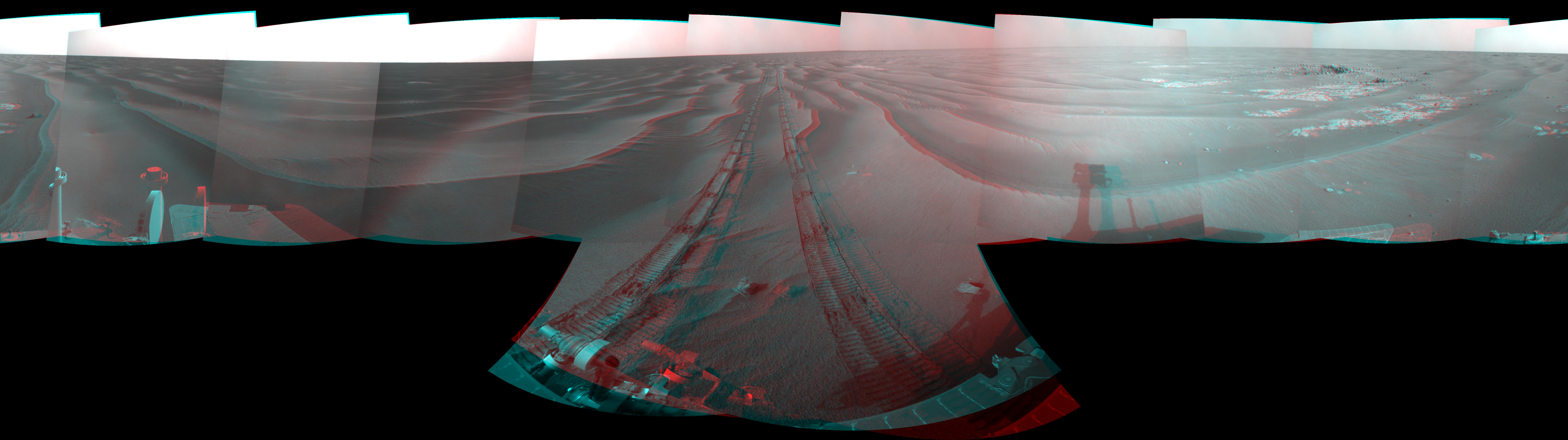
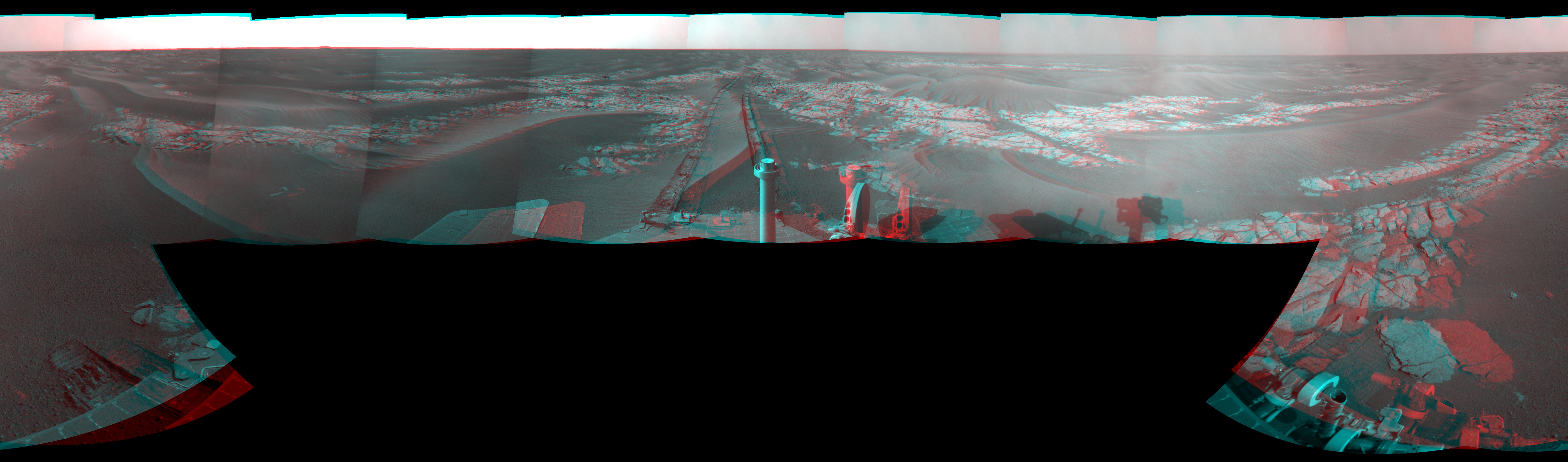
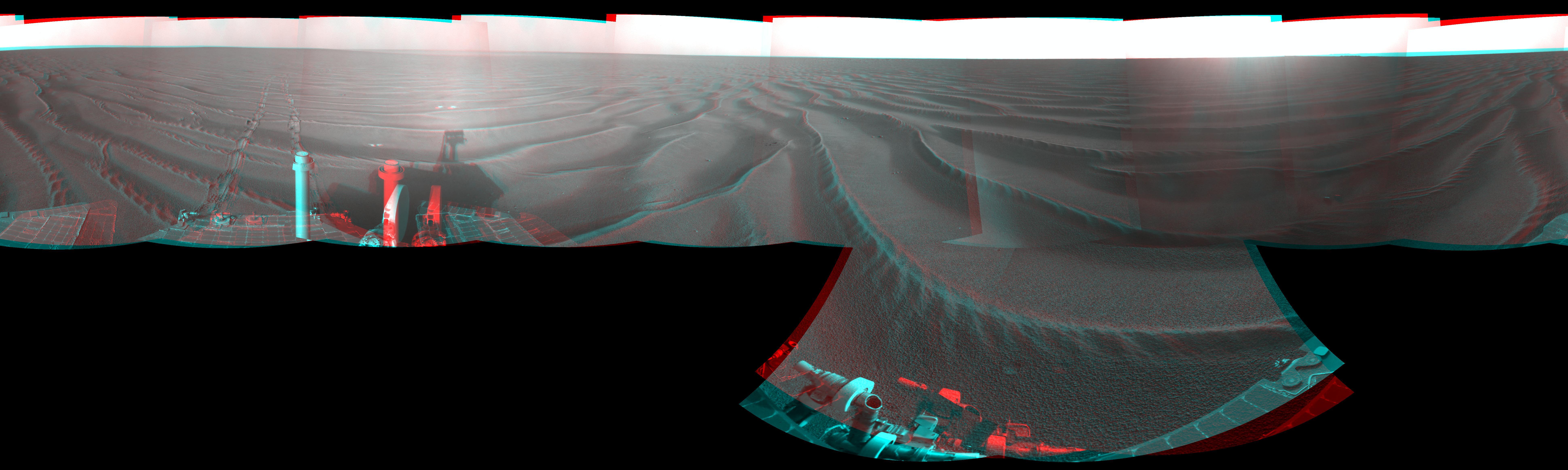
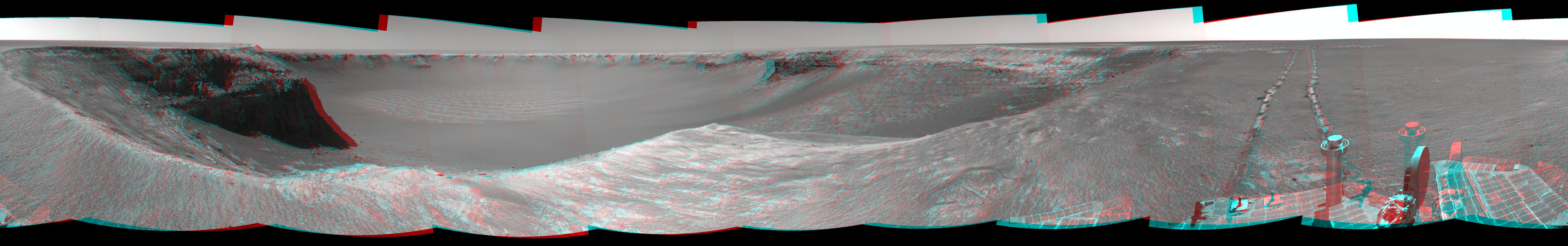
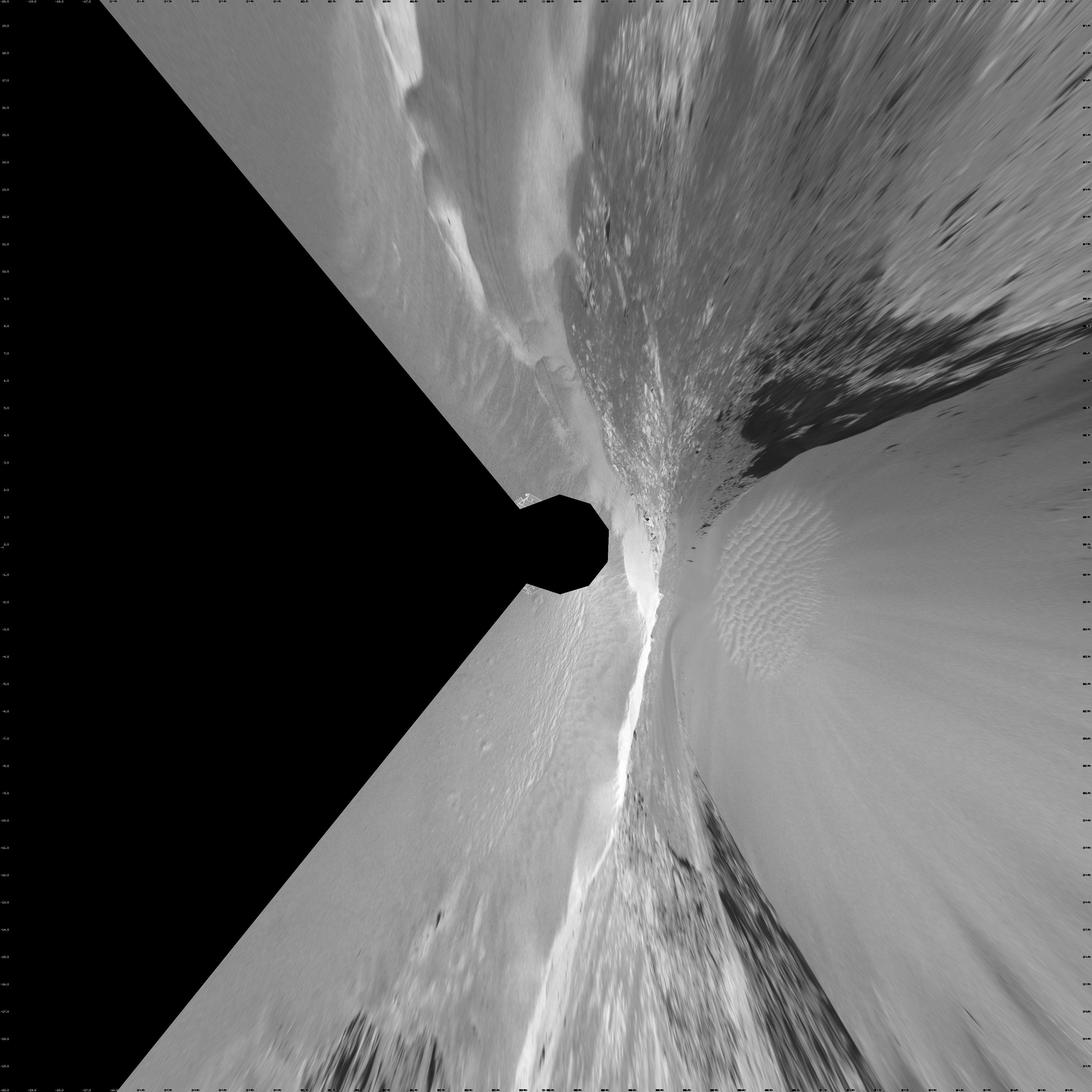
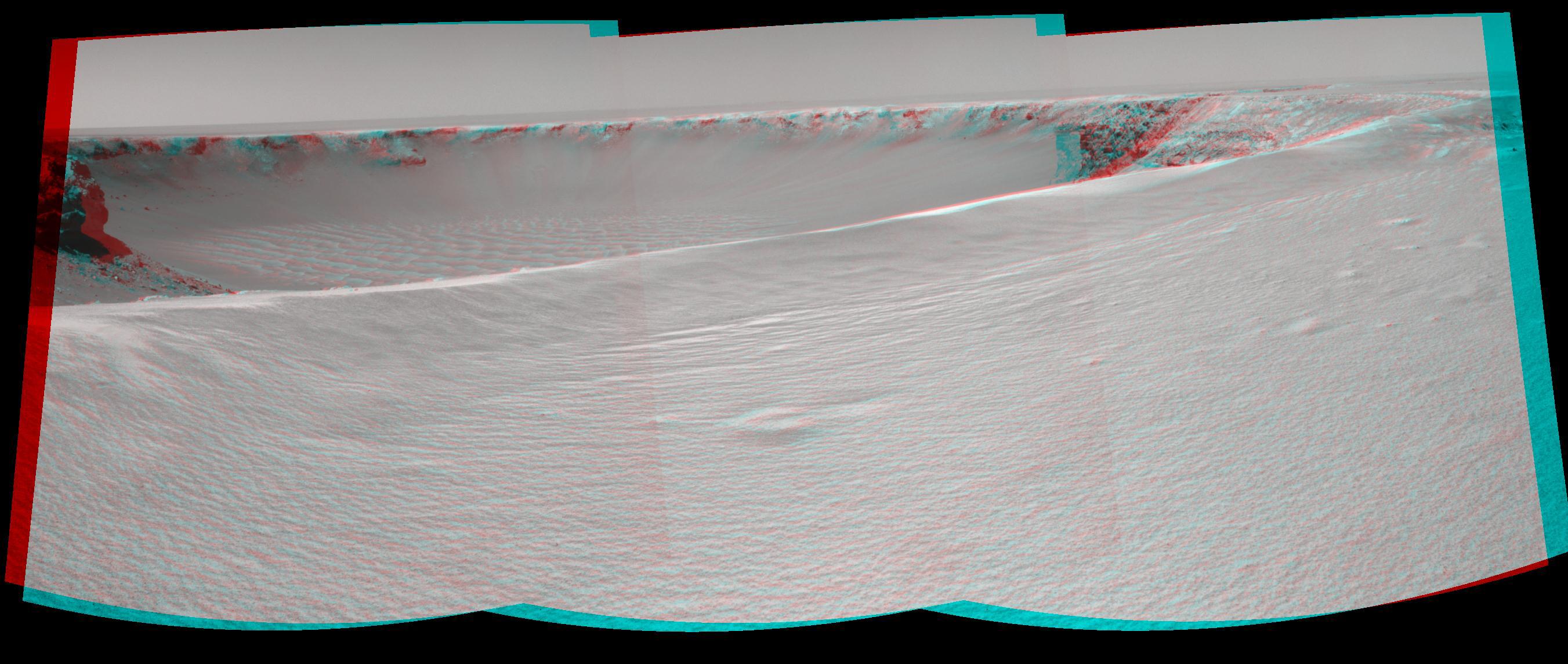
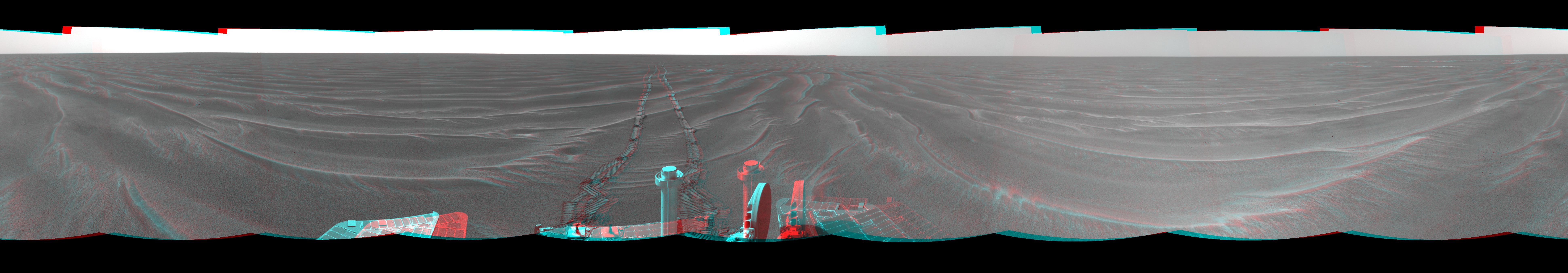
PIA12154:
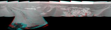
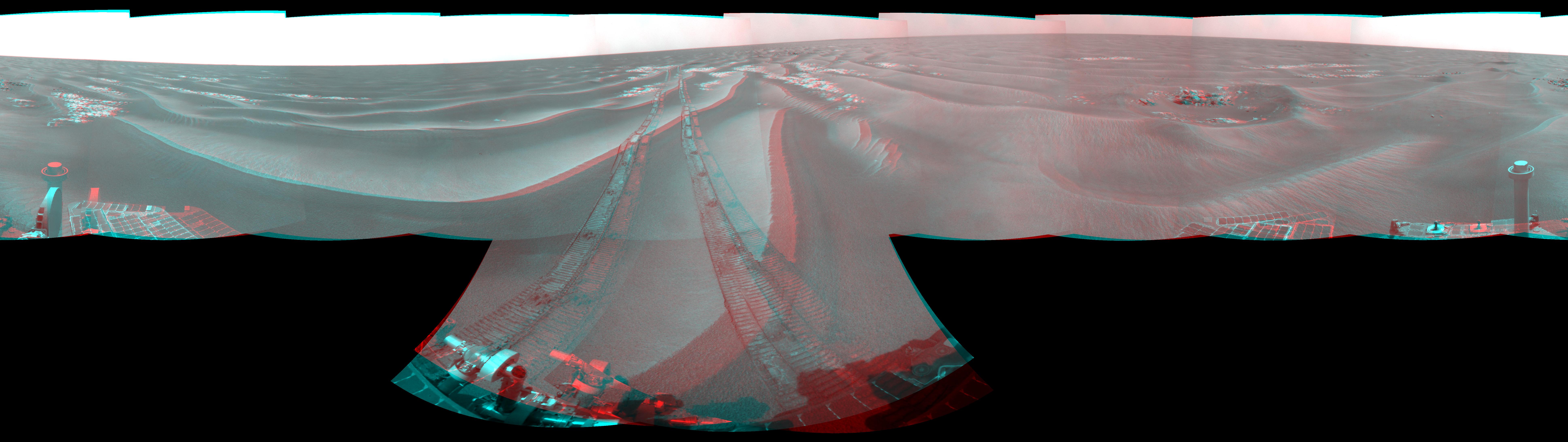
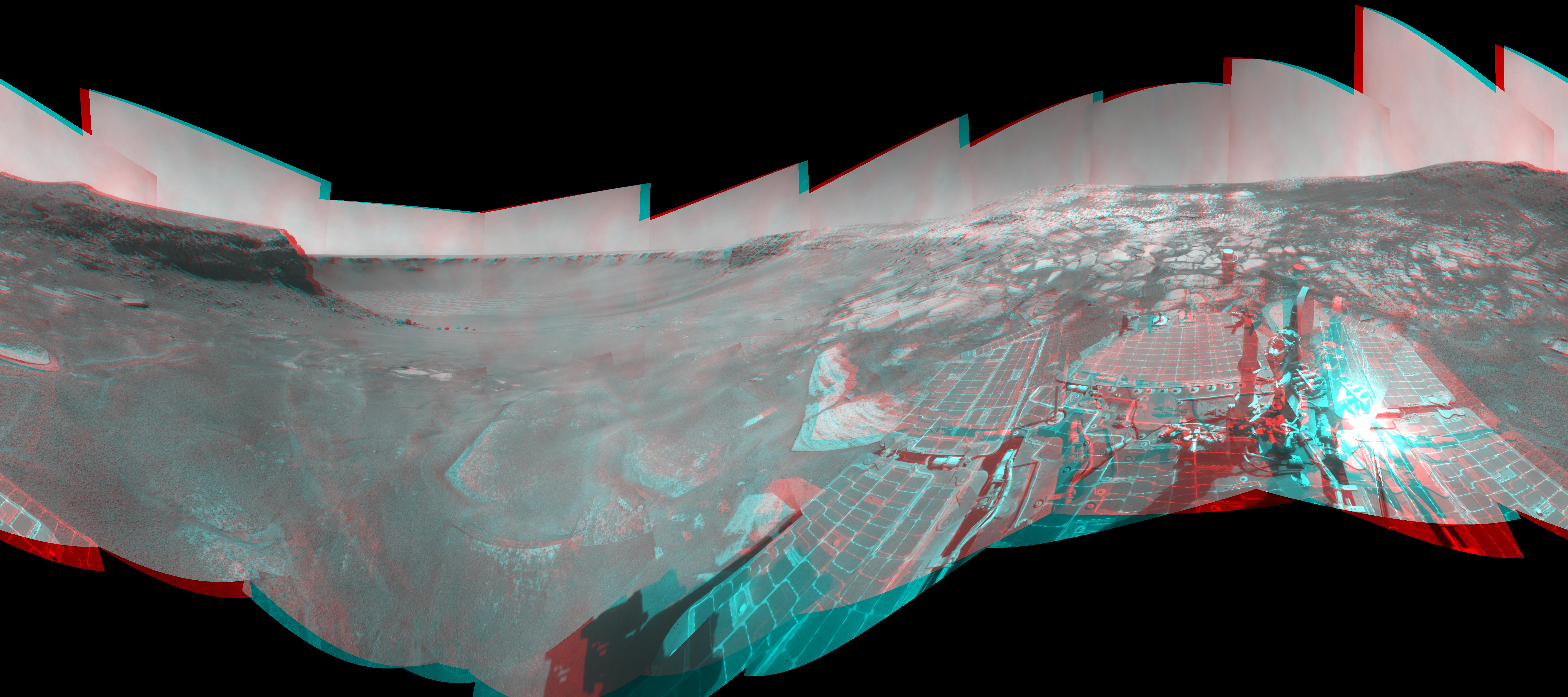
Opportunity's Surroundings on Sol 1950 (Stereo)
Full Resolution:
TIFF
(50.66 MB)
JPEG
(1.35 MB)
|
|
|
2009-07-23 |
Mars
|
Mars Exploration Rover (MER)
|
Navigation Camera
|
4000x4000x1 |

|
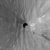
-
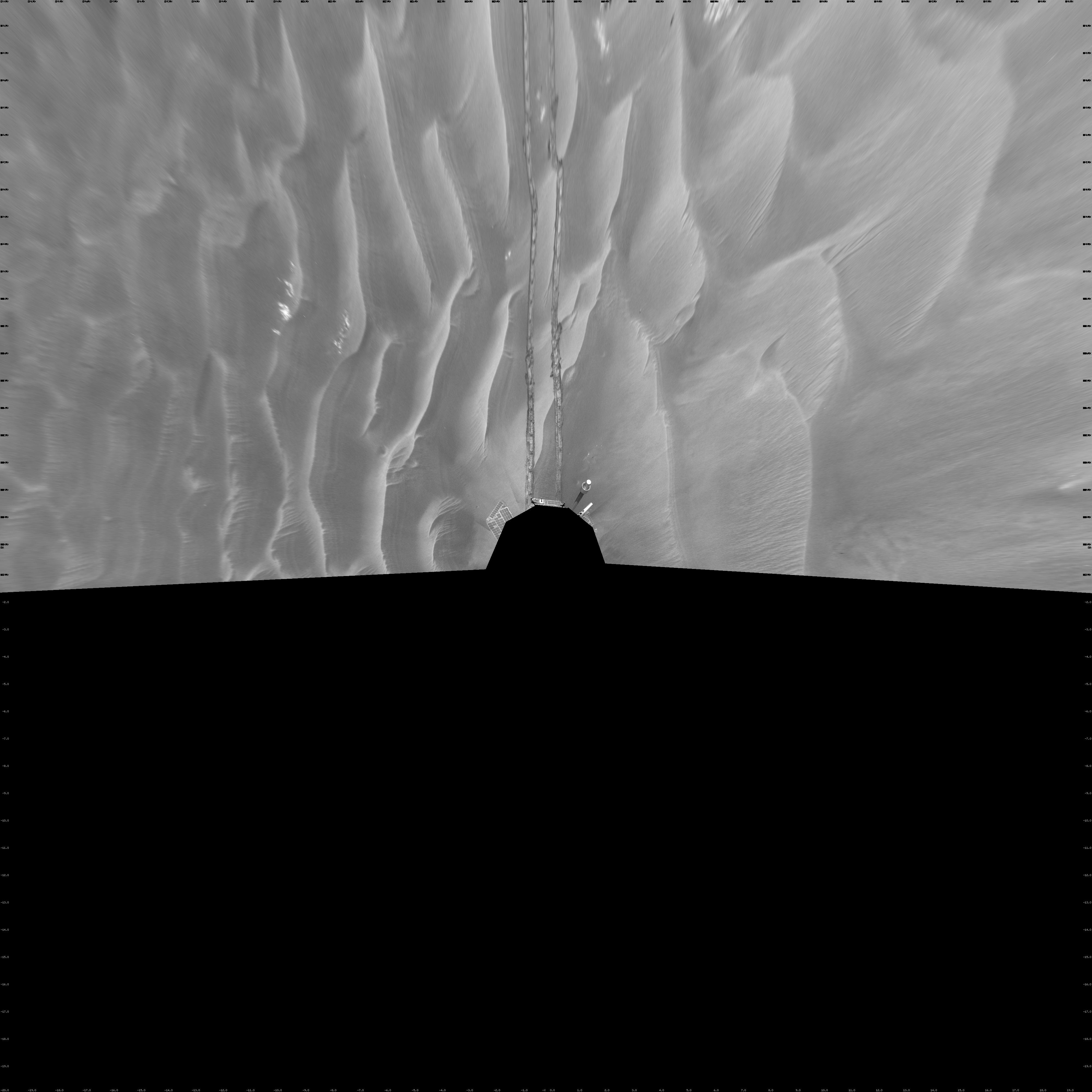
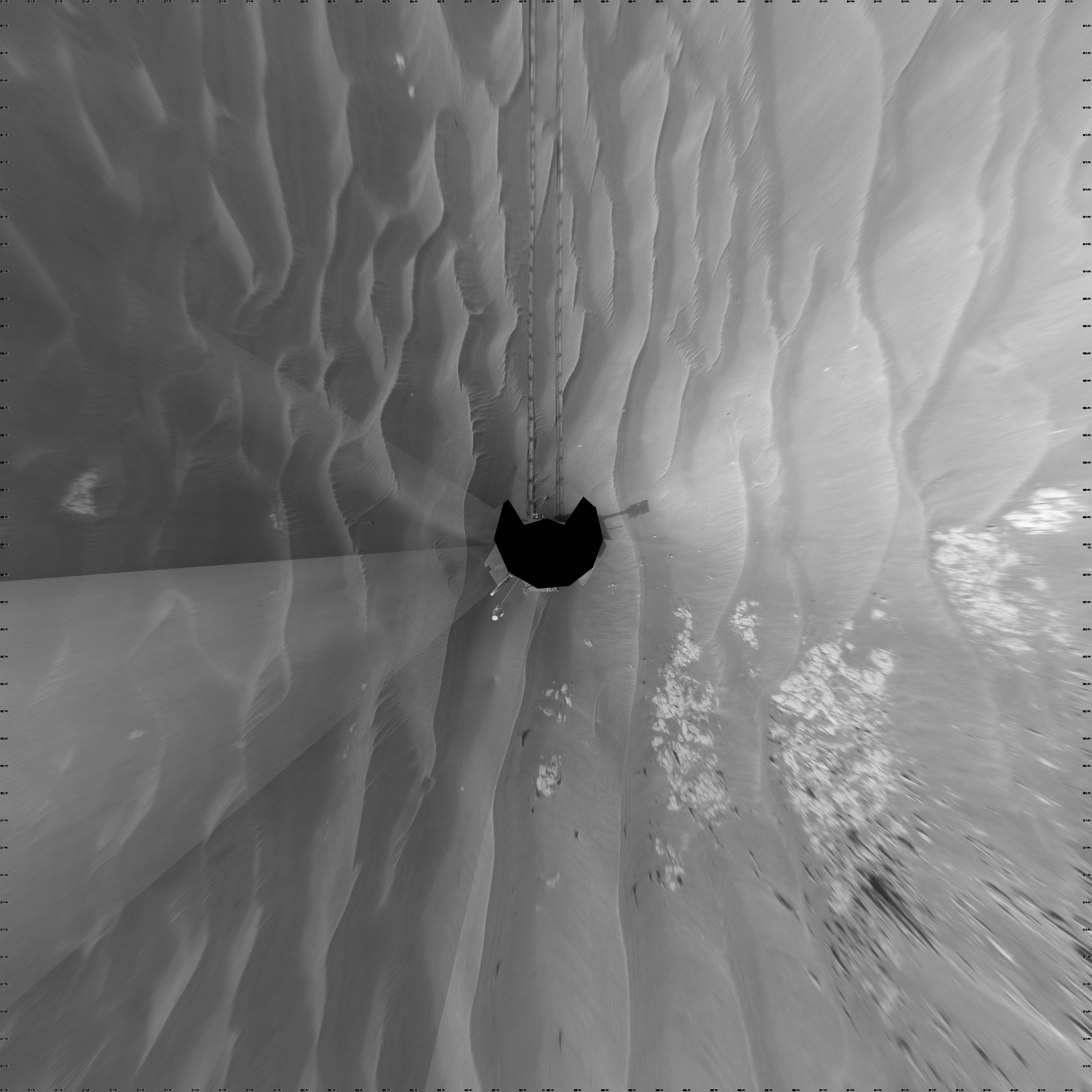
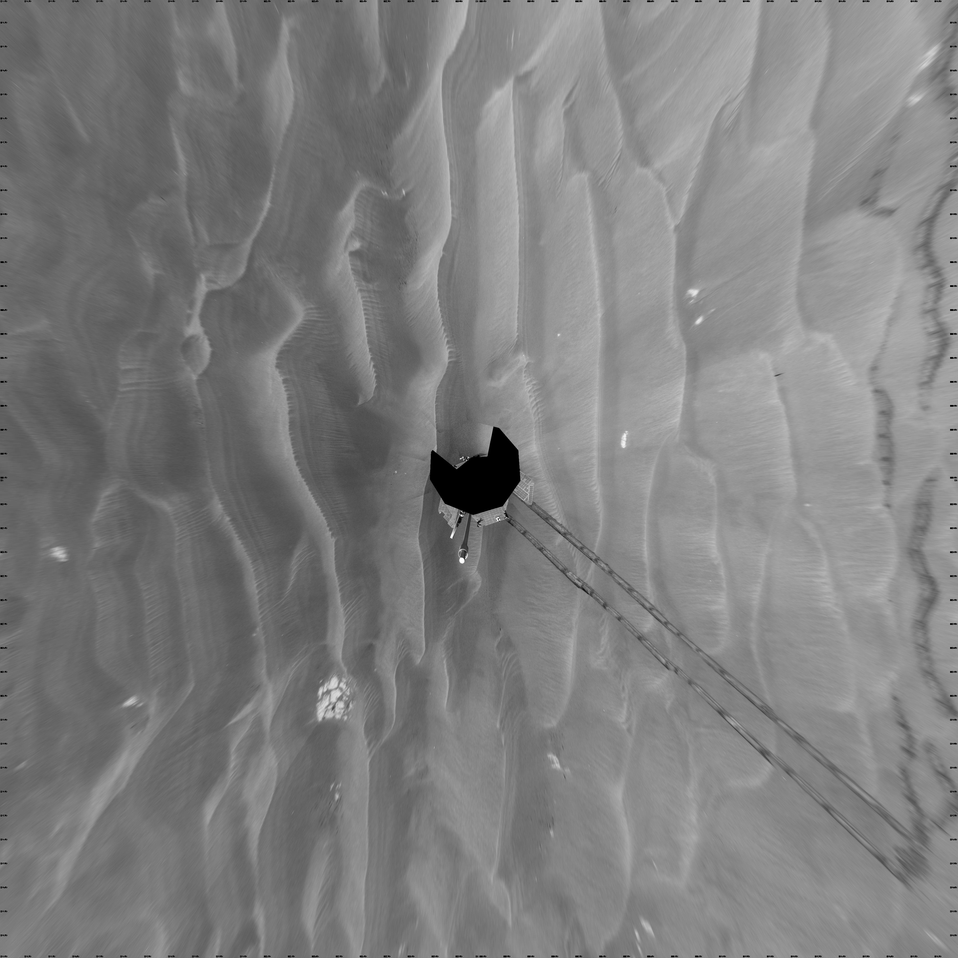
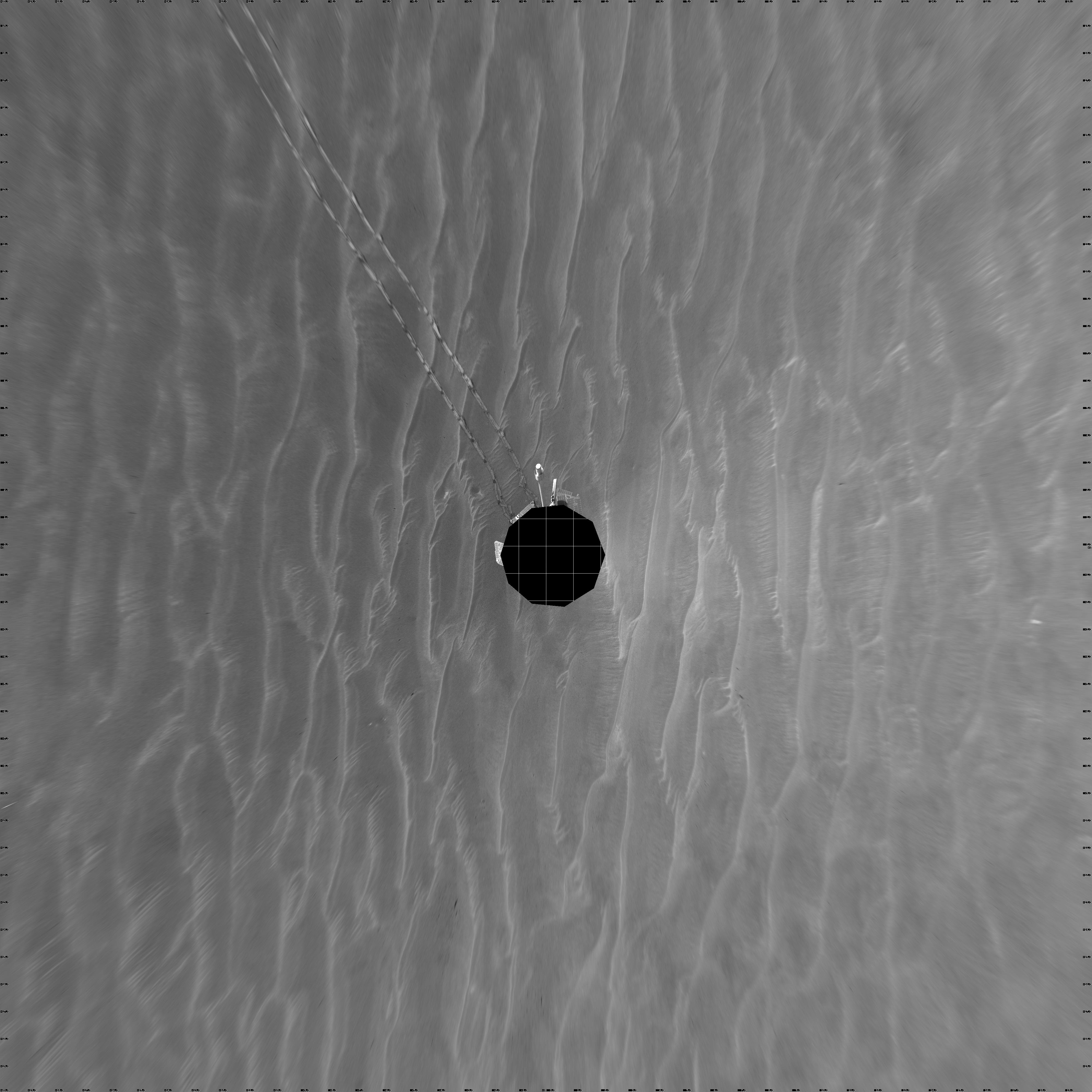
PIA12153:
-
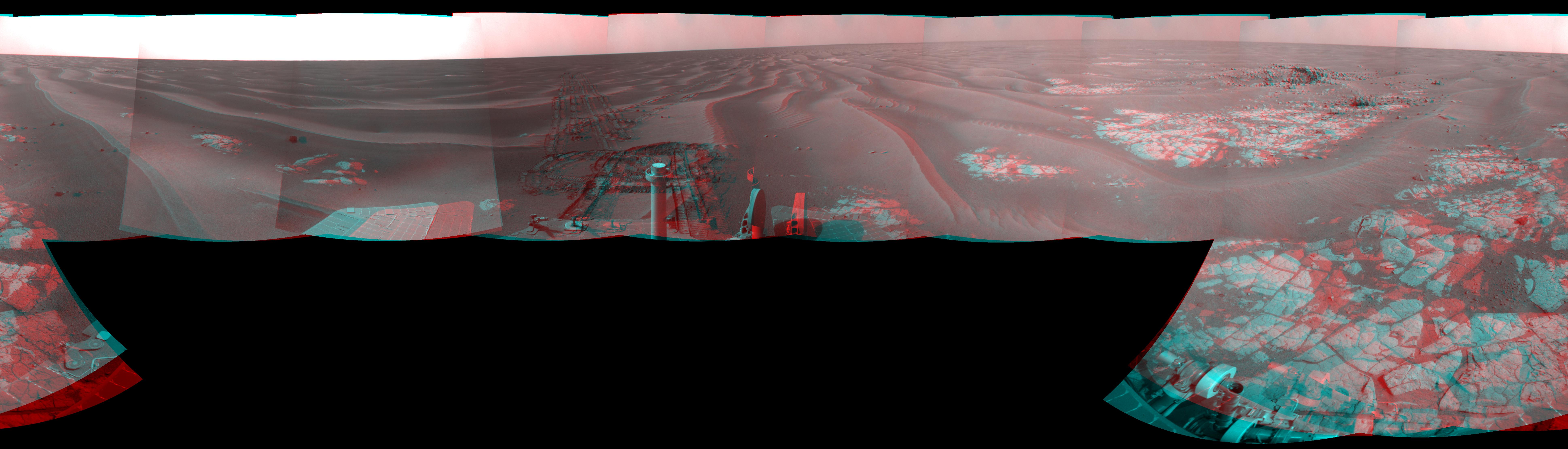
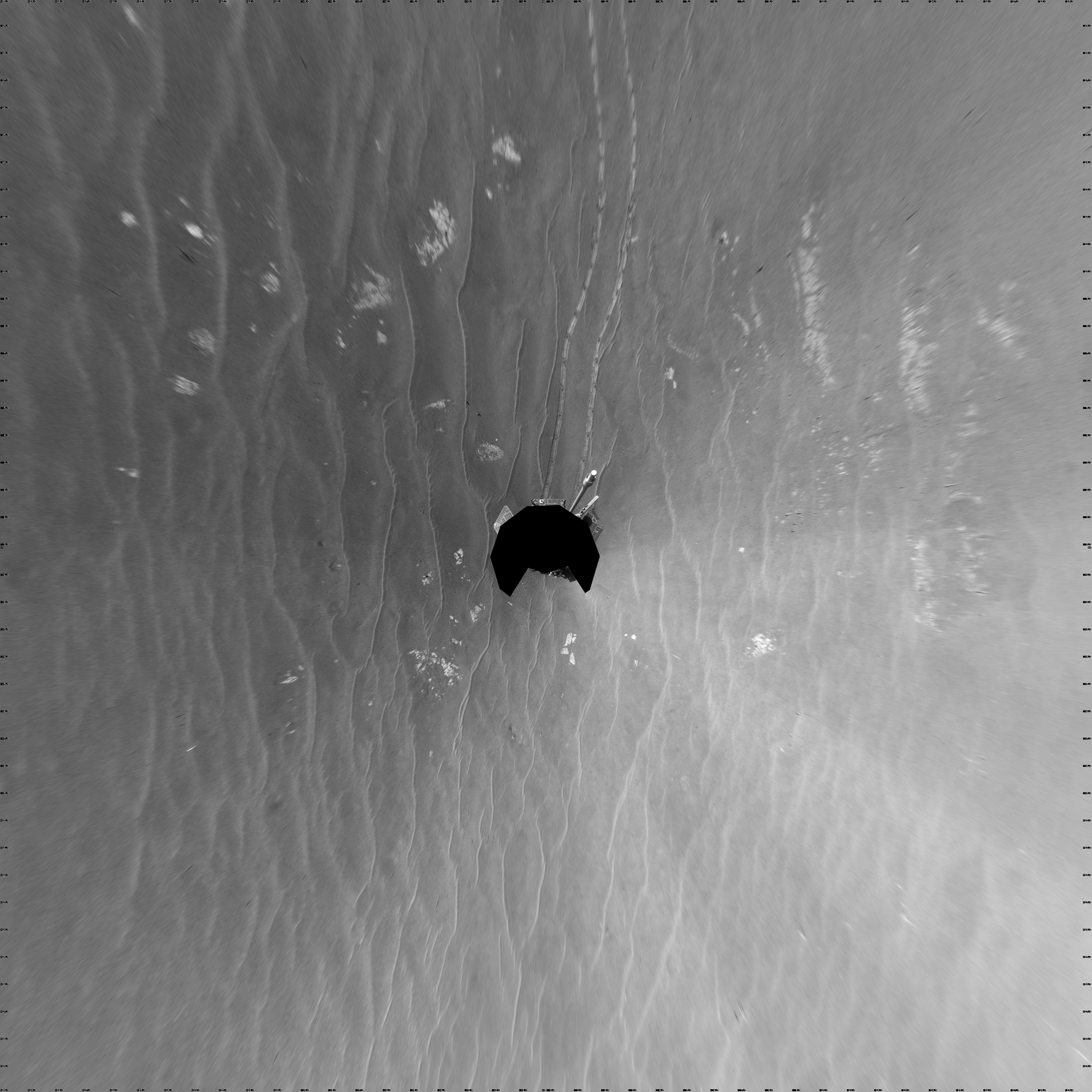
Opportunity's Surroundings on Sol 1950 (Vertical)
Full Resolution:
TIFF
(16.02 MB)
JPEG
(1.143 MB)
|
|
|
2009-07-23 |
Mars
|
Mars Exploration Rover (MER)
|
Navigation Camera
|
4103x4103x1 |

|
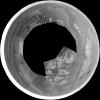
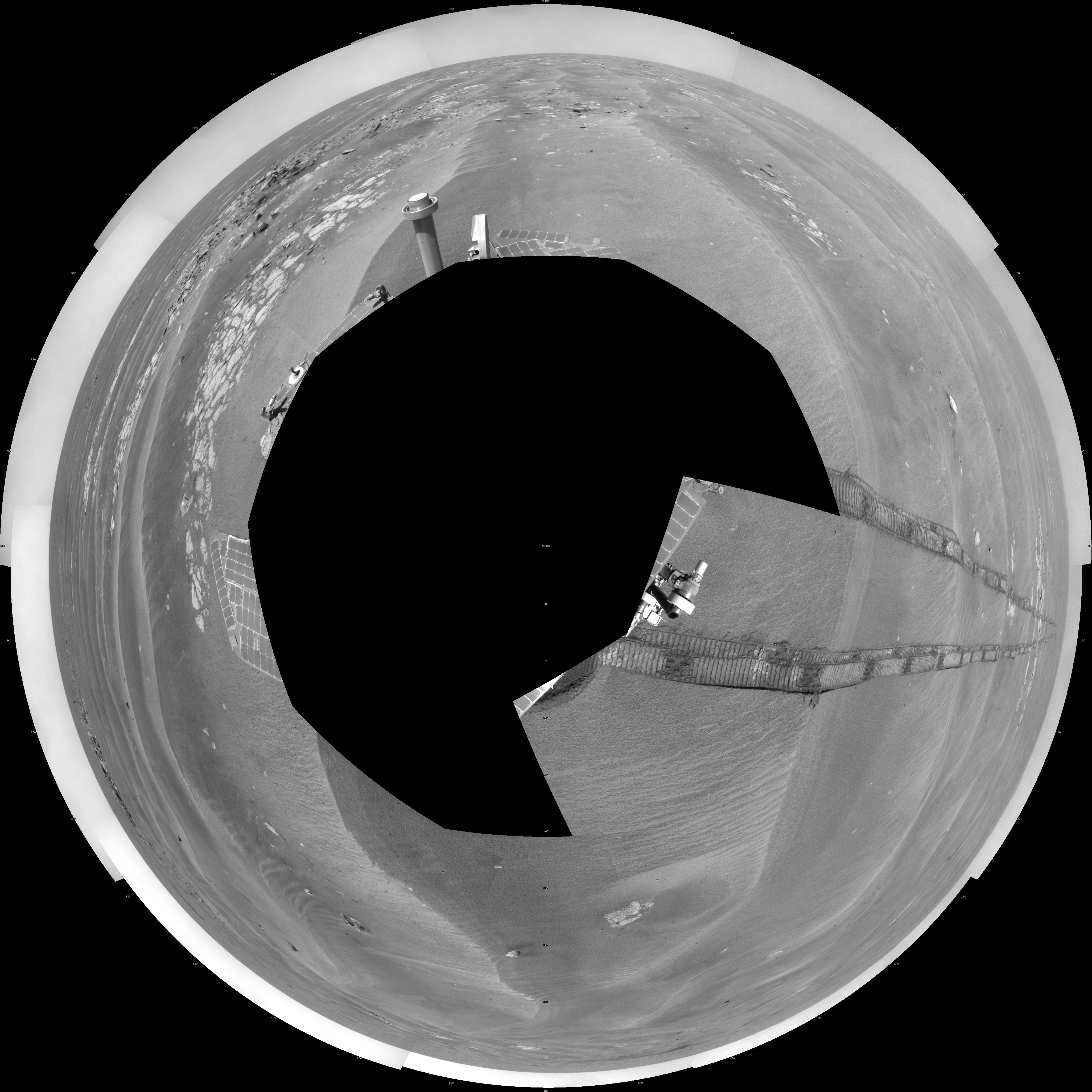
-
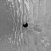
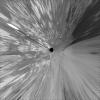
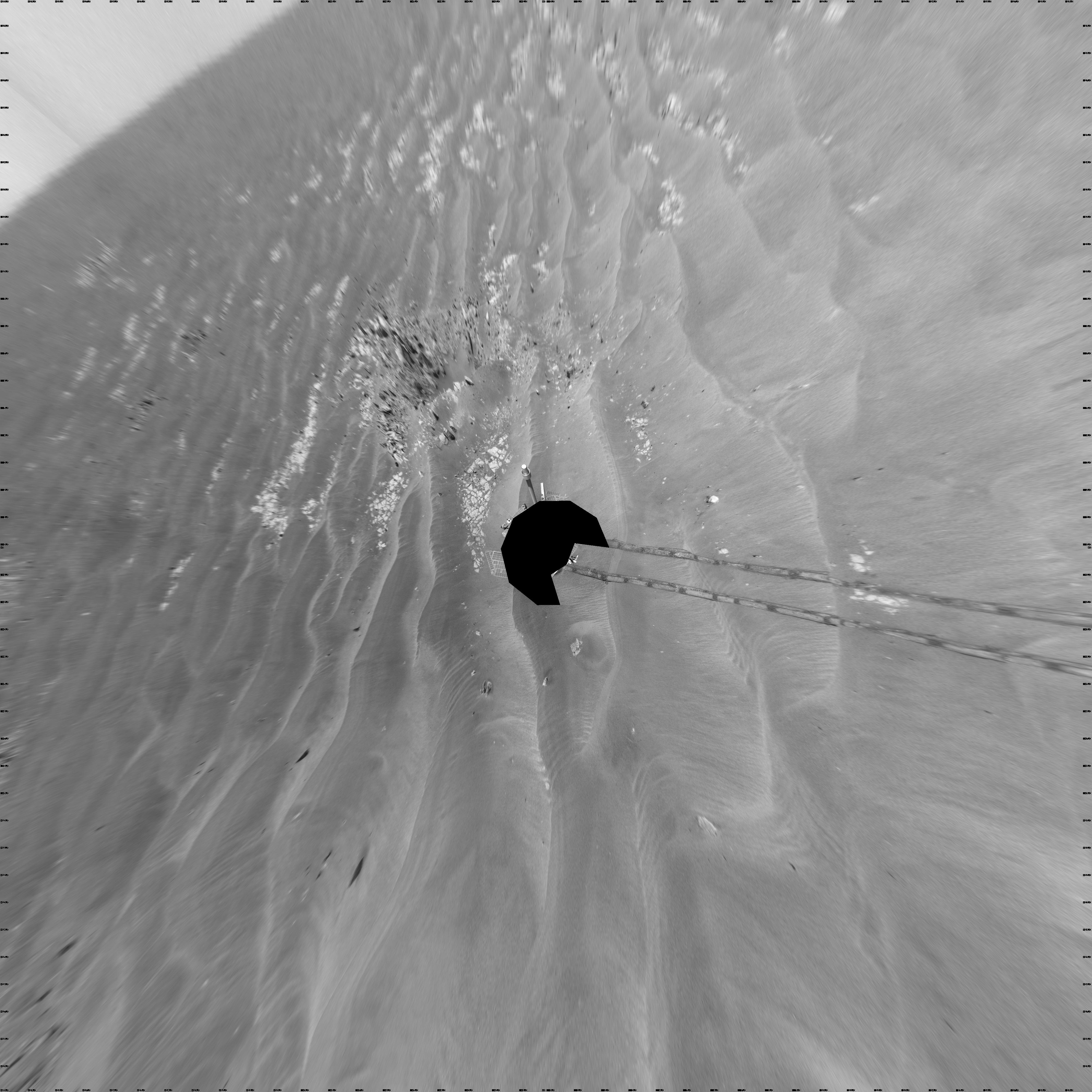
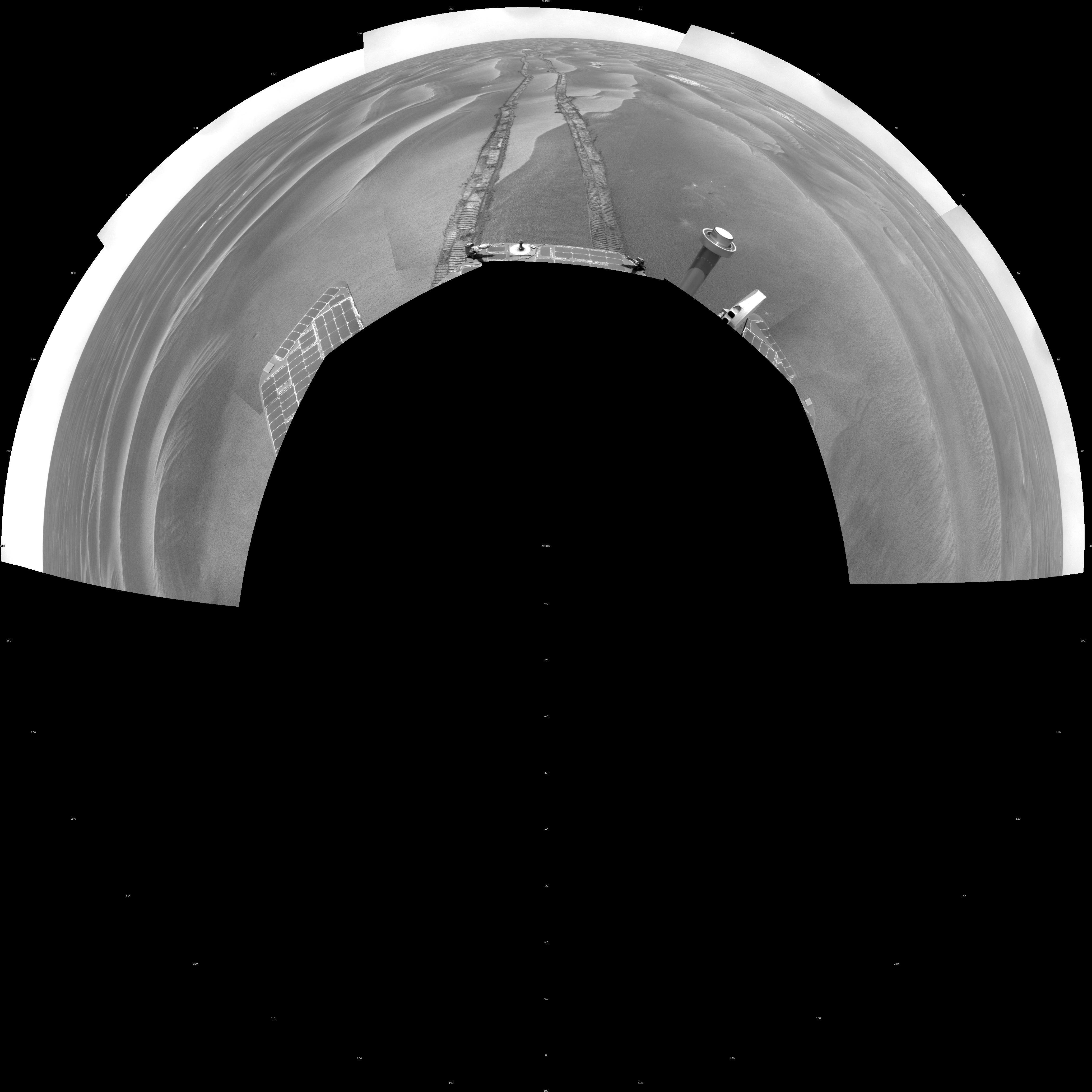
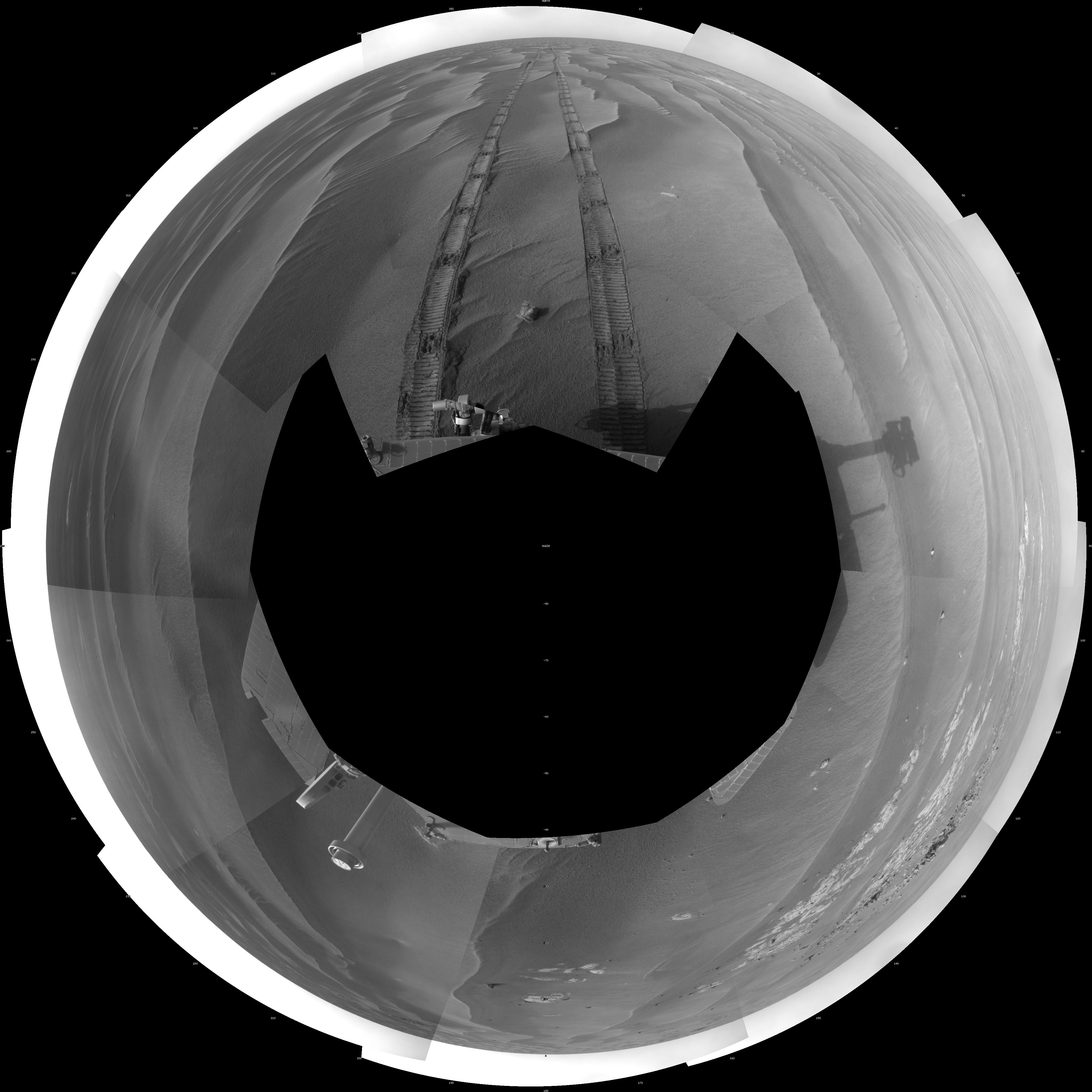
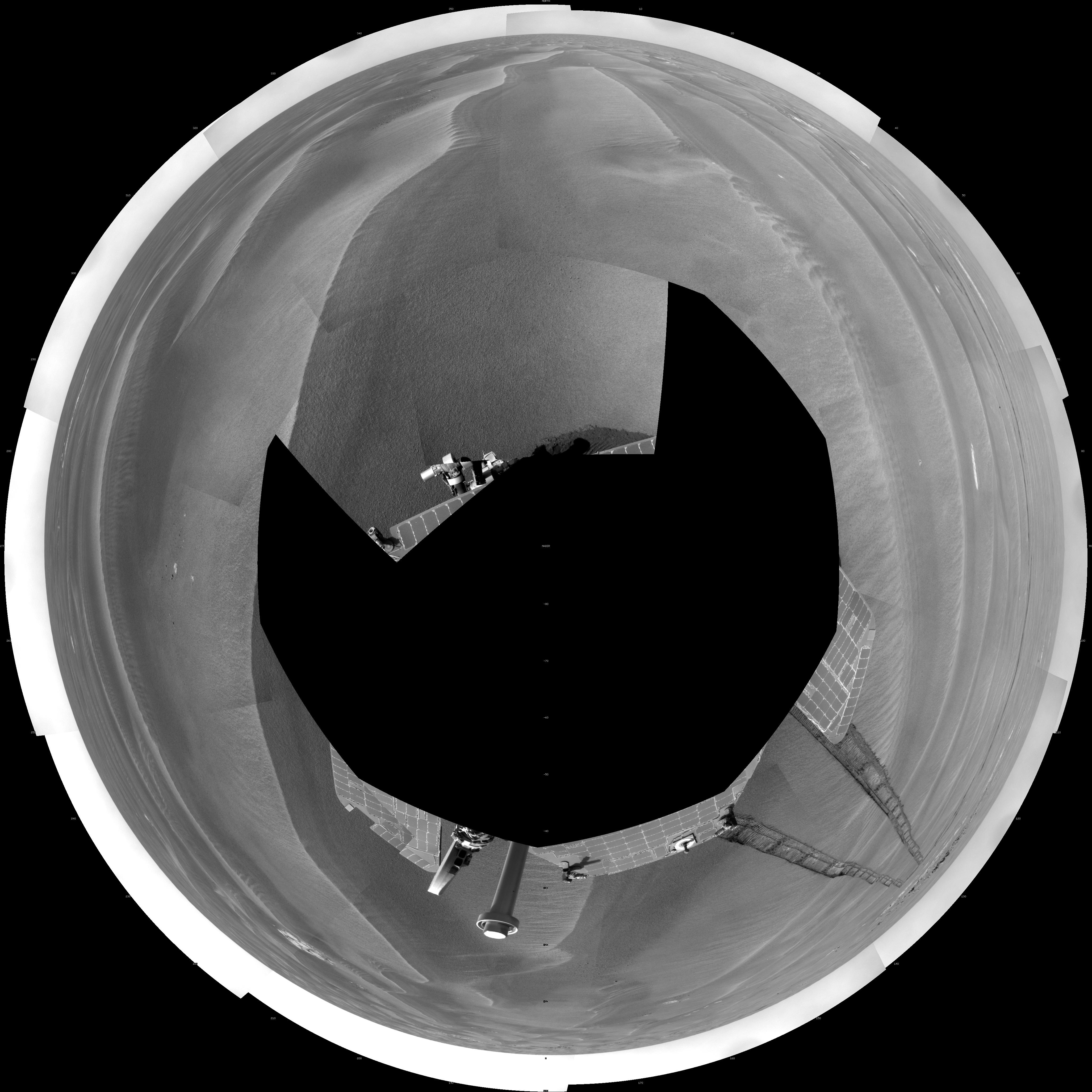
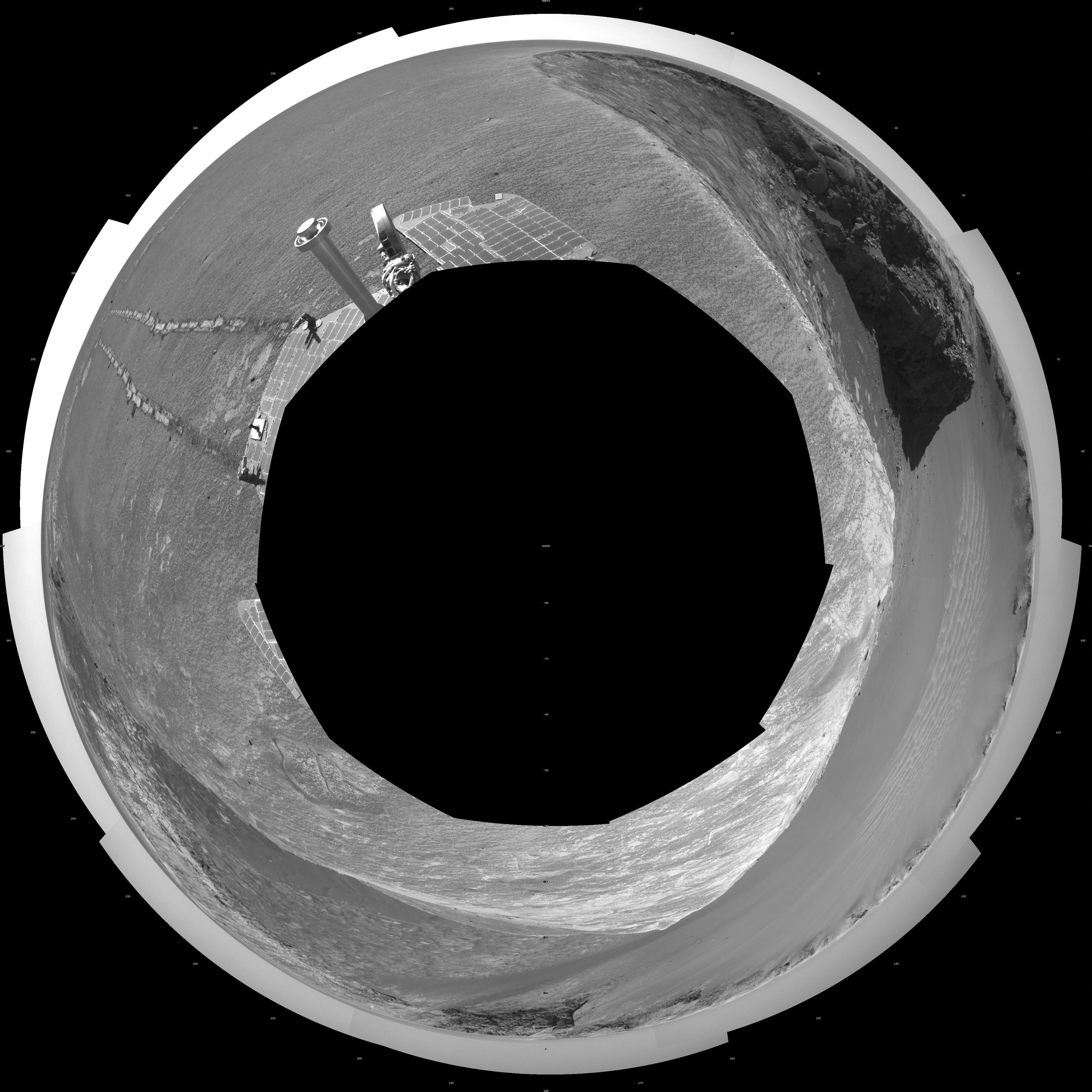
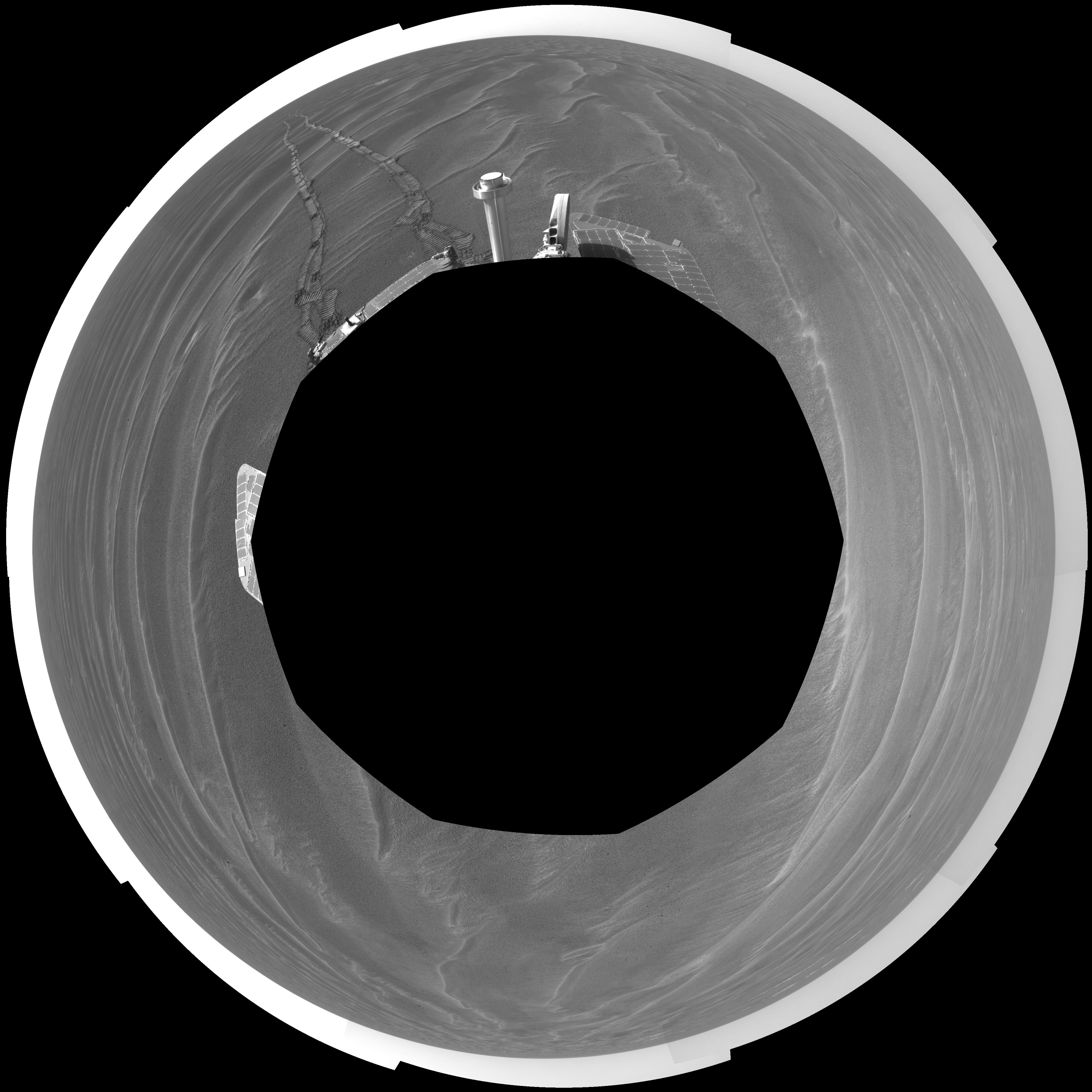
PIA12152:
-
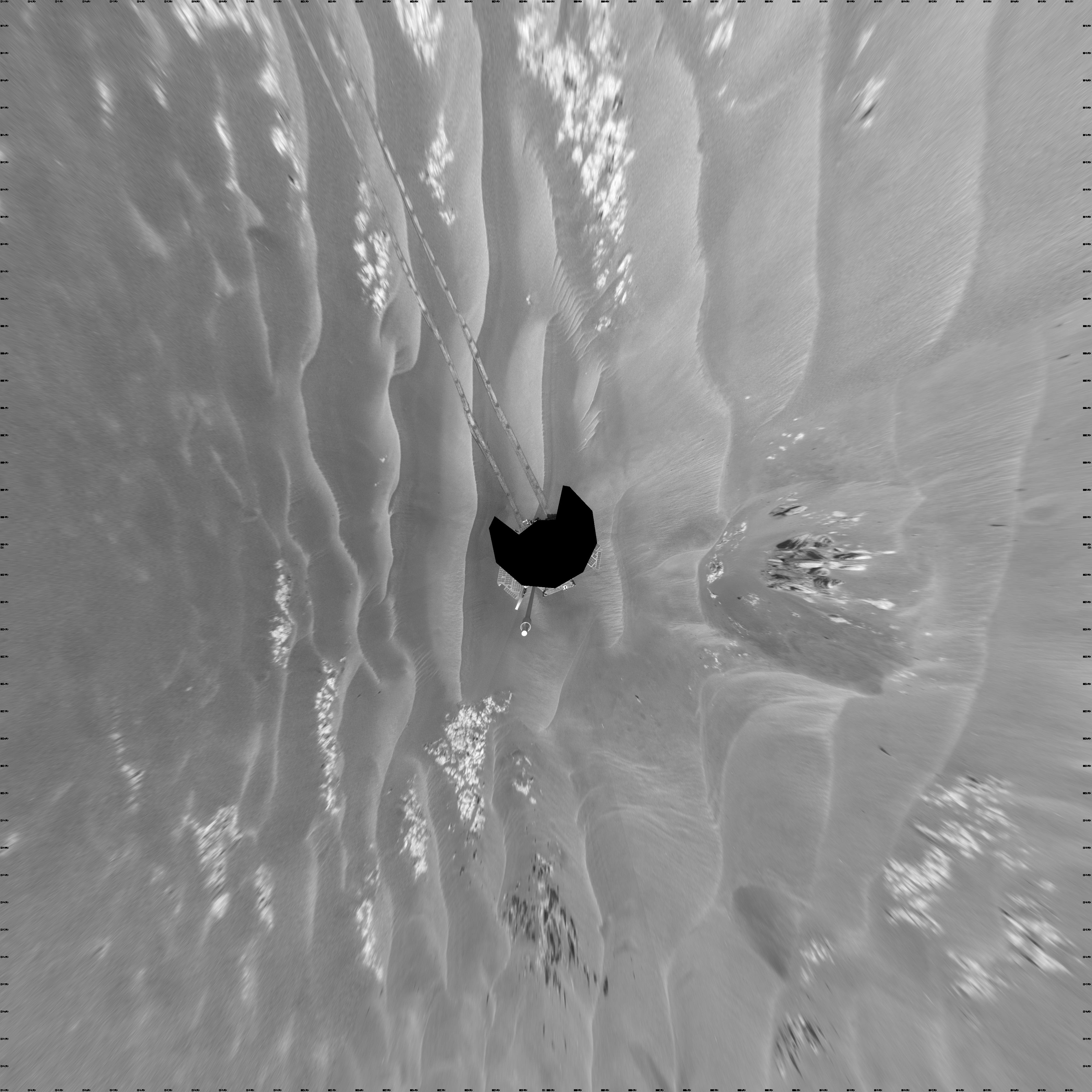
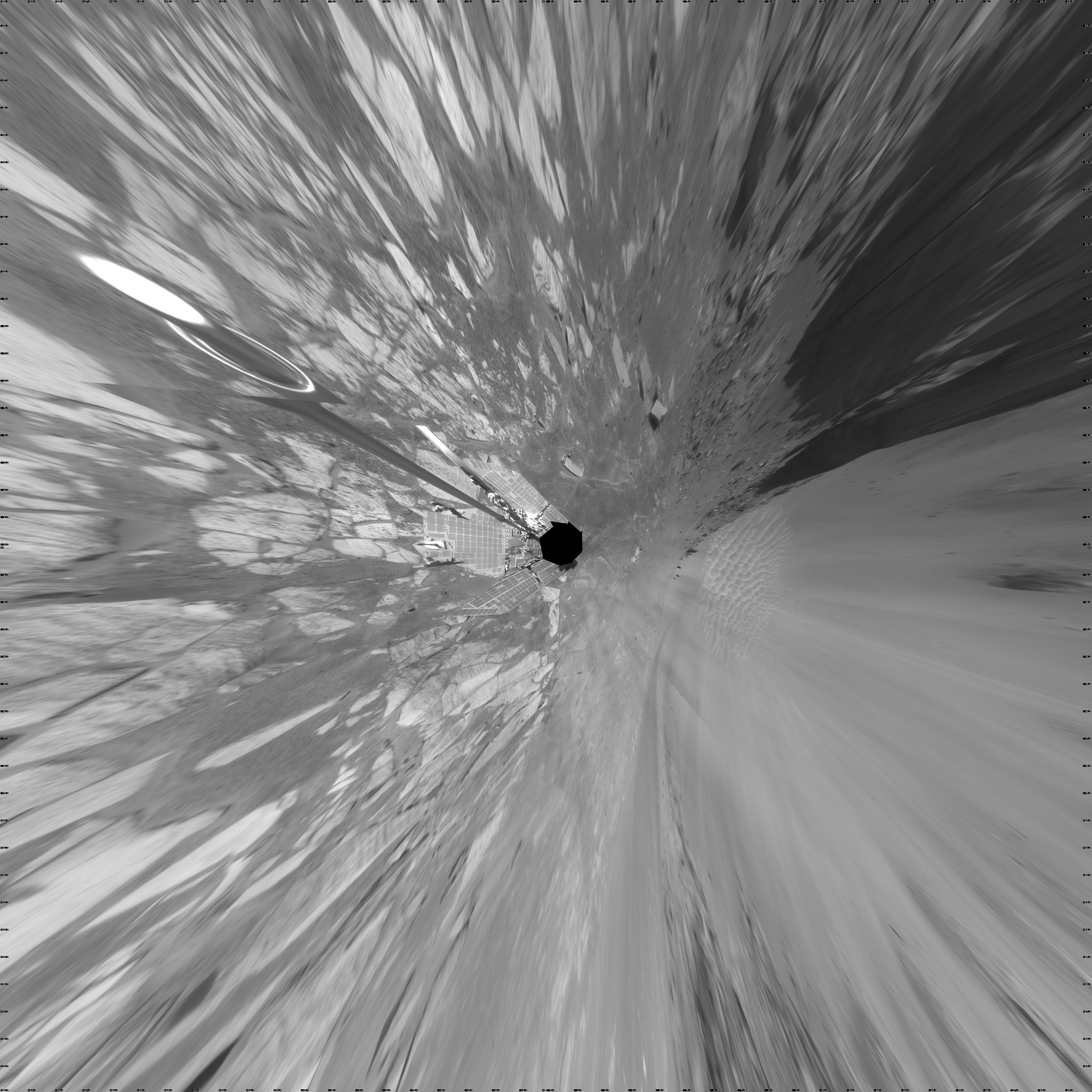
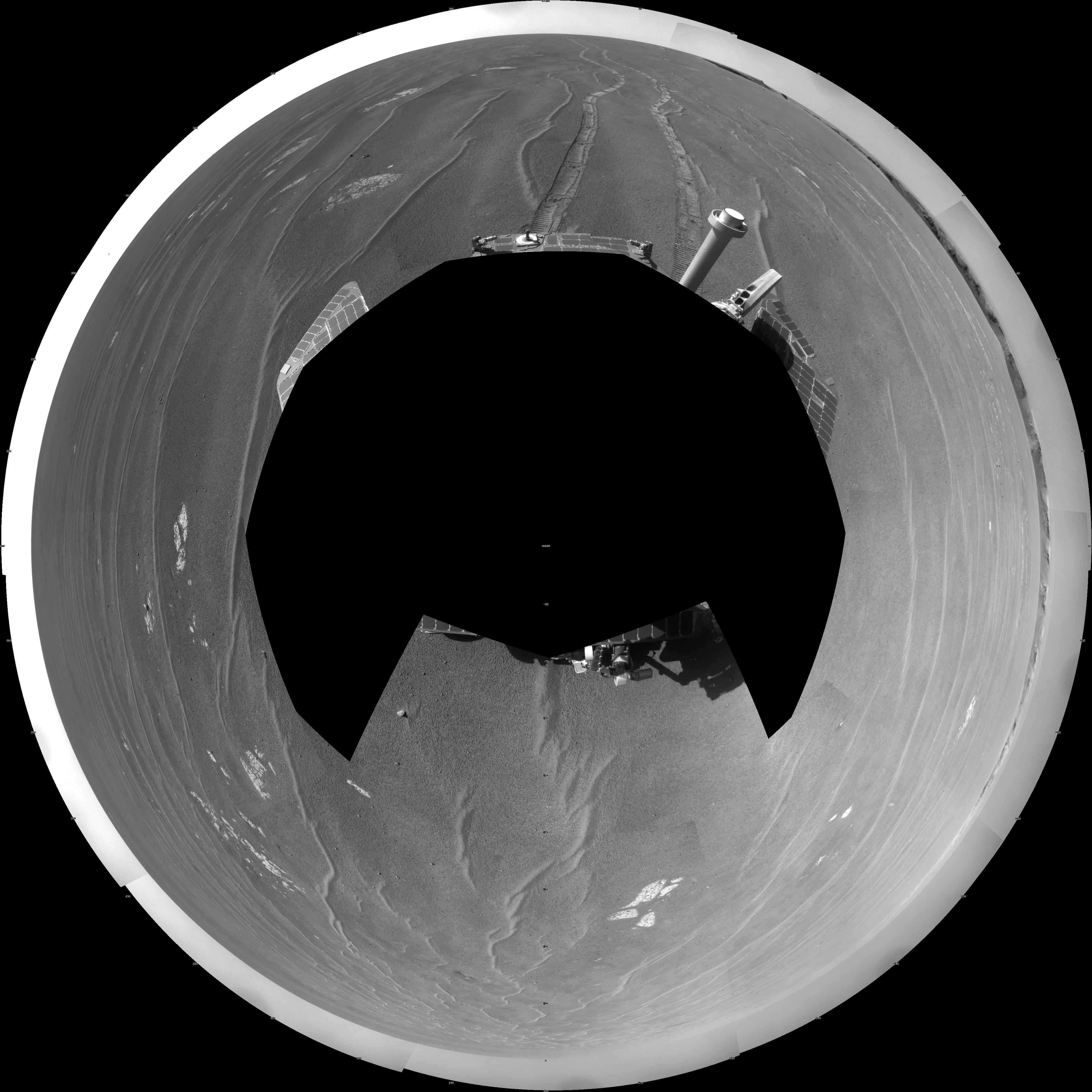
Opportunity's Surroundings on Sol 1950 (Polar)
Full Resolution:
TIFF
(16.87 MB)
JPEG
(1.262 MB)
|
|
|
2009-07-15 |
Mars
|
Mars Exploration Rover (MER)
|
Navigation Camera
|
4274x1922x1 |
|
-
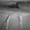
PIA12131:
-
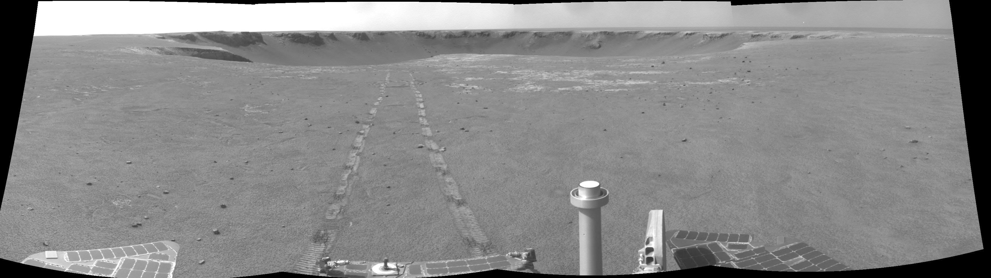
Skirting an Obstacle, Opportunity's Sol 1867
Full Resolution:
TIFF
(8.23 MB)
JPEG
(681.5 kB)
|
|
|
2009-07-15 |
Mars
|
Mars Exploration Rover (MER)
|
Navigation Camera
|
7688x1720x1 |
|
-
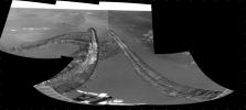
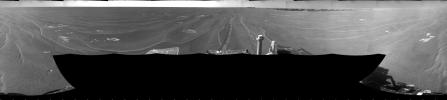
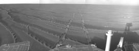
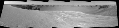
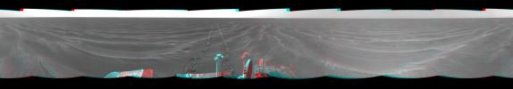
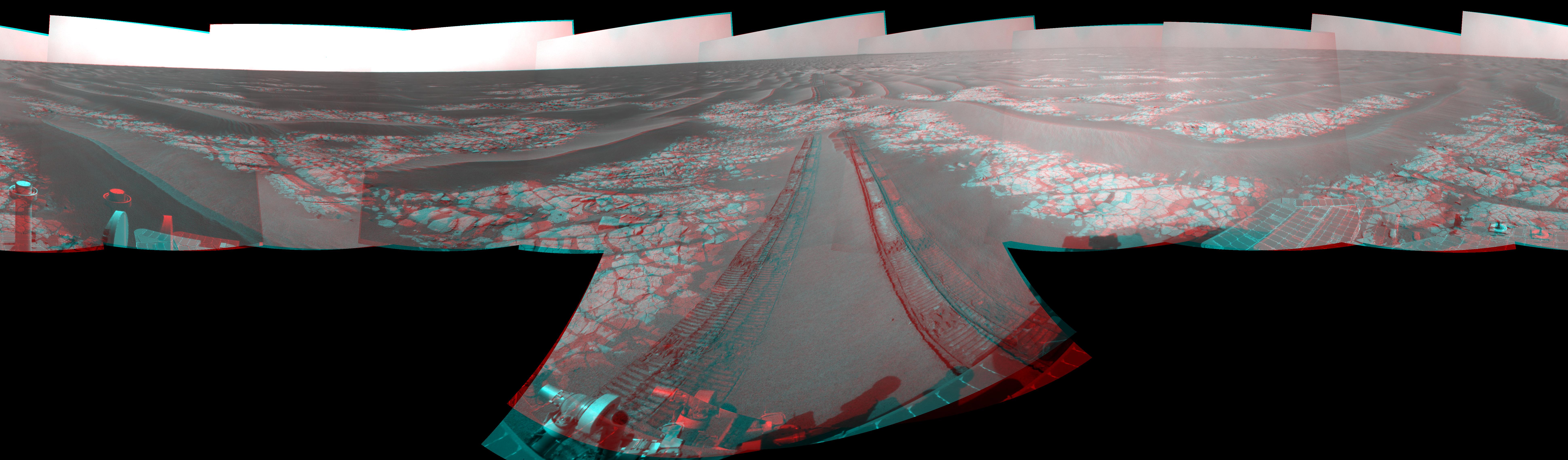
PIA12130:
Opportunity's View After 72-Meter Drive, Sol 1912
Full Resolution:
TIFF
(13.24 MB)
JPEG
(1.042 MB)
|
|
|
2009-07-15 |
Mars
|
Mars Exploration Rover (MER)
|
Navigation Camera
|
7753x2187x3 |
|
-
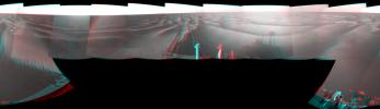
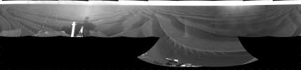
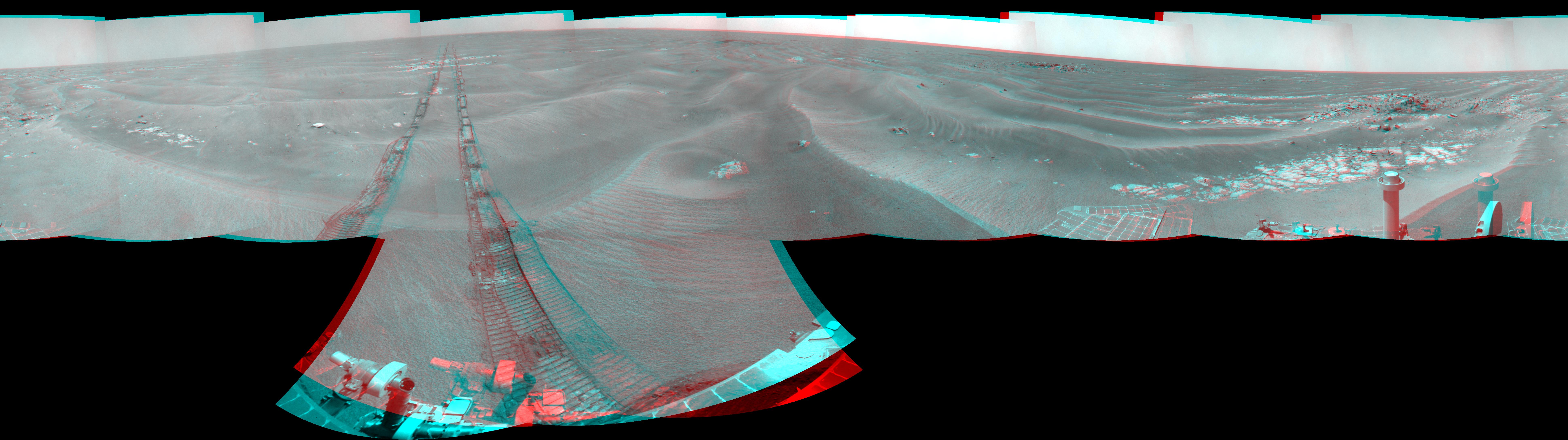
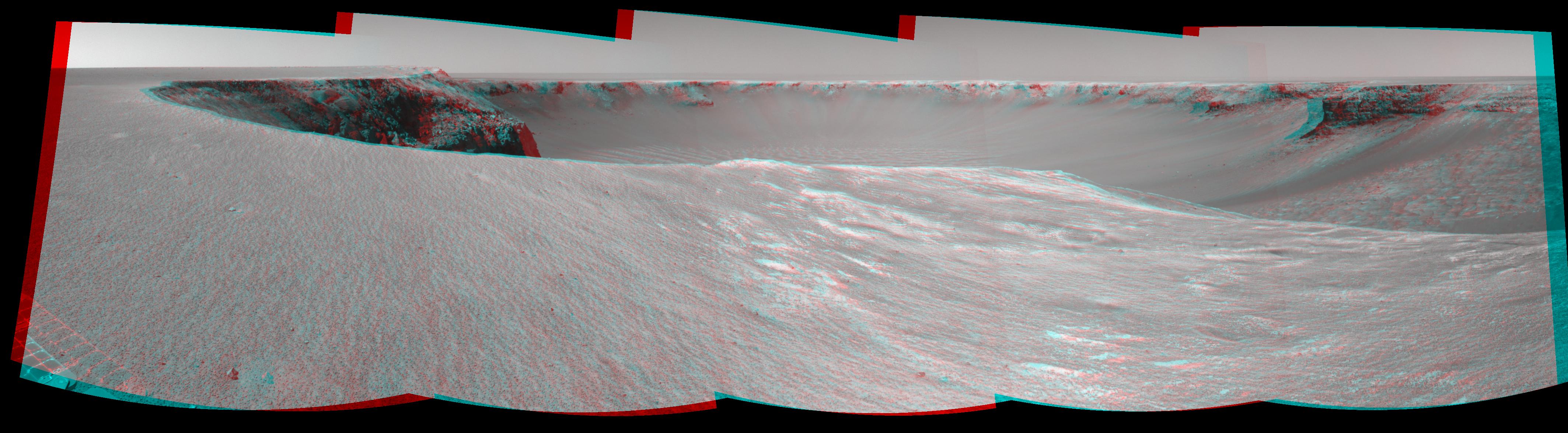
PIA12129:
Opportunity's View After 72-Meter Drive, Sol 1912 (Stereo)
Full Resolution:
TIFF
(50.87 MB)
JPEG
(1.249 MB)
|
|
|
2009-07-15 |
Mars
|
Mars Exploration Rover (MER)
|
Navigation Camera
|
4000x4000x1 |
|
-
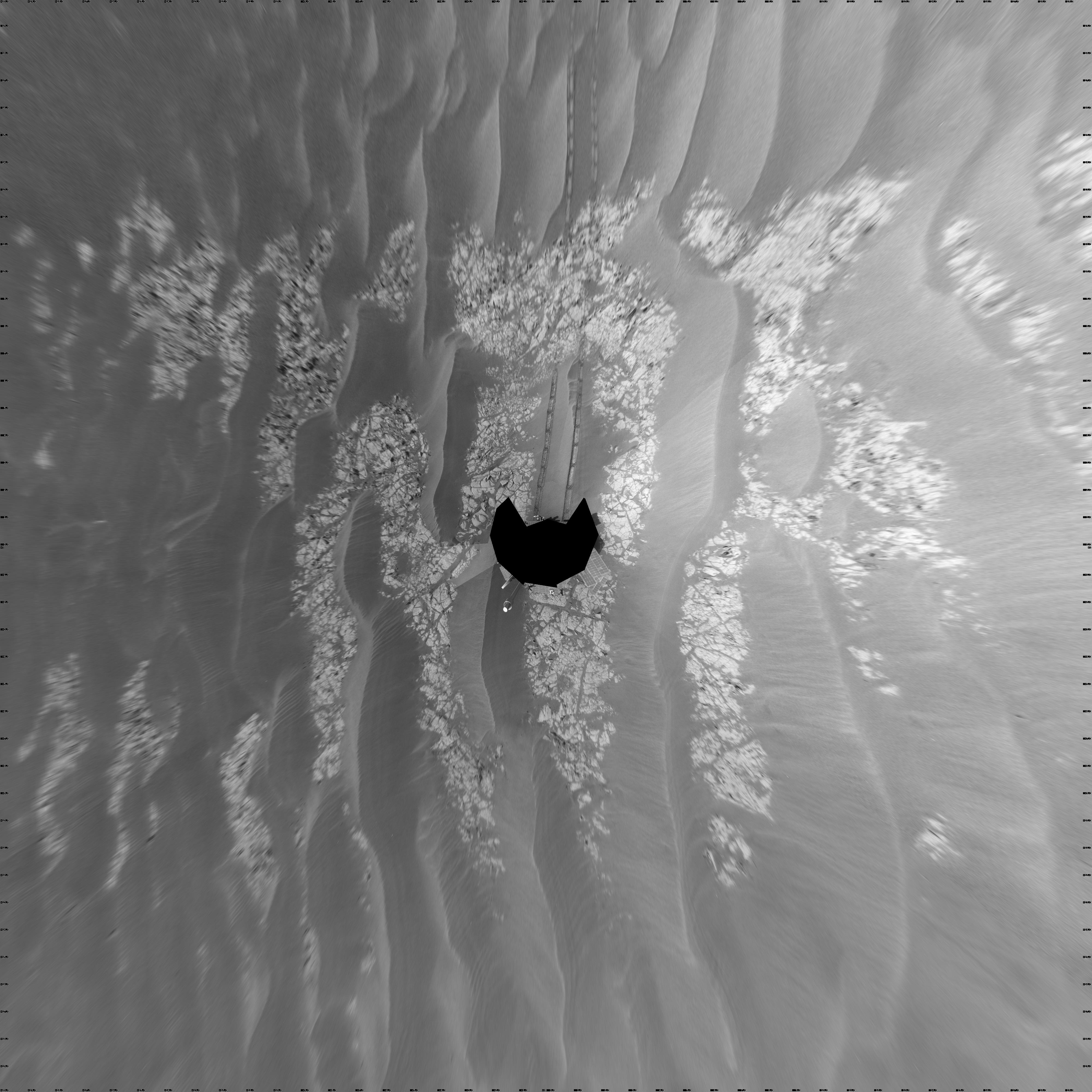
PIA12128:
-
Opportunity's View After 72-Meter Drive, Sol 1912 (Vertical)
Full Resolution:
TIFF
(16.02 MB)
JPEG
(1.21 MB)
|
|
|
2009-07-15 |
Mars
|
Mars Exploration Rover (MER)
|
Navigation Camera
|
4099x4099x1 |
|
-
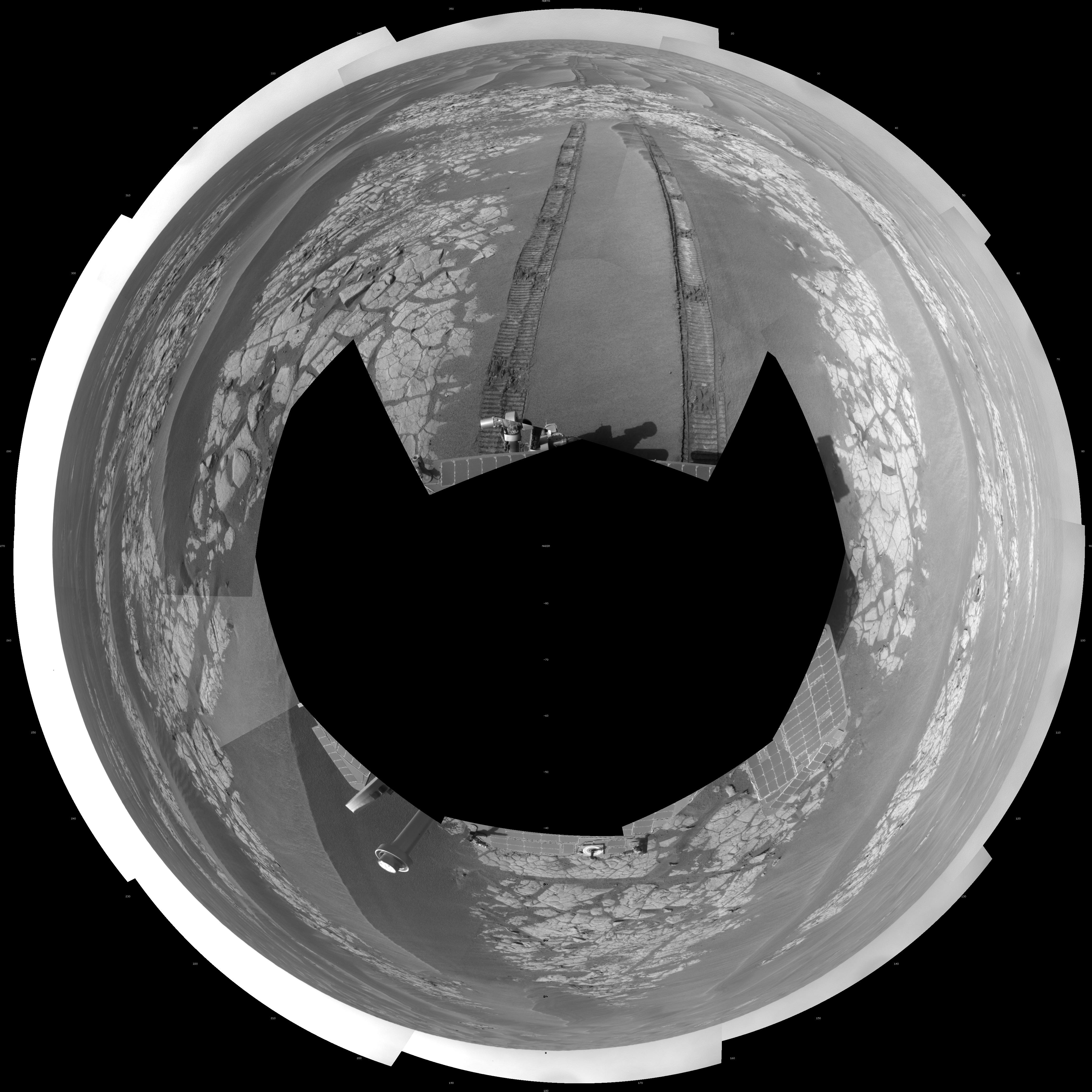
PIA12127:
-
Opportunity's View After 72-Meter Drive, Sol 1912 (Polar)
Full Resolution:
TIFF
(16.83 MB)
JPEG
(1.215 MB)
|
|
|
2009-07-15 |
Mars
|
Mars Exploration Rover (MER)
|
Navigation Camera
|
7688x1719x1 |
|
-
PIA12126:
Opportunity's Surroundings After Backwards Drive, Sol 1850
Full Resolution:
TIFF
(13.23 MB)
JPEG
(931.6 kB)
|
|
|
2009-07-15 |
Mars
|
Mars Exploration Rover (MER)
|
Navigation Camera
|
7753x2186x3 |
|
-
PIA12125:
Opportunity's Surroundings After Backwards Drive, Sol 1850 (Stereo)
Full Resolution:
TIFF
(50.84 MB)
JPEG
(1.08 MB)
|
|
|
2009-07-15 |
Mars
|
Mars Exploration Rover (MER)
|
Navigation Camera
|
4000x4000x1 |
|
-
PIA12124:
-
Opportunity's Surroundings After Backwards Drive, Sol 1850 (Vertical)
Full Resolution:
TIFF
(16.02 MB)
JPEG
(1.151 MB)
|
|
|
2009-07-15 |
Mars
|
Mars Exploration Rover (MER)
|
Navigation Camera
|
4091x4091x1 |
|
-
PIA12123:
-
Opportunity's Surroundings After Backwards Drive, Sol 1850 (Polar)
Full Resolution:
TIFF
(16.75 MB)
JPEG
(1.095 MB)
|
|
|
2009-03-23 |
Mars
|
Mars Exploration Rover (MER)
|
Navigation Camera
|
7688x1738x1 |
|
-
PIA11855:
Opportunity at 'Cook Islands'
Full Resolution:
TIFF
(13.38 MB)
JPEG
(967.1 kB)
|
|
|
2009-03-23 |
Mars
|
Mars Exploration Rover (MER)
|
Navigation Camera
|
7753x2218x3 |

|
-
PIA11854:
-
Opportunity at 'Cook Islands' (Stereo)
Full Resolution:
TIFF
(51.59 MB)
JPEG
(1.162 MB)
|
|
|
2009-03-23 |
Mars
|
Mars Exploration Rover (MER)
|
Navigation Camera
|
4093x4093x1 |
|
-
PIA11853:
-
Opportunity at 'Cook Islands' (Polar)
Full Resolution:
TIFF
(16.77 MB)
JPEG
(1.106 MB)
|
|
|
2009-03-23 |
Mars
|
Mars Exploration Rover (MER)
|
Navigation Camera
|
4000x4000x1 |
|
-
PIA11852:
-
Opportunity at 'Cook Islands' (Vertical)
Full Resolution:
TIFF
(16.02 MB)
JPEG
(948.2 kB)
|
|
|
2009-03-23 |
Mars
|
Mars Exploration Rover (MER)
|
Navigation Camera
|
4225x995x1 |

|
-
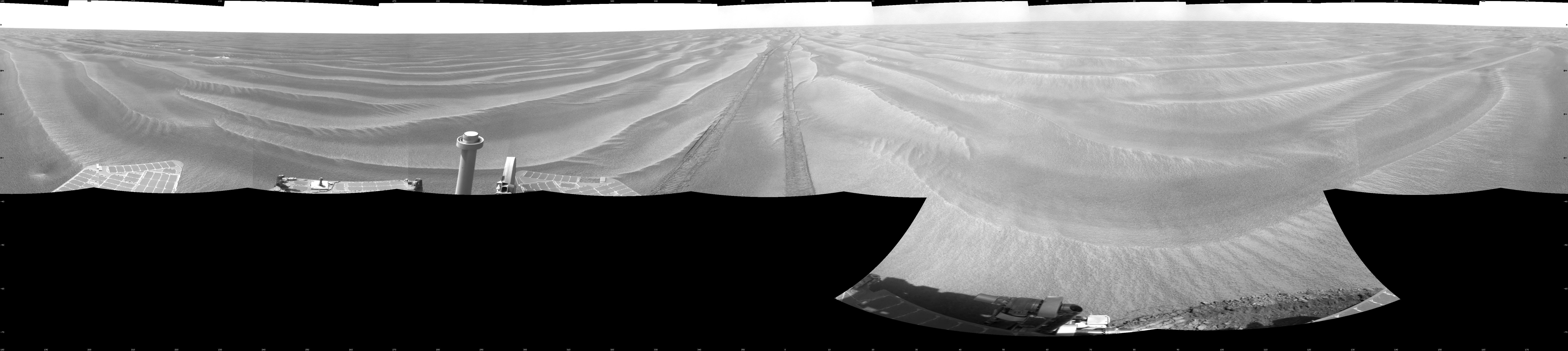
PIA11851:
Opportunity's Surroundings on Sol 1798
Full Resolution:
TIFF
(4.212 MB)
JPEG
(394.7 kB)
|
|
|
2009-03-23 |
Mars
|
Mars Exploration Rover (MER)
|
Navigation Camera
|
4260x1161x3 |

|
-
PIA11850:
Opportunity's Surroundings on Sol 1798 (Stereo)
Full Resolution:
TIFF
(14.84 MB)
JPEG
(449.3 kB)
|
|
|
2009-03-23 |
Mars
|
Mars Exploration Rover (MER)
|
Navigation Camera
|
4133x4133x1 |

|
-
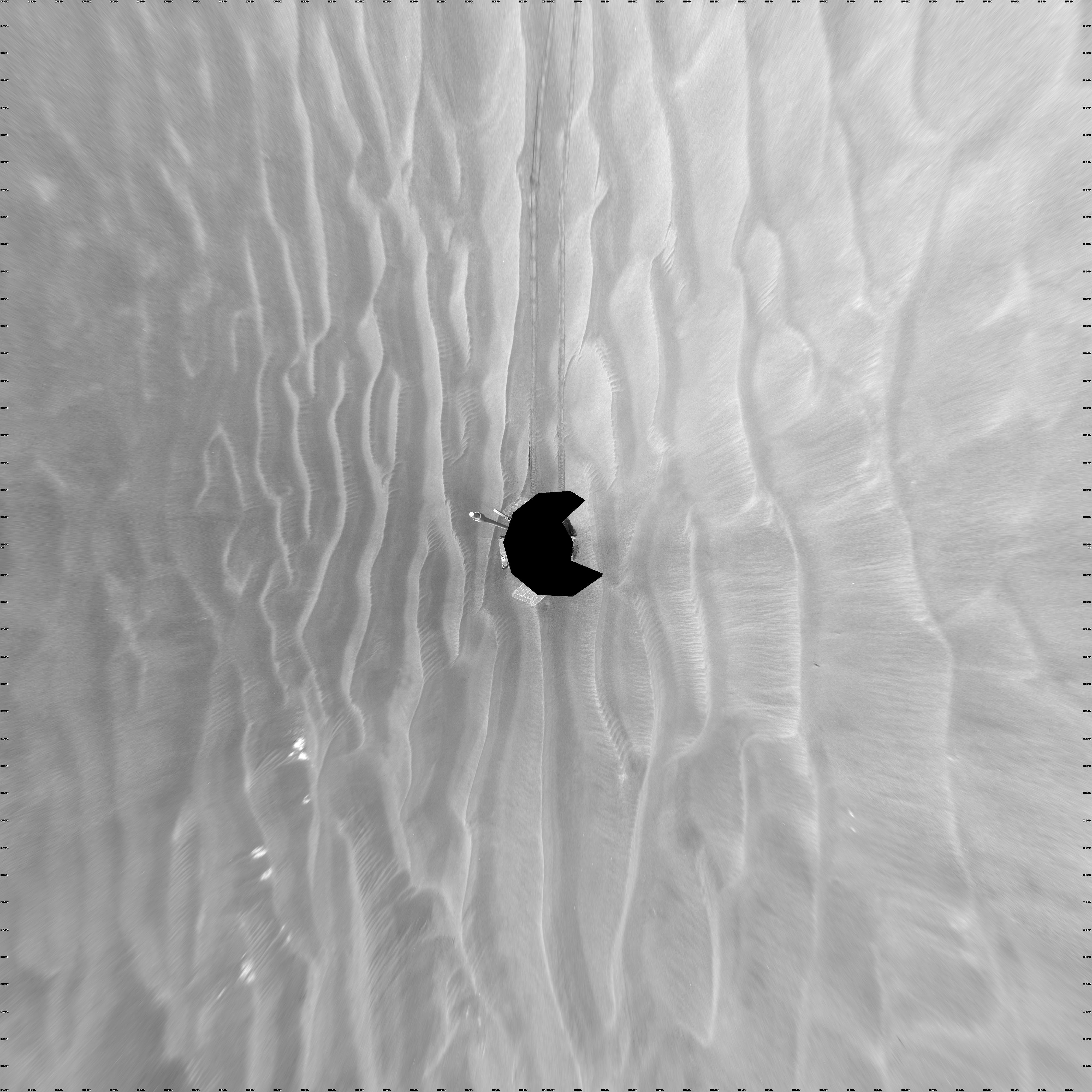
PIA11849:
-
Opportunity's Surroundings on Sol 1798 (Polar)
Full Resolution:
TIFF
(17.11 MB)
JPEG
(645.9 kB)
|
|
|
2009-03-23 |
Mars
|
Mars Exploration Rover (MER)
|
Navigation Camera
|
4000x4000x1 |

|
-
PIA11848:
-
Opportunity's Surroundings on Sol 1798 (Vertical)
Full Resolution:
TIFF
(16.02 MB)
JPEG
(609.2 kB)
|
|
|
2009-03-23 |
Mars
|
Mars Exploration Rover (MER)
|
Navigation Camera
|
7688x1714x1 |

|
-
PIA11847:
Opportunity's Surroundings on Sol 1818
Full Resolution:
TIFF
(13.19 MB)
JPEG
(800.1 kB)
|
|
|
2009-03-23 |
Mars
|
Mars Exploration Rover (MER)
|
Navigation Camera
|
7753x2177x3 |
|
-
PIA11846:
Opportunity's Surroundings on Sol 1818 (Stereo)
Full Resolution:
TIFF
(50.64 MB)
JPEG
(970 kB)
|
|
|
2009-03-23 |
Mars
|
Mars Exploration Rover (MER)
|
Navigation Camera
|
4127x4127x1 |

|
-
PIA11845:
-
Opportunity's Surroundings on Sol 1818 (Polar)
Full Resolution:
TIFF
(17.07 MB)
JPEG
(939 kB)
|
|
|
2009-03-23 |
Mars
|
Mars Exploration Rover (MER)
|
Navigation Camera
|
4000x4000x1 |

|
-
PIA11844:
-
Opportunity's Surroundings on Sol 1818 (Vertical)
Full Resolution:
TIFF
(16.02 MB)
JPEG
(778.4 kB)
|
|
|
2009-03-23 |
Mars
|
Mars Exploration Rover (MER)
|
Navigation Camera
|
7688x1815x1 |
|
-
PIA11843:
Opportunity's Surroundings After Sol 1820 Drive
Full Resolution:
TIFF
(13.97 MB)
JPEG
(1.053 MB)
|
|
|
2009-03-23 |
Mars
|
Mars Exploration Rover (MER)
|
Navigation Camera
|
7753x2357x3 |
|
-
PIA11842:
-
Opportunity's Surroundings After Sol 1820 Drive (Stereo)
Full Resolution:
TIFF
(54.82 MB)
JPEG
(1.314 MB)
|
|
|
2009-03-23 |
Mars
|
Mars Exploration Rover (MER)
|
Navigation Camera
|
4107x4107x1 |

|
-
PIA11841:
-
Opportunity's Surroundings After Sol 1820 Drive (Polar)
Full Resolution:
TIFF
(16.9 MB)
JPEG
(1.159 MB)
|
|
|
2009-03-23 |
Mars
|
Mars Exploration Rover (MER)
|
Navigation Camera
|
4000x4000x1 |
|
-
PIA11840:
-
Opportunity's Surroundings After Sol 1820 Drive (Vertical)
Full Resolution:
TIFF
(16.02 MB)
JPEG
(944.5 kB)
|
|
|
2009-03-03 |
Mars
|
Mars Exploration Rover (MER)
|
Navigation Camera
|
7688x1747x1 |

|
-
PIA11821:
Wind-Sculpted Vicinity After Opportunity's Sol 1797 Drive
Full Resolution:
TIFF
(13.45 MB)
JPEG
(946 kB)
|
|
|
2009-03-03 |
Mars
|
Mars Exploration Rover (MER)
|
Navigation Camera
|
7753x2235x3 |
|
-
PIA11820:
-
Wind-Sculpted Vicinity After Opportunity's Sol 1797 Drive (Stereo)
Full Resolution:
TIFF
(51.98 MB)
JPEG
(1.099 MB)
|
|
|
2009-03-03 |
Mars
|
Mars Exploration Rover (MER)
|
Navigation Camera
|
4135x4135x1 |
|
-
PIA11819:
-
Wind-Sculpted Vicinity After Opportunity's Sol 1797 Drive (Polar)
Full Resolution:
TIFF
(17.13 MB)
JPEG
(1.073 MB)
|
|
|
2009-03-03 |
Mars
|
Mars Exploration Rover (MER)
|
Navigation Camera
|
4000x4000x1 |
|
-
PIA11818:
-
Wind-Sculpted Vicinity After Opportunity's Sol 1797 Drive (Vertical)
Full Resolution:
TIFF
(16.02 MB)
JPEG
(1.033 MB)
|
|
|
2009-03-03 |
Mars
|
Mars Exploration Rover (MER)
|
Navigation Camera
|
7688x1770x1 |
|
-
PIA11817:
Opportunity's View After Drive on Sol 1806
Full Resolution:
TIFF
(13.62 MB)
JPEG
(1.074 MB)
|
|
|
2009-03-03 |
Mars
|
Mars Exploration Rover (MER)
|
Navigation Camera
|
7753x2275x3 |
|
-
PIA11816:
-
Opportunity's View After Drive on Sol 1806 (Stereo)
Full Resolution:
TIFF
(52.91 MB)
JPEG
(1.29 MB)
|
|
|
2009-03-03 |
Mars
|
Mars Exploration Rover (MER)
|
Navigation Camera
|
4151x4151x1 |
|
-
PIA11815:
-
Opportunity's View After Drive on Sol 1806 (Polar)
Full Resolution:
TIFF
(17.26 MB)
JPEG
(1.258 MB)
|
|
|
2009-03-03 |
Mars
|
Mars Exploration Rover (MER)
|
Navigation Camera
|
4000x4000x1 |
|
-
PIA11814:
-
Opportunity's View After Drive on Sol 1806 (Vertical)
Full Resolution:
TIFF
(16.02 MB)
JPEG
(1.157 MB)
|
|
|
2009-03-03 |
Mars
|
Mars Exploration Rover (MER)
|
Navigation Camera
|
7688x1698x1 |
|
-
PIA11813:
Opportunity's View on Sols 1803 and 1804
Full Resolution:
TIFF
(13.07 MB)
JPEG
(980.2 kB)
|
|
|
2009-03-03 |
Mars
|
Mars Exploration Rover (MER)
|
Navigation Camera
|
7753x2149x3 |
|
-
PIA11812:
Opportunity's View on Sols 1803 and 1804 (Stereo)
Full Resolution:
TIFF
(49.98 MB)
JPEG
(1.162 MB)
|
|
|
2009-03-03 |
Mars
|
Mars Exploration Rover (MER)
|
Navigation Camera
|
4131x4131x1 |
|
-
PIA11811:
-
Opportunity's View on Sols 1803 and 1804 (Polar)
Full Resolution:
TIFF
(17.1 MB)
JPEG
(1.2 MB)
|
|
|
2009-03-03 |
Mars
|
Mars Exploration Rover (MER)
|
Navigation Camera
|
4000x4000x1 |
|
-
PIA11810:
-
Opportunity's View on Sols 1803 and 1804 (Vertical)
Full Resolution:
TIFF
(16.02 MB)
JPEG
(1.129 MB)
|
|
|
2009-02-04 |
Mars
|
Mars Exploration Rover (MER)
|
Navigation Camera
|
7688x1776x1 |

|
-
PIA11792:
Opportunity's View After Long Drive on Sol 1770
Full Resolution:
TIFF
(13.67 MB)
JPEG
(964.9 kB)
|
|
|
2009-02-04 |
Mars
|
Mars Exploration Rover (MER)
|
Navigation Camera
|
7753x2286x3 |
|
-
PIA11791:
-
Opportunity's View After Long Drive on Sol 1770 (Stereo)
Full Resolution:
TIFF
(53.17 MB)
JPEG
(1.193 MB)
|
|
|
2009-02-04 |
Mars
|
Mars Exploration Rover (MER)
|
Navigation Camera
|
4097x4097x1 |

|
-
PIA11790:
-
Opportunity's View After Long Drive on Sol 1770 (Polar)
Full Resolution:
TIFF
(16.82 MB)
JPEG
(1.11 MB)
|
|
|
2009-02-04 |
Mars
|
Mars Exploration Rover (MER)
|
Navigation Camera
|
4000x4000x1 |
|
-
PIA11789:
-
Opportunity's View After Long Drive on Sol 1770 (Vertical)
Full Resolution:
TIFF
(16.02 MB)
JPEG
(989.2 kB)
|
|
|
2009-02-03 |
Mars
|
Mars Exploration Rover (MER)
|
Navigation Camera
|
7688x2291x1 |
|
-
PIA11788:
-
Opportunity View During Exploration in 'Duck Bay,' Sols 1506-1510
Full Resolution:
TIFF
(17.63 MB)
JPEG
(1.481 MB)
|
|
|
2009-02-03 |
Mars
|
Mars Exploration Rover (MER)
|
Navigation Camera
|
7753x3446x3 |
|
-
PIA11787:
-
Opportunity View During Exploration in 'Duck Bay,' Sols 1506-1510 (Stereo)
Full Resolution:
TIFF
(80.15 MB)
JPEG
(2.041 MB)
|
|
|
2009-02-03 |
Mars
|
Mars Exploration Rover (MER)
|
Navigation Camera
|
5245x5245x1 |

|
-
PIA11786:
-
Opportunity View During Exploration in 'Duck Bay,' Sols 1506-1510 (Polar)
Full Resolution:
TIFF
(27.55 MB)
JPEG
(1.756 MB)
|
|
|
2009-02-03 |
Mars
|
Mars Exploration Rover (MER)
|
Navigation Camera
|
4000x4000x1 |
|
-
PIA11785:
-
Opportunity View During Exploration in 'Duck Bay,' Sols 1506-1510 (Vertical)
Full Resolution:
TIFF
(16.02 MB)
JPEG
(1.191 MB)
|
|
|
2009-01-22 |
Mars
|
Mars Exploration Rover (MER)
|
Navigation Camera
|
4000x4000x1 |

|
-
PIA11388:
-
View from West of Victoria Crater, Sol 1664 (Vertical)
Full Resolution:
TIFF
(16.02 MB)
JPEG
(1.093 MB)
|
|
|
2009-01-22 |
Mars
|
Mars Exploration Rover (MER)
|
Navigation Camera
|
4089x4089x1 |

|
-
PIA11387:
-
View from West of Victoria Crater, Sol 1664 (Polar)
Full Resolution:
TIFF
(16.74 MB)
JPEG
(1.258 MB)
|
|
|
2009-01-22 |
Mars
|
Mars Exploration Rover (MER)
|
Navigation Camera
|
7688x1722x1 |
|
-
PIA11386:
View from West of Victoria Crater, Sol 1664
Full Resolution:
TIFF
(13.25 MB)
JPEG
(1.1 MB)
|
|
|
2009-01-22 |
Mars
|
Mars Exploration Rover (MER)
|
Navigation Camera
|
7753x2191x3 |
|
-
PIA11385:
View from West of Victoria Crater, Sol 1664 (Stereo)
Full Resolution:
TIFF
(50.96 MB)
JPEG
(1.302 MB)
|
|
|
2009-01-08 |
Mars
|
Mars Exploration Rover (MER)
|
Navigation Camera
|
3465x972x1 |
|
-
PIA11750:
Places to Go, Things to See
Full Resolution:
TIFF
(3.372 MB)
JPEG
(355.9 kB)
|
|
|
2009-01-05 |
Mars
|
Mars Exploration Rover (MER)
|
Navigation Camera
|
2368x870x1 |
|
-
PIA11743:
-
View from Southwest of Victoria Crater
Full Resolution:
TIFF
(2.063 MB)
JPEG
(205.1 kB)
|
|
|
2009-01-05 |
Mars
|
Mars Exploration Rover (MER)
|
Navigation Camera
|
7688x1797x1 |
|
-
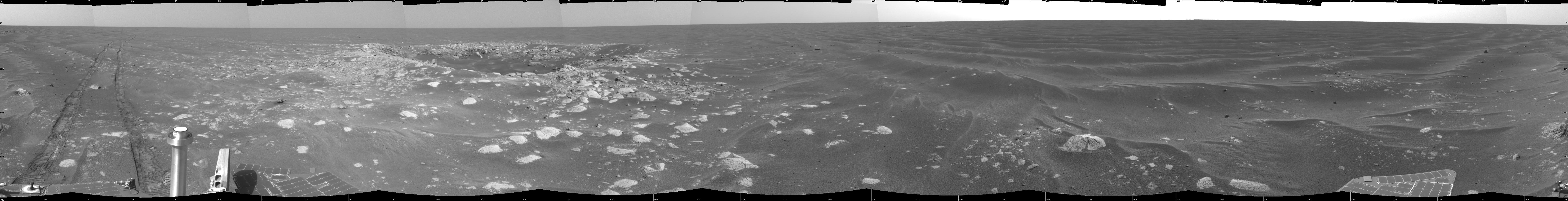
PIA11742:
Opportunity's Surroundings on Sol 1687
Full Resolution:
TIFF
(13.83 MB)
JPEG
(1.02 MB)
|
|
|
2009-01-05 |
Mars
|
Mars Exploration Rover (MER)
|
Navigation Camera
|
4000x4000x1 |
|
-
PIA11741:
-
Opportunity's Surroundings on Sol 1687 (Vertical)
Full Resolution:
TIFF
(16.02 MB)
JPEG
(1.013 MB)
|
|
|
2009-01-05 |
Mars
|
Mars Exploration Rover (MER)
|
Navigation Camera
|
4099x4099x1 |

|
-
PIA11740:
-
Opportunity's Surroundings on Sol 1687 (Polar)
Full Resolution:
TIFF
(16.83 MB)
JPEG
(1.114 MB)
|
|
|
2009-01-05 |
Mars
|
Mars Exploration Rover (MER)
|
Navigation Camera
|
7753x2324x3 |
|
-
PIA11739:
-
Opportunity's Surroundings on Sol 1687 (Stereo)
Full Resolution:
TIFF
(54.05 MB)
JPEG
(1.201 MB)
|
|
|
2008-08-31 |
Mars
|
Mars Exploration Rover (MER)
|
Navigation Camera
|
1024x1024x1 |
|
-
PIA11056:
-
Looking Back at Arena of Exploration
Full Resolution:
TIFF
(1.05 MB)
JPEG
(155.8 kB)
|
|
|
2007-09-07 |
Mars
|
Mars Exploration Rover (MER)
|
Navigation Camera
|
4000x4000x1 |
|
-
PIA09974:
-
Forty Meters from Entry to Victoria Crater (Vertical)
Full Resolution:
TIFF
(16.02 MB)
JPEG
(1.071 MB)
|
|
|
2007-09-07 |
Mars
|
Mars Exploration Rover (MER)
|
Navigation Camera
|
4093x4093x1 |
|
-
PIA09973:
-
Forty Meters from Entry to Victoria Crater (Polar)
Full Resolution:
TIFF
(16.77 MB)
JPEG
(1.093 MB)
|
|
|
2007-09-07 |
Mars
|
Mars Exploration Rover (MER)
|
Navigation Camera
|
7753x1949x3 |
|
-
PIA09972:
Forty Meters from Entry to Victoria Crater (Stereo)
Full Resolution:
TIFF
(45.33 MB)
JPEG
(1.248 MB)
|
|
|
2007-09-07 |
Mars
|
Mars Exploration Rover (MER)
|
Navigation Camera
|
7688x1575x1 |

|
-
PIA09971:
Forty Meters from Entry to Victoria Crater
Full Resolution:
TIFF
(12.12 MB)
JPEG
(937 kB)
|
|
|
2007-02-07 |
Mars
|
Mars Exploration Rover (MER)
|
Navigation Camera
|
4181x973x1 |
|
-
PIA09173:
Opportunity Passes 10-Kilometer Mark
Full Resolution:
TIFF
(4.076 MB)
JPEG
(335.9 kB)
|
|
|
2007-01-29 |
Mars
|
Mars Exploration Rover (MER)
|
Navigation Camera
|
512x512x10 |
|
-
PIA09170:
-
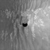
Martian Clouds Pass By on a Winter Afternoon

Full Resolution:
TIFF
(262.6 kB)
JPEG
(10.83 kB)
|
|
|
2006-11-15 |
Mars
|
Mars Exploration Rover (MER)
|
Navigation Camera
|
7688x1045x1 |

|
-
PIA01894:
Opportunity's View, Sol 959 (Cylindrical)
Full Resolution:
TIFF
(8.043 MB)
JPEG
(961.4 kB)
|
|
|
2006-11-15 |
Mars
|
Mars Exploration Rover (MER)
|
Navigation Camera
|
7753x1221x3 |
|
-
PIA01893:
Opportunity's View, Sol 959, (Stereo)
Full Resolution:
TIFF
(28.4 MB)
JPEG
(1.101 MB)
|
|
|
2006-11-15 |
Mars
|
Mars Exploration Rover (MER)
|
Navigation Camera
|
4000x4000x1 |
|
-
PIA01892:
-
Opportunity's View, Sol 959 (Vertical)
Full Resolution:
TIFF
(16.02 MB)
JPEG
(1.163 MB)
|
|
|
2006-11-15 |
Mars
|
Mars Exploration Rover (MER)
|
Navigation Camera
|
4183x4183x1 |
|
-
PIA01891:
-
Opportunity's View, Sol 959 (Polar)
Full Resolution:
TIFF
(17.53 MB)
JPEG
(1.265 MB)
|
|
|
2006-11-14 |
Mars
|
Mars Exploration Rover (MER)
|
Navigation Camera
|
4220x1007x1 |
|
-
PIA01898:
Opportunity's View, Sol 958
Full Resolution:
TIFF
(4.258 MB)
JPEG
(528.6 kB)
|
|
|
2006-11-14 |
Mars
|
Mars Exploration Rover (MER)
|
Navigation Camera
|
4255x1175x3 |
|
-
PIA01897:
Opportunity's View, Sol 958 (Stereo)
Full Resolution:
TIFF
(15 MB)
JPEG
(593.3 kB)
|
|
|
2006-11-14 |
Mars
|
Mars Exploration Rover (MER)
|
Navigation Camera
|
4000x4000x1 |
|
-
PIA01896:
-
Opportunity's View, Sol 958 (Vertical)
Full Resolution:
TIFF
(16.02 MB)
JPEG
(653.1 kB)
|
|
|
2006-11-14 |
Mars
|
Mars Exploration Rover (MER)
|
Navigation Camera
|
4151x4151x1 |
|
-
PIA01895:
-
Opportunity's View, Sol 958 (Polar)
Full Resolution:
TIFF
(17.26 MB)
JPEG
(795.5 kB)
|
|
|
2006-09-28 |
Mars
|
Mars Exploration Rover (MER)
|
Navigation Camera
|
4000x4000x1 |

|
-
PIA08786:
-
'Victoria Crater' from 'Duck Bay' (Vertical Projection)
Full Resolution:
TIFF
(16.02 MB)
JPEG
(986.6 kB)
|
|
|
2006-09-28 |
Mars
|
Mars Exploration Rover (MER)
|
Navigation Camera
|
4071x4071x1 |
|
-
PIA08785:
-
'Victoria Crater' from 'Duck Bay' (Polar Projection)
Full Resolution:
TIFF
(16.59 MB)
JPEG
(927.8 kB)
|
|
|
2006-09-28 |
Mars
|
Mars Exploration Rover (MER)
|
Navigation Camera
|
5800x1133x3 |
|
-
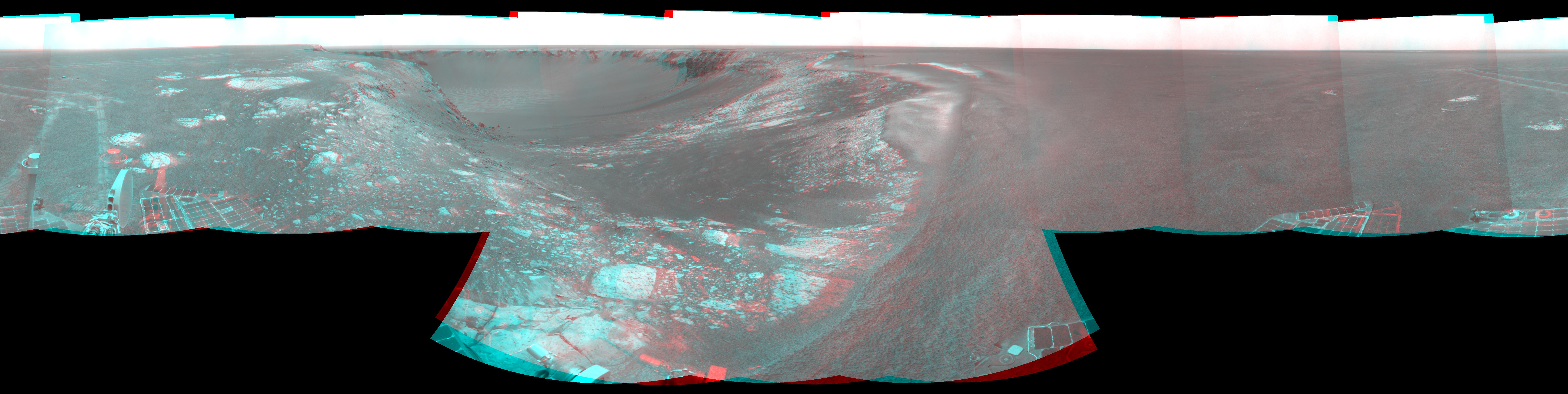
PIA08784:
'Victoria Crater' from 'Duck Bay' (Stereo)
Full Resolution:
TIFF
(19.71 MB)
JPEG
(700.2 kB)
|
|
|
2006-09-28 |
Mars
|
Mars Exploration Rover (MER)
|
Navigation Camera
|
5752x971x1 |
|
-
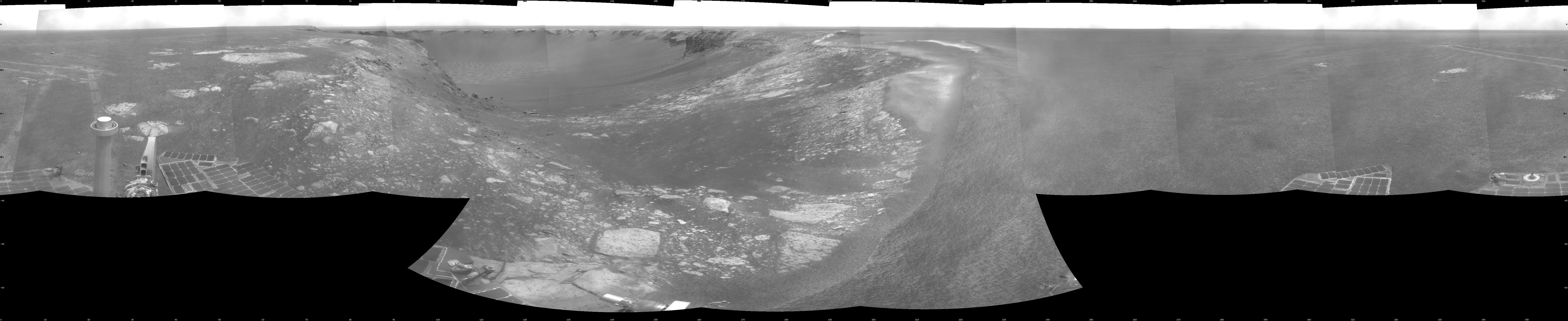
PIA08783:
'Victoria Crater' from 'Duck Bay'
Full Resolution:
TIFF
(5.593 MB)
JPEG
(643.5 kB)
|
|
|
2006-09-27 |
Mars
|
Mars Exploration Rover (MER)
|
Navigation Camera
|
4091x4091x1 |
|
-
PIA08781:
-
On the Rim of 'Victoria Crater' (Polar Projection)
Full Resolution:
TIFF
(16.75 MB)
JPEG
(515.4 kB)
|
|
|
2006-09-27 |
Mars
|
Mars Exploration Rover (MER)
|
Navigation Camera
|
4000x4000x1 |
|
-
PIA08782:
-
On the Rim of 'Victoria Crater' (Vertical Projection)
Full Resolution:
TIFF
(16.02 MB)
JPEG
(436.7 kB)
|
|
|
2006-09-27 |
Mars
|
Mars Exploration Rover (MER)
|
Navigation Camera
|
2703x1145x3 |
|
-
PIA08780:
-
On the Rim of 'Victoria Crater' (Stereo)
Full Resolution:
TIFF
(9.294 MB)
JPEG
(322.6 kB)
|
|
|
2006-09-27 |
Mars
|
Mars Exploration Rover (MER)
|
Navigation Camera
|
2680x982x1 |
|
-
PIA08779:
-
On the Rim of 'Victoria Crater'
Full Resolution:
TIFF
(2.635 MB)
JPEG
(287.8 kB)
|
|
|
2006-09-27 |
Mars
|
Mars Exploration Rover (MER)
|
Navigation Camera
|
4260x1130x3 |
|
-
PIA08778:
'Victoria' After Sol 950 Drive (Stereo)
Full Resolution:
TIFF
(14.44 MB)
JPEG
(487 kB)
|
|
|
2006-09-19 |
Mars
|
Mars Exploration Rover (MER)
|
Navigation Camera
|
4184x973x1 |

|
-
PIA08763:
Opportunity's First Glimpse into 'Victoria Crater'
Full Resolution:
TIFF
(4.079 MB)
JPEG
(438.7 kB)
|
|
|
2006-05-24 |
Mars
|
Mars Exploration Rover (MER)
|
Navigation Camera
|
2701x1046x1 |
|
-
PIA08480:
-
Opportunity's Outcrop Outing
Full Resolution:
TIFF
(2.828 MB)
JPEG
(354.3 kB)
|
|
|
2006-05-01 |
Mars
|
Mars Exploration Rover (MER)
|
Navigation Camera
|
1024x1024x1 |
|
-
PIA08424:
-
Rolling Ripple
Full Resolution:
TIFF
(1.05 MB)
JPEG
(183 kB)
|
|
|
2006-02-02 |
Mars
|
Mars Exploration Rover (MER)
|
Navigation Camera
|
1024x1024x1 |
|
-
PIA02156:
-
Opportunity's Arm in 'Hover-Stow' Position
Full Resolution:
TIFF
(1.05 MB)
JPEG
(147.6 kB)
|
|
|
2005-11-28 |
Mars
|
Mars Exploration Rover (MER)
|
Navigation Camera
Panoramic Camera
|
1024x1024x3 |
|
-
PIA03576:
-
Windblown Ripple 'Scylla'
Full Resolution:
TIFF
(3.15 MB)
JPEG
(163.9 kB)
|
|
|
2005-09-16 |
Mars
|
Mars Exploration Rover (MER)
|
Navigation Camera
|
1119x387x1 |
|
-
PIA06009:
-
Heading South on 'Erebus Highway'
Full Resolution:
TIFF
(433.7 kB)
JPEG
(68.68 kB)
|
|
|
2005-06-21 |
Mars
|
Mars Exploration Rover (MER)
|
Navigation Camera
|
1024x1024x1 |
|
-
PIA07999:
-
Looking Back at 'Purgatory Dune'
Full Resolution:
TIFF
(1.05 MB)
JPEG
(140.2 kB)
|
|
|
2005-05-06 |
Mars
|
Mars Exploration Rover (MER)
|
Navigation Camera
|
2000x2000x1 |
|
-
PIA07922:
-
Opportunity's Sol 446 Position, with Relative Heights
Full Resolution:
TIFF
(4.004 MB)
JPEG
(552.8 kB)
|
|
|
2005-04-08 |
Mars
|
Mars Exploration Rover (MER)
|
Navigation Camera
|
7688x984x1 |
|
-
PIA07823:
Opportunity's View of 'Viking' Crater, Sol 421
Full Resolution:
TIFF
(5.872 MB)
JPEG
(804.7 kB)
|
|
|
2005-03-17 |
Mars
|
Mars Exploration Rover (MER)
|
Navigation Camera
|
4000x4000x1 |
|
-
PIA07471:
-
Beside 'Vostok Crater' (vertical)
Full Resolution:
TIFF
(10.32 MB)
JPEG
(1.015 MB)
|
|
|
2005-03-17 |
Mars
|
Mars Exploration Rover (MER)
|
Navigation Camera
|
4069x4069x1 |

|
-
PIA07470:
-
Beside 'Vostok Crater' (polar)
Full Resolution:
TIFF
(8.151 MB)
JPEG
(1.15 MB)
|
|
|
2005-03-17 |
Mars
|
Mars Exploration Rover (MER)
|
Navigation Camera
|
7753x1333x3 |
|
-
PIA07469:
Beside 'Vostok Crater' (3-D)
Full Resolution:
TIFF
(16.98 MB)
JPEG
(999.4 kB)
|
|
|
2005-03-17 |
Mars
|
Mars Exploration Rover (MER)
|
Navigation Camera
|
7688x971x1 |

|
-
PIA07468:
Beside 'Vostok Crater'
Full Resolution:
TIFF
(5.623 MB)
JPEG
(864.4 kB)
|
|
|
2005-03-17 |
Mars
|
Mars Exploration Rover (MER)
|
Navigation Camera
|
4000x4000x1 |
|
-
PIA07467:
-
Opportunity View on Sol 398 (vertical)
Full Resolution:
TIFF
(10.37 MB)
JPEG
(868.7 kB)
|
|
|
2005-03-17 |
Mars
|
Mars Exploration Rover (MER)
|
Navigation Camera
|
4101x4101x1 |

|
-
PIA07466:
-
Opportunity View on Sol 398 (polar)
Full Resolution:
TIFF
(8.137 MB)
JPEG
(1.038 MB)
|
|
|
2005-03-17 |
Mars
|
Mars Exploration Rover (MER)
|
Navigation Camera
|
7753x1350x3 |
|
-
PIA07465:
Opportunity View on Sol 398 (3-D)
Full Resolution:
TIFF
(16.66 MB)
JPEG
(874.1 kB)
|
 Planetary Data System


