My
List |
Addition Date
|
Target
|
Mission
|
Instrument
|
Size
|

|
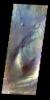
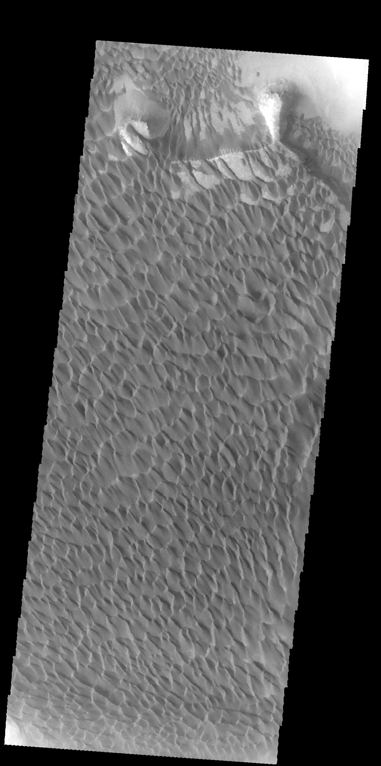
2015-03-12 |
Mars
|
2001 Mars Odyssey
|
THEMIS
|
320x1296x1 |
|
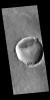
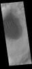
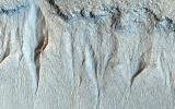
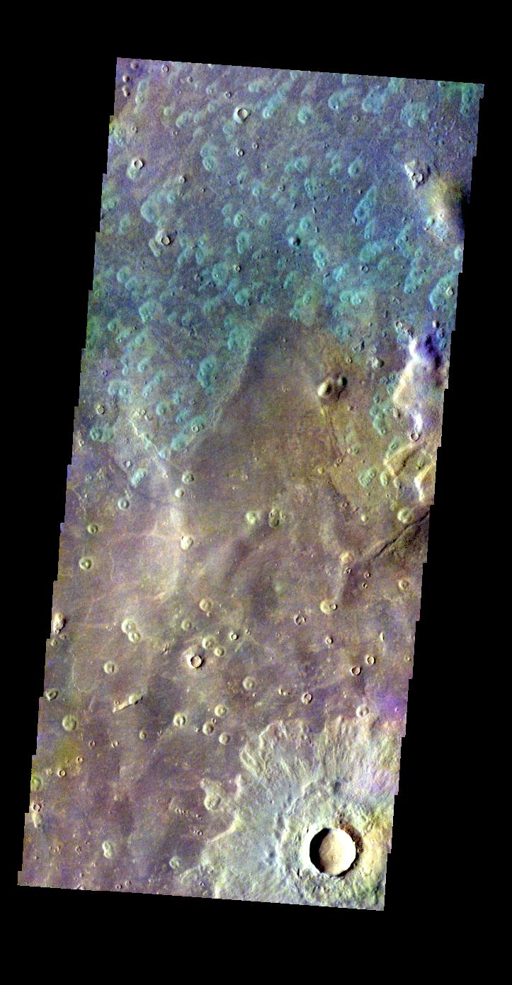
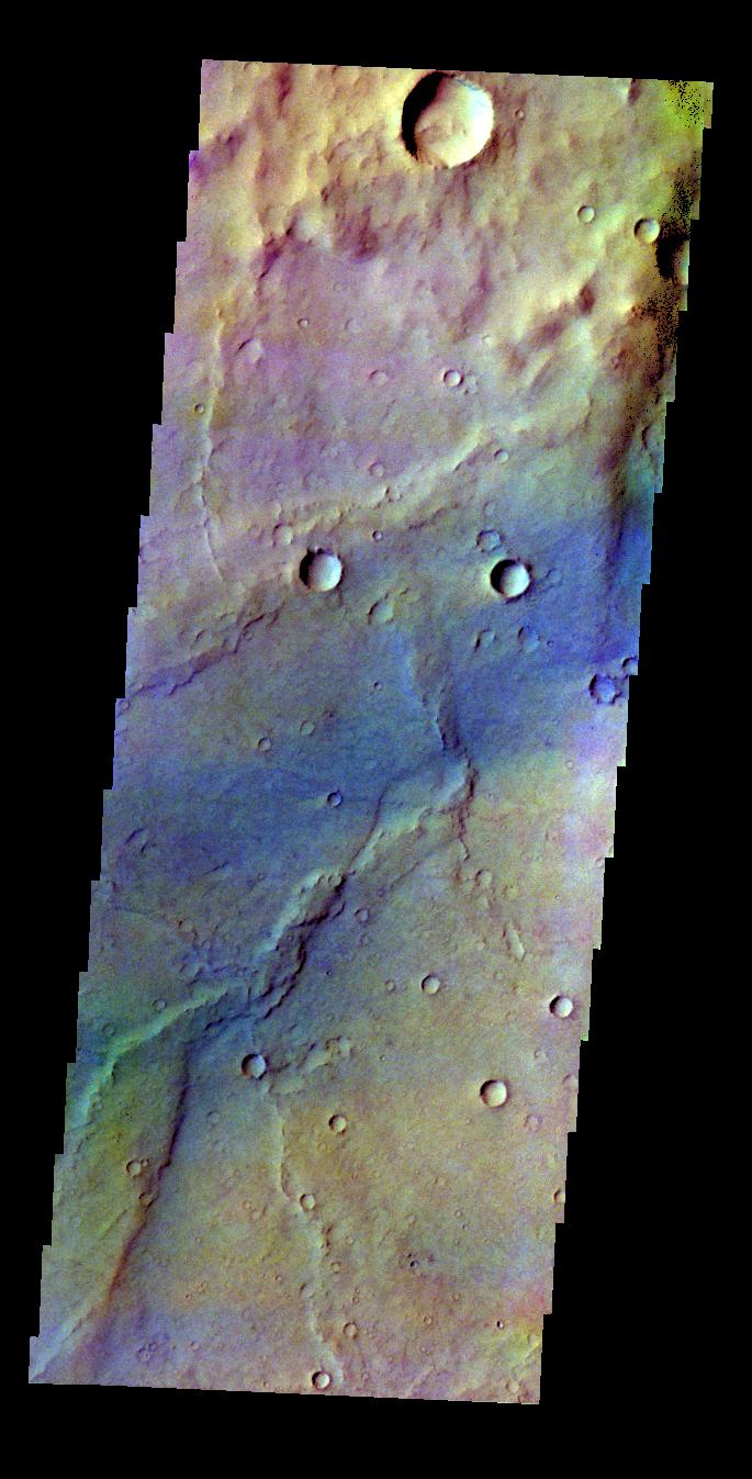
-
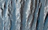
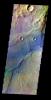
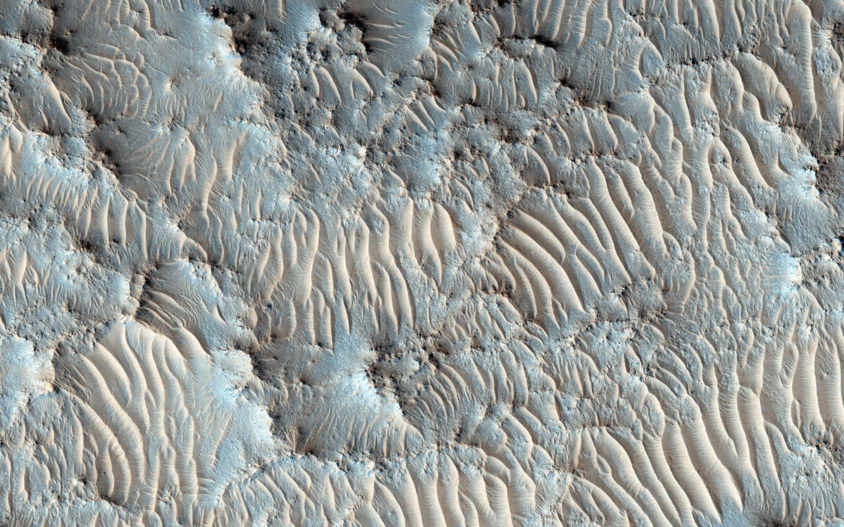
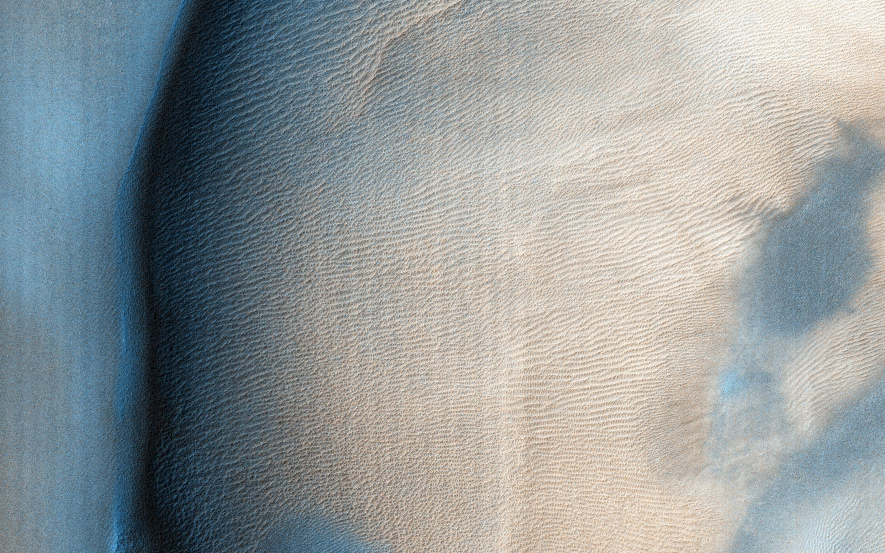
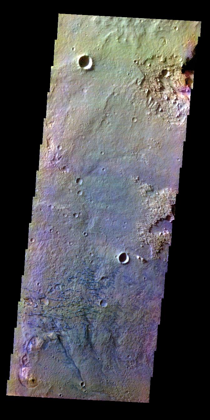
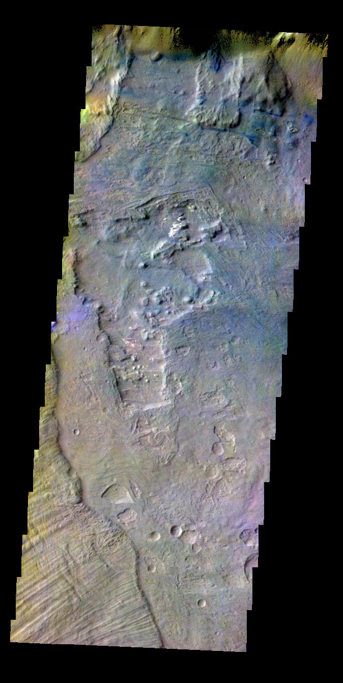
PIA19233:
-
Noachis Terra Dunes - IR
Full Resolution:
TIFF
(415.4 kB)
JPEG
(67.26 kB)
|
|
|
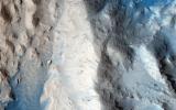
2015-03-11 |
Mars
|
Mars Reconnaissance Orbiter (MRO)
|
HiRISE
|
2880x1800x3 |
|
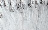
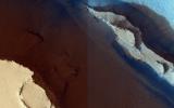
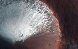
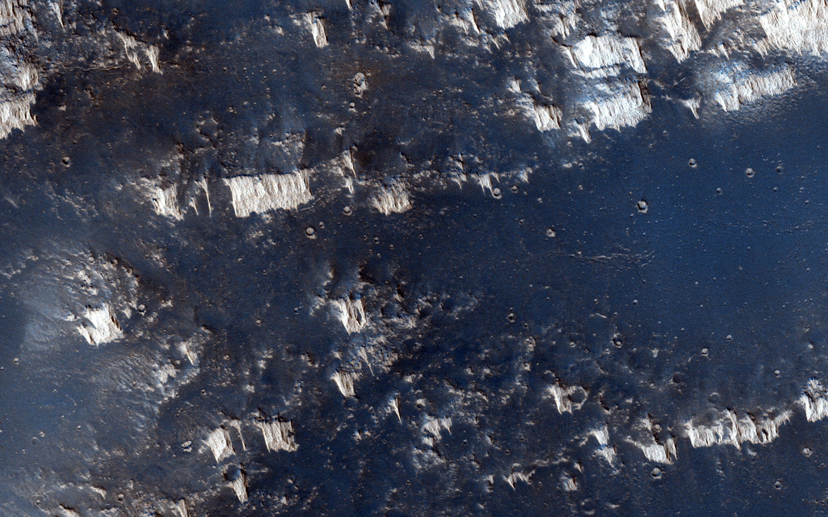
-
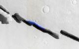
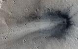
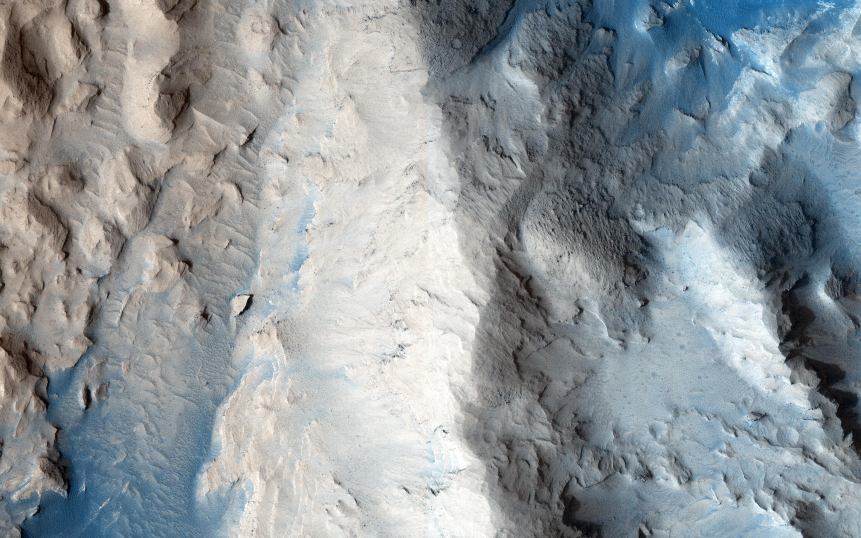
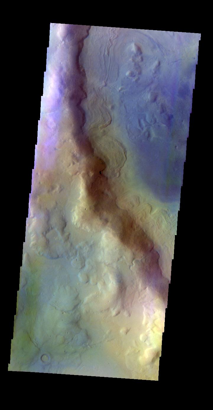
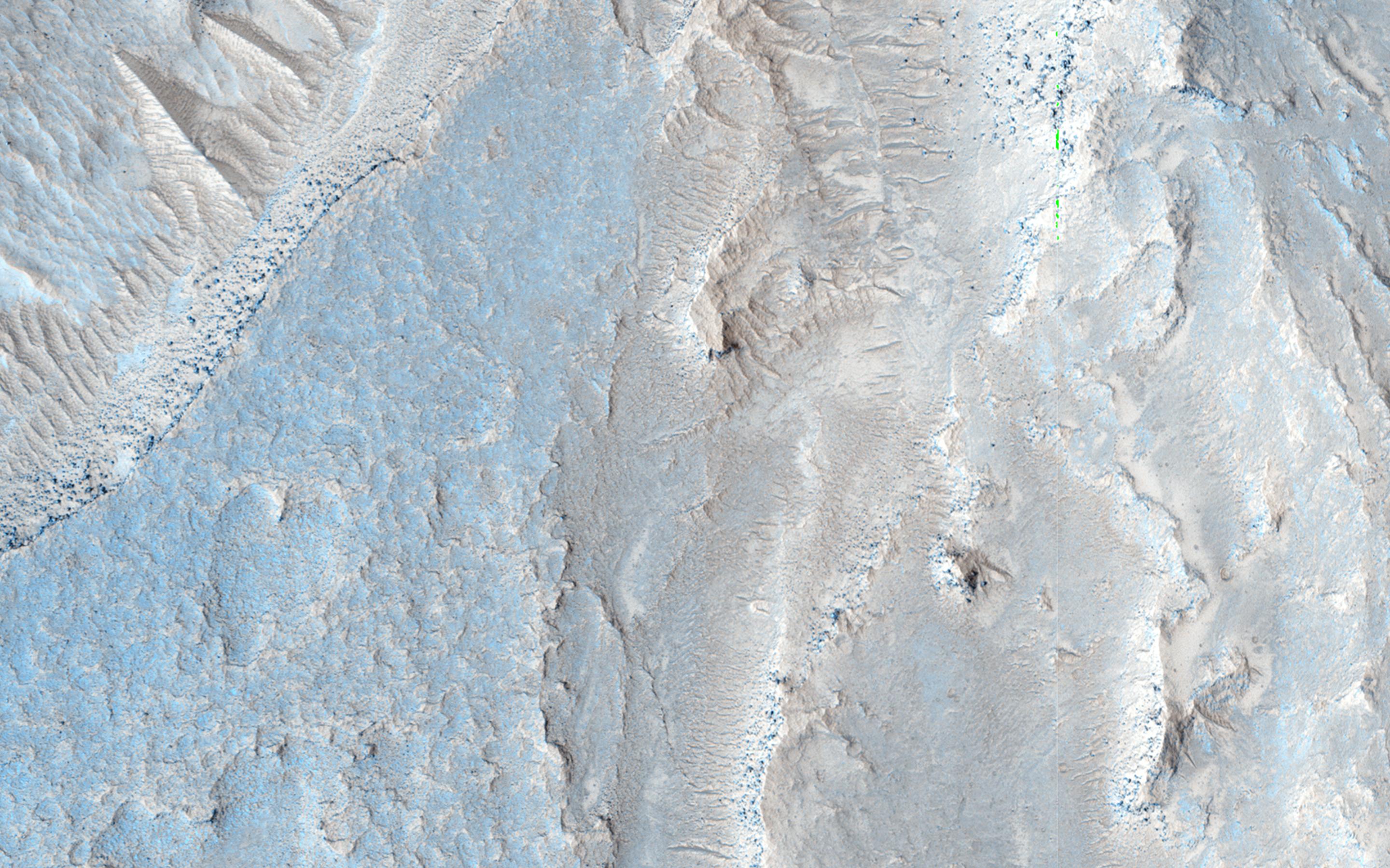
PIA19309:
-
Recurring Slope Lineae in Raga Crater
Full Resolution:
TIFF
(15.56 MB)
JPEG
(923.4 kB)
|
|
|
2015-03-11 |
Mars
|
Mars Reconnaissance Orbiter (MRO)
|
HiRISE
|
2880x1800x3 |
|
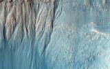
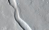
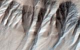
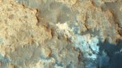
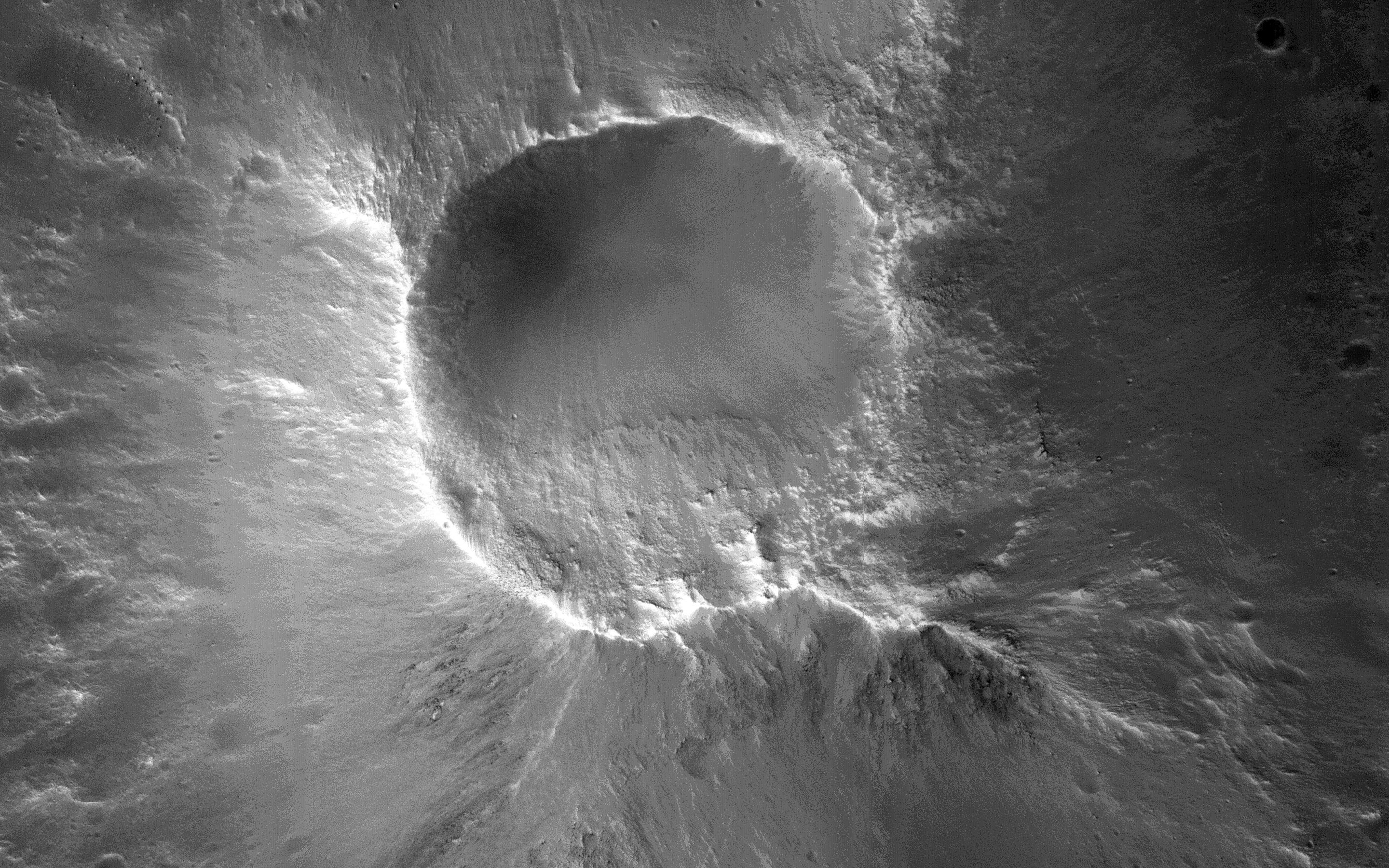
-
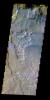
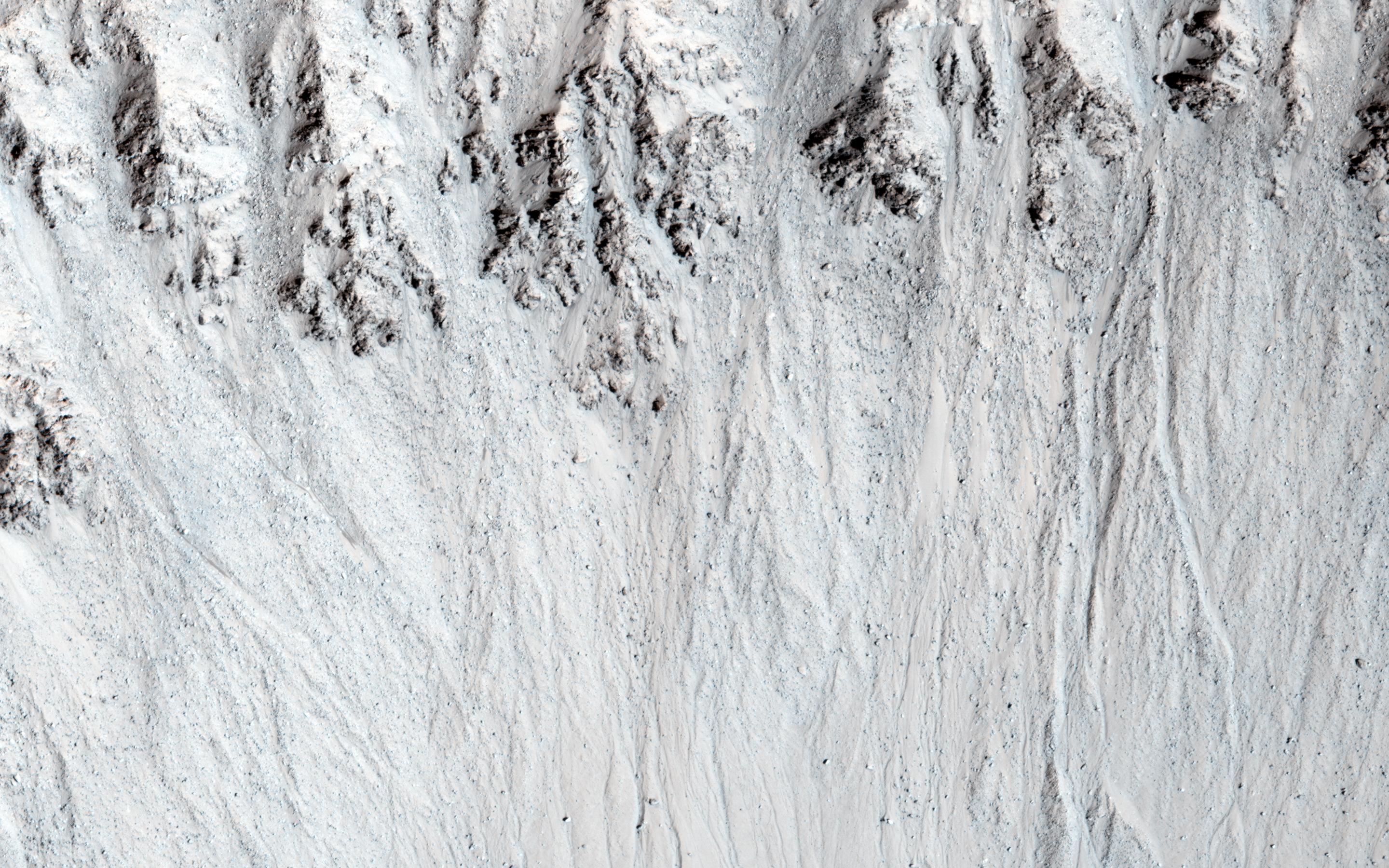
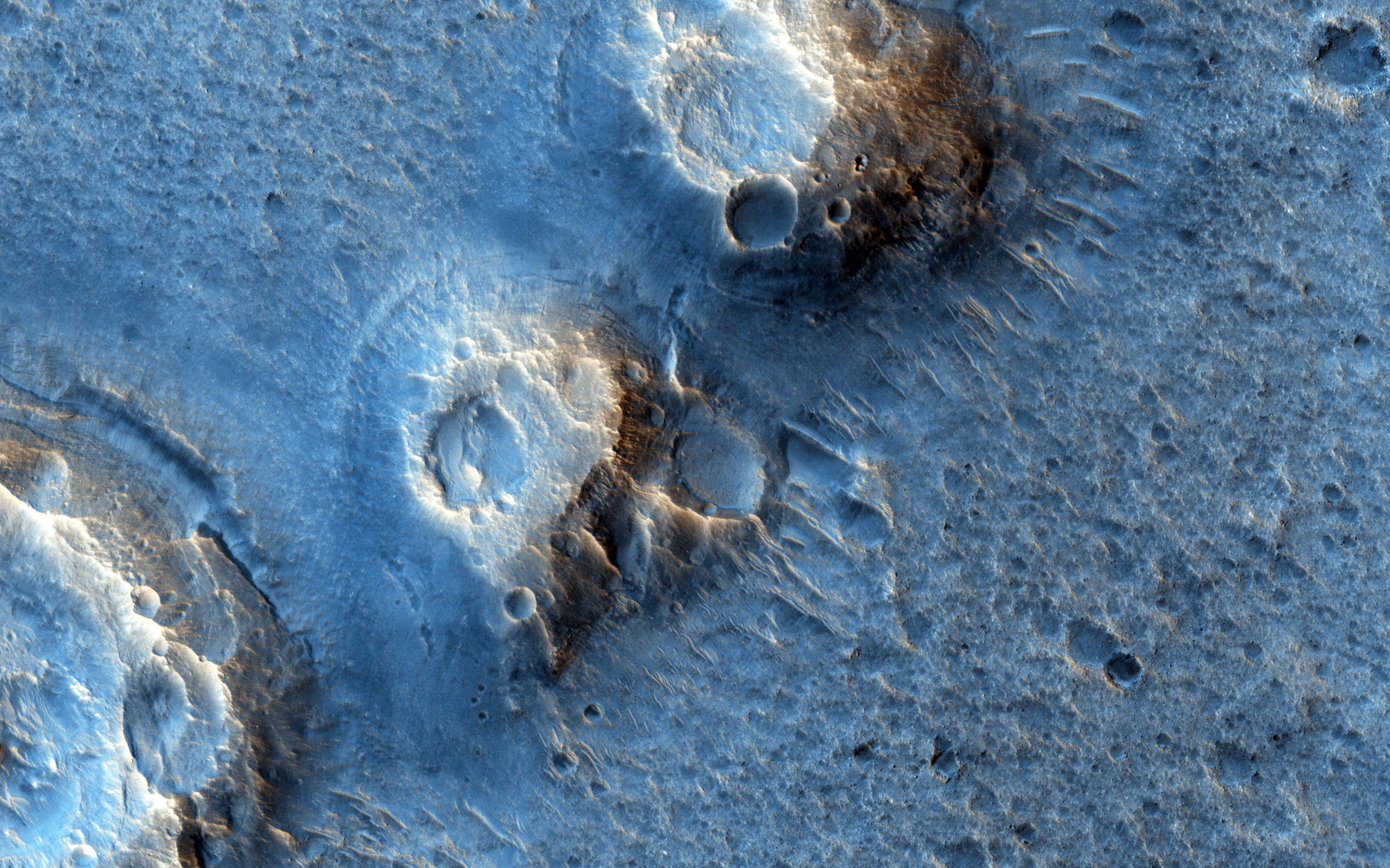
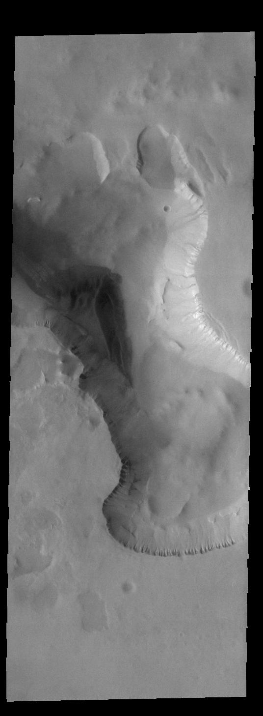
PIA19308:
-
Gullies and Layers in a Crater Near Mariner Crater
Full Resolution:
TIFF
(15.56 MB)
JPEG
(941.4 kB)
|
|
|
2015-03-11 |
Mars
|
Mars Reconnaissance Orbiter (MRO)
|
HiRISE
|
2880x1800x3 |
|
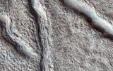
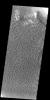
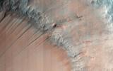
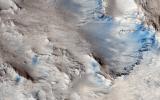
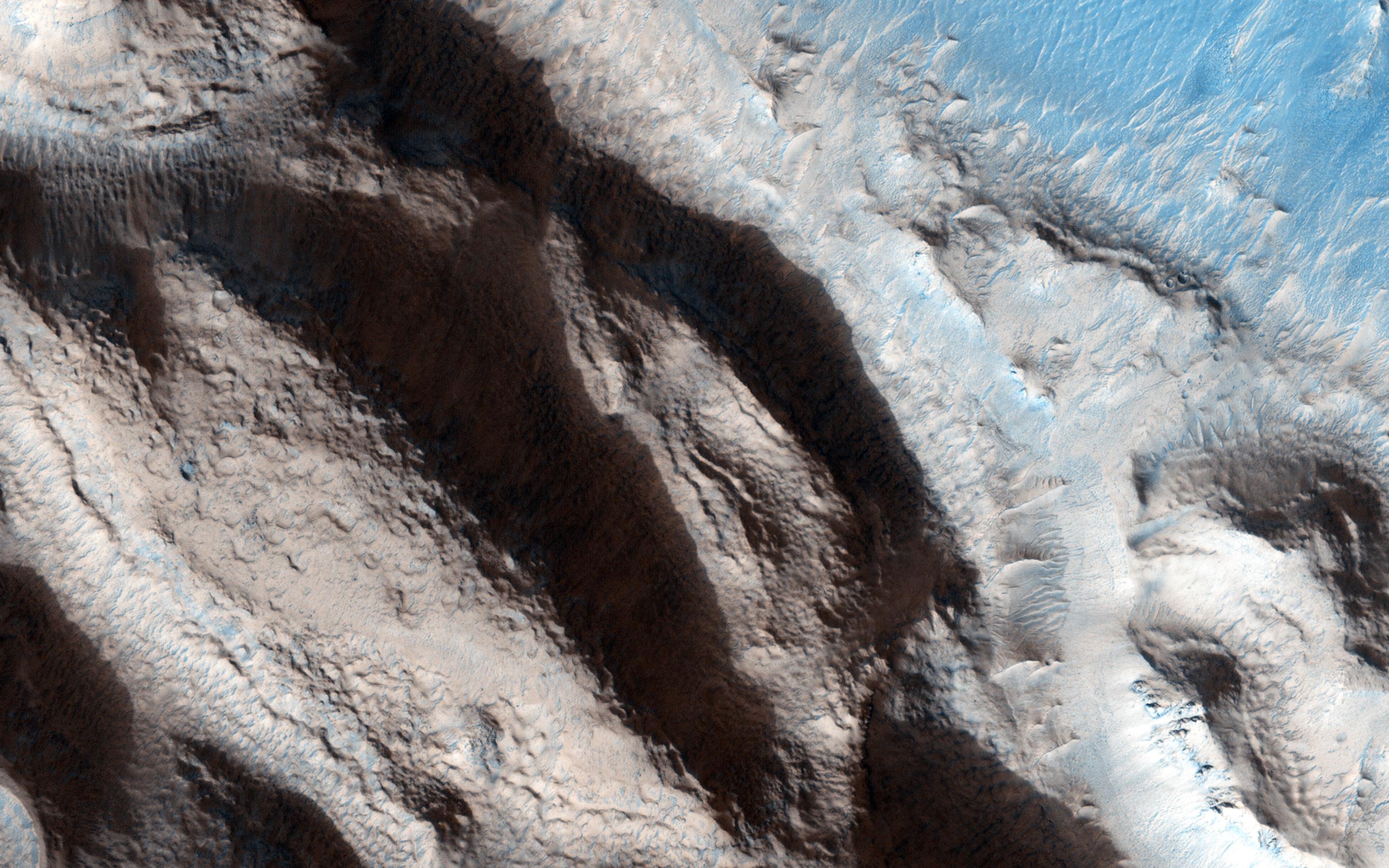
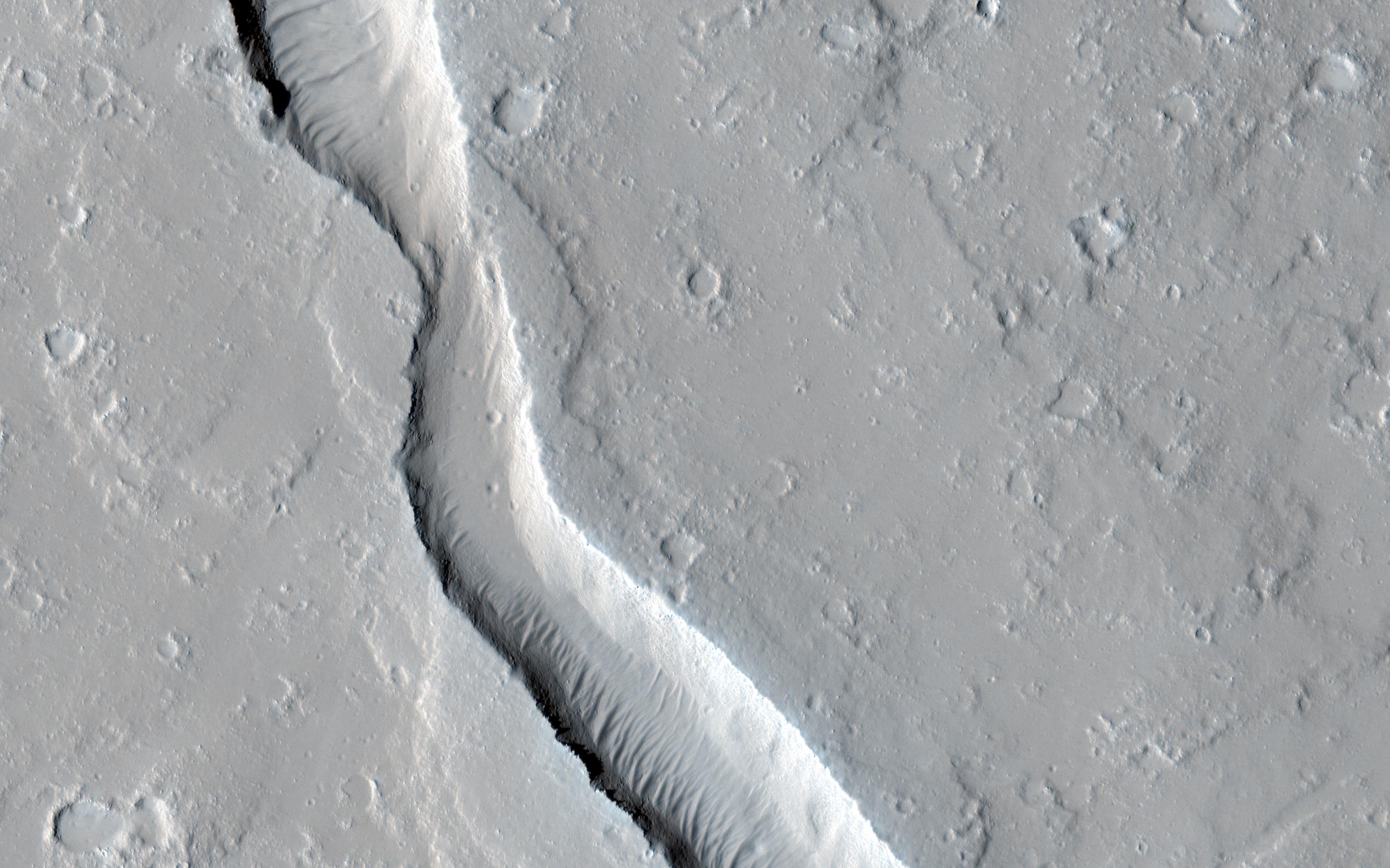
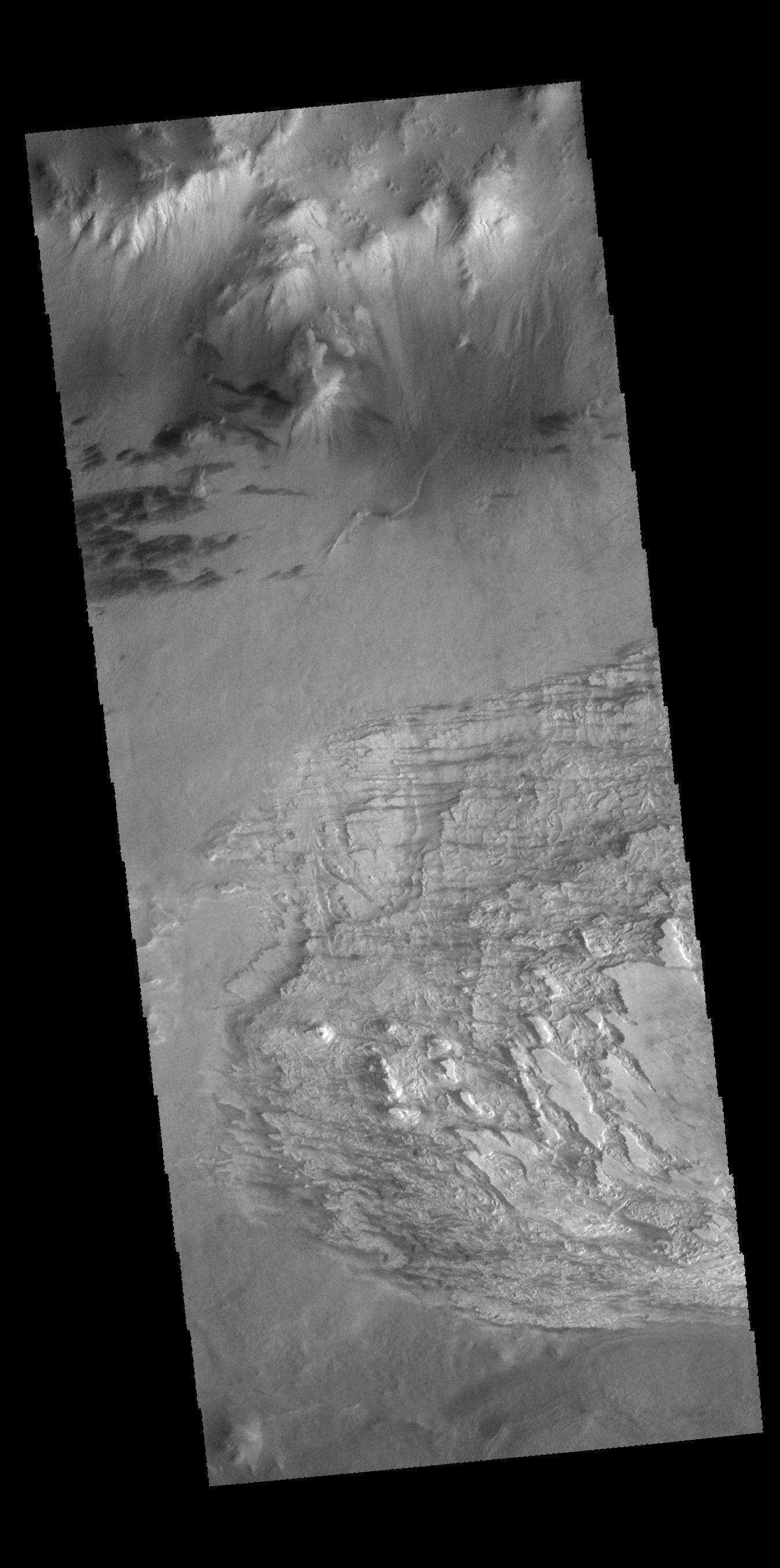
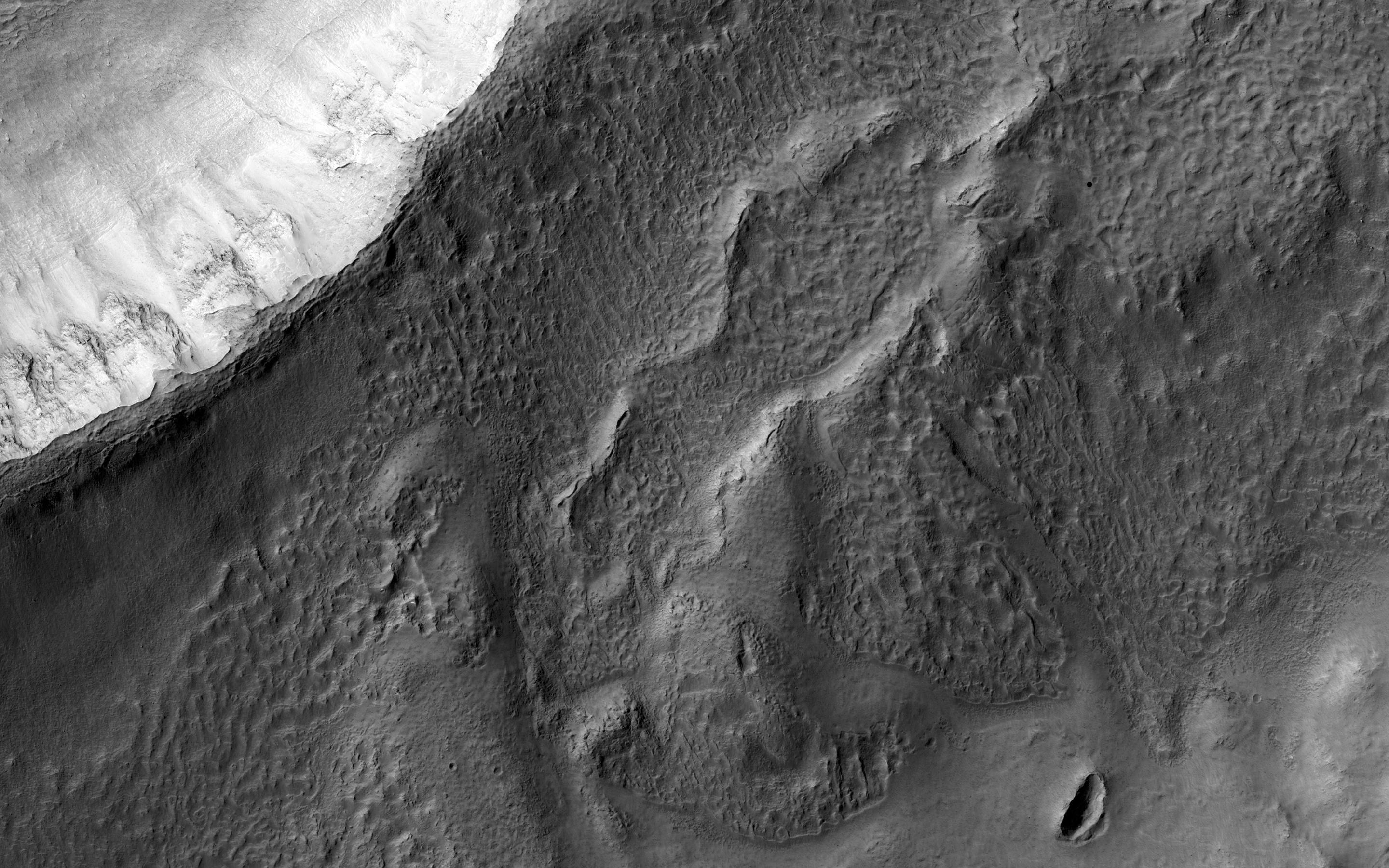
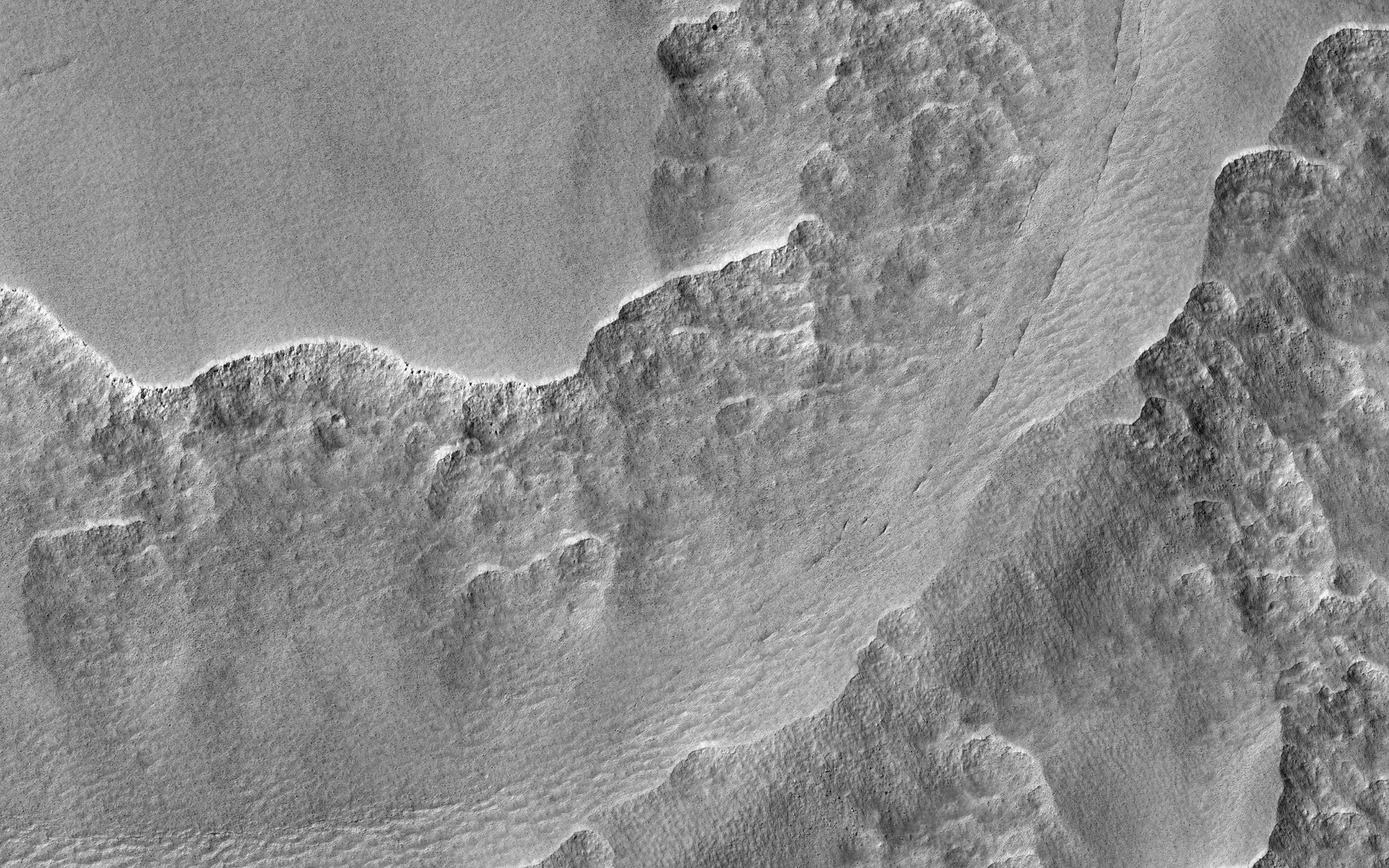
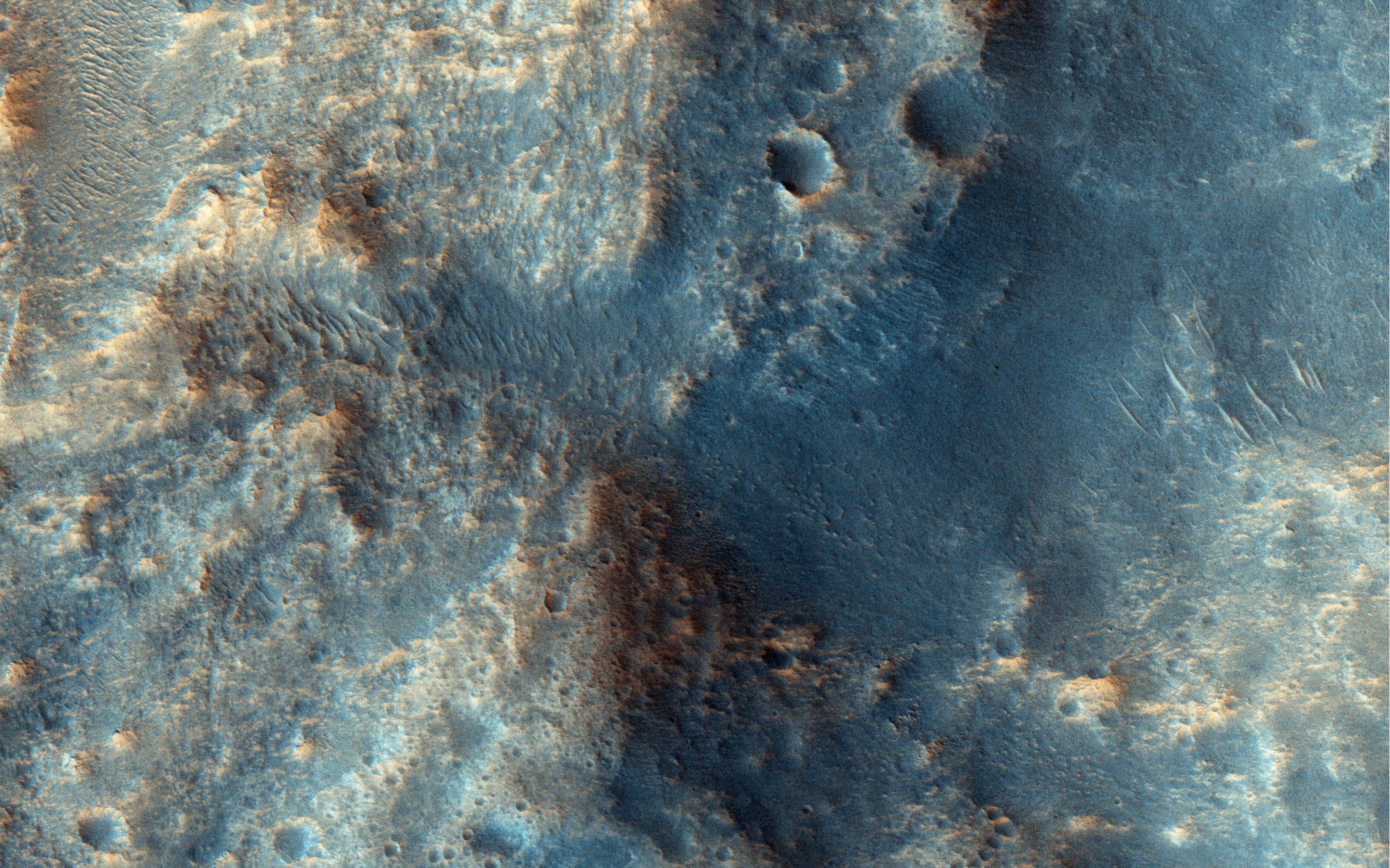
-
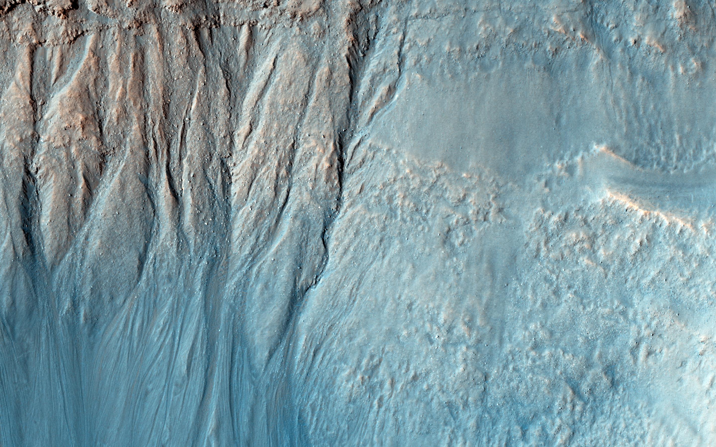
PIA19307:
-
Cracks in a Debris Apron
Full Resolution:
TIFF
(15.56 MB)
JPEG
(1.125 MB)
|
|
|
2015-03-11 |
Mars
|
Mars Reconnaissance Orbiter (MRO)
|
HiRISE
|
2880x1800x3 |

|
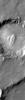
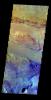
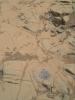
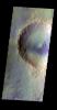
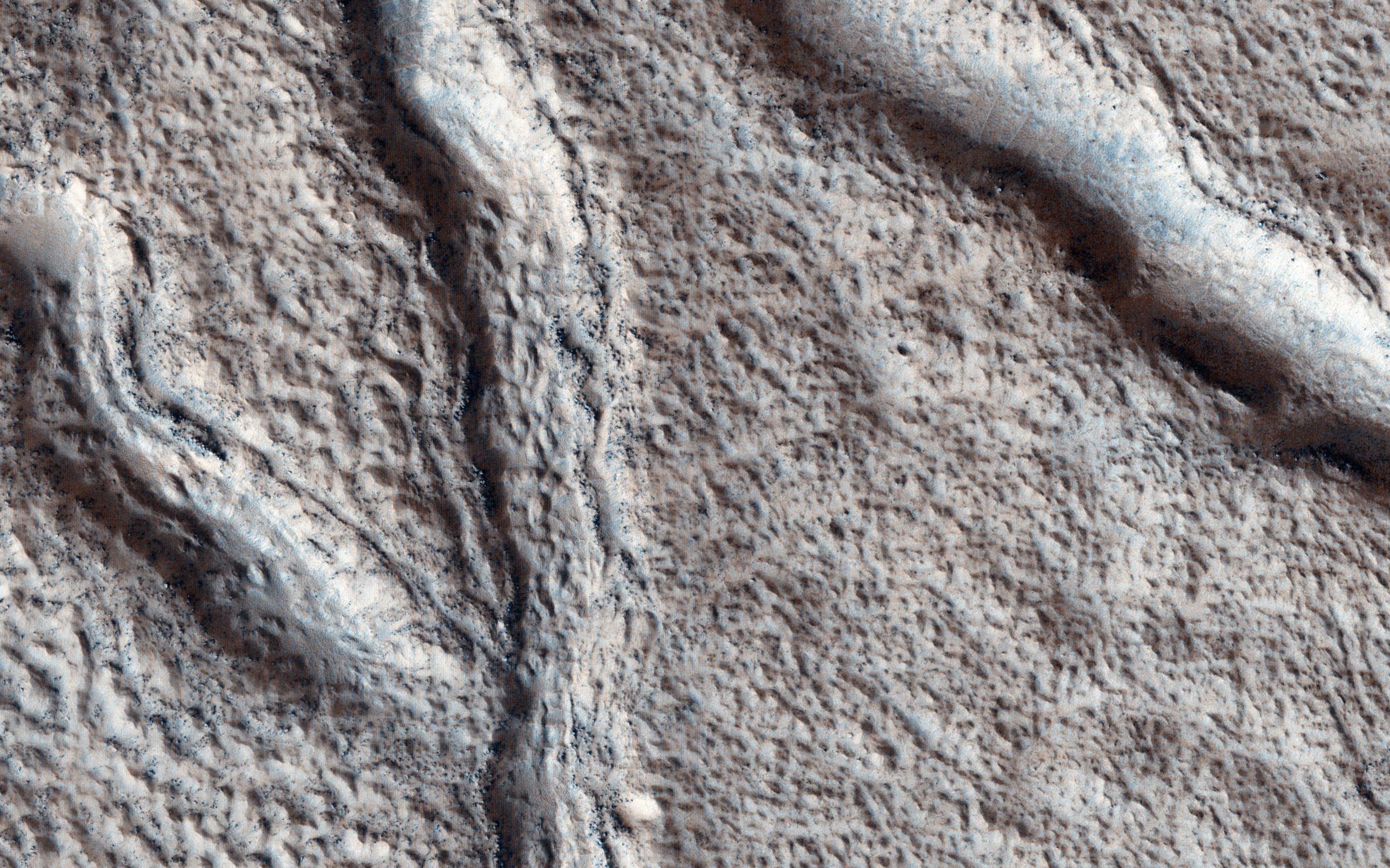
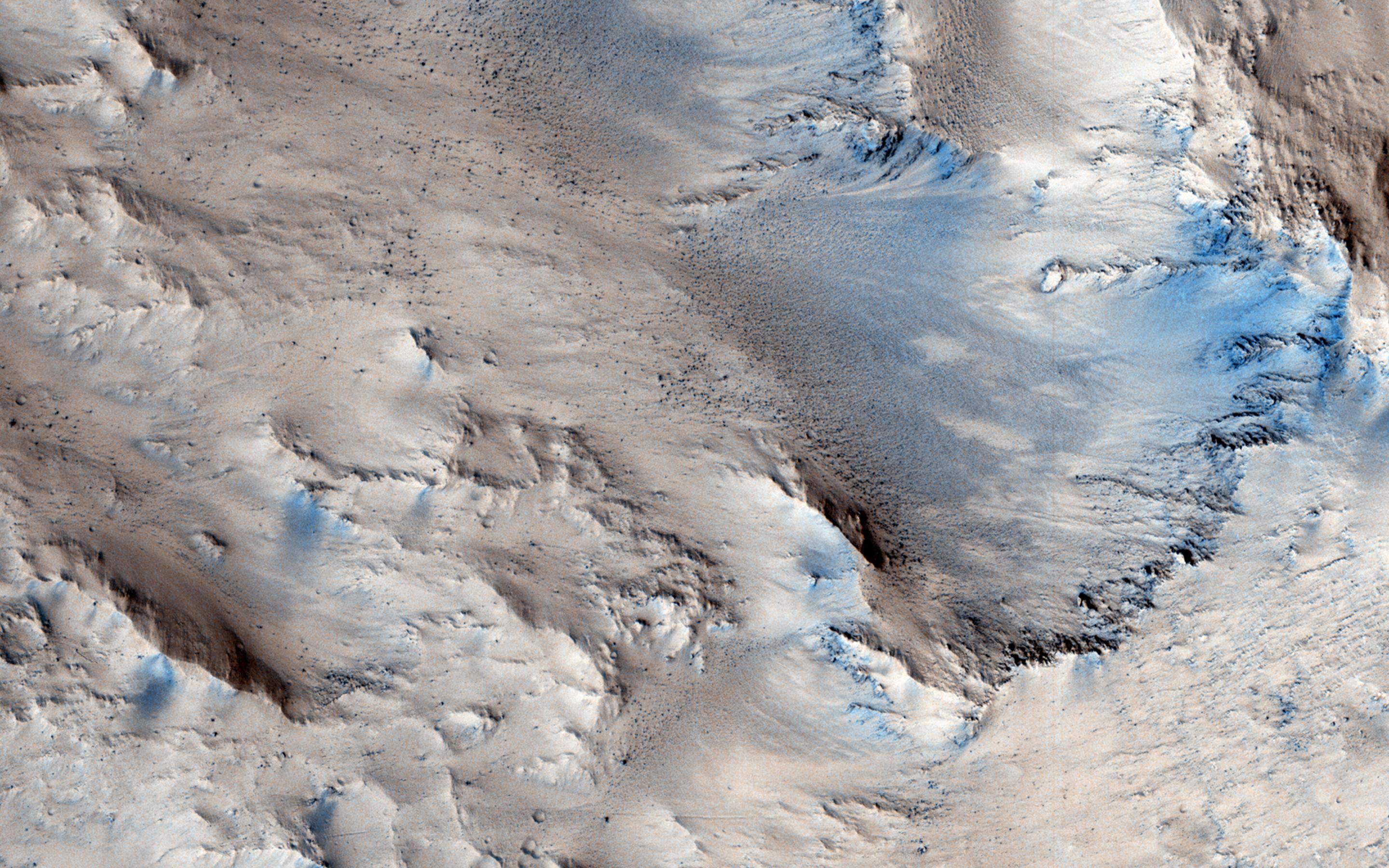
-
PIA19306:
-
Ares 3 and The Martian
Full Resolution:
TIFF
(15.56 MB)
JPEG
(949.9 kB)
|
|
|
2015-03-11 |
Mars
|
2001 Mars Odyssey
|
THEMIS
|
1348x2691x3 |
|
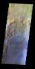
-
PIA19229:
-
Russell Crater Dunes - VIS
Full Resolution:
TIFF
(3.631 MB)
JPEG
(201.8 kB)
|
|
|
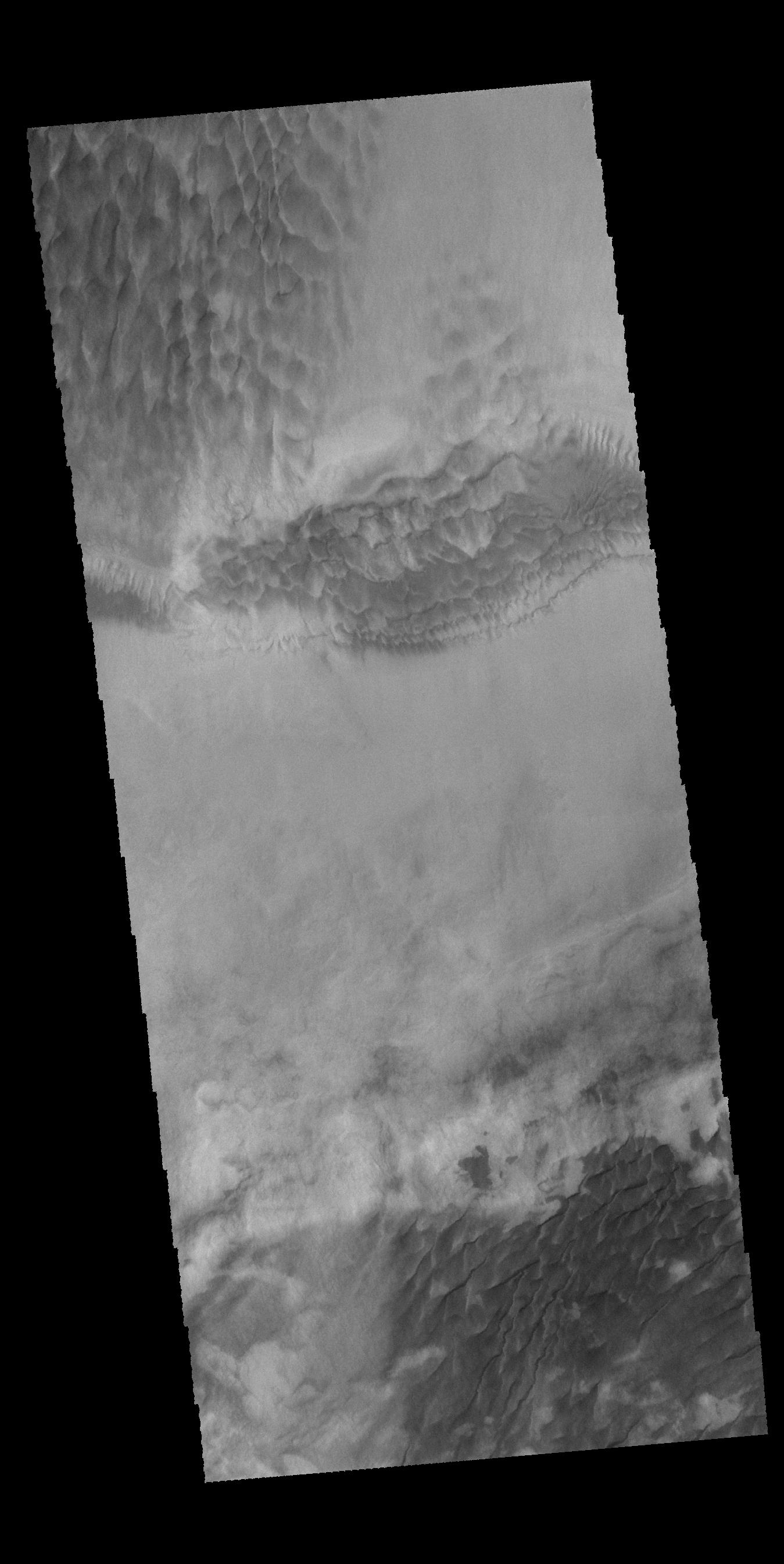
2015-03-10 |
Mars
|
2001 Mars Odyssey
|
THEMIS
|
320x1808x3 |
|
-
PIA19228:
-
Russell Crater Dunes - IR
Full Resolution:
TIFF
(579.4 kB)
JPEG
(85.98 kB)
|
|
|
2015-03-09 |
Mars
|
2001 Mars Odyssey
|
THEMIS
|
1335x2681x3 |
|
-
PIA19227:
-
Proctor Crater Dunes
Full Resolution:
TIFF
(3.583 MB)
JPEG
(247.8 kB)
|
|
|
2015-03-06 |
Mars
|
Mars Science Laboratory (MSL)
|
Navcam (MSL)
|
1024x830x1 |
|
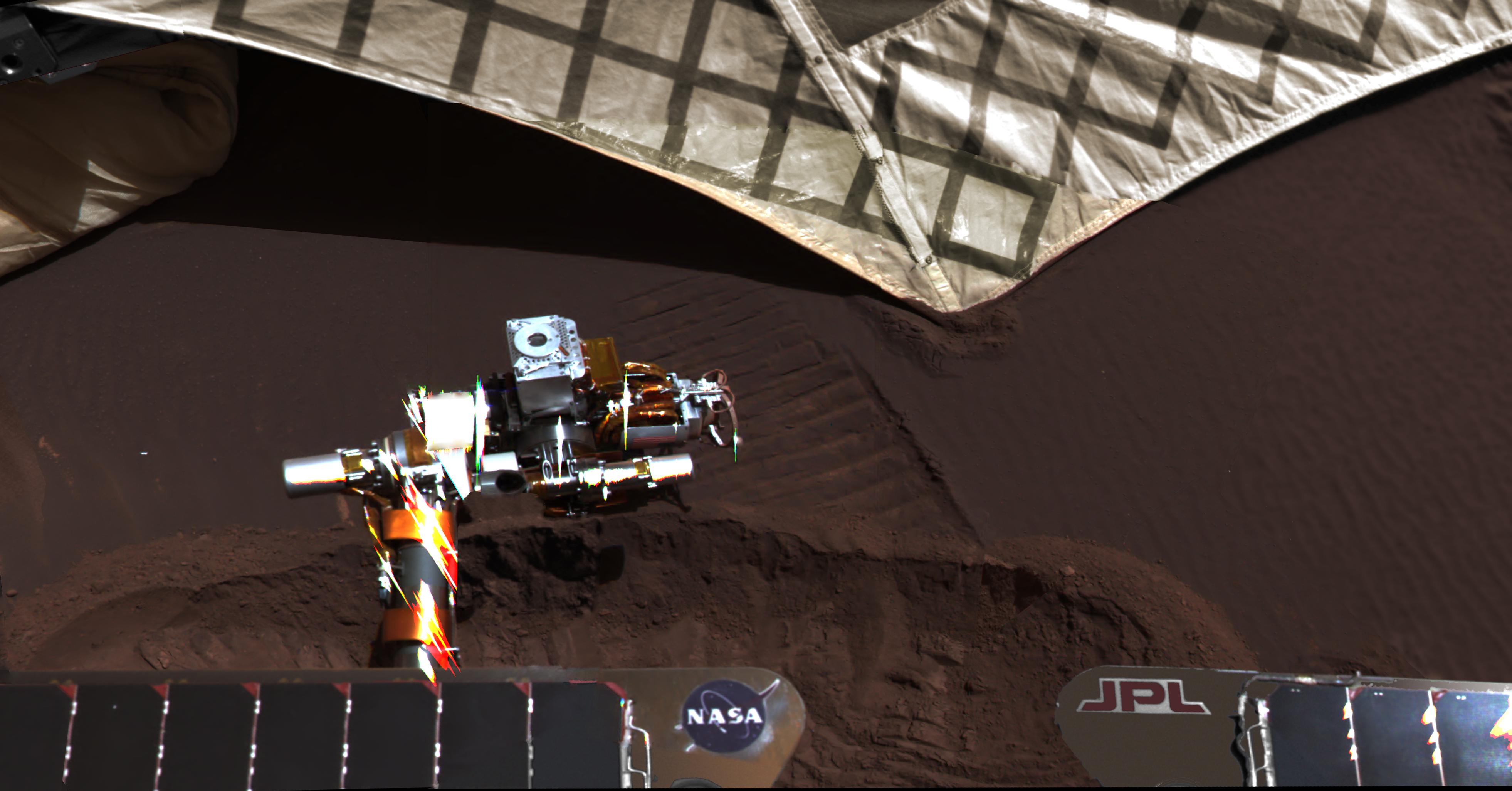
-
PIA19147:
-
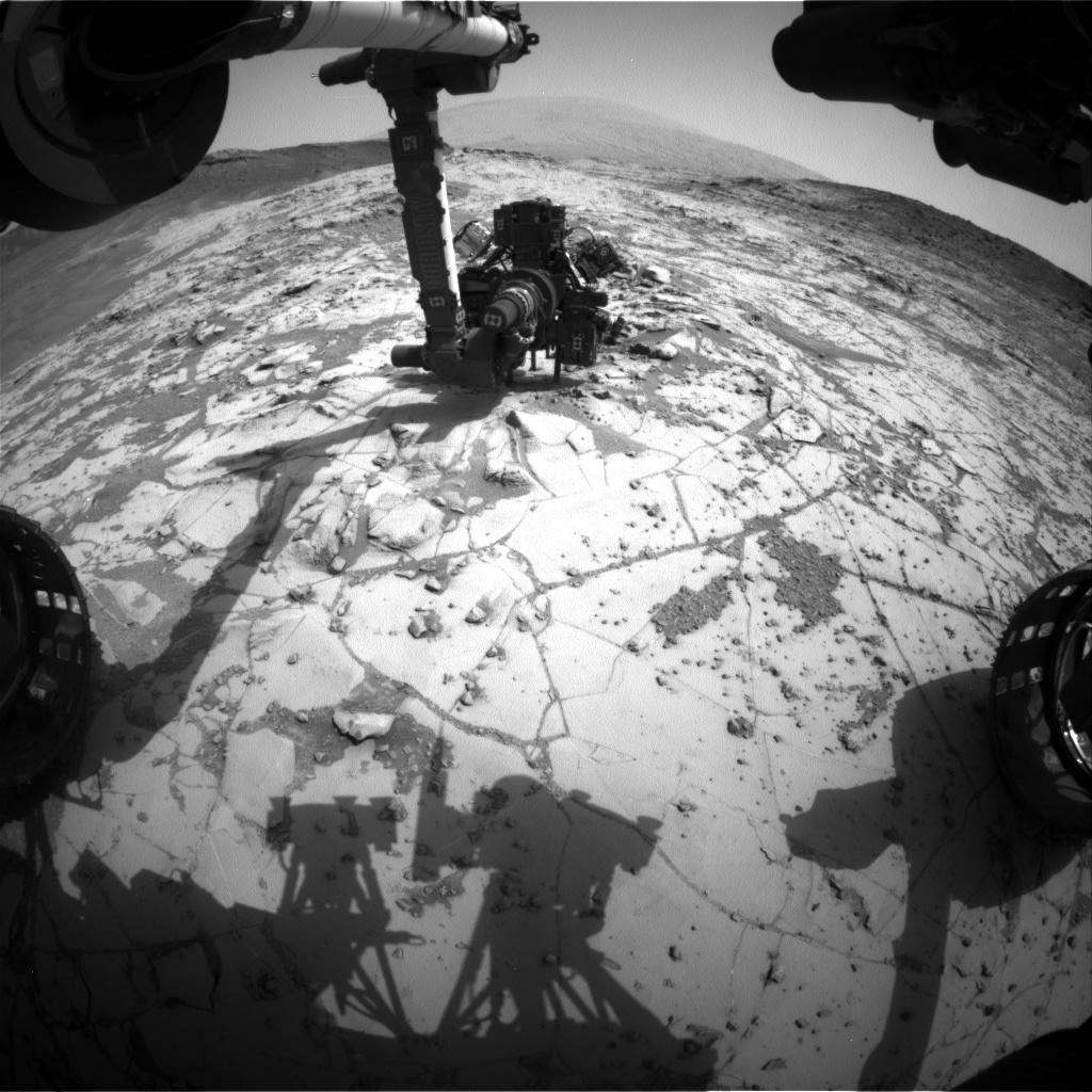
Curiosity's Arm Holding Steady, Sol 915
Full Resolution:
TIFF
(851 kB)
JPEG
(152.4 kB)
|
|
|
2015-03-06 |
Mars
|
2001 Mars Odyssey
|
THEMIS
|
670x1431x3 |

|
-
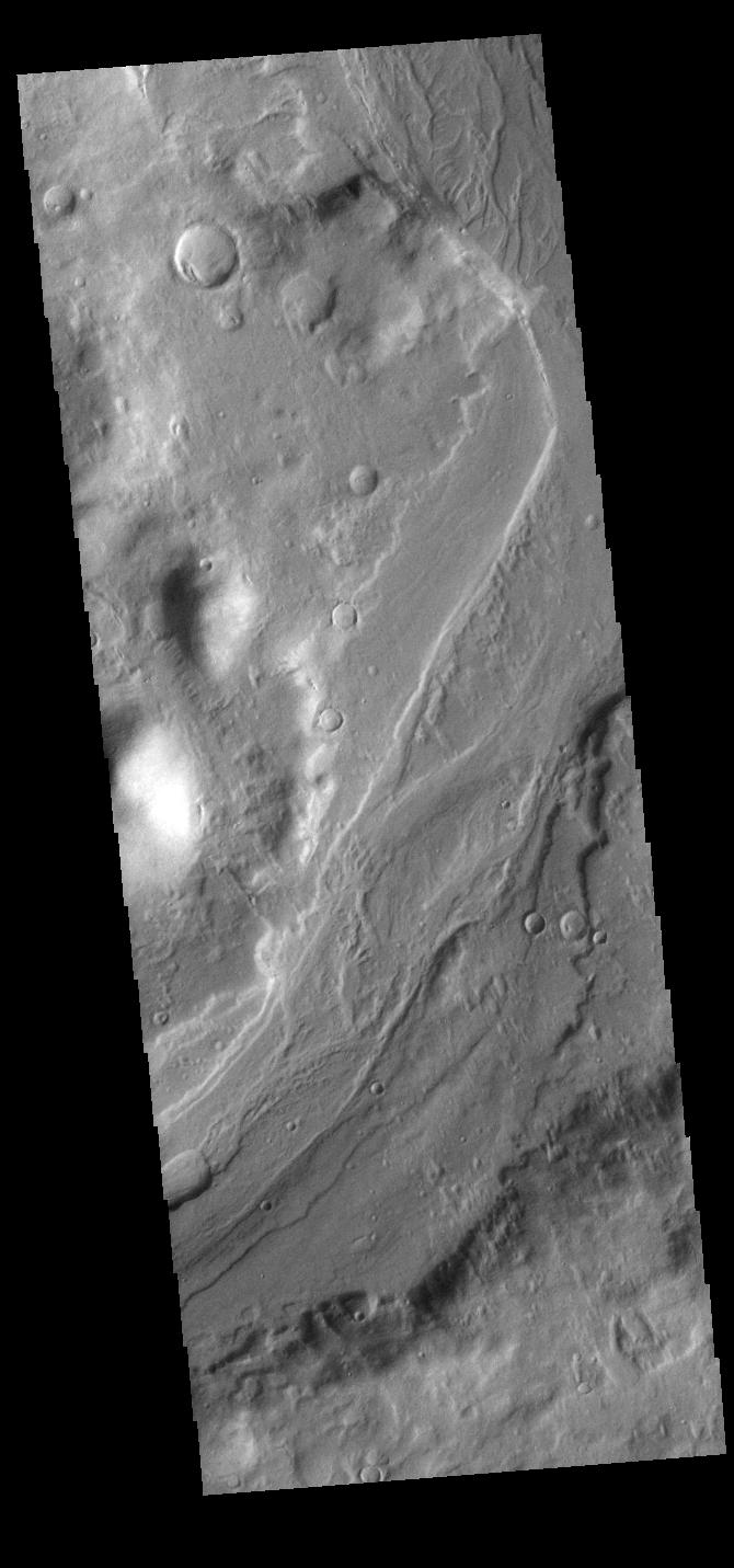
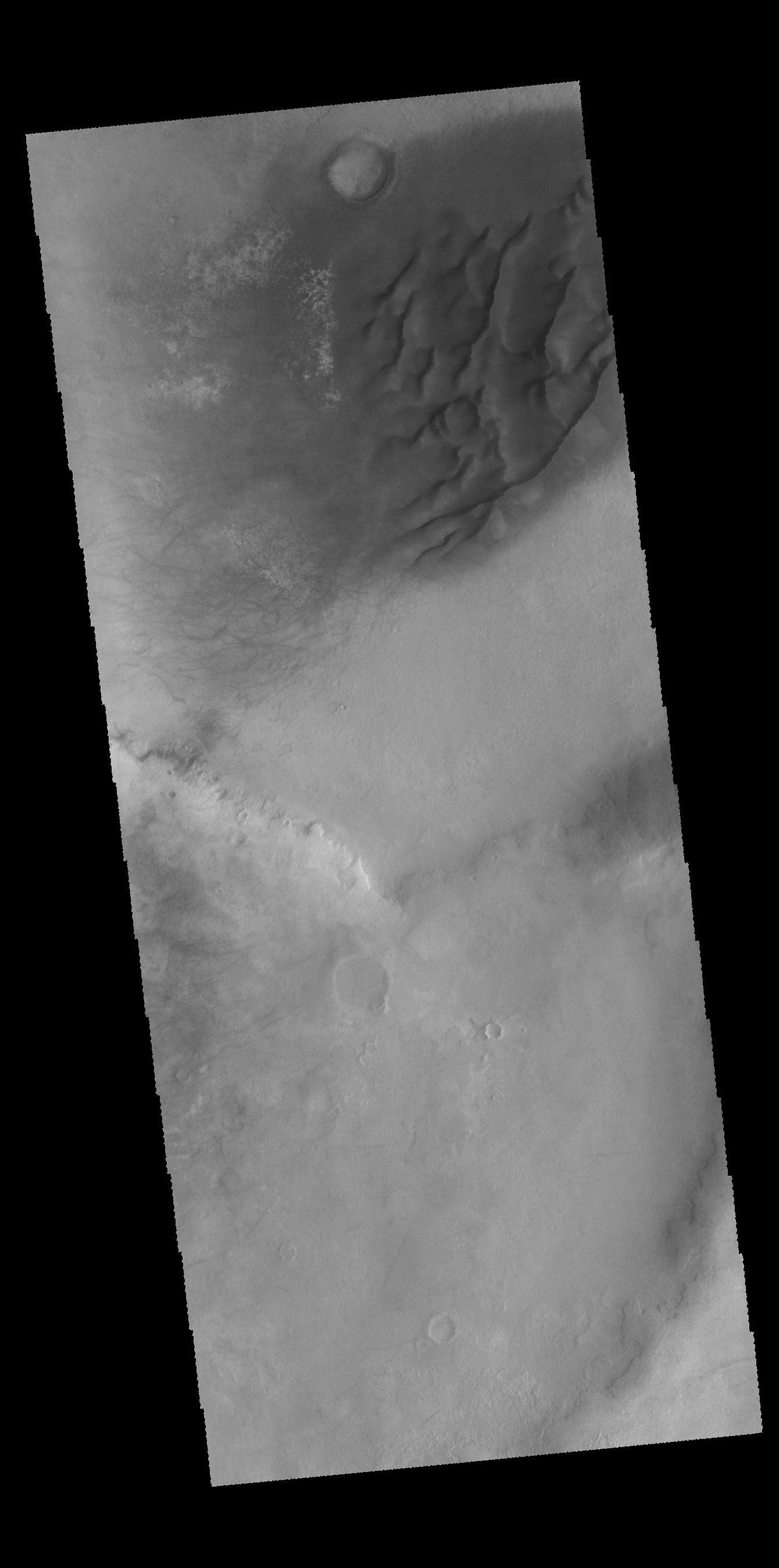
PIA19226:
-
Reull Vallis
Full Resolution:
TIFF
(959.9 kB)
JPEG
(94.04 kB)
|
|
|
2015-03-06 |
Mars
|
Mars Science Laboratory (MSL)
|
Mastcam
|
1278x1092x3 |
|
-
PIA19145:
-
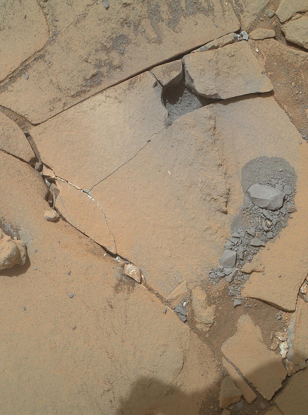
Curiosity's Drill After Drilling at 'Telegraph Peak'
Full Resolution:
TIFF
(4.188 MB)
JPEG
(128.3 kB)
|
|
|
2015-03-05 |
Mars
|
Mars Exploration Rover (MER)
|
Hazcam
|
1024x742x1 |

|
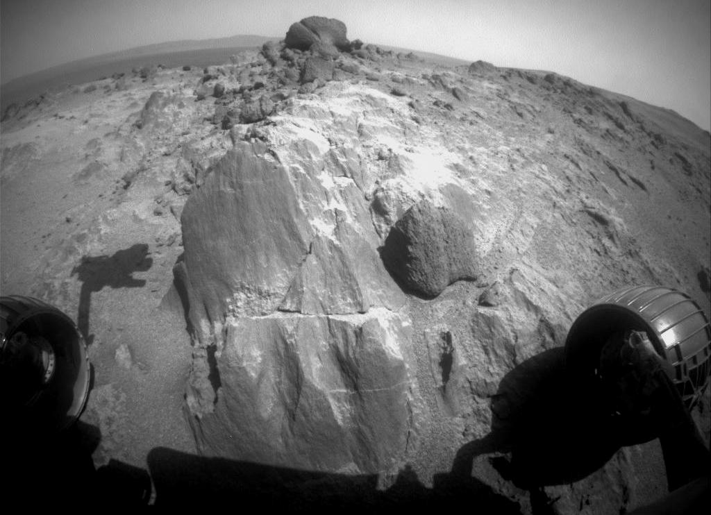
-
PIA19146:
-
Blocky Rock is Exam Target for Mars Rover Opportunity
Full Resolution:
TIFF
(760.8 kB)
JPEG
(95.91 kB)
|
|
|
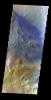
2015-03-05 |
Mars
|
2001 Mars Odyssey
|
THEMIS
|
723x1391x3 |

|
-
PIA19225:
-
Acidalia Planitia - False Color
Full Resolution:
TIFF
(3.018 MB)
JPEG
(142.4 kB)
|
|
|
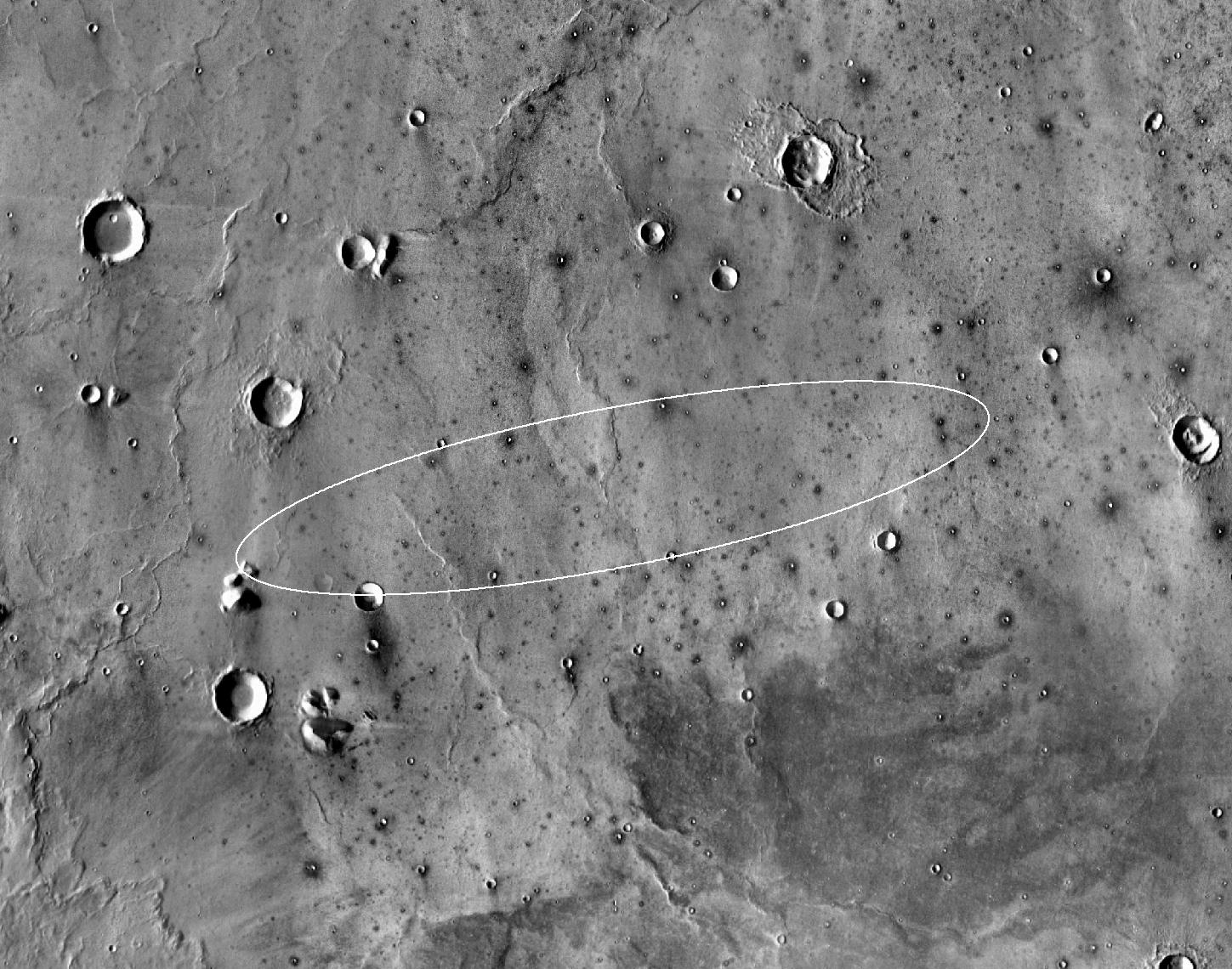
2015-03-04 |
Mars
|
InSight
|
THEMIS
|
1449x1140x1 |

|
-
PIA19143:
-
Landing Site for InSight
Full Resolution:
TIFF
(1.654 MB)
JPEG
(305 kB)
|
|
|
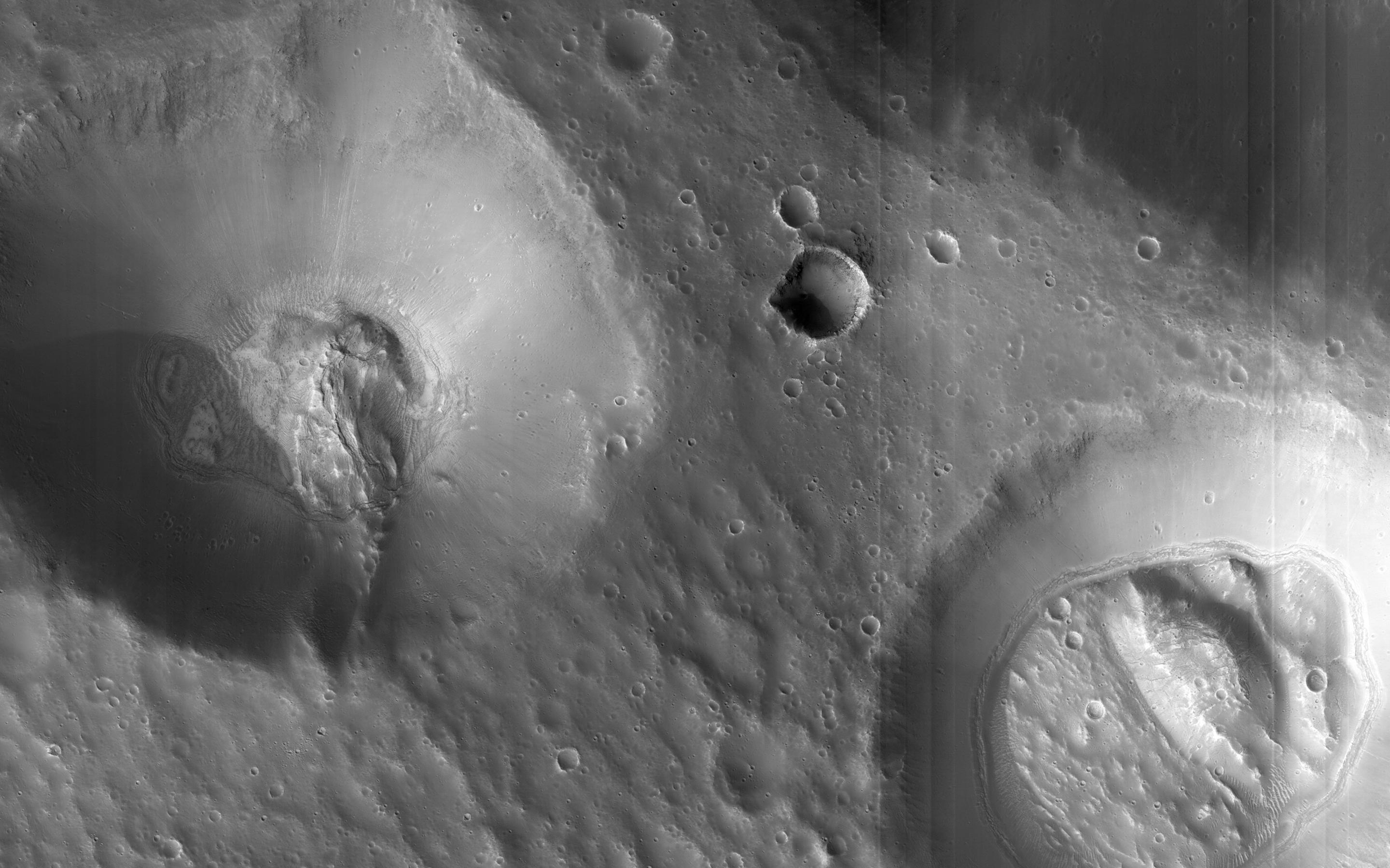
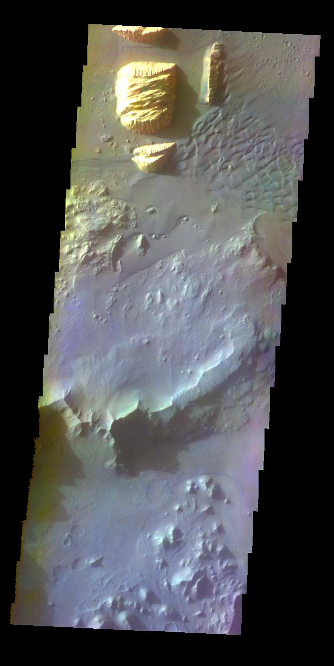
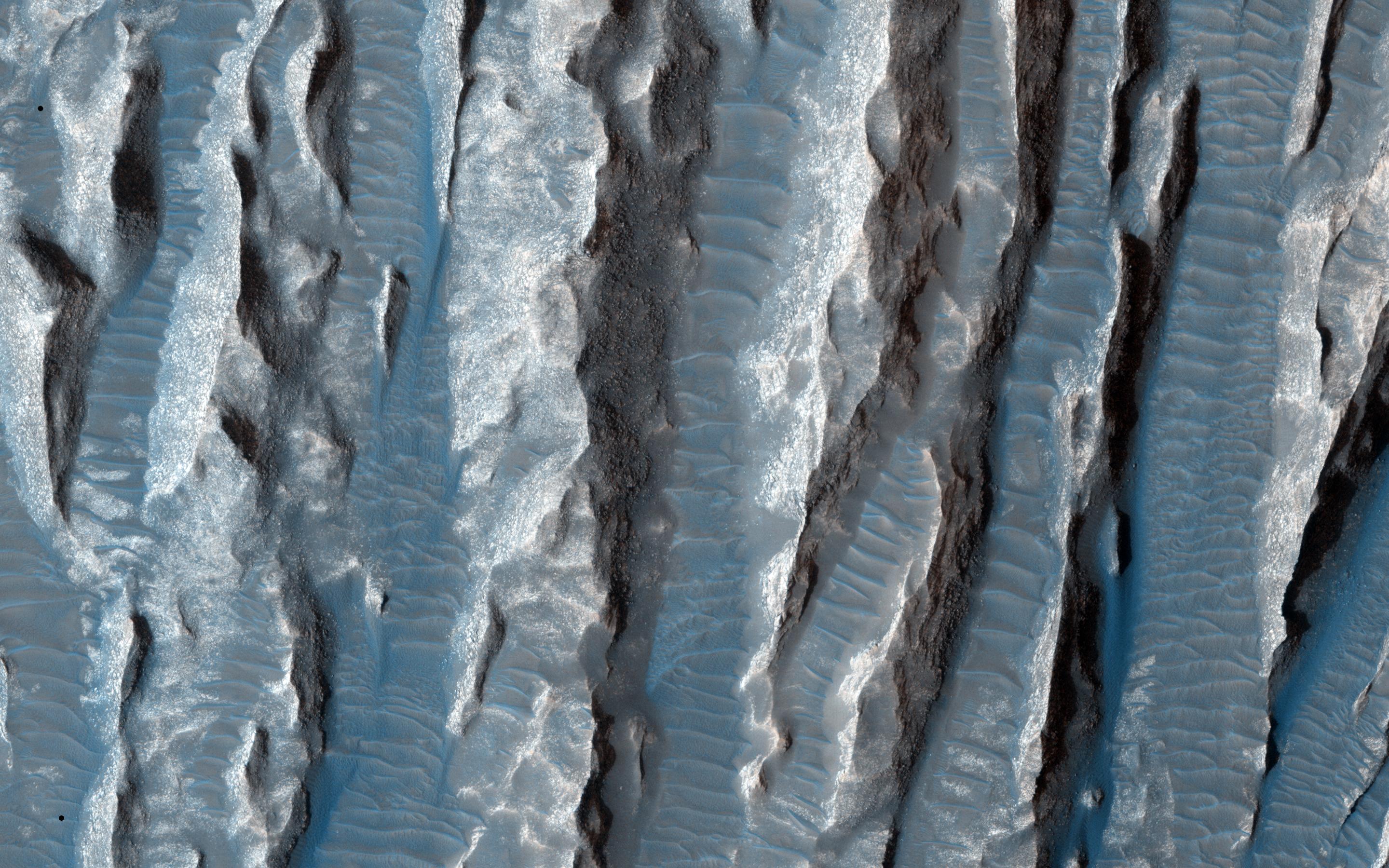
2015-03-04 |
Mars
|
Mars Reconnaissance Orbiter (MRO)
|
HiRISE
|
2880x1800x3 |

|
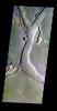
-
PIA19305:
-
Sand Avalanches in Meroe Patera
Full Resolution:
TIFF
(15.56 MB)
JPEG
(924.2 kB)
|
|
|
2015-03-04 |
Mars
|
Mars Reconnaissance Orbiter (MRO)
|
HiRISE
|
2880x1800x1 |

|
-
PIA19304:
-
Craters Near Nilokeras Scopulus
Full Resolution:
TIFF
(5.191 MB)
JPEG
(495.4 kB)
|
|
|
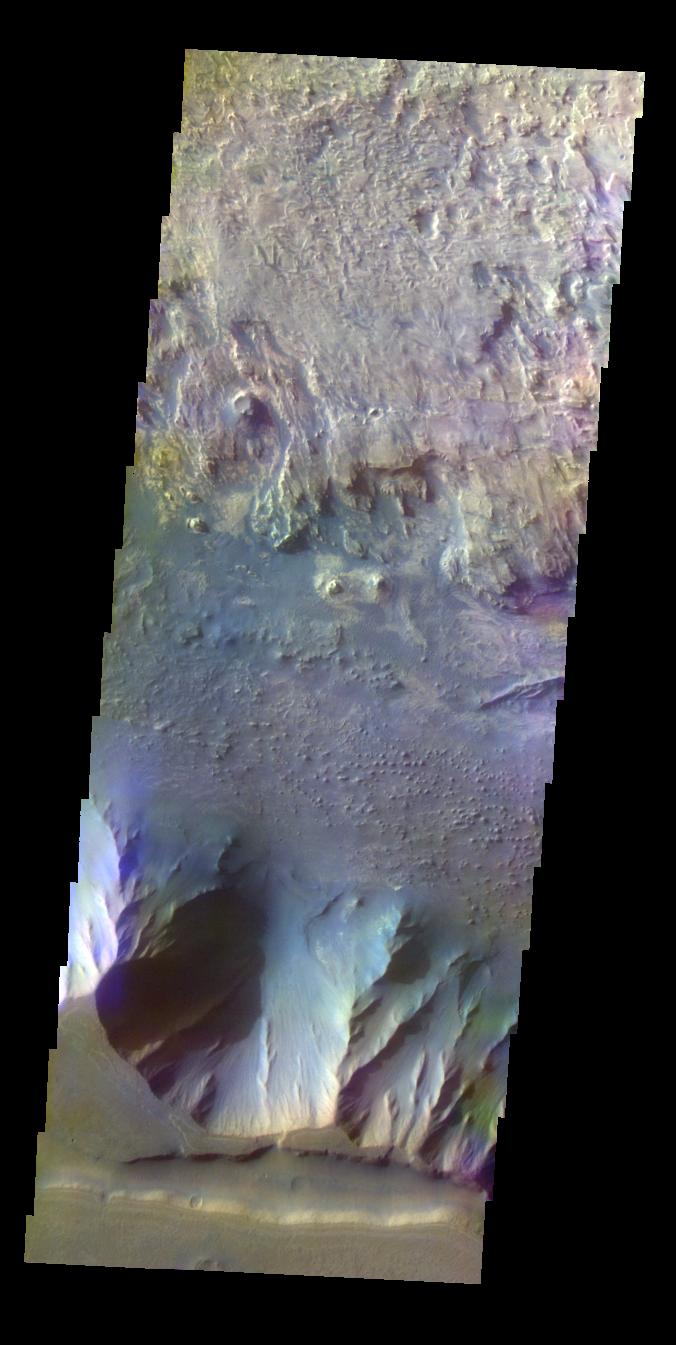
2015-03-04 |
Mars
|
Mars Reconnaissance Orbiter (MRO)
|
HiRISE
|
2880x1800x3 |
|
-
PIA19303:
-
A Possible Landing Site for the 2020 Mission: Jezero Crater
Full Resolution:
TIFF
(15.56 MB)
JPEG
(1.099 MB)
|
|
|
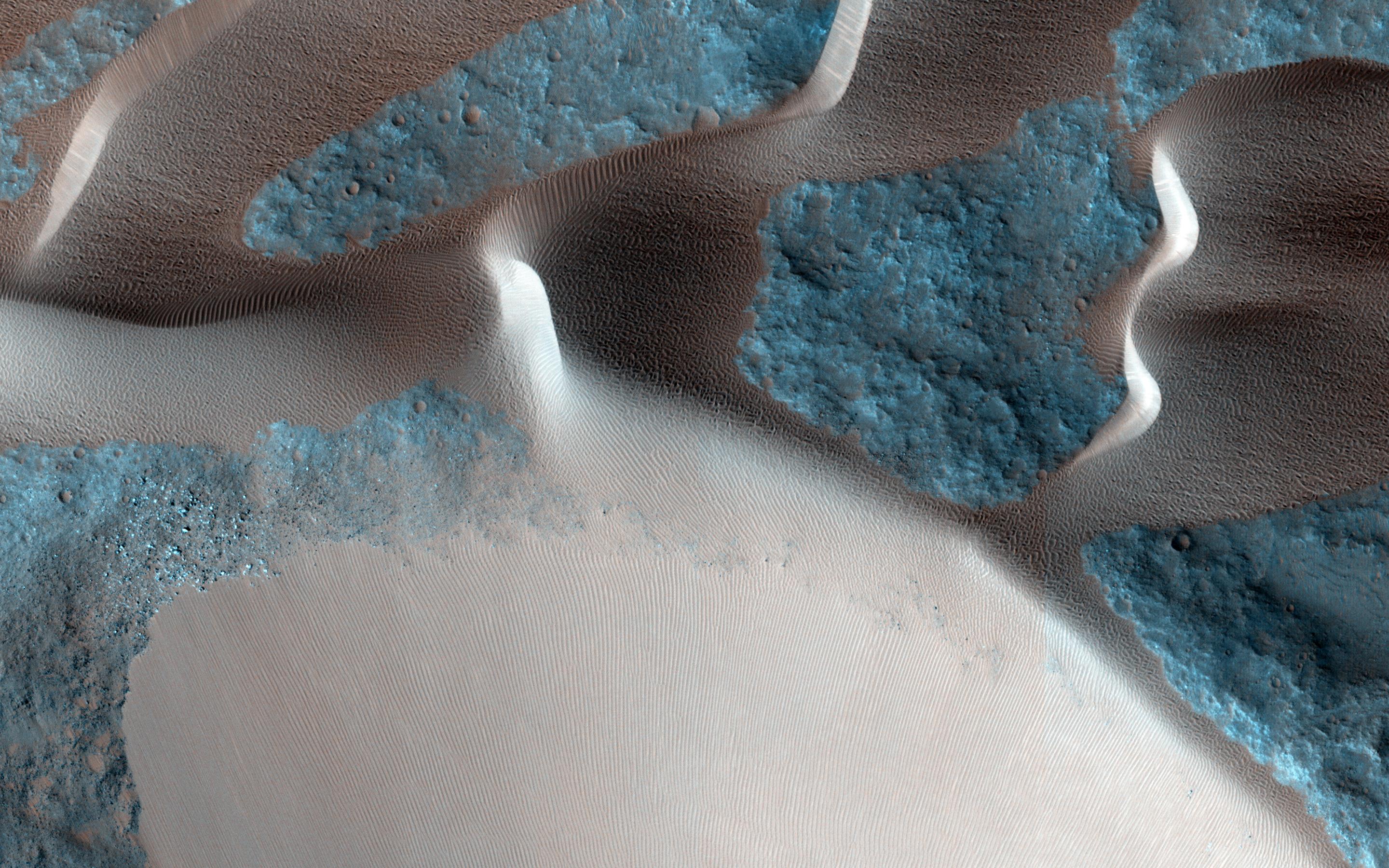
2015-03-04 |
Mars
|
Mars Reconnaissance Orbiter (MRO)
|
HiRISE
|
2880x1800x3 |
|
-
PIA19302:
-
Dunes in Western Medusae Fossae Formation
Full Resolution:
TIFF
(15.56 MB)
JPEG
(697.2 kB)
|
|
|
2015-03-04 |
Mars
|
2001 Mars Odyssey
|
THEMIS
|
687x1355x3 |
|
-
PIA19221:
-
Marth Crater - False Color
Full Resolution:
TIFF
(2.794 MB)
JPEG
(58.81 kB)
|
|
|
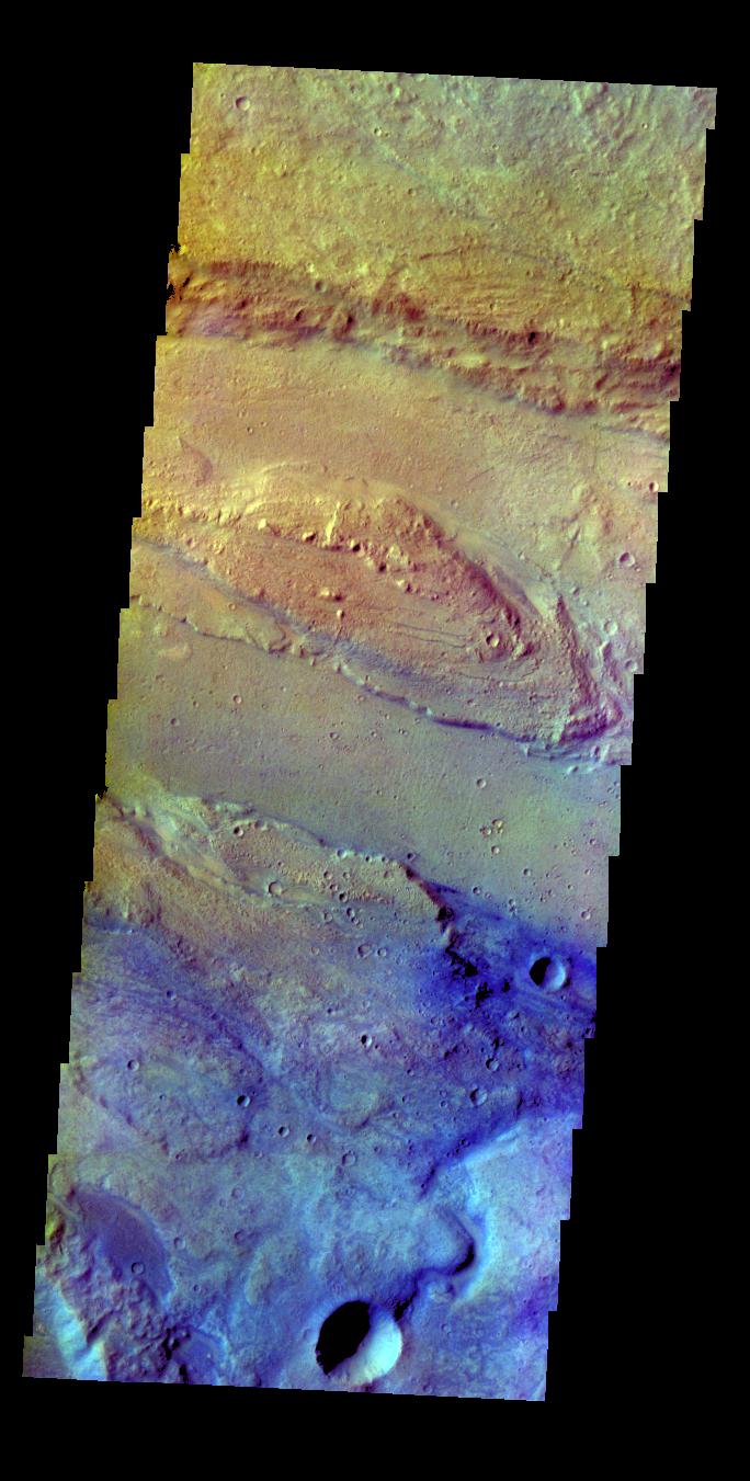
2015-03-03 |
Mars
|
2001 Mars Odyssey
|
THEMIS
|
675x1344x3 |
|
-
PIA19220:
-
Ceti Mensa - False Color
Full Resolution:
TIFF
(2.723 MB)
JPEG
(117.4 kB)
|
|
|
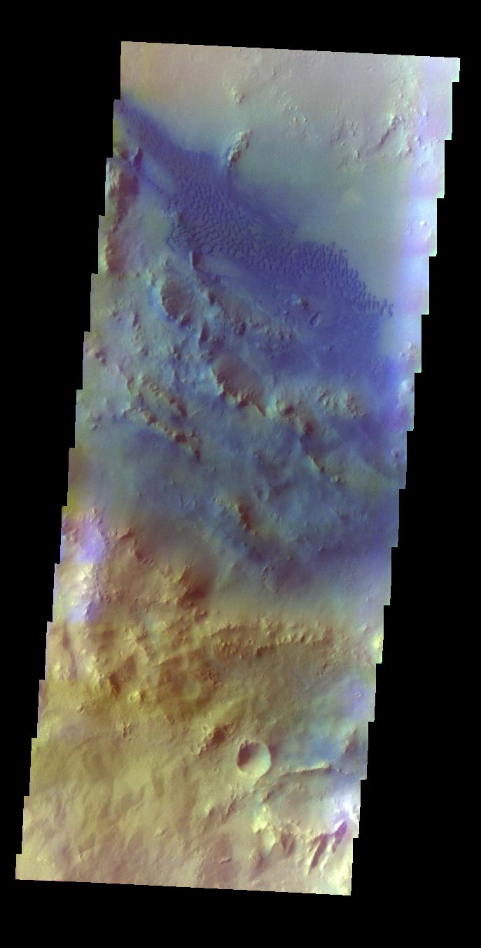
2015-03-02 |
Mars
|
2001 Mars Odyssey
|
THEMIS
|
679x1347x3 |
|
-
PIA19219:
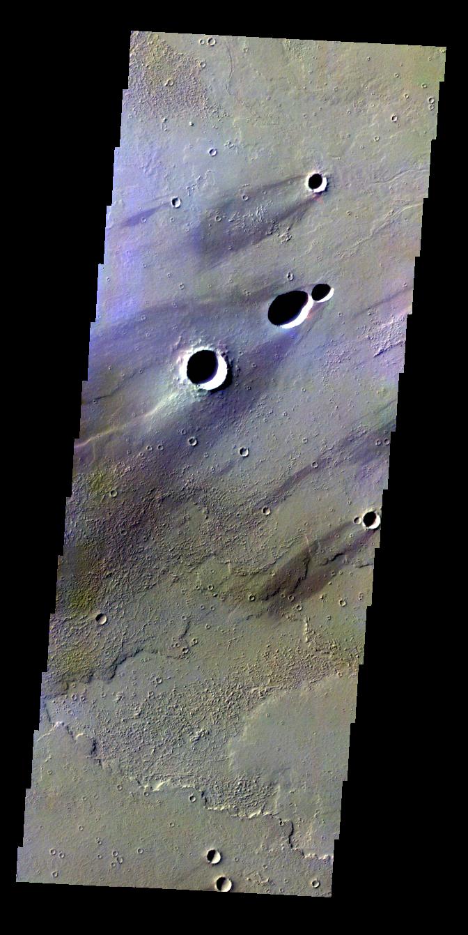
-
Elysium Planitia Crater - False Color
Full Resolution:
TIFF
(2.745 MB)
JPEG
(75.68 kB)
|
|
|
2015-02-27 |
Mars
|
2001 Mars Odyssey
|
THEMIS
|
674x1344x3 |
|
-
PIA19218:
-
Melas Chasma - False Color
Full Resolution:
TIFF
(2.719 MB)
JPEG
(91.58 kB)
|
|
|
2015-02-26 |
Mars
|
2001 Mars Odyssey
|
THEMIS
|
696x1365x3 |

|
-
PIA19217:
-
Arabia Terra - False Color
Full Resolution:
TIFF
(2.851 MB)
JPEG
(133.6 kB)
|
|
|
2015-02-25 |
Mars
|
Mars Science Laboratory (MSL)
|
MAHLI
|
1584x1184x3 |
|
-
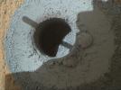
PIA19140:
-
Hole at 'Telegraph Peak' Drilled by Mars Rover Curiosity
Full Resolution:
TIFF
(5.628 MB)
JPEG
(477.6 kB)
|
|
|
2015-02-25 |
Mars
|
2001 Mars Odyssey
|
THEMIS
|
684x1351x3 |
|
-
PIA19215:
-
Ares Vallis - False Color
Full Resolution:
TIFF
(2.773 MB)
JPEG
(124 kB)
|
|
|
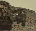
2015-02-24 |
Mars
|
Mars Science Laboratory (MSL)
|
MAHLI
|
9015x4617x3 |
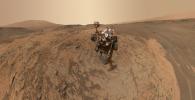
|
-
PIA19142:
-
Curiosity Self-Portrait at 'Mojave' Site on Mount Sharp
Full Resolution:
TIFF
(124.9 MB)
JPEG
(3.55 MB)
|
|
|
2015-02-24 |
Mars
|
2001 Mars Odyssey
|
THEMIS
|
675x1345x3 |
|
-
PIA19214:
-
Ganges Chasma - False Color
Full Resolution:
TIFF
(2.725 MB)
JPEG
(84.83 kB)
|
|
|
2015-02-23 |
Mars
|
2001 Mars Odyssey
|
THEMIS
|
687x1353x3 |
|
-
PIA19211:
-
Pettit Crater - False Color
Full Resolution:
TIFF
(2.79 MB)
JPEG
(73.98 kB)
|
|
|
2015-02-20 |
Mars
|
2001 Mars Odyssey
|
THEMIS
|
673x1343x3 |

|
-
PIA19210:
-
Ganges Chasma - False Color
Full Resolution:
TIFF
(2.713 MB)
JPEG
(78.99 kB)
|
|
|
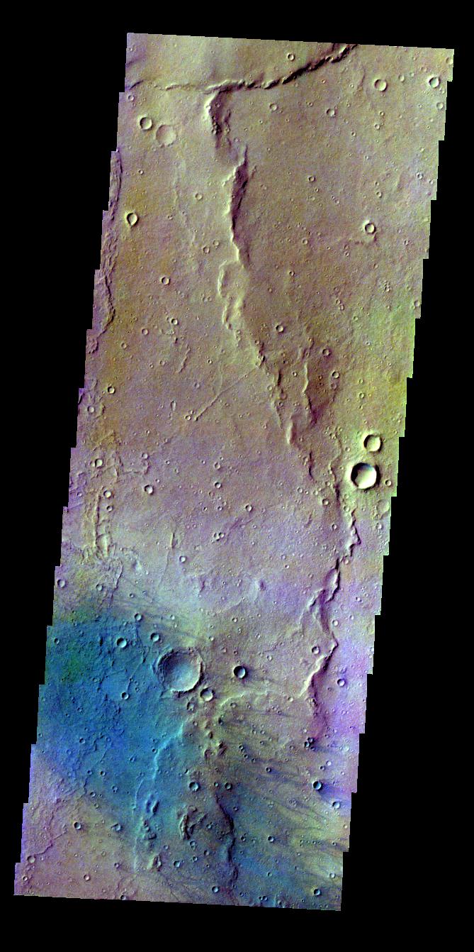
2015-02-19 |
Mars
|
2001 Mars Odyssey
|
THEMIS
|
1341x2698x3 |
|
-
PIA19208:
-
Gullies
Full Resolution:
TIFF
(3.622 MB)
JPEG
(264.4 kB)
|
|
|
2015-02-18 |
Mars
|
Mars Reconnaissance Orbiter (MRO)
|
HiRISE
|
2880x1800x3 |

|
-
PIA19301:
-
A Fresh, Shallow Valley in Northern Arabia Terra
Full Resolution:
TIFF
(15.56 MB)
JPEG
(805.1 kB)
|
|
|
2015-02-18 |
Mars
|
Mars Reconnaissance Orbiter (MRO)
|
HiRISE
|
2880x1800x3 |
|
-
PIA19300:
-
Cerberus Fossae: In the Relay Zone
Full Resolution:
TIFF
(15.56 MB)
JPEG
(751.6 kB)
|
|
|
2015-02-18 |
Mars
|
Mars Reconnaissance Orbiter (MRO)
|
HiRISE
|
2880x1800x3 |
|
-
PIA19299:
-
Lava Flow Near the Base of Olympus Mons
Full Resolution:
TIFF
(15.56 MB)
JPEG
(567.7 kB)
|
|
|
2015-02-18 |
Mars
|
2001 Mars Odyssey
|
THEMIS
|
1334x2676x3 |
|
-
PIA19207:
-
Rabe Crater Dunes
Full Resolution:
TIFF
(3.574 MB)
JPEG
(312.6 kB)
|
|
|
2015-02-17 |
Mars
|
2001 Mars Odyssey
|
THEMIS
|
1349x2689x3 |

|
-
PIA19205:
-
Hooke Crater Dunes
Full Resolution:
TIFF
(3.631 MB)
JPEG
(262.8 kB)
|
|
|
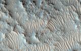
2015-02-16 |
Mars
|
2001 Mars Odyssey
|
THEMIS
|
536x1457x3 |
|
-
PIA19201:
-
Crater Dunes
Full Resolution:
TIFF
(782 kB)
JPEG
(58.82 kB)
|
|
|
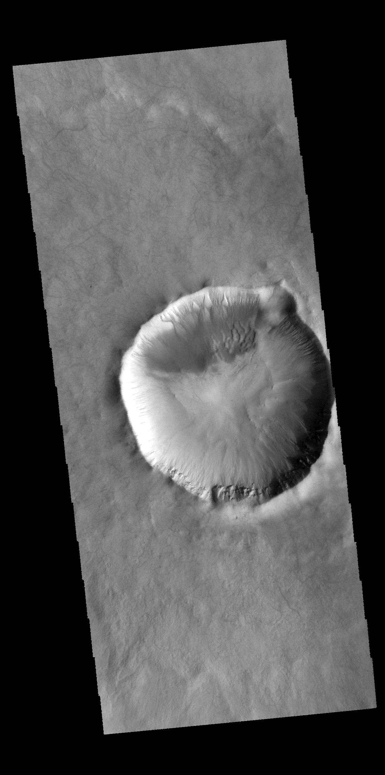
2015-02-13 |
Mars
|
2001 Mars Odyssey
|
THEMIS
|
670x1434x3 |
|
-
PIA19200:
-
Crater
Full Resolution:
TIFF
(962 kB)
JPEG
(85.97 kB)
|
|
|
2015-02-12 |
Mars
|
2001 Mars Odyssey
|
THEMIS
|
1340x2698x3 |
|
-
PIA19199:
-
Dunes and Dust Devils
Full Resolution:
TIFF
(3.619 MB)
JPEG
(202.6 kB)
|
|
|
2015-02-11 |
Mars
|
Mars Reconnaissance Orbiter (MRO)
|
HiRISE
|
2880x1800x3 |
|
-
PIA19296:
-
Fan-Shaped Deposits in Bigbee Crater
Full Resolution:
TIFF
(15.56 MB)
JPEG
(1.115 MB)
|
|
|
2015-02-11 |
Mars
|
Mars Reconnaissance Orbiter (MRO)
|
HiRISE
|
2880x1800x3 |
|
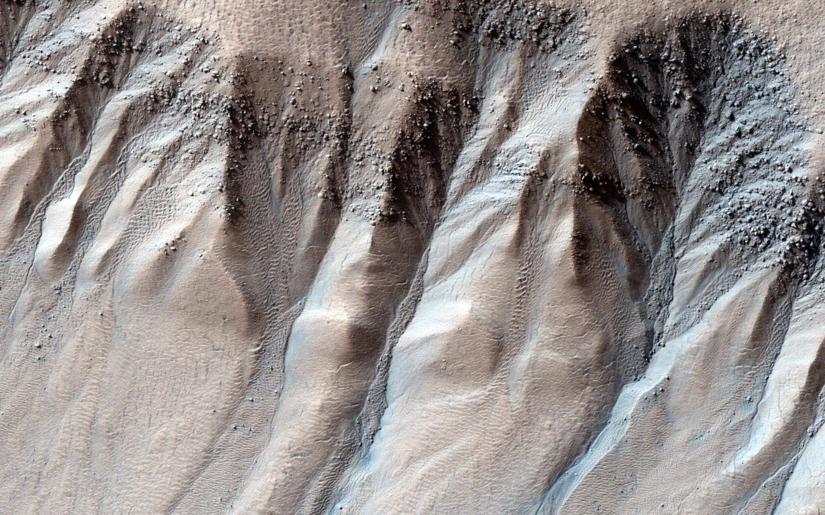
-
PIA19295:
-
Boulders in Gully Alcoves
Full Resolution:
TIFF
(15.56 MB)
JPEG
(1.004 MB)
|
|
|
2015-02-11 |
Mars
|
Mars Reconnaissance Orbiter (MRO)
|
HiRISE
|
2880x1800x3 |
|
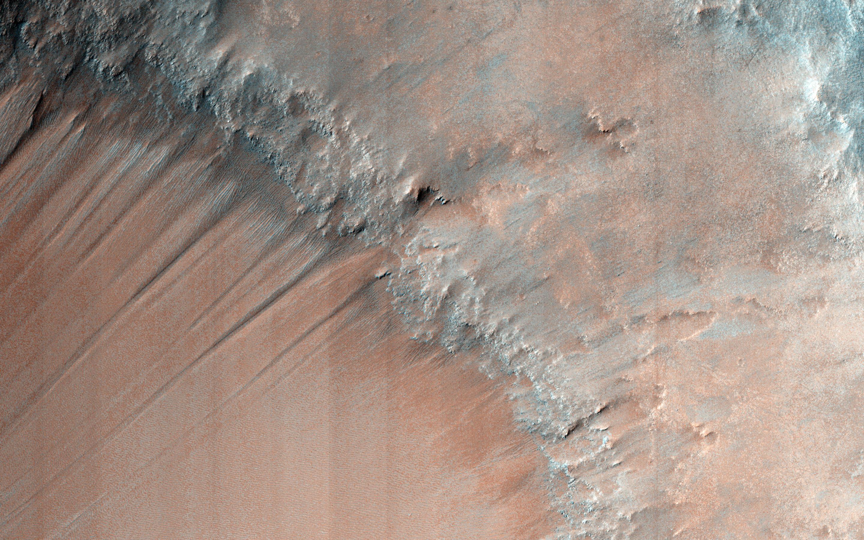
-
PIA19294:
-
Gullies and Bedrock in Nirgal Vallis
Full Resolution:
TIFF
(15.56 MB)
JPEG
(1.112 MB)
|
|
|
2015-02-11 |
Mars
|
Mars Reconnaissance Orbiter (MRO)
|
HiRISE
|
2880x1800x3 |

|
-
PIA19293:
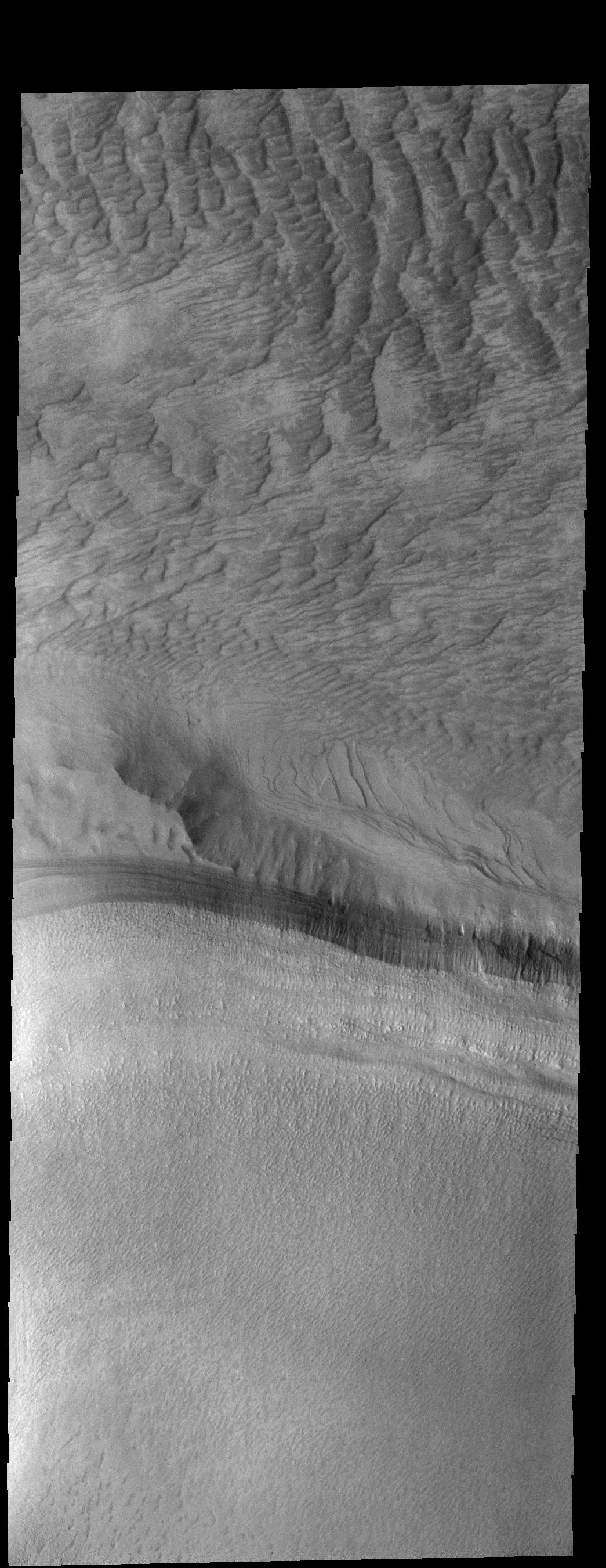
-
A Large, Longitudinal Dune
Full Resolution:
TIFF
(15.56 MB)
JPEG
(1.116 MB)
|
|
|
2015-02-11 |
Mars
|
2001 Mars Odyssey
|
THEMIS
|
1343x2702x3 |
|
-
PIA19198:
-
Lowell Crater
Full Resolution:
TIFF
(3.633 MB)
JPEG
(198.7 kB)
|
|
|
2015-02-10 |
Mars
|
Mars Exploration Rover (MER)
|
HiRISE
|
3602x2208x3 |
|
-
PIA19141:
-
Opportunity Rover Nears Mars Marathon Feat
Full Resolution:
TIFF
(23.87 MB)
JPEG
(1.028 MB)
|
|
|
2015-02-10 |
Mars
|
2001 Mars Odyssey
|
THEMIS
|
1333x2690x3 |

|
-
PIA19197:
-
Asimov Crater
Full Resolution:
TIFF
(3.59 MB)
JPEG
(255.3 kB)
|
|
|
2015-02-09 |
Mars
|
2001 Mars Odyssey
|
THEMIS
|
668x1436x3 |
|
-
PIA19194:
-
Matara Crater Dunes
Full Resolution:
TIFF
(960.4 kB)
JPEG
(56.89 kB)
|
|
|
2015-02-06 |
Mars
|
2001 Mars Odyssey
|
THEMIS
|
1330x2687x3 |

|
-
PIA19193:
-
Rabe Crater Dunes
Full Resolution:
TIFF
(3.578 MB)
JPEG
(217.5 kB)
|
|
|
2015-02-05 |
Mars
|
Mars Science Laboratory (MSL)
|
MAHLI
|
1184x1584x3 |
|
-
PIA19115:
-
Site of Curiosity's Second Bite of Mount Sharp
Full Resolution:
TIFF
(5.629 MB)
JPEG
(251.9 kB)
|
|
|
2015-02-05 |
Mars
|
2001 Mars Odyssey
|
THEMIS
|
1345x2702x3 |

|
-
PIA19191:
-
Galle Crater Floor
Full Resolution:
TIFF
(3.638 MB)
JPEG
(331.4 kB)
|
|
|
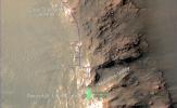
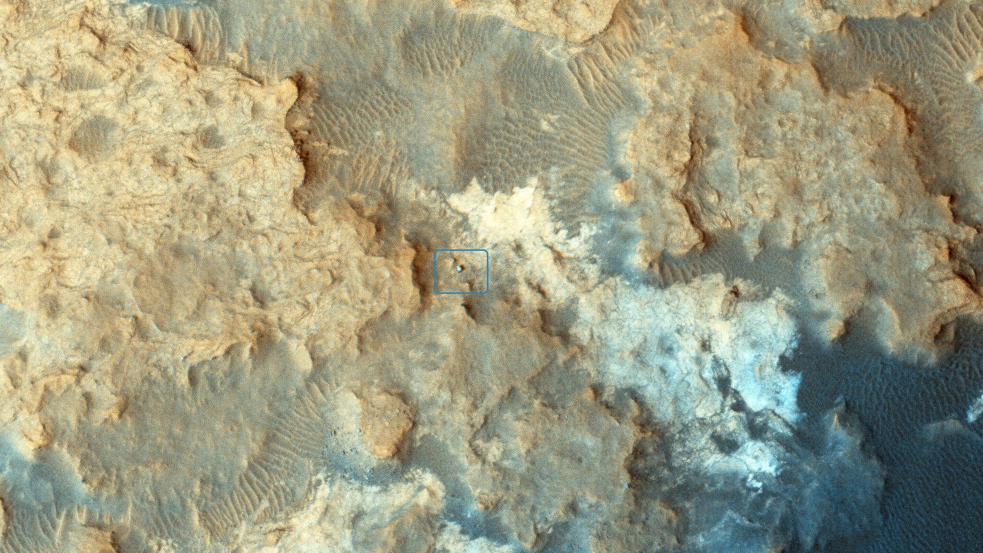
2015-02-04 |
Mars
|
Mars Reconnaissance Orbiter (MRO)
|
HiRISE
|
1920x1080x3 |
|
-
PIA19114:
-
Curiosity Rover at 'Pahrump Hills'
Full Resolution:
TIFF
(6.223 MB)
JPEG
(692.3 kB)
|
|
|
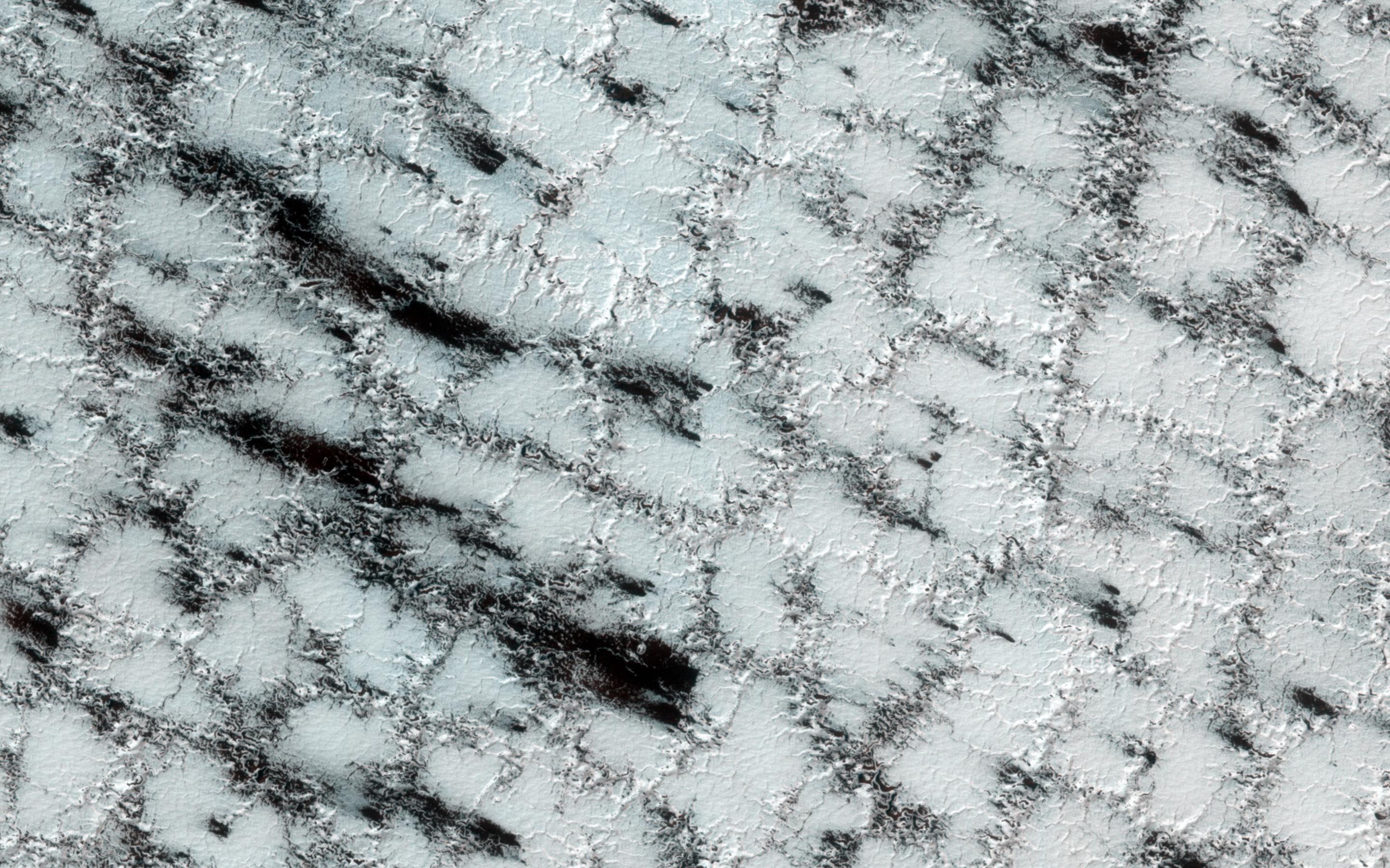
2015-02-04 |
Mars
|
Mars Reconnaissance Orbiter (MRO)
|
HiRISE
|
2880x1800x3 |
|
-
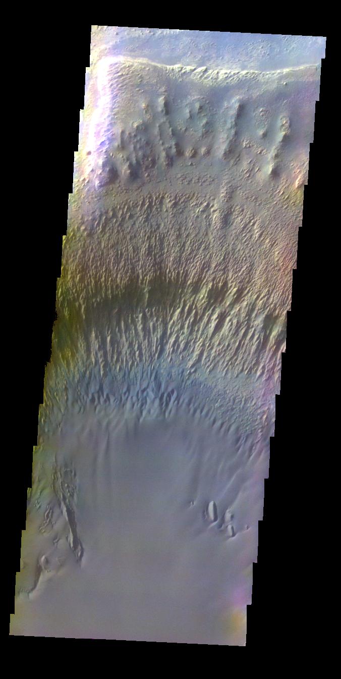
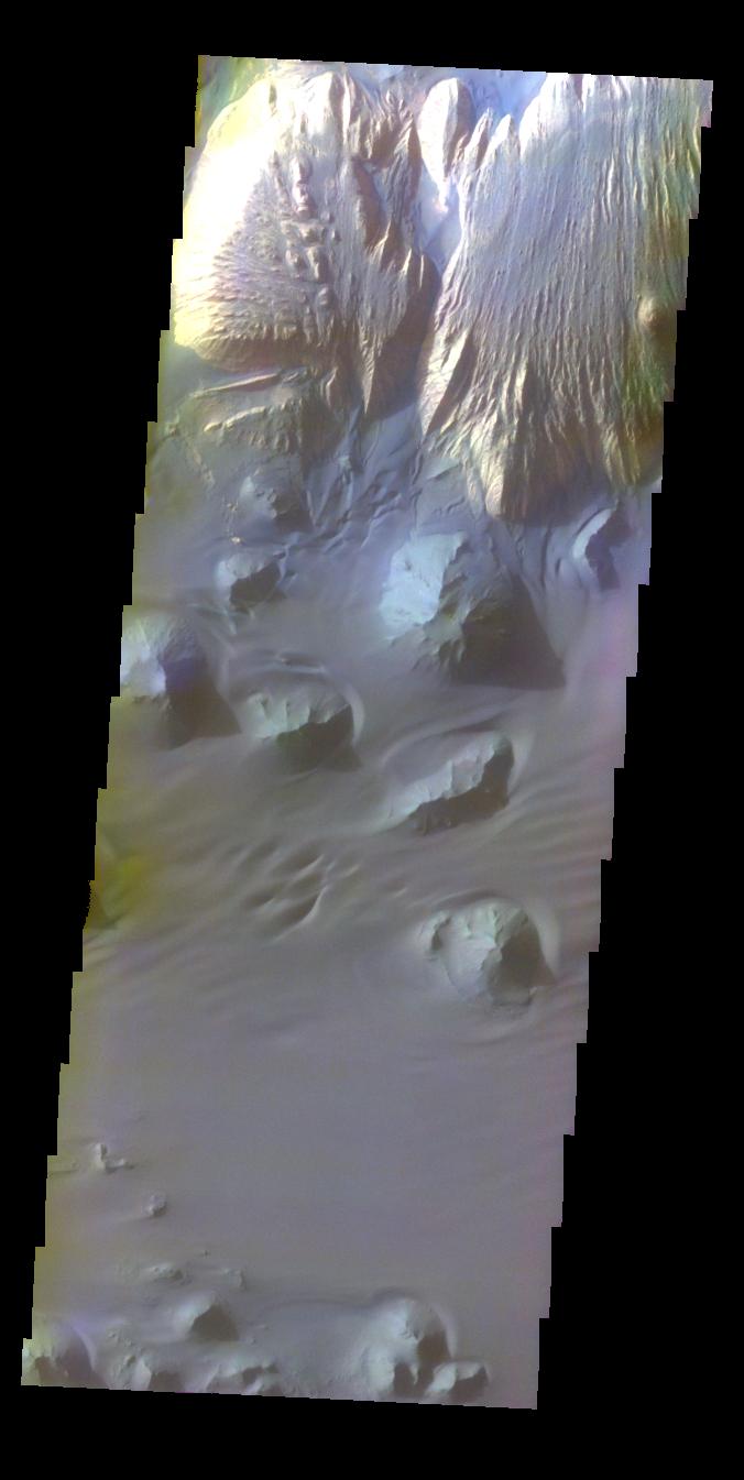
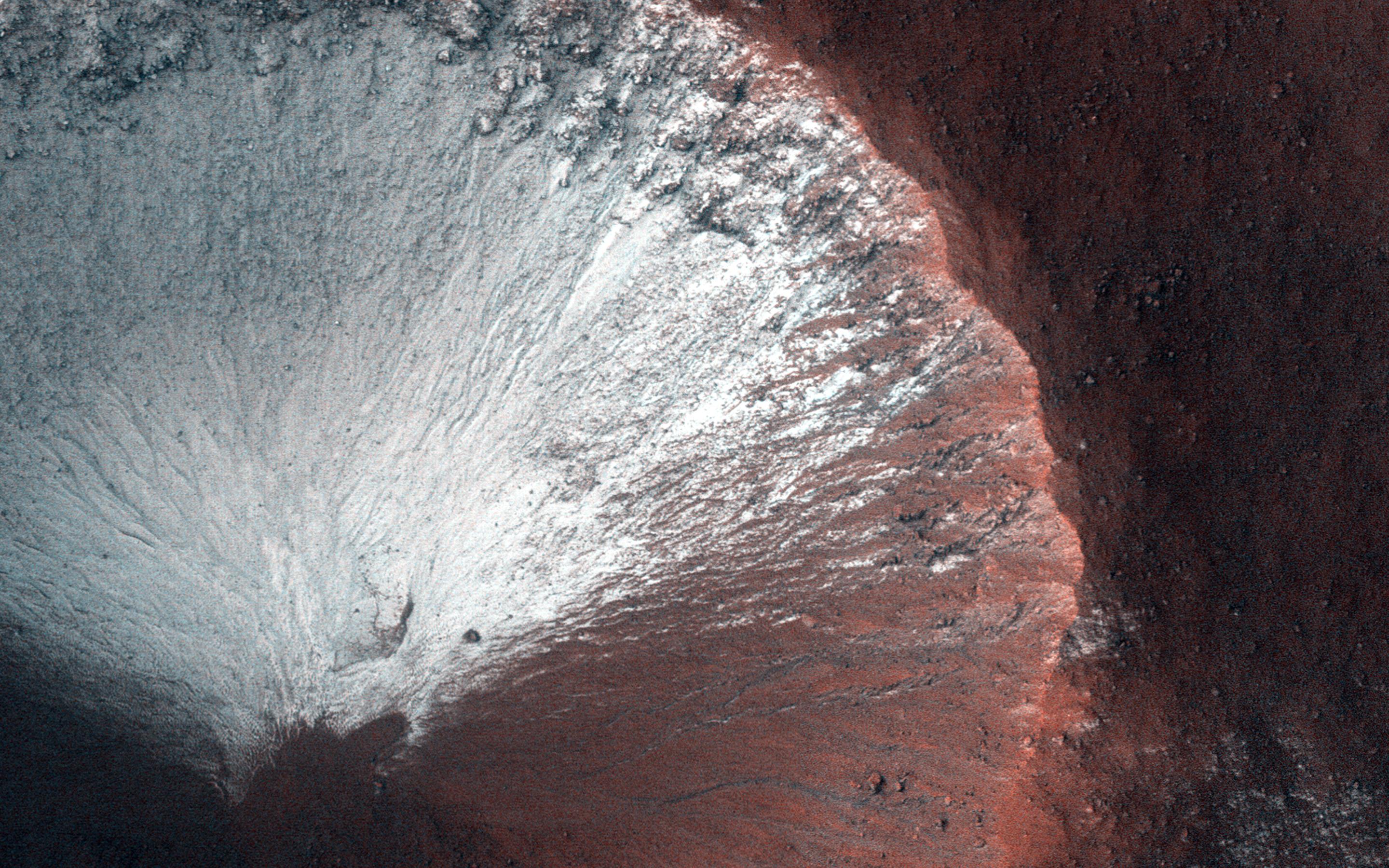
PIA19292:
-
Icy Wonderland
Full Resolution:
TIFF
(15.56 MB)
JPEG
(906.4 kB)
|
|
|
2015-02-04 |
Mars
|
Mars Reconnaissance Orbiter (MRO)
|
HiRISE
|
2880x1800x3 |
|
-
PIA19291:
-
Yardangs in Arsinoes Chaos, Mars
Full Resolution:
TIFF
(15.56 MB)
JPEG
(844.8 kB)
|
|
|
2015-02-04 |
Mars
|
Mars Reconnaissance Orbiter (MRO)
|
HiRISE
|
2880x1800x1 |

|
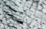
-
PIA19290:
-
Tangential Craters within Ptolemaeus Crater
Full Resolution:
TIFF
(5.191 MB)
JPEG
(798.2 kB)
|
|
|
2015-02-04 |
Mars
|
2001 Mars Odyssey
|
THEMIS
|
1045x2701x3 |
|
-
PIA19190:
-
Dune Texture
Full Resolution:
TIFF
(2.826 MB)
JPEG
(388.4 kB)
|
|
|
2015-02-03 |
Mars
|
2001 Mars Odyssey
|
THEMIS
|
320x784x3 |
|
-
PIA19189:
-
Rabe Dunes in IR
Full Resolution:
TIFF
(251.4 kB)
JPEG
(38.11 kB)
|
|
|
2015-02-02 |
Mars
|
2001 Mars Odyssey
|
THEMIS
|
667x1436x3 |
|
-
PIA19188:
-
Dunes
Full Resolution:
TIFF
(959 kB)
JPEG
(57.77 kB)
|
|
|
2015-01-30 |
Mars
|
2001 Mars Odyssey
|
THEMIS
|
672x1341x3 |
|
-
PIA19186:
-
Windstreaks -- False Color
Full Resolution:
TIFF
(2.705 MB)
JPEG
(130.7 kB)
|
|
|
2015-01-29 |
Mars
|
2001 Mars Odyssey
|
THEMIS
|
698x1368x3 |
|
-
PIA19034:
-
Makhambet Crater - False Color
Full Resolution:
TIFF
(2.866 MB)
JPEG
(94.82 kB)
|
|
|
2015-01-28 |
Mars
|
Mars Reconnaissance Orbiter (MRO)
|
HiRISE
|
2880x1800x3 |
|
-
PIA19289:
-
Pits in Hale Crater Ejecta
Full Resolution:
TIFF
(15.56 MB)
JPEG
(829 kB)
|
|
|
2015-01-28 |
Mars
|
Mars Reconnaissance Orbiter (MRO)
|
HiRISE
|
2880x1800x1 |
|
-
PIA19288:
-
Filled Crater and Scallops
Full Resolution:
TIFF
(5.191 MB)
JPEG
(1.214 MB)
|
|
|
2015-01-28 |
Mars
|
Mars Reconnaissance Orbiter (MRO)
|
HiRISE
|
2880x1800x3 |
|
-
PIA19287:
-
Higher Terrain between Sinai and Solis Plana
Full Resolution:
TIFF
(15.56 MB)
JPEG
(827 kB)
|
|
|
2015-01-28 |
Mars
|
Mars Reconnaissance Orbiter (MRO)
|
HiRISE
|
2880x1800x3 |
|
-
PIA19286:
-
Gullies Old and New Near the Argyre Region
Full Resolution:
TIFF
(15.56 MB)
JPEG
(1.238 MB)
|
|
|
2015-01-28 |
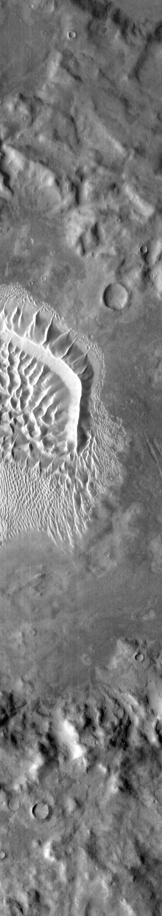
Mars
|
2001 Mars Odyssey
|
THEMIS
|
1419x1724x3 |
|
-
PIA19033:
-
North Polar Cap - False Color
Full Resolution:
TIFF
(7.342 MB)
JPEG
(95.17 kB)
|
|
|
2015-01-27 |
Mars
|
Mars Exploration Rover (MER)
|
Microscopic Imager
|
1077x1077x3 |
|
-
PIA19113:
-
Martian Concretions Near Fram Crater
Full Resolution:
TIFF
(3.481 MB)
JPEG
(281 kB)
|
|
|
2015-01-27 |
Mars
|
Mars Exploration Rover (MER)
|
Navigation Camera
|
3924x2052x3 |
|
-
PIA19112:
-
Lander Trench Dug by Opportunity
Full Resolution:
TIFF
(24.16 MB)
JPEG
(468.4 kB)
|
|
|
2015-01-27 |
Mars
|
2001 Mars Odyssey
|
THEMIS
|
676x1345x3 |
|
-
PIA19031:
-
Ganges Chasma - False Color
Full Resolution:
TIFF
(2.729 MB)
JPEG
(93.08 kB)
|
|
|
2015-01-26 |
Mars
|
2001 Mars Odyssey
|
THEMIS
|
672x1343x3 |
|
-
PIA19030:
-
Schaeberle Crater - False Color
Full Resolution:
TIFF
(2.709 MB)
JPEG
(135.3 kB)
|
|
|
2015-01-23 |
Mars
|
2001 Mars Odyssey
|
THEMIS
|
676x1345x3 |
|
-
PIA19028:
-
Ganges Chasma - False Color
Full Resolution:
TIFF
(2.729 MB)
JPEG
(66.46 kB)
|
|
|
2015-01-22 |
Mars
|
Mars Reconnaissance Orbiter (MRO)
|
HiRISE
|
2880x1800x3 |

|
-
PIA19176:
-
Southeast Rim of Hale Crater
Full Resolution:
TIFF
(15.56 MB)
JPEG
(953.4 kB)
|
|
|
2015-01-22 |
Mars
|
Mars Reconnaissance Orbiter (MRO)
|
HiRISE
|
2880x1800x3 |
|
-
PIA19175:
-
Gullies in Liu Hsin Crater
Full Resolution:
TIFF
(15.56 MB)
JPEG
(1.496 MB)
|
|
|
2015-01-22 |
Mars
|
Mars Reconnaissance Orbiter (MRO)
|
HiRISE
|
2880x1800x3 |
|
-
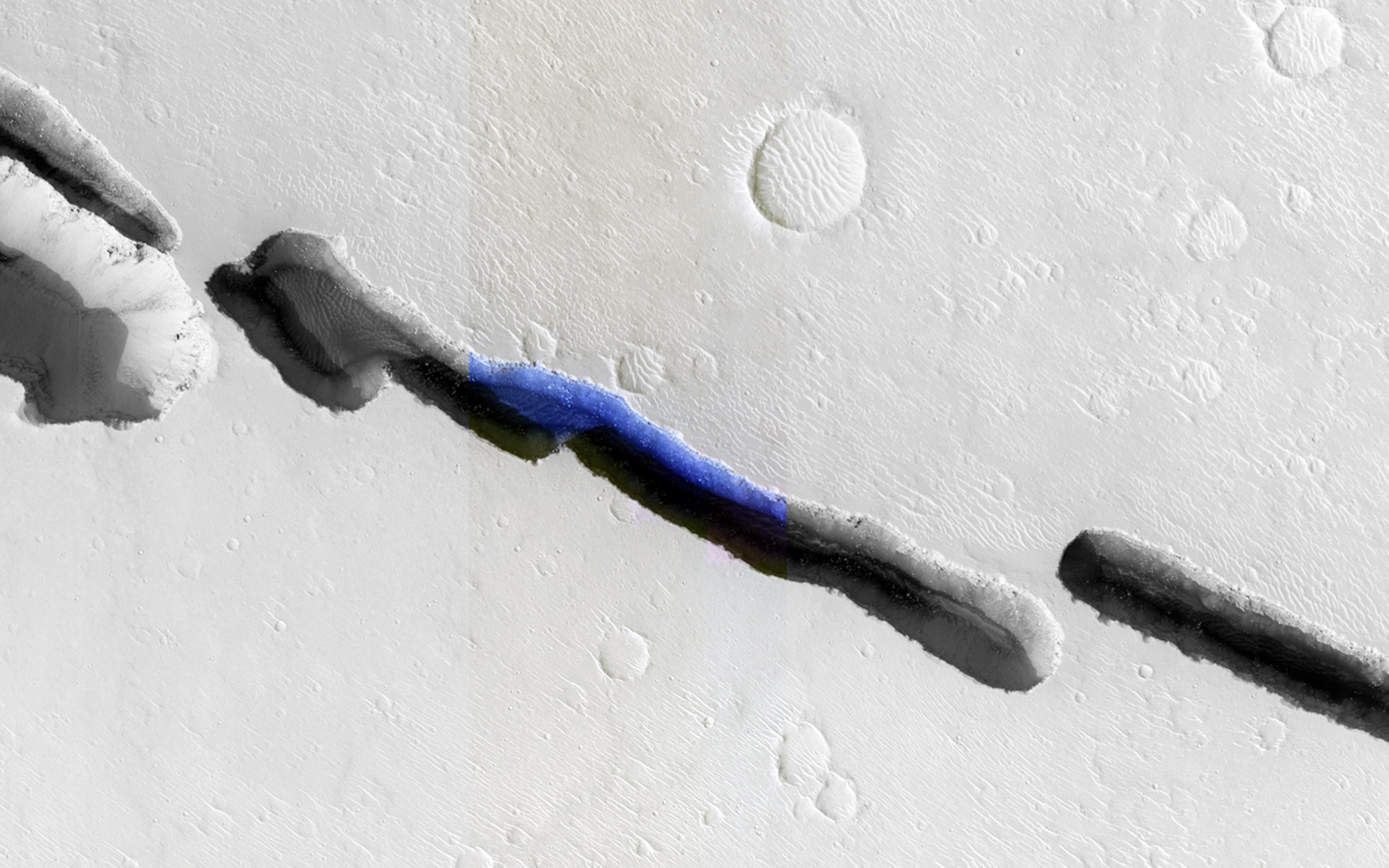
PIA19139:
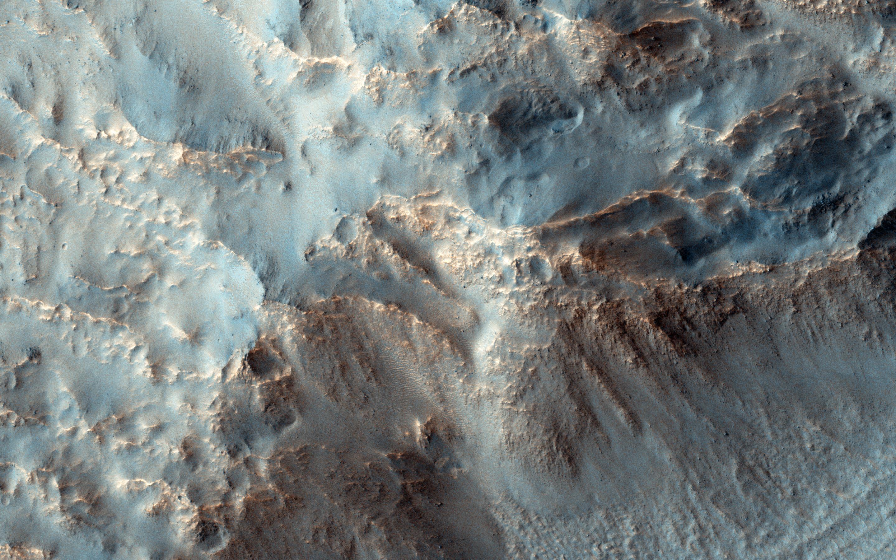
-
Crater Slopes: The Power of a Repeat Image
Full Resolution:
TIFF
(15.56 MB)
JPEG
(945.6 kB)
|
|
|
2015-01-22 |
Mars
|
Mars Reconnaissance Orbiter (MRO)
|
HiRISE
|
2880x1800x1 |

|
-
PIA19138:
-
Triple-Crater in Elysium Planitia
Full Resolution:
TIFF
(5.191 MB)
JPEG
(542.9 kB)
|
|
|
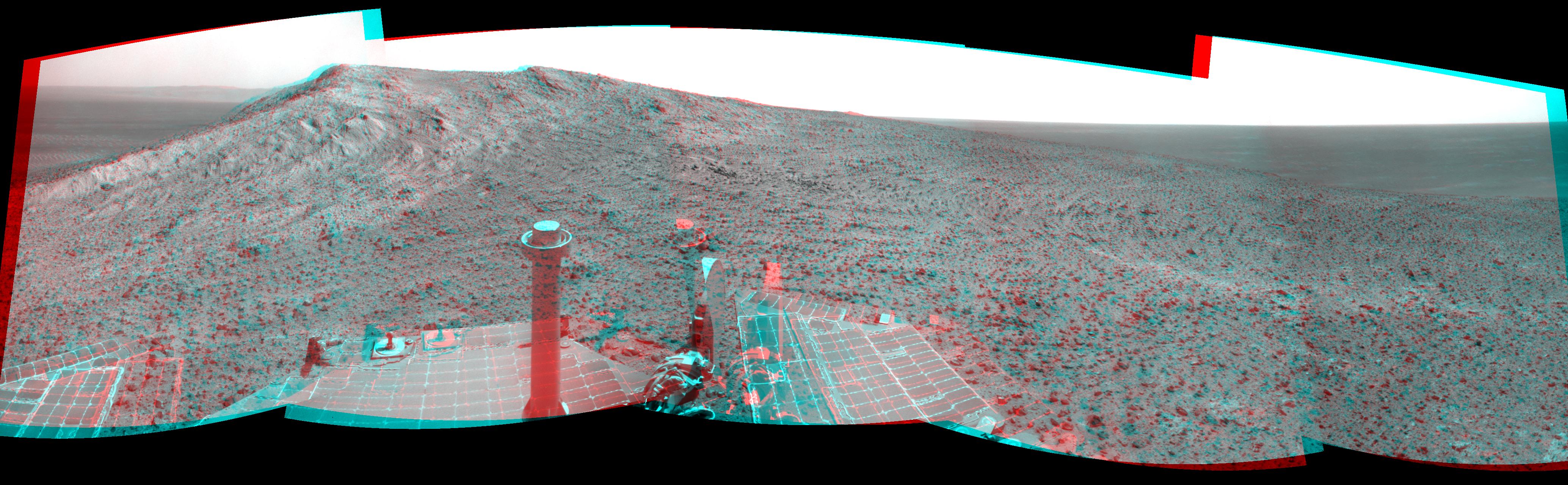
2015-01-22 |
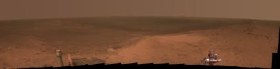
Mars
|
Mars Exploration Rover (MER)
|
Panoramic Camera
|
4109x1024x3 |
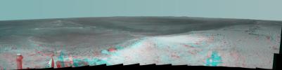
|
-
PIA19111:
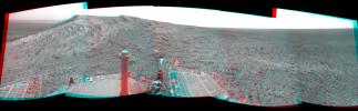
High Viewpoint for 11-Year-Old Rover Mission on Mars (Stereo)
Full Resolution:
TIFF
(12.63 MB)
JPEG
(475.3 kB)
|
|
|
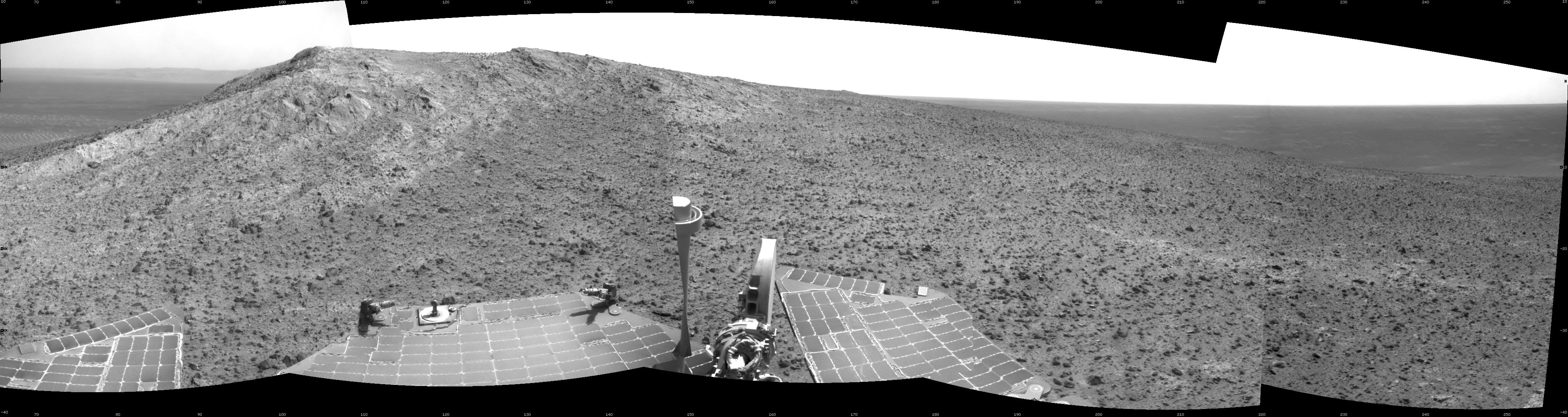
2015-01-22 |
Mars
|
Mars Exploration Rover (MER)
|
Panoramic Camera
|
8108x2000x3 |
|
-
PIA19110:
High Martian Viewpoint for 11-Year-Old Rover (False-Color Landscape)
Full Resolution:
TIFF
(48.66 MB)
JPEG
(1.742 MB)
|
|
|
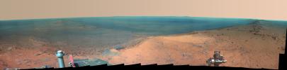
2015-01-22 |
Mars
|
Mars Exploration Rover (MER)
|
Panoramic Camera
|
8097x2000x3 |
|
-
PIA19109:
High Viewpoint for 11-Year-Old Rover Mission on Mars
Full Resolution:
TIFF
(48.6 MB)
JPEG
(1.042 MB)
|
|
|
2015-01-22 |
Mars
|
2001 Mars Odyssey
|
THEMIS
|
676x1345x3 |

|
-
PIA19027:
-
Candor Chasma - False Color
Full Resolution:
TIFF
(2.729 MB)
JPEG
(95.42 kB)
|
|
|
2015-01-21 |
Mars
|
2001 Mars Odyssey
|
THEMIS
|
681x1350x3 |
|
-
PIA19022:
-
Capen Crater - False Color
Full Resolution:
TIFF
(2.759 MB)
JPEG
(65.62 kB)
|
|
|
2015-01-20 |
Mars
|
2001 Mars Odyssey
|
THEMIS
|
697x1369x3 |
|
-
PIA19021:
-
Utopia Planitia - False Color
Full Resolution:
TIFF
(2.864 MB)
JPEG
(98.68 kB)
|
|
|
2015-01-19 |
Mars
|
2001 Mars Odyssey
|
THEMIS
|
669x1342x3 |
|
-
PIA19020:
-
Gusev Crater - False Color
Full Resolution:
TIFF
(2.695 MB)
JPEG
(144.1 kB)
|
|
|
2015-01-16 |
Mars
|
2001 Mars Odyssey
|
THEMIS
|
675x1344x3 |
|
-
PIA19019:
-
Pollack Crater - False Color
Full Resolution:
TIFF
(2.723 MB)
JPEG
(88.64 kB)
|
|
|
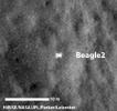
2015-01-16 |
Mars
|
Mars Reconnaissance Orbiter (MRO)
|
HiRISE
|
1000x750x3 |
|
-
PIA19108:
-
Beagle 2 Lander Observed by Mars Reconnaissance Orbiter
Full Resolution:
TIFF
(2.251 MB)
JPEG
(103.7 kB)
|
|
|
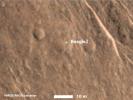
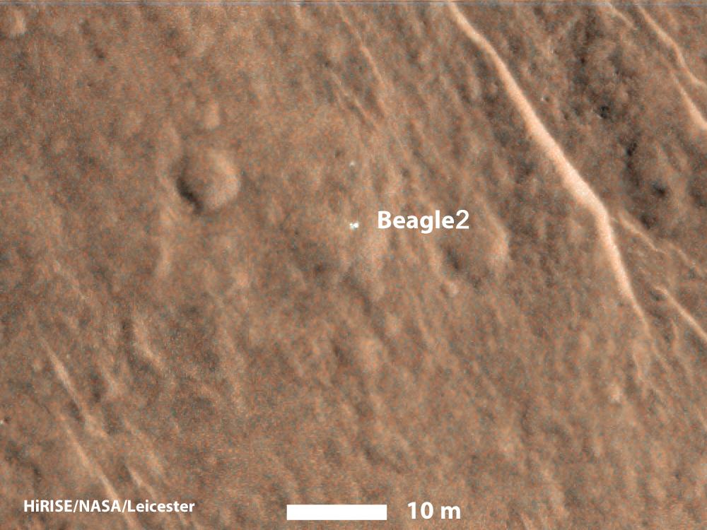
2015-01-16 |
Mars
|
Mars Reconnaissance Orbiter (MRO)
|
HiRISE
|
345x327x1 |
|
-
PIA19107:
-
Beagle 2 Lander on Mars, With Panels Deployed
Full Resolution:
TIFF
(113.2 kB)
JPEG
(15.66 kB)
|
|
|
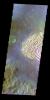
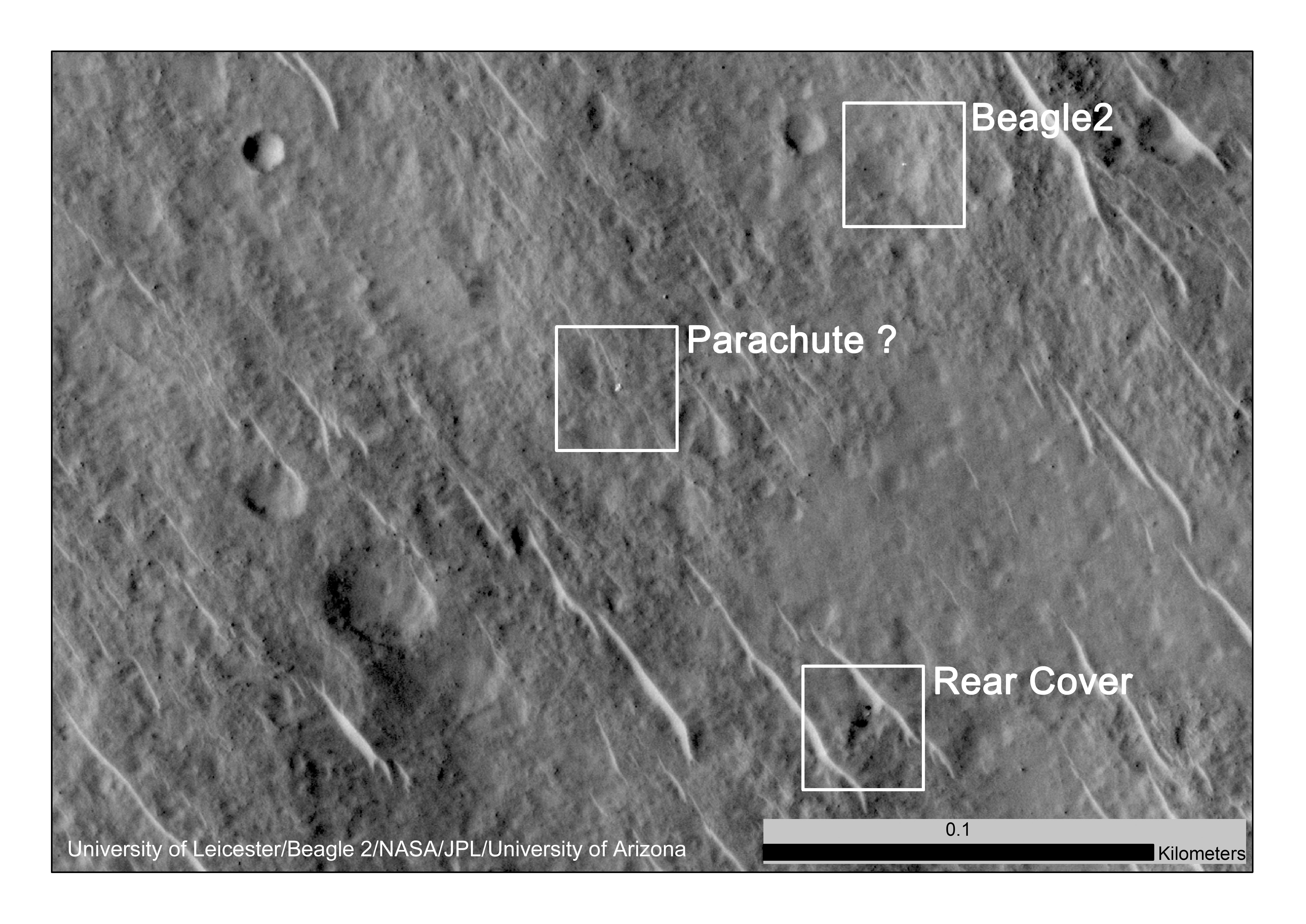
2015-01-16 |
Mars
|
Mars Reconnaissance Orbiter (MRO)
|
HiRISE
|
5844x4135x1 |

|
-
PIA19106:
-
Components of Beagle 2 Flight System on Mars
Full Resolution:
TIFF
(24.2 MB)
JPEG
(2.123 MB)
|
|
|
2015-01-15 |
Mars
|
2001 Mars Odyssey
|
THEMIS
|
721x1385x3 |
|
-
PIA19018:
-
Renaudot Crater - False Color
Full Resolution:
TIFF
(2.997 MB)
JPEG
(70.19 kB)
|
|
|
2015-01-15 |
Mars
|
Mars Reconnaissance Orbiter (MRO)
|
HiRISE
|
2880x1800x1 |

|
-
PIA19131:
-
Cratered Summit of a Knob
Full Resolution:
TIFF
(5.191 MB)
JPEG
(1.017 MB)
|
|
|
2015-01-15 |
Mars
|
Mars Reconnaissance Orbiter (MRO)
|
HiRISE
|
2880x1800x3 |

|
-
PIA19130:
-
A Plateau in Ares Vallis
Full Resolution:
TIFF
(15.56 MB)
JPEG
(1.13 MB)
|
|
|
2015-01-15 |
Mars
|
Mars Reconnaissance Orbiter (MRO)
|
HiRISE
|
2880x1800x3 |
|
-
PIA19129:
-
Sedimentary Fans North of Mojave Crater
Full Resolution:
TIFF
(15.56 MB)
JPEG
(839.9 kB)
|
|
|
2015-01-14 |
Mars
|
Mars Science Laboratory (MSL)
|
MAHLI
|
1196x1607x3 |

|
-
PIA19105:
-
Results from Curiosity's Mini-Drill Test at 'Mojave'
Full Resolution:
TIFF
(5.768 MB)
JPEG
(403 kB)
|
|
|
2015-01-14 |
Mars
|
Mars Science Laboratory (MSL)
|
Hazcam (MSL)
|
1024x1024x1 |

|
-
PIA19104:
-
Curiosity Conducting Mini-Drill Test at 'Mojave'
Full Resolution:
TIFF
(1.05 MB)
JPEG
(145.5 kB)
|
|
|
2015-01-14 |
Mars
|
2001 Mars Odyssey
|
THEMIS
|
718x1386x3 |
|
-
PIA19016:
-
Crater - False Color
Full Resolution:
TIFF
(2.987 MB)
JPEG
(78.87 kB)
|
|
|
2015-01-13 |
Mars
|
2001 Mars Odyssey
|
THEMIS
|
697x1358x3 |
|
-
PIA19015:
-
Hargraves Crater - False Color
Full Resolution:
TIFF
(2.841 MB)
JPEG
(63.63 kB)
|
|
|
2015-01-12 |
Mars
|
2001 Mars Odyssey
|
THEMIS
|
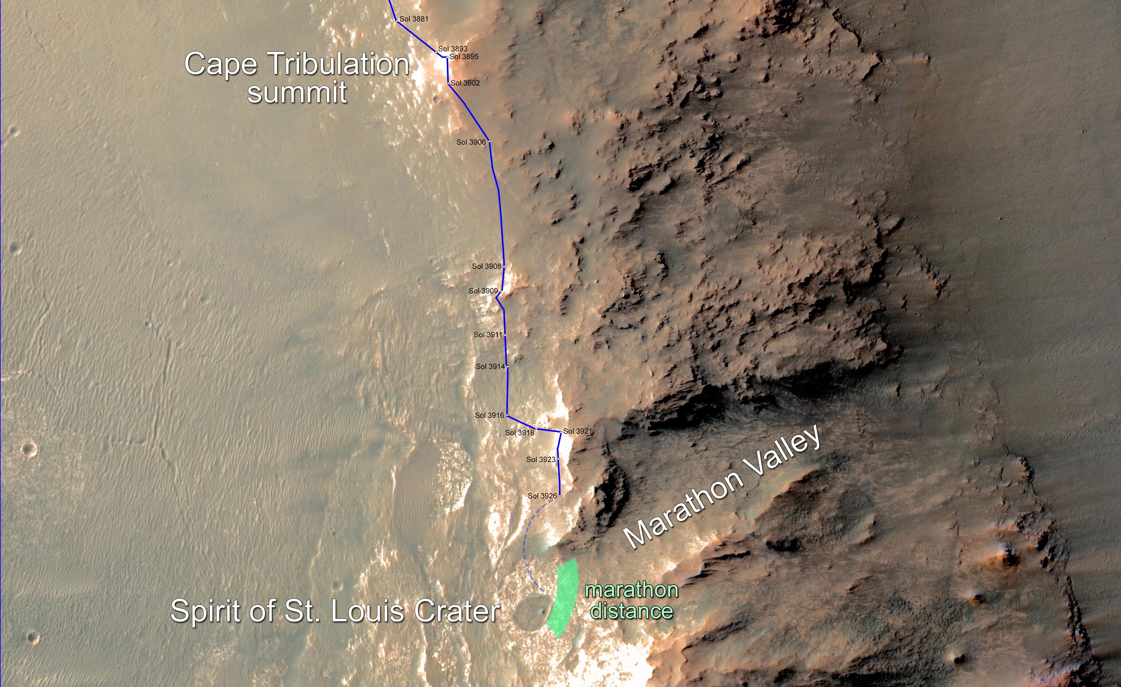
704x1364x3 |
|
-
PIA19010:
-
Granicus Valles - False Color
Full Resolution:
TIFF
(2.882 MB)
JPEG
(96.28 kB)
|
|
|
2015-01-09 |
Mars
|
2001 Mars Odyssey
|
THEMIS
|
685x1347x3 |
|
-
PIA19009:
-
Syrtis Major - False Color
Full Resolution:
TIFF
(2.769 MB)
JPEG
(116.3 kB)
|
|
|
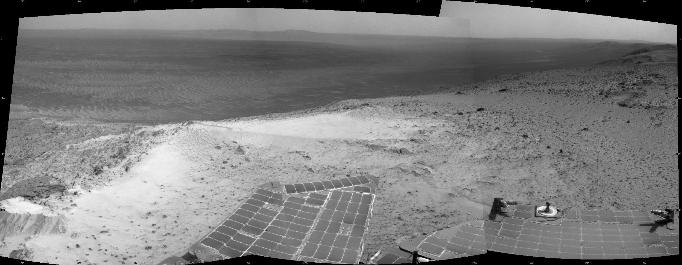
2015-01-08 |
Mars
|
Mars Exploration Rover (MER)
|
Navigation Camera
|
4136x1278x3 |
|
-
PIA19100:
-
Approach to 'Cape Tribulation' Summit (Stereo)
Full Resolution:
TIFF
(15.87 MB)
JPEG
(779.7 kB)
|
|
|
2015-01-08 |
Mars
|
Mars Exploration Rover (MER)
|
Navigation Camera
|
4102x1091x1 |

|
-
PIA19099:
Opportunity's Approach to 'Cape Tribulation' Summit
Full Resolution:
TIFF
(4.484 MB)
JPEG
(663.7 kB)
|
|
|
2015-01-08 |
Mars
|
Mars Exploration Rover (MER)
|
Navigation Camera
|
2586x1007x1 |

|
-
PIA19098:
-
Opportunity's View from Atop 'Cape Tribulation'
Full Resolution:
TIFF
(2.607 MB)
JPEG
(305.3 kB)
|
|
|
2015-01-08 |
Mars
|
2001 Mars Odyssey
|
THEMIS
|
674x1340x3 |
|
-
PIA19008:
-
Coprates Chasma - False Color
Full Resolution:
TIFF
(2.711 MB)
JPEG
(124.2 kB)
|
|
|
2015-01-07 |
Mars
|
Mars Reconnaissance Orbiter (MRO)
|
HiRISE
|
2880x1800x3 |
|
-
PIA19128:
-
The Eastern Portion of Cerberus Fossae
Full Resolution:
TIFF
(15.56 MB)
JPEG
(537.6 kB)
|
|
|
2015-01-07 |
Mars
|
Mars Reconnaissance Orbiter (MRO)
|
HiRISE
|
2880x1800x3 |
|
-
PIA19127:
-
A Recent Impact in Elysium Planitia
Full Resolution:
TIFF
(15.56 MB)
JPEG
(1.047 MB)
|
|
|
2015-01-07 |
Mars
|
Mars Reconnaissance Orbiter (MRO)
|
HiRISE
|
2880x1800x3 |

|
-
PIA19126:
-
Strange Flow: Landslide, Impact Melt or Lava?
Full Resolution:
TIFF
(15.56 MB)
JPEG
(794.7 kB)
|
 Planetary Data System


