My
List |
Addition Date
|
Target
|
Mission
|
Instrument
|
Size
|

|
2023-02-09 |
Earth
|
ARIA
|
SAR
|
720x480x3 |

|
-
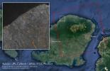
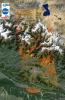
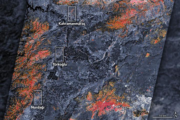
PIA25564:
-
Satellites Assess Earthquake Damage in Turkey
Full Resolution:
TIFF
(1.037 MB)
JPEG
(126.3 kB)
|
|
|
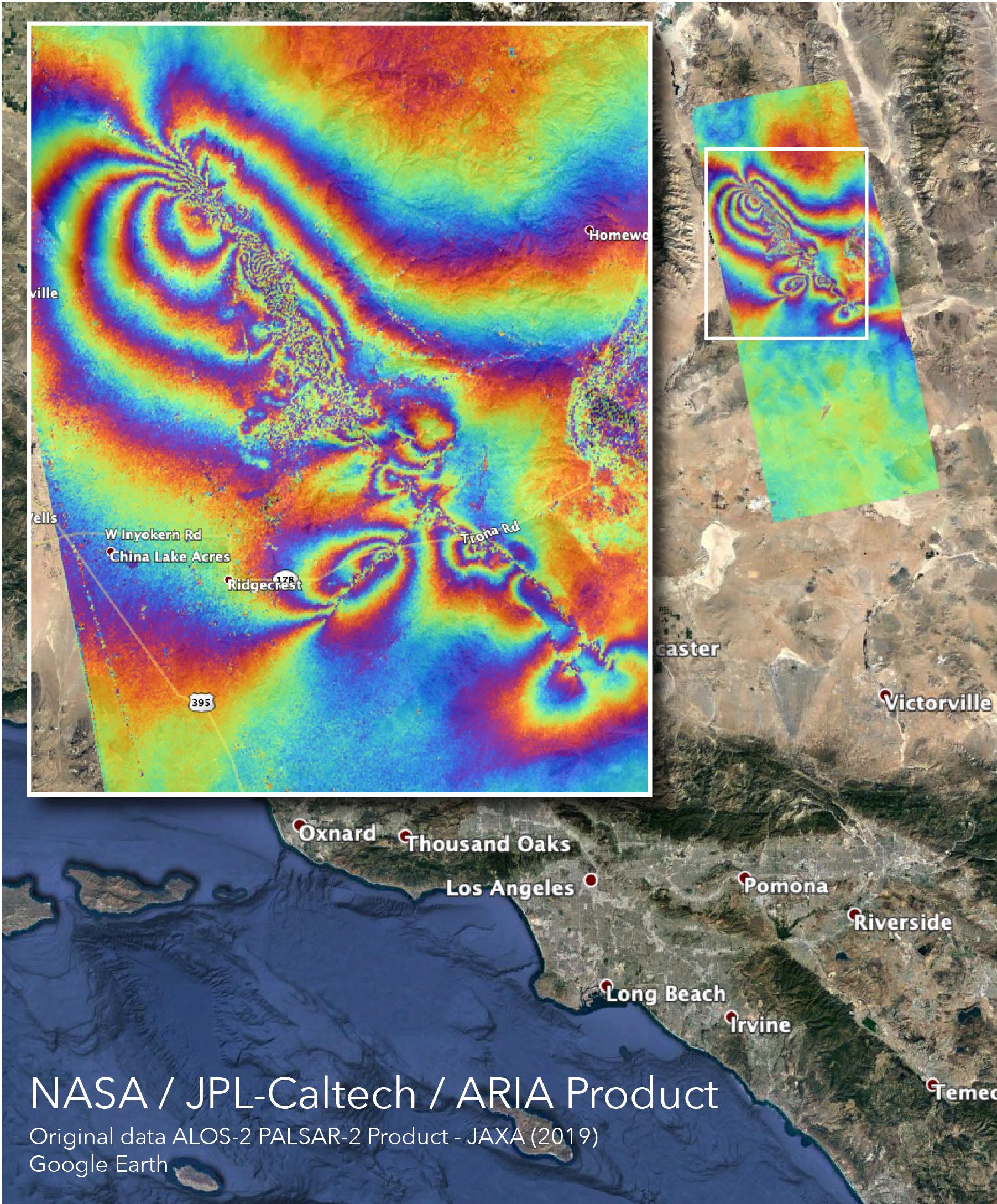
2019-07-11 |
Earth
|
ARIA
|
|
1754x1959x3 |
|
-
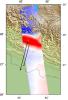
PIA23351:
-
NASA Map Shows Ground Movement from California Quakes
Full Resolution:
TIFF
(4.263 MB)
JPEG
(292.6 kB)
|
|
|
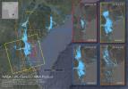
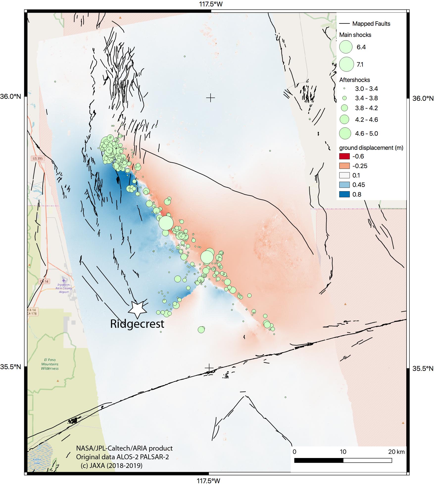
2019-07-09 |
Earth
|
ARIA
|
SAR
|
1803x2176x3 |

|
-
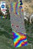
PIA23150:
-
NASA's ARIA Maps Southern California Quake Damage
Full Resolution:
TIFF
(11.77 MB)
JPEG
(703 kB)
|
|
|
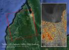
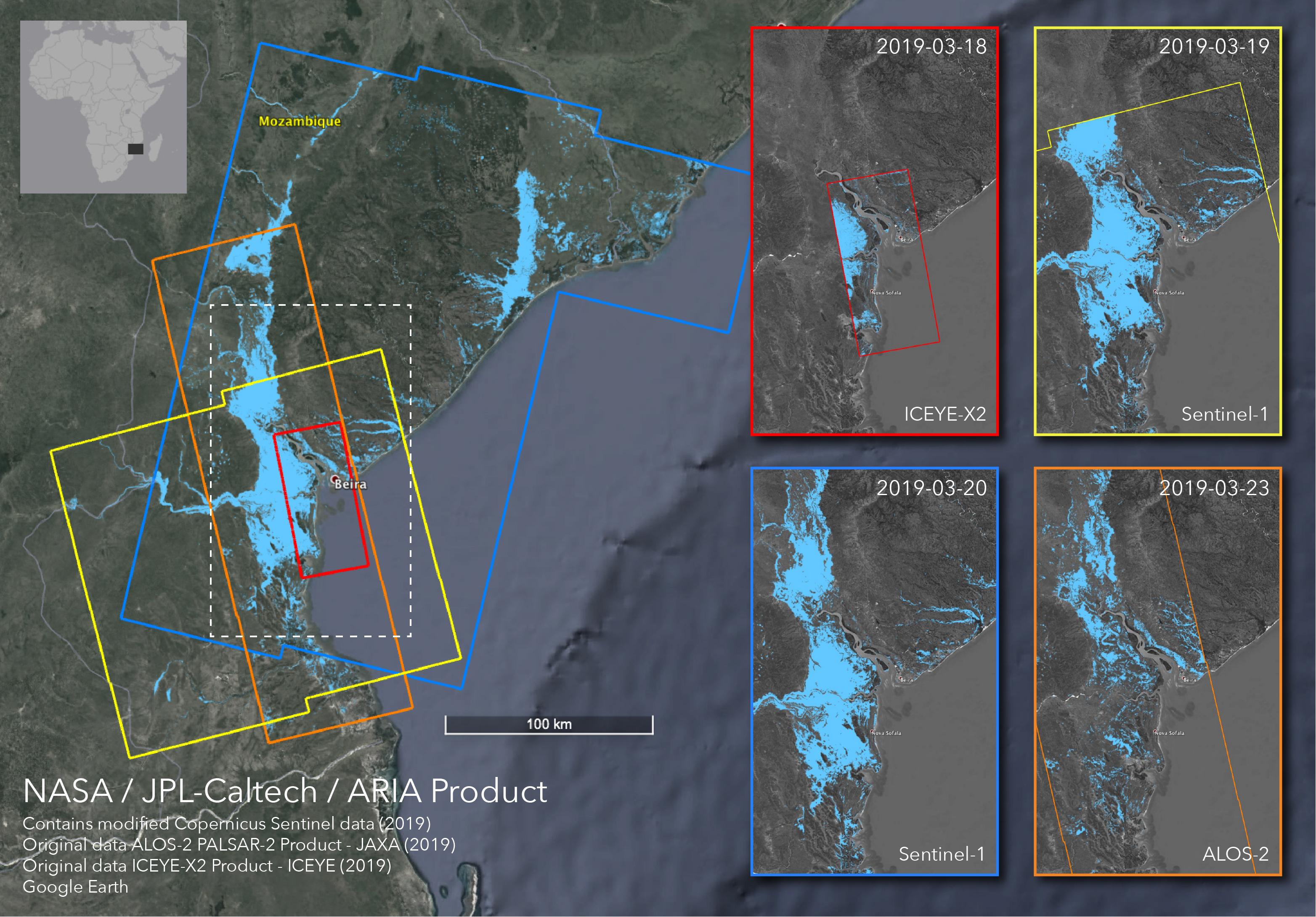
2019-04-01 |
Earth
|
ARIA
|
SAR
|
3128x2180x3 |
|
-
PIA23142:
-
Satellites Image Mozambique Flooding after Cyclone Idai
Full Resolution:
TIFF
(13 MB)
JPEG
(778.9 kB)
|
|
|
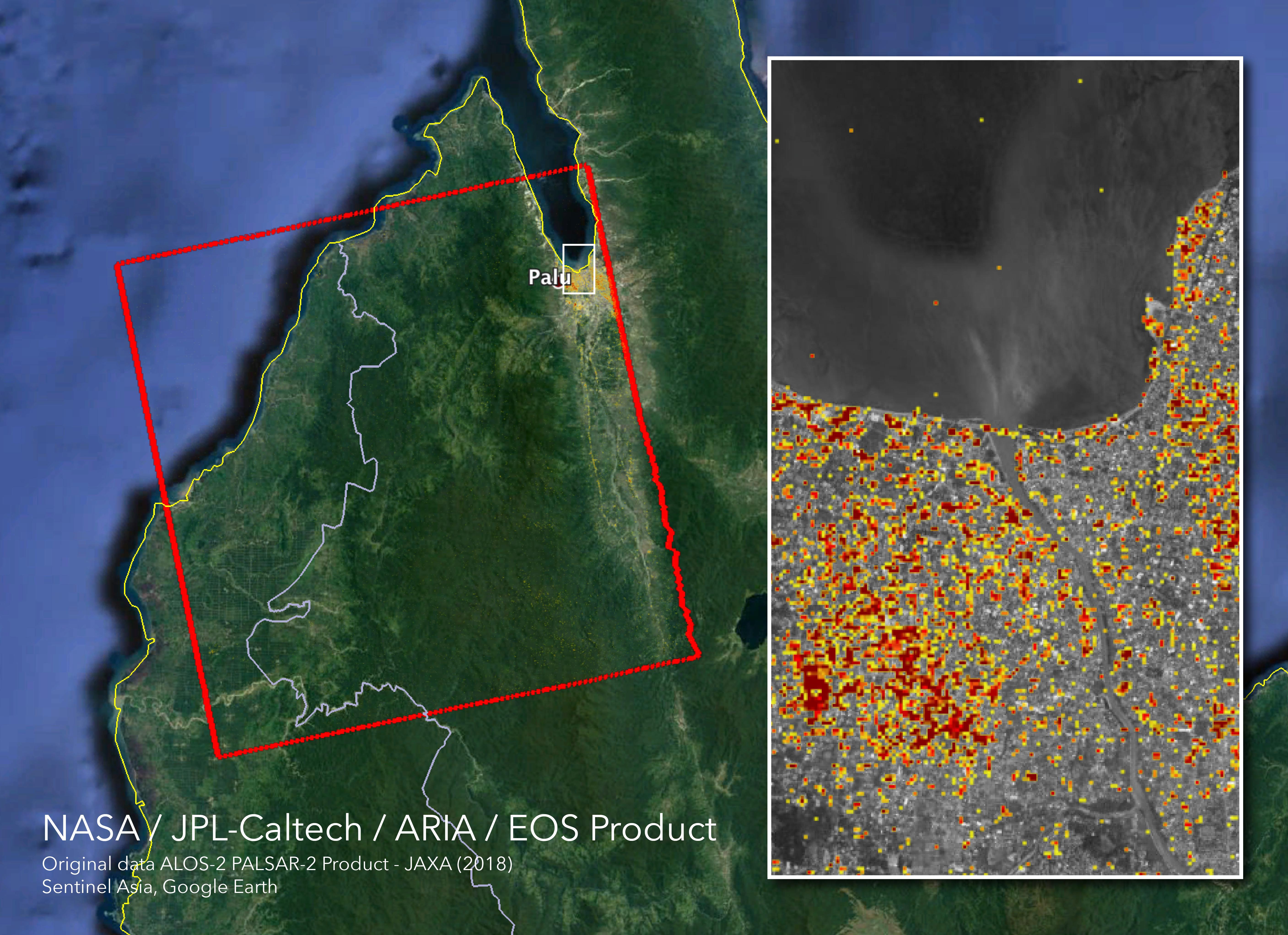
2018-10-05 |
Earth
|
ARIA
|
SAR
|
5630x4092x3 |
|
-
PIA22746:
-
NASA's ARIA Maps Indonesia Quake, Tsunami Damage
Full Resolution:
TIFF
(38.03 MB)
JPEG
(1.997 MB)
|
|
|
2018-09-10 |
Earth
|
ARIA
|
SAR
|
1377x964x3 |
|
-
PIA22696:
-
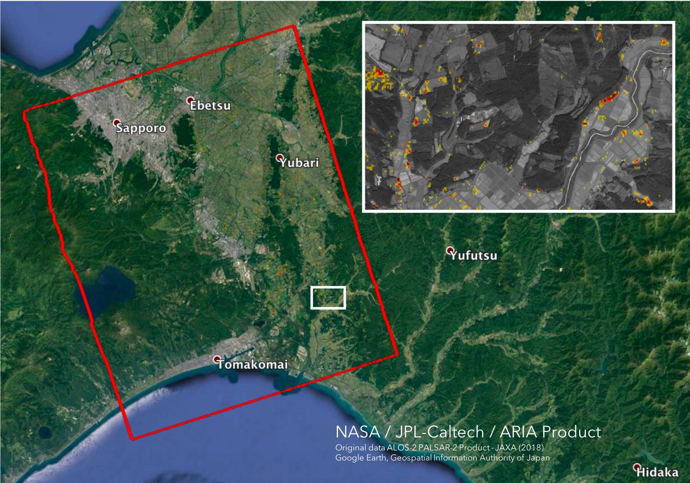
Japan Earthquakes (ARIA Damage Proxy Map)
Full Resolution:
TIFF
(3.89 MB)
JPEG
(229.1 kB)
|
|
|
2018-09-05 |
Earth
|
ARIA
|
SAR
|
6776x4377x3 |
|
-
PIA22495:
-
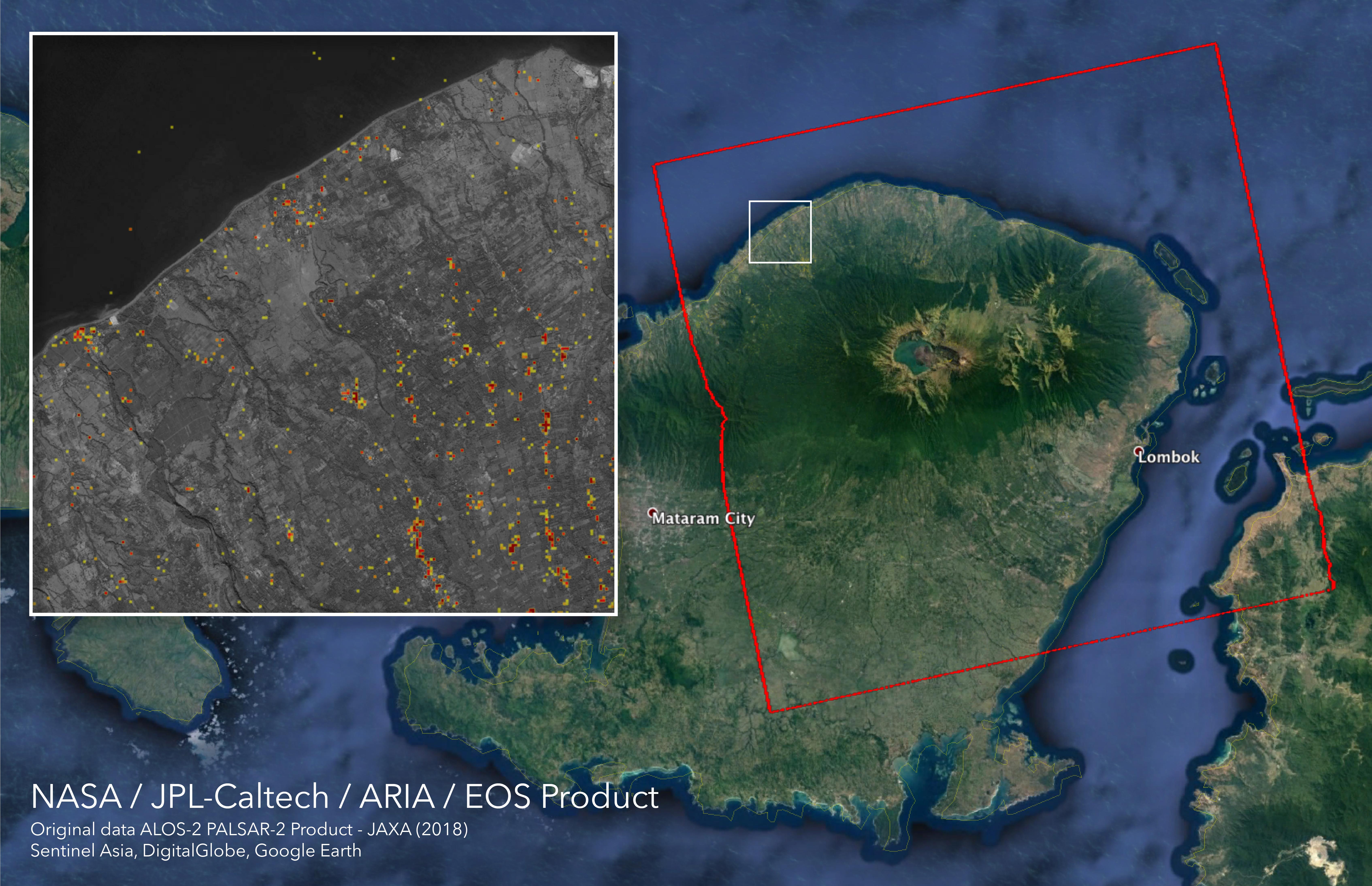
ARIA Damage Proxy Map of Lombok, Indonesia Earthquakes
Full Resolution:
TIFF
(47.99 MB)
JPEG
(2.341 MB)
|
|
|
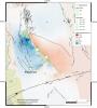
2017-08-31 |
Earth
|
ARIA
|
|
824x1173x3 |
|
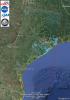
-
PIA21931:
-
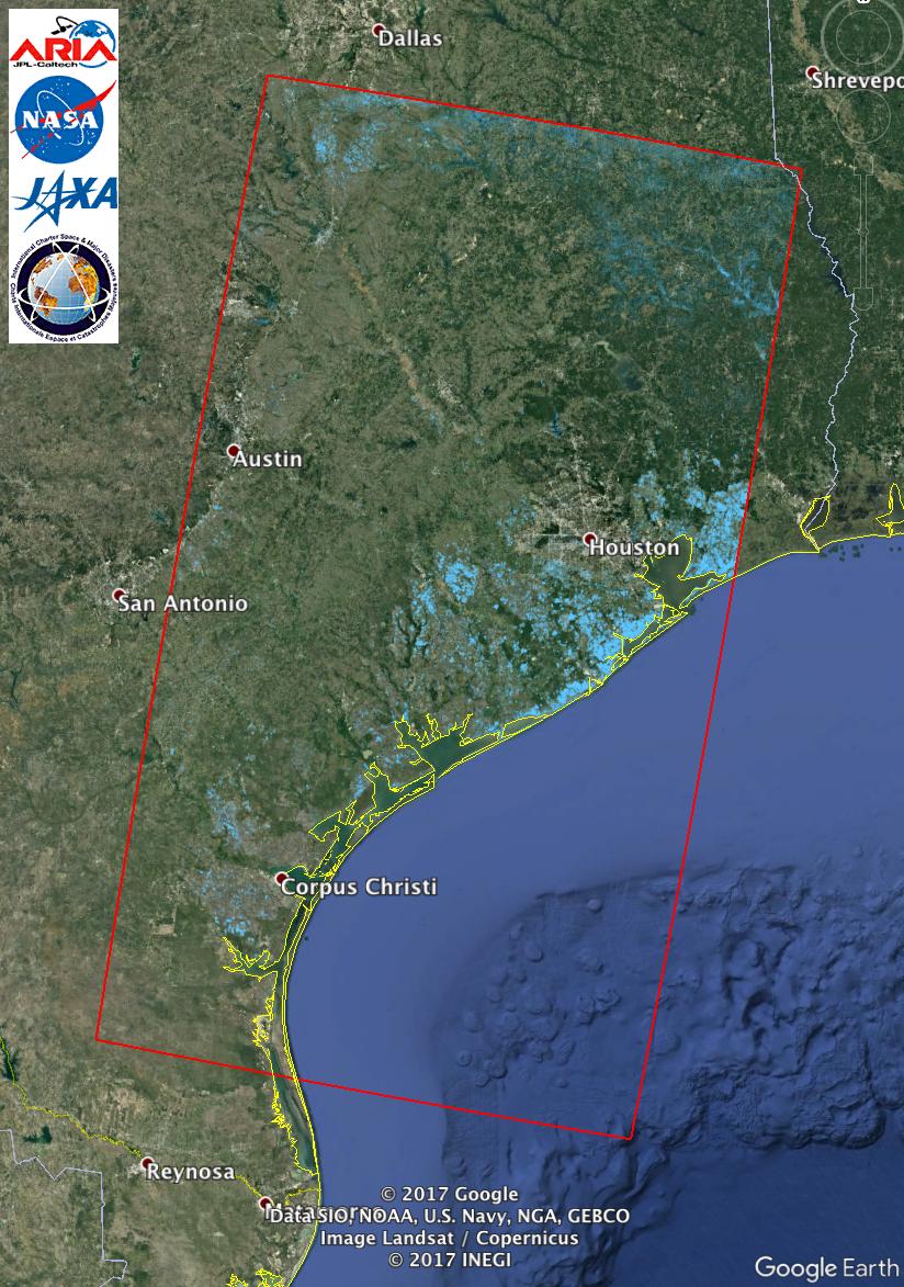
Updated NASA Satellite Flood Map of Southeastern Texas (ALOS-2 Data)
Full Resolution:
TIFF
(2.819 MB)
JPEG
(194.7 kB)
|
|
|
2017-08-30 |
Earth
|
ARIA
|
PALSAR-2
|
1237x1222x3 |
|
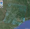
-
PIA21928:
-
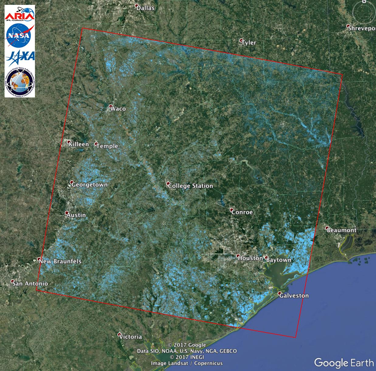
Extent of Texas Flooding Shown in New NASA Map
Full Resolution:
TIFF
(4.537 MB)
JPEG
(367.5 kB)
|
|
|
2017-03-23 |
Earth
|
ARIA
|
PALSAR-2
|
4481x2682x3 |
|
-
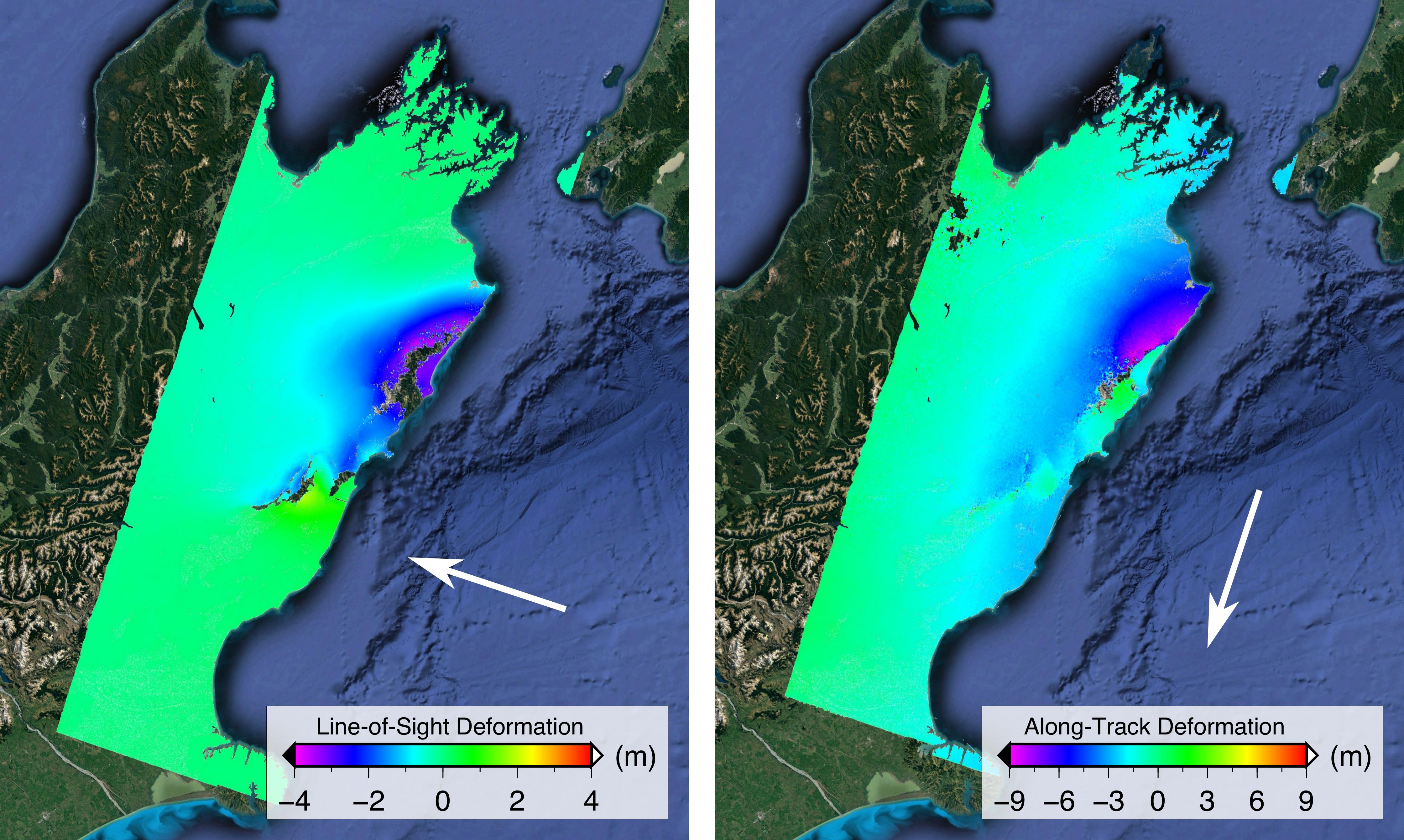
PIA21210:
-
Satellite Radar Show Complex Set of Faults Moved in 2016 New Zealand Earthquake
Full Resolution:
TIFF
(32.2 MB)
JPEG
(1.209 MB)
|
|
|
2016-08-27 |
Earth
|
ARIA
|
PALSAR-2
|
1002x1011x3 |

|
-
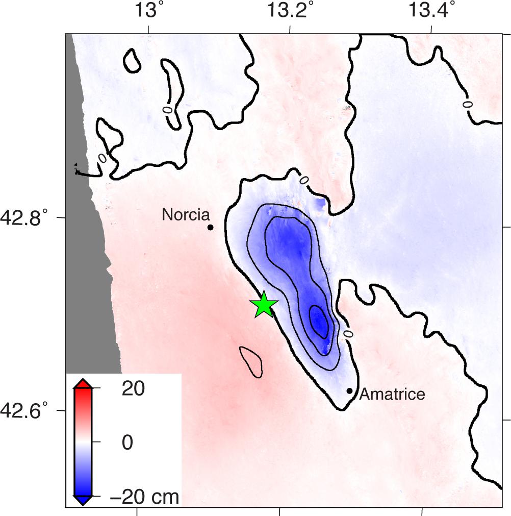
PIA20893:
-
Radar Shows Italy Area Moved 8 Inches by Amatrice Earthquake
Full Resolution:
TIFF
(1.094 MB)
JPEG
(99.43 kB)
|
|
|
2016-04-20 |
Earth
|
ARIA
|
PALSAR-2
|
970x759x3 |

|
-
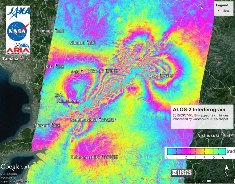
PIA20460:
-
NASA's ARIA Project, JAXA Examine Earth Surface Deformation from Kumamoto, Japan Quakes
Full Resolution:
TIFF
(2.21 MB)
JPEG
(165.3 kB)
|
|
|
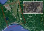
2015-05-11 |
Earth
|
ARIA
|
PALSAR-2
|
822x1263x3 |
|
-
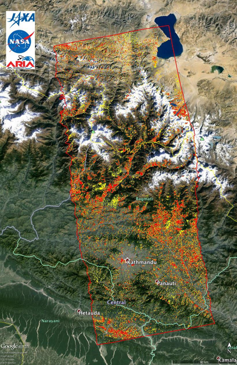
PIA14710:
-
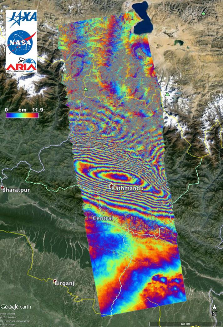
New ALOS-2 Damage Map Assists 2015 Gorkha, Nepal Disaster Response
Full Resolution:
TIFF
(3.116 MB)
JPEG
(307.4 kB)
|
|
|
2015-05-07 |
Earth
|
ARIA
|
PALSAR-2
|
1402x2048x3 |
|
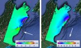
-
PIA14708:
-
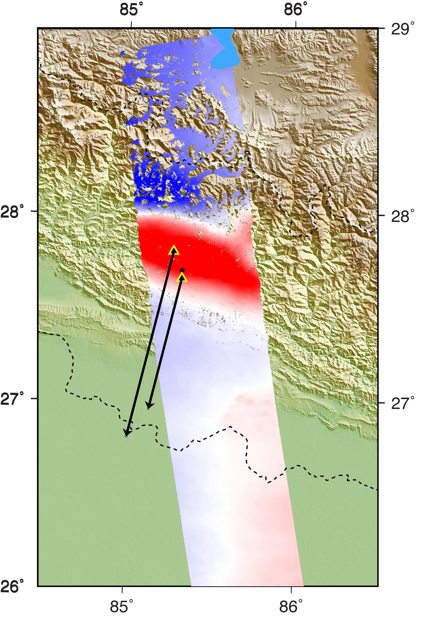
Radar Shows Kathmandu Area Uplifted 5 Feet by Gorkha, Nepal Earthquake
Full Resolution:
TIFF
(8.617 MB)
JPEG
(460.9 kB)
|
|
|
2015-05-04 |
Earth
|
ARIA
|
PALSAR-2
|
713x1047x3 |
|
-
PIA19383:
-
NASA's ARIA Project Provides New Look at Earth Surface Deformation from Nepal Quake
Full Resolution:
TIFF
(2.241 MB)
JPEG
(179.7 kB)
|
 Planetary Data System


