My
List |
Addition Date
|
Target
|
Mission
|
Instrument
|
Size
|

|
2012-12-19 |
Mars
|
Mars Exploration Rover (MER)
|
Hazcam
|
1024x1024x1 |
|
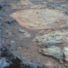
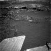
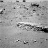
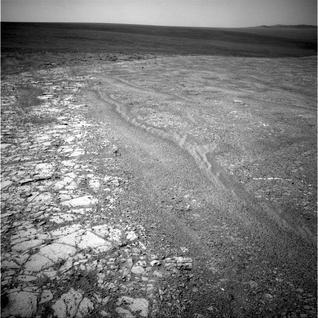
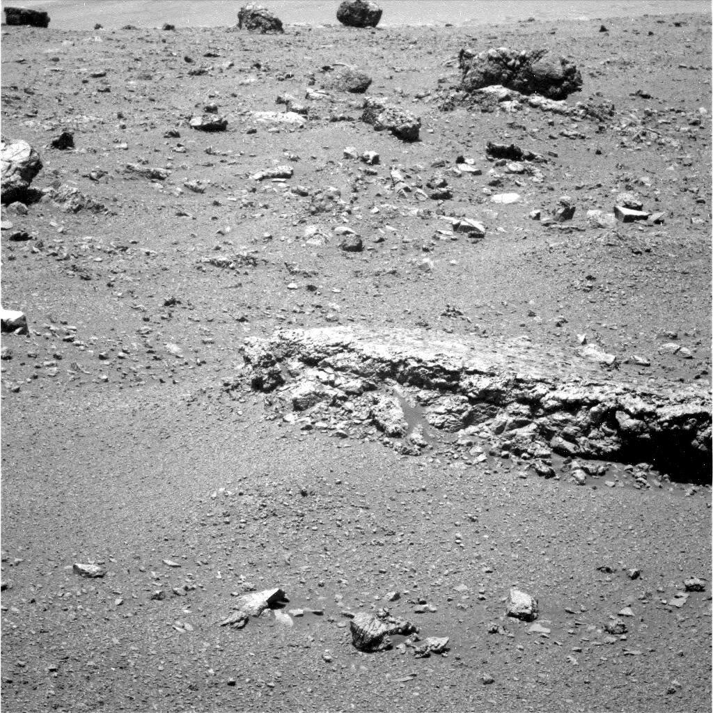
-
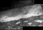
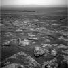
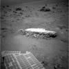
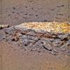
PIA16555:
-
Opportunity Investigation Target "Onaping"
Full Resolution:
TIFF
(1.05 MB)
JPEG
(117.5 kB)
|
|
|
2012-11-12 |
Mars
|
Mars Exploration Rover (MER)
|
Panoramic Camera
|
1024x1024x3 |
|
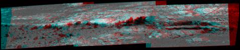
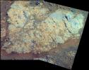
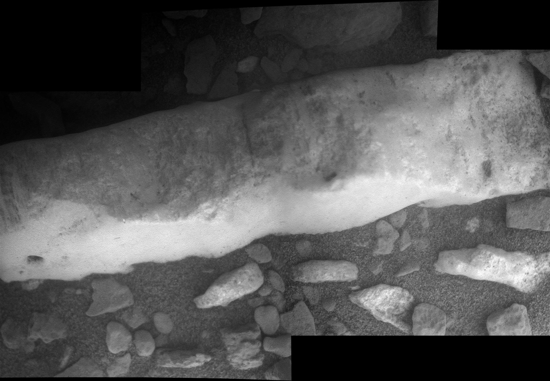
-
PIA16445:
-
'Whitewater Lake' Rock Viewed by Opportunity
Full Resolution:
TIFF
(3.147 MB)
JPEG
(214.2 kB)
|
|
|
2012-11-12 |
Mars
|
Mars Exploration Rover (MER)
|
Panoramic Camera
|
2233x1330x3 |
|
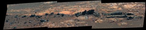
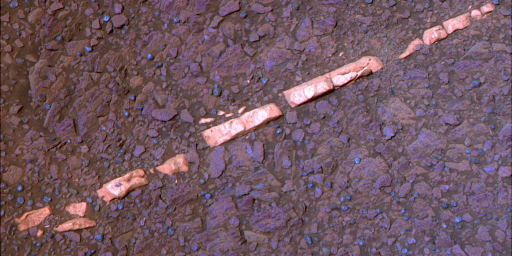
-
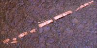
PIA16444:
-
'Homestake' Vein on 'Cape York,' Color Enhanced
Full Resolution:
TIFF
(8.913 MB)
JPEG
(204.2 kB)
|
|
|
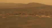
2012-11-09 |
Mars
|
Mars Exploration Rover (MER)
|
Panoramic Camera
|
12953x12953x3 |
|
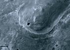
-
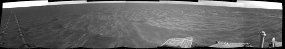
PIA16443:
-
Spirit Mars Rover in 'McMurdo' Panorama, Polar Projection (False Color)
Full Resolution:
TIFF
(503.4 MB)
JPEG
(15.03 MB)
|
|
|
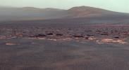
2012-11-09 |
Mars
|
Mars Exploration Rover (MER)
|
Panoramic Camera
|
12953x12953x3 |
|
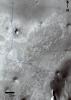
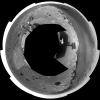
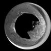
-
PIA16442:
-
Spirit Mars Rover in 'McMurdo' Panorama, Polar Projection
Full Resolution:
TIFF
(503.4 MB)
JPEG
(12.15 MB)
|
|
|
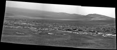
2012-11-09 |
Mars
|
Mars Exploration Rover (MER)
|
Panoramic Camera
|
11174x3162x3 |
|
-
PIA16441:
Spirit Mars Rover in 'McMurdo' Panorama (False Color)
Full Resolution:
TIFF
(106 MB)
JPEG
(4.81 MB)
|
|
|
2012-11-09 |
Mars
|
Mars Exploration Rover (MER)
|
Panoramic Camera
|
11174x3162x3 |

|
-
PIA16440:
Spirit Mars Rover in 'McMurdo' Panorama
Full Resolution:
TIFF
(106 MB)
JPEG
(3.946 MB)
|
|
|
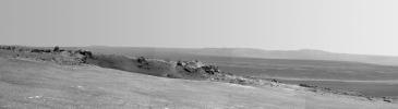
2012-10-15 |
Phobos
|
Mars Exploration Rover (MER)
|
Panoramic Camera
|
124x122x1 |

|
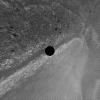
-
PIA16228:
-
Phobos Transit Viewed by Opportunity on Sol 3078

Full Resolution:
TIFF
(15.36 kB)
JPEG
(1.08 kB)
|
|
|
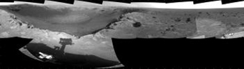
2012-10-03 |
Mars
|
Mars Exploration Rover (MER)
|
Navigation Camera
|
7753x1287x3 |
|
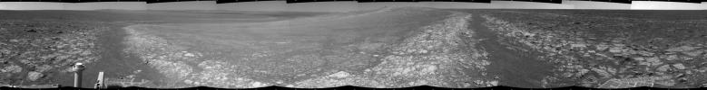
-
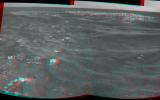
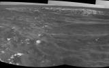
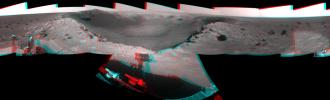
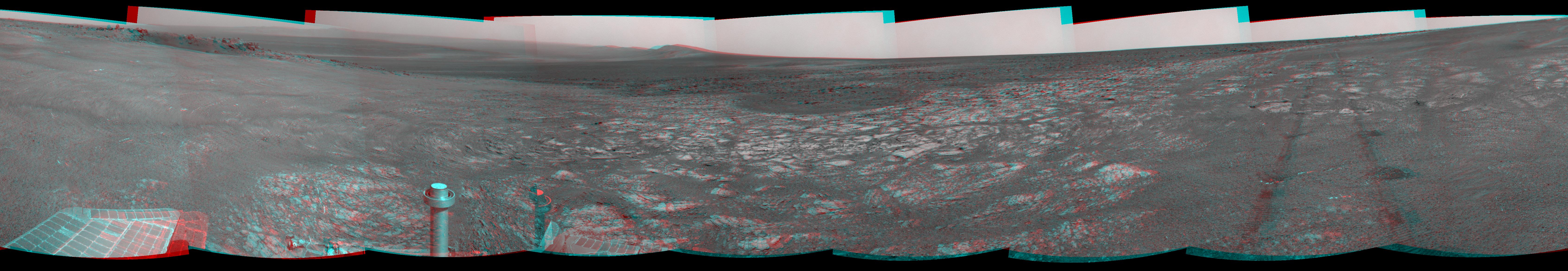
PIA16222:
'Matijevic Hill' on Rim of Mars' Endeavour Crater, Stereo View
Full Resolution:
TIFF
(29.94 MB)
JPEG
(1.162 MB)
|
|
|
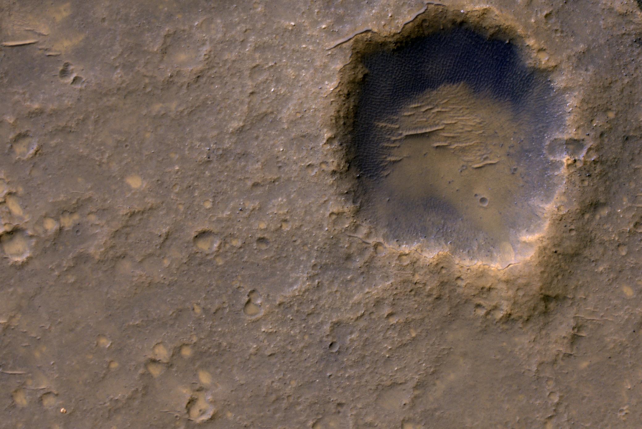
2012-09-14 |
Mars
|
Mars Exploration Rover (MER)
|
Microscopic Imager
|
1809x1856x1 |
|
-
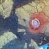
PIA16139:
-
Puzzling Little Martian Spheres That Don't Taste Like 'Blueberries'
Full Resolution:
TIFF
(3.361 MB)
JPEG
(607 kB)
|
|
|
2012-09-07 |
Mars
|
Mars Exploration Rover (MER)
|
Panoramic Camera
|
2979x624x3 |

|
-
PIA16128:
Opportunity Eyes Rock Fins on Cape York, Sol 3058
Full Resolution:
TIFF
(5.579 MB)
JPEG
(233.9 kB)
|
|
|
2012-09-07 |
Mars
|
Mars Exploration Rover (MER)
|
Panoramic Camera
|
2979x624x3 |
|
-
PIA16126:
Opportunity Eyes Rock Fins on Cape York, Sol 3058 (Stereo)
Full Resolution:
TIFF
(5.579 MB)
JPEG
(297.1 kB)
|
|
|
2012-09-07 |
Mars
|
Mars Exploration Rover (MER)
|
Panoramic Camera
|
2979x624x3 |
|
-
PIA16127:
Opportunity Eyes Rock Fins on Cape York, Sol 3058 (False Color)
Full Resolution:
TIFF
(5.579 MB)
JPEG
(302.9 kB)
|
|
|
2012-09-07 |
Mars
|
Mars Exploration Rover (MER)
|
Navigation Camera
|
4000x4000x1 |
|
-
PIA16125:
-
Opportunity's Surroundings on 3,000th Sol, Vertical Projection
Full Resolution:
TIFF
(16.02 MB)
JPEG
(1.55 MB)
|
|
|
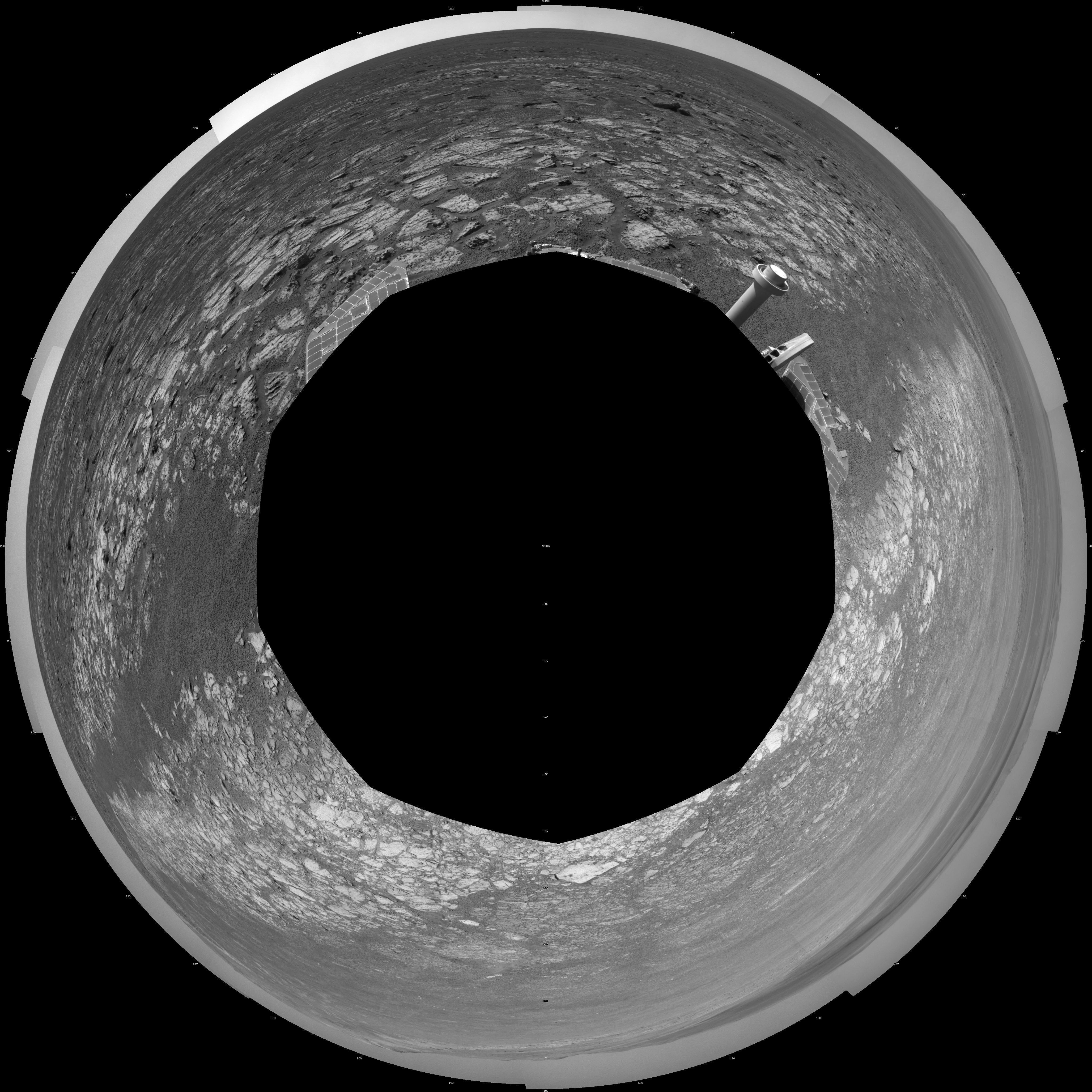
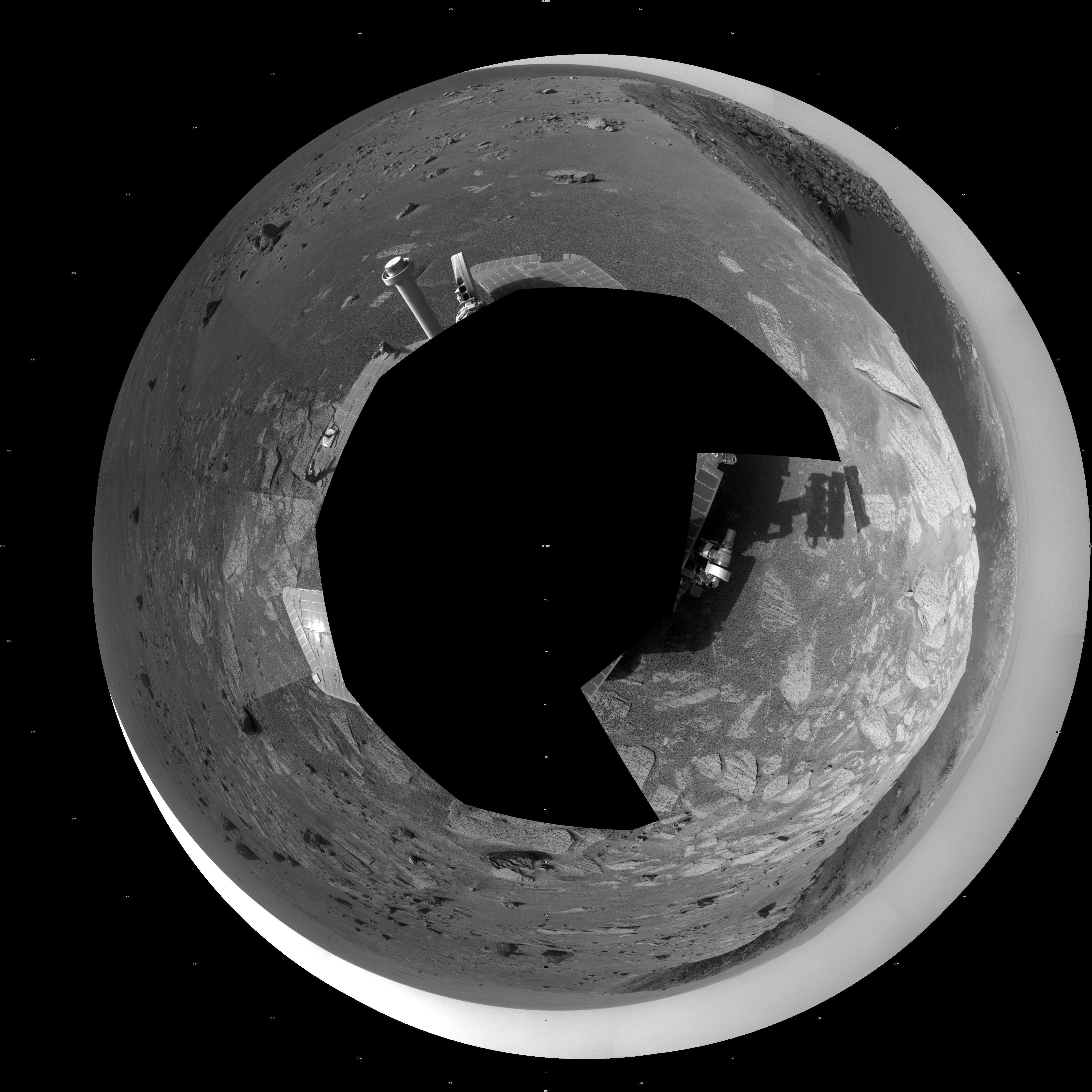
2012-09-07 |
Mars
|
Mars Exploration Rover (MER)
|
Navigation Camera
|
4111x4111x1 |

|
-
PIA16124:
-
Opportunity's Surroundings on 3,000th Sol, Polar Projection
Full Resolution:
TIFF
(16.93 MB)
JPEG
(1.518 MB)
|
|
|
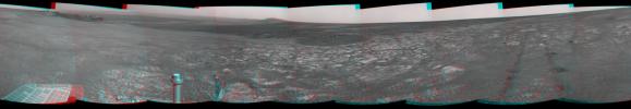
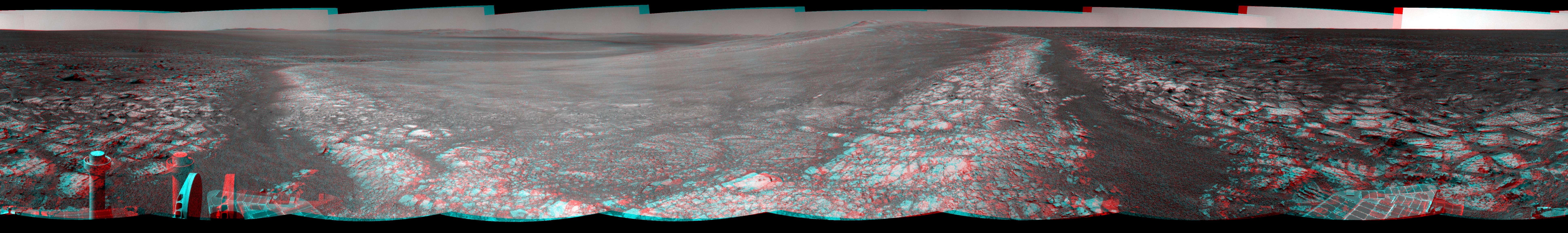
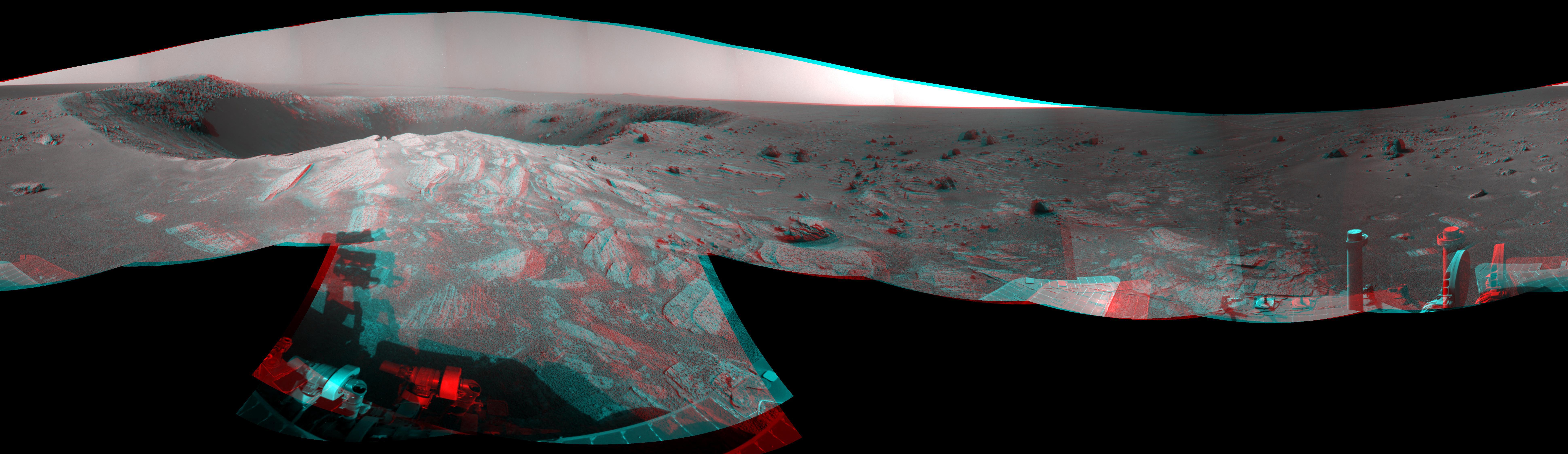
2012-09-07 |
Mars
|
Mars Exploration Rover (MER)
|
Navigation Camera
|
7753x1152x3 |

|
-
PIA16123:
Opportunity's Surroundings on 3,000th Sol, in 3-D
Full Resolution:
TIFF
(26.8 MB)
JPEG
(1.421 MB)
|
|
|
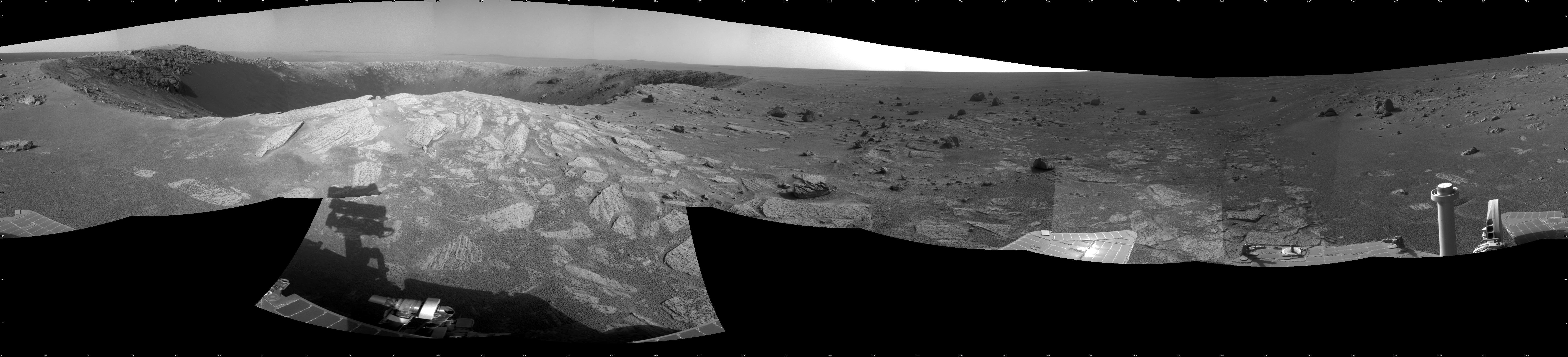
2012-09-07 |
Mars
|
Mars Exploration Rover (MER)
|
Navigation Camera
|
7688x987x1 |
|
-
PIA16122:
Opportunity's Surroundings on 3,000th Sol
Full Resolution:
TIFF
(7.596 MB)
JPEG
(1.148 MB)
|
|
|
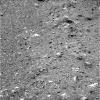
2012-09-07 |
Mars
|
Mars Exploration Rover (MER)
|
Navigation Camera
|
1024x1024x1 |
|
-
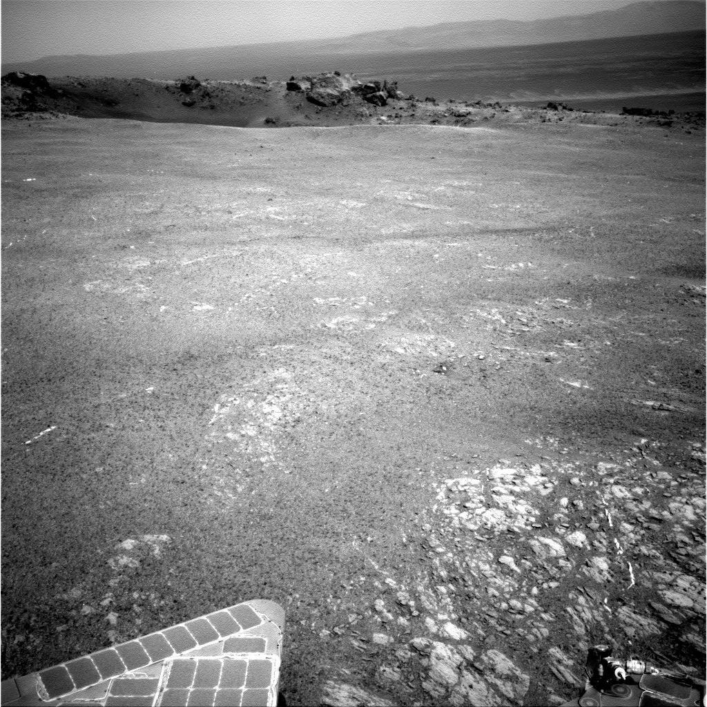
PIA16121:
-
Outcrop Beckoning Opportunity, Sol 3057
Full Resolution:
TIFF
(1.05 MB)
JPEG
(218.8 kB)
|
|
|
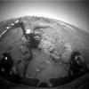
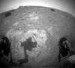
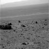
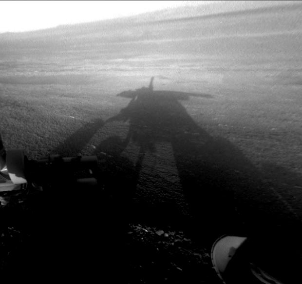
2012-09-07 |
Mars
|
Mars Exploration Rover (MER)
|
Hazcam
|
620x582x1 |
|
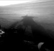
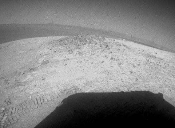
-
PIA16120:
-
Shadow Self-Portrait by Opportunity at Endeavour Crater
Full Resolution:
TIFF
(361.4 kB)
JPEG
(27.52 kB)
|
|
|
2012-07-05 |
Mars
|
Mars Exploration Rover (MER)
|
Panoramic Camera
|
5788x2000x3 |
|
-
PIA15689:
-
'Greeley Panorama' from Opportunity's Fifth Martian Winter (False Color)
Full Resolution:
TIFF
(34.74 MB)
JPEG
(1.065 MB)
|
|
|
2012-05-22 |
Mars
|
Mars Exploration Rover (MER)
|
Panoramic Camera
|
3090x3809x3 |
|
-
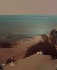
PIA15684:
-
Late Afternoon Shadows at Endeavour Crater on Mars
Full Resolution:
TIFF
(35.31 MB)
JPEG
(621.8 kB)
|
|
|
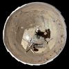
2012-05-09 |
Mars
|
Mars Exploration Rover (MER)
|
Hazcam
|
569x416x1 |
|
-
PIA15681:
-
Looking Back at Greeley Haven After Opportunity's First Drive of 2012
Full Resolution:
TIFF
(237.2 kB)
JPEG
(31.55 kB)
|
|
|
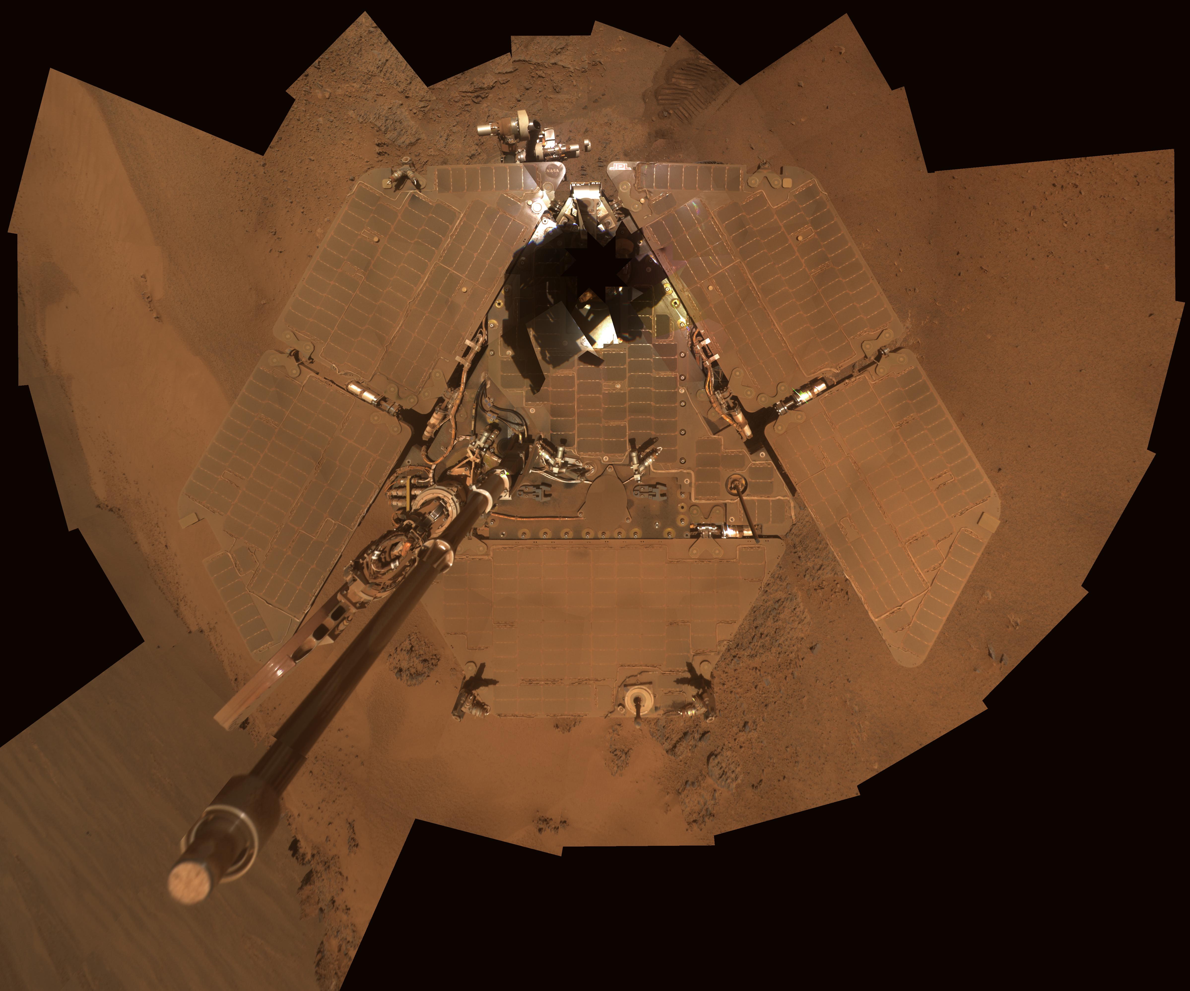
2012-02-17 |
Mars
|
Mars Exploration Rover (MER)
|
Panoramic Camera
|
4796x3993x3 |

|
-
PIA15115:
-
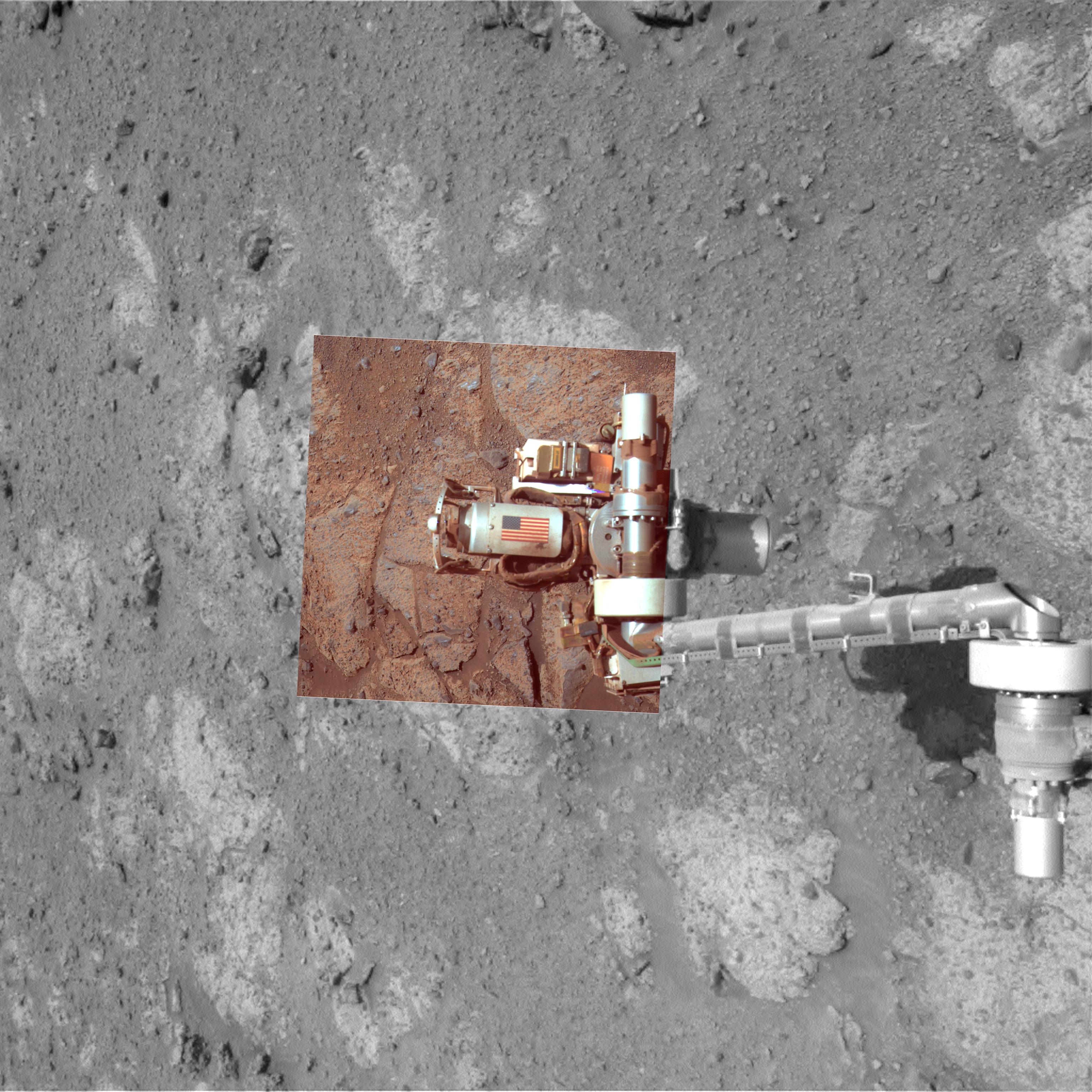
Dusty Mars Rover's Self Portrait
Full Resolution:
TIFF
(57.45 MB)
JPEG
(1.186 MB)
|
|
|
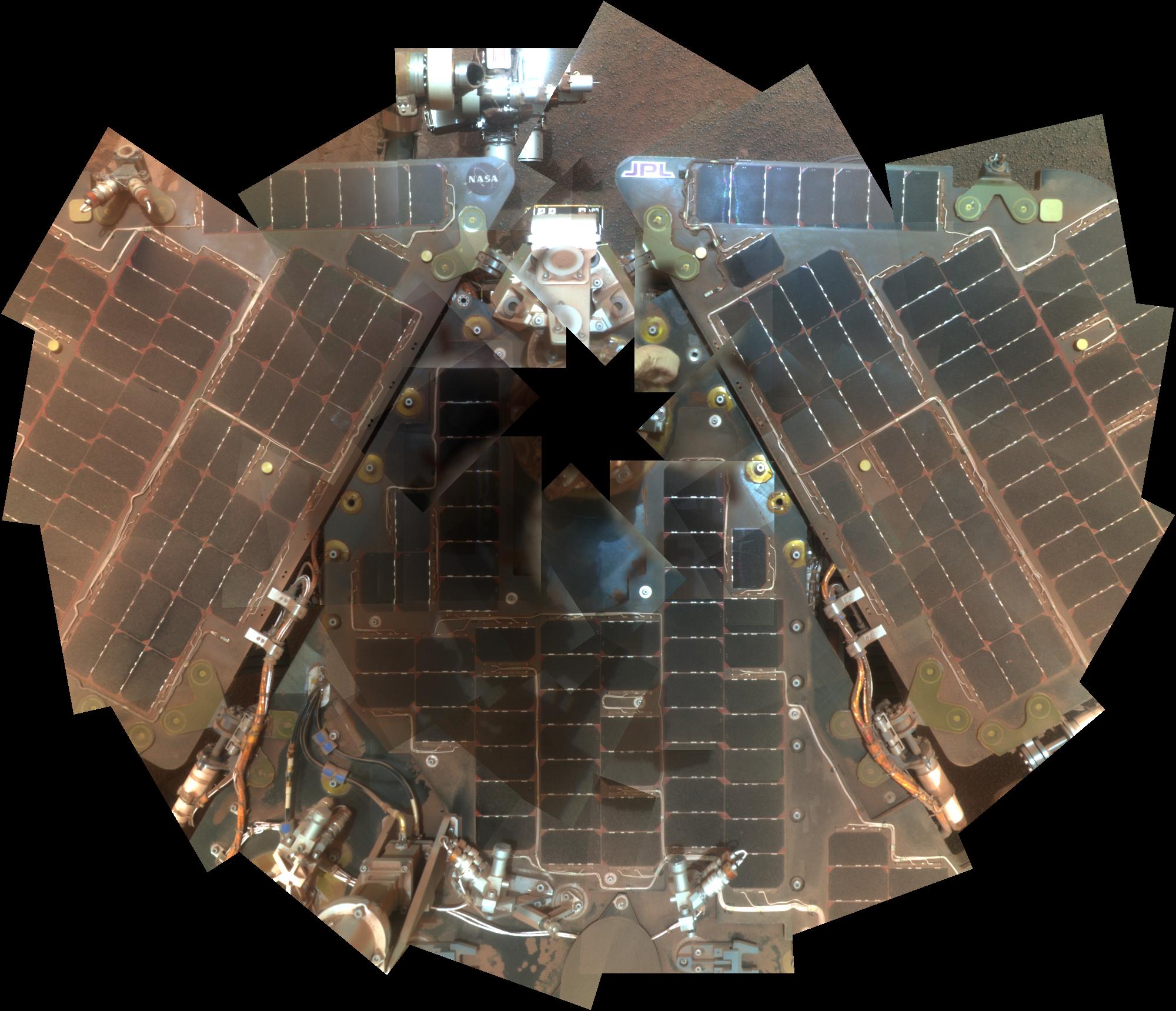
2012-02-17 |
Mars
|
Mars Exploration Rover (MER)
|
Panoramic Camera
|
2000x1719x3 |
|
-
PIA15114:
-
Opportunity Rover Self-Portrait From 2007
Full Resolution:
TIFF
(10.33 MB)
JPEG
(328.6 kB)
|
|
|
2012-02-08 |
Mars
|
Mars Exploration Rover (MER)
Mars Reconnaissance Orbiter (MRO)
|
HiRISE
|
2080x1393x3 |
|
-
PIA15038:
-
Spirit Lander and Bonneville Crater in Color
Full Resolution:
TIFF
(8.704 MB)
JPEG
(354.7 kB)
|
|
|
2012-02-03 |
Mars
|
Mars Exploration Rover (MER)
|
Panoramic Camera
|
1024x1024x1 |
|
-
PIA15024:
-
Opportunity's Late Afternoon View of Mars
Full Resolution:
TIFF
(1.05 MB)
JPEG
(173.9 kB)
|
|
|
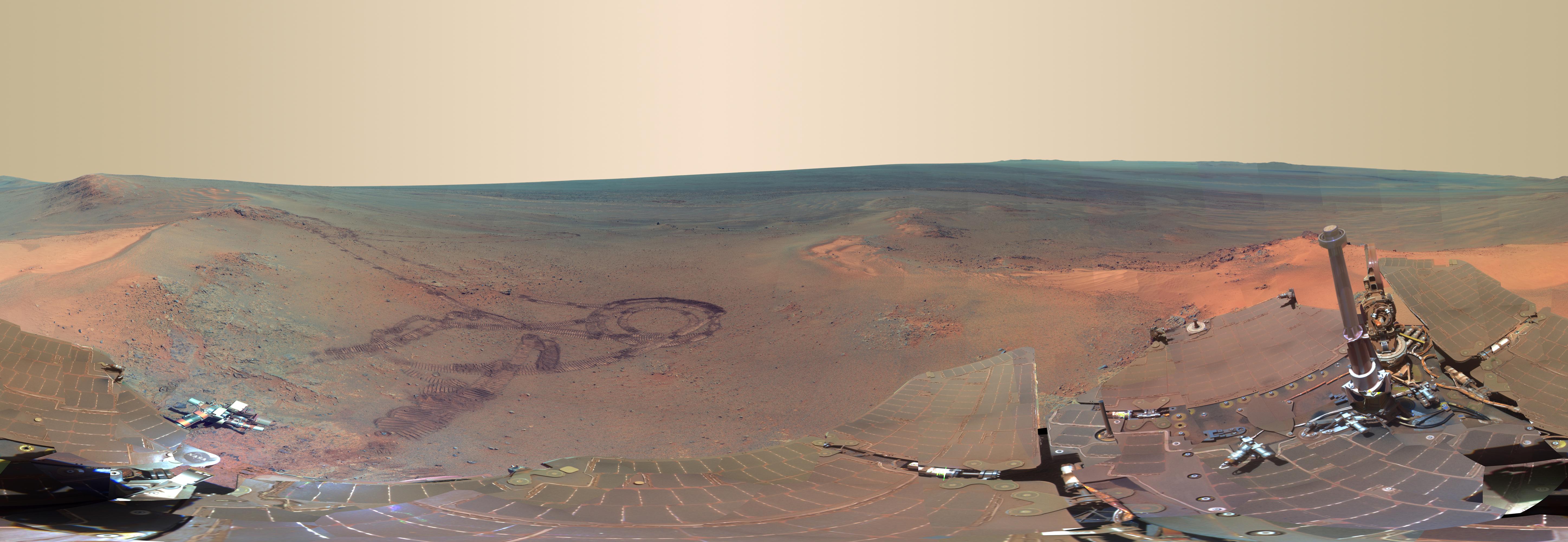
2012-01-24 |
Mars
|
Mars Exploration Rover (MER)
|
Panoramic Camera
|
3976x2542x3 |
|
-
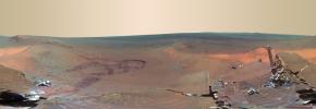
PIA15282:
-
Opportunity's Eighth Anniversary View From 'Greeley Haven' (False Color)
Full Resolution:
TIFF
(30.32 MB)
JPEG
(1.452 MB)
|
|
|
2012-01-24 |
Mars
|
Mars Exploration Rover (MER)
|
Panoramic Camera
|
3976x2542x3 |
|
-
PIA15281:
-
Opportunity's Eighth Anniversary View From 'Greeley Haven'
Full Resolution:
TIFF
(30.32 MB)
JPEG
(935.4 kB)
|
|
|
2012-01-17 |
|
Mars Exploration Rover (MER)
Mars Pathfinder (MPF)
Mars Science Laboratory (MSL)
|
|
6048x4032x3 |
|
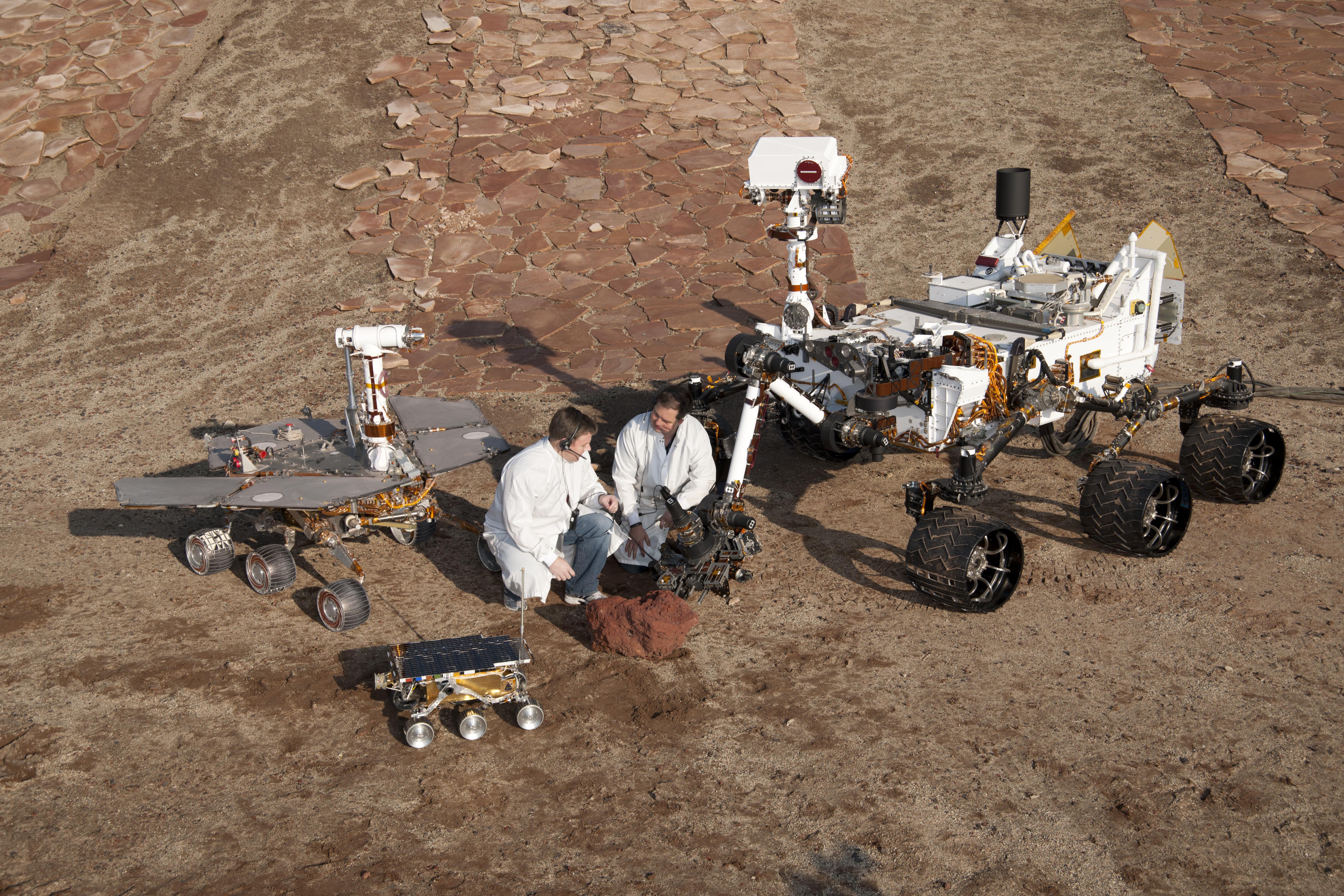
-
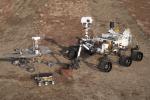
PIA15280:
-
Three Generations of Rovers with Crouching Engineers
Full Resolution:
TIFF
(73.16 MB)
JPEG
(4.303 MB)
|
|
|
2012-01-17 |
|
Mars Exploration Rover (MER)
Mars Pathfinder (MPF)
Mars Science Laboratory (MSL)
|
|
6048x4032x3 |

|
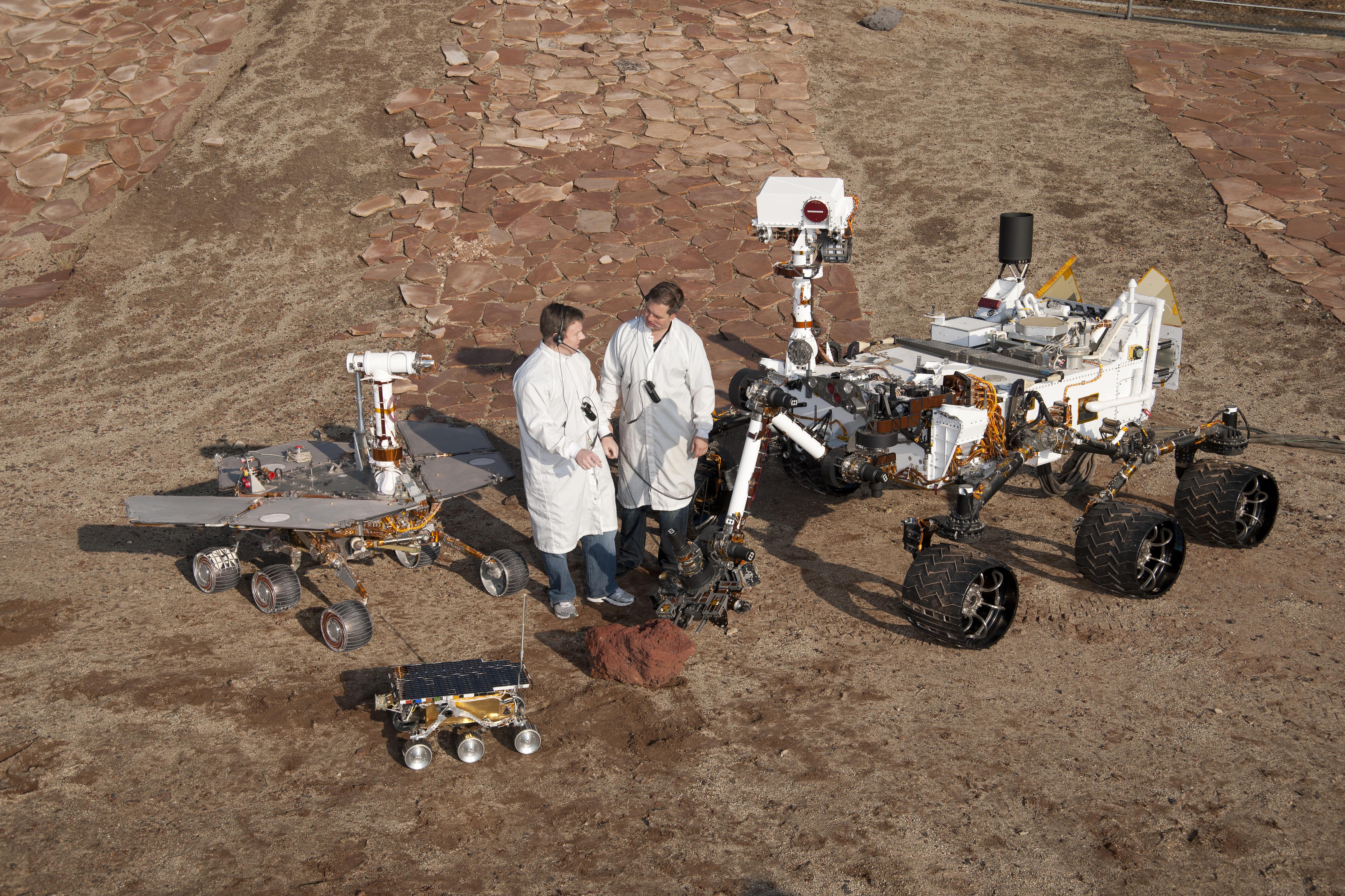
-
PIA15279:
-
Three Generations of Rovers with Standing Engineers
Full Resolution:
TIFF
(73.16 MB)
JPEG
(5.508 MB)
|
|
|
2012-01-17 |
|
Mars Exploration Rover (MER)
Mars Pathfinder (MPF)
Mars Science Laboratory (MSL)
|
|
5888x3085x3 |
|
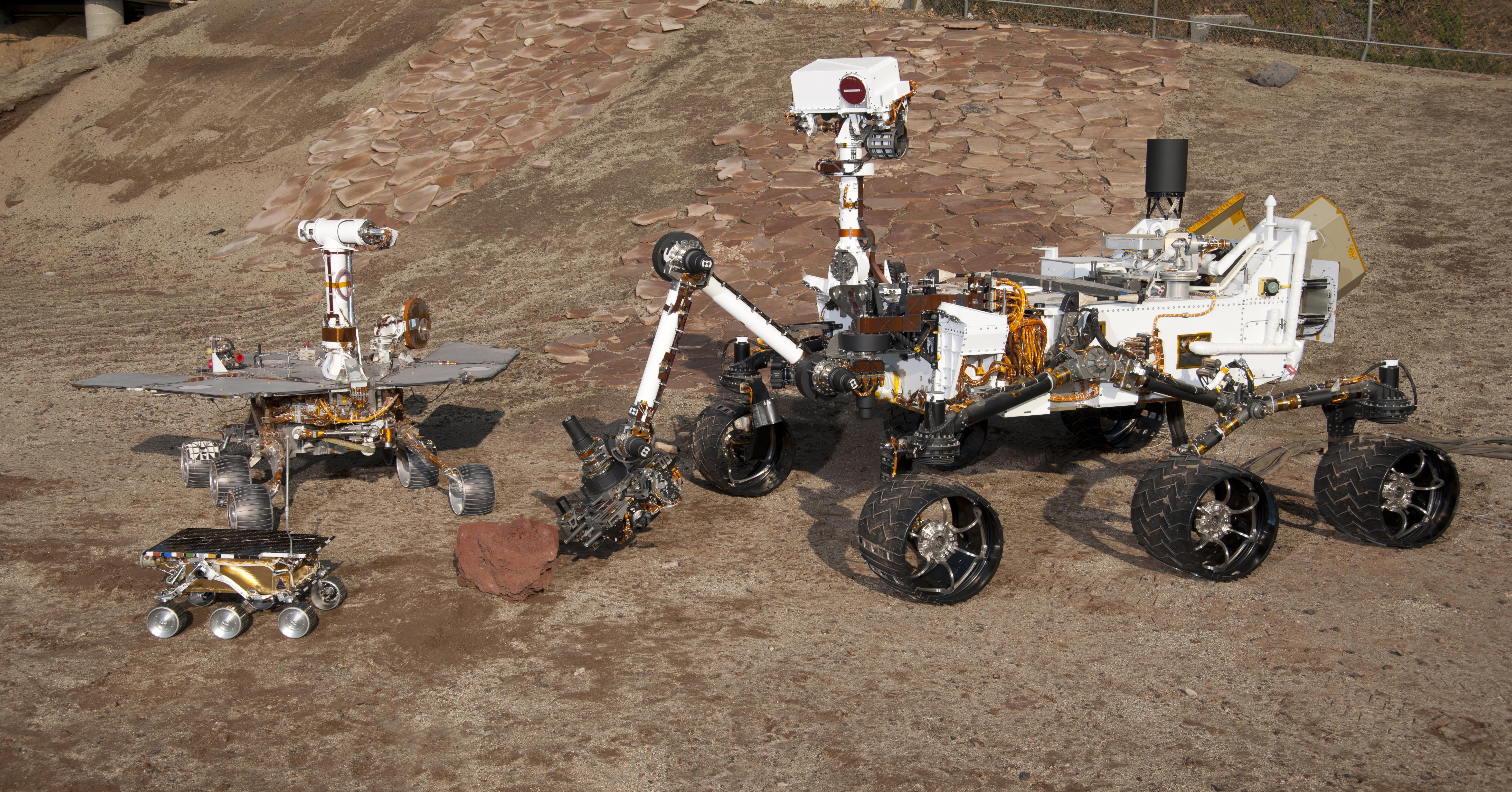
-
PIA15278:
-
Three Generations of Rovers in Mars Yard
Full Resolution:
TIFF
(54.49 MB)
JPEG
(3.191 MB)
|
|
|
2012-01-17 |
|
Mars Exploration Rover (MER)
Mars Pathfinder (MPF)
Mars Science Laboratory (MSL)
|
|
6048x4032x3 |
|
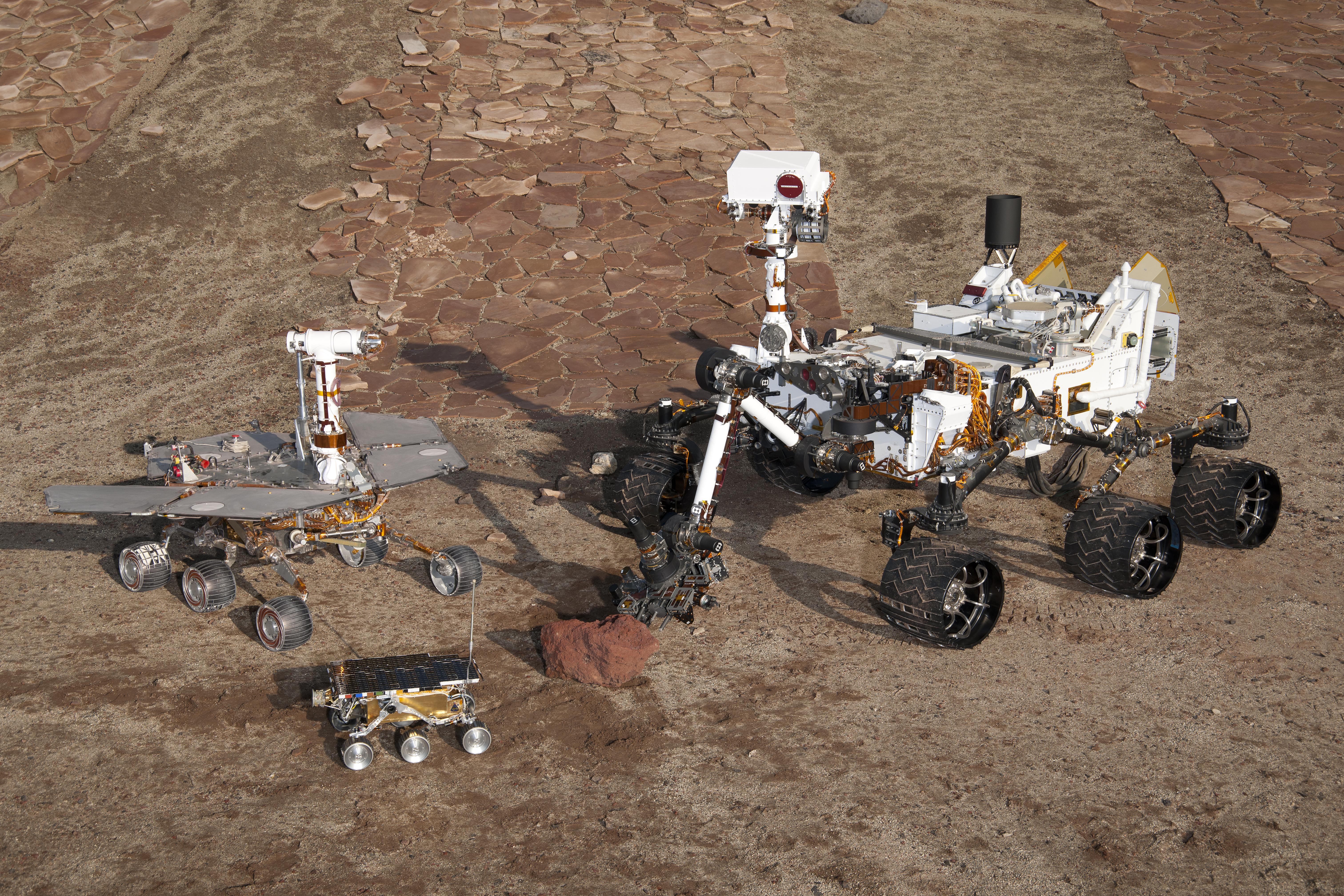
-
PIA15277:
-
Three Generations in Mars Yard, High Viewpoint
Full Resolution:
TIFF
(73.16 MB)
JPEG
(5.475 MB)
|
|
|
2012-01-05 |
Mars
|
Mars Exploration Rover (MER)
Mars Reconnaissance Orbiter (MRO)
|
HiRISE
|
700x560x1 |
|
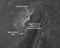
-
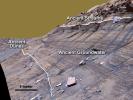
PIA15276:
-
Locator Map for 'Greeley Haven' on Endeavour Rim
Full Resolution:
TIFF
(392.6 kB)
JPEG
(56.54 kB)
|
|
|
2012-01-05 |
Mars
|
Mars Exploration Rover (MER)
|
Panoramic Camera
|
4478x1722x3 |
|
-
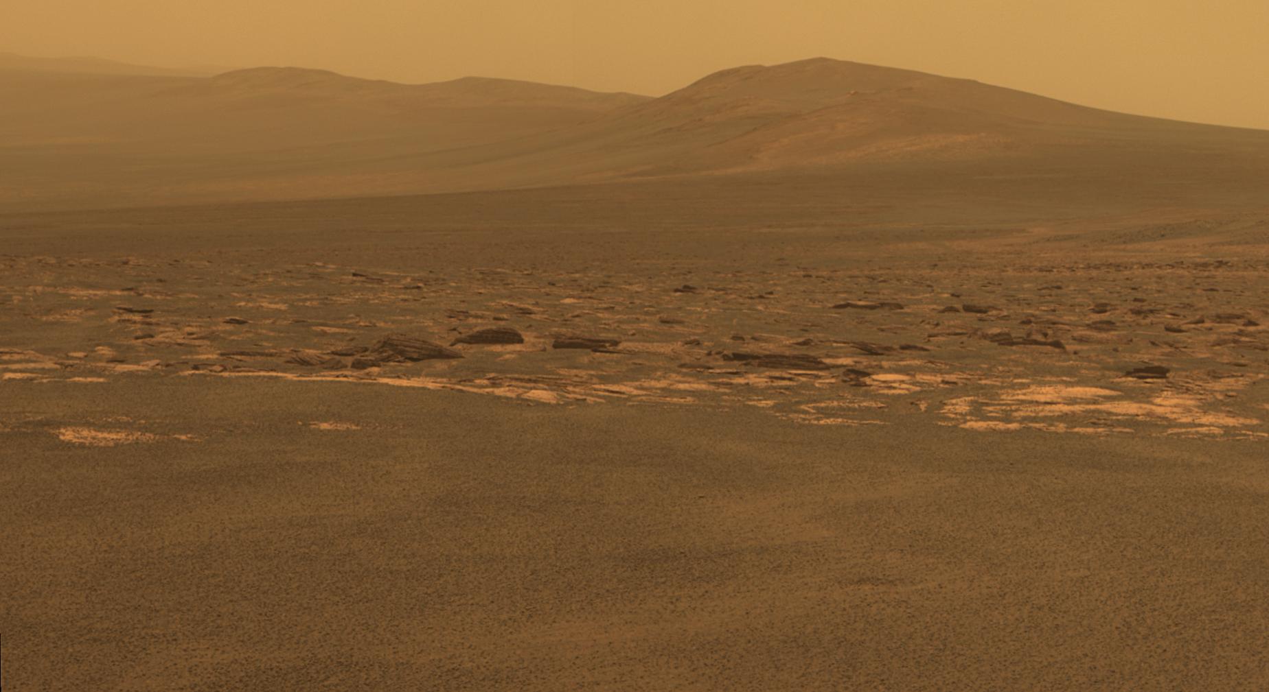
PIA15275:
-
'Greeley Haven' Site for Opportunity's Fifth Martian Winter (False Color)
Full Resolution:
TIFF
(23.13 MB)
JPEG
(1.402 MB)
|
|
|
2012-01-05 |
Mars
|
Mars Exploration Rover (MER)
|
Panoramic Camera
|
4478x1722x3 |

|
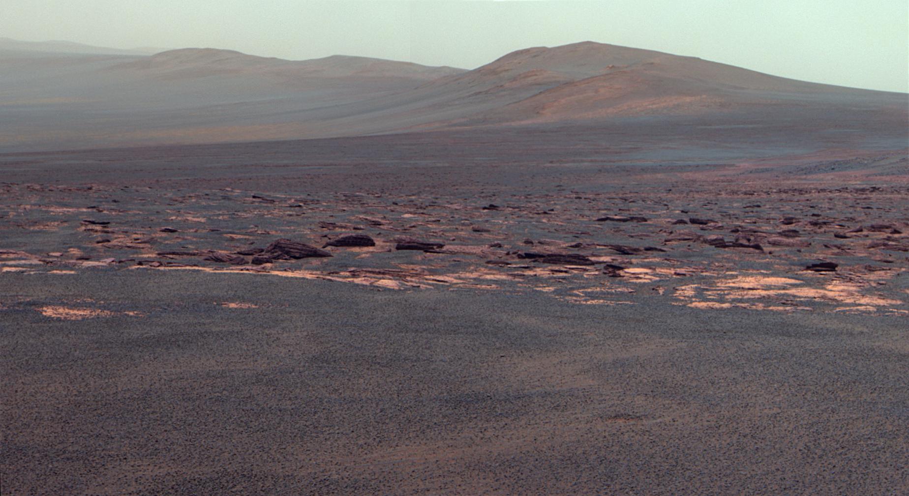
-
PIA15119:
-
'Greeley Haven' Site for Opportunity's Fifth Martian Winter
Full Resolution:
TIFF
(23.13 MB)
JPEG
(694.1 kB)
|
|
|
2012-01-05 |
Mars
|
Mars Exploration Rover (MER)
|
Navigation Camera
|
1024x1024x1 |

|
-
PIA15118:
-
Approaching 'Greeley Haven' on Endeavour Rim
Full Resolution:
TIFF
(1.05 MB)
JPEG
(212.1 kB)
|
|
|
2011-12-07 |
Mars
|
Mars Exploration Rover (MER)
|
Panoramic Camera
|
1024x512x3 |

|
-
PIA15113:
-
'Shoemaker Ridge' on Endeavour Rim (False Color)
Full Resolution:
TIFF
(1.575 MB)
JPEG
(111 kB)
|
|
|
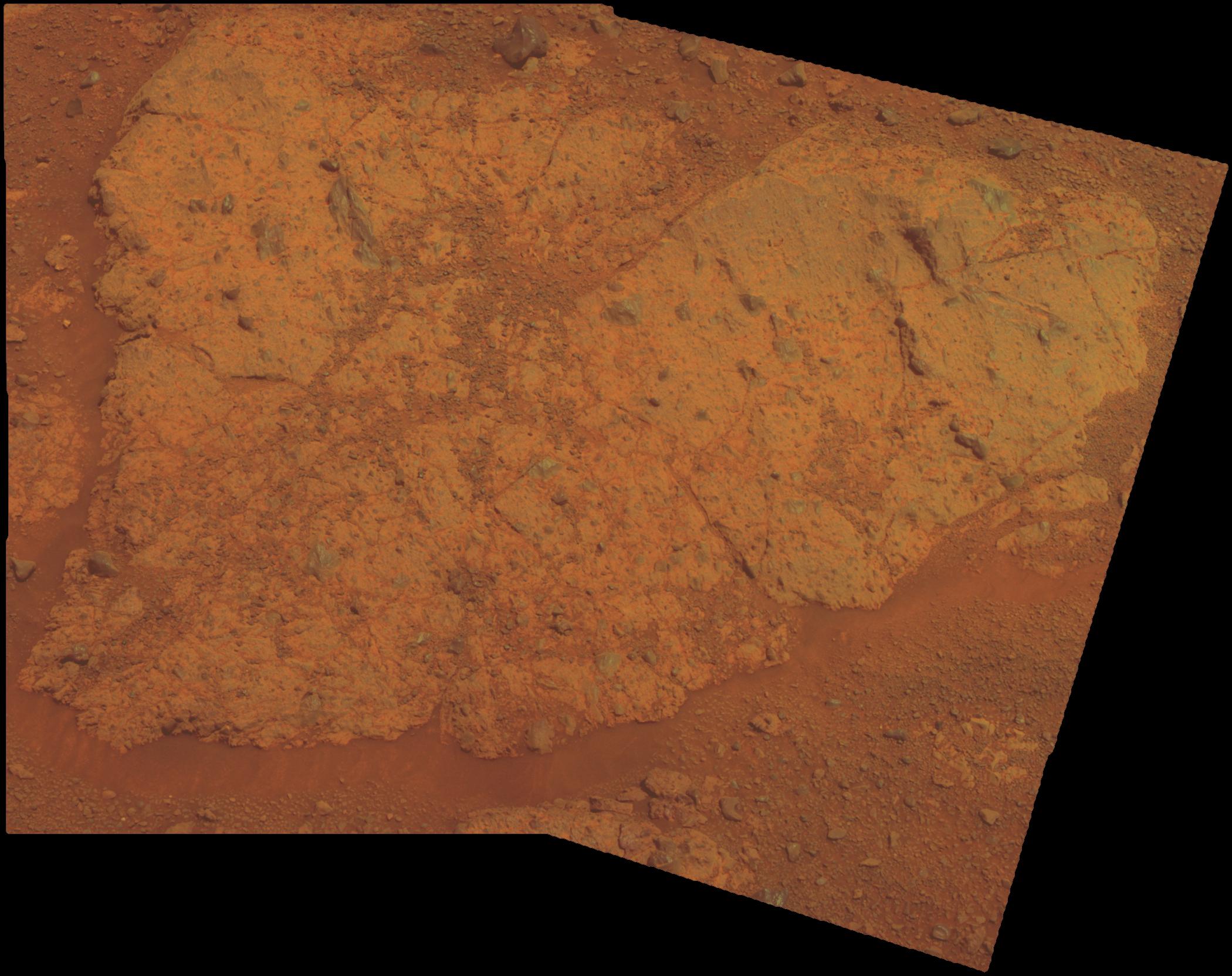
2011-12-07 |
Mars
|
Mars Exploration Rover (MER)
|
Hazcam
|
474x474x1 |

|
-
PIA15037:
-
Opportunity's Approach to 'Homestake'
Full Resolution:
TIFF
(225.1 kB)
JPEG
(18.68 kB)
|
|
|
2011-12-07 |
Mars
|
Mars Exploration Rover (MER)
|
Navigation Camera
|
1024x1024x1 |
|
-
PIA15036:
-
Western Edge of 'Cape York,' with Bright Vein
Full Resolution:
TIFF
(1.05 MB)
JPEG
(297.5 kB)
|
|
|
2011-12-07 |
Mars
|
Mars Exploration Rover (MER)
|
Microscopic Imager
|
1928x1335x1 |
|
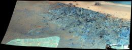
-
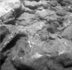
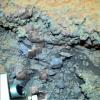
PIA15035:
-
Close-up View of 'Homestake' Vein
Full Resolution:
TIFF
(2.577 MB)
JPEG
(408.3 kB)
|
|
|
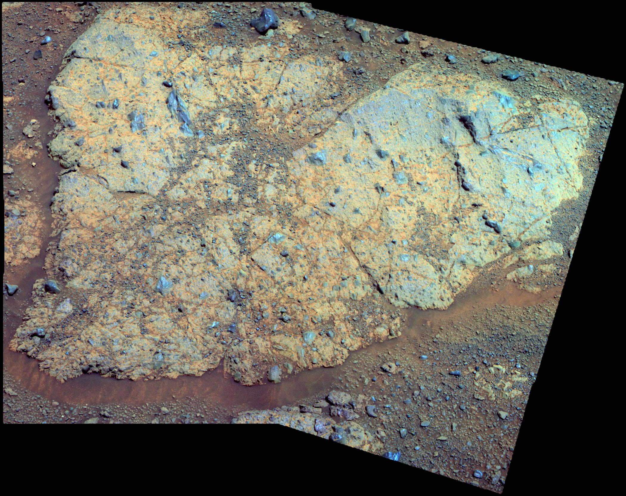
2011-12-07 |
Mars
|
Mars Exploration Rover (MER)
|
Panoramic Camera
|
1022x512x3 |
|
-
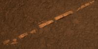
PIA15034:
-
'Homestake' Vein, False Color
Full Resolution:
TIFF
(1.572 MB)
JPEG
(105.5 kB)
|
|
|
2011-12-07 |
Mars
|
Mars Exploration Rover (MER)
|
Panoramic Camera
|
1022x512x3 |
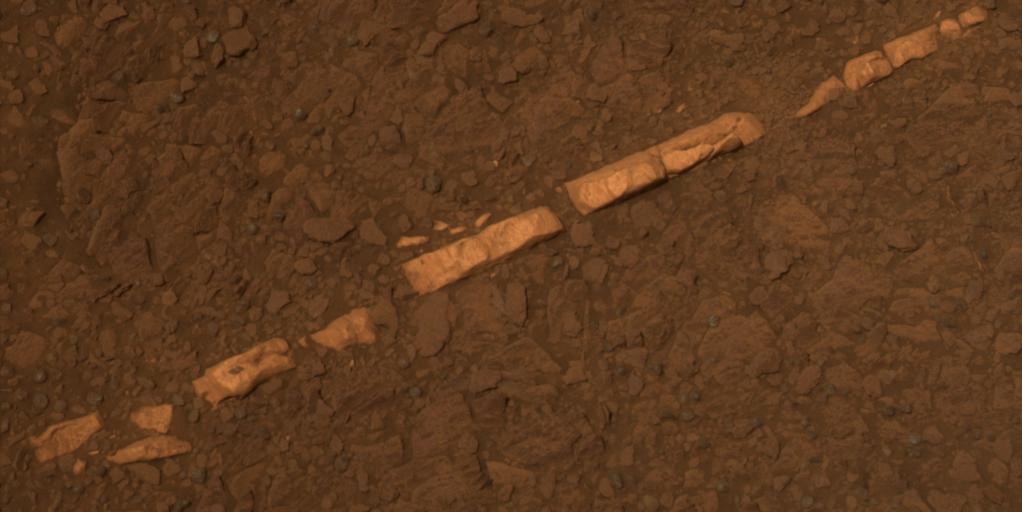
|
-
PIA15033:
-
'Homestake' Vein in Color
Full Resolution:
TIFF
(1.572 MB)
JPEG
(56.78 kB)
|
|
|
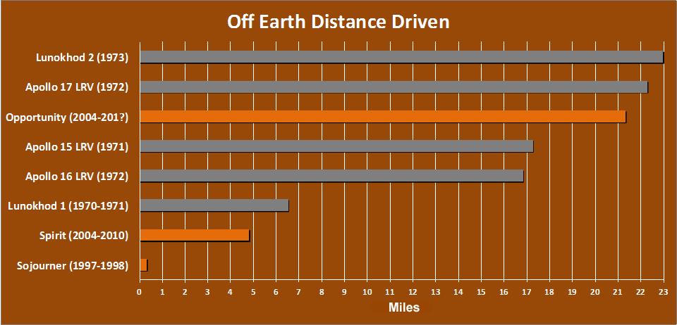
2011-12-07 |
|
Mars Exploration Rover (MER)
|
|
960x462x3 |

|
-
PIA14859:
-
Off-Earth Driving Champs (in Miles)
Full Resolution:
TIFF
(445.8 kB)
JPEG
(61.98 kB)
|
|
|
2011-11-21 |
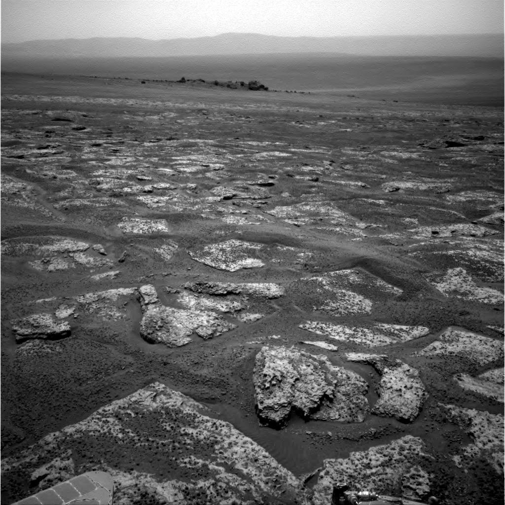
Mars
|
Mars Exploration Rover (MER)
|
Panoramic Camera
|
862x647x3 |
|
-
PIA15091:
-
Layers in Burns Cliff Examined by Opportunity
Full Resolution:
TIFF
(1.675 MB)
JPEG
(112.3 kB)
|
|
|
2011-10-10 |
Mars
|
Mars Exploration Rover (MER)
|
Navigation Camera
|
1024x1024x1 |
|
-
PIA14759:
-
Approaching Endeavour Crater, Sol 2,680
Full Resolution:
TIFF
(1.05 MB)
JPEG
(204.5 kB)
|
|
|
2011-09-26 |
Mercury
|
Clementine
MESSENGER
Mariner Venus Mercury (Mariner 10)
|
|
1248x624x1 |
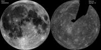
|
-
PIA14823:
-
The Whole of the Moon
Full Resolution:
TIFF
(779.8 kB)
JPEG
(103.9 kB)
|
|
|
2011-09-14 |
Mars
|
Mars Exploration Rover (MER)
|
Panoramic Camera
|
2100x1664x3 |

|
-
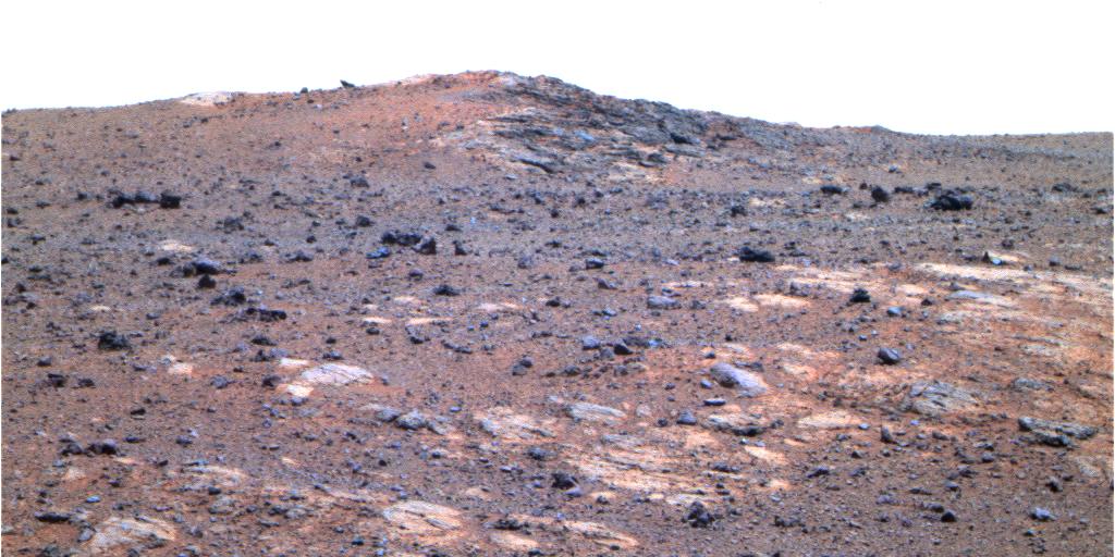
PIA14753:
-
'Chester Lake' Bedrock on Rim of Endeavour Crater
Full Resolution:
TIFF
(10.5 MB)
JPEG
(361.7 kB)
|
|
|
2011-09-14 |
Mars
|
Mars Exploration Rover (MER)
|
Panoramic Camera
|
2100x1664x3 |
|
-
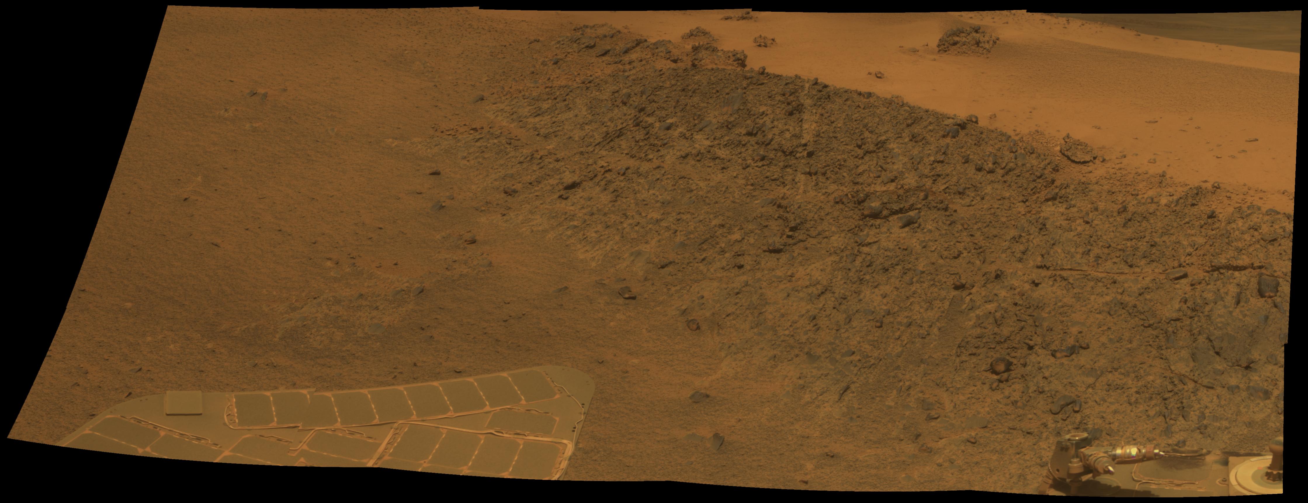
PIA14752:
-
'Chester Lake' Bedrock on Rim of Endeavour Crater (False Color)
Full Resolution:
TIFF
(10.5 MB)
JPEG
(657.4 kB)
|
|
|
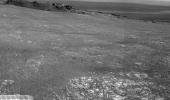
2011-09-14 |
Mars
|
Mars Exploration Rover (MER)
|
Hazcam
|
1024x933x1 |
|
-
PIA14751:
-
Shadow Across 'Chester Lake' on Endeavour Rim, Sol 2710
Full Resolution:
TIFF
(956.6 kB)
JPEG
(131.7 kB)
|
|
|
2011-09-12 |
Mars
|
Mars Exploration Rover (MER)
|
Navigation Camera
Panoramic Camera
|
3072x3072x3 |

|
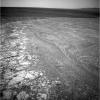
-
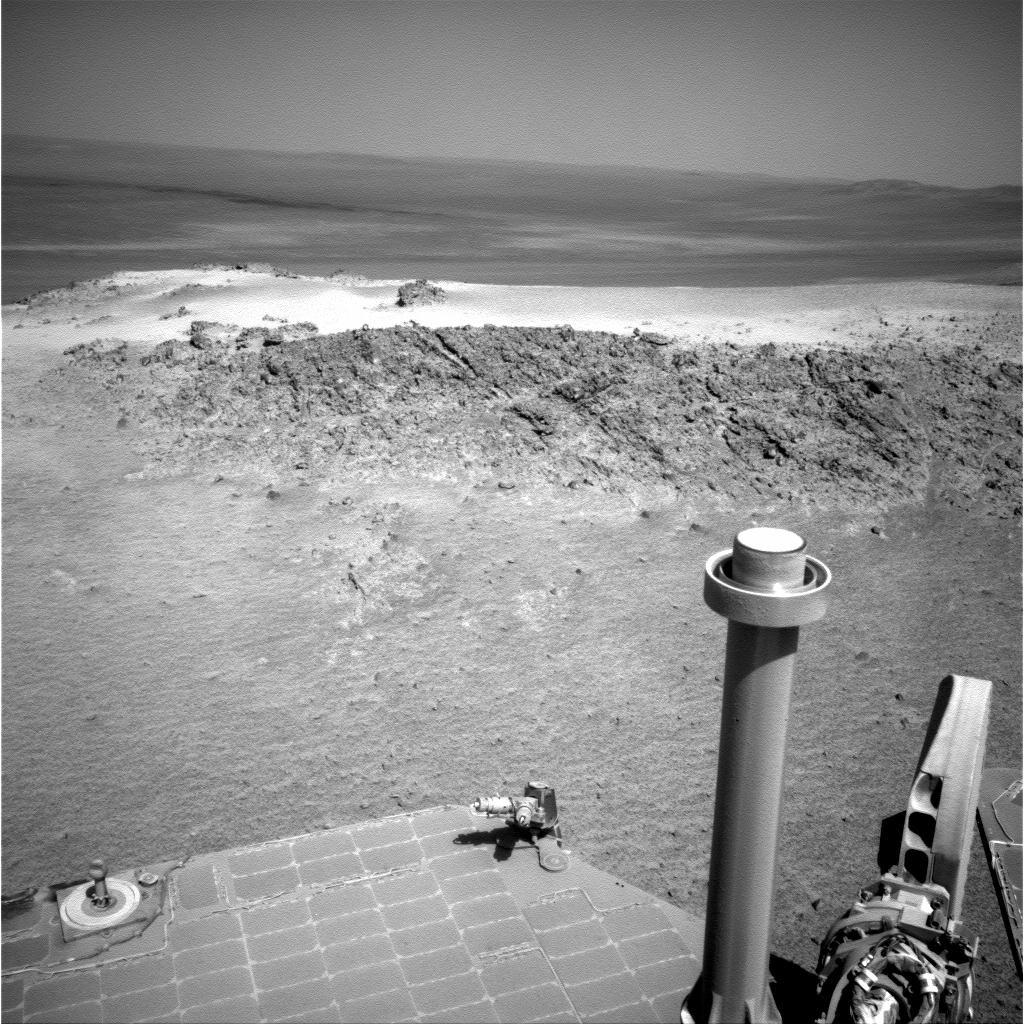
PIA14750:
-
Memorial Image Taken on Mars on Sept. 11, 2011
Full Resolution:
TIFF
(28.31 MB)
JPEG
(1.098 MB)
|
|
|
2011-09-01 |
Mars
|
Mars Exploration Rover (MER)
|
Hazcam
|
1024x1024x1 |

|
-
PIA14749:
-
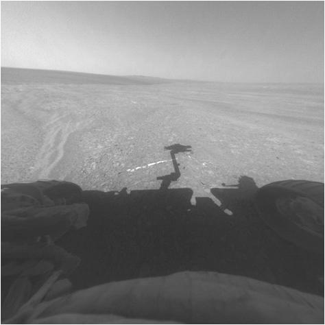
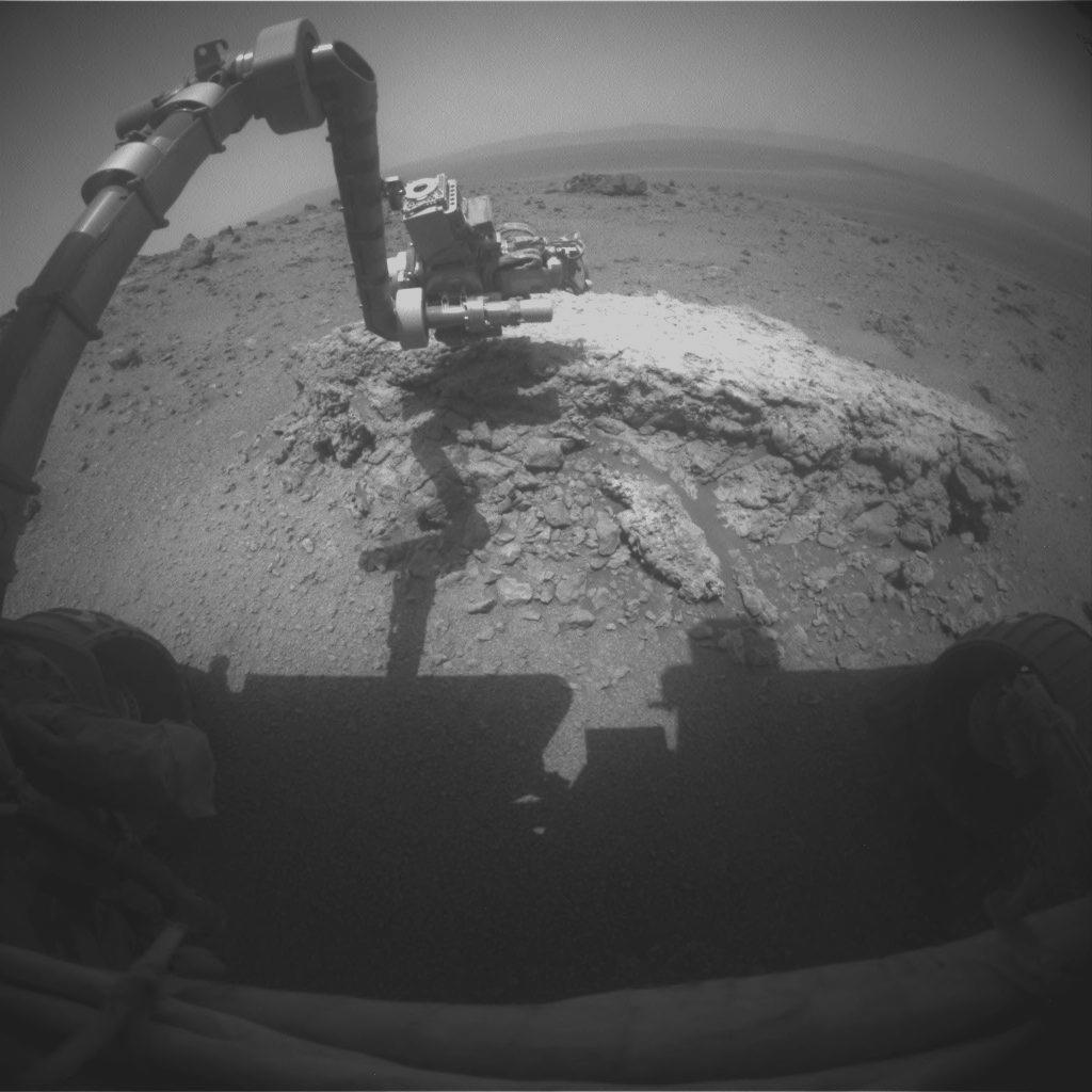
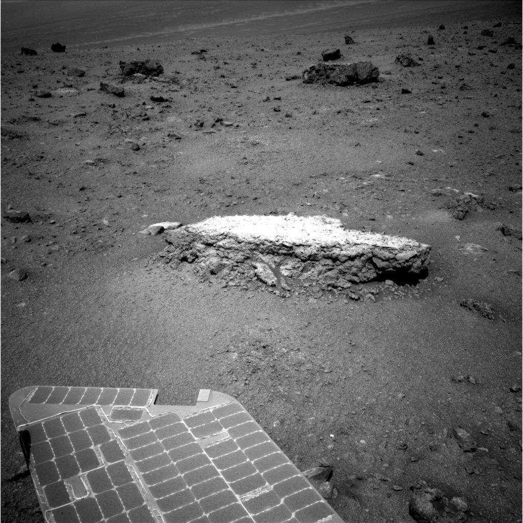
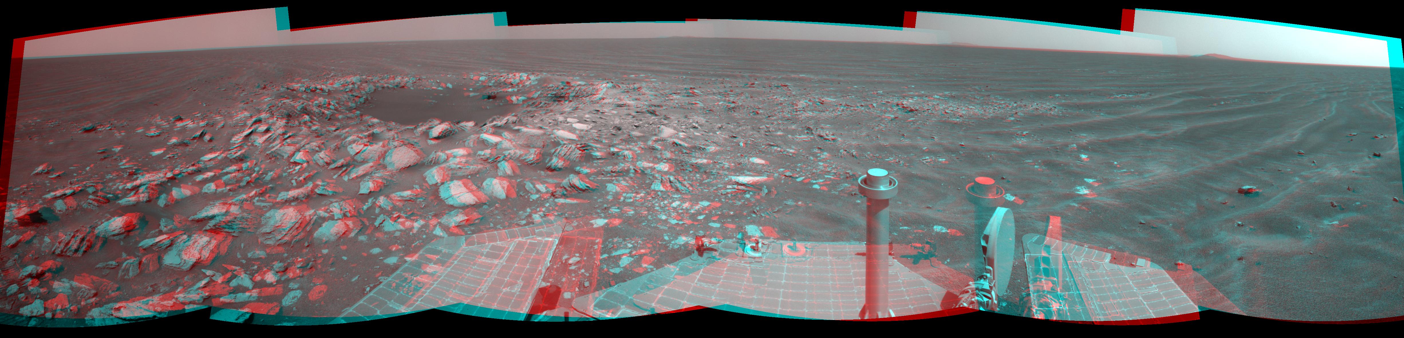
Opportunity at Work Examining 'Tisdale 2,' Sol 2695
Full Resolution:
TIFF
(1.05 MB)
JPEG
(100.3 kB)
|
|
|
2011-09-01 |
Mars
|
Mars Exploration Rover (MER)
|
Navigation Camera
|
1024x1024x1 |
|
-
PIA14748:
-
Approaching 'Tisdale 2' Rock on Rim of Endeavour Crater, Sol 2690
Full Resolution:
TIFF
(1.05 MB)
JPEG
(192.7 kB)
|
|
|
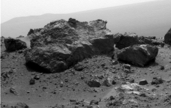
2011-09-01 |
Mars
|
Mars Exploration Rover (MER)
|
Alpha Particle X-ray Spectrometer
|
934x673x3 |
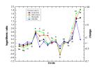
|
-
PIA14747:
-
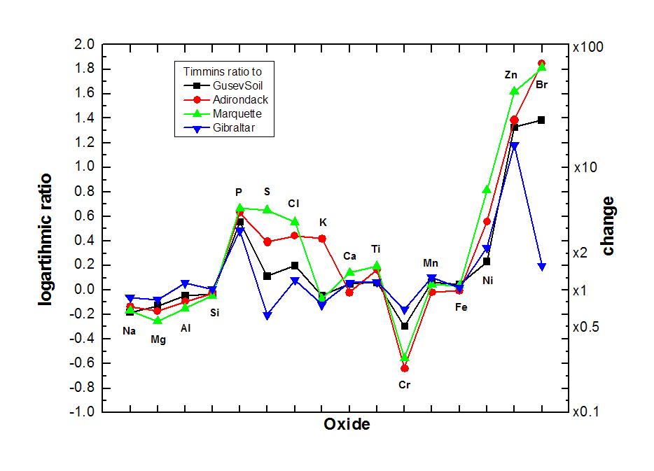
Elevated Zinc and Bromine in Rock on Endeavour Rim
Full Resolution:
TIFF
(631 kB)
JPEG
(64.27 kB)
|
|
|
2011-09-01 |
Mars
|
Mars Exploration Rover (MER)
|
Microscopic Imager
|
6621x6488x1 |
|
-
PIA14746:
-
Magnified View of Texture on Part of "Tisdale 2" Rock
Full Resolution:
TIFF
(43.01 MB)
JPEG
(2.786 MB)
|
|
|
2011-09-01 |
Mars
|
Mars Exploration Rover (MER)
|
Microscopic Imager
Panoramic Camera
|
7680x7671x3 |
|
-
PIA14745:
-
Locations of Microscopic Imager Observations on 'Tisdale 2'
Full Resolution:
TIFF
(176.7 MB)
JPEG
(4.45 MB)
|
|
|
2011-09-01 |
Mars
|
Mars Exploration Rover (MER)
|
Panoramic Camera
|
1024x1024x3 |
|
-
PIA14540:
-
Rock 'Tisdale 2' on Endeavour Crater Rim (False Color)
Full Resolution:
TIFF
(3.15 MB)
JPEG
(324.2 kB)
|
|
|
2011-09-01 |
Mars
|
Mars Exploration Rover (MER)
|
Navigation Camera
|
8192x4809x1 |
|
-
PIA14539:
-
Bright Veins in 'Botany Bay' on rim of Endeavour Crater on Mars
Full Resolution:
TIFF
(39.43 MB)
JPEG
(3.268 MB)
|
|
|
2011-09-01 |
Mars
|
Mars Exploration Rover (MER)
|
Navigation Camera
|
8192x4843x1 |

|
-
PIA14538:
-
Opportunity's View Across 'Botany Bay' and Endeavour on Sol 2678
Full Resolution:
TIFF
(39.71 MB)
JPEG
(3.319 MB)
|
|
|
2011-09-01 |
Mars
|
Mars Exploration Rover (MER)
Mars Reconnaissance Orbiter (MRO)
|
HiRISE
|
8192x5786x3 |
|
-
PIA14537:
-
Opportunity's First Neighborhood on Rim of Endeavour
Full Resolution:
TIFF
(142.2 MB)
JPEG
(5.631 MB)
|
|
|
2011-09-01 |
Mars
|
Mars Exploration Rover (MER)
Mars Reconnaissance Orbiter (MRO)
|
CTX
|
5664x7979x3 |
|
-
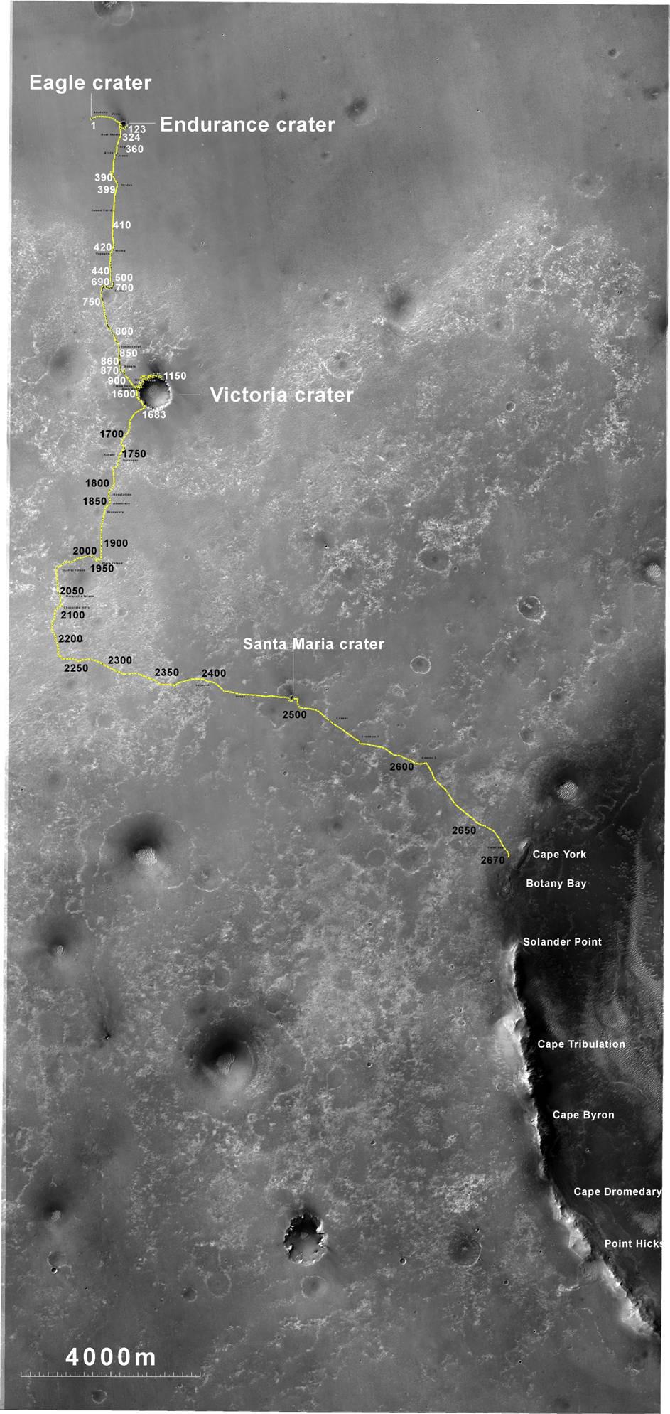
PIA14536:
-
Opportunity Traverses Through 2,700 Martian Days
Full Resolution:
TIFF
(45.26 MB)
JPEG
(6.766 MB)
|
|
|
2011-08-19 |
Mars
|
Mars Exploration Rover (MER)
|
Panoramic Camera
|
1024x1024x1 |
|
-
PIA14535:
-
'Tisdale 2' Rock, Next Stop for Opportunity
Full Resolution:
TIFF
(1.05 MB)
JPEG
(300.5 kB)
|
|
|
2011-08-19 |
Mars
|
Mars Exploration Rover (MER)
|
Panoramic Camera
|
1024x1024x1 |
|
-
PIA14534:
-
View Across Endeavour Crater
Full Resolution:
TIFF
(1.05 MB)
JPEG
(167.3 kB)
|
|
|
2011-08-19 |
Mars
|
Mars Exploration Rover (MER)
|
Panoramic Camera
|
1024x1024x1 |
|
-
PIA14533:
-
On Different Ground: Soil on Endeavour Rim
Full Resolution:
TIFF
(1.05 MB)
JPEG
(299.6 kB)
|
|
|
2011-08-19 |
Mars
|
Mars Exploration Rover (MER)
|
Panoramic Camera
|
650x410x1 |

|
-
PIA14532:
-
'Ridout' Rock on Rim of Odyssey Crater
Full Resolution:
TIFF
(267 kB)
JPEG
(43.24 kB)
|
|
|
2011-08-15 |
Mars
|
Mars Exploration Rover (MER)
|
Navigation Camera
|
6767x1169x3 |
|
-
PIA14531:
'Spirit Point' Vista from Opportunity, in Stereo
Full Resolution:
TIFF
(23.73 MB)
JPEG
(1.008 MB)
|
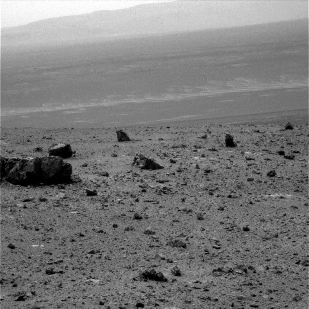
|
|
2011-08-10 |
Mars
|
Mars Exploration Rover (MER)
|
Panoramic Camera
|
1024x1024x1 |

|
-
PIA14510:
-
Small 'Odyssey' Crater on Rim of Huge 'Endeavour' Crater
Full Resolution:
TIFF
(1.05 MB)
JPEG
(286.7 kB)
|
|
|
2011-08-10 |
Mars
|
Mars Exploration Rover (MER)
|
Panoramic Camera
|
4383x1200x1 |
|
-
PIA14509:
Arrival at 'Spirit Point' by Mars Rover Opportunity
Full Resolution:
TIFF
(5.269 MB)
JPEG
(448.8 kB)
|
|
|
2011-08-10 |
Mars
|
Mars Exploration Rover (MER)
|
Panoramic Camera
|
1848x1009x3 |
|
-
PIA14508:
-
West Rim of Endeavour Crater on Mars
Full Resolution:
TIFF
(5.602 MB)
JPEG
(167.1 kB)
|
|
|
2011-08-10 |
Mars
|
Mars Exploration Rover (MER)
|
Panoramic Camera
|
1848x1009x3 |
|
-
PIA14507:
-
West Rim of Endeavour Crater on Mars (False Color)
Full Resolution:
TIFF
(5.602 MB)
JPEG
(242.4 kB)
|
|
|
2011-08-08 |
Mars
|
Mars Exploration Rover (MER)
|
Panoramic Camera
|
2908x1246x1 |
|
-
PIA14506:
-
Opportunity's View Approaching Rim of Endeavour
Full Resolution:
TIFF
(3.629 MB)
JPEG
(510.5 kB)
|
|
|
2011-08-05 |
Mars
|
Mars Exploration Rover (MER)
|
CTX
|
943x759x3 |
|
-
PIA14505:
-
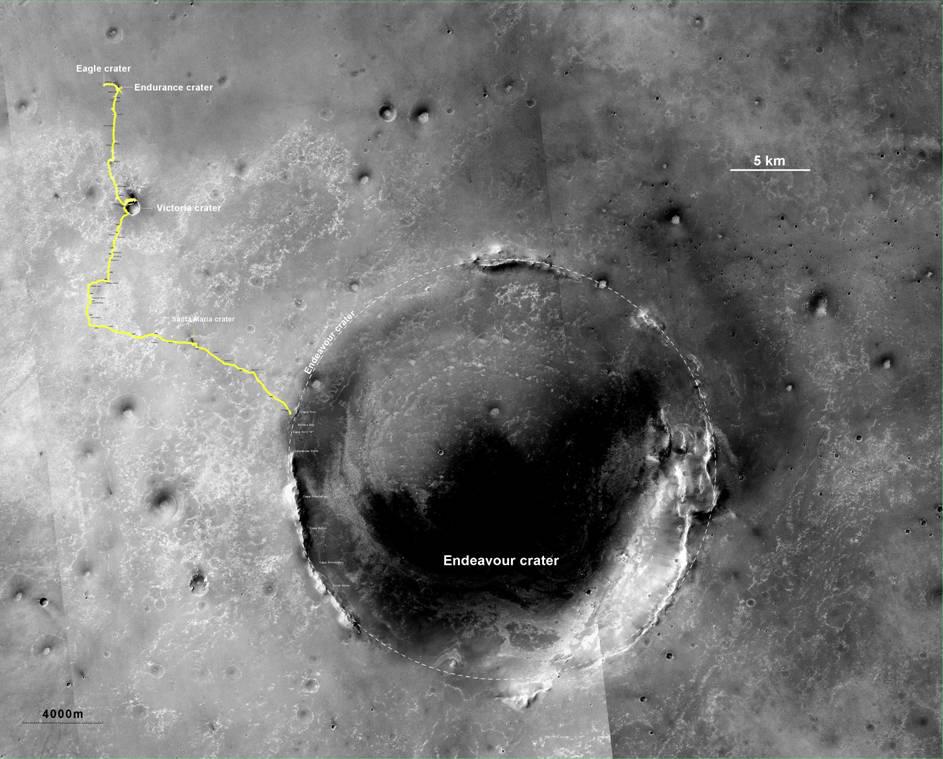
Opportunity's Route to Endeavour Crater (Wide View)
Full Resolution:
TIFF
(2.15 MB)
JPEG
(101 kB)
|
|
|
2011-08-05 |
Mars
|
Mars Exploration Rover (MER)
|
CTX
|
943x1989x3 |
|
-
PIA14504:
-
Opportunity's Route to Endeavour Crater
Full Resolution:
TIFF
(5.635 MB)
JPEG
(260 kB)
|
|
|
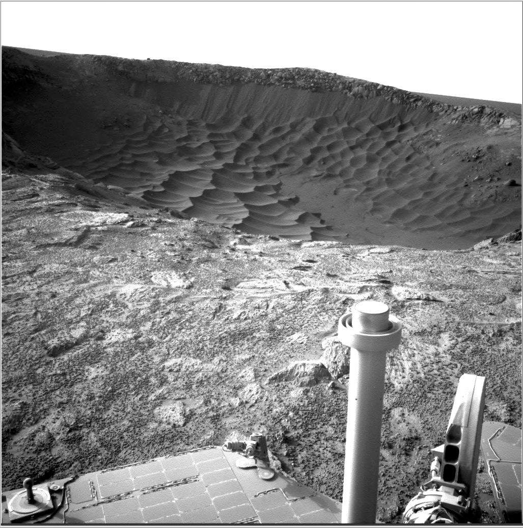
2011-07-19 |
Mars
|
Mars Exploration Rover (MER)
|
Navigation Camera
|
1024x1024x1 |
|
-
PIA14269:
-
Drive Direction Image by Opportunity After Surpassing 20 Miles
Full Resolution:
TIFF
(1.05 MB)
JPEG
(189.9 kB)
|
|
|
2011-06-08 |
Mars
|
Mars Exploration Rover (MER)
Mars Reconnaissance Orbiter (MRO)
|
CTX
|
2948x2193x3 |
|
-
PIA14135:
-
Eagle to Endeavour: Opportunity's Path, Sol 2609
Full Resolution:
TIFF
(19.4 MB)
JPEG
(1.319 MB)
|
|
|
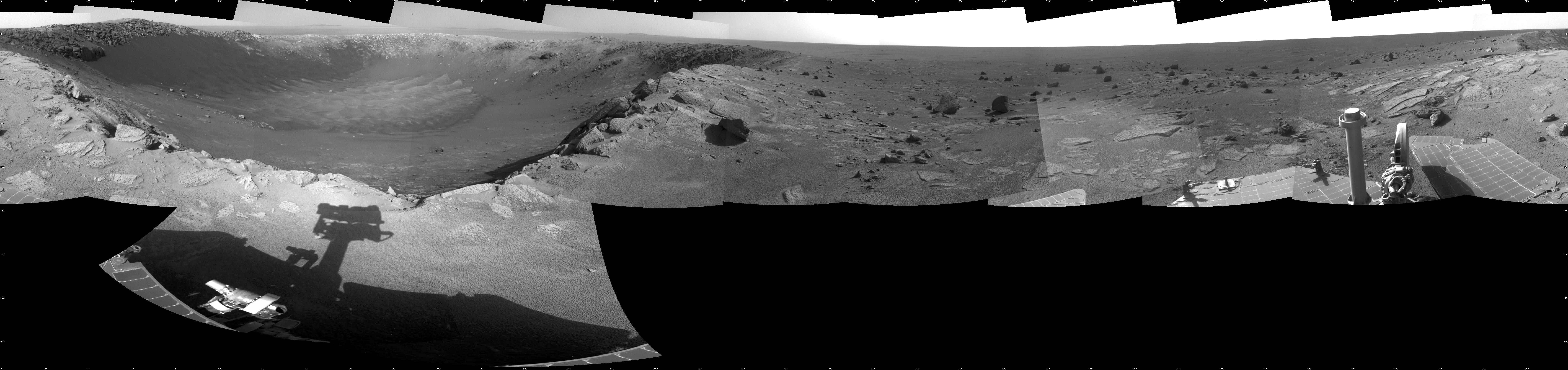
2011-06-08 |
Mars
|
Mars Exploration Rover (MER)
Mars Reconnaissance Orbiter (MRO)
|
HiRISE
|
8192x5789x3 |
|
-
PIA14134:
-
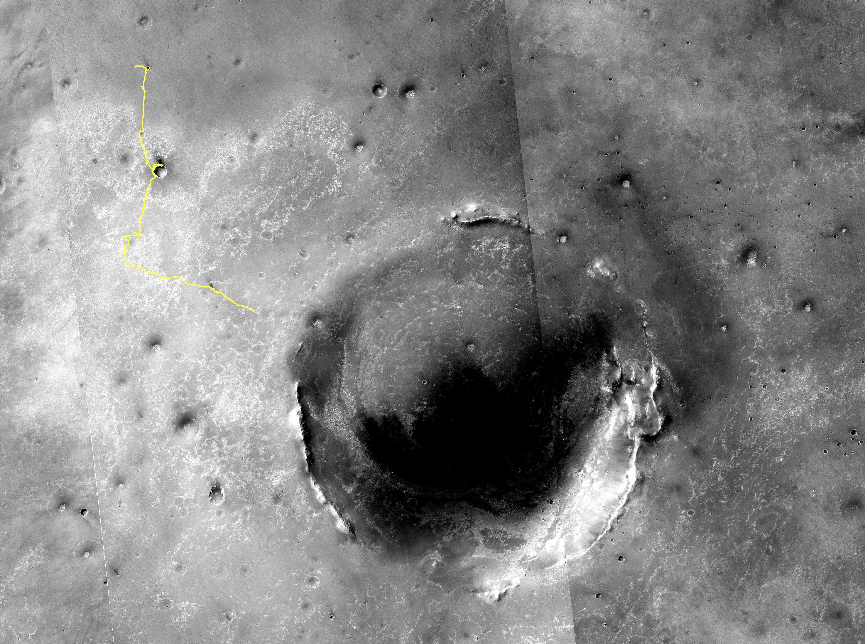
Opportunity's First Goal at Endeavour Crater: 'Spirit Point'
Full Resolution:
TIFF
(47.47 MB)
JPEG
(3.48 MB)
|
|
|
2011-06-02 |
Mars
|
Mars Exploration Rover (MER)
|
Navigation Camera
|
4905x1182x3 |
|
-
PIA14133:
-
Opportunity Beside a Small, Young Crater (Stereo)
Full Resolution:
TIFF
(17.39 MB)
JPEG
(702.3 kB)
|
|
|
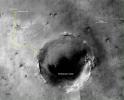
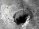
2011-06-02 |
Mars
|
Mars Exploration Rover (MER)
|
Navigation Camera
|
4865x1013x1 |
|
-
PIA14132:
-
Opportunity Beside a Small, Young Crater
Full Resolution:
TIFF
(4.937 MB)
JPEG
(609.6 kB)
|
|
|
2011-05-18 |
Mars
|
Mars Exploration Rover (MER)
|
Navigation Camera
|
5733x1153x3 |
|
-
PIA14130:
Autonomous Hazard Checks Leave Patterned Rover Tracks on Mars (Stereo)
Full Resolution:
TIFF
(19.83 MB)
JPEG
(736.2 kB)
|
|
|
2011-05-18 |
Mars
|
Mars Exploration Rover (MER)
|
Navigation Camera
|
5685x989x1 |
|
-
PIA14129:
Autonomous Hazard Checks Leave Patterned Rover Tracks on Mars
Full Resolution:
TIFF
(5.631 MB)
JPEG
(692.8 kB)
|
|
|
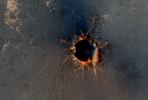
2011-05-04 |
Mars
|
Mars Exploration Rover (MER)
|
Navigation Camera
|
1747x1093x3 |
|
-
PIA13989:
-
Martian 'Freedom 7' Crater 50 Years After Freedom 7 Flight (Stereo)
Full Resolution:
TIFF
(5.737 MB)
JPEG
(245.7 kB)
|
|
|
2011-05-04 |
Mars
|
Mars Exploration Rover (MER)
|
Navigation Camera
|
1747x1093x1 |
|
-
PIA13988:
-
Martian 'Freedom 7' Crater 50 Years After Freedom 7 Flight
Full Resolution:
TIFF
(1.912 MB)
JPEG
(239.2 kB)
|
|
|
2011-04-08 |
Mars
|
Mars Exploration Rover (MER)
|
Panoramic Camera
|
1020x1023x3 |
|
-
PIA13984:
-
'Gagarin' Rock Examined by Opportunity in 2005, False Color
Full Resolution:
TIFF
(3.135 MB)
JPEG
(220.8 kB)
|
|
|
2011-04-08 |
Mars
|
Mars Exploration Rover (MER)
|
Panoramic Camera
|
1020x1023x3 |

|
-
PIA13983:
-
'Gagarin' Rock Examined by Opportunity in 2005
Full Resolution:
TIFF
(3.135 MB)
JPEG
(83.31 kB)
|
|
|
2011-04-08 |
Mars
|
Mars Exploration Rover (MER)
|
Navigation Camera
Rock Abrasion Tool (RAT)
|
1024x1024x1 |

|
-
PIA13982:
-
Opportunity's Arm and 'Gagarin' Rock, Sol 405
Full Resolution:
TIFF
(1.05 MB)
JPEG
(169 kB)
|
|
|
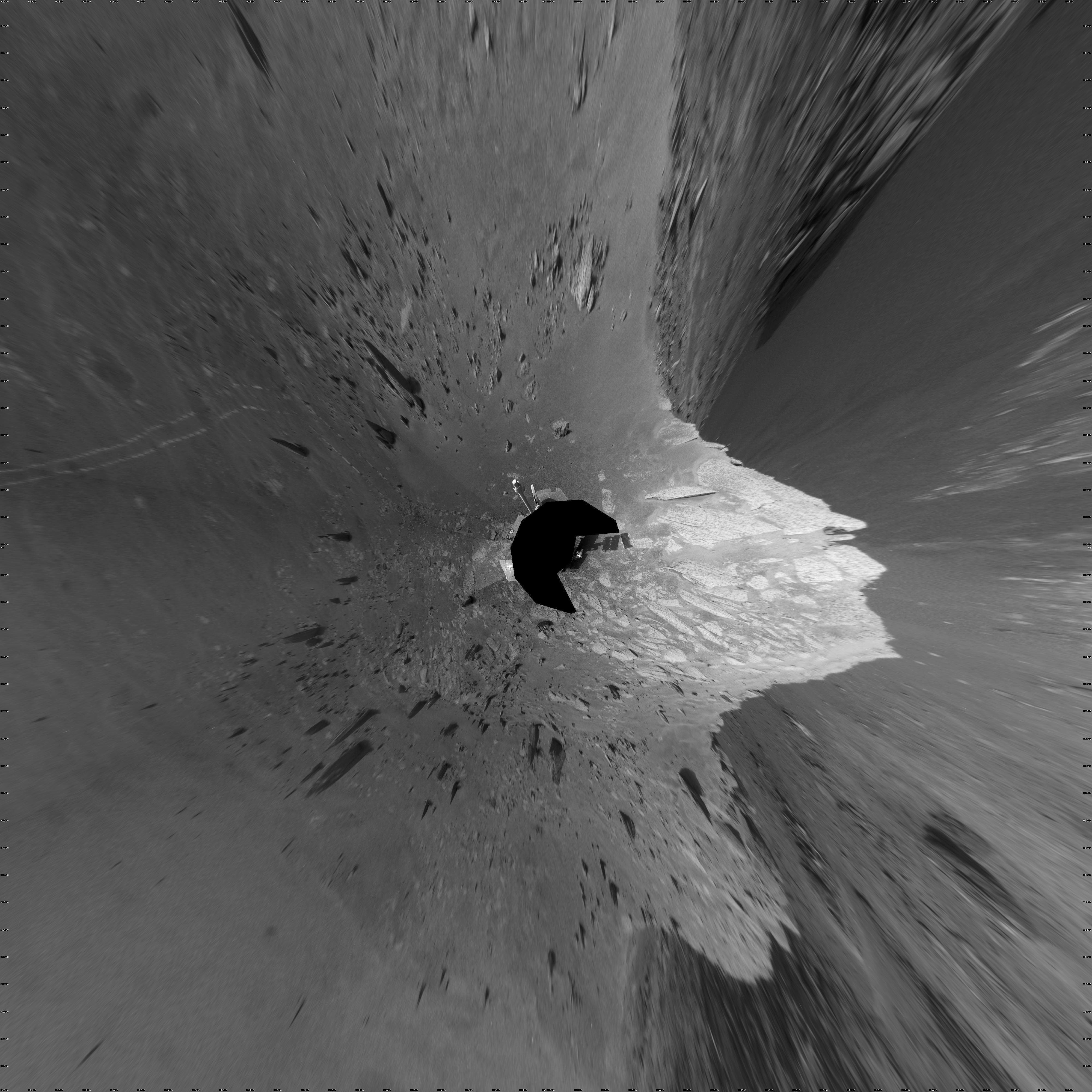
2011-03-09 |
Mars
|
Mars Exploration Rover (MER)
Mars Reconnaissance Orbiter (MRO)
|
HiRISE
|
2254x1522x3 |
|
-
PIA13803:
-
Opportunity is Still Smiling
Full Resolution:
TIFF
(10.3 MB)
JPEG
(1.155 MB)
|
|
|
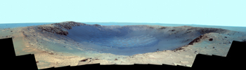
2011-01-20 |
Mars
|
Mars Exploration Rover (MER)
|
Panoramic Camera
|
14745x4000x3 |
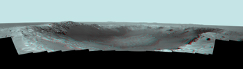
|
-
PIA13796:
-
Stereo Panorama of 'Santa Maria' Crater for Opportunity's Anniversary
Full Resolution:
TIFF
(176.9 MB)
JPEG
(3.45 MB)
|
|
|
2011-01-20 |
Mars
|
Mars Exploration Rover (MER)
|
Panoramic Camera
|
14745x4000x3 |
|
-
PIA13795:
-
Panorama of 'Santa Maria' Crater for Opportunity's Anniversary (False Color)
Full Resolution:
TIFF
(176.9 MB)
JPEG
(5.587 MB)
|
|
|
2011-01-20 |
Mars
|
Mars Exploration Rover (MER)
|
Panoramic Camera
|
14745x4000x3 |
|
-
PIA13794:
-
Color Panorama of 'Santa Maria' Crater for Opportunity's Anniversary
Full Resolution:
TIFF
(176.9 MB)
JPEG
(4.196 MB)
|
|
|
2011-01-13 |
Mars
|
Mars Exploration Rover (MER)
|
Navigation Camera
|
4000x4000x1 |

|
-
PIA13759:
-
View of 'Santa Maria' Crater from Western Rim, Sol 2454 (Vertical)
Full Resolution:
TIFF
(16.02 MB)
JPEG
(1.38 MB)
|
|
|
2011-01-13 |
Mars
|
Mars Exploration Rover (MER)
|
Navigation Camera
|
4187x4187x1 |
|
-
PIA13758:
-
View of 'Santa Maria' Crater from Western Rim, Sol 2454 (Polar)
Full Resolution:
TIFF
(17.56 MB)
JPEG
(1.44 MB)
|
|
|
2011-01-13 |
Mars
|
Mars Exploration Rover (MER)
|
Navigation Camera
|
7753x2352x3 |
|
-
PIA13757:
-
View of 'Santa Maria' Crater from Western Rim, Sol 2454 (Stereo)
Full Resolution:
TIFF
(54.71 MB)
JPEG
(1.487 MB)
|
|
|
2011-01-13 |
Mars
|
Mars Exploration Rover (MER)
|
Navigation Camera
|
7688x1812x1 |
|
-
PIA13756:
-
View of 'Santa Maria' Crater from Western Rim, Sol 2454
Full Resolution:
TIFF
(13.95 MB)
JPEG
(1.253 MB)
|
|
|
2011-01-13 |
Mars
|
Mars Exploration Rover (MER)
|
Navigation Camera
|
1027x1036x1 |

|
-
PIA13755:
-
Textures of 'Santa Maria' Crater, Sol 2476
Full Resolution:
TIFF
(1.065 MB)
JPEG
(226.6 kB)
|
|
|
2011-01-04 |
Mars
|
Mars Exploration Rover (MER)
Mars Reconnaissance Orbiter (MRO)
|
HiRISE
|
1347x1277x1 |

|
-
PIA13754:
-
Mars Orbiter Sees Rover Opportunity at Crater Edge
Full Resolution:
TIFF
(1.722 MB)
JPEG
(195 kB)
|
|
|
2011-01-03 |
Mars
|
Mars Exploration Rover (MER)
|
Navigation Camera
|
4000x4000x1 |

|
-
PIA13753:
-
'Santa Maria' Crater in 360-Degree View, Sol 2451 (Vertical)
Full Resolution:
TIFF
(16.02 MB)
JPEG
(1.289 MB)
|
|
|
2011-01-03 |
Mars
|
Mars Exploration Rover (MER)
|
Navigation Camera
|
4443x4443x1 |
|
-
PIA13752:
-
'Santa Maria' Crater in 360-Degree View, Sol 2451 (Polar)
Full Resolution:
TIFF
(19.78 MB)
JPEG
(1.462 MB)
|
|
|
2011-01-03 |
Mars
|
Mars Exploration Rover (MER)
|
Navigation Camera
|
7753x2243x3 |

|
-
PIA13751:
-
'Santa Maria' Crater in 360-Degree View, Sol 2451 (Stereo)
Full Resolution:
TIFF
(52.17 MB)
JPEG
(1.44 MB)
|
|
|
2011-01-03 |
Mars
|
Mars Exploration Rover (MER)
|
Navigation Camera
|
7688x1752x1 |
|
-
PIA13750:
-
'Santa Maria' Crater in 360-Degree View, Sol 2451
Full Resolution:
TIFF
(13.48 MB)
JPEG
(1.236 MB)
|
|
|
2010-12-28 |
Mars
|
Mars Exploration Rover (MER)
|
Hazcam
|
1004x1024x3 |
|
-
PIA13710:
-
Fisheye Stereo from Edge of 'Santa Maria' Crater, Sol 2459
Full Resolution:
TIFF
(3.089 MB)
JPEG
(111.5 kB)
|
|
|
2010-12-27 |
Sol (our sun)
|
Mars Exploration Rover (MER)
|
Panoramic Camera
|
640x350x3 |

|
-
PIA13737:
-
Phobos Passes in Front of Sun's Face, Nov. 9, 2010
Full Resolution:
TIFF
(672.9 kB)
JPEG
(6.111 kB)
|
 Planetary Data System


