PDS logoPlanetary Data System
PDS Information
Find a Node - Use these links to navigate to any of the 8 publicly accessible PDS Nodes.

This bar indicates that you are within the PDS enterprise which includes 6 science discipline nodes and 2 support nodes which are overseen by the Project Management Office at NASA's Goddard Space Flight Center (GSFC). Each node is led by an expert in the subject discipline, supported by an advisory group of other practitioners of that discipline, and subject to selection and approval under a regular NASA Research Announcement.
Click here to return to the Photojournal Home Page Click here to view a list of Photojournal Image Galleries Photojournal_inner_header
Latest Images  |  Spacecraft & Technology  |  Animations  |  Space Images App  |  Feedback  |  Photojournal Search  
Your search criteria found 6 images
Mission
Go to PIAxxxxx:
Click on an image for detailed information
Click on a column heading to sort in ascending or descending order
My
List
Addition DateSort Ascending Target Mission Instrument Size
Add Image to Favorite List 2018-06-06 Earth Jason-3
3300x1555x3
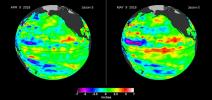
This image from the U.S./European Jason-3 satellite shows a comparison of sea surface height with respect to the seasonal cycle and the long-term trend between April 9 and May 9, 2018.
PIA22473:
Downwelling Kelvin Wave in the Pacific
Full Resolution:     TIFF (5.931 MB)     JPEG (352.9 kB)
Add Image to Favorite List 2016-03-16 Earth Jason-3
4769x5500x3
The U.S./European Jason-3 satellite has produced its first map of sea surface height. El Nino is visible as the red blob in the eastern equatorial Pacific.
PIA20532:
Jason-3 Produces First Global Map of Sea Surface Height
Full Resolution:     TIFF (20.12 MB)     JPEG (1.521 MB)
Add Image to Favorite List 2013-05-23 Earth Jason-3
8192x8192x3
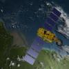
Artist's concept of U.S.-European Jason-3 Ocean Altimetry Satellite over the Amazon
PIA14441:
Artist's Concept of U.S.-European Jason-3 Ocean Altimetry Satellite over the Amazon
Full Resolution:     TIFF (201.4 MB)     JPEG (3.898 MB)
Add Image to Favorite List 2013-05-23 Earth Jason-3
8192x8192x3
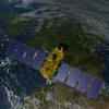
Artist's concept of U.S.-European Jason-3 Ocean Altimetry Satellite over France.
PIA14440:
Artist's Concept of U.S.-European Jason-3 Ocean Altimetry Satellite over France
Full Resolution:     TIFF (201.4 MB)     JPEG (4.08 MB)
Add Image to Favorite List 2013-05-23 Earth Jason-3
8192x8192x3
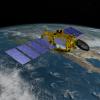
Artist's concept of the U.S.-European Jason-3 spacecraft over the California coast. Jason-3 will precisely measure the height of the ocean surface, allowing scientists to monitor ocean circulation and sea level.
PIA14439:
Artist's Concept of U.S.-European Jason-3 Ocean Altimetry Satellite over California
Full Resolution:     TIFF (201.4 MB)     JPEG (4.259 MB)
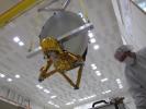
Add Image to Favorite List 2013-05-23 Jason-3
4000x3000x3
JPL technicians perform a practice run of the mechanical integration sequence that will be used to mate the Jason-3 spacecraft's Advanced Microwave Radiometer instrument to the Jason-3 satellite.
PIA14438:
Integration Test of Jason-3 Advanced Microwave Radiometer Instrument
Full Resolution:     TIFF (36.01 MB)     JPEG (1.09 MB)
Currently displaying images: 1 - 6 of 6