My
List |
Addition Date
|
Target
|
Mission
|
Instrument
|
Size
|

|
2014-07-28 |
Mars
|
Mars Exploration Rover (MER)
|
Panoramic Camera
|
3609x3130x3 |
|
-
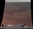
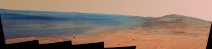
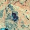
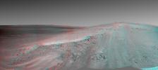
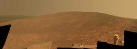
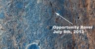
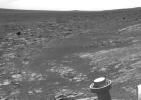
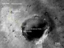
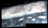
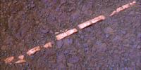
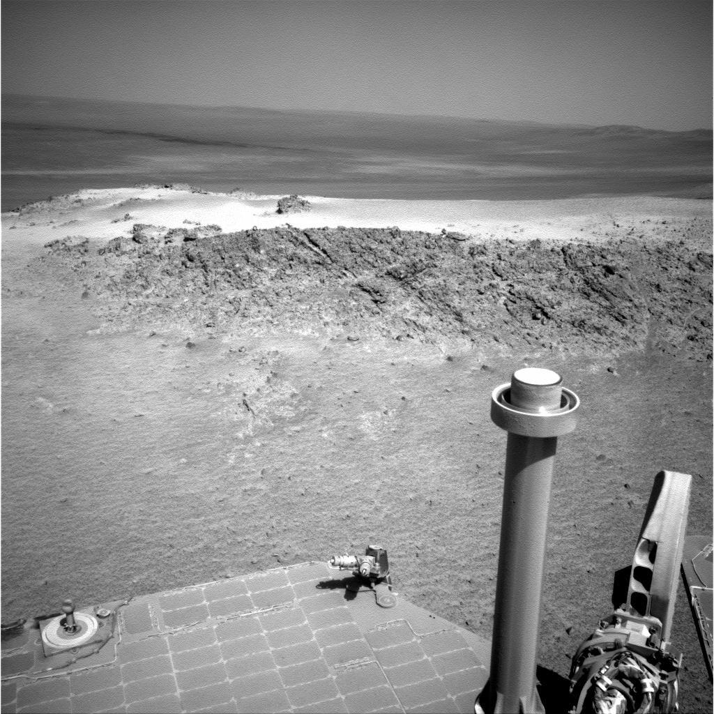
PIA18414:
-
'Lunokhod 2 Crater' on Mars (False Color)
Full Resolution:
TIFF
(33.9 MB)
JPEG
(1.349 MB)
|
|
|
2014-07-28 |
Mars
|
Mars Exploration Rover (MER)
Mars Reconnaissance Orbiter (MRO)
|
CTX
|
2420x1838x3 |
|
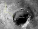
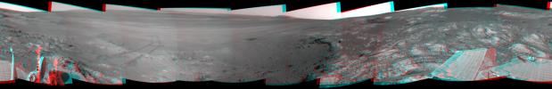
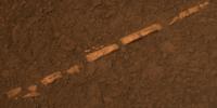
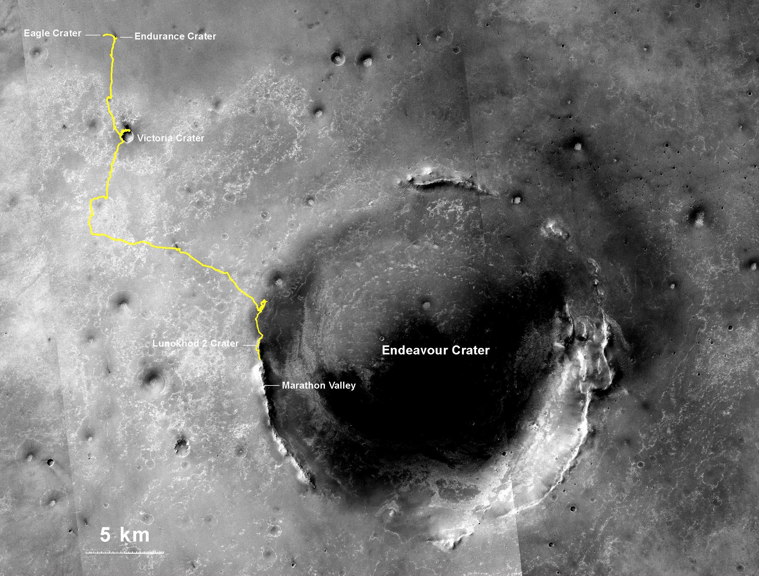
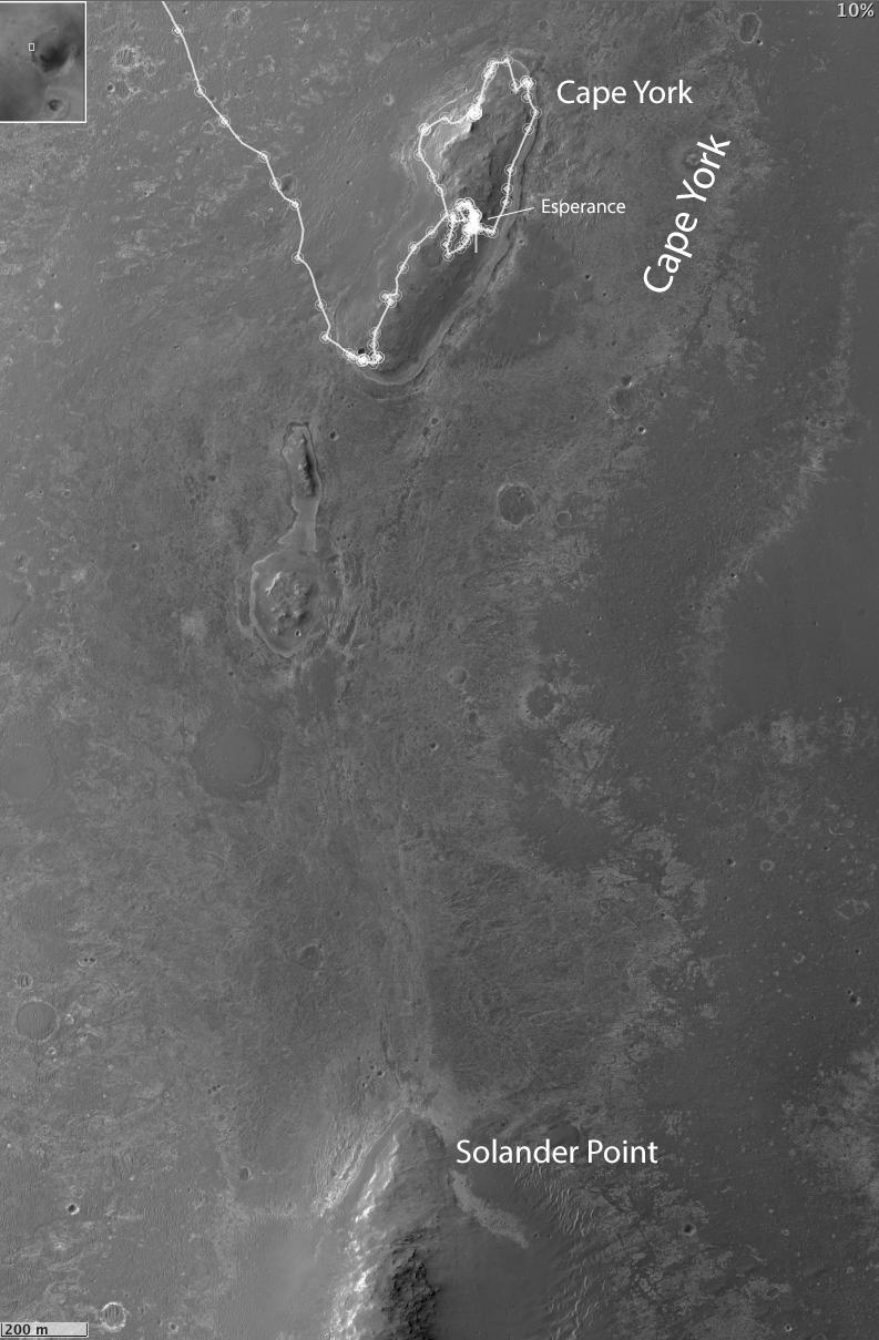
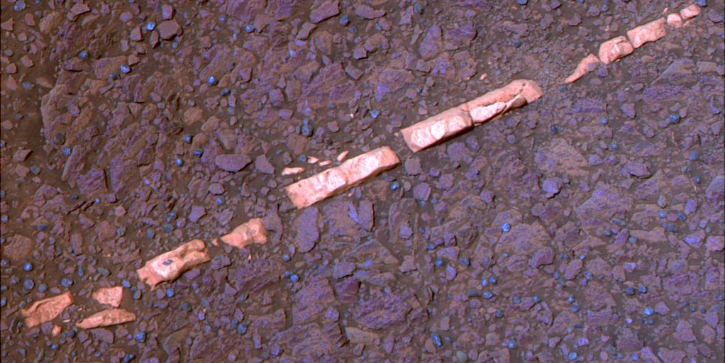
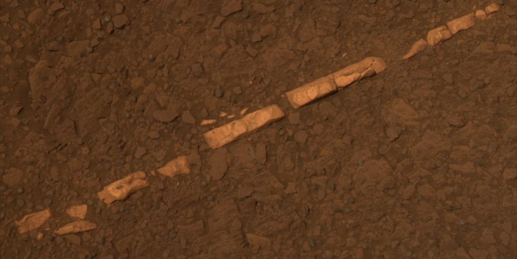
-
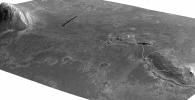
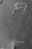
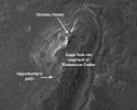
PIA18404:
-
Opportunity's Journey Exceeds 25 Miles
Full Resolution:
TIFF
(13.35 MB)
JPEG
(943.2 kB)
|
|
|
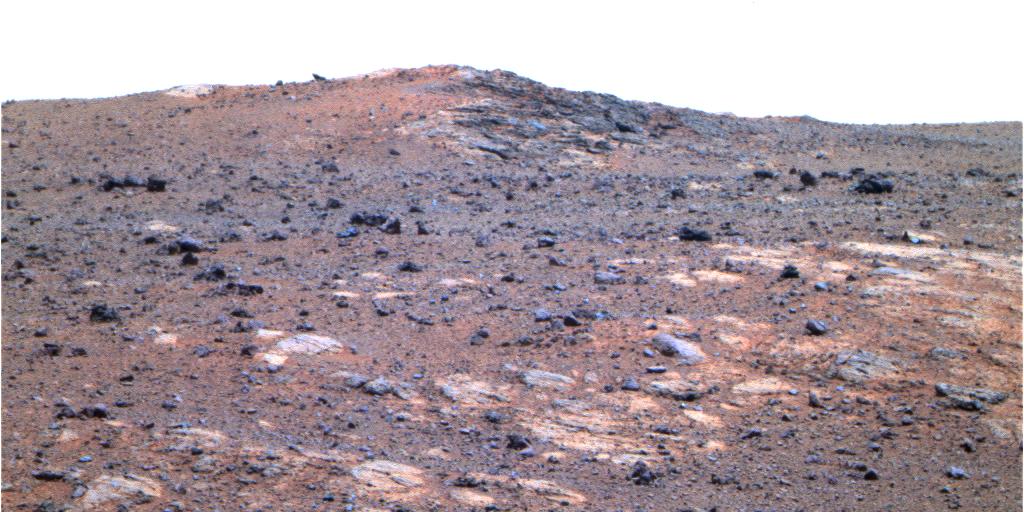
2014-06-23 |
Mars
|
Mars Exploration Rover (MER)
|
Panoramic Camera
|
7843x2000x3 |

|
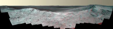
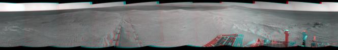
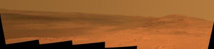
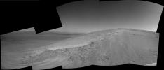
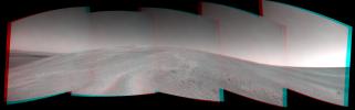
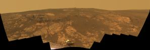
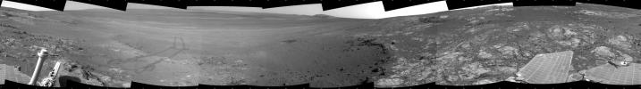
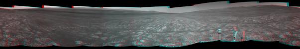
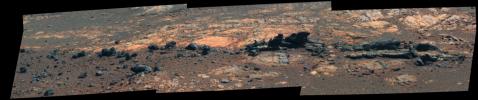
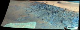
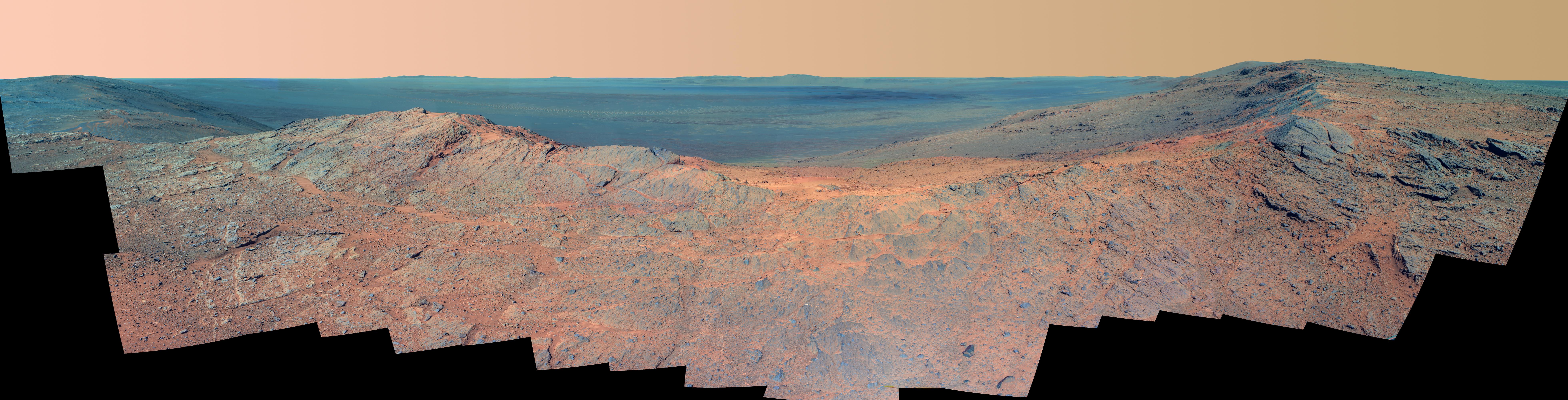
-
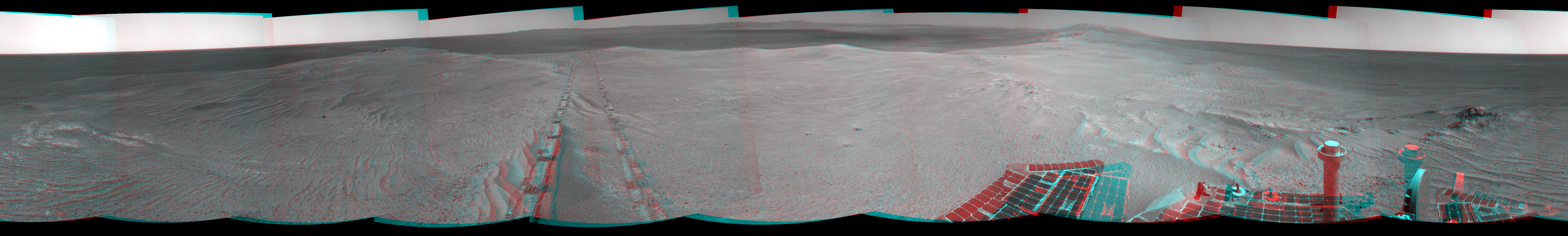
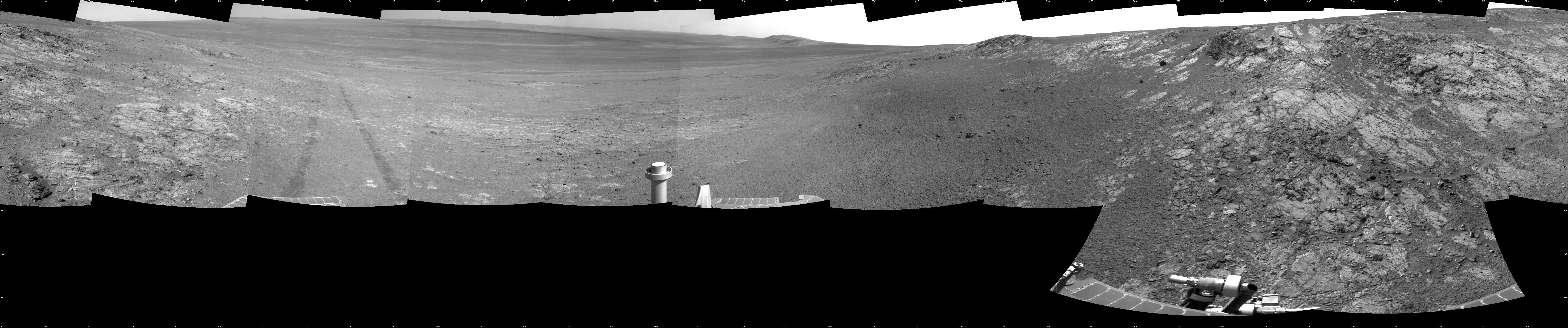
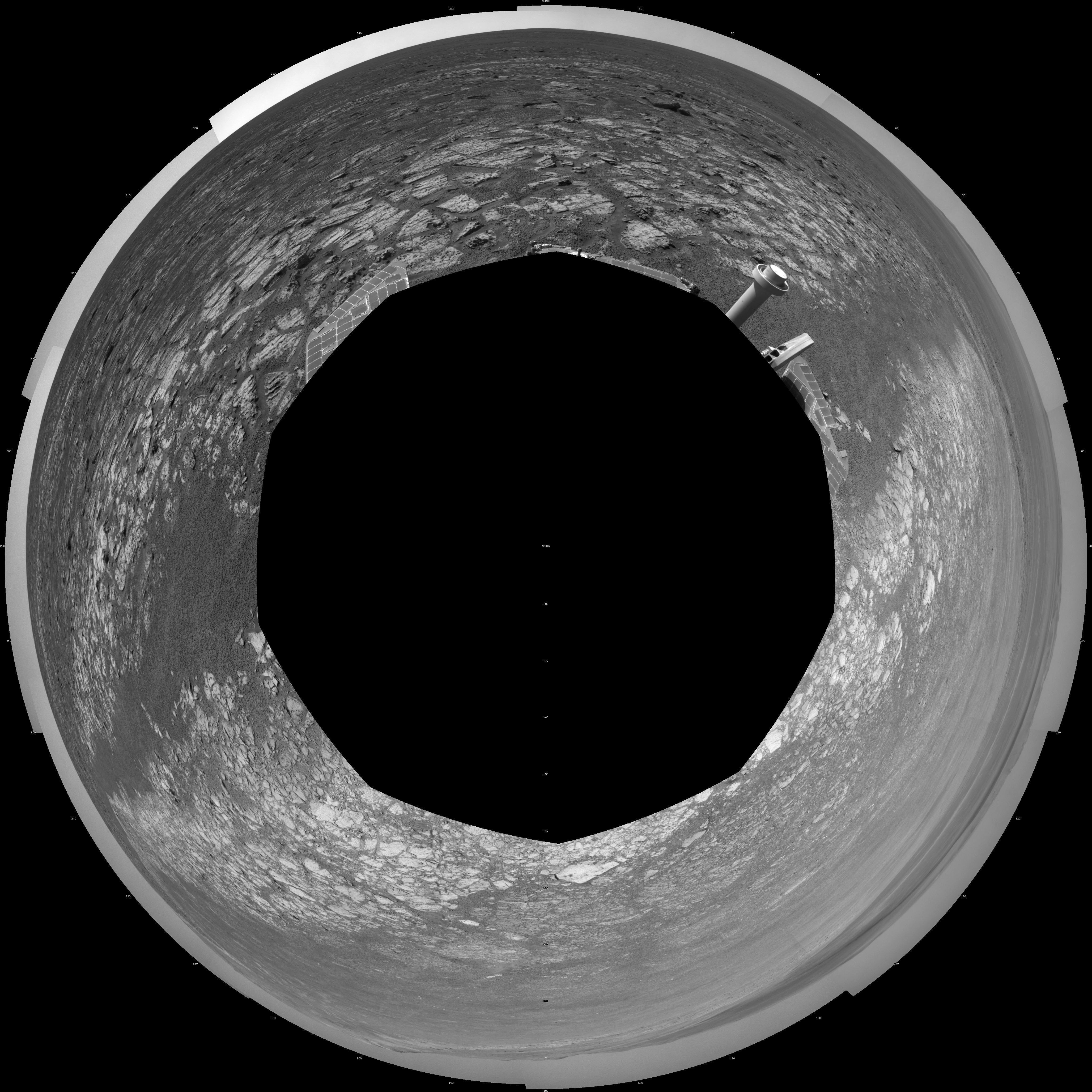
PIA18394:
'Pillinger Point' Overlooking Endeavour Crater on Mars (False Color)
Full Resolution:
TIFF
(47.07 MB)
JPEG
(2.293 MB)
|
|
|
2014-06-23 |
Mars
|
Mars Exploration Rover (MER)
|
Panoramic Camera
|
7793x2000x3 |
|
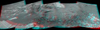
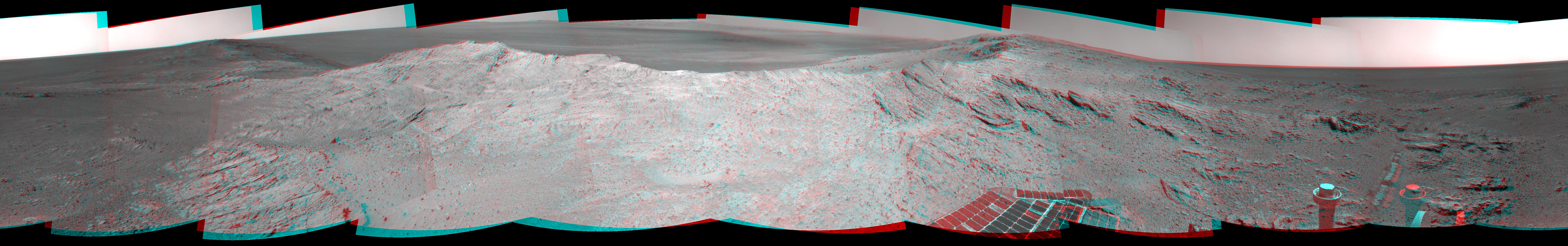
-
PIA18395:
'Pillinger Point' Overlooking Endeavour Crater on Mars (Stereo)
Full Resolution:
TIFF
(46.77 MB)
JPEG
(2.275 MB)
|
|
|
2014-06-23 |
Mars
|
Mars Exploration Rover (MER)
|
Panoramic Camera
|
7843x2000x3 |
|
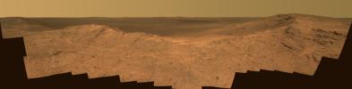
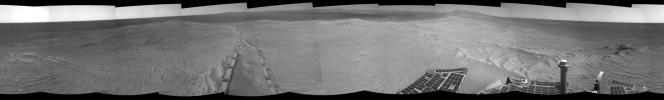
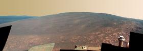
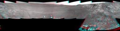
-
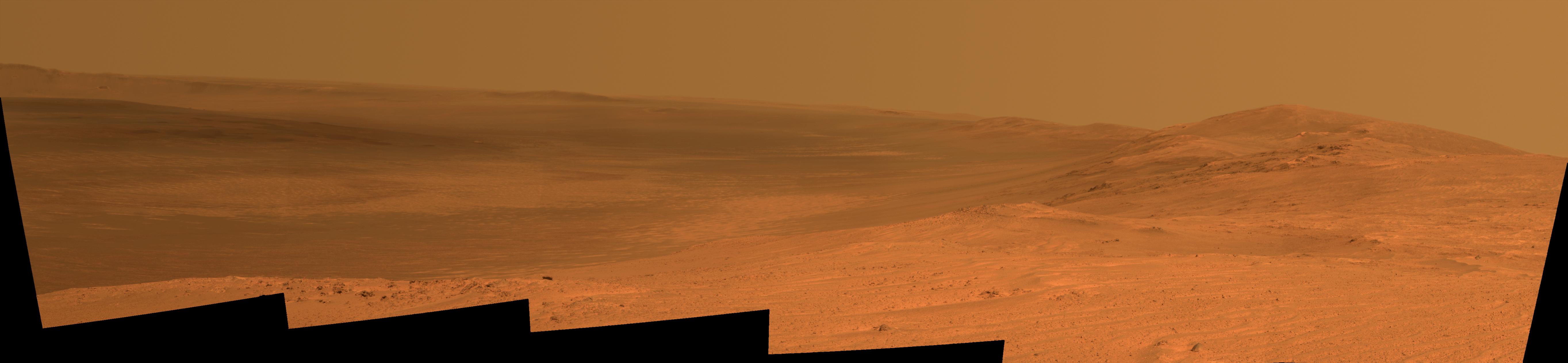
PIA18393:
'Pillinger Point' Overlooking Endeavour Crater on Mars
Full Resolution:
TIFF
(47.07 MB)
JPEG
(1.723 MB)
|
|
|
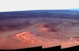
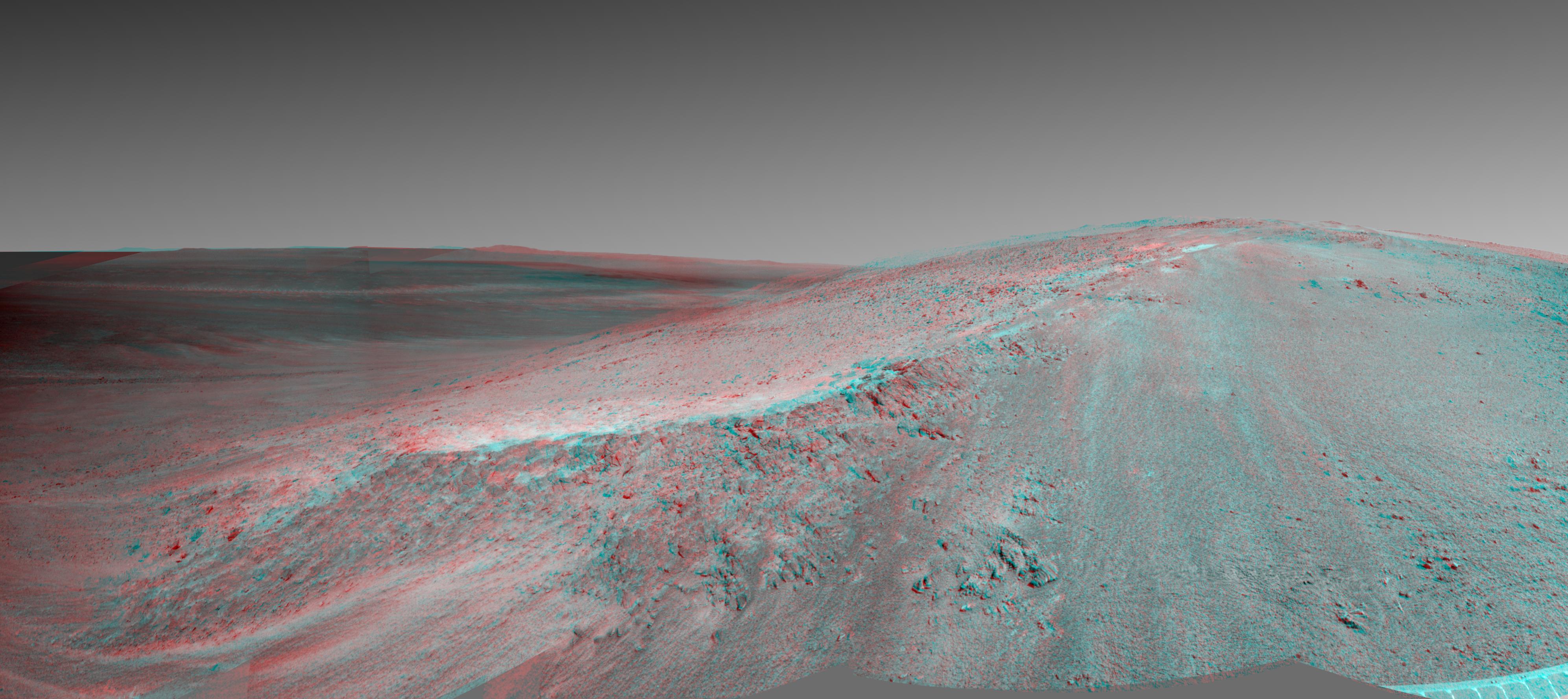
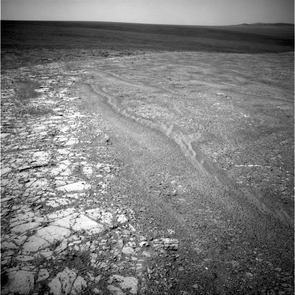
2014-05-19 |
Mars
|
Mars Exploration Rover (MER)
|
Navigation Camera
|
7753x1168x3 |
|
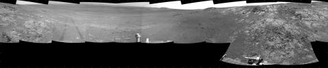
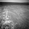
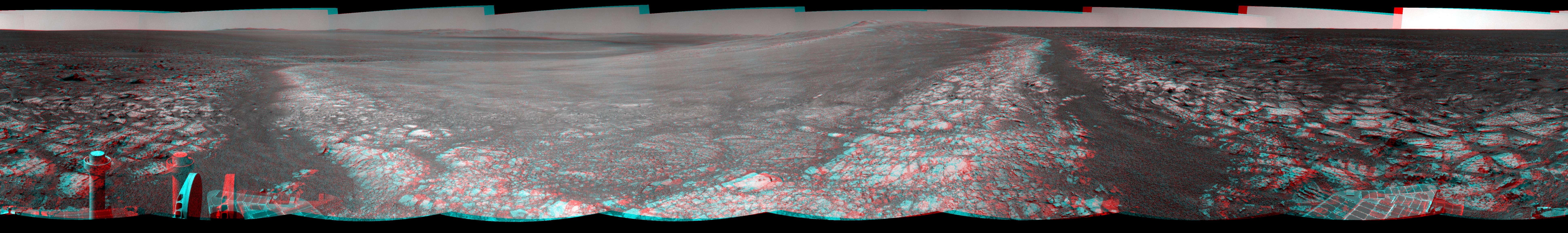
-
PIA18099:
Opportunity's Tracks Near Crater Rim Ridgeline (Stereo)
Full Resolution:
TIFF
(27.18 MB)
JPEG
(1.024 MB)
|
|
|
2014-05-19 |
Mars
|
Mars Exploration Rover (MER)
|
Navigation Camera
|
7753x1168x1 |
|
-
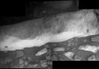
PIA18098:
Opportunity's Tracks Near Crater Rim Ridgeline
Full Resolution:
TIFF
(9.065 MB)
JPEG
(993.8 kB)
|
|
|
2014-05-19 |
Mars
|
Mars Exploration Rover (MER)
|
Navigation Camera
|
7753x1217x3 |
|
-
PIA18096:
Approaching a Target Deposit on Mars Crater Rim (Stereo)
Full Resolution:
TIFF
(28.32 MB)
JPEG
(1.311 MB)
|
|
|
2014-05-19 |
Mars
|
Mars Exploration Rover (MER)
|
Navigation Camera
|
7753x1217x1 |
|
-
PIA18095:
Approaching a Target Deposit on Mars Crater Rim
Full Resolution:
TIFF
(9.445 MB)
JPEG
(1.222 MB)
|
|
|
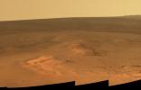
2014-05-19 |
Mars
|
Mars Exploration Rover (MER)
|
Panoramic Camera
|
5454x1264x3 |
|
-
PIA18094:
Endeavour Crater Rim From 'Murray Ridge' on Mars, False Color
Full Resolution:
TIFF
(20.69 MB)
JPEG
(598 kB)
|
|
|
2014-05-19 |
Mars
|
Mars Exploration Rover (MER)
|
Panoramic Camera
|
5454x1264x3 |
|
-
PIA18093:
Endeavour Crater Rim From 'Murray Ridge' on Mars
Full Resolution:
TIFF
(20.69 MB)
JPEG
(398 kB)
|
|
|
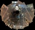
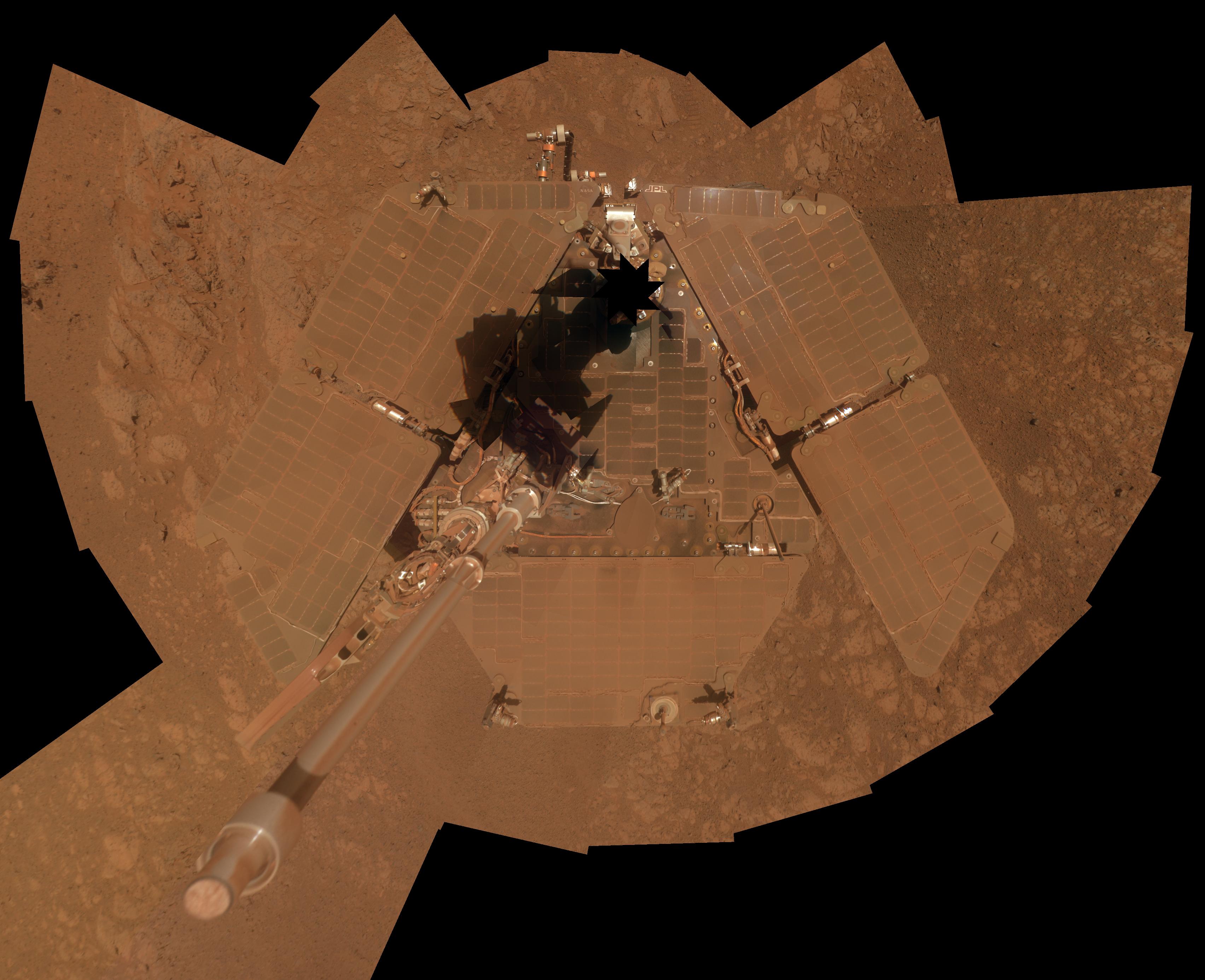
2014-04-17 |
Mars
|
Mars Exploration Rover (MER)
|
Panoramic Camera
|
7694x6016x3 |
|
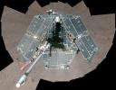
-
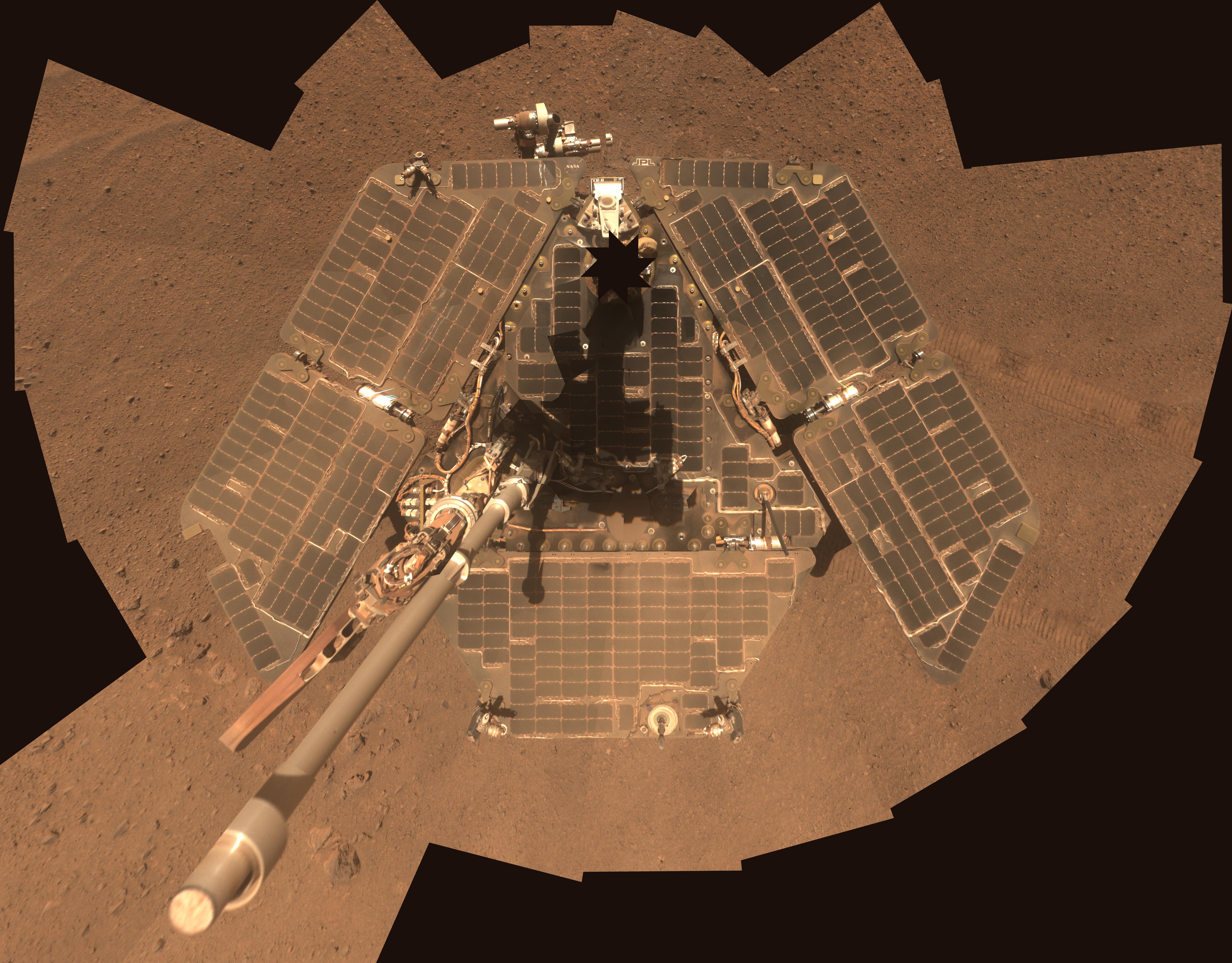
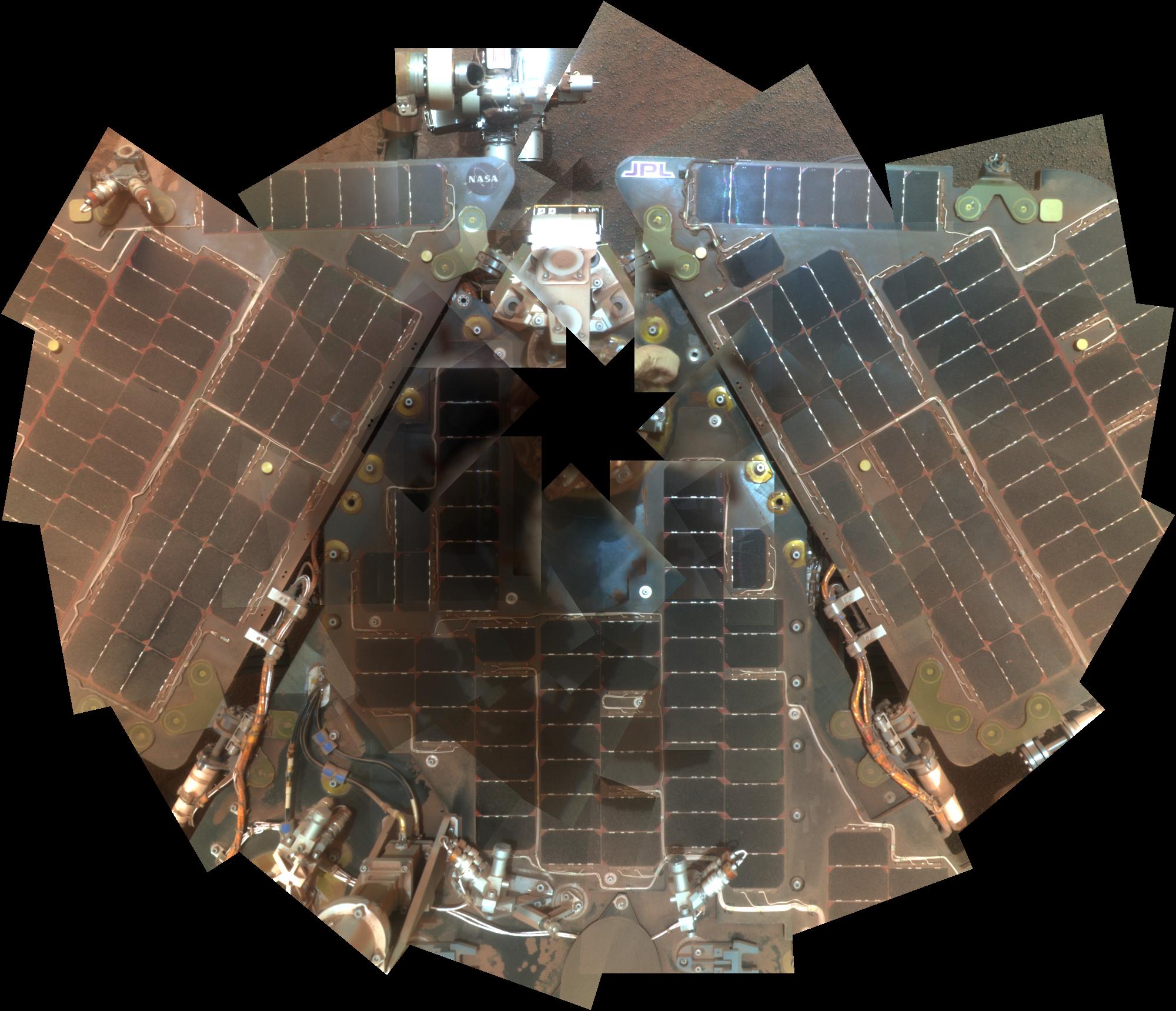
PIA18080:
-
Self-Portrait by Freshly Cleaned Opportunity Mars Rover, False Color
Full Resolution:
TIFF
(138.9 MB)
JPEG
(4.265 MB)
|
|
|
2014-04-17 |
Mars
|
Mars Exploration Rover (MER)
|
Panoramic Camera
|
7694x6016x3 |
|
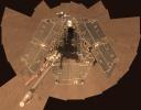
-
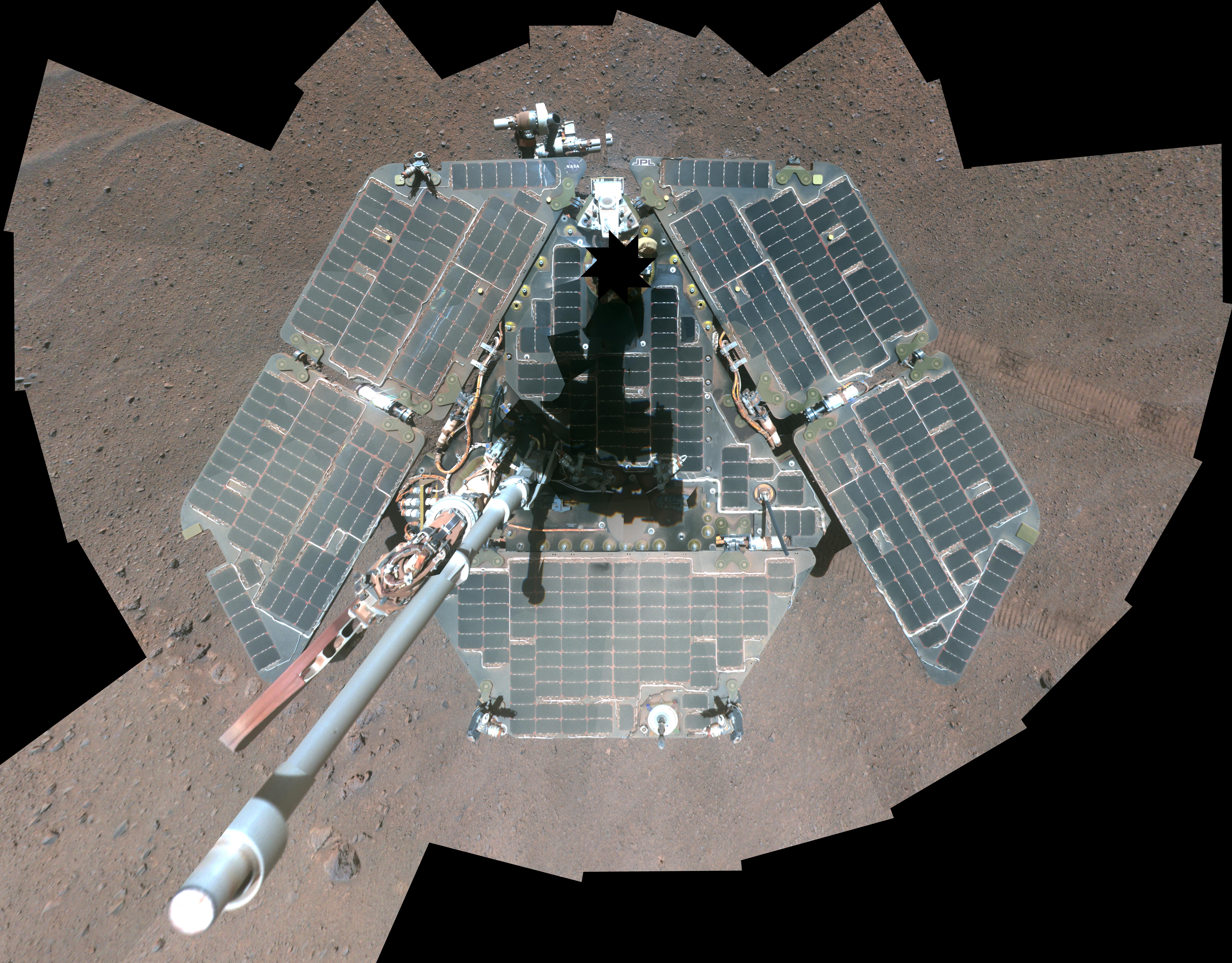
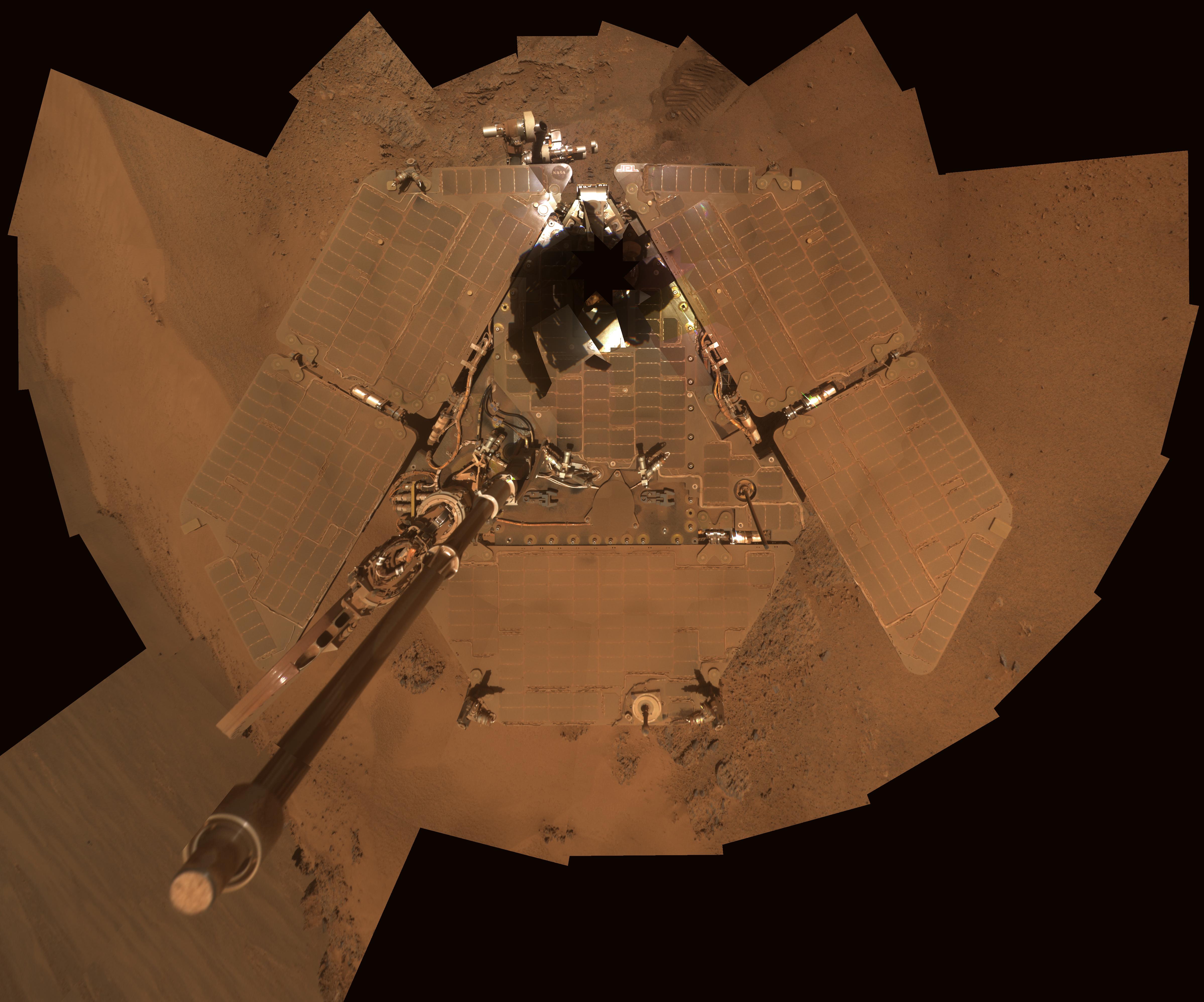
PIA18079:
-
Self-Portrait by Freshly Cleaned Opportunity Mars Rover in March 2014
Full Resolution:
TIFF
(138.9 MB)
JPEG
(3.583 MB)
|
|
|
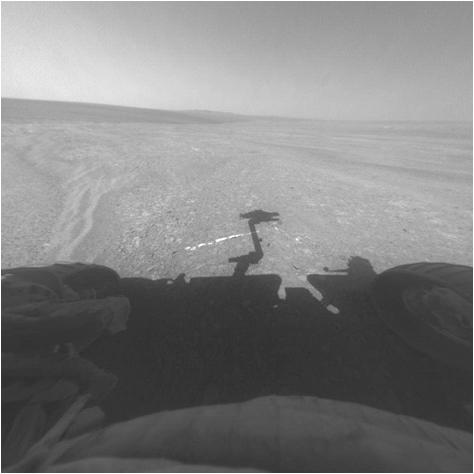
2014-03-27 |
Mars
|
Mars Exploration Rover (MER)
|
Hazcam
|
1024x1024x1 |
|
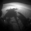
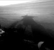
-
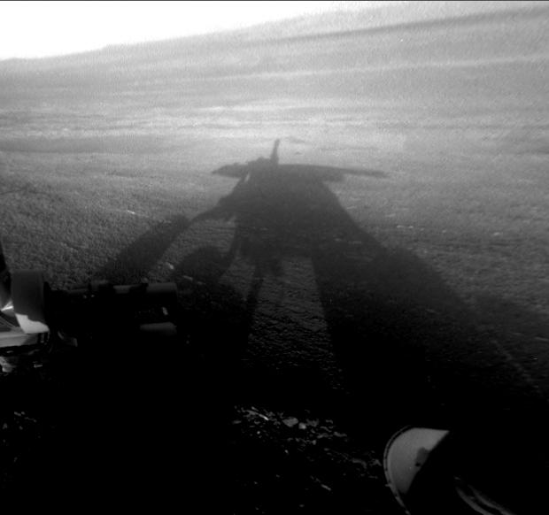
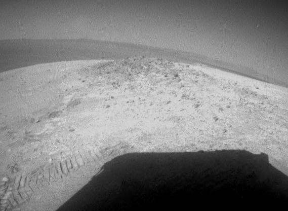
PIA17956:
-
Shadow Portrait of NASA Rover Opportunity on Martian Slope
Full Resolution:
TIFF
(1.05 MB)
JPEG
(98.26 kB)
|
|
|
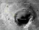
2014-02-19 |
Mars
|
Mars Exploration Rover (MER)
Mars Reconnaissance Orbiter (MRO)
|
HiRISE
|
1416x1441x3 |
|
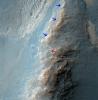
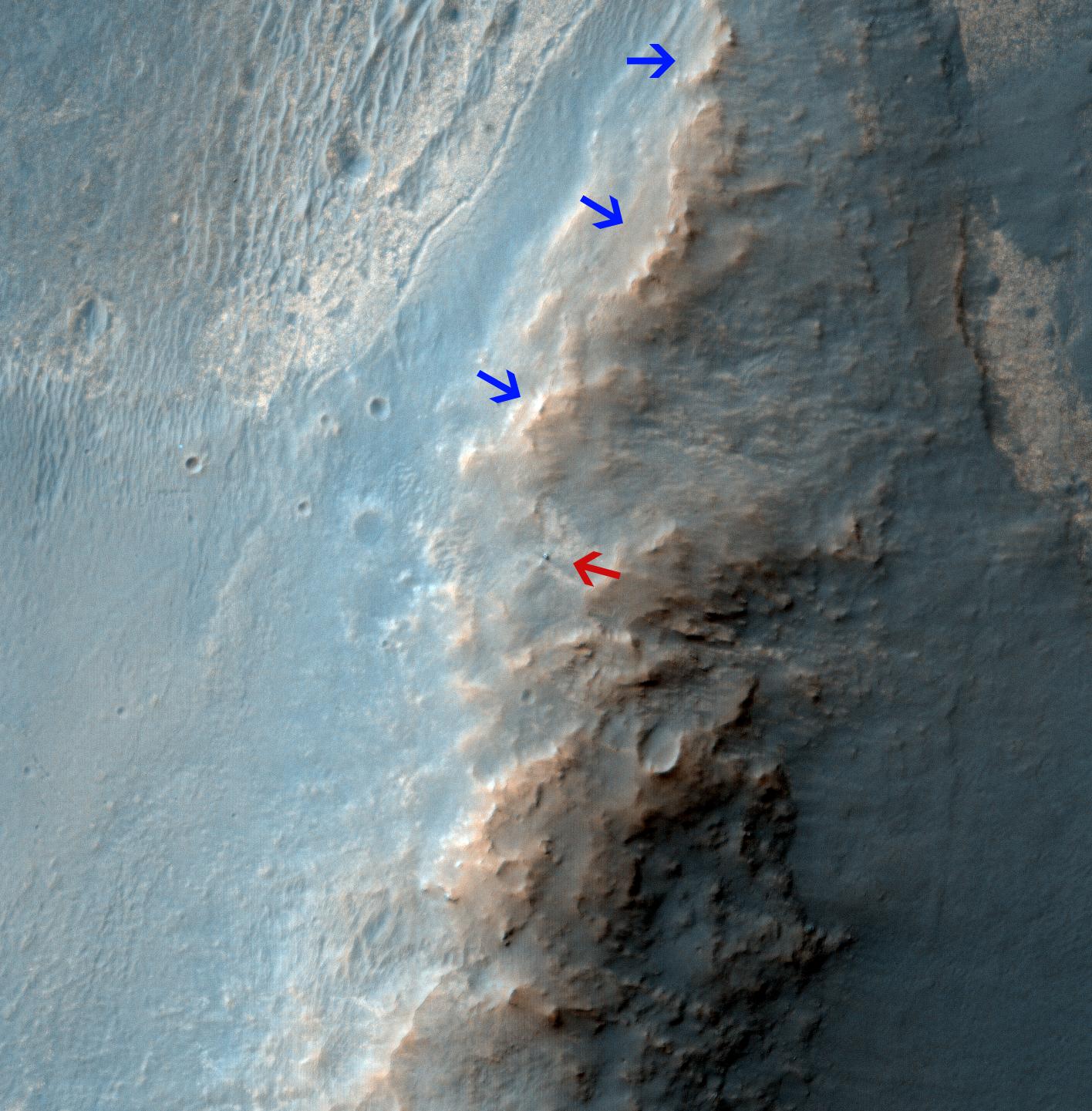
-
PIA17941:
-
Opportunity Rover on 'Murray Ridge' Seen From Orbit
Full Resolution:
TIFF
(6.124 MB)
JPEG
(282.8 kB)
|
|
|
2014-02-14 |
Mars
|
Mars Exploration Rover (MER)
|
Panoramic Camera
|
4383x934x3 |
|
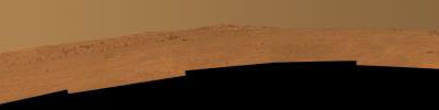
-
PIA17943:
Opportunity's Southward View of 'McClure-Beverlin Escarpment' on Mars
Full Resolution:
TIFF
(12.29 MB)
JPEG
(260.7 kB)
|
|
|
2014-02-14 |
Mars
|
Mars Exploration Rover (MER)
|
Panoramic Camera
|
1020x1020x3 |
|
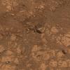
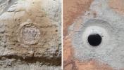
-
PIA17942:
-
Where Martian 'Jelly Doughnut' Rock Came From
Full Resolution:
TIFF
(3.122 MB)
JPEG
(222.7 kB)
|
|
|
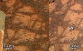
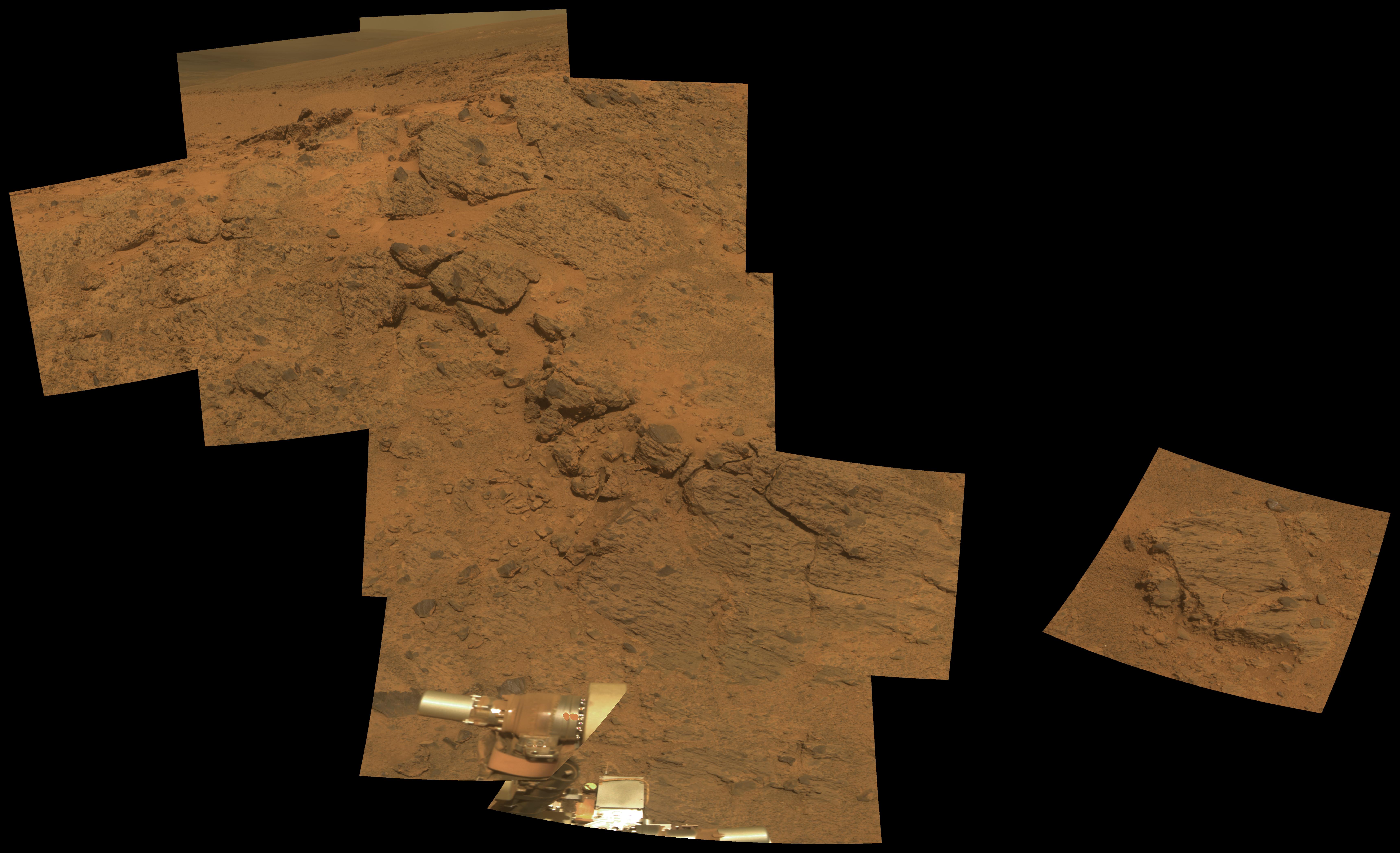
2014-01-23 |
Mars
|
Mars Exploration Rover (MER)
|
Panoramic Camera
|
3408x2772x3 |
|
-
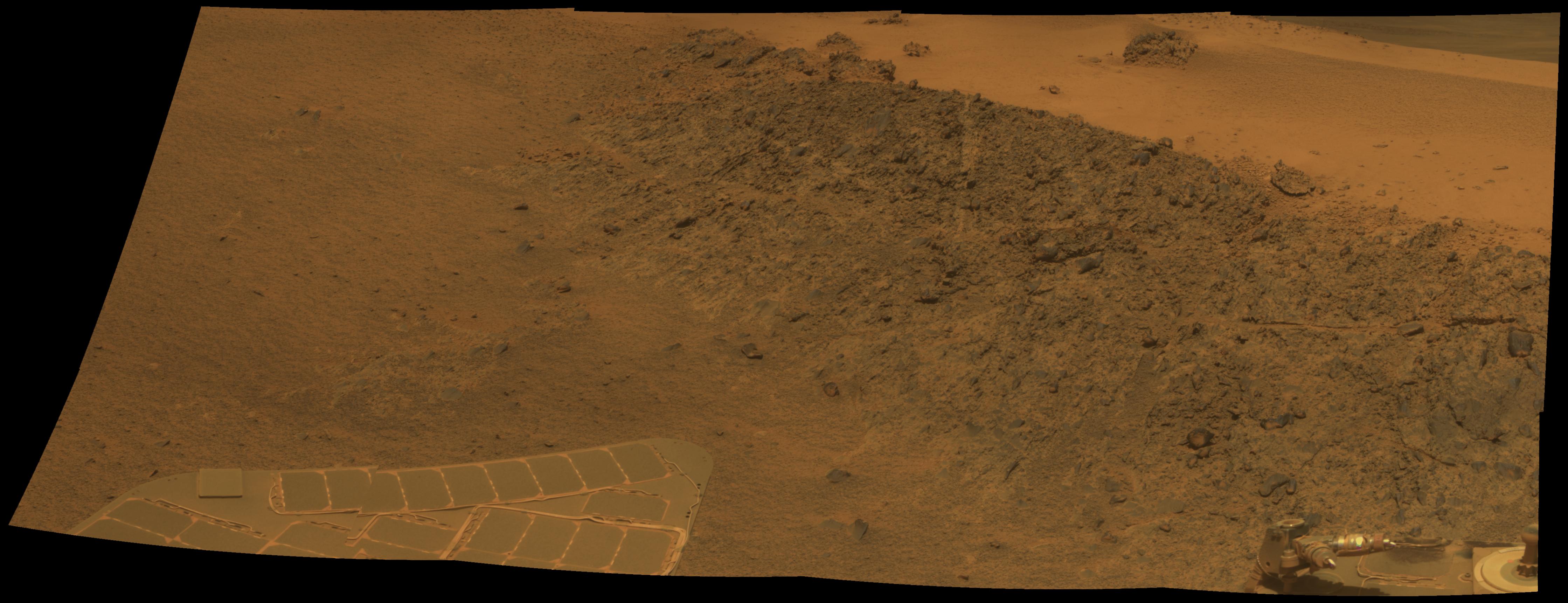
PIA17759:
-
Self-Portrait by Opportunity Mars Rover in January 2014
Full Resolution:
TIFF
(28.35 MB)
JPEG
(696.2 kB)
|
|
|
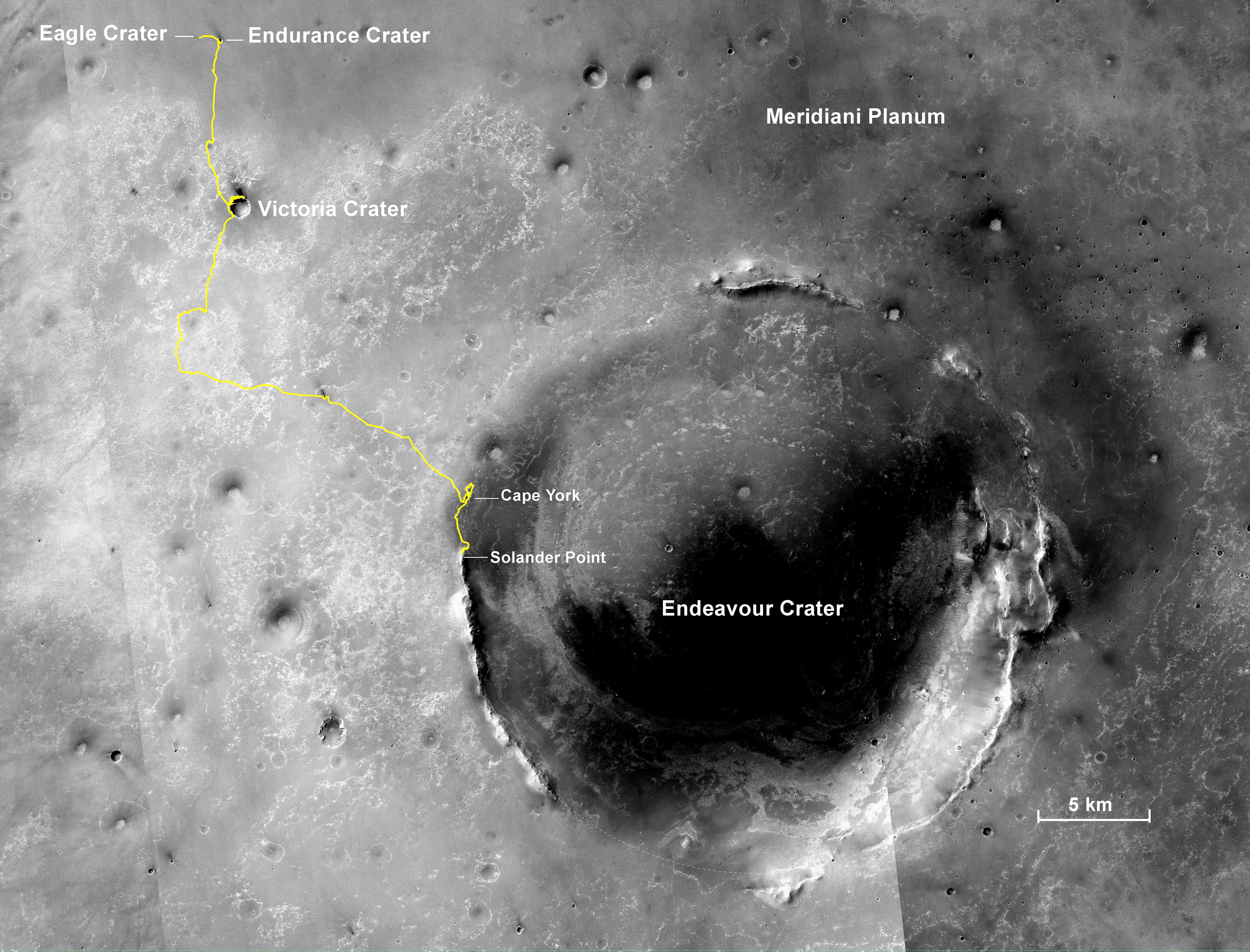
2014-01-23 |
Mars
|
Mars Exploration Rover (MER)
Mars Reconnaissance Orbiter (MRO)
|
CTX
|
4853x3687x3 |
|
-
PIA17758:
-
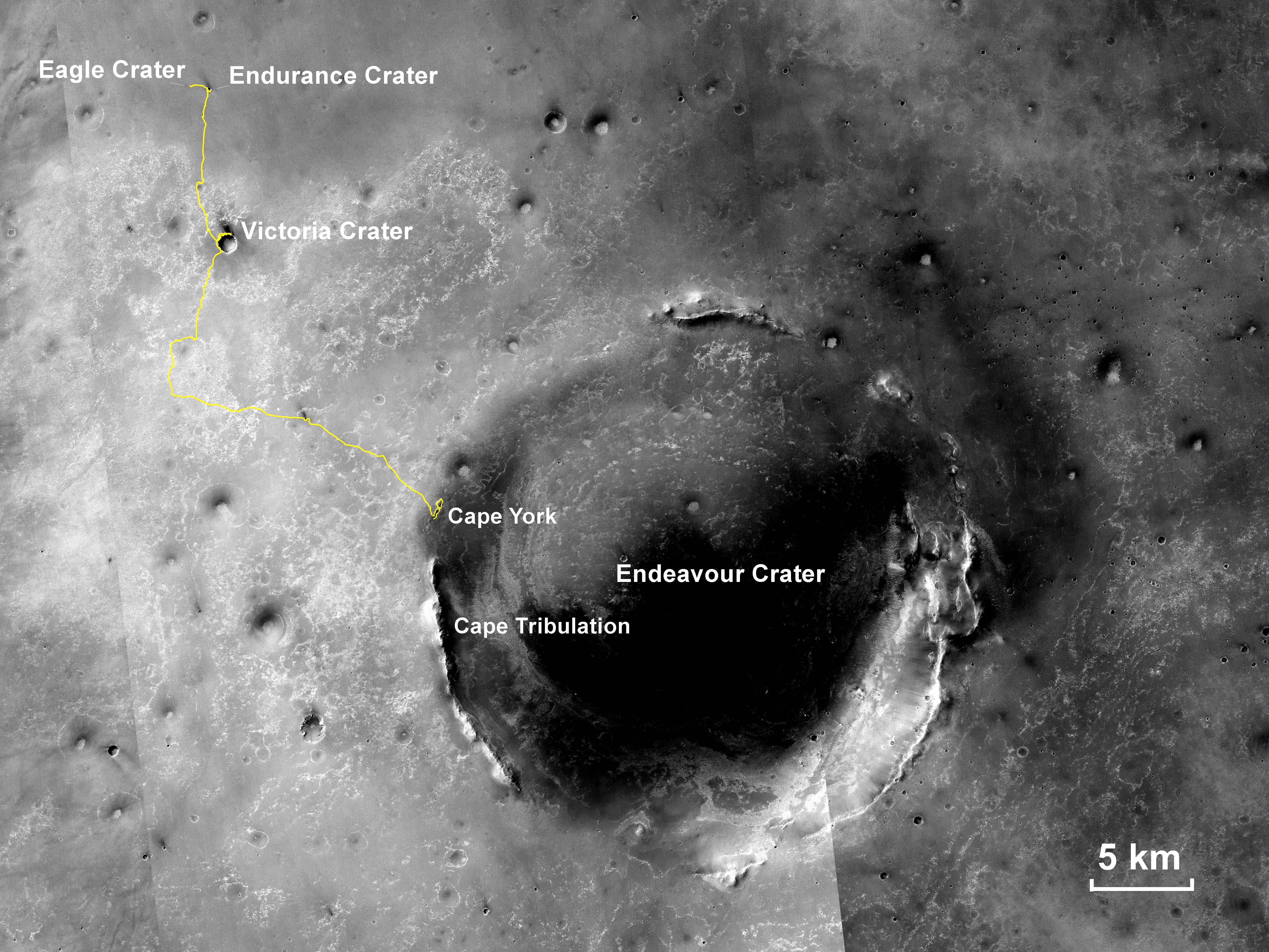
Opportunity's First Decade of Driving on Mars
Full Resolution:
TIFF
(53.71 MB)
JPEG
(3.168 MB)
|
|
|
2014-01-23 |
Mars
|
Mars Exploration Rover (MER)
|
|
1280x720x3 |
|
-
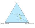
PIA17757:
-
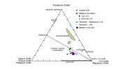
Mineral Plot from 'Esperance' Target
Full Resolution:
TIFF
(2.766 MB)
JPEG
(61.69 kB)
|
|
|
2014-01-23 |
Mars
|
Mars Exploration Rover (MER)
|
Panoramic Camera
|
1035x651x3 |
|
-
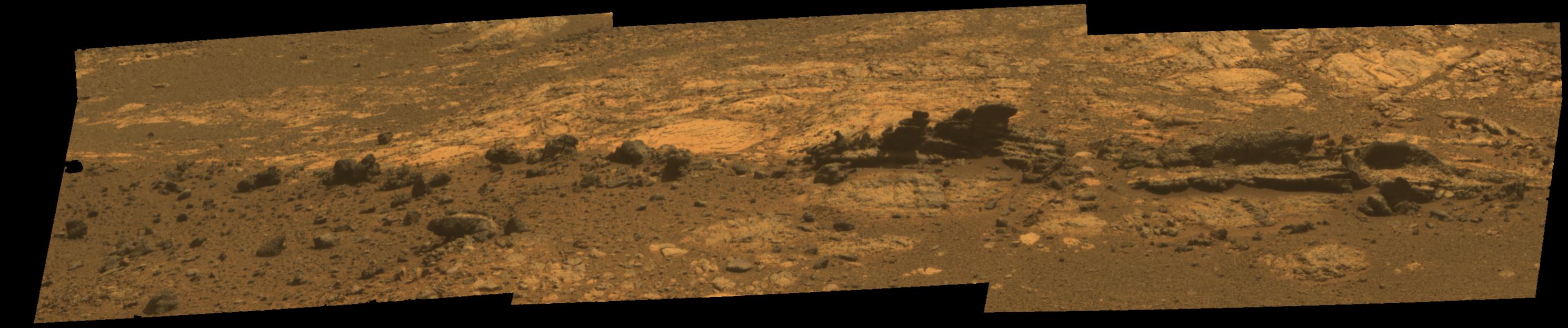
PIA17756:
-
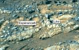
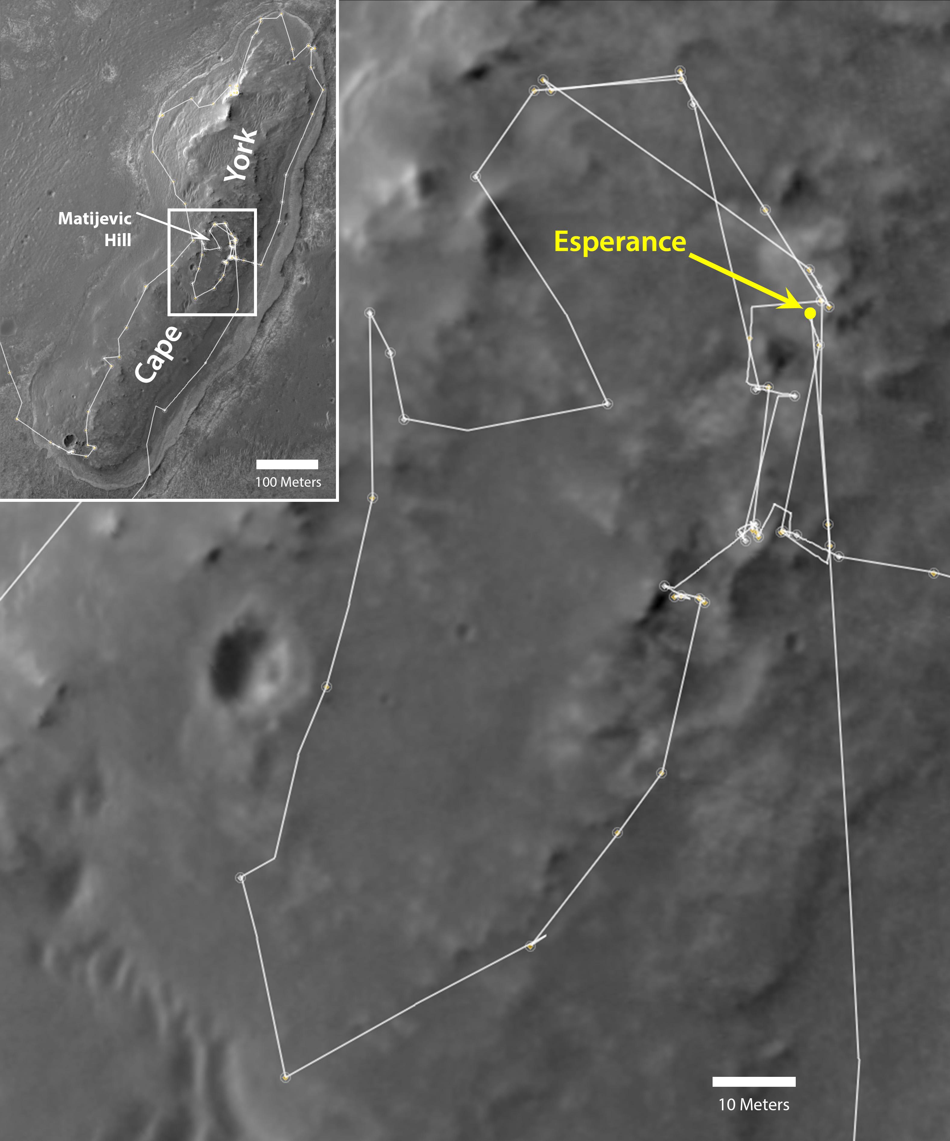
'Esperance6' and 'Lihir' Rover Targets
Full Resolution:
TIFF
(2.022 MB)
JPEG
(134.9 kB)
|
|
|
2014-01-23 |
Mars
|
Mars Exploration Rover (MER)
|
Panoramic Camera
|
2940x3000x3 |
|
-
PIA17364:
-
Mineral Detected from Orbit Found in Dark Veneers
Full Resolution:
TIFF
(26.47 MB)
JPEG
(790.4 kB)
|
|
|
2014-01-21 |
Mars
|
Mars Exploration Rover (MER)
|
Panoramic Camera
|
1171x720x3 |
|
-
PIA17761:
-
Rock That Appeared in Front of Opportunity on "Murray Ridge"
Full Resolution:
TIFF
(2.531 MB)
JPEG
(164.7 kB)
|
|
|
2014-01-03 |
Mars
|
Mars Exploration Rover (MER)
|
Panoramic Camera
|
6883x4196x3 |

|
-
PIA17753:
-
Outcrop on 'Murray Ridge' Section of Martian Crater Rim (False Color)
Full Resolution:
TIFF
(86.68 MB)
JPEG
(2.89 MB)
|
|
|
2014-01-03 |
Mars
|
Mars Exploration Rover (MER)
|
Panoramic Camera
|
6883x4196x3 |
|
-
PIA17752:
-
Outcrop on 'Murray Ridge' Section of Martian Crater Rim
Full Resolution:
TIFF
(86.68 MB)
JPEG
(1.69 MB)
|
|
|
2013-12-03 |
Mars
|
Mars Exploration Rover (MER)
|
Navigation Camera
|
1024x1024x1 |

|
-
PIA17590:
-
Tracks of a Climb on Opportunity's Sol 3485
Full Resolution:
TIFF
(1.05 MB)
JPEG
(207.9 kB)
|
|
|
2013-12-03 |
Mars
|
Mars Exploration Rover (MER)
Mars Reconnaissance Orbiter (MRO)
|
CTX
|
4731x3605x3 |
|
-
PIA17589:
-
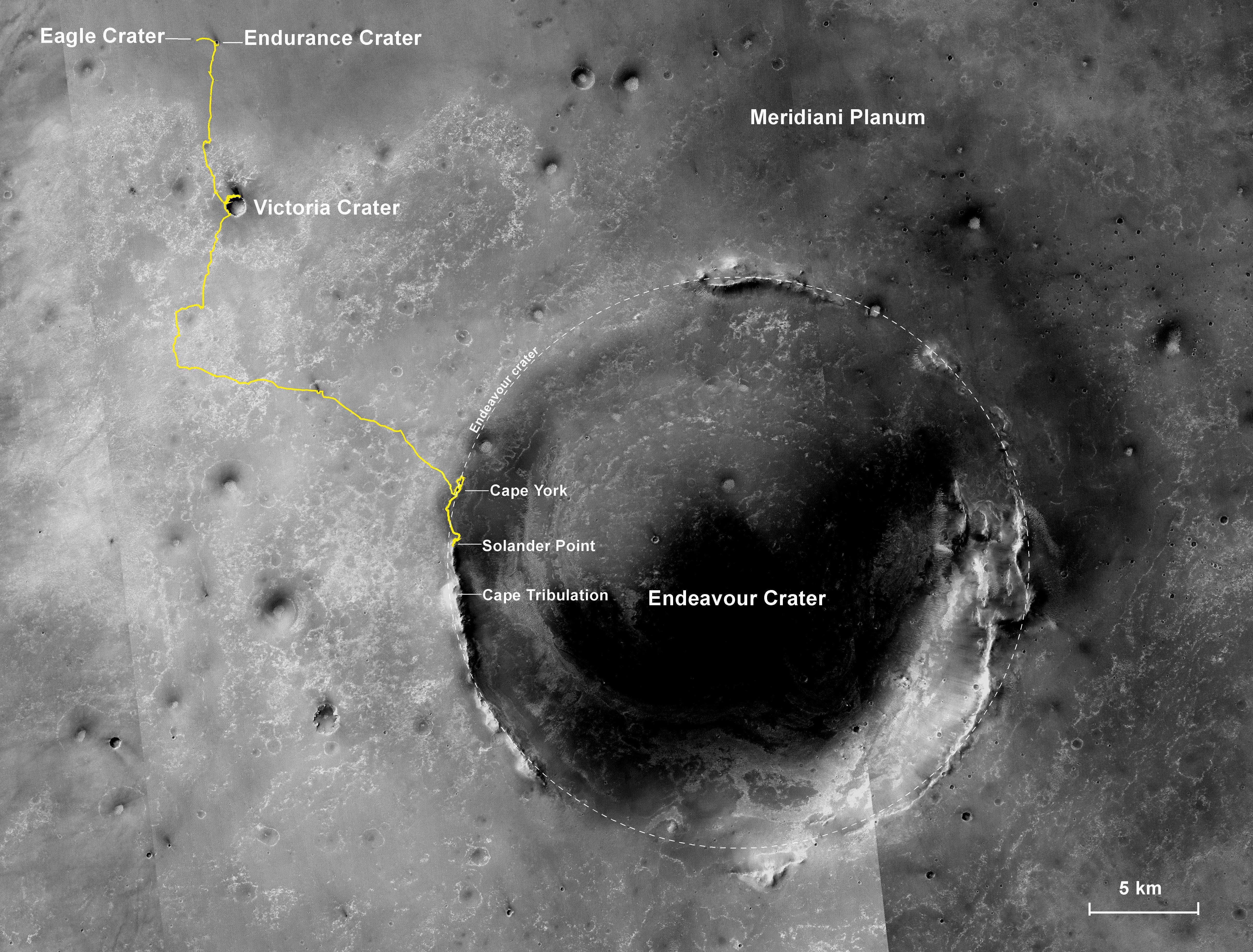
Opportunity's Journey, Approaching 10th Anniversary
Full Resolution:
TIFF
(51.19 MB)
JPEG
(3.199 MB)
|
|
|
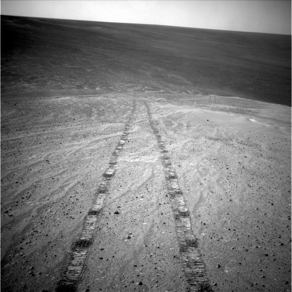
2013-11-13 |
Mars
|
Mars Exploration Rover (MER)
|
Navigation Camera
|
3985x1776x3 |
|
-
PIA17588:
-
'Murray Ridge' in Stereo from Mars Rover Opportunity
Full Resolution:
TIFF
(21.24 MB)
JPEG
(747.4 kB)
|
|
|
2013-11-13 |
Mars
|
Mars Exploration Rover (MER)
Mars Reconnaissance Orbiter (MRO)
|
HiRISE
|
8192x4298x3 |
|
-
PIA17586:
-
A New Perspective on Murray Ridge
Full Resolution:
TIFF
(105.7 MB)
JPEG
(2.803 MB)
|
|
|
2013-11-13 |
Mars
|
Mars Exploration Rover (MER)
|
Navigation Camera
|
4253x1820x1 |
|
-
PIA17585:
-
Opportunity's View Climbing 'Murray Ridge'
Full Resolution:
TIFF
(7.755 MB)
JPEG
(596.5 kB)
|
|
|
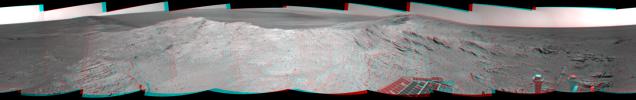
2013-11-13 |
Mars
|
Mars Exploration Rover (MER)
|
Panoramic Camera
|
9908x3546x3 |
|
-
PIA17583:
-
'Murray Ridge' on Rim of Endeavour Crater on Mars, False Color
Full Resolution:
TIFF
(105.4 MB)
JPEG
(4.847 MB)
|
|
|
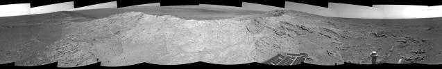
2013-11-13 |
Mars
|
Mars Exploration Rover (MER)
|
Panoramic Camera
|
9908x3546x3 |
|
-
PIA17582:
-
'Murray Ridge' on Rim of Endeavour Crater on Mars
Full Resolution:
TIFF
(105.4 MB)
JPEG
(3.421 MB)
|
|
|
2013-10-23 |
Mars
|
Mars Exploration Rover (MER)
|
Navigation Camera
|
4278x1333x3 |
|
-
PIA17367:
-
Mars Hill-Climbing Opportunity at 'Solander Point,' in Stereo
Full Resolution:
TIFF
(17.12 MB)
JPEG
(474 kB)
|
|
|
2013-10-23 |
Mars
|
Mars Exploration Rover (MER)
|
Navigation Camera
|
4243x1135x1 |

|
-
PIA17366:
Mars Hill-Climbing Opportunity at 'Solander Point'
Full Resolution:
TIFF
(4.825 MB)
JPEG
(376 kB)
|
|
|
2013-08-14 |
Mars
|
Mars Exploration Rover (MER)
|
Navigation Camera
|
1024x1024x1 |
|
-
PIA17088:
-
Northern Tip of 'Solander Point' on Endeavour Crater Rim
Full Resolution:
TIFF
(1.05 MB)
JPEG
(180.7 kB)
|
|
|
2013-08-14 |
Mars
|
Mars Exploration Rover (MER)
|
Navigation Camera
|
858x374x1 |
|
-
PIA17087:
-
Geological Boundary at the Edge of 'Solander Point'
Full Resolution:
TIFF
(321.4 kB)
JPEG
(70.07 kB)
|
|
|
2013-07-17 |
Mars
|
Mars Exploration Rover (MER)
Mars Reconnaissance Orbiter (MRO)
|
HiRISE
|
1616x839x3 |
|
-
PIA17278:
-
Color View From Orbit Showing Opportunity in 'Botany Bay'
Full Resolution:
TIFF
(4.069 MB)
JPEG
(524.7 kB)
|
|
|
2013-07-02 |
Mars
|
Mars Exploration Rover (MER)
|
Hazcam
|
1024x774x1 |

|
-
PIA17271:
-
Opportunity's View in 'Botany Bay' Toward 'Solander Point'
Full Resolution:
TIFF
(793.6 kB)
JPEG
(81.87 kB)
|
|
|
2013-06-21 |
Mars
|
Mars Exploration Rover (MER)
|
Navigation Camera
|
3426x1149x3 |
|
-
PIA17266:
-
'Nobbys Head' on Opportunity's Southward Route (Stereo)
Full Resolution:
TIFF
(11.81 MB)
JPEG
(491.5 kB)
|
|
|
2013-06-21 |
Mars
|
Mars Exploration Rover (MER)
|
Panoramic Camera
|
5274x1001x1 |
|
-
PIA17265:
'Nobbys Head' on Opportunity's Southward Route
Full Resolution:
TIFF
(5.288 MB)
JPEG
(873.7 kB)
|
|
|
2013-06-07 |
Mars
|
Mars Exploration Rover (MER)
|
Panoramic Camera
|
1020x1022x3 |
|
-
PIA17078:
-
Opportunity's view of 'Solander Point'
Full Resolution:
TIFF
(3.129 MB)
JPEG
(139.6 kB)
|
|
|
2013-06-07 |
Mars
|
Mars Exploration Rover (MER)
|
Navigation Camera
|
5730x4075x1 |
|
-
PIA17077:
-
Opportunity's View Leaving 'Cape York'
Full Resolution:
TIFF
(23.38 MB)
JPEG
(1.688 MB)
|
|
|
2013-06-07 |
Mars
|
Mars Exploration Rover (MER)
|
HiRISE
|
8192x4206x1 |
|
-
PIA17076:
-
Perspective View of 'Botany Bay' and Surroundings, With Vertical Exaggeration
Full Resolution:
TIFF
(34.49 MB)
JPEG
(3.985 MB)
|
|
|
2013-06-07 |
Mars
|
Mars Exploration Rover (MER)
|
|
3082x2500x3 |
|
-
PIA17075:
-
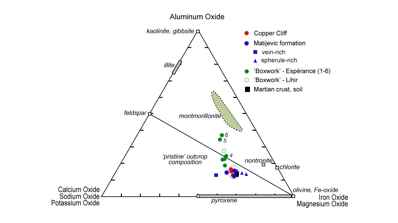
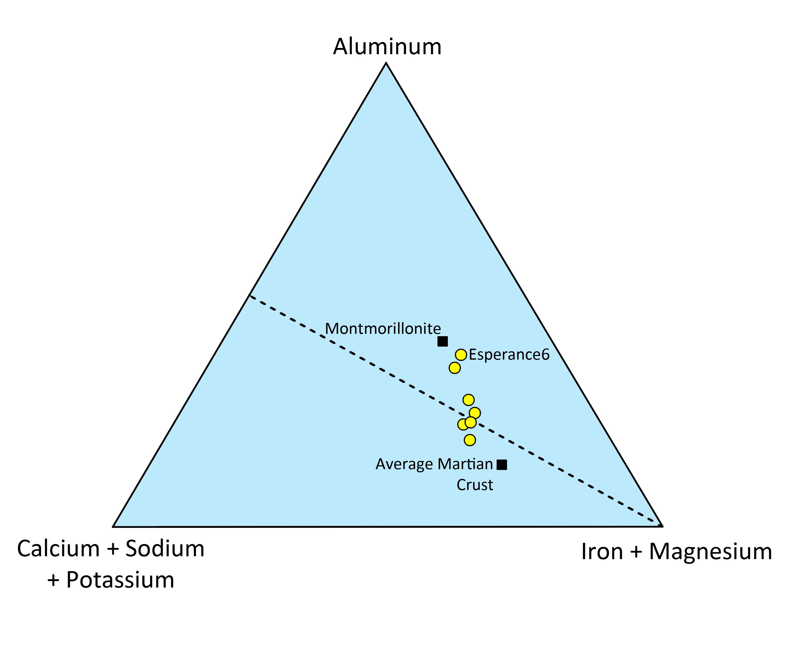
Chemistry of Martian Rock "Esperance"
Full Resolution:
TIFF
(23.13 MB)
JPEG
(222 kB)
|
|
|
2013-06-07 |
Mars
|
Mars Exploration Rover (MER)
|
Panoramic Camera
|
1024x1024x3 |

|
-
PIA17074:
-
'Esperance' Target Examined by Opportunity
Full Resolution:
TIFF
(3.147 MB)
JPEG
(239 kB)
|
|
|
2013-06-07 |
Mars
|
Mars Exploration Rover (MER)
Mars Reconnaissance Orbiter (MRO)
|
HiRISE
|
3153x3788x3 |
|
-
PIA17073:
-
Opportunity's Exploration of "Cape York"
Full Resolution:
TIFF
(35.85 MB)
JPEG
(573.3 kB)
|
|
|
2013-06-07 |
Mars
|
Mars Exploration Rover (MER)
Mars Reconnaissance Orbiter (MRO)
|
CTX
|
5198x3900x3 |
|
-
PIA17070:
-
Opportunity's Traverse Through 112 Months
Full Resolution:
TIFF
(60.85 MB)
JPEG
(3.973 MB)
|
|
|
2013-05-17 |
Mars
|
Mars Exploration Rover (MER)
|
HiRISE
|
793x1209x1 |
|
-
PIA16931:
-
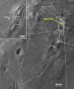
Opportunity Heads Toward Next Destination, 'Solander Point'
Full Resolution:
TIFF
(959.9 kB)
JPEG
(122.1 kB)
|
|
|
2013-05-17 |
Mars
|
Mars Exploration Rover (MER)
|
Panoramic Camera
|
1019x1024x3 |
|
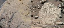
-
PIA16930:
-
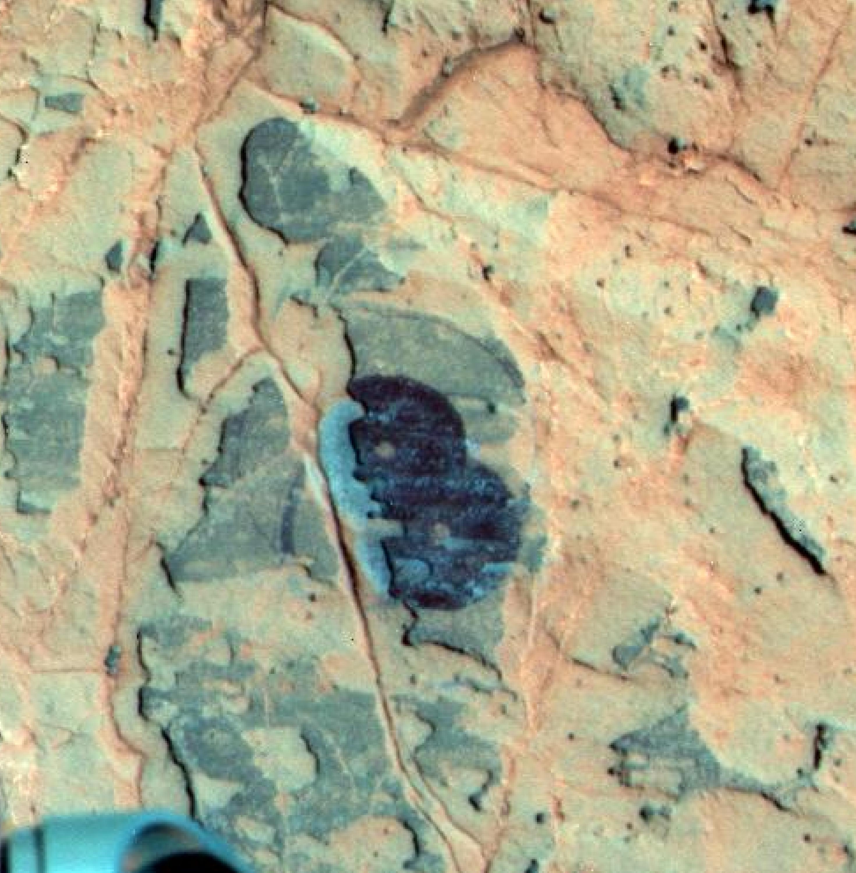
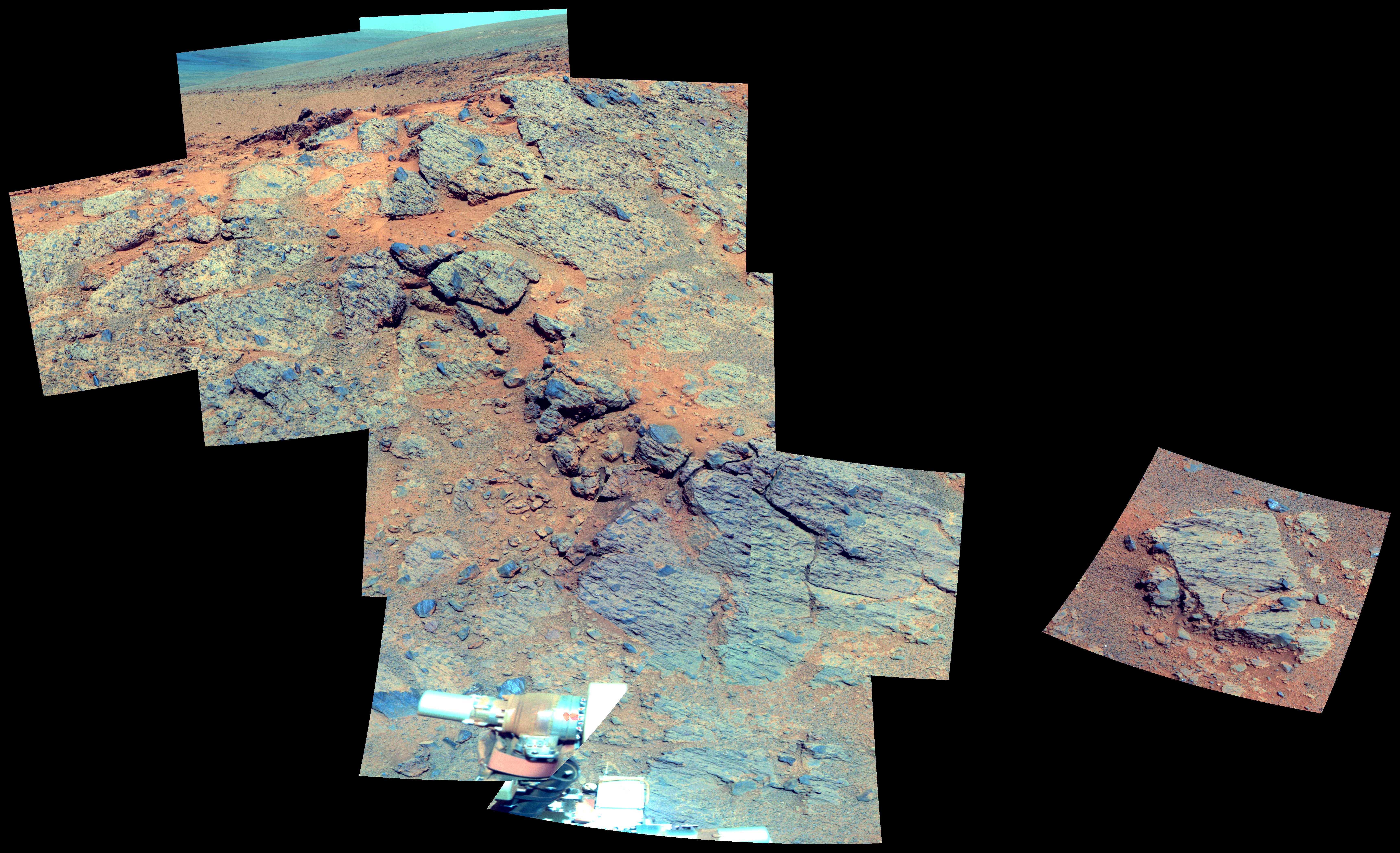
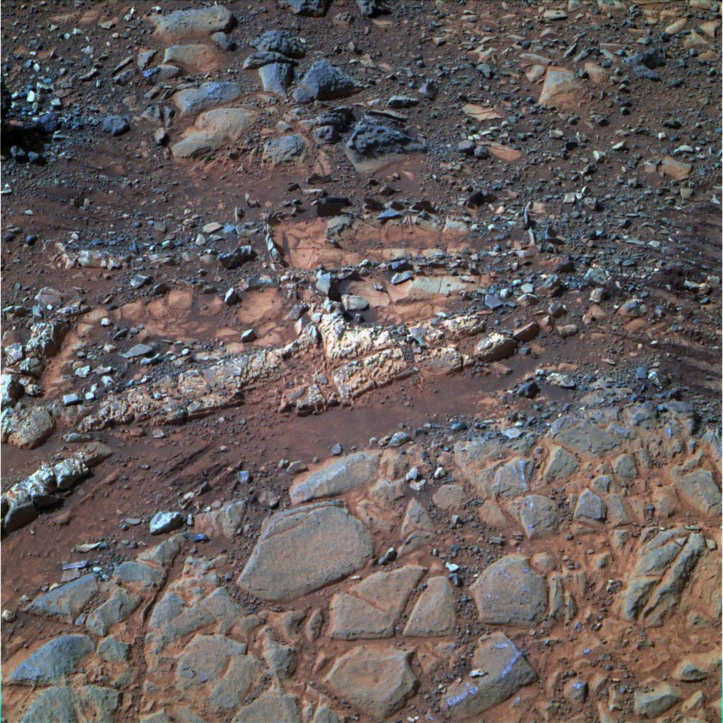
Rock Target 'Esperance' Altered by Wet History (False Color)
Full Resolution:
TIFF
(3.132 MB)
JPEG
(135.4 kB)
|
|
|
2013-05-17 |
Mars
|
Mars Exploration Rover (MER)
|
Microscopic Imager
|
1743x1743x1 |

|
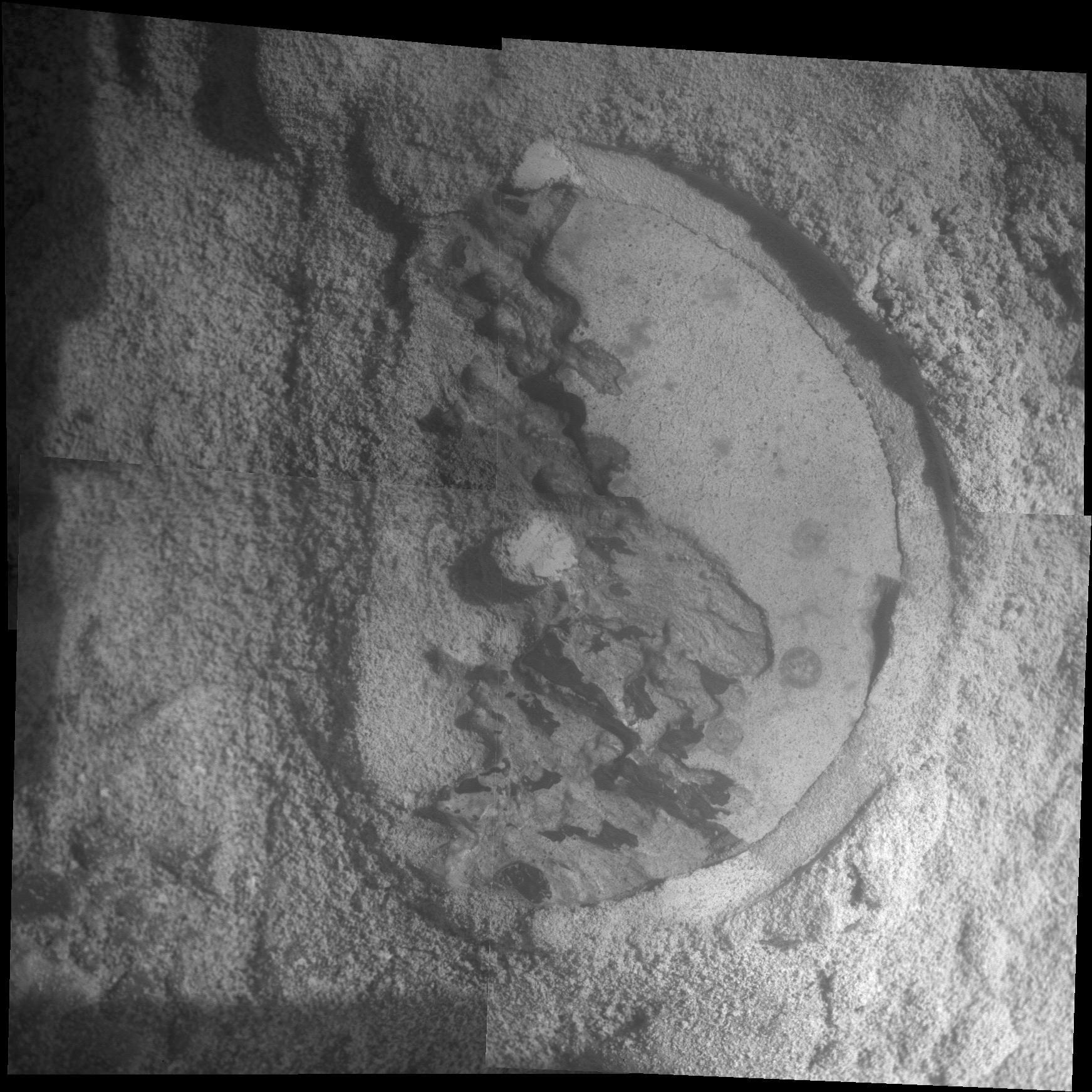
-
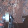
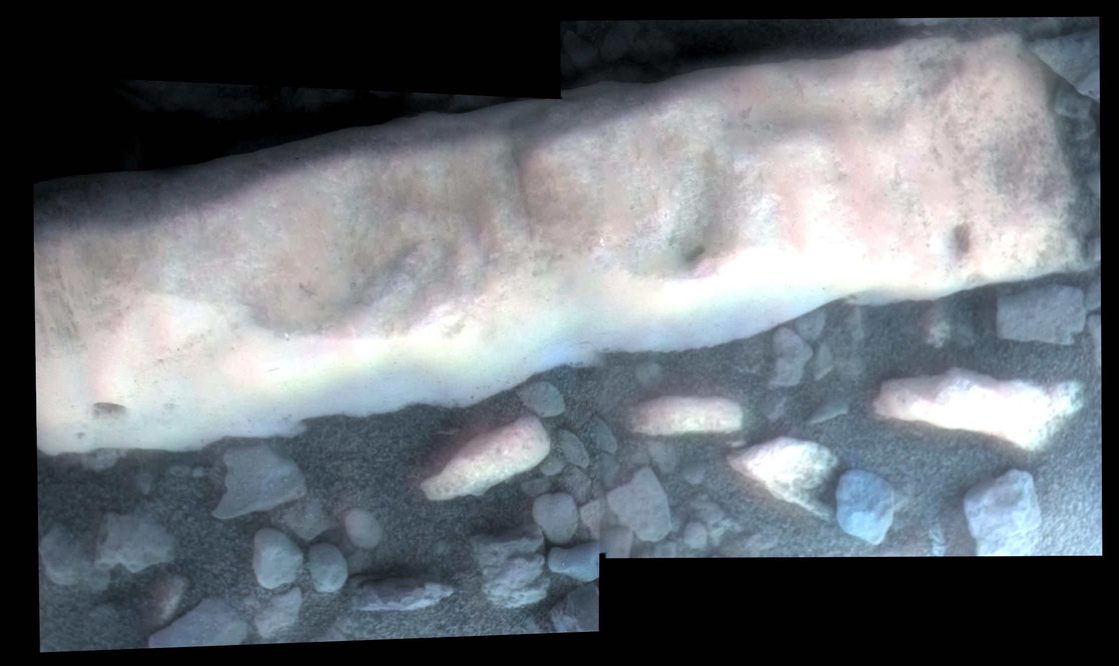
PIA16929:
-
Close-Up of 'Esperance' After Abrasion by Opportunity
Full Resolution:
TIFF
(3.042 MB)
JPEG
(401.9 kB)
|
|
|
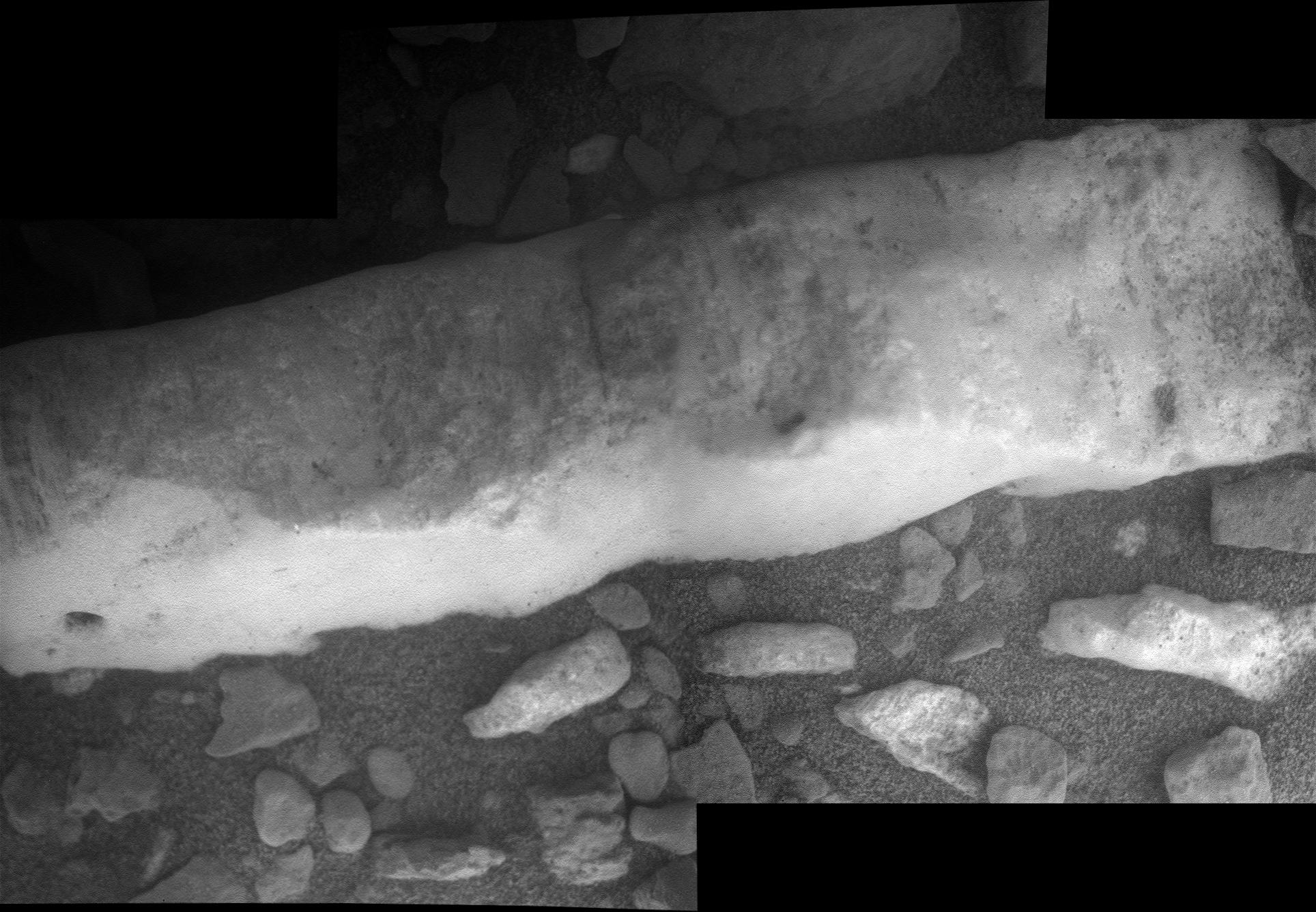
2013-05-16 |
Mars
|
Mars Exploration Rover (MER)
|
Hazcam
|
1024x1024x1 |

|
-
PIA16933:
-
View Back at Record-Setting Drive by Opportunity
Full Resolution:
TIFF
(1.05 MB)
JPEG
(67.02 kB)
|
|
|
2013-05-10 |
Mars
|
Mars Exploration Rover (MER)
|
Hazcam
|
2048x1024x1 |

|
-
PIA16814:
-
Sky Gets Dustier Between Opportunity's Sols 3296 and 3301
Full Resolution:
TIFF
(2.099 MB)
JPEG
(128.4 kB)
|
|
|
2013-04-16 |
Mars
|
Mars Exploration Rover (MER)
|
Navigation Camera
|
5076x1157x3 |
|
-
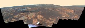
PIA16924:
Opportunity Overlooking Endeavour Crater, Stereo View
Full Resolution:
TIFF
(17.63 MB)
JPEG
(764.1 kB)
|
|
|
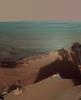
2013-04-12 |
Mars
|
Mars Exploration Rover (MER)
|
Navigation Camera
|
1059x922x1 |
|
-
PIA16923:
-
Opportunity's Shadow and Endeavour Crater Vista
Full Resolution:
TIFF
(977.7 kB)
JPEG
(120.5 kB)
|
|
|
2013-03-12 |
Mars
|
Mars Exploration Rover (MER)
Mars Science Laboratory (MSL)
|
MAHLI
Panoramic Camera
|
1054x598x3 |
|
-
PIA16834:
-
Studying Habitability in Ancient Martian Environments
Full Resolution:
TIFF
(1.892 MB)
JPEG
(117.8 kB)
|
|
|
2013-03-12 |
Mars
|
Mars Exploration Rover (MER)
Mars Science Laboratory (MSL)
|
Mastcam
Panoramic Camera
|
2660x1179x3 |
|
-
PIA16833:
-
Two Different Aqueous Environments
Full Resolution:
TIFF
(9.412 MB)
JPEG
(605.8 kB)
|
|
|
2013-02-20 |
Mars
|
Mars Exploration Rover (MER)
Mars Science Laboratory (MSL)
Phoenix
|
MAHLI
Panoramic Camera
|
1585x598x3 |

|
-
PIA16731:
-
Different Tools for Different Purposes on Mars
Full Resolution:
TIFF
(2.845 MB)
JPEG
(172 kB)
|
|
|
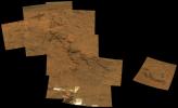
2013-01-22 |
Mars
|
Mars Exploration Rover (MER)
|
Panoramic Camera
|
14669x5000x3 |

|
-
PIA16709:
-
'Matijevic Hill' Panorama for Rover's Ninth Anniversary (Stereo)
Full Resolution:
TIFF
(220.1 MB)
JPEG
(7.268 MB)
|
|
|
2013-01-22 |
Mars
|
Mars Exploration Rover (MER)
|
Panoramic Camera
|
14823x5000x3 |
|
-
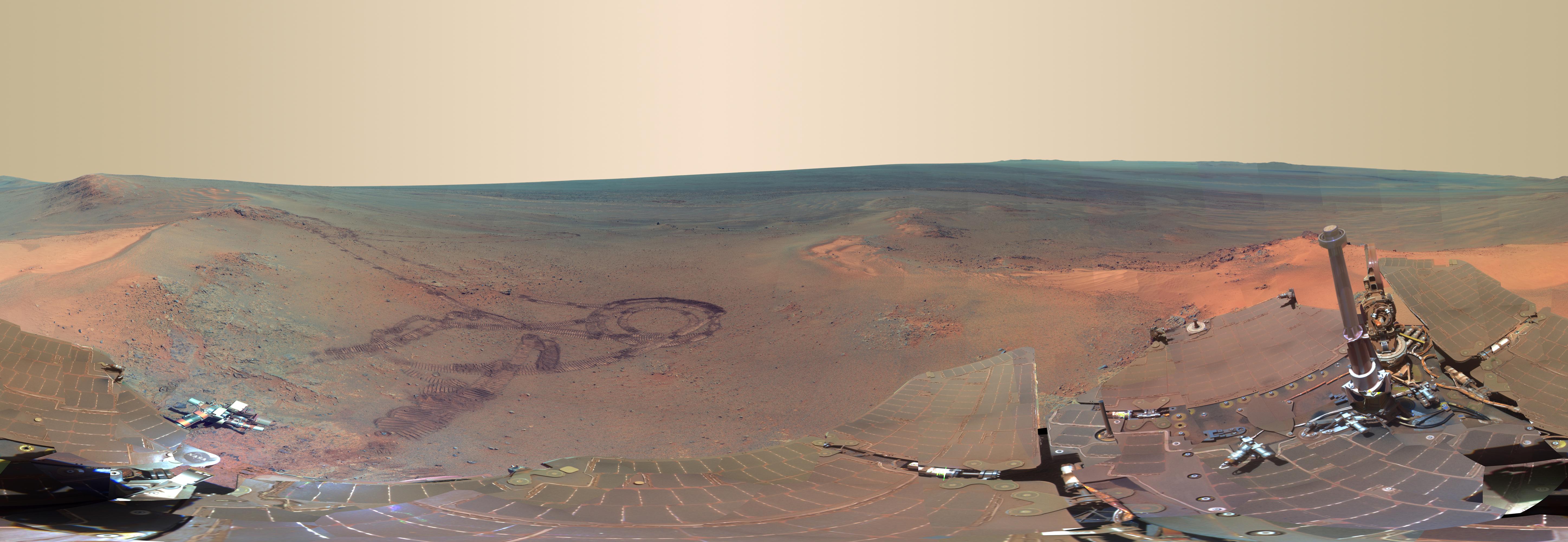
PIA16704:
-
'Matijevic Hill' Panorama for Rover's Ninth Anniversary (False Color)
Full Resolution:
TIFF
(222.4 MB)
JPEG
(8.17 MB)
|
|
|
2013-01-22 |
Mars
|
Mars Exploration Rover (MER)
|
Panoramic Camera
|
14823x5000x3 |
|
-
PIA16703:
-
'Matijevic Hill' Panorama for Rover's Ninth Anniversary
Full Resolution:
TIFF
(222.4 MB)
JPEG
(6.068 MB)
|
|
|
2012-12-19 |
Mars
|
Mars Exploration Rover (MER)
|
Navigation Camera
|
4249x1100x1 |

|
-
PIA16560:
Opportunity at 'Copper Cliff,' Sol 3153
Full Resolution:
TIFF
(4.683 MB)
JPEG
(715.9 kB)
|
|
|
2012-12-19 |
Mars
|
Mars Exploration Rover (MER)
|
Navigation Camera
|
4285x1289x3 |
|
-
PIA16561:
-
Opportunity at 'Copper Cliff,' Sol 3153
Full Resolution:
TIFF
(16.58 MB)
JPEG
(862.8 kB)
|
|
|
2012-12-19 |
Mars
|
Mars Exploration Rover (MER)
|
Navigation Camera
|
7753x2005x3 |
|
-
PIA16559:
Opportunity's Surroundings on Sol 3105, Stereo View
Full Resolution:
TIFF
(46.65 MB)
JPEG
(1.802 MB)
|
|
|
2012-12-19 |
Mars
|
Mars Exploration Rover (MER)
|
Navigation Camera
|
7688x1610x1 |
|
-
PIA16558:
Opportunity's Surroundings on Sol 3105, on 'Matijevic Hill'
Full Resolution:
TIFF
(12.39 MB)
JPEG
(1.516 MB)
|
|
|
2012-12-19 |
Mars
|
Mars Exploration Rover (MER)
|
Navigation Camera
|
7753x1255x3 |
|
-
PIA16557:
Opportunity's Surroundings on Sol 3071, Stereo View
Full Resolution:
TIFF
(29.2 MB)
JPEG
(1.296 MB)
|
|
|
2012-12-19 |
Mars
|
Mars Exploration Rover (MER)
|
Navigation Camera
|
7688x1073x1 |
|
-
PIA16556:
Opportunity's Surroundings on Sol 3071, on 'Whitewater Lake' Outcrop
Full Resolution:
TIFF
(8.258 MB)
JPEG
(1.138 MB)
|
|
|
2012-12-19 |
Mars
|
Mars Exploration Rover (MER)
|
Hazcam
|
1024x1024x1 |
|
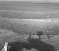
-
PIA16555:
-
Opportunity Investigation Target "Onaping"
Full Resolution:
TIFF
(1.05 MB)
JPEG
(117.5 kB)
|
|
|
2012-11-12 |
Mars
|
Mars Exploration Rover (MER)
|
Panoramic Camera
|
1024x1024x3 |
|
-
PIA16445:
-
'Whitewater Lake' Rock Viewed by Opportunity
Full Resolution:
TIFF
(3.147 MB)
JPEG
(214.2 kB)
|
|
|
2012-11-12 |
Mars
|
Mars Exploration Rover (MER)
|
Panoramic Camera
|
2233x1330x3 |
|
-
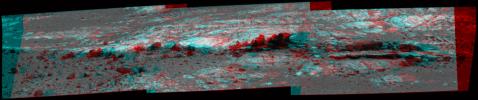
PIA16444:
-
'Homestake' Vein on 'Cape York,' Color Enhanced
Full Resolution:
TIFF
(8.913 MB)
JPEG
(204.2 kB)
|
|
|
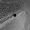
2012-10-15 |
Phobos
|
Mars Exploration Rover (MER)
|
Panoramic Camera
|
124x122x1 |

|
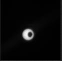
-
PIA16228:
-
Phobos Transit Viewed by Opportunity on Sol 3078

Full Resolution:
TIFF
(15.36 kB)
JPEG
(1.08 kB)
|
|
|
2012-10-03 |
Mars
|
Mars Exploration Rover (MER)
|
Navigation Camera
|
7753x1287x3 |
|
-
PIA16222:
'Matijevic Hill' on Rim of Mars' Endeavour Crater, Stereo View
Full Resolution:
TIFF
(29.94 MB)
JPEG
(1.162 MB)
|
|
|
2012-09-14 |
Mars
|
Mars Exploration Rover (MER)
|
Microscopic Imager
|
1809x1856x1 |
|
-
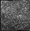
PIA16139:
-
Puzzling Little Martian Spheres That Don't Taste Like 'Blueberries'
Full Resolution:
TIFF
(3.361 MB)
JPEG
(607 kB)
|
|
|
2012-09-07 |
Mars
|
Mars Exploration Rover (MER)
|
Panoramic Camera
|
2979x624x3 |

|
-
PIA16128:
Opportunity Eyes Rock Fins on Cape York, Sol 3058
Full Resolution:
TIFF
(5.579 MB)
JPEG
(233.9 kB)
|
|
|
2012-09-07 |
Mars
|
Mars Exploration Rover (MER)
|
Panoramic Camera
|
2979x624x3 |
|
-
PIA16126:
Opportunity Eyes Rock Fins on Cape York, Sol 3058 (Stereo)
Full Resolution:
TIFF
(5.579 MB)
JPEG
(297.1 kB)
|
|
|
2012-09-07 |
Mars
|
Mars Exploration Rover (MER)
|
Panoramic Camera
|
2979x624x3 |
|
-
PIA16127:
Opportunity Eyes Rock Fins on Cape York, Sol 3058 (False Color)
Full Resolution:
TIFF
(5.579 MB)
JPEG
(302.9 kB)
|
|
|
2012-09-07 |
Mars
|
Mars Exploration Rover (MER)
|
Navigation Camera
|
4000x4000x1 |
|
-
PIA16125:
-
Opportunity's Surroundings on 3,000th Sol, Vertical Projection
Full Resolution:
TIFF
(16.02 MB)
JPEG
(1.55 MB)
|
|
|
2012-09-07 |
Mars
|
Mars Exploration Rover (MER)
|
Navigation Camera
|
4111x4111x1 |

|
-
PIA16124:
-
Opportunity's Surroundings on 3,000th Sol, Polar Projection
Full Resolution:
TIFF
(16.93 MB)
JPEG
(1.518 MB)
|
|
|
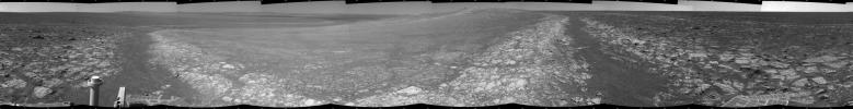
2012-09-07 |
Mars
|
Mars Exploration Rover (MER)
|
Navigation Camera
|
7753x1152x3 |

|
-
PIA16123:
Opportunity's Surroundings on 3,000th Sol, in 3-D
Full Resolution:
TIFF
(26.8 MB)
JPEG
(1.421 MB)
|
|
|
2012-09-07 |
Mars
|
Mars Exploration Rover (MER)
|
Navigation Camera
|
7688x987x1 |
|
-
PIA16122:
Opportunity's Surroundings on 3,000th Sol
Full Resolution:
TIFF
(7.596 MB)
JPEG
(1.148 MB)
|
|
|
2012-09-07 |
Mars
|
Mars Exploration Rover (MER)
|
Navigation Camera
|
1024x1024x1 |
|
-
PIA16121:
-
Outcrop Beckoning Opportunity, Sol 3057
Full Resolution:
TIFF
(1.05 MB)
JPEG
(218.8 kB)
|
|
|
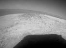
2012-09-07 |
Mars
|
Mars Exploration Rover (MER)
|
Hazcam
|
620x582x1 |
|
-
PIA16120:
-
Shadow Self-Portrait by Opportunity at Endeavour Crater
Full Resolution:
TIFF
(361.4 kB)
JPEG
(27.52 kB)
|
|
|
2012-07-05 |
Mars
|
Mars Exploration Rover (MER)
|
Panoramic Camera
|
5788x2000x3 |
|
-
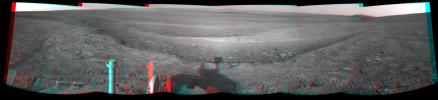
PIA15689:
-
'Greeley Panorama' from Opportunity's Fifth Martian Winter (False Color)
Full Resolution:
TIFF
(34.74 MB)
JPEG
(1.065 MB)
|
|
|
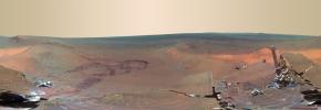
2012-05-22 |
Mars
|
Mars Exploration Rover (MER)
|
Panoramic Camera
|
3090x3809x3 |
|
-
PIA15684:
-
Late Afternoon Shadows at Endeavour Crater on Mars
Full Resolution:
TIFF
(35.31 MB)
JPEG
(621.8 kB)
|
|
|
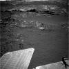
2012-05-09 |
Mars
|
Mars Exploration Rover (MER)
|
Hazcam
|
569x416x1 |
|
-
PIA15681:
-
Looking Back at Greeley Haven After Opportunity's First Drive of 2012
Full Resolution:
TIFF
(237.2 kB)
JPEG
(31.55 kB)
|
|
|
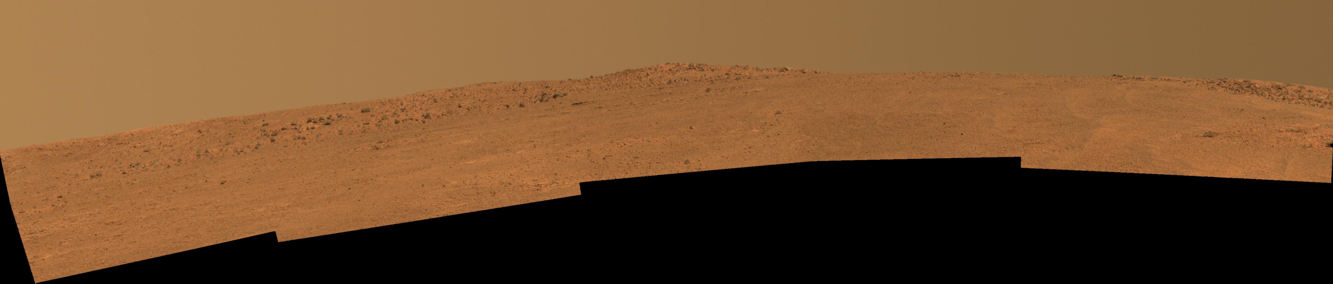
2012-02-17 |
Mars
|
Mars Exploration Rover (MER)
|
Panoramic Camera
|
4796x3993x3 |

|
-
PIA15115:
-
Dusty Mars Rover's Self Portrait
Full Resolution:
TIFF
(57.45 MB)
JPEG
(1.186 MB)
|
|
|
2012-02-17 |
Mars
|
Mars Exploration Rover (MER)
|
Panoramic Camera
|
2000x1719x3 |
|
-
PIA15114:
-
Opportunity Rover Self-Portrait From 2007
Full Resolution:
TIFF
(10.33 MB)
JPEG
(328.6 kB)
|
|
|
2012-02-03 |
Mars
|
Mars Exploration Rover (MER)
|
Panoramic Camera
|
1024x1024x1 |
|
-
PIA15024:
-
Opportunity's Late Afternoon View of Mars
Full Resolution:
TIFF
(1.05 MB)
JPEG
(173.9 kB)
|
|
|
2012-01-24 |
Mars
|
Mars Exploration Rover (MER)
|
Panoramic Camera
|
3976x2542x3 |
|
-
PIA15282:
-
Opportunity's Eighth Anniversary View From 'Greeley Haven' (False Color)
Full Resolution:
TIFF
(30.32 MB)
JPEG
(1.452 MB)
|
|
|
2012-01-24 |
Mars
|
Mars Exploration Rover (MER)
|
Panoramic Camera
|
3976x2542x3 |
|
-
PIA15281:
-
Opportunity's Eighth Anniversary View From 'Greeley Haven'
Full Resolution:
TIFF
(30.32 MB)
JPEG
(935.4 kB)
|
|
|
2012-01-05 |
Mars
|
Mars Exploration Rover (MER)
Mars Reconnaissance Orbiter (MRO)
|
HiRISE
|
700x560x1 |
|
-
PIA15276:
-
Locator Map for 'Greeley Haven' on Endeavour Rim
Full Resolution:
TIFF
(392.6 kB)
JPEG
(56.54 kB)
|
|
|
2012-01-05 |
Mars
|
Mars Exploration Rover (MER)
|
Panoramic Camera
|
4478x1722x3 |
|
-
PIA15275:
-
'Greeley Haven' Site for Opportunity's Fifth Martian Winter (False Color)
Full Resolution:
TIFF
(23.13 MB)
JPEG
(1.402 MB)
|
|
|
2012-01-05 |
Mars
|
Mars Exploration Rover (MER)
|
Panoramic Camera
|
4478x1722x3 |

|
-
PIA15119:
-
'Greeley Haven' Site for Opportunity's Fifth Martian Winter
Full Resolution:
TIFF
(23.13 MB)
JPEG
(694.1 kB)
|
|
|
2012-01-05 |
Mars
|
Mars Exploration Rover (MER)
|
Navigation Camera
|
1024x1024x1 |

|
-
PIA15118:
-
Approaching 'Greeley Haven' on Endeavour Rim
Full Resolution:
TIFF
(1.05 MB)
JPEG
(212.1 kB)
|
|
|
2011-12-07 |
Mars
|
Mars Exploration Rover (MER)
|
Panoramic Camera
|
1024x512x3 |

|
-
PIA15113:
-
'Shoemaker Ridge' on Endeavour Rim (False Color)
Full Resolution:
TIFF
(1.575 MB)
JPEG
(111 kB)
|
|
|
2011-12-07 |
Mars
|
Mars Exploration Rover (MER)
|
Hazcam
|
474x474x1 |

|
-
PIA15037:
-
Opportunity's Approach to 'Homestake'
Full Resolution:
TIFF
(225.1 kB)
JPEG
(18.68 kB)
|
|
|
2011-12-07 |
Mars
|
Mars Exploration Rover (MER)
|
Navigation Camera
|
1024x1024x1 |
|
-
PIA15036:
-
Western Edge of 'Cape York,' with Bright Vein
Full Resolution:
TIFF
(1.05 MB)
JPEG
(297.5 kB)
|
|
|
2011-12-07 |
Mars
|
Mars Exploration Rover (MER)
|
Microscopic Imager
|
1928x1335x1 |
|
-
PIA15035:
-
Close-up View of 'Homestake' Vein
Full Resolution:
TIFF
(2.577 MB)
JPEG
(408.3 kB)
|
|
|
2011-12-07 |
Mars
|
Mars Exploration Rover (MER)
|
Panoramic Camera
|
1022x512x3 |
|
-
PIA15034:
-
'Homestake' Vein, False Color
Full Resolution:
TIFF
(1.572 MB)
JPEG
(105.5 kB)
|
|
|
2011-12-07 |
Mars
|
Mars Exploration Rover (MER)
|
Panoramic Camera
|
1022x512x3 |
|
-
PIA15033:
-
'Homestake' Vein in Color
Full Resolution:
TIFF
(1.572 MB)
JPEG
(56.78 kB)
|
|
|
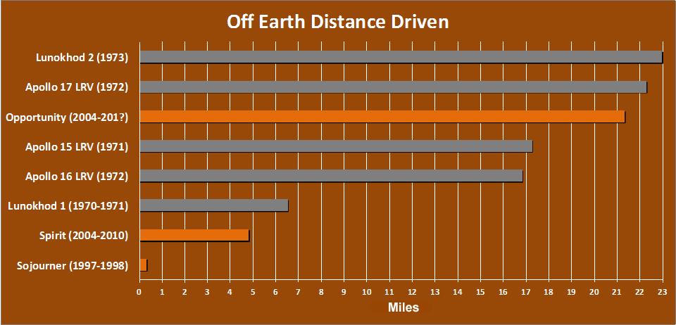
2011-12-07 |
|
Mars Exploration Rover (MER)
|
|
960x462x3 |

|
-
PIA14859:
-
Off-Earth Driving Champs (in Miles)
Full Resolution:
TIFF
(445.8 kB)
JPEG
(61.98 kB)
|
 Planetary Data System


