PDS logoPlanetary Data System
PDS Information
Find a Node - Use these links to navigate to any of the 8 publicly accessible PDS Nodes.

This bar indicates that you are within the PDS enterprise which includes 6 science discipline nodes and 2 support nodes which are overseen by the Project Management Office at NASA's Goddard Space Flight Center (GSFC). Each node is led by an expert in the subject discipline, supported by an advisory group of other practitioners of that discipline, and subject to selection and approval under a regular NASA Research Announcement.
Click here to return to the Photojournal Home Page Click here to view a list of Photojournal Image Galleries Photojournal_inner_header
Latest Images  |  Spacecraft & Technology  |  Animations  |  Space Images App  |  Feedback  |  Photojournal Search  
Your search criteria found 6 images
Instrument
Go to PIAxxxxx:
Click on an image for detailed information
Click on a column heading to sort in ascending or descending order
My
List
Addition DateSort Ascending Target Mission Instrument Size
Add Image to Favorite List 2018-09-14 Earth Terra
ASTER
MODIS
804x1627x3
On Thursday, Sept. 13, 2018, NASA's Terra spacecraft acquired this image swath over Hurricane Florence as the storm headed for the Eastern seaboard and the Carolinas.
PIA22651:
Hurricane Florence Swath seen by NASA Spacecraft
Full Resolution:     TIFF (2.219 MB)     JPEG (125.9 kB)
Add Image to Favorite List 2017-07-14 Earth Suomi NPP
Terra
MODIS
VIIRS
1805x1350x1
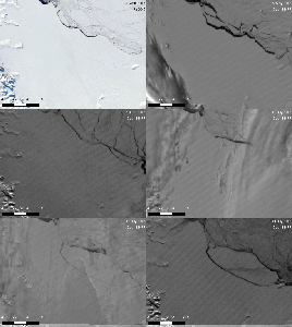
This still from an animation shows the Larsen C Ice Shelf in West Antarctica calved one of the largest icebergs in history between July 10 and 12, 2017.
PIA21785:
Spawning of Massive Antarctic Iceberg Captured by NASA Animation Animation Icon
Full Resolution:     TIFF (1.693 MB)     JPEG (201.4 kB)
Add Image to Favorite List 2014-03-05 Earth Terra
MODIS
436x348x3
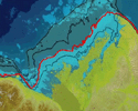
This frame from a NASA MODIS animation depicts warming sea surface temperatures in the Arctic's Beaufort Sea after warm waters from Canada's Mackenzie River broke through a shoreline sea ice barrier in summer 2012, enhancing the melting of sea ice.
PIA18035:
Warm Rivers Play Role in Arctic Sea Ice Melt (Animation) Animation Icon
Full Resolution:     TIFF (455.6 kB)     JPEG (23.57 kB)
Add Image to Favorite List 2014-03-05 Earth Terra
MODIS
2410x935x3
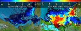
Beaufort Sea surface temperatures where Canada's Mackenzie River discharges into the Arctic Ocean, measured by NASA's MODIS instrument; warm river waters had broken through a shoreline sea ice barrier to enhance sea ice melt.
PIA18034:
Warm Rivers Play Role in Arctic Sea Ice Melt
Full Resolution:     TIFF (6.763 MB)     JPEG (430.9 kB)
Add Image to Favorite List 2013-06-13 Earth Aqua
Terra
MODIS
MODIS
1659x1452x3
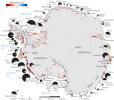
Rates of basal melt of Antarctic ice shelves (melting of the shelves from underneath) overlaid on a 2009 mosaic of Antarctica created from data from NASA's Terra and Aqua spacecraft.
PIA17284:
Rates of Basal Melt of Antarctic Ice Shelves
Full Resolution:     TIFF (7.23 MB)     JPEG (358.1 kB)
Add Image to Favorite List 2010-04-16 Earth Terra
MODIS
3780x2328x3
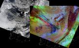
On April 15, 2010, NASA's Terra spacecraft captured these images of the ongoing eruption of Iceland's Eyjafjallajökull Volcano, which continues to spew ash into the atmosphere and impact air travel worldwide.
PIA13046:
NASA Satellite Images Provide Insights Into Iceland Volcanic Plume
Full Resolution:     TIFF (26.4 MB)     JPEG (1.262 MB)
Currently displaying images: 1 - 6 of 6