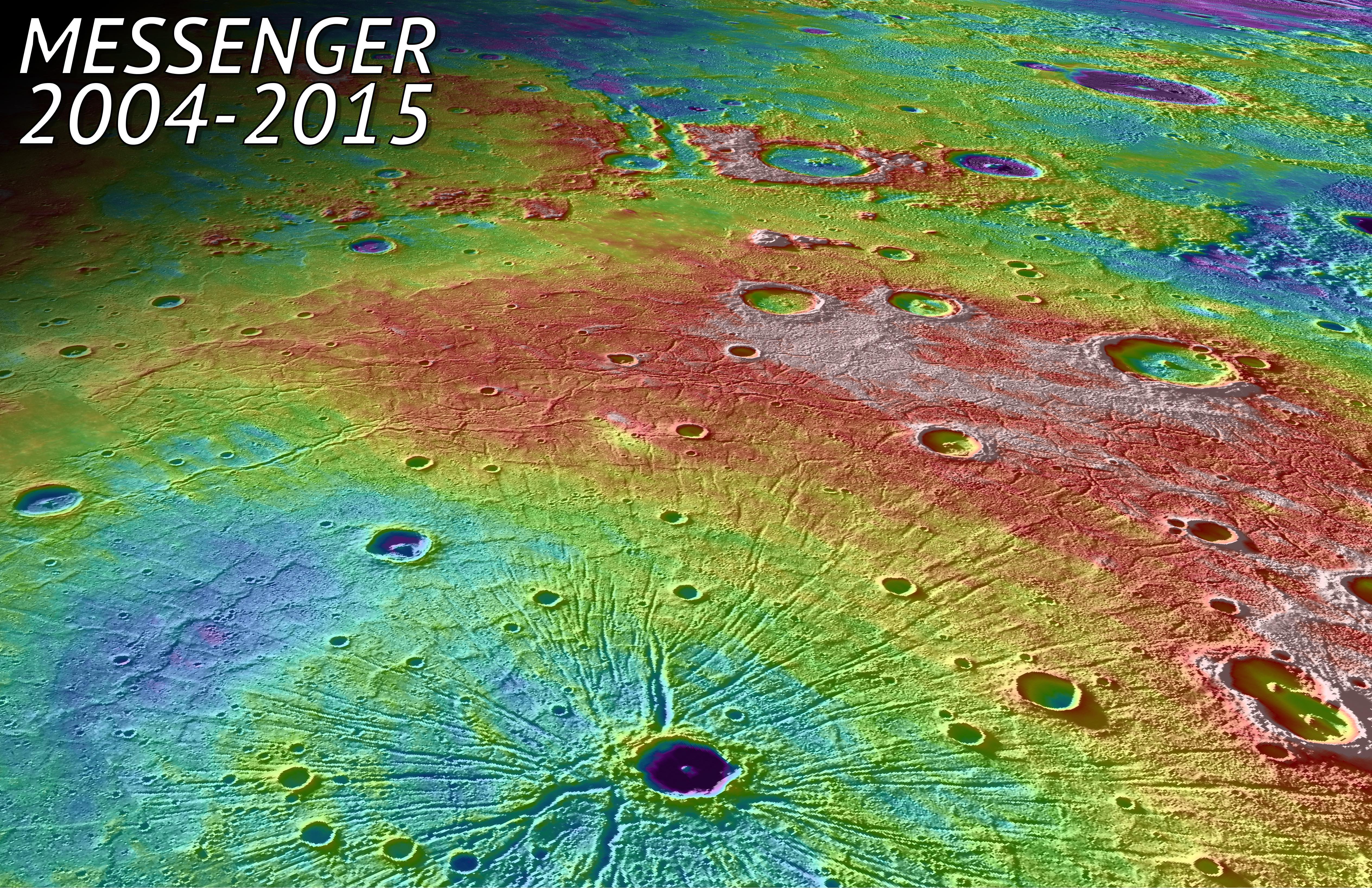
My
List |
Addition Date
|
Target
|
Mission
|
Instrument
|
Size
|

|
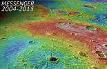
2015-05-01 |
Mercury
|
MESSENGER
|
Mercury Dual Imaging System (MDIS)
MLA
|
5057x3272x3 |
|
-
PIA19450:
-
In Tribute
Full Resolution:
TIFF
(49.67 MB)
JPEG
(4.768 MB)
|
|
|
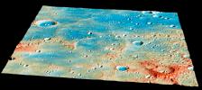
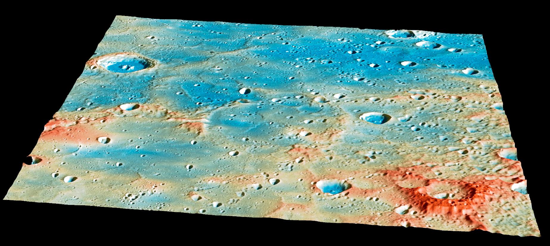
2015-04-29 |
Mercury
|
MESSENGER
|
Mercury Dual Imaging System (MDIS)
MLA
|
1846x826x3 |
|
-
PIA19444:
-
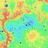
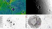
Overview of the Impact Region
Full Resolution:
TIFF
(4.576 MB)
JPEG
(276.7 kB)
|
|
|
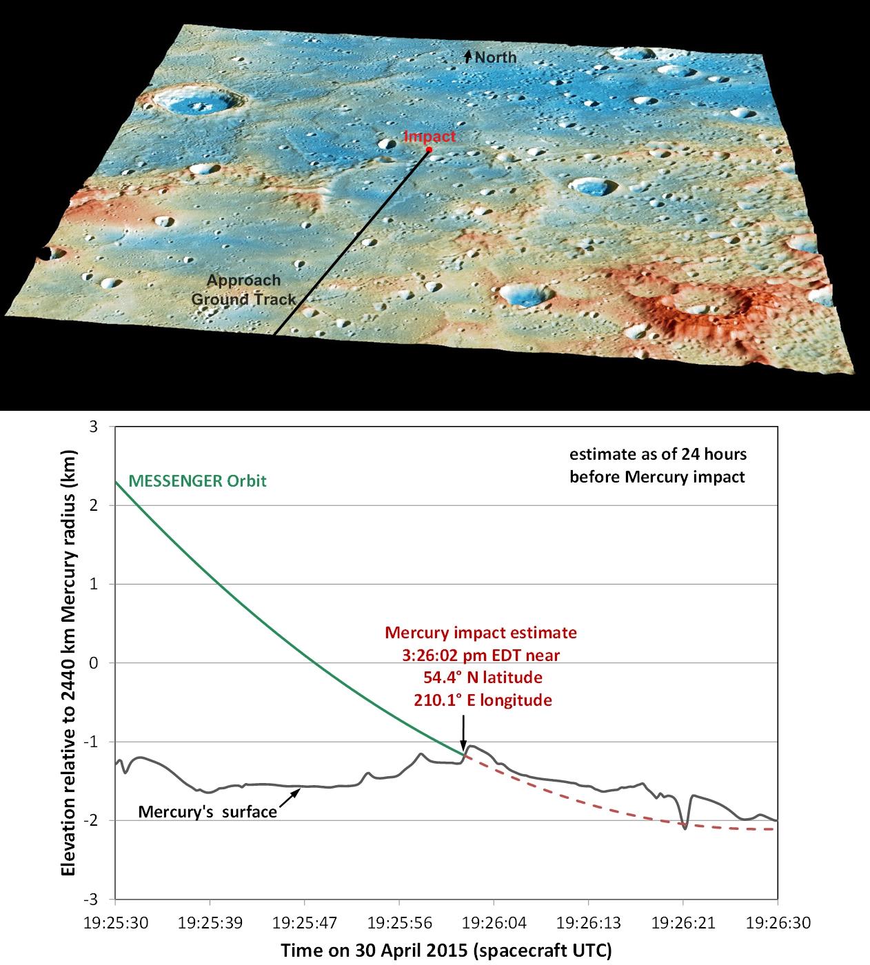
2015-04-29 |
Mercury
|
MESSENGER
|
Mercury Dual Imaging System (MDIS)
MLA
|
1262x1400x3 |
|
-
PIA19443:
-
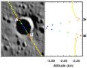
Details of MESSENGER's Impact Location
Full Resolution:
TIFF
(5.302 MB)
JPEG
(218.3 kB)
|
|
|
2015-04-16 |
Mercury
|
MESSENGER
|
Mercury Dual Imaging System (MDIS)
MLA
|
1664x1206x3 |
|
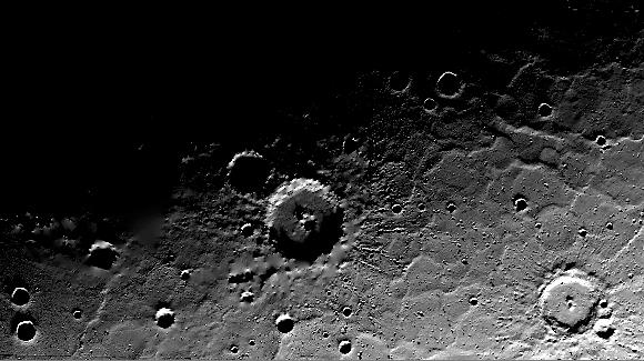
-
PIA19422:
-
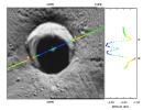
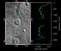
A Striking Perspective
Full Resolution:
TIFF
(6.023 MB)
JPEG
(382.6 kB)
|
|
|
2015-04-16 |
Mercury
|
MESSENGER
|
MLA
|
3750x3752x3 |
|
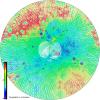
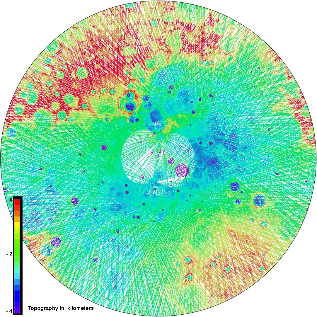
-
PIA19420:
-
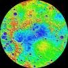
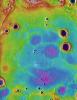
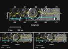
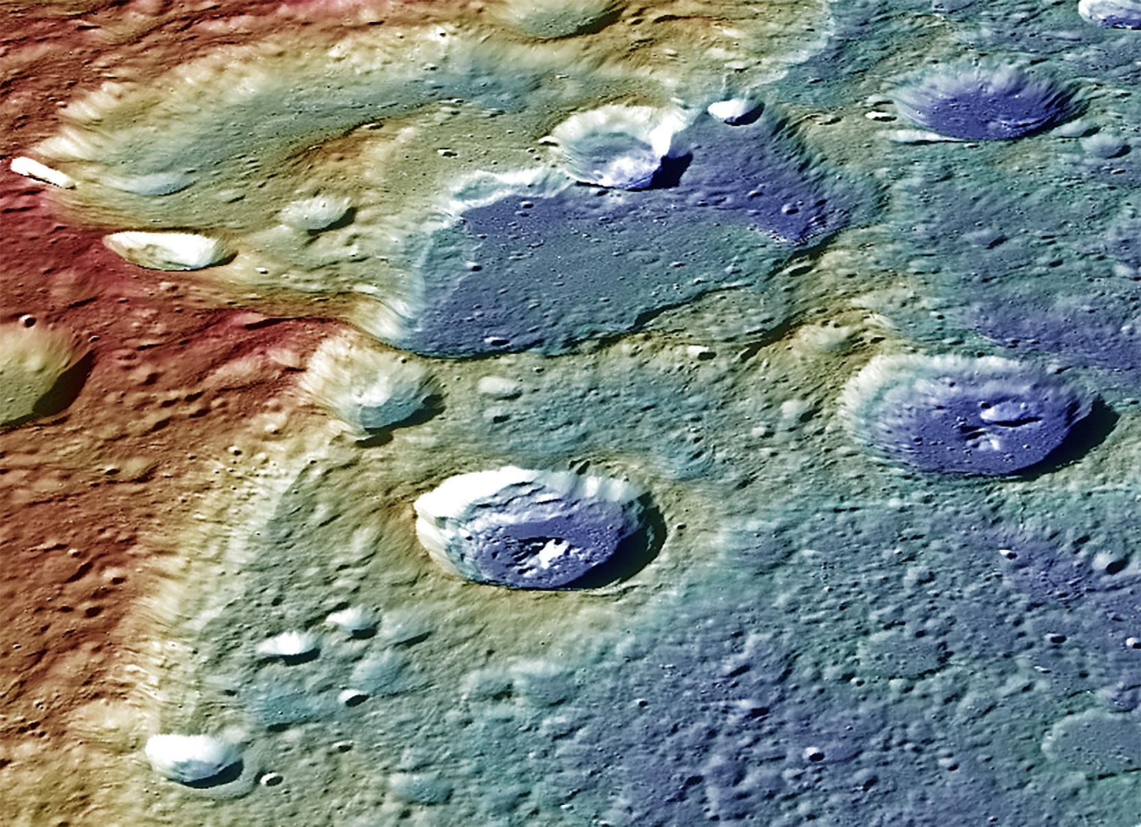
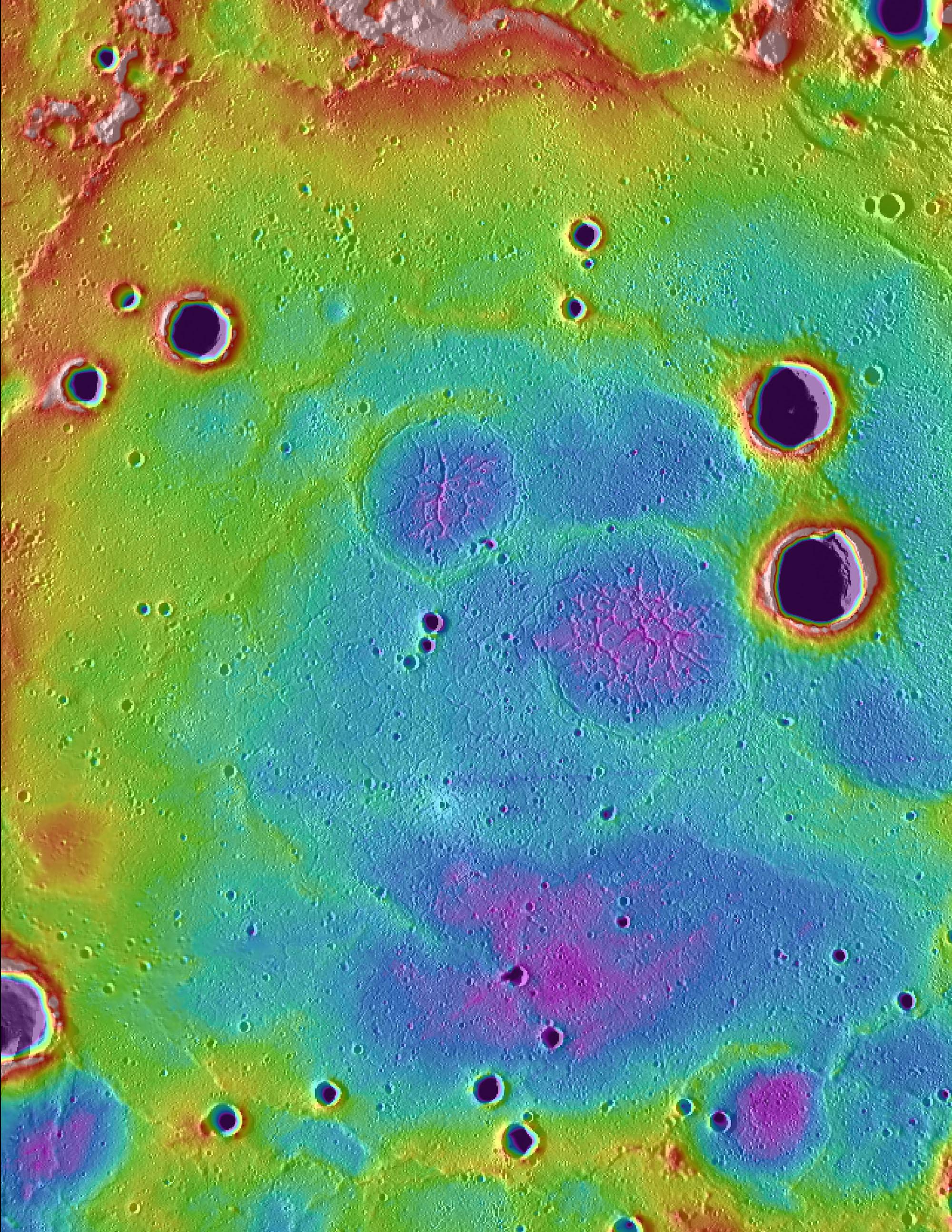
The Ups and Downs of Mercury's Topography
Full Resolution:
TIFF
(42.23 MB)
JPEG
(3.656 MB)
|
|
|
2014-08-15 |
Mercury
|
MESSENGER
|
MLA
|
723x571x3 |
|
-
PIA18678:
-
Simple Shapes
Full Resolution:
TIFF
(1.239 MB)
JPEG
(36.26 kB)
|
|
|
2014-07-23 |
Mercury
|
MESSENGER
|
MLA
|
1335x1026x3 |
|
-
PIA18626:
-
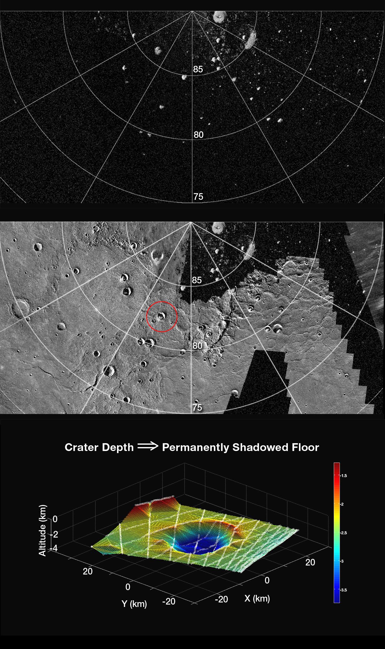
Peaking into the Shadows
Full Resolution:
TIFF
(4.111 MB)
JPEG
(111.5 kB)
|
|
|
2013-07-17 |
Mercury
|
MESSENGER
|
MLA
|
1536x1536x3 |
|
-
PIA17385:
-
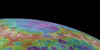
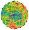
Digital Elevation Model of Mercury's Northern Hemisphere
Full Resolution:
TIFF
(2.364 MB)
JPEG
(289.2 kB)
|
|
|
2013-07-11 |
Mercury
|
MESSENGER
|
Mercury Dual Imaging System (MDIS)
MLA
|
1150x600x3 |

|
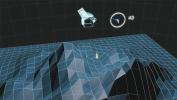
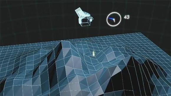
-
PIA17379:
-
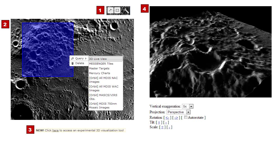
New QuickMap Feature: 3-D!
Full Resolution:
TIFF
(2.071 MB)
JPEG
(120.9 kB)
|
|
|
2013-04-09 |
Mercury
|
MESSENGER
|
MLA
|
1082x1082x3 |
|
-
PIA16951:
-
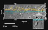
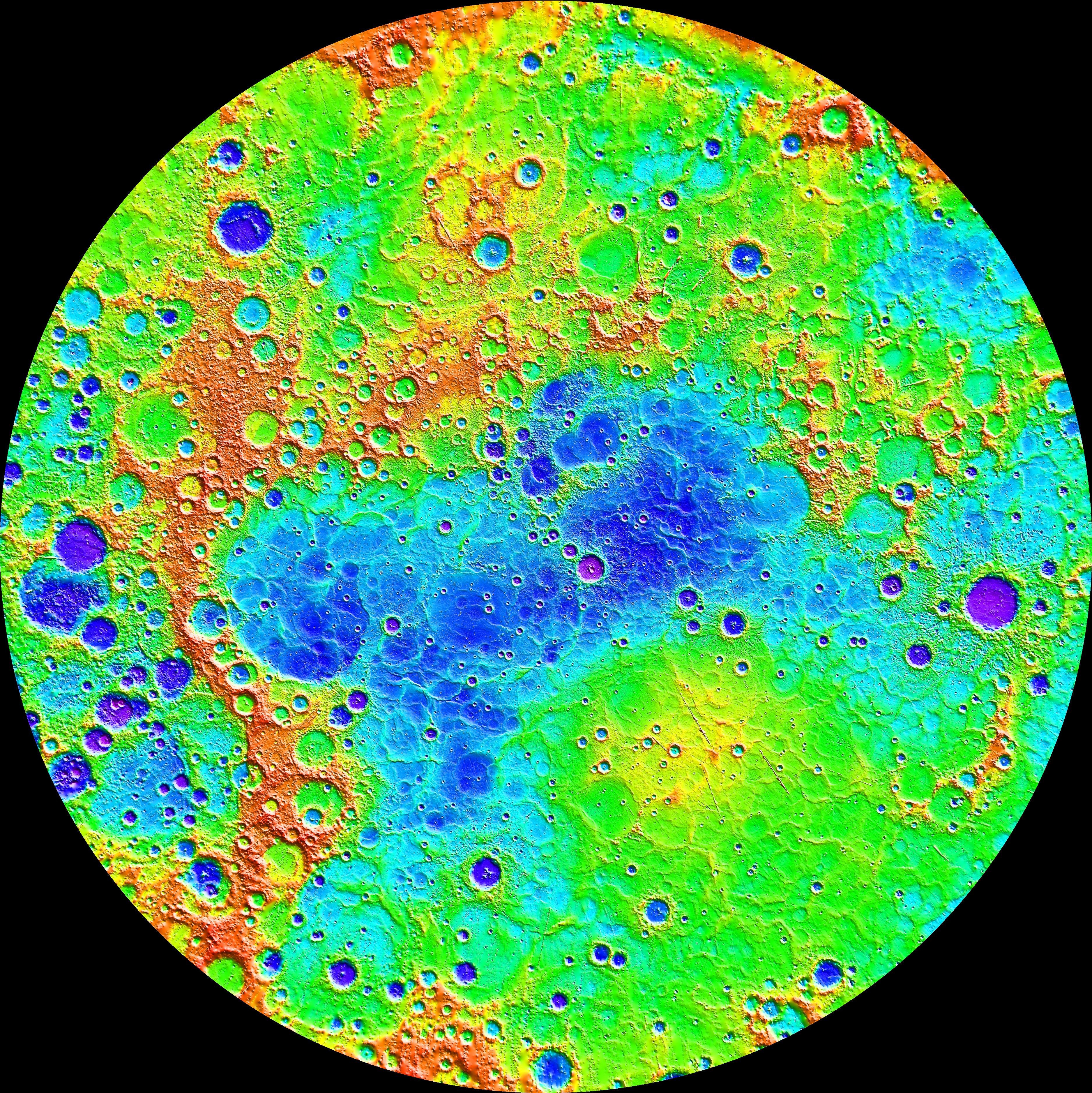
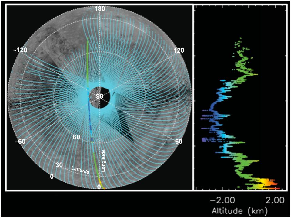
Northern Topography
Full Resolution:
TIFF
(3.514 MB)
JPEG
(398.8 kB)
|
|
|
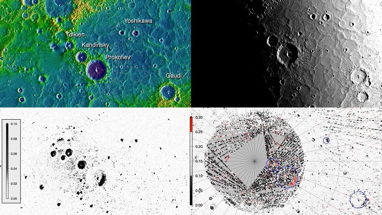
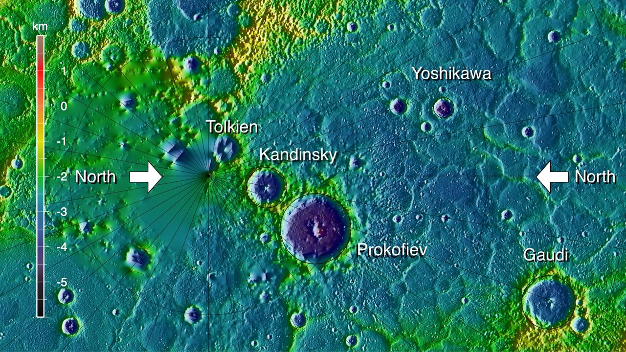
2012-12-03 |
|
MESSENGER
|
MLA
|
580x325x1 |

|
-
PIA16530:
-
A Solar Day at Prokofiev Crater
Full Resolution:
TIFF
(188.9 kB)
JPEG
(47.11 kB)
|
|
|
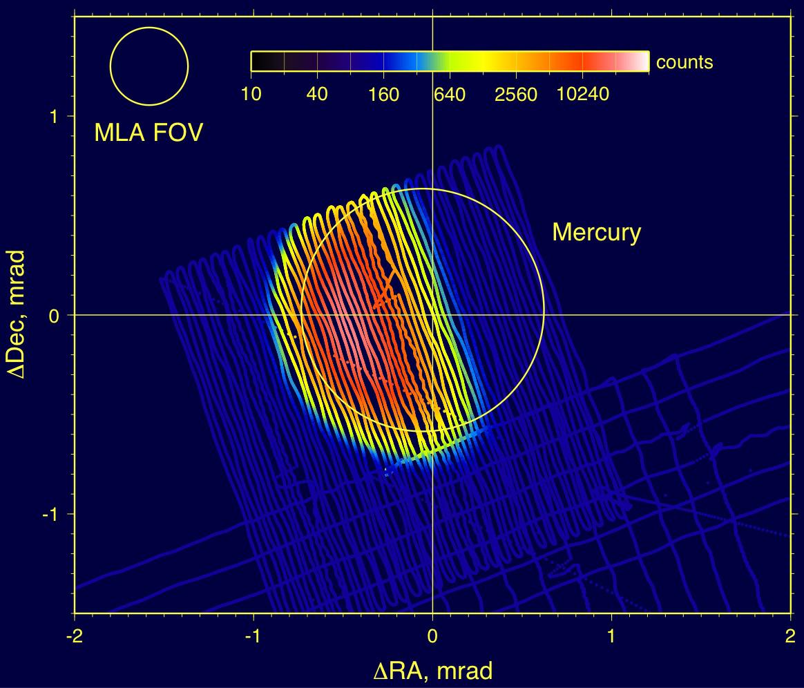
2012-12-03 |
|
MESSENGER
|
MLA
|
580x327x3 |
|
-
PIA16529:
-
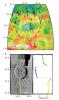
How MLA Works
Full Resolution:
TIFF
(569.4 kB)
JPEG
(29.2 kB)
|
|
|
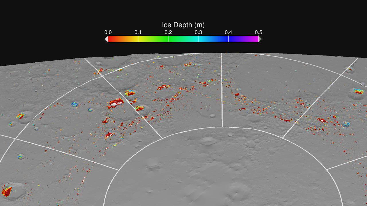
2012-11-30 |
Mercury
|
MESSENGER
|
MLA
|
1280x720x3 |
|
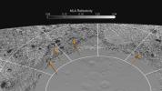
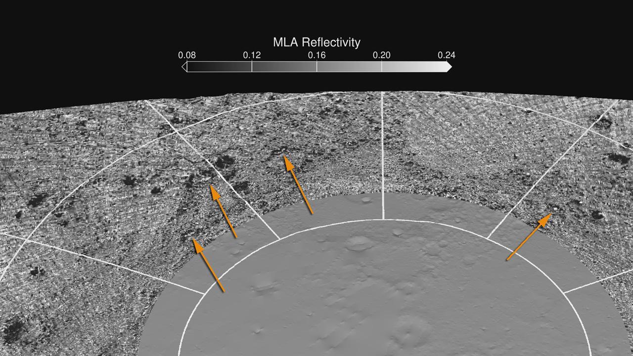
-
PIA16527:
-
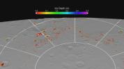
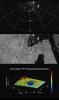
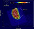
MLA Reflectivity near the North Pole
Full Resolution:
TIFF
(2.766 MB)
JPEG
(174 kB)
|
|
|
2012-11-30 |
Mercury
|
MESSENGER
|
MLA
|
1280x720x3 |
|
-
PIA16525:
-
Maximum Surface Temperature near the North Pole
Full Resolution:
TIFF
(2.766 MB)
JPEG
(168.8 kB)
|
|
|
2012-11-29 |
Mercury
|
MESSENGER
|
MLA
|
1280x720x3 |
|
-
PIA16522:
-
MLA Montage
Full Resolution:
TIFF
(2.766 MB)
JPEG
(241.8 kB)
|
|
|
2012-11-29 |
Mercury
|
MESSENGER
|
MLA
|
1280x720x3 |
|
-
PIA16521:
-
Modeling Ice Stability
Full Resolution:
TIFF
(2.766 MB)
JPEG
(98.78 kB)
|
|
|
2012-11-29 |
Mercury
|
MESSENGER
|
MLA
|
1280x720x3 |
|
-
PIA16518:
-
MLA Surface Reflectance
Full Resolution:
TIFF
(2.766 MB)
JPEG
(267.5 kB)
|
|
|
2012-11-29 |
Mercury
|
MESSENGER
|
MLA
|
1280x720x3 |

|
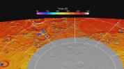
-
PIA16516:
-
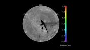
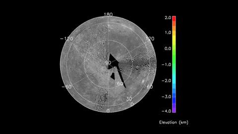
Polar Topography
Full Resolution:
TIFF
(2.766 MB)
JPEG
(264.2 kB)
|
|
|
2012-08-23 |
Mercury
|
MESSENGER
|
MDIS - Wide Angle
MLA
|
4320x2160x3 |
|
-
PIA16388:
-
Lowlands in Mercury's North
Full Resolution:
TIFF
(28.01 MB)
JPEG
(1.391 MB)
|
|
|
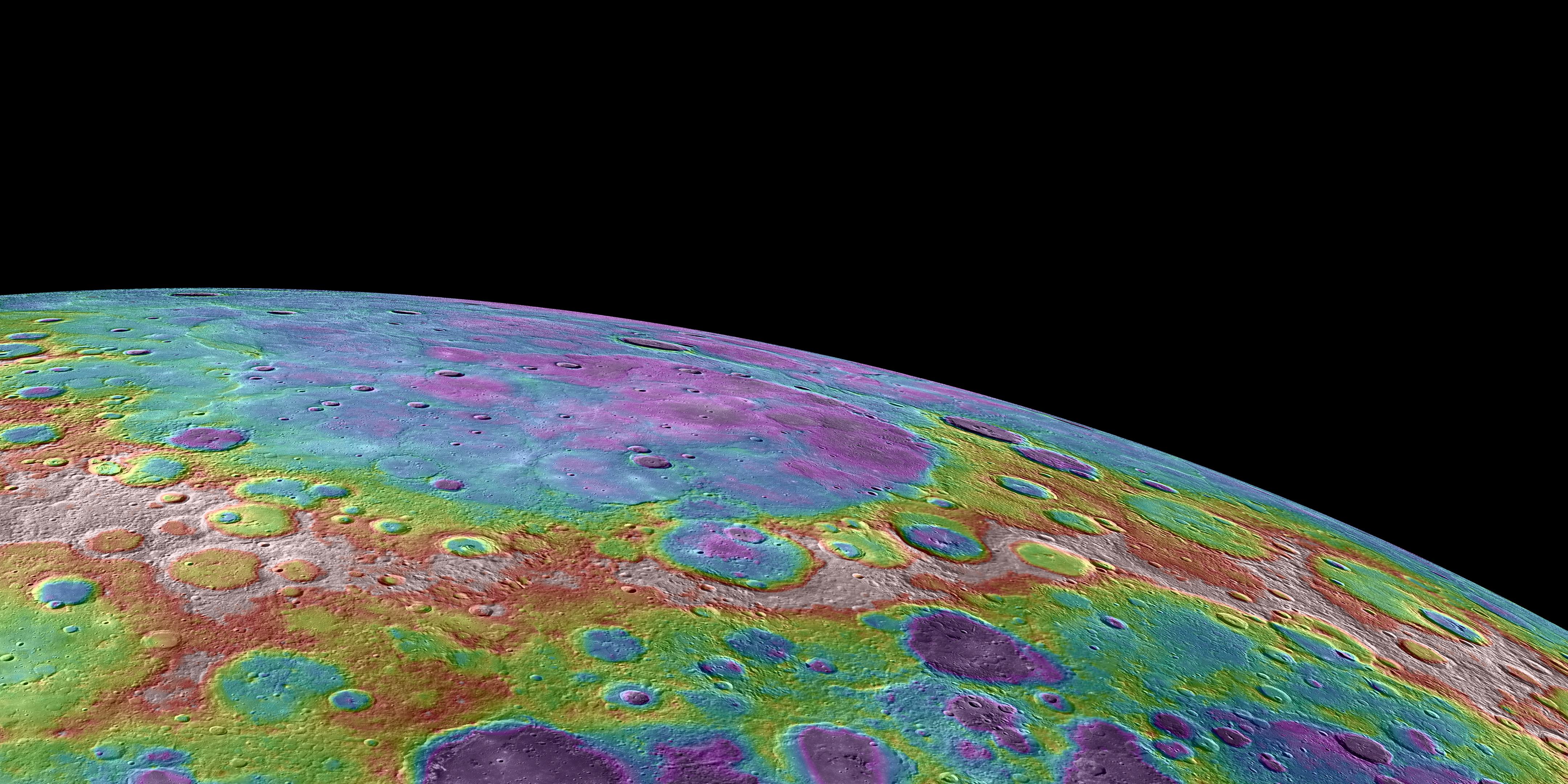
2012-03-22 |
Mercury
|
MESSENGER
|
MLA
|
2000x2588x3 |
|
-
PIA15536:
-
Highs and Lows of Goethe
Full Resolution:
TIFF
(15.55 MB)
JPEG
(1.103 MB)
|
|
|
2012-03-22 |
Mercury
|
MESSENGER
|
MLA
|
2000x2588x3 |
|
-
PIA15534:
-
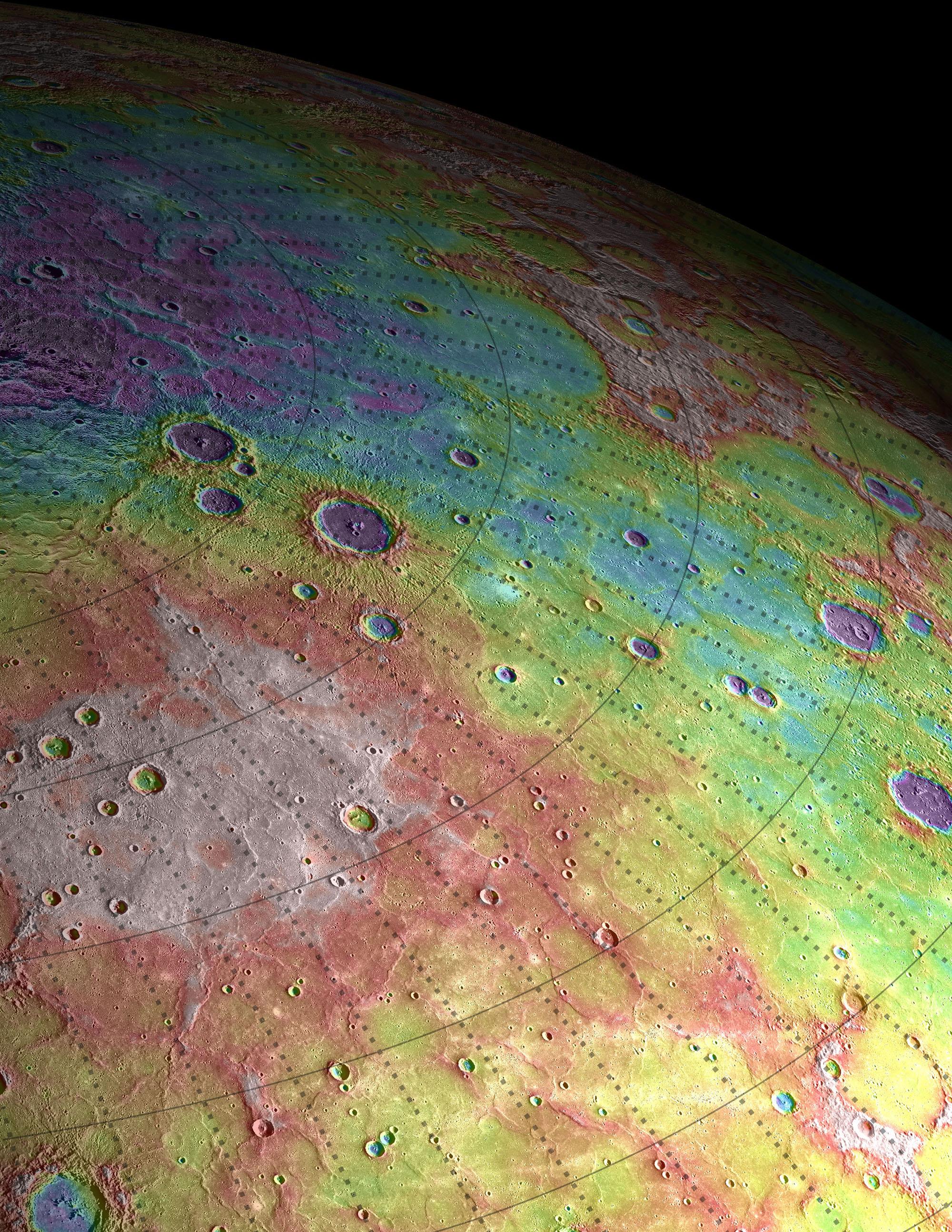
Perspective View of Mercury's Topography
Full Resolution:
TIFF
(15.55 MB)
JPEG
(1.278 MB)
|
|
|
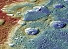
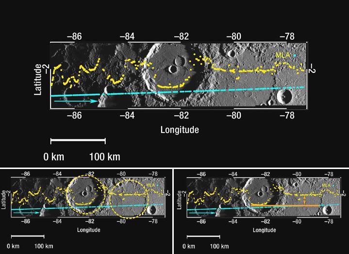
2012-03-21 |
Mercury
|
MESSENGER
|
MLA
|
618x1048x3 |
|
-
PIA15531:
-
Tilted Craters in Caloris
Full Resolution:
TIFF
(1.945 MB)
JPEG
(92.34 kB)
|
|
|
2012-03-21 |
Mercury
|
MESSENGER
|
MLA
|
760x780x3 |
|
-
PIA15529:
-
Mercury's Topography from MLA
Full Resolution:
TIFF
(1.781 MB)
JPEG
(128.3 kB)
|
|
|
2011-07-07 |
Mercury
|
MESSENGER
|
MDIS - Narrow Angle
MLA
|
503x414x3 |
|
-
PIA14394:
-
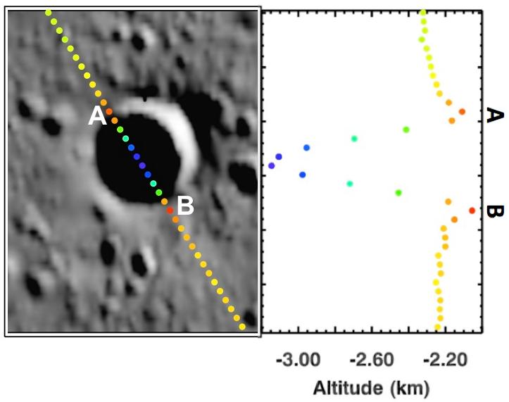
Taking the Measure of Impact Craters on Mercury
Full Resolution:
TIFF
(625.6 kB)
JPEG
(40.76 kB)
|
|
|
2011-06-16 |
Mercury
|
MESSENGER
|
MDIS - Wide Angle
MLA
|
1280x2160x3 |
|
-
PIA14350:
-
A Look at Craters Hosting Polar Deposits
Full Resolution:
TIFF
(8.303 MB)
JPEG
(515.8 kB)
|
|
|
2011-06-16 |
Mercury
|
MESSENGER
|
MLA
|
480x270x3 |
|
-
PIA14345:
-
Movie of MLA Coverage to Date
Full Resolution:
TIFF
(389.5 kB)
JPEG
(12.75 kB)
|
|
|
2011-05-24 |
Mercury
|
MESSENGER
|
MLA
|
960x721x3 |
|
-
PIA14279:
-
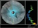
Altimetry Is Defining Mercury's Shape
Full Resolution:
TIFF
(2.08 MB)
JPEG
(101 kB)
|
|
|
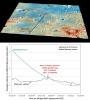
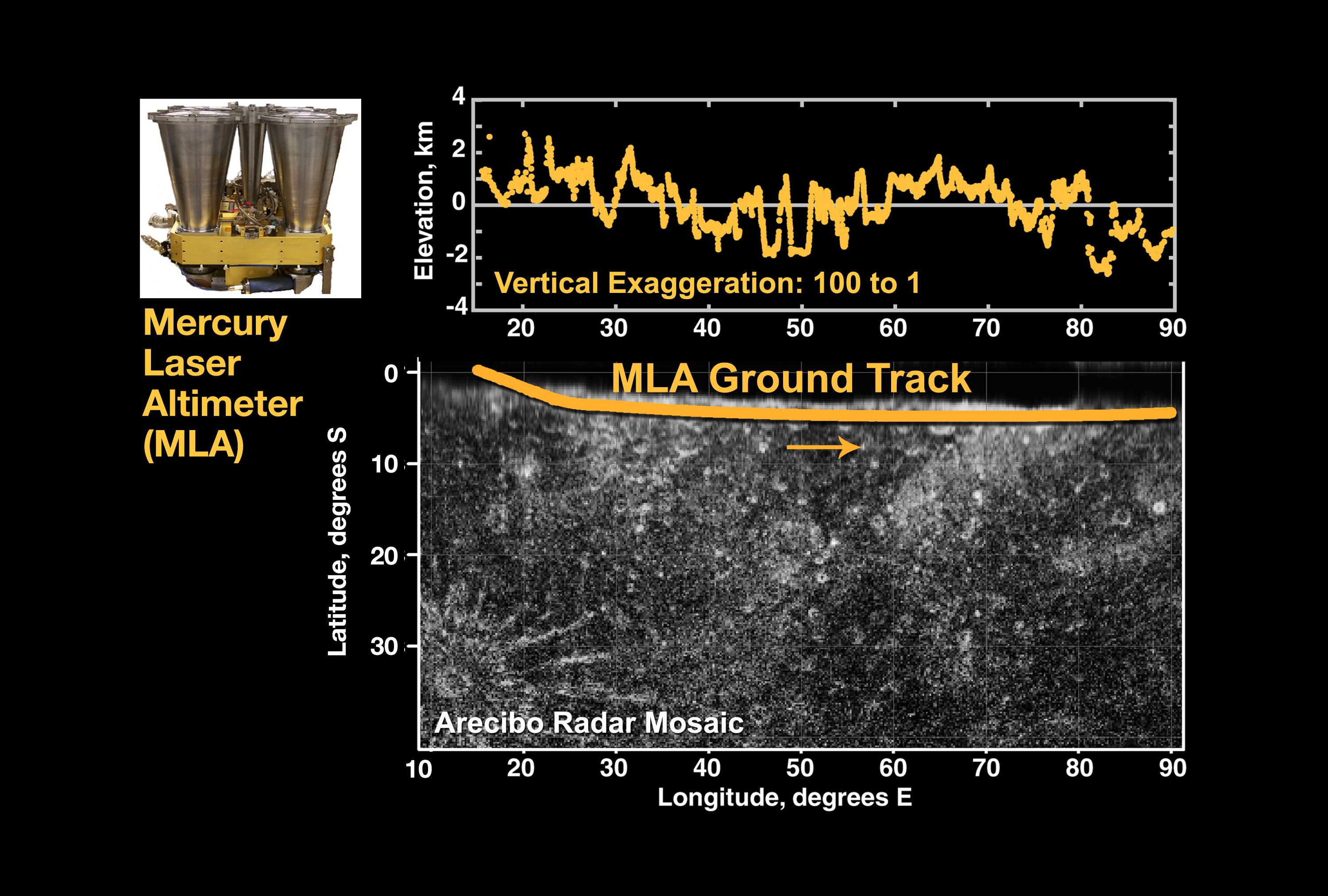
2011-03-30 |
Mercury
|
MESSENGER
|
MLA
|
1200x711x3 |

|
-
PIA14078:
-
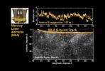
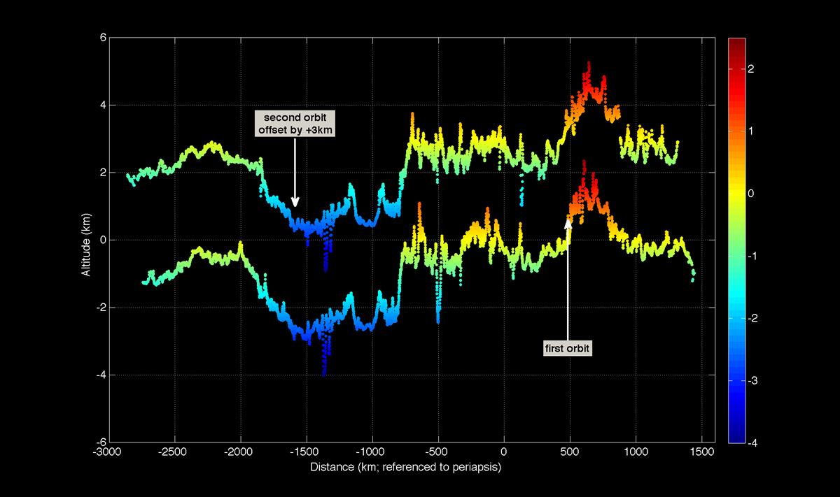
First Mercury Laser Altimeter (MLA) Results from Orbit
Full Resolution:
TIFF
(2.563 MB)
JPEG
(83.89 kB)
|
|
|
2008-10-31 |
Mercury
|
MESSENGER
|
MDIS - Narrow Angle
MLA
|
719x523x3 |
|
-
PIA11414:
-
Mercury Laser Altimeter (MLA) Measures the Depths of Mercury's Craters
Full Resolution:
TIFF
(1.13 MB)
JPEG
(65.5 kB)
|
|
|
2008-10-29 |
Mercury
|
MESSENGER
|
MDIS - Narrow Angle
MLA
|
612x384x3 |
|
-
PIA11405:
-
Mercury's Topography from the Second Flyby
Full Resolution:
TIFF
(706 kB)
JPEG
(39.97 kB)
|
|
|
2008-03-31 |
Mercury
|
MESSENGER
|
MLA
|
1164x996x3 |
|
-
PIA10608:
-
Mercury Laser Altimeter (MLA) Images Mercury from 4 Million Kilometers
Full Resolution:
TIFF
(3.482 MB)
JPEG
(144.3 kB)
|
|
|
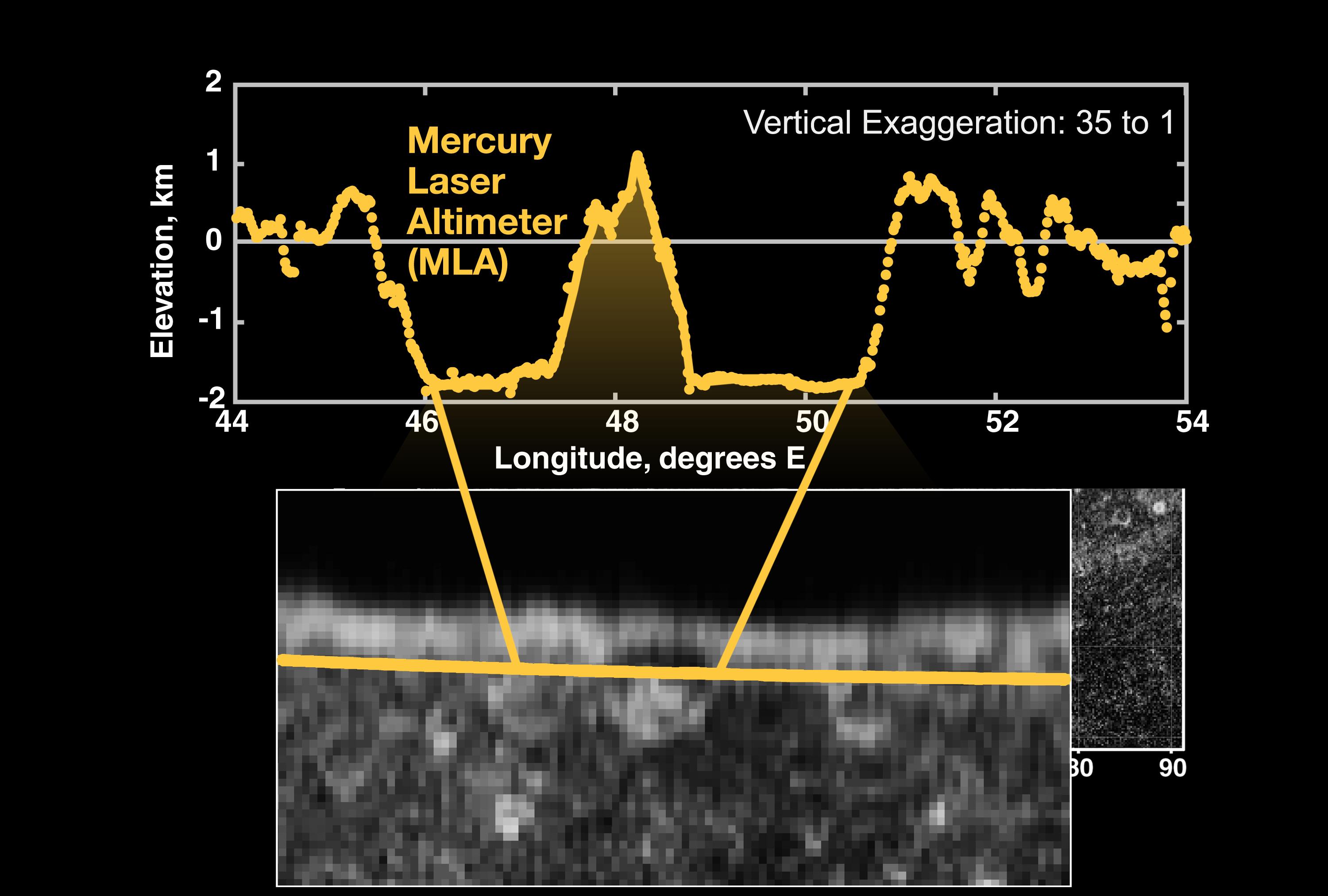
2008-01-30 |
Mercury
|
MESSENGER
|
MLA
|
3000x2025x3 |
|
-
PIA10394:
-
First Laser Altimetry for Mercury
Full Resolution:
TIFF
(18.23 MB)
JPEG
(557.2 kB)
|
|
|
2008-01-30 |
Mercury
|
MESSENGER
|
MLA
|
3000x2025x3 |
|
-
PIA10381:
-
Topographic Close-up
Full Resolution:
TIFF
(18.23 MB)
JPEG
(357.3 kB)
|
|
|
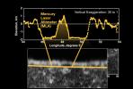
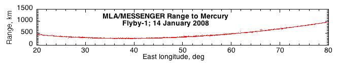
2008-01-19 |
Mercury
|
MESSENGER
|
MLA
|
666x126x3 |

|
-
PIA10183:
First Results from the Mercury Laser Altimeter
Full Resolution:
TIFF
(252.2 kB)
JPEG
(16.75 kB)
|
 Planetary Data System


