The ACT-REACT Quickmap tool, which is available on the left-side tab, has recently been updated. Check out the cool new 3D Live View function to visualize Mercury's surface! The 3D view is made using the MLA Goddard (PDS9) elevation model.
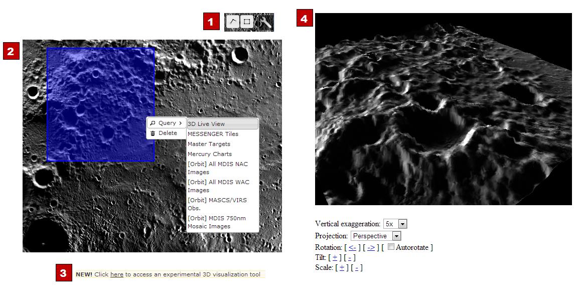
You can access QuickMap here. Follow the four steps given below and numbered in the above diagram to create your own 3D view of Mercury's surface!
Step 1: Use the box tool at the top right. Click, hold, and drag the box.
Step 2: Click on the box, chose "query", and select "3D Live View."
Step 3: Follow the link labeled "here" to access the 3D tool.
Step 4: Adjust the settings to create a 3D view and use autorotate to produce a movie.
Elevation Model: Goddard (PDS9)
Center Latitude: 85°
Center Longitude: 150° E
Scale: About 87 km (54 mi) box width
Instruments: Mercury Dual Imaging System (MDIS) and Mercury Laser Altimeter (MLA)
The MESSENGER spacecraft is the first ever to orbit the planet Mercury, and the spacecraft's seven scientific instruments and radio science investigation are unraveling the history and evolution of the Solar System's innermost planet. MESSENGER acquired over 150,000 images and extensive other data sets. MESSENGER is capable of continuing orbital operations until early 2015.
For information regarding the use of images, see the MESSENGER image use policy.
