PDS logoPlanetary Data System
PDS Information
Find a Node - Use these links to navigate to any of the 8 publicly accessible PDS Nodes.

This bar indicates that you are within the PDS enterprise which includes 6 science discipline nodes and 2 support nodes which are overseen by the Project Management Office at NASA's Goddard Space Flight Center (GSFC). Each node is led by an expert in the subject discipline, supported by an advisory group of other practitioners of that discipline, and subject to selection and approval under a regular NASA Research Announcement.
Click here to return to the Photojournal Home Page Click here to view a list of Photojournal Image Galleries Photojournal_inner_header
Latest Images  |  Spacecraft & Technology  |  Animations  |  Space Images App  |  Feedback  |  Photojournal Search  
My Favorite Images from the Planetary Photojoural
I have 10 images in my list


The first time you select an image to My List, a separate browser window will open. This page will list the set of images you have selected as favorites from the Photojournal. This list is kept for a short period of time, approximately 60 days. The way we associate you with your list is through a persistent cookie left on your computer. This cookie is nothing more than a unique key that allows the Photojournal to make this association. Once created, this list is only modifiable from the same computer. Information stored in the cookie on your computer is used by the Photojournal server only during your session. If you configure your Web browser not to use cookies, you will not be able to create and refer back to a personal list of favorite images. To view your current list, click on a marked entry for your list from the catalog page, or add another favorite. For more information, see JPL's Privacy Policy.
My
List
Catalog # Target Mission Instrument Addition Date Size
Remove Image from Favorite List PIA16995 Earth Terra
ASTER
2013-05-21 2020x3315x3
Alaska's Pavlof volcano, located along Alaska's Aleutian Peninsula, sent a low-level ash plume north-northeast about 37.3 miles (60 kilometers) on May 19, 2013, when this image was acquired NASA's Terra spacecraft.
Title:
Prolific Alaska Volcano Spews Ash in New Eruption
Remove Image from Favorite List PIA17567 NuSTAR
NuSTAR
2014-01-09 3300x2800x3
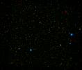
A range of supermassive black holes lights up this new image from NASA's NuSTAR. All of the dots are active black holes tucked inside the hearts of galaxies, with colors representing different energies of X-ray light.
Title:
Different Flavors of Black Holes
Remove Image from Favorite List PIA02711 Earth Shuttle Radar Topography Mission (SRTM)
C-Band Interferometric Radar
2000-02-17 1059x722x3
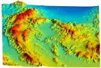
This perspective view acquired by NASA's Shuttle Radar Topography Mission from data collected on February 16, 2000 shows an area of Ventura County, California, including Simi Valley in the center of the image.
Title:
Simi Valley, California, Perspective View of Shaded Relief, Color as Height
Remove Image from Favorite List PIA03095 Mars Mars Exploration Rover (MER)
Panoramic Camera
2005-11-07 22348x2697x3
This image from NASA's Mars Exploration Rover Spirit taken in Oct 2005 show a sweeping panorama of the summit of 'Husband Hill,' a broad plateau of rock outcrops and windblown drifts.
Title:
'Everest' Panorama; 20-20 Vision
Remove Image from Favorite List PIA22310 Mars 2001 Mars Odyssey
THEMIS
2018-04-03 698x1432x1
The arcuate fractures and broken up surface shown in this image from NASA's 2001 Mars Odyssey spacecraft is called Avernus Colles. This unique surface has developed on the southeast margin of Elysium Plainitia.
Title:
Avernus Colles
Remove Image from Favorite List PIA18797 Earth E-DECIDER
2014-09-03 1027x698x3
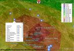
A NASA-funded disaster decision support system, provided a number of rapid response map data products to decision makers at the California Earthquake Clearinghouse following its activation for the Aug. 24, 2014 magnitude 6.0 earthquake in Napa, California
Title:
NASA's E-DECIDER Rapid Disaster Decision Support Products
Remove Image from Favorite List PIA14269 Mars Mars Exploration Rover (MER)
Navigation Camera
2011-07-19 1024x1024x1
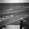
NASA's Mars Exploration Rover Opportunity used its navigation camera to record this view in the eastward driving direction after completing a drive on July 17, 2011, that took the rover's total driving distance on Mars beyond 20 miles.
Title:
Drive Direction Image by Opportunity After Surpassing 20 Miles
Remove Image from Favorite List PIA24667 Mars 2020 Rover
2021-06-14 640x480x3
JPL's Abigail Allwood, principal investigator of the PIXL instrument aboard NASA's Perseverance Mars rover, examines rocks in Greenland.
Title:
Abigail Allwood in Greenland
Remove Image from Favorite List PIA17721 Earth Terra
ASTER
2013-11-22 2598x2147x3
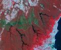
On Nov. 14, 2013, NASA's Terra spacecraft spied a fire scar west of Wollongong, New South Wales, from the Hall Road fire in New South Wales, Australia. October 2013 brought the worst fires seen in Australia's New South Wales in many decades.
Title:
Australian Wildfire, NASA Spacecraft Image Aftermath
Remove Image from Favorite List PIA26296 Cooperative Autonomous Distributed Robotic Exploration (CADRE)
2024-05-13 3840x2160x3
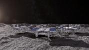
This animated artist's concept depicts three small rovers – part of NASA's CADRE technology demonstration headed for the Moon – driving together on the lunar surface.
Title:
CADRE Rovers Explore the Moon Together (Artist's Concept)